Stafford Road Corridor Area Action Plan
Stafford Road Corridor Area Action Plan
Stafford Road Corridor Area Action Plan

Create successful ePaper yourself
Turn your PDF publications into a flip-book with our unique Google optimized e-Paper software.
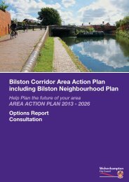
<strong>Stafford</strong> <strong>Road</strong> <strong>Corridor</strong>Help <strong>Plan</strong> the future of your areaAREA ACTION PLAN 2012 - 2026Options ReportConsultation
This document / information can be made availablein languages other than English, large print, Brailleor audio.If you require it in one of these formats please contact:<strong>Plan</strong>ning PolicyWolverhampton City Council,Civic Square,St Peter’s SquareWolverhamptonWV1 1SHTel: 01902 551155Email: planning.policy@wolverhampton.gov.uk2Options Report for the Development of the <strong>Stafford</strong> <strong>Road</strong> <strong>Corridor</strong>
Contents:Executive Summary. . . . . . . . . . . . . . . . . . . . . . . . . . . . . . . . . . . . . . . . . . . . . . . . . . . . . . . . . . . . 4Background to the AAP. . . . . . . . . . . . . . . . . . . . . . . . . . . . . . . . . . . . . . . . . . . . . . . . . . . . . . . . . 5The Options Report . . . . . . . . . . . . . . . . . . . . . . . . . . . . . . . . . . . . . . . . . . . . . . . . . . . . . . . . . . . . 6Where we have got to so far . . . . . . . . . . . . . . . . . . . . . . . . . . . . . . . . . . . . . . . . . . . . . . . . . . . . . 6Sustainability Appraisal . . . . . . . . . . . . . . . . . . . . . . . . . . . . . . . . . . . . . . . . . . . . . . . . . . . . . . . . . 7Habitats Regulation Assessment . . . . . . . . . . . . . . . . . . . . . . . . . . . . . . . . . . . . . . . . . . . . . . . . . . 8Equality Analysis . . . . . . . . . . . . . . . . . . . . . . . . . . . . . . . . . . . . . . . . . . . . . . . . . . . . . . . . . . . . . . 8Part 1 - Vision and Masterplan for the <strong>Stafford</strong> <strong>Road</strong> <strong>Corridor</strong> . . . . . . . . . . . . 9The <strong>Stafford</strong> <strong>Road</strong> <strong>Corridor</strong> – the Focus for Innovation and Regeneration . . . . . . . . . . . . . . . . . . . 9The AAP Boundary . . . . . . . . . . . . . . . . . . . . . . . . . . . . . . . . . . . . . . . . . . . . . . . . . . . . . . . . . . . . 9Vision and Key Development Targets . . . . . . . . . . . . . . . . . . . . . . . . . . . . . . . . . . . . . . . . . . . . . 11Masterplan and Design Framework . . . . . . . . . . . . . . . . . . . . . . . . . . . . . . . . . . . . . . . . . . . . . . 11Part 2 - Policies to Guide Regeneration . . . . . . . . . . . . . . . . . . . . . . . . . . . . . . . . . . 13Supporting Economic Prosperity . . . . . . . . . . . . . . . . . . . . . . . . . . . . . . . . . . . . . . . . . . . . . . . . . 13Creating Sustainable Communities . . . . . . . . . . . . . . . . . . . . . . . . . . . . . . . . . . . . . . . . . . . . . . . 21Transformation of the Environment and Addressing Climate Change . . . . . . . . . . . . . . . . . . . . . . 26Part 3 - Development Opportunities and Character <strong>Area</strong>s . . . . . . . . . . . . . . . 38Junction 2 . . . . . . . . . . . . . . . . . . . . . . . . . . . . . . . . . . . . . . . . . . . . . . . . . . . . . . . . . . . . . . . . . . 39Fordhouses . . . . . . . . . . . . . . . . . . . . . . . . . . . . . . . . . . . . . . . . . . . . . . . . . . . . . . . . . . . . . . . . . 43Goodyear and Fordhouse <strong>Road</strong> . . . . . . . . . . . . . . . . . . . . . . . . . . . . . . . . . . . . . . . . . . . . . . . . . 47Wolverhampton Science Park and Dunstall & Wulfrun Trading Estates. . . . . . . . . . . . . . . . . . . . . 51Fowlers Playing Fields, Park Village and Fallings Park . . . . . . . . . . . . . . . . . . . . . . . . . . . . . . . . . 56Part 4 – Infrastructure, Priorities for Delivery and Monitoring . . . . . . . . . . . . 61Part 5 – Getting Involved and Next Steps . . . . . . . . . . . . . . . . . . . . . . . . . . . . . . . . 66AppendicesAppendix A - Summary of Policy Options . . . . . . . . . . . . . . . . . . . . . . . . . . . . . . . . . . . . . . . . . . 67Appendix B - Evidence List . . . . . . . . . . . . . . . . . . . . . . . . . . . . . . . . . . . . . . . . . . . . . . . . . . . . . 69Appendix C - Issues which will not be taken forward . . . . . . . . . . . . . . . . . . . . . . . . . . . . . . . . . . 71Options Report for the Development of the <strong>Stafford</strong> <strong>Road</strong> <strong>Corridor</strong>3
Executive SummaryThe <strong>Stafford</strong> <strong>Road</strong> <strong>Corridor</strong> as a Focusfor Innovation and RegenerationWolverhampton City Council is preparing an excitingnew plan for the <strong>Stafford</strong> <strong>Road</strong> <strong>Corridor</strong>. The<strong>Corridor</strong> is a focus for regeneration inWolverhampton and covers the area from the M54Junction 2 to the outer edges of the City Centre. Itincludes parts of Fordhouses, Bushbury, Oxley, andLow Hill.The <strong>Stafford</strong> <strong>Road</strong> <strong>Corridor</strong> <strong>Area</strong> <strong>Action</strong> <strong>Plan</strong> (theAAP) will guide the transformation of the area up to2026 and a successful AAP is key toWolverhampton’s future. It will identify the locationof new development in the area and help makedecisions on planning applications. It will alsoinfluence decisions about transport, communityfacilities and jobs. It is vital that the AAP provides astrong framework for regeneration which respondsto local needs and will benefit everyone.Local people need access to and better housing andservices, secure jobs, local facilities and a transformedenvironmentNational and Local Businesses need room tomodernise and expand to drive forward the City’seconomy, and access to a skilled workforce and areliable transport networkThe AAP will belong to the local community and willsupport and build on plans already in place for<strong>Stafford</strong> <strong>Road</strong> <strong>Corridor</strong>. There are many regenerationsites in the <strong>Corridor</strong> with detailed proposals, such as theJaguar Land Rover development at i54, high qualityoffice development at Wolverhampton Business Parkand the regeneration of the Goodyear site. Beyond this,the Black Country Core Strategy sets out broadproposals for further large-scale regeneration up to2026.Investment in high quality employment opportunitiesis a key driver for delivering successful andsustainable development in the <strong>Stafford</strong> <strong>Road</strong><strong>Corridor</strong>. The inclusion of a cluster of sites at thenorthern end of the <strong>Stafford</strong> <strong>Road</strong> <strong>Corridor</strong> in the BlackCountry Enterprise Zone will be essential to achievingthis aim. Wolverhampton Science Park is also a keysite for the area. There is the potential to modernise,strengthen and improve the quality of employmentopportunities on offer focussing on high technology andhigh end manufacturing.The AAP will be deliverable. To bring aboutregeneration and growth in the <strong>Stafford</strong> <strong>Road</strong> <strong>Corridor</strong>will be challenging and require the support of manypartners. The AAP will make a huge change to the areaand will require intensive effort and focussing ofresources. The economic downturn will limitregeneration opportunities in the next few years, but theAAP will establish a long term vision which will be readyto deliver as the economy recovers. By 2026 the AAPwill ensure the delivery of:1,250 new homes and supporting services to deliverthe regeneration of local communities74 hectares of employment developmentopportunities, which will mean there are an extra3,000 jobs in the area in addition to the jobopportunities at i54A modern and sustainable transport network, withtargeted investment to support developmentSignificant environmental improvements - including anew Neighbourhood Park and public realmenhancements at Three Tuns Centre.Investment in open spaces, local heritage assets andhigh quality design will support the regeneration of thearea and create a successful placeThe AAP will be flexible. The AAP must providecertainty, for businesses, land owners and residents,regarding future plans and infrastructure requirementsfor the area. However, it must also be flexible enough toallow businesses to expand and prosper and to attractinvestment.The AAP Options ReportThis Options Report sets out what we think are themain development options for the future of the<strong>Stafford</strong> <strong>Road</strong> <strong>Corridor</strong> up to 2026. The Report buildson the responses to the Issues consultation, which tookplace in 2009, and also draws on a range of detailedand up-to-date evidence. Where possible, the Reportsets out options, and highlights the Council’s preferredoption in terms of policies and developmentopportunities.Your views are sought on these options. What do youthink the area should be like in 2026 and what changesneed to happen to achieve this? Many of these changeswill mean new development to provide additionalhousing, jobs and transport facilities. But it’s also aboutprotecting areas of environmental assets and makingthem even better. We want to make sure that thesechanges benefit the whole community.We would like your response to the questions raised inthis Options Report by 19th October 2012.4Options Report for the Development of the <strong>Stafford</strong> <strong>Road</strong> <strong>Corridor</strong>
Background to the AAPThe <strong>Stafford</strong> <strong>Road</strong> <strong>Corridor</strong> <strong>Area</strong> <strong>Action</strong> <strong>Plan</strong> (the AAP) isbeing produced by Wolverhampton City Council and itspublic, private and voluntary sector partners as part ofthe planning strategy for the City, called theDevelopment <strong>Plan</strong>. The Development <strong>Plan</strong> is the mainconsideration when guiding future development in theCity. It is also key to the delivery of Wolverhampton’s CityStrategy.The Development <strong>Plan</strong> for Wolverhampton comprisesLocal <strong>Plan</strong>s and Neighbourhood <strong>Plan</strong>s. This includes aCore Strategy, site specific plans (such as <strong>Area</strong> <strong>Action</strong><strong>Plan</strong>s) and associated Policies Map showing site specificland use allocations. It also includes the saved policiesof the Unitary Development <strong>Plan</strong>.The Core Strategy has been adopted by the Council andwas produced on a joint basis with Dudley, Sandwelland Walsall Councils. The Core Strategy is the strategicplanning document to guide the regeneration of theBlack Country to 2026. It provides a Vision, adevelopment strategy, development planning policiesand identifies broad locations for new developments upto 2026.The purpose of the AAP is to provide a more detailedframework at the local level to show how the CoreStrategy will be delivered and how sustainabledevelopment will be achieved. In Wolverhampton, theCity Council is preparing three AAPs. These are theWolverhampton City Centre AAP, the <strong>Stafford</strong> <strong>Road</strong><strong>Corridor</strong> AAP and the Bilston <strong>Corridor</strong> AAP (andNeighbourhood <strong>Plan</strong>). These will be supported by twoNeighbourhood <strong>Plan</strong>s in Tettenhall and Heathfield Park.The AAPs will set out a detailed land use and urbandesign framework and direct development investment.They will allocate land for development, make proposalsfor infrastructure and set out steps to be taken to ensuredelivery. The AAPs will have the same lifespan as theCore Strategy, running to 2026.Options Report for the Development of the <strong>Stafford</strong> <strong>Road</strong> <strong>Corridor</strong>5
The Options ReportThis Options report is the second key stage in preparingthe AAP.This Options Report sets out the main options for thefuture of the <strong>Stafford</strong> <strong>Road</strong> <strong>Corridor</strong> up to 2026. Theseoptions have been prepared in the light of responses tothe Issues consultation, and are based upon a robustand up-to-date evidence base.The main purpose of this document is to get the viewsof communities, businesses, developers and otherorganisations on the Options to deliver regeneration inthis part of the city. We will use the feedback from thisReport to put together the final draft AAP before it issubmitted to Government. This is called the Publicationstage. Details of the stages of preparing the AAP areset out in Part 5.Evidence GatheringPreparation of Issues Paperand 6 weeks consultationPreparation of Options Reportand 6 weeks consultationPreparation of <strong>Area</strong> <strong>Action</strong> <strong>Plan</strong>Submission to Secretary of StateExamination in PublicAdoption of <strong>Area</strong> <strong>Action</strong> <strong>Plan</strong>This Options Report is divided intoa number of Sections:Community & Stakeholder Consultationand Sustainability Appraisal• Part One describes the character of the area andsets out the Preferred Vision, Development Targetsand Masterplan for the AAP.• Part Two sets out the policies we feel are needed toguide development in the area. These are structuredaround three Directions of Change to cover allaspects of development, growth and change that webelieve the AAP has to prepare for in the period to2026. These Directions of Change correspond tothose identified in the Core Strategy.The Directions of Change are:◆◆Supporting Economic ProsperityCreating Sustainable Communities◆ Transforming the Environment andaddressing Climate Change• Part Three sets out and identifies development sites/ opportunities, social and environmental proposals,infrastructure requirements and design considerationswithin five Character <strong>Area</strong>s.• Part Four identifies further policies to support thedelivery of the AAP. Delivery is a crucial consideration,particularly in the current economic climate. It alsoidentifies the emerging approach that will be taken tomonitor the delivery of the AAP.• Part Five provides further details on how to give yourviews on the Options Report, and sets out thetimetable for the preparation of the AAP.Throughout the document there are a series ofquestions to find out what you think about the Options.We will use the feedback from this Options Report tohelp put together the final draft plan.Where we have got to so far…AAP Issues PaperPreparation on the AAP began in 2009 with a publicconsultation on the Issues Paper. This document soughtthe views on the issues the AAP needed to address. Theproduction of the Options Report was delayed to focuson getting the Core Strategy adopted, but also toundertake further evidence gathering to inform theproduction of the plan.Comments received on the Issues Paper are highlightedin the Options Report, and an overall summary isprovided below. Further details, including a detailedsummary of the representations received, and the Councilresponse to them can be found in the <strong>Stafford</strong> <strong>Road</strong><strong>Corridor</strong> AAP – Consultation Report (June 2009 – April2011) (available via www.wolverhampton.gov.uk/ldf).Some of issues raised in the Issues Paper are no longerbeing addressed by the AAP. In a number of cases theissue has now been addressed in the adopted CoreStrategy. The issues no longer being taken forward inthe AAP are listed below, with the reasons for doing sohighlighted in Appendix C:• Creating Stronger Links between New EmploymentDevelopment and the Local Workforce• Getting the Right Type and Mix of Housing,including provision for Gypsies and Travellers• Providing the Right Level of Affordable Housing• Ensuring there are Facilities for the Community• Providing Sport and Leisure Facilities6Options Report for the Development of the <strong>Stafford</strong> <strong>Road</strong> <strong>Corridor</strong>
<strong>Corridor</strong>. These included climate change; deprivation;economic factors; health; historic environment andtownscape; material assets (including energy andwaste); and population and equality.To complement the current stage of development for theAAP, the SA process has appraised the options andproposals put forward for each of the Policy <strong>Area</strong>sincluded in this Options Report. This has taken astrategic level assessment which has assessed each setof options and proposals against the SA Framework ofobjectives and indicators developed during scoping forthe SA. The Options SA Report, which accompanies thisOptions Report, presents the findings of the appraisaland sets out a number of recommendations forconsideration during the next stages of development forthe AAP.Summaries of the appraisal findings for each Policy <strong>Area</strong>and Character <strong>Area</strong> have been included in this OptionsReport in the relevant sections.Habitats Regulations AssessmentThe AAP is also required to have a Habitats RegulationsAssessment (HRA) to demonstrate that the AAPproposals and policies will not adversely affect anyEuropean sites protected for their nature conservationimportance (such as Special <strong>Area</strong>s of Conservation(SACs)). This assessment will include looking at thepotential for population growth in the AAP area toincrease visitor activities at Cannock Chase SAC. If asignificant adverse impact is identified, the AAP will needto demonstrate proportionate measures to mitigatethis impact.opportunities are yet to be added. Issues raised throughinitial HRA scoping should aid and shape the futuredevelopment of the AAP to ensure that likely significanteffects are dealt with prior to re-screening following therelease of a final draft of the AAP.Equality AnalysisThe AAP is being informed by an Equality Analysis whichwill assess potential effects of the policies on differentpeople. The analysis has due regard to the three aims ofthe Equality Duty 1 , and will be informed by the publicconsultation on this Options Report (for example, we willtalk to local groups / people about equality issues inrelation to the AAP and the impacts it could have).This will ensure that any impacts are fully consideredand inform the final version of the AAP.1 The three aims of the Equality Duty are to eliminate unlawfuldiscrimination, harassment, victimisation and any otherconduct prohibited by the Act; advance equality of opportunitybetween people who share a protected characteristic andpeople who do not share it; and foster good relations betweenpeople who share a protected characteristic and people whodo not share it.A Cannock Chase visitor survey and impactassessment, to be completed during 2012, will informthe HRA of the Draft AAP (Publication stage). Althoughthe results of this work were not available to inform thisOptions Report, an outline HRA Report has beenprepared and Part Two highlights policy options to dealwith any potential identified impacts.At this stage the outline HRA Report has not been ableto rule out potential impacts from development in theAAP on European Special <strong>Area</strong>s of Conservation.However the AAP options are yet to be finalised andsupportive detail for policy areas and development8Options Report for the Development of the <strong>Stafford</strong> <strong>Road</strong> <strong>Corridor</strong>
Part One –Vision and Masterplan forthe <strong>Stafford</strong> <strong>Road</strong> <strong>Corridor</strong>The <strong>Stafford</strong> <strong>Road</strong> <strong>Corridor</strong> as a Focus forInnovation and RegenerationThe <strong>Stafford</strong> <strong>Road</strong> <strong>Corridor</strong>, covering the area from theA449 at Junction2 of the M54 to the outskirts of the CityCentre, is one of the main ‘gateways’ intoWolverhampton and the Black Country, containingimportant road, canal and rail infrastructure which linksthe City with <strong>Stafford</strong>shire, Shropshire, Telford and withNorth-West England.It is home to some of the highest quality employmentareas in the Black Country, containing clusters of hightechnology leading edge manufacturing atWolverhampton Science Park. Access to the motorwaymakes it an excellent location for business. The <strong>Stafford</strong><strong>Road</strong> itself developed mainly to accommodate the city’shistoric industrial growth.The area contains a number of residentialneighbourhoods of approximately 4000 homes with apopulation of around 10,500 people, mainlyconcentrated in Fordhouses and Park Village areas. TheAAP is also surrounded by residential areas to the eastand west. Properties were typically built in the inter-warand post war periods, with a large quantity of 2/3bedroom houses and pockets of higher quality areas.There are significant areas of open space (such asFowlers Playing Fields), important heritage features(including two monumental railway viaducts and thecanal) and a range of shopping and other services at<strong>Stafford</strong> <strong>Road</strong> (Three Tuns) Centre.Wolverhampton is covered by a number of LocalNeighbourhood Partnerships (LNP) which were set up toprovide the means for local communities and businessesto work with service providers and commissioners inshaping the design, planning and delivery of publicservices. The AAP includes parts of the Oxley &Bushbury North LNP, Low Hill & Scotlands LNP and asmall part of the Whitmore Reans LNP. These areas facea number of challenges, including higher levels ofworklessness and issues surrounding private landlords.They have each set their own local priorities, whichproposals in the AAP may be able to help address.There are also a number of major features anddevelopments in areas adjoining the AAP which have animpact on the area (see map below). These include:• Wolverhampton City Centre – The main shoppingdestination for the City, with proposals for retailexpansion, major office development and furtherimprovements to the transport interchange.• i54 – proposal for a major technology based businesspark (96 ha), supported by the Wolverhamptonelement of the Black Country Enterprise Zone.A number of occupiers are already confirmedincluding Jaguar Land Rover and work has alreadystarted on site.• North Wolverhampton Academy and Heath ParkBusiness and Enterprise College – proposed newschools to be built under the Buildings Schools for theFuture (BSF) programme on the sites of PendefordHigh School and Heath Park High School.• Wolverhampton Racecourse, Dunstall Park - Majorleisure facility for the City, with planning permission forexpansion and enhanced facilities, including thepotential for a casino.• Featherstone Prison – an extension to the prison tohold an extra 1,600 prisoners is due to open in 2012.• Fordhouses Cricket Club and former RakegateSchool sites – housing developments.• Aldersley Leisure Village – the City’s premier sportsvenue for national, regional and local events.• Northycote Farm and Country Park – 36 ha ofparkland, woodland and pasture.• The extensive canal network, including the ShropshireUnion Canal, <strong>Stafford</strong>shire and Worcestershire Canaland the Birmingham Canal.• New Cross Hospital – the City’s main hospital• New Primary and Community Care Centre at ShowellParkWithout a clear plan, there will no doubt continue to bepiecemeal change in the <strong>Stafford</strong> <strong>Road</strong> <strong>Corridor</strong> over thenext 20 years. However, the AAP provides a uniqueopportunity to plan for comprehensive, balanced andsustainable regeneration, which allows the <strong>Stafford</strong> <strong>Road</strong><strong>Corridor</strong> to play a full part in realising urban renaissancein Wolverhampton and the wider Black Country.The impact of the proposals in the AAP for communitiesliving within and around the area is important toconsider. For example, new employment developmentcould increase local job opportunities, and access andtransport improvements will help local people to accessfacilities such as health, education, jobs and fresh food.The Local Neighbourhood Partnerships will help ensurethat communities are engaged in the AAP process(see Part 5).The AAP BoundaryAs part of the Issues Paper consultation, views weresought on whether the boundary to the AAP should beextended to include a wider area. Three potentialboundary revisions were included in the Issues Paperand the respondents generally thought that the AAPshould include these areas to take account of, forexample, nearby environmental assets and developmentopportunities.Options Report for the Development of the <strong>Stafford</strong> <strong>Road</strong> <strong>Corridor</strong>9
The evidence we have collected since the publication ofthe Issues Paper has considered these potentialboundary revisions in the information that has beencollected. This information has revealed that theboundary does need some minor amendments toinclude proposals that are directly related to sites in theAAP boundary. The main changes to the boundaryinclude:• An Environmental Infrastructure proposal on theFormer Quarry at Gorsebrook <strong>Road</strong> (site ref EI 17 inPart 3),• A Housing Proposal to the North of Hives IndustrialEstate (site ref HP 1 in Part 3).• A Local Character and Distinctiveness proposal onShowell <strong>Road</strong> and on the corner of Vine Island (siteref LCD 7 in Part 3).Beyond these minor amendments, we do not feel thatthe AAP boundary needs to be extended in the wayssuggested in the Issues Paper. This is on the basis thatsignificant development sites in the proposed boundaryextensions already have planning permission or are10Options Report for the Development of the <strong>Stafford</strong> <strong>Road</strong> <strong>Corridor</strong>
already under construction, and the impact these areashave on the area has been assessed by the evidence(such as the Transport Strategy). Any requiredinfrastructure can also be planned for within the existingAAP boundary. These areas will be considered forinclusion in any other planning documents that may beneeded in the City.QuestionsDo you agree that the AAP boundary doesnot need extending?Vision and Key Development TargetsThe AAP Vision is important because it defines whatkind of place the area will be like in 2026 and how it willchange over the <strong>Plan</strong> period. It is important to set keytargets for the AAP area to ensure that the area makesthe maximum possible contribution towards CoreStrategy targets and to facilitate monitoring and delivery.The detailed policies and proposals in the AAP mustclearly set out how the Vision and key targets will bedelivered.The following Vision is proposed to coverthe AAP area:By 2026…• The area will have fulfilled its potential to become oneof the premier high quality employment locations inthe Black Country. I54 will be a flagship businesspark, supported by other high quality employmentlocations focussed around Fordhouses and itsaerospace industries, Wolverhampton Science Parkand the Dunstall and Wulfrun Trading Estates. All willhave a focus on high technology / high endmanufacturing including the aerospace andenvironmental industries.• Enhancements to public transport and the walking,cycling and highway networks, particularly <strong>Stafford</strong><strong>Road</strong>, will have taken place to maintain sustainabletransport patterns and secure private sectorinvestment.• New high quality mixed residential communities willhave been created on surplus employment land, witha strong focus on the Fallings Park area. This willmaintain existing investment in regeneration in thearea, such as that at the Goodyear mixed usescheme, and will be supported by the infrastructurethe community needs to thrive. Park Village will be animproving neighbourhood, both physically andsocially.• Three Tuns Centre will be reinvigorated, havingattracted investment to support the widerregeneration in the area.• The will be a high quality built environment whichrespects and enhances the historic character andlocal distinctiveness of the area. Gateway locations,the public realm and townscape quality will have beenimproved, and key local assets protected.• Strong investment and access improvements willhave taken place in Environmental Infrastructure,particularly to Fowlers Playing Fields and the canals,but also as part of new developments by providingrenewable energy, open spaces and wildlife habitats.The AAP will ensure:• At least 155ha of land is safeguarded for employmentuses. These areas will be targeted to secureinvestment in 74 ha of employment land throughredevelopment and other investment opportunities.This will meet identified demand and will achieve anuplift in the overall quality of premises available.• Development sites to provide at least 600 new homesabove existing housing commitments (which willprovide 650 new homes), with the potential for somehousing on a small section of Fowlers Playing Fieldsopen space• The services and infrastructure necessary areidentified and planned for to serve new developmentand benefit existing communities. Investment will beneeded in a number of areas, including transport,community facilities, environmental projects and thepublic realm.Issues Paper CommentsA number of views were expressed, including the needto acknowledge the strong influence i54 has over thearea despite it being mainly in South <strong>Stafford</strong>shire. Therewas general acceptance of the vision for the area, with anumber of priorities identified.Masterplan and Design FrameworkEmerging Urban Design FrameworkThe importance of urban design for successful placemaking has been established in the Black Country CoreStrategy. The emerging strategy for the AAP is toincorporate new and enhanced land uses into an urbandesign framework, including gateways providing apositive sense of arrival, focal points and hubs / clustersof facilities, key corridors and frontages, and greeninfrastructure and open spaces.Junction 2 of the M54 is a key gateway toWolverhampton. The i54 development and remodellingof the employment area south west of the Motorwayroundabout provides a great opportunity to set the tonefor the approach to the city. Five Ways Island is, incontrast, a key gateway to the City Centre itself. Urbanlandmark buildings already define the roundabout;enhancement and management of the public realm canfurther support quality.Options Report for the Development of the <strong>Stafford</strong> <strong>Road</strong> <strong>Corridor</strong>11
Focal points along the corridor include locally importantjunctions at Bee Lane, Goodyear and Bushbury Lane.Bee Lane focal point has already been enhancedthrough recent development. Goodyear and BushburyLane focal points can be emphasised through proposeddevelopment immediately to the east. Three Tuns is themain shopping centre for the area and has beenidentified for public realm and frontage improvements.These will enhance this key marker on the approach tothe City.<strong>Stafford</strong> <strong>Road</strong>, the canal and the rail corridor provideopportunities for improvement. Public realm treatmentand management could transform the city approachbetween Three Tuns and Goodyear. Fowlers PlayingFields and the Science Park provide opportunities tofurther open up access to the canal with targeted newdevelopment overlooking open spaces to improvesafety. Development sites - particularly at Fordhousesemployment area and the area around Park Village -provide medium term opportunities to transform the areathrough quality design.Good design can be further promoted at the local levelthrough design initiatives, area wide design guidanceand site specific briefs.12Options Report for the Development of the <strong>Stafford</strong> <strong>Road</strong> <strong>Corridor</strong>
Part Two -Policies to GuideRegenerationDelivering the Vision for the AAP area will require somemajor changes over the next 15 years. Three ‘Directionsof Change’ have been identified, in line with the CoreStrategy, which cover all aspects of development,growth and change that the AAP has to prepare for.For each of the Directions of Change we have identifieda series of policy areas. These policy areas have clearaims to clearly guide the regeneration of the area.For each policy area there are a series of headings toshow how it has been developed. Firstly, the aim of thepolicy area is set out, followed by the need for the policyin terms of the relationship to the Core Strategy, IssuesPaper comments and evidence base. Then Options anda Preferred Policy Approach, if appropriate, are putforward. Finally, consultation questions are posed, anddelivery and sustainability appraisal issues arehighlighted.Direction of Change -Supporting EconomicProsperityPolicy <strong>Area</strong> 1Delivering High Quality and LocalEmployment OpportunitiesPolicy AimTo identify the right amount of employment land todeliver regeneration and job opportunities. There will bea focus on attracting investment in high qualityemployment and a focus on the delivery of a rollingsupply of employment development opportunities in linewith the targets set in the Core Strategy, includingopportunities for waste management facilities. This willsupport the delivery of the Enterprise Zone.Need for the PolicyCore Strategy RequirementsAppendix 2 identifies the contribution this area makes topolicies EMP1-EMP4 on providing opportunities foreconomic growth and jobs in the Black Country(Regeneration <strong>Corridor</strong>s 1 and 2). The following targetsare identified for this area:• Retained Gross Strategic High QualityEmployment Land - 45ha• Potential Gross Strategic High QualityEmployment Land - 76ha (Existing employmentareas that need improvements)• Retained Gross Local Quality EmploymentLand - 23 ha• Additions to employment land through existingdevelopment opportunities (RELS) - 21ha• Total Gross Employment Land at 2026 - 165ha• Long term supply of land for new employmentdevelopment through recycling of gross employmentland - 46haThis means that the Core Strategy anticipates that thearea will contain 165ha of employment land, with thenumber of jobs in the area increased from approximately8,500 to 12,000 in addition to the jobs provided at i54.Of this 165ha, 67ha will have been developed over theplan period, the vast majority of which will contributetowards meeting the high quality employment landtargets.Strategic High Quality Employment Land ischaracterised by excellent accessibility, high qualityenvironment and clusters of high technology knowledgebased sectors (Core Strategy Policy EMP2). LocalQuality Employment Land is characterised by a criticalmass of industrial, warehousing and service activity in fitfor purpose accommodation with good access to localmarkets and employees (Core Strategy Policy EMP3).Policy WM1 and WM3 identify the Waste ManagementCapacity Requirements for the Black CountryAuthorities. The AAP will need to show how itcontributes to meeting the requirement identified forWolverhampton. Appendix 2 of the Core Strategy alsoidentifies Strategic Waste Management Facilities in thearea in line with policy WM2 which seeks to protect andenhance existing waste management capacity.Issues Paper CommentsThis Policy <strong>Area</strong> formed part of Aims 16-18 and 20 inthe Issues Paper, and have now been grouped togetherinto one policy approach.The AAP was acknowledged as having a key role indelivering high quality employment opportunities,building on its existing clusters of high technologyindustries, and acknowledging the influence of i54. It isalso important that opportunities for local employmentdevelopment and growth should also be appropriatelyplanned for.EvidenceA number of sites already have planning permission fornew employment development. The Land InterestsStudy has helped to identify longer term employmentdevelopment opportunities, by refining the employmentstudy work which informed the Core Strategy. Theresults of the Study have identified areas that are likely tocome forward for redevelopment based on theintentions of landowners/businesses, the physicalconditions of buildings and the pattern oflandownership. It has also identified areas whereinvestment is likely to be needed during the plan period.This could take the form of either redevelopment,Options Report for the Development of the <strong>Stafford</strong> <strong>Road</strong> <strong>Corridor</strong>13
efurbishment of existing buildings or other measure toimprove the quality of the employment land. Thisevidence has provided the additional local evidence tosupport the findings in the Core Strategy EmploymentSites Study (2009).The Land Interests Study has identified a number of newdevelopment opportunities within the AAP area, inaddition to existing development proposals. Theseopportunities will be supported by development /investment within the identified Employment Investment<strong>Area</strong>s, which is where redevelopment may take place, orwhere refurbishment / investment is needed. These sitesand areas are detailed in Part 3, and this land willcontribute towards the Core Strategy long term supplyof land for new employment development (46ha).There are also two significant regeneration areas in theAAP. These are i54 and the Black Country EnterpriseZone (i54 is also one of the sites within this Zone).I54 is a flagship technology-based business park oflocal, national and international importance, immediatelyto the north of the AAP area. i54 has outline planningpermission for 235,000 sq metres of industrial, office,technology and leisure space, as well as environmentalimprovements, with opportunities for significant jobgrowth. There are also a number of detailed planningpermissions on the site enabling Jaguar Land Rover,MOOG and Eurofins to locate on the site. These highprofile occupiers and the i54 development as a wholewill have positive links and benefits for Wolverhampton.In August 2011, the Black Country gained EnterpriseZone status and this area includes employmentdevelopment sites in this AAP area. The AAP has a roleto play in supporting the implementation of theEnterprise Zone by providing a clear planning frameworkto ensure that the development of these sites and thewider regeneration of the area are delivered andsupported by the relevant infrastructure. By having anAAP in place which gives clear guidance ondevelopment it will help provide increased planningcertainty needed for the Enterprise Zone. The AAP andEnterprise Zone could be supported by a LocalDevelopment Order, although the Council do not feel thisis essential at this stage. The sites in the Enterprise Zoneare highlighted in Part 3.During 2012, a study will be undertaken to establish theneed and potential location for large scale Logisticsprovision to serve the Black Country / and Southern<strong>Stafford</strong>shire. The AAP will need to take account of thefindings of this Study, although it is unlikely tosignificantly alter the employment proposals highlightedin Part 3 of this Options Report given an element of B8uses are expected to come forward on these sites.The Geo-environmental Desktop Study covers allpotential development sites in the AAP area andhighlights ground condition and mining risks, andpotential land remediation and stabilisation costs. Thesecosts have been compared with potential developmentsites in other parts of the City, producing a rating of low,moderate and high risk for geotechnical andcontamination issues.For the proposed employment sites, the picture isvaried, ranging from areas identified as having moderatecontamination risk and low to moderate geotechnicalrisk, to areas with high contamination risk and very highgeotechnical risk. Land remediation costs tend to beless for employment uses than for housing, althoughincreases in land value through development is also likelyto be less. This evidence will therefore inform whetherareas are viable to come forward for employmentredevelopment, rather than investment in existingbuildings.It is worth noting that addressing contamination andmining issues is a common feature when developingBrownfield sites in Wolverhampton and the BlackCountry. In addition, the Desktop Study takes aconservative approach and allows for a significantcontingency to cover all potential risks. Undertakingground investigations to provide certainty and reducerisk is likely to reduce costs significantly on many sites.Further details on financial viability are contained inPolicy <strong>Area</strong> 9 in Part 4.Options and Preferred Policy ApproachSupply of Employment Land and EmploymentDevelopment OpportunitiesThe AAP needs to clearly identify the different types ofemployment areas and new employment developmentopportunities, and with very limited options, thepreferred approach will include:• Identifying the role each employment area will have,potentially looking at the types of industry to besupported in each location.• Designating employment areas to be retained for highquality and local quality employment uses (includingUse Class B1(b), B1(c), B2, B8 and wastemanagement uses).• Identify Employment Development Opportunities, aswell as Employment Investment <strong>Area</strong>s whereinvestment (such as refurbishment and/orimprovements) or redevelopment will be encouraged.This will ensure that areas of potential become HighQuality Employment <strong>Area</strong>s. The policy could:◆◆◆Identify the types of improvements neededin each areaGuide the types of uses suitable in certainemployment areas, e.g. limiting the amount ofnon-employment uses in areas where theseare already prevalent.Categorise the development sites based ontheir potential attractiveness to the market e.g.Premium, Sub-Regional, Good Local andOther Local.14Options Report for the Development of the <strong>Stafford</strong> <strong>Road</strong> <strong>Corridor</strong>
The main Option is how much existing employment landshould be released for housing development. This isdiscussed further in Policy <strong>Area</strong> 4 - DeliveringSustainable Levels of Housing. Overall the Options foremployment land will bring forward:Employment <strong>Area</strong>at 2026Employment Development SitesShort Term (RELS)Long TermEmploymentInvestment <strong>Area</strong>sHigh QualityEmployment LandLocal QualityEmployment LandRetained Local QualityEmployment Land inHousing Growth <strong>Area</strong>sHousingOption 122ha132.3ha 26.8ha 11.2ha 25.8ha7.4ha 2.8ha 0.4ha 1.3haHousingOption 215.6ha0ha 1.9ha 3.4haCompared to CoreStrategy Targets-3.3ha -9.7ha 8.6ha -2haSouth <strong>Stafford</strong>shire118ha* 118ha* – –* This figure takes account of the small section of i54 in theAAP area (approximately 1ha). It also includes an additional15ha of high quality employment which is now expected tocome forward in South <strong>Stafford</strong>shire.The above table shows that there is broadly sufficientemployment land in the AAP area to meet the CoreStrategy targets in terms of retained employment landand anticipated development opportunities. The minordifferences in the table highlighted above compared tothe Core Strategy targets can largely be explained bythe fact that the employment areas / sites have beendrawn more tightly for this AAP than what was neededin the Core Strategy. In broad terms Housing Options 1and 2 are both acceptable as they do not have asignificant negative impact on the overall supply ofemployment land. Overall there are enough EmploymentDevelopment Sites and Investment <strong>Area</strong>s to meet theCore Strategy requirements. The above tabledemonstrates the preferred policy approach.New Office DevelopmentAt this stage we do not feel this policy needs to identifyopportunities for new office development above existingcommitments (at Wolverhampton Business Park,Wolverhampton Science Park and The Gateway site) asthe Core Strategy identifies the City Centre as the mainlocation for offices. However the approach will be informedby the emerging City Centre AAP and any other relevantevidence. For example, there may be a need to identifysites for office development in this AAP (subject to meetingthe Centres policy requirements of the Core Strategy andthe NPPF) if a lack of capacity within the City Centre toaccommodate the levels of office growth that need to beplanned for is identified. If Offices need to be planned for inthis AAP, then appropriate sites will be selected from theemployment development opportunities identified in Part 3of the Options Report.New Waste Management FacilitiesThe AAP needs to address the requirements of the CoreStrategy Waste policies. The plan will need to identifywhere the existing Strategic Waste ManagementFacilities are in the area, such as the Councils Energyfrom Waste Facility, Transfer Station and HouseholdWaste Recycling Centre. Proposals for land use changein the AAP area are not expected to have any impact onwaste management capacity that has not already beenconsidered through the preparation of the Core Strategy.There is an Option over how we accommodate the needfor additional waste management facilities to helpaddress the capacity gap identified in the Core Strategy.The Options around this are:Option 1 - Allocate sites specifically for newwaste management facilitiesOption 2 - Identify which employment developmentsites are also considered suitable for newwaste management facilities.Option 3 - Identify employment areas where wewould prefer new waste managementfacilities to be located.The preferred approach at this stage is Option 2 as wefeel this is a flexible approach, whilst also giving somecertainty to the waste industry about which sites areconsidered suitable in planning terms for wastemanagement facilities.Options Report for the Development of the <strong>Stafford</strong> <strong>Road</strong> <strong>Corridor</strong>15
current Government policy and available planning andtransportation interventions. The Strategy forms thebasis for the Preferred Policy Approach (see below) andwill involve a package of measures, including:• Better Highway Management• Improving Public Transport• Smarter Choices and Accessibility <strong>Plan</strong>ning• Improving <strong>Road</strong> Safety and Reducing Casualties• Adding Capacity to the NetworkOptions and Preferred Policy ApproachThe Transport Strategy sets out measures andinterventions needed to improve the transport network inthe AAP area, and to support new development, basedon what is realistic, affordable and deliverable. There aretherefore no realistic alternative options. The Strategyidentifies and addresses existing transport issues andthose that are likely to arise as a result of futuredevelopment.The comments on this AAP will be used to further refineand add detail to the Transport Strategy to ensure thelocal community’s views are considered. The TransportStrategy will therefore form the basis of the PreferredPolicy Approach. The measures which will be included inthe policy are set out below, with emerging schemesidentified in Part 3:Better Highway ManagementMeasure - Parking Provision and EnforcementDetails - Review waiting restrictions along the A449.Amend Traffic Regulation Orders and increase parkingenforcement as necessary to improve traffic flow,increase highway capacity and improve highway safety.Parking provision to be reviewed in accordance withstrategy and national policy/guidance.Timeframe - Short TermMeasure - Traffic ManagementDetails - Review the A449 bus lanes and considerextending their use to include other vehicles and userswhere transport user benefits are cost effective and it isconsidered safe to do so.Timeframe - Short to Medium TermDetails - Management of traffic signals and camerasthrough the Urban Traffic Control System. This will needto be reviewed in light of the new regeneration anddevelopment projects to ensure minimum impact on thehighway network and support the promotion of carsharing, public transport, walking and cycling measures.Timeframe - Short to Medium TermDetails - Variable Message Signs to advise drivers oftraffic conditions and support traffic managementTimeframe - OngoingImproving Public TransportMeasure - Develop High Volume PublicTransport RoutesDetails - To include bus priority at key junctions andimproved shelters and stops to complement widertransport service improvements. This would includeinvestigating, with Centro, the feasibility of Bus RapidTransit / Enhanced Bus <strong>Corridor</strong> between i54 and theCity Centre.Timeframe - Short to Medium TermMeasure - Park and Ride facilitiesDetails - Review existing provision and investigateopportunities for new strategic Park & Ride facilities inthe corridor to serve new development and supportinvestment opportunities.Timeframe - Short to Medium TermMeasure - Improving Rail LinksDetails - Improve the rail service on the Shrewsbury Linein terms of speed and new stations as opportunitiesarise through lobbying and working in partnership withneighbouring authorities and rail operating companies.This should build on the role for Wolverhampton as a keygateway for services from mid-Wales and Shropshire tothe Intercity Rail Network.Timeframe - Medium to Long TermSmarter Choices & Accessibility <strong>Plan</strong>ningMeasure - Smarter ChoicesDetails - The promotion of ‘Smarter Choices’ in transport,including flexible working, car sharing, improved publictransport, walking and cycling as well as management ofcar use, will continue to be sought through Travel <strong>Plan</strong>sand other relevant methods. Such approaches havealready been secured through the planning process forthe i54 development.Timeframe - OngoingMeasure - Cycling and WalkingNetwork ImprovementsDetails - Develop a strategic network of cycle routesconnecting key areas of the City and examine thepotential to develop these routes in the AAP area, aswell as improving local links for both walking and cycling.This network will include upgrading towpaths andaccess points along the Birmingham and <strong>Stafford</strong>shire &Worcestershire Canals as appropriate. These will beincluded in the AAP.Timeframe - Short to Medium TermMeasure - Addressing Accessibility GapsDetails - Accessibility modelling has demonstrated thatOptions Report for the Development of the <strong>Stafford</strong> <strong>Road</strong> <strong>Corridor</strong>17
most parts of the AAP area which have potential forhousing have good access to residential services in linewith Policy HOU2 of the Core Strategy. Parts of theFowlers Playing Fields, Park Village and Fallings ParkCharacter <strong>Area</strong> currently has moderate access for freshfood and schools. Any existing shortfalls and potentialimprovements, either to residential or transport services,will be identified. These issues will be discussed withservice providers and incorporated into site specificpolicies as appropriate.Timeframe - OngoingImproving <strong>Road</strong> Safetyand Reducing CasualtiesMeasure - <strong>Road</strong> Safety SchemesDetails - Targeted Local Safety Improvements -particularly at Goodyear Island / Junction; Three TunsJunction; Vine Island and Wobaston <strong>Road</strong>.Timeframe - Short to Medium TermDetails - Review all ‘gaps’ in the A449 central reservationwith a view to closure should there be a safetyimperative.Timeframe - Short TermAdding Capacity to the NetworkMeasure - Junction ImprovementsDetails - A major scheme to improve highway capacity,pedestrian safety and to provide public transport priorityis proposed at Vine Island to cater for increased trafficgrowth and to serve the i54 employment developmentsite located to the north of Wobaston <strong>Road</strong>.Timeframe - Short to Medium TermDetails - The following junctions will be investigated toevaluate traffic capacity, public transport requirementsand road safety and any required improvementsdeveloped and delivered during the <strong>Plan</strong> period (subjectto resources being available):• Springfield Lane• Oxley Moor <strong>Road</strong>• Goodyear Island• Bushbury Lane Island• Gorsebrook <strong>Road</strong> Island• Five Ways IslandTimeframe - Medium to Long TermDetails - Safety and capacity improvements at Cannock<strong>Road</strong>/ Cross Street North/ Cambridge Street areproposed to improve visibility and facilitate right-turningvehicles.Timeframe - Short to Medium TermQuestionsDo you agree with the measures andinterventions identified in the Transport Strategywhich forms the preferred policy approach forthe AAP?Are any other transport improvements needed?If so, which locations need them?DeliveryThe Transport Strategy is considered to be realistic anddeliverable, given current objectives and transportationand funding scenarios. They will need to be monitoredand reviewed in the light of changing policy and financialcircumstances during the 15 year plan period. Furtherinformation will be provided in the AAP Delivery <strong>Plan</strong>.Sustainability AppraisalThe package of transport measures proposed throughthe transport strategy presented in Policy <strong>Area</strong> 2 willpromote accessibility to services, facilities andopportunities by walking, cycling and public transport,and help reduce existing barriers for vulnerable roadusers. This will support road safety, facilitate socialinclusion and promote community cohesion for thoseliving and working in and around the <strong>Stafford</strong> <strong>Road</strong><strong>Corridor</strong>. Whilst highway improvements on the <strong>Stafford</strong><strong>Road</strong> and an increase in junction capacity at Vine Islandwill cater for proposed growth in the area, and help limitcongestion in the short term, over the longer term anincrease in road capacity has the potential to lead to anincrease in traffic growth over a wider area. This mayhave implications for air and noise pollution, the qualityof the public realm and built environment and onneighbourhood quality. For these reasons proposedenhancements to public transport networks, walkingand cycling linkages and the built environment should bedesigned in such a way to ensure that capacityimprovements on the highway network are ‘locked in’ tolimit the potential effects of growth in the <strong>Stafford</strong> <strong>Road</strong><strong>Corridor</strong> on traffic flows and congestion.18Options Report for the Development of the <strong>Stafford</strong> <strong>Road</strong> <strong>Corridor</strong>
Policy <strong>Area</strong> 3Meeting Shopping and ServiceNeeds at Three Tuns Centreand the Neighbourhood Centreat GoodyearPolicy AimIdentify the role of the <strong>Stafford</strong> <strong>Road</strong> (Three Tuns) DistrictCentre and the proposed Neighbourhood Centre on theGoodyear redevelopment site and guide the futuresuccessful development of these Centres.Need for the PolicyCore Strategy RequirementsNo targets set for the Centres in this area, althoughgeneral guidance is given on acceptable scale forCentres and local facilities in policy CEN5.Issues Paper commentsThis Policy <strong>Area</strong> formed part of Aim 21 in the IssuesPaper.Strong support was given for securing improvements toThree Tuns Centre including additional parking provision,modernising and refurbishing Marsh Lane parade ofshops, general improvements to the appearance of thearea and increase the mix of uses in the centre.EvidenceSince the year 2000, five surveys have been undertakenon Three Tuns Centre to monitor and implementplanning policies in the area. These surveys show that:• The vacancy rate in the centre has gone through anumber of changes. In 2000 it was 2% (1 unit), butsurveys from 2005 – 2009 showed an increase whichpeaked at 19% (13 units). Surprisingly, given pasttrends and current trading conditions, the survey ofthe centre in 2011 showed a reduction in the vacancyrate to 9%. This is encouraging although it will beimportant to monitor these changes in the future.• In terms of the breakdown of goods and servicesprovided in the centre, there has been some subtlechanges since 2000, with the main uses changing asfollows:◆◆◆The number of convenience goods shops(which sell every day items, such as butchersand grocery shops) now has a reduced presencein the centre since 2000, reducing from 20% toapproximately 13%.The number of comparison goods shops (whichsell non-food goods, such as clothes, homewaregoods) has retained a fairly stable presence since2000 at approximately 33%.The number of service provider units (such asbanks and travel agents) has increase from 45%in 2000 to approximately 56% in 2011.The first phase of the planned Neighbourhood Centre atthe Goodyear Redevelopment was implemented in 2011when the Aldi supermarket opened. The Masterplan forthe site identifies the potential for some local retail unitsto provide facilities to serve the area. TheNeighbourhood Centre development is subject to futureplanning applications.In addition the Historic Landscape CharacterisationStudy identified a number of buildings and sites at ThreeTuns Centre which are considered to have historicsignificance and/or local distinctiveness and which makea positive contribution to their surroundings.Options and Preferred Policy ApproachWe feel there are Options available for both Centres inthe AAP:Three Tuns District CentreOption 1Provide a positive planning policy framework tosupport improvements to Three Tuns CentreOption 2Identify a detailed package of improvements,potentially including a long term redevelopment site,which could become a catalyst for the regenerationof Three Tuns.Option 1 is the Councils preferred policy option as thereis no evidence at this stage to suggest that aredevelopment opportunity site would become availableduring the plan period. At the same time we feel Option1 would still deliver improvements and investment in thecentre. Option 1 could include:• Providing a more flexible policy to manage thebalance of retail and other uses within the Centre.This would introduce a more flexible policy approachpotentially allowing a greater amount of non-retailuses as being acceptable in ground floor units (UseClass A2, A3, other sui generis uses akin to an A1use). Currently there are a number of criteriaprotecting frontages including a 30% target ofnumber of units / frontage length over which no morenon-Class A1 uses are allowed.• Review the Centre boundary with a view to strengthenthe function of the centre. This could involveidentifying a consolidated boundary and / oridentifying a core area where retail activities should befocussed.• Provide guidance on the use of upper floor uses.• Define frontages in the centre to give clearer policyguidance where a high proportion of A1 uses will besought.• Further information to ensure the positivemanagement/consideration of heritage assets in thearea, such as identifying the types of public realmimprovements needed.Options Report for the Development of the <strong>Stafford</strong> <strong>Road</strong> <strong>Corridor</strong>19
Car parking was raised as an issue for Three TunsCentre during consultations on the Issues Paper. Thereare currently no potential funding sources or sitesidentified for the development of additional public carparking. The issue will be considered further should anyopportunities arise to provide additional public carparking. Existing car parks are on private land andtherefore the power to carry out improvements andprovide disabled parking lie with the land owners. Theopportunity to provide additional disabled parking onstreetwill be considered, where opportunities arise.Neighbourhood Centre at theGoodyear RedevelopmentSustainability AppraisalThe proposed approach to the Three Tuns Centre issupported by the SA process as it provides a positiveplanning framework to support improvements to theThree Tuns Centre. This will help the Centre evolve tomeet the local area’s needs and the requirements oflocal residents and a review of the centre’s boundary willstrengthen the centre and support improvements to itsvitality. In terms of the Neighbourhood Centre at theGoodyear redevelopment, this will meet small scale localneeds for shopping / services, particularly for the newresidents on the housing element of the redevelopment.Option 1Identify the Neighbourhood Centre as a District/LocalCentre within the Core Strategy Centres hierarchy tofacilitate development.Option 2Recognise the Neighbourhood Centres future role inmeeting small scale local needs for shopping /services in accordance with policy CEN6 of theCore Strategy.At this stage, Option 2 is the Council’s preferred policyapproach as the Neighbourhood Centre has not yetbeen fully constructed and the Aldi supermarket, alongwith the provision of a limited number of small retail unitsin line with the agreed Masterplan for the site, wouldhave a similar function to a parade of shops rather thanas a District/Local Centre.QuestionsDo you agree with the preferred policy approachidentified for Three Tuns Centre, or do you feel adeliverable redevelopment site could beidentified?Is car parking an issue at Three Tuns Centre? Ifso, what are the issues and potential solutions?What flexible policy measures do you feel weshould include for Three Tuns Centre to supportthe preferred policy approach?Do you agree with the preferred policy approachfor the Neighbourhood Centre at the Goodyearredevelopment?DeliveryThe delivery of improvements to Three Tuns Centre inline with the preferred policy approach should be seenas a long term strategy to secure investment in the areaas development happens. The Neighbourhood Centre atthe Goodyear Redevelopment is part of an agreedMasterplan for the site and a developer is coordinatingthe delivery of this wider site.20Options Report for the Development of the <strong>Stafford</strong> <strong>Road</strong> <strong>Corridor</strong>
Direction of Change -Creating SustainableCommunitiesPolicy <strong>Area</strong> 4Delivering SustainableLevels of HousingPolicy AimHelp deliver sustainable housing growth andregeneration in the area in line with the targets set in theCore Strategy. It will provide the policy context forspecific housing allocations.Need for the PolicyCore Strategy RequirementsPolicy HOU1 and Appendix 2 of the Core Strategyidentify indicative housing targets for the Black Country.The following targets are identified for this area:a) Housing Commitments (i.e. sites with planningpermission) on Employment Land - 770 dwellings(19ha)b) Housing Proposals on surplus Employment Land –873 dwellings – post 2016 (25ha)c) Housing Capacity on Free-Standing EmploymentSites – 30 dwellings (0.9ha)• Total = 1,673 dwellings (a+b+c)Issues Paper commentsThis Policy <strong>Area</strong> formed part of Aims 4-6 in the IssuesPaper, and has now been grouped together into onepolicy approach.General support was given to the need to provideadditional housing in the AAP area. Certain sites werealso suggested, such as addressing the future of theNorthicote School site once the school has relocated(this is currently outside the AAP area). A need was alsoidentified for the AAP to understand the impact ofresidential growth on local businesses.EvidenceThe Wolverhampton Strategic Housing Land AvailabilityAssessment (SHLAA) identifies potential developmentsites across the City and assesses their suitability forhousing. The SHLAA update in December 2011indicates that the housing market is slowly recovering inthe current market conditions and that existing‘commitments’ (sites with planning permission) in theAAP area fall short of the figure identified in the CoreStrategy by approximately 180 homes. Howeverongoing discussions with developers indicate that theshort fall may be reduced to approximately 130 homes.The Land Interests Study identifies employment areasthat are likely to come forward for redevelopment basedon the intentions of landowners/businesses, the physicalconditions of buildings and the pattern oflandownership. This Study gauges the likelihood of sitescoming forward for redevelopment in the long term. Ithas revealed that there are sites that will come forwardfor housing development in line with the areas identifiedin Appendix 2 of the Core Strategy, however there aresome exceptions to this. Further details are given belowand in Part 3 to the Options Report.The Geo-environmental Desktop Study covers allpotential development sites in the AAP area andhighlights ground condition and mining risks andpotential land remediation and stabilisation costs.These costs have been compared with potentialdevelopment sites in other parts of the City, producinga rating of low, moderate and high risk for geotechnicaland contamination issues.For the proposed housing sites, all areas were identifiedas having moderate geotechnical risk, withcontamination risk varying between moderate risk tohigh risk. Further details are given in Part 3. It is worthnoting that there are very few sites which have a riskrating below moderate, and addressing such issues area common feature of developing on Brownfield sites inWolverhampton and the Black Country. In addition, theDesktop Study takes a conservative approach andallows for a significant contingency to cover all potentialrisks. Undertaking ground investigations to providecertainty and reduce risk is likely to reduce costssignificantly on many sites. This evidence will be used tohelp indicate the financial viability of sites and the extentOptions Report for the Development of the <strong>Stafford</strong> <strong>Road</strong> <strong>Corridor</strong>21
to which they are capable of being brought forward bydevelopers.An additional source of housing capacity in the areacould be provided by developing on limited areas ofopen spaces in the area to help boost housing capacitybut also where there are wider social and environmentalbenefits in doing so. Two options have been looked at inrespect of this, and we feel that the only option thatshould currently be considered is for a limited amount ofdevelopment on Fowlers Playing Fields. The discountedoption related to Bee Lane Playing Fields. Further detailsare provided below and the comments received on thisOptions Report will inform the decision on whetherFowlers Playing Fields should be subject to somedevelopment.Bee Lane Playing FieldsDeveloping on Bee Lane Playing Fields offered thepotential to provide approximately 150 homes and couldhelp secure further investment in the area. However ithas been discounted as an option as it would involve theloss of approximately 6.1ha of open space (includingrecreational open space and two football pitches (thesmaller junior pitch was outside of the development site),areas of Millennium Forest and two community facilities(a scout hut and air training corps building). In addition,comments received during the Issues Paper consultationsuggested that Bee Lane Playing Fields should beprotected from development and the Historic LandscapeCharacterisation work identified it as an Anchor Site (SeePolicy <strong>Area</strong> 6). The Sustainability Appraisal also did notsupport this option. On balance it was felt that, whilst itwould provide additional homes in the area, thecommunity would be significantly disadvantaged weredevelopment to go ahead.Fowlers Playing FieldsFowlers Playing Fields is a District Park and has animportant role in the local area. As well as sportspitches, there are also areas of Millennium Forest andpart of a Site of Local Importance for NatureConservation (updated survey results are due this year)on site. The Historic Landscape Characterisation workidentified it as an Anchor Site and the Conservation <strong>Area</strong>Appraisal of the 21 Locks area has identified anextension to the Conservation <strong>Area</strong> which covers part ofthe parkland (see Policy <strong>Area</strong> 6 for further details).Development on Fowlers Playing Fields could provideinvestment in the open space, which would supportcomments received during the Issues Paperconsultation. Without such development it may bedifficult to resolve some of the issues on site such as alack of natural surveillance. We feel that Fowlers PlayingFields could accommodate approximately 45 homeswithout affecting the integrity of the open space andheritage and natural assets, although this scale ofdevelopment would lead to the loss of approximately1.2ha of open space. Such a proposal would helpdeliver wider investment in the area, potentiallybenefitting Park Village (see Policy <strong>Area</strong> 5), as well ashelping increase the use of the site, which, for an openspace of its size, is currently underused.A large part of Fowlers Playing Fields is covered by aCovenant meaning that approval and consent of theCharity Commission would also be needed as the firststage in the legal process to developing the site. If suchconsent is forthcoming, and if the AAP proposeddevelopment on Fowlers Playing Fields, proposals wouldneed to:• Secure developer financial contributions in FowlersPlaying Fields as compensation for any loss (includingthe SLINC on site if affected by the proposal).• Bring benefits to the security of the parkland bylocating new housing which overlooks the site,• Ensure the retention and enhancement of a linkedand accessible network of open space in the area(such as the links to Park Lane, Springfield Brewery(via the redundant railway line beneath Cannock<strong>Road</strong>) and potentially provide a route through theopen space for cyclists as an alternative to the canaltowpath),• Adopt a design approach and investment whichwould protect and enhance the heritage assets, andtheir settings, having clear regard to the proposedConservation <strong>Area</strong> extension (subject to the locationof the development site(s))• Bring additional investment in affordable housing andother Environmental Infrastructure.At this stage views are sought on the principle ofdevelopment so the Council can pursue what optionsare available, and seek appropriate consents. Forexample, a number of small sites could be developed, orone larger site provided any playing fields / recreationalopen space can be appropriately replaced within theFowlers Playing Fields area. At the same time, thehistoric and natural value of the area, particularly interms of the proposed Conservation <strong>Area</strong> extension andthe SLINC, will have a strong influence on the location,scale and level of development which will be acceptablein this location.22Options Report for the Development of the <strong>Stafford</strong> <strong>Road</strong> <strong>Corridor</strong>
Options and Preferred Policy ApproachGiven the potential difficulties in bringing sites forwardfor development (highlighted in the evidence base),the following options are based on the degree of“intervention” required. We feel that these are theonly realistic and deliverable housing options for theAAP:Housing Option 1Low Intervention, which does not meet housingtargetsHousing Option 3Limited Development on Fowlers Playing Fields toadd further housing capacity to Option 1 or 2.There are choices to be made over whether Option 1or 2 is chosen, and whether Option 3 is used tosupport either of these Options. In terms of the levelsof housing they could provide, the Options can besummarised as:Housing Option 2High Intervention which delivers housing more in linewith housing targetsSource of NewHousing SupplyHousingCapacity*Details ofIntervention RequiredCompared to CoreStrategy Targets**Potential Risksa) HousingCommitments642 N/A-128• Capacity of sites furtherreduced if schemes aredeveloped at lowerdensitiesb) AAPAllocationsOption 1 -Low interventionOption 2 -High interventionImpact ofHousingOption 3• Public sector land assembly599support for developers• Business relocation support-304 -259to enable redevelopment826• Land assembly activity bypublic sector anddevelopers, including thepotential for compulsorypurchase orders• Business relocation strategyto enable comprehensiveredevelopment-77 -32• Some site assemblyrequired• Does not delivercomprehensiveredevelopment• Insufficient publicsector resources• Risk that some sitesmay not come forwardfor development• Quality of developmentmay be affected.*Based on 35 dwellings per hectare gross** From Appendix 2 of the Core Strategy, and includescapacity estimate used to inform the Core Strategy on theFree Standing Employment Site in the AAP areaOptions Report for the Development of the <strong>Stafford</strong> <strong>Road</strong> <strong>Corridor</strong> 23
Preferred Policy ApproachOption 1 has been put forward as the preferred optionas it is considered to be more deliverable than Option 2.It also provides a good balance between meetingdemand for new housing, whilst also reflecting theneeds of local businesses. However, this option willresult in an under-provision of 304 dwellings against ourhousing target. This shortfall would need to beaddressed through other development opportunities inthe city.Option 2 would deliver a more comprehensiveregeneration of the area, secure more communitybenefits (such as affordable housing and EnvironmentalInfrastructure) and reduce the need to provide additionalhousing in other areas of the city. However Option 2 willrequire more intervention by the Council than Option 1to bring sites forward and there is likely to result in thedisplacement of some active businesses. The risk ofnon-delivery under this option is therefore greater. Theremay be an opportunity to incorporate some of theOption 2 sites into Option 1 depending on the results ofthe consultation on this Options Report. Further detailson these sites can be found in Part 3.The merits of Option 3 for limited development onFowlers Playing Fields is highlighted above. This Optioncould make a small contribution to meeting housingneeds in this part of the city but could have a big impacton the regeneration of this part of the city. At this stageno decision on the principle of developing on a smallpart of this site has been made, and the community’sviews on this Option will be used to inform the decisionon this proposal.approaches to planning obligations – see Policy <strong>Area</strong> 9).The proposals have the potential to provide specifictypes of housing in the area to meet local needs.Sustainability AppraisalIn terms of the sustainability performance of the twoHousing options, Option 2 will deliver a greater degree ofhousing within the AAP area, helping to meet CoreStrategy targets for housing in the <strong>Stafford</strong> <strong>Road</strong><strong>Corridor</strong>. Option 1 will however support existingemployment uses in the AAP area, as less displacementof existing businesses will be required due to housingdevelopment. The extent to which either of the twooptions taken forward by the AAP delivers high qualityhousing that meets the needs of the city will depend onthe type and tenure of housing taken forward throughthe AAP, including affordable housing. It will also dependon aspects such as housing density, design and layout,and the quality, energy efficiency and sustainability ofnew and existing housing.Taking forward Option 3 (including the discounted BeeLane Option) is not supported by the SustainabilityAppraisal due to the potential loss of open space,recreational offer, environmental infrastructure provisionand biodiversity assets. The options also have thepotential to lead to adverse effects on the setting of thehistoric environment.QuestionsDo you agree that Option 1 should form the basisof the preferred policy approach?Do you support Option 3 (developing on part ofFowlers Playing Fields open space) as a way todeliver improvements to Fowlers Playing Fields?Should any other sites be considered for housingdevelopment?Should some of the Option 2 sites be broughtinto the preferred policy approach?DeliveryThe preferred policy approach is based what isconsidered to be realistic and deliverable, and shouldmean that the Council can constructively work with landowners to deliver regeneration in the area. The otheroptions considered tended to have greater delivery risksassociated with them. Certain sites may still needsupport to be brought forward (such as flexible24Options Report for the Development of the <strong>Stafford</strong> <strong>Road</strong> <strong>Corridor</strong>
Policy <strong>Area</strong> 5Facilitating the Improvementof Park VillagePolicy AimEnable a range of measures to be delivered at ParkVillage to secure an improving neighbourhood, bothphysically and socially.Need for the PolicyCore Strategy RequirementsPolicy HOU1 on delivering sustainable housing growth inthe Black Country will be implemented in part byhousing renewal schemes. Appendix 2 of the CoreStrategy identifies the potential for the renewal of ParkVillage.Issues Paper commentsPark Village formed part of Aim 4 in the Issues Paper,and we now feel it needs to be highlighted in theOptions Report separately. Park Village was identified bycommunities as an area where improvements areneeded.EvidenceA Neighbourhood Renewal Assessment (NRA) of ParkVillage was completed in January 2010. The NRArecommended the declaration of a 10 year HousingRenewal <strong>Area</strong> in order to bring about transformationalchange in the area provided that such a programme ofredevelopment and improvement could be funded andsustained. A number of potential options were assessedand the report recommended the most satisfactorycourse of action for the area as Improvement andTransformational Redevelopment. The NRA focussed onthe historic core area of Park Village between Cannock<strong>Road</strong> and Stratton Street which was identified in theHLC as having significant heritage value as a group.The Council has not declared Park Village as a NRA dueto the lack of funds to sustain a renewal area at thepresent time in line with the NRA recommendations.However it does remain a priority for deliveringimprovements and the Council is developing anaffordable phased intervention plan for the area todeliver the improvements.Key issues to be tackled in the area include:• Poor quality environment both the public and privaterealms due to poor quality maintenance leading tofurther deterioration of the local neighbourhood andother more serious crimes.• Excessively large private rented sector and highincidence of long term empty properties limitinghousing choice and opportunity. Such a high figure ina low property value area point to a dysfunctionalhousing market.• High incidence of fuel poverty as a result of both poorthermal performance of the existing housing (solidwall/no cavity traditional construction) and a largenumber of households on low incomes.• Poor property conditions including number ofproperties failing the minimum statutory housingstandard (Category 1 Hazards) and the decent homesstandard.• Incidence of crime and anti social behaviour includingthe fear of crime potentially affecting the popularityand level of confidence in the areaPotential proposals for delivery in the emergingImplementation <strong>Plan</strong> include:• Fuel poverty action programme• Develop and promote the private sector to improveconditions, management and stability regardinglength of tenancy• Develop the fast track of proactive action with respectto problematic long term empty properties detractingfrom the neighbourhood and provide additionalhousing opportunities• <strong>Action</strong> to deal with the poor public and private realm,and crime, anti-social behaviour and fear of crimeThe SHLAA also identifies some small development sitesin the area which are considered suitable for housingdevelopment. These could contribute to the widerrenewal of the area.In addition the HLC Study undertook an Intensive <strong>Area</strong>Assessment of the area given its historic significance,local distinctiveness, townscape value and its sensitivityto change. The area is identified in the report for its localheritage value and the contribution this could make tothe regeneration of the area. It also identified somebuildings to add to the Local List.Options and Preferred Policy ApproachWe feel a policy is needed to identify Park Village as ahousing improvement area, and do not feel there are anydistinct options over how this may be implemented(particularly as options were looked at as part of theNRA process). However the AAP will need to provide aclear but flexible framework given the lack of certainty atthis time over the extent of improvements that arecapable of being delivered in the area given fundingOptions Report for the Development of the <strong>Stafford</strong> <strong>Road</strong> <strong>Corridor</strong>25
issues. The policy will provide the wider spatial contextto the Intervention <strong>Plan</strong>, but also identify long termambitions to deliver more significant change in the areain line with the NRA. This will need to take account ofthe urban design framework for the AAP, consider therecommendations of the HLC Study, and takeopportunities to improve Fowlers Playing Fields (such asaccess, security, etc).QuestionsDo you agree that a policy is needed to facilitateimprovements to the Park Village area?DeliveryThere is a lack of funds at this time to deliver and sustaindesignating Park Village as a formal NRA; however theCouncil is looking to deliver an Intervention <strong>Plan</strong> todeliver improvements in line with the recommendationsof the NRA. The AAP can provide a clear framework forthis, both in terms of short term actions and longer termambitions. Work on the actions in the Implementation<strong>Plan</strong> has already begun.Sustainability AppraisalIdentifying Park Village as a housing improvement areawhich provides a clear but flexible framework issupported by the SA process due to the potential for theapproach to address existing issues of deprivation, poorquality housing, and issues linked to the quality of thepublic realm and townscape present in the area. ThePolicy <strong>Area</strong> also seeks to ensure the area’s historicenvironment and local distinctiveness are central to theproposals. As well as helping to enhance culturalheritage assets and their settings, this will support localidentity and a sense of place and help improve thesatisfaction of residents with their neighbourhood as aplace to live.Direction of Change -Transformation of theEnvironment and AddressingClimate ChangePolicy <strong>Area</strong> 6Strengthening Local Characterand IdentityPolicy AimPromote public realm improvements and designsolutions at key locations to increase the areas ability toattract investment and to secure a high qualityenvironment. A gateway route will be created to athriving city and a distinctive area with a sense of placein which people will be happy to make a home and wantdo business. The <strong>Stafford</strong> <strong>Road</strong> will be enhanced toprovide a legible and attractive entrance to theemployment areas in the north of the city and through tothe central core business area of the City.Public realm improvements will be promoted at localgateways which will help to create attractive, distinctive,safe and accessible routes through the area andconnecting local communities. The Council will seek toprotect, conserve and enhance historic assets and areasof townscape quality in the area.Need for the PolicyCore Strategy RequirementsGeneral policy guidance is given on design, historiccharacter and local distinctiveness in policies ENV2 andENV3 of the Core Strategy. These seek to ensure thatplace making is at the heart of new developmentproposals to ensure high quality design is secured andcharacter and distinctiveness of the local area respectedand enhanced.Issues Paper commentsThis Policy <strong>Area</strong> formed part of Aims 9-11 in the IssuesPaper, and we now feel it can be grouped together intoone policy area in the Options Report.Respondents felt that new development should be ofhigh quality and should contribute to visualimprovements in the area. There was support for localdesign guidance to be included in the AAP providedthere are specific issues that need to be addressed. Thecanal was highlighted as a specific example of a localfeature that needs to be appropriately considered bynew development in design terms. The HistoricLandscape Characterisation approach was supportedas a way to inform the development of the area toenhance historic character and local distinctiveness.High quality design was identified as something topursue given the gateway the <strong>Corridor</strong> forms intoWolverhampton. A number of gateways and other key26Options Report for the Development of the <strong>Stafford</strong> <strong>Road</strong> <strong>Corridor</strong>
locations were identified including the railway viaducts,islands along the <strong>Stafford</strong> <strong>Road</strong>, Three Tuns Centre,M54 junction, canal and the Cannock <strong>Road</strong>. A numberof areas were also highlighted as priority sites to helpimprove the area, including Bluebird Trading Estate andthe Goodyear site redevelopment. Key assets wereidentified as important to keep/improve in the area,including Fowlers Playing Fields and Bee Lane.EvidenceFour pieces of evidence have considered issues ofdesign, historic character and local distinctiveness in theAAP. These are the Detailed Historic LandscapeCharacterisation (HLC) Study, <strong>Stafford</strong> <strong>Road</strong> <strong>Corridor</strong>Baseline Audit, Phase 2 Black Country EnvironmentalInfrastructure Guidance and the Wolverhampton LocksConservation <strong>Area</strong> Appraisal.Townscape analysis of the <strong>Stafford</strong> <strong>Road</strong> <strong>Corridor</strong>classified much of the industrial and residential sites inthe area as being adequate or poor in terms of overalltownscape quality. First impressions are negative forthose arriving in the City and moving through the<strong>Corridor</strong> via its many gateways, focal points andfrontages, with a few notable exceptions. Unattractiveemployment areas, cleared derelict sites and areas ofundistinguished housing all contribute towards an overallpoor perception of the <strong>Corridor</strong>.The <strong>Stafford</strong> <strong>Road</strong> <strong>Corridor</strong> contains very fewdesignated heritage assets but it is known to have beenan important route between the historic centres ofWolverhampton and <strong>Stafford</strong>. In the 18th and 19thcenturies it became a main corridor for transportation bycanals and then railways. These transport routes definethe area; road, rail and, to a lesser extent, the canals.The historical development of these routes, togetherwith associated industrial and subsequent residentialdevelopment has made an indelible impression on thecharacter of the area.The HLC Study has included a comprehensive survey toidentify previously unrecognised heritage assets whichcontribute towards the overall historic character of thearea together with an assessment of their significance. Ithas categorised these assets based on the potentialthey have to be catalysts for regeneration and theirheritage value (Category 1 & 2) and their townscapevalue (Category 3). The whole area has also beendivided into locally distinctive character areas and thecontribution that the historical development of the areahas made to its present character can now be moreclearly understood and appreciated. Recognising whatis special about the area and what makes it distinctive isa useful first stage in engendering a sense of placewhich will be vital to the ongoing regeneration of thearea for local residents and the business community.Results of the HLC can be used by everyone involved inplanning for the future of the <strong>Corridor</strong> to ensure thatforthcoming development proposals take into accountthe known heritage assets and locally distinctiveelements of the area. Together with the townscapeanalysis of the area, opportunities can now be identifiedwhere public realm improvements can be focussed andnew development which can positively augment localcharacter can be encouraged. This will assist inpromoting a more cohesive approach to place makingthroughout the <strong>Plan</strong> area to achieve the aims of theoverall policy.A new appraisal of the Wolverhampton LocksConservation <strong>Area</strong> has been undertaken as part of theevidence gathering for the AAP. The Birmingham Canalpasses through the south-west part of the <strong>Stafford</strong> <strong>Road</strong><strong>Corridor</strong> and where it has an important historicalrelationship with bordering industrial sites and laterrailway features that particularly characterise this part ofthe <strong>Corridor</strong>. Character <strong>Area</strong> 2 of the Conservation <strong>Area</strong>Appraisal (from Cannock <strong>Road</strong> to Oxley Viaductcovering Locks 6 through to 16) lies within the corridor.The appraisal contains a number of managementproposals for the Conservation <strong>Area</strong> and onerecommendation for an extension to the designated areato include important archaeological remains of coalingstages and a railway engine turntable in Fowlers PlayingFields open space.Options and Preferred Policy ApproachFour key areas need to be addressed by the AAP ondesign, each with their own options and Preferred PolicyApproach. These elements could form separate policieson these issues, or elements could be incorporatedwithin other parts of the AAP, specifically Part 3 on sites.Conserving and Enhancing the HistoricEnvironmentThe HLC concluded that there is little overall coherentsurvival of historic character throughout the area interms of standing buildings or historic form, howeverthere are small pockets of surviving late 19th / early 20thcentury buildings that contribute towards a sense ofplace. There are also sections of two canal basedConservation <strong>Area</strong>s, and highly significant historicelements of the transport infrastructure that was so vitalto the industrial development of Wolverhampton, muchof which is still operational. The surviving andfragmentary remains of the heritage of the area arefragile but this is a heritage that nonetheless deserves toOptions Report for the Development of the <strong>Stafford</strong> <strong>Road</strong> <strong>Corridor</strong>27
e celebrated and nurtured as successive phases ofdevelopment are planned.Local <strong>Plan</strong>ning Authorities are required to set out apositive, proactive strategy for the conservation andenjoyment of the historic environment in the Local <strong>Plan</strong>for their area. The National <strong>Plan</strong>ning Policy Frameworkalso requires Local Authorities to set out strategicpriorities to deliver protection and enhancement of thehistoric environment. The AAP will take into account thesignificance of the historic environment of the area andthe social, economic and cultural contribution that theconservation of heritage assets can make on the qualityof life of this and future generations.The options below are how we feel we can addressthe above requirements and information:Option 1Adopt the buildings and areas identified in the HLC ashaving heritage significance and townscape value toformally recognise that their protection andenhancement should form an important considerationthroughout regeneration.Option 2As option 1, and also identify measures to guide thefuture management of these assets in key locations,such as where they relate to development sites, or ifthey are in gateway locations.There are merits in both options. The preferred policyapproach is Option 2, however we feel the policy shouldonly give additional guidance in specific locations, suchas where these assets are likely to be affected bydevelopment. This approach also reflects the preferredpolicy approach identified in ‘Encouraging distinctivenew development in key locations’ (see below). Theheritage and townscape assets identified in the HLC canbe found in Part 3. Some of these assets are identified inemerging development sites in Part 3 and this is wherethe AAP will need to give further guidance.New development should acknowledge the past andrespect these rare survivors of earlier times and wherepossible carefully considered design can be used to helpengender a greater appreciation of that heritage.This can be achieved though a combination of carefultargeted conservation and encouragement of newdesign that respects the old and helps knit together thefractured townscape of many parts of the area. Respectshould be shown for those distinctive, and sometimessurprising, elements of the landscape, by protecting andenhancing views to key sites and improving accesswhere possible and providing interpretation to fostercommunity engagement in the unique heritage of the<strong>Corridor</strong>. Achieving the vision for the area will need asound respect for the foundations of the past to helpdrive forward an area with a sustainable future.Creating a Higher Quality and MoreDistinctive Public RealmThe <strong>Stafford</strong> <strong>Road</strong> itself forms a strategically importantapproach to the City from the M54 Motorway Junctiongateway into Wolverhampton from the north, to the CityCentre gateway entrance at Five Ways Island to thesouth. Townscape analysis of this route has beenundertaken and, together with HLC Study, it has beenpossible to define what is distinctive about this route andwhere strengths and weaknesses lie.This approach into the City includes key arrival points tothe area for road based visitors and will have particularsignificance for companies located in the area that dobusiness beyond the local area making the most of linksto the national motorway network. For users, legibility isa key issue - the ease with which visitors can gain anunderstanding and appreciation of place will helpprovide a positive experience of the <strong>Corridor</strong>.The two key gateways at the Motorway Junction andFive Ways Island are complemented at the local level bya series of important local focal points. These largelytake the form of junctions where movement is slowed,land uses are more intense and are therefore moreprominent. These areas are also generally used for localeast/west journeys by car, cycle and on foot. Locallydistinctive canal focal points around locks and bridgesare a particularly important part of the experience of thearea, particularly for people passing through the area byboat and along the towpath. The Three Tuns Centre isanother key marker on the <strong>Corridor</strong> that provides afocus for enhancement (see Policy <strong>Area</strong> 3). There arealso key prominent frontages which are identified forimprovement - many linked to new developmentopportunities. All of these gateways, focal points andfrontages provide an opportunity to enhance theperception of the area and create a distinctive sense ofplace. Many cross above or below railway lines which,whilst being significant landscape features inthemselves, also present barriers to movementthroughout the area and separate neighbourhoods.We therefore feel the AAP needs to promote publicrealm improvements and high quality design at keylocations to improve the experience of those arriving inthe City and those living and passing through the area tocreate a more positive image of Wolverhampton as aplace in which to live, work and invest. This is thepreferred policy approach as it will provide and support28Options Report for the Development of the <strong>Stafford</strong> <strong>Road</strong> <strong>Corridor</strong>
the cohesive regeneration of the area with no otheroptions considered. The sites/areas are identified inPart 3 and are split into:• Key Gateways• Local Focal Points• Canal Focal Points• Frontages / Enclosures to bestrengthened / enhanced• Street / <strong>Corridor</strong> / Canal Landscapesto be enhanced• Cross Links to be enhancedImprovements in these locations could includeenhancements to hard and soft landscaping and streetfurniture, reducing / rationalising signage clutter, qualityboundary treatments, and where appropriate,introducing distinctive public art inspired by the heritageand character of the area. Proposals should be preparedin consultation with local communities with the key goalsof creating a positive experience when entering orleaving the area by opening up key open spaces and thecanal through new development as well as exploiting theimportant transport heritage significance of the gatewaysby way of sensitive interpretation. There are also anumber of important views in the area which the AAPwill need to consider in the context of developmentopportunities.Encouraging Distinctive Developmentin Key LocationsPart 3 of the Options Report identifies anumber of key sites where developmentopportunities will come forward. Many ofthese are adjacent to gateways into thearea (such as the West Coast Main Line)and focal points or have an importantrelationship to heritage assets, inparticular the canal. Development ofthese sites presents an importantopportunity to enhance the townscape ofthe area. Information derived from theHLC and the Wolverhampton LocksConservation <strong>Area</strong> Appraisal should helpinform and shape development proposalson these sites (in terms of scale, density,massing, height, landscaping, layout andaccess) and create development that isdistinctive and responsive to the localcontext. Certain design guidance couldalso be provided for housing andemployment developments, such as thedesign requirements needed to deliver theright type of employment development in high qualityemployment areas.There are also sites within the <strong>Corridor</strong> which have beenidentified as being of poor townscape quality which havenot been identified as development opportunities.Design guidance could also be prepared for these sitesto encourage and promote enhancement and gooddesign through phased development, refurbishment,landscaping and boundary treatments.Option 1Prepare design policy guidance for all the emergingdevelopment opportunity sites identified in the plan as aguide for developers.Option 2Prepare design policy guidance for emergingdevelopment sites in key locations (e.g. gateways) andsites which have been identified as having poor or verypoor townscape quality, to promote redevelopmentand enhancement throughout the area.Option 3Provide limited policy guidance which enablesdevelopers to use information derived from the HLCand other sources to design and justify developmentproposals which they feel are appropriate fordevelopment sites on the basis that nationalplanning guidance should be sufficient to secureappropriate schemes.Option 2 is the preferred policy approach as clear sitespecific design guidance in key locations, but not overlyprescriptive, will assist developers in deliveringsustainable developments that will add to and enhancethe overall quality of the area. Guidance will provide aclear direction on creating proposals thatwill be responsive to local character interms of relationships to neighbouringbuildings, open spaces and any nearbyenvironmental assets which lend the areaa distinct local identity. It will also link tothe preferred policy approach identified in‘Creating a Higher Quality and MoreDistinctive Public Realm’.We feel that Option 1 may be tooinflexible, whilstOption 3 may not deliver design solutionsin line with local priorities.Wolverhampton LocksConservation <strong>Area</strong>The AAP allows for and encourages theredevelopment of several employmentsites which abut the Conservation <strong>Area</strong>which is one of the most significantheritage assets in the area. Only themiddle third of the conservation area lieswithin the AAP and before theConservation <strong>Area</strong> Appraisal can be formally adopted bythe Council, a wider public consultation must beundertaken to ensure community views beyond the AAPcan be considered before the document is finalised.However, contained within the appraisal are specificOptions Report for the Development of the <strong>Stafford</strong> <strong>Road</strong> <strong>Corridor</strong>29
management recommendations that can be consideredin the context of the AAP. These are as follows:• The appraisal makes recommendations for anextension to the boundary of the Conservation <strong>Area</strong>and additions to the Local List of heritage assets. Theproposed extension would bring the remains ofcoaling stages, platforms and a railway engineturntable located adjacent to the canal in FowlersPlaying Fields into the conservation area boundary.The proposed additions to the Local List are theremains of covered loading bays at the former CeresWorks and the archaeological remains in FowlersPlaying Fields open space described above.• Design guidelines are given for new development thatwould affect the setting of the Conservation <strong>Area</strong> andthis has relevance for the several of the developmentopportunity sites adjacent to the canal.• Suggestions for future management andenhancement of the Conservation <strong>Area</strong> itself are alsoincluded.The Conservation <strong>Area</strong> Appraisal also contained asuggested policy approach to be incorporated into theAAP. Canalside design guidance would ensure theprotection and enhancement of the setting of theConservation <strong>Area</strong> in the context new developmenthappening in the area.Preferred Policy ApproachIt is important that any new development shouldenhance the setting of the existing Conservation <strong>Area</strong>,provide active attractive frontages to the canal and,where feasible, allow both visual and physical access tothis important heritage asset to the wider community.The Conservation <strong>Area</strong> Appraisal provides a clearjustification for the designation and articulates thespecial architectural and historic qualities of the area thatcan be used as a framework for planning decisions. Wedo not feel there is more than one option for this policyand that the Conservation <strong>Area</strong> Appraisal should formthe basis of the preferred policy approach.The policy could provide:• Guidelines for development of sites adjacent to thecanal should make specific reference to the heritagesignificance of the Conservation <strong>Area</strong> and its setting.• Give consideration to providing opportunities for newresidential moorings and canal related businesses inthe context of any new canalside developments.• Identify the circumstances where the council wouldseek to encourage improvements to existingcanalside boundary treatments where these aredetrimental to the character and appearance of theConservation <strong>Area</strong>, either voluntarily or by use of itsstatutory powers.If Housing Option 3 is included in the final AAP, then anydevelopment proposals would need to have clear regardto the proposed Conservation <strong>Area</strong> extension and willhave a strong influence on the scale and level ofdevelopment which will be acceptable in this location.QuestionsConserving and Enhancing theHistoric EnvironmentDo you agree that the areas and buildingsidentified by the HLC have significance that needto be taken into account when planningdecisions are being made?Do you agree with the preferred policy approach(Option 2)?Creating a Higher Quality More DistinctivePublic RealmDo you agree with the preferred policy approachto promote public realm improvements and highquality design at key locations?Are there any other gateways, focal points andfrontages that should be prioritised forimprovement in the area?Encouraging Distinctive New Developmentin Key LocationsDo you agree with the preferred policy approach(Option 2)?Are there any sites / areas that the AAP shouldidentify in relation to this?Wolverhampton Locks Conservation <strong>Area</strong>Do you agree/disagree with the proposedextension to the Wolverhampton LocksConservation <strong>Area</strong>?Do you agree with the proposal to add theremaining wall associated with the coveredloading bays of the former Ceres Works to theWolverhampton Local List?Do you agree with the preferred policy approachto provide guidance for development within theConservation <strong>Area</strong>?DeliveryThe delivery of these policy areas will be strongly linkedto the development of sites and areas in the AAP. Thepolicy approaches will provide certainty and guidance todevelopers on what is considered acceptable, and thishas been prioritised to ensure important locations arehighlighted. Where appropriate the Council will prioritiseresources to deliver improvements, as well asencouraging the private landowners / developers to helpdeliver the successful regeneration of the area. TheCouncil has statutory powers to seek improvements toexisting canalside boundary treatments where these aredetrimental to the character and appearance of theConservation <strong>Area</strong>,30Options Report for the Development of the <strong>Stafford</strong> <strong>Road</strong> <strong>Corridor</strong>
Sustainability AppraisalThe proposed options and proposals included underPolicy <strong>Area</strong> 6 will bring a range of benefits for the<strong>Stafford</strong> <strong>Road</strong> <strong>Corridor</strong>. In addition to providing a robustframework for the protection and enhancement of thehistoric environment, the Policy <strong>Area</strong> will supportimprovements to the quality of the public realm andtownscape, enhance the quality of neighbourhoods andthe satisfaction of residents with their area, support localdistinctiveness and a sense of place and promote the<strong>Stafford</strong> <strong>Road</strong> <strong>Corridor</strong> as a place to live and work.Option 1 relating to encouraging distinctive developmentin key locations, will ensure all emerging developmentsites are informed by a design guidance policy. This willhave the highest potential to shape and inform designconsiderations for all emerging developmentopportunities in key locations. This option will do mostto ensure that local qualities, distinctiveness andcharacters are maintained and enhanced.Policy <strong>Area</strong> 7Delivering EnvironmentalInfrastructure at the Local LevelPolicy AimIdentify the relevant measures to secure the delivery ofnew and enhanced Environmental Infrastructure in thearea to support development in line with the BlackCountry Environmental Infrastructure Guidance, and tohelp the area mitigate and adapt to the effects ofClimate Change.Need for the PolicyCore Strategy RequirementsPolicy CSP3 of the Core Strategy requires developmentproposals to demonstrate how the network ofEnvironmental Infrastructure (EI) will be protected,enhanced and expanded at every opportunity. This issupported by other strategic environmental policies on,for example, nature conservation (ENV1). This networkmay also need to be strengthened to provide alternativenatural greenspace to divert visitors from using CannockChase, depending on the results of survey and analysiswork currently underway.The Core Strategy also provides the strategic approachto Climate Change adaptation and mitigation issues inthe Black Country through these environmental policies.The main issues the AAP needs to address are floodrisk,urban heat island effect, strengthening ecologicalnetworks, providing renewable energy and improvingsustainable transport. Appendix 2 of the Core Strategyhighlights some of the locally specific issues which thisAAP will need to address, such as areas of floodrisk inthe Fordhouses and Wolverhampton Science ParkEmployment <strong>Area</strong>s and for wildlife corridors in the areato be enhanced.These issues are best addressed in an integratedmanner through an EI approach which delivers othermultiple benefits, including recreation opportunities andhigh quality design which attracts investment and ABhouseholds to the area.Issues Paper CommentsThis Policy <strong>Area</strong> formed part of Aims 12 -14 in theIssues Paper, and we now feel it can be groupedtogether into one policy approach.Options Report for the Development of the <strong>Stafford</strong> <strong>Road</strong> <strong>Corridor</strong>31
Support was given for an EI approach in the AAP, andthe benefits this can bring as part of regenerationprojects. Comments relating to the need to protect andenhance nature conservation and open space assetswere prominent in the responses received. There wasalso general recognition that the AAP needs to addressClimate Change issues.EvidenceBuilding on the work of the Core Strategy, the BlackCountry EI Design Guidelines and <strong>Action</strong> <strong>Plan</strong> have beencompleted. The Design Guidelines identify a number ofinterventions to implement an integrated EI system in theBlack Country. These are:• Green Roofs• Biomass and Phytoremediation (remediatingsites using vegetation)• Urban Wetlands and Street Rain Gardens(sustainable drainage)• Space for Food• Ecological Networks• Open Space and Health• Canals• Cycle and Pedestrian Routes• Quality Places: Public Realm Improvements• Economic Gateways (identifies design principlesto apply in priority gateways)• Adaptation for SchoolsThe EI <strong>Action</strong> <strong>Plan</strong> also identified a number of projects todeliver EI in Wolverhampton. This was seen as the firststage in identifying specific projects to deliver EI in the<strong>Stafford</strong> <strong>Road</strong> <strong>Corridor</strong> (at this stage some projects havemore details than others). The projects identified in thereport include:• Queens Gateway Improvements (M54 Junction 2)• <strong>Stafford</strong> <strong>Road</strong> Sustainable Transport Improvements• Linear Park associated with new housingdevelopment adjacent to the West Coast MainLine railway corridor• Surface Water Management <strong>Plan</strong> (SWMP) topromote Sustainable Drainage• Smestow Brook Restoration• Cycling and walking routes• Fowlers Playing Fields/ Allotments / NorthycoteFarm improvements• Phytoremediation pilot project on site withinFordhouses Industrial area• Gorsebrook <strong>Road</strong> open space improvements.The Wolverhampton Open Space Strategy (based on theAudit and Needs Assessment) and a number of surveysof nature conservation sites are also being undertaken,and contain recommendations to update existingdesignations on the Proposals Map. The canals in thearea are also being surveyed for their ecological value toinform their designation as a nature conservation site.These have clear links to the EI approach.The Black Country Scoping Surface Water Management<strong>Plan</strong> highlighted how the complex geology of the BlackCountry is likely to affect the types of SUDs appropriatein different areas. The detailed Wolverhampton SurfaceWater Management <strong>Plan</strong>, which is currently underway,will provide more detailed recommendations for the AAParea which may be able to contribute to EI. TheWolverhampton Strategic Flood Risk Assessment alsoidentifies interventions which can help contribute towardsEI and climate change adaptation/mitigation in the area.Options and Preferred Policy ApproachDelivering Environmental Infrastructure inthe <strong>Stafford</strong> <strong>Road</strong> <strong>Corridor</strong>We feel the evidence points to a need to have a policywhich adopts a locally specific EI approach, whichprovides further guidance on the types and locations forprotection, enhancement and expansion of EI. A policyon EI will demonstrate how these measures will help thearea mitigate and adapt to the effects of ClimateChange.We feel the policy should also provide the framework toupdate existing designations (such as the natureconservation sites and open spaces), identify potentialprojects (such as those contained in the EI <strong>Action</strong> <strong>Plan</strong>),quantify EI requirements and identify locally appropriatesustainable drainage techniques for new developments.Further details are given in Part 3.The policy will need to be relatively detailed to givedevelopers and delivery agencies clarity over whatinterventions are required, where they should beprovided, and what types of development will need toprovide them. The policy will also contain an element offlexibility to ensure the range of EI needed in the areacan be delivered to support the wider regeneration ofthe area.This is the preferred policy approach, with the onlyoption around the types of interventions and where theyare required. The EI Design Guidelines identifyapproaches / interventions that could be used in theBlack Country. We feel the policy should incorporatethese approaches / interventions where they are relevantto the AAP area and the potential development sitescoming forward. As an indication, the EI policy could :• Identify that Employment and Centre uses shouldprovide Green Roofs where feasible/viable to reducethe impact of the heat island affect given that the EIDesign Guidelines identify Employment <strong>Area</strong>s andCentres as areas having a lack of vegetation andsoils.32Options Report for the Development of the <strong>Stafford</strong> <strong>Road</strong> <strong>Corridor</strong>
• Support the temporary use of vacant/derelict sites togrow Biomass (likely to be favoured on such sitesover 3ha which are level and accessible to croppingmachinery). Phytoremediation will also be supportedwhere this offers a suitable remediation technique onparticular sites.• Identify the need to consider Urban Wetlands andStreet Rain Gardens in priority areas (including areaswith known surface water flooding issues and wherewildlife habitat connectivity could be enhanced) aspart of Sustainable Urban Drainage schemes (whichcould be incorporated into the public realm) on newdevelopments.• Consider the need for further provision of allotments(Space for Food), and identify potential sites for suchinvestment (such sites may be outside the AAP area,rather than requiring them as part of residentialdevelopment sites or temporarily on vacant/derelictsites).• Identify the Ecological Network and whereimprovements to the network are needed, e.g. byidentifying where links need to be created whenopportunities arise. It will also protect and identifywhere improvements are needed to designatednature conservation sites. This will support thedelivery of the Birmingham and Black Country NatureImprovement <strong>Area</strong>.• Designate areas of Open Space and identify the roleand function they play in the area, including how theycan help tackle Health issues, and whereimprovements will be focussed (such as FowlersPlaying Fields). It will also demonstrate how thedevelopment will help meet quantity, quality andaccessibility targets for open space (taking intoaccount expected population changes) and look atthe potential for provision of new or dual-use outdoorsports facilities to meet deficiencies.• Guide the provision of Pedestrian and Cyclingfacilities, which ensure routes are safe, integrated intonew development and linked as part of a network.Projects to enhance these networks are in Policy <strong>Area</strong>2 which guides the Transport Strategy for the AAP.• Support the Adaptation of Schools to provide naturalinterventions to combat summer heating and increaseevapo-transpirative cooling by planting green roofs,creating rain gardens and water features in suitablelocations.At this stage Part 3 identifies EI <strong>Action</strong> <strong>Plan</strong> projects andenvironmental designations in the area (including newand amended environmental designations).Impact of development in the <strong>Stafford</strong><strong>Road</strong> <strong>Corridor</strong> on Cannock Chase SACThe AAP proposals and policies must not causesignificant harm to any European Special <strong>Area</strong> ofConservation (SAC). Cannock Chase SAC, which formspart of Cannock Chase AONB, is located about 30minutes drive from the <strong>Stafford</strong> <strong>Road</strong> <strong>Corridor</strong>. A studyis underway to look at the potential for populationgrowth in areas around Cannock Chase to increasevisitor activities which could be potentially harmful toCannock Chase SAC. If this study finds that populationgrowth in the <strong>Stafford</strong> <strong>Road</strong> <strong>Corridor</strong> (associated withnew residential development) is likely to cause significantharm to Cannock Chase SAC, the AAP will need toinclude measures to mitigate this impact.In the event that the AAP proposals and policies aredemonstrated to cause significant harm to CannockChase SAC, we feel that there are the followingOptions to mitigate this impact:Option 1Require new housing developments to contributetowards green space improvements in Wolverhamptonwhich would act as alternative visitor attractions forresidents in the <strong>Stafford</strong> <strong>Road</strong> <strong>Corridor</strong>. This wouldreduce the level of harm to Cannock Chase SAC tominimal levels.Option 2Require new housing developments to contributetowards the management or improvement of CannockChase SAC, to mitigate any harm caused by visits fromnew residents in the <strong>Stafford</strong> <strong>Road</strong> <strong>Corridor</strong> area.• Set preferred design approaches for developmentwhich is near / adjacent to the Canal. Certaintypologies are shown in the EI Design Guide, and wefeel there is the opportunity to add to this with specificdesign guidance for employment developmentadjacent to the canal. This will support the historicand ecological designations of the canal and provideslinks to Policy <strong>Area</strong> 6.Under Option 1, the type of green space improvementsfunded would be determined by the reasons that localpeople typically visit Cannock Chase. For example, ifthey typically visit to take part in mountain biking thencontributions would be used to fund development of asite for mountain bike use.Preferred Policy ApproachWe feel that the Option 1 is the preferred policyapproach, as this would provide investment for EIOptions Report for the Development of the <strong>Stafford</strong> <strong>Road</strong> <strong>Corridor</strong>33
improvements in Wolverhampton and would not add todeveloper costs if this investment were funded throughthe section 106 system. Option 2 would requireadditional contributions from developers and provide nodirect benefit to local people in the <strong>Stafford</strong> <strong>Road</strong><strong>Corridor</strong>, or Wolverhampton as a whole.QuestionsHow specific should the EI policy be? Do youagree that the AAP focus on approaches /interventions where they are relevant to the AAParea and the potential development sites?Do you agree with the above list of interventionsto implement EI in the AAP? For example isadditional allotment provision needed?Are there any open spaces of particularimportance in the local area that the plan shouldprioritise for protection?Are there any EIG projects which the AAP shouldidentify?Do you agree with the preferred policy approachto deal with potential harm to Cannock ChaseSAC?DeliveryThe delivery of a successful EI network will require acoordinated approach by all delivery partners, includingthe Council, statutory agencies, landowners anddevelopers. Delivering some of these interventions (suchas growing biomass on vacant/derelict sites) may involvepartnership approaches. We need to look at the optionsto enable us to deliver these improvements, which willalso help improve the image of the area.In February 2012 the Government awarded Birmingham& the Black Country Nature Improvement <strong>Area</strong> status.This 3 year funded programme will help deliver additionalimprovements to the natural assets of the area, and willhopefully help secure long terms investment in thenatural environment to support the delivery of the AAP.The evidence and the AAP Delivery <strong>Plan</strong> willdemonstrate how the overall EI network will beprotected and enhanced.In relation to biodiversity in the AAP area, there is somepotential for the policy to further clarify how biodiversityassets will be protected and enhanced in conjunctionwith the UK Natural Environment White Paper and theEngland Biodiversity Strategy.In relation to the approaches to Cannock Chase SACboth options seek to address any potential adverseeffects on the SAC. Option 1 seeks to providealternative natural greenspace in the <strong>Stafford</strong> <strong>Road</strong><strong>Corridor</strong>. It is a positive approach as it will lead toenvironmental improvements/ gains at a local level forresidents of <strong>Stafford</strong> <strong>Road</strong>. Option 2 seeks to contributetowards management of the SAC to mitigate potentialadverse effects.From an SA perspective, Option 1 will support andimprove the environmental infrastructure of <strong>Stafford</strong><strong>Road</strong>.It is presently unclear as to whether or not this wouldoffset visits to Cannock Chase for open air recreation.Various factors affect the way in which people use greenspace and a research project is currently exploring visitorpatterns at the AONB.If adverse effects are identified in association with visitsto the SAC by <strong>Stafford</strong> <strong>Road</strong> residents despite theprovision of additional green space, Option 1 may notaddress potential adverse impacts on the SAC. Option2 may help mitigate and manage any potential adverseimpacts directly at the SAC through contributing to itsmanagement and care.There is potential for a third option which combinesOptions 1 and 2.The on-going Cannock Chase Visitor Survey Study willprovide greater detail on visitor impact pressures onCannock Chase SAC. Conclusions from the study willhelp identify the relative suitability and appropriatenessof each option and will offer constructive baselineinformation. The issues of visitor impact pressures onCannock Chase SAC are complex and cross boundaryco-operation should be encouraged in relation to thisissue.Sustainability AppraisalThe SA process supports the approach put forward byPolicy <strong>Area</strong> 7 for the provision of EI in the <strong>Stafford</strong> <strong>Road</strong><strong>Corridor</strong>. Through seeking to implement the sub-regionalEI Guidance locally through a dedicated policy for theAAP, and by seeking to adopt a locally specific EIapproach which provides further guidance on the typesand locations for protection, enhancement andexpansion of EI, the policy can help achieve a range ofpotential benefits for the area.34Options Report for the Development of the <strong>Stafford</strong> <strong>Road</strong> <strong>Corridor</strong>
Policy <strong>Area</strong> 8Providing Local Renewable andLow Carbon Energy InfrastructurePolicy AimEnsure the AAP provides clear guidance to deliverrenewable and low carbon energy infrastructure in thearea to support regeneration and address ClimateChange.Need for the policyCore Strategy RequirementsPolicies in the Core Strategy provide the strategicapproach to Climate Change issues in the BlackCountry. This includes a requirement for the AAP toadopt a strong approach to renewable energy, as setout in Policy ENV7. Wolverhampton Council hasadopted an approach towards the 10% requirement setout in Policy ENV7 which includes low carbon forms ofenergy generation.Issues Paper commentsThere was general recognition that the AAP needs toaddress Climate Change issues, and could play a positiverole in, for example, facilitating the provision of districtheating schemes as part of development proposals. Atthe same time there was a need identified for flexibility inthe policy, if targets are set, to take account of thefinancial viability of development proposals.Need for the policyEvidenceA Renewable and Carbon Reduction Energy CapacityStudy has been completed, which estimates thepotential for renewable and low carbon energyproduction in the City and in each AAP area. In doing soit identifies which technologies would be particularlysuited to certain sites or areas, including any potentialfor district heating systems in larger development areas.As part of this Study a number of opportunities havealready been identified for detailed assessment. Keyopportunities within this AAP could include:■The potential for community-wide energy■■infrastructure (e.g. a combined heat and power (CHP)network) alongside wider growth and developmentplanned in the area, particularly in the Junction 2Character <strong>Area</strong> (see Part 3) as there is developerinterest in bringing forward a Renewable EnergyGenerating <strong>Plan</strong>t in this location.Connection to a City Centre district heating network ifsuch a network is established, particularly for existingand proposed development in the south of the AAParea (Wolverhampton Science Park and Dunstall &Wulfrun Trading Estates and Fowlers Playing Fields,Park Village and Fallings Park Character <strong>Area</strong>s).Making use of existing and underused employmentland both for the supply of resources for energygeneration (biomass and waste) and for on-sitegeneration (e.g. solar PV and biomass/waste toenergy plants).■ Micro-generation on existing and new buildings in thearea, particularly solar PV and solar thermal.The Study highlights the wider benefits that renewableand low carbon energy can have within the AAP andWolverhampton as a whole, which developers,communities and businesses should consider, including:■■■■■Economic benefits in terms of jobs, skills andinvestment in developing a low carbon economy;Helping to reduce fuel energy bills and respond tofuel poverty;Raising Wolverhampton’s profile as a centre forsustainable living in response to climate change;Contributing towards Wolverhampton’senergy security;Providing a fixed return on an investment, throughsupplying energy to local consumers, to the gridand via Government incentives (e.g. the Feed-in-Tariff,Renewables Obligation and Renewable HeatIncentive).Options and Preferred Policy ApproachGiven the strength of policies in the Core Strategy onrenewable and low carbon energy, likely changes toBuilding Regulations over the <strong>Plan</strong> period, and thesignificant viability issues highlighted in the evidencebase, we feel that there is no scope to introduceadditional local targets on renewable and low carbonenergy which potentially could add to developmentcosts.However, we feel there is scope for the AAP to addfurther guidance on local implementation of PolicyENV7, highlighting specific potential for renewable andlow carbon energy technologies, including districtheating networks. The guidance would be predominantlybased on interventions identified in the Renewable andCarbon Reduction Energy Capacity Study. There is alsoscope for the AAP to adopt a positive approach toOptions Report for the Development of the <strong>Stafford</strong> <strong>Road</strong> <strong>Corridor</strong>35
proposals for renewable and low carbon energy in theAAP area, within the context of Policy ENV7 andnational guidance.We feel that there are three Options:zero carbon non-residential development from 2019. Itis expected that a significant proportion of developmentopportunity sites identified in the AAP will beginconstruction after 2016.Option 1No AAP policy, rely on Core Strategy Policy ENV7Option 2Set out preferred renewable and low carbontechnologies for each development opportunity site, inline with current evidence.Option 3Include a policy which adopts a positive approach toproposals for renewable and low carbon energy inappropriate locations and requires developers todemonstrate how they have planned for higher nationalstandards, including zero carbon development, adoptinga hierarchy approach.Under Option 3, energy assessments provided bydevelopers would need to address Policy ENV7, butalso, where appropriate given Government timetables,demonstrate the capacity to achieve zero carbondevelopment in accordance with the following hierarchy:1. Ensuring energy efficiency. This will include measuresto reduce CO2 emissions via the design of thescheme and performance of its buildings.2. <strong>Plan</strong>ning for on-site low and zero carbon energy andlocally connected heat. The following opportunitiesshould be considered:a. connection to an existing heating networkwhere available (e.g. a City Centre network,if established)b. establishing a new site-wide heating network(e.g. for mixed use and higher density schemes),using renewable or, if not viable, low carbonsourcesc. the use of micro-generation, particularly solarthermal and solar PV3. Providing for allowable solutions towards off-site CO2reduction measures. The approach to allowablesolutions is currently being considered byGovernment, but is likely to be a financial contributionto offset residual emissions (for example £ per tonneof CO2). This money could be used for a range ofprojects e.g. heating network infrastructure orretrofitting existing homes with micro-generation.Preferred Policy ApproachOption 3 is the preferred policy approach because itrequires developers to demonstrate the capacity for theirschemes to achieve higher national building regulationsstandards, including zero carbon homes from 2016 andAchieving zero carbon performance has implications forboth the design and viability of schemes. It is thereforecrucial to consider this at the outset of themasterplanning process, given the lead-in times to AAPadoption and subsequent phasing of development. Thiswill help to ‘future proof’ schemes and ensure flexibility.Option 1 on its own is considered insufficient withrespect to planning for the longer term. Option 3 willhelp to ensure that the capacity exists for the AAPdevelopment opportunities to deliver zero carbondevelopment, when this requirement is introduced, in amanner which minimises costs and maximises widerbenefits.The Renewable Energy and Carbon Reduction Study isa helpful reference point to show what could beachieved and what technologies could work within theAAP area. However, specifying particular technologiesfor certain sites in the AAP, as set out in Option 2, wouldbe too rigid, given the fast pace of advances intechnology and potential changes in the energy supplyand waste sectors. Option 3 allows for greater flexibility,requiring developers to consider how to respond toimpending national targets for zero carbon developmentnow, and also allowing for consideration of potentialviability issues.QuestionsDo you agree with the preferred policy approach(Option 3)?Are there any other sites / areas withopportunities to provide renewable and/or lowcarbon energy? If so, what are the opportunities?DeliveryThe delivery of renewable and low carbon energy in thearea will require a flexible approach. By providing clearguidance, the AAP can ensure the provision of this36Options Report for the Development of the <strong>Stafford</strong> <strong>Road</strong> <strong>Corridor</strong>
infrastructure is considered at the outset and will help‘future proof’ development schemes. Governmentfinancial incentives, as well as the potential for Councilled initiatives (such as an ESCO) will provide anappropriate delivery framework.Sustainability AppraisalThe SA process supports the Policy <strong>Area</strong>’s aim toprovide further guidance on the local implementation ofthe Core Strategy policies on renewable energy, basedon the findings of the Renewable and Carbon ReductionEnergy Capacity Study.Of the three options, Option 3 provides the strongestapproach towards mitigating climate change. It is moreprescriptive and will lead to greater opportunities for zerocarbon planning. From a sustainability perspectiveOption 3 is more likely to have a greater impact onclimate change mitigation and resource use. TheRenewable and Carbon Reduction Energy CapacityStudy (2011) identified that the most prominent futurerenewable energy capacity is from micro-generation; ithas the potential to facilitate flexibility in design of microgeneratingenergy schemes for developments.Options Report for the Development of the <strong>Stafford</strong> <strong>Road</strong> <strong>Corridor</strong>37
Part Three –Development Opportunities and Character <strong>Area</strong>sDelivering the policy areas will require the identification ofa number of development sites and opportunities overthe next 15 years. Doing so gives a certain amount ofcertainty to investors over the types of investmentWolverhampton wants to see delivered in the area.Five Character <strong>Area</strong>s have been identified in the AAPwhich focus on development sites / opportunities, socialand environmental proposals, infrastructurerequirements and Masterplan and designconsiderations.38Options Report for the Development of the <strong>Stafford</strong> <strong>Road</strong> <strong>Corridor</strong>
Junction 2VisionThis area will have fulfilled its potential to become thepremier high quality employment location inWolverhampton, with a focus on leading edge, hightechnology industry. Investment in the FordhousesEmployment <strong>Area</strong>, infrastructure and otherenvironmental improvements will mean that peopleworking in and travelling into the City will be greeted bya high quality environment.Development Outputs• 74.8ha of Employment Land• 41.7ha Employment Development Opportunitiesand Investment <strong>Area</strong>s• Protection of and investment in open spaces,nature conservation assets and local character /townscape features.• Delivery of transport proposals and otherinfrastructure to support and ensure the successfuldelivery of developmentDevelopment Parameters• The majority of the development opportunities in thearea have higher risks associated with contamination/ geotechnical, although some areas have moderaterisks.• The Character <strong>Area</strong> is a key gateway intoWolverhampton, as such a high quality design isimportant to consider.• <strong>Area</strong>s of flood risk affect some developmentopportunities in Fordhouses Employment <strong>Area</strong> – sitespecific recommendations from the Strategic FloodRisk Assessment (SFRA) need to be considered.• Potential for a community-wide energy infrastructure(e.g. a CHP network)Strategic Options Considered - NoneSustainability AppraisalThe proposals will support the ongoing regeneration ofthe <strong>Stafford</strong> <strong>Road</strong> <strong>Corridor</strong> linked with the developmentof the i54 site and the surrounding areas. Due to thescale and magnitude of the proposals (when included incombination with proposed development of the majorityof the i54 site within South <strong>Stafford</strong>shire), thedevelopment of new employment land in the area hasthe potential to lead to additional effects on townscape(and landscape) quality, the built environment, and,through a stimulation of traffic growth, implications for airand noise quality and greenhouse gas emissions.These effects will in part be mitigated by the othermeasures put forward, including linked to sustainabletransport measures, open space designations andimprovements, expansion of nature conservationdesignations, and the protection and enhancement ofthe integrity of local buildings, features and areas ofvalue for the historic environment and/or localdistinctiveness. Change in the area will however need tobe managed carefully to help ensure that the likelyeffects of the expansion of employment land in the northof the <strong>Stafford</strong> <strong>Road</strong> <strong>Corridor</strong> are minimised.Options Report for the Development of the <strong>Stafford</strong> <strong>Road</strong> <strong>Corridor</strong>39
<strong>Area</strong> DesignationsThese relate to the employment areas the plan needs to protect. Established office activity will be supported atPendeford and Wolverhampton Business Parks. There will be a focus on aerospace / high technology / high endmanufacturing at Fordhouses Employment <strong>Area</strong>, which will be considered high quality upon the completion of theEmployment Development Sites and the Employment Investment <strong>Area</strong>.Policy <strong>Area</strong> Name <strong>Area</strong> Ref Type SizePolicy <strong>Area</strong> 1 Wolverhampton Business Park HQEA 1 High Quality Employment Land 12haPendeford Business Park HQEA 2 High Quality Employment Land 9.3haFordhouses Employment <strong>Area</strong> HQEA 3 High Quality Employment Land 53.5haDevelopment Sites/OpportunitiesDevelopment Sites and Investment <strong>Area</strong>s provide the employment opportunities in the area, with a number of largesites available for development. It may be possible to develop a number of sites as part of one scheme to providecomprehensive redevelopment and to increase the number of large sites available in the area. There will be a focus onattracting high technology / high end manufacturing. Sites in the Enterprise Zone are expected to provide the shortterm development opportunities.Sites within the Enterprise ZonePolicy <strong>Area</strong> Name SiteRefType Size IndicativePhasingPolicy i54 EDO 1 Employment Development 1ha (remainder of<strong>Area</strong> 1 Site (commitment) site in South Staffs) Pre 2016Rear of IMI EDO 2 Employment 7.2ha Pre 2016Development SiteLupus Park EDO 3 Employment Development 4.4ha Pre 2016Site (commitment)Wolverhampton EDO 4 Employment Development 4.2ha Pre 2016Business ParkSite (commitment)*The Gateway EDO 5 Employment Development 1.4ha Pre 2016(Tree Tops)Site (commitment)**Sites outside the Enterprise ZonePolicy <strong>Area</strong> Name Site Type Size IndicativeRefPhasingPolicy Citigate Park EDO 6 Employment 4.1ha Pre 2016<strong>Area</strong> 1Development SiteBettles Site EDO 7 Employment 1.5ha Post 2016Development Site***Fmr Corus building EDO 8 Employment 2.4ha Post 2016Development SiteFordhouses EIA EIA 1 Employment 15.5ha By 2026Investment <strong>Area</strong>Note – Commitment means the site already has planning permission. *commitment includes B1(a) Office use. **commitmentincludes B1(a) Office and hotel uses. *** To include compensatory provision for loss of SLINC on site40Options Report for the Development of the <strong>Stafford</strong> <strong>Road</strong> <strong>Corridor</strong>
Social and Environmental ProposalsSocial and environmental proposals in this Character<strong>Area</strong> will support the existing areas of open space,enhance and protect nature conservation assets(particularly the identification of the Canal network)and identify local heritage / townscape features,predominantly focussed around key open spacesin the area.Policy <strong>Area</strong> Name Site Type Further InformationRefPolicy Bushbury INF 1 Infrastructure Proposal Extent of allocation to<strong>Area</strong> 10 Substation be refined in consultationwith National GridPolicy Broadlands EI 1 Open Space Designation*<strong>Area</strong> 7 Open SpacePendeford Business EI 2 Open Space Designation*Park Natural <strong>Area</strong>Greenfield Lane EI 3 Open Space Designation*Golf CourseWobaston <strong>Road</strong> EI 4 Open Space Designation*Open SpacePendeford Lane EI 5 Open Space Designation*Sports GroundFordhouses Cricket EI 6 Open Space Designation*Club, Pendeford<strong>Stafford</strong>shire EI 7 Environmental Infrastructure - Extent of designation will be& Worcestershire Nature Conservation defined once surveyCanal Designation results availablePendeford Lane EI 8 Environmental Infrastructure - Potential designation – awaitingNature Conservationsurvey resultsDesignationPolicy Wobaston <strong>Road</strong> LCD 1 Local Heritage / Category 1<strong>Area</strong> 6 Playing Fields Townscape Site/BuildingWobaston <strong>Road</strong> LCD 2 Local Heritage / Category 1Sports GroundTownscape Site/BuildingPatshull Avenue LCD 3 Local Heritage / Category 1Playing FieldsTownscape Site/BuildingGoodrich LCD 4 Local Heritage / Category 2 & 3Sports GroundTownscape Site/BuildingGreenfield Lane LCD 5 Local Heritage / Category 2 & 3Golf CourseTownscape Site/BuildingMarsh Lane LCD 6 Local Heritage / Category 2 & 3Canal BridgeTownscape Site/BuildingFlats Development, LCD 7 Local Heritage / Category 2 & 3Bee Lane / <strong>Stafford</strong>Townscape Site/Building<strong>Road</strong>* Open space already exists; the proposal is to add it to the Policies Map.Options Report for the Development of the <strong>Stafford</strong> <strong>Road</strong> <strong>Corridor</strong>41
Transport ProposalsThe proposed transport infrastructure provides access to employment sites in this key gateway from both withinWolverhampton and outside by road and public transport as well as providing local walking and cycling links andaddressing road safety concerns. This infrastructure is important to unlocking the development potential of thesemajor employment sites.Policy <strong>Area</strong> Name Site Type IndicativeRefPhasingPolicy i54-City Centre Rapid TI 1 As yet unidentified By 2026<strong>Area</strong> 2 Transit / EnhancedBus <strong>Corridor</strong>Motorway Access to i54 TI 2 Proposal shown for context – not in AAP area By 2016Wobaston <strong>Road</strong> / TI 3 Improvements to capacity, pedestrian By 2016Vine Islandsafety and public transport priority<strong>Stafford</strong> <strong>Road</strong> / TI 4 Junction Improvement By 2016Goodrich / SpringfieldLane Junction<strong>Stafford</strong>shire and TI 5 Canal improvements to provide enhancements By 2026Worcestershire Canalfor pedestrians and cyclists.Masterplan and Design ConsiderationsJunction 2 is the key city wide gateway to the north of Wolverhampton and is of a mixed business / industrial naturewith some higher quality buildings and business environments. Development opportunities overlooking the roundaboutfrom the south west provide the potential to establish a striking landmark in this prominent location linked to i54. Theindustrial approach between the junction and the Bee Lane focal point and the frontage along Wobaston <strong>Road</strong> to thei54 entrance provide opportunities to upgrade the user experience through public realm and access improvements andtargeted new development.Policy <strong>Area</strong> Name Site Ref TypePolicy M54 J2 D 1 Gateway<strong>Area</strong> 6I54 entrance from Wobaston <strong>Road</strong> D 2 Local Focal PointWobaston <strong>Road</strong> / <strong>Stafford</strong> <strong>Road</strong> Junction D 3 Local Focal PointGreenfield Lane D 4 Local Focal Point<strong>Stafford</strong>shire & Worcester Canal D 5 Canal Focal Pointsat Wobaston <strong>Road</strong>Fordhouses Employment <strong>Area</strong> fronting Refer to Strengthen Frontages / Enclosure<strong>Stafford</strong> <strong>Road</strong> / Wobaston <strong>Road</strong>MasterplanM54 J2 – Five Ways Island Refer to Enhance / Protect ResidentialMasterplan Street FrontagesWobaston <strong>Road</strong> Refer to Enhance Landscape to Street /Masterplan <strong>Corridor</strong> / Canal<strong>Stafford</strong> <strong>Road</strong> - M54 J2 to Vine Island Refer to Enhance Landscape to Street /Masterplan <strong>Corridor</strong> / CanalDo you agree with the proposalsin this Character <strong>Area</strong>?Are there any other developmentproposals or designations (such as openspaces or local heritage sites) that needto be identified in this Character <strong>Area</strong>?42Options Report for the Development of the <strong>Stafford</strong> <strong>Road</strong> <strong>Corridor</strong>
FordhousesVisionThis residential based Character <strong>Area</strong> will be supportedby the positive development of housing and investmentin employment premises to the east of the West CoastMain Line. Investment directed to Three Tuns Centre willprovide the local amenities needed to support existingand new communities in the <strong>Stafford</strong> <strong>Road</strong> <strong>Corridor</strong>.Development Outputs• 2.9ha of Employment Land• Investment in Three Tuns Centre• Delivery of 46 new homes, providing approximately0.2 ha of open space• Protection of and investment in open spaces andlocal character / townscape features• Delivery of transport proposals to support andensure the successful delivery of developmentOptions Report for the Development of the <strong>Stafford</strong> <strong>Road</strong> <strong>Corridor</strong>43
Development Parameters• Development opportunities in the area have moderateto higher risks associated with contamination /geotechnical issues.• Three Tuns Centre acts as a local focus point alongthe <strong>Stafford</strong> <strong>Road</strong>• No areas of flood risk although there area site specificrecommendations in the SFRA which need to beconsidered.Strategic Options Considered –• Usam Trading Estate and Wood Lane considered forhousing development. It had the potential to deliverapproximately 100 homes, however the evidenceindicated it was more appropriate to retain the areafor employment uses despite it offering the potentialfor a more comprehensive development approach.The plan could still adopt a flexible approach to this ifconsidered appropriate.• Some housing development was considered on BeeLane Playing Fields open space, although this wasdiscounted for a number of reasons (see policy<strong>Area</strong> 4).Sustainability AppraisalWhilst the proposals for this area will increase housingoffer, a number of existing businesses will need to berelocated to deliver housing at the proposed locations.This has the potential to have impacts on localemployment and economic activity, although the AAPidentifies a number of employment opportunities to meetrelocation demands of businesses.No nature conservation designations exist in theCharacter <strong>Area</strong>, and the area is not deemed by theBlack Country SFRA as being within an area at risk offlooding. Whilst there are no nationally listed buildings orconservation areas within the area, the HLC assessmentsuggests that there are a number of locally importantbuildings and areas of some historic interest andbuildings important for local distinctiveness. In thiscontext the integrity of these assets will be supported bythe proposals’ aim to protect and enhance the setting ofbuildings of historic environment value and/or of valuefor local distinctiveness.Bee Lane Playing Fields is an important environmentalinfrastructure asset for the AAP area, providing playingpitches, open space and community facilities. Thedevelopment of this site for housing would thereforepotentially lead to the loss of important environmentalinfrastructure in the Character <strong>Area</strong>, with implications fora range of aspects, including health and wellbeing,townscape quality, climate change adaptation,biodiversity enhancement opportunities and the qualityof local neighbourhoods.<strong>Area</strong> DesignationsUsam Trading Estate and Wood Lane is to beprotected for employment uses, mainly to providelocal employment opportunities. Three Tuns Centreis to be retained as a Centre, and is identified forimprovements in Policy <strong>Area</strong> 3.Policy <strong>Area</strong> Name <strong>Area</strong> Ref Type SizePolicy <strong>Area</strong> 1 Usam Trading Estate LQEA 1 Local Quality 2.9haand Wood LaneEmployment LandPolicy <strong>Area</strong> 3 Three Tuns (<strong>Stafford</strong> <strong>Road</strong>) Centre DLC 1 District and Local Centre N/ADevelopment Sites/OpportunitiesThe only development site in the area is on Hives Industrial Estate and Telling Group Building to provide housingdevelopment. The development of this site also includes an area of underused and landlocked open space, which willneed to be compensated for as part of development.Policy <strong>Area</strong> Name Site Type Capacity / Size IndicativeRefPhasingPolicy Hives Industrial HP 1 Housing Proposal 46 Dwellings / Post 2016<strong>Area</strong> 1 Estate and Telling 1.3 haGroup Building44Options Report for the Development of the <strong>Stafford</strong> <strong>Road</strong> <strong>Corridor</strong>
Social and Environmental ProposalsSocial and environmental proposals in this Character <strong>Area</strong> will support the existing areas of open space and identifylocal heritage / townscape features, predominantly focussed around some key local buildings in the area.Policy <strong>Area</strong> Name SiteRefType Further InformationPolicy Kipling <strong>Road</strong> EI 9 Open Space Designation*<strong>Area</strong> 7 Open SpaceShelley <strong>Road</strong> EI 10 Open Space Designation*Open SpaceSt Anthony's Roman EI 11 Open Space Designation*Catholic PrimarySchoolBee Lane EI 12 Open Space Designation*Playing FieldsBee Lane Playing EI 13 Open Space Designation*Fields / Rear ofBurns AvenuePolicy St Anthony's Roman LCD 8 Local Heritage / Category 2 & 3<strong>Area</strong> 6 Catholic Church Townscape Site/BuildingElston Hall LCD 9 Local Heritage / Category 1Primary School Townscape Site/Building Locally Listed BuildingFormer Three LCD 10 Local Heritage / Category 2 & 3Tuns InnTownscape Site/BuildingChurch of the LCD 11 Local Heritage / Category 2 & 3Epiphany andTownscape Site/BuildingVicarage436 <strong>Stafford</strong> <strong>Road</strong> LCD 12 Local Heritage / Category 2 & 3Townscape Site/Building448-462 <strong>Stafford</strong> LCD 13 Local Heritage / Category 2 & 3<strong>Road</strong> and 1-3 ChurchTownscape Site/Building<strong>Road</strong>Woodbine Inn, LCD 14 Local Heritage / Category 2 & 3Wood LaneTownscape Site/BuildingPatshull Avenue LCD 3 Local Heritage / Category 1Playing FieldsTownscape Site/BuildingBee Lane LCD 15 Local Heritage / Category 1Playing FieldsTownscape Site/BuildingRailway Cottages LCD 16 Local Heritage / Category 2 & 3and Adjacent FormerTownscape Site/BuildingPumping Station,Wood Lane* Open space already exists; the proposal is to add it to the Policies Map.Options Report for the Development of the <strong>Stafford</strong> <strong>Road</strong> <strong>Corridor</strong> 45
Transport ProposalsThe proposed transport infrastructure will provide improved access, by road and public transport, along the strategic<strong>Stafford</strong> <strong>Road</strong> corridor, to employment areas to the north as well as to residential and other development sites withinthe area. They would also improve local walking and cycle access, as well as road safety, and address the barriers tolocal travel presented by the busy <strong>Stafford</strong> <strong>Road</strong>.Policy <strong>Area</strong> Name Site Type IndicativeRefPhasingPolicy i54-City Centre Rapid TI 1 As yet unidentified By 2026<strong>Area</strong> 2 Transit / EnhancedBus <strong>Corridor</strong><strong>Stafford</strong> <strong>Road</strong> / TI 6 Improve pedestrian facilities By 2016Three Tuns Lane /and traffic capacityMarsh Lane Island<strong>Stafford</strong> <strong>Road</strong> / TI 7 Junction Improvement By 2026Oxley Moor <strong>Road</strong>Masterplan and Design ConsiderationsFordhouses emphasises the transition from a business to a neighbourhood environment focused around the ThreeTuns Centre. The Centre provides the opportunity to greatly enhance this focal point both as a corridor marker and ahub for surrounding neighbourhoods and passing trade, both through public realm and frontage improvements.Housing development to the east of the railway line provides opportunities to improve the housing quality and mix inthe area.Policy <strong>Area</strong> Name Site Ref TypePolicy Bee Lane D 6 Local Focal Point<strong>Area</strong> 6Three Tuns Centre D 7 Local Focal PointThree Tuns Lane / Elston Hall Lane D 8 Local Focal PointM54 J2 – Five Ways Island Refer to Enhance / ProtectMasterplan Residential Street Frontages<strong>Stafford</strong> <strong>Road</strong> - Three Tuns Island Refer to Enhance Landscape to Street /to Goodyear Island Masterplan <strong>Corridor</strong> / CanalBee Lane Refer to Strengthen Cross LinksMasterplanThree Tuns Lane Refer to Strengthen Cross LinksMasterplanDo you agree with the proposalsin this Character <strong>Area</strong>?Are there any other developmentproposals or designations (such as openspaces or local heritage sites) that needto be identified in this Character <strong>Area</strong>?46Options Report for the Development of the <strong>Stafford</strong> <strong>Road</strong> <strong>Corridor</strong>
Goodyear & Fordhouse <strong>Road</strong>VisionThe Goodyear Mixed Use development is the catalyst forthe regeneration of the wider Character <strong>Area</strong>. Furtherhousing will have been developed on Showell <strong>Road</strong>,with areas of Employment land protected and investedin on Fordhouses <strong>Road</strong>. The quality of the built andnatural environment will have been significantlyenhanced, embodied in the new Neighbourhood Park.Development Outputs• 16.5ha of Employment Land• 1.9ha of Employment Development Opportunities• Delivery of 734 new homes, providing approximately7ha of open space.• Protection of and investment in a newNeighbourhood Park and local character /townscape features.• Delivery of transport proposals to support and ensureOptions Report for the Development of the <strong>Stafford</strong> <strong>Road</strong> <strong>Corridor</strong>47
the successful delivery of developmentDevelopment Parameters• Development opportunities in the area have moderateto higher risks associated with contamination /geotechnical issues.• The Goodyear Island acts as a local focus for peopletravelling along the <strong>Stafford</strong> <strong>Road</strong>.• No areas of flood risk although there area site specificrecommendations in the SFRA which need to beconsidered.Strategic Options ConsideredThe Core Strategy identified the potential for housinggrowth on the Fordhouses <strong>Road</strong> Employment <strong>Area</strong> aswell as the sites to the south. However the Landinterests Study indicated that the Fordhouses <strong>Road</strong>Employment <strong>Area</strong> should be retained for employmentuses.Sustainability AppraisalThe proposals for this area will increase the availability ofhousing locally and promote the regeneration of thearea. This includes through a close focus onimprovements to the quality of the townscape and builtenvironment and through promoting localdistinctiveness.The Goodyear redevelopment has the potential to leadto effects on biodiversity networks in the area. Whilst thedesignation of a new Neighbourhood Park as part of theGoodyear housing proposals will in part help mitigatepotential longer term impacts, effects on biodiversitynetworks will need to be managed as housingdevelopment proceeds at this location. The scale ofresidential development proposed at this location is alsolikely to lead to inevitable increases in greenhouse gasemissions, including from an increase in the builtfootprint and increased traffic flows, although the formerfactory on site would also have had an impact.<strong>Area</strong> DesignationsThe Goodyear Factory has recently undergonerefurbishment and represents a significant investmentin the area. Fordhouses <strong>Road</strong> Employment <strong>Area</strong> isprotected for employment, and offers local qualityemployment opportunities.Policy <strong>Area</strong> Name <strong>Area</strong> Ref Type SizePolicy <strong>Area</strong> 1 Goodyear Factory HGEA 4 High Quality Employment Land 8.4haFordhouses <strong>Road</strong> Employment <strong>Area</strong> LQEA 2 Local Quality Employment Land 8.1haDevelopment Sites/OpportunitiesThe Goodyear Mixed Use development is the largest development site in this area, and offers the potential to deliverynew homes and other infrastructure in the area. The development of housing on employment sites on Showell <strong>Road</strong>will replace out of date accommodation which needs significant investment.Policy <strong>Area</strong> Name SiteRefType Capacity / Size IndicativePhasingPolicy Goodyear Mixed MU 1 Proposed Housing and Approx 550 By 2021<strong>Area</strong> 3/4 Use Redevelopment Neighbourhood Centre dwellings /(Commitment)18.8haPolicy Armitage Shanks HP 2 Housing Commitment 92 Dwellings / 2.4ha Pre 2016<strong>Area</strong> 4Showell <strong>Road</strong> / HP 3 Housing Proposal 74 dwellings / 2.1ha Post 2016Busbury LanePromise House – HP 5 Housing Proposal 18 dwellings / 0.5ha Post 2016SouthPolicy Fordhouses <strong>Road</strong> EDO 9 Employment 1.9ha Post 2016<strong>Area</strong> 1Development Site48Options Report for the Development of the <strong>Stafford</strong> <strong>Road</strong> <strong>Corridor</strong>
Social and Environmental ProposalsSocial and environmental proposals in this Character <strong>Area</strong> mainly revolve around local heritage / townscape features,predominantly focussed around some key local buildings and structures in the area. This includes the GoodyearClock Tower.Policy <strong>Area</strong> Name Site Type Further InformationRefPolicy Goodyear EI 14 Environmental Infrastructure – <strong>Plan</strong>ning permission granted<strong>Area</strong> 7 Neighbourhood Open Space and Nature for approximately 6ha.Park Conservation Includes 1ha of natureconservation site as mitigation forloss of 1ha of a SLINC as part ofGoodyear housing proposals.Oxley Primary School EI 15 Open Space Designation*Policy 3-127 Bushbury LCD 17 Local Heritage / Category 2 & 3<strong>Area</strong> 6 Lane Townscape Site/BuildingThe Island House LCD 18 Local Heritage / Category 2 & 3Public HouseTownscape Site/Building166-172 <strong>Stafford</strong> LCD 19 Local Heritage / Category 2 & 3<strong>Road</strong>Townscape Site/BuildingOxley Primary LCD 20 Local Heritage / Category 2 & 3SchoolTownscape Site/Building190-236 <strong>Stafford</strong> LCD 21 Local Heritage / Category 2 & 3<strong>Road</strong>Townscape Site/BuildingGoodyear Clock LCD 22 Local Heritage / Category 1Tower (approximateTownscape Site/Buildinglocation)26-154 Showell LCD 23 Local Heritage / Category 2 & 3<strong>Road</strong>Townscape Site/Building* Open space already exists; the proposal is to add it to the Policies Map.Transport ProposalsThe proposed transport infrastructure would provide improved access, by road and public transport, along thestrategic <strong>Stafford</strong> <strong>Road</strong> corridor, to employment areas to the north as well as to residential and other development siteswithin the area. They would also improve local walking and cycle access, as well as road safety, and address thebarriers to local travel presented by the busy <strong>Stafford</strong> <strong>Road</strong>.Policy <strong>Area</strong> Name Site Type IndicativeRefPhasingPolicy i54-City Centre Rapid TI 1 As yet unidentified By 2026<strong>Area</strong> 2 Transit / EnhancedBus <strong>Corridor</strong>Goodyear Island TI 8 <strong>Road</strong> Safety Improvements By 2016Safety Improvements TI 9 Review gaps in <strong>Stafford</strong> <strong>Road</strong> By 2016to <strong>Stafford</strong> <strong>Road</strong>Central Reservation and close ifthere is a safety imperativeOptions Report for the Development of the <strong>Stafford</strong> <strong>Road</strong> <strong>Corridor</strong> 49
Masterplan and Design ConsiderationsThe Goodyear factory has provided a landmark for north Wolverhampton for decades. Redevelopment at Goodyearwill be of a scale that can create a new neighbourhood character for this area. Much of the site is hidden from <strong>Stafford</strong><strong>Road</strong> and the corridor along this suburban stretch in particular need of a lift in environmental quality and character.Goodyear and nearby sites provide a scale of opportunity that can transform and announce the neighbourhoodenvironment in this area. New development needs to be linked to surrounding attractions such as Three Tuns Centre,the canal and Fowler Playing Fields, as well as neighbourhoods to the east of the rail line along Bushbury Lane.Policy <strong>Area</strong> Name Site Ref TypePolicy Goodyear Island D 9 Local Focal Point<strong>Area</strong> 6Bushbury Lane Bridge D 10 Local Focal PointBushbury Lane / Showell <strong>Road</strong> Refer to Strengthen Frontages /Masterplan EnclosureM54 J2 – Five Ways Island Refer to Enhance / Protect ResidentialMasterplan Street Frontages<strong>Stafford</strong> <strong>Road</strong> - Three Tuns Island Refer Enhance Landscape toto Goodyear Island Masterplan Street / <strong>Corridor</strong> / CanalDo you agree with the proposalsin this Character <strong>Area</strong>?Are there any other developmentproposals or designations (such as openspaces or local heritage sites) that needto be identified in this Character <strong>Area</strong>?50Options Report for the Development of the <strong>Stafford</strong> <strong>Road</strong> <strong>Corridor</strong>
Wolverhampton Science Parkand Dunstall & WulfrunTrading EstatesVisionWolverhampton Science Park will be the focus of animproved quality of employment offer in this area.Improvements to Dunstall and Wulfrun Trading Estatesand the employment areas around Shaw <strong>Road</strong> /Bushbury Land and Crown Street / Cross Street Northwill also have improved the physical environment of thearea, supporting environment and townscapeimprovements.Development Outputs• 56.4ha of Employment Land• 26.7ha Employment Development Opportunitiesand Investment <strong>Area</strong>s• Local character / townscape features will addto the Conservation <strong>Area</strong>.Options Report for the Development of the <strong>Stafford</strong> <strong>Road</strong> <strong>Corridor</strong> 51
• New nature conservation assets will be identified.• Delivery of transport proposals to support andensure the successful delivery of developmentDevelopment Parameters• The majority of the development opportunities in thearea have moderate risks associated withcontamination / geotechnical, although some areashave higher risks.• The Character <strong>Area</strong> is a key gateway intoWolverhampton City Centre, as such a high qualitydesign is important to consider. The WolverhamptonLocks Conservation <strong>Area</strong> will influence design ofcertain development sites.• <strong>Area</strong>s of flood risk affect some developmentopportunities in Wolverhampton Science Park – sitespecific recommendations from the SFRA need to beconsidered.• Potential for connection to a City Centre districtheating network if such a network is established.Strategic Options Considered - NoneSustainability AppraisalThe proposals for this area have a strong focus onimproving the quality of employment land and initiatingthe development of new employment land on previouslydeveloped or underutilised sites. This will supportexisting businesses, promote economic growth in thearea and increase local job and training opportunities.The proposals also support local and sub-regionalbiodiversity networks through designating new natureconservation sites, extending existing sites, improvingexisting open space in the area and recognising thevalue of local geodiversity assets. The protection andenhancement of historic environment assets are alsosupported by the proposals, and local distinctivenesswill be enhanced by improvements to open spaceprovision, enhancements to townscape assets and thedevelopment of distinctive local gateways. Whilst anumber of the proposed employment allocations arelocated adjacent to the Wolverhampton LocksConservation <strong>Area</strong>, the remaining proposals and policieswill provide a measure of protection for the integrity ofthe Conservation <strong>Area</strong> through promoting high qualitydesign and protecting and enhancing local heritageassets.In terms of flooding and climate change adaptation, anumber of the proposed site allocations in this area arelocated within a Flood Zone 2, which denotes a mediumprobability of flooding, and/or are within or close to anoverland flow path.<strong>Area</strong> DesignationsThese relate to the employment areas the <strong>Plan</strong> needs toprotect. The High Quality Employment <strong>Area</strong>s will have afocus on high technology / high end manufacturing, withLocal Quality Employment <strong>Area</strong>s offering localemployment opportunities. The building out of theEmployment Development Sites, and the refurbishment /investment in existing premises in the EmploymentInvestment <strong>Area</strong>s will ensure that areas such as theDunstall and Wulfrun trading Estates become high quality.Existing Strategic Waste Management facilities area alsoidentified for protection in the area.Policy <strong>Area</strong> Name <strong>Area</strong> Ref Type SizePolicy Wolverhampton Science Park HQEA 5 High Quality Employment Land 18.8ha<strong>Area</strong> 1Shaw <strong>Road</strong> / Bushbury Lane HQEA 6 High Quality Employment Land 12.9haEmployment <strong>Area</strong>Dunstall and Wulfrun HQEA 7 High Quality Employment Land 17.3haTrading EstatesCrown Street / Cross Street North LQEA 3 Local Quality Employment Land 7.4haCrown Street Energy SW 1 Existing Strategic N/Afrom Waste FacilityWaste Management FacilitiesCrown Street Transfer Station SW 2 Existing Strategic N/AWaste Management FacilitiesShaw <strong>Road</strong> Household SW 3 Existing Strategic N/AWaste Recycling CentreWaste Management Facilities52Options Report for the Development of the <strong>Stafford</strong> <strong>Road</strong> <strong>Corridor</strong>
Development Sites/OpportunitiesDevelopment sites and opportunities in the area will secure investment in employment opportunities which will providehigh technology / high end manufacturing. Typically the sites tend to offer the potential to meet small to mediumoccupation needs and the sites at Wolverhampton Science Park offer the short term opportunities.Policy <strong>Area</strong> Name SiteRefType Capacity / Size IndicativePhasingPolicy WSP – Gas Holders EDO 10 Employment 2.6ha Pre 2016<strong>Area</strong> 1Development SiteWSP Stratosphere EDO 11 Employment Development 0.4ha Pre 2016Site (commitment)*WSP Mammoth EDO 12 Employment Development 0.8ha Pre 2016DriveSite (commitment)*WSP – EDO 13 Employment 1.1ha Pre 2016Opportunity SiteDevelopment SiteCross Street North EDO 14 Employment 2.8ha Pre 2016Development SiteFoxs Lane / EDO 15 Employment 0.4ha Post 2016Crown StreetDevelopment SiteShaw <strong>Road</strong> / EDO 16 Employment 0.8ha Post 2016Bushbury LaneDevelopment SiteEast of Wulfrun EDO 17 Employment 1.4ha Post 2016Trading EstateDevelopment SiteShaw <strong>Road</strong> EDO 18 Employment 0.8ha Post 2016Development SiteShowell Rd Ind Est EDO 19 Employment 2.1ha Post 2016Development SiteTransco Site EDO 20 Employment 1.9ha Post 2016Development SiteGorsebrook <strong>Road</strong> EIA 2 Employment 0.7ha By 2026Investment <strong>Area</strong>Dunstall Trading EIA 3 Employment 4.3ha By 2026EstateInvestment <strong>Area</strong>Crown Street / EIA 4 Employment 1.3ha By 2026Cross St NorthInvestment <strong>Area</strong>Wulfrun Trading EIA 5 Employment 3.2ha By 2026EstateInvestment <strong>Area</strong>Shaw <strong>Road</strong> EIA 6 Employment 2.1ha By 2026Investment <strong>Area</strong>Note – Commitment means the site already has planning permission. *commitment includes B1(a) Office useSocial and Environmental ProposalsSocial and environmental proposals in this Character <strong>Area</strong> mainly revolve around nature conservation designations andlocal heritage / townscape features. There are some key local features including the Birmingham Canal, and a numberof local heritage / townscape features which are in addition to the Conservation <strong>Area</strong> and listed structures.Policy <strong>Area</strong> Name Site Type Further InformationRefPolicy Birmingham Canal EI 16 Environmental Infrastructure - Extent of designation will<strong>Area</strong> 7 (Wolverhampton Nature Conservation be defined once surveyLevel) Designation results availableOptions Report for the Development of the <strong>Stafford</strong> <strong>Road</strong> <strong>Corridor</strong> 53
Policy <strong>Area</strong> Name Site Type Further InformationRefPolicy Gorsebrook EI 17 Environmental Infrastructure - New site (geology)<strong>Area</strong> 7 <strong>Road</strong> Quarry Nature Conservation - 0.9ha. Awaiting ecologyDesignation and Proposal survey resultsfor ImprovementsDunstall Trading EI 18 Environmental Infrastructure - New site – 0.4haEstate CuttingNature ConservationDesignation<strong>Stafford</strong> <strong>Road</strong> EI 19 Environmental Infrastructure - Amended site boundaryCutting Nature Conservation – increased to 0.4haDesignationOld Fallings Park EI 20 Open Space Designation*Sports and SocialClub Bowling GreenDunstall Hill EI 21 Open Space Designation*Open SpacePonds at EI 23 Environmental Infrastructure - Potential designationWolverhampton Nature Conservation – awaiting survey resultsScience ParkDesignationPolicy Mosque, Five Ways LCD 17 Local Heritage / Category 2 & 3<strong>Area</strong> 6Townscape Site/BuildingRailway Bridge, LCD 18 Local Heritage / Category 2 & 3Showell <strong>Road</strong>Townscape Site/BuildingOxley House LCD 19 Local Heritage / Category 1and GardensTownscape Site/BuildingWolverhampton LCD 20 Local Heritage / Category 2 & 3Science ParkTownscape Site/BuildingRailway Viaduct, LCD 21 Local Heritage / Category 1WSPTownscape Site/BuildingBushbury Junction LCD 22 Local Heritage / Category 1ReservoirTownscape Site/BuildingOxley Viaduct LCD 23 Local Heritage / Category 1Townscape Site/Building* Open space already exists; the proposal is to add it to the Policies Map.Transport ProposalsThe proposed transport infrastructure will provide improved access, by road and public transport, along the strategic<strong>Stafford</strong> <strong>Road</strong> corridor, to employment areas to the north and to other employment sites within the area. They wouldalso improve local walking and cycle access, as well as road safety, and address the barriers to local travel presentedby the busy <strong>Stafford</strong> <strong>Road</strong>.Policy <strong>Area</strong> Name Site Type IndicativeRefPhasingPolicy i54-City Centre Rapid TI 1 As yet unidentified By 2026<strong>Area</strong> 2 Transit / EnhancedBus <strong>Corridor</strong>WSP Park & Ride TI 10 Review role of existing Park and Ride site By 2016Cross Street North / TI 11 Junction Improvements, including 2021-2026Cannock <strong>Road</strong>pedestrian enhancements54Options Report for the Development of the <strong>Stafford</strong> <strong>Road</strong> <strong>Corridor</strong>
Policy <strong>Area</strong> Name Site Type IndicativeRefPhasingPolicy Bushbury Lane Island TI 12 Junction Improvements By 2026<strong>Area</strong> 2<strong>Stafford</strong> <strong>Road</strong> / TI 13 Junction Improvements By 2026Gorsebrook <strong>Road</strong> IslandFive Ways Island TI 14 Junction Improvements By 2026Birmingham Canal TI 15 Canal improvements to provide By 2026enhancements for pedestrians and cyclists.Masterplan and Design ConsiderationsCriss-crossed by rail bridges and the canal, this area has a strong character reflecting the city's impressive industrialheritage. This directly affects the <strong>Stafford</strong> <strong>Road</strong> - especially with the three bridges - and local focal points such as canallocks, cottages and significant open space.The Science Park provides a contemporary example of a quality business environment that addresses the canal. FiveWays Island provides a strong positive gateway to the city centre itself. Further proposed development around theScience Park provides the opportunity to add to the quality of the business environment and in particular to positivelyaddress the canal and the focal point at Bushbury Lane / <strong>Stafford</strong> <strong>Road</strong>. Existing trading estates provide opportunitiesfor enhanced canal side business environments overlooking Fowler Playing Fields and frontage enhancements along<strong>Stafford</strong> <strong>Road</strong>. The impact of historic bridges as they cross key routes should be utilised to the full.Policy <strong>Area</strong> Name Site Ref TypePolicy Five Ways Island D 11 Gateway<strong>Area</strong> 6Bushbury Lane Island D 12 Local Focal PointBridges on <strong>Stafford</strong> <strong>Road</strong> D 13 Local Focal PointJunction of Birmingham Canal D 14 Canal Focal Pointsand Oxley Viaduct at Jones <strong>Road</strong>Fox’s Lane access to Fowlers Playing Fields D 15 Canal Focal PointsBirmingham Canal at Cannock <strong>Road</strong> D 16 Canal Focal PointsBushbury Lane Island Refer to Strengthen Frontages /to Five Ways Island Masterplan EnclosureM54 J2 – Five Ways Island Refer to Enhance / ProtectMasterplan Residential Street FrontagesBushbury Lane & Showell <strong>Road</strong> Refer to Enhance / ProtectMasterplan Residential Street Frontages<strong>Stafford</strong> <strong>Road</strong> - Bushbury Lane Island Refer to Enhance Landscape to Street /to Gorsebrook <strong>Road</strong> Island Masterplan <strong>Corridor</strong> / CanalBirmingham Canal Refer to Enhance Landscape to Street /Masterplan <strong>Corridor</strong> / CanalBushbury Lane Refer to Strengthen Cross LinksMasterplanShowell <strong>Road</strong> Refer to Strengthen Cross LinksMasterplanInto Fowlers Playing Fields from Fox’s Refer to Strengthen Cross LinksLane, Crown Street / Bonemill LaneMasterplanDo you agree with the proposalsin this Character <strong>Area</strong>?Are there any other developmentproposals or designations (such as openspaces or local heritage sites) that needto be identified in this Character <strong>Area</strong>?Options Report for the Development of the <strong>Stafford</strong> <strong>Road</strong> <strong>Corridor</strong> 55
Fowlers Playing Fields, Park Village and Fallings ParkVisionA mixed use area will have been developed to the eastof the West Coast Rail Line, developing housing andprotecting and securing investment in the retainedemployment areas to support local companies. Thisinvestment will be supported by progressiveimprovements to Park Village which respect its localheritage / townscape importance. Fowlers Playing FieldsOpen Space will have been enhanced and invested in tomake it part of the local community.Development Outputs• Delivery of up to 511 new homes, providingapproximately 2ha of open space.• 11.1ha of Employment Land• 3.4ha of Employment Investment <strong>Area</strong>• Protection of and investment in a Fowlers PlayingFields to make it part of the existing and plannedcommunities. Local character / townscape featureswill also be identified along with the extension tothe Wolverhampton Locks Conservation <strong>Area</strong>.• Delivery of small scale transport proposalsDevelopment Parameters• Development opportunities in the area have moderaterisks associated with contamination / geotechnicalissues.• Fowlers Playing Fields open space acts as the maintownscape feature. The Wolverhampton LocksConservation <strong>Area</strong> is proposed for extension into thisopen space. Other local heritage / townscape sitesare also identified.56Options Report for the Development of the <strong>Stafford</strong> <strong>Road</strong> <strong>Corridor</strong>
• No areas of flood risk affecting development sitesalthough there area site specific recommendations inthe SFRA which need to be considered.• Potential for connection to a City Centre districtheating network if such a network is established.• Parts of the area only have moderate access for freshfood and schools – may require investment ortransport improvements.Strategic Options Considered:• The Core Strategy identified the potential for housinggrowth on employment land to the east of the WestCoast Main Line. The Land interests Study indicatedthat some areas should clearly be retained foremployment uses, including the southern part of theACS&T site, and Fallings Park, Guys Motors andMerry Hills Industrial Estates.• Bridge St / Bank St / Wood Ln employment area wasconsidered for housing development to deliver morecomprehensive development with the BluebirdTrading Estate, however it was felt that there was notenough certainty at this time to indicate this area wascapable of being brought forward for housingdevelopment given the multiple ownerships involved.• Potential for part of Fowlers Playing Fields to bedeveloped for housing to secure investment in the site(see Policy <strong>Area</strong> 4 for further details).Sustainability AppraisalIn addition to increasing housing offer in the area, theproposals for this area have a close focus on improvingthe built environment and supporting the historicenvironment through the protection and enhancement ofimportant local heritage assets and improvements to thefabric and setting of undesignated heritage assets.Through seeking to promote the retention of local qualityemployment land, the proposals for this area will alsosupport existing businesses and employment. Whilst theretention of existing areas of local employment land mayhave the potential to have effects on the quality of thepublic realm in the vicinity of some new areas ofhousing, this is likely to be limited by the initiation of theenhancements linked with the EmploymentImprovement <strong>Area</strong>s and the Policy <strong>Area</strong>s seeking toenhance the built environment of the area.Taking forward Housing Option 3 will lead to the loss ofan area of open space on Fowlers Playing Fields. Theloss of environmental infrastructure at this location hasthe potential to have implications for a range of aspects,including climate change adaptation, health andwellbeing, townscape quality, biodiversity enhancementopportunities and the quality of local neighbourhoods.The development will need to compensate for anyissues that do arise. Otherwise, with the exception ofHousing Option 3, the proposals for this area seek toimprove the quality and multifunctionality of open spacein the area.<strong>Area</strong> DesignationsThese mainly relate to the employment areas the planneeds to protect, and will offer accommodation for localemployment opportunities. Park Village will be identifiedas a Housing Improvement <strong>Area</strong> to support appropriateinvestment to increase the physical and socialenvironment.Policy <strong>Area</strong> Name <strong>Area</strong> Ref Type SizePolicy Fallings Park, Guys Motors LQEA 4 Local Quality Employment Land 4.1ha<strong>Area</strong> 1&4 and Merry Hills Industrial EstatesBridge St / Bank St / Wood St LQEA 5 Local Quality Employment Land 3.6haACS&T, Park Lane LQEA 6 Local Quality Employment Land 3.4haPolicy <strong>Area</strong> 5 Park Village HIA 1 Housing Improvement <strong>Area</strong> 15.4haOptions Report for the Development of the <strong>Stafford</strong> <strong>Road</strong> <strong>Corridor</strong>57
Development Sites/OpportunitiesDevelopment sites in the area relate to the opportunity to provide housing development. There are a number of largesites, all of which are expected to come forward at different times. It will therefore be important to provide a clearframework to achieve the successful and coordinated regeneration of this area. The option to develop housing onFowlers Playing Fields is also identified (see Policy <strong>Area</strong> 4 for more details). The Employment Investment <strong>Area</strong> atACS&T is identified to support existing plans by the company to invest in their site.Policy <strong>Area</strong> Name SiteRefType Capacity / Size IndicativePhasingPolicy Assa Abloy Building HP 4 Housing Proposal 108 Dwellings / Post 2021<strong>Area</strong> 4 and Frm Petrol 3.1haFilling StationBluebird Trading HP 5 Housing Proposal 128 Dwellings / By 2021Estate and Site3.6hato RearBus Depot HP 6 Housing Proposal 96 Dwellings / 2.8ha Post 2021Former Paget Arms HP 7 Housing Proposal 10 Dwellings / 0.4ha By 2016Public House(capacity restrictedby adjacent uses)Land to the rear of HP 8 Housing Proposal 124 Dwellings / 3.6ha Post 2021Guy Avenue (Northof ACS&T site)Fowlers Playing HO 1 Housing Option 3 Approx 45 Dwellings / Post 2016Fields1.2ha (location tobe determined)Policy ACS&T, Park Lane EIA 7 Employment 3.4ha Post 2021<strong>Area</strong> 1Investment <strong>Area</strong>Social and Environmental ProposalsSocial and environmental proposals in this area mainly revolve around Fowlers Playing Fields with the need to secureinvestment in the site highlighted. There are also local heritage / townscape features mainly relating to building andstreet frontages in the area.Policy <strong>Area</strong> Name Site Type Further InformationRefPolicy Fowlers Playing EI 24 Environmental Infrastructure – Improved pedestrian and cycling<strong>Area</strong> 7 Fields Enhanced open space, access to Cannock <strong>Road</strong> /pedestrian / cycling facilities Springfield Brewery and Park Laneand potential amendments / Guy Avenue. Potentially provideto Nature ConservationboundaryPark Village Multi EI 25 Open Space Designation*Use Games <strong>Area</strong>Natural <strong>Area</strong> EI 26 Open Space Designation*Adjoining FowlersParka route through the open spacefor cyclists as an alternative to thecanal towpath. Security and otherimprovements to increase use ofsite. Awaiting survey results fornature conservation siteamendments58Options Report for the Development of the <strong>Stafford</strong> <strong>Road</strong> <strong>Corridor</strong>
Policy <strong>Area</strong> Name Site Type Further InformationRefPolicy Wolverhampton CON 1 Conservation <strong>Area</strong><strong>Area</strong> 6 Locks Conservation Boundary Extension<strong>Area</strong> ExtensionRailway Bridges, LCD 18 Local Heritage / Category 2 & 3Showell <strong>Road</strong>Townscape Site/BuildingClinic, Park Lane LCD 24 Local Heritage / Category 2 & 3Townscape Site/BuildingGuys Motors LCD 25 Local Heritage / Category 2 & 3Industrial BuildingTownscape Site/BuildingBluebird Trading LCD 26 Local Heritage / Category 2 & 3 - potential toEstate – Street Townscape Site/Building retain and reuse buildingsFrontageas part of redevelopmentPark Village Youth LCD 27 Local Heritage / Category 2 & 3Community CentreTownscape Site/Building443-449 Cannock LCD 28 Local Heritage / Category 2 & 3<strong>Road</strong>Townscape Site/BuildingMethodist Church, LCD 29 Local Heritage / Category 2 & 3Stratton StreetTownscape Site/BuildingLewisham Arms LCD 30 Local Heritage / Category 2 & 3Public House,Townscape Site/BuildingStratton StreetPark Village - LCD 31 Local Heritage / Category 1<strong>Area</strong>s of late 19thTownscape Site/BuildingCentury/early 20thCentury HousingFowlers Playing LCD 32 Local Heritage / Category 1 – boundary will beFields Townscape Site/Building amended if Housing Option 3 ischosen. Will influence designapproach if developmentgoes ahead.* Open space already exists; the proposal is to add it to the Policies Map.Transport ProposalsThe proposed transport infrastructure provides improved access, by road and public transport, along the Cannock<strong>Road</strong> corridor, in particular to housing development opportunities and retained employment areas. They would alsoimprove local walking and cycle access, as well as road safety, and address the barriers to local travel presented bythe busy Cannock <strong>Road</strong>.Policy <strong>Area</strong> Name Site Type IndicativeRefPhasingPolicy Cannock <strong>Road</strong> / TI 16 Junction Improvements, including Post 2021<strong>Area</strong> 2 Cambridge Street pedestrian enhancementsOptions Report for the Development of the <strong>Stafford</strong> <strong>Road</strong> <strong>Corridor</strong> 59
Masterplan and Design ConsiderationsFowlers Playing Fields and its canal based industrial heritage provides an underutilised hub for the area, surrounded byPark Village to the south - with its strong grid character but in need of renewal - and low grade rail-side trading estatesto the east. The inward looking nature of these land uses provides much scope for positive change. Fowlers PlayingFields has the opportunity to be more intensively used with targeted new employment and residential developmentsproviding overlooking and improved safety. Improved connections from surrounding areas targeted for improvementwould further support this, as well as providing links and views to the canal, offering interpretation of the heritage of thearea and appropriate signage to nearby facilities. Trading estates to the east provide the potential for growing ParkVillage and transforming the city approach along the Cannock <strong>Road</strong> corridor.Policy <strong>Area</strong> Name Site Ref TypePolicy Park Lane / Guy Avenue Junction D 17 Local Focal Points<strong>Area</strong> 6Fox’s Lane access to Fowlers Playing Fields D 15 Canal Focal PointsBirmingham Canal at Cannock <strong>Road</strong> D 16 Canal Focal PointsPark Lane / Cannock <strong>Road</strong> Refer to Strengthen Frontages /Masterplan EnclosurePark Village / Cannock <strong>Road</strong> Refer to Enhance / ProtectMasterplan Residential Street FrontagesBirmingham Canal Refer to Enhance Landscape toMasterplan Street / <strong>Corridor</strong> / CanalInto Fowlers Playing Fields from Park Lane, Refer to Strengthen Cross LinksBadger Drive, Prole StreetMasterplanDo you agree with the proposalsin this Character <strong>Area</strong>?Are there any other developmentproposals or designations (such as openspaces or local heritage sites) that needto be identified in this Character <strong>Area</strong>?60Options Report for the Development of the <strong>Stafford</strong> <strong>Road</strong> <strong>Corridor</strong>
Part Four – Infrastructure,Priorities for Deliveryand MonitoringDelivering the policy areas and development sites willrequire a range of new infrastructure being deliveredover the next 15 years. This section provides informationregarding the infrastructure needs and the approach tothe delivery of sites in the AAP area. It is set out in asimilar format to the other policy areas. This section alsobegins to set out the Councils approach to implantationand monitoring of the AAP.Infrastructure andDelivery PoliciesPolicy <strong>Area</strong> 9Local Infrastructure Requirementsand Delivery PrioritiesPolicy AimEnsure that developments in the AAP area aresupported by the required infrastructure, which reflectsthe aspirations of the local community.Need for the PolicyCore Strategy RequirementsCore Strategy Policy DEL1 expects AAPs to ensure thatkey infrastructure is delivered by setting out clearly whatinfrastructure is required. The Core StrategyInfrastructure and Deliverability Study concluded that thelevel of development and growth proposed in the BlackCountry did not require large scale infrastructureimprovements, although local improvements might beneeded to support particular areas or sites.Issues Paper CommentsThis formed part of the Delivery section in the IssuesPaper, and we now feel it needs a specific policyapproach in the Options Report.Views were sought on the community’s priorities forinfrastructure delivery based on typical developercontributions (see below for further detail). Thecommunity identified the following that should beprioritised:• Transport• Open Space• Job Opportunities• Affordable HousingCommunity Facilities and Public Art were identified asless of a priority by the community.EvidenceThe Black County Infrastructure Study identifies thebroad infrastructure requirements needed to supportdevelopment in the <strong>Stafford</strong> <strong>Road</strong> <strong>Corridor</strong>. Theevidence used to inform the policy areas in this OptionsReport has identified specific requirements for this area.The main identified infrastructure requirements tosupport new development in the AAP area up to 2026include:RequirementsTransport improvements, including bus rapidtransit / enhanced bus corridor and junctionimprovementsProvision of affordable housing on newhousing developmentsThe need for additional primary schoolprovision, through extending / investing inexisting sites)Environmental Infrastructure• New open space providing a variety ofEI functions (at least 15% of housingdevelopment land, which has beenassumed in the capacity figures)• Deliver EI Projects (site specific)• Sustainable drainage systems to meet localand national standards• Open space improvements to reduceimpacts on Cannock Chase SAC(dependent on results of Impact Study)DeliveryWCC / DevelopersDevelopers /Housing AssociationsWCCWCC / DevelopersIndication of Levelof Investment NeededMajor schemes (such as highways andpublic transport improvements) are likelyto be significant. Small scale schemes(such as walking, cycling and road safetyschemes) are likely to be less significant.Likely to be significantLikely to be significantLikely to be less significantOptions Report for the Development of the <strong>Stafford</strong> <strong>Road</strong> <strong>Corridor</strong>61
RequirementsDelivery of public art / public realm /gateway improvements to enhance theappearance of the areaDeliver enhancements to Park Village(site specific)Renewable Energy, including districtheating systemsSite Remediation to Land Use standard,taking into account findings of the GeoenvironmentalDesktop Study(site specific)Flood Risk mitigation in line withrecommendations in the Strategic FloodRisk Assessment (site specific)Improvements to Bushbury Substation(site specific)DeliveryWCC / DevelopersWCC / Police /Landlords / FuelPoverty <strong>Action</strong>Programmes / OthersWCC / DevelopersDevelopersDevelopers /Environment AgencyNational GridIndication of Levelof Investment NeededLikely to be less significantLikely to be significantLikely to be less significantVaries site by siteVaries site by siteUnknown at this stageThe Geo-environmental Desktop Study and the LandInterests Study have highlighted significant potentialconstraints and costs for development sites across theAAP area, based on detailed evidence. Groundconditions are complex and will be expensive to addresson all sites. There are often multiple issues which wouldneed to be addressed prior to development, includingland contamination, mining (including the potential forthe prior extraction of minerals before developmentoccurs), and drainage and service diversion.The Land Interests Study has shown that there arereasonably sized areas of employment land made up ofmedium to large plots, with some developer interest,which have potential for land assembly. However, thereare also areas with multiple small ownerships, or wherekey owners are resistant to development, or whereresponse rates to the Study have been low. Anecdotalevidence indicates that residential land values are notsufficient to fully fund the relocation of businessescurrently occupying small sites.The evidence can be used on a site by site basis toprovide an estimate of financial viability. However, theconstraints revealed are wide-ranging and pose a risk todelivery of sites, some more so than others. We will beundertaking further work on the viability of developmentin the area, and how this relates to the need to providesufficient infrastructure to make the developmentsacceptable. This information will feed into the AAPPublication document (the draft <strong>Plan</strong>) and the AAPDelivery <strong>Plan</strong>.The Council is looking into whether a CommunityInfrastructure Levy (CIL) is suitable approach forWolverhampton. Even without CIL, the Council willcontinue to seek developer contributions via section106 agreements.Options and Preferred Policy ApproachThere are limited options for this issue given the CoreStrategy requires infrastructure priorities to be identified.Therefore the preferred policy approach will:• Identify the infrastructure requirements the AAP needsto support regeneration (in line with policy DEL 2requirements and emerging evidence) and identifiesdelivery responsibilities• Prioritise developer contributions to ensuredevelopments are delivered, supported by essentialinfrastructure (this could be site specific guidance andwill need to take into account the financial viability of62Options Report for the Development of the <strong>Stafford</strong> <strong>Road</strong> <strong>Corridor</strong>
developing sites) taking into account the communitiespriorities for what the AAP needs to deliver.With regard to viability issues, the evidence doeshighlight certain sites / areas where the cost fordeveloping sites will be more significant for developersdue to land assembly / remediation requirements.Wolverhampton City Council currently has in place aflexible approach to planning obligations to supportdevelopers in the current economic climate. We feel thatthe AAP should provide further details and clarity on howthis flexible approach needs to be applied in the AAParea with regard to the evidence and the need forinfrastructure directly related to development sites. Thepolicy could identify certain approaches which we woulduse, such as prioritising the types of infrastructureneeded on certain sites.It is a clear that a partnership approach is needed todeliver the infrastructure needed in the area. The Councilhas pivotal role to play in coordinating and potentiallydelivering this. The table above forms the basis for thispolicy area and will be further refined by the viewsreceived on the Options Report. We feel that this overallapproach takes into account the financial considerationsof development and will give investors certainty that theAAP can be delivered.Policy <strong>Area</strong> 9 will enable the specific requirements todeliver growth in the AAP area to take place. In additionto the aspects already addressed through Policy <strong>Area</strong>s1-8, Policy <strong>Area</strong> 9 introduces proposed approaches toflood risk and site remediation in relation tocontaminated land. This is welcomed by the SA processas it addresses two important considerations whichhave not been introduced by the other policy areas.QuestionsDo you agree with the preferred policy approachfor the AAP to identify the infrastructure needsand to ensure essential infrastructure isdelivered by new development?What sort of infrastructure should be consideredessential and prioritised for developercontributions?Do you feel that a flexible approach to developercontributions will strike the right balancebetween delivering the required infrastructurewhilst having regard to the financial costsassociated with developing certain sites? Whatsort of approaches should the Council look toinclude in the policy to implement this?DeliveryIt is clear that essential infrastructure needs to bedelivered and the delivery responsibility for this willdepend on the type of infrastructure. Identifying what isconsidered essential, as well as having a flexibleapproach to developer contributions, will ensure theAAP is supported by the infrastructure it needs. Furtherdetails will be provided in the AAP Delivery <strong>Plan</strong>.Sustainability AppraisalThrough setting out the specific infrastructurerequirements of the <strong>Stafford</strong> <strong>Road</strong> <strong>Corridor</strong> to 2026,Options Report for the Development of the <strong>Stafford</strong> <strong>Road</strong> <strong>Corridor</strong>63
Policy <strong>Area</strong> 10Supporting InfrastructureProvisionPolicy AimThe AAP will support the ability of infrastructureproviders to meet the needs of growing communitiesand businesses in appropriate ways.Need for the PolicyCore Strategy RequirementsPolicy DEL1 sets requirements for documents such asAAPs to meet to ensure infrastructure is delivered. Theserequirements include setting out:• the range of infrastructure to be providedor supported,• the prioritisation of and resource for infrastructureprovision• the scale and form of obligation or levy to be appliedon each type of infrastructurethat generally smaller scale local enhancements may berequired as specific sites are developed.The Surface Water Management <strong>Plan</strong> will identify anysurface water infrastructure improvements required inthe AAP area, although these are likely to be minor. TheRenewable and Low Carbon Energy Study also identifiesinfrastructure needed in the local area.Options and Preferred Policy ApproachThe AAP needs to provide guidance and information onthe infrastructure needed to support the delivery of theplan. Specifically we feel it will also need to provideguidance on potential development needs atBushbury Substation.The Options around this are:Option 1Have a policy which addresses the needs ofinfrastructure providers. This policy could potentiallyprovide guidance to enable the appropriate investmentat Bushbury Substation whilst reflecting its Green Beltlocation. Information will also be provided in the AAPand the supporting Delivery <strong>Plan</strong>.Option 2Provide information in the AAP Delivery <strong>Plan</strong>. Anyproposals, such as those at Bushbury Substation, wouldthen be assessed against Core Strategy and nationalpolicy to facilitate the delivery of infrastructure.Issues Paper CommentsThis Policy <strong>Area</strong> formed part of the Delivery section inthe Issues Paper, and we now feel it needs a specificpolicy approach in the Options Report.National Grid requested that the Bushbury Substationsite is identified as a Major Developed Site in the GreenBelt. This is on the basis of the need for flexibility inGreen Belt policy as there is likely to be a need toexpand / develop the site to meet operational needsduring the plan period. Whilst the exact extent of this isnot known at this stage, it is likely to require anexpansion of the substation footprint.Other infrastructure providers indicated detailedcomments would be given at Options stage whenadditional information would be available about thelevels of growth in the area.EvidenceThe Infrastructure and Deliverability Study undertaken onthe Core Strategy identified that the level of developmentand growth in the Black Country did not require theprovision of large scale infrastructure enhancements toaccommodate the proposed growth. It was anticipatedAt this stage we feel Option 1 will provide clarity on thisissue, although the approach will be informed by theamount of information available from infrastructureproviders.The way forward will be informed by the responses tothe Options Report and the comments of theinfrastructure providers.QuestionsAre there any other infrastructure requirementsneeded in this AAP area? If so, please providedetails.DeliveryThe AAP will, where appropriate and possible, provide asupportive framework for service providers to deliveryinfrastructure to support growth and development in thearea.Sustainability AppraisalOption 1 is supported by the SA process as it will enablethe potential effects of the infrastructure provisionproposed through the Policy <strong>Area</strong> to be considered in64Options Report for the Development of the <strong>Stafford</strong> <strong>Road</strong> <strong>Corridor</strong>
some depth by the SA process for the AAP, onceproposals have been developed in more detail.Implementation and MonitoringAAP Delivery <strong>Plan</strong>The views received on the Options Report and thecompletion of the evidence base will enable the Councilto write detailed policies to go into the AAP Publicationdocument (the final draft plan). This will provide clarityover the implementation of the plan, and the delivery ofthe wider regeneration of the area. The AAP Delivery<strong>Plan</strong> will demonstrate how the implementation of theproposals in the AAP will be supported by the delivery ofthe infrastructure needs to support the regeneration ofthe area, as well as addressing issues of viability, fundingand phasing.The AAP Delivery <strong>Plan</strong> will be published along side thePublication document and will be prepared withinfrastructure providers and developers.Monitoring of the AAPAs part of the development of the AAP Publicationdocument (the draft plan), clear indictors and targets willbe developed to enable the monitoring and successfulimplementation of policies. The intention is to useexisting indicators where appropriate and develop newones where necessary. This approach will then supportthe existing monitoring framework the Council havebased on the Core Strategy and the saved UDP policies.The monitoring framework will be used to determine:• whether the policies are still appropriate tothe AAP’s vision and aims;• whether the policies are actually being implemented;• whether the assumptions behind the policies remainvalid;• the pace of development; and• whether the policies are achieving their objectives.Upon the adoption of the AAP, progress towards theoverall delivery of the AAP will be monitored in theMonitoring Reports produced annually by the Council.Options Report for the Development of the <strong>Stafford</strong> <strong>Road</strong> <strong>Corridor</strong>65
Part FiveGetting Involvedand Next StepsProviding Your CommentsThe Council have developed an Engagement Strategy toprovide an overall plan to ensure the wide range ofinterests in the area (including local communities,businesses and developers) can influence thedevelopment of the AAP. A detailed engagementprogramme for the Options Report consultation will bedeveloped with the Local Neighbourhood Partnershipsin the area. The Wolverhampton LDF website will containmore information on this, as well as highlightingarrangements for any consultation events.Your views are crucial to help shape the futuredevelopment of the area. We will then be able to identifythe detailed changes that need to take place and howthey can be managed effectively. A summary of thepolicy options contained in the Options Report can befound in Appendix A.We would like your comments to the questionsand issues raised in this Options Report by 19thOctober 2012.We would prefer for you to submit your comments on theOptions Report by filling in the response form which canbe accessed from www.wolverhampton.gov.uk/ldf. Weare also happy to receive your comments in other ways.You only need to give answers to questions you wish toreply to. Contact details are provided below:E-mail: planning.policy@wolverhampton.gov.ukPhone: 01902 555638Minicom: 01902 555554<strong>Plan</strong>ning PolicyRegeneration and EnvironmentWolverhampton City CouncilCivic CentreSt Peter's SquareWolverhampton WV1 1RPPlease note that all comments will be treated aspublic documents.Next StepsMilestoneDateOptions Report September –October 2012Publication of February 2013AAP DocumentSubmission of AAP March 2013to Secretary of StateExamination of the AAP Summer 2013by the Secretary of StateAdoption of the AAP March 201466Options Report for the Development of the <strong>Stafford</strong> <strong>Road</strong> <strong>Corridor</strong>
Appendix ASummary of Policy OptionsPolicy <strong>Area</strong>1 Delivering High Quality and Local EmploymentOpportunities.Options• Employment Land – no significant options as need tosafeguard employment land, and identifyemployment development opportunities / investmentareas. Amount of employment land is linked to Policy<strong>Area</strong> 4 options.• Offices - No options – will only address if lack ofcapacity in City Centre.• Waste Management Facilities.1. Allocate sites specifically for new waste managementfacilities.2. Identify which employment development sites arealso considered suitable for new waste managementfacilities.3. Identify employment areas where we would prefernew waste management facilities to be located.Policy <strong>Area</strong>2 The <strong>Stafford</strong> <strong>Road</strong> <strong>Corridor</strong> Transport Strategy.Options• No significant options – sets out measures andinterventions needed to improve the transportnetwork in the AAP area, and to support newdevelopment, based on what is realistic, affordableand deliverable.Policy <strong>Area</strong>3 Meeting Shopping and Service Needs at ThreeTuns Centre and the Neighbourhood Centreat Goodyear.Options• Three Tuns Centre.1. Provide a positive planning policy framework tosupport improvements to Three Tuns Centre.2. Identify a detailed package of improvements,potentially including a long term redevelopment site,which could become a catalyst for the regenerationof Three Tuns.• Goodyear Neighbourhood Centre.1. Identify the Neighbourhood Centre as a District/LocalCentre within the Core Strategy Centres hierarchy tofacilitate development.2. Recognise the Neighbourhood Centres future role inmeeting small scale local needs for shopping /services in accordance with policy CEN6 of the CoreStrategy.Policy <strong>Area</strong>4 Delivering Sustainable Levels of Housing.Options• Housing.1. Low Intervention, which does not meet housingtargets (approx. 1,250 homes).2. High Intervention which delivers housing more in linewith housing targets (approx. 1,500 homes).• Limited Development on Fowlers Playing Fields - toadd further housing capacity to Option 1 or 2.Policy <strong>Area</strong>5 Facilitating the Improvement of Park Village.Options• No Options – policy facilitates the improvement ofPark Village as established through the NRA process(which also assessed a number of options).Policy <strong>Area</strong>6 Strengthening Local Character and Identity.Options• Conserving and Enhancing the Historic Environment.1. Adopt the buildings and areas identified in the HLCas having heritage significance and townscape valueto formally recognise that their protection andenhancement should form an importantconsideration throughout regeneration.2. As option 1, and also identify measures to guide thefuture management of these assets in key locations,such as where they relate to development sites, or ifthey are in gateway locations.• Creating a Higher Quality and More Distinctive PublicRealm.• No options as the AAP needs to promote publicrealm improvements and high quality design at keylocations to improve the experience and image of theCity.• Encouraging Distinctive Development in KeyLocations.1. Prepare design policy guidance for all the emergingdevelopment opportunity sites identified in the planas a guide for developers.2. Prepare design policy guidance for emergingdevelopment sites in key locations (e.g. gateways)and sites which have been identified as having pooror very poor townscape quality, to promoteredevelopment and enhancement throughoutthe area.3. Provide limited policy guidance which enablesdevelopers to use information derived from the HLCOptions Report for the Development of the <strong>Stafford</strong> <strong>Road</strong> <strong>Corridor</strong>67
and other sources to design and justify developmentproposals which they feel are appropriate fordevelopment sites on the basis that national planningguidance should be sufficient to secure appropriateschemes.• Wolverhampton Locks Conservation <strong>Area</strong>.• No options, as the AAP should enhance the settingof the Conservation <strong>Area</strong>, and support its extension.Policy <strong>Area</strong>7 Delivering Environmental Infrastructure at theLocal LevelOptions• Environmental Infrastructure (EI) – No options as theAAP needs to provide further guidance on the typesand locations for the protection, enhancement andexpansion of EI.• Cannock Chase SAC1. Require new housing developments to contributetowards green space improvements inWolverhampton which would act as alternative visitorattractions for residents in the <strong>Stafford</strong> <strong>Road</strong> <strong>Corridor</strong>.This would reduce the level of harm to CannockChase SAC to minimal levels.2. Require new housing developments to contributetowards the management or improvement ofCannock Chase SAC, to mitigate any harm causedby visits from new residents in the <strong>Stafford</strong> <strong>Road</strong><strong>Corridor</strong> area.Policy <strong>Area</strong>9 Local Infrastructure Requirements andDelivery Priorities.Options• Infrastructure and Delivery – No options as the AAPneeds to identify infrastructure and priorities fordeveloper contributions.Policy <strong>Area</strong>10 Supporting Infrastructure ProvisionOptions• Infrastructure Provision1. Have a policy which addresses the needs ofinfrastructure providers. This policy could potentiallyprovide guidance to enable the appropriateinvestment at Bushbury Substation whilst reflectingits Green Belt location. Information will also beprovided in the AAP and the supporting Delivery<strong>Plan</strong>.2. Provide information in the AAP Delivery <strong>Plan</strong>. Anyproposals, such as those at Bushbury Substation,would then be assessed against Core Strategy andnational policy to facilitate the delivery ofinfrastructure.The preferred options are shown in redPolicy <strong>Area</strong>8 Providing Local Renewable and Low CarbonEnergy InfrastructureOptions• Renewable and Low Carbon Energy1. No AAP policy, rely on Core Strategy Policy ENV72. Set out preferred renewable and low carbontechnologies for each development opportunity site,in line with current evidence.3. Include a policy which adopts a positive approach toproposals for renewable and low carbon energy inappropriate locations and requires developers todemonstrate how they have planned for highernational standards, including zero carbondevelopment, adopting a hierarchy approach.68Options Report for the Development of the <strong>Stafford</strong> <strong>Road</strong> <strong>Corridor</strong>
Appendix B - Evidence ListGeo-Environmental Desktop Study (Jacobs)This study draws together existing evidence on likelyground conditions for each potential development site inthe AAP area, including mine workings. The study thenhighlights the level of associated development risk,based on the estimated cost of development for theproposed use. This work has been used to assess therelative deliverability of development opportunity sites.Timetable - CompletedLand Interests Study (Bruton Knowles)This study identifies landowners / occupiers of existingemployment sites in the AAP area and seeks the viewsand future plans of owners / occupiers with a view toinforming and ensuring that Options are deliverable.Timetable - CompletedStrategic Housing Land Availability Assessment(SHLAA) (WCC)The SHLAA provides the main mechanism for identifyingpotential housing sites across the city and assessingtheir suitability for housing and how developable anddeliverable they are.Timetable - Updated annuallyWolverhampton Transport Strategy & AAP EvidenceBase (ITP)This work pulls together the significant amount ofinformation available on transport in the city to date andformulates a Transport Strategy for the City as a wholeand for each main transport corridor.Timetable - CompletedBlack Country Environmental InfrastructureGuidance (EIG) – Phase 2 (Aecom)This work was completed to support the Core Strategyand Growth Point status and includes an evidencebasedanalysis of the multiple benefits of environmentalinfrastructure in the Black Country, supplementarydesign guidance for recommended interventions, and adraft action plan for each AAP area.Timetable - CompletedNature Conservation Surveys (Various)Surveys have been undertaken on sites to assess theirnature conservation value (ecological and geologicalaspects) with a view to identifying these sites as LocalSites in the AAP. These surveys include resurveys ofexisting designated sites and surveys of potential newsites, including the canal network.Timetable - Due for completion Autumn 2012Wolverhampton Level 2 Strategic Flood RiskAssessment (Jacobs)This study built on the work carried out for the BlackCountry Level 1 SFRA and assessed in detail thepotential risk from flooding for potential developmentsites across the City.Timetable - CompletedWolverhampton Surface Water Management <strong>Plan</strong>(Scott Wilson)This study will build on the work carried out for the BlackCountry Scoping SWMP, and will develop a detailedunderstanding of surface water flooding, identifyvulnerable areas and prioritise improvements.Timetable - Due for completion Autumn 2012<strong>Stafford</strong> <strong>Road</strong> <strong>Corridor</strong> Historic LandscapeCharacterisation Study (CgMs)This study makes recommendations in order to helpensure that the heritage assets of the area are fullyconsidered in the formulation of detailed regenerationand development proposals. Buildings and otherstructures or sites that are identified as having historicsignificance and/or local distinctiveness and which makea positive contribution to their surroundings are identifiedin the report.Timetable - CompletedWolverhampton Locks Conservation <strong>Area</strong> Appraisal(Rob Lloyd Sweet)This appraisal includes a historical summary andappraisal of the character and appearance of theConservation <strong>Area</strong> in the AAP area. Based on thisappraisal, it sets out proposals for the preservation andenhancement of the Conservation <strong>Area</strong> through itsrecommendations and management proposals.Timetable - CompletedWolverhampton Renewable and Carbon ReductionEnergy Capacity Study (Amec)This study assessed the opportunities for renewable andlow carbon energy generation across Wolverhampton tosupport the implementation of the Core Strategy and thedevelopment of the AAPs. As well as the assessment ofdifferent types of renewable and low carbon energy, thestudy it looked at approaches to delivery, the need toreduce CO2 emissions, and the key role for planning insupporting this.Timetable - CompletedEducation Provision Background Paper (WCC)This work is required to ensure that there are sufficientprimary school places available in the catchment of theOptions Report for the Development of the <strong>Stafford</strong> <strong>Road</strong> <strong>Corridor</strong>69
AAP area to meet the needs of new and existingresidents, given recent increases in primary school agechildren in the population.Timetable - Due for completion early 2013Local Character and Design Background Paper (WCC)This report will draw together the key findings fromvarious studies of historic character and design.Timetable - Due for completion early 2013Wolverhampton Open Space Strategy (KKP)This will update the 2008 Open Space Sport andRecreation Study and will provide a City Council strategyand action plan for different types of open space acrossthe City and by local area.Timetable - Due for completion end of 2012Wolverhampton Playing Pitch Strategy and<strong>Action</strong> <strong>Plan</strong> (KKP)A playing pitch assessment was first carried out to auditthe existing quantity and quality of pitches and outdoorsports facilities and to assess the current and futuredemand for pitches / facilities. A Strategy and <strong>Action</strong><strong>Plan</strong> was then developed to set a framework for themaintenance and improvement of pitches and outdoorsports facilities across the CityTimetable - CompletedWolverhampton Sports Development andInvestment Strategy (WCC)This strategy has been developed by the Council andkey partners to set out key priorities for sport up to2022, including increased sports participation andsecuring investment in facilities.Timetable - CompletedConsultation with land owners / land interests withindevelopment opportunity sites (WCC)Evidence of the engagement work undertaken will formpart of the Consultation reports which will be producedto demonstrate compliance with the Statement ofCommunity Involvement.Timetable - Due for completion early 2013Delivery and Implementation <strong>Plan</strong> (WCC)This report will provide certainty to the deliverability ofthe AAP. It will take into the proposals of the AAP,phasing of new development, infrastructurerequirements, development viability and risks andmitigation measures.Timetable - Due for completion early 2013Regional Logistics Site Study (URS / CBRE)This study will conduct a refresh of the RSS Phase 2Revision evidence base regarding the need for logisticsprovision to serve the Black Country and southern<strong>Stafford</strong>shire.Timetable - Due for completion by the end of 2012<strong>Stafford</strong> <strong>Road</strong> <strong>Corridor</strong> – Baseline Audit(Taylor Young)This report conducted an initial audit of the area to setout what the area is like now and what the key issuesare that need to be addressed. It covers urban design,physical constraints, social infrastructure, propertymarket and transport and movement.Timetable - CompletedPark Village Neighbourhood RenewalAssessment (NRA) (CPC)An NRA was carried out of the Park Village areafollowing Government methodology to set a clearstrategy for this area. The assessment includedgathering information about the housing stock, soughtviews from residents and stakeholders and generatedand appraised alternative option packages for theregeneration of the area and to choose the best wayforward in partnership with residents.Timetable - CompletedThree Tuns Centre – Frontage Surveys (WCC)Surveys are regularly conducted of Centres to monitorthe types of uses / occupiers present, including vacancyratesTimetable - Updated periodicallyCannock Chase Special <strong>Area</strong> of Conservation VisitorSurvey (Footprint Ecology)This study will use an up to date visitor survey to analysepatterns of visitor use at Cannock Chase and the originof different types of visitor. This will then inform ananalysis of the potential for population growth in areasaround Cannock Chase to increase visitor activitieswhich could be harmful to this protected site.Timetable - Due for completion by the end of 2012Upon completion, the evidence documents will beavailable on www.wolverhampton.gov.uk/ldf70Options Report for the Development of the <strong>Stafford</strong> <strong>Road</strong> <strong>Corridor</strong>
Appendix CIssues which will notbe taken forwardDirection of Change - SupportingEconomic ProsperityIssueAim 19 - Creating Stronger Links between NewEmployment Development and the Local WorkforceIssues Paper CommentsSupport given for the need to provide local jobopportunities to support existing and future residents.Reason not to address this in the AAPWe believe Core Strategy policy EMP5 does all we canto encourage this. There are good transport links in thearea and new housing is likely to be attractive to ABhouseholds, whose skills will be well matched toemerging higher skilled jobs. The new NorthWolverhampton Academy, Science Park initiatives withthe University, etc. will help to facilitate stronger links.Can also be encouraged through EIG cycling / walkingimprovements and transport measures.Creating Sustainable Communities -Direction of ChangeIssues PaperAim 5 - Getting the Right Type and Mix of HousingConsultation CommentsType and mix should be based on needs of residents.Very little specialist housing stock in the area and weneed to support the needs of an ageing population. Donot feel there is a need for more flats, but more familytype housing (e.g. 3 bed houses) and bungalows. Sizestandards for housing should be considered.Reason not to address this in the AAPCore Strategy gives enough guidance and provides<strong>Stafford</strong> <strong>Road</strong> with flexibility in delivering housing figures.No evidence to suggest we should plan for anythingdifferent. Accessibility modelling has demonstrated thatmost parts of the AAP area which have potential forhousing have good access to residential services in linewith Policy HOU2 of the Core Strategy and thereforedensities do not need to be restricted. Parts of Bluebirdand Fallings Park Industrial Estates currently havemoderate access for fresh food and schools, Thepotential for transport proposals to improve access inthis area should be explored and any necessaryinterventions e.g. footpaths, provision of local shops,incorporated into site specific policies for this area. TheCore Strategy ranges are considered in the housingdensities assessing the capacity for development inthis area.Issues PaperAim 5 - Getting the Right Type and Mix of Housing –Needs of Gypsy and Traveller CommunitiesConsultation CommentsNo comments receivedReason not to address this in the AAPWolverhampton currently has one 40 pitch gypsy sitelocated in Low Hill (in the AAP area), which is owned bythe Council and managed by the Gypsy Council. TheCore Strategy identifies the needs that need to beplanned for gypsy and traveller communities, bothpermanent and transit pitches.We do not feel it is appropriate to identify sites for gypsyor traveller accommodation in this AAP for the followingreasons:• The SHLAA does not identify any suitable sites forgypsy and traveller accommodation in this AAP.• Extending the existing Gypsy site was not consideredappropriate as it would extend its size beyond 40pitches which is not in line with best practice andcould make the site difficult to manage.• Requiring developers to provide gypsy or travelleraccommodation on housing sites through theiraffordable housing requirement could threatendevelopment viability.Issues PaperAim 6 - Providing the Right Level of Affordable HousingConsultation CommentsSupport AAP in providing an appropriate mix of housing,having regard to local need and affordabilityReason not to address this in the AAPWe don’t feel we need a policy on this. The CoreStrategy sets the thresholds for development to provideaffordable housing, and the overall targets we areworking towards. The AAP therefore doesn’t need apolicy, but will highlight the amount of affordable housingwe expect will come forward from residentialdevelopment sites, in line with known viability issues.Issues PaperAim 7 – Ensuring there are Facilities for the CommunityConsultation CommentsThere was recognition of the importance of ensuringenough community facilities are available for thecommunity and that new development may add todemand for these facilities.Reason not to address this in the AAPThe only identified need for additional facilities for theCommunity were for Primary Schools due to theOptions Report for the Development of the <strong>Stafford</strong> <strong>Road</strong> <strong>Corridor</strong>71
increase in the number of births. However, as there areno proposals in this area at this stage to address this,and we therefore feel that Core Strategy Policy HOU5,which offers support for new education facilities, issufficient.The delivery of this will be addressed through the AAPDelivery <strong>Plan</strong>, to show that the proposed regeneration ofthe area will be match by investment in supportingservices as identified.Access to residential services (such as fresh food andschools) in line with Policy HOU2 of the Core Strategy, isaddressed in Policy <strong>Area</strong> 2 of this AAP.Issues PaperAim 8 - Providing Sport and Leisure FacilitiesConsultation CommentsIt is important to ensure that enough sport and leisurefacilities are available and it was felt new residents andcommercial properties would add additional pressure tothese facilities. Demand for these in certain areas washighlighted.Reason not to address this in the AAPIn general terms we feel that the Core Strategy and UDPpolicies which protect against the loss of these facilitiesand encourage new ones already provide suitableguidance. There may be specific cases where sites oropportunities are highlighted but we do not feel we needa policy on these issues as they can be picked up in theoverall housing policy. Playing Pitch Study will provideevidence regarding need.72Options Report for the Development of the <strong>Stafford</strong> <strong>Road</strong> <strong>Corridor</strong>
<strong>Plan</strong>ning PolicyRegeneration and EnvironmentWolverhampton City CouncilCivic CentreSt Peter's SquareWolverhamptonWV1 1RPE-mail: planning.policy@wolverhampton.gov.ukPhone: 01902 555638Minicom: 01902 555554WCC 561 08/12