Stafford Road Corridor Area Action Plan
Stafford Road Corridor Area Action Plan
Stafford Road Corridor Area Action Plan

You also want an ePaper? Increase the reach of your titles
YUMPU automatically turns print PDFs into web optimized ePapers that Google loves.
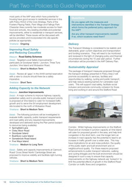
most parts of the AAP area which have potential forhousing have good access to residential services in linewith Policy HOU2 of the Core Strategy. Parts of theFowlers Playing Fields, Park Village and Fallings ParkCharacter <strong>Area</strong> currently has moderate access for freshfood and schools. Any existing shortfalls and potentialimprovements, either to residential or transport services,will be identified. These issues will be discussed withservice providers and incorporated into site specificpolicies as appropriate.Timeframe - OngoingImproving <strong>Road</strong> Safetyand Reducing CasualtiesMeasure - <strong>Road</strong> Safety SchemesDetails - Targeted Local Safety Improvements -particularly at Goodyear Island / Junction; Three TunsJunction; Vine Island and Wobaston <strong>Road</strong>.Timeframe - Short to Medium TermDetails - Review all ‘gaps’ in the A449 central reservationwith a view to closure should there be a safetyimperative.Timeframe - Short TermAdding Capacity to the NetworkMeasure - Junction ImprovementsDetails - A major scheme to improve highway capacity,pedestrian safety and to provide public transport priorityis proposed at Vine Island to cater for increased trafficgrowth and to serve the i54 employment developmentsite located to the north of Wobaston <strong>Road</strong>.Timeframe - Short to Medium TermDetails - The following junctions will be investigated toevaluate traffic capacity, public transport requirementsand road safety and any required improvementsdeveloped and delivered during the <strong>Plan</strong> period (subjectto resources being available):• Springfield Lane• Oxley Moor <strong>Road</strong>• Goodyear Island• Bushbury Lane Island• Gorsebrook <strong>Road</strong> Island• Five Ways IslandTimeframe - Medium to Long TermDetails - Safety and capacity improvements at Cannock<strong>Road</strong>/ Cross Street North/ Cambridge Street areproposed to improve visibility and facilitate right-turningvehicles.Timeframe - Short to Medium TermQuestionsDo you agree with the measures andinterventions identified in the Transport Strategywhich forms the preferred policy approach forthe AAP?Are any other transport improvements needed?If so, which locations need them?DeliveryThe Transport Strategy is considered to be realistic anddeliverable, given current objectives and transportationand funding scenarios. They will need to be monitoredand reviewed in the light of changing policy and financialcircumstances during the 15 year plan period. Furtherinformation will be provided in the AAP Delivery <strong>Plan</strong>.Sustainability AppraisalThe package of transport measures proposed throughthe transport strategy presented in Policy <strong>Area</strong> 2 willpromote accessibility to services, facilities andopportunities by walking, cycling and public transport,and help reduce existing barriers for vulnerable roadusers. This will support road safety, facilitate socialinclusion and promote community cohesion for thoseliving and working in and around the <strong>Stafford</strong> <strong>Road</strong><strong>Corridor</strong>. Whilst highway improvements on the <strong>Stafford</strong><strong>Road</strong> and an increase in junction capacity at Vine Islandwill cater for proposed growth in the area, and help limitcongestion in the short term, over the longer term anincrease in road capacity has the potential to lead to anincrease in traffic growth over a wider area. This mayhave implications for air and noise pollution, the qualityof the public realm and built environment and onneighbourhood quality. For these reasons proposedenhancements to public transport networks, walkingand cycling linkages and the built environment should bedesigned in such a way to ensure that capacityimprovements on the highway network are ‘locked in’ tolimit the potential effects of growth in the <strong>Stafford</strong> <strong>Road</strong><strong>Corridor</strong> on traffic flows and congestion.18Options Report for the Development of the <strong>Stafford</strong> <strong>Road</strong> <strong>Corridor</strong>