

GEOLOGY OF THE - GNS Science
GEOLOGY OF THE - GNS Science
GEOLOGY OF THE - GNS Science

You also want an ePaper? Increase the reach of your titles
YUMPU automatically turns print PDFs into web optimized ePapers that Google loves.
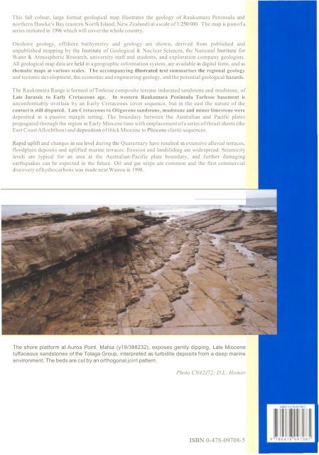
This full colour, large format geological map illustrates the geology of Raukumara Peninsula andnorthern Hawke's Bay (eastern North Island, New Zealand) at ascale of 1:250 000. The map is panofaseries initiated in 1996 which will cover the whole country.Onshore geology, offshore bathymetry and geology are shown, derived from published andunpublished mapping by the Institute of Geological & Nuclear <strong>Science</strong>s, the National Institute forWater & Atmospheric Research, university staff and students, and exploration company geologists.All geological map data are held in a geographic information system, are available in digital form, and asthematic maps at various scales. The accompanying illustrated text summarises the regional geologyand tectonic development, the economic and engineering geology, and the potential geological hazards.The Raukumara Range is formed ofTorlesse composite terrane indurated sandstone and mudstone, ofLate Jurassic to Early Cretaceous age. In western Raukumara Peninsula Torlesse basement isunconformably overlain by an Early Cretaceous cover sequence, but in the east the nature of thecontact is still disputed. Late Cretaceous to Oligocene sandstone, mudstone and minor limestone weredeposited in a passive margin setting. The boundary between the Australian and Pacific platespropagated through the region in Early Miocene time with emplacementofa series ofthrust sheets (theEast CoastAllochthon) and deposition ofthick Miocene to Pliocene clastic sequences.Rapid uplift and changes in sea level during the Quaternary have resulted in extensive alluvial terraces,floodplain deposits and uplifted marine terraces. Erosion and landsliding are widespread. Seismicitylevels are typical for an area at the Australian-Pacific plate boundary, and further damagingearthquakes can be expected in the future. Oil and gas seeps are common and the first commercialdiscovery ofhydrocarbons was made near Wairoa in 1998.The shore platform at Auroa Point, Mahia (y19/388232), exposes gently dipping, Late Miocenetuffaceous sandstones of the Tolaga Group, interpreted as turbidite deposits from a deep marineenvironment. The beds are cut by an orthogonal joint pattern.Photo CN42J72: D.L. HomerISBN 0-478-09708-5


