The Alaska Vegetation Classification - Alaska Geobotany Center ...
The Alaska Vegetation Classification - Alaska Geobotany Center ...
The Alaska Vegetation Classification - Alaska Geobotany Center ...

You also want an ePaper? Increase the reach of your titles
YUMPU automatically turns print PDFs into web optimized ePapers that Google loves.
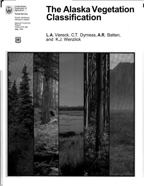
~~ ~rForest ServicePacific NorthwestResearch StationGeneral TechnicalReportPNW-GTR-286July 1992<strong>The</strong> <strong>Alaska</strong> <strong>Vegetation</strong><strong>Classification</strong>II@L.A. Viereck, C.T. Dyrness, A.R. Batten,and K.J. Wenzlick
IAuthorsL.A. VIERECK is a principal plant ecologist, C.T. DYRNESS was a research soilscientist (now retired), and K.J. WENZLICK was a secretary (currently is an editorialassistant, Research Information Services, Portland, Oregon 97208), Instituteof Northern Forestty, 308 Tanana Drive, Fairbanks, <strong>Alaska</strong> 99775-5500; andA.R. BATTEN is research associate at University of <strong>Alaska</strong> Museum, Fairbanks,<strong>Alaska</strong> 99775-1200.
AbstractViereck, L.A.; Dyrness, C.T.; Batten, A.R.; Wenzlick, K.J. 1992. <strong>The</strong> <strong>Alaska</strong>vegetation classification. Gen. Tech. Rep. PNW-GTR-286. Portland, OR: U.S.Department of Agriculture, Forest Service, Pacific Northwest Research Station278 p.<strong>The</strong> <strong>Alaska</strong> vegetation classification presented here is a comprehensive, statewidesystem that has been under development since 1976. <strong>The</strong> classification is based,as much as possible, on the characteristics of the vegetation itself and is designedto categorize existing vegetation, not potential vegetation. A hierarchical system withfive levels of resolution is used for classifying <strong>Alaska</strong> vegetation. <strong>The</strong> system, anagglomerative one, starts with 888 known <strong>Alaska</strong> plant communities, which arelisted and referenced. At the broadest level of resolution, the system contains threeformations-forest, scrub, and herbaceous vegetation. In addition to the classification,this report contains a key to levels I, 11, and 111; complete descriptions of all level IVunits; and a glossary of terms used.Keywords: <strong>Vegetation</strong>, classification, <strong>Alaska</strong>, tundra, boreal forest, coastal forest,plant communities.
Contents 134445666778101215555510715821 221 3243243254IntroductionGeneral Description of the <strong>Classification</strong> SystemNaming the Plant CommunitiesReview of Vegetatlon Classificatlon Work in <strong>Alaska</strong>Southeast <strong>Alaska</strong>Aleutian IslandsSouth-Central <strong>Alaska</strong>Southwest <strong>Alaska</strong>Northwest <strong>Alaska</strong>Arctic <strong>Alaska</strong>Interior <strong>Alaska</strong>Entire State of <strong>Alaska</strong><strong>The</strong> Classiflcatlon SystemKey to Levels I, II, and 111 of the <strong>Alaska</strong> <strong>Vegetation</strong> Classlfkatlon<strong>Classification</strong> TableDescriptions of Level I, II, 111, and IV TypesI. ForestII. Scrub111. HerbaceousAcknowledgmentsReferencesAppendixSpecies listGlossary
Introduction<strong>The</strong> first draft of this classification system was produced at the <strong>Alaska</strong>n RangelandWorkshop in Anchorage in February 1976. It was a rudimentary effort with four levelsof resolution. Improvements were made, and a revision was sent out for review inJune 1976. Members of the committee that worked on these early drafts were WilliamGabriel (Bureau of Land Management, Anchorage), Samuel Rieger (Soil ConservationService, Anchorage), David Murray (University of <strong>Alaska</strong> Fairbanks), and Leslie A.Viereck and C. <strong>The</strong>odore Dyrness (Institute of Northern Forestry, Fairbanks). <strong>The</strong>rewas considerable statewide interest in the effort, and several suggestions for improvementsin the system were received. In 1977, Murray and Batten (1977) produced anunpublished provisional classification of tundra communities in <strong>Alaska</strong>: Batten alsoreviewed many vegetation descriptions and determined the synonymy of many vegetationtypes. <strong>The</strong>ir work was incorporated into a much more comprehensive classificationsystem for <strong>Alaska</strong>'s vegetation.<strong>The</strong> first publication of the system appeared in 1980 under the title, "A preliminaryclassification system for vegetation of <strong>Alaska</strong>" (Viereck and Dyrness 1980). Thispublication was widely distributed and apparently was well received; but it constitutedonly the first approximation of a comprehensive, statewide system, and much workremained to be done. A revision of the classification system was released in May1981 (Viereck and others 1981) and was distributed rather widely with a call forsuggestions by users for further improvements. This 1981 revision incorporated twomajor changes: (1) tundra as a level I formation was discontinued, and the tundraunits were retained and incorporated into the scrub and herbaceous vegetation formations:and (2) wetland units were developed fully and were clearly identified atlevel IV. This portion of the revision was based largely on a 1980 unpublished reportby Batten (1980).A workshop on classification of <strong>Alaska</strong> vegetation held in Anchorage in December1981 led to a second revision of the published system, which was issued in May1982 (Viereck and others 1982). At the workshop, the classification was revised tolevel 111, definitions were agreed on that helped delineate the major units of the classification,and descriptions of the "descriptors" and "states" for determining the variouslevels were discussed. As a result of these discussions, many changes were madein system terminology, and categories in level I were reduced from four to three withthe placement of aquatic vegetation in the herbaceous category. Workshop participantsalso agreed that the final version should include keys, descriptions of vegetationunits, photographs typifying some of the more common units, and a glossary.Another well-attended workshop involving those interested in classifying <strong>Alaska</strong>'svegetation was held in Anchorage in February 1983. Participants expressed stronginterest in seeing the final version of the classification system published, and an interagencycommittee was appointed to aid in this endeavor. Members of the committeewere Stephen Talbot ( US Fish and Wildlife Service), Page Spencer (Bureau of LandManagement), Merlin Wibbenmeyer (<strong>Alaska</strong> Department of Natural Resources), JonMartin (USDA Forest Service). David Murray (University of <strong>Alaska</strong> Fairbanks), andPete Scorup (University of <strong>Alaska</strong>, Palmer).1
In 1984, the authors received funding from the <strong>Alaska</strong> Department of Natural Resources,USDA Soil Conservation Service, U.S. Fish and Wildlife Service, and NationalPark Service to begin compiling material on <strong>Alaska</strong> vegetation types into anexpanded and revised version of the <strong>Alaska</strong> vegetation <strong>Classification</strong>. <strong>The</strong> fundswere depleted before this sizable undertaking was finished, but an interim report ofprogress, yet another unpublished revision of the classification system, was distributedin March 1986 (Viereck and others 1986). This edition contained descriptions ofall the herbaceous and scrub types at level IV except the dwarf tree scrub types,some minor revisions of the basic classification, an updated and expanded list ofreferences, and a key to the first three levels in the classification.We have attempted to devise a pure classification system; that is, one based, asmuch as possible, on the characteristics 01 the vegetation itself. <strong>The</strong> characteristicmost frequently used is species composition. Inevitably the punty of the system issometimes compromised and habitat features must be included in the definition forclarity. <strong>The</strong> feature most often included in a unit definition along with species compositionis character of the substrate; for example, at level IV we have included suchunits as ericaceous shrub bog and halophytic sedge wet meadow, which are partiallydefined by physical and chemical characteristics of their substrate.Bailey and others (1978) summarize the types and characteristics of resource classificationsystems. <strong>The</strong>y note that the most basic system is a taxonomic classificationindependent of place. For maximum usefulness, a classification should be based onmany characteristics. Our classification is based on all the plants at any location-therelative abundance of individual plant species. Our proposed system is a taxonomicclassification designed to serve many needs. In this respect, it is a natural rather thanan artificial classification designed to meet a narrowly defined need (Bailey andothers 1978).This system is designed to classify existing vegetation, not potential vegetation. Aclassification for potential vegetation must be built on a solid background of knowledgeof successional relations of all vegetation types. Because the successionalstatus of many plant communities in <strong>Alaska</strong> is, as yet, unknown, we concentratedon existing vegetation. <strong>The</strong> successional relations are important and are describedin the level IV descriptions when information is available.Our classification was developed by aggregation, with plant communities as thebasic elements. We started with known communities and grouped them into broaderclasses based on similarity of composition by species. Some plant communities wehave listed have been described in great detail, others only sketchily. In all cases,we attempted to list at least one published reference for each community, <strong>The</strong> communitiesgenerally are named for dominant species in principal layers (tree, tallshrub, low shrub, and herb). In some cases, species with high indicator value arealso listed.2
General Descriptionof the<strong>Classification</strong> SystemWe have Constructed a hierarchical classification containing units at five levels ofresolution (levels I through V). In the ideal hierarchical system, each unit is exclusiveof all others, and when one class at any level is known, all levels above it are automaticallyknown. <strong>The</strong> broadest, most generalized level (level I) consists of threeformations-forest, scrub, and herbaceous. At the finest level of resolution (level V)units are discrete plant communities, with levels 11, 111, and IV intermediate in re-solution. We have not attempted to name levels 11, 111, and IV, although level IV inforest is comparable to Daubenmire's (1952) series. <strong>The</strong> scope of the system isshown by the number of units: level II contains 11 units; level 111, 30 units; level IV,146 units: and level V, 888 units.To be considered as a vegetation type in this system, at least 2 percent of covermust be vegetation. Any area with less than 2 percent in cover is not included hereand is considered to be unvegetated or barren.<strong>The</strong> forest units are based on tree crown canopy coverage and tree species compositiondown through level IV. <strong>The</strong> level II classes for forest are needleleaf, broadleaf,and mixed. A needleleaf forest is one where over 75 percent of total tree coveris contributed by needleleaf (coniferous) species. Similarly, a broadleaf forest hasover 75 percent of the tree cover in broadleaf tree species. In a mixed forest, neitherneedleleaf nor broadleaf species have clear dominance: both contribute 25 to 75 percentof the total canopy cover. Classes in level 111 are based on amounts of total treecanopy cover and are those suggested by Fosberg (1967): closed, open, and woodland.Closed stands have from 60 to 100 percent crown canopy. Open stands havefrom 25 to 60 percent crown canopy cover. Woodland has only scattered trees anda canopy cover of 10 to 25 percent. Level IV units are defined by the dominant treespecies in the overstory. To be listed under a level IV unit, a tree species mustcomprise at least 25 percent of the total tree canopy.Scrub vegetation classes are based on shrub height, shrub canopy coverage, andspecies composition down through level IV. <strong>The</strong> level II scrub classes are dwarf treescrub, tall scrub, low scrub, and dwarf scrub. Dwarf tree scrub is defined as vegetationhaving 10 percent or more of cover in tree species that on the site will notachieve 3 meters (10 ft) in height at maturity. Tall scrub vegetation is 1.5 meters(5 ft) or more in height, with 25 percent or more of the cover in tall shrubs. Lowscrub vegetation is between 20 centimeters (8 in) and 1.5 meters (5 ft) in heightand has 25 percent or more cover in low shrubs. Dwarf scrub vegetation is less than20 centimeters (8 in) high, and has 25 percent or more cover in dwarf shrubs. Level111 classes in dwarf tree scrub are the same used for forest; that is, closed, open, andwoodland. Level 111 classes for tall and low scrub are closed and open. Closed talland low scrub units have over 75 percent shrub canopy cover, and open units aredefined as having less than 75 percent shrub cover. For dwarf scrub, the level 111units are based on dominant plant species groups. <strong>The</strong>se classes are dryas dwarfscrub, ericaceous dwarf scrub, and willow dwarf scrub.3
Naming the PlantCommunitiesHerbaceous vegetation is dominated by nonwoody species that may range fromterrestrial grasses to aquatic algae. Level II units in the herbaceous category aredesigned to divide this tremendous diversity into four more manageable classes:graminoid herbaceous, forb herbaceous, bryoid herbaceous, and aquatic herbaceous.Graminoid herbaceous vegetation has the predominance of cover in grassesor sedges. Forb herbaceous vegetation has the dominant plant cover in nongraminoidspecies (broadleaf herbs, ferns, and horsetails). Bryoid herbaceous is a specialcategory of vegetation in which the predominance of cover is in mosses or lichens.Aquatic herbaceous vegetation consists of floating or submerged plants growing inwater. This unit includes aquatic mosses and algae as well as vascular plants. Level111 units for the graminoid and forb herbaceous classes are differentiated by moisturecontent of the substrate: dry, mesic, and wet. Wet sites are those that are saturatedor semipermanently flooded. In the bryoid herbaceous class, there are two level Illunits: mosses and lichens. Level 111 divisions under aquatic herbaceous vegetationare based on degree of salinity of the water. <strong>The</strong> three units are freshwater, brackishwater, and marine.Under level V, we list the plant communities and references known to us. We havestandardized the community names by listing only the most significant species.Species in community names separated by hyphens are in the same layer; a slash(I) between species indicates a change in layer (tree layer to shrub, tall shrub to lowshrub, shrub to herb layer, and so forth). Many tundra communities have shrubs andherbs in a single layer; dominants in this layer are separated by hyphens. Some referenceslisted for the communities give complete descriptions; others may mentiononly the community name.In many cases, elements of higher levels easily can be combined with communitynames for greater clarity. For example, a ficea marianalfeathermoss-C/a~~n;acommunityis listed under open black spruce and a similar ficea mariandSphagnum-Cladonia community is under black spruce woodland. In actual practice, these communitiesshould be referred to as open Picea marianalfeathermoss-Cladonia andwoodland ficea mariana/Sphagnum-Cladonia, respectively. This not only improvesdifferentiation between the two community types but also provides more informationin the community name.Review Of <strong>Vegetation</strong> Viereck and Dyrness (1980) give a brief review of some of the past vegetation clas-ClaSSifiCatiOn Work sification efforts in <strong>Alaska</strong>. To provide a background for our suggested classification,in <strong>Alaska</strong>it may be helpful to present an updated version of that review here. To facilitate ourdiscussions both here and in the descriptions of level IV units, we have divided theState into seven broad, generally recognized physiographic units. <strong>The</strong>se units aresoutheast, Aleutians, south-central, southwest, northwest, arctic, and interior <strong>Alaska</strong>(fig.1).Southeast <strong>Alaska</strong>Most vegetation classification work in southeast <strong>Alaska</strong> has been done in recentyears by Forest Selvice ecologists (Martin 1989). In some cases the work is stillgoing on, and in others results have not yet appeared in published form. Alaback(1980b) developed a list of provisional forest communities on the basis of his experiencein conducting ecological research there for several years. Martin and others(1985) classified forest communities in the Sitka area. <strong>The</strong> results of this work areunpublished. In addition, Martin and other ecologists have been working on vegetationclassification in the Ketchikan area. Preliminary results of this work also areunpublished but are available (West 1986).4
Northwest’. Tenltoryf-Figure I-Major geographic regions in <strong>Alaska</strong>Aleutian IslandsOlder studies generally were localized in coverage. Klein (1965) provides detaileddescriptions of the vegetation on Coronation and Woronkofski Islands, and Cooper(1942) does the same for portions of Prince William Sound. Also, Borchers andothers (1989) describe 16 forest plant associations from Montague Island on thesouth side of Prince William Sound. Palmer (1942) provides general information onthe vegetation of southeast <strong>Alaska</strong> to the Fish and Wildlife Service; his report listsonly two forest types and six nonforest types for the entire area. Neiland (1971)describes bog vegetation of southeast <strong>Alaska</strong> but does not separate distinct vegetationtypes. Glacier Bay has been the subject of numerous studies of plant successionafter deglaciation (Cooper 1924, 1939; Crocker and Major 1955; Lawrence1958).<strong>Vegetation</strong> on many of the Aleutian Islands has not been described in detail. Much ofthe early, detailed work was focused on Amchitka Island. Amundsen (1972) describes10 plant community types on Amchitka; a more detailed description of the vegetationwas given by Shacklette and others (1969); they listed 15 habitats with 41 plant communitiesby using the system presented by Fosberg (1967). More recently, Byrd(1984) describes the vegetation on Buldir Island.Virtually the only general descriptions of vegetation for the entire Aleutian Islandchain come from the work of Hulten (1960), Tatewaki and Kobayashi (l934), andBank (1951).5
South-Central <strong>Alaska</strong>Southwest <strong>Alaska</strong>Northwest <strong>Alaska</strong>This diverse region, including an area from the peaks of the <strong>Alaska</strong> Range to thecoastal marshes, has attracted considerable attention from those interested in vegetationclassification and inventory, especially during the last decade. A multiresourceinventory was conducted from 1978 to 1980 of the huge Susitna River Basin (16 millionacres). As a result of this inventory, 19 forest types, 7 herbaceous types, and6 shrub types were described (US. Department of Agriculture 1986). <strong>The</strong>se units areequivalent to level IV units in this classification. <strong>The</strong> Anchorage-area vegetation isdescribed by Tande (1983) for Elmendoff Air Force Base and by Hogan and Tande(1983) for the local wetlands.Prince William Sound, Cook Inlet, Kenai Peninsula, and Kodiak Island all offer atremendous variety of coastal habitats. Copper River Delta comprises the largestwetland on the west coast of North America and, because of its extreme importancefor wateffowl habitat, more and more plant ecological work has been undertakenthere. Scheierl and Meyer (1976, 1977) prepared maps of the vegetation on theCopper River Delta, and Crow (1968) discusses ecological relations in the area.Crow (1977a. 1977b) and Crow and Koppen (1977) describe salt marsh vegetationin coastal areas elsewhere in south-central <strong>Alaska</strong>. Beak (1966) studied the vegetationof cottonwood forests on Kodiak Island.Examples of alpine tundra are common in south-central <strong>Alaska</strong>, as are snow and icefields and other nonvegetated mountainous areas. Pegau (1972) and Viereck (1962,1963) describe plant communities in the <strong>Alaska</strong> Range, and Scott (1974a) suppliesdescriptions of alpine plant communities in the Wrangell Mountains.Southwest <strong>Alaska</strong> includes the Bristol Bay area, Kuskokwim Bay, and the extensiveYukon-Kuskokwim Delta region (fig. 1). Much of this region is low and poorly drained;consequently, wetland vegetation types are common. Not much vegetation classificationwork has been undertaken in the area; some work has been carried out,however, in wildlife refuges, and other projects are currently underway. Tande andJennings (1986) report on an intensive vegetation classification and mapping efforton a portion of the Yukon Delta National Wildlife Refuge. <strong>The</strong>y identify and describe77 community types ranging from halophytic wet meadows to tundra communitiesdominated by low shrubs. Talbot and others (1986) also worked on a vegetationreconnaissance and mapping project in Yukon Delta National Wildlife Refuge, andByrd and Ronsse (1983) classified plant communities in the intertidal zone of thecentral Yukon Delta. Farther south, broad vegetation types have been mapped byusing LANDSAT imagery in the Bristol Bay region (Wibbenmeyer and others 1982).Northwest <strong>Alaska</strong> extends from just north of the Yukon River Delta to Cape Lisburne(fig. 1). This region includes Norton Sound, Seward Peninsula, Kotzebue Sound, andthe Kobuk and Noatak River drainages. As in southwest <strong>Alaska</strong>, not much vegetationclassification work has been done in this area. Some of the earliest work was conductedby Hopkins and Sigafoos (1951) who describe general vegetation patterns onthe Seward Peninsula. Hanson (1953) describes some vegetation types in northwest<strong>Alaska</strong> and compares them with communities in other arctic areas. Johnsonand others (1966) describe eight broad vegetation types in the Cape Thompsonarea: Eriophorurn tussock, Dryas fell-field, Eriophorum-Carex wet meadow,EriophorunCarexsolifluction slope, ericaceous shrub polygon, Dryas step andstripe, Carex bigelowii high-center polygon, and saline meadow. Young (l974b)describes the vegetation of the Noatak River valley.6
Arctic <strong>Alaska</strong>Interior <strong>Alaska</strong>An extensive vegetation mapping and classification project in the Kobuk Riverdrainage recently has been described by Craighead and others (1988). <strong>Vegetation</strong>was mapped by using the LANDSAT multispectral scanning system over an area of33,768 square kilometers (13,034 mi'). <strong>Vegetation</strong> classification was based on datacollected from 880 ground plots; 15 vegetation complexes were mapped. <strong>The</strong>secomplexes contain 68 separate plant communities and range from a tidal marshcomplex to an alpine tundra complex. A variety of willow, shrub tundra, and bothriparian and upland white spruce communities are described.Much vegetation description and classification work has been undertaken in arctic<strong>Alaska</strong>, especially around Barrow and, more recently, near Prudhoe Bay. <strong>The</strong>refore,it is impossible to review all the studies and here we will attempt to discuss onlysome exemplary reports. Notable studies in the past include those of Churchill (1955),Spetzman (1959), Britton (1967), and Johnson and Tieszen (1973). Churchill (1955)describes tundra communities in the Umiat region. Both Spetzman (1959) and Britton(1967) give general vegetation descriptions of arctic tundra north of the crest of theBrooks Range. Johnson and Tieszen (1973) review the vegetation work in arctic<strong>Alaska</strong> and list 42 community types in 10 physiographic habitats. <strong>The</strong>y do notdescribe the community types but correlate eight major types with soil texture,drainage, soil type, and level of permafrost. <strong>The</strong> 42 community types representa mix of habitats and general vegetation physiognomy and plant groups.Walker and others (1982) mapped landforms, soils, and vegetation in a 5,700-square-kilometer (2,200-mi') portion of the Arctic National Wildlife Refuge by usingLANOSAT data. <strong>Vegetation</strong> units mapped include wet sedge tundra, dry prostrateshrub, forb tundra, moist sedge-prostrate shrub tundra, moist sedge tussock-prostrateshrub tundra, moist sedge tussock-dwarf shrub tundra, and shrub tundra. Walker(1985b) also carried out a detailed study of vegetation and environmental gradientsat Prudhoe Bay. A total of 92 permanent study plots were established on which42 vegetation types were identified. Factors studied for their possible control overvegetation distribution included temperature, soil moisture, soil pH, organic mattercontent, soil nutrients, snow depth, hummock size, cryoturbation, and animal activity.Walker (1983) presents an arctic <strong>Alaska</strong> tundra classification, especially designed formapping applications.<strong>The</strong> tundra vegetation near Barrow is described by Brown and others (1980a, 1980b).This report describes results of tundra biome research conducted under the InternationalBiological Program. Murray (1978) presents a very helpful summary of thestate of knowledge of vegetation, floristics, and phytogeography of northern <strong>Alaska</strong>.Hettinger and Janz (1974) describe the vegetation and soils of the eastern portion ofarctic <strong>Alaska</strong>. <strong>The</strong>y identify and describe 67 vegetation types, ranging from tundra toforest, and correlate them with terrain and soil features.Until about 1975, little work in vegetation classification had been done in interior<strong>Alaska</strong>. Viereck (1975), after reviewing available information on taiga communities,developed a classification that follows the system of Fosberg (1967) for the InternationalBiological Program. Whenever possible, Viereck made his classificationcompatible with Reid's (1974) lor an adjacent area in Canada. Viereck also showsrelative positions of all vegetation types along hypothetical moisture and temperaturegradients.7
Entire State of <strong>Alaska</strong>Dyrness and Grigal (1979) identify and describe one white spruce and four blackspruce communities along a 3-kilometer (1.9-mi) slope transect. <strong>The</strong>y correlateoccurrence of these communities with presence of permafrost, thickness of forestfloor, and quantities of soil nutrients. Yarie (1983) studied the forest vegetation on365 plots in a 3 600 000-hectare (8,895.600-acre) area north of the Yukon River andcentered on the Porcupine River drainage. By using ordination methods, he classifiedthe vegetation into 40 forest communities. Forest types in the Porcupine Block includeblack spruce, white spruce, mixed black and white spruce, aspen, balsampoplar, aspen-balsam poplar, aspen-birch, aspen-white spruce, aspen-black spruce,white spruce-birch, and black spruce-birch. Foote (1983) describes changes in vegelationfollowing fire on black spruce and white spruce sites in interior <strong>Alaska</strong> southof the Yukon River. She describes six developmental stages characteristically encounteredafter fire: (1) newly burned, (2) moss-herb, (3) tall shrub-sapling, (4) densetree, (5) hardwood or hardwood-spruce, and (6) spruce. In addition, Foote classifiesand describes 12 mature forest communities.Since the early 1970% intensive studies of the structure and function of forest communitieshave been done near Fairbanks. Some results appeared in a special issueof the Canadian Journal of Forest Research (1983: vol. 13, issue 5) and in a book(Van Cleve and others 1986). As a part of these efforts, successional stages wereidentified and described for the Tanana River flood plain and white spruce sites onthe upland (Van Cleve and Viereck 1981. Van Cleve and others 1980). Eight primarysuccessional stages are described for the flood plain that range from bare, recentlydeposited alluvium to mature white spruce and seven successional stages in theuplands, starting with newly burned and ending with mature white spruce. Resultsof a study of vegetation, soils, and forest productivity in 23 stands in the Fairbanksarea are reported by Viereck and others (1983). Forest types studied included blackspruce, white spruce, mixed black and white spruce, balsam poplar, birch, and aspen.In these stands, tree productivity was strongly correlated with soil temperature duringthe growing season. Prelogging examination of the vegetation on Willow Island in theTanana River disclosed 10 white spruce communities plus one willow and one balsampoplar community (Dyrness and others 1988).All published statewide vegetation classifications we are aware of were developed foruse with large-scale vegetation maps of <strong>Alaska</strong>. Spetzman's (1963) map, at a scaleof 1 :2,500,000, is the basis for several subsequent vegetation maps of <strong>Alaska</strong>. Mapunits shown are four forest types (coastal western hemlock-Sitka spruce, bottomlandspruce-poplar, upland spruce-hardwood, and lowland spruce-hardwood); three tundratypes (moist, wet, and alpine); two shrub types (high brush and low brush); andmuskeg-bog. A slightly modified version of this map was prepared at the same scaleby the Joint FederaCState Land Use Planning Commission for <strong>Alaska</strong> (1973). Viereckand Little (1972) prepared a map of the vegetation of <strong>Alaska</strong> only slightly modifiedfrom Spetzman's map; they provide an extensive description of the mapped units, aswell as further division and description of additional vegetation units.
Figure 2-<strong>Vegetation</strong> type map of <strong>Alaska</strong>.<strong>The</strong> National Atlas of the USA (Kuchler 1969) includes a map of the potentialvegetation of <strong>Alaska</strong> at a scale of 1 :7,500,000. <strong>The</strong> vegetation units are similarto Spetzman's (1963), although many names were changed. In the taiga, Kuchlercombined the upland units into one unit called spruce-birch forests; the low mixedtype he renamed black spruce forest; and the wet, moist, and alpine tundra ofSpetzman he renamed water sedge tundra, cotton sedge tundra, and dryas meadowsand barrens, respectively. Kuchler also recognized that vegetation of the AleutianIslands differs from that of northern and western <strong>Alaska</strong> by identifying two distincttypes: Aleutian meadows and Aleutian heath and barrens.Two provisional statewide classifications were used to develop our system. Murrayand Batten (1977) constructed a suggested classification of <strong>Alaska</strong> tundra communities.Several years later Batten (1980) proposed a classification framework for<strong>Alaska</strong> wetland and aquatic vegetation. Neither report is published.Because of the small scale (1:lO,OOO,OOO) of the vegetation map (fig. 2), we havedivided the State into only four major vegetation zones: (1) coastal forest, (2) borealforest or taiga, (3) lowland tundra, and (4) upland tundra. Within each of thesemajor vegetation zones there is a mosaic of vegetation types at all levels of ourclassification.9
<strong>The</strong> <strong>Classification</strong>SystemCoastal forests are dominated by closed and open evergreen forests, primarily Sitkaspruce-western hemlock. Closed and open deciduous forests are rare and limitedprimarily to stands of black cottonwood or red alder on flood plains, streamsides, andrecently disturbed sites. Woodland lodgepole pine communities grade into bog types(locally called muskegs) on poorly drained sites. On coastal deltas, extensive areasof halophytic and freshwater sedge and grass wet meadows dominated by Carexlyngbyaeiare common.Boreal forest or taiga forms an extensive vegetation zone between the coastal forestand the northern and western limits of forest growth. It is dominated by closed, open,and woodland evergreen forests of black and white spruce, but has extensive areasof open and closed deciduous forests of paper birch, aspen, and balsam poplar.Within this vegetation zone are extensive mosaics of shrub and herbaceous types,including extensive areas of subarctic lowland sedge and sedge-moss bog meadowsas well as willow, sweetgale, and graminoid bogs. <strong>The</strong>re are also extensive areas ofclosed and open shrubs of alder and willows in successional communities after fireand alluvial deposition.Lowland tundra occurs primarily on the coastal plain in northern <strong>Alaska</strong> and in lowlyingdeltas and other coastal areas in western <strong>Alaska</strong>. <strong>The</strong> dominant vegetation isa wet sedge meadow of Eriophorum angustifoliurn and Carex aquatilis interspersedwith many lakes. Eriophorum vaginatum tussock tundra occurs on the dryer sites.Upland tundra in <strong>Alaska</strong> includes three major vegetation zones as mapped by mostvegetation maps of <strong>Alaska</strong>; moist tundra, dry or alpine tundra, and shrub or highbrush tundra. Over much of arctic and western <strong>Alaska</strong>, this type is dominated byEriophorum vaginatum tundra with areas of Dryas dwarf shrub tundra on exposedridges and dry rocky sites. In mountainous areas above treeline, Dryas andericaceous shrub tundra are the mst widespread plant communities. In manyareas in western <strong>Alaska</strong> and in mst areas near treeline in the <strong>Alaska</strong> and BrooksRanges, the zone includes extensive areas of shrubland, primarily low shrub dwarfbirch. On the Aleutian Islands. the most widespread community is Empetrum heath,but extensive areas of dry and mesic graminoid herbaceous vegetation of Elymusarenarius, Calamagrostis nutkaensis, and Deschampsia beringensis also occur.<strong>The</strong> <strong>Alaska</strong> vegetation classification system is presented on the following pages.Table 1 presents the classification to level 111 and can be used as a quick referenceto the broad vegetation types in <strong>Alaska</strong>. This is followed by a key to the first threelevels of the classification. Following the key is a detailed presentation of all fivelevels of the system in tabular form (table 2). Finally, detailed descriptions of levels I,11, 111, and IV are given on pages 55 to 212.10
Table 1-<strong>Alaska</strong> vegetation classification to level illLevel I Level II Level 111I. Forest A. Needleleaf (conifer)forestB. Broadleaf forestC. Mixed forest(1) Closed needleleaf (conifer) forest(2) Open needleleaf (conifer) forest(3) Needleleaf (conifer) woodland(1) Closed broadleaf forest(2) Open broadleaf forest(3) Broadleaf woodland(1) Closed mixed forest(2) Open mixed forest(3) Mixed woodlandII. ScrubA. Dwarf tree scrubB. Tall scrubC. Low scrubD. Dwarf scrub(1) Closed dwarf tree scrub(2) Open dwarf tree scrub(3) Dwarf tree scrub woodland(1) Closed tali scrub(2) Open tall scrub(1) Closed low scrub(2) Open low scrub(1) Dryas dwarf scrub(2) Ericaceous dwarf scrub(3) Willow dwarf scrub111. Herbaceous A. Graminoid herbaceousB. Forb herbaceousC. Bryoid herbaceousD. Aquatic (nonemergent)herbaceous(1) Dry graminoid herbaceous(2) Mesic graminoid herbaceous(3) Wet graminoid herbaceous(emergent)(1) Dry forb herbaceous(2) Mesic forb herbaceous(3) Wet forb herbaceous (emergent)(1) Mosses(2) Lichens(1) Freshwater aquatic herbaceous(2) Brackish water aquatic herbaceous(3) Marine aquatic herbaceous11
Kev to Levels I. ,, II. Descriptions of levels I, 11, 111, and IV follow the classification tableand 111 of thela. Trees over 3 meters (10 ft) tall are<strong>Alaska</strong> <strong>Vegetation</strong>present and have a canopy cover<strong>Classification</strong>of 10 percent or more .................................... I. Forest 2lb. Trees over 3 meters (10 ft) tall areabsent or nearly so, Less than10 percent cover. (Dwarf trees, lessthan 3 meters [lo ft] tall may bepresent and abundant ...........I. Forest2a.2b.3a.3b.3c.4a.4b.5a.5b.5c.6a.6b.6c.7a.7b.Over 75 percent of tree covercontributed by needleleaf(conifer) species .............................. 1.A Needleleaf forest 3Less than 75 percent of treecover contributed by needleleaf(conifer)species ................................................. 4Tree canopy of 60-100 percentcover ..................................Tree canopy of 25-59 percentcover ....................................Tree canopy of 10-24 percentcover ......................................7.I.A.l Closed needleleaf forestI.A.2 Open needleleaf forestI.A.3 Needleleaf woodlandOver 75 percent of tree covercontributed by broadleaf species .................. 1.B Broadleaf forest 5Broadleaf or needleleaf speciescontribute 25 to 75 percent of thetreecover ....................................................... 6Tree canopy of 60-1 00 percent cover .......... I.B.l Closed broadleaf forestTree canopy of 25-59 percent cover ............ .1.B.2 Open broadleaf forestTree canopy of 10-24 percent cover .............. 1.8.3 Broadleaf woodlandTree canopy of 60-1 00 percent cover. ............ I.C.l Closed mixed forestTree canopy of 25-59 percent cover ............... I.C.2 Open mixed forestTree canopy of 10-24 percent cover ................. I.C.3 Mixed woodland<strong>Vegetation</strong> with at least 25 percentcover of erect to decumbent shrubsor with at least 10 percent coverof dwarf trees (less than 3 meters[loft] tall) ................................<strong>Vegetation</strong> herbaceous (may haveup to 25 percent shrub cover) ................................. a................ 1512
II. Scrub8a. <strong>Vegetation</strong> with at least 10 percentcover of dwarf trees ........................... I1.A Dwarf tree scrub 98b. <strong>Vegetation</strong> with at least 25 percentcover of shrubs and less than10 percent cover of dwarf trees .................................... 109a. Dwarf tree canopy of 60-100 percentcover ..................................9b. Dwarf tree canopy of 25-59 percentcover ....................................9c. Dwarf tree canopy of 10-24 percentcover .................................II.A.l Closed dwarf tree scrubll.A.2 Open dwarf tree scrubll.A.3 Dwarf tree scrub woodlandloa. Shrubs more than 1.5 meters(5 ft) tall ......................................... .II.B Tall scrub 11lob. Shrubs less than 1.5 meters(5ft)tall ....................................................... 121 la. Shrub canopy cover greater than75 percent. ................................... 11.8.1 Closed tall scrub1 Ib. Shrub canopy cover of 25-74 percent ............... .11.8.2 Open tall scrub12a. Shrubs 20 centimeters to 1.5 meters tall ............... 1I.C Low scrub 1312b. Shrubs under 20 centimeters in height. .............. .II.D Dwarf scrub 1413a. Shrub canopy cover greater than75 percent .................................... II.C.l Closed low scrub13b. Shrub canopy cover of 25-74 percent,or as low as 2 percent if little or noother vegetation wver present .....................14a. Dryas species dominant in the dwarfshrub layer ..................................14b. Ericaceous species dominant inthe dwarf shrub layer ......................14c. Willow species dominant in the dwarfscrub layer. .................................111. Hebaceousll.C.2 Open low scrubII.D.l Dryas dwarf scrubll.D.2 Ericaceous dwarf scrub.II.D.2 Willow dwarf scrub15a. Terrestrial vegetation, or if growingin the water, dominated by emergentvegetation ..................................................... 1615b. Dominant vegetation growing submergedin water or floating on the water surface,but not emerging above the water ............ 1II.D Aquatic herbaceous 2113
16a. Grasses, sedges, or rushes(graminoid) plants dominant ..........16b. Forbs or bryophytes dominant ........17a. Grasslands of well-drained, drysites, such as south-facing bluffs,old beaches, and sand dunes.Typically (but not always) dominatedby Elymus spp., Fesfuca spp.,and Deschampsia spp. ..............17b. On moist sites, but usually notwith standing water. Usuallydominated by Calamagrostis spp.,Carex spp. or Eriophorum spp.;tussocks often present ..............17c. On wet sites, standing waterpresent for part of the year;dominated by either sedges orgrasses; includes wet tundra,bogs, marshes, and fens .............18a. <strong>Vegetation</strong> dominated by forbs(broadleaf herbs, ferns, or horsetails) ............ 111.8 Forb herbaceous 1918b. <strong>Vegetation</strong> dominated by mossesorlichens .........................19a. On dry sites, usually rocky and welldrained; mostly tundra sites ..........,......... III.B.l Dry forb herbaceous19b. On moist sites but without standingwater, mostly within forested areas .....,......,111.8.2 Mesic forb herbaceous19c. On wet sites, usually with standingwater for part of the year. ..................... 111.8.3 Wet forb herbaceous20a. <strong>Vegetation</strong> cover dominated bymosses ..........................20b. <strong>Vegetation</strong> cover dominated bylichens ..........................21a. <strong>Vegetation</strong> submerged or floatingin fresh water. .......................... . III.A.1 Dry graminoid herbaceous.. lll.A.2 Mesic graminoid herbaceous...... .III.A Graminoid herbaceous 17........................... 18. lll.A.3 Wet graminoid herbaceous..... .III.C Bryoid herbaceous 20................ III.C.l Bryoid moss................lll.C.2 Bryoid lichenIII.D.1 Freshwater aquatic herbaceous21 b. <strong>Vegetation</strong> submerged or floatingin brackish water ................ lll.D.2 Brackish water aquatic herbaceous21c. <strong>Vegetation</strong> submerged or floatingin salt water ..........................lll.D.3 Marine aquatic herbaceous14
mn15
Y8L._ mad17
FQ221
zs0,Pn u u ld n
n aa25
28u ai .2 ai
mP35
u m .L m i41
.I44
->?WInQi54
Descriptions ofLevel I, II, 111,and IV TypesI. Forest<strong>Vegetation</strong> with at least 10 percent cover of trees. Trees are defined as singlestemmedwoody plants at least 3 meters (10 ft) tall at maturity. This classificationincludes the following tree species: Picea sifchensis, Tsuga heterophylla, Thujaplicafa, Chamaecyparis nootkatensis, Abies amabilis, Abies lasiocarpa, Taxusbrevifolia, Picea glauca, Tsuga rnertensiana, Picea rnariana, Larix laricina. Pinuscontorta, Alnus rubra, Populus trichocarpa, Populus balsamifera, Populustremuloides, and Betula papyrifera.I.A. Needleleaf ForestNeedleleaf forest communities are dominated by needleleaf (coniferous) tree species.In mixtures with broadleaf trees, needleleaf tree species contribute over 75 percent ofthe total tree cover.I.A. 1. Closed Needleleaf ForestClosed needleleaf forest communities have a crown canopy cover of 60 to 100 percent(fig. 3A and E). <strong>The</strong> tree canopy is comprised of at least 75 percent of needleleaf(coniferous) tree species.1.A.l.a. Closed Sitka Spruce ForestDescriptionSitka spruce dominates the overstory of these communities, providing40 to 85 percent cover (fig. 4). Western hemlock may be common, but provides lessthan 40 percent cover (usually less than 25 percent cover) and is overtopped by thespruce. Other tree species are uncommon. Total canopy cover is 60 percent or more.Seedlings of both western hemlock and Sitka spruce are common, but conditionsfavor spruce regeneration. Spruce trees in mature stands average 75 to 100 centimeters(30 to 40 in) in diameter at breast height (d.b.h.) and 36 to 67 meters (1 10 to220 ft) in height.AFigure 3-A. Aerial photograph of a small clump of closed needleleaf forest of Sitka spruceand western hemlock surrounded by a closed tall shrub stand of Ahus sinuata in southeastern<strong>Alaska</strong>. Color infrared film gives a reddish color for deciduous trees and shrubs.6. Closed needleleaf forest of Sitka spruce and western hemlock stand shown in 3A.55
Figure 4-Closed needleleal forest of Sitka spruce with an understoryof Oplopanax horridus, Vaccinium spp., and mosses from ChichagofIsland in southeastern <strong>Alaska</strong>. (Photograph m unq on Manin.)A dense shrub layer averages over 70 percent cover. Dominant shrubs areOplopanax horridus, Alnus spp., Rubus spectabilis, Ribes spp., Vacciniumalaskaense, and V. ovalifolium.<strong>The</strong> herb layer is commonly dominated by the ferns Gymnocarpiumdryopferis,Dryopferis dilatafa, and Afhyrium filix-femina, and the herbs Tiareella frifoliata, Rubuspedafus, Lysichifon americanum, Calamagrosfis nufkaensis, and Sfrepfopus spp.<strong>The</strong> herb layer cover is usually only moderate, averaging 29 percent cover.PhaseMn coasts subject to salt spray, high winds, and storms, a variant growsin which the shrub layer is sparse or absent and the herb layer is dominated byCalamagrosfis nufka8nsis. Associated herb species are various but commonlyinclude Prenanfhes alata, Rubus pedafus. Gymnocarpium dryopferis, and Cornusspp. Western hemlock occurs in small quantities or is absent, and the spruce issmaller than in inland stands, averaging 50 to 63 centimeters (20 to 24 in) d.b.h.and 27 to 36 meters (80 to 11 0 ft) tall. Conifer seedlings are uncommon or absent.Distribution and site characteristics-Sitka spruce forest occurs primarily at lowelevations in southeastern <strong>Alaska</strong> where it is common on wet, well-drained alluvialfans and flood plains and along a narrow coastal strip. It is also found at midelevationson steep mountain slopes adjacent to channels, along snow avalanche paths,on slopes subject to mass-wasting, and on sites subject to annual deposits of loess.Soils are generally deep, poorly developed, and well drained, with a thin organiclayer on the surface.Successional status-Soil disturbance caused by flooding, salt spray, and avalanchingseems to be the primary environmental factors allowing the spruce andshrub species, such as Oplopanax horridus, to maintain dominance on these sites.<strong>The</strong>se communities seem to represent stable late-seral or climax units.Closely related types-Closed Sitka spruce communities are similar to closedspruce-hemlock forests but have less hemlock. <strong>The</strong>y also are similar to open Sitkaspruce communities but have more trees and less understory diversity.Photographs-Figure 4, this publication.Primary reference-Martin and others 1985.56
Communities-Picea sifchensis/Oplopanax horridus-Rubus spectabi/is/Gornuscanadensis (Alaback 1980b, Neiland 1971a, Martin and others 1985, Stephens andothers 1969). Picea sitchensis/Oplopanax horridus/Lysichiton americanum (Martinand others 1985). Picea sitchensis/Oplopanax horridus/Circaea alpina (Pawuk andKissinger 1989). Picea sifchensis/Calamagrosfis nufkaensis (Martin and others 1985).LA. 1.b. Closed Western Hemlock ForestDescription-<strong>The</strong>se communities are dominated by western hemlock in the overstory(fig. 5). Sitka spruce may be present but provides less than 25 percent (usuallymuch less) of the overstoty cover. Total overstory canopy cover ranges from 60 to100 percent. Other conifer species are uncommon. Mature trees range from 37 to75 centimeters (14 to 30 in) d.b.h. and are about 24 to 36 meters (70 to 110 ft) tall.<strong>The</strong> shrub layer is dominated by some combination of Vaccinium alaskaense/ovalifolium, Oplopanax horridus, and Menziesia ferruginea. <strong>The</strong> shrub layer isgenerally 1 to 1.5 meters (3 to 5 fi) tall. Common ferns and herbs includeGymnocarpium dryopferis, Dryopteris dilafata, Athyrium filix-femina. fiarellafrifoliata, Cornus spp., Sfreptopus spp., and Rubus pedatus.Distribution and site characteristics-Western hemlock communities are widespreadin southeastern <strong>Alaska</strong> where they occur from lowlands to the subalpine onseveral landforms including inactive alluvial fans and flood plains, footslopes, andsteep mountain slopes. Soils usually are deep and well drained with a thin (10 to15 centimeters [4 to 6 in]) forest floor layer.Successional status-<strong>The</strong>se communities are usually stable (climax). Some aremoderately influenced by periodic surface or by subsurface groundwater flows(Martin and others 1985).Closely related types-<strong>The</strong>se communities are similar to closed Sitka sprucewesternhemlock communities but have less spruce.Photographs-Figure 5, this publication.Primary reference-Martin and others 1985.Communities-Tsuga heferophylla/Vacciniuum spp. (Fox 1983, Martin and others1985). Tsuga heferophy//a/vaccinium spp./Dryopteris dilatata (Martin and others1985). Tsuga heterophylla/Vaccinium spp.-Oplopanax horridus (LaBau 1981. Martinand others 1985). Tsuga heterophy/la/Oplopanax horridus (Martin and others 1985).Figure %Closed needleleafforest of western hemlock withan understory of Vaccinium sppand Dryopreris dilatata fromsoutheastern <strong>Alaska</strong>. (Photographmunery Jon Maoin.)57
.A. 1.c. Closed Sitka Sprucewestern Hemlock ForestDescrlptlon-<strong>The</strong>se communities are dominated by Sitka spruce and westernhemlock. <strong>The</strong> spruce provides 35 to 60 percent cover and constitutes mOSt 01 theoverstory. Mature spruce trees generally are 30 to 50 meters (95 to 145 ft) tall and50 lo 100 centimeters (20 to 40 in) d.b.h. Hemlock usually provides an understory25 to 40 meters (80 to 125 ft) high with 30 to 60 percent cover. Average diameter ofmature hemlock is 40 to 65 centimeters (15 to 25 in). Other tree species areuncommon.A well-developed shrub layer 1 to 1.5 meters (3 to 5 ft) tall is usually presentand consists of combinations of Oplopanax horridus, Vaccinium spp., and Rubusspectabilis. Common ferns and herbs include Gymnocarpium dryopteris, Dryopterisdilatata, Coptis aspleniifolia, Cornus spp., Rubus pedatus, Maianthemum dilataturn,Lysichiton americanum, Tiarella trifoliata, and Streptopus spp.Dlstrlbutlon and site characterlstlcs-Closed Sitka spruce-westem hemlock standsare common in southeastern <strong>Alaska</strong> and in a narrow coastal strip in south-central<strong>Alaska</strong>, mostly at low elevations on alluvial fans, flood plains, footslopes, and upliftedbeaches. <strong>The</strong>se communities occur on deep, well-drained, welldeveloped soils oninterfluves and on poorly drained, weakly developed soils on lowlands subject toflooding. <strong>The</strong>y also are found at midelevations on steep slopes near periodicallyactive channels and snow avalanche paths and on mass-wasting slopes.Successional status-Sitka spruce-western hemlock communities are climax ornear-climax.Closely related types-<strong>The</strong>se communities are similar to both Sitka sprucecommunities and western hemlock communities but have substantial quantities ofboth tree species. <strong>The</strong>y also are similar to open Sitka spruce-western hemlockcommunities but have greater tree cover.Primary referenc+Martin and others 1985.Communities-Picea sitchensis-Tsuga heterophylWLysichiton americanuWSphagnumspp. (Alaback 1980b, Neiland 1971a, Stephens and others 1969). Piceasitchensis-Tsuga heterophyllalvaccinium spp.-Menziesia ferruginea (Neiland 1971a.Stephens and others 1969). Picea sitchensis-(Tsuga heterophy/la)'/Oplopanaxhorr;dus/Lysichiton amerrcanurn (Martin and others 1985). Picea sitchensis-(Tsugaheterophylla)(see footnote l)/Vacciniurn sppJOplopanax horridus (Marlin and others1985). Picea sitchensis-(Tsuga heterophylla)(see footnote l)/Vacciniumspp. (Martinand others 1985). Picea sitchensis-(Tsuga heterophy//a)(see footnote l)/Vacciniumspp./Lysichiton arnericanurn (DeMeo and others 1989).' Name in parentheses not included in the plant associationname by Martin and others (1985).58
LA. 1.d. Closed Western Hemlock-Sitka Spruce-(Western Redcedar) ForestDescription-<strong>The</strong>se communities are dominated by western hemlock. Sitka spruceis codominant but secondary to the hemlock in cover. Stands often are fairly open,but have about 60 percent overstory cover or more. South of 570 north latitude,western redcedar (Thuja plicata) often is included in stands lo the point of beingcodominant. Mature trees range from 38 to 50 centimeters (15 lo 20 in) in d.b.h. andfrom 24 to 30 meters (75 to 90 ft) in height. Western hemlock seedlings are common.A well-developed shrub layer 1 to 1.5 meters (3 to 5 it) tall is dominated by somecombination of Oplopanax horridus, Vaccinium spp., Menziesia ferruginea, andRubus spectabilis. Common ferns and herbs include Gymnocarpiurn dryopferis,Dryopferis dilafafa, Rubus pedafus, Tiarella frifoliafa, and Lysichiton americanum.Distribution and site characteristics-<strong>The</strong>se communities are common in southeastern<strong>Alaska</strong> and in a narrow strip along the coast of south-central <strong>Alaska</strong> at allelevations below the subalpine zone. <strong>The</strong>y generally occur on steep, stony slopeswhere the soil is shallow but well drained. Rock outcrops are common. Soils aremineral and often disturbed by periodic surface and subsurface water flows. <strong>The</strong>forest floor layer is variable in thickness. A distinct microtopography of hummocksand hollows may be present.Successional status-<strong>The</strong>se are climax communities.Closely related types-<strong>The</strong>se communities are similar to Sitka spruce-westernhemlock communities but have more hemlock and less spruce. <strong>The</strong>y also are similarto Sitka spruce communities and western hemlock communities but differ in that bothspecies are well represented.Primary reference-Marlin and others 1985.Communities-Tsuga heterophylla-Picea sitchensis-(Thuja plicafa)/Vacciniumspp./Rhytidiadelphus loreus (Alaback 1980b, Neiland 1971a, Stephens and others1969). Tsuga heferophylla-Picea sifchensis-(Thuja plicata)/Lysichifon americanurWSphagnum recurvum (Neiland 1971a). Tsuga heferophylla-(Picea sifchensis)(seefootnote l)/Vaccinium spp./Oplopanax horridus (Martin and others 1985). Tsugaheterophylla-(Picea sifchensis)(see footnote l)/Vaccinium spp./Lysichifonamericanum (Martin and others 1985).1.A.l.e. Closed Western Hemlock-<strong>Alaska</strong>-CedarDescription-<strong>The</strong>se communities are dominated by western hemlock and <strong>Alaska</strong>cedar(Chamaecyparis noofkafensis). Sitka spruce is uncommon, and mountainhemlock (Tsuga merfensiana) occurs in minor quantities. Canopy cover is usually atthe lower end of the closed category (55 to 70 percent). Mature trees average 24 to30 meters (75 to 90 it) tall and 38 to 50 centimeters (15 to 20 in) d.b.h. Hemlockseedlings are abundant; <strong>Alaska</strong>-cedar seedlings are uncommon.A well-developed shrub layer 1 to 1.5 meters (3 to 4.5 It) tall is dominated byVaccinium spp. and Menziesia ferruginea. Common ferns and herbs includeGymnocarpium dryopferis, Blechnum spicanf, Cornus spp., Rubus pedafus,Coptis aspleniifolia, and Lysichiton americanum.59
Distribution and site characteristics-Western hemlock-<strong>Alaska</strong>-cedar communitiesoccur at all elevations below the subalpine zone in southeastern <strong>Alaska</strong>. <strong>The</strong>y primarilyare found on stable mountain slopes, hillslopes, and footslopes where drainageor root growth are impeded. Erosive surface or subsurface waterflow does notoccur. Microtopography is sometimes characterized by mounds and depressions.Lysichiton americanurn is usually restricted to depressions.Soils are mineral and may be either deep and somewhat poorly drained or shallowand well drained. <strong>The</strong> most common restricting layers of shallow soils are bedrock,compact till, and compact ash. Soils of localized depressions generally have a thickorganic horizon.Successlonal status-<strong>The</strong>se communities are thought to be climax. When sitessupporting these communities are logged, they tend to come back to Vacciniurn spp.and Menziesia ferruginea if the soil is not seriously disturbed, and to Alms sinuataand Rubus spectabilis if the soil has been seriously disturbed.Closely related types-Closed western hemlock-<strong>Alaska</strong>-cedar communities aresimilar to some western hemlock stands but have more yellow-cedar. <strong>The</strong>y alsomay be similar to some open mixed conifer stands but have slightly greater treecover and fewer dominant tree species.Primary referenceMartin and others 1985.Communities-Tsuga heterophylla-Chamaecyparis nootkatensis/Vacciniurn spp.(Martin and others 1985). Tsuga heterophylla-Chamaecyparis nootkatensidVaccinium spp./Lysichiton arneficanurn (Martin and others 1985). Tsugaheterophylla-Chamaecyparis nootkatensis/Vaccinirn spp./Oplopanax horridus(DeMeo and others 1989).LA. i.f. Closed Mountain Hemlock ForestDescrlption4ountain hemlock (Tsuga mertensiana) dominates the overstory(fig. 6). Sitka spruce may be present but occupies less than 10 percent of the overstory.Western hemlock may occur in the transition zone at the lower elevationalextent of these communities. Overstory cover is greater than 60 percent, usuallynearer 70 or 75 percent. Mature mountain hemlock trees range from 18 to 25 meters(55 to 75 ft) tall and from 38 to 50 centimeters (15 to 20 in) d.b.h.A well-developed shrub layer about 1 meter (3 ft) high and providing about 65 percentcover is dominated by Vacciniurn spp. Common herbs and ferns include Cornuscanadensis, Rubus pedatus, Coptis aspleniifolia, Blechnum spicant, and Faufiacrista-galli.Dlstrlbution and site characteristics-Mountain hemlock communities occurmost often on upper mountain slopes. <strong>The</strong>y also occur to a minor extent at lowerelevations in frost pockets and on steep, norlh-facing mountain slopes. Typicalelevations range from 400 to 500 meters (1,300 to 1,600 ft). Slope gradients aresteep (on the order of 45 to 60 percent). Soils generally are shallow, poorly to welldrained, and weakly to well developed." .
Figure 6-Closed needleleaf forest of mountainhemlock with a sparse understory of Vacciniurnspp. and a dense forest floor covering 01feathermosses in Prince William Sound insouth-central Alasb.Successional status-<strong>The</strong>se communities are thought to be climax. Because theyrarely are logged and rarely are affected by windthrow, secondary succession ispoorly understood. Because of the dense shrub layer and poor growing conditionsat these sites, they probably require substantial time to return to climax conditionafter disturbance.Closely related types-Closed mountain hemlock communities are similar toopen mountain hemlock communities but have greater canopy cover. At lowerelevations, they grade into western hemlock, western hemlock-<strong>Alaska</strong>-cedar, andwestern hemlock-western redcedar communities.Photographs-Figure 6, this publication.Primary reference-Martin and others 1985.Communities-Tsuga rnertensianaNacciniurn spp. (Fox 1983, Martin and others1985).I.A.1.g. Closed Western Hemlock-Western Redcedar ForestDescription-<strong>The</strong>se stands are dominated by western hemlock and westernredcedar. Other tree species of significance include <strong>Alaska</strong>-cedar and mountainhemlock. A dense shrub layer composed of Vacciniurn alaskaense, V. ovalifoliurn,V. parvifoliurn, Menziesia ferruginea, Oplopanax horridus, and Gaultheria shallon ispresent. Lysichifon arnericanurn is common as are patches of Sphagnurnspp.Distribution and site characteristics-<strong>The</strong>se stands are common in the southernportion of southeast <strong>Alaska</strong> (south of Wrangell) on moderately to highly productivesites with somewhat poorly to moderately well-drained soil. <strong>The</strong> soils may be organicor mineral.Successional status-<strong>The</strong>se communities appear to be climax. After logging orother disturbance, sites supporting these communities often go through a stagedominated by western hemlock, with small proportions of Sitka spruce and frequentlya lodgepole pine component.61
Closely related types-<strong>The</strong>se wmmunities are closely related to western hemlock-<strong>Alaska</strong>-cedar communities but have more western redcedar and less <strong>Alaska</strong>-cedar.Western hemlock-<strong>Alaska</strong>-cedar communities often are found north of the range ofwestern redcedar but on sites similar to those occupied by western hemlock-westernredcedar farther south. Western hemlock-western redcedar communities also aresimilar to open mixed conifer communities but have greater arboreal cover and astronger dominance of western hemlock and western redcedar.Prlmary references-Alaback 1980b. Stephens and others 1969.Communities-Tsuga heferophylla-Thuja plicafa/Vaccinium spp./Lysichifonamericanurn (Alaback 1980b, Stephens and others 1969).LA. 1.h. Closed Silver Fir-Western Hemlock ForestDescrlptlon-<strong>The</strong>se stands are dominated by Pacific silver fir (Abies amabilis)and western hemlock. Sitka spruce and western redcedar also may be important.Maximum size of silver fir is approximately 115 centimeters (45 in) in diameter and47 meters (143 ft) in height. A well-developed and productive shrub layer is presentand is dominated by Vacciniurn alaskaense. Other common shrubs include Menziesiafermginea and Rubus specfabilis. Common ferns include Dryopferis dilafafa, Afhyriurnfilix-femina, and Gymnocarpium dryopferis. <strong>The</strong> herb layer consists primarily ofCornus canadensis and the low trailing shrub Rubuspedafus. Common mossesinclude Rhyfidiadelphus loreus, Hylocomium splendens, and Plagiotheciumundulafum.Distributlon and site characteristics-Silver fir-western hemlock stands arescattered in southernmost southeast <strong>Alaska</strong> (south of lat. 55'15' N.), primarily onnorth- and east-facing slopes. <strong>The</strong>y are most common on low- and mid-elevationslopes but sometimes extend from tidewater to tree line. Pacific silver fir shows thestrongest dominance in stands in the northern part of its <strong>Alaska</strong> range.SUCCeSSlOnal status-This is a climax forest type. Some stands have been loggedin the past and have returned to silver fir codominance.Closely related types-Pacific silver fir may be present in Sitka spruce-westernhemlock stands and western hemlock-Sitka spruce-(western redcedar) stands.Primary reference-luday and others 1980.Communities-Abies amabilis-Tsuga heferophylla (Juday and others 1980).I.A. 1.1. Closed Subalpine Fir ForestDescription-<strong>The</strong>se communities are dominated by subalpine fir (Abies lasiocarpa).Other important tree species include Sitka spruce, mountain hemlock, and <strong>Alaska</strong>cedar.<strong>The</strong> largest subalpine firs are on the order of 18 meters (55 R) tall and 45 centimeters(18 in) d.b.h. Most trees are considerably smaller, at least on the islandsites. On severely wind-exposed sites, subalpine fir readily forms krummholz bygrowing in dense mats as low as 15 centimeters (6 in). Sitka spruce and mountainhemlock, on the other hand, when present on these exposed sites, do not as readilyform mats but occur as clumps of small trees surrounded by low mats of subalpinefir. Layering appears to be the primary form of reproduction, at least on the islandsites. Although abundant cones are formed, the seeds frequently are not viable.Common understory species include fauria crista-gall!, Cornus canadensis, andfhyllodoce aleutica.62
Distrlbutlon and site characteristics-Small, widely scattered stands occur onupper slopes and ridges at a few localities in southeastern <strong>Alaska</strong>. Most of theseare on relatively continental sites at the heads of mainland fjords, but a few are inmaritime settings on islands. Stands are generally above 460 meters (1,500 ft) inelevation and extend upward to the limit of tree growth, over 945 meters (2,850 ft)in places. Subalpine fir forests are found most commonly on organic soils but alsogrow well on shallow, stony soils.Successional status-As far as is known, these are climax stands; the subalpine firmaintains itself primarily by layering. Postdisturbance succession has not beendescribed.Closely related types-At the upper altitudinal limit of tree growth, the subalpine firtype becomes open and shrublike in form and grades into both an open forest typeand a dwarf tree scrub type. At the other extreme, subalpine fir forest can grade intoopen or closed mountain hemlock and western hemlock-Sitka spruce stands. Astrees become even less dense, the vegetation may grade into alpine shrub communitiessuch as mountain heath tundra.Primary references-Harris 1965, Worley and Jacques 1973.Communities-Abies lasiocapa-Tsuga meflensiana (Harris 1965, Worley andJaques 1973).l.A.1.j. Closed White Spruce ForestDescription-<strong>The</strong> closed white spruce forest type represents the best developed,most productive forest sites in the taiga of <strong>Alaska</strong> (fig. 7). <strong>The</strong> overstory canopycover, usually entirely white spruce but occasionally with either scattered paperbirch or balsam poplar, can range from 60 to 100 percent. On the best sites, treesreach 30 meters (100 ft) in height and 60 to 90 centimeters (2 to 3 ft) in diameterbut average much less and may be only 12 to 15 meters (40 to 50 ft) tall toward thewestern and northern fringes of the taiga. Tree densities may be as high as 4000 to5000 per hectare (1,600 to 2,000 per acre) in the younger stands but are usuallyfrom 600 to 1000 per hectare (250 to 400 per acre) in the older stands.Figure 7-Closed needleleal forest of whitespruce with a shrub layer of Rosa acicularisand a forest floor layer of Linnaea borealis andfeathermosses on the flood plain of theTanana River in interior <strong>Alaska</strong>.63
Because of the dense tree canopy, the tall shrub layer of alders and willows is onlysparsely developed and generally contributes little cover. Low shrubs and dwatishrubs, such as Vaccinium uliginosurn, Ledurngroenlandicum, Vaccinium vitis-idaea,Ernpetrum nigrum, and Betula nana, become common in older stands as the canopybegins to open.A well-developed moss layer consisting primarily of the feathermosses Hylocomiurnsplendens, Pleuroziurn schreberi, and less commonly, Rhytidialdelphus tfiquefrusis characteristic of these stands. Herbaceous grtswth is usually sparse but horsetails,primarily Equisetum sylvaticum and €. arvense. may provide as much as 50 percentcover in flood-plain stands. Other forbs include Pyrola spp., Linnaea borealis,Geocaulon lividurn, Merfensia paniculata, and Goodyera repens.Phases-A phase of this type, with lichens dominating the ground cover, has beenreported from southwestern <strong>Alaska</strong> (Wibbenmeyer and others 1982). In the PorcupineRiver area of northeastern <strong>Alaska</strong>, Shephefdia canadensis and Arctostaphylosrubra are important shrubs and subshrubs in this type on dryer sites.Distribution and site characteristics-This type is found on the most productivesites throughout the <strong>Alaska</strong> taiga. It occurs on young river terraces, especially wherepermafrost is lacking, and on low-elevation slopes with well-drained soils on south,west, or east aspects. <strong>The</strong> type is most extensive in central <strong>Alaska</strong> but occurs inisolated small stands along rivers and in warm upland sites nearly to the northernand western tree lines. <strong>The</strong> soils are usually moderately well drained and lackpermafrost or have a deep active layer.Successional status-<strong>The</strong> closed white spruce type is considered by many to bethe climax vegetation on the well-drained upland and flood-plain sites in much of the<strong>Alaska</strong> taiga. In the upland, white spruce stands occasionally may regenerate directlyafter fire, but more commonly white spruce replaces successional hardwood standsof aspen or birch. On the flood plain, white spruce stands usually develop after shruband balsam poplar stages, and there is considerable evidence that over long periods,perhaps one to two generations, the white spruce stands are replaced by blackspruce as permafrost develops on the site.Closely related types-<strong>The</strong> closed white spruce forest is similar to the open whitespruce type, except that the latter has more shrub cover and the moss layer maybe partially replaced by lichens. On some transitional sites in the upland and on theflood plain, a mixture of white and black spruce occurs but with much the sameunderstory vegetation as in the closed white spruce stands. In most publications,the type is referred to as the closed white spruce forest type or the white spruceforest type.Photographs-Figure 7, this publication.Primary references-Drury 1956, Foote 1983, Lutz 1956, Viereck and others 1983,Wibbenmeyer and others 1982, Yarie 1983.
Communities-Picea glaucahathermosses (Buckley and Libby 1957; Craigheadand others 1988; Drury 1956; Dyrness and others 1988; Viereck 1970a, 1975). Piceaglauca/Alnus fenuifolia/Hylocomium splendens (Dyrness and others 1988). Piceaglauca/Viburnum edule/€quisetum afvense (Foote 1983). Picea glauca/Linnaeaborealis-Equisetum sylvaticum (Foote 1983). Picea glauca/Rosa acicularisLinnaeaboreali~/Hylocomium splendens (Viereck 1989). Picea glauca/Rosa acicularis-Shepherdia canadensis/Linnaea borealis (Yarie 1983). Picea glauca/Alnus spp./Arctostaphylos uva-ursi (Yarie 1983). Picea glaucallllertensia spp./Gramineae (Yarie1983). Picea glaucalSalix spp./Sbepherdia canadensis/Arcfosfaphylos spp./Peltigeraspp. (Yarie 1983). Picea glauca/Rosa acicularis/€quisetum spp. (Yarie 1983). Piceaglaucdshepherdia canadensis/€quisetum spp.-Arctostaphylos spp. (Yarie 1983).Picea glauca/Alnus crispdRosa acicularis/Arctostaphylos rubra (Yarie 1983). PiceaglaucdRosa acicularis-Shepherdia canadensislArctosfaphylos rubra-Linnaea borealis(Yarie 1983).1.A.i.k. Closed Black Spruce ForestDescription-<strong>The</strong>se torest communities are dominated by black spruce (Piceamariana) (fig. 8). White spruce and paper birch may be present but are not veryimportant. Black spruce trees average 9 meters (30 ft) tall and 10 centimeters(4 in) d.b.h. Productivity is very low, trees often requiring 100 years or more toreach average size. Tree density is high with 12,000 to 15,000 stems per hectare(4,900 to 6,070 stems per acre), but volume is low at 177 cubic meters per hectare(2,529 R3/acre) and mean annual increment is, at best, only 1.7 cubic meter perhectare (24 ft3/acre). Black spruce regeneration is usually abundant, primarily fromlayering of lower branches.Figure 8-Closed needieleaf forest of black sprucewith a thick mat of Ihe feathermosses Hylocomiumsplendens and Pleurozium schreberi and folioselichens, primarily Pelfigera canina and P. aphrhosa,in the uplands in interior <strong>Alaska</strong>.65
Patches of Alnus crispa several meters high commonly grow intermixed with theblack spruce. Common understory shrubs growing 0.5 to 2.0 meters (1.5 to 6 ft)tall include Rosa acicularis, Salix spp., and Ledum groenlandicum. Common lowshrubs include Vaccinium uliginosum, V. vitis-idaea, and Linnaea borealis. Ledumdecumbens and Empetrum nigrum may be important locally. <strong>The</strong> moss layer variesfrom patchy to continuous and is composed primarily of Hylocomium splendens andPleurozium schreberi. Sphagnum spp. may be important on many of the Wetter Sites.<strong>The</strong> moss mat is generally about 20 centimeters (8 in) thick, but may be up to ameter (3 ft) thick beneath mounds of sphagnum. Foliose lichens such as Pelfigeraaphthosa and P. canina are common.Most black spruce stands are burned before they are 100 years in age. Older treesare found occasionally, usually as stringers or islands within younger stands. Olderstands have greater cover of mosses and low shrubs and less cover provided by tallshrubs.Distribution and site characteristics-Closed black spruce forest is found onflood-plain terraces and on level to undulating uplands in interior and south-central<strong>Alaska</strong>. Soils range from well-drained alluvial gravels to poorly drained Cryaquepts.Permafrost is usually present at depths ranging from 30 centimeters (12 in) to over1 meter (3 ft) but sometimes is absent from stands growing on coarse alluvium oron shallow soils over bedrock.Successlonal status-Many of these stands seem to be stable until they areburned. After fire they eventually return to nearly their original composition. In thelong term, they may be transitional between white spruce forests and open blackspruce stands common on wetter and colder soils. This transition to open blackspruce is probably driven by a tendency for the soil to become more poorly drainedand for the permafrost table to rise as the moss mat becomes thicker and the soilbecomes colder.Closely related types-Closed black spruce communities are related to open blackspruce communities but have a greater cover of black spruce and a thinner mosslayer. <strong>The</strong>y also are related to black spruce dwarf tree scrub communities but havetaller trees. <strong>The</strong>y may be similar to some closed black spruce-white spruce standsbut are more strongly dominated by black spruce. <strong>The</strong>y may resemble some standsof open or closed spruce-birch mixed forest but with less birch.Photographs-Figure 8, this publication.Primary references-Foote 1983, Neiland and Viereck 1977, Viereck and others1983, Yarie 1983.CommunltletPicea rnarianalfeathermosses (Drufy 1956, Lutz 1956, Neiland andViereck 1977, Viereck 1975). Picea mariana/Rosa acicularis/Pe/tigera spp. (Foote1983, La Roi 1967). Picea mariandLedum decumbens/Vaccinium vitis-idaedCladonia spp. (Yarie 1983). Picea mariandRosa acicularis/€quisetum spp./Cladoniarangiferina (Yarie 1983).66
LA. 1.1. Closed Black Spruce-White Spruce ForestDescription-<strong>The</strong>se stands have tree coverof more than 60 percent that is almost entirelycontributed by black spruce and white spruce(fig. 9). <strong>The</strong>se are slow-growing stands, andthe trees rarely exceed 25 centimeters (10 in)d.b.h. and 24 meters (75 11) tall, even at 100to 200 years of age. White spruce is oftenolder and larger than the black spruce inthese stands. A few paper birch trees may bepresent, but they do not provide significantcover. Reproduction is usually abundantand primarily black spruce, but occasionallynumerous white spruce seedlings occur. Onsome sites, reproduction may be nonexistentor consist of only a few birch seedlings.<strong>The</strong> shrub layer generally is weakly developed.Alnus crispa and willows severalmeters tall usually are present. Other understoryshrubs growing less than 1.5 metersFigure 9-Closed needleleal forest of mixedblack and white spruce with Equiserurnarvense, E. prafense, and the mossesHylocornium splendens and Rhylidiadelphuslriquelrus in the herb and moss layers.(5 ft) tall include Rosa acicularis, Viburnum edule, Ledumgroenlandicurn, Vacciniurnuliginosum, V. vitis-idaea, Ribes spp., and sometimes Empetrum nigrum. Equisetumsylvaficum frequently dominates the ground layer of flood-plain stands. Cornuscanadensis and Linnaea borealis are common herbs. A thick layer of feathermossesusually is present, generally dominated by Rhytidiadelphus triquetrus and Hylocorniurnsplendens. Sphagnum spp. may be important locally.Phases-At high elevations, Betula nana and Arctostaphylos rubra may be importantshrubs. Aulacomniumspp. and fruticose lichens dominate the moss and lichen layer.Distribution and site characteristics-Closed black spruce-white spruce forestsare common near the northern and western limits of trees, on flood-plain terraces ininterior <strong>Alaska</strong>, and at the bases of south-facing slopes. Soils generally are poorlydrained silts with a surface horizon about 10 centimeters (4 in) thick that is overlainby a decimeter or two of organic remains and the living moss mat. Soil pH is usuallyslightly acid (6.5) to neutral. Permafrost is often present at depths of 50 to 60 centimeters(20 to 24 in). <strong>The</strong>se communities occasionally are found on moderatelywell-drained soil, but permafrost is almost always present.Successional status-On flood-plain terraces, these communities generally aretransitional between closed white spruce stands on well-drained soils of the youngerterraces and open black spruce stands on poorly drained soils of older terraces. Soilorganic matter, depth to permafrost, and drainage are intermediate between thewhite spruce and black spruce communities.Closely related types-Closed black spruce-white spruce stands can resembleboth open and closed stands of both white spruce forest and black spruce forest,depending on the proportion of the two species and the density of the tree cover.Photographs-Viereck 1970a, figure 5; figure 9, this publication.Primaty references-Viereck 1970a, Viereck and others 1983, Yarie 1983.67
Communities-Picea mariana-P. glauca/leathermosses (Foote 1983; La Roi 1967;Neiland and Viereck 1977; Viereck 1970a, 1975). Picea glauca-P. mariandSalixspp./Arctostapbylos spp. (Yarie 1983). Picea glauca-P. mariandSalix spp./Vacciniumvitis-idaea/Hylocomium splendens (Yarie 1983). Picea glauca-P. mariandSalix spp./Vaccinium vitis-idaeallichens (Yarie 1983). Picea mariana-P. glaucdSalix spp./LedumdecumbensEmpetrum nigrum (Yarie 1983). Picea mariana-P. glaucdsalix spp./Potentilla fruficosdRubus arcticus-Arctostapbylos spp. (Yarie 1983).l.A.2. Open Needleleaf ForestOpen needleleaf forest communities have from 25 to 60 percent tree crown canopycover. When mixed with broadleaf tree species, needleleaf (coniferous) trees contributeat least 75 percent of total tree cover (fig. 10, A and B).I.A.2.a. Open Sitka Spruce ForestDescrlption-Large Sitka spruce dominate the overstory and provide 35 to 55 percentcover (fig. 11). Small amounts of western hemlock may occur, but other coniferspecies are rare. Mature spruce range in height from 29 to 49 meters (95 to 160 ft)and from 51 to 102 centimeters (20 to 40 in) in d.b.h. Seedlings of both westernhemlock and Sitka spruce may occur, but survival is limited. Alms rubra or A.sinuata usually dominate a tall shrub layer 3 to 12 meters (10 to 40 ft) in height andprovide 15 to 40 percent cover.Figure l&A. Aerial photograph of open needleleaf forest of black spruce in interior <strong>Alaska</strong>. 8. Groundview of open needleleaf forest of black spruce shown in A.Figure 1 lapen needleleaf forest of Sitka spruce with anunderstory of Oploplanax horridus from Baranof Island insoulheastern <strong>Alaska</strong>. (Photograph mumy J ~ ~~rti".)O
A lower well-developed shrub layer about 2 meters high is dominated by Oplopanaxhorridus, Rubus spectabilis, Ribes spp., and Vacciniurn spp. Common ferns andherbs include Gymnocarpium dryopferis, Athyriurn fifix-fernina, and Tiareffa frifofiafa.Distribution and site characteristics-Open Sitka spruce forest occurs most oftenat low elevations on active alluvial fans and flood plains. It is sometimes also presentat midelevations on steep mountain slopes adjacent to active channels and on activesnow avalanche paths. <strong>The</strong> soils are generally deep, well drained, and weaklydeveloped. <strong>The</strong> surface organic layer is thin because of frequent disturbance bywater flow, snow movement, or mass-wasting. <strong>The</strong> mineral horizons are mixed,thereby reflecting their alluvial or colluvial origin.Successional status-Open Sitka spruce (spruce/alder) communities appear to bestable over long periods of time. Periodic severe hydrologic disturbance seems tobe the main environmental factor allowing spruce and alder to share dominance onthese sites. Alder and Rubus specfabilis dominate these sites after clearcut logging.Conifers are slow to establish because of the thick shrub cover and the frequentdisturbance of soil by mass movement.Closely related types-<strong>The</strong>se communities are similar to some closed tall alderscrub communities but have a substantial overstory of Sitka spruce. <strong>The</strong>y also aresimilar to closed Sitka spruce communities but with less canopy cover.Photographs-Figure 11, this publication.Primary referencGMartin and others 1985.Communities-Picea sifchensis/A/nus sinuafa/Ca/amagrosfis canadensis (Viereck1979, Worley 1977). Picea sitchensis/Alnus spp. (Martin and others 1985).I.A.2.b. Open Western Hemlock-Sitka Spruce ForestDescription-<strong>The</strong>se communities have an open overstory dominated by westernhemlock and Sitka spruce (fig. 12). Total tree cover is usually in the range of 45 to65 percent with most of it provided by hemlock, but Sitka spruce provides at least25 percent of the canopy cover. Mature western hemlock range from 21 to 27 meters(70 to 90 ft) tall and from 38 to 64 centimeters (15 to 25 in) d.b.h. Mountain hemlockmay occur but generally in small quantities. Mature spruce average 29 meters (95 ft)in height and 64 centimeters (25 in) in d.b.h. A well-developed shrub layer 1 to1.5 meters (3 to 5 ft) tall is dominated by Oplopanax horridus, Vaccinium spp.,Menziesia ferruginea, and Rubus specfabilis. Common herbs are Lysichifonarnericanurn, Rubus pedafus, and Afhyrium fikfemina.Figure 12-Open needleleaf forest ofwestern hemlock with scattered Sitkaspruoe, scattered Oplopanax horridusin the shrub laysr, and conspicuousLysichifon americanurn in the herb layeron Chichagof Island in southeastern <strong>Alaska</strong>.(Pholagraph munsry Jon Martin.)69
Distribution and site characterlstlcs-Open hemlock-spruce communities arecommonly found on slopes of less than a 30-percent gradient from midelevationto lower elevations. Common landforms supporting these communities includefootslopes, mountainside benches, and concave slopes. Thick organic soils andsurface and subsurface water flow characterize sites where these communitiesare found. Sites with understories dominated by Oplopanax hofridus have a greaterwater runoff than those where Lysichiton americanum dominates. Soils are deep,poorly drained, and weakly developed and have a thick surface organic layer 0115 to 30 centimeters (6 to 12 in).Successlonal status-Successional relations are largely unknown. Coniferseedlings do not seem to grow well on the poorly drained organic soils.Closely related types-<strong>The</strong>se communities are similar to closed western hemlock-Sitka spruce communities, the closed Sitka spruce-western hemlock communitiesand some closed western hemlock communities but canopy cover averages less than60 percent. <strong>The</strong>y also are similar to some open mixed-conifer communities, but aremore strongly dominated by western hemlock and Sitka spruce.Photographs-Figure 12, this publication.Primary referent-Martin and others 1985.Communltles-Tsuga heterophylla-(Picea sitchensis)(see footnote 1)lOplopanaxhorridus/Lysichiton americanum (Martin and others 1985).bA.2.c. open Mountain Hemlock ForestDescrlptlon-Mountain hemlock dominates the overstoty of these forest communitiesby providing 15 to 60 percent cover (fig. 13). Overstory trees average 9 to21 meters (30 to 70 ft) in height and 25 to 50 centimeters (10 to 20 in) in d.b.h.Mountain hemlock seedlings are generally common to abundant. Other coniferspecies, particularly Sitka spruce, may occur occasionally but are not important.A well-developed shrub layer is present and is dominated by some combination ofVaccinium alaskaense, V. ovalifolium, Menziesia ferruginea, and Cladofhamnuspyfolifolia. <strong>The</strong>se shrubs grow 1 to 1.5 meters (3 to 5 It) tall and provide 50 to 70percent cover. In some communities, a layer of low alpine shrubs dominated bysome combination of Cassiope mefltensiana, C. stelleriana, Phyllodoce aleutica spp.glanduliflora. and Luetkea pecrinata is present.Figure 1Mpen needleleaf forestof mountain hemlock with understoryof Vaccinium spp. and Cassiopemettensiana in southeastern <strong>Alaska</strong>.(Photcgraph munsry Jon Manin.)70
A layer of herbs and ferns provides 40 to 60 percent cover. Common species includeRubus arcticus, Coptis aspleniifolia, Veratmm viride, Cornus canadensis, and Fauriacrista-galli. In some communities, sedges (including Carex aquatilis, C. nigricans, andTrichophorum caespitosum) may be common. In others, ferns (primarily Blechnumspicant) may be present.Distribution and site characteristics-Mountain hemlock communities are foundin south-central and southeastern <strong>Alaska</strong>. <strong>The</strong>y primarily occupy sites at high elevationson upper mountain slopes but also may be found in isolated frost pockets oron steep north slopes at low elevations. <strong>The</strong>y become increasingly common at lowelevations near the western limit of the range of this type. Soils are shallow and oftenrather poorly drained. Soils may be either predominately mineral or organic.Successional status-<strong>The</strong>se communities are stable over long periods. <strong>The</strong>y arerarely disturbed, either naturally or by humans; therefore, secondary successionpatterns are unknown.Closely related types-<strong>The</strong>se communities are similar to closed mountain hemlockcommunities but have less than 60 percent tree cover. Some of these communitiesare similar to mountain-heath tundra communities dominated by species ofPhyllodoce, Cassiope, and Luetkea.Photographs-Figure 13, this publication.Primary reference-Martin and others 1985Communities-Tsuga mertensianaWaccinium spp.-Cassiope mertensiana (Alaback1980b, Jaques 1973, Martin and others 1985). Tsugamertensiana/Vacciniumspp.-Cladofhamnus pyrolaeflorusFauria crista-galli (Alaback 1980b, DeMeo andothers 1989, Martin and others 1985, Pawuk and Kissinger 1989, Stephens andothers 1969).bA.2.d. Open Mixed Conifer ForestDescription-<strong>The</strong>se communities are dominated by various combinations of <strong>Alaska</strong>cedar(Chamaecyparis nootkatensis), western hemlock, mountain hemlock, and Sitkaspruce (fig. 14). Lodgepole pine (Pinus conforta) may be a minor constituent of theoverstory. At the southern end of southeast <strong>Alaska</strong>, western redcedar (Thuja plicata)and Pacific yew (Taxus brevifolia) also may be present. Overstory cover ranges from25 to 50 percent, with height averaging 11 to 24 meters (35 to 80 ft) and d.b.h.averaging 25 to 50 centimeters (10 to 20 in). Spruce and hemlock seedlings areusually abundant; cedar seedlings are uncommon.Figure 14-Open needleleaf forest ofseveral mnifer species, an understory ofVacciniurn spp., and Fauria crista-galh inlhe herb layer in southeastern <strong>Alaska</strong>(PhotqlraphmurteryJon Martin.)71
<strong>The</strong> shrub layer is dominated by some combination of Vaccinium alaskaense, V.ovalifolium, Menziesia ferruginea, and Gaultheria shallon. This layer is 1 to 1.5meters (3 to 5 ft) tall and is variable in its density; it provides from 20 to 80 percentcover. In some areas, a low shrub layer dominated by Empetrum nigrum is present.Common species in the herb layer include Lysichiton americanum, Cornuscanadensis, Coptis aspleniifolia, Tiarella trifoliata, Faufia crista-gall;, Carex spp.,Blechnum spicant, Athyrium filix-femina, and Gymnocarpiurn dryopteris. Total herbcover ranges from 40 to 80 percent.Distribution and site characterlstics-<strong>The</strong>se communities are common in southeast<strong>Alaska</strong> on nearly level sites, hilltops, benches, lowlands, and valley bottoms, aswell as gentle slopes. Soils are wet and poorly drained; they are either organic orhave thick organic surface horizons.Successional status-<strong>The</strong>se communities are stable and slow to change. Becausethey are rarely disturbed, secondary succession patterns leading to these communitiesare unknown. Tree growth rate on these sites is low; therefore, recovery fromsevere disturbance undoubtedly would be slow.Closely related types-Some of these communities resemble open mountain hemlockor open western hemlock-Sitka spruce stands, but they have a greater diversityof overstory tree species and are less strongly dominated by mountain hemlock orwestern hemlock and Sitka spruce. At the other extreme, some stands may resemblelodgepole pine woodlands but have greater overstory cover (greater than 25 percent),a greater diversity of overstory species, and a greatly reduced dominance of lodgepolepine. Open mixed conifer forest also may resemble certain shrubby bog typesbut is differentiated by greater cover of trees.Photographs-Figure 14, this publication.Primary reference-Martin and others 1985.Communities-Tsuga heterophylla-Chamaecyparis nootkatensis-Tsuga mertensianuPicea sitchensis/Vaccinium spp./Lysichiton americanum (Martin and others 1985).Tsuga heterophylla-Chamaecyparis nootkatensis-Tsuga mertensiana-Picea sitchensis/Lysichiton americanum-Athyrium filix-femina (Martin and others 1985). Chamaecyparisnootkatensis-Tsuga mertensiana-Tsuga heterophylla-Picea sitchensis-Pinus contortdVaccinium spp./Fauria crista-galli (Marlin and others 1985).I.A.2.e.Open White Spruce ForestDescrlption-<strong>The</strong>se stands are dominated by white spruce with total tree cover inthe range of 25 to 60 percent (fig. 15). Trees are relatively small but variable in size.<strong>The</strong> largest trees are typically about 16 meters (50 ft) in height and 30 centimeters(12 in) d.b.h. Black spruce, paper birch, and aspen may be present but do not providemuch cover. A shrub layer dominated by Betula glandulosa 1 to 2 meters (3 to 6 ft)tall is usually well developed. Alder (Alnus crispa or A. sinuata) and willows (primarilySalix planifolia and S. lanata) are common locally, especially on wetter sites. Lowshrubs such as Shepherdia canadensis and Rosa acicularis may be present,particularly on lowland sites. Common herbs include Linnaea borealis, Equisetumspp., and Calamagrostis canadensis. Beneath the tall shrubs is a nearly continuouslayer of feathermosses, primarily Pleurozium schreberi and Hylocomium splendens.
Figure lS0pen needleleaf forest ofwhite spruce with a shrub layer ofAhus crisp, A. tenuiiolia, and Rosaacicularis; the low subshrub Vacciniumvitis-idaea on the forest floor; and athick ieathermoss layer an the floodplain of the Tanana River in interior<strong>Alaska</strong>.Phases-On moist lowland sites in the Yukon Flats, willows (particularly Salixbebbiana) may replace Betula glandulosa as the dominant shrub. <strong>The</strong> groundcover may be dominated by foliose lichens such as Parmelia spp. and Pelfigeraspp. Feathermosses are important associates.Sphagnum replaces feathermosses in the ground layer on many sites in southwestern<strong>Alaska</strong> because of the abundant precipitation and poor soil drainage.Distribution and site characteristics-Open white spruce communities arecommon on well-drained timberline sites and occasionally occur on certainsomewhat poorly drained to well-drained lowland sites. <strong>The</strong>y are found throughoutinterior, northwest, southwest, and south-central <strong>Alaska</strong>. Soils are commonlyCryaquepts, Cryochrepts, or Cryofluvents and range from somewhat acid to almostbasic. Permafrost may be present or absent; but if present, it is generally deeperthan 70 centimeters (30 in). Brooks Range tree-line stands commonly are on streamand river terraces or alluvial fans where silts overlie alluvial gravels.Successional status-Most stands appear to be stable and some are very old(up to 250 years). Tree-line stands, in particular, are probably climax. Successionalsequences after disturbance are unknown. Some tree-line stands would remainunforested for long periods of time if severely disturbed.Closely related types-<strong>The</strong>se communities are similar to closed white spruce andwhite spruce woodland Communities but differ in the amount of tree cover present(25 to 60 percent for open white spruce communities). Some stands may be similarto open black spruce-white spruce or open white spruce-paper birch communities,but have less black spruce or paper birch. Some stands are similar to certain scrubcommunities but have at least 25 percent tree cover.Photographs-Figure 15, this publication.Primary references-Viereck 1970b, 1979; Yarie 1983.73
Communities-Picea glauca/Alnus fenuifolia/Hylocomium splendens (Dyrnessand others 1988). Picea glauca/Alnus crispa-A. tenuifolia/Vaccinium vifis-idaea/Hylocomium splendens (Dyrness and others 1988, Viereck 1989). Picea glauca/Alnus fenuifolia/Calamagrosfis canadensis-Vaccinium vifis-idaea (Dyrness and others1988). Picea glauca/Betula glandulosa/Hylocomium splendens (Hettinger and Janz1974; Viereck 1970b, 1975, 1979; Williamson and Peyton 1962). Piceaglauca/Betulaglandulosa/Sphagnumspp. (Hettinger and Janz 1974; Viereck 1970b, 1975. 1979;Williamson and Peyton 1962). Picea glauca/Betula glandulosa/Cladonia spp. (Racineand Anderson 1979, Viereck 1979). Picea glauca/Salix bebbiana/Rosa acicularis/Equisefum spp.-Epilobium spp./lichens (Yarie 1983). Picea glauca/Salix spp./Shepherdia canadensis/Vaccinium vitis-idaea (Yarie 1983). Picea glauca/Salixspp./Ledum decumbens/Vaccinium vitis-idaea (Yarie 1983). Picea glauca/Alnuscrispa-Salix spp./€quisefum arvense (Craighead and others 1988). Picea glaucdVaccinium spp.-Salix spp./€quisefum arvense (Craighead and others 1988). Piceaglauca/Salix spp./€quisefum arvense (Craighead and others 1988). Picea glaucdSalix spp./feathermosses (Craighead and others 1988). Picea glaucalfeathermosses(Craighead and others 1988). Picea glauca/Alnus crispaAeathermosses (Craigheadand others 1988). Picea g/auca/Alnus crispa-Salix spp./Vaccinium uliginosunVfeathermosses (Craighead and others 1988). Picea glauca/Befula nana-Vacciniumuliginosu~feathermosses (Craighead and others 1988).1.A.2.f. Open Black Spruce ForestDescrlptlon4pen black spruce forest is generally dominated by small blackspruce trees 3 to 9 meters (9 to 30 ft) tall and 4 to 7 centimeters (1.5 to 3 in) d.b.h.growing at densities of 1200 to 3700 stems per hectare (480 to 1,500 stems peracre) (fig. 16). Stands over 100 years old occasionally are found; however, moststands are younger. In older stands the trees are larger (up to 18 centimeters [7 in]d.b.h. and 17 meters 156 ft] tall) and grow less densely. Black spruce seedlings andsaplings are common in some stands; in others, reproduction is primarily by layering.Other tree species that may be present in minor quantities include paper birch, whitespruce, and tamarack (Larix laricina).An open to nearly continuous cover of low shrubs 10 to 100 centimeters (4 to 39 in)tall is characteristic of these communities. Common shrubs include Vacciniumuliginosum, V. vitis-idaea, Ledumgroenlandicum, and sometimes Rosa acicularis,Potentilla fruticosa. €mpetrum nigrum and L. decumbens. <strong>The</strong> tall shrubs Ahuscrispa, Betula glandulosa, and Salix spp. also occur in some stands. Common herbsinclude Calamagrostis spp., Equisetum sylvaticum, Rubus chamaemorus, Eriophowmvaginatum, and Carex bigelowii. <strong>The</strong> ground layer generally is dominated by feathermosses(commonly Pleurozium schreberi and Hylocomium splendens), thoughPolyfrichum spp., Sphagnum spp., and fruticose and foliose lichens are usuallypresent and may be dominant in some stands.Distrlbutlon and site characteristics-Open black spruce forests are extremelycommon on vast areas of poorly drained, cold terrain in interior and south-central<strong>Alaska</strong>. Soils are usually Histic Pergelic Cryaquepts and sometimes Cryochrepts.Permafrost usually is present at depths of 30 to 60 centimeters (12 to 24 in) butmay be absent in the southern part of the State and where the soil is shallow overbedrock. <strong>The</strong> forest floor layer is usually 5 to 20 centimeters (2 to 8 in) thick butsometimes is over 1 meter (3 it) thick.74
Figure 1 64pen needleleaf forest of black sprucewith a shrub layer of Betula glandulosa, Ledumgrosnlandicum. and Vaccinium uliginosum and athick moss mat of the feathermosses Hylocomiumsplendens and Pleurozium schreberi in the uplandsof interior <strong>Alaska</strong>.Successional status-<strong>The</strong>se communities are climax on cold, poorly drained sites.<strong>The</strong>y burn frequently, and stands older than 100 years are rare. Postfire successionis complex and ranges from direct re-establishment of black spruce to successionalseres involving various moss-herb, shrub, and tree communities.Closely related types-Open black spruce communities are intermediate in treecover between closed black spruce communities and black spruce woodland communities.In some areas, additional tree species such as paper birch, white spruce,tamarack, or quaking aspen (Populus fremuloides) occur in black spruce communitiesbut provide little cover. As the cover of these other tree species increases, thevegetation grades into communities where dominance is shared by black spruceand the associated species (black spruce-white spruce, aspen-spruce, and so forth).Scrubby stands of open black spruce are similar to open black spruce dwalf treescrub communities.Photographs-Figure 16, this publication.Primary references-Foote 1983, Viereck and others 1983, Yarie 1983.Communities-Picea mariandVaccinium spp./feathermosses (Drury 1956; Foote1983; Lutz 1956; Viereck 1975, 1979). Picea marian&Ledum groenlandicurmHylocomium splendens (Viereck 1989). Picea marian~eathermosses-C/adonia spp.(Foote 1983; Viereck 1975, 1979). Picea mariandBefulaglandu/osa-Ledumdecumbens/Sphagnumspp. (Dachnowski-Stokes 1941, Drury 1956, Dyrness andGrigal 1979, Neiland and Viereck 1977). Picea mariandAhus fenuifolidBefulanana-Ledumdecumbens/Sphagnum spp. (Batten and others 1978, McCormick andPichon 1978). Picea mariana/Arcfosfaphy/os rubra-Empetrum nigrum/Cladonia spp.(Yarie 1983). Picea mariana/Befula nana-Potentilla fruficosdCarex spp. (Yarie 1983)Picea mariana/Befula nana-Carex spp. (Yarie 1983). Picea mariana/A/nus crisp&Befula nandVaccinium spp./Cladonia spp. (Yarie 1983). Picea mariandVacciniumuliginosumEmpefrum nigrumllichens (Yarie 1983). Picea mariandVacciniumu/iginosum/Arcrosfaphy/os rubra/Dicranum spp. (Yarie 1983). Picea mariandSalixspp./Pofenfilla fruficosa/Arcfosfaphylos rubra/Pelfigera spp. (Yarie 1983). Piceamarian&Betu/a glandulos~eathermosses (Jorgenson and others 1986).75
I.A.2.g. Open Black Spruce-White Spruce ForestDescription-<strong>The</strong>se open stands are made up of black spruce and white spruce ascodominants. Total arboreal cover is between 25 and 60 percent. Paper birch andquaking aspen may be present in small amounts. <strong>The</strong> trees tend to be small; thelargest trees are about 5 to 10 centimeters (2 to 4 in) d.b.h. and 6 to 10 meters(18 to 30 R) tall. Tree reproduction may be either black spruce or white spruce,or a mixture. A welldeveloped tall shrub layer dominated by Befula glandulosa1 to 2 meters (3 to 6 ft) high often is present, especially at sites near treeline. Othertall shrubs locally important on moist sites include Alnus crispa, A. sinuafa, Salixspp., and Rosa acicularis. A low shrub layer usually is present and consists primarilyof some combination of Vaccinium uliginosum, V. vitis-idaea. Potentilla fruticosa,Arctostaphylos rubra, Empetrum nigruum, and Ledum spp. Grasses and sedges maybe common, especially in young stands, but in other stands herbs may be scarce.<strong>The</strong> moss layer is continuous or nearly so and dominated by a combination ofHylocomium splendens, Pleurozium schreberi, Polyfricbum spp., and Dicranum spp.Lichens such as Cladonia spp. are important on some sites.Distribution and site characteristics-Open black spruce-white spruce forestsare found at tree line, especially in the Yukon-Tanana uplands and on the northernslopes of the <strong>Alaska</strong> Range. <strong>The</strong>se tree-line stands are similar to the more commontree-line stands of open white spruce forest but have a significant admixture of blackspruce. Open black spruce-white spruce forests are occasionally found at lowerelevations and have been reported from the Porcupine Plateau in northeastern<strong>Alaska</strong>. Soils are Pergelic Cryaquepts and Pergelic Cryochrepts. Permafrost usuallyis present at depths of 60 centimeters or more but is absent from some soils.Successional status-Many stands, particularly those near tree line, may be climaxor at least stable. Others may be in the process of changing from closed white spruceforests to black spruce forests in response to increasing organic layer thickness, arising permafrost table, decreasing soil temperature, and decreasing soil drainage.Succession after disturbance on these sites has not been adequately described.Closely related types-Open black spruce-white spruce forests may resembleclosed black spruce-white spruce forests and black spruce-white spruce woodlandsbut have roughly 25 to 60 percent tree cover. <strong>The</strong>y also may be similar to open whitespruce forests and open black spruce forests, but have significant amounts of bothspecies.Primary references-Viereck 1979, Yarie 1983.Communities-Picea glauca-P. mariandLedum groenlandicum-Vacciniumvifis-idaea/Pleufozium schreberi (Viereck 1989). Picea mariana-P. glauca/Befulaglandulosa (Viereck 1979). Picea glauca-P. mariana/Vaccinium uliginosudArctostaphylos rubrdDicranum spp. (Yarie 1983). Picea mariana-P. glaucdBetulanandArcfostaphylos rubra-Vaccinium uliginosum (Yarie 1983). Picea mariana-P.glaucdLedum decumbens/Pefasifes spp./Dicranum spp. (Yarie 1983). Piceamariana-P. glauca/Shepherdia canadensis/Epilobium spp./Pelfigera spp. (Yarie1983). PiCea glauca-P. mariandVaccinium uliginosum-Carex bigelowii (Craigheadand others 1988). Picea mariana-P. glaucdRubus chamaemorus-Ledumdecumbens-Vacciniumspp. (Craighead and others 1988).76
1.A.2.h. Open Black Spruce-Tamarack ForestDescriptlon-Open forest standsdominated by black spruce and tamarackare known to exist, but descriptions havenot been published (fig. 17). <strong>The</strong> treesare small and stunted; the understory issimilar to that of open black spruce forestDistribution and site characteristics-Black spruce-tamarack stands are foundon wet lowlands in interior <strong>Alaska</strong> with ashallow active layer above permafrost.Successional status-<strong>The</strong> successionalstatus of these stands is unknown, butthey appear to be stable.Closely related types-Open blackspruce-tamarack stands are similar toopen black spruce stands but with asignificant tamarack component.Photographs-Figure 17, thispublication.Primary reference-None.Communities-Picea rnariana-Larix laricina (undescribed).I.A.3. Needleleaf WoodlandFigure 174pen needleleaf forest of tamarackand black spruce with a shrub layer of Befulaglandulosa and Ledum groenlandicum and a mosscover of feathermosses and sphagnum mosses onan old river terrace in interior <strong>Alaska</strong>Needleleaf woodland communities have from 10 to 25 percent total tree canopycoverage (fig. 18, A and B). Needleleaf (coniferous) tree species make up at least75 percent of the total tree canopy.Figure 18-A. Aerial view of needleleaf woodland of black spruce (center of photograph) in interior <strong>Alaska</strong>.6. Ground view of black spruce needleleaf woodland shown in A.77
I.A.3.a. Lodgepole Pine WoodlandDescrlption-<strong>The</strong> overstory of these communities is dominated by lodgepole pine(fig. 19). Total tree cover ranges from 10 to 25 percent. Scattered <strong>Alaska</strong>-cedar,western redcedar, and mountain hemlock also may be present in the overstory. <strong>The</strong>maximum size of lodgepole pine is about 25 to 40 centimeters (10 to 15 in) d.b.h.and 8 to 11 meters (25 to 35 ft) tall. A discontinuous layer of shrubs 1 to 2 meters(3 to 6 ft) tall is usually present but provides little cover. Important species includeMenziesia fernfginea, Vaccinium alaskaense, and V. ovalifolium. Shrubs usually arerooted on mounds at bases of trees. Dwarf shrubs are more important and provide15 percent cover or more. Primary low shrub species are Empetrum njgrum,Vaccinium caespifosum, V. uliginosum, V. vifis-idaea, Kalmia polifolia, Andromedapolifolia, Ledumgroenlandicum, and Vaccinium oxycoccos. Common herbs includeFauria crisfa-galli, Trichophorum caespifosum, Carex canadensis, Eriophorumangustifolium, and Cornus canadensis. Mosses, including Sphagnum spp., areabundant.Distribution and site characteristlcs-Lodgepole pine woodlands are common onpoorly drained sites at all elevations below the subalpine zone in southeast <strong>Alaska</strong>.<strong>The</strong>se sites are either level or gently sloping and most commonly occur on lowlandplateaus with compact till. Soils are deep, organic, and poorly drained.Successlonal status-Lodgepole pine woodlands are climax communities; theychange to bogs only slowly as paludification leads to tree death and bog expansion,or as increased drainage enables spruce and hemlock to invade in quantity.ClOSely related types-Lodgepole pine woodlands are closely related to open lowericaceous shrub bog communities but have more than 10-percent tree cover. <strong>The</strong>yalSO are related to some poorly drained open forest types such as open mixedconifer forest.Photographs-Figure 19, this publication.Primary referenceSMartin and others 1985, Neiland 1971,CommunitlecPinus confortaEmpetrurn nigrum (Martin and others 1985, Neiland1971a).Figure 19-Needleleaf woodlandof lodgepole pine with a shrublayer of Menziesia fsrruginea andVaccinium spp: a harf shNb layerof Emperrum nigrum. Vacciniumcaespirosum. V. uliginosum.V. viris-idaea, Kalmia polifoliaa, andAndromsdapolilolia; and an herblayer of Fauria crisra-galliandEriophorum angusrifolium insouheastern <strong>Alaska</strong>.78
A.3.b. Siika Spruce WoodlandDescrlption4itka spruce woodland has an open overstory of stunted Sitka spruce.Tall shrubs are absent. Low shrubs are common and include Vaccinium uliginosum,Vaccinium oxycoccos, Empetrum nigrum, and Andromeda polifolia. <strong>The</strong> herb layeris diverse and well represented. Carex spp., Trichophorumcaespifosum, Geumcalthifolium, Drosera rotundifolia, Fauria crista-gall;, and Dodecatheon jeffreyi areabundant. Mosses form a continuous carpet, with Sphagnum spp. being the mostimportant components.Dlstributlon and site characteristics-This type is known only from the BoussoleValley in Glacier Bay National Park. It occurs on gently sloping or undulating valleylowlands on outwash or till where peat accumulates. Soils are organic.Successional status-<strong>The</strong>se communities apparently are stable. Large, welldecayedstumps are present at several sites.Closely related types-<strong>The</strong> Sitka spruce woodland is similar to open ericaceousshrub bogs and may be similar to some sedge-moss bogs. It is, in fact. questionablewhether spruce provides more than 10 percent of the cover in these particular stands.If spruce cover is less than 10 percent, then according to our classification, thiswould be an open ericaceous shrub bog community with scattered, stunted Sitkaspruce.Primary reference-Worley 1977.Communities-Picea sitchensis/Vaccinium uliginosum- Jrichophorum caespitosum/Sphagnum fuscum-S. papiflosum (Worley 1977).I.A.3.c. Whiie Spruce WoodlandDescription-<strong>The</strong>se communities have 10 to 25 percent tree cover and are dominatedby white spruce (fig. 20). Paper birch, black spruce, and occasionally aspenmay be present on some sites, but they provide little cover. An open shrub layerdominated by Betula glandulosa is common. <strong>The</strong> ground layer beneath the shrubsis dominated by feathermosses, primarily Pleurozium schreberi and Hylocomiumsplendens. <strong>The</strong> open areas between the shrubs are occupied primarily by fruticoselichens such as Cladonia spp.Figure 20-Needleleaf woadland 01 white sprucewith a shrub layer of Betula glandulosa. Salkrichardson3, and Spiraea beuverdiana and a mossand lichen layer of feathermosses and Cladoniaspp. near the limit 01 trees in southwestern <strong>Alaska</strong>.79
PhaseMn old sand dunes in the Kobuk Valley and the Kantishna River area,the shrub layer is absent, and fruticose lichens dominate the openings between thescattered spruce trees. <strong>The</strong> most important lichens are species of Cladonia, Cladina,and Stereocaulon. A few prostrate ericaceous shrubs are present (primarily Empetrumnigrum and Vaccinium vifis-idaea), but these do not provide much cover.On highly exposed sites near the altitudinal treeline, white spruce may grow as anoverstory in what otherwise would be alpine ma! and cushion tundra. On these sites,Dryas ocfopefala dominates low vegetation mats in which Arctostaphylos rubra, Salixarcfica, Empetrum nigrum, and Vaccinium vitis-idaea also are important. Fruticoselichens, such as Cefraria cucullafa and C. islandica, are interspersed throughout themat. Mosses, primarily Pleurozium schreberi and Rhytidium rugosum, are found inmoist depressions.Distribution and Site characterlstlcs-White spruce woodlands are most commonnear the latitudinal and elevational tree lines, especially in the Brooks and <strong>Alaska</strong>Ranges. <strong>The</strong>y generally are found on fairly exposed sites where conditions are evenmore severe than on sites supporting open white spruce forest. Soils are generallythin and well drained. Depth to permafrost is more than 50 centimeters (20 in), orpermafrost may be nonexistent.Successional status-<strong>The</strong>se communities are probably climax and are held intheir open state by a combination of low temperatures and exposure to wind. <strong>The</strong>irresponse to disturbance is unknown, but some sites might not return to forest vegetationif the trees were destroyed even if a seed source was available upwind.Closely related types-White spruce woodlands are similar to open white spruceforests but have less than 25 percent cover. On the other hand, stands with verysparse tree cover resemble certain shrubland communities with scattered spruce(primarily open low mesic shrub birch-ericaceous shrub, dryas or dryas-dwarf shrubtundra, and lichen dwarf shrub tundra). Stands containing black spruce may besimilar lo black spruce-white spruce woodlands. but have less than 25 percentof the canopy cover contributed by black spruce.Photographs-Fiacine 1976, figure 19; figure 20, this publication.Primary references-Racine 1976, Viereck 1979.Communities-Picea glauca/Befula glandulosa/feathermosses-C/adonia spp.(Hettinger and Janz 1974; Racine 1975; Viereck 1975, 1979; Williamson and Peyton1962). Picea glauca/Dryas spp.-mosses (Viereck 1979). Picea glaucdcladonia spp.(Racine 1976). Picea glaucalsalix lanafa/Cladonia spp. (LaPerriere 1976). Piceaglauca/Ledumgroenlandicum-Vaccinium vifis-idaea/feathermsses (Dyrness andothers 1988). Picea glauca/Alnus fenuifolialArcfosfaphylos uva-urstlichens (Dyrnessand others 1988). Picea glaucamryas octopetala-Salix reticulafa-Empefrum nigrum(Craighead and others 1988). Picea glauca/Alnus crispa-Salix spp./Fquisetumawense (Craighead and others 1988). Picea g/auca/Salix spp./Fquisefum arvense(Craighead and others 1988). Picea glauca/Salix spp./feathermosses (Craighead andothers 1988). Picea glaUCa/VaCCifliUm spp.-Salix spp./€quisetum arvense (Craigheadand others 1988). PiCea glaucafVaccinium spp.-Fmpefrum nigrum (Craighead andothers 1988). Picea gl~UCa/saliX alaxensis-S. glauca-S. lanata/Carex scirpoidea(Craighead and others 1988). Picea glauca/Alnus crispalfeathermosses (Craighead
and others 1988). Picea glaucdAlnus cfispa-Salix spp./Vaccinium uliginosum!leathermosses (Craighead and others 1988). Picea glaucdvacciniurn uliginosum-Carex bigelowii (Craighead and others 1988). Picea glaucdLedum groenlandicum-Vaccinium vifis-idaealfeathermosses (Dyrness and others 1988). PiceaglaucdAlnusfenuifolidArctosfaphylos uva-urssiilichen (Dyrness and others 1988).l.A.3.d. Black Spruce WoodlandDescription-<strong>The</strong>se open stands have a total treecover of 10 to 25 percent and are dominated byblack spruce (fig. 21). Paper birch and tamarackmay be present but provide little cover. Trees ofthese communities are very slow growing, withthe largest trees (over 100 years old) being onthe order of 15 centimeters (6 in) d.b.h. and11 meters (37 ft) tall, or smaller. Tree density isoften surprisingly great considering the opencanopy. Densities of 445 to 2900 stems perhectare (180 to 1,200 per acre) for stems withdiameters greater than 2.5 centimeters (1 in)have been reported. Basal areas are from 0.3 to6.8 square meters per hectare (1.3 to 30 ft2 peracre). Most stands have enough black spruceregeneration, usually by layering, lo maintain thewoodland cover.Tall shrubs in these stands consist of scatteredclumps of Alnus crispa 1 to 3 meters (3 to 6 11)tall, Betula glandulosa, sometimes with willowssuch as Salix lanafa, S. planifolia, and S. glauca.Low shrubs are common in most stands andinclude Vacciniurn uliginosurn, V. vifis-idaea,Ledum decumbens, L. groenlandicum, andEmpetrum nigrum. <strong>The</strong> herb layer ranges fromsparse to dense. Common herbs include Carexspp., Eriophorum vaginatum, Calamagrosfiscanadensis, Rubus chamaemorus, and Geocaulonlividum. <strong>The</strong> moss and lichen layer is continuousor nearly so. <strong>The</strong> mosses Hylocomium splendens,Pleurozium schreberi, and Sphagnum spp.generally dominate beneath the shrubs. AlthoughSphagnumspp. are commonly dominant, theyare absent or nearly so from some communities.On moist and wet sites, the areas between thetrees are usually dominated by shrubs and theassociated mosses. On drier sites, the shrubs arerestricted to the vicinity of the trees; the openingsbetween trees are occupied by fruticose andfoliose lichens (fig. 22). Important lichens includeNephroma arcficum, Cladonia spp., Cladina spp.,Cetraria spp., and Pelfigera spp.Figure 21-Needleleaf wocdland of blackspruce with a low shrub layer of Befulaglandulosa, Ledum groenlandicum, andVaccinium uliginosum and a scatteredherbaceous layer with Eriophorumvaginarum and a moss and lichen layer ofSphagnum, feathermosses, and Cladoniaspp. on a toe slope in interior <strong>Alaska</strong>Figure 22-Needleleaf woodland of blackspruce with a scattered shrub layer ofVaccinium uliginsoum and Ledumgroenlandicum and a nearly wntinuouslichen layer of Cladonia spp. andPelrigera spp. on a well-drained soil ininterior <strong>Alaska</strong>81
Distribution and site characteristics-Black spruce woodlands are found throughoutinterior, westem, and south-central <strong>Alaska</strong>, primarily on cold, wet, poorly drainedsoils, but occasionally on some cold, well-drained soils. <strong>The</strong>y are found in severaltopographic positions including flood plains, slopes, and ridges. Permafrost may bepresent or absent. Soils are shallow lo permafrost, bedrock, or raw parent material.<strong>The</strong>y are generally Cryaquepts or, more rarely, Cryochrepts, with a surface organiclayer 10 to 30 centimeters (4 to 12 in) thick.Successional status-Many black spruce woodlands seem to be a fire climax.When burned, these communities pass through several herb and shrub stagesbefore returning lo black spruce woodland.Closely related types-Black spruce woodlands often resemble open black spruceforest but have less than 25 percent tree cover. When tree canopy cover becomesless than 10 percent, the more open black spruce woodlands resemble various openscrub communities, such as mixed shrub-sedge tussock bog, shrub birch-ericaceousshrub bog, and mesic shrub birch-ericaceous shrub scrub. Stands containing whitespruce can resemble black spruce-white spruce woodland, but contain less whitespruce. Stunted trees on very poor sites may resemble black spruce dwarl treewoodland scrub.Photographs-Ftacine 1976, figure 22; figures 21 and 22, this publication.Prlmary references-Foote 1983, Racine 1976, Viereck and others 1983, Yarie1983.Communities-Picea mariana/Sphagnum spp.-Cladonia spp. (Heilman 1966;Viereck 1975, 1979). Picea mariana/Cladonia spp. (Foote 1983; Racine 1976;Viereck 1975, 1979). Picea mariana/Vaccinium spp.-Salix spp./Sphagnum spp.(Racine 1976, Webber and others 1978, Williamson and Peyton 1962). Piceamariana/Befula nana/€riophorum spp./Sphagnum spp. (Yarie 1983). Piceamariana/Sa/ix spp./Hylocomium splendens-Cladonia fangiferina (Yarie 1983). Piceamariana/€riophorum vaginatum (Jorgenson and others 1986). Picea mariana/Ledumdecumbens-Vacciniumspp. (Jorgenson and others 1986). Picea marianalsphagnumspp. (Jorgenson and others 1986).I.A.3.e. Black SpruceWhite Spruce WoodlandDescription-<strong>The</strong>se communities are comprised 01 black spruce and white spruceas codominants. Although both species provide a significant amount of cover, theymay differ in size and age class. Trees tend lo be slow growing but occasionallygrow to relatively large sizes. <strong>The</strong> largest trees, usually white spruce, may reach32 centimeters (13 in) d.b.h. and over 10 meters (33 ft) in height. More typical sizesare 7 to 11 centimeters (3 to 4 in) d.b.h. and 3 to 7 meters (10 to 23 ft) in height.Regeneration of both species generally is present, though there is a tendency for alarger proportion of young trees to be black spruce rather than white spruce.
A well-developed tall shrub layer, consisting primarily of Befula glandulosa and Ahuscrispa, is characteristically present. A low shrub layer occupies the spaces betweenthe tall shnrbs and trees. Common low shrubs include Vaccinium uliginosum, V.vifis-idaea, Emperrum nigrum, and Ledurn groenlandicum. <strong>The</strong> herb layer is sparseand consists predominantly of Calamagrosfis canadensis and Carex bigelowii. Acontinuous or nearly continuous layer of mosses is dominated by Pleuroziumschreberi, Hylocomium splendens, and Polyfrichumspp. Foliose and fruticose lichenssuch as Cladonia spp., Cladina spp., Cetraria spp., and Peltigera spp. contribute asubstantial amount of cover to the moss layer.Distribution and site characteristics-Black spruce-white spruce woodlands arefound near tree line in interior, western, and south-central <strong>Alaska</strong>. Near Fairbanks,they are reported on east- and west-facing slopes above 700 meters (2,300 it). <strong>The</strong>yoften occupy the coldest sites capable of supporting forest vegetation. <strong>The</strong> poorlydeveloped, stony, mesic to dry soils are shallow and may lie directly on fracturedbedrock. A 0- to 3-centimeter-thick (0- to 12-in-thick) organic layer covers the soilsurface. Permafrost is absent or fairly deep.Successional status-<strong>The</strong>se woodlands appear to be climax but probably are in avery delicate balance with climate. A series of warm, moist summers might allowmany seedlings to establish, which would lead to a more closed canopy in a fewdecades. On the other hand, some catastrophically distutbed stands may not returnto a forested condition at all.Closely related types-Densely treed stands resemble open black spruce-whitespruce forest but have less than 25 percent tree cover. Very open stands grade intoopen low mesic shrub birch-ericaceous shrub scrub communities with scatteredspruce. Depending on the relative proportions of the two spruce species present,these communities may resemble either black spruce woodland or white sprucewoodland but have significant cover of both species.Photographs-Foote 1983, figure 13.Primary references-Foote 1983, Viereck and others 1983.Communities-Picea mariana-P. glauca/Befulag/andulosalfeathermosses (Viereck1979). Picea glauca-P. marianallichens (Foote 1983). Picea mariana-P. g/auca/Alnuscrispa-Betula glandulosa/Pleurozium schreberi (Jorgenson and others 1986, Viereckand others 1983). Picea mariana-P. glauca/Rubus chamaemorus-Ledum decumbens-Vacciniumspp. (Craighead and others 1988)./.E. Broadleaf ForestBroadleaf forest communities have at least 75 percent of tree canopy coveragecontributed by broadleaf tree species. <strong>Alaska</strong> broadleaf tree species are Alnusrubra, Befula papyrifera, Populus frichocarpa, P. balsamifera, and P. fremuloides.83
AFigure 23-A. Aerial view of closed broadleaf forestin interior <strong>Alaska</strong>. E. Ground view of dosed broadleafpaper birch forest similar to that shown in kI.B. 1. Closed Broadleaf ForestClosed broadleaf forest communities have from 60 to 100 percent tree canopycoverage. Less than 25 percent of the total tree coverage is contributed byneedleleaf (coniferous) tree species (fig. 23, A and B).I.B. 1.a. Closed Red Alder ForestDescription-<strong>The</strong>se communities are dominated by red alder (Alnus rubra) and havea total tree cover of 60 percent or more (fig. 24). Red alder reaches heights of 6 to12 meters (20 to 40 ft) and diameters of IO to 40 centimeters (4 to 16 in). This typehas been described only from the Stikine area in southeastem <strong>Alaska</strong>, and substantialvariations from the description are to be expected. Woody plants other thanalder are scarce. Common species in the understory include Carex macrochaefa,Calamagrostis nufkagnsis, and in wet areas, Carex lyngbyaei and Potentilla palustris.Distribution and slte characterlstlcs-Red alder forests are common on wet, welldrainedsites with rich, stony, moist soils along creek bottoms and on river terraces insoutheastern <strong>Alaska</strong>. <strong>The</strong>y also occupy old clearcuts and other disturbed areas onmoist, well-drained sites. Red alder, often with green alder, also forms dense thicketson avalanche slopes.Successlonal status-Red alder communities can be part of a hydrosere betweenmarsh and Sitka spruce-western hemlock forest. Stands on flood plains and riverterraces may remain stable for long periods. Red alder also is successional ondisturbed sites, establishes itself in pure stands on skid trails after clearcut loggingand dominates these areas for several decades.84
Figure 24-Closed broadleaf forest of redalder in southeastern <strong>Alaska</strong>.Closely related types-Red aider forests differ from tall alder scrub by beingcomposed of a taller and more treelike alder. <strong>The</strong>y also are similar to open Sitkaspruce forests but have less spruce and more alder.Photographs-Figure 24, this publicationPrimary referencede1 Moral and Watson 1978, Viereck and Little 1972.Communities-Alnus rubra (del Moral and Watson 1978)LA. 1.6. Closed Black Cottonwood ForestDescription-<strong>The</strong>se communities are dominated by black cottonwood (Populustrichocarpa), which commonly grow 24 to 30 meters (80 to 100 11) tall and reachdiameters of up to 1 meter (3 ft). Young stands tend to have continuous tree coverwith sparse understories. As the stands age, openings in the canopy allow the understoryto develop more fully. Common shrubs include Rosa acicularis. Viburnumedule, and Oplopanax horridus. Calamagrostis canadensis and Equisetum spp. arethe dominant species of the herb layer.Distribution and site characteristics-Black cottonwood communities are commonon moist, well-drained sites on flood plains in south-central and southeastern <strong>Alaska</strong>.Successional status-<strong>The</strong>se are seral communities in the primary succession ofstream terraces and flood plains that are intermediate between various early seralshrub communities on the one hand, and birch and spruce forest communities on theother.85
Closely related types-Black cottonwood forests are closely related to balsampoplar forests, and the trees themselves are sometimes considered conspecific. <strong>The</strong>seed capsules of black cottonwood split into three parts at maturity, as opposed tothose of balsam poplar which split into two parts at maturity. Closed black cottonwoodcommunities resemble open black cottonwood communities in species compositionbut have much greater tree cover.Primary references-US. Department of Agriculture 1986, Viereck and Little 1972.Communities-Populus trichocarpa (undescribed).I.B. I.C. Closed Balsam Poplar ForestDescrlptlon-<strong>The</strong>se forests are dominated by balsam poplar and have more than60 percent canopy cover (fig. 25). This species commonly reaches diameters of40 centimeters (16 in) and heights 01 30 meters (90 ft). Flood-plain balsam poplarstands are the most productive lorest stands in interior <strong>Alaska</strong>. Annual tree productionaverages 551 grams per square meter per year (4,900 Ib/acre) and reaches950 grams per square meter per year (8.500 Ib/acre) on the most productive sites.Young stands have densities on the order of 2,000 stems per hectare (800 stems/acre), but densities drop to 600 to 800 stems per hectare (200 to 300 stems/acre)in older stands.Alms crispa and A. tenuifolia are common shrubs in these stands. Willows arecommon to abundant in young stands, but drop out after the balsam poplar canopybegins to close. Other common shrubs include Rosa acicularis (which may form anearly continuous layer about 1.5 meters [5 R] high), Viburnum edule, and sometimesCornus stolonifera. Dwarf shrubs are absent. A dense layer of herbs usuallyis dominated by Calamagrosfis canadensis and Equisetum spp. Other common herbsinclude Geocaulon lividum, Galium boreale, and Meffensia paniculafa. Mosses andlichens usually are sparse because they are intolerant of the heavy leaf fall andfrequent flooding that the forest floor is subject to. Some mosses usually are present,though, on the bases of the tree trunks, and the lichens Pelfigera spp. and Cladoniaspp. can be found on sites flooded relatively infrequently.Phases-South of the <strong>Alaska</strong> Range, Oplopanax horridus may dominate the herblayer and a variety of ferns becomes important.Figure 2SClosed broadleaf forest of balsampoplar with a shrub layer of Ainus tenuifolia, Rosaadcularis, and Viburnum wduie and a herbaceouslayer primarily of Equisetum awense and E.prarense on the flood plain of a river in interiorAlas!ia
Occasionally, small stands of balsam poplar occur on slopes near timberline throughout<strong>Alaska</strong>. Associated species differ considerably between different parts of theState, but a scattered shrub layer of Salix spp., Rosa acicularis, and Viburnumedule usually is present. Calamagrostis canadensis usually dominates the herb layer.In the Brooks Range and possibly the <strong>Alaska</strong> Range, a ground layer dominated byArctostaphylos rubra may be present.Distribution and site characteristics-Balsam poplar stands are found primarilyon flood plains in interior, south-central, and southwestern <strong>Alaska</strong>. A few smallstands are isolated well north of treeline on the Arctic Slope along major rivers inthe northern foothills of the Brooks Range. Soils are well-drained Cryofluvents lackingpermafrost. <strong>The</strong>y are essentially unmodified by soil-forming processes, with the soilprofile layers remaining as they were originally deposited. <strong>The</strong> soil surface is coveredby 2 to 15 centimeters (1 to 6 in) of leaf litter, the depth depending on the time sincethe last flooding and siltation episode.Tree-line balsam poplar stands usually are on slopes with weakly developed,well-drained, thin soils without permafrost or with very deep permafrost.Successional status-Flood-plain balsam poplar communities are part of a successionalsequence from willow-alder thickets to balsam poplar to white spruce,and eventually to black spruce. Substantial numbers of white spruce seedlings andsaplings are present in some stands. In other stands, white spruce may be very slowto invade, depending on the proximity of a white spruce seed source and the timingof good white spruce seed crops. Some balsam poplar stands are over 200 yearsold, but most are replaced by white spruce at about 100 years of age.Closely related types-Closed balsam poplar communities are similar to openbalsam poplar communities but have 60 percent tree cover or more. Stands wherewhite spruce contribute to the canopy are similar to closed poplar-spruce mixedforest or closed spruce-birch-poplar forest, but they have less canopy cover of spruceor birch. At the other extreme, young stands where balsam poplar sharesthe canopy with species ot willow may resemble closed tall willow thickets but havea greater dominance of balsam poplar.Photographs-Foote 1983, figure 8; Viereck 1970a, figure 3; figure 25, thispublication.Primary references-Foote 1983; Viereck 1970a, 1979; Viereck and others 1983;Yarie 1983.Communities-Populus balsamifera/Alnus tenuifolia/Calamagrostis canadensis(Buckley and Libby 1957; Drury 1956; Hettinger and Janz 1974; Lutz 1956; Neilandand Viereck 1977; Racine 1976; Viereck 1970a, 1975). Populus balsamifera/Alnustenuifolia/Rosa acicularis/€quisetum spp. (Dyrness and others 1988, Viereck 1989).Populus balsamifera/Salix barclayi/Heracleum lanatum (Viereck 1970b). Populusbalsamifera/Salix spp.-Alnus spp./herbs (Viereck 1979). Populus balsamifera/Alnusspp.-Salix spp./Rosa acicularis/€quiseturn spp. (Yarie 1983). Populus balsamifewRosa acicularis/Equisetum spp.-Pyrola spp. (Yarie 1983). Populus balsamifera/Arctostaphylos uva-ursi/Peltigera spp. (Yarie 1983).87
I.B. 1.d. Closed Paper Birch ForestDescrlption-<strong>The</strong>se are communities withpaper birch dominating the overstory andwith at least 60 percent tree cover (fig. 26).Large trees reach 30 to 45 centimeters (12 to18 in) in d.b.h. and 18 to 25 meters (60 to 80ft) in height. Densities can range from 15,500trees per hectare (6,300 treeslacre) for youngstands (20 to 25 years old) to 370 trees perhectare (150 treeslacre) for old stands (120years). Annual aboveground tree biomassincrement is about 343 to 572 grams persquare meter (3,060 to 5,100 Iblacre). Leaffall is heavy, on the order of 250 grams persquare meter per year (2,230 Iblacre). Birchregeneration is limited mostly to sternsuckers sprouting from the bases of oldtrees. White spruce and black spruceseedlings and saplings may be present butusually are not abundant.Figure 26Closed broadleaf forest of paperbirch with a scattered shrub layer of Wburnumedule and Rosa acicularis and an herbaceouslayer of Equisetum awense and E. sylvaticumin the uplands of interior <strong>Alaska</strong>In most stands. a discontinuous tall-shrublayer several meters tall is made up of Alnus crispa or A. sinuafa. Rosa acicularisand Viburnum edule commonly form a shrub layer 1 to 2 meters (3 to 6 ft) high,though in some stands, particularly those with abundant alder, these shrubs maybe lacking or nearly so. Dwarf shrubs may be absent or may be represented only byVaccinium vifis-idaea and Linnaea borealis. <strong>The</strong> herb layer usually is dominated byCalamagrostis canadensis. <strong>The</strong> importance of Calamagrostis generally increases withage of the stand. Merfensia paniculafa and €quisefum spp. also may be common.Mosses and lichens are rare, probably because of the heavy leaf litter.Distributlon and slte characteristics-Paper birch forests are common on severalupland sites in interior and south-central <strong>Alaska</strong>. Soils generally are moderatelydrained to well-drained silts. In some areas, the soil is stony and shallow overbedrock. Permafrost usually is absent, but some birch forests develop on soils withpermafrost and a shallow active layer. <strong>The</strong> organic horizon over the mineral soil isthin and consists mostly of decaying birch leaves. Mosses and lichens usually areabsent from the forest floor.Successional status-Paper birch communities generally result from fires or otherdisturbances and usually will be replaced by open or closed white spruce, blackspruce, or black spruce-white spruce communities after passing through severaltypes of spruce-birch mixtures. In south-central and interior <strong>Alaska</strong>, open mixturesof white spruce and birch with grassy openings may be climax on some sites(Neiland and Viereck 1977).White spruce and paper birch may become established at the same time; however,the birch grows faster than the spruce. When the birch become overmature and die,the spruce is already present. It is more difficult for spruce to invade after a birchforest is well established, because the heavy leaf fall prevents the survival of spruceseedlings (Gregory 1966). Eventually, however, a few spruce become established asthe aging birch weaken and die.
Mature birch can survive low-intensity ground fires, but the aerial parts are easilykilled by moderate and severe fires. If the roots survive the fire, the stumps sproutvigorously, which leads to an abundance of multiple-stemmed trees in the resultingforest.Closely related types-Closed paper birch communities resemble open paper birchcommunities but have a greater overstory cover. Birch communities with spruce understoriesjust beginning to reach into the birch canopy may resemble spruce-birchmixed forest, but they have less spruce in the canopy. If aspen is present, birchcommunities may resemble birch-aspen communities but with less aspen.Photographs-Foote 1983, figures 4 and 5; figure 26, this publication.Prlmary references-Foote 1983, Neiland and Viereck 1977, Viereck and others1983.Communities-Betula papyriferaIAlnus crispa/Calamagrostis spp. (Buckley andLibby 1957, Lutz 1956, Viereck 1975). Betulapapyrifefda/Viburnum edule (Foote1983). Betula PapyriferdAlnus spp.-Salix spp. (Racine 1976). Betula papyrifera/Ledumgroenlandicum/fleurozium schreberi-Polytrichum juniperinurn (Jorgensonand others 1986).I.B.1.e. Closed Quaking Aspen ForestDescription-<strong>The</strong>se stands are dominated by aspen and total tree cover is 60 percentor more (fig. 27). <strong>The</strong> largest aspen trees reach 25 to 36 centimeters (10 to14 in) in d.b.h. and 18.3 meters (60 ft) in height. Aspen may grow in pure stands orbe associated with small quantities of white spruce, black spruce, balsam poplar, orpaper birch. White spruce seedlings and black spruce regeneration may be present.Tree densities range from 1,200 trees per hectare (480lacre) for mature stands(50 to 80 years old) to 700 trees per hectare (280lacre) for overmature stands.Scattered clumps of Alnus crispa and Salix bebbiana that are several meters tallare commonly present. A broken to nearly continuous shrub layer 1 to 2 meters(3 to 6 ft) high consists primarily of Viburnum edule, Rosa acicular;& Salix spp., andShepherdia canadensis. <strong>The</strong> herb layer is poorly developed, but scattered plants ofCalamagrostis canadensis, Epilobium angusfifolium, Equisetum arvense, fedicularislabradorica, Linnaea borealis, Geocaulon lividurn, and Galium boreale usually can befound. Mosses and lichens are scarce.Figure 27-Closed broadleaf forest of quaking aspenwith a shrub layer of Rosa acicularis, Viburnum edule,and Shepherdia canadensis; a scattered herbaceouslayer of Calamagrosfis canadensis and Epilobiumangusfifolium; and the creeping subshrub Linnaeaborealis on a south-facing slope with a thick depositof loess in the uplands of interior <strong>Alaska</strong>89
Distribution and site characteristics-Closed aspen forests grow on warm, welldrainedupland slopes in interior and south-central <strong>Alaska</strong>. <strong>The</strong>se are the warmestforested sites in central <strong>Alaska</strong>. Slope gradient ranges from 7 to 40 percent. Soilsare generally well-drained, sometimes shallow and stony, silt loam (often AlficCryochrepts). Snow melts early in spring, and seasonal frost retreats to at least80 centimeters (30 in) below the surface by late June. Soils supporting aspen forestlack permafrost or have a thick active layer. <strong>The</strong> soils can become extremely dryduring droughty summers.Successional status-Aspen can colonize burned-over white spruce forest sitesunder some circumstances. Aspen are killed by hot fires, but in pure stands fires arecharacteristically light (Neiland and Viereck 1977). Fires therefore tend to maintainaspen stands. Aspen sprouts vigorously from roots when aerial portions of the treeare killed; thus, when aspen stands are burned or otherwise disturbed, they usuallyquickly regenerate themselves.White spruce often seeds in at the same time that the aspen is established. <strong>The</strong>spruce initially grows much more slowly than the aspen, but in the absence of fire theshort-lived aspen eventually die and leave the spruce to assume dominance. Whenthe spruce overtop the aspen canopy, the demise of the shade-intolerant aspen ishastened.Black spruce stands on shallow, stony soils, if severely burned so that the organicmat is removed, may be replaced by aspen. Presumably these sites eventually willreturn to black spruce if they are not reburned.Closely related types-Closed aspen stands are similar to open aspen stands buthave more than 60 percent tree cover. <strong>The</strong>y also are similar to birch-aspen, aspenbalsampoplar, and spruce-aspen communities but have low amounts of covercontributed by the associated tree species.Photographs-Foote 1983, figure 3; figure 27, this publication.Primary referencesfoote 1983, Neiland and Viereck 1977, Viereck and others1983, Yarie 1983.Communities-Populus tremuloides/Viburnum edule/Linnaea borealis (Foote 1983).Populus tremuloides/Salix spp./Arcfostaphylos uva-ursi(Hettinger and Janz 1974,Viereck 1975). Populus tremuloides/Salix spp./Drepanocladus spp. (Yarie 1983).I.B. 1.f. Closed Paper Birch-Quaking Aspen ForestDescription-<strong>The</strong>se are communities in which dominance in the canopy is sharedby paper birch and quaking aspen and the total tree cover is 60 percent or more.Published descriptions of these communities are limited to very young stands on thePorcupine Plateau in northeastern <strong>Alaska</strong>. <strong>The</strong>se stands have tree reproduction ofblack spruce, aspen, and birch. Alnus crispa and several species of willow form a tallshrub layer. A rather open, low shrub layer is composed of Rosa acicularis andShepherdia canadensis. <strong>The</strong> ground layer is dominated by Arctostaphylos uva-ursiand Equisetum spp. Other common herbs include €pi/obium angustifolium, Linnaeaborealis, and Arctostaphylos rubra. Scattered lichens include species of Cladonia,Cladina, Peltigera, and Cetraria.90
Distribution and Site characteristlcs-Birch-aspen communities are found onmoderately warm sites, primarily upland slopes, in interior and south-central <strong>Alaska</strong>.Permafrost is absent or more than a meter below the surface.Successional status-Most stands originate after fire and most likely, in theabsence of fire, will be replaced eventually by white spruce or black spruce.Closely related types-Birch-aspen communities are related to paper birch communitiesand aspen communities but have both species well represented in the canopy.If a spruce understory is beginning to enter the canopy, this community mayresemble a spruce-birch-aspen mixed forest.Primary reference-Yarie 1983.Communities-Populus tremuloides-Betula papyrifera/Rosa acicularis/Arctostaphylosuva-urssPlichens (Yarie 1983).I.B. 1.g. Closed Quaking Aspen-Balsam Poplar ForestDescription-<strong>The</strong>se forest communities are dominated by aspen and balsam poplarand have a total tree cover of 60 percent or more. Scattered white sptuce also maybe present in the overstory. Regeneration of aspen and balsam poplar usually ispresent, and frequently white spruce regeneration is as well. Annual productivityaverages about 113 grams per square meter (1,000 Ib/acre) per year.Willows commonly form a tall shrub layer, especially in young stands. Characteristiclow shrubs include Rosa acicularis and Shepherdia canadensis. Common herbsinclude Mertensia paniculafa, Calamagrostis canadensis, Equisetum spp., fpilobiumangustifolium, and Galium spp. Mosses and lichens are sparse: Dicranum spp. areperhaps the most common mosses.Distribution and site characteristlcs-Aspen-balsam poplar communities havebeen reported only from the Yukon Flats but are thought to be more widespread onflood plains in interior <strong>Alaska</strong>. <strong>The</strong>y commonly occur on moderately well-drained soils(Cryofluvents). <strong>The</strong>se tend to be young soils with circumneutral to slightly acidic soilreaction and only a few centimeters of organic matter on the mineral soil surface.Permafrost is at least 50 centimeters (20 in) below the surface at sites in the YukonFlats and probably is lacking from many sites farther south.Successional status-Flood-plain stands generally develop after alder and willowthickets. Usually the aspen and balsam poplar establish at the same time as thealder and willows but are overtopped for a few years by the faster growing shrubs.Most of these stands, if left undisturbed, would be expected to be replaced by whitespruce. After a still longer time, the white spruce theoretically may give way to blackspruce.Closely related types-Aspen-balsam poplar stands are similar to aspen standsand balsam poplar stands, but dominance is shared by both species. Young stands,where the tree canopy has recently emerged above the alder and willows, are similarto tall alder, tall willow, and tall alder-willow shrub communities. Older stands wherespruce is beginning to enter the canopy may resemble aspen-spruce or balsampoplar-spruce stands.Primary reference-Yarie 1983.Communities-Populus tremuloides-P. ba/samifera/Rosa acicularis (Yarie 1983).91
Figure 28-A. Aerial view of open broadleaf forest of paper birch in interior <strong>Alaska</strong>. B. Groundview of open broadleaf forest of paper birch similar to that shown in A.1.8.2. Open Broadleaf ForestOpen broadleaf forest communities have from 25 to 60 percent total tree canopycoverage. Over 75 percent of the canopy is made up of broadleaf tree species(fig. 28, A and E).LB.2.a. Open Paper Blrch ForestDescription-<strong>The</strong>se communities are dominated by paper birch and have a totaltree cover of 25 to 60 percent (fig. 29). Scattered white spruce or black spruce alsomay be present. On moist sites, such as those near the western treeline and manysites near the elevational treeline, shrubs dominate the openings between the trees.Betula glandulosa, 1 to 2 meters (3 to 6 ft) tall, is characteristic of this shrub layer.Alder and willows also are present. Ericaceous shrubs form an open dwarf shrublayer beneath the taller shrubs. <strong>The</strong> ground layer consists of a nearly continuouslayer of teathermosses, primarily Hylocomium splendens and Pleurozium schreberi.Dry sites support lichens instead of shrubs in the openings between the trees. Commonlichens include species of the genera Cladonia, Cladina, and Stereocaulon.Another type of open birch community consists of overmature birch stands on uplandslopes in interior and south-central <strong>Alaska</strong>: it lacks a spruce understory to replace thebirch trees as they die. <strong>The</strong>se stands have a low shrub layer composed primarily ofRosa acicularis and Viburnum edule. Clumps of tall alder are occasional. <strong>The</strong> herblayer is commonly dominated by Equisetum arvense or Calamagrostis canadensis.Figure 24-Open broadleaf forest of mature paper b irchwith a shrub layer of Alnus crispa and a herbaceouslayer of Calamagrostis canadensis and Lycopodiumcomplanarum on an east-facing slope in he uplands Ofinterior <strong>Alaska</strong>92
Distributlon and site characteristics-Overmature open birch stands are commonin interior and south-central <strong>Alaska</strong>. <strong>The</strong> open birch stands with a lichen understoryare apparently fairly rare; they occur mostly near the western tree line and near theelevational tree line of interior, western, and south-central <strong>Alaska</strong>. Elevational tree-linestands may have originated as a result of fires burning through white spruce stands.Moist sites, such as those near tree line, support shrubby understories. Dry sites,including stabilized sand dunes and possibly some elevational tree-line sites, supportfruticose lichens in the forest openings. Soils are moderately well drained in themature open upland birch sites. Permafrost is absent or with a deep active layer.Successional status-<strong>The</strong> successional status of many open birch stands is unknown.Some probably will be replaced by white spruce if sufficient time elapses.Others, particularly certain overmature birch communities in south-central <strong>Alaska</strong>,do not appear to be heading toward spruce dominance. Perhaps they are revertingto open shrub communities with grassy openings (Neiland and Viereck 1977).Closely related types-Open birch communities are similar to closed birch communitiesand birch woodland communities but have less tree cover than the formerand more tree cover than the latter (25 to 60 percent tree cover).Photographs-Racine 1976, figure 9; figure 29, this publicationPrimary references-Foote 1983, Hanson 1953, Neiland and Viereck 1977, Racine1976.Communities-BetulapapyriferdCladonia spp. (Racine 1976). Betula papyriferdBetula glandulosa/Hylocomium spp. (Hanson 1953; Hettinger and Janz 1974; Viereck1975, 1979). Betulapapyr-sifera/Viburnum edule/Calamagrostis spp. (Foote 1983).Betula papyriferdAlnus crispd~edumgroenlandicum (Jorgenson and others 1986).I.B.2,b. Open Quaking Aspen ForestDescription-Open quaking aspen stands aredominated by generally small aspen trees thatprovide roughly 10 to 60 percent canopy cover(fig. 30). <strong>The</strong>se trees rarely are larger than12 centimeters (5 in) d.b.h. and 15 meters (50 ft)tall. A representative basal area is 8.7 squaremeters per hectare (37 ft'lacre). Rosa acicularis1 to 2 meters (3 to 6 ft) tall may be present.Shepherdia canadensis is a common lowshrub, and Arctostaphylos uva-urs-simay form apatchy ground cover. Common herbs includeCalamagrostis purpurascens, Galium boreale,and Pulsatilla patens. Neither mosses norlichens provide significant cover. Flood-plainsites may support substantial quantities of tallwillows in addition to the aspen.Figure 36Open broadleaf forest of quaking aspen with ashrub layer of Shepherdia canadensis and Rosa acicularisand an herbaceous layer of Calamagrostis purpurescens.Pulsardla patens, and the subshrub Arctosfaphylos uva-ursion a steep, south-facing bluff in interior <strong>Alaska</strong>.93
Dlstrlbutlon and slte characterlstlcs-open aspen stands usually occur on verydry sites on steep, south-facing slopes along rivers in interior and south-central<strong>Alaska</strong>. <strong>The</strong>y commonly are associated with dry midgrass-shrub or sagebrush-grasscommunities. Soils generally are shallow silt loams over fractured bedrock and arequite warm and dry. Open aspen stands also infrequently occur on more or lesslevel, well-drained alluvium. If permafrost is present, it will be at depths greater than70 centimeters (28 in).Successlonal status-Open aspen communities frequently develop on sites wherewhite spruce stands have been destroyed by fire. White spruce may be unable toreinvade steeply sloping, dry sites, though small changes in summer climate mayenable such an invasion at some time in the future. A series of hot, dry summersmay stress the aspen to the point of making them susceptible to death by certaindiseases, thus converting the open aspen stands to dry midgrass-shrub communitiesor open sagebrush-grass communities. On the other hand, a series of wet, coolsummers presumably could lead to the expansion of aspen forest at the expense ofgrassland and shrubland.On most flood-plain sites aspen will be replaced by white spruce if left undisturbed.Closely related types-Open aspen communities are similar to closed aspencommunities but have less tree cover and generally occur on steeper and dryerslopes.Photographs-Figure 30, this publication.Primary references-Neiland and Viereck 1977, Viereck and others 1983, Yarie1983.Communltles-Populus tremuloides/Salix spp./Arctosfaphylos uva-ursSramineae(Yarie 1983). Populus fremuloides/Salix spp./Arcfosfaphylos uva-ursEpilobium spp.(Yarie 1983). Populus fremuloides/€laeagnus commufata-Shepherdia canadensis/Arctostaphylos spp./lichens (Neiland and Viereck 1977). Populus fremu/oides/Shepherdia canadensis/Calamagrosfis purpurascens (Viereck and others 1983).I.B.2.c. Open Balsam Poplar (Black Cottonwood) ForestDescrlptlon-<strong>The</strong>se open stands are dominated by balsam poplar or blackcottonwood and have a total tree cover of 25 to 60 percent (fig. 31). Other treespecies generally are absent. Balsam poplar reaches sizes of 40 centimeters (16 in)d.b.h. and 20 to 30 meters (65 to 100 ft) in height. <strong>The</strong> trees of most open stands,particularly those near timberline, rarely exceed 10 to 12 meters (30 to 40 ft) tall,though the maximum diameters remain about the same. Black cottonwood may growslightly larger than balsam poplar. Understory composition is variable, but thereusually is a scattered tall shrub layer consisting of Salix spp. and Alnus spp. and alow shrub layer dominated by Viburnum edule, Rosa acicularis, Shepherdiacanadensis (restricted to balsam poplar), or Oplopanax horridus (restricted to blackcottonwood). Common herbs are Calamagrostis canadensis, Pyrola spp., Mertensiapaniculata, Epilobium angustifolium, and Arctostaphylos rubra. Hylocomiumsplendens and Pleurozium schreberi are common bryophytes.
Figure 314pen broadleaf forest ofbalsam poplar with a shrub layer of.Mix barclayi and Alnus crisp and anherbaceous layer of Calamagrosriscanadensis, Equissrum pratense. andHeracleum lanatum on the flood plainof a river in southwestern <strong>Alaska</strong>Distribution and site characteristics-Black cottonwood stands are found onlyalong the southeastern and southern coasts of <strong>Alaska</strong>. Balsam poplar stands occurover the remainder of forested areas in <strong>Alaska</strong>. When the two species' ranges meet,as in the Cook Inlet area, hybrids between the two species occur, making it difficultto determine which species dominates in some stands (Viereck and Foote 1970).Open balsam poplar and black cottonwood communities often are found on floodplains, but they occasionally occur on slopes. Flood-plain communities usuallygrow on well-drained sands and gravels capped by a thin layer of silt and an evenshallower layer of organic material on the surface of the mineral soil. Stands onslopes usually occupy shallow, stony mineral soils over bedrock. Soils on bothupland and flood-plain sites either lack permafrost or have deep active layers(70 centimeters [28 in] or more).Successional status-Tree-line stands seem fairly stable. On flood plains, thesestands maintain themselves in the face of severe flooding disturbance, including siltdeposition and erosion. On such flood-plain sites, poplar or cottonwood is seral andwhite spruce or Sitka spruce is the eventual climax tree species.Closely related types-Open balsam poplar or black cottonwood communities aresimilar to closed balsam poplar communities and closed black cottonwood communitiesbut have less tree cover. <strong>The</strong>y also are similar to balsam poplar woodlands buthave more tree cover.Photographs-Murray 1980, figure 2; figure 31, this publication.Primary references-Edwards and Dunwiddie 1985, Racine and Anderson 1979,Viereck 1979.Communities-Populus balsamifera/Salix spp.-Alnus spp./Ca/amagrostis spp.(Racine and Anderson 1979, Viereck 1979). Populus balsamiferdSalix hastata-Shepherdia candensis-Epilobium angustifo/ium/Hyocomium splendens-Pleuroziumschreberi (Edwards and Dunwiddie 1985). Popu/us balsamiferdAlnus tenUifOlia/Equisetum spp. (Viereck 1989).95
1.8.3. Broadlead WoodlandFigure 32-Broadleaf woodland ofpaper birch with a lichen and mosslayer ot the lichens Cladina spp.,Cladonia spp., Cetraria spp., andStereocaulon spp. and the mossRhacomitrium uliginosum on awell-drained gravel ndge in northerninterior <strong>Alaska</strong>.Broadleaf woodland communities have from 10 to 25 percent total tree cover. Atleast 75 percent of this total tree cover is contributed by broadleaf tree species.I.B.3.a.Paper Birch WoodlandDescription-Paper birch woodlands are characterized by open-grown paper birch,which has roughly 10 to 25 percent cover (fig. 32). <strong>The</strong> birches usually are multistemmedand rather stunted in growth form. Typical tree heights are 6 to 10 meters(20 to 32 ft) and tree diameters range up to 20 centimeters (8 in) but usually are lessthan half that. <strong>The</strong> ground cover consists primarily of fruticose lichens of the generaCladonia, Cladina, Cetraria, and Stereocaulon. Lichen cover tends to be sparser thanin the white spruce woodland, possibly because of increased litter fall. Shrubs andherbs are not important components of communities that have been described.Distribution and slte characteristics-Paper birch woodlands occur on dry sites innorthwestern <strong>Alaska</strong> and northern interior <strong>Alaska</strong>. <strong>The</strong>y have been reported growingon stabilized sand dunes and coarse alluvial gravels. Permafrost is deep below thesurface or absent from these soils.Successional status-<strong>The</strong> successional relations of these communities is unknown.Similar sites also have white spruce woodlands with a few scattered, subordinatebirches. Possibly the pure birch stands owe their existence to severe fire or otherdisturbances. Perhaps white spruce will replace the birch in the absence of furtherdisturbance as it does on many other sites; however, evidence for this has not beenreported.Closely related types-Paper birch woodlands are similar Io open paper birchforests but have less tree cover. Sparsely wooded stands may grade into some typeof shrub tundra or dryas-lichen tundra.Photographs-Racine 1976, figure 9; figure 32, this publication.Primary referenceflacine 1976.Communities-Befu/apapyrifera/C/adonia spp. (Racine 1976).
I.B.3.b. Balsam Poplar WoodlandDescription-<strong>The</strong>se stands are dominated by balsam poplar in the tree layer andare very open with only 10 to 25 percent tree cover. <strong>The</strong>y are similar to open balsampoplar stands but have larger openings. Alders and willows are common tall shrubs.Other typical shrubs include Rosa acicularis, Viburnum edule, and (in black cottonwoodstands) Oplopanax horridus. Common herbs include Calamagrosfis canadensis,Epilobium angustifolium, Mertensia paniculafa, and Pyrola spp.Distribution and site characteristics-Balsam poplar woodlands have been reportedfrom the Susitna Valley but have not yet been described in any detail. <strong>The</strong>yhave been found on flood plains but probably are more common on slopes near treeline.Successional status-Successional relations of these woodlands are unknown. It isuncertain whether white spruce, open shrubland, or grassland with scattered trees isclimax on these sites.Closely related types-<strong>The</strong>se woodlands are similar to the equivalent open forestsbut have less cover. On the other hand, they may be similar to certain shrubland orgrassland types with a few scattered trees.Primaty reference-U.S. Department of Agriculture 1986.Communities-fopulus babamifers1.8.3.c. Paper Birch-Balsam Pop/ar WoodlandDescription-<strong>The</strong>se woodlands are made up of open stands of paper birch andbalsam poplar. Total tree cover is 10 to 25 percent. Birch-poplar woodlands havebeen reported from the Susitna Valley but have not yet been described in any detail.Distribution and site characteristics-<strong>The</strong>se woodlands have been reported fromthe Susitna Valley of south-central <strong>Alaska</strong>. Soils are well drained to moderately welldrained, and many of them are alluvial in origin. Permafrost is generally absent.Successional status-<strong>The</strong> successional status of these communities is unknown.Closely related types-Birch-balsam poplar woodlands are similar to birch woodlandsand balsam poplar woodlands but are composed of a mixture of the twospecies. <strong>The</strong> more sparsely treed communities may resemble various shrubland orgrassland types.Primary references-None.Communities-Betula papyrifera-Populus balsamifera (see footnote 2).'Winterberger, Kenneth; LaBau, V.J. Personal communicationat workshop on classification of <strong>Alaska</strong> vegetaiton, December3-4, 1981. Anchorage, AK.97
I.C. Mixed ForestFigure 33-Closed mixed forest of paper birch andwhite spruce wih a sparse shrub layer of Viburnumsdule and Rosa aucularis.In mixed forest, neither needleleaf nor broadleaf tree species have clear dominance.Both needleleaf and broadleaf contribute 25 to 75 percent of the total canopy cover.Tree cover totals at least 10 percent.I.C.1. Closed Mlxed ForestClosed mixed forest communities have tree canopy coverages ranging from 60 to100 percent. Dominance in the tree layer is shared between broadleaf and needleleafspecies, with both groups contributing from 25 to 75 percent of the total tree cover.I.C. 1.a. Closed Sprucepaper Blrch ForestDescrlptlon-<strong>The</strong>se stands are made up of paper birch and either white or blackspruce or a mixture of both (fig. 33). White spruce-paper birch stands generally aredominated by large white spruce and paper birch that reach maximum diametersof about 30 to 35 Centimeters (12 to 14 in) d.b.h. and maximum heights of 18 to23 meters (60 to 75 ft). Tree regeneration is usually scattered and largely restrictedto spruce. Stands commonly reach 140 years of age. Older stands tend to be moreopen (total tree cover decreases), and the relative cover of sptuce increases as theovermature birch trees drop out. <strong>The</strong> birch component of these stands is even aged:the spruce component becomes more uneven aged as the stand matures. A moderatelydense tall shrub layer consisting of Alnus crispa, Salix bebbiana, andS. scouleriana often is present. A low shrub layer dominated by Rosa acicularis orViburnum edule, or both, is characteristic of these communities. Other common lowshrubs include Ribes frisfe, Spiraea beauverdiana, and Vaccinium vifis-idaea. Commonherbs include Calamagrosfis canadensis, Cornus canadensis, Linnaea borealis,Merfensia paniculafa, and Equisetum arvense. A patchy carpet of feathemossescommonly dominated by Hylocomium splendens occupies the forest floor.Black spruce-paper birch stands 40 to 70 years old have black spruce averaging7 to 9 centimeters (3 to 4 in) d.b.h. and 2 to 17 meters (6 to 56 ft) tall. Black spruceseedlings and saplings are common. Paper birch, ranging up to 20 centimeters (8 in)d.b.h.. are less abundant than black spruce. Little birch regeneration is present. <strong>The</strong>birch become overmature and slowly die as the stand ages: few are left by the time
stands reach 120 years of age. A tall shrub layer consisting of Alnus crispa, Salixbebbiana, S. glauca, and S. scouleriana may be present. Low shrubs are alwayspresent and are represented by Rosa acicularis, Vaccinium vitis-idaea, V. uliginosum,Ledum groenlandicum, and sometimes Empetrum nigrum. <strong>The</strong> herb layer often ispoorly developed, but Calamagrostis canadensis usually is present. <strong>The</strong> ground layeris dominated by the feathermosses Pleurozium scbreberi and Hylocomium splendens,especially under spruce trees. Lichens are not abundant.Distribution and site characteristics-Closed spruce-birch forests are common ininterior and south-central <strong>Alaska</strong> and occasional in northwest and southwest <strong>Alaska</strong>.White spruce-birch stands tend to occur on well-drained to moderately well-drainedsoils (cryorthents or cryochrepts) on flood plains and slopes. Permafrost usually islacking, except for sites near the northern or western limit 01 the range of these communities,where permafrost may be present as close to the surface as 30 centimeters(12 in).Black spruce-birch stands usually occur on poorly drained soils, commonly classedas Cryaquepts, on flood-plain terraces and slopes. Similar stands can sometimesoccur on well-drained sites, however. Permafrost usually is present at depths of 30to 70 centimeters (12 to 28 in).Successional status-Spruce-birch stands usually develop from stands of pure ornearly pure birch as the slower growing spruce reach the birch canopy and as therelatively short-lived birch begin to mature and die. In some areas, the birch andspruce establish at the same time, and the stand is dominated for many years bythe faster growing birch. In other stands, only birch is present at the outset, and thespruce slowly comes into the stand over a long period.Spruce-birch stands eventually develop into stands of pure spruce as the birch treescontinue to drop out without replacement. In some cases, the resultant spruce standsmay be fairly open if spruce regeneration is insufficient to maintain a closed overstorycanopy.Closely related types-Stands in which either the birch or the spruce is considerablymore abundant in the overstory canopy may resemble closed birch, closed whitespruce, or closed black spruce communities. Relatively open stands may resembleopen spruce-birch communities.Photographs-Lutz 1956, figure 13; figure 33, this publication.Primary references-Jorgenson and others 1986, Lutz 1956, Yarie 1983.Communities-Picea glauca-Betula papyrifera/Alnus crispa/Calamagrostiscanadensis (Buckley and Libby 1957, Hettinger and Janz 1974, Lutz 1956,Viereck 1975). Picea mariana-Betula papyrifera/Alnus crispa/Hylocomiumsplendens (Jorgenson and others 1986). Picea mariana-Betula papyriferdLedumspp. (undescribed). Betula papyrifera-Picea glauca-P. mariana/Calamagrostis spp.(Foote 1983). Picea glauca-Betula papyrifera/Alnus spp.-Salix spp./Galium boreale(Yarie 1983). Picea glauca-Betula papyrifera/Alnus crispa/Ledum groenlandicum(Jorgenson and others 1986). Picea mariana-Betulapapyrifera/Arctostap~ylosuva-ursiilichens (Yarie 1983). Picea mar;ana-Betula papyrifera/LedumdecumbensNaccinium vifis-idaea (Yarie 1983).99
I.C. 1.b. Closed White Spruce-Paper Blrch-Balsam Poplar (Black Cottonwood)ForestDescrlptlon-<strong>The</strong>se stands are made up of white spruce, paper birch, and eitherbalsam poplar or black cottonwood. <strong>The</strong> canopy coverage is at least 60 percent.Dlstrlbution and Slte characteristics-This type has been reported from floodplains in the Susitna River basin in south-central <strong>Alaska</strong>, but descriptions have notbeen published.Successional status-<strong>The</strong>se stands are in a successional sequence leading to aclimax of white spruce or mixtures of white spruce and paper birch.Closely related types-Depending on the proportions of the dominant species in thecanopy, these communities could resemble closed white spruce, closed spruce-birch,closed birch, or closed cottonwood communities. <strong>The</strong>se communities also couldresemble open birch-cottonwood-spruce communities, but they have more canopycover.Primary references-None.Communltles-Picea glauca-Betula papyrifera-Populus balsamifera (frichocarpa)(see footnote 2).IC.1.c. Closed Spruce-Paper Blrch-Quaking Aspen ForestDescriptlon-Dominance in these stands is shared by birch, aspen, and white orblack spruce. Only communities with black spruce codominance have been reportedto date. Scattered tall shrubs include Salix bebbiana, S. scouleriana, and Betulaglandulosa. A closed low shrub layer is dominated by Ledumgroenlandicum.Vaccinium uliginosum, V. vitis-idaea, and Rosa acicularis are also well represented.Common herbs include Geocaulon lividum, Epilobium angustifoliurn, and Lycopodiumcomplanatum. <strong>The</strong> ground layer is dominated by the feathermosses Pleuroziumschreberi and Hylocomium splendens.Dlstrlbutlon and Slte characterlstlcs-<strong>The</strong>se stands have been reported frominterior <strong>Alaska</strong> at the bases of south-facing slopes. Soils are generally fine grainedand moist and have been classified as Cryorthents. Permafrost may be present.Successlonal status-<strong>The</strong>se stands are seral and part of a successional sequenceafter fire. If they remain undisturbed, the birch and aspen will slowly drop out leavinga forest (closed or open) of nearly pure black spruce.Closely related types-Depending on the proportions of the three dominants, thesestands may resemble pure stands of any of the dominant species or spruce-birch,spruce-aspen, or birch-aspen types.Primary referencdorgenson and others 1986.Communities-Picea marianaBetula papyrifera-Populus tremuloides/Ledumgroenlandicum(Jorgenson and others 1986).100
1.c.7.d. Closed Quaking Aspen-Spruce ForestFigure 3GClosed mixed forest of aspen andwhite spruce with an understoty of Linnaeaborealis, Vaccinium vifis-idaea. Lycopodiumcomplaflafum, and Epilobium angusfifolium ininterior <strong>Alaska</strong>. (PhotqjraphoounesyA.Voungbload.)Description-<strong>The</strong>se forests are codominated by quaking aspen and white spruce,black spruce, or both (fig. 34). Tree canopy coverage is over 60 percent. Smallquantities of balsam poplar may be present in these stands. Spruce seedlings andsaplings are usually common. Aspen root suckers may be abundant, but thesenormally live only a few years and then die. <strong>The</strong> largest trees of both aspen andwhite spruce in mature and overmature stands reach about 25 to 30 centimeters(10 to 12 in) d.b.h. and 18 to 22 meters (60 to 72 ft) in height. <strong>The</strong> aspen in aspenblackspruce stands is smaller. <strong>The</strong> largest black spruce reach 6 to 7 centimeters(2.5 to 3 in) d.b.h. and 4 to 12 meters (12 to 40 ft) in height. <strong>The</strong> aspen are tallerthan the spruce in both cases and begin to die if they are overtopped. <strong>The</strong> aspenare always even aged; the spruce are usually uneven aged as they come in slowlyafter the initial establishment of the stand. Stand densities are high in young stands,about 2,500 to 6,000 stems per hectare (1,000 to 2,40O/acre) at 20 years. Densitydecreases with age, reaching 1,500 aspen stems per hectare (600/acre) and 400black spruce stems per hectare (160/acre) in aspen-black spruce stands at maturity(60 to 70 years). Density in aspen-white spruce stands decreases to 1,000 to 1,500stems per hectare (400 to 600/acre) at about 100 years.Occasional tall shrubs such as Alnus crispa, Salix bebbiana, S. scouleriana, andperhaps other species of Salix, usually are present. Rosa acicularis commonly formsan intermittent low shrub layer. Common dwarf shrubs include Vaccinium vifis-idaea,V. uliginosum, Arctostaphylos uva-ursi, Linnaea borealis, and Shepherdia canadensisin aspen-white spruce stands, and Vaccinium vitis-idaea, V. uliginosum, Ledumgroenlandicum, Linnaea borealis, and Arcfosfaphylos rubra in aspen-black sprucestands. Common herbs include Epilobium angusfifolium, Equisetum spp., Cornuscanadensis, Calamagrostis canadensis, Mertensia paniculafa. and Pyrola spp.Common mosses on the forest floor of both white spruce and black spruce typesare various combinations of Drepanocladus spp., Hylocomium splendens, andPolyfrichum spp., with the addition of Pleurozium schreberi in stands where blackspruce is present. Pelfigera aphfhosa is a common lichen.101
Dlstrlbutlon and site characterlstlcs-Aspen-white spruce communities occur onrelatively warm, dry sites in interior and south-central <strong>Alaska</strong>. Aspen-black sprucestands occur on sites made relatively dry, at least temporarily. by fires in terrainnormally occupied by black spruce forest. Soils of aspen-black spruce types arecommonly Pergelic Cryaquepts developed on loess, bedrock, or alluvium. A thinorganic layer (4 to 12 centimeters 12 to 5 in] thick) commonly is present. Permafrostusually is found at depths of 65 to 100 centimeters (26 to 40 in) in aspen-blackspruce stands but is absent in aspen-white spruce stands.Successional status-<strong>The</strong>se stands commonly develop after fires. <strong>The</strong> aspentypically establishes itself very quickly after fire and is even aged. White spruceusually comes in slowly over many years after the aspen is already established.Black spruce often establishes immediately after a burn because its semiserotinouscones are opened by the heat of the fire: it may also seed in more slowly in denselyburned areas. <strong>The</strong> aspen grows quickly and generally is present in greater numbersthan spruce in young stands. <strong>The</strong> aspen generally begin to decline at 60 to 100 yearsof age, which allows the spruce to rapidly gain in imporlance. Fire generally is moredestructive to spruce than to aspen because of the thin bark, flammable low-growingfoliage, and inability to generate root sprouts (unlike aspen). Fires consequently cantransform these stands into more or less pure aspen stands, although spruce ultimatelywill invade again. In the absence of fire or other severe disturbance, thesecommunities eventually will be transformed into white spruce or black spruce forest.Closely related types-<strong>The</strong>se communities may be similar to quaking aspen, blackspruce, white spruce, and black spruce-white spruce communities but are dominatedby a mixture of aspen and spruces. <strong>The</strong>y also may be similar to open aspen-sprucecommunities but have 60 percent total tree cover or more.Photographs-Foote 1983, figure 9; Lutz 1956, figure 15; figure 34, this publication.Prlmary references-Foote 1983, Lutz 1956, Yarie 1983.Communities-Populus tremuloides-Picea glaucalArCtosfaphylos uva-ursi (Buckleyand Libby 1957, Lutz 1956, Viereck 1975). Populus tremuloides-Picea mariana/Ledum spp. (Viereck 1975). Populus fremuloides-Picea marimidcornus canadensis(Foote 1983). Populus tremuloides-Picea glauca/Salix spp./€pilobium spp. (Yarie1983). Populus tremuloides-Picea glauca/Salix spp./Arcfostapby/os uva-mi (Yarie1983). Populus tremuloides-Picea mariandSalix spp./Rosa acicularisEquisetum spp.(Yarie 1983).LC. 1.e. Closed Balsam Poplar-White Spruce ForestDescrlptlon-<strong>The</strong>se forests are made up of balsam poplar and white spruce, usuallywith the balsam poplar dominating the canopy cover (fig. 35). In stands where whitespruce is dominant, the balsam poplar tend to be decadent and there are manystanding dead trees. In south-central <strong>Alaska</strong>, the poplars tend to be large, 75 to100 centimeters (30 to 40 in) d.b.h. with smaller, younger spruce. In interior <strong>Alaska</strong>,102
Figure 35-Closed mixed forest 01 balsam poplar and whitespruce with a shrub layer of Alnus tenuifolia, Viburnum edule.and Rosa acicularis with an herbaceous layer of Equisetumawense on the flood plain of a river in interior <strong>Alaska</strong>.the two species usually are similar in size and age but only 25 to 45 centimeters(10 to 18 in) d.b.h. Scattered openings where poplars have died usually are present.Common tall shrubs include Alnus spp. and Salix spp. Important low shrubs areRosa acicularis, Viburnum edule, Rubus idaeus, and Oplopanax horridus. Commonherbs are Epilobium angusfifolium, Galium boreale, Calamagrosfis canadensis,Merfensia paniculafa, Pyrola spp., and Trienfalis europaea.Distribution and site characteristics-<strong>The</strong>se communities are found on flood plainsin interior, south-central, southwestern, and northwestern <strong>Alaska</strong>. Soils are alluvial,well drained, and poorly developed. Permafrost is absent or very deep.Successional status-Balsam poplar-white spruce stands are transitional betweenstands of pure balsam poplar and climax stands of white spruce in the flood-plainsuccessional sequence.Closely related types-<strong>The</strong>se communities are similar to closed balsam poplar orblack cottonwood communities and to closed white spruce communities but aredominated by both species. <strong>The</strong>y also may be similar to open spruce-balsam poplarcommunities, but tree cover totals 60 percent or more.Photographs-Figure 35, this publication.Primary reference-US Department of Agriculture 1986.Communities-Populus balsamifera-Picea g/auca/A/nus spp./Oplopanax hoffidus(U.S. Department of Agriculture 1986). Populus balsamifera-Piceaglauca/Alnusfenuifolia/€~uisetumspp. (Viereck 1989).bC.2. Open Mixed ForestOpen mixed forest communities have from 25 to 60 percent total tree canopycoverage. Tree cover dominance is shared by both needleleaf and broadleaf treespecies, with each contributing from 25 to 75 percent.103
C.2.a. Open Spruce-Paper Birch ForestFigure 3Mpen mixed forest of white spruce andpaper birch with a shrub layer of Alnus crispa anda herbaceous layer dominated by Calamagrostiscanadensis in south-central <strong>Alaska</strong>.Descrlptlon-<strong>The</strong>se stands are comprised of paper birch and either white or blackspruce (fig. 36). Total tree cover is between 25 and 60 percent. <strong>The</strong> trees usually arefairly small, though trees in white spruce-paper birch stands may reach 15 meters(50 ft) in height and 20 centimeters (8 in) d.b.h. Alnus crispa and various speciesof willow may be important tall shrubs. Important understory species includeCalamagrostis canadensis and low shrubs such as Betula glandulosa, Spiraeabeauverdiana, Vaccinium uliginosum, V. vitis-idaea. and Ledum decumbens.Feathermosses such as Hylocomium splendens and Pleurozium schreberigenerallydominate the ground layer. In southwestern <strong>Alaska</strong>, open white spruce-paper birchstands have been reported from wet sites where the ground layer is a continuousthick mat of Sphagnumspp. Both foliose and fruticose lichens are important onsome sites.Distribution and site characteristics-Open spruce-paper birch forests occur onseveral upland sites in interior, south-central, southwestern, and northwestern <strong>Alaska</strong>.Many of these sites are relatively wet and poorly drained.Successional status-Successional relations of these communities are poorlyunderstood. Many of these communities appear to be stable and may be climax onsome sites. On other sites, with time, the birch is replaced by white or black spruce.Closely related types-<strong>The</strong>se communities may be similar to open white spruce,open black spruce, and open paper birch types but are dominated by a mixture ofspruce and birch. <strong>The</strong>y also are similar to closed spruce-paper birch communities,but with less than 60 percent cover, and to spruce-birch woodland, but with morethan 25 percent cover. <strong>The</strong>y also may be similar to some of the dwarf tree scrubtypes.Photographs-Figure 36, this publication.Primary references-US. Department of Agriculture 1986, Viereck 1970bCommunities-Picea glauca-Betula papyrifera/Calamagrostis canadensis-Hylocomium splendens (Hettinger and Janz 1974, Viereck 1975). Piceaglauca-Betula papyrifera/Alnus crispa/Sphagnum spp. (Viereck 1975). Piceaglauca-Betula papyrifera/Salix planifolidSphagnum spp. (Viereck 1970b). PiceamarianaBetula papyrifera/Cladonia spp. (undescribed).
I.C.2.b. Open Quaking Aspen-Spruce ForestDescrlptlon-<strong>The</strong>se communities are dominated by mixtures of quaking aspen andwhite or black spruce. <strong>The</strong> Only communities described (Yarie 1983) have had blackspruce as the codominant species; however, open aspen-white spruce stands areknown to exist. Both aspen and black spruce are stunted, rarely reaching 10 centimeters(4 in) d.b.h. <strong>The</strong> aspen usually are taller than the spruce. In one standdescribed, reproduction of both aspen and black spruce was present but not insufficient quantities to make canopy closure likely.Common understory low shrubs include Rosa acicularis, Vaccinium uliginosum,V. vitis-idaea, and Empetrum nigrurn. Common herbs include Cornus canadensis,Epilobium angustifolium, Calamagrostis canadensis, and Pedicularis spp.Dlstribution and site characteristics-Open aspen-black spruce stands arecommon on uplands of the Porcupine Plateau. <strong>The</strong> soils generally are PergelicCryorthents or Pergelic Cryaquepts. <strong>The</strong>y are poorly drained but may be relativelydry because the surface organic layer has been removed by fire.Successional status-Open aspen-black spruce stands are common on burnedoverlands that previously supported black spruce. <strong>The</strong>se stands probably will persistfor some time, until the shorter lived aspen drops out of the stand and the surfaceorganic layer becomes thick enough and the soils cold enough to inhibit growth ofaspen roots and root suckers. <strong>The</strong> resultant climax vegetation is expected to beopen black spruce or open black spruce-white spruce forest.Closely related types-Open aspen-spruce communities are similar to open aspen,open white spruce, and open black spruce communities but consist of more or lessequal mixtures of both aspen and spruce. <strong>The</strong>y also are similar to closed aspensprucecommunities but have less than 60 percent tree cover.Primary reference-Yarie 1983.Communities-Populus tremuloides-Picea mariana/Vaccinium uliginosumPolyfrichum spp. (Yarie 1983).l.C.2.c. Open Paper Birch-Balsam Poplar-Spruce ForestDescription-Described stands fitting this community have been dominated bywhite spruce, paper birch, and black cottonwood. All three species grow taller than10 meters (32 ft). Tall shrubs include Alnus spp. and Salix spp. Common low shrubsinclude Vaccinium uliginosum, V. vitis-idaea, Cornus canadensis, Empetrum nigrurn,Spiraea beauvefdiana, Rubus arcticus, Rosa acicularis, and Ledum groenlandicum.Common herbs include Calamagrostis canadensis, Equisetum spp., €pilobiumangustifolium, Trientalis europaea, Merfensia paniculata, Streptopus amplexifolius,and Geranium erianthum.Distribution and site characteristics-Spruce-birch-cottonwood forests have beendescribed from creek bottoms in south-central <strong>Alaska</strong>.Successional status-<strong>The</strong> balsam poplar or cottonwood is expected to drop out ofthe stand over time, thereby leaving white spruce and paper birch. Over even moretime, the paper birch also may drop out. In some south-central <strong>Alaska</strong> settings, paperbirch appears to regenerate itself and persist in climax associations (Neiland andViereck 1977).105
Closely related types-Depending on the proportions of the dominant species inthe canopy, these communities might resemble open white spruce, open sprucebirch,open paper birch, or open cottonwood communities. <strong>The</strong>y also could resembleclosed birch-cottonwood-spruce communities but have less canopy cover (25 to60 percent).Primary reference-US. Department of Agriculture 1986.Communities-Betula papyrifera-Populus balsamifera-Picea glauca (see footnote 2).I.C.2.d.Open Spruce-Balsam PoplarDescription-<strong>The</strong>se communities are characterized by white spruce and balsampoplar dominance in the overstory. Total tree cover falls between 25 and 60 percent.Stands described thus far have been dominated by white spruce and balsam poplar.Important shrubs include Salix spp. and Alnus sinuata 2 or more meters (6 or morefeet) tall, and Viburnum edule. Rosa acicularis, Oplopanax horridus, and Rubusidaeus growing 1 to 2 meters (3 to 6 fl) tall. <strong>The</strong> herbaceous layer includes Epilobiumangustifolium, Cornus canadensis. Trientalis europaea, Pyrola spp., Mertensiapaniculafa, Equisetum spp. and the ferns Athyrium filix-femina, Dryopferis dilafafa,and Gymnocarpium dryopteris. Mosses are common on the forest floor.Distribution and site characteristics-Open white spruce-balsam poplar forestshave been described from south-central <strong>Alaska</strong> where they occur in rather localizedareas within low shrub vegetation at treeline, just above the elevational limit of openwhite spruce forest. In some locations they appear to be associated withhigh-elevation streams.Successlonal status-<strong>The</strong> successional status of these stands is unknown.Closely related types-Open spruce-balsam poplar (black cottonwood) communitiesare similar to closed poplar-spruce communities but have less than 60 percent treecover. <strong>The</strong>y also can be similar to open white spruce, open balsam poplar, or openblack cottonwood communities but are dominated by mixtures of coniferous andbroadleaved trees.Primary reference-U.S. Department of Agriculture 1986.Communities-Picea glauca-Populus balsamifera (see footnote 2).bC.3. Mixed WoodlandMixed woodland communities have from 10 to 25 percent total tree cover.Dominance in the tree canopy is shared by both needleleaf and broadleaf treespecies, with each group contributing from 25 to 75 percent of total tree cover.I.C.3.a.Spruce-Paper Birch Woodlandblack spruce or white spruce, or both. Total tree cover is 10 to 25 percent. PublishedDescrIptlon-Spruce-birch woodlands are dominated by mixtures of paper birch anddescriptions of these communities are lacking. Spruce-birch woodlands probably aresimilar to open spruce-birch forests but have less tree cover and the trees generallyare smaller.
Distribution and site characteristics-Spruce-birch woodlands have been reportedfrom the Susitna Valley in south-central <strong>Alaska</strong>.Successional status-<strong>The</strong> successional status of these stands is unknown.Closely related types-Spruce-birch woodlands may be similar to open spruce-birchforests but have less tree cover. Depending on the dominant species present, theycan resemble black spruce woodlands, white spruce woodlands, or paper birchwoodlands, but they are dominated by mixtures of spruce and paper birch.Primary reference-Viereck and others 1986.Communities-Picea rnariana-Betula papyritefa (see footnote 2).II. ScrubScrub communities have less than 10 percent cover of trees over 10 meters (3 11)in height. A tree is defined to be an individual of a tree species (for example,ficea spp., Befula papyrifera, Lafix laricina, Tsuga spp., Abies spp., Pinus spp.,Charnaecyparus spp., Thuja spp., Taxus brevifolia, fopulus spp., or Alnus rubra)that has grown to a height of 3 meters (10 11) or more at the site under consideration.Scrub communities have 10 percent or more cover of dwarf trees (that is, maturetrees less than 3 meters [loft] in height) or 25 percent or more cover of shrubs(woody plants of species other than trees), or as link as 2 percent woody plantcover (dwarf trees or shrubs) if no herbaceous or bryoid plants are present.It is necessary to differentiate between 'we" trees and "dwarf" trees only on siteswhere tree species provide the dominant overstory cover. A stand on a good sitewith a closed canopy of tall shrubs and abundant spruce seedlings and saplingsbeneath the shrub canopy is a closed tall shrub stand. It is not a forest, even thoughthe spruce reproduction would be considered "true" trees because they probablywill grow to be several tens of meters tall at maturity.Scrub communities are composed of various combinations of dwarf trees, tall shrubs(over 1.5 meters [5 111 tall). low shrubs (0.2 to 1.5 meters [8 in to 5 ft] tall), and dwarfshrubs (less than 0.2 meter [8 in] tall). Subshrubs, such as Dryas spp., also areconsidered shrubs. Breaks between open and closed cover and between dwarf, low,and tall canopy heights are arbitrary and intended to be used only as approximatereferences. When individual stands span these dividing points. observers must usetheir own judgment and knowledge of the regional vegetation to arrive at a decisionon classifying the stand.1I.A. Dwarf Tree ScrubDwarf tree scrub communities are dominated by dwarf trees, usually shrublike inform, under 3 meters (10 ft) tall. Tree cover of trees over 3 meters (10 11) tall is lessthan 10 percent, and dwarf tree cover is 10 percent or more. Shrubs may be absentor abundant.//.A. 1. Closed Dwarf Tree ScrubClosed dwarf tree scrub communities are composed of trees less than 3 meters(10 ft) tall. Cover of dwarf trees is 60 percent or more. Trees over 3 meters (10 11)tall provide less than 10 percent cover.107
II.A.1.a. Closed Mountain Hemlock Dwarf Tree ScrubDescription-<strong>The</strong>se communities are dominated by mountain hemlock that are lessthan 3 meters (10 ft) tall at maturity. On sites with severe exposure to wind, mountainhemlock may form a mat only 30 centimeters (12 in) tall. Total tree cover is at least60 percent. Sitka spruce sometimes occurs with the hemlock, but other tree speciesare rare or absent. A sparse low shrub cover of Vaccinium ovalifolium may bepresent. <strong>The</strong> dwarf shrub layer is well developed and consists of combinations ofRubus pedatus, Cassiope mertensiana, Vaccinim caespitosum, Empefrum nigrum,Phyllodoce aleufica, Luetkea pectinata, Cassiope sfelleriana, and Vacciniumuliginosum. Herb cover is generally low, although scattered clumps of Fauriacrista-galli may be conspicuous. Important mosses include Dicranum scoparium,Rhyfidiadelphus loreus, Pleurozium schreberi, and Hylocomium splendens.Dlstributlon and site characteristics-Closed mountain hemlock dwarf tree scrubcommunities are found on windblown ridges near treeline in southeast <strong>Alaska</strong>. Windand blowing winter snow are the primary factors preventing the trees from growingtaller.Successlonal status-Successional relations are unknown, but these communitiesappear to be stable and may be climax for the specialized settings where they occur.Closely related types-Closed mountain hemlock dwarf tree scrub communities aresimilar to closed mountain hemlock forests but are composed of smaller trees. <strong>The</strong>yalso are similar to open mountain hemlock dwarf tree scrub but have more than 60percent total tree cover.Primary reference-Worley 1977.Communities-Tsuga merfensiana/Vaccinium ovalifo/ium/Rubus pedatus/Dicranumscoparium-Rhyfidiadelphus loreus (Worley 1977). Tsuga merfensiana/Vacciniumspp./Cassiope merfensiana-Rubus pedatus (Fox 1983).II.A.1.b. Closed Subalplne Fir Dwarf Tree ScrubDescrlptlon-<strong>The</strong>se communities are dominated by subalpine fir (Abies lasiocarpa)growing less than 3 meters (10 It) tall. Other tree species that may be presentinclude mountain hemlock and Sitka spruce. Although cones are abundantlyproduced, viable seed may not be, and the principal method of reproduction seemsto be layering. On sheltered sites, these trees grow taller than 3 meters (10 ft) andgrade into subalpine fir forest. On highly exposed sites, they may form prostrate matsno more than 15 centimeters (6 in) in height. <strong>The</strong> associated conifers, if present, donot form mats but project through the subalpine fir mat as erect (though stunted)trees. Species common in the understory include Phyllodoce aleutica, Cornuscanadensis, and faufia crista-gall;.Distribution and site characteristics-closed subalpine fir dwarf tree scrub communitiesare common at tree line on the southeast <strong>Alaska</strong> mainland and at a fewsites on islands. <strong>The</strong>y occur in areas highly exposed to the wind. <strong>The</strong> wind and theabrasion of blowing snow in the winter are the primary causes of the stunted treegrowth.Successlonal status-Successional relations have not been studied, but thesecommunities seem to be self-perpetuating and stable.
Closely related types-Closed subalpine fir dwarf tree scrub communities aresimilar to closed subalpine fir forest communities, but the trees are less than 3 meters(10 ft) tall and usually in krummholz form. <strong>The</strong>y also may grade into closed mountainhemlock dwarf tree scrub and lorest communities as mountain hemlock becomesmore important in the canopy, usually with decreasing elevation. As clump sizebecomes smaller, they may be regarded as scattered trees in various types of alpineshrub vegetation, primarily dwarf scrub mountain-heath tundra communities.Photographs-Worley and Jacques 1973, figures 2 and 3.Primary references-Harris 1965, Worley and Jacques 1973.Communities-Abies lasiocarpdPbyllodoce aleutica-fauria crista-galli (Harris 1965,Worley and Jaques 1973).ll.A.2. Open Dwarf Tree Scrub<strong>The</strong>se communities are composed of dwarf trees (tree species less than 3 meters[lo ft] tall) with a cover of 25 to 60 percent. "True" trees provide less than 10 percentcover. Shrubs may be absent or abundant but usually are fairly common.ll.A.2.a. Open Black Spruce Dwarf Tree ScrubDescription-<strong>The</strong>se communities are similar to open black spruce forest communitiesbut are composed of trees averaging less than 3 meters (10 ft) in height at maturity.Dwarf tree cover is 25 to 60 percent and 'Vue" tree cover (provided by trees morethan 3 meters [IO 111 in height) is less than 10 percent. Dwarf tamarack and paperbirch also may be present in addition to the dominant black spruce. <strong>The</strong> understory iscomposed mainly of the same shrubs and herbs that make up the open black spruceforest understory.Distribution and site characteristics-Open black spruce dwarf tree scrub communitiesare common in interior, south-central, and western <strong>Alaska</strong> on very cold orwet soils barely capable of supporting tree growth. At least 30 cm (12 in) of peatoverlies poorly drained mineral soil, which is saturated with water throughout mostof the growing season. Permafrost is continuous beneath a shallow, active layer30 centimeters (12 in) thick in interior and western <strong>Alaska</strong> but is only sporadic insouth-central <strong>Alaska</strong>. In south-central <strong>Alaska</strong>, these communities are common onthe ridges of string bogs. In interior <strong>Alaska</strong>, they may occur on both patterned andunpatterned bogs. <strong>The</strong>y also occur at both the latitudinal and altitudinal tree line.Successional status-<strong>The</strong>se communities are climax on cold wet sites that cannotsupport trees taller than 3 meters (10 ft). Many of these sites burn frequently, andstands older than 60 years are rare. Postlire succession is complex and ranges fromdirect re-establishment of black spruce to successional seres involving variousmoss-herb, shrub, and tree communities, to the re-establishment of an open blackspruce dwarf tree scrub.Closely related types-Open black spruce dwarf tree scrub communities are similarto open black spruce forests, except that the height of mature trees is less than3 meters (10 ft). Stands also may be similar to black spruce dwarf tree woodland,but have more than 25 percent cover of dwarf trees.Photographs-Hogan and Tande 1983, plate 8.Primary references-Hogan and Tande 1983, Luken and Billings 1983.109
Communltles-Picea marianaMyrica gale-Ledum decumbens/Trichophorumcaespitosumfeathermosses-Sphagnum spp. (Hogan and Tande 1983). Piceamariana/Ledum decumbens-Vaccinium vifis-idaea/Rubus chamaemorus/Sphagnumspp. (Luken and Billings 1983). Picea marianaEriophorum vaginafum (Craigheadand others 1988).ll.A.2.b. Open Mountain Hemlock Dwarf Tree ScrubDescrlptlon-<strong>The</strong>se communities are dominated by mountain hemlock growingless than 3 meters (10 ft) tall. Total cover of dwarf trees is 25 to 60 percent andtotal cover 01 trees taller than 3 meters (10 ft) is less than 10 percent. Other treespecies are absent or unimportant, although the tall shrub, Sitka mountain-ash(Sorbus sitchensis), is sometimes present. Important low shrubs that have beenreported include Cladothamnuspyfolaeflorus, Menziesia fefruginea, and Vacciniumovalifolium. <strong>The</strong> dwarf shrub Empefrum nigrum also is common. Common herbsinclude Calamagrosfis canadensis, Cornus canadensis. and Fauria crista-galli.Dominant mosses are Pleurozium schreberi, Hylocomium splendens, Rhyfidiadelphusloreus, and Ptilium crista-casfrensis.Distrlbutlon and Site characterlstlcs-Open mountain hemlock dwarf tree scrubcommunities have been reported as copses or islands of low trees within peatlandsin southeastern <strong>Alaska</strong>. <strong>The</strong>se sites are slightly elevated above the general levelof the peatlands and, though wet, are substantially better drained than are thepeatlands themselves. <strong>The</strong>se communities also may be present on exposedsubalpine ridges.Successional status-Successional relations are unknown, but these communitiesprobably persist for substantial periods and may be climax or near-climax on thespecialized sites where they occur.Closely related types-Open mountain hemlock dwarf tree scrub communitiesresemble closed mountain hemlock dwarf tree scrub but have a more open canopy.<strong>The</strong>y also are similar to open mountain hemlock forest but are composed of treesless than 3 meters (10 ft) tall.Primary reference-Worley 1977.Communities-Tsuga me~ensiana/Cladothamnuspyrolaeflorus/€mpefrm nigrum-Calamagrosfis canadensis (Worley 1977).ll.A.3. Dwarf Tree Scrub Woodland<strong>The</strong>se communities are composed of dwarf trees (tree species less than 3 meters[lo ft] tall) with a cover of 10 to 25 percent. If shrubs, herbaceous vegetation, andbryoid vegetation are lacking, dwarf tree cover can be as low as 2 percent. Treesover 3 meters (10 ft) tall provide less than 10 percent cover. Shrubs may be absentor abundant but usually are common.
ll.A.3.a. Black Spruce Dwarf Tree WoodlandDescription-<strong>The</strong>se communities consist of a sparse overstory of stunted blackspruce less than 3 meters (10 11) tall. Total dwarf tree cover is 10 to 25 percent. <strong>The</strong>communities are very similar to black spruce woodlands but the trees tend to benoticeably shorter and fewer. Other tree species normally are not present. Commonunderstory shrubs include Betula nana, Ledurn decurnbens, Vacciniurn uliginosurn,V. vitis-idaea, and Myrica gale. Myrica generally occurs on the wettest, though notthe coldest, sites supporting these communities. Sedges, such as Eriophomrnvaginaturn and Carex bigelowii, are common. <strong>The</strong> moss mat may be either continuousor discontinuous. Common dominants include Aulacomniumspp., Hylocomiumsplendens, and Sphagnum spp. Lichens, including Pelfigera aphthosa and Cladoniaspp., generally are present.Distribution and site characteristics-Black spruce dwarf tree woodlands arecommon near tree line in interior, south-central, and western <strong>Alaska</strong> on cold, wetsites just barely capable of supporting trees. Soils are poorly drained and usuallyhave a surface peat layer at least 30 centimeters (12 in) thick. Permafrost is present30 to 60 centimeters (12 to 24 in) below the surface in interior and western <strong>Alaska</strong>but may be absent or sporadic on south-central <strong>Alaska</strong> sites.Successional status-Black spruce dwarf tree woodlands appear to be climax.Atier being burned, these sites pass through several herb and shrub stages beforereturning to black spruce woodland.Closely related types-Black spruce dwarf tree woodlands resemble open blackspruce dwarf tree scrub but have less than 25 percent dwarf tree cover. <strong>The</strong>y alsoresemble black spruce woodlands and open black spruce forests but have trees lessthen 3 meters (10 It) tali. <strong>The</strong> more open black spruce woodlands resemble variousopen scrub communities, such as mixed shrub-sedge tussock bog, shrub birchericaceousshrub bog, and mesic shrub birch-ericaceous shrub scrub.Photographs-Hogan and Tande 1983, plate 7; Tande 1983, plate 18.Primary references-Hogan and Tande 1983, Tande 1983, Webber and others1978.Communities-Picea rnariana/Ledurn decumbensEphagnurn spp. (Hogan andTande 1983, Tande 1983, Webber and others 1978). Picea rnariana/€riophorumvaginaturn (Craighead and others 1988). Picea rnariana/Befula nana/Carex spp.(Yarie 1983).1I.B. Tall ScrubTail scrub communities have at least 25 percent cover of tall (1.5 meters [5 ft] ortaller) shrubs, unless tall shrubs are the only plants present; cover then can be aslow as 2 percent. Trees contribute less than 10 percent cover and often are absent.Low and dwarf shrubs may be present or absent. Maximum shrub heights of 4 to6 meters (12 to 20 ft) commonly are attained, and even faller stands may developon good sites in the southern part of <strong>Alaska</strong>.111
Figure 37-A. Aerial view of closed tall shrub of willow and alder surrounded by a mixed birch-sprucestand adjacent to a small stream in south-central <strong>Alaska</strong>. 8. Ground view 01 dosed tall shrub shown in A.11.8.1. Closed Tall ScrubClosed tall scrub communities have 75 percent or more cover of shrubs 1.5 meters(5 ft) tall or taller (fig. 37, A and 6). Tree species overtopping the shrub canopyprovide less than 10 percent cover. Seedlings and saplings of tree species may beabsent or abundant beneath the shrub canopy. Low shrubs and dwarf shrubs areusually sparse or absent. Mosses may be abundant.II.B.1.a. Closed Tall Willow ShfubDescription-<strong>The</strong>se stands have about 75 percent or greater cover of shrubs (principallywillows) taller than 1.5 meters (5 ft) (fig. 38). Maximum heights range from 2to 3 meters (6 to 10 ft) in the north to over 6 meters (20 ff) in well-developed thicketsin the south. Common dominant species include Salix alaxensis, S. arbusculoides,S. planifolia, and S. lanafa, as well as S. barclayiand S. sifchensis in the southernpart of the State. Sometimes a few alders (Alnus spp.) contribute to the overstorycanopy, and scattered balsam poplar (Populus balsamifera) or black cottonwood(Populus frichocarpa) overtop the willows. Low shrubs such as Pofenfilla fruficosa,Salix hasfafa, and S. brachycarpa are usually uncommon and restricted to openings.<strong>The</strong> understory is sparse in dense stands, though mosses, including Po/yfrichumspp., Hylocomium splendens, and Drepanocladus uncinatus, may grow abundantly.Slightly more open stands may have a dense understory of Calamagrosfiscanadensis, Fesfuca alfaica, and Equisetum spp.Dlstribution and site characteristics-Closed stands of tall willow are commonthroughout the State except for the Aleutian Islands and a narrow strip of tundranext to the Arctic Ocean. <strong>The</strong>y are especially common in south-central, western,and interior <strong>Alaska</strong> and occur primarily on flood plains and streambanks, but theyalso are common on roadsides, burns, alpine drainageways, and (especially inwestern <strong>Alaska</strong>) sheltered slopes and lake margins. Soils usually are well to moderatelydrained and range in texture from loam to gravel. Permafrost is absent or50 centimeters (20 in) or more below the surface.Successional status-Closed tall willow communities on flood plains are successional,usually developing from seral herb communities and eventually replaced bysome kind of forest. Tall willow communities developing on burns usually arereplaced by forests in the forested parts of the State. In tundra regions, closed tall
Figure 38-Closed tall willow shrub of Salixinmterior,S. alaxensis, S. novae-angliae, S. brachycarpa, andS. lasiandra and an herbaceous layer of Equiseiumarvense and E. pramtense on a river flood plain ininterior <strong>Alaska</strong>willow stands slowly degenerate as the permafrost table rises. <strong>The</strong> willow standsbecome lower and more open and are eventually replaced by wet sedge meadowor tussock tundra types. Successional relations of stands on sheltered upland slopesare less clear. Some of these stands may persist for long periods.Closely related types-Closed tall willow communities are similar to open tall willowcommunities but have greater than 75 percent of their cover in tail shrubs. <strong>The</strong>y alsoare similar to closed low willow communities, but the canopy height is generallygreater than 1.5 meters (5 ft). <strong>The</strong>y are similar to closed tall alder-willow communitiesbut have little or no alder. Some of the moister closed tall willow stands, particularlythose dominated by Salix planifolia, S. lanafa, or S. barclayi, may closely resemblesome closed tall shrub swamps, but the shrub swamps are wetter with permanent orsemipermanent standing water.Photographs-Figure 38, this publication.Primaty references-Bliss and Cantlon 1957, del Moral and Watson 1978, Hanson1953, Racine and Anderson 1979, Viereck 1963.Communities-Salix alaxensis (Bliss and Cantlon 1957, Brock and Burke 1980,Craighead and others 1988, Griggs 1936, Hanson 1953, Johnson and others 1966,Pegau 1972, Racine and Anderson 1979, Spetzman 1959, Viereck 1963). Salixalaxensis/Calamagrostis spp.-Equisetum arvense (Farjon and Bogaers 1985). Salixalaxensis/€quisefum arvense (Craighead and others 1988). Salix alaxensis-S. glauca-S. lanata (Drew and Shanks 1965, Komarkova and Webber 1980, Spetzman 1959,Wiggins and Thomas 1962, Young 1974b). Salix alaxensis-S. glauca-S. planifolirdEquisetum arvense (Craighead and others 1988). Salix alaxensis-S. planifolia(Johnson and others 1966, Young and Racine 1977). Salix alaxensis-S. planifolia-Ahus tenuifolirdVaccinium uliginosum-Betula glandulosa (Jorgenson and others1986). Salix alaxensis-S. arbusculoides-S. glaucd€quisetum arvense-Pyrolagrandiflora (Batten 1977, Bliss and Cantlon 1957). Salk alaxensis-S. arbuscu/oides/Calamagrosfis canadensis-Equisetumprafense (Hulten 1966). Salix planifolia(Craighead and others 1988, Hopkins and Sigafoos 1951, Hulten 1962, Johnsonand others 1966). Salixglauca-S. planifolia-S. lanafa (Batten 1977, Childs 1969,Griggs 1936, Hanson 1953, Koranda 1960, Pegau 1968, Racine 1977, Racine andAnderson 1979, Viereck 1962). Salix barclayi(de1 Moral and Watson 1978, Hulten1960).113
11.B. 1.6. Closed Tall Alder ShrubFigure 3SClosed tall alder shrub ofAhus fenuilofia with an herbaceouslayer of Equisetum awense, E. prafense,E. palustre, Mosringia /aferiIo/ia, andCalamagrostis canadensis on a riverflood plain in interior <strong>Alaska</strong>.Descrlptlon4losed tall alder stands are dominated by alder (Alnus spp.) generallyover 1.5 meters (511) tall, with a tall shrub cover of 75 percent or more (fig. 39).Interior stands are generally 1.5 to 4.0 meters (5 to 13 ft) tall, depending on siteconditions. Alnus sinuata may grow considerably taller. Sometimes tall willows arescattered through the stand, and occasionally a balsam poplar, black cottonwood,or spruce will overtop the shrub canopy. Understory shrubs are generally absent, butscattered Ribes spp., Rosa acicularis, and Rubus spectabilis (in southeast <strong>Alaska</strong>)may occur. Understory hebs may be sparse or dense. Common species in thislayer include Calamagrosfis canadensis, Equisetum arvense, Aconitum delphinifolium,Epilobium lafifolium, E. angustifohm, Mertensia paniculata, and Atbyrium filix-femina.A discontinuous mat of mosses, largely feathermosses, may be present. A fewlichens may be present.Distribution and slte characteristics-Tall closed alder stands are common onsteep subalpine slopes, drainages, and avalanche tracks, at forest edges, floodplains, and along streambanks. Alflus crispa commonly dominates on upland andwell-drained flood-plain sites in south-central, interior, and western <strong>Alaska</strong>. Alnussinuata dominates well-drained uplands and avalanche tracks in south-centraland southeast <strong>Alaska</strong>. Alnus fenuifolia occasionally will be dominant, but mostA. tenuifolia stands are shrub swamps. Soils usually are moist loams, often thinand stony.Successional status-Closed tall alder stands are a topoedaphic climax at manysites, including avalanche tracks, steep alpine slopes, and tundra uplands. Subarcticlowland alder communities eventually will be replaced by forests in most instances;many have established themselves on sites disturbed by fire or land-clearingactivities.Closely related types-Closed tall alder communities resemble closed tall alderwillowcommunities but have few or no willows. <strong>The</strong>y also resemble open tall aldercommunities and closed low alder communities but have 75 percent or more coverof shrubs about 1.5 meters (5 ft) tall or taller. Many of the moister closed tall aldercommunities resemble some shrub swamp communities but are drier, with a less
hummocky substrate and usually are dominated by Alnus crispa or A. sinuata (asopposed to A. tenuifolia, which typically dominates alder shrub swamps). Red alderis considered a tree, so stands of this species are classified as broadleaf forest.Photographs-Figure 39, this publication.Primary references-Batten and others 1978; Hanson 1951; Racine and Anderson1979; Viereck 1962, 1963.Communities-Alnus crispa/Calamagrostis canadensis (Hanson 1953; Hulten 1960,1962; Jorgenson and others 1986; Racine and Anderson 1979; Viereck 1962; Youngand Racine 1977). Alflus crisp-Salix planifolia/Arcfagrostis latifolia-Equisetumarvense (Craighead and others 1988). Alflus crispdSpiraea beauverdiana (Craigheadand others 1988). Ahus crispa/Festuca altaica-Arcfagrostis latifolia (Craighead andothers 1988). Alnus crispa/Carex bigelowii-Festuca altaica-Arcfagroosfis latifolia(Craighead and others 1988). Alnus crispa/€quisefum arvense (Craighead and others1988). Alnus crispa-Salix glauca-S. planifolia/€quisefum arvense (Craighead andothers 1988). Alnus crispa-Salix arbusculoides-S. glauca/Delphinium glaucum-Aconitumdelphinifolium-Calamagrosfis spp. (Viereck 1963). Alnus sinuata (Battenand others 1978, Cooper 1942, Palmer 1942, Young and Racine 1978). Alnussinuata/Calamagrosfiscanadensis (Hanson 1951; Hulten 1960, 1962; Worley 1980).Alnus sinuafa/Rubus specfabilis (Heusser 1960, lsleib and Kessel 1973, Strevelerand Paige 1971). Alnus tenuifolia (Hogan and Tande 1983, Van Cleve and others1971). Alnus fenuifolia/Calamagrosfis canadensis (Hanson 1953).ll.8.l.c. Closed Tall Shrub Birch ShrubDescription-<strong>The</strong>se communities are dominated by Betula glandulosa or hybrids ofB. glandulosa and 6. papyrifera. <strong>The</strong> shrub canopy is generally 1.5 meters (5 ft) tallor taller and provides 75 percent cover or more. A few tall willows may be presentbut do not provide much cover.Distribution and site characteristics-Closed tall shrub birch communities arerather uncommon types that occur primarily in forest openings near tree line ininterior <strong>Alaska</strong> and on moderate, protected slopes beyond tree line in western<strong>Alaska</strong>, especially on the Seward Peninsula.SUCCeSSiOnal status-Successional relations are largely unknown. On sites withintree line, these communities are probably late in a successional sequence thatoriginated after some disturbance.Closely related types-Closed tall shrub birch communities resemble other shrubbirch communities (open tall shrub birch, closed low shrub birch, and open low shrubbirch) but differ in having a tall shrub canopy at least 1.5 meters (5 ft) high with acover of at least 75 percent. <strong>The</strong>y also are similar to closed tall shrub birch-willowcommunities but have less willow cover.Primary references-Hanson 1953, Jorgensen and others 1986.Communities-Betula glandulosa (Hanson 1953). Betula glandulosa/Ledumdecumbens-Vacciniumspp. (Jorgenson and others 1986).115
l.B.l.d. Closed Tall Alder- Willow ShNbFigure 4GClosed tall alder-willow shrub of Almstenuifolia, Salix alaxensis, S. novae-angliae. S. lasiandm,and S. brachycarpa with an herbaceous layer of Equisetumarvense, E. palusfre, and Calamagrostis canadensis on ariver flood plain in interior <strong>Alaska</strong>Descrlptlon-<strong>The</strong>se communities are codominated by alders and willows (fig. 40).<strong>The</strong> average canopy height is 1.5 meters (5 ft) or more above the ground, and tallshrub cover averages at least 75 percent. <strong>The</strong> dominant alder is usually Alnus crispaor A. sinuafa, but may occasionally be A. fenuifolia. Dominant willows includeSalix alaxensis, S. barclayi, S. sifchensis. S. planifolia, S. glauca, S. lanata, andS. arbusculoides. Within the forested part of the state, scattered trees (Populus spp.,Betula papyrifera, or Picea spp.) may overtop the shrub canopy, but they provideless than 10 percent cover. Understory shrubs are scarce or absent, but seedlingsand saplings of tree species (especially spruce) may be present on sites within theforest zone. <strong>The</strong> herb layer is often sparse and commonly includes Arctagrostislatifolia, Carex bigelowii, and Pyrola grandiflora in tundra areas and Calamagrostiscanadensis, Equisetum awense, Afhyrium filix-femina. and Epilobium spp. in forestedareas. Mosses may be present, but individual species have not been reported.Distribution and site characteristics-Closed tall alder-willow communities occuron terrace edges and upland drainageways on slopes in northern and western <strong>Alaska</strong>and on raised beaches, streambanks, and flood plains in interior, south-central, andsoutheastern <strong>Alaska</strong>. <strong>The</strong>y also occur as narrow ecotones between forests andvarious treeless communities. Soil textures range from river gravels to upland loams.Soils usually are adequately drained. Permafrost is absent or at least 50 centimeters(20 in) below the surface.Successional status-In tundra areas, these communities can probably persistpermanently on sites with a thick active layer and adequate drainage. Within theforested part of the State, alder-willow shrub communities are eventually replacedby trees.Closely related types-Closed tall alder-willow communities are similar to closed tallalder and closed tall willow communities but have a substantial cover of both shrubs.<strong>The</strong>y are similar to open alder-willow communities but have 75 percent or more of tallshrub cover. <strong>The</strong>y also may resemble some shrub swamps but are much drier (lacksemipermanent standing water).Photographs-Figure 40, this publication.116
Primary references-Batten and others 1978, Bliss and Cantlon 1957, George andothers 1977.Communities-Alnus crispa-Salix planifolia/Carex bigelowii (Craighead and others1988, George and others 1977, Racine and Anderson 1979). Alnus crispa-Salixglauca/Arctagrostis latifolia-Pyrola grandiflora (Churchill 1955). Alnus crispa-Salixlanafa-S. planifolia-S. glauca (Bliss and Cantlon 1957). Alnus fenuifolia-Salix spp./Equisetum spp. (Van Cleve and others 1971, Viereck 1989). Alnus tenuifolia-Salixalaxensis/Calamagrostiscanadensis (Ritchie and others 1981). Alnus sinuafa-Salixbarclayi-S. sitchensis (Batten and others 1978).ll.B.1.e. Closed Tall Shrub Birch-Willow ShrubDescription-<strong>The</strong>se communities are codominated by willows and either shrubbirches or shrub birch-tree birch hybrids. <strong>The</strong> average canopy height is 1.5 meters(5 ft) or more and tall shrub cover is 75 percent or more. Common willows includeSalix planifolia and S. lanafa. Occasional trees may overtop the canopy, and aldermay be scattered within the canopy of some stands. Low shrubs are sparse orabsent; spruce seedlings and saplings may be present. Herb and moss layersprobably are present but have not been described.Distribution and site characteristics-Closed tall shrub birch-willow stands arerare, and have been reported only from near tree line on the Seward Peninsula.Successional status-Successional relations are unknown, but many of thesestands may be fairly stable.Closely related types-Closed tall shrub birch-willow stands are similar to severalother shorter or more open birch-willow stands but have canopies 1.5 meters (5 ft)or more high that provide 75 percent cover or more. <strong>The</strong>y also are similar to closedtail shrub birch and closed tall willow stands, but both birches and willows arecodominant.Primary reference-Hanson 1953.Communities-Betula glandulosa-Salix planifolia-S. lanafa-Alnus crispa (Hanson1953).lI.B.1.f. Closed Tall Shrub SwampDescription-<strong>The</strong> unifying characteristic of shrub swamp stands is an excess ofmoisture with standing water present throughout all or much of the growing season.Closed tall shrub swamps usually are dominated by alder, typically Alnus tenuifolia.Alnus sinuata has been reported only rarely as a dominant. Some shrub swampsare dominated or codominated by willows, commonly Salix planifolia or S. lanafa.Sometimes scattered trees rise above the shrub canopy, which is 1.5 meters (5 ft)or more tall (commonly 3 to 5 meters [lo to 16 It]) and provides at least 75 percentcover. A low shrub layer may be absent or may be represented by such species asChamaedaphne calyculata, Viburnum edule, Ribes spp., Sambucus callicarpa,Rosa aciculafis, and Oplopanax horridus. Common herbs include Calamagrosfiscanadensis, Equisetum spp., Cornus canadensis, Jrienfalis europaea, Pofentillapalustris, and Carex spp. Sphagnumspp. or various other hydrophytic mossessuch as Calliergon sarmenfosum are usually present.117
Dlstrlbutlon and Site characteristics-Closed tall shrub swamps are common ininterior, south-central, and southeastern <strong>Alaska</strong> on marshy streambanks, poorlydrained forest openings, bog edges, seepage areas below bluffs, and other poorlydrained sites with relatively nutrient-rich water. <strong>The</strong> substrate is usually hummocky,with water in the depressions throughout all or much of the growing season. <strong>The</strong>water is not stagnant but moves slowly through the system. <strong>The</strong> substrate generallyconsists of fine-textured mineral soil, sometimes with substantial quantities of intermixed,well-decomposed organic matter and sometimes with a thin surlicial peatlayer. Soil reaction is normally circumneutral to acid but usually above pH 5.0.Successional status-<strong>The</strong>se communities probably represent topoedaphic climaxesin many cases and will persist as long as the hydrologic conditions causing seepageand flooding persist.Closely related types-Closed tall shrub swamps resemble closed tall alder, willow,and alder-willow stands but are much wetter. Alnus tenuifolia is a common (but notuniversal) dominant of shrub swamps and rarely dominates scrub communities onmesic sites. Closed tall shrub swamps are also similar to open tall shrub swamps buthave 75 percent or more of tall shrub cover.Photographs-Crow 1968, figure 9; Hogan and Tande 1983, plate 9; Tande 1983,plate 19.Primary references-Batten and others 1978, Crow 1968, Hogan and Tande 1983,Ritchie and others 1981, Tande 1983, Webber and others 1978.Communities-Salix planifolia/Calamagrostis canadensis/Sphagnum spp. (Webberand others 1978). Alnus tenuifolia/Calamagrostis canadensis (Batten and others1978, Hanson 1953, Quimby 1972). Alnus tenuifolkVCarex aquatilis (Ritchie andothers 1981). Betula papyrifera-Alnus tenuifoli~Calamagrostis canadensis (Hoganand Tande 1983, McCormick and Pichon 1978, Ritchie and others 1981, Tande1983). Alms sinuata/Calamagrostis canadensis (Crow 1968, Scheierl and Meyer1977).11.8.2. Open Tall ScrubThis includes communities of tall (1.5 meters [5 it] or taller) shrubs with open (25 to75 percent tall shrub cover) canopies. Low shrubs may be abundant or absent. Tallshrub cover may be as low as 2 percent if mosses, herbs, and low shrubs are absentll.B.2.a. Open Tall Willow ShrubDescrlptlon-<strong>The</strong>se are communities where the overstory canopy is dominatedby willows about 1.5 meters (5 It) high or higher, with a tall shrub cover of 25 to75 percent (fig. 41). Common dominant species include Salix alaxensis, S. glauca,S. barclay;, S. planifolia, S. lanata, and S. bebbiana. Scattered trees, primarily whitespruce and balsam poplar, may be present but total less than 10 percent cover. Lowshrubs are unusual, but Salix brachycarpa, Rosa acicularis, Shepherdia canadensis,or others are sometimes present. <strong>The</strong> herb layer may be sparse or dense. If sparse,it is usually composed of species common in seral herb communities, such asOxytropis spp., Astragalus spp., Epilobium latifolium. and Artemisia spp.: denser herb
Figure 41-Open tall willow shrub of Salix bebbiana witha low shrub layer of Vaccnium uliginosum and Ledumgroenlandicum and a herbaceous layer of Equiseiumawense and Epilobium angustifolium that has developedafter a fire in black spruce in interior <strong>Alaska</strong>.layers may contain Calamagrostis canadensis, Epilobium angustifolium, Geraniumerianthum, Aconitum delphinifolium, and other forbs. Mosses may be common orabsent. Rhacomitrium canescens may be present on dry gravelly sites; Polyfrichumspp., Hylocomium splendens, and Drepanocladus uncinatus may be common onmesic sites. Lichens are generally rare, which reflects the early successional statusof most of these stands.Distribution and site characteristlcs-Open tall willow communities occur on floodplains and recent outwash deposits. <strong>The</strong>y also occur on sand dunes, in drainageways,and on sheltered slopes. <strong>The</strong>y are common throughout most of the Stateexcept for southeastern <strong>Alaska</strong> and the Aleutian Islands. <strong>The</strong> substrate consists ofexcessively drained alluvial sands and gravels or loams. <strong>The</strong> coarser substrates tendto be quite dry except when flooded. Flood-plain sites are subject to periodic flooding.Most flood-plain sites lack relief, but in some fine-textured soils, hummocks andhollows may be present. In forested areas permafrost is absent or far below thesurface; in tundra areas the active layer may be as shallow as 30 centimeters (12 in).Successional status-Flood-plain open tall willow communities frequently developfrom seral herb communities as willow seedlings grow and begin to dominate. Inforested parts of the State, most of these communities will be replaced by trees afterseveral intermediate stages if the communities are not redisturbed by flooding orerosion. In tundra areas, the willows eventually become decadent and do not growas tall as an organic soil layer builds up and soil temperatures decrease. <strong>The</strong> willowsusually are replaced by dwarf shrub-sedge tussock tundra or, in some cases, wetsedge meadow tundra. Successional relations of nonflood-plain open tall willowstands are mostly unknown.Closely related typesopen tall willow communities are similar to closed tall willowcommunities but have less than 75 percent cover. <strong>The</strong>y also are similar to open lowwillow communities but are taller with canopy heights averaging 1.5 meters (5 ft) ormore. Some stands may be similar to open tall alder-willow or open tall birch-willow,but alders and birches are absent or only minor components of willow communities.Photographs-Figure 41, this publication.Primary references-Hanson 1951, Ritchie and others 1981, Viereck 1970a,Webber and others 1978.119
Communities-Salix alaxensis-S. glauca (Komarkova and Webber 1980). SalixalaxensisIArctostaphylos rubra (Webber and others 1978). Salix alaxensisIAstragalusalpinus-Epilobium latifolium (Webber and others 1978). Salix alaxensisIShepherdiacanadensis/Dryas octopetala-Arctostaphylos rubra-Cladonia pyxidata (Scott 1974a).Salix alaxensisEquisetum arvense (Craighead and others 1988). Salix alaxensis-S.glauca-S. planifolia/Equisetum arvense (Craighead and others 1988). Salix alaxensislRhacomitrium canescens (Viereck 1970a). Salix brachycarpa-S. barclayi-S. glaucdHylocomium splendens (Viereck 1966). Salix planifolia-S. glauca/Calamagrostiscanadensis-Epilobium angustifolium-Equisetumpratense (Young and Racine 1978).Salix lanata-S. planifolia (Hanson 1951). Salix barclayi-S. glauca/Calamagrostiscanadensis (Ritchie and others 1981). Salix barclayi-S. glauca/Carex lyngbyaei(Ritchie and others 1981). Salix bebbiana/Calamagrostisanadensis (Ritchie andothers 1981).ll.B.2.b. Open Tall Alder ShrubDescription-<strong>The</strong>se communities have an open (25 to 75 percent cover) canopy oftall shrubs (about 1.5 meters [5 ft] or more), primarily alders. Dominant alders includeAlnus crispa, A. sinuata. and (more rarely) A. tenuifolia. Tree species (primarily balsampoplar and white spruce) occasionally may overtop the alder canopy, but theyprovide less than 10 percent cover. Low shrubs may be absent or common. Betulaglandulosa, Vaccinium uliginosum, and Ledum spp. often are common in tree-linestands. Calamagrostis canadensis often dominates the herb layer, especially inlowland stands; Carex bigelowii may be common in tree-line stands. Mosses andlichens have not been reported.Distribution and site characteristics-Open tall alder communities are found nearthe altitudinal tree line, on old burns, and on creek and river banks in interior andsouth-central <strong>Alaska</strong>. Soils mostly are undescribed but moist silty loams have beenreported. Soils are not flooded or water saturated (in contrast to those of shrubswamp communities, ll.B.2.f.). Permafrost probably is absent or soils have a thickactive layer.Successional status-Successional relations are unknown for the most part. Manyalder stands on slopes below tree line will be replaced by forests. Stands at tree lineand along riverbanks subject to periodic flooding may be relatively stable.Closely related types-Open tall alder communities have a more open (less than75 percent cover) canopy than closed tall alder communities and are taller than openlow alder communities. <strong>The</strong>y also are similar to open tall shrub swamps (which oftenare dominated by Ahus tenuifolia) but are drier.Photographs-Tande 1983, plate 20.Primary references-Brock and Burke 1980, Tande 1983, Wibbenmeyer and others1982.Communities-Alnus crispa/Calamagrostis canadensis (Young and Racine 1977).Alnus crispa/Vaccinium uliginosum (Brock and Burke 1980). Alnus crispa/Spiraeabeauverdiana (Craighead and others 1988). Alnus crispa/Carex bigelowii-Festucaaltaica-Arctagrostis latifolia (Craighead and others 1988). Alnus crispa/Festucaaltaica-Arcfagrostis latifolia (Craighead and others 1988). Alnus sinuatdCalamagrostis canadensis (Crow 1968). Ahus tenuifolia/Calamagrostiscanadensis (Tande 1983).
ll.B.2.c. Open Tall Shrub Birch ShrubDescription-<strong>The</strong>se communities are dominated by shrub birch averaging 1.5 meters(5 ft) or more in height with 25 to 75 percent tall shrub cover. Communities of shrubbirch 1 to 2 meters (3 to 6 It) tall have been reported (Batten and others 1979) butare classed with open low shrub birch communities rather than dividing the communitiesinto low and high phases.Distribution and site characteristics-<strong>The</strong>se communities are not nearly ascommon as low shrub birch communities but may exist near tree line in the<strong>Alaska</strong> Range.Communities-Undescribed.ll.B.2.d. Open Tall Alder-Willow ShrubDescription-<strong>The</strong>se communities have an opencanopy (25 to 75 percent cover) of tall shrubs(1.5 meters [5 ft] or taller) codominated byalder and willow (fig. 42). Common dominantsinclude Alnus crispa, A. sinuafa, Salk lanata,S. glauca, S. planifolia, and S. barclayi. Atsites below tree line, occasional trees mightovertop the shrub canopy, but these provideless than 10 percent cover. Low shrubs, suchas Betula glandulosa, Ledum decumbens,and Vaccinium uliginosum, are common.Calamagrostis canadensis may be abundant.Carex bigelowii may be abundant at tree linesites, and Sphagnum spp. may dominate theground layer on cold, moist sites.Distribution and site characteristics-Opentall alder-willow shrub communities have beenreported from flood plains, gentle slopes, andFigure 4 24pen fall alder-willow shrub ofAlnus tenuiiolia, Salix alaxensis, S. interior,and S. brachycarpa on a river flood plain ininterior <strong>Alaska</strong>steep north slopes near and above tree line in interior, northern, and southwestern<strong>Alaska</strong>. Soils may be moderately well-drained loams on lowland sites or stonylithosols with thick organic mats on alpine north slopes. Permafrost may be presentat some sites.Successional status-In the generally forested part of ihe State, many of thesestands will be replaced by forest vegetation. Above and beyond the trees, thesecommunities may be a topoedaphic climax on terrace edges and steep slopes.Elsewhere they may become progressively shorter amd more open, eventuallyto be replaced by dwarf shrub-tussock tundra or wet sedge meadow.Closely related types-<strong>The</strong>se communities resemble closed tall alder-willow andopen low alder-willow communities but have less than 75 percent cover and anaverage canopy height of 1.5 meters (5 ft) or more. <strong>The</strong>y also resemble some opentall shrub swamp Communities but are drier, without standing water.Photographs-Figure 42, this publication.Primary references-Viereck 1963, Wibbenmeyer and others 1982121
Communltles-Alnus crispa-Salix lanafa-S. planifoliaLedum decumbens-Carexbigelowii/Sphagnum spp. (Viereck 1963). Alnus crispa-Salix planifolidCarex bigelowii(Craighead and others 1988).ll.B.2.e.Open Tall Shrub Birch-Willow ShrubDescription-<strong>The</strong>se stands have an open canopy (25 to 75 percent cover) oftall (1.5 meters [5 111 or greater) shrubs dominated by shrub birches and willows.Dominant species include Betula glandulosa, Salix planifolia. and S. lanata. Treespecies, especially spruce, may overtop the shrub canopy, but they provide less than10 percent cover. Alnus crispa sometimes may be scattered in the tall shrub canopy.Low shrubs, such as Salix fuscescens, Spiraea beauverdiana, Ledum decumbens,and Vaccinium uliginosum, may be present. Calamagrostis canadensis, Festucaalfaica, and Mertensiapaniculata may be abundant in some stands. Mosses,including Sphagnum spp., may form extensive mats in welter areas, and fruticoselichens (such as Cladonia spp. and Stereocaulon fomentosum) are locally abundantin drier. more open stands.Distribution and site characteristics-Open tall shrub birch-willow stands occur onmoderate upland slopes near the western and altitudinal tree-line, especially in the<strong>Alaska</strong> Range and on the Seward Peninsula. Soils are often moist silt loams, thoughno detailed descriptions are available. Permafrost may be present at some sites,probably at depths of 50 centimeters (20 in) or more.Successional status-Successional relations are unknown. In their position neartree line, these communities may be fairly stable, perhaps occupying sites submarginalfor tree growth but sufficiently warm to inhibit organic matter accumulation,soil cooling, and other edaphic phenomena leading to tundra development.Closely related types-Open tall shrub birch-willow stands are similar to closed talland open low birch-willow but are more open (25 lo 75 percent cover) than theformer and taller (1.5 meters [5 ft] tall or more) than the latter. <strong>The</strong>y also are similarto open tall shrub birch and open tall willow stands but are equally dominated byboth shrub genera.Primary reference-Hanson 1953.Communlties--Betula glandulosa-Salix planifolia-S. lanata-Alnus crispa (Hanson1953).ll.B.2.f. Open Tall Shrub SwampDescription-<strong>The</strong>se are wetland scrub communities with waterlogged soils andstanding water throughout all or much of the growing season. <strong>The</strong>y are characterizedby an open (25 to 75 percent cover) canopy of tall (1.5 meters [5 ft] or more) shrubs.Common dominants include Alnus fenuifolia. Salix planifolia, and S. lanata. SometimesAlnus crispa or A. sinuafa may be dominant or codominant, especially whereA. tenuifolia is absent from the flora. Tree species occasionally may overtop theshrub canopy but provide less than 10 percent cover. Low shrubs that may becommon include Myrica gale, Spiraea beauverdiana, Viburnum edule, Rosaacicularis, and Ribes friste. A dense herb layer often is present and can includespecies such as Calamagrostis canadensis, Carex aquafilis, Equisetum arvense,E. fluviatile, Potentilla palusfris, and Polemonium acufiflorum. Mosses, includingMnium spp., feathermosses, and sometimes Sphagnumspp.. are common butusually discontinuous. Lichens are scarce.
Distribution and site characteristics-Open tall shrub swamps occur on wet soilson flood-plain terraces, on wet creek banks and drainageways, and in other placesreceiving seepage or relatively nutrient-rich water in interior and south-central <strong>Alaska</strong>.<strong>The</strong> substrate is usually hummocky, with microrelief of up to 70 centimeters (28 in).<strong>The</strong> hollows are usually flooded with water. This water is generally nct stagnant butflows slowly through the system. Soils may be mineral, a mixture of well-decomposedorganic material and mineral material, or sometimes peat. Soil pH is circumneutral toslightly acid (ca. 6). Permafrost is generally absent but may be present at thenorthernmost sites.Successional status-Successional relations are unknown. Most stands probablyare fairly stable as long as the hydrologic regime remains constant.Closely related typesopen tall shrub swamp communities are similar to closedtall shrub swamp communities but have more open shrub canopies (25 to 75 percenttall shrub cover). <strong>The</strong>y also are similar to open tall willow, alder, and alder-willowcommunities but are wetter, with saturated soils and standing water during all ormuch of the growing season. Alnus tenuifolia, rarely dominant in nonwetland communities,commonly dominates shrub swamps. Some communities may be similarto willow-graminoid scrub bogs but have taller shrubs and usually have a substantialalder component.Photographs-Hogan and Tande 1983, plate 5.Primary references-Brock and Burke 1980, Hogan and Tande 1983, Ritchie andothers 1981.Communities-Alnus tenuifolidCarex aquatilis-Calamagrosris canadensis (Ritchieand others 1981). Alnus fenuifo/ia/Myrica gale-Calamagrostis canadensis (Ritchie andothers 1981). Alms tenuifolialRosa acicularis-Calamagrostis canadensis (Hogan andTande 1983). Salix planifolia-Alnus crispa/Betula nana-Calamagrostis spp. (Brockand Burke 1980).KC. Low Scrub<strong>The</strong>se communities are dominated by low shrubs (shrubs 20 centimeters 18 in] to1.5 meters (5 ft] tall). Specifically, these communities have at least 25 percent coverby shrubs at least 20 centimeters (8 in) tall; trees provide less than 10 percent coverand tall shrubs (taller than 1.5 meters [5 ft]) provide less than 25 percent cover.Dominant plants are generally alders, willows, and shrub birches. Myrica gale,Potentilla fruticosa, and some ericaceous shrubs may dominate some communtites.Some ericaceous shrubs transcend the boundary between dwarl scrub and lowscrub. In general, Vaccinium uliginosum and Ledum spp. are considered to be lowshrubs; Empetrum nigrum, Vaccinium vitis-idaea, Arctostaphylos spp., Loiseleuriaprocumbens, and Diapensia lapponica are considered to be dwarf shrubs. Communitiescontaining shrub birch as a codominant species always are placed in eitherthe tall or low scrub unit.II.C.1. Closed Low ScrubClosed low scrub includes communities with at least 75 percent cover by shrubs 20centimeters (8 in) tall or taller. Trees provide less than 10 percent cover and shrubsover 1.5 meters (5 11) tall provide less than 25 percent cover.123
II.C.1.a. Closed Low Shrub Birch ShrubFigure 43-Closed low birch shrub ofBetula glandulosa wilh scattered Salixplanifolia subsp. pulchra, S. glauca,Calamagmstis canadensis, andEpilobiurn angustiloliurn between thebirch clumps, just above lreeline onthe south slope of the <strong>Alaska</strong> Rangein soulhenlral <strong>Alaska</strong>Descrlption-<strong>The</strong>se communities have at least 75 percent of their cover by shrubsat least 20 centimeters (8 in) tall (fig. 43). Trees provide less than 10 percent coverand shrubs over 1.5 meters (5 ft) tall provide less than 25 percent cover. Trees andtall shrubs usually are absent. <strong>The</strong> low shrub (0.2 to 1.5 meters [8 in to 5 ft] tall)canopy is dominated by shrub birch (Befulaglandulosa or 8. nana). Sometimesscattered willows also are present in the overstory. Lower shrubs, such as Vacciniurnuliginosurn and Ernpetrum nigrurn, may be common under the birch canopy and insmall openings. Herbs generally are scarce, but feathermosses commonly form acontinuous mat and lichens may be common.Distrlbution and site characteristics-Closed low shrub birch communities occuron river terraces in interior <strong>Alaska</strong> and on steep slopes and banks on the SewardPeninsula. <strong>The</strong> soil is fairly well drained and usually has an organic mat up to 30 centimeters(12 in) thick. Acid conditions predominate especially in the organic mat,which may be at least as acidic as pH 4.5. Permafrost is usually absent or at least50 centimeters (20 in) below the surface.Successional status-On terraces, the successional trend is usually toward increasingorganic layer thickness, decreasing soil drainage and temperature, anddecreasing size and density of shtubs. On such sites, shrub birch communities tendto be slowly transformed into shrub-tussock communities. On steep slopes andbanks, closed low shrub birch communities may be a topographic climax.Closely related types-Closed low shrub birch communities are similar to closedtall shrub birch communities and open low shrub birch communities, but the birchesare less than 1.5 meters (5 ft) tall on the average and provide at least 75 percentcover. Closed low shrub birch-willow shrub has more willow.Photographs-Viereck 1966, figure 8; figure 43, this publication.Primary references-Hopkins and Sigafoos 1951, Racine and Anderson 1979,Viereck 1966.Communities-Betula nana (Craighead and others 1988, Hopkins and Sigafoos1951, Racine and Anderson 1979). Betula glandulosa/P/euroziurn schfeberi-Hylocorniurn splendens (Viereck 1966).
Figure 44-Closed low willow shrub of Salixplaniiolia subsp. pulchra along a smallstream in noiihwest <strong>Alaska</strong>.1I.C.l.b. Closed Low Willow ShrubDescription-<strong>The</strong>se communities have at least 75 percent cover by shrubs at least20 centimeters (8 in) tall (fig. 44). Trees provide less than 10 percent cover, andshrubs over 1.5 meters (511) tall are absent or provide less than 25 percent cover.Willows commonly dominating the shrub canopy include Salixglauca, S. planifolia,and S. lanata. Myrica gale also may be present on wet sites. Common species in theherb layer include Calamagrosfis canadensis, Equisetum spp., Sanguisorba stipulata,Lafhyrus palustris, Festuca rubra, Amemone spp., and Astragalus alpinus. Feathermosses,especially Hylocomium splendens, often are common.Distribution and site characteristics-Closed low willow communities occur inmoist protected gullies and drainageways, streambanks, and on steep scarps aroundlakes and ponds in arctic and alpine tundra of interior, northern, and western <strong>Alaska</strong>.<strong>The</strong>y also are present on major river deltas in south-central <strong>Alaska</strong> and probably atthe fringes of other low-elevation wetlands in south-central and interior <strong>Alaska</strong>. Soilsare usually moist and fairly well drained. A thin organic layer may be present. Standsin topographic depressions (gullies and drainageways) are protected by a thick layerof snow during winter, which melts relatively early in the spring. Permafrost usually isabsent or at least 50 centimeters (20 in) below the surface.Successional status-Communities in depressions in tundra regions may representtopoedaphic climaxes. If they change at all, it is probably in the direction of shrubtussocktundra. Lowland communities in south-central and interior <strong>Alaska</strong> are replacedeventually by forests, but this may take a long time, especially on the wetter sites.Closely related types-Closed low willow shrub is similar to closed tall willowshrub and open low willow shrub but has less than 25 percent cover of shrubs over1.5 meters (5 ft) tall and at least 76 percent cover in shrubs 20 centimeters (8 in)and taller. Closed low shrub birch-willow is codominated by dwarf birch and willow.Photographs-Racine and Anderson 1979, figure 4; figure 44, this publication.Primary references-Churchill 1955; Crow 1968: Racine and Anderson 1979:Viereck 1962, 1963.125
Communltles-Salix planifolia (Craighead and others 1988). Salixplanifolia-Vaccinium spp./Arcfagrosfis lafifolia (Craighead and others 1988). Salix planifolia-S.lanafa-Myrica gale/Calamagrostis canadensis (Craighead and others 1988). Salixplanifolia/Equisefum arvense (Webber and others 1978). Salix glauca-8 planifolia-S.lanafa/Equisefum arvense (Craighead and others 1988; Pegau 1968; Racine 1977;Racine and Anderson 1979; Viereck 1962, 1963). Salix glaucaPefasifes frigidus(Churchill 1955). Salix /anafa/Carexspp. (Craighead and others 1988). Salixlanafa/Equisefumspp. (Craighead and others 1988). Salix lanata/Carex aquafilis-Equisetum arvense (Scott 1974a). Salix spp./Fesfuca rubra (Crow 1968). Salixspp./€quisetum prafense (Crow 1968).II.C.1.c.Closed Low Shrub Birch-Willow ShrubDescription-<strong>The</strong>se communities have atleast 75 percent cover by shrubs at least20 centimeters (8 in) tall (fig. 45). Treesprovide less than 10 percent cover andshrubs over 1.5 meters (5 ft) tall provideless than 25 percent cover. <strong>The</strong> shrubcanopy is dominated by shrub birch(Betula glandulosa or 6. nana) andwillows (commonly Salix planifolia andS. lanafa). <strong>The</strong> herb layer is usuallysparse. Mosses, such as Hylocomium sppand Aulacomniumspp., form a mat underthe shrubs.Distrlbutlon and Sitecharacterlstics-closed low shrubbirch-willow shrub is uncommon vegetationthat has been reported from thenorthern foothills of the Brooks Range,Figure 45-Closed low mixed birch and willowshrub of Betula glandulosa Salix lanata subsp.richardsonii. S. alauca. and Salix danifoliasubsp. pulchrah scattered whiie spruce on ariver terrace in the <strong>Alaska</strong> Range.where it occupies colluvial deposits near valley bottoms. Soils are generally PergelicCryaquepts or Histic Pergelic Cryaquepts. Microrelief patterns are absent. Permafrostis present, but thickness of the active layer is unknown.Successional status-Shrub birch-willow shrub often is replaced by shrub-tussocktundra or wet sedge meadow, depending on soil moisture. This probably takes a longtime, and it may be better to consider these communities as topoedaphic climaxes.Closely related types-Closed low shrub birch-willow shrub is similar lo closedtall shrub birch-willow shrub and open low shrub birch-willow shrub but has at least75 percent shrub cover and less than 25 percent tall shrub cover. It also is similar toclosed low shrub birch shrub and closed low willow shrub but has a dominant componentof both shrub birch and willow.Photographs-Figure 45, this publication.Prlmary referencdorgenson 1984.
Communities-Betula nana-Salixplanifolia/Hylocomium splendens-Aulacomniumturgidum (Jorgenson 1984). Betula nana-Salix planifolia-Ledum decumbens(Craighead and others 1988). Betula nana-Salk planifolidfetasites frigidus(Craighead and others 1988). Befula nana-Salix planifolia-Vaccinium uliginosum(Craighead and others 1988).II.C.1.d.Closed Low Ericaceous ShrubDescription-<strong>The</strong>se rare communities have at least 75 percent cover by shrubs atleast 20 centimeters (8 in) tall. Trees provide less than 10 percent cover and shrubsover 1.5 meters (5 ft) tall provide less than 25 percent cover. <strong>The</strong>se communities aredominated by ericaceous shrubs having a true shrub physiognomy. <strong>The</strong> only closedlow ericaceous shrub community described to date is dominated by copperbush(Cladothamnuspyrolaeflorus). This shrub forms dense thickets with no importantassociated species.Distribution and site characteristics-Copperbush communities have been reportedfrom near tree line in southeast <strong>Alaska</strong>, where they commonly occur in depressionsand at the bases of steep banks where deep snow accumulates in the winter andpersists until late spring.Successional status-Copperbush communities appear to be a topoedaphic climaxin areas of deep snow accumulation.Closely related types-Closed low ericaceous shrub may be similar to dwarlericaceous shrub tundra (II.D.1.g.) but are dominated by ericaceous shrubs thatcharacteristically grow much taller than the 20-centimeter (8-in) boundary betweendwarf shrubs and low shrubs.Primary referencc+Shacklette 1965.Communities-Cladofhamnuspyrolaeflorus (Shacklette 1965).I1.C.l.e.Closed Low Alder-Willow ShrubDescription-<strong>The</strong>se communities have at least 75 percent cover by shrubs at least20 centimeters (8 in) tall. Trees provide less than 10 percent cover and shrubs over1.5 meters (5 11) tall provide less than 25 percent cover. <strong>The</strong> shrub canopy is codominatedby alder and willow. Species of aider and willow present in these communitieshave not been documented but probably include Alnus crispa, A. sinuata, Salixglauca, S. barclayi, S. planifolia, and S. lanafa. Dwarf ericaceous shrubs, such asArctostaphylos alpina, Empetrum nigrum, and Vaccinium vitis-idaea may be commonin the understory. Nonsphagnaceous mosses also are common.Distribution and site characteristics-Closed low alder-willow communities havebeen reported from southeastern <strong>Alaska</strong> on poorly to moderately drained soils onflood plains and gentle slopes. <strong>The</strong>y also may occur in other parts of the State,particularly interior and western <strong>Alaska</strong> near and beyond tree line.Successional status-On gentle slopes beyond the treeline, these may be climaxcommunities or at least stable over long periods. In flood-plain stands shrub density,soil drainage, and soil temperature probably decrease with time, resulting in replacementof shrub community by open forests or shrub tundra, depending on soil orclimate.127
Closely related types-Closed low alder-willow communities are similar to closedtall alder-willow communities and open low alder-willow communities, but the canopyis primarily less than 1.5 meters (5 11) tall and provides at least 75 percent cover.<strong>The</strong>se communities also are similar to closed low willow communities but have asubstantial alder component.Primary reference-Wibbenmeyer and others 1982.Communltie+Alnus spp.-Salix spp. (Wibbenmeyer and others 1982).ll.C.2. Open Low ScrubOpen low scrub Communities are characterized by an open canopy (25 to 75 percentcover) of low shrubs (0.2 lo 1.5 meters [E in to 5 ft) tall). More specifically, they have25 to 75 percent cover by shrubs at least 20 centimeters (8 in) tall, shrubs taller than1.5 meters (5 it) provide less than 25 percent cover, and trees overtopping the shrubcanopy provide less than 10 percent cover. If low shrubs are the only plants present,cover can be as low as 2 percent. Many shrubby wetlands and tundra types are in-cluded in this unit. Many ericaceous shrubs sometimes grow shorter than 20 centimeters(8 in) and sometimes grow taller. In practice, ericaceous shrub communitieson wetlands and those containing shrub birch are treated as open low scrub. Otherericaceous shrub communities (primarily alpine heath vegetation) are treated in thedwarl scrub unit (1I.D.).II.C.2.a. Open Low Mlxed Shrub-Sedge Tussock TundraDescrlptlon-<strong>The</strong>se communities have at least 25 percent shrub cover and are dominatedby tussock-forming sedges, usually Eriophorum vaginatum but sometimesCarex bigelowii. Tussocks are commonly 5 to 30 centimeters (2 to 12 in) high and15 to 35 centimeters 6 to 14 in) wide, often with a density of 2-4 tussocks1persquare meter (10.8Ift ) (Hopkins and Sigafoos 1951, Racine and Anderson 1979).Trees are absent or very scarce. Mosses and dwarf shlubs form a mat surroundingthe tussocks. Commn shrubs include Betulaglandulosa, 8. nana, Ledumdecumbens, Vaccinium vitis-idaea, and V. uliginosum. Other shrubs sometimescommn include Empetrum nigrum (especially in western <strong>Alaska</strong>), Rhododendronlapponicum (especially in calcareous areas), Salix planifolia, S. reticulafa, andArctostaphylos rubra. Rarely an open overstory of scatfered alders (Ahus crispa) orwillows up to 1 meter (3 ft) tall is present. Herbs other than the tussock-formers aregenerally scarce, though Rubus chamaemorus is locally commn and Arctagrostislatifolia. Poa arctica, Eriophorum angusfifolium (especially in frost scars), Pedicularislabradorica, and Perasires frigidus may be present. Common mosses includePleurozium schreberi, Hylocomium splendens, Aulacomnium spp., and Sphagnumspp. Sphagnum is often a rather minor constituent, or even absent, but is sometimesquite important. Lichens, such as Cetraria cucullata, C. islandica, Cladonia spp.,Cladina rangiferina. and Jhamnolia subuliformis, may be common.128
Distribution and site characteristics-Mixed shrub-sedge tussock tundra is characteristicof polygonal ground and wet to mesic gentle slopes in northern and western<strong>Alaska</strong> and in alpine areas of interior <strong>Alaska</strong>. It is one of the most extensive tundravegetation units in the State and occupies vast areas of the Arctic Foothills and theSeward Peninsula. It commonly occurs on Pergelic Cryaquepts and Histic PergelicCryaquepts (upland tundra and meadow tundra) soils. Permafrost generally is present30 to 40 centimeters (12 to 16 in) below the surface but may be as much as 90 centimeters(35 in) below the surface on the Seward Peninsula (Hopkins and Sigafoos1951, Racine and Anderson 1979).An organic mat of variable thickness in which the shrubs are rooted often is presentat the soil surface. <strong>The</strong> tussocks always are rooted in mineral soil so that the organicmat is never thicker than the active layer. Pockets of standing water usually arepresent at spring breakup and the soil remains moist to wet throughout the growingseason. In many areas, water will seep slowly into soil pits dug at any time in thegrowing season. <strong>The</strong> mineral soil is a fine-textured gley with gray or dark-graymottling, which indicates anaerobic conditions and periodic waterlogging. Soils aregenerally acid with pH values of 4.4 to 4.9 at the surface; these usually increasewith depth.Frost scars (unvegetated or slowly revegetating patches of mineral soil thrust tothe surface by frost action) may be absent or abundant. Carex bigelowiitends todominate on steeper, better drained, and less acid soils than Eriophorurn vaginaturn.Successional status-Shrub-tussock communities probably are the climax vegetationfor large areas of arctic <strong>Alaska</strong>. But if local climatic conditions lead to theaccumulation of organic matter, mosses and shrubs thrive at the expense of thetussocks (the tussocks must stay above the rising tide of peat but keep their roots inunfrozen mineral soil). Eventually, mosses and shrubs invade the tussocks, therebyleading to tussock senescence and death. This generally leads to the development ofwet shrub birch-ericaceous shrub communities. Disturbances such as fire favor thetussocks by burning back the shrubs and moss and by releasing nutrients from thepeat mat that the tussocks can use more effectively than the shrubs can use them(Fetcher and others 1984).Closely related types-<strong>The</strong>se communities are very similar, if not identical, to mixedshrub-sedge tussock bog communities but occur in arctic and alpine areas (beyondthe trees) instead of in subarctic lowland areas (within the trees). <strong>The</strong>y also aresimilar to tussock tundra (lll.A.2.d.) but have more than 25 percent shrub cover.<strong>The</strong>y are similar to mesic shrub birch-ericaceous shrub communities and shrubbirch-ericaceous shrub bog communities, except that these two communities lacktussocks.Photographs-Drew and Shanks 1965, figure 11; Johnson and others 1966, figure13; Kessel and Schaller 1960, figures 2 and 3; Racine 1976, figure 33; Viereck 1966,figure 9.Primary references-Brock and Burke 1980, Holowaychuk and Smeck 1979,Hopkins and Sigafoos 1951, Johnson and others 1966, Racine and Anderson 1979,Viereck 1966.129
Communities-friophorum vaginaturn-Salixplanifolia-S. lanata (Koranda 1960).Eriophorurn vaginatum-Carex bigelowii-Ledurn decurnbens-Vacciniurn vitis-idaea(Childs 1969, Dean and Chesemore 1974, Hanson 1950). friophorurn vaginatum-Betula nana-Ledum decumbens-Vaccinium spp. (Bliss and Cantlon 1957, Clebsch1957, Craighead and others 1988, Drew and Shanks 1965. Hanson 1953, Jorgenson1984. Pegau 1968, Peterson and Billings 1978, Racine and Anderson 1979, Ugoliniand Walters 1974, Young and Racine 1978). Eriophomm vaginaturn-Betula nana-Salix planifolia-Ledum decurnbens-Vaccinium spp. (Johnson and others 1966,Koranda 1960, Young 1974b). Eriophorum vaginaturn-Betula nana-Sa/ix lanata-Ledumdecumbens-Vaccinium spp. (Webber and others 1978). friophorurnvaginaturn-Betula nana-Ledum decumbens-Vaccinium spp.-Carex bigelowii (Brockand Burke 1980; Churchill 1955; Craighead and others 1988; Hopkins and Sigafoos1951; Nodler and others 1978; Racine 1976,1977; Racine and Anderson 1979;Viereck 1966; Young and Racine 1977). friophorurn vaginatum-Betula nana-Salixplanifolia-Ledum decumbens-Vaccinium spp.-Carex bigelowii (Spetzman 1959.Webber and others 1978). friophorum vaginatum-Betula nana (Jorgenson 1984,Kessel and Schaller 1960, Komarkova and Webber 1980, Webber and others 1978).Carex bigelowii-Betula nana-Salix planifolia-Ledum decumbens-Vaccinium spp.(Craighead and others 1988, Racine and Anderson 1979, Racine and Young 1978).Carex bigelowii-Salix spp.-Dyas integrifolia (Craighead and others 1988). Carexbigelowii-Vaccinium uliginosum-feathermosses (Craighead and others 1988). Carexbigelowii-Spiraea beauverdiana (Craighead and others 1988). Carex bigelowii-Vaccinium spp./Sphagnum spp. (Brock and Burke 1980). Eriopborurn vaginatum-Carex bigelowii-Betula nana-Ledum decumbens-Alnus crispa (Brock and Burke 1980).ll.C.2.b. Open Low Mlxed Shrub-Sedge Tussock BogDescription-<strong>The</strong>se communities are dominated equally by sedge tussocks (usuallyfriophomm vaginatum) and low shrubs. <strong>The</strong> tussocks are as high as 50 centimeters(20 in) above the surface and reach a maximum of 35 centimeters in diameter,though usually they are considerably smaller. Low shrubs provide at least 25 percentcover. <strong>The</strong>y are commonly represented by Betula glandulosa, B. nana, Ledumdecumbens, Vaccinium ulignosum, and V. vitis-idaea. Other low shrubs that maybe present include Chamaedaphne calyculata, Vaccinium oxycoccos, Potentillafruticosa, Salix planifolia, S. fuscescens. and Alnus tenuifolia. Trees provide lessthan 10 percent cover and usually are restricted to scattered. stunted individuals ofblack spruce. Herbs generally are sparse, but Rubus cbamaemorus, Equisetum spp.,and Carex spp. may be common. Mosses form a nearly continuous mat betweentussocks. Common msses include Sphagnumspp., Pleurozium schreberi, andHylocomium splendens. Lichens appear to be scarce, though Peltigera caninais sometimes present.Distribution and site characterlstlcs-Mixed shrub-sedge tussock bog communitiesare found in the lowlands of interior and south-central <strong>Alaska</strong> in filled-in sloughs onflood plains and on cold. poorly drained slopes and terraces in wet silty mineral soilwith a surface peat layer 10 to 40 centimeters (4 to 16 in) thick surrounding thetussocks. <strong>The</strong> soil is saturated most of the year. <strong>The</strong> organic layer is usually highlyacidic (pH 3.5 to 5.7). Permafrost is present at 30 to 40 centimeters (12 to 16 in)below the surface. Some of these communities have evidently been burned in thepast (Calmes 1976). As in the tussock tundra types, the tussocks are rooted inmineral soil and the shrubs are rooted primarily in the organic mat.130
Successlonal status-Many of these communities appear to be quite stable amdmay be topoedaphic climaxes; others may require periodic disturbance, such asfire, to persist. If soils are not too wet, black spruce or tamarack, or both, may invadein sufficient numbers for development of woodland or open forest (or dwarf treescrub) vegetation. If the organic mat becomes thick, mosses and shrubs may invadetussocks, thereby leading to their senescence and death. On the other hand, fireburns back the shrubs and moss, which releases nutrients for uptake by the tussocks.Shrub-tussock bogs seem to develop on permafrost soils, with fine-textured mineralsoil composing at least the base of the active layer, on sites slightly too dry to supportwet sedge meadows.Closely related types-Mixed shrub-sedge tussock bogs are very similar to mixedshrub-sedge tussock tundra, and are differentiated primarily by locality. <strong>The</strong> shrubtussockbogs occur in flood-plain depressions and poorly drained slopes within thegenerally forested part of the State. Shrub-tussock tundra occupies poorly drainedslopes, plateaus, and valleys in northern, western, and interior <strong>Alaska</strong> above orbeyond tree line. Mixed shrub-sedge tussock bogs also are similar to some blackspruce woodland and black spruce dwarf tree scrub woodland communities but haveless than 10 percent tree cover.Photographs-calmes 1976, figures 4, 11, and 18.Primary references-Calmes 1976, Dyrness and Grigal 1979, Neiland and Viereck1977.Communities-Eriophorm vaginaturn-Betula nana-Ledum decumbens/Sphagnumspp. (Calmes 1976, Dyrness and Grigal 1979, Neiland and Viereck 1977, Pegau1972, Talbot and others 1984, Wibbenmeyer and others 1982).ll.C.2.c.Open Low Mesic ShNb Birch-Ericaceous ShrubDescription-<strong>The</strong>se communities have 25 to 75 percent cover by shrubs at least20 centimeters (8 in) tall (fig. 46). Trees overtopping the shrubs provide less than10 percent cover, and tall shrubs (taller than 1.5 meters [5 ft]) provide less than25 percent cover. Common dominants include Betula glandulosa, B. nana, Vacciniumuliginosum, V. vitis-idaea, Ledum decumbens, Arctostaphylos spp., and Empetrumnigrum. Other ericaceous shrubs are commonly present in smaller amounts. Salixreticulata, S. arctica, S. glauca, S. planifolia, and Dryas integrifolia may be importantlocally. Scattered trees, primarily white spruce and black spruce, may be present.<strong>The</strong> shrub birch frequently forms an overstory 0.5 to 1.5 meters (20 in to 5 It) tall, orsometimes slightly taller, with the ericaceous shrubs and any herbs present formingan understory below and between the taller shrubs. In less productive stands, theshrub birch may grow only 20 to 50 centimeters (8 to 20 in) tall and form a singlelayer of birch, ericaceous shrubs, and herbs. In both types, common herbs includeFestuca altaica, Hierochloe alpina, and Carex bigelowii. A moss mat usually ispresent, especially under the shrubs. Hylocomium splendens, Pleurozium schreberi,Polytrichum spp., and Tomentbypnum nitens may be common. Lichens maybe common to abundant. Important lichen species include Cetraria islandica,C. cucullata, Stereocaulon tomentosum. Cladonia spp., and Thamnolia vermicularis.131
Figure 460pen low mesic shrubbirch-ericaceous shrub tundra withBetula glandulosa, Ledurn decurnbens.Vaccinium uliginosum, and Vaacciniumviris-idaea near tree line in the <strong>Alaska</strong>Range in interior <strong>Alaska</strong>Distribution and slte characteristics-Mesic shrub birch-ericaceous shrub communitiesoccupy extensive areas of mesic slopes in the <strong>Alaska</strong> Range, in alpine areas ofinterior and south-central <strong>Alaska</strong>, and in northern and western <strong>Alaska</strong>. <strong>The</strong>se communitiescan develop on sites with a wide variety of moisture, temperature, and edaphicconditions. <strong>The</strong> soil is generally mineral with a well-decomposed organic layer 5 to30 centimeters (2 to 12) thick. Much mineral material is admixed into the base of theorganic layer. Silt loams or stony silt loams are common. Soil reaction is usuallysomewhat acidic; pH 4.5 to 6.0 is fairly typical. Permafrost is generally present butusually at least 50 centimeters (20 in) below the surface.Successlonal status-Many of these communities appear to be stable and tochange little over time. Some may develop on burned-over spruce forests andwoodlands near tree line (Pegau 1972); these stands may be slowly reverting toforest. Mesic shrub birch-ericaceous communities tend to grade into shrub-tussockcommunities as moisture increases, into shrub birch-ericaceous shrub bogs asmoisture increases on thick peat deposits, and into dwarf shrub (mat and cushion)fellfield communities as moisture decreases and wind exposure increases.Closely related types-Mesic shrub birch-ericaceous shrub communities are similarto shrub birch-ericaceous bog communities, but lack hydrophytic sedges (such asCarex aquafilis, C. pluriflofa. and Eriophorum angusfifolium) and Sphagnum spp.Fesfuca altaica, present in many of the mesic communities is absent from the bogcommunities. Mesic birch-ericaceous communities also are similar to some mixedshrub-sedge tussock communities but lack tussock-forming sedges. At the otherextreme, some communities resemble dwalf shrub (mat and cushion) communitiesbut have abundant birch and usually are not as windswept and unproductive. <strong>The</strong>yalso are similar to open tall birch shrub communities but are dominated by lowshrubs (generally 0.2 to 1.5 meters [E in to 5 ft] tall). <strong>The</strong>y are similar to closed lowshrub birch communities but have an open canopy (25 to 75 percent cover) andfrequently a more diverse understory. Some white spruce woodlands are similar tomesic birch-ericaceous shrub communities but have at least 10 percent tree cover.Some ericaceous dwarf shrub and dryas dwarf shrub communities are similar lomesic shrub birch-ericaceous shrub communities but lack significant cover of shrubbirch.Photographs-Viereck 1966, figure 7; figure 46, this publication.132.
Primary referencecHanson 1951; Pegau 1972; Steigers and others 1983; Viereck1963, 1966, 1983.Communities-Betula glandulosalVaccinium uliginosum-Empetrum nigrum-Ledumdecumbens’iichens (Anderson 1974, Batten 1977, Hanson 1953, Hettinger andJanz 1974, Hulten 1966, Jorgenson 1984, Kessel and Shaller 1960, Pegau 1968,Steigers and others 1983, Webber and others 1978, Young and Racine 1978).Betula glandulosalfesfuca alfaica-Vaccinium spp./feathermosses-lichens (Hanson1951, Hettinger and Janz 1974, Pegau 1972, Viereck 1963). BefulaglandulosaIFesfuca alfaica4eathermosses (Batten and others 1979; Viereck 1962, 1966).Betula glandulosa-Vaccinium spp.-Carex bigelowii (Churchill 1955, Hanson 1950).Befula glandulosa-Ledum decumbens-Vaccinium vifis-idaea-Arcfagrostis lafifolia(Churchill 1955). Befulaglandulosa-Salix spp./Carex bigelowii-Ledum decumbens/feathermosses-lichens (Hanson 1951. Scott 1972). Betula nana-Rubus chamaemorus-Ledum decumbens-Vaccinium spp. (Craighead and others 1988).ll.C.2.d. Open Low Shrub Birch-Ericaceous Shrub BogDescription-<strong>The</strong>se communities have 25 to 75 percent cover by shrubs at least20 centimeters (8 in) tall. Trees overtopping the shrub canopy provide less than10 percent cover and tall shrubs (over 1.5 meters or 5 ft) provide less than 25 percentcover. Common dominants include Befula glandulosa, 6. nana, Vacciniumuliginosum, V. vifis-idaea, Ledum decumbens, Empefrum nigrurn, and Andromedapolifolia. Other locally common shrubs include Myrica gale, Pofenfilla fruticosa, Salixplanifolia, and S. reticulafa. Small stunted spruce trees are scattered in some stands,usually black spruce in interior and south-central <strong>Alaska</strong> lowlands and white spurcenear tree line. A wide variety of sedges and other herbs may be present. Somecommon species include Rubus chamaemorus, Eriphorurn angustifolium, Carexaquafilis, C. limosa, C. pauciflora, C. rotundafa, and C. magellanica. OccasionalEriophorum vaginafum or Carex bigelowii tussocks may be present, and Equisetumfluviafile sotlletimes is abundant. Sphagnum spp. are abundant at most sites but alsocan be absent. Feathermosses, Dicranum spp. and Polyfrichum spp., are locallycommon. Common lichens include Cetraria islandica, C. cucullafa, Cladonia spp.,and Cladina spp.Distribution and site characteristics-Shrub birch-ericaceous bog communitiesare common on wet, peaty substrates in south-central, interior, western, and tosome extent northern <strong>Alaska</strong>. In many cases, these communities occupy the ridgesof string bogs but they also occupy unpatterned wetlands. <strong>The</strong> substrate is peat,usually if not always composed at least partially of sphagnum mosses. <strong>The</strong> peat isat least 20 centimeters (8 in) thick, and accumulations greater than 4 meters (13 ft)thick have been reported (Hogan and Tande 1983). Microrelief is usually present,consisting of hummocks or narrow elongated ridges. <strong>The</strong> peat usually is acid with apH of about 4.5 to 5.5. Permafrost is present at depths of 30 to 100 centimeters(12 to 40 in) at most sites but is absent from many of the southernmost stands.Successional status-<strong>The</strong>se communities may develop in some cases from sedgemeadows or bog meadows as peat accumulates and the upper part of the peatbecomes hummocky and drier, thereby enabling shrub invasion. <strong>The</strong>y also maydevelop from shrub-tussock bogs if peat accumulates and overruns the tussocks. Ifgrowing-season warmth is adequate and the peat is not too wet, trees (primarilyblack spruce) may invade these sites and eventually transform them to woodlandsor dwarf tree woodland scrub.133
Closely related types-Shrub birch-ericaceous shrub bogs are similar to mesicshrub birch-ericaceous shrub communities but occur on peats and have peat-formingmosses or sedges, or both, as part of the community. Sphagnum spp. and hydrophyticsedges (for example, Carex aquatilis and C. limosa) generally indicate a bogcommunity. Birch-ericaceous bogs also are similar to ericaceous shrub bogs, but thelatter lack shrub birch and are restricted mainly to maritime climates or extremely wetsites. Birch-ericaceous bogs also are similar to shrub-tussock bogs but lack tussocks.Some are similar to black spruce woodland and black spruce dwalf tree woodlandscrub but have less than 10 percent tree cover.Photographs-Drew and Shanks 1965, figures 15 and 17; Dlury 1956, figure 11;Hogan and Tande 1983, plates 13,14,16,17,19, and 22; Johnson and others 1966,figure 16; Racine 1976, figure 30; Racine 1978b, figure 40.Prlrnary references-Brock and Burke 1980, Dachnowski-Stokes 1941, Drew andShanks 1965, Drury 1956, Griggs 1936, Hanson 1951, Hogan and Tande 1983,Johnson and others 1966, Racine and Anderson 1979, Viereck 1966.Communities-Betula glandulosa-Vaccinium vitis-idaea-Rubus chamaemomdSphagnumspp. (Bos 1967, Dachnowski-Stokes 1941, Drew and Shanks 1965, Fries1977, Hanson 1953, Hogan and Tande 1983, Johnson and others 1966, Jorgenson1984. Komarkova and Webber 1978, Racine 1976, Racine and Anderson 1979, Rigg1914, Rosenberg 1986. Steigers and others 1983, Tande 1983, Webber and others1978. Young and Racine 1978). Betula glandulosa-Vaccinium uliginosum-Carexspp./Sphagnum spp. (Brock and Burke 1980; Hanson 1950, 1953; Hogan and Tande1983; Racine 1978a, 1978b; Viereck 1970b). Betulaglandulosa-AndromedapolifolidSphagnumspp. (Hogan and Tande 1983, Ritchie and others 1981). Betulaglandulosa-Rhododendron lapponicum-Carex spp. (Drew and Shanks 1965). Betulaglandulosa-Myrica gale-Andromeda polifolidSphagnum spp. (Drury 1956, Hanson1951, Hogan and Tande 1983). Betula glandulosa-Myrica gale-Carex spp./Sphagnumspp. (Griggs 1936). Potentilla fruticosa-Myrica gale-Betula glandulosdEmpetrumnigmnVSphagnumspp. (Hogan and Tande 1983. Racine 1978b). Potentilla fruticosa-Myra gale-Betula glandulosa-Ledum decumbensfeathermosses (Hogan and Tande1 983).ll.C.2.e. Open Low Ericaceous Shrub BogDescription-<strong>The</strong>se communities are dominated by ericaceous shrubs generallyforming a loose mat 20 to 50 centimeters (8 to 20 in) thick. Shrubs provide 25 to75 percent cover. Common shrubs include Kalmia polifolia, Empetrum nigrum,Vaccinium uliginosum, V. vitis-idaea, Andromeda polifolia, Vaccinium oxycoccos, andLedum decumbens. Ledum decumbens, Vaccinium uliginosurn, and V. vitis-idaea aremost common in interior, south-central, and southwestern <strong>Alaska</strong>. Kalmia polifoliais limited to southeast <strong>Alaska</strong>. Scattered trees may be present in oceanic bogs(southeast <strong>Alaska</strong> and the gulf coast of <strong>Alaska</strong>). Common trees include lodgepolepine, <strong>Alaska</strong>-cedar, and mountain hemlock in southeast <strong>Alaska</strong> and Sitka spruce andwestern hemlock along the gulf coast. interior sites generally are too wet to supportany trees at all; sites dry enough to support trees134r
generally also have an abundance of shrub birch, thereby becoming shrub birchericaceousshrub bogs. Sedges such as Eriophorurn angustifoliurn, Trichophorumcaespitosum, Carex pluriflora, and C. pauciflora often are common or codominant.Other herbs commonly important include Rubus chamaemorus, Drosera spp., andGentiana douglasiana; the last is restricted to southeastern <strong>Alaska</strong>. Sphagnum spp.are always present and usually dominate the moss layer. Other mosses, such asfeathermosses. also may be common. Lichens may be present on mounds.Distribution and site characteristics-Ericaceous shrub bogs occur on peatdeposits in maritime climates (southeast <strong>Alaska</strong>, gulf coasl, and Aleutian Islands)where shrub birch is absent and in a few extremely wet, young bogs in interior andsouth-central <strong>Alaska</strong> that are dominated by ericaceous shrubs and have not yet beeninvaded by shrub birch. In maritime areas, these communities occur on topogenousbogs and blanket bogs (bogs with thick peat deposits blanketing large areas of slopesand rounded summits). In south-central and interior <strong>Alaska</strong>, they are more or lessrestricted to topogenous bogs occupying lowland depressions. Peat depth is variablebut generally is at least 45 centimeters (18 in) and often 1 to 2 meters (3 to 6 ft) ormore. <strong>The</strong> peat usually is composed at least partially of sphagnum at the surface andoften grades into sedge or woody peat with depth. <strong>The</strong> peat is highly acid, with pHvalues from 3.6 to 5.2. Bryophyte production of a bog near Fairbanks that is dominatedby Andromeda polifolia has been measured at 115 grams per square meterper year (1,025 Ib/acre) (Luken and Billings 1983) and was produced by threespecies of Sphagnum. Permafrost generally is absent but has been reported at adepth of 60 centimeters (24 in) along the Bering Sea side of the <strong>Alaska</strong> Peninsula(Racine 1978a).Successional status-No clear successional pattern is apparent in southeastern<strong>Alaska</strong>. Many of these bogs have remained stable for extended periods, others havebeen invaded by forest, and still others have expanded through paludification offorests (Neiland 1971). Relations among bog meadows (lacking substantial shrubs),ericaceous shrub bogs, and woodlands or open forests are complex and involveprecipitation, temperature, vegetation, and peat composition.In interior <strong>Alaska</strong>, ericaceous shrub bogs seem to develop from sedge meadowsor sedge bog meadows as enough peat accumulates to provide a sufficiently drysurface for ericaceous shrub invasion. Dwarf birch also would be expected to invadein a relatively short time.Closely related types-Ericaceous shrub bogs are similar to shrub birch-ericaceousshrub bogs but have little or no shrub birch. Many are similar to some mat andcushion (dwarf scrub) tundra types but are wetter and have more sphagnum andthicker peat accumulations. <strong>The</strong> dwarf scrub tundra types generally lack Sphagnumspp. or at most have them as minor constituents. Some ericaceous shrub bogcommunities are similar to bog meadow communities but have at least 25 percentshrub cover, primarily in ericaceous shrubs.Photographs-Calmes 1976, figure 14; Dachnowski-Stokes 1941, figure 17; Scheierland Meyer 1977, figure 28 (aerial view).Primary references-Cooper 1942; Dachnowski-Stokes 1941; Luken and Billings1983; Neiland 1971a, 1971b; Reiners and others 1971.135
Communltles-Ledum decumbens-Vaccinium vitis-idaea/Sphagnum spp.(Dachnowski-Stokes 1941, Racine 1978b, Rigg 1914, Young and Racine 1976).Empetrum nigrum-Ledum decumbens/Sphagnum spp. (Bos 1967, Cooper 1942,Viereck 1970b). Empetrum nigrum-Vaccinium spp.-Carex pluriflora-Rubuschamaemorus/Sphagnumspp. (HultBn 1960). Empetrum nigrum-Vacciniumuliginosum-Eriophorrn angustifolium-Carex pauciflora/Sphagnum recurvum-Pleurozium schreberi3 Empetrum nigrum-Carex pluriflora-C. pauciflora/Sphagnumspp. (Batten and others 1978, Dachnowski-Stokes 1941, Heusser 1960, Scheierl andMeyer 1977). Empetrum nigrum-Eriophorum an~ustifolium-Carexpluriflora/Sphagnumrecurvum-Pleurozium schreberi (see footnote 3). Empetrum nigrum-Eriophorumangustifolium/Sphagnum magellanicum-S. warnstorfii (Reiners and others 1971,Streveler and others 1973). Kalmia polifolia-Empetrum nigrum-Trichophorumcaespitosum-Eriophorumangusfifolium/Sphagnum spp. (Dachnowski-Stokes 1941 ;Neiland 1971a; Stephens and others 1969, 1970). Chamaedaphnecalyculata-Salixspp.-Carex spp. (Calmes 1976). Kalmiapolifolia-Empetrum nigrum-Trichophorumcaespitosum-Carexspp. (Dachnowski-Stokes 1941, Stephens and others 1969).Andromedapolifolia/Sphagnum spp. (Luken and Billings 1983, Racine 1976).ll.C.2.f. Open Low Shrub Birch-Willow ShrubDescription-<strong>The</strong>se communities have 25 to 75 percent cover of shrubs at least20 centimeters (8 in) tall, less than 25 percent cover of shrubs taller than 1.5 meters(5 ft), and less than 10 percent cover of trees overtopping the shrub canopy. <strong>The</strong>canopy is dominated by shrub birch (Betula glandulosa, B. nana) and willows(Salix spp.). Common willows include Salix glauca, S. planifolia, S. lanata, andS. brachycarpa. Scattered black or white spruce may be present. Low shrubscommon beneath the canopy and in openings include Vaccinium vitis-idaea,V. uliginosum, Ledum spp., and Empetrum nigrum. Common herbs includeCalamagrostis canadensis, Eriophorum angustifolium, and Carex spp. on mesicto wet (usually lowland) sites and Festuca altaica and Hierochlo.5 alpha on mesicto dry (usually subalpine) sites. Scattered Eriophorum vaginatum tussocks may bepresent on wet sites. A continuous moss mat is present, which is usually composedof feathermosses (such as Hylocomium splendens and Pleurozium schreberj),Tomenthypnum nitens, and Aulacomnium palustre.Distribution and site characteristics-Shrub birch-willow open low shrub communitiesoccur in poorly drained lowlands and moist slopes near tree line in interior,south-central, and southwestern <strong>Alaska</strong> and on terraces and cutbanks in arctic<strong>Alaska</strong>. <strong>The</strong>y occur on mineral soils with a surface organic-rich horizon severalcentimeters thick. <strong>The</strong> soil is usually somewhat acid, with a pH of about 5 to 6.Permafrost is nearly always present at depths of 50 to 100 centimeters (20 to 39 in)(possibly shallower at the northernmost localities).Neiland, Bonita J. 1976. Unpublished field notes. On file with:University of <strong>Alaska</strong> Museum-Herbarium, 907 Yukon Drive,Fairbanks, AK 99775-1200.
Successional status-Communities on alpine and subalpine slopes are probablystable, though possibly subject to slow colonization by forests. Subarctic lowlandstands also may be fairly stable as long as moisture conditions are constant. A dropin the water table probably favors tree invasion, and a rise in the water table mightallow shrub-tussock communities or shrub birch-ericaceous shrub bog communitiesto occupy the site. Arctic stands generally develop from closed shrub thickets as thepermafrost table rises and the active layer becomes wetter. In time, many of thesestands will develop into shrub-tussock tundra.Closely related types-Open low shrub birch-willow shrub is similar to mesic shrubbirch-ericaceous shrub communities and shrub birch-ericaceous shrub bog communitiesbut has more willows, willow being codominant with birch. <strong>The</strong>y also resemblesome open low willow communities but have shrub birch. <strong>The</strong>y are similar to closedlow birch-willow and open tall birch-willow communities but are more open andshorter, respectively. Some stands may approach shrub-tussock bog or shrub-tussocktundra, but Eriophomm vaginatum is much less important than it is in those types.Primary references-Spetzman 1959, Steigers and others 1983, Talbot and others1984, Viereck 1963.Communities-Betula nana-Salix brachycarpa-S. planifolia-S. lanata/Arctostaphylosrubra-Cassiope fetragona-Ledum decumbens (Spetzman 1959). Betula nana-Salix lanata/Carex aquatilis-Equisetum spp. (Craighead and others 1988). Salixarbusculoides-S. glauca-S. hastataBetula glandulosa/Bromus pumpellianus-Festucaaltaica (Batten 1977). Betula glandulosa-Salix glauca-S. planifolia/Festuca alfaica-Vaccinium vitis-idaea-Arctostapaphylos alpina/Hylocornium splendens (Viereck 1963)Salix glauca-Betula nana (Childs 1969). Betula glandulosa-Salix planifolia-Vacciniumuliginosum (Steigers and others 1983). Betula glandulosa-Salix spp.-Eriophorumspp./Hylocornium splendens (McCartney 1976, Talbot and others 1984).ll.C.2.g. Open Low Willow ShrubDescription-<strong>The</strong>se communities have 25 to 75 percent cover of shrubs (primarilywillows), at least 20 centimeters (8 in) tall (fig. 47). Shrubs taller than 1.5 meters(5 ft) provide less than 25 percent cover and trees overtopping the shrubs provideless than 10 percent cover. <strong>The</strong> understory is generally dominated by dwarfshrubs or forbs. Willows commonly dominant include Salix glauca, S. planifoliaand S. lanata. Trees are generally absent. Shrubs important in the understoryinclude ericaceous shrubs such as Arctostaphylos rubra and Vaccinium uliginosum,dwarf willows such as Salix reticulafa, or subshrubs such as Dryas spp. Commonunderstory species include Petasites frigidus, Fesfuca altaica, Carex bigelowii, andArtemisia arctica. Nonsphagnaceous mosses may form patchy to continuous mats.On wet sites, Sphagnumspp. are sometimes present. Lichens are generallyunimportant.137
Figure 47-@en low willow shrub with Salixbrachycarpa, Salix lanara subsp. richardsonii,and S.planifolia subsp. pulchra with a subshrublayer of Oryas ocroperala on glacial moraine inthe <strong>Alaska</strong> Range in interior <strong>Alaska</strong>.Distribution and site characteristics-Open low willow communities are found onterraces, bluffs, dune complexes, and moist uplands in northern <strong>Alaska</strong> and on moistslopes near treeline in interior and south-central <strong>Alaska</strong>. Salix glauca tends to occuron moist to dry sites and S. lanata and S. planifolia on moist to wet sites. Dryas spp.in the understory generally indicates dry sites, and Petasites frigidus indicates wetsites. Soils include dune sands and, more commonly, organic-rich silts, often withintermixed sand and gravel. Higher, more windswept sites generally have lessorganic matter and more rock fragments than lower, moister sites. <strong>The</strong> silty soilsare generally somewhat acid, with a single measured pH value (from south-central<strong>Alaska</strong>) of 5.1 to 5.3. Frost scars are abundant in many stands. Microrelief features,such as hummocks and solifluction lobes, are also common at many of the moistersites. Permafrost is probably present at most sites. Depth to permafrost has not beenmeasured but is probably from 30 to 100 centimeters (12 to 40 in).Successlonal status-Several diverse communities are included in this unit, eachwith different successional relations, which are mostly unknown. Many communitiesmay be fairly stable. Some stands on moist slopes grade upward into mesic shrubbirch-ericaceous shrub communities as the soil becomes dry on windblown sites athigh elevations (Brock and Burke 1980).Closely related types-Open low willow communities are similar to willow-sedgetundra and willow-graminoid bog, except that graminoids are not important in theunderstory and the communities are not generally tundralike (the willows are tallerwith erect shrub physiognomy, or the sites are not located in tundra areas) or boglike(they lack hydrophytic sedges and Sphagnumspp.). <strong>The</strong>y also are similar to openlow birch-willow and alder-willow communities, but shrub birch and alder are unimportantin them. <strong>The</strong>y are similar to open tall willow and closed low willow, buthave canopies less than 1.5 meters (5 ft) tall (or less than 25 percent cover of shrubstaller than that height) and open shrub canopies (less than 75 percent shrub cover),respectively.Photographs-Figure 47, this publication.Primary references-Brock and Burke 1980, Hanson 1958, Jorgenson 1984,Komarkova and Webber 1978, Webber and others 1978.
Communitles-Salix glauca/Arcfosfaphylos rubra-Vaccinium uliginosum-Arcfagrosfislatifolia (Hettinger and Janz 1974). Salix glauca/Dryas octopefala-Betula nana(Hettinger and Janz 1974). SalixglaucaPetasites frigidus (Churchill 1955). Salkglauca/Dryas ocfopetala (Webber and others 1978). Salix glauca/S. reticulafa-Carexpodocarpa-Artemisia arcfica (Scott 1974a). Salix glauca/Arctostaphylos rubra-Dryasoctopetala-Salix reticulafa-Oxytropis deflexa (Scott 1974a). Salix glauca-S. planifolia-S. lanafa/€quisefurn awense (Craighead and others 1988). Salix lanata-S. glauca/Dryas integrifolia (Komarkova and Webber 1978). Salix lanafaEquisefurn awense(Craighead and others 1988, Webber and others 1978). Salix planifolidS. rotundifolia-S. phlebophylla-Pefasifes frigidus-Poa arcfica-Luzula confusa (Clebsch 1957). Salixplanifolia-S. lanafa/Calarnagrosfis canadensis (Craighead and others 1988). Salixplanifolia-S. lanata-Myrica gale/Calamagrostis canadensis (Craighead and others1988). Salixglauca/Arctostaphylos alpina (Webber and others 1978). Salix glauca/Hylocorniurn splendens (Jorgenson 1984). Salix planifoliaPefasifes frigidus-Sphagnum spp. (Jorgenson 1984). Salix planifolialBetula glandulosa-Vacciniumuliginosurn (Brock and Burke 1980).ll.C.2.h. Open Low Willow-Sedge Shrub TundraDescription-<strong>The</strong>se communities have 25 to 75 percent cover of shrubs, primarilywillows, at least 20 centimeters (8 in) high (fig. 48). Shrubs taller than 1.5 meters(5 11) provide less than 25 percent cover and tree canopy cover is less than 10 percent.Salix planifolia or S. lanafa most commonly dominate these communities.<strong>The</strong>se often are quite low, 20 to 50 centimeters (8 to 20 in) tall. Carex aquatilistypically dominates the understory, though other sedges, such as C. vaginafa andC. bigelowii, are sometimes dominant. Other vascular plants commonly presentinclude Salix arch and S. reticulata. Nonsphagnaceous mosses, commonly includingTomenfhypnurn nitens, Disfichiurn capillaceum, Drepanocladus spp., andCampyliurn sfellaturn, often are abundant. Lichens are scarce.Distribution and site characteristics-Willow-sedge tundra occurs on terraces,pond margins, streambanks, low-center polygons, drained lake basins, and sometimesstrangmoor strang in northern and western <strong>Alaska</strong>. It also may occur on moistalpine slopes in interior <strong>Alaska</strong> but has not been reported from there. Soils arepoorly drained, usually more poorly drained than shrub-tussock tundra. Permafrostis present; reported active layer thicknesses range from 60 to 75 centimeters (24 to30 in), but some northern stands may have permafrost at shallower depths.Figure 484pen low willow sedge-shrubtundra with Salixplanibl!a subsp. pulchraand scattered Beiula nana and Carex spp.between the shrub clumps in arctic <strong>Alaska</strong>.139
Successional status-Successional relations are mostly unknown. Many standsmay be fairly stable. Drying trends may produce changes toward shrub-tussocktundra. Increased moisture may cause a decrease in willows and shift toward wetsedge meadow.Closely related types-Willow-sedge tundra is similar to open low willow communitiesbut has a strong sedge component. <strong>The</strong>y are similar to willow-graminoid bogsbut occur in tundra (arctic) settings. <strong>The</strong>y also are similar lo sedge-willow tundra buthave more than 25 percent shrub cover, primarily willows.Photographs-Figure 48, this publication.Primary references-Komarkova and Webber 1978, Webber and Walker 1975,Webber and others 1978.Communities-Salix planifolia-Carex aquafilis (Komarkova and Webber 1978, 1980).Salk lanata-Carex aquafilis (Webber and Walker 1975, Webber and others 1978).Salix lanafa-Carex vaginata/Hylocomium splendens (Hettinger and Janz 1974). Salixlanafa/Carex spp. (Craighead and others 1988). Salix planifolia-Spiraea beauverdiana/Carex aquafilis (Hulten 1966). Salix p/anifolia/Carex bigelowii (Craighead and others1988). Salix planifolia/Carex bigelowii-Pefasites frigidus/Hylocomium splendens(Hanson 1958, Hettinger and Janz 1974). Salix planifolidcarex podocarpa-Pefasifesfrigidus (Anderson 1974). Salix planifolia/Carex bigelowii-Arctagrostis lafifolia(Churchill 1955).ll.C.2.1. Open Low Willow-Graminoid Shrub BogDescription-<strong>The</strong>se communities have 25 to 75 percent cover of shrubs at least20 centimeters (8 in) tall, primarily willows. Shrubs taller than 1.5 meters (5 ft)provide less than 25 percent cover, and tree canopy cover is less than 10 percent.Dominant willows include Salix barclayi, S. commufata, and probably others. Scatteredindividuals of shrub birch (Betulaglandulosa and €3. nana) sometimes arepresent. Trees are absent or scarce. Understory dominants include Calamagrostiscanadensis. Carex aquafilis, and C. pluriflora. Nonsphagnaceous mosses areabundant in some sites. Sphagnum is sometimes present. Lichens are absent orsparse.Distribution and site characteristics-Willow-graminoid bogs occur in wet streambottoms and lowland depressions in interior, southwestern, south-central, and southeast<strong>Alaska</strong>, but peat is generally thin. Permafrost is generally absent.Successional status-Successional relations are largely unknown. If the substratesurface builds up or the water level drops, trees may invade, which leads to forestdevelopment. Willow graminoid bogs sometimes develop from wet meadows or bogmeadows.Closely related types-<strong>The</strong>se communities are similar to willow-sedge tundra butoccur within the trees (subarctic lowland sites). <strong>The</strong>y are similar to open low willowcommunities but have a strong component of grasses or sedges in the understory.Some stands may be similar to sweetgale-graminoid bogs but have more willows andless sweetgale. Some may be similar to open tall scrub swamps but are not as talland lack a significant alder component.Photographs4iogan and Tande 1983, plates 20 and 21,140
Primary references-Hogan and Tande 1983, Streveler and others 1973,Wibbenmeyer and others 1982.Communities-Salix spp./Carex spp./Sphagnum spp. (See footnote 3). SalixcommutataCarex aquatilis/Calliergon giganteurn (Streveler and others 1973). Salixbarclayi/Calamagrostiscanadensis-Carex spp. (Streveler and others 1973). Salkspp.-Betula nana/Calamagrosfis canadensis-Carex aquatilis (Batten 1979). Salixspp.-Calamagrosfis camdeflsis/Pofentilla palusfris (Rosenberg 1986).ll.C.2.j. Open Low Sweetgale-Graminoid BogDescription-<strong>The</strong>se communities have 25 to 75 percent cover of shrubs at least20 centimeters (8 in) tall, primarily sweetgale (Myrica gale) (fig. 49). Shrubs tallerthan 1.5 meters (5 ft) provide less than 25 percent cover, and free canopy cover isless than 10 percent. Other shrubs that may be present include Salix fuscescens, S.barclayi, Chamaedaphne calyculata, Betula glandulosa, B. nana, and Alnus tenuifolia.Scattered birch and spruce trees may be present. Commonly dominant graminoidsinclude Calamagrostis canadensis, Carex livida, C. aquatilis, C. pluriflora, C. limosa,C. silchensis, C. magellanica, C. canescens, C. lyngbyaei, and Trichophorumcaespitosum. Other common plants are Potentilla palustris, Menyanthes trifoliata,and Equisetum spp. Utricularia spp. may be present in flooded hollows betweenhummocks. Mosses, usually including Sphagnum spp., are abundant and togetherwith the shrubs form a thick mat. Lichens are absent or sparse.Distribution and site characteristics-Sweetgale-graminoid bogs occupy poorlydrained lowlands (sometimes at the inland edge of coastal marshes), gentle slopes,depressions in string bogs, and floating bog mats at pond margins in southeastern,south-central, and southwestern <strong>Alaska</strong>. <strong>The</strong>se sites are extremely wet, and standingwater usually is present. <strong>The</strong> substrate is peat composed of sedges or mosses, orboth, often with abundant woody fragments. <strong>The</strong> peat is at least 15 to 20 centimeters(6 to 8 in) thick and usually overlies silt or gravelly silt. Hummocky microrelief often ispresent. Soil reacton is only slightly acidic, with most recorded values clusteringaround pH 6. Permafrost is absent.Figure 4Upen low shrub sweetgale-graminoid bog of Myricagale and Carex aquarrlrs, which form a zone around a subarcticlowland sedge wet meadow of Carex rosrrara in south-central<strong>Alaska</strong>.141
Successional status-Successional relations are unknown. <strong>The</strong>se communitiesappear to be fairly early stages of bog succession, given the thin peat accumulationsand relatively high pH's of many stands. Exactly how they fit into a successionalsequence remains to be discovered. Possibly ericaceous shrubs become moreimportant as peat thickness increases and pH decreases. Bogs do not necessarilyshow a uniform increase in peat thickness with age (for example, string bogs).Patterns of peat generation and decomposition within a bog probably result froma complex interplay of many factors.Closely related types-Some stands that are more or less intermediate betweensweetgale-graminoid bogs and willow-graminoid bogs are found, but willows aresecondary to sweetgale in sweetgale-graminoid bogs. <strong>The</strong>se communities also aresimilar to subarctic lowland sedge-shrub wet meadows (lll.A.3.h.) but have at least25 percent shrub cover, primarily in sweetgale.Photographs-Hogan and Tande 1983, plates 11.12, 15, and 18; Scheierl andMeyer 1977, figure 21 (aerial view); figure 49, this publication.Primary referenceerow 1968, Griggs 1936, Hanson 1951, Hogan and Tande1983, Ritchie and others 1981.Cornmunltles-Myrica gale/Jrichophorum caespitosum/Sphagnum spp. (Hogan andTande 1983, Tande 1983, Viereck 1970b). Myrica gale/€mpetrum nigrum-Eriophorumangustifolium-Carex pluriflora/Sphagnum recurvum-Pleurozium schreberi (Seefootnote 3). Myrica gale/Calamagrostis canadensis (Batten and others 1978, Frohne1953, Hanson 1951, McCormick and Pichon 1978. Quimby 1972, Ritchie and others1981). Myrica gale-Salix spp./Calamagrostis canadensis (Crow 1968. Scheierl andMeyer 1977). Myrica gale-Betula nana-Salix spp./Calamagrostis canadensis-Carexspp. (Seguin 1977). Myrica gale/Carex spp. (Hogan and Tande 1983, Ritchie andothers 1981). Myrica gale-Salix spp./Carex spp. (Ritchie and others 1981). Myricagale/Rubus chamaemoms/Sphagnum spp. (Griggs 1936, Wibbenmeyer and others1982). Myrica gale/Hordeum brachyantherum (Crow 1968). Myrica gale/Poa eminens(Crow 1968). Myrica gale-Potentilla ffuticosa-Betula nana/Ledum decumbens-Rubuschamaemorus (Rosenberg 1986). Myrica gale/Menyanthes trifoliata-Carex spp.(Rosenberg 1986).ll.C.2.k. Open Low Alder-Willow ShrubDescription-<strong>The</strong>se communities have 25 to 75 percent cover of shrubs at least 20centimeters (8 in) tall. Shrubs taller than 1.5 meter (5 ft) provide less than 25 percentcover and tree canopy cover is less than 10 percent. Alders and willows dominatethe shrub canopy. Common species include Alnus crispa, Salix lanafa, S. planifoh,and S. glauca. Trees are scarce or, more commonly, absent. Shrubby understoryspecies include Spiraea beauverdiana, Betula glandulosa, 6. nana, Empetrumnigrum, Vaccinium vitis-idaea, and Ledum decumbens. Common herbs includeEquisetum awense, Eriophomm angustifolium, Rubus chamaemorus. Petasitesfrigidus, and Carex bigelowii Eriophomm vaginatum tussocks may be scattered. Acontinuous moss mat consisting of feathermosses or sphagnum, or both, often ispresent. Lichens, such as Cetraria cucullata and Cladonia spp., are present locally.142
Distribution and site characteristics-Open low alder-willow shrub occurs on steepnorth slopes and along drainageways near tree line in interior <strong>Alaska</strong> and on riverterraces in northern <strong>Alaska</strong>. <strong>The</strong> shrubs and mosses form a hummocky mat overmineral soil or rocks. Permafrost is probably present at most of these sites, but thethickness of the active layer has not been measured.Successional status-<strong>The</strong>se communities are probably fairly stable at many sites.With decreasing elevation and decreasing slope steepness, communities on drainagewaysgrade into tall alder-willow communities. North Slope terrace communitiesprobably become shrub-tussock tundra communities as the permafrost table risesand soils become colder and wetter.Closely related types-Open low alder-willow shrub communities are similar toopen tall alder-willow shrub and closed low alder-willow shrub but are composedprimarily of low (less than 1.5 meters [5 ft] tall) shrubs and have open (less than75 percent) shrub canopies. <strong>The</strong>y also are similar to open low alder and open lowwillow communities but have substantial cover of both kinds of shrubs. Some standsmay be similar to shrub-tussock tundra but have more and usually taller alders andwillows and few tussocks.Primary references-Bliss and Cantlon 1957, Brock and Burke 1980, Viereck 1963.Communities-Alnus crispa-Salix spp./Carex bigelowii-Empefrum nigrum-Vacciniumvifis-idaea/Cefraria cucullafa-Cladonia spp. (Bliss and Cantlon 1957, Viereck 1963).Alnus crispa-Salix planifoliaEriophorum angusfifolium/Sphagnum spp. (Brock andBurke 1980).ll.C.2.1. Open Low Alder ShrubDescription-<strong>The</strong>se communities have 25 to 75 percent cover of shrubs at least 20centimeters (8 in) tall, which are primarily alders. Shrubs taller than 1.5 meters (5 ft)provide less than 25 percent cover and tree canopy cover is less than 10 percent.Ahus crispa dominates most of these communities, but A. fenuifolia is dominant insome stands. Common understory species include Betula nana and the ericaceousshrubs Ledum decumbens, Empetrum nigrum, Vacciniurn uliginosum, V. vifis-idaea,and Arctostaphylos alpina. Carex bigelowii is often present, and friophorurnvaginatum tussocks may be present but not abundant. Mosses, such as Hylocomiumsplendens, Aulacomnium spp., Tomenfhypnum nifens, and sometimes Sphagnumspp., form a continuous mat.Distribution and site characteristics-Open low alder shrub occurs on gentlealpine slopes, broad drainageways, and locally in poorly drained flats in southwestern,south-central, and interior <strong>Alaska</strong> and on river terraces in northern <strong>Alaska</strong>.<strong>The</strong> substrate consists of an organic mat over mineral soil and is generally acid.Permafrost is present at many of these sites.Successional status-Successional relations are unknown. In northern <strong>Alaska</strong>,open low alder communities seem to occur in areas adjacent to and slightly betterdrained than areas supporting shrub-tussock tundra. Sometimes these areas arequite moist, but the water is moving (for example, open low alder shrub in broaddrainageways receiving water from shrub-tussock tundra upslope). On level groundaway from drainageways, open low alder shrub may give way to shrub-tussocktundra as the permafrost table rises and the soil becomes wetter and colder.143
Closely related typesopen low alder shrub is similar to open tall alder shrub, butthe general level of the canopy is lower than 1.5 meters (5 11). <strong>The</strong>se communitiesalso are similar to open low alder-willow communities but have little or no willowcover. Some are similar to shrub-tussock tundra but have more alder and few, if any,tussocks.Primary references-Bliss and Cantlon 1957, Drew and Shanks 1965.CommunitlesAlnus crispdVaccinium uliginosum-Ledum decumbensBe1ula nana-Carex bigelowii/Hyocomium splendens-Aulacomnium palusfre (Bliss and Cantlon1957). Alnus crispdBefula glandulosa-Ledum decumbens/Sphagnum spp. (Drew andShanks 1965, Ritchie and others 1981).ll.C.2.m. SagebrushJuniperDescription-Although these communities are known to exist on steep south-facingbluffs in interior and south-central <strong>Alaska</strong>, none has been described.ll.C.2.n. Sagebrvsh-GrassDescription-<strong>The</strong>se communities have 25 to 75 percent cover of shmbs tallerthan 20 centimeters (8 in), which is primarily sagebrush (fig. 50). Shrubs taller than1.5 meters (5 ft) generally are absent or at most contribute less than 25 percentcover. Tree canopy cover, primarily aspen, is less than 10 percent. Common sagebrushesinclude Artemisia frigida and A. alaskana. Common associated grassesinclude Calamagrosfis purpurascens, Agropyron spicafum, Bromus pumpellianus,and Festuca alfaica. Other common species include Potenfilh pennsylvanica andPoa glauca. Mosses are scarce and lichens are scattered.Distribution and site characteristics-Sagebrush-grass communities occur locallyon steep south-facing bluffs primarily along major river systems in interior and southcentral<strong>Alaska</strong>. <strong>The</strong> substrate vanes from silt loams to rocky silts and is extremelysteep, unstable, and dry. Plant cover is discontinuous and much bare ground isexposed. Soil reaction is generally circumneutral, pH 6-8. Permafrost is absent.Successional status-<strong>The</strong>se communities are stable in the specialized localitiesthey exist in. <strong>The</strong>y sometimes share the bluffs with open stands of stunted aspen,which presumably are on slightly moister microsites.Figure W p e n low sagebrushgrassshrub of Alfemisia frigida,Bromus pumpelkanus, Calamagrostispurpurascens, and Agropyron spicatumon a south-facing river bluff in interior<strong>Alaska</strong>.144
Closely related types-Sagebrush-grass communities are similar to some of thedry grassland communities (especially some midgrass-shrub communities) buthave at least 25 percent shrub (primarily sagebrush) cover. <strong>The</strong>y also are similar tosagebrush-juniper communities, but juniper is much less important or absent. Somemay grade into aspen woodlands but have less than 10 percent tree cover.Photographs-Figure 50, this publication.Primary reference-Hanson 1951Communities-Artemisia ffigida-Bromus pumpellianus (Hanson 1951)1I.D. Dwarf Scrub<strong>The</strong>se communities are dominated by dwarf shrubs (shrubs less than 20 centimeters[8 in] tall) and have at least 25 percent shrub cover. Trees provide less than 10 percentcover and usually are entirely absent: shrubs taller than 20 centimeters (8 in)provide less than 25 percent cover. If dwarf shrubs are the only plants present thencover can be as low as 2 percent (fig. 51, A and 6).Dominant plants are most commonly ericaceous shrubs or species of Dryas.Willows that normally exceed 20 centimeters (8 in) in height (including Salixplanifoh, S. lanata, S. glauca, and S. brachycarpa) are absent or nearly so. Acommunity with 50 percent cover of Salix planifolia would be classified as open lowwillow shrub regardless of the height of the willows. Ericaceous shrub communitieson wetlands and those containing shrub birch as a codominant are treated as lowshrub communities (shrubs 20 to 150 centimeters [8 in to 5 111 tall). Other ericaceousshrub communities (primarily alpine heath) are treated here as dwarf shrub tundra(less than 20 centimeters [8 in] tall).Closed and open forms of dwarf scrub tundra have been combined because thepercentage of shrub cover is not as meaningful as it is in taller shrubdominatedcommunities. <strong>The</strong> dwarf shrub layer is overtopped by the herb layer, so changesin dwarf shrub cover have a relatively small effect on physiognomy.AFigure 51-A. Aerial view of dryas dwarfshrub tundra area in the uplands betweenthe Tanana and Yukon Rlvers in interior<strong>Alaska</strong> 6. Ground view of the samearea as shown in A.145
11.0.1. Dtyas Dwarf Scrub<strong>The</strong>se are dwarf scrub communities dominated by species of the genus Dryas.Ericaceous shrubs, willows, sedges, and lichens may be abundant or evencodominant.1I.D.l.a. Dryas Dwarf Shrub TundraDescrlptlon-<strong>The</strong>se communities are dominated by species of the genus Dryas,which form mats a few centimeters thick (figs. 52 and 53). Dwarf shlubs other thandryas may be absent or common, or sometimes even codominant. Common dwarfshrubs include ericads Vacciniurn vitis-idaea. V. uliginosurn, Cassiope tetragona,Arctostaphylos alpha, and A. rubra, and prostrate willows Salix reticulata andS. phlebophylla. Shrub birch is absent or nearly so, as are shrubby willows such asSalix glauca and S. brachycarpa. Graminoids, such as Hierochlo.5 alpina. Triseturnspicaturn, Carex rnicrochaeta, and C. scirpoidea may be present, but provide littlecover. Forbs, including Oxyfropis nigrescens, Hedysarurn alpinurn, Minuarfiaspp., Anemone spp., and Saxifraga spp. may be common. Mosses, such asTornenthypnurn nitens and Rhacornitriurn spp., usually are present in smallquantities, and lichens (such as Cetraria cucullata, Cetraria spp.. Cladina alpestris,Tharnnolia spp., and Stereocaulon spp.) may be common but not codominant. Treesare absent, and shrubs taller than 20 centimeters (8 in) are absent or provide lessthan 25 percent cover. Plant cover ranges from sparse to complete. Patterns,commonly steps or stripes, may be present.Dlstrlbutlon and site characteristics-Dryas dwarf shrub tundra is common onwindswept alpine sites throughout the northern two-thirds of the State and occasionallyis present on well-drained, exposed arctic lowland sites. Soils are mostlythin, well drained, and stony (generally Pergelic Cryaquolls, Cryoborolls, orCryochrepts). Permafrost usually is present, but the active layer is at least 50 centimeters(20 in) thick and usually much thicker. Most sites are exposed to strongwinds, which remove fines and organic material.Successional status-Successional relations are largely unknown. Most of thesecommunities are probably quite stable. Soils change very slowly in these exposedsettings, which creates a relatively constant environment for plant growth.Closely related types-Dryas tundra is similar to dryas-sedge tundra and dryaslichentundra but has fewer sedges and lichens, respectively. Some stands may besimilar to dwarf ericaceous tundra or dwarf willow tundra, but ericaceous shrubs andwillows, if present at all, are subordinate to dryas in the dryas tundra communities.Some open low shrub communities (such as low willow and mesic shrub birchericaceousshrub) have large quantities of dryas, but dryas tundra lacks shrub birchand erect shrubby willows.Photographs-Johnson and others 1966, figures 2 and 6; Racine and Anderson1979, figure 12; figures 52 and 53, this publication.Primary references-Johnson and others 1966; Jorgenson 1984; Komarkova andWebber 1978; Racine and Anderson 1979; Viereck 1962, 1963; Webber and others1978.
Figure 52-Oryas dwarf shrub tundrawith a nearly continuous mat of Dryasoctopelala with scattered Mix reticulafaand Cassiope fetragona in the <strong>Alaska</strong>Range in interior <strong>Alaska</strong>Figure 53-Oryas dwarf shrub tundracomposed of mats of Dryas drummono'iiand Dryas infegr;fol;a, a seral communityon glacial outwash in the <strong>Alaska</strong> Range.Communities-Dryas ocfopetala (Craighead and others 1988, Drew and Shanks1965, Hanson 1953, Hettinger and Janz 1974, Johnson and others 1966, Nodler andothers 1978, Pegau 1968, Viereck 1963). Dryas ocfopefala-Salix arcfica-Oxyfropisnigrescens (BOS 1967). Dryas octopefala-Vaccinium spp. (Jorgenson 1984, Racineand Young 1978, Talbot and others 1984). Dryas ocfopefala-Cassiope fefragona(Craighead and others 1988). Dryas ocfopefala-Salix reticulafa-Cassiope fefragona(Anderson 1974; Batten 1977; Kessel and Schaller 1960; Viereck 1962, 1963). Dryasocfopefala-Vaccinium uliginosum-Salix reficulata (Anderson 1974). Dryas ocfopetala-Arcfostaphylos alpina (Jorgenson 1984, Webber and others 1978, Young 1974b).Dryas octopetala-Arcfosfaphylos alpina-Tomenfbypnum nitens-Carex bigelowii(Webber and others 1978). Dryas infegrifolia (Hettinger and Janz 1974, Kornarkovaand Webber 1978, Webber and Walker 1975). Dryas infegrifolia-Arcfostapbylos rubra(Jorgenson 1984, Koranda 1960, Webber and others 1978). Dryas infegrifolia-Lupinusarcficus (Churchill 1955). Dryas infegrif~lia-Hedysarm alpinum-fesfuca rubra(Hanson 1951). Dryas drummondii-I). infegrifolia (Viereck 1966). Dryas infegrifolia-Poa glauca-Oxyfropis borealis (Koranda 1960). Dryas integrifolia-Vaccinium spp.(Drew and Shanks 1965, Jorgenson 1984). Dryas infegrifolia-Salix reficulafa-Equisetum arvense (Craighead and others 1988).147
II.D.1.b. Dryas-Sedge Dwarf ShNb TundraDescrlptlon-<strong>The</strong>se communities are dominated by Dryas spp. and also have astrong sedge component. Carex scirpoidea, C. misandfa, C. bigelowii, Kobresiamyosuroides, and several other sedges can be codominant with the dryas. Otherdwarf shrubs, such as Salix reticulafa and Arcfostaphylosspp., may be common.Grasses and broad-leaved herbs may be scattered (for example, Hierochloe alpina,Hedysarum spp., Saxifraga spp.). Mosses, commonly Tomenthypnum nifens,Rhyfidium rugosum, and Hylocomium splendens, are common as are fruticoselichens such as Cladonia spp. and Cetraria spp. <strong>The</strong> dryas, associated shrubs, andmosses form a mat a few centimeters thick through which the sedges and otherherbs, if present, grow to heights of 10 to 30 centimeters (4 to 12 in). Trees areabsent, and shrubs tailer than 20 centimeters (8 in) are absent or provide less than25 percent cover. Shrub species that normally grow taller than 20 centimeters (8 in)(such as Betula glandulosa, 6. nana, Salix glauca, and S. brachycarpa) are absent orprovide less than 20 percent cover. Total plant cover ranges from open to completebut often is greater than 75 percent.Distribution and site characteristics-Dryas-sedge dwarf shrub tundra wmmunitiesare common on alpine sites throughout the northern two-thirds of the State.<strong>The</strong>y occupy well-drained soils that are usually not quite as exposed and windsweptas those supporting dryas tundra communities. <strong>The</strong> permafrost table is at least50 centimeters (20 in) below the surface and usually much deeper.Successional status-Successional relations are unknown. Most of these communitiesprobably are stable and change slowly with time.Closely related types-Dryas-sedge tundra is similar to dryas tundra but has moresedges. It also is similar to dryas-lichen tundra, but sedges are more important thanlichens. It is similar to sedge-dryas (herbaceous) tundra but has more than 25 percentshrub cover, primarily dryas. Some stands may be similar to some of the dwarfericaceous scrub tundra types or dwarf willow scrub tundra types, but ericaceousshrubs and willows are less important or absent entirely. Some stands may evenresemble some mesic shrub birch-ericaceous shrub communities but lack a shrubbirch component and have only minor quantities of ericaceous shrubs.Primary references-Drew and Shanks 1965, Gjaerevoll 1954, Viereck 1963.Communities-Dryas ocfopefala-Carex scirpoidea (Gjaerevoll 1954). Dryasoctopetala-Kobresia myosuroides (Drew and Shanks 1965, Hanson 1951, Johnsonand others 1966, Spetzman 1959). Dryas ocfopefala-Kobresia simpliciuscula(Gjaerevoll 1954). Dryas ocfopefala-Vaccinium vitis-idaealuzula spp.-Carexmisandfa (Childs 1969). Dryas ocfopetala-Carex franklinii (Gjaerevoll 1954).Dryas octopefala-Salix arcfica-Carex bigelowii-mosses (Anderson 1974). Dryasintegrifolia-Salk reticulafa-Carex scirpoidea (Batten 1977, Drew and Shanks 1965,Hanson 1953, Hettinger and Janz 1974). Dryas infegrifolia-Carex misandfa-Rhyfidium148
ugosum (Hettinger and Janz 1974). Dryas octopetala-Carex microchaeta (Webberand others 1978). Dryas octopefala-Carex misandfa-C. bigelowii (Hanson 1951).Dryas octopefala-Carex glacialis (Gjaerevoll 1954). Dryas octopefala-Carexnardina-C. vaginafa-lichens (George and others 1977). Dryas infegrifolia-Carexscirpoidea-Kobresia simpliciuscula (Koranda 1960). Dryas octopetala-Salixreticulata-Carex bigelowii(Hanson 1950, Viereck 1963). Dryas octopefala-Salixfeficulafa-Carex podocarpa (Scott 1974a). Dryas integrifolia-Carex scirpoidea(Drew and Shanks 1965, Hettinger and Janz 1974). Dryas infegrifolia-Carexbigelowii (Craighead and others 1988, Jorgenson 1984). Dryas integrifolia-Oxvrropisnigrescens-Carex rupestris (Koranda 1960, Webber and Walker 1975). Dryasintegrifolia-Carexspp. (Craighead and others 1988). Dryas integrifolia-Eriophorumscheuchzeri-Tomenthypnum nitens (Jorgenson 1984).1I.D.T.c. Dryas-Lichen Dwarf Shrub TundraDescription-<strong>The</strong>se communities are codominated by dryas and fruticoselichens (fig. 54). Common lichens include Alecforia spp., Cetraria spp. (especiallyC. cucullafa), Cladina spp., and Thamnolia vermicularis. Mosses, includingTomenthypnum nitens, Rhacomitrium spp. and Polytrichum spp., may grow intertwinedwith the dryas mat. Dwarf shrubs other than dryas may be present, commonlySalix reticulata, s. phlebophylla, Empefrum nigrum, Arctostaphylos spp., and otherericaceous shrubs. Graminoids such as Fesfuca spp., Hierochloe; a$ina, and Carexspp. may be present. Broad-leaved herbs, including Oxyfropis nigrescens, Minuarfiaspp. and Saxifraga spp., may be common. Trees are absent and shrubs taller than20 centimeters (8 in) (as well as shrub species normally growing taller than 20 centimeters[8 in], such as Betula spp., Salix glauca, and S. brachycarpa) are absent orprovide less than 25 percent cover. Plant cover ranges from 2 to 100 percent. Asubstantial amount of the total cover is contributed by fruticose lichens.Figure 54-Dryas-lichen tundra with scattered mats ofDryas ocloperaia, a wide variety of other subshrubs andherbs, including Oxyiropis nigrescens, Minuania arcria,Silene acaulis, Geum giaciaie. and Porenrilla biflora; andan open cover of lichens, especially Alecroria spp.,Cetraria spp., and Cladonia spp. in arctic <strong>Alaska</strong>149
Dlstrlbutlon and Slte characterlstlcs-Dryas-lichen dwarf shrub tundra occursthroughout alpine regions of the northern two-thirds of the State on exposed windsweptsites. It reaches its best development in western <strong>Alaska</strong>, particularly on theSeward Peninsula. Soils are young, thin, dry, and stony (Entisols). <strong>The</strong> permafrosttable is at least 50 centimeters (20 in) below the surface and usually deeper. <strong>The</strong>lichens are extremely fragile when dry and subject to damage by trampling. Exposureto strong winds with consequent deflation of fines and organic material causessoil development to proceed extremely slowly on most sites occupied by thesecommunities.Successlonal status-Little is known except that lichens require many years (on theorder of decades) to recover from severe trampling (Palmer and Rouse 1945). Mostdryas-lichen stands seem to be stable as long as they are not overgrazed.Closely related types-Dryas-lichen tundra is similar to dryas tundra and dryassedgetundra, but lichens are much more important and provide substantial cover.Some stands may be similar to some of the ericaceous scrub tundra types (particularlyvaccinium, bearberry, and crowberry), but dryas is the most important vascularplant present. Some mesic shrub birch-ericaceous low shrub communities haveabundant dryas and lichens, but shrub birch is absent or unimportant in dryas-lichentundra. Dryas-lichen tundra also can be similar to lichen tundra but has much moredryas. Vascular plants are scarce in lichen tundra stands.Photographs-Figure 54, this publication.Prlrnary references-Drew and Shanks 1965, Hanson 1951, Johnson and others1966, Pegau 1968, and Viereck 1962.Cornrnunltles-Dryas ocfopefala-Cetraria spp.-Cladonia spp. (Pegau 1968, Viereck1962). Dryas octopetala-lichens (Anderson 1974, Brock and Burke 1980, Childs1969, George and others 1977, Hanson 1951, Spetzman 1959). Dryas integrifolialichens(Drew and Shanks 1965, Hanson 1951, Komarkova and Webber 1978,Webber and Walker 1975). Dryas octopetala-lichens-Oxytropis nigrescens-Salkphlebophylla-Carex microchaefa (Johnson and others 1966). Dryas octopetala-Stereocaulon tomentosum (Scott 1974a). Dryas octopetala-Cetraria cucullata (Scott1974a. Viereck 1962). Dryas octopetala-Empetrum nigrum-Salix arctica-Cetrariaspp.-Cladonia spp. (Young and Racine 1978). Dryas octopetala-Salk reticulata-Cladonia rangiferina (Scott 1974a).11.0.2. Ericaceous Dwarf Scrub<strong>The</strong>se communities are dominated by ericaceous shrubs. Several of the level IV unitsare closely related, and assignment of communities to them is sometimes arbitrary.II.D.2.a. Bearberry Dwarf Shrub TundraDescrlptlon-<strong>The</strong>se types are dominated by bearberry (Arctostaphylos alpina orA. rubra). Other ericaceous shrubs also may be abundant or even codominant,particularly Vaccinium vitis-idaea, V. uliginosum, Ledum decumbens, Empetrumnigrum, and Cassiope tetragona. Prostrate willows such as Salix phlebophylla andS. rotundifo/ia also may be common. Shrub birch is absent or unimportant as arenormally erect willows such as Salk glauca. Common herbs include Carex bigelowii,
Oxyfropis nigrescens, Hierochlog alpina, and Carex spp. but these generally providelittle cover. Mosses are commonly intertwined in the mat of ericaceous shrubs or, inthe case of Rhacomitriumspp., occur as distinct polsters. Moss species reportedinclude Dicranum spp. and Rhacomitrium lanuginosum. Tornenfhypnum nitens andHylocorniurn splendens probably also are common on many sites. Fruticose lichensmay be abundant. Common species include Cladina stellaris, C. rangiferina,C. arbuscula, Cetraria cucullafa, and Stereocaulon tornentosum. Trees generallyare absent and never provide more than 10 percent cover. Shrubs taller than20 centimeters (8 in) (and shrub species normally taller than 20 centimeters 18 in],such as Betula spp., Salixglauca, and S. planifolia) are absent or provide less than25 percent cover. <strong>The</strong> mat of shrubs, mosses, and lichens commonly provides nearlycomplete vegetative cover, although open stands are present on exposed sites.Distribution and site characteristics-Bearberry dwarf shrub tundra communitiesoccupy alpine areas of interior, northern, and western <strong>Alaska</strong>, possibly being mostcommon in the west. <strong>The</strong>y occupy shallow, rocky, well-drained soils on slopes andwindswept ridges that are not as exposed as those supporting dryas tundra communities.Permafrost is at least 50 centimeters (20 in) deep and usually deeper.Successional status-Successional relations are mostly unknown. Sometimes thesecommunities occur on slopes between low scrub communities (such as mesic shrubbirch-ericaceous shrub) and dryas communities. Bearberry dwarf shwb tundra communitiesseem to be stable over long periods. <strong>The</strong>re may be a trend for shrub birchto establish and become more important as soil development proceeds and asexposure to wind decreases.Closely related types-Bearberry tundra is closely related to vaccinium tundra and,in some cases, to crowberry tundra. Assigning stands to these units can becomevery arbitrary. Bearberry is more abundant in bearberry tundra than in the otherericaceous scrub tundras. Some dry windswept stands of bearberry tundra may besimilar to some of the dryas-dominated communities but have less dryas and morebearberry. Bearberry tundra also may be similar to some dwarf willow scrub tundracommunities but have more bearberry and less willow. Some bearberry stands mayresemble some open low shrub communities, such as mesic shrub birch-ericaceousshrub or open low willow, but lack significant quantities of shrub birch or erectwillows. Moist bearberry stands may resemble ericaceous scrub bogs but lacksphagnum and peat-forming sedges and generally occur on drier sites. <strong>The</strong>y alsomay resemble mixed shrub-sedge tussock tundra but lack tussocks.Photographs-Racine and Anderson 1979, figure 13.Primary references-Hanson 1953, Jorgenson 1984, Racine and Anderson 1979,Webber and others 1978.Communities-Arctostaphylos alpina-Vaccinium vifis-idaea (Hanson 1953).Arctosfapbylos alpina-Rhododendron camtschaticum (Pegau 1968). Afctostapbylosrubra-Cladina stellaris (Webber and others 1978). Arctostaphylos alpina-Vacciniumspp.-Empetrum nigrum-Cassiope fefragona-lichens (Jorgenson 1984). Arctostaphylosalpina-Vaccinium uliginosum-Dicranum spp.-Rhacomitrium lanuginosum (Jorgenson1984). Arcfosfophylos alpina-Carex bigelowii (Racine and Anderson 1979).151
ll.D.2.b. Vaccinlum Dwarf Shrub TundraFigure 55-Ericace0us dwarf shrubtundra of Vacciniurn uliginosum,V. viiis-idaea. Ledurn decurnbens.CassrOpe teuagona. and Arciosiaphylosalpha. a snowbed mrnmunity in arctic<strong>Alaska</strong>.Descriptlon-Vaccinium dwarf shrub tundra communities are dominated byVaccinium uliginosum or V. vitis-idaea (fig. 55). Other ericaceous shtubs. especiallyLedum decumbens, Arctostaphylos rubra, A. alpina, Empetrum nigrum, and Cassiopetetragons, may be abundant or even codominant. Dwarf willows such as Salixphlebophylla, S. rotundifolia, and S. arctica also may be common. Common herbsinclude HiemChloe alpina, Polygonum bistorts, Anemone spp., Festuca altaica, andLuzula spp. Mosses, such as Polytrichumspp.. Dicranum spp., and Hylocomiumsplendens may be common, but usually do not contribute much cover. Fruticoselichens may provide substantial cover or may even codominate with the shrubs.Common lichens include Cladina stellais, C. rangiferina, Cetraria islandica.C. delisei, C. cuwllata, Stereocaulon spp., Alectoria nigricans, mamnoliavermicularis, and Sphaerophorus fragilis. Trees usually are absent and alwaysprovide less than 10 percent cover. Shrubs taller than 20 centimeters (8 in) (andshrub species that normally grow taller than 20 centimeters 18 in], such as Betulaspp., Salix glauca, and S. planifolia) are absent or provide less than 25 percent cover.Distribution and slte characteristics-Vaccinium dwarf shrub tundra communitiesare common in alpine areas of interior, northern, 2nd western <strong>Alaska</strong> on slopes andwindswept ridges. <strong>The</strong>y generally occupy shallow, stony, fairly well-drained soils.Permafrost is present at depths of 30 centimeters (12 in) or usually more. Sites aregenerally exposed to the wind and do not accumulate much snow in the winter butusually are not as exposed as sites supporting dryas wmmunities.Successional status--Successional relations are mstly unknown. Sometimes thesecommunities occur on slopes between low scrub communities (such as mesic shrubbirch-ericaceous shrub) and dryas communities. Many vaccinium communities seemto be stable over long periods. <strong>The</strong>re may be a long-term trend for shrub birch toinvade and become more important as soil development proceeds or as exposureto wind decreases.152
Closely related types-Vaccinium dwarf shrub tundra is closely related to bearberrytundra and, in some cases, to crowberry tundra and even cassiope tundra. Vacciniumspp. are more abundant in vaccinium tundra than in the other ericaceous units. Drywindswept stands of vaccinium tundra can be similar to dryas tundra or dwarf willowtundra but have more vaccinium and less dryas or willow. Mesic vaccinium standscan resemble mesic shrub birch-ericaceous shrub or open low willow shrub but lacksignificant quantities of shrub birch and erect willows. Moist vaccinium stands canalso resemble ericaceous shrub bogs but lack sphagnum and peat-forming sedges;they generally occur on drier sites. <strong>The</strong>y can also resemble mixed shrub-sedgetussock tundra but lack tussocks.PhotographrFigure 55, this publication.Primary references-Drew and Shanks 1965, Hanson 1951, Johnson and others1966, Webber and others 1978.Communities-Vaccinium vitis-idaea-Dryas octopetala-Empetrum nigrum-festucaalfaica (Scott 1974a). Vaccinium vitis-idaea-Salix phlebophylla-Arctostaphylos alpina(Anderson 1974). Vaccinium vifis-idaea-Empetrum nigrurn-Cladina spp. (Racine andAnderson 1979). Vaccinium uligiflosum-Diapensia lapponica-Phyllodoce coerulea-Salix polaris-S. arcfica (Fries 1977). Loiseleuria procumbens-Vaccinium uliginosum-Salix arctica-Ledum decumbens (Griggs 1936). Bryophyte-Vaccinium uliginosum-Dryas octopefala-Carex bigelowii(Anderson 1974). Vaccinium spp.-Ledumdecumbens-Arcfostopbylos alpina-Cassiope fetragona (Hanson 1958, Johnson andothers 1966). Ledum decumbens-Vaccinium vitis-idaea-Cetraria spp. (Hanson 1951)Rhododendron lapponicum-Vaccinium uliginosum-V. vifis-idaea (Drew and Shanks1965). Fesfuca altaica-Vaccinium vifis-idaea-V. uliginosum-Empefrum nigrum-Dryasoctopetala (Hanson 1951). Vacciflium uliginosum-V. vitis-idaea (Hettinger and Janz1974). Vaccinium uliginosum-Empetrum nigrum-Ledum decumbens-Cladonia spp.(Steigers and others 1983). Vaccinium uliginosum-lichens (Craighead and others1988).ll.D.2.c. Crowberry Dwarf Shrub TundraDescription-Crowberry dwarf shrub tundra communities are dominated byEmpetrum nigrum (fig. 56). Other dwarf shrubs may be abundant. Vacciniumuliginosum, V. vitis-idaea, Arcfosfapbylos a/pina, Cassiope tetragona, Salix arcfica,and Dryas octopetala are common associates in the more continental, northern partsof the range of this unit; Phyllodoce aleufica, Cassiope stelleriana, C. lycopodioides,C. mertensiana, Vaccinium caespifosum, and Luefkea pecfinafa are common in theoceanic climate prevalent in the Aleutian Islands and along the gulf coast. <strong>The</strong> herbcomponent is variable and usually provides little cover. It may include Geumcalfhifolium, Arnica spp., Campanula spp., Pedicularis spp., Artemisia arcfica, Fauriacrisfa-gall;, and Carex spp. Mosses apparently are common in most stands, butspecies names have not been reported. Lichens, especially Cladonia spp., arecommon in many stands. Trees usually are absent and always provide less than10 percent cover. Shrubs taller than 20 centimeters (8 in) (including shrub birch)are absent or provide less than 25 percent cover.153
Figure 56Crowberry tundra dominated b) I Empsirumnigrum with Carex spp. and Calamagrosiis nurkaonsis inthe Aleutian Islands.Dlstrlbutlon and slte characterlstlcs-<strong>The</strong>se communities are common in theAleutian Islands and northwestern, southwestern, and south-central <strong>Alaska</strong> on slopesand level ground. <strong>The</strong>y become infrequent east of Prince William Sound, apparentlybeing replaced by mountain-heath dwarf shrub tundra communities. Soils are variable,ranging from thin well-drained mineral soil (most common in western <strong>Alaska</strong> andwindswept Aleutian localities) to rather poorly drained peats. <strong>The</strong> peat is generallyless than 30 centimeters (12 in) thick and often is broken by bedrock outcrops.Permafrost is present at depths of 30 to 60 centimeters (12 to 24 in) at most westernand southwestern sites but is absent elsewhere.Successlonal status-Successional relations are unknown, but crowberry tundracommunities occupy large areas and appear to be stable.Closely related types-Crowberry dwarf shrub tundra can be similar to all otherdwarf shrub types, especially the ericaceous ones, but has more Empetrum nigrum.It also is similar Io some ericaceous scrub bog communities but occurs on thin peakand has little or no sphagnum. Some western <strong>Alaska</strong> stands may resemble mesicshrub birch-ericaceous scrub communities, or even mixed shrub-sedge tussocktundra communities, but have more crowberry and lack sedge tussocks and shrubbirch.Photographs-Figure 56, this publication.Prlmary references-Bos 1967, Byrd 1984, Cooper 1942, Everett 1971, Griggs1936.Communities-Empetrum nigrum-Cassiope stelleriana-Phyllodoce aleutica-Vaccinium spp. (Cooper 1942, Fox 1983, Heusser 1960, lsleib and Kessel 1973,Palmer 1942). Empetrum nigrum-Vaccinium spp. (Friedman 1982, Griggs 1936,Racine and Young 1978). Empetrum nigrum-Lycopodium spp./Bracbytheciumalbicans-Cladonia spp. (Bank 1951). Empetrum nigrum-Carexpluriflora-C. macrochaeta/Cladonia spp. (Bank 1951, Everett 1971, Hulth 1960, Shackletteand others 1969). Empetrum nigrum-Cassiope lycopodioides-Carex circinnata/mosses (Byrd 1984). Empetrum nigrum-Arctostaphybs alpina (60s 1967, Fries1977). Empetrum nigfum-Vaccinium uliginosum (HultBn 1962). Empetrum nigrum-Carex 6igelowii-Arcfostaphylos alpina (Bos 1967). Empetrum nigwm-Salix arctica-Cetraria spp. (Young and Racine 1978).154
ll.D.2.d. Mountain-Heath Dwarf Shrub TundraDescrlptlon-Mountain-heath dwarf shrub tundra communities are dominated byPhyllodoce aleutica (P. aleutica ssp. glanduliflora in southeastern <strong>Alaska</strong>). Associated(sometimes codominant) dwarf shrubs include Cassiope mertensiana, C. stelleriana,Luetkea pectinata, Vaccinium uliginosum, and V. caespitosum. Several herbs, includingLupinus nootkatensis, Valeriana sitchensis, and Sedum rosea, may be minorcomponents of the vegetation. Mosses and lichens probably are common, but speciesnames have not been reported. Trees are absent or provide less than 10 percentcover. Shlubs taller than 20 centimeters (8 in) are absent or provide less than 25 percentcover. Plant cover ranges from open to complete but usually is fairly high.Distribution and slte characterlstlcs-Mountain-heath dwarf shrub tundra communitiesare common on alpine slopes and snowbed margins in south-central andsoutheastern <strong>Alaska</strong>. Most are well protected by snow in winter. Soils usually arerelatively thin and often are stony.Successional status-Successional relations are unknown. <strong>The</strong>se communitiesappear to be stable.Closely related types-Mountain-heath dwarf shrub tundra can be similar to crowberrytundra and some stands of cassiope tundra but has a greater proportion ofPhyllodoce spp. Some stands also may be similar to ericaceous shrub bogs buthave little or no sphagnum or other peat formers and much more mountain-heath.Primary references-Klein 1965, Racine and Young 1978, Streveler and others1973.Communities-Phyllodoce aleutica-Cassiope stelleriana (Heusser 1960). Phyllodocealeutica-Cassiope spp.-Vaccinium spp. (Klein 1965). Phyllodoce aleutica-Cassiopemertensiana (Jaques 1973). Leutkea pectinata-Phyllodoce spp.-Cassiope spp.(Racine and Young 1978, Streveler and others 1973).ll.D.2.e. Cassiope Dwarf Shrub TundraDescription-Cassiope dwarf shrub tundra communities are dominated by Cassiopetetragona in the northern two-thirds of the State and by Cassiope mertensiana insnow beds in the mountains bordering the Pacific Coast (fig. 57). Common associateddwarf shrubs (sometimes codominant) include Vaccinium vitis-idaea,V. uliginosum, Empetrum nigrum, Salix reticulata. S. arctica, and Dryas spp. withCassiope tetragona; and Cassiope stelleriana. Phyllodoce aleutica ssp. glanduliflora,Vaccinium uliginosum, V. caespitosum, and Empetrum nigrum with Cassiopemeffensiana. Herbs, including Luzula spp., Pyrola spp., Saxifraga spp., and Carexbigelowii, are minor components of these communities. Mosses, including Distichiumcapillaceurn, Tomenthypnum nitens. Drepanocladus revolvens. Aulacomniumpalustre, and Hylocomium splendens, are abundant in Cassiope tetragona stands.Mosses associated with C. meffensiana are unknown. Lichens, such as Cetrariarichardsonii and C. cucullata, are common in Cassiope tetragona stands but providelittle cover. Trees are absent, and shrubs over 20 centimeters (8 in) tall (includingshrub birch of any height) are absent or provide less than 25 percent cover. Plantcover is usually complete or nearly so.155
Figure 57-Ericaceous dwarf shrub tundra of Cassiopetetragona wilh some Dtyas ocroperala and Vacciniumvitis-idaea. a snowbed community in he <strong>Alaska</strong> Range.Distribution and site characteristicoCassiope dwarf shrub tundra is widespreadon moist alpine sites throughout <strong>Alaska</strong> with the possible exception of the AleutianIslands. It occurs on moist, thin, stony soils, commonly on north slopes, gelifluctionlobes, or snow accumulation areas, although it can occur on ridge crests and slopesof all aspects. Sometimes the soil is a thin organic mat over boulders. Cassiopetundra occurs on sites well protected by snow in winter that become snow free inthe early to middle part of the growing season.Successional status-Successional relations are unknown. <strong>The</strong>se communitiesseem extremely stable.Closely related types-Cassiope mefiensiana communities may be similar tomountain-heath and crowberry communities but have a greater cover of Cassiopespp. <strong>The</strong>y also may be similar to some ericaceous shrub bog communities but lacksphagnum and peat-forming sedges, occur on better drained soils at higher elevations,and are dominated by Cassiope spp.Cassiope tetragona communities may be similar to bearberry, vaccinium, andcrowberry communities but have a greater cover of Cassiope tefragona. Somestands might intergrade with mesic shrub birch-ericaceous shrub stands, butcassiope tundra lacks shrub birch, generally has lower species diversity, and isdominated by Cassiope tetragona.Photographs-Figure 57, this publication.Primary references-Hanson 1953, Jorgenson 1984, Ward 1957, Webber andothers 1978.Communities-Cassiops tetragona (Anderson 1974; Komarkova and Webber 1978,1980; Pegau 1968; Scott 1974a; Webber and others 1978). Cassiope tetragona-Salixrotundifoliamosses (Batten 1977, Jorgenson 1984, Webber and Walker 1975).Cassiope tefragona-Vaccinium uliginosum-mosses (Hanson 1953, Scoff 1974a).Cassiope fetfagona-Vaccinium vitis-idaea (Childs 1969, Webber and others 1978).Cassiope tetragona-Dryas integrifolia (Komarkova and Webber 1978, 1980; Koranda1960). Cassiope tetragona-Vaccinium vitis-idaea-Carex bigelowii-Hylocomiumsplendens-lichens (Jorgenson 1984). Cassiope fefragona-Dicranum spp. (Jorgenson156
1984). Cassiope mertensiana-C. stelleriana-Empetrum nigrum (Fox 1983; Heusser1954, 1960; Ward 1957). Luetkea pectinata-Cassiope stelleriana-Lycopodiumalpinurn-Cladonia spp. (Hanson 1951).11.0.3. Willow Dwarf Scrub<strong>The</strong>se are dwarf scrub communities dominated by prostrate willows. Shrubs tallerthan 20 centimeters (8 in) (including normally erect willow species such as Salixplanifolia and S. brachycarpa of any height) are absent or provide less than 25percent cover.ll.D.3.a. Willow Dwarf Shrub TundraDescription-Willow dwarf shrub tundra communities are dominated by dwarf willowssuch as Salix polaris, S. reticulata, S. phlebophylla, S. rofundifolia, S. ovalifolia, andS. arctica. Other common dwarf shrubs (sometimes codominant) include Ernpetrumnigrum, Cassiope lycopodioides, Dryas spp., Vaccinium uliginosum, V. vitis-idaea,and Ledum decurnbens. Dwarf birch is absent or nearly so, as are shrubby, normallyerect willows such as Salix planifolia, S. lanafa, S. glauca, and S. brachycarpa.Common herbs include Hierochloe alpina, Minuartia spp., Carex microchaeta,C. scirpoidea, Carex spp., Saxifraga spp., Poa arctica, and Anemone spp. Mosses,including Dicranurn spp., Aulacomnium spp., Hylocomium splendens, Tomenthypnumnitens, and Rhacomitriumspp., may be common. Lichens may be common butusually do not provide much cover. Species include Dacfylina arctica, Cladoniarangiferina, C. alpestris, Sphaerophorus globosus, Thamnolia vermicularis, Cetrariacucullata, and, in rocky fell-fields, Rhizocarpon spp. and Umbilicaria spp. Trees areabsent or provide less than 10 percent cover. Shrubs taller than 20 centimeters (8 in)are absent or provide less than 25 percent cover. Plant cover ranges from verysparse to complete.Distribution and site characteristics-Willow dwarf shrub tundra communities arecommon in alpine areas and other windswept tundra settings throughout the Stateexcept for southeastern <strong>Alaska</strong>. <strong>The</strong>y occupy a wide variety of habitats includingsnowbeds, wet high-alpine drainage channels, gelifluction lobes, windblown highcenterpolygon summits, stabilized sand dunes, mesic slopes, exposed slopes, andridges. Soils are generally thin and well drained but range from wet (snowbeds andsome gelifluction lobes) to dry. In moist and mesic settings, a thin organic mat maybe present at the surface. Permafrost is present 30 centimeters (12 in) or morebelow the surface at most sites, except for the Aleutian Islands where permafrostis absent.Successional status-Successional relations are unknown. Most communities seemto be stable.Closely related types-Willow dwarf shrub tundra communities are similar to manydwarf ericaceous shrub tundra communities but have greater cover by dwarf willows.<strong>The</strong>y also are similar lo some open low shrub willow and birch communities but lacksignificant quantities of shrubby birches and willows. <strong>The</strong>y also resemble mesicsedge-willow tundra but have more than 25 percent shrub cover, primarily of dwarfwillows.Photographs--Byrd 1984, figure 6; Shacklette and others 1969, figure 29.Primary references-Anderson 1974, Byrd 1984, Hettinger and Janz 1974, Klein1959. Shacklette and others 1969.157
Communltles-Salk rotundifolia (Klein 1959, Komarkova and Webber 1978, Whiteand others 1975). Salix rotundifolia-Oxyria digyna (Anderson 1974). Salk ovalifolia-Empetrum nigrum-festuca rubra-Calamagrostis deschampsioides (Hanson 1951).Salk polaris-S. reticulata-Hylocomium splendens-Carex podocarpa (Scott 1974a).Salix ovalifolia (White and others 1975). Salk reticulafa-Carex microchaeta-Rhacomitrium lanuginosum (Hettinger and Janz 1974). Salix reticulata-Carex saxatilis(Hettinger and Janz 1974). Salix rotundifolia-Potentilla vahliana-Saxifraga oppositifolia(Racine and Anderson 1979). Salix polaris-Cetraria islandica-Cladina rangiferina(Scott 1974a). Salk arctica-Carex nesophila-Cladina alpestris-Cetraria cucullata(Klein 1959). Salix arctica-S. rotundifolia-Empetrum nigrum (Shacklette and others1969). Salix rotundifolia-S. ovalifolia-Cassiope lycopodioides-Empetrum nigrum(Shacklette and others 1969). Salk ovalifolia-Artemisia borealis (Webber and others1978). Salk rofundifolia-S. phlebophylla (Clebsch 1957). Salix phlebophylla(Craighead and others 1988). Salix reticulata-Dryas integrifolia-Carex bigelowii-Tomenthypnum nitens (Hettinger and Janz 1974). Salix reticulata-Ledum decumbens(Hettinger and Janz 1974). Salix spp.-Cassiope lycopodioides (Byrd 1984). Salixreticulafa-Carex bigelowii-Aulocomnium spp. (Jorgenson 1984). Salix reticulata-Dryasoctopetala-Carex scirpoidea (Anderson 1974).111. HerbaceousHerbaceous communities lack woody plants or have less than 10 percent of theircover in tree species and less than 25 percent of their cover in shrubs. Most ofthese communities are dominated by graminoids (grasses or sedges), but others aredominated by broad-leaved herbs (forbs) or bryoids (bryophytes or lichens). Manytundra communities are included in the herbaceous unit, but the term ‘Tundra” is notused above level IV. Communities of aquatic herbs are grouped within level II asaquatic communities.MA. Gramlnold HerbaceousGraminoid herbaceous communities are dominated by grasslike plants, usuallygrasses (Gramineae) or sedges (Cyperaceae). Horsetails (Equisetaceae) andrushes (Juncaceae) are not included (unless codominant with a grass or sedge)but are treated instead as forbs in this classification.III.A.l. Dry Graminold Herbaceous<strong>The</strong>se are communities dominated by graminoids, occurring on welldrained toexcessively drained sites. Forbs may be codominant in some stands. Shrubs maybe present but provide less than 25 percent cover.MA. 1.a. ElymusDescription-<strong>The</strong>se communities are dominated by species of the genus Nymus,usually E. arenarius (fig. 58). Often the elymus grows in dense pure stands, but italso commonly mixes with other grasses or forbs. Common secondary. or sometimescodominant, species include the strand plants Lathyrus maritimus, Senecio pseudoarnica,Honckenya peploides, Ligusticum scoticum, and Mertensia maritima and thegrasses Poa eminens and Festuca rubra. A different species, Elymus innovatus,dominates certain dry inland sites; common codominants with this species includeFestuca altaica and Poa glauca. Mosses, lichens, and woody plants are scarce orabsent in most elymus communities, though feathermosses are abundant in some.158
Figure SB--Dry graminoid herbaceous stand of Elymusarenarius with Senecio pseudoarnica and Medensiamaririma on sand dunes in the Aleutian Islands.Elymus arenarius ranges in height from around 20 centimeters (8 in) in the Arcticto over 1 meter (311) in the southern part of the State. Elymus innovatus is usually30 to 70 centimeters (12 to 30 in) tall depending on site conditions. Vegetative coverof communities of both species may be complete or sparse.Distribution and site characteristics-Hymus arenarius communities are characteristicof coastal and near-coastal sand dunes and the upper parts of coastalsand beaches around the State. Exceptions are the Aleutian Island communitieswhere dominance is shared by ferns or large forbs of the family Umbelliferae(Apiaceae), which do not occur on coastal sands but on well-drained, mesic soils onslopes. In northen <strong>Alaska</strong>, because of the small tidal range and the extreme erosiveforce periodically exerted on beaches by storms, elymus communities are rare onexposed beaches and more commonly are found on the inland side of spits andbarrier islands. Along much of the Beaufort Sea coast, sand substrates are rare andelymus communities are restricted mostly to dune fields at river mouths and smallisolated pockets of sand scattered along the coast. Elymus innovatus communitiesform small localized stands on flood plains and dry south-facing slopes in the <strong>Alaska</strong>and Brooks Ranges. Substrates of the coastal Elymus arenarius communities consistof circumneutral (pH 6.4 to 7.3) sands or pebbles. Although many of these communitiesare inundated by infrequent storm surges, water drains quickly without leavingany appreciable quantity of salt in the soil. Substrates of other elymus communitiesare well drained and consist of silt loams to river gravels. Permafrost is absent fromall but the most northern sites; even there it is at least 1 meter (3 ft) below thesurface.Successional status-Hymus arenarius is normally the first species to colonizeshifting dune sands. On beaches, elymus communities gradually replace halophyticherb communities as uplift or beach progradation decreases the frequency of tidalinundation. Increasing numbers of grasses, sedges, forbs, or low shrubs invade theelymus communities as the substrate is stabilized; the exact species depends on sitecharacteristics and location. In western <strong>Alaska</strong>, ericacious shrubs, particularly crowberry(Ernpetrum nigrurn), and several grasses and sedges gradually replace theelymus. In south-central and southeastern <strong>Alaska</strong>, succession proceeds throughvarious herbaceous and shrubby types to culminate in Sitka spruce forest.159
Elymus innovatus types on flood plains develop from pioneer perennial-he& communities,apparently in a few decades if the sites are not disturbed. In the <strong>Alaska</strong> Range,Betula glandulosa commonly invades the elymus communities to produce an openlow birch shrub scrub in a relatively short time. Elymus innovatus types on steepslopes appear to be stable and may represent microclimatic, topographic. or edaphicclimaxes.Closely related types-Most coastal elymus communities grade seaward intohalophytic herb communities. <strong>The</strong> point at which Elymus arenarius is sufficientlyabundant to constitute an elymus community is often somewhat arbitrary. Somemidgrass-herb communities of silty coastal slough levees resemble elymus communitiesbut have less Elymus arenarius and often contain Puccinellia spp. orTriglochin marifimum, species not typical of elymus communities, <strong>The</strong> Aleutian Islandelymus-umbel communities closely resemble some umbel or umbel-fern (mesic forb)communities, distinguished only by a higher cover of Elymus arenarius. <strong>The</strong> Elymusinnovatus types are similar physiognomically to, and sometimes grade into, some ofthe dry fescue and midgrass types but differ in dominant species.Photographs-Byrd 1984, figure 3 and 4; Hanson 1951, figure 30; Shacklette andothers 1969, figure 5; Viereck 1966, figure 5; figure 58, this publication.Primary references-Byrd 1984, Hanson 1951, Johnson and others 1966, Racineand Anderson 1979, Shacklette and others 1969, Viereck 1966.Communities-€lymus arenarius (Bank 1951 : Batten and others 1978; George andothers 1977; Griggs 1936; Hanson 1951, 1953; Johnson and others 1966; Klein1959; Meyers 1985; Racine and Anderson 1979; Rosenberg 1986; Shacklette andothers 1969; Spetzman 1959; Stephens and Billings 1967; Ugolini and Walters 1974;Young 1971). Elymus arenarius-Honckenya peploides (Manuwal 1979). Elymusarenarius-Honckenya peploides-Mertensia maritima (Fries 1977, Potter 1972,Wiggins and Thomas 1962). Elymus arenarius-Poa eminens-Calamagrostiscanadensis (Quimby 1972). Elymus arenarius-Poa eminens-Carex ramenskii (Byrdand Ronsse 1983). Elymus arenarius-Senecio pseudo-arnica-Lathyrus maritimus(Bank 1951, Hulten 1960, Rausch and Rausch 1968). Elymusarenarius-Seneciopseudo-arnica-Claytonia sibirica (Friedman 1982). Elymus arenarius-Lathyrusmaritimus (Hanson 1951). Elymus arenarius-Lathyrus maritimus-Poa eminens(Hanson 1953). Elymus arenarius-Heracleum lanatum-Angelica lucida (Byrd 1984).Elymus arenarius-Heracleum lanatum-Angelica lucida-Athyrium filix-femina (Byrd1984). Elymus arenarius-Ligusficum scoticum-Anemone narcissiflora (Shacklette andothers 1969). Elymus arenarius/Potenti//a egedii(Crow and Koppen 1977). Elymusarenarius-Fesfuca rubra (Hanson 1951, Palmer and Rouse 1945). Elymus arenarius-Lathyrus maritimus-Senecio pseudo-arnica-Ange/ica lucida (Fries 1977). Elymusarenarius-Polemonium boreale-Senecio pseudo-arnica (Young and Racine 1978).Elymus arenarius-Calamagrostis canadensis-Descbampsia beringensis (Friedman1982). Elymus arenarius-Dryas integrifolia (Komarkova and Webber 1980). Elymusinnovatus-Fesfuca alfaica/Hylocomium splendens (Viereck 1966). Elymusinnovatus-Poa glauca (Hanson 1951).
' , , .MA. 1.b. Dry FescueFigure 54-Dry fescue stand of Festuca altaica andElyrnus innovarus with scattered herbs of Aconitumdelphinifoliurn and Solidago multiradiara on glacialouwash in the <strong>Alaska</strong> Range.Description-Dry fescue communities that have been reported are dominated byFestuca altaica, though stands dominated by F. rubra may exist and then wouldbelong here also (fig. 59). Fesfuca altaica may grow in pure stands, or other grassessuch as Calamagrosfis canadensis or C. purpurascens may be common or even codominant.Forbs, including Epilobium angustifolium, Achillea borealis, and Mertensiapaniculata, may be common but not codominant. Mosses often are abundant, primarilyfeathermosses and sometimes also Polytrichum spp. Scattered low shrubsmay be present but are not conspicuous. Lichens usually are sparse.Distribution and site characteristics-Dry fescue communities occur on variousdry to mesic sites, including level lowland meadows in south-central <strong>Alaska</strong>, dryslopes at low elevations in interior <strong>Alaska</strong>, and alpine and subalpine slopes in themountains (except in southeastern <strong>Alaska</strong>). Associated species differ among thesesites; they range from Calamagrostis canadensis, Angelica lucida, and Sanguisorbasfipulata in south-central lowlands to Calamagrosfis purpurascens and Artemisiafrigida on dry interior slopes to Carex spp., Salix reticulafa, and ericaceous shrubs inalpine meadows. <strong>The</strong> substrate is usually mesic to dry, slightly to highly acid (pH 4.6to 6.6) silts or loams. Permafrost is absent with the possible exception of somealpine stands.Successional status-Edaphic evidence indicates that at least some of the coastalfescue communities may have replaced Carex lyngbyaei halophytic sedge wet meadows.Willows probably invade the fescue meadows ultimately and convert them tolow or tall scrub (Hanson 1951).Hanson (1951) suggests that fire may initiate development of some fescue communitieson dry slopes in interior <strong>Alaska</strong>. <strong>The</strong>se grasslands are then slowly reclaimed bywillow, birch, and white spruce.Little is known of successional relations of alpine and subalpine fescue communities,but many appear to be fairly stable over long periods.161
Closely related types-Some dry fescue communities are similar to some dry€/ymus innovatus communities, and others are similar to mesic bluejoint communities;the dry fescue communities have a greater cover of fescue. With increasingshrubs or herbs, dry fescue communities grade into midgrass-shrub or midgrass-herbcommunities, respectively. Shrubs are inconspicuous in dry fescue communities andforbs are not dominant.Photographs-Figure 59, this publication.Primary references-Hanson 1951, Viereck 1962.Communities-Festuca altaica (Hanson 1951, 1953; Pegau 1972; Viereck 1962).Fesfuca a/faica-Ca/amagrosfis canadensis (Hanson 1951).1II.A. 1.c. Mldgrass-ShrubDescription-<strong>The</strong>se communities are commonly dominated by medium-heightgrasses such as Fesfuca altaica, Calamagrostis purpurascens, Agropyron spicafum,Poa spp., and Bromus pumpellianus (fig. 60). Shrubs are conspicuous but provideless than 25 percent cover. <strong>The</strong> shrubs occasionally provide more cover than thegrass but still less than 25 percent. Common shrubs on alpine and subalpine slopesinclude ericaceous shrubs, such as Vacciniurn vifis-idaea and Empetrum nigrum, andlow willows. Sagebrush (Arfeemisia spp., especially Artemisia frigida) is the commonshrub on dry slopes. Feathermosses may be commn (especially on alpine sites) orabsent. Lichens often are common but may be absent. Total canopy cover is open(dry slope communities are almost always open) or closed. <strong>The</strong> grasses generallyare 30 to 70 centimeters (12 to 30 in) tall, the shrubs 10 to 30 centimeters (8 to12 in) tall.Distribution and site characteristics-Midgrass-shrub communities occur on dryslopes at low elevations and on mesic to dry slopes and plateaus in alpine and subalpinesettings. <strong>The</strong>y generally are restricted to interior and south-central <strong>Alaska</strong> andthe surrounding mountain ranges.Soils are typically silt loams, often with abundant intermixed gravel or rock fragmentsLow-elevation dry slope soils are generally slightly acid to moderately basic (pH 6 to8). Alpine soils are usually acid (pH 5 to 6). Permafrost has not been reported butmay be present under some alpine stands.Successlonal status-<strong>The</strong>se communities appear to be fairly stable. <strong>The</strong> Fesfucaalfaica-ericaceous shrub types may have developed from dry fescue communitiesand may be evolving toward open ericaceous shrub scrub. <strong>The</strong> dry slope typesappear lo be stable and generally occupy slopes too steep and dry for woody plantsother than sagebrush.Closely related types-<strong>The</strong> Fesfuca altaica-shrub types are similar to dry fescuecommunities but have a conspicuous shrub element. <strong>The</strong> dry slope grass-sagebrushtypes are similar to sagebrush-juniper open low shrub scrub, but juniper is lacking,grasses are dominant, and sagebrush has less than 25 percent cover.Photographs-Figure 60, this publication.Primary references-Hanson 1951, Scott 1974a.
Figure 60-Midgrass-shrub stand of thegrasses Calamagrostis purpurascens, Bromuspumpellianus, and Elymus innovatus, shrubsof Artemisia frigida, and the herbs Pulsatillapatens, Antenarria rosea. Silene menziesii,and Arabis holboelliion a south-facing bluffin interior <strong>Alaska</strong>.Communities-Festuca alfaica-Salix lanafa-Artemisia arcfica (Scott 1974a).Calamagrostis purpurascens-Artemisia frigida (Batten and others 1979, Hanson1951). Fesfuca altaica-Empetrum nigrum-Salix reficulafa (Scott 1974a). Agropyronspicafum-Artemisia frigida (Batten and others 1979, Hanson 1951). Fesfucaalfaica-Calamagrosfis canadensis-Empetrum nigrum (Bos 1967). Poaglauca-Artemisia frigida-Calamagrostispurpurascens (Hanson 1951).III.A.1.d. Midgrass-HerbDescription-<strong>The</strong>se communities are dominated by middle-height grasses andbroad-leaved herbs (fig. 61). A few communities have been included here that aredominated entirely by grasses, or grasses and sedges are codominant. Commondominant grasses include Fesfuca alfaica. F. rubra, Deschampsia beringensis,Poa eminens, and Agropyron subsecundum. Herbs reported as codominantinclude Anemone narcissiflora, Lupinus arcticus, Aconitum delphinifolium, Mertensiapaniculafa, Cornus canadensis, Geranium erianfhum, Potentilla egedii, and Achilleaborealis. Woody plants are rare or absent. Nonsphagnaceous mosses (especiallyfeathermosses) are common in many of these communities. Plant cover is usuallyhigh.Distribution and site characteristics-Midgrass-herb communities are found onvarious mesic sites, including alpine and subalpine meadows, streambanks, lowlandmeadows, and coastal slough levees. Coastal slough levee variants are foundthroughout the State, but the others are restricted lo the Aleutian Islands and interior,south-central, and southeastern <strong>Alaska</strong>. On coastal slough levees, the substrate isusually barely modified, tidally deposited silt. Other midgrass-herb communitiesgenerally occur on well-developed, well-drained silt loams or occasionally on sands.Soil pH is circumneutral to acid (usually 5.4 to 7.4), but values as low as 4.6 havebeen reported. <strong>The</strong> alpine sites tend to be acidic and the low-elevation sites circumneutral.Permafrost generally is absent but has been reported at depths of about1 meter (3 ft) from sites in the <strong>Alaska</strong> Range. Associated species characteristic ofcoastal slough levees are Festuca rubra, Poa eminens, and Pofenfilla egedii.Agropyron spp. and Deschampsia beringensis are restricted to low elevations;Festuca altaica and most of the herbs occur over a broad elevational range.163
Successlonal status-<strong>The</strong> slough levee types often develop from halophytic herbcommunities as silt accumulation decreases flooding frequency. Tall willows, andeventually alder and Populus spp., invade these sites with further soil developmentand further removal from tidal influence. Successional relations of the other midgrassherbcommunities are less clear. Some of the coastal meadow sites probably developedfrom coastal marshes (halophytic sedge wet meadows) and eventually maysucceed to tall scrub and forest unless paludification leads to bog development.Some of the stands on slopes appear to persist indefinitely.Closely related types-<strong>The</strong>se communities are similar to some of the hair-grassand dry fescue types but are dominated by forbs, or at least dominated by two ormore different kinds of grasses. Some midgrass-herb types also are similar to mesicmixed herb communities but differ in having a codominant grass element.Coastal levee communities often grade seaward into halophytic herb communities butdiffer in having substantial quantities of Poa eminens or Fesfuca rubra. As the leveesbecome higher or sandier, these communities may grade into €/ymus arenarius types.Photographs4ianson 1951, figure 24; figure 61, this publication.Primary references-Hanson 1951, Ritchie and others 1981.Communities-Festuca altaica-Anemone narcissiflora (Anderson 1974, Pegau 1972).Festuca alfaica-Lupinus arcticus (Scott 1974a). Festuca alfaica-Carex podocarpa-Aconitum delphinifolium-Mertensia paniculafa-Artemisia arctica (Hanson 1951).Festuca altaica-Sanguisorba sfipulata-Lycopodium alpinum-Salix reticulatalfeathermosses (Hanson 1951). Festuca alfaica-Calamagrosfis canadensis-Comuscanadensis-Geranium erianfhum (Hanson 1951). Festuca rubra-Dodecafheonpulchellum-Lathyrus palustris (Hanson 1951). Fesfuca rubfa-Angelica lucida-Achilleaborealis-Cardamine umbellafa (Byrd 1984). Fesfuca rvbra-Carex supina-Agropyronboreale (Hanson 1951). Fesfuca rubra-Angelica lucida (Byrd 1984). Festucabrachyphylla-Poa arctica (Shacklette and others 1969). Poa eminens-Potentilla egedii
(Crow 1977b, Ritchie and others 1981). Poa eminens-Festuca rubra-Potentilla egedii(Vince and Snow 1984). Poa eminens-Deschampsia beringensis-Festuca rubra(Shacklette and others 1969). Agropyronpauciflorum-fpilobium angustifolium(Hanson 1951). Carex macrochaefa-Fesfuca rubra (Byrd 1984). Agropyronpauciflorum-Fesfuca rubra-Achillea borealis-Lafhyrus palusfris (Hanson 1951). Poaglauca-Carex macrochaefa-Calamagrosfis canadensis-Angelica lucida (Hanson1951). Carex macrochaefa-Deschampsia beringensis (Friedman 1982). Potentillaegedii-Festuca rubra (del Moral and Watson 1978). Hedysarum alpinurn-Deschampsiaberingensis (Crow 1968).III.A.1.e. Hair-GrassDescription-<strong>The</strong>se communities are dominated by hair-grasses (Deschampsiaspp.), usually D. beringensis. Broad-leaved herbs may be common but not codominant.Mosses may be common or absent. Woody plants and lichens generally arerare. <strong>The</strong> canopy may be open or closed, and the hair-grass usually grows 40 to80 centimeters (16 to 32 in) tall.<strong>The</strong>se are often rather diverse stands, with small numbers of a great many species.Sometimes the hair-grass is only weakly dominant over the other species in thestand. Common associated species (not all are likely to be present at any one site)include Potentilla egedii, Calamagrostis canadensis, Poa eminens, Achillea borealis,Fesfuca rubra, and Hedysarum alpinum.Distribution and site characteristics-Hair-grass communities are found insouthern <strong>Alaska</strong> (including the Aleutian Islands) in coastal or near-coastal settingssuch as channel levees, fringes of coastal marshes, cliff tops, and cliff bases. Soilsare generally well drained and mesic to dry. Textures range from clays to sands, andpH generally is circumneutral to slightly acid, with the few reported values hoveringaround 6.7 to 6.8. Some hair-grass communities are flooded irregularly by brackishwater during storm surges, but this seems to have no appreciable effect on soilsalinity. Permafrost is absent.Successional status-Hair-grass communities may be near the middle of severalsuccessional sequences. Communities on coastal channel levees probably developfrom halophytic herb communities via midgrass-herb communities. Hair-grass communitiesat the upper fringes of coastal marshes may develop from halophytic sedge(especially Carex lyngbyael) stands if drainage is adequate and the marsh isprograding.Some hair-grass communities may be invaded by Calamagrostis canadensis(Hanson 1951) and eventually replaced by it. Other stands may be replacedeventually by willows or alders.Closely related types-Hair-grass communities are most similar to midgrass-herbcommunities but lack a dominant broad-leaved herb (forb) component. Forbs may becommon or scarce but not codominant. Some hair-grass communities have a substantialcover of Calamagrosfis canadensis and are similar to bluejoint meadows orbluejoint-herb meadows but have less bluejoint (Calamagrostis canadensis) andmore hair-grass.165
Primary references-Hanson 1951, Ritchie and others 1981, Stephens and Billings1967.Communities-Deschampsia beringensis (Batten and others 1978 Hanson 1951,Ritchie and others 1981, Seguin 1977, Stephens and Billings41967 ). Deschampsiaberingensis-Juncus arcticus (Batten and others 1978). Deschampsia beringensis-Carex lyngbyaei (McCartney 1976). Deschampsia beringensis-Festuca rubra (Battenand others 1978, Hanson 1951).lli.A.2. Mesic Graminoid HerbaceousCommunities dominated or codominaled by graminoids and occupying relativelymesic sites are included here. Forbs may be codominant in some communities andshrubs may be present, but these provide less than 25 percent cover.lll.A.2.a.Bluejoint MeadowDescrlption4luejoint meadows are dominated by bluejoint reedgrass(Calamagrostis canadensis), though a community dominated by C. nutkaensishas been reported from the Aleutian Islands (fig. 62). Other grasses and herbsmay be present but not codominant. Mosses are often absent or scarce, especiallyin well-developed, dense stands of bluejoint. In slightly more open stands, a patchylayer of feathermosses may be present. Lichens and woody plants are absent orscarce within the bluejoint meadows, though often a mosaic pattern composed ofbluejoint meadows and tall shrub (especially alder) communities exists. <strong>The</strong> vegetationis usually very dense; cover is usually complete and canopy height is 0.8 to1.4 meters (32 to 55 in), occasionally reaching 2 meters (6 11). Bluejoint meadowsoften occur as nearly pure stands of Calamagrostis canadensis, but sometimesminor amounts of species such as Heracleum lanatum, Angelica lucida. €pilobiumangustifolium, Trientalis europaea. Merfensia paniculata, Viburnum edule, andEquisetum awense are present.Distrlbutlon and site characteristics-Bluejoint meadows are very common insouth-central and southwestern <strong>Alaska</strong> and are present in the Aleutian Islands andnorthwestern and interior <strong>Alaska</strong>. <strong>The</strong>y occur on flood plains, upland slopes fromvalley bottoms to tree line, streambanks, lowland fens, and recently drained lakebasins. <strong>The</strong>y often occur in a mosaic pattern with shrub or broadleaf forest communities.<strong>The</strong>y do not occur on windswept alpine sites. Though sometimes abundantat the fringes of coastal marshes, they are freshwater communities. Soils are usuallysilts, loams, mucks, or sedge peats and may be extremely wet (more or less permanentlyflooded with a few centimeters of water) to mesic or even dry. A mulch ofdecaying plant material several centimeters or even decimeters thick usually ispresent at the soil surface. <strong>The</strong> wetter sites usually are hummocky. Soils are acid,usually ranging from pH 5 to 6. Permafrost has not been reported in bluejointmeadows but may exist at depths of 1 meter (3 ft) or more below the surface ofcommunities in western <strong>Alaska</strong>.‘ Reported by Stephens and Billings (1967) as Deschampsia(= Vahlodwa) atropurpurq but species identification isquestionable.166
Successional status-In southwestern <strong>Alaska</strong>, bluejoint meadows are stable andappear to be climax or near-climax (Griggs 1936). <strong>The</strong>y seem to develop frombluejoint-herb communities as the bluejoint gradually excludes other herbs.Bluejoint communities on the Seward Peninsula are small and largely restrictedto disturbed sites such as villages and recently drained lake basins (Racine andAnderson 1979). It seems likely that accumulation of organic matter in these siteswill eventually raise the permafrost table and inhibit drainage, thereby leading toreplacement by tussock tundra or wet sedge meadow.Within the tree line, development of bluejoint communities is generally initiated bydisturbance such as fire or land-clearing. Bluejoint communities may be preceded bya bluejoint-herb stage. Though bluejoint meadows may persist for some time, mostprobably will evolve through alder or willow scrub to a forest community if disturbanceis not renewed (Mitchell and Evans 1966).Closely related types-Bluejoint meadows are similar to bluejoint-herb meadowsbut are more strongly dominated by bluejoint (Calamagrosfis canadensis). Somebluejoint stands are invaded by willows, alders, or other shlubs. As long as theseremain minor components of the vegetation, the stand is considered bluejointmeadow; otherwise it would be considered a bluejoint-shrub community. Somebluejoint stands may have small admixtures of midgrasses (such as Deschampsiaberingensis and Fesfuca alfaica) and resemble some of the dry midgrass communities,but again these stands are more strongly dominated by Calamagrosfiscanadensis.Photographs-Racine and Anderson 1979, figure 12; Tande 1983, plate 24; figure62, this publication.Primary references-Eyrd 1984, Hanson 1951, Racine and Anderson 1979, Ritchieand others 1981Communities-Calamagrosfis canadensis (Bank 1951; Batten and others 1978;Burns 1964; Craighead and others 1988; Friedman 1982; Fries 1977; Hanson 1951,1953; Heusser 1960; Hulten 1966; McCormick and Pichon 1978; Pegau 1968, 1972;Racine 1976; Racine and Anderson 1979; Ritchie and others 1981; Tande 1983;Wibbenmeyer and others 1982; Young and Racine 1976). Calamagrosfis canadensis/Galium trifidum (Crow 1977b). Calamagrostis nutkaensis/Fesfuca fubra (Amundsenand Clebsch 1971, Byrd 1984).167
lll.A.2.b. Bluejoint-HerbDescrlpflon-Bluejoint-herb communities are dominated equally by bluejoint(Calamagrostis canadensis) and various herbs, commonly including Epilobiumangusfifolium, Angelica lucida, Athyrium filix-femina, Equisetum arvense, andE. fluviafile. Sedges and other grasses, such as Carex macrochaeta, Deschampsiaberingensis, and Festuca rubfa, also may be present in significant amounts. Woodyplants are absent or scattered. Feathermosses may be absent or common andfolytrichum spp. are sometimes present. Sphagnum spp. are sometimes presentin small quantities on certain wet sites. Lichens are scarce or absent. <strong>The</strong> canopyis about 0.8 to 1.5 meters tall, sometimes taller. Cover usually is complete or nearlyso. Productivity of a mesic stand in south-central <strong>Alaska</strong> was determined to be465 grams per square meter per year (4,150 Ib/acre), primarily €pilobium angustifoliumand Calamagrostis canadensis (Mitchell and Evans 1966).Dlstrlbutlon and site characterlstlcs-Bluejoint-herb communities are common inthe southern half of the State and occupy the same wide range of sites as bluejointmeadows: flood plains, upland slopes from valley bottoms to tree line, streambanks,and fens. Soils also are similar to those of bluejoint meadows, usually silts or loamsor sometimes sedge peals. <strong>The</strong>y may be extremely wet (flooded with 10 to 30 centimeters[4 to 12 in] of fresh water) but more commonly are mesic. <strong>The</strong> wetter sitesusually have a hummocky microrelief pattern. Soil reaction is moderately acid,generally pH 5 to 6 (minimum value reported is pH 4.4). A layer of decaying plantmaterial often is present at the surface but usually is not as thick as in pure bluejointstands. Permafrost has not been reported from any of these communities but mayexist at depths of 1 meter (3 11) or more under stands in western <strong>Alaska</strong>.Successional status-In southwestern <strong>Alaska</strong>, bluejoint-herb communities maydevelop from fell-fields as soils become richer and deeper and from dwarf birchericaceousshrub communities as drainage improves (Griggs 1936). Where drainageand soil development are adequate, the bluejoint may eventually suppress the herbsthereby resulting in the bluejoint-alder grassland climax of that area.In the forested parts of the State, most of the mesic bluejoint-herb communities.havedeveloped when fire, land-clearing, or some other disturbance destroyed forest communities.If disturbance is not renewed, most of these stands eventually are invadedby shrubs (alder or willow, or both) and transformed to scrub vegetation and ultimatelyforest. If shrub invasion is delayed long enough, the bluejoint may crowd out otherherbs, thereby producing a bluejoint meadow.<strong>The</strong> wet types may be derived from wet sedge meadows or wet herb marshes. Inturn, they eventually are invaded by shrubs and become scrub communities.Closely related types-Bluejoint-herb communities are similar to bluejoint meadowsbut have a substantial component of broad-leaved herbs or, rarely, other graminoidsor ferns. <strong>The</strong>y also may be similar to some bluejoint-shrub stands but lack a significantshrub component. Some mesic forb herbaceous communities may containbluejoint but as a nondominant. flymus spp. and various midgrasses may be presentin some bluejoint herb communities but are less abundant than they are in theelymus or midgrass communities.Photographs-Mitchell and Evans 1966, figure 1.168
Primary references-Batten and others 1978, del Moral and Watson 1978, Griggs1936, Hanson 1951, Mitchell and Evans 1966, Ritchie and others 1981.Communities-Calamagrostis canadensis-Epilobium angusfifolium (Hanson 1951.Klein 1959, Mitchell and Evans 1966, Young and Racine 1978). Calamagrosfiscanadensis-Epilobium angustifolium-Geranium erianthum (Heusser 1960).Calamagrosfis canadensis-Thalictrum minus-Geranium erianthum-Epilobiumangusfifolium (Hulten 1960). Calamagrostis ca,iadensis-Epilobium angusfifolium-Heracleum lanafum-Angelica genuflexa (Griggs 1936). Calamagrosfis canadensis-Deschampsia beringensis-Heracleum lanatum-Angelica lucida (Bank 1951).Calamagrosfis canadensis-Fesfuca alfaica (Hanson 1951). Calamagrostiscanadensis-Festuca altaica-Elymus arenarius (Hanson 1951). CalamagfOSfiScanadensis-Elymus arenarius (Hanson 1951). Calamagrostis canadensis-C.nufkaensis-Geranium erianfhum (Friedman 1982). Calamagrostis canadensis-Equisetum sylvaficum (Hanson 1951). Calamagrosfis canadensis-Equisetumfluviatile-Pofenfillapalusfris (Ritchie and others 1981). Calamagrosfis canadensis-Hordeum brachyanfherum (Batten and others 1978). Calamagrosfis canadensis-Deschampsia beringensis (Batten and others 1978, Hanson 1951). Calamagrosfiscanadensis-Angelica genuflexa (Hanson 1951). Calamagrosfis canadensis-Carexmacrochaefa-Angelica lucida (Hanson 1951). Calamagrosfis canadensis-Carexmacrochaefa (Hanson 1951). Calamagrostis canadensis-Afhyrium filix-femina(Hanson 1951). Carex macrochaefa-Calamagrosfis nufkaensis (Friedman 1982).Calamagrostis nutkaensis-Heracleum lanafum (del Moral and Watson 1978).lll.A.2.c. Bluejoint-ShrubDescription4luejoint-shrub communities are dominated by bluejoint (Calamagrosfiscanadensis) and have a conspicuous shrub element. <strong>The</strong> shrubs can be tail or shortbut must total less than 25 percent cover. <strong>The</strong> only such community reported consistsof scattered clumps of tall alder (Alnus sinuafa) growing in a matrix of pure bluejoint.Bluejoint-willow and bluejoint-sweetgale stands certainly must exist, however. Herbsother than bluejoint may be common or absent. Mosses are absent where thebluejoint is dense (as is usually the case) but may be present in more open stands.Lichens are scarce or absent.Distribution and site characteristics-Although bluejoint-shrub communities havebeen reported only from southwestern <strong>Alaska</strong>, they probably are distributed widelyin south-central and interior <strong>Alaska</strong> on the full range of sites occupied by bluejointmeadows: flood plains, upland slopes from valley bottoms to tree line, and fens. Soilsare wet to mesic silts, loams, or peats with acid reaction (pH 5 to 6).Successional status-Griggs (1936) considers a landscape mosaic of bluejointmeadows and tall alder copses to be climax in southwestern <strong>Alaska</strong> beyond the treeline. He believes it to be the endpoint of both wet (via dwarf birch-ericaceous shrubcommunities and bluejoint-herb communities) and dry (via bluejoint-herb communities)seres on sites where soil development can proceed toward a mesic condition.In forested parts of the State, bluejoint-shrub communities probably develop whenshrubs invade bluejoint meadows or bluejoint-herb stands, though sometimes theymay develop directly after fire or other disturbance. If disturbance is not renewed,bluejoint-shrub communities probably develop into scrub and then forest communities.169
Closely related types-Bluejoint-shrub communities are similar to bluejointmeadows and bluejoint-herb communities but have a substantial (but still less than25 percent cover) component of low or tall shrubs. <strong>The</strong>y are also similar to open lowor tall shrub communities with bluejoint understories but have less shrub cover. Wetbluejoint-shrub types grade into shrub-grass fen communities but have less shrubcover.Photographs-Griggs 1936, figure 11.Primary reference-Griggs 1936.Communities-Calamagrostis canadensis-Alnus sinuata (Griggs 1936).III.A.2.d. Tussock TundraDescription-Tussock tundra is dominated by sedges in a tussock growth form(fig. 63). Eriophorurn vaginaturn is the primary tussock-former, but in some standsCarex bigelowii is the dominant tussock-forming sedge. Tussocks occur in manysizes and densities but commonly are 10 to 60 centimeters (4 to 24 in) tall andspaced 30 to 60 centimeters (12 to 24 in) apart. Low shrubs often grow between thetussocks; occasionally these grow as high as the tops of the sedges but usually aremuch lower. <strong>The</strong>se shrubs, commonly Betula nana, Ledum decurnbens, Vacciniurnvitis-idaea. V. uliginosurn, and Empetrum nigfurn, total less than 25 percent cover.Mosses are common between tussocks. Sphagnum spp. may be locally abundant butmore commonly are absent or sparse. Lichens are common.Distribution and site characteristics-Tussock tundra is widespread in northernand western <strong>Alaska</strong> on poorly drained, acid soils over permafrost on flats and gentleslopes with gradients up to 10 percent. It typically occurs on upland tundra or meadowtundra soils (Pergetic Cryaquepts or Histic Pergelic Cryaquepts). <strong>The</strong>se arepoorly drained, gleyed soils, often with a poorly decomposed organic horizon at thesurface, which may constitute most of the active layer. Soil pH is usually in the rangeof 4.4 to 5.5. Permafrost usually is present at depths of 30 to 50 centimeters (12 to20 in). In some areas, the vegetation and surface organic mat frequently are brokenby frost scars of mineral soil. Carex bigelowiitussock tundra is much less commonthan Eriophorurn vaginaturn tussock tundra and usually occupies slightly steeper andbetter drained sites when the two occur in the same area.Successional status-Tussock tundra, especially in the arctic foothills and the hillyparts of the arctic coastal plain, is very stable and may represent climax vegetationon poorly drained flats, plateaus, benches, and gentle slopes. It may develop fromwet sedge meadows if drainage improves (usually through headward erosion ofstreams and gullies). Conversely, it sometimes may develop from dwarf birchericaceousshrub communities if drainage is impeded or if the permafrost tablerises. If sphagnum can invade and accumulate to the point of overtopping thesedge tussocks, the tussocks will be killed and the site may convert to an ericaceousshrub-herblsphagnum community. Tussock senescence also occurs if the permafrosttable rises into the organic mat at the soil surface, because the roots of a tussockformermust reach mineral soil to survive.Disturbance, such as soil frost activity or fire, may be necessary for the maintenanceof some tussock tundra stands, particularly in more southerly areas.170
Primary reference-Hjeljord 1971.Communities-Carex macrocbaeta-Geranium erianfbum-Erigeron peregrinus-Lupinus nootkatensis (Hjeljord 1971).lll.A.2.g. Mesic Grass-Herb Meadow TundraDescription-Mesic grass-herb meadow tundra is dominated by grasses (commonlyArcragrosfis latifolia, Bromus pumpellianus, Trisetum spicatum, and Poa spp.) andforbs (including Oxyria digyna, Petasires frigidus, and Saxifraga spp., among manyothers). Canopy height is usually under 50 centimeters (20 in). Plant cover is variable(open to closed).Distribution and site characteristics-<strong>The</strong>se communities are restricted to occasionalsmall stands on various mesic sites throughout the arctic part of the State,including streambanks, sheltered pockets on slopes, and high-center polygons. Soilsare relatively thin and well drained. Permafrost is probably present beneath all standsbut may be under a thick active layer.Successional status-Successional relations of mesic grass-herb meadow tundraare unknown, but it seems likely that the successional trend would be for sedges orlow shrubs to gradually invade and gain dominance on at least some of these sites.Closely related types-<strong>The</strong>se stands are similar to mesic sedge-herb tundra buthave more grasses and few sedges. Some stands may be similar to some mesicmixed herb communities but have more grass cover.Primary referenceKoranda 1960.Communities-Bromus pumpellianus-Trisetum spicafum-Bupleurum triradiatum(Koranda 1960). Luzula confusa-Poa arctica-Pefasites frigidus (Wiggins 1951).lll.A.2.h. Sedge-Wiiiow TundraDescriptionSedge-willow tundra is dominated by sedges (commonly Carexaquatilis, C. bigelowii, or C. microchaeta) and has a conspicuous willow component,though total shrub cover is less than 25 percent. Common willows include Salixplanifolia, S. lanata, S. fuscescens, S. reticdata, S. phlebophylla, S. rofundifolia,S. ovalilolia, and S. arcfica. Other shrubs may be present but are usually minorcomponents of the vegetation. Dryas integrifolia may be common at some sites.Mosses, especially species of Aulacomnium, Tomenfhypnum, Hylocomium, andPolytrichum, are common and may form a continuous mat. Sphagnumspp. aregenerally rare, but are abundant at some sites. Lichens are relatively scarce butcommon locally. Canopy height is about 15 to 50 centimeters (6 to 20 in); coverusually is complete.Distribution and site characteristics-Sedge-wiiiow tundra is found on wet tomesic sites on flood plains, benches, plateaus, low-center polygons, drained lakebasins, and north slopes, primarily in the Arctic but also in alpine areas. Frost scarsare abundant in some communities. Carex aquatilis dominates the wetter sites; othersedges dominate on the more mesic sites. Acid to circumneutral tundra soils (poorlydrained, fine-textured mineral soils with a surface organic mat of variable thickness)commonly form the substrate, with permafrost at about 35 to 150 centimeters (14 to60 in) (the deeper extremes from <strong>Alaska</strong> Range alpine sites). Low microrelief ridges,hummocks, or solifluction lobes often are present, and the shrubs often areconcentrated on these features.173
Successional status-Successional status of these stands is largely unknown, butmany sedge-willow tundra stands appear to be stable. If drainage were to improve,through lowering of the permafrost table or some other cause, the willows mightincrease in area and size and form scrub communities. If the sites became wetter,the willows might decrease and wet sedge meadows form. Considerable fluctuationin moisture regimen of these sites may have minimal impact, however, on themoisture conditions within the small raised microreliel features where the willowsare concentrated.Closely related types-Subarctic lowland sedge-shrub wet meadows are thesubarctic counterpart of sedge-willow tundra and are differentiated primarily bygeography, though the dominant sedge species commonly also are dilferent. Carexaquatiliswillow communities are similar lo some wet sedge meadow types but havemore willows. Other sedge-willow communities resemble mesic sedge-grass tundrabut likewise have a greater cover of willows. Some of the shrubbier sedge-willowtundra stands resemble willow-sedge tundra and willow-sedge fen but have less than25 percent shrub cover.PhotographHatten 1977, figure 14; Drew and Shanks 1965, figure 10; Hettingerand Janz 1974, plate 1OC; Johnson and others 1966, figures 10 and 15.Primary references-Drew and Shanks 1965; Hanson 1950, 1951; Johnson andothers 1966; Viereck 1963.Communities-Carex aquatilis-Salixplanifolia (Childs 1969, Clebsch 1957, Dennis1968. Hanson 1951, Hettinger and Janz 1974, Koranda 1960, Webber and others1978). Carex aquatilis-Salix lanata (Craighead and others 1988, Spetzman 1959).Carex aquafilis-Ahus crispa-Salix spp. (Bliss and Cantlon 1957). Carex bigelowii-Salix planifolia (Hettinger and Janz 1974, Johnson and others 1966, Koranda 1960,Viereck 1963). Carex bigelowii-Salix reticulafa-8 planifolia (Batten 1977, Hettingerand Janz 1974). Carex bigelowii-Salix reticulata (Drew and Shanks 1965, Hettingerand Janz 1974). €riophorum angustifolium-Salk planifolia (Fries 1977). friophorumangustifolium-Salix fuscescens (Johnson and others 1966). Erio~horumangusfifolium-Carex pluriflora-Salk reticulata (Hanson 1951). Carex bigelowii-C. membranacea-Salix polaris-€quisetum awense (Hanson 1950). Carex nesophila-Salix rotundifolia-S. reficulata (Klein 1959). Carex subspathacea-~upontia fischeri-Salix ovalifolia(Meyers 1985).lll.A.2.i. Sedge-Birch TundraDescription-Sedge-birch tundra is dominated by sedges (commonly Carexaquatilis or C. bigelowi!) with a substantial admixture of shrub birch (Betula nanaor B. glandulosa). Total shrub cover is less than 25 percent. Mosses, includingfeathermsses and Sphagnumspp.. may be common.Distribution and site characteristics-Sedge-birch tundra has been infrequentlyreported from flood plains and gentle slopes in northern <strong>Alaska</strong>. A hummockymicrotopography usually is present, and the shrubs usually are concentrated onthe hummocks.Successional status-Successional relations of these communities are unknown.
Closely related types-Sedge-birch tundra is similar to wet sedge meadow tundraand mesic sedge-grass tundra but has a substantial dwarf birch component. At theother extreme, some shrubby stands may be similar to birch-sedge fens (not yetreported from northern <strong>Alaska</strong>) or birch and ericaceous shrub tundra but have lessthan 25 percent shrub cover.Photographs-tiettinger and Janz 1974, plate 11A.Primary references-Hettinger and Janz 1974.Communities-Carex bigelowii-C. aquatilis-Betula nana (Hettinger and Janz 1974).ill.A.2.j. Sedge-Dryas TundraDescription-Sedge-dryas tundra communities are dominated by sedges (mostcommonly Carex aquafilis or C. bigelowii but Eriophorum angustifolium andKobresia simpliciuscula also are included) and have a substantial component ofDryas integrifolia or D. ocfopefala. Total shrub cover (including dryas) is less than25 percent. Willows and ericaceous shrubs may be minor components of thevegetation. Nonsphagnaceous mosses (often including Drepanocladus spp. andTomenfhypnum nitens) are common: lichens usually are scarce. Canopy height isless than 30 centimeters (12 in) and commonly lower. Cover may be open tocomplete.Distribution and site characteristics-Sedge-dryas tundra is common on protectedmesic alpine slopes and calcareous tundra lowlands throughout the State exceptsoutheastern <strong>Alaska</strong>. In lowland wet to mesic areas (terraces, flats, polygon rims), itis more or less restricted to calcareous substrates with circumneutral soil reaction. Inalpine areas, it is found on both calcareous and acidic parent materials. Sometimesthese communities occur in a mosaic pattern with other communities. An examplewould be low-center polygons with wet sedge meadow tundra in the centers andsedge-dryas tundra on the rims.Lowland soils supporting these communities include Pergelic Cryaquepts and PergelicCryaquolls. An organic mat a few centimeters thick usually is present at the surface.Solifluction lobes are common in Communities on slopes. Permafrost has beenreported at depths of 25 to 30 centimeters (10 to 12 in) at sites on the arctic coastalplain: the active layer is probably thicker at alpine sites.Successional status-Successional relations of sedge-dryas tundra are unknown.Drying trends probably would favor the dryas; trends toward increasing moisture or(in the lowlands at least) increasing acidity probably would favor the sedges.Closely related types-Some sedge-dryas communities are similar to mesic sedgeherbtundra communities but have a greater cover of dryas. At the other extreme,stands with abundant dryas are similar to dryas-sedge tundra (open dwarf scrub) buthave less than 25 percent of dryas cover.Photographs-Drew and Shanks 1965, figure 12; Johnson and others 1966, figures5 and 9; Webber and Walker 1975, p. 85.Primary references-Drew and Shanks 1965, Johnson and others 1966, Webberand Walker 1975, Webber and others 1978.175
Communities-Carex aquatilis-Dryas infegrifolia (Webber and Walker 1975, Webberand others 1978). Carex bigelowii-Dryas integrifolia (Childs 1969, Hettinger and Janz1974, Webber and others 1978). Carex bigelowii-€riophorum angustifolium-Dryasintegrifolia (Drew and Shanks 1965). Carex bigelowii-Eriophorum angustifolium-Dryasoctopefala (Anderson 1974). Carex bigelowii-C. membranacea-Dryas octopetala(Hanson 1950). Carex bigelowii-Dryas octopetala (Johnson and others 1966). Carexbigelowii-Dryas ocfopetala-Salix reticulafa (Anderson 1974, Scott 1974a, Webber andothers 1978). Kobresia simpliciuscula-Dryas integrifolia (Webber and others 1978).Eriophorum angustifolium-Dryas infegrifolia (Webber and Walker 1975, Webber andothers 1978).lll.A.3. Wet Gramlnold HerbaceousCommunities dominated or codominated by graminoids and occupying wet sites areincluded here. Forbs may be codominant in some communities, and shrubs may bepresent but provide less than 25 percent cover. Soils are saturated with water or areundewater for all or most of the growing season.lll.A.3.a.Wet Sedge Meadow TundraDescription-Wet sedge meadow tundra is commonly dominated by Carex aquafilis,€riophorumangusfifolium, or both (fig. 64). Woody plants are generally absent,though sometimes prostrate willows are important. Mosses, commonly of the generaScorpidiumor Drepanocladus, may be absent or common. Sphagnum is usually notimportant but is codominant on a few sites. Lichens are rare or absent.Scorpidium scorpioides indicates circumneutral, marly soils; Sphagnum spp. indicatesacid sites; Carex chordorrhiza is characteristic of very wet, floating sedge peats.Distribution and Site characteristics-Large stands of wet sedge meadow tundraare common on arctic lowlands, and small stands are locally common in alpine areaseverywhere except southeast <strong>Alaska</strong>. <strong>The</strong>y occur on drained lake basins, lakemargins, depressions, and on level to gently sloping flood plains and terraces.Soils are fine-grained and poorly drained. <strong>The</strong>y may be mineral or organic, or mayconsist of a few centimeters of organic matter over mineral soil. Permafrost ispresent, usually 30 to 50 centimeters (12 to 20 in) below the surface, though possiblyup to 1 meter (3 ft) below the surface near the southern limit of this type. Soil pHranges from circumneutral (7.5) to highly acid (4.5) (Drew and Shanks 1965,Holowaychuk and Smeck 1979). <strong>The</strong> soil is generally flooded at breakup, with a fewcentimeters of standing water persisting into at least the early part of the growingseason.Successional status-Successional relations among tundra communities arecomplex (Britton 1967). It appears that wet sedge meadows may replace grassmarshes (Afctophila fulva) if sedimentation or drainage causes the water table todrop. A further decrease in moisture may enable tussock tundra to move in. A rise inthe water table may cause tussock tundra to be replaced by wet sedge meadow.176
Figure 64-We1 sedge meadow tundraof Eriophorum angusiifolium and Carexaquafrlrs in arctic <strong>Alaska</strong>.Closely related types-Wet sedge meadow tundra is similar to subarctic lowlandsedge wet meadow (lll.A.3.g.), which occupies similar sites within the tree line.Although some species commonly dominate both, many species dominating thesubarctic sites are not present in the Arctic. Also, Eriophorum angusfifolium is lesscommonly dominant on the subarctic sites than it is in the Arctic. This unit is alsosimilar to wet sedge-grass and wet sedge-herb meadow tundras (which are esentiallyvariants of wet sedge meadow tundra) but lack conspicuous grass or broad-leavedherb elements. Fresh sedge marsh also is similar but does not include any tundra(arctic) communities, is permanently flooded with relatively deep water, and isdominated by genera other than Carex.PhotoQraphs--Batten 1977, figure 13 (aerial view); Bergman and others 1977,plates I, Il, and 111; Churchill 1955, figure 9; Drew and Shanks 1965, figure 14;Hettinger and Janz 1978, plate 10E; Johnson and others 1966, figures 8, 9, 15,and 16; Komarkova and Webber 1978, figure 66; Racine 1978a, figures 12 and 13;Racine and Anderson 1979, figure 24; Webber 1978, figure 7; figure 64, thispublication.Primary references-Drew and Shanks 1965, Racine and Anderson 1979, Webberand Walker 1975.Communities-Eriophorm angustifoliurn (Craighead and others 1988, Holowaychukand Smeck 1979, Murray 1974, Racine 1976, Racine and Anderson 1979, Viereck1963, White and others 1975). Eriophorumangusfifolium-E scheuchzeri(Brit1on1967). Eriophorum angustifolium-Carex membranacea (Murray 1974). Eriophorumangustifoliurn-E. brachyanfherurn-Carex aquafilis (Murray 1974, Young 1974b).Eriophorum angusfifoliurn-Tfichophorum caespifosurn (Murray 1974). Eriophorumangusfifolium-Carex pluriflora-Salix reticulafa (Hanson 1951). Eriophorumangusfifolium-Carex aquatilis-C. lachenalii(K1ein 1959, Rausch and Rausch 1968).Eriophorurn angusfifolium-Carex bigelowii(Anderson 1974, Drew and Shanks 1965,Hanson 1950). Eriophorum angustifolium-Carex chordorrhiza (Webber and others1978). Eriophorumangustifolium-Equisetumfluviafile (Craighead and others 1988).177
Eriophorum scheuchzeri/Drepanocladus revolvens (Jorgenson 1984). Carexaquatilis-Eriophorum angustifolium (Batten 1977; Bergman and others 1977; Childs1969; Craighead and others 1988; Hopkins and Sigafoos 1951; Porter 1966; Racine1977, 1978a. 1978b; Spetzman 1959). Carex aquatilis-Eriophorum angustifoliudDrepanocladus lycopodioides (Webber and Walker 1975, Webber and others 1978).Carex aquatilis-Eriophorum angustifolium/Rhytidium rugosum (Johnson and others1966). Carex aquatilis-Eriophorum augusfifolium/Scorpidium scorpioides (Neiland andHok 1975, Webber and Walker 1975). Carex aquatilis-Eriophorum angustifoliudSphagnumspp. (Bos 1967, Johnson and others 1966). Carex aquatilis-Eriophorumangustifolium-carex rotundafa (Hanson 1953, Jorgenson 1984). Carex aquatilis-Eriophorum angusfifolium-E. russeolum (Murray 1974; Racine 1978a, 1978b). Carexaquatilis-Eriophorum angustifolium-E scheuchzeri (Jorgenson 1984, Koranda 1960,Pegau 1968). Carex aquafilis (Bergman and others 1977; Britton 1967; Churchill1955; Clebsch 1957; Craighead and others 1988; Dennis 1968; Fries 1977; Georgeand others 1977; Kessel and Schaller 1960; Komarkova and Webber 1978; Koranda1960; Meyers 1985; Murray 1974; Pegau 1972; Peterson and Billings 1978; Racine1976,1978a. 1978b; Racine and Anderson 1979; Spetzman 1959; Webber 1978;White and others 1975; Young 1971). Carex aquafilis/Scorpidium scorpioides (Neilandand Hok 1975, Webber and Walker 1975, Webber and others 1978). Carex aquatilis/Drepanocladus spp. (Webber and others 1978). Carex aquafilis-C. rotundata (Georgeand others 1977; Hanson 1951, 1953; Webber and others 1978). Carexaquatilis-Eriophorum russeolum/Drepanocladus lycopodioides (Webber 1978). Carex aquatilis-Eriophorumscheuchzeri (Britton 1967, Webber and others 1978). Carex aquatilis-Eriophorum scheuchzeri-Carex rotundata (Jorgenson 1984). Carex aquafilis-C.chordorrhiza-C. limosa-C. microglochin-Eriophorum scheuchzeri-E. angusfifolium(Drew and Shanks 1965). Carex chordorrhiza (Batten 1977, Spetzman 1959).Eriophorumscheuchzeri(Racine 1976). Carex fariflofa (Batten 1977, Hanson 1951).Carex bigelowii-C. rarifiora-C. saxatilis (Hettinger and Janz 1974). Carex rariflora-Hippuris tetraphyildSphagnurn spp. (HultBn 1962). Carex rotundata (Brock andBurke 1980).III.A.3.b. Wet Sedge-Grass Meadow TundraDescriptlon4ommunities of this unit are dominated by sedges and grasses, orsometimes by grasses alone. Dominant sedges commonly are Carex aquatilis orEriophorum angustifolium, or sometimes both. <strong>The</strong> dominant grass usually isDupontia fischeri but sometimes is Alopecurus alpinus or other grasses (but notArctophila fulva, which is characteristic of grass marsh types). <strong>The</strong> presence ofDupontia fischerias a codominant species often is sufficient lo include a communitywith this unit. Woody plants and lichens are absent or unimportant; mosses arecommon; sphagnum occasionally is present. Cover usually is close to 100 percent.Biomass of a stand at Barrow has been reported to be 84 to 92 grams per squaremeter (750 to 820 Ib/acre) aboveground and 995 to 1,305 grams per square meter(8,875 to 11,640 Ib/acre) belowground, with total vascular plant production of 45 to52 grams per square meter per year (400 to 460 Ib/acre) (Webber 1978).178r
Distribution and site characteristics-Wet sedge-grass meadow tundra communitiesthat have been reported all have been within a few kilometers of the Arcticcoast, where they occupy shallow polygon troughs, streambanks, and low wet areas.Soils range from tundra humic gleys to histosols and are wet and fine textured. <strong>The</strong>yusually are somewhat acid, with reactions as low as pH 4.1 reported (Webber 1978),and may be flooded by up to 15 centimeters (6 in) of water much of the growingseason. Permafrost is present at shallow depths (ca. 30 to 40 centimeters [12 to16 in]).Successional status-Most wet sedge-grass meadow tundra communities probablyare fairly stable ecologically. <strong>The</strong>y may replace fresh grass marsh if the water tabledrops.Closely related types-This unit differs from fresh grass marsh in that the latter iswetter and dominated by Arctophila fulva. Wet sedge meadow tundra lacks grass;wet sedge-herb meadow tundra has a substantial component of broad-leaved herbs.Mesic sedge-grass meadow tundra rarely is dominated by Carex aquatilis and neveris dominated by Eriophorum angustifolium or Dupontia fischeri.Photographs-Webber 1978, figures 5 and 66.Primary references-Webber 1978, Webber and Walker 1975.Communities-Dupontia fischeri(Britton 1967, Clebsch 1957, Dennis 1968, Meyers1985, Potter 1972, Wiggins 1951). Duponfia fischeri-Alopecurus alpinus (Bergmanand others 1977). Dupontia fischeri-Petasites frigidus (Dennis 1968). Dupontiafischeri-€riophorumangusfifolium (Brown and others 1970, Dennis 1968, Meyers1985. Webber 1978, Young 1971). Dupontia fischeri-friophorumangustifolium/Bryumspp. (Webber 1978). Duponfia fischeri-€riophorum scheuchzeri (Spetzman 1959).Eriophorum angustifolium-Carex glareosa-Deschampsia caespitosa-Dupontia fischeri-Arctagroostis latifolia (Johnson and others 1966). Carex aquatilis-Dupontia fischeri(Potter 1972, Webber and others 1978, Wiggins 1951). Carex aquatilis-Dupontiafischeri/Oncophorus wahlenbergii (Webber 1978). Carex aquatilis-Dupontia fischeri/Bryum spp. (Webber and Walker 1975, White and others 1975). Carex aquatilis-Duponfia fischeri-Carex membranacea (Koranda 1960). Eriophorum scheuchzeri-Alopecurus alpinus (Koranda 1960). Alopecurus alpinus (Britton 1967).lll.A.3.c. Wet Sedge-Herb Meadow TundraDescription-<strong>The</strong>se communities are dominated by sedges and broad-leaved herbs(forbs). Carex aquatilis is often the dominant sedge, but several other carices maydominate in certain settings. Several herbs may share dominance; some of the mostcommon are Menyanthes frifoliata, Petasites frigidus, and Potentilla palustris. Insoutheast <strong>Alaska</strong>, Fauria crista-gall; may be the codominant herb. Woody plantsand lichens are absent or rare. Mosses may be present or absent, but sphagnum isabsent or at least unreported from these communities. Plant cover is usually open oreven sparse.179
Dlstrlbutlon and Slte characterlstlcs-Small stands 01 these communities arelocally common in tundra areas (arctic and alpine) throughout the State in verywet, poorly drained sites with standing water, such as oxbow lakes, lake and pondmargins, kettles and other depressions, and very wet polygon pans. <strong>The</strong> standingwater is usually shallow (15 centimeters [6 in] or less) but probably is sometimesdeeper. Soils are poorly drained and fine textured, mineral or organic-rich, butwithout a well-presewed organic mat. Soil pH ranges from basic to acid but probablyare not extremely acid. Permafrost is present at most sites 50 to 100 centimeters(20 to 40 in) below the surface but is absent from southeastern and south-central<strong>Alaska</strong> alpine sites.Closely related types-This is a variant of wet sedge meadow tundra, differing inhaving a codominant broad-leaved herb component. It is similar to the subarcticlowland sedge meadow (lll.A.3.f.) within the tree line, though with more herbs. Withincreasing sphagnum, it also is similar to the subarctic lowland sedge-moss bogmeadow (lll.A.3.k.). Mesic sedge-herb meadow tundra (lll.A.2.f.) is dominated bydifferent species and occupies well-drained soils, usually on slopes. <strong>The</strong> wet herbunits under the wet forb herbaceous branch of this classification (level 3, 111.8.3.) lacka significant sedge component and are generally restricted to the forested parts ofthe State.Prlmary references-Bliss and Cantlon 1957, Webber and others 1978.Communities-Carex aquatilis-Menyanfhes trifoliata (Racine 1976, Webber andothers 1978). Carex aquafilis-C. membranacea-Pefasites frigidus (Scott 1974a).Carex aquatilis-Potentilla palusfris (Bliss and Cantlon 1957, Webber and others1978). Carex nigricans-Eriophorum angustifolium-Fauria crista-gal/;-Trichophorumcaespifosum (Fox 1983, Jaques 1973). Trichophorum caespitosum-Triglochinpalustris (Webber and others 1978).lll.A.3.d. Fresh Sedge MarshDescription-<strong>The</strong>se communities are dominated by tall emergent sedges, primarilyScirpus validus or Eleocharis palusfris (fig. 65). Trees, shrubs, and lichens areabsent; aquatic mosses may be present, but are not abundant. Plant cover mayappear fairly dense when viewed from the side but generally is less than 50 percentbecause the dominant plants have no leaves.Dlstrlbutlon and site characteristics-Fresh sedge marshes occur locally in deep(15 to 100 centimeters 16 to 14 in]) water of ponds, sloughs, and oxbow lakes insouth-central and southeastern <strong>Alaska</strong>. Our reports have been from coastal settingswhere fresh sedge marshes occur in fresh water, although most of these sites areinfrequently flooded by sea water during storm surges. <strong>The</strong>se communities also areexpected to occur in inland lakes, ponds, and sluggish streams. Soils are mineral ororganic-rich mucks.SUCCeSSlOnal status-<strong>The</strong>se communities are early colonizers of ponds and otherwater bodies and may be replaced eventually by wet sedge meadow as plant detritusand other sediments accumulate. Under certain circumstances, these communitiescould be encroached upon by horizontal growth of peat mats of adjacent bog or fencommunities180
Closely related types-Wet sedge meadows are similar to fresh sedge marshes buthave less water and are generally dominated by species of the genus Carex. Freshgrass marshes are dominated by grasses (primarily Arctophila fulva) and are mostcommon in the Arctic. Fresh sedge marsh communities dominated by Eleocharispafustris are similar to halophytic sedge wet meadow communities dominated by thatspecies but are found in sites not susceptible to tidewater flooding.Photograph!+-Batten and others 1978, figure 54; figure 65, this publication.Primary references-Batten and others 1978, del Moral and Watson 1978.Communities-Scirpus validus (Batten and others 1978, del Moral and Watson1978, Hanson 1951, Neiland 1971b, Ritchie and others 1981). Eleocharispalustris-Hippuris vulgaris (Heusser 1960). Eleocharispalusfris-Myriophyllumspicatum (Crow 1968). Eleocharis palustris-Equisetum fluviatile-E. palusfre (Worley1980).lll.A.3.e. Fresh Grass MarshDescription-<strong>The</strong>se communities are dominated by grasses growing in deep water.Arctophila fulva is characteristically dominant or codominant. Woody plants andlichens are absent. Aquatic mosses (not sphagnum) often are present but usuallycontribute little cover or biomass. Total plant cover may be sparse or dense butusually is less than complete.Distribution and site characteristics-This vegetation is common in deep (generally15 to 200 centimeters or 6 to 79 in) water in ponds, slow-flowing streams, lakemargins, and thermokarst pits in arctic and northwestern <strong>Alaska</strong>, primarily the arcticcoastal plain, though small stands can be found on lake margins throughout theState. It generally seems to occur in shallower water in the southern part of the Stateand sometimes grows in wet mud without standing water. Soils can be mineral ororganic; water pH ranges from circumneutral down to about 5.0.Successional status-Marshes are early colonizers of water bodies and mayeventually be replaced by wet meadow communities.Closely related types-Fresh sedge marshes are similar, but they are dominated byspecies of the leafless (or nearly so) genera Scirpus and Eleocharis and do not occurin the Arctic. Wet meadow communities are flooded by shallow water, if flooded atall, and are dominated by different species.181
Photographs-Webber and Walker 1975, p. 89.Primary references-Bergman and others 1977, Webber and Walker 1975, Wigginsand Thomas 1962.Communities-Arctophila fulva (Batten 1977, Bergman and others 1977, Britton1967, Childs 1969, Clebsch 1957, Hultbn 1966, Komarkova and Webber 1978,Meyers 1985, Murray 1974, Potter 1972, Racine and Anderson 1979, Rausch andRausch 1968, Streveler and others 1973, Webber and others 1978. Wiggins andThomas 1962). Arctophila fulva-Carex aquatilis (Webber and Walker 1975, Wiggins1951). Arctophila fulva-Ranunculuspallasii(Johnson and others 1966, Spetzman1959, Webber 1978, Young
Figure €.&Subarcticlowland sedge wet meadow ofCommunities-Carex aquafilis (Ritchie and others 1981, Rosenberg 1986). Carexaquafilis-Menyanfhes trifoliafa/Scorpidium spp. (Ritchie and others 1981). Carexaquatilis-Equisetum arvense (Johnson and Vogel 1966, Murray 1974, Scott 1974a).Carex aquafilis-C. saxafilis (Hanson 1951, Pegau 1972). Carex saxafilis (Rosenberg1986). Carex saxati/is-Calamagrosfis canadensis/Calliergon giganteurn (Drury 1956).Carex rostrata (Craighead and others 1988; Racine 1976, 1978b; Ritchie and others1981; Rosenberg 1986). Carex rostrata-C. aquatilis (Calmes 1976, Dachnowski-Stokes 1941, Drury 1956, Hulten 1966, Rosenberg 1986, Tande 1983). Carexrostrata-€riophorum angusfifolium-Calamagrosfis canadensis (Racine 1978b). Carexrosfrata-Eriophorum angustifolium-Equisefurn fluviatile (Porsild 1939). Carex mstrata-Eriophorum angustifolium-Arctophila fulva (Porsild 1939). Carex rosfrata-Equisefumfluviatile (Craighead and others 1988). Carex roosffafa-C. saxafilis-Equisetum fluviatile(Porsild 1939). Carex lyngbyaei(Byrd 1984, Griggs 1936, Hultkn 1960, Scheierl andMeyer 1977). Carex lyngbyaei-C. aquatilis (Dachnowski-Stokes 1941, Streveler andothers 1973). Carex lyngbyaei-C. sifchensis (Neiland 1971b, Quimby 1972, Ritchieand others 1981). Carex lyngbyaei-C. saxafilis (Streveler and others 1973). Carexlyngbyaei-Calamagrostis canadensis (Batten and others 1978, Crow 1977b, Hanson1951). Carex lyngbyaei-Lathyruspalusfris (Batten and others 1978, Crow 1968).Carex lyngbyaei-Cicufa mackenziana (Crow 1968). Carex lyngbyaei-C. pluriflora-C. anfhoxanfbea-C. macrochaefa (Amundsen and Clebsch 1971, Shacklette andothers 1969). Carex lyngbyaei-C. macrochaeta/Cladina portenfosa (Amundsen 1977,Amundsen and Clebsch 1971, Everett 1971, Shacklette and others 1969). Carexplurif/ora-Deschampsia beringensis (Crow 1977b). Deschampsia beringensis-Carexlyngbyaei(McCarlney 1976). Carexsitchensis (Ritchie and others 1981). Carexsitchensis-Caltha palustris (Thomas 1957). Carex lasiocarpa (Rosenberg 1986).Eriophorum angustifolium-Carex livida (Rosenberg 1986).lll.A.3.g. Subarctic Lowland Sedge-Shrub Wet MeadowDescription-<strong>The</strong>se wetland types are dominated by sedges but have a conspicuousshrub component. Trees are absent or insignificant. Shrubs are conspicuousbut still total less than 25 percent cover. Lichens are scarce; mosses are occasionalto common. Carex lyngbyaeiis the only dominant sedge reported, but communitiesdominated by other coarse sedges probably exist. Important shrubs are commonlyMyrica gale or Salix spp.183
Distribution and slte characteristics-<strong>The</strong>se types have been reported infrequentlyfrom the upper parts of coastal marshes in south-central and southeastern <strong>Alaska</strong>.<strong>The</strong>y may be more widespread than the paucity of reports indicates and could beexpected to occur near edges of wetlands in the interior as well. <strong>The</strong> coastal marshsites are quite wet and usually have a hummocky surface. <strong>The</strong> water is .%sentiallyfresh, though sites that have been reported may be subject to infrequent sea-waterflooding during extreme storm surges.Successional status-<strong>The</strong>se communities seem to represent broad ecotonesbetween sedge wetlands and adjacent scrub types.Closely related types-Some stands are similar to the sweetgale-grass type butwith less sweetgale (Myrica gale) and with sedge instead of grass. This type also issimilar to some wet sedge meadow types but has more shrubs. <strong>The</strong> arctic counterpartof this unit is mesic sedge-willow tundra.Photographs-Scheierl and Meyer 1977, figure 28 (aerial).Primary reference-Frohne 1953.Communities-Carex lyngbyaei-Salix spp. (Scheierl and Meyer 1977). Carexlyngbyaei-Myrica gale (Frohne 1953). Scirpus microcarpus-Salix barclayi-S.sifchensis (Worley 1980).lll.A.3.h. Halophytic Grass Wet MeadowDescription-<strong>The</strong>se are communities dominated or codominated by grasses, characteristicallyspecies of the salt-tolerant genus Puccinellia. Halophytic forbs, suchas Honckenya peploides, Triglochin marifimum, Plantago maritima, Spergulariacanadensis or Cochlearia officinalis are often codominant. Woody plants, mosses,and lichens are absent; marine algae are present at some sites. <strong>Vegetation</strong> is sparseand productivity is low. Aerial standing crop reaches a maximum of about 400 gramsper square meter (3,600 Ib/acre) dry matter in southern <strong>Alaska</strong> (Crow and Koppen1977); amounts approximately one-fifth this large might be more typical.Distribution and site characteristics-<strong>The</strong>se communities are found at the seawardedges of coastal marshes throughout the State. Soils are mostly clays and fine siltssubject to regular, if not daily, tidal inundation. Salinity ranges from 1 to 35 parts perthousand (Vince and Snow 1984). with most reports averaging around 10 parts perthousand. <strong>The</strong> soil reaction is generally circumneutral (pH 6.5 to 7.5), at least in thesouthern part of the State. Water runs off quickly after high tides and the surfacerapidly dries, but beneath the surface the soil remains wet (Neiland 1971). Permafrostis absent except at the northernmost sites.<strong>The</strong>se communities become smaller and less common as one goes north, probablyas a result of decreasing tidal range and the extreme erosive power of sea icecombined with storm surges.Successional status-Where sediment continues to accumulate, marsh developmentwill probably cause gradual seaward migration of these communities and replacementat the inland edge by halophytic sedge wet meadow communities.184
Closely related types-Halophytic grass wet meadow communities occur in thesame settings as and are very similar to halophytic herb wet meadows, except thatthe latter lack significant grass cover. Halophytic grass meadows often grade inlandinto halophytic sedge wet meadows, which are generally taller, denser, and moreproductive. <strong>The</strong> ecotone between the two usually is narrow and abmpt.Photographs-Batten and others 1978, figures 24 and 39; Neiland 1971b, figure 10.Primary references-Crow and Koppen 1977, Jefferies 1977, Meyers 1985, Neiland1971 b, Vince and Snow 1984.Communities-Puccinelia nufkaensis-Spergularia canadensis (Crow 1977b, Crowand Koppen 1977). Puccinellia nutkaensis-Suaeda depressa (Crow and Koppen1977). Puccinellia nufkaensis-Plantago maritima (Crow and Koppen 1977). Puccinellianufkaensis-Glaux maritima (Crow 1977b, Crow and Koppen 1977). Puccinellianutkaensis-Fucus spp. (Crow 1977b, Crow and Koppen 1977). Puccinellianufkaensis-Honckenya peploides (Crow 1977b). Puccinellia nufkaensis (Batten andothers 1978, Cooper 1931, Streveler and others 1973, Vince and Snow 1984).Puccinellia grandis-Triglochin maritimum (McCormick and Pichon 1978, Neiland1971 b. Quimby 1972). Puccinellia grandis-Plantago maritima-Elymus arenarius(Neiland 1971 b). Puccinellia grandis (Batten and others 1978, McCormick and Pichon1978). Puccinellia glabra-Plantago maritima (Hanson 1951). Puccinellia borealis-Potentilla egedii (Hanson 1953). Puccinellia phryganodes (Jefferies 1977, Meyers1985, Rosenberg 1986). Puccinellia phryganodes-Triglochin maritimum (Quirnby1972, Rosenberg 1986, Vince and Snow 1984). Puccinelliaphryganodes-Salicorniaeuropaea (Hanson 1951). Puccinelliaphrvaanodes-Cochlearia . ._officinalis (Thomas1951). Puccinellia andersonii(Meyers 1985).Ill.A.3.i. Halophytic Sedge Wet MeadowDescription-<strong>The</strong>se communities generally form themain body of coastal marshes around the State (fig.67). <strong>The</strong>y can be grouped into two main phases: (1)monotypic stands of coarse sedges near the seawardedges of coastal marshes, and (2) more diverse standsdominated by more delicate sedges farther inland.Communities of the first phase are composed of denseswards of sedges. Carex lyngbyaeigenerally dominatesin southern <strong>Alaska</strong>, and Carex ramenskii andC. subspafhacea are characteristic dominants ofnorthern sites. Woody plants, mosses, and lichens areabsent. Plant cover is often complete (100 percent)and is usually over 50 percent, though sparse standsdo occur. Reported aerial standing crops range from466 grams per square meter (4,150 Ib/acre) for Carexlyflgbyaeicommunities at Cook Inlet (Vince and Snow1984) to 94 grams per square meter (838 Iblacre) forC. subspafhacea at Barrow (Jefferies 1977). <strong>The</strong>dominant sedges range in height from over 1 meter(3 ft) in Carex lyngbyaeicommunities of southern<strong>Alaska</strong> to a few centimeters in northern <strong>Alaska</strong>.Figure 67-Halophytic sedge wetmeadow of Carexlyngbyaeiin thetidal zone in south-central <strong>Alaska</strong>.185
Communities of the second phase are commonly dominated by Carexpluriflora inthe south and C. rariflora in the north. Low shrubs may be present, but mosses andlichens are absent. Plant cover is usually complete or nearly so and plant height isgenerally 20 to 40 centimeters (8 to 16 in).Distribution and site characterlstics-<strong>The</strong> coarse sedge communities of the firstphase are common throughout the State along borders of brackish ponds, drainageways,and tidal flats. Areas tend to be quite small in northern <strong>Alaska</strong>, where tidalfluctuation is small and coastal erosion is intense. Frequency of tidal inundationranges from several times per month to once per summer. Soils consist of silts andclays, without microtopography, that often overlay sand or gravel. Water quickly runsoff most of the seaward sites after flooding, which allows the surface centimeter ortwo of soil to dry. Soil salinity ranges from 6 to 12 parts per thousand. Soil reaction iscircumneutral to slightly acid.Communities of the second phase occur inland from those of the first phase andform a broad ecotone with freshwater wetlands. <strong>The</strong> substrate is a saturated hummockypeat, often with a few centimeters of water in the depressions. Soil salinity isgenerally between 0 and 6 parts per thousand; soil reaction ranges from slightly acidto as low as pH 4.4.Successional status-Succession depends primarily on whether the coastline isprograding (as on deltas), subsiding, or stable. <strong>The</strong> successional trend on a progradingmarsh would be from halophytic forb or halophytic grass to halophytic sedgephase one to halophytic sedge phase two to various freshwater wetland types.Where the coastline is subsiding, the successional trend would be reversed.Closely related types-Seaward edges of communities of the first phase commonlyborder abruptly on halophytic grass wet meadow communities. <strong>The</strong> sedge communitiesare substantially taller and denser than the grass communities. Communities ofthe second phase frequently grade inland into fresh wet meadows or bogs. <strong>The</strong>y areespecially similar to subarctic lowland sedge-bog meadows, but the latter are fartherfrom the sea (never tidally inundated) and support mosses and a greater diversity ofsedges. With increasing shrubs, these inland halophytic sedge meadows may gradeinland into sweetgale, willow ten, or shrubby bog communities. Communities dominatedby Neocharispalusfris are similar to certain fresh sedge marshes but areexposed to periodic flooding by tidewater.Photographs-Batten and others 1978, figure 9; Neiland 1971b, figures 12 and 13;Racine and Anderson 1979, figure 22; figure 67, this publication.Primary relerence&el Moral and Watson 1978, Frohne 1953, Jefferies 1977,Meyers 1985, Stephens and Billings 1967, Vince and Snow 1984.Communities-Carex subspafbacea (Hanson 1951, 1953; Meyers 1985). Carexsubspafbacea-Puccinelliaphryganodes (Bergman and others 1977, Byrd and Ronsse1983, Nodler and others 1978, Webber and others 1978). Carex ursina (Jefferies1977). Carex mackenziei(Byrd and Ronsse 1983. Ritchie and others 1981). Carexramenskii(6atten and others 1978, Hanson 1951, Jefferies 1977, Neiland 1971b,Quimby 1972, Vince and Snow 1984). Carex ramenskii-Potentilla egedii (Byrd andRonsse 1983, George and others 1977, Rosenberg 1986). Carex ramenskii-Triglochinmarifimum-Pofenfilla egedii (Hanson 1951, Ritchie and others 1981). Carex lyngbyaei(Batten and others 1978; Craighead and others 1988; Crow 1968, 1977b; Crow and
Koppen 1977; del Moral and Watson 1978; Friedman 1982; Frohne 1953; Hanson1951; Klein 1965; McCormick and Pichon 1978; Neiland 1971b; Racine and Anderson1979; Ritchie and others 1981; Rosenberg 1986; Stephens and Billings 1967;Streveler and others 1973; Vince and Snow 1984; Wibbenmeyer and others 1982).carex lyngbyaei-Poa eminens-Pofenfilla egsdii (Rosenberg 1986). Carex lyngbyaei-Triglochin maritimum (Crow 1968, Crow and Koppen 1977, Ritchie and others 1981).Carex lyngbyaei-fotenfilla egedii (Crow 1977b). Carex lyngbyaei-Heocharis palustris(Crow 1968, 1977b). Carex lyngbyaei-Hippuris tef~~ph~lla (Crow 1968). Carexlyngbyaei-Polygonumamphibium (Thomas 1957). CareXp/urif/ora (Vince and Snow1984). Carex pluriflora-c. lyngbyaei (Hanson 1951, Ritchie and others 1981,Rosenberg 1986). Carex pluriflora-Triglochin palusfris (Crow 1977b). Carex pluriflora-Deschampsia beringensis (Crow 1977b). Carex rarif/ora-Sa/ix ovalifolia-Empetrumnigrurn (Byrd and Rome 1983, Hanson 1951). Eleocharispalustris (Crow 1977b.del Moral and Watson 1978). Scirpus paludosus (McCormick and Pichon 1978,Neiland 1971b, Quimby 1972).llLA.3.j. Subarctic Lowlandsedge-Bog MeadowDescriptlon-<strong>The</strong>se communities are dominated by low peat-forming sedgesgrowing on bog peats. Common sedges include Eriophorum russeolum, Carexlimosa, C. pluriflora, C. chofu'orrhiza. C. livida, C. magellanica, and Trichophorurncaespifosum. <strong>The</strong>se species are much smaller and more delicate than the coarserobust species that dominate sedge wet meadows. Shrubs, mosses (includingsphagnum), and lichens may be common or absent but are not dominant. Andromedapolifolia is commonly present in minor quantities. Plant cover is complete or nearly so.Dlstrlbution and site Characteristics-Sedge-bog meadows are found throughoutthe nonarctic part of the State, (including the Aleutian Islands) in filled-in sloughs,boggy pond margins, and other topographic depressions. <strong>The</strong>se are among thewettest bog communities with saturated peaty soils often forming quaking mats.<strong>The</strong> peat, composed primarily of sedge material, is generally at least 30 centimeters(12 in) thick and usually much thicker. It often is marked with small pools or sometimesmay be shallowly flooded. Permafrost is generally absent, though isolatedpockets of ice may occur under hummocks in interior <strong>Alaska</strong>. Reported soil reactionsrange from pH 5.4 to 6.4.Successional status-Floating mats of these communities may actively extendinto shallow lakes and replace marsh or aquatic communities there. Likewise, peataccumulation in wet meadows can lead to their gradual transformation into sedgebogmeadows. Continued bog development may cause these communities to bereplaced by mossier and shrubbier bog communities.Closely related types-Sedge-bog meadows are similar to sedge wet meadows, butthe former are dominated by low slender sedges and occur on well-preserved peats.<strong>The</strong>y are also similar to sedge-moss bogs but lack a dominant moss component. Asbroad-leaved herbs increase at the expense of sedges, these communities grade intosubarctic lowland herb bog meadows.Photographs-Calmes 1976, figures 2, 8, 9, and 17.Primary references-calmes 1976, Drury 1956, Shacklette 1961.187
Communltles-Eriophorrn russeolum-E. scheuchzeri (Wilson and Underwood1979). €riophormspp.-Menyanthes trifoliata (Dachnowski-Stokes 1941). Eriophorumrusseolum-Carex kelloggii-Calamagrostis canadensis (Heusser 1960). Eriophorumrusseolum-Carex limosa-Calamagrosfis canadensis (Cooper 1939, Streveler andothers 1973). Carex limosa-C. chordorrbiza (Calmes 1976, Drury 1956). Tarexlimosa-C. capillaris (Viereck 1970b). Carex pluriflora (Hulten 1960). Carex pluriflora-Eriophorm russeolum (Bank 1951). Carex kelloggii-C. canescens (Shacklette1961 a). Carex livida-Menyanfhes trifoliata (Hogan and Tande 1983).lll.A.3.k. Subarctic Lowland Sedge-Moss Bog MeadowDescription-<strong>The</strong>se communities are dominated by mosses, principally Sphagnumspp. (fig. 68). Low sedges, such as those listed above for sedge-bog meadows, aregenerally present and usually codominant. <strong>The</strong> aspect is of low slender sedges andother herbs growing out of a matrix of sphagnum mosses. Low shrubs and lichensmay be present or absent but are not dominant. Andromeda polifolia and Vacciniumoxycoccos are low, delicate shrubs that are commonly present, though they providelittle cover. Widely scattered stunted trees may be present. Plant cover is completeor nearly so.Distribution and site characteristics-<strong>The</strong> subarctic lowland sedge-moss bogsoccur throughout the nonarctic parts of the State on peat in filled-in lakes and otherdepressions or on slopes where precipitation is adequate (Aleutian Islands, southeastern<strong>Alaska</strong>, and parts of south-central <strong>Alaska</strong>) and may form floating mats. <strong>The</strong>substrate is wet acidic peat at least 30 centimeters (12 in) thick and frequently isdotted with small pools. <strong>The</strong> reaction of the peat is generally pH 4.0 to 5.5, thoughvalues as high as 6.2 have been reported. <strong>The</strong> pH of the wafer in the pools is usuallyslightly higher than that of the associated peat. Permafrost is generally absent, butisolated pockets may be present under moss hummocks in interior <strong>Alaska</strong>.Successional status-Floating mats of these communities may advance into shallowlakes lo replace marsh or aquatic vegetation. Continued peal accumulation in sedgebogmeadows combined with invasion of sphagnum mosses also can result in establishmenlof these sedge-moss bogs. Continued bog development may yield surfaceconditions resulting eventually in shrub or forest invasion of the bog.Figure GB--Subarctic lowland sedgemossbog meadow dominated by thesphagnum mosses Sphagnum luscumand S. warnstofii, the sedges Carexpaucinora, C. limosa. and Eriophorumangustifolium. and the low shrubsAndromeda polilolia, Betula nana, andVaccinium oxycoccos in southwest<strong>Alaska</strong>.188
Closely related types-<strong>The</strong>se communities are similar to sedge-bog meadows,though the latter lack a dominant moss component. <strong>The</strong>y also are similar to heb-bogmeadows, where broad-leaved herbs have increased their influence at the expenseof sedges.Photographealmes 1976, figures 3 and 17; Cooper 1942, figure 4; figure 68, thispublication.Primary references-Calmes 1976, Cooper 1942, Dachnowski-Stokes 1941, Drury1956.Communities-Carex aquafilis-Menyanthes trifoliata/Sphagnum spp. (Scheierl andMeyer 1977). Carex aquat;lis/Sphagnum riparium (Luken and Billings 1983).Carex nigricans-C. limosa/Sphagnum recufvum (Cooper 1942). Carex limosa-C. chordorrhiza/Sphagnum spp. (Calmes 1976; Drury 1956; Hanson 1953, 1958).Carex limosa-Eriophorum russeolum/Sphagnum fuscum-S. papillosum (Dachnowski-Stokes 1941). Carexpluriflora-Calamagroslis spp./Sphagnumspp. (Thomas 1957;also see footnote 3). Carex chordorrbiza-Menyanfhes trifoliata/Sphagnum spp.(Scheierl and Meyer 1977). Carex canescens-C. magellanica/Sphagnum teres(Calmes 1976, Drury 1956). Eriophofum russeolum-Equisefumfluviatile/Sphagnumspp. (Racine 1978b). Eriophorum russeolum-Carex rotundafa/Sphagnum spp.(Rosenberg 1986). Eriopholvm russeolum-Carex p/urif/ora/Sphagnum spp.(Rosenberg 1986). Eriophorum russeolum-Carex limosa/Sphagnum squarrosum(Hogan and Tande 1983). Erophofum scheuchzeri-Menyanthes trifoliafa/Sphagnumspp. (Heusser 1960). Trichophorumcaespifosum-Eriophorum spp.-Rhynchosporaa/ba/Sphagnum spp. (Dachnowski-Stokes 1941, Streveler and others 1973).Rhynchospora alba-Drosera anglica/Sphagnum lindbergii-S. tenellum (Neiland1971 b). Carex pluriflora-friophorum russeolum/Sphagnum teres-S. magellanicum(Shacklette and others 1969).IlI.8. Forb HerbaceousIncluded are communities dominated by forbs (broad-leaved herbs), rushes(Juncaceae), horsetails (Equisetaceae), and ferns. Graminoids may be present butare not dominant. Shrubs may be present but provide less than 25 percent cover.111.8.1. Dry Forb HerbaceousThis includes forb communities on dry sites. Most of these are sparsely vegetatedpioneer communities.lll.B.l.a. Seral HerbsDescription-<strong>The</strong>se are open communities of herbs colonizing previously unvegetatedlandscapes (fig. 69). A wide variety of herbs may be present. Some of themost common are fpilobium lafifolium, Arfemisia files;;, Crepis nana, Hedysarummackenzii, and Oxyria digyna. Grasses may be present but usually are widelyscattered. Woody plants and small patches of mosses may be present but providelittle cover. Lichens are scarce. Cover is often low and varying amounts of bareground are exposed.Distribution and site characteristics-Seral herb communities are found throughoutthe State, primarily on unstable sites such as flood plains, riverbanks, anderoding bluffs. Though biomass and cover are low, diversity often is high. <strong>The</strong>substrate usually is coarse and excessively drained.189
Figure 69-Seral herb stand dominated by Epilobiumlariiolium with scauered Anemlsia rilesii, Crepis nana,Astragalus nufzorinensis, and several other herb specieson the gravel bar of a glacial river in the <strong>Alaska</strong> Rangein interior <strong>Alaska</strong>.Successional status-<strong>The</strong>se are early successional communities colonizing recentlyexposed surfaces. If disturbance is not renewed, many will develop into grass orscrub communities depending on locality and climate.Closely related types-Seral herb communities are similar to alpine herb communities,but the former usually are on lowlands (including mountain flood plains)recently or periodically disturbed by a catastrophic agent, commonly moving water(floods on flood plains or storm surges on coastal bluffs). Alpine herb communitiesare typical of talus slopes and rock outcrops, where soil development is minimal anddisturbance comes in the form of frost action or rockfall.Photographs-Figure 69, this publication.Primary references-lohnson and others 1966, Spetzman 1959.Communities-Epilobium latifolium (Scott 1974a, Webber and others 1978).Epilobium lafifolium-Artemisia tilesii (Batten 1977, Bliss and Cantlon 1957, Johnsonand others 1966, Spetzman 1959). Epilobiurn lafifolium-Crepis nana (Young 1974b).Hedysarum alpinurn-Artemisia arctica (Webber and others 1978). Cochleariaofficinalis-Oxyria digyna-Saxifraga rivularis (Potter 1972). Cochlearia officinalis-Phippsia algida-Sfellaria humifusa (Webber 1978). Artemisia arctica ssp. comafa(Meyers 1985). Wilbelmsia physodes-Artemisia arctica-Chrysanthemum arcficum(Thomas 1951). Equisetum variegafum (Helm and others 1984, Young 1974b).Dryas drummondii-€pilobium latifolium (Talbot and others 1984).lll.B.l.b. Alpine Herb-Sedge (Snowbed)Description-This unit includes a wide variety of vegetation types below late-lyingsnowbanks in mountainous areas throughout the State. Dominant species may beherbs (such as Oxyria digyna, Koenigia islandica, Saxifraga rivularis, Cardarninebellidifolia, Poa arctica, Carex lachenalii, and Claytonia sarmenfosa), mosses, andlichens, commonly Cetraria delisei. Woody plants are absent. Cover is sparse, andmuch bare ground generally is present.Distribution and site characteristics-Snowbed communities occur below outcropsand in depressions, streambeds, or other topographic features that break the windand allow substantial snowdrifts to accumulate. Soils are well drained, often stony,and may be dry late in the season. <strong>The</strong>se sites are irrigated, at least seasonally, bywater from late-melting snowdrifts upslope.190
<strong>The</strong> sites themselves are covered with snow through part or most of the summer.Species present must adapt to a short growing season.Successional status-<strong>The</strong>se specialized communities are not likely to change aslong as winter precipitation and wind patterns do not change significantly.Closely related types-<strong>The</strong>se communities may resemble mesic sedge-herbmeadow tundra but have a more open vegetative cover and less sedge cover andare located in snowbeds. In some cases, these snowbed communities may gradeinto alpine herb communities on adjacent talus, but a topographic break and changesin species usually separate the two. Open dwarf scrub snowbed communities aredominated by prostrate mat-forming shrubs, are usually more densely vegetated thanalpine herb-sedge snowbeds, and occur on sites with long growing seasons.Prlmary references4ohnson and others 1966, Scott 1974a.Communities-Cetraria delisei-Oxyria digyna-Koenigia islandica-Saxifraga rivularis(Johnson and others 1966). Carex lachenalii-Oxyria digyna-Claytonia sarmenfosa(Scott 1974a). Rhacomifrium canescens-Dicranoweisia cirrafa-Oxyria digyna (Scott1974a). Anthelia julacea-Scapania paludosa-Saxifraga hirculus-Lepfarrhena pyrolifolia(Shacklette and others 1969). Rubus arcticus-Sedum mea-Polygonumbisforta-Saxifraga hirculus (Racine and Young 1978). Carex nigricans (Jaques 1973).III.5.l.c. Alpine HerbsDescription-Alpine herb communities consist of sparse vegetation on talus andblockfields. A wide variety of herbs may be present, often with no particular speciesdominating. Species commonly present include Draba spp., Saxifraga spp., Festucabrachyphylla, Potentilla spp., Diapensia lapponica, Oxyria digyna, Androsace spp.,Epilobium latifolium, and Smelowskia spp. Woody plants are absent or nearly so.Small patches of mosses such as Andreaea spp. may be present between rocks.Lichens, especially crustose lichens, may be common. <strong>The</strong>se communities are openwith much bare rock between individual plants.Distribution and site characteristics-Alpine herb communities occur on talus, rockoutcrops, and blockfields throughout the State. <strong>The</strong>se are sites too steep or toowindblown for soil development. <strong>The</strong> substrate consists of lithosols or regosolsbetween rocks.Successional status-<strong>The</strong>se are early successional communities colonizing stony,unvegetated surfaces. <strong>The</strong>y persist at these sites indefinitely because soil formationis slow and fine materials are either blown away or moved downslope as soon asthey are formed.Closely related types-Alpine herb communities are very similar to seral herbcommunities, but seral communities occur primarily on flood plains, cutbanks, andother sites where succession to other communities will occur fairly rapidly afterdisturbance ceases. Alpine herb communities are maintained in a successional stateindefinitely by steep slopes and wind erosion. Some species are common in bothcommunities (notably Epilobium lafifolium). Others, such as Artemisia tilesiiandEedysarum mackenzii, are more typical of seral herb communities. Still others, suchas Draba spp. and Smelowskia spp., are more typical of alpine herb communities.191
Alpine herb communities also may be similar to alpine heb-sedge (snowbed) communities,but the latter occur in depressions below snowbeds lasting late in thespring and usually are quite distinctive. Mesic mixed herb communities are onwell-developed soils and have much denser (usually closed) vegetation. Very opendwarf scrub communities may resemble alpine herb communities, but ir the latterthe plants are primarily woody mat-formers, such as dryas, crowberry, or prostratewillows.Very open alpine herb communities with lichens present may resemble lichencommunities (lll.C.2.), but herbs are almost completely absent from lichencommunities.Photographs-Johnson and others 1966, figure 5; Racine and Anderson 1979,figure 17; Shacklette and others 1969, figures 6. 7, 18, 30, 32, and 33.Primary references-Griggs 1936, Johnson and others 1966, Racine and Anderson1979, Shacklette and others 1969, Spetzman 1959.Communities-Saxifraga tricuspidata-Daba caesia (Batten 1977, Johnson andothers 1966). Saxifraga oppositifolia (Griggs 1936). Saxifraga oppositifolia-Epilobiumlatifolium (Viereck 1963). Saxifraga tricuspidafa-Artemisia arctica (Webber and others1978). Potentilla byparctica-Cerastium aleuticum-Draba aleutica (Shacklette andothers 1969). Potentilla villosa-Draba hyperborea-Saxifraga bracteata (Shacklette andothers 1969). Artemisia arctica-Potentilla hyparctica-Hierochloe alpina (Heusser 1954,1960). Diapensia lapponica6axifraga bronchialis-Sibbaldia procumbens-Trisetumspicatum (Griggs 1936). Saxifraga spp.-festuca brachypbylla-Poa glauca-Luzulaconfusa-Minuartia spp. (Spetzman 1959). Oxyria digyna-Saxifraga punctafa-Sedumrosea-Primula tscbuktscborum (Fries 1977). Veronica stelleri-Cassiope lycopodioides-Tofieldia coccinea-Salix rotundifolia (Shacklette and others 1969). Carex circinnafa-Umbilicariaproboscidea-Agrostis borealis (Shacklette and others 1969). Geumrossii-Silene acaulis-Oxyria digyna (Friedman 1982). Hierochloe: alpina-Luzulatundricola-Potentilla elegans (Racine and Anderson 1979).111.B.2. Mesic Forb Herbaceous<strong>The</strong>se forb communities primarily occur on rich, sheltered, well-drained sites withdeep soils.lll.B.2.a. Mixed HerbsDescription-<strong>The</strong>se communities are dominated by herbs and have complete ornearly complete vegetative cover (fig. 70). Locally common herbs include Campanulaspp., Angelica spp., Lupinus spp., Artemisia spp., Lathyrus spp., Anemone spp,Delphinium spp., and Aconitum delphinifolium. Sedges, grasses, ferns, and mosses(especially feathermosses) also are common at many sites. Lichens may be present;woody plants are rare.
Figure 70-A mesic forb herbaceous communitydominated by Fauria crista-gaili and Luetkia pectinatanear the coast in south-central <strong>Alaska</strong>.Distribution and site characteristiccMixed herb communities are found in small,local patches on deep, loamy, fairly well-drained soils along streambanks, onstabilized dunes, on ancient beach ridges, and in sheltered pockets on subalpineslopes. <strong>The</strong>se communities have been reported from southeastern and south-central<strong>Alaska</strong> and the Aleutian Islands; they probably are present throughout the State.Snow generally accumulates on these sites throughout winter but melts early inspring. Permafrost has not been reported, but communities of this type on relativelythick active layers may exist over permafrost in northern and western <strong>Alaska</strong>.Successional status-Successional relations are largely unknown and probablydiffer considerably by individual location and site characteristics. In general, it seemslikely that mixed herb communities would tend to develop toward scrub or foresttypes or, occasionally, bogs in the forested parts of the State and toward sedge ortussock communities elsewhere.Closely related types-Mesic mixed herb communities with Heracleurn lanafurn orAngelica spp. are similar to large umbel types but differ in having less Umbelliferaecover. Other mesic mixed herb communities are similar to mesic sedge-herb meadowtundra, but have fewer sedges. <strong>The</strong>y also can be similar to alpine herb and seralherb communities but grow much more densely and occur on much more mesic siteswith deeper soils. Still other mesic mixed herb communities can resemble some ofthe dry or mesic grass types (elymus, bluejoint, fescue, or other medium-heightgrasses) but have more herbs and fewer grasses.PhotographsShacklette and others 1969, figure 13; figure 70, this publication.Primary references-Anderson 1974, Bank 1951, Hanson 1951, Klein 1965,Shacklette and others 1969.193
Communltles-Fauria crista-galli (Shacklette 1965). Fauria crista-galli-Caltha biflora(Fox 1983. Klein 1965). Achillea borealis-Arnica unalaschcensis-Claynia sibirica-Geum cafihifolium (Shacklette and others 1969). Polygonum viviparum-Campanulalasiocarpa-Primula cuneifolia-Cardamine umbellata (Bank 1951). Epilobium latifolium-Mertensia paniculata-Arcfagrosfis latifolia (Anderson 1974). Aconitum delphinifolium-Aquilegia formosa-Sanguisorba stipulata-Geranium erianfhum (Cooper 1942).Strepropus amplexifolius-Linnaea borealis-Juncus arcticus (Bank 1951). Platanthefaspp.-Fritillaria camschatcensis-Polygonum viviparum-Erigeron peregrinus (Bank 1951).Athyrium filix-femina-Carex lyngbyaei-Heracleum lanatum-Geum macrophyllum(Shacklette and others 1969). Lupinus arcticus-Aconitum delphinifolium-Anemonenarcissiflora (Brock and Burke 1980). Fritillaria camschatcensis-Aconitum maximum-Angelica lucida (Friedman 1982). lris serosa-Dodecafheon pulchellum (Frohne 1953).Hedysarum alpinurn-Equbefum variegafum (Crow 1968). Lupinus nootkatensis-Lathyrus maritimus-Achillea borealis (Hanson 1951).lll.B.2.b. FireweedDescription-<strong>The</strong>se communities are dominated by fireweed (Epilobiumangusfifolium). Grasses, sedges, mosses, lichens, and woody plants may bepresent but are inconspicuous.Distrlbution and site characteristics-Fireweed communities are common ondisturbed sites in south-central <strong>Alaska</strong> and on recent burns in interior <strong>Alaska</strong>, thoughnone has been reported in the literature.Successlonal status-If disturbance is not renewed, most of these communitiesprobably will be invaded by bluejoint (Calamagrostis canadensis) fairly quickly. <strong>The</strong>ythen may persist for several years as bluejoint or bluejoint-herb communities beforeyielding to scrub and eventually forest communities. Alternatively, fireweed cornmunitiesmay be replaced rapidly by shrubs or trees sprouting from roots and rhizomesthat survived the original disturbance.Closely related types-Fireweed communities can be similar to some bluejoint-herbcommunities but have less bluejoint and a stronger dominance of fireweed.Primary references-None.Communitles-Epilobium angustifolium (undescribed).lll.B.2.c. Large UmbelDescription-<strong>The</strong>se communities are dominated by tall herbs (0.5 to 1.5 meters[20 in to 5 It]) of the family Umbelliferae, most commonly of the genera Heracleumand Angelica. Other broadleaved herbs, grasses, and sedges may be common, butit is the large umbellifers that are most conspicuous in these communities. Woodyplants are absent or rare; nonsphagnaceous mosses often are abundant; lichensmay be present. Cover is complete or nearly so.Distribution and site characteristics-Small stands are common on relativelydeep soils of sheltered subalpine mesic slopes and streambanks in south-centraland southeastern <strong>Alaska</strong> and the Aleutian Islands. <strong>The</strong>se sites usually are protectedby snow in winter but become snow-free in early summer. Permafrost is absent.Successional status-Successional relations are unknown. Stands in the AleutianIslands may be quite stable. Those in south-central <strong>Alaska</strong> eventually may bereplaced by scrub or forest communities.194
Closely related types-<strong>The</strong>se communities are closely related to the mixed herband fern types but have more cover of Heracleum lanafum or Angelica spp. Communitiescontaining Elymus arenarius are closely related to some of the elymus (drygraminoid herbaceous) types but have more umbels and less elymus.Primary reference-Byrd 1984.CommunitieoHeracleum lanatum-Veratrum viride-Senecio triangularis (Cooper1942, Fox 1983). Heracleum lanatum-Athyrium filix-femina-Angelica lucida (Byrd1984, Friedman 1982). Artemisia tilesii-Heracleum lanafum-Elymus arenarius (Byrd1 984).111.8.2.6. FernsDescription-<strong>The</strong>se communities are Characterized by a lush growth of ferns, oftenAthyrium filix-femina or Dryopferis spp. Herbs, grasses, and sedges may be commonbut are inconspicuous. Woody plants are absent or rare, mosses may be common,and lichens may be present. Cover is complete or nearly so.Distribution and site characteristics-Fern communities usually are found at lowelevation in localized patches in relatively deep, well-drained, moist soils in southeasternand south-central <strong>Alaska</strong> and the Aleutian Islands. <strong>The</strong>se sites are snowcovered in winter but become snow free early in spring. Permafrost is absent. <strong>The</strong>single community reported is at the bases of rock cliffs at low elevations in theAleutian Islands.Successional status-Successional relations are unknown.Closely related types-Fern communities can be similar to large umbel communitiesand mesic mixed herb communities but are strongly dominated by ferns.Primary referenceqank 1951Communities-Athyrium filix-femina-Cystopteris fragilis-Botrychium spp.-Gymnocar~iumdryopferis (Bank 1951)111.8.3. Wet Forb Herbaceous<strong>The</strong>se wet forb communities occur on soils saturated with water or semipermanentlyflooded.lll.B.3.a. Fresh Herb MarshDescription-Fresh herb marsh communities are dominated by emergent herbs indeep water (15 centimeters [6 in] or more). Characteristically, the dominant or codominantemergent is Equisetum fluviatile; although it is not really an herb, it isincluded with true herbs on the basis of being nongraminoid and nonwoody. Commonassociated emergent herbs (sometimes codominant) include Menyanthes frifoliataand Potentilla palustris. Floating-leaved or submerged aquatic plants, such asPotamogeton spp., Hippuris vulgaris, and Myriophyllum spicatum. may be presentor even abundant. Aquatic mosses often are common. Woody plants and lichensare absent. Plant cover is open.195
Distribution and site characteristics-Fresh herb marshes occur in permanentlyflooded sites (usually with 15 to 100 centimeters [6 to 40 in] of water), includingsloughs, oxbow lakes, sluggish rivers, and lake margins, in and near the forestedparts of the State. Soils may be mineral silts or sands or welldecomposed organicmucks.Successional status-<strong>The</strong>se are early successional communities in aquatic seres;they replace open water or aquatic communities. As sedimentation and organic matteraccumulation gradually build up the soil to near the water level, these communitiesprobably will be replaced by graminoid wet meadows. <strong>The</strong>y also can be replaced bylaterally expanding floating bog mats.Closely related types-Fresh herb marshes are similar to graminoid marshes inthat they consist of tall emergent plants in deep water. <strong>The</strong> former are dominated,however, by nongraminoid emergents, typically Equisetum fluviatile.Fresh herb marshes also are similar to subarctic lowland herb wet meadows and bogmeadows. Many of the common secondary species of marshes are codominant inherb wet meadows or herb bog meadows. Wet meadows are flooded with much lesswater than marshes or have no standing water at all. Herb bog meadows often occurin shallower water than herb marshes but sometimes are in fairly deep water or onfloating mats submerged slightly below the surface that sink when walked on. <strong>The</strong>substrate of the bog meadows is peat. in contrast to the mineral or well-decomposedorganic substrate of marshes. Neither herb wet meadows nor herb bog meadows aredominated by €quiseturn fluviatile.Primary references-Racine 1976, Ritchie and others 1981.Cornmunitie~-Equisefum fluviatile (Craighead and others 1988, Racine 1976,Ritchie and others 1981). Equisetum fluviatile-Menyanfhes trifoliafa (Hulten 1966.Racine 1978b, Ritchie and others 1981, Rosenberg 1986). Equisetum fluviatile-Polygonum amphibium (Young and Racine 1976).llJ.B.3.b. Subarctic Lowland Herb Wet MeadowDescriptlon-Herb wet meadows are dominated by herbs or nonwoody plants otherthan grasses and sedges, commonly Equisetum arvense, E. variegatum, Calfhapalustris, and Juncus arcticus. Scattered grasses and sedges may be present.Nonsphagnaceous mosses may be common or absent. Lichens and woody plantsare rare or absent. Cover usually is less than complete.Distribution and site characteristics-Herb wet meadows are found in seepageareas, pools, pond margins, and marsh edges throughout most of the State, especiallythe southern two-thirds. Stands usuaiiy are quite small and widely scattered.<strong>The</strong>y occur on saturated or shallowly flooded soils. If standing water is present, itusually is less than 15 centimeters (6 in) deep. Soils usually are mineral silts orsometimes sands; often they have a few centimeters of well-decomposed organicmuck at the surface. Soil reaction is circumneutral to acid but not extremely acid; pHvalues of 6.1 to 7.0 have been reported, but some herb meadows probably occur onmore acidic substrates.Successional status-As soil development proceeds, adjacent wet sedge meadowsmay expand into and ovewhelm many of these communities, which eventuallyevolve to bog or scrub communities.196
Closely related types-Herb wet meadows are similar lo fresh herb marshes butare not as wet and are not dominated by Equisetum fluviatile. <strong>The</strong>y also are similarto herb bog meadows but occupy essentially mineral substrates instead of peats.<strong>The</strong>y also resemble wet sedge-herb tundra and subarctic lowland wet sedgemeadows, but sedges are absent or scarce.Photographs-Batten and others 1978, figure 26; Racine and Anderson 1979, figure25.Primary references-Cooper 1939, Hanson 1951, Shacklette and others 1969.Communities-Equisetum arvense (Craighead and others 1988, Hulten 1960).Equisetum arvense-E. variegafum (Batten and others 1978). Equisetum arvense-E. var;egatum/Phi/onofis fonfana (Cooper 1939). Calfha palusfris (Murray 1974).Calfha palustris-Clayfonia sibirica (Shacklette and others 1969). Caltha palustris-Sparganium hyperboreum (Amundsen 1977, Amundsen and Clebsch 1971). Calfhapalusfris-Angelica lucida-Plafanthera spp. (Friedman 1982). Juncus arcficus (delMoral and Watson 1978, Hanson 1951). Senecio congesfus (Racine and Anderson1979). Parnassia kofzebuei/Philonofis fonfana (Shacklette and others 1969).lll.B.3.c. Subarctic Lowland Herb Bog MeadowDescription-Herb bog meadows are dominated by broad-leaved herbs, commonlyMenyanfhes trifoliata (fig. 71). Other common herbs include Potentilla palustris andCalfha palustris. Aquatic plants such as Hippuris vulgaris and Sparganium spp. maybe present. Mosses, sometimes including sphagnum, usually are present. Graminoids,woody plants, and lichens are absent or scarce. Plant cover is usually open.Distribution and site characteristics-Small stands of herb bog meadows arefound on the wettest parts of floating peat mats, in shallow bog pools, and on boggypond margins throughout the southern two-thirds of the State. <strong>The</strong> substrate is peat,often a floating peat rnat, and may be strongly acidic. Standing water usually ispresent. <strong>The</strong> peat rnat is often shallowly submerged and sinks 20 to 50 centimeters(8 to 20 in) or more when walked on.Flgure 71-Subarctic lowland herb bog meadow 01 Menyanfhes iriloliafa,Porentdia palustris, and Caliha palustris near the coast in south-central<strong>Alaska</strong>.197
Successlonal status-In some cases, these communities extend into ponds,replacing aquatic or emergent (marsh) communities. In other cases, they occupy bogpools brought into existence by various bog processes. As the peat mat thickens,many herb bog meadow communities gradually will be replaced by sedge bog orsedge-moss bog communities.Closely related types-Herb bog meadows are similar to herb wet meadows butoccur on peat substrates and are usually dominated by different species (commonlyMenyanthes trifoliata). <strong>The</strong>y also are similar to herb marshes but have a peat substrateand are never dominated by Equisetum fluviatile. Herb bog meadows aresimilar to sedge bog meadows and sedge-moss bog meadows but have few sedges.Photographs-Dachnowski-Stokes 1941, figure 10; Tande 1983, plate 23; figure 71,this publication.Primary references-Dachnowski-Stokes 1941, Griggs 1936, Racine 1978b, Ritchieand others 1981, Tande 1983.Communltles-Menyanthes trifoliata (Dachnowski-Stokes 1941, Griggs 1936,Palmer 1942, Ritchie and others 1981, Rosenberg 1986, Young and Racine 1976).Menyanthes trifoliatalSphagnum spp. (Racine 1978b, Scheierl and Meyer 1977,Seguin 1977). Menyanthes frifoliata-Ranunculus pallasii (Webber and others 1978).Menyanthes trif~/iata-Potentilla palusrris (Griggs 1936, Tande 1983). Hippurisvulgaris-Menyanthes trifoliata (Cooper 1942). Viola /angsdorffii/Sphagnumgirgensohnii-Rh~idiadel~hus friquetrus (Bank 1951).111.8.3.4. Halophytic Herb Wet MeadowDescrlptlon-<strong>The</strong>se communities are dominated by halophytic herbs such asTriglochin maritimum, Plantago maritima, Honckenya peploides, Meltensia maritima,Atriplexspp., and Cochlearia officinalis (fig. 72). Scattered halophytic grasses(usually Puccinellia spp.) or sedges may be present. Woody plants, mosses, andlichens generally are absent. Scattered shrubs may be present in some sloughlevee halophylic herb communities, along with scattered representatives of otherless halophytic species such as Poa eminens, Festuca rubra, and flymus arenarius.Plant cover often is open. A relatively dense stand of Triglochin maritimum andPotentilla egediiin upper Cook Inlet had a peak standing crop of 412 k 63 grams persquare meter (3,675 f 560 Iblacre) (Vince and Snow 1984).Distribution and site characteristics-Halophytic herb communities occur throughoutthe State at the seaward edges of beaches and coastal marshes, on gentleswales and backslopes within coastal marshes, and on coastal slough levees. <strong>The</strong>substrate consists of tidally deposited silts, sands, or pebbles and is inundated atleast a few times per month by high tides. As the tides recede, water runs rapidly offthe surface leaving it firm, but silt substrates remain saturated below the upper 1 or2 centimeters (0.5 to 1 in). Measured substrate salinity and pH range from 6 to 13parts per thousand and pH 6.4 to 8.6. respectively.Successional status-<strong>The</strong>se are early successional communities; on progradingbeaches and marshes, most will be replaced gradually on marshes by halophyticsedge meadows (usually Carex lyngbyaei, C. subspathacea, or C. ramenski,) and onbeaches by Elymus arenarius communities.
Closely related types-Halophytic herb communities occupy habitats similar tohalophytic grass wet meadows (Puccinellia spp.) and often intergrade with the latterbut have few grasses and many herbs. <strong>The</strong>y sometimes intergrade in a similarway with halophytic sedge wet meadows (Carex ramenski;, C. subspathacea, orC. lyngbyae!). Again, the boundary between communities must sometimes bearbitrary, but halophytic herb communities have few sedges and relatively abundantherbs.Halophytic herb communities on slough levees can resemble some midgrass-herbcommunities (Deschampsia beringensis, Fesfuca rubra, or Poa erninens), butgrasses are widely scattered and herbs are much more conspicuous in the former.Photographs-Neiland 1971b, figure 9; Racine 1978b, figure 38; figure 72, thispublication.Prrmaty references-Batten and others 1978, Frohne 1953, Hanson 1951, Neiland1971b, Ritchie and others 1981, Vince and Snow 1984.Communities-Triglochin maritimum (Frohne 1953, Quimby 1972, Ritchie andothers 1981). Triglochin marifimum-Potentilla egedii(Hanson 1951, Vince and Snow1984). Triglochin maritimum-Plantago maritima (Batten and others 1978, Vince andSnow 1984, Ritchie and others 1981). Triglochin marifimum-Puccinelspp. (Racine1978b). Triglochin palusfris-Atr~lexgmelini (Neiland 1971 b). Honckenya peploides(Batten and others 1978, Crow 1977b, Meyers 1985). Men'ensia marifirna-Honckenyapeploides (Amundsen and Clebsch 1971, Batten and others 1978, Britton 1967,Griggs 1936, Hanson 1953, Potter 1972, Spetzman 1959, Streveler and others1973, Thomas 1951). Cochlearia officinalis (Wiggins and Thomas 1962). Cochleariaofficinalis-Lathyrus maritimus (Bank 1951). Cochlearia o~icinalis-~uccinelliaphryganodes (Webber and others 1978). Honckenya peploides-Senecio pseudoarnica(Shacklette and others 1969, Young 1971). Cochlearia officinalis-Fucusdistichus (Batten and others 1978). Cochlearia officinalis-Achillea borealis (Byrd1984). Plantago maritima-Puccinellia spp. (Hanson 1951). Sfellaria humifusa(Meyers 1985).111. C. BryoidThis unit includes communities dominated by bryophytes and lichens. Bryophytesand lichens also may be abundant in graminoid and forb communities and someshrubby communities, but here they occur to the near-exclusion of vascular plants.1II.C. 1. Bryophyte<strong>The</strong>se are communities dominated by mosses or hepatics.199
1II.C. 1.a. Wet BryophyteFigure 73-A wet bryophyte (:ommunityalong a small stream in arctic <strong>Alaska</strong>.Descrlptlon-<strong>The</strong>se are communities of bryophytes, including mosses and hepatics(fig. 73). Common dominants include Gymnocolea acutiloba, Scapania paludosa, andNardia spp. Vascular plants and lichens are absent or nearly so. Sphagnumspp.have not been reported. Plant cover is usually nearly 100 percent.Distribution and site characteristics-Wet bryophyte communities have beenreported lrom the southern (high precipitation) part of the State. <strong>The</strong>y are always ofsmall extent and widely scattered and often are associated with peculiar substrateconditions (lor example, copper concentrations on Latouche Island [Shacklette1961al). Substrates are varied but often consist of 10 to 60 centimeters (4 to 24 in)of wet to mesic organic material (moss or liverwort peat) overlying mineral soil.Permafrost is absent from all sites reported.Successional status-Successional relations are various and many are unknown.Some communities maintained by mineral concentrations, such as the Gymnocoleaacutiloba community on Latouche Island, appear to have remained stable over along period (Shacklette 1961a). <strong>The</strong> Scapania-Nardia community on Yakobi Islandcolonized mountain rivulets, thereby providing a substrate for invasion by fauria herbmeadows and, later, copperbush thickets (Shacklette 1965).Closely related types-Wet bryophyte communities are similar to dry bryophytecommunities but are dominated by different species and occupy wetter substrates.<strong>The</strong>y also are similar to some subarctic lowland sedge-moss bog communities, andthe distinction between them is sometimes arbitrary. Sphagnum communitiesgenerally are included with the sedge-moss bog types even if sedges are verysparse or locally absent from small areas. Wet bryophyte communities have virtuallyno vascular plants and are defined arbitrarily not to be parts of bogs or other broadlandscape features.Photographs-Figure 73, this publication.Primary references-Shacklette 1961a, 1965.Communities-Gymnocola acutiloba (Shacklette 1961a). Scapaniapaludosa-Nardia compressa (Shacklette 1965). Nardia scalaris-Bryum stenotrichum (Shacklette1961 a). Pleuroclada albescens (Shacklette 1961 a). Scapania paludosa-Nardiascalaris-Marsupella emarginafa (Shacklette and others 1969).200
III.C.1.6. Dly BryophyteFigure ? L A dry bryophyte community of Rhacomifriumlanuginosum on coarse gravel outwash in a coastal areaof south-central <strong>Alaska</strong>.Description-<strong>The</strong>se are communities dominated by bryophytes, usually mossessuch as Rhacomitrium spp., Grimmia apocarpum, and Andreaea rupesfris (fig. 74).Lichens may be common. Vascular plants are rare or absent. Cover usually is sparse.Distribution and site characteristics-Dry bryophyte communities are fairly rareand have been reported primarily from the Aleutian Islands, though they probably aremore widespread. <strong>The</strong>y are most common on windswept coarse mineral substrates,including sand dunes and gravelly slopes. <strong>The</strong>se are sparsely vegetated types withmuch exposed substrate.Moss mound communities also are included within this unit. <strong>The</strong>se well-vegetatedmicrocommunities occupy a substrate of dead mosses. Some mounds consist ofmosses throughout, others have rock cores. Substrates are generally acidic (pH 5to 7).Successional status-<strong>The</strong> windswept barren dry bryophyte communities are anearly successional stage but may persist indefinitely because of wind deflation of soilmaterials. Moss mounds are temporary features; eventually growth ceases and themounds start to break apart, finally becoming indistinguishable from the surroundingvegetation.Closely related types-Dry bryophyte communities are similar to wet bryophytecommunities but are dominated by different species and occupy drier sites. <strong>The</strong> drywindswept bryophyte types also are similar to some lichen communities but aredcminated by bryophytes instead of lichens. Both resemble some of the mostsparsely vegetated open dwarf shrub (mat and cushion) communities, but the latterhave more vascular plants, particularly shrubs or subshrubs.Photographs-Shacklette and others 1969, figure 10; figure 74, this publication.Primary reference-Shacklette and others 1969.Communities-Rhacomifrium lanuginosum-Dicranum spp. (Shacklette and others1969). Rhacomifrium lanuginosum-Grimmia apocarpa-Ulofa phyllanfha (Shackletteand others 1969). Andreaea rupesfris-Grimmia apocarpa-Rhacomifrium lanuginosum(Shacklette and others 1969).201
iil.C.2. Lichen<strong>The</strong>se are communities dominated by lichens.lii.C.2.a. Crustose LichenFigure 75-A community of crustose and folioselichens on a granite bouMet in the <strong>Alaska</strong> Range ininterior <strong>Alaska</strong>.Descrlption-<strong>The</strong>se communities are dominated by crustose lichens, such asRhizocarpon spp. and Lecanora spp. (fig. 75). Xerophytic saxicolous (rock inhabiting)foliose lichens, especially Umbilicaria spp., Xanfhoria spp., and Parmelia saxatilk,also may be abundant. Fruticose lichens, mosses and vascular plants are absent orrare. Plant cover always is sparse.Distribution and site characteristics-<strong>The</strong>se communities grow on rocks onextremely xeric, windblown, soilless sites such as rockfields, outcrops, and recentlava flows where nothing but saxicolous lichens can grow. <strong>The</strong>y are common inalpine regions throughout the State.Successional status-Crustose lichen communities are probably the earliest successionalstage of many xeric seres but are likely to persist indefinitely because ofsevere environmental conditions at the sites they inhabit.Closely related types-Crustose lichen communities are similar to foliose andfruticose lichen communities but are even more xeric and consist entirely ofsaxicolous lichens. <strong>The</strong>y also may be similar to some very open dwarf scrub(mat and cushion) communities, but the latter have more vascular plants.Photographs-Racine and Anderson 1979, figure 18; Shacklette and others1969, figure 7; figure 75, this publication.Primary referenc+Racine and Anderson 1979.Communities-Umbilicariaspp. (Rausch and Rausch 1968). Umbi/icaria spp.-Rhizocarponspp. (Anderson 1974, Hanson 1953, Kessel and Schaller 1960, Klein1959, Pegau 1968, Rausch and Rausch 1968, Webber and others 1978). Umbilicariaspp.-Parmelia spp. (Webber and .others 1978). Umbilicaria spp.-Cetraria spp.-Cornicdafia spp.-Pseudephebe spp. (Talbot and others 1984). Xanfhorea candelaria-Ramalina scoparia-R. almquistii(Shack1ette and others 1969). Lecanora spp:Parmelia saxatilis-Xanthorea candelaria (Racine and Anderson 1979).
lll.C.2.b. Foliose and Fruticose LichenFigure 76-A community of fruticose lichens,primarily Ceiraria nivalis and Thamnoliavermicularis, on rock scree in arctic <strong>Alaska</strong>.Descriptlon-Foliose and fruticose lichen communities are dominated by foliose andfruticose lichens, such as species of Cladonia, Cladina, and Stereocaulon (fig. 76).Crustose lichens may be common. Mosses are uncommon. Vascular plants areabsent or nearly so. This unit is reserved for communities where lichens are commonand other life forms are absent or nearly so.Distribution and site characteristics-Foliose and fruticose lichen communitiesare most important in southwestern and northwestern <strong>Alaska</strong>, where they occur onfellfields and exposed ridges. <strong>The</strong>se sites are slightly more amenable to plant growththan are those occupied by crustose lichen communities, but the sites are still toosevere for vascular plant growth.Successional status-Successional relations are unknown.Closely related types-Foliose and fruticose lichen communities are similar tocrustose lichen communities but are dominated by foliose and at least some fruticoselichens. <strong>The</strong>y also are similar to some lichen-rich open dwarf shrub types, butvascular plants are absent or very scarce. Dwarf shrubs or sedges, or both, havebeen common in all the fruticose lichen-rich communities reported to date. Communitieswith a dense cover of lichens but with some shrub or herbaceous coverhave been placed in dwarf scrub or graminoid herbaceous tundra types in thisclassification.Photographs-Figure 76, this publication.Primary references-None known.Communities-Cladina slellaris-Sphaerophorus fragilis (Klein 1959). Cladoniaspp.-Cetraria spp. (Johnson and others 1966). Cladonia spp.-Cladina spp. (Brockand Burke 1980). Alectoria spp.-Stereocaulon spp. (Brock and Burke 1980).1II.D. Aquatic Herbaceous<strong>The</strong>se are communities dominated by plants with leaves that float on the watersurface or grow entirely below the surface of the water.111.0.1. Freshwater Aquatic HerbaceousThis unit includes aquatic communities in fresh water.203
I1I.D. 1.8. PondlllyFigure 77-A freshwater aquaticpondlily mmmunily of Nupharpalysepalum in a shallow lake insouth-central <strong>Alaska</strong>Description-<strong>The</strong>se are aquatic communities dominated by pondlilies (Nupharpolysepalumor Nymphaea tefragona) (fig. 77). Other aquatic plants, such asCalliffiche spp., Pofamogefon spp., Sparganium spp., Hippuris vulgaris, Myriophyllumspicatum, or aquatic mosses, also may be common. Emergent species such asScirpus spp. and Carex spp. may be scattered but usually are absent.Distribution and site characteristics-Pondlily communities are commn in ponds,bog pools, and shallow lake embayments throughout the forested parts of the Stateand extend somewhat beyond the trees in the western part of the State. Water depthgenerally ranges from 3.0 to 9.5 meters (10 to 30 11). <strong>The</strong> substrate is usually a welldecomposedorganic-rich muck, but pondlilies also grow in peat-bottomed pools.Successional status-<strong>The</strong>se are early stages of aquatic seres and most will bereplaced by emergent sedges or floating bog mat communities as the ponds fill in.Closely related types-Pondlily communities are distinctive. Pondlilies are large,conspicuous, and tend to dominate aquatic communities wherever they are present.Photographs-Cooper 1942, figure 4; Hogan and Tande 1983, plate 28; Shacklette1961 b, figure 355.1; Tande 1983, plate 26; figure 77, this publication.Primary references-Cooper 1942, Hogan and Tande 1983, Ritchie and others1981, Shacklette 1961 b.Communities-Nupharpolysepalum (Dachnowski-Stokes 1941; Griggs 1936:Hogan and Tande 1983; Heusser 1960; Johnson and Vogel 1966; Palmer 1942;Porsild 1939; Racine 1976, 1978b; Ritchie and others 1981; Tande 1983). Nupharpolysepalum-Ca//itriche vema (Streveler and others 1973). Nupharpolysepalum-Sparganium angusfifolium (Cooper 1942). Nuphar polysepalum-lsoefes muricafa(Shacklette 1961b). Nupharpolysepalum-Huris vulgaris (Drury 1956, lsleib andKessel 1973). Nupharpolysepalum-Pofamogefongramineus (Rosenberg 1986).Nupharpolysepalum-Polarnogeton spp. (Talbot and others 1984).
lll.D.I.b. Common MarestailFigure 78-A freshwater aquatic commonmarestail community of Hippuris vulgarisin a shallow pond in arctic <strong>Alaska</strong>Description-<strong>The</strong>se aquatic communities are dominated by common marestail(Hippuris vulgaris) (fig. 78). This species may occur in pure, usually small, standsor may be associated with other aquatic species, commonly Sparganiumspp. andMyriophyllum spicatum. Emergent plants are absent or rare.Distribution and site characteristics-Common marestail communities occurthroughout the State in shallow freshwater pools and flooded depressions, usually in5 to 30 centimeters (2 to 12 in) 01 water. In some localities, the water occasionallydries to leave the marestail in wet mud for a few days or even weeks of the growingseason. <strong>The</strong> substrate is mineral soil or organic-rich muck. Marestail stands areusually small in area but quite common.Successional status-Like most aquatic communities, these are early successionaland probably will be replaced by wet sedge meadows or sedge bogs as the organicsubstrate builds up.Closely related types-<strong>The</strong>se communities are similar to other aquatic communitiesbut have common marestail as a dominant component. <strong>The</strong>y are especially similar tofour-leaf marestail communities (which grow in brackish ponds) but are dominated bycommon marestail instead of tour-leaf marestail.Some marshes (Scripus spp., Equisetum fluviatile, and Arctophila fulva communities)and wet sedge meadows have abundant marestail. Emergents are common in allthose communities but are absent or nearly so from common marestail communities.Photographs-Figure 78, this publication.Primary references-Ritchie and others 1981, Webber and others 1978.Communities-Hippuris vulgaris (Potter 1972, Racine 1976, Ritchie and others1981). Hippuris vulgar;s-Potamogefongramineus (Webber and others 1978). Hippurisvulgaris-Sparganium hyperboreum (Hulten 1966, Porsild 1939, Streveler and others1973). Hippuris vulgaris-Potentilla palusfris (Spetzman 1959).205
1ll.D. I.C. qua tic ButtercupDescriptlon-<strong>The</strong>se communities are dominated or codominated by aquatic buttercups,including Ranunculus trichophyllus, R. gmelini, R. hyperboreus. and R. pallasii.Common associated aquatic plants include h'ippufis vulgaris, Myriophyllum spicatumand Pofamogefon spp. and, in streams, the aquatic moss Fontinalis neomexicana.Emergent plants are absent or rare.Dlstrlbutlon and site characteristics-Aquatic buttercup communities are commonin several habitats throughout the State. <strong>The</strong>y occur in ponds, sloughs, oxbow lakes,sluggish rivers, swift streams, beaded drainages, and wet polygon centers. Waterdepths range from a few centimeters to a meter or more. Ranunculus hyperboreusand, to a lesser degree, R. gmeliniare facultative aquatics and can live for a time inwet mud during periods of low water. Substrates are usually mineral soils or organicrichmucks.Successional status-Like all aquatic communities, these are early successionaland most will be replaced eventually by marshes or wet meadows.Closely related types-<strong>The</strong>se communities are similar to other aquatic communitiesbut have aquatic buttercups as major components. Again, they may be similar tosome marsh or wet meadow communities but lack emergent plants.Prlmary referencedohnson and others 1966, Shacklette and others 1969.Communities-Ranunculus frichophyllus-Hippuris vulgaris (Friedman 1982. Hanson1953, Shacklette and others 1969). Ranunculus frichophyllus-Pofamogeton nafans(Seguin 1977). Ranunculus hyperboreus-R. gmelini-R. frichophyllus (Johnson andothers 1966). Ranunculus hyperboreus-R. frichophyllus (Griggs 1936). Fontinalisneomexicana-Ranunculus frichophyllus (Bank 1951, Shacklette and others 1969).Ranunculus frichophyllus (Streveler and others 1973).lll.D.l.d. BurreedDescription-<strong>The</strong>se communities are dominated by burreed (Sparganiumspp.)(fig. 79). <strong>The</strong>se species often form pure stands or commonly mix with other aquaticspecies including Polamgeton spp, Hippuris vulgaris, Ranunculus pallasii, andaquatic mosses such as Calliergon sarmenfosum. Emergent plants are absent orrare. <strong>The</strong> leaves of most burreed species lie flat on the surface of the water, butthe central portion of the leaves of some species (Sparganiumangustifolium andS. multipedunculatum) commonly arch out of the water. with only the tips floatingon the surface.Distributlon and site chatacterlstlcs-Burreed communities occupy small areas,but are widely distributed throughout the State. <strong>The</strong>y are found in freshwater ponds,sloughs, oxbow lakes, shallow embayments, and sluggish rivers, usually in 10 to50 centimeters (4-20 in) of water. <strong>The</strong> substrate is usually mineral silts or organic-richmucks.Successional status-Many of these early successional aquatic communitiesprobably will be replaced by marshes or wet meadows.Closely related types-Burreed communities are similar to other aquatic communitiesbut have burreed as a major component. <strong>The</strong>y also may be similar to somemarsh or wet meadow communities but lack emergent species.206
Photographs-Figure 79, this publication.Figure ?%A freshwater aquatic burreed community of Sparganiumhyperboreum in a shallow pool in south-central <strong>Alaska</strong>Primary references-Racine 1976, 1978b; Racine and Anderson 1979; Spetzman1959.CommunltiecSparganiumhyperboreum (Heusser 1960, Johnson and others 1966,Murray 1974, Spetzman 1959). Sparganium hyperboreum-Pofamogeton perfohatus(Hulten 1966). Sparganium hyperboreurn-Potamogefonpectinatus (Racine 1978b,Young 1974b). Sparganium hyperboreurn-Ranunculspallasii(Racine 1976, Racineand Anderson 1979, Wiggins and Thomas 1962, Young 1974b).lll.D.l.e. Water MilfoilDescription-<strong>The</strong>se communities are dominated by water milfoil (Myriophyllumspicafum). Common associated or codominant aquatic species include Pofamogetonspp., Sparganiumspp.. and Calliffiche spp. Emergent plants are absent or rare.Distribution and site characteristics-Water milfoil communities are common assmall stands in freshwater ponds, sloughs, oxbow lakes, and flooded depressionsthroughout interior, south-central, and western <strong>Alaska</strong>. <strong>The</strong>y usually occur in shallowwater about 10 to 100 centimeters (4 to 40 in) deep. Substrates include mud, organicrichmuck, and peat.Successional status-Most of these communities probably will be replaced bymarshes or wet meadows as succession advances.Closely related types-Water milfoil communities are similar to other aquaticcommunities but have a dominant component of water milfoil. This species alsois common in the understory of some marshes (dominated by Scirpus validus orEquisetum fluviatile) and the wetter parts of some wet meadows (dominated byMenyanthes frifoliata or various sedges), but water milfoil communities have fewor no emergents.Photographs-Batten and others 1978, figure 16; Dachnowski-Stokes 1941,figure 17.Primary references-Racine and Anderson 1979, Ritchie and others 1981.207
Communities-Myriophyllum spicafum-Potamogefon perfoliafus (Batten and others1978, Racine 1976). Myriophyllumspicafum-Pofamogefon spp. (Dachnowski-Stokes1941, Ritchie and others 1981, Young 1974b). Myriophyl/umspicafum-Ufriculariavulgaris (Porsild 1939, Racine and Anderson 1979).lII.D.l.f. Fresh PondweedDescription-<strong>The</strong>se communities are dominated by pondweeds (Potamogefonspp.).Some species grow mostly submerged (Pofamogefonpectinatus). and others extendto the water surface and have some floating leaves (P. gramheus). Common associatedaquatic plants include Myriophyllum spicatum, Hippuris vulgaris, Sparganiumspp., and Callifricbe spp. Cham spp. may be common on mineral substrates at thebottom of clear water bodies. Emergent plants are absent or rare.Distribution and site characteristics-Pondweed communities are common infreshwater lakes, ponds, and sluggish rivers throughout <strong>Alaska</strong>, except for the littoralfringe of the arctic coastal plain. <strong>The</strong>y occur in 10 centimeters (4 in) to at least3 meters (10 ft) of water and are rooted in a substrate of mud or organic-rich muck.Successional status-Communities in shallow water will probably be replaced bymarshes or wet meadows. Those in deep water may eventually suffer the same fatebut after a much longer time.Closely related types-<strong>The</strong>se communities are similar to other aquatic communities,but have a dominant component of pondweeds. <strong>The</strong>y are especially similar tobrackish pondweed communities and sometimes contain the same species, but thebrackish pondweed types are restricted to shallow ponds on the coast periodicallyinundated by tides. Some pondweeds are found occasionally in the understories ofmarsh communities, but pondweed communities contain few or no emergents.Primary reference-Ritchie and others 1981.Communitles-Pofamgefon gramineus-P. alpinus (Porsild 1939). Pofamgefonberchfoldi-P. alpinus (Porsild 1939). Pofamogetonpectinatus (Spetzman 1959).Pofamgeton filiformis-Ruppia spiralis (Cooper 1939). Pofamogefon perfoliafus(Ritchie and others 1981).III.D.1.g. Waterstar-WonDescriptlon-<strong>The</strong>se communities are dominated or codominated by water star-wort(Callitfiche spp.). Other aquatic plants may be associated with the star-wort, but theonly one reported is Subularia aquafica. Emergent plants are rare or absent.Distribution and site characteristics-Water star-wort communities have beenreported only from Amchitka Island, but small communities are probably scatteredin freshwater ponds, bog pools, and shallow lake embayments throughout the State,except for the arctic coastal plain. <strong>The</strong>se communities have been reported only fromrock-bottomed seasonal pools, but they probably also exist in perennial water bodieswith various substrates and 1 or 2 meters (3 to 6 ft) of water.Successional status-Most of these communities probably are eventually replacedby marshes or wet meadows.Closely related types-<strong>The</strong>se communities are similar to other aquatic communitiesbut have a dominant component of water star-wort.Primary reference-Shackiette and others 1969.
Communlties-Su~ularia aquafica-Callitfiche anceps (Shacklette and others 1969).lll.D.l.h. Aquatic
Closely related types-<strong>The</strong>se communities are similar to other aquatic communitiesbut are dominated by four-leaf marestail. <strong>The</strong>y are especially similar to commonmarestail communities, which occur exclusively in fresh water, but are dominated byfour-leaf marestail instead of common marestail and occur in brackish, coastalsettings. Four-leaf marestail may be common in the understory of the wetter parts ofsome halophytic sedge wet meadow communities, but emergent plants are lackingfrom four-leaf marestail communities.Primary references-Batten and others 1978, del Moral and Watson 1978.Communities-Hippuris tetraphylla (Potter 1972). Hippuris tetraphylla-Potamogetonpectinatus (Batten and others 1978). Hippuris tetraphylla-Pofamogeton filiformis-Myriophyllumspicatum (Crow 1968, lsleib and Kessel 1973). Hippuris fetraphylla-Pofamogeton filiformis (del Moral and Watson 1978, Thomas 1957).lll.D.2.b. Bracklsh PondweedDescription-<strong>The</strong>se communities are dominated by species of pondweed thattolerate brackish water, primarily Potamogeton pectinatus and P. filiformis.Wigeongrass (Ruppia spiralis) and horned pondweed (Zannichellia palustris)communities also are included. Hippuris tetraphylla may be present. Emergentplants are absent or rare.Dlstributlon and site characteristics-Brackish pondweed communities occupyshallow (10 to 50 centimeters [4 to 20 in] deep) brackish ponds in coastal marshesthroughout <strong>Alaska</strong>, except for the Chukchi and Beauforl seacoasts. <strong>The</strong>se pondsare tidally inundated several times each summer and have salinities of roughly 1 to10 parts per thousand. <strong>The</strong> substrate consists of tidally deposited silts and clays.Successional status-Most ponds containing brackish pondweed communities arereplaced eventually by halophytic sedge wet meadows.Closely related types-<strong>The</strong>se communities are similar to fresh pondweed communities,and most of the dominant species also grow in fresh water. <strong>The</strong> brackishpondweed communities occur, however, only within or at the edges of coastalmarshes and may include Hippuris tetraphylla or other salt-tolerant species as minorconstituents. Pondweed species with broad leaves (such as Potamogetongramineusand P. perfoliatus) never dominate brackish communities.Primary references-Neiland 1971 b, Palmer 1942.Communities-~yriophyllum spicafum-Potamogeton filiformis (Crow 1968).Pofamogeton filiformis (Crow 1968). Potamogefonspp. (Neiland 1971b, Palmer1942). Potamogetonspp.-Zanniche/liapalustris (Rosenberg 1986).111.0.3. Marine Aquatic HerbaceousThis unit includes communities in the ocean.21 0
Figure 80(len)-A marine aquatic eelgrass community of Zosiera marina in a lagoon in south^west <strong>Alaska</strong>. (Photograph counery JaannaRoIh.)Figure 8l(right)-A(Photograph oounery Glenn Juday.)lll.D.3.a. Eelgrassmarine algae community of Fucus spp. in coastal south-central <strong>Alaska</strong>Description-<strong>The</strong>se communities are dominated by eelgrass (Zostera marina) andnormally occur as pure stands of this species (fig. 80).Distribution and site characteristics-Eelgrass communities occur in protectedbays, inlets, and lagoons with clear water along the <strong>Alaska</strong> coast as far north as thenorth shore of the Seward Peninsula. <strong>The</strong>y occur in the subtidal and lower intertidalzones. <strong>The</strong> substrate usually is marine silts and clays but sometimes is cobbles.Successional status-<strong>The</strong>se communities probably would be considered climax inmost instances.Closely related types-Eelgrass communities are distinctive and unlikely to bemistaken for another type except, perhaps, certain communities of marine algae.Surfgrass (Phyllospadix scoulerf) communities occur occasionally on rocks exposedto suri in southeastern <strong>Alaska</strong>.Photographs-Figure 80, this publication.Primary references-Batten and others 1978, McRoy 1968, Roth 1986.Communities-Zostera marina (Batten and others 1978, McRoy 1968, Palmer 1942,Roth 1986).lll.D.3.b. Marine AlgaeDescription-<strong>The</strong>se communities are dominated by various species of marine algae,including species of fucus, Laminaria, Gigarfina, Porpbyra, Alaria, and Ulva (fig. 81).Plants other than algae are not present.Distribution and site characteristics-Marine algae communities are widespreadon subtidal and intertidal rocky shores along the Pacific coast and the AleutianIslands.21 1
Successlonal status-Successional relations are unknown to us.Closely related types-<strong>The</strong>se communities are quite distinctive. Rarely, Fucuscommunities will border on and intergrade with halophytic herb communities ongravels near river mouths, but even then they usually are distinct.Photographs-Lebednik and Palmisano 1977, several figures; figure 81, thispublication.Primary references-Batten and others 1978, Lebednik and Palrnisano 1977.CommunItles-Many communities occur, but a review of marine ecological literatureis beyond the scope of this vegetation classification, which is terrestrially oriented.Species of Fucus, Gigarfina, Porphyra, and Ulva are important along <strong>Alaska</strong> coasts(Batten and others 1978, Druehl 1970, Palmer 1942, Stevens 1965).AcknowledgmentsIt is impossible to acknowledge everyone who contributed to the <strong>Alaska</strong> vegetationclassification over the 15 years of its development. A few individuals and agenciesthat significantly influenced or encouraged our work should be mentioned, though.Agencies and programs that contributed direct funding to the project include theBureau of Land Management, the National Park Service. U.S. Fish and WildlifeService, the <strong>Alaska</strong> Department of Natural Resources, and the US. Man and theBiosphere Program (MAB). William Gabriel (retired), Bureau of Land Management,gave us considerable support over the years through his organization of variousvegetation committees and working groups and his suggestions and encouragementduring the many revisions of the classification. Merlin Wibbenmeyer, <strong>Alaska</strong>Department of Natural Resources, was untiring in his efforts to coordinate the agencyfunding of the classification efforts during the late 1970s and early 1980s; he alsohas served on our publication committee for the last 5 years. Linda Schandelmeierwas responsible for compiling the extensive bibliography that formed the basisfor the classification and that is presented at the end of this publication. KennethWinterberger, Forestry Sciences Laboratory, Anchorage, provided us with the pairedaerial and ground plot photographs and reviewed several sections of the manuscript.Sage Patton and Joanna Roth, Institute of Northern Forestry, Fairbanks, were helpfulin several aspects of bibliography and manuscript preparation. Richard Driscoll(retired), USDA Forest Service, Rocky Mountain Experiment Station, encouragedus to develop an <strong>Alaska</strong> classification separate from the national classification beingdeveloped at Fort Collins and was helpful in our efforts to coordinate our systemwith the national system. Finally, we thank the committee that reviewed and offeredsuggestions for revisions to the classification. Members of this committee were DavidMurray, University of <strong>Alaska</strong> Fairbanks; Peter Scotup, University of <strong>Alaska</strong>, Palmer;Jon Martin, USDA Forest Sewice, Sitka; Page Spencer, Bureau of Land Management,Anchorage; Stephen Talbot, US. Fish and Wildlife Service, Anchorage; andMerlin Wibbenmeyer, <strong>Alaska</strong> Department of Natural Resources, Anchorage.
ReferencesWhile preparing the <strong>Alaska</strong> vegetation classification, we compiled a complete bibliographyof published and unpublished papers and reports related to all aspects ofvegetation classification, inventory, and mapping in <strong>Alaska</strong>. <strong>The</strong> list of 480 citationsincludes all references cited in this publication and the papers and unpublishedmaterial that we were able to locate and review. We have an additional list of about100 citations, not included here, that we have not been able to locate and review.Acevedo, William; Walker, Donald; Gaydos, Leonard; Wray, James. 1982. <strong>Vegetation</strong> andland cover: Arctic National Wildlife Refuge Coastal Plain, <strong>Alaska</strong>. Misc. Investigations SeriesMap 1-1443. Reston, VA: Department of the Interior, U.S. Geolgoical Survey. 1: 250,000.Ager, T.A.; Ager, L.P. 1980. Ethnology of the Eskimos of Nelson Island. <strong>Alaska</strong>. ArcticAnthropology. t7(1): 27-48.Alaback, P.B. 1980a. Biomass and primary productivity of understory vegetation in the Sitkaspruce-western hemlock forests of southeast <strong>Alaska</strong>. [Place of publication unknown]: U.S.Department of Agriculture, Forest Service, Pacific Northwest Forest and Range ExperimentStation; final report. 53 p.Alaback, Paul B. 1980b. Proposed provisional plant community types of southeastern <strong>Alaska</strong>.14 p. Unpublished report. On file with: Institute of Northern Forestry, 308 Tanana Drive,Fairbanks, AK 99775.Alaback, Paul B. 1982a. Dynamics of understory biomass in Sitka spruce-western hemlockforests of southeast <strong>Alaska</strong>. Ecology. 63(6): 1932-1948.Alaback, Paul B. 1982b. Forest community structural changes during secondary successionin southeast <strong>Alaska</strong>. In: Means, Joseph E., ed. Forest succession and stand developmentresearch in the Northwest: Proceedings of the symposium; 1981 March 26; Corvallis, OR.Corvallis. OR: Oregon State University, Forest Research Laboratory: 70-79.Alaback, Paul B. 1984. Piant succession following logging in the Sitka spruce-western hemlockforests of southeast <strong>Alaska</strong>: implications for management. Gen. Tech. Rep. PNW-GTF-173.Portland, OR: U.S. Department of Agriculture, Forest Service, Pacific Northwest Forest andRange Experiment Station. 25 p.<strong>Alaska</strong> Planning Group, US. Department of Agrlculture. 1974. Proposed Porcupine NationalForest, <strong>Alaska</strong>. Final Environmental Statement. [Place of publication unknown]: [Publisherunknown]. 672 p.<strong>Alaska</strong> Plannlng Group, U.S. Department of the Interlor. 1974a. Proposed AniakchakCaldera National Monument, <strong>Alaska</strong>. Final environmental statement. [Place of publicationunknown]: [Publisher unknown]. 547 p.<strong>Alaska</strong> Plannlng Group, US. Department of the Interior. 1974b. Proposed Arctic NationalWildlife Refuge <strong>Alaska</strong>. Final environmental statement. [Place of publication unknown]:[Publisher unknown]. 668 p.<strong>Alaska</strong> Planning Group, US. Department of the Interior. 1974c. Proposed Beaver CreekNational Wild River <strong>Alaska</strong>. Final environmental statement. [Place of publication unknown]:[Publisher unknown]. 400 p.<strong>Alaska</strong> Planning Group, U.S. Department of the Interior. 1974d. Proposed Chukchi lmurukNational Reserve, <strong>Alaska</strong>. Final environmental statement. [Place of publication unknown]:[Publisher unknown]. 763 p.<strong>Alaska</strong> Planning Group, U.S. Department of the Interlor. 1974e. Proposed FortymileNational Wild and Scenic River, <strong>Alaska</strong>. Final environmental statement. [Place of publicationunknown]: [Publisher unknown]. 422 p.213
<strong>Alaska</strong> Planning Group, U.S. Department of the Interlor. 19741. Proposed Harding Icefield-Kenai Fjords National Monument, <strong>Alaska</strong>. Final environmental statement. [Place of publicationunknown]: [Publisher unknown]. 618 p.<strong>Alaska</strong> Planning Group, US. Department of the Interlor. 19746. Proposed lliamna ResourceRange <strong>Alaska</strong>. Final environmental statement. [Place of publication unknown]: [Publisherunknown]. 620 p.<strong>Alaska</strong> Planning Group, US. Department of the Interior. 1974h. Proposed Katmai NationalPark <strong>Alaska</strong>. Final environmental statement. [Place of publication unknown]: [Publisherunknown]. 652 p.<strong>Alaska</strong> Plannlng Group, U.S. Department of the Interior. 19741. Proposed Kobuk ValleyNational Monument, <strong>Alaska</strong>. Final environmental statement. [Place of publication unknown]:[Publisher unknown]. 626 p.<strong>Alaska</strong> Planning Group, U.S. Department of the Interior. 19743. Proposed Noatak NationalArctic Range <strong>Alaska</strong>. Final environmental statement. [Place of publication unknown]:[Publisher unknown]. 700 p.<strong>Alaska</strong> Plannlng Group, U.S. Department of the Interior. 1974k. Proposed Selawik NationalWildlife Refuge. Final environmental statement. [Place of publication unknown]: [Publisherunknown]. 632 p.<strong>Alaska</strong> Plannlng Group, U.S. Department of the Interior. 19741. Proposed WrangellMountain National Forest <strong>Alaska</strong>. Final environmental statement. [Place of publicationunknown]: [Publisher unknown]. 713 p.<strong>Alaska</strong> Plannlng Group, U.S. Department of the Interior. 1974111. Proposed Wrangell-St.Elias National Park <strong>Alaska</strong>. Final environmental statement. [Place of publication unknown]:[Publisher unknown]. 76.4 p.<strong>Alaska</strong> Plannlng Group, U.S. Department oftha Interior. 1974n. Proposed Yukon-CharleyNational Rivers, <strong>Alaska</strong>. Final environmental statement. [Place of publication unknown]:[Publisher unknown]. 669 p.<strong>Alaska</strong> Plannlng Group, US. Department of the Interior. 19740. Proposed Yukon DeltaNational Wildlife Refuge, <strong>Alaska</strong>. Final environmental statement. [Place of publicationunknown]: [Publisher unknown]. 550 p.<strong>Alaska</strong> Planning Group, U.S. Department of the Interior. 1974p. Proposed Yukon FlatNational Wildlife Refuge, <strong>Alaska</strong>. Final environmental statement. [Place of publicationunknown]: [Publisher unknown]. 646 p.<strong>Alaska</strong> Plannlng Group, U.S. Department of the Interior. 1974q. Proposed Yukon-Kuskokwim National Forest. <strong>Alaska</strong>. Final environmental statement. [Place of publicationunknown]: [Publisher unknown]. 673 p.Amundsen, C.C. 1972. Plant ecology of Amchitka Island: final report. Columbus. OH:Battelle. Columbus Laboratories; BMI-171-139. 27 p.Amundsen, C.C. 1977. Terrestrial plant ecology. In: Merriit. Melvin L.; Fuller, R. Glen, eds.<strong>The</strong> environment of Amchitka Island. <strong>Alaska</strong>. TID-26712. [Place of publication unknown]:Technical Information <strong>Center</strong>, Energy Research and Development Administration: 203-226.Amundsen, C.C.; Clebsch, E.E.C. 1971. Dynamics of the terrestrial ecosystem vegetationof Amchitka Island. <strong>Alaska</strong>. Bioscience. 21 (2): 619-623.Amundsen, Cllfford C. 1985. Central Aleutian tundra: ecological manifestations of maritimetundra landscapes in the central Aleutian Islands (Amchitka, Adak). <strong>Alaska</strong>. Final Rep.Knoxville, TN: Department of Botany and Graduate Program in Ecology, University ofTennessee. 77 p. [plus appendixes].214
Anderson, J.H. 1972. Phytocenology and primary production at Eagle Summit, <strong>Alaska</strong>. In:Proceedings, 1972 tundra biome symposium; 1972 July; Seanle, WA. (Place of publicationunknown]: US. Tundra Biome: 61-69.Anderson, J.H. 1974. Plants, soils, phytocenology and primary production of the EagleSummit Tundra Biome site. U.S. Tundra Biome Data Rep. 74-42. Fairbanks, AK: Universityof <strong>Alaska</strong>, institute of Arctic Biology: 1-1 to Vlll-2.Anderson, J.H. 1979. Preliminary botanical sketch of the Camp 26 and Marble MountainNunataks, lower Lleweliyn Glacier, northwestern British Columbia. Fairbanks, AK: Universityof <strong>Alaska</strong>, Institute of Arctic Biology. 13 p.Anderson, James H.; Shapiro, Lewls; Belon, Albert E. 1973. Vegetative and geologicmapping of the western Seward Peninsula, <strong>Alaska</strong>, based on ERTS-1 imagery. In: Freden.Stanley C.; Mercanti, Enrico P.: Becker, Margaret A,, mmps.. eds. Symposium onsignificant resuns obtained from the Earth resources technology satellite-I: Volume 1:Technical presentations, section A: Proceedings of a symposium: 1973 March 5-9: NewCarrollton. MD. NASA SP-327. Washington, DC: National Aeronautics and SpaceAdministration. Scientific and Technical Information Office: 67-75.Andreev, V.N. 1978. Botanicheskie Nablyudeniya na Alyaske: Botanical ObSeNatiOnS on<strong>Alaska</strong>. Akademiya Nauk SSSR. 63(1): 115-128.Arctlc Envlronmental lniormatlon and Data <strong>Center</strong>. 1980. An assessment of environmentaleffects of construction and operation of the proposed Tyee Lake hydroelectric project,Petersburg and Wrangell, <strong>Alaska</strong>. Anchorage, AK: University of <strong>Alaska</strong>, Arctic Informationand Data <strong>Center</strong>. 231 p.Arctic Environmental Information and Data <strong>Center</strong>; lnstltute of Soclal, Economic,Government Research. 1974a. <strong>The</strong> Bristol Bay environment, a background study ofavailable knowledge. Anchorage, AK: University of <strong>Alaska</strong>, Arctic Environmental Informationand Data <strong>Center</strong>; Fairbanks, AK: University of <strong>Alaska</strong>, Institute of Social, Economic,Government Research. 858 p.Arctlc Envlronmental Information and Data <strong>Center</strong>; Institute of Social, Economic,Government Research. 1974b. <strong>The</strong> western Gulf of <strong>Alaska</strong>, a summary of availableknowledge. Anchorage, AK: University of <strong>Alaska</strong>, Arctic Environmental Information andData <strong>Center</strong>: Fairbanks, AK: University of <strong>Alaska</strong>, Institute of Social, Economic, GovernmentResearch. 599 p.Arctlc lnstltute of North Amerlca. 1974. <strong>The</strong> <strong>Alaska</strong>n arctic coast. a background study ofavailable knowledge. Anchorage, AK <strong>Alaska</strong> Office, Arctic institute of North Ameriia. 551 p.Balley, Edgar P. 1976. Breeding bird distribution and abundance in the Barren Islands,<strong>Alaska</strong>. <strong>The</strong> Murrelet. 57(1): 2-12.Bailey, Robert G.; mister, Robert D.; Henderson, Jan A. 1978. Nature of land and resourceclassification-a review. Journal of Forestry. 76(10): 650-655.Bank, <strong>The</strong>odore P., II. 1951. Botanical and ethnobotanical studies in the Aleutian Islands.I: Aleutian vegetation and Aleut culture. Michigan Academy of Science, Arts and Letters37: 13-30,Bank, <strong>The</strong>odore P., II. 1953. Biological succession in the Aleutians. Pacific Science. 7:493-503.Barbour, M.G.; DeJong, T.M.; Johnson, A.F. 1975. Additions and corrections to a review ofNorth American Pacific Coast beach vegetation. Madrono. 23(3): 130-134.Batten, Alan R. 1979. Wetlands of the Kenai River corridor. 2 p. [plus maps]. Unpublishedreport. On file with: Institute of Northern Forestry, 308 Tanana Drive, Fairbanks, AK 99775.215
Batten, Alan R. 1980. A proposed classification framework for <strong>Alaska</strong>n wetland and aquaticvegetation. Final Rep. 135 p. Unpublished report. On file with: Institute of Northern Forestry,308 Tanana Drive, Fairbanks, AK 99775.Batten, Alan R.; Murphy, Stephen; Murray, David F. 1978. Definition of <strong>Alaska</strong>n coastalwetlands by floristic criteria. Cowallis, OR: Corvallis Environmental Research I aboratory;EPA 804965-01. 490 p.Batten, Alan R.; Murray, David F. 1982. A literature survey on the wetland vegetation of<strong>Alaska</strong>. Fairbanks, AK: Institute of Arctic Biology and Museum, University of <strong>Alaska</strong>; Tech.Rep. Y-82-2; contract DACW39-76-M-2473. 222 p. Prepared for: Office, Chief of Engineers,US. Army, Washington, DC.Batten, Alan R.; Murray, David F.; Dawe, Janice C. 1979. Threatened and endangeredplants in selected areas of the ELM Fortymile Planning Unit, <strong>Alaska</strong>. BLM-<strong>Alaska</strong> Tech.Rep. 3. Anchorage, AK: US. Department of the Interior. Bureau of Land Management,<strong>Alaska</strong> State Office. 127 p.Batten, Alan Richard. 1977. <strong>The</strong> vascular floristics, major vegetation units, and phytogeographyof the Lake Peters area, northeastern <strong>Alaska</strong>. Fairbanks, AK: University of <strong>Alaska</strong>.330 p. MS. thesis.Beak, Edward W. 1966. <strong>Vegetation</strong> of the cottonwood forests of Kodiak Island. <strong>The</strong> CanadianField-Naturalist, 80: 166-171.Bergman, Robert D.; Howard, Robert L; Abraham, Kenneth F.; Weller, Milton W. 1977.Water birds and their wetland resources in relation to oil development at Stokersen Point,<strong>Alaska</strong>. Resour. Publ. 129. Washington, DC: US. Department of the Interior, Fish andWildlife Service. 38 p.Billings, W.D.; Peterson, KM. 1980. <strong>Vegetation</strong> change and ice-wedge polygons through thethaw-lake cycle in arctic <strong>Alaska</strong>. Arctic and Alpine Research 12(4): 413-432.Bliss, L.C. 1975. Tundra grasslands, herblands, and shrublands and the role of herbivores.Geoscience and Man. IO: 51-79.Bllss, L.C.; Cantlon, J.E. 1957. Succession on river alluvium in northern <strong>Alaska</strong>. AmericanMidland Naturalist. 52: 452-469.Bllss, Lawrence C.; Gustafson, Karen M. 1981. Proposed ecological natural landmarks inthe Brooks Range, <strong>Alaska</strong>. Seattle, WA: Department of Botany, University of Washington.175 p.Bolovan, Karen. 1985. <strong>The</strong> vegetation of Nunivak Island Yukon Delta National Wildlife Refuge,<strong>Alaska</strong>. [Place of publication unknown]: US. Fish and Wildlife Service. [Not paged].Borchers, S.L; Wattenbarger, J.; Ament, R. 1989. Forest plant associations of MontagueIsland. Chugach National Forest: preliminary results. In: Alexander, Earl B., ed. Proceedingsof watershed '89: a conference on the stewardship of soil, air, and water resources: 1989March 21-23; Juneau, AK. Juneau, AK: US. Department of Agriculture, Forest Service,<strong>Alaska</strong> Region: 29-46.Bos, Gregory Neil. 1967. Range types and their utilization by muskox on Nunivak Island.<strong>Alaska</strong>: a reconnaissance study. Fairbanks, AK University of <strong>Alaska</strong>. 113 p. MS. thesis.Breckon, Gary J.; Barbour, Michael G. 1974. Review of North American Pacific Coast beachvegetation. Madrono. 22: 333-360.Britton, Max E. 1967. <strong>Vegetation</strong> of the arctic tundra. In: Hansen, Henry P., ed. Arctic biology.Cowallis, OR: Oregon State University Press: 67-130.21 6
Brock, Steven; Burke, Ingrid. 1980. <strong>Vegetation</strong>. In: Farquhar. N.; Schubert. J., eds. RayMountains, central <strong>Alaska</strong>: environmental analysis and resources statement. Middlebury,VT: Middlebury College. Northern Studies Program: 147-202.Brown, Davld E.; Lowe, Charles H.; Pase, Charles P. 1980a. A digitized systematic classificationfor ecosystems with an illustrated summary of the natural vegetation of NorthAmerica. Gen. Tech. Rep. RM-73. Fort Collins, CO: U.S. Department of Agriculture, ForestService, Rocky Mountain Forest and Range Experiment Station. 93 p.Brown, J.; Everen, K.R.; Webber, P.J. [and others] 1980b. <strong>The</strong> coastal tundra at Barrow.In: Brown. Jerry; Miller, Philip C.; Tieszen, Larry L.; Bunnell. Fred L.. eds. An arctic ecosystem:the coastal tundra at Barrow. <strong>Alaska</strong>. US/IBP Synthesis Series 12. Stroudsburg,PA: Dowden. Hutchinson and Ross, Inc.: 1-29.Brown, J.; Pitelka, F.A.; Coulombe, H.N. 1970. Section I-A: a word model of the Barrowecosystem. In: Fuiler, W.A.; Kevan, P.G., eds. Proceedings, conference on produdivity andconservation in northern circumpolar lands; 1969 October 15-17; Edmonton, AB. IUCN Pub.New Series 16. Morges, Switzerland: International Union for Conservation of Nature andNatural Resources: 41-43,Brown, Jerry, ed. 1975. Ecological and limnological reconnaissances from Prudhoe Bayinto the Brooks Range, <strong>Alaska</strong>-summer 1985. Hanover, NH: US. Army Cold RegionsResearch and Engineerlng Laboratory. 65 p.Brown, Jerry; Berg, Rlchard L, eds. 1980. Environmental engineering and ecologicalbaseline investigations along the Yukon River-Prudhoe Bay Haul Road. CRREL Rep.80-19. Hanover, NH: U.S. Army, Corps of Engineers, Cold Regions Research andEngineering Laboratory. 187 p.Brown, Jerry; Miller, Philip C.; Tleszen, Larry L.; Bunnell, Fred L, eds. 198Oc. An arcticecosystem: the coastal tundra at Barrow. <strong>Alaska</strong>. US/IBP Synthesis Series 12. Stroudsburg,PA: Dowden. Hutchinson and Ross, Inc. 571 p.Buckley, John L.; Llbby, Wllbur L. 1957. Research and reports on aerial interpretation ofterrestrial bioenvironments and faunal populations. Tech. Rep. 57-32. Fairbanks, AK:<strong>Alaska</strong> Air Command. Arctic Aeromedical Laboratory. Ladd Air Force Base. 105 p.Buckley, John L.; Llbby, Wllbur L 1959. <strong>The</strong> distribution in <strong>Alaska</strong> of plant and animallife available for survival. Tech. Rep. 58-10. Fairbanks, AK: <strong>Alaska</strong> Air Command. ArcticAeromedical Laboratory. Ladd Air Force Base. 43 p.Burns, John J. 1964. Pingos in the Yukon-Kuskokwim Delta. <strong>Alaska</strong>: their plant successionand use by mink. Arctic. 17(3): 203-210.Byrd, G. Vernon. 1984. Vascular vegetation of Buldir Island, Aleutian Islands, <strong>Alaska</strong>,compared to another Aleutian Island. Arctic. 37(1): 37-48.Byrd, G. Vernon; Dlvoky, George J.; Bailey, Edgar P. 1980. Changes in marine bird andmammal populations on an active volcano in <strong>Alaska</strong>. <strong>The</strong> Murrelet. 61: 50-62.Byrd, G. Vernon; Ronsse, Dennis. 1983. Preliminary classification of plant communities inthe vegetated intertidal zone of the central Yukon Delta. <strong>Alaska</strong>. Bethel, AK: YukonDelta NWR. 18 p. Unpublished manuscript. On file with: Institute of Northern Forestry,308 Tanana Drive, Fairbanks, AK 99775.Byrd, G. Vernon; Woolington, Dennis W. 1977. Breeding biology, habitat utilization, andpopulation structure of Aleutian Canada geese. Draft. 140 p. Unpublished report. On filewith: Institute of Northern Forestry, 308 Tanana Drive, Fairbanks, AK 99775.Cahalane, Vlctor H. 1959. A biological survey of Katmai National Monument. SmithsonianMisc. Coll. Vol. 138. NO. 5, Publ. 4376. Washington, DC: Smithsonian Institution. 246 p.21 7
Calmes, Mary A. 1976. <strong>Vegetation</strong> pattern of bottomland bogs in the Fairbanks area, <strong>Alaska</strong>.Fairbanks, AK: University of <strong>Alaska</strong>. 104 p. MS. thesis.Calvin, Natasha I. 1977. A qualitative description of the intertidal plants and animals ofBerners Bay, southeastern <strong>Alaska</strong>. Syesis. 10: 11-24.Chapin, F.S., 111. 1975. Suocessional relationships of Eriophorum vaginaturn. In: Brown, Jerry,ed. Emlogical and limnological reconaissances from Prudhoe Bay into the Brooks Range,<strong>Alaska</strong>-summer 1975. Hanover, NH: US. Army Cold Regions Research and EngineeringLaboratory: 36-39.Childs, Henry E., Jr. 1969. Birds and mammals of the Pitmegea River region, Cape Sabine,northwestern <strong>Alaska</strong>. Biol. Pap. Univ. <strong>Alaska</strong> 10. Fairbanks, AK University of <strong>Alaska</strong>. 76 p.Churchlll, Ethan D. 1955. Phytosociological and environmental characteristics of some plantcommunities in the Umiat region of <strong>Alaska</strong>. Ecology. 36(4): 606-627.Clebsch, Edward Ernst Cooper. 1957. <strong>The</strong> summer season climatic and vegetationalgradient between Point Barrow and Meade River, <strong>Alaska</strong>. Knoxville, TN: University ofTennessee. 60 p. MS. thesis.Coady, John W. 1973. Evaluation of mwse range and habitat Utilization in interior <strong>Alaska</strong>. In:Coady. John W. Interior moose studies. Pro]. Prog. Rep. Juneau, AK <strong>Alaska</strong> Department ofFish and Game: 1-26. Vol. 1.Coady, John W. 1974. Evaluation of mwse range and habitat utilization in interior <strong>Alaska</strong>. In:Coady, John W. interior moose studies. Pro]. Prog. Rep. Juneau, AK: <strong>Alaska</strong> Department ofFish and Game: 1-1 2. Vol. 2.Cooper, Davld J. 1986. Arctic-alpine tundra vegetation of the Arrigetch Creak Valley, BrooksRange, <strong>Alaska</strong>. Phytocoenoiogia. 14(4): 647-555.Coopar, W.S. 1931. A third expedition to Glacier Bay. <strong>Alaska</strong>. Ecology. 12(1): 61-95.Cooper, Willlam S. 1939. Afourth expedition to Glacier Bay. <strong>Alaska</strong>. Ecology. 20(2): 130-155.Cooper, Willlam S. 1942. <strong>Vegetation</strong> of the Prince William Sound region, <strong>Alaska</strong>; with a briefexcursion into post-Pleistocene climatic history. Ecological Monographs. 12(1): 1-22.Cooper, Willlam Skinner. 1924. <strong>The</strong> forests of Glacier Bay-present. past, and yet unborn.Journal of Forestry. 22(1): 16-23.Craighead, John J.; Cralghead, F. Lance; Cralghead, Derek J.; Redmond, Roland L. 1988.Mapping arctic vegetation in norlhwest <strong>Alaska</strong> using Landsat MSS imagery, NationalGeographic Research. 4(4): 496-527.Crocker, Robert L; Major, Jack. 1955. Soil development in relation to vegetation and surfaceage at Glacier Bay, <strong>Alaska</strong>. Journal of Ecology. 43(2): 42748.Crow, J.H. 1977a. Sak marshes of the <strong>Alaska</strong> Pacific Coast. In: Andrews, Rollin D., 111; Carr,Robert L.; Gibson, Flash [and others]. eds. Proceedings of the symposium on terrestrial andaquatic ecological studies of the Northwest; 1976 March 26-27; Cheney, WA. Cheney, WA:Eastern Washington State College. Department of Biology: 103-110.Crow, J.H. 1977b. Sak marshes of Port Valdez. <strong>Alaska</strong>, and vicinity: a baseline study. FinalRep. [Place of publication unknown]: Rutgers Universky. Newark College of Arts andSciences. I13 p.Crow, J.H.; Koppen, J.D. 1977. <strong>The</strong> salt marshes of China Poot Bay, <strong>Alaska</strong>. Volume 10:Environmental studies of Kachemak Bay and lower Cook Inlet. Anchorage, AK: <strong>Alaska</strong>Department of Fish and Game. 29 p.
Crow, John Huber. 1968. Plant ecology of the Copper River Detta, <strong>Alaska</strong>. Pullman, WA:Washington State University. 120 p. Ph.D. dissertation.Crum, Howard A,; Sleere, William C.; Anderson, Lewis E. 1973. A new list of mosses ofNorth America north of Mexico. <strong>The</strong> Bryologist. 76(1): 85-130.Curatolo, J.A.; Eoyce, M.S.; Robus, M.A.; Kacyon, R.H. 1981. Aquatic furbearer habitatsurvey. Juneau, AK: U.S. Department of Agriculture, Forest Service: final report; contract53-0109-0-00052. 33 p. [plus appendixes].Dachnowskl-Stokes, A.P. 1941. Peat re~ources in <strong>Alaska</strong>. Tech. Bull. 769. Washington, DC:U.S. Department of Agriculture. 84 p.Daubenmire, R.F. 1952. Forest vegetation of northern Idaho and adjacent Washington, and itsbearing on concepts of vegetation classification. Ecological Monographs. 22(2): 301-330.Davls, A.; Rak, D.; Davldson, D.; Huecker, R. 1980. Soil resource inventory of the KenaiPeninsula, Chugach National Forest, <strong>Alaska</strong>, 1980. <strong>Alaska</strong> Reg. Rep. 110. Juneau, AK:US. Department of Agricutture, Forest Service. 148 p. [plus maps].Dean, Frederick C. 1964. Biological investigations of the Baird and Schwatka MountainsBrooks Range, <strong>Alaska</strong>, 1963. Fairbanks, AK University of <strong>Alaska</strong>. 130 p.Dean, Frederick C.; Chesemore, David L. 1974. Studies of birds and mammals in the Bairdand Schwatka Mountains, <strong>Alaska</strong>. Biol. Pap. Univ. <strong>Alaska</strong> 15. Fairbanks, AK: University of<strong>Alaska</strong>. 80 p.del Moral, Roger; Watson, Alan F. 1978. <strong>Vegetation</strong> on the Stikine Flats, southeast <strong>Alaska</strong>.Northwest Science. 52(2): 137-150.DeMeo, T.; West, R.; Martin, J.R. 1989. Preliminary forest plant assocation managementguide: Ketchikan Area, Tongass National Forest. Unpublished report. On file with: KetchikanRanger District, Ketchikan. AK 99901,Dennls, John Goodwln. 1968. Growth of tundra vegetation in relation to arctic microenvironmentsat Barrow, <strong>Alaska</strong>. Durham, NC: Duke University. 289 p. Ph.D. dissertation.Densmore, David. 1980. <strong>Vegetation</strong> and forest dynamics of the upper Dietrich River Valley,<strong>Alaska</strong>. Raleigh, NC: North Carolina State University. 183 p. MS. thesis.Drew, James V.; Shanks, Royal E 1965. Landscape relationships of soils and vegetation inthe forest-tundra ecotone. upper Firth River Valley, <strong>Alaska</strong>-Canada. Ecological Monographs.35(3): 285-306.Druehl, L.D. 1970. <strong>The</strong> pattern of Laminariales distribution in the northeast Pacific. Phycologia.9(3/4): 237-247.Drury, W.H., Jr. 1956. Bog flats and physiographic processes in the upper Kuskokwim Riverregion, <strong>Alaska</strong>. Contrib. Gray Herb. 178. Cambridge, MA: Harvard University. 130 p.Dyrness, C.T.; Grlgal, D.F. 1979. <strong>Vegetation</strong>-soil relationships along a spruce forest transectin interior <strong>Alaska</strong>. Canadian Journal of Botany. 57(23): 2644-2656.Dyrness, C.T.; Vlereck, L.A.; Foote, M.J.; Zasada, J.C. 1988. <strong>The</strong> effect on vegetation andsoil temperature of logging flood-plain white spruce. Res. Pap. PNW-RP-392. Portland, OR:US. Department of Agricutture. Forest Service, Pacific Northwest Research Station. 45 p.Eben, James I.; Brown, Galen N. 1977. Ecologic/wver-type mapping for purposes of culturalresources sampling in NPRA. Albuquerque, NM: Remote Sensing Division, SouthwestCultural Resources <strong>Center</strong>, National Park Service. 16 p.219
Edwards, Mary E.; Dunwlddle, Peter W. 1985. Dendrochronological and palynologicalobservations on Populus balsamifera in northern <strong>Alaska</strong>, U.S.A. Arctic and AlpineResearch. 17(3): 271 -278.Edwards, M.E.; Armbuster, W.S. 1989. A tundra-steppe transition on Kathul Mountain,<strong>Alaska</strong>, U.S.A. Arctic and Alpine Research. 21(3): 296-304.Egan, Robert S. 1987. A fiith checklist of the lichen-forming, lichenicolous and allied fungiof the continental United States and Canada. <strong>The</strong> Btyologist. 90(2): 77-173.Evans, B.M.; Walker, D.A.; Benson, C.S. [and others]. 1989. Spatial interrelationshipsbetween terrain, snow distribution, and vegetation patterns at an arctic foothill site in<strong>Alaska</strong>. Holarctic Ecology. 12(3): 270-278.Everett, K.R. 1971. Composition and genesis of the organic soils of Amchitka Island. AleutianIslands, <strong>Alaska</strong>. Arctic and Alpine Research. 3(1): 1-16.Everett, K.R. 1980. Distribution and variability of soils near Atkasook, <strong>Alaska</strong>. Arctic andAlpine Research. 12(4): 433-446.Everett, K.R.; Murray, B.M.; Murray, D.F. [and others]. 1985. Reconnaissance observationsof long-term natural vegetation recovery in the Cape Thompson region, <strong>Alaska</strong>, andadditions to the checklist of flora. CRREL Rep. 85-1 1. Hanover, NH: US. Army ColdRegions Research and Engineering Laboratory. 84 p.Farjon, Aljos; Bogaers, Pleter. 1985. <strong>Vegetation</strong> zonation and primary succession alongthe Porcupine River in interior <strong>Alaska</strong>. Phytocoenologia. 13(4): 465-504.Farquhar, N.; Schubert, J., eds. 1980. Ray Mountains, central <strong>Alaska</strong>: an environmentalanalysis and resources statement. Middlebury, VT: Middlebury College, Northern StudiesProgram. 390 p.Felix, Nancy A,; Jorgenson, M. Torre. 1984. Effects of winter seismic exploration on thecoastal plain of the Arctic National Wildlife Refuge. <strong>Alaska</strong>, 1984. Fairbanks, AK: ArcticNational Wildlife Refuge, U.S. Fish and Wildlife Service. 86 p.Felix, Nancy A,; Raynolds, Martha K 1989. <strong>The</strong> effects of winter seismic trails on tundravegetation in northeastern <strong>Alaska</strong>, U.S.A. Arctic and Alpine Research. 21(2): 188-202.Fetcher, Ned; Beatty, Thomas F.; Mulllnax, Ben; Wlnkier, Daniel S. 1984. Changes inArctic tussock tundra thirteen years aiter fire. Ecology. 65(4): 1332-1333.Foote, M. Joan. 1983. <strong>Classification</strong>, description, and dynamics of plant communlies afterfire in the taiga of interior <strong>Alaska</strong>. Res. Pap. PNW-307. Portland, OR: US. Department ofAgriculture, Forest Service, Pacific Northwest Forest and Range Experiment Station. 108 p.Fosberg, F.R. 1967. A classification of vegetation for general purposes. In: Peterkin, G.F..comp. Guide to the checksheet for IBP areas. IBP Handb. 4. Oxford and Edinburgh:Blackwell Scientific Publications: 73-120.Fox, Joseph Larkln. 1978. Weather as a determinant factor in summer mountain goat activityand habtat use. Fairbanks, AK: University of <strong>Alaska</strong>. 64 p. M S. thesis.Fox, Joseph Larkln. 1983. Constraints on winter habtat selection by the mountain goat(Oreamnos americanus) in <strong>Alaska</strong>. Seattle, WA: University of Washington. 147 p. Ph.D.dissertation.Friedman, Bonnie. 1982. Environmental: section 3. In: Draft feasibility study for Atka Islandhydroelectric project. [Place of publication unknown]: [Publisher unknown]: [Not paged].Submitted to <strong>Alaska</strong> Power Authority by NORTEC. Inc.220
Fries, Janet A. 1977. <strong>The</strong> vascular flora of Nunivak Island, <strong>Alaska</strong>. Middlebury, VT: EnvironmentalStudies Department, Middiebury College. 58 p. Senior thesis project. On file with:Institute of Northern Forestry, 308 Tanana Drive, Fairbanks, AK 99775.Frohne, William C. 1953. Mosquito breeding in <strong>Alaska</strong>n salt marshes, with special referenceto Aedes punctodes Dyar. Mosquito News. 13: 96-103.Gabriel, Herman W.; Talbot, Stephen S. 1984. Glossary of landscape and vegetation ecologyfor <strong>Alaska</strong>. ELM-<strong>Alaska</strong> Tech. Rep. IO. Anchorage, AK: US. Department of the Interior.Bureau of Land Management. 137 p.Gasbarro, Anthony F. 1978. Copper River-Wrangells regional analysis. Fairbanks, AK: Schoolof Agriculture and Land Resources Management, Agricultural Experiment Station, Universityof <strong>Alaska</strong>. 77 p.George, T.H.; Stringer, W.J.; Preston, J.E. [and others]. 1977. Reindeer range inventory inwestern <strong>Alaska</strong> from computer-aided digital classification of LANDSAT data. In: 28th <strong>Alaska</strong>science conference. <strong>Alaska</strong> Division American Association for the Advancement of Science;1977 September 22-24; Anchorage, AK. Anchorage. AK: <strong>Alaska</strong> Division American Associationfor the Advancement 01 Science: 98-115. Vol. 4.Gjaerevoll, Olav. 1954. Kobresieto-dryadion in <strong>Alaska</strong>. Nyn Magasin for Botanikk. 3: 51-54.Gjaerevoll, Olav. 1980. A comparison between the alpine plant communities of <strong>Alaska</strong> andScandinavia. Acta Phylogeographica Suecica. 68: 83-88Gregory, Robert A. 1966. <strong>The</strong> effect of leaf litter upon establishment of white spruce beneathpaper birch. <strong>The</strong> Forestry Chronicle. 42: 251-255.Grlggs, Robert F. 1936. <strong>The</strong> vegetation of the Katmai District. Ecology. 17(3): 380-417.Grumman Ecosystems Corporation. 1971. Flora, vegetation and ecological formations. In:A resource inventory and evaluation of the recreational potential of the Wood River-TikchikLakes area of <strong>Alaska</strong>. Bethpage. NY 12.1 to 12.66. Chapter 12.Hagen, R.; Meyer, M. 1978. Remote sensing applications to habaat analysis of the BeringRiver-Controller Bay Trumpeter Swan Management Area and Martin River Valley, <strong>Alaska</strong>.IAFHE RSL Res. Rep. 78-4. St. Paul, MN: Remote Sensing Laboratory, College of Forestryand the Agricultural Experiment Station, institute of Agriculture, Forestry and HomeEconomics. University of Minnesota. 65 p.Hamet-Ahtl, L. 1976. Biotic subdivisions of the Boreal Zone. GeobotanicheskoeKartografirovanie. 1976: 51-58.Hanley, Thomas A,; Wailmo, Olof C.; Schoen, John W.; Klrchhoff, Matthew D. [n.d.].Habitat relationships of Sitka black-tailed deer. Admin. Doc. 151. Juneau, AK: U.S.Department of Agriculture, Forest Service. Region IO. 32 p.Hanson, Herbert C. 1950. <strong>Vegetation</strong> and soil profiles in some solifluction and mound areas in<strong>Alaska</strong>. Ecology. 31 (4): 606-630.Hanson, Herbert C. 1951. Characteristics of some grassland. marsh, and other plant communitiesin western <strong>Alaska</strong>. Ecological Monographs. 21(4): 317-378.Hanson, Herbert C. 1953. <strong>Vegetation</strong> types in northwestern <strong>Alaska</strong> and comparisons withcommunities in other arctic regions. Ecology. 34(1): 111-140.Hanson, Herbert C. 1958. Caribou management studies: analysis of Nelchina caribou range.[Place of publication unknown]: [Publisher unknown]; job completion reports: ProjectW-3-R-12 wildlife investigations; work plan B, job 6, vol. 12. no. 4. 68 p.Harris, Arland S. 1965. Subalpine fir on Harris Ridge near Hollis, Prince of Wales Island.<strong>Alaska</strong>. Northwest Science. 39(4): 123-128.221
Harris, Arland S.; Farr, Wilbur A. 1974. <strong>The</strong> forest ecosystem of southeast <strong>Alaska</strong>. 7: Forestecology and timber management. Gen. Tech. Rep. PNW-25. Portland, OR: U.S. Departmentof Agriculture, Forest Service, Pacific Northwest Forest and Range ExperimentStation. 109 p.Harris, Arland S.; Hutchlnson, 0. Keith; Meehan, William R. [and others]. 1974. <strong>The</strong> forestecosystem of southeast <strong>Alaska</strong>. 1: <strong>The</strong> setting. Gen. Tech. Rep. PNW-12. Portland, OR:US. Department of Agriculture, Forest Service, Pacific Northwest Forest and RangeExperiment Station. 40 p.Hatch, Martha A. 1978. Flora of Chowiet Island in the Semidi National Wildlife Refuge, <strong>Alaska</strong>.41 p. Unpublished report. On file with: Institute of Northern Forestty. 308 Tanana Drive,Fairbanks, AK 99775.Hatch, Martha A. 1985. <strong>Vegetation</strong> and flora of the Semidi Islands, <strong>Alaska</strong>. Fairbanks, AK:University of <strong>Alaska</strong>. 118 p. M.S. thesis.Heebner, Deborah K. 1982. <strong>The</strong> numerical analysis of vegetation plots in Denali National Parkand Preserve. Fairbanks, AK: University of <strong>Alaska</strong>. 243 p. M.S. thesis.Hegg, Karl M.; Sleverdlng, Harold. 1979. Timber resources of the Kuskokwim flood plainand adjacent uplands. Resour. Bull. PNW-87. Portland. OR: US. Department of Agriculture,Forest Service, Pacific Northwest Forest and Range Experiment Station. 40 p.Heilman, Paul E. 1966. Change in distribution and availability of nitrogen with forest successionon north slopes in interior <strong>Alaska</strong>. Ecology. 47(5): 825.831.Helm, D.; Collins, W.; McKendrlck, J. 1984. Floodplain succession in southcentral <strong>Alaska</strong>. In:LaBau, Vernon J.; Kerr, Calvin L., eds. Inventorying forest and other vegetation of the highlatitude and high altitude regions: Proceedings of an international symposium, Society ofAmerican Foresters regional technical conference; 1984 July 23-26; Fairbanks, AK.Bethesda, MD: Society of American Foresters: 114-118.Helm, Dot. 1982. <strong>Vegetation</strong> studies for the proposed Susitna hydroelearic project.Agroborealis. 14: 52-55.Hettlnger, L.R.; Janz, A.J. 1974. <strong>Vegetation</strong> and soils of northeastern <strong>Alaska</strong>. Arctic Gas Biol.Rep. Ser. Vol. 21. [Place of publication unknown]: Northern Engineering Services Co. Ltd.206 p.Henlnger, Loren; Janz, Arnold; Weln, Ross W. 1973. <strong>Vegetation</strong> of the northern YukonTerritory. Arctic Gas Biol. Rep. Ser. Vol. 1. [Place of publication unknown]: NorthernEngineering Services Co. Ltd. 171 p.Heusser, Calvin J. 1954. Nunatak flora of the Juneau Ice Field, <strong>Alaska</strong>. Bulletin of the TorreyBotanical Club. 81(3): 236-250.Heusser, Calvin J. 1960. Late-Pleistocene environments of North Pacific North America. Am.Geogr. SOC. Spec. Publ. 35. New York: American Geographical Soclety. 308 p.Hjeljord, Olav G. 1971. Feeding ecology and habitat preference of the mountain goat in<strong>Alaska</strong>. Fairbanks, AK: University of <strong>Alaska</strong>. 128 p. M.S. thesis.Hogan, Mary; Tande, Gerald F. 1983. <strong>Vegetation</strong> types and bird use of Anchorage wetlands.Anchorage, AK: U.S. Department of the Interior, Fish and Wildlife Service-Region 7. SpecialStudies. 134 p.Holmes, Kay W. 1981. Natural revegetation of dredge tailings at Fox, <strong>Alaska</strong>. Agroborealis.13: 26-29.Holmes, R.T.; Black, C.P. 1973. Ecological distribution of birds in the Kolomak River-AskinukMountain region, Yukon-Kuskokwim Delta. <strong>Alaska</strong>. Condor. 75(2): 150-163.222
Holowaychuk, N.; Smeck, Neil E. 1979. Soils of the Chukchi-lmuruk area. In: Melchior,Herbert R., ed. Biological survey of the Bering Land Bridge National Monument: revisedfinal report. Fairbanks, AK: Biology and Resource Management Program, <strong>Alaska</strong> CooperativePark Studies Unit, University of <strong>Alaska</strong>: 114-192. Chapter 6.Hooper, David Chandler. 1952. Waterfowl investigations at Minto Lakes, <strong>Alaska</strong>. Fairbanks,AK: University of <strong>Alaska</strong>. 62 p. M.S. thesis.Hopklns, D.M.; Slgafoos, R.S. 1951. Frost action and vegetation patterns on SewardPeninsula, <strong>Alaska</strong>. Geol. Surv. Bull. 974-C. Washington, DC: U.S. Department of theInterior, Geological Survey: 51-100.HuItbn, Eric. 1960. Flora of the Aleutian Islands and westernmost <strong>Alaska</strong> Peninsula with noteson the flora of Commander Islands. 2d. ed., rev. Weinheim. Germany: J. Cramer. 376 p.HultBn, Eric. 1962. Flora and vegetation of Scammon Bay, Bering Sea Coast, <strong>Alaska</strong>. SvenskBotanisk Tidskrift. 56(1): 36-54.Hultbn, Eric. 1966. Contributions to the knowledge of flora and vegetation of the southwestern<strong>Alaska</strong>n mainland. Svensk Botanisk Tidskrift. 60(1): 175-189.Hultbn, Eric. 1968. Flora of <strong>Alaska</strong> and neighboring territories. Stanford, CA: Stanford UniversityPress. 1008 p.Hunt, Steven; Tltlow, Budd; Root, Ralph [and others]. 1986. Aerial photos of land covertypes aid Denali mining impact analysis. Park Science. 6(2): 3-6.Islelb, M.E. “Pete”; Kessel, Brlna. 1973. Birds of the North Gull Coast-Prince William Soundregion, <strong>Alaska</strong>. Biol. Pap. Univ. <strong>Alaska</strong> 14. Fairbanks, AK: University of <strong>Alaska</strong>. 149 p.Jackson, Marlon T. 1981. <strong>Vegetation</strong> patterns of an emperor goose nesting ground nearKokechik Bay, western <strong>Alaska</strong>. National Geographic Society Research Reports. 13: 287-296.Jaques, Dennls Randall. 1973. Reconnaissance botany of alpine ecosystems on Prince ofWales Island, southeast <strong>Alaska</strong>. Corvallis, OR: Oregon State University. 133 p. MS. thesis.Jefferles, R.L 1977. <strong>The</strong> vegetation of salt marshes at some coastal sacs in arctic NorthAmerica. Journal of Ecology. 65: 661-672.Jeglum, J.K.; Bolssonneau, A.N.; Haavlsto, V.F. 1974. Toward a wetland classification forOntario. Information Rep. 0-X-215. Sault Ste. Marie, ON: Great Lakes Forest ResearchCentre, Canadian Forestry Service, Department of the Environment. 54 p. [plus appendixes].Johnson, Albert W.; Kubanls, Susan A. 1978. Investigations of weeds and weedy <strong>Vegetation</strong>along the Yukon River-Prudhoe Bay haul road. In: Brown. Jerry, principal investigator.Ecological baseline investigations along the Yukon River-Prudhoe Bay Haul Road, <strong>Alaska</strong>.Hanover, NH: Corps of Engineers, U.S Army Cold Regions Research and EngineeringLaboratory; progress report: 5-24.Johnson, Albert W.; Kubanis, Susan A. 1979. Investigations of weeds and weedy vegetationalong the Yukon River-Prudhoe Bay haul road: a second year annual report. CRREL InternalRep. 594. Hanover, NH: US. Army Corps of Engineers, Cold Regions Research andEngineering Laboratory. 80 p.Johnson, Albert W.; Vlereck, Leslie A. 1962. Some new records and range extensions ofarctic plants for <strong>Alaska</strong>. Biol. Pap. Univ. <strong>Alaska</strong> 6. Fairbanks, AK: University of <strong>Alaska</strong>. 32 p.Johnson, Albert W.; Vlereck, Leslie A,; Johnson, Ross E.; Melchlor, Herbert. 1966.<strong>Vegetation</strong> and flora. In: Wilimovsky. Norman J.: Wok. John N.. eds. Environment of theCape Thompson region, <strong>Alaska</strong>. Oak Ridge, TN: US. Atomic Energy Commission, Divisionof Technical Information: 277-354. Chaoter 14.223
Johnson, Philip L.; Vogel, <strong>The</strong>odore C. 1966. <strong>Vegetation</strong> of the Yukon flats region, <strong>Alaska</strong>.Res. Rep. 209. Hanover, NH: U.S. Army Materiel Command, Cold Regions Research andEngineering Laboratory. 53 p.Johnson, Phlllp L.; Tleszen, Larry L. 1973. Vegetative research in arctic <strong>Alaska</strong>. In: BrittOn.Max E., ed. <strong>Alaska</strong>n arctic tundra: Proceedings of the 25th anniversary celebr?tion of theNaval Arctic Research Laboratory: 1972 August 14; Fairbanks, AK. Tech. Pap. 25. NewHampshire: Arctic Institute of North America: 169.198.Joint Federal-State Land Use Plannlng Commlssl~on for <strong>Alaska</strong>. 1973. Major ecosystemsof <strong>Alaska</strong>. Washington, DC: US. Geological Survey. Map.Jorgenson, M. Torre; Slaughter, Charles W.; Vlereck, Leslle A. 1986. Relation of vegetationand terrain in the Caribou-Poker Creek research watershed, central <strong>Alaska</strong>. 89 p. Unpublisheddocument. On file with: Institute of Northern Forestry, 308 Tanana Drive, Fairbanks.AK 99775.Jorgenson, T. 1984. <strong>The</strong> response of vegetation to landscape evolution on glacial till nearToolik Lake, <strong>Alaska</strong>. In: LaBau, Vernon J.; Kerr. Calvin L., eds. Inventorying forest andother vegetation of the high latitude and high altitude regions: Proceedings of an internationalsymposium, Society of American Foresters regional technical conference; 1984July 23-26; Fairbanks, AK. Bethesda. MD: Society of American Foresters: 134-141.Juday, Glenn Patrlck. 1983. Limestone landscapes of the White Mountains. Agroborealis.15: 24-28.Juday, Glenn Patrick. 1988. <strong>Alaska</strong> Research Natural Area: 1. Mount Prindle. Gen. Tech.Rep. PNW-GTR-224. Portland. OR: U.S. Department of Agriculture, Forest Service. PacificNorthwest Research Station. 34 p.Juday, Glenn Patrlck. 1989. <strong>Alaska</strong> Research Natural Areas. 2: Limestone Jags. Gen. Tech.Rep. PNW-GTR-237. Portland. OR: US. Department of Agriculture, Forest Service. PacificNorthwest Research Station. 58 p.Juday, Glenn Patrlck; Alaback, Paul; Harris, AI. 1980. Establishment report, Red RiverResearch Natural Area, Tongass National Forest, Misty Fiords National Monument. <strong>Alaska</strong>.[Not paged]. Unpublished report. On file with: Institute of Northern Forestry. 308 TananaDrive, Fairbanks, AK 99775.Juday, Glenn Patrlck; Zasada, John C. 1984. Structure and development of an old-growthwhite spruce forest on an interior <strong>Alaska</strong> floodplain. In: Meehan. William R.; Merrell,<strong>The</strong>odore R.. Jr.; Hanley, Thomas A,, eds. Fish and wildlife relationships in old-growthforests: Proceedings of a symposium; 1982 April 12-15.; Juneau, AK. [Place of publicationunknown]: American Institute of Fishery Research Biologists: 227-234.Kan, E.P. 1977. <strong>The</strong> ten-ecosystem study (TES) interim report. Rep. JSC-12924. Houston, TX:Lockheed Electronics Company, Inc., System and Services Division: 1-1 to 8-1.Kassler, Katrlna C. 1979. Relicts of the late Pleistocene arclic-steppe: investigations ofcertain south-facing slopes in interior <strong>Alaska</strong>. Middlebury. VT: Northern Studies Program.Middlebury College. 65 p.Kessel, Brlna. 1979. Avian habaat classiiication for <strong>Alaska</strong>. <strong>The</strong> Murrelet. 60: 86-94.Kessel, Brlna; Cade, Tom J. 1958. Birds of the Colville River, northern <strong>Alaska</strong>. Biol. Pap.Univ. <strong>Alaska</strong> 2. Fairbanks, AK: University of <strong>Alaska</strong>. 83 p.Kessel, Brlna; Schaller, George E. 1960. Birds of the upper Sheenjek Valley, northeastern<strong>Alaska</strong>. Biol. Pap. Univ. <strong>Alaska</strong> 4. Fairbanks, AK: University of <strong>Alaska</strong>. 59 p.
Kessler, Wlnlfred B. 1979. Bird population responses to clearcuning in the Tongass NationalForest of southeast <strong>Alaska</strong>. <strong>Alaska</strong> Reg. Rep. 71. Ketchikan. AK: US. Department 01 Agriculture,Forest Service, <strong>Alaska</strong> Region, Tongass National Forest, Ketchikan Area. 22 p.Klein, David R. 1959. Saint Matthew Island reindeer-range study. Spec. Sci. Rep. Wildlife 43.Washington, DC: US. Department of the Interior, Fish and Wildlife Service. 48 p.Klein, David R. 1965. Ecology of deer range in <strong>Alaska</strong>. Ecological Monographs.35(3): 259-284.Kornarkova, V. 1983. Recovery of plant communities and summer thaw at the 1949 FishCreek test well 1, arctic <strong>Alaska</strong>. In: Permafrost: 4th international conference proceedings;1983 July 17-22: Fairbanks, AK. Washington, DC: National Academy Press: 645-650.Komarkova, V.; Webber, P.J. 1978. Geobotanical mapping, vegetation disturbance andrecovery In: Lawson, DE; Brown, J.: Everett. K.R. [and others]. Tundra disturbances andrecovery following the 1949 exploratory drilling, Fish Creek, northern <strong>Alaska</strong>. CRREL Rep.78-28. Hanover, NH: U S Army Cold Regions Research and Engineering Laboratory: 41-51.Komarkova, V.; Webber, P.J. 1979. Analysis of 5-km vegetation transects along the YukonRiver to Prudhoe Bay Haul Road. Internal Rep. 61 0. Hanover. NH: US. Army, Corps ofEngineers, Cold Regions Research and Engineering Laboratory. 175 p.Komarkova, Vera; Webber, P.J. 1980. Two low arctic vegetation maps near Atkasook,<strong>Alaska</strong>. Arctic and Alpine Research. 12(4): 447-472.Koranda, John James. 1960. <strong>The</strong> plant ecology of the Franklin Bluffs area, <strong>Alaska</strong>. Knoxville,TN: University of Tennessee. 235 p. Ph.D. thesis.Koranda, John J.; Evans, Charles D. 1975. A discussion of sites recommended as potentialnatural landmarks in the arctic lowland. natural region, northern <strong>Alaska</strong>. Fairbanks, AK: Universityof <strong>Alaska</strong>, Tundra Biome <strong>Center</strong>. 189 p.Krause, H.H.; Relger, S.; Wllde, S.A. 1959. Soils and forest growth on different aspects in theTanana watershed of interior <strong>Alaska</strong>. Ecology. 40(3): 492-495.Krelg, Raymond A.; Reger, Richard D. 1982. Air-photo analysis and summary of landformsoil properties along the route of the trans-<strong>Alaska</strong> pipeline system. Geologic Rep. 66.College, AK: <strong>Alaska</strong> Division of Geological and Geophysical Surveys. 149 p.Kuchler, A. 1969. Potential natural vegetation of <strong>Alaska</strong>. US. Geological Survey NationalAtlas Map 89. Washington. DC: US. Geological Survey.LaBau, Vernon J. 1981. Summary of vegetation classification information on southeast<strong>Alaska</strong>. Reinventory timber plots. Data sheets. On file with: Institute of Northern Forestry,308 Tanana Drive, Fairbanks, AK 99775.LaBau, Vernon J.; Kerr, Calvln L., eds. Inventorying forest and other vegetation of the highlatitude and high altitude regions: Proceedings of an international symposium. Society ofAmerican Foresters regional technical conference; 1984 July 23-26; Fairbanks, AK.Bethesda, MD: Society of American Foresters. 296 p.LaBau, Vernon J.; Mead, BeR R.; Herman, David A. 1986. Quantification of vegetation edgefor the Tanana River Basin, <strong>Alaska</strong>. In: Proceedings, 1986 ASPRS-ACSM fall convention:1986 September 18-October 3; Anchorage, AK. Falls Church, VA: American Society ofPhotogrammetry and Remote Sensing: 335-341.LaPerrlere, A.J.; Lent, P.C.; Gassaway, W.C.; Nodler, F.A. 1980. Use of Landsat data formoose-habltat analyses in <strong>Alaska</strong>. Journal of Wildlife Management. 44(4): 881-887.LaPerrlere, Arthur J.L., 111. 1976. Feasibility of caribou winter habitat analysis using satellitedata. Fairbanks, AK: University of <strong>Alaska</strong>. 167 p. Ph.D. thesis.225
Lapin, Marc. 1985% <strong>The</strong> vegetation of the Eek River drainage, Yukon Delta National WildlifeRefuge. Bethel, AK: US. Fish and Wildlife Service. 16 p.Lapin, Marc. 1985b. <strong>Vegetation</strong> of the Kwethluk River drainage. Bethel, AK: U.S. Fish andWildlife Service. [Not paged].La Rol, George H. 1967. Ecological studies in the boreal spruce-fir forests of the NorthAmerican taiga. I: Analysis of the vascular flora. Ecological Monographs. 37(3): 229-253.La Rol, George H.; Strlnger, Muriel H. 1976. Ecological studies in the boreal spruce-firforests of the North American taiga. 11: Analysis of the bryophyte flora. Canadian Journalof Botany. 54(7): 619-643.Lausl, D.; Nlmls, P.L. 1985. Roadside vegetation in boreal south Yukon and adjacent <strong>Alaska</strong>.Phytocoenologia. 13(1): 103.138.Lawrence, Donald B. 1958. Glaciers and vegetation in southeastern <strong>Alaska</strong>. AmericanScientist. 46(2): 89-122.Lawson, D.E.; Brown, J.; Everett, K.R. [and others]. 1978. Tundra disturbances andrecovery following the 1949 exploratory drilling. Fish Creek, northern <strong>Alaska</strong>. CRREL Rep.78-28. Hanover. NH: US. Army Cold Regions Research and Engineering Laboratory. 91 p.Lebednlk, Phillip A.; Palmlsano, John F. 1977. Ecology of marine algae. In: Merritt, MelvinL.; Fuller. R. Glen, eds. <strong>The</strong> environment of Amchitka Island, <strong>Alaska</strong>. TID-26712. [Place ofpublication unknown]: Technical Information <strong>Center</strong>, Energy Research and DevelopmentAdministration: 353-393.Lee, Lyndon C.; Teskey, Robert 0.; Hlnckley, Thomas M. 1982. Impact of water levelchanges on woody riparian and wetland communities. Volume 11: <strong>Alaska</strong>. Seattle, WA:College of Forest Resources, University of Washington. 170 p.LeResche, R.E.; Bishop, R.H.; Coady, J.W. 1974. Distribution and habitats of moose in<strong>Alaska</strong>. Le Naturaliste Canadien. 101: 143-178.Luken, J.O.; Billings, W.D. 1983. Changes in bryophyte production associated with athermokarst erosion cycle in a subarctic bog. Lindbergia. 9: 163-1 68.Lutz, H.J. 1956. Ecological effects of forest fires in the interior of <strong>Alaska</strong>. Tech. Bull. 1133.[Place of publication unknown]: US. Department of Agriculture. 121 p.Lyon, John Grlrnson; George, Thomas Luke. 1979. <strong>Vegetation</strong> mapping in the Gates of theArctic National Park. In: 45th annual meeting of the American Society of Photogrammetry;1979 March 22; Washington, DC. [Place of publication unknown]: [Publisher unknown]:483-497.MacDonald, K.B.; Barbour, M.G. 1974. Beach and salt marsh vegetation along the PacificCoast. In: Reimold. R.J.; Queen, W.H., eds. Ecology of halophytes. New York: AcademicPress: 175-234.MacDonald, Keith B. 1977. Plant and animal communities of Pacific North American saltmarshes. In: Chapman, V.J., ed. Ecosystems of the world. I: Wet coastal ecosystems.New York: Elsevier Science Publishing Co.: 167-191.Manuwal, Naornl J. 1979. <strong>Vegetation</strong> of the Barren Islands, <strong>Alaska</strong>. Syesis. 12: 131-146.Markon, Carl J. 1980. Terrestrial and aquatic habitat mapping along the <strong>Alaska</strong> natural gaspipeline system. Anchorage, AK: US. Fish and Wildlife Service, Special Studies. 67 p.Martin, Jon R. 1989. <strong>Vegetation</strong> and environment in old growth forests of southeast <strong>Alaska</strong>: aplant association classification. Tempe, A Z : Arizona State University. 221 p. MS. <strong>The</strong>sis.226
Martin, Jon R.; Brady, Ward W.; Downs, James M. 1985. Preliminary forest plantassociations (habitat types) of southeast <strong>Alaska</strong>: Chatham Area, Tongass National Forest.91 p. Draft. On file with: Institute of Nolthern Forestry. 308 Tanana Drive, Fairbanks, AK99775.Marvin, LuDean C. 1986. A floristic survey of the Eklutna Valley, Chugach State Park, <strong>Alaska</strong>.Provo. UT: Brigham Young University. 147 p. MS. thesis.McCartney, Nancy Glover. 1976. Effects of Eskimos on soils and vegetation at two northernarcheological sites. Madison, WI: University of Wisconsin. 652 p. Ph.D. thesis.McCormick, Jack; Plchon, Wayne. 1978. Wetlands of Potter Marsh, Point Campbell toPotter. WAPORA Proj. 681. Washington, DC: WAPORA, Inc. 79 p.McKendrlck, Jay D. 1981. Responses of arctic tundra to intensive muskox grazing.Agroborealis. 13: 49-55.McKendrlck, J.D.; Scorup, PC; Mitchell, Wm. W.; Branton, 1. 1974. Identification ofphenological stages and vegetation types for land use classification. Final report. Greenbelt,MD: National Aeronautics and Space Administration, Goddard Space Flight <strong>Center</strong>. 95 p.McKendrlck, Jay D. 1987. Plant succession on disturbed sites, North Slope, <strong>Alaska</strong>, USA.Arctic and Alpine Research 19(4): 554-565.McRoy, C. Peter. 1966. <strong>The</strong> standing stock and ecology of eelgrass (Zostera marina L.) inlzembek Lagoon, <strong>Alaska</strong>. Seattle, WA: University of Washington. 138 p. MS. thesis.McRoy, C. Peter. 1968. <strong>The</strong> distribution and biogeography of Zostera marina (eelgrass) in<strong>Alaska</strong>. Pacific Science. 22(4): 507-513.Meehan, William R. 1974. <strong>The</strong> forest ecosystem of southeast <strong>Alaska</strong>: 4. Wildlife habitats.Gen. Tech. Rep. PNW-16. Portland, OR: US. Department of Agriculture, Forest Service,Pacific Northwest Forest and Range Experiment Station. 32 p.Merriam, C. Hart. 1884. <strong>The</strong> geographic distribution of animals and plants in North America.Washington, DC: US. Department of Agriculture: 203-214.Meyers, Cynthia R. 1985. <strong>Vegetation</strong> of the Beaufort Sea coast, <strong>Alaska</strong>: community composition,distribution, and tidal influences. Fairbanks, AK: University of <strong>Alaska</strong>. 206 p.MS. thesis.Miller, P.C. 1975. Patterns of plant growth forms in the tussock tundra. In: Brown, Jerry, ed.Ecological and limnological reconnaissances from Prudhoe Bay into the Brooks Range,<strong>Alaska</strong>-summer 1975. Wanover. NH: US. Army Cold Regions Research and EngineeringLaboratory: 40-44.Miquelle, Dale. 1985. Food habits and range conditions of bison and sympatric ungulates onthe upper Chitna River, Wrangell-St. Elias National Park and Preserve. ResearchFiesourcesManagement Rep. AR-8. Anchorage AK: National Park Service, <strong>Alaska</strong> Regional Office.112 p.Mitchell, Wm. W. 1968. On the ecology of Sitka alder in the subalpine zone of south-central<strong>Alaska</strong>. In: Trappe, J.M.; Franklin, J.F.; Tarrant, R.F.; Hansen, G.M., eds. Biology of alder:Proceedings of a symposium held at Northwest Scientific Association 40th annual meeting;1967 April 14-15; Pullman, WA. Portland, OR: U.S. Department of Agriculture, ForestService, Pacific Northwest Forest and Range Experiment Station: 45-56.Mitchell, Wm. W.; Evans, Jim. 1966. Composition of two disclimax bluejoint stands in southcentral<strong>Alaska</strong>. Journal of Range Management. 19(2): 65-68.227
Money, Dennis. 1977. <strong>Vegetation</strong> classification. In: Proceedings of the meeting on LANDSATin <strong>Alaska</strong>: Remote sensing for resource inventory; 1977 June 30; Anchorage, AK.Anchorage, AK: Bureau of Land Management, <strong>Alaska</strong> District Office: 13-22.Moore, N.J. 1983. Pioneer Salk alaxensis communities along the Sagavanirtok River andadjacent drainages. Fairbanks, AK: University of <strong>Alaska</strong>. 189 p. MS. thesis.Mould, Eric David. 1977. Movement panerns of moose in the Colville River area, <strong>Alaska</strong>.Fairbanks, AK: University of <strong>Alaska</strong>. 82 p. MS. thesis.Mouton, Michele A,; Splndler, Michael A. 1980. <strong>Vegetation</strong> and habitat structure. In: Spindler,Michael A,; Mouton, Michele A,; MacDonald, Stephen 0. Biological surveys in the Firth-Mancha Research Natural Area, <strong>Alaska</strong>, 1979. Fairbanks, AK: William 0. Douglas ArcticWildlife Range, Arctic National Wildlife Refuge: 10-36.Murray, D.F. 1974. Notes on the botany at selected localities in the Alatna and Killik Rivervalleys, central Brooks Range, <strong>Alaska</strong>. Final Rep. Fairbanks, AK: University of <strong>Alaska</strong>,<strong>Alaska</strong> Cooperative Parks Studies Unit. 218 p. [plus appendixes].Murray, D.F.; Murray, B.M. 1975. Notes on the floristics of tussock tundra at selected sites.In: Brown, Jerry, ed. Ecological and limnological reconnaissance from Prudhoe Bay into theBrooks Range, <strong>Alaska</strong>-summer 1975. Hanover, NH: US. Army Cold Regions Researchand Engineering Laboratory: 27-30.Murray, D.F.; Murray, B.M.; Johnson, A.W. 1978. Botanical rewnnaissance of the YukonRiver-Prudhoe Bay haul road, 1977. In: Brown. Jerry, principal investigator. Ecologicalbaseline investigations along the Yukon River-Prudhoe Bay Haul Road, <strong>Alaska</strong>. ProgressRep. Hanover. NH: Corps of Engineers, US. Army Cold Regions Research andEngineering Laboratory: 88-91.Murray, D.F.; Murray, B.M.; Llpkln, R.; Johnson, A.W. 1979. Botanical inventory of theYukon River-Prudhoe Bay haul road and selected sites in National Petroleum Reserve<strong>Alaska</strong>: 15-27 July 1978. Internal Rep. 611. Hanover. NH: US. Army, Corps of Engineers,Cold Regions Research and Engineering Laboratory. 49 p.Murray, D.F.; Murray, B.M.; Yurtsev, B.A.; Howensteln, R. 1983. Biogeographic significanceof steppe vegetation in subarctic <strong>Alaska</strong>. In: Permafrost: 4th international conferenceproceedings; 1983 July 17-22; Fairbanks, AK. Washington, DC: National Academy Press:883-888.Murray, David F. 1978. <strong>Vegetation</strong>, floristics, and phytogeography of northern <strong>Alaska</strong>. In:Tieszen, Larry L., ed. <strong>Vegetation</strong> and production ecology of an <strong>Alaska</strong>n arctic tundra.Ecological Studies 29. New York: Springer-Verlag: 19-36.Murray, David F. 1980. Balsam poplar in northern <strong>Alaska</strong>. Canadian Journal of Anthropology.l(1): 29-32.Murray, David F.; Batten, Alan R. 1977. A provisional classification of <strong>Alaska</strong>n tundra. 134 p.Unpublished report. On file with: Institute of Arctic Biology. University of <strong>Alaska</strong>, Fairbanks,AK 99775.National Petroleum Reserve In <strong>Alaska</strong> Task Force. 1978. Ecological profile. Study Rep. 4.[Place of publication unknown]: US. Department of the Interior, National Petroleum Reserve<strong>Alaska</strong> Land Use Study. 118 p.Neiland, B.J. 1971a. <strong>The</strong> forest-bog complex of southeast <strong>Alaska</strong>. Vegetatio Acta Geobotanica22. 64 D.228
Neiland, Bonita J. 1971b. Survey of vegetational and environmental panerns of the ChickaloonFlats, Kenai Peninsula, <strong>Alaska</strong>. College, AK: Depallment of Biological Sciences, Universityof <strong>Alaska</strong>. 21 p. A report to: <strong>The</strong> Kenai National Moose Range, Bureau of Sports Fish andWildlife, U.S. Department of the Interior, Kenai, <strong>Alaska</strong>.Nelland, Bonita J. 1975. Investigations of possible correlations of vegetation, substrate, andtopography in interior <strong>Alaska</strong>. Fairbanks, AK: University of <strong>Alaska</strong>, School of Agriculture andLand Resources Management. 61 p. Unpublished report. On file with: Institute of NorthernForestry, 308 Tanana Drive, Fairbanks, AK 99775.Neiland, Bonita J.; Hok, Jerome R. 1975. <strong>Vegetation</strong> survey of the Prudhoe Bay region. In:Brown, Jerry, ed. Ecological investigations of the tundra biome in the Prudhoe Bay region,<strong>Alaska</strong>. Biol. Pap. Univ. <strong>Alaska</strong> Spec. Rep. 2. Fairbanks, AK: University of <strong>Alaska</strong>: 73-80.Neiland, Bonita J.; Viereck, Leslie A. 1977. Forest types and ecosystems. In: North Americanforest lands at latitudes north of 60 degrees: Proceedings of a symposium; 1977 September19-22; Fairbanks, AK. Fairbanks, AK University of <strong>Alaska</strong>, School of Agriculture and LandResources Management, Agricultural Experiment Station, Cooperative Extension Service:109-136.Noble, Mark G. 1978. Sherman Glacier vegetation. Northwest Science. 52(4): 351-357.Noble, Mark G.; Sandgren, Craig D. 1976. A floristic survey of Muir Point, Glacier BayNational Monument, <strong>Alaska</strong>. Bulletin of the Torrey Botanical Club. 103(3): 132-136.Nodler, Frances A,; LaPerriere, Arthur J.; Klein, David R. 1978. <strong>Vegetation</strong> type mappingin northwestern <strong>Alaska</strong> in relation to caribou and reindeer range potentials. Spec. Rep. 2.Fairbanks, AK: <strong>Alaska</strong> Cooperative Wildlife Research Unit, University of <strong>Alaska</strong>. 33 p.Oldemeyer, John L.; Regelin, Wayne L. 1984. Forest succession, habitat management, andmoose on the Kenai National Wildlife Refuge. Final Rep. Fort Collins, CO: U.S. Departmentof the Interior, Fish and Wildlife Service, Denver Wildlife Research <strong>Center</strong>. 422 p.Ovenden, Lynn: Brassard, Guy R. 1989. Wetland vegetation near Old Crow, northern Yukon.Canadian Journal of Botany. 67(4): 954-960Palmer, L.J. 1942. Major vegetative types of southeastern <strong>Alaska</strong>. 16 p. Unpublished report.On file with: Institute of Northern Foresty, 308 Tanana Drive, Fairbanks, AK 99775.Palmer, L.J.; Rouse, C.H. 1945. Study of the <strong>Alaska</strong> tundra with reference to its reactions loreindeer and other grazing. Res. Rep. 10. Juneau, AK: U.S. Fish and Wildlife Service. 48 p.Pawuk, W.H.; Kissinger, E. 1989. Preliminary forest plant assocations: Sitkine Area, TongassNational Forest. [Not paged]. Unpublished report. On file with: Petersburg Ranger District,Petersburg, AK 99833.Pearson, Walter H. 1970. An investigation of the soil fauna of some tidal marshes of southeast<strong>Alaska</strong>. Fairbanks, AK: University of <strong>Alaska</strong>. 92 p. M.S. thesis.Pegau, Robert E. 1968. Reindeer range appraisal in <strong>Alaska</strong>. Fairbanks, AK: University of<strong>Alaska</strong>. 130 p. M.S. thesis.Pegau, Robert E. 1970. Succession in the exclosures near Unalakleet. <strong>Alaska</strong>. CanadianField Naturalist. 84(2): 175-177.Pegau, Robert E. 1972. CariCau investigations-analysis of range. In: Pegau. Robert E.;Hemming, James E. Caribou report. Volume 12. Juneau, AK: <strong>Alaska</strong> Department of Fishand Game; Proj. Prog. Rep.; Fed. Aid Wildl. Restoration; Proj. W-17-2 and W-17-3; Job3.3R: 1-216.229
Petersen, Tobl Norton. 1980. University of <strong>Alaska</strong> boreal arboretum preliminary vegetationcovertype mapping and vascular plant inventory. Fairbanks, AK: University of <strong>Alaska</strong>. 31 p.Unpublished report. On file with: Institute of Northern Forestry, 308 Tanana Drive,Fairbanks, AK 99775.Peterson, K.M.; Billings, W.D. 1978. Geomorphic processes and vegetational change alongthe Meade River sand bluffs in northern <strong>Alaska</strong>. Arctic. 31(1): 7-23.Peterson, K.M.; Billings, W.D. 1980. Tundra vegetational patterns and succession in relationto microtopography near Atkasook, <strong>Alaska</strong>. Arctic and Alpine Research. 12(4): 473-482.Porsild, A.E. 1939. Contributions to the flora of <strong>Alaska</strong>. Rhodora. 41: 141.301.Porter, Stephen C. 1966. Pleistocene geology of Anaktuvuk Pass, central Brooks Range,<strong>Alaska</strong>. Tech. Pap. 18. [Place of publication unknown]: Arctic Institute of North America.100 p.Potter, Loren D. 1972. Plant ewlogy of the Walakpa Bay area, <strong>Alaska</strong>. Arctic. 25(2): 115-130.Quimby, Roland Louis. 1972. Waterbird habitat and use of Chickaloon Flats. Fairbanks, AK:University of <strong>Alaska</strong>. 86 p. M.S. thesis.Racine, C.H. 1980. Effects of a tundra fire on soils and plant communities along a hillslope inthe Seward Peninsula, <strong>Alaska</strong>. CRREL Spec. Rep. 80-37. Hanover. NH: U.S. Army ColdRegions Research and Engineering Laboratory. 21 p.Racine, C.H. 1981. Tundra fire effects on soils and three plant communities along a hillslopegradient in the Seward Peninsula. <strong>Alaska</strong>. Arctic. 34(1): 71-84.Racine, C.H.; Dennis, J.G.; Patterson, W.A., 111. 1985. Tundra fire regimes in the NoatakRiver Watershed, <strong>Alaska</strong>: 1956-83. Arctic. 38(3): 194.200.Racine, C.H.; Young, S.B. 1978. Ecosystems of the proposed Lake Clark National Park,<strong>Alaska</strong>: results of the <strong>Center</strong> for Northern Studies 1976 ecosystem survey: final report.Contributions from the <strong>Center</strong> for Northern Studies 16. Wolcott, VT: <strong>The</strong> <strong>Center</strong> forNorthern Studies. 232 p.‘Raclne, Charles H. 1975. Tussock tundra vegetation in relation to topography, soils and frostaction in the Chukchi-lmuruk area, Seward Peninsula, <strong>Alaska</strong>. 22 p. Unpublished report. Onfile with: Institute of Northern Forestry, 308 Tanana Drive, Fairbanks, AK 99775. [Presentedat: American institute of Biological Sciences Symposium; 1975 August; Corvallis, OR].Raclne, Charles H. 1976. Flora and vegetation. In: Melchior. Herbert R.. ed. Biological surveyof the proposed Kobuk Valley National Monument. Final Rep. Fairbanks, AK: National ParkService, U.S. Department of the Interior; Fairbanks, AK: University of <strong>Alaska</strong>, <strong>Alaska</strong>Cooperative Park Studies Unit, Biological and Resource Management Program: 39-139.Racine, Charles H. 1977. Tundra disturbance resulting from a 1974 drilling operation in theCape Espenberg area, Seward Peninsula, <strong>Alaska</strong>. Wolcott. VT: <strong>Center</strong> for Northern Studies.47 p.Racine, Charles H. 1978a. Ecosystems and vegetation types of the proposed Katmai westernextension in relation to soils topography, and disturbance. In: Young, Steven 8.; Racine,Charles H., eds. Ecosystems of the proposed Katmai western extension, Bristol BayLowlands, <strong>Alaska</strong>: final report. Contributions from the <strong>Center</strong> for Northern Studies 15.Wolcott, VT: <strong>Center</strong> for Northern Studies. 94 p.Racine, Charles H. 1978b. <strong>Vegetation</strong> of the proposed Lake Clark National Park in relation totopography, soils and disturbance. In: Racine. C.H.; Young, S.B., by. Ecosystems of theproposed Lake Clark National Park..<strong>Alaska</strong>: results of the <strong>Center</strong> for Northern Studies1976 ecosystem survey: final report. Contributions from the <strong>Center</strong> for Northern Studies 16.Wolwtt, VT <strong>The</strong> <strong>Center</strong> for Northern Studies: 33-129.230I
Raclne, Charles H.; Anderson, J.H. 1979. Flora and vegetation of the Chukchi-lmuruk area.In: Melchior. Herbert R., ed. Biological survey of the Bering Land Bridge National Monument:revised final repott. Fairbanks, AK: Biology and Resource Management Program, <strong>Alaska</strong>Cooperative Park Studies Unit, University of <strong>Alaska</strong>: 38-113.Rausch, R. 1958. <strong>The</strong> occurrence and distribution of birds on Middleton Island. <strong>Alaska</strong>. <strong>The</strong>Condor. 60: 227-242.Rausch, Robert L.; Rausch, Virginla R. 1968. On the biology and systematic position ofMicrotus abbreviatus Miller, a vole endemic to the St. Matthew Islands, Bering Sea.Sonderdruck aus Zeitschrift fur Saugetierkunde. 33(2): 65-99.Reed, John C., Jr.; Harms, John C. 1956. Rates of tree growth and forest succession in theAnchorage-Matanuska Valley area, <strong>Alaska</strong>. Arctic. 9(4): 238-248.Reid, David E. 1974. <strong>Vegetation</strong> of the MacKenzie Valley-part one. Arctic Gas BiologicalRep. Series Vol. 3. [Place of publication unknown]: Northern Engineering Services Co. Ltd.145 p.Reld, David E.; Janz, Arnold. 1974. <strong>Vegetation</strong> of the MacKenzie Valley-part two. ArcticGas Biological Rep. Series Vol. 3. [Place of publication unknown]: Northern EngineeringServices Co. Ltd. 166 p.Reiners, William A,; Worley, Ian A.; Lawrence, Donald 6. 1971. Plant diversity in achronosequence at Glacier Bay. <strong>Alaska</strong>. Ecology. 52(1): 55-65.Reynolds, Keith M. 1990. Preliminary classification of forest vegetation of the KenaiPeninsula, <strong>Alaska</strong>. Res. Pap. PNW-RP-424. Portland. OR: US. Department ofAgriculture, Forest Service, Pacific Northwest Research Station. 67 p.Rieger, Samuel; Wunderlich, R. Eugene. 1960. Soil survey and vegetation of northwesternKodiak Island area, <strong>Alaska</strong>. [Place of publication unknown]: Soil Survey Service, Bureau ofLand Management. 46 p.Rigg, George E. 1914. Notes on the flora of some <strong>Alaska</strong>n sphagnum bogs. Plant World.17(6): 167-1 82.Rigg, George E. 1937. Some raised bogs of southeastern <strong>Alaska</strong> with notes on flat bogs andmuskegs. American Journal of Botany. 24: 194-198.Ritchie, Robert; Curatolo, James; Batten, Alan. 1981. Knik Arm wetland study: final report.Fairbanks, AK: <strong>Alaska</strong> Biological Research. 195 p.Roach, Deborah Ann. 1983. Buried seed and standing vegetation in two adjacent tundrahabitats, northern <strong>Alaska</strong>. Oecologia. 60: 359-364.Ronsse, Dennis E. 1984. A preliminary investigation of wetland vegetation on the SelawikNational Wildlife Refuge. Selawik NWR Prog. Rep. 1984-1. Kotzebue, AK: Selawik NationalWildlife Refuge, U.S. Fish and Wildlife Service. 6 p.Rosenberg, Daniel H. 1986. Wetland types and bird use of Kenai lowlands. Anchorage, AK:U.S. Department of the Interior, Fish and Wildlife Service, Region 7, Special Studies. 189 p.Roth, Joanna E. 1986. Effects of disturbance of clipping on two distinct forms of Zosteramarina L. Fairbanks, AK: University of <strong>Alaska</strong>. 100 p. MS. thesis.Rolhe, Thomas C.; Lanigan, Steven H.; Martin, Patricia A.; Tande, Gerald F. 1983. Naturalresource inventory of Elmendorf Air Force Base, <strong>Alaska</strong>: pari I. Anchorage, AK: US. Departmentof the Interior, Fish and Wildlife Service, Region ?, Special Studies. 368 p.Rucks, Jeff. 1977. An inventory of wildlife and wildlife habitat of the Gulkana River, <strong>Alaska</strong>.Boulder, CO: Western interstate Commission for Higher Education, Resources DevelopmentInternship Program. 28 p.231
Ruth, Robert H.; Harris, AS. 1979. Management of western hemlock-Sitka spruce forests fortimber production. Gen. Tech. Rep. PNW-88. Portland, OR: US. Department of Agriculture,Forest Service. Pacific Northwest Forest and Range Experiment Station. 197 p.Sandgren, Craig D.; Noble, Mark G. 1978. A floristic survey of a subalpine meadow on Mt.Wright, Glacier Bay National Monument, <strong>Alaska</strong>. Northwest Science. 52(4): 329-336.Sandor, John A. 1955. Forest type classification: <strong>Alaska</strong> region. Juneau, AK: US. Departmentof Agriculture. Forest Service, Division of Resource Management. 24 p.Schelerl, R.; Meyer, M. 1976. Evaluation and inventory of waterfowl habitats of the CopperRiver Delta, <strong>Alaska</strong>, by remote sensing. IAFHE RSL Res. Rep. 76-3. St. Paul, MN: RemoteSensing Laboratory, College of Forestry and the Agricultural Experiment Station, Institute ofAgriculture, Forestry and Home Economics, University of Minnesota. 46 p.Schelerl, R.; Meyer, M. 1977. Habitat analysis of the Copper River Delta game managementarea (east side) <strong>Alaska</strong>. IAFHE RSL Res. Rep. 77-8. St. Paul, MN: Remote Sensing Laboratory,College of Forestry and the Agricultural Experiment Station, Institute of Agriculture,Forestry and Home Economics, University of Minnesota. 73 p.Scorup, Peter C.; Swanson, J. David. 1984. A provisional inventory and evaluation of foragequality on Seward Peninsula reindeer ranges. In: LaBau. Vernon J.; Kerr, Calvin L., eds.Inventorying forest and other vegetation of the high latitude and high altitude regions: Proceedingsof an international symposium, Society of American Foresters regional technicalconference; 1984 July 23-26; Fairbanks, AK. Bethesda. MD: Society of American Foresters:241 -248.Scott, Richard Walter. 1972. Ewlogy and phytogeography of alpine vegetation in thesoutheastern Wrangell Mountains, <strong>Alaska</strong>. Ann Arbor, MI: University of Michigan. 314 p.Ph.D. thesis.Scott, Richard W. 1974a. Alpine plant communities of the southeastern Wrangell Mountains,<strong>Alaska</strong>. In: Bushnell. V.C.; Marcus, M.G.. eds. lcefield ranges research project scientificresults: volume 4. New York: American Geographical Society: 283-306.Scott, Richard W. 1974b. <strong>The</strong> effect of snow duration on alpine plant community compositionand distribution. In: Bushnell, V.C.; Marcus, M.G., eds. lcefield ranges research projectscientific results: volume 4. New York: American Geographical Society: 307-318.Scott, Richard W. 1974c. Floristic and ecological phytogeography of the southeasternWrangell Mountains, <strong>Alaska</strong>. In: Bushnell. V.C.; Marcus, M.G., eds. lcefield ranges researchproject scientific results: volume 4. New York: American Geographical Society: 339-353.Scott, Rlchard W. 1974d. Successional patterns on moraines and outwash of the FrederikaGlacier, <strong>Alaska</strong>. In: Bushnell. V.C.; Marcus, M.G.. eds. lcefield ranges research projectscientific results: volume 4. New York: American Geographical Society: 319-329.Scott, Richard W. 19749. <strong>The</strong> vegetation of Chitistone, Skolai and Frederika Valleys, <strong>Alaska</strong>.In: Bushnell, V.C.; Marcus, M.G., eds. lcefield ranges research project scientific results:Vol. 4. New York: American Geographical Society: 331-337.Seguln, Randolph J. 1977. Portage Flats wildlife habitat inventory and analysis 1977. In:Mangan, Larry S., ed. Boulder, CO: Western Interstate Commission for Higher Education.64 p.Seguln, Randolph Joeseph. 1979. Wildlife habitat evaluation in the Portage Flats area,<strong>Alaska</strong>. Fairbanks, AK: University of <strong>Alaska</strong>. 116 p. MS. thesis.Selkregg, Lldia L. 1974. <strong>Alaska</strong> regional profiles: southcentral region. Anchorage, AK:University of <strong>Alaska</strong>, Arctic Environmental Information and Data <strong>Center</strong>. 255 p. Vol. 1.
Selkregg, Lidla L. 1975a. <strong>Alaska</strong> regional profiles: arctic region. Anchorage, AK: Universityof <strong>Alaska</strong>, Arctic Environmental Information and Data <strong>Center</strong>. 218 p. Vol. 2.Selkregg, Lidia L. 1975b. <strong>Alaska</strong> regional profiles: northwest region. Anchorage, AK:University of <strong>Alaska</strong>, Arctic Environmental Information and Data <strong>Center</strong>. 265 p. Vol. 5.Selkregg, Lidia L. 1975~. <strong>Alaska</strong> regional profiles: southeast region. Anchorage, AK:University of <strong>Alaska</strong>, Arctic Environmental Information and Data <strong>Center</strong>. 233 p. Vol. 4.Selkregg, Lidia L. 1975d. <strong>Alaska</strong> regional profiles: southwest region. Anchorage, AK:University of <strong>Alaska</strong>, Arctic Environmental Information and Data <strong>Center</strong>. 313 p. Vol. 3.Selkregg, Lidia L. 1975e. <strong>Alaska</strong> regional profiles: Yukon region. Anchorage, AK: Universityof <strong>Alaska</strong>, Arctic Environmental Information and Data <strong>Center</strong>. 346 p. Vol. 6.Setzer, <strong>The</strong>odore S.; Mead, Bert R.; Carroll, Gary L. 1984. Timber resource statistics for theWillow block, Susitna River basin multiresource inventory unit, <strong>Alaska</strong>, 1978. Resour. Bull.PNW-114. Portland, OR: US. Department of Agriculture, Forest Service, Pacific NorthwestForest and Range Experiment Station. 47 p.Shacklette, Hansford T. 1961a. Physiographic processes of sedge meadow pool formationon Latouche Island, <strong>Alaska</strong>. In: Geological Survey Research. US. Geological Survey Prof.Pap. 424. Washington, DC: U.S. Geological Survey: D-197 to D-198.Shacklette, Hansford T. 1961b. Substrate relationships of some bryophyte communities onLalouche Island. <strong>Alaska</strong>. <strong>The</strong> Bryologist. 64(1): 1-16.Shacklette, Hansford T. 1965. A leafy liverworl hydrosere on Yakobi Island, <strong>Alaska</strong>. Ecology.46(3): 377-378.Shacklette, Hansford T. 1966a. Phytoecology of a greenstone habitat at Eagle, <strong>Alaska</strong>. GeologicalSurvey Bulletin 1198-F. Washington, DC: U.S. Government Printing Office. 36 p.Shacklette, Hansford T. 1966b. Unattached moss polsters on Amchitka Island, <strong>Alaska</strong>. <strong>The</strong>Bryologist. 69(3): 346-352.Shacklette, Hansford T.; Durrell, L.W.; Erdman, James A. [and others]. 1969. <strong>Vegetation</strong>of Amchitka Island. Aleutian Islands. <strong>Alaska</strong>. Geol. Surv. Prof. Pap. 648. Washington, DC:U.S. Government Printing Office. 66 p.Shasby, Mark; Carneggle, David. 1986. <strong>Vegetation</strong> and terrain mapping in <strong>Alaska</strong> usinglandsat MSS and digital terrain data. Photogrammetric Engineering and Remote Sensing.52(6): 779-786.Shelton, Napier. 1962. A study of vegetational zonation in Mount McKinley National Park,<strong>Alaska</strong>. Durham, NC: Duke University. 62 p. M.S. thesis.Sigafoos, Robert S. 1958. <strong>Vegetation</strong> of northwestern North America, as an aid in interpretationof geologicdata. Geol. Surv. Bull. 1061-E. Washington, DC: US. Deparimentof the Interior. Geological Survey: 165-185.Sjors, Hugo. 1985. A comparison between mires of southern <strong>Alaska</strong> and Fennoscandia.Aquilo. 21: 89-94.Smith, David Kent. 1974. Floristic, emlogic and phytogeographic studies of the bryophytesin the tundra around Barrow, <strong>Alaska</strong>. Knoxville, TN: University of Tennessee. 191 p. Ph.D.thesis.Smith, Glibert M. 1950. <strong>The</strong> fresh-water algae of the United States. 2d ed. New Vork:McGraw-Hill Book Company. 719 p.Smith, Gilbert M. 1969. Marine algae of the Monterey Peninsula, California. 2d ed. Stanford,CA: Stanford University Press. 752 p.233
Smith, Katherlne C.; Larson, Frederlc R. 1984. Overstory-understory relationships in theblack spruce type of interior <strong>Alaska</strong>. In: LaBau, Vernon J.; Kerr, Calvin L., eds. Inventoryingforest and other vegetation of the high latitude and high altitude regions: Proceedings of aninternational symposium, Society of American Foresters regional technical conference: 1984July 23-26; Fairbanks, AK. Bethesda, MD: Society of American Foresters: 103-112.Snow, Alllson A.; Vlnce, Susan W. 1984. Plant zonation in an <strong>Alaska</strong>n salt marsh. II: Anexperimental study of the role of edaphic conditions. Journal of Ecology. 72: 669-684.Sparks, Louise H.; del Moral, Roger; Watson, Alan F.; Kruckeberg, Arthur R. 1977. <strong>The</strong>distribution of vascular plant species on Sergief Island, southeast <strong>Alaska</strong>. Syesis. IO: 1-9.Spetzman, L.A. 1963. Terrain study of <strong>Alaska</strong>. Part 5: <strong>Vegetation</strong>. In: U.S. Department of theArmy, Engineering Intelligence Study. EIS 301. Washington, DC: Chief of Engineers. [Notpaged].Spetzman, Lloyd A. 1959. <strong>Vegetation</strong> of the Arctic slope of <strong>Alaska</strong>. US. Geol. Surv. Prof.Pap. 302-E. Washington, DC: US. Government Printing Office. 58 p.Splndler, Michael A. 1976. Ecological survey of the birds, mammals and vegetation ofFairbanks Wildlife Management Area. Fairbanks, AK: University of <strong>Alaska</strong>. 258 p. M.S.thesis.Splndler, Michael A. 1978. Bird populations and habitat use in the Okpilak River delta area,Arctic National Wildlife Range, <strong>Alaska</strong>. Fairbanks, AK: Arctic National Wildlife Range, U.S.Fish and Wildlife Service. 79 p.Spindler, Mlchael A.; Kessel, Brina. 1978. Terrestrial avian habitats and their utilization,upper Tanana River Valley, <strong>Alaska</strong>, 1977. Fairbanks, AK: University of <strong>Alaska</strong> Museum.118 p.Spindler, Michael A.; Mouton, Michele A,; MacDonald, Stephen 0. 1980. Biological surveysin the Firth-Mancha Research Natural Area, <strong>Alaska</strong>, 1979-1980. Fairbanks, AK: William 0.Douglas Arctic Wildlife Range, Arctic National Wildlife Refuge. 91 p.Stanek, Walter. 1980. <strong>Vegetation</strong> types and environmental factors associated with FoothillsGas Pipeline Route, Yukon Territory (maps and legend). BC-X-205. Victoria, BC: EnvironmentCanada, Forestry Service. 47 p.Steere, William Campbell. 1978. Floristics, phytogeography, and ecology of arctic <strong>Alaska</strong>nbryophytes. In: Tieszen, Larry L.. ed. <strong>Vegetation</strong> and production ecology of an <strong>Alaska</strong>narctic tundra. Ecological Studies 29. New York: Springer-Verlag: 141-167.Stelgers, William D., Jr.; Helm, Dot; MacCracken, James G. [and others] 1983. <strong>Alaska</strong>Power Authority, Susitna Hydroelectric Project, environmental studies-subtask 7.12: 1982plant emlogy studies. Final Rep. Palmer, AK: University of <strong>Alaska</strong>, Agricultural ExperimentStation. 288 p.Stephens, F.R. 1969. Aforest ecosystem on a glacier in <strong>Alaska</strong>. Arctic. 22(4): 178-183.Stephens, F.R.; Billings, R.F. 1967. Plant communities of a tide-influenced meadow onChichagof Island, <strong>Alaska</strong>. Northwest Science. 41(4): 178-183.Stephens, F.R.; Gass, C.R.; Billlngs, R.F. 1970. <strong>The</strong> muskegs of southeast <strong>Alaska</strong> andtheir diminished extent. Northwest Science. 44(2): 123-130.Stephens, F.R.; Gass, C.R.; Billlngs, R.F.; Paulson, D.E. 1969. Soils and associatedecosystems of the Tongass. 67 p. Draft. On file with: Institute of Northern Forestry,308 Tanana Drive, Fairbanks, AK.99775.234
Stevens, M.E. 1965. Relation of vegetation to some soils in southeastern <strong>Alaska</strong>. In:Youngberg. C.T., ed. Forest-soil relationships in North America. Corvallis, OR. OregonState University Press: 177-188.Stone, Catherine S. 1984. Panerns in coastal marsh vegetation of the Juneau area, <strong>Alaska</strong>.Corvallis. OR: Oregon State University. 259 p. Ph.D. thesis.Stotler, Raymond; Crandler-Stotler, Barbara. 1977. A checklist of the liverworts andhornworts of North America. <strong>The</strong> Bryologist. 80(3): 405-428.Streveler, G.P.; Worley, LA.; Terry, C.J.; Gordon, R.J. 1973. Dixon Harbor biological survey:final report on the summer phase of 1973 research. 241 p. Unpublished report. On file with:Institute of Northern Forestry, 308 Tanana Drive, Fairbanks, AK 99775.Streveler, Gregory P.; Paige, Bruce P. 1971. <strong>The</strong> natural history of Glacier Bay NationalMonument, <strong>Alaska</strong>: a survey of past research and suggestions for the future. [Place ofpublication unknown]: U.S. Department of the Interior, National Park Service, Glacier BayNational Monument. 89 p.Talbot, S.S.; Fleming, M.D.; Markon, C.J. 1986. May 1985 draft: LANDSAT-facilitatedvegetation map and vegetation reconnaissance of Yukon Delta National Wildlife Refuge,<strong>Alaska</strong>. Anchorage, AK: U.S. Fish and Wildlife Service, Refuge Support. [Not paged].Unpublished report. On file with: Institute of Northern Forestry, 308 Tanana Drive,Fairbanks, AK 99775.Talbot, S.S.; Markon, C.J.; Shasby, M.B. 1984. LANDSAT-facilitated vegetation classificationof Tetlin National Wildlife Refuge, <strong>Alaska</strong>. In: LaBau, Vernon J.; Kerr. Calvin L.,eds. Inventorying forest and other vegetation of the high latitude and high altitude regions:Proceedings of an international symposium, Society of American Foresters regional technicalconference; 1984 July 23-26; Fairbanks, AK. Bethesda, MD: Society of American Foresters:143-151.Talbot Stephen S.; Markon, Carl J. 1986. <strong>Vegetation</strong> mapping of Nowitna National WidlifeRefuge, <strong>Alaska</strong> using Landsat MSS digital data. Photogrammetic Engineering and RemoteSensing. 52(6): 791-799.Tande, Gerald F. 1983. <strong>Vegetation</strong>. In: Rothe, Thomas C.; Lanigan, Steven H.; Martin, PatriciaA.; Tande, Gerald F. Natural resource inventory of Eimendorf Air Force Base, <strong>Alaska</strong>: part I.Anchorage, AK: U.S. Department of the Interior. Fish and Wildlife Service, Region 7, SpecialStudies: 14-85.Tande, Gerald F.; Jennings, Thomas W. 1986. <strong>Classification</strong> and mapping of tundra nearHazen Bay. Yukon Delta National Wildlife Refuge, <strong>Alaska</strong>. <strong>Alaska</strong> Investigations AI 87/01.Anchorage, AK: U.S. Fish and Wildlife Service. <strong>Alaska</strong> Investigations Field Office, Wetlandsand Marine Ecology Branch. 187 p.Tatewaki, M.; Kobayashi, Y. 1934. A contribution to the flora of the Aleutian Islands. Journalof Faculty Agriculture. Sapporo, Japan: Hokkaido Imperial University; 36(1): 1-1 19.Taylor, R.F. 1929. <strong>The</strong> role of Sitka spruce in the development of second growth in S.E.<strong>Alaska</strong>. Journal of Forestry. 27(5): 532-534.Taylor, R.F. 1930. <strong>The</strong> indicator vegetation of S.E. <strong>Alaska</strong>. University of Washington ForestryClub Ouarterly: 21-27.Taylor, R.F. 1932. <strong>The</strong> successional trend and its relation to second-growth forests insoutheastern <strong>Alaska</strong>. Ecology. 13(4): 381.391Taylor, R.F. 1933. Site prediction in virgin forests of S.E. <strong>Alaska</strong>. Journal of Forestry.21(1): 14-18.235
Taylor, R.F. 1934. Yield of second-growth western hemlock-Sitka spruce stands in southeastern<strong>Alaska</strong>. Tech. Bull. 412. Washington, DC: US. Depa*ment of Agriculture. 30 p.Taylor, R.J. 1981. Shoreline vegetation of the arctic <strong>Alaska</strong> mast. Arctic. 34(1): 37-42.Thomas, John H. 1951. A collection of plants from Point Lay, <strong>Alaska</strong>. Contributions from theDudley Herbarium. 4(3): 53-56.Thomas, John H. 1957. <strong>The</strong> vascular flora of Middleton Island, <strong>Alaska</strong>. Contributions from theDudley Herbarium. 5(2): 39-56.Thompson, D.C. 1980. A classification of the vegetation of Boothia Peninsula and thenorthern district of Keewatin, N.W.T. Arctic. =(I): 73-99.Tieszen, Larry L., ed. 1978. <strong>Vegetation</strong> and production eoology of an <strong>Alaska</strong>n arctic tundra.Ecological Studies 29. New York: Springer-Verlag. 666 p.Ugollnl, F.C.; Mann, D.H. 1979. Biopedological origin of peatlands in southeast <strong>Alaska</strong>.Nature. 261: 366368.Ugolini, Florenzo C.; Walters, James C. 1974. Pedological survey of the Noatak River Basin.In: Young, S.B., ed. <strong>The</strong> environment of the Noatak River Basin, <strong>Alaska</strong>: results of the<strong>Center</strong> for Northern Studies biological survey of the Noatak River Valley, 1973. Contributionsfrom the <strong>Center</strong> for Northern Studies 1. Wolcott. VT: <strong>The</strong> <strong>Center</strong> for NorthernStudies: 86-156.United Nations Educational, Scientificand Cultural Organization. 1973. Internationalclassification and mapping of vegetation. Ecology and conservation 6. Paris. 93 p.US. Army Engineer District, <strong>Alaska</strong>. 1979. Aleutian Islands and lower <strong>Alaska</strong> Peninsula,debris removal and cleanup, draft environmental impact statement. [Publisher locationunknown]: US. Army Corps of Engineers, <strong>Alaska</strong> District. 272 p.US. Department of Agriculture. 1986. Timber and vegetation resources of the Susitna RiverBasin-<strong>Alaska</strong>. 49 p. Unpublished office report. On file with: Institute of Northern Forestry,308 Tanana Drive, Fairbanks, AK 99775.US. Department of Agriculture, Forest Service. 1975. West Chichagot-Yakobi Island DraftEnvironmental Statement. Juneau. AK. 109 p.U.S. Department of the Army, <strong>Alaska</strong> Distrlct, Corps of Engineers. 1978. Kenai Riverreview: final. Anchorage, AK. 334 p.US. Department of the Interlor. 1975. Proposed <strong>Alaska</strong> Peninsula National Wildlife Refuge<strong>Alaska</strong>. Final environmental impact statement. [Place of publication unknown]: [Publisherunknown]. 339 p.U.S. Department of the Interior. 1980. A proposal: <strong>Alaska</strong> Peninsula National Wildlife RefugeDraft Environmental Impact Statement. Washington, DC: US. Fish and Wildlife Service:1-1 7 [plus maps and appendixes].US. Department of the Interior, Bureau of Sport Fisheries and Wildlife, <strong>Alaska</strong> PlanningGroup. 1973. Proposal, lliamna National Resource Range <strong>Alaska</strong>. [Place of publicationunknown]. 195 p.Valkenburg, Patrick. 1976. A study of the brown bear (Ursus arctos) in the proposednortheastern addition to Mount McKinley National Park. Fairbanks, AK: University of<strong>Alaska</strong>. 88 p. MS. thesis.Van Cleve, K.; Chapin, F.S., 111.; Flanagan, P. [and others]. 1986. Forest ecosystems inthe <strong>Alaska</strong> taiga: a synthesis of structure and function. New York: Springer-Verlag. 230 p.
Van Cleve, K.; Viereck, L.A. 1981. Forest succession in relation to nutrient cycling in theboreal forest of <strong>Alaska</strong>. In: West, D.; Shugart, H.; Botkin, D., eds. Forest succession:concepts and applications. New York: Springer Advanced Texts in Life Sciences: 185-21 1.Van Cleve, Keith; Dyrness, Ted; Viereck, Les. 1980. Nutrient cycling in interior <strong>Alaska</strong> floodplains and its relationship to regeneration and subsequent forest development. In: Murray,Mayo; Van Veldhuizen, Robert M., eds. Forest regeneration at high latitudes: Proceedingsof an international workshop; 1979 November 15-16; Fairbanks, AK. Gen. Tech. Rep.PNW-107. Portland, OR: U.S. Department of Agriculture, Forest Service, Pacific NorthwestForest and Range Experiment Station: 11-18,Van Cleve, Keith; Viereck, Leslie A.; Schlentner, Robert L. 1971. Accumulation ofnitrogen on alder (Ahus) ecosystems near Fairbanks, <strong>Alaska</strong>. Arctic and AlpineResearch. 3(2): 101-1 14.Venard, James W.; Hays, H.E. 1980. Area planning and development: forest resourceassessment, Nana Corporation. Juneau, AK: US. Department of Agriculture, ForestService, State and Private Forestry, <strong>Alaska</strong> Region. 29 p.Ver Hoef, Jay M. 1985. <strong>Vegetation</strong> patterns of two areas in southeast <strong>Alaska</strong>'s forests.Fairbanks, AK: University of <strong>Alaska</strong>. 136 p. M.S. thesis.Ver Hoef, Jay M.; Neiland, Bonita J.; Glenn-Lewin, David C. 1988. <strong>Vegetation</strong> gradientanalysis of two sites in southeast <strong>Alaska</strong>. Northwest Science. 63(4): 171-180.Viereck, L.A. 1962. Range survey: sheep and goat investigations. [Place of publicationunknown]: [Publisher unknown]; completion report, W-6-R-3. <strong>Alaska</strong> work plan E, Job 2-a.21 p.Viereck, L.A. 1963. Sheep investigations: survey of range ecology. Juneau, AK: <strong>Alaska</strong>Department of Fish and Game; project W-6-R-4, work plan E, Job 2-A. [Not paged].Viereck, L.A. 1965. Relationship of white spruce to lenses of perennially frozen ground,Mount McKinley National Park, <strong>Alaska</strong>. Arctic. 18(4): 262-267.Viereck, L.A. 1983. <strong>The</strong> effects of fire in black spruce ecosystems of <strong>Alaska</strong> and northernCanada. In: Wein. Ross W.; MacLean, David A., eds. <strong>The</strong> role of fire in northerncircumpolar ecosystems. New York: John Wiley 8 Sons Ltd.: 201.220, Chapter 11.Viereck, L.A.; Dyrness, C.T.; Batten, A.R. 1981. Revision of preliminary classificationsystem for vegetation of <strong>Alaska</strong>. 64 p. Unpublished. On file with: Institute of NorthernForestry, 308 Tanana Drive, Fairbanks, AK 99775.Viereck, L.A.; Dyrness, C.T.; Batten, A.R. 1982. Revision of preliminary classification forvegetation of <strong>Alaska</strong>. 72 p. Unpublished. On file with: Institute of Northern Forestry,308 Tanana Drive, Fairbanks, AK 99775.Viereck, L.A.; Dyrness, C.T.; Batten, A.R. 1986. <strong>The</strong> 1986 revision of the <strong>Alaska</strong> vegetationclassification. 112 p. [plus bibliography]. Unpublished. On file with: Institute of NorthernForestry, 308 Tanana Drive, Fairbanks, AK 99775.Viereck, L.A.; Van Cleve, K.; Dyrness, C.T. 1986. Forest ecosystem distribution in the taigaenvironment. In: Van Cleve, K.; Chapin, F.S.. 111; Flanagan, P.W. [and others], eds. Forestecosystems in the <strong>Alaska</strong>n taiga: a synthesis of structure and function. New York: SpringerVeriag: 22-43. Chapter 3.Viereck, Leslie A. 1966. Plant succession and soil development on gravel outwash of theMuldrow Glacier, <strong>Alaska</strong>. Ecological Monographs. 36(3): 181.199.Viereck, Leslie A. 1970a. Forest succession and soil development adjacent to the ChenaRiver in interior <strong>Alaska</strong>. Arctic and Alpine Research. 2(1): 1-26.237
Viereck, Leslie A. 1970b. Preliminary investigation of vegetation types surrounding LakeAleknagik, Wood River Lakes, <strong>Alaska</strong>. 15 p. Unpublished report. On file with: Institute ofNorthern Forestry, 308 Tanana Drive, Fairbanks, AK 99775.Viereck, Leslie A. 1975. Forest ecology of the <strong>Alaska</strong> taiga. In: Proceedings of thecircumpolar conference on northern ecology; 1975 September 15-18; Oltawa, ON. Ottawa,ON: National Research Council of Canada: 1-1 to 1-22.Viereck, Leslie A. 1979. Characteristics of treeline plant communities in <strong>Alaska</strong>. HolarcticEcology. 2(4): 228-238.Viereck, Leslie A. 1989. Floodplain succession and vegetation classification in interior <strong>Alaska</strong>.In: Ferguson, D.E.; Morgan, P.; Johnson, F.D., comps. Proceedings, land classificationsbased on vegetation: applications for resource managment; 1987 November 17-19:Moscow, ID. Gen. Tech. Rep. INT-257. Ogden, UT: U.S. Department of Agriculture, ForestService, Intermountain Research Station: 197.203.Viereck, Leslie A.; Dyrness, C.T. 1980. A preliminary classification system for vegetation of<strong>Alaska</strong>. Gen. Tech. Rep. PNW-106. Portland, OR: US. Department of Agriculture, ForestService, Pacific Northwest Forest and Range Experiment Station. 38 p.Viereck, Leslie A.; Dyrness, C.T.; Van Cleve, Keith; Foote, M. Joan. 1983. <strong>Vegetation</strong>,soils, and forest productivity in related forest types in interior <strong>Alaska</strong>. Canadian Journal ofForest Research. 13(5): 703-720.Vlereck, Leslle A,; Foote, M. Joan. 1970. <strong>The</strong> status of Populus balsamifera andP. frichocarpa in <strong>Alaska</strong>. <strong>The</strong> Canadian Field Naturalist. 84(2): 169.173.Vlereck, Leslie A.; Llttle, Elbert L. 1972. <strong>Alaska</strong> trees and shrubs. Agric. Handb. 410.Washington, DC: U.S. Department of Agriculture, Forest Sewice. 265 p.Vince, Susan W.; Snow, Allison. 1979. Preliminary study of the plant ecology of SusitnaFlats, <strong>Alaska</strong>. Draft Rep. Anchorage, AK: <strong>Alaska</strong> Department of Fish and Game. 25 p.Vince, Susan W.; Snow, Allison A. 1984. Plant zonation in an <strong>Alaska</strong>n salt marsh: I.distribution, abundance, and environmental factors. Journal of Ecology. 72: 651.667.Vincent, Robert E. 1964. <strong>The</strong> origin and affinity of the biota of the Kodiak Island group,<strong>Alaska</strong>. Pacific Science. 18: 11 9-1 25.Walker, D.A.; Acevedo, W. 1986. A LANDSAT-derived vegetation map of the Beechey PointQuadrangle, Arctic Coastal Plain, <strong>Alaska</strong>. CRREL Rep. 363. Hanover, NH: U.S. Army ColdRegions Research and Engineering Laboratory. 77 p.Walker, D.A.; Acevedo, W.; Everett, K.R. [and others]. 1982. Landsat-assisted environmentalmapping in the Arctic National Wildlife Refuge, <strong>Alaska</strong>. CRREL Rep. 82-37.Hanover, NH: U.S. Army, Cold Regions Research and Engineering Laboratory. 59 p.Walker, D.A.; Blnnlan, E.; Evans, B.M. [and others]. 1989. Terrain, vegetation, andlandscape evolution of the R4D research site, Brooks Range, <strong>Alaska</strong>. Holarctic Ecology.12(3): 238-261.Walker, D.A.; Everett, K.R.; Webber, P.J. 1983. <strong>Geobotany</strong>. In: Troy, D.M., ed. Prudhoe Bayunit-Eileen west end environmental studies program, summer 1982. Fairbanks, AK: LGLResearch Associates. Inc.: 2-1 to 2-77. Chapter 2.Walker, D.A.; Everett, K.R.; Webber, P.J.; Brown, J. 1980. Geobotanical atlas of thePrudhoe Bay region, <strong>Alaska</strong>. CRREL Rep. 80-14. Hanover, NH: U.S. Army Corps ofEngineers, Cold Regions Research and Engineering Laboratory. 69 p.238
Walker, D.A.; Lederer, N.P. 1983. <strong>Vegetation</strong> aerial and ground reference data for the Noatakand Kotzebue 1:250,000-scale quadrangles. Boulder, CO: Institute of Arctic and AlpineResearch. [Not paged].Walker, D.A.; Short, S.K.; Andrews, J.T.; Webber, P.J. 1981. Late Holocene pollen andpresent-day vegetation, Prudhoe Bay and Atigun River, <strong>Alaska</strong> North Slope. Arctic andAlpine Research. 13(2): 153-172.Walker, D.A.; Webber, P.J. 1979a. Relationships of soil acidity and air temperature to thewind and vegetation at Prudhoe Bay, <strong>Alaska</strong>. Arctic. 32(3): 224-236.Walker, D.A.; Webber, P.J. 1979b. Report of Yukon River to Prudhoe Bay vegetation mappingprogram. Internal Rep. 607. Boulder. CO: Institute of Arctic and Alpine Research. Departmentof Environmental, Population, and Organismic Biology, University of Colorado. 186 p.Walker, D.A.; Webber, P.J. 1983. <strong>Vegetation</strong> studies, 1:63.360-scale mapping and an accuracycheck of the 1:250,000-scale LANDSAT-derived map in the Arctic National WildlifeRefuge, <strong>Alaska</strong>. Boulder, CO: Institute of Arctic and Alpine Research. 151 p.Walker, D.A.; Webber, P.J.; Everett, K.R.; Brown, J. 1977. <strong>The</strong> effects of low-pressurewheeled vehicles on plant communities and soils at Prudhoe Bay, <strong>Alaska</strong>. Spec. Rep.77-17. Hanover, NH: U.S. Army Corps of Engineers, Cold Regions Research and EngineeringLaboratory. 49 p.Walker, D.A.; Webber, P.J.; Komarkova, V. 1979. A large scale (1 :6000) vegetation mappingmethod for northern <strong>Alaska</strong>. 49 p. Unpublished report. On file with: Institute of NorthernForestry. 308 Tanana Drive, Fairbanks, AK 99775.Walker, Donald A. 1983. A hierarchical tundra vegetation classification especially designed formapping in northern <strong>Alaska</strong>. In: Permafrost: 4th international conference proceedings; 1983July 17-22; Fairbanks. AK. Washington, DC: National Academy Press: 1332-1337.Walker, Donald A. 1985a. Illustrated surface-form and vegetation legend for geobotanicalmapping of the Arctic Coastal Plain of northern <strong>Alaska</strong>. Boulder. CO: Institute of Arcticand Alpine Research, University of Colorado. 70 p.Walker, Donald A. 1985b. <strong>Vegetation</strong> and environmental gradients of the Prudhoe Bay region,<strong>Alaska</strong>. CRREL Rep. 85-14. Hanover, NH: U.S. Army Cold Regions Research and EngineeringLaboratory. 240 p.Walker, Donald A.; Webber, P.J.; Everett, K.R. 1983. 1:63,360-scale geobotanical mappingstudies in the Arctic National Wildlife Refuge, <strong>Alaska</strong>. Final Rep. Boulder. CO: Institute ofArctic and Alpine Research, University of Colorado. 125 p.Walker, Donald A.; Webber, Patrick J.; Walker, Marilyn D. [and others]. 1986. Use ofgeobotanical maps and automated mapping techniques to examine cumulative impacts inthe Prudhoe Bay oilfield. <strong>Alaska</strong>. Environmental Conservation. 13(2): 149-160.Walker, E.H. 1945. Plants of the Aleutian Islands. In: Collins, H.B., Jr.; Clark, A.H.; Walker,E.H. <strong>The</strong> Aleutian Islands: their people and natural history. War Background Studies 21,Bull. 3775. Washington, DC: Smithsonian Institution; 63-71.Wallrno, Olof C.; Schoen, John W. 1980. Response of deer to secondary forest successionin southeast <strong>Alaska</strong>. Forest Science. 26(3): 448-462.Ward, J.F.; Edwards, B.F. 1978. Ten-ecosystem study (TES) site VI, Fort Yukon, <strong>Alaska</strong>, finalreport. [Place of publication unknown]: National Aeronautics and Space Administration 87 p.Ward, Richard T. 1957. Some ecological notes on the alpine tundra in the area of the Juneaube Field. Iowa Academy of Science. 64: 113-126.239
Watson, Sarah. 1981. Wetlands habitat investigations in Sitka Sound, <strong>Alaska</strong>. Anchorage, AK<strong>Alaska</strong> Department of Fish and Game, Marine and Coastal Habitat Management, HabitatProtection. 126 p.Webber, P.J. 1975. <strong>Vegetation</strong>. In: Brown, Jerry, ed. Ecological and limnological reconnaissancesfrom Prudhoe Bay into the Brooks Range, <strong>Alaska</strong>-summer 1975. Hanover. NH:U.S. Army Cold Regions Research and Engineering Laboratory: 24-26.Webber, P.J.; Komarkova, V.; Walker, D.A.; Werbe, E. 1978. <strong>Vegetation</strong> mapping andresponse to disturbance along the Yukon River-Prudhoe Bay haul road. In: Brown, Jerry,principal investigator. Ecological baseline investigations along the Yukon River-PrudhoeBay haul road, <strong>Alaska</strong>. Hanover, NH: Corps of Engineers, US. Army Cold Region Researchand Engineering Laboratory: 25-87.Webber, P.J.; Miller, PC.; Chapln, F.S., 111; McCown, B.H. 1980. <strong>The</strong> vegetation: patternand succession. in: Brown, Jerry; Miller, Philip C.; Tieszen, Larry L.; Bunnell, Fred L., eds.An arctic ecosystem: the coastal tundra at Barrow, <strong>Alaska</strong>. US/IBP Synthesis Series 12.Stroudsburg. P A Dowden, Hutchinson and Ross, Inc.: 186-218.Webber, P.J.; Walker, D.A.; Rowley, F. 1975. Gradient analysis of plant growth forms. In:Brown. Jerry, ed. Ecological and limnological reconnaissances from Prudhoe Bay into theBrooks Range, <strong>Alaska</strong>-summer 1975. Hanover. NH: U.S. Army Cold Regions Researchand Engineering Laboratory: 31-35.Webber, Patrlck J. 1978. Spatial and temporal variation of the vegetation and its production,Barrow, <strong>Alaska</strong>. In: Tieszen, Larry L., ed. <strong>Vegetation</strong> and production ecology of an <strong>Alaska</strong>narctic tundra. Ecological Studies 29. New York: Springer-Verlag: 37-1 12.Webber, Patrick J.; Walker, Donald A. 1975. <strong>Vegetation</strong> and landscape analysis at PrudhoeBay, <strong>Alaska</strong>: a vegetation map of the tundra biome study area. In: Brown, Jerry, ed.Ecological investigations of the tundra biome in ihe Prudhoe Bay region, <strong>Alaska</strong>. Bioi. Pap.Univ. <strong>Alaska</strong> Spec. Rep. 2. Fairbanks, AK: University of <strong>Alaska</strong>: 81-91.Welsh, Stanley L. 1974. Anderson's flora of <strong>Alaska</strong> and adjacent parts of Canada. Provo, UT:Brigham Young University Press. 724 p.West, Randolph A. 1986. Key to preliminary plant associations (habitat types) of southeast<strong>Alaska</strong>: Ketchikan Area, Tongass National Forest. Draft. 8 p. On file with: Institute ofNorthern Forestry, 308 Tanana Drive, Fairbanks, AK 99775.Western <strong>Alaska</strong> Ecological Services; U.S. Fish and Wlldlife Service. 1981. Bradley Lakehabitat evaluation procedures report. [Not paged]. Unpublished report. On file with: U.S.Fish and Wildlife Service, Anchorage, AK 99501.White, Roben G.; Thomson, Brian R.; Skogland, Terge [and others].1975. Ecology ofcaribou at Prudhoe Bay. <strong>Alaska</strong>. In: Brown, Jerry, ed. Ecological investigations of the tundrabiome in the Prudhoe Bay region, <strong>Alaska</strong>. Biol. Pap. Univ. <strong>Alaska</strong> Spec. Rep. 2. Fairbanks,AK: University of <strong>Alaska</strong>: 151-201.Wibbenmeyer, Merlin; Grunblatt, Jesse; Shea, Lana. 1982. User's guide for Bristol Bayland aver maps. Anchorage, AK: State of <strong>Alaska</strong>; US. Department of the Interior. 120 p.Wlelgolaskl, F.E. 1972. <strong>Vegetation</strong> types and plant biomass in tundra. Arctic and AlpineResearch. 4(4): 291 -305.Wiersma, G. Bruce; Slaughter, Charles; Hilgert, Jerry [and others]. 1986. Reconnaissanceof Noatak National Preserve and biosphere reserve as a potential site for inclusion in theintegrated global background monitoring network. Washington, DC: US. Department ofState, U.S. Man and the Biosphere Program. 84 p.
Wiggins, Ira L. 1951. <strong>The</strong> distribution of vascular plants on polygonal ground near PointBarrow. <strong>Alaska</strong>. Contributions from the Dudley Herbarium. Stanford. CA: Natural HistoryMuseum of Stanford University. 4(3): 41-52.Wiggins, Ira L.; MacVicar, Donald G., Jr. 1958. Notes on the plants in the vicinity ofChandler Lake, <strong>Alaska</strong>. Contributions from the Dudley Herbarium. Stanford, CA: NaturalHistory Museum of Stanford University. 5(3): 69-95.Wiggins, Ira L.; Thomas, John Hunter. 1962. A flora of the <strong>Alaska</strong> Arctic Slope. ArcticInstitute of North America Spec. Publ. 4. Toronto: ON: University of Toronto Press. 425 p.Wilde, SA.; Krause, H.H. 1960. Soil-forest types of the Yukon and Tanana Valleys in subarctic<strong>Alaska</strong>. Journal of Soil Science. 11 (2): 266-279.Williamson, F.S.L. 1957. Ecological distribution of birds in the Napaskiak area of theKuskokwim River Delta, <strong>Alaska</strong>. Condor. 59: 317-338.Wilson, Brighton, F.; Patterson, William A,, 111; O’Keafe, John F. 1985. Longevity andpersistence of alder west of the tree line on the Seward Peninsula, <strong>Alaska</strong>. CanadianJournal of Botany. 63(10): 1870-1875.Williamson, Francis S.L.; Peyton, Leonard J. 1962. Faunal relationships of birds in thelliarnna Lake area, <strong>Alaska</strong>. Biol. Pap. Univ. <strong>Alaska</strong> 5. Fairbanks, AK: University of <strong>Alaska</strong>.73 p.Wilson, W.J.; Underwood, L.S. 1979. An assessment of environmental effects of constructionand operation of the proposed Terror Lake hydroelectric facility, Kodiak, <strong>Alaska</strong>. Anchorage,AK: Arctic Environmental Information and Data <strong>Center</strong>, University of <strong>Alaska</strong>. 305 p.Winters, Jack F., Jr. 1980. Summer habitat and food utilization by Dall sheep and theirrelation to body and horn size. Fairbanks, AK: University of <strong>Alaska</strong>. 129 p. M.S. thesis.Wolff, Jerry 0.; Cowling, Joanne. 198:. Moose browse utilization in Mount McKinley NationalPark, <strong>Alaska</strong>. Canadian Field-Naturalist. 95(1): 85-88.Worley, Ian A. 1975. Plant community analysis. In: Streveler, G.P.; Worley, LA., eds. DixonHarbor biological survey: final report on the summer phase of 1974 research. Juneau, AK:National Park Service: 42-90.Worley, LA.; Streveler, G.P. 1974. Plant communities. in: Streveler, G.P.; Worley, LA.; Terry,C.J.; Gordon, R.J. Dixon Harbor biological survey: final report on the summer phase of1973 research: 16-30. Unpublished report. On file with: Institute of Northern Forestry, 308Tanana Drive, Fairbanks, AK 99775.Worley, Ian A. 1972. <strong>The</strong> bryo-geography of southeastern <strong>Alaska</strong>. Vancouver, BC: Universityof British Columbia. 715 p. Ph.D. thesis.Worley, Ian A. 1977. Plant community analysis. In: Streveler. G.P.; Worley, I.A., eds. DixonHarbor biological survey: final report on the summer phase of 1975 research. Juneau, AK:National Park Service: 126-239. Part 6.Worley, Ian A. 1980. Plant community analysis. In: Streveler. G.P.; Worley, LA.; Molnia, B.F.,eds. Lituya Bay environmental survey. Juneau, AK: National Park Service: 92-192. 2 vol.Worley, Ian A.; Jacques, Dennis. 1973. Subalpine fir (Abies lasiocarpa) in coastal westernNorth America. Northwest Science. 47(4): 265-273.Worley, Ian A,; Savrine, Thomas J., Jr. 1980. <strong>The</strong> vegetation map. In: Streveler, G.P.;Worley, LA.; Molnia. B.F., eds. Lituya Bay environmental survey. Juneau. AK: NationalPark Service: 193-200. 2 VOI.241
Yarle, John. 1983. Forest community classification of the Porcupine River drainage, interior<strong>Alaska</strong>, and its application to forest management. Gen. Tech. Rep. PNW-154. Portland.OR: US. Department of Agriculture, Forest Service, Pacific Northwest Forest and RangeExperiment Station. 68 p.Young, S.B.; Raclne, C.H. 1977. <strong>Vegetation</strong>al and floristic analysis and discussion of thequaternary environment of the Kobuk Valley. Wolwtt, VT: <strong>Center</strong> for Northern Studies.47 p.Young, S.B.; Raclne, C.H. 1978. Ecosystems of the proposed Katmai western extension,Bristol Bay lowlands, <strong>Alaska</strong>. Final Rep. Contributions from the <strong>Center</strong> for Northern Studies15. Wolcott. VT: <strong>Center</strong> for Norlhern Studies. 94 p.Young, Steven E. 1971. <strong>The</strong> vascular flora of St. Lawrence Island with special referewe tofloristic zonation in the arctic regions. Contributions from the Gray Herbarium of HarvardUniversity. 201: 115 p.Young, Steven E. 1974a. Floristics of the Noatak River drainage. In: Young, S.B., ed. <strong>The</strong>environment of the Noatak river basin, <strong>Alaska</strong>: results of the <strong>Center</strong> for Northern Studiesbiological survey of the Noatak River Valley, 1973. Contributions from the <strong>Center</strong> forNorthern Studies 1. Wolcott, VT: <strong>The</strong> <strong>Center</strong> for Northern Studies: 354459.Young, Steven E. 1974b. <strong>Vegetation</strong> of the Noatak River Valley, <strong>Alaska</strong>. In: Young, S.B.,ed. <strong>The</strong> environment of the Noatak river basin, <strong>Alaska</strong>: results of the <strong>Center</strong> for NorthernStudies biological survey of the Noatak River Valley, 1973. Contributions from the <strong>Center</strong>for Northern Studies 1. Wolwtt, VT: <strong>The</strong> <strong>Center</strong> for Northern Studies: 58-84.Young, Steven B.1976a. An annotated checklist of the vascular flora of the Yukon-Charleystudy area. In: Young, Steven 6.. ed. <strong>The</strong> environment of the Yukon-Charley Rivers area<strong>Alaska</strong>: results of the <strong>Center</strong> for Northern Studies biological survey of the Yukon-CharleyRivers area 1974-5. Contributions from the <strong>Center</strong> for Northern Studies 9. Wolcott, VT:<strong>Center</strong> for Northern Studies: 59-96.Young, Steven B. 1976b. Floristic investigations in the '"arctic-steppe" biome. In: Young,Steven 6.. ed. <strong>The</strong> environment of the Yukon-Charley Rivers area <strong>Alaska</strong>: results of the<strong>Center</strong> for Northern Studies biological survey of the Yukon-Charley Rivers area 1974-5.Contributions from the <strong>Center</strong> for Northern Studies 9. Wolcott, VT: <strong>Center</strong> for NorthernStudies: 124-145.Young, Steven 6.; Raclne, Charles H. 1976. General vegetation studies. In: Young, StevenB., ed. <strong>The</strong> environment of the Yukon-Charley Rivers area <strong>Alaska</strong>: results of the <strong>Center</strong> forNorthern Studies biological survey of the Yukon-Charley Rivers area 1974-5. Contributionsfrom the <strong>Center</strong> for Northern Studies 9. Wolcott, VT: <strong>Center</strong> for Northern Studies: 40-58.
Table %Listof scientific and common names used In the textScientific namesTrees?Abies amabilis (Dougl.) ForbesAbies lasiocarpa (Hook.) Nun.Alnus rubra Bong.Betula papyrifera Marsh. var. humilis (Reg.)Fern. 8 RaupChamaecyparis nootkafensis (D. Don) SpachLarixlaricina (Du Roi) K. KochPicea glauca (Moench) VossPicea nlariana (Mill.) B.S.P.Picea sitchensis (Bong.) Carr.Pinus mnlorta Dougl.Populus balsamifera L.Populus tremuloides Michx.Populus trichocarpa Torr. & GrayTaxus brevifolia Nutt.Thuja plicafa DonnTsuga heterophylla (Ral.) Sarg.Tsuga mertensiana (Bong.) Carr.Shrub and subshrubs:aAlnus crispa (Ail.) PurshAlnus sinuafa (Reg.) Rydb.Alnus tenuifolia Nutt.Andromeda polifolia L.Arctost.sphylos alpina (L.) Spreng.Arctostaphylos rubra (Rehd.& Wilson) Fern.Arctostaphylos uva-ursi(L.) Spreng.Artemisia alaskana Rydb.Artemisia frigida Willd.Betula glandulosa Michx.Betula nana L.Cassiope lycopodioides (Pall.) D. DonCassiope mertensiana (Bong.) D. DonCassiope sfelleriana (Pall.) DC.Cassiope tefragona (L.) D. DonChamaedaphne calyculata (L.) MoenchCladothamnuspyrolaeflorus Bong.Cornus stolonifera Michx.Diapen:jia lapponica L.Dryas drummondii Richards.Dryas integrifolia VahlDryas octopetala L.Elaeagnus cummutata Bernh.Empetrum nigrum L.Gaultheria shallon PurshKalmia ,oolifolia Wang.Ledum decumbens (nit.) Small (= Ledumpalustre L. ssp. decumbens (nit.) Hull.)Common namePacific silver firSubalpine firRed alder<strong>Alaska</strong> paper birch<strong>Alaska</strong>-cedarTamarack, larchWhite spruceBlack spruceSitka spruceLodgepole pineBalsam poplarQuaking aspenBlack cottonwoodPacific yewWestern redcedarWestern hemlockMountain hemlockAmerican green alderSitka alderThinleal alderBog-rosemaryAlpine bearberryRed-fruit bearberryBearberry, kinnikinnik<strong>Alaska</strong> sagebrushFringed sagebrushResin birch, bog birchDwarf arCtic birch<strong>Alaska</strong> cassiopeMertens cassiopeStarry cassiopeFour-angled cassiopeLeatherleafCopperbushRed-osier dogwoodDiapensiaDrummond mountain-avensEntire-leaf mountain-avensWhite mountain-avensSilverberryCrowberrySalalBog kalmiaNarrow-leaf Labrador-teaFootnote (on page 253.243
Table %Listof scientific and common names used In the text (continued)Scientific namesLedum groenlandicum Oeder (= Ledumpalustre L. ssp. groenlandicum (Oeder)Hull.)Linnaea borealis L.Loiseleuriaprocumbens (L.) Dew.Menziesia ferruginea Sm.Myrica gale L.Oplopanax horridus (Sm.) Miq.Phyllodoce aleutica (Spreng.) HellerPhyNodoce aleutica ssp. glanduliflora(Hwk.) Hult.Phyllodoce coerulea (L.) Bab.Potentilla fruticosa L.Rhododendron camtschaticum Pall.Rhododendron lapponicum (L.) Wahlenb.Ribes triste Pall.Rosa acicularis Lindl.Rubus idaeus L. var. str@osus (Michx.) MaximRubus spectabilis PurshSalix alaxensis (Anderss.) Cov.Salix arbuscubides Anderss.Salix arctica Pall.Safix barclayi Anderss.Salix bebbiana Sarg.Salk brachycarpa Nun. ssp. niphoclada(Rydb.) ArgusSalix mmmutata BebbSalix fuscescens Anderss.Salix glauca L.Salix hastata L.Salix interior RowleeSalix lanata L. ssp. richardsonii (Hook.)A. Skwortz.Salix lasiandra Benth.Salix novae-angliae Anderss.Salix ovalifolia Trautv.Salixphlebophylla Anderss.Salixplanifolia Pursh ssp. pulchra(Cham.) ArgusSalixpolaris Wahlenb. ssp. pseudopolaris(Flcd.) Hult.Salix reticulata L.Salix rotundifolia Trautv.Salk sitchensis SansonSambucus callicarpa GreeneShepherdia canadensis (L.) Nun.Sorbus sitchensis Roem.Spiraea douglasii Hook.Spiraea beauverdiana Schneid.Vaccinium alaskaense HowellVaccinium caespitosum Michx.Common nameLabrador-teaTwinflowerAlpine-azaleaRusty menziesiaSweetgaleDevilsclubAleutian mountain-heathGlandular Aleutian mountain-heathBlue mountain-heathBush cinquefoilKamchatka rhododendronLapland rosebayAmerican red currantPrickly roseAmerican red raspberrySalmonberryFeltleaf willowLittletree willowArctic willowBarclay willowBebb willowBarren-ground willowUndergreen willow<strong>Alaska</strong> bog willowGrayleaf willowHalberd willowSandbar willowRichardson willowPacific willowTall blueberry willowOvalleaf willowSkeletonleaf willowDiamondleaf willowPolar willowNetleaf willowLeast willowSitka willowPacific red elderBuffaloberrySitka mountain-ashDouglas spireaBeauverd spirea<strong>Alaska</strong> blueberryDwarf blueberry
Table &--List of scientific and common names used in the text (continued)Scientific namesVaccinium ovalifolium Sm.Vaccinium oxycocms L.Vaccinium parvifolium Sm.Vaccinium uliginosum L.Vaccinium vitis-idaea L.Viburnum edule (Michx.) RafHerbs: bAchillea borealis Bong.Aconitum delphinifolium DC.Aconitum maximum Pall.Agropyrm boreale (Turcz.) Drobov(= Agropyron latiglume (Scribn. 8 Sm.) Rydb.)Agropyron pauciflorum (Schwein.) Hitchc.Agropyrm spicatum (Pursh) Scribn. & Sm.Agropyron subsecundum (Link) Hitchc.Agrostis borealis Hartm.Alopecurus alpinus Sm.Androsace L.Anemone narcissiflora L.Angelica genuflexa Nun.Angelica lucida L.Antennaria rosea GreeneAquilegia formosa Fisch.Arabis holboelliiHornem.Arctagrc'stis larifolia (R.Br.) Griseb.Arctophrla fulva (Trin.) Anderss.Arnica unalaschcensis Less.Artemisia arctica Less.Artemisia arctica Less. ssp. comata(Rydb.) Hult.Artemisia borealis Pall.Artemisia tilesii Ledeb.Astragalus alpinus LAstragalus nutzotinensis RousseauAthyriunl filix-femina (L.) RothAtriplex gmelini C.A. Mey.Blechnum spicant (L.) RothEotrychiom L.Bromus pumpellianus Scribn.Bupleurom triradiatum AdamCalamagrosris canadensis (Michx.) Beauv.Calamaigrostis deschampsioides Trin.Calamagrostis nutkaensis (Presl) Steud.Calamagrostis purpurascens R. Br.Callitrick,e anceps Fern.Callitriche verna L. emend. Lonnr.Calfha biflora DG.Calrha palusiris L.Common nameEarly blueberryBog cranberryRed huckleberryBog blueberryMountain-cranberryHigh bushcranberryNorthern yarrowMonkshoodKamchatka aconiteNorthern wheatgrassFew-flowered wheatgrassBluebunch wheatgrassWheatgrassRed bentgrassAlpine foxtailNo wmmon nameNarcissus-flowered anemoneBent-leaved angelicaSea coast angelicaPussytoeWestern columbineNo wmmon namePolar grassPendent grassNo mmmon nameArctic wormwoodNo common nameNorthern wormwoodNo wmmon nameAlpine milk vetchSickle podLady fernOrach, spearscaleDeer fernMoonwortBromegrassThorough-wortBluejointNo wmmon namePacific reed-grassPurple reed-grassWater star-wortVernal water star-wortBroad-leaf marsh-marigoldYellow marsh-marigoldFootnote on page 253.245
Table %List of scientlfic and common names used in the text (continued)Scientific namesCampanula /asiocarpa Cham.Cardarnine hellidifolia L.Cardarnine ornbellata GreeneCarex L.Carex anfhoxanthea Pres1Carex aquatilis Wahlenb.Carex bigelowii Torr.Carex canescens L.Carex capillaris L.Carex chordorrhiza Ehrh.Carex circinnata C.A. Mey.Carex franklinii BoottCarex glacidis Mack.Carex glareosa Wahlenb.Carex kellqgii W. BoottCarex lachenalii SchkuhrCarex lasioiarpa Ehrh.Carex fimosa L.Carex livida (Wahlenb.) Wiild.Carex IyngbyaeiHornemCarex rnacKenziei Krecz.Carex rnacrochaeta C.A. Mey.Carex rnagellanica Lam.Carex men~branacea Hook.Carex rnicrxhaeta HolmCarex rnicmglochin Wahlenb.Carex rnisandra R. Br.Carex nardina E. FriesCarex nesophila HolmCarex nigncans C.A. Mey.Carexpauciflora Lightf.Carexplurlflora Hult.Carex podocarpa R.Br.Carex rarnenskiiKom.Carex rariflora (Wahlenb.) J.E. Sm.Carex rost'afa StokesCarex rotundafa Wahlenb.Carex rupesfris All.Carex sax.-ltilis L.Carex scirpoidea Michx.Carex sitchensis PrescottCarex subspathacea Wormsk.Carex supina Willd.Carex ursma Dew.Carex vaginata TauschCerastiurn aleuticurn Hult.Chrysanthemum arcticum L.Cicuta rnackenzieana RaupCircaea alpha L.Claytonia sarmentosa C.A. Mey.Claytonia sibirica L.Common nameBellflowerAlpine bittercressBittercressSedgeNo wmmon nameWater sedgeBigelow sedgeSilvery sedgeHair-like sedgeCreeping sedgeCoiled sedgeNo common nameGlacier sedgeWeak cluster sedgeKellogg sedgeArctic hare's-foot sedgeNo common nameShore sedgeLivid sedgeLyngbye sedgeMackenzie sedge<strong>Alaska</strong> long-awned sedgeBog sedgeFragile sedgeNo common nameFalse unciniaShort-leaved sedgeHepburn sedgeBering Sea sedgeBlackish sedgeFew-flowered sedgeMany-flowered sedgeShort-stalk sedgeRamenski sedgeLoose-flowered alpine sedgeBeaked sedgeRound-fruited sedgeRock sedgeNo wmmon nameNollhern single-spike sedgeSitka sedgeHoppner sedgeNo common nameNo common nameSheathed sedgeAleutian chickweedArctic daisyWater hemlockEnchanter's nightshadeSpring beautySiberian spring beauty246
Table 3-Lis.t of scientific and common names used In the text (continued)Scientific namesCochlearia officinalis L.Coptis aspleniifolia Salisb.Coptis frifolia (L.) Salisb.Cornus canadensis L.Crepis ,nana Richards.Cystopteris fragilis (L.) Bernh.Delphinium glaucum S.Wats.Deschampsia beringensis Hult.Deschampsia caespitosa (L.) Beauv.Dodecatheon jeffreyivan HoutteDodecatheon pulchellum (Raf.) Merr.Draba aleutica EkmanDraba caesia AdamsDraba hyperborea (L.) Dew.Drosera anglica Huds.Drosera rotundifolia L.Dryopteris dilatata (Hoffm.) GrayDuponlia fischeriR. Br.Eleocharis palustris (L.) Roem. & Schult.Elymus arenarius L.Elymus innovatus BealEpilobixn adenocaulon Haussk.Epilobium angustifolium L.Epilobium latifolium L.Equisetum arvense L.Equisetum fluviatile L. ampl. Ehrh.Equisetum palusfre L.Equisetum pratense Ehrh.Equisetum sylvaticum L.Equisetum variegatum Schleich.Erigercmperegrinus (Pursh) GreeneEriogo,wm flavum Nun.Erioph,xum angustifolium Honck.Eriophtmm brachyantherum Trautv. 8 Mey.Eriophorum russeolum E. FriesEriophorum scheuchzeri HoppeEriophorum vaginatum L.Fauria crista-gall; (Menzies) MakinoFestuca altaica Trin.Festuca brachyphylla Schult.Festuca rubra L.Fritillaria camschatcensis (L.) Ker-Gawl.Galium boreale L.Galium trifidum L.Gentiana douglasiana Bong.Geocaulon lividum (Richards.) Fern.Geranium erianthum DC.Geum calthifoiium MenziesGeum glaciaie AdamsGeum rnacrophyiium Willd.Geum rossii(R. Br.) Ser.Common nameSCUNY grassGoldthreadGoldthreadBunchberry. dwarl dogwoodDwarl hawk's-beardFragile fernGlaucous larkspurBering hair-grassTufted hair-grassJeffrey shooting starPretty shooting starAleutian drabaNo mmmon nameNo mmmon nameLong-leaved sundewRound-leaved sundewSpinulose shield-fernTundra grass, dupontiaSpike rushDunegrassDowny ryegrassNorthern willow-herbFireweedDwarf fireweedMeadow horsetailSwamp horsetailMarsh horsetailMeadow horsetailWoodland horsetailVariegated scouring-rushCoastal fleabaneUmbrella plantTall conongrassNo mmmon nameRussett cottongrassWhite cottongrassTussockcottongrassDeer cabbageFescue grassSheep fescueRed fescueBlack lily, indian riceNorthern bedstrawSmall bedstrawSwamp gentianNorthern commandraNorthern geraniumCaltha-leafed avensGlacier avensLarge-leaved avensRoss avens247
Table %Listof scientific and common names used in the text (continued)Scientific namesGlaux maritima L.Glyceria borealis (Nash) BatchelderGoodyera repens (L.) R. Br.Gymnocarpium dryopteris (L.) Newm.Hedysarum alpinum L.Hedysarum mackenzii Richards.Heracleum lanatum Michx.Hierochloe alpina (Sw.) Roem. 8 Schult.Hippuris tetraphylla L.Hippuris vulgaris L.Honckenya peploides (L.) Ehrh.Hordeum brachyantherum Nevskilris setosa Pall.lsoetes muricata Dur.Juncos arcticus Willd.Kobresia myosuroides (Vill.) Fiori 8 Paol.Kobresia simpliciuscula (Whalenb.) Mack.Koenigia islandica L.Lathyrus mariiimus L.Lathyrus palustris L.Leptarrhenapyrolifolia (D. Don) Ser.Ligusticum scoticum L.Limosella aquatica L.Luetkeapectinata (Pursh) KuntzeLupinus arcticus S. Wats.Lupinus nootkatensis DonnLuzula confusa Lindeb.Luzula tundrimla Gorodk.Lycopodium alpinum L.Lycopodium complanatum L.Lysichiton americanum Hult. 8 St. JohnMaianthemum dilatatum (How.) Nels. 8 Macbr.Menyanthes trifoliata L.Mertensia maritima (L.) S.F. GrayMertensiapaniculata (nit.) G. DonMinuartia arctica (Stev.) Aschers. 8 Graebn.Myriophyllum spicatum L.Nupharplysepalum Engelm.Nymphaea tetragona GaorgiOxyria digyna (L.) HillOxytropis borealis DC.Oxytropis deflexa (Pall.) DC.Oxytropis nigrescens (Pall.) Fisch.Pamassia kotzebueiCham. 8 Schlecht.Pedicularis labradorica WirsingPetasites frigidus (L.) Franch.Phippsia agida (Soland.) R. Br.Phyllospadix scouleriHook.Plantago maritima L.Platanthera L.C. Rich.Poa arctica R. Br.Common nameSea milkwortNorthern manna grassRattlesnake plantainOak fernAlpine sweet-vetchNorthern sweet-vetchCow parsnipAlpine holygrassFour-leaf marestailCommon marestailSeabeach sandwortMeadow barleyWild lrisQuillwortArctic rushNo common nameNo wmmon nameKoenigiaBeach peaWild-peaLeatherleaved saxifrageBeach lovageMudwortLuetkeaArctic lupineNootka lupineWood rushTundra woodrushAlpine club mossGround-cedarYellow skunk cabbageFalse lily-of-the-valleyBuckbeanOysterleafBluebellArctic sandwortWater milfoilYellow pondlilyDwarf waterlilyMountain sorrelBoreal oxytropeDeflexed oxytropeBlackish oxytropeKotzebue grass-of-parnassusLabrador IousewotiArctic sweet coltsfootSnow grassScouler's surfgrassGoose-tonqueBog orchidArctic bluegrass
Table >Listof scientific and common names used In the text (continued)Scientific namesPoa eminens PreslPoa glauca M.VahlPolemonium acutitlorurn Willd.Polemonium boreale AdamsPolygonum amphfbfum L.Polygonum bistoria L.Polygonum viviparum L.Polystichum munitum (Kaulf.) Presl.Potamogeton alpinus Balb.Potamogeton berchtoldiFieb.Potamogeton filiformis Pers.Potamogeton gramineus L.Potamogeton natans L.Potamogeton pectinatus L.Potamogeton perfoliatus L.Potentilla biflora Willd.Potent:lla egedii Wormsk.Potentilla elegans Cham. & Schlecht.Potentilla hyparctica MakePotentillapalustris (L.) Scop.Potentilla pennsylvanica L.Potentilla vahliana Lehm.Potentilla villosa Pall.Prenanthes alata (Hook.) Dietr.Primula cuneifolia Ledeb.Primula tschuktschorum KjellmPuccinellia andersoniiSwallenPuccinellia borealis SwallenPuccinellia glabra SwallenPuccinellia grandis SwallenPuccinellia phryganodes (Trim)Scribn. & Merr.Puccinellia nutkaensis (Presl)Fern. & Weath.Pulsatillapatens (L.) Mill.Pyrola asarifolia Michx.Pyrola grandiflora RadiusPyrola secunda L.Ranunculus gmelini DC.Ranunculus hyperboreus Rottb.Ranunculus pallasif Schlecht.Ranunculus reptans L.Ranunculus trichophyllus Chaix.Rhynchospora alba (L.) M. VahlRubus arcticus L.Rubus chamaemorus L.Rubus pedatus SmRuppia spiralis L.Salicornia europaea L.Sanguisorba stipulata Raf.Saxifraga bracteata D. DonCommon nameCoastal bluegrassGlaucous bluegrassBlue Jacobs ladderNorthern Jacobs ladderWater smartweedMeadow bistortAlpine bistortSword fernNorthern pondweedBerchtold pondweedFiliform pondweedGrasslike pondweedFloating pondweedFennel-leaf pondweedClasping-leaf pondweedTwo-flowered cinquefoilCommon silverweedElegant cinquefoilArctic cinquefoilMarsh fivefingerPennsylvania cinquefoilOne-flowered cinquefoilVillous cinquefoilRattlesnake rootWedge-leaf primroseChukch primroseAnderson alkali grassNorthern alkali grassGlabrous alkali grassLarge alkali grassCreeping alkali grassPacific alkali grassPasqueflowerLiverleaf wintergreenLarge-flowered wintergreenOne-sided wintergreenNo mmmon nameArctic buttercupPallas buttercupCreeping buttercupWhite water crowfootBeak rushNagoon-berryCloudberryFive-leaf brambleDi!ch grassGlasswortSitka burnetNo common name249
Table 3-List of Sclentific and common names used In the text (continued)Scientific namesSaxifraga bronchialis L.Saxifraga hirculus L.Saxifraga oppositifolia L.Saxifraga punctata L.Saxifraga rivularis L.Saxifraga tricuspidata Rottb.Scirpus microcarpus Presl.Scripus paludosus Nels.Scirpus validus M. VahlSedum rosea (L.) Scop.Senecio congestus (R. Br.) DC.Senecio pseudo-arnica Less.Senecio triangularis Hook.Sibbaldia procumbens L.Silene acaulis L.Silene menziesii Hook.Smelowskia C.A. Mey.Solidago multiradiata Ait.Sparganium angustifolium Michx.Sparganium hyperboreum Laest.Sparganium multipedunculatum (Morong)Rydb.Spergularia canadensis (Pers.) G. DonStellaria humifusa Rottb.Streptopus amplexifolius (L.) DC.Suaeda depressa (Pursh) S. Wats.Subularia aquatica L.Thalictrum minus L.Tiarella trifoliata L.Tofieldia coccinea Richards.Trichophorum caespitosum (L.) Hartm.(= Scirpus caespitosus L.)Trientalis europaea L.Triglochin maritimum L.Triglochin palustris L.Trisetum spicatum (L.) RichterUtricularia vulgaris L.Vahlodea atropurpurea (Wahlenb.) E. Fries(= Deschampsia atropurpurea (Wahlenb.)Scheele)Valeriana sitchensis Bong.Veratrum viride Ait.Veronica stelleri Pall.Viola langsdoflfii Fisch.Wilhelmsia physodes (Fisch.) McNeillZannichellia palustris L.Zostera marina L.Common nameSpotled saxifrageBog saxifragePurple mountain sawifrageCordate-leaved saxifrageBrook saxifragePrickly savifrageSmall-fruit bullrushBayonet-grassGreat bulrushRoserootMarsh fleabaneNo common nameNo common nameSibbaldiaMoss campionNo wmmon nameNo wmmon nameGoldenrodNarrow-leaved burreedNorthern burreedEmersed burreedCanada sand-spurryLow chickweedTwisted-stalkSea bliteAwlwortMeadow rueLace flowerNorthern asphodelTufted clubrushStadlowerMaritime arrow grassMarsh arrow grassDowny oatgrassCommon bladderwortMountain hair-grassSitka valerianFalse helleboreAlpine speedwellLangsdotff violetMerckiaHorned pondweedEelgrass
Table %Listof scientific and common names used In the text (continued)Scientific namesBrophytes:cAndreaea rupestris Hedw.Anthelia julacea (L.) Dum.Aulacomnium palustre (Hedw.) Schwaegr.Aulacomnium turgidum (Wahlenb.) SchwaegrBrachythecium albicans (Hedw.) B.S.G.Bryum stenotrichum C. Muell.Calliergon giganteum (Schimp.) Kindb.Calliergon sarmentosum (Wahlenb.) Kindb.Campylium stellaturn (Hedw.) C. Jens.Dicranoweisia cirrata (Hedw.) Lindb. ex MildeDicranum scoparium Hedw.Distichium capillaceum (Hedw.) B.S.G.Drepanocladus lycopodioides (Brid.) Warnst.Drepanocladus revolvens (Sw.) Warnst.Drepanocladus uncinafus (Hedw.) Warnst.Fontinalis antipyretica Hedw.Fontinalis neomexicana Sull. & Lesq.Grimmia apocarpa Hedw. (= Schistidiumapocarpum)Gymnocolea acutiloba (Schiffn.) K. MullHylocomium splendens (Hedw.) B.S.G.Marsupella emarginata (Ehrh.) Dum.Mnium Hedw.Nardia compressa (Hook.) S. GrayNardia scalaris S. GrayOncophorus wahlenbergii BridPhilonotis fontana (Hedw.) Brid.Plagiothecium undulaturn (Hedw.) B.S.G.Pleuroclada albescens (Hook.) SprucePleurozium schreberi (Brid.) Mitt.Polytrichum juniperinurn Hedw.Ptilium crista-castrensis (Hedw.) De Not.Rhacomitrium canescens (Hedw.) Brid.Rhacomitrium lanuginosum (Hedw.) Brid.Rhytidiadelphus loreus (Hedw.) Warnst.Rhytidiadelphus triquetrus (Hedw.) Warnst.Rhytidium rugosum (Hedw.) Kindb.Scapania paludosa (K. Mull) K. MullScorpidium scorpioid0s (Hedw.) Limpr.Sphagnum L.Sphagnum fuscum (Schimp.) Klinggr.Sphagnum girgensohniiRuss.Sphagnum lindbergiiSchimp. ex Lindb.Sphagnum magellanicum Brid.Sphagnum papillosum Lindb.Sphagnum riparium Angstr.Common nameNo common nameNo common nameNo wmmon nameNo common nameNo common nameNo wmmon nameNo wmmon nameNo wmmon nameNo common nameNo common nameNo wmmon nameNo common nameNo common nameNo wmmon nameNo common nameNo common nameNo common nameNo common nameNo wmmon nameFeathermossNo wmmon nameNo wmmon nameNo common nameNo common nameNo wmmon nameNo common nameNo common nameNo wmmon nameFeathermossNo common nameNo wmmon nameNo wmmon nameNo wmmon nameNo common nameFeathermossNo wmmon nameNo common nameNo common nameSphagnum mossSphagnum mossSphagnum mossSphagnum mossSphagnum mossSphagnum mossSphagnum mossFootnote on page 253.251
Table 3-List of sclentlflc and common names used In the text (continued)Scientific namesSphagnum recuwum P.-Beauv.Sphagnum squarrosum CromeSphagnum tenellurn Ehrh. ex Hoffm.Sphagnum teres (Schimp.) Angstr. ex C. HartmSphagnum warnstodii Russ.Jomenthypnum nitens (Hedw.) LoeskeUlota phyllantha Brid.LichewdAlectoria nigricans (Ach.) Nyl.Cetraria cucullata (Bellardi) Ach.Cetraria delisei (Boty ex Schaerer) Nyl.Cetraria islandica (L.) Ach.Cetraria nivalis (L.) Ach.Cladina arbuscula (Walk.) Hale & Culb.Cladinapollentosa (Dufour) Follm.(= Cladina impexa B. de Lesd.)Cladina rangiferina (L.) Nyl.(= Cladonia rangiferina (L.) Rabenh.)Cladina stellaris (Opiz) Brodo(= Cladina alpestris (L.) Nyi.)(= Cladonia alpestris (L.) Rabenh.)Cladonia Hill ex BrowneCladonia pyxidata (L.) Hoffm.Gxnicularia (Schreber) Hoffm.Dactylina arctica (Richardson) Nyl.Lecanora Ach. in LuykenMasonhalea richardsonii (Hook.) Karnef.(= Cetraria richardsonii Hook.)Nephroma arcticum (L.) Torss.Parmelia saxatilis (L.) Ach.Peltigera Willd.Peltigera aphthosa (L.) Willd.Peltigera canina (L.) Willd.Pseudephebe M. ChoisyRamalina almquistii VainioRamalina scoparia VainioRhizocarpon Ramond ex DC.Siphula ceratites (Wahlenb.) Fr.Sphaerophorus fragilis (L.) Pers.Sphaerophorus globosus (Huds.) VainioStereocaulon tomentosum Fr.Thamnolia subuliformis (Ehrh.) Culb.Thamnolia vermicularis (Swartz) Ach.ex SchaererUmbilicariaproboscidea (L.) SchraderXanthoria candelaria (L.) Th. Fr.Common nameSphagnum mossSphagnum mossSphagnum mossSphagnum mossSphagnum mossNo common nameNo common nameNo mmmon nameNo mmmon nameNo common nameNo common nameNo common nameNo common nameNo common nameReindeer lichenNo common nameNo common nameNo common nameNo common nameNo common nameNo common nameNo common nameNo common nameNo common nameNo common nameNo common nameDog lichenNo common nameNo common nameNo common nameNo common nameNo common nameNo common nameNo common nameNo common nameNo common nameWorm lichenNo common nameNo common name
~~~ ~Table %Listof Scientific and common names used in the text (continued)Scientific namesAlgae:'Alaria Grev.Chara ValliantFucus distichus L.Gigaflina Stackh.Laminaria Lamour.Porphyra C.A.Ulva L.Common nameNo mmmon nameNo mmmon nameNo mmmon nameNo common nameNo common nameNo common nameNo wmmon namea Nomenclature from Viereck and Little (1972).Nomenclature from Hulten (1968); some common names from Welsh (1974).Nomenclature from Crum and others (1973) for mosses and Stotler and Crandall-Stotler (1977) forhepatics.Nomenclature from Egan (1987).e Nomenclature for marine algae from Smith (1969) and for freshwater algae Smilh (1950).253
Glossary'Abundanc+(l) <strong>The</strong> total number of individuals of a species in an area, population,or community; (2) total number of individuals in a sample divided by the number ofoccupied sampling units gives relative abundance; (3) also may be expressedsubjectively on a five-part scale as very rare, rare, infrequent, abundant, and veryabundant.Active layer-<strong>The</strong> layer of soil above the permafrost that thaws and freezes annually.Age dlstrlbutlon-<strong>The</strong> classification of individuals of a population according to ageclasses or periods, such as prereproductive, reproductive, and postreproductive, orinto numerical intervals such as 10-year age classesAll-agebApplied to a stand of trees in which trees of all ages are found.AlluvlaCRefers to material transported and deposited by running water.Alluvial soil-Soil that has developed from transported and relatively recently depositedmaterial (alluvium), characterized by little or no modification of the originalmaterial by soil-forming processes.Alluvium-A general term for all detrital material deposited or in transit by streams,including gravel, sand, silt, clay, and all variations and mixtures of these.Alpine(1) Refers to those portions ot mountain landscapes above tree growth, orthe organisms living there; (2) that vegetation occurring between the upper limit oftrees (tree line) and the lower limit of snow (snowline) on mountains high enough topossess both of these features; (3) implies high elevation, particularly above tree line,and a cold climate.Alpine meadow-(1) A dense, low, meadowlike type of herbaceous plant coverfound above tree line: (2) low herbaceous vegetation dominated by grasses, sedges,and other herbs in the alpine zone; (3) nearly synonymous with alpine grassland.Alpine tundra-That portion of the landscape above the upper limit of tree growththat supports a plant cover of dwart shrubs and herbs.Annual plant-A plant completing its life cycle and dying in 1 year or less; forexample, Bromus tectorum.Aquatic plant, emerged or emersed-A plant adapted to life with its lower partssubmerged in water, its upper parts raised out of water.Aquatic plant, Immersed-A plant adapted for life submerged or almost submergedin water: for example, Myriophy//um spp.Aquatlc sltecSites permanently or at least characteristically flooded where alldominant plants are aquatics with floating or submerged leaves; for example, speciesof Potamogeton, Hippuris, Myriophy//um, and several others. Depth of water is notsignificant but its persistence is.Arctic-High-latitude region where tree growth usually is absent because of unfavorableenvironmental conditions (low temperatures, short growing season) andmore or less following the 10 OC mean daily isotherm for the warmest month of theyear. In general, north of 670 N. latitude; sometimes defined in <strong>Alaska</strong> as north of the"P-Y-K Line," or north of the Porcupine, Yukon, and Kuskokwim Rivers.' Definitions for terms are from Gabriel and Talbot (1984).254
Assoclatlon, plant-A stand or group of stands made up of plants Characterized bya definite floristic composition consisting of uniformity in physiognomy and structureand uniform habitat conditions. <strong>The</strong> term generally is reserved for a climaxcommunity.Avalanche track-<strong>The</strong> central, channellike corridor along which an av alanche hasmoved; it may take the form of an open path in a forest, with bent and broken trees,or an eroded surface marked by pits, scratches, and grooves.Barreb(1) An area devoid of trees or tall shrubs, as in the Canadian "barrenground terminology for tundra; (2) an area devoid 01 vegetation or nearly so.BeackDepositional area at the shore of an ocean or lake covered by silt, sand,gravel or larger rock fragments and extending into the water for some distance. <strong>The</strong>zone of demarcation between land and water.Bedrock-<strong>The</strong> solid rock underlying the soil and other unconsolidated material orthat is exposed at the surface.Biennial plant-A plant requiring 2 years to complete its life cycle; for example,raspberries.Biomass-(1) <strong>The</strong> total amount of living material present in a particular area orhabitat (community biomass) at any given time on a per-unit-area basis expressedin terms of either mass ( gd, kg/ha) or energy (callm'); (2) an expression of thetotal weight of matter incorporated into a population of organisms (species biomass).Biome-A continental-scale ecosystem characterized by similarities in plant life-formand environment (for example, tundra or coniferous forest) but including all plantsand animals in the area.Bog-(1) A peat-forming ecosystem influenced solely by water falling directly onto itas rain or snow and generally dominated by sphagnum mosses; (2) a peat-coveredor peat-filled area, generally with a high water table dominated by mosses, especiallysphagnum-although the water table is near the surface, there is little standing waterexcept in ponds; (3) in <strong>Alaska</strong>, bog vegetation may be predominantly herbs, shrubs,or trees with Sphagnurnspp. usually present and often dominating the moss layer;substrate is composed of very wet sedge peat or sphagnum peat with depth of peatranging from 30 centimeters (12 in) to several meters.Basin bog-A bog that has built up to the water level in a lake or an old riverchannel, and the upper surface of the peat is either horizontal or gently sloping.Blanket bog-Term used in Britain for bog covering undulating semiuplands:(1) bogs of cool temperate regions formed under a maritime rainfall at lowerelevations; (2) bogs that have developed on hills under high rainfall and lowtemperatures as in southeastern <strong>Alaska</strong>.Ericaceous shrub bog4ites in <strong>Alaska</strong> on wet, peaty soils on which ericaceousshrubs are codominant with sedges, mosses, other shrubs, or trees. Trees, whenpresent, provide less than 25 percent of the cover. Peats may be either sedge orsphagnum, and accumulations range from 15 centimeters (6 in) to 12 meters(39 ft).255
Flat ralsed bog4 bog having a tendency for peat growth to extend up thesloping valley sides, thereby leaving the boundary between bog and valley sidepoorly marked.Lacustrine bog-<strong>The</strong> transitional stage in which some mineral water is still amaior influence in the development of the bog.Paludification-4 bog formed over previously dry land where a rise in the watertable saturates the soil without forming a lake.Quaking bog-(l) Bog that has developed on a mat of Carexor Sphagnumgrowing over a water surface; (2) a carpet of bog vegetation that is floating andsinks and quivers when walked on. Often called a floating bog.Ralsed bog4og with an elevated central area caused by peat accumulation.This central zone is generally isolated from the local water table and chieflydependent on precipitation for water and minerals.String bog-A common taiga landscape consisting of alternating low bog ridges(German: stfange) and wet, sedgy hollows (Swedish: flarke, English: flarks). <strong>The</strong>ridges and hollows are oriented across the major slope of the peatland at rightangles 10 water movement. Synonym of strangmoor(German) and more properlytermed a ‘Yen” because it usually is fed by waters from outside the mire.Treed bog-A type of ericaceous shrub bog with 10 to 25 percent of the cover intrees at least 135 centimeters (53 in) tall. See muskeg.Bog ridgeA ridge of peat moss supporting shrubs or trees and superimposed ona matrix composed primarily of sedges. <strong>The</strong> ridges are narrow, usually with theirlong axes across the slope, and may form into net patterns. Synonyms are strange(German), sfrangar (Swedish), and pounu (Finnish).Boreak(1) Northern, or having lo do with northern regions; (2) one of threetranscontinental regions, extending from the northern polar seas south lo southernCanada.Boulder-Rock fragments larger than 60 centimeters (2 it) in diameter.Brackish water-Slightly salty water with a saline content intermediate betweenthose of fresh water and sea water.Breast height-A standard height for measurement of tree diameters 1.37 meters(4.5 ft) above average ground level in the United States; in Europe and mostCommonwealth countries, 1.3 meters (4.25 ft).Broad-IeafebWith leaves other than linear in outline as opposed to grasslike orgraminoid.Broadleaf-(adj.) A conventional term applied to trees and shrubs of theAngiospermae. in loose contrast to the generally needle-leaved Gymnospermae.See hardwoodBrowse-(n.) Twigs or shoots, with or without attached leaves, of shrubs or treesthat are available for forage for wild or domestic animals. (v.) To eat such plantmaterial.
Bryold-(1) A moss, liverwort, or hornwort; (2) in the <strong>Alaska</strong> vegetation classification,a herbaceous vegetation class including both bryoid communities andlichen communities.Bryophyte-A plant of the phylum Bryophyta, which includes mosses, liveworts,and hornworts.Burn-An area over which fire has run.Caespitose (cespitose>-Plants with short stems and branches usually coveredwith leaves and forming dense tufts or cushions; for example, Silene acaulis. Seecushion plant.Canopy-(1) More or less continuous cover of branches and foliage formedcollectively by crowns of adjacent trees, shrubs, or herbs, depending on the typeof vegetation; (2) the cover of leaves and branches formed by the tops or crownsof plants as viewed from above.Canopy closure-In a stand, the progressive reduction of space between crowns asthey grow and spread laterally. A canopy in which the individual crowns are nearinggeneral contact is termed a "close canopy"; and having achieved contact, a "closedcanopy."Canopy cover-See cover.Character (characteristic) species-A plant species nearly always found in acommunity type regardless of its abundance or influence.Circumboreal-Occurring simultaneously in the northern parts of North America,Asia, and Europe. <strong>The</strong> zoological equivalent of this botanical term is holarctic.Circumpolar-Occurring around the North or South Pole.Classificatiow(1) A "bottom-up'' synthesis in which units are grouped by similaritiesto form a first category of classes; classification proceeds upward through synthesizingof new categories until all classes are included in one superclass; (2) theorderly arrangement of objects by their differences and similarities.Clay-As a soil separate, mineral soil particles less than 0.002 millimeter (0.0005 in)in diameter. As a soil textural class, soil material that is 40 percent or more clay, lessthan 45 percent sand, and less than 40 percent silt.Climax-That state of a biotic community that is attained when population structuresof all its species fluctuate rather than exhibit unidirectional change. Such a communitywill remain in a self-perpetuating state so long as present climatic, edaphic,and biotic conditions continue.Climatic climax-<strong>The</strong> ultimate phase of ecological development of plantcommunities permitted by the climate of a region.Edaphic climax-Any distinctive type of stable community that develops on soilsdifferent from those supporting a climatic climax.Fire climax-Any type of apparently stable vegetation whose distinctivenessdepends on being burned at regular intervals.Zoofic climax4ny type of stable vegetation whose continued existence dependson continuous stress from heavy use by animals.257
Climax species-A species that is self-perpetuating in the absence of disturbance,with no evidence of replacement by other plant species.Climax vegetation-(1) <strong>The</strong> pattern or complex of climax communities (associations)in a landscape corresponding lo the pattern of environmental gradients or habitats;(2) the stabilized plant community of a particular site, where the plant cover reproducesitself and does not change so long as the environment remains the same;(3) the final, stable community in an ecological succession that is able to reproduceitself indefinitely under existing environmental conditions.Codominant-One of several species dominating a plant community, no one to theexclusion of the others.Colluvial-(1) In soils, material that has been transported downhill and has accumulatedon lower slopes or at the bottom of the hill; (2) pertaining to materialtransported and deposited by mass-wasting and local unconcentrated runoff onand at the base of steep slopes.Community-A general term for an assemblage of plants living together andinteracting among themselves in a specific location with no particular ecologicalstatus being implied. <strong>The</strong> basic unit of vegetation.Community-type-An abstract community. or a group or class of similar abstractcommunities, that is relatively stable and recurs in similar habitats. Successionalstatus is uncertain.CompetitIow<strong>The</strong> influence of one plant on another that results when both drawfrom one or more resources in short supply.Conlfer-(n.) A plant belonging to Coniferales that bears cones and needlelike orscalelike leaves. Sometimes misleadingly referred to as a softwood,Conlferou+(adj.)Bearing cones.Constancy-<strong>The</strong> relative consistency of occurrence of a species in stands of equalsize located in a community-type, expressed as a percentage of the stands in whichthe species occurs.Cover-(1) Any vegetation producing a protecting mat on or just above the soilsurface; (2) the area of ground covered by the vertical projection of the aerial partsof plants of one or more species; (3) the entire canopy of all plants of all sizes andspecies found in an area.CanOpycoVer-<strong>The</strong> proportion of the ground area covered by the verticalprojection of the canopy. Expressed as a percentage of area.Crown cover-<strong>The</strong> ground area covered by the crown of a tree or shrub, asdelimited by the vertical projection of its outermost perimeter.Crown-<strong>The</strong> upper portion of a tree or shrub including the branches and foliage.Crown closure-(1) <strong>The</strong> closing together of the crowns of trees in a forest as theyage and grow; (2) by extension of the term, the proportion of the ground area coveredby the aggregate vertical projection of all the tree crowns in a crown cover. Expressedas a percentage of area.258
Ctyaquepts-Gray or olive soils with a high water table during all or most of thesummer. <strong>The</strong>y generally are strongly mottled. <strong>The</strong>se soils have many textures andmay have substratum of gravelly sand below 30 centimeters (12 in). Only thinaccumulations of organic matter occur on the soil surtace, and only thin dark upperhorizons occur in the mineral soil.Cryochrepts-Soils in which small or moderate amounts of organic matter havebeen incorporated into the upper portion of the mineral soil. Usually are well drainedand support forest vegetation. Textures are most often loam or silt loam but may begravelly. Many of these soils contain permafrost.Cryptogam-(I) Any plant reproducing sexually without forming seeds; (2) collectiveterm for the Thallophytes, Bryophytes, and Pteridophytes.Cushion plant-An herbaceous or low woody plant so densely branched that itforms a dense, resilient mat or cushion; for example, Silene acaulis.Diameter at breast height (d.b.h.)-<strong>The</strong> diameter of a tree, measured outside thebark, at 1.37 meters (4.5 ft) above ground level. See breast height.Decadent-Declining or decaying.Deciduous-Woody plants, or pertaining to woody plants, that seasonally lose alltheir leaves and temporarily become bare-stemmed.Density, stand-<strong>The</strong> number of plants per unit of area at a given time. Expressedas number per square meter or stems per acre.Depauperate-Describing an unusually sparse growth of undergrowth plants.Disjunct-Pertaining to discontinuous range having two or more potentially interbreedingpopulations separated by a distance precluding genetic exchange bypollination or dissemination.Distributiob(1) <strong>The</strong> geographic range of a species at any one time; (2) the patternof occurrence of individuals of a taxon in an area.DisturbancP-Any mechanism limiting plant biomass by causing its partial or totaldestruction.Diversity-An expression of the variety of species that exist in a community, or ofthe variety of communities in a landscape.Domlnanc+<strong>The</strong> degree of influence that a plant species exerts over a communityas measured by its mass or basal area per unit area of the ground surface, or by theproportion it forms of the total cover, mass, or basal area of the community.Dominant-(1) <strong>The</strong> plant species having the greatest canopy coverage; (2) the mostnumerous or vigorous species in a stand; (3) a taxon or group of taxa characterizingthe community in its larger aspects, usually preponderant either numerically or inmass.Drainage (hydrology)-Process of downward removal of water from soil, particularlyby surface and subsurface runoff and artificially by ditching and other measures forhastening removal.259
Dralnage (pedology)-Frequency and duration of the periods when the soil is freeof saturation or partial saturation. Commonly expressed in terms of seven subjectivedrainage classes extending from very poorly drained to excessively drained.Verypooflydfalned-Drainage class where water is removed from the soil soslowly that free water remains at or on the surface during most of the growingseason.Poorly draln-rainage class where water is removed so slowly that the soil issaturated periodically during the growing season or remains wet for long periods.Somewhatpoorlydfalned-Drainage class where water is removed slowlyenough that the soil is wet for significant periods during the growing season.Moderately well dralned-Drainage class where water is removed from the soilsomewhat slowly during some periods. <strong>The</strong>se soils are wet for only a short timeduring the growing season.Welldralned-Drainage class where water is removed from the soil readily, butnot rapidly. Water is available to plants throughout most of the growing season,and wetness does not inhibit growth of roots for significant periodsSomewhat excesslvely drained-Drainage class where water is removed fromthe soil rapidly. Many somewhat excessively drained soils are sand textured andrapidly permeable.Excesslvelydralned-Drainage class where water is removed from the soil veryrapidly. Excessively drained soils are commonly very coarse textured, stony, orshallow.Drift-(1) Any rock material such as boulders, till, gravel, sand, or silt and claytransported by a glacier and deposited by or from the ice or by water derived frommelting of the ice; (2) snow lodged on the lee of a surface irregularity under theinfluence of wind.Duff-Forest litter and other organic debris in various stages of decomposition ontop of the mineral soil; typical of conifer forests in cool climates where the rate ofdecomposition is slow and litter accumulation exceeds decay.Dwarf scrub-<strong>Vegetation</strong> made up of dwarf shrubs and averaging less than0.2 meter (8 in) tall.Dwarf shrubA shrub or woody plant usually less than 0.2 meter (8 in) tall.Dwarf tree forest-In <strong>Alaska</strong>, vegetation with 10 percent or more crown cover indwarf trees that will not achieve heights of 3 meters (10 ft) or more at maturity; forexample, some black spruce bogs.Ecosystem-(1) Totality of an environment plus its included organisms, or habitatand community as an interacting unit; (2) a community, including all componentorganisms, together with the environment forming an interacting system. <strong>The</strong>fundamental unit in ecology.EcotoneA transition zone between two well-defined plant communities or unitsof vegetation.Ecotyp+Within a species, a race that is genetically adapted to a local habitatdifferent from the habitat of other races of that species:260
Edaphic-(adj.) Pertaining to the soil and particularly the influence of soil onorganisms.Edge-<strong>The</strong> more or less well-defined boundary between two or more elements ina landscape; for example, forest and grassland.Emergent-Aquatic plant, usually rooted, that during part of its life cycle has portionsabove water; for example, cattail and bulrush.Endemlc-A taxon confined to a particular region and having a comparativelyrestricted distribution (usually a relatively small geographic area or an unusual orrare type of habitat).Eolian soil material-Material accumulated through wind action. Commonly refersto sandy deposits in dunes or to silt (loess) in blankets on the surface.Ephemeral-Short-lived existence, or occupying a site for a brief period.Epiphyte-A plant using another living plant as a substratum (that is, growing uponanother plant but deriving no sustenance from the supporting structure); for example,many mosses and lichens growing on trees.Erlcaceom-Refers to the heath family, Ericaceae; for example, blueberry.Eutrophic-Literally, 'Well fed." Refers to habitats. particularly soils and water, richin nutrients.Even aged-A stand of trees with individuals that originated at nearly the sametime and thus have essentially the same age. <strong>The</strong> maximum difference in age inan even-aged stand is usually 10 to 20 years.EvergreebPlants, or pertaining to plants, that remain green the year round, eitherby retaining at least some of their leaves at all times or by having green stems thatcarry on the principal photosynthetic functions.Exotic-A plant or species not native to the region it is growing in; for example,clover in alpine tundra.Exposure-[l) <strong>The</strong> openness of a site to weather conditions, particularly sun andwind; (2) the direction a slope faces.Fauna-(1) <strong>The</strong> sum total of all species of animals living in a defined area at onetime; (2) a collective term tor all animal species in the same way that "vegetation" isa collective term for all plant communities.Feathermoss-Common name for some species of mosses; for example,Hylocomium splendens, Pleurozium schreberi, Pfilium crista-castrensis. andRhytidiadelphus triqueffus.FellfielbFrom the Danish fjoeldmark, or rock desert. A type of tundra ecosystemcharacterized by rather flat relief, very stony soil, and low, widely spaced vascularplants.Fen-A general term for a mire (peat-forming ecosystem) with little or no Sphagnumspp. and with a source of water and minerals outside the limits of the mire. Fens,in comparison with bogs, are less acidic or even alkaline and mineral rich. Fensgenerally support a more varied vegetation, composed of grasses, sedges, or reeds,than bogs do.261
Eutrophic feWutrient-rich fen with green sedges predominate and Sphagnumspp. are absent. Usually on sites with nutrient-rich ground water.Forested fen-see swamp.Mesotrophk f e H moderately nutrient-poor fen where greyish-green sedgesare predominant and Sphagnum spp. occur. With an increase in Sphagnum spp.,it would become a bog.Patterned f e H mire (peat-forming ecosystem) characterized by low peat ridgesalternating with parallel wet hollows, the pattern developing parallel to the contour(at right angles to water movement) on gentle slopes.String fen-A patterned fen with long strings and flarks. (see bog, string bog).Shrub fen-A type of mire (peat-forming ecosystem) usually flooded with slowlyflowing water. Vegetated with low (less than 1.5 meters [5 ft] tall) erect shrubs anda generally open canopy. Trees may be present or absent. Sedge peat often ispresent.Fertility, soil-<strong>The</strong> quality that enables a soil to provide plant nutrients, in adequateamounts and in proper balance, for the growth of specified plants when light,moisture, temperature, soil physical conditions, and other growth factors arefavorable.Flre cycle-<strong>The</strong> length of time necessary for an area equal to the entire area ofinterest to burn. <strong>The</strong> size of the area of interest must be clearly specified. Expressedas years per area. Synonym of fire rotation.Flre effect-Any consequence, neutral, detrimental, or beneficial, resulting from a fire.Fire frequency-<strong>The</strong> number of fires per unit of time in some designated area(which may be as small as a single point). <strong>The</strong> size of the area must be specified.Expressed as number of fires per unit of time per unit of area.Fire interval-<strong>The</strong> number of years between two successive fires documented in adesignated area (that is, the interval between two successive fire occurrences). <strong>The</strong>size of the area must be clearly specified. Unit of measurement is years. Synonymof fire-free interval and fire-return interval.Fire regime-<strong>The</strong> type, intensity, size, and frequency of fires typical for a specificland area. <strong>The</strong> fire regime determines the scale of fire effects and the way fireinfluences an ecosystem.Floating aquatic plant-Plant adapted to a floating aquatic existence, not rooted insoil; for example, duckweed and some algae.Flood plaln-A nearly level alluvial plain bordering a stream and subject to periodicflooding unless protected artificially.Flooding-<strong>The</strong> temporary covering of the soil with water from overflowing streams,runoff from adjacent slopes, and exceptionally high tides.FloritA collective term for all plant species in the same way that "vegetation" is acollective term for all plant communities. Flora indicates what species are present;not abundance or spatial arrangement.Floristic-Pertaining to the species composition of vegetation.262
Foliage cover-See cover.Foot slope-<strong>The</strong> inclined surface at the base of a hill; also, the toe of a hill.ForbAn herbaceous plant other than a grass, sedge, or other grasslike plant.Forest-(1) Plant community predominately of trees and other woody plants, growingmore or less closely together; (2) in the <strong>Alaska</strong> vegetation classification, vegetationwith at least 10 percent of the crown cover by trees (that is, single stemmed woodyplants at least 3 meters [lo ftl in height at maturity).Broadleaf forest-In the <strong>Alaska</strong> vegetation classification, forest vegetation inwhich 75 percent or more of the forest canopy is made up of broadleaf trees.Closed forest4 community completely dominated by the tree stratum becauseof the closure of the crowns. In the <strong>Alaska</strong> vegetation classification, defined ashaving over 60 percent tree canopy coverage.Conifer foresf4ee forest, needleleaf.Hardwood foresfqee forest, broadleaf.Mixed foresf+l) A forest composed of two or more species of trees;(2) according the the <strong>Alaska</strong> vegetation classification, a forest composedof both needleleaf and broadleaf trees.Needleleaf forest-ln the <strong>Alaska</strong> vegetation classification, forest vegetation inwhich 75 percent or more of the forest canopy is made up of needleleaf trees.Open boreal forest-<strong>The</strong> widespread forest within the subarctic zone betweenthe tree line and closed boreal forest. Synonym of subarctic woodland, openwoodland, and lichen-woodland.Forest cover-All trees and other woody plants occupying the ground in a forest.Forest floor-An inclusive term for deposited dead plant matter on the mineral soilsurface in a forest. Includes litter and unincorporated humus. See duff.Forest type-A forest stand, community, or association essentially similar throughoutits extent in composition and development under essentially similar conditions.Usually used in an abstract sense to mean both climax and seral species.Forest-tundra-Characterized by a mosaic of forest communities, krummholz, treeislands, or trees growing along river and lake shores or in sheltered positions and atundra vegetation on exposed ridges between the rivers and in xeric habitats.Forest-tundra ecotone-A transition belt between the dense conifer forest andalpine or arctic tundra.Formation-A continental-scale vegetation unit comprising all plant communities thatresemble each other in appearance and in major features of their environment; forexample, northern coniferous forest and tropical rain forest.Frequency-(1) Number of recurring events in unit time (for example, forest fires peryear); (2) the degree of uniformity with which individuals of a species are distributedin an area and, more specifically, a stand. Expressed as a percentage of plots(quadrats) of equal size in which a species occurs in a stand.Fruticose-Shrubby, as in fruticose lichens; for example, Cladonia rangiferina.263
FueC(1) Any combustible material that will support a forest or range fire; (2) deadand down woody material in a forest.Glacial drift-Rock debris transported by a glacier and deposited either directly fromthe ice or from the melt water.Glacial outwash-Gravel, sand, and silt, commonly stratified, deposited by meltwater as it flows from glacial ice.Glacial till-Unsorted, nonstratified glacial drift consisting of clay, silt, sand, andstones transported and deposited by glacial ice.Gradient-A more or less continuous change of some property in space. Gradientsof environmental properties are ordinarily reflected in gradients of biota.GraminolbGrasslike in appearance with leaves mostly very narrow or linear.Grass-A member of the family Gramineae and characterized by hollow stems thatare circular in cross section and bladelike leaves arranged on the culm or stem intwo ranks.GraSSlanbA landscape in which the existing plant cover is dominated by grasses.Gravel-Rounded or angular fragments of rock 2 millimeters to 7.5 centimeters(0.08-3 in) in diameter.Groundwater-Water that moves downward from the upper soil layers intopermanently saturated soil and geologic zones.Growth form-<strong>The</strong> characteristic shape or appearance of a plant as a result of itsdevelopment in response to environmental conditions within its genetic constitution.Habitat-<strong>The</strong> natural abode of a plant or animal; refers to the kind of environment aplant or animal normally lives in as opposed to the range or geographical distribution.Half-shrub-A perennial plant with a woody base whose annually produced stemsdie back each year; for example, Artemisia frigida.Halophyte-A plant adapted to existence in a saline environment and more or lessrestricted to saline or alkaline soils or to sites influenced by salt water.Halophytic-Refers to halophyte.HardwoobGenerally, a colloquial term for trees having broad leaves, in contrast tothe needleleaf conifers. Inaccurate. in that the wood of many conifers is harder thanthat of many "hardwoods."Heath-Community of grasslike plants and shrubs of one or more of the heathfamilies Ericaceae, Empetraceae, or Diapensiaceae found on infertile sites.Frequently found on bogs in <strong>Alaska</strong>.HeathlanbLandscape dominated by evergreen sclerophyllous shlubs growing onsoils very low in plant nutrients. <strong>The</strong> vegetation always contains members of theheath families-Ericaceae, Empetraceae, and Diapensiaceae.Herb-Flowering plant with no significant woody tissue above the ground; incl J desforbs and grasses.
Herbaceous4n the <strong>Alaska</strong> vegetation classification, vegetation with 2 percent ormore of the crown cover in vascular and nonvascular (mosses and lichens) plantsand less than 10 percent of crown cover of woody plants.Aquatic herbaceoos4n the <strong>Alaska</strong> vegetation classification, vegetation in whichthere is a predominance of cover of floating or submerged plants growing in water.Can include mosses and algae as well as vascular plants. In this classification,emergent plants are not included in aquatic vegetation but are placed in the wetforb herbaceous and graminoid herbaceous units.Bryoid herbaceoos4n the <strong>Alaska</strong> vegetation classification. a category of vegetationin which the predominance of cover is in mosses or lichens.Forb herbaceous4n the <strong>Alaska</strong> vegetation classification. herbaceous vegetationin which the predominance of cover in nongrasslike plants. This includes forbs,rushes, ferns, and horsetails.Graminoid herbaceous4n the <strong>Alaska</strong> vegetation classification, herbaceousvegetation with the predominance of cover in grasses or sedges.Herbland-Any landscape on which herbaceous species dominate the vegetation.Holarctic-Occurring simultaneously in the northern parts of North America, Asia,and Europe. <strong>The</strong> botanical equivalent of this zoological term is circumboreal.Horizon, soil-A layer of soil, approximately parallel to the surface, having distinctcharacteristics produced by soil-forming processes.Humificatiort<strong>The</strong> process of decomposition whereby organic material is humifiedand becomes humus.Hummock-A microtopographic elevated area on a raised bog, composed principallyof hummock-forming species such as Sphagnum fuscum, S. imbricatum,and S. flavicomans.Hummocky-Refers to a landscape of hillocks, separated by low sags, havingsharply rounded tops and steep sides. Hummocky relief resembles rolling orundulating relief, but the tops of ridges are narrower and the sides are shorterand less even.Hydrophyte-A plant usually found growing in water or in soil containing waterwell in excess of field capacity most of the time.Hygrophyte-A plant that is more or less restricted to moist sites; for example,Drosera rotundifolia.Ice lenses-Segregated ground ice oriented more or less parallel to the groundsurface.Ice wedges-Wedge-shaped vertical or inclined sheets of foliar ground ice that formin thermal contraction cracks in permafrost. Formation and active growth of wedgesrequires temperatures of -40 to -45 OC (-40 to -50 OF) for creation of contractioncracks.Importance-Density, basal area, cover, or frequency each could be interpretedas an "imporlance value" depending on the values the investigator considers mostimportant for a particular species or community.265
Indlcator-A plant whose presence, abundance, or vigor is indicative of certain siteconditions; for example, Cassiope lefragona on sites with late-melting snowbeds.Indigenous-Native to the area; not introduced by man.Karst-A limestone plateau malked by sinks, or karst holes, and solution channelsinterspersed with abrupt ridges. Not a single feature but a landscape.Knrmmholz-Scrubby, stunted trees often forming a characteristic zone at the limitof tree growth in mountains.Lacustrlne deposlt-Mineral material deposited in lake water and exposed when thewater level lowers or the land raises.LandscapCAI1 the natural features, such as hills, forest, and water, that distinguishone part of Earth's surface from another.Landsllde-<strong>The</strong> rapid downhill movement of a mass of soil and loose rock, generallywhen wet or saturated.Layer (vegetation)-A stuctural component of a community consisting of plants ofabout the same stature or height; for example, tree layer, shrub layer, herb layer,and moss layer.Lichen-woodland-Subarctic forest in which the open ground between trees iscovered with lightcolored fruticose lichens; for example, Cladonia rangiferina.Llnear leaf-A leaf many times as long as wide and with essentially parallel sidesat least in the middle portions.LithophytCA plant growing on a rock; for example, lichens and mosses.Lithosol-A young soil consisting mainly of partly weathered rock fragments orof nearly bare rock.Lltter-A surface layer on the forest floor of loose organic debris consisting offreshly fallen or slightly decomposed plant parts.LlttoraCThat portion of the sea shore subject to alternate submergence andemergence by abnormal tides.Liverwort-A small plant in the class Hepaticae, phylum Bryophyta, usuallygrowing in moist places; for example, Marchanfia.Loam-Soil material that is 7 to 27 percent clay particles, 28 to 50 percent siltparticles, and less than 52 percent sand particles.Loess-Soil material transported and deposited by wind and consisting ofpredominantly silt-sized particles.Low moor-Type of fen composed of peat or muck soil, formed in eutrophic ormesotrophic waters (commonly a former lake) and, therefore, relatively rich inminerals and supporting a rich vegetation.Lowland-A relative term for land tying along streams and flood plains.Marine aquatic-Aquatic plant community types in ocean settings, either subtidalor intertidal, but low enough to be inundated at least once daily by high tides.
Marsh-(1) A periodically wet or continually flooded nonpeat-forming ecosystemwhere the surface is not deeply submerged and supports sedges, cattails, andrushes or other hygrophytic plants. Subclasses include freshwater and saltwatermarshes. Less acid and less continuously flooded than a bog, often only intermittentlyflooded. (2) In <strong>Alaska</strong>, sites are characteristically flooded with 15 centimeters(6 in) or more of water; may have no standing water late in the summer butsoils remain saturated. <strong>Vegetation</strong> usually is dominated by emergent herbaceousplants. Typical species are Arctophila fulva, Scifpus spp., Equisetum fluviatile, andEleochafispalustfis. Woody plants, lichens, and sphagnum are absent or rare.Sa/tmarsh--Similar to a fresh marsh, but adjacent to the sea and inundatedperiodically (tidally or seasonally) with saline water.Tidal marsMow marsh lands traversed by interlacing channels and sloughsand subject to tidal inundation. Usually the vegetation is composed of salt-tolerant(halophytic) grasses and sedges.Meadow-Closed herbaceous vegetation, commonly in stands of limited extent.Often used to denote stands of grasses and sedges.Brackish marsh meadow-Coastal flats and lower beach habitats regularlyinundated by tides. Soils are mineral, sometimes overlain by a tough sod ofroots and rhizomes or by shallow (up to 20 centimeters [8 in]) peat.Fresh marsh meadow-Fresh or essentially fresh community types predominatelyon mineral soils or less than 30 centimeters (12 in) of peat. Where peat ispresent, it usually is sedge peat.Sedge meadow4 vegetation unit (usually in wet situations) consisting of lowgrasslike plants belonging to Cyperaceae; for example, cottongrass.Wet meadow-In <strong>Alaska</strong>, sites characterized by saturated soils or by flooding todepths of less than 15 centimeters (6 in) and vegetation dominated by herbaceousspecies, usually graminoids. Moss cover varies but generally is low. Soils aremineral but may be overlain by a shallow organic layer.Mesic-Refers to sites of habitats characterized by intermediate moisture conditions;that is, neither decidedly wet (hygric) nor decidedly dry (xeric).Mesophyte-A plant whose normal habitat is neither very wet nor very dry; forexample, paper birch.Metamorphic rock-Rock of any origin altered in mineralogical composition,chemical composition, or structure by heat and pressure. Nearly all such rocksare crystalline.Microrelief-Small-scale local differences in topography, including mounds, swales,and pits that are only a few feet in diameter and height.Microsere-A time sequence of communities, of small areal extent, that may beobserved even in climax stands. Microseres involve such processes as thereplacement of a large individual plant after it dies, the sequence of decomposersthat follow each other in a unit of litter, and the development of vegetation on anabandoned ant nest.Mineral soil-Soil that is mainly mineral material and low in organic material (usuallyless than 20 percent). Its bulk density is greater than that of organic soil.267
MIreGeneral term embracing all peat-forming ecosystems described in English byother terms such as bog, fen, carr, muskeg, moor, and peatland. Does not includemarshes because they are, by definition, nonpeat-forming and seasonally flooded.Mires are subdivided into fens and bogs by origin and chemistry of their respectivewater supplies.Moisture, soil-<strong>The</strong> relative amount of moisture in the soil, usually applied to theA- and B-horizons and occasionally to the humic material.Moor-(1) A term applied to any area of deep peat whether acid or alkaline (bog orfen); (2) in England, the term is applied to high-lying country covered with heatherand other ericaceous dwarf shrubs, mainly Vacciniurn.Moor, string-See fen, sfring and bog, string.Moraine-An accumulation of glacial drift built within a glaciated region by the directaction of glacial ice. Examples are lateral, terminal, and recessional moraines.Moss-A plant in the class Musci of the phylum Bryophyta; usually, but not always,occurring in a wet habitat.Moss peat-Peats composed generally of Sphagnum spp. It also includes pealshaving a high percentage of other constituents, such as sedge-moss peat, woodmosspeat, and moss-sedge peat.Mottling, soil-Irregular spots of different soil colors that differ in number and size.Mottling generally indicates poor aeration and impeded drainage.Muck-Black, well-decomposed organic material accumulated under conditions ofimperfect drainage. Contains more mineral matter and is usually dalker than peat,and the original plant parts are not recognizable.Muskeg-A wet area usually moss-floored, characterized chiefly by an organic soil.Muskeg most often refers to a black spruce woodland with a thick mat of mosses(generally Sphagnurnspp.) underlain by peat.Needleieaf-Plant bearing stiff. linear, needlelike leaves, or vegetation composedof needleleaf plants; for example, Picea glauca.Needleieaf declduousNeedIeleaf plant that loses its leaves and has bare stemsseasonally: for example, Larix laricina.Nets, nonsorted-Patterned ground with a mesh intermediate between that of anonsorted circle and a nonsorted polygon, and with a nonsorted appearance due toabsence of a border of stones, such as characterize a sorted net.Nets, polygonal-Honeycomb patterns in the soils of arctic and alpine regions, withborders formed 01 relatively large stones or boulders and centers consisting of finerparticles sorted by solifluction processes.Nets, sorted-Patterned ground with a mesh intermediate between that of a sortedcircle and a sorted polygon, and with a sorted appearance commonly due to a borderof stones surrounding finer material.Neutral soil-A soil having a pH value between 6.6 and 7.3.
Old-growth stand-Not synonymous with old-aged forest and must be recognizedon the basis of stand characteristics rather than age of trees. Old-growth standscontain trees of wide range of sizes and ages and have a deep, multilayered canopy.<strong>The</strong>y contain large standing dead snags and large down dead trees and other coarsewoody debris.Oligotrophic-(1) Describing bog formed of plants growing in waters poor innutrients, as in a raised bog; (2) pertaining to water poorly supplied with the basicnutrients needed by plants.Organic matter-<strong>The</strong> more or less decomposed material of the soil derived fromorganic sources, usually from plant remains. <strong>The</strong> term covers matter in all stagesof decay.Organic terrain-Tract of land having a surficial layer of living plant material(vegetation) and a sublayer of peat or fossilized plant detritus of any depth existingin association with various hydrological conditions and underlying mineral formations.Term used somewhat interchangeably with muskeg in Canada.Outwash, glacial-Stratified sand and gravel produced by glaciers and carried,sorted, and deposited by water originating mainly from the melting of glacial ice.Outwash fan-Material deposited by fast-flowing, heavily loaded water whosevelocity is suddenly reduced; for example, at the mouth of a gorge or ravine.Outwash plain-A land form of mainly sandy- or coarse-textured material ofglaciofluvial origin deposited gradually. An outwash plain commonly is smooth;where pitted, it generally is low in relief.Overstory-<strong>The</strong> portion of the trees forming the upper canopy in a forest stand ofmore than one story.Paludiflcatiow-Literally, "swamping." Process of mire (peat-forming ecosystem)formation over previously forested land or grassland due to climatic or autogenicprocesses leading to waterlogging and anaeroby.Parent material-(1) <strong>The</strong> great variety of unconsolidated, more or less chemicallyweathered organic and mineral material from which soil forms. Consolidated bedrockis not yet parent material by this definition. (2) <strong>The</strong> C-horizon of the soil.Patterned ground-A collective term for the more or less symmetrical forms suchas circles, polygons, nets, steps, and stripes that are characteristic of but not necessarilyconfined to ground that is subject to intensive frost action. Circles, polygons,and nets are most typically formed on level ground, and stripes and steps are foundon slopes.Peat-Layer consisting largely of organic residues originating under more or lesswater-saturated conditions through the incomplete decomposition of plant and animalconstituents; results from anaerobic conditions, low temperatures, and other complexcauses.Amorphous granularpeat-Descriptive term applied to one of the primary macroscopicelements 01 peat that is granular in nature but has no particular shape.269
sedge peat-Peat composed of sedge species, primarily Carex, with Juncus,Eriophorum, and Scirpus. In some instances, sedge peat is so-termed because aunit proportion of peat is more than 50 percent sedge.Sphagnum peat4eat that develops from sphagnum mosses.Peatland-A generic term including all types of peat-covered terrain. Many peatlandsare a complex of bogs and fens, sometimes called a "mire complex." A loosesynonym of muskeg and organic terrain.PerennIaCA plant that lives for 3 or more years.Pergelic-A soil temperature regime that has mean annual soil temperatures of lessthan 0 OC (32 OF). Permafrost is present.PerlglaclaLRefers to areas, conditions, processes, and deposits adjacent to themargin of a glacier.Permafrost-Perennially frozen ground, or ground in which a temperature below0 O C (32 OF) has existed continuously for 2 or more years. Permafrost is definedexclusively by temperature, and no moisture or ice need be present.Active layer-<strong>The</strong> layer of ground above the permafrost that freezes and thawseach year.Confinuouspermafrost--A zone of perennially frozen ground in which permafrostis present everywhere except under lakes and rivers that do not freeze tothe bottom.Discontinuouspermafrost-A zone including numerous permafrost-freeareas that progressively increase in size and area from north to south untilthe permafrost-free zone is reached.Permafrost tab/+<strong>The</strong>upper surface of permafrost.pH valu-A numerical designation of acidity and alkalinity in the soil, the negativelogarithm of hydrogen-ion concentration. pH 7.0 is neutral; values above 7.0 indicatealkalinity and those below 7.0 indicate acidity.Phase-Subdivision of a unit of vegetation representing a characteristic variationin species composition or abundance as caused by a change in environmentalconditions.Phenology-<strong>The</strong> study of the time of appearance of characteristic periodic eventsin the life cycle of organisms in nature and how these events are influenced byenvironmental factors, such as temperature, latitude, and elevation; for example,flowering and leaf-fall in plants.Physiognomy-<strong>The</strong> general outward appearance of a plant community, determinedby the life-form of the dominant species; for example, forest or scrub.Physiography-Branch of physical science dealing with the physical features ofEarth's surface and the description of the landscape.Pingo-An Eskimo term for a perennial, conical-shaped ice-cored mound as muchas 65 meters (213 ft) high and 1000 meters (3280 ft) in diameter. Generally found onthe arctic slope, but open-system pingos also occur south of the Brooks Range.
Pioneer-Plant capable of invading bare sites and persisting there (that is, colonizing,until replaced by other species as succession proceeds); for example, Stereocaulonspp. and Epilobium spp.PleistocenG<strong>The</strong> geological epoch preceding the Recent in the Quaternary periodof the Cenozoic era; began about 1 million years ago and lasted for about 1 millionyears.Polygons-One of the forms of patterned ground caused by intensive frost action.Highcenteredpolygon~olygons bordered by eroding ice wedges that havepermitted the polygon margin to collapse into thermal contraction cracks. Generally,a later developmental stage of ice-wedge polygon that is associated with improveddrainage.Ice wedge polygons-Large-scale polygonal features commonly outlined byshallow trenches underlain by ice wedges.Low-cenferedpolygons-Polygons bordered by active ice wedges, which arecovered by low ridges of peat that cause the margins of the polygon to be higherthan the surface of the center.Population-A group of individual plants of the same species in a common locationor habitat.Presence<strong>The</strong> occurrence of a taxon in a vegetation (association or stand) table.Plots do not have to be of equal size.Profile, soil-A vertical section of the soil extending through all its horizons and intothe parent material.Promlnence-<strong>The</strong> degree to which a species characterizes or dominates thecommunity, or conspicuously impresses the observer, regardless of any numericalabundance.Quadrat-A small, clearly demarcated plot or sample area of known size whereecological observations are made. Quadrats may be square, rectangular, or circular.Quaternary-<strong>The</strong> latest geologic period of the Cenozoic era, which began about1 million years ago and includes the Recent and Pleistocene epoch.Range-That portion of Earth's surface enclosed by a line drawn about the outermostlimits of the distribution of a taxon. A species does not occupy all the areawithin its range owing to differences in soil, topography, and so forth.Raw humus-A loose term for any appreciable accumulation of slightly to moderatelydecomposed organic matter on the surface of a mineral soil.RegeneratioLRenewal of a tree crop, whether by natural or artificial means; alsothe young crop itself.Regolith-<strong>The</strong> unconsolidated mantle of weathered rock and soil material overlyingthe solid rock of the earth.Regosol-Young soils located on deep, unconsolidated soft mineral deposits; forexample, sand dunes and loess.Rellef-Variations in elevation of Earth's surface.
Revegetation-<strong>The</strong> reestablishment or improvement of a plant cover. May takeplace naturally through reproductive processes of the existing flora or be inducedby humans through seeding or transplanting.Riparian-Pertaining to streamside environment.Saline-Pertaining to soil or water containing sufficient soluble salts to interferewith normal plant growth.Sand-As a soil separate, individual rock or mineral fragments from 0.05 to2.0 millimeters (0.002 to 0.08 in) in diameter. Most sand grains consist of quartz.As a soil textural class, a soil that is 85 percent or more sand and no more than10 percent clay.Sandstone-Sedimentary rock containing dominantly sand-size particles.Saprophyte-A plant incapable of synthesizing its nutrient requirements frominorganic sources and that obtains food from dead or decaying organic material.Scree-Sheet of coarse rock debris mantling a mountain slope. Whereas talus isan accumulation of rock material at the base of a cliff, scree includes loose materiallying on slopes without cliffs.Scrub(1) Woody vegetation predominantly of shrubs, ranging between 0.2 meter(8 in) and 3 meters (10 ft) in height; (2) in the <strong>Alaska</strong> vegetation classification,treeless vegetation (or with less than 10 percent tree crowns) and with shrubscomprising 25 percent or more of the absolute crown cover.Dwarf shrub scrub-ln the <strong>Alaska</strong> vegetation classification, scrub vegetation thatis less than 20 centimeters (8 in) tall and with 25 percent or more crown cover indwarf shrubs. If tall or low shrubs are present, their combined cover should beless than25 percent.Dwarf tree scrub-ln the <strong>Alaska</strong> vegetation classification, vegetation with 10 percentor more crown cover in dwarf trees that will not achieve heights of 3 meters(10 ft) at maturity on those sites.Low shrub scmb-ln the <strong>Alaska</strong> vegetation classification, scrub vegetation lessthan 1.5 meters (5 ft) in height and with 25 percent or more crown cover in shrubs.Scrublanbln the <strong>Alaska</strong> vegetation classification, landscape occupied by scrubvegetation or capable of growing shrubs.Sedge-A plant in Cyperaceae, grasslike in appearance, but with solid stems thatare triangular in cross section.Sedimentary rock-Rock made of particles deposited from suspension in water. <strong>The</strong>chief types of sedimentary rock are conglomerate, formed from gravel; sandstone,formed from sand; shale, formed from clay; and limestone, formed from soft massesof calcium carbonate.Seral-Nonclimax; that is, a species or a community demonstrably susceptible toreplacement by another species or community, usually within a few decades or a fewcenturies at most.272
Sere-A sequence of plant communities that follow one another in an ecologicalsuccession on the same habitat from a pioneer stage to, and terminate in, aparticular kind of stable (climax) association.Series--Term for a group of habitat types having the same tree species dominant atclimax; for example, white spruce series or black spruce series.ShrubA woody perennial plant differing from a tree by its low stature and bygenerally producing several basal stems instead of a single bole, and from aperennial herb by its persistent and woody stem(s).DwarfshruM shrub less than 20 centimeters (8 in) tall.LOW shrub4 the <strong>Alaska</strong> vegetation classification, a shrub between 20 centimeters(8 in) and 1.5 meters (5 ft) in height.Tall s hruM shrub more than 1.5 meters (5 ft) in height.Shrubland-A landscape occupied by a scrub vegetation and probably not capableof growing trees.Silt-As a soil separate, individual mineral particles that range in diameter from theupper linlit of clay (0.002 millimeter [0.0005 in]) to the lower limit of very fine sand(0.05 millimeter [0.002 in]). As a soil textural class, soil that is 80 percent or moresilt and less than 12 percent clay.Site-An area considered in terms of its environment and ecological factors withreference to capacity to produce a particular vegetation; the combination of biotic,climatic, and soil conditions of an area.SlougkA former stream channel now containing standing water, at least seasonally.Snag-Standing dead tree from which the leaves and most of the branches havefallen.SnowbebArea where snow accumulates each winter and melts late each growingseason; for example, cornice on the lee of a ridge.Snowfield-An area or mass of snow that remains throughout much of the summer.Softwood-In common usage, the wood of a coniferous tree. Inaccurate, in that thewood of many conifers is harder than that of many "hardwoods"; for example, spruceis harder than aspen.Soil-<strong>The</strong> unconsolidated mineral and organic material on the immediate surface ofEarth that serves as a natural medium for the growth of land plants.Soil reaction-<strong>The</strong> degree of acidity or alkalinity of a soil expressed in pH values.Soil texture-A property defined by particle size distribution and thus dependent onrelative proportions of sand, silt, and clay particles in a mass of soil.Coarse-textured soil-sand or loamy sand.Moderately coarse-textured soil-sandy loam and fine sandy loam.Medium-textored soil-Very fine sandy loam, loam, silt loam, or silt.Moderately fine-fextored soil4lay loam, sandy clay loam, and silty clay loam.Fine-texrured soil4andy clay, silty clay, and clay.273
SolifluctlowDownslope movement ("flowing soil") of earth materials resulting fromfrost action characteristic of areas with cold arctic or alpine climate.Solum-<strong>The</strong> upper and most weathered part of a soil profile, above the parentmaterial. in which processes of soil formation are active. <strong>The</strong> solum in mature soilsconsists of the A- and B-horizons.Sphagnum moss-Moss plants of the genus Sphagnum.Spruce bog-A loosely applied term describing confined areas of organic terrainwhere coniferous trees are a prominent feature of the vegetational cover.Stand-A concrete (vs. abstract) aggregation of plants of more or less similaruniformity in physiognomy, species composition, spatial arrangement, and conditionto distinguish it from adjacent communities, Concrete stands, which we sample ormeasure, are aggregated into abstract communities. and communities are furtherabstracted into a general vegetation.SteppeTemperate zone vegetation dominated by grasses and occurring in climateswhere zonal soils are too dry to support trees. Open grass or other herbaceous vegetation,the plants or tufts discrete but averaging less than their diameters apart.Stones-Rock fragments 25 to 60 centimeters (10 lo 24 in) in diameter.Stone strlpes-Patterned ground with bands of fine rock debris that alternate withchannels filled with coarse rock fragments and are oriented parallel to the directionof the steepest slopes.Stony-Refers to a soil containing stones in numbers that interfere with or preventtillage.Strand-That portion of the shore between high and low water on beaches, spits,reefs, and so forth.Stratum (vegetation)-A horizontal layer in a community in which the plants areabout the same height.Structure (soil)-<strong>The</strong> arrangement of primary soil particles into compound particlesor aggregates that are separated from adjoining aggregates.Structure (vegetation)-(I) <strong>The</strong> spatial distribution pattern of life forms in a plantcommunity, especially with regard to their height, abundance, or coverage within theindividual layers: (2) the three components of vegetation structure are (a) verticalstructure (stratification into layers), (b) horizontal structure (spatial distribution ofindividuals and species populations), and (c) quantitative structure (abundance ofeach species).SubalpIne<strong>The</strong> first distinctive type of vegetation, usually open forest, below thealpine tundra.Subarctic-Perlaining lo regions immediately outside the Arctic Circle. Often interpretedas constituting a biotic transition belt (the forest-tundra ecotone) between thetreeless arctic zone and the forested boreal zone.Subarctic forest-<strong>The</strong> northern part of the boreal forest, characterized by openstands of small conifers, chiefly black spruce, with abundant lichens on the ground.Subarctic woodland-See forest, open boreal.274
Submerged aquatic plant-Plant adapted to totally submerged aquatic existence orwith only leaves floating.Subsoil-Technically, the B-horizon; roughly, the part of the solum below plow depth.Substratum-<strong>The</strong> soil or other material that plants are rooted in or attached to.Succession-<strong>The</strong> gradual replacement of one community of plants by another; thesequence of communities being termed a sere and each community a seral(successional) stage. <strong>The</strong> endpoint of succession is a stable, climax community.Primafy succession-Plant succession on newly formed soils or on surfacesexposed for the first time that have never borne vegetation.Secondafysuccessiorr-Plant succession subsequent to the destruction of all orpart of the original vegetation on a site.Succulent-Having the stems or leaves conspicuously fleshy.Surface soil-Commonly refers to the top horizon in the soil profile (generally theA-horizon).Swale-A moist or marshy depression, particularly in a grassland or prairie.Swamp-In the <strong>Alaska</strong> vegetation classification, wetland sites dominated by tallshrubs and occasional trees. Standing or flowing water usually is present. Althoughpeat generally is absent, soils may be high in organic matter content. A wooded fen.Synecology-<strong>The</strong> study of plant communities and their environmental relations.TaigitA Russian term meaning "land of little sticks," and originally applied to theopen conifer lichen woodland between the boreal conifer forest and the tundra. Thisterm often is used more broadly to denote the northern portion of the boreal forest.Talus-In polar and arid temperate climates, the debris from rock falls accumulatesat the foot of cliffs and steep slopes. <strong>The</strong> sloping heap of rock fragments is termed'7alus," from the French term for slope.Taxon-A neutral term for a taxonomic group of any rank, such as subspecies,species, or genus.Temperate-Climates with regular winter seasons of freezing weather, alternatingwith summer seasons that either are hot or are warm but of long duration.Terrace-An old alluvial plain, ordinarily flat or undulating, bordering a river, a lake,or the sea. A stream terrace is frequently called a second bottom, in contrast with aflood plain, and is infrequently subject to overflow.<strong>The</strong>rmokarst-A permafrost-related landscape characterized by a peculiar topographyof pits, hummocks, depressions, and small ponds caused by the melting ofground ice and the settling or caving of the ground surface.Tidal-Refers to plants or vegetation within reach of the influence of tides.Tidal marsh-Low marshlands traversed by interlacing channels and sloughsand subject to tidal inundation. Usually the vegetation is composed of salt-tolerantgrasses and sedges.275
TilCAn unstratified, nonsorted deposit of gravel, boulders, sand and finer materialsthat has been transported and laid down by glacial ice with little or no transportationor sorting by water.Till plain-An extensive flat-to-undulating area underlain by glacial till.TlmberllneSome consider the upper edge of continuous forest to be timberline;others recognize timberline as the altitude of the highest tree or a midpoint betweenthese extremes.Tolerance<strong>The</strong> relative ability of a plant species to survive and develop under adeficiency of an essential growth requirement, such as light, moisture, or nutrientsupply.Tre&A woody perennial plant, typically large (a mature height of at least 3 meters[lo feet]) and with a single well-defined stem and a definite crown shape.Tree Ilne-A loose term for the limit beyond which trees cannot or do not occur.Tree line is more generally used lo refer to the altitudinal boundaty, and the term'Tree limit" is used for the latitudinal boundary.Tree, dwarf-In the <strong>Alaska</strong> vegetation classification, a plant species that would,under normal conditions, be a tree but which will not achieve a height of 3 meters(10 ft) on the site where found; for example black spruce on bogs or near treeline.TundrsA cold-climate landscape having a vegetation without trees. <strong>The</strong> absenceof trees is caused by a complex of conditions that ultimately is related to regionalclimate. This regional aspect distinguishes tundra from treeless bogs where lowedaphic extremes prevent tree growth in areas within a generally forested region.Alpine tundra-That portion of the landscape above the upper limit of tree growthin the higher mountain regions that supports a plant cover of dwarf shrubs andherbs.Dwarf shrub scrub tundra--A tundra landscape (beyond the limits of treegrowth) with a dwarf shrub scrub vegetation.Herbaceous tundra-A tundra landscape (beyond the limits of tree growth) withan herbaceous vegetation.Mat and cusblon tundra-A tundra landscape (beyond the limits of tree growth)with a vegetation composed of mat and cushion plants.Sedge-grass tundra4 tundra landscape (beyond the limits of tree growth) withan herbaceous vegetation of nontussock-forming sedges and grasses.Shrub tundra-A tundra landscape (beyond the limits of tree growth) with a scrubvegetation.Tussock tundra-A tundra landscape (beyond the limits of tree growth) with anherbaceous vegetation of tussock-forming plants, particularly Eriophorurnspp.Tussock-A plant form that is tufted and bears many stems arising as a large,dense cluster from the crown.
~ y p + kind ~ of vegetation; for example. cover type, community-type, or forest type.CovertypeA descriptive term used to group stands similar in composition anddevelopment, by which they may be differentiated from other groups of stands. Itsuggests repetition of the same character under similar conditions.Undergrowth-A loose term generally meaning shrubs and herbs growing under aforest canopy.Understory-That portion of the trees in a stand below the upper crown cover oroverstory. Also commonly applied to shrubs and herbs growing under a forest orshrub canopy.Uneven-agecCA stand of trees in which the individuals are of considerably differentages but are not all ages.UplanbLand at higher elevation, in general, than the alluvial plain or streamterrace; land above the lowlands along streams.Vascular plant-Fern or seed plant having an internal system of vascular tissue fortransport of food (via phloem) and water (via xylem).<strong>Vegetation</strong>-(1) <strong>The</strong> mosaic of plant communities in the landscape; (2) plants ingeneral, or the sum total of plant life in an area.Acfual vegetation-<strong>The</strong> currently existing vegetation mosaic of an area; thevegetation actually existing at the time of observation. regardless of the character,condition, and stability of its component communities.Climax vegetation-<strong>The</strong> final, stable community in an ecological succession thatis able to reproduce itself indefinitely under existing climatic conditions.Original vegetatlon45xists in a landscape before European influence affects itsignificantly.Potential natural vegetation-<strong>The</strong> climax vegetation that would develop if humaninfluence were removed.<strong>Vegetation</strong> type-A kind of vegetation, or the kind of community of any size, rank,or stage of succession.<strong>Vegetation</strong> zone-<strong>The</strong> vegetation cover found in a specified geographic region orzone having a uniform macroclimate.Vegetative cover-More properly called plant cover, vegetal cover, or vegetationalcover.Water table-<strong>The</strong> upper limit of the soil or underlying rock material that is whollysaturated with water.Perched water table<strong>The</strong> surface of a local zone of saturation held above themain body of ground water by an impermeable layer or stratum (for example,clay or permafrost) and separated from the main body of ground water by anunsaturated zone.WaterloggecCSaturated with water. Replacement of most of the soil air by water.277
WatershebAn entire drainage basin including all living and nonliving componentsof the system.WetlanbLands where saturation with water is the dominant factor in determiningthe nature of soil development and the types of plant and animal communities livingin the area.Wet meadow-<strong>The</strong>se sites are characterized by saturated soils or by flooding todepths 01 less than 15 centimeters (6 in). <strong>The</strong> vegetation is dominated by hebaceousspecies, usually by graminoids. Moss cover varies but generally is low. Soils aremineral but may be overlain by a shallow organic layer.Woodland-In the <strong>Alaska</strong> vegetation classification, forest vegetation with 10 to25 percent crown cover by the tree crowns.BfoaUIeaf wooUlanU4n the <strong>Alaska</strong> vegetation classification, a broadleaf forestvegetation with 10 to 25 percent crown cover of the tree crowns.Conlfef wooU/anc%See woodland, needleleaf.Llchen wooUlanbSee forest, open boreal.MIxeU woodlanbln the <strong>Alaska</strong> vegetation classification, a mixed broadleaf andneedleleaf forest vegetation with 10 to 25 percent crown cover by the tree crowns.Needleleaf wooUland--ln the <strong>Alaska</strong> vegetation classification, a needleleafvegetation with 10 to 25 percent crown cover by the tree crowns.Xeric-Refers to a dry habitat or site.XerophytctA plant capable of surviving periods of prolonged moisture deficiency.A plant that grows on dry sites.ZonaCln Russian geobotany, term applied to vegetation unit that reflects a closerelation to current climatic conditions of a large region on soils with nonextremeproperties. Zonal plant community corresponds more or less to climatic climaxcommunity.Zone-An area characterized by similar flora or fauna; a belt or area that certainspecies are limited to.
Viereck, L.A.; Dymess, C.T.; Batten, A.R.; Wenzlick, K.J. 1992. <strong>The</strong> <strong>Alaska</strong>vegetation classification. Gen. Tech. Rep. PNW-GTR-286. Portland, OR: U.S.Department of Agriculture. Forest Service, Pacific Northwest Research Station.278 p.<strong>The</strong> <strong>Alaska</strong> vegetation classification presented here is a wmprehensive, statewidesystem that has been under development since 1976. <strong>The</strong> dassification is based,as much as possible, on the characteristics of the vegetation itself and is designedto categorize existing vegetation, not potential vegetation. A hierarchical system withfive levels of resolution is used for classifying <strong>Alaska</strong> vegetation. <strong>The</strong> system, anagglomerative one, starts with 888 known <strong>Alaska</strong> plant communities, which arelisted and referenced. At the broadest level of resolution, the System contains threeformations-forest, scrub, and herbaceous vegetation. In addition to the classification,this report contains a key to levels I. II. and 111; wmplete descriptions of all level IVunits; and a glossary of terms used.Keywords: <strong>Vegetation</strong>. classification, <strong>Alaska</strong>, tundra, boreal forest, coastal forest, plantcommunities.<strong>The</strong> Forest Service of the US. Department ofAgriculture is dedicated to the principle of multipleuse management of the Nation's forest resourcesfor sustained yields of wood, water, forage, wildlife,and recreation. Through forestry research,cooperation with the States and private forestowners, and management of the National Forestsand National Grasslands, it strives-as directed byCongress-to provide increasingly greater serviceto a growing Nation.<strong>The</strong> U.S. Department of Agriculture is an EqualOpportunity Employer. Applicants for all Departmentprograms will be given equal consideration withoutregard to age, race, color, sex, religion, or nationalorigin.333 S.W. First AvenuePacific Northwest Research StationP.O. Box 3890Portland, Oregon 97208-3890
U.S. Department of AgriculturePacific Northwest Research Station333 S.W. First AvenueP.O. Box 3890, Portland, Oregon 97208IOfficial BusinessPenalty for Private Use, $300do NOT detach label