HMP South & Boresight Control Building Historic Survey
HMP South & Boresight Control Building Historic Survey
HMP South & Boresight Control Building Historic Survey

Create successful ePaper yourself
Turn your PDF publications into a flip-book with our unique Google optimized e-Paper software.
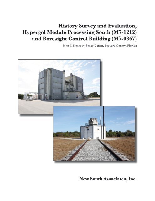
History <strong>Survey</strong> and Evaluation,Hypergol Module Processing <strong>South</strong> (M7-1212)and <strong>Boresight</strong> <strong>Control</strong> <strong>Building</strong> (M7-0867)John F. Kennedy Space Center, Brevard County, FloridaReport submitted to:InoMedic Health Applications, LLC • John F. Kennedy Space Center •Kennedy Space Center, Florida 32899Report prepared by:New <strong>South</strong> Associates • 6150 East Ponce de Leon Avenue • Stone Mountain, Georgia 30083Mary Beth Reed – Principal InvestigatorDavid Price – Historian and AuthorApril 6, 2012 • Final ReportNew <strong>South</strong> Associates Technical Report 2035
iiACKNOWLEDGEMENTSA number of individuals at KSC contributed time, knowledge, and other resources to helpcomplete this report. Barbara A. Naylor, KSC <strong>Historic</strong> Preservation Officer, coordinated thesurvey project and assisted with site tours and background information. Nancy S. English, KSCCultural Resources Management, also assisted with site tours and background information.Elaine Liston, Senior Librarian/Archivist at KSC Library Archives, conducted backgroundresearch and historical documentation for the report. Larry E. Taylor, Facility Manager, andStanley D. Johnson, Senior Systems Technician, provided tours of the surveyed resources andbackground information. Douglas A. Younger, KSC Environmental Protection Specialist,supplied background information on the history and use of the <strong>Boresight</strong> <strong>Control</strong> <strong>Building</strong>. SueTzareff, the RCRA Contamination Assessment Program Manager, Environmental Sampling,Analysis & Monitoring (ESAM) Section of the Environmental Services Branch, InoMedicHealth Applications (IHA), and Wayne Sarosi, former Facility Manager at the <strong>Boresight</strong> <strong>Control</strong><strong>Building</strong>, provided valuable information on the building’s use and renovations during his tenuresthere from 1996 through 1998, and again from 2003 through 2011.
HISTORY SURVEY AND EVALUATION, HYPERGOL MODULE PROCESSING SOUTH (M7-1212)AND BORESIGHT CONTROL BUILDING (M7-0867) JOHN F. KENNEDY SPACE CENTERiiiTABLE OF CONTENTSABSTRACT ..................................................................................................................................... i ACKNOWLEDGEMENTS ............................................................................................................ ii TABLE OF CONTENTS ............................................................................................................... iii LIST OF FIGURES ....................................................................................................................... iv I. INTRODUCTION ...................................................................................................................... 1 II. HISTORIC CONTEXT .............................................................................................................. 5 NASA AND THE SPACE SHUTTLE PROGRAM ................................................................... 5 III. BUILDING DESCRIPTIONS .................................................................................................. 7 SITE LOCATION ....................................................................................................................... 7 <strong>HMP</strong> <strong>South</strong> (M7-1212) ............................................................................................................ 7 <strong>Boresight</strong> <strong>Control</strong> <strong>Building</strong> (M7-0867) .................................................................................... 9 IV. NRHP EVALUATION ........................................................................................................... 11 <strong>HMP</strong> SOUTH (M7-1212) .......................................................................................................... 11 BORESIGHT CONTROL BUILDING (M7-0867) .................................................................. 13 IV. RESULTS AND RECOMMENDATIONS ........................................................................... 19 REFERENCES CITED ................................................................................................................. 21 APPENDIX A. SURVEY LOG SHEET APPENDIX B. FLORIDA MASTER SITE FILE (FMSF) FORMS
ivLIST OF FIGURESFigure 1. Location of <strong>Survey</strong>ed <strong>Building</strong>s, Kennedy Space Center, Industrial Area .................... 2 Figure 2. Hypergol Module Processing <strong>South</strong> (M7-1212) ............................................................ 8 Figure 3. <strong>Boresight</strong> <strong>Control</strong> <strong>Building</strong> (M7-0867) ........................................................................ 10 Figure 4. <strong>Historic</strong> Aerial Photograph Showing <strong>HMP</strong> <strong>South</strong> Under Construction, 1963 ............. 12 Figure 5. <strong>Historic</strong> Aerial Photograph Showing <strong>Boresight</strong> Towers, 1963 .................................... 14 Figure 6. <strong>Historic</strong> Aerial Photograph of the HMCA <strong>Historic</strong> District and Radar <strong>Boresight</strong>Range, 1969 .................................................................................................................. 15 Figure 7. HMCA <strong>Historic</strong> District Boundary Expansion ............................................................. 20
HISTORY SURVEY AND EVALUATION, HYPERGOL MODULE PROCESSING SOUTH (M7-1212)AND BORESIGHT CONTROL BUILDING (M7-0867) JOHN F. KENNEDY SPACE CENTER1I. INTRODUCTIONNew <strong>South</strong> Associates, Inc., under contract with InoMedic Health Applications, LLCconducted background research and a historic building survey of two buildings in the John F.Kennedy Space Center (KSC) Industrial Area, including the Hypergol Module Processing <strong>South</strong>(<strong>HMP</strong> <strong>South</strong>) (M7-1212) and the <strong>Boresight</strong> <strong>Control</strong> <strong>Building</strong> (M7-0867) (Figure 1). <strong>HMP</strong> <strong>South</strong>was originally built in 1964 to test, fuel, service, and checkout the Apollo spacecraft hypergolicpropulsion systems. The building’s interior was renovated in 1976 to test and process the SpaceShuttle’s forward Reaction <strong>Control</strong> System (RCS). The forward RCS was located in theshuttle’s nose area to provide thrust for pitch, yaw, and roll rotational maneuvers while in orbit,as well as small velocity changes (National Aeronautics and Space Administration [NASA]1988). The <strong>Boresight</strong> <strong>Control</strong> <strong>Building</strong> was built in 1963 as part of the Radar <strong>Boresight</strong> Range,which tested antenna systems used on the Gemini spacecraft and Agena target vehicle. It wasrenovated in the late 1980s to test antenna and radar systems used on the Space Shuttle.KSC is located on the northern portion of Merritt Island, between the Indian and BananaRivers in Brevard County, Florida. The historic survey evaluated whether <strong>HMP</strong> <strong>South</strong> and the<strong>Boresight</strong> <strong>Control</strong> <strong>Building</strong> are eligible as elements of the National Register of <strong>Historic</strong> Places(NRHP)-eligible Hypergol Maintenance and Checkout Area (HMCA) <strong>Historic</strong> District. Thebuildings were also evaluated for individual listing in the NRHP. The survey includedbackground research, field inspection, digital photography, interviews of current and formerKSC employees, and preparation of Florida Master Site File (FMSF) and <strong>Survey</strong> Log forms(Appendix A and B).NASA and Archaeological Consultants, Inc. of Sarasota, Florida, conducted the SpaceShuttle Program (SSP) <strong>Historic</strong> <strong>Survey</strong> in 2006-07, and documented the HMCA <strong>Historic</strong> Districtin 2007. A draft NRHP nomination was prepared for the district, although it has not beenofficially submitted. The proposed district contains two contributing resources, including theHypergol Module Processing North (<strong>HMP</strong> North) and the Hypergol Support <strong>Building</strong> (HSB).<strong>HMP</strong> North was also determined individually eligible for listing in the NRHP under Criterion Ain the area of Space Exploration as a one-of-a-kind facility that was critical to the successivelaunches of the SSP. The district also contains one non-contributing resource, the GroundService Equipment (GSE) Support <strong>Building</strong>. The district’s original boundaries were defined as arectangular area that begins at the southwest corner of Fifth Street S.E. and G Avenue S.E., and
2Figure 1.Location of <strong>Survey</strong>ed <strong>Building</strong>s, Kennedy Space Center, Industrial Area<strong>Boresight</strong> <strong>Control</strong><strong>Building</strong> (M7-0867),8BR2934Hypergol ModuleProcessing <strong>South</strong>(M7-1212), 8BR29330 750 1,500 3,000 Feet0 150 300 600 MetersSource: USGS Orisino, Florida Quadrangle, 1976
HISTORY SURVEY AND EVALUATION, HYPERGOL MODULE PROCESSING SOUTH (M7-1212)AND BORESIGHT CONTROL BUILDING (M7-0867) JOHN F. KENNEDY SPACE CENTER3extends approximately 300 feet to the west and 830 feet to the south (Figure 7). <strong>HMP</strong> North andthe HSB were built in 1964 to support NASA’s Apollo program and were later renovated in 1976to support the SSP (Deming and Slovinac 2007).<strong>HMP</strong> <strong>South</strong> (8BR2933) was built in 1964 at the same time as the other eligible buildingsin the HMCA district and features a similar architectural design, construction materials, andhistory of use for the space industry. However, it was not documented in the SSP <strong>Historic</strong><strong>Survey</strong> due to ongoing usage requirements at the time. The <strong>Boresight</strong> <strong>Control</strong> <strong>Building</strong>(8BR2934) has not been previously surveyed or evaluated for individual listing in the NRHP oras part of the HMCA <strong>Historic</strong> District.The remainder of this report is organized as follows. Chapter II provides an overviewhistory of NASA and the SSP. Chapter III presents building descriptions of the surveyedproperties. Chapter IV includes the historic background and NRHP eligibility evaluation of thesurveyed properties. Chapter V presents the survey results and recommendations. Following alist of References Cited, Appendix A contains the <strong>Survey</strong> Log Sheet and Appendix B containsthe Florida Master Site File forms for the surveyed properties.
HISTORY SURVEY AND EVALUATION, HYPERGOL MODULE PROCESSING SOUTH (M7-1212)AND BORESIGHT CONTROL BUILDING (M7-0867) JOHN F. KENNEDY SPACE CENTER5II. HISTORIC CONTEXTNASA AND THE SPACE SHUTTLE PROGRAMNASA was created in 1958 in response to the Soviet launch of the Sputnik satellite a yearearlier. NASA’s first series of missions were to send man into space, followed by manned orbitsaround the Earth, mastery of rendezvous and docking procedures, and finally, landing man onthe moon. These goals defined the three main programs of the late 1950s and 1960s: Mercury,Gemini, and Apollo. This effort culminated in the first moon landing, which occurred on July20, 1969. Moon landings continued until 1972 when the Apollo program ended. Programs afterApollo included the Skylab space station that orbited Earth from 1973 to 1979, and the Apollo-Soyuz Test Project, the first space mission undertaken as a joint effort between the United Statesand the Soviet Union in 1975. By the mid-1970s, it was clear that NASA’s next major programwould be based on a reusable space shuttle, designed to serve orbiting space stations and relatedmissions (Deming and Slovinac 2008:2.1; NASA 2010; NASA 2009).President Nixon established the Space Task Group in 1969 to determine the future courseof the U.S. Space Program. This led to the creation of the SSP, which was announced in aspeech by President Richard Nixon in 1972. In the speech, Nixon outlined the future of the SSPbased on the idea that a series of reusable space flight vehicles would provide “routine access tospace” (Deming and Slovinac 2008:2.1). Following this announcement, new SSP contracts wereawarded, new space vehicles were designed, old Apollo-era facilities were retro-fitted, and newfacilities were built. After a decade of preparation, the first shuttle flight occurred in 1981. Afteralmost three decades of operations, the SSP was retired in 2011.During those twenty-nine years of operation, there were over 130 different flights, usinga total of five space shuttles: Columbia, Challenger, Discovery, Atlantis, and Endeavour (theprototype, Enterprise, never went into space). The SSP achieved a number of significant goals.In addition to supporting diverse space facilities such as Spacelab, the Hubble Space Telescope,the Mir Space Station, and the International Space Station (ISS), the shuttles contributed to manyother space programs. Among these were various satellite systems (from the COMSAT,Communication Satellite to the Advanced Communications Technology Satellite, or ACTS), andthe unmanned probes that were sent to Jupiter (Galileo), Venus (Magellan), and the Sun(Ulysses). Additionally, the shuttle has deployed a number of Department of Defense (DoD)payloads that remain classified (Deming and Slovinac 2008:2.22-24).
6Two significant accidents have been associated with the SSP. The Challenger (1/28/86)and Columbia (2/1/03) disasters resulted in the loss of all crew members on board (Deming andSlovinac 2008:2.15). Both incidents caused lengthy flight down time for the program, whileexhaustive investigations led to extensive physical and procedural improvements.Most of the Space Transportation System (STS) was in place by the time of the firstshuttle launch. The basic STS components have not changed since reusable space shuttles werefirst designed in the 1970s; however, as with any endeavor that occurs over almost a thirty-yearperiod, changes were made to the STS, its support structures, and its operational proceduresbased on mission shifts, the two accidents, and improvements in technology.The final design for the Space Shuttle was chosen from twenty-nine different possibilitiesin 1972. After years of testing and preparation, the first shuttle vehicle, Columbia, arrived atKennedy Space Center in 1979. Most of the work required to prepare the vehicle for launch wasdone in the Orbiter Processing Facility (OPF). After a series of test flights each with a crew oftwo (STS-2 through STS-4), the first operational flight, STS-5, occurred the following year,November 11, 1982 (Deming and Slovinac 2008:2.13-15).These launches were conducted from Launch Complex 39, Pad A, on KSC. By the mid-1980s, Launch Complex 39, Pad B, was also available for launch services. Since the beginning,there were on average around five shuttle launches per year, with no launches for many monthsfollowing each of the two major accidents (Deming and Slovinac 2008:6.4).The end of the SSP came in July of 2011, when the crew of Atlantis landed at KSC tocomplete the program’s 135 th mission (STS-135). Since the SSP’s first launch 1981, theprogram launched 355 astronauts from 16 countries. The five shuttles traveled more than 542million miles and conducted over 2,000 experiments in the fields of Earth, astronomy, biological,and materials sciences. The shuttles docked with two space stations, including the Russian Mirand the International Space Station, and deployed 180 payloads such as satellites and spacecraft.With the return of the final mission, NASA Administrator Charles Bolden said, “the braveastronauts of STS-135 are emblematic of the shuttle program – skilled professionals from diversebackgrounds who propelled America to continued leadership in space with the shuttle’s manysuccesses” (Curie, Herring, and Thomas 2011).
HISTORY SURVEY AND EVALUATION, HYPERGOL MODULE PROCESSING SOUTH (M7-1212)AND BORESIGHT CONTROL BUILDING (M7-0867) JOHN F. KENNEDY SPACE CENTER7III. BUILDING DESCRIPTIONSSITE LOCATIONThe survey area on the southeast corner of the KSC Industrial Area is generally referredto by two names, including the Hypergol Maintenance Facility (HMF) and the Fluid Test Area.The area is located between Fifth and Sixth Street S.E., along G Avenue S.E., and also includesthe former Radar <strong>Boresight</strong> Range along Fifth Street S.E. (Figure 1). Prior to 1964, the surveyarea was undeveloped.<strong>HMP</strong> SOUTH (M7-1212)<strong>HMP</strong> <strong>South</strong> (8BR2933) is a concrete block building with a reinforced concretefoundation. The building has an irregular footprint that contains 7,100 square feet of floor area.It has two high-bay test cells, one on the east side and one on the west side, which measureapproximately 40x40x60 feet. Each cell features two vertical-lift exterior doors that measure22x40 feet and are equipped with inflatable seals for excluding contaminants. Each test cell hasa 10-ton overhead bridge crane with a hook height of 45 feet. Both cells have a large capacityexhaust system and a floor system that collects and dilutes hypergolic spills. Between the testcells is a two-story central area that contains a control room, equipment room, and storage area(NASA 1967:10-55) (Figure 2).On the south side of <strong>HMP</strong> <strong>South</strong>’s exterior are chilled water storage tanks and basins,compressed air tanks, gaseous nitrogen/helium tanks, washdown systems, and a contaminatedeffluent tank to control and contain inadvertent spilling of toxic and combustible propellants.The interiors of <strong>HMP</strong> <strong>South</strong>’s test cells contain hypergolic fuel and oxidizer servicingareas that are capable of testing and servicing the Space Shuttle’s forward RCS. The east testcell contains three levels of work platforms arranged in a U-shape around the outer walls. Thiscell was used primarily as a staging area or auxiliary test space, with the west test cell reservedas the primary area for forward OMS module processing. The west test cell contains a two-levelwork area. The ground level has an OMS module staging area and all of the hypergolic fuel andoxidizer pumps, lines, and gauges. Above this ground level is a steel-frame upper level workplatform. The overhead bridge crane lifted the OMS module up onto this platform where it wasmaneuvered into different positions depending on the work performed.
8Figure 2.Hypergol Module Processing <strong>South</strong> (M7-1212)A. Exterior Oblique, View <strong>South</strong>westB. Interior Test Cell with Forward RCS Module, View Northwest
HISTORY SURVEY AND EVALUATION, HYPERGOL MODULE PROCESSING SOUTH (M7-1212)AND BORESIGHT CONTROL BUILDING (M7-0867) JOHN F. KENNEDY SPACE CENTER9The two-story central portion of <strong>HMP</strong> <strong>South</strong> contains a variety of rooms that support thetest cell work areas, including a Thermal <strong>Control</strong> System (TCS) room, control room, HardwareInterface Module (HIM) room, equipment testing rooms, and central corridor. Interior spaces aretypically finished with suspended acoustic tile ceilings, drywall walls, and tile floors.BORESIGHT CONTROL BUILDING (M7-0867)The <strong>Boresight</strong> <strong>Control</strong> <strong>Building</strong> (8BR2934) is located just northeast of the HMCA<strong>Historic</strong> District boundaries. The building is set at the east end of the former Radar <strong>Boresight</strong>Range, a cleared area surrounded by low trees and brushy wetlands. It is set at an angle so thatthe building’s western corner faces the range.It is a two-story building with a concrete block structure and reinforced concretefoundation. The block-shaped building measures 20x20x20 feet. There is a mechanical room onthe first floor, a control room on the second floor, and a pedestal on the roof for mounting a testantenna. There is also a crane on the roof for lifting equipment from the ground surface (NASA1974:10-67). There are two fixed single-light windows on the building’s second story that facewest toward the antenna range. Extending west is a railroad track, approximately 400 feet long,equipped with a movable radar test tower. This track and tower were installed circa 1986 whenthe building was refurbished for the Space Shuttle Program. Adjacent to the southwest elevationis a telephone pole (Figure 3).The building is accessed via double pedestrian doors on the northeast elevation at theground and/or second level. There is a single pedestrian door on the ground level of thesoutheast elevation. The northeast elevation also has a two-story steel staircase that leads to thesecond floor entrance and to the roof. The staircase is shielded on its north side by anapproximately 5x20-foot wing wall. The perimeter of the roof is lined by a metal safety railing.The west end of the test antenna on the roof is shielded by blocks of radar absorbent foampadding in deteriorated condition. Similar absorbent foam padding is stacked in a column on thenorthwest elevation (Figure 3).The most recent renovation of the building occurred in 2006. Repairs were made to theroof and the exterior and control room walls were also painted. Other repairs completed wereinstallation of new windows, a new roof crane, new radar absorbent padding, and new computerand equipment systems (Sarosi 2012).
10Figure 3.<strong>Boresight</strong> <strong>Control</strong> <strong>Building</strong>Telephone PoleRadar AbsorbentFoam PaddingA. West Corner of <strong>Building</strong> Facing <strong>Boresight</strong> Range, Oblique View EastB. Rear (Northeast) Elevation of the <strong>Boresight</strong> <strong>Control</strong> <strong>Building</strong> and Movable Radar Tower, View <strong>South</strong>west
HISTORY SURVEY AND EVALUATION, HYPERGOL MODULE PROCESSING SOUTH (M7-1212)AND BORESIGHT CONTROL BUILDING (M7-0867) JOHN F. KENNEDY SPACE CENTER11IV. NRHP EVALUATION<strong>HMP</strong> SOUTH (M7-1212)<strong>HMP</strong> <strong>South</strong> was built in 1964 as part of the same effort that produced the HMCA<strong>Historic</strong> District, originally known as the “Fluid Test Area.” First known as the “HypergolicTest <strong>Building</strong>,” <strong>HMP</strong> <strong>South</strong> provided space for testing, fueling, servicing, and checkout of theApollo spacecraft hypergolic propulsion systems (Figure 4). The building was designed by theTampa Bay Engineering Company (NASA 1965:3-19). In 1976, the interior was remodeled byPan American Technical Services, Inc., of Cocoa Beach, Florida, to test and service the shuttle’sforward RCS (Deming and Slovinac 2007:8-1; NASA 1984:2-11). The forward RCS worked intandem with the shuttle’s aft RCS and Orbital Maneuvering System (OMS) pods located oneither side of the tail fin, or vertical stabilizer. The aft RCS/OMS pods were processed in <strong>HMP</strong>North, which was <strong>HMP</strong> <strong>South</strong>’s companion facility in the HMCA <strong>Historic</strong> District.At <strong>HMP</strong> <strong>South</strong>, the shuttle’s RCS system module was inspected and connected toelectrical cables and propellant lines. Residual propellants were drained and the system wasflushed and dried. The line replaceable units were then repaired and replaced, followed by anelectrical and pneumatic checkout process. Once the systems were revalidated, the RCS modulewas moved out of the building for installation on the shuttle. The building also conductedelectrical, tile, and thermal control system repairs on the forward RCS. Due to the hazardousnature of the hypergolic fuels, employees were required to wear full-body self-containedatmospheric protective ensemble suits and vapor concentration monitors during certain tests(Deming and Slovinac 2007:8-1).<strong>HMP</strong> <strong>South</strong> (8BR2933) is recommended eligible for inclusion in the NRHP-eligibleHMCA <strong>Historic</strong> District in the context of the U.S. Space Shuttle Program (1969-2011) underNRHP Criterion A in the area of Space Exploration. Since it has achieved significance withinthe past 50 years, Criteria Consideration G applies. <strong>HMP</strong> <strong>South</strong> is also recommended eligiblefor individual listing in the NRHP as a one-of-a-kind facility used to test and process the SpaceShuttle’s forward RCS system, a key component of the shuttle vehicle system. <strong>HMP</strong> <strong>South</strong>retains all seven aspects of its physical integrity, including its location, design, setting, materials,workmanship, feeling, and association.
12Figure 4.<strong>Historic</strong> Aerial Photograph Showing <strong>HMP</strong> <strong>South</strong> Under Construction, 1963Source: J-BOSC Environmental Health and Services 2004
HISTORY SURVEY AND EVALUATION, HYPERGOL MODULE PROCESSING SOUTH (M7-1212)AND BORESIGHT CONTROL BUILDING (M7-0867) JOHN F. KENNEDY SPACE CENTER13BORESIGHT CONTROL BUILDING (M7-0867)The <strong>Boresight</strong> <strong>Control</strong> <strong>Building</strong> was built on March 3, 1963, as part of a larger areacalled the Radar <strong>Boresight</strong> Range that tested the radiating capabilities and characteristics ofantenna systems used on the Gemini spacecraft and Agena target vehicle. In addition tothe<strong>Boresight</strong> <strong>Control</strong> <strong>Building</strong>, the Radar <strong>Boresight</strong> Range originally included the wooden<strong>Boresight</strong> Tower on its west end that measured 64x24x50 feet (Figure 5). Informally known asthe “timber tower,” it provided a platform for testing radar equipment from the control room inthe <strong>Boresight</strong> <strong>Control</strong> <strong>Building</strong>. The tower was demolished in the 1980s due to its deteriorationinto a safety hazard. Between the <strong>Boresight</strong> <strong>Control</strong> <strong>Building</strong> and tower is the former1,000x200-foot graded area that provided a controlled reflective surface for radar boresighttesting (J-BOSC Environmental Health and Services 2004).The Radar <strong>Boresight</strong> Range was initially constructed to support the Gemini (1962-1966)program. It was also used by the Apollo (1968-1972) program and was then modified to supportthe Spaceflight Tracking and Data Network Station (STDNS). The range and its equipment weredesigned and furnished by Scientific-Atlanta, Inc., a company that represented the state-of-theartground-level antenna testing at that time. According to a 1963 NASA procurementmemorandum, there were only two other existing ground level antenna ranges of this type thatoffered the required levels of sensitivity, accuracy, dynamic range, and operational integrity.The memorandum does not state where these two other antenna ranges were located (Eiband1963) (Figure 6).Following the Apollo program in the early 1970s, the Radar <strong>Boresight</strong> Range was stillused to test radar systems, antennas, transponders, and other instrumentation, although its futurewas uncertain (NASA 1974). With the advent of the SSP, the original function of the range wasmade obsolete by newer radar and antenna technology used on the shuttle. In the early 1980s,the building was vacated. The building was listed in the KSC technical facilities catalogs in1967 and 1974, but it was not listed in the 1984 catalog (NASA 1984).According to Doug Younger, KSC Environmental Protection Specialist, the <strong>Boresight</strong><strong>Control</strong> <strong>Building</strong> fell into disrepair in the mid-1980s and its site was used as a dump for old GSEhardware. Sometime after the Challenger disaster in 1986, the building was renovated for SpaceShuttle radar and antenna testing, (i.e. new foam insulation pads, upgraded electrical, plumbing,and roof systems). It was also at this time that the railroad track and movable tower were builton the former range area to the west of the building (Younger 2012).
14Figure 5.<strong>Historic</strong> Aerial Photograph Showing <strong>Boresight</strong> Tower, 1963Source: J-BOSC Environmental Health and Services 2004
HISTORY SURVEY AND EVALUATION, HYPERGOL MODULE PROCESSING SOUTH (M7-1212)AND BORESIGHT CONTROL BUILDING (M7-0867) JOHN F. KENNEDY SPACE CENTER15Figure 6.<strong>Historic</strong> Aerial Photograph of the HMCA <strong>Historic</strong> Districtand Radar <strong>Boresight</strong> Range, 1969Source: J-BOSC Environmental Health and Services 2004
16The building continued to test shuttle antennas into the 1990s. By 1996, the building wasused to test prototype antennas for the shuttle and was referred to by employees as the Far FieldAntenna Testing Range, or just the Far Field Range. One antenna was installed in the cabinairlock and another in the cargo bay for Extravehicular Activity (EVA). This testing was done tosolve problems with Ultra High Frequency (UHF) voice transmission between the shuttle andastronauts. In addition to shuttle antenna work, the building hosted similar research anddevelopment testing for outside commercial vendors (Sarosi 2012).The <strong>Boresight</strong> <strong>Control</strong> <strong>Building</strong> was again vacated in 1998 and fell back into disrepair.In 2003, the building was partially renovated and reopened by United Space Alliance (USA) totest low frequency, UHF, and S-Band antennas associated with the SSP. At this time, workingconditions in the building were difficult because years of neglect and a lack of air conditioninghad caused a serious mold and animal infestation problem. Over the next few years, the buildingwas cleaned and renovated by Wayne Sarosi, Facility Manager, and staff, including installationof new radar absorbent padding (2004), windows and a crane on the roof (2005), an airconditioner, exterior and interior paint, and new computer systems (2006). The <strong>Boresight</strong><strong>Control</strong> <strong>Building</strong> was used for radar and antenna testing until 2011, when United Space Alliance(USA) transferred management of the building to NASA. NASA planned to use it for a fuelexperiment, but it never occurred. The building was vacated for the final time and has remainedunoccupied (Sarosi 2012; J-BOSC 2004).The <strong>Boresight</strong> <strong>Control</strong> <strong>Building</strong> was part of at least two different facilities of its type thatNASA operated for the SSP. The other was the Radar <strong>Boresight</strong> Range Facility located atJohnson Space Center (JSC) in Houston, Texas. The JSC <strong>Boresight</strong> Range was originallycompleted to test Apollo rendezvous and lunar lander radar. It was later upgraded to supportshuttle systems, including Rendezvous Radar, Microwave Scanning Beam Landing System, andTactical Air Navigation System (National Technical Information Service n.d.:170).The <strong>Boresight</strong> <strong>Control</strong> <strong>Building</strong> is recommended not eligible to be individually listed inthe NRHP, or as a contributing resource in the HMCA <strong>Historic</strong> District. The building wasevaluated under NRHP Criteria A, B, and C in the context of the U.S. Space Shuttle Program(1969-2011) in the area of Space Exploration. It was also evaluated under its earlier historiccontext of the Gemini/Apollo programs of the 1960s.The building was constructed in 1963 as part of the larger Radar <strong>Boresight</strong> Range, whichwas located northeast of the HMCA <strong>Historic</strong> District although not involved in the district’s workwith hypergolic fuels testing. Since this range was a distinct entity with a separate history of use,the remaining <strong>Boresight</strong> <strong>Control</strong> <strong>Building</strong> does not meet Criterion A for listing as a contributingresource in the HMCA <strong>Historic</strong> District.
HISTORY SURVEY AND EVALUATION, HYPERGOL MODULE PROCESSING SOUTH (M7-1212)AND BORESIGHT CONTROL BUILDING (M7-0867) JOHN F. KENNEDY SPACE CENTER17In the context of its early 1960s history as part of the Radar <strong>Boresight</strong> Range and theGemini/Apollo programs, the <strong>Boresight</strong> <strong>Control</strong> <strong>Building</strong>’s physical integrity of setting, feeling,and association were compromised by the demolition of the “timber tower” and the alteration ofthe original graded reflective range. If the two original resources were intact then the entirerange may have been eligible as a separate historic district. By itself, the <strong>Boresight</strong> <strong>Control</strong><strong>Building</strong> does not communicate the larger historic significance of the Radar <strong>Boresight</strong> Range.In the context of the SSP, the <strong>Boresight</strong> <strong>Control</strong> <strong>Building</strong> played a supportive role intesting a variety of antennas and radar equipment used on the shuttle; however, it did not processany critical components of the shuttle itself. By the 1980s, it was one of at least two boresightcontrol buildings used by NASA for the SSP, with the other located at JSC in Houston, Texas.The facility at KSC has no particular significance in the history of radar or antenna testing;therefore, the <strong>Boresight</strong> <strong>Control</strong> <strong>Building</strong> is not recommended eligible for listing in the NRHPunder Criterion A.Background research did not indicate any associations with a historically significantperson or people, so the <strong>Boresight</strong> <strong>Control</strong> <strong>Building</strong> is not recommended eligible for listing in theNRHP under Criterion B.The <strong>Boresight</strong> <strong>Control</strong> <strong>Building</strong> is a utilitarian industrial-type building that does notembody the distinctive characteristics of a type, period, or method of construction. It does notrepresent the work of a master architect. It does not possess high artistic value. Lastly, it doesnot represent a significant and distinguishable entity whose components lack individualdistinction. Therefore, the <strong>Boresight</strong> <strong>Control</strong> <strong>Building</strong> is recommended not eligible for listing inthe NRHP under Criterion C.
HISTORY SURVEY AND EVALUATION, HYPERGOL MODULE PROCESSING SOUTH (M7-1212)AND BORESIGHT CONTROL BUILDING (M7-0867) JOHN F. KENNEDY SPACE CENTER19IV. RESULTS AND RECOMMENDATIONSNew <strong>South</strong> Associates conducted background research, a historic building survey, andNRHP evaluation of <strong>HMP</strong> <strong>South</strong> (8BR2933) and the <strong>Boresight</strong> <strong>Control</strong> <strong>Building</strong> (8BR2934) atKSC. <strong>HMP</strong> <strong>South</strong> was built in 1964 as part of the Fluid Test Area to test hypergolic fuels andwas later used to process the Space Shuttle’s forward RCS modules. It was built at the same timeand shares a similar history as <strong>HMP</strong> North, its companion building in the Fluid Test Area, whichwas previously determined eligible to the NRHP as both a contributing resource in the HMCA<strong>Historic</strong> District and as an individually eligible property. <strong>HMP</strong> <strong>South</strong> is therefore recommendedeligible as a contributing resource to the proposed NRHP-eligible HMCA <strong>Historic</strong> District underCriterion A in the area of Space Exploration. It is also recommended eligible for individuallisting in the NRHP as a one-of-a-kind facility that was critical to the successive launches of theSSP.<strong>HMP</strong> <strong>South</strong> is located across a wooded area directly south of the existing HMCA <strong>Historic</strong>District. It is recommended that the property be included in district’s boundary; therefore, theboundary must be extended to the south approximately 750 feet. The boundaries do not need tobe expanded in any other direction. This boundary expansion will add approximately 4.5 acresto the historic district (Figure 7).With <strong>HMP</strong> <strong>South</strong> recommended eligible to the NRHP, it should be included in theplanned HAER Level II documentation of the HMCA <strong>Historic</strong> District. Level II documentationrequires the production of 4x5-inch archivally processed photographic views of the buildings inthe district, as well as 8x10-inch photographic views of the building’s as-built constructiondrawings.The <strong>Boresight</strong> <strong>Control</strong> <strong>Building</strong>, built in 1963 to test radar and antennas used in theGemini program, and later renovated to test Space Shuttle antennas, is recommended not eligiblefor listing in the NRHP as an individual property or as contributing to a historic district.Therefore no further work is recommended under Section 106 for this resource.
Figure 7.HMCA <strong>Historic</strong> District Boundary ExpansionSource: NASA
HISTORY SURVEY AND EVALUATION, HYPERGOL MODULE PROCESSING SOUTH (M7-1212)AND BORESIGHT CONTROL BUILDING (M7-0867) JOHN F. KENNEDY SPACE CENTER21REFERENCES CITEDCurie, Michael, Kyle Herring, and Candrea Thomas2011 “NASA’s Proud Space Shuttle Program Ends With Atlantis Landing,” NASApress release. Available at: http://www.nasa.gov/home/hqnews/2011/jul/HQ_11-240_Atlantis_Lands.html. Accessed on March 8, 2012.Eiband, A. Martin1963 “Memorandum for Contracting Officer, MSC-AMR Operations. Subject:Procurement of Radar <strong>Boresight</strong> Range (Instrumentation).” Doug BlackCollection, 14B.2. Folder 12. Kennedy Space Center Archives.J-BOSC Environmental Health and Services2004 “Hypergol Maintenance Facility – North Area (HMF North) (M7-961), KennedySpace Center, Florida, SWMU Assessment Report.” PRL #118 (Revision 0)[KSC-TA-7110]. Prepared for Environmental Program Office, NationalAeronautics and Space Administration, John F. Kennedy Space Center, Florida.National Aeronautics and Space Administration (NASA)1965 “Apollo/Saturn V, MILA Facilities Descriptions.” K-V-011. On file at theKennedy Space Center Archives Department.1967 “Technical Facilities Catalog, Volume II.” On file at the Kennedy Space CenterArchives Department.1974 “Technical Facilities Catalog, Volume II.” On file at the Kennedy Space CenterArchives Department.1984 “Space Transportation System: Facilities and Operations, Kennedy Space Center,FL.” On file at the Kennedy Space Center Archives Department.1988 “Reaction <strong>Control</strong> System,” NSTS Shuttle Reference Manual. Available at:http://science.ksc.nasa.gov/shuttle/technology/sts-newsref/sts-rcs.html. AccessedMarch 8, 2012.
222009 “Skylab.” Available at: http://www.nasa.gov/mission_pages/skylab/. AccessedMarch 30, 2012.2010 “Apollo-Soyuz Test Project.” Available at: http://history.nasa.gov/astp/.Accessed March 30, 2012.National Technical Information Servicen.d. Federal Laboratory & Technology Resources, 5th Edition: A Guide to Services,Facilities, and Expertise. Available at:http://books.google.com/books?id=zZtG9flU40gC&pg=PA170&dq=space+shuttle+radar+boresight+control+building&hl=en&sa=X&ei=NJ4yT9ysDI6utweYwdHgBg&ved=0CD8Q6AEwAA - v=onepage&q&f=false. Accessed February 8,2012.Sarosi, Wayne2012 Former <strong>Boresight</strong> <strong>Control</strong> <strong>Building</strong> Facility Manager. Interview with author,February 8, 2012.Slovinac, Trish and Joan Deming2007 “Hypergolic Maintenance and Checkout Area <strong>Historic</strong> District.” Draft NationalRegister of <strong>Historic</strong> Places Nomination. On file at the Kennedy Space Center<strong>Historic</strong> Preservation Office.2008 NASA-Wide <strong>Survey</strong> and Evaluation of <strong>Historic</strong> Facilities in the Context of theU.S. Space Shuttle Program: Roll-Up Report. Submitted to the NationalAeronautics and Space Administration, Environmental Management Branch.Sarasota, Florida: Archaeological Consultants, Inc. February 2008, revised July2008.Younger, Doug2012 Environmental Protection Specialist, Kennedy Space Center, EnvironmentalAssurance Branch. Interview with author, February 1, 2012.
APPENDIX A. SURVEY LOG SHEET
History <strong>Survey</strong> and Evaluation, Hypergol Module Processing <strong>South</strong> History <strong>Survey</strong> and Evaluation, Hypergol Processing <strong>South</strong> (M7-1212) and<strong>Boresight</strong> <strong>Control</strong> <strong>Building</strong> (M7-0867), John F. Kennedy Space Center, Brevard County, Florida . David L. Price. . . 2012 20 . . . Mary Beth Reed New <strong>South</strong> Associates Stone Mountain, GA . Hypergol Module Processing. <strong>Boresight</strong> <strong>Control</strong> <strong>Building</strong>. .. Kennedy Space Center . . . . InoMedic Health Applications LLC. . 6141 N. Courtenay Pkwy., Suite A, Merritt Island, FL 32953, David L. Price 3-13-2012 . Brevard. . . . . . ORSINO 1976 . . . . . 1-30-2012 2-3-2012 10 1 ...
. New <strong>South</strong> Assoc. conducted background research and a historic building surveyof the Hypergol Module Processing <strong>South</strong> and <strong>Boresight</strong> <strong>Control</strong> <strong>Building</strong> at Kennedy Space Center todetermine their eligibility in the National Register of <strong>Historic</strong> Places. . . . . . 0 2 . . . . BR-2933 (HypergolModule Processing <strong>South</strong>) and BR-2934 (<strong>Boresight</strong> <strong>Control</strong> <strong>Building</strong>) . ...
<strong>Boresight</strong> <strong>Control</strong><strong>Building</strong> (M7-0867),8BR2934Hypergol ModuleProcessing <strong>South</strong>(M7-1212), 8BR29330 750 1,500 3,000 Feet0 150 300 600 MetersSource: USGS Orisino, Florida Quadrangle, 1976
APPENDIX B. FLORIDA MASTER SITEFILES (FMSF) SITE FORMS
Page 1 Original UpdateHISTORICAL STRUCTURE FORMFLORIDA MASTER SITE FILEVersion 4.0 1/07Shaded Fields represent the minimum acceptable level of documentation.Consult the Guide to <strong>Historic</strong>al Structure Forms for detailed instructions.Site #8 ___________________Field Date ________________Form Date ________________Recorder # _______________Site Name(s) (address if none) ____________________________________________________________ Hypergol Module Processing (<strong>HMP</strong>) <strong>South</strong>Multiple Listing (DHR only) _________<strong>Survey</strong> Project Name _________________________________________________________________ KSC <strong>Survey</strong>: <strong>HMP</strong> <strong>South</strong> and <strong>Boresight</strong> <strong>Control</strong> Bldg<strong>Survey</strong> # (DHR only) ______________National Register Category (please check one) building structure district site objectOwnership: private-profit private-nonprofit private-individual private-nonspecific city county state federal Native American foreign unknownLOCATION & MAPPINGStreet Number Direction Street Name Street Type Suffix DirectionAddress:Avenue G_Cross Streets (nearest / between) __________________________________________________________________________________________7th StreetUSGS 7.5 Map Name _____________________________________ ORSINOUSGS Date ______ Plat or Other Map ___________________________City / Town (within 3 miles) ________________________________ Kennedy Space Center In City Limits? yes no unknown County _____________________________BrevardTownship _______ 23S Range _______ 37E Section _______ 4 ¼ section: NW SW SE NE Irregular-name: _____________________Tax Parcel # ___________________________________________________ Landgrant __________________________________________Subdivision Name _________________________________________________ Block ___________________ Lot _____________________UTM Coordinates: Zone 16 17 Easting 535144 Northing 3 1 5 3 9 8 2Other Coordinates: X: _________________ Y: _________________ Coordinate System & Datum __________________________________Name of Public Tract (e.g., park) ________________________________________________________________________________________John F. Kennedy Space CenterHISTORYConstruction Year: _________ 1964 approximately year listed or earlier year listed or laterOriginal Use ___________________________________________From (year):____________ To (year):____________Current Use __________________________________________ From (year):____________ To (year):____________Other Use __________________________________________ Hypergolic fuels testing/Space Shuttle From (year):____________ 1964 To (year):____________ 2012Moves: yes no unknown Date: ____________ Original address ___________________________________________________Alterations: yes no unknown Date: ____________ 1-1-1976 Nature _________________________________________________________Interior renovation for shuttle programAdditions: yes no unknown Date: ____________ Nature _________________________________________________________Architect (last name first): _______________________________________ Tampa Bay Engineering Company Builder (last name first): ______________________________________Ownership History (especially original owner, dates, profession, etc.) ___________________________________________________________________National Aeronautics and Space Administration (NASA)__________________________________________________________________________________________________________________Is the Resource Affected by a Local Preservation Ordinance? yes no unknown Describe ___________________________________DESCRIPTIONStyle __________________________________________ Industrial Vernacular Exterior Plan ________________________________ Irregular Number of Stories _______ 2Exterior Fabric(s) 1. _______________________________ Concrete block2. ______________________________ Steel3. _______________________________Roof Type(s) 1. _______________________________ Flat2. ______________________________ 3. _______________________________Roof Material(s) 1. _______________________________ Built-up2. ______________________________ 3. _______________________________Roof secondary strucs. (dormers etc.) 1. ______________________________________ 2. _______________________________________Windows (types, materials, etc.) ____________________________________________________________________________________________None__________________________________________________________________________________________________________________Distinguishing Architectural Features (exterior or interior ornaments) _________________________________________________________________Exterior dominated by 22'x40' steel vertical lift doors.____________________________________________________________________________________________________________________________________________________________________________________________________________________________________Ancillary Features / Outbuildings (record outbuildings, major landscape features; use continuation sheet if needed.) ____________________________________Exterior chilled water storage__________________________________________________________________________________________________________________tanks and basins, compressed air tanks, gaseous nitrogen/helium tanks, and washdown systems.__________________________________________________________________________________________________________________DHR USE ONLY OFFICIAL EVALUATION DHR USE ONLYNR List Date SHPO – Appears to meet criteria for NR listing: yes no insufficient info Date _______________ Init._______________________ KEEPER – Determined eligible: yes no Date _______________ Owner Objection NR Criteria for Evaluation: a b c d (see National Register Bulletin 15, p. 2)HR6E046R0107 Florida Master Site File / Division of <strong>Historic</strong>al Resources / R. A. Gray <strong>Building</strong> / 500 <strong>South</strong> Bronough Street, Tallahassee, FL 32399-0250Phone (850) 245-6440 / Fax (850)245-6439 / E-mail SiteFile@dos.state.fl.us
Page 2 HISTORICAL STRUCTURE FORM Site #8 ______________DESCRIPTION (continued)Chimney: No.____ 0 Chimney Material(s): 1. ___________________________ 2. ____________________________Structural System(s): 1. ____________________________ Concrete block2. ____________________________ 3. ____________________________Foundation Type(s): 1. ____________________________ Slab2. ____________________________Foundation Material(s): 1. ____________________________ Concrete, Generic 2. ____________________________Main Entrance (stylistic details) ____________________________________________________________________________________________The main entrance is on the north side of the building and consists of a pair of__________________________________________________________________________________________________________________metal pedestrian doors.Porch Descriptions (types, locations, roof types, etc.) _____________________________________________________________________________None____________________________________________________________________________________________________________________________________________________________________________________________________________________________________Condition (overall resource condition): excellent good fair deteriorated ruinousNarrative Description of Resource _______________________________________________________________________________________See continuation sheet.____________________________________________________________________________________________________________________________________________________________________________________________________________________________________Archaeological Remains __________________________________________________________________ Check if Archaeological Form CompletedRESEARCH METHODS (check all that apply) FMSF record search (sites/surveys) library research building permits Sanborn maps FL State Archives/photo collection city directory occupant/owner interview plat maps property appraiser / tax records newspaper files neighbor interview Public Lands <strong>Survey</strong> (DEP) cultural resource survey (CRAS) historic photos interior inspection HABS/HAER record search other methods (describe) _____________________________________________________________________________________________Bibliographic References (give FMSF manuscript # if relevant, use continuation sheet if needed) ________________________________________________<strong>Survey</strong> and Evaluation of NASA-owned <strong>Historic</strong>Facilities __________________________________________________________________________________________________________________and Properties, John F. Kennedy Space Center, Brevard County, Florida.__________________________________________________________________________________________________________________OPINION OF RESOURCE SIGNIFICANCEAppears to meet the criteria for National Register listing individually? yes no insufficient informationAppears to meet the criteria for National Register listing as part of a district? yes no insufficient informationExplanation of Evaluation (required, whether significant or not; use separate sheet if needed) __________________________________________________<strong>HMP</strong> <strong>South</strong> is recommended eligible forinclusion __________________________________________________________________________________________________________________in the NRHP-eligible Hypergolic Maintenance and Checkout Area <strong>Historic</strong> District in the context ofthe __________________________________________________________________________________________________________________U.S. Space Shuttle Program (1969-2010) under NRHP Criterion A in the area of Space Exploration.Area(s) of <strong>Historic</strong>al Significance (see National Register Bulletin 15, p. 8 for categories: e.g. “architecture”, “ethnic heritage”, “community planning & development”, etc.)1. ___________________________________ Other3. ___________________________________ 5. ___________________________________2. ___________________________________ 4. ___________________________________ 6. ___________________________________DOCUMENTATIONAccessible Documentation Not Filed with the Site File - including field notes, analysis notes, photos, plans and other important documentsDocument type __________________________________________ Maintaining organization _________________________________________1)Document description _______________________________________ File or accession #’s ___________________________________________Document type __________________________________________ Maintaining organization _________________________________________2)Document description _______________________________________ File or accession #’s ___________________________________________RECORDER INFORMATIONRecorder Name _____________________________________________ David L. PriceAffiliation ______________________________________________New <strong>South</strong> AssociatesRecorder Contact Information __________________________________________________________________________________________6150 E. Ponce de Leon Ave., Stone Mountain, GA 30083(address / phone / fax / e-mail)RequiredAttachments USGS 7.5’ MAP WITH STRUCTURE LOCATION PINPOINTED IN RED LARGE SCALE STREET, PLAT OR PARCEL MAP (available from most property appraiser web sites) PHOTO OF MAIN FACADE, ARCHIVAL B&W PRINT OR DIGITAL IMAGE FILEIf submitting an image file, it must be included on disk or CD AND in hard copy format (plain paper is acceptable).Digital image must be at least 1600 x 1200 pixels, 24-bit color, jpeg or tiff.
Page 2a HISTORICAL STRUCTURE FORM Continuation Sheet Hypergol Maintenance Processing (<strong>HMP</strong>) <strong>South</strong> Narrative Description of Resource <strong>HMP</strong> <strong>South</strong> is a concrete block building with a reinforced concrete foundation. The air-‐conditioned building has an irregular footprint that contains 7,100 square feet of floor area. It has two high-‐bay test cells, located on the east and west sides, which measure approximately 40 feet by 40 feet by 60 feet high. Each cell features three vertical-‐lift exterior doors, one on each exterior elevation, that measure 22 feet wide by 40 feet high and are equipped with inflatable seals for excluding contaminants. Each test cell has a 10-‐ton overhead bridge crane with a hook height of 45 feet. The cells have large capacity exhaust systems and a floor system which collects and dilutes hypergolic spills. Between the test cells is a two-‐story central area that contains control rooms, equipment rooms, and storage areas (National Aeronautics and Space Administration [NASA] 1967:10-‐55). On the south side of <strong>HMP</strong> <strong>South</strong>’s exterior are chilled water storage tanks and basins, compressed air tanks, gaseous nitrogen/helium tanks, washdown systems, and a contaminated effluent tank to control and contain inadvertent spilling of toxic and combustible propellants. The interiors of <strong>HMP</strong> <strong>South</strong>’s test cells contain hypergolic fuel and oxidizer servicing areas that are capable of testing and servicing the space shuttle’s forward Orbital Maneuvering System (OMS) module. The east test cell contains three levels of work platforms arranged in a U shape around the outer walls. This cell was used primarily as a staging area or auxiliary test space, with the west test cell reserved as the primary area for forward OMS module processing. The west test cell contains a two-‐level work area. The ground level has an OMS module staging area and all of the hypergolic fuel and oxidizer pumps, lines, and gauges. Above this ground level is a steel-‐frame upper level work platform. The overhead bridge crane lifted the OMS module up onto this platform where it was maneuvered into different positions depending on the work performed. The two-‐story central portion of <strong>HMP</strong> <strong>South</strong> contains a variety of rooms that support the test cell work areas, including a Thermal <strong>Control</strong> System (TCS) room, control room, Hardware Interface Module (HIM) room, equipment testing rooms, and central corridor. Interior spaces are typically finished with suspended acoustic tile ceilings, drywall walls, and tile floors.
<strong>Boresight</strong> <strong>Control</strong><strong>Building</strong> (M7-0867),8BR2934Hypergol ModuleProcessing <strong>South</strong>(M7-1212), 8BR29330 750 1,500 3,000 Feet0 150 300 600 MetersSource: USGS Orisino, Florida Quadrangle, 1976
Page 1 Original UpdateHISTORICAL STRUCTURE FORMFLORIDA MASTER SITE FILEVersion 4.0 1/07Shaded Fields represent the minimum acceptable level of documentation.Consult the Guide to <strong>Historic</strong>al Structure Forms for detailed instructions.Site #8 ___________________Field Date ________________Form Date ________________Recorder # _______________Site Name(s) (address if none) ____________________________________________________________ <strong>Boresight</strong> <strong>Control</strong> <strong>Building</strong>Multiple Listing (DHR only) _________<strong>Survey</strong> Project Name _________________________________________________________________ KSC <strong>Survey</strong>: <strong>HMP</strong> <strong>South</strong> and <strong>Boresight</strong> <strong>Control</strong> Bldg<strong>Survey</strong> # (DHR only) ______________National Register Category (please check one) building structure district site objectOwnership: private-profit private-nonprofit private-individual private-nonspecific city county state federal Native American foreign unknownLOCATION & MAPPINGStreet Number Direction Street Name Street Type Suffix DirectionAddress:5thStreetCross Streets (nearest / between) __________________________________________________________________________________________Avenue GUSGS 7.5 Map Name _____________________________________ ORSINOUSGS Date ______ Plat or Other Map ___________________________City / Town (within 3 miles) ________________________________ Kennedy Space Center In City Limits? yes no unknown County _____________________________BrevardTownship _______ 23S Range _______ 37E Section _______ 4 ¼ section: NW SW SE NE Irregular-name: _____________________Tax Parcel # ___________________________________________________ Landgrant __________________________________________Subdivision Name _________________________________________________ Block ___________________ Lot _____________________UTM Coordinates: Zone 16 17 Easting 535572 Northing 3 1 5 4 4 7 2Other Coordinates: X: _________________ Y: _________________ Coordinate System & Datum __________________________________Name of Public Tract (e.g., park) ________________________________________________________________________________________John F. Kennedy Space CenterHISTORYConstruction Year: _________ 1963 approximately year listed or earlier year listed or laterOriginal Use __________________________________________ From (year):____________ To (year):____________Current Use __________________________________________ From (year):____________ To (year):____________Other Use __________________________________________ NASA radar and antenna testingFrom (year):____________ To (year):____________Moves: yes no unknown Date: ____________ Original address ___________________________________________________Alterations: yes no unknown Date: ____________ Nature _________________________________________________________Interior renovations: circa 1986, 2003Additions: yes no unknown Date: ____________ Nature _________________________________________________________Architect (last name first): _______________________________________ John J. Harte AssociatesBuilder (last name first): ______________________________________Ownership History (especially original owner, dates, profession, etc.) ___________________________________________________________________National Aeronautic and Space Administration (NASA)__________________________________________________________________________________________________________________Is the Resource Affected by a Local Preservation Ordinance? yes no unknown Describe ___________________________________DESCRIPTIONStyle __________________________________________ No style Exterior Plan ________________________________ Square Number of Stories _______ 2Exterior Fabric(s) 1. _______________________________ Concrete block2. ______________________________ 3. _______________________________Roof Type(s) 1. _______________________________ Flat2. ______________________________ 3. _______________________________Roof Material(s) 1. _______________________________ Other2. ______________________________ 3. _______________________________Roof secondary strucs. (dormers etc.) 1. ______________________________________ 2. _______________________________________Windows (types, materials, etc.) ____________________________________________________________________________________________Fixed, single-light, wood sash__________________________________________________________________________________________________________________Distinguishing Architectural Features (exterior or interior ornaments) _________________________________________________________________N/A____________________________________________________________________________________________________________________________________________________________________________________________________________________________________Ancillary Features / Outbuildings (record outbuildings, major landscape features; use continuation sheet if needed.) ____________________________________Extending west from the building__________________________________________________________________________________________________________________is a 400' railroad track with movable radar tower that were installed circa 1986 for use in testing shuttle__________________________________________________________________________________________________________________antennas.DHR USE ONLY OFFICIAL EVALUATION DHR USE ONLYNR List Date SHPO – Appears to meet criteria for NR listing: yes no insufficient info Date _______________ Init._______________________ KEEPER – Determined eligible: yes no Date _______________ Owner Objection NR Criteria for Evaluation: a b c d (see National Register Bulletin 15, p. 2)HR6E046R0107 Florida Master Site File / Division of <strong>Historic</strong>al Resources / R. A. Gray <strong>Building</strong> / 500 <strong>South</strong> Bronough Street, Tallahassee, FL 32399-0250Phone (850) 245-6440 / Fax (850)245-6439 / E-mail SiteFile@dos.state.fl.us
Page 2 HISTORICAL STRUCTURE FORM Site #8 ______________DESCRIPTION (continued)Chimney: No.____ 0 Chimney Material(s): 1. ___________________________ 2. ____________________________Structural System(s): 1. ____________________________ Concrete block2. ____________________________ 3. ____________________________Foundation Type(s): 1. ____________________________ Slab2. ____________________________Foundation Material(s): 1. ____________________________ Concrete, Generic 2. ____________________________Main Entrance (stylistic details) ____________________________________________________________________________________________Two pairs of metal pedestrian entrances, one on the ground floor and one on the__________________________________________________________________________________________________________________second floor.Porch Descriptions (types, locations, roof types, etc.) _____________________________________________________________________________N/A____________________________________________________________________________________________________________________________________________________________________________________________________________________________________Condition (overall resource condition): excellent good fair deteriorated ruinousNarrative Description of Resource _______________________________________________________________________________________See continuation sheet.____________________________________________________________________________________________________________________________________________________________________________________________________________________________________Archaeological Remains __________________________________________________________________ Check if Archaeological Form CompletedRESEARCH METHODS (check all that apply) FMSF record search (sites/surveys) library research building permits Sanborn maps FL State Archives/photo collection city directory occupant/owner interview plat maps property appraiser / tax records newspaper files neighbor interview Public Lands <strong>Survey</strong> (DEP) cultural resource survey (CRAS) historic photos interior inspection HABS/HAER record search other methods (describe) _____________________________________________________________________________________________Bibliographic References (give FMSF manuscript # if relevant, use continuation sheet if needed) ________________________________________________<strong>Survey</strong> and Evaluation of NASA-owned <strong>Historic</strong>Facilities __________________________________________________________________________________________________________________and Properties in the Context of the U.S. Space Shuttle Program, John F. Kennedy Space Center,Brevard __________________________________________________________________________________________________________________County, Florida (October 2007).OPINION OF RESOURCE SIGNIFICANCEAppears to meet the criteria for National Register listing individually? yes no insufficient informationAppears to meet the criteria for National Register listing as part of a district? yes no insufficient informationExplanation of Evaluation (required, whether significant or not; use separate sheet if needed) __________________________________________________See continuation sheet.____________________________________________________________________________________________________________________________________________________________________________________________________________________________________Area(s) of <strong>Historic</strong>al Significance (see National Register Bulletin 15, p. 8 for categories: e.g. “architecture”, “ethnic heritage”, “community planning & development”, etc.)1. ___________________________________ 3. ___________________________________ 5. ___________________________________2. ___________________________________ 4. ___________________________________ 6. ___________________________________DOCUMENTATIONAccessible Documentation Not Filed with the Site File - including field notes, analysis notes, photos, plans and other important documentsDocument type __________________________________________ All materials at one locationMaintaining organization _________________________________________New <strong>South</strong> Associates1)Document description _______________________________________ <strong>Survey</strong> report, photos, notes.File or accession #’s ___________________________________________Document type __________________________________________ Maintaining organization _________________________________________2)Document description _______________________________________ File or accession #’s ___________________________________________RECORDER INFORMATIONRecorder Name _____________________________________________ David L. PriceAffiliation ______________________________________________New <strong>South</strong> AssociatesRecorder Contact Information __________________________________________________________________________________________6150 E. Ponce de Leon Ave., Stone Mountain, GA 30083(address / phone / fax / e-mail)RequiredAttachments USGS 7.5’ MAP WITH STRUCTURE LOCATION PINPOINTED IN RED LARGE SCALE STREET, PLAT OR PARCEL MAP (available from most property appraiser web sites) PHOTO OF MAIN FACADE, ARCHIVAL B&W PRINT OR DIGITAL IMAGE FILEIf submitting an image file, it must be included on disk or CD AND in hard copy format (plain paper is acceptable).Digital image must be at least 1600 x 1200 pixels, 24-bit color, jpeg or tiff.
Page 2a HISTORICAL STRUCTURE FORM Continuation Sheet <strong>Boresight</strong> <strong>Control</strong> <strong>Building</strong> – Kennedy Space Center, FL Narrative Description of Resource The <strong>Boresight</strong> <strong>Control</strong> <strong>Building</strong> is located just northeast of the Hypergol Maintenance and Checkout Area (HMCA) <strong>Historic</strong> District. It is a two-‐story concrete block building with a reinforced concrete foundation. The block-‐shaped building measures 20 feet by 20 feet by 20 feet. There is a mechanical room on the first floor, a control room on the second floor, and a pedestal on the roof for mounting a test antenna. There is also a crane on the roof for lifting equipment from the ground (NASA 1974:10-‐67). There are two fixed single-‐light windows on the building’s second story that face west toward the antenna range. Extending west from the building is an approximately 400-‐foot long railroad track equipped with a movable radar test tower. The track and tower were installed circa 1986 when the building was refurbished for the Space Shuttle Program. Adjacent to the southwest elevation is a telephone pole. The building is accessed via double pedestrian doors on the northeast elevation at the ground and second levels. There is a single pedestrian door on the ground level of the southeast elevation. The northeast elevation also has a two-‐story steel staircase that leads to the second floor entrance and to the roof. The staircase is shielded on its north side by an approximately 5-‐foot by 20-‐foot wing wall. The perimeter of the roof is lined by a metal safety railing. The west end of the test antenna on the roof is shielded by blocks of foam padding that is in deteriorated condition. Similar foam padding is stacked in a column on the northwest elevation. The most recent renovation of the building occurred in 2006, when staff repaired and painted the roof, exterior, and control room. Staff also installed new windows, a roof crane, radar absorbent padding, and computer and equipment systems (Sarosi 2012). Explanation of Evaluation The <strong>Boresight</strong> <strong>Control</strong> <strong>Building</strong> is recommended not eligible to be individually listed in the NRHP, or as a contributing resource in the HMCA <strong>Historic</strong> District. The building was evaluated under NRHP Criteria A, B, and C in the context of the U.S. Space Shuttle Program (1969-‐2011) in the area of Space Exploration. The building was also evaluated under its earlier historic context of the Gemini/Apollo programs of the 1960s. The building was completed in 1963 as part of the larger Radar <strong>Boresight</strong> Range, which was located northeast of the HMCA <strong>Historic</strong> District, however, was not involved in the district’s work with hypergolic fuels testing. Since this range was a distinct entity with a separate history of use, the remaining <strong>Boresight</strong> <strong>Control</strong> <strong>Building</strong> does not meet Criterion A for listing as a contributing resource in the HMCA <strong>Historic</strong> District.
Page 2b In the context of its early 1960s history as part of the Radar <strong>Boresight</strong> Range and the Gemini/Apollo programs, the <strong>Boresight</strong> <strong>Control</strong> <strong>Building</strong>’s physical integrity of setting, feeling, and association were compromised by the demolition of the “timber tower” and the alteration of the original graded reflective range. If these two original resources remained intact then the entire range may have been eligible as a separate historic district, but by itself the <strong>Boresight</strong> <strong>Control</strong> <strong>Building</strong> does not communicate the larger historic significance of the Radar <strong>Boresight</strong> Range. In the context of the Space Shuttle Program (SSP), the <strong>Boresight</strong> <strong>Control</strong> <strong>Building</strong> played a supportive role in testing a variety of antennas and radar equipment used on the shuttle, it did not process any critical components of the shuttle itself. By the 1980s, it was one of at least two boresight control buildings used by NASA for the SSP, with the other located at JSC in Houston, Texas. The <strong>Boresight</strong> <strong>Control</strong> <strong>Building</strong> at KSC has no particular significance in the history of radar or antenna testing, therefore, the faciilty is not recommended eligible for listing in the NRHP under Criterion A. Background research did not indicate any associations with a historically significant person or people, so the <strong>Boresight</strong> <strong>Control</strong> <strong>Building</strong> is not recommended eligible for listing in the NRHP under Criterion B. The <strong>Boresight</strong> <strong>Control</strong> <strong>Building</strong> is a utilitarian industrial-‐type building that does not embody the distinctive characteristics of a type, period, or method of construction. It does not represent the work of a master architect. It does not possess high artistic value. Lastly, it does not represent a significant and distinguishable entity whose components lack individual distinction. Therefore, the <strong>Boresight</strong> <strong>Control</strong> <strong>Building</strong> is recommended not eligible for listing in the NRHP under Criterion C.
<strong>Boresight</strong> <strong>Control</strong><strong>Building</strong> (M7-0867),8BR2934Hypergol ModuleProcessing <strong>South</strong>(M7-1212), 8BR29330 750 1,500 3,000 Feet0 150 300 600 MetersSource: USGS Orisino, Florida Quadrangle, 1976