CYCLE NETWORK AND ROUTE PLANNING GUIDE
CYCLE NETWORK AND ROUTE PLANNING GUIDE
CYCLE NETWORK AND ROUTE PLANNING GUIDE

Create successful ePaper yourself
Turn your PDF publications into a flip-book with our unique Google optimized e-Paper software.
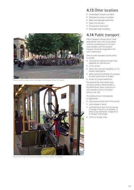
4.13 Other locations• Undeveloped transport corridors• Dedicated bus lanes or corridors• Water and sewerage easements• Power line corridors• Conservation land tracks• Redundant road formations4.14 Public transportPublic transport extends cyclists’ travelrange. Buses, trains, ferries and planescould be considered part of the cycleroute network, and links to publictransport should be recognised in thecycle network plan.Bicycles parked at railway station, Cambridge, United Kingdom. (Photo: Tim Hughes)Links to public transport can be criticalto cyclists:• to ensure the viability of longer trips,especially for cycle tourists• in hilly terrain• where there are poor, hazardous or nonexistentroad options• where cycling is prohibited, for exampleat some road tunnels or bridges• as part of a leisure experience.The potential for multi-mode travelinvolving cycling is demonstrated inThe Netherlands, where 35 percent oftrain travellers cycle to the station(MTPW and WM, 1992).The viability of such links dependson appropriate:• cycle access at each end of the journey• cycle storage in transit• cycle parking at each end of a journeyif storage in transit is not possible, orwhere a key destination is adjacent toa transport interchange• transit or storage costs.Bicycle rack on light rail, Portland, United States of America. (Photo: Tim Hughes)29