2010 Downtown Plan - Fort Myers Business Development
2010 Downtown Plan - Fort Myers Business Development
2010 Downtown Plan - Fort Myers Business Development

Create successful ePaper yourself
Turn your PDF publications into a flip-book with our unique Google optimized e-Paper software.
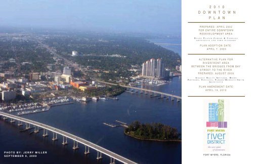
2 0 1 0D O W N T O W NP L A NPREPARED: APRIL 2002FOR ENTIRE DOWNTOWNREDEVELOPMENT AREAD UANY PLATER-ZYBERK & COMPANYARCHITECTS AND TOWN PLANNERSPLAN ADOPTION DATE:APRIL 7, 2003ALTERNATIVE PLAN FORRIVERFRONT AREABETWEEN THE BRIDGES FROM BAYSTREET TO THE RIVERPREPARED: AUGUST 2009AC QUEST REALTY ADVISORS, BOORNPA RTNERS, P OPULOUS, P ARKER/M UDGETT/S MITHA R CHITECTSPLAN AMENDMENT DATE:APRIL 19, <strong>2010</strong>PHOTO BY: JERRY MILLERSEPTEMBER 9, 2009FORT MYERS, FLORIDA
DOWNTOWN FT. MYERS, FLORIDA---- CONTINUEDWATERFRONT PEDESTRIAN EDGE ............................... 3-12WATERFRONT DEVELOPMENT....................................... 3-13LAND USE/ZONING (NEW) ............................................... 3-14SITE PLAN ......................................................................... 3-15CURRENT/FUTURE LAND USE AND ZONING ................ 3-16PARKING ............................................................................ 3-19SECTIONS AT STREET LEVEL ......................................... 3-20RENDERINGS .................................................................... 3-24DEVELOPMENT GUIDELINES ..................................................4DEVELOPMENT GUIDELINES ............................................ 4-1BLOCK A GUIDELINES ........................................................ 4-2BLOCK B GUIDELINES ....................................................... 4-4BLOCK C GUIDELINES ....................................................... 4-6BLOCK D GUIDELINES ....................................................... 4-8BLOCK E GUIDELINES ..................................................... 4-10BLOCK F GUIDELINES ..................................................... 4-12BLOCK W1 GUIDELINES .................................................. 4-14BLOCK W2 GUIDELINES .................................................. 4-16BLOCK W6 GUIDELINES .................................................. 4-18BLOCK P9W GUIDELINES .............................................. 4-22BLOCK P9E GUIDELINES ................................................. 4-24IMPLEMENTATION PLAN ..........................................................5IMPLEMENTATION PLAN SUMMARY ................................ 5-1SITE PLAN ........................................................................... 5-2SITE PLAN PROGRAMMING .............................................. 5-3PROJECT & COMPONENT COST MODEL......................... 5-6SCHEDULE OF REGULATORY REQUIREMENTS ........... 5-24PRELIMINARY PROJECT SCHEDULE & PHASING ........ 5-28COMPONENT BLOCKS ..................................................... 5-34DISTRICT BRANDING PLAN / MARKETING ANDMANAGEMENT PLAN ................................................. 5-40PRELIMINARY PROJECT FINANCIALFORECASTING MODELS ............................................ 5-42FUNDING STRATEGY SOURCES AND USES ................. 5-52REGULATORY REQUIREMENTS -WATER TREATMENT/QUALITY-QUANTITY ................ 5-74REGULATORY REQUIREMENTSMINIMUM FINISH FLOOR ELEVATION FEMA MAP .... 5-75ELEVATION CHANGE CONCEPTS................................... 5-76GRADE TRANSITION VIEWS ........................................... 5-77
DOWNTOWN FT. MYERS, FLORIDAFOREWORDFOREWORD<strong>Fort</strong> <strong>Myers</strong>, like many small to mid sized cities, experienced the decline in its central business district over the years as a result of deterioratinginfrastructure, the functional obsolescence of 100-year old buildings and the development of suburban malls and office parks. To reverse this declinethe City embarked on an aggressive revitalization program for the downtown business district in 1984 when it created a downtown redevelopmentdistrict pursuant to Florida Statute Chapter 163. The City Council established itself as the <strong>Fort</strong> <strong>Myers</strong> Redevelopment Agency (FMRA) to oversee theredevelopment and approved the use of tax increment financing to help fund the revitalization of downtown.One of the first projects undertaken by the FMRA was the completion of the City’s first “modern day” redevelopment plan, which was completed in 1986by BRW. The 1986 <strong>Plan</strong> resulted in several significant accomplishments, including:2 0 1 0D O W N T O W NP L A N• The retention and expansion of the City, County, State and Federal government offices to create a comprehensive government center.• The construction of the 10-acre Centennial Park along the riverfront.• Completion of a three-quarter mile long Riverwalk.• Construction of two fishing piers and three commercial boat piers.• Construction of the Harborside Event Center and parking garage.By the start of the 21st Century it became evident that an updated master plan was needed for the downtown district. The internationally acclaimedarchitect and urban planner Andres Duany, and his firm Duany Plater-Zyberk and Co. (DPZ), was selected to work with the City Council and citizens of<strong>Fort</strong> <strong>Myers</strong> to formulate a new vision for downtown. The <strong>Downtown</strong> <strong>Fort</strong> <strong>Myers</strong> <strong>Plan</strong> was completed in 2002 and after extensive review it was formallyadopted in April 2003. The 2003 <strong>Downtown</strong> <strong>Fort</strong> <strong>Myers</strong> <strong>Plan</strong>, which was based on the principles of “New Urbanism”, focused on pedestrian connectivityto the built environment, streetscape improvements, increased residential densities and restoration of the historic structures. Land use, street frontageimprovements, street reconfigurations, and parking were controlled through a “Smart Code” which was adopted by the City as the overall land developmentregulations to guide renovations and new development in the downtown district.The 2003 <strong>Downtown</strong> <strong>Fort</strong> <strong>Myers</strong> <strong>Plan</strong> also established Specific Interventions for the four pedestrian sheds (Heart of <strong>Downtown</strong>, Western Approach,Eastern Approach and Southern Approach) that make up the downtown area. Specific Interventions are defined as “. . . pilot projects and othersometimes-flashy ideas that get most of the attention but these are most useful not as mandatory construction efforts but rather as illustrations of hownew construction can occur along the lines of the General Controls.” City leaders immediately began implementing the plan and to date have met withgreat success. Major accomplishments include:• Adoption of the 2003 <strong>Downtown</strong> <strong>Fort</strong> <strong>Myers</strong> <strong>Plan</strong>, Streetscape <strong>Plan</strong> and Smart Code.• Completion of over 1,200 new residential units.• Completion of a 50-block utility replacement and streetscape improvement project.• Reconfiguration of one-way streets to two-way throughout the core of downtown.• The opening of a 40,000 sq. ft Publix grocery store.• The approval of a new $20 million public library in the Cultural Campus.• Completion of a new 10-story addition and 800 car parking facility to the Lee County Justice Center.• Opening of the new Hotel Indigo.• Rehabilitation of the former Post Office/Federal Courthouse for the Sidney and Berne Davis Arts Center.• Leasing of the City Pier building to the Art of the Olympians.• Completion of the Southern Approach gateway park.• Renovations and upgrades to the City Yacht Basin.• Designation by the State of Florida as a Waterfronts Florida Community.• Historic restoration of over 20 downtown buildings.PHOTO BY: JERRY MILLERiSEPTEMBER 9, 2009
DOWNTOWN FT. MYERS, FLORIDAFOREWORD CONTINUEDOne of the few areas lagging behind the successful redevelopment efforts was the publicly owned riverfront. The 2003 <strong>Downtown</strong> <strong>Fort</strong> <strong>Myers</strong> <strong>Plan</strong> hadincluded recommendations for a new riverfront hotel constructed around the Exhibition Hall, a Symphony Hall connected to Harborside, parking facilitiessurrounded by retail and commercial liner buildings, an expanded Convention Center and an enlarged marina. Further study of the Symphony Hall provedthat it was not financially feasible and Hurricane Charlie damaged the Exhibition Hall to the point that it had to be demolished. As proposed in the 2003<strong>Downtown</strong> <strong>Fort</strong> <strong>Myers</strong> <strong>Plan</strong>, the City issued a Request for Proposals for development of the riverfront but negotiations with the selected developer endedafter two years without an agreement. The crash of the real estate market in 2006 and 2007 further halted any attempts at developing the riverfront. TheCity Council later concluded that the hotel should be directly connected to Harborside and the riverfront should remain open for public access.In 2008, City leaders explored the idea of seeking a different sort of public/private partnership for the development of the riverfront. A Request forQualifications was issued for a developer-led team of architects, planners, hotel consultants and retail specialists to master plan the riverfront from BayStreet to the river. The key to this approach was that the developer had to substantiate the financial and market feasibility of each aspect of the projectand agree to be one of the developers of the project. The selected development team would be responsible for engaging the public in the planningprocess to create a plan that achieved the following criteria.2 0 1 0D O W N T O W NP L A N• Activate the riverfront• Create an exciting riverfront destination for local, regional and seasonal residents, and to attract tourists and convention visitors.• Improve the connectivity between the historic downtown and the riverfront.• Improve and enhance the existing public open spaces and create exciting new spaces.• Maintain the scale and density of the riverfront that was proposed in the 2003 <strong>Plan</strong>.• Improve and expand the Harborside Event Center and attract a convention quality hotelThe City selected Acquest Realty Advisors, who had teamed up with Boorn Partners, HOK/Populous and Parker Mudgett Smith Architects, to preparethe riverfront development plan. The notice to proceed was issued in December 2008 and in January, 2009 the first of several charrettes were held togain public input. Throughout the planning process the team worked with property owners, citizens, business owners and civic leaders to explore andevaluate the desired uses for the riverfront. The Specific Interventions proposed in the 2003 <strong>Downtown</strong> <strong>Fort</strong> <strong>Myers</strong> <strong>Plan</strong> were also carefully evaluatedagainst current financial and market conditions. The result was a riverfront plan and implementation strategy that was presented to the City on August31, 2009 and adopted in principle by City Council on September 8, 2009.The 2009 <strong>Fort</strong> <strong>Myers</strong> Riverfront <strong>Development</strong> <strong>Plan</strong> will serve to update and amend many of the Specific Interventions for the riverfront portion of the Heartof <strong>Downtown</strong> contained in the 2003 <strong>Downtown</strong> <strong>Fort</strong> <strong>Myers</strong> <strong>Plan</strong>. Formal adoption is scheduled for March <strong>2010</strong> following review by the <strong>Plan</strong>ning Board,FMRA, Historical Preservation Commission, citizen and business groups and City Council. It should be noted that within the 2009 <strong>Fort</strong> <strong>Myers</strong> Riverfront<strong>Development</strong> <strong>Plan</strong> the page numbers are hyphenated. The hyphenation refers to the section number and the page number within each section (i.e. 1-1is section 1-page 1).The significant elements of the 2009 <strong>Fort</strong> <strong>Myers</strong> Riverfront <strong>Development</strong> <strong>Plan</strong> include:PHOTO BY: JERRY MILLERSEPTEMBER 9, 2009• Creation of a signature water basin that would appear to bring the riverfront back to its historical shoreline along Bay Street. In reality thebasin is a water retention area that helps to filter the surface water run-off from the downtown streets and buildings before it flows into theCaloosahatchee River.• The construction of a convention quality hotel over a parking structure attached to the east end of Harborside.• The addition of breakout rooms, lecture halls and office space in the existing Harborside Event Center.• The construction of an 80,000 +/- sq ft new exhibit hall for Harborside on the Post Office site.• Three signature restaurant sites, on publicly owned land, that could be leased to selected restaurants.• Improvements to Centennial Park including a boardwalk on the river side of the mangroves, a children’s interactive fountain, anamphitheater, and a permanent farmers market structure.• Expansion of the yacht basin.• A parking structure surrounded by liner retail/commercial buildings on the Smith Block.• Upgrades to Edwards Drive to create a more ceremonial, but still functional, vehicular drive.• Future improvements to the Royal Palm Tower site.ii
DOWNTOWN FT. MYERS, FLORIDAFOREWORD CONTINUEDA major goal of the 2009 <strong>Fort</strong> <strong>Myers</strong> Riverfront <strong>Development</strong> <strong>Plan</strong> is to connect the historic district to the river rather than creating a stand-alone riverfrontdestination. The plan accomplishes this by bringing the water into Bay Street, connecting the historic downtown and keeping a majority of the riverfrontas public open space. The plan also focuses on attracting unique local and regional retail shops and restaurants rather than strictly national chains.As a final note about the two plans, it should be understood that each plan has unique characteristics and merits, and in reality, elements of both plansmay be incorporated into the final implementation strategy. It is worth noting that the 2003 <strong>Downtown</strong> <strong>Fort</strong> <strong>Myers</strong> <strong>Plan</strong> is a stand alone document thatcovers the entire downtown redevelopment area. The 2009 <strong>Fort</strong> <strong>Myers</strong> Riverfront <strong>Development</strong> <strong>Plan</strong> is a refinement of the ideas put forth in the 2003<strong>Downtown</strong> <strong>Fort</strong> <strong>Myers</strong> <strong>Plan</strong> for the geographic area between the Caloosahatchee River Bridge and the Edison Bridge and from Bay Street to the river.To properly use this document it should be noted that there are three sections. Tab 1 enumerates the accomplishments that have been achieved sincethe adoption of the 2003 <strong>Downtown</strong> <strong>Fort</strong> <strong>Myers</strong> <strong>Plan</strong> and incorporates the changes and amendments proposed by the 2009 <strong>Fort</strong> <strong>Myers</strong> Riverfront<strong>Development</strong> <strong>Plan</strong>. Tab 1 is the 2003 <strong>Downtown</strong> <strong>Fort</strong> <strong>Myers</strong> <strong>Plan</strong> with updates and revisions noted in text boxes. Tab 2 is the 2009 <strong>Fort</strong> <strong>Myers</strong> Riverfront<strong>Development</strong> <strong>Plan</strong> for the area between the Caloosahatchee River Bridge and the Edison Bridge and from Bay Street to the river.2 0 1 0D O W N T O W NP L A Niii
DOWNTOWN FT. MYERS, FLORIDAPUBLIC PROGRAM IMPLEMENTATIONPUBLIC PROGRAM IMPLEMENTATIONIncreasingly, and especially in challenging economic times, downtown urban mixed-use development plans are dependent upon public incentives.Each project must be carefully evaluated, however, to determine if the project conforms to the plan and what incentives may be needed to achieve areasonable financial return. Incentives may take the form of grants, loans, marketing and promotions programs, tax and impact fee credits and othertangible and intangible benefits.Financial Incentives/ProgramsNew development and substantial rehabilitation of existing buildings in today’s economic climate is extremely difficult. Often time a gap exists betweenthe cost of developing a project and the income the project can generate to cover debt service and operating expenses. As a result the followingincentives may be required to attract new development.2 0 1 0D O W N T O W NP L A N• Tax increment rebates• Rent subsidies• Loan or grant programs• Tenant improvement subsidies• Land assembly assistance and acquisition of easements• Impact fee waivers or creditsThe involvement of the public sector in private development results in what is commonly known as a public/private partnership. Such partnerships demandthat the private developer understand the desires and goals of the public agency to encourage a particular redevelopment opportunity, to increase thelocal tax base or to enhance public services. Likewise the public sector must recognize the private sectors return on investment requirements. Thepartnership only works when both parties understand and accept each others goals.<strong>Business</strong>/Retail Retention and Recruitment StrategiesSuccessful implementation of the <strong>Plan</strong> requires a healthy retail and business mix within the downtown district. To accomplish this goal it is critical thatthe city retains the existing businesses and helps to insure their vitality so that new businesses can be successfully recruited. The following initiativesare recommended to retain and attract new businesses.Retention – <strong>Business</strong> retention strategies involve a number of potential programs and they require open communication and a high level ofcoordination between the City, the FMRA and the businesses to insure that the programs are viable and effective. The FMRA businessretention program could include the following elements:PHOTO BY: JERRY MILLERSEPTEMBER 9, 2009• The production and sponsorship of special events and promotions to attract people into downtown and the River District.• Marketing and co-op advertising programs and materials.• Branding and image making to create a unique identity for the downtown.• Banners, gateway identification, wayfinding signage, websites, printed and E-newsletters and PowerPoint and video presentations.• Assistance through rent subsidies/tenant improvements, grants and subsidy programs.Recruitment – The retail market analysis concluded that local and regional specialty businesses and restaurants that offer unique shopping anddining experiences should be recruited. <strong>Downtown</strong> should distinguish itself from the regional malls by offering an authentic, historic downtownsetting with an attractive mix of one-of-a-kind shops and restaurants. The recruitment program could include the following elements:• An up to date inventory of available commercial spaces.• Programs to encourage property owners to lease ground floor spaces to retail and restaurant tenants instead of offices.• Local, national and international marketing.PHOTO BY: JERRY MILLERSEPTEMBER 9, 2009iv
DOWNTOWN FT. MYERS, FLORIDAPUBLIC PROGRAM IMPLEMENTATION CONTINUEDMaintenance and SecurityProper maintenance and security of downtown are essential to the success of the revitalization program. Enhanced community policing efforts suchas bicycle and walking patrols will result in improved safety for the area, and just as important, will improve the public’s perception that the area issafe. Likewise, enhanced maintenance, with seven day a week clean-up, is essential to the success of retail and dining destinations. Clean streetsand sidewalks lead to less littering and other maintenance problems. A specialized street, sidewalk and parking lot sweeper should be consideredfor the downtown area to help maintain the brick streets, patios and sidewalks. The FMRA should continue to work with the Public Works and ParksDepartments to determine the optimum number of workers and equipment needed to properly maintain the downtown district.2 0 1 0D O W N T O W NP L A Nv
DOWNTOWN FT. MYERS, FLORIDATHE COMMUNITY REDEVELOPMENT ACT REQUIREMENTSTHE COMMUNITY REDEVELOPMENT ACT REQUIREMENTSChapter 163, Part III, Florida Statutes (the Community Redevelopment Act of 1969), as amended contains the requirements to be met by this <strong>Plan</strong>,included in the <strong>Downtown</strong> <strong>Fort</strong> <strong>Myers</strong> - April 2002 Redevelopment plan, adopted on April 7, 2003, as amended on March 15, <strong>2010</strong>, to incorporate the2009 <strong>Fort</strong> <strong>Myers</strong> Riverfront <strong>Development</strong> <strong>Plan</strong>, (as shown in Tab 2) for its use as the new community redevelopment plan for downtown <strong>Fort</strong> <strong>Myers</strong>.The Act requires that this <strong>Plan</strong> show by diagram and in general terms those specific plan requirements set forth in s. 163.362(2), Florida Statutes, includingopen space, street layout, building limitations (type, size, height, number, and use of buildings), as well as, dwelling units, and other public improvements.The General Controls section of the 2003 <strong>Downtown</strong> <strong>Fort</strong> <strong>Myers</strong> <strong>Plan</strong>, adopted on April 7, 2003, which follows, addresses each of these elements.2 0 1 0D O W N T O W NP L A NAs stated previously, Tab 2 includes the 2009 <strong>Fort</strong> <strong>Myers</strong> Riverfront <strong>Development</strong> <strong>Plan</strong>, of which the “Master <strong>Plan</strong>” Section of the <strong>Plan</strong> demonstrates analternative redevelopment scenario (commonly referred to as the riverfront redevelopment area) for the area located between the Caloosahatchee RiverBridge and the Edison Bridge north of Bay Street to the Caloosahatchee River. The open space, street layout, building limitations, as well as dwellingunits and other public improvements for this alternative are located within the Master <strong>Plan</strong> section.Also required under the Act is the identification of publicly funded capital projects to be undertaken. Street reconfigurations are shown in the GeneralControls section of the 2003 <strong>Downtown</strong> <strong>Fort</strong> <strong>Myers</strong> <strong>Plan</strong>. Parking Garage relocation plans are outlined in the Analysis section, and additional desirableprojects, while not mandatory, are depicted as Specific Interventions of the 2003 <strong>Downtown</strong> <strong>Fort</strong> <strong>Myers</strong> <strong>Plan</strong>. The accompanying Streetscape <strong>Plan</strong>identifies landscaping, lighting, and other streetscape treatments for downtown.The 2009 <strong>Fort</strong> <strong>Myers</strong> Riverfront <strong>Development</strong> <strong>Plan</strong> (Tab 2) demonstrates an alternate street reconfiguration, parking garage location, and additionaldesirable projects which could be funded as public projects within the redevelopment area. These alternative recommendations are found primarilywithin the Master <strong>Plan</strong> and Implementation <strong>Plan</strong> sections of the 2009 <strong>Fort</strong> <strong>Myers</strong> Riverfront <strong>Development</strong> <strong>Plan</strong> (Tab 2).The Act also requires that adequate safeguards exist that the work of redevelopment will be carried out pursuant to the <strong>Plan</strong>. This assurance can bemade by noting that the City’s Comprehensive <strong>Plan</strong> and land development regulations for downtown were modified to conform to the recommendationsset forth in the 2003 <strong>Downtown</strong> <strong>Fort</strong> <strong>Myers</strong> <strong>Plan</strong> and the alternative redevelopment scenario for the area located between the bridge north of Bay Streetto the Caloosahatchee River necessitate additional comprehensive plan and land development code amendments.With regard to the projected costs of redevelopment, including the amount to be expended on publicly funded capital projects for the alternate riverfrontredevelopment scenario, the implementation plan includes extensive project cost models, phasing, and additional opportunities for leveraging county,state, and federal funding to assist with redevelopment and funding. This cost/funding model does include the ability to utilize tax increment revenue toimplement the design, permitting and construction of this alternate redevelopment scenario.No displacement of residents is anticipated as a result of the <strong>Plan</strong>, however, as a general policy, relocation shall conform to uniform relocation requirements,and replacement housing shall be assured, should any unanticipated temporary or permanent displacement occur as a result of specific action of the <strong>Fort</strong><strong>Myers</strong> Community Redevelopment Agency or the City of <strong>Fort</strong> <strong>Myers</strong>.PHOTO BY: JERRY MILLERSEPTEMBER 9, 2009Finally, in addition to discussion of providing affordable housing in the Evans Neighborhood Square Specific Intervention, it is important to note that theCity of <strong>Fort</strong> <strong>Myers</strong> has also created two redevelopment areas located immediately adjacent to the downtown redevelopment area, which have a primaryfocus on housing affordable to low and moderate income persons and the elderly. Consequently, the <strong>Downtown</strong> <strong>Fort</strong> <strong>Myers</strong> <strong>Plan</strong> is not intended toremedy a shortage of affordable housing in the City.As noted throughout the Specific Interventions section, the <strong>Plan</strong> provides for the retention of controls and establishment of restrictions on land sold orleased for private use. In addition, the Analysis section provides standards for municipal land leases or sale in the case of condominium development,as required by Chapter 163.PHOTO BY: JERRY MILLERviSEPTEMBER 9, 2009
DOWNTOWN FT. MYERS, FLORIDAIDENTIFICATION OF ALTERNATIVESIDENTIFICATION OF ALTERNATIVES:2003 DOWNTOWN FORT MYERS PLANPREPARED BY DUANY PLATER-ZYBERK & COMPANYWITH ALTERNATIVE:2009 FORT MYERS RIVERFRONT DEVELOPMENT PLANBETWEEN THE BRIDGES FROM BAY STREET TO THE RIVERPREPARED BY ACQUEST REALTY AVISORY, BOORN PARTNERS, POPULOUS, PARKER MUDGETT SMITH ARCHITECTSDuring the April 2003 planning process, the land along the river, primarily owned by the City of <strong>Fort</strong> <strong>Myers</strong>, became known as “the Gold Coast” and was considered the City’s biggest asset.With the 2009 plan, several key changes have been made and are highlighted in the following table. These proposed alternatives have been proposed to demonstrate opportunities that, with proper execution,should provide the impetus needed to bring people downtown to experience the true unique character and amenity of <strong>Fort</strong> <strong>Myers</strong>. It should be noted that within the 2009 <strong>Fort</strong> <strong>Myers</strong> Riverfront <strong>Development</strong><strong>Plan</strong> the page numbers are hyphenated. The hyphenation refers to the section number and the page number within each section (i.e. 1-1 is section 1-page 1).2003 <strong>Downtown</strong><strong>Fort</strong> <strong>Myers</strong> <strong>Plan</strong>Page Number2009 <strong>Fort</strong> <strong>Myers</strong>Riverfront<strong>Development</strong><strong>Plan</strong>Page NumberII.6 3-19DifferenceParking GarageRelocationsExplanationIn the 2003 <strong>Downtown</strong> <strong>Fort</strong> <strong>Myers</strong> <strong>Plan</strong>, parking garage locations were proposed for the areabetween Bay Street and Edwards Drive. In the 2009 <strong>Fort</strong> <strong>Myers</strong> Riverfront <strong>Development</strong> <strong>Plan</strong>public parking structures are still proposed on the block between Bay/Edwards/Hendry andJackson - but have been rearranged on the other two blocks.The land use map within the 2003 <strong>Downtown</strong> <strong>Fort</strong> <strong>Myers</strong> <strong>Plan</strong> on pg III.2 includes urban core,urban center, civic, civic recreation, and parking structure overlay districts.Page 3-14 of the 2009 <strong>Fort</strong> <strong>Myers</strong> Riverfront <strong>Development</strong> <strong>Plan</strong> demonstrates an alternateland use/zoning map for the area between the Caloosahatchee River Bridge, the EdisonBridge, Bay Street, and the Caloosahatchee River.III.23-143-153-16 - 3-18General Controls -Land UseRegulating <strong>Plan</strong>MapLand use and zoning map changes are necessary if the master plan on page 3-15 of the 2009<strong>Fort</strong> <strong>Myers</strong> Riverfront <strong>Development</strong> <strong>Plan</strong> is implemented. The 2009 <strong>Fort</strong> <strong>Myers</strong> Riverfront<strong>Development</strong> <strong>Plan</strong> generally demonstrates phasing(see page 5-33) for the riverfrontredevelopment and once the water basin (P3) is implemented, a small scale land use mapamendment may be necessary to accomodate the planned 12 story hotel on the C1/C2 site ofthe master plan (see page 3-15). Based on direction by the city staff, land use and zoningchanges may be processed for the C1 and C2 blocks.It should be noted that the existing land use map and zoning map with corresponding futureland use policy and land development code need to be consistent and the 2003 <strong>Downtown</strong><strong>Fort</strong> <strong>Myers</strong> <strong>Plan</strong> (pg III.2) may need to be amended to be consistent with the final land usecontrols that were processed and approved after the 2003 plan adoption.III.5 3-16 - 3-18Street Frontage/Retail UseIn addition to blocks C1 and C2 changes, additional public space to be designated civicrecreation may be processed as a small scale land use and zoning map amendment as wellfor block P2, P5, P7, and P8.The 2003 <strong>Downtown</strong> <strong>Fort</strong> <strong>Myers</strong> <strong>Plan</strong> recommended the designation of A/B type streetfrontage, as well as desired ground floor level retail.The 2009 <strong>Fort</strong> <strong>Myers</strong> Riverfront <strong>Development</strong> <strong>Plan</strong> includes additional targeted retail frontageareas including: blocks D1, D-2, E, F, and W.vii
DOWNTOWN FT. MYERS, FLORIDAIDENTIFICATION OF ALTERNATIVESIDENTIFICATION OF ALTERNATIVES (CONTINUED):2003 DOWNTOWN FORT MYERS PLANPREPARED BY DUANY PLATER-ZYBERK & COMPANYWITH ALTERNATIVE:2009 FORT MYERS RIVERFRONT DEVELOPMENT PLANBETWEEN THE BRIDGES FROM BAY STREET TO THE RIVERPREPARED BY ACQUEST REALTY AVISORY, BOORN PARTNERS, POPULOUS, PARKER MUDGETT SMITH ARCHITECTS2003 <strong>Downtown</strong><strong>Fort</strong> <strong>Myers</strong> <strong>Plan</strong>2009 <strong>Fort</strong> <strong>Myers</strong>Riverfront<strong>Development</strong><strong>Plan</strong>DifferenceExplanationPage NumberPage NumberIII.6III.73-6StreetReconfigurationsThe 2003 <strong>Downtown</strong> <strong>Fort</strong> <strong>Myers</strong> <strong>Plan</strong> references a street pattern on page III.6 and III.7. Toimplement the 2009 <strong>Fort</strong> <strong>Myers</strong> Riverfront <strong>Development</strong> <strong>Plan</strong> alternative, the street pattern orvehicular circulation shown on page 3-6 of the 2009 <strong>Fort</strong> <strong>Myers</strong> Riverfront <strong>Development</strong> <strong>Plan</strong>should be implemented. This exhibit demonstrates the rights of way that should be vacatedto accomplish the development plan.The alternatives identified in the 2009 <strong>Fort</strong> <strong>Myers</strong> Riverfront <strong>Development</strong> <strong>Plan</strong> for this areaare focused along the riverfront and recommend a reconfiguration of the planned developmentbetween the bridges, and from Bay Street to the River. When the 2009 <strong>Fort</strong> <strong>Myers</strong> Riverfront<strong>Development</strong> <strong>Plan</strong> is implemented various actions are needed to set the framework in placefor the development to become a reality, including comprehensive text amendments, landdevelopment code amendments (to incorporate the specific guidelines into the downtownsmart code). In addition, it is anticipated the city will enter into a development agreement toproceed with the implementation plan in sections 5-1 through 5-77 of the 2009 <strong>Fort</strong> <strong>Myers</strong>Riverfront <strong>Development</strong> <strong>Plan</strong>.IV.1THROUGHIV.123-23-154-1 THROUGH 4-245-1 THROUGH 5-77Specific RiverfrontInterventions forthe “Heart of<strong>Downtown</strong>” to the2009 <strong>Fort</strong> <strong>Myers</strong>Riverfront<strong>Development</strong> <strong>Plan</strong>IV.13IV.143-113-15SpecificInterventions forthe WesternApproach to the2009 <strong>Fort</strong> <strong>Myers</strong>Riverfront<strong>Development</strong> <strong>Plan</strong>The 2003 <strong>Downtown</strong> <strong>Fort</strong> <strong>Myers</strong> <strong>Plan</strong> identifies improvements to Centennial Park in a generalterm. While this area was not part of the riverfront redevelopment planning effort, the 2009<strong>Fort</strong> <strong>Myers</strong> Riverfront <strong>Development</strong> <strong>Plan</strong> was developed to integrate Centennial Park with theconnectivity of the Centennial Park eastern portion. Specific improvements including P7 andP8 are recommendations in concept only.viii
DOWNTOWN FT. MYERS, FLORIDAPLAN ADOPTION RESOLUTIONRESOLUTION NO. <strong>2010</strong>-10ix
DOWNTOWN FT. MYERS, FLORIDAPLAN ADOPTION RESOLUTIONx
D O W N T O W NF O R T M Y E R SAPRIL 2002PLAN ADOPTION DATE:APRIL 7, 2003FORT MYERS, FLORIDAD UANY PLATER-ZYBERK & COMPANYARCHITECTS AND TOWN PLANNERS
DOWNTOWN FT. MYERS, FLORIDACITY OF FORT MYERS, FLORIDAJIM HUMPHREY, MAYORD O W N T O W NF O R T M Y E R SCITY COUNCIL/COMMUNITY REDEVELOPMENT AGENCY:TAMMY HALL, WARD ONEVERONICA S. SHOEMAKER, WARD TWOANN MURPHY KNIGHT ED.D., WARD THREEMICHAEL FLANDERS, WARD FOURRANDALL P. HENDERSON JR., WARD FIVEDOWNTOWN REDEVELOPMENT AGENCY ADVISORY BOARD:DR. GERALD LABODA, CHAIRMANKEN JONES, VICE CHAIRMANMARK FREEMAN, AIADOMINIK GOERTZLODOVIC KIMBALLBETTY LANDRYBERNARD MCGOVERNMARC SULLIVANDOWNTOWN PLAN STEERING COMMITTEE:DR. GERALD LABODA, CHAIRMANMARY BENSELMELISSA CREASYMICHAEL FLANDERS, AIAMARK FREEMAN, AIADOMINIK GOERTZTAMMY HALLHARRISON KNIGHTGERALD MCHALEANDY MESSICKMIKE ROEDERSTEVE SHIMPMARC SULLIVANDAISY UPSHAW-BENJAMINDOWNTOWN REDEVELOPMENT AGENCY STAFF:DON PAIGHT, EXECUTIVE DIRECTORJOAN LIGHT, DONNA LIMERICK, SHAYE PRATHERCOMMUNITY DEVELOPMENT DEPARTMENT STAFF:CHRISTINE HURLEY, DIRECTORMAUREEN LUND, AMY BAVIN, NICOLE DEVAUGHNPUBLIC WORKS STAFF:SAEED KAZEMI, CITY ENGINEERDEREK C.S. BURRATTORNEY:NANCY E. STROUD,WEISS SEROTA HELFMAN PASTORIZA & GUEDES, P.A.CHARRETTE DATE: NOVEMBER 12-20, 2001PLAN ADOPTED IN PRINCIPLE: APRIL 22, 2002FINAL PLAN ADOPTION DATE: APRIL 7, 2003DESIGN TEAM:ANDRES DUANY, JEFF SPECK, DEBRA HEMPEL,EUSEBIO AZCUE, MARINA KHOURY, SUZY LEE,MARCELA LEIVA, MANUEL FERNANDEZ-NOVALL,NATASHA QUINTANILLA, MAXIMO RUMIZ,GUSTAVO SANCHEZ, GALINA TAHCHIEVACONSULTANTS:CHUCK BOHL, JAIME BROWN, CATHY FOERSTER,BOB GIBBS, RICK HALL, JOE PETRICH,JAMES WASSELL
DOWNTOWN FT. MYERS, FLORIDAEXECUTIVE SUMMARYEXECUTIVE SUMMARYThe 1990s witnessed a widespread rediscovery of Americanmain streets and downtowns, a revival so powerful that it ledto the construction of new town centers for the first time inover half a century. Revitalizing downtowns face morecomplex challenges, but they also benefit from their primelocations, extensive infrastructure, history, and architecturalheritage.Not every city, however, was fortunate enough to survive theprevious three decades with its downtown urban fabric intact.Although not immune from the ravages of this era of antiurbandevelopment, the City of <strong>Fort</strong> <strong>Myers</strong> did emerge withthe “bones” of its historic downtown preserved: narrowstreets, short blocks, historic buildings and a waterfrontunspoiled by highways and high rises. “Success,” as BobbyUnser said, “is where preparation and opportunity meet,” andthe downtowns that have succeeded are those that havetaken steps to prepare themselves for redevelopmentopportunities, the great majority of which must be initiated bythe private sector. The City has now embarked on an effort toprepare itself to take advantage of the opportunities itshistoric assets present for the revitalization of its downtown.The current effort builds on the administrative foundation,plans and studies previously commissioned by the City andsummarized in the Pre-Charrette Analysis completed by theGenesis Group (under separate cover) and a follow-up memoincluded as Appendix A of this report. In 1984, the City of <strong>Fort</strong><strong>Myers</strong> created the <strong>Fort</strong> <strong>Myers</strong> Redevelopment Agency(FMRA) to formulate a plan and strategy for the revitalizationof downtown <strong>Fort</strong> <strong>Myers</strong>. A master plan was completed in1986 with a 10 to 15 year development horizon, now elapsed.The study area for the downtown also corresponds with a TaxIncrement Finance District (TIF) created to help fundinfrastructure improvements.After several false starts, a series of rehabilitation projectswere initiated in the late 1990s focusing on the key downtowncorridors of First Street and Hendry Street. These projectshave begun to bear fruit in restoring the architecture andvitality of buildings along these key corridors, and bringingresidents and street life back downtown.Recognizing that the 1986 master plan had run its course andthat development conditions were rapidly evolving, the Cityleadership decided that the downtown had arrived at a crucialpoint in its revitalization and initiated a new master planprocess focused on the next steps. The effort commencedwith an extensive pre-charrette analysis conducted by theGenesis Group, which reviewed all previous plans andstudies for the downtown and identified issues andopportunities in advance of the charrette.The charrette itself ran for nine days, from November 12through November 20, 2001, during which over 1,500residents, government leaders and major stakeholders of theCity of <strong>Fort</strong> <strong>Myers</strong> attended public presentations, roundtablediscussions and stakeholder meetings to contribute theirknowledge and ideas for the future of downtown <strong>Fort</strong> <strong>Myers</strong>.Members of the DPZ team met with large groups ofstakeholders to identify specific challenges and issues relatedto parking, traffic, retailing, real estate development, arts andculture, historic preservation, public works, and the waterfront.Dozens of individual meetings were also held to take a closerlook at property ownership and the limitations and opportunitiesconnected with specific sites throughout the downtown.<strong>Downtown</strong> <strong>Fort</strong> <strong>Myers</strong> is the product of that effort, and of themonths of work analyzing the downtown both before and afterthe charrette.HOW TO USE THIS PLAN<strong>Downtown</strong> <strong>Fort</strong> <strong>Myers</strong> is not just a document. It is a new wayof approaching urban planning and development, one thatviews the collaboration of public and private actions as acontinuous and evolving process that began months beforethe charrette and will continue for years to come. Its aim is toidentify general initiatives and specific projects that willmaximize private investment while enhancing the publicrealm of the downtown.The text and graphics that follow provide a snapshot of thisongoing development process as of the end of 2001. Theplan itself sets forth the actions that are necessary for<strong>Downtown</strong> <strong>Fort</strong> <strong>Myers</strong> to achieve its objectives. The documentincludes proposals for public action and proposals for privatedevelopment, as well as general strategies for the downtownrevitalization. Some are already well under way or will beexecuted over the coming months. Others will have to waituntil conditions permit their implementation. One thing iscertain: they will all change many times over the life of<strong>Downtown</strong> <strong>Fort</strong> <strong>Myers</strong>. The plan itself should continue toevolve as conditions change and projects are executed.SUPPLEMENTAL MATERIALSThis plan document is to be used in conjunction with threedocuments provided under separate cover. These are:- The SmartCode, which comprises a guide to implementationof this <strong>Plan</strong>. This document should be revised as necessaryto qualify for legal status and then adopted by the city as analternative to existing regulations including, but not limited to,the Comprehensive <strong>Plan</strong> and Smart Growth ManagementCode. The SmartCode can be implemented in one of twoways: either as a replacement to existing ordinances, or asan optional alternative. In an ideal world, we wouldrecommend the former approach, but we have found that, inmost places, eliminating existing codes in favor of a new oneis often politically impossible. Instead, it is easier to allow theSmartCode to function in parallel with existing ordinances asa separate path to getting a permit. The key to achievingsuccess in this latter case is to incentivize the SmartCodewith quicker permitting, a pro-active process, and financialbonuses as possible. Many communities, such as Orlando,tie incentives like lower impact fees to the lower impactsassociated with development that is permitted under smartgrowth regulations. When a smart growth code is implementedin this way, the benefits to developers are based on objectivestandards associated with the performance of developmentunder the Smart Code versus development under the existingregulations. In effect, these represent performance standardsrather than incentives. Of course, if the City has the politicalwill to pass the SmartCode as its only zoning, land use, andsubdivision ordinance for the downtown, we would supportthis effort.- <strong>Fort</strong> <strong>Myers</strong> Retail Analysis (November 2001), provided byGibbs <strong>Plan</strong>ning. This report analyzes the <strong>Fort</strong> <strong>Myers</strong> tradearea, demographic trends, downtown retail trends, and thecompetitive position of the downtown vis-à-vis regional retailcenters. The report identifies the types of retail that can besupported in the downtown in light of the market conditionsfor 2001, and those anticipated for a five-year outlook to theyear 2006. Immediate opportunities for supportable retailinclude: market support for up to 90,000 square feet of juniordepartment store retail, 55,000 square feet of grocery/supermarkets, 40,000 square feet of movie theater withstadium seating, and a variety of entertainment/recreation,hardware, office supply, home furnishings and eating anddrinking establishments. This represents a desirable mix ofestablishments to recruit for the proposed concentration ofretail in the heart of downtown. The report emphasizes that“full implementation of the supportable retail square footagewill require…implementation of the 2003 <strong>Downtown</strong> <strong>Fort</strong><strong>Myers</strong> <strong>Plan</strong> recommendations, including additional parkingdecks, vehicular circulation enhancements and improvedStreetscaping” (Gibbs, p. 3). This <strong>Plan</strong> incorporates elementsof the retail analysis in the proposals for First Street and thelocation of specific types of retail and entertainment uses inthe specific interventions presented below.- The <strong>Downtown</strong> <strong>Fort</strong> <strong>Myers</strong> Streetscape <strong>Plan</strong> provided byGenesis Group. This document addresses downtownaesthetics, focusing on the landscape, street furniture,lighting, signage, and other details recommended for thedetailed improvement of downtown streetscapes. This DPZ<strong>Plan</strong> includes a more general analysis identifying theparticular streets where the City should concentrate itsresources, the phasing of improvements, and provides amore detailed consideration of the streetscape elementsessential for enhancing First Street as the City’s premierpedestrian-oriented Main Street.THE COMPONENTS OF THE PLAN<strong>Downtown</strong> <strong>Fort</strong> <strong>Myers</strong> can be best understood as providingtwo different categories of product: General Controls on theone hand, and Specific Interventions on the other. TheGeneral Controls are the least glamorous part of the plan, butthey are its heart and soul. They provide the fundamentalsystemic framework that will allow and encourage newgrowth to occur in a form that improves urban vitality ratherthan undermining it. Central to these is the SmartCode, anI.1
DOWNTOWN FT. MYERS, FLORIDAEXECUTIVE SUMMARYalternative zoning ordinance described below, which shall beused as a guide to creation of new Growth ManagementCode regulations for the downtown area. The SpecificInterventions, in contrast, are the pilot projects and othersometimes-flashy ideas that get most of the attention, butthese are most useful not as mandatory construction effortsbut rather as illustrations of how new construction can occuralong the lines of the General Controls. While it would indeedplease us to see all of these projects built as designed, theirreal value is to communicate the types of projects that the cityshould encourage in its efforts to improve the downtown. Thistoo will be discussed below.The General Controls can be broken down into the followingdocuments:· The A/B Frontage Assignment: One key to asuccessful downtown is to acknowledge that notevery street must correspond to the highestpedestrian-friendly standards. Some streets willinevitably provide sites for muffler shops, fast-fooddrive-throughs, and other automotive-orientedbusinesses. Rather than dreaming that such placescan be eliminated entirely, our plan will locate thesestreets in a way that they do not undermine theintegrity of the downtown pedestrian network.A-Streets, serving pedestrians as well as cars, will beasked to correspond to the highest frontagestandards of the SmartCode, while B-streets will beavailable for those businesses that focus primarily onautomotive traffic. Both are profitable uses; the keyis keeping them separate in order to create acontinuous network of high-quality pedestrianfrontage for the downtown.· The Street Reconfigurations: As discussed in theStreet Reconfigurations section of this report, mostof the streets in downtown <strong>Fort</strong> <strong>Myers</strong> are currentlyconfigured to speed automotive traffic through thedowntown -- or divert it entirely -- at the directexpense of pedestrian and commercial life. Over theyears, the widening of travel lanes to higher-velocitystandards, the removal of parallel parking, theimplementation of one-way pairs, and the diversionof traffic from First Street have all contributed to thedowntown’s demise. Central to our plan is areconfiguration of streets within the study area to amore pedestrian-friendly design. In many cases,such reconfiguration can be accomplished for thecost of paint alone (through re-striping), but othermore significant changes can be implemented overtime in conjunction with the planned replacement ofunder-capacity downtown infrastructure that willrequire major street excavations, and throughregular public works maintenance required of thedowntown streets, curbs, sidewalks and street trees.· The SmartCode: As mentioned above, theSmartCode (provided under separate cover) is aguide to recommended changes to the City’s zoning,Comprehensive <strong>Plan</strong>, and Growth ManagementCode that are currently in effect. Such an alternativeis necessary because the existing ordinances includeregulations that work against the realization of arevitalized, pedestrian-friendly downtown. TheSmartCode, in contrast, focuses on the creation ofmixed use, walkable neighborhoods. As part of theimplementation of the <strong>Downtown</strong> <strong>Fort</strong> <strong>Myers</strong> plan,the SmartCode will be used by the City in evaluatingplans prior to adoption of the final amendments to theCity’s Comprehensive <strong>Plan</strong> and Growth ManagementCode. Following final adoption of the Comprehensive<strong>Plan</strong> and Growth Management Code amendments,the final regulating ordinance shall governdevelopment in the downtown area.· The Regulating <strong>Plan</strong>: The SmartCode is organizedon the basis of the urban-to-rural Transect, a tool thatis used to create internally-consistent environmentsof varying urban intensity. For example, an area inthe Urban Center zone would have taller buildingsthat would be spaced closely adjacent to one anotherto form a pedestrian-friendly street wall, with widersidewalks and more intensive downtownstreetscaping, while an area in the Urban Generalzone would be composed of low rise, detachedbuildings and possess a more residential character.Clearly, an instrument is needed to distribute thesedifferent Transect zones in an organized fashionthroughout the downtown, and this instrument is theRegulating <strong>Plan</strong>. The Regulating <strong>Plan</strong> for <strong>Downtown</strong><strong>Fort</strong> <strong>Myers</strong> is presented in the General Controlssection of this <strong>Plan</strong>.If they were implemented quickly, the four documents abovewould probably be enough to produce dramatic positivechange within a few years. However, our time spent in <strong>Fort</strong><strong>Myers</strong> allowed us to discover a large number of additionalopportunities for improvement. Some of these improvementswere already partially underway, others were suggested to usby citizens or business people, and many came from thedesign team. The most promising were developed into theSpecific Interventions that make up a large part of the plan.The Specific Interventions include the following types ofprojects:· Private <strong>Development</strong> of Private Land: Manyprivate properties within the study area are currentlylaying fallow because their owners are unable to finda profitable way to develop them according toexisting zoning ordinances. For the largest of theseproperties, such as the Edison Ford Plaza, the sheersize of the site demands a scale of investment thatcould have a significant impact on the dynamics ofthe downtown. For this site and others, the planrecommends subdividing the area into smallerblocks and lots, so that smaller investors mayimmediately begin to build along the lines of theSmartCode. In other areas such as the EastRiverfront, the scale of investment is already healthy,and a Specific Intervention is provided simply toillustrate the sort of development that the SmartCodewould encourage.· Private <strong>Development</strong> of Public Land: it has beenmentioned many times how <strong>Fort</strong> <strong>Myers</strong>’ greatestmaterial asset is the large amount of (non-park)riverfront land under city ownership, which becameknown as the “Gold Coast” during the charrette.Rather than laying empty, of no use to anyone, theseproperties should be leased on a long-term basis or,in the case of condominium development, sold to builderswho are prepared to develop them along the pedestrianfriendlylines of the SmartCode. In the second case, astrong developer agreement would be an essentialcomponent of the ownership transfer. This is a strategy thatcities such as West Palm Beach and Boca Raton haveemployed with great success in recent years, and has thebenefit of catalyzing development without selling off theCity’s prime assets. For each of these sites, the DPZ teamproposed a Specific Intervention, such as a Hotelsurrounding the Exhibition Hall. These proposals should beput forward by the city in the form of public Requests forProposals, where the terms of the lease and theopportunities for public/private partnership would encouragedevelopers to create projects similar to those proposed inthe plan.· Public Works on Public Land: No smart downtownrevitalization plan relies on public funding to accomplish itsgoals – the money simply isn’t available. However, it isexpected that the leasing of public land for private projects,and the tax revenue from those projects, will eventuallygenerate a pool of funds large enough to support a widerange of public improvements. In addition to the streetreconstruction already mentioned, this plan has proposed anumber of Specific Interventions directed at public land,such as a reconfigured Centennial Park and Fishing Pier.· Public Works on Private Land: Finally, there are a numberof locations within the downtown where private property canbest be used to serve public functions. For example, thecreation of a landscaped entry to downtown where HendryStreet meets Martin Luther King (MLK) Boulevard wouldrequire the city to work cooperatively with privatelandowners. In the same way that the city would jointventurewith private developers on its own land, the city isalso encouraged to collaborate with these individual partiesto convert certain private lands to public through theoutright purchase of property, a land swap, transferof development rights, property tax breaks ordevelopment bonuses involving the mix and densityof the project, so long as the bonuses are consistentwith the master plan.I.2
DOWNTOWN FT. MYERS, FLORIDAEXECUTIVE SUMMARYORGANIZATION OF THE PLAN DOCUMENTAnalysis of Existing Conditions<strong>Downtown</strong> <strong>Fort</strong> <strong>Myers</strong> begins with an analysis of existingconditions for the downtown, looking at the Regional Context,Urban Fabric, the Existing Frontage Quality throughout thedowntown, and Land Ownership. One major product of thecharrette was the creation of an up-to-date figure-grounddrawing of the Urban Fabric showing the building footprints,the street network and open space throughout the downtownstudy area. The Land Ownership diagram reveals thatapproximately 40% of downtown land is currently used forlocal, state, and federal government organizations and civicinstitutions (i.e., off the tax rolls). Of all these public lands, theCity-owned land in the heart of downtown and along thewaterfront basin represents the key opportunity forimplementing this <strong>Plan</strong> through the types of public-privateinterventions described above. NOTE: In this <strong>Plan</strong>, the “heartof downtown” refers to the rectangular portion of the studyarea between the Edison Bridge and the US 41 bridge, fromthe waterfront to Second Street that is concentrated aroundthe historic downtown of <strong>Fort</strong> <strong>Myers</strong>.General ControlsNext the General Controls are presented through detaileddiagrams and discussions applying the general strategies(introduced above) to the specific conditions present indowntown <strong>Fort</strong> <strong>Myers</strong>. The field surveys and analysis ofexisting conditions provided the basis for three key diagrams:the A/B Street Frontage Assignment, the Principal PedestrianSheds and Transit Loop, and the Proposed ParkingRelocation strategy. The A/B Street Frontage Assignment(discussed above) indicates how the existing frontagesshould be woven together to create a continuous network ofhigh-quality, pedestrian-oriented “A” Streets supported by “B”Streets. The Principal Pedestrian Sheds and Transit Loopdiagram shows how the downtown can be organized into fouroverlapping pedestrian sections through the creation of highquality pedestrian frontages in the core and threeneighborhood centers just to the east, west and south of thehistoric downtown. The Proposed Parking Relocationdiagram shows how the relocation of planned parking garagesfrom the fringe to the core of the downtown can be used tofuel revitalization by establishing a steady flow of employeefoot traffic past downtown businesses during workday hours,and by providing parking capacity in the core to serve eveningand weekend visitors.A quick analysis of the Traffic Volume for downtown streetsthen leads into the section on Street Reconfigurations, whichpresents specific instructions for the re-striping, reversion totwo-way, and eventual reconstruction of many streets withinthe study area. While the details of these reconfigurationswill need to be redrawn by a qualified engineering firm, theyhave been approved by Rick Hall, the transportation engineeron the DPZ team.The General Controls section concludes with the presentationof the Regulating <strong>Plan</strong> (introduced above). Althoughsignificant portions of the downtown remain intact, thecharacter of the area has been damaged by allowing urbanand non-urban types of development to occur side-by-side.Based on the team’s field studies of neighborhoodsthroughout the downtown, the Regulating <strong>Plan</strong> specifiesareas within the downtown appropriate for different types ofdevelopment to create built environments that range from avital downtown core to the more residential urban generalzones. The plan also identifies districts where largerinstitutional uses and automobile-oriented activities canoccur without intruding on the vitality of the core or theresidential character of in-town neighborhoods.Specific InterventionsThe core of the report is devoted to a detailed presentation ofStudy Areas where the types of specific interventionsdiscussed above are presented. As noted on page I.2,Specific Interventions differ from General Controls in thatthey are visions for pilot projects rather than mandatoryrequirements for development in the downtown. The studyareas include critical areas along the waterfront, and keysites and corridors that will be instrumental in anchoring andconnecting the satellite centers to the east, west and south ofthe core. The majority of study areas focus on the core itself,where the greatest opportunities exist for leveraging publicand private sector resources and which represents the crucialstarting point for carrying out the revitalization of thedowntown.Many of the interventions described below imply a more fluidrelationship between the public and private sectors, which isappropriate given the often-arbitrary lines that tend to existbetween public and private property. These lines may providetemporary impediments, but to focus on such limitations isthe exact opposite of what DPZ was asked to provide, whichwas “vision.” “Vision,” can be defined many ways, but it isperhaps best understood as “accounting for the factor oftime.” In other words, when one considers the cumulativeimpact of repeated efforts towards a well-defined goal, it ispossible to imagine overcoming even the largest obstaclesover time. This <strong>Plan</strong> is intended to become that goal.In his final public presentation, Andres Duany noted that thecurrent focus on the downtown, and the additional emphasison the historic core, is something that all of the citizens andcouncil members of <strong>Fort</strong> <strong>Myers</strong> can support as a commoneffort for all: “The downtown belongs to all of you; it is theidentity of the entire city, and the reputation of <strong>Fort</strong> <strong>Myers</strong>rises and falls with the image of downtown.” It is only thedowntown of the city that can claim this role, and therefore itis our responsibility to support the downtown in its efforts torepresent us proudly and serve us well.2009 <strong>Fort</strong> <strong>Myers</strong> Riverfront <strong>Development</strong> <strong>Plan</strong>As described in the FOREWORD, the City commissioned amore refined riverfront development plan for the area betweenthe bridges from Bay Street to the Caloosahatchee River.This plan is a representation of a market driven recommendationto connect the historic downtown district to the river and isfound in Tab 2.I.3
DOWNTOWN FT. MYERS, FLORIDAANALYSISCAPE CORALCALOOSAHATCHEE RIVEREDISON BRIDGEBUS 41US 41FIRST STREETMARTIN LUTHER KING BLVDFOWLER STREETMONROE STREETDOWNTOWN FORT MYERS: The interconnected grid of comfortablestreets and short blocks in historic downtown <strong>Fort</strong> <strong>Myers</strong> provide a healthyfoundation on which to build a walkable downtown.The Regional ContextAll strategies for revitalizing <strong>Downtown</strong> <strong>Fort</strong> <strong>Myers</strong> must takeinto account the regional context of Southwest Florida. Thevast expanse of development that has spread out all alongthe Gulf Coast in between the original settlements of theregion has provided a large population base that will factorinto the future of the downtown, but it also reveals the widerange of choices available to people for living, working, dining,shopping, entertainment, recreational and cultural activities.<strong>Downtown</strong> <strong>Fort</strong> <strong>Myers</strong> is one place in a region of competingplaces, and it must identify and build on its inherent qualitiesto successfully compete in the regional marketplace.The general controls and specifi c interventions presentedin <strong>Downtown</strong> <strong>Fort</strong> <strong>Myers</strong> are designed to leverage thedowntown’s unique assets vis-à-vis neighboring communitiesin the region. While <strong>Fort</strong> <strong>Myers</strong> does not possess the coastalbeaches and upscale demographics of a Sanibel or Naples,the downtown does possess both a waterfront and a walkable“Main Street.” While other communities might possess oneor the other, it is rare to fi nd both of these amenities withineasy walking distance of one another. Thus the riverfrontand First Street represent the key features of the downtown’slocation and built environment that will help drive its futurerevitalization.The regional setting also infl uences the merchandisingstrategy, which emphasizes activating the kind of existingvariety of restaurants, merchants and venues rather thanpursuing an “open air mall” strategy focused on the recruitmentof national franchises.Situated along the Caloosahatchee River off the Gulf Coast, <strong>Fort</strong> <strong>Myers</strong> can compete effectively with nearby communities by leveraging thequalities of its downtown core.II.1
0 200 400 800 1,600 ftDOWNTOWN FT. MYERS, FLORIDAANALYSISEDWARDS DRIVEFOWLER STREETURBAN FABRIC: Shown in greater detail on the next page.The Existing Urban Fabric and Frontage QualityBAY STREETFIRST STREETLEE STREETMONROE STREET<strong>Downtown</strong> <strong>Fort</strong> <strong>Myers</strong> and the more detailed drawings thatfollow also illustrate the quality of the downtown’s urbanfabric, largely inherited from its historic past, that generallyprovides the network of narrow streets, alleyways and shortblocks necessary for creating a walkable downtown.As noted earlier, the Urban Fabric drawing provides the Citywith an up-to-date drawing of the downtown that revealsthe extent to which the construction and demolition ofdowntown buildings and aggregation of lots have altered thebuilt environment of the city in recent decades. The UrbanFabric drawing reveals strengths, such as the considerablebuilding coverage that remains in the historic core, andforms consistent streetwalls necessary for a high-qualitypedestrian experience. It also shows weaknesses, such asthe disintegration of these desirable conditions outside thecore, including the blocks along the basin and waterfront.The relative continuity of the in-town neighborhoods locatedinland and to the west and east of the heart of downtownalso becomes apparent, providing ample opportunities forinfi ll housing to solidify and strengthen these neighborhoods.Finally, and perhaps most signifi cantly, the drawing showsthe coarse grain of the large governmental and civic uses andtheir associated parking lots that have created an automobileorientedinstitutional district to the east and west of the HendryStreet corridor, particularly south of MLK Boulevard and northof the Boulevard bordering Cleveland Avenue.The Existing Frontage Quality map indicates sections ofblocks where there is currently Good, Fair, or Poor qualityfrontages in terms of the pedestrian experience. The analysisfound that approximately 25% of the pedestrian experiencedowntown is fi rst rate (“Good”), which is fairly typical of cities inthe United States. The advantage present in <strong>Fort</strong> <strong>Myers</strong> is thatso much good frontage is already contiguous, concentratedalong First Street and some adjacent side streets and alleys.These existing conditions all infl uence the Transect-basedRegulating <strong>Plan</strong> and A/B street assignment presented later.MAIN STREETHENDRY STREETSECOND STREETThe Existing Frontage Quality drawing identifi es areas where the quality of the frontage is Good, Fair, or Poor. Good quality frontages typically havebuildings pulled up to the sidewalk, doors and windows facing the street, awnings and other features to create a positive pedestrian experience.Poor quality frontages typically involve buildings with deep setbacks, blank walls, garage openings, or surface parking lots facing the street.SR 820 250 500 1000 ftII.2
DOWNTOWN FT. MYERS, FLORIDAANALYSISURBAN FABRIC: The existing urban fabric in the downtown presents favorable conditions for creating walkable downtown neighborhoods. While the past strategy of locating large institutional buildings and parking lots south of MLKBoulevard has made that area unattractive to pedestrians, it helped preserve key areas of the downtown. The historic core along First Street enjoys continuous streetwalls that make this an extremely comfortable “main street” forthe City. To the east and west of the core, houses line the sidewalks with detached garages to the rear, providing a good basis for reconstructing in-town neighborhoods.II.3
DOWNTOWN FT. MYERS, FLORIDAANALYSISLand OwnershipThe study area for the downtown corresponds with aTax Increment Finance District (TIF) created to help fundinfrastructure improvements. The effectiveness of the TIF hasbeen hampered by several factors that have limited its ability toraise funds. These include the lack of private investment in thedowntown; the signifi cant number of properties that currentlybenefi t from a 10-year property tax assessment freeze as anincentive for the rehabilitation of historic buildings; and, mostsignifi cantly, a decline in the amount of tax-paying privateproperty in the 1980s and 1990s due to land acquisitions bycity, county, state and federal governments and churcheswhich now constitute approximately 40% of downtown land.The land ownership analysis leads directly to the fi rst GeneralControl of the plan. The City-owned land in the heart ofdowntown and along the waterfront basin – often referredto as “the Gold Coast” during the charrette – representsthe great creative opportunity in <strong>Fort</strong> <strong>Myers</strong>, and holds thekey for implementing this plan, bringing people downtownand funding future downtown improvements and amenities.Given its proximity to both the waterfront and First Street, theCity-owned land is incredibly valuable.LAND OWNERSHIPCITYCOUNTYSTATEFEDERALCHURCHMONROE STREETEDWARDS DRIVEBAY STREETHENDRY STREETFIRST STREETMAIN STREETLEE STREETFOWLER STREETSECOND STREETSR 822009 <strong>Fort</strong> <strong>Myers</strong> Riverfront <strong>Development</strong> <strong>Plan</strong>As described in the FOREWORD, the Citycommissioned a more detailed riverfrontdevelopment plan in 2009 for the area between thebridges from Bay St. to the river. This plan is arepresentation of a market driven recommendationto connect the historic downtown district to the riverand is found in Tab 2.Specifi cally, as it relates to land ownership, theriverfront land owned by the City of <strong>Fort</strong> <strong>Myers</strong> isintended to be developed with uses to encouragepublic access to the waterfront, as well as activationof the land area to encourage private development toimprove the tax increment revenue within the districtso that additional improvements can be made tobenefi t the public.The downtown land ownership pattern resembles that of a state capital, with 40% of the downtown land owned by city, county, state and federal government agencies and civic institutions such as churches. The <strong>Plan</strong> callsfor leveraging the City-owned land in the heart of downtown, particularly along the waterfront, to drive the downtown revitalization effort.II.4
DOWNTOWN FT. MYERS, FLORIDAANALYSISMunicipal Ground LeasesThe <strong>Plan</strong> calls for this City-owned land to be developedthrough a long-term ground lease arrangement in which theCity retains ownership of the land and leases it to developers,except in the case of condominium development, whereownership transfer and a strong developer agreement maybe the more desirable approach. Lee S. Sobel, an Associatewith the Investment Properties Group of CB Richard Ellis Inc.in Miami, provides additional background on municipal landleases:A municipal land lease typically works as follows: Thecity owns the land or has an option or some similarreversionary interest in which they can get the landin fee. They may put that parcel out to an RFP fordevelopment on a ground lease, or negotiate a directground lease with a developer, or buy land and fl ipa ground lease to a developer (there are a millionvariations). The lease may be for several pads onthe parcel such as at Boca Raton’s Mizner Park,or they may lease the entire parcel, like at Miami’sBayside, or a strip center or a free-standing building(especially fast food out-parcels). Ground leasesare for periods of up to 99 years. This representsan ownership interest to the leaseholder that is longenough to be bought and sold from one leaseholderto the next.The theory behind any ground lease is that the lesseecontrols the improvements (the use of the land only)and pays rent to the lessor for the right to be on thatland. The lessee does not buy the ground becauseit is cheaper to build a building and pay rent over thelength of the depreciable life. When the amortizationends, the building has no value but rental revenuecontinues. They have excluded the cost of the landinto their calculations thereby getting to profi ts(hopefully) faster than if they bought the land.It works differently with a municipal landlord. In thiscase, the transfer of land in the form of a lease defi nesa sum certain value that is then capitalized to anamount equal to that which can then be raised in theform of a bond issue. In simpler terms, the executionof a lease instantly establishes a market value of thelease term to which credit (the bond) can be realizedand justifi ed when bargaining for the amount of thebond. The bond could be for many things but it canbe made specifi c to the site or its immediate vicinityand applied to infrastructure improvements.By leasing the land, the City can retain some control overthe development process through the issuance of RFPs. Inaddition, developers benefi t from not having to carry the costof the land, and the City retains the longterm ownership ofthe land for the benefi t of future generations. Several of thespecifi c interventions discussed below focus specifi cally onappropriate types of development options for City-ownedland.2009 <strong>Fort</strong> <strong>Myers</strong> Riverfront <strong>Development</strong> <strong>Plan</strong>As described in the FOREWORD, the Citycommissioned a more detailed riverfrontdevelopment plan in 2009 for the area between thebridges from Bay St. to the river. This plan is arepresentation of a market driven recommendationto connect the historic downtown district to the riverand is found in Tab 2.Specifi cally, as it relates to municipal ground leases,the riverfront land owned by the City of <strong>Fort</strong> <strong>Myers</strong>is intended to be developed with uses to encouragepublic access to the waterfront, as well as activationof the land area to encourage private developmentto improve the tax increment revenue within thedistrict so that additional improvements can bemade to benefi t the public. Leasing vs. ownershipshould be examined in detail upon agreement duringredevelopment efforts.II.5
DOWNTOWN FT. MYERS, FLORIDAANALYSISParking Garage RelocationLand acquisitions for government offi ces in the past weregenerally supported as a means for boosting the employmentbase in the downtown. Unfortunately the presence of some9,000 employees in the downtown has not had the spillovereffect that many hoped would bolster downtown shops, services,restaurants and entertainment venues. This failure canbe blamed on the lack of an organizational strategy designedto increase pedestrian traffi c in the commercial core.The need to effectively link the activities of the daily downtownemployee and out-of-town visitors to the life of downtownthrough the built environment was a major conclusion ofa report written more than three decades ago:Every effort should be made to improve the economiclinkage between related downtown functions throughstrengthening of the physical linkages; the geographicalproximity of related space users; the orientation,capacity and effi cient use of streets, sidewalks andother facilities for accommodating pedestrian andvehicular access; the location of parking facilities andso forth. All of these are necessary and vital ingredientsin the physical plan.From a developer’s perspective, parking is sheer investment.Each parking space costs $15,000 to build and has a potentialyearly rental value of approximately $500. Every parkingspace permits the building of approximately 330 squarefeet of retail and permits the building of approximately threefourthsof an apartment or a condominium unit. To have thousandsof county employee parking spaces sit vacant duringevenings and weekends when the County offi ces are closed-- times when the parking could be shared with downtownresidents and visitors -- would be an extraordinary waste ofthis valuable resource.The plan recommends locating a signifi cant portion of theseparking spaces to the north of First Street where they canreinforce investment in the heart of downtown. This locationwill create morning, lunchtime and afternoon foot traffi c pastdowntown shops and merchants walking between the garagesand their offi ces. It will also provide parking for people to visitthe downtown during evenings and weekends for dining,shopping, entertainment and cultural events. Finally, it will actas a catalyst for new private sector investment in the downtownthat can share this parking capacity.Source: Economic Analysis of the Expansion ofthe CBD (1968), pg 31.Thus a major goal of <strong>Downtown</strong> <strong>Fort</strong> <strong>Myers</strong> will be to orchestratestreetscape improvements, traffi c and pedestrian fl ow,parking garage placement, and the urban design of newdevelopment in the downtown in a way that unlocks theselargely untapped markets for fueling the revitalization of thedowntown. One key element of this strategy is to relocatein the city core some of the 3,000 parking garage spacesthe County is planning to build within the next fi ve years justsouth of MLK Boulevard.This map shows the proposed redirection of a large County parking garage into threesmaller parking garages in the downtown. <strong>Downtown</strong> parking garages, lined with shopsand residences, represent a major catalyst for attracting new downtown investment andwill provide shared parking for offi ce workers during the day, and residents and downtownvisitors at night and on weekends.II.6
DOWNTOWN FT. MYERS, FLORIDAANALYSISPrincipal Pedestrian Sheds and TransitPedestrian sheds are circular areas measured in terms of thewalking distance that the average person is willing to walkfrom their home or parking space to their destinations. Thepedestrian shed diagram identifi es a potential neighborhoodstructure for the downtown based on historical developmentpatterns, the existing frontage analysis, and the developmentpotential of specifi c sites as commercial centers to anchorneighborhoods as the downtown is redeveloped. Pedestriansheds recognize that in an area as large as the downtownthere is not a single center, or a single neighborhood, butseveral that can be logically organized based on neighborhoodcenters and the discipline of the 5-minute walk.The plan identifi es four pedestrian sheds that cover most ofthe downtown. Three of these are prototypical pedestriansheds, that is, a 1/4-mile (5-minute) walk from center-toedge.One pedestrian shed is centered on Edison Square asa future neighborhood center; another is located where EvansAvenue turns into Park Avenue, where there is an existingcorner store and some residual memory of commerce fromearlier times; and another where MLK Boulevard and HendryStreet meet, which was identifi ed during the charrette as anarea of prime concern located outside of the historic heart ofdowntown. The centers for each of these pedestrian shedsoccur where several major streets, avenues and boulevardscome together, which is historically where centers of commercehave been located and which continue to represent some ofthe most viable site locations for retail.The fourth pedestrian shed is the heart of downtown, and ittakes on a slightly different form given the concentration ofgood pedestrian frontages in this area. Instead of focusingon a single node, the center of the pedestrian shed in thecore stretches out along an axis formed by the two principalpedestrian streets, First Street and Hendry Street. The resultis a larger, elongated pedestrian shed in the heart of downtownthat refl ects the willingness of people to walk further whenthere is a continuous high quality pedestrian fabric.These centers and their pedestrian catchments, in turn, formthe basis of a downtown transit loop that can relieve the overrelianceon automobiles when traveling within the downtown.People will not use transit if they have to get in the car andget out of the car to access transit. This situation involveschanging from one mode of travel to another, and it is veryhard to effect. If you capture riders as pedestrians, however,transit is viable. Each person who can walk from the edge tothe center of a pedestrian shed is a potential transit user.Making transit work, however, requires careful phasing of theconditions that support transit use and the establishment ofa regular, reliable schedule. First, the land-use must be inplace in terms of establishing a mix of uses, walkability, andattractive waiting areas that are integrated with shops andactivities rather than set up as isolated benches and boothsattached to a street. With good walkability and destinationsestablished (including key attractions such as the Edison-Ford Estates and City of Palms Park), transit will become alegitimate alternative to driving.As the above conditions begin to be met, the City shouldintroduce a small bus or group of busses along the loopshown. At its current size, this loop should allow a singlebus to provide service every 12 minutes or less. In the bestsuch systems, one never has to wait more than 5 minutes fora bus; therefore, to truly test the viability of transit, the cityshould provide – with much fanfare – two or three vehiclesto loop in constant succession. These can begin as leasedvans, to be purchased or replaced with larger vehicles asridership grows. The ideal such vehicles are electric busessuch as those that have been introduced with great successin Chattanooga, Miami Beach, and elsewhere. Initially atleast, this transit should be provided for free, as the revenuesgenerated from reasonable fares are insignifi cant comparedto the benefi t to downtown businesses that will result. Ideally,these vehicles would eventually be funded by tax revenuefrom those businesses that benefi t.15 MINUTE BUS LOOP5 MINUTE WALKThe <strong>Plan</strong> calls for building on the underlying neighborhood structure of the downtown to create walkable neighborhoods focused on three smallerneighborhood centers, and one larger center representing the heart of downtown. These centers will form the basis for a downtown transit loop thatwill provide an alternative to cars for moving around within the downtown.0 200 400 800 1,600 ftII.7
DOWNTOWN FT. MYERS, FLORIDAANALYSISThe Community Redevelopment Act RequirementsChapter 163, Part III, Florida Statutes (the CommunityRedevelopment Act of 1969), as amended contains therequirements to be met by this <strong>Plan</strong> for its use as the newcommunity redevelopment plan for downtown <strong>Fort</strong> <strong>Myers</strong>.The Act requires that this <strong>Plan</strong> show by diagram and ingeneral terms those specifi c plan requirements set forthin s. 163.362(2), Florida Statutes, including open space,street layout, building limitations, dwelling units, and otherpublic improvements. The General Controls section of the<strong>Plan</strong>, which follows, addresses each of these elements.Also required under the Act is the identifi cation of publiclyfunded capital projects to be undertaken. Street reconfi gurationsare shown in the General Controls section of the<strong>Plan</strong>, Parking Garage relocation plans are outlined in theAnalysis section, and additional desirable projects, whilenot mandatory, are depicted as Specifi c Interventions. Theaccompanying Streetscape <strong>Plan</strong> identifi es landscaping,lighting, and other streetscape treatments for downtown.The Act also requires that adequate safeguards exist thatthe work of redevelopment will be carried out pursuant tothe <strong>Plan</strong>. This assurance can be made by noting that theCity’s Comprehensive <strong>Plan</strong> and land development regulationsfor downtown are in the process of being modifi ed toconform to the recommendations set forth in this document.No displacement of residents is anticipated as a resultof the <strong>Plan</strong>, however, as a general policy, relocationshall conform to uniform relocation requirements, andreplacement housing shall be assured, should any unanticipatedtemporary or permanent displacement occuras a result of specifi c action of the <strong>Fort</strong> <strong>Myers</strong> CommunityRedevelopment Agency or the City of <strong>Fort</strong> <strong>Myers</strong>.As noted throughout the Specifi c Interventions section,the <strong>Plan</strong> provides for the retention of controls andestablishment of restrictions on land sold or leased forprivate use. In addition, the Analysis section providesstandards for municipal land leases or sale in the case ofcondominium development, as required by Chapter 163.II.8
DOWNTOWN FT. MYERS, FLORIDAGENERAL CONTROLSThe Regulating <strong>Plan</strong>The layers of complex land use regulations that haveaccumulated over many generations have resulted in theerosion of downtowns, as suburban elements like shoppingmalls, strip commercial areas, offi ce complexes and gardenapartment complexes are placed in neighborhoods that werehistorically urban. The introduction of rural-style landscapingand suburban types of development in cities destroys thepedestrian, mixed-use, urban atmosphere that makescities viable, attractive, competitive places. Likewise, theintroduction of high-rise buildings, attached housing, narrowstreets and formal squares and plazas in rural and suburbancommunities contradicts the ambient qualities that attractpeople to those settings.In order to re-establish the urban character of downtown <strong>Fort</strong><strong>Myers</strong>, the Regulating <strong>Plan</strong> simplifi es the existing zoninginto three categories of internally consistent environments.These categories are Urban General, Urban Center, andUrban Core. The Regulating <strong>Plan</strong> ensures that everything– the height of the building, the setback, the degree ofcomplexity, the kind of lighting, the kind of landscaping – actsto reinforce the essential character that makes each of thesezones a distinctive place.Two additional categories accommodate more specializedland uses and activities that either cannot or should not becoded: Civic and District. Civic properties are those that arepublicly owned and publicly used and are expected to remainso in the future. They occupy considerable area within thedowntown, some on smaller lots in the historic core, andothers on very large sites along Monroe Street and southof MLK Boulevard. Although they are typically surroundedby another zone, they are not subject to the same rules.The greater regulatory fl exibility allowed of civic usesrecognizes their important roles in reinforcing communityidentity, and expressing democratic ideals and beliefsystems. Government facilities are not only included in theCivic category, they are also permitted in all other transectbasedclassifi cations in downtown, to allow for governmentalfl exibility in acquiring and developing private properties forfuture public uses. Civic properties which are publicly usedfor recreational purposes, either directly or indirectly, will bedesignated as Civic Recreation.Other institutional uses which are not government-owed,such as non-profi ts, private schools, and religious institutionswill also be allowed in all districts, but they are not includedin the Civic category, to allow them fl exibility in future sale ofproperty.Within the transect-based categories of Urban Core andUrban General and along the riverfront, it is important togive high priority to water-dependent uses, such as marinas,yacht clubs, ferry terminals, or boat ramps, as well as mixeduse projects containing these uses. Water enhanced usessuch as resource-based recreational uses, residential,hotel, motel, as well as water-dependent uses will also beencouraged along the river. Also, in accordance with this<strong>Plan</strong>, uses which may possibly be enhanced by a waterfrontlocation, such as restaurants, retail, bars, and mixtures of allwater-enhanced uses will be allowed, if they are suitable forthe neighborhood, and if the site plan takes full advantage ofthe location.Districts are set aside for very different reasons, to meetthe more specialized needs of concentrations of offi ce andindustrial uses, and automobile-oriented uses where themixed-use, pedestrian-oriented standards of the downtownare not required. Typical District properties in downtowninclude the Florida Power & Light Substation and the News-Press complex.There are two reasons to support these standards fordistricts. First, the establishment of a pedestrian characteris very diffi cult to maintain and is far less important for thesetypes of uses (e.g., investment in landscaping, plazas andpedestrian walkways are often wasted in conjunction withcar dealerships, drive-through fast food restaurants, and carwashes). Second, by designating areas of the City wherethese types of uses can locate, the code protects the characterof the three principal zones – Urban General, Urban Center,and Urban Core – from being destroyed by incompatibleforms of development. The development standards forDistricts allow the owner the option of developing under theunderlying zoning category, i.e. B-2, or review under theCity’s <strong>Plan</strong>ned Unit <strong>Development</strong> process.2009 <strong>Fort</strong> <strong>Myers</strong> Riverfront <strong>Development</strong> <strong>Plan</strong>As described in the FOREWORD, the City commissioned amore detailed riverfront development plan in 2009 for the areabetween the bridges from Bay St. to the river. This plan is arepresentation of a market driven recommendation to connectthe historic downtown district to the river and is found in Tab2.Specifi cally, as it relates to the regulating plan for the <strong>Downtown</strong>area, an alternate land use and zoning recommendation hasbeen made for portions of the riverfront geographic areasbetween the bridges from Bay Street to the CaloosahatcheeRiver.Please refer to Tab 2 to review the alternate regulating planrecommendation.III.1
DOWNTOWN FT. MYERS, FLORIDAGENERAL CONTROLS - REGULATINGGENERAL CONTROLSPLAN MAPLEGEND:Urban Core: This zone contains the most dense construction and tallest buildings in downtown. It occurs primarily alongthe waterfront. The district imposes urban standards that respect the street. Density in the Urban Core is between 35and 70 units per acre.Urban Center: This is a mixed-use district composed of buildings with retail at street level and commercial and residentialuses above. The alignment of storefronts forms a continuous streetwall, and open space takes the form of regularlyshaped streets, squares, greens, and plazas. This is the most common zone in the downtown and is applied to protectand establish the pedestrian-friendly fabric of the historic core. Density in the Urban Center is between 30 and 60 unitsper acre.Urban General: This is a primarily residential area, but more urban in character. Live/work areas and limited mixed usesare allowed in Urban General areas. Density in the Urban General area is between 6 and 12 units per acre.Civic: Only government owned, publicly used land that is intended to remain in public use and ownership.Civic Recreation: This area shall be set aside to reserve land use areas for parks, open space, and active and passiverecreation purposes.RS-7: A single family residential district that meets the requirements of the City’s Growth Management Code.C-1: The Intensive Commercial allows general commercial uses.IL: A Light Industrial area.District Land Use - RS-7, C-1 and IL: The District land use category accommodates more specialized land uses that cannotor should not be coded based on the Smart Code, thus allowing greater regulatory fl exibility to meet the more specializedneeds of automobile-oriented uses. These uses are typically incompatible with the mixed used pedestrian character ofthe Urban Core, Urban Center, and Urban General uses found throughout most of downtown. <strong>Development</strong> in the Districtis regulated by either the <strong>Plan</strong>ned Unit <strong>Development</strong> review process or the underlying land use designation.Note: Map is not to scale. Along the waterfront on West First Streetand First Street, the Urban Core land use designation shall beginthirty-fi ve (35) feet from the property line, except for the area betweenWilna and Carson Street, where the designation shall begin twelve(12) feet from the property line.2009 <strong>Fort</strong> <strong>Myers</strong> Riverfront <strong>Development</strong> <strong>Plan</strong>As described in the FOREWORD, the City commissioned a more detailedriverfront development plan in 2009 for the area between the bridges from BaySt. to the river. This plan is a representation of a market driven recommendationto connect the historic downtown district to the river and is found in Tab 2.This map is a representation of compiled public information. It is believed to be an accurate and true depiction for the stated purpose, but the City of <strong>Fort</strong><strong>Myers</strong> and its employees make no guarantees implied or otherwise as to the accuracy or its completeness. We therefore do not accept any responsibilitiesto its use. This is not a survey or is it to be used for design. The CFMCDD maintains records regarding methods used to produce this map, and they can befurnished upon request. This map is for planning purposes only.Specifi cally, as it relates to the regulating plan for the <strong>Downtown</strong> area, analternate land use and zoning recommendation has been made for portionsof the riverfront geographic areas between the bridges from Bay Street to theCaloosahatchee River.Please refer to Tab 2 to review the alternate regulating plan recommendation.III.2
DOWNTOWN FT. MYERS, FLORIDAGENERAL CONTROLSThe TransectThe Transect: a system of classifi cation deploying theconceptual range rural -to- urban to arrange in useful orderthe typical elements of urbanism. The Transect is a naturalordering system, as every urban element easily fi nds a placewithin its continuum. For example, a street is more urbanthan a road, a curb more urban than a swale, a brick wall moreurban than a wooden one, an allee of trees more urban thana cluster. This gradient when rationalized and subdivided,becomes the urban Transect, the basis of a common zoningsystem.The continuum of the Transect, when subdivided, forms thebasis of the zoning categories: Rural, Sub-Urban, GeneralUrban, Urban Center, and Urban Core.The Transect technique is derived from ecological analysiswhere it is applied to present the sequence of natural habitatfrom shore-dune-upland or wetland-woodland-prairie.Although the transect classifi cation system contains both ruraland sub-urban zones, there are no such zones in downtown<strong>Fort</strong> <strong>Myers</strong>.However, the historic 1920’s era Dean Park neighborhood atthe eastern edge of the downtown does share some of thecharacteristics of a Sub-Urban zone and the Urban Generalarea described on the following page. The majority of DeanPark residents have expressed their desire to limit higherdensity development in the neighborhood. Consequently,Dean Park will retain its existing land use designation asA-1 single family residential with some modifi cations whichrecognize the unique characteristics of the neighborhood(A-1DP).The transect is a classifi cation system ranging from the most rural to the most urban types of natural and built environments. It provides a method of land-use planning rooted in the overall character of the places to be preservedand built. <strong>Downtown</strong> <strong>Fort</strong> <strong>Myers</strong> is predominantly characterized by Urban General, Urban Center, and Urban Core places and conditions.III.3
DOWNTOWN FT. MYERS, FLORIDAGENERAL CONTROLSThe Urban General area is primarily residential but moreurban in character than a single family or Sub-Urban district.It is located closer to the town center. A mix of housing oftenshares a common setback and garden wall. A regular row ofstreet trees gives the residential streets a special canopy.Urban General areas of the Regulating <strong>Plan</strong> encouragecompatible infi ll primarily in the western portions of thedowntown. These areas are closer to the urban center andurban core areas of the downtown, and present opportunitiesfor introducing live/work units and limited mixed uses.TRANSECT: URBAN GENERAL ZONE: Character of a block in the Urban General Zone2009 <strong>Fort</strong> <strong>Myers</strong> Riverfront <strong>Development</strong> <strong>Plan</strong>The mixed-use Urban Center is composed of two- to fi vestorybuildings with retail at street level and commercial andresidential uses above. The alignment of storefronts formsa continuous streetwall, and open space takes the form ofregularly shaped streets, squares, greens and plazas. Thisis the most common zone in the downtown and is appliedto help protect and establish the pedestrian-friendly fabricof the historic core and the center of each surroundingneighborhood.As described in the FOREWORD, the City commissioned amore detailed riverfront development plan in 2009 for the areabetween the bridges from Bay St. to the river. This plan is arepresentation of a market driven recommendation to connectthe historic downtown district to the river and is found in Tab 2.Specifi cally, as it relates to the regulating plan for the <strong>Downtown</strong>area, an alternate land use and zoning recommendation hasbeen made for portions of the riverfront geographic areasbetween the bridges from Bay Street to the CaloosahatcheeRiver.TRANSECT: URBAN CENTER ZONE: Character of a block in the Urban Center ZoneNOTE: The maximum allowable building height within theUrban Center was changed from 2-5 stories to 2-7 stories afterthis plan was adopted.The Urban Core contains the most dense constructionin the tallest buildings. This area often occurs along majorthoroughfares but may also be located along waterfronts (asin the case of <strong>Fort</strong> <strong>Myers</strong>) or in other areas where propertyvalues are highest. The Urban Core is either thoroughlymixed-use or within walking distance of a mixed-use UrbanCenter. The designation of the eastern and western riverfrontsas Urban Core acknowledges the expectations of propertyowners and people drawn to waterfront residences for theirviews and amenities. While accommodating the intensityof development implied by high property values, the UrbanCore zone imposes urban standards that will make buildingsin these areas respect the street, help frame the public realm,and provide public vistas to the water at the terminus of northsouthstreets.TRANSECT: URBAN CORE ZONE: Character of a block in the Urban Core ZoneIII.4
DOWNTOWN FT. MYERS, FLORIDAGENERAL CONTROLSA/B Street Frontage AssignmentThe mapping of Existing Frontage Quality on page II.2 indicates how certainstreets, due to their current characteristics, are more or less promising asfuture pedestrian routes. The A/B Street Frontage Assignment takes theseconditions into account in proposing which streets should be directed towardspedestrian-oriented use and which should be allowed to maintain their primarilyautomotive-oriented quality.EDISON BRIDGEBUS 41Streets that will form a continuous, high quality pedestrian network aredesignated “A-Streets.” These include virtually all street frontage north ofMain Street and west of Jackson Street through the heart of downtown to thewaterfront. Within this core, First Street and Hendry Street form the main axes,with Hendry continuing as an A-Street to MLK Boulevard and beyond, to themulti-modal terminal and the City of Palms Park, while First Street continues asan A-Street to the east and west of downtown along the waterfront.It is a goal of this plan to have portions of the A-Streets preserved for existingand future retail commercial uses. The adjacent map outlines in red the desiredlocations for ground fl oor retail in a concentrated area of two to three blocksin the core of downtown. If, for economic or other major reasons, ownerscannot place retail uses in these ground fl oor locations, it is important to ensurethat the exteriors present a retail appearance. This can be accomplished withlarger windows and signage which follow the guidelines in this plan.Streets that are allowed to maintain their automotive focus are designated“B-Streets.” These include most of the streets outside of the historic core thatdo not participate in the pedestrian network described above, as well as a fewstreets within the core that would require tremendous investment to achievepedestrian-quality frontage.US 41EDWARDS DRIVEMONROE STREETMAIN STREETBAY STREETFIRST STREETHENDRY STREETLEE STREETSECOND STREETSR 82FOWLER STREETThe A/B Frontage Assignment, in addition to informing City redevelopmentefforts, is referenced by the SmartCode to indicate the level of regulation thatwill apply along different streets within the <strong>Plan</strong>. As mentioned earlier, A-Streetsare not necessarily any more profi table than B-Streets, but business ownersabutting a B-Street may at their own discretion collectively elect to redesignatethemselves as an A-Street, if they wish to follow A-Street requirements. TheCity should designate a policy for such a redesignation, for example by amajority vote.2009 <strong>Fort</strong> <strong>Myers</strong> Riverfront <strong>Development</strong> <strong>Plan</strong>As described in the FOREWORD, the City commissioneda more detailed riverfront development plan in 2009 for thearea between the bridges from Bay St. to the river. Thisplan is found in Tab 2.Specifi cally, as it relates to frontage assignments, thefollowing streets have been changed to refl ect the newplan or physical changes made during streetscape:Bay Street jog aligns to connect with Royal Palm; Portionof Edwards and Hendry St (retail); Dean Street (vacated);Bay Street (west end) primary frontage; River Drive(eliminated).Given the good condition of existing downtown frontages in the core, almost everything north of Dr. Martin Luther King Jr. Boulevard is designated an A-Street, intended for high pedestrian quality frontages. South of MLKBoulevard, the goal is to create a pedestrian-friendly corridor that connects to the heart of downtown, running through the proposed Martin Luther King Square to the bus terminal and the City of Palms Park.THOROUGHFARE DESIGNATIONPRIMARY STREET NETWORK (A FRONTAGE - PEDESTRIAN ORIENTED)SECONDARY STREET NETWORK (B FRONTAGE - AUTO ORIENTED)NEW PRIMARY STREETIII.5REMOVED STREETDESIRED GROUND FLOOR RETAIL0 250 500 ft
DOWNTOWN FT. MYERS, FLORIDAGENERAL CONTROLSStreet Reconfi gurationsThe Traffi c Volume diagram at right illustrates the amount of traffi calong key corridors leading into and through the downtown. Thesurprise fi nding of Hall <strong>Plan</strong>ning and Engineering was that all ofthe principal downtown streets are currently well under capacity –most are near 50% capacity -- a situation that makes a wide rangeof traffi c calming and street reconfi gurations possible. Any furtherroad widenings of downtown streets are unnecessary, and thefast moving one-way streets that crisscross the downtown can bereverted to pedestrian-friendly, two-way designs without impedingthe existing volume of traffi c.It is not so much the volume of downtown traffi c – which isessential to support commerce – but the speed of vehicles movingthrough the downtown that residents and visitors abhor. Most of thestreets in downtown <strong>Fort</strong> <strong>Myers</strong> are currently confi gured to speedautomotive traffi c through the city -- or divert it entirely -- at thedirect expense of pedestrian and commercial life. A key element inthe redevelopment of the downtown as a vital urban center will bethe reconfi guration of streets to a more pedestrian-friendly design.Some of these reconfi gurations require only restriping; while othersrequire new signalization. The most extreme require replacementcurbs; most of these should wait until infrastructure improvementsare necessary.The street reconfi gurations are presented street-by-street on pagesIII.9 - III.19. While the details vary greatly according to existingconditions, the basic strategies can be described as follows:1. The reintroduction of parallel parking wherever possible.The addition of parallel parking increases the supply ofconvenient parking in front of downtown shops, helpsslow down vehicles, and shields pedestrians on sidewalksfrom the fl ow of traffi c.2. Consistent application of 10-foot wide travel lanes and7-foot wide parking lanes wherever possible, including onany new streets. The narrowing of travel lanes also helpsto slow traffi c and create more comfortable downtownstreets. In Traffi c-Engineering terminology, any travel lanewider than 10’ is deemed a “speed” lane and is thereforeinappropriate to a pedestrian-friendly downtown.3. Reduction of curb radii to a more urban standardappropriate for town centers, preferably in the 5-10 footrange depending on the width of the sidewalk. The curbradius is a measure of the perimeter arc of the curb, andit is an important street design element for town centers.The longer the radius, the faster speed at which carscan make a turn, which is why curves are very longand gradual entering and exiting expressways. In towncenters it is important to use shorter curb radii to createsharper turns that will slow down automobiles (which arerequired to stop for stop signs, crosswalks or traffi c lightsanyway, and should not be speeding around cornerswithout slowing down). The 25-foot curb radius commonlyrequired for suburban streets needs to be reduced to amore urban standard for town centers, preferably in the5-10 foot range.4. Avoiding the use of bulb-outs, curb cuts and suburbanengineering of streets. The street reconfi gurationstrategies will result in relatively narrow, urban streetswith on-street parking that are ideal for pedestrians,and where bulb-outs are unnecessary. While bulb-outsmay be necessary in suburban settings, where streetsare wider and more challenging to cross, they end upcluttering the streetscape in downtowns with good urbanstreets. Bulb-outs are also more diffi cult to engineer andconstruct, especially for drainage, and will add to the costof infrastructure.5. The elimination of the traffi c diverter at the easternentrance of First Street and straightening of the winding,rural character of the street back to a more formal urbanlayout. The changes made to the historic character ofFirst Street in the 1980s were intended to allow traffi c tomove more quickly through the downtown and aroundFirst Street, and imposed a meandering path which isincompatible with a traditional main street environment.The diverter at the eastern entrance of First Streetactually steers traffi c away from First Street shops andbusinesses. Straightening First Street and restoringon-street parking will restore its “Main Street” characterand slow traffi c. Removing the diverter will increase theopportunities for drivers slowly pass by and take noticeof downtown shops and merchants. While this particularreconfi guration requires new infrastructure, it should becompleted quickly due to the strong promise that it holdsfor downtown.Some of these changes can be accomplished immediatelythrough restriping, some fairly quickly through restriping andthe resignalizing of traffi c lights, and some eventually throughinfrastructure replacement. These approaches are summarized asfollows:1. Restriping – Wherever possible, streets should be narrowedmore economically by leaving existing infrastructure inplace. Striping to designate new on-street parking spacesis a primary tool to achieve pedestrian-friendly traffi c fl ow,allowing most curb lines to remain. Some speed reductionmay be achieved for outlying streets as they approach thedowntown by adding 4’-wide on-street bike lanes to the 35mph streets.NUMBER OF CARSIN THOUSANDSPER 24 HOURS10203040500 200 400 800 1,600 ftTRAFFIC VOLUME: <strong>Downtown</strong> traffi c is concentrated on a few major thoroughfares and the one-way streets crisscrossing the downtown. Most of these streets are currentlyover-engineered with as much as 50% excess capacity. Other than the major north-south bridge connections, the <strong>Plan</strong> calls for adopting more pedestrian-friendlyconfi gurations for streets throughout the downtown.2. Reversion to Two-Way – This is an overlap with thereconstruction and restriping actions in many cases. BayStreet, First Street and Second Street should be returnedto two-way operation at the earliest opportunity. Stagingshould begin from inside the historic downtown core andwaterfront and proceed outward. It is essential that thereversion to two-way operation include the entire stretchof existing one-way streets, from Heitman Street (nearUS 41) on the west to the four-lane section of SR 80 onthe east. The North/South one-way streets approachingEdison Bridge should remain. The Fowler and Parkintersections with First Street and Second Street will takeon a very effi cient three-phase signal design to maintaincapacity.3. Reconstruction – Where necessary, “A” Streets shouldbe reconstructed as economically as possible to achievethe design speeds of 25 or 30 mph that yield pedestriancomfort. This primarily means 9- or 10-foot lane widthsand parallel parking on two-way streets.Detailed information on existing conditions and proposed changesfor individual streets in the downtown appear on the followingpages.2009 <strong>Fort</strong> <strong>Myers</strong> Riverfront <strong>Development</strong> <strong>Plan</strong>As described in the FOREWORD, the Citycommissioned a more detailed riverfrontdevelopment plan in 2009 for the area betweenthe bridges from Bay St. to the river. This plan isfound in Tab 2. In addition, the City undertook,as the 2003 plan recommended, a 50 block utilityreplacement and streetscapes improvementproject that implemented the recommendationsprimarily found in the General Controls portion ofthis plan.Specifi cally, as it relates to street reconfi gurations,the plan was used as a guide for design andimplementation.The result is an outstanding example of pedestrianfriendly streets, with 8 foot wide parallel parking,10 foot wide travel lanes to slow traffi c, reducedcurb radii to an urban standard, wtih other streetreconfi gurations to maintain safety for pedestrians.III.6
DOWNTOWN FT. MYERS, FLORIDAStreet Reconfi gurationsGENERAL CONTROLSSTREET RECONFIGURATIONSThis diagram summarizes the current organization of thedowntown street network, which is reconfi gured in thepages that follow. As currently organized, the street networkspeeds traffi c through the downtown on the one-way pair ofBay Street and Second Street.EDISON BRIDGEBUS 41US 41FOWLER STREET2009 <strong>Fort</strong> <strong>Myers</strong> Riverfront <strong>Development</strong> <strong>Plan</strong>As described in the FOREWORD, the Citycommissioned a more detailed riverfrontdevelopment plan in 2009 for the area between thebridges from Bay St. to the river. This plan is foundin Tab 2.Specifi cally, as it relates to street reconfi gurations,the pages following have been adjusted slightly toaccount for the recommendations of the 2009 plan.MONROE STREETEDWARDS DRIVEBAY STREETFIRST STREETMAIN STREETLEE STREETHENDRY STREETSECOND STREETSR 82STREET DIRECTION AND LANES0 250 500 ftIII.7
DOWNTOWN FT. MYERS, FLORIDAProposed Street ChangesGENERAL CONTROLSSTREET RECONFIGURATIONSThis map summarizes the reconfi gurations described inthe pages ahead. The elimination of the Bay/Second onewaypair and the introduction of additional on-street parkingcontribute to a more walkable environment.EDISON BRIDGEBUS 41US 412009 <strong>Fort</strong> <strong>Myers</strong> Riverfront <strong>Development</strong> <strong>Plan</strong>FOWLER STREETAs described in the FOREWORD, the Citycommissioned a more detailed riverfrontdevelopment plan in 2009 for the area between thebridges from Bay St. to the river. This plan is foundin Tab 2.Specifi cally, as it relates to street reconfi gurations,it is recommended that:• Dean Street between Edwards Drive andBay Street be removed (this functionscurrently as a driveway adjacent toHarborside with access to parking locatedeast of Harborside)• The western portion of Edwards Drivebetween Monroe Street and Heitman bevacated• Heitman from Edwards Drive to BayStreet be vacated.EDWARDS DRIVEMONROE STREETBAY STREETFIRST STREETMAIN STREETHENDRY STREETSECOND STREETLEE STREETSR 82In addition, during the streetscape improvements,the City:• Maintained the eastern portion of BayStreet, instead of removing that portion asoriginally recommended.• Converted First Street and Second Streetfrom one-way pair to two way traffi c• Removed Heitman (from SR82 to MainStreet)PROPOSED CHANGESREMOVED STREET2009 <strong>Fort</strong> <strong>Myers</strong> Riverfront <strong>Development</strong> <strong>Plan</strong>REVERTED STREET TWO-WAYThe Street-by-Street Redesign pages contained on III.9 throughIII.18 were not included in this printing since they depictedDPZ’s proposed street reconfi gurations for the StreetscapeProject which has since been completed in November 2009.PARKING ADDED 0 250 500 ftIII.8
DOWNTOWN FT. MYERS, FLORIDASPECIFIC INTERVENTIONSThe Study Areas map identifi es 17 Specifi c Interventions for<strong>Downtown</strong> <strong>Fort</strong> <strong>Myers</strong>. The study areas are focused on: thecritical fi rst stage areas for revitalization in the heart of downtownand along the waterfront; key sites for future neighborhoodcenters; and the principal corridors leading into the downtown.As mentioned earlier, the plan focuses on leveraging the keydowntown amenities – a riverfront within walking distance of awalkable main street (First Street) – and taking advantage of theconcentration of City-owned property in this area. Thus the areashown in The Heart of <strong>Downtown</strong> diagram contains the largestnumber of proposed interventions.EAST BASINSITECULTURAL CAMPUSEASTERNENTRANCEEASTERNRIVERFRONTOVERVIEW2009 <strong>Fort</strong> <strong>Myers</strong> Riverfront <strong>Development</strong> <strong>Plan</strong>As described in the FOREWORD, the City commissioned a moredetailed riverfront development plan in 2009 for the area betweenthe bridges from Bay St. to the river. This plan was to translate theriverfront concepts presented in the 2003 <strong>Downtown</strong> <strong>Fort</strong> <strong>Myers</strong><strong>Plan</strong> into an actual development plan that was based on currentmarket and fi nancial conditions. (The 2009 <strong>Fort</strong> <strong>Myers</strong> Riverfront<strong>Development</strong> <strong>Plan</strong> is located behind Tab 2.)SYMPHONY ANDPARKING SITEWESTERN ANCHORBASIN-FRONT SITEWEST BASINSITEEVANSNEIGHBORHOODSQUAREThe Specifi c Interventions contained in this section of the 2003<strong>Downtown</strong> <strong>Fort</strong> <strong>Myers</strong> <strong>Plan</strong> are concepts of how new constructioncould occur in the <strong>Downtown</strong> Redevelopment Area. Since the fi naladoption of the 2003 <strong>Downtown</strong> <strong>Fort</strong> <strong>Myers</strong> <strong>Plan</strong>, these Interventionshave been studied to determine whether they were fi nancially andspatially feasible. Many of the items recommended in the 2003<strong>Downtown</strong> <strong>Fort</strong> <strong>Myers</strong> <strong>Plan</strong>, such as the Harborside expansion,hotel, retail/mixed-use development, parking and public riverfrontopen space, have remained in the 2009 <strong>Fort</strong> <strong>Myers</strong> Riverfront<strong>Development</strong> <strong>Plan</strong>, however, some of them have been relocatedwithin the riverfront area or revised. These include:• the relocation of the convention hotel from the formerExhibition Hall site to the Harborside Parking Lot site,• an increase in the amount of restaurant and retail space,• the relocation of the parking garage locations and thefarmers’ market.HENLEY PLACEWESTERNRIVERFRONTCENTENNIAL PARKEASTERNANCHORHENDRY STREETENTRANCESeveral items which were added in the 2009 <strong>Fort</strong> <strong>Myers</strong> Riverfront<strong>Development</strong> <strong>Plan</strong> include:• the creation of a water feature whose primary goal is to treatstormwater runoff,• a more substantial expansion of Harborside,• a curvilinear pier extending into the river, and• the creation of a riverwalk constructed on the riverside ofthe mangrovesMC GREGORENTRANCEEDISON SQUARETHE CENTER0 200 400 800 1,600 ftTwo Specifi c Interventions which were not included in the 2009 <strong>Fort</strong><strong>Myers</strong> Riverfront <strong>Development</strong> <strong>Plan</strong> include the Symphony Hall andriverfront roadway from Hendry St to Dean St.STUDY AREAS: The study areas include new neighborhood centers, eastern and western riverfront areas, and a host of sites in the historic core.IV.1
DOWNTOWN FT. MYERS, FLORIDATHE HEART OF DOWNTOWNSPECIFIC INTERVENTIONSMARINA EXPANSIONEDISON BRIDGESAILING CLUBRIVER DRIVEEXHIBITIONHALL(LOBBY)ARCADESURROUNDINGBUILDINGYACHT BASINLARGER BLDGWITH ARCADERESIDENTIALOR HOTELHOTELUS 41RESIDENTIALOR HOTELEDWARDS DRIVEMARKET STRUCTURELINERNEWCONCERTHALLPLATTEDPROPERTIESNEW DRIVEPLATTEDPROPERTIESCONVENTIONCENTER ANNEXRETAIL ANCHORBAY STREETFIRST STREETLINERSNEW GARAGESCULTURAL CAMPUSINFILL BUILDINGCOURT-HOUSEEXPANSIONRELOCATEDHALL OF50 STATESCINEMAPLATTEDPROPERTIESNEW SURFACEPARKINGNEW STREETCONFIGURATIONLINERNEW RETAILOR OFFICEGATEWAYMONROE STREETROYAL PALM AVENUE2009 <strong>Fort</strong> <strong>Myers</strong> Riverfront <strong>Development</strong> <strong>Plan</strong>TRAFFICCIRCLEOFFICEEXPANSIONAs described in the FOREWORD, the Citycommissioned a more detailed riverfront developmentplan in 2009 for the area between the bridges from BaySt. to the river. To review this alternative, pleasereview the plan found in Tab 2.ARCADEEXTENSIONW/ PO BOXESMAIN STREETBROADWAY STREETNEW PASSAGEEXTENSIONHENDRY STREETOFFICEEXPANSIONNEW PASSAGE ANDREAR SQUARENEW PASSAGEEXTENSIONJACKSON STREETPLATTEDPROPERTIESLEE STREETPLATTEDPROPERTIESFOWLER STREETMOVEDHISTORICHOUSE0 50 100 200 400 ftSECOND STREETNEW GARAGESImprovements to the heart of downtown include the addition of infi ll buildings on empty lots and along the perimeter of blocks to mask parking areas, and the extension of the mid-block walkways to create an extensive system of passageways and courtyards lined with shopsand restaurants. Many of these improvements are detailed in the pages ahead.IV.2
DOWNTOWN FT. MYERS, FLORIDASPECIFIC INTERVENTIONSThe CenterTHE HEART OF DOWNTOWNThe Center study area is bounded by Edwards Drive to thenorth, Main Street to the south, Monroe Street to the west,and Lee Street to the east. This area represents, literally, “thecenter” of the downtown and includes the key “main street”section of First Street.PHASE 1PHASE 2The fi rst interventions planned for The Center study areaconcern the Street Improvement Phasing for downtown streets.Street improvements involve both the street reconfi gurationstrategies (discussed above) and streetscape improvementsfor the following corridors:1. First Street between Royal Palm Avenue and MonroeStreet;2. Hendry Street from Main Street to the Yacht Basin,and;3. The one-block section of Dean Street between FirstStreet and Bay Street.THE CENTER2003 <strong>Downtown</strong> <strong>Fort</strong> <strong>Myers</strong> <strong>Plan</strong>RecommendationThe City completed the streetscape improvementsrecommended by this specifi c intervention,primarily discussed on pages IV. 3- IV. 5 inDecember 2009.STREET IMPROVEMENT PHASING: This map identifi es the fi rst areaswhere the initial street improvements should be carried out. Subsequentphases will expand outward from this high-quality pedestrian core.0 200 400 800 1,600 ftIV.3
DOWNTOWN FT. MYERS, FLORIDASPECIFIC INTERVENTIONSTHE HEART OF DOWNTOWNCURVING STREET(STRAIGHTEN)STREET LIGHTTRASH RECEPTACLEBRICK INSETPLANTER (REMOVE)DINING PENS(REMOVE)SMALL AWNING(ENLARGE)NO PARKING(ADD)PLANTER(REMOVE)TRASH RECEPTACLE(MOVE)ONE WAY (MAKE 2-WAY)DINING PENS (REMOVE)LARGE PALMSMALL AWNING(ENLARGE)SMALL AWNING(ENLARGE)TWO 12’ TRAVEL LANES(NARROW TO 10’)LARGE CURB RADII(REDUCE)PLANTER(REMOVE)FIRST STREET - CURRENTDEAN STREETHENDRY STREETBROADWAYHENDRY STREETDEAN STREETHENDRY STREETSMALL CURB RADIIADDITIONAL STREET LIGHTSADDITIONAL LARGE PALMSTO MATCH EXISTINGENLARGED AWNING(LOCATED AT PARTY WALLS)NEW CONCRETE MATCHING EXTENSIONSSIDEWALKSOF PASSAGESENLARGED AWNINGTWO 7’ PARALLELPARKING LANESTWO 10’ TRAVEL LANES(TWO WAY)ENLARGED AWNINGONE TRASH RECEPTACLEPER CORNERBROADWAY0 15 30 60 ftHENDRY STREETFIRST STREET - RECONFIGURATION: First Street represents the premier “Main Street” for all of downtown <strong>Fort</strong> <strong>Myers</strong>, and the block between Hendry and Broadway requires special attention, but these techniques should be applies to adjacent blocks as well.IV.4
DOWNTOWN FT. MYERS, FLORIDASPECIFIC INTERVENTIONSSpecifi c improvements proposed for First Street, betweenBroadway and Hendry Street, begin with the reversal of thedamage done by earlier automobile-oriented alterations.Proposals include the street reconfi guration strategiesalready discussed: straightening the street path; reversion totwo-way traffi c; restoration of on-street parking on both sidesof the street (7-foot parking lanes); narrowing the travel lanesfrom 12-foot down to 10-foot widths; and reducing large curbradii down to 5-10 foot range.Additional streetscape improvements include:1. Removing brick planters, which impede the fl ow ofpedestrian movement and are out of character;2. Repositioning trash receptacles from their currentlocations so that there is one at each street corner;3. <strong>Plan</strong>ting large palm trees (to match existing trees) atthe party walls between buildings to avoid blockingwindow displays, signage and entrances to shops;4. Removing “dining pens” (fenced in dining areasattached to restaurants on the sidewalks, that keeppotential shoppers away from store windows) andbuilding periodic extensions for dining;5. Adding and enlarging awnings over entrances toshops and above display windows;6. Extending the brick-paved mid-block walkways overthe on-street parking lanes, to the edge of the travellanes;7. Adding streetlights along the length of the block atregular intervals at a consistent height of 10-12 feet.Lighting itself should be warm spectrum (eg., colorcorrectedsodium vapor), and not too bright. Anylight that is bright yellow (e.g., non color-correctedsodium) or Cobra-Head should be removed fromthe downtown; these can be relocated to the City’shighways where they are appropriate.The proposed streetscape improvements for First Streetcan be applied to A-Streets throughout the downtown.More detailed streetscape improvements are presented inthe Genesis Report (under separate cover), but two itemsdeserve additional attention here: canopies and signage.Mandatory Canopies on Retail StreetsWhile many buildings in the downtown have canopies toshelter pedestrians on sidewalks, there are signifi cant gapsthat discourage people from walking past storefronts on hot,sunny days or during rain. There should be a consistentcoverage of canopies, arcades, and galleries to shelter peoplealong the principle pedestrian streets and walks. Currentlythese encroachments are only encouraged by the downtownordinance. The FMRA should require building owners andbusinesses to provide a canopy, arcade or gallery attachedto the front of their buildings along the principle pedestrianA-Streets.Blade Signage For CanopiesMain street retail requires excellent visibility to the passerby,who should be able to easily identify the names of shopsand restaurants and the types of merchandise and food theysell from either side of the street. The FMRA should requirebuilding owners and businesses to attach blade signs onthe bottom of canopies with the names of stores. Overheadsignage shall be not less than 6 feet 8 inches (2 meters)nominal height above the sidewalk (per the City of <strong>Fort</strong> <strong>Myers</strong>Standard Fire Prevention Code, Section 7.1.5; A7.1.5).Additional Interventions in The CenterAdditional proposals for The Center study area include thecompletion of the streetwall through the addition of infi ll,the offi ce expansion of the Wachovia block, and extensionsand improvements to mid-block walkways to create a morecomprehensive system.Infi ll buildings are proposed at the southern corners of BayStreet at the intersection with Hendry Street, and at thesoutheast corner of First Street and Jackson Street. TheWachovia property involves a crucial block that is currentlydominated by a surface parking lot. The presence of thesurface lot damages the pedestrian fabric of the downtownalong two important A-Streets, Hendry and Main. Thepotential acquisition and expansion of this offi ce building isshown, involving three separate buildings that will completethe street wall on the south side of Main Street and the westside of Hendry Street.TREE CANOPY ABOVERETAIL SIGNSDEEP AWNINGS AT 8’LIGHTS AT LIMITED HEIGHT“WOOD” DINING PLATFORMIN PARKING LANEPLANTERS TOPROTECT DINERSBLADE SIGNAGE AT 6’-8” MINPARALLEL PARKING LANEFIRST STREET - PROPOSED STREETSCAPE: This drawing summarizes the recommendations at left.THE HEART OF DOWNTOWNHENDRY STREET MARKET FROM MAIN STREET: This view down Hendry Street from Main Street shows the collective impact on thepedestrian quality of the downtown resulting from interventions proposed for several study areas, with the street walls completed all the way downto the proposed Hendry Street Market and beyond.IV.5
DOWNTOWN FT. MYERS, FLORIDABAY STREETSPECIFIC INTERVENTIONSTHE HEART OF DOWNTOWNBROADWAY STREETFIRST STREETNEW PASSAGEEXTENSIONMAIN STREETHENDRY STREETNEW PASSAGE ANDREAR SQUARECANOPYSECOND STREETOFFICEEXPANSION6’-8”CLEARSIGN1’-0”to1’-4”THE MID-BLOCK PEDESTRIAN NETWORKFinally, the already established pattern of mid-block walkways(many former alleyways) is enhanced by extending the CollierArcade south to Main Street, where it will open onto a viewof the historic courthouse building. This new section of thearcade will incorporate along its interior a 5,000-6,000 squarefoot liner building accommodating a relocated post offi ce (forpost offi ce boxes, stamps, and mail drop-off) to help maintaina steady fl ow of pedestrian traffi c. The walkway system willcontinue out the existing arcade entrance, moving east acrossBroadway, where a new walkway extension is proposed.Continuing east, this extension will tie into the existingwalkway system that runs north all the way through to BayStreet, south to Main Street (where it can connect to a FirstUnion pathway), and east across Hendry Street. Here anotherwalkway extension will be created by removing one slimbuilding, leading to a “rear square” courtyard, and on throughto Jackson Street. The walkway will then turn north, aroundbehind the planned infi ll building, and open into the existingplaza across the street from the historic courthouse buildingon First Street. Thin liner buildings will be added along thewalkways and courtyards for shops and cafes that will addto the vitality, ambience, lighting, and sense of safety in thewalkways.In most cities, such mid-block pedestrian paths are not a wisedevelopment, because they take away rear alleys from theirstandard utilitarian use, forcing dumpsters out onto publicsidewalks. The expansion of the mid-block network shownhere is only recommended because the existing paths wouldbenefi t from a more integrated pedestrian fl ow, and becausethe City and its merchants have demonstrated a willingness tobecome more vigilant in the placement (and prompt removal)of trash receptacles on collection day. The merchants shouldformally agree to police themselves in this regard prior toundertaking any expansion.CANOPY AND SIGN SECTIONCANOPY AND SIGN SECTIONCANOPY AND SIGN PERSPECTIVE: “Main Street” shops require signage oriented towards pedestrians. Thissample blade sign is designed for use on the low canopies that are found on many buildings in the downtown.IV.6
DOWNTOWN FT. MYERS, FLORIDASPECIFIC INTERVENTIONSWEST BASINSITEEAST BASINSITEBASIN-FRONT SITE2009 <strong>Fort</strong> <strong>Myers</strong> Riverfront <strong>Development</strong> <strong>Plan</strong>As described in the FOREWORD, the City commissioneda more detailed riverfront development plan in 2009for the area between the bridges from Bay St. to theriver. This plan was to translate the riverfront conceptspresented in the 2003 <strong>Downtown</strong> <strong>Fort</strong> <strong>Myers</strong> <strong>Plan</strong> intoan actual development plan that was based on currentmarket and fi nancial conditions. (The 2009 <strong>Fort</strong> <strong>Myers</strong>Riverfront <strong>Development</strong> <strong>Plan</strong> is located behind Tab 2.)MARINA EXPANSIONARCADESURROUNDINGBUILDINGLARGER BLDGWITH ARCADETHE HEART OF DOWNTOWNBASIN STUDY AREAS: The study areas along Edwards Drive and aroundthe Yacht Basin represent some of the most valuable opportunities forspurring new investment in the downtown.Edwards Drive and the Yacht BasinThe 2009 <strong>Fort</strong> <strong>Myers</strong> Riverfront <strong>Development</strong> <strong>Plan</strong>incorporates most of the recommended Specifi cInterventions from the 2003 <strong>Downtown</strong> <strong>Fort</strong> <strong>Myers</strong> <strong>Plan</strong>,such as expansion of Harborside, addition of a conventionhotel, retail/mixed use development, parking and publicopen space, and in addition, incorporates a two blocklong water retention feature.HOTELMARKET STRUCTUREYACHT BASINPLATTEDPROPERTIESLINERJust north of The Center are four key downtown blocks andwaterfront property, including substantial City-owned land thatwill be crucial pieces of the downtown revitalization. Movingclockwise from in front of the Yacht Basin, these study areasinclude the Basin-Front, the (Hendry Street) Market Structure,the Symphony and Parking Site, the West Basin, the EastBasin, and the Cultural Campus sites.Basin-Front SiteThe Basin-Front study area – half of which is owned bythe City – illustrates several strategies for developing thedowntown as a pedestrian-friendly, mixed-use urban center.Located one block north of First Street and adjacent to theYacht Basin, the site is the proposed destination for one ofthe relocated parking garages from south of Martin LutherKing Boulevard. The parking garage should be located in thecenter of this site and hidden from the street by buildings onthree sides. The area surrounding the garage is platted asfi ve individual properties, each of which would ideally hold astructure perhaps fi ve stories tall.The platting of smaller properties allows smaller developersto take part in downtown development, and produces a largernumber of small-to-mid size projects that can be developedincrementally. This approach avoids the potential monotonousuniformity that a smaller number of large-scale projects canbring, such as the Ramada and the Justice Center compounds,that work against creating a diverse fabric of many differentbuildings that appeal to downtown visitors and enhance thedowntown pedestrian experience.The thin parcel along Edwards Drive is shown occupiedby a liner building that conceals the garage from the YachtBasin and provides an attractive location for small shops andmerchants on the ground fl oor, with residential on the upperfl oors all facing the riverfront. The other four parcels affordsimilar opportunities for 4-6 story mixed-use buildings, withretail opportunities on the ground fl oors (especially facingthe Hendry Street Market) and residential or offi ces above.The waterfront view available from this location is probablybest reserved for a variety of housing (apartments, seniorhousing, possibly a small hotel) over retail uses. Part of thisintervention also involves the relocation of the Hall of FiftyStates – which has previously been relocated – to reinforcethe Cultural Campus site on page IV.10. The beautiful Banyantree along Hendry must be preserved, however. The groundfl oors facing South and East need not contain retail uses.NEW GARAGESCULTURAL CAMPUS0 50 100 200 400 ftBASIN-FRONT SITE: Proposed strategies for this key site include the insertion of a parking garage to be masked by 5-story mixed-use buildings,including residences with small shops on the ground fl oor facing the Yacht Basin.HARBOR FROM HENDRY STREET PIER: If properly developed, the <strong>Fort</strong> <strong>Myers</strong> Basin can look and function like the great European harbors ofMarseille or Portofi no, where buildings surround a port that feels like a town square with water as its fl oor.IV.7
DOWNTOWN FT. MYERS, FLORIDASPECIFIC INTERVENTIONSTHE HEART OF DOWNTOWN2009 <strong>Fort</strong> <strong>Myers</strong> Riverfront <strong>Development</strong> <strong>Plan</strong>HOTELMARKET STRUCTURENEW GARAGESTHE HENDRY-STREET MARKET0 50 100 200 400 ftHendry Street MarketDirectly adjacent to this block, the block of Hendry Streetrunning between Bay Street and Edwards Drive is shownwidened and shifted west by slightly shrinking the blockwest of Hendry (wholly owned by the City). The realignmentand widening of Hendry along this block makes room for aninexpensive, open-air market linear pavilion to be locatedrunning down the center of Hendry Street, similar to thefamous Market building in Charleston, South Carolina. Thisprovides a classic, open-air setting for the existing Farmer’sMarket that can help energize the downtown much moreeffectively from this location than from its current locationbelow the US 41 overpass. This building is simply a long,inexpensive shed, but its southern end is capped with a smallbut monumental civic building to announce the market in thedirection of First Street, drawing visitors toward the river.As described in the FOREWORD, the Citycommissioned a more detailed riverfrontdevelopment plan in 2009 for the area betweenthe bridges from Bay St. to the river. This planwas to translate the riverfront concepts presentedin the 2003 <strong>Downtown</strong> <strong>Fort</strong> <strong>Myers</strong> <strong>Plan</strong> into anactual development plan that was based oncurrent market and fi nancial conditions. (The2009 <strong>Fort</strong> <strong>Myers</strong> Riverfront <strong>Development</strong> <strong>Plan</strong> islocated behind Tab 2.)The 2009 <strong>Fort</strong> <strong>Myers</strong> Riverfront <strong>Development</strong> <strong>Plan</strong>incorporates most of the recommended Specifi cInterventions from the 2003 <strong>Downtown</strong> <strong>Fort</strong><strong>Myers</strong> <strong>Plan</strong>, such as expansion of Harborside,addition of a convention hotel, retail/mixed usedevelopment, parking and public open space,and in addition, incorporates a two block longwater retention feature. While a farmers’ marketis included in the 2009 <strong>Fort</strong> <strong>Myers</strong> Riverfront<strong>Development</strong> <strong>Plan</strong>, the recommended locationwas shifted east to the Harborside expansion andCentennial Park.HENDRY STREET MARKET: The Market Building has the potential to become a signature attraction for tourists and locals alike.HENDRY STREET MARKET FROM MAIN STREET: View of the proposed Market Building looking north up Hendry Street towards the riverfront.IV.8
DOWNTOWN FT. MYERS, FLORIDASPECIFIC INTERVENTIONSTHE HEART OF DOWNTOWNSAILING CLUBRIVER DRIVEEXISTING LOBBYFOYER(ENCLOSE)HOTELEDWARDS DRIVELOBBYTKTSBAY STREETNEWCONCERTHALLSYMPHONY AND PARKINGSymphony and Parking SiteLINERSNEWGARAGE0 50 100 200 400 ftThe Symphony and Parking Site includes the two blocksjust west of the proposed Hendry Street Market. A secondrelocated parking garage with residential liner buildings on allfour sides will occupy the easternmost block (wholly ownedby the City). Retail use is recommended for the ground fl ooron Hendry Street (facing the market) at the least.On the adjacent block, a new concert hall is proposed asan addition to the existing convention center. The concerthall proposal is driven by the ongoing search for a morepermanent home for the 37-year old symphony in thedowntown. The building itself is designed to the specifi cationsof the symphony – acoustically perfect with a main level andsecond level balcony, with 1100 to 1500 seats in a slopedseating arrangement. As shown in the plan view, the hall canbe embedded on the eastern side of the convention center sitewithout moving the existing street. Creating the symphony hallas an addition to the existing building, rather than as its ownseparate structure, also allows the symphony hall to operateeffi ciently by sharing the existing staff and administrativeapparatus of the convention center. The downtown benefi tsby having symphony-goers exit onto Dean Street, a shortwalk from both First Street and the riverfront.2009 <strong>Fort</strong> <strong>Myers</strong> Riverfront <strong>Development</strong> <strong>Plan</strong>As described in the FOREWORD, the Citycommissioned a more detailed riverfrontdevelopment plan in 2009 for the area betweenthe bridges from Bay St. to the river. This planwas to translate the riverfront concepts presentedin the 2003 <strong>Downtown</strong> <strong>Fort</strong> <strong>Myers</strong> <strong>Plan</strong> into anactual development plan that was based oncurrent market and fi nancial conditions. (The2009 <strong>Fort</strong> <strong>Myers</strong> Riverfront <strong>Development</strong> <strong>Plan</strong> islocated behind Tab 2.)The 2009 <strong>Fort</strong> <strong>Myers</strong> Riverfront <strong>Development</strong><strong>Plan</strong> incorporates most of the recommendedSpecifi c Interventions from the 2003 <strong>Downtown</strong><strong>Fort</strong> <strong>Myers</strong> <strong>Plan</strong>, such as expansion ofHarborside, addition of a convention hotel, retail/mixed use development, parking and public openspace, and in addition, incorporates a two blocklong water retention feature. Following the fi naladoption of the 2003 <strong>Downtown</strong> <strong>Fort</strong> <strong>Myers</strong> <strong>Plan</strong>,Council determined that locating a SymphonyHall within the riverfront area was not fi nanciallyfeasible.HARBOR SIDE CONVENTION CENTEREXISTINGSERVICESSTAGEBACKSTAGEOFFICES OFFICESMEZZANINE LEVELOPEN TOBELOWFIRST LEVEL: The new concert hall takes advantage of wastedspace to the east of the convention center and, by making use of thatbuilding’s existing lobbies and services, provides a new stage at greateconomy.IV.9
DOWNTOWN FT. MYERS, FLORIDASPECIFIC INTERVENTIONSWest Basin SiteJust north of the Symphony Hall is the West Basin Site,which is currently partially occupied by the Exhibition Hall.This riverfront site adjacent to the Yacht Basin represents anattractive site for a hotel. The proposal calls for the ExhibitionHall to be preserved and incorporated into the hotel as alobby and restaurant area beneath the (re-exposed) vaultedceiling. A small plaza in front of the Ferry terminal wouldprovide a drop-off area for the Hotel.The Ferry Terminal itself is shown with a new wraparoundporch. While the current suburban-mansion-style facade ofthe terminal is no great detriment to downtown, it would beeasy to reconfi gure through the replacement of the existingporch with something more appropriate. A wraparoundporch would provide waterfront dining opportunities on thepier.A new River Drive has been created by running a roadwest from the bottom of Hendry Street to the boat ramp atthe corner of Centennial Park, which then turns south toreconnect with Edwards Drive. River Drive provides anotherattractive street with a riverfront view, much like Ocean Drivein Miami Beach. This street could be closed off with bollardsfrom time to time to keep vehicles away from the waterfront,but its low-speed geometrics would generally keep traffi cfrom being a nuisance.The Sailing School is proposed as relocated next to theexisting boat ramp, arranged in an L-shaped building to holdthe boats. The free use of this ramp for big boats createsnumerous problems for the downtown, including majorparking issues, and is preventing the best use of this valuablewaterfront property. In this proposal for the West Basin Siteonly the Sailing School retains access to the boat launch; allother users are to be redirected to boat ramps outside of theheart of downtown. In this way, the large turnaround can beeliminated to create a more walkable environment.East Basin SiteAcross the Yacht Basin from this site, additional developmentis proposed on the East Basin Site that will complement theWest Basin and complete the enclosure of the harbor. At thevery end of Lee Street, on a site directly across from the FerryTerminal, the existing single-story building is eventually bereplaced by a larger building with a western arcade for sunsetdining. This building should be the twin of the Ferry Terminalin terms of its mass. The site on the northeast corner ofEdwards and Lee affords excellent views of the riverfront, andwould be suitable for a large residential building or hotel. Thebuilding that is shown contains its own parking underneath,hidden from the street. The <strong>Plan</strong> also calls for additional boatslips to be added to the Yacht Basin, inviting more visitors tothe downtown. These boat slips should be encouraged, asvisiting yachters arrive with free time and disposable incometo spend downtown. They also lack large kitchens, whichbenefi ts local restaurants.2009 <strong>Fort</strong> <strong>Myers</strong> Riverfront <strong>Development</strong> <strong>Plan</strong>As described in the FOREWORD, the Citycommissioned a more detailed riverfront developmentplan in 2009 for the area between the bridges fromBay St. to the river. This plan was to translate theriverfront concepts presented in the 2003 <strong>Downtown</strong><strong>Fort</strong> <strong>Myers</strong> <strong>Plan</strong> into an actual development plan thatwas based on current market and fi nancial conditions.(The 2009 <strong>Fort</strong> <strong>Myers</strong> Riverfront <strong>Development</strong> <strong>Plan</strong> islocated behind Tab 2.)The 2009 <strong>Fort</strong> <strong>Myers</strong> Riverfront <strong>Development</strong> <strong>Plan</strong>incorporates most of the recommended Specifi cInterventions from the 2003 <strong>Downtown</strong> <strong>Fort</strong> <strong>Myers</strong><strong>Plan</strong>, such as expansion of Harborside, addition ofa convention hotel, retail/mixed use development,parking and public open space, and in addition,incorporates a two block long water retention feature.Recommendations contained in the 2003 <strong>Downtown</strong><strong>Fort</strong> <strong>Myers</strong> <strong>Plan</strong> with respect to the Exhibition Hallbeing used as a lobby for a hotel are no longer validsince damage to the Hall resulting from HurricaneCharlie forced the City to demolish the Hall. Also,Council later decided that they would prefer to havethe convention hotel connected directly to Harborside,effectively moving it back one block from the river.SAILING SCHOOLEDWARDS DRIVENEWCONCERTHALLRIVER DRIVEEXHIBITIONHALL(LOBBY)HOTELWEST BASIN SITE: Proposals for this site include the adaptive reuse ofthe Exhibition Hall as the lobby for a new hotel and restaurant, and therelocation of the Sailing School next to the existing boat ramp.THE HEART OF DOWNTOWNLARGER BLDGWITH ARCADEYACHT BASINRESIDENTIALOR HOTELEAST BASIN SITE: The plan calls for a larger building with an arcadefor sunset dining to be constructed directly across from the Ferry Terminaland help frame the harbor with buildings on all three sides of the YachtBasin.NEW HOTEL INCORPORATING EXHIBITION HALL: This renedering shows the Exhibition Hall incorporated into a new hotel and restaurant lookingout over the riverfront.IV.10
DOWNTOWN FT. MYERS, FLORIDASPECIFIC INTERVENTIONSThe Cultural CampusCompleting the circle of study areas around the Yacht Basin isa two-block sliver of land north of First Street between Lee andJackson where the courthouse and the Chamber of Commercebuilding are located. The <strong>Plan</strong> calls for transforming this blockinto a “cultural campus” where a cluster of civic uses may begathered.The elimination of the First Street diverter (discussed in greaterdetail under the Eastern Entrance study area below) will allowthese two small block fragments to be woven together into asingle long block with an east-west walkway through the center.The courthouse has been the focus of numerous proposalsfrom within the community for use as a photography museum,a library, and other civic and cultural activities. The existingbuilding is generally too small for many of the proposed activities,but the removal of the diverter will make it possible to build anaddition on the back of the courthouse that could accommodateeven the most demanding space needs of the library proposal.The <strong>Plan</strong> is designed to accommodate whichever option thecommunity ultimately decides to pursue.The <strong>Plan</strong> shows the Hall of Fifty States relocated to the centerof this block, facing Lee, and surrounded by the pedestrianwalkway and a small plaza. The Hall and plaza are partiallyenclosed by a new L-shaped building that fronts Jackson Street,ready for whichever institution fails to secure the courthousebuilding. This proposal imagines the eventual removal of anunsightly apartment building north of Bay Street, as that buildingundermines the pedestrian character of the neighborhood.Eastern Entrance & Eastern AnchorThe eastern portion of the heart of downtown includes theEastern Entrance and the Eastern Anchor study areas locatedbetween Fowler Street and Lee Street, from Second Street andEdwards Drive.The Eastern EntranceThe Eastern Entrance study area runs from Fowler Street toLee Street between First Street and Edwards Drive, but alsoincludes the sites just east of Fowler on either side of First Streetthat represent a key gateway to the downtown. The northernparcel is occupied by the stately Burroughs Home, and the<strong>Plan</strong> calls for the Langford Kingston house – in danger of beingtorn down on its current site -- to be restored and relocated tothe southern parcel. These two grand historic homes will thenform the eastern gateway into downtown <strong>Fort</strong> <strong>Myers</strong> for traffi centering on First Street.The First Street corridor is the principal A-Street for downtownand the <strong>Plan</strong> calls for gaps in the street wall to be fi lled,including the little-used basketball court area at the rear ofthe Ramada on the southwest corner of First and Fowler and,across the street, the current site of the Langford Kingstonhouse (targeted for a church parking lot). There is ample areafor church parking further south on the same block, and this keyfrontage at the corner of two high-volume streets is extremelyvaluable for retail. The two buildings shown place retail at theintersection, with parking hidden behind.The diversion of First Street that cuts through the Ramadaproperty is removed, and a single infi ll building blocks longviews of the ugly parking lot while still allowing room for access.A north-south alley divides the Ramada block, with the obsoletesenior housing building removed and this site and portionsof the Ramada site re-platted to accommodate smaller infi llbuildings. These front a formal urban square that is createdby inserting two narrow drives around the Palm Arboretum atEdwards Drive, giving the Arboretum a civic site worthy of itscontents. Breaking down these larger properties into smallerparcels will allow more individual developers to participate,using different architects, resulting in greater variety. Themidblock alley is fl anked by hidden parking lots serving thenew buildings surrounding the Arboretum.Eastern AnchorJust south of the Eastern Entrance lies the Eastern Anchorstudy area, so-named because it is the site where the <strong>Plan</strong>envisions locating a retail/entertainment anchor for FirstStreet. The Commercial Market Analysis, conducted by theGibbs <strong>Plan</strong>ning Group, identifi ed a market for a 40,000-squarefoot cinema with stadium seating that could be located inthe downtown and help fuel the retail stores and restaurantsalong First Street. The <strong>Plan</strong> recommends positioning a midsized6-to-8 screen theater at the southwest corner of Firstand Royal Palm Avenue, with a liner building for shops alongFirst Street to mask the blank side wall of the cinema building.Sites for additional infi ll buildings are added along Lee Street,with two parking garages located on either side of Lee to servemoviegoers. The larger garage structure on the east side ofLee will also include a thin liner building for apartments facingan existing undervalued green.YACHT BASINCULTURAL CAMPUSJACKSON STREETCOURT-HOUSEEXPANSIONLEE STREETNEW DRIVERELOCATEDHALL OF50 STATESCULTURAL CAMPUS: The elimination of the First Street diverter on thesite provides room to expand the existing courthouse and accommodatea plaza around the relocated Hall of Fifty States, accommodating acluster of civic buildings.LEE STREETTHE HEART OF DOWNTOWNNEW DRIVECINEMAPLATTEDPROPERTIESNEW SURFACEPARKINGNEW STREETCONFIGURATIONLINERNEW RETAILOR OFFICEGATEWAYMOVEDHISTORICHOUSEEASTERN ENTRANCE AND EASTERN ANCHOR: The <strong>Plan</strong> transforms theEastern Entrance study area into a graceful gateway to the downtown, with historichomes fl anking either side of First Street. A cinema is proposed as the EasternAnchor as a generator of commercial activity along First Street.2009 <strong>Fort</strong> <strong>Myers</strong> Riverfront <strong>Development</strong> <strong>Plan</strong>As described in the FOREWORD, the City commissioned a moredetailed riverfront development plan in 2009 for the area betweenthe bridges from Bay St. to the river. This plan was to translatethe riverfront concepts presented in the 2003 <strong>Downtown</strong> <strong>Fort</strong> <strong>Myers</strong><strong>Plan</strong> into an actual development plan that was based on currentmarket and fi nancial conditions. (The 2009 <strong>Fort</strong> <strong>Myers</strong> Riverfront<strong>Development</strong> <strong>Plan</strong> is located behind Tab 2.)The 2009 <strong>Fort</strong> <strong>Myers</strong> Riverfront <strong>Development</strong> <strong>Plan</strong> incorporatesmost of the recommended Specifi c Interventions from the 2003<strong>Downtown</strong> <strong>Fort</strong> <strong>Myers</strong> <strong>Plan</strong> for the Cultural Campus and EasternAnchor. Two signifi cant changes include: keeping Bay Street openfrom Jackson Street to First Street and aligning it with Royal PalmAve.; and replacing the proposed cinema with a public library.IV.11
DOWNTOWN FT. MYERS, FLORIDAWestern AnchorAt the opposite end of First Street the <strong>Plan</strong> calls for a second anchor, in this case a grocery store. The Gibbs Commercial MarketAnalysis identifi ed support for up to 55,000 square feet of grocery/markets, and recommended pursuing an operator that couldbe divided into more than one unit. Grocery store chains such as Ralph’s have been building urban-friendly versions of theirmarkets with separate storefronts and entrances for their bakery operations, drug stores, video/fi lm centers, and cafés ratherthan the typical superstore format in which all of these subunits are internalized and accessed through a single entrance.SPECIFIC INTERVENTIONSTHE HEART OF DOWNTOWNThe grocery store is presented in one of two scenarios that might be pursued as part of an overall development strategy for theWestern Anchor study area. Both scenarios include the following changes: Heitman Street (which currently acts as a serviceroad) is removed and replaced with extended parking areas and a driveway; the postal facility is relocated; and the corner of FirstStreet and Monroe Street is reserved for the grocery market. The corner location is considered essential to provide the grocerystore with the highest visibility and traffi c count possible.SAILING CLUBSAILING CLUBIn the fi rst scenario, the drive-through bank building is also removed and the convention center is expanded to include a largeannex that abuts US 41. The grocery store occupies the entire corner of First Street and Monroe Street. The northern portionof the block is occupied by a parking garage wrapped by a hotel or residential building that faces Centennial Park along theriverfront and Monroe Street to the east.In the second scenario, the convention center annex is not built and the drive-through bank building is retained. In this scenarioa smaller grocery store is built on the corner of First and Monroe, with parking in the rear of the building. A larger parking garageis built in the center of the block masked by a mixed-use building along Monroe Street and the hotel or residential building facingCentennial Park and the northern section of Monroe.Together, the market and cinema act as anchors at either end of First Street, much like department stores act as anchors ateither end of a shopping mall, feeding the pedestrian foot traffi c that fl ows in between. The <strong>Plan</strong> identifi es the development ofthese two anchors as the highest priorities for the downtown in terms of any incentives that might be offered to developers toencourage investment.Western <strong>Downtown</strong>US 41RESIDENTIALOR HOTELCONVENTIONCENTER ANNEXRETAIL ANCHORMONROESTREETEDWARDS DRIVEBAY STREETFIRST STREETUS 41LARGERRESIDENTIAL ORHOTELLARGERPARKINGGARAGEANCHORRETAILBANKEDWARDS DRIVEBAY STREETFIRST STREETThe portion of the downtown west of US 41 is comprised of several diverse study areas, including Centennial Park, HenleyPlace, the McGregor Entrance, the Western Riverfront, and Edison Square. The <strong>Plan</strong> also addresses the pending changes tothe Edison and Ford Estates, which lie just outside of the western edge of the downtown boundary, but which should be carefullytied into the downtown plan.2009 <strong>Fort</strong> <strong>Myers</strong> Riverfront <strong>Development</strong> <strong>Plan</strong>As described in the FOREWORD, the City commissioned a more detailed riverfront development plan in 2009 for thearea between the bridges from Bay St. to the river. This plan was to translate the riverfront concepts presented inthe 2003 <strong>Downtown</strong> <strong>Fort</strong> <strong>Myers</strong> <strong>Plan</strong> into an actual development plan that was based on current market and fi nancialconditions. (The 2009 <strong>Fort</strong> <strong>Myers</strong> Riverfront <strong>Development</strong> <strong>Plan</strong> is located behind Tab 2.)WESTERN ANCHOR: This version of the Western Anchor isbased upon the successful completion of a Convention Centerexpansion across Monroe Street.WESTERN ENTRANCE ALTERNATIVE SCENARIO: Thissecond version of the Western Anchor is based upon thepossibility that a Convention Center expansion is not deemedfeasible. The result is a larger waterfront building and thepreservation of the drive-through bank.MONROESTREETThe 2009 <strong>Fort</strong> <strong>Myers</strong> Riverfront <strong>Development</strong> <strong>Plan</strong> incorporates most of the recommended Specifi c Interventions fromthe 2003 <strong>Downtown</strong> <strong>Fort</strong> <strong>Myers</strong> <strong>Plan</strong> for the Western Anchor of the Heart of <strong>Downtown</strong>, such as expansion of theHarborside Event Center. However, following the fi nal adoption of the 2003 <strong>Downtown</strong> <strong>Fort</strong> <strong>Myers</strong> <strong>Plan</strong>, the grocerystore that was proposed as a retail anchor for the western edge of the Heart of <strong>Downtown</strong>, was built in the Edison FordSquare site within the Western Riverfront Shed. This site was determined to be more suitable to accommodating theparking, loading and traffi c circulation needs of a large grocery store.IV.12
DOWNTOWN FT. MYERS, FLORIDAWestern <strong>Downtown</strong>SPECIFIC INTERVENTIONSTHE WESTERN APPROACHThe portion of the downtown west of US 41 is comprisedof several diverse study areas, including CentennialPark, Henley Place, the McGregor Entrance, the WesternRiverfront, and Edison Square. The <strong>Plan</strong> also addresses thepending changes to the Edison and Ford Estates, which liejust outside of the western edge of the downtown boundary,but which should be carefully tied into the downtown plan.Henley Place and the McGregor EntranceThese three study areas, tightly clustered just west of the US41 fl yover, are presented as a group. While the distinctiveoval park that defi nes Henley Place has survived, most of thelarge historic homes that once graced this little neighborhoodare now gone. The <strong>Plan</strong> calls for replatting these large lots intosmaller ones to accommodate rowhouses. These lots couldalso be recombined to create larger residential buildings. Analley is added on both sides of the park to accommodate offstreetparking in back of the homes.West First Street represents an offi ce corridor of sorts.In keeping with this theme, three new offi ce buildingsare proposed just north of Henley Place, with parkingaccommodated in a new garage that backs up to US 41. Thesite for this garage is created by eliminating the unnecessaryCarson Street. On the north side of First Street, mid-riseresidential buildings are proposed to take advantage of theviews of Centennial Park and the riverfront. The building shownfronting West First Street includes a 120-foot wide central lotwhere surface parking can be concealed from the street, withparking garages located beneath the rear of buildings. Justnorth of this structure, along the narrow “shrimp dock” parcel,a 60-foot wide mid-rise residential building is proposed thatcould include restaurants, shops and services for park userson the ground fl oor. If commerce is not considered viableand the ground fl oor is used for a parking garage, the wallof the parking garage facing the park should be broken upby requiring at least one small window per bay with detailingsuch as iron crossbars.MID-RISERESIDENTIALRESIDENTIALCHART HOUSERESTAURANTPLATTED PROPERTYFOR ROWHOUSESSURFACEPARKINGOFFICEOFFICEWEST FIRST STREETOFFICEPARKINGGARAGEMc GREGOR BLVDEXTENDEDPARKINGNEW STAGEHENLEY PLACE AND CENTENNIAL PARK: The western approach todowntown is shown with lots replatted to accomodate rowhaouses inHenley Place, a greener Centennial Park, and a potential roundabout torationalize traffi c fl ows entering the downtown.US BUS 41PROPOSEDTRAFFIC CIRCLEFUTURE POSSIBLEFLYOVER REMOVALHENLEY PLACE: Henley Place as a townhome neighborhood with parking behind the homes along alleyways and the oval park preserved.2009 <strong>Fort</strong> <strong>Myers</strong> Riverfront <strong>Development</strong> <strong>Plan</strong>As described in the FOREWORD, the Citycommissioned a more detailed riverfrontdevelopment plan in 2009 for the area betweenthe bridges from Bay St. to the river. Thisplan did not address the Western Approach ofthe 2003 <strong>Downtown</strong> <strong>Fort</strong> <strong>Myers</strong> <strong>Plan</strong> and nosignifi cant changes have been made to the2003<strong>Downtown</strong> <strong>Fort</strong> <strong>Myers</strong> <strong>Plan</strong> recommendations.0 50 100 200 400 ftIV.13
DOWNTOWN FT. MYERS, FLORIDASPECIFIC INTERVENTIONSBoth of these projects imagine an “Urban Center” Transectdesignation on this site, resulting in mid-rise buildings.Several developers are now considering projects on theseproperties that would require a more intense “Urban Core”Transect designation to be accomplished. The regulatingplan will need to be adjusted in the weeks ahead to refl ectthe City’s desires regarding the density of this site and others.Either solution is supportable from a planning perspective,as long as the street and park frontages are handled in apedestrian-friendly manner.The McGregor Boulevard entrance addresses the problemsassociated with the US 41 fl yover, which comes downoff the bridge as it approaches the downtown, then risesagain. The ramps and signage also make it diffi cult to enterthe downtown from this important artery, with visitors oftenmisdirected away from the downtown when they are tryingto reach it. The shorter-term proposal is to create a traffi ccircle underneath the ramp to improve the local traffi c fl ow.Pending further traffi c studies, the long-term proposal isto remove the fl yover and bring the highway down to theground sooner, so that traffi c can easily choose to enter thedowntown through the rerouting made possible by the traffi ccircle. Both of these scenarios require further study prior toimplementation, but they are recommended by Rick Hall, theteam’s Transportation Engineer.Centennial ParkThe <strong>Plan</strong> also includes two scenarios for improvingCentennial Park, the downtown’s largest and most importantgreen space. In the fi rst scenario, a new bandstand is addedto project the sound of performances toward the river ratherthan into nearby residential areas. The hardscape area isreduced to allow for more green space within the park, anda fountain is added. The existing pavilions in the park nearthe riverfront remain, but the bathroom building is enhancedwith a wrap-around loggia and trees are planted to mask theservice area behind the pavilion. Parking is extended furtherunder the US 41 fl yover and beyond, made possible by theremoval of Heitman Street. (This parking serves both the parkand the Western Anchor.) Additional pathways are addedalong the “desire lines” where people already regularly treadthrough the park.WEST FIRST STREETEXTENDEDPARKINGNEW STAGEPARTIALLY MODIFIED CENTENNIAL PARK: Here Centennial parkis shown with a new bandstand facing the riverfront, some additionalgreenspace and a fountain. Parking is extended under the US 41 fl yover,and a wrap-around loggia and trees are added to enhance the existingpublic restroom facilities.In the second scenario for Centennial Park, the existingpavilions are removed and the hardscape is further reducedto create a greener park. A linear green is created runningfrom the new bandstand (now set further back from the water,closer to West First Street) to the waterfront. The “shrimpdock” property has been obtained by the City in order to extendthe park to its natural western waterfront, where it is providedwith services, food, and drink in smaller pavilion buildings.The waterfront walk is continued beyond Centennial Parkto the west and continues on past the Chart House per theexisting plan.US 41PARKRESTAURANTSWEST FIRST STREETTHE WESTERN APPROACHEXTENDEDPARKINGNEW STAGEFULLY MODIFIED CENTENNIAL PARK: Here Centennial Park is shown with a linear greenreplacing much of the existing hardscape. The existing buildings are replaced and the “shrimpdock” has been aquired..2009 <strong>Fort</strong> <strong>Myers</strong> Riverfront <strong>Development</strong> <strong>Plan</strong>As described in the FOREWORD, the City commissioned a moredetailed riverfront development plan in 2009 for the area between thebridges from Bay St. to the river. This plan was to translate the riverfrontconcepts presented in the 2003 <strong>Downtown</strong> <strong>Fort</strong> <strong>Myers</strong> <strong>Plan</strong> into anactual development plan that was based on current market and fi nancialconditions. (The 2009 <strong>Fort</strong> <strong>Myers</strong> Riverfront <strong>Development</strong> <strong>Plan</strong> is locatedbehind Tab 2.)Most of Centennial Park was outside of the 2009 <strong>Fort</strong> <strong>Myers</strong> Riverfront<strong>Development</strong> <strong>Plan</strong> study area but both the 2003 <strong>Downtown</strong> <strong>Fort</strong><strong>Myers</strong> <strong>Plan</strong> and the 2009 <strong>Fort</strong> <strong>Myers</strong> Riverfront <strong>Development</strong> <strong>Plan</strong>recommended improvements to the park to generate more activityand use. In the future, it is recommended that a consultant be hired toprepare a Master <strong>Plan</strong> for the park.US 41IV.14
DOWNTOWN FT. MYERS, FLORIDASPECIFIC INTERVENTIONSTHE WESTERN APPROACHMID- TO HIGH-RISE BUILDINGS ALONG WATERPERIODIC WATERFRONTPLAZASPARKING ATMID-BLOCKLINER APTSPARKING STRUCTURESERVING BUILDINGSTO SOUTH AND EASTLINER BUILDINGSCHART HOUSERESTAURANTNEW GREENLOW- TO MID-RISE BUILDINGS ALONG STREETSWEST FIRST STREETNEIGHBORHOOD INFILLAND REPLACEMENTVIRGINIA AVENUEEUCLID AVENUECLIFFORD STREETWEST FIRST STREETSFWMDOFFICELINERFOUNTAINROUNDABOUTMODERATE-DENSITYEDISON SQUARE PROPOSALMc GREGOR BLVDEDISON LABEDISON/FORDPARKING0 50 100 200 400 ftEDISON SQUARE AND WESTERN RIVERFRONT: In the western-most edge of the downtown, the Edison-Ford Shopping Center is transformed into smaller mixed-use urban blocks to allow for its reintegration into the surrounding urban fabric.IV.15
DOWNTOWN FT. MYERS, FLORIDAEdison Square and The Western RiverfrontSPECIFIC INTERVENTIONSTHE WESTERN APPROACHAt the western-most edge of the downtown, the <strong>Plan</strong> proposesto transform the Edison-Ford Plaza (shopping center) intoEdison Square, a pedestrian-oriented neighborhood center.Edison Square will serve as the center for a pedestrian shedthat serves surrounding residential neighborhoods, newoffi ces, hotels and residences along the western riverfront,and visitors to the nearby Edison and Ford Estates as well asdrive-by traffi c along McGregor Boulevard.Edison Square is a largely vacant shopping center borderedby McGregor Boulevard, Clifford Street, West First Street andVirginia Avenue. The current owners of the shopping centermet with DPZ during the charrette and discussed severalredevelopment options for the property. This <strong>Plan</strong> includesthree alternative scenarios of varying degrees of intensity forthe site: low density, moderate density, and high density. Allthree scenarios call for replatting the site by breaking up thelarge buildings and expansive parking lot into smaller piecesand creating a walkable fabric of narrow streets and shortblocks. All scenarios also introduce a mix of uses, includinga small grocery market at the head of the square, additionalretail shops on the ground fl oor of buildings facing the square,and a mix of residential, offi ce and live/work space. While themarket will dictate the ultimate size of the grocery, out of themaximum market demand for 55,000 square feet of grocerystore space identifi ed in the Commercial Market Analysis, the<strong>Plan</strong> includes approximately 13,000-square feet located inEdison Square, with another 30,000-square feet located inthe Western Anchor of the downtown core.a parking court masked from the street by offi ce buildingsalong McGregor, apartment villas along West First Street,row houses or live/work buildings along Clifford Street, andthe retail facing the Square. The overall effect is to transforma single-use property dominated by a large parking lot into awide range of housing, offi ce and retail uses that can adapt tothe market all focused on a well defi ned civic space.WEST FIRST STREETOFFICEOR RETAILPARKINGGARAGELINER APTSOVER RETAILFOUNTAINROUNDABOUTEDISON SQUARE, MODERATE DENSITYAPTSMARKETMcGREGOR BLVDRETAILSQUAREEUCLID AVENUEAPT VILLASROWHOUSEOR LIVE/WORKSURFACEPARKINGOFFICECLIFFORD STREET0 50 100 200 400 ftThe moderate density scenario (which approaches 30dwelling units per acre) appears in the drawing above andis also shown in the context of the larger area of westerndowntown in the Edison Square and the Western Riverfrontdrawing. In this scenario the site is broken up into four blocksplus the Square, which is fronted by three-story buildingswith retail on the ground fl oor and apartments above. Aparking garage is located at the western edge of the sitealong McGregor and masked by a liner building that containsapartments over retail. A two-block east-west street linedwith apartments, rowhouses and a narrow attached plazaruns through the middle of the site between Virginia Avenueand Euclid Avenue. The eastern third of the site containsThe moderate density proposal for Edison Square is shown here, with the market at the head of the plaza (in pink), other retail shops with awningslining the square, and the square itself adapted to accommodate parking while maintaining a formal landscape.IV.16
DOWNTOWN FT. MYERS, FLORIDASPECIFIC INTERVENTIONSIn the lower density proposal for Edison Square, the retailshops front onto a “parking square” fashioned after theHighland Park Shopping Village in Dallas, a successfulmodel for balancing the needs of cars and pedestrians forover seventy years. At 150-foot face-to-face, the square islarger than the square in the moderate density proposal andis detailed to look and act as a formal square even when usedfor parking. The buildings are low-rise, although there areapartments above the retail shops around the square. A newstreet now runs all the way through the site between VirginiaAvenue and Clifford Street. As compared with the moderatedensity proposal, this street accommodates a larger numberof rowhouses or live/work units that face one another acrossthe street to create a consistent character.The higher density proposal divides the site up into threeblocks plus the square. Two of these blocks, east and west ofthe square, are larger and contain parking garages to supportthe higher density of development. These structures arecompletely lined by residential and mixed-use buildings. Theeast-west through street is eliminated but good connectivity isachieved with north-south streets on either side of the Squareconnecting West First Street and McGregor Boulevard. Thesmaller increments of individual rowhouses, live/work unitsand apartment villas are replaced in this scenario by threestory,six-unit (“six-pack”) apartment buildings with parking tothe rear. The square is larger and more formal than in themoderate density proposal, and buildings range from fi vestoriesaround the parking decks to the 3-story apartmentbuildings.The <strong>Plan</strong> for the remainder of the Western Riverfront proposeslow-to-mid rise buildings (1-5 story) running along West FirstStreet and side streets, with mid-to-high rise (2 to 18 story)buildings located along the waterfront. It is anticipated thata mix of offi ce, hotels, condominiums and apartments willcontinue to be attracted to the West First Street corridor andriverfront, with offi ces concentrated south of the riverfront. Toaccommodate taller buildings along the waterfront withoutsacrifi cing the public view of the river, the <strong>Plan</strong> extends eachof the north-south streets straight to the water’s edge wherethey terminate with a pleasant view of the river at the end ofeach street. Buildings line the perimeter of each waterfrontblock, with parking lots concealed in mid-block locations. Oneparking garage is proposed along the waterfront, just west ofthe boat slip, to serve sites to the east and south too small toaccommodate adequate on-site parking.Just to the east of this garage, the <strong>Plan</strong> shows the riverfrontwalkway turning south and emerging on West First Streetin an attractive plaza that announces the entrance to thewalkway. This solution responds to the current intentions forthe completion of the walkway in approximately this location.However, should additional support from developers beidentifi ed as the riverfront properties are redeveloped, thewalkway could be extended all along the riverfront punctuatedby periodic waterfront plazas. This is perhaps not the mostpopular solution, but it is the one that will result in the highestproperty values in the long run.Moving further west, the West First Street dogleg isreconfi gured to add a new green with a liner building to closethe vista and enclose the green. Moving south from the greenon West First Street, the <strong>Plan</strong> also calls for neighborhood infi lland replacement buildings to line the east side of the street. Atthe intersection of McGregor Boulevard and Virginia Avenue asmall roundabout with a fountain lined with buildings on eachcorner is proposed to calm traffi c and announce the entranceinto the neighborhood from the west. The consistent frontagealong McGregor, and particularly the retail on the north side ofthe boulevard, is designed to provide an attractive pedestrianroute to Edison Square for visitors of the Edison and FordEstates, discussed next.WEST FIRST STREETOFFICEOR RETAILWEST FIRST STREETLINER APTS.OFFICEOR RETAILAPTSOVER RETAILFOUNTAINROUNDABOUTPARKINGGARAGEAPTS OR OFFICEOVER RETAILFOUNTAINROUNDABOUTAPT VILLASMARKETPARKINGSQUAREMc GREGOR BLVDEDISON SQUARE, LOWER DENSITY: In the lower density proposal for Edison Square, the square itself isenlarged and accommodates parking for the retail shops around the square. A new through-street bisects the sitefrom east-to-west.APARTMENTSMARKETLINER APTSOVER RETAILSQUAREMc GREGOR BLVDEDISON SQUARE, HIGHER DENSITY: The higher density proposal for Edison Square includes two parkinggarages on either side of the square anchoring two large blocks, with the market on the third block.EUCLID AVENUEEUCLID AVENUETHE WESTERN APPROACHROWHOUSEOR LIVE/WORKAPTSOVER RETAILOFFICEPARKINGGARAGEOFFICECLIFFORD STREETCLIFFORD STREET0 50 100 200 400 ftIV.17
DOWNTOWN FT. MYERS, FLORIDAEdison and Ford EstatesSPECIFIC INTERVENTIONSTHE WESTERN APPROACHIn the core interventions, the relocation of parking garages inthe downtown was presented as a key strategy for activatingthe largely untapped market of downtown offi ce workers. Asecond source of vitality for the downtown that has not beeneffectively leveraged is the <strong>Fort</strong> <strong>Myers</strong> tourism market. Thepre-charrette analysis by The Genesis Group included asurvey of ten key attractions in and around the downtown,including the Edison and Ford Estates, the Boston Red Soxspring training games at the City of Palms Park, and the<strong>Downtown</strong> Farmers Market. Taken together these attractionsdrew some 885,000 visitors to <strong>Fort</strong> <strong>Myers</strong> in the year 2000,and the Skatium is expected to add another 130,000 people,pushing the total number of visitors over the one-million mark.Unfortunately, the contribution that these visitors make to thedowntown economy is only a small fraction of what might beanticipated given their numbers.The <strong>Plan</strong> also strongly recommends restoring trolley servicebetween the Estates and the downtown core to bolster theeconomic impact of the Estates visitors on downtown shops,restaurants and attractions. The trolley itself should adopta historic appearance and open-air design making the ridepart of the visitor experience rather than an anonymous bustypetransit connection. This trolley is ideally imagined as aninterim solution until the proposed Transit Loop is established.The ideal long-term solution is perhaps is a slightly expandedtransit loop that also serves the entrance to the Edison FordEstates, so that redundancy is avoided.GARDEN RESTOREDTO ORIGINAL DESIGNThe key attraction by far is the Edison and Ford Estates, whichlie directly adjacent to the western edge of the downtownstudy area. The Estates existing plan is to create moreparking and a new entrance just northeast of the existing site,and to restore portions of the historic gardens and botanicallaboratory on the grounds. <strong>Downtown</strong> <strong>Fort</strong> <strong>Myers</strong> responds tothis plan by creating a high-quality pedestrian frontage fromEdison Square, down McGregor and Virginia Avenue to apedestrian walkway that leads directly to the new entrance.The new parking is accommodated in a tree lined parking“fi eld” of pervious surface (unpaved), blending more smoothlywith the gardens of the estates. The famous palms along theBoulevard would also be extended further northeast alongMcGregor. The improvements will lead visitors along a short,attractive stroll to Edison Square where they could stop forlunch and some shopping.RESTORED EXPERIMENTALLANDSCAPENEW ENTRANCE BUILDINGNEW PARKING0 50 100 200 400 ftThe Edison and Ford Estates lie just west of the downtown study area, but are a key attraction that needs to be better connectedto the Edison Square neighborhood and the downtown core. This drawing shows how this objective could be achieved while stillaccomplishing the expansion plans by carefully orienting the new visitor center and a pedestrian connection from the parking areastowards Edison Square.IV.18
DOWNTOWN FT. MYERS, FLORIDASPECIFIC INTERVENTIONSTHE EASTERN APPROACHBUSINESS US 41 (NORTHBOUND)EDISON BRIDGEMID- TO HIGH-RISE BLDGSON WATERPARKING IN BETWEENFIRST STREETLOW- TO MID-RISE BLDGSAGAINST STREETSPASSAGE TO WATERSTREET TO WATEREASTERN RIVERFRONT: The <strong>Plan</strong> works to replace the riverfront pattern of residential towers surrounded by parking lots with a more urban settlement pattern that accommodates dense development while masking parking from First Street and preserving public views and connectionsto the riverfront.Eastern RiverfrontLike the Western Riverfront, the market and existingzoning for the Eastern Riverfront has created pressure andexpectations for more dense, taller development in this area.The <strong>Plan</strong> works to curb the tendency to build isolated high-risebuildings surrounded by parking lots by requiring low-to-midrisebuildings along First Street to mask parking areas. Midto-highrise buildings are allowed to seek out the riverfrontviews, but the building footprints drawn suggest scenarioswhere the 30-dwelling-per-acre limit can be accommodatedin 5-story arrangements rather than high-rises. The formercollege/American Legion building is shown redeveloped witha park wrapping around the building and extending out intothe river. The <strong>Plan</strong> also extends a street and a walkway to theriverfront, preserving some public views and passages to thewater.0 50 100 200 400 ftIV.19
EVANS AVENUEDOWNTOWN FT. MYERS, FLORIDASPECIFIC INTERVENTIONSEvans Neighborhood SquareTHE EASTERN APPROACHThe last two study areas represent sites targeted forneighborhood centers serving the pedestrian sheds of thedowntown’s interior blocks. The Evans Neighborhood Squareis focused on the intersection of Fourth Street with EvansAvenue and Park Avenue. The neighborhood center includesa parking plaza in front of the existing corner store (shownwith a small expansion). Similar to in the low-density EdisonSquare proposal, this parking lot should be detailed as apedestrian-friendly plaza. The long-term changes proposere-opening the intersection in front of the plaza and potentiallyreconnecting the neighborhood across Evans. While this mayseem like wishful thinking today, the residents across Evansare well within easy walking distance of the center, so sometraffi c calming and the installation of a pedestrian crossing lightcould make the store an accessible destination for everydayshopping even if the traffi c patterns are not altered.Tall 1-story offi ce buildings line Evans Avenue as it headssouth, away from the Square, and help defi ne the streetedge and slow traffi c. At the intersection of Evans and MLKBoulevard low-to-mid rise offi ce or retail buildings frame theperimeter of the southwest corner with parking concealedwithin a mid-block court. The parking court is masked fromthe interior of the block by a strip of infi ll housing that backsup to the parking lot. Parking for offi ce buildings and the retailuses at the Square are also accommodated to the rear ofbuildings.This neighborhood maintains an important pool of low-incomeand affordable housing, and the <strong>Plan</strong> encourages the Cityand nonprofi t institutions to work closely together to ensurethat affordable housing is maintained as redevelopment ofthe downtown moves forward. Throughout the interior blocksoff Evans the <strong>Plan</strong> calls for compatible infi ll buildings to fi llthe gaps along streets, such that a mix of housing types andcosts are maintained and enhanced to meet the demands fordowntown living.THIRD STREETFOURTH STREETWALTER’S STOREWITH EXTENSIONINFILLHOUSINGTHOMPSON STREETPARK AVENUELOW-RISEOFFICEOR RETAILPOSSIBLERECONFIG.(PEDESTRIANALTERNATIVE)PARKINGPLAZALOW-RISEOFFICEHOUGH STREETSTREETRECONFIGURATIONPUBLIC GREENINFILL HOUSINGMIDBLOCKPARKINGLOW TO MID-RISEOFFICE OR RETAILEVANS NEIGHBORHOOD SQUARE: This is a view of the proposed Evans Neighborhood Square looking east-northeast. The Square is framed bythe L-shaped corner store and line of street trees, yet open in the center for parking. The retail and offi ce buildings are one story tall, providing a smoothtransition to the single-family homes in the surrounding neighborhood.0 50 100 200 400 ftMARTIN LUTHER KING BLVDThe Evans Neighborhood Square (at top) aims to leverage an existing corner store and the drive-by traffi c along Evans andPark Avenues to establish a neighborhood center that can bridge two residential neighborhoods.IV.20
BROADWAYDOWNTOWN FT. MYERS, FLORIDASPECIFIC INTERVENTIONSEastern RiverfrontTHE SOUTHERN APPROACHLike the Western Riverfront, the market and existingzoning for the Eastern Riverfront has created pressure andexpectations for more dense, taller development in this area.The <strong>Plan</strong> works to curb the tendency to build isolated high-risebuildings surrounded by parking lots by requiring low-to-midrisebuildings along First Street to mask parking areas. Midto-highrise buildings are allowed to seek out the riverfrontviews, but the building footprints drawn suggest scenarioswhere the 30-dwelling-per-acre limit can be accommodatedin 5-story arrangements rather than high-rises. The formercollege/American Legion building is shown redeveloped witha park wrapping around the building and extending out intothe river. The <strong>Plan</strong> also extends a street and a walkway to theriverfront, preserving some public views and passages to thewater.CITY HALLSURFACE PARKINGAT REAREvans Neighborhood SquareCORNER PLAZAMARTIN LUTHER KING BLVDThe last two study areas represent sites targeted forneighborhood centers serving the pedestrian sheds of thedowntown’s interior blocks. The Evans Neighborhood Squareis focused on the intersection of Fourth Street with EvansAvenue and Park Avenue.MLK SQUAREW/ PALM GROVESCREENMID-BLOCKSURFACE PARKINGFIRESTATIONJACKSON STREETCENTRAL AVENUEHENDRY STREETMONROE STREETPECK AVENUECIVIC PLAZALINER BUILDINGHISTORICALMUSEUMPOLICESTATIONLIBRARYEXPANSIONINTERMODALCENTERLIBRARYUNION STREET0 50 100 200 400 ftThe proposed neighborhood center at Martin Luther King Boulevard is positioned to serve the residential area south of MLK Boulevard, take advantage of the drive-by traffi c at one of the city’s busiest intersections, and tiein with the Hendry Street corridor.IV.21
DOWNTOWN FT. MYERS, FLORIDASPECIFIC INTERVENTIONSThe neighborhood center includes a parking plaza in frontof the existing corner store (shown with a small expansion).Similar to in the low-density Edison Square proposal, thisparking lot should be detailed as a pedestrian-friendlyplaza. The long-term changes propose re-opening theintersection in front of the plaza and potentially reconnectingthe neighborhood across Evans. While this may seem likewishful thinking today, the residents across Evans are wellwithin easy walking distance of the center, so some traffi ccalming and the installation of a pedestrian crossing lightcould make the store an accessible destination for everydayshopping even if the traffi c patterns are not altered.THE SOUTHERN APPROACHTall 1-story offi ce buildings line Evans Avenue as it headssouth, away from the Square, and help defi ne the streetedge and slow traffi c. At the intersection of Evans and MLKBoulevard low-to-mid rise offi ce or retail buildings frame theperimeter of the southwest corner with parking concealedwithin a mid-block court. The parking court is masked fromthe interior of the block by a strip of infi ll housing that backsup to the parking lot. Parking for offi ce buildings and the retailuses at the Square are also accommodated to the rear ofbuildings.Current ProposalSince the charrette, a number of developments have led tothe reconsideration of the site, and a new design. First, theOasis Restaurant agreed to move to this key location fromits current home in the defunct Edison-Ford Plaza ShoppingCenter. Second, the city moved to purchase the large greenlawn on the north fl ank of the Historical Museum, which iswell situated to be a public square.In response to these developments, this new proposal onthe next page relocates the primary MLK Square one blockeast, where it provides excellent views of the HistoricalMuseum while contributing to its campus. The civic plazarecommended at the museum entrance is kept, but a linearbuilding is added to its north to screen the existing commercialbuilding. This building, while unavailable in the short term,should eventually be removed to complete the square.HENDRY STREET ENTRANCE AT MARTIN LUTHER KING SQUARE: The palm grove lends formality to the Martin Luther King Square, connects with the historic “City of Palms” theme introduced by Edison along theMcGregor Boulevard approach to the downtown, and announces the arrival to visitors into the high quality, pedestrian-oriented A-Street fabric of the downtown core.IV.22
BROADWAYDOWNTOWN FT. MYERS, FLORIDASPECIFIC INTERVENTIONSThe new Oasis block has been reconfi gured as detailed below.The existing building has been given three additions: a tablearea opening broadly onto a patio to its west, a frontispiece tothe north providing additional fl oor space and better visibility,and an optional rear addition for when more space is needed.A small section of the originally-proposed square is kept atthe corner, providing an amenity to the Oasis dining patio andgiving an appropriate setting for this quasi-public institution.CITY HALLSURFACE PARKINGAT REARTHE SOUTHERN APPROACHCORNER PLAZAMARTIN LUTHER KING BLVDThe redesigned Oasis Restaurant Site includes a parking lot lined by alow wall, a new smaller square, and several building additions designedto turn the existing structure into a suitable restaurant.This project concludes the Specifi c Interventions proposedas a part of this <strong>Plan</strong>. As already discussed, these are alldesign proposals that arose from the Charrette but that havenot been fully tested and are expected to evolve over time.The <strong>Plan</strong>’s intention is not to have these all built by tomorrow,but rather to provide examples of the sort of constructionthat the City should encourage in general. That said, weare confi dent that more carefully-designed versions of theseSpecifi c Interventions would be a worthy addition to <strong>Fort</strong><strong>Myers</strong>, and we are hopeful that the City will investigate eachone on its own merits as a possible target project for futureinvestment.MONROE STREETPECK AVENUEPOLICESTATIONHENDRY STREETINTERMODALCENTERCIVIC PLAZAJACKSON STREETLIBRARYEXPANSIONHISTORICALMUSEUMLIBRARYMLK SQUAREW/ PALM GROVEUNION STREETCENTRAL AVENUEFIRESTATION0 50 100 200 400 ftThe recent redesign of this neighborhood moves MLK Square one block east, and redesigns the original block to accomodate the relocated Oasis Restaurant.IV.23
DOWNTOWN FT. MYERS, FLORIDASPECIFIC INTERVENTIONSAccomplishing the Specifi c Interventions:The RFP Process.The Specifi c Interventions do not constitute regulationsor required efforts. Some of them are intended to beaccomplished by the City at its own expense when fundingbecomes available. But most Specifi c Interventions aredesigned to be undertaken by the private sector, and indeedit is the private sector that has been responsible for most ofthe development of American cities throughout history. Assponsors of this plan, however, the City must take measuresto encourage the private sector to follow the plan, and centralto this effort is the implementation of a public Request forProposals process.For each of the Specifi c Interventions above intendedfor the private sector, the city should issue an RFP to thedevelopment community. These should be phased to refl ectCity priorities and timed to allow convenient response onthe part of developers. Timing should also refl ect whichparcels are currently “in play,” and thus considered ripe fordevelopment by the business community. Each RFP shouldinclude the proposals included in this <strong>Plan</strong>, a copy of theSmartCode and the Regulating <strong>Plan</strong> for each parcel, and alist of further requirements for successful development bids.Each RFP should also list the specifi c incentives – fi nancial,permitting, and otherwise -- that the City may provide, notto encourage a massive response as much as to avoid falseexpectations of government handouts.If the City sees opportunities to do so, it can wed some of thepublic projects imagined above to the private developmentprocess. For example, it can propose a single RFP for theBasin-Front Site and the Hendry Street Market, such thatthe developer of the private project would also be asked tocomplete the public one. These pairings must be organizedcarefully, to accomplish as much public improvement aspossible without placing too large a burden on the developer.Particularly when coordination is needed between a varietyof participants – such as the relocation of a County parkinglot in a private building on City land – the City must take thelead in soliciting proposals from the largest possible range ofdevelopers.IV.24
DOWNTOWN FT. MYERS, FLORIDAAPPENDIXAPPENDIX AM E M O R A N D U MTO: Andres Duany, DPZJeff Speck, DPZFROM: Cathy Foerster, Genesis GroupDATE: Wednesday, November 7, 2001RE: Summary of Prior Reports<strong>Downtown</strong> <strong>Fort</strong> <strong>Myers</strong>Several prior studies have been completed that provide historicalperspective as well as recommendations for the downtown area. Thesestudies/reports have been summarized below with the exception of the1986 plan which was previously analyzed and incorporated into the precharretteanalysis.1. The <strong>Fort</strong> <strong>Myers</strong> <strong>Plan</strong>, 1926Prepared by: Herbert Swan (New York)2. Economic Analysis of the Expansion of the Central <strong>Business</strong>District, June 1968Prepared by: Adley Associates3. <strong>Downtown</strong> Master <strong>Plan</strong>, 1986Prepared by: BRW, Inc.4. Urban Design Study, 1989Prepared by: University of Florida Graduate Studio5. First Street Entertainment District Implementation Strategy,July 1994Prepared by: <strong>Downtown</strong> Redevelopment Agency6. Mayor’s Institute Design Team Workshop, September 1999Participants: Grover Mouton, Mayor’s Institute of City Design atTulane University Ralph Lerner, Dean of School of Architectureof Princeton University Mark Robbins, Director of Design for theNational Endowment of the Arts7. Martin Luther King Boulevard Redevelopment <strong>Plan</strong>, March2000Prepared by: City of <strong>Fort</strong> <strong>Myers</strong> Economic <strong>Development</strong>DepartmentThe <strong>Fort</strong> <strong>Myers</strong> <strong>Plan</strong> (1926)This study was very thorough for its time and resulted in the suggestedimplementation of a thoroughfare plan, street maintenance/planting plan,parks/parkways plan, school plan, railroad plan, improvements to thecaloosahatchee river, and changes related to public building/housing/zoning.Interesting observations from 75 years ago include:§ Lack of east/west and through streets. First Street should beextended to the west; Main Street should be continued to the westfor 8 additional blocks.§ Recommend that all downtown streets be 50 feet or more in width§ Recommend that curb corners be no less than 12 feet, preferably 15feet.§ It is very important to set back street corners when erecting newbuildings.§ One-way movement is not advisable.§ Decrease the number of left hand turning options.§ Cars are permitted to park up to 12 feet from the house line.§ 876 cars parked in the center of town at any given time.§ The proposed river park and drive should be designed to allowgenerous parking; garages in the interior of blocks.Specific recommendations:Thoroughfare <strong>Plan</strong>§ Establish building lines.§ Create street openings through extension, widening and/or openingof specific streets.§ Start the construction of Riverside Drive (Edwards Drive) ASAP.§ Retain and ultimately widen the present bridge.§ A new, wider bridge needed on the Fowler Street site.Street <strong>Plan</strong>ting/Maintenance§ Minimum 8 ft wide open air planting strips; 12 ft preferred.§ Implement street tree planting program.§ Botanical garden should be the feature of at least one public park.§ Widen streets in the central business area to build proper sidewalks.§ Place wires underground ASAP.§ Recommend uniform street signs.Parks/Parkways§ 18-hole golf course should be made available ASAP.§ Acquire and construct park along the waterfront, to include a yachtbasin.§ Recommend series of acquisitions for parks, connected by a seriesof boulevards.Public Building/Housing/Zoning§ Establish minimum size of business lots.§ A new city hall and municipal courthouse should be built on presentCity Hall site south of First Street.Economic Analysis of the Expansion of the CBD (1968)This report was meant as a preliminary step in the development of aphysical plan for downtown fort myers. “The most important and basiclesson downtown has to learn is the importance of overall planningaccording to a unified design concept…the plan for the cbd mustrecognize the various inextricable relationships and linkages which existbetween location and function of major downtown users (page 30).”The author’s conclusion in 1968 is still applicable in 2001: “Every effortshould be made to improve the economic linkage between relateddowntown functions through strengthening of the physical linkages; thegeographical proximity of related space users; the orientation, capacityand efficient uses of streets, sidewalks and other facilities foraccommodating pedestrian and vehicular access; the location of parkingfacilities and so forth. All of these are necessary and vital ingredients inthe physical plan (page 31).”Interesting observations (from 33 years ago):§ Central <strong>Fort</strong> <strong>Myers</strong> stands on the threshold of becoming the tradeand service center for a large and rapidly growing consumer market.§ <strong>Downtown</strong> <strong>Fort</strong> <strong>Myers</strong> is virtually ringed on every side by blightinginfluences.§ Reduction of sales within <strong>Downtown</strong> is due to construction of firstrate shopping centers outside of the study area.§ The <strong>Downtown</strong> has been in a state of decline for years. Increasedpopulation from 1940-1960, but minimal downtown buildingconstruction.§ Natural areas have not been utilized.§ Lack of continuity of retailing uses in <strong>Downtown</strong>.§ Strong increasing demand for quality office space.University of Florida Urban Design Study (1989)This study, prepared by UF Graduate Students, is focused on designconcepts related to circulation, facades and street edges, streetscape,block types and waterfront considerations in the <strong>Downtown</strong> area. It isworth a review by DPZ.First Street Entertainment District Implementation Strategy (1994)The <strong>Downtown</strong> Redevelopment Agency, through a series ofsubcommittees, prepared this implementation plan based on the districtsdelineated in the 1986 Master <strong>Plan</strong>. This strategy references 17requested actions including:§ Amend the <strong>Downtown</strong> <strong>Plan</strong> to change the Retail/Mixed District toEntertainment District.§ Amend the Growth Management Code to permit open air market /farmers market.§ Develop voluntary design standards for existing buildings, newconstruction and streetscape design.§ Create a development handbook that incorporates designstandards, permitting process and incentive programs.§ Request for Proposals for Security Services of the <strong>Downtown</strong> Area.Anticipated budget for implementation of this strategy:$220,000 Incentive Programs$104,400 Advertising and Promotions$622,500 Capital Improvements (streetscape, signage, lighting)$146,700 Operating Expenses (includes enhanced maintenance andsecurity)$1,093,600Mayor’s Institute Design Team Workshop (1999)This initiative was focused on the expansion of the Harborside ConventionCenter and hotel development. The design team recommended thepromotion of development through defined zones; placement of the hotelon top of the ballroom/meeting space; connecting the waterfront toactivities on First Street (Entertainment District) through waterways; and,creating an open air shelter out of the Old Exhibition Hall by preservingthe roof and tearing down the walls.Martin Luther King Boulevard Redevelopment <strong>Plan</strong> (2000)The study limits for this corridor redevelopment plan abut the easternboundary of the Central <strong>Business</strong> District, and has an indirect influenceon planning / redevelopment efforts within the <strong>Downtown</strong>. This study wasprepared in coordination with FDOT’s expansion of the roadway. Inconjunction with the widening, the City committed $3 million ininfrastructure improvements – storm sewers, landscaping, irrigation, newutilities and enhanced lighting.V.1
DOWNTOWN FT. MYERS, FLORIDAAPPENDIXAPPENDIX BRESOLUTION NO. 2003-20A RESOLUTION OF THE CITY COUNCIL OF THE CITY OFFORT MYERS, FLORIDA, AMENDING REDEVELOPMENTPLAN FOR DOWNTOWN DATED JULY 21, 1986, BYADOPTING A REVISED PLAN ENTITLED “DOWNTOWN FORTMYERS - APRIL 2002”, APPROVING THE STREETSCAPEPLAN AND THE SMART CODE IN PRINCIPLE, EXTENDINGTHE TIME CERTAIN FOR COMPLETING ALLREDEVELOPMENT FINANCED BY INCREMENT REVENUESUNTIL NOVEMBER 18, 2032, AND PROVIDING FOR ANEFFECTIVE DATE.WHEREAS: Pursuant to Part III, Chapter 163, Florida Statutes,the Community Redevelopment Act of 1969, as amended, the Cityof <strong>Fort</strong> <strong>Myers</strong> has previously created the CommunityRedevelopment Agency to undertake redevelopment within thecorporate limits of the City pursuant to the Redevelopment Act;andWHEREAS: The City Council created the <strong>Downtown</strong>Redevelopment District on September 4, 1984; andWHEREAS: Based on evidence presented to the City Councilat public meetings and incorporated into the minutes ofCouncil meetings, the area in the City of <strong>Fort</strong> <strong>Myers</strong> more fullydescribed in Section 2 below meets the criteria of a blightedarea as defined in Section 163.340(8)(a), Florida Statutes; andWHEREAS: The City Council adopted the <strong>Fort</strong> <strong>Myers</strong><strong>Downtown</strong> <strong>Plan</strong> on July 21, 1986, to guide the redevelopmentof the district; andWHEREAS: The Community Redevelopment Agency and theCity Council in 2001, determined that there was a need for anamended downtown plan, and as a result, hired the firm ofDuany Plater-Zyberk and Company to prepare an amendedplan; andWHEREAS: The amended <strong>Downtown</strong> <strong>Plan</strong>, Streetscape <strong>Plan</strong>,and SmartCode were presented to the City Council on April 22,2002, whereby they were adopted in principle; andWHEREAS: The City of <strong>Fort</strong> <strong>Myers</strong> <strong>Plan</strong>ning Board reviewed said<strong>Plan</strong>, Streetscape <strong>Plan</strong>, and SmartCode on October 9, 2002 andJanuary 15, 2003, and recommended approval; andWHEREAS: The redevelopment of the aforesaid area isnecessary in the interest of the public health, safety and welfare ofthe residents of the City of <strong>Fort</strong> <strong>Myers</strong> and in the interest ofimplementing the intent of the Florida Legislature as expressed inthe Act by revitalizing the area economically and socially, therebyimproving the tax base, promoting sound growth, and providingeconomic development.NOW, THEREFORE, BE IT RESOLVED BY THE CITYCOUNCIL OF THE CITY OF FORT MYERS, FLORIDA, that:1. The Community Redevelopment <strong>Plan</strong> entitled “<strong>Downtown</strong><strong>Fort</strong> <strong>Myers</strong> – April 2002” and the accompanying appendices,hereafter referred to as the “<strong>Plan</strong>”, is hereby adopted as theamended redevelopment plan for the area described below.Said <strong>Plan</strong> and accompanying appendices are on file in the CityClerk’s Office.2. The Streetscape <strong>Plan</strong> and Smart Code are herebyapproved in principle.3. The “<strong>Plan</strong>” redevelopment area boundaries shall remain thesame as those established on July 21, 1986, and aredescribed as follows:Beginning at the intersection of the centerline of the thread ofBilly’s Creek and the east line of Section 13, Township 44South, Range 24 East, City of <strong>Fort</strong> <strong>Myers</strong>, Lee County, Floridarun southeasterly and southerly along said centerline of saidCreek for 340 feet more or less to an intersection with thenortherly prolongation of the east line of Lot 8, Block C, Dean’sSubdivision (Plat Book 4, page 24, Lee County Records);thence run southerly along said prolongation, said east lineand a southerly prolongation thereof for 950 feet more or lessto an intersection with the southerly line of Michigan Avenue;thence run westerly along said southerly line for 1,465 feetmore or less to an intersection with the east line of EvansAvenue; thence run southerly along said easterly line for 2,610feet more or less to an intersection with the south line of saidSection 13 in Anderson Avenue; thence run easterly alongsaid south line for 5 feet to an intersection with the northerlyprolongation of the easterly line of Evans Avenue as shown onthe plat of Evans Second Addition (Plate Book 2, page 1A,Lee County Records); thence run southerly along saidprolongation and said easterly line for 1,480 feet more or lessto an intersection with the easterly prolongation of thesoutherly line of Market Street as shown on the plat ofAnderson Heights (Plat Book 3, page 59, Lee CountyRecords); thence run westerly along said prolongation, saidsoutherly line and a westerly prolongation thereof for 1,410feet more or less to an intersection with the west line ofCentral Avenue; thence run northerly along said westerly lineof Central Avenue for 160 feet more or less to an intersectionwith the south line of Victoria Avenue; thence run westerlyalong said southerly line and a westerly prolongation thereoffor 3,900 feet more or less to an intersection with the west lineof Euclid Avenue; thence run northwesterly along thesouthwesterly line of Altamont Avenue for 57 feet more or lessto an intersection with the southeasterly line of McGregorBoulevard; thence run southwesterly along said southeasterlyline for 1,185 feet more or less to an intersection with thenortheasterly line of the Edison Estate; thence runnorthwesterly for 1,200 feet more or less to the Point ofBeginning of the former City of <strong>Fort</strong> <strong>Myers</strong> bulkhead line asestablished by City Ordinance No. 545; thence continuenorthwesterly for 5530 feet more or less to a point ofintersection in the northwest Corporate Limit of the City of<strong>Fort</strong> <strong>Myers</strong>; thence run northeasterly along said Limit5,464.19 feet to an intersection with a line parallel with and300 feet (as measured on a perpendicular) southwesterlyfrom the centerline of State Road No. 45; thence runnortheasterly along said Limit, perpendicular to and passingthrough a point on said centerline at 300 feet, for 600.0 feet;thence run northeasterly along said Limit for 1,934.95 feet toan intersection with a line 200 feet southwesterly (asmeasured on a perpendicular) from the centerline of <strong>Business</strong>41 (State Road No. 45A); thence run northeasterly along saidLimit (perpendicular to said centerline) for 500 feet; thencerun northeasterly along said Limit for 1,600 feet more or lessto an intersection with the northeast limit of City ownership ofsubmerged lands as established by Chapter 6962, Laws ofFlorida, 1915; thence run southeasterly along saidnortheasterly limit for 6,200 feet more or less to saidcenterline of Billy’s Creek; thence run southeasterly alongsaid centerline for 530 feet more or less to the Point ofBeginning.4. The City Council of the City of <strong>Fort</strong> <strong>Myers</strong>, Florida herebyfinds that it is in the best interest of the City of <strong>Fort</strong> <strong>Myers</strong> toextend the time certain set forth for completing allredevelopment financed by increment revenues within thearea described in Section 2 above. Said date shall beextended to November 18, 2032, which is thirty (30) yearsfrom the date of adoption of this amended plan, as permittedby s. 163.362(10), Florida Statutes.5. The City Council of the City of <strong>Fort</strong> <strong>Myers</strong>, Florida herebyfinds that the “<strong>Plan</strong>” meets the requirements of Chapter 163,Part III, Florida Statutes, as amended, and specifically findsthat:(a) The “<strong>Plan</strong>” shows by diagram and in general terms thosespecific plan requirements set forth in s. 163.362(2), FloridaStatutes, including open space, street layout, buildinglimitations, dwelling units, and other public improvements.(b) The “<strong>Plan</strong>” identifies publicly funded capital projects to beundertaken.(c) Adequate safeguards exist that the work ofredevelopment will be carried out pursuant to the “<strong>Plan</strong>”.(d) No displacement of residents is anticipated as a result ofthe “<strong>Plan</strong>”, however, as a general policy, relocation shallconform to uniform relocation requirements, and replacementhousing shall be assured, should any unanticipated temporaryor permanent displacement occur as a result of specific actionof the Community Redevelopment Agency or the City of <strong>Fort</strong><strong>Myers</strong>.(e) The “<strong>Plan</strong>” provides for the retention of controlsand establishment of restrictions on land sold or leased forprivate use.(f) The City of <strong>Fort</strong> <strong>Myers</strong> has a commitment to the provisionof affordable housing, including the creation of tworedevelopment areas with a primary focus on housingaffordable to low and moderate income persons and theelderly. Said areas are located immediately adjacent to the“<strong>Plan</strong>” area; consequently, the “<strong>Plan</strong>” is not intended to remedya shortage of affordable housing in the City.6. The Community Redevelopment Agency is hereby directedto carry out the “<strong>Plan</strong>” in accordance with its terms.7. This resolution shall become effective immediately uponadoption.V.2
<strong>Fort</strong> <strong>Myers</strong> Riverfront <strong>Development</strong> <strong>Plan</strong>ACQUEST REALTY ADVISORSBOORN PARTNERSPOPULOUSPARKER/MUDGETT/SMITH ARCHITECTS
RIVERFRONT DEVELOPMENT TEAM:ACKNOWLEDGEMENTSAcquest Realty Advisors, Inc.Acquest <strong>Development</strong>, Inc.Boorn PartnersPopulous (formerly HOK Venue)Parker Mudgett Smith Architects, Inc.David Ong, Joan Cleland, Doug Smith, John Lowry, Karen ShamalyJohn Boorn, Mary Lynne BoornJohn Shreve, David Greusel, Mike Rodriquez, Kevin Fast, Brett Payton, Kata Borszeki, David Archer, Wyatt Beard, Daniel Wood, Matthew KeysWilliam Mudgett, Patrick Hartig, Michelle GouleyCONSULTING TEAM:HOKJJRJohnson EngineeringDavid Plummer AssociatesHVS<strong>Downtown</strong> WorksS. Hamilton Group, LLCJ. Foard Meriwether, Ismael TorresBernie Fekete, Chad BrintnallKevin Winter, David Willems, Christine Hurley, Tina Mayfi eldMark Gillis, Suresh KarreHans DetlefsonScott SchulerSandra HamiltonCITY OF FORT MYERSMayor:Hon. Jim HumphreyCity Council Members:Michael FlandersRandall Henderson, Jr.Thomas LeonardoLevon SimmsJohnny StreetsWarren WrightRiverfront Steering Committee:Don PaightStephen BuckleyTed CoymanMichael FlandersBob GardnerLee GoldenSaeed KazemiGerry LabodaBill LawtonDavid LovelandLeif LustigRose RundleWilliam MitchellAcknowledgementsii
TABLE OF CONTENTSEXECUTIVESUMMARYINTRODUCTIONMASTER PLANDEVELOPMENTGUIDELINESIMPLEMENTATIONPLAN1-1Project Scope and History2-1Project Background3-1Rendering4-1<strong>Development</strong> Guidelines5-1Implementation <strong>Plan</strong> Summary1-2Charrette 1: Framework for Design2-2Project History3-2Illustrative <strong>Plan</strong>4-2Block A Guidelines5-2Site <strong>Plan</strong>1-3Charrette 2: Concept Exploration2-3Project Area3-3Master Redevelopment <strong>Plan</strong>4-4Block B Guidelines5-3Site <strong>Plan</strong> Programming1-4Master <strong>Plan</strong> Summary2-4Previous <strong>Plan</strong>ning Efforts3-4Rendering4-6Block C Guidelines5-6Project & Component Cost Model1-5Master <strong>Plan</strong>2-5Charrette 1 Summary3-6Vehiclular Circulation4-8Block D Guidelines5-24Schedule of Regulatory Requirements1-6<strong>Development</strong> Guidelines Summary2-6Historic District3-7Existing/New Land Area4-10Block E Guidelines5-28Preliminary Project Schedule & Phasing1-7<strong>Development</strong> Guidelines-District2-7FEMA Map3-8Existing/New Structures4-12Block F Guidelines5-34Component Blocks1-8Hotel Market Study Summary2-8Figure Ground with DPZ <strong>Plan</strong>3-9Sustainable Features4-14Block W1 Guidelines5-40District Branding <strong>Plan</strong> |1-9Retail Market Study Summary2-9Existing Land Use3-10Pedestrian Circulation4-16Block W2 GuidelinesMarketing and Management <strong>Plan</strong>2-10<strong>Downtown</strong> Parking3-11Open Space -Active/Passive4-18Block W4 Guidelines5-42Preliminary Project Financial2-11Existing Green Space3-12Waterfront Pedestrian Edge4-20Block W6 GuidelinesForecasting Models2-12Key <strong>Plan</strong>ning Goals3-13Waterfront <strong>Development</strong>4-22Block P9W Guidelines5-52Funding Strategy Sources and Uses2-13Analysis Sketch - Access3-14Land Use/Zoning (New)4-24Block P9E Guidelines5-74Regulatory Requirements -2-14Analysis Sketch - <strong>Development</strong>3-15Site <strong>Plan</strong>Water Treatment | Quality/Quantity2-15Analysis Sketch - Water3-16Current/Future Land Use and Zoning5-75Regulatory Requirements -2-16Analysis Sketch - Open Space3-19ParkingMinimum Finish Floor Elevation2-17Analysis Sketch - Sustainability3-20Sections at Street LevelFEMA Map2-18Charrette 2 History3-24Renderings5-76Elevation Change Concepts2-19Charrette 2 Findings5-77Grade Transition Views2-20Day 3 - Option AB2-21Day 3 - Option C2-22South Florida Architecture2-23Waterfront ArchitectureTable of Contentsiii
EXECUTIVE SUMMARY 1
PROJECT SCOPE AND HISTORYThe Acquest/Boorn/Populous team (Redevelopment Team) was selected bythe <strong>Fort</strong> <strong>Myers</strong> Redevelopment Commission in October of 2008 to lead the Citythrough the process of planning and designing a revitalized riverfront in historic<strong>Downtown</strong> <strong>Fort</strong> <strong>Myers</strong>. On November 10, the City entered into an Agreementwith the Redevelopment Team to begin the master planning of <strong>Fort</strong> <strong>Myers</strong>’downtown riverfront.The team began work in earnest in early 2009. The team’s mission was first,to develop a master plan for the riverfront study area, and, on gaining approvalfor the master plan, to implement the projects identified therein. This reportdocuments the first of these two primary tasks.Photo courtesy of Jerry MillerSCOPEThe project scope for the planning phase consists in three main tasks, with manyassociated subtasks. The first task, Project Evaluation, took place in the firstquarter of 2009. This task consisted of learning about existing conditions withinthe study area, and conducting meetings with stakeholders in the community tolearn what the community’s desires for the downtown riverfront were. The primarygoal-setting activity was conducted in the form of a charrette (an intense, threeday workshop) in <strong>Fort</strong> <strong>Myers</strong> in January 2009. Results of the first phase weredocumented in a booklet called the “Framework for Design,” portions of whichare excerpted in this Executive Summary.The second major phase, Conceptual <strong>Development</strong> <strong>Plan</strong> and Testing, tookplace in the late spring and early summer of 2009. This phase involvedengaging the planning team to develop a series of alternative approachesto the development of the downtown riverfront which could be tested bycommunity stakeholders and the marketplace. The central focus of this phasewas another charrette, which took place in March 2009 at City Pier, a buildingon the waterfront with excellent views of the redevelopment area. The results ofthe second charrette were documented in a second booklet entitled “ConceptExploration,” portions of which are included in this Executive Summary and inSection 2: Introduction.Following the second charrette, a series of market studies were conducted bythe team to test the feasibility and practicality of the concept that emerged fromthe charrette as the preferred approach to redevelopment.The third major phase of work, <strong>Development</strong> Strategy Recommendations,is documented in this publication. The Redevelopment Team’s master planrecommendation is based on market testing of the redevelopment plan. Thisimportant step helped the Redevelopment Team to verify that the physicalimprovements anticipated by the master plan do in fact address real or potentialmarket needs and are organized in a way that makes sense to the commercialreal estate marketplace. The master plan was adjusted during this phase to betterreflect the realities of the real estate market in downtown <strong>Fort</strong> <strong>Myers</strong>. An overallproject budget and financing plan outline have been developed and are included inSection 5: Implementation <strong>Plan</strong>.It should be said, in this regard, that while the Redevelopment Team recognizesthat the real estate market is, at this moment (third quarter 2009), in one of theworst down cycles since the Great Depression, our team’s findings are basedon the assumed return, in the not too distant future, of a more normal real estateand commercial development market. The time required to entitle and design theproposed improvements should, we believe, allow the development to coincidewith that anticipated return to more normal conditions, putting the City in positionto be one of the first major new developments to emerge on the other side of thecurrent economic downturn.The completion and adoption of this Master <strong>Plan</strong> for Redevelopment by the Cityof <strong>Fort</strong> <strong>Myers</strong> will constitute the conclusion of the planning phase of the project,and the initiation of, with the City’s approval, the implementation phase. This willentail a series of entitlement tasks, to ensure that the regulatory hurdles facing thereconfiguration of the riverfront are all properly addressed, as well as the puttingtogether of funding from the various public and private sources anticipated in thefirst phase of implementation. See the Phasing and Implementation Strategy inSection 5: Implementation <strong>Plan</strong> for more information.<strong>Fort</strong> <strong>Myers</strong> Riverfront <strong>Development</strong> <strong>Plan</strong>Project Scope and History1-1
Charrette 1: Framework for DesignThe following list of goals represents a consensus of the planning team’stakeaways from Charrette 1 in <strong>Fort</strong> <strong>Myers</strong>, after having received input from alarge number of stakeholder individuals and groups. The first charrette was heldJanuary 19-21, 2009.CONNECTIONS:Facilitate connections to venues. Vehicular and pedestrian interaction betweenEdwards Drive and 1st Street. Reconnect the waterfront to the historic downtown.Link residential towers to downtown. Connect the marina to the historicdowntown.Pedestrian friendly vehicular flows. Appeal to a wide spectrum of thepopulation.NEW DEVELOPMENT:Organic and evolved, not forced. Treat the redevelopment as an ongoing organicentity. Create different pods of interest. Meet community needs in a sustainablesequence. Phased project with early phase accomplishments.UNIQUE DESTINATION:A unique destination in Florida for people of different ages and incomes to enjoy.A destination for visitors and residents. Change the perception of the downtownand the city. Establish unifying components. Regularly scheduled arts/eventsprogramming about the arts and culture of Southwest Florida. The arts are a hugepart of downtown. “Pleasure Pier” would be a fabulous “big idea.” Create a reasonto visit and/or stay. Unique identifying element. Possible themes include: art,historic, lights.THE WATERFRONT:Activate the river edge. Bring the waterfront to life. Interact with the water—goout into it, don’t block it visually. Activate the waterfront walk with activitiesthroughout the day. Need programming and consistent use 365/24/7. Utilizedby every segment of the community to create an active waterfront. A year roundenvironment for activity. Look for activities that drive pedestrian and boatingactivity.OPEN SPACE:The waterfront is the most significant public space. Access to the water must bepreserved. Edwards Drive can be a significant boulevard. Multiple public plazas,parks and green spaces.SUSTAINABILITY:Leverage <strong>Fort</strong> Myer’s unique natural setting to emphasize an outdoor-orientedand healthy lifestyle as over arching qualities that define future characteristics ofdowntown. This would apply to environmental practices, energy consciousness,and material utilization for new construction. This redevelopment plan would alsofoster social sustainability, attracting a wider economic/demographic audience,both locally and regionally.1-2 Charrette 1: Framework for DesignAugust 19, 2009
Charrette 2 Concept ExplorationCHARRETTE 2 : CONCEPT EXPLORATIONThe second <strong>Fort</strong> <strong>Myers</strong> charrette was concerned with building a series ofalternative plan approaches to the redevelopment based on the goals andinformation developed during the first charrette. This charrette took placeover three days from March 24 – March 26, 2009.The charrette’s first day saw the development of several planningapproaches. One of the main differences in approach was the attitudetaken toward the water’s edge. Recognizing that the reconfiguration of rivershoreline is both technically challenging and presents significant regulatoryissues, the team took a series of more and less conservative approaches totreating the water’s edge.Generally, these approaches varied from the most conservative (Option A1)to the least conservative (Option C). As the charrette continued, both setsof options (conservative and non-conservative) were developed in order toprovide the City with both safe and potentially challenging approaches toconsider. A public review meeting ended the day with a healthy turnout ofboth citizens and stakeholders.The second day included a more careful look at the options generated onDay 1. Each option was developed, and in some instances, options werecombined, with variations in treatment of public space also developed.At the conclusion of the second day, a public review meeting gave theRedevelopment Team and stakeholders an opportunity to review andcomment on the work completed.The third day saw continued refinement of the two options which receivedthe most favorable reception at the end of Day 2. Option AB, a compilationof desirable features from Options A and B, represents the conservativeapproach with respect to shoreline modifications. Option C is characterizedby a new basin (which may in fact be a stormwater basin rather than a riverbasin) which creates a dramatic new waterfront profile in the redevelopmentarea.In the review with the City Council on the third day, a clear preferenceemerged for Option C. This is the option which was carried forward intodevelopment of the proposed redevelopment master plan illustrated inSection 3 of this document.Option AB Site <strong>Plan</strong>Option AB is intended to be minimally invasive with respect to the river edge. CentennialPark is expanded to the east, while the boat ramp is relocated to the west edge ofCentennial Park or off site. An expanded City Pier is the focus of waterfront activity, withadditional restaurant and pavilion structures as well as “pleasure pier” activities which mightinclude rides or other attractions on a boardwalk pier extension.Option C Site <strong>Plan</strong>This is the final version of Option C as presented at the wrap-up meeting of the secondcharrette. Although not yet a master plan, this plan depicts the most current thinking of theteam with respect to Option C.Major features of the plan include an expanded Centennial Park, a major water featurereaching deep into the development as a way to bring First Street closer to the river, andan expanded City Pier that includes restaurants, pavilions, and family attractions on aboardwalk extension. An iconic structure (like a lighthouse) is shown on an artificial islandextending north from City Pier. While constructing the island may be problematic, the ideaof an iconic structure at the end of an extended pier should not be.<strong>Fort</strong> <strong>Myers</strong> Riverfront <strong>Development</strong> <strong>Plan</strong>Charrette 2: Concept Exploration1-3
RECOMMENDED MASTER PLANThe recommended master plan for <strong>Fort</strong> <strong>Myers</strong>’ downtown riverfrontredevelopment is the outgrowth of a process that has unfolded over ten monthsand uncounted conversations, workshops, meetings and public discussions.It represents the best thinking not only of the Redevelopment Team, but of themany stakeholders who have taken part in its creation. The recommendedMaster <strong>Plan</strong> is a response to the strong desire of this community to leverage itsunique riverfront location and historic, pedestrian oriented city center to create avibrant downtown that attracts residents, visitors, businesses and investors.The core idea of the master plan is a two-directional armature of public spacethat ties the entire riverfront together in an east-west direction (assuming thatthe river is north), and, perpendicular to this, ties the riverfront to the rest ofdowntown along the key connection at Hendry Street. To this armature allthe proposed development, redevelopment and public improvements areconnected, creating important synergies among the various commercial, culturaland civic anchors. Highlights of the master plan are briefly outlined as follows.PUBLIC REALMAs mentioned above, the cruciform armature of Edwards Drive and Hendry Streetis the primary public space in the redeveloped River District. This armature isreinforced by special paving patterns and streetscaping that is a level abovethe already excellent landscaping achieved by the downtown utility and streetimprovement project. The intent is to redefine these streets as major pedestrianthoroughfares, inviting citizens and visitors to explore the riverfront and the rest of<strong>Fort</strong> <strong>Myers</strong>’ historic downtown as an understandable, cohesive experience.A redeveloped Centennial Park is shown as part of the enhanced public realm.Better access to the riverfront, more active and passive areas for recreationand entertainment, and planned utilization of open space for Harborside relatedevents, as well as fairs, festivals and open markets will allow Centennial Park toserve as a vital civic anchor that draws residents and visitors alike to this centraldestination.Another significant component of the redesigned public realm is the addition ofa water basin that more effectively ties downtown <strong>Fort</strong> <strong>Myers</strong> to the river. Thisbasin, which has the added benefit of serving to treat stormwater runoff in thevicinity, creates a strong visual link between the river and Bay Street, and isvisible from First Street. The basin helps to identify City Pier as a peninsula, andcreates a focus for the redevelopment area. Additionally, the expanded use ofwater creates valuable waterfront locations for the proposed hotel and mixedused developments bringing important commercial activity to downtown <strong>Fort</strong><strong>Myers</strong>’ River District.WATERFRONTPublic access to the waterfront is at the forefront of the redevelopment masterplan. Beginning with a redeveloped waterfront in Centennial Park, a boardwalkhelps extend river access past the environmentally sensitive mangroves. Thenew basin is of course lined with a promenade, and City Pier engages moreactively with the river because of this basin and the addition of new diningand amusement facilities planned for the pier. An expanded marina providesadditional slips for leased and transient boating, and the redevelopment ofEdwards Drive will create a stronger pedestrian promenade along the south edgeof the yacht basin. The redesigned and expanded waterfront serves as a centralcivic amenity that has broad appeal for a diverse community and allows peopleto experience this unique location whether they are cruising the Caloosahatchee,just strolling through the district, visiting a particular business or attending anevent.CONNECTIVITYThroughout the planning process, emphasis has been placed on making betterconnections: between river and downtown, between attractions, and betweendowntown and the larger metropolitan area. The recommended master planresponds by reinforcing the city grid, dispersing parking resources around andat the edges of the redevelopment area to encourage pedestrian activity, andmaking explicit links to planned transit developments along First Street. Theintegration of a trolley system for more local use as well as the inclusion of bikingand walking paths will only enhance this connectivity and expand the districtsappeal as a regional destination for residents and visitors alike.HARBORSIDE EVENT CENTERThe master plan anticipates the expansion of Harborside Event Center intwo ways. On site expansion will include new meeting space and dedicatedballroom space to help the Center compete more effectively for regional andnational events. A major expansion to the west, across Monroe Street, willprovide needed exhibition space, and will also serve as a spectator venuefor entertainment events, drawing more people to <strong>Fort</strong> <strong>Myers</strong>’ riverfront. Theexpanded Center serves as an important economic catalyst for thedowntown by bringing visitors to the area who will drive demand fordowntown <strong>Fort</strong> <strong>Myers</strong>’ goods and services, allow for the developmentof the proposed hotel and waterfront restaurants, and increase businessopportunities locally.MIXED USE DEVELOPMENTA significant block (‘D’ in the plan) is shown developed as a mixed-useproject with ground-floor retail and restaurants, structured parking, andupper floors containing offices or other appropriate uses. This developmentwill add much needed activity and population to the River District, makingit more active by day and more attractive in the evening. With vitalfrontage along Hendry Street, the D Block development will create a criticalcommercial link to the existing historic downtown business district to drivedemand for future ground floor retail and restaurant users. Similar mixeduse development is planned to occur, over time, in the blocks east ofJackson as the redevelopment area matures.PHASING AND IMPLEMENTATIONThe general flow of redevelopment will be from west to east. The blockslabeled E and F in the master plan will likely be the last to be redeveloped.The future of the former Ambassador hotel is unclear at this time, andresolution of the challenges surrounding this property may be some yearsaway. <strong>Fort</strong>unately, the plan is conceived in such a way that given the properbalance of public and private investment, the development area will appear“complete” at the end of any phase and allow each phase of developmentto succeed on that basis.Details of the phasing and implementation plan can be found behind the5th section of this document, labeled “Implementation <strong>Plan</strong>”. The purposeof this section is to provide detail regarding the uses proposed within theredevelopment including their physical, financial and market feasibility,conceptual programming as well as prospective phasing. Pursuant tothe implementation plan, the Riverfront Redevelopment Team identifies thecritical initial public and private development necessary to provide vitalityto the above described armature and assure the natural succession of theredevelopment plan in full through its final phase.1-4 Master <strong>Plan</strong> SummaryAugust 19, 2009
Riverfront <strong>Development</strong> <strong>Plan</strong>US 41 (CLEVELAND AVENUE)P6DETENTIONPONDSTAGEP7P9CENTENNIALPARKP8P7W1P2FOUNTAINSP1P3DETENTIONBASINP5W2P19W3W5EX. CITYPIERBUILDINGP15P17YACHTBASINEXPANSIONEXISTINGFORTMYERSYACHTBASINP16SURFACE PARKINGW6EXISTINGW7EDISON BRIDGEP8P7P7P7P9CENTENNIALPARKP7LOADING/PARKINGA1P18P10B1B2P11 EDWARDS DRIVEB4EXISTING HARBORSIDEEVENT CENTERB3BAY STREETEMERGENCY ACCESSC1P10C2P4FOUNTAINSW4P3DETENTIONBASINHENDRY STREETP14D1EDWARDS DRIVED2P12JACKSON STREETE1BAY STREETLEE STREETEXISTINGPARK OF PALMSF1F2PROPOSEDSURFACE PARKINGPROPOSEDSURFACE PARKINGAMBASSADORHOTELEXISTING MULTI-LEVELPARKING GARAGEFOWLER STREETP7HEITMAN STREETEXISTING CITYPARKING GARAGEDEAN STREETROYAL PALM AVENUEFIRST STREETFIRST STREETFUTURELIBRARY SITENA1 Exhibit HallB1 Lecture HallB2 Event CenterB3 Event Center Admin.B4 Event Center Meeting Rms.C1 Rooms TowerC2 ParkingD1 Retail/Residential/OfficeD2 Parking/Retail/ResidentialE1 Mixed UseF1 Retail/Residential/OfficeF2 Retail/Residential/OfficeW1 Future Art of OlympiansW2 Retail/RestaurantW3 Retail/RestaurantW4 Retail/RestaurantW5 Retail/RestaurantW6 CommercialW7 CommercialP1 SeawallP2 Curved PierP3 Storm DetentionP4 Edwards Culvert/BridgeP5 PierP6 BoardwalkP7 Park PavillionP8 Boat RampP9 Centennial ParkP10 Monroe - Bay to EdwardsP11 Edwards - Monroe to HendryP12 Edwards - Hendry to LeeP13 Edwards - Lee to BridgeP14 Hendry - Bay to EdwardsP15 Hendry - Edwards to City PierP16 Lee - Edwards to Yacht BasinP17 Marina ExpansionP18 Trolley System0 100 200400<strong>Fort</strong> <strong>Myers</strong> Riverfront <strong>Development</strong> <strong>Plan</strong>Master <strong>Plan</strong>1-5
Guidelines Summary<strong>Development</strong> GuidelinesAs part of the recommended master plan, the Redevelopment Team has createdthese <strong>Development</strong> Guidelines. The purpose of these guidelines is not to dictatea particular building mass, form, or expression, but to put in place some basicplanning principles that should be observed as each block is redeveloped. Ingeneral, these principles are compatible with the guidelines contained in the2002 DPZ master plan for downtown <strong>Fort</strong> <strong>Myers</strong>. They are, however, morespecific with respect to the blocks in the redevelopment study area, andcorrespond directly to the recommendations of the redevelopment master plan(preceding section).The <strong>Development</strong> Guidelines are intended to convey the general shape andcharacter of the proposed redevelopment without being overly prescriptive withrespect to architecture. This is intended to provide latitude to individual owners,whether public or private, as to the appropriate architectural expression of aparticular parcel, while still maintaining a coherent overall appearance within theRiver District.Moreover, these guidelines are intended to encourage new development to bedesigned compatibly with adjacent existing downtown buildings, particularlythose in the historic district. With the exception of the Hall of 50 States, thecontributing structures of the historic district are located south of the study area(south of Bay Street). While a variety of architectural styles exist in the district,three over arching characteristics are evident among the historic buildings:boundary/edges, massing, and articulation. As described below, these threeurban design qualities form the basis of the <strong>Development</strong> Guidelines as illustratedon a block-by-block basis:Boundary/Edges: Common alignment of building facades along streetsor parks contribute to the sense of a cohesive district and definition of publicspace, evident with the distinctive “streetwall” of First Street between Monroeand Lee Streets. The <strong>Development</strong> Guidelines identify important edges ofindividual parcels, which should be architecturally resolved by “build-to” lines:these are similar to traditional “set-back” criteria, but stipulate that building edgesbe built along identified property lines to achieve a similar streetwall effect.Massing: Except for the massive Ambassador Hotel and residential towersand near the bridges, the general scale of downtown buildings varies betweentwo and four levels (a few one-story and six- or seven-story buildings also exist).These guidelines suggest how new development can vary with height, mass,modulation, and setbacks so that it fits appropriately with the urban scale of thehistoric downtown core.Articulation: Some of the most notable features of <strong>Fort</strong> <strong>Myers</strong> architectureinclude the first-level canopies along First Street, the Arcade Theater marquis,and the neo-classical First National Bank entry pediment – among others.The variety and richness of the downtown core contains lessons for futuredevelopment on how individual building articulation can create uniqueness,but can also relate to adjacent buildings on a district and civic scale. Theseguidelines suggest specific design opportunities of individual blocks that canembrace adjacent amenities, entries, roof shapes, circulation elements, etc.It is important to point out that the <strong>Development</strong> Guidelines are indeed“guidelines”, and not intended to be “prescriptive”. For example, the buildingmassing represented in the guidelines reflects the massing portrayed in themaster plan, but should not be construed by the City or by future developersas a strict building envelope. The building envelope for each parcel is ultimatelygoverned by the underlying zoning, not by the development guidelines. This isto ensure that there is enough flexibility within the master plan to accommodatechanges in market demand that will naturally occur over time.Another reason for avoiding prescriptive design details at this level is to avoidexcessive uniformity of expression, which is characteristic of suburban shoppingand “lifestyle” centers, but which should not characterize <strong>Fort</strong> Myer’s redevelopedhistoric riverfront. The plan anticipates and has room for more than onearchitectural form or expression within its overall framework.This is illustrated in the master plan by the discussion of appropriate SouthFlorida architecture. While steering away from the faux Mediterranean look whichhas characterized many recent developments in South Florida, the master plancommends two distinct styles as particularly appropriate to the region: the SouthFlorida Cracker style, which evolved organically from early settlements, and theMid-Century Modern style, a rethinking of traditional forms that, while bringinga new vocabulary to the region, still respected the climate, scale and buildingtraditions of South Florida.Further, it is not the intention of this master plan to prescribe that all buildingsmust be designed in either of these two styles. Rather, it is the intention of theplan to suggest that new development be informed by the insights of these twohistoric styles while taking advantage of present-day building technology andmaterials. Just as it would be wrong, in our view, to create a faux Mediterraneanvillage on the riverfront, it would be just as wrong to create a faux Cracker-stylevillage in the early decades of the 21st Century.1-6 <strong>Development</strong> Guidelines SummaryAugust 19, 2009
<strong>Development</strong> Guidelines - District<strong>Fort</strong> <strong>Myers</strong> Riverfront <strong>Development</strong> <strong>Plan</strong><strong>Development</strong> Guidelines - District1-7
Hotel Market Study SummaryHotel Study (HVS, June 2009) and Harborside ExpansionStudy (KPMG, late 2006):As part of the Redevelopment <strong>Plan</strong> initiative, Acquest hired HVS to complete ahotel study which presumed the expansion of Harborside as contemplated byKPMG. The highlights and recommendations of the KPMG study are as follows:New free standing Exhibit Center adjacent to existing Harborside Event Centerand improvements to the existing Harborside Event Center - Proposed Program:Exhibit Hall 50,000 SF – 60,000 SFBallroom 15,000 SF – 18,000 SFMeeting Space 10,000 SF – 12,000 SFKPMG RATIONALE:“HEC does not compare favorably with other State convention facilities interms of its size, type and configuration of space placing it at a competitivedisadvantage for attracting convention and meetings business. In addition,projected future changes in the State competitive market will likely furthernegatively impact HEC’s ability to penetrate convention and meetings business ifthe facility is not renovated and expanded.””….. research suggests that a moderate expansion and reconfiguration ofexisting space at HEC in tandem with the development of additional hotelsadjacent to and/or within walking distance would place the facility in a betterposition to meet the long-term needs of the community and increase itspenetration in various market segments such as State association business andsports tournaments that generate more out of-town attendees, hotel room nightsand incremental new economic impact.”POTENTIAL ECONOMIC IMPACT:•350,000 attendee days•$58 - 67 million in direct/indirect spending•800 direct/indirect jobs are supportable based upon this spending•Over $2 million in hotel, sales and use taxes generated for State and CountyThe findings and recommendations of the HVS study, the purpose of which wasto determine the feasibility of a hotel integrated into the Harborside Event Center,are as follows:HOTEL PROGRAMMING RECOMMENDATION:•200-room, full-service hotel - Marriott, Hilton, Sheraton•Restaurant serving breakfast, lunch & dinner and separate lounge•6,140 SF of on-site meeting space•Outdoor pool & whirlpool•Exercise center, <strong>Business</strong> center, Gift shop, Guest laundryHOTEL ASSUMPTIONS:•Modernization / expansion of existing Harborside Center•Contiguous headquarters hotel•Separate event center•Other local amenitiesHOTEL MARKET FINDINGS AND FORECAST OF PERFORMANCE:•Market peaked in late 90’s at 72% occupancy rate•Declined to 55% in 2002•Fluctuated from 60% to 69% 2003-2008•Off 5% YTD 2009•Average daily rates (“ADR’s”) increased from $129 in 2002 to $163 in 2008•ADR off 11% YTD 2009•Subject projected to open in 2012 @ 63% occupancy $135 ADR•Increasing in 2015 @ 69% occupancy $155 ADR•Forecast occupancy consists of:23% Commercial57% Group20% Leisure•Concludes market value AT opening $27 million•Estimated “all-in”cost $35.5 million•Economic Gap (Difference) $8.5 million1-8 Hotel Market Study SummaryAugust 19, 2009
Retail Market Study SummaryRetail Market StudyThe development team commissioned the firm <strong>Downtown</strong> Works to study theproposed retail based, mixed use development within the proposed redevelopedRiver District. <strong>Downtown</strong> Works’ study encompasses new development only, butaddresses broader market conditions impacting Historic <strong>Downtown</strong> District. Theproposed program (to be completed in multiple phases) includes street level retailof roughly 100,000 square feet and residential/office use on several levels aboveranging from 100,000 to 150,000 square feet.Retail/Mixed Use Findings:Retail Market StudyWhile the recent national economic challenges have had a negative impact onthe current market conditions, the study highlights the importance of the longterm growth trajectories of the region which have consistently placed SouthwestFlorida’s population among the fastest growing in the United States over the past20 years. The study states that currently Cape Coral-Ft. <strong>Myers</strong> his ranked 8thin the nation with Lee County’s growth projected to increase 35% in the next 8years.In addition to the longer term growth characteristics of the region, the studyalso highlights the importance of this unique location to draw tenants and theirrespective customers based on the lack of competition for this type of projectgiven its waterfront orientation and integration with the historic, pedestrianoriented downtown.The <strong>Downtown</strong> Works’ study findings project the market will be able to supportup to 271,300 SF by 2013. This is based on a 1% capture share of downtownworkers’ daytime expenditures, a 1% capture of the seasonal visitor marketshare, a 1% capture of trade area expenditures (Lee County excluding BonitaSprings and south) and a 1% capture of seasonal resident expenditures. Thestudy recommends merchandising the project to focus on a core district ofwaterfront oriented restaurants consisting of 5-7 properties at varying price pointsand food types. The development should orient tenant mix towards one-of-akind,innovative and diverse vendors with a local and/or regional presence.This retail will depend greatly on the success of the surrounding improvements(hotel, upgraded waterfront, restaurants and cultural attractions) as well asthe vibrancy of the established downtown core. The study recognizes theimportance of Hendry Street to connect the downtown historic districts to createa regional draw and destination over the long term.Mixed Use Market IndicatorsThe district calls for an authentic urban, multi-layered, mixed use environmentconsisting of retail at grade with several stories of additional uses above. Itis clear that the current and forecasted residential market conditions will notallow for additional development of rental/for-sale units in the reasonable future.Therefore, the development team is considering office and other commercialuses for the upper floors of the project. Given the logistic and physical realitiesof the construction process, the phasing of these multi storied buildings is notrecommended (i.e. do not build 1st floor retail and add upper levels in the future)for this project. Rather the mixed use blocks must consider realities of currentmarket in the selection of recommended uses and develop the buildings overtime based on the market demand and financing realities.The development team will continue to explore development alternatives for themixed-use blocks to incorporated potential solutions and balance market factors.<strong>Fort</strong> <strong>Myers</strong> Riverfront <strong>Development</strong> <strong>Plan</strong>Retail Market Study Summary1-9
INTRODUCTION 2
PROJECT BACKGROUNDThe City of <strong>Fort</strong> <strong>Myers</strong> is located along south bank of the CaloosahatcheeRiver a short distance from the Gulf of Mexico. Historically a working city ofshipping and industry, <strong>Fort</strong> <strong>Myers</strong> is today the business and governmental hubof Lee County and a region known as Southwest Florida, which includes Lee,Hendry, Glades, Collier and Charlotte counties. The population of Lee County,Florida is approximately 600,000 (2008 Census Bureau estimate). Until therecent economic downturn, Southwest Florida had experienced rapid growthin population (over 30% growth between 2000 and 2008), and that growth isexpected to continue once the economy stabilizes.Harborside Event Center was opened in 1985 as a public facility for conventions,events, local performances, and public functions. Although the building has beenwell-maintained and upgraded in certain cosmetic aspects, it retains the basicfunctional aspects of its original 1985 configuration. As the availability of hotelrooms in downtown <strong>Fort</strong> Meyers has declined since Harborside opened, thenumber of conventions involving out of town delegates held in the building hasdwindled to a negligible number.In 2004, The City of <strong>Fort</strong> <strong>Myers</strong> engaged KPMG in a study of the market demandfor expanded convention space at Harborside Event Center, a large publicbuilding at Monroe Street and Edwards Drive in the historic district. The studydetermined that there was market demand for expanded space at Harborside if aheadquarters hotel was available in close proximity (by the time of this study, theAmbassador Hotel, which had originally opened as a Sheraton four blocks eastof Harborside, was no longer operating as a convention-quality hotel, a situationwhich led to the eventual closing of the hotel in 2008). The study also suggestedthat new exhibition space of approximately 50,000 square feet be usable forspectator events by means of telescoping seating, which would enhance theflexibility of the building and provide additional events, revenue and foot traffic inthe downtown. The KPMG study also recommended adding meeting space toHarborside to make the facility more competitive.Following the KPMG study, the City undertook a process to select adevelopment team to plan and redevelop the downtown riverfront. This processis described in a subsequent section, Project History.SITE CHARACTERISTICSThe redevelopment area is defined by the portion of downtown <strong>Fort</strong> <strong>Myers</strong>between the US Highway 41 bridge on the west, the Edison Bridge on the east,and north of Bay Street to the river. The river edge within the redevelopment areafeatures a number of conditions, including a concrete promenade in CentennialPark, a dense mangrove, commercial piers, and a City-owned yacht basin. Whilethe water’s edge is more or less accessible to the public within the study area,conditions vary and are more or less hospitable to pedestrian traffic.The City of <strong>Fort</strong> <strong>Myers</strong>’ downtown is characterized by the generally smallscale(2-3 story) historic buildings which line most of First Street between theUS Highway 41 bridge and the Edison Bridge. Much of this area is includedin a Historic District designated a US Historic District in 1990. Most of theredevelopment study area is within this Historic District. Over the years,redevelopment projects have reduced the building inventory north of Bay Streetto the point that much of this land is now vacant, underdeveloped, or surfaceparking.The land in most of the study area is fill that was accumulated along the riverbank during the city’s industrial past. For this reason, soils are generally of poorquality and deep foundations are required for buildings of all but the smallestsize. The site, with the exception of Centennial Park and a very small park (PalmsPark) south of Edwards Drive, has been fully developed in the past and is mostlycovered with buildings or paving.Most of the site is in a storm surge floodplain as defined by the FederalEmergency Management Agency (FEMA). An illustration of the extent of thisfloodplain is included elsewhere in this section. A discussion of our team’sstrategy is included in section 5.<strong>Fort</strong> <strong>Myers</strong> Riverfront <strong>Development</strong> <strong>Plan</strong> Project Background 2-1
PROJECT HISTORYIn August 2007, the City of <strong>Fort</strong> <strong>Myers</strong> issued a request for qualificationsfor architectural firms to assist with the planned first phase of expansion ofHarborside Event Center. However, before qualifications were received, theCity withdrew the RFQ in anticipation of a developer-led redevelopment projectto encompass the entire riverfront, not just the expansion of Harborside. Thisdeveloper-led process was issued as a request for qualifications in February,2008; qualifications were received in April, 2008. Proposals were then requestedfrom three teams, leading to the eventual selection of the Acquest/Boorn/Populous team in October of 2008. Once an agreement was negotiated, theteam began background work on the project in November and December of2008.In January of 2009, the Redevelopment Team convened in <strong>Fort</strong> <strong>Myers</strong> for thefirst charrette, an intense, three day workshop involving the team and a largegroup of stakeholders interested in the outcome of the project. Stakeholderswere invited from each of the following groups:• Steering Committee• Hospitality industry• <strong>Downtown</strong> property owners• Retail industry• County planning and development staff• City department representatives• City CouncilIn addition to the above groups, a public forum was held so that members ofthe general public would have the opportunity to provide input to the process.The goal of each of these meetings was for the redevelopment team to gainan understanding of the community’s goals and objectives for the riverfrontredevelopment.After the first charrette, the redevelopment team assembled and issued adocument called the Framework for Design, which captured the key findingsfrom the charrette, along with documenting existing conditions on and aroundthe project site.In March of 2009, the Redevelopment Team convened a second charrette in<strong>Fort</strong> <strong>Myers</strong>. This charrette was to explore a series of conceptual design ideasfor the redevelopment project, and to test those ideas with stakeholders in thecommunity. This charrette resulted in a great deal of interest from stakeholdersas well as the general public, and three public sessions were held to reviewprogress and to summarize findings. The most successful concept to emergefrom the second charrette became the basis of the master plan.After the conclusion of the Alternative <strong>Development</strong> Concept Exploration phase,the team went about verifying the market demand for new space anticipatedby the preferred concept. This market analysis resulted in some adjustments tothe plan, but not to the overall redevelopment concept. The modified plan is the2-2 Project HistoryAugust 19, 2009
Project AreaThe area is bounded by the CaloosahatcheeRiver to the north, Bay street to the south, USHighway 41 (Cleveland Avenue) to the west andFowler street to the east. Though not included inthe redevelopment area, making connections tohistoric First Street will be a critical success factor.Additionally, the portion of Centennial Parklocated west of the Caloosahatchee Bridgewas included in the planning efforts due to it’sproximity to the redevelopment area and it’sfunction as a civic space. The concepts shownhereafter, as they relate to Centennial Park, areonly design suggestions. <strong>Development</strong> of thearea should be refined by a consultant team andthe solution should relate to adjacencies as partof the master plan.Project Area<strong>Fort</strong> <strong>Myers</strong> Riverfront <strong>Development</strong> <strong>Plan</strong> Project Area 2-3
PREVIOUS PLANNING EFFORTSThe <strong>Fort</strong> <strong>Myers</strong> riverfront redevelopment is part of alarger downtown redevelopment area which itself ispart of <strong>Fort</strong> <strong>Myers</strong> proper. These areas have beensubject to a number of planning efforts in the recentpast. The most significant of these planning effortsare briefly summarized below.DOWNTOWN MASTER PLAN (“THE DUANY PLAN”)APRIL, 2003This plan, prepared by Duany Plater-Zyberk &Company but popularly referred to as The Duany<strong>Plan</strong>, was the result of a major public participationprocess which took place in the early 2000s. Theresult was a comprehensive master plan whichhas served as the basis for much of <strong>Fort</strong> <strong>Myers</strong>subsequent planning, zoning and land use decisionmaking.The Duany <strong>Plan</strong> touches on several areasof the central city, but includes a fairly detailedplan for the redevelopment of the riverfront (seegraphic this section). This plan has been referredto often by the Governing Body when evaluatingdevelopment proposals for downtown <strong>Fort</strong> <strong>Myers</strong>,and is still considered to be a guiding document fordevelopment of the city’s urban core.HARBORSIDE EXPANSION STUDY 2006KPMG and HOK Venue provided this study of thepotential expansion of Harborside Event Centerin 2006. The study found that there was marketsupport for expansion of the facility on the conditionthat an adequate number of hotel rooms bedeveloped in close proximity to Harborside. Thestudy recommended adding approximately 12,000square feet of new meeting space to Harborside, inDuany Sketchaddition to approximately 55,000 square feet of multi-purposeexhibition space that could be used for a variety of functions,including spectator events. The likely location for the exhibitionspace was across Monroe Street from Harborside Event Center.Meeting space could be added on site.A study was also undertaken of the potential for locating aperforming arts venue immediately to the east of Harborsideadjacent to Dean Street, as suggested in the Duany <strong>Plan</strong>. Itwas determined that a performing arts venue of the desiredsize would not fit on the existing land east of Harborside, andthat the function space afforded by such a venue would be ofmarginal value to Harborside in attracting events. There was noclear method for financing the construction or operation of theperformance venue.FUTURE LAND USE PLAN MARCH, 2008The Future Land Use component of the Comprehensive <strong>Plan</strong>touches on the redevelopment of downtown. The <strong>Downtown</strong>Redevelopment Area is identified in Exhibit C-1 of the FutureLand Use <strong>Plan</strong>, encompassing the present study area as wellas most of downtown <strong>Fort</strong> <strong>Myers</strong>.Duany SketchDuany <strong>Plan</strong>2-4 Previous <strong>Plan</strong>ning EffortsAugust 19, 2009
Charrette 1 HistoryCHARRETTE 1 SUMMARYCharrette 2Charrette 2Acquest Realty Advisors, Acquest <strong>Development</strong>, Boorn Partners, HOK Venueand Parker Mudgett Smith Architects were selected by the City of <strong>Fort</strong> <strong>Myers</strong>in late 2008 to plan and develop the downtown riverfront in <strong>Fort</strong> <strong>Myers</strong>. Thisdocument is the record of the first planning charette for the <strong>Fort</strong> <strong>Myers</strong> RiverfrontRedevelopment project as well as investigations and research conducted prior tothe second charrette. It is intended to represent a framework for the design ideaswhich will be advanced in the second charrette.In the first charrette, input was solicited from a number of stakeholder groups inaddition to the City Council and the Council-appointed Steering Committee forthe project. Stakeholders included individuals and representatives of the followinggroups:• Local land owners• Retailers• Hospitality industry (hotels and motels)• City staff• County staff• General publicThe results of those meetings was captured and recorded, and from thoseresults, the team has developed a series of guiding principles which can be foundin the following pages. These principles represent a distillation of the generalsense and consensus of the various stakeholder groups. While not all stakeholderremarks were exactly congruent, there was sufficient repetition and overlap for theteam to be able to develop the guidelines which follow.Also included in the framework were a series of background diagrams whichrepresent a level of understanding of the physical and legal opportunities andconstraints within the study area. These diagrams are important because theyestablish the parameters within which the planning team will operate.Following the baseline diagrams, a series of pages documented block-by-blockthe existing conditions within the study area, including an inventory of existingparcels, buildings, and ground floor uses. This documentation assisted the designteam by establishing known conditions for each block under investigation.Finally, a series of case studies were presented for reference. These case studiesdepicted similar development projects which were mentioned or alluded to duringthe first charrette. They were helpful for comparison to the current case, and, forthe most part, as examples of successful mixed use developments elsewhere inFlorida and North America.The purpose of this document was not to anticipate the outcome of the secondcharrette, but to create a realistic and relevant framework within which theplanning team can generate ideas which address the most significant goals of theproject.<strong>Fort</strong> <strong>Myers</strong> Riverfront <strong>Development</strong> <strong>Plan</strong> Charrette 1 Summary 2-5
Historic DistrictSTUDY AREASTUDY AREAContributing StructuresThe <strong>Fort</strong> <strong>Myers</strong> <strong>Downtown</strong> Commercial District is a US historic district (designatedas such on January 26, 1990) located in <strong>Fort</strong> <strong>Myers</strong>, Florida. The district isbounded by Monroe Street to the west, Lee Street to the east and Second st.to the south. It extends north to the Caloosahatchee River. It contains 69 historicbuildings.2-6Historic DistrictAugust 19, 2009
FEMA MapSTUDY AREAThe entire redevelopment zone is within the100 year flood hazard area as defined byFEMA. See section 5 Implementation <strong>Plan</strong>for a discussion of how the redevelopmentproposes to treat ground floor elevations inlight of FEMA and SFWMD requirements.<strong>Fort</strong> <strong>Myers</strong> Riverfront <strong>Development</strong> <strong>Plan</strong> FEMA Map Enhanced 2-7
Figure Ground with Duany <strong>Plan</strong>Figure ground diagramcomparing the existingbuilding inventory to theproposed inventory fromthe DPZ master plan.The existing inventory isdepicted by solid blackshapes, and the proposedinventory is depicted withtransparent gray shapes.2-8Figure Ground with DPZ <strong>Plan</strong>August 19, 2009
250Feet308831063260IXORA DRU-CTRCI3310NRDCIVICCYPRE SHE RON RD323327672827U-CTRA LANLIVEOAKMANY RDRS-7AVEAvalon Pl32613064PALM TR EFAIRVIEWRIVERM CORMICKBA RE TCIVICCGNR1PINEY RDRDNEWMARSHMELODYROSEMONTU-GEN3101CIVIC RECCIVICCIVICU-CTRMA NINGRS-7CIRIVER RDBETMAR BLVDU-CTRNRCIVICThird StFAIRVIEWADAMS12RIVERFowler StFirst StCGCO TONSEMINOLEU-CTRHough StBay StU-CTRSTALEY RDLAKES DRILARMEDAPALM AVEM ODY RDMain StPOLKZANA163074U-CTRCIVICGR ENW ODSCO TPINECHEROK ECICOUNTRYORTIZ AVECAYCEDE LENAIROQUOIS304827423 0L e StRM-RM-12DU FYJARMI LAW ODSIDESEMINOLERS-7JAMESCG16PKWYOLEANDERDE SOTOJULIAJEA NIERECWASHINGTONRS-62816MADISONNUNAMARSHWINDSORPOLKALDERMANBE LTARPONNR1CGILCIVIC33663219U-CTRCIVICCIVICU-CTRU-GENCIVIC REC345RS-7CI3259BE LLURAYRS-7SUMTERLORARAILROADNO TINGHAMNEAL RDRS-7CASTLEBARROANOKEBELMONTHUNTERS GR ENPEARLROSEROYALSTONLUCKE TNEW YORKNEW YORKPOINSE TIAMUCONSKIPTONSEABOARDM ODY RDRECCICONGRANADADETROITVERONICA SHOEMAKERRM-RM-REC16IL2588CIVICCleveland Ave33453168CIVIC3034REC2 92CGRECCON CONRM-12SHORTCGCIMARIO NPRISCI LARM-MARION3227RM-12FRIERSONRM-16CICONDOMINGOBA LARDCASALAOHIOCLOTILDE12PATRICKKINGFowler StHeitman StCIALPHAWI LIAMCentral AveHendry StMonroe StU-CTR28923263U-CTRHACIENDAKINGSMANUTANACG2778Co tage StU-CTRGLENBORODEMERYMEADOWVIEWA LENCGCIVIC258834813331CIÞDIANACICGCGCG338730 8LOUISEZAPATO310630463260RS-7NOGALESU-COREMUILORTIZ AVEBASELINEELEVATION WAYEUGENIAFLORALBERTLURAGARDENIABR OKHI L310HLSFDCICIRS-7LUCI LEMICHIGANCATALINAU-COREBMARIAMICHIGANDIEGOLOCKW ODLIVE OAKC IV IC3233RS-DCONIL12CGRALEIGHBI LIESEABOARDPROVIDENCE2827CGU-CTRU-GEN27673261CICGCON3282U-COREIL3357BENCHMARKRM-16RM-3064AVALON3261PO16PARKMICHIGANMARYLANDHENDERSONPOINSE TIAU-CTRRS-7APACHEAGUAVALAREDOR S - 7LAREDOILCRANFORDW ODFORDDECSHOEMAKERSECONDCGCIVICU-COREILCIV I CRE C332816CI V IC R E CEVANSAVE LINKBHIGHCIVICHOUGHCLEVELANDILPALMDALEPALMSABALDELAWARESTARNESMANGOU-GEN3101CIVICRECMANGOCIVICBAYRECMEADORMARKLEYINDIANTHIRDU-ILCDEANRS-7ECO NOMYVELASCOLIMEFOURTHCO TONCU MINSHIGHLI LIEMI SIONVERONICA SRM-RM-NR1U -C T RL ECTRIHCICGDALEEASTLANDCOXCGORTIZ AVEFRENCHFORDWRIGHTVERONAORANGELEMONSU TONROYAL PALMMAINCIVICCIVICCONIH3074KNIGHTU-CTRREC3029ILIHREC3 03 632193183CARSONCIRS-DRS-7CICGCIVICCIVIC3453452903RECWA TSILRECARCADIACGBARKERDAVISTOWLESBARDENFOUNTAINILCICGPAULDOCENTRALHENDRYCIVICFAIRVIEWRECDOUGLASCO TAGE3271CONU-IHPRICERM-12RS-7MITCHE LBAYSIDESIMONHALECICIPARK 82CARVERKERNEYBLAKECGIH3168CGRECCGCIILLARMIE2778ILCILINCOLNAMONROEWILNACG2892FOWLER34813481AMERICANCUBALIBERTY3481THOMASFRONTAGEMLKIHRECJACKSONVI LEMARTINDUPR EALICIAFORESTFLINTDAVISBENBROWNHANDYBA SIEUNIONH OPLEHEITMAN32633039ILC ICLI FORDCG25 83331HIGHLANDSVICTORIAVICTORIAMARKETVIRGINIAORTIZCIEVANSOMNICITETERHENDERSONRS-D ILALTAMONTEUCLIDLAFAYE TELAFAYE TEJACKSONBROADWAYCICGU-GENCONST CHARLESCRAWFORDCGEDISONCICIILRS-ERS-6LAFAYE TE381RS-DRM-16SRI-75NICKAZTECIHEDISONRS - 6CGBUCKINGHAM82WI LARDRM-12WI LINRECRM- RM- RM- CI161212RM-12RM-12CLERMONTCG3193C GRM-RM-12MAYFLOWERSDAWRIGHTALVIN AVERM-MENLOFRANKLINPRINCEPALMPORM-12RECWI LARDFRANKLINMONTESUNTRUSTVISTAMCGREGORCIILMARLYNRS-7RECKNO TLIGHTARDDORADIXIEARDMORERS-6SR 82IHDORADORA28243311FORUMVIAROCKFI LCISOUTHSANDRARS-DRS-JE FCO TPOPIA ZACLEVELANDNEWTONMANUELSSTE LAOLDCAMPANIAOAKVIACONGRE S2959CORTEZPOSHRIVERRS-712STE LARECDEL RIOBUCKINGHAMCG3376MURANOVIASDACANALEROSILILILCGKATHERINEIHRM-12RM-RS-516RS-628063210IL3405PEGASUSIHMURECVIARINGORTIZARCADIAILWORKATHENACENTAURMARCORIALTOVAN BURENCANALCANALICARUSLINHARTIHPALMCIIHMUILINDUSTRIALPOWE LCOCOSMEADOWBROADWAYGRANDPOINCIANALYNW ODCGRS-7RS-73413IHFORDRM-12CI3376CGCENTRALMONTCLAIRELINHARTILRS-DCALVINKURTZRS-6VIA SANVINCESMITHIHBIRCHINRS-6GARDENSSHOEMAKERMAPLEDRS-MORADORM-12SDAWALTMANMAPLEHO LYMAGNOLIAMUALMERIAHANSONALCAZARRS-7OLYMPIAPOINTEALHAMBRA3192CRAGRS-6RS-5L EBL OMFIELDROYALILWESTGATEL ELEGENDSCYPRE SBRUCE HERDVERONICA SKATANGAWALPEARMEADOWEVANS2 81RECMU16RECCOCONUTRAVE LO3374R S - 7CORONADORANSOMMUILBRAMANRM-16SALINASCOFIELDILCGPARKAUGERRM-16SUNSETBRAMANTARA L EMORENO32 1MIRACLECIRS-6IHNELSONCHIANADUTCHE SWORKIRON BRIDGEKUTAKMORENO314230473384ANTICARS-6CO LINSREC3194KE NESAWROYAL PALMBROADWAYGRACEKE NESAWR M -30613069BLVDP ONBLVDSILVER BIRCHRS-7ORTIZCARGOMETROUNITYCANELOCAL OSASR 82LIRONRM-12PO28773052RIVERSIDECOLONIALMUDYNASTYFORUMCENTERMILANASHENTR ECIALDERMANSBRIDGEWE LHUNTERHUNTERWI LIAMSSIVANIHILPARKWAYWELCHSIMPSONPA SAICKINGRICARDORICARDOEDWARDSSILVESTREOSCEOLARS-7123077DMARAVI LAHANTON16ROSADAMURS-7CIELSONPALOMAPLUMOSAOPCISDACOLONIALPROVINCEDU NSTERRM-16PARKAVIANBRI TONSWAREHOUSEPALMELMW ODSTUARTSR 82GLE NEARLCA RE LCIRS-6CGROLFESWALKCI2756HALGRIMGOLF VIEWOLMEDACOLONIALCOLONIALHIBISCUSFLORIDAPALMAVOCADOTRIANGLECG320RECASHW ODGASPARI LAPALMSPIA ZAIL3103DANIPINE OAKCIRM-16CGWILMONTMCKINLEYROGERSLUVERNEARLINGTONLA PALMAPRINCETONTRIESTEAVIANOCOLONIAL COUNTRY CLUB3060CG16SPANISHSHADOWREGATATR ELINE2756MARVAEZHI LCROFTONPARKWINDSORGROVEOXFORD2 97GROVEKE LYWINKLERLUZONCANTERBURYWALESSUNBURYCO LIERGLENTILBORSEAG OCIBRENOPROSPERITYSHADOWCHE RYBR OKBURTW ODVESPERHAROLDHI LTURTLESIX MILE CYPRE SRS-5CG31752682ILJE FERSONHANOVERCG3030REC31103104CG3181RM-16CENTRALSUWAN ELAKEST ELER OSEVELTOAKLEYRECSTADLERARTHURWINKLEROAKLEYMORNINGSIDERIVERSIDERS-6RAVE NALINKSWINKLERCYPRE SI-75GARDENSORANGECLOVERBAYWI LOWBE LASOL27832549RM-123234CASTI LARS-6RS-7CGCGSDASIX MILE CYPRE SCO MERCIALRESIDENCEMARVAEZCARLENECENTER POINTEINVENTORSCOVERESERVEMEADOWPELICANME RIFIELDBILTMOREAMIATASEASHE LOAK RIDGECGRM-16317130432759PARKSOLOMONCOURTNEYRM-RM-12IL3141CORTINACIRM-12BERNW ODPLACEMCGREGORPRESERVECOUNTRY CLUBFORD3182JAMBALANACOLONIALVERONICASWAMPMETROCA BAGEDELEON3045WALDENMILDREDE LENLA GMANORWINKLEREAST MA LLAZIOSIESTASEABR OKSHOEMAKER2974TE RAPALMACIPACIFIC BEACHCGSDAREALCAMINOFORD ST EXTMELALEUCASLAKEFOWLERPAULRS-73076HI LTUFTSSO MERSETCGHI LPO PYPALMHEMINGWAYSAGO PALMQU ENMEADESANTABRADFORD2727BARBARAKERNEL34RIO VISTARS-6RS-5VENITORM-16SDA33903114P OCGMAJESTICSOUTHLANDILTILTONCGMARCOSMEDICALCIBOWLINGGR ENCHURCHCIMUM UCGBU TERFLYPALMRDCR EKSKY VIEWWEST3042SU MERLINRARCOSANRM-RM-RM-16RM-CG32803264WHITECLEVELANDNORTH16ROYAL PALM SQUAREBARKLEYVISTABE LARS-E31532972MUILMCGREGORPALMVIEWHORSEHEMINGWAYHIGHLANDRECRM-1627843346RM-12GEORGEREC3166CGCISU MERLIN RDTOWNHORSEIRONDELEON22772788RS-DRECAVILASEVI LAMUSTDPALMSU MERLINARGYLELONGWINGPALMWINED ER RUN FARMSSOUTHMA THEWCLUBHERITAGERM-34 116SDATR ELINECU RYFOWLERSUNRISETIBERIOCOUNTRYPALMSCGRS-6CR EKPALMGATORPELICANPRESERVEMDP-3TUPELOPALMTIGERCLEVELANDPOPALA ZOMI LCHE RYCIMASONGARLANDCORBINMDP-3LAURELGOCONCANESCONBLU FWATERMETRORAMSEYCEDARBARBE RYCLAYTONYE LOWREDHAYLEYWINEW ODTIMBERLANDREDMAITLANDOXBRIDGECATALPAMDP-3KINGSCONBRIDGESU FIELDLAUGHTONLAKESSPARKLEBE RYCON3204ISLESLONG W O DRWI LOWPOPLAROAKHERITAGEBLU FLITHGOWBEACHBLUESANDPINEMIMOSA SILKREFLECTIONSPALMSUGARMAPLESIE RACONRIVER O TERCONKINGSBRIDGECONWINGEDELMCONI-75SDARANCHE TE RDCICGCONPASEOSUGARPALMCO NSPRUCECON3205CO MONSCONPINEMUPROVENCIARUTHERFORDCONBOURKECONSARITAJAVIERAMDP-3C O NC O NPALOMINODIXONTR ELINEBLVDSU MERLINWESTMORELANDOLINDABATHGATEBOWESI-75NALDALIANAIZA RATULIOHERMINIAOLIVERIAANDONCIAFORBESBIBIANADARCYMACQUARIEGLENHURSTPASEOGRANDEDELICIABEACONS CLEVELAND AVEWHISKEY CR EKCO MERCECONC O NCONGARDENSCONMDP-3CONDRCONCONLAKESCORCORANCONSU REYCONCONTR ELINE AVEI-75PALOMINO LNFORDHAM STCHATHAM STBEACON STCRYSTAL CTCONSALISBURYKINGSMI LMARKETCONAUSTIN STNEWC O NMDP-3R M- 12CONCONDARLINGTONC ONPLANTATION RDMETRO PKWYCISIMSBURYPE NINGTONCONMILFORDCONBLVDCONMDP-3BLVDWAYCHRISTIANACONBIG PINE WAYCICONMILEBLVDCISIXExisting Land UseNEW POSTPINE ISLAND RDRhode Island AveE MARIANA AVEORANGE RIVER BLVDCLEVELANDEVERGR EN RDRAINBOWTICE STPALM BEACHNDE LA RDEDWARDSCaloosahatchee RiverEast First StEdwards DrFourth StCABANA AVEN CLEVELAND AVEThompson StRoyal Palm AveSecond StMonroe StCI CIBRIDGEDr Martin Luther King BlvdProvidence St<strong>Downtown</strong> Redevelopment Inset<strong>Downtown</strong> Redevelopment AreaParking Structure OverlayDistrict OverlayRS-E - SINGLE FAMILY ESTATERS-5 - SINGLE FAMILY - 5RS-6 - SINGLE FAMILY - 6RS-7 - SINGLE FAMILY - 7RS-D - SINGLE FAMILY DUPLEXRM-12 - MEDIUM DENSITY MULTIFAMILYRM-16 -HIGH DENSITY MULTIFAMILYNR1 - NEIGHBORHOOD REDEVELOPMENTPO - PROFESSIONAL OFFICECG - COMMERCIAL GENERALCI - COMMERCIAL INTENSIVEIL - LIGHT INDUSTRIALIH - HEAVY INDUSTRIALCON - CONSERVATION LANDSREC - RECREATIONMU - MIXED USEMU-R - MIXED USE RESIDENTIALPUD by OrdinanceU-GEN - URBAN GENERALU-CTR - URBAN CENTERU-CORE - URBAN CORECIVIC RECREATIONU-COREHenley PlHANCOCKRIVERSIDELUCKE T RDJohnson StEDISON BRIDGEW. First StSANTA LUCIAMcGregor BlvdSKYLINE DRCAL OSAHATCH E BRIDGERM-12EDWARDSRM-12CIVICTHOMPSONI H IHCORECIVICU-CTRDIVIDENDDR MARTIN LUTHER KING JRCIVICTOURNAMENT2899348734303482LARCHMONTLEWE LYNBUCKINGHAM RD3341JE FCO TKATHERINECHAMPIONHIGHLANDSHANSON STLEONARDRIVER TRENTKINGWI LIAMS3431WHISPERINGSHOEMAKERSCH OLHOUSEMIDPOINT BRIDGECONCORDEINDEPENDENCEBERNW ODTBDExisting zoning taken from theCity of <strong>Fort</strong> <strong>Myers</strong> official zoningmap. Zoning categories arederived from the DPZ downtownmaster plan. See page 3-14 forproposed land use diagram.<strong>Fort</strong> <strong>Myers</strong> Riverfront <strong>Development</strong> <strong>Plan</strong> Existing Land Use 2-9THISTLEDOWNLOUDOUNCOLONIAL LAKESOAKHURSTEXECUTIVESANTADEL RAEPACIFICPINESVIAROYALEEDWARDSKONTINOSN AIRPORTMCARTHUR PALMCAMARE LECOLONIALFALCONW ODIDLEWILD STPALMS ESTATESGATEWAY BLVDBOTANICADANLEY DRCEDARBENDCAROLINASILVER MAPLEPONDCYPRE SSEMINOLEPALMSOUTH RDSU MERLINMERCADOMAPLE DRBEACON MANOR DROAK DRCASTLEREAGHDE NINGTONROSALINDAPENZANCE BLVDKINGSBRIDGECYPRE S DRPLANTATIONPARK MEADOWS DRCRYSTAL DRLAKES DRBRANTLEY RDCO MERCEKENTFIELDCO LEGE PKWYW ODLAND BLVDBR OKSHIRELAKECORDOVA CANALBARCELONARM-12CHA LENGERCHA LENGERBE LAGIOZoning KeyResidentialRS-E - SINGLE FAMILY ESTATERS-5 - SINGLE FAMILY - 5RS-6 - SINGLE FAMILY - 6RS-7 - SINGLE FAMILY - 7RS-D - SINGLE FAMILY DUPLEXRM-12 - MEDIUM DENSITY MULTIFAMILYRM-16 -HIGH DENSITY MULTIFAMILYNR1 - NEIGHBORHOOD REDEVELOPMENTHLSFD - HERITAGE LAKES SINGLE FAMILY DISTRICTCommercialPO - PROFESSIONAL OFFICECG - COMMERCIAL GENERALCI - COMMERCIAL INTENSIVEIndustrialIL - LIGHT INDUSTRIALIH - HEAVY INDUSTRIALOpen SpaceCON - CONSERVATION LANDSREC - RECREATION<strong>Plan</strong>ned DistrictsMU - MIXED USEMU-R - MIXED USE RESIDENTIALMDP-3 - MASTER DEVELOPMENT PLAN 3EVMU - EASTWOOD VILLAGE MIXED USESDA - SPECIAL DEVELOPMENT AREAPUD - PLANNED UNIT DEVELOPMENT- by OrdinanceUrban & CivicU-GEN - URBAN GENERALU-CTR - URBAN CENTERU-CORE - URBAN CORECIVICCIVIC RECREATIONCity Zoning Not DeterminedScriveners Note: Per Ordinance 3422, Updated TBD area to beTBDconsistant with Official Zoning Map.Pending Note: Per Ordinance 3422, zoning in pending area is effective on theeffective date of the Comprehensive <strong>Plan</strong> Future Land Use MapAmendments.Inland WaterDRI AreaCity BoundaryMap for reference only and is not a Survey. The City of <strong>Fort</strong> <strong>Myers</strong>makes no claims or guarantees about the accuracy or currency of theinformation contained on this map, and expressly disclaims liability forerrors and omissions.Source: City of <strong>Fort</strong> <strong>Myers</strong> Community <strong>Development</strong> GISCity of <strong>Fort</strong> <strong>Myers</strong> Official Zoning Map.mxd - 09/18/2008 @ 1:45:21 PMUnion StU-COREU-CORETournament StU-CORECIVIC REC3271CIVIC RECCIVIC RECU-CORE0 500 1,000U-CORE3481 3481Virginia AveSIX MILE CYPRE S:City of <strong>Fort</strong> <strong>Myers</strong>Official Zoning Map0 0.5 1 2MilesCaloosahatchee RiverBOY SCOUTCYPRE S PKWYLAKESBLVDSEVENBE L TOWER DSOUTH POINTEDANIELS PKWYCity of <strong>Fort</strong> <strong>Myers</strong> official zoning map.Urban CenterCivicCivic RecreationUrban Core
<strong>Downtown</strong> Parking CapacityA <strong>Downtown</strong> Parking Needs Capacity Studywas performed by Walker Parking Consultantsfor the City of <strong>Fort</strong> <strong>Myers</strong> in the fall of 2006.This study reviewed the existing parking andfuture needs for an area bounded by theCaloosahatchee River to the north, FowlerStreet to the east , Edison Avenue to thesouth, and US HWY 41 (Cleveland Avenue)to the west. In the report, Walker identifies5,653 parking spaces in the north sub-area,which is defined as the 38 block area northof Martin Luther King Jr. Blvd. This includeson-street public spaces, on-street privatespaces, off-street public spaces, off-streetpublic-restricted spaces and off-street privatespaces.2-10<strong>Downtown</strong> ParkingAugust 19, 2009
Existing Green SpaceCentennial ParkCentennial ParkCentennial ParkExisting GreenspaceExisting Riverwalk<strong>Fort</strong> <strong>Myers</strong> Riverfront <strong>Development</strong> <strong>Plan</strong> Existing Green Space 2-11
KEY PLANNING GOALSThe following list of goals represents a consensus of the planning team’s takeawaysfrom Charrette 1 in <strong>Fort</strong> <strong>Myers</strong>, after having received input from a large number ofstakeholder individuals and groups. The first charrette was held January 19-21, 2009.CONNECTIONS:Facilitate connections to venues. Vehicular and pedestrian interaction betweenEdwards Drive and 1st Street. Reconnect the waterfront to the historic downtown. Linkresidential towers to downtown. Connect the marina to the historic downtown.Pedestrian friendly vehicular flows. Appeal to a wide spectrum of the population.NEW DEVELOPMENT:Organic and evolved, not forced. Treat the redevelopment as an ongoing organicentity. Create different pods of interest. Meet community needs in a sustainablesequence. Phased project with early phase accomplishments.UNIQUE DESTINATION:A unique destination in Florida for people of different ages and incomes to enjoy. Adestination for visitors and residents. Change the perception of the downtown and thecity.Establish unifying components. Regularly scheduled arts/events programming aboutthe arts and culture of Southwest Florida. The arts are a huge part of downtown.“Pleasure Pier” would be a fabulous “big idea.” Create a reason to visit and/or stay.Unique identifying element. Possible themes include: art, historic, lights.OPEN SPACE:The waterfront is the most significant public space. Access to the water must bepreserved. Edwards Drive can be a significant boulevard. Multiple public plazas, parksand green spaces.SUSTAINABILITY:Leverage <strong>Fort</strong> Myer’s unique natural setting to emphasize an outdoor-oriented andhealthy lifestyle as over arching qualities that define future characteristics of downtown.This would apply to environmental practices, energy consciousness, and materialutilization for new construction. This redevelopment plan would also foster socialsustainability by attracting a wider economic/demographic audience, both locally andregionally.THE WATERFRONT:Activate the river edge. Bring the waterfront to life. Interact with the water—go out intoit, don’t block it visually.Activate the waterfront walk with activities throughout the day. Need programming andconsistent use 365/24/7. Utilized by every segment of the community to create anactive waterfront. A year round environment for activity. Look for activities that drivepedestrian and boating activity.2-12Key <strong>Plan</strong>ning GoalsAugust 19, 2009
Analysis Sketch - Access<strong>Fort</strong> <strong>Myers</strong> Riverfront <strong>Development</strong> <strong>Plan</strong> Access 2-13
Analysis Sketch - <strong>Development</strong>2-14 <strong>Development</strong>August 19, 2009
Analysis Sketch - Water<strong>Fort</strong> <strong>Myers</strong> Riverfront <strong>Development</strong> <strong>Plan</strong> Water 2-15
Analysis Sketch - Open Space2-16 Open SpaceAugust 19, 2009
Analysis Sketch - Sustainability<strong>Fort</strong> <strong>Myers</strong> Riverfront <strong>Development</strong> <strong>Plan</strong> Sustainability 2-17
Charrette 2 HistoryDiagram delineating a proposedhybrid-powered transit line thatwould connect the riverfront withother regional attractions.Vital to the success of a redeveloped riverfront is connectivity and access toother sites in and adjacent to downtown <strong>Fort</strong> <strong>Myers</strong>, as well as sufficient parkingcapacity for the expected increase in visitors. As part of the charrette, the teamanalyzed downtown and developed a series of diagrams that begin to think ofdowntown in terms of a series of loosely bounded districts. As an overlay tothis, existing parking was studied. The districts began to inform the team as towhere new parking resources should be proposed in relation to redevelopmentof the riverfront.Connecting people with the various sites and amenities is critical. A hybridpoweredtransit line that links the downtown with the Edison-Ford Estates, City ofPalms Park and sites to the north is proposed. This line would terminate at theReilly Brothers depot. The transit line would also allow the city to utilize parkingfacilities at various sites, that otherwise may not be accessible, for larger eventson the river.Sketch delineating the various districts in downtown <strong>Fort</strong> <strong>Myers</strong>, and how potential parking and public transit begin to connect these districts.2-18Charrette 2 HistoryAugust 19, 2009
Charrette 2 FindingsOPTION A2 SITE PLANOption A2 as developed is very similar to Option A1, with the significant differences being thelocation of the Harborside expansion and hotel, as well as the redesign of Centennial Park. Inthis option, the hotel is located across Dean Street from the existing Harborside facility. TheHarborside expansion is located to the west, on the block that is currently occupied by the USPost Office. In Centennial Park, a large basin is carved out of the shoreline, with a jetty extendingout into the harbor to help to form an enclosed area of passive water that is approachable fromthe shore. This space is framed by a building to house the Art of the Olympians on the city pier,which could take on the characteristics of a “pleasure pier”. Adjacent to the northeast edge ofthe development area, a cultural oriented development is encouraged, with the a componentbeing new downtown classroom facilities for Florida Gulf Coast University. Facilities of this typebegin to set up a gateway into the heart of downtown <strong>Fort</strong> <strong>Myers</strong>.OPTION B SITE PLANOption B was developed on the premise of creating two intersecting grand avenues, which formthe spine that everything else works toward. The two streets that are developed as avenues areEdwards Drive and Hendry Street from Edwards Drive to Bay Street. The improved Hendry wouldtake on a slightly altered alignment to bring it more in line with the pier that leads out to the existingCity Pier building. The primary retail zone would span both sides of Hendry, with specialty retailand waterfront restaurants focused on and adjacent to the City Pier. The Harborside expansionis shown on the block currently occupied by the US Postal Service. A hotel and parking garageare added to the east side of the existing Harborside facility, the result being the closure of DeanStreet between Edwards and Bay. Along the waterfront, Centennial Park receives a significantmakeover, with primary focus given to creating a formal lawn / open space that can be used forpassive recreation as well as large functions (i.e. Boat and RV shows, concerts, etc…). Theshoreline is reworked, so that water is “pulled” inland to the edge of Edwards Drive, thus creatingan opportunity for people to get close to the water and better experience everything the riverfrontoffers (boat rentals, kayaking, etc.). The final major component of this plan is to introduce a farmersmarket at the southwestern terminus of Edwards Drive (Edwards and Monroe), which will extend tothe west and connect the park on the southwest side of US 41 with everything that is proposed onthe east side of the bridge.OPTION C SITE PLANOption C has several characteristics that are similar to the other options, yet provides the boldestmove as far as the shoreline is concerned. A channel is cut into the site, returning a small pieceof the Caloosahatchee shoreline back to its original location, which is roughly at Bay Street. Thisallows for views to the water from the retail and hotel development that is shown along the channel.Centennial Park is also reconfigured to allow for a beach along the waterfront. This effort isintended to begin to provide opportunities for locals and visitors alike who want to interact with thewater, while bringing an explicit connection to the riverfront as close as possible to the First Streetpedestrian corridor.<strong>Fort</strong> <strong>Myers</strong> Riverfront <strong>Development</strong> <strong>Plan</strong> Charrette 2 Findings 2-19
Option ABComparativeScale:3-D model of Option ABADEDWARDS DRIVEBDCDDEScale: 1” = 300’ (*scale is approximate)0 150 300600ACentennial ParkMONROE STREETFDEAN STREETFDHENDRY STDFIRST STREETFJACKSON STBAY STREETLEE STREETDOPTION AB SITE PLANOption AB is intended to be minimally invasive with respect to the river edge. Centennial Parkis expanded to the east, while the boat ramp is relocated to the west edge of Centennial Parkor off site. An expanded City Pier is the focus of waterfront activity, with additional restaurantand pavilion structures as well as “pleasure pier” activities which might include rides or otherattractions on a boardwalk pier extension.The main focus of Option AB is the redevelopment of Hendry Street as a two-sided retailcorridor leading visitors from the waterfront to First Street and vice versa. The new hotel is shownadjoining Harborside Event Center on the east, with a drop-off courtyard in relocated Dean Street.The expansion of Harborside incorporates new meeting rooms and lecture halls adjoining theexisting structure as well as expanded exhibit space west of Monroe Street.A new parking structure is shown at the southeast corner of the main retail/mixed use block;this garage is intended to support the retail users as well as residents or offices above. Primaryparking for the development would be at anchor garages (not shown in this drawing) proximate toCity of Palms Garage and the Ambassador Hotel.BCDEFHarborside ExpansionHotelRetail / Mixed UsePotential Public/Civic Building SiteParking2-20Day 3 - Option ABAugust 19, 2009
Option C3-D model of Option CADEDWARDS DRIVEDEBCDFDThis is the final version of Option C as presented at the wrap-up meeting of the second charrette.Major features of the plan include an expanded Centennial Park, a major water feature reachingdeep into the development as a way to bring First Street closer to the river, and an expandedCity Pier that includes restaurants, pavilions, and family attractions on a boardwalk extension. Aniconic structure (like a lighthouse) is shown on an artificial island extending north from City Pier.While constructing the island may be problematic, the idea of an iconic structure at the end of anextended pier should not be.The new hotel and its related ground floor space wrap the west edge of the water feature southof Edwards Drive. Harborside Event Center is expanded as described elsewhere in this report.The primary retail/mixed use block is east of Hendry and south of Edwards Drive. Other, lessintense development fills in the edges of Palms Park. A parking structure, similar in footprint toCity of Palms Garage, provides required parking for riverfront retail, restaurants and mixed usedevelopment.Centennial Park is developed as a major public open space, with potential for large gatherings.Edwards Drive is redeveloped as the primary east-west circulation through the development,while Hendry is the primary north-south connection.OPTION C SITE PLANMONROE STREETFDEAN STREETHENDRY STBAY STREETFIRST STREETJACKSON STLEE STREETABCScale: 1” = 300’ (*scale is approximate)0 150 300600Centennial ParkHarborside ExpansionHotelDRetail / Mixed UseEPotential Public/Civic Building SiteFParking<strong>Fort</strong> <strong>Myers</strong> Riverfront <strong>Development</strong> <strong>Plan</strong> Day 3 - Option C 2-21
South Florida ArchitectureThe Steering Committee, the City Council, and the various stakeholders involved in theredevelopment planning process have been clear about their architectural expectations:The redevelopment should feature architecture that is appropriate to Southwest Florida.This requirement has resulted in the team spending some time exploring what sort ofarchitecture is most appropriate to its location within a registered Historic District indowntown <strong>Fort</strong> <strong>Myers</strong>. The team has been assisted by local architects, planners andurban designers who have thought deeply about this topic well before the presentplanning effort. This section of the Introduction will briefly capture some of the thinkingthat has influenced, and continues to influence, the Redevelopment Team.Example of Florida Cracker architectural style.Mid-century modernism.Cracker StyleGenerally, the term “Cracker Style” refers to indigenous buildings in South Florida built inthe late 19th and early 20th centuries. This unselfconscious style is a direct response,using technologies available at the time, to the particularities of climate in the region. TheFlorida Solar Energy Center says of Cracker Style:Before the advent of air conditioning, Florida settlers counted on nature for coolcomfort. They surrounded their homes with wide verandas that shadedwalls and windows. They built in lots of windows that were open to coolingbreezes but protected from summer sun and seasonal rains. And they toppedoff their houses with clever cupolas and clerestories to vent interior heat. Thesecommon-sense design elements are the roots of Florida’s original architecturalstatement – the Cracker style. Why “Cracker?” The story goes that many ofthese early settlers were ranchers who used the “crack” of a whip to round uptheir cattle – a distinctive sound that became a trademark. Native Floridianscame to be called Crackers, and their homes defined what today is known asthe Cracker style.Cracker style buildings are characterized by sloping roofs, often with monitors of sometype, wide roof overhangs, surrounding porches, and a ventilated crawl space todiscourage wood rot.Mid-Century ModernWhen Modern architecture became popular in the United States, generally after WorldWar II, a few Florida practitioners began to explore its implications and usefulness for thedemands of Florida’s climate. Interestingly enough, although they employed a designvocabulary very different from the Cracker Style discussed above, they reached manyof the same conclusions. Mid-Century Modern buildings in Florida were often designedwith deep roof overhangs to provide shade and keep occupants dry during heavy rains.Brise-soleils were designed to protect the buildings from harsh sunlight. And open plansExample of Florida Cracker architectural style .were devised that allowed natural ventilation to cool the buildings.Sadly, most of those lessons were forgotten as architecture moved on and became moreand more dependent on air conditioning. Air conditioned buildings no longer required (soit was thought) deep overhangs, thoughtful plans for cross-ventilation, or sun protection.Eventually, architects came to believe that any kind of building could work in SouthFlorida with enough air conditioning. Only the relatively recent interest in sustainability hasled architects to reconsider the lessons of both the Cracker Style and the Mid-Centurymodernists.ImplicationsThe common element to both Cracker and Mid-Century Modern styles is a logicalsensitivity to and a logical response to the unique demands of South Florida’s sub-tropicalclimate. Although very different in their expression, both Cracker Style and Mid-CenturyModern buildings can respond effectively to Southwest Florida’s unique climate, minimizingMid-century modernism.the need for mechanical refrigeration and taking into account the high humidity thatrequires careful attention to the choice of building materials.It is not the intent of the Redevelopment Team to require either Cracker Style or Mid-Century Modern Buildings in the redevelopment area. The intent of this exploration isto demonstrate that in at least two cases, an appropriate architecture can be derivedfrom the locale, the climate, and the materials and technologies available to the builder.Roof overhangs, shading, cross ventilation, protected openings and other features arecommon to both historical styles, and might inform the design of new buildings in theredevelopment area.Most important, in our view, is that the design of the new buildings be informed by thewisdom of both indigenous builders and the pioneers of Mid-Century Modernism. Thatwisdom consists in paying attention to the conditions of the site, the climate and thecontext to develop design solutions that are as appropriate to the unique SouthwestFlorida setting as they are to the time.2-22South Florida ArchitectureAugust 19, 2009
Historic photograph of City Recreation Pier in downtown <strong>Fort</strong> <strong>Myers</strong>.Waterfront ArchitectureOne finding of the team, after reviewing historical documentation availableto them, was that there is a particular type of building that was common onthe <strong>Fort</strong> <strong>Myers</strong> waterfront in years past but is no longer seen there. As theredevelopment plan took shape, there came to be increasing interest amongteam members in understanding the particular waterfront architecture of<strong>Fort</strong> <strong>Myers</strong>’ riverfront, and in seeing what applicability it might have for futureredevelopment.AERIAL PHOTOGRAPH OF FORT MYERS, late 1940’sPier BuildingsThe term “pier buildings” refers to the industrial and warehouse buildingsthat used to line Bay Street prior to more recent redevelopments. Thougharchitecturally very simple, these buildings created a particular rhythm alongthe waterfront. Their long dimension was, like a pier, always perpendicularto the river’s edge. Their roofs were invariably pitched across the shortdimension of the building, creating a distinctive building type along theriver. The collection of pier buildings that used to line the riverfront wasa distinctive characteristic of the downtown riverfront, one that hasunfortunately disappeared as the downtown evolved from shipping tocommercial to government and recreational uses.Our team believes that the massing characteristic of the earlier pierbuilding is an appropriate architectural response to the buildings in theredevelopment plan which are north of Edwards Drive. In particular, thepotential building sites shown on blocks labeled “W,” except where verysmall pavilions are indicated, should take on the character of pier buildings.As with the discussion of South Florida architecture, it is important to pointout that the intention of the Redevelopment <strong>Plan</strong>ning Team is not to replicatehistoric structures along the riverfront. Our desire is that new waterfrontbuildings be informed by the linear massing, sloped roofs and simpleshapes of the historic pier buildings, not that they be recreated.<strong>Fort</strong> <strong>Myers</strong> Riverfront <strong>Development</strong> <strong>Plan</strong> Waterfront Architecture 2-23
MASTER PLAN 3
Rendering 1Aerial view from the north<strong>Fort</strong> <strong>Myers</strong> Riverfront <strong>Development</strong> <strong>Plan</strong>Rendering3-1
Illustrative <strong>Plan</strong>FORT MYERS RIVERFRONT DEVELOPMENT PLANUS 41 (CLEVELAND AVENUE)P6DETENTIONPONDSTAGEP7P9CENTENNIALPARKP8P7W1P2FOUNTAINSP1P3DETENTIONBASINP5W2P19W3W5EX. CITYPIERBUILDINGP15P17YACHTBASINEXPANSIONEXISTINGFORTMYERSYACHTBASINP16SURFACE PARKINGW6EXISTINGW7EDISON BRIDGEP8P7P7P7P9CENTENNIALPARKP7LOADING/PARKINGA1P18P10B1B2P11 EDWARDS DRIVEB4EXISTING HARBORSIDEEVENT CENTERB3BAY STREETEMERGENCY ACCESSC1P10C2P4FOUNTAINSW4P3DETENTIONBASINHENDRY STREETP14D1EDWARDS DRIVED2P12JACKSON STREETE1BAY STREETLEE STREETEXISTINGPARK OF PALMSF1F2PROPOSEDSURFACE PARKINGPROPOSEDSURFACE PARKINGAMBASSADORHOTELEXISTING MULTI-LEVELPARKING GARAGEFOWLER STREETP7HEITMAN STREETEXISTING CITYPARKING GARAGEDEAN STREETROYAL PALM AVENUEFIRST STREETFIRST STREETFUTURELIBRARY SITENA1 Exhibit HallB1 Lecture HallB2 Event CenterB3 Event Center Admin.B4 Event Center Meeting Rms.C1 Rooms TowerC2 ParkingD1 Retail/Residential/OfficeD2 Parking/Retail/ResidentialE1 Mixed UseF1 Retail/Residential/OfficeF2 Retail/Residential/OfficeW1 Future Art of OlympiansW2 Retail/RestaurantW3 Retail/RestaurantW4 Retail/RestaurantW5 Retail/RestaurantW6 CommercialW7 CommercialP1 SeawallP2 Curved PierP3 Storm DetentionP4 Edwards Culvert/BridgeP5 PierP6 BoardwalkP7 Park PavillionP8 Boat RampP9 Centennial ParkP10 Monroe - Bay to EdwardsP11 Edwards - Monroe to HendryP12 Edwards - Hendry to LeeP13 Edwards - Lee to BridgeP14 Hendry - Bay to EdwardsP15 Hendry - Edwards to City PierP16 Lee - Edwards to Yacht BasinP17 Marina ExpansionP18 Trolley System0 100 2004003-2 Illustrative <strong>Plan</strong>August 19, 2009
Master Redevelopment <strong>Plan</strong>This section describes the Master Redevelopment <strong>Plan</strong> for the RiverfrontRedevelopment study area.The culmination of almost a year of work, the master plan is the result of an interactive,participatory process that involved a large number of citizens, stakeholders, electedofficials and government staff in addition to the Redevelopment <strong>Plan</strong>ning Team. Assuch, it represents the best efforts of all involved to make a statement about thedesired future state of the downtown riverfront in <strong>Fort</strong> <strong>Myers</strong>.This section consists of several plates which illustrate various aspects of the masterplan. The Illustrative <strong>Plan</strong>, shown on this page and elsewhere, is a single view thatattempts to envelop all the various aspects of the plan in a comprehensible format.The additional plates serve to make some of the particular aspects of the plan morereadily apparent to the interested reader.Major ThemesThe “big ideas” embedded in the master plan are the same ones that came out ofthe first charrette and are recorded in the Framework for Design document producedearlier in this process. They are as follows:city. Establish unifying components, like regularly scheduled arts/events programmingabout the arts and culture of Southwest Florida. The arts are a huge part of downtown.“Pleasure Pier” would be a fabulous “big idea.” Create a reason to visit and/or stay.Create a unique identifying element. Possible themes include art, history, lights.The Waterfront:Activate the river edge. Bring the waterfront to life. Interact with the water—go out intoit, don’t block it visually. Activate the waterfront walk with activities throughout the day.Need programming and consistent use 365/24/7. The waterfront should be utilizedby every segment of the community to create an active waterfront. A year roundenvironment for activity. Look for activities that drive pedestrian and boating activity.Open/Public Space:The waterfront is acknowledged as the most significant public space. Access to thewater must be preserved, continuously at the water’s edge and from as many inlandpoints as possible. Edwards Drive can become a significant public boulevard, as canthe crucial Hendry Street connection between First Street and the riverfront. Multiplepublic plazas, parks and green spaces should be provided in order to create a varietyof nodes of interest throughout the development.Council’s (USGBC) LEED® Rating System is a widely accepted measurement tool forgauging the sustainability of any given construction project relative to the current stateof the art. New development in downtown <strong>Fort</strong> <strong>Myers</strong>, especially where public fundingis involved, should pursue LEED® Certification as a development goal. BecauseLEED is administered by USGBC, it is important to characterize LEED certification as agoal, not as a requirement, since the decision whether to certify a project is not in theowner’s domain.The other aspect of sustainability, of equal importance to environmental stewardship,is the sustainability of the redevelopment as a whole. Each recession serves to remindus of the vulnerability of commercial real estate, especially of retail, to the vagariesof the economy and the whims of consumers. It is vitally important that the riverfrontredevelopment be sustainable not just environmentally, but also as a viable, ongoingoperation. This kind of sustainability, like its counterpart, requires careful planning andeven more careful execution. Projects must be identified with acknowledgement of therealities of the marketplace (such as the need for parking), not on the wishful thinkingof the planning team. And the implementation plan must be sufficiently flexible to allowfor change over time as marketplace realities shift. Even an acclaimed master plan willbe of little service if it does not allow for growth and change over time.Access and Connections:Facilitate connections to venues within the study area. Promote healthy vehicularand pedestrian interaction between Edwards Drive and First Street. Reconnect thewaterfront to the historic downtown. Link residential towers to the downtown. Connectthe marina to the historic downtown.New <strong>Development</strong>:New development should be organic and evolved, not forced. Treat the redevelopmentas an ongoing organic entity. Create different pods of interest. Meet communityneeds in a sustainable sequence. Develop a phased project with early phaseaccomplishments.Unique DestinationA unique destination in Florida for people of different ages and incomes to enjoy. Adestination for visitors and residents. Change the perception of the downtown and theSustainability:The redevelopment should leverage <strong>Fort</strong> <strong>Myers</strong>’ unique natural setting to emphasizean outdoor-oriented and healthy lifestyle as overarching qualities that define futurecharacteristics of downtown. This would apply to transportation strategy, environmentalpractices, energy consciousness, and material utilization for new construction.The redevelopment plan would also foster social sustainability by attracting a widereconomic/demographic audience both locally and regionally.There are two distinct aspects to the term “sustainability” that need to be understood.On the one hand, sustainable development follows best practices for environmentalstewardship. This means that future development should improve the characteristicsof the site with respect to storm water runoff, minimize construction waste, followbest practices for minimization of energy use, use locally available and/or recycledconstruction materials, and provide a healthful and regenerative indoor environment,all while taking the realities of the marketplace into account. The U.S. Green BuildingLiving <strong>Plan</strong>Like any plan, the redevelopment master plan represents a snapshot, not of existingconditions but of a desired future state. This recognizes that snapshots are in essencefrozen moments of time, while the development of <strong>Fort</strong> <strong>Myers</strong>’ riverfront is a dynamiccondition. While it would be desirable to imagine the master plan being implementedall at once in a single massive construction project, the reality will be far more complex,and will unfold over a period of several years. Along the way, it is likely that particularelements of the plan will change in response to changing market realities, changingownership of land, and changing priorities of the community. The best that can besaid of the current plan is that it represents the best thinking of all those involved aboutwhat <strong>Fort</strong> <strong>Myers</strong>’ riverfront should look like some years hence. What it actually will looklike depends on the commitment of city leaders and the citizens of the region to followthrough with the plan.<strong>Fort</strong> <strong>Myers</strong> Riverfront <strong>Development</strong> <strong>Plan</strong>Master Redevelopment <strong>Plan</strong>3-3
Rendering 2Aerial view looking west3-4 RenderingAugust 19, 2009
Rendering 3Nighttime aerial view looking north<strong>Fort</strong> <strong>Myers</strong> Riverfront <strong>Development</strong> <strong>Plan</strong>Rendering3-5
Vehicular CirculationEDISON BRIDGEVehicle CirculationEliminated Roadway3-6 Vehicular CirculationAugust 19, 2009
Existing / New Land Area0 100 200400Current Land AreaProposed Land AreaN<strong>Fort</strong> <strong>Myers</strong> Riverfront <strong>Development</strong> <strong>Plan</strong>Existing / New Land Area3-7
Existing / New StructuresNew StructuresExisting StructuresPotential <strong>Development</strong>(outside the study area)FUTURELIBRARY SITE3-8 Existing / New StructuresAugust 19, 2009
Sustainable Features0 100 200400Pretreatment ofstorm waterNative and Adapted<strong>Plan</strong>tingPreserveMangrovePermeablePavingPotential PermeablePavingPreserve ParkPermeableLawnPotential Roof GardenOpportunitiesMaintain River FlowN<strong>Fort</strong> <strong>Myers</strong> Riverfront <strong>Development</strong> <strong>Plan</strong>Sustainable Features3-9
Pedestrian CirculationTo Edison-FordEstatesPedestrian CirculationStructuresBuilding EntryFIRST STREETFIRST STREETROYAL PALM AVENUE3-10 Pedestrian CirculationAugust 19, 2009
Open Space0 100 200400FIRST STREETOpen Space - Passive/ActiveOpen Space - PassiveOpen Space - ActiveN<strong>Fort</strong> <strong>Myers</strong> Riverfront <strong>Development</strong> <strong>Plan</strong>Open Space - Active3-11
Waterfront Pedestrian EdgeWaterfront Pedestrian Edge3-12 Waterfront Pedestrian EdgeAugust 19, 2009
Waterfront <strong>Development</strong>0 100 200400New StructuresNew Open spaceNew Water SurfaceN<strong>Fort</strong> <strong>Myers</strong> Riverfront <strong>Development</strong> <strong>Plan</strong>Waterfront <strong>Development</strong>3-13
Land Use / Zoning (New)*Urban CenterCivicCivic RecreationUrban Coresee page 2-9 for existing landuse diagram3-14 Land Use / Zoning (New)August 19, 2009
<strong>Development</strong> Key <strong>Plan</strong>FORT MYERS RIVERFRONT REDEVELOPMENT MASTERPLAN<strong>Fort</strong> <strong>Myers</strong> Riverfront <strong>Development</strong> <strong>Plan</strong>Site <strong>Plan</strong>3-15
Current/Future Proposed Land Use and Zoning Designations<strong>Fort</strong> <strong>Myers</strong> Riverfront <strong>Development</strong> <strong>Plan</strong>Current/Future ProposedLand Use and Zoning Designationswith maximum development potential compared to Riverfront <strong>Development</strong> <strong>Plan</strong>BlockLandAcreageCURRENT LAND USE AND ZONING REGULATIONSSF Land Use/Zoning F.A.R Max. Bldg. (SF) Max. Height(Habitable Floors)UseFoot-print(gsf)LevelsBuilding(gsf)PROPOSED LAND USE AND ZONING REGULATIONSLand Use/Zoning F.A.R Max. Bldg.(SF)Max. Height(Habitable Floors)A 2.5 108,730Civic Rec (ROW)/UrbanCenter 5 543,650 7 Event/Exhibit Center 82,800 1 82,800 Urban Center 5 543,650 7A1 0.41 17859.6 Civic Rec (ROW) NA NA NA Exhibit Hall 82,800 Urban Center 5 89298 7A1 2.09 91040.4 Urban Center 5 455,202 7 Urban Center 5Request Civic Use not be required to go through <strong>Plan</strong>ned Unit <strong>Development</strong>(PUD) processB 2.41 104,966 Civic* 5 524,830 7 Harborside Expansion (Area to be added) 28,485 2 28,485 Civic* 5 524,830 7* Using Urban Center <strong>Development</strong> Parameters *Using Urban Center <strong>Development</strong> ParametersB1 Lecture Hall (level 1) 10,600 2 13,100B1 Lecture Hall (level 2) 2,500B2 Event Center Retail 2,160 1 (1st floor) 2,160B3 Event Center Admin. 7,600 1 (2nd floor) 7,600B4 Event Center Meeting Rms 5,625 1 (2nd floor) 5,625Request Civic Land Use Category not be required to go through <strong>Plan</strong>ned Unit<strong>Development</strong> (PUD) processC 1.54 67,202 Civic/Urban Center 5 336,010 7 Hotel 39,000 12 378,370 Urban Center - 12 806,424 12with Hotel/Convention Center Overlay (HCO)C1 0.43 18730.8 Civic 5 93,654 7 Rooms Tower 5-12 283,770 Urban Center - HCO 12 224,770 12C1 0.4 17424 Urban Center 5 87,120 7 Urban Center - HCO 12 209,088 12C2 0.71 30927.6 Urban Center 5 154,638 7 Parking 1-4 94,600 Urban Center - HCO 12 371,131 12C block updated to reflect HCO, 01/10/10D 2.83 123,251 Urban Center 5 616,255 7 Mixed Use 42,235 4 333,935 Urban Center 5 616,255 7D1 Retail/Residential/Office 42,235 4 143,335Level 1: Retail/Restaurant 42,235Level 2: Residential/Office 33,700Level 3: Residential/Office 33,700Level 4: Residential/Office 33,700D2 Parking/Retail/Residential/Office 38,130 7 190,600Level 1: Garage 32,050Level 1: Retail 6,060Level 2: Garage 38,110Level 3: Garage 38,110Level 4: Garage 38,110Level 5: Garage 38,110Level 6: Office 25,000*Level 7: Office 25,000*3-16 Current/Future Proposed Land Use and Zoning DesignationsAugust 19, 2009
Current/Future Proposed Land Use and Zoning Designations<strong>Fort</strong> <strong>Myers</strong> Riverfront <strong>Development</strong> <strong>Plan</strong>Current/Future ProposedLand Use and Zoning Designationswith maximum development potential compared to Riverfront <strong>Development</strong> <strong>Plan</strong>BlockLandAcreageCURRENT LAND USE AND ZONING REGULATIONSSF Land Use/Zoning F.A.R Max. Bldg. (SF) Max. Height(Habitable Floors)UseFoot-print(gsf)LevelsBuilding(gsf)PROPOSED LAND USE AND ZONING REGULATIONSLand Use/Zoning F.A.R Max. Bldg.(SF)Max. Height(Habitable Floors)E 0.59 25,673 Urban Center 5 128,365 7 Mixed Use 12,200 4 43,460 Urban Center 5 128,365 7Level 1: Retail/Restaurant 12,200Level 2: Residential/Commercial 10,420Level 3: Residential/Commercial 10,420Level 4: Residential/Commercial 10,420F 2.57 112,146 Urban Center 5 560,730 7 Mixed Use 38,525 104,100 Urban Center 5 560,730 7F1 Retail/Residential/Office 13,525 4 54,100Level 1: Retail 13,525Level 2: Residential/Commercial 13,525Level 3: Residential/Commercial 13,525Level 4: Residential/Commercial 13,525F2 Retail/Residential/Office 25,000 107Level 1: Retail 25,000 2 100,000Level 2: Resdiential/Commercial 25,000Level 3: Potential additional levels as Residentialor Commercial 25,000Level 3 & 4: Potential additional levels asResidential or Commercial 25,000W 3.13 136,557 Urban Center 5 682,785 7 Waterfront Mixed Use 63,200 1 63,200 Urban Center 5 682,785 7W1 0.75 32,654 Urban Center 5 163,270 7Future Art of Olympians or potential futureprivate/public building expansion 16,130 Urban Center 5 163,270 7W2 0.34 14,641 Urban Center 5 73,205 7 Retail/Restaurant 8,000 Urban Center 5 73,205 7W3 0.38 16,370 Urban Center 5 81,850 7 Retail/Restaurant 8,000 Urban Center 5 81,850 7W4 0.29 12,810 Urban Center 5 64,050 7 Retail/Restaurant 5,200 Urban Center 5 64,050 7W5 0.25 10,892 Urban Center 5 54,460 7 Retail/Restaurant 6,300 Urban Center 5 54,460 7W6 0.49 21,253 Urban Center 5 106,265 7 Commercial 10,750 Urban Center 5 106,265 7W7 0.64 27,937 Urban Center 5 139,685 7 Commercial 8,820 Urban Center 5 139,685 7P Civic Rec/NONE NA NA NAPublic InfrastructureImprovements Civic Rec NA NA NAWaterfront Inlet and FeatureP1 Urban Center/NONE NA NA NA Seawall Urban Center/NONE NA NA NAP2 NONE NONE NONE NONE Curved Pier Civic Rec NA NA NAP3 1.47 63875 Urban Center 5 319,375 7 Storm Detention NONE NONE NONE NONEP4 Urban Center ROW ROW ROW Edwards Culvert/Bridge Urban Center ROW ROW ROWP5 NONE NONE NONE NONE Pier (adjacent to City Pier Bldg.) Civic Rec NA NA NAP19 NONE NONE NONE NONE Docks/Slips NONE NONE NONE NONE<strong>Fort</strong> <strong>Myers</strong> Riverfront <strong>Development</strong> <strong>Plan</strong>Current/Future Proposed Land Use and Zoning Designations3-17
Current/Future Proposed Land Use and Zoning Designations<strong>Fort</strong> <strong>Myers</strong> Riverfront <strong>Development</strong> <strong>Plan</strong>Current/Future ProposedLand Use and Zoning Designationswith maximum development potential compared to Riverfront <strong>Development</strong> <strong>Plan</strong>BlockLandAcreageCURRENT LAND USE AND ZONING REGULATIONSSF Land Use/Zoning F.A.R Max. Bldg. (SF) Max. Height(Habitable Floors)UseFoot-print(gsf)LevelsBuilding(gsf)PROPOSED LAND USE AND ZONING REGULATIONSLand Use/Zoning F.A.R Max. Bldg.(SF)Max. Height(Habitable Floors)Park Improvements and AmenitiesP6 Civic Rec NA NA NA Boardwalk Civic Rec NA NA NAP7 Civic Rec NA NA NA Park Pavillion(s), restrooms and stages Civic Rec NA NA NAP8 0.88 38285 Urban Center 5 191,425 7Boat ramp relocation or potential futureprivate/public building expansion Urban Center 5 191425 7P9 Civic Rec NA NA NA Park Infrastructure and Landscape Civic Rec NA NA NAStreetscapeP10 NA NA NA NA Monroe - Bay to Edwards NA NA NA NAP11 NA NA NA NA Edwards - Monroe to Hendry NA NA NA NAP12 NA NA NA NA Edwards - Hendry to Lee NA NA NA NAP13 NA NA NA NA Edwards - Lee to Bridge NA NA NA NAP14 NA NA NA NA Hendry - Bay to Edwards NA NA NA NAP15 NA NA NA NA Hendry - Edwards to City Pier Building NA NA NA NAP16 Urban Center 5 NA ROW 7 Lee - Edwards to Yacht Basin Urban Center 5 NA ROW 7MarinaP17 NA NA NA NA Marina expansion NA NA NA NATrolleyP18 NA NA NA NA Trolley system NA NA NA NA3-18 Current/Future Proposed Land Use and Zoning DesignationsAugust 19, 2009
Section through MonroeProposed Building(A1)Terrace(12’ width)Walkway(12’ width)Angled Parking(22’ width)Monroe StreetTwo-lane(22’ width)Median withWater Feature(21’ width)Monroe StreetTwo-lane(22’ width)Walkway(15’ width)Proposed Building(B1)3-20 Sections at Street LevelAugust 19, 2009
Section through Edwards at Centennial ParkCentennial ParkWalkway(12’ width)On-streetParking(8’ width)Edwards DriveTwo-lane(22’ width)On-streetParking(8’ width)Walkway(10’ width)Proposed Building(B4)<strong>Fort</strong> <strong>Myers</strong> Riverfront <strong>Development</strong> <strong>Plan</strong>Sections at Street Level3-21
Section through Edwards dr at BasinNorth BasinWalkway(8’ width)GreenZone(7’)Walkway(5’)Edwards DriveTwo-lane(22’ width)Walkway(5’)GreenZone(7’)Walkway(8’ width)South Basin3-22 Sections at Street LevelAugust 19, 2009
Section through HendrySouth BasinWalkway(12’ width)On-streetParking(8’ width)Hendry St.One-lane(12’ width)Median(28’ width)Hendry St.One-lane(12’ width)On-street WalkwayParking (10’ width)(8’ width)Terrace(14’ width)Proposed Building(D1)<strong>Fort</strong> <strong>Myers</strong> Riverfront <strong>Development</strong> <strong>Plan</strong>Sections at Street Level3-23
RenderingsLofton’s Island:The programming for the Marinaand or reconfigured City Pier areais flexible and should take intoconsideration the opportunity toprovide connectivity to Lofton’sIsland.Redeveloped Edwards DriveAerial view of Hendry Street and City PierAerial view of City Pier and Marina3-24 RenderingsAugust 19, 2009
RenderingsExpanded Harborside Event CenterExpanded Yacht BasinNew Basin and Hotel at City Pier<strong>Fort</strong> <strong>Myers</strong> Riverfront <strong>Development</strong> <strong>Plan</strong>Renderings3-25
DEVELOPMENT GUIDELINES 4
<strong>Development</strong> GuidelinesAs part of the recommended master plan, the Redevelopment Team has createdthese <strong>Development</strong> Guidelines. The purpose of these guidelines is not to dictatea particular building mass, form, or expression, but to put in place some basicplanning principles that should be observed as each block is redeveloped. Ingeneral, these principles are compatible with the guidelines contained in the2002 DPZ master plan for downtown <strong>Fort</strong> <strong>Myers</strong>. They are, however, morespecific with respect to the blocks in the redevelopment study area, andcorrespond directly to the recommendations of the redevelopment master plan(preceding section).The <strong>Development</strong> Guidelines are intended to convey the general shape andcharacter of the proposed redevelopment without being overly prescriptive withrespect to architecture. This is intended to provide latitude to individual owners,whether public or private, as to the appropriate architectural expression of aparticular parcel, while still maintaining a coherent overall appearance within theRiver District.Moreover, these guidelines are intended to encourage new development to bedesigned compatibly with adjacent existing downtown buildings, particularlythose in the historic district. With the exception of the Hall of 50 States, thecontributing structures of the historic district are located south of the study area(south of Bay Street). While a variety of architectural styles exist in the district,three over arching characteristics are evident among the historic buildings:boundary/edges, massing, and articulation. As described below, these threeurban design qualities form the basis of the <strong>Development</strong> Guidelines as illustratedon a block-by-block basis:Boundary and EdgesBoundary/Edges: Common alignment of building facades along streetsor parks contribute to the sense of a cohesive district and definition of publicspace, evident with the distinctive “streetwall” of First Street between Monroeand Lee Streets. The <strong>Development</strong> Guidelines identify important edges ofindividual parcels, which should be architecturally resolved by “build-to” lines:these are similar to traditional “set-back” criteria, but stipulate that building edgesbe built along identified property lines to achieve a similar streetwall effect.Massing: Except for the massive Ambassador Hotel and residential towersand near the bridges, the general scale of downtown buildings varies betweentwo and four levels (a few one-story and six- or seven-story buildings also exist).These guidelines suggest how new development can vary with height, mass,modulation, and setbacks so that it fits appropriately with the urban scale of thehistoric downtown core.Articulation: Some of the most notable features of <strong>Fort</strong> <strong>Myers</strong> architectureinclude the first-level canopies along First Street, the Arcade Theater marquis,and the neo-classical First National Bank entry pediment – among others.The variety and richness of the downtown core contains lessons for futuredevelopment on how individual building articulation can create uniqueness,but can also relate to adjacent buildings on a district and civic scale. Theseguidelines suggest specific design opportunities of individual blocks that canembrace adjacent amenities, entries, roof shapes, circulation elements, etc.It is important to point out that the <strong>Development</strong> Guidelines are indeed“guidelines”, and not intended to be “prescriptive”. For example, the buildingmassing represented in the guidelines reflects the massing portrayed in theMassingmaster plan, but should not be construed by the City or by future developersas a strict building envelope. The building envelope for each parcel is ultimatelygoverned by the underlying zoning, not by the development guidelines. This isto ensure that there is enough flexibility within the master plan to accommodatechanges in market demand that will naturally occur over time.Another reason for avoiding prescriptive design details at this level is to avoidexcessive uniformity of expression, which is characteristic of suburban shoppingand “lifestyle” centers, but which should not characterize <strong>Fort</strong> Myer’s redevelopedhistoric riverfront. The plan anticipates and has room for more than onearchitectural form or expression within its overall framework.This is illustrated in the master plan by the discussion of appropriate SouthFlorida architecture. While steering away from the faux Mediterranean look whichhas characterized many recent developments in South Florida, the master plancommends two distinct styles as particularly appropriate to the region: the SouthFlorida Cracker style, which evolved organically from early settlements, and theMid-Century Modern style, a rethinking of traditional forms that, while bringinga new vocabulary to the region, still respected the climate, scale and buildingtraditions of South Florida.Further, it is not the intention of this master plan to prescribe that all buildingsmust be designed in either of these two styles. Rather, it is the intention of theplan to suggest that new development be informed by the insights of these twohistoric styles while taking advantage of present-day building technology andmaterials. Just as it would be wrong, in our view, to create a faux Mediterraneanvillage on the riverfront, it would be just as wrong to create a faux Cracker-stylevillage in the early decades of the 21st Century.Articulation*Photo curtesy of Jerry Miller<strong>Fort</strong> <strong>Myers</strong> Riverfront <strong>Development</strong> <strong>Plan</strong><strong>Development</strong> Guidelines4-1
Block A GuidelinesEXISTING EXISTINGGROUND FLOOR TENANT ADDRESS GROUND FLOOR USE LAND UNIT TOTALS (sf)A1 US Post Office 1330/50 Monroe Street Retail / Distribution (post office) 40,338A2 Parking Lot 2050 Edwards Drive Parking 21,244A3 Parking Lot Heitman Street Parking 8,030* Cross reference 3-19 for full development use4743MONROE STREET31652EDWARDS DRIVEBoundary and Edges1 EXISTING PROPERTY LINE2 PROPOSED PROPERTY LINE3 PROPOSED HWY 41 ROW4 SET BACK LINE5 CENTENNIAL PARK BUILD TO LINE6 MONROE ST BUILD TO LINE7 BAY ST BUILD TO LINEW6P9EW1 W2W4CBDEFAP9WDiagram Legend4-2 <strong>Development</strong> Guidelines - Block AAugust 19, 2009
Block A Guidelines5213147MONROE STREETMONROE STREET4623EDWARDS DRIVEEDWARDS DRIVEMassing1 ICONIC MASS WITH OPEN VIEWS TO THE RIVER2 PREFUNCTION ZONE. MOSTLY TRANSPARENT WITH OPEN VIEWS3 UNDERSIDE OF US41 - ALLOWS LOADING AND SERVICES ON BACKSIDE OF EXHIBIT HALL4 FOCAL POINT FOR END AXIS OF EDWARDS DRIVEArticulation1 ICONIC ROOF AT CENTENNIAL PARK2 PEDESTRIAN SCALE CANOPY3 RAISED TERRACE (FEMA FLOOD ELEVATION)4 LOBBY WITH TRANSPARENCY AND LIGHTING FEATURES5 SECONDARY ENTRY6 COVERED WALKWAY TO HARBORSIDE7 US41 BRIDGEEast ViewNorth ViewSouth ViewWest View<strong>Fort</strong> <strong>Myers</strong> Riverfront <strong>Development</strong> <strong>Plan</strong><strong>Development</strong> Guidelines - Block A4-3
Block B GuidelinesEXISTING EXISTINGGROUND FLOOR TENANT ADDRESS GROUND FLOOR USE LAND UNIT TOTALS (sf)B1 Harborside Event Center 2150 Edwards Drive Convention Center 101,254.4* Cross reference 3-19 for full development use5EDWARDS DRIVE6314MONROE STREET2Boundary and Edges1 EXISTING PROPERTY LINE2 PROPOSED PROPERTY LINE3 EXISTING HARBORSIDE EVENT CENTER4 MONROE STREET BUILD TO LINE5 BAY STREET BUILD TO LINE6 EDWARDS DRIVE BUILD TO LINEW6P9EW1 W2W4CBDEFAP9WDiagram Legend4-4 <strong>Development</strong> Guidelines - Block BAugust 19, 2009
Block B Guidelines12 38714 56EDWARDS DRIVEMONROE STREETEDWARDS DRIVE23MONROE STREETMassing1 PREFUNCTION CORRIDOR LINKING NEW BALLROOM WITH MEETING ROOMS2 UPPER LEVEL MEETING ROOMS WITH VIEWS TO THE RIVER3 MASS OF PLENARY HALLS SHOULD FIT SCALE OF EXISTING BUILDINGArticulation1 NEW BALLROOM INSIDE EXISTING HARBORSIDE2 EXISTING RAISED PATIO BECOMES COVERED OUTDOOR SPACE3 NEW SECOND LEVEL MEETING ROOMS4 NEW PREFUNCTION WITH CLERESTORY WINDOWS ALLOWING NATURAL LIGHT5 NEW PLENARY HALL 1 - TIERED SEATING6 NEW PLENARY HALL 2 - TIERED SEATING7 OUTDOOR COURTYARD8 SECOND LEVEL ADMINISTRATIVE OFFICEEast ViewNorth ViewSouth ViewWest View<strong>Fort</strong> <strong>Myers</strong> Riverfront <strong>Development</strong> <strong>Plan</strong><strong>Development</strong> Guidelines - Block B4-5
Block C GuidelinesEXISTING EXISTINGGROUND FLOOR TENANT ADDRESS GROUND FLOOR USE LAND UNIT TOTALS (sf)C1 Parking Lot 1320 Hendry Street Parking 67,430C2 Parking Lot 1375 Hendry Street Parking 18,398.59* Cross reference 3-19 for full development use67235BAY STREET4HENDRY1Boundary and Edges1 EXISTING PROPERTY LINE2 PROPOSED PROPERTY LINE3 PROPOSED PARKING GARAGE4 BAY STREET BUILD TO LINE5 BUILD TO LINE6 BUILD TO LINE7 EDWARDS DRIVE BUILD TO LINEW6FP9EW1 W2BW4CDEAP9WDiagram Legend4-6 <strong>Development</strong> Guidelines - Block CAugust 19, 2009
Block C Guidelines1521643284BAY STREETHENDRY STREETBAY STREET73HENDRY STREETMassing1 MAIN HOTEL MASS2 FORM RESPONDS TO CURVED BASIN3 DRIVES FOR PARKING GARAGE ACCESS AND SERVICES4 PARKING GARAGEArticulation1 EMPHASIZE TOWER ROOF AT RIVER SIDE2 FEATURE TOWER SIDE WITH TRANSPARENCY AND VIEWS TO RIVER3 RAISED TERRACE (FEMA FLOOD ELEVATION)4 ROOFTOP TERRACE - POSSIBLE GREEN ROOF, EVENT SPACE, OVERLOOKS5 ROOF LEVEL STEPS DOWN TOWARDS BAY STREET TO RESPECT URBAN SCALE6 BREAK UP FACADE OF TOWER7 MODULATE BAY STREET FACADE8 ICONIC FACADE TO TERMINATE DEAN STREETEast ViewNorth ViewSouth ViewWest View<strong>Fort</strong> <strong>Myers</strong> Riverfront <strong>Development</strong> <strong>Plan</strong><strong>Development</strong> Guidelines - Block C4-7
Block D GuidelinesEXISTING EXISTINGGROUND FLOOR TENANT ADDRESS GROUND FLOOR USE LAND UNIT TOTALS (sf)D1 Vacant Site Corner Lot Undeveloped 13,011D2 Vacant Historic Bldg.* 2254 Edwards Drive Undeveloped* 7,070D3 Vacant Site Corner Lot Undeveloped 29,947D4 Parking Lot 2269/75 Bay Street Parking 60,225* Cross reference 3-19 for full development use**The existing Hall of 50 states (D2) will be relocated to one of two locations: adjacent to Palms Parkon land adjacent to the Amtel property, Historical Museum.6661551* Cross reference 3-19 for full development useEDWARDS DRIVE3 41HENDRY STREET2Boundary and Edges1 EXISTING PROPERTY LINE2 PROPOSED PROPERTY LINE3 EDWARDS DRIVE BUILD TO LINE4 HENDRY STREET BUILD TO LINE5 BAY STREET BUILD TO LINE6 JACKSON STREET BUILD TO LINEW6P9EW1 W2W4CBDEFAP9WDiagram Legend4-8 <strong>Development</strong> Guidelines - Block DAugust 19, 2009
Block D Guidelines82186711EDWARDS DRIVE1HENDRY STREET42EDWARDS DRIVE514534HENDRY STREETMassing1 MULTI-STORY DEVELOPMENT WITH LOWER LEVEL STOREFRONTS2 UPPER LEVEL DEVELOPMENT WITH VIEWS TO THE RIVERArticulation1 FEATURE CORNER ELEMENTS2 EDWARDS DRIVE FACADE - MODULATED FACADE WITH OPENINGS THAT SHOULD TAKE ADVANTAGE OF RIVER VIEW3 HENDRY STREET FACADE - MODULATED FACADE WITH RESPECT TO 1 ST STREET4 PEDESTRIAN SCALE CANOPY5 RAISED TERRACE (FEMA FLOOD ELEVATION)6 FACADE WITH TRANSPARENCY TAKING ADVANTAGE OF RIVER VIEWS7 PARKING GARAGE8 GARAGE ENTRY TOWERSEast ViewNorth ViewSouth ViewWest View<strong>Fort</strong> <strong>Myers</strong> Riverfront <strong>Development</strong> <strong>Plan</strong><strong>Development</strong> Guidelines - Block D4-9
Block E GuidelinesEXISTING EXISTINGGROUND FLOOR TENANT ADDRESS GROUND FLOOR USE LAND UNIT TOTALS (sf)E1 <strong>Fort</strong> <strong>Myers</strong> Chamber of Comm. 2310 Edwards Drive Retail / Office 21,545E2 Parking under office building 1375 Jackson Street Parking 24,650* Cross reference 3-20 for full development use45555JACKSON STREET1LEE STREET23EDWARDSBoundary and Edges1 EXISTING PROPERTY LINE2 PROPOSED PROPERTY LINE3 EDWARDS DRIVE BUILD TO LINE4 LEE STREET BUILD TO LINE5 SET BACK LINEW6P9EW1 W2W4CBDEFAP9WDiagram Legend4-10 <strong>Development</strong> Guidelines - Block EAugust 19, 2009
Block E Guidelines12JACKSON STREETJACKSON STREET41 223LEE STREETLEE STREETEDWARDSEDWARDSMassingArticulation1 EXISTING UTILITY WITH SETBACKS TO DESIGN AROUND1 FACADE MODULATION ALONG EDWARDS DRIVE2 MAJORITY OF MASS ADDRESSING EDWARDS DRIVE2 PEDESTRIAN SCALE CANOPY3 RAISED TERRACE (FEMA FLOOD ELEVATION)4 MODULATED LEE STREET FACADEEast ViewNorth ViewSouth ViewWest View<strong>Fort</strong> <strong>Myers</strong> Riverfront <strong>Development</strong> <strong>Plan</strong><strong>Development</strong> Guidelines - Block E4-11
Block F GuidelinesEXISTING EXISTINGGROUND FLOOR TENANT ADDRESS GROUND FLOOR USE LAND UNIT TOTALS (sf)F1 <strong>Fort</strong> <strong>Myers</strong> Palm Park 2414 Edwards Drive Park 19,500F2 Parking Lot 2401 Bay Street Parking 19,122.84F3 Lobby / Reception 2424 Edwards Drive Apartment Lobby 86,515F4 Driveway 2425 Bay Street Parking / Driveway 4,543F5 Amtel Hotel 2500 Edwards Drive Hotel 192,0765666* Cross reference 3-20 for full development use45324LEE STREETEDWARDS STREET1Boundary and Edges1 EXISTING PROPERTY LINE2 PROPOSED PROPERTY LINE3 EDWARDS DRIVE BUILID TO LINE4 BUILD TO LINE5 LEE STREET BUILD TO LINE6 BAY STREET BUILD TO LINE7 SET BACK LINEW6P9EW1 W2W4CBDEFAP9WDiagram Legend4-12 <strong>Development</strong> Guidelines - Block FAugust 19, 2009
Block F Guidelines1223213221341LEE STREETLEE STREETEDWARDS STREETEDWARDS STREET45Massing1 FORT MYERS PALM PARK2 MAIN FACADES WITH VIEWS AND ACCESS TO THE PARKArticulation1 PROMINENT CORNER ELEMENTS2 MODULATED FACADE PLAYING OFF THE CHARACTER OF THE HISTORIC 1 ST STREET3 PEDESTRIAN LEVEL CANOPIES4 RAISED TERRACE (FEMA FLOOD ELEVATION)5 FORT MYERS PALM PARKEast ViewNorth ViewSouth ViewWest View<strong>Fort</strong> <strong>Myers</strong> Riverfront <strong>Development</strong> <strong>Plan</strong><strong>Development</strong> Guidelines - Block F4-13
Block W1 Guidelines21342W1Boundary and Edges1 EXISTING SHORELINE2 PROPOSED SHORELINE3 EDWARDS DRIVE BUILD TO LINE4 SET BUILD LINEW6P9EW1W2W4CBDEFAP9WDiagram Legend4-14 <strong>Development</strong> Guidelines - Block W1August 19, 2009
EDWARDS DRIVEEDWARDS DRIVEBlock W1 Guidelines476131124231083159Massing1 SHED ROOF FORM TO MIMIC THE HISTORIC PIER BUILDINGS2 BUILDING SHOULD PREDOMINANTELY RUN ALONG THE NORTH-SOUTH AXIS3 SIMPLE SHAPES TO BUILDING4 VERTICAL ELEMENT SERVES AS A FOCAL POINT OR GATEWAY TO DOWNTOWNArticulation1 NORTH BASIN2 PEDESTRIAN BRIDGE3 DANCING WATER FEATURE4 RIVER5 BOARDWALK OVERLOOK6 BOARDWALK TRELLIS7 ICONIC TOWER8 COVERED PROMENADE9 FEMA TERRACE10 HISTORIC PIER LINEAR ROOF LINE11 ICONIC GRAPHICEast ViewNorth ViewSouth ViewWest View<strong>Fort</strong> <strong>Myers</strong> Riverfront <strong>Development</strong> <strong>Plan</strong><strong>Development</strong> Guidelines - Block W14-15
Block W2 Guidelines2656452HENDRY STREET3EDWARDS DRIVE1W2Boundary and Edges1 EXISTING PROPERTY LINE2 PROPOSED PROPERTY LINE3 EXISTING SHORELINE4 EDWARDS DRIVE BUILD TO LINE5 HENDRY STREET BUILD TO LINE6 BUILD TO LINEW6P9EW1 W2W4CBDEFAP9WDiagram Legend4-16 <strong>Development</strong> Guidelines - Block W2August 19, 2009
Block W2 Guidelines133125633657212HENDRY STREET453HENDRY STREET2EDWARDS DRIVEEDWARDS DRIVEMassing1 LINEAR BUILDINGS RUNNING IN THE NORTH/SOUTH AXIS2 OPENINGS AND ACCESS FROM ALL SIDES OF THE BUILDING3 STRONG UNOBSTRUCTED VIEWS TO THE RIVERArticulation1 EXISTING CITY PIER BUILDING2 BOARDWALK3 COVERED PROMENADE4 RAISED TERRACE (FEMA FLOOD ELEVATION)5 LINEAR ROOF LINES PLAYING OFF OF THE HISTORIC PIER BUILDINGS6 ICONIC GRAPHIC7 OPEN LINK BETWEEN BUILDINGSEast ViewNorth ViewSouth ViewWest View<strong>Fort</strong> <strong>Myers</strong> Riverfront <strong>Development</strong> <strong>Plan</strong><strong>Development</strong> Guidelines - Block W24-17
Block W4 Guidelines6555 5HENDRY STREET1423EDWARDS DRIVEW4Boundary and Edges1 EXISTING PROPERTY LINE2 PROPOSED PROPERTY LINE3 EDWARDS DRIVE BUILD TO LINE4 HENDRY STREET BUILD TO LINE5 BUILD TO LINE6 PROPOSED HOTELW6P9EW1 W2W4CBDEFAP9WDiagram Legend4-18 <strong>Development</strong> Guidelines - Block W4August 19, 2009
Block W4 Guidelines765314HENDRY STREETHENDRY STREET21223EDWARDS DRIVEEDWARDS DRIVEMassing1 SOUTH BASIN2 BUILDING ACCESS OFF OF EDWARDS DRIVE AND HENDRY STREET3 TRANSPARENT FACADE WITH VIEWS OF THE BASINArticulation1 FEATURE CORNER2 COVERED TERRACE3 RAISED TERRACE (FEMA FLOOD ELEVATION)4 OVERLOOK TRELLIS5 SOUTH BASIN6 DANCING WATER FEATURE7 PUBLIC FOUNTAIN PLAZAEast ViewNorth ViewSouth ViewWest View<strong>Fort</strong> <strong>Myers</strong> Riverfront <strong>Development</strong> <strong>Plan</strong><strong>Development</strong> Guidelines - Block W44-19
Block W6 Guidelines234LEE STREET51EDWARDS DRIVEW6Boundary and Edges1 EXISTING PROPERTY LINE2 PROPOSED PROPERTY LINE3 EXISTING SHORELINE4 EDWARDS DRIVE BUILD TO LINE5 LEE STREET BUILD TO LINEW6P9EW1 W2W4CBDEFAP9WDiagram Legend4-20 <strong>Development</strong> Guidelines - Block W6August 19, 2009
Block W6 Guidelines212133421LEE STREET3 4EDWARDS DRIVELEE STREET233EDWARDS DRIVEMassing1 FORT MYERS YACHT BASIN2 PROMINENT BUILDING ENDING LEE STREET AXIS3 LINEAR BUILDINGS PLAYING OFF THE HISTORIC PIER BUILDINGSArticulation1 BUILDING WITH STRONG NORTH/SOUTH LINEAR AXIS2 COVERED PORCHES3 RAISED TERRACE (FEMA FLOOD ELEVATION)4 ICONIC GRAPHICEast ViewNorth ViewSouth ViewWest View<strong>Fort</strong> <strong>Myers</strong> Riverfront <strong>Development</strong> <strong>Plan</strong><strong>Development</strong> Guidelines - Block W64-21
Block P9W GuidelinesExisting Conditions:Proposed Conditions:The area of Centennial Park west of the Bridge accommodates both passive and active recreational uses, and acts as an importantgateway into the city from both the north and south. A waterfront sidewalk provides attractive views of the Caloosahatchee River, andextends eastward toward City Pier. A variety of tree species are found in the park, but the majority of the park is open grassy area whereconcerts and other events take place. The existing restroom facilities are reportedly in need of upgrade or replacement, and contributelittle to the creation of a central space or water promenade. The Farmers Market currently takes place under the bridge, using the existingpaving for parking and temporary stall installation.Replacement restroom facilities and a new Farmers Market pavilion areproposed along the east and west edges of the park, along with a newopen-air stage at the north end. These new structures, and supportingsidewalks and landscaping, will create a centralized oval where futureconcerts, festivals and other public events can take place in a moreefficient layout. The stage location is set back from the water’s edgeso that it can support smaller, more intimate audiences and eventswhich could gather at a prime location to enjoy sunset views over theCaloosahatchee. A small pier is also proposed for small craft such askayaks, to complement the adjacent Edison Sailing Club use directlyto the west of the park. Additionally, a two-bay surface parking lotand drop-off is indicated on the western edge of the park to provideconvenient access for visitors; if desired, this could also be redesignedto accommodate a future boat ramp if desired.All concepts shown, as they relate to Centennial Park, are onlydesign suggestions. <strong>Development</strong> of the area should be refined by aconsultant team and the solution should relate to adjacencies as partof the master plan.P9WW6P9EW1 W2W4CBDEFAP9WDiagram Legend4-22 <strong>Development</strong> Guidelines - Block P9WAugust 19, 2009
Block P9W Guidelines14325Park Elements1 LINEAR BUILDINGS OPEN ON ALL SIDES2 SMALL AMPHITHEATER STAGE WITH COVER.DESIGNED SO THAT PERFORMANCES CAN OCCUR ON NORTH OR SOUTH LAWN3 SOUTH LAWN - OPEN PARK SPACE FOR LARGE GATHERINGS4 PARKING5 I-40 BRIDGEEast ViewNorth ViewSouth ViewWest View<strong>Fort</strong> <strong>Myers</strong> Riverfront <strong>Development</strong> <strong>Plan</strong><strong>Development</strong> Guidelines - Block P9W4-23
Block P9E GuidelinesExisting Conditions:Proposed Conditions:The area of Centennial Park west of the US 41 Bridge is a large area with several elements – sidewalks, parking, trees, boat ramp –but falls short of its potential to be the signature park of downtown <strong>Fort</strong> <strong>Myers</strong>. From the downtown, it acts as the threshold to theCaloosahatchee River; yet it has little direct relationship to the water. From the Edison Bridge and from the river, it acts as the “front yard”for the downtown buildings; yet its most direct connection to the buildings is achieved by its role as a surface parking lot. While thesidewalk connects along the northern edge of the park to City Pier, the thick mangroves block any view of the water for nearly its entirelength. The existing boat ramp has been identified as a community asset, but needs to be relocated to a different location along the river.The ramp will be relocated out of the downtown and three possible options are being considered: Epler site across the River, Boatlandsite across the River and immediately adjacent to the Riverside Community Park.With the improvements to Edwards Drive as the last piece of thedowntown streetscape plan to be executed, the new street willbe transformed into a premier waterfront promenade extendingbetween the two downtown bridges. In the future, Edwards Drivemay become known as the “Promenade of Palms” or similar, implyingits new connection as an important public space that is now anintegral element of Centennial Park. Edwards Drive now becomesthe pedestrian-oriented space that unites the park with the adjacentbuildings, and the spine that accommodates large events such asArt Fest, boat festivals and other activities that could be plannedwith Harborside (and possibly the Art of the Olympians). Takingthis partnership one step further, the park space between MonroeStreet and the W1 parcel is envisioned as a flexible open space withmodulated banding and infrastructure to handle festivals, concerts, orsimply passive recreation uses.P9EWhereas the park space east of Monroe Street may be characterizedby large, flexible open area, the park space between Monroe andthe bridge has the ability to take on a different scale and character:one more directly connected to the Harborside Expansion andprogrammed to act as a sort of outdoor lobby or reception area. Ifproperly funded and designed, it could become the <strong>Fort</strong> <strong>Myers</strong> PublicGardens – the place where public art, monuments, native plants andlandscaping and lighting all come together and symbolize the marriageof the city and the river.A variation on the waterfront walkway proposes that a new boardwalkbe constructed on the waterside of the existing mangroves. Thiswould be an elevated walkway that could now place visitors directlynext to the water, emphasizing the environment (mangroves, manatee,and the larger river ecosystem) in an educational and recreationalmanner. To further promote a visual connection with the river, themangroves could also be “limbed up” under a managed plan, to allowAP9EW1 W2W4CBDW6EFpedestrians to see the water through the branches.P9WDiagram Legend4-24 <strong>Development</strong> Guidelines - Block P9EAugust 19, 2009
Block P9E Guidelines46345214Park Elements1 TEMPORARY FESTIVAL TENTS ALONG EDWARDS DRIVE2 HARDSCAPE BANDS WITH POWER CONNECTIONS EVERY 30 FEET TO ALLOWFOR PARK EVENTS AND EXHIBITIONS3 COVERED BAND SHELTER WITH STAGE FACING BOTH THE PARK AND THE RIVER4 RIVERWALK PROMENADE5 FEATURE TURN ABOUT AT WEST END OF EDWARDS DRIVE AND NORTH END OFMONROE STREET6 PASSIVE PARK WITH PONDS AND SMALL PERFORMANCE STAGES1East ViewNorth ViewSouth ViewWest View<strong>Fort</strong> <strong>Myers</strong> Riverfront <strong>Development</strong> <strong>Plan</strong><strong>Development</strong> Guidelines - Block P9E4-25
IMPLEMENTATION PLAN 5
Implementation <strong>Plan</strong> SummaryImplementation <strong>Plan</strong>: Summary of Purpose and ObjectiveThe purpose of this section is to provide detail regarding the uses proposed withinthe redevelopment including their physical, financial and market feasibility, conceptualprogramming as well as prospective phasing. Please note below, a statement regardingthe physical challenges we face in the implementation of the plan related to theSouthwest Florida Water Management District minimum floor elevations. We presume, asdiscussed on numerous occasions with City staff, that we will be successful in mitigatingthe impact of this obstacle.Phase 1A, as depicted in the Preliminary Project Schedule and Phasing <strong>Plan</strong> section,is recommended as the initial public and private development which will provide criticalimpetus behind the redevelopment district plan and cause the natural succession of theredevelopment plan in full through its final phase. Assuming support for the plan, thefinal section, Funding Strategy – Sources and Uses, provides a tool to guide the Teamin aligning the significant resources necessary for implementation. The opportunitiesavailable from public sources conveyed within this section, like those available within theprivate sector for a well conceived market driven real estate investment, are numerous,but will require significant political advocacy and intergovernmental cooperation to realize.In concert with the newly hired federal lobbyist and local, county and state proponents ofeconomic development, this document, supplemented by economic impact statistics,provides a guide for the funding of the redevelopment plan. Below is an overview of thesub-sections within the Implementation <strong>Plan</strong> section which follows:Site <strong>Plan</strong> and Site <strong>Plan</strong> ProgrammingEach proposed use within the redevelopment plan is identified by an alpha numericdesignation (i.e. A1 or P18) referred to as a block number on the site plan provided in5.2. The site plan provides an aerial perspective of the redevelopment plan and thephysical location of each component block in relation to the plan and other componentblocks. The proposed programming for each component block is identified in furtherdetail with section 5.3. The programming for a block includes a brief description anddetails as applicable, like square footage, number of stories, number of parking spaces,number of rooms or units for the built environment including proposed infrastructure.Project and Component Cost ModelThe Project and Component Cost Model provides preliminary cost estimates for each ofthe component blocks in accordance with its applicable programming. These estimatesare “rough order of magnitude” (ROM), meaning they have been derived from verypreliminary architectural and engineering design detail and reasonable assumption basedupon our Team’s experience. The estimates include soft costs and contingency. Thepurpose of this section is to convey the prospective costs of the proposed improvementsin order to better understand their financial feasibility and subsequently plan for theirimplementation. Additionally, the model identifies the critical Phase 1A improvements andtheir estimated costs separately.Schedule of Regulatory RequirementsThe Schedule of Regulatory Requirements provides a roadmap for the entitlementsrequired for the adoption of the redevelopment plan at which point the plan will becomeactionable from an implementation perspective including beginning detailed design work.Preliminary Project Schedule and PhasingThe Preliminary Project Schedule and Phasing plan provides an overview of the proposedsequential physical development of the redevelopment plan for each componentblock. The <strong>Plan</strong> is intended to guide implementation by suggesting the mix of publicimprovements needed to support the private improvements. The critical initial public andprivate development necessary to provide the vitality to the redevelopment district andassure the natural succession of the redevelopment plan in full through its final phase isidentified as Phase 1A.Component Blocks DetailThe Component Blocks – Detail section provides a block by block narrative of eachuse or proposed improvement within the redevelopment plan. Provided within eachsection is the alpha numeric block number, a rendering of the block, an indication of itsproposed phase within the overall redevelopment plan, as well as a discussion regardingthe physical and financial feasibility of the use and its interdependence with otherproposed uses. A summary of the proposed uses of funds (estimate of the costs) for thedevelopment of the block and prospective sources of funds to implement development isalso provided. Details related to the identified sources can be found beneath the FundingStrategy – Sources and Uses section. vDistrict Branding <strong>Plan</strong>/Marketing and Management RecommendationThe District Branding <strong>Plan</strong>/Marketing and Management Recommendation section isintended to provide a framework for the ongoing interaction between the stakeholderswithin the district and to leverage their respective marketing efforts to more effectivelyreach prospective visitors and businesses that will build <strong>Downtown</strong> <strong>Fort</strong> Myer’s economicstrength and recognition as a regional destination.Preliminary Project Financial Forecasting ModelsThe Preliminary Project Financial Forecasting Models are provided as a tool for theongoing assessment of the potential financial feasibility of each block. The models aredesigned to measure market rates of return for the blocks as presented and for thepermutations that are likely to arise as a result of a redevelopment plan which will evolveto adapt to market and financial conditions. The models allow for the adjusting of publicand private sources of funds in order to determine an appropriate mix based upon theavailability of public and private resources.Funding Strategy – Sources and UsesThe Funding Strategy – Sources and Uses section is a highly detailed description of thepotential pool of funding sources, and critical milestones relating to their procurement,that can be brought to bear upon each component blocks within the redevelopment plan.This section identifies local, state and federal programs and initiatives that, if pursued, canfacilitate the appropriate financial architecture to make implementation feasible.The opportunities available from public sources conveyed within this section, likethose available within the private sector for a well conceived market driven realestate investment, are numerous, but will require significant political advocacy andintergovernmental cooperation to realize. In concert with the newly hired federal lobbyistand local, county and state proponents of economic development, this documentsupplemented by economic impact statistics provides a basis for the funding of theredevelopment plan.Physical Feasibility- a note regarding minimum finish floor elevations:The City of <strong>Fort</strong> <strong>Myers</strong> Riverfront redevelopment area is located within theCaloosahatchee FEMA flood zone AE. FEMA has established a base flood elevation(BFE) of 7 to 9 ft, NAVD within the project area. The BFE is the peak stage for a 100-yearstorm event. Per 44 CRF Ch 1 Section 60.3(c)(3), FEMA requires all non-flood proofednon-residential building finished floor elevations be constructed at or above this elevation.FEMA does allow commercial buildings to be built below the BFE, as long as thosebuildings are flood proofed. However, SFWMD has stated all finished floor elevations(commercial or residential) must be constructed above the BFE. SFWMD would requirea variance to construct a building finished floor elevation (other than an accessorystructure) below the BFE. SFWMD staff stated that to their knowledge no variances tothis requirement have been issued by SFWMD.The Team for this riverfront master plan has indicated the need for retail and serviceoriented businesses to be connected to the street frontage without the steps, ramps andterraces that would be required with the higher finished floor elevations. It is important tomaintain pedestrian connectivity to the proposed uses within the riverfront redevelopmentarea.Saeed Kazemi, P.E., Public Works Director has indicated the City of <strong>Fort</strong> <strong>Myers</strong> will assistin obtaining a variance from SFWMD, per Chapter 40E-0.113. If successful, the need toelevate the buildings to the extent required by SFWMD could be reduced and provide thepedestrian connectivity being sought by the design team. The proposed building finishedfloor elevations could remain close to the existing elevations and be flood proofed abovethe BFE.A majority of the existing structures within the <strong>Downtown</strong> redevelopment area do notmeet this minimum finished floor elevation required by SFWMD. Incorporating newhigher finished floor elevations with the existing lower elevations would require ramps,steps and terraces. The City would like to eliminate the need for these additionaldesign requirements and the development Team strongly recommends this be pursuedimmediately and with diligence in order reach an understanding of the requirements sowe can market the district successfully.<strong>Fort</strong> <strong>Myers</strong> Riverfront <strong>Development</strong> <strong>Plan</strong>IMPLEMENTATION PLAN : SUMMARY5-1
<strong>Development</strong> Key <strong>Plan</strong>FORT MYERS RIVERFRONT DEVELOPMENT PLAN5-2 DEVELOPMENT KEY PLANAugust 19, 2009
Site <strong>Plan</strong> Programmingpart 1 of 3<strong>Fort</strong> <strong>Myers</strong> Riverfront <strong>Development</strong> <strong>Plan</strong>Project Programming by BlockPhase Block LandAcreageSF Use Footprint(gsf)LevelsBuilding(gsf)ParkingSpaces/Rooms/Res. Units1A A 2.5 108,730 Event/Exhibit Center 82,800 1 82,800A1 Exhibit Hall 82,8001A B 2.41 104,966 Harborside Expansion 28,485 2 28,485B1 Lecture Hall (level 1) 10,600 2 13,100B1 Lecture Hall (level 2) 2,500B2 Event Center Retail 2,160 1 (1st floor) 2,160B3 Event Center Admin. 7,600 1 (2nd floor) 7,600B4 Event Center Meeting Rms 5,625 1 (2nd floor) 5,6251A C 1.54 67,202 Hotel 39,000 12 378,370C1 Rooms Tower 5-12 283,770 200-227 roomsC2 Parking 1-4 94,600 224 spaces1B D 2.83 123,297 Mixed Use 42,235 4 333,935D1 Retail/Residential/Office 42,235 4 143,335 111 res.unitsLevel 1: Retail/Restaurant 42,235Level 2: Residential/Office 33,700 37 unitsLevel 3: Residential/Office 33,700 37 unitsLevel 4: Residential/Office 33,700 37 unitsD2 Parking/Retail/Residential/Office 38,130 7 190,600 411 spacesLevel 1: Garage 32,050Level 1: Retail 6,060Level 2: Garage 38,110Level 3: Garage 38,110Level 4: Garage 38,110Level 5: Garage 38,110Level 6: Office 25,000Level 7: Office 25,000<strong>Fort</strong> <strong>Myers</strong> Riverfront <strong>Development</strong> <strong>Plan</strong>Acquest SITE PLAN PROGRAMMING5-3
Site <strong>Plan</strong> Programmingpart 2 of 3<strong>Fort</strong> <strong>Myers</strong> Riverfront <strong>Development</strong> <strong>Plan</strong>Project Programming by BlockPhase Block LandAcreageSF Use Footprint(gsf)LevelsBuilding(gsf)ParkingSpaces/Rooms/Res. Units3 E 0.59 25,673 Mixed Use 12,200 4 43,460Level 1: Retail/Restaurant 12,200Level 2: Residential/Commercial 10,420 tbdLevel 3: Residential/Commercial 10,420 tbdLevel 4: Residential/Commercial 10,420 tbd3 F 2.57 112,146 Mixed Use 38,525 104,100 to 154,100F1 Retail/Residential/Office 13,525 4 54,100Level 1: Retail/Restaurant 13,525Level 2: Residential/Commercial 13,525 tbdLevel 3: Potential Residential/Office 13,525 tbdLevel 4: Potential Residential/Office 13,525 tbdF2 Retail/Residential/Office 25,000 2-4 50,000 to 100,000Level 1: Retail/Restaurant 25,000Level 2: Residential/Commercial 25,000Level 3: Potential Residential/Office 25,000 tbdLevel 4: Potential Residential/Office 25,000 tbdW 3.13 136,557 Waterfront Mixed Use 63,200 1 63,2002 W1 0.75 32,654 Future Art of Olympians/Other Private/Park Pavillion 16,1301B W2 0.34 14,641 Retail/Restaurant 8,0001B W3 0.38 16,370 Retail/Restaurant 8,0001B W4 0.29 12,810 Retail/Restaurant 5,2001B W5 0.25 10,892 Retail/Restaurant 6,3003 W6 0.49 21,253 Commercial 10,7503 W7 0.64 27,937 Commercial 8,8205-4 Acquest SITE PLAN PROGRAMMINGAugust 19, 2009
Site <strong>Plan</strong> Programmingpart 3 of 3<strong>Fort</strong> <strong>Myers</strong> Riverfront <strong>Development</strong> <strong>Plan</strong>Project Programming by BlockPhase Block LandAcreageSF Use Footprint(gsf)LevelsBuilding(gsf)ParkingSpaces/Rooms/Res. UnitsPPublic InfrastructureImprovementsWaterfront Inlet and Feature1A P1 Seawall2 P2 Curved Pier1A P3 Storm Detention1A P4 Edwards Culvert/Bridge1A P5 Pier (adjacent to City Pier Bldg.)2 P19 Docks/SlipsPark Improvements and Amenities2 P6 Boardwalk2 P7 Park Pavillion(s), restrooms and stages2 P8 Boat ramp relocation2 P9 Park Infrastructure and LandscapeStreetscape1A P10 Monroe - Bay to Edwards1A P11 Edwards - Monroe to Hendry2 P12 Edwards - Hendry to Lee3 P13 Edwards - Lee to Bridge2 P14 Hendry - Bay to Edwards2 P15 Hendry - Edwards to City Pier Building2 P16 Lee - Edwards to Yacht Basin1A P18 Roundabout - Monroe and EdwardsMarina3 P17 Marina expansionTrolley3 P18 Trolley system<strong>Fort</strong> <strong>Myers</strong> Riverfront <strong>Development</strong> <strong>Plan</strong>Acquest SITE PLAN PROGRAMMING5-5
Project and Component Cost Modelpart 1 of 18 5-6 PROJECT AND COMPONENT COST MODELAugust 19, 2009
Project and Component Cost Modelpart 2 of 18 <strong>Fort</strong> <strong>Myers</strong> Riverfront <strong>Development</strong> <strong>Plan</strong>PROJECT AND COMPONENT COST MODEL5-7
Project and Component Cost Modelpart 3 of 18 All concepts shown, as they relate to Centennial Park, are only design suggestions.<strong>Development</strong> of the area should be refined by a consultant team and the solution shouldrelate to adjacencies as part of the master plan.5-8 PROJECT AND COMPONENT COST MODELAugust 19, 2009
Project and Component Cost Modelpart 4 of 18 <strong>Fort</strong> <strong>Myers</strong> Riverfront <strong>Development</strong> <strong>Plan</strong>PROJECT AND COMPONENT COST MODEL5-9
Project and Component Cost Modelpart 5 of 18City of <strong>Fort</strong> <strong>Myers</strong> Riverfront Redevelopment <strong>Plan</strong>Estimating AssumptionsGeneral: Please make sure your estimate includes the following (these need not be broken out separately, justaccounted for in your overall estimate for each component)- Construction costs including pile foundations and sitework (i.e. utilities, sidewalks, curbs, hardscapeand landscape);- General conditions and fee;- Design contingency- Use today’s construction costs but indicate in a footnote your recommendation for a constructioncost escalation (%) assuming a 3rd Q <strong>2010</strong> construction start.A1: New Exhibit Hall- Parking below is eliminated;- Demo Heitman St. (Bay to Edwards St.)- Demo Edwards Dr., (Monroe to Heitman)- Loading/Delivery area on vacated Heitman;- 3 well truck loading dock;- Exterior – masonry or pre-cast w/stucco;- Column free space;- Operable partitions;- Carpeted floor w/ power grid 25-30’ on center;- Open grid ceiling;- Acoustical soundboard;- Prefunction and concession areas;- Prep kitchen and equipment- Covered pedestrian crosswalk (across Monroe)B1-B4: Expansion and Renovation of Existing Harborside Event Center- Renovation of existing space-finishes only (floor covering, paint, VWC, ceiling, lighting);- Finish of new meeting rooms should be of same quality as existing;- Assume pile foundations under expanded areasC1-C2: Hotel and Parking Garage- Include demo of Dean St.- Assume some costs for integrating existing Harborside with new hotel;- Assume full service hotel brand (Marriott or Sheraton)- Break out cost of garage separately and assume foundations entire building split 50-50 between hoteland garage.- Include full kitchen and laundry with equipment;D1-D2: Mixed Use (Smith Block)- Include removal/relocation of Hall of 50 States- Retail space assumptions – core and shell- plumbing stubbed, no plumbing fixtures, storefront, noceilings, undistributed HVAC;- Residential space assumptions – paint, flooring, appliances, cabinets- Office space assumptions – core and shell; exclude TIW1 – W7: Waterfront Mixed Use- WI – assume enclosed, stand alone, single purpose building – art gallery and some small offices.- Retail/Restaurant – assume buildings visible from all sides, attractive roof and storefront, core andshell interior; assume masonry or steel construction.- W5 – existing City Pier retrofit to retail below and restaurant above- W6 & W7 – commercial – assume some sort of marina oriented business (i.e. yacht broker, marinastore)P1 – P19: Public Infrastructure ImprovementsBasin- PI – Seawall extends around curved basin from pedestrian bridge (north end) to Bay St., then fromBay St. along east edge of basin to pedestrian bridge.- P3 – Storm detention. Include all costs for dredging and constructing basin; assume earth bottom,12’ depth. Include cost of hauling off and de-watering.- P4 – Include cost of constructing Edwards Dr. over basin from edge to edge and box culvert. Alsoinclude in this section cost of pedestrian bridge/weir construction at north end of basin.New Piers/Docks- P2 – P5 - include cost of construction of curved pier that extends from pedestrian bridge into riverand the cost of the construction of the pier to be added directly to the west of the City Pierbuilding; assume piers are constructed with concrete piers and decking.- P19 – include costs of new commercial slips and docks as depicted on plan surrounding new pierand City Pier building.- See attached email with attachments for dock and pier revisions and construction details.Centennial Park Improvements- P6,P7,P9 – See Centennial Park Improvement <strong>Plan</strong> (sent to you previously) for detail onimprovements. P7 structures are a combination of open air pavilions, open stages, andenclosed restroom/service buildings; include costs for demolition of existing park improvementsand all hardscape, detention pond and landscaping.- P8 – include cost of demolishing existing boat ramp and relocating it to western edge of park;include cost of surface parking for boaters in this component.- See attached email for latest revisions to boardwalk and elimination of filled area at riverStreetscape- P10 – P18 – Please estimate the cost of each street segment:- include- traffic circle at end of Edwards in estimate for P11; streetscape estimate should assume samedesign and materials as utilized in City’s newly constructed First St. (brick pavers). Note thatEdwards Dr. is intended to be wider than typical city streets downtown as it is anticipated to beutilized as an Esplanade for outdoor events (art festivals, etc).- Include demolition, surveying, maintenance of traffic for roadways & public access allowance, andallowance for unchartered underground piping and for adjacent site restoration; includelandscaping (note Edwards is intended to be lined with palm trees its entire length), irrigationand any hardscape depicted.- exclude- any ROW utilities with the exception of an allowance for some storm sewer modification; excludecost of sidewalks and curbs (these should be included in each building component estimate aspart of sitework); Exclude signalization, and site furnishings, signage, pavement markings.Marina Expansion & Trolley – Exclude from estimate5-10 PROJECT AND COMPONENT COST MODELAugust 19, 2009
Project and Component Cost Modelpart 6 of 18OAK Estimates<strong>Fort</strong> <strong>Myers</strong> Riverfront <strong>Development</strong> <strong>Plan</strong>Estimated CostsPhaseBlockLandUse/ZoningAcresLand Area(SF)F.A.RMax. Bldg.(SF)UseFootprint(gsf)LevelsBuilding(gsf)ParkingSpacesTotal ConstCostAssumptions:1A A 2.71 118,050 Event/Exhibit Center 82,800 1 82,800 $ 23,601,401 Exhibit hall itself is based on $275/s.f including pile foundations.A1 Exhibit Hall 82,8001A B 2.42 105,415 Harborside Expansion 28,485 2 28,485 $ 5,302,988 Piling for new bldgs. Included; sitework included.Remodel of existing harborside included.B1 Lecture Hall (level 1) 10,600 2 13,100 $145/s.f. excl pilesB1 Lecture Hall (level 2) 2500 2,500 $135/s.f.B2 Event Center Retail 2,160 1 (1st floor) 2,160 $125/s.f. excl. piles; shell only.B3 Event Center Admin. 7,600 1 (2nd floor) 7,600 $145/s.f.B4 Event Center Meeting Rms 5,625 1 (2nd floor) 5,625 $130/s.f.1A C 2.56 111,515 Hotel 39,000 12 378,370 252 Pile foundation and sitework are split 50/50 between hotel & parkingC1 Rooms Tower 5-12 200-227 $ 51,527,700 Hotel/room/retail themselves = 286,270 s.f.= $173.30/s.f. exl site/pilesC2 Parking 1-4 252 $ 5,995,000 Parking itself = 94,600 s.f. = $43.92/s.f. excl site & piles$ 57,522,700 Grand Total1B D 2.79 121,530 Mixed Use 42,270 4 385,180 522 $ 35,675,190 Includes retail terrace & relocation of Hall of 50 States.D1 Retail/Residential/Office 45,500 4 169,080 111Level 1: Retail/Restaurant 45,000Level 2: Residential 33,700 37Level 3: Residential 33,700 37Level 4: Residential 33,700 37D2 Parking/Retail/Office 38,130 7 216,100 411Level 1: Garage 32,070Level 1: Retail 6,060Level 2: Garage 38,130Level 3: Garage 38,130Level 4: Garage 38,130Level 5: Garage 38,130Level 6: Office 12,725Level 7: Office 12,725<strong>Fort</strong> <strong>Myers</strong> Riverfront <strong>Development</strong> <strong>Plan</strong>PROJECT AND COMPONENT COST MODEL5-11
Project and Component Cost Modelpart 7 of 18<strong>Fort</strong> <strong>Myers</strong> Riverfront <strong>Development</strong> <strong>Plan</strong>Estimated CostsPhaseBlockLandUse/ZoningAcresLand Area(SF)F.A.RMax. Bldg.(SF)UseFootprint(gsf)LevelsBuilding(gsf)ParkingSpacesTotal ConstCostAssumptions:3 E 0.59 25,700 Mixed Use 12,200 4 43,460 $ 6,723,765 Includes pile foundations, sitework & demo of existing bldgs.Level 1: Retail/Restaurant 12,200 $120/s.f. excluding piles, sitework and demolition.Level 2: Residential 10,420 $130/s/f. excluding piles, sitework and demolition.Level 3: Residential 10,420 $130/s/f. excluding piles, sitework and demolition.Level 4: Residential 10,420 $130/s/f. excluding piles, sitework and demolition.3 F 257 2.57 112,070 Mixed Use 25,000 104,100100 $16,594,700F1 Retail/Residential/Office 13,525 37F2 Civic 25,000 107Level 1: Retail 13,525 4 $150/s.f. excl piles and sitework; shell space only.Level 2: Residential 13,525 $130/s.f. excl piles and siteworkLevel 3: Residential 13,525 $130/s.f. excl piles and siteworkLevel 4: Residential 13,525 $130/s.f. excl piles and siteworkLevel 1: Public 25,000 2 $150/s.f. excl piles and sitework.Level 2: Public 25,000 $150/s.f. excl piles and sitework.W1-W7 Waterfront Mixed Use 51,760 1 66,370 $11,950,0502 W1 Future Art of Olympians/Park Pavillion 16,130 $190/s.f. excl sitework.1B W2 Retail/Restaurant 8,000 $180/s.f. excl sitework.2 W3 Retail/Restaurant 6,300 $180/s.f. excl sitework.1B W4 Retail/Restaurant 5,200 $180/s.f. excl sitework.1B W5 Retail/Restaurant 5,380 22 Two levels - 5,380 s.f. x2 = 10,760 s.f. total; $200/s/f. @10,760 s.f.3 W6 Commercial 10,750 18 $155/s.f. excl sitework3 W7 Commercial 8,020 $155/s.f. excl siteworkP1-P19Public InfrastructureImprovementsWaterfront Inlet and Feature1A P1 Seawall $288,9001A P3 Storm Detention $480,0001A P4 Edwards Culvert/Bridge $100,0001A P2 Curved Pier $ 3,810,625 21,775 s.f. x $175/s.f.1A P5 Pier (adjacent to City Pier Bldg.) $ 3,150,000 18,000 s.f. x $175/s.f.1A P19 Docks/Slips $ 2,280,720 15,205 s.f. x $150/s.f.5-12 PROJECT AND COMPONENT COST MODELAugust 19, 2009
Project and Component Cost Modelpart 8 of 18<strong>Fort</strong> <strong>Myers</strong> Riverfront <strong>Development</strong> <strong>Plan</strong>Estimated CostsPhaseBlockLandUse/ZoningAcresLand Area(SF)F.A.RMax. Bldg.(SF)UseFootprint(gsf)LevelsBuilding(gsf)ParkingSpacesTotal ConstCostAssumptions:Park Improvements and Amenities2 P6 Boardwalk $ 1,176,000 16,800 s.f. x $70/s.f.2 P7 Park Pavillion (s), restrooms and stages $1,311,6101A P8 Boat ramp relocation $187,0002 P9 Park Infrastructure, hardscape and landscape $1,711,994Streetscape1A P10 Monroe - Bay to Edwards $ 314,000 Based on $785/l.f. (typical)1A P11 Edwards - Monroe to Hendry $557,350P12 Edwards - Hendry to Lee $549,5001A P13 Edwards - Lee to Bridge $549,5002 P14 Hendry - Bay to Edwards $251,200P15 Hendry - Edwards to City Pier Building $227,6502 P16 Lee - Edwards to Yacht Basin $204,100Marina2 P17 Marina expansionTrolley1B P18 Trolley systemAll concepts shown, as they relate to Centennial Park, are only design suggestions.<strong>Development</strong> of the area should be refined by a consultant team and the solution shouldrelate to adjacencies as part of the master plan.<strong>Fort</strong> <strong>Myers</strong> Riverfront <strong>Development</strong> <strong>Plan</strong>PROJECT AND COMPONENT COST MODEL5-13
Project and Component Cost Modelpart 9 of 18Dear Ms. Cleland:Thank you for the opportunity to provide the attached Conceptual Construction Budget Update for the <strong>Fort</strong> <strong>Myers</strong>Riverfront Redevelopment. We appreciate the opportunity to participate in this most exciting project for the City of<strong>Fort</strong> <strong>Myers</strong>.We reviewed the site plan dated July 9,2009 along with the related Information included with your email datedJuly 13th• We discussed the conceptual designs and architectural character and Intent of this project with Mr. BillMudgett of Parker Mudgett Smith Architects on July 14th and generally agreed the scope for this update.We updated all of the Marine & Site Elements based on the JJR revised Site <strong>Plan</strong> dated July 10th, along with thememo and other related Info from JJR. Recognizing the most significant revisions to the concept design since ourinitial submission in early June are related to various scope revisions to the site and marine work, we secured budgetpricing Information from Kelly Brothers, who we have worked with In the past and who have undertaken most of thistype of work in the Ft. <strong>Myers</strong> area in the past.We have also based our Conceptual Construction Budget Update on the <strong>Downtown</strong> <strong>Fort</strong> <strong>Myers</strong> Preliminary<strong>Development</strong> Yields chart (program of building areas) provided with your email and as modified in the attached fileand the conceptual plans of the Convention Hotel component dated May 22, 2009 that were provided previously.We also based our costing on the current market conditions and pricing levels In the summer of 2009, as you areno doubt aware, the local construction market had experienced significant de-escalation over the last few yearsreflecting the current state of the national, regional and local economies. It is difficult to predict when the localconstruction market will recover given all of the variables, we currently anticipate a somewhat slow recovery subjectto the economy and the eventual recovery of the local real estate market upon which the local construction Industry isso dependant.We understand that you anticipate commencing some of the construction in <strong>2010</strong>. We would suggest that anescalation contingency be considered to protect the <strong>Fort</strong> <strong>Myers</strong> Riverfront Redevelopment budget albeit thiscontingency should be somewhat modest at least thru the next three years thru 2012, we would recommend a 10%escalation contingency be carried at this time for any work not commencing over the next couple of years, note thisescalation contingency Is not reflected In the attached or below.We developed our Conceptual Construction Budget using both our historical and current pricing database andreflected a range of pricing to address the very preliminary conceptual nature of the concept design at this time andalso Included a design and construction contingency of 5% as attached and as follows:Building Components Range· $138,000,000 to $152,000,000Site & Marine Work Components Range -$28,000,000 to $35,000,000Design & Construction Contingency Range -$8,000,000 to $9,500,000 (5%)Total Conceptual Construction Budget Range· $174,000,000 to $196,500,000Kraft Construction has also worked with the City of <strong>Fort</strong> <strong>Myers</strong> and we are under construction currently on the<strong>Downtown</strong> Streetscape project which will upon completion redevelop some 55 blocks of downtown <strong>Fort</strong> <strong>Myers</strong>,including milling, repaving the asphalt roads, extensive redeveloped underground utilities, brick pavers andsidewalks, street lighting and signalization and landscaping/irrigation; that experience will certainly pertain to the<strong>Fort</strong> <strong>Myers</strong> Riverfront Redevelopment project.Kraft Construction also has significant prior experience with all of the various components planned In your program,e.g., we completed the High Point Place residential development in downtown <strong>Fort</strong> <strong>Myers</strong> In 2007. Kraft has alsoplayed a significant role in the redevelopment of both downtown Naples and Sarasota given dozens of Commercial,Retail, Hotel and Residential buildings both along 5th Avenue (downtown) Naples and in Sarasota over the last 10years.We would be very Interested In partnering with Acquest and your selected design team as your ConstructionManager, we believe we have all of the necessary experience and credentials and the financial strength toundertake a development of this magnitude.We would be very happy to meet with you and your team at your convenience to present the attached ConceptualConstruction Budget, brief your team on the various assumptions and the basis upon which we provided theattached cost Information.Thank you again for this opportunity, please do not hesitate to call If you require any clarification or have anyquestions.Yours Sincerely,Travis A. Coulter Senior Vice President Chief Preconstruction OfficerKraft Construction Co. Inc.CC: Bill Mudgett, Parker Mudgett Smith Architects Bob Koenig, Kraft ConstructionAs you may be aware, Kraft Construction Is currently working with your designers Including Parker Mudgett SmithArchitects and Populous with Kraft having been selected by Lee County to act as the Construction Manager for thenew Boston Red Sox Spring Training Facility, the project team has commenced preconstruction services with theanticipated start of construction over the next year.Kraftsmanship We build more than buildings. We build partnerships.5-14 PROJECT AND COMPONENT COST MODELAugust 19, 2009
Project and Component Cost Modelpart 10 of 18All concepts shown, as they relate to Centennial Park, are only design suggestions.<strong>Development</strong> of the area should be refined by a consultant team and the solution shouldrelate to adjacencies as part of the master plan.<strong>Fort</strong> <strong>Myers</strong> Riverfront <strong>Development</strong> <strong>Plan</strong>PROJECT AND COMPONENT COST MODEL5-15
Project and Component Cost Modelpart 11 of 18 5-16 PROJECT AND COMPONENT COST MODELAugust 19, 2009
Project and Component Cost Modelpart 12 of 18 All concepts shown,as they relate toCentennial Park, are onlydesign suggestions.<strong>Development</strong> of the areashould be refined by aconsultant team and thesolution should relate toadjacencies as part ofthe master plan.<strong>Fort</strong> <strong>Myers</strong> Riverfront <strong>Development</strong> <strong>Plan</strong>PROJECT AND COMPONENT COST MODEL5-17
Project and Component Cost Modelpart 13 of 18Ft <strong>Myers</strong> Hotel Program Summary - Option C2 Date: 5/22/2009HotelDescriptionBuilding Gross 35%Dept Gross 15%Future ExpansionNet Area Gross Area Subtotal Gross Area SubtotalGround Floor 35,700 9,000Lobby/Circulation 5,750 6,613Front Office 3,276 3,767Guest ServicesOffices & Front DeskBaggage/Valet ServicesService & Engineering 6,566 7,551Main Kitchen Storage & Food Handling 5,904 6,790 9,000All Purpose Restaurant 5,406 6,217Café 2,878 3,310Other 1,453Level 2 19,900Administration 1,163 1,337<strong>Business</strong> CenterHousekeeping & Laundry 4,007 4,608Engineering & Service 4,933 5,673Employees Facilities 4,066 4,676Other 3,606Level 7 17,000 14,000Guest/Modules 36 14,246 28 12,299Circulation 2,754 1,701Level 8 17,000 14,000Guest/Modules 36 14,246 28 12,299Circulation 2,754 1,701Level 9 17,000 14,000Guest/Modules 36 14,246 28 12,299Circulation 2,754 1,701Level 10 17,000 14,000Guest/Modules 36 14,246 28 12,299Circulation 2,754 1,701Level 11 17,000 14,000Guest/Modules 36 14,246 28 12,299Circulation 2,754 1,701Total Modules 252 196Total Keys 227 176Total Area 191,800 121,000Level 3 8,500Administration/Bookkeeping 3,137 3,608Engineering & Service 4,366 5,021Other (129)Level 4 8,700 14,000Pool Support 2,323 2,672LockersTowelsOfficesGrille 2,047 2,354Fitness 1,859 2,138 1,150Children's AreaChildren's Area 0Other 1,536 4,012Pool Deck 6,500 7,688Level 5 17,000 14,000Guest/Modules 32 12,788 28 12,299Concierge 4 1,458Circulation 2,754 1,701Level 6 17,000 14,000Guest/Modules 36 14,246 28 12,299Circulation 2,754 1,701FT <strong>Myers</strong> Hotel Program Summary - Option C2 Date: 5/22/2009ParkingFutureDescriptionSpaces Net Area Gross Area Spaces Gross AreaGround Floor 27,800Service Parking (on grade) 24,000Ramp 3,800Second FloorParking 68 20,500 46 14,000Third FloorParking 87 25,800 46 14,000Fourth FloorParking 68 20,500 46 14,000Total Spaces 224 139Total Area 94,600 42,0005-18 PROJECT AND COMPONENT COST MODELAugust 19, 2009
Project and Component Cost Modelpart 14 of 18Joan, the breakdown for the D2 Bldg is as follows:•Retail 6,060 sf @ $95/sfto $105/sf Low Range $576,000; Mid Range $606,000; High Range $636,000•Parking Garage 184,590 sf 522 spaces @ $52/sf to $57/sf Low Range $9,640,000; Mid Range $10,081,000; HighRange $10,521,000•Office/Commercial 25,450 sf @ $142/sfto $156/sf Low Range $3,614,000; Mid Range$3,792,000; High Range $3,970,000•Total D2 Bldg 216,100 sf @ $64/sfto $70/sf Low Range $13,830,000; Mid Range $14,479,000; High Range$15,127,000The split between D1 & D2 in the <strong>Development</strong> Yield Spreadsheet is D1 $20,162,000 & D2 $14,479,000; we usedthe Mid Range numbers per the Conceptual Construction Budget breakdown we provided in the <strong>Development</strong> YieldSpreadsheet.These numbers exclude the associated 5% Design & Construction Contingency.Please note there can be a wide variance on pricing parking garages particularly if the proposed bldg includesmixed use elements such as Retail/Commercial or Residential Use, the level of architectural detail on the perimeterelevations and also dependant on the efficiency of the garage design, layout, ramps, etc. Surprisingly, we have seenprice ranges considerably larger than the Low to High Range I expressed above on other garage structures we havepriced and built previously.Trust this is sufficient, please let me know if you have any other questions.Regards, TravisFrom: Joan Cleland [mailto:JCleland@acquestrealty.com] Sent: Monday, July 27, 2009 9:42 AM To: Travis CoulterSubject: Ft. <strong>Myers</strong> Riverftont <strong>Development</strong> <strong>Plan</strong> -estimateTravis: I need a little bit more information on the D block. You’ve estimated the entire Mixed Use block with parkingin one number (D1 & D2). I need to see the break out of the parking garage costs (D2) that you included. Can youprovide me with that today?Thanks, JoanJoan, the breakdown between the Hotel & associated Parking Garage is as follows:•Parking Garage 94,600 sf 224 spaces @ $57/sf to $63/sf Low Range $5,392,200; Mid Range $5,676,000; HighRange $5,959,800•Hotel (Front/Back of House & Guestrooms) 191,800 sf 227 keys, 252 modules @ $208/sf to $229/sf Low Range$39,858,800; Mid Range $41,867,000; High Range $43,874,200Note, this breakout based on the conceptual $/sf would include the associated foundation costs of each functionalfacility; if for budget purposes the foundation costs are to be split 50/50 between the Parking Garage & Hotel, Iwould suggest another approx. $200,000 be shifted from the Hotel to the Garage as follows:•Parking Garage say Mid Range $5,876,000•Hotel say Mid Range $41,667,000These numbers exclude the associated 5% Design & Construction Contingency.Trust this is sufficient, please let me know if you have any other questions.Regards, TravisFrom: Joan Cleland [mailto:JCleland@acquestrealty.com] Sent: Friday, July 24, 2009 11:54 AM To: Travis CoulterCc: Karen Shamaly Subject: Hotel Parking garageTravis: I have one question on the estimate that you submitted. Can you break out the cost of the hotel parkinggarage, (C2), separate from the hotel? As mentioned in the Estimating Assumptions document I sent you, we needyou to divide the foundation costs between the hotel and parking garage 50-50.Please cc Karen Shamaly with your response since she is preparing our cost schedules.Thanks for your help.Joan Cleland<strong>Fort</strong> <strong>Myers</strong> Riverfront <strong>Development</strong> <strong>Plan</strong>PROJECT AND COMPONENT COST MODEL5-19
Project and Component Cost Modelpart 15 of 18 5-20 PROJECT AND COMPONENT COST MODELAugust 19, 2009
Project and Component Cost Modelpart 16 of 18 <strong>Fort</strong> <strong>Myers</strong> Riverfront <strong>Development</strong> <strong>Plan</strong>PROJECT AND COMPONENT COST MODEL5-21
Project and Component Cost Modelpart 17 of 18 5-22 August 19, 2009
Project and Component Cost Modelpart 18 of 18 <strong>Fort</strong> <strong>Myers</strong> Riverfront <strong>Development</strong> <strong>Plan</strong>5-23
Schedule of Regulatory Requirementspart 1 of 45-24 Acquest SCHEDULE OF REGULATORY REQUIREMENTSAugust 19, 2009
Schedule of Regulatory Requirementspart 2 of 4August, <strong>2010</strong><strong>Fort</strong> <strong>Myers</strong> Riverfront <strong>Development</strong> <strong>Plan</strong>Acquest SCHEDULE OF REGULATORY REQUIREMENTS5-25
Schedule of Regulatory Requirementspart 3 of 4<strong>Downtown</strong> <strong>Fort</strong> <strong>Myers</strong> Riverfront Master <strong>Plan</strong> - <strong>Development</strong> Approval ProcessesSchedule of Regulatory Requirements and Timetable for AdoptionNOTE: This development approval process assumes that certain requirements will be removed during the amendment to theComprehensive <strong>Plan</strong> and Land <strong>Development</strong> Code (e.g. Parking Structure Overlay; Civic Uses being a mandatory <strong>Plan</strong>ned Unit<strong>Development</strong> [PUD]). If certain anticipated changes are not completed, then alternate or other development approval process maybe needed.AUGUST, 2009 SEPTEMBER, 2009 OCTOBER, 2009 NOVEMBER, 2009 2009<strong>2010</strong>CC ACQUEST HPC/PLN BD SPEC CC CC DT POA CRA ADV CRA HPC PLN BD CRA CC ADV CC CC DEC JAN FEB MAR APR MAY JUN JUL AUG SEP OCTSUBMITTAL Special Workshop Special to run29-Jun-09 19-Aug 27-Aug 31-Aug 7-Sep 10-Sep 10-Sep 23-Sep 24-Sep 7-Oct 19-Oct 19-Oct 26-Oct 2-Nov 16-NovCOMMUNITY REDEVELOPMENT AGENCY ACTION ITEMS1 Master <strong>Plan</strong> Adoption - Amendment to Redevelopment <strong>Plan</strong> - NOVEMBER 2, 2009 FINAL ADOPTION2 <strong>Fort</strong> <strong>Myers</strong> Riverfront Master <strong>Plan</strong> Interim Review (invite <strong>Plan</strong>ning Board, Historic Preservation Commission, CRA Advisory Board)3 <strong>Fort</strong> <strong>Myers</strong> Riverfront Master <strong>Plan</strong> Publication and submittal by Acquest, Populous, BoorneCRA Staff to circulate plan to Council, CRA, CRA Advisory Board, Historic Preservation Commission, and <strong>Plan</strong>ning Board by4 memorandum5 Regular Historic Preservation Commission and Special <strong>Plan</strong>ning Board Meeting6 Staff to Incorporate Riverfront Master <strong>Plan</strong> into <strong>Downtown</strong> Redevelopment <strong>Plan</strong> and produce final redevelopment plan document 16 days to incorporate plan and produce amendmentCity Council Conceptual Approval BY RESOLUTION of Riverfront Master <strong>Plan</strong> by Populous (invite <strong>Plan</strong>ning Board/Historic7 Preservation Commission/Board of Adjustments/<strong>Downtown</strong> Advisory Council)Advisory Review (not statutory) of Riverfront Master <strong>Plan</strong> incorporation into <strong>Downtown</strong> Redevelopment <strong>Plan</strong> by <strong>Downtown</strong> Property8 Owners AssociationAdvisory Review (not statutory) of Riverfront Master <strong>Plan</strong> incorporation into <strong>Downtown</strong> Redevelopment <strong>Plan</strong> by <strong>Fort</strong> <strong>Myers</strong>9 Redevelopment Advisory Board10 Advisory Review (not statutory) of Riverfront Master <strong>Plan</strong> by Community Redevelopment Agency BoardAdvisory Review (not statutory review of Riverfront Master <strong>Plan</strong> incorporation into <strong>Downtown</strong> Redevelopment <strong>Plan</strong> by Historic11 Preservation Commission12 Review of Riverfront Master <strong>Plan</strong> incorporation into <strong>Downtown</strong> Redevelopment <strong>Plan</strong> by <strong>Plan</strong>ning Board13 Sixty (60) day response time for <strong>Plan</strong>ning Board to send written comments (endorsement) to City Council (only time for 16 days) Approx - 12 days to publish written endorsementStatory Review of Riverfront Master <strong>Plan</strong> incorporation into <strong>Downtown</strong> Redevelopment <strong>Plan</strong> by Community Redevelopment Agency14 Board and send to City Council for review15 Permission to advertise <strong>Downtown</strong> Redevelopment <strong>Plan</strong> amendment - City Council16 Advertisement to run in FM News Press17 One Required Public Hearing of <strong>Downtown</strong> Redevelopment <strong>Plan</strong> amendment - City Council1819 Master <strong>Development</strong> Agreement - Acquest Realty Advisors Inc.20 Preparation of <strong>Development</strong> Agreement21 City staff and Developer negotiate Master <strong>Development</strong> Agreement (anticipated to include phases of development)22 <strong>Plan</strong>ning Board review (optional)23 Permission to Advertise Master <strong>Development</strong> Agreement24 1st Public Hearing - Master <strong>Development</strong> Agreement25 2nd Public Hearing - Master <strong>Development</strong> Agreement26 NOTE: Contingent on Comprehensive <strong>Plan</strong> Amendment and Land <strong>Development</strong> Code Amendments27 Phase 1 <strong>Development</strong> Agreement - Acquest Realty Advisors Inc.28 Preparation of <strong>Development</strong> Agreement - Phase 129 City staff and Developer negotiate Phase 1 <strong>Development</strong> Agreement (anticipated to include phases of development)30 <strong>Plan</strong>ning Board review (optional?)31 Permission to Advertise Phase 1 - <strong>Development</strong> Agreement32 1st Public Hearing - Phase I - <strong>Development</strong> Agreement33 2nd Public Hearing - Phase I - <strong>Development</strong> Agreement5-26 Acquest SCHEDULE OF REGULATORY REQUIREMENTSAugust 19, 2009
NOTE: This development approval process assumes that certain requirements will be removed during the amendment to theComprehensive <strong>Plan</strong> and Land <strong>Development</strong> Code (e.g. Parking Structure Overlay; Civic Uses being a mandatory <strong>Plan</strong>ned Unit<strong>Development</strong> [PUD]). If certain anticipated changes are not completed, then alternate or other development approval process maybe needed.CC ACQUEST HPC/PLN BD SPEC CC CC DT POA CRA ADV CRA HPC PLN BD CRA CC ADV CC CC DEC JAN FEB MAR APR MAY JUN JUL AUG SEP OCTSUBMITTAL Special Workshop Special to run29-Jun-09 19-Aug 27-Aug 31-Aug 7-Sep 10-Sep 10-Sep 23-Sep 24-Sep 7-Oct 19-Oct 19-Oct 26-Oct 2-Nov 16-NovSchedule of Regulatory Requirementspart 4 of 435 COMMUNITY DEVELOPMENT DEPARTMENT ACTION ITEMS36 Land Disposition in a Community Redevelopment Area37 City of <strong>Fort</strong> <strong>Myers</strong> advertises land disposition within a Community Redevelopment Area38 Developer submits for purchase39 Permission to advertise land disposition40 Public Hearing on Land Disposition4142 Master <strong>Plan</strong> Adoption/Amended Redevelopment <strong>Plan</strong> into Comprehensive <strong>Plan</strong> (Map and Text)43 Preparation of Comprehensive <strong>Plan</strong> Map and Text Amendments needed for plan adoption into Comprehensive <strong>Plan</strong>44 Submit analysis of Comprehensive <strong>Plan</strong> Text and Map amendments needed to accommodate Master <strong>Plan</strong>45 Staff review of changes needed to Comprehensive <strong>Plan</strong>City of <strong>Fort</strong> <strong>Myers</strong> to amend Comprehensive <strong>Plan</strong> Future Land Use Element Text to incorporate newly adopted plan and any46 necessary development density/intensity47 Draft Text Amendment in underline strikethrough of Text amendment with New Redevelopment <strong>Plan</strong> date48 City of <strong>Fort</strong> <strong>Myers</strong> <strong>Plan</strong>ning Board to review and recommend transmittal of Comprehensive <strong>Plan</strong> Text Amendment49 Permission to advertise Comprehensive <strong>Plan</strong> Text Amendment transmittal to DCA50 Public Hearing Comprehensive <strong>Plan</strong> Text Amendment transmittal to DCA51 Transmit to DCA52 Department of Community Affairs Objections Recommendations and Comments (ORC) Report Period (publication)53 Permission to advertise Comprehensive <strong>Plan</strong> Text Amendment ADOPTION for DCA54 1st Public Hearing Comprehensive <strong>Plan</strong> Text Amendment ADOPTION for DCA55 2nd Public Hearing Comprehensive <strong>Plan</strong> Text Amendment ADOPTION for DCA5657 Land <strong>Development</strong> Code/Zoning Map Amendment58 Preparation of Land <strong>Development</strong> Code (Smart Code) amendments needed for adoption into Code59 Submit analysis of Land <strong>Development</strong> Code amendments needed to accommodate Master <strong>Plan</strong>60 Staff review of changes needed to Smart CodeCity of <strong>Fort</strong> <strong>Myers</strong> to amend Land <strong>Development</strong> Code to incorporate newly adopted plan (and any necessary development maximums61 needed)Draft Land <strong>Development</strong> Code Text Amendment in underline strikethrough of Text amendment with New Redevelopment <strong>Plan</strong>62 development parameters63 City of <strong>Fort</strong> <strong>Myers</strong> <strong>Plan</strong>ning Board to review and recommend approval to Land <strong>Development</strong> Code Amendments64 Permission to advertise Land <strong>Development</strong> Code/Zoning Map Amendments65 Public Hearings to adopt Land <strong>Development</strong> Code/Zoning Map amendments6667 Certificate of Review from Historic Preservation Commission for <strong>Downtown</strong> Master <strong>Plan</strong>68 Preparation of Certificate of Review Application/<strong>Plan</strong> for submittal69 Staff review of plan70 Revision (if needed) of Certificate of Review Application/<strong>Plan</strong>s71 Staff Report of Certificate of Review72 Historic Preservation Commission (HPC) Public Hearing<strong>Fort</strong> <strong>Myers</strong> Riverfront <strong>Development</strong> <strong>Plan</strong>Acquest SCHEDULE OF REGULATORY REQUIREMENTS5-27
Preliminary Project Schedule and PhasingPart 1 of 6<strong>Development</strong> Implementation Schedule:Phase 1A(Applies to all projects within Phase 1A that require zoning amendments. Individual public infrastructurecomponents of Phase 1A can be commenced immediately and should have an earlier delivery schedule subjectto funding availability)Pre-<strong>Development</strong> Activities: (12 months)- Conduct physical feasibility testing (soil, environmental, engineering, traffic studies);- Secure hotel franchise commitment;- Qualify and competitively select project team (A&E, CM, hotel operator);- Conduct cost feasibility (design development to reflect franchise requirements; pre-constructionestimating)- Complete zoning/land use feasibility (Comp <strong>Plan</strong> and Land Use <strong>Plan</strong> amendments, SFWMD floodzonevariance);- Create overall project Cost Summary and Master Schedule;- Negotiate terms of all land acquisition and land lease agreements;- Negotiate terms of all project agreements (management, construction, A&E, franchise)- Negotiate terms of <strong>Development</strong> Agreement- Negotiate and structure terms of City and County contributions- Financial feasibility- acquire funding commitments from all public and private funding/financingsources- Finalize all project agreements and close on all required financing/fundingPre-Construction Activities: ( 12 to 18 months)- Design Phase 6-9 mos.- Permitting Phase 6-9 mos.Site Improvements and Building Construction:(24 months)5-28 PRELIMINARY PROJECT SCHEDULE AND PHASINGAugust 19, 2009
Preliminary Project Schedule and PhasingPart 2 of 6Phasing 1APhase 1A consists of (from west to east) Harborside Expansion, Edwards Drive, basin and pier, new hotel, and Hendry Street improvements.<strong>Fort</strong> <strong>Myers</strong> Riverfront <strong>Development</strong> <strong>Plan</strong>PRELIMINARY PROJECT SCHEDULE AND PHASING5-29
Preliminary Project Schedule and PhasingPart 3 of 6Phasing 1BPhase 1B development includes (from west to east) new restaurants at pier and basin, and Block D mixed-use development and parking.5-30 PRELIMINARY PROJECT SCHEDULE AND PHASINGAugust 19, 2009
Preliminary Project Schedule and PhasingPart 4 of 6All concepts shown, as they relate toCentennial Park, are only design suggestions.<strong>Development</strong> of the area should be refined by aconsultant team and the solution should relate toadjacencies as part of the master plan.Phasing 2Phase 2 developments include (from west to east) Centennial Park, City Pier, and east portion of Edwards Drive.<strong>Fort</strong> <strong>Myers</strong> Riverfront <strong>Development</strong> <strong>Plan</strong>PRELIMINARY PROJECT SCHEDULE AND PHASING5-31
Preliminary Project Schedule and PhasingPart 5 of 6Phasing 3Phase 3 development includes (from west to east) Block E and Block F mixed use developments, Yacht Basin expansion, and new marina buildings.5-32 PRELIMINARY PROJECT SCHEDULE AND PHASINGAugust 19, 2009
Preliminary Project Schedule and PhasingPart 6 of 6Combined PhasingPhase 1A Phase 1B Phase 2 Phase 3<strong>Fort</strong> <strong>Myers</strong> Riverfront <strong>Development</strong> <strong>Plan</strong>PRELIMINARY PROJECT SCHEDULE AND PHASING5-33
Component Block A1 and B1-B4Part 1 of 6Block Number (s):A1 and B1-B4Phase: 1AProject Description:A1The Harborside expansion includes an approximately 80,000 SF event andexhibit center (new construction) on a single level. The expansion will beconnected to the existing Harborside Event Center via a covered pedestriancrosswalk that will traverse Monroe St.B1- B4The Harborside renovation includes upgrades to the existing interior finishes,conversion of existing space into divisible ballroom space, the addition of a2 story lecture hall, several new meeting rooms, administrative space andlimited retail space. As part of the renovation, Harborside and the new fullservice hotel will be fully integrated on the east side of the existing HarborsideEvent Center building, to provide for seamless operation and access betweenthe hotel and the Event Center.Acquisition <strong>Plan</strong>:To facilitate the Harborside expansion (A1), the City will need to control thepost office site through fee simple ownership or a long term lease (this costis not reflected below). Both options as well as others should be scrutinizedwhile taking into consideration the priorities and financial needs of eachcomponent of the plan.The estimated economic impact, also developed within the aforementioned KPMG study, broughtforth the following highlights which we believe remain reasonable:1. 350,000 attendee days2. $58 - 67 million in direct/indirect spending3. 800 direct/indirect jobs are supportable based upon this spending4. Over $2 million in hotel, sales and use taxes generated for State and CountySources and Uses:Block Estimated Costs/Uses* Potential Sources (both blocks)A1 $28.7 – $35.1 million Tourist <strong>Development</strong> TaxState Sales Tax TIF (Super TIF)Discretionary County Sales TaxB1-B4 $6.6 – $8.1 million FMRA Ad Valorem TIFFederal Grants/AppropriationsCorporate NamingFederal EB-5 Program (debt)BAB and RZED Bonds (debt)Assuming the uses are partially funded through bonded indebtedness (30 year amortization at 6.5%with 1.2x DSC), the revenue stream necessary to support them is between $3,000,000 and $4,000,000 per year.Feasibility and Economic Impact:The feasibility of blocks A1 and B1-B4 are well documented in the KPMGstudy dated December of 2006. As designed, the new Harborside will bewell positioned to capture its fair share of regional and national business. Thesuccess of the new Harborside is dependent upon the development of afull service nationally branded headquarter hotel, the ongoing revitalization ofthe downtown and the addition of supporting entertainment, retail and diningdestinations.5-34 COMPONENT BLOCK A1 AND B1-B4August 19, 2009
Component Block E1 and F1-F2part 2 of 6Block Number (s):C1 and C2Phase: 1AProject Description:KPMG study for the combined hotel and Harborside improvements, forecasted the followinghighlights which we believe remain reasonable:P9WAP9EW1 W2W4CBDW6EFC1A full service nationally branded hotel with 200-227 rooms and the followingamenities:3 meal restaurant Fitness centerCafé Outdoor pool & whirlpoolLobby lounge <strong>Business</strong> centerGift shop Guest laundryC2A 224 space, 4 level, public parking deck to service the hotel and Harborside.Acquisition <strong>Plan</strong>:To facilitate the development of the hotel, we recommend the City negotiatean economically reasonable long term lease for air rights above the parkingwith the hotel owner, suitable to facilitate financing for the hotel. We do notbelieve, given the initial economics of the hotel, that this will be a significantsource of cash for the City. We do, however, expect that the hotel and/orits guests will pay market based parking fees for the public parking structureintegral to the hotel.Feasibility and Economic Impact:The feasibility of the hotel and parking were examined by HVS and the studyhas been provided under separate cover. As designed, the new hotel willbe well positioned to capture its fair share of regional and national groupbusiness. The success of the new hotel is dependent upon the renovationand expansion of Harborside and other public improvements including thestreetscape along Edwards, Monroe and Hendry and the construction ofthe storm detention inlet and related improvements which are anticipated tocreate additional entertainment destinations with close proximity. We havehad preliminary discussions with several national hotel brands who haveexpressed significant interest in the project given its unique position in themarket.The estimated economic impact, developed within the previously mentioned1. 350,000 attendee days2. $58 - 67 million in direct/indirect spending3. 800 direct/indirect jobs are supportable based upon this spending4. Over $2 million in hotel, sales and use taxes generated for State and CountyNotwithstanding the positive results forecasted within the KPMG and HVS studies, the costs of thehotel as designed exceed its economic market value as estimated through an analysis of futurecash flows. As a result, in addition to providing parking, favorable land terms, and the sharing ofpublic spaces within Harborside, additional tools, which are enumerated beneath the sources anduses header below for C1, will be utilized to create the returns necessary to attract private capital fordevelopment.Sources and Uses:Block Estimated Costs/Uses* Potential SourcesC1 $36 – $44.9 million Private equity and traditional debtFederal New Market Tax CreditsState New Market Tax CreditsFMRA Ad Valorem TIFEnterprise Zone tax creditsBrownfield tax creditsImpact Fee WaiversFederal EB-5 Program (debt)HUD Section 108 Loans (debt)C2 $5.92 – $7.24 million FMRA Ad Valorem TIFFederal Grants/AppropriationsBAB and RZED Bonds (debt)*Assuming the parking deck (C2) is partially funded through bonded indebtedness (30 yearamortization at 6.5% with 1.2x DSC), the revenue stream necessary to support it is between$ 500,000 and $ 700,000 per year.<strong>Fort</strong> <strong>Myers</strong> Riverfront <strong>Development</strong> <strong>Plan</strong>COMPONENT BLOCK C1 AND C25-35
Component Block D1 and D2Part 3 of 6Block Number (s):Phase: 1BD1 and D2Project Description:The Block D program forms the basis of a principal retail destination indowntown <strong>Fort</strong> <strong>Myers</strong>. The program was specifically designed to maximizewaterfront viewing and interaction among all of the leasable areas to maximizedemand in the marketplace.D1The current plan includes a mixed use building totaling 143,335 sq. ft. whichconsists of 42,235 sq. ft. of ground level retail and restaurant space withthree levels of residential/office above at 33,700 sq. ft. each.D2The D2 block represents a 411 car structured parking facility on levels 1-5with a 6,000 sq. ft retail location on the ground floor and an additional 50,000sq. ft. of potential office space on two 25,000 sq. ft. levels at 6 and 7.Acquisition <strong>Plan</strong>:The 2.83 acres that make up the D Block is privately owned by the Smithfamily and will need to be controlled by the City and/or Developer in orderto implement the proposed program. This cost is not included in currentcost estimates. Land control may take multiple forms including an outrightland purchase to develop the commercial uses and the garage or someform of joint venture or development agreement which would allow the landowner to participate and/or maintain some form of ownership as the projectis developed. These options will be assessed as the development is furtherrefined and the owners continue to assess the opportunity.Feasibility and Economic Impact:Given the current economic conditions, the near term development prospectsfor this component are challenging. However, the long term growthcharacteristics that have consistently placed <strong>Fort</strong> <strong>Myers</strong> and SouthwestFlorida markets among the fastest growing in the United States are expectedto continue driving economic growth in the area.The first floor retail and dining environment will play a critical role in establishinga core, retail oriented, pedestrian friendly destination in <strong>Fort</strong> <strong>Myers</strong>. With anew building to meet the design criteria of key destination tenants, D1 has theability to add a new dimension to the merchandising available downtown. Inaddition, the surrounding walkway/terrace will offer customers much desiredoutdoor dining and views of the waterThe development team recognizes the fluidity of the market and is evaluating several developmentalternatives in response to market conditions. These alternatives include considering the benefitsand challenges of creating a largely residential component above the first floor retail/restaurantplatform versus developing a more marketable office oriented product. The development team isconsidering options which may include little or no residential, but include more efficient office abovea reconfigured parking structure.Given the project’s location within the FEMA flood zone, the finished floor heights will need to beraised 7-9 feet above the base flood elevation in order to meet SFWMD requirements. This levelcould be as high as 5 feet above the existing grade which will have a significant negative impacton the pedestrian access and connection to the surrounding streets, public spaces and existinghistoric, commercial district. The City and project team are working together to obtain a variancewhich will lower the requirement for this finished floor height, making the buildings more attractive topotential tenants and decreasing costs associated with meeting these conditions.It is important to note that in considering development alternatives within this block, the overalldevelopment square footage yields, parking amounts (400-500 spaces), and height characteristics(seven levels) are comparable in all of these various cases. The product mix and subsequent designwill be finalized based on market demand response and pre-leasing activity.Sources and Uses:Block Estimated Costs/Uses* Potential SourcesD1 $25.1 – $30.7 million** Private equity and traditional debtFederal New Market Tax CreditsState New Market Tax CreditsFMRA Ad Valorem TIFCounty QTI/employment benefitsEnterprise Zone tax creditsBrownfield tax creditsImpact Fee WaiverFederal EB-5 Program (debt)D2 Parking Garage $8.8 – $10.8 million FMRA Ad Valorem TIFFederal Grants/AppropriationsBAB and RZED Bonds (debt)D2 Potential Office $8.5 – $10.3 million Private equity and traditional debtFederal New Market Tax CreditsState New Market Tax CreditsFMRA Ad Valorem TIFCounty QTI/employment benefitsEnterprise Zone tax creditsBrownfield tax creditsImpact Fee WaiverThe leasing strategy will focus efforts towards high quality, destination orientedtenants with a local/regional appeal. The development team recommendscontinuing to work with Florida based S. Hamilton Group to seek thesetenants and gain leasing commitments, assuming the future site control(described above). The overall merchandising strategy includes gaininga total of 5-7 noteworthy restaurants of varying price points and themeslocated along the water (in the W blocks) as well as the key corners of the D1building.*Assuming the parking deck (D2) is funded through bonded indebtedness (30 year amortization at6.5% with 1.2x DSC), the revenue stream necessary to support it is between$ 790,000 and $ 970,000 per year. This amount could be offset substantially through the use of TIFfinancing mechanisms and grant funds to lower the borrowing amount as well as potential parkingrevenue to support debt payments.**tenant allowance not included in projected cost – amount will be a function of use andmarket conditions5-36 COMPONENT BLOCK D1 AND D2August 19, 2009
Component Block E1 and F1-F2part 4 of 6Block Number (s):E1 and F1-F2Phase: 3Project Description:The E and F Blocks are designed to take advantage of their park frontageand proximity to the waterfront. These buildings are envisioned to havean orientation towards the water and park for retail, residential and othercommercial uses. The ultimate use of these sites will be determined bytwo critical factors. First, the development plans will need to consider theexisting uses (i.e. Chamber of Commerce Facility on E Block and the Section8 housing provided on the F Block). In addition to requiring the relocationof these vital uses, the redevelopment plans will be greatly impacted by theexisting Amtel Hotel and parking facility which currently dominates the easternedge of the redevelopment area.E1The current plan includes a mixed use building totaling 43,460 sq. ft. on fourlevels.F1-F2The development plan contemplates a total of 104,100 sq. ft. on blocks F1and F2 of up to four levels with a mix of retail, residential, commercial andcivic uses.Acquisition <strong>Plan</strong>:Feasibility:The development team recommends a redevelopment plan which evolves and is flexible in naturegiven the expense of and need to relocate the current uses and the uncertainty of the Amtel’sfuture use. The distance of these locations from the Hendry Street corridor logically allowsthe redevelopment of these sites to be finalized based on market demand in a later Phase 3development.Sources and Uses:Block Estimated Costs/Uses Potential Sources (both blocks)E1 $7.2 – $9.8 million Private equity and traditional debtFederal New Market Tax CreditsState New Market Tax CreditsFMRA Ad Valorem TIFF1-F2 $17.8 – $24.1 million Private equity and traditional debtFederal New Market Tax CreditsState New Market Tax CreditsFMRA Ad Valorem TIFCity CIBPrivate donations for Civic UsesWhile these sites are publicly owned, future development will be largelydetermined less by the land control issues and more by the relocation ofexisting uses as well as the future redevelopment of the Amtel hotel andgarage site.W6P9EW1 W2W4CBDEFAP9W<strong>Fort</strong> <strong>Myers</strong> Riverfront <strong>Development</strong> <strong>Plan</strong>COMPONENT BLOCK E1 AND F1-F25-37
Component Block P1 through P19part 5 of 6Block Number (s):P1-P19Phase: 1A, 2 and 3Project Description:The P Blocks represent public improvements integral to the plan. Theseimprovements range from seawall to boardwalks, multi purpose pavilionbuildings to an expansion of the existing Marina and streetscapeimprovements. Below is a listing of the proposed improvements:Phase Block Number Description1A P1 Seawall2 P2 Curved Pier1A P3 Storm Detention1A P4 Edwards Culvert/Bridge1A P5 Pier (adjacent to City Pier Bldg.)2 P6 Boardwalk2 P7 Park Pavilion(s), Farmer’s Market,Restrooms, Stages2 P8 Boat ramp relocation2 P9 Centennial Park Infrastructure andLandscape1A P10 Streetscape: Monroe - Bay to Edwards1A P11 Streetscape: Edwards - Monroe to Hendry2 P12 Streetscape: Edwards - Hendry to Lee3 P13 Streetscape: Edwards - Lee to Bridge2 P14 Streetscape: Hendry - Bay to Edwards2 P15 Streetscape: Hendry - Edwards to City PierBuilding2 P16 Streetscape: Lee - Edwards to Yacht Basin3 P17 Marina expansion1A P18 Streetscape roundabout: Monroe andEdwards3 P18 Trolley system stop2 P19 Docks/SlipsThe improvements are lumped together in related groups below for simplicity. The estimatefor phase 1A improvements, considered critical to attract and instigate redevelopment, is between$10.5 and $12.5 million*.Block/Phase/Description Estimated Costs/UsesWaterfront Inlet and Feature $20 – 25 million1A P1 Seawall2 P2 Curved Pier1A P3 Storm Detention1A P4 Edwards Culvert/Bridge1A P5 Pier (adjacent to City Pier Bldg.)2 P19 Docks/SlipsPark Improvements and Amenities $7 – $9 million2 P6 Boardwalk2 P7 Park Pavillion(s), restrooms and stages2 P8 Boat ramp relocation2 P9 Park Infrastructure and LandscapeBlock/Phase/Description Estimated Costs/UsesStreetscape $6 – 7.5 million1A P10 Monroe - Bay to Edwards1A P11 Edwards - Monroe to Hendry2 P12 Edwards - Hendry to Lee3 P13 Edwards - Lee to Bridge2 P14 Hendry - Bay to Edwards2 P15 Hendry - Edwards to City Pier Building2 P16 Lee - Edwards to Yacht Basin1A P18 Roundabout - Monroe and EdwardsAcquisition <strong>Plan</strong>:Implementation of the above is not expected to require the acquisition ofproperty with the exception of the boat ramp relocation. To facilitate thedevelopment of the improvements as depicted on the plan, we recommendthe City investigate the relocation of the ramp to another nearby locationin advance of phase 2, when the plan necessitates relocation. While theactivity created by the ramp is desirable within the downtown, the significantamount of property it requires is better utilized as proposed in supportingcore uses critical to the framework of the redevelopment. Several options areavailable including two properties across the River and another adjacent to theRiverside Community Park.Sources and Uses:The proposed sources for the P block improvements are provided in detailwithin the sub-section “Funding Strategy – Sources and Uses”. Significantgrants and low cost loans are available in addition to traditional sourcesincluding the downtown TIF. The costs represented below, it must beemphasized, are rough order of magnitude as a result of the minimal level ofengineering and architectural detail completed to date. Estimates for theseimprovements range widely as demonstrated within the detailed Projectand Component Cost Model section, and in each case we are displaying arange based upon the highest estimate below. Further planning and valueengineering outside the scope of this master plan will result in a narrowing ofthe range.Marina** $5 – 6 million3 P17 Marina expansionTrolley3 P18 Trolley system TBD* Assuming the P block improvements for 1A are fully funded through bonded indebtedness (30 yearamortization at 6.5% with 1.2x DSC), the revenue stream necessary to support them between $950,000 and $ 1.1 million per year.**the marina improvements are expected to generate additional revenue for the marina operationsand are a source of repayment for the indebtedness incurred in undertakingthem.All concepts shown, as they relate to Centennial Park, are only design suggestions.<strong>Development</strong> of the area should be refined by a consultant team and the solution shouldrelate to adjacencies as part of the master plan.Additionally, it is worth noting that with the development of P2, P5 and P17there will be numerous opportunities to creatively plan for interaction betweenLofton’s Island and the City. Ideally, these improvements will provide theimpetus for further development of the island as a unique destination andintegral part of the experience within the Riverfront District.5-38 COMPONENT BLOCK PAugust 19, 2009
Component Block W1, W2-W5 & W6-W7part 6 of 6Block Number (s):W1, W2-W5 & W6-W74Phase: W1–W5 Phase 2 and W6-W7 Phase 3Project Description:The W2, W3, W4 and W5 Block buildings represent a collection of waterfrontoriented restaurants built around the expanded inlet which capitalizes onthe expanded waterfront and responds to the significant unmet demand forwaterfront dining opportunities. All of these buildings, with the exception of theCity Pier W5 building, will be newly constructed to meet the specifications ofthe tenants with strong design guidelines to ensure a high quality constructionworthy of these flagship locations. Currently, W5 is home to the Art of theOlympians with the long term objective that this organization will grow into astand alone, uniquely designed feature on the park, making available W5 foran additional premiere waterfront destination.The W1 building is located on the park side of the inlet and is highlighted as apotential location for the new Art of the Olympians venue. As the planning forthis facility is in its early stages, the final build out will depend on the group’ssuccess, however, this block is certainly well located and could support manyother uses such as, other civic uses, a marine life education, additional parkpavilions, and even later phased restaurants or mixed uses.The W6 & W7 buildings are located within the expanded and renovatedmarina and represent future uses to support the marina facility and add to thestrength of the marina operations and support additional patron usage.Given the strength of these locations for their proposed uses, the development team recommendscontinuing with its engagement of S. Hamilton Group to pursue leasing the restaurant locationsW2, W3 and W4 during the implementation process of the public components, i.e. the park andwaterfront improvements, which are necessary to create these physical locations. Critical to thesuccess of these restaurants are the waterfront locations created by the new inlet as well as theadditional demand generated by the new hotel and expanded convention facilities.Given the project’s location within the FEMA flood zone, the finished floor heights will need to beraised 7-9 feet above the base flood elevation in order to meet the SWFMD requirements. Thislevel could be as high as 5-7 feet above the existing grade which will have a significant impacton the pedestrian access and connection to the surrounding streets, public spaces and existingcommercial district. The City and project team are working together to obtain a variance which willlower the requirement for this finished floor height, making the buildings more attractive to potentialtenants and decreasing costs associated with meeting these conditions.This first phase requires that Block D is controlled by the City/Developer in such a manner thatparking is secured for these locations until the full development of Block D is implemented. It isanticipated that these building will be funded through traditional equity and debt sources and will notrequire public subsidy outside of providing flexible terms for the use of the public land.In the cases of W1, and W6-W7, these buildings will be developed in later phases, Phase 2 and 3respectively, based on market demand and the progress of the potential users in implementing theirown growth strategies.P9EW1 W2W4CBDW6EFW1 16,130 sq. ft. Future Art of the Olympians/Future Private/PublicBuildingW2 8,000 sq. ft. Retail/RestaurantW3 8,000 sq. ft. Retail/RestaurantW4 5,200 sq. ft. Retail/RestaurantW5 6,300 sq. ft. Retail/RestaurantW6 10,750 sq. ft. CommercialW7 8,820 sq. ft. CommercialTotal 63,200 sq. ft.Acquisition <strong>Plan</strong>:All of the land necessary for the development of these buildings is currentlyowned by the City and will either be purchased as these sites are developedor controlled under a long term lease as the buildings are developed.Feasibility and Economic Impact:Sources and Uses:Block Estimated Costs/Uses Potential SourcesW1, W6 & W7 $7.1 - $8.7 million Private equity/donationsState and Federal grantsCity- flexible terms for landMarina CIBMarina revenuesCity CIBW2-W5 $7.1 - $8.7 million* Private equity andtraditional debtCity- flexible terms for land*tenant allowance not included in projected cost – amount will be a function of use and marketconditionsAP9W<strong>Fort</strong> <strong>Myers</strong> Riverfront <strong>Development</strong> <strong>Plan</strong>COMPONENT BLOCK W5-39
District Branding <strong>Plan</strong>Marketing and Management <strong>Plan</strong>Part 1 of 2Branding the DistrictCreating a strong brand for the River District will play an important role in the overall implementation of the RiverfrontRedevelopment <strong>Plan</strong>. Once established, the brand identity serves as a powerful marketing tool that allows for clear,consistent messaging across a variety of customer groups including residents, business owners, public officials andvisitors. As people know and understand the brand and see its value, the District’s brand identity can serve as a rallyingcall and an important launch pad for those working within the district to market their unique businesses and organizations.In addition, the District’s branding strategy will need to embrace the redesigned public spaces in the RiverfrontRedevelopment <strong>Plan</strong>, leveraging their uses to further the goals of creating a vital downtown that serves its community,attracts visitors and brings new businesses to the downtown.Under the direction of the <strong>Fort</strong> <strong>Myers</strong> Redevelopment Agency and the Harborside Event Center management team, thecreation of a River District brand and marketing strategy is in process and focuses on the River District’s history, arts andevents. One of the first initiatives is the creation of a River District website to achieve a broader audience and create amore consistent message. The development team recommends leveraging the efforts underway rather than creatinga new, separate strategy for the proposed Riverfront Redevelopment <strong>Plan</strong> and subsequent projects. Critical successfactors for the River District brand include:(1) Riverfront location - Celebrating the unique aspects of <strong>Fort</strong> <strong>Myers</strong>’ riverfront, including its visual andphysical access to the Caloosahatchee River which creates a clear competitive advantage to this locationrelative to other regional commercial and retail oriented districts.(2) Historic downtown - Ensuring that the River District brand includes a strong reference to and alliancewith the Historic <strong>Downtown</strong> District another distinct and defining aspect to attract visitors, residents andbusinesses to the area.(3) Proactive, consistent communications - Creating a cohesive district-wide communications strategy thattargets residents, employers (both current and potential), visitors and business owners.(4) History of place - Connecting the district brand to the historic features which bookend the district to thewest and east including the Edison Ford Winter Estates as well as the Burroughs Home and Gardens andthe Langford Kingston Home.(5) Arts & culture – Building upon the success of the monthly Art Walk and the popular Florida Rep/ArcadeTheatre to support the District as the regional hub for the arts.(6) Art of the Olympians – Integrating this internationally unique Olympic designation into both the artscomponent as well as the regional attractions aspect of the brand and subsequent marketing strategy.(7) Programming public spaces - Coordinating existing downtown <strong>Fort</strong> <strong>Myers</strong>’ events to improve the visitorexperience and the expansion of public programming for a diverse audience over the annual calendar.(8) Connections among places – Fostering enhanced connections within the district through the use of anew trolley system, an informative signage program and well located, accessible parking.A strong brand identity will help organize and leverage the marketing strategies of the component parts while allowing theircustomers to better understand all the District has to offer.Ongoing ManagementOngoing management of the Riverfront District will play an important role to maximize the benefits of the public and privateinvestments required to bring the Riverfront Redevelopment <strong>Plan</strong> to fruition. The most fundamental role will be to enhancethe image, awareness and usage of downtown as a vibrant regional hub of activity for business, art, entertainmentand water activities. This effort will require a focused staff that has the expertise necessary to accomplish a rangeof vital managerial tasks and serve as a clearinghouse for the many initiatives and events already in place. It is thedevelopment team’s recommendation that, if financially feasible, a <strong>Downtown</strong> Coordinator be engaged who would havededicated responsibility for the ongoing management of the district.Key components of the District’s management will include:(1) Brand Management - Implementing the branding strategy for the Riverfront District to integrate thebrand identity across multiple channels.(2) Marketing Implementation - Creating and implementing the specific marketing plans associated withthe broader district brand strategy including website management, advertising initiatives, district signageand way finding as well as stakeholder and public communications.(3) Stakeholder Coordination - Integrate efforts among the various Riverfront District groups and initiativessuch as Harborside Event Center, annual events and festivals, business owners and landlords, Chamberof Commerce, Visitor and Convention Bureau, public departments, and resident groups.(4) Event Management - Programming public spaces to provide a robust calendar of year round activitythat draws residents and visitors to <strong>Fort</strong> <strong>Myers</strong> River District on a consistent basis and allows the keycivic spaces to act as anchors to the District.(5) Fundraising and Promotions – Sourcing revenue opportunities and event sponsors will be a vitalcomponent of supporting the enhanced programming and marketing within the District(6) Cultural Anchors - Continue to build upon the arts attractions in the district by supporting the growthand development of existing organizations and growing institutions such as Art of the Olympians and theSidney & Berne Davis Center as well as the inclusion of public art in the redesigned public spaces.(7) Waterfront Activity – Seek water oriented activities and businesses to capitalize on the expandedwaterfront access of the redevelopment plan.(8) Retail, Restaurant and New <strong>Business</strong> Attraction - Engage historic downtown landlords in retailmarketing and leasing strategies that leverage the Riverfront District anchors and serve as a conduit thatproactively works with brokers, retailers and restaurateurs to find optimal locations.The development team recognizes the strength of many current City staff members and recommends leveragingthis talent to focus on a more unified approach that will bring together numerous marketing, event management andbusiness attraction efforts underway. Secondly, with the newly redeveloped waterfront and the addition of a full servicehotel and expanded convention facility, <strong>Fort</strong> <strong>Myers</strong>’ strength as a regional player will grow tremendously. To capitalizeon this momentum, requires a singularly focused agency or organization that will ensure a high quality experience fordowntown’s visitors, residents and stakeholders.This type of organization may be created from scratch or by integrating existing resources. Regardless of its formation,the most important element for future success is that the group has a clarity of mission to accomplish the above tasks,the necessary funding and the responsibility to report results. One important pitfall to avoid is the assigning of thisextensive effort to an existing group without increasing funding and staffing to successfully accomplish it. Fundingsources may come from a reallocation of current sources and/or creating a Building Improvement District or a SpecialImprovement District (BID or SID) to support initiatives. The most frequently used improvement or assessment districtis the BID, where property or business owners in a commercial district pay a supplemental property tax to improve anarea’s maintenance, security, parking and transportation management, streetscape enhancements, vending programs,special events and marketing. Assessments may be based on either square footage or frontage footage. Clearly,in challenging economic times this is an approach that may not be feasible and may not gain widespread support inthe near term, therefore, leveraging existing personnel and funding may be the optimal course in the near term as theRedevelopment <strong>Plan</strong> is executed and projects brought to fruition. The creation of such a group is a critical next step inthe project implementation phase of the Riverfront Redevelopment <strong>Plan</strong>.5-40 DISTRICT BRANDING PLANAugust 19, 2009
District Branding <strong>Plan</strong>Marketing and Management <strong>Plan</strong>Part 1 of 2Project Marketing and LeasingThe finalized River District brand will also play an important role in helping to establish the identity of the RiverfrontRedevelopment <strong>Plan</strong> projects. The marketing plans for these projects should tie into and gain leverage from the strengthof the broader District plan adding their own unique play on the naming, logos, signage that fit the particular use whilecreating a cohesive destination understood by the broader audience of visitors, stakeholders, business owners, potentialconventioneers and residents alike. (By way of example: “The River District’s Caloosa Walk, Caloosa Way at the RiverDistrict or Caloosa Harbor” ).In the near term, the development team will be focusing its respective marketing efforts at the project level to build publicadvocacy and to facilitate project implementation particularly in the areas of:• Gaining support of necessary public officials and agency staff members to serve asadvocates for the funding sources and tenant attraction.• Obtaining financing from commercial, private equity and public sources.• Securing a commitment for a national, full service hotel franchise.• Securing private equity and debt financing commitments for a full service hotel.• Attracting potential tenants to verify project feasibility and achieve preleasing hurdlerequirements for financing.In the case of the mixed use project (Block D) and restaurant pads (W’s), Boorn Partners will work directly with businessowners as well as leverage brokerage relationships to find, attract and secure tenants. Additionally, we will represent theproject nationally through the International Council of Shopping Centers’ (ICSC) regional and national sponsored eventsto attract the broadest range of retailers and restaurateurs to the project. Initial efforts include contracting with the Floridabased leasing brokerage firm of S. Hamilton Group, LLC to market the project to prospective restaurateurs and retailers.In addition, the firm will introduce the project to prospective tenants at the August Florida ICSC in Orlando.The leasing program of the key W and D blocks focuses on anchoring the pedestrian, waterfront destination with a selectgroup of 5 – 7 restaurants having a variety of offerings and the ability to create a regional draw. The remaining 20,000sq. ft. of retail will consist of unique tenants (i.e. jewelry, gifts, home décor, books, apparel, galleries etc…) and other fooduses (such as ice cream, coffee, and gourmet). Boorn Partners and S. Hamilton Group are targeting Florida’s wealth oflocal and regional retailers and restaurateurs looking for opportunities to expand a regional presence rather than traditionalnational brands.The ultimate goal is to join this waterfront dining and retail destination with the critical First Street corridor by using thestrength of the D Block frontage along Hendry as a key connector both visually and physically. Boorn Partners stronglyrecommends coordinating leasing efforts and merchandising strategies across the downtown and working closelywith landlords to maximize benefits throughout the district. Partnering with the City’s Redevelopment Agency and theproposed <strong>Downtown</strong> Coordinator, Boorn Partners and S. Hamilton Group would create a master merchandising strategythat leverages the Riverfront investment to benefit the historic downtown district.10 95786142113 Overall, the results from these critical project level marketing efforts will play an important role in measuring marketdemand for the proposed commercial uses, better understanding potential rental revenue and clarifying project capitalsources in today’s challenging markets.<strong>Fort</strong> <strong>Myers</strong> Riverfront <strong>Development</strong> <strong>Plan</strong>DISTRICT BRANDING PLAN5-41
Preliminary Project Financial Forecasting ModelsPart 1 of 10Hotel Project PlatformStabilized Cash Flow ForecastREVENUES: % Revenue POR Occupancy RevenueRoom Revenue AssumptionsHotelRoom Revenue 65.0% $150.83 69.00% $7,597,307 Number Rooms 200Food 26.8% $62.09 69.00% $3,127,473 Occupancy 69.00%Beverage 5.1% $11.94 69.00% $601,418 Average Rate $150.83Telephone 0.5% $1.07 69.00% $53,896 Rev PAR $104.07Other Income 2.6% $5.97 69.00% $300,709 Days Open 365Subtotal 100.0% $231.90 $11,680,803Total Base Revenue $231.90 $11,680,803Other Income $0Gross Potential Income $11,680,803EXPENSES:Departmental Expenses % of Revenue TotalRooms 22.00% $1,671,408Food & Beverage 60.00% $2,237,335Telephone 130.00% $70,065Other Income 50.00% $150,354Total Departmental Expenses 35.35% $4,129,161Departmental Income $7,551,642Non-Departmental Operating Expenses 26.90% $3,142,136Gross Operating Profit 37.75% $4,409,506Mangement Fee 3.00% $350,424Real Estate Taxes 3.30% $385,466Insurance 3.10% $362,105Replacement Reserve 4.00% $467,232Fixed Expenses $1,565,228Total Operating Expenses 75.65% $8,836,525Net Operating Income 24.35% $2,844,2785-42 Preliminary Project Financial Forecasting ModelsAugust 19, 2009
Preliminary Project Financial Forecasting ModelsPart 2 of 10Hotel ProjectCASH FLOW FORECAST PLATFORMInitial Capitalization:ProjectConstruction Cost (Retail) $36,000,000 $180,000 Cost per room200 Total RoomsTotal Construction Cost $36,000,000Initial Equity Contributions 100% $12,107,896 $12,107,896 $0New Market Tax Contribution $4,068,937Tax Credit Proceeds $1,823,167Construction Loan Amount % of Total Cstrn C Leverage: 50% $18,000,000Total Required Equity $12,107,896 $12,107,896 $0Assumption Summary:69.00% Average occupancy during first operating year is 85%.$150.83 Average Daily Rate$104.07 Rev PAR365 Day OpenProceeds at Stabilization:4.00% Structural Reserves (inc. in Fixed Expenses)Value at Stabilization based on Cap Rate 10.00% $28,442,780 3.00% Average rental increases across all rental revenue beginning with stabilizationPermanent Loan Amount based on Stabilized Value 70% $19,909,946 3.00% Expense growthPermanent Loan Proceeds After Repayment of Cstrn Loan $1,909,946 10.00% Reversion Cap RateRepayment of Other Debt $0 $0 2.00% Closing Costs (inc. commissions)Permanent Loan Proceeds after repay of Debt & Other Debt $1,909,946 $1,909,946 $0 200 Total RoomsOutstanding Equity After Repayment of Constr. & Priority Loans $10,197,950 $10,197,950 $0StabilizedYear 1 Year 2 Year 3 Year 4 Year 5 Year 6 Year 7 Year 8 Year 9 Year 10Number of Rooms 200 200 200 200 200 200 200 200 200 200Occupancy Rate 63% 67% 69% 69% 69% 69% 69% 69% 69% 69%Average Rate $136.12 $143.29 $150.83 $155.35 $160.02 $164.82 $169.76 $174.85 $180.10 $185.50Rev PAR $85.76 $96.00 $104.07 $107.19 $110.41 $113.72 $117.13 $120.65 $124.27 $128.00Days Open 365 365 365 365 365 365 365 365 365 365REVENUE:Total Room Revenue $6,211,000 $7,019,000 $7,597,307 $7,825,226 $8,059,983 $8,301,783 $8,550,836 $8,807,361 $9,071,582 $9,343,729Total Departmental Revenue $3,563,000 $3,867,000 $4,083,496 $4,206,001 $4,332,181 $4,462,146 $4,596,011 $4,733,891 $4,875,908 $5,022,185Gross Potential Income $9,774,000 $10,886,000 $11,680,803 $12,031,227 $12,392,164 $12,763,929 $13,146,847 $13,541,252 $13,947,490 $14,365,914EXPENSES:Departmental Expenses $3,762,000 $3,964,000 $4,129,161 $4,253,036 $4,380,627 $4,512,046 $4,647,407 $4,786,830 $4,930,435 $5,078,348Non-Departmental Expenses $2,819,000 $2,995,000 $3,142,136 $3,236,400 $3,333,492 $3,433,497 $3,536,502 $3,642,597 $3,751,875 $3,864,431Fixed Expenses $1,195,000 $1,375,000 $1,565,228 $1,612,184 $1,660,550 $1,710,366 $1,761,677 $1,814,528 $1,868,964 $1,925,033Total Operating Expenses $7,776,000 $8,334,000 $8,836,525 $9,101,621 $9,374,669 $9,655,909 $9,945,587 $10,243,954 $10,551,273 $10,867,811NET OPERATING INCOME $1,998,000 $2,552,000 $2,844,278 $2,929,606 $3,017,495 $3,108,019 $3,201,260 $3,297,298 $3,396,217 $3,498,103ADJUSTED NET OPERATING INCOME $1,998,000 $2,552,000 $2,844,278 $2,929,606 $3,017,495 $3,108,019 $3,201,260 $3,297,298 $3,396,217 $3,498,103CASH FLOW BEFORE DEBT:Cash Flow Before Debt Service $1,998,000 $2,552,000 $2,844,278 $2,929,606 $3,017,495 $3,108,019 $3,201,260 $3,297,298 $3,396,217 $3,498,103Reversion $30,458,590ADJUSTED CASH FLOW BEFORE DEBT ($36,000,000) $1,998,000 $2,552,000 $2,844,278 $2,929,606 $33,476,085 $3,108,019 $3,201,260 $3,297,298 $3,396,217 $3,498,103CASH FLOW AFTER DEBT: Interest Rate: 7.00%Permanent Debt Service Loan Principle: $19,909,946 $1,688,632 $1,688,632 $1,688,632 $1,688,632 $1,688,632 $1,688,632 $1,688,632 $1,688,632 $1,688,632 $1,688,632NMTC Debt Service $126,020 $126,020 $126,020 $126,020 $126,020 $126,020 $126,020Other Debt ServiceCash Flow After Debt Service $183,347 $737,347 $1,029,625 $1,114,954 $31,661,432 $1,293,367 $1,386,607 $1,608,665 $1,707,584 $1,809,471Loan Principal Repayment $304,585 $326,604 $350,214 $375,531 $18,553,013ADJUSTED CASH FLOW AFTER DEBT SERVICE $183,347 $737,347 $1,029,625 $1,114,954 $13,108,419 $1,293,367 $1,386,607 $1,608,665 $1,707,584 $1,809,471<strong>Fort</strong> <strong>Myers</strong> Riverfront <strong>Development</strong> <strong>Plan</strong>Preliminary Project Financial Forecasting Models5-43
Preliminary Project Financial Forecasting ModelsPart 3 of 10Retail Project PlatformStabilized Cash Flow ForecastTenant Allowance Calculation Leasing Commission CalculationREVENUES: % GLA SF Rent/SF Total Rent TA/SF Total TI Ls. Term CommissionRetail 3.0%Restaurants 35.6% 24,880 $28.00 $696,640 $120.00 $2,985,600 10 $208,992In-line Restaurant 21.5% 15,000 $25.00 $375,000 $80.00 $1,200,000 10 $112,500In-line Retail 42.9% 30,000 $18.00 $540,000 $40.00 $1,200,000 10 $162,000Cinema 0.0% - - $0 $0.00 $0 10 $0Health/Fitness 0.0% - - $0 $0.00 $0 10 $0Subtotal 100.0% 69,880 $23.06 $1,611,640 $77.07 $5,385,600 $483,492Total Base Rent 100.0% 69,880 $23.06 $1,611,640Other Income $0.00 $0Total Income $1,611,640Reimbursement Revenue 90% $8.10 $566,028Gross Potential Income $2,177,668Vacancy & Credit Loss 8.00% ($128,931)Effective Gross Income $29.32 $2,048,737EXPENSES:Recoverable Expenses $/SF TotalOperating Expenses $5.00 $349,400Insurance $1.50 $104,820Real Estate Taxes $2.50 $174,700Total Recoverable Expenses $9.00 $628,920Non-Recoverable ExpensesReplacement Reserves $0.15 $10,482Total Non-Recoverable Expenses $0.15 $10,482Total Operating Expenses $9.15 $639,402Net Operating Income $20.17 $1,409,3355-44 Preliminary Project Financial Forecasting ModelsAugust 19, 2009
Preliminary Project Financial Forecasting ModelsPart 4 of 10Retail ProjectCASH FLOW FORECAST PLATFORMInitial Capitalization:ProjectConstruction Cost (Retail) $20,964,000 $300 Cost psf69,880 Total GLATotal Construction Cost $20,964,000Initial Equity Contributions 100% $4,476,537 $4,476,537 $0New Market Tax Proceeds $2,762,437Tax Credit Proceeds $1,146,626Construction Loan Amount % of Total Cstrn Leverage: 60% $12,578,400Total Required Equity $4,476,537 $4,476,537 $0Assumption Summary:75.00% Average occupancy during first operating year is 85%.10 Year leases8.00% Vacancy and Credit loss on all tenants (stabilized)Proceeds at Stabilization:2.00% Average rental increases across all rental revenue beginning with stabilizationValue at Stabilization based on Cap Rate 8.00% $17,616,685 3.00% Expense growthPermanent Loan Amount 70% $12,331,680 8.00% Reversion Cap RatePermanent Loan Proceeds After Repayment of Cstrn Loan -$246,721 2.00% Closing Costs (inc. commissions)Repayment of Other Debt $0 $0 69,880 Total GLAPermanent Loan Proceeds After Equity Repayment -$246,721 -$246,721 $0Outstanding Equity After Repayment of Constr. & Other Debt $4,723,257 $4,723,257 $0StabilizedYear 1 Year 2 Year 3 Year 4 Year 5 Year 6 Year 7 Year 8 Year 9 Year 10Square Feet Occupied 52,410 52,410 69,880 69,880 69,880 69,880 69,880 69,880 69,880 69,880Occupancy Rate (Physical) 75% 85% 100% 100% 100% 100% 100% 100% 100% 100%Occupancy Rate (Economic) 75% 85% 100% 100% 100% 100% 100% 100% 100% 100%Expense Recovery 68% 85% 90% 100% 100% 100% 100% 100% 100% 100%REVENUE:Retail Base Rental Revenue $1,343,033 $1,580,039 $1,611,640 $1,643,873 $1,676,750 $1,710,285 $1,744,491 $1,779,381 $1,814,968 $1,851,268Absorption & Turnover Vacancy $0 $0 $0 $0 $0 $0 $0 $0 $0 $0Scheduled Base Rental Revenue $1,343,033 $1,580,039 $1,611,640 $1,643,873 $1,676,750 $1,710,285 $1,744,491 $1,779,381 $1,814,968 $1,851,268Other Income $0 $0 $0 $0 $0 $0 $0 $0 $0 $0Retail Reimbursement Revenue $400,152 $549,542 $566,028 $647,788 $667,221 $687,238 $707,855 $729,091 $750,963 $773,492Gross Potential Income $1,743,185 $2,129,581 $2,177,668 $2,291,660 $2,343,971 $2,397,523 $2,452,346 $2,508,471 $2,565,932 $2,624,760General Vacancy & Credit Loss 8.00% $0 ($79,002) ($128,931) ($82,194) ($83,838) ($85,514) ($87,225) ($88,969) ($90,748) ($92,563)Effective Gross Income $1,743,185 $2,050,579 $2,048,737 $2,209,467 $2,260,134 $2,312,009 $2,365,121 $2,419,502 $2,475,183 $2,532,197EXPENSES:Recoverable Operating Expenses $592,817 $610,602 $628,920 $647,788 $667,221 $687,238 $707,855 $729,091 $750,963 $773,492Non-Recoverable Expenses $9,880 $10,177 $10,482 $10,796 $11,120 $11,454 $11,798 $12,152 $12,516 $12,892Total Operating Expenses $602,698 $620,779 $639,402 $658,584 $678,342 $698,692 $719,653 $741,242 $763,479 $786,384NET OPERATING INCOME $1,140,487 $1,429,800 $1,409,335 $1,550,883 $1,581,792 $1,613,317 $1,645,469 $1,678,260 $1,711,704 $1,745,813CAPITAL ITEMS:Tenant Allowances $0 $0 $0 $0 $0 $0 $0 $0 $0 $0Leasing Commissions $0 $0 $0 $0 $0 $0 $0 $0 $0 $0Capital Reserves $17,107 $21,447 $21,140 $23,263 $23,727 $24,200 $24,682 $25,174 $25,676 $26,187Total Capital Items $17,107 $21,447 $21,140 $23,263 $23,727 $24,200 $24,682 $25,174 $25,676 $26,187CASH FLOW BEFORE DEBT:Cash Flow Before Debt Service $1,123,380 $1,408,353 $1,388,195 $1,527,619 $1,558,066 $1,589,117 $1,620,787 $1,653,086 $1,686,028 $1,719,626Reversion (@ cap rate net of sales cost) $19,763,134ADJUSTED CASH FLOW BEFORE DEBT -$20,964,000 $1,123,380 $1,408,353 $1,388,195 $1,527,619 $21,321,199 $1,589,117 $1,620,787 $1,653,086 $1,686,028 $1,719,626CASH FLOW AFTER DEBT: Rate: 7.00%Permanent Debt Service Loan Principle: $12,331,680 $1,045,893 $1,045,893 $1,045,893 $1,045,893 $1,045,893 $1,045,893 $1,045,893 $1,045,893 $1,045,893 $1,045,893NMTC Payments (Fed & State) $101,020 $126,020 $126,020 $126,020 $126,020 $126,020 $126,020Other Debt ServiceCash Flow After Debt Service -$23,533 $236,440 $216,281 $355,706 $20,149,286 $417,204 $448,873 $607,193 $640,135 $673,733Loan Principal Repayment $188,652 $202,289 $216,913 $232,593 $11,491,232ADJUSTED CASH FLOW AFTER DEBT SERVICE -$23,533 $236,440 $216,281 $355,706 $8,658,054 $417,204 $448,873 $607,193 $640,135 $673,733<strong>Fort</strong> <strong>Myers</strong> Riverfront <strong>Development</strong> <strong>Plan</strong>Preliminary Project Financial Forecasting Models5-45
Preliminary Project Financial Forecasting ModelsPart 5 of 10Initial Office Program (does not include Levels 6&7)Tenant Allowance Calculation Leasing Commission CalculationREVENUES: % GLA SF Rent/SF Total Rent TA/SF Total TI Ls. Term CommissionOffice 3.0%Level 2 33.3% 33,700 $15.00 $505,500 $50.00 $1,685,000 10 $151,650Level 3 33.3% 33,700 $15.00 $505,500 $50.00 $1,685,000 10 $151,650Level 4 33.3% 33,700 $15.00 $505,500 $50.00 $1,685,000 10 $151,650Level 5 0.0% - $0.00 $0 $50.00 $0 10 $0Level 6 0.0% - $0.00 $0 $50.00 $0 10 $0Level 7 0.0% - $0.00 $0 $50.00 $0 10 $0Subtotal 100.0% 101,100 $15.00 $1,516,500 $50.00 $5,055,000 $454,950Total Base Rent 100.0% 101,100 $15.00 $1,516,500Other Income $0.00 $0Total Income $1,516,500Office Project PlatformStabilized Cash Flow ForecastReimbursement Revenue 90% $10.35 $1,046,385Gross Potential Income $2,562,885Vacancy & Credit Loss 8.00% ($121,320)Effective Gross Income $24.15 $2,441,565EXPENSES:Recoverable Expenses $/SF TotalOperating Expenses $7.50 $758,250Insurance $1.60 $161,760Real Estate Taxes $2.40 $242,640Recoverable Expenses $11.50 $1,162,650Non-Recoverable ExpensesReplacement Reserves $0.15 $15,165Total Non-Recoverable Expenses $0.15 $15,165Total Operating Expenses $11.65 $1,177,815Net Operating Income $12.50 $1,263,7505-46 Preliminary Project Financial Forecasting ModelsAugust 19, 2009
Preliminary Project Financial Forecasting ModelsPart 6 of 10Office ProjectCASH FLOW FORECAST PLATFORMInitial Capitalization:ProjectConstruction Cost $20,220,000 $200 Cost psf101,100 Total GLATotal Construction Cost $20,220,000Initial Equity Contributions 100% $4,219,630 $4,219,630 $0New Market Tax Credit Proceeds $2,762,437Tax Credit Proceeds $1,105,933Construction Loan Amount % of Total Cstrn Leverage: 60% $12,132,000Total Required Equity $4,219,630 $4,219,630 $0Assumption Summary:80.00% Average occupancy during first operating year is 85%.10 All 10-year leases8.00% Vacancy and Credit loss on all tenants (stabilized)Proceeds at Stabilization:1.00% Structural ReservesValue at Stabilization based on Cap Rate 7.50% $16,850,000 2.00% Average rental increases across all rental revenue beginning with stabilizationPermanent Loan Amount based on Stabilized Value 70% $11,795,000 3.00% Expense growthPermanent Loan Proceeds After Repayment of Cstrn Loan ($337,000) 7.50% Reversion Cap RateRepayment of Other Debt $0 $0 2.00% Closing Costs (inc. commissions)Permanent Loan Proceeds after repay of Debt & Equity ($337,000) ($337,000) $0 101,100 Total GLAOutstanding Equity After Repayment of Constr. & Other Debt $4,556,630 $4,556,630 $0StabilizedYear 1 Year 2 Year 3 Year 4 Year 5 Year 6 Year 7 Year 8 Year 9 Year 10Square Feet Occupied 80,880 85,935 101,100 101,100 101,100 101,100 101,100 101,100 101,100 101,100Occupancy Rate (Physical) 80% 90% 100% 100% 100% 100% 100% 100% 100% 100%Occupancy Rate (Economic) 80% 90% 100% 100% 100% 100% 100% 100% 100% 100%REVENUE:Office Base Rental Revenue $1,213,200 $1,364,850 $1,516,500 $1,546,830 $1,577,767 $1,609,322 $1,641,508 $1,674,339 $1,707,825 $1,741,982Absorption & Turnover Vacancy $0 $0 $0 $0 $0 $0 $0 $0 $0 $0Scheduled Base Rental Revenue $1,213,200 $1,364,850 $1,516,500 $1,546,830 $1,577,767 $1,609,322 $1,641,508 $1,674,339 $1,707,825 $1,741,982Other Income $0 $0 $0 $0 $0 $0 $0 $0 $0 $0Office Reimbursement Revenue $789,055 $1,015,908 $1,046,385 $1,197,530 $1,233,455 $1,270,459 $1,308,573 $1,347,830 $1,388,265 $1,429,913Gross Potential Income $2,002,255 $2,380,758 $2,562,885 $2,744,360 $2,811,222 $2,879,781 $2,950,081 $3,022,169 $3,096,090 $3,171,895General Vacancy & Credit Loss 8.00% 0.00 (68,242.50) (121,320.00) (77,341.50) (78,888.33) (80,466.10) (82,075.42) (83,716.93) (85,391.27) (87,099.09)Effective Gross Income $2,002,255 $2,312,515 $2,441,565 $2,667,018 $2,732,334 $2,799,315 $2,868,006 $2,938,452 $3,010,699 $3,084,796EXPENSES:Recoverable Operating Expenses $1,095,909 $1,128,786 $1,162,650 $1,197,530 $1,233,455 $1,270,459 $1,308,573 $1,347,830 $1,388,265 $1,429,913Non-Recoverable Expenses $14,294 $14,723 $15,165 $15,620 $16,089 $16,571 $17,068 $17,580 $18,108 $18,651Total Operating Expenses $1,110,204 $1,143,510 $1,177,815 $1,213,149 $1,249,544 $1,287,030 $1,325,641 $1,365,410 $1,406,373 $1,448,564NET OPERATING INCOME $892,051 $1,169,006 $1,263,750 $1,453,869 $1,482,790 $1,512,285 $1,542,365 $1,573,041 $1,604,326 $1,636,232ADJUSTED NET OPERATING INCOME $892,051 $1,169,006 $1,263,750 $1,453,869 $1,482,790 $1,512,285 $1,542,365 $1,573,041 $1,604,326 $1,636,232CAPITAL ITEMS:Tenant Allowances $0 $0 $0 $0 $0 $0 $0 $0 $0 $0Leasing Commissions $0 $0 $0 $0 $0 $0 $0 $0 $0 $0Capital Reserves $8,921 $11,690 $12,638 $14,539 $14,828 $15,123 $15,424 $15,730 $16,043 $16,362Total Capital Items $8,921 $11,690 $12,638 $14,539 $14,828 $15,123 $15,424 $15,730 $16,043 $16,362CASH FLOW BEFORE DEBT:Cash Flow Before Debt Service $883,130 $1,157,316 $1,251,113 $1,439,330 $1,467,962 $1,497,162 $1,526,941 $1,557,311 $1,588,283 $1,619,869Reversion (@cap rate and net of closing costs) $19,760,519ADJUSTED CASH FLOW BEFORE DEBT ($20,220,000) $883,130 $1,157,316 $1,251,113 $1,439,330 $21,228,481 $1,497,162 $1,526,941 $1,557,311 $1,588,283 $1,619,869CASH FLOW AFTER DEBT: Interest Rate: 6.00%Permanent Debt Service Loan Principle: $11,795,000 $911,944 $911,944 $911,944 $911,944 $911,944 $911,944 $911,944 $911,944 $911,944 $911,944NMTC Debt Service (State & Fed) $101,020 $126,020 $126,020 $126,020 $126,020 $126,020 $126,020Other Debt ServiceCash Flow After Debt Service -$129,834 $119,351 $213,148 $401,365 $20,190,516 $459,197 $488,976 $645,367 $676,339 $707,925Loan Principal Repayment $209,956 $222,905 $236,653 $251,250 $10,874,236ADJUSTED CASH FLOW AFTER DEBT SERVICE -$129,834 $119,351 $213,148 $401,365 $9,316,280 $459,197 $488,976 $645,367 $676,339 $707,925<strong>Fort</strong> <strong>Myers</strong> Riverfront <strong>Development</strong> <strong>Plan</strong>Preliminary Project Financial Forecasting Models5-47
Preliminary Project Financial Forecasting ModelsPart 7 of 10Residential Project PlatformStabilized Cash Flow ForecastREVENUES: % GLA Rentable SF Rent/SF/Yr Total Rent Rental Assumptions:ResidentialLevel 2 33.3% 33,700 $12.00 $404,400 $1.00 Rent/psf/MonthLevel 3 33.3% 33,700 $12.00 $404,400 101 #UnitsLevel 4 33.3% 33,700 $12.00 $404,400 1,000 AverageUnitSizeLevel 5 0.0% - $12.00 $0 85.00% RentabletoGrosLevel 6 0.0% - $12.00 $0 1.00% BadDebtExpenseLevel 7 0.0% - $12.00 $0Subtotal 100.0% 101,100 $12.00 $1,213,200Other Income 101,100 $0Gross Potential Income $1,213,200% of PGIVacancy & Credit Loss 10.00% $121,320Model/Employee Units 1 $12,000Rent Concessions 0 $0Bad Debt Expense 1.00% $12,132Total Loss 11.99% $1.44 $145,452Effective Gross Income $1,067,748EXPENSES:Operating Expenses % of PGI $/SF TotalPayroll 9.00% $0.95 $96,045Repairs & Maintenance 0.95% $0.10 $10,110Turnover 1.89% $0.20 $20,220Contract Service/Landscaping 4.73% $0.50 $50,550Utilities 1.42% $0.15 $15,165Administrative 1.00% $0.11 $10,677Leasing & Marketing 2.00% $0.21 $21,355Insurance 5.00% $0.53 $53,387Real Estate Taxes 15.00% $1.58 $160,162Management Fees 4.00% $0.42 $42,710Total Operating Expenses 44.99% $4.75 $480,382Net Operating Income 55.01% $5.81 $587,366Capital ExpendituresCapital Expenditures 0% $0.00 $0Replacement Reserves 2.00% $0.21 $21,355Total Capital Expenditures 2.00% $0.21 $21,355Operating Cash Flow 53.01% $5.60 $566,0115-48 Preliminary Project Financial Forecasting ModelsAugust 19, 2009
Preliminary Project Financial Forecasting ModelsPart 8 of 10Residential ProjectCASH FLOW FORECAST PLATFORMInitial Capitalization:ProjectConstruction Cost $18,198,000 $180 Cost psf101,100 Total GLATotal Construction Cost $18,198,000Initial Equity Contributions 100% $11,743,260 $11,743,260 $0New Market Tax Credit Proceeds $0Tax Credit Proceeds $995,340Construction Loan Amount % of Total Cstrn C Leverage: 30% $5,459,400Total Required Equity $11,743,260 $11,743,260 $0Assumption Summary:85.00% Average occupancy during first operating year is 85%.All 10-year leases10.00% Vacancy and Credit loss on all tenants (stabilized)Proceeds at Stabilization:2.00% Structural ReservesValue at Stabilization based on Cap Rate 8.00% $7,342,076 2.00% Average rental increases across all rental revenue beginning with stabilizationPermanent Loan Amount based on Stabilized Value 70% $5,139,453 3.00% Expense growthPermanent Loan Proceeds After Repayment of Cstrn Loan ($319,947) 8.00% Reversion Cap RateRepayment of Other Debt $0 $0 2.00% Closing Costs (inc. commissions)Permanent Loan Proceeds after repay of Debt & Equity ($319,947) ($319,947) $0 101,100 Total GLAOutstanding Equity After Repayment of Constr. & Other Debt $12,063,207 $12,063,207 $0StabilizedYear 1 Year 2 Year 3 Year 4 Year 5 Year 6 Year 7 Year 8 Year 9 Year 10Square Feet Occupied 85,935 90,990 101,100 101,100 101,100 101,100 101,100 101,100 101,100 101,100Occupancy Rate (Physical) 85% 90% 100% 100% 100% 100% 100% 100% 100% 100%Occupancy Rate (Economic) 85% 90% 100% 100% 100% 100% 100% 100% 100% 100%REVENUE:Base Rental Revenue $1,031,220 $1,189,412 $1,213,200 $1,237,464 $1,262,213 $1,287,458 $1,313,207 $1,339,471 $1,366,260 $1,393,585Absorption & Turnover Vacancy $0 $0 $0 $0 $0 $0 $0 $0 $0 $0Scheduled Base Rental Revenue $1,031,220 $1,189,412 $1,213,200 $1,237,464 $1,262,213 $1,287,458 $1,313,207 $1,339,471 $1,366,260 $1,393,585Other Income $0 $0 $0 $0 $0 $0 $0 $0 $0 $0Gross Potential Income $1,031,220 $1,189,412 $1,213,200 $1,237,464 $1,262,213 $1,287,458 $1,313,207 $1,339,471 $1,366,260 $1,393,585Total General Vacancy & Credit Loss 11.99% 123,634.20 142,600.00 145,452.00 148,361.04 151,328.26 154,354.83 157,441.92 160,590.76 163,802.58 167,078.63Effective Gross Income $907,586 $1,046,812 $1,067,748 $1,089,103 $1,110,885 $1,133,103 $1,155,765 $1,178,880 $1,202,458 $1,226,507Total Operating Expenses $408,325 $432,344 $480,382 $494,793 $509,637 $524,926 $540,674 $556,894 $573,601 $590,809NET OPERATING INCOME $499,261 $614,468 $587,366 $594,310 $601,248 $608,176 $615,091 $621,986 $628,856 $635,698CAPITAL ITEMS:Capital Expenditures $0 $0 $0 $0 $0 $0 $0 $0 $0 $0Capital Reserves $9,985 $12,289 $21,355 $11,886 $12,025 $12,164 $12,302 $12,440 $12,577 $12,714Total Capital Items $9,985 $12,289 $21,355 $11,886 $12,025 $12,164 $12,302 $12,440 $12,577 $12,714OPERATING CASH FLOW:Cash Flow Before Debt Service $489,276 $602,179 $566,011 $582,423 $589,223 $596,013 $602,789 $609,546 $616,279 $622,984Reversion (@cap rate and net of closing costs) $7,450,161ADJUSTED CASH FLOW BEFORE DEBT ($18,198,000) $489,276 $602,179 $566,011 $582,423 $8,039,384 $596,013 $602,789 $609,546 $616,279 $622,984CASH FLOW AFTER DEBT: Interest Rate: 7.00%Permanent Debt Service Loan Principle: $5,139,453 $435,895 $435,895 $435,895 $435,895 $435,895 $435,895 $435,895 $435,895 $435,895 $435,895NMTC Debt Service (State & Fed)Other Debt ServiceCash Flow After Debt Service $53,381 $166,284 $130,116 $146,528 $7,603,489 $160,118 $166,894 $173,651 $180,384 $187,089Loan Principal Repayment $78,624 $84,308 $90,402 $96,938 $4,789,181ADJUSTED CASH FLOW AFTER DEBT SERVICE $53,381 $166,284 $130,116 $146,528 $2,814,307 $160,118 $166,894 $173,651 $180,384 $187,089<strong>Fort</strong> <strong>Myers</strong> Riverfront <strong>Development</strong> <strong>Plan</strong>Preliminary Project Financial Forecasting Models5-49
Preliminary Project Financial Forecasting ModelsPart 9 of 10Subsidized Debt EvaluationTAX REVENUE FORECAST PLATFORMAssumptions:Tax Millage Rate 1.00%Assessed Value Discount 80.00%Debt Coverage Ratio 1.25Interest Rate 8.00%Anuual Value Increase 2.00%Length of TIF (years) 15City Retainage 5.00%Closing Costs 2.00%<strong>Development</strong> Use Base Value Improved Value TIF PotentialStabilizedYear 1 Year 2 Year 3 Year 4 Year 5 Year 6 Year 7 Year 8 Year 9 Year 10 Year 11 Year 12 Year 13 Year 14 Year 15Hotel Tax Revenue $36,000,000 0 288,000 293,760 299,635 305,628 311,740 317,975 324,335 330,821 337,438 344,187 351,070 358,092 365,254 372,559Less: City Retainage 0 273,600 279,072 284,653 290,347 296,153 302,077 308,118 314,280 320,566 326,977 333,517 340,187 346,991 353,931After DCR threshold 0 218,880 223,258 227,723 232,277 236,923 241,661 246,494 251,424 256,453 261,582 266,813 272,150 277,593 283,145TIF Funds Available (net of closing costs) $1,823,167Convention Facility 0Less: City RetainageAfter DCR thresholdTIF Funds Available (net of closing costs)Retail $1,350,000 $20,964,000 0 167,712 171,066 174,488 177,977 181,537 185,168 188,871 192,648 196,501 200,431 204,440 208,529 212,699 216,953Less: City Retainage 159,326 162,513 165,763 169,078 172,460 175,909 179,427 183,016 186,676 190,410 194,218 198,102 202,064 206,106After DCR threshold 127,461 130,010 132,611 135,263 137,968 140,727 143,542 146,413 149,341 152,328 155,374 158,482 161,652 164,885TIF Funds Available (net of closing costs) $1,146,626Office $3,150,000 $20,220,000 0 161,760 164,995 168,295 171,661 175,094 178,596 182,168 185,811 189,528 193,318 197,185 201,128 205,151 209,254Less: City Retainage 153,672 156,745 159,880 163,078 166,340 169,666 173,060 176,521 180,051 183,652 187,325 191,072 194,893 198,791After DCR threshold 122,938 125,396 127,904 130,462 133,072 135,733 138,448 141,217 144,041 146,922 149,860 152,857 155,915 159,033TIF Funds Available (net of closing costs) $1,105,933Residential $0 $18,198,000 0 145,584 148,496 151,466 154,495 157,585 160,736 163,951 167,230 170,575 173,986 177,466 181,015 184,636 188,328Less: City Retainage 138,305 141,071 143,892 146,770 149,706 152,700 155,754 158,869 162,046 165,287 168,593 171,965 175,404 178,912After DCR threshold 110,644 112,857 115,114 117,416 119,764 122,160 124,603 127,095 129,637 132,230 134,874 137,572 140,323 143,130TIF Funds Available (net of closing costs) $995,340Subtotal Mixed Use $4,500,000 $59,382,000 $3,247,900 0Parking Facility 0Less: City RetainageAfter DCR thresholdTIF Funds Available (net of closing costs)TOTAL PROJECT TIF FUNDS AVAILABLE $5,071,0675-50 Preliminary Project Financial Forecasting ModelsAugust 19, 2009
Assumptions for NMTC Transaction:NEW MARKET TAX CREDIT ANALYSISPreliminary Project Financial Forecasting ModelsPart 10 of 10Federal Credits HOTEL OFFICE RETAIL RESIDENTIALCredit Pricing $0.67 $0.67 $0.67 $0.67Amount of Credit Available 39.00% 39.00% 39.00% 39.00%Amount of NMTC Allocation 15,000,000 10,000,000 10,000,000 10,000,000Gross Fed NMTC Equity 3,919,500 2,613,000 2,613,000 2,613,000Leveraged Loan 9,226,982 5,533,482 5,533,482 5,533,482Up Front CDE Fees (% of allocatio 8.00% 8.00% 8.00% 8.00%Up Front CDE Fees ($) 1,200,000 1,200,000 1,200,000 1,200,000Annual CDE Fee (% of allocation) 0.50% 0.50% 0.50% 0.50%Annual CDE Fee ($) 75,000 50,000 50,000 50,000Estimated Transaction Costs 200,000 200,000 200,000 200,000Net Federal NMTC Funds 2,519,500 1,213,000 1,213,000 1,213,000State CreditsDiscount Rate 12.00% 12.00% 12.00% 12.00%PV of Credit $0.28 $0.28 $0.28 $0.28Credit Pricing $0.65 $0.65 $0.65 $0.65Amount of NMTC Allocation- Max 10,204,082 10,204,082 10,204,082 10,204,082Gross State NMTC Equity 1,853,518 1,853,518 1,853,518 1,853,518Leveraged Loan 8,350,563 8,350,563 8,350,563 8,350,563Up Front CDE Fees (% of allocatio 2.00% 2.00% 2.00% 2.00%Up Front CDE Fees ($) 204,082 204,082 204,082 204,082Annual CDE Fee (% of allocation) 0.50% 0.50% 0.50% 0.50%Annual CDE Fee ($) 51,020 51,020 51,020 51,020Estimated Transaction Costs 100,000 100,000 100,000 100,000Net State NMTC Funds 1,549,437 1,549,437 1,549,437 1,549,437Cash Flows from NMTC Transaction 0.07 0.08 0.08 0.08 0.08StabilizedYear 1 Year 2 Year 3 Year 4 Year 5 Year 6 Year 7HOTELSOURCESLeveraged Loan 9,226,982Gross Fed NMTC Equity 3,919,500Project Cash Flow for Fed NMTC Fees 75,000 75,000 75,000 75,000 75,000 75,000 75,000Gross State NMTC Equity 1,853,518Project Cash Flow for State NMTC Fees 51,020 51,020 51,020 51,020 51,020 51,020 51,020TOTAL SOURCES OF CAPITAL 15,126,020 126,020 126,020 126,020 126,020 126,020 126,020USESUp Front Fed CDE Fees 1,200,000QLICI Loan Mirroring Leveraged Loan 9,226,982Net New Sources of Funds from Fed NMTC 2,519,500Fed Transaction Costs 200,000Incremental Cost of Capital for Fed NMTC 75,000 75,000 75,000 75,000 75,000 75,000 75,000Up Front State CDE Fees 204,082Net New Sources of Funds from State NMTC 1,549,437State Transaction Costs 100,000Incremental Cost of Capital for State NMTC 51,020 51,020 51,020 51,020 51,020 51,020 51,020TOTAL USES OF CAPITAL 15,126,020 126,020 126,020 126,020 126,020 126,020 126,020RETAILSOURCESLeveraged Loan 5,533,482Gross Fed NMTC Equity 2,613,000Project Cash Flow for Fed NMTC Fees 50,000 75,000 75,000 75,000 75,000 75,000 75,000Gross State NMTC Equity 1,853,518Project Cash Flow for State NMTC Fees 51,020 51,020 51,020 51,020 51,020 51,020 51,020TOTAL SOURCES OF CAPITAL 10,101,020 126,020 126,020 126,020 126,020 126,020 126,020USESUp Front Fed CDE Fees 1,200,000QLICI Loan Mirroring Leveraged Loan 5,533,482Net New Sources of Funds from Fed NMTC 1,213,000Fed Transaction Costs 200,000Incremental Cost of Capital for Fed NMTC 50,000 75,000 75,000 75,000 75,000 75,000 75,000Up Front State CDE Fees 204,082Net New Sources of Funds from State NMTC 1,549,437State Transaction Costs 100,000Incremental Cost of Capital for State NMTC 51,020 51,020 51,020 51,020 51,020 51,020 51,020TOTAL USES OF CAPITAL 10,101,020 126,020 126,020 126,020 126,020 126,020 126,020<strong>Fort</strong> <strong>Myers</strong> Riverfront <strong>Development</strong> <strong>Plan</strong>Preliminary Project Financial Forecasting Models5-51
Funding StrategySources and Usespart 1 of 11<strong>Downtown</strong> <strong>Fort</strong> <strong>Myers</strong> Riverfront Master<strong>Plan</strong> Funding Strategy with Schedule ofSources and Uses (Public and PrivateResources)Phase Block UseFootprint(gsf)LevelsBuilding(gsf)Funding SourcesEligibleApplicantResponsiblePartyResource Average Resource Minimum Resource MaximumMatchingrequirementApplication CycleDescriptionA1Event Center and Parking 82,800 1 82,800Level 1: Exhibit Hall 82,800Hotel/Tourist<strong>Development</strong> Tax City of <strong>Fort</strong> <strong>Myers</strong> FMRA/City see description see description see description n/a n/aState Sales Tax TIF City/County FMRA/City see description see description see description n/a n/aFMRA Ad Valorem TIF City FMRA/City see description see description see description n/a n/aThe County, per State enacted legislation, currently collects a 5% tax on room rental from hotelrooms and accomodations of 6 months or less. An additional 1% is allowed in Counties whosetourism has reached specific quantative measures. The funds are then distributed in accordancewith the following: 53.6% advertsing and promotion (VCB and TDC operations), 26.4% for beachand shoreline related improvements and 20% provides debt service for the Lee County SportsComplex and promotion of not-for-profit attractions. Total collections were in excess of $23 millionin fiscal 07/08. Resource minimums and maximums are not available until further discussion ledby the City with the TDC and County. The tourist development tax proceeds generated by the hotelare projected to be in excess of $300,000/year in the stablized year of operation.There is precedent in many States for the redistribution of State collected sales taxes for apredetermined period to fund economic development projects. The current State sales tax is 6%and the County share is .5%. Sales tax projections for the whole development have not beenforecasted as many uses are only speculative. The conceptual revenues in the stablized year fromthe hotel's room, food and beverage sales will alone contribute approximately $700,000 in revenueto the State.The FMRA established tax increment finance district allows for the recapture of incrementalproperty taxes to benefit the improvement of the district or for partial redistribution to a projectwhich will generate taxes, but is in need of an inducement for a predetermined period. Currentcollections of incremental revenue not pledged for other uses could be pledged as revenue forprojects within the master plan.1ACorporate naming City FMRA/City see description see description see description n/a n/aEB-5 Investor programDeveloper/Owner/F Developer/Owner/FMRA/City MRA/City see description see description see description n/aRolling application process orcan work through existinglicensed entity or "regionalcenter"There is precedent in many locations for corporations to pay for naming rights associated withsubstantive community facilities dedicated to serving a broad public audience. Given theprominence of the proposed facility and its regional and potentially national stature, an opportunitymight exist to capture a one time upfront fee or regularly scheduled contractual payment for suchrights. Terms in other markets have been for 10 years and between $100,000 to $1,000,000/yearbut are a function of market size and the use and size of the venue.The resources available through this program would be represented by low cost loans. Undersection 203(b)(5) of the Immigration and Nationality Act (INA), 8 U.S.C. §1153(b)(5), 10,000immigrant visas per year are available to qualified individuals seeking permanent resident statuson the basis of their engagement in a new commercial enterprise. Of the 10,000 investor visas(i.e., EB-5 visas) available annually, 3,000 are set aside for those who apply under a pilot programinvolving a USCIS-designated "Regional Center."A "Regional Center:" is an entity, organization oragency that has been approved as such by the Service; Focuses on a specific geographical areawithin the United States; and, seeks to promote economic growth through increased export sales,improved regional productivity, creation of new jobs, and increased domestic capital investment."Alien investors" must: Demonstrate that a "qualified investment" (see below) is being made in anew commercial enterprise located within an approved Regional Center; and, show, usingreasonable methodologies, that 10 or more jobs are actually created either directly or indirectly by thFederal Economic<strong>Development</strong> Agency -2009 AppropriationFederal Economic<strong>Development</strong> Agency -Second Supplemental tothe Disaster ReliefAppropriation (1)Federal Economic<strong>Development</strong> Agency -<strong>2010</strong> AppropriationDistrictOrganization;Indian Tribe; LocalGovernment;Higher EducationInstitutions; orpublic or privatenon-profitorganizations. $1,300,000.00 $1,000,000.00 $3,000,000.00 50% match is required.DistrictOrganization;Indian Tribe; LocalGovernment;Higher EducationInstitutions; orpublic or privatenon-profitorganizations. $3,000,000.00 $1,000,000.00 $3,000,000.00 25% match is required.DistrictOrganization;Indian Tribe; LocalGovernment;Higher EducationInstitutions; orpublic or privatenon-profitorganizations. $1,300,000.00 $1,000,000.00 $3,000,000.00 50% match is required.Closing date is Septermber 30,2009Rolling application period untilmoney is appropriatedRolling application period untilSeptember 30, <strong>2010</strong>EDA will provide Public Works investments to support the construction or rehabilitation of essentialpublic infrastructure and facilities necessary to generate or retain private sector jobs andinvestments, attract private sector capital, and promote regional competitiveness, includinginvestments that expand and upgrade infrastructure to attract new industry, support technology leddevelopment, accelerate new business development, and enhance the ability of regions tocapitalize on opportunities presented by free trade. The Economic Adjustment Assistance Programprovides a wide range of technical, planning and infrastructure assistance in regions experiencingadverse economic changes that may occur suddenly or over time. This program is designed torespond flexibly to pressing economic recovery issues and is well suited to help addresschallenges faced by U.S. communities and regions. The Economic Adjustment AssistanceProgram is available to all eligible recipients under PWEDA, including institutions of highereducation, non-profit organizations and consortia and State and local governments.The Economic Adjustment Assistance program can provide a wide range of technical,planning and infrastructure assistance. This program is designed to respond adaptively topressing economic recovery issues and is well suited to help address the challenges faced by theregions affected by the Midwest storms and floods and other recent natural disasters. Assistancecan support development of a strategy to alleviate economic dislocation caused by the disaster(that is, a strategy grant) or support project implementation (an implementation grant), such asinfrastructure improvements.Public Works investments to support the construction or rehabilitation of essential publicinfrastructure and facilities necessary to generate or retain private sector jobs and investments,attract private sector capital, and promote regional competitiveness, innovation, andentrepreneurship, including investments that expand and upgrade infrastructure to attract newindustry, support technology-led development, accelerate new business development, andenhance the ability of regions to capitalize on opportunities presented by free trade. The EconomicAdjustment Assistance Program provides a wide range of technical, planning and public works andinfrastructure assistance in regions experiencing adverse economic changes that may occursuddenly or over time. This program is designed to respond flexibly to pressing economic recoveryissues and is well suited to help address challenges faced by U.S. communities and regions.5-52 Aquest FUNDING STRATEGY | SOURCES AND USESAugust 19, 2009
<strong>Downtown</strong> <strong>Fort</strong> <strong>Myers</strong> Riverfront Master<strong>Plan</strong> Funding Strategy with Schedule ofSources and Uses (Public and PrivateResources)2009 <strong>2010</strong>2011Phase Block UseFootprint(gsf)LevelsBuilding(gsf)August September October November December January February March April May June July August September October Novermber December January February March April May June July August SeptemberA1Event Center and Parking 82,800 1 82,800Level 1: Exhibit Hall 82,8001AApplicationSubmittal1,300,000FundingAwardedApplicationPreparationEstimatedSubmittal -RollingApplicationPeriod3,000,000FundingAwardedApplicationPreparationApplicationSubmittal1,300,000FundingAwarded<strong>Fort</strong> <strong>Myers</strong> Riverfront <strong>Development</strong> <strong>Plan</strong>5-53
Funding StrategySources and Usespart 2 of 11<strong>Downtown</strong> <strong>Fort</strong> <strong>Myers</strong> Riverfront Master<strong>Plan</strong> Funding Strategy with Schedule ofSources and Uses (Public and PrivateResources)Phase Block UseFootprint(gsf)LevelsBuilding(gsf)Funding SourcesEligibleApplicantResponsiblePartyResource Average Resource Minimum Resource MaximumMatchingrequirementApplication CycleDescriptionHarborside Expansion 0 2 28,485B1-B4Federal Economic<strong>Development</strong> Agency -2009 AppropriationDistrictOrganization;Indian Tribe; LocalGovernment;Higher EducationInstitutions; orpublic or privatenon-profitorganizations. $1,300,000.00 $1,000,000.00 $3,000,000.00 50% match is required.Closing date is Septermber 30,2009EDA will provide Public Works investments to support the construction or rehabilitation of essentialpublic infrastructure and facilities necessary to generate or retain private sector jobs andinvestments, attract private sector capital, and promote regional competitiveness, includinginvestments that expand and upgrade infrastructure to attract new industry, support technology leddevelopment, accelerate new business development, and enhance the ability of regions tocapitalize on opportunities presented by free trade. The Economic Adjustment Assistance Programprovides a wide range of technical, planning and infrastructure assistance in regions experiencingadverse economic changes that may occur suddenly or over time. This program is designed torespond flexibly to pressing economic recovery issues and is well suited to help addresschallenges faced by U.S. communities and regions. The Economic Adjustment AssistanceProgram is available to all eligible recipients under PWEDA, including institutions of highereducation, non-profit organizations and consortia and State and local governments.1AFederal Economic<strong>Development</strong> Agency -Second Supplemental tothe Disaster ReliefAppropriation (1)DistrictOrganization;Indian Tribe; LocalGovernment;Higher EducationInstitutions; orpublic or privatenon-profitorganizations. $3,000,000.00 $1,000,000.00 $3,000,000.00 25% match is required.Rolling application period untilmoney is appropriatedThe Economic Adjustment Assistance program can provide a wide range of technical,planning and infrastructure assistance. This program is designed to respond adaptively topressing economic recovery issues and is well suited to help address the challenges faced by theregions affected by the Midwest storms and floods and other recent natural disasters. Assistancecan support development of a strategy to alleviate economic dislocation caused by the disaster(that is, a strategy grant) or support project implementation (an implementation grant), such asinfrastructure improvements.Federal Economic<strong>Development</strong> Agency -<strong>2010</strong> AppropriationDistrictOrganization;Indian Tribe; LocalGovernment;Higher EducationInstitutions; orpublic or privatenon-profitorganizations. $1,300,000.00 $1,000,000.00 $3,000,000.00 50% match is required.Rolling application period untilSeptember 30, <strong>2010</strong>Public Works investments to support the construction or rehabilitation of essential publicinfrastructure and facilities necessary to generate or retain private sector jobs and investments,attract private sector capital, and promote regional competitiveness, innovation, andentrepreneurship, including investments that expand and upgrade infrastructure to attract newindustry, support technology-led development, accelerate new business development, andenhance the ability of regions to capitalize on opportunities presented by free trade. The EconomicAdjustment Assistance Program provides a wide range of technical, planning and public works andinfrastructure assistance in regions experiencing adverse economic changes that may occursuddenly or over time. This program is designed to respond flexibly to pressing economic recoveryissues and is well suited to help address challenges faced by U.S. communities and regions.10600Lecture Hall (level 1), 2500Lecture Hall (level 2), Event 2160Center Retail, Event Center 7600Admin, Meeting Rooms 5625221111310013100216076005625Hotel/Tourist<strong>Development</strong> Tax City of <strong>Fort</strong> <strong>Myers</strong> FMRA/City see description see description see description n/a n/aState Sales Tax TIF City/County FMRA/City see description see description see description n/a n/aThe County, per State enacted legislation, currently collects a 5% tax on room rental from hotelrooms and accomodations of 6 months or less. An additional 1% is allowed in Counties whosetourism has reached specific quantative measures. The funds are then distributed in accordancewith the following: 53.6% advertsing and promotion (VCB and TDC operations), 26.4% for beachand shoreline related improvements and 20% provides debt service for the Lee County SportsComplex and promotion of not-for-profit attractions. Total collections were in excess of $23 millionin fiscal 07/08. Resource minimums and maximums are not available until further discussion ledby the City with the TDC and County. The tourist development tax proceeds generated by the hotelare projected p to be in excess y of $300,000/year in the stablized year of operation.predetermined period to fund economic development projects. The current State sales tax is 6%and the County share is .5%. Sales tax projections for the whole development have not beenforecasted as many uses are only speculative. The conceptual revenues in the stablized year fromthe hotel's room, food and beverage sales will alone contribute approximately $700,000 in revenueto the State.FMRA Ad Valorem TIF City FMRA/City see description see description see description n/a n/aCorporate naming City FMRA/City see description see description see description n/a n/aThe FMRA established tax increment finance district allows for the recapture of incrementalproperty taxes to benefit the improvement of the district or for partial redistribution to a projectwhich will generate taxes, but is in need of an inducement for a predetermined period. Currentcollections of incremental revenue not pledged for other uses could be pledged as revenue forprojects within the master plan.There is precedent in many locations for corporations to pay for naming rights associated withsubstantive community facilities dedicated to serving a broad public audience. Given theprominence of the proposed facility and its regional and potentially national stature, an opportunitymight exist to capture a one time upfront fee or regularly scheduled contractual payment for suchrights. Terms in other markets have been for 10 years and between $100,000 to $1,000,000/yearbut are a function of market size and the use and size of the venue.5-54 Aquest FUNDING STRATEGY | SOURCES AND USESAugust 19, 2009
<strong>Downtown</strong> <strong>Fort</strong> <strong>Myers</strong> Riverfront Master<strong>Plan</strong> Funding Strategy with Schedule ofSources and Uses (Public and PrivateResources)2009 <strong>2010</strong>2011Phase Block UseFootprint(gsf)LevelsBuilding(gsf)August September October November December January February March April May June July August September October Novermber December January February March April May June July August SeptemberHarborside Expansion 0 2 28,485B1-B4ApplicationSubmittal1,300,000FundingAwarded1AApplicationPreparationEstimatedSubmittal -RollingApplicationPeriod3,000,000FundingAwardedApplicationPreparationApplicationSubmittal1,300,000FundingAwarded10600Lecture Hall (level 1), 2500Lecture Hall (level 2), Event 2160Center Retail, Event Center 7600Admin, Meeting Rooms 5625221111310013100216076005625<strong>Fort</strong> <strong>Myers</strong> Riverfront <strong>Development</strong> <strong>Plan</strong>5-55
Funding StrategySources and Usespart 3 of 11<strong>Downtown</strong> <strong>Fort</strong> <strong>Myers</strong> Riverfront Master<strong>Plan</strong> Funding Strategy with Schedule ofSources and Uses (Public and PrivateResources)Phase Block UseFootprint(gsf)LevelsBuilding(gsf)Funding SourcesEligibleApplicantResponsiblePartyResource Average Resource Minimum Resource MaximumMatchingrequirementApplication CycleDescriptionHotel 39,000 12 378,370 Could be used a private match for Harborside fundingRooms Tower 12Private Capital -Traditional Debt/Equity Developer/Owner Developer/Owner n/a n/a n/a n/a n/aTraditional bank debt along with equity from private sources will be available, subject to creatingthe requisite capital stack including public incentives which create a market rate of return andpublic impovements necessary to induce demand.1AC1Federal New Market TaxCreditsState New Market TaxCreditsMRA/City n/aAllocations are made on a projectbasis and can involve more than oneCDE per project. Generally$15,000,000-$20,000,000 million perCDE per project is a maximum. Eachof the individual projects which areprivate sector driven is eligible to$0.00 utilize the credits.Developer/Owner/F Developer/Owner/FMRA/CityDeveloper/Owner/F Developer/Owner/FMRA/City MRA/City n/a $0.00 $10,000,000 n/aEnterprise Zone City City n/a see description see description see description$2,500 per job created with 25% ofBrownfield Zone City City n/a $2,500 benefit being paid out yearlyn/aYearly appropriation bygovernment (add'l fundsmade available throughARRA) and applicationprocess for those seekingallocations. Projects arePart of the Community Renewal Tax Relief Act of 2000, the New Markets Tax Credit Program willspur approximately $15 billion in investments into privately managed investment institutions. Inturn, these privately managed investment institutions, or Community <strong>Development</strong> Entities (CDEs),will make loans and capital investments in businesses in underserved areas. By making aninvestment in a CDE, an individual or corporate investor can receive a tax credit worth 39 percentconsidered by allocatees on a (30 percent net present value) of the initial investment, distributed over 7 years, along with anyrolling basis subject to the anticipated return on their investment in the CDE. The NMTC Program permits taxpayers to claima credit against Federal income taxes for Qualified Equity Investments (QEIs) made to acquireallocatees mission, projectstock or a capital interest in designated Community <strong>Development</strong> Entities (CDEs). Thesespecifics (asset type, designated CDEs must use substantially all (defined as 85 percent) of these proceeds to makelocation, job creation...) and Qualified Low-Income Community Investments (QLICIs). The investor, or a subsequent purchaser,the status of the project. is provided with a tax credit claimed over seven years. The investor receives a tax credit equal to fivOpen application - target fullallocation by July , <strong>2010</strong>Rolling application processonce in designated EnterpriseZone20% optional - withoutmatch only 80% oftotal potntial refund isattainableRolling application processThe Florida State program, enacted July 1, 2009, essentially mirrors the Federal program withseveral technical exceptions, most notably the application of the credits to FL corporate tax liabilityversus federal tax liability. The program has been allocated $250 million which is expected to bedistributed within 12 months through Enterprise Florida.The Enterprise zone designation provides businesses potential credits for application againstcorporate income tax and sales tax payments to the State based upon the creation of new jobs andcapital investment. The credits are in an amount determined by the number and wages of newemployees, weighted for employees from within the EZ, building material sales tax credits,property tax credits and new equipment sales tax credits. The program is administered throughEnterprise Florida and the County Economic <strong>Development</strong> office. The property within the masterplan area is not currently within the Enterprise Zone and formal steps need to be taken before it isincluded and benefits could be realized.Similar to the Enterprise zone designation, the Brownfield designation would provide businesses,with several qualifications if not a QTI including minimum capital investment and creation of 10FTE, potential credits (up to $2500/job) for application against corporate and sales tax payments tothe State based upon the creation of new jobs. The program is administered through EnterpriseFlorida. The property within the master plan area is not currently a brownfield, however given thenature of the redevelopment efforts, would qualify.FMRA Ad Valorem TIF City FMRA/City see description see description see description n/a n/aThe FMRA established tax increment finance district allows for the recapture of incrementalproperty taxes to benefit the improvement of the district or for partial redistribution to a projectwhich will generate taxes, but is in need of an inducement for a predetermined period. Currentcollections of incremental revenue not pledged for other uses could be pledged as revenue forprojects within the master plan. Projected ad valorem tax revenue from the hotel is estimated to benear $400,000 per year at stabliization - a portion thereof could be reimbursed as an incentive.EB-5 Investor programDeveloper/Owner/F Developer/Owner/FMRA/City MRA/City see description see description see description n/aRolling application process orcan work through existinglicensed entity or "regionalcenter" subject to their abilityto raise investor equity.The resources available through this program would be represented by low cost loans. Undersection 203(b)(5) of the Immigration and Nationality Act (INA), 8 U.S.C. §1153(b)(5), 10,000immigrant visas per year are available to qualified individuals seeking permanent resident statuson the basis of their engagement in a new commercial enterprise. Of the 10,000 investor visas(i.e., EB-5 visas) available annually, 3,000 are set aside for those who apply under a pilot programinvolving a USCIS-designated "Regional Center."A "Regional Center:" is an entity, organization oragency that has been approved as such by the Service; Focuses on a specific geographical areawithin the United States; and, seeks to promote economic growth through increased export sales,improved regional productivity, creation of new jobs, and increased domestic capital investment."Alien investors" must: Demonstrate that a "qualified investment" (see below) is being made in anew commercial enterprise located within an approved Regional Center; and, show, usingreasonable methodologies, that 10 or more jobs are actually created either directly or indirectly by th1AC2 Public Parking 167,400 1-4 224Private Capital -Traditional Debt/Equity,New Market Tax Credits, SEE C1 AND A1,State New Market Tax FOR DETAILS OFCredits, Enterprise THE FUNDINGZone/Brownfield credits, SOURCES TOFMRA TIF, EB-5 THE LEFT5-56 Aquest FUNDING STRATEGY | SOURCES AND USESAugust 19, 2009
<strong>Downtown</strong> <strong>Fort</strong> <strong>Myers</strong> Riverfront Master<strong>Plan</strong> Funding Strategy with Schedule ofSources and Uses (Public and PrivateResources)2009 <strong>2010</strong>2011Phase Block UseFootprint(gsf)LevelsBuilding(gsf)August September October November December January February March April May June July August September October Novermber December January February March April May June July August SeptemberHotel 39,000 12 378,370Rooms Tower 12ApplicationpreparationTraditionalapplicationdeadlineAllocationsdetermined1AC1Next EZBoardMeeting10/271AC2 Public Parking 167,400 1-4 224<strong>Fort</strong> <strong>Myers</strong> Riverfront <strong>Development</strong> <strong>Plan</strong>5-57
Funding StrategySources and Usespart 4 of 11<strong>Downtown</strong> <strong>Fort</strong> <strong>Myers</strong> Riverfront Master<strong>Plan</strong> Funding Strategy with Schedule ofSources and Uses (Public and PrivateResources)Phase Block UseFootprint(gsf)LevelsBuilding(gsf)Funding SourcesEligibleApplicantResponsiblePartyResource Average Resource Minimum Resource MaximumMatchingrequirementApplication CycleDescriptionD1-D2 Mixed Use 45,500 4 347,450Private Capital -Traditional Debt/Equity,New Market Tax Credits, SEE C1 AND A1,State New Market Tax FOR DETAILS OFCredits, Enterprise THE FUNDINGZone/Brownfield credits, SOURCES TOFMRA TIF, EB-5 THE LEFT1BD1Retail/Residential/ Office 45,500 4 156,800Lee County JobOpportunity ProgramLee County FinancialIncentives for RecruitingStrategic TargetsEnterprise FloridaQualified TargetIndustries Tax RefundLocating orExpandingCompanies intarget industriesLocating orExpandingCompanies intarget industriesPre-approvedcompanies<strong>Business</strong> in targetedindustry. $6,000.00 $6,000.00 $500,000.00 Rolling Application Period<strong>Business</strong> in targetedindustry.Rolling Application Period<strong>Business</strong> in targetedindustry. $3,000.00 $3,000.00 $5,000,000.00 Rolling Application PeriodQualified companies may be awarded up to $6,000 for each full-time, permanent job created,subject to a maximum award amount of $500,000. Incentives are paid in the form ofreimbursements as new jobs are created. New employment paying an average wage that exceedsthe Lee County average may qualify for an award of up to $2,000 per job. <strong>Business</strong>es paying 115%of the annual average wage may qualify for an award of up to $3,000 per job; businesses paying125% of the annual average wage may receive up to $4,000 per job; and businesses paying 150%or more of the annual average wage may qualify for up to $5,000 per job. An additional incentive ofup to $1,000 for each full-time, permanent job may be provided for a company locating orexpanding in the <strong>Fort</strong> <strong>Myers</strong>/Lee County Enterprise Zone. Must create at least 10 new full timepermanent jobs. Incentive must be an inducement for the company to locate or expand in LeeCounty; application must be made prior to the company’s making a decision. The following types ofcosts are eligible: payment of impact or permit fees; Infrastructure costs; Capital machinery andequipment; Existing facility improvements or rehabilitation; Selected company relocation costs; LandCompany must be approved for participation prior tomaking a decision to locate or expand in LeeCounty. Must operate within a target industry or high impact sector, create at least 75 new full-timeequivalent jobs within 3 years paying an average wage of at least 125% of the Lee County averagewage, and make a capital investment within Lee County over the life of the project that is equal toor greater than the amount awarded.Applicants must be approved prior to make a decision to relocate to Lee County. Pre-approvedapplicants who create jobs in Florida receive tax refunds of $3,000 per net new full-time equivalentFlorida job created; $6,000 in an Enterprise Zone or Rural County. For businesses paying 150percent of the average annual wage, add $1,000 per job; for businesses paying 200 percent of theaverage annual salary, add $2,000 per job. New or expanding businesses in selected targetedindustries or corporate headquarters are eligible. If approved, the applicant may receive refunds onthe taxes it pays. This includes corporate income, sales, ad valorem, intangible personal property,insurance premium, communications services, and certain other taxes. There is a cap of $5 millionper single qualified applicant in all years, and no more than 25 percent of the total refund approvedmay be taken in any single fiscal year. Must create at least 10 new full-time jobs, pay an averageannual wage that is at least 115 percent of the state, metropolitan statistical area, or the localaverage wagesLevel 1: Retail 45,000Level 2: Residential 37,100Level 3: Residential 37,100Level 4: Residential 37,100Parking/Retail 38,130 4 190,650D2Level 1: Garage 32,070Level 1: Retail 6,060Level 2: Garage 38,130Level 3: Garage 38,130Level 4: Garage 38,130Level 5: Garage 38,1305-58 Aquest FUNDING STRATEGY | SOURCES AND USESAugust 19, 2009
<strong>Downtown</strong> <strong>Fort</strong> <strong>Myers</strong> Riverfront Master<strong>Plan</strong> Funding Strategy with Schedule ofSources and Uses (Public and PrivateResources)2009 <strong>2010</strong>2011Phase Block UseFootprint(gsf)LevelsBuilding(gsf)August September October November December January February March April May June July August September October Novermber December January February March April May June July August SeptemberD1-D2 Mixed Use 45,500 4 347,450Retail/Residential/ Office 45,500 4 156,800D11BLevel 1: Retail 45,000Level 2: Residential 37,100Level 3: Residential 37,100Level 4: Residential 37,100Parking/Retail 38,130 4 190,650D2Level 1: Garage 32,070Level 1: Retail 6,060Level 2: Garage 38,130Level 3: Garage 38,130Level 4: Garage 38,130Level 5: Garage 38,130<strong>Fort</strong> <strong>Myers</strong> Riverfront <strong>Development</strong> <strong>Plan</strong>5-59
Funding StrategySources and Usespart 5 of 11<strong>Downtown</strong> <strong>Fort</strong> <strong>Myers</strong> Riverfront Master<strong>Plan</strong> Funding Strategy with Schedule ofSources and Uses (Public and PrivateResources)Phase Block UseFootprint(gsf)LevelsBuilding(gsf)Funding SourcesEligibleApplicantResponsiblePartyResource Average Resource Minimum Resource MaximumMatchingrequirementApplication CycleDescription3 E1Mixed Use 12,200 4 43,460Private Capital -Traditional Debt/Equity, SEE C1, HOTELNew Market Tax Credits, TOWER FORState New Market Tax FUNDINGCredits, Enterprise SOURCES ANDZone/Brownfield credits, RELATEDEB-5DETAILSLevel 1: Retail 12,200Level 2: Residential 10,420Level 3: Residential 10,420Level 4: Residential 10,420F1-F2 Mixed Use 13,525 & 25,000 154,100Retail/Residential/ Office 13,525 37Private Capital -Traditional Debt/Equity, SEE C1, HOTELNew Market Tax Credits, TOWER FORState New Market Tax FUNDINGCredits, Enterprise SOURCES ANDZone/Brownfield credits, RELATEDEB-5DETAILS3F1Level 1: Retail 13,525 4Level 2: Residential 13,525Level 3: Residential 13,525Level 4: Residential 13,525Retail/Residential/Office 25,000 2-4 107F2Level 1: Retail 25,000Level 2: Resdiential/Comm. 25,000Level 3: Potential additionallevels as Residential orCommercial 25,000Level 3 & 4: Potentialadditional levels asResidential or Commercial 25,00050,000-100,000Waterfront Mixed Use #REF! 1 66,370Private Capital -Traditional Debt/Equity, SEE C1, HOTELNew Market Tax Credits, TOWER FORState New Market Tax FUNDINGCredits, Enterprise SOURCES ANDZone/Brownfield credits, RELATEDEB-5DETAILS1B, 2, 3W1-W7Federal Economic<strong>Development</strong> Agency -2009 AppropriationDistrictOrganization;Indian Tribe; LocalGovernment;Higher EducationInstitutions; orpublic or privatenon-profitorganizations. City of <strong>Fort</strong> <strong>Myers</strong> $1,300,000.00 $1,000,000.00 $3,000,000.00 50% match is required.Closing date is Septermber 30,2009EDA will provide Public Works investments to support the construction or rehabilitation of essentialpublic infrastructure and facilities necessary to generate or retain private sector jobs andinvestments, attract private sector capital, and promote regional competitiveness, includinginvestments that expand and upgrade infrastructure to attract new industry, support technology leddevelopment, accelerate new business development, and enhance the ability of regions tocapitalize on opportunities presented by free trade. The Economic Adjustment Assistance Programprovides a wide range of technical, planning and infrastructure assistance in regions experiencingadverse economic changes that may occur suddenly or over time. This program is designed torespond flexibly to pressing economic recovery issues and is well suited to help addresschallenges faced by U.S. communities and regions. The Economic Adjustment AssistanceProgram is available to all eligible recipients under PWEDA, including institutions of highereducation, non-profit organizations and consortia and State and local governments.Federal Economic<strong>Development</strong> Agency -Second Supplemental tothe Disaster ReliefAppropriation (1)DistrictOrganization;Indian Tribe; LocalGovernment;Higher EducationInstitutions; orpublic or privatenon-profitorganizations. City of <strong>Fort</strong> <strong>Myers</strong> $3,000,000.00 $1,000,000.00 $3,000,000.00 25% match is required.Rolling application period untilmoney is appropriatedThe Economic Adjustment Assistance program can provide a wide range of technical,planning and infrastructure assistance. This program is designed to respond adaptively topressing economic recovery issues and is well suited to help address the challenges faced by theregions affected by the Midwest storms and floods and other recent natural disasters. Assistancecan support development of a strategy to alleviate economic dislocation caused by the disaster(that is, a strategy grant) or support project implementation (an implementation grant), such asinfrastructure improvements.Federal Economic<strong>Development</strong> Agency -<strong>2010</strong> AppropriationDistrictOrganization;Indian Tribe; LocalGovernment;Higher EducationInstitutions; orpublic or privatenon-profitorganizations. City of <strong>Fort</strong> <strong>Myers</strong> $1,300,000.00 $1,000,000.00 $3,000,000.00 50% match is required.Rolling application period untilSeptember 30, <strong>2010</strong>Public Works investments to support the construction or rehabilitation of essential publicinfrastructure and facilities necessary to generate or retain private sector jobs and investments,attract private sector capital, and promote regional competitiveness, innovation, andentrepreneurship, including investments that expand and upgrade infrastructure to attract newindustry, support technology-led development, accelerate new business development, andenhance the ability of regions to capitalize on opportunities presented by free trade.5-60 Aquest FUNDING STRATEGY | SOURCES AND USESAugust 19, 2009
<strong>Downtown</strong> <strong>Fort</strong> <strong>Myers</strong> Riverfront Master<strong>Plan</strong> Funding Strategy with Schedule ofSources and Uses (Public and PrivateResources)2009 <strong>2010</strong>2011Phase Block UseFootprint(gsf)LevelsBuilding(gsf)August September October November December January February March April May June July August September October Novermber December January February March April May June July August September3 E1Mixed Use 12,200 4 43,460Level 1: Retail 12,200Level 2: Residential 10,420Level 3: Residential 10,420Level 4: Residential 10,420F1-F2 Mixed Use 13,525 & 25,000 154,100Retail/Residential/ Office 13,525 373F1Level 1: Retail 13,525 4Level 2: Residential 13,525Level 3: Residential 13,525Level 4: Residential 13,525Retail/Residential/Office 25,000 2-4 107F2Level 1: Retail 25,000Level 2: Resdiential/Comm. 25,000Level 3: Potential additionallevels as Residential orCommercial 25,000Level 3 & 4: Potentialadditional levels asResidential or Commercial 25,00050,000-100,000Waterfront Mixed Use #REF! 1 66,3701B, 2, 3W1-W7ApplicationSubmittal1,300,000FundingAwardedApplicationPreparationEstimatedSubmittal -RollingApplicationPeriod3,000,000FundingAwardedApplicationPreparationApplicationSubmittal1,300,000FundingAwarded<strong>Fort</strong> <strong>Myers</strong> Riverfront <strong>Development</strong> <strong>Plan</strong>5-61
Funding StrategySources and Usespart 6 of 11<strong>Downtown</strong> <strong>Fort</strong> <strong>Myers</strong> Riverfront Master<strong>Plan</strong> Funding Strategy with Schedule ofSources and Uses (Public and PrivateResources)Phase Block UseFootprint(gsf)LevelsBuilding(gsf)Funding SourcesEligibleApplicantResponsiblePartyResource Average Resource Minimum Resource MaximumMatchingrequirementApplication CycleDescription1A-2P1-P7 Public ImprovementsP2, P5,P19, W2-W3, W5-W7Land AcquisitionSubtotal for Land AcquisitionStan Mayfield WorkingWaterfronts FloridaForever Grant ProgramMatch is stronglyencouraged to earnadditional points. Matchcan be governmentrevenue and existing cashfrom non-profitLocal Governmentand non-profitworking waterfrontorganizations $2,300,000.00 $1,500,000.00organization. Draftrulemaking indicates a35% or more match will$5,000,000.00 receive the most points.$2,300,000.00 $1,500,000.00 $5,000,000.00No funding available for Fiscal Year 2009/<strong>2010</strong>. Funding can be used to acquire land directly usedfor the purpose of active commercial seafood/aquaculture. This includes piers, wharves, docks andother facilities that provide waterfront access. Funds can also be used to acquire land used forexhibitions, demonstrations, educational venues, civic spaces, and other purposes that educatethe general public about Florida Working Waterfronts. It is expected the Legislature will awardmoney for the <strong>2010</strong>/2011 fiscal year. According to draft rulemaking, funding will be capped at 5million per project per fiscal year. Draft rulemaking also indicates requests under 1.5 million willreceive higher points than those over 1.5 million.FDEP - Clean WaterRevolving Loan Fund Pre-Construction (3) Local government City of <strong>Fort</strong> <strong>Myers</strong> $0.00 $0.00 $0.00Last Pre-construction deadline wasJune 1, 2009. New applications areheld until new rulemaking is complete.It is believed rulemaking will do awaywith program for larger municipalitites.In addition, loan amount is perLoans provide up-front disbursements for project planning, administrative services and project design. The loansalso provide a mechanism for continued funding for project costs, including construction. Interest ratescalculated for each system using the Thomson Publishing Corporation's "Bond Buyer" 20-Bond GO Index and anaffordability index developed specifically for the Bureau. Once the affordability index for a service area isdetermined, it is divided by 200 and the resulting number is multiplied by the 20-Bond GO Index. The maximuminterest rate is limited to 80% of the market rate. The rate does not change over the life of the loan. RepaymentSponsor, City of <strong>Fort</strong> <strong>Myers</strong> already has in equal semiannual amounts begins six months after project work is scheduled to be completed. Theloans for wastewater, reducing amount repayment revenue source must be identified; most commonly a pledge of water and sewer utility revenues is,available.used but other types of revenues can be considered.1A1AP1, P3P1, P3Stormwater Feature LoansSubtotal for Stormwater LoansStormwater Feature GrantsSubtotal for Stormwater GrantsStormwater TotalFDEP - Clean WaterRevolving Loan FundConstruction (4)(5)FDEP - Clean WaterRevolving Loan Fund -Green Infrastructure(ARRA 2009) (6)FDEP - Federal Section319 Grant (5)FDEP - CommunityBudget Issues Request(7)EPA Gulf of MexicoProgram (5)Local governmentand specialdistricts City of <strong>Fort</strong> <strong>Myers</strong> $7,500,000.00 $250,000.00 $7,500,000.00Currently, maximum cap is set at 10 million, this has fluctated in the past. Staff is hoping with the newrulemaking, 10 million maximum will be permanent. The repayment period for loans is 20 years. Interest ratesare no longer the same for all projects. They are now calculated for each system using the Thomson PublishingCorporation's "Bond Buyer" 20-Bond GO Index and an affordability index developed specifically for the Bureau.Application review currently on hold for Once the affordability index for a service area is determined, it is divided by 200 and the resulting number isnew ruling making. In addition, loan multiplied by the 20-Bond GO Index. The maximum interest rate is limited to 80% of the market rate. The rateamount is per Sponsor, the City of <strong>Fort</strong> does not change over the life of the loan. Repayment in equal semiannual amounts begins six months after<strong>Myers</strong> already has loans forproject work is scheduled to be completed. The repayment revenue source must be identified; most commonlywastewater, reducing amount available. a pledge of water and sewer utility revenues is, used but other types of revenues can be considered.Cities, counties,authorities, andspecial districts City of <strong>Fort</strong> <strong>Myers</strong> $0.00 All funding has been awarded. Possibility of additional funding coming available. Would be added to Construction Loan Fund.$7,500,000.00 $250,000.00 $7,750,000.00State and localgovernments,colleges,universities, nonprofitorganizations,public utilities andstate watermanagementdistricts. Partneringwith other entitiesis stronglyencouraged City of <strong>Fort</strong> <strong>Myers</strong> $1,000,000.00 $75,000.00 $1,000,000.00Local Government,WaterManagementDistricts, SpecialDistricts for WaterManagement City of <strong>Fort</strong> <strong>Myers</strong> $0.00 $50,000.00 $1,000,000.0040% NonFederal Matchrequired. Non-federal projectexpenditures starting OctoberProject proposals due May 22, 2009 forreview and ranking. DEP will submit adraft “work plan” on August 31, 2009containing selected proposals to EPAfor their review and comment. DEP willnotify applicants of the status of theirproposals in Sept 2009. EPAanticipates awarding the funds in2009 can be counted toward Summer <strong>2010</strong>, and DEP initiatesmatch.work/contracting with grantees.None required; howeverstrongly encouraged or lessthan 50% of request will beNo matching requirement;however, the extent ofState and localgovernments,interstate agencies,tribes, colleges anduniversities, andother public ornonprofitorganizations. City of <strong>Fort</strong> <strong>Myers</strong> $173,000.00 $13,000.00partnerships and leveragedfunding will be consideredduring the evaluationprocess. Other federal grantfunds may be be used asvoluntary matches or costshares without statute$333,000.00 authority. Application deadline June 5, 2009$1,173,000.00 $138,000.00 $2,333,000.00$8,673,000.00 $338,000.00 $8,833,000.00funded.Application cycle for <strong>2010</strong> closed, next cycle to open Feb. <strong>2010</strong> for FY 2011. These grant funds are used toimplement projects to reduce nonpoint sources of pollution. Nonpoint source (NPS) pollution refers to diffusesources of pollution, such as stormwater runoff from urban areas and agricultural operations, failing septictanks, and erosion from construction sites. DEP currently awards nearly $5 million each year in Section 319funds to local governments and others in Florida to implement projects, such as stormwater treatment facilities,demonstration projects for agricultural best management practices (BMPs), and training and educationprograms to reduce NPS pollution. May require the addition of monitoring to the project scope.No funding available for Fiscal Yea 2009/<strong>2010</strong>. To be eligible projects must protect public health andenvironment and implement a State, regional or local plan related to water quality protection. Projects eleigblefor funding include stormwater construction, surface water improvement and restoration construction, otherwater management project construction.Successful proposals must have clear and measurable environmental results directly related to EPA’s Strategic<strong>Plan</strong> specifically Goal 4, Objective 4.3 and Subobjective 4.3.5. EPA’s Strategic <strong>Plan</strong>:http://www.epa.gov/ocfo/plan/plan.htm All proposed projects must demonstrate the linkage to the Strategic <strong>Plan</strong>and include specific statements describing the environmental results of the proposed project in terms of welldefinedoutputs, and, to the maximum extent practicable, well-defined outcomes that demonstrate how theproject will contribute to the overall goal of restoring and protecting ecosystems.5-62 Aquest FUNDING STRATEGY | SOURCES AND USESAugust 19, 2009
<strong>Downtown</strong> <strong>Fort</strong> <strong>Myers</strong> Riverfront Master<strong>Plan</strong> Funding Strategy with Schedule ofSources and Uses (Public and PrivateResources)2009 <strong>2010</strong>2011Phase Block UseFootprint(gsf)LevelsBuilding(gsf)August September October November December January February March April May June July August September October Novermber December January February March April May June July August SeptemberP1-P7 Public Improvements1A-2P2, P5,P19, W2-W3, W5-W7Land AcquisitionSubtotal for Land AcquisitionApplicationPreparationApplication SubmittalMax 5,000,000Funidng Awarded1AP1, P3Stormwater Feature LoansApplicationPreparationApplicationSubmittalApplicationHearing7,500,000FundingAwardedSubtotal for Stormwater LoansApplicationPreparationApplicationSubmittal1,000,000FundingAwarded1AP1, P3Stormwater Feature GrantsSubtotal for Stormwater GrantsStormwater TotalApplicationPreparationApplicationSubmittal173,000FundingAwarded<strong>Fort</strong> <strong>Myers</strong> Riverfront <strong>Development</strong> <strong>Plan</strong>5-63
Funding StrategySources and Usespart 7 of 11<strong>Downtown</strong> <strong>Fort</strong> <strong>Myers</strong> Riverfront Master<strong>Plan</strong> Funding Strategy with Schedule ofSources and Uses (Public and PrivateResources)Phase Block UseFootprint(gsf)LevelsBuilding(gsf)Funding SourcesEligibleApplicantResponsiblePartyResource Average Resource Minimum Resource MaximumMatchingrequirementApplication CycleDescriptionWest Coast InlandNavigation District Grants(WCIND) - Waterway<strong>Development</strong> Program(5) Local government City of <strong>Fort</strong> <strong>Myers</strong> $125,000.00 $400.00 $250,000.00FDEP - FloridaRecreation <strong>Development</strong>Assistance Program(FRDAP) (5) Local government City of <strong>Fort</strong> <strong>Myers</strong> $200,000.00 $200,000.00 $500,000.00Match must be cash onlyand constitute 50% offunds for Boating safetyand recreation programs.Encouraged for othercategories as well.Match requirementdepends on total projectcost:Total Project, CostFRDAP Grant, LocalMatch$50,000 or less, 100%,0%Application period was fromFebruary 2 to April 2, 2009Submission period September 1-15, 2009. Administered by FDEP.Projects includes shoreline stabilization, waterway related recreation, environmental education,public navigation, boating safety and recreation and any other improvements/construction thatimprove boat access or navigation. Projects are funded on a reimbursement basis and are limitedto one year. http://www.wcind.net/Grants for acquisition or development of land for public outdoor recreation.http://www.dep.state.fl.us/parks/OIRS/Match ratio is 1:1 Cash; Inkindservices; Value ofNational Park Service(NPS) through FDEP -donated real propertyLand and WaterConservation FundProgram (5) Local government City of <strong>Fort</strong> <strong>Myers</strong> $200,000.00 $200,000.00owned by applicant canbe used for match if preapprovedby $500,000.00DEP.Funds can be used for outdoor recreation areas and facilities such as beaches, picnic areas, trails,ball fields, tennis and basketball courts and playgrounds along with associated support facilitiessuch as lighting, parking, restrooms and landscaping, and acquisition of land for outdoor recreationpurposes. Enclosed buildings and structures (except restrooms, restroom/concessionbuildings and bathhouses) are ineligible. http://www.dep.state.fl.us/parks/OIRS/1AP1SeawallFDEP - CoastalPartnerships InitiativeGrants - Access toCoastal Resources (5) Local government City of <strong>Fort</strong> <strong>Myers</strong> $40,000.00 $20,000.00 $60,000.00Grant recipients will berequired to provide 100%(1 to 1) matching funding.Match may include cash,employee salaries, valueof volunteer work timevolunteers, or value ofconstruction materials.Federal funds from anysource may not be usedas matchAugust - October 2009 - Notice ofAvailability of Funds is publishedin the Florida AdministrativeWeekly, posted onwww.dep.state.fl.us/cmp/grants/index.htm Applications are due 60days after the Notice is publishedin the FAW. Applications shouldbe for projects that can becompleted from July 1, <strong>2010</strong> –June 30, 2011The Coastal Partnership Initiative intends to inspire community action and promote the protectionand effective management of Florida’s coastal resources. Access to Coastal Resources:Communities are encouraged to accommodate public access to coastal and marine resourceswhile protecting fragile and overused environments. Access projects could include developingplans for land acquisition and management; developing site plans for nature trails; developingrecreational surface water use policies; exotic species removal and restoration of native species;and small-scale capital improvements such as dune walkovers, boardwalks, and canoe launches.http://www.dep.state.fl.us/cmp/grants/index.htmSubtotal for SeawallFlorida Fish and WildlifeConservationCommission (FWC) -Florida BoatingImprovement ProgramTier II (5) Local government City of <strong>Fort</strong> <strong>Myers</strong> $200,000.00 $5,000.00 $500,000.00$765,000.00 $425,400.00 $1,810,000.00Must identify in kind andcash matches. Non cashmatches may beadministrative/ contractmngmnt, Engineering/Construction Mngmnt,equipment through inhouse resources. Nomore than 5% of totalproject costs may beadministrative/construction management match andno more than 10% may beengineering/ constructionmngmnt. No advancedfunds will be awarded.Match requirementdepends on total projectcost:Total Project, CostFDEP - FloridaRecreation <strong>Development</strong>Assistance Program(FRDAP) (5) Local government City of <strong>Fort</strong> <strong>Myers</strong> $200,000.00 $200,000.00FRDAP Grant, LocalMatch$50,000 or less, 100%,$500,000.00 0%Application is announced onFebruary 1 of every year.Application must be submittedwithin 60 days.Submission period September 1-15, 2009. Administered by FDEP.A competitive grant program with 4 categories (1 Boat Ramps, Piers and Docks, 2 PublicLaunching Facilities, 3 Boater Education, 4 Economic <strong>Development</strong> Initiatives) which includes theconstruction and maintenance of publicly owned boat ramps, piers and docks, boater educationand economic development initiatives that promote boating in the state, and for public launchingfacilities. http://www.myfwc.com/RECREATION/boat_grant_fbip.htmGrants for acquisition or development of land for public outdoor recreation.http://www.dep.state.fl.us/parks/OIRS/Match ratio is 1:1 Cash; Inkindservices; Value ofNational Park Service(NPS) through FDEP -donated real propertyLand and WaterConservation FundProgram (5) Local government City of <strong>Fort</strong> <strong>Myers</strong> $200,000.00 $200,000.00owned by applicant canbe used for match if preapprovedby $500,000.00DEP.Funds can be used for outdoor recreation areas and facilities such as beaches, picnic areas, trails,ball fields, tennis and basketball courts and playgrounds along with associated support facilitiessuch as lighting, parking, restrooms and landscaping, and acquisition of land for outdoor recreationpurposes. Enclosed buildings and structures (except restrooms, restroom/concessionbuildings and bathhouses) are ineligible. http://www.dep.state.fl.us/parks/OIRS/1A, 1BP2, P5PierFDEP - CoastalPartnerships InitiativeGrants - Access toCoastal Resources (5) Local government City of <strong>Fort</strong> <strong>Myers</strong> $40,000.00 $20,000.00 $60,000.00Grant recipients will berequired to provide 100%(1 to 1) matching funding.Match may include cash,employee salaries, valueof volunteer work timevolunteers, or value ofconstruction materials.Federal funds from anysource may not be usedas matchAugust - October 2009 - Notice ofAvailability of Funds is publishedin the Florida AdministrativeWeekly, posted onwww.dep.state.fl.us/cmp/grants/index.htm Applications are due 60days after the Notice is publishedin the FAW. Applications shouldbe for projects that can becompleted from July 1, <strong>2010</strong> –June 30, 2011The Coastal Partnership Initiative intends to inspire community action and promote the protectionand effective management of Florida’s coastal resources. Access to Coastal Resources:Communities are encouraged to accommodate public access to coastal and marine resourceswhile protecting fragile and overused environments. Access projects could include developingplans for land acquisition and management; developing site plans for nature trails; developingrecreational surface water use policies; exotic species removal and restoration of native species;and small-scale capital improvements such as dune walkovers, boardwalks, and canoe launches.http://www.dep.state.fl.us/cmp/grants/index.htmSubtotal for PierFlorida Fish and WildlifeConservationCommission (FWC) -Florida BoatingImprovement ProgramTier II (5) Local government City of <strong>Fort</strong> <strong>Myers</strong> $200,000.00 $5,000.00 $500,000.00$640,000.00 $425,000.00 $1,560,000.00Must identify in kind andcash matches. Non cashmatches may beadministrative/ contractmngmnt, Engineering/Construction Mngmnt,equip through in houseresources. No more than5% of total project costsmay be administrative/construction mngmntmatch and no more than10% may be engineering/construction mngmnt. Noadvanced funds will be<strong>Downtown</strong> <strong>Fort</strong> <strong>Myers</strong> Riverfront Master <strong>Plan</strong>5-64 Aquest FUNDING STRATEGY | SOURCES AND USESAugust 19, 2009awarded.Application is announced onFebruary 1 of every year.Application must be submittedwithin 60 days.A competitive grant program with 4 categories (1 Boat Ramps, Piers and Docks, 2 PublicLaunching Facilities, 3 Boater Education, 4 Economic <strong>Development</strong> Initiatives) which includes theconstruction and maintenance of publicly owned boat ramps, piers and docks, boater educationand economic development initiatives that promote boating in the state, and for public launchingfacilities. http://www.myfwc.com/RECREATION/boat_grant_fbip.htm
<strong>Downtown</strong> <strong>Fort</strong> <strong>Myers</strong> Riverfront Master<strong>Plan</strong> Funding Strategy with Schedule ofSources and Uses (Public and PrivateResources)2009 <strong>2010</strong>2011Phase Block UseFootprint(gsf)LevelsBuilding(gsf)August September October November December January February March April May June July August September October Novermber December January February March April May June July August SeptemberApplicationPreparationApplicationSubmittal125,000FundingAwardedApplicationPreparationApplicationSubmittal200,000FundingawardedApplicationPreparationApplicationSubmittal200,000Fundingawarded1AP1SeawallApplicationPreparationApplication Submittal40,000FundingAwardedSubtotal for SeawallApplicationPreparationApplication Submittal200,000FundingAwardedApplicationPreparationApplicationSubmittal200,000.00FundingawardedApplicationPreparationApplicationSubmittal200,000Fundingawarded1A, 1BP2, P5PierApplicationPreparationApplication Submittal200,000FundingAwardedSubtotal for Pier<strong>Downtown</strong> <strong>Fort</strong> <strong>Myers</strong> Riverfront Master <strong>Plan</strong><strong>Fort</strong> <strong>Myers</strong> <strong>Development</strong> <strong>Plan</strong>ApplicationPreparationApplication Submittal200,000FundingAwarded5-65
Funding StrategySources and Usespart 8 of 11<strong>Downtown</strong> <strong>Fort</strong> <strong>Myers</strong> Riverfront Master<strong>Plan</strong> Funding Strategy with Schedule ofSources and Uses (Public and PrivateResources)Phase Block UseFootprint(gsf)LevelsBuilding(gsf)Funding SourcesEligibleApplicantResponsiblePartyResource Average Resource Minimum Resource MaximumMatchingrequirementApplication CycleDescriptionMatch requirementdepends on total projectcost:Total Project, CostFDEP - FloridaRecreation <strong>Development</strong>Assistance Program(FRDAP) (5) Local government City of <strong>Fort</strong> <strong>Myers</strong> $200,000.00 $200,000.00FRDAP Grant, LocalMatch$50,000 or less, 100%,$500,000.00 0%Submission period September 1-15, 2009. Administered by FDEP.Grants for acquisition or development of land for public outdoor recreation.http://www.dep.state.fl.us/parks/OIRS/Match ratio is 1:1 Cash; Inkindservices; Value ofNational Park Service(NPS) through FDEP -donated real propertyLand and WaterConservation FundProgram (5) Local government City of <strong>Fort</strong> <strong>Myers</strong> $200,000.00 $200,000.00owned by applicant canbe used for match if preapprovedby $500,000.00DEP.Funds can be used for outdoor recreation areas and facilities such as beaches, picnic areas, trails,ball fields, tennis and basketball courts and playgrounds along with associated support facilitiessuch as lighting, parking, restrooms and landscaping, and acquisition of land for outdoor recreationpurposes. Enclosed buildings and structures (except restrooms, restroom/concessionbuildings and bathhouses) are ineligible. http://www.dep.state.fl.us/parks/OIRS/2P6BoardwalksFDEP - CoastalPartnerships InitiativeGrants - Access toCoastal Resources (5) Local government City of <strong>Fort</strong> <strong>Myers</strong> $40,000.00 $20,000.00 $60,000.00Grant recipients will berequired to provide 100%(1 to 1) matching funding.Match may include cash,employee salaries, valueof volunteer work timevolunteers, or value ofconstruction materials.Federal funds from anysource may not be usedas matchAugust - October 2009 - Notice ofAvailability of Funds is publishedin the Florida AdministrativeWeekly, posted onwww.dep.state.fl.us/cmp/grants/index.htm Applications are due 60days after the Notice is publishedin the FAW. Applications shouldbe for projects that can becompleted from July 1, <strong>2010</strong> –June 30, 2011The Coastal Partnership Initiative intends to inspire community action and promote the protectionand effective management of Florida’s coastal resources. Access to Coastal Resources:Communities are encouraged to accommodate public access to coastal and marine resourceswhile protecting fragile and overused environments. Access projects could include developingplans for land acquisition and management; developing site plans for nature trails; developingrecreational surface water use policies; exotic species removal and restoration of native species;and small-scale capital improvements such as dune walkovers, boardwalks, and canoe launches.http://www.dep.state.fl.us/cmp/grants/index.htmFlorida Fish and WildlifeConservationCommission (FWC) -Florida BoatingImprovement ProgramTier II (5) Local government City of <strong>Fort</strong> <strong>Myers</strong> $200,000.00 $5,000.00 $500,000.00Must identify in kind andcash matches. Non cashmatches may beadministrative/ contractmngmnt, Engineering/Construction Mngmnt,equipment through inhouse resources. Nomore than 5% of totalproject costs may beadministrative/construction management match andno more than 10% may beengineering/ constructionmngmnt. No advancedfunds will be awarded.Application is announced onFebruary 1 of every year.Application must be submittedwithin 60 days.A competitive grant program with 4 categories (1 Boat Ramps, Piers and Docks, 2 PublicLaunching Facilities, 3 Boater Education, 4 Economic <strong>Development</strong> Initiatives) which includes theconstruction and maintenance of publicly owned boat ramps, piers and docks, boater educationand economic development initiatives that promote boating in the state, and for public launchingfacilities. http://www.myfwc.com/RECREATION/boat_grant_fbip.htmSubtotal for BoardwalksTourism <strong>Development</strong>Council - Beach andShoreline CapitalImprovements Program(5) (8) Local Government City of <strong>Fort</strong> <strong>Myers</strong> $500,000.00 $10,000.00 $900,000.00 None listed$1,140,000.00 $435,000.00 $2,460,000.00Application was due March 18,2009Funding made available through the Tourist <strong>Development</strong> Tax and provided for beachmaintenance, beach renourishment, and park development projects. Goals of the program are topromote tourism while preserving and enhancing beaches and shorelines.Variousbeg. with P10 - P181AEdwards Drive/ Monroe/Hendry infrastructure/streetscapeSubtotal for Edwards DriveLee County MPO -TransportationEnhancement Activities(5)Economic <strong>Development</strong>Agency - <strong>2010</strong>AppropriationMunicipal, County,State, or FederalgovernmentAgency City of <strong>Fort</strong> <strong>Myers</strong> $400,000.00 $100,000.00 $600,000.00District uses a soft matchfor 100% federallyfunding. Projects on theState Highway systemmay use FDOT funds forthe federal match if not100% federally funded.Projects not on the StateHighway system may splitthe federal match with thelocal government orsponsoring agency if not100% federally funded.Local government,non-profits,educationalinstitutions City of <strong>Fort</strong> <strong>Myers</strong> $1,300,000.00 $1,000,000.00 $3,000,000.00 50% match is required$1,700,000.00 $1,100,000.00 $3,600,000.00Always due the Friday beforeMemorial Day.September 30, <strong>2010</strong>. Applicationsaccepted continuouslyTypically funding is for year five of the 5 year work program; however, local government can makethe recommendation for project to be moved to an earlier fiscal year. Transportation enhancementimprovements include: facilities for pedestrians and bicycles, safety and educational activities forpedestrians and bicyclists, acquisition of scenic easements and scenic or historic sites, Scenic orhistoric highway programs (including tourist and welcome center facilities), landscaping and otherscenic beautification, historic preservation rehabilitation and operation of historic transportationbuildings, structures, or facilities (including historic railroad facilities and canals), preservation ofabandoned railway corridors (including the conversion and use thereof for pedestrian or bicycletrails), control or removal of outdoor advertising, archaeological planning and research,environmental mitigation to address water pollution due to highway runoff or reduce vehicle-causedwildlife mortality while maintaining habitat connectivity, and establishment of transportationmuseums.Public Works investments to support the construction or rehabilitation of essential publicinfrastructure and facilities necessary to generate or retain private sector jobs and investments,attract private sector capital, and promote regional competitiveness, innovation, andentrepreneurship, including investments that expand and upgrade infrastructure to attract newindustry, support technology-led development, accelerate new business development, andenhance the ability of regions to capitalize on opportunities presented by free trade.The Economic Adjustment Assistance Program provides a wide range of technical, planning andpublic works and infrastructure assistance in regions experiencing adverse economic changes thatmay occur suddenly or over time. This program is designed to respond flexibly to pressingeconomic recovery issues and is well suited to help address challenges faced by U.S. communitiesand regions.5-66 Aquest FUNDING STRATEGY | SOURCES AND USESAugust 19, 2009
<strong>Downtown</strong> <strong>Fort</strong> <strong>Myers</strong> Riverfront Master<strong>Plan</strong> Funding Strategy with Schedule ofSources and Uses (Public and PrivateResources)2009 <strong>2010</strong>2011Phase Block UseFootprint(gsf)LevelsBuilding(gsf)August September October November December January February March April May June July August September October Novermber December January February March April May June July August SeptemberApplicationPreparationApplicationSubmittal200,000FundingawardedApplicationPreparationApplicationSubmittal200,000Fundingawarded2P6BoardwalksApplicationPreparationApplication Submittal40,000FundingAwardedApplicationPreparationApplication Submittal200,000FundingAwardedSubtotal for BoardwalksApplicationSubmittal500,000FundingAwarded viaLee CountyBOCC BudgetHearingVariousbeg. with P10 - P181AEdwards Drive/ Monroe/Hendry infrastructure/streetscapeApplicationPreparationApplicationSubmittalSubtotal for Edwards DriveApplicationPreparationApplicationSubmittal1,300,000FundingAwarded<strong>Fort</strong> <strong>Myers</strong> Riverfront <strong>Development</strong> <strong>Plan</strong>5-67
Funding StrategySources and Usespart 9 of 11<strong>Downtown</strong> <strong>Fort</strong> <strong>Myers</strong> Riverfront Master<strong>Plan</strong> Funding Strategy with Schedule ofSources and Uses (Public and PrivateResources)Phase Block UseFootprint(gsf)LevelsBuilding(gsf)Funding SourcesEligibleApplicantResponsiblePartyResource Average Resource Minimum Resource MaximumMatchingrequirementApplication CycleDescriptionThe Conservation Fund -The Eastman KodakAmerican GreenwaysProgram Grant (5)land trusts, localgovernments, andotherorganizations.Community, nonprofitsandorganizations willreceive preference City of <strong>Fort</strong> <strong>Myers</strong> $1,000.00 $500.00 $2,500.00No specific percentagelisted, although match isexpected.The 2009 application deadline hasbeen extended to July 15. Grantnotifications will be made duringthe first week of September.Small grant awards to stimulate the planning and design of greenways in communities throughoutAmerica. Grants may be used for activities such as: mapping, ecological assessments, surveying,conferences, and design activities; developing brochures, interpretative displays, audio-visualproductions or public opinion surveys; hiring consultants, incorporating land trusts, building a footbridge, planning a bike path, or other creative projects. In general, grants can be used for allappropriate expenses needed to complete, expand or improve a greenway project includingplanning, technical assistance, legal and other costs. Funding must be used within 12 months2 P7, W1Park Pavillion (Art ofOlympians/other privateuse)Florida Division ofForestry - Urban andCommunity ForestryProgram (5)local governments,educationalinstitutions, Native-American tribalgovernments, andlegally organizednonprofit(volunteer)organizations City of <strong>Fort</strong> <strong>Myers</strong> $10,000.00 $3,000.00 $10,000.00 50-50 matching requiredApplication deadline was April 17,2009Match requirementdepends on total projectcost: Total Project, CostFRDAP Grant, LocalMatch; $50,000 or less,100%, 0%; $50,001 -150,000, 75%, 25%; OverFDEP - FloridaRecreation <strong>Development</strong>Assistance Program(FRDAP) (5) Local government City of <strong>Fort</strong> <strong>Myers</strong> $200,000.00 $200,000.00$150,000, 50%, 50%Match can be cash, vlaueof undeveloped land and$500,000.00 in kind servicesSubmission period September 1-15, 2009. Administered by FDEP.Match ratio is 1:1 Cash; Inkindservices; Value ofNational Park Service -Land and WaterConservation FundProgram (5) local government City of <strong>Fort</strong> <strong>Myers</strong> $200,000.00 $200,000.00donated real propertyowned by applicant canbe used for match if preapprovedby DEP.$500,000.00All grant awards must bematched. You chooseLocal governments,either 50:50, 60:40 orState or Federal80:20 match. The moreFDEP Recreational TrailsProgram (5)governmentalmatch provided, the moreagencies City of <strong>Fort</strong> <strong>Myers</strong> $250,000.00 $10,000.00 $200,000.00 points awarded.Application Period was March 18 –31, 2009As part of the federal government’s Urban and Community Forestry Matching Grant Program,funds will be available to organizations to develop or enhance their urban and community forestryprograms. Demonstration or Site Specific Projects . This includes tree planting on public land, treeprotection projects, and tree maintenance projects. A maximum of $10,000 will be awarded tosuccessful applicants for demonstration and for information and education projects. Staffing grantswill be limited to three years, and the applicant will have to reapply on an annual basis.Grants for acquisition or development of land for public outdoor recreation.http://www.dep.state.fl.us/parks/OIRS/Funds can be used for outdoor recreation areas and facilities such as beaches, picnic areas, trails,ball fields, tennis and basketball courts and playgrounds along with associated support facilitiessuch as lighting, parking, restrooms and landscaping, and acquisition of land for outdoor recreationpurposes. Enclosed buildings and structures (except restrooms, restroom/concessionbuildings and bathhouses) are ineligible. http://www.dep.state.fl.us/parks/OIRS/A competitive program which provides grants for projects that provide, renovate or maintainrecreational trails, trailhead and trailside facilities. Applications must involve only one project siteFDEP - CoastalPartnerships InitiativeGrants - Access toCoastal Resources (5) Local government City of <strong>Fort</strong> <strong>Myers</strong> $40,000.00 $20,000.00 $60,000.00Grant recipients will berequired to provide 100%(1 to 1) matching funding.Match may include cash,employee salaries, valueof volunteer work timevolunteers, or value ofconstruction materials.Federal funds from anysource may not be usedas matchAugust - October 2009 - Notice ofAvailability of Funds is publishedin the Florida AdministrativeWeekly, posted onwww.dep.state.fl.us/cmp/grants/index.htm Applications are due 60days after the Notice is publishedin the FAW. Applications shouldbe for projects that can becompleted from July 1, <strong>2010</strong> –June 30, 2011The Coastal Partnership Initiative intends to inspire community action and promote the protectionand effective management of Florida’s coastal resources. Access to Coastal Resources:Communities are encouraged to accommodate public access to coastal and marine resourceswhile protecting fragile and overused environments. Access projects could include developingplans for land acquisition and management; developing site plans for nature trails; developingrecreational surface water use policies; exotic species removal and restoration of native species;and small-scale capital improvements such as dune walkovers, boardwalks, and canoe launches.http://www.dep.state.fl.us/cmp/grants/index.htmSouthwest FloridaCommunity FoundationMajor Annual Grant Cycle non-profitMatches are not outlinedbut strongly favored(5)organizations City of <strong>Fort</strong> <strong>Myers</strong> $25,000.00 $3,000.00 $25,000.00 during scoring. Major Annual Grant - May 8, 2009Provides grants of up to $25,000 to organizations in seven different program areas: AnimalWelfare, Community <strong>Development</strong>, Conservation and Preservation, Education, Environment,Healthcare and Human Services. .Southwest FloridaCommunity FoundationArts and Attractions (5)Matches are not outlinednon-profitorganizations City of <strong>Fort</strong> <strong>Myers</strong> $12,500.00 $3,000.00but strongly favored$25,000.00 during scoring.Arts and Attractions Grant - June12, 2009Assist arts and attractions agencies with both marketing and operational expenses. The two typesof grants offered are Marketing and Visitor Enhancement Grants and Basic Operating grantsSubtotal for Park PavilionTourism <strong>Development</strong>Council - Beach andShoreline CapitalImprovements Program(5) Local Government City of <strong>Fort</strong> <strong>Myers</strong> $500,000.00 $10,000.00 $1,300,000.00 None listed$2,500,500.00 $433,500.00 $1,272,500.00Application was due March 18,20095-68 Aquest FUNDING STRATEGY | SOURCES AND USESAugust 19, 2009
<strong>Downtown</strong> <strong>Fort</strong> <strong>Myers</strong> Riverfront Master<strong>Plan</strong> Funding Strategy with Schedule ofSources and Uses (Public and PrivateResources)2009 <strong>2010</strong>2011Phase Block UseFootprint(gsf)LevelsBuilding(gsf)August September October November December January February March April May June July August September October Novermber December January February March April May June July August SeptemberApplicationPreparationApplicationSubmittal1,000 FundingAwardedApplicationPreparationApplicationSubmittal10,000FundingAwardedApplicationPreparationApplicationSubmittal200,000FundingawardedApplicationPreparationApplicationSubmittal200,000Fundingawarded2 P7, W1Park Pavillion (Art ofOlympians/other privateuse)ApplicationPreparationApplicationSubmittal250,000FundingAwardedApplicationPreparationApplication Submittal40,000FundingAwardedApplicationPreparationApplicationSubmittal25,000 FundsAwardedApplicationPreparationApplicationSubmittal12,500 FundsAwardedSubtotal for Park PavilionApplicationSubmittal500,000FundingAwarded viaLee CountyBOCC BudgetHearing<strong>Fort</strong> <strong>Myers</strong> Riverfront <strong>Development</strong> <strong>Plan</strong>5-69
Funding StrategySources and Usespart 10 of 11<strong>Downtown</strong> <strong>Fort</strong> <strong>Myers</strong> Riverfront Master<strong>Plan</strong> Funding Strategy with Schedule ofSources and Uses (Public and PrivateResources)Phase Block UseFootprint(gsf)LevelsBuilding(gsf)Funding SourcesEligibleApplicantResponsiblePartyResource Average Resource Minimum Resource MaximumMatchingrequirementApplication CycleDescription1BP4Relocation of Hall of 50StatesSubtotal for Relocation of Hall of 50 StatesFDEP - CoastalPartnerships InitiativeGrants - Access toCoastal Resources (5) Local government City of <strong>Fort</strong> <strong>Myers</strong> $40,000.00 $20,000.00 $60,000.00$40,000.00 $20,000.00 $60,000.00Grant recipients will berequired to provide 100%(1 to 1) matching funding.Match may include cash,employee salaries, valueof volunteer work timevolunteers, or value ofconstruction materials.Federal funds from anysource may not be usedas matchAugust - October 2009 - Notice ofAvailability of Funds is publishedin the Florida AdministrativeWeekly, posted onwww.dep.state.fl.us/cmp/grants/index.htm Applications are due 60days after the Notice is publishedin the FAW. Applications shouldbe for projects that can becompleted from July 1, <strong>2010</strong> –June 30, 2011Match requirementdepends on total projectcost: Total Project, CostFRDAP Grant, LocalMatch; $50,000 or less,100%, 0%; $50,001 -150,000, 75%, 25%; OverFDEP - FloridaRecreation <strong>Development</strong>Assistance Program(FRDAP) (5) Local government City of <strong>Fort</strong> <strong>Myers</strong> $200,000.00 $200,000.00$150,000, 50%, 50%Match can be cash, vlaueof undeveloped land and$500,000.00 in kind servicesSubmission period September 1-15, 2009. Administered by FDEP.Match ratio is 1:1 Cash; Inkindservices; Value ofNational Park Service -Land and WaterConservation FundProgram (5) local government City of <strong>Fort</strong> <strong>Myers</strong> $200,000.00 $200,000.00donated real propertyowned by applicant canbe used for match if preapprovedby $500,000.00DEP.The Coastal Partnership Initiative intends to inspire community action and promote the protectionand effective management of Florida’s coastal resources. Access to Coastal Resources:Communities are encouraged to accommodate public access to coastal and marine resourceswhile protecting fragile and overused environments. Access projects could include developingplans for land acquisition and management; developing site plans for nature trails; developingrecreational surface water use policies; exotic species removal and restoration of native species;and small-scale capital improvements such as dune walkovers, boardwalks, and canoe launches.http://www.dep.state.fl.us/cmp/grants/index.htmGrants for acquisition or development of land for public outdoor recreation.http://www.dep.state.fl.us/parks/OIRS/Funds can be used for outdoor recreation areas and facilities such as beaches, picnic areas, trails,ball fields, tennis and basketball courts and playgrounds along with associated support facilitiessuch as lighting, parking, restrooms and landscaping, and acquisition of land for outdoor recreationpurposes. Enclosed buildings and structures (except restrooms, restroom/concessionbuildings and bathhouses) are ineligible. http://www.dep.state.fl.us/parks/OIRS/2P8Boat ramp relocationFDEP - CoastalPartnerships InitiativeGrants - Access toCoastal Resources (5) Local government City of <strong>Fort</strong> <strong>Myers</strong> $40,000.00 $20,000.00 $60,000.00Grant recipients will berequired to provide 100%(1 to 1) matching funding.Match may include cash,employee salaries, valueof volunteer work timevolunteers, or value ofconstruction materials.Federal funds from anysource may not be usedas matchAugust - October 2009 - Notice ofAvailability of Funds is publishedin the Florida AdministrativeWeekly, posted onwww.dep.state.fl.us/cmp/grants/index.htm Applications are due 60days after the Notice is publishedin the FAW. Applications shouldbe for projects that can becompleted from July 1, <strong>2010</strong> –June 30, 2011The Coastal Partnership Initiative intends to inspire community action and promote the protectionand effective management of Florida’s coastal resources. Access to Coastal Resources:Communities are encouraged to accommodate public access to coastal and marine resourceswhile protecting fragile and overused environments. Access projects could include developingplans for land acquisition and management; developing site plans for nature trails; developingrecreational surface water use policies; exotic species removal and restoration of native species;and small-scale capital improvements such as dune walkovers, boardwalks, and canoe launches.http://www.dep.state.fl.us/cmp/grants/index.htmFlorida Fish and WildlifeConservationCommission (FWC) -Florida BoatingImprovement ProgramTier II (5) Local government City of <strong>Fort</strong> <strong>Myers</strong> $200,000.00 $5,000.00 $500,000.00Must identify in kind andcash matches. Non cashmatches may beadministrative/ contractmngmnt, Engineering/Construction Mngmnt,equipment through inhouse resources. Nomore than 5% of totalproject costs may beadministrative/construction management match andno more than 10% may beengineering/ constructionmngmnt. No advancedfunds will be awarded.Application is announced onFebruary 1 of every year.Application must be submittedwithin 60 days.A competitive grant program with 4 categories (1 Boat Ramps, Piers and Docks, 2 PublicLaunching Facilities, 3 Boater Education, 4 Economic <strong>Development</strong> Initiatives) which includes theconstruction and maintenance of publicly owned boat ramps, piers and docks, boater educationand economic development initiatives that promote boating in the state, and for public launchingfacilities. http://www.myfwc.com/RECREATION/boat_grant_fbip.htmSubtotal for Boat Ramp Relocation2, 3 P17, P19 Marina expansionSubtotal for Marina ExpansionWest Coast InlandNavigation District Grants(WCIND) - Waterway<strong>Development</strong> Program(5) Local government City of <strong>Fort</strong> <strong>Myers</strong> $125,000.00 $400.00 $250,000.00$640,000.00 $425,400.00 $1,810,000.00Florida Fish and WildlifeConservationCommission (FWC) -Florida BoatingImprovement ProgramTier II (5) Local government City of <strong>Fort</strong> <strong>Myers</strong> $200,000.00 $5,000.00 $500,000.00$200,000.00 $5,000.00 $500,000.00Match must be cash onlyand constitute 50% offunds for Boating safetyand recreation programs.Encouraged for othercategories as well.Must identify in kind andcash matches. Non cashmatches may beadministrative/ contractmngmnt, Engineering/Construction Mngmnt,equipment through inhouse resources. Nomore than 5% of totalproject costs may beadministrative/construction mngmntmatch and no more than10% may be engineering/construction mngmnt. Noadvanced funds will beawarded.Application period was fromFebruary 2 to April 2, 2009Application is announced onFebruary 1 of every year.Application must be submittedwithin 60 days.Projects includes shoreline stabilization, waterway related recreation, environmental education,public navigation, boating safety and recreation and any other improvements/construction thatimprove boat access or navigation. Projects are funded on a reimbursement basis and are limitedto one year. http://www.wcind.net/A competitive grant program with 4 categories (1 Boat Ramps, Piers and Docks, 2 PublicLaunching Facilities, 3 Boater Education, 4 Economic <strong>Development</strong> Initiatives) which includes theconstruction and maintenance of publicly owned boat ramps, piers and docks, boater educationand economic development initiatives that promote boating in the state, and for public launchingfacilities. http://www.myfwc.com/RECREATION/boat_grant_fbip.htm5-70 Aquest FUNDING STRATEGY | SOURCES AND USESAugust 19, 2009
<strong>Downtown</strong> <strong>Fort</strong> <strong>Myers</strong> Riverfront Master<strong>Plan</strong> Funding Strategy with Schedule ofSources and Uses (Public and PrivateResources)2009 <strong>2010</strong>2011Phase Block UseFootprint(gsf)LevelsBuilding(gsf)August September October November December January February March April May June July August September October Novermber December January February March April May June July August September1BP4Relocation of Hall of 50StatesSubtotal for Relocation of Hall of 50 StatesApplication Submittal40,000FundingAwardedApplicationPreparationApplicationSubmittal200,000FundingawardedApplicationPreparationApplicationSubmittal200,000Fundingawarded2P8Boat ramp relocationApplicationPreparationApplication Submittal40,000FundingAwardedApplicationPreparationApplication Submittal200,000FundingAwardedSubtotal for Boat Ramp RelocationApplicationPreparationApplicationSubmittal125,000FundingAwarded2, 3 P17, P19 Marina expansionSubtotal for Marina ExpansionApplicationPreparationApplication SubmittalFundsAwarded<strong>Fort</strong> <strong>Myers</strong> Riverfront <strong>Development</strong> <strong>Plan</strong>5-71
Funding StrategySources and Usespart 11 of 11<strong>Downtown</strong> <strong>Fort</strong> <strong>Myers</strong> Riverfront Master<strong>Plan</strong> Funding Strategy with Schedule ofSources and Uses (Public and PrivateResources)Phase Block UseFootprint(gsf)LevelsBuilding(gsf)Funding SourcesEligibleApplicantResponsiblePartyResource Average Resource Minimum Resource MaximumMatchingrequirementApplication CycleDescription2 P18 Trolley (9)Lee County TransitGrand Total of Loan Funding $7,500,000.00 $250,000.00 $7,750,000.00Grand Total of Grant Funding $11,098,500.00 $4,902,300.00 $19,905,500.00GRAND TOTAL OF PROPOSED LEVERAGED FUNDING (excluding funding fortrolley)$18,598,500.00 $5,157,300.00 $28,155,500.00Need to coordinate with LeeTran or provide City operatedPreparationNotes(1) Example timing given, application submittal available on a rolling timeframe until funds are distributed.Application SubmittalFunding Awarded(2) P2, P5, P19, W2-W3, W5-W7 were identified as applicable improvements for the Stan Mayfield Working Waterfront Grant because they have the ability to provide direct access to the river to enhance activecommercial fishing activities.(3) FDEP Clean Water Revolving Loan Fund Pre-Construction - It is expected that new rulemaking will alter this program's requirements. Future funding from this program is expected to be for rural or underservedcommunities.(4) FDEP Clean Water Revolving Loan Fund Construction - The City of <strong>Fort</strong> <strong>Myers</strong> already has a loan, the remainder of funding available is 7.5 million. To be awarded funding in July <strong>2010</strong> application should be submittedprior to January hearing. If the City did not have a loan, the total available would be $10,000,000.00(5) General Notation - The 2009 grant schedule was used to estimate all future schedules.(6) FDEP Clean Water Revolving Loan Fund Green Infrastructure - These funds have been placed into the general SRF fund and are already allocated. There may be an additional funding opportunity in the future.(7) Community Budget Issues Request - There is a possibility funding will be available during the <strong>2010</strong>/2011 fiscal year. Projects are funding through legislative approval. Not expected to be discussed until later in thelegislative session.(8) Fuding awards are a part of the Lee County CIP Budget and voted on by the Board of County Commissioners during the annual CIP budget process each year.(9) It is not expected that Trolley funding will be awarded to the City as a sole applicant as sll funds listed are for community wide projects not specific routes such as a trolley.5-72 Aquest FUNDING STRATEGY | SOURCES AND USESAugust 19, 2009
<strong>Downtown</strong> <strong>Fort</strong> <strong>Myers</strong> Riverfront Master<strong>Plan</strong> Funding Strategy with Schedule ofSources and Uses (Public and PrivateResources)2009 <strong>2010</strong>2011Phase Block UseFootprint(gsf)LevelsBuilding(gsf)August September October November December January February March April May June July August September October Novermber December January February March April May June July August September2 P18 Trolley (9)Grand Total of Loan FundingGrand Total of Grant FundingGRAND TOTAL OF PROPOSED LEVERAGED FUNDINGtrolley)PreparationApplication SubmittalFunding Awarded<strong>Fort</strong> <strong>Myers</strong> Riverfront <strong>Development</strong> <strong>Plan</strong>5-73
City of <strong>Fort</strong> <strong>Myers</strong> Riverfront RedevelopmentStormwater Treatment RequirementsThe SFWMD will require any redevelopment (other than building remodeling) within theCity of <strong>Fort</strong> <strong>Myers</strong> to provide treatment for the project’s runoff. This treatment istypically provided within a stormwater Best Management Practice (BMP) such as, drydetention, wet detention or underground storage areas. Some credit can be obtained byimplementing Low Impact <strong>Development</strong> (LID) practices. However, this credit is notformalized and typically needs to be negotiated on a case-by-case basis. LID creditswould likely not cover all treatment requirements. Additional treatment would berequired within dry detention, wet detention or underground storage areas.Following is a summary of each typical BMP:Dry detention areas – These are depressed grassed or landscaped areas that holdwater after a storm event. Ideally, a dry detention area will dry outbetween storm events. Due to the high ground water table, fine soils andfrequency of storm events during the summer they typically do not dry outduring the summer. They can become muddy and hard to maintain.Dry detention is likely not applicable to the riverfront redevelopmentproject due to the likely aesthetics associated with it.Wet detention area – These are ponds with bottoms excavated below the watertable to create a permanent pool of water. These systems typicallyperform well in south Florida and are often used as an amenity as well as atreatment area. Wet detention areas can provide needed fill material foradjacent development.Underground storage is applicable to the riverfront redevelopment but hassome challenges associated with it. The cost is typically high compared to the otheroptions and they need to be placed under paved areas such asparking lots or grassed areas. They can’t be placed under buildings,parking garages or areas with large trees.LID – These are source based practices that are intended to reduce the volume ofstormwater runoff by encouraging increased infiltration and reuse ofstormwater runoff. So examples include reduced impervious area,pervious pavement, greens roofs, stormwater cisterns and filter boxes.Proposed Riverfront Redevelopment <strong>Plan</strong>:To accommodate the requirement for stormwater treatment, the <strong>Fort</strong> <strong>Myers</strong> RiverfrontRedevelopment project is proposing to construct a wet detention area that extends fromthe river to Bay Street. The wet detention area will create a focal point for the City,creating more marketable space for the adjacent uses, as well as treat runoff from the Cityprior to discharging to the River. The construction of the wet detention area will providefill material that could be used to fill the adjacent development (depending on the fillquality). This will reduce construction costs. Wet detention is also significantly lessexpensive to construct than underground storage, which is the other most likely treatmentalternative for a downtown redevelopment project.Wet detention could function well within the riverfront redevelopment byproviding the needed treatment and by bringing the river into the City.Underground storage – These are underground vaults or chambers that store waterand promote percolation into the surrounding soil. They can provide therequired storage volumes while not reducing the developable area. Thesesystems can be challenging in south Florida due to the high groundwatertable and fine soils. They typically don’t provide sufficient percolationinto the surrounding soil to meet SFWMD treatment requirements. Due tothe existing fill material, within the project limits percolation ofunderground storage areas could be challenging. Underground storageareas are typically significantly more expensive to construct than wet ordry detention areas.5-74 REGULATORY REQUIREMENTSAugust 19, 2009
FEMA Map<strong>Fort</strong> <strong>Myers</strong> Riverfront RedevelopmentMinimum Finished Floor ElevationThe City of <strong>Fort</strong> <strong>Myers</strong> Riverfront redevelopment area is locatedwithin the Caloosahatchee FEMA flood zone AE. FEMA hasestablished a base flood elevation (BFE) of 7 to 9 ft, NAVD within theproject area. The BFE is the peak stage for a 100year storm event.Per 44 CRF Ch 1 Section 60.3(c)(3), FEMA requires all non-floodproofed non-residential building finished floor elevations beconstructed at or above this elevation. FEMA does allow commercialbuildings to be built below the BFE, as long as those buildings areflood proofed. However, SFWMD has stated all finished floorelevations (commercial or residential) must be constructed abovethe BFE. SFWMD would require a variance to construct a buildingfinished floor elevation (other than an accessory structure) below theBFE. SFWMD staff stated that to their knowledge no variances tothis requirement have been issued by SFWMD.The design team for this riverfront master plan has indicated theneed for retail and service oriented businesses to be connected tothe street frontage without the steps, ramps and terraces that wouldbe required with the higher finished floor elevations. It is importantto maintain pedestrian connectivity to the proposed uses within theriverfront redevelopment area.STUDY AREASaeed Kazemi, P.E., Public Works Director has indicated the Cityof <strong>Fort</strong> <strong>Myers</strong> will assist in obtaining a variance from SFWMD, perChapter 40E-0.113. If successful, the need to elevate the buildingsto the extent required by SFWMD could be reduced and providethe pedestrian connectivity being sought by the design team. Theproposed building finished floor elevations could remain close to theexisting elevations and be flood proofed above the BFE.A majority of the existing structures within the <strong>Downtown</strong>redevelopment area do not meet this minimum finished floorelevation required by SFWMD. Incorporating new higher finishedfloor elevations with the existing lower elevations would requireramps, steps and terraces. The City would like to eliminate theneed for these additional design requirements.The entire redevelopment zone is within the100 year flood hazard area as defined byFEMA.<strong>Fort</strong> <strong>Myers</strong> Riverfront <strong>Development</strong> <strong>Plan</strong>FEMA MAP ENHANCED5-75
2 FEET - 6 FEET Elevation Change ConceptsDescription of Illustrative <strong>Plan</strong>sThese diagrams illustrate a series of approaches to ground floor elevation (see discussionof FEMA requrements (5-65). Full compliance with FEMA/SFWMD requrements will resut ina 5 foot differential as shown in the bottom row of drawings.5-76 2FEET - 6FEET ELEVATION CHANGE CONCEPTSAugust 19, 2009
Grade Transition Views<strong>Plan</strong>PerspectiveBasic stair withwrapped edges.<strong>Plan</strong>PerspectiveBasic straight stair.<strong>Plan</strong>PerspectiveBasic straight stair withswitch-back ramp<strong>Fort</strong> <strong>Myers</strong> Riverfront <strong>Development</strong> <strong>Plan</strong>GRADE TRANSITION VIEWS5-77
Grade Transition Views<strong>Plan</strong>PerspectiveBasic corner conditionwith (2) 30’-0” ramps<strong>Plan</strong>PerspectiveBumped out patiowith curved stairs<strong>Plan</strong>PerspectiveBumped out patiowith straight stairs andswitch-back ramp5-78 GRADE TRANSITION VIEWSAugust 19, 2009