Slope Engineering forMountain RoadsGJ Hearn (Ed)<strong>Geological</strong> <strong>Society</strong> <strong>of</strong> London, EngineeringGeology Special Publication 24, London, 2011,316 pagesISBN 978-1-86239-331-8I am highly envious <strong>of</strong> the authors <strong>of</strong> thisexcellent book. In their well-thought-out,well-structured and wonderfully illustratedtome they have published a most useful bookon engineering geology applied to the design,maintenance and assessment <strong>of</strong> mountainroads. It is one that I would have liked tohave authored had I the time, patience andaccess to one <strong>of</strong> the best collections <strong>of</strong> landslidephotographs and engineering geologyillustrations I have seen in one place.Past the foreword by the eminent Pr<strong>of</strong>essorPG Fookes and an introduction outlining howto use it, the book is divided into four mainparts. As explained in the introduction thebook is not intended to be read from coverto cover (though it works well that way)but instead to be used by experiencedpr<strong>of</strong>essionals on an as-needs basis dependingon the specific requirements <strong>of</strong> the job athand. This might be preliminary geological/geotechnical investigations for routeselection or slope risk assessment <strong>of</strong> existingroads to help plan maintenance andmonitoring needs. The chart on p xiiprovides a handy road map <strong>of</strong> where in thebook to go to find the required information.There is a glossary <strong>of</strong> terms and a handyindex.Part A covers the basics about landslides onmountain roads. Included here is conciseinformation on the intended geographiccoverage and climate conditions. Whileintended for the tropics the book also haswide application in subtropical and temperateregions and would be <strong>of</strong> great use topractitioners in mountainous terrain ineastern <strong>Australia</strong> and New Zealand forinstance. Part A3 on slope materials, landslidecauses and landslide mechanisms provides anexcellent run-down <strong>of</strong> different soil and rockclasses. The terminology used is a littledifferent from the current <strong>Australia</strong>nStandard for Geotechnical Site Investigations(AS 1726) but is applicable to some<strong>Australia</strong>n conditions.Part B covers site investigation ranging fromscope and programming (B1), and deskstudies (B2), which includes a good run-downon terrain analysis and development <strong>of</strong> landslidesusceptibility and hazard and risk maps.I was pleased to see field mapping givensome prominence in section B3. This remainsone <strong>of</strong> the best and most economicalmethods <strong>of</strong> developing local and regionalgeological/geomorphological understanding<strong>of</strong> a site or route from which to derive ageotechnical model that might assist inplanning for road construction andmaintenance in steep country. B4 deals withground investigation and B5 briefly dealswith monitoring slope movements.Part C on design and construction deals withroute selection (C1), earthworks (C2) soil androck stabilisation methods (C3 and C4),retaining structures (C5), drainage (C6)and erosion control (C7). All these are wellsupported with case studies and excellentphotos. All parts are quite up-to-date interms <strong>of</strong> methods and materials.Part D is about slope management andincludes a section on slope risk assessment.The risk assessment procedure outlinedappears to have some flaws with many slopesrating as high risk, leading perhaps to somedifficulty in assigning remediation prioritiesby nervous asset managers. How do youdecide which slope to start with if they areall equally high risk? This section cops myonly criticism in that it omits the excellentguide to slope risk analysis developed by theNSW RTA (now Roads and Maritime Services(RMS); see Stewart et al, 2002), although thisdocument is not widely available outside<strong>Australia</strong>. I have been assisting RMS with thefurther development <strong>of</strong> the guide for anumber <strong>of</strong> years. I am also assisting intraining, so admit a vested interest in it.I have forwarded the authors a copy <strong>of</strong> theRMS guide in the view that it might bereferenced in future editions.The text is supported throughout by anexcellent collection <strong>of</strong> photographs, figuresand tables. The authors are to be commendedfor the variety and sheer volume <strong>of</strong> photosand illustrations. Some photos are really quitestunning and they are well produced incolour. More to the point they are all relevantto the text and help expand on the excellentcommentary.Case studies are referenced throughout.These emphasise the practical nature <strong>of</strong> thetext in seeking to provide users with practicalguidance on the selection <strong>of</strong> remedialoptions, for instance. They are brief and tothe point and again are supported by wellchosenphotos <strong>of</strong>ten annotated to clearlyshow the features mentioned in the text.One <strong>of</strong> the others things I enjoyed about thebook was the practical no-nonsense approachto remediation and design. Many <strong>of</strong> the casestudies have been collected from developingnations where funds for remedial works or forupfront design and construction <strong>of</strong> new roadsare limited and practitioners need to makecommon-sense decisions that weigh practicalfactors <strong>of</strong> safety against the cost involved toimplement them. It makes no sense to upgradevery short sections <strong>of</strong> road to highfactors <strong>of</strong> safety when adjacent slopes remainvulnerable to failure from frequent rainevents. The lessons are equally relevant todeveloped nations with old road networksdesigned to standards long since superseded,but with budgets that will not sustain agold-plated solution to every minor road slipor rockfall.I have run out <strong>of</strong> superlatives! This book willbe <strong>of</strong> great practical use to those responsiblefor maintaining and managing fragile slopesnext to roads in misty mountains in allcountries, not just those found in the tropics.Congratulations again to the authors andeditors.MARC HENDRICKXPrincipal GeologistMarc Hendrickx and Associates Pty Ltdhttp://marchgeo.comR E F E R E N C EStewart, IE, Baynes, FJ & Lee, IK, 2002. The RTA Guideto Slope Risk Analysis Version 3.1. <strong>Australia</strong>nGeomechanics vol. 37(2) pp. 115–147.Pictures <strong>of</strong> Time Beneath:science, heritage and the uses<strong>of</strong> the deep pastK DouglasCSIRO Publishing, Melbourne, 2010, 224 pages,$89.95ISBN 9780643097049Kirsty Douglas works with the Natural andIndigenous Heritage Branch <strong>of</strong> the Department<strong>of</strong> the Environment, Water, Heritageand the Arts in Canberra. This book is basedon a PhD at ANU, completed in 2004.The book marks a period when we are hopingfor a change in geoheritage work in <strong>Australia</strong>,making better contact with ordinary<strong>Australia</strong>ns and with the first inhabitants <strong>of</strong><strong>TAG</strong> March 2013| 45
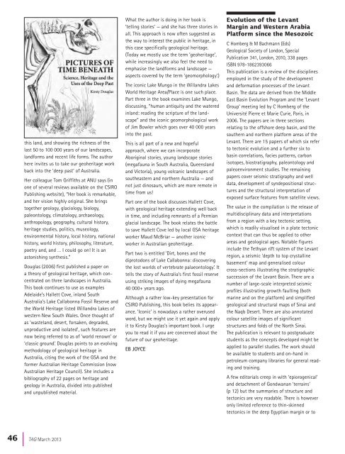
this land, and showing the richness <strong>of</strong> thelast 50 to 100 000 years <strong>of</strong> our landscapes,landforms and recent life forms. The authorhere invites us to take our geoheritage workback into the ‘deep past’ <strong>of</strong> <strong>Australia</strong>.Her colleague Tom Griffiths at ANU says (inone <strong>of</strong> several reviews available on the CSIROPublishing website), “Her book is remarkable,and her vision highly original. She bringstogether geology, glaciology, biology,paleontology, climatology, archaeology,anthropology, geography, cultural history,heritage studies, politics, museology,environmental history, local history, nationalhistory, world history, philosophy, literature,poetry and, and … I could go on! It is anastonishing synthesis.”Douglas (2006) first published a paper ona theory <strong>of</strong> geological heritage, which concentratedon three landscapes in <strong>Australia</strong>.This book continues to use as examplesAdelaide’s Hallett Cove, inland South<strong>Australia</strong>’s Lake Callabonna Fossil Reserve andthe World Heritage listed Willandra Lakes <strong>of</strong>western New South Wales. Once thought <strong>of</strong>as ‘wasteland, desert, forsaken, degraded,unproductive and isolated’, such features arenow being referred to as <strong>of</strong> ‘world renown’ or‘classic ground’. Douglas points to an evolvingmethodology <strong>of</strong> geological heritage in<strong>Australia</strong>, citing the work <strong>of</strong> the GSA and theformer <strong>Australia</strong>n Heritage Commission (now<strong>Australia</strong>n Heritage Council). She includes abibliography <strong>of</strong> 22 pages on heritage andgeology in <strong>Australia</strong>, divided into publishedand unpublished material.What the author is doing in her book is‘telling stories’ — and she has three stories inall. This approach is now <strong>of</strong>ten suggested asthe way to interest the public in heritage, inthis case specifically geological heritage.(Today we mostly use the term ‘geoheritage’,while increasingly we also feel the need toemphasise the landforms and landscape —aspects covered by the term ‘geomorphology’.)The iconic Lake Mungo in the Willandra LakesWorld Heritage Area/Place is one such place.Part three in the book examines Lake Mungo,discussing, “human antiquity and the wateredinland: reading the scripture <strong>of</strong> the landscape”and the iconic geomorphological work<strong>of</strong> Jim Bowler which goes over 40 000 yearsinto the past.This is all part <strong>of</strong> a new and hopefulapproach, where we can incorporateAboriginal stories, young landscape stories(megafauna in South <strong>Australia</strong>, Queenslandand Victoria), young volcanic landscapes <strong>of</strong>southeastern and northern <strong>Australia</strong> — andnot just dinosaurs, which are more remote intime from us!Part one <strong>of</strong> the book discusses Hallett Cove,with geological heritage extending well backin time, and including remnants <strong>of</strong> a Permianglacial landscape. The book relates the battleto save Hallett Cove led by local GSA heritageworker Maud McBriar — another iconicworker in <strong>Australia</strong>n geoheritage.Part two is entitled ‘Dirt, bones and thediprotodons <strong>of</strong> Lake Callabonna: discoveringthe lost worlds <strong>of</strong> vertebrate palaeontology’. Ittells the story <strong>of</strong> <strong>Australia</strong>’s first fossil reserveusing striking images <strong>of</strong> dying megafauna40 000+ years ago.Although a rather low-key presentation forCSIRO Publishing, this book belies its appearance.‘Iconic’ is nowadays a rather overusedword, but we might use it yet again and applyit to Kirsty Douglas’s important book. I urgeyou to read it if you are concerned about thefuture <strong>of</strong> our geoheritage.EB JOYCEEvolution <strong>of</strong> the LevantMargin and Western ArabiaPlatform since the MesozoicC Homberg & M Bachmann (Eds)<strong>Geological</strong> <strong>Society</strong> <strong>of</strong> London, SpecialPublication 341, London, 2010, 338 pagesISBN 978-1862393066This publication is a review <strong>of</strong> the disciplinesemployed in the study <strong>of</strong> the developmentand deformation processes <strong>of</strong> the LevantBasin. The data are derived from the MiddleEast Basin Evolution Program and the ‘LevantGroup’ meeting led by C Homberg <strong>of</strong> theUniversité Pierre et Marie Curie, Paris, in2006. The papers are in three sectionsrelating to the <strong>of</strong>fshore deep basin, and thesouthern and northern platform areas <strong>of</strong> theLevant. There are 15 papers <strong>of</strong> which six referto tectonic evolution and a further six tobasin correlations, facies patterns, carbonisotopes, biostratigraphy, paleontology andpaleoenvironment studies. The remainingpapers cover seismic stratigraphy and welldata, development <strong>of</strong> syndepositional structuresand the structural interpretation <strong>of</strong>exposed surface features from satellite views.The value in the compilation is the release <strong>of</strong>multidisciplinary data and interpretationsfrom a region with a key tectonic setting,which is readily visualised in a plate tectoniccontext that can thus be applied to otherareas and geological ages. Notable figuresinclude the Tethyan rift system <strong>of</strong> the Levantregion, a seismic ‘depth to top crystallinebasement’ map and generalised colourcross-sections illustrating the stratigraphicsuccession <strong>of</strong> the Levant Basin. There are anumber <strong>of</strong> large-scale interpreted seismicpr<strong>of</strong>iles illustrating growth faulting (bothmarine and on the platform) and simplifiedgeological and structural maps <strong>of</strong> Sinai andthe Naqb Desert. There are also annotatedcolour satellite images <strong>of</strong> significantstructures and folds <strong>of</strong> the North Sinai.The publication is relevant to postgraduatestudents as the concepts developed might beapplied to parallel studies. The work shouldbe available to students and on-hand inpetroleum company libraries for general readingand training.A few editorials creep in with ‘epiorogenical’and detachment <strong>of</strong> Gondwanan ‘terrains’(p 12) but the summaries <strong>of</strong> structure andtectonics are very readable. There is howeveronly limited reference to thin-skinnedtectonics in the deep Egyptian margin or to46 |<strong>TAG</strong> March 2013


