
You also want an ePaper? Increase the reach of your titles
YUMPU automatically turns print PDFs into web optimized ePapers that Google loves.
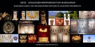
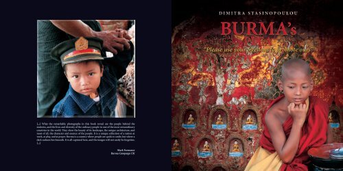
DIMITRA STASINOPOULOU<br />
BURMA’s<br />
<strong>PLEA</strong><br />
“Please use your freedom to promote ours”<br />
[...] What the remarkable photographs in this book reveal are the people behind the<br />
statistics, and the lives and diversity of the ordinary people in one of the most extraordinary<br />
countries in the world. They show the beauty of its landscape, the unique architecture, and<br />
most of all, the character and essence of the people. It is a unique collection of a nation at<br />
work, at play, and at prayer. Burma is a country where people are quick to smile, but where a<br />
dark sadness lies beneath. It is all captured here, and the images will not easily be forgotten.<br />
[...]<br />
Mark Farmaner<br />
Burma Campaign UK
BURMA’s <strong>PLEA</strong><br />
“Please use your freedom to promote ours”<br />
Aung San Suu Kyi<br />
PHOTOGRAPHY - TEXT<br />
Dimitra Stasinopoulou
PRIVATE EDITION<br />
To the Lady of Burma,<br />
Aung San Suu Kyi,<br />
the outstanding example of<br />
the power of the powerless<br />
Dimitra Stasinopoulou has donated these books to Burma Campaign UK.<br />
Any proceeds from the sales can be used at their discretion. To find out more<br />
about their work and ways to support, please contact:<br />
BURMA CAMPAIGN UK<br />
28 Charles Square,<br />
London, N1 6HT<br />
Tel: +44 (0)20 7324 4710<br />
Email: info @burmacampaign.org.uk<br />
Web: www.burmacampaign.org.uk<br />
The Burma Campaign UK, Registered Company No. 3804730<br />
Registered office address as shown above.
Dimitra Stasinopoulou was born in Athens, Greece in 1953. After<br />
completing her studies, she worked in the banking sector for 20<br />
years, and later on, in the family business in Romania. Her first<br />
Book “Romania of my Heart” was awarded with the Romanian<br />
UNESCO prize. Ever since then, her love of travelling to amazing<br />
destinations around the globe and her desire to share the images<br />
she brought back with her, led her to the publiction of the books<br />
“Bhutan, Smiling Faces from the Roof of the World” in October<br />
2008, “India, Unity in Diversity” in March 2010, and “Papua, New<br />
Guinea”, in September 2011. Her pictures have been awarded in<br />
international photo-competitions and have been displayed in<br />
Greece and abroad.<br />
CONTENTS<br />
PROLOGUE & MOTIVATION - INTRODUCTION 6 - 13<br />
EAST BURMA Inle Lake, Shan State 14 - 83<br />
WEST BURMA Sittwe, Mrauk U, Ngapali 84 - 205<br />
UPPER BURMA Mandalay, Bagan, Irrawaddy River, Maymyo, Mt.Popa 206 - 351<br />
SOUTH BURMA Yangon, Bago, The Golden Rock 352 - 407
PROLOGUE & MOTIVATION by Dimitra Stasinopoulou<br />
have written in the past that my interest in photography came late<br />
I in my life. As I grew up, I began traveling and photographing places<br />
and, above all, people that are distant from the modern western way of<br />
life, who pursue a different path, and who have not been overtaken yet<br />
by the homogeneity of the west. I take photographs of whatever moves<br />
me, I take photographs from the heart, hoping to transmit these images<br />
and emotional experiences and discovering what it means seeing, rather<br />
than merely looking. The poet Tasos Livaditis wrote, “Only when you<br />
share it does the world exist”, a phrase that perfectly sums up my need to<br />
share all this.<br />
Burma (renamed Myanmar by the military dictatorship in 1989) has<br />
been ruled by one of the most brutal dictatorships in the world since<br />
1962, the year when the democratic political system was dissolved.<br />
The country and its people differ from the rest of Asia. As Kipling<br />
wrote, “This is Burma, and it will be quite unlike any land you know<br />
about”. More than a century later, Myanmar remains a world apart. It’s<br />
like visiting a vast open-air museum, with time stopping in 1948. The<br />
country and its population are different from the rest of Asia. Just three<br />
months after my first visit, in October 2010, I was back. The “land of the<br />
golden horizons”, as it also called, is a beautiful country frozen in time,<br />
one of the most mysterious and unexplored destinations in the world,<br />
with a cultural heritage going back 2.500 years. Wonderful monuments<br />
and ancient cities testify to a vibrant culture, whilst the warmest greetings<br />
of Asia await the visitors who can appreciate this exceptional place.<br />
It is also said that “in the other Asian countries the people offer you a<br />
gentle smile, while here the smiles never end”. Due to years of political<br />
isolation, Myanmar is one of the world’s least technologically advanced<br />
countries. Although modern practices, such as cars and televisions, have<br />
made their appearance, there are still parts of the country where goods<br />
are transported in ox-drawn carts, or in rafts along the rivers, and where<br />
storytellers are responsible for the evening’s entertainment. In one of<br />
the most photogenic countries in the world, it seems all one has to do is<br />
point the camera, and he has a wonderful picture. The people, friendly<br />
and anxious for a window to the outside world, embrace foreign visitors.<br />
A unique charm and ambience prevails throughout the country.<br />
The country which Marco Polo called “The Golden Land” inspired by the<br />
spectacle of the golden pagodas, is inhabited by good hearted, hospitable<br />
and deeply religious people, 90% being Buddhist. Religion is defining<br />
their lives. The most important institution is the Theravada Buddhism<br />
School, whilst the local animistic worship is still alive, now incorporated<br />
into Buddhism. Burma today has over 56.800 monasteries, the number<br />
of monks, nuns and young novices, exceeding 580.000. In the past,<br />
religion also defined political legitimacy, and each king was responsible<br />
for reforming the principles of Sangha, that is, of monkhood, and for<br />
building imposing pagodas. The monks played an even more important<br />
role: all the schools in the pre-colonial period were inside the monasteries<br />
and the monks had the responsibility for educating the people, so<br />
that they would read the scriptures. Even today, thousands of children<br />
from poor families, or orphans from remote villages, are sent to the<br />
monastic schools in order to be taught reading, writing and the basic<br />
elements of the natural sciences, history, geography and Buddhism, as<br />
well as to ensure that they are fed. Seventy percent of the population<br />
belongs to the Burman (Bumah) ethnic group, which is related to the<br />
Tibetan, while the country has another 135 ethnic minority groups.<br />
George Orwell, who lived in Burma for a number of years, serving in<br />
the British Empire’s Indian Imperial Police force, was prophetic for the<br />
conditions that prevail today. His novels The Burmese Days, Animal<br />
Farm and Nineteen Eighty-Four, appear to have been written specifically<br />
as an account of the situation that the country faces the last 50 years.<br />
The generals have been accused of infringing human rights, of violent<br />
displacements of ethnic minorities, the widespread use of forced labour,<br />
even amongst under age children, kidnapping civilians and using them<br />
to war zones to carry bullets and bombs, murders and rapes. The<br />
inhabitants have revolted many times, the best known occasion being<br />
the large uprising that was violently suppressed in 1988.<br />
In 2007, when the people protested peacefully in the streets, demanding<br />
democratic reforms and better living conditions, the military did not<br />
hesitate to open fire, even against the thousands of Buddhist monks. The<br />
regime revealed its hateful side in May 2008, when Burma was struck by<br />
Cyclone Nargis, leaving in its wake hundreds of thousands of dead and<br />
millions in emergency need. Although they had advance warnings from<br />
the meteorological agencies, they did not do the slightest to be prepared,<br />
and they didn’t inform the people. The cyclone found the inhabitants<br />
unprotected in the face of the powerful winds, that devastated villages,<br />
uprooted houses and swept children from their parents’ arms, while<br />
after the disaster the regime refused to accept the aid of the United<br />
Nations and humanitarian groups and refused medicines, food and<br />
clean water. In declaring that any aid was unwelcome they left its people<br />
at the mercy of famine and epidemics.<br />
Because of its long-term political isolation, Burma is one of the poorest<br />
countries in the world, but the poverty one encounters everywhere,<br />
does not seem to have crushed the morale of its smiling people.<br />
As I wandered through bustling markets, golden pagodas and faded<br />
British hill stations – like images from old postcards – it was difficult<br />
for me to believe that I was travelling in a country whose people were<br />
suffering from the greatest human rights violations in the world. In<br />
contrast of what you see, a society that values tradition and can look<br />
after itself, this country is like a prison. The local guides are carefully<br />
chosen, and they only show what the regime permits, carefully hiding<br />
the reality. It is not rare at all, however, for some local to start talking<br />
to you of their support for Αung San Suu Kyi and of their hopes for<br />
the collapse of the country’s military regime, to tell the world about<br />
their hidden, deep suffering. On my first day in Yangon, as I set off<br />
from the most holy place of pilgrimage, the Swhedagon Pagoda, a<br />
man approached me, smiled and said to me: “please spread our need<br />
for democracy, we are so tired”, one of the few fleeting hints that not<br />
everything was right.<br />
Burma’s amazing natural landscape, the picturesque villages and its<br />
vibrant culture, hide from the visitor the harsh reality that lurks beneath<br />
the surface. The regime has driven the country into an unprecedented<br />
isolation and poverty, gradually deadening its spirit, its purity, its deeper<br />
truth. Suspicion has a primary role in human communication, given<br />
that anybody could be, and sometimes is, a government spy. People<br />
are arrested, imprisoned and tortured for long periods of time, without<br />
being charged, or trialed, and without being able to appeal. People are<br />
not permitted to travel freely within the country; they cannot even<br />
spend the night at a friend’s house without special permission and<br />
each citizen must be registered to live at a given address. The regime<br />
has photographs of all tenants and during the sporadic raids of homes,<br />
which always happen late at night, anyone who is not documented is<br />
arrested. This for me is the most shocking thing about Burma: how this<br />
flagrant oppression of a whole nation of 55 million people, can exist<br />
and be perpetuated in a completely cloaked manner, as the country’s<br />
rich visual imagery can divert your attention from the oppression of the<br />
people, the infringements and the undercurrent of sorrow.<br />
In order to get to know the true Burma, one must come face-to-face<br />
with the displacement of at least 1.000,000 inhabitants, the existence of<br />
over 2.000 political prisoners -many of whom are tortured, the use of<br />
systematic rapes as a weapon of control, the human trafficking, the high<br />
infant mortality rate (10% die before the age of five), the huge military<br />
expenditure (half the national budget), the propaganda of the media,<br />
and the poverty, in contrast with the luxury palatial villas in which the<br />
generals live.<br />
Until recently, travelers avoided visiting, backing the boycott, trying<br />
not to strengthen and maintain the regime with their money, but things<br />
are different now. People have a need to speak with someone –anyone–<br />
from abroad. Visitors are living symbols that they need to see, in order<br />
to feel that they have not been forgotten. Tourists for the Burmese, are<br />
a wide window to learn about the outside world, while talking with the<br />
local can bring ideas. Ideas are like oxygen and valuable information<br />
can be transferred from and to the country. “Please use your liberty to<br />
promote ours” is their only request, as it was expressed by Aung San Suu<br />
Kyi, Burma’s icon of democracy, the only thing that they ask in return<br />
for sharing the wonderful natural and cultural treasures that they have<br />
taken care to preserve. And it is indeed the duty of the foreigners, to give<br />
something small in return to these wonderful people who have suffered<br />
for decades, and to spread the news of all they have encountered<br />
during their stay in the country. To get to know these humble, gentle<br />
and decent people, who can teach us much with their smiles, patience<br />
and generous humanity, who allow their deep religious feelings to<br />
guide them to a kindness and an inexhaustible and persistent faith in<br />
life, and who desperately want to find their place in the world, within a<br />
country that is at the mercy of tyrants, isolated from the international<br />
community.<br />
Aung San Suu Kyi, the Lady, as they call her in Burma, armed only with<br />
the principle of non-violent resistance and her smile, dares to stand up<br />
to the generals who have controlled Burma for five decades, personifies<br />
all meaning of resistance, every hope for freedom. In 1990, she and<br />
her party, the National League for Democracy, won a crushing victory<br />
during the country’s first elections, but she was never allowed to govern.<br />
This brave woman, has spent 15 of the past twenty-one years of her life<br />
under house arrest, while at the same time, has also become the voice for<br />
one of the most oppressed and unjustly treated people on the planet.<br />
Perhaps the Noble Peace Prize that she was awarded in 1991, was the<br />
most overt expression of support on the part of the West for her quiet,<br />
persistent yet peaceful struggle. The decision of the Norwegian Nobel<br />
Committee stated: “We have decided to award the Nobel Peace Prize for<br />
1991, to Aung San Suu Kyi of Myanmar (Burma), for her non-violent<br />
struggle for democracy and human rights… Suu Kyi’s struggle is one of the<br />
most extraordinary examples of civil courage in Asia in recent decades.<br />
She has become an important symbol in the struggle against oppression…<br />
We wish to honour this woman for her unflagging efforts and to show<br />
our support for the many people throughout the world who are striving<br />
to attain democracy, human rights and ethnic conciliation by peaceful<br />
6 7
means”. The committee chairman, called her “an outstanding example<br />
of the power of the powerless”.<br />
In a world in desperate need of heroes, Aung San Suu Kyi stands tall<br />
as one of the few moral resistance symbols left. Wang Dan, the leader<br />
of the bloody student uprising in Tiananmen Square, China, in 1989,<br />
refers to her as “A Lady called Hope”. He has “drawn inspiration from<br />
Suu Kyi” and declares that “She has become a symbol to those of us<br />
fighting for human rights against authoritarian regimes. She represents<br />
a force that seems weak on first appearance but which, in fact, is truly<br />
tremendous”. When she was liberated in November 13 th , 2010, the U.S.<br />
President Barack Obama called her “a hero of mine”, while her first<br />
statements were: “My very top priority is for people to understand that<br />
they have the power to change things themselves,” adding “In my life, I<br />
have been showered with kindness. More than love, I value kindness. Love<br />
comes and goes, but kindness remains”. Her message is very simple: “only<br />
by defeating your fears you can be truly free”. And it is precisely this<br />
message that the military regime fears and is desperate to silence.<br />
In the November 2010 elections, San Suu Kyi’s party was prohibited<br />
from participating. The United Nations described these elections as<br />
a parody with the purpose of legitimising the regime. Thein Sein, a<br />
former general, who won the elections with almost 80% of the seats,<br />
was appointed President by the parliament and became the country’s<br />
first non-military President in fifty years. Today, there are a few hopeful<br />
signs, but are still very far from the true changes this country needs.<br />
On October 6 th 2011 the government, in order to lift the political<br />
and economic sanctions imposed in the 1990s, by the USA, EU and<br />
Australia, announced the release of a number of political prisoners.<br />
My journeys to Burma, were among the most amazing and revealing,<br />
that I have undertaken in my whole life. I was able to approach people<br />
who live under the harshest dictatorship. These photographs are a<br />
glimpse onto the hinterland of a forgotten country, where the people<br />
remain excruciatingly isolated and cut off, enduring one of the worst<br />
regimes in the world with an incredible stoicism and dignity, and<br />
who truly need the help of all of us. The viciousness of the regime, the<br />
hardships, people’s daily struggle for survival, the poverty, the kindness,<br />
the quiet dignity, as well as the hope, are documented through the<br />
camera lens, along with their souls.<br />
There are so many experiences that I would like to share with you<br />
on the kindness of these people. One day, as I was slowly climbing<br />
up the steep footpath towards the Golden Rock, one of the country’s<br />
most holy pilgrimage sites, a tropical storm suddenly broke out and it<br />
was impossible for me to continue. A beautiful, toothless, old peasant<br />
woman invited me into the reed hut that housed her whole family, their<br />
tools and their animals. Conversation, beyond the language of gestures,<br />
a smile, an eye contact, a touch, was impossible. Despite all this, we<br />
felt very close for the few hours, until the rain stopped. When the time<br />
came for me to leave, and knowing that we would probably never meet<br />
again, we walked to the edge of the road and said farewell, with a warm<br />
embrace. We continue to be together. I still think of her. When our<br />
minds could not meet, our hearts formed the common bond. When our<br />
speech was a mystery, it was solved through our glances and our hand<br />
movements. I kept thinking, that no matter how many journeys one<br />
might take, whichever part of the planet we may find ourselves, every<br />
time we will see the cheeky smile of a child, the impetuous gaze of the<br />
adults and the stoic, welcome expression of the elders, we realize that<br />
under the successive layers of culture, we are all the same.<br />
Burma Campaign UK is a non-profit organisation that fights for<br />
human rights, democracy and Burma’s development, the loudest voice<br />
in support of Aung San Suu Kyi’s struggle and the suffering people of<br />
Burma. It is an honour for me to offer them these books.<br />
I am grateful and deeply indebted to the authors of the books I used<br />
for my research. Their deep knowledge has granted me precious input<br />
regarding the way of life, the religion and the culture of Burma - in<br />
fact, the completion of this book would have been impossible without<br />
their contribution.<br />
BIBLIOGRAPHY<br />
BURMA CAMPAIGN UK www.burmacampaign.org.uk<br />
BBC News, Country Profile: Burma<br />
Aung San Suu Kyi, Letters From Burma, Penguin books, 2010<br />
Aung San Suu Kyi, Freedom from Fear, Penguin books, 1991<br />
Aung San Suu Kyi, The Voice of Hope, Random Group Ltd, 2008<br />
George Orwell, Animal Farm, Harcourt Books, 2003<br />
George Orwell, Burmese Days, Penguin Modern Classics, 2009<br />
George Orwell, 1984, Harcourt Books, 2003<br />
Asia Transpacific Journeys, Information leaflet<br />
Peter De Ruiter, Burma: The Beauty and the Beast, Kindle Edition 2010<br />
David I. Steinberg, Burma/Myanmar – What Everyone Needs to Know,<br />
Oxford University Press, 2010<br />
Emma Larkin, Finding George Orwell In Burma, Penguin Books, 2010<br />
Human Rights Watch, Burma’s Forgotten Prisoners, Kindle Edition, 2009<br />
Frans Welman, Oh Burma–A Country Abandoned–Myanmar or Burma,<br />
vol. I & II, Kindle Edition, 2011<br />
Pascal Khoo Thwe, From the Land of the Green Ghosts: Burmese Odyssey,<br />
Harper Perennial, 2003<br />
A Patrick Forsyth, A Land Like None you know, Awe and Wonder in Burma on the Road to<br />
Mandalay, Bangkok Books, 2010<br />
Rudyard Kipling, “On the Road to Mandalay”, Barrack-Room Ballads, and Other Verses, Signet<br />
Classics, 2003<br />
Normal Lewis, Golden Earth-Travels in Burma, Eland Publishing, 2008<br />
Thant Myint-U, The River of the Lost Footsteps-A Personal History of Burma, Faber & Faber Ltd,<br />
Kindle Edition, 2011<br />
Anders Ostergaard, Burma NJ (DVD), 2008<br />
Lisa Rhodes, Roads to Existence, Kindle Edition, 2008<br />
Noel F. Singer, Burma: A Ph.Journey 1855-1925, Kiscadale, 1993<br />
Matthew Smith (Human rights and environmental activist), “Time for New Approach to Burma:<br />
War Crimes Mounting”, Internet article<br />
Ma Thanegi (text), Khant (photography), The Splendors of Myanmar, Asia House Publication<br />
Hannah Beech, “The Lady Returns”, TIME Magazine, Nov.29, 2010<br />
Hannah Beech, “The Fighter” TIME Magazine, January 10, 2011<br />
R. Ratnesar, “Is it time to Invade Burma”, Time World,May 10,2008<br />
Lonely Planet, Burma/Myanmar, 2009<br />
Wikipedia And Wikitravel<br />
BURMA - AN INTRODUCTION by Mark Farmaner, Director, Burma Campaign UK<br />
Burma is a country most people know little about. Some may<br />
have heard of Aung San Suu Kyi, the iconic leader of Burma’s<br />
democracy movement. A winner of the Nobel Peace Prize, she has<br />
spent 15 years in detention, mostly under house arrest. Her nonviolent<br />
and stoic resistance is an inspiration not just to the people of<br />
Burma, but for people all over the world.<br />
When Burma does make the news it is often because of an atrocity,<br />
such as in 2007, when soldiers opened fire on Buddhist monks<br />
marching peacefully in the streets, calling for democratic change.<br />
Or because of a tragedy, such as when Cyclone Nargis struck in 2008,<br />
and the dictatorship ruling the country refused to allow international<br />
aid into the country. At least 140,000 people lost their lives. Burma<br />
is also often referred to in terms of statistics, having thousands of<br />
political prisoners, the Burmese Army destroying 3,600 villages of<br />
ethnic minority groups, and having one of the world’s longest running<br />
civil wars.<br />
What the remarkable photographs in this book reveal, are the people<br />
behind the statistics, and the lives and diversity of the ordinary people<br />
in one of the most extraordinary countries in the world. They show<br />
the beauty of its landscape, the unique architecture, and most of all,<br />
the character and essence of the people. It is a unique collection of<br />
a nation at work, at play, and at prayer. Burma is a country where<br />
people are quick to smile, but where a dark sadness lies beneath. It is<br />
all captured here, and the images will not easily be forgotten.<br />
HISTORY<br />
Burma’s strategic location, with India and China as neighbours, has<br />
played in the development and history of the country. It has also<br />
contributed to Burma being beset by conflict for much of its history.<br />
The first people to settle in central Burma are thought to be the Mon.<br />
Their migration from India began approximately 3-2,500BC. However,<br />
the Arakanese in north-west Burma claim they had kingdoms in<br />
Burma as long ago as 3,335BC. Migration of other groups followed,<br />
with the Karen thought to have travelled to Burma from Mongolia,<br />
the Kachin from Tibet, and many others from Yunnan in China. The<br />
Bamar, the Burmese ethnic group, came from southern China, and<br />
founded the kingdom of Pagan. Many other smaller ethnic groups<br />
also came to Burma, settling in more isolated mountains and valleys.<br />
In 1044 the Burmese King Anawratha began to extend Burmese<br />
rule over much of the country and promoted Theravada Buddhism.<br />
Anawratha then conquered the Mon kingdom. In 1077 Anawratha<br />
was succeeded by his son, Sawlu. He was killed in fighting against<br />
the Mon and replaced by the military leader, Kyansittha. Under his<br />
rule, Pagan is said to have been known as the “city of the four million<br />
pagodas”. He died in 1112. As the Mongols in China and the ethnic<br />
Shan in the east of Burma grew stronger, Burmese rule weakened.<br />
Pagan was overwhelmed by the Mongols in 1287. The Mon broke<br />
with Pagan and founded a new kingdom at Martaban in Tenasserim,<br />
further south in Burma.<br />
In a period extending from about 1300 to 1550, the Shan dominated<br />
Burma with their capital at Ava. In 1369, the Mon abandoned<br />
Martaban and built a new capital at Pegu under King Zazadhirit<br />
(1385-1423). The Mon, ruled by, among others, Queen Shin Saw<br />
Bu and King Dhammazedi, and the Shan, under kings such as<br />
Minkhaung, waged many wars. The Shwedagon Pagoda in Rangoon<br />
was built between 1453 and 1492, a period during which Minkyinyo<br />
established Toungoo as a new Burmese power base. During this time<br />
the first European explorers arrived, mainly Portuguese. Some were<br />
to eventually settle in Burma, prized by Burmese Kings for their<br />
artillery skills. Burmese influence revived between 1531 and 1550.<br />
Tabinshweti set up his capital at Pegu. He was murdered by a Mon<br />
subject, leaving King Bayinnaung to bring the Burmese, the Shan and<br />
the Mon under his rule. After his death, the Burmese spent the next<br />
two hundred years or more fighting intermittent wars with the Thai<br />
and the Arakanese.<br />
8<br />
9
In 1752, Alaungpaya became the first king of the Konbaung dynasty.<br />
He reunited the country but waged more wars against the Thai. He<br />
died in 1760. War-weariness and the rehabilitation of destroyed towns<br />
and villages and the devastated countryside produced a short period<br />
of relative peace and stability. Burmese kings gradually expanded<br />
their influence. However, many ethnic minorities found the rule of<br />
Burmese kings cruel and oppressive.<br />
The early part of the nineteenth century brought the British to southeast<br />
Asia in force. The first Anglo-Burmese war broke out in 1824.<br />
Manipur and Assam were ceded to the British in India. The second<br />
Anglo-Burmese war in 1852 ended with Lower Burma falling into<br />
British hands. In 1857, King Mindon founded Mandalay and made<br />
it his capital. The British captured the city during the third Anglo-<br />
Burmese war in 1885. Thibaw, the last king of the Konbaung dynasty,<br />
was sent into exile in India and Burma became part of the British<br />
empire as a province of India. The British moved the capital to<br />
Rangoon. In January 1886, Burma was incorporated into the British<br />
empire as a province of India; Rangoon was made the capital; and the<br />
Burmese monarchy was abolished.<br />
Resistance to British rule, first through armed uprisings, and later<br />
through political channels and civil disobedience, finally led the<br />
British parliament to pass in 1935 the Government of Burma Act,<br />
providing for the country’s separation from India and a limited<br />
form of home rule with a two-chamber legislative assembly. The<br />
following year, the students of Rangoon University protested<br />
again in protest at attempts to suppress an article in their magazine<br />
criticising government officials. Aung San, father of Aung San Suu<br />
Kyi emerged as the main leader of the nationalist independence<br />
movement. During World War II, Aung San and other leaders of<br />
the independence movement snuck out of Burma and received<br />
training from the Japanese. There were 30 of them, and they became<br />
known as the 30 Comrades. They formed the Burma Independence<br />
Army (BIA) on the 28 th December 1941. The following January,<br />
the first BIA units invaded Burma from Thailand with the Japanese<br />
15 th Army. Japan swiftly occupied Burma. But the Burmese soon<br />
found that Japan was not going to keep promises about restoring the<br />
independence of Burma. Instead they wanted a puppet government.<br />
The Burmese found Japanese rule even more oppressive than<br />
the British.<br />
Aung San secretly met with Lord Mountbatten, commander of allied<br />
forces in South East Asia. He said his forces might be willing to switch<br />
sides. When asked if he was just saying this now as it was clear the<br />
allies were going to win the war, Aung San replied that it would be<br />
silly of him to switch sides to the allies if he thought they were going<br />
to lose! In March 1945, with the British Army successfully retaking<br />
northern Burma, Aung San kept his word, and switched the 10,000<br />
BIA troops, now renamed the Burma National Army in support of<br />
the Allies. The Allies then quickly captured Mandalay and Rangoon.<br />
On August 28 th 1945, the Japanese in Burma formally surrendered.<br />
British rule was restored but Burma’s economy and infrastructure<br />
were in ruins. Elections were held in April 1947 with Aung San’s Anti-<br />
Fascist People’s Freedom League (AFPFL) winning an overwhelming<br />
victory. On the 19th July 1947, Aung San and other senior leaders<br />
were killed by armed uniformed men bursting into a meeting of the<br />
Executive Council. The assassins were traced to the former Prime<br />
Minister, U Saw, who was subsequently found guilty of involvement in<br />
the plot, and executed. As Burma finally celebrated its independence<br />
on the 4 th January 1948, it had also been stripped of its most able and<br />
charismatic leaders.<br />
CONFLICT RETURNS<br />
Almost from the moment of independence, Burma was again afflicted<br />
by conflict. Initially the biggest threat to the government was from<br />
communist insurgents, who had once been part of the independence<br />
movement. Communist insurgency was to continue until the late<br />
1980s. However, an even more serious source of conflict was with<br />
Burma’s many ethnic groups. Burma as it is today was created under<br />
British rule. Some ethnic groups wanted to return to an independent<br />
status, others, such as the Karen, who had been oppressed under the<br />
rule of Burmese kings, also wanted their own separate state.<br />
During World War II many of the ethnic groups had sided with the<br />
British against the invading Japanese and the Burma Independence<br />
Army. This had exacerbated existing ethnic tensions. Many British<br />
commanders in Burma had also promised them an independent<br />
state should Burma become independent after the war. But Britain<br />
broke its word. The British had initially offered a compromise<br />
whereby the ethnic areas on Burma’s mountainous borders would<br />
remain as a kind of British protectorate, while the rest of Burma<br />
gained immediate independence. Aung San refused to consider<br />
this, effectively threatening mass civil unrest and armed uprising if<br />
the British pursued this option. With the British weakened by war<br />
and facing crises which they saw as more important, they backed<br />
down. Burma would gain independence as a whole. Aung San did<br />
understand that the aspirations of Burma’s ethnic people would have<br />
to be accommodated in some way. He held the Panglong conference<br />
in early 1947, at which some ethnic nationalities did agree to remain<br />
part of Burma and the Shan and Karenni had the right to secede after<br />
ten years. This agreement was never honoured by the government of<br />
Burma once independence was obtained.<br />
The ethnic Karen had not signed up to Panglong, and continued to<br />
campaign for their own state. As well as living in the east of Burma in<br />
what is now Karen State, the Karen also lived in the Delta of Burma,<br />
and many lived in Insein Township on the outskirts of Rangoon. The<br />
Karen were most associated with siding with the British. Incidents<br />
of communal violence increased immediately after independence,<br />
and some elements of the Burmese Army appeared to be allowing,<br />
if not actively encouraging, the violence against the Karen. Tensions<br />
reached a peak in December 1948 when a Karen church had a grenade<br />
thrown inside during a service on Christmas Eve. Areas of Insein<br />
where Karen people lived we fired upon by people driving through on<br />
trucks. When political leaders of the Karen were arrested, the main<br />
Karen party, the Karen National Union, called on people to take up<br />
arms, and so began the world’s longest running civil war.<br />
DICTATORSHIP<br />
On 2nd March 1962, General Ne Win, one of the 30 comrades,<br />
seized power in a military coup. He then formed the Burma Socialist<br />
Programme Party. All other parties were eventually banned. Student<br />
protests were brutally put down. The coup was triggered in part by the<br />
democratic government agreeing to meet with some ethnic groups to<br />
discuss the old Panglong agreement. Since independence more ethnic<br />
groups had taken up arms in order to protect their communities and<br />
pursue their political goals. However, the nationalist military was<br />
unwilling to allow the elected government make any concessions to<br />
ethnic groups, claiming they had to take power to preserve the unity<br />
of the nation. Ne Win’s regime isolated the people of Burma, although<br />
Ne Win and other regime officials enjoyed frequent foreign travel.<br />
Tourist visas were granted for only seven days with travel restricted to<br />
specific areas. Burmese citizens were rarely allowed to go abroad.<br />
Ne Win’s economic policies plunged what had been before the war<br />
a relatively prosperous country compared to its neighbours, into<br />
stagnation and decline. Burma was left behind as neighbouring<br />
economies grew, and Burma’s people slipped deeper into poverty.<br />
In 1987 Burma was reclassified by the United Nations as a Least<br />
Developed Country. At the same time Ne Win’s superstitious belief<br />
that his lucky number was 9 led to a bizarre abolition of much of the<br />
currency, leaving only 45 and 90 kyat notes in circulation. As most<br />
people kept all their wealth in cash rather than trusting banks, this<br />
wiped out people’s life savings.<br />
Students protested about these events on the streets, and Ne Win’s<br />
regime responded with brutality, but this in turn just brought more<br />
people onto the streets, culminating in huge protests on 8th August<br />
1988. The Burmese Army fired on the protestors and thousands of<br />
people were killed. Ne Win had announced his resignation in July<br />
but was believed still to be pulling the strings from behind the scenes.<br />
Protests continued and on 18 th September 1988 there was a military<br />
coup, led by Saw Maung. His regime gave themselves the title, the<br />
State Law and Order Restoration Council (SLORC). A year later the<br />
regime announced the country had been renamed Myanmar, a change<br />
many in Burma refused to accept, saying the military had no right to<br />
change the name of the country.<br />
AUNG SAN SUU KYI<br />
Aung San Suu Kyi was born on 19 th June 1945, daughter of Burma’s<br />
independence hero, Aung San, who was assassinated when she was<br />
only two years old. Aung San Suu Kyi was educated in Burma, India,<br />
and the United Kingdom. While studying at Oxford University, she<br />
met Michael Aris, a Tibet scholar who she married in 1972. They had<br />
two sons, Alexander and Kim. Aung San Suu Kyi returned to Burma<br />
in 1988 to nurse her dying mother, and soon became engaged in the<br />
country’s nationwide democracy uprising.<br />
Following the military coup on 18th September 1988, on 24 th<br />
September 1988 a new pro-democracy party, the National League for<br />
Democracy (NLD), was formed. Aung San Suu Kyi was appointed<br />
General Secretary. Aung San Suu Kyi gave numerous speeches calling<br />
for freedom and democracy, and carried out political activities across<br />
the country. Facing increasing domestic and international pressure,<br />
the dictatorship was forced to call a general election, held in 1990<br />
As Aung San Suu Kyi began to campaign for the NLD, she and many<br />
others were detained by the regime. Aung San Suu Kyi was banned<br />
from personally standing in the election. Despite conditions around<br />
the elections being far from free and fair, with Aung San Suu Kyi<br />
and other democracy activists being detained, biased media, and<br />
intimidation of politicians, the voting on the day was relatively free<br />
and fair. The NLD won a staggering 82% of the seats in Parliament.<br />
The dictatorship never recognised the results of the election, and<br />
refused to hand over power.<br />
Aung San Suu Kyi was held under house arrest until July 1995. When<br />
she was released she faced restrictions on travel. On 27 th March 1999,<br />
Aung San Suu Kyi’s husband, Michael Aris, died of cancer in London.<br />
He had petitioned the Burmese authorities to allow him to visit Aung<br />
San Suu Kyi one last time, but they had rejected his request. He had<br />
not seen her since a Christmas visit in 1995. The government always<br />
urged Aung San Suu Kyi to join her family abroad, but she knew that<br />
she would not be allowed to return to Burma. In 2000 Aung San Suu<br />
Kyi was again placed under house arrest after repeated attempts to<br />
leave the capital, Rangoon, to hold political meetings in other parts<br />
of the country. In 2002, Aung San Suu Kyi was released from house<br />
arrest and with freedom to travel around the country. The release was<br />
part of a deal negotiated by UN Envoy on Burma, Razali Ismail. He<br />
had facilitated secret meetings between Aung San Suu Kyi and the<br />
military. However, when it came to move from confidence building<br />
meetings, and instead start dealing with matters of substance, the<br />
dictatorship refused to engage in any meaningful dialogue.<br />
10 11
The dictatorship began using members of the Union Solidarity and<br />
Development Association (USDA) to harass and attack NLD meetings.<br />
This political militia was set up and organised by the military, with<br />
Than Shwe, dictator of Burma, as its President. It later transformed as<br />
the Union Solidarity and Development Party, the political party front<br />
for the military in the elections held on 7th November 2010.<br />
On 30 th May 2003, members of the USDA attacked a convoy of<br />
vehicles Aung San Suu Kyi was travelling in. It was an attempt by the<br />
dictatorship to assassinate Aung San Suu Kyi, using a civilian front so<br />
as not to take the blame. Aung San Suu Kyi’s driver managed to drive<br />
her to safety, but more than 70 of Aung San Suu Kyi’s supporters were<br />
beaten to death. The attack became known at the Depayin Massacre.<br />
The dictatorship claimed it was a riot between two political groups,<br />
incited by the NLD. The United Nations General Assembly called for<br />
the incident to be investigated, but it never was. Following the attack,<br />
Aung San Suu Kyi was held in detention, and then placed back under<br />
house arrest.<br />
In May 2009, just days before her period of house arrest was due to<br />
expire, Aung San Suu Kyi was arrested and charged with breaking the<br />
terms of her house arrest, which forbids visitors, after John Yettaw, a<br />
United States citizen, swam across Inya lake and refused to leave her<br />
house. In August 2009 she was convicted, and sentenced to three years<br />
imprisonment. In an apparent attempt to placate international outrage<br />
about the trial, the sentence was reduced to 18 months under house<br />
arrest. By coincidence, this meant her release date turned out to be<br />
just 6 days after elections to be held in Burma, thereby ensuring that<br />
once again she was in detention during elections. On 13 th November<br />
2010, the day her sentence was due to expire, and six days after rigged<br />
elections, Aung San Suu Kyi was released again.<br />
Aung San Suu Kyi has won numerous international awards, including<br />
the Nobel Peace Prize, the Sakharov Prize from the European<br />
Parliament and the United States Presidential Medal of Freedom. She<br />
has called on people around the world to join the struggle for freedom<br />
in Burma, saying “Please use your liberty to promote ours.”<br />
ETHNIC ISSUES<br />
The failure to address the concerns of Burma’s ethnic groups lies at<br />
the heart of Burma’s problems. Burma’s ethnic minorities have been<br />
struggling for ethnic and political rights for decades as successive<br />
dictators in Burma have pursued a policy of ‘Burmanisation’, which<br />
ranges from repressing the teaching of ethnic history, language and<br />
culture, to military attacks against civilians.<br />
Lack of a reliable census makes it impossible to more than roughly<br />
estimate the composition of Burma’s ethnic populations today or its<br />
total population. It is estimated ethnic people constitute 30-40 percent<br />
of Burma’s population of 54-59 million people. Most of Burma’s ethnic<br />
minorities inhabit areas along the country’s mountainous frontiers.<br />
Karen and Shan groups comprise about 10% each, while Akha, Chin,<br />
Chinese, Danu, Indian, Kachin, Karenni, Kayan, Kokang, Lahu, Mon,<br />
Naga, Palaung, Pao, Rakhine, Rohingya, Tavoyan, and Wa peoples<br />
each constitute smaller percentages of the population.<br />
The principal demands of Burma’s ethnic minorities are to gain<br />
genuine autonomy for their home areas and to achieve a significant<br />
voice in the affairs of the country as a whole. Most want a federal<br />
system of government, and are not fighting for independence.<br />
In the 1960s the Burmese Army began what is known as the ‘Four<br />
Cuts’ policy to cut off supplies and support to ethnic armed groups.<br />
This involved cutting off supplies such as food, funds, new recruits<br />
and intelligence. What this meant in practice was the deliberate<br />
targeting of civilian villages by the Burmese Army. This is classified<br />
as war crimes by the Geneva Conventions. Abuses committed by the<br />
Burmese Army, and documented by the United Nations and local<br />
communities, include the use of millions of people as slave labour,<br />
rape and gang-rape, even against young children, torture, mutilations,<br />
crucifixions, executions, burning of villages, confiscation of land,<br />
mortar bombing schools, recruitment of child soldiers and looting.<br />
The abuses have forced millions of people to flee Burma. Possibly 10<br />
percent of the population of Burma have fled human rights abuses<br />
and poverty in the country. The regime’s new constitution, which<br />
came into force after the fake elections in November 2010, not only<br />
guarantees continued dictatorship, but also denies any ethnic rights.<br />
It does not grant ethnic people any real level of autonomy, or grant<br />
any protection or promotion of ethnic cultures. There cannot be<br />
democracy or lasting peace and stability in Burma if the rights of<br />
ethnic people continue to be ignored.<br />
UPRISING IN 2007<br />
September 2007 saw the biggest demonstrations in Burma since<br />
the 1988 uprising. Tens of thousands of monks led massive<br />
demonstrations in towns and cities across Burma. Thousands of<br />
Burmese civilians from all walks of life joined the protests to call<br />
for an end to military rule. The protests started on 19 August after<br />
the regime raised fuel prices, without warning, by up to 500% on 15<br />
August. The demonstrations that followed were led by prominent<br />
leaders of the 1988 uprising. The regime began a brutal crackdown on<br />
the peaceful demonstrators, arresting hundreds of people, including<br />
many of the protest leaders. Activists were forced into hiding as the<br />
regime launched a manhunt against the organisers. However, despite<br />
the regime’s continued campaign of intimidation, harassment and<br />
arrests, protests continued and took on a new momentum when<br />
Buddhist monks joined the demonstrations.<br />
On 22 September a crowd of 2,000 monks and civilians walked past<br />
a roadblock and gathered outside Aung San Suu Kyi’s house. Aung<br />
San Suu Kyi left her house to greet and pray with Buddhist monks<br />
outside her gate. This was the first time she had been seen in public<br />
since 2003. The rally was a strong and clear display of unity between<br />
the monks and the pro-democracy movement. By 24 September<br />
over 100,000 monks and ordinary citizens were marching in<br />
Rangoon and demonstrations were taking place in every state and<br />
division in Burma. Despite some of the strictest media censorship in<br />
the world, Burmese activists were able to post pictures and videos of<br />
the demonstrations on websites and blogs, ensuring that images of the<br />
protests were seen worldwide. The regime resorted to shutting off the<br />
country’s internet connection in an attempt to stop the flow of news<br />
and pictures getting out.<br />
On 26 September the regime began a massive crackdown against<br />
demonstrators. Soldiers carried out dawn raids on monasteries. Monks<br />
were forcibly disrobed, severely beaten, kicked, and taken away by the<br />
security forces. During a raid in monasteries in Myitkyina, Kachin<br />
State, SPDC security forces reportedly beat four monks to death.<br />
52 monasteries were raided during the crackdown, and over 6000<br />
people were arrested.<br />
NARGIS<br />
Burma experienced another tragedy within months, when Cyclone<br />
Nargis struck Burma. No flood or storm defences had been built in<br />
the Irrawaddy Delta of Burma despite its vulnerability. Nor was a<br />
proper warning given about the cyclone on its way. But the regime<br />
did know what was coming, the cyclone had formed offshore days<br />
before, monitored by weather agencies, and the Indian government<br />
was so concerned at the regime’s lack of preparation that they directly<br />
informed them about the cyclone. To ignore warnings and fail to<br />
warn the population of the coming cyclone, or give any advice on<br />
how to prepare for when it hit is bad enough, but what followed was<br />
even more shocking, though sadly not surprising. As news began to<br />
trickle out about the scale of the disaster, the United Nations and aid<br />
agencies began to mobilise to help, only to be told by the regime that<br />
they were not welcome.<br />
The amazing resilience of the people of Burma shone through once<br />
again. As the regime continued to refuse shipments of aid, Burmese<br />
people in Rangoon packed cars and vans with supplies and drove<br />
to the delta to help people. They returned with horrific stories of<br />
death and devastation, of whole villages empty, or where all the<br />
children were gone, having been swept from their parents’ arms by<br />
the force of the wind. Bodies were everywhere, rotting in fields and<br />
villages. People had little or no food or clean water. No shelter, and<br />
no medicine. The regime’s response was to send the army to the delta,<br />
not to help people, but to set up roadblocks to stop people going in to<br />
deliver aid, and to stop survivors escaping.<br />
A month after the devastating cyclone in Burma, an estimated 2.4<br />
million people remained in urgent need of aid because the regime<br />
denied aid workers free access to operate in the areas most severely<br />
affected by the cyclone. Even those who were getting aid were not<br />
receiving the full package of aid. While we will probably never know<br />
how many people were killed, official estimates are 140,000 dead or<br />
missing, but some unofficial estimates are as high as 300,000.<br />
ELECTIONS AGAIN<br />
In the midst of the aftermath of the Cyclone, Burma’s generals went<br />
ahead with a referendum on a new constitution they had drafted, one<br />
designed to legalise dictatorship. Elections followed in November<br />
2010, but they were not free and fair, ballot boxes were stuffed with<br />
pre-cast votes for the pro-military party, and Aung San Suu Kyi’s<br />
National League for Democracy was not able to take part. A 25<br />
percent allocation for the military in Parliament combined with<br />
rigged elections to ensure the pro-military party won, ensures the<br />
military still controls Parliament, but in any case, the Parliament<br />
can be overruled by the Military. Thein Sein, an ex general, became<br />
President in March 2011. The military still effectively rule, but<br />
through a civilian face. Despite this tumultuous history, with<br />
such sadness and suffering, the people of Burma have shown<br />
remarkable resilience.<br />
12 13
INDIA<br />
BANGLADESH<br />
CHINA<br />
EAST BURMA<br />
Inle Lake • Shan State<br />
LAOS<br />
Bay of<br />
Bengal<br />
THAILAND
Inle Lake, Shan Hills<br />
Inle Lake, a freshwater lake located in the Shan Hills, is one of the<br />
most picturesque spots in Southeast Asia. It. is the second largest<br />
lake in Burma with an estimated surface area of 116km, and one of<br />
the highest, at an altitude of 880m 1,328m above sea level. It is 22 km<br />
long and is the home of a number of endemic species. More than 100<br />
monasteries and several hundred pagodas are nestled among the hills<br />
surrounding the lake.<br />
The 70,000 people of Inle Lake are called Intha and they live in four<br />
cities bordering the lake, in numerous small villages along the lake’s<br />
shores, and on the lake itself. The population consists predominantly<br />
by the Intha, also called People of the Lake, mixed with settlements of<br />
Shan and many other tribes. Everyone wears headgear specific to their<br />
community. Most are devout Buddhists, and live in simple houses of<br />
wood and woven bamboo on stilts, simply and contentedly and with a<br />
deep respect for their culture. The lifestyle of the Intha race is unique;<br />
they live in houses built on the water, using skiffs as transportation<br />
that they row with one leg while balanced on the stern with the other.<br />
Their distinctive rowing style which involves standing at the stern<br />
on one leg and wrapping the other leg around the oar (leg-rowing<br />
Intha people) make them unique. This style evolved for the reason<br />
that the lake is covered by reeds and floating plants, which made it<br />
difficult to see above them while sitting, while standing provides the<br />
rower with a view beyond the reeds. However, the leg rowing style is<br />
only practiced by the men. Women row in the customary style, using<br />
the oar with their hands, sitting cross legged at the stern, while the<br />
children now how to row safely on the lake unsupervised by adults, as<br />
they must daily go to school by boat and they know very well how to<br />
swim. Most transportation on the lake is traditionally by small boats,<br />
or by somewhat larger boats fitted with outboard motors.<br />
In addition to fishing, locals grow vegetables and fruit in large gardens<br />
that float on the surface of the lake. The floating garden beds are formed<br />
by extensive manual labor. The farmers gather up lake-bottom weeds<br />
from the deeper parts of the lake, bring them back in boats and make<br />
them into floating beds in their garden areas, anchored by bamboo<br />
poles. These gardens rise and fall with changes in the water level,<br />
and so are resistant to flooding. The constant availability of nutrientladen<br />
water results in these gardens being very fertile. Maybe it is<br />
the sweetness of the lake waters that make these vegetables are truly<br />
delicious. Rice cultivation is also significant.<br />
The Inle lake area is renowned for its weaving industry. The Shanbags,<br />
used daily by many Burmese as a tote-bag, are produced in large<br />
quantities here. Silk-weaving is another very important industry,<br />
producing high-quality hand-woven silk fabrics of distinctive design<br />
called Inle longyi. A unique fabric from the lotus plant fibers is<br />
produced only here and is used for weaving special robes for Buddha<br />
images called kya thingahn (lotus robe).<br />
The Shan States’ tribal market, which rotates every 5 days from one<br />
village to the other, is a fascinating hodgepodge of bright flowers,<br />
flopping fish and exotic hill tribe groups. There the farmers bring<br />
their produce and the fishermen bring their catch from the lake, such<br />
as carp, snakehead, feather back and catfish, as well as market stalls<br />
selling food and household items.In these colorful unique markets,<br />
one can see representatives of all the tribes living in the lake, like<br />
people from the Po O race, who wear black long-sleeved costumes<br />
and colourful turbans, or the Kayan Padaung tribe Women that<br />
start wearing their neck and leg rings when they are five years old,<br />
beginning with five neck rings. More are added when they reach<br />
puberty, when they marry, and when their family prospers. Although<br />
it makes them none too mobile, it is a great cultural prestige that they<br />
feel honoured to uphold.<br />
The Phaung Daw U Pagoda is their pride. This pagoda is one of the<br />
most famous pilgrimage sites for the Buddhists. The pagoda houses<br />
five small gilded images of Buddha, which have been covered in gold<br />
leaf to the point that their original forms cannot be seen. Although<br />
the monastery is open to all for veneration, only men are permitted to<br />
place gold leaf on the images. Another part of the ritual for pilgrims<br />
is to place a small robe or thingan around the images, and to take the<br />
robe back to their houses and place it on their own altar as a token of<br />
respect for the Buddha and his teachings.<br />
Phaung Daw U Pagoda Annual Festival: Annually, during the<br />
Burmese month of Thadingyut (from September to October), an<br />
18-day festival is held, during which four of the Buddha images are<br />
placed on a replica of a royal barge designed as a hintha bird and<br />
taken throughout Inle Lake. One image always remains at the temple.<br />
The elaborately decorated barge is towed by several boats of legrowers<br />
rowing in unison, and other accompanying boats, making an<br />
impressive procession on the water. Regattas from each village team<br />
race each other and the competition is fierce, as to win the trophy<br />
brings great honour to their village. The barge is towed from village<br />
to village along the shores of the lake in clockwise fashion, and the<br />
four images reside at the main monastery in each village for the night.<br />
The high point of the festival is on the day when the images arrive<br />
at the main town of Nyaung Shwe, where most pilgrims from the<br />
surrounding region come to pay their respects and veneration.<br />
16
Inle Lake at dusk 19
Leg-rowing Intha fishermen at work 21
A rainbow appears above Inle lake - to the Burmese rainbows are good omens 23
25
26
28<br />
Living on the water
Houses made of teak wood, built on the water 31
Children rowing on the lake, going to school 33
34<br />
Intha fisherman using his conical basket to catch fish
Daily transportation, Nyaung Shwe town, north of Inle lake 37
38<br />
Waiting for the royal barge, Phaung Daw U Festival
40<br />
Lorem Phaung Ipsum Daw U Pagoda, annual festival
Phaung Daw U Pagoda Festival 43
44 Lorem Ywama Ipsum Village, Inle Lake<br />
The Royal barge, Phaung Daw U Pagoda Festival 45
Regattas racing, Phaung Daw U Pagoda Festival 47
Phaung Daw U Pagoda Festival Gold Barge (Hintha bird) 49
Children selling wooden toys, entrance to In Dein Monastery 51
Ancient Pagodas close to In Dein Monastery 53
54<br />
Kayan Padaung tribe long neck women, Ywama Village, Inle Lake
56<br />
Selling fish, Shan State rotating tribal market, Inle lake
58<br />
Po O tribe woman, Shan States rotating market
60<br />
Daily life, Inle Lake village market
Women smoking cheroot (Burmese traditional cigars) 63
64<br />
Pa-O race mothers with their traditional garbs, rotating market, Inle lake village
66<br />
Women from various Shan State tribes at the market
68
71
72<br />
Shwe Yan Pyay Monastery, Nyaung Shwe
74<br />
Shwe Yan Pyay Monastery, Nyaung Shwe town (built 17th c.)
Shwe Yan Pyay Monastery, made of teak wood 77
Novice monks praying inside Shwe Yan Pyay Monastery 79
Novice Monks resting, Shwe Yan Pyay Monastery 81
82 Dormitory, Shwe Yan Pyay Monastery
INDIA<br />
BANGLADESH<br />
CHINA<br />
WEST BURMA<br />
RAKHINE STATE (Arakan)<br />
Sittwe • Mrauk U • Ngapali<br />
LAOS<br />
Bay of<br />
Bengal<br />
THAILAND
Rakhine State (Arakan)<br />
Along the Bay of Bengal, in the North West corner of Burma lie the splendid capital<br />
cities of ancient Arakan, full of immense temples built of stone. The Rakhine culture<br />
has flourished for over two thousand years and the strongly carved faces of the Buddha<br />
images are heritages of the Rakhine people’s pride in their culture.<br />
In the 2 nd c. AD, Ptolemy knew Arakan and mentioned it in his Geography. He named as<br />
Argyre (the Land of Silver) and was visited by merchants from southern India. With a capacity<br />
to produce 3 crops of paddy rice per year, it was very rich having also a lot of gold. Arakan<br />
was from then a cosmopolitan State with a vigorous and complex culture. Indian Brahmins<br />
and Buddhist monks spread their teaching, traders came by land and sea, and artists and<br />
architects used Indian and S.E. Asian models for inspiration. Arakan came into contact with<br />
other remote countries, including Sri Lanka, Nepal, Tibet and China.<br />
The art and architecture tell the story of the development of religious ideas and beliefs.<br />
Buddhist traditions are the most important in the formation of Arakan’s culture. It was<br />
a State between two cultures – Indian influence from Bengal but also from the Buddhist<br />
centers visited by monks and pilgrims, especially from Nalanda in north India. It was a fine<br />
time, with the kings hiring Japanese samurais as bodyguards and the naval fleet of 10,000<br />
boats terrorizing neighboring countries from the Bay of Bengal.<br />
SITTWE (Akyab)<br />
Sittwe is the capital of Rakhine State and is located on the northern coast, near Bangladesh,<br />
on an estuarial island created at the confluence of the Kaladan, Mayu, and Lay Mro rivers,<br />
emptying into the Bay of Bengal. Kaladan river forms also the international border between<br />
India and Burma. The waterfront location is striking and the town has about 200,000<br />
inhabitants. Originally a small fishing village, Sittwe became an important seat of maritime<br />
commerce, especially as a port for the export of rice after the British occupation of Arakan,<br />
now known as Rakhine State. The British adopted the name Akyab for the place. Today it is<br />
used as a hub for visiting the temples of Mrauk U.<br />
The name Sittwe means “The place where the war meets”. When the Burmese King<br />
Bodawpaya invaded the Mrauk-U Kingdom in 1784, the Rakhine defenders encountered the<br />
Burmese force at the mouth of Kalandan River. In the ensuing battle, which was waged on<br />
both land and water, the Mrauk-U forces were defeated and all of the Arakanese defenders<br />
were killed. This defeat opened the route towards the inland Arakanese capital of Mrauk U,<br />
which was soon conquered, ending their independence.<br />
The largest ethnic group in Sittwe is the Rakhine people. Alongside, there are some Burmese<br />
and descendants of mainly Bengali immigrants during British rule. Approximately 60% of<br />
the city’s populace practices Theravada Buddhism. There is also a large Muslim population,<br />
roughly at 40%, and the central Jama Mosque is an impressive religious site in town. Sittwe is<br />
home to some of the most sacred Buddhist pagodas, some believed to have built in the days<br />
of Emperor Asaoka (r.269-232 BC). Sittwe’s greatest attraction is the morning colorful fish<br />
market, which starts around 6am on the Kaladan River bank. The fishermen bring their daily<br />
catch and the people are entering into the sea to unload them and sell them fresh.<br />
86
88<br />
Living with the tides, Sittwe riverside
90<br />
Kaladan River, early morning fishmarket, Sittwe
Fishermen unloading their daily catch, Sittwe port 93
Open Central market, Sittwe 95
Dried fish, Central market, Sittwe 97
99
Early morning fish market, Sittwe 101
City Center, Sittwe 103
104<br />
Phaya Gyi<br />
Pagoda, Entrance
Dormitory, Phaya Gyi Pagoda & Monastery, Sittwe 107
Inside U Ye Kyaw Thu Monastery, Sittwe 109
Sunsetting over the Bay of Bengal 111
Mrauk U & Chin State<br />
The magnificent, but little-known, Buddhist ruins at Mrauk U<br />
are like a smaller Bagan, but more alive, surrounded by forests<br />
and accessible only by river and to reach there you need 60 km<br />
slow boat flow on the Kaladan River from the seashores of Sittwe.<br />
It is located in the remote Rakhine State (Arakan) not far from<br />
Bangladesh. It is a lovely country with mountains dotted with<br />
townships, villages and beautiful fields. The eye fell on more than<br />
150 pagodas which make the view more enchanting.<br />
It was one of the most spectacular royal cities and flourished<br />
between the15 th and the 18 th centuries. It drew its wealth from<br />
the coastal trade with its neighboring countries, Bengal, Burma<br />
and beyond. From the early centuries, Kings who adopted Indian<br />
titles and traditions were ruling. The earliest inhabitants were<br />
some minority groups the Chin, the Mro and the Sak. Mrauk<br />
U served as the Rakhaing capital from 1430 to 1784, when the<br />
British relocated it to Sittwe. It was annexed to India by the British<br />
in 1826.<br />
Mrauk U Temples might have been employed as a refuge for the<br />
Buddhist religious order in time of war.<br />
Shite Thaung Temple was built in 1535. The name means “Temple<br />
with 80,000 Buddha images”. It has several passage ways, with<br />
galleries throughout the inner temple. Full with status of Buddha,<br />
as well as images of the animals or persons, which Gautama<br />
Buddha occupied in his 550 previous lives. People are shown<br />
wrestling, boxing and dancing.<br />
Andaw-Thein is a temple in the NW corner of the Shite Thaung<br />
Temple and was built in 1515-1521 by King Sajata. The name<br />
means “Tooth shrine” and contains a tooth relic of the Buddha<br />
coming from Sri Lanka.<br />
Htukkanthein Temple: The name means “Cross-Beam Orientation<br />
hall”. Like most of Mrauk U’s temples it is designed as a dual<br />
purpose “fortress-temple” and has a single entrance and small<br />
windows. It was built of stone by King Min Hpalaung in the<br />
mid 16 th c (1571). A spiralling corridor in the dark interior is lined<br />
with figures in relief showing the life-style of the contemporary<br />
period, among which are shown 64 different ways of coiling<br />
a chignon.<br />
Koe-thaung Temple is the largest in Mrauk U. The name means<br />
“Temple of 90,000 Buddha Images”. King Min Theikha began<br />
construction in 1553, but he was assassinated before the pagoda<br />
was finished. The ruins were discovered only during the 1980’s,<br />
covered with weeds. Measuring 230 feet by 250 feet, it is the<br />
biggest monument in Mrauk U.<br />
Nan-oo Image Shrine, the goddess of the continent, west of Mount<br />
Meru, guards the people in the western part of the country. These<br />
people have faces shaped like the full moon. The image illustrates a<br />
local version of Buddhist cosmology. They represent all nationalities<br />
in Rankhine State, while inside has the figures of the King and<br />
the Queen.<br />
Chin State is located at the western part of the country, bordering<br />
with India, and is home of one of the National races of Burma.<br />
The river flowing through Chin State is Lemro, that flows into the<br />
Indian Ocean east of Sittwe. Between the 11 th and 15 th centuries,<br />
small walled settlements were built by the Arakanese people<br />
along the river bank. For generations, the village women of this<br />
province have tattooed their faces, as a symbol of strength and<br />
beauty, but this tradition is dying out, as a result of globalization.<br />
Luckily, I was able to capture the beauty of some Chin ladies with<br />
tattooed faces, before there aren’t any left.<br />
According to Chin elders, the practice of tattooing women’s<br />
faces started a long time ago, to prevent women from being<br />
taken away by the Burmese kings. They would come to villages<br />
across the province and just pick out the girls they wanted to take<br />
away with them. With no other means to defend themselves, the<br />
village elders, who were also women, began tattooing the girls’<br />
faces, thus taking away their beauty. A full-face tattoo is very<br />
painful and was usually done to young girls, aged between 11<br />
and 15. The ink used comes from a special plant that some tribes<br />
mix with buffalo kidney, and is hammered into the skin with<br />
an instrument much like a sturdy pine needle. Although it started<br />
out as a way of making women less appealing, face-tattooing<br />
gradually evolved into a symbol of feminine beauty and toughness.<br />
Women of certain tribes get different tattoos, and even though<br />
they might not look too appealing to us, they’re appreciated in<br />
their tribal societies.<br />
112
114<br />
Escorting flight by seagulls, Kaladan river, on the way to Mrauk U
Traditional sailing boats, Kaladan river 117
Kaladan river 119
120 Bamboo poles tied into rafts, Kaladan river<br />
Mrauk U village dock 121
Early morning fishing, Kaladan river 123
Children extracting sand, Lemro river 125
Tattooed women, Chin village 127
Tattooed Chin women 129
Villagers carrying their daily water, Mrauk U 131
132<br />
Watering the fields, Mrauk U
134<br />
Returning from the fields, Mrauk U
136<br />
Koe-thaung Temple (Temple of 90,000 Buddha Images), built in 1553
Htukkan Thein Temple (built 1571) & Shite Thaung Temple (built 1535 ) 139
140<br />
Shite Thaung Temple details (Temple with 80,000 Buddha images)<br />
Inner passages with stone guardians and images of Buddha’s 550 previous lives 141
Andaw-Thein Temple or “The Tooth Shrine” (built 1515) 143
The monk and the parot, Andaw-Thein Temple 145
146 Temple door guardians<br />
Nan-oo Image shrine, illustrating Buddhist cosmology 147
148<br />
Daily life, village on the river banks, Mrauk U
Fetching clean water, Mrauk U 151
Preparing the daily meal, Mrauk U village 153
154<br />
Handmade cradle, Mrauk U village
A baby in a basket, Mrauk U village 157
158<br />
Mrauk U children
Inside a house, River village, Mrauk U 161
Thanaka makeup paste, made from thanaka tree ground bark, is used all over<br />
Burma by women and children to keep the complexion clear and to protect from the sun 163
Mrauk U village 165
Selling fresh fish, Mrauk U open market 167
Selling fruit, beetles, honey and betel leaves, Mrauk U open market 169
170<br />
Dock at sunset, Mrauk U
Ngapali & Thandwe<br />
On the Bay of Bengal, 7 km away from Thandwe town, in<br />
the Rakhine State, is the white sanded beach of Ngapali.<br />
It is the most famous beach in Myanmar and stretches for<br />
3km overlooking the Indian Ocean. The name comes from<br />
the Italian “Napoli” (The city of Naples). The beach has soft<br />
white sand fringed by coconut palms, crystal blue water and<br />
the town serves up some of the country’s best food. It is said<br />
that in the village of Lontha Rudyard Kipling wrote his first<br />
draft of the Jungle Book from a small house around there,<br />
and that why the bay is sometimes called “Kipling’s Bay”.<br />
It is home to the fisher folk who live in peaceful villages<br />
shaded with swaying palms. They go about their lives with<br />
dignity, friendly towards the visitors, but leaving them to their<br />
privacy. Women workers lay fish out to dry in the sun along<br />
the beach every morning, while they gather them up dried<br />
before sunset. There are 300 fishing boats in the six charming<br />
villages that line Ngapali beach. Ox carts are used by the<br />
fishermen as they find the sand-ways a smoother ride than<br />
the rough one-lane road. Village life is largely unchanged.<br />
Thandwe (also called Sandoway), is a town and major<br />
seaport in Rakhine State, the westernmost part of Myanmar.<br />
Thandwe is very ancient, and is said to have been at one time<br />
the capital of Rakhine State, then called Arakan. The district<br />
has an area of 9,800 km 2 . The country is mountainous, the<br />
Arakan Mountains sending out spurs which reach the coast.<br />
The streams are only mountain torrents to within a few miles<br />
of the coast; the mouth of the Khwa forms a good anchorage<br />
for vessels. The rocks in the Arakan Range and its spurs<br />
are metamorphic, and comprise clay, slates, ironstone and<br />
indurated sandstone; towards the south, ironstone, trap and<br />
rocks of basaltic character are common; veins of steatite and<br />
white fibrous quartz are also found. Except a few acres of<br />
tobacco, all the cultivation is rice.<br />
172
Ngapali beach 175
Early morning, Ngapali fishing village 177
178
180<br />
Ox carts carrying fish
182<br />
Daily catch, Ngapali fishing village
184<br />
Laying out fish to dry in the sun, Ngapali village
187
Children playing with fishing nets 189
190<br />
Marks on the sand, made by very small crabs
192<br />
Late afternoon, gathering up the dried fish
194
196
Fishermen repairing their boats 199
Fishing boats, Ngapali 201
202<br />
Young girl helping children with their homework, Ngapali fishing village
INDIA<br />
BANGLADESH<br />
CHINA<br />
UPPER BURMA<br />
Mt. Popa • Bagan• Mandalay • Irrawaddy River • Maymyo<br />
LAOS<br />
Bay of<br />
Bengal<br />
THAILAND
Mount Popa & Taung Kalat Shrine<br />
Mount Popa is known as an extinct volcano. The mountain stands<br />
737m above the plain, 518m above sea level and is located in central<br />
Burma, about 50 km southeast of Bagan. Many legends are associated with<br />
this mountain, including its dubious creation from a great earthquake,<br />
when the mountain erupted out of the ground in 442 B.C. From the top,<br />
one can enjoy a panoramic view and can see the ancient city of Bagan and<br />
the massive solitary conical peak of Taung Ma-gyi that rises like Mount Fuji<br />
in Japan. The surrounding areas are arid, but the Mount Popa area has over<br />
200 springs and streams. It is therefore likened to an oasis in the desertlike<br />
dry central zone of Burma. This means the surrounding landscape is<br />
characterized by prickly bushes and stunted trees, as opposed to the lush<br />
forests and rivers Burma is famous for. Plenty of trees, flowering plants and<br />
herbs grow due to the fertile soil from the volcanic ash. Prominent among<br />
the fauna are the Macaque monkeys that have become a tourist attraction<br />
for the people that visit the Shrine.<br />
Mount Popa is perhaps best known for the nearby stunningly picturesque<br />
Popa Taung Kalat Monastery at the top of the mountain. Every piece of the<br />
temple had to be carried up the mountain by hand. The Taung Kalat pedestal<br />
hill is sometimes itself called Mount Popa, and a stairway of 777 steps leads<br />
to it. The Shrine is considered the abode of Burma’s most powerful Nats or<br />
spirits and as such it is the most important Nat worship center of the country<br />
and has therefore been called “Burma’s Mount Olympus”. Although it has<br />
long been revered as the home of the most powerful spirits, the Taung Kalat<br />
temple complex is Buddhist, reflecting a thorough integration of the Burmese<br />
animism into the Buddhist system. All 37 Nats of the official pantheon are<br />
represented here and many Burmese pilgrims are visiting every year.<br />
Spirits – known as Nats in Burma– are Guardians and they never vanished.<br />
Beliefs held before the earliest cities were built, were incorporated into<br />
introduced religions. Some remain much as they always have, dwelling in<br />
trees and on the hills and guarding particular fields and villages. Throughout<br />
the traditional histories there are accounts of the deeds of the spirits who<br />
protected the shrines, the cities and the country. People, given as slaves to<br />
a pagoda, continue to guard it as ghosts. The Burmese respect them for<br />
good health, business, farm production and protection in general. Many<br />
different exists all over the country. Before they were physical persons killed<br />
by someone (normally by the King) and then, by their spirit power, showed<br />
some miracle. Burmese superstition says that here one should not wear red,<br />
black or green and should also not bring meat, especially pork, as it could<br />
offend the resident Nats.<br />
208
Nats (Spirit Guardians), Popa Taung Kalat 211
Macaque monkeys, Mount Popa 213
Bagan (Pagan)<br />
Myanmar’s equivalent of Angkor Wat of Cambodia, Bagan is one of the world’s most<br />
splendid archeological sites. During a 230-year period starting in 1057, more than<br />
13,000 religious structures were built on the 40 km 2 of this flat plain on the banks of the<br />
Irrawaddy River. Marco Polo once described Bagan as a “gilded city alive with tinkling bells<br />
and the swishing sounds of monks’ robes”. He also named it “The Golden Land”. While Kublai<br />
Khan and several massive earthquakes reduced that number drastically, what remains is<br />
incredible. By the last official count in 1978, there were 2,230 remaining structures. If you<br />
include the remaining brick mounds and foundations of other structures, the number tops<br />
4,000. After a destructive earthquake in 1975, several major restoration projects, including<br />
joint projects with UNESCO, have been undertaken. Despite the majesty and importance<br />
of Bagan, UNESCO has failed to include it on its World Heritage Site; because it says some<br />
temples were rebuilt in an un-historic way. Nonetheless, the site is arguably as impressive as<br />
the Pyramids of Egypt, a dry, vast open landscape dominated entirely by votive architecture.<br />
The area around Bagan has been inhabited since the 8 th century but it did not come into glory<br />
until the reign of Anawrahta (1044-1077). That made Bagan the capital of the First Burmese<br />
Empire, transforming it into a religious and cultural centre. With the help of a monk from<br />
Lower Burma, Great King Anawrahta made Theravada Buddhism a kind of State religion,<br />
and he also established contacts with Sri Lanka. In the 12 th and 13 th centuries, Bagan became<br />
a truly cosmopolitan centre of Buddhist studies, attracting monks and students from as far as<br />
India and Sri Lanka, as well as the Thai and Khmer Kingdoms. In 1287, the Kingdom fell to<br />
the Mongols, after refusing to pay tribute to Kublai Khan. Abandoned by the Burmese King<br />
and sacked by the Mongols, the city declined as a political centre, but continued to flourish<br />
as a place of Buddhist scholarship.<br />
Ananda Temple also called “The Westminster Abbey of Burma” is a Buddhist temple built in<br />
1105, as a merit of King Kyansittha who reigned in Bagan from 1084-1112. It is one of the<br />
four surviving temples in Bagan. The temple’s layout is in a cruciform with several terraces<br />
leading to a small pagoda at the top and it houses four huge standing Buddhas, each one<br />
facing the cardinal direction of East, North, West and South. The four Buddhas placed in the<br />
sanctum, called the “Buddha of the modern age”, give an indication of Buddha’s “sense of the<br />
omnipresence through space and time”. The temple is said to be an architectural wonder and is<br />
a fusion of Mon and adopted Indian style of architecture. It was damaged in the earthquake of<br />
1975 and has been restored. It has been built with bricks and plaster depicting iconographic<br />
images in stones and plaques (terra-cotta glazed tiles) with the main purpose of educating<br />
the people of the region in the religious ethos of Theravada Buddhism.<br />
Shwezigon Pagoda was built as the most important reliquary shrine in Bagan, a centre of<br />
prayer and reflection for the new Theravada faith that King Anawarahta had established in<br />
Bagan and was completed in 1102 AD, to enshrine a bone and tooth of Gautama Buddha.<br />
The pagoda’s graceful bell shape became a prototype for virtually all later pagodas all over<br />
Burma. The gold-leaf gilded pagoda, sits on three rising terraces. At the cardinal points,<br />
facing the terrace stairways, are four shrines, each of which houses a four-meter-high bronze<br />
standing Buddha. These bronze Buddha images are known to be the last survived images of<br />
the ancient time. In addition to ranking as one of the oldest pagodas, Shwezigon is known<br />
as the site where the 37 pre-Buddhist Nats (the spirits) were first officially endorsed by the<br />
Kings of Burma.<br />
214
216<br />
Buddhist pagodas & temples, across the plains of Bagan<br />
Phammayangyl & Sulamani temples 217
218<br />
Horse cart<br />
Ananda temple (built 1105) 219
Standing Buddhas (10m height), facing the 4 cardinal directions, Ananda temple 221
222<br />
The most important<br />
Shrine in Bagan,<br />
Shwezigon Pagoda (built 1102)
224<br />
Selling watermelon in the courtyard of Shwezigon Pagoda
226<br />
Villagers enjoying their cheroots
Local transportation, Bagan village 229
230<br />
Inside a house, Bagan village
232<br />
Hanging bird nests, village close to mount Popa
Collecting coconuts 235
236<br />
Village life
238<br />
Carrying clean water
240<br />
Village festival parade, Bagan
242
244<br />
Lunch time, village festival, Bagan<br />
The baby and the beetle 245
Animals made from Papier-mache, village festival 247
248<br />
Fish Market
250<br />
Local people, Bagan village open market
252<br />
Rice Market
254<br />
Craftsmen working with silver, lacquer and tissue thin gold foil
Puppet show, Bagan 257
Mandalay<br />
Mandalay is the second-largest city and the last royal capital of<br />
Burma. Located 716km north of Yangon, on the east bank<br />
of the Irrawaddy River, has a population of over two million and<br />
is the capital of Mandalay Region. Mandalay is Burma’s cultural<br />
and religious centre of Buddhism, having numerous monasteries<br />
and more than 700 pagodas. It is the economic hub of Upper Burma<br />
and is considered the centre of Burmese culture. A continuing<br />
influx of Chinese immigrants, mostly from Yunnan Province, in<br />
the past twenty years, has reshaped the city’s ethnic makeup and<br />
increased its economic dynamism. The city gets its name from the<br />
nearby Mandalay Hill. The name is likely a derivative of a Pali word<br />
although the exact word of origin remains unclear. The root word has<br />
been speculated as: “Mandala” (meaning, circular plains), “Mandare”<br />
(believed to mean “auspicious land”), or “Mandara” (a mountain<br />
from Hindu mythology). When it was founded in 1857, the Royal<br />
City was officially named Yadanabon, the Burmese version of its Pali<br />
name Ratanapura, which means “The City of Gems”. Rudyard Kipling’s<br />
“The Road to Mandalay,” made the name of the last capital of Burma<br />
Kings familiar even to those who had never heard of Burma.<br />
Like most former capitals, Mandalay was founded on the wishes of<br />
the ruler of the day. On 13 February 1857, King Mindon founded a<br />
new royal capital at the foot of Mandalay Hill, ostensibly to fulfill a<br />
prophecy on the founding of a metropolis of Buddhism in that exact<br />
place, on the occasion of the 2400th jubilee of Buddhism. The new<br />
capital city site was 66km² in area, surrounded by four rivers. The<br />
plan called for a 144-square block grid patterned citadel, at the center<br />
by Mandalay Hill. In addition, the King also commissioned the<br />
Kuthodaw Pagoda, the Pahtan-haw Shwe Thein, higher ordination<br />
hall, the Thudhamma Zayats, or public houses for preaching the<br />
Doctrine and the library for the Buddhist scriptures.<br />
In June 1857, the former royal palace of Amarapura was dismantled<br />
and moved by elephants to the new location at the foot of Mandalay<br />
Hill, although construction of the palace compound was officially<br />
completed only two years later, on Monday, 23 May 1859. For the<br />
next 26 years, Mandalay was to be the last Royal capital of the last<br />
independent Burmese Kingdom, before its final annexation by the<br />
British. Mandalay ceased to be the capital on 28 November 1885,<br />
when the conquering British sent King Thibaw and his queen Supayalat<br />
to exile, ending the Third Anglo-Burmese War. While Mandalay<br />
would continue to be the chief city of Upper Burma during the British<br />
colonial rule, the commercial and political importance had irreversibly<br />
shifted to Yangon.<br />
After the country gained independence from Britain in 1948, Mandalay<br />
continued to be the main cultural, educational and economic hub of<br />
Upper Burma. The urban sprawl now encompasses Amarapura, the<br />
very city King Mindon left some 150 years ago. The Irrawaddy River<br />
remains an important arterial route for transporting goods such as<br />
farm produce including rice, beans and pulses, cooking oil, pottery,<br />
bamboo and teak. There are several ancient capitals around Mandalay,<br />
such as Amarapura, Sagaing, Ava, and Mingun where Kongboung<br />
dynasty kings used to rule respectively.<br />
Shwenandaw Kyaung Monastery: A former royal residence, the<br />
Shwenandaw Kyaung Monastery, is noted for its fine teak carvings.<br />
Of particular note are the 10 inner panels that depict portions of<br />
Buddha’s life. The outside of the pagoda was once covered in intricate<br />
glass mosaics and was gold plated; however, only the gold layer on<br />
the high ceiling remains today. This monastery is a fragile reminder<br />
of the old Mandalay Palace. Actually, it was a part of the old palace,<br />
which was later moved to its current site by King Thibaw in 1880.<br />
Kyauktawgyi Pagoda: Near the southern approach to Mandalay<br />
Hill stands the Kyauktawgyi Buddha Image built by King Mindon<br />
in 1853–78. The Image was carved out of a huge single block of<br />
marble. Statues of 80 Arahants (the Great Disciples of the Buddha)<br />
are assembled around the Image, 20 on each side. The carving of the<br />
Image was completed in 1865.<br />
At the foot of Mandalay Hill, sits the world’s official “Buddhist Bible”,<br />
also known as the “World’s largest book”, in Kuthodaw Pagoda or<br />
Young U, build by King Minton in 1857. There are 729 slabs of stone<br />
that together are inscribed with the entire Buddhist canon, as edited<br />
and approved by the 5 th Buddhist Synod, each housed in its own<br />
white stupa.<br />
The Mahamuni Pagoda: Mahamuni Image (3.8m high) is one of<br />
the most venerated golden-seated Buddha Image of Burma, and the<br />
Burmese believe is one of only five exact likenesses made during the<br />
Buddha’s life. The image is covered in more than 15 cm of gold leaf,<br />
revered as the holiest pagoda in Mandalay and also considered as the<br />
greatest, next to Shwedagon in Yangon. It was brought to Mandalay<br />
from Rakhine State in 1784. The early morning ritual of washing the<br />
Face of the Buddha image draws a large crowd of devotees<br />
every day.<br />
Amarapura (City of Eternity) and ex-capital, is famous for its<br />
ancient sights and for the U-Bein Bridge, the world’s longest<br />
teak bridge (1.2 km). The bridge was built by U-Bein, in the<br />
mid of 19th century, who was the lord of the villages on the<br />
other side of Taungthaman Lake, using the unwanted teak<br />
columns from the old palace, during the move to Mandalay. It<br />
still serves as the most important communication link for the<br />
people of the villages around the lake. The view of sunset from<br />
and around the bridge is perhaps the most beautiful scene<br />
around Mandalay. There are now 1086 posts and 482 spans.<br />
Mandalay is best known not only for its rich traditional,<br />
cultural and spiritual splendor, but also exquisite handicraft<br />
such as hand-woven embroidery in silk and cotton, the<br />
incredible process of making gold leaves, wood and stone<br />
carving and bronze casting. The techniques are handed down<br />
for generations and the artisans create their products in<br />
much the same way that their forefathers did hundreds of<br />
years ago.<br />
The marionette stage used to be very important in the 18 th<br />
century, as these wooden dolls enjoyed many privileges<br />
denied to human performers, such as telling things to the<br />
King that more mortals dared not utter. Now they remain<br />
popular with the public. Once, in days before newspapers,<br />
marionette played a role in entertaining farmers, also giving<br />
them news of the capital city. The Mandalay artisans still make<br />
the best ones.<br />
Making tissue thin gold foil is a flourishing trade in Mandalay.<br />
Flat pieces of gold are placed between many pieces of slick<br />
bamboo paper and the whole stack wrapped in deerskin,<br />
which the men pound with heavy mallets. They must pound<br />
for at least 8 hours to complete one batch, traditionally using<br />
a water clock to time their work. The girls, with the lightest<br />
touch of their fingers, cut the gold foil into smaller squares after<br />
each bout from the hammer and repack them for additional<br />
work by the men. They use horn or ivory cutters. Finally when<br />
the gold foil is so thin that a breath might crumple it, it is cut<br />
into squares and packed for sale.<br />
258
260<br />
Novice monks, on their morning alms round
262<br />
Sunset, U-Bein Bridge
264<br />
U-Bein bridge, Amarapura
Taungthaman Lake, Amarapura 267
268<br />
Early morning, U-Bein Bridge
270<br />
Crossing U-Bein Bridge
272<br />
Shwenandaw Kyaung Monastery (built 1879)
274<br />
Shwenandaw Kyaung Monastery, former royal residence
276<br />
Maha Ganayon Monastery, Mandalay
278<br />
Kuthodaw Pagoda, “The world’s biggest book” (built 1857)
280<br />
Streets of Mandalay
282<br />
Ancient pagodas near Pale
284<br />
Snake Temple area, Pale
286<br />
Flower market near Mandalay
288<br />
Burmese traditional dances
Maymyo or Pyin U Lwin<br />
Maymyo, is a city in the Mandalay Division of Myanmar. Once<br />
the summer capital of the Raj in Burma, retains some of the<br />
‘hill station’ look that cities like Darjeeling and Simla in India used<br />
to have, in the 1960s and 1970s. Because of its history as a summer<br />
capital and a military center of the Indian Army during British times,<br />
it has both a large Indian population and strong Anglo-Burmese and<br />
Anglo-Indian communities. As a town near the border of China, many<br />
Chinese people are also settling down, in this pleasant hill town. It is<br />
also an important market center for goods from the Shan State and<br />
Kachin territories.<br />
The British ‘discovered’ the city after the capture of Mandalay, at the<br />
end of the Third Burmese War and they soon established a military<br />
post there renaming the village to MayMyo (May Town) after the<br />
commander of the post, Colonel May, a veteran of the Indian Mutiny.<br />
Within a few years, after it was connected to Mandalay by rail, it became<br />
the summer residence of the British Government in Burma.<br />
From there one can take the train and visit The Gokteik Viaduct<br />
Bridge which is located in Upper Burma, in the Shan state. The bridge<br />
is between the two towns of MayMyo and Lashio, the principal town<br />
of northern Shan State, about 50miles west of the border with China.<br />
The Railroad Bridge is a compelling structure in the middle of the rock<br />
cliffs and thick jungle that spans the Goktein Gorge. It was built in 1899<br />
by the Pennsylvania Steel company. At that time, Burma was part of<br />
India and the railroad was being constructed by the British. It was one<br />
of only major construction contracts awarded to an American company<br />
during British colonial rule. When it opened, it was the second largest<br />
bridge in the world, with a height of over 100 meters and a span of 670<br />
meters and considered a marvel of steel and US engineering. During<br />
2 nd World War the bridge sustained damage from the Japanese who<br />
invaded Burma and was out of service until 1954.<br />
Crossing this bridge by train, is another unique Burma experience. The<br />
train goes so slow, that leaves fall into the carriage through the open<br />
windows. A trip of 40 km takes 4 hours, since it stops many times to<br />
various stations, while in the meantime food salesmen, mainly women,<br />
are coming and selling food to the passengers. After spending so many<br />
hours inside the train everybody becomes a friend.<br />
290
292<br />
Horse-drawn Victorian carriages, Maymyo
294<br />
Playing with bottle cups
296<br />
Tailor shop, Maymyo
Young nuns collecting their daily food 299
Morning alms round, Maymyo market 301
Flower market, Maymyo 303
304<br />
Open market, Maymyo
306<br />
Gokteik Viaduct railway bridge
Train passengers on their way to Lashio 309
311
312<br />
Train station, Maymyo
314<br />
Village, Northern Shan State
316<br />
Flooded street, Shan State village
The Irrawaddy River<br />
(from Royal Mandalay to Ancient Bagan)<br />
The Irrawaddy River or Ayeyarwady, flows from north to south through Burma. It is the<br />
country’s largest river and most important commercial waterway. It is considered the “Mother”<br />
of the Burmese for: it gives life to their dry fields, fresh fish and prawns to feed them, a means<br />
of transport from north to south, and gold for the lucky ones. It is a source of continuity and<br />
hope. The river widens as it nears Mandalay. Originating from the confluence of the N’mai and<br />
Mali rivers, it flows relatively straight North-South before emptying through the Irrawaddy<br />
Delta into the Andaman Sea, in the Indian Ocean. After Rudyard Kipling’s poem, it is sometimes<br />
referred to as ‘The Road to Mandalay’.<br />
As early as the 6 th century, ancestors of the Burmese were using the Irrawaddy river to gain<br />
power in the region, through trade and transport on the China - India route. By the 12 th century,<br />
a well-developed network of irrigation canals were made for flourishing rice cultivation. Later,<br />
the River became a key economic tool of British interests, who set up trading ports along its<br />
shores. Big quantities of rice are produced in the Irrawaddy Delta, irrigated by water from the<br />
river. This delta’s eco-region consists of mangroves and freshwater swamp forests. It is an extremely<br />
fertile area because of the river-borne silt deposited in the delta.<br />
The Irrawaddy is still the country’s most important commercial waterway. Despite Mandalay’s<br />
position as the chief rail and highway focus in northern Burma, a considerable amount of<br />
passenger and goods traffic moves by river. More than 3,200 km of navigable waterways exist in the<br />
Irrawaddy delta, while there is also a system of connecting canals.<br />
Sagaing lies 21 km southwest of Mandalay, on the west bank of the Irrawaddy River. The Sagaing<br />
Hills are noted as a religious retreat and has over 400 cloisters for monks and nuns. It is one of the<br />
most important religious centers in Burma, with more than 600 pagodas and monasteries. It briefly<br />
regained his position as a royal capital of Burma from 1760-1764. In 1934 the British-built a 16 span<br />
Innwa Bridge, that connects Sagaing with Mandalay, crossing the mighty Irrawaddy River.<br />
Mingun is a small picturesque town in Sagaing Region, northwest Burma, located 11 km up the<br />
Irrawaddy River on the west bank from Mandalay. Its main attraction is the ruined Mingun<br />
Pahtodawgy Temple, a monumental uncompleted stupa, began by King Bodawpaya in 1790. It<br />
was not completed, due to an astrologer claiming that, once the temple was finished, the King<br />
would die. The completed stupa would have been the largest in the world, at 150 meters. Huge<br />
cracks are visible on the structure from the earthquake of 23 March 1839. The King also had<br />
a gigantic bell cast to go with his huge stupa, the Mingun Bell, weighing 90 tons and is today<br />
the largest ringing bell in the world. It measures 3.7 meters in height, is 5 meters wide at its mouth,<br />
and hung from metal-plate-covered triple beams, supported by teak logs.<br />
Hsinbyume or Myatheindan Pagoda is just a couple of hundred meters from the great stupa<br />
and bell. It is a huge dome shaped pagoda that rises up to 46 meters. At the base of the pagoda,<br />
there are 812 stone pillars, each one with a hollow and an image of a Nat in it. It has a distinctive<br />
architectural style modeled after the mythical Myinmo taung or Mount Meru, built in 1816 by<br />
Bodawpaya’s grandson and successor Bagyidaw and dedicated to the memory of his first consort<br />
Princess Hsinbyume (Lady of the White Elephant, granddaughter of Bodawpaya, 1789–1812),<br />
who died in childbed.<br />
318
320<br />
Sunset, Irrawaddy River
322<br />
Bathing & washing, Irrawaddy River
Chidren working on a river boat 325
326
328<br />
Yandobo village (specializing in pottery making)
330<br />
Yandobo river village
332<br />
Returning from the fields, Yandobo river village
335
336<br />
Yandobo river village, Sagaing area
338<br />
Mingun town, Sagaing area
340<br />
Small shop, Sagaing village
342<br />
Hsinbyume - Myatheindan Pagoda (built 1816), Mingun
Sagaing Nunnary 345
346<br />
Sagaing Nunnary (pink, considered an ugly color, is used on nuns robes to avoid men’s attention)
348<br />
Sunset, Irrawaddy River
350
INDIA<br />
BANGLADESH<br />
CHINA<br />
SOUTH BURMA<br />
Yangon • Bago • The Golden Rock<br />
LAOS<br />
Bay of<br />
Bengal<br />
THAILAND
Yangon (Rangoon)<br />
Yangon is the main gateway to Burma and until 2006 the capital (moved by the Generals to the new<br />
city, Naypyidaw). Evergreen and cool with lush tropical trees, shady parks, beautiful lakes and historic<br />
streets concealing some of the best British colonial-era architecture in the region, has earned the name<br />
of “the Garden city of the East”. The now bustling city was originally a small Mon fishing village, but<br />
gained prominence in the 14 th cent. It is mentioned in Mon inscriptions as Lagun.<br />
In 1757 the name of the town was changed to Yangon that means “End of Threat”. Soon after the second<br />
Anglo Burmese war of 1852, the British anglicized Yangon to Rangoon. The present day city covers about<br />
500 sq-km and has a population of over 5 million. The port of Yangon is about 34 km inland from the sea,<br />
on the Hlaing River. Yangon was devastated by Cyclone Nargis in 2008. Recovery efforts have been slow.<br />
The premier place of interest is the Shwedagon Pagoda, one of the Wonders of the World, believed<br />
to have been built more than 2,500 years ago. Its circular platform is crowded with gilded shrines of the<br />
most extravagant design. The Shwedagon Pagoda dominates Yangon as the holiest of holies for Burmese<br />
and is the very heart and soul of the country. An old Mon chronicle states that the Buddha gave eight<br />
hairs to the brothers Phussa and Bhandika who, on their return to Burma from India, enshrined the<br />
relics in a jeweled cave beneath the pagoda. During the second half of the 15 th c. the sanctity of the site<br />
spread and drew pilgrims from the surrounding Buddhist countries. It is covered entirely in gold leaf and<br />
is studded with an amazing 20,912 bricks of solid gold. More than 10,000 diamonds, rubies, emeralds<br />
and other precious stones decorate the pagoda while the gigantic 76-carat diamond graces the top.<br />
Hundreds of images of nats (powerful national spirits), Buddha images and other religious statuary ring<br />
this “Golden Pyramid of Fire”. At sunset the pagoda seems almost alive, glowing with the last rays of the<br />
sun. Endless processions of worshipers come to pay their respects. The Shwedagon is the second tallest<br />
religious structure in the country, the Shwe-maw-dow Pagoda in Pegu being highest.<br />
Kipling, in his book “Letters from the East” wrote: “…A golden mystery up heaved itself on the horizon<br />
–a beautiful winking wonder that blazed in the sun, of a shape that was neither Muslim dome nor Hindu<br />
temple spire… This is Burma, and it will be quite unlike any land you know about”, while Somerset Maugham<br />
described it as “...looking like a sudden hope in the dark night of the soul...”. Swhedagon Pagoda is said to<br />
have more gold spread that there is in the Bank of England.<br />
The 70 meter-long elegant Reclining Buddha image of the Chauk Htat Kyee Pagoda in Yangon, is seen<br />
in the style of relaxing, as opposed to one of death, when the head would be on a pillow. It is housed in an<br />
open-air shed. The feet of the Buddha are covered with the 108 noble signs of enlightenment, as well as<br />
astrological signs associated with the eight days of the week.<br />
Naga Hlainggu Aung Chantha Pagoda Monastic Education Center: On the Naga Hlainggu Hillock,<br />
ancient pagodas, stupas and 28 ancient Buddha statues were found during 1938-39 excavations. They are<br />
very old, contemporaneous with Bagan period (10 th c.), and all religious objects were re-enshrined inside<br />
a new pagoda named Aung Chantha Pagoda,which was constructed under the management of the Most<br />
Venerable Aboh Kalaywa Sayadaw. More than 1,000 novice monks and nuns are studying in this holy<br />
learning center.<br />
All over Burma children from poor families, as well as orphans from remote villages, are sent to the<br />
city by local monks, to attend monastic schools where they learn to read, write and study fundamentals<br />
of sciences, history, geography and Buddhism. Official statistics estimate that in 2005, there were 1,200<br />
monastic schools in Burma. Although they are officially permitted by the Ministry of Religious Affairs to<br />
provide primary education, only two of them, this one in Yangon and one in Mandalay – are currently<br />
authorized to provide education beyond the fifth grade.<br />
354
Entrance to Shwedagon Pagoda, believed to have been built 2,500 years ago 357
Shwedagon Pagoda 359
Shwedagon Pagoda devotees paying their respects 361
362<br />
The Shwedagon Pagoda, the holiest of holies for the Burmese
364<br />
The Shwedagon Pagoda is entirely covered in gold leaf and is studded with 20,912 bricks of solid gold. More than 10,000<br />
diamonds, rubies, emeralds and other precious stones decorate the pagoda while the gigantic 76-carat diamond graces the top.
367
368<br />
Naga Hlainggu Aung Chantha, Monastic Education Center
370<br />
School, Naga Hlainggu Aung Chantha, Monastic Education Center
372<br />
Nuns at Naga Hlainggu Aung Chantha, Monastic Education Center
374<br />
School, Naga Hlainggu Aung Chantha Pagoda
376<br />
Nuns praying before the daily meal
378<br />
Novice monks playing football
380<br />
Waterfront, Hlaing River, Yangon port
Bago (Pegu) & The Kyaiktiyo Pagoda (The Golden Rock)<br />
BAGO (Pegu)<br />
The archaeologically rich city of Bago, only two hours away<br />
from Rangoon, was once the capital of a Mon kingdom. The<br />
original town was founded in AD 573 by two Mon princes who saw<br />
an auspicious sign on the banks of the river. Once a major seaport<br />
known far and wide, it was sacked and almost completely destroyed by<br />
King Alaungpaya in 1757. Not long after, the river changed direction,<br />
cutting Bago off from the sea and any further development. It never<br />
regained its previous importance. After the Second Anglo-Burmese<br />
War, the British annexed Bago in 1852. In 1862, the province of British<br />
Burma was formed, and the capital moved to Yangon.<br />
Main points of interest are: The towering Shwemawdaw Pagoda<br />
(taller than the Shwedagon in Yangon). The 54 meters Shwethalyaung<br />
Buddha (Reclining Buddha), constructed in 994 A.D. by King<br />
MigadepaShwe-Tha-Lyaung: Is the large reclining image of the<br />
Buddha, 180 feet in length and 52.5 feet in height. This is one of the<br />
largest reclining Buddha images in the world. Traditionally believed<br />
to have been built by King Migadipa in AD 944, it was restored by<br />
Ramadhipatiraja (1472-1492) but was later ‘lost’. Rediscovered 1880<br />
and restored again several times to bring it to this condition.<br />
To the south west, four gigantic Buddha figures that still rear their<br />
heads over the treetops. The shrine (27 meters statues) built by the<br />
Mon King Bana (1348-1383) is called Kyaik Pun Pakya Buddhas,<br />
and depicts the Buddha seated back to back in four positions.<br />
KYAIKTIYO PAGODA (The Golden Rock)<br />
It is a well-known Buddhist pilgrimage site, at an elevation of 1100<br />
meters, at the top of Mount Kyaiktiyo in Mon State, south of the<br />
town of Bago. It is a small pagoda (7.3 meters). Built in 574 BC, on<br />
the top of a granite boulder, is covered with gold leaves pasted on by<br />
devotees. According to legend, the Golden Rock itself is precariously<br />
perched on a strand of the Buddha’s hair. The rock seems to defy<br />
gravity, as it perpetually appears to be on the verge of rolling down<br />
the hill. It is the third most important Buddhist pilgrimage site in<br />
Burma after the Shwedagon Pagoda in Yangon and the Mahamuni<br />
Pagoda in Mandalay. A glimpse of the “gravity defying” Golden Rock<br />
is believed to be enough of an inspiration for any person to turn to<br />
Buddhism. ‘Kyaiktiyo’ in the Mon language means “Pagoda upon a<br />
hermit’s head”.<br />
The legend associated with the pagoda is that the Buddha, on one of<br />
his many visits, gave a strand of his hair to a hermit, who in turn gave<br />
it to the King, with the wish that the hair be enshrined in a boulder<br />
shaped like the hermit’s head. The king, who had supernatural<br />
powers, found the boulder at the bottom of the sea and used a ship<br />
to bring it to the top of the mountain. Its cargo unloaded, the ship<br />
promptly turned into stone. It is this strand of hair that, according to<br />
the legend, prevents the rock from tumbling down the hill. The boat,<br />
which was used to transport the rock, turned into a stone. This also<br />
is now worshipped by pilgrims at a location about 300 meters from<br />
the golden rock. It is known as the Kyaukthanban Pagoda or stupa<br />
(literal meaning: stone boat stupa).<br />
Legend also mentions that pilgrims undertaking the pilgrimage by<br />
trekking from the Kinpun base camp, three times consecutively in a<br />
year will be blessed with wealth and recognition. The most meritorious<br />
way to the shrine is to trek 13 km up the trail, a trip that takes about<br />
4 hours. However, you can also take a vehicle part of the way and<br />
walk the last 45 minutes up to the shrine. Old people, who cannot<br />
climb, are carried on stretchers by porters to the Pagoda to offer<br />
prayers to Buddha.<br />
A lotus shape is painted in gold leaf, encircling the base of the rock.<br />
It appears as though the boulder will crash down at any moment.<br />
A staircase leads to the pagoda complex that houses several viewing<br />
platforms, pagodas, Buddha shrines, and Nats (spirits) that are<br />
worshipped in Burma in conjunction with Buddhism shrines. As the<br />
golden rock gleams in different shades from dawn to dusk (the sight<br />
at dawn and at sunset is unique), pilgrims’ chants reverberate in the<br />
precincts of the shrine. Lighting of candles, meditation and offerings<br />
to the Buddha continues throughout the night. This holy place is never<br />
closed. Men cross over a bridge across an abyss to affix golden leaves,<br />
square in shape, on the face of the Golden Rock, in deep veneration.<br />
A thread can even be passed under it, causing some to believe that<br />
the rock is not actually touching the base, but is miraculously afloat.<br />
Women are not allowed to touch the rock or even to come close.<br />
382
384 Reclining Buddha (measuring 54m, built 994 AD), Shwethalyaung Paya<br />
Kyaik Pun Paya Buddgas(24m height, built 1380 AD) 385
Meditation Center, Bago 387
Young nuns, Meditation Center, Bago 389
Fishermen, river near Bago 391
392
394<br />
Selling dried fish, Bago countryside
396<br />
Bago countryside
Kinpun base camp, on the way to the Golden rock 399
Hermit on the way to the Golden rock 401
The Golden Rock Pagoda (built 574 BC) 403
Worshipers placing gold leaf on The Golden Rock 405