2016 Mtns & Mesas with covers

Create successful ePaper yourself
Turn your PDF publications into a flip-book with our unique Google optimized e-Paper software.
page 42<br />
you miss the fork, don’t worry, follow the loop and<br />
merge going left, then stay on the right branch, turn<br />
right, and follow the road back out to Highway 160.<br />
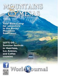
Table top mountains...what’s the deal?<br />
Another trip option is to start out in Trinidad.<br />
Visit the Louden-Henritze Museum, located at 600<br />
Prospect Sreet <strong>with</strong>in Trinidad State Junior College.<br />
Admission is free, so take the chance to head in and<br />
learn about the history of the area from the dinosaurs<br />
through the paleolithic people of the area. From<br />
Trinidad, drive south along I-25 to head past Fisher’s<br />
Peak and over Raton Pass.<br />
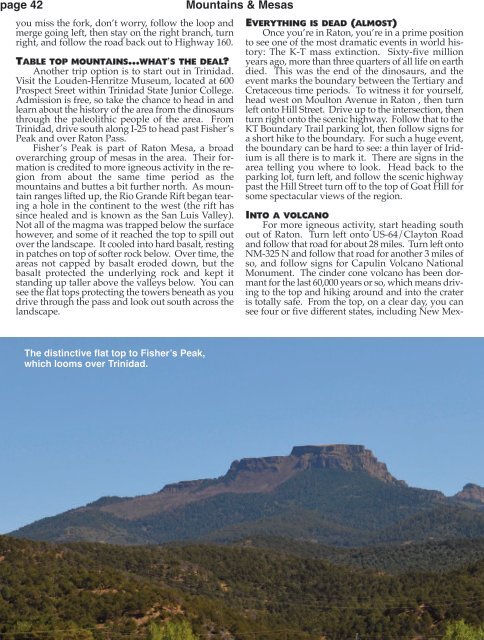
Fisher’s Peak is part of Raton Mesa, a broad<br />
overarching group of mesas in the area. Their formation<br />
is credited to more igneous activity in the region<br />
from about the same time period as the<br />
mountains and buttes a bit further north. As mountain<br />
ranges lifted up, the Rio Grande Rift began tearing<br />
a hole in the continent to the west (the rift has<br />
since healed and is known as the San Luis Valley).<br />
Not all of the magma was trapped below the surface<br />
however, and some of it reached the top to spill out<br />
over the landscape. It cooled into hard basalt, resting<br />
in patches on top of softer rock below. Over time, the<br />
areas not capped by basalt eroded down, but the<br />
basalt protected the underlying rock and kept it<br />
standing up taller above the valleys below. You can<br />
see the flat tops protecting the towers beneath as you<br />
drive through the pass and look out south across the<br />
landscape.<br />
Mountains & <strong>Mesas</strong><br />
Everything is dead (almost)<br />
Once you’re in Raton, you’re in a prime position<br />
to see one of the most dramatic events in world history:<br />
The K-T mass extinction. Sixty-five million<br />
years ago, more than three quarters of all life on earth<br />
died. This was the end of the dinosaurs, and the<br />
event marks the boundary between the Tertiary and<br />
Cretaceous time periods. To witness it for yourself,<br />
head west on Moulton Avenue in Raton , then turn<br />
left onto Hill Street. Drive up to the intersection, then<br />
turn right onto the scenic highway. Follow that to the<br />
KT Boundary Trail parking lot, then follow signs for<br />
a short hike to the boundary. For such a huge event,<br />
the boundary can be hard to see: a thin layer of Iridium<br />
is all there is to mark it. There are signs in the<br />
area telling you where to look. Head back to the<br />
parking lot, turn left, and follow the scenic highway<br />
past the Hill Street turn off to the top of Goat Hill for<br />
some spectacular views of the region.<br />
Into a volcano<br />
For more igneous activity, start heading south<br />
out of Raton. Turn left onto US-64/Clayton Road<br />
and follow that road for about 28 miles. Turn left onto<br />
NM-325 N and follow that road for another 3 miles of<br />
so, and follow signs for Capulin Volcano National<br />
Monument. The cinder cone volcano has been dormant<br />
for the last 60,000 years or so, which means driving<br />
to the top and hiking around and into the crater<br />
is totally safe. From the top, on a clear day, you can<br />
see four or five different states, including New Mex-<br />
The distinctive flat top to Fisher’s Peak,<br />
which looms over Trinidad.