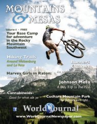
2016 Mtns & Mesas with covers

You also want an ePaper? Increase the reach of your titles
YUMPU automatically turns print PDFs into web optimized ePapers that Google loves.
page 46<br />
eroded away, a shallow inland sea crossed across the<br />
heart of the continent and our entire region was underwater.<br />
Thousands of feet of sand, silt, mud, clay,<br />
and marine fossils settled on the floor of the ocean,<br />
and over time gravity cemented them together into<br />
stone. It was this stone that was cracked open when<br />
the Spanish Peaks and their dikes came bubbling up<br />
from the mantle. Much of the stone has eroded away<br />
through the years, but outcroppings and boulders<br />
can be seen all along this drive.<br />
Mountains & <strong>Mesas</strong><br />
Mountains and meadows<br />
Continue following County Road 54.2 until there<br />
is a fork in the road. Stay right and turn onto County<br />
Rd 41.4, which turns into Co Road 313. Stay on 313<br />
for another few miles. From the turnoff onto the dirt<br />
road until your next major turn onto Co Rd 312<br />
should be about ten miles. The signal to turn is a rundown<br />
one-room schoolhouse at a fork in the road.<br />
Take a right hand turn onto Co Rd 312, and follow it<br />
up. Keep your eyes peeled for incredible views of the<br />
Spanish Peaks, the Wet Mountain Range, and Greenhorn<br />
Mountain as you drive down. Remember, this<br />
is all private property, so don’t go wandering off even<br />
if there isn’t a fence near the road. Stay on Co Rd 312,<br />
also known as Rouse Road, until you come to an intersection<br />
<strong>with</strong> Co Rd 310. Stay right and continue<br />
heading down out of the mountains on 310. Don’t<br />
turn off 310 and it will take you all the way back to I-<br />
25. You can turn left for Walsenburg or right to head<br />
back to Trinidad from there.<br />
A mountain, and, a meadow