Key Issues Report of the Porirua City Council - Environmental ...
Key Issues Report of the Porirua City Council - Environmental ...
Key Issues Report of the Porirua City Council - Environmental ...

Create successful ePaper yourself
Turn your PDF publications into a flip-book with our unique Google optimized e-Paper software.
Underlying Zoning<br />
6.16 The proposed transmission line relocation traverses two zones being <strong>the</strong> Rural<br />
and Public Open Space Zones. The activities that may be undertaken as<br />
Permitted Activities are viewable on <strong>the</strong> links attached as Appendix B.<br />
6.17 The predominant activity that is permitted in <strong>the</strong> Rural Zone is Primary<br />
Production Activities 40 (Rule D4.1.1(i)). It is also noted that up to one hectare<br />
or production forestry can be removed as a Permitted Activity (Rule D4.1.1(x))<br />
also.<br />
6.18 The Public Open Space Zone applies to Battle Hill Forest Farm Park which has<br />
Tower's 27 and 30 within it. Like <strong>the</strong> Rural Zone, Primary Production<br />
Activities are permitted in this zone (Rule D4C.1.1(v)). Also various recreation,<br />
community and environmental enhancement related activities are permitted. It<br />
is also noted that Buildings up to 8 metres in height are permitted within <strong>the</strong><br />
Battle Hill Forest Farm Park (Rule D4C.2.1).<br />
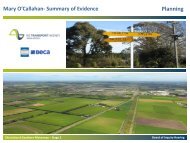
Analysis <strong>of</strong> Aerial Photographs<br />
6.19 The <strong>Porirua</strong> <strong>City</strong> <strong>Council</strong> commissioned aerial photographs that were flown in<br />
February 2010. Also <strong>the</strong> author <strong>of</strong> this report attended a site visit on 16 June<br />
2011 as part <strong>of</strong> <strong>the</strong> completeness check work commissioned by <strong>the</strong> EPA.<br />
Utilising <strong>the</strong> combination <strong>of</strong> <strong>the</strong> observations made on <strong>the</strong> site visit and viewing<br />
<strong>the</strong> aerial photography it is considered that a basic description <strong>of</strong> <strong>the</strong><br />
environment can be provided as follows.<br />
6.20 The nor<strong>the</strong>rn reaches (chainage 5000m – 10,000m as identified on Sheet's<br />
GM04 – GM07 41 ) are rural in nature and sparsely populated with few buildings,<br />
if any within <strong>the</strong> location <strong>of</strong> <strong>the</strong> existing transmission lines or <strong>the</strong>ir new<br />
proposed location. The nearest dwelling, at 874 Paekakariki Hill Road is<br />
approximately 850 meters from <strong>the</strong> nearest tower being Tower 23. To <strong>the</strong> east<br />
<strong>of</strong> <strong>the</strong> transmission line is uninhabited land that is ei<strong>the</strong>r covered in pasture or<br />
vegetation.<br />
6.21 From approximately chainage 10000m to 11500m, is <strong>the</strong> Battle Hill Forest<br />
Farm Park. This is rural in nature and is predominantly covered in pasture with<br />
vegetation to <strong>the</strong> east. Minimal changes to <strong>the</strong> transmission line are occurring<br />
within <strong>the</strong> Battle Hill Forest Farm Park.<br />
6.22 The area covered by <strong>the</strong> next portion <strong>of</strong> transmission line to be relocated, being<br />
between Towers 30 – 33A is rural in nature though it is noted that <strong>the</strong>re is a<br />
difference in nearby dwellings, both in density as well as proximity, compared<br />
to <strong>the</strong> areas previously described. There is a residential dwelling (548<br />
Paekakariki Hill Road) located within approximately 60 metres <strong>of</strong> <strong>the</strong><br />
transmission line and 3 o<strong>the</strong>r dwellings (at 516, 510 and 504 Paekakariki Hill<br />
Road) within approximately 150 – 200 metres west <strong>of</strong> <strong>the</strong> existing transmission<br />
line. To <strong>the</strong> east <strong>of</strong> <strong>the</strong>se towers is vegetation.<br />
40 See Page M-19 <strong>of</strong> <strong>the</strong> <strong>Porirua</strong> <strong>City</strong> District Plan for a definition.<br />
41 Sheets GM04 – GM07 version No.B in Volume 4: Plan Set <strong>of</strong> TGP application<br />
28

![Application for test certificate [pdf, 131kb]](https://img.yumpu.com/50666502/1/184x260/application-for-test-certificate-pdf-131kb.jpg?quality=85)