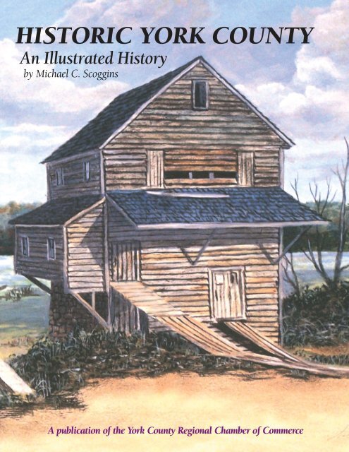
Historic York County
An illustrated history of the York County area, paired with the histories of companies, families and organizations that make the region great.
An illustrated history of the York County area, paired with the histories of companies, families and organizations that make the region great.

You also want an ePaper? Increase the reach of your titles
YUMPU automatically turns print PDFs into web optimized ePapers that Google loves.
HISTORIC YORK COUNTY<br />
An Illustrated History<br />
by Michael C. Scoggins<br />
A publication of the <strong>York</strong> <strong>County</strong> Regional Chamber of Commerce
Thank you for your interest in this HPNbooks publication.<br />
For more information about other HPNbooks publications, or information about<br />
producing your own book with us, please visit www.hpnbooks.com.
HISTORIC YORK COUNTY<br />
An Illustrated History<br />
by Michael C. Scoggins<br />
Commissioned by the <strong>York</strong> <strong>County</strong> Regional Chamber of Commerce<br />
<strong>Historic</strong>al Publishing Network<br />
A division of Lammert Incorporated<br />
San Antonio, Texas
❖<br />
This old well shed is located on SC<br />
Highway 97 in the Bullocks Creek<br />
community of western <strong>York</strong> <strong>County</strong>,<br />
where some folks still dry their<br />
laundry on a sunny day by hanging it<br />
on a clothesline.<br />
PAINTING BY JOHN WINE. COURTESY OF THE<br />
CULTURE & HERITAGE MUSEUMS.<br />
First Edition<br />
Copyright © 2009 <strong>Historic</strong>al Publishing Network<br />
All rights reserved. No part of this book may be reproduced in any form or by any means, electronic or mechanical, including photocopying, without permission in writing<br />
from the publisher. All inquiries should be addressed to <strong>Historic</strong>al Publishing Network, 11555 Galm Road, Suite 100, San Antonio, Texas, 78254. Phone (800) 749-9790.<br />
ISBN: 9781893619944<br />
Library of Congress Card Catalog Number: 2008943562<br />
<strong>Historic</strong> <strong>York</strong> <strong>County</strong>: An Illustrated History<br />
author: Michael C. Scoggins<br />
cover design: Jack Bolin<br />
contributing writers for “Sharing the Heritage”: Joe Goodpasture<br />
<strong>Historic</strong>al Publishing Network<br />
president: Ron Lammert<br />
project manager: Larry Sunderland<br />
administration: Donna M. Mata<br />
Melissa Quinn<br />
book sales: Dee Steidle<br />
production: Colin Hart<br />
Craig Mitchell<br />
Charles A. Newton, III<br />
Joshua Johnston<br />
Roy Arellano<br />
Glenda Krouse<br />
PRINTED IN KOREA<br />
2 ✦ HISTORIC YORK COUNTY
CONTENTS<br />
4 PREFACE AND ACKNOWLEDGEMENTS<br />
6 INTRODUCTION<br />
8 CHAPTER I the Catawba Indian Nation<br />
12 CHAPTER II <strong>York</strong><br />
16 CHAPTER III Clover<br />
22 CHAPTER IV Bowling Green<br />
26 CHAPTER V Kings Mountain Township<br />
30 CHAPTER VI Smyrna<br />
34 CHAPTER VII Hickory Grove<br />
38 CHAPTER VIII Bullock Creek Township<br />
42 CHAPTER IX Sharon<br />
46 CHAPTER X McConnells and Brattonsville<br />
54 CHAPTER XI Fort Mill<br />
58 CHAPTER XII Rock Hill<br />
64 CHAPTER XIII Catawba Township<br />
70 CHAPTER XIV Lake Wylie and Tega Cay<br />
74 BIBLIOGRAPHY<br />
76 SHARING THE HERITAGE<br />
110 SPONSORS<br />
111 ABOUT THE AUTHOR<br />
Contents ✦ 3
PREFACE AND ACKNOWLEDGEMENTS<br />
Over the years a great number of books, pamphlets, and articles have been published on the history of <strong>York</strong> <strong>County</strong>. These works<br />
have traditionally given a chronological overview of the county’s history, but this approach makes it difficult to present organized histories<br />
of specific towns and communities. Most of <strong>York</strong> <strong>County</strong>’s incorporated towns also have their own individual histories, but these<br />
are by necessity narrowly focused and usually ignore what was happening in other parts of the county. In either case, the smaller,<br />
unincorporated rural communities either get sparse recognition or are overlooked entirely.<br />
For this new <strong>York</strong> <strong>County</strong> history we have taken a different approach. Each chapter focuses on the history of a specific town or<br />
township, and these chapters include not only the large cities and incorporated towns but most of the small rural communities as<br />
well—at least those that are still in existence. This book is a kind of “grand tour” of the county, both geographical and chronological.<br />
It begins with <strong>York</strong> <strong>County</strong>’s oldest inhabitants, the Catawba Nation, and its oldest town, <strong>York</strong>. The tour then proceeds north to Clover<br />
and Bowling Green, then heads west and executes a counterclockwise loop through Kings Mountain Township, Smyrna, Hickory<br />
Grove, Bullock Creek Township, and Sharon. From there we proceed southeast to McConnells and Brattonsville, turn northeast to<br />
visit Fort Mill, Rock Hill, the Catawba Township, Lake Wylie, and Tega Cay. At each stop along the way, we discuss the history of the<br />
towns and communities, and document that history with photographs and other images keyed to the text.<br />
As the title implies, this is a study of <strong>Historic</strong> <strong>York</strong> <strong>County</strong>. The greatest focus has been on the early history of the county, prior to<br />
the mid-twentieth century, and space limitations make it impossible to treat all the modern communities and planned developments<br />
that have sprung up since the 1970s. On the other hand, there are a number of historical communities in the county that are no longer<br />
extant, and they are, for the most part, also beyond the scope of this volume.<br />
This book embodies the contributions of a great many people and organizations. During the research phase of the project, we collected<br />
far more photographs and reference material than we could possibly incorporate into a work of this size. Hopefully we will be<br />
able to utilize this additional material in future publications on the history of <strong>York</strong> <strong>County</strong>. Most of the photographs used in this book<br />
have never been published before, and many are in color, another departure from previous <strong>York</strong> <strong>County</strong> history books.<br />
On behalf of the Culture & Heritage Museums and the <strong>York</strong> <strong>County</strong> Regional Chamber of Commerce, I would like to extend my<br />
appreciation to the following individuals and institutions for their assistance in this project:<br />
Nancy Sambets, Brooke Harris, Andrea Rice, Denise Jensen, and Rick Owens of the Culture & Heritage Museums, <strong>York</strong>, SC;<br />
Michael Baldwin, Tom Longshaw, and Heather Andrus, interns from Winthrop University, Rock Hill, SC; Jerry L. West of the Museum<br />
of Western <strong>York</strong> <strong>County</strong>, Sharon, SC; Sandra Reinhardt of the Catawba Cultural Preservation Project, Rock Hill, SC (Sandra wrote the<br />
article on the Catawba Nation and assembled the illustrations for it); Gina Price White of the Louise Pettus Archives, Winthrop<br />
University, Rock Hill, SC; Mary Mallaney of the <strong>York</strong> <strong>County</strong> Public Library, Rock Hill, SC; Ann Evans of the White Homestead, Fort<br />
Mill, SC; Bill Henson of YC Magazine; the South Carolina Department of Archives and History, Columbia, SC; and the South<br />
Caroliniana Library, University of South Carolina, Columbia, SC.<br />
I would also like to acknowledge the generous contributions of the following individuals, who shared their photographs, paintings,<br />
postcards, newspaper articles, scrapbooks, memories, and advice on the history of <strong>York</strong> <strong>County</strong>’s towns and communities:<br />
<strong>York</strong>: Mary C. Montgomery, Mary R. Lowry, Anne Allison, Jeanne Ferguson, John Wine, and Jan Ramsey; Clover, Bowling Green<br />
and northern <strong>York</strong> <strong>County</strong>: Margaret McCall Smith, Sis Bentley, J. R. Caldwell, Betty Love, Floyd Ballard, Estelle Withers, W. B. Dulin,<br />
Jr., Mr. and Mrs. Cary Grant, Janelle Dixon, Robert Black, Vera S. Wyatt, Dorothy Montgomery Good, Eddie D. Pursley, and Rick<br />
Owens; Sharon and western <strong>York</strong> <strong>County</strong>: Jerry L. West, Eleanor Whitesides Jones, Carl F. Hope, and Phillip Faulkner; McConnells<br />
and southeastern <strong>York</strong> <strong>County</strong>: H. J. Harshaw, Jr., Agnes Aycock Love, Phyllis Morgan, Harold S. Walker, Nancy Scoggins, Robert<br />
Scoggins, Jr., and Curwood Chappell; Fort Mill: Ruth Meacham, Nancy B. Thomas, Jack Bolin, Ann Evans, Annie Case, Elwyn Case,<br />
and Louise Pettus; Rock Hill and Ebenezer: Phyllis Morgan, Robert Ratterree, Sr., Michael Baldwin, John T. Misskelley, Millard<br />
Stafford, Dot Amick, Allan Miller, Robert Scoggins, Jr., and the Rock Hill Fire Department.<br />
Finally, I would especially like to thank Jenny Kaemmerlin and Ashley Barron of the Culture & Heritage Museums for their hard<br />
work in proofreading the manuscript. Any errors that remain are my responsibility, not theirs.<br />
Michael C. Scoggins<br />
Culture & Heritage Museums<br />
April 2008<br />
4 ✦ HISTORIC YORK COUNTY
❖<br />
Snow is a rare occurrence in <strong>York</strong><br />
<strong>County</strong>, but when it does occur the<br />
results are striking, as shown in this<br />
scene of a snow-covered barn located<br />
off SC Highway 5 several miles<br />
northwest of <strong>York</strong>.<br />
PAINTING BY JOHN WINE. COURTESY OF THE<br />
CULTURE & HERITAGE MUSEUMS.<br />
Preface & Acknowledgements ✦ 5
INTRODUCTION<br />
<strong>York</strong> <strong>County</strong> is the northernmost county in the central region of the South Carolina Piedmont or “foothills.” It is bounded on the<br />
north by the North Carolina state line, on the east by the Catawba River, on the south by Chester <strong>County</strong>, and on the west by the<br />
Broad River and Cherokee <strong>County</strong>. The climate is moderate, and the terrain is hilly, forested, and well-watered, supporting a large variety<br />
of fish and game. Human beings have called this area home for at least 12,000 years, and for several centuries prior to European<br />
settlement the <strong>York</strong> <strong>County</strong> area formed a buffer between the Catawba Indians to the east and the Cherokee Indians to the west.<br />
Although the English colony of Carolina was organized in 1670, the upcountry or “backcountry” remained largely unsettled and unexplored<br />
by Europeans until the early eighteenth century. Around the year 1750 the area began receiving settlers from the British Isles<br />
and western Europe, who either moved south from Pennsylvania, Virginia, and North Carolina or landed in Charleston and made their<br />
way north into the backcountry. Present-day <strong>York</strong> <strong>County</strong> was settled predominantly by Presbyterians from the north of Ireland and<br />
lowland Scotland, and four Presbyterian congregations—Bethel, Beersheba, Bethesda, and Bullock’s Creek—were the first organized<br />
churches here. These became known during the colonial period as “the four B’s,” and all four are still active today.<br />
Prior to 1772 the upper Piedmont region was claimed by both North and South Carolina, and both colonies issued hundreds of<br />
royal land grants in what is now <strong>York</strong> <strong>County</strong>. South Carolina assigned the territory to Craven <strong>County</strong>, St. Mark’s Parish, and Camden<br />
District, while North Carolina claimed it as part of Anson <strong>County</strong>, Mecklenburg <strong>County</strong>, and finally Tryon <strong>County</strong>. In 1772 the provincial<br />
boundary was surveyed west of the Catawba River as far as the Cherokee Territory (the present-day Spartanburg-Greenville<br />
<strong>County</strong> line), and the territory between the Catawba and the Broad Rivers became known as the New Acquisition. The citizens of the<br />
New Acquisition overwhelmingly supported the Whig or “Patriot” cause during the American Revolution, and the area’s first industrialist,<br />
William Hill, operated an important ironworks on Allison Creek that supplied ordinance to the state government. Two important<br />
Patriot victories, the Battles of Williamson’s Plantation or Huck’s Defeat (July 12, 1780) and King’s Mountain (October 7, 1780),<br />
were fought in the future <strong>York</strong> <strong>County</strong>. A number of smaller battles occurred here as well, including skirmishes at William Hill’s<br />
Ironworks, Bullock’s Creek, Stallions’ Plantation on Fishing Creek, Biggers’ Ferry on the Catawba River, and Floyd’s Fort on King’s<br />
Creek. All but one of these, Hill’s Ironworks, were also Patriot victories, and all took place between June and October 1780. The notorious<br />
British cavalry commander, Lieutenant Colonel Banastre Tarleton, camped at White’s Mill on Fishing Creek in southeastern <strong>York</strong><br />
<strong>County</strong> in September 1780, and while there was seriously ill from a fever for several days.<br />
In March 1785 the South Carolina legislature officially created <strong>York</strong> <strong>County</strong> as part of Camden District, with <strong>York</strong>ville as its county<br />
seat. From 1791 until 1799, <strong>York</strong> <strong>County</strong> was part of the short-lived Pinckney District, along with neighboring Chester, Union, and<br />
Spartanburg Counties, but in 1800 these counties were all reorganized as separate districts. <strong>York</strong> District was primarily agricultural in<br />
livelihood, and, after the invention of Eli Whitney’s cotton gin in 1793, the cultivation of cotton became increasingly important.<br />
Cotton planting also encouraged the use of slave labor, although <strong>York</strong> District had fewer slaves than most of the other districts in the<br />
state. The district was also noted for its mineral wealth, particularly iron and gold, and the northwestern portion of the county became<br />
a center for iron production and gold mining during the early decades of the nineteenth century.<br />
The year 1852 brought two railroads to <strong>York</strong> District: the Kings Mountain Railroad, running north from Chesterville through the<br />
center of the district as far as <strong>York</strong>ville, and the Charlotte & South Carolina Railroad, which pushed south from Charlotte and northeast<br />
from Chesterville and laid the foundation for a new town called Rock Hill. Other towns like Fort Mill and McConnells developed<br />
along these railroads as well, but the War Between the States interrupted this progress. <strong>York</strong> District dispatched at least fourteen companies<br />
of men to the Confederate States Army, and it suffered the highest per capita battle losses of any district in South Carolina.<br />
Following the end of the war, the area exploded into violent conflict between newly freed African-American slaves and their former<br />
owners, and the year 1868 brought two new developments: the organization of the Ku Klux Klan (KKK) and the reconstitution of<br />
<strong>York</strong> District as <strong>York</strong> <strong>County</strong>. KKK activities resulted in the stationing of Federal occupation troops in <strong>York</strong>ville in the early 1870s in<br />
order to keep the peace. The election of former Confederate general Wade Hampton as state governor in 1876 gradually brought an<br />
end to the violence, and by the 1880s the state was on the road to recovery from the economic and social devastation caused by the<br />
war and Reconstruction.<br />
The Kings Mountain Railroad was reorganized as the Chester & Lenoir Narrow-Gauge Railroad in 1873, and by 1884 the line had<br />
reached its terminus at Lenoir, North Carolina. In 1888 two new railroads came through <strong>York</strong> <strong>County</strong>: the Charleston, Cincinnati &<br />
Chicago (nicknamed the “Three C’s”) became the county’s first line running from east to west, and the Seaboard Air Line cut across<br />
the southeastern section from Chester into Lancaster <strong>County</strong>. These lines resulted in the organization of several new towns, including<br />
Smyrna, Hickory Grove, Sharon, Lesslie, and Roddey, on the Three C’s; Clover and Bowling Green on the Chester & Lenoir; and<br />
6 ✦ HISTORIC YORK COUNTY
Harmony and Catawba on the Seaboard. The resurgence of cotton also spurred the growth of the textile industry as far-sighted businessmen<br />
realized that the South needed local industry if it was ever to recover from the devastation of the Civil War. The year 1880<br />
marked the beginning of the modern textile era in the Carolina Piedmont, and <strong>York</strong> <strong>County</strong>’s first cotton mills began production in<br />
1881 at Rock Hill on the Catawba River and Cherokee Falls on the Broad River. The railroads and the mills supported each other,<br />
making possible the transportation of raw goods and finished products and bringing in new capital and new jobs. <strong>York</strong> <strong>County</strong> entered<br />
the twentieth century with a growing economy and a thriving industrial base, but agriculture was still the dominant livelihood for<br />
much of the rural population.<br />
The first decade of the twentieth century witnessed the establishment of the India Hook dam and hydroelectric station on the<br />
Catawba River, which laid the foundation for the industrial giant Duke Power Company (now part of Duke Energy) and brought electrical<br />
power to the region. Rock Hill became the county’s industrial center, but <strong>York</strong>, Clover, and Fort Mill also became industrial cities,<br />
and the Fort Mill textile plants helped lay the foundations for a second industrial giant called Springs Industries (now Springs Global).<br />
The First World War sent many of <strong>York</strong> <strong>County</strong>’s sons overseas to fight in Europe, while at home the increased demands of war production<br />
boosted industrial and agricultural output. The recession of the 1920s and the Great Depression of the 1930s brought hard<br />
times to <strong>York</strong> <strong>County</strong> as it did elsewhere, but the farmers still produced their crops and the people still persevered as the country<br />
entered the Second World War.<br />
Through the end of World War II, agriculture still dominated <strong>York</strong> <strong>County</strong>. In 1945 there were 4,093 farms in the county, and they<br />
yielded a variety of products including cotton, peaches, turkeys, hay, grain, dairy products, and livestock. But of all these, cotton still<br />
predominated. The veterans who returned from World War II led the way to the increased diversification and modernization of <strong>York</strong><br />
<strong>County</strong> in the form of paved highways, new industries, educational improvements, and economic revitalization. By 1947, there were<br />
some 7,000 persons employed in agriculture and over 10,000 employed in industry, most of whom worked in the county’s twentyone<br />
textile mills.<br />
It was during the 1950s and the 1960s that agriculture finally began to lose its once pervasive hold on rural <strong>York</strong> <strong>County</strong>. Worn<br />
out land and the decline of the family farm as a viable livelihood forced many families to either take jobs in the larger towns or leave<br />
the county and seek their fortunes elsewhere. The wars in Korea and Vietnam left their marks on the citizenry as well, but <strong>York</strong> <strong>County</strong><br />
managed to avoid most of the social strife and civil unrest that characterized the Sixties in other parts of the country.<br />
The 1970s and 1980s saw the decline of the railroads and the dramatic downsizing of the once dominant textile industry.<br />
Paradoxically, this was also the beginning of a period of unprecedented population growth and economic expansion. This was particularly<br />
true in the Rock Hill and Fort Mill areas, where the completion of Interstate Highway 77 made <strong>York</strong> <strong>County</strong> a commuter base<br />
for employment in the nearby Charlotte-Mecklenburg region of North Carolina. In the early 1980s Duke Power completed the<br />
Catawba Nuclear Station, which guaranteed the continued availability of affordable electrical power for the county’s growing residential,<br />
commercial, and industrial needs.<br />
The rapid expansion of eastern <strong>York</strong> <strong>County</strong> brought its own problems of increased population, urban sprawl, and intense pressure<br />
on housing and educational resources. In the last decade of the twentieth century, the <strong>York</strong> <strong>County</strong> Council began working with<br />
property owners on “<strong>York</strong> <strong>County</strong> Forever,” a program dedicated to protecting large tracts of “green space” from further development.<br />
As the twenty-first century dawned, the <strong>York</strong> <strong>County</strong> Culture & Heritage Museums joined forces with Cherokee Investment Partners<br />
to create a unique environmental history museum and a 400-acre “green community” called Kanawha at the intersection of I-77 and<br />
the Catawba River, not far from the location of some of the earliest Catawba Indian villages. The development of this “environmental<br />
crossroads” brought the county history full circle, establishing a world-class facility for environmental awareness and stewardship at<br />
the site of one of the area’s oldest human settlements. Programs like these have helped to ensure <strong>York</strong> <strong>County</strong>’s position as one of South<br />
Carolina’s most progressive leaders, not only in economic and commercial growth but in cultural, historical, and environmental<br />
preservation as well.<br />
Introduction ✦ 7
8 ✦ HISTORIC YORK COUNTY
CHAPTER I<br />
T HE C ATAWBA I NDIAN N ATION<br />
BY SANDRA REINHARDT<br />
The earliest contact between Europeans and the native inhabitants of the South Carolina Piedmont<br />
occurred in 1540, when Spanish explorers under Hernando De Soto traveled through the area on<br />
their way from Florida to the Mississippi River. That initial contact created the foundation of what<br />
would become an ongoing and, for the most part, amicable relationship between European settlers<br />
and the native peoples of the Catawba and Wateree Rivers.<br />
In the early eighteenth century the English settlers in Virginia and the Carolinas began referring<br />
to the Native Americans of the central Piedmont as “the Catawba.” The modern Catawba refer to<br />
themselves as ye iswa or “people of the river” in their native language. Linguistic clues have placed<br />
the Catawba within the larger family of Siouan tribes. Though Native American history goes back at<br />
least twelve thousand years in this region, the exact time that the Catawba entered the Carolinas is<br />
not known. Today, the Catawba still live along the river that carries their name.<br />
The first European settlers of the Catawba River in South Carolina settled along Waxhaw Creek,<br />
Rocky Creek, and Fishing Creek. When Carolina became a royal colony in 1729, the colonial<br />
government encouraged settlement of the interior by establishing townships based on land grants<br />
from the Crown. These Europeans also discovered an ancient Indian path, known today as the Nation<br />
Ford Road after the predominant crossing point on the upper Catawba River. This busy trading route<br />
passed near several Catawba villages and stretched from Virginia and the North Carolina Piedmont<br />
to the Lower Cherokee towns in western South Carolina and northern Georgia. European traders<br />
used it to transport weapons, tools, and trinkets to the Indians in return for animal skins, pottery,<br />
baskets, and slaves.<br />
Thus, by 1755 the Indians were crowded by incoming settlers who were attracted to the rich soil<br />
and moderate climate. European livestock ruined the Indians’ cornfields, and game became scarce as<br />
their habitat was cut and cleared for farms. In addition, European diseases, liquor, hunger, and<br />
warfare rapidly reduced the Indian population. One epidemic of smallpox in 1759 killed half of the<br />
Catawba Nation. With their population declining, the Catawba recruited other Indians to join them.<br />
When James Adair passed through the vicinity in the mid-eighteenth century, he heard more than<br />
twenty dialects spoken in Catawba territory.<br />
As the political environment of the Carolinas became more complex, the Catawba people were<br />
forced to make difficult political decisions. The Seven Years War in Europe, known in the colonies as<br />
the French and Indian War (1754-1763), pitted Indians against each other as they allied themselves<br />
with European powers. Catawba warriors sided with the English, while other powerful Southeastern<br />
tribes like the Cherokee and Shawnee supported the French. However, during the American<br />
Revolution, the Catawba Nation sided with the Whigs or “Patriots” against Great Britain. From then<br />
on the Catawba fought for the South Carolina government, served in the Confederate Army, the two<br />
World Wars, and the wars in Korea, Vietnam and the Persian Gulf. Currently, Catawbas serve in the<br />
National Guard and the Reserves, and on active duty in Iraq.<br />
Despite the early loyalty of the Catawba to England, they lost the rights to most of their land<br />
by way of the treaties of Pine Tree Hill in 1760 and Augusta in 1763. The tribe agreed to a reservation<br />
of fifteen square miles that included villages in Lancaster and <strong>York</strong> Counties. In 1782 the tribe<br />
had to reaffirm its agreements with the new American government. The Indian Trade and<br />
Intercourse Act of 1790 prohibited the conveyance of Indian land except by treaty with the United<br />
States. Following the Lease Act of 1808, South Carolinians leased nearly all of the remaining<br />
Catawba land.<br />
❖<br />
Many of the stones that smooth the<br />
Catawba pottery surfaces have been<br />
used by several generations and are<br />
cherished family heirlooms.<br />
PHOTOGRAPH BY ANN KENION OVERTON.<br />
COURTESY OF THE CATAWBA CULTURAL<br />
PRESERVATION PROJECT ARCHIVES.<br />
Chapter I ✦ 9
❖<br />
Above: This silver gorget was<br />
presented to Piney (Finey) George, a<br />
Catawba warrior, for Revolutionary<br />
War service under Brigadier General<br />
Thomas Sumter, 1780-1782.<br />
PHOTOGRAPH BY ANN EVANS. COURTESY OF<br />
THE CATAWBA CULTURAL PRESERVATION<br />
PROJECT ARCHIVES.<br />
Bottom, left: Fred Sanders served with<br />
the U.S. Military Border Security<br />
Forces on the Danube River in Europe<br />
in March 1948.<br />
COURTESY OF THE CATAWBA CULTURAL<br />
PRESERVATION PROJECT ARCHIVES.<br />
As the Carolinians’ desire for arable land<br />
grew, the South Carolina government urged<br />
the Catawba to sell their land and move west.<br />
In the 1840 Treaty of Nation Ford, the tribe<br />
forfeited its entire homeland to the state in<br />
exchange for cash payments and new homes<br />
elsewhere. The United States Congress did not<br />
ratify this treaty, and the state did not honor it.<br />
The results were devastating: the Catawba were<br />
scattered, losing much of their language and<br />
culture in the process.<br />
Most of the surviving Catawba returned to<br />
<strong>York</strong> District after about eighteen months, and<br />
in 1842 the state purchased 630 acres for a new<br />
Catawba Reservation. The Reservation was<br />
enlarged again by the purchase of additional<br />
tracts of land in 1945. A large old barn that is<br />
currently visible from Dave Lyle Boulevard near<br />
Bottom, right: During the assimilation<br />
period, many Indian children such as<br />
Rosa Harris Wheelock attended<br />
Carlisle Industrial School in Carlisle,<br />
Pennsylvania. Shown in this<br />
photograph from circa 1895, Rosa<br />
later returned to the Catawba Nation<br />
and taught school on the Reservation.<br />
COURTESY OF THE CATAWBA CULTURAL<br />
PRESERVATION PROJECT ARCHIVES.<br />
10 ✦ HISTORIC YORK COUNTY
<strong>York</strong> Technical College was part of what became<br />
known as the “New Reservation.” Most of the<br />
Catawba stayed in their traditional homes and<br />
subsisted by sharecropping, the sale of<br />
cordwood and pottery, and the gifts of the<br />
woods and the river. The Catawba Indian<br />
Nation continues one of the oldest pottery<br />
traditions east of the Mississippi River. This<br />
traditional art form forms the foundation of the<br />
Catawba cultural identity.<br />
The traditional way of life was altered<br />
following the Civil War, when the Catawba were<br />
forced to seek employment away from the<br />
Reservation. Discrimination limited their<br />
options, as did their status as non-citizens.<br />
The state employed generations of<br />
Catawba Indians to run Ashe’s Ferry above<br />
the mouth of Twelve Mile Creek at Van<br />
Wyck in Lancaster <strong>County</strong>. When the ferry<br />
closed in 1959, it was the last stateoperated<br />
ferry in South Carolina.<br />
In 1924 the United States Congress<br />
passed the Indian Citizenship Act<br />
declaring that all American Indians<br />
were citizens. Although the Catawba<br />
paid federal taxes and served in the<br />
military, it was another twenty years<br />
before the South Carolina legislature<br />
passed an act providing state citizenship<br />
for the Catawba.<br />
The Catawba voted to end their federal<br />
status as an organized tribe in January<br />
1959 by the Catawba Termination Act,<br />
although they continued to have state<br />
recognition. The state government then<br />
put the New Reservation up for sale. As<br />
part of the termination program,<br />
individuals could choose between<br />
a five-acre tract of land from the<br />
New Reservation and a cash<br />
settlement. The majority chose<br />
the land, but some families<br />
remained on the Old Reservation,<br />
which is still the heart and home<br />
of the Catawba Nation.<br />
In 1980, the Catawba filed suit<br />
against the United States and<br />
South Carolina for a violation of<br />
the Non-Intercourse Act of 1790.<br />
The case was finally settled by<br />
the Catawba Land Claims<br />
Settlement Act of 1993, which provided<br />
compensation for the funds and land that were<br />
originally due the tribe as part of the unfulfilled<br />
Treaty of 1840. By virtue of this settlement, the<br />
nation was finally able to repurchase some of<br />
the land that was lost through the nineteenthcentury<br />
leases.<br />
Today the settlement provides funds for<br />
houses, healthcare, and education. The past few<br />
years have seen a renewed interest in the<br />
Catawba people’s past and a renaissance in their<br />
cultural heritage.<br />
❖<br />
Above: The congregation of the<br />
Church of Jesus Christ of Latter-day<br />
Saints at the Catawba Reservation is<br />
shown in this photograph, c. 1920.<br />
PHOTOGRAPH FROM THE THOMAS J. BLUMER<br />
COLLECTION OF THE CATAWBA NATION<br />
NATIVE AMERICAN STUDIES COLLECTION.<br />
COURTESY OF THE UNIVERSITY OF SOUTH<br />
CAROLINA-LANCASTER.<br />
Below: A Catawba named Early<br />
Brown operated Ashe’s Ferry across<br />
the Catawba River until the late<br />
1950s. The ferry closed after the<br />
construction of the SC Highway 5<br />
bridge between Lancaster <strong>County</strong> and<br />
<strong>York</strong> <strong>County</strong> in 1959.<br />
COURTESY OF THE CATAWBA CULTURAL<br />
PRESERVATION PROJECT ARCHIVES.<br />
Chapter I ✦ 11
CHAPTER II<br />
Y ORK<br />
❖<br />
The Lowry family built this raised<br />
cottage style house at 109 East<br />
Jefferson Street during the 1830s. The<br />
basement was called “the Academy<br />
Room” and was used as an early<br />
school; it was also occupied by<br />
refugees from Charleston during the<br />
Civil War. From about 1930 until<br />
1963, the house was occupied by<br />
Charles and Edith Gillam (sometimes<br />
spelled Gilliam), and was known as<br />
“the Lilacs” because of its extensive<br />
flower gardens. This Colorama<br />
postcard photo of the Gillam house<br />
was produced during the 1950s.<br />
COURTESY OF THE CULTURE &<br />
HERITAGE MUSEUMS.<br />
The city of <strong>York</strong> is located in <strong>York</strong> Township in the center of <strong>York</strong> <strong>County</strong>, and it is the county<br />
seat. Geographically it lies on an elevated ridge that runs through the middle of <strong>York</strong> <strong>County</strong> in a<br />
general north-south direction from Chester <strong>County</strong>, South Carolina to Gaston <strong>County</strong>, North<br />
Carolina. The headwaters of Turkey Creek and Bullock’s Creek rise on the west side of <strong>York</strong> and flow<br />
into the Broad River, while the waters of Allison Creek and Fishing Creek begin east of <strong>York</strong> and flow<br />
into the Catawba. <strong>York</strong> had its origins as the intersection of two important colonial wagon roads, one<br />
running north-south and one running east-west. During the 1760s and 1770s, two brothers named<br />
James and William Fergus operated a tavern at this intersection, and the junction of the two roads<br />
became known locally as Fergus (or Fergus’s) Crossroads.<br />
<strong>York</strong> was one of twenty original counties created by the South Carolina General Assembly on<br />
March 24, 1785. This act also mandated the establishment of a county seat with a courthouse and<br />
jail in each county, and the appointment of justices of the peace and constables to administer the<br />
courts and enforce the law. The first public session of the <strong>York</strong> <strong>County</strong> Court was held on January 2,<br />
1786, with Colonel William Bratton, Colonel William Hill, Captain John Drennan, David Leech, and<br />
James Wilson (all Revolutionary War veterans) presiding as justices of the peace. Two days later, the<br />
court “chose the Cross roads formerly known as Fergus Crossroads” as the “proper & central place<br />
whereon a Court House for this county shall be erected.” The use of the phrase “formerly known as”<br />
indicates “Fergus Crossroads” had already been renamed “<strong>York</strong>ville,” probably at the same time that<br />
the county name was chosen, but “<strong>York</strong>ville” did not officially appear in the court records until<br />
12 ✦ HISTORIC YORK COUNTY
January 15, 1788, when a “Deed of conveyance<br />
from William Hill Esq. to John Gee for a Lott of<br />
Land in <strong>York</strong>ville [was] acknowledged.”<br />
Although the official name was <strong>York</strong>ville, the<br />
town was often referred to even in the early<br />
days simply as “<strong>York</strong>,” and it was also listed by<br />
that name in some of the antebellum federal<br />
census records.<br />
On April 12, 1786, the county court<br />
appointed Captain Andrew Love, William<br />
Fergus, and John Currence as commissioners to<br />
erect the first courthouse and jail, but work on<br />
these structures proceeded slowly and<br />
erratically. As late as 1796, the construction of<br />
this first courthouse had still not been<br />
completed, and the court was forced to meet in<br />
other buildings for most of that period. The<br />
exact date at which “<strong>York</strong> Court House,” as it<br />
was known, was finally finished is not recorded,<br />
but the original wooden structure was<br />
reportedly replaced by a one-story brick<br />
building in the early 1800s. In 1825, a new twostory<br />
Classical Revival style courthouse was<br />
constructed of wood and brick with an elaborate<br />
double-curved wrought iron stairway leading to<br />
the front door. This building was based on a<br />
design by famed architect Robert Mills that was<br />
used for many other second-generation county<br />
courthouses in South Carolina. After a fire<br />
damaged the upper story in November 1892,<br />
the courthouse was remodeled and equipped<br />
with a bell tower, new front steps, and<br />
additional wings. This structure was demolished<br />
in 1913, and in February 1914 work began on<br />
the present (fourth) courthouse building.<br />
Designed by architect William Augustus<br />
Edwards, the new courthouse was completed in<br />
July 1915.<br />
The town of <strong>York</strong>ville grew slowly during the<br />
nineteenth century. The north-south road<br />
through <strong>York</strong>ville became Congress Street,<br />
although it was also known locally as Main<br />
Street, while the east-west road became Liberty<br />
Street. Most of the town’s businesses developed<br />
along these two streets. The first church in town<br />
was the Independent Presbyterian Church,<br />
established in 1813 on East Liberty Street where<br />
Rose Hill Cemetery now stands; it disbanded in<br />
1864. Trinity Methodist Episcopal Church was<br />
organized by Reverend William Gassaway in<br />
1824; known today as Trinity United Methodist<br />
Church, it is the oldest existing church in <strong>York</strong>.<br />
The First Presbyterian Church was organized in<br />
1842, followed ten years later by the Church of<br />
the Good Shepherd, the first Episcopal church<br />
in <strong>York</strong> <strong>County</strong>. The <strong>York</strong> Associate Reformed<br />
Presbyterian (ARP) Church was founded in<br />
1853, and the <strong>York</strong>ville Baptist Church, which<br />
later became the First Baptist Church of <strong>York</strong>,<br />
❖<br />
Left: This colorized postcard shows the<br />
1825 <strong>York</strong> Court House building as it<br />
appeared circa 1895, after the<br />
addition of the clock, bell tower, and<br />
new steps.<br />
COURTESY OF THE CULTURE &<br />
HERITAGE MUSEUMS.<br />
Below: The original depot for the<br />
Kings Mountain Railroad was located<br />
at the intersection of the Chester Road<br />
and the Pinckney’s Ferry Road, where<br />
South Congress Street meets SC<br />
Highway 49 today. William A. Latta<br />
donated five acres to the railroad<br />
company in February 1851 for the<br />
establishment of the depot, as shown<br />
in this original plat.<br />
COURTESY OF THE CULTURE &<br />
HERITAGE MUSEUMS.<br />
Chapter II ✦ 13
❖<br />
Above: The Rose Hotel (originally<br />
Rose’s Hotel) on South Congress Street<br />
was built in 1852 by Dr. J. Rufus<br />
Bratton and Dr. E. A. Crenshaw.<br />
When this photo was taken in the<br />
early 1950s, the old hotel had been<br />
purchased by the Cloniger Brothers<br />
and was the home of the Carolina<br />
Carpet Mills. Carl M. Green’s Esso<br />
Station was located adjacent to the<br />
mill at 25 South Congress Street.<br />
COURTESY OF JEANNE FERGUSON.<br />
Below: The first <strong>York</strong>ville Graded<br />
School on East Jefferson Street burned<br />
on November 16, 1900, and was<br />
replaced with this new building in<br />
1902. The main entrance faced west<br />
(on the right in this postcard photo),<br />
while the side entrance faced north.<br />
The building was expanded in 1922<br />
and served as a high school and later<br />
an elementary school, finally closing in<br />
1987. Now known as the McCelvey<br />
Center, it serves as a historical research<br />
facility, county archive, and community<br />
center, and is part of the Culture &<br />
Heritage Museums of <strong>York</strong> <strong>County</strong>.<br />
COURTESY OF THE CULTURE &<br />
HERITAGE MUSEUMS.<br />
was organized in 1866. Wesley United<br />
Methodist Church on West Jefferson Street,<br />
established in 1863, has the distinction of being<br />
the oldest African-American church in <strong>York</strong>.<br />
The earliest post office in <strong>York</strong> operated in<br />
the courthouse, and mail going to an individual<br />
in <strong>York</strong>ville was addressed to that person care of<br />
“<strong>York</strong> Court House.” The name was generally<br />
abbreviated “<strong>York</strong> C. H.” on maps and in other<br />
period documents, and it commenced operation<br />
sometime before July 3, 1802, when the first<br />
returns were filed. The original postmaster was<br />
John McCaw, a Revolutionary War veteran who<br />
was also the first county clerk. Robert Mills, the<br />
architect and engineer who compiled South<br />
Carolina’s first state atlas, reported in his<br />
Statistics of South Carolina in 1826 that<br />
<strong>York</strong>ville had eight stores, five taverns, a male<br />
and female academy, a post office, a printing<br />
office, and about eighty houses. The population<br />
was 451, of whom 292 were white and 159 were<br />
black. Numbered among these residents were<br />
eight lawyers, two physicians, one minister, and<br />
fifty-two mechanics.<br />
The name of the post office was changed to<br />
“<strong>York</strong>ville Post Office” on September 6, 1833.<br />
On December 7, 1841, <strong>York</strong>ville was officially<br />
incorporated by the South Carolina legislature;<br />
the city limits were defined as a perfect circle<br />
one mile in radius with the courthouse at the<br />
center. The first intendant (mayor) was William<br />
Clawson, and the wardens were Stanhope<br />
Sadler, Francis Gailbraith, Francis Simril, and<br />
Barret Wheeler. By this time <strong>York</strong>ville boasted a<br />
population of about eight hundred residents.<br />
The first railroad to come through <strong>York</strong>ville<br />
was chartered by a group of local investors in<br />
December 1848 as the Kings Mountain Railroad<br />
(KMR). As originally planned, the KMR would<br />
begin at the existing Charlotte & South Carolina<br />
Railroad in Chesterville and proceed north<br />
through the center of <strong>York</strong> District into western<br />
North Carolina. The company completed the<br />
line to <strong>York</strong>ville in 1852 and constructed a<br />
depot on the south side of town, but it could not<br />
proceed any further due to lack of capital funds.<br />
Nonetheless, the railroad brought a measure of<br />
prosperity to the area, facilitating the export of<br />
cotton and other agricultural products and<br />
enabling the importation of manufactured<br />
products and dry goods not produced locally.<br />
The year 1852 also saw the establishment of<br />
the <strong>York</strong>ville Female College, a Presbyterian<br />
school for girls. It became a public school for<br />
boys and girls in 1889 and was renamed the<br />
<strong>York</strong>ville Graded School. In January 1855, two<br />
Citadel graduates from the lowcountry, Micah<br />
Jenkins and Asbury Coward, opened the Kings<br />
Mountain Military School for young men,<br />
which became the site of the Episcopal<br />
Church Home for Children (now <strong>York</strong> Place) in<br />
the early twentieth century. Five years later the<br />
town constructed a gas plant on West Liberty<br />
Street for lighting street lamps and became the<br />
first municipality in the South Carolina<br />
upcountry, and the second in the state, to have<br />
gas street lights.<br />
The conclusion of the War Between the States<br />
brought Reconstruction, economic depression,<br />
and political chaos to <strong>York</strong>ville and <strong>York</strong><br />
<strong>County</strong>. The US government declared martial<br />
14 ✦ HISTORIC YORK COUNTY
law in 1871, and Federal troops from the 18th<br />
Infantry Regiment and the 7th Cavalry<br />
Regiment were stationed at Rose’s Hotel on<br />
Congress Street to keep the peace. Railroad<br />
service between Chesterville and <strong>York</strong>ville was<br />
restored in 1867, and in 1873, the Kings<br />
Mountain Railroad was incorporated into the<br />
Chester & Lenoir Narrow-Gauge Railroad<br />
Company. The new line reached Gaston <strong>County</strong>,<br />
North Carolina, in 1876 and was completed to<br />
Lenoir in 1884; it helped substantially in<br />
rebuilding <strong>York</strong>ville’s postwar economy. In<br />
1888, the Charleston, Cincinnati & Chicago<br />
(Three C’s) Railroad came through <strong>York</strong>ville and<br />
connected western <strong>York</strong> <strong>County</strong> and the Broad<br />
River settlements with eastern <strong>York</strong> <strong>County</strong>,<br />
Rock Hill, and Lancaster, adding a further boost<br />
to the area’s quality of life.<br />
The 1880s were a relatively prosperous time<br />
for <strong>York</strong>ville, and the town acquired colorful<br />
nicknames like “the Crossroads of the<br />
Upcountry,” “the Queen City of the Hills,” and<br />
“the Charleston of the Upstate.” The 1890s<br />
brought electric street lights to town, driven by<br />
a small steam-powered direct-current<br />
generating plant. The year 1897 saw two new<br />
developments in <strong>York</strong>ville’s industrial<br />
expansion: the town’s first textile factory, the<br />
<strong>York</strong> Cotton Mill, was established on the<br />
northeastern edge of the city limits, and the<br />
Chester & Lenoir Railroad was reorganized as<br />
the Carolina & North-Western (C&N-W)<br />
Railroad. In 1899, <strong>York</strong>’s second textile mill, the<br />
Sutro Cotton Mill on South Congress Street,<br />
began manufacturing yarn, and the following<br />
year the Victor Cotton Oil Company began<br />
producing cottonseed oil at its plant on Raille<br />
Avenue. The C&N-W Railroad changed from<br />
narrow gauge track back to standard gauge track<br />
in 1902 and built a new depot in town, and<br />
both the Three C’s and the C&N-W operated<br />
busy platforms for loading and unloading<br />
cotton and manufactured goods as well as<br />
general passenger and freight service.<br />
These early mills were all steam powered, but<br />
after the Catawba Power Company dam and<br />
hydroelectric station went online in 1904, the<br />
city’s textile mills rapidly converted to electrical<br />
power. In 1905, Sutro Mill became Tavora Mill<br />
(occasionally misspelled Travora) and Neely<br />
Manufacturing Company was established on<br />
Blackburn Street, followed two years later by<br />
Lockmore Cotton Mill at the intersection of<br />
Madison and Blackburn Streets, where Hunter<br />
Street is located today. Both of these later mills<br />
produced yarn. The first telephone lines were<br />
also run from <strong>York</strong>ville to Chesterville and Rock<br />
Hill during this period.<br />
The first two decades of the twentieth<br />
century were a time of growth for <strong>York</strong>ville. The<br />
Cannon Mill Company purchased <strong>York</strong> Mill in<br />
1913, and under the new management it<br />
expanded into the largest textile mill in town. In<br />
1915, <strong>York</strong>ville changed its name to <strong>York</strong> and<br />
adopted the epithet “White Rose City,” from the<br />
symbol for the English House of <strong>York</strong>. For most<br />
of the twentieth century, the textile industry<br />
remained the single largest employer in <strong>York</strong>,<br />
while the development of paved roads and<br />
modern automobiles made possible the<br />
commuter economy that became increasingly<br />
important after 1950. But this same explosion in<br />
highway construction and automotive<br />
technology also contributed to the decline<br />
of the railroad industry, and by 1980 both<br />
of <strong>York</strong>’s railroad lines had been abandoned.<br />
The 1980s also saw the demise of the local<br />
textile industry and the closure of all of <strong>York</strong>’s<br />
textile mills. To replace the lost textile jobs, in<br />
the late twentieth and early twenty-first<br />
centuries the city successfully transitioned to<br />
high technology manufacturing, service<br />
industries, banking, large-scale retail outlets,<br />
and heritage tourism.<br />
❖<br />
Downtown <strong>York</strong> and Congress Street<br />
looking north are the subjects of this<br />
color postcard from the early 1960s.<br />
COURTESY OF MARY R. LOWRY.<br />
Chapter II ✦ 15
CHAPTER III<br />
C LOVER<br />
❖<br />
The Clover High School marching<br />
band participated in the Charlotte<br />
Carrousel Parade in 1956. The<br />
Clover High majorettes, from left to<br />
right, are Linda Craig, Francis<br />
Hambright, Sue Hogue, Margaret Ann<br />
McCall, and Sybil Nivens.<br />
COURTESY OF MARGARET MCCALL SMITH.<br />
Like most of the other municipalities in <strong>York</strong> <strong>County</strong>, Clover began as a rural agricultural<br />
settlement long before there was any thought to establishing a town there. Bethel Presbyterian<br />
Church, founded in 1764, was the first of the four original congregations in <strong>York</strong> <strong>County</strong> and it<br />
provided a focal point for much of the settlement across the northern section, with many widely<br />
scattered families listed among its early members. Among the original settlers in the Bethel area were<br />
the Neels, Barnetts, Spratts, Smarts, and Jacksons, and the cemetery at Bethel Church includes the<br />
graves of hundreds of these pioneers as well as several dozen Revolutionary War veterans. Bethel also<br />
organized the earliest school in northern <strong>York</strong> <strong>County</strong>. Known as the Bethel Academy, it was located<br />
in the present-day “Five Points” community at the intersection of SC Highways 49, 55, and 274 near<br />
Lake Wylie. One of its alumni was Andrew Jackson, the seventh president of the United States.<br />
Bethel Post Office was established on July 20, 1843, with John B. Hunter as postmaster. It was<br />
discontinued on January 25, 1860, re-established on March 1, 1871, permanently closed on July 31,<br />
1902, and its papers were moved to <strong>York</strong>ville. Samuel A. Glenn was the last postmaster at Bethel.<br />
16 ✦ HISTORIC YORK COUNTY
During the 1820s, the Bethel congregation<br />
organized a “preaching point” about five miles<br />
to the west so that local residents could gather<br />
for worship without traveling all the way to the<br />
church. This rendezvous point became “New<br />
Centre,” and on June 11, 1851, the New Centre<br />
Post Office was established with Myles Smith as<br />
its postmaster. New Centre became a<br />
Confederate post office during the Civil War<br />
and was closed in September 1866. Reestablished<br />
on June 22, 1874, New Centre<br />
closed for good on October 13 that same year<br />
due to the growing importance of a new post<br />
office named “Clover” located a few miles to<br />
the north.<br />
The modern city of Clover, located nine miles<br />
north of <strong>York</strong> in the southeastern corner of<br />
Kings Mountain Township, owes its existence to<br />
the railroad. The Kings Mountain Railroad<br />
(KMR), chartered in 1849, was originally<br />
intended to extend from Chester <strong>County</strong> into<br />
North Carolina, but it stopped in <strong>York</strong>ville in<br />
1852 due to a shortage of funds. The line<br />
remained unfinished until after the end of the<br />
Civil War. Work resumed in 1873 when the<br />
KMR became part of the newly-formed Chester<br />
& Lenoir Narrow-Gauge Railroad, and work<br />
crews began replacing the old standard-gauge<br />
track with narrow-gauge track in early 1874. On<br />
March 19, 1874, a new post office was<br />
established north of the former New Centre Post<br />
Office. Zimri Carroll was appointed postmaster<br />
of this new facility which was named “Clover.”<br />
By December 1875 the railroad track had been<br />
completed from <strong>York</strong>ville as far north as<br />
Crowder’s Creek, and in early 1876 the railroad<br />
company set up a water tank near the Clover<br />
Post Office where the steam-powered<br />
locomotives could refill their boilers. This<br />
5,000-gallon tank stood fifteen feet in height,<br />
was supported by six legs, and had a diameter of<br />
some twelve feet. The water stop would<br />
eventually become the site for a railroad depot<br />
❖<br />
Above: Bethel Presbyterian Church,<br />
organized in 1764, is shown in an<br />
early photograph from circa 1930.<br />
Bethel claims the oldest organized<br />
congregation in <strong>York</strong> <strong>County</strong>.<br />
COURTESY OF CARY GRANT.<br />
Below: The Riddle grist mill and dam<br />
on Crowder’s Creek in northern <strong>York</strong><br />
<strong>County</strong>, as it appeared circa 1880.<br />
The grist mill was built by George<br />
Riddle in 1836, and in 1886 his<br />
grandson George L. Riddle established<br />
the first roller mill in <strong>York</strong> <strong>County</strong> at<br />
the site. In 1897 Riddle installed a<br />
Munger cotton gin that could process<br />
1,000 bales of cotton per season. The<br />
mill was closed in 1904 when the<br />
Catawba Power Company dam<br />
created Lake Wylie.<br />
COURTESY OF CARY GRANT.<br />
Chapter III ✦ 17
❖<br />
Above: This survey plat documents<br />
the beginnings of Clover as a town.<br />
The text reads as follows: “South<br />
Carolina <strong>York</strong> <strong>County</strong>} & Town of<br />
Clover on the Chester & Lenoir N. G.<br />
R. R. The above represents Ten lots in<br />
the Town of Clover—Each Containing<br />
one half Acre, having such shape &c.<br />
as above described. The same<br />
belonging to W. B. Smith & surveyed<br />
at his request on the 30th of April<br />
1879. [signed] J. R. Wallace,<br />
Surveyor.” A space was reserved in<br />
the upper right corner for the site of a<br />
Presbyterian church. The “public<br />
road” became Kings Mountain Street.<br />
COURTESY OF MARGARET MCCALL SMITH.<br />
as well, and in 1896 the station became part of<br />
the newly organized Carolina & North-Western<br />
(C&N-W) Railroad.<br />
Local businessman William Beaty Smith, who<br />
was also Clover’s second postmaster, led the way in<br />
establishing several retail businesses near the rail<br />
stop, and in July 1881 the Clover Presbyterian<br />
Church was founded, giving area residents a closer<br />
focal point for their worship services. The last<br />
several decades of the nineteenth century also<br />
brought other denominations to the Clover area,<br />
including Green Pond Methodist (1870), Mt.<br />
Harmony Methodist (1876), the Center of<br />
Attraction AME Zion Church, better known as<br />
Clover AME Zion (1883), Clover Chapel Methodist<br />
Church (1890), First Baptist Church of Clover<br />
(1891), Clover ARP (1893), and the Methodist<br />
Church of Clover (1901), which later became the<br />
First United Methodist Church of Clover.<br />
The South Carolina General Assembly<br />
officially chartered the town of Clover on<br />
December 24, 1887, and the first election was<br />
held two days later, with E. F. Bell chosen as the<br />
town’s first intendant. In 1889 William Beaty<br />
Smith began raising the necessary capital to<br />
establish the town’s first textile mill, which<br />
began operation in 1890 as the Clover Spinning<br />
Company but was soon renamed the Clover<br />
Cotton Manufacturing Company. By this time<br />
the town’s population had increased to almost<br />
300 residents, mostly families from western<br />
<strong>York</strong> <strong>County</strong> attracted by the new industry.<br />
The Clover cotton mill expanded in 1899<br />
with the addition of a second floor. As the mill<br />
grew, so did its workforce, and these additional<br />
workers needed places to live. This demand for<br />
low-cost housing led to the construction of<br />
Clover’s first mill village on Railroad Avenue.<br />
Around this same time Clover built its first<br />
school house, a two-story frame structure<br />
located at the intersection of Kings Mountain<br />
Street and Church Street. In 1900 the Clover Oil<br />
Mill began operation, converting cottonseed<br />
into cottonseed oil. An additional two story<br />
building was added to the Clover cotton mill<br />
that year and the number of spindles was<br />
increased from 3,000 to 11,000. In 1916 a<br />
second cotton mill was organized and named<br />
Hawthorne Mill, after local Revolutionary War<br />
hero Colonel James Hawthorne. The Hawthorne<br />
Mill commenced operations in 1917, and was<br />
followed in 1923 by the four-story Hampshire<br />
Mill. Both the Hawthorne and Hampshire Mills<br />
were purchased by the American Thread<br />
Company about 1942.<br />
In 1902 the R. G. Dun Mercantile Agency<br />
Reference Book showed Clover with a population<br />
of 961 and eighteen businesses, including the<br />
Clover Cotton Manufacturing Company; Clover<br />
Drug Company; S. M. Fairies, livery; Lulu (Mrs.<br />
18 ✦ HISTORIC YORK COUNTY
S. M.) Fairies, millinery; M. L. Ford, furniture,<br />
undertaker and wheelwright; J. D. Gwin,<br />
stationery and confectioner; H. P. Jackson,<br />
grocer and butcher; John Knox, blacksmith; J. F.<br />
Pursley and A. J. Quinn, grocers; J. J. Smith,<br />
general store and hotel; W. B. Stroup & Bro.,<br />
general store and drugs; and S. V. Wallace &<br />
Company, drugs.<br />
The Bank of Clover opened in 1906, with<br />
Myles Linden Smith (son of William Beaty<br />
Smith) as president. Electrical power came to<br />
Clover that same year from the Catawba Power<br />
Company hydroelectric station. The town<br />
council agreed to furnish free electrical wire to<br />
connect all houses and buildings within 200 feet<br />
of Main Street to the power grid; for<br />
connections beyond 200 feet, special<br />
arrangements had to be made. The Piedmont<br />
Telephone & Telegraph Company established a<br />
telephone exchange in Clover in 1907; this was<br />
subsequently purchased by Southern Bell in<br />
January 1927. The first automobiles also came<br />
to Clover in 1907; they were Ford Model T’s<br />
purchased from Campbell-Matthews Garage,<br />
the Ford dealership, by Dr. Ike J. Campbell and<br />
J. Meek Smith. Buick and Chevrolet dealerships<br />
followed soon afterwards.<br />
The first brick schoolhouse was built in 1910<br />
on Pressley Street (later the site of Kinard<br />
Elementary School), with J. W. Shealy as the<br />
town’s first school superintendent. Clover’s<br />
second bank, the First National Bank of Clover,<br />
opened in 1919. By 1928 Clover was booming.<br />
In that year, R. G. Dun listed the population of<br />
Clover as 1,608 and carried fifty-nine<br />
businesses and utilities in its mercantile<br />
reference book. Although the Great Depression<br />
of the 1930s resulted in the closing of many<br />
banks in <strong>York</strong> <strong>County</strong>, both of Clover’s banks<br />
managed to remain open. The 1930 census<br />
showed Clover as the second largest<br />
municipality in <strong>York</strong> <strong>County</strong>, behind Rock<br />
Hill and ahead of <strong>York</strong>. This changed in the<br />
1940s as the population of <strong>York</strong> increased and<br />
Clover dropped to third in size. Clover’s<br />
population underwent a more drastic decline<br />
after the massive textile mill closings of the<br />
late twentieth century. As is true in most of<br />
<strong>York</strong> <strong>County</strong>’s municipalities, today many of<br />
Clover’s citizens are commuters who work<br />
elsewhere in the county or across the state line<br />
in North Carolina.<br />
❖<br />
Opposite, bottom: Joshua D. Gwin,<br />
who became Clover’s postmaster in<br />
September 1878, constructed the<br />
town’s first dedicated post office<br />
building in 1884. Shown here as it<br />
appeared in 1992, the Clover Post<br />
Office was originally located on Main<br />
Street. It was subsequently moved to<br />
Guinn Street, then finally to Church<br />
Street in the early 1980s.<br />
COURTESY OF THE CULTURE &<br />
HERITAGE MUSEUMS.<br />
Above: This image of the Clover<br />
Cotton Manufacturing Company<br />
appeared on an early postcard that<br />
was postmarked in July 1909.<br />
COURTESY OF THE CULTURE &<br />
HERITAGE MUSEUMS.<br />
Below: The Clover railroad station<br />
and water tank are both shown to<br />
good effect in this photograph,<br />
c. 1900.<br />
COURTESY OF RICK OWENS.<br />
Chapter III ✦ 19
❖<br />
Above: Another old postcard,<br />
postmarked March 1909, featured this<br />
photograph of Kings Mountain Street<br />
looking east.<br />
COURTESY OF THE CULTURE &<br />
HERITAGE MUSEUMS.<br />
Below: Clover’s first brick high school<br />
was depicted in this postcard image<br />
from 1915.<br />
COURTESY OF THE CULTURE &<br />
HERITAGE MUSEUMS.<br />
Between Clover and <strong>York</strong> on US Highway 321<br />
lies the farming community of Filbert. Both the<br />
Chester & Lenoir and the C&N-W Railroads<br />
operated a railroad station here, and the Filbert<br />
Post Office was established on December 15,<br />
1890, with Hugh G. Brown as postmaster.<br />
During the late nineteenth and early twentieth<br />
centuries, Filbert was a well-known stumping<br />
ground for state politicians campaigning for<br />
office. The annual Filbert picnic<br />
held in the early 1900s was<br />
justifiably famous throughout<br />
the Piedmont for “politicking,<br />
eating, singing and nipping at<br />
bootleg whiskey,” as the <strong>York</strong><br />
Observer once put it. Filbert<br />
had a population of forty in<br />
1902, and two general stores:<br />
Miss M. J. Brown’s store and<br />
Hugh G. Brown’s store. By<br />
1928, the population was one<br />
hundred, and local businesses<br />
included the Farmers’ Gin<br />
Company and four general<br />
stores operated by the Brown Brothers, J. W.<br />
Crites, J. B. McCarter, and E. I. Wood. Today the<br />
Filbert area is a well-known center for peach<br />
cultivation and is famous for its extensive peach<br />
orchards and peach sales outlets. The Filbert<br />
Presbyterian Church is also a landmark for the<br />
community and its congregation includes<br />
members from <strong>York</strong>, Rock Hill, Clover, Smyrna,<br />
and Hickory Grove.<br />
20 ✦ HISTORIC YORK COUNTY
❖<br />
Above: Students from Clover’s first<br />
school pose for the camera circa 1900.<br />
Known as Thornwell’s Academy after<br />
schoolmaster Earle Thornwell<br />
(standing far left in this photograph),<br />
the school was operated by Clover<br />
Presbyterian Church and was<br />
located on the east side of Kings<br />
Mountain Street.<br />
COURTESY OF MARGARET MCCALL SMITH.<br />
Below: M. L. Ford & Sons operated a<br />
successful furniture and undertaking<br />
business in Clover for many years. By<br />
the 1920s, when this photograph was<br />
taken, the family owned business was<br />
also an authorized Ford service<br />
station and Standard Motor Oil<br />
distributor, and had its own Ford<br />
sedan delivery vehicle.<br />
COURTESY OF THE MUSEUM OF WESTERN<br />
YORK COUNTY.<br />
Chapter III ✦ 21
CHAPTER IV<br />
B OWLING<br />
G REEN<br />
❖<br />
The present Bowling Green<br />
Presbyterian Church building was<br />
constructed by the congregation<br />
in 1924-1925 from granite<br />
quarried nearby.<br />
COURTESY OF J. R. CALDWELL.<br />
The community of Bowling Green is located within Kings Mountain Township at the very<br />
northernmost limits of <strong>York</strong> <strong>County</strong>, almost on the North Carolina state line. The origins of the name<br />
go back to 1874, when the Chester & Lenoir Narrow-Gauge Railroad was pushing a new line from<br />
<strong>York</strong>ville to Gastonia. According to local tradition, the mules and horses used for grading the railroad<br />
were brought across the mountains by a man from Bowling Green, Kentucky, and he suggested that<br />
the local railroad station be named “Bowling Green” in honor of his home town.<br />
As with many other historic towns in <strong>York</strong> <strong>County</strong>, long before it had a name Bowling Green was<br />
an agricultural crossroads community located at the intersection of two old wagon roads, which<br />
eventually became US Highway 321 and the Ridge Road. During the early days of the county, the area<br />
was simply considered a part of the widely scattered Bethel community that grew up around Bethel<br />
Presbyterian Church. The establishment of the railroad service gave the community an immediate<br />
focal point, and the Bowling Green Post Office was established on November 13, 1877, with Elias M.<br />
Adams as the first postmaster.<br />
An important milestone in the community’s development came in October 1895, when Bowling<br />
Green Presbyterian Church was organized by twenty-seven members of Bethel Presbyterian Church<br />
who wished to establish a place of worship in their own community. The present church building on<br />
22 ✦ HISTORIC YORK COUNTY
Ridge Road dates to April 1924 and is unique in<br />
that it was constructed of native granite<br />
quarried less than a mile from the church on the<br />
farm of James Monroe Adams. The quarrying<br />
and construction were done mostly by church<br />
members, and the church held its first service<br />
on Easter Sunday, 1925.<br />
In order to raise money for the new building,<br />
the church members (most of whom were<br />
farmers) each planted an acre of cotton, which<br />
❖<br />
Above: Bowling Green Presbyterian<br />
Church was organized in 1895. The<br />
members initially met in the old<br />
Chestnut Oak School, shown in this<br />
photograph, until the first church<br />
building was constructed.<br />
COURTESY OF J. R. CALDWELL.<br />
Below: The Bowling Green<br />
Elementary School was originally<br />
located adjacent to the Presbyterian<br />
church and instructed grades one<br />
through six. This photograph shows a<br />
group of Bowling Green school<br />
children in 1942.<br />
COURTESY OF SIS BENTLEY.<br />
Chapter IV ✦ 23
❖<br />
The employees of Bowling Green<br />
Spinning Company pose in front of<br />
the textile mill in this photograph<br />
from the early 1930s.<br />
COURTESY OF ESTELLE WITHERS.<br />
they called “the Lord’s acre,” for the benefit of<br />
the church. The cotton from these dedicated<br />
plots was then brought to the church and sold at<br />
public auction, with the proceeds from the sale<br />
going toward resolving the church’s debt.<br />
Special worship services were held during these<br />
annual cotton sales, along with “shape note”<br />
hymn singing and all day “cotton picnics.” The<br />
church expanded in 1972 with the addition of a<br />
$120,000 brick educational building.<br />
The textile industry came to Bowling Green in<br />
1902, when a group of local citizens constructed<br />
a one-story brick building about a half mile<br />
south of town to manufacture light weight<br />
knitted undershirts. Known as Bowling Green<br />
Knitting Mill, it was powered by steam, as were<br />
almost all of <strong>York</strong> <strong>County</strong>’s early cotton mills.<br />
This enterprise lasted until 1907, when the<br />
company closed and sold all of its equipment.<br />
The building remained vacant until 1916, when<br />
Reynolds Cotton Mills purchased the facility and<br />
set up a new mill to manufacture carded cotton<br />
yarns. In 1921 the mill was renamed Bowling<br />
Green Cotton Mills, and the following year the<br />
factory building was expanded and new<br />
machinery for winding and spinning was<br />
installed, giving the plant a total of 5,040<br />
spindles. The mill was reorganized as Bowling<br />
Green Spinning Company and converted from<br />
steam power to electrical power. The size of the<br />
factory increased again in 1931, when the mill<br />
switched from carded yarn to combed knitting<br />
yarn for the underwear market. As did most<br />
Southern mills during this period, the company<br />
also operated a school and a church for its<br />
employees. The school is gone, but the church<br />
survives as Bowling Green First Baptist Church.<br />
In 1946, LaFar Industries took over<br />
management of the Bowling Green Spinning<br />
Company. The plant continued to expand over<br />
the next three decades, increasing the size of the<br />
factory, building a cotton warehouse, and<br />
adding more space for winding, spinning, and<br />
yarn storage. The plant was also modernized<br />
with automated equipment, filtration and waste<br />
removal systems, air conditioning, and fire<br />
24 ✦ HISTORIC YORK COUNTY
prevention systems. By the 1980s, the company<br />
boasted 17,244 spindles and manufactured a<br />
variety of cotton yarns for the knitting industry,<br />
including not only underwear garments but also<br />
outerwear such as golf shirts, children’s<br />
clothing, and ladies’ wear. Like many other<br />
cotton mills in <strong>York</strong> <strong>County</strong>, however, Bowling<br />
Green Spinning Company closed in the 1990s,<br />
and the facility is now primarily a warehouse.<br />
Another important industry in Bowling Green<br />
was the Dulin mill and gin. Established as<br />
Flanagan & Company Millers and Ginners in<br />
1917, the operation was founded by George<br />
Flanagan and his brother-in-law, Robert M.<br />
Dulin, who also owned a local general store. The<br />
company began operations in 1890 with a flour<br />
mill, and in 1900 added a corn mill, a saw mill,<br />
and a cotton gin. Unlike most grist mills in <strong>York</strong><br />
<strong>County</strong>, this mill was not powered by water, but<br />
was instead driven by its own power plant,<br />
originally steam, later diesel. In the 1940s Dulin’s<br />
son, N. B. Dulin, bought the company from his<br />
father and uncle and renamed it the Dulin Gin<br />
Company. During its heyday farmers from a fifty<br />
mile radius in North and South Carolina brought<br />
wheat, corn, and cotton to the Dulin mill and gin.<br />
The operation reached its peak in the 1920s,<br />
when the mill ran continuously and produced up<br />
to fifty barrels of wheat flour per day. In the<br />
1930s Dulin expanded his operation, adding a<br />
blacksmith shop, a peach shed, and a feed and<br />
fertilizer store. N. B. Dulin’s son, Blair Dulin, Jr.,<br />
continued operating the family business until the<br />
1970s. The old mill and gin buildings still stand<br />
today on Ridge Road near Bowling Green<br />
Presbyterian Church, a silent testimonial to a<br />
vanished way of life.<br />
❖<br />
Above: The employees of the winding<br />
department of Bowling Green<br />
Spinning Mills, shown here circa<br />
1937, were responsible for winding<br />
cotton thread onto cones.<br />
COURTESY OF ESTELLE WITHERS.<br />
Below: The Dulin Gin Company<br />
processed wheat flour, corn meal and<br />
cotton until well into the 1970s.<br />
COURTESY OF THE NANCY BIGGS THOMAS<br />
COLLECTION, CULTURE & HERITAGE MUSEUMS.<br />
Chapter IV ✦ 25
❖<br />
In 1767 William McElwee received a<br />
land grant for 100 acres on Clark’s<br />
Fork of Bullock’s Creek below Kings<br />
Mountain, where he built this twostory<br />
log house circa 1770. McElwee<br />
served in the Revolution and was a<br />
veteran of the battles of Huck’s Defeat<br />
and Kings Mountain. Standing in<br />
front of the old McElwee home in this<br />
photograph taken circa 1898 are<br />
members of the William Butler Black<br />
family, who were living there at the<br />
time. From left to right, they are<br />
William Steele Black (third son of<br />
Black and his first wife Emma Steele);<br />
William Butler Black; Sarah Phifer<br />
Black (Black’s third wife); Clarence<br />
and Harley Black (sons of Black and<br />
second wife Sarah McCarter);<br />
Rebecca Fewell Black (Black’s<br />
mother); and Samuel Fewell Black<br />
(oldest son of Black and first wife<br />
Emma Steele).<br />
COURTESY OF ROBERT BLACK.<br />
CHAPTER V<br />
K INGS M OUNTAIN T OWNSHIP<br />
The northwestern section of <strong>York</strong> <strong>County</strong> forms Kings Mountain Township, bordered on the north<br />
by the state line and on the west by Cherokee <strong>County</strong>. The headwaters of several important creeks<br />
rise in this township. Clark’s Fork empties into Bullock’s Creek, which flows west to the Broad River,<br />
while Crowder’s Creek and Allison Creek both empty into the Catawba River to the east. Kings<br />
Mountain Township takes its name from one of the most famous landmarks of the American<br />
Revolution. Shaped like a human footprint, Kings Mountain (originally King’s Mountain) is actually<br />
a sixteen-mile-long mountain range that cuts across the border between North and South Carolina in<br />
a northeast-to-southwest orientation. The southern tip of this ridge extends about one and one-half<br />
miles into <strong>York</strong> <strong>County</strong>, and it was here in 1780 that several battalions of backcountry Whig<br />
militia attacked and defeated the left wing of Lord Cornwallis’ British army. Often referred to as “the<br />
turning point of the American Revolution,” the Battle of Kings Mountain has also been justifiably<br />
called “the Southern militia’s finest hour.” On October 7, 1780, an ad hoc coalition of Whig<br />
militiamen from northwestern South Carolina, western North Carolina, eastern Tennessee, and<br />
southwestern Virginia came together and annihilated a large, well organized force of British<br />
Provincial troops and Loyalist militia under the command of Major Patrick Ferguson, an officer of the<br />
British regular army. By an act of the U. S. Congress dated March 3, 1931, the Federal government<br />
officially created the Kings Mountain National Military Park which included the original battleground<br />
(in <strong>York</strong> <strong>County</strong>) and over ten thousand acres of surrounding forest and farm land in both <strong>York</strong> and<br />
Cherokee Counties.<br />
26 ✦ HISTORIC YORK COUNTY
Today the Kings Mountain National Military<br />
Park also forms the terminus of the<br />
Overmountain Victory National <strong>Historic</strong> Trail, a<br />
330-mile trail system that marks the various<br />
routes taken by the militia battalions from<br />
southwestern Virginia, western North Carolina,<br />
and eastern Tennessee on their way to the battle.<br />
In 1934 the Federal government donated about<br />
6,000 acres from the national park to the state of<br />
South Carolina to form the Kings Mountain<br />
State Park. The state park includes facilities for<br />
camping and picnicking as well as a living<br />
history farm that represents life in the Carolina<br />
Piedmont during the early nineteenth century.<br />
❖<br />
Above: This <strong>York</strong>ville Enquirer<br />
postcard shows two early monuments<br />
at Kings Mountain commemorating<br />
the historic battle. The “old<br />
monument” on the left was erected in<br />
1815 by Dr. William McLean of<br />
Lincolnton, North Carolina. The<br />
monument on the right was erected<br />
to preserve the inscription of the<br />
original monument.<br />
COURTESY OF THE CULTURE &<br />
HERITAGE MUSEUMS.<br />
Left: Beersheba Presbyterian Church,<br />
organized in 1769, was one of the<br />
four original Presbyterian churches of<br />
<strong>York</strong> <strong>County</strong>.<br />
COURTESY OF THE CULTURE &<br />
HERITAGE MUSEUMS.<br />
Chapter V ✦ 27
❖<br />
Right: Also published and sold by the<br />
<strong>York</strong>ville Enquirer, this postcard<br />
shows the hundredth-anniversary<br />
monument erected at Kings Mountain<br />
on October 7, 1880. Included are<br />
portraits of two of the heroes of that<br />
battle, Colonel Joseph McDowell of<br />
North Carolina and Colonel John<br />
Sevier of Tennessee.<br />
COURTESY OF THE CULTURE &<br />
HERITAGE MUSEUMS.<br />
Below: Bethany ARP Church was<br />
organized in <strong>York</strong> <strong>County</strong> in the late<br />
eighteenth century by members from<br />
Bethel and Beersheba. Bethany was<br />
instrumental in the organization of<br />
several early schools in the Kings<br />
Mountain Township.<br />
COURTESY OF THE CULTURE &<br />
HERITAGE MUSEUMS.<br />
Much of the construction<br />
work that created these two<br />
parks was performed by the<br />
Civilian Conservation Corps<br />
in the 1930s.<br />
Just outside the southeastern<br />
edge of the township<br />
boundary lies one of <strong>York</strong><br />
<strong>County</strong>’s four original<br />
Presbyterian churches.<br />
Organized in 1769, Beersheba<br />
Presbyterian Church is located<br />
about five miles northeast of<br />
<strong>York</strong> off SC Highway 161 on<br />
Beersheba Road. Beersheba’s<br />
congregation originally<br />
included members from King’s<br />
Creek, upper Bullock’s Creek,<br />
upper Turkey Creek, and<br />
<strong>York</strong>ville, until the religious<br />
explosion of the early 1800s<br />
brought other churches to the<br />
community. Beersheba has<br />
many veterans of the<br />
American Revolution, the<br />
Civil War, and later conflicts<br />
buried in its historic cemetery.<br />
In 1797 another important<br />
house of worship was<br />
organized on the Kings<br />
Mountain Road (modern SC<br />
Highway 161) about three<br />
and one-half miles west of<br />
Clover and about four miles southeast of the<br />
battleground. This was Bethany ARP Church,<br />
which rapidly became the focal point of its own<br />
community and led to the establishment of<br />
numerous schools, stores, and other churches in<br />
the area. Bethany Post Office was commissioned<br />
on June 11, 1851, with William McGill, Jr., as<br />
postmaster. It was discontinued on October 13,<br />
1859, re-established on December 18, 1867,<br />
and discontinued again on July 31, 1902, and<br />
its papers moved to <strong>York</strong>ville. James L. McGill<br />
was the final postmaster at Bethany.<br />
One of the most enduring landmarks in the<br />
Bethany community is McGill’s Store, a general<br />
store established in 1887 by James Leslie<br />
McGill. Located at the intersection of SC<br />
Highways 55 and 161, McGill’s Store is one of<br />
the oldest stores in <strong>York</strong> <strong>County</strong> today and may<br />
be the oldest in continuous operation under the<br />
ownership of its founding family.<br />
Following the establishment of Bethany ARP,<br />
a number of other churches grew up in the Kings<br />
28 ✦ HISTORIC YORK COUNTY
Mountain Township during the late nineteenth<br />
and early twentieth centuries. These included<br />
Antioch Baptist (established 1813, now in<br />
Cherokee <strong>County</strong>), Enon Baptist (1855), Kings<br />
Mountain Chapel Methodist (1864), Ramah<br />
Presbyterian (1879), New Zion Methodist<br />
(1890), Zoar AME Zion (1898), and Mountain<br />
View Baptist (1920). A plethora of small rural<br />
schools once existed in this section, beginning<br />
with the Bethany Presbyterial School established<br />
at Bethany ARP Church. Other small schools that<br />
once served the white and black communities of<br />
this township included Center Hill, Clarks Fork,<br />
Crawford, Cross Roads, Fairview, Hero,<br />
Mountain View, New Zion, Santiago, and Zoar.<br />
Several of these schools, including Mountain<br />
View, New Zion, and Zoar, were associated with<br />
those churches of the same name.<br />
❖<br />
Above: The Bethany Presbyterian<br />
High School, established in 1902, was<br />
a boarding school with separate<br />
dormitories for male and female<br />
students. This photograph shows the<br />
Bethany graduating class circa 1906.<br />
The lumber in the photo was probably<br />
being used for the construction of a<br />
new school building.<br />
COURTESY OF ELEANOR WHITESIDES JONES.<br />
Left: This photograph from circa 1915<br />
shows Emmett Pursley’s sawmill,<br />
located in the Bethany community a<br />
short distance southwest of the Kings<br />
Mountain battleground.<br />
COURTESY OF EDDIE D. PURSLEY.<br />
Chapter V ✦ 29
CHAPTER VI<br />
S MYRNA<br />
❖<br />
The Piedmont Springs Hotel attracted<br />
visitors from all over the state to “take<br />
the cures” in the mineral springs<br />
north of Smyrna. Portions of the old<br />
“Natural Spring House” still remain<br />
at the site on Piedmont Springs Road.<br />
COURTESY OF THE MUSEUM OF WESTERN<br />
YORK COUNTY.<br />
Smyrna, located in Broad River Township, has the distinction of being the smallest incorporated<br />
town in South Carolina: the official town population in the 2000 census was fifty-nine. It takes its<br />
name from the Smyrna ARP Church, which in turn gets its name from the Greek city of Smyrna on<br />
the Aegean coast of Asia Minor, mentioned prominently in the Biblical Book of Revelation. Smyrna<br />
also has the distinction of being <strong>York</strong> <strong>County</strong>’s westernmost town; it is located almost on the border<br />
with Cherokee <strong>County</strong>. From 1772 until the creation of Cherokee <strong>County</strong> in 1897, the area to the<br />
north and west of Smyrna, bordered by the Broad River and the North Carolina state line, was<br />
successively part of the original New Acquisition District, <strong>York</strong> District, and <strong>York</strong> <strong>County</strong>. During the<br />
American Revolution, the nearby fords on the Broad River, including Smith’s Ford and Cherokee<br />
Ford, were important crossings for both the American and British armies, and men from the area<br />
served in both the Whig and Tory militias. In the summer of 1780 a prominent Loyalist officer from<br />
western <strong>York</strong> <strong>County</strong>, Colonel Matthew Floyd, commanded a battalion of local Tories known as the<br />
“Upper River Boys,” and these men built a fort on King’s Creek not far from the present town of<br />
Smyrna in an effort to help secure the area for the British Crown. Following the Battle of Kings<br />
Mountain in October 1780, a group of Whig militiamen from across the Broad River attacked Floyd’s<br />
Fort and defeated the Loyalists, and from then until the end of the war, the King’s Creek area<br />
remained firmly under the control of the Whigs.<br />
The region located between Smyrna and the upper Broad River is noted for being rich in mineral<br />
deposits, particularly iron and gold. One of <strong>York</strong> <strong>County</strong>’s earliest heavy industries was the iron<br />
industry, and after Hill’s Ironworks on Allison Creek closed down about 1815, iron manufacturing<br />
moved to the northwestern corner of the county. Among the companies that operated in the King’s<br />
30 ✦ HISTORIC YORK COUNTY
Creek area between 1815 and 1865 were the<br />
King’s Creek Company, the Cherokee<br />
Ironworks, the South Carolina Iron<br />
Manufacturing Company, and the King’s<br />
Mountain Iron Company. The iron industry<br />
faded out following the end of the Civil War.<br />
Smyrna has also been called “the gold capital<br />
of <strong>York</strong> <strong>County</strong>” because of the large number of<br />
gold mines located in the area from the late 1820s<br />
and early 1830s. This was the period of America’s<br />
first “gold rush,” when northern Georgia and the<br />
western Carolinas were buzzing with “gold fever.”<br />
The first gold was mined here in 1829, and<br />
within a few years the area surrounding Smyrna<br />
was the site of numerous gold mines. Of the<br />
forty-eight gold mines listed in <strong>York</strong> <strong>County</strong> by<br />
the South Carolina Division of Geology, twentysix<br />
were in the Smyrna area and four were at<br />
nearby King’s Creek Station. However, these<br />
mines were generally small, private enterprises<br />
and they never attained the size and economic<br />
success of <strong>York</strong> <strong>County</strong>’s iron industry. There<br />
were three main periods of gold production in<br />
South Carolina: 1830-1861, 1880-1910; and<br />
1935-1942, but the gold industry in <strong>York</strong> <strong>County</strong><br />
declined after the early 1940s due to a lack of<br />
large, easily recoverable deposits.<br />
These mineral riches also gave birth to<br />
another early commercial enterprise in the<br />
Smyrna area. Between 1810 and 1820, Hugh<br />
Cain built a small health spa around several<br />
mineral springs on his property. These mineral<br />
springs, part of the headwaters of Clark’s Fork<br />
Creek, were reputed to have significant healing<br />
properties for a variety of health problems. One<br />
spring, known as the Lithia Spring, was rich in<br />
lithium salts and its waters were reportedly<br />
beneficial for people suffering kidney or bladder<br />
problems. The waters of the other spring,<br />
known as the Arsenic or Beauty Spring, were<br />
supposed to enhance beauty and were used for<br />
washing and bathing. Cain’s Springs became<br />
widely known throughout the state for their<br />
curative properties, and around 1900 a group of<br />
investors led by Paul V. Gaffney purchased the<br />
site and built a large, two-story hotel which they<br />
called the Litha Springs Hotel. By 1910 the site<br />
was known as “Piedmont Springs,” and it was<br />
located about one and one-half miles due north<br />
of Smyrna on Piedmont Springs Road, off<br />
modern SC Highway 5. Also sometimes known<br />
as White Diamond Springs, the resort did not<br />
survive the Great Depression of the 1930s.<br />
❖<br />
Above: A group of gold miners near<br />
Smyrna, c. 1940. Included in the<br />
photo are Banks Alexander, Marvin<br />
McDaniel, and Ed Castles.<br />
COURTESY OF THE MUSEUM OF WESTERN<br />
YORK COUNTY.<br />
Below: Smyrna ARP Church,<br />
established in 1843, is the oldest<br />
church in Smyrna.<br />
COURTESY OF THE CULTURE &<br />
HERITAGE MUSEUMS.<br />
Chapter VI ✦ 31
❖<br />
Above: Ureanus Meek Pursley<br />
(1873-1929) was the first mayor of<br />
Smyrna. He is shown in this<br />
photograph with his wife Alice Hope<br />
Pursley (1873-1936).<br />
COURTESY OF CARL F. HOPE.<br />
Below: The old Smyrna Post Office<br />
building was moved from its original<br />
location (where the 1970s brick post<br />
office stands today) and is now<br />
located beside the Smyrna Volunteer<br />
Fire Department.<br />
COURTESY OF ELEANOR WHITESIDES JONES.<br />
The actual town of Smyrna grew up in the<br />
early nineteenth century around Smyrna ARP<br />
Church, which was founded in 1834, when<br />
seven widely scattered families united to build a<br />
house of worship on land donated by John<br />
Darvin. Throughout most of its history, the<br />
fortunes of the town and the church have been<br />
closely linked, with the town taking its name<br />
and much of its character from the church.<br />
Smyrna ARP was officially organized in 1843,<br />
and, when the first communion service was held<br />
in 1844, there were forty-eight communicants.<br />
The original church was a small log building<br />
without heat or any other luxuries. A larger<br />
wooden frame building was erected about 1860<br />
and dedicated about three years later. The<br />
church building has been destroyed twice by<br />
fire, once in 1873 and again in 1942, but each<br />
time the members rebuilt it.<br />
In 1888, Hickory Grove ARP Church was<br />
organized with members transferred from Smyrna,<br />
and in 1891 the two congregations began a longstanding<br />
tradition of sharing the same pastor.<br />
Several other well established churches, including<br />
Canaan Methodist (organized 1812, now in<br />
Cherokee <strong>County</strong>), Smyrna Baptist (organized<br />
1912, also in Cherokee <strong>County</strong>), Broad River<br />
Baptist (organized 1946), and Ebenezer AME<br />
Zion, serve the Smyrna area as well.<br />
The second cotton mill founded in <strong>York</strong><br />
<strong>County</strong> was established about eight miles<br />
northwest of Smyrna, where Doolittle Creek<br />
enters the Broad River. Known as the Cherokee<br />
Falls Manufacturing Company, it commenced<br />
operation in 1882 with 2,500 spindles, only a<br />
few months after the Rock Hill Cotton Factory<br />
became <strong>York</strong> <strong>County</strong>’s first textile mill. Unlike<br />
<strong>York</strong> <strong>County</strong>’s other first generation cotton<br />
mills, the Cherokee Falls factory was water<br />
powered instead of steam powered. The<br />
Cherokee Falls mill and community were part of<br />
the territory ceded to Cherokee <strong>County</strong> in 1897.<br />
The Charleston, Cincinnati & Chicago<br />
Railroad (Three C’s) came through Smyrna as it<br />
pushed its new rail line through western <strong>York</strong><br />
<strong>County</strong> in 1888, and the company opened a<br />
railroad depot and telegraph office in the town.<br />
Junius L. Duncan was the first railroad agent<br />
and telegraph operator at the Smyrna Depot.<br />
Meanwhile, the opportunities afforded by the<br />
new railroad station prompted F.D. Horn to<br />
build the town’s first mercantile business not<br />
long after the depot opened. Around 1889, Dr.<br />
J.W. Allison established a grocery store and drug<br />
store, and in January 1891 Milton Wylie opened<br />
a dry goods store. These businesses were<br />
followed soon after by the first Smyrna School.<br />
On February 1, 1892, the Smyrna Post Office<br />
opened for business with Julius A. Hope as<br />
postmaster. A <strong>York</strong> <strong>County</strong> post office also<br />
operated at King’s Creek Station from June 1889<br />
until the area was absorbed into Cherokee<br />
<strong>County</strong>. Albert Whisonant and Miles M. Smith<br />
were the King’s Creek postmasters while the<br />
post office was in <strong>York</strong> <strong>County</strong>.<br />
32 ✦ HISTORIC YORK COUNTY
Smyrna was officially chartered by the South<br />
Carolina legislature on January 5, 1895, and<br />
Uraneus Meek Pursley was elected the town’s<br />
first mayor. Smyrna is one of only two towns in<br />
<strong>York</strong> <strong>County</strong> (the other is McConnells) that still<br />
defines its town limits as a perfect circle,<br />
although part of the circle was cut off by the<br />
formation of Cherokee <strong>County</strong>. By 1910, the<br />
Three C’s Railroad had been incorporated into<br />
the much larger Southern Railway System and<br />
there were two large cotton gins operating in<br />
Smyrna, one in the center of town near the post<br />
office and the other a short distance to the south<br />
on the road to Hickory Grove. As a sign of the<br />
changing times, Dr. Ben Miller purchased<br />
Smyrna’s first automobile in April 1910; he also<br />
had one of the town’s first telephones.<br />
In 1924, the “West Road” running from<br />
Smyrna through Hickory Grove and Sharon to<br />
<strong>York</strong> was completed. The new road facilitated<br />
automobile travel to <strong>York</strong> and Rock Hill, and the<br />
lure of steady employment in the rapidly<br />
expanding textile industry prompted many rural<br />
families in the Smyrna area to relocate. The 1928<br />
edition of the R. G. Dun Mercantile Agency<br />
Reference Book gives the population of Smyrna<br />
as 101 and lists the following businesses: S. L.<br />
Caldwell’s general store, R. J. Castles & Company<br />
general store, Whitesides Company general store,<br />
and Whisonant Drug Store. In 1929, Southern<br />
Railway closed the railroad depot at Smyrna, and<br />
during the Great Depression many of Smyrna’s<br />
early businesses closed as well.<br />
New industry came to Smyrna in 1965 when<br />
Screen Prints, Inc. opened a plant specializing in<br />
flat bed screen printing for upholstery,<br />
draperies, and terry cloth towels. Originally<br />
serving the Carolinas and Georgia, by 1981 the<br />
plant employed seventy-six people and sold its<br />
products nationwide. Like many other firms in<br />
<strong>York</strong> <strong>County</strong>, Screen Prints fell victim to the<br />
decline of the textile industry, and closed its<br />
doors for the last time in 1999. Another blow to<br />
the community came in January 2007 when the<br />
Whitesides Company general store closed,<br />
marking the end of Smyrna’s longest continually<br />
operating mercantile business. However, the<br />
Smyrna Post Office remains open and it still<br />
delivers mail to much of rural western <strong>York</strong><br />
<strong>County</strong>, as it has since 1892. In spite of its<br />
economic setbacks, the town of Smyrna remains<br />
proud of its history and heritage and continues<br />
to persevere.<br />
❖<br />
Above: Dr. Ben Miller’s house, located<br />
on SC Highway 97, was built around<br />
the year 1900. Miller owned the first<br />
automobile in Smyrna and one of the<br />
first telephones.<br />
COURTESY OF THE CULTURE &<br />
HERITAGE MUSEUMS.<br />
Below: The Whitesides Company<br />
general store was a Smyrna landmark<br />
and community center for most of the<br />
twentieth century. This photograph<br />
shows the store as it appeared in 1992.<br />
COURTESY OF THE CULTURE &<br />
HERITAGE MUSEUMS.<br />
Chapter VI ✦ 33
CHAPTER VII<br />
H ICKORY<br />
G ROVE<br />
❖<br />
The Irene Bridge was constructed on<br />
the Broad River in 1909 and was a<br />
major link between <strong>York</strong> <strong>County</strong>,<br />
Union <strong>County</strong>, and Cherokee <strong>County</strong>.<br />
It took its name from Irene Edwards,<br />
a young girl who was the first person<br />
to cross the bridge after its<br />
completion. In 1956 the bridge<br />
foundations were weakened by<br />
flooding and it collapsed after being<br />
traversed by heavy road equipment.<br />
COURTESY OF THE MUSEUM OF WESTERN<br />
YORK COUNTY.<br />
According to local tradition, Hickory Grove owes its name to an early stand of hickory trees that<br />
once stood where the town is now located. Situated in Broad River Township about halfway between<br />
Guyon Moore Creek and Clark’s Fork of Bullock’s Creek, Hickory Grove, like many other <strong>York</strong><br />
<strong>County</strong> towns, began life as a crossroads community at the intersection of Quinn’s Road and the<br />
Smith’s Ford Road. Among the earliest settlers in the region were Guyon (or Guyan) Moore (for<br />
whom the creek was named), John McKinney, William Kerr, John McMillan, Matthew Floyd, and<br />
John and Robert Stephenson, all of whom settled on North Carolina land grants during the 1750s<br />
and 1760s. The future site of Hickory Grove became a hub connecting several other heavily traveled<br />
routes that linked important crossings on the Broad River, including the Howell’s Ferry Road and the<br />
Irene Bridge Road (now Irene Bridge Highway), as well as roads leading north and east. Gold was<br />
mined in the Hickory Grove area in the nineteenth and twentieth centuries, although to a lesser<br />
extent than in neighboring Smyrna. The South Carolina Division of Geology lists eight gold mine<br />
locations in the Hickory Grove vicinity.<br />
Salem Presbyterian Church was organized about 1810 near Howell’s Ferry in what is now<br />
Cherokee <strong>County</strong>, but was then part of <strong>York</strong> District. Sometime around 1812, Unity Church was<br />
constructed on the River Road near Hickory Grove. Originally shared by Baptists, Methodists, and<br />
Presbyterians, it eventually became Unity Baptist Church when the other denominations formed<br />
separate churches. The first school in the Hickory Grove area, Unity Academy, was organized at Unity<br />
34 ✦ HISTORIC YORK COUNTY
Church in 1826. The earliest Methodist church<br />
in the vicinity was Old Prospect, established in<br />
1841. After moving to the town of Hickory<br />
Grove, it became Mount Vernon Methodist<br />
Church in 1862.<br />
The Hickory Grove Post Office opened for<br />
business on February 10, 1831, with James<br />
McKinney (or McKenny) as postmaster.<br />
McKinney owned a store located at the<br />
intersection of Quinn’s Road and Smith’s Ford<br />
Road, and he reportedly suggested the name<br />
“Hickory Grove” for the post office. The post<br />
office closed on December 3, 1845, reopened on<br />
August 23, 1847, closed again on August 22,<br />
1866, and was re-established on December 18,<br />
1867. In July 1895 the post office name was<br />
changed to “Hickory,” but in September 1907 it<br />
was changed back to “Hickory Grove.”<br />
In 1846, McKinney sold his store to Thomas<br />
Grier Wylie, and McKinney’s Store became<br />
Thomas G. Wylie & Company. Wylie became<br />
Hickory Grove’s second postmaster in August<br />
1847. His store was the first of many mercantile<br />
establishments to spring up in the town over the<br />
next century. By the time the Charleston,<br />
Cincinnati & Chicago (Three C’s) Railroad came<br />
through Hickory Grove in 1888, J. N. McDill<br />
had purchased Thomas Wylie’s store. As in the<br />
case of Smyrna and Sharon, the railroad proved<br />
to be a boon for Hickory Grove. The town was<br />
officially incorporated that same year, and<br />
McDill became the first intendant. Another<br />
important landmark that year was the<br />
establishment of Hickory Grove ARP Church,<br />
which was organized on December 6, 1888, by<br />
members dismissed from Smyrna ARP.<br />
Following the establishment of the Three C’s<br />
line through Hickory Grove, Calvin W.<br />
❖<br />
Left: The Stooping Pines Church and<br />
School, located on Irene Bridge Road,<br />
was an important meetinghouse for<br />
African Americans from both sides of<br />
the Broad River during the late<br />
nineteenth and early twentieth<br />
centuries.<br />
COURTESY OF THE CULTURE &<br />
HERITAGE MUSEUMS.<br />
Below: Hickory Grove’s first town<br />
school, the Hickory Grove Academy,<br />
was established in 1848 and is shown<br />
here as it appeared around 1900.<br />
COURTESY OF THE MUSEUM OF WESTERN<br />
YORK COUNTY.<br />
Chapter VII ✦ 35
❖<br />
Right: This old postcard shows<br />
Hickory Grove ARP Church as it<br />
appeared in the early twentieth<br />
century.<br />
COURTESY OF THE MUSEUM OF WESTERN<br />
YORK COUNTY.<br />
Below: Molasses mills, used for<br />
making molasses from sugar cane and<br />
sorghum, were very popular in rural<br />
<strong>York</strong> <strong>County</strong> during the early<br />
nineteenth century. This photograph<br />
shows a fixed sorghum mill operated<br />
at W. S. Wilkerson’s farm on Irene<br />
Bridge Road in the early 1900s.<br />
Wilkerson invented his own improved<br />
molasses mill and was known locally<br />
as “the Sorghum King.”<br />
COURTESY OF THE MUSEUM OF WESTERN<br />
YORK COUNTY.<br />
Whisonant started a general store, and Dr.<br />
Joseph W. Allison opened a combination general<br />
store and drugstore. In October 1891, James C.<br />
Chancellor established a legal practice in<br />
Hickory Grove. By 1910, the town included a<br />
railroad line crew shop, a telegraph operator for<br />
the Piedmont Telephone & Telegraph Company,<br />
a harness maker and several blacksmiths, a<br />
livery stable, and a brick maker. There were also<br />
no less than seven general stores and mercantile<br />
establishments, a pharmacy, and a livery stable.<br />
The town even had its own insurance company<br />
and its own bank, appropriately named the<br />
Bank of Hickory Grove.<br />
During the early twentieth century, Hickory<br />
Grove was noted for its excellent hotels.<br />
Railroad travelers who wished to stop for the<br />
night had their choice of the Central Hotel<br />
(known locally as the Slaughter House after<br />
owner W. T. Slaughter), the Joe Leech Hotel, or<br />
the Mitchell Hotel, all of which were within<br />
walking distance of the depot. These familyowned<br />
hotels were famous for their excellent<br />
home cooked meals and proved to be very<br />
popular with travelers passing through the area.<br />
In 1889 the Hickory Grove Academy became<br />
the town’s first public school. The school<br />
continued to meet in the old academy building<br />
until 1916, when a new brick building was<br />
constructed. In 1928, Hickory Grove High<br />
School was built; it served the community until<br />
1975, when high school students were<br />
transferred to <strong>York</strong>. The Hickory Grove-Sharon<br />
Elementary School was completed in 1988 and<br />
still educates younger students from Hickory<br />
Grove, Sharon, and Smyrna.<br />
Electricity came to Hickory Grove in 1925,<br />
thanks to Southern Power and the construction of<br />
hydroelectric power plants on both the Catawba<br />
and Broad Rivers. In 1928, the R. G. Dun<br />
Mercantile Agency Reference Book gave the<br />
population of Hickory Grove as 301, and listed<br />
the following businesses: R. A. Brown, general<br />
store; Farmer’s Supply Company; Hanna Garage;<br />
Hickory Supply Company, general store; Hood<br />
Drug Company; J. M. & C. R. McGill Company,<br />
general store; Smith & Smith, general store, gin,<br />
and grist mill; R. H. Westmoreland, blacksmith; S.<br />
H. Wilkerson, garage; T. W. Wilkerson, hardware;<br />
Wilkerson-Edwards Company, wholesale grocer;<br />
Wilkerson Supply Company, general store and<br />
furniture; and C. S. Wilkins, restaurant. The Great<br />
Depression of the 1930s caused many of these<br />
businesses to fail, and it also doomed the Bank of<br />
Hickory Grove, which closed in 1931.<br />
The first resident of Hickory Grove to own an<br />
automobile was Dr. W. A. Hood, who purchased<br />
a one cylinder chain-driven Brush vehicle in<br />
1915. Cars and trucks necessitated gasoline and<br />
mechanical service, and the town’s first service<br />
station was opened by J. T. Howe and Frank P.<br />
Ramsey on the corner of Peachtree Street and<br />
<strong>York</strong> Street. As a sign of further modernization, in<br />
36 ✦ HISTORIC YORK COUNTY
❖<br />
Above: Members of several different<br />
families, all of whom lived on the<br />
Irene Bridge Road between Hickory<br />
Grove and the Broad River, pose at<br />
the home of Captain John Whitley<br />
Mitchell in this 1903 photograph.<br />
From left to right, they are Jonathan<br />
Buice; Willie and Odette Mitchell,<br />
grandchildren of Captain Mitchell;<br />
Grover Robinson (with dog); Mary<br />
Robinson; Jemima Robinson; Samuel<br />
Robinson; Martha Mitchell Robinson;<br />
J. J. J. Robinson; and John Smith.<br />
COURTESY OF THE MUSEUM OF WESTERN<br />
YORK COUNTY.<br />
December 1938, Duke Power provided the town<br />
with electric lamps that illuminated the streets at<br />
night. During the 1950s, there were two stations<br />
in town, the Bratton & Rhodes Esso station and<br />
Scoggins’ Service Station. The advent of the<br />
automobile and the growth of the textile industry<br />
in <strong>York</strong> <strong>County</strong> brought many changes to western<br />
<strong>York</strong> <strong>County</strong> in the middle of the twentieth<br />
century. While agriculture still remained an<br />
important livelihood, the availability of better<br />
roads and cheap transportation made the<br />
prospect of commuting to <strong>York</strong>, Clover, and Rock<br />
Hill an increasingly viable option for employment<br />
after World War II.<br />
The textile industry came to town in 1956,<br />
when Hickory Grove Sportswear began<br />
manufacturing children’s underwear in one of<br />
the old brick buildings on Wylie Avenue.<br />
Oxford Manufacturing purchased the plant in<br />
1960 and it became Oxford of Hickory Grove,<br />
producing slacks and shirts. At its peak in the<br />
late 1980s, Oxford employed 126 workers and<br />
even set up a small airport behind its plant<br />
where visiting executives could land their<br />
aircraft. In 1987, Hickory Grove Industries<br />
established a chemical plant at the airport for<br />
manufacturing wood preservatives. Both of<br />
these industries have since closed down.<br />
Like other small towns in western <strong>York</strong><br />
<strong>County</strong>, the population and the number of<br />
businesses in Hickory Grove declined in the late<br />
twentieth century. Gone are the old hotels and<br />
many of the other establishments that once<br />
thrived in town, but the town itself remains a<br />
strong and vibrant community.<br />
Bottom, left: Samuel Wright Mitchell<br />
built this Queen Anne styled house on<br />
the Three C’s Railroad in 1898 and<br />
operated it as a hotel. Local dry goods<br />
dealer James M. McGill purchased the<br />
property in 1908 and used it as a<br />
boarding house. Located on Peachtree<br />
Street, the Mitchell Hotel/McGill<br />
House enjoyed a considerable<br />
reputation for its fine cuisine.<br />
COURTESY OF THE CULTURE &<br />
HERITAGE MUSEUMS.<br />
Below: The sixth-grade students of<br />
Hickory Grove Elementary School<br />
posed for this photograph in the<br />
early 1930s.<br />
COURTESY OF ELEANOR WHITESIDES JONES.<br />
Chapter VII ✦ 37
CHAPTER VIII<br />
B ULLOCK C REEK T OWNSHIP<br />
❖<br />
This steam-powered cotton gin was<br />
located near Bullock’s Creek Church<br />
in the early twentieth century.<br />
COURTESY OF THE MUSEUM OF WESTERN<br />
YORK COUNTY.<br />
Bullock Creek Township (originally Bullock’s Creek or Bullocks Creek Township) comprises the<br />
southwestern corner of <strong>York</strong> <strong>County</strong>, with the Broad River as its western boundary and the Chester<br />
<strong>County</strong> line as its southern border. The township takes its name from Bullock’s Creek, a large water<br />
system that begins northwest of <strong>York</strong> and flows into the Broad River. Bullock’s Creek, in turn, was<br />
named for Zachariah Bullock, an early settler on the Broad River who received no less than fourteen<br />
colonial land grants totaling 5,953 acres between May 1766 and November 1771. These were all<br />
North Carolina grants issued for Mecklenburg and Tryon Counties during the period when North<br />
Carolina claimed much of upstate South Carolina. The vast majority of these grants were on the west<br />
side of the Broad River in present-day Union and Spartanburg Counties, but two of them were in<br />
<strong>York</strong> <strong>County</strong>. Bullock eventually sold these grants to other settlers, as he did with many of his other<br />
grants across the river. He also surveyed many of the early settlers’ land grants on both sides of the<br />
Broad River, including much of the land containing the creek that now bears his name.<br />
The early settlers on the Broad River were predominantly Scotch-Irish Presbyterians, and one of<br />
the earliest landmarks they established in the area was Bullock’s Creek Presbyterian Church. Bullock’s<br />
Creek Church was originally known as Dan, from the famous Biblical expression “from Dan even<br />
unto Beersheba,” because like its namesake it was located southwest of the Beersheba congregation.<br />
The Bullock’s Creek congregation was organized in 1769 by Reverend Joseph Alexander, a member<br />
of the wealthy and influential Alexander family of Mecklenburg <strong>County</strong>, North Carolina, and it was<br />
38 ✦ HISTORIC YORK COUNTY
one of <strong>York</strong> <strong>County</strong>’s four original<br />
congregations. During the American Revolution,<br />
the Bullock’s Creek meetinghouse was a<br />
frequent rendezvous point for Whig militia from<br />
both sides of the Broad River.<br />
A colonial wagon road called Quinn’s Road,<br />
most of which is no longer extant in <strong>York</strong> <strong>County</strong>,<br />
once traversed the east side of the Broad River<br />
and crossed Bullock’s Creek on its way into North<br />
Carolina. Beginning in the 1760s, this road was<br />
one of the major highways running north-south<br />
through western <strong>York</strong> <strong>County</strong>. In June 1780, a<br />
skirmish took place at the ford where Quinn’s<br />
Road crossed Bullock’s Creek. British Legion<br />
cavalrymen and Loyalist militia under the<br />
command of Captain Christian Huck skirmished<br />
with Whig militia at the ford, and several of the<br />
Whigs were killed or captured. Huck also hanged<br />
an elderly citizen named Robert Fleming, who<br />
had four sons in the Whig militia.<br />
Quinn’s Road remained in service until the<br />
mid-1950s, when much of it was abandoned in<br />
favor of newer highways. However, portions of<br />
Quinn’s Road were incorporated into modern<br />
Blanton Road, Wilson Chapel Road, and SC<br />
Highway 97. Two other major roads that crossed<br />
the township from early times were the<br />
Pinckney’s Ferry Road and the Howell’s Ferry<br />
Road, which linked <strong>York</strong>ville with two major<br />
ferry locations on the Broad River. The<br />
Pinckney’s Ferry Road was especially important<br />
during the period when Pinckneyville, on the<br />
west bank of the Broad River, was the legal<br />
center of the Pinckney District. From 1791 until<br />
1799 the Pinckney District included <strong>York</strong>,<br />
Chester, Union, and Spartanburg Counties, and<br />
the district courthouse and jail were located<br />
there. Pinckneyville declined in importance<br />
after the district was abolished, but the<br />
Pinckney Ferry remained an important river<br />
crossing until well into the twentieth century.<br />
A post office was established at Bullock’s<br />
Creek on January 21, 1831, with Thompson<br />
McCluny as postmaster. It was discontinued on<br />
January 12, 1835, re-established on March 19,<br />
1850, as “Bullock Creek,” discontinued on<br />
❖<br />
Above: This groundbreaking ceremony<br />
for the construction of a new building<br />
at Bullock’s Creek Presbyterian<br />
Church took place in 1950. The old<br />
building in the photograph was built<br />
in 1860.<br />
COURTESY OF THE MUSEUM OF WESTERN<br />
YORK COUNTY.<br />
Below: This fine example of a Folk<br />
Victorian-Style cottage was originally<br />
constructed about 1895 by Mason<br />
Blair of the Blairsville community.<br />
COURTESY OF THE CULTURE &<br />
HERITAGE MUSEUMS.<br />
Chapter VIII ✦ 39
❖<br />
Born in Ireland, Reverend Robert<br />
Young Russell (1800-1866) was<br />
pastor at Bullock’s Creek Presbyterian<br />
Church for many years during the<br />
nineteenth century. His home was in<br />
the Blairsville community.<br />
COURTESY OF THE MUSEUM OF WESTERN<br />
YORK COUNTY.<br />
October 4, 1866, re-established on December 3,<br />
1866, and finally discontinued for good on<br />
August 30, 1930. The last postmaster was<br />
Haskell D. Cranford. The 1902 R. G. Dun<br />
Mercantile Agency Reference Book reported that<br />
“Bullock Creek” had a population of twenty-five<br />
and three general stores: W. B. Good, Sherer &<br />
Inman, and Sam B. Pratt. In 1928, R. G. Dun<br />
put the population of “Bullock Creek” at ninety<br />
and in addition to Sherer & Inman, which Dun<br />
noted as a “trade name,” the report listed the<br />
following businesses: H. D. Cranford, general<br />
store; L. L. Dowdle, general store; P. P. Good,<br />
general store and cotton gin; and J. A. Purcell,<br />
garage and accessories. Although the creek,<br />
community, and township are all officially<br />
labeled “Bullock Creek” on modern county and<br />
state maps, many residents of <strong>York</strong> <strong>County</strong> still<br />
refer to the area as “Bullock’s Creek.”<br />
Unlike most of <strong>York</strong> <strong>County</strong>’s other townships,<br />
Bullock Creek Township has no incorporated<br />
towns or large organized communities, and it<br />
never developed the commercial and industrial<br />
activities that characterize <strong>York</strong> <strong>County</strong>’s more<br />
urbanized townships. Bypassed by the railroads<br />
in the late nineteenth century, the township could<br />
not become a transportation hub like some of the<br />
other communities of western <strong>York</strong> <strong>County</strong>, and<br />
no major highway bridges span the Broad River<br />
in Bullock Creek Township. Until the early<br />
twentieth century travelers who wished to cross<br />
into Union <strong>County</strong> from the Bullock’s Creek<br />
community (or vice versa) had the choice of<br />
using the Pinckney Ferry on the southern<br />
boundary of the township or Howell’s Ferry near<br />
the northern edge. These ferries were abandoned<br />
after the Lockhart and Irene Bridges were<br />
constructed across the Broad River, but both of<br />
these bridges are outside Bullock Creek<br />
Township. The lack of mass transportation<br />
facilities in the late nineteenth and early<br />
twentieth centuries undoubtedly also contributed<br />
to the fact that no major industries developed<br />
here as they did in eastern and northern <strong>York</strong><br />
<strong>County</strong>. Even today the Bullock Creek Township<br />
retains the rural, agricultural lifestyle that has<br />
characterized it for 250 years.<br />
Northeast of Bullock’s Creek and about two<br />
and one-half miles south of Sharon on the old<br />
Pinckney’s Ferry Road (now SC Highway 49)<br />
lies the farming community of Blairsville.<br />
Taking its name from the Blair family who were<br />
once numerous in the area, Blairsville had a post<br />
office, church, and school for most of the<br />
nineteenth century. Other prominent families in<br />
the community included the Sherers, Raineys,<br />
Crosbys, and Russells. The Blairsville Post Office<br />
was established on January 1, 1815, with John<br />
Blair as postmaster, almost twenty years before<br />
the Bullock’s Creek Post Office began.<br />
Blairsville’s PO was discontinued and reestablished<br />
three times between March 1848<br />
and August 1867, before it was permanently<br />
closed on June 30, 1903, and its papers moved<br />
to Sharon. The final location of this post office<br />
was in the right front room of the Russell house<br />
in Blairsville, and the last postmaster was Sarah<br />
N. Russell. The Blairsville community was at its<br />
peak in 1902 when the R. G. Dun Mercantile<br />
Agency Reference Book gave its population as<br />
forty and listed the John L. Rainey cotton gin<br />
and grist mill as the primary businesses there.<br />
About three miles due north of Bullock’s<br />
Creek Church is Hoodtown, situated at the<br />
crossroads of SC Highway 97 and Hoodtown<br />
Road. Hoodtown is another small farming<br />
community that takes its name from a<br />
prominent local family. Hoodtown had its own<br />
post office from March 11, 1884, until March<br />
14, 1903, when its papers were moved to<br />
Sharon. Postmasters during this period were<br />
40 ✦ HISTORIC YORK COUNTY
Samuel S. Plexico, William L. Hood, James S.<br />
Hood, and John J. Hood.<br />
Farther north, but still within the bounds of<br />
Bullock Creek Township, lies the Hopewell<br />
community. Hopewell, like Blairsville, was the<br />
site of one of the earliest post offices in western<br />
<strong>York</strong> <strong>County</strong>, and both offices are prominently<br />
indentified on Robert Mills’ 1820 map of <strong>York</strong><br />
District. Located on the Howell’s Ferry Road<br />
near the Broad River, the Hopewell Post Office<br />
was established on March 24, 1816, with John<br />
S. Henderson as postmaster. The post office was<br />
discontinued and re-established three times<br />
between 1866 and 1867 before being closed for<br />
good on April 30, 1902, when its mail service<br />
was moved to Hickory Grove. The last<br />
postmaster was Joseph W. Smarr. The Hopewell<br />
community includes a prominent African-<br />
American church organized after the Civil War.<br />
Originally known as Zion Church, it is now<br />
identified as Mt. Zion No. 2 AME Zion Church.<br />
In the extreme southwestern corner of<br />
Bullock Creek Township, between SC Highway<br />
49 and the Broad River, lies the community of<br />
Thomson Quarter, which also extends into<br />
nearby Chester <strong>County</strong>. The area takes its name<br />
from the Thomson (or Thompson) family, who<br />
were very numerous in the region during the<br />
late nineteenth and early twentieth centuries.<br />
Prominent among this family was Dr. William P.<br />
Thomson, who practiced medicine in Union<br />
<strong>County</strong> and owned land on both sides of the<br />
Broad River. Thomson had a large number of<br />
slaves, and following the end of the Civil War<br />
these ex-slaves became tenant farmers on his<br />
plantation, resulting in a large number of black<br />
Thomsons (or Thompsons) in the area as well.<br />
In the 1880s these former slaves established Mt.<br />
Pleasant Baptist Church on Quail Hollow Road.<br />
The church also operated a school at the site,<br />
and it served the blacks in Thomson Quarter for<br />
several generations. Mt. Hopewell Baptist<br />
Church on Highway 49 is a more recent African-<br />
American church that serves the Thomson<br />
Quarter community today. Another landmark in<br />
the Thomson Quarter community was William<br />
C. Thomson’s cotton gin, which until recently<br />
was the oldest standing cotton gin in <strong>York</strong><br />
<strong>County</strong>. Established in the late nineteenth<br />
century, it was located off Thomson Quarter<br />
Road on the west side of Highway 49. It has<br />
since fallen into ruin.<br />
❖<br />
Above: The Hugh Hicklin Sherer<br />
family posed for this photograph in<br />
front of Hugh Sherer’s home in<br />
Blairsville, circa 1937.<br />
COURTESY OF THE MUSEUM OF WESTERN<br />
YORK COUNTY.<br />
Below: The Hopewell School on<br />
Hopewell Road is an example of the<br />
Craftsman architectural style that<br />
was very popular in the South in the<br />
1920s and 1930s. Constructed in<br />
1925 to replace an earlier building<br />
that burned, the school was closed in<br />
1941 and now functions as a<br />
community center. The building has<br />
also been the site of “shape note”<br />
singing conventions in the past.<br />
COURTESY OF THE MUSEUM OF WESTERN<br />
YORK COUNTY.<br />
Chapter VIII ✦ 41
CHAPTER IX<br />
S HARON<br />
❖<br />
This house was constructed in 1910<br />
by John Silas Rainey on Hickory<br />
Grove Road (SC Highway 211). The<br />
son of John L. Rainey of Raineytown,<br />
he owned a cotton gin and saw mill,<br />
and also established the Sharon<br />
Warehouse. The John S. Rainey House<br />
exemplifies the wealth and elegance<br />
that Sharon was noted for in the early<br />
twentieth century.<br />
COURTESY OF THE CULTURE &<br />
HERITAGE MUSEUMS.<br />
The largest town in Broad River Township is Sharon, located six miles southwest of <strong>York</strong> on the<br />
east side of Bullock’s Creek. Sharon had its beginnings as a farming community situated about<br />
halfway between Beersheba Presbyterian Church to the north and Bullock’s Creek Presbyterian<br />
Church to the southwest—between Dan and Beersheba, to use the Biblical phrase. After the<br />
establishment of Pinckneyville as the seat of the Pinckney District in 1791, the road from <strong>York</strong>ville<br />
to Pinckney’s Ferry became an important highway running through the future site of Sharon. In<br />
1796, the Sharon ARP Church, which took its name from a fertile plain mentioned in the Old<br />
Testament, was established on the Pinckney’s Ferry Road (now SC Highway 49) near its intersection<br />
with several other local roads. Sharon Church became a focal point for this community, and the area<br />
around the church soon became known as “Sharon.”<br />
One of the earliest large scale landowners in the Sharon area was John L. Rainey. In 1887, Rainey<br />
was one of several individuals who granted rights-of-way for the Charleston, Cincinnati & Chicago<br />
Railroad, better known as the Three C’s. The Three C’s line through western <strong>York</strong> <strong>County</strong> was<br />
42 ✦ HISTORIC YORK COUNTY
completed the following year and Rainey<br />
deeded land for a temporary railroad depot<br />
which became known as “Sharon Station.” The<br />
railroad promised to establish a permanent<br />
depot with passenger, freight, and telegraph<br />
services, but in early 1889 the railroad<br />
unexpectedly closed the temporary station and<br />
scrapped its plans for a permanent depot.<br />
Bewilderment turned to anger when local<br />
residents learned that the railroad had been paid<br />
off by wealthy merchants in <strong>York</strong>ville who did<br />
not want competition so close to their town. An<br />
investigation by the South Carolina Railroad<br />
Commission ruled in favor of Sharon, and the<br />
Three C’s was forced to re-establish the Sharon<br />
Station as originally promised.<br />
Within a short time after the depot was<br />
secured, new businesses sprang up in Sharon,<br />
including W. S. Wilkerson’s general store and a<br />
furniture store established by W. A. Robinson<br />
and Robert R. Plexico. In October 1889,<br />
William Lawrence Hill began moving his<br />
country store, formerly known as the Minter<br />
Store, from the now defunct community of<br />
Sandersville on Susy Bole Creek in<br />
southwestern <strong>York</strong> <strong>County</strong>. On December 24,<br />
1889, the South Carolina legislature granted a<br />
charter for the town of Sharon, and by 1910 the<br />
population of Sharon had grown to 374.<br />
The growth and prosperity made possible by<br />
the railroad led to the organization of the First<br />
National Bank of Sharon. Officially chartered on<br />
May 11, 1909, the officers were Dr. Joseph H.<br />
Saye, president; John L. Rainey, vice president;<br />
and A. M. Haddon, cashier. The building was<br />
erected over the course of the next year by<br />
contractor W. W. Blair and opened for business<br />
in 1910. From 1910 until 1929, the U.S. Bureau<br />
of Engraving and Printing produced national<br />
bank notes bearing the name of the bank and the<br />
signatures of Saye, Haddon, and J. S. Hartness,<br />
who served as bank cashier after Haddon.<br />
In 1912, William L. Hill began constructing a<br />
remarkable new brick building in Sharon for<br />
his thriving business, the Hill & Company<br />
Mercantile general store. The three-story “W. L.<br />
Hill Store,” as it was known locally, remains<br />
the tallest structure in western <strong>York</strong> <strong>County</strong><br />
and is listed on the National Register of <strong>Historic</strong><br />
❖<br />
Above: Downtown Sharon as it<br />
appeared circa 1911 was the subject<br />
of this early photographic postcard.<br />
The building on the far right is the<br />
First National Bank of Sharon,<br />
founded in 1909.<br />
COURTESY OF THE MUSEUM OF WESTERN<br />
YORK COUNTY.<br />
Below: The W. L. Hill Store, built in<br />
1912 and 1913, is the tallest structure<br />
in western <strong>York</strong> <strong>County</strong>. It is shown<br />
here as it appeared in the 1970s,<br />
before the Southern Railway (formerly<br />
Three C’s Railroad) tracks were<br />
dismantled in 1988.<br />
COURTESY OF PHYLLIS MORGAN.<br />
Chapter IX ✦ 43
❖<br />
Above: “We Honor All Major Credit<br />
Cards” proclaims the signs on the gas<br />
pumps at Wilson’s Sunoco Station in<br />
Sharon during the late 1960s. The<br />
Sharon Grill is now located on<br />
the site.<br />
COURTESY OF THE CULTURE &<br />
HERITAGE MUSEUMS.<br />
Below: The Sharon Grammar School<br />
is shown here as it appeared in the<br />
late 1940s.<br />
COURTESY OF CARL F. HOPE.<br />
Opposite, Top: Turkey farms became<br />
a lucrative business in western <strong>York</strong><br />
<strong>County</strong> following the end of World<br />
War II. In this 1950 photograph,<br />
Charles Pressly Whitesides drives his<br />
Ford 8N tractor through a field of<br />
turkeys at his farm on Whitesides<br />
Road near Sharon. Whitesides was a<br />
founding member of the South<br />
Carolina Turkey Federation and was<br />
one of the largest turkey farmers in<br />
the upstate.<br />
COURTESY OF ELEANOR WHITESIDES JONES.<br />
Opposite, Bottom: This photograph<br />
was taken from <strong>York</strong> Street in Sharon<br />
looking toward Woodlawn Street in<br />
the early 1970s. The buildings are,<br />
left to right, the Town Hall, Fred<br />
Youngblood’s Store, the Shannon<br />
Building, and Hartness’s Peach Shed.<br />
COURTESY OF THE CULTURE &<br />
HERITAGE MUSEUMS.<br />
Places. Constructed of locally made brick, the<br />
building imitated the large urban department<br />
stores of its day. Surviving in almost unaltered<br />
condition, the Hill Store includes an immense<br />
central stairway linking all three floors, a<br />
manually operated freight elevator that rose<br />
from the basement to the third floor, and<br />
walk-in vaults in the basement and first<br />
floors. The first floor vault includes a<br />
Cannonball safe that held cash for the store<br />
and the Planters Bank, of which Hill was the<br />
president. From 1913 until Hill’s death in<br />
1953, the Hill Store sold household goods,<br />
hardware, clothing, farm tools, and even<br />
automobiles, and was famous throughout the<br />
Carolina Piedmont.<br />
In 1928, the R. G. Dun Mercantile Agency<br />
Reference Book put Sharon’s population at 419<br />
44 ✦ HISTORIC YORK COUNTY
and listed 21 businesses in town. Included in<br />
that list were R. H. G. Caldwell & Sons, Inc.,<br />
general store; The Cash Store (general store);<br />
R. A. Ferguson, grocery and meat; H. C. Floyd,<br />
drug store; Hill & Company, general store;<br />
R. W. Hope, contractor and builder; S. A. Hope,<br />
grocery and shoe repair; A. F. Plexico, harness,<br />
hardware and furniture; J. M. Plexico, drug<br />
store; Plexico’s Garage; J. S. Rainey, sawmill<br />
and gin; Sharon Garage; Sharon Warehouse<br />
Company, storage; J. L. Whitesides, general<br />
store; and G. W. Whitesides, general store<br />
and fertilizer.<br />
The stock market crash of 1929 and the Great<br />
Depression of the 1930s brought a sudden end to<br />
many banks in <strong>York</strong> <strong>County</strong>. The Bank of Hickory<br />
Grove and the Planters Bank in Sharon were both<br />
casualties of the economic collapse, but the First<br />
National Bank of Sharon managed to stay open,<br />
making it the only bank in western <strong>York</strong> <strong>County</strong><br />
to do so. When the economy improved in the late<br />
1940s and early 1950s, the First National Bank<br />
prospered with it, and it became the bank of<br />
choice for many residents of Smyrna, Hickory<br />
Grove, Sharon, and the rural communities of<br />
western <strong>York</strong> <strong>County</strong>. However, it could not<br />
escape the large scale bank mergers of the 1980s.<br />
When First Citizens Bank purchased the First<br />
National Bank of Sharon in 1986, the Sharon<br />
bank was the oldest continuously operating bank<br />
in all of <strong>York</strong> <strong>County</strong>..<br />
Chapter IX ✦ 45
CHAPTER X<br />
M C C ONNELLS AND B RATTONVILLE<br />
❖<br />
Bethesda Presbyterian Church on SC<br />
Highway 322 was the earliest<br />
congregation in the McConnells area.<br />
The present church building dates to<br />
about 1820 and is reported to be the<br />
oldest surviving church building in<br />
the county.<br />
COURTESY OF THE CULTURE &<br />
HERITAGE MUSEUMS.<br />
McConnells, located in the heart of Bethesda Township, is situated on a natural elevated ridge that<br />
runs roughly north-south through the centers of <strong>York</strong> and Chester Counties between Turkey Creek<br />
and Fishing Creek. An early eighteenth century wagon road cut across these creeks in an east-west<br />
direction, following the approximate path of modern Chappell Road to the east of McConnells and<br />
U.S. Highway 322 to the west. Another early wagon road, following the modern route of U.S.<br />
Highway 321 and SC Highway 161, followed the ridge running through the middle of <strong>York</strong> and<br />
Chester Counties and connected Kings Mountain and western North Carolina with the Charleston<br />
and Saluda Roads, where the city of Chester now lies. The intersection of these two early wagon roads<br />
laid the groundwork for the future town of McConnells. A third colonial wagon road known as<br />
Quinn’s Road crossed Turkey Creek about six miles west of McConnells, providing a heavily traveled<br />
link along the east side of the Broad River western North Carolina and the Charleston Road where<br />
the city of Chester is now located.<br />
One of the earliest settlers in what would eventually become McConnells was William Moore, who<br />
received a 300-acre colonial land grant “on ye South fork of fishing Creek adjoining branches of<br />
turkie creek” on April 8, 1754. A trader and surveyor named John Wade built a store or trading post<br />
known as “Wade’s Store” nearby sometime prior to 1764. However, the bulk of the land covered by<br />
the present town of McConnells was originally owned by a Scotch-Irish settler named James Hannah.<br />
Between June 1765 and August 1767, Hannah obtained several large land grants totaling over 500<br />
46 ✦ HISTORIC YORK COUNTY
❖<br />
Above: This photograph shows the<br />
colonial home of Colonel William and<br />
Martha Bratton as it appeared in<br />
1992. The core of the house, on the<br />
left, is a single-pen log structure<br />
probably constructed in 1766 when<br />
the Brattons settled on the South Fork<br />
of Fishing Creek. The building<br />
was extensively remodeled by<br />
Dr. John Bratton in the 1830s and<br />
has been restored to its nineteenthcentury<br />
appearance.<br />
COURTESY OF THE CULTURE &<br />
HERITAGE MUSEUMS.<br />
acres, and he also purchased some of John<br />
Wade’s earlier patents and William Moore’s 300-<br />
acre tract.<br />
Between the mid-1750s and the early 1770s,<br />
more settlers arrived whose names are familiar<br />
to modern McConnells residents: Ashe, Bratton,<br />
Burris, Love, Lowry, McKnight, Neely, Rainey,<br />
Sadler, Steele, Wallace, Williamson, and, finally,<br />
just before the outbreak of the Revolution, the<br />
McConnell family. Around 1769 these early<br />
settlers established Bethesda Presbyterian<br />
Church, one of <strong>York</strong> <strong>County</strong>’s four original<br />
congregations, which provided a focal point for<br />
further settlement.<br />
During the American Revolution, the<br />
predominantely Scotch-Irish settlers on Fishing<br />
Creek and Turkey Creek almost overwhelmingly<br />
supported independence. One of the most<br />
important battles in the Piedmont, the Battle of<br />
Huck’s Defeat, occurred on July 12, 1780, at<br />
James Williamson’s plantation near McConnells.<br />
This site of this Patriot victory soon became a<br />
part of Brattonsville, the agricultural community<br />
that grew up around the crossroads plantation<br />
of Colonel William Bratton, one of the area’s<br />
most active Whig militia officers.<br />
In the fall of 1780, the Patriot militia under<br />
Colonel Edward Lacey, who lived just south of<br />
McConnells on Susy Bole Creek, constructed a<br />
stockade fort where Quinn’s Road crossed<br />
Turkey Creek, about six miles west of<br />
McConnells. This fort, known as Lacey’s Fort or<br />
Fort Lacey, provided a base of operations for the<br />
Whigs in western <strong>York</strong> <strong>County</strong> and helped<br />
control the activities of the Loyalists. The British<br />
general Lord Cornwallis, with about 1,300<br />
British soldiers, camped near Lacey’s Fort for<br />
several days in January 1781 before marching<br />
into North Carolina.<br />
After 1790, families like the Brattons,<br />
Raineys, and McConnells began aggressively<br />
Below: On October 1, 1903, the<br />
King’s Mountain Chapter of the<br />
Daughters of the American Revolution<br />
erected this monument<br />
commemorating the Battle of Huck’s<br />
Defeat in front of the Colonel William<br />
Bratton house at Brattonsville. This<br />
1915 postcard also shows the old<br />
Armstrong Ford Road, an early<br />
colonial road that connected<br />
Armstrong Ford on the upper<br />
Catawba River with Brattonsville and<br />
the Charleston Road.<br />
COURTESY OF THE CULTURE &<br />
HERITAGE MUSEUMS.<br />
Chapter X ✦ 47
❖<br />
Above: The old Harshaw Cotton Gin<br />
on SC Highway 322 in McConnells<br />
was constructed about 1880 by<br />
William Newton Ashe from brick<br />
made on his father’s farm.<br />
COURTESY OF YC MAGAZINE.<br />
Below: The present Olivet<br />
Presbyterian Church building was<br />
constructed in 1886. The congregation<br />
posed for this photograph in front of<br />
Olivet Church in 1954.<br />
COURTESY OF AGNES AYCOCK LOVE.<br />
expanding their plantations and<br />
buying up large numbers of African<br />
slaves from Virginia and the South<br />
Carolina lowcountry to work these<br />
plantations, which were increasingly<br />
devoted to the cultivation of cotton.<br />
The 1820 <strong>York</strong> District survey,<br />
published in Robert Mills’ 1825<br />
South Carolina atlas, shows the old<br />
wagon road running from Kings<br />
Mountain through <strong>York</strong>ville and<br />
then due south past the plantations<br />
of “McConnel” and “M. Love”<br />
(probably Reuben McConnell and<br />
James M. Love) into Chester<br />
District, but the town of McConnells<br />
did not yet exist. The nearby<br />
community of Brattonsville actually<br />
predates McConnells as an<br />
organized settlement; the Bratton<br />
family operated a country store and tavern after<br />
the Revolution and had a post office at<br />
Brattonsville from May 1818 until December<br />
1852. In 1852, the Kings Mountain Railroad<br />
established a depot at the old crossroads near the<br />
McConnell plantation, located almost exactly<br />
halfway between Chesterville and <strong>York</strong>ville, and<br />
from that period on the development of<br />
McConnellsville (as it was originally known)<br />
increased as Brattonsville declined.<br />
Not long after the railroad came through,<br />
Joseph P. Moore and Hugh Burris opened a<br />
small store beside the depot selling dry goods<br />
and millinery, which they called Moore &<br />
Burris. Once the railroad was completed, a post<br />
office was not far behind. The McConnellsville<br />
48 ✦ HISTORIC YORK COUNTY
❖<br />
Above: The second, two-room<br />
McConnells School, c. 1910.<br />
COURTESY OF HUGH JOHN HARSHAW, JR.<br />
Post Office officially opened for business on<br />
April 1, 1854, and the first postmaster was<br />
Joseph P. Moore, who operated the post office<br />
out of the same building as his store.<br />
The 1870s saw two new country stores,<br />
Moore & Hemphill and Crawford & Lindsay,<br />
open in the town. Local businessman E. N.<br />
Crawford set up a repair center for wagons and<br />
buggies complete with a blacksmith shop.<br />
Another important early business was the Ashe<br />
Brick Company, founded by William Newton<br />
Ashe. Originally known as Ashe & Ashe, the<br />
company supplied material for many of the<br />
early brick buildings in McConnells. Around<br />
1880, Ashe built a six-course brick building to<br />
house his cotton gin, which he then sold to the<br />
Mutual Gin & Mining Company. After changing<br />
hands several more times, the gin was<br />
purchased by Hugh John Harshaw in 1947 and<br />
became known as the Harshaw Gin.<br />
Further growth came to the town when<br />
Olivet Presbyterian Church was officially<br />
organized in August 1868. Church history<br />
indicates that Olivet had its beginnings as far<br />
back as 1842, when members of the Bethesda,<br />
Bullock’s Creek, and Pleasant Grove<br />
Presbyterian churches in <strong>York</strong> <strong>County</strong>, along<br />
with Zion Presbyterian Church in Chester<br />
<strong>County</strong>, began organizing a new church near<br />
McConnellsville. Originally called the<br />
Independent Presbyterian Church, it was<br />
located about two miles southwest of<br />
Below: The Chappell Cotton Gin on<br />
Chappell Road, northeast of<br />
McConnells, was constructed by John<br />
Henry Chappell in 1947. It was<br />
rebuilt two years later after it was<br />
destroyed by fire. Shown here in a<br />
photograph from the late 1970s, the<br />
Chappell Gin was for many years the<br />
last functioning cotton gin in the<br />
upstate. The gin was completely<br />
destroyed by arson on July 11, 2004.<br />
COURTESY OF PHYLLIS MORGAN.<br />
Chapter X ✦ 49
❖<br />
Above: The Carroll School was<br />
constructed in <strong>York</strong> <strong>County</strong> in the<br />
early 1920s for the education of<br />
African Americans. Area residents<br />
raised the funds to match a $1,000<br />
grant from the Julius Rosenwald Fund<br />
to build the school.<br />
COURTESY OF THE CULTURE &<br />
HERITAGE MUSEUMS.<br />
Below: In the 1940s, John and Perry<br />
Aycock built this peach shed alongside<br />
the Carolina & North-Western<br />
railroad in McConnells. The shed<br />
made it possible for them to load<br />
peaches from their orchards onto<br />
C&N-W freight cars. By that time the<br />
old McConnells railroad depot, visible<br />
in the background, was being used as<br />
a tenant house.<br />
COURTESY OF AGNES AYCOCK LOVE.<br />
Opposite, top: Peaches were the<br />
subject of the McConnells town float<br />
in the Rock Hill Christmas parade of<br />
1952. From left to right, the<br />
McConnells girls are Patricia Aycock,<br />
Agnes Aycock, Lucette McCausland,<br />
Jo Love, Ann Love, Linda Harshaw,<br />
Jane McCausland, Ann Harshaw, and<br />
Sarah Love. The double feature at the<br />
Stevenson Movie Theater in Rock Hill<br />
included The Pace that Thrills and<br />
Leadville Gunslinger, both of which<br />
were released in 1952.<br />
COURTESY OF AGNES AYCOCK LOVE.<br />
McConnellsville on the road that is now SC<br />
Highway 322. The church was also known as<br />
Turkey Creek Presbyterian, but the name<br />
“Olivet” was in use by the congregation at least<br />
as early as 1860. In 1886, the congregation of<br />
Olivet decided to move the church closer to<br />
town, and a new building was constructed at the<br />
present location using bricks supplied by the<br />
Ashe Brick Company.<br />
Like most other churches in the South<br />
Carolina upcountry, Bethesda and Olivet had<br />
many African-American members in their<br />
congregations in the years before, during and<br />
immediately after the Civil War, and the records<br />
of Bethesda and Olivet show that both churches<br />
were still baptizing black infants and adults as<br />
late as the 1870s. But in the late 1860s, many<br />
black members began leaving these churches<br />
and forming their own houses of worship, one<br />
of which was Bethlehem Presbyterian Church,<br />
established in 1868 about one mile southwest of<br />
the town center. Other African-American<br />
families established Baptist and AME Zion<br />
churches in the area surrounding<br />
McConnellsville, including Mt. Zion Baptist<br />
Church (1867), Cedar Grove AME Zion Church,<br />
and Providence Baptist Church (now defunct).<br />
The first schoolhouse was built in<br />
Opposite, bottom: The Brick House<br />
and the Bratton Store building at<br />
Brattonsville are shown here as they<br />
appeared in the early 1980s. The<br />
Brick House was begun by Dr. John S.<br />
Bratton in 1840 and was the home of<br />
his youngest son, Napoleon Bonaparte<br />
Bratton, from the late 1860s until<br />
1915. Napoleon also ran the store,<br />
which was known locally as “the N. B.<br />
Bratton Store.” The store building was<br />
destroyed by fire in January 2001.<br />
COURTESY OF PHYLLIS MORGAN.<br />
50 ✦ HISTORIC YORK COUNTY
McConnellsville sometime between 1880 and<br />
1890. The original McConnellsville School had<br />
one room and one teacher, Samuel B. Lathan,<br />
who boarded with the town’s first doctor, Dr.<br />
Robert L. Love. In those days Dr. Love visited<br />
his patients on horseback and carried all his<br />
medicines and equipment in his saddlebags.<br />
Love’s son, William Mitchell Love, carried on<br />
the medical tradition and actually opened a<br />
doctor’s office in McConnellsville in the 1880s.<br />
According to the R. G. Dun Mercantile Agency<br />
Reference Book, in 1902 the town’s population<br />
stood at 125, and local businesses included<br />
general stores operated by R. R. Clinton, E. B.<br />
Mendenhall & Company, S. D. Patrick, and O.<br />
Chapter X ✦ 51
❖<br />
This horse-drawn International<br />
Harvester No. 9 mowing machine was<br />
photographed at the farm of Cecil and<br />
Mary Brakefield on Susy Bole Creek<br />
following a winter snowfall in January<br />
1970. It bears mute witness to the<br />
McConnells area’s once thriving<br />
agricultural lifestyle.<br />
COURTESY OF MICHAEL C. SCOGGINS.<br />
L. Sanders; J. N. & R. Conrad’s grocery store;<br />
and R. P. Sandsing, blacksmith. The growth of<br />
the town resulted in its incorporation as<br />
“McConnellsville” in September 1906. The town<br />
limits were established as a perfect circle<br />
encompassing an area of two square miles from<br />
the town center.<br />
By 1910 the one room McConnellsville<br />
School had expanded into a two room wooden<br />
building with two teachers. In 1921, the town<br />
erected a new brick school building across the<br />
road from the original school. Another country<br />
school in nearby Guthriesville was then<br />
incorporated into the McConnellsville School,<br />
making these two schools the first in rural <strong>York</strong><br />
<strong>County</strong> to consolidate. The expanded school<br />
originally housed grades one through eleven,<br />
but in 1930 grades eight through eleven moved<br />
to <strong>York</strong>, followed by the seventh grade a few<br />
years later. The school continued to instruct<br />
grades one through six with three teachers until<br />
the 1955-1956 school year, after which all of the<br />
remaining grades transferred to <strong>York</strong>. The old<br />
brick school building was torn down in the<br />
early 1960s and a community center was built<br />
in its place, although the school’s ball field is<br />
still used by the community.<br />
Taking a cue from other surrounding towns,<br />
McConnellsville dropped the “ville” from its<br />
name and officially became “McConnells” in<br />
1915. In the early 1920s, a three-teacher school<br />
for African-American students was established<br />
at the intersection of Mobley Store Road and<br />
Williamson Road near McConnells. Known as<br />
the Carroll School, it was one of many so-called<br />
“Rosenwald schools” built in <strong>York</strong> <strong>County</strong><br />
during the period, using funds provided by the<br />
famous Chicago philanthropist Julius<br />
Rosenwald. Several other small schools for<br />
blacks were also built in the community, but<br />
none within the town limits.<br />
In the 1920s the automobile became<br />
increasingly important as a mode of<br />
transportation, making it possible for<br />
52 ✦ HISTORIC YORK COUNTY
McConnells residents to commute to towns like<br />
<strong>York</strong> and Rock Hill to work and shop. In the<br />
1928 R. G. Dun Mercantile Agency Reference Book,<br />
McConnells was still listed as “McConnellsville”<br />
and had a population of 247. By the early 1950s<br />
there were three country store/gas stations in<br />
McConnells: E. B. Bankhead’s General<br />
Merchandise, J. P. Williams & Company, and<br />
Harshaw’s Grocery. The McConnells Post Office<br />
operated out of Harshaw’s Grocery until the early<br />
1960s, when it relocated to Bankhead’s Store.<br />
In the late 1960s, the town erected a new<br />
brick building to house the McConnells Post<br />
Office and the McConnells Volunteer Fire<br />
Department. The McConnells community by<br />
this time had made the transition from a<br />
predominantly agricultural economy to a<br />
commuter-based economy, with many residents<br />
driving as much as 50 or 60 miles to work, and<br />
this trend continues to the present day. Under<br />
the management of the Culture & Heritage<br />
Museums of <strong>York</strong> <strong>County</strong>, the eighteenth and<br />
nineteenth century plantation at Brattonsville<br />
has since grown into a nationally famous<br />
heritage tourism site that brings thousands of<br />
visitors to the McConnells area each year. In<br />
1999, <strong>Historic</strong> Brattonsville was one of several<br />
area sites using in the filming of the<br />
Revolutionary War epic movie, The Patriot.<br />
Due north of McConnells on U.S. Highway<br />
321, but still within the bounds of Bethesda<br />
Township, are two small communities known as<br />
Guthriesville and Delphia. Both were originally<br />
farming communities, and both had early post<br />
offices and railroad depots. Guthriesville, now<br />
known as Guthries, took its name from the<br />
Guthries family who lived in the area. The 1928<br />
R. G. Dun Mercantile Agency Reference Book<br />
gave the population of Guthriesville as eightyfive,<br />
and listed the Guthriesville Mercantile<br />
Company and W. M. Sadler as general stores.<br />
Delphia, which has also been known as<br />
Delphos or Delphus, derived its name from<br />
Philadelphia Methodist Church. Organized in<br />
1837, Philadelphia Church has long been the<br />
focal point of this community. The Philadelphia<br />
School building, which dates to circa 1925, is<br />
still standing in its original location on Highway<br />
321. Since the 1980s, this building has housed<br />
a succession of small local churches.<br />
Seven miles due east of McConnells lies the<br />
farming community of Ogden, situated on Stony<br />
Fork of Fishing Creek and the Norfolk-Southern<br />
Railway. At the center of the Ogden community<br />
is Antioch Methodist Church, established in<br />
1878. In the early twentieth century, the<br />
community included the Ogden School, the<br />
Hebrew Negro School, a railroad passenger<br />
stop, and a grocery store. About three miles<br />
south of Ogden is Smith’s Turnout, the site of a<br />
railroad switch or “turnout” that allows trains to<br />
pass each other.<br />
❖<br />
The old Philadelphia School building<br />
on Highway 321 was the home of the<br />
Delphia Pentecostal Church when this<br />
photograph was taken in 1992.<br />
COURTESY OF THE CULTURE &<br />
HERITAGE MUSEUMS.<br />
Chapter X ✦ 53
CHAPTER XI<br />
F ORT<br />
M ILL<br />
❖<br />
The core of the White Homestead,<br />
shown here in a winter scene from a<br />
recent Fort Mill post card, dates to<br />
1831. Construction was begun by<br />
William Elliott White, and the<br />
home has seen many additions over<br />
the years.<br />
COURTESY OF ANN EVANS AND THE<br />
WHITE HOMESTEAD.<br />
The township of Fort Mill forms the northeastern corner of <strong>York</strong> <strong>County</strong> and is bordered on the<br />
west and south by the Catawba River, on the east by Sugar Creek and Lancaster <strong>County</strong>, and on the<br />
north by Mecklenburg <strong>County</strong>, North Carolina. Another large tributary, Steel Creek (or Steele Creek<br />
as it is sometimes spelled), cuts across the northern third of the township on its way from North<br />
Carolina to Sugar Creek. The township owes its peculiar shape in part to Sugar Creek and in part to<br />
the boundaries of the Catawba Indian Nation as defined by the Treaty of Augusta in 1763. For most<br />
of <strong>York</strong> <strong>County</strong>’s history, the only incorporated body in the township was the city of Fort Mill. This<br />
changed when the residential community of Tega Cay, established on Lake Wylie in 1970, was<br />
chartered by the state in 1982.<br />
During the 1750s, European settlers began settling within the bounds of the traditional Catawba<br />
Indian territory on the northeast side of the Catawba River. Some had colonial land grants from<br />
North or South Carolina, while others did not. Following the Treaty of Pine Tree Hill (Camden) in<br />
1760, both colonial governments agreed to rescind their land grants in the Catawba territory and to<br />
bar further settlement, but this proved difficult to enforce. The Treaty of Augusta established the<br />
boundaries of the Catawba Nation as a square with sides 15 miles in length (144,000 acres), centered<br />
on the Catawba River and oriented at an oblique angle to the thirty-fifth parallel.<br />
54 ✦ HISTORIC YORK COUNTY
Fort Mill derived its name from two historic<br />
sites originally situated near the spot where the<br />
town later grew. The first of these sites was a<br />
colonial fort located near Nation Ford, an<br />
important prehistoric river crossing named after<br />
the Catawba Nation. The North Carolina<br />
colonial government began construction of this<br />
fort in the spring of 1757 at the request of the<br />
Catawba Indians, who desired protection from<br />
the Cherokee tribe. Work on the fort stopped<br />
after four months, also at the request of the<br />
Catawbas, and the fort was never completed.<br />
The second part of Fort Mill’s name was derived<br />
from the first grist mill in the area. Known<br />
originally as Isaac Garrison’s mill, and later as<br />
Theodoric Webb’s mill, it was established on<br />
Steel Creek in the 1780s.<br />
Local tradition states that the first permanent<br />
white settler to homestead on the Catawba<br />
Nation with the permission of the Indians was<br />
Thomas “Kanawha” Spratt. Tradition also states<br />
that about 1761 the Catawbas awarded Spratt a<br />
large tract of land reportedly five miles square<br />
(16,000 acres). Spratt made his home on the<br />
Nation Ford Road just south of the present town<br />
of Fort Mill, and he was followed by other early<br />
settlers including William Ervin, William Elliott,<br />
and Isaac Garrison, many of whom obtained<br />
their land from Spratt. Following the end of the<br />
American Revolution, the Catawbas began<br />
leasing more of their territory to local planters. A<br />
tavern and a store soon followed, and in 1788<br />
the settlers built a log meetinghouse that became<br />
Unity Presbyterian Church. The meetinghouse<br />
burned in 1804, and the congregation built a<br />
new structure where the Nation Ford Road<br />
crossed the Camden Road. A Baptist church<br />
called Sugar Creek was constituted on the<br />
Catawba Indian land in 1792; it later became<br />
known as Flint Hill Baptist Church.<br />
For a brief period of time in the late<br />
eighteenth and early nineteenth centuries, the<br />
village that grew up around these early<br />
settlements was known as Little <strong>York</strong>, but the<br />
name did not stick. The earliest post office in<br />
the community, known as Pine Hill, was<br />
established on April 21, 1811, with Hugh White<br />
❖<br />
Above: The Sutton House on Sutton<br />
Road, west of Fort Mill, dates to circa<br />
1850 and is typical of the two-story<br />
farmhouses so prevalent in <strong>York</strong><br />
<strong>County</strong> in the nineteenth century.<br />
COURTESY OF THE CULTURE &<br />
HERITAGE MUSEUMS.<br />
Below: Fort Mill’s Main Street as it<br />
appeared in 1889. Laborers are<br />
unloading bricks used for the<br />
construction that followed the<br />
introduction of textile manufacturing<br />
to the town.<br />
ORIGINAL PHOTOGRAPH BY WALTER B. MEACHAM,<br />
SR,. OF FORT MILL. COURTESY OF THE NANCY<br />
BIGGS THOMAS COLLECTION, CULTURE &<br />
HERITAGE MUSEUMS.<br />
Chapter XI ✦ 55
❖<br />
This view of Main Street in Fort Mill<br />
looking north shows the city as it<br />
appeared around 1910, complete with<br />
horse-drawn buggies and electric<br />
trolley cars but no automobiles.<br />
ORIGINAL PHOTOGRAPH BY WALTER B. MEACHAM,<br />
SR. OF FORT MILL.COURTESY OF THE NANCY<br />
BIGGS THOMAS COLLECTION, CULTURE &<br />
HERITAGE MUSEUMS.<br />
as postmaster. The post office name was<br />
changed to White’s Store on April 12, 1827,<br />
when store owner William Elliott White took<br />
over as postmaster. In 1831, White began<br />
construction of the village’s most prominent<br />
landmark, the White Homestead, a Flemish<br />
Bond Georgian structure that was also one of<br />
<strong>York</strong> <strong>County</strong>’s earliest brick homes. This<br />
elaborate domicile would be home to several<br />
succeeding generations of the interrelated<br />
White, Springs, and Close families, who became<br />
one of South Carolina’s greatest industrial<br />
dynasties.<br />
The year 1832 brought the area’s first<br />
Methodist church, Philadelphia, located on<br />
what is now SC Highway 160 several miles<br />
northwest of Fort Mill. On August 10 of that<br />
year, the new postmaster, Thomas Dryden<br />
Spratt (son of “Kanawha” Spratt), changed the<br />
name of the local post office to Fort Hill. The<br />
presence of a preexisting “Fort Hill” in South<br />
Carolina prompted the final name change to<br />
Fort Mill on September 20, 1833, when Thomas<br />
Webb became postmaster. Another important<br />
milestone in the development of Fort Mill<br />
occurred in 1852, when the Charlotte & South<br />
Carolina Railroad came through the town on its<br />
way from Charlotte to Rock Hill. The railroad<br />
company built a trestle at the old Nation Ford<br />
and established a depot on the south side of<br />
town. On February 13, 1873, Fort Mill was<br />
granted a charter of incorporation by the South<br />
Carolina General Assembly, with B. F. Powell as<br />
intendant. The year 1875 brought a new<br />
church, St. John’s Methodist, to the town of Fort<br />
Mill. The 1880 census showed Fort Mill with a<br />
population of 290, but this figure was soon to<br />
change dramatically.<br />
In 1887 Fort Mill entered the industrial<br />
age—specifically, the textile age, which would<br />
dominate the town’s livelihood for the next one<br />
hundred years. On January 23 of that year the<br />
Fort Mill Manufacturing Company received its<br />
charter from the state with Captain Samuel<br />
Elliott White, the son of postmaster William<br />
Elliott White, as president. Built on White’s<br />
land, this steam-powered factory was originally<br />
equipped with 200 looms and was dedicated to<br />
weaving cloth. The mill produced its first yard<br />
of cloth on February 8, 1888, and within a short<br />
period of time it was producing 8,000 yards<br />
daily. The shareholders quickly decided to<br />
expand Fort Mill Manufacturing to include a<br />
separate facility for spinning yarn; work<br />
commenced on the Catawba Manufacturing<br />
Company in April 1888, and it began operation<br />
in February 1889 with 3,000 spindles. A third<br />
mill, Luna Manufacturing Company, was<br />
organized in February 1892; it proved to be less<br />
successful and in 1901 it was taken over by<br />
Leroy Springs, husband of Samuel Elliott<br />
White’s daughter Grace Allison White.<br />
56 ✦ HISTORIC YORK COUNTY
Leroy Springs had founded the Lancaster<br />
Cotton Mills in Lancaster, South Carolina in<br />
1895, and in 1914 he took over the Fort Mill<br />
Manufacturing Company. This was the<br />
beginning of a textile empire. By 1919 Springs<br />
was operating five plants, each one as a separate<br />
company: the Fort Mill and White (formerly<br />
Luna) Plants in Fort Mill, the Lancaster and<br />
Kershaw Plants in Lancaster <strong>County</strong>, and the<br />
Eureka Plant in Chester. Following Springs’<br />
death in 1931, his son Colonel Elliott White<br />
Springs, a World War I veteran and one of<br />
America’s first ace fighter pilots, inherited six<br />
cotton mills with 5,000 employees, 7,500<br />
looms, and 300,000 spindles valued at<br />
$7,250,000 (in 1930 dollars). Colonel Springs<br />
combined these separate mills to form Springs<br />
Cotton Mills, which in turn became the basis for<br />
Springs Mills, Inc., and later Springs Industries.<br />
For most of the twentieth century, Fort<br />
Mill’s growth mirrored that of the local textile<br />
industry. In 1890 the town’s population was<br />
689; in 1900 it was 1,394. This increase<br />
resulted in the town receiving a new charter<br />
from the South Carolina government on<br />
October 11, 1907. The 1928 R. G. Dun<br />
Mercantile Agency Reference Book lists forty-three<br />
separate businesses in Fort Mill, including the<br />
Fort Mill Manufacturing Company; the town<br />
population was at that time 1,946. By 1940, the<br />
population stood at 2,919, and in 1994 it was<br />
4,930. This only accounts for residents within<br />
the city limits, however, and does not begin to<br />
measure the explosive growth that the<br />
surrounding region experienced beginning in<br />
the 1980s.<br />
Part of this growth was sparked by another<br />
unique industry that took root in the Fort Mill<br />
area in the late 1970s: the PTL (“Praise the<br />
Lord”) religious broadcasting network,<br />
established in 1978 by television evangelists Jim<br />
and Tammy Faye Bakker. After becoming a<br />
highly successful multi-million dollar operation<br />
in the 1980s, the PTL Network collapsed in<br />
1987 in the wake of personal and financial<br />
scandals involving the Bakkers. More enduring<br />
and aggressive has been the growth in the Fort<br />
Mill area due to its close proximity to the<br />
Charlotte-Matthews-Pineville area of North<br />
Carolina and the lucrative job market there.<br />
Since the 1980s, the commercial and residential<br />
development in Fort Mill Township has dwarfed<br />
most of <strong>York</strong> <strong>County</strong> and, indeed, much of the<br />
rest of the state as well, and at present it shows<br />
no signs of slowing down.<br />
❖<br />
Above: The Fort Mill Manufacturing<br />
Company was initially set up to<br />
weave cloth, but it soon added<br />
facilities for spinning yarn. This photo<br />
shows the factory in 1889 after the<br />
addition of the spinning section. The<br />
mill was constructed on cotton fields<br />
that belonged to Captain Samuel<br />
Elliott White.<br />
ORIGINAL PHOTOGRAPH BY WALTER B. MEACHAM,<br />
SR., OF FORT MILL.COURTESY OF THE NANCY<br />
BIGGS THOMAS COLLECTION, CULTURE &<br />
HERITAGE MUSEUMS.<br />
Below: Fort Mill citizens gather on the<br />
east bank of the Catawba River on<br />
July 17, 1916, to observe the<br />
destruction of the Southern Railway<br />
trestle caused by the Great Flood<br />
of 1916.<br />
ORIGINAL PHOTOGRAPH BY WALTER B. MEACHAM,<br />
SR., OF FORT MILL.COURTESY OF THE NANCY<br />
BIGGS THOMAS COLLECTION, CULTURE &<br />
HERITAGE MUSEUMS.<br />
Chapter XI ✦ 57
CHAPTER XII<br />
R OCK<br />
H ILL<br />
❖<br />
Ebenezer Presbyterian Church is now<br />
in its fourth building on Ebenezer<br />
Road in Rock Hill. This 1940s<br />
photograph shows the third church<br />
building, which is no longer extant.<br />
COURTESY OF MILLARD STAFFORD.<br />
The city of Rock Hill is unique in several ways. It is <strong>York</strong> <strong>County</strong>’s largest and most urban<br />
community, and more so than any other location in the county, it owes its existence to the railroad.<br />
It also lies in two townships, Ebenezer and Catawba, both of which are situated along the Catawba<br />
River in eastern <strong>York</strong> <strong>County</strong>. In more recent times the Rock Hill city limits have even begun to<br />
extend southwest into Bethesda Township as well.<br />
Rock Hill’s history actually begins with the community of Ebenezer, from which Ebenezer<br />
Township takes its name. Ebenezer traces its origins to the establishment of Ebenezer Presbyterian<br />
Church circa 1785. Although situated along the main road from <strong>York</strong>ville to Nation Ford on the<br />
Catawba River, Ebenezer retained its rural, agricultural landscape until well into the twentieth<br />
century. An educational academy was organized at Ebenezer Church before 1819, and on April 11,<br />
1822 the Ebenezer Academy Post Office was established with Thomas P. Weathers as its first<br />
postmaster. The post office name was changed to “Ebenezerville” on March 14, 1837, and it was<br />
discontinued on September 29, 1866. As late as the 1840s, Ebenezerville was still a small agricultural<br />
village consisting of the church, the academy, the post office, eight houses, and one store. The town<br />
was incorporated in 1893 with Dr. William Barron Fewell as the first intendant. A later post office<br />
called Old Point operated in this community from April 19, 1890, until March 5, 1894, after which<br />
the mail service was transferred to Rock Hill.<br />
Between Ebenezer and <strong>York</strong>, but within the bounds of Ebenezer Township, are two small<br />
communities situated on the old Charleston, Cincinnati & Chicago (Three C’s) Railroad and modern SC<br />
Highway 161. One of these, Tirzah, grew up around Tirzah ARP Church, established some seven miles<br />
58 ✦ HISTORIC YORK COUNTY
east of <strong>York</strong> in 1803. A post office, originally<br />
known as Tirza, was established here on<br />
September 27, 1853, with Philip Sandifer as<br />
postmaster. Discontinued in 1860, it was reestablished<br />
on October 18, 1877 as Tirzah Post<br />
Office. In 1902 Tirzah boasted a population of<br />
131 and local businesses included R. R. Allison &<br />
Company, general store; F. H. Brown & Company,<br />
general store; S. M. Carothers & Company,<br />
general store; W. T. Massey’s fruit stand; and C. J.<br />
Peterson & Son, blacksmiths. By 1928, the<br />
population was 160 and local businesses included<br />
two general stores owned by Campbell & Oates<br />
and Fred E. Smith. The Tirzah Post Office was<br />
discontinued on January 31, 1943, with Fred E.<br />
Smith serving as the final postmaster.<br />
Three miles east of Tirzah is the community<br />
of Newport. After completion of the Three C’s<br />
Railroad in 1888, the Newport Post Office was<br />
established on January 28, 1889, with William<br />
H. Taylor as postmaster. Newport’s post office<br />
remained in service until February 14, 1920,<br />
when its mail was transferred to Rock Hill. In<br />
1902, Newport had a population of twenty and<br />
the Neely Brothers general store was the center<br />
of the community. By 1928 the population stood<br />
at 100 and local businesses included T. W.<br />
Jackson’s general store and D. L. Sharp’s service<br />
station, which sold groceries, gasoline, and oil.<br />
The groundwork for the city of Rock Hill<br />
began in 1846 when the Charlotte & South<br />
Carolina Railroad was organized to link<br />
Charlotte, North Carolina with Columbia, South<br />
Carolina. As originally envisioned, this line<br />
would run from Charlotte through Fort Mill,<br />
across the Catawba River at the Nation Ford,<br />
through Ebenezerville and Chesterville and then<br />
south to Columbia. However, the inhabitants of<br />
Ebenezerville opposed the running of a railroad<br />
through their community, so the engineers<br />
moved the proposed line two miles to the east,<br />
where it crossed the property of planter<br />
Alexander Templeton Black. Black and other<br />
local landowners like George Pendleton White<br />
and James Lawrence Moore provided rights-ofway<br />
for the railroad, and from 1848 until 1851<br />
❖<br />
Above: The Neely Brothers Store in<br />
Newport is shown in this 1914<br />
photograph. The car in the front is a<br />
1912 Studebaker.<br />
COURTESY OF THE CULTURE &<br />
HERITAGE MUSEUMS.<br />
Below: “Uncle" Spencer, shown in this<br />
old postcard photograph, was typical<br />
of the many African-Americans in the<br />
Rock Hill area who still made their<br />
living picking cotton in the early<br />
twentieth century. The man is<br />
probably Spencer Holly of Bethesda<br />
Township, who was listed as a<br />
seventy-year-old tenant farmer in the<br />
1900 census.<br />
COURTESY OF ROBERT RATTERREE.<br />
Chapter XII ✦ 59
❖<br />
<strong>York</strong> <strong>County</strong>’s first cotton mill was<br />
the steam-powered Rock Hill Cotton<br />
Factory, established at the intersection<br />
of Chatham Avenue and White<br />
Street in 1881. During the 1940s,<br />
when this photo was taken, the mill<br />
was owned by John Cutter of<br />
Charlotte and operated as the Cutter<br />
Manufacturing Company.<br />
COURTESY OF THE ROCK HILL EVENING HERALD.<br />
the line slowly advanced from Charlotte into<br />
<strong>York</strong> District and from Columbia into Chester<br />
District. In October 1851, Black granted the<br />
railroad a right-of-way to construct a depot near<br />
a “rocky hill” on his land, and the following<br />
month he surveyed a main street and twentythree<br />
lots for the new town that he envisioned<br />
would grow up around the depot.<br />
The new railroad depot was built in early<br />
1852 and named “Rock Hill” after the nearby<br />
flint knoll that was leveled to lay the tracks. The<br />
Rock Hill post office was officially established on<br />
April 17, 1852, with Henry T. Brouch as the first<br />
postmaster, and the first train pulled into Rock<br />
Hill Depot two months later. With the railroad as<br />
a catalyst and A. T. Black’s early lots as a starting<br />
point, the town of Rock Hill grew rapidly over<br />
the next two decades. Rock Hill’s first churches<br />
included Rock Hill Methodist Church (now St.<br />
John’s United Methodist Church), organized in<br />
1856; the Rock Hill Chapel of Ebenezer Church,<br />
which became the First Presbyterian Church of<br />
Rock Hill, organized in 1855; the Episcopal<br />
Church of Our Savior, established in 1869; and<br />
the First Baptist Church of Rock Hill, organized<br />
in 1878. Early African-American churches<br />
included Mt. Olivet AME Zion Church and<br />
Hermon (originally Mt. Hermon) Presbyterian<br />
Church, established in 1869.<br />
The city attracted a number of investors and<br />
businessmen following the end of the Civil War,<br />
including several cotton factors who acted as<br />
middle men between local planters and the<br />
textile mills of New England. In 1869 the<br />
Charlotte & South Carolina Railroad merged with<br />
the Columbia & Augusta Railroad to become the<br />
Charlotte, Columbia & Augusta (CC&A)<br />
Railroad, under which name it operated for the<br />
next fifteen years, bringing new business and new<br />
residents to the town. Rock Hill was incorporated<br />
by the South Carolina General Assembly on<br />
February 26, 1870 with an area of one square<br />
mile, centered at Gordon’s Hotel on East Main<br />
Street. John R. Allen was the first intendant, and<br />
the wardens were James M. Ivy, Dr. Thomas L.<br />
Johnston, John Ratterree, and M. W. Russell.<br />
In the late 1870s, James Ivy began advocating<br />
the construction of a cotton mill in Rock Hill.<br />
With investment capital from planters and<br />
businessmen like Adolphus Eugene Hutchison,<br />
Andrew Hutchison White, William Lyle Roddey,<br />
William Barron Fewell, and John Rutherford<br />
London, Ivy drew up plans for <strong>York</strong> <strong>County</strong>’s first<br />
textile mill. Construction began in early 1880,<br />
and the appropriately-named Rock Hill Cotton<br />
Factory began production in 1881. Unlike most<br />
earlier textile mills in the Carolina Piedmont, the<br />
Cotton Factory was driven by a steam engine<br />
instead of hydraulic power, making it perhaps the<br />
earliest steam-powered cotton mill in the state.<br />
The Cotton Factory went through a succession of<br />
owners and name changes before it finally closed<br />
in 1968, but it sparked a textile revolution in<br />
<strong>York</strong> <strong>County</strong> and particularly in Rock Hill.<br />
Between 1889 and 1896 four more mills—<br />
Standard, Globe, Arcade, and Manchester—<br />
began manufacturing textile products in Rock<br />
Hill. Several new textile mills were established in<br />
the early twentieth century, including a cotton<br />
mill at Red River east of Rock Hill built by textile<br />
magnate Hamilton Carhartt.<br />
Another important milestone in Rock Hill’s<br />
history came in 1886, when John Gary Anderson<br />
and his father-in-law, contractor Adley Holler<br />
60 ✦ HISTORIC YORK COUNTY
(who built most of the city’s early cotton mills),<br />
established the Rock Hill Buggy Company. In<br />
1910 the company began producing automobiles,<br />
and in 1916 the owners changed the name to the<br />
Anderson Motor Company. The company<br />
prospered for several years, producing handmade<br />
cars noted for quality, luxury, and technical<br />
innovation. Unfortunately Anderson was unable<br />
to compete with the cheaper, mass-produced<br />
Fords and Chevrolets, and in 1926 the company<br />
was sold to pay back taxes. Approximately 6,300<br />
Anderson cars were produced from 1916 to 1925,<br />
of which only eleven are known to still exist.<br />
The Charleston, Cincinnati & Chicago (Three<br />
C’s) Railroad brought its east-west line through<br />
Rock Hill in August 1888. The Three C’s line<br />
crossed the CC&A line at Railroad Avenue,<br />
which later became Trade Street, and additional<br />
freight and passenger depots were established for<br />
both lines. The presence of two railroads and a<br />
thriving commercial and industrial base opened<br />
Rock Hill to further investment and<br />
development. The CC&A became part of<br />
Southern Railway in 1894, and the Three C’s<br />
followed suit in 1899. In 1912 Southern built a<br />
new two-story union depot for both lines, and<br />
this depot remained a feature of downtown Rock<br />
Hill until it was destroyed in the 1970s during<br />
the construction of Dave Lyle Boulevard.<br />
Higher education for African Americans<br />
began in Rock Hill with the establishment of the<br />
Baptist affiliated Friendship Junior College in<br />
1891 and the Clinton Normal and Industrial<br />
College (now Clinton Junior College) in 1894.<br />
When the state legislature approved the<br />
establishment of a public college for women in<br />
1891, Rock Hill won out over Anderson,<br />
Chester, and Spartanburg as the new home for<br />
the Winthrop Normal and Industrial College,<br />
named after philanthropist Robert C. Winthrop.<br />
With the support of South Carolina Governor<br />
Ben Tillman and school superintendent Dr.<br />
David Bancroft Johnson, and with donations<br />
from Rock Hill’s business and civic leaders,<br />
Winthrop College (now Winthrop University)<br />
opened its doors in 1896. Within a few years it<br />
became, in the words of Governor Tillman, “the<br />
largest woman’s college of its kind in the Union.”<br />
Rock Hill extended its city limits in 1890 and<br />
obtained a new charter on December 24, 1892.<br />
During the last decade of the nineteenth century<br />
and the first decade of the twentieth century, the<br />
❖<br />
Above: The final “double-decker”<br />
Southern Railway depot stood on<br />
Trade Street in downtown Rock Hill<br />
from 1912 until 1973. It is shown<br />
here in a postcard photo taken during<br />
the 1930s.<br />
COURTESY OF ROBERT RATTERREE.<br />
Below: The original India Hook dam<br />
on the Catawba River is shown here<br />
as it appeared around 1905.<br />
COURTESY OF MILLARD STAFFORD.<br />
Chapter XII ✦ 61
❖<br />
Above: During the Great Flood of July<br />
1916, the eastern portion of the India<br />
Hook dam was washed away.<br />
ORIGINAL PHOTOGRAPH BY WALTER B. MEACHAM,<br />
SR., COURTESY OF THE NANCY BIGGS THOMAS<br />
COLLECTION, CULTURE & HERITAGE MUSEUMS.<br />
Below: Lake Wylie has always been a<br />
source of recreation and<br />
entertainment for the people of <strong>York</strong><br />
<strong>County</strong>. These Winthrop students<br />
were photographed in the 1950s after<br />
enjoying a boat ride on the lake.<br />
ORIGINAL PHOTOGRAPH BY JOE AZER,<br />
COURTESY OF THE LOUISE PETTUS ARCHIVES,<br />
WINTHROP UNIVERSITY.<br />
Opposite, top: Rock Hill’s first civil<br />
rights protest took place on February<br />
12, 1960. In this photograph, twenty<br />
Friendship College students are seated<br />
at the F. W. Woolworth’s Department<br />
Store lunch counter on that fateful<br />
February morning.<br />
COURTESY OF THE ROCK HILL EVENING HERALD.<br />
Opposite, bottom: This color<br />
photograph shows East Main Street in<br />
downtown Rock Hill in the early<br />
1960s. Buildings visible on the right<br />
are the Andrew Jackson Hotel, First<br />
Baptist Church, the U.S. Post Office<br />
and Courthouse, and the Citizens<br />
Bank & Trust Building.<br />
COURTESY OF ROBERT RATTERREE.<br />
city underwent another transformation with the<br />
introduction of modern utilities. Telephones,<br />
electric lights, running water, and a city sewer<br />
system all came into usage during this period. In<br />
1900, engineer William Church Whitner, with<br />
investment capital from Dr. Walker Gill Wylie,<br />
formed the Catawba Power Company (later<br />
Southern Power Co.) and began construction of<br />
a dam and a hydroelectric power station on the<br />
Catawba River at India Hook Shoals. After<br />
several setbacks, the dam was finished in 1904<br />
with the backing of tobacco magnate James<br />
Buchanan Duke, who went on to form Duke<br />
Power Company (now part of Duke Energy).<br />
This power plant made cheap electrical power<br />
available to customers in Rock Hill, Fort Mill,<br />
Clover, Charlotte and, eventually, all of <strong>York</strong><br />
<strong>County</strong>. The India Hook dam was the first in a<br />
series of dams on the Catawba and Broad Rivers<br />
that led to the total electrification of the<br />
Carolina Piedmont.<br />
The India Hook dam also created a manmade<br />
lake (later named Lake Wylie in honor of Dr.<br />
Wylie), but in July 1916 the dam and lake were<br />
both destroyed by massive flooding of the<br />
Catawba River. This flood, known locally as the<br />
Great Flood of 1916, was the result of an<br />
unprecedented deluge of hurricane-induced<br />
rainfall that fell across the entire Carolina<br />
Piedmont and much of the Blue Ridge<br />
Mountains. The Great Flood destroyed virtually<br />
every bridge, railroad trestle, and dam on the<br />
Tennessee, Broad, Catawba, and Yadkin Rivers,<br />
while also ruining thousands of acres of crops<br />
and destroying homes, towns, and the lives of<br />
many area residents. Southern Power Company<br />
replaced the old India Hook dam with a larger<br />
and more substantial dam that began operation<br />
in 1925; it continued to be the major source of<br />
local electrical power until Duke completed the<br />
Catawba Nuclear Station in the 1980s.<br />
In 1926, Rock Hill’s commercial leaders<br />
raised the funds to build the town’s first modern<br />
“grand hotel,” the Andrew Jackson Hotel (now<br />
the Guardian Building). Two years later the<br />
Lowenstein Company selected downtown Rock<br />
Hill as the site for a new operation that would<br />
eventually employ some 3,000 people.<br />
Although officially named the Rock Hill Printing<br />
and Finishing Company, it was better known<br />
locally as “the Bleachery,” and was dedicated to<br />
printing and dying cotton and rayon fabrics. In<br />
addition to new jobs and a substantial boost to<br />
the local economy, the Bleachery’s<br />
unprecedented demand for water forced the city<br />
to build a new waterworks to handle the<br />
volume. This expansion proved fortuitous,<br />
because in 1948 another major textile industry,<br />
the Celanese Corporation, constructed a<br />
massive plant on the Catawba River east of Rock<br />
Hill to manufacture synthetic acetate fibers. Ten<br />
years later the Bowater Corporation’s decision to<br />
put a paper mill on the Catawba River below<br />
Rock Hill forced the city to build a sewage<br />
treatment facility in order to guarantee the mill’s<br />
requirement for clean water.<br />
The World War II years brought several new<br />
institutions to Rock Hill, both headquartered in<br />
62 ✦ HISTORIC YORK COUNTY
the old Citizens Bank & Trust building on East<br />
Main Street, which had closed in 1927. Rock<br />
Hill National Bank opened for business in 1941,<br />
and in 1944 Rock Hill’s first radio station,<br />
WRHI-AM, signed on the air. <strong>York</strong> <strong>County</strong>’s first<br />
museum began in 1950 as the Children’s Nature<br />
Museum in Rock Hill’s Fewell Park. Two years<br />
later the museum became the home for a worldclass<br />
collection of African animal trophies<br />
belonging to Maurice Stans, a big-game hunter<br />
who was also President Eisenhower’s budget<br />
director and later secretary of commerce under<br />
President Nixon. The museum relocated to<br />
Mount Gallant Road in 1965 and became the<br />
Museum of <strong>York</strong> <strong>County</strong>, while diversifying its<br />
collections to include the art, history, natural<br />
history, and culture of the Carolina Piedmont.<br />
Rock Hill became a focal point for the civil<br />
rights movement in the early 1960s when<br />
students from Friendship Junior College began<br />
staging “sit-down” demonstrations in the city’s<br />
segregated public places, particularly the lunch<br />
counters at McCrory’s 5-10-25¢ Variety Store, F.<br />
W. Woolworth’s Department Store, Good Drug<br />
Company, and Phillips Drug Company on East<br />
Main Street. One of these lunch counter<br />
demonstrations, held in McCrory’s on January<br />
31, 1961, garnered national attention. Ten<br />
Friendship students sat down at the McCrory’s<br />
lunch counter and refused to leave; they were<br />
arrested and set a national precedent when nine<br />
of the students chose to serve out their jail<br />
sentences rather than pay their bail and be<br />
released. This “jail-no bail” policy spread across<br />
the country, and the so-called “Friendship Nine”<br />
and the “Rock Hill movement” became symbols<br />
for the national civil rights campaign, which in<br />
turn resulted in the Civil Rights Act of 1964, the<br />
Voting Rights Act of 1965, and the Civil Rights<br />
Act of 1968.<br />
Technical education became a major theme for<br />
Rock Hill’s advancement into the twenty-first<br />
century with the establishment of the <strong>York</strong><br />
Technical Education Center in 1962, which<br />
became <strong>York</strong> Technical College in 1974. “<strong>York</strong><br />
Tech,” as it is known locally, has successfully<br />
provided thousands of area students with<br />
training in modern technology, as well as offering<br />
transfer courses to four-year colleges and<br />
universities. Winthrop College successfully<br />
transitioned itself into a co-educational<br />
institution in 1972 and became a fully accredited<br />
university in 1992. This emphasis on higher<br />
education helped Rock Hill and <strong>York</strong> <strong>County</strong><br />
make the change to high-tech industry, business<br />
technology, and financial services in the late<br />
twentieth century, at the same time that the oncedominant<br />
textile industry died out due to cheap<br />
foreign imports and the “outsourcing” of<br />
American manufacturing. Rock Hill’s story has<br />
been admirably summed up by former South<br />
Carolina Governor Carroll Campbell, who stated,<br />
“Every city in this state should look to Rock Hill<br />
to see the formula for success in action.”<br />
Chapter XII ✦ 63
CHAPTER XIII<br />
C ATAWBA<br />
T OWNSHIP<br />
❖<br />
William Samuel Leslie constructed<br />
this house in the Lesslie community<br />
circa 1880. It was originally a onestory<br />
cottage with a rear one-story<br />
kitchen attachment. The house was<br />
remodeled about 1900 and a second<br />
story was added at that time.<br />
COURTESY OF THE CULTURE &<br />
HERITAGE MUSEUMS.<br />
The southeastern corner of <strong>York</strong> <strong>County</strong> comprises Catawba Township, which lies along the river<br />
of the same name. It includes part of Rock Hill, the Catawba Indian reservation, and the small<br />
communities of Neely’s Creek, Red River, Friendship, Lesslie, Roddey, Harmony, and Catawba. A<br />
historic and heavily traveled colonial road connected Nation Ford on the Catawba River (between<br />
present day Rock Hill and Fort Mill) with Lands Ford and Rocky Mount in Chester <strong>County</strong>; this<br />
wagon road became the basis for US Highway 21. Catawba Township is also crisscrossed by three of<br />
<strong>York</strong> <strong>County</strong>’s four historic railroad lines: the Charlotte, Columbia & Augusta (CC&A) and the<br />
Charleston, Cincinnati & Chicago (Three C’s), both of which became part of Southern Railway (now<br />
Norfolk Southern); and the Georgia, Carolina & Northern (GC&N), which became part of the<br />
Seaboard Air Line (later Seaboard Coast Line) and is now owned by CSX Transportation. The<br />
communities of Lesslie, Roddey, Harmony, and Catawba in particular owe much of their development<br />
to these early railroads.<br />
One of the most important landmarks in southeastern <strong>York</strong> <strong>County</strong> is Neely’s Creek ARP Church,<br />
located four miles southeast of Rock Hill on the creek for which it was named. This church was part<br />
of a post-Revolutionary War boom in <strong>York</strong> <strong>County</strong> that saw the establishment of several new<br />
Presbyterian and ARP churches by distant members of the original four congregations. Neely’s Creek<br />
was initially organized as a Presbyterian church in 1790, drawing members from Bethesda and<br />
Ebenezer in <strong>York</strong> <strong>County</strong> and upper Fishing Creek in Chester <strong>County</strong>. Reverend William Blackstock<br />
was the first pastor, ministering to the churches at Steel Creek, Ebenezer and Neely’s Creek. In 1847,<br />
Neely’s Creek Church was reorganized as an Associate Reformed Presbyterian church. A post office<br />
64 ✦ HISTORIC YORK COUNTY
was established at Neely’s Creek on February<br />
22, 1841, with John Roddey as postmaster. It<br />
was discontinued on June 26, 1845.<br />
The Lesslie community (spelled Leslie on the<br />
1910 <strong>York</strong> <strong>County</strong> map) takes its name from the<br />
Leslie or Lesslie family who lived in the area.<br />
Lesslie lies on the historic Nation<br />
Ford-Lands Ford Road and the old<br />
Three C’s Railroad. One of the earliest<br />
landmarks in this community was<br />
Catawba Baptist Church, constituted<br />
in 1790. The church had its origins<br />
when a small group of Baptists in the<br />
area organized a meetinghouse called<br />
“Old Field.” In its early days the<br />
church was also known as Ellison’s<br />
Creek and Catawba River Church.<br />
Catawba is one of the oldest Baptist<br />
congregations in <strong>York</strong> <strong>County</strong>, and<br />
was the parent church of several<br />
other Baptist churches, including<br />
First Baptist in Rock Hill. The<br />
modern church complex is located<br />
on US Highway 21 about one and<br />
one-half miles north of Lesslie. The<br />
Three C’s Railroad came through<br />
Lesslie in 1888, and the first Lesslie<br />
Post Office was established on June<br />
6, 1889, with D. Preston Lesslie as<br />
postmaster. This post office<br />
continued in operation until June 30,<br />
1959, with four of the seven postmasters being<br />
members of the Lesslie family. In 1928, the R. G.<br />
Dun Mercantile Agency Reference Book put Lesslie’s<br />
population at fifty and listed two businesses there,<br />
Ray H. Carter’s grocery and the J. E. Glasscock<br />
Company general store.<br />
❖<br />
Above: Thomas Wherry built this nine<br />
room log house near Neely’s Creek<br />
ARP prior to 1870. In 1878, Andrew<br />
Jackson Walker purchased the house<br />
from Wherry along with 1,000 acres<br />
of land.<br />
COURTESY OF HAROLD S. WALKER.<br />
Left: Andrew Jackson Walker’s three<br />
daughters, Minnie, Maggie, and<br />
Mattie, inherited the Walker home<br />
place on Neely’s Creek and lived there<br />
for the rest of their lives. None of the<br />
girls ever married. A 1949 article in<br />
the Rock Hill Evening Herald stated<br />
that the Walker sisters were “noted<br />
for being fine cooks” and had a<br />
“gleaming electric stove [and] a<br />
modern refrigerator” to help prepare<br />
their meals.<br />
COURTESY OF HAROLD S. WALKER.<br />
Chapter XIII ✦ 65
The community of Roddey, like Lesslie, is<br />
traversed by Highway 21 and the old Three C’s<br />
Railroad line, and like Lesslie it bears the name<br />
of one of its prominent families. Long before it<br />
was called Roddey, however, the community<br />
was known as Coate’s (or Coat’s) Tavern. This<br />
tavern was a gathering place and voting station<br />
for area residents from the early 1800s, and was<br />
noted as “Coats Tavern” on the 1910 <strong>York</strong><br />
<strong>County</strong> map. The Coate’s Tavern Post Office was<br />
established on November 19, 1823, with Jesse<br />
Simmons as postmaster, and continued in<br />
operation until February 5, 1861; Hugh<br />
Simpson was the last postmaster. The Roddey<br />
Post Office was established as “Roddey’s Post<br />
Office” on September 25, 1890, with John H.<br />
Hayes as postmaster. The name was changed to<br />
“Roddey” on February 1, 1896, and the name<br />
stuck. The Roddey Post Office was discontinued<br />
on November 29, 1919, and the mail was<br />
transferred to the Catawba Post Office. Because<br />
of the Three C’s railroad depot there, the<br />
community was also known locally as “Roddey<br />
Junction” or “Roddey Station.”<br />
The community of Catawba, located on the<br />
Catawba River in the extreme southeastern<br />
corner of <strong>York</strong> <strong>County</strong>, can trace its origins at<br />
least as far back as 1880, when it first appeared<br />
by name in the U.S. Census. Catawba became an<br />
important railroad junction in 1887, when the<br />
Georgia, Carolina & Northern Railway began<br />
constructing a railroad line from Monroe, North<br />
Carolina to Atlanta, Georgia. The GC&N<br />
crossed the Catawba River from Lancaster<br />
66 ✦ HISTORIC YORK COUNTY
❖<br />
Opposite, top: Neely’s Store on Neely<br />
Store Road dates to before 1910 and<br />
is shown here as it appeared in 1992.<br />
It was typical of the many small<br />
country stores that dotted <strong>York</strong><br />
<strong>County</strong>’s landscape during the<br />
eighteenth and nineteenth centuries.<br />
COURTESY OF THE CULTURE &<br />
HERITAGE MUSEUMS.<br />
Opposite, bottom: This old Lesslie<br />
school building dates to around 1900<br />
and is located on Cote Lane off Neely<br />
Store Road. It has been converted into<br />
a private residence.<br />
COURTESY OF THE CULTURE &<br />
HERITAGE MUSEUMS.<br />
Left: Friendship United Methodist<br />
Church, located on Old Friendship<br />
Road, was established in 1861; this<br />
building dates to about 1900. The<br />
community of Friendship, located<br />
northeast of Lesslie, took its name<br />
from the church.<br />
COURTESY OF THE CULTURE &<br />
HERITAGE MUSEUMS.<br />
Below: The family of W. E. Walker,<br />
Sr., poses in front of their horse-drawn<br />
buggy on the Walker farm located<br />
beside the Roddey Junction school,<br />
circa 1920. The family members are,<br />
back row (left to right): W. E. Walker,<br />
Sr., his wife Rosa Wherry Walker,<br />
Sloan Lesslie (son of Greer Lesslie and<br />
nephew of W. E. Walker); front row<br />
(left to right), Mary Walker (daughter<br />
of W. E. and Rosa), Alice Walker<br />
(daughter of W. E. and Rosa), Elloree<br />
Lesslie (wife of Sloan), Reese Lesslie<br />
(infant son of Sloan and Elloree), and<br />
Rosa Marion Walker (daughter of W.<br />
E. and Rosa).<br />
COURTESY OF HAROLD S. WALKER.<br />
<strong>County</strong> and cut an arc across the southeastern<br />
corner of <strong>York</strong> <strong>County</strong> into Chester <strong>County</strong>. The<br />
following year, the Three C’s Railroad ran its line<br />
underneath the GC&N line, creating an<br />
overpass at what soon became known as<br />
“Catawba Junction.” On January 8, 1889, the<br />
Catawba Post Office opened its doors for<br />
business with Sallie P. Wylie as postmistress.<br />
Chapter XIII ✦ 67
❖<br />
Right: The Roddey Junction school,<br />
located on the Southern Railway, is<br />
documented in this photograph from<br />
circa 1917. Among the children in the<br />
photograph are W. E. Walker, Jr., Rosa<br />
Marion Walker, Alice Walker, and<br />
Mary Walker.<br />
COURTESY OF HAROLD S. WALKER.<br />
Below: Cotton sheds like this one,<br />
located at the old Wylie Roddey home<br />
place off US Highway 21, were once a<br />
common sight in <strong>York</strong> <strong>County</strong>. This<br />
shed was built around 1850.<br />
COURTESY OF THE CULTURE &<br />
HERITAGE MUSEUMS.<br />
Opposite, Top: The Catawba railroad<br />
depot, located on College Road, dates<br />
to about 1930.<br />
COURTESY OF THE CULTURE &<br />
HERITAGE MUSEUMS.<br />
Opposite, Bottom: This two-story<br />
farmhouse is one of several Roddey<br />
family homes constructed in the late<br />
nineteenth century. Located on Hall<br />
Spencer Road in the Harmony<br />
community, it dates to around 1885.<br />
COURTESY OF THE CULTURE &<br />
HERITAGE MUSEUMS.<br />
Catawba Methodist Church, located nearby, was<br />
established in 1895.<br />
The GC&N line was completed to Atlanta<br />
in 1852 and became part of the Seaboard Air<br />
Line Railway in 1901. Meanwhile, the Southern<br />
Railway acquired the Three C’s in 1897. In 1967<br />
Seaboard Air Line united with Atlantic Coast<br />
Line to form Seaboard Coast Line. In 1986<br />
Seaboard became part of CSX Transportation,<br />
while Southern became part of Norfolk<br />
Southern in 1982. Both railroads still operate<br />
their lines through Catawba.<br />
In 1928, the R. G. Dun Mercantile Agency<br />
Reference Book gave the population of Catawba<br />
as seventy-five and listed eight businesses: E. C.<br />
Collius, a pottery maker; grocers J. I. Ingram,<br />
Patton Grocery Company, and Ed Smith; and<br />
general stores owned by J. C. Faris, C. T. Holder,<br />
68 ✦ HISTORIC YORK COUNTY
W. B. Simpson, and G. W. Stroud. The Catawba<br />
community became the site of one of <strong>York</strong><br />
<strong>County</strong>’s major industries in 1958, when<br />
Bowater Corporation constructed a pulp mill on<br />
the banks of the Catawba River about one mile<br />
southeast of the railroad junction. This plant,<br />
still one of the largest industrial facilities in the<br />
county, makes pulp out of pine wood and<br />
converts it into paper.<br />
Harmony, like Catawba, also lies on the old<br />
Seaboard Air Line Railroad. The exact origin of<br />
the name is unclear, but it is likely connected<br />
with Harmony Baptist Church, organized in<br />
September 1839, which is situated about two<br />
and one-half miles to the south in Chester<br />
<strong>County</strong>. The name is documented in <strong>York</strong><br />
<strong>County</strong> at least as early as June 21, 1889, when<br />
the Harmony Post Office was established on the<br />
Seaboard Railroad with William T. Anderson as<br />
postmaster. The post office was ordered to be<br />
discontinued in June 1907, but the order was<br />
rescinded and the post office remained in<br />
operation until November 15, 1915, when its<br />
mail route was transferred to Catawba.<br />
The Harmony Gin Company was<br />
established on Harmony Road by William<br />
Joseph Cornwell around 1900. The complex<br />
included three structures, a gin, a warehouse,<br />
and an office, located on both sides of the road.<br />
Chapter XIII ✦ 69
CHAPTER XIV<br />
❖<br />
Concord was one of many small<br />
farming communities formerly<br />
situated on the west bank of the<br />
Catawba River. The community was<br />
centered around Concord Methodist<br />
Church and the Concord School next<br />
door, both located on Concord Road<br />
north of Allison Creek. This photo<br />
shows the Concord School circa 1897.<br />
Among the students identified are<br />
Sarah “Sally” Cook (second girl from<br />
right), Martha Allene Steele (third girl<br />
from right), Earl Partlow Steele<br />
(second boy from right, seated on<br />
bottom step), and Sally’s brother<br />
George Cook (second from left,<br />
standing). The bearded gentleman on<br />
the far right is Ed Partlow Steele,<br />
father of the two Steele children.<br />
COURTESY OF MILLARD STAFFORD.<br />
L AKE W YLIE AND T EGA C AY<br />
The shores and waterways of the upper Catawba River valley were the scene of some of <strong>York</strong><br />
<strong>County</strong>’s earliest human settlements. Prehistoric Americans hunted and camped in these areas for<br />
thousands of years, and the Catawba Indian tribe had many of their villages on the east bank of the<br />
river. In the 1750s and 1760s, the tributaries of Allison Creek and Crowder’s Creek on the river’s west<br />
bank were heavily settled by Scotch-Irish immigrants, who formed much of the basis for the Bethel<br />
Presbyterian Church congregation and the later town of Clover.<br />
In the early nineteenth century, both sides of the river became thickly populated with plantations<br />
and grist mills. At the end of that century, however, much of this land was worn out from heavy<br />
cotton farming and its resultant soil erosion, and by 1900 many families had moved away from the<br />
upper Catawba River, leaving the shoreline sparsely populated and subject to reforestation.<br />
The modern communities of Lake Wylie and Tega Cay both owe their existence to far-reaching<br />
decisions made in 1899, when the Catawba Power Company was created to bring hydroelectric<br />
power to the central Piedmont. This enterprise was the brainchild of civil engineer William Church<br />
Whitner, a graduate of South Carolina College (now the University of South Carolina) who had<br />
already built several dams and power stations in western South Carolina and northern Georgia. With<br />
technical assistance from his brother Frank C. Whitner, also a civil engineer, Whitner obtained<br />
financial backing from Dr. Walker Gill Wylie and his brother Dr. Robert H. Wylie, two Chester<br />
<strong>County</strong> physicians who had offices in New <strong>York</strong> City. The immediate result of this collaboration was<br />
70 ✦ HISTORIC YORK COUNTY
the Catawba Power Company, incorporated in<br />
1899 with Gill Wylie as president, Will Whitner<br />
as general manager and Frank Whitner as<br />
secretary-treasurer.<br />
The following year the Catawba Power<br />
Company began construction of a twenty-foot<br />
high concrete-and-earth dam at India Hook<br />
Shoals between Rock Hill and Fort Mill, about<br />
four and one-half miles above the historic<br />
Nation Ford. After the unfinished dam was<br />
partially destroyed by a flood in 1901, the<br />
Whitners left the project and William States Lee<br />
took over as chief engineer. By this time Gill<br />
Wylie was running seriously short of funds, so<br />
he enlisted one of his patients, wealthy tobacco<br />
capitalist James Buchanan Duke, to finance the<br />
dam’s completion.<br />
The Catawba Hydroelectric Station<br />
commenced operation on April 30, 1904, with<br />
eight 1,000-horsepower turbines, each turning<br />
a 10,000-volt AC generator. The total power<br />
output of the original station was 8,000<br />
kilowatts, an amazing feat for the time. The<br />
668-acre lake created by the India Hook dam<br />
was initially known simply as the Catawba Lake.<br />
This artificial reservoir inundated much of the<br />
upper Catawba River valley and its tributaries in<br />
<strong>York</strong>, Mecklenburg, and Gaston Counties.<br />
In 1905, Wylie and Duke formed the<br />
Southern Power Company to build additional<br />
dams on the Catawba and further electrify the<br />
Carolina Piedmont and the Blue Ridge<br />
Mountains. The Southern Power Company<br />
absorbed the original Catawba Power Company<br />
and began the decades-long acquisition of<br />
thousands of acres of cheap farm land along the<br />
Catawba, thus ensuring the river valley’s<br />
availability for future hydroelectric expansion.<br />
The eastern side of the India Hook dam was<br />
obliterated by the Great Flood of July 1916, the<br />
largest natural disaster in the history of the<br />
Piedmont. The dam’s collapse drained the new<br />
lake, and the flood waters buried the power<br />
house, turbines, and generators in a sea of mud.<br />
Both the dam and the powerhouse were quickly<br />
repaired, but the Great Flood demonstrated<br />
once and for all the inadequacies of the dam’s<br />
original design. The Southern Power Company<br />
undertook a complete renovation of the facility<br />
in 1924 to make it less susceptible to flood<br />
damage and to increase its power output. This<br />
second, more powerful dam was four times the<br />
height of the original and was completed in<br />
❖<br />
Above: During 1924 and 1925, the<br />
Southern Power Company completely<br />
rebuilt the original India Hook dam,<br />
creating a much larger lake in the<br />
process. This Southern Power<br />
Company steam shovel was<br />
photographed while excavating earth<br />
for the new dam.<br />
COURTESY OF MILLARD STAFFORD.<br />
Below: This 1992 photograph<br />
highlights the modern Wylie<br />
Hydroelectric Station and dam as<br />
seen from the east side of the lake.<br />
COURTESY OF THE CULTURE &<br />
HERITAGE MUSEUMS.<br />
Chapter XIV ✦ 71
mid-1925. The resultant lake it impounded had<br />
a total surface area of 13,400 acres and boasted<br />
325 miles of coastline. The “new Catawba<br />
Station” went online in August 1925 with four<br />
15,000-kilowatt generators producing a total of<br />
60,000 kilowatts. In 1927 the Southern Power<br />
Company was reorganized as Duke Power<br />
Company, which became the pre-eminent<br />
power generating firm in the area.<br />
By the time the new Catawba Station began<br />
operation, travel across the river between the<br />
two Carolinas had been greatly facilitated by the<br />
construction of the Buster Boyd Bridge, named<br />
for local landowner W. M. “Buster” Boyd. This<br />
new steel bridge was constructed across the<br />
lake, about six miles northwest of the dam, in<br />
1923. The Buster Boyd Bridge replaced many of<br />
the old fords, ferries and wooden county<br />
bridges that formerly dotted the riverscape, and<br />
it created a heavily traveled route linking <strong>York</strong><br />
and Charlotte that became SC Highway 49. The<br />
bridge was rebuilt in 1961 and subsequently<br />
widened into a modern four lane concrete and<br />
steel bridge in the 1990s.<br />
In October 1960, Duke Power changed the<br />
names of the lake and the power station to Lake<br />
Wylie and the Wylie Hydroelectric Station, in<br />
honor of their founder. Not much else changed<br />
along the lake during the 1960s; however; there<br />
was little development of the area, and<br />
recreational activities were mostly confined to<br />
local residents. This situation began to shift<br />
dramatically in the late 1970s and early 1980s,<br />
when some of the long established families, as<br />
well as Duke Power, began selling properties<br />
along the lake for development. Whereas<br />
previously the “Lake Wylie community” had<br />
included most of the lake shore area on both<br />
sides of the river, by the 1980s this term came<br />
to be applied more specifically to the<br />
unincorporated town of Lake Wylie, situated on<br />
the northwestern section of the lake between the<br />
North Carolina state line and the “Five Points”<br />
intersection of SC Highways 49, 55, and 274. At<br />
the time of the 2000 census, the town of Lake<br />
Wylie had a population of 3,061 persons, but<br />
the greater Lake Wylie area now includes over<br />
20,000 inhabitants living in <strong>York</strong>, Gaston, and<br />
Mecklenburg Counties.<br />
The Catawba Nuclear Generating Station,<br />
located on the southwestern side of the lake,<br />
was completed in the mid-1980s and brought<br />
industrial expansion and many new jobs to the<br />
region. Today, Lake Wylie is one of the most<br />
sought-after residential areas in the upstate, and<br />
its proximity to Rock Hill, Fort Mill, Clover,<br />
<strong>York</strong>, and Charlotte makes it a prime destination<br />
for residents of the greater Piedmont area. Lake<br />
Wylie now receives more recreational use than<br />
any other lake on the Catawba, and it also<br />
provides drinking water for the cities of Rock<br />
Hill and Belmont, North Carolina.<br />
Part of the development of the lakefront<br />
property in the early 1970s involved the<br />
construction of the Tega Cay residential and<br />
recreational community, located on a 1,600-acre<br />
peninsula that juts into the eastern side of the<br />
lake about one mile above the Wylie Dam. For<br />
much of the twentieth century this peninsula,<br />
with its thirteen miles of water frontage, was<br />
virtually uninhabited and was frequented<br />
primarily by hunters and fishermen. In the late<br />
1960s this property was acquired from Duke<br />
Power by a group of developers known as the<br />
Ervin Company. The developers chose the name<br />
“Tega Cay” for the community, a Polynesian<br />
phrase that means “beautiful peninsula.”<br />
Construction of Tega Cay began in 1970 with<br />
the access roads, clubhouse, pools, tennis<br />
courts, and golf courses being completed first.<br />
❖<br />
With its modern lakefront homes and<br />
recreational facilities, Lake Wylie is<br />
today one of the most sought-after<br />
residential localities in the upstate.<br />
COURTESY OF THE YORK COUNTY REGIONAL<br />
CHAMBER OF COMMERCE.<br />
72 ✦ HISTORIC YORK COUNTY
The design of the homes, clubhouse, and even<br />
the street names reflected the Polynesian theme<br />
of the community.<br />
The new residents quickly formed a property<br />
owners’ association to represent their interests<br />
with the Ervin Company. Development of the<br />
property and residential enclaves continued<br />
throughout the 1970s, but by the beginning of<br />
the 1980s, Ervin was experiencing financial<br />
problems, and in 1982 the company filed for<br />
bankruptcy. At that time, Tega Cay applied for a<br />
charter from the state and was incorporated on<br />
July 4, 1982, with a mayor-city council form of<br />
government. The bankruptcy court appointed<br />
Tony Tarulli as the city’s first mayor, and he<br />
represented the interests of the property owners<br />
during the proceedings. The court approved a<br />
bankruptcy plan in June 1983 and created a<br />
trust company to administer the clubhouse,<br />
recreational facilities, and the remaining<br />
undeveloped property. The following month a<br />
police department was established, and the first<br />
municipal court sessions were held. The city<br />
government assumed administrative duties over<br />
the public amenities as well as municipal<br />
services like security and trash collection. In<br />
October 1984, a permanent city hall and<br />
community room were dedicated at Tega Cay for<br />
the use of the city government and the public.<br />
For the next fifteen years Tega Cay continued<br />
to grow and develop into a modern lakefront<br />
community of 1,650 homes. The city annexed<br />
three new properties in the fall of 2000, one of<br />
which, Stonecrest, became Tega Cay’s first<br />
planned retail and commercial area. The other<br />
two properties include the Crescent town homes<br />
development and the Nivens Creek Boat<br />
Landing, which is owned by Duke Power and<br />
provides area residents with boat access to the<br />
lake. At the time of the 2000 census, Tega Cay<br />
had a population of 4,040, but the city expects<br />
that the planned expansion and future<br />
development of the community will add another<br />
1,400 homes and more than double its<br />
population by the year 2010.BIBLIOGRAPHY<br />
❖<br />
Above: Each year thousands of<br />
residents and visitors take advantage<br />
of the opportunities that Lake Wylie<br />
provides for both pleasure boating<br />
and fishing.<br />
COURTESY OF THE YORK COUNTY REGIONAL<br />
CHAMBER OF COMMERCE.<br />
Below: The entrance to Tega Cay<br />
reflects the tranquil South Pacific<br />
theme of the entire community.<br />
COURTESY OF THE YORK COUNTY REGIONAL<br />
CHAMBER OF COMMERCE.<br />
Chapter XIV ✦ 73
BIBLIOGRAPHY<br />
ARCHIVAL COLLECTIONS<br />
<strong>Historic</strong>al Center of <strong>York</strong> <strong>County</strong>, Culture & Heritage Museums, <strong>York</strong>, SC.<br />
Nan Weller Carson Local History Room, <strong>York</strong> <strong>County</strong> Public Library,<br />
Rock Hill, SC.<br />
South Carolina Department of Archives and History, Columbia, SC.<br />
South Caroliniana Library, University of South Carolina, Columbia, SC.<br />
BOOKS<br />
…And Clover Began to Grow: 1876-1976. Clover, SC: Westmoreland<br />
Printers, 1976.<br />
Andrews, Julie M., ed. South Carolina Highway <strong>Historic</strong>al Marker Guide.<br />
Columbia, SC: South Carolina Department of Archives and<br />
History, 1998.<br />
Belcher, Max. A Land and Life Remembered: Americo-Liberian Folk<br />
Architecture. Athens, GA: University of Georgia Press, 1988.<br />
Bethany <strong>Historic</strong>al Commission. Bethany Community Schools: Our Rich<br />
Heritage, 1995 Calendar. <strong>York</strong>, SC: n. p., 1995.<br />
Bethany <strong>Historic</strong>al Commission. <strong>Historic</strong> Bethany, 1996 Calendar. <strong>York</strong>, SC:<br />
n. p., 1996.<br />
Bethany <strong>Historic</strong>al Commission. <strong>Historic</strong> Bethany: Through the Years,<br />
1997 Calendar. <strong>York</strong>, SC: n. p., 1997.<br />
Betts, Albert Deems. History of South Carolina Methodism. Columbia, SC:<br />
The Advocate Press, 1952.<br />
Bradford, William R. The Catawba Indians of South Carolina. Bulletin of<br />
the University of South Carolina (new series), no. 34. Columbia, SC:<br />
University of South Carolina, 1946.<br />
Bradford, William R., Jr. Out of the Past: A History of Fort Mill, South Carolina<br />
1600-1980. Fort Mill, SC: Bradford Publishing Company, 1980.<br />
Bridenbaugh, Carl. Myths and Realities: Societies of the Colonial South.<br />
New <strong>York</strong>: Atheneum Press, 1973.<br />
Brown, Douglas Summers. A City Without Cobwebs: A History of Rock Hill,<br />
South Carolina. Columbia, SC: University of South Carolina Press, 1953.<br />
Brown, Douglas Summers. The Catawba Indians: People of the River.<br />
Columbia, SC: University of South Carolina Press, 1966.<br />
Butler, J. Robert. Geology and Mineral Resources of <strong>York</strong> <strong>County</strong>, South<br />
Carolina: Bulletin No. 33. Columbia, SC: Division of Geology State<br />
Development Board, 1966.<br />
Chandler, Marion, et. al. Hickory Grove: The First Hundred Years. Hickory<br />
Grove, SC: The Town of Hickory Grove, 1988.<br />
Dun, R. G. The Mercantile Agency Reference Book (and Key). Volume 98.<br />
New <strong>York</strong>: R. G. Dun & Company, July 1902.<br />
Dun, R. G. The Mercantile Agency Reference Book (and Key). Volume 124.<br />
New <strong>York</strong>: R. G. Dun & Company, July 1928.<br />
Eller, E. M. A Grove of Hickories. Hickory Grove, SC: Tri-Cities Jaycee-ettes,<br />
n. d.<br />
Edgar, Walter B., ed. The South Carolina Encyclopedia. Columbia, SC:<br />
University of South Carolina Press, 2007.<br />
Hildebrand, Jack D. Rock Hill Reflections: An Illustrated History.<br />
Chatsworth, CA: Windsor Publications, 1989.<br />
Holcomb, Brent H. North Carolina Land Grants in South Carolina.<br />
Baltimore, MD: Genealogical Publishing Company, 1980.<br />
King, Joe M. A History of South Carolina Baptists. Columbia, SC: R. L.<br />
Bryan Company for the South Carolina General Board of South<br />
Carolina Baptist Convention, 1964.<br />
Lee, J. Edward, ed. <strong>York</strong>ville to <strong>York</strong>. Dallas, TX: Taylor Publishing<br />
Company for <strong>York</strong>ville <strong>Historic</strong>al Society, 1998.<br />
Lee, J. Edward, and Jerry L. West. <strong>York</strong> and Western <strong>York</strong> <strong>County</strong>: The<br />
Story of a Southern Eden. Charleston, SC: Arcadia Publishing, 2001.<br />
Lewis, Hylan. Blackways of Kent. Chapel Hill, NC: University of North<br />
Carolina Press, 1955. Reprinted Columbia, SC: University of South<br />
Carolina Press, 2008.<br />
McAlester, Virginia, and Lee McAlester. A Field Guide to American Houses.<br />
New <strong>York</strong>: Alfred A. Knopf, 2005.<br />
McGill, Rachel, et. al. “Uplifting Christ since 1834…”: Smyrna Associate<br />
Reformed Presbyterian Church. Galion, OH: United Church Directories<br />
for the Smyrna Associate Reformed Presbyterian Church, 1984.<br />
Mendenhall, Samuel Brooks. A Compilation of <strong>York</strong> <strong>County</strong> Post Offices.<br />
Rock Hill, SC: privately printed, 1960.<br />
Mendenhall, Samuel Brooks. History of Ebenezer Presbyterian Church.<br />
Rock Hill, SC: Reynolds & Reynolds Printing, 1985.<br />
Merrell, James H. The Indians’ New World. Chapel Hill, NC: University of<br />
North Carolina Press, 1989.<br />
Mills, Robert. Mills’ Atlas of South Carolina. Lexington, SC: Sandlapper<br />
Store, 1979 (reprint of 1825 edition).<br />
Mills, Robert. Statistics of South Carolina, including a view of its Natural,<br />
Civil and Military History, General and Particular. Charleston, SC:<br />
Hurlbut & Lloyd, 1826.<br />
Moore, David. Catawba Valley Mississippian: Ceramics, Chronology, and<br />
Catawba Indians. Tuscaloosa, AL: University of Alabama Press, 2002.<br />
Moore, John Hammond, comp. and ed. South Carolina in the 1880s: A<br />
Gazetteer. Orangeburg, SC: Sandlapper Publishing, 1989.<br />
Morland, John Kenneth. Millways of Kent. Chapel Hill, NC: University of<br />
North Carolina Press, 1958. Reprinted Columbia, SC: University of<br />
South Carolina Press, 2008.<br />
Munsey, Becky, et. al. Bowling Green Presbyterian Church 1979 Cookbook.<br />
Bowling Green, SC: privately printed, 1979.<br />
Parks, Nae E., ed. <strong>Historic</strong> Sites Survey, <strong>York</strong> <strong>County</strong>. Rock Hill, SC:<br />
Catawba Regional Planning Council, 1975.<br />
Patrick, Ralph C., Jr. The Townways of Kent. Columbia: University of<br />
South Carolina Press, 2008.<br />
Pettus, Louise. The White Homestead. Rock Hill, SC: privately printed, n. d.<br />
74 ✦ HISTORIC YORK COUNTY
Pettus, Louise, and Martha Bishop. The Springs Story: Our First Hundred<br />
Years. Fort Mill, SC: Springs Industries, 1987.<br />
Pettus, Louise, and Nancy Crockett. The Waxhaws. Rock Hill, SC: Regal<br />
Graphics, 1993.<br />
Pursley, Robert Neill. An Architectural Survey of Selected <strong>Historic</strong>al Houses<br />
of Clover, South Carolina. Columbia, SC: South Carolina Honors<br />
College, 1997.<br />
Robinson, Karan M., and Christina Stiles. Images of America: Clover.<br />
Charleston, SC: Arcadia Publishing, 2004.<br />
Scoggins, Michael C. A Brief History of <strong>Historic</strong> Brattonsville. Rev. ed.<br />
Rock Hill, SC: <strong>York</strong> <strong>County</strong> Culture & Heritage Commission, 2004.<br />
Scoggins, Michael C. The Day It Rained Militia: Huck’s Defeat and the<br />
Revolution in the South Carolina Backcountry, May-July 1780.<br />
Charleston, SC: The History Press, 2005.<br />
Scoggins, Michael C., and Nancy Sambets. Images of America: <strong>York</strong>.<br />
Charleston, SC: Arcadia Publishing, 2007.<br />
Shankman, Arnold, et. al. <strong>York</strong> <strong>County</strong>, South Carolina: Its People and Its<br />
Heritage. Norfolk, VA: The Donning Company, for Rock Hill Area<br />
Chamber of Commerce, 1983.<br />
Sloan, Earle. Catalogue of the Mineral Localities of South Carolina.<br />
Columbia, SC: Division of Geology State Development Board, 1958.<br />
Smith, Margaret McCall. Letters to Daisy: 1893-1896. Aiken, SC:<br />
Innovative Solutions, 2003.<br />
Springs, Katherine Wooten. The Squires of Springfield. Charlotte, NC:<br />
William Lofton, 1965.<br />
Taukchiray, Wesley DuRant, et. al. “Contemporary Native Americans in<br />
South Carolina.” Chapter 4 in Indians of the Southeastern United States<br />
in the Late 20th Century. Edited by J. Anthony Paredes. Tuscaloosa,<br />
AL: University of Alabama Press, 1992.<br />
Thomas, Nancy Biggs. Fort Mill: Transition from a Farming to a Textile<br />
Community, 1880-1920. MA Thesis, Winthrop College, Rock Hill,<br />
SC, 1986.<br />
Thomas, Samuel N., Jr. <strong>Historic</strong>al Properties of <strong>York</strong> <strong>County</strong>, South<br />
Carolina. <strong>York</strong>, SC: <strong>York</strong> <strong>County</strong> <strong>Historic</strong>al Commission, 1995.<br />
Thomas, Samuel N., Jr., and Paul C. Whitesides. Under the Leaves of the<br />
Palmetto: <strong>York</strong> <strong>County</strong>’s Confederate Veterans. 2 volumes. <strong>York</strong>, SC:<br />
<strong>York</strong> <strong>County</strong> <strong>Historic</strong>al Commission, 1994.<br />
Wells, Laurence K., ed. <strong>York</strong> <strong>County</strong>, South Carolina Minutes of the <strong>County</strong><br />
Court, 1786-1797. Columbia, SC: South Carolina Magazine of<br />
Ancestral Research, 1981.<br />
West, Jerry L. Sharon: The First Fifty Years, 1889-1939. Sharon, SC: privately<br />
printed, n. d.<br />
Willoughby, Lynn. The “Good Town” Does Well: Rock Hill, SC, 1852-<br />
2002. Orangeburg, SC: Written in Stone, 2002.<br />
<strong>York</strong>ville <strong>Historic</strong>al Society. Welcome to <strong>Historic</strong> <strong>York</strong>, South Carolina:<br />
Walking Tour. <strong>York</strong>, SC: <strong>York</strong>ville <strong>Historic</strong>al Society, 2002.<br />
<strong>York</strong> <strong>County</strong> <strong>Historic</strong>al Commission. <strong>York</strong> <strong>County</strong> <strong>Historic</strong>al and<br />
Architectural Inventory. Gainesville, GA: The Jaeger Company, 1992.<br />
<strong>York</strong>ville Graded School Annual Report, 1911-1912. <strong>York</strong>, SC: privately<br />
printed, 1912.<br />
<strong>York</strong>ville Graded School Annual Report, 1912-1913. <strong>York</strong>, SC: privately<br />
printed, 1913.<br />
M APS & ATLASES<br />
(all copies on file at the <strong>Historic</strong>al Center of <strong>York</strong> <strong>County</strong>, <strong>York</strong>, SC)<br />
1773. “A Map of the Province of South Carolina with all the Rivers,<br />
Creeks, Bays, Inletts, Islands…<strong>County</strong> Parish District and Provincial<br />
Lines.” James Cook, Charleston, SC.<br />
1775. “An Accurate Map of North and South Carolina with their Indian<br />
Frontiers….” Henry Mouzon, Charleston, SC.<br />
1787. “The Marches of Lord Cornwallis in the Southern Provinces Now<br />
States of North America Comprehending the Two Carolinas, with<br />
Virginia and Maryland, and the Delaware Counties.” William Faden,<br />
geographer to the King, London, England.<br />
1820. “<strong>York</strong> District, South Carolina, surveyed by Gordon Moore,” in<br />
Robert Mills, Mills’ Atlas of South Carolina, Columbia, SC, 1825.<br />
1865. “U.S. Coast Survey, 1865.” Corps of Engineers, US Army,<br />
Washington, DC.<br />
1879. “Catawba River, South Carolina.” Corps of Engineers, US Army,<br />
Washington, DC.<br />
1896. “Post Route Map of the States of North Carolina and South<br />
Carolina showing Post Offices with intermediate distances and mail<br />
routes as of the 1st of June, 1896.” Postmaster General William L.<br />
Wilson, Washington, DC.<br />
1910. “<strong>York</strong> <strong>County</strong>, South Carolina.” Jones & Walker, Rock Hill, SC.<br />
1961. “General Highway Map, <strong>York</strong> <strong>County</strong>, South Carolina.” South<br />
Carolina State Highway Department, Columbia, SC.<br />
1998. South Carolina Atlas and Gazetteer. DeLorme, Inc., Yarmouth, ME.<br />
MICROFILM COLLECTIONS<br />
Rock Hill Herald, Rock Hill Evening Herald, Rock Hill Record, and <strong>York</strong>ville<br />
Miscellany newspapers. Copies on file at <strong>York</strong> <strong>County</strong> Public Library,<br />
Rock Hill, SC.<br />
United States Census, 1790-1930. Washington, D.C.: National Archives<br />
and Records Administration. Copies on file at <strong>Historic</strong>al Center of<br />
<strong>York</strong> <strong>County</strong>, Culture & Heritage Museums, <strong>York</strong>, SC.<br />
<strong>York</strong>ville Enquirer newspaper. Copies on file at <strong>Historic</strong>al Center of <strong>York</strong><br />
<strong>County</strong>, Culture & Heritage Museums, <strong>York</strong>, SC.<br />
Bibliography ✦ 75
❖<br />
This old mule barn is located in the Bowling Green community of northern <strong>York</strong> <strong>County</strong> on U.S. Highway 321 near Ridge Road.<br />
PAINTING BY JOHN WINE. COURTESY OF THE CULTURE & HERITAGE MUSEUMS.<br />
76 ✦ HISTORIC YORK COUNTY
SHARING THE HERITAGE<br />
<strong>Historic</strong> profiles of businesses,<br />
organizations, and families that have<br />
contributed to the development and<br />
economic base of <strong>York</strong> <strong>County</strong><br />
SPECIAL<br />
THANKS TO<br />
Duke Energy and Catawba Nuclear Station .........................................78<br />
Piedmont Medical Center .................................................................82<br />
Mack & Mack.................................................................................86<br />
Rinehart Realty Corporation.............................................................90<br />
Norman Hege Jewelers .....................................................................92<br />
Rock Hill Coca-Cola Bottling Company...............................................94<br />
Comporium ® ...................................................................................96<br />
Founders Federal Credit Union .........................................................98<br />
MorningStar Fellowship Church.......................................................100<br />
Microtel Inn & Suites ....................................................................102<br />
The Herald ..................................................................................104<br />
AbitibiBowater Catawba Operations .................................................105<br />
Peoples First Insurance..................................................................106<br />
<strong>York</strong> Technical College ...................................................................107<br />
Clinton Junior College ...................................................................108<br />
<strong>York</strong> <strong>County</strong> Regional Chamber of Commerce .....................................109<br />
1st Patriots Federal Credit Union ....................................................110<br />
The Culture & Heritage<br />
Museums<br />
Sharing the Heritage ✦ 77
DUKE ENERGY<br />
AND CATAWBA<br />
NUCLEAR<br />
STATION<br />
❖<br />
Right: Dr. Walker Gill Wylie (1848-<br />
1923). Dr. Wylie was born in Chester,<br />
South Carolina, and joined the<br />
Confederate army at sixteen and later<br />
became a doctor. In 1900, he founded<br />
the Catawba Power Company to build<br />
the Catawba Hydro Station at India<br />
Hook Shoals near Rock Hill, South<br />
Carolina. When Buck Duke and<br />
others formed the Southern Power<br />
Company in 1905, Dr. Wylie joined<br />
the venture and included his Catawba<br />
Power Company as part of Southern<br />
Power Company’s start-up capital.<br />
Below: James Buchanan "Buck" Duke<br />
(1856-1925). James Buchanan "Buck"<br />
Duke was born in Durham <strong>County</strong>,<br />
North Carolina. Having helped his<br />
father Washington Duke found a<br />
fledgling tobacco-retailing business in<br />
Durham during Reconstruction, Duke<br />
struck out for New <strong>York</strong> City, where<br />
he very briefly attended business<br />
school. He later founded the American<br />
Tobacco Company, which owned<br />
virtually all the cigarette and chewing<br />
tobacco companies in the United<br />
States. President Theodore Roosevelt<br />
broke up the American Tobacco<br />
Company under the terms of the<br />
Sherman Antitrust Act.<br />
Just a century ago, hunger and poverty were<br />
widespread across the south, including the<br />
Piedmont Carolinas. The average life expectancy<br />
was no more than forty-seven years, only six<br />
percent of all Americans had graduated from<br />
high school, and the average U.S. wage was a<br />
mere twenty-two cents per hour.<br />
The South, in particular, was still suffering<br />
from the terrible devastation of the Civil War<br />
and the region’s traditional reliance on<br />
agriculture was no longer sufficient to feed and<br />
clothe its citizens.<br />
It was in this atmosphere that Dr. Walker Gill<br />
Wylie and his brother, Robert, organized the<br />
Catawba Power Company in Rock Hill. Dr.<br />
Wylie hired engineer William States Lee to help<br />
design and build the Catawba Hydro Station at<br />
India Hook Shoals. That dam impounded what<br />
is now Lake Wylie.<br />
The first hydroelectric plant on the Catawba<br />
River was built at a cost of more than $1 million<br />
and, shortly before dawn on March 30, 1904,<br />
the control gates on the dam opened and tons of<br />
water crashed down onto the blades of a<br />
massive water turbine. As the blades turned, the<br />
water’s energy was transmitted to a generator<br />
and electric power came to the region for the<br />
first time.<br />
The 11,500-volt transmission line delivered<br />
power to the station’s first customer, Victoria<br />
Cotton Mill in Rock Hill. That eighteen-mile<br />
line is considered the beginning of the Duke<br />
Energy System.<br />
J. B. “Buck” Duke had invested $25,000 in<br />
Dr. Wylie’s Catawba Power Company, but that<br />
was just a small drop in the reservoir. Duke had<br />
a much bigger plan in mind. He had already<br />
formed the American Development Company in<br />
1899 to purchase land and water rights along<br />
the Catawba River for anticipated hydroelectric<br />
projects when a pain in the foot brought him<br />
together with Dr. Wylie.<br />
Duke suffered from erysipelas, also known as<br />
“St. Anthony’s Fire” and went to Dr. Wylie for<br />
treatment. During the appointment, Dr. Wylie<br />
told Duke about his brilliant young engineer,<br />
William States Lee.<br />
Duke invited Lee to his Fifth Avenue<br />
mansion in New <strong>York</strong> City to discuss the<br />
possibility of electricity production. Duke had<br />
already made a fortune in tobacco and textiles<br />
and was now turning his attention to<br />
hydroelectric power.<br />
Lee had prepared maps showing transmission<br />
lines that tied together prospective plants on the<br />
Catawba River at Great Falls and Wateree, South<br />
Carolina, and Mountain Island, North Carolina.<br />
Lee’s vision called for an integrated system of<br />
large hydroelectric stations up and down the<br />
Catawba, instead of small electric generating<br />
stations to serve only one or two mills.<br />
When Lee announced that the system would<br />
cost around $8 million, an incredible amount at<br />
the time, Duke did not even blink.<br />
On June 22, 1905, J.B. Duke, the Wylies, and<br />
Lee organized Southern Power Company, which<br />
78 ✦ HISTORIC YORK COUNTY
later became Duke Power Company in 1924.<br />
Today, the company is known as Duke Energy.<br />
The company’s founders shared a passion and<br />
vision to electrify the Carolinas and strengthen<br />
the region. They remained visionaries<br />
throughout their careers and did not stop at<br />
building power plants to provide electricity to<br />
cities and factories. From the beginning, they<br />
were determined to build an interconnected<br />
system of power plants. This zeal to bring<br />
business and industry to the area improved the<br />
region tremendously—the textile industry<br />
❖<br />
Above: Catawba Hydroelectric Dam<br />
and Power Plant (1904). The<br />
development of hydroelectric power<br />
on the Catwba River was initiated in<br />
1900 with the construction of the "Old<br />
Catwba Plant," which had a<br />
generation capacity of 6.6 megawatts.<br />
The plant is in Fort Mill, South<br />
Carolina, and was completed in<br />
March 1904. The power from this<br />
plant was delivered to the Victoria<br />
Cotton Mill at Rock Hill, South<br />
Carolina, over an 11,500-volt line.<br />
Old Catawba operated from 1904<br />
until 1925, when the New Catawba<br />
Hydro Station (re-named Wylie<br />
Hydro Station in 1960), was built on<br />
top of the existing plant.<br />
Left: Portable substation (1916).<br />
Southern Power Company (Duke<br />
Power’s predecessor company) used a<br />
railroad-flatcar-mounted portable<br />
substation to provide emergency<br />
voltage transmission when crews had<br />
to take substations off line.<br />
Sharing the Heritage ✦ 79
❖<br />
Catawba Nuclear Station, located<br />
in <strong>York</strong>, South Carolina, began<br />
commercial operation in 1985<br />
and has a station capacity of<br />
2,258 megawatts.<br />
boomed, new jobs were created, transportation<br />
improved, and the overall economic health of<br />
the Piedmont area improved greatly.<br />
Electricity in the early twentieth century,<br />
however, was not the immediate hit you might<br />
expect. Many were frightened of the new<br />
technology and some of the fiercest opposition<br />
came from the mill owners who stood to benefit<br />
the most. When one of the engineers tried to sell<br />
a textile mill president on the idea of electric<br />
power, the executive replied, “You must be a<br />
damned fool if you think I will bring electricity<br />
into my plant to kill my people.”<br />
Gradually, however, residents began to see<br />
the benefits of lighting their homes with<br />
electricity and even added such appliances as<br />
ranges, refrigerators and irons. The mill owners<br />
finally concluded that electricity was safe, as<br />
well as much more economical.<br />
While hydroelectric stations such as Catawba<br />
brought industrialization to the Carolinas, they<br />
were equally important for environmental<br />
reasons. The eleven reservoirs associated with<br />
what became known as the Catawba-Wateree<br />
Project regulate the flow of the Catawba River<br />
for electric power generating, drinking and<br />
industrial water supplies, recreation, and other<br />
beneficial purposes.<br />
Once electricity was made widely available in<br />
the area, business and industry thrived. To<br />
facilitate industrialization, Duke built an<br />
interurban railway—the Piedmont and<br />
Northern—which ran from Anderson, South<br />
Carolina, to Charlotte and Gastonia, North<br />
Carolina. The line carried both passengers and<br />
freight and its slogan was “A Mill to the Mile.”<br />
With abundant, inexpensive electricity from<br />
the Catawba hydro and other generating<br />
stations, easy access to raw materials, and an<br />
abundant supply of labor, textile mills began to<br />
proliferate all across the Piedmont Carolinas. In<br />
1925, eighty percent of the nation’s cotton textile<br />
industry was located in New England; by 1954,<br />
the figure had dropped to twenty percent. The<br />
New England mills had relocated to the South.<br />
Duke Energy experienced tremendous<br />
growth from 1924 to 1960 and set a standard<br />
for the industry with low construction costs<br />
for its steam and hydroelectric plants. The<br />
company shifted its focus from hydro generating<br />
plants to large-scale steam stations during this<br />
period because demand for electricity was<br />
growing and sites for future hydro plants along<br />
the river became harder to find. Large steam<br />
stations also represented the latest in<br />
technology, were more efficient, and could<br />
generate more electricity.<br />
Demand for electricity increased greatly from<br />
1959 to 1971 and additional generation units<br />
were built to meet that need, including the<br />
Oconee Nuclear Station. Ironically, it was<br />
William States Lee, III, the grandson of Buck<br />
Duke’s chief architect, who ushered in the<br />
nuclear era at Duke Energy.<br />
Bill Lee joined the company in 1955, became<br />
vice president of engineering in 1965, president<br />
and chief operating officer in 1978, and<br />
chairman and chief executive officer in 1982.<br />
It was under Lee’s leadership that Oconee<br />
Nuclear Station was designed and built, and<br />
McGuire and Catawba nuclear stations began<br />
commercial operation.<br />
Lee’s leadership in the nuclear industry<br />
is legendary. He was instrumental in stabilizing<br />
the situation following the partial meltdown<br />
at Three-Mile Island in 1979 and, from<br />
that experience, realized the need for an<br />
industry-wide organization to ensure nuclear<br />
excellence. Lee was the catalyst for creation<br />
of the Institute of Nuclear Power Operations<br />
(INPO) and, after the Chernobyl accident<br />
in 1986, helped establish a similar organization<br />
on a global scale: the World Association of<br />
Nuclear Operators.<br />
80 ✦ HISTORIC YORK COUNTY
Plans for the company’s third nuclear plant,<br />
the Catawba Nuclear Station, were announced<br />
in 1972. The Catawba Nuclear Station would be<br />
located on a peninsula in Lake Wylie, about<br />
three miles north of the rebuilt dam where the<br />
company had started in 1904. Construction<br />
began in May 1974 and, in June 1985,<br />
Catawba’s Unit 1 began commercial operation;<br />
followed by Unit 2 in August 1986.<br />
Unlike Oconee and McGuire Nuclear Stations<br />
owned and operated by Duke Energy, Catawba<br />
Nuclear Station is operated by Duke Energy, but is<br />
jointly owned by Duke Energy and four<br />
municipalities and cooperatives: North Carolina<br />
Municipal Power Agency Number One, North<br />
Carolina Electric Membership Corporation,<br />
Piedmont Municipal Power Agency and Saluda<br />
River Electric Cooperative, Inc. During construction<br />
of the plant, the country faced doubledigit<br />
inflation, economic recession, and unstable<br />
financial markets. As part of its strategy to improve<br />
its financial health while meeting the energy<br />
demands of its customers, Duke Energy sold a<br />
percentage of both units to assist with construction<br />
costs and reduce financial requirements.<br />
Duke Energy is proud to be a part of the <strong>York</strong><br />
<strong>County</strong> community and it realizes being a good<br />
neighbor goes well beyond operating electricity. It<br />
means supporting the communities in which its<br />
employees work and live. Since 1985 the<br />
employees of Catawba Nuclear Station have<br />
contributed millions of dollars to charitable<br />
organizations that support the needs in <strong>York</strong><br />
<strong>County</strong>. The company’s commitment goes beyond<br />
dollars; its team of more than one thousand<br />
employees spends many hours supporting its<br />
neighbors. Each year, employees donate hundreds<br />
of pints of blood and volunteer in schools,<br />
churches, community, and civic groups.<br />
The company also works hard to protect the<br />
environment, and its staff of scientists,<br />
technicians, and engineers carefully monitors<br />
its operations and the environment. Catawba’s<br />
site is certified by the South Carolina Wildlife<br />
Federation as a Wildlife and Industry Together<br />
site. This includes wildlife food plots, a<br />
butterfly garden, various wildlife habitats and a<br />
nature trail.<br />
For more than one hundred years, Duke<br />
Energy has continued its proud tradition of<br />
expansive vision, executive leadership,<br />
customer focus, and public/private partnerships<br />
to promote prosperity in the region. Just as<br />
Duke Energy has helped shape the Piedmont<br />
Carolinas over the past century, you can count<br />
on it to be part of building a bright future. Duke<br />
Energy continues to build upon its foundational<br />
values of operating excellence, business<br />
integrity, customer and community service,<br />
safety and environmental stewardship.<br />
The first few years of the twenty-first century<br />
have been challenging ones for the energy<br />
industry. Regulatory uncertainties, increasing<br />
energy demand, global climate change and<br />
power blackouts have made headlines and<br />
challenged even the best in the industry. But,<br />
they have also been character defining years for<br />
Duke Energy. We enter our second century with<br />
renewed determination to continue serving our<br />
customers with excellence and integrity.<br />
❖<br />
Above: Catauba Nuclear Station today.<br />
Below: In 2005, Catawba Nuclear<br />
Station celebrated twenty years of safe<br />
and reliable operations in the<br />
Piedmont Carolinas. Pictured are<br />
station employees who had worked for<br />
twenty continuous years at Catawba<br />
Nuclear Station as of June 2005.<br />
Sharing the Heritage ✦ 81
PIEDMONT<br />
MEDICAL<br />
CENTER<br />
❖<br />
The front of the main tower at<br />
Piedmont Medical Center.<br />
For quality medical care that is nationally<br />
recognized, residents of <strong>York</strong> <strong>County</strong> need<br />
travel no farther than Piedmont Medical Center.<br />
“For a community of our size, the services and<br />
first-class facilities offered by Piedmont far<br />
exceed what you’d expect to find,” comments<br />
Charlie Miller, president and CEO of Piedmont<br />
Medical Center.<br />
Once a small community hospital, Piedmont<br />
Medical Center has developed into the major<br />
medical center for the Tri-<strong>County</strong> area of <strong>York</strong>,<br />
Chester and Lancaster Counties. The 288-bed<br />
medical center includes more than 360 active,<br />
courtesy and consulting physicians in 37<br />
specialties, all supported by a staff of 1,600<br />
employees and nearly 200 volunteers.<br />
Among the specialized services offered by<br />
Piedmont Medical Center are the Heart and<br />
Vascular Center, the Women’s Center, and a<br />
Level III trauma center.<br />
The Heart and Vascular Center, opened in<br />
1997, includes the physicians, staff, technology<br />
and processes to tackle cardiovascular disease<br />
aggressively. The center includes three<br />
advanced cardiac catheterization labs, openheart<br />
surgery capabilities, a cardiovascular<br />
intensive care unit, a cardiovascular telemetry<br />
unit and a chest pain observation unit. In<br />
addition, a comprehensive cardiac rehabilitation<br />
program helps patients return to normal<br />
activities as quickly as possible.<br />
A nationally accredited Chest Pain Center,<br />
Piedmont is one of only four hospitals in South<br />
Carolina that has earned a special designation<br />
for its capabilities, not only to diagnose, but to<br />
treat chest pain patients as well.<br />
Piedmont Emergency Medical Services, as<br />
well as the medical center’s Emergency<br />
Department, play a crucial role in the Chest Pain<br />
Center. Piedmont EMS, staffed by paramedics<br />
and emergency medical technicians, provides<br />
critical transport and care through a fleet of<br />
advanced life support units. EMS responds to<br />
nearly 17,000 calls annually and includes new<br />
stations in Tega Cay, Clover and Riverview Road<br />
in Rock Hill.<br />
The 95,000 square foot Piedmont Women’s<br />
Center is a spacious, welcoming environment<br />
for families. It includes ten labor and delivery<br />
rooms complete with Jacuzzi tubs, sleeper sofas<br />
and glider rockers. In addition to its well baby<br />
nursery, Piedmont offers a special care nursery<br />
for newborns born ill or prematurely. Since<br />
opening in 2002, the Center has provided a<br />
82 ✦ HISTORIC YORK COUNTY
❖<br />
Left: Heart Center, 2005.<br />
Below: The Imaging Center at<br />
Baxter Village.<br />
warm welcome for more than thirteen thousand<br />
babies and offers a variety of classes on<br />
childbirth and infant care.<br />
In addition to labor and delivery services,<br />
Piedmont Women’s Center offers medical and<br />
surgical care for women of all ages and a<br />
pediatric unit.<br />
Staying at the forefront of medical technology<br />
is critical to Piedmont’s mission. For example,<br />
the Center’s 64-slice CT scanner is the state-ofthe-art<br />
for 3D, non-invasive viewing of hearts<br />
and arteries, providing physicians with a<br />
significant tool for diagnosing heart disease<br />
quickly and accurately.<br />
Other technologies available to Piedmont<br />
patients are MRI, PET-CT, an interventional<br />
radiology suites, radiation therapy, digital<br />
mammography, ultrasound, bone densitometry,<br />
and hyperbaric oxygen therapy.<br />
The Medical Center also provides intensive<br />
care, cancer care, surgical services, physical,<br />
occupational and speech therapy, orthopedics, a<br />
Digestive Disease Center, respiratory therapy,<br />
infusion services, Pain Care Center, Sleep<br />
Disorder Center, and Wound Care Center.<br />
Piedmont Medical Center celebrated its<br />
twenty-fifth anniversary in 2008, but the<br />
hospital’s history actually dates from 1941 when<br />
<strong>York</strong> <strong>County</strong> Hospital was established on<br />
Ebenezer Avenue in Rock Hill.<br />
The original hospital, owned by <strong>York</strong> <strong>County</strong>,<br />
opened with ninety-eight beds and was governed<br />
by a Board of Trustees appointed by the county’s<br />
legislative delegation. Dr. Bob Sims, a local<br />
pharmacist, was instrumental in establishment of<br />
the hospital. The medical staff was headed by Dr.<br />
Bob Patten, a family practitioner, and Dr. Alton<br />
Brown, a general surgeon. Hospital administrator<br />
was Mark Stanton, who was also a popular<br />
community leader.<br />
Sharing the Heritage ✦ 83
❖<br />
Piedmont West Urgent Care Center.<br />
During the 1960s, the hospital’s name was<br />
changed to <strong>York</strong> General Hospital to better<br />
describe the institution’s growing role in<br />
meeting the community’s healthcare needs.<br />
Explosive growth in the region, including <strong>York</strong><br />
<strong>County</strong>, accelerated the need for a larger and<br />
more comprehensive hospital and, in 1979, the<br />
hospital went to the public, seeking approval to<br />
issue bonds to build a new facility.<br />
Although the referendum did not pass, it<br />
actually became a turning point in the hospital’s<br />
history. Realizing the difficulty of maintaining<br />
<strong>York</strong> General as a community hospital, the<br />
<strong>County</strong> Council in 1980 decided to sell the<br />
facility to the predecessor of Piedmont’s current<br />
owner, Tenet Healthcare Corporation.<br />
More than a thousand residents turned out<br />
for a barbecue lunch and the groundbreaking<br />
for the new hospital in a kudzu-covered field on<br />
South Herlong Avenue. U.S. Senator Strom<br />
Thurmond was the keynote speaker for the<br />
groundbreaking and returned two years later to<br />
speak at the dedication of the new facility.<br />
Dr. Walter Tiedemann, who retired recently<br />
after nearly forty years as a general surgeon in<br />
private practice, recalls the difficulty in<br />
recruiting physicians for the old, outdated <strong>York</strong><br />
General. “Piedmont Medical Center has allowed<br />
us to add new services and diagnostic equipment<br />
and attract top physicians,” he says. “This means<br />
the residents of <strong>York</strong> <strong>County</strong> don’t have to leave<br />
their community for excellent medical care.”<br />
The ever-expanding medical center has also<br />
been a major economic boost for <strong>York</strong> <strong>County</strong>,<br />
according to Carl Gullick, District 48 State<br />
Representative. “It really helps when industrial<br />
prospects see the caliber of medical care available<br />
through Piedmont,” he says. “Piedmont Medical<br />
Center has been responsible for millions of dollars<br />
worth of new investment in the community.”<br />
Piedmont’s economic impact on <strong>York</strong> <strong>County</strong><br />
is significant. Its 1600 staff members rank it<br />
number two among the largest employers in the<br />
area, and the Center pays $1.8 million annually<br />
in taxes on its <strong>York</strong> <strong>County</strong> property.<br />
Piedmont makes financial contributions to a<br />
wide variety of local nonprofit organizations,<br />
including a $250,000 pledge for the Wayne T.<br />
Patrick Hospice House, designed to meet the<br />
specialized needs of terminally ill patients and<br />
their families.<br />
The quality of care provided by Piedmont has<br />
been recognized with significant awards,<br />
including the 2008 HealthGrades Pulmonary<br />
Care Excellence Award . For three years,<br />
HealthGrades has ranked Piedmont among the<br />
top ten percent of hospitals in the nation for<br />
pulmonary care.<br />
Piedmont has also received three-year approval<br />
with commendation from the Commission on<br />
Cancer of the American College of Surgeons. In<br />
addition to its Chest Pain Center recognition,<br />
Piedmont is a UnitedHealth Premium ® Cardiac<br />
Specialty Center for Cardiac Surgery, Cardiac<br />
Care, and Rhythm Management.<br />
Piedmont Medical Center continues to<br />
expand its services as <strong>York</strong> <strong>County</strong> continues to<br />
grow. Piedmont West Urgent Care Center is now<br />
open twenty-four hours, six days a week and<br />
until 1:00 p.m. on Sundays. Piedmont Internal<br />
Medicine at Baxter Village has opened in Fort<br />
Mill, alongside the Piedmont Urgent Care<br />
84 ✦ HISTORIC YORK COUNTY
Center there. Two family medicine practices<br />
also are open: Piedmont Family Practice at Tega<br />
Cay and Piedmont Family Practice at Rock Hill.<br />
In late 2008, Piedmont Internal Medicine and<br />
Family Practice will open in the city of <strong>York</strong>. In<br />
addition, Piedmont East Urgent Care Center<br />
near Manchester Village serves Rock Hill.<br />
In 2008, Piedmont opened a state-of-the-art<br />
facility, The Imaging Center at Baxter Village, and<br />
is awaiting final approval for a new one-hundredbed<br />
hospital in Fort Mill. “The tremendous growth<br />
of <strong>York</strong> <strong>County</strong> is expected to continue and<br />
Piedmont Medical Center will continue to grow<br />
and expand as the community grows,” Miller says.<br />
Piedmont Medical Center has become a<br />
source of pride and a tremendous asset for the<br />
community and Miller believes the number of<br />
residents receiving quality medical care close to<br />
home will continue to increase as Piedmont<br />
continues to expand its presence across the<br />
three counties with physician’s offices and<br />
other services.<br />
❖<br />
Above: Piedmont Women’s Center.<br />
Left: Strom Thurmond, keynote<br />
speaker at the dedication of a<br />
new facility.<br />
Sharing the Heritage ✦ 85
MACK & MACK<br />
❖<br />
The library inside the first office of<br />
Mack & Mack, located at 217 Brooks<br />
Street, Fort Mills, South Carolina.<br />
Built in 1941 by William Bayles<br />
Mack, the library is still in use today<br />
by the firm. Shown in this photograph<br />
are the desk copies of CYC, Corpus<br />
Juris, and Corpus Juris Secundum.<br />
The Mack family ancestors have lived in the<br />
Fort Mill area since first arriving in 1879. The<br />
family has produced a long line of Presbyterian<br />
ministers and, starting with William Mack, four<br />
generations of distinguished attorneys. Today,<br />
the law office of Mack & Mack is Fort Mill’s<br />
oldest legal services provider.<br />
The Mack Family has lived in South Carolina<br />
since the early 1860s when the Reverend Joseph<br />
Bingham Mack, a Presbyterian minister and a<br />
native of New <strong>York</strong>, became a chaplain in the<br />
Confederate Army. The Mack family has lived in<br />
the Fort Mill area ever since.<br />
William Mack was born in Mayesville, South<br />
Carolina in 1865 and, after practicing law for<br />
several years, became owner and editor-in-chief<br />
of American Law Book Company in New <strong>York</strong>.<br />
He was also editor-in-chief of CYC, Corpus Juris,<br />
and volumes one through twenty-one of Corpus<br />
Juris Secundum.<br />
William Bayles Mack began his practice in<br />
Fort Mill in 1931 after graduation from<br />
Cumberland Law School in Lebanon,<br />
Tennessee, and Washington and Lee University<br />
in Lexington, Virginia.<br />
In 1960, after twenty-eight years as a solo<br />
practitioner, William Bayles Mack was joined in<br />
practice by his son, Barron Bayles Mack, to form<br />
the general practice firm of Mack & Mack<br />
Attorneys. In 1985, Barron B. Mack, Jr. joined<br />
the firm as the third generation of Mack<br />
attorneys serving Fort Mill.<br />
Although the founder, William Bayles<br />
Mack, died in 1986, his son and grandson<br />
continue the family tradition of serving<br />
their client’s needs in a professional and<br />
efficient manner.<br />
The professional services provided by the<br />
law firm of Mack & Mack include<br />
administrative, corporate and business, personal<br />
injury claims, general trial work, wills and<br />
estate planning, estate administration, and real<br />
estate transactions.<br />
Mack & Mack serve clients in the fastgrowing<br />
area of <strong>York</strong> <strong>County</strong>, including<br />
Rock Hill, Tega Cay, <strong>York</strong>, Clover and Lake<br />
Wylie; as well as Indian Land in Lancaster<br />
<strong>County</strong>. The firm maintains two locations<br />
in Fort Mill: 101 Allison Street and 217<br />
Banks Street.<br />
Among the clients of Mack & Mack are the<br />
Town of Fort Mill, Paramounts Carowinds,<br />
Catawba Indian Nation and Clear Springs<br />
Development Corporation, Crescent Resources,<br />
Gold Hill Enterprises, Jennings Enterprises, and<br />
Knights Baseball.<br />
86 ✦ HISTORIC YORK COUNTY
In recent years, Mack & Mack have<br />
specialized in meeting the need for qualified,<br />
experienced real estate attorneys in the fastgrowing<br />
area of South Carolina near Charlotte.<br />
Mack & Mack’s qualifications as real estate<br />
attorneys are enhanced by an in-depth<br />
knowledge of the geographic area and the<br />
community of residents and small businesses.<br />
The real estate growth has also created<br />
opportunities for the formation of small<br />
businesses that range from car washes to banks<br />
and dry cleaners.<br />
A native of Fort Mill, B. Bayles Mack received<br />
his undergraduate degree from Davidson<br />
College and earned his law degree from the<br />
Washington and Lee University School of Law<br />
in Lexington, Virginia. He served as<br />
administrative assistant to U.S. Representative<br />
Tom Gettys and as <strong>York</strong> <strong>County</strong> magistrate<br />
in the 1960s. Mack became city attorney<br />
for the City of Fort Mill in 1969, a post he<br />
still holds.<br />
Barron B. “Barry” Mack, Jr., received a B.S.<br />
degree from Davidson College and his J.D.<br />
degree from the University of South Carolina<br />
School of Law. Barry is the primary estate<br />
planning attorney and business lawyer for<br />
the firm.<br />
Over the years, the Mack family has found<br />
time to be deeply involved in state and<br />
community affairs in many ways. As partial<br />
recognition of this contribution, B. Bayles Mack<br />
was honored as Fort Mill Citizen of the Year in<br />
1999. In 2008, he was honored with the<br />
Lifetime Business Achievement Award,<br />
sponsored by Wachovia Bank. This award is<br />
presented to an individual who has shown a<br />
sustained commitment to working for the<br />
betterment of the business community.<br />
B. Bayles Mack was a member of the <strong>York</strong><br />
<strong>County</strong> Council for several years and served two<br />
terms as Chairman. He also is the longest<br />
serving Highway Commissioner in South<br />
Carolina, and made a huge contribution in<br />
bringing I-77 through Rock Hill. He is a former<br />
President of the Fort Mill Chamber of<br />
Commerce and Chairman of the Rock Hill<br />
Area Chamber of Commerce. Mack served as a<br />
captain in the Army’s Judge Advocates General<br />
Corps and currently is a colonel in the Joint<br />
Services Detachment of the South Carolina<br />
National Guard. He is active in Fort Mill’s Unity<br />
Presbyterian Church where he has served as an<br />
elder, deacon, president of the men of the<br />
church and a Sunday School teacher.<br />
In recognition of his many years service on<br />
the Highway Commission, the South Carolina<br />
General Assembly named a section of I-77 “B.<br />
Bayles Mack Highway.” The section runs from<br />
the North Carolina state line to Highway 9 in<br />
<strong>York</strong> and Chester Counties.<br />
Bayles is also renowned for his smooth skill<br />
in performing the famous South Carolina state<br />
dance, The Shag. This resulted in his induction<br />
into the “Living Legends of Shag” in 2008.<br />
Bayles began going to Myrtle Beach at an early<br />
age and reveals that he learned to shag from<br />
❖<br />
Senior Partner B. Bayles Mack.<br />
Sharing the Heritage ✦ 87
❖<br />
Above: The main office of Mack &<br />
Mack, Attorneys at Law, at<br />
101 Allison Street, Fort Mill,<br />
South Carolina.<br />
Below: Bayles Mack. Longest serving<br />
SCDOT Highway Commissioner. He<br />
had an integral part of the building of<br />
I-77. The Highway Commission<br />
named a section which runs from the<br />
North Carolina state line to Highway<br />
9 in <strong>York</strong> and Chester Counties as<br />
B. Bayles Mack Highway.<br />
older teenaged girls when he was only<br />
twelve. He has taught both his children to<br />
shag and is now teaching the state dance to his<br />
seven grandchildren.<br />
“I hope my family and friends remember me<br />
as the man who had more fun shagging than<br />
walking or running,” he commented upon<br />
receiving the plaque signifying his induction<br />
into the Living Legends of Shag.<br />
Barron B. “Barry” Mack has served on a<br />
variety of boards and committees and is<br />
currently a member of the Board of the Nations<br />
Ford Land Trust and the Fort Mill <strong>Historic</strong><br />
Review Board. He is also very active with St.<br />
Paul’s Episcopal Church of Fort Mill, where he<br />
has served several terms as senior warden for<br />
the Parish.<br />
In addition to the practice of law, Bayles is a<br />
partner of Rugs and Antiques, a wholesale and<br />
retail antique business. Bayles has a love for old<br />
furniture and tries to preserve the downtown<br />
historic area where his store is located.<br />
The law firm of Mack & Mack has served<br />
clients in Fort Mill and the surrounding area for<br />
more than seventy-five years and would be<br />
pleased to serve you as well. You may call or<br />
contact the law office at 803-548-7200 to<br />
schedule an appointment.<br />
For more information about Mack & Mack,<br />
please visit www.mackandmacklaw.com.<br />
88 ✦ HISTORIC YORK COUNTY
❖<br />
Top: A 1946 Buddy “day coach” train<br />
car before it was remodeled by the<br />
L&C Railroad for B. Bayles Mack’s<br />
personal office in April 2006. The car<br />
is named “The Elizabeth Mills Mack”<br />
after Mack’s mother who worked in a<br />
similar train car office in for the late<br />
Colonel Elliott Springs, owner of<br />
Springs Cotton Mills.<br />
Middle: Bayles Mack reviewing<br />
interior of the train car being<br />
remodeled, April 2006.<br />
Bottom: Bayles Mack and Barry<br />
Mack, along with local elected<br />
officials, cut the ribbon at the<br />
opening of the Elizabeth Mills Mack<br />
Office Car.<br />
Sharing the Heritage ✦ 89
RINEHART<br />
REALTY<br />
CORPORATION<br />
❖<br />
Above: John and Geri pose with John’s<br />
real estate car; it was equipped with a<br />
mobile phone in 1977.<br />
Below: Jay and his sister, Jennifer, in<br />
front of Rinehart Realty’s first sign.<br />
Making “Home” a reality for<br />
families in <strong>York</strong> <strong>County</strong> has<br />
been the fabric of the Rinehart<br />
Family for more than thirtythree<br />
years. Rinehart Realty is a<br />
success story with deep roots in<br />
the community.<br />
Begin every day with work<br />
that you love, add innovative<br />
ideas and a drive for success<br />
and you have the foundation<br />
on which John and Geri<br />
Rinehart began Rinehart Realty.<br />
With a “good name” and space<br />
in the back of a small grocery<br />
store, Rinehart Realty’s success<br />
story began in 1973. John and Geri returned to<br />
Rock Hill after John graduated from<br />
Appalachian State University and purchased<br />
Bill’s Foodway, a small grocery store on Cherry<br />
Road owned by Geri’s parents, who financed<br />
the purchase.<br />
The couple soon realized the store was not<br />
generating enough income to make the<br />
payments. “We had a big building, a little<br />
business, and lots of inventory,” recalls Geri.<br />
Fueled with the enthusiasm of youth, John<br />
and Geri turned the building’s second floor into<br />
their home and worked to turn the store around.<br />
Thanks to some memorable promotions, such as<br />
selling watermelons “three for $1”, the business<br />
slowly improved and the Rineharts began to earn<br />
enough to make their payments.<br />
Although business was improving, John and<br />
Geri saw an opportunity in the real estate<br />
business to take advantage of the region’s<br />
tremendous growth. John’s real estate major<br />
provided him with the tools and desire to<br />
succeed. It was 1976 and after two banks turned<br />
down their request for a business loan, they<br />
used their $3,000 savings to fund the new<br />
company. John, now a broker, opened the real<br />
estate office in an eight by ten foot room in the<br />
back of the store. Taking a huge risk, they<br />
replaced a dairy cooler with the office and<br />
Rinehart Realty was in business.<br />
John’s first listing was a store customer whose<br />
house had been for sale for a year. Rinehart sold<br />
the home in twenty-four hours to another store<br />
customer. Needing more listings, John ran a<br />
newspaper ad showing a picture of that first<br />
house. The next week, he ran the same picture<br />
with the word “SOLD” across—marketing<br />
innovation at work.<br />
Rinehart Realty’s second house, listed for<br />
$5,500, had been for sale for two years and<br />
was literally falling down. Despite its condition,<br />
Rinehart ran a picture of the home in their<br />
newspaper ad and sold the home a day later to<br />
a handyman who refurbished the home. The<br />
same week, a customer came into the store one<br />
night for a loaf of bread and left with the bread<br />
and a new home. Three transactions and the real<br />
estate business was taking off. “We never knew<br />
how much that store would help us in the real<br />
estate business,” comments Geri.<br />
With both businesses growing, the Rinehart’s<br />
were stretched thin. They made a decision to<br />
90 ✦ HISTORIC YORK COUNTY
sell the grocery store and concentrate on the real<br />
estate business.<br />
The Rinehart’s bought a house on Ebenezer<br />
Road and converted it into an office. John<br />
comments, “We actually bought an office before<br />
buying a home.”<br />
Rinehart Realty now includes more than<br />
eighty real estate agents, a property<br />
management staff of five, and other support staff<br />
who work from offices in Rock Hill, Tega<br />
Cay/Fort Mill and Lake Wylie. The firm is<br />
involved in residential real estate brokerage,<br />
property management, and commercial real<br />
estate sales and development. Rinehart Realty<br />
serves clients in <strong>York</strong>, Chester, and Lancaster<br />
Counties in South Carolina, and the Charlotte,<br />
North Carolina, metro area.<br />
John and Geri’s son, Jay, has been an<br />
integral part of the business since 1988. Jay<br />
was a handyman/painter, a sales agent,<br />
executive vice president and legal counsel<br />
before being named president and CEO in<br />
2005. Jay, a visionary leader, believes that “a<br />
local business has wonderful benefits including<br />
truly knowing your customers and clients and<br />
their individual needs. With the tradition of<br />
superior service, Rinehart Realty will continue<br />
to be successful.”<br />
Rinehart Realty and its employees are<br />
deeply involved in community activities,<br />
including more than two dozen local churches,<br />
the <strong>York</strong> Regional Chamber of Commerce,<br />
local area Chambers, Winthrop University,<br />
Eagle Club, Winthrop Foundations, Habitat<br />
for Humanity, Safe Passage, Children’s Attention<br />
Home, Rotary, Kiwanis, Salvation Army,<br />
Come-See-Me, Christmasville, over fifteen PTAs<br />
and school support organizations—just to name<br />
a few.<br />
Jay’s vision for the company is: “Rinehart<br />
Realty will serve our community through<br />
Superior Service to our customers and clients,<br />
through giving back to those less fortunate,<br />
through building strong homes and<br />
communities, and through helping people<br />
enjoy the American Dream of home ownership.”<br />
Jay and Rinehart Realty’s reputation as the<br />
leader in the real estate industry has been<br />
built on character, honesty, loyalty, fairness,<br />
trust and results. These are characteristics<br />
Jay focuses on each day in leading Rinehart<br />
Realty. As is evident from the association of<br />
fine people with the Rineharts—they take care<br />
of and listen to their customers, clients, agents,<br />
and employees.<br />
Rinehart Realty helps welcome visitors,<br />
newcomers, and citizens to <strong>York</strong> <strong>County</strong>—our<br />
home—and desires to help each person make it<br />
Their Home.<br />
Rinehart Realty is located at 1339 Ebenezer<br />
Road in Rock Hill and on the Internet at<br />
www.rinehartrealty.com.<br />
❖<br />
John and Jay celebrating Jay’s<br />
promotion to CEO/president.<br />
Sharing the Heritage ✦ 91
NORMAN HEGE<br />
JEWELERS<br />
❖<br />
Norman and Kathern Hege.<br />
When it comes to something as personal as<br />
jewelry, there is nothing better than the personal<br />
touch you get from a hometown jeweler. For<br />
more than a half-century, Norman Hege<br />
Jewelers, in Rock Hill, South Carolina has<br />
provided that hometown touch with class, style,<br />
and no small degree of innovation.<br />
A true family business, Norman Hege<br />
Jewelers was founded in 1951 by Norman<br />
and Kathern Hege, who were childhood<br />
sweethearts since grammar school in West<br />
Jefferson, North Carolina.<br />
As a young man just out of the navy, Norman<br />
married Kathern and decided to enroll in a<br />
watch and jewelry repair school in Winston<br />
Salem, North Carolina. His first job was with a<br />
jewelry store in Marion, Virginia. After three<br />
years and three children (Stephen, Mike and<br />
Linda) Norman, who had an entrepreneurial<br />
spirit, decided to open his own business.<br />
In 1951 the young couple moved to Rock<br />
Hill, South Carolina, where Kathern’s father,<br />
E.O.Woodie, owned the City Bus Company<br />
at the corner of Hampton and Black Street.<br />
Norman set up shop in the back of the<br />
bus station with his watch repair bench and<br />
one showcase. He repaired and sold watches<br />
and watchbands.<br />
The small watch business grew and the<br />
couple opened their first real jewelry store at<br />
that location, later moving to Main Street in<br />
Rock Hill. But as retail business shifted to the<br />
suburbs, the business moved in 1988 to Village<br />
Square Shopping Center, now known as Food<br />
Lion Plaza.<br />
Leaving downtown after thirty-seven years<br />
was a difficult decision, but a well-earned<br />
reputation for quality merchandise, fair prices<br />
and superb personal service followed them to<br />
their new location and the business continued<br />
to grow.<br />
“We’re very pleased with Rock Hill and the<br />
progress we have made here,” Norman says.<br />
“We really appreciate the people who have<br />
done business with us over the years.”<br />
Norman Hege Jewelers offers a wide selection<br />
of fine jewelry, watches, diamonds, silver gifts,<br />
14K chains and bracelets, and previously owned<br />
Rolex watches, as well as watch and jewelry<br />
repair and custom made jewelry.<br />
Both Norman and Kathern feel the business’<br />
emphasis on serving customers has been the key<br />
to their success. “I think our services and efforts<br />
to serve the needs of the customers have helped<br />
us survive,” Norman says.<br />
The Hege’s possess a dedication to personal<br />
service that is unsurpassed, and realize that<br />
being able to service their products to the<br />
satisfaction of their customers is vital to success.<br />
Services provided by Norman Hege Jewelers<br />
include diamond mounting, custom-made<br />
jewelry, engraving, appraisals, watch repair and<br />
restoration of antique clocks, watches and<br />
pocket watches.<br />
Two of Norman and Kathern’s three children,<br />
Mike Hege and Linda Gordon, now direct most<br />
92 ✦ HISTORIC YORK COUNTY
of the day-to-day operations of the business.<br />
Stephen worked in the business while in high<br />
school. The Hege’s grandchildren have also been<br />
active over the years making the store a threegeneration<br />
family business.<br />
Mike came to work for his Dad in 1973 after<br />
graduating from watchmaker school and jewelry<br />
repair and now serves as general manager. In<br />
addition to his sister, the diamond buyer who<br />
has been with the company nineteen years, he is<br />
assisted by a number of valuable long-time<br />
employees. Jerry Dixon, head of the watch<br />
repair department, has been with the company<br />
for twenty years.<br />
The Hege children have no intention of<br />
changing the formula of quality merchandise<br />
and superior service that has made the business<br />
so successful. “It has worked for all these years,<br />
why would we come in thinking we know<br />
better”, Mike comments. “If it ain’t broke, don’t<br />
fix it,” he adds.<br />
Both Mike and Linda agree that the store’s<br />
longevity is due to their parents’ ability to be<br />
real and true to their customers, adding that all<br />
services are provided in the store. “If there is<br />
something we can’t do, we will let the customer<br />
know up front,” adds Mike.<br />
Linda says her parents’ honesty set a strong<br />
example. “People know that they are going to do<br />
right by themselves and everyone else. Because<br />
it’s a smaller store people like the personal touch<br />
we can give. Norman’s honesty is something<br />
people have always appreciated,” adds Kathern.<br />
“We’ve always wanted to do for the customer<br />
what is best for them.”<br />
Kathern notes that in their marriage of sixtyone<br />
years the business has never intefered with<br />
their personal happiness. “To me, it was his<br />
store,” she explains. “I would work and help<br />
him any way I could. We’ve never had any<br />
confrontations about the business.” “It really is<br />
a family business and many of our customers are<br />
like family too,” observes Norman. “They have<br />
come into our store for years and now we’re<br />
serving their children and even their<br />
grandchildren. We’ve been here so long we<br />
almost feel like landmarks.”<br />
Sharing the Heritage ✦ 93
ROCK HILL<br />
COCA-COLA<br />
BOTTLING<br />
COMPANY<br />
❖<br />
Above Rock Hill Coca-Cola on<br />
Cherry Road.<br />
Below: Mark Mauldin with Coca-Cola<br />
cart used to sell drinks and<br />
sandwiches in the mills in 1939.<br />
Few companies in history have<br />
been as successful—or as popular—<br />
as Coca-Cola. The refreshing<br />
soft drink has become a favorite<br />
with consumers throughout the<br />
world and an icon of refreshment<br />
and conviviality.<br />
The Rock Hill Coca-Cola Bottling<br />
Company, founded in 1906, was<br />
one of the earliest to bottle and sell<br />
Coca-Cola under the firm’s unique<br />
territory agreement, and its success<br />
has mirrored that of its parent firm<br />
for more than a century.<br />
Around the turn of the twentieth century,<br />
Coca-Cola President Asa Candler, whose flair<br />
for merchandising transformed the company<br />
into worldwide domination, offered exclusive<br />
rights to bottle and sell Coca-Cola to local<br />
entrepreneurs. The Charlotte, North Carolina,<br />
territory, which included <strong>York</strong> and Chester<br />
Counties in South Carolina, was purchased by<br />
Luther Snyder.<br />
Rock Hill Coca-Cola Bottling Company<br />
began operations on Elm Street in downtown<br />
Rock Hill in 1906. The building was destroyed<br />
by fire in 1908 and, since there was no<br />
insurance on the structure, Snyder decided to<br />
sell the South Carolina rights to bottle and<br />
distribute Coca-Cola to Mark Mauldin.<br />
William Mark Mauldin grew up on a Georgia<br />
farm but detested farm work and vowed to leave<br />
for the city as soon as he could. He became a<br />
bookkeeper for a mill in Gainesville, Georgia,<br />
where he noticed that the workers eagerly<br />
anticipated the daily visit of a horse-drawn wagon<br />
filled with a delicious, refreshing drink called<br />
Coca-Cola. Mauldin was intrigued by the popular<br />
new product and began to ask questions about the<br />
company. His investigation revealed that two<br />
territories were for sale; one in Dade <strong>County</strong>,<br />
Florida, the other in Rock Hill, South Carolina.<br />
Mauldin had dreamed of becoming his own<br />
boss and responsible for his own destiny and he<br />
scrimped and saved and persuaded others to<br />
invest in his dream. Mauldin approached his<br />
brother-in-law Fred Williams, who later became<br />
president of Cannon Mills, and convinced him<br />
to become an investor in the Coca-Cola<br />
territory. Mauldin purchased the territory for<br />
$4,750 and arrived in Rock Hill in 1908, ready<br />
to begin his long career with Coca-Cola.<br />
Mauldin began in a building on West Main<br />
Street on January 1, 1909. The facility was<br />
crude by modern standards; the production<br />
equipment was all manually operated, bottles<br />
washed by hand, and large blocks of ice cooled<br />
the water. The bottles were filled and capped by<br />
a machine operated by foot power. The plant<br />
initially employed five people and production of<br />
fifty cases was considered a good day’s output.<br />
As business improved, a second delivery<br />
wagon was acquired to take Coca-Cola to rural<br />
areas, which was served by a branch in <strong>York</strong>,<br />
South Carolina. Deliveries to Lancaster <strong>County</strong><br />
were made by ferry. The firm’s first motor truck<br />
was purchased in 1917.<br />
Mauldin’s dream of becoming a success in<br />
business came true as Coca-Cola grew in<br />
94 ✦ HISTORIC YORK COUNTY
popularity. Coca-Cola leaped to unrivaled<br />
heights of worldwide success during the 1920s<br />
and the growth continued on into the 1930s<br />
and beyond. In addition to his business<br />
leadership, Mauldin became an influential<br />
leader in community and church affairs,<br />
establishing a tradition that continues<br />
throughout the family today. He died in 1958<br />
and was succeeded as president by his son,<br />
William Mark “Billy” Mauldin, Jr.<br />
Billy had graduated from the University of<br />
Virginia and was working on Wall Street in New<br />
<strong>York</strong> in the late 1930s. Undecided about his<br />
future, Billy approached his uncle, Fred. His<br />
uncle reminded Billy that his father had a very<br />
successful business in Rock Hill and advised<br />
him that he could “stay in New <strong>York</strong> and be a<br />
small fish in a big pond, or return home to the<br />
family business and become a big fish in a small<br />
pond.” Billy returned to Rock Hill in 1937 to<br />
work for his father.<br />
Billy’s career was interrupted by distinguished<br />
service in the Army Air Corps during World War<br />
II, but he returned to the company in 1947 and<br />
succeeded his father as president in 1958,<br />
serving in that capacity until his death in 2002.<br />
The company continued to grow under Billy’s<br />
leadership and he continued the family emphasis<br />
on community involvement.<br />
Rock Hill Coca-Cola Bottling Company is<br />
now led by Fred Faircloth, III, a grandson of<br />
William Mark Mauldin whose uncle and mentor<br />
was Billy Mauldin. He began his career in 1968<br />
by working in the plant, graduated from<br />
Clemson University, and returned to the<br />
company in 1972. He served as general<br />
manager for several years before becoming<br />
president in 2002.<br />
The bottling company had outgrown its<br />
facilities by the twenty-first century and more<br />
room was needed for the company’s thirty-five<br />
employees. In 2001 plans were finalized to<br />
build a new plant on a nine-acre site in the<br />
Aspen Commerce Park and the company moved<br />
into its modern new facilities at 2211 Mauldin<br />
Drive on June 1, 2002.<br />
Fred Faircloth’s vision for the future of Rock<br />
Hill Coca-Cola Bottling Company is to continue<br />
to be a successful, growing beverage company<br />
and to use the same tenets that got it through its<br />
first hundred years: a dedication to satisfying<br />
customers’ needs and being good to the<br />
community. “The future is limitless if we use<br />
those principles to guide our efforts,” he says.<br />
❖<br />
Above A Coca-Cola truck parked<br />
outside St. John’s United<br />
Methodist Church.<br />
Below: Rock Hill Bottling Company is<br />
located at 2211 Mauldin Drive.<br />
Sharing the Heritage ✦ 95
COMPORIUM ®<br />
❖<br />
Above: Two of Comporium’s<br />
employees volunteer their free time to<br />
help with the City of Rock Hill’s<br />
“Rolling in Rock Hill” program that<br />
spruces up qualified area residences.<br />
Below: Representatives from six area<br />
charities gather to accept the keys for<br />
half a dozen surplus vehicles that<br />
Comporium donated for these<br />
organizations’ use.<br />
The Comporium ® group of companies have<br />
provided communications services to customers<br />
in <strong>York</strong> and Lancaster Counties for more than<br />
a century.<br />
In 2001, Rock Hill Telephone and its<br />
affiliates became known as “Comporium,” a<br />
word created from “Communications” and<br />
“Emporium”—a one-stop shop for a variety of<br />
products and services. Comporium is the<br />
nation’s eighteenth largest independent local<br />
exchange carrier.<br />
By working more closely together,<br />
Comporium Group makes it easier for its more<br />
than ninety-five thousand residential and<br />
commercial customers to access a broad range of<br />
communication services. These include local<br />
telephone, long distance, wireless, cable<br />
television, Internet, security, data services, and<br />
directory publishing.<br />
Comporium is one of the major backers of<br />
Immedion, LLC, a newly formed data center<br />
and managed services company headquartered<br />
in Greenville, South Carolina. Immedion<br />
opened the Upstate’s first dedicated technology<br />
hosting and co-location facility in Greenville in<br />
the summer of 2007.<br />
The fourteen-thousand-square-foot facility is<br />
specially equipped with redundant power and<br />
network systems to provide businesses highly<br />
reliable, scalable, and secure managed<br />
technology services. The facility also includes a<br />
five-thousand-square-foot data center, office<br />
space and room for future expansion.<br />
Continuing the tradition of Rock Hill<br />
Telephone, Comporium is deeply involved in<br />
community affairs in Rock Hill and <strong>York</strong> <strong>County</strong>.<br />
The firm recently donated six work vehicles<br />
that it was retiring from its fleet to five local<br />
charitable organizations, as well as to the South<br />
Carolina School for the Deaf and Blind.<br />
Although the vehicles were used, they had been<br />
well maintained and will provide many<br />
hundreds of thousands of miles of additional<br />
service. The local nonprofit agencies receiving<br />
the vehicles were Keystone, the Upper Palmetto<br />
YMCA, the International Center of <strong>York</strong> <strong>County</strong>,<br />
the Palmetto Council Boy Scouts of America,<br />
and the <strong>York</strong> <strong>County</strong> Board of Disabilities and<br />
Special Needs.<br />
Comporium also partnered with the<br />
Mecklenburg <strong>County</strong> Air Quality’s “Clean<br />
Air Works” program and conducted free gas<br />
cap checks to the public at the Rock Hill<br />
Municipal Parking lot. The inspection<br />
prevented one ton of air-polluting emissions by<br />
checking 260 vehicles and finding ten that<br />
needed to be replaced. The gas cap check was<br />
free, and, if the cap leaked, it was replaced free<br />
of charge.<br />
96 ✦ HISTORIC YORK COUNTY
Comporium’s local cable television Channel<br />
18 partnered with CN2 to televise area high<br />
school graduation ceremonies. Live coverage<br />
and replays were provided for the ceremonies at<br />
Rock Hill High School, <strong>York</strong> Comprehensive<br />
High School, Northwestern High School, and<br />
Fort Mill High School.<br />
Comporium was named a winner of the<br />
American Psychological Association’s 2006<br />
National Psychologically Healthy Workplace<br />
Award. The award is given to organizations that<br />
implement a comprehensive array of workplace<br />
practices that foster employee health and wellbeing<br />
while enhancing organizational performance.<br />
The company also operates the Comporium<br />
Telephone Museum, which offers a hands-on<br />
tour through one hundred years of providing<br />
communications to the area’s residential and<br />
business customers.<br />
Visitors to the Telephone Museum learn how<br />
telephone poles were erected in the 1930s, tour<br />
a late 1800s telephone office, and use an<br />
original magneto telephone. There is also a<br />
replica of a typical 1930s hotel lobby where<br />
visitors can use a coin-operated telephone booth<br />
to call anyone in Rock Hill, then become an<br />
operator and use the hotel switchboard.<br />
Another section of the Telephone Museum<br />
features a display of local telephone directories<br />
and shows a cable splicer working to connect<br />
the many wires in a cable. Visitors also see how<br />
a telephone switch station works when a rotary<br />
dial telephone is used to place a call.<br />
The modern section of the museum displays<br />
how communications developed from transistors<br />
to fiber optics.<br />
For additional information about Comporium,<br />
please visit www.comporium.com.<br />
❖<br />
Above: Comporium’s Paul Kutz and<br />
Glenn McFadden present the “key” for<br />
a donated vehicle to Barbara Guidry,<br />
executive director of the International<br />
Center of <strong>York</strong> <strong>County</strong>.<br />
Below: Comporium executives Glenn<br />
McFadden (left) and Nancy O’Neal<br />
accept the national recognition from<br />
the president of the American<br />
Psychological Association to honor<br />
the company for its employee<br />
benefits programs and overall<br />
work environment.<br />
Sharing the Heritage ✦ 97
FOUNDERS<br />
FEDERAL<br />
CREDIT UNION<br />
❖<br />
The Founders Anderson Road Office<br />
in Rock Hill.<br />
COURTESY OF THE FOUNDERS FEDERAL<br />
CREDIT UNION.<br />
The legendary head of Springs Mills, Colonel<br />
Elliott White Springs, established Founders<br />
Federal Credit Union, one of the largest and<br />
most innovative credit unions in the nation.<br />
Springs became aware that many of the<br />
Springs Mills employees in Fort Mill were<br />
borrowing from local finance companies at very<br />
high interest rates. At that time, banks had not<br />
become as active in consumer lending, and<br />
finance companies were very prevalent and<br />
unregulated.<br />
The Colonel appointed a three-person team—<br />
James Bradley, Bill Close and William Medford—<br />
to find a means for Springs’ employees to borrow<br />
money at affordable rates and maintain a<br />
systematic savings program. Their<br />
recommendation was to organize a companysponsored<br />
credit union, and in September 1950,<br />
the Springs Employees Federal Credit Union was<br />
established and began operation with<br />
approximately 900 charter members.<br />
The Fort Mill-based credit union was an<br />
immediate success and a similar operation was<br />
organized in 1951 to serve the Springs employees<br />
in Chester, South Carolina. In the spring of 1961,<br />
the Kershaw, Grace and Lancaster Springmaid<br />
Credit Associations were organized. During the<br />
first thirty years, the credit unions operated as<br />
separate and independent operations.<br />
In 1980 the five offices were consolidated<br />
to form one organization guided by a single<br />
Board of Directors. At the end of 1983,<br />
the credit union changed to a federal charter<br />
and became Springmaid Federal Credit Union,<br />
and other companies were added to the field<br />
of membership.<br />
The name Founders Federal Credit Union<br />
was adopted in 1993 to reflect a more diversified<br />
field of membership.<br />
Leading these changes was former President<br />
and CEO Laura M. Fleming. Fleming retired<br />
in 2002 after helping build one of the state’s largest<br />
credit unions during her forty-two years of service.<br />
Current President and CEO Bruce Brumfield<br />
oversees more than 1,200 business partners, 26<br />
offices, and 2 service centers in North and South<br />
Carolina. Founders has more than 550<br />
employees, more than 170,000 members and<br />
more than $1.5 billion in assets.<br />
As a credit union, Founders is owned<br />
and operated by its members under a volunteer<br />
Board of Directors. The members—not<br />
stockholders—reap the benefits of Founders’<br />
success. Founders is able to pay higher rates on<br />
savings, charge less for loans and offer free or<br />
low-cost financial services.<br />
Founders Federal Credit Union helps<br />
make the dreams of new homes, automobiles<br />
and college educations a reality by working<br />
with the members and preparing them for<br />
the future. Daily financial transactions are made<br />
easy and convenient with technological<br />
advancements and cutting edge efficiency.<br />
Founders grows by serving its members<br />
better and is strong enough to take advantage of<br />
new opportunities in its service area. The<br />
growth over the past fifty-seven years has<br />
allowed the credit union to focus more<br />
resources on providing members with the<br />
products and services they truly want.<br />
Founders works to strengthen families and<br />
communities through significant financial<br />
98 ✦ HISTORIC YORK COUNTY
support, employee involvement, and the<br />
promotion of economic opportunity and<br />
development. Founders focuses its contributions<br />
on programs inspiring education and learning<br />
and improving the overall well-being of the<br />
communities it serves.<br />
The senior management team and Board of<br />
Directors of Founders work closely together to<br />
achieve a balanced regard for both short- and<br />
long-term strength. This means continuously<br />
monitoring market rates to ensure its position<br />
and occasionally expanding its reach to embrace<br />
new communities that match the credit union’s<br />
core demographics. At other times it means<br />
pulling back to maintain the ever important<br />
bottom line.<br />
At Founders, ongoing success relies greatly<br />
upon the ability to demand more. This results in<br />
continued improvement, efficiency, reliability,<br />
innovation, and more focus than ever on giving<br />
members the financial essentials they need<br />
and want.<br />
The Mission Statement of Founders states the<br />
organization’s purpose: We work to create<br />
financial opportunities to improve the quality of<br />
life for all our members/owners.<br />
The credit union’s vision is to meet members’<br />
changing financial needs through responsible<br />
growth and expansion of products and services.<br />
Founders puts the individual member first,<br />
while achieving sound strategy and maintaining<br />
a solid financial position. This allows members<br />
to continue enjoying the benefits and services of<br />
the credit union as well as sharing in its success.<br />
Founders Federal Credit Union’s philosophy<br />
of serving people is simple—they earn member<br />
loyalty and build lifetime relationships by<br />
consistently offering the best products and<br />
services and most efficient delivery methods<br />
possible. Founders Federal Credit Union is<br />
committed to maintaining the highest standards<br />
of excellence as they expand into the future.<br />
❖<br />
Above: A member services<br />
representative explains certificate<br />
options to a member.<br />
Below: The Founders Ebenezer<br />
Road office.<br />
Sharing the Heritage ✦ 99
MORNINGSTAR<br />
FELLOWSHIP<br />
CHURCH<br />
MorningStar Fellowship Church (MFC) is a<br />
multifaceted international ministry<br />
headquartered at the former Heritage Grand<br />
Hotel and Conference Center in Fort Mill, South<br />
Carolina.<br />
MorningStar’s operations include the<br />
publishing and distribution of Christian books<br />
and other written materials to more than one<br />
hundred nations, recording and distribution of<br />
contemporary Christian music, two weekly<br />
television programs that are broadcast<br />
internationally, a school of Christian ministry, a<br />
kindergarten through twelfth grade school, a<br />
fellowship of churches, a fellowship of<br />
ministries, a Christian retreat center in the North<br />
Carolina mountains, and the hosting of Christian<br />
conferences and special study seminars.<br />
MorningStar was founded by Rick and Julie<br />
Joyner as a part-time publishing ministry in<br />
1985. At the time, their main occupation was an<br />
aircraft charter business they owned in Jackson,<br />
Mississippi. The first book published by<br />
MorningStar, There Were Two Trees in the Garden,<br />
by Rick Joyner, attracted national attention and<br />
within two years Joyner’s books and articles were<br />
being distributed around the world.<br />
The Joyners closed their aviation business in<br />
1987 to devote themselves full-time to the<br />
ministry. They also moved to Pineville, North<br />
Carolina with their two young daughters, Anna<br />
and Aaryn.<br />
Steve Thompson became the first to join the<br />
staff of MorningStar after the move and Steve’s<br />
wife, Angie, became MorningStar’s first IT<br />
specialist. During these formative years, the<br />
Thompsons helped build and manage the<br />
ministry while Rick spent much of his time<br />
speaking at churches and conferences across<br />
America and Europe. Steve is now executive<br />
vice president of the ministry and has also<br />
become a successful author who travels<br />
extensively as a conference speaker.<br />
Leonard Jones joined the ministry staff in<br />
1990 and developed the first MorningStar music<br />
projects. While speaking in Nashville, Rick met<br />
Don Potter, a renowned musician and producer<br />
who had been the lead singer and guitarist for<br />
Chuck Mangione. Don, assisted by country<br />
music star Ricky Skaggs, produced an album of<br />
Christian music for Julie Joyner. John G. Elliott<br />
also wrote some of the music and conducted the<br />
strings used on the project. The album project,<br />
Morning Light, was a success and began to bring<br />
together the world-class music talent that gave<br />
birth to what has become known around the<br />
world as “MorningStar Music” and helped thrust<br />
contemporary Christian music to a new level.<br />
In 1992, MorningStar hosted its first<br />
conference at the facilities of Lifespring Church<br />
in Pineville, North Carolina. The conference<br />
ministry began to grow nearly as fast as the<br />
publishing, drawing thousands from many<br />
nations, as well as from virtually every Christian<br />
denomination.<br />
100 ✦ HISTORIC YORK COUNTY
In the early 1990s, Rick began speaking<br />
at the chapels held for NFL football teams<br />
before most games. This led to friendship<br />
with many players, including All-Pro defensive<br />
lineman Reggie White, who asked him to<br />
serve on the board of The Nehemiah Project,<br />
which helps churches, businesses and<br />
governments work together to rebuild the<br />
economies of inner cities. The program also<br />
helped launch a venture called UrbanHope,<br />
which helped start hundreds of microbusinesses<br />
with a success rate of over ninetyeight<br />
percent. This program was so successful it<br />
was used as part of the Bush administration’s<br />
model for its “Faith Based Initiative.”<br />
MorningStar began its School of Ministry in<br />
1995, a two-year school that offers Associate<br />
Degrees in Christian ministry. Thompson now<br />
serves as director of the school, which has over<br />
two hundred students from six continents.<br />
In 1996, Rick released his all-time bestseller,<br />
The Final Quest, which almost immediately<br />
overwhelmed MorningStar’s ability to handle<br />
the publishing. Publishing of the book was<br />
given to another publisher, which began good<br />
working relationships with several other<br />
publishers. The Final Quest is under contract for<br />
development into a major motion picture under<br />
a new venture headed by Frank Yablans, a<br />
former head of MGM/UA and Paramount.<br />
This relationship has led to a whole new<br />
genre of Biblically-themed movies using stateof-the-art<br />
animation, which began hitting<br />
theaters in 2007.<br />
In 1998, MorningStar began its Kindergarten<br />
through twelfth grade school named the<br />
Comenius School for Creative Leadership. The<br />
school was begun with an innovative vision to<br />
revolutionize basic education and was led for<br />
the first few years by Bobby and Ginger Hussey,<br />
who now oversee children’s and youth<br />
ministries at MorningStar. The Comenius<br />
School is now directed by Al Wood, a former<br />
All-American basketball player at the University<br />
of North Carolina, who also played in the NBA.<br />
In 2003, MorningStar purchased the former<br />
Heritage USA Grand Hotel and Conference<br />
Center, along with fifty-two acres in Fort Mill.<br />
This property has been restored for use as a<br />
ministry base and to host Christian conferences<br />
and retreats. The name has been changed to<br />
Heritage International Ministries to reflect the<br />
more international emphasis of MorningStar.<br />
The property was formerly home to Jim<br />
Bakker’s PTL Club before it was brought down<br />
in one of the biggest scandals in modern<br />
Christianity, and Bakker was sent to prison.<br />
However, believing that the basis of Christianity<br />
is redemption and restoration, MorningStar<br />
hopes to turn the discredited property into a<br />
positive Christian experience. The ministry<br />
celebrated the grand opening of the restored<br />
Heritage Grand Hotel and Conference Center in<br />
September of 2007, exactly three years after its<br />
purchase by the ministry, and it is again drawing<br />
thousands of Christians from around the world<br />
to its events, beginning a new chapter for this<br />
property that was once called “the second most<br />
famous address in the world.”<br />
Sharing the Heritage ✦ 101
MICROTEL<br />
INN & SUITES<br />
Microtel Inn & Suites of Rock Hill, South<br />
Carolina is an award winning property<br />
conveniently located off I-77, Exit 82B. After a<br />
long days drive or work you can relax and get a<br />
great night’s sleep on our new Dream Well<br />
Bedding. If you like to work out, you may use our<br />
local fitness center, absolutely free. And, if you<br />
require the use of a computer, you can use our<br />
Business Center to connect to the Internet or print<br />
out your boarding pass. Should you need to wash<br />
clothes, you may use our Guest Laundry Room.<br />
Once you settle comfortably in your room<br />
you can choose from more than sixty-three<br />
channels, including HBO, ESPN, Telemundo,<br />
and News Channels. Other amenities include<br />
local and long distance calls, high-speed wired<br />
and wireless Internet and deluxe continental<br />
breakfast—all free! Microtel rooms include a<br />
clock radio, hairdryer, microwave, refrigerator,<br />
voice mail, and curved shower rod.<br />
For your peace of mind, Microtel provides a<br />
twenty-four hour front desk, interior corridors, and<br />
an elevator. It provides these features, not because<br />
we have to, but because its guests are worth it.<br />
Guests often tell us they have never stayed in<br />
a Microtel Inn before, but plan to stay with us<br />
from now on. Give us a chance, and you will see<br />
why we keep winning awards and why guests<br />
keep coming.<br />
The Microtel Inn & Suites is only a short drive<br />
from award winning Winthrop University’s 125-<br />
acre campus and 325-acre recreational complex.<br />
Carowinds Theme/Waterpark is only a short drive<br />
away, as is <strong>Historic</strong> Brattonville, a 775-acre living<br />
history plantation where the movie The Patriot<br />
starring Mel Gibson was filmed. Other nearby<br />
attractions include the Museum of <strong>York</strong> <strong>County</strong>,<br />
Anne Springs Close Greenway’s 2,300 acres filled<br />
with 32 miles of trails and open spaces for<br />
horseback riding, mountain biking, jogging,<br />
picnicking and a nature center. Nearby Lake<br />
Wylie, with 325 miles of shore line, is host to<br />
many fishing tournaments, and Kings Mountain<br />
State and National Park consists of 11,000 acres of<br />
protected green space.<br />
Rock Hill’s Cherry Park, a eighty-eight acre<br />
recreational complex, hosts many softball/baseball<br />
tournaments; the Tennis Center has eight<br />
regulation courts and a championship court with<br />
stadium seating; Manchester Meadows, a seventy<br />
acre park, offers six regulation soccer fields and<br />
two championship courts; and the Aquatic Center<br />
is a 41,000-square-foot facility with 10 lanes, a 25-<br />
yard by 25-meter competition pool (cool water),<br />
and eight lane, 25-yard pool (warm water).<br />
<strong>York</strong> <strong>County</strong> is proud of its small towns with<br />
traditional downtowns, each with its own<br />
unique flavor. Towns like Clover, Fort Mill,<br />
102 ✦ HISTORIC YORK COUNTY
Hickory Grove, Rock Hill, Sharon and <strong>York</strong> have<br />
been beautifully restored and offer refurbished<br />
buildings with a mix of quaint retail shops,<br />
specialty stores and local restaurants.<br />
Charlotte Douglas International Airport,<br />
one of the nation’s largest, is only twentyfive<br />
minutes away. Several professional sports<br />
teams perform in the area, including the<br />
NFL’s Carolina Panthers, the NBA’s Charlotte<br />
Bobcats, Charlotte Knights AAA baseball team,<br />
and the Charlotte Checkers minor league Hockey<br />
Team. Charlotte Motor Speedway, host to two<br />
NASCAR races each year, is thirty minutes away.<br />
More than thirty golf courses are located<br />
nearby and a major PGA event is held each May<br />
at Quail Hollow Country Club.<br />
More than sixty restaurants are located within<br />
easy driving distance of the Microtel Inn & Suites,<br />
which includes local and chain restaurants, fast<br />
food, and twenty-four- hour restaurants.<br />
Microtel is the recipient of many awards<br />
and accolades. For an unprecedented<br />
seventh consecutive year, Microtel Inn &<br />
Suites has been ranked highest in guest<br />
satisfaction among Economy/Budget Hotel<br />
chains. This recognition is only one testament<br />
to its long-standing dedication of offering<br />
quality service and unmatched conveniences to<br />
its guests.<br />
Microtel Inn & Suites at 1047 Riverview<br />
Road in Rock Hill is part of the fastest-growing<br />
budget hotel chain in the United States.<br />
Microtel began with twenty-two hotels in<br />
upper New <strong>York</strong> State in the late 1980s.<br />
Currently, there are more than 325 hotels open or<br />
under construction worldwide. Microtel<br />
hotels are located in forty-five states in the U.S<br />
and in Argentina, Canada, Honduras, Mexico,<br />
and the Philippines.<br />
For additional information on Microtel Inn &<br />
Suites or to make reservations, please visit<br />
www.microtelinn.com.<br />
Sharing the Heritage ✦ 103
THE HERALD<br />
The Herald, Rock Hill’s daily newspaper,<br />
traces its origins to a weekly newspaper<br />
called The Lantern, which began publication in<br />
1872. The Lantern was owned by local<br />
businessman J. M. Ivy, who changed the name of<br />
the newspaper to The Herald, in 1874. It was<br />
known as The Evening Herald until 1986, when<br />
a Sunday edition was added. The publication<br />
switched from evening publication to mornings<br />
in 1989.<br />
The Herald was privately held by several<br />
owners until 1985 when The News & Observer<br />
Company of Raleigh, North Carolina, purchased<br />
the newspaper from the Patrick family. The last<br />
publisher under family ownership was Wayne<br />
Patrick, whose family still lives in Rock Hill.<br />
In 1990, The Herald and its three community<br />
publications—the <strong>York</strong>ville Enquirer, the Clover<br />
Herald, and Lake Wylie Magazine—were<br />
purchased by The McClatchy Company. The<br />
Herald bought the Fort Mill Times in 1998.<br />
The Herald serves the greater Rock Hill area,<br />
which includes <strong>York</strong>, Chester, and parts of<br />
Lancaster counties, with a daily circulation of<br />
nearly 32,000 and Sunday circulation of more<br />
than 33,000.<br />
The Herald building is centrally located on<br />
a five-acre site at 132 West Main Street, one<br />
of Rock Hill’s main thoroughfares. The Herald<br />
also operates bureaus in Fort Mill, <strong>York</strong>, and<br />
Lake Wylie, where the community publications<br />
are produced.<br />
The Herald and its weeklies employ about<br />
130 people full-time and 38 part-time.<br />
The Herald, its community publications, and<br />
its website—Heraldonline.com—have all won<br />
top South Carolina Press Association (SCPA)<br />
awards for journalism and advertising<br />
excellence. Both The Herald and the Fort Mill<br />
Times have won the press association’s coveted<br />
General Excellence Award. The Herald most<br />
recently won first place for Public Service in the<br />
SCPA awards competition for daily newspapers<br />
in its circulation size.<br />
The newspaper generously supports a<br />
number of charitable and civic campaigns, and<br />
Herald employees are represented on many<br />
community boards. The Herald also sponsors an<br />
annual holiday giving campaign called Empty<br />
Stocking Fund.<br />
The marketing department at The Herald<br />
offers full-service advertising agency services,<br />
from targeted direct mail and databases to media<br />
placement, creative services, printing, web<br />
development, and marketing consultations. The<br />
group also coordinates six annual events in<br />
upstate South Carolina: the Spring Home and<br />
Living Show, World’s Largest Yard Sale, Area<br />
Parade of Homes, Bridal Expo, Women’s Expo,<br />
and the Cooking and Lifestyles show.<br />
Special publications include Ride in Style<br />
high-end automotive guide, <strong>York</strong> <strong>County</strong><br />
Magazine, Buzzie Awards Winner’s Section,<br />
Focus on Fort Mill newcomer’s guide, emergency<br />
services guide, and Herald Homes & Real Estate<br />
section.<br />
For additional information about The Herald,<br />
please visit www.Heraldonline.com.<br />
104 ✦ HISTORIC YORK COUNTY
William Vansittart Bowater, a descendent of a<br />
distinguished British family, started Bowater,<br />
Inc., now known as AbitibiBowater, as a oneman<br />
operation in 1881. Bowater’s three sons<br />
joined the business in 1910 and the firm<br />
became W. V. Bowater & Sons Limited.<br />
Bowater entered the newsprint manufacturing<br />
business in the United Kingdom as<br />
newspapers were beginning to reach mass<br />
markets. Sir Eric Bowater, a grandson of<br />
Vansittart Bowater, had the foresight to see that<br />
Britain had insufficient natural resources to<br />
meet the demand for newsprint.<br />
Sir Eric, who led the company from 1926<br />
until 1962, took the firm from a small paper<br />
merchant, buying and selling paper made by<br />
others, to a worldwide corporation.<br />
Planning for the mill at Catawba, Bowaters<br />
Carolina Corporation, began in late 1956 and<br />
the first market pulp was produced in 1959.<br />
As a corporation, Bowater, Inc., enjoyed<br />
being a leading producer of coated and specialty<br />
papers and newsprint as well as bleached<br />
market pulp and lumber products. The<br />
company employed about 7,000 people at<br />
twelve pulp and paper mills in the United<br />
States, Canada and South Korea. The firm<br />
operated six recycling plants and was one of the<br />
world’s largest consumers of recycled<br />
newspapers and magazines.<br />
The Catawba Operation employs nearly 1,000<br />
people, primarily residents of <strong>York</strong>, Lancaster,<br />
and Chester counties. The Catawba Operation<br />
employees are committed to making the best<br />
lightweight coated paper in the world. Since<br />
2001 the Catawba Operation has spent nearly<br />
$400 million on capital projects, which has<br />
contributed to the vitality of the local economy.<br />
In recent years, the facility earned both the<br />
South Carolina “Manufacturer of the Year” Award<br />
and IndustryWeek magazine’s “Best Plants in<br />
North America” award. The honors were based<br />
not only on production results, but on safety,<br />
quality, environmental stewardship, human<br />
resources practices and community partnerships.<br />
The Catawba Operation budgets a quarter of<br />
a million dollars each year for philanthropic<br />
causes in the community and is a major<br />
contributor to local United Way campaigns.<br />
Scholarships awarded annually help an average<br />
of twenty students attend college each year.<br />
ABITIBIBOWATER CATAWBA OPERATIONS<br />
The Catawba Operation also is deeply<br />
committed to leaving the smallest<br />
environmental footprint possible. Many of the<br />
resources at the facility are reused, including<br />
water and steam. Each year, nurseries grow<br />
more than six million seedlings for Bowater to<br />
distribute to local landowners for planting.<br />
When foresters noticed that bluebirds were<br />
declining in population, the company arranged<br />
to have several hundred bluebird nesting boxes<br />
constructed and distributed to the public.<br />
Bowater recently merged with Abitibi-<br />
Consolidated, forming a stronger, more globally<br />
competitive forest products business.<br />
AbitibiBowater produces a broad range of forest<br />
products marketed in more than eighty countries<br />
around the world. Customers include many of<br />
the world’s largest publishers, commercial<br />
printers, retailers, consumer product companies<br />
and building supply outlets.<br />
❖<br />
Below: The Rocky Shoals Spider<br />
Lily thrives six miles down the<br />
Catawba River.<br />
Sharing the Heritage ✦ 105
PEOPLES FIRST<br />
INSURANCE<br />
❖<br />
Local and family owned, Peoples<br />
First Insurance is located at<br />
466 Hood Center Drive in Rock<br />
Hill and on the Internet at<br />
www.peoplesfirstinsurance.com.<br />
The Peoples Trust Company, dba Peoples<br />
First Insurance and Realty, began as the<br />
Insurance and Real Estate Departments of the<br />
old Peoples Bank & Trust Company of Rock Hill<br />
in 1906. When the bank received its national<br />
charter, Peoples Trust Company was organized<br />
as a separate corporation, chartered by the state<br />
of South Carolina.<br />
The first president of Peoples Trust Company<br />
was Dr. J. B. Johnson, who served until 1932.<br />
T. L. Johnston succeeded Dr. Johnson and<br />
served until 1938, when he was succeeded by<br />
C. L. Cobb.<br />
In 1967 the Peoples Trust Company moved<br />
its offices from the Peoples National Bank<br />
building on Main Street to new offices at 151<br />
Oakland Avenue. The property was the former<br />
site of the old city water and light plant.<br />
In 1986 the Peoples Trust Company<br />
purchased the First Insurance Agency, a local<br />
independent insurance agency that had been in<br />
existence since 1902. The purchase made<br />
Peoples Trust one of the largest independent<br />
insurance agencies in South Carolina.<br />
First Insurance Agency had been founded<br />
as the Insurance Department of Central Union<br />
Bank of Rock Hill. W. Ben Dunlap bought<br />
the agency from the bank in 1933 and when<br />
Dunlap became president of Rock Hill National<br />
Bank, Jennings Neely and Jimmy Galloway<br />
assumed leadership of First Insurance Agency<br />
as partners. Neely sold his interest to Galloway<br />
in 1983.<br />
Peoples First Insurance purchased a local<br />
independent agency, the Insurance Centre, in<br />
2006, the same year the agency celebrated its<br />
one hundredth anniversary.<br />
Peoples First now has thirty-five employees<br />
serving the community from two locations.<br />
The main office is located at 466 Hood<br />
Center Drive in Rock Hill and a branch office<br />
is located at 818 Dave Gibson Boulevard in<br />
Fort Mill. The president of Peoples First is<br />
Jimmy Galloway.<br />
Peoples First sells and services all lines of<br />
insurance, including personal (home, auto, and<br />
personal property), commercial (commercial<br />
property, general liability, workers’ compensation,<br />
and business auto), as well as group and<br />
individual life and health insurance.<br />
The company also develops residential<br />
property and its developments include Seven<br />
Oaks, Hidden Forest, Gallant Meadows, Rolling<br />
Woods, The Plantation, and Greenfield Acres.<br />
The mission of the Peoples Trust Company is<br />
to instill and maintain confidence in the clients<br />
it serves. From this perspective, the company’s<br />
mission statement is: “We Put People First.”<br />
106 ✦ HISTORIC YORK COUNTY
<strong>York</strong> Technical College has provided<br />
educational opportunities for the residents<br />
of Chester, Lancaster, and <strong>York</strong> Counties<br />
since 1964.<br />
The institution began as the <strong>York</strong><br />
<strong>County</strong> Technical Education Center with<br />
one building located on a twenty-four-acre<br />
site. Seven programs were offered to a<br />
total of 60 students. The Center was part<br />
of a statewide technical education initiative<br />
launched by Governor Ernest<br />
Hollings and key legislative leaders in<br />
1961 to enhance the economic development<br />
of South Carolina by providing industry<br />
with a technically-skilled and educated<br />
workforce, as well as educational opportunities<br />
for area residents.<br />
The Technical Education Center expanded<br />
rapidly and after its first decade, approximately<br />
1,200 students were enrolled in a variety of<br />
academic programs, including engineering<br />
technology, data processing, and medicalrelated<br />
programs.<br />
To accommodate the growing student<br />
population, a 6,000-square-foot student center<br />
and a combination library/administration<br />
building were added to the campus, which more<br />
than doubled in size to 58 acres.<br />
The Center also received accreditation<br />
from the Commission on Colleges of the<br />
Southern Association of Colleges and Schools<br />
and changed its name to <strong>York</strong> Technical College<br />
in 1974.<br />
Growth continued during the 1980s and<br />
1990s and enrollment increased to more than<br />
3,600 credit students in more than 50 academic<br />
programs. New facilities, including a continuing<br />
education center, child development center,<br />
student services center, library, state-of-the-art<br />
medical laboratories, and computer facilities<br />
were constructed on a campus that had grown<br />
to nearly 120 acres.<br />
At publication, more than 7,250 credit<br />
students were enrolled annually in more than 85<br />
credit programs of study. An additional nine<br />
thousand students are served annually in noncredit<br />
continuing education programs. The<br />
campus consists of fifteen buildings, including<br />
the Institute for Manufacturing Productivity and<br />
the Science and Technology Building. Facilities<br />
in Rock Hill also include a building<br />
construction trades training laboratory on<br />
Wilson Street and a rapid manufacturing<br />
training center in the Waterford Business Park,<br />
called 3D Systems University.<br />
<strong>York</strong> Technical College operates off-campus<br />
centers in Chester and Kershaw that offer<br />
various credit and continuing education classes<br />
through traditional delivery methods and<br />
distance learning.<br />
<strong>York</strong> Technical College significantly benefits<br />
the economy of its three-county service area. The<br />
cumulative economic impact of the College is<br />
estimated to be more than $200 million annually.<br />
The College serves as an engine for job creation,<br />
secures numerous grants from federal and state<br />
governments and other revenue sources, and<br />
provides high quality post-secondary educational<br />
opportunities to area residents.<br />
For additional information about <strong>York</strong><br />
Technical College, please visit www.yorktech.com.<br />
YORK<br />
TECHNICAL<br />
COLLEGE<br />
❖<br />
Above: Science and Technology<br />
Building.<br />
Below: 3D Systems University.<br />
Sharing the Heritage ✦ 107
CLINTON<br />
JUNIOR<br />
COLLEGE<br />
❖<br />
Clinton Junior College is located at<br />
1029 Crawford Road in Rock Hill,<br />
South Carolina.<br />
Clinton Junior College, founded<br />
by the African Methodist Episcopal<br />
Zion Church in 1894, is a historically<br />
black two-year liberal arts college.<br />
The college, located on twenty acres<br />
on Crawford Road in Rock Hill, was<br />
founded to eradicate illiteracy among<br />
the freedmen of South Carolina. In<br />
1909 the college was incorporated as<br />
Clinton Normal and Industrial<br />
College and, in 1956, the name was<br />
changed to Clinton Junior College.<br />
Clinton College offers associate<br />
degrees in liberal arts, business,<br />
religious studies, early childhood education,<br />
and science. The liberal arts emphasis is<br />
designed to allow students to explore a wide<br />
variety of courses, many of which may be<br />
transferred to four-year colleges or universities.<br />
A liberal arts degree from Clinton provides the<br />
flexibility to move into any major career area.<br />
The mission of Clinton Junior College is to<br />
offer an educational program that will help all<br />
students lead moral, spiritual, and productive<br />
lives. Believing that education is a continuing<br />
process, the institution will admit all qualified<br />
applicants who are interested in improving their<br />
lives, and will provide them with the<br />
educational experiences, counseling, placement,<br />
and other services necessary to encourage and<br />
foster success.<br />
The curriculum at Clinton Junior College is<br />
designed to offer educational opportunities to a<br />
wide range of students who show academic<br />
promise. Clinton has an open admissions<br />
policy, but in order to be accepted, a student<br />
must have a high school diploma or GED<br />
certificate. All students are welcome, regardless<br />
of race, religion, creed, handicap, nationality, or<br />
ethnic origin.<br />
To make college tuition more affordable,<br />
Clinton helps many students with their<br />
expenses through financial aid programs. These<br />
programs are supported by federal funds, gifts<br />
from friends, and The A.M.E. Zion Church.<br />
Students may be eligible for Pell grants, student<br />
loans, work-study jobs, scholarships, and<br />
institutional awards.<br />
In-state tuition averages about $3,000 per<br />
academic year and the institution has a current<br />
coed enrollment of 130 students. The total cost<br />
for an academic year is approximately $9,000<br />
for residential students.<br />
Clinton’s Beacon of Light Scholars Program is<br />
a federally funded program designed to meet the<br />
needs of students and help brighten their paths<br />
to success. The goal is to provide academic<br />
assistance and support to students as they work<br />
toward fulfilling their educational requirements.<br />
The program aims to increase student retention<br />
and graduation rates and increase the transfer<br />
rate to four-year institutions.<br />
Clinton Junior College is a participant in the<br />
Curriculum Improvement Partnership Award,<br />
which funds innovative advances in the<br />
instructional areas of Science, Technology,<br />
Engineering, and Mathematics.<br />
Clinton Junior College is accredited by the<br />
Transnational Association of Christian Colleges<br />
and Schools and is authorized to offer<br />
appropriate associate degrees.<br />
108 ✦ HISTORIC YORK COUNTY
On August 10, 2004, the <strong>York</strong> <strong>County</strong><br />
Regional Chamber of Commerce dedicated its<br />
new headquarters facility at 116 East Main<br />
Street in downtown Rock Hill. It is fitting that<br />
the property has a rich history of<br />
entrepreneurship and business success.<br />
Originally built in the early 1880s, the<br />
building opened as a restaurant, owned by J.N.<br />
McElwee, and was later changed to McElwee’s<br />
Cash Grocery. Records indicate that, beginning<br />
in 1908, the building also housed motion<br />
picture shows, thus the impetus for replicating<br />
the look of a movie theatre at the Chamber’s<br />
Main Street entrance.<br />
The building was extensively renovated,<br />
including the addition of a new façade, and was<br />
fully occupied in 1936 by Efird’s Department<br />
Store. In 1974 the building became the O.K.<br />
Boy’s-Men’s Wear & Pawn Shop.<br />
The building was purchased in June 2001 when<br />
Chamber leaders realized that the organization<br />
needed a new facility to more effectively deliver its<br />
services to members and the region. The diversity<br />
of the Chamber’s membership base was magnified<br />
by the merger of the Fort Mill, Rock Hill and Tega<br />
Cay chambers in the year 2000. The collective<br />
history of the three merging organizations totals<br />
nearly 150 years.<br />
Today, the Regional Chamber is a recognized<br />
partner in the progress that has taken place in<br />
the <strong>York</strong> <strong>County</strong> region. One dynamic<br />
partnership that was recently revitalized is the<br />
Council of Chambers, which also includes the<br />
Greater Clover, Greater <strong>York</strong> and Lake Wylie<br />
chambers. All four chambers work well together<br />
to advocate the county’s business interests.<br />
The newly renovated facility, along with the<br />
partnerships and programs of the Regional<br />
Chamber, support the mission of fostering a<br />
business environment that results in economic<br />
prosperity for Chamber members and the<br />
community. Continued diligence in pursuit of<br />
this mission will indeed allow the organization<br />
to realize its vision of leading the county to<br />
become the premier place to live, work and<br />
conduct business in the Carolinas.<br />
Additional information is available on the<br />
Internet at www.yorkcountychamber.com.<br />
YORK COUNTY<br />
REGIONAL<br />
CHAMBER OF<br />
COMMERCE<br />
Sharing the Heritage ✦ 109
1ST PATRIOTS<br />
FEDERAL<br />
CREDIT UNION<br />
❖<br />
Above: The main gate at the Celriver<br />
Plant of the Hoechst Celanese<br />
Corporation.<br />
Below: 1st Patriots Federal Credit<br />
Union building located at 2760 Home<br />
Depot Boulevard in Rock Hill,<br />
South Carolina.<br />
1st Patriots Federal Credit Union is a member-owned<br />
financial institution whose purpose<br />
is to promote the financial well being of its<br />
members by providing comprehensive and progressive<br />
financial services. The credit union was<br />
established in 1954 as the Celriver Federal<br />
Credit Union, which was chartered to serve<br />
employees of the Celanese Corporation.<br />
The Celriver Federal Credit Union was located<br />
in the Rock Hill Celanese plant until 1966<br />
when it relocated to a building across the street<br />
on Cherry Road. Continued growth resulted in<br />
construction of a spacious two-story building at<br />
2760 Home Depot Boulevard in Rock Hill in<br />
1998. Services such as ATMs, IRAs and CDs<br />
were added to provide a full array of financial<br />
services for the benefit of the members.<br />
In January 2000 the credit union was granted<br />
a community charter which allowed Celriver<br />
Credit Union to offer membership to all who<br />
live, work, and worship or attend school in <strong>York</strong><br />
<strong>County</strong>, South Carolina.<br />
The community charter attracted new members<br />
and the Board of Directors voted to change<br />
the name to 1st Patriots Federal Credit Union in<br />
the spring of 2003. The name change was an<br />
ideal solution to better position the organization<br />
as a loyal, devoted, community-based financial<br />
institution. The name change also marked the<br />
beginning of a new tradition and commitment<br />
to serving the new members and their families<br />
who work or reside in <strong>York</strong> <strong>County</strong>.<br />
Services offered by 1st Patriots Federal Credit<br />
Union include checking and savings accounts,<br />
money market, IRAs and CDs, as well as mortgage,<br />
auto, personal and home equity loans.<br />
Other services include debit and credit card<br />
services, direct deposit, wire transfers, safe<br />
deposit boxes and insurance protection.<br />
1st Patriots sponsors a variety of events and<br />
is active in the <strong>York</strong> area Chamber of<br />
Commerce. Employees are also active in a number<br />
of community projects.<br />
Since its name change, 1st Patriots has continued<br />
to grow and meet member needs through<br />
first class products, services and dedicated<br />
employees. The credit union is managed and<br />
operated by professional staff members who<br />
work under the guidance of a member-elected<br />
board of directors.<br />
110 ✦ HISTORIC YORK COUNTY
SPONSORS<br />
1st Patriots Federal Credit Union . . . . . . . . . . . . . . . . . . . . . . . . . . . . . . . . . . . . . . . . . . . . . . . . . . . . . . . . . . . . . . . . . . . . . . .110<br />
AbitibiBowater Catawba Operations . . . . . . . . . . . . . . . . . . . . . . . . . . . . . . . . . . . . . . . . . . . . . . . . . . . . . . . . . . . . . . . . . . . . .105<br />
Clinton Junior College . . . . . . . . . . . . . . . . . . . . . . . . . . . . . . . . . . . . . . . . . . . . . . . . . . . . . . . . . . . . . . . . . . . . . . . . . . . . . . . .108<br />
Comporium ® . . . . . . . . . . . . . . . . . . . . . . . . . . . . . . . . . . . . . . . . . . . . . . . . . . . . . . . . . . . . . . . . . . . . . . . . . . . . . . . . . . . . . . . .96<br />
The Culture & Heritage Museums . . . . . . . . . . . . . . . . . . . . . . . . . . . . . . . . . . . . . . . . . . . . . . . . . . . . . . . . . . . . . . . . . . . . . . . .77<br />
Duke Energy and Catawba Nuclear Station . . . . . . . . . . . . . . . . . . . . . . . . . . . . . . . . . . . . . . . . . . . . . . . . . . . . . . . . . . . . . . . . .78<br />
Founders Federal Credit Union . . . . . . . . . . . . . . . . . . . . . . . . . . . . . . . . . . . . . . . . . . . . . . . . . . . . . . . . . . . . . . . . . . . . . . . . . .98<br />
The Herald . . . . . . . . . . . . . . . . . . . . . . . . . . . . . . . . . . . . . . . . . . . . . . . . . . . . . . . . . . . . . . . . . . . . . . . . . . . . . . . . . . . . . . . .104<br />
Mack & Mack . . . . . . . . . . . . . . . . . . . . . . . . . . . . . . . . . . . . . . . . . . . . . . . . . . . . . . . . . . . . . . . . . . . . . . . . . . . . . . . . . . . . . . .86<br />
Microtel Inn & Suites . . . . . . . . . . . . . . . . . . . . . . . . . . . . . . . . . . . . . . . . . . . . . . . . . . . . . . . . . . . . . . . . . . . . . . . . . . . . . . . .102<br />
MorningStar Fellowship Church . . . . . . . . . . . . . . . . . . . . . . . . . . . . . . . . . . . . . . . . . . . . . . . . . . . . . . . . . . . . . . . . . . . . . . . .100<br />
Norman Hege Jewelers . . . . . . . . . . . . . . . . . . . . . . . . . . . . . . . . . . . . . . . . . . . . . . . . . . . . . . . . . . . . . . . . . . . . . . . . . . . . . . . .92<br />
Piedmont Medical Center . . . . . . . . . . . . . . . . . . . . . . . . . . . . . . . . . . . . . . . . . . . . . . . . . . . . . . . . . . . . . . . . . . . . . . . . . . . . . .82<br />
Rinehart Realty Corporation . . . . . . . . . . . . . . . . . . . . . . . . . . . . . . . . . . . . . . . . . . . . . . . . . . . . . . . . . . . . . . . . . . . . . . . . . . . .90<br />
Rock Hill Coca-Cola Bottling Company . . . . . . . . . . . . . . . . . . . . . . . . . . . . . . . . . . . . . . . . . . . . . . . . . . . . . . . . . . . . . . . . . . . .94<br />
Peoples First Insurance . . . . . . . . . . . . . . . . . . . . . . . . . . . . . . . . . . . . . . . . . . . . . . . . . . . . . . . . . . . . . . . . . . . . . . . . . . . . . . .106<br />
<strong>York</strong> <strong>County</strong> Regional Chamber of Commerce . . . . . . . . . . . . . . . . . . . . . . . . . . . . . . . . . . . . . . . . . . . . . . . . . . . . . . . . . . . . . .109<br />
<strong>York</strong> Technical College . . . . . . . . . . . . . . . . . . . . . . . . . . . . . . . . . . . . . . . . . . . . . . . . . . . . . . . . . . . . . . . . . . . . . . . . . . . . . . .107<br />
Sponsors ✦ 111
ABOUT THE AUTHOR<br />
M ICHAEL<br />
C. SCOGGINS<br />
Michael C. Scoggins is the historian for the Culture & Heritage Museums (CHM) and the research director of the Southern<br />
Revolutionary War Institute in <strong>York</strong>, South Carolina. Michael has degrees in science, engineering technology and history from the<br />
University of South Carolina, <strong>York</strong> Technical College and Winthrop University, and was employed as an electronics engineer for twenty<br />
years before changing careers to pursue his life-long interest in history. He is the author of The Day It Rained Militia: Huck’s Defeat and<br />
the Revolution in the South Carolina Backcountry, May-July 1780 (History Press, 2005) and Relentless Fury: The Revolutionary War in the<br />
Southern Piedmont (CHM, 2006), two groundbreaking studies of the American Revolution in the Carolina Piedmont, and he edited the<br />
republication of Benson Lossing’s 1889 classic, Reflections of Rebellion: Hours with the Living Men and Women of the Revolution (History<br />
Press, 2005). Along with Dr. Bobby G. Moss, he wrote the highly acclaimed African-American Patriots in the Southern Campaign of the<br />
American Revolution (Scotia-Hibernia Press, 2004) and African-American Loyalists in the Southern Campaign of the American Revolution<br />
(Scotia-Hibernia Press, 2005). He has contributed articles to numerous historical publications and journals, including War, Literature<br />
and the Arts; Military Collector and Historian; The South Carolina Encyclopedia; Southern Campaigns of the American Revolution; Carologue;<br />
and American Revolution Magazine. In addition, he writes a monthly history column for YC Magazine, edits the <strong>York</strong> <strong>County</strong> Genealogical<br />
and <strong>Historic</strong>al Society Quarterly, and is a frequent lecturer on topics of local and regional history. Michael lives near McConnells, South<br />
Carolina, only a few miles from the site of the historic Battle of Huck’s Defeat.<br />
112 ✦ HISTORIC YORK COUNTY
LEADERSHIP SPONSORS<br />
Mack & Mack<br />
Piedmont Medical Center<br />
ISBN: 9781893619944