appendix a - National Grid
appendix a - National Grid
appendix a - National Grid
You also want an ePaper? Increase the reach of your titles
YUMPU automatically turns print PDFs into web optimized ePapers that Google loves.
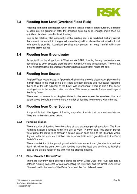
8.3 Flooding from Land (Overland Flood Risk)<br />
TEP on behalf of <strong>National</strong> <strong>Grid</strong> 13 of 21<br />
King’s Lynn 400kV Connection<br />
110488-FRA-R1(1)<br />
Flooding from land can happen when intense rainfall, often of short duration, is unable<br />
to soak into the ground or enter the drainage systems quick enough and is then run<br />
quickly off land and result in local flooding.<br />
Due to the relatively flat topography of the existing site, it is predicted that any rainfall<br />
that cannot percolate into the ground immediately will sit above the saturated soil until<br />
infiltration is possible. Localised ponding may present in heavy rainfall with more<br />
extreme storm events.<br />
8.4 Flooding from Groundwater<br />
As quoted from the King’s Lynn & West Norfolk SFRA, flooding from groundwater is not<br />
considered to be of strategic significance in King’s Lynn and West Norfolk. Therefore, it<br />
is not anticipated that groundwater flooding poses a significant risk to the site.<br />
8.5 Flooding from Sewers<br />
Anglian Water record maps in Appendix G show that there is clean water pipe running<br />
in High Road to the west of the site. There are both surface and foul sewer located to<br />
the north of the site adjacent to the Low Road roundabout. There is also a foul sewer<br />
running close to the northern site boundary. This sewer connects further east beyond<br />
the Puny Drain.<br />
There are no sewers from Anglian Water in the area where the overhead line and<br />
pylons are to be built; therefore there is no risk of flooding from sewers within the site.<br />
8.6 Flooding from Other Sources<br />
It is possible that other types of flooding may affect the site that not mentioned above.<br />
They are further discussed below.<br />
8.6.1 Pumping Station<br />
There is a risk of flooding from the failure of land drainage pumping stations. The Puny<br />
Pumping Station is located within the site at NGR TF 60701502. This station pumps<br />
water under the railway line through a culvert into an open drain to the River Nar where<br />
it goes under the river via a siphon into an open drain which gravitates into the Flood<br />
Relief Channel.<br />
There is a risk that if the pumping station fails to operate, it can give rise to a residual<br />
flood risk within the area. Any such flooding would be local and confined to low-lying<br />
land as the area is relatively flat with minimal change in levels.<br />
8.6.2 Direct Breach & Hazard Zone<br />
There are currently flood defences along the River Great Ouse, the River Nar and a<br />
defence running from east to west connecting the River Nar and the Great Ouse Relief<br />
Channel, just to the south of the Dairy Farm and the Saddlebow House.


