Africa Surveyors May-June issue 2021
Africa Surveyors is Africa’s premier source of Surveying, Mapping and Geospatial news and an envoy of surveying products/service for the Construction, Maritime, Onshore & Offshore energy and exploration, Engineering, Oil and Gas, Agricultural and Mining sectors on new solution based trends and technology for the African market.
Africa Surveyors is Africa’s premier source of Surveying, Mapping and Geospatial news and an envoy of surveying products/service for the Construction, Maritime, Onshore & Offshore energy and exploration, Engineering, Oil and Gas, Agricultural and Mining sectors on new solution based trends and technology for the African market.

You also want an ePaper? Increase the reach of your titles
YUMPU automatically turns print PDFs into web optimized ePapers that Google loves.
FEATURE<br />
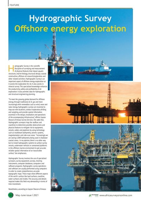
Hydrographic Survey<br />
Offshore energy exploration<br />
Hydrographic Survey is the scientific<br />
discipline of surveying and measurement<br />
of physical features that impact aquatic<br />
structures, marine biology, structural design, coastal<br />
construction, offshore oil research/exploration and<br />
other related activities. Hydrographic Survey is an<br />
important aspect of offshore energy exploration as<br />
it assists the exploration for oil. It also assists in<br />
mineral survey. This specialized knowledge enhances<br />
the productivity, safety and profitability of oil<br />
exploration. It also provides data for hydrographic<br />
and structural engineering planning.<br />
“To meet the growing global demand for offshore<br />
energy, through traditional oil & gas and more<br />
increasingly with renewables such as wind, wave and<br />
solar energy, hydrographic surveys are essential to<br />
map out new locations, conduct exploratory drilling<br />
and sampling, and provide spatial information<br />
essential in the design, installation and operations<br />
of the accompanying infrastructure,” affirms Gaynor<br />
Deacon of Amaza Survey Services. She adds that,<br />
Hydrographic surveyors map the seafloor and<br />
coastlines to determine possible obstructions and<br />
physical features to mitigate risk to equipment,<br />
vessels, cables and pipelines by using technology<br />
such as multibeam bathymetry, seismic systems,<br />
magnetometers and side-scan sonar. “Increasingly we<br />
are seeing LiDAR bathymetry being used in shallower<br />
coastal zones. In my opinion, there is no other way<br />
but to install hydrographic systems to surface survey<br />
vessels, underwater vehicles or unmanned platforms<br />
in the offshore marine environment to get accurate<br />
reliable spatial information of an inaccessible<br />
surface,” she emphasizes.<br />
Hydrographic Survey involves the use of specialized<br />
surveyors, survey equipment, surveys, charting<br />
instruments, computer databases, computers and<br />
software programs. Hydrographic survey operations<br />
and software are usually performed using computers<br />
in order to create comprehensive, accurate<br />
topographic maps. These maps show different aspects<br />
of the earth's surface like land surfaces, coastline,<br />
water surfaces and insides. The accuracy and details<br />
required makes this field very demanding in terms of<br />
time investment.<br />
Nonetheless, according to Gaynor Deacon of Amaza<br />
16 <strong>May</strong>-<strong>June</strong> <strong>issue</strong> l <strong>2021</strong> www.africasurveyorsonline.com