PACIFIC ISLANDS DIGITAL ELEVATION MODELS - NOAA National ...
PACIFIC ISLANDS DIGITAL ELEVATION MODELS - NOAA National ...
PACIFIC ISLANDS DIGITAL ELEVATION MODELS - NOAA National ...

You also want an ePaper? Increase the reach of your titles
YUMPU automatically turns print PDFs into web optimized ePapers that Google loves.
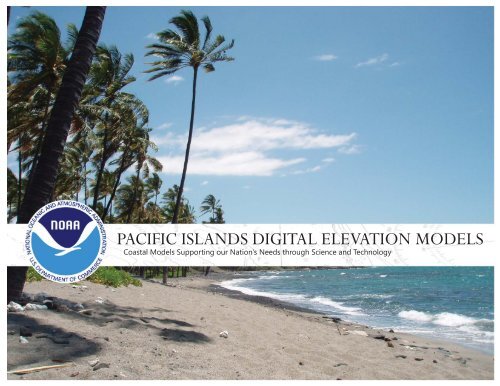
<strong>PACIFIC</strong> <strong>ISLANDS</strong> <strong>DIGITAL</strong> <strong>ELEVATION</strong> <strong>MODELS</strong><br />
Coastal Models Supporting our Nation’s Needs through Science and Technology
All of the coastal digital elevation models (DEMs) in this presentation were created by scientists<br />
with <strong>NOAA</strong>’s <strong>National</strong> Geophysical Data Center (NGDC) and the Cooperative Institute for Research in<br />
Environmental Sciences (CIRES)— University of Colorado at Boulder. The elevation modeling work,<br />
done in collaboration with the <strong>National</strong> Tsunami Hazard Mitigation Program (NTHMP), is providing<br />
near-continous coverage of U.S. coasts in support of <strong>NOAA</strong>’s role in protecting life and property and<br />
conserving and protecting natural resources.<br />
Data identifi ed as coming from the <strong>NOAA</strong> <strong>National</strong> Geophysical Data Center are provided for public<br />
use from many academic, federal, state and other sources. For a complete list of sources see the<br />
Technical Reports developed for each DEM, available online.
<strong>PACIFIC</strong> <strong>ISLANDS</strong><br />
United States Pacifi c Islands and territories are dispersed mostly across the<br />
southern Pacifi c Ocean. This geographic area – also known as Oceania, includes<br />
over 30,000 islands that are broken up into the regional groups of Melanesia,<br />
Micronesia, and Polynesia. These island groups consist of small atolls<br />
and cays, coral islands, expansive barrier reefs, and high volcanic islands. The<br />
islands include well known landmarks such as the Hawaiian Islands, American<br />
Samoa, Fiji, and Guam. More than just tropical travel destinations, these<br />
islands are home to thousands of residents whose local indigenous populations<br />
are mixed with western culture.<br />
Communities and people who inhabit the tropical Pacifi c islands— especially<br />
in developments near the coast— are extremely vulnerable to severe storms,<br />
coastal inundation events, typhoons, earthquakes, and, as shown by the 2009<br />
event that killed 149 people, 34 in American Samoa alone, tsunamis. Seismic<br />
activity at plate boundaries along the Pacifi c Ring of Fire, along with other<br />
tectonic stresses, deep-sea trenches, submerged volcanoes, and undersea<br />
features, increase the likelihood of risks associated with deadly large-wave<br />
events. Every year, coastal inundation events cause millions of dollars in damages<br />
and often loss of life.<br />
The <strong>National</strong> Geophysical Data Center’s digital elevation models (DEMs) provide<br />
detailed, accurate depictions of the coastal bathymetry and topography<br />
of the Pacifi c U.S. Islands and territories. The models are used by scientists,<br />
coastal managers, and policy makers to effectively maintain marine ecosystems<br />
and coastal resources, coordinate planning and mitigation efforts, and<br />
better understand the impacts of natural hazards on coastal communities.<br />
1. Midway Atoll<br />
2. Wake Island<br />
3. Pago Pago<br />
4. Hanalei<br />
5. Lahaina<br />
6. Kawaihae<br />
7. Keauhou
2<br />
1<br />
3<br />
4<br />
5<br />
6<br />
7
<strong>DIGITAL</strong> <strong>ELEVATION</strong> MODEL<br />
Midway Atoll
© 2011 Google<br />
Who Provided the Data?<br />
<strong>NOAA</strong> Knows... <strong>National</strong> Oceanic and Atmospheric Administration<br />
MIDWAY ATOLL<br />
- <strong>NOAA</strong> <strong>National</strong> Geophysical Data Center (NGDC)<br />
- <strong>NOAA</strong> Offi ce of Coast Survey (OCS)<br />
- <strong>NOAA</strong> Center of Coastal Monitoring and<br />
Assessment (CCMA)<br />
- <strong>NOAA</strong> Coastal Services Center (CSC)<br />
- U.S. Geological Survey (USGS)<br />
- Naval Postgraduate School<br />
Why Model Midway Atoll?<br />
U.S. Department of Commerce<br />
Midway Atoll is a circular atoll that consists of two islands, Sand Island and<br />
Eastern Island, collectively called Midway Island. The atoll is located in the<br />
Hawaiian archipelago approximately 1,150 miles west-northwest of Hawaii.<br />
In 1940, an air and submarine base were built on the island. Shortly after, in<br />
1942, the island gained notoriety after the Battle of Midway proved to be the<br />
turning point of World War II. In 2006, Midway Island was designated as a<br />
protected national monument with the other northwestern Hawaiian Islands,<br />
and is managed by the U.S. Fish and Wildlife Service and <strong>NOAA</strong>. Midway<br />
Atoll was formed from a shield volcano that developed around 28 million<br />
years ago from the same hotspot that is located under Hawaii today. Pacifi c<br />
plate motion has moved the volcano northwest from the hotspot, where it<br />
has slowly subsided. A coral reef has grown around the rim of the atoll, which<br />
is home to an array of important wildlife and marine species. The Midway<br />
Atoll DEM is an important tool for hazard managers due to the dangers assocated<br />
with Midway’s low-lying position in an active volcanic zone.<br />
Photo Credits: Forest and Kim Starr; Elliot Lim<br />
http://www.ngdc.noaa.gov/mgg/coastal/ dem.info@noaa.gov
<strong>DIGITAL</strong> <strong>ELEVATION</strong> MODEL<br />
Wake Island
© 2011 Google<br />
<strong>NOAA</strong> Knows...<br />
Who Provided the Data?<br />
WAKE ISLAND<br />
- <strong>NOAA</strong> <strong>National</strong> Ocean Service (NOS)<br />
- <strong>NOAA</strong> <strong>National</strong> Geophysical Data Center (NGDC)<br />
- <strong>NOAA</strong> Offi ce of Coast Survey (OCS)<br />
- U.S. Geological Survey (USGS)<br />
Why Model Wake Island?<br />
<strong>National</strong> Oceanic and Atmospheric Administration<br />
U.S. Department of Commerce<br />
Wake Island is a tiny coral atoll with less than twenty kilometers of coastline.<br />
It is located in the North Pacific Ocean, approximately two-thirds of<br />
the way from Hawaii to the Northern Mariana Islands. The atoll consists<br />
of three low coral islands— Peale, Wake, and Wilkes— surrounding a<br />
central lagoon. The area is an unincorporated, unorganized territory of<br />
the United States. Activities on the island are minimal and are overseen<br />
by the United States Air Force. All public access to the island is restricted.<br />
Wake Island is vulnerable to typhoons and tsunamis. In August 2006,<br />
a category 5 Super Typhoon (Loke) passed over Wake Island with winds<br />
over 185 mph, causing a seven meter storm surge and inflicting major<br />
damage to the island. Tsunami inundation from far-field events is also a<br />
threat to the island due to the surrounding subduction zones that line<br />
the Pacific Basin. This DEM will help to understand and mediate the effects<br />
of future tsunamis and severe storm events.<br />
Photo Credit: www.msc.navy.mil<br />
http://www.ngdc.noaa.gov/mgg/coastal/ dem.info@noaa.gov
<strong>DIGITAL</strong> <strong>ELEVATION</strong> MODEL<br />
Pago Pago
© 2011 Google<br />
Who Provided the Data?<br />
<strong>NOAA</strong> Knows...<br />
PAGO PAGO<br />
- <strong>NOAA</strong> <strong>National</strong> Geophysical Data Center (NGDC)<br />
- <strong>NOAA</strong> Coastal Services Center (CSC)<br />
- Scripps Institution of Oceanography (SIO)<br />
- Gaia Geo-Analytical<br />
- U.S. Geological Survey (USGS)<br />
- Naval Oceanographic Offi ce (NAVOCEANO)<br />
Why Model Pago Pago?<br />
<strong>National</strong> Oceanic and Atmospheric Administration<br />
U.S. Department of Commerce<br />
American Samoa is an unincorporated territory of the United States located<br />
in the South Pacifi c Ocean. The Pago Pago digital elevation models include<br />
coverage of the American Samoa islands of Tutuila, Ofu, Olosega, and Ta’u.<br />
Tutuila is the largest of the islands and features the eroded summit of a<br />
large basaltic volcano that formed 1.54 to 1 million years ago. Pago Pago,<br />
the capital of American Samoa, is home to roughly 11,500 of the territory’s<br />
total population of more than 57,000 people. Pago Pago Harbor is one of<br />
the world’s largest natural harbors and was formed by submergence of the<br />
volcano’s caldera. The area is frequently hit by typhoons and is at great risk<br />
of experiencing future severe storm events. In September 2009, an 8.0 magnitude<br />
earthquake struck 120 miles off the coast of American Samoa, generating<br />
a tsunami. Three waves hit the islands, killing 34 people in Pago Pago,<br />
Tutuila, and American Samoa, and 149 people in neighboring Samoa. The<br />
American Samoa DEM is an important tool in predicting and preparing for<br />
future tsunamis and other natural disasters.<br />
Photo Credits: Eric Guinther and Elliot Lim<br />
http://www.ngdc.noaa.gov/mgg/coastal/ dem.info@noaa.gov
<strong>DIGITAL</strong> <strong>ELEVATION</strong> MODEL<br />
Hanalei, Kauai
© 2011 Google<br />
<strong>NOAA</strong> Knows...<br />
Who Provided the Data?<br />
HANALEI, KAUAI<br />
- <strong>NOAA</strong> <strong>National</strong> Geophysical Data Center (NGDC)<br />
- <strong>NOAA</strong> <strong>National</strong> Ocean Service (NOS)<br />
- <strong>NOAA</strong> Offi ce of Coast Survey (OCS)<br />
- <strong>NOAA</strong> Center for Coastal Monitoring and Assessment (CCMA)<br />
- <strong>NOAA</strong> Coastal Services Center (CSC)<br />
- <strong>NOAA</strong> Pacifi c Services Center (PSC)<br />
- County of Kauai Information Technology Division<br />
- Federal Emergency Man¬agement Agency (FEMA)<br />
- U.S. Army Engineer Joint Airborne Lidar Bathymetry<br />
Technical Center of Expertise (JALBTCX)<br />
- U.S. Geological Survey (USGS)<br />
Why Model Hanalei, Kauai ?<br />
<strong>National</strong> Oceanic and Atmospheric Administration<br />
U.S. Department of Commerce<br />
Hanalei is located along Hanalei Bay near the mouth of the Hanalei River. The<br />
small town is home to 500 residents and is nestled next to the coast. Hanalei<br />
is known for its beautiful beaches and its breathtaking views of the mountains.<br />
The Hanalei regional DEM covers the northern coast of the island of Kauai, the<br />
northernmost island of the main Hawaiian Island Chain. The area is at risk from<br />
tsunamis caused by both distant and local sources. While some tsunamis that<br />
affect Hawaii originate in distant areas where tectonic plates collide (subduction<br />
zones), such as in Alaska’s Aleutian Island chain, Japan, or the west coast<br />
of South America, shallow regional undersea earthquakes or landslides can<br />
also generate local tsunamis. The shorter warning time for locally generated<br />
tsunamis, perhaps as little as a few minutes, poses a great danger to residents.<br />
The Hanalei DEM can help local managers prepare for both distant and local<br />
tsunamis, and for hazardous events that are associated with inundation, sea<br />
level rise, tropical cyclones, and geologic change.<br />
Photo Credit: www.gohawaii.com<br />
http://www.ngdc.noaa.gov/mgg/coastal/ dem.info@noaa.gov
<strong>DIGITAL</strong> <strong>ELEVATION</strong> MODEL<br />
Lahaina, Hawaii
© 2011 Google<br />
<strong>NOAA</strong> Knows...<br />
Who Provided the Data?<br />
- <strong>NOAA</strong> <strong>National</strong> Ocean Service (NOS)<br />
- <strong>NOAA</strong> Coastal Services Center (CSC)<br />
- <strong>NOAA</strong> <strong>National</strong> Geophysical Data Center (NGDC)<br />
- U.S. Geological Survey (USGS)<br />
- <strong>National</strong> Geospatial-Intelligence Agency (NGA)<br />
- Joint Airborne LiDAR Bathymetry Technical<br />
Center of Expertise (JALBTCX)<br />
LAHAINA, HAWAII<br />
Why Model Lahaina, Hawaii?<br />
<strong>National</strong> Oceanic and Atmospheric Administration<br />
U.S. Department of Commerce<br />
Lahaina is located on the western coast of the island of Maui, Hawaii, near the<br />
marine channels between Maui, Lanai, and Molokai. Neighboring communities<br />
include Kapalua on Maui, Lopa on Lanai, and Kaluaaha on Molokai. Lahaina has<br />
a resident population of roughly 9,000 people, which can grow by almost 40,000<br />
people during the highest tourism seasons. The islands of Hawaii have been<br />
created by still active shield-building volcanoes, whose low-viscosity lava fl ows<br />
often reach the coast. Development in the coastal zone of the popular tourist<br />
destination has modifi ed the local morphology, especially in boat harbors.<br />
In the deep water, the marine channels between the islands exhibit signifi cant<br />
morphologic relief, refl ecting alternation between living and drowned coral reefs<br />
built atop submarine volcanic material. The islands’ volcanic history and central<br />
location in the Pacifi c “Ring of Fire” make the area an important location for<br />
tsunami research. Large wave events and ocean storms often threaten coastal<br />
communities such as Lahaina, and so DEMs and tsunami models are useful tools<br />
in providing information to hazard managers and planners.<br />
Photo Credit: www.hawaii.gov<br />
http://www.ngdc.noaa.gov/mgg/coastal/ dem.info@noaa.gov
<strong>DIGITAL</strong> <strong>ELEVATION</strong> <strong>DIGITAL</strong> MODEL <strong>ELEVATION</strong> MODEL<br />
Kawaihae, Hawaii<br />
Midway Atoll
© 2011 Google<br />
<strong>NOAA</strong> Knows...<br />
Who Provided the Data?<br />
- <strong>NOAA</strong> <strong>National</strong> Geophysical Data Center (NGDC)<br />
- <strong>NOAA</strong> <strong>National</strong> Ocean Service (NOS)<br />
- U.S. Geological Survey (USGS)<br />
- U.S. Army Corps of Engineers (USACE)<br />
KAWAIHAE, HAWAII<br />
Why Model Kawaihae, Hawaii?<br />
<strong>National</strong> Oceanic and Atmospheric Administration<br />
U.S. Department of Commerce<br />
The Kawaihae DEM covers the northwestern coastal region of the island of Hawaii,<br />
an island with a long history of tsunamis, including several non-deadly tsunamis<br />
in Kawaihae. The town of Kawaihae is an unincorporated community and is a<br />
shipping terminal, a popular surfi ng destination, a military landing site, and one<br />
of the largest harbors on the island of Hawaii. This well known island chain was<br />
created by shield-building volcanoes and the Island of Hawaii is composed of fi ve<br />
volcanoes: Kohala, Hualalai, Mauna Kea, Mauna Loa, and Kilauea. The island has<br />
428 kilometers of coastline and is known locally and abroad as the Big Island. The<br />
western side of the Big Island lies in the lee of Mauna Loa (4,205 meters), the largest<br />
volcano on Earth, rising almost 9 kilometers from the sea fl oor. The island’s<br />
volcanic history and location within the Pacifi c “Ring of Fire” make it vulnerable to<br />
local and distant tsunami events as well as ocean storms, making DEMs, disaster<br />
planning, and warning efforts very important.<br />
Photo Credit: www.poh.usace.army.mil<br />
http://www.ngdc.noaa.gov/mgg/coastal/ dem.info@noaa.gov
<strong>DIGITAL</strong> <strong>ELEVATION</strong> MODEL<br />
Keauhou, Hawaii
© 2011 Google<br />
Who Provided the Data?<br />
<strong>NOAA</strong> Knows...<br />
KEAUHOU, HAWAII<br />
- <strong>NOAA</strong> <strong>National</strong> Geophysical Data Center (NGDC)<br />
- <strong>NOAA</strong> <strong>National</strong> Ocean Service (NOS)<br />
- <strong>NOAA</strong> Offi ce of Coast Survey (OCS)<br />
- <strong>NOAA</strong> Center for Coastal Monitoring and Assessment (CCMA)<br />
- <strong>NOAA</strong> Coastal Services Center (CSC)<br />
- <strong>NOAA</strong> Pacifi c Services Center (PSC)<br />
- County of Hawaii Information Technology Division<br />
- Federal Emergency Management Agency (FEMA)<br />
- U.S. Army Engineer Joint Airborne Lidar Bathymetry<br />
Technical Center of Expertise (JALBTCX)<br />
- U.S. Geological Survey (USGS)<br />
http://www.ngdc.noaa.gov/mgg/coastal/<br />
Why Model Keauhou?<br />
<strong>National</strong> Oceanic and Atmospheric Administration<br />
U.S. Department of Commerce<br />
Keauhou is located on the west coast of the Big Island of Hawaii, six miles<br />
south of Kailua-Kona. This coastal community is made up of roughly 2,500<br />
residents, who depend largely on tourism to fuel their local economy. Nearby<br />
attractions, such as Kealakekua Bay and Keauhou Bay offer some of the<br />
best beaches and snorkeling spots— where visitors can see green sea turtles,<br />
tropical fi sh, and manta rays despite the otherwise rocky shores. Historically,<br />
this area has been occupied for 500 years and once was an important residence<br />
for Kings and royal families. The remains of ancient fi shponds, burial<br />
grounds, housing structures, and stone temples remind locals and visitors<br />
alike of the rich history of these lands. While some tsunamis that threaten<br />
Hawaii originate from distant areas where tectonic plates collide, regional<br />
shallow undersea earthquakes or landslides can also generate local tsunamis.<br />
The Keauhou DEM will serve as an important resource for tsunami warning<br />
centers, emergency planners, and local hazard managers in the face of future<br />
possible disasters and inundation events.<br />
Photo Credit: www.gohawaii.com<br />
dem.info@noaa.gov
This fl ipbook is part of a “Regional DEM Series” that is based on the work of a team of<br />
<strong>NOAA</strong> and CIRES scientists, led by Dr. Barry Eakins and Lisa Taylor. To learn more about<br />
coastal DEMs and DEM development in support of coastal management and research, visit<br />
http://www.ngdc.noaa.gov/mgg/coastal/
Design and Layout: Siobhan Collins<br />
Photographs from <strong>NOAA</strong> Photo Library<br />
http://www.photolib.noaa.gov/<br />
Editors and contributors: Barry Eakins,<br />
Lisa Taylor, Susan McLean, Loren<br />
Pahlke, Heather McCullough, Pamela<br />
Grothe, Christopher Amante, Elliot<br />
Lim, Kelly Carignan, Matthew Love,<br />
and Dorothy Friday<br />
2011, <strong>NOAA</strong> NGDC