

Wahleach Project Water Use Plan Wahleach Reservoir ... - BC Hydro
Wahleach Project Water Use Plan Wahleach Reservoir ... - BC Hydro
Wahleach Project Water Use Plan Wahleach Reservoir ... - BC Hydro

Create successful ePaper yourself
Turn your PDF publications into a flip-book with our unique Google optimized e-Paper software.
SN<br />
× ×<br />
FN<br />
SN<br />
×<br />
Boat Launch<br />
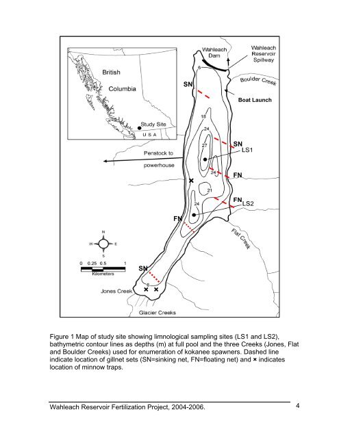
Figure 1 Map of study site showing limnological sampling sites (LS1 and LS2),<br />
bathymetric contour lines as depths (m) at full pool and the three Creeks (Jones, Flat<br />
and Boulder Creeks) used for enumeration of kokanee spawners. Dashed line<br />
indicate location of gillnet sets (SN=sinking net, FN=floating net) and × indicates<br />
location of minnow traps.<br />
<strong>Wahleach</strong> <strong>Reservoir</strong> Fertilization <strong>Project</strong>, 2004-2006.<br />
SN<br />
FN<br />
FN<br />
4


