

APAALSE - Paper - Caris
APAALSE - Paper - Caris
APAALSE - Paper - Caris
- TAGS
- apaalse
- paper
- caris
- www.caris.com

Create successful ePaper yourself
Turn your PDF publications into a flip-book with our unique Google optimized e-Paper software.
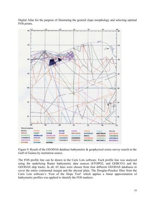
Digital Atlas for the purpose of illustrating the general slope morphology and selecting optimal<br />
FOS points.<br />
Figure 9: Result of the GEODAS database bathymetric & geophysical cruise survey search in the<br />
Gulf of Guinea by institution source.<br />
The FOS profile line can be drawn in the <strong>Caris</strong> Lots software. Each profile line was analyzed<br />
using the underlying Raster bathymetric data sources (ETOPO2, and GEBCO1) and the<br />
GEODAS ship tracks. In all, 65 lines were chosen from four different GEODAS databases to<br />
cover the entire continental margin and the abyssal plain. The Douglas-Peucker filter from the<br />
<strong>Caris</strong> Lots software’s ‘Foot of the Slope Tool’ which applies a linear approximation of<br />
bathymetric profiles was applied to identify the FOS markers.<br />
10


