

APAALSE - Paper - Caris
APAALSE - Paper - Caris
APAALSE - Paper - Caris
- TAGS
- apaalse
- paper
- caris
- www.caris.com

You also want an ePaper? Increase the reach of your titles
YUMPU automatically turns print PDFs into web optimized ePapers that Google loves.
the second sediment - Coarse Raster Model. It must be stated that these analyses are for<br />
demonstration only as gridded datasets are not accepted by the Commission for submissions.<br />
Establishment of the 350 Nautical Miles Limit<br />
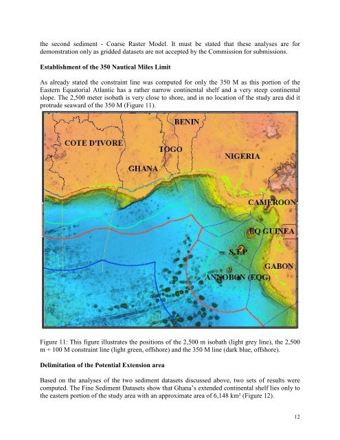
As already stated the constraint line was computed for only the 350 M as this portion of the<br />
Eastern Equatorial Atlantic has a rather narrow continental shelf and a very steep continental<br />
slope. The 2,500 meter isobath is very close to shore, and in no location of the study area did it<br />
protrude seaward of the 350 M (Figure 11).<br />
Figure 11: This figure illustrates the positions of the 2,500 m isobath (light grey line), the 2,500<br />
m + 100 M constraint line (light green, offshore) and the 350 M line (dark blue, offshore).<br />
Delimitation of the Potential Extension area<br />
Based on the analyses of the two sediment datasets discussed above, two sets of results were<br />
computed. The Fine Sediment Datasets show that Ghana’s extended continental shelf lies only to<br />
the eastern portion of the study area with an approximate area of 6,148 km² (Figure 12).<br />
12


