

APAALSE - Paper - Caris
APAALSE - Paper - Caris
APAALSE - Paper - Caris
- TAGS
- apaalse
- paper
- caris
- www.caris.com

Create successful ePaper yourself
Turn your PDF publications into a flip-book with our unique Google optimized e-Paper software.
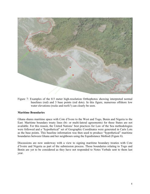
Figure 7: Examples of the 0.5 meter high-resolution Orthophotos showing interpreted normal<br />
baselines (red) and 3 base points (red dots). In this figure, numerous offshore low<br />
water elevations (rocks and reefs?) can clearly be seen.<br />
Maritime Boundaries<br />
Ghana shares maritime space with Cote d’Ivore to the West and Togo, Benin and Nigeria to the<br />
East. Maritime boundary treaty lines (bi- or multi-lateral agreements) for these States are not<br />
available. For this reason, the United Nations’ best practices for Law of the Sea methodologies<br />
were followed and a “hypothetical” set of Geographic Coordinates were generated in <strong>Caris</strong> Lots<br />
as the base points. This baseline information was then used to produce “hypothetical” maritime<br />
boundaries between Ghana and her neighbours using the Equidistance Method (Figure 8).<br />
Discussions are now underway with a view to signing maritime boundary treaties with Cote<br />
d’Ivoire and Nigeria as part of the submission process. Those boundaries relating to Togo and<br />
Benin are yet to be considered as they have not responded to Notes Verbale sent to them last<br />
year.<br />
8


