Manual - International Environmental Technology Centre
Manual - International Environmental Technology Centre
Manual - International Environmental Technology Centre

You also want an ePaper? Increase the reach of your titles
YUMPU automatically turns print PDFs into web optimized ePapers that Google loves.
UNITED NATIONS EDUCATIONAL, SCIENTIFIC AND CULTURAL ORGANIZATION<br />
INTERNATIONAL HYDROLOGICAL PROGRAMME<br />
THE UNITED NATIONS ENVIRONMENT PROGRAMME<br />
INTERNATIONAL ENVIRONMENTAL TECHNOLOGY CENTRE<br />
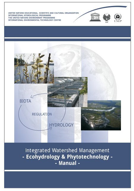
BIOTA<br />
REGULATION<br />
HYDROLOGY<br />
Integrated Watershed Management<br />
- Ecohydrology & Phytotechnology -<br />
- <strong>Manual</strong> -
Integrated Watershed Management<br />
- Ecohydrology & Phytotechnology -<br />
- <strong>Manual</strong> -<br />
UNITED NATIONS ENVIRONMENT PROGRAMME<br />
DIVISION OF TECHNOLOGY, IINDUSTRY AND ECONOMICS - INTERNATIONAL ENVIRONMENTAL TECHNOLOGY CENTRE<br />
Osaka Office<br />
2-110 Ryokuchi koen, Tsurumi-ku,<br />
Osaka 538-0036 Japan<br />
Tel: +81-6-6915-4581<br />
Fax: +81-6-6915-0304<br />
Email: ietc@unep.or.jp<br />
URL: http://www.unep.or.jp<br />
Shiga Office<br />
1091 Oroshimo-cho, Kusatsu City,<br />
Shiga 525-0001 Japan<br />
Tel: +81-77-568-4581<br />
Fax: +81-77-568-4587<br />
VwerySmatrBook03.p65 3<br />
2004-06-18, 16:28<br />
3
UNEP’s Copyright<br />
Copyright 2004 UNEP<br />
This publication may be reproduced in whole or in part and in any form for educational or non-profit purposes without<br />
special permission from the copyright holder, provided acknowledgement of the source is made. UNEP would appreciate<br />
receiving a copy of any publication that uses this publication as a source.<br />
No use of this publication may be made for resale or for any other commercial purpose whatsoever without prior<br />
permission in writing from UNEP.<br />
First edition 2004<br />
The designations employed and the presentation of the material in this publication do not imply the expression of any<br />
opinion whatsoever on the part of the United Nations Environment Programme concerning the legal status of any<br />
country, territory, city or area or of its authorities, or concerning delimitation of its frontiers or boundaries. Moreover,<br />
the views expressed do not necessarily represent the decision or the stated policy of the United Nations Environment<br />
Programme, nor does citing of trade names or commercial processes constitute endorsement.<br />
UNITED NATIONS PUBLICATION<br />
This publication is printed on paper made from 100 per cent recycled material.<br />
The photographs on the front cover page are (top to bottom): 1. Willows - used for water quality improvement and<br />
bioenergy production (Photo: Nyga); 2. Engineering device for purifying water using aquatic macrophytes - City of<br />
Rostov on Don, Russia (photo: Santiago-Fandino); 3. Pilica River floodplain, part of a UNESCO/UNEP Demonstration<br />
Project (photo: Wagner-Lotkowska); 4. The Earth from space (photo: NASA).<br />
The scheme on the back cover page is modified from Zalewski (2002). <strong>International</strong> Journal of Ecohydrology and<br />
Hydrobiology. vol. 2, no 1-4. Proceedings of the final Conference of the First Phase of the IHP-V Project 2.3/2.4 on<br />
Ecohydrology "The application of Ecohydrology to Water Resources Development and Management'. Venice, Italy 16-<br />
18 September 2001.<br />
Design: Kamil Zakrzewski<br />
Typesetting: Przemyslaw Nyga<br />
4<br />
VwerySmatrBook03.p65 4<br />
2004-06-18, 16:28
VENICE OFFICE<br />
UNESCO Regional Bureau for Science in Europe<br />
Palazzo Zorzi, Castello 4930<br />
30122 Venice, Italy<br />
<strong>Centre</strong> for Ecohydrological Studies<br />
University of Lodz<br />
12/16 Banacha Str., 90-237 Lodz, Poland<br />
Editors:<br />
Maciej Zalewski<br />
(ICE-PAS)<br />
Iwona Wagner-Lotkowska<br />
(CEHS-UL)<br />
Assistant Editor:<br />
Richard D. Robarts<br />
(UNEP-GEMS/Water)<br />
Coordination & Supervision:<br />
Vicente Santiago-Fandino<br />
(UNEP-IETC)<br />
Philippe Pypaert<br />
(UNESCO-ROSTE)<br />
The United Nations Environment Programme<br />
<strong>International</strong> <strong>Environmental</strong> <strong>Technology</strong> <strong>Centre</strong><br />
2-110 Ryokuchi Koen, Tsurumi-ku, Osaka 538-0036<br />
1091 Oroshimo-cho, Kusatsu-City, Shiga 525-0001, Japan<br />
UNESCO <strong>International</strong> Hydrological Programme<br />
Division of Water Sciences<br />
1, rue Miollis 75732 Paris Cedex 15, France<br />
<strong>International</strong> <strong>Centre</strong> for Ecology<br />
Polish Academy of Sciences<br />
Warsaw, Dziekanow Lesny, 1 Konopnickiej Str.<br />
05-092 Lomianki, Poland<br />
VwerySmatrBook03.p65 5<br />
2004-06-18, 16:28<br />
5
The <strong>Manual</strong> is one of the results of the ongoing co-operation between the United Nations Environment<br />
Programme - Division of <strong>Technology</strong>, Industry and Economics - <strong>International</strong> <strong>Environmental</strong> <strong>Technology</strong><br />
<strong>Centre</strong> (UNEP-DTIE-IETC) and the United Nations Educational, Scientific, and Cultural Organization -<br />
<strong>International</strong> Hydrological Programme (UNESCO-IHP), represented by the Regional Bureau for Science in<br />
Europe (UNESCO-ROSTE). A printed version has been separately produced by UNESCO IHP (ISBN: 92-9220-<br />
011-9, ISBN: 83-908410-8-8).<br />
The <strong>Manual</strong> has been produced with the assistance and advice of the members of the Scientific Advisory Committee<br />
(SAC) of the Ecohydrology Initiative of UNESCO-IHP and in some cases with their direct participation.<br />
The manual contains results of the first joint UNEP-IETC/UNESCO-IHP Ecohydrology & Phytotechnology<br />
Demonstration Project „Application of Ecohydrology and Phytotechnology for Water Resources Management<br />
and Sustainable Development”, on the Pilica River catchment in the Republic of Poland. This was<br />
developed and implemented by the <strong>International</strong> <strong>Centre</strong> for Ecology, Polish Academy of Sciences (ICE-<br />
PAS) and <strong>Centre</strong> for Ecohydrological Studies, University of Lodz (CEHS UL).<br />
This publication contains results of research supported by grants: European Commission projects: EC-<br />
EVK1-2001-00182 - acronym TOXIC; EC-EVK2-2002-00546 - acronym MIDI-CHIP; EVK1 -CT-2001-00094 –<br />
acronym FAME; Polish Committee of Scientific Research grants: 6 PO4F 065 19, 3 PO4G 057 22, 6 PO4F 067<br />
19, 6 P04G 112 20.<br />
The following experts contributed to the production of this manual:<br />
Chapter 1: M. Zalewski, I. Wagner-Lotkowska<br />
Chapter 2: M. Zalewski (A), V. Santiago-Fandino (B), I. Wagner-Lotkowska (A, B, C)<br />
Chapter 3: I. Wagner-Lotkowska (A, C, D, G), A. Magnuszewski (A, C), Z. Kaczmarek (B),<br />
A. Trojanowska (D), K. Krauze (E), M. Lapinska (F), K. Izydorczyk,<br />
A. Wojtal & P. Frankiewicz (H), L. Chicharo (I)<br />
Chapter 4: R. Kucharski, A. Sas-Nowosielska, M. Kuperberg (C), K. Krauze (B), J. Bocian (A)<br />
Chapter 5: A. Zdanowicz (A), K. Krauze (B), I. Wagner-Lotkowska, J. Markowska & J. Markowski (C)<br />
Chapter 6: M. Lapinska (A, B), A. Trojanowska (C), M. Zalewski (B)<br />
Chapter 7: A. Trojanowska (A), A. Bednarek (B), K. Izydorczyk (C), J. Mankiewicz, T. Jurczak,<br />
B. Romanowska-Duda, M. Tarczynska (D), A. Wojtal (E), P. Frankiewicz (F)<br />
Chapter 8: A. Chicharo (A, B), L. Chicharo (C)<br />
Chapter 9: R. Kucharski, A. Sas-Nowosielska & M. Kuperberg (A), L. Ryszkowski, A. Kedziora (B, C)<br />
Chapter 10: K. Krauze (B), I. Wagner-Lotkowska, E. Kiedrzynska, B. Sumorok (C), J. Bocian (A)<br />
Chapter 11: M. Lapinska (A, C), K. Krauze (B), Z. Kaczkowski (D)<br />
Chapter 12: I. Wagner-Lotkowska, K. Izydorczyk, T. Jurczak & M. Tarczynska (A), P. Frankiewicz (B),<br />
S. E. Jorgensen (C, D)<br />
Chapter 13: L. Chicharo<br />
Chapter 14: A. T. Calcagno (A), Z. Kaczmarek (B)<br />
Special thanks to Boguslawa Brewinska-Zaras and Marta Rogalewicz for their help in preparing the final<br />
version of the manual.<br />
6<br />
ACKNOWLEDGMENTS<br />
VwerySmatrBook03.p65 6<br />
2004-06-18, 16:28
PREFACE<br />
The World Summit on Sustainable Development (WSSD) held in Johannesburg, South Africa in 2002 and<br />
the 3rd World Water Forum held in Kyoto, Japan in 2003 highlighted the importance of the UN Millennium<br />
Declaration and the Millennium Development Goals. Both events emphasized the importance of elaborating<br />
strong science to support sustainable development policy.<br />
Further, the <strong>International</strong> Council for Scientific Unions (ICSU) declared that in the twenty-first century<br />
science „must become more problem-focused and apply an interdisciplinary approach to sustainable<br />
development issues in order for science to become more policy relevant”. Likewise, the UN World Commission<br />
for Sustainable Development (CSD), besides supporting the development and application of sound<br />
science towards sustainable development, also underscored the importance of developing and transferring<br />
environmentally sound technologies.<br />
As the twenty-first century begins, it has been recognized that successfully managing water resources is<br />
an essential component of achieving sustainable development. However, due to the anthropogenic modification<br />
of the hydrological cycle by deforestation, urbanization and irrigation, water resources have<br />
been overexploited, degraded and wasted, resulting in higher risks to human health, economic and social<br />
development as well as to the functioning of ecosystems and the preservation of the environment.<br />
In light of this scenario, there is a need to develop a novel, environmental management approach within<br />
the context of Integrated Watershed Management (IWM). This is where ecohydrology as well as the<br />
application of <strong>Environmental</strong>ly Sound Technologies (ESTs) such as phytotechnology constitute a new dimension.<br />
The concept of ecohydrology and its scientific foundations were developed by UNESCO-IHP over the past<br />
few decades. The integration of the two components - hydrology and ecology - by means of regulating<br />
hydrological, biotic and landscape interactions and processes, has contributed to improving ecosystems’<br />
resistance to stress. The concept of phytotechnology, developed by the UNEP-<strong>International</strong> <strong>Environmental</strong><br />
<strong>Technology</strong> Center, encompasses a variety of environmental approaches and technologies based on<br />
the ecosystem services that plants provide. The use of phytotechnologies, together with the development<br />
of ecohydrology, can help prevent, control and even reverse the degradation of water resources.<br />
Considering the complementarities of ecohydrology and phytotechnology and, taking into account the<br />
calls for an interdisciplinary approach by the WSSD, the 3rd WWF and the ICSU, UNESCO-IHP, UNESCO-<br />
Regional Bureau for Science in Europe (ROSTE) and UNEP-IETC merged their efforts through a number of<br />
projects and activities, including the present publication. The „<strong>Manual</strong> for Integrated Watershed Management”<br />
follows on the „Guidelines for the Integrated Management of the Watershed”, published in 2002 by<br />
the same agencies, in which the general philosophy of ecohydrology and phytotechnology was put together<br />
for the first time, providing the reader an understanding of the concepts and their application to the<br />
integrated management of watersheds.<br />
Due to the great interest generated by the Guidelines, and in order to provide practitioners with practical<br />
information about how to implement the concepts and approaches considered within ecohydrology and<br />
phytotechnology, the Scientific Advisory Committee of Ecohydrology IHP-VI and UNEP-IETC decided to<br />
produce the present publication. The manual has been designed to improve decision makers’ identifica-<br />
VwerySmatrBook03.p65 7<br />
2004-06-18, 16:28<br />
7
tion capabilities and understanding of mechanisms used to solve problems related to water resource<br />
degradation within watersheds. It is also expected that a larger audience would benefit from the present<br />
publication (i.e., technical experts, scientists, NGOs and others interested in water resource management.)<br />
Bearing in mind once again that one of the major questions in achieving sustainable development is<br />
„whether scientific evidence can successfully overcome social, economic and political resistance” (Kennedy,<br />
Science 2003), we sincerely hope that the new approaches of ecohydrology and phytotechnology,<br />
developed in IHP-V and VI and supported by UNEP-IETC, will generate positive socioeconomic benefits for<br />
those living in watersheds in addition to improving the water resources quality.<br />
8<br />
Steve Halls<br />
Director<br />
UNEP-IETC<br />
VwerySmatrBook03.p65 8<br />
2004-06-18, 16:28<br />
Andras Szöllösi-Nagy<br />
Director<br />
Division of Water Sciences, UNESCO<br />
Secretaryof the UNESCO IHP
TABLE OF CONTENTS<br />
Acknowledgments<br />
Preface<br />
Table of contents<br />
PART ONE: INTRODUCTION<br />
1. About this <strong>Manual</strong><br />
1.A. What is the goal of this manual?<br />
1.B. Why is this manual needed?<br />
1.C. What is covered by this manual?<br />
1.D. Who should use this manual?<br />
2. What are Ecohydrology & Phytotechnology?<br />
2.A. What is ecohydrology?<br />
2.B. What is phytotechnology?<br />
2.C. Application of ecohydrology and phytotechnology for water resources management and<br />
sustainable development. UNESCO/UNEP Demonstration Project<br />
3. Basic Concepts & Definitions<br />
3.A. Watershed<br />
3.B. Climate<br />
3.C. Hydrological cycle<br />
3.D. Biogeochemical cycles<br />
3.E. Landscape structure and vegetation cover<br />
3.F. Streams and rivers<br />
3.G. Lakes and reservoirs<br />
3.H. Freshwater Biota<br />
3.I. Estuarine and coastal areas<br />
PART TWO: SURVEYS & ASSESSMENT: How to Assess & Quantify Specific Issues in Watersheds<br />
4. LANDSCAPES: Defining Critical Areas in Watersheds<br />
4.A. How urbanization and industries influence water quality<br />
4.B. How to assess landscape impacts on water quality<br />
4.C. How to assess soil contamination<br />
5. LAND-WATER INTERACTIONS: How to Assess their Effectiveness<br />
5.A. Can ground water influence surface water quality<br />
5.B. How to assess the efficiency of ecotones in nutrient removal<br />
5.C. How to estimate effects of riparian areas and floodplains on water quality and quantity<br />
6. STREAMS & RIVERS: Defining their Quality & Absorbing Capacity<br />
6.A. Bioassays – A tool to measure ecosystem quality<br />
6.B. Fish communities – indicators of riverine degradation<br />
6.C. Bacteria, fungi and microbial processes<br />
7. LAKES & RESERVOIRS: Defining their Ecosystem Status<br />
7.A. What happens to phosphorus in a water body: Sedimentation<br />
7.B. What happens to nitrogen in a water body: Denitrification<br />
7.C. How to assess phytoplankton biomass?<br />
7.D. Why are cyanobacterial blooms harmful<br />
7.E. Assessment of zooplankton communities<br />
7.F. Assessment of fish communities<br />
VwerySmatrBook03.p65 9<br />
2004-06-18, 16:27<br />
6<br />
7<br />
9<br />
13<br />
14<br />
15<br />
16<br />
17<br />
21<br />
25<br />
30<br />
31<br />
32<br />
33<br />
34<br />
35<br />
36<br />
37<br />
40<br />
45<br />
49<br />
56<br />
61<br />
66<br />
71<br />
75<br />
79<br />
90<br />
97<br />
101<br />
106<br />
110<br />
116<br />
121<br />
9
8. ESTUARINE & COASTAL AREAS: How & What to Measure<br />
8.A. Water Chemistry<br />
8.B. Water Circulation<br />
8.C. Structure of Biota<br />
PART THREE: MANAGEMENT: How to Prevent Degradation & Restore Watersheds<br />
9. LANDSCAPE MANAGEMENT: Regulating Pollution Exports & Hydrological Cycles<br />
9.A. Phytoremediation of soils<br />
9.B. How to manage water cycles in watersheds<br />
9.C. Control of diffuse pollutant inputs to water bodies<br />
10. LAND-WATER INTERACTIONS: Reduction of Contamination Transport<br />
10.A. Constructed wetlands: How to combine sewage treatment with phytotechnology<br />
10.B. Ecotones: How to diminish nutrient transport from landscapes<br />
10.C. Floodplains and natural wetlands: Reduction of nutrient transport<br />
11. MANAGEMENT OF STREAMS & RIVERS: How to Enhance Absorbing Capacity<br />
against Human Impacts<br />
11.A. Restoration of physical structure in a river<br />
11.B. Restoration of vegetation: Increasing nutrient retention capacity and self-purification ability<br />
11.C. Management of shoreline and riverbed structure: Increasing fish yields<br />
11.D. Ecohydrological approach in pond aquaculture<br />
12. RESERVOIR & LAKE MANAGEMENT: Improvement of Water Quality<br />
12.A. Ecohydrological methods of algal bloom control<br />
12.B. How to manage biotic structure in a reservoir<br />
12.C. Harvesting macrophytes and macroalgae<br />
12.D. Other methods of water quality improvement<br />
13. ESTUARINE & COASTAL AREAS: How to prevent degradation and restore<br />
14. OTHER ASPECTS OF WATERSHED MANAGEMENT<br />
14.A. Socio-economic aspects of ecohydrology & phytotechnology applications in integrated watershed<br />
management (IWM)<br />
14.B. Can global climate change affect management outcomes?<br />
APPENDIX<br />
Appendix<br />
Glossary of Terms<br />
References<br />
Contributing Authors<br />
10<br />
VwerySmatrBook03.p65 10<br />
2004-06-18, 16:27<br />
124<br />
128<br />
131<br />
139<br />
144<br />
150<br />
154<br />
158<br />
163<br />
169<br />
175<br />
180<br />
184<br />
188<br />
194<br />
197<br />
199<br />
202<br />
209<br />
212<br />
219<br />
226<br />
231<br />
246
VwerySmatrBook03.p65 11<br />
2004-06-17, 17:18<br />
11
12<br />
VwerySmatrBook03.p65 12<br />
2004-06-17, 17:18
1.A. What is the goal of this <strong>Manual</strong><br />
ECOHYDROLOGY & PHYTOTECHNOLOGY<br />
PROGRAMMES<br />
The concept of ecohydrology and its scientific foundations<br />
were developed by <strong>International</strong> Hydrological<br />
Programme (IHP) of UNESCO. According to<br />
ecohydrology, through the manipulation of biota<br />
and hydrology interactions in a landscape, the<br />
possibility of augmenting ecosystems resilience to<br />
anthropogenic changes can be achieved.<br />
Phytotechnology, on the other hand, as the use of<br />
vegetation and its natural services for environmental<br />
quality improvement, is being developed by<br />
the UNEP <strong>International</strong> <strong>Environmental</strong> <strong>Technology</strong><br />
<strong>Centre</strong> (UNEP - IETC). This can complement ecohydrology<br />
through, for example, development of<br />
techniques of vegetation use to reducing erosion<br />
of shorelines, preserving and restoring soils and<br />
landscapes, controlling and preventing pollution,<br />
as well as restoring habitats.<br />
ECOHYDROLOGY & PHYTOTECHNOLOGY<br />
GUIDELINES FOR IWM<br />
The complementarities of ecohydrology and phytotechnology,<br />
together with the similar interests<br />
in water resources management of UNEP-IETC,<br />
UNESCO-IHP and UNESCO-Regional Bureau for<br />
Science in Europe (ROSTE), led to a joint project<br />
that produced the „Guidelines for the Integrated<br />
Management of the Watershed”. The Guidelines<br />
provided a strong scientific basis for the concepts<br />
of ecohydrology and phytotechnology as well as a<br />
theoretical background for their application in Integrated<br />
Watershed Management (IWM). They presented<br />
ecohydrological approach to understanding<br />
of processes regulating dynamics of water basins, as<br />
well as the mechanisms for increasing absorbing capacity<br />
of ecosystems against human impacts.<br />
UNESCO/UNEP<br />
Guidelines for the Integrated Management<br />
of the Watershed<br />
Phytotechnology and Ecohydrology<br />
Freshwater ManagementSeries No. 5<br />
UNEP, 2002<br />
THIS MANUAL<br />
Being a continuation of the scientific background<br />
provided in the „Guidelines”, this publication does<br />
not present to a reader any detailed theoretical<br />
considerations about the mechanisms of the ecohydrological<br />
and phytotechnological processes.<br />
Discussion of the theoretical aspects of the concepts<br />
in this publication is limited to an essential<br />
minimum. The <strong>Manual</strong> complements the Guidelines<br />
and focuses on the methodology and practical<br />
aspects of implementing ecohydrological and phytotechnological<br />
concepts in watershed management.<br />
Therefore, the objectives of this manual are to:<br />
provide examples of ecohydrology and phytotechnology<br />
in water resources management;<br />
assist decision makers, technical experts and<br />
scientists to manage watersheds and related<br />
water bodies; and<br />
facilitate and promote the better understanding<br />
of the opportunities that the application<br />
of ecohydrology and phytotechnology offer for<br />
this purpose.<br />
HOW TO USE THE GUIDELINES AND MANUAL<br />
In order to benefit from both practical information<br />
presented in the <strong>Manual</strong> as well as the scientific<br />
background provided by the Guidelines, it is<br />
recommended to get familiar with both of the complementary<br />
publications.<br />
Therefore, in the section named:<br />
MAKE SURE TO CHECK THESE RESOURCES:<br />
located at the end of each chapter, you will find<br />
references to corresponding chapters of the UNEP<br />
/ UNESCO Guidelines for the Integrated Management<br />
of the Watershed – Phytotechnology and Ecohydrology.<br />
VwerySmatrBook03.p65 13<br />
2004-06-17, 17:18<br />
13<br />
Introduction: About this <strong>Manual</strong>
Introduction: About this <strong>Manual</strong><br />
14<br />
1.B. WHY IS THIS MANUAL NEEDED?<br />
FRESHWATER DEGRADATION IS MUCH MORE THAN<br />
JUST POLLUTION<br />
At the beginning of the 21st century, the increasing<br />
human population has become a major factor<br />
in progressive environmental degradation on<br />
the global scale. Although the traditional perception<br />
of freshwater degradation has been usually<br />
linked to pollution, increasing human activities in<br />
a catchment have more profound effects on environmental<br />
quality. Most river basins in the world<br />
have been dramatically modified due to unsustainable<br />
development of agriculture, grazing, deforestation,<br />
and urbanization. These disturbances<br />
have been changing local and regional climates,<br />
hydrological cycles as well as evolutionary established<br />
biogeochemical cycles in a catchment.<br />
Therefore, it became evident that the degradation<br />
of river ecosystems has been of a two-dimensional<br />
nature (Box 1.1):<br />
first - pollution, which can be eliminated to<br />
a large extent by technologies;<br />
second - and much more complex, degradation<br />
of evolutionary established water and<br />
nutrient cycling.<br />
WHY DOES THE DEGRADATION OF ECOLOGICAL<br />
PROCESSES CAUSE RISK TO HUMANS?<br />
Degradation of biological structures and ecological<br />
processes means a reduction in an ecosystem’s<br />
VwerySmatrBook03.p65 14<br />
2004-06-17, 17:18<br />
carrying capacity. As a consequence, with the present<br />
rate of society development and environmental<br />
degradation, it is expected that during the next<br />
30 to 60 years, human imperatives may clash with<br />
the carrying capacity of the global environment<br />
(see Guideline, chapter I). Such a clash would be<br />
nothing less than catastrophic for humanity. Today<br />
changes of ecological processes at a catchment<br />
scale have become strongly manifested by the continuous<br />
decrease of water quality and the enhanced risks<br />
of floods and droughts in many regions of the world.<br />
It is evident that water is becoming scarcer for society<br />
in some developed and many developing countries.<br />
This results in a higher risk to not only human health,<br />
but also to economic and societal development.<br />
In this situation, development of an integrated<br />
approach to environmental management, based<br />
on the harmonization of technical and ecological<br />
measures, is necessary to achieve sustainable development.<br />
Integrating different branches of environmental<br />
science (such as, e.g., ecology and hydrology)<br />
can help provide an understanding of environmental<br />
changes as well the knowledge-base necessary to apply<br />
efficient measures to improve the quality and, at<br />
the same time, increase absorbing capacity of the environment<br />
for human impacts.
1.C. WHAT IS COVERED BY THIS MANUAL?<br />
This manual provides a new approach based on<br />
application of across disciplines knowledge in holistic<br />
management of water resources. It encourages<br />
a reader to have a broader, interdisciplinary<br />
view on various aspects of IWM, with special emphasis<br />
on practical use of understanding relationships<br />
between hydrology and biota and their use<br />
in order to control environment quality.<br />
According to the presented approach, for sustainable<br />
management of water resources quality and<br />
stabilization of hydrological cycle, it is necessary<br />
to harmonize technological and ecological measures.<br />
Ecological measures should be based on understanding<br />
of biota-water interplay in various scales<br />
of a catchment. Therefore, the manual has been organized<br />
hierarchically, in order to easily identify the necessary<br />
measures in the particular areas of a catchment,<br />
such as (Box 1.2):<br />
LANDSCAPE<br />
LAND-WATER INTERFACE<br />
STREAMS & RIVERS<br />
LAKES & RESERVOIRS<br />
ESTUARINE & COASTAL AREAS<br />
The manual has been divided into the following<br />
major sections:<br />
PART ONE: INTRODUCTION: presents basic<br />
theory for ecohydrology and phytotechnology<br />
concepts and introduces basic definitions<br />
essential for understanding in order to apply<br />
ecohydrological and phytotechnological<br />
measures.<br />
PART TWO: SURVEYS & ASSESSMENT: presents<br />
an overview of methods for assessment<br />
of potential issues in watersheds, focusing<br />
a re ader’s attention on possible variations and<br />
interpretations of results from the point of<br />
view of ecohydrology and phytotechnology.<br />
PART THREE: MANAGEMENT: presents practical<br />
suggestions and recommendations for<br />
application of ecohydrology and phytotechnology<br />
in IWM.<br />
VwerySmatrBook03.p65 15<br />
2004-06-17, 17:18<br />
15<br />
Introduction: About this <strong>Manual</strong>
Introduction: About this <strong>Manual</strong><br />
16<br />
1.D. WHO SHOULD USE THIS MANUAL?<br />
Anyone who is involved in Integrated Watershed<br />
Management (IWM) should find this manual of<br />
interest. In particular, those who deal with<br />
improvement of degraded aquatic and terrestrial<br />
environments, as well as those interested in<br />
sustainable management and maintaining good<br />
quality water recourses, will find this manual<br />
useful.<br />
In the traditional approach to water resources<br />
management, hydrotechnical engineers have<br />
usually been the major target group. Although they<br />
still play a fundamental role as those who<br />
eliminate threats, such as for example, point<br />
sources of pollution, it has become obvious that<br />
to achieve high-quality results with environmental<br />
issues, the technical approach alone is not enough.<br />
This manual encourages and provides an<br />
understanding of the need for a broader view on<br />
catchment management. This involves the<br />
VwerySmatrBook03.p65 16<br />
2004-06-17, 17:18<br />
application of new strategies that amplify the<br />
opportunities provided by an understanding of<br />
ecosystem properties in order to enhance their<br />
carrying capacity against increasing human<br />
impacts.<br />
Successful implementation of any strategy in IWM<br />
depends on participation of various groups of<br />
people working and living in a catchment (Box 1.3).<br />
Therefore, we believe, that not only professionals<br />
with various expertise, but also a wide range of<br />
practitioners, politicians and the public will find<br />
the manual of interest. In particular, the manual<br />
has been dedicated to:<br />
environmental managers and technical experts;<br />
local and regional authorities, decision makers<br />
in government agencies and non-governmental<br />
organizations;<br />
coordinators and consultants; and<br />
landowners.
2.A. WHAT IS ECOHYDROLOGY?<br />
INTEGRATION OF SCIENCES...<br />
According to the strategy defined by ICSU, science<br />
in the 21st century should actively participate<br />
in creating a vision, strategy and implementation<br />
methodology essential to the support of sustainable<br />
development. The approach that accelerates<br />
the above actions should be based on the integration<br />
of various interdisciplinary and transdisciplinary<br />
fields of science. The developmental conditions<br />
required for comprehensive, integrative and<br />
interdisciplinary scientific research is „maturity”<br />
of the empirical disciplines that participate in the<br />
integration process.<br />
The progress that took place in ecological sciences<br />
in the last years of the 20th century, allowed<br />
for major advancements of knowledge. A level was<br />
attained that permitted an attempt to integrate<br />
ecological sciences with the more advanced scientific<br />
fields to great extend expresses by phisics<br />
and mathematics hydrology. This integration created<br />
a platform for the development of a new discipline<br />
(Zalewski et al., 1997; Zalewski, 2000).<br />
Ecohydrology (EH), has been formulated and developed<br />
within the framework of UNESCO’s <strong>International</strong><br />
Hydrological Programme, IHP -V.<br />
DEFINING ECOHYDROLOGY...<br />
The basis for the development and advancement<br />
of interdisciplinary science and related research<br />
should be the defining of a new scope and formulation<br />
of new key questions to be answered (Keyfitz,<br />
1993). In the course of the genesis of ecohydrology,<br />
it was assumed that the questions should<br />
meet the two following fundamental conditions:<br />
1. They should be related to the dynamics of two<br />
entities in such a way that the answer without<br />
consideration of one of the two components<br />
(both ways E H) would be impossible. In<br />
other words, this question should enable the<br />
defining of relationships between hydrological<br />
and biological processes in order to obtain<br />
comprehensive empirical data at the same<br />
spatial and temporal scales.<br />
2. The results of the empirical analysis should<br />
test the whole range of processes (from a<br />
molecular to catchment scale), should enable<br />
their spatial/temporal integration and<br />
should be convertible to large-scale management<br />
measures in order to enable further<br />
testing of the hypotheses.<br />
Taking into account the above conditions, the key<br />
questions for ecohydrology have been defined based<br />
on an in-depth understanding of the interplay<br />
between biological and hydrological processes and<br />
the factors that regulate and shape them. The<br />
hypotheses have been defined in the form of the<br />
following questions:<br />
Hypothesis H1: „The regulation of hydrological<br />
parameters in an ecosystem or catchment can be<br />
applied for controlling biological processes”.<br />
Hypothesis H2: „The shaping of the biological<br />
structure of an ecosystem(s) in a catchment can<br />
be applied to regulating hydrological processes”.<br />
Hypothesis H3: „Both types of regulation (H2 and<br />
H3) integrated at a catchment scale and in a synergistic<br />
way can be applied to the sustainable<br />
development of freshwater resources, measured<br />
as the improvement of water quality and quantity<br />
(providing of ecosystem services)”(Zalewski, 2000).<br />
It should be stressed that according to the ecohydrology<br />
concept, the overall goal defined in the<br />
above hypotheses is the sustainable management<br />
of water resources. This should be focused on the<br />
enhancement of ecosystem carrying capacity against<br />
anthropogenic stresses.<br />
WHAT IS ECOHYDROLOGY?<br />
Ecohydrology is a scientific concept applied to<br />
environmental problem-solving (Zalewski et al.,<br />
1997). It quantifies and explains the relationships<br />
between hydrological processes and biotic dynamics<br />
at a catchment scale.<br />
The concept is based upon the assumption<br />
that sustainable development of water resources<br />
is dependent on the ability to restore<br />
and maintain evolutionarily established<br />
processes of water and nutrient circulation<br />
and energy flows at the basin scale.<br />
VwerySmatrBook03.p65 17<br />
2004-06-17, 17:18<br />
17<br />
Introduction: Ecohydrology & Phytotechnology
Introduction: Ecohydrology & Phytotechnology<br />
This depends on an in-depth understanding of a<br />
whole range of processes involved that have a<br />
two-dimensional character:<br />
temporal: spanning a time frame from the past<br />
to the present with due consideration of<br />
future global change scenarios; and<br />
spatial: understanding the dynamic role of<br />
aquatic and terrestrial biota over a range of<br />
scales from the molecular- to the basin-scale.<br />
Both dimensions should serve as a reference system<br />
for enhancing the buffering capacity of ecosystems<br />
against human impacts by using ecosystem<br />
properties as a management tool. This, in turn,<br />
depends on the development, dissemination, and<br />
implementation of interdisciplinary principles and<br />
knowledge based on recent advances in environmental<br />
science.<br />
ECOHYDROLOGY KEY ASSUMPTIONS<br />
AND PRINCIPLES<br />
Up to the time when the ecohydrology concept<br />
was defined, hydrologists considered aquatic biota<br />
mostly as an indicative system for monitoring<br />
while hydrobiologists considered hydrological processes<br />
as a disturbance factor.<br />
The ecohydrology paradigm, which is based on<br />
functional relationships between hydrology and<br />
biota (Zalewski et al. 1997, Zalewski 2000; 2002),<br />
can be expressed in three key assumptions.<br />
Key assumptions of EH<br />
REGULATION of hydrology by shaping biota<br />
and, vice versa, regulation of biota by altering<br />
hydrology.<br />
INTEGRATION - at the basin scale various<br />
types of regulations (E H) act in a synergistic<br />
way to improve and stabilize the quality<br />
of water resources.<br />
HARMONIZATION of ecohydrological measures<br />
with necessary hydrotechnical solutions<br />
(e.g., dams, sewage treatment plants, levees at<br />
urbanized areas, etc.)<br />
Following these assumptions the concept of ecohydrology<br />
is based on three principles.<br />
18<br />
VwerySmatrBook03.p65 18<br />
2004-06-17, 17:18<br />
Principles<br />
1. FRAMEWORK - Integration of the catchment,<br />
water and its biota into one entity, including:<br />
Scale - the mesoscale cycle of water circulation<br />
within a basin is a template for<br />
the quantification of ecological processes;<br />
Dynamics - water and temperature are<br />
the driving forces for both terrestrial and<br />
freshwater ecosystems;<br />
Hierarchy of factors - abiotic (e.g., hydrological)<br />
processes are dominant in<br />
regulating ecosystem functioning. Biotic<br />
interactions may manifest themselves when<br />
abiotic factors are stable and pre-dictable.<br />
2. TARGET - Understanding evolutionarily established<br />
ecohydrological processes is crucial<br />
for a proactive approach to the sustainable<br />
management of freshwater resources.<br />
It assumes that it is not enough to simply<br />
protect ecosystems but, in the face of<br />
increasing global changes (such as increasing<br />
population, energy consumption, global<br />
climate change), it is necessary to increase<br />
the carrying capacity of ecosystems, and<br />
their resistance and resilience, to absorb<br />
human-induced impacts.<br />
3 METHODOLOGY - ecohydrology uses ecosystem<br />
properties as a management tool. It is<br />
applied by using biota to control hydrological<br />
processes and, vice versa, by using hydrology<br />
to regulate biota. Scientific basis for the<br />
methodological aspect of using biota for water<br />
quality improvement has been seriously<br />
advanced by ecological engineering (e.g.,<br />
Mitsch & Jorgensen, 2004).<br />
Technical approach is not enough...<br />
The importance of the effort to develop the ecohydrology<br />
approach increased with the publication<br />
of the paper by Meybeck (2003) in which he<br />
justifies the name of Anthropocene for the present<br />
era. Based on an in-depth analysis of published<br />
studies, he demonstrated that the modification<br />
of aquatic systems by human pressures (e.g.,<br />
flood regulation, fragmentation, sedimentation imbalance,<br />
salinization, contamination, eutrophication,<br />
etc.) has increased to a level that no longer
can be considered as being controlled by only natural<br />
processes (climate, relief, vegetation, limnology),<br />
thus defining a new era that we have already<br />
entered.<br />
The decline in water quality and biodiversity, observed<br />
at the global scale in both developed and<br />
developing countries, has provided evidence that<br />
the traditional „mechanistic” approach focused on<br />
elimination of threats, such as point source pollution<br />
and flood control, is crucial but not sufficient.<br />
This is because purely technical control, without<br />
understanding and considering biotic dynamics,<br />
constitutes a more trial and error approach<br />
to water management than the imple-mentation<br />
of a policy toward sustainable water use. While<br />
elements of this approach remain valid and viable,<br />
a technical solution alone is clearly insufficient<br />
for the sustainable use of the world’s water<br />
resources. To guarantee the sustainability of freshwater<br />
resource use, it is necessary not only to<br />
reduce or eliminate the discharge of pollutants,<br />
but also to extend the number of potential tools<br />
to manage the degradation of ecological processes<br />
in landscapes. Such a more efficient approach<br />
must be based on an understanding of the temporal<br />
and spatial patterns of catchment scale water<br />
dynamics.<br />
ECOHYDROLOGY - CREATING OPPORTUNITIES<br />
Human survival and the preservation of biodiversity<br />
on Earth are dependent on our ability to maintain<br />
the integrity of ecological processes. Therefore,<br />
one of the fundamental tenets for the sustainable<br />
development of water resources is the<br />
main-tenance of a homeostatic equilibrium within<br />
an ecosystem.<br />
At the present level of human impacts on ecosystems,<br />
it is necessary to increase the opportunities<br />
for ecosystems (Box 2.1). It can be achieved<br />
by increasing the absorbing capacity of ecosystems<br />
against human impacts that continue to increase.<br />
Ecohydrology as an approach provides tools to<br />
achieve this goal by defining new approaches to<br />
freshwater protection, restoration and management.<br />
ECOHYDROLOGY AS AN INTEGRATIVE APPROACH<br />
The formulation of the ecohydrology concept defined<br />
in UNESCO IHP V was to a large extent a<br />
logical consequence of the progress of river ecology<br />
(Zalewski, 2000; Zalewski & Robarts, 2003).<br />
The awareness of a need for integration of hydrology<br />
and ecology appears in the hydrobiology and<br />
hydrology scientific papers of the 1970`s (Zalewski<br />
et al., 1997). However, only in the 1990`s did<br />
VwerySmatrBook03.p65 19<br />
2004-06-17, 17:18<br />
19<br />
Introduction: Ecohydrology & Phytotechnology
Introduction: Ecohydrology & Phytotechnology<br />
independent research directed to the interactions<br />
between the hydrosphere and biosphere become<br />
a subject of research for scientists in various fields.<br />
This created a basis for the holistic approach to<br />
understanding interactions between ecological and<br />
hydrological processes at a catchment scale and<br />
directed at the development of practical approaches<br />
for sustainable watershed management (Box<br />
2.2). Among others, the broad scope of the research<br />
covered the following aspects:<br />
The relationship between vegetation, soil and<br />
water based on an understanding of the physiological<br />
properties of plants was presented<br />
by Baird & Wilby (1999).<br />
Considerable progress was made in understanding<br />
the role of vegetation in water cycling<br />
processes in a landscape through research by<br />
Rodriguez-Iturbe (2001) and that done within<br />
the IGBP BAHC programme (Vorosmarty, 2000).<br />
The multidimensional role of the buffering by<br />
ecotone zones between land and water have<br />
been well defined within the framework of<br />
the UNESCO MAB Programme (Naiman et al.,<br />
1989; Zalewski, Schiemer Thorpe, 1996, 2001;<br />
Gilbert et al.,1997).<br />
Application of ecological engineering, e.g., to<br />
the management of wetlands for water purification<br />
from excessive nutrient loads based<br />
on ecological theory and mathematical mo-<br />
MAKE SURE TO CHECK THESE RESOURCES:<br />
Guidelines: chapters 1, 2<br />
20<br />
VwerySmatrBook03.p65 20<br />
2004-06-17, 17:18<br />
delling, has been developed by Jorgensen &<br />
Mitsch (1996).<br />
Effect of hydrological regimes on vegetation<br />
succession of grasslands and swamps has been<br />
analysed by Witte & Runhar (2001).<br />
Reduction of nutrient loads to lowland reservoirs<br />
by enhancement of their retention in<br />
floodplains has been demonstrated by Wagner<br />
& Zalewski (2000).<br />
Control of eutrophication symptoms (elimination<br />
of toxic algal blooms through regulation<br />
of water levels for control of trophic cascades)<br />
has been evidenced by Zalewski et al.<br />
(1990, 2000).<br />
Some research has been undertaken on the<br />
control of water quality and dissolved oxygen<br />
content under ice cover during winter in dam<br />
reservoirs by regulation of the outlet (Timchenko<br />
et al., 2000).<br />
Regulation of the timing of water release on<br />
the Parana River (Porto Prima Vera Dam) in<br />
order to maintain fish migration, preserve biodiversity<br />
and fish production, has been investigated<br />
by Agostinho et al. (2001).<br />
Examination of the possibilities of managing<br />
coastal waters and diminishing their eutrophication<br />
using ecohydrology at a basin scale has<br />
been initiated by Wolanski et al. (2004).
2.B. WHAT IS PHYTOTECHNOLOGY?<br />
WHAT IS PHYTOTECHNOLOGY?<br />
In general, the term phytotechnology describes<br />
the application of science and engineering to examine<br />
problems and provide solutions involving<br />
plants. The term itself is helpful in promoting a<br />
broader understanding of the importance of plants<br />
and their beneficial role within both societal and<br />
natural systems. A central component of this concept<br />
is the use of plants as living environmentally<br />
sound technologies (ESTs) that provide services<br />
in addressing environmental issues. In the context<br />
of this manual phytotechnologies are related<br />
to environmental problems and the provision of<br />
solutions within Integrated Watershed Management.<br />
Phytotechnological applications employ ecological<br />
engineering (Mitsch & Jorgensen, 2004) principles<br />
and are considered to be ecotechnologies.<br />
Ecotechnologies are dependent on the self-regulating<br />
capabilities of ecosystems and nature. The<br />
focus on, and use of, biological species, communities,<br />
and ecosystems distinguishes ecotechnologies<br />
from more conventional engineering-technological<br />
approaches, which seldom consider integrative<br />
ecosystem-based approaches (UNEP, 2003).<br />
WHAT ARE THE ENVIRONMENTAL APPLICATIONS<br />
FOR PHYTOTECHNOLOGIES?<br />
General categories for phytotechnological<br />
applications<br />
<strong>Environmental</strong>ly beneficial applications of phytotechnology<br />
can generally be divided into five categories<br />
(Box 2.3). The integrated ecosystem<br />
management component focuses on the use of<br />
phytotechnology to augment the capacity of natural<br />
systems to absorb impacts by serving as natural<br />
buffers. The prevention component is related<br />
to avoiding degradation effects originating<br />
from the release of pollutants into the environment<br />
or destruction of habitats (this also brings<br />
together the need to modify non-sustainable habits<br />
and behaviours of society). The control component<br />
mainly addresses the management of pollutants<br />
releases while rendering them harmless<br />
through natural processes. The remediation and<br />
restoration component considers methods and<br />
applications to bring back degraded ecosystems<br />
or the construction of artificial ones. Monitoring<br />
and assessment involves the use of bioindicators<br />
to follow up and assess conditions and changes in<br />
the environment due to natural and/or anthropogenic<br />
disturbances.<br />
VwerySmatrBook03.p65 21<br />
2004-06-17, 17:18<br />
21<br />
Introduction: Ecohydrology & Phytotechnology
Introduction: Ecohydrology & Phytotechnology<br />
Benefits of the applications of phytotechnologies<br />
Their application may increase the functioning of<br />
ecological systems and hence the value of natural<br />
capital and natural services provided by ecosystems<br />
as a whole. The term „ecosystem services”<br />
or „natural services” refers to the conditions and<br />
processes through which natural ecosystems sustain<br />
and fulfill human life (Daily, 1977). These<br />
services are the result of complex natural cycles<br />
driven by solar energy, influencing the functioning<br />
of the biosphere in a number of different ways.<br />
Ecosystem services maintaining biodiversity and<br />
the production of ecosystem goods, such as food,<br />
timber, energy and natural fiber, as well as many<br />
pharmaceuticals, industrial products, and their<br />
precursors. The harvest and trade of these goods<br />
is based on „natural capital” and hence are an<br />
important part of the global economy. In addition,<br />
ecological services include life support functions,<br />
such as protecting watersheds, reducing erosion,<br />
providing habitats for wild species, as well as the<br />
cleaning, recycling, and renewal of systems.<br />
Plants are a fundamental part of the world’s natural<br />
capital base due to the services they provide.<br />
The value of natural capital is increased by<br />
augmenting the capacity of ecological systems to<br />
function effectively. Some examples of the benefits<br />
of ecological services are:<br />
purification of air and water;<br />
mitigation of floods and droughts;<br />
detoxification and decomposition of wastes;<br />
generation and renewal of soil and soil fertility;<br />
translocation of nutrients;<br />
pest control;<br />
biomass production from simple elements<br />
through photosynthesis, and<br />
moderation of temperature, wind force<br />
and wave action.<br />
Examples of phytotechnological applications<br />
Phytotechnology can be applied for solving several<br />
ecological problems by the direct use of plants<br />
for in situ (or „in place”) removal or degradation<br />
of contaminants or improving the physical structure<br />
of an ecosystem and hence it’s functioning.<br />
Phytotechnology covers a variety of low cost, so-<br />
22<br />
VwerySmatrBook03.p65 22<br />
2004-06-17, 17:18<br />
lar energy driven cleanup techniques. At some sites<br />
with low levels of environmental degradation<br />
they can be used in place of conventional technical<br />
solutions. In other cases, they can be applied<br />
together with them a final step towards refined<br />
environmental improvement. Some specific examples<br />
of phytotechnological applications include<br />
(UNEP, 2003):<br />
Reduction and management of problems<br />
related to point and non-point sources of<br />
pollution through the use of natural or constructed<br />
wetlands (usually coupled with<br />
conventional methods).<br />
Facilitating the recovery of degraded ecosystems<br />
and soils, such as brown fields or<br />
post industrial sites, or, for example, in the<br />
case of mine-tailing fields and dumping sites.<br />
Also they are widely used for aquatic<br />
and terrestrial ecotone recovery.<br />
Sinks for carbon dioxide to mitigate the<br />
impacts of climate change through refo<br />
restation and afforestation.<br />
Augmentation of the environmental capacity<br />
of urban areas to mitigate pollution<br />
impacts and moderate energy extremes.<br />
An example is the use of rooftop vegetation,<br />
or „green roofs” to thermally insulate<br />
buildings as well as to avoid or reduce<br />
the formation of „heat islands”. They can<br />
also be used to increase land beautification<br />
and urban biodiversity.<br />
WHY IS PHYTOTECHNOLOGY USED IN IWM?<br />
Specific applications of phytotechnologies in integrated<br />
watershed management are complementary<br />
to ecohydrology. The biota, hence plants, are<br />
key players in restoring water and biogeochemical<br />
cycles augmenting the carrying capacity, resilience<br />
and functionality of ecosystems (UNEP,<br />
2003). In Box 2.4 the role of phytotechnology in<br />
IWM is presented in schematic form while in the<br />
following information some of the reasons behind<br />
their application are given:<br />
Plants form the first level of ecosystem structure<br />
(primary producers) and, therefore,<br />
control energy flow and nutrient cycling in<br />
landscapes. Control of vegetation structure
can be used for transformation and retention<br />
of nutrients and pollutants.<br />
Plant cover is one of the most dynamic and<br />
vulnerable components for the regulation of<br />
the water cycle in a watershed. It is fundamental<br />
to the evapotranspiration rate and,<br />
therefore, can help to mitigate effects of<br />
floods and droughts.<br />
Production of plant biomass provides alternative<br />
sources of energy (bioenergy), resulting<br />
in reduction of CO emissions from bur-<br />
2<br />
ning fossil fuels.<br />
Some other benefits from using plants include:<br />
production of materials for housing,<br />
food, forage medicine production and the<br />
creation of employment opportunities.<br />
An understanding of the potential and the limitations<br />
of phytotechnologies would ensure success<br />
when they are applied. Insufficient knowledge and<br />
expertise regarding selection of species, distribution<br />
and disposition requirements, factors influencing<br />
plant growth, as well as public and regulatory<br />
acceptance of their use, will cause the use<br />
this technological approach to fail. Each applica-<br />
tion of phytotechnologies involves site-specific<br />
considerations and should be evaluated on a caseby-case<br />
basis. The developers and proponents of<br />
phytotechnological applications must be able to<br />
demonstrate environmental performance of the<br />
selected technique based on objectives and economic<br />
benefits and minimizing potential environmental<br />
and human health risks (the latter particularly<br />
in cases of phytoremediation applications<br />
that are undertaken to clean polluted sites).<br />
The effectiveness in the short and long term of<br />
the application of phytotechnologies would also<br />
depend on having both broad-based and expert<br />
input into their development, adoption, maintenance<br />
and monitoring by those utilizing them. The<br />
involvement in some cases of local citizens will<br />
also ensure their performance and sustainability.<br />
Specific examples of phytotechnological<br />
applications in IWM<br />
The major goal of applying of phytotechnologies<br />
and ecohydrology in IWM is to improve water quality<br />
and quantity as well as to stabilize the hydrological<br />
cycle. To achieve this, applications of<br />
VwerySmatrBook03.p65 23<br />
2004-06-17, 17:18<br />
23<br />
Introduction: Ecohydrology & Phytotechnology
Introduction: Ecohydrology & Phytotechnology<br />
phytotechnologies should cover activities at all<br />
spatial levels in the watershed (see chapter 1.C),<br />
which include the landscape, land-water ecotone<br />
zones, freshwater bodies and estuaries. The most<br />
commonly used applications of phytotechnology<br />
for management of water resources include the<br />
following:<br />
phytoremediation of soils to reduce landscape<br />
pollution impacts on fresh waters<br />
(e.g., chapter 9.A);<br />
vegetation cover management (forestry<br />
and agriculture practices) in order to control<br />
the water cycle in landscapes and reduce<br />
nutrient leaching and erosion from a<br />
catchment (e.g., chapters 9.B, 9.C);<br />
ecotone protection and rehabilitation for<br />
reducing diffuse pollution from agricultural<br />
lands and others (e.g., chapters 10.B, 11.C);<br />
water quality improvement and eutrophication<br />
control through the use of natural<br />
and constructed wetlands and floodplains<br />
(e.g., chapters 10.A, 10 C);<br />
enhancement of biodiversity through the<br />
growth of aquatic vegetation (e.g., chapters<br />
11.B, 12.C); and<br />
production of alternative fuels or bio-energy<br />
production to reduce oil and charcoal<br />
use as the main sources of energy mainly<br />
in rural areas (e.g., chapters 2.C).<br />
MAKE SURE TO CHECK THESE RESOURCES:<br />
Guidelines: chapters 1, 4, 5<br />
http://www.unep.or.jp/ietc/Publications/Freshwater/FMS7/index.asp<br />
http://www.unep.or.jp/ietc/Publications/Freshwater/FMS2/index.asp<br />
http://www.rtdf.org/public/phyto/bib/default.cfm<br />
http://www.itrcweb.org<br />
http://www.ec.gc.ca/etad/default.asp?lang=En&n=510541DD-1<br />
24<br />
VwerySmatrBook03.p65 24<br />
2004-06-17, 17:18<br />
Socio-economic benefits of phytotechnological<br />
applications in IWM<br />
Phytotechnologies are considered as low cost environmentally<br />
sound technologies and may provide<br />
high environmental efficiency at reduced costs.<br />
While applied together in some cases with conventional<br />
methods, they can provide socio-economic<br />
benefits on their own. For example:<br />
provision of alternative sources of energy<br />
(bioenergy), resulting in a decrease of per<br />
capita outflows of capital for fossil fuel use;<br />
fertilizer source for agriculture, forestry<br />
and bioenergetic plantations;<br />
production of material for housing, food,<br />
forage and sources of medicine;<br />
creation of employment opportunities for<br />
local residents;<br />
increase of the quality of life through rural<br />
development and more livable cities;<br />
and<br />
contribute to the inflow of capital resul<br />
ting from the activities based on the quality<br />
of water and environment (e.g., tourism).
2.C. APPLICATION OF ECOHYDROLOGY AND PHYTOTECHNOLOGY<br />
FOR WATER RESOURCES MANAGEMENT AND SUSTAINABLE DEVELOPMENT.<br />
UNESCO / UNEP DEMONSTRATION PROJECT<br />
Demonstration projects aims at developing, validating<br />
and implementing ecohydrology and phytotechnology<br />
in integrated watershed management,<br />
and are joint UNESCO/UNEP initiatives.<br />
Based on the above concepts, demonstration projects<br />
endeavour to develop a cost-effective, comprehensive<br />
strategy, not only for improving water<br />
quality and quantity, but also for meeting local<br />
concerns in a given region.<br />
The Pilica River Demonstration Project was designed<br />
to mitigate point and non-point sources of<br />
pollution entering a river, reduce the risk of toxic<br />
algal blooms appearing in a shallow reservoir and<br />
converting these threats into opportunities for the<br />
regional economy.<br />
LOCATION OF THE DEMONSTRATION PROJECT<br />
The Pilica River Demonstration Project is located<br />
in central Poland. It is comprised of a catchment<br />
- river - reservoir system, including the Pilica Ri-<br />
VwerySmatrBook03.p65 25<br />
2004-06-17, 17:18<br />
Fig. 2.1<br />
The Pilica River<br />
(photo: B. Sumorok)<br />
25<br />
Introduction: Ecohydrology & Phytotechnology
Introduction: Ecohydrology & Phytotechnology<br />
ver (Fig. 2.1) and a lowland reservoir located in<br />
its middle reach (the Sulejow Reservoir; Box 2.5).<br />
For nearly 30 years the main function of the reservoir<br />
has been to supply the City of Lodz (about<br />
800 000 inhabitants) with drinking water. This purpose<br />
has lately been restricted because of water<br />
quality concerns. It serves now as an optional source<br />
of drinking water and recreational area for<br />
about 1 million people.<br />
KEY ISSUES<br />
Key issues have been classified into ecological and<br />
socio-economic categories (Box 2.6).<br />
26<br />
VwerySmatrBook03.p65 26<br />
2004-06-17, 17:18<br />
Ecological issues<br />
The Pilica River catchment is a beautiful, picturesque<br />
area, with several landscape parks and preserved<br />
old forests, as well it has high cultural and<br />
historical values. The river itself - although over<br />
most of it’s length has an undisturbed character -<br />
it is, however, impacted by point-sources of pollution<br />
due to unstable and outdated sewage treatment<br />
technologies. These affect the chemical<br />
and physical components, bacteriology and biotic<br />
structure of the river. A large part of the pollution<br />
also comes from non-point sources, which is derived<br />
mostly from agriculture in the catchment<br />
(Box 2.5).<br />
The pollution not only effects the quality of the<br />
river, but is transported to the Sulejow Reservoir<br />
located downstream. Large amounts of the inflowing<br />
sediment and nutrients are retained in the<br />
reservoir, resulting in eutrophication and the occurrence<br />
of intensive cyanobacterial blooms during<br />
summers. The maximum cyanobacterial biomass<br />
observed in 1995 reached 60 mg L-1 (Tarczynska,<br />
1998). Several studies revealed cancerous and<br />
toxic effects of the toxins produced in the reservoir<br />
by the cyanobacteria (Microcystis aeruginosa)<br />
(Mankiewicz, Tarczynska, Walter, Zalewski,<br />
2003; see chapter 7.D).<br />
Socio-economic issues<br />
The area is characterized by a high unemployment<br />
rate, locally reaching more than 20%. At the same<br />
time agriculture, considered traditionally to be the<br />
main income for a large part of the local population,<br />
has been limited by low soil quality in a competitive<br />
economy.<br />
High value of the region’s natural resources could<br />
make it a good area for future development of<br />
recreation, tourism and eco-tourism. However,<br />
there is a need to improve the water quality and<br />
reduce the occurrence of toxic algal blooms, which<br />
reduce the appeal of the area for potential investors<br />
and can restrict the development. Another<br />
opportunity is development of alternative agricultural<br />
production, e.g., production of biomass.
GOAL OF THE PROJECT<br />
The major goal of the project has been to validate<br />
application of ecohydrology and phytotechnology<br />
for converting of nutrients from point and<br />
non-point sources of pollution into biomass and<br />
bioenergy. This is not only to improve the quality<br />
of the environment, but also to provide additional<br />
alternatives for development of the region<br />
and employment.<br />
DEMONSTRATION AREAS<br />
The project has been developed in the two demonstration<br />
areas (Box 2.5):<br />
The sewage treatment plant in Przedborz<br />
Town (4,000 inhabitants), where treated sewage<br />
from the plant has been disposed directly<br />
into the river, until now. According to<br />
the phytotechnology approach, establishment<br />
of a constructed wetland together with<br />
a willow plantation as the final step of treatment,<br />
could diminish the impact on the river.<br />
Additionally, the biomass produced in the<br />
wetland could be utilized as bioenergy, and<br />
cover part of the energetic needs of the treatment<br />
plant, reducing costs of it’s maintenance.<br />
Demonstration floodplain of the Pilica River,<br />
where a method for reduction nutrient<br />
loads transported by the river down to the<br />
reservoir was to be developed and quantified.<br />
Nutrient retention can be enhanced<br />
by two groups of processes: physical ones<br />
(intensification of sedimentation by regulation<br />
of floodplain hydraulics) and biological<br />
ones (uptake of the dissolved fraction by biomass<br />
through the management of the natural<br />
floodplain vegetation communities and<br />
patches of planted willow).<br />
PROJECT IMPLEMENTATION<br />
The implementation of the project has been developed<br />
through five parallel lines of action:<br />
research - providing scientific evidence of<br />
the hydrological and biological processes;<br />
development and implementation of technologies<br />
for applying ecohydrology and phytotechnology<br />
in the research areas;<br />
Meetings with local government, stakehol-<br />
Fig. 2.2<br />
Sampling of mycorrhizal samples<br />
on the Pilica River demonstration floodplain<br />
(photo: I. Wagner-Lotkowska)<br />
ders and landowners, for dissemination of<br />
information and facilitation of implementation;<br />
Training and education - including primary<br />
and secondary schools in the region, national<br />
and international university students and<br />
young scientists;<br />
Dissemination of the information and experiences<br />
about the project at the national<br />
and international levels;<br />
VwerySmatrBook03.p65 27<br />
2004-06-17, 17:18<br />
27<br />
Introduction: Ecohydrology & Phytotechnology
Introduction: Ecohydrology & Phytotechnology<br />
GENERAL RESULTS<br />
The results of the first year of project implementation<br />
include the following:<br />
Development of hydraulic models of the demonstration<br />
floodplain, for optimization of<br />
sedimentation processes and nutrient and<br />
water retention (Box 2.7);<br />
Elaboration of recommendations for vegetation<br />
management in order to enhance the<br />
ability of the system to retain nutrients in<br />
biomass.<br />
Elaboration of a draft management plan for<br />
a water treatment plant in Przedborz, including<br />
recommendations for both technical<br />
upgrades and justifications for a phytotechnological<br />
application.<br />
28<br />
Elaboration of a management strategy for<br />
the use of biomass produced in the area.<br />
Following the idea presented in the summary<br />
of the UNESCO/UNEP Guidelines (Box 2.8),<br />
the strategy should generate a positive socio-economic<br />
feedback based on the use and<br />
management of environmental resources. The<br />
potential for bioenergy production in the<br />
region has been estimated using various scenarios<br />
of energetic needs.<br />
Increase of knowledge and awareness about<br />
ecohydrology and phytotechnology, their<br />
application in IWM and benefits for sustainable<br />
development in the region, by training,<br />
education and dissemination. Several<br />
trained target groups includes local, regional<br />
and national authorities, NGOs, stakehol-<br />
Fig. 2.3. Education for primary schools<br />
(photo: I. Wagner-Lotkowska)<br />
VwerySmatrBook03.p65 28<br />
2004-06-17, 17:18<br />
Fig. 2.4.<br />
Extensive planting of willows<br />
on the Demonstration Floodplain<br />
(photo: I. Wagner-Lotkowska)<br />
ders and landowners, which have been involved<br />
in implementation of the project during<br />
the latter stages. Another group of activities<br />
was aimed at researchers, young<br />
scientists, university teachers, students,<br />
youth and children, primary and secondary<br />
teachers. The outcomes and results of the<br />
project have been disseminated during a<br />
number of national and international meetings<br />
and conferences, by distribution of<br />
informative materials and a website written<br />
in both Polish and English.<br />
FUTURE PERSPECTIVES<br />
The results of the first phase of the project implementation<br />
show the potential for the application<br />
of ecohydrology and phytotechnology measures<br />
in the Pilica Region, which has attracted the<br />
interest of local and regional authorities. Further<br />
development of the project is to be focused on<br />
the following aspects:<br />
Continuation of the tasks developed in the<br />
first phase of the project;<br />
Preparatory work for implementation of the<br />
achievements of the project’s first phase at<br />
a larger scale;<br />
Elaboration of a strategy for biomass use for<br />
solving other environmental problems in cities<br />
in the region, such as conversion of polyolefin<br />
wastes into energy.
MAKE SURE TO CHECK THESE RESOURCES:<br />
Guidelines: chapters 2, 7, 10<br />
www.biol.uni.lodz.pl/demosite/pilica<br />
VwerySmatrBook03.p65 29<br />
2004-06-17, 17:18<br />
29<br />
Introduction: Ecohydrology & Phytotechnology
Introduction: Basic Concepts & Definitions<br />
30<br />
3.A. WATERSHED<br />
WHAT IS A WATERSHED?<br />
Rivers can be seen as veins of a leaf, extending all<br />
over a drainage basin up to their divides. When<br />
rain falls on a watershed it finally ends up in a<br />
river system. A river channel is the lowest point in<br />
the surrounding landscape. Its purpose is to convey<br />
excess water from a drainage basin, which<br />
will include the products of weathering and additional<br />
loads of solutes produced by man. This property<br />
makes a drainage basin an integrator and its<br />
operation is reflected in the quantity and quality<br />
of the river run-off.<br />
Drainage basin (catchment area) is the area which<br />
supplies a river system, lake or reservoir with<br />
water. The whole area consists of smaller subcatchments<br />
supplying tributaries of the main river<br />
and direct catchments, which drain straight<br />
into a lake or main river (Box 3.1).<br />
The purpose of the river system is to drain catchment<br />
areas. Surplus water in the drainage area<br />
forms river run-off, which is conveyed by a river<br />
system. Products of weathering (sediments and<br />
solutes) as well as man-generated pollutants, are<br />
transported with the water.<br />
WHERE ARE THE BOUNDARIES OF A WATERSHED?<br />
The boundary line separating catchments is called<br />
a drainage divide or watershed divide.<br />
A watershed divide is delineated on a topographic<br />
VwerySmatrBook03.p65 30<br />
2004-06-17, 17:18<br />
map according to the relief of the landscape. This<br />
method helps to determine the surface catchment.<br />
In many catchments the area which supplies a river<br />
system with groundwater is not coincident with<br />
the surface catchment. Ground water may flow<br />
from a distant area. In such a case a groundwater<br />
catchment should be delineated based on an analysis<br />
of the groundwater contour lines or piezometric<br />
surface.<br />
WHY IS A WATERSHED A BASIC UNIT IN IWM?<br />
A drainage basin is the primary unit for water and<br />
matter circulation, analysis and planning. In this<br />
unit mesoscale water circulation is created from<br />
a random and temporally uneven field of atmospheric<br />
precipitation. According to the first principle<br />
of ecohydrology, which defines the framework<br />
for ecohydrological processes in IWM, energy<br />
flow, water and matter circulation are integrated<br />
at a basin scale, as a major unit, and function<br />
as a single entity. The mesoscale cycle of water<br />
circulation within a basin regulates the coupling<br />
of terrestrial and aquatic ecosystems, provides a<br />
template for the quantification of ecological processes<br />
and creates the template for the application<br />
of ecohydrology and phytotechnologies in<br />
management practices.
3.B. CLIMATE<br />
WHAT IS CLIMATE?<br />
Climate is defined as the average of weather<br />
variables over relatively long periods of time.<br />
Climate variability is defined as the range of<br />
values that the climate can take over time in<br />
a given area.<br />
Climate change means an alteration of atmospheric<br />
processes attributed to human activity,<br />
in addition to natural climate variability.<br />
DOES CLIMATE CHANGE?<br />
According to the most recent assessment of the<br />
Intergovernmental Panel on Climate Change<br />
(2001), the global surface temperature may increase<br />
by between 1,4oC and 5,8oC over the 21st<br />
Century as a result of human activities. Not only<br />
air temperature, but also precipitation, evapotranspiration,<br />
wind speed and solar radiation,<br />
are likely to be perturbed due to changes in the<br />
chemical composition of the atmosphere. Climate<br />
changes are likely to exaggerate extreme weather<br />
fluctuations.<br />
HOW DOES IT CHANGE?<br />
The impacts of climate change on hydrology and<br />
ecology are usually assessed by defining scenarios<br />
for changes in climatic inputs to physical and biological<br />
processes. There is a growing demand for<br />
credible regional-scale climate scenarios, which<br />
are reliant on techniques to downscale from Global<br />
Climate Models (GCMs) - the principal tools<br />
for climate change research.<br />
There is much uncertainty implicit in the choice<br />
of GCM, further complicated by the variety of downscaling<br />
methods. One of the major policy implications<br />
of climate change is that it may no longer<br />
be assumed that the future aquatic resources<br />
base will be similar to that of the present.<br />
HOW CAN CLIMATE CHANGE IMPACT<br />
ECOHYDROLOGICAL PROCESSES?<br />
Global climate change is expected to affect directly<br />
both the quantity and quality of water resources.<br />
It will affect particular elements of the hydrological<br />
cycle, changing river discharges, and hence<br />
also water retention times in reservoirs and water<br />
levels in lakes. It is predicted that the timing and<br />
intensity of floods and droughts will also change,<br />
which can have serious economic and sociological<br />
effects. Since water is the main medium responsible<br />
for the export of nutrients and pollutants from<br />
catchments, the above processes will alter nutrient<br />
transport patterns to fresh waters, and<br />
hence their physical and chemical parameters.<br />
Due to predicted air temperature increases, water<br />
temperature and the number of ice-free days<br />
will also change. The rate of all physical, chemical<br />
and biological processes could be accelerated.<br />
Some species may disappear or the boundaries of<br />
their range could be shifted. All the above processes<br />
may seriously affect ecosystem functioning<br />
and structure, especially in the case of degraded<br />
ecosystems.<br />
VwerySmatrBook03.p65 31<br />
2004-06-17, 17:18<br />
31<br />
Introduction: Basic Concepts & Definitions
Introduction: Basic Concepts & Definitions<br />
32<br />
3.C. HYDROLOGICAL CYCLE<br />
WHAT IS THE HYDROLOGICAL CYCLE?<br />
The hydrological cycle is a process of water circulation<br />
between the atmosphere, hydrosphere, and<br />
lithosphere (Box 3.2). It can be considered at two<br />
major scales:<br />
global scale, where the major elements are<br />
the oceans (97%), continents (0,02% as inland<br />
waters), and atmosphere (0,001%); and<br />
basin scale (mesoscale), where the major elements<br />
are water fluxes between the atmosphere,<br />
biosphere and lithosphere. Mesoscale<br />
water circulation can be considered as the<br />
template for the quantification of fundamental<br />
ecological processes.<br />
WHY IS AN UNDERSTANDING OF THE<br />
HYDROLOGICAL CYCLE IMPORTANT FOR IWM?<br />
Water quantity...<br />
Sustainable water management should take into<br />
account the natural water balance that determines<br />
the amount of water resources and their availability<br />
in time. Hydrological cycle dynamics regulate<br />
the amount of water in freshwater ecosystems<br />
and the availability of water in terrestrial<br />
ecosystems, which is potentially a limiting<br />
factor for primary productivity and hence vegetation<br />
development. Therefore, water is one of the<br />
major driving forces for ecological processes at<br />
VwerySmatrBook03.p65 32<br />
2004-06-17, 17:18<br />
the catchment scale. On the other hand, biological<br />
processes can also regulate the hydrological<br />
cycle, especially at the mesoscale, by influencing<br />
evapotranspiration, evaporation, and the heat and<br />
water balances. Therefore, application of phytotechnologies<br />
(e.g., increase of water retention in<br />
a catchment by management of vegetation cover)<br />
can be a useful tool to regulate water circulation<br />
in a basin and, consequently, to increase the quantity<br />
of water.<br />
From a socio-economic perspective, stabilization<br />
of the hydrological cycle by using ecohydrological<br />
and phytotechnological measures may reduce the<br />
risk of floods and droughts.<br />
Water quality...<br />
The hydrological cycle forms a template for biogeochemical<br />
cycles in a catchment and is linked<br />
with processes of erosion and sedimentation. Water<br />
is one of the most important driving forces for<br />
material circulation and the primary medium by<br />
which nutrients and pollutants flow within landscapes<br />
and into most terrestrial and water ecosystems.<br />
Therefore, without an accurate estimate<br />
of the hydrological cycle elements in a catchment,<br />
it is not possible to estimate biogeochemical<br />
cycles, the control of which is fundamental<br />
for the application of ecohydrological and phytotechnological<br />
measures in IWM.
3.D. BIOGEOCHEMICAL CYCLES<br />
WHAT ARE BIOGEOCHEMICAL CYCLES?<br />
Biogeochemical cycles are the characteristic routes<br />
between abiotic elements of the environment<br />
and its biotic components through which<br />
matter circulates. Matter circulates as particular<br />
elements and occurs in the form of continuously<br />
transformed organic and inorganic compounds.<br />
Living organisms need 40 elements to sustain<br />
growth and reproduction. The most required nutrients<br />
include such elements as: carbon, phosphorus,<br />
nitrogen, oxygen and hydrogen, of which the<br />
last two are usually readily available in most environments.<br />
HOW ARE NUTRIENTS TRANSFORMED?<br />
Nutrient transformations in biogeochemical cycles<br />
are controlled by two groups of processes:<br />
Abiotic - geochemical cycles such as: precipitation,<br />
diffusion, dissociation and redox<br />
reactions.<br />
Biotic - resulting from the activity of live<br />
organisms such as: incorporation of inorganic<br />
and organic nutrients into the biomass of<br />
plants, grazers and predators or liberation of<br />
nutrients in microbiological decomposition.<br />
All the above processes in both terrestrial and freshwater<br />
ecosystems are strongly controlled by solar energy,<br />
water and temperature. Solar energy is asimilated<br />
by plants and flows trough trophic levels and back<br />
to decomposers. Water serves as a medium determi-<br />
ning the «routes» of the nutrients in biogeochemical<br />
cycles (e.g., the rate of erosion and nutrient availability<br />
for vegetation). Temperature determines the rate<br />
of both abiotic and biotic process.<br />
Degradation of biogeochemical cycles<br />
Anthropogenic pressure results in degradation of<br />
landscapes (e.g., deforestation, unsustainable<br />
agriculture and urbanization) and the biotic structure<br />
of fresh waters (e.g., river regulation), and<br />
thus leads to modification of evolutionarily established<br />
biogeochemical cycles.<br />
The above processes open nutrient cycles that<br />
results in their increased export from the landscape<br />
to fresh waters and diminish the ability of<br />
freshwater ecosystems to self-purify, while nutrient<br />
enrichment will lead to eutrophication.<br />
Role of ecohydrology and phytotechnology<br />
Proper functioning of biogeochemical cycles determines<br />
water quality. The main role of phytotechnology<br />
is to reverse the effect of their degradation<br />
by retention of nutrients in vegetation.<br />
Ecohydrology defines how to optimize the assimilation<br />
processes by use of hydrological processes,<br />
e.g., for precise distribution of vegetation in<br />
a catchment. Therefore, understanding the functioning<br />
and factors regulating biogeochemical cycles<br />
is fundamental for application of ecohydrology<br />
and phytotechnology in IWM.<br />
VwerySmatrBook03.p65 33<br />
2004-06-17, 17:18<br />
33<br />
Introduction: Basic Concepts & Definitions
Introduction: Basic Concepts & Definitions<br />
34<br />
3.E. LANDSCAPE STRUCTURE AND VEGETATION COVER<br />
WHAT IS A LANDSCAPE?<br />
A landscape is the total human environment including<br />
the geosphere, biosphere and technosphere.<br />
From an ecological point of view, it should be<br />
considered as a group of biotopes, which are the<br />
smallest spatial units of homogenous abiotic conditions<br />
(physiotope) with a related natural combination<br />
of biota.<br />
This imposes the approach for landscape analysis,<br />
which requires a holistic and integrative approach<br />
focused on the entirety of biogeochemical<br />
processes, such as proposed in the concept of ecohydrology.<br />
WHAT ARE LANDSCAPE FUNCTIONS?<br />
accumulation of material and dispersion of<br />
human - induced energy;<br />
receptacle of unsuitable wastes from populated<br />
areas and their rendering;<br />
filtration of energy, matter and organism<br />
flows;<br />
resource regeneration and recycling;<br />
provision of wildlife refuges; and<br />
support for regional settlement and recreation<br />
(Mander et al., 1995).<br />
WHAT DECIDES LANDSCAPE STRUCTURE?<br />
A landscape is a complex system of elements, which<br />
are static or dynamic in time and space.<br />
static elements include forms that are structural<br />
in character - point, line and area<br />
elements distributed homogenously, heterogeneously<br />
or in a patchy way;<br />
dynamic elements consist of biota reflecting<br />
relationships between biotic and abiotic components.<br />
UNBALANCED AND BALANCED LANDSCAPES<br />
The elements in each class consist of primary or<br />
natural, and secondary, or human-made or manmodified,<br />
structures. The unsustainable interaction<br />
between these two groups may create an<br />
unbalanced situation leading to devaluation of<br />
landscape processes.<br />
The effect of this interaction is degradation of<br />
landscape structure, its fragmentation or homogenization<br />
(depending on the land - use system).<br />
Both situations may lead to:<br />
VwerySmatrBook03.p65 34<br />
2004-06-17, 17:18<br />
Fig. 3.1<br />
Representation of a tropical Landscape,<br />
Bogor, Indonesia<br />
(photo: V. Santiago-Fandino)<br />
increased leak of toxic substances and<br />
nutrients to waters;<br />
decrease of water retention in river catch<br />
ments;<br />
changes in solar radiation balance; and<br />
decline of biodiversity.<br />
Freshwater ecosystems, which are located in land<br />
depressions, are good indicators of the quality of<br />
neighbouring terrestrial systems.<br />
ECOHYDROLOGY & PHYTOTECHNOLOGY<br />
IN LANDSCAPE MANAGEMENT<br />
Vegetation is one of the most important factors<br />
protecting landscapes and, at the same time, the<br />
most sensitive element affected by man’s activities.<br />
Its role is influenced by: the reduction of forests,<br />
changes in species composition and quantitative<br />
properties of vegetation cover, land drainage<br />
or irrigation, and the degradation of land -<br />
water ecotone zones.<br />
Therefore, sustainable landscape management,<br />
as well as management of ecotone zones between<br />
a landscape and water, requires a better understanding<br />
and regulation of hydrology - biota<br />
interactions as proposed in the ecohydrological<br />
approach and put into practice through the application<br />
of phytotechnologies as one of major biotic<br />
tods.<br />
The goal of sustainable management is to maintain<br />
the ecological functions of landscapes under<br />
increasing human aspirations and pressures.
3.F. STREAMS AND RIVERS<br />
WHAT ARE THE STRUCTURAL COMPONENTS<br />
OF A RIVER ECOSYSTEM?<br />
Streams and rivers are integrated flowing systems<br />
that create and maintain aquatic habitats within<br />
the structure of their flow as well as on and below<br />
their wetted boundaries.<br />
Natural channel evolution is governed by climate,<br />
geology, topography, soil and vegetation conditions<br />
of a watercourse and watershed. The characteristic<br />
regime, or geomorphology, of a natural channel<br />
can be defined in terms of the maximum water<br />
level contained between its banks, channel<br />
width to depth ratio, occurrence of an active floodplain,<br />
meander pattern, slope, bed material and<br />
bank material.<br />
Streams and rivers are thus open systems characterized<br />
by a high level of heterogeneity across a<br />
range of spatio-temporal scales (Ward, 1989). Four<br />
dimensions are recognized:<br />
longitudinal dimension: along the direction<br />
of flow from source to estuary;<br />
lateral dimension: the system composed of<br />
the main channel and floodplain;<br />
vertical dimension: the interactions between<br />
river water and groundwater in the surrounding<br />
area; and<br />
temporal dimension: processes such as succession<br />
and rejuvenation.<br />
Longitudinally rivers are divided into three zones:<br />
headwaters;<br />
transfer; and<br />
deposition zones (Schumm, 1989).<br />
Riverine habitats are organized hierarchically in a<br />
basin context (Frissell et al., 1986) and should be<br />
especially considered during restoration projects.<br />
The broad spatio-temporal scale of river ecosystems,<br />
especially their links and interactions with<br />
landscapes, determines the need to view and understand<br />
its processes in the larger scale and holistic<br />
context proposed, e.g., by ecohydrology concept.<br />
The simplest way to estimate the size of a river is<br />
with the stream-order conception (Strahler, 1964).<br />
In this system, channels with no tributaries are<br />
numbered as order 1. Two channels of order 1 create<br />
a channel of order 2, etc.<br />
VwerySmatrBook03.p65 35<br />
2004-06-17, 17:19<br />
35<br />
Introduction: Basic Concepts & Definitions
Introduction: Basic Concepts & Definitions<br />
36<br />
3.G. LAKES AND RESERVOIRS<br />
WHAT ARE THE DIFFERENCES AND SIMILARITIES<br />
BETWEEN LAKES AND RESERVOIRS?<br />
A lake is a natural, standing, freshwater or saline<br />
water body found on the Earth’s continental land<br />
masses (Table 3.1) .<br />
Man-made reservoirs, also called „artificial lakes”,<br />
are water bodies with different shapes and sizes<br />
that have been constructed by humans by damming<br />
a river.<br />
Reservoirs that have been formed by diverting<br />
water from a river to an artificial basin are called<br />
impoundments.<br />
FUNCTIONS OF LAKES AND RESERVOIRS<br />
The functions of lakes and reservoirs usually<br />
includes:<br />
production of drinking water;<br />
fisheries and aquaculture; and<br />
recreation.<br />
Additionally, reservoirs may also be used for:<br />
flood prevention;<br />
retention of storm waters; and<br />
production of electricity.<br />
Some of the functions require maintaining high<br />
water quality.<br />
VwerySmatrBook03.p65 36<br />
2004-06-17, 17:19<br />
MAN-MADE RESERVOIRS - MANAGEMENT ISSUES<br />
Freshwater management strategies for dams have<br />
usually been focused on issues such as flood protection,<br />
drought relief, and energy generation.<br />
However, catchment degradation resulting in lowering<br />
of water quality in reservoirs has lately become<br />
an emerging problem. River damming intensifies<br />
sedimentation of particular matter and thus<br />
nutrient retention within a reservoir. Subsequent<br />
recirculation of the matter by the biota and increased<br />
productivity leads to so called „secondary<br />
pollution”. The worst of these impacts are blooms<br />
of cyanobacteria that may produce carcinogenic<br />
toxic substances.<br />
WHY RESERVOIRS ARE SUSCEPTIBLE<br />
TO WATER QUALITY DEGRADATION?<br />
Limnological characteristics of reservoirs make<br />
them especially susceptible to the processes of<br />
eutrophication. This is because of:<br />
the high ratio of catchment to reservoir area<br />
resulting in high nutrient input;<br />
high suspended matter sedimentation;<br />
increase of water retention time; and<br />
lack of a littoral zone as a consequence<br />
of water level changes.
3.H. FRESHWATER BIOTA<br />
PHYTOPLANKTON<br />
Freshwater phytoplankton is the algal component<br />
of plankton, which are free-living organisms within<br />
aquatic environments. Phytoplankton is represented<br />
by prokaryotic cyanobacteria and several<br />
groups of eukaryotic algae.<br />
Phytoplanktonic organisms are autotrophs, i.e.,<br />
they fix solar energy by photosynthesis using carbon<br />
dioxide, nutrients and trace metals. They comprise<br />
the major portion of primary producers in<br />
most fresh waters. Like plants on land, they provide<br />
basic food for higher trophic levels such as<br />
zooplankton and fish.<br />
Nutrients are necessary for algal development, however,<br />
their surplus (especially phosphorus)<br />
due to catchment degradation, for example, may<br />
lead to formation of blooms that degrade water<br />
quality.<br />
Cyanobacteria<br />
filaments or round 3-4 µm diameter prokaryotic<br />
cells that can build large dense colonies,<br />
100 to 500 µm in diameter (Fig. 3.2);<br />
they often form seasonal blooms in late summer<br />
in temperate lakes, reservoirs, and seas.<br />
produce toxic compounds that pose a health<br />
hazard to people and animals;<br />
colonies are not easily ingested by aquatic<br />
fauna due to their large size;<br />
destabilization of a reservoir’s hydrological<br />
characteristics may reduce cyanobacterial<br />
growth.<br />
Fig. 3.2<br />
Microcystis<br />
wesenbergi<br />
(photo: P. Znachor)<br />
Fig. 3.3<br />
Fragilaria<br />
crotonensis<br />
(photo: P. Znachor)<br />
Diatoms<br />
the most morphologically varied group, including<br />
single-cell and colonial species (Fig. 3.3);<br />
the cells are covered with a cellular membrane<br />
hidden inside box-shaped silicate shell;<br />
unable to move actively, they may have a problem<br />
keeping suspended in the water column<br />
and that is why they prefer turbulent<br />
mixing conditions;<br />
The dominant group in spring-early summer<br />
and in autumn.<br />
Phytoflagellates<br />
possess flagella, which enable migration through<br />
a water column;<br />
some taxa, especially dinoflagellates, cryptomonads<br />
and euglenoids, can be temporarily<br />
heterotrophic (Fig. 3.4);<br />
can dominate throughout the year, especially<br />
in winter (some dinoflagellates and cryptomonads),<br />
or early summer (chrysophyceae);<br />
may form blooms that sometimes can be<br />
toxic, e.g., Peridinium sp.<br />
Green Algae<br />
characterized by their grassy green colour,<br />
they are among the main sources of food for<br />
filtering fauna (Fig. 3.5).<br />
high diversity of cell size and cellular organization<br />
(single cells, colonial and filamentous)<br />
and may be both motile and non-motile.<br />
in fresh water they are dominant, especially<br />
during the second half of summer-autumn.<br />
Sometimes they may reach bloom density.<br />
Fig. 3.4<br />
Ceratium<br />
hirundinella<br />
(photo: P. Znachor)<br />
VwerySmatrBook03.p65 37<br />
2004-06-17, 17:19<br />
Fig. 3.5<br />
Scenedesmus quadricauda<br />
(photo: M. Tarczynska)<br />
37<br />
Introduction: Basic Concepts & Definitions
Introduction: Basic Concepts & Definitions<br />
ZOOPLANKTON<br />
Zooplankton occupy a key position in the food webs<br />
of lakes and reservoirs, transferring algal primary<br />
production to higher trophic levels. Filtering algae<br />
and suspended detritus, zooplankton strongly<br />
determine the amount and composition of organic<br />
matter in the water column.<br />
Rotatoria<br />
small organisms (body lengh
FISH<br />
Teleost fish are represented by about 20 000 species,<br />
which means that nearly half of all vertebrate<br />
species are fish. Fresh waters are inhabited by<br />
approximately 41% of all fish species (Wootton,<br />
1990). Freshwater fish show multi-adaptations for living<br />
in highly variable habitats, utilizing all available<br />
food sources by means detritivory via herbivory to insectivory<br />
and piscivory (Box 3.2). Many are key major<br />
species in lakes and reservoirs, influencing their functioning<br />
and dynamics.<br />
In many countries freshwater fish are of great<br />
importance as a source of food, but in recent years<br />
they also serve as a biomanipulation tool for improving<br />
water quality by changing the biotic structure<br />
of ecosystems. To achieve this goal, proper<br />
fish stock management based on a thorough knowledge<br />
of fish biology and ecology is required.<br />
Depending on the position of a given fish species<br />
in the trophic structure of a ecosystem, it may<br />
play a positive or negative role in regulating water<br />
quality. Many piscivorous fish control zooplanktivorous<br />
fish reducing greezing preassure on zooplankton,<br />
thus can indirectly reduce algal blooms.<br />
On the other hand herbivorous fish by consuption<br />
of macrophytes and algae return readily available<br />
nutrients (up to 90%) to water and intensify algal<br />
blooms.<br />
To promote a strong and vital population of fish<br />
species favourable for lakes and reservoirs, one<br />
can utilize the inherent properties of the ecosystem,<br />
e.g., the dependence of spawning success of<br />
given fish species on the availability of spawning<br />
grounds, which in nature is highly influenced by<br />
the hydrological regime. Water level manipulation<br />
in a reservoir in order to regulate fish spawning<br />
success is a good example of an activity based on<br />
this principle (Zalewski et al., 1990).<br />
VwerySmatrBook03.p65 39<br />
2004-06-17, 17:19<br />
Fig. 3.11<br />
Pikepearch<br />
(photo: Z. Kaczkowski)<br />
39<br />
Introduction: Basic Concepts & Definitions
Introduction: Basic Concepts & Definitions<br />
40<br />
3.I. ESTUARINE AND COASTAL AREAS<br />
WHAT ARE ESTUARIES AND COASTAL AREAS?<br />
Estuaries are commonly defined as areas where<br />
rivers discharge into the sea. Based on Pritchard’s<br />
(1967) definition, Day (1980, 1981) considered „an<br />
estuary as a partially enclosed coastal body of<br />
water which is either permanently or periodically<br />
open to the sea, and within which there is a measurable<br />
variation of salinity due to the mixture<br />
of sea water with fresh water derived from land<br />
drainage”. However, this „hydrological” definition<br />
must include the more „biological” approach suggested<br />
by Perillo (1995), that also considers estuaries<br />
as being responsible for „sustaining euryhaline<br />
biological species for either part or the whole<br />
of their life cycle”.<br />
According to water circulation patterns, estuaries<br />
can be classified as salt wedge estuaries, partially<br />
mixed estuaries, well-mixed estuaries, and fjord<br />
- type estuaries (Box 3.5). Salt wedge estuaries<br />
occur when circulation is controlled by a river that<br />
pushes back the seawater. Partially mixed estuaries,<br />
usually deeper estuaries, have a tidal flow:<br />
salt water is mixed upward and fresh water is mixed<br />
downward. Well-mixed estuaries are frequently<br />
shallow, have strong tidal mixing and reduced<br />
river flow resulting in vertical homogeneous<br />
salinity. Fjord-type estuaries are deep and have<br />
moderately high river input and little tidal mixing.<br />
Estuaries are commonly subdivided into upper,<br />
VwerySmatrBook03.p65 40<br />
2004-06-17, 17:19<br />
middle and lower areas. The upper estuary includes<br />
most of the freshwater section, although the<br />
effects of tides are still observable. It is an area<br />
where riparian vegetation is abundant. This vegetation<br />
constitutes a buffer zone, „controlling”<br />
nutrient inputs into an estuary, thus representing<br />
a particularly important target for application of<br />
phytotechnology. The middle estuary is a transition<br />
area in terms of salinity (mainly brackish water)<br />
and vegetation. The lower estuary is characterized<br />
by a marine influence.<br />
The coast is where land meets the sea. However,<br />
as in estuaries, land and ocean processes change<br />
this line over time and space, affecting the area<br />
considered as coastal.<br />
WHY ARE ESTUARIES AND COASTAL AREAS<br />
IMPORTANT?<br />
The dynamic nature of estuaries forms the basis<br />
of a very complex food chain based on high primary<br />
and secondary productivities<br />
Estuaries are perceived as highly productive ecosystems<br />
because they are often nutrient rich and<br />
have multiple sources of organic carbon to sustain<br />
populations of bacteria and other, heterotrophs.<br />
These sources include riverine and waste inputs<br />
and autochthonous primary production by vascular<br />
plants, macroalgae, phytoplankton and benthic<br />
microalgae (Cloern, 1987).
Sediments in the water column, of organic and<br />
inorganic origins, can be trapped in a strong upstream<br />
bottom flow and forced into the Maximum Turbidity<br />
Zone (MTZ). This occurrence affects the<br />
structure and functioning of the microbial community,<br />
may be limiting to photosynthesis (suspended<br />
particulate matter > 50 mg L-1 ), contributes to<br />
the increase of heteretrophic processes and results<br />
in the degradation of organic material, what<br />
may lead to depletion of oxygen concentrations.<br />
In this zone the transition between freshwater and<br />
marine environments occurs. Phytoplankton and<br />
bacterioplankton transported down a river will<br />
experience salt stress. The freshwater microbial<br />
population will lyse and die in this zone.<br />
The composition and spatial distribution of groups<br />
of organisms like phytoplankton, zooplankton and<br />
benthic invertebrates in estuaries are primarily<br />
regulated by salinity and only secondarily by habitat<br />
factors, such as sediment structure and<br />
depth. Due to their ability to osmotically regulate,<br />
fishes are less affected by salinity changes.<br />
Estuaries are also important nursery areas for several<br />
invertebrate and fish species. Protection<br />
against predators and loss by outwelling currents<br />
increases success of larval development and recruitment.<br />
River discharge and the consequent river<br />
plume, associated with tides, export estuarine<br />
nutrients and organisms to coastal areas, enhancing<br />
coastal food web dynamics, supporting<br />
coastal fisheries and contributing to global ocean<br />
productivity.<br />
The structure, broad range and biodiversity of<br />
coastal habitats provides a large number of ecological<br />
tools and services, such as storage and cycling<br />
of nutrients, filtration of pollutants from inland<br />
freshwater systems, and protection from erosion<br />
and storms. Coral reefs, mangroves, tidal<br />
wetlands, seagrasses, estuaries and a variety of<br />
other habitats, each provides its own distinct goods<br />
and services and faces different pressures.<br />
Human modification on shorelines changes currents<br />
and sediment loading, affecting coastlines and<br />
habitats in some areas.<br />
WHY ARE ESTUARIES AND COASTAL AREAS<br />
CONSIDERED SUSCEPTIBLE?<br />
Many coastal areas are ecologically productive,<br />
biologically diverse and climatically and physically<br />
attractive and, therefore, are preferred places<br />
for the settlement of human populations. Thus,<br />
estuaries and coastal areas became the final receptacles<br />
of innumerous human and natural factors<br />
from land, riverine and oceanic origins.<br />
In the last century, development of cities with<br />
millions of people on estuarine margins contributed<br />
to the massive destruction of vegetation cover<br />
and other habitats. Cumulatively, construction<br />
of river diversions (barrages, dams, etc) aimed to<br />
provide enough fresh water for human consumption<br />
and uses, affects water quality and quantity<br />
in estuaries and coastal areas. This human migration<br />
to the coast occured both in developed and<br />
developing countries. The resulting stress has become<br />
apparent as populations increase, watersheds<br />
are deforested and fisheries are over exploited.<br />
Considering the expected human population<br />
growth and the increasing need for food, water<br />
and space, pressure on estuaries and coastal areas<br />
will continue to rise. The consequences could<br />
be aggravated under predicted global changes and<br />
sea-level rise scenarios.<br />
WHAT FACTORS INFLUENCE ESTUARIES<br />
AND COASTAL AREAS?<br />
Estuaries and coastal areas are affected by both<br />
continental and oceanic factors, from exogenous<br />
and endogenous origins. As noted above, continental<br />
(land and river) originating factors and processes<br />
(e.g., run-off, changes in riverine discharges,<br />
changes in agricultural practices, etc.) affect<br />
estuaries and coastal areas. Moreover, oceanographic<br />
factors and processes (e.g., longshore<br />
or upwelling currents) also influence water characteristics<br />
and affect coastal biological communities<br />
and sediment composition and distribution.<br />
Endogenous fluctuations in estuarine and coastal<br />
communities are expected, for example, as a result<br />
from seasonal reproductive cycles. Exogenous<br />
impacts caused by anthropogenic activities<br />
(e.g., water canalization, pollution, destruction<br />
of riparian and salt-marsh vegetation or construc-<br />
VwerySmatrBook03.p65 41<br />
2004-06-17, 17:19<br />
41<br />
Introduction: Basic Concepts & Definitions
Introduction: Basic Concepts & Definitions<br />
tion of piers) influence water quality, quantity and<br />
circulation and modifies habitats, affecting the<br />
basic structure of species organization in estuarine<br />
and coastal ecosystems (Box 3.6).<br />
WHY DO WE NEED A STANDARDIZED MANUAL FOR<br />
ECOHYDROLOGICAL AND PHYTOTECHNOLOGICAL<br />
APPLICATIONS IN ESTUARIES AND COASTAL ZONES?<br />
Implementation and development of mitigation<br />
and restoration techniques based on ecohydrology<br />
and phytotechnologies can provide an adequate<br />
basis for the integrated and sustainable development<br />
and management of estuaries and coastal<br />
areas. These concepts use intrinsic characteristics<br />
and processes of ecosystems to solve ecological<br />
problems. This is accomplished by increasing the<br />
natural response of a system and, by doing that,<br />
42<br />
VwerySmatrBook03.p65 42<br />
2004-06-17, 17:19<br />
increasing the capacity to absorb impacts and their<br />
consequences.<br />
However, application of these management techniques<br />
needs an in-depth knowledge of a system’s<br />
functioning and the technical skills to make interventions<br />
as precisely as possible. In estuaries and<br />
coastal areas the complexity of processes and factors<br />
involved adds an extra difficulty to the application<br />
of these techniques. Basic to the general<br />
application of ecohydrolgical and phytotechnological<br />
solutions to estuaries and coastal areas is<br />
the need for harmonization of sampling methods,<br />
sample processing and analysis of information, as<br />
proposed in this manual. This will allow comparisons<br />
and exchange of ecohydrolgical and phytotechnological<br />
successful solutions between different<br />
estuaries and coastal areas.
VwerySmatrBook03.p65 43<br />
2004-06-17, 17:23<br />
43
44<br />
VwerySmatrBook03.p65 44<br />
2004-06-17, 17:23
4.A HOW URBANIZATION AND INDUSTRIES INFLUENCE WATER QUALITY<br />
Quantification of pollution is necessary for evaluation<br />
of environment quality and elaboration of a<br />
successful strategy for water quality improvement.<br />
Reduction of threats resulting from pollution is<br />
always the first step to implement ecological measures<br />
in IWM.<br />
The objective of this chapter is to:<br />
introduce possible treats resulting from the<br />
impacts of urbanization, industrialization and<br />
agriculture;<br />
give a review of the assessment procedures<br />
for point and non-point pollution and identification<br />
of „hotspots” in a catchment.<br />
IMPACT OF URBANIZATION, INDUSTRIALIZATION<br />
AND AGRICULTURE ON WATER RESOURCES<br />
In the next decades, water shortages resulting from<br />
both a lowering of water quantity and quality will<br />
be the most urgent problem for 80% of the world’s<br />
population. Development of agriculture, industry<br />
and urbanization will result in increasing water<br />
use, generate more pollutants from both munici-<br />
Fig. 4.1<br />
Urban sprawl often creates poverty belts<br />
that heavily impinge on water quality<br />
(photo: V. Santiago-Fandino)<br />
pal and industrial uses of water, and contribute to<br />
the decline of water resources quality. This may<br />
result in the limitation of water resource use by<br />
people living downstream, as well as very often<br />
degradation of the whole basin-river-reservoir system<br />
occurs. Box 4.1 presents an overview of the<br />
key sources of pollution impacting fresh waters.<br />
VwerySmatrBook03.p65 45<br />
2004-06-17, 17:23<br />
45<br />
Surveys & Assessments: Landscape
Surveys & Assessments: Landscape<br />
46<br />
VwerySmatrBook03.p65 46<br />
2004-06-17, 17:23
IDENTIFICATION OF POTENTIAL IMPACTS<br />
ON FRESHWATER QUALITY<br />
The first step in the assessment of human impacts<br />
on freshwater resources requires identification and<br />
quantification of the impacts of major past, ongoing<br />
and planned projects (activities) in a catchment.<br />
This allows for the recognition of potential<br />
pollutants in the basin.<br />
Table 4.1 helps to check the potential risks in a<br />
catchment. The following three steps are proposed<br />
to<br />
optimize the evaluation procedure for pollution<br />
risk assessment at a catchment scale:<br />
screening – identification of hot spots (mapstudy<br />
& questionnaires);<br />
direct assessment of impacts (field study); and<br />
quantification of problems (laboratory assessment<br />
and timing of monitoring).<br />
SCREENING<br />
The screening for identification of „hot spots” can<br />
be done based on map information, statistical<br />
analysis and the use of a questionnaire.<br />
What are the main objectives of screening?<br />
analysis of the distribution of activities that<br />
affect water quantity and quality at the<br />
catchment scale;<br />
identification of potential pressures;<br />
identification of „hot spots” and elaboration<br />
of guidelines for further assessment; and<br />
integration of the information at the catchment<br />
level.<br />
What issues should be identified?<br />
water demand by agriculture, municipal<br />
and industrial users:<br />
daily uptake (m3 day-1 ) can be estimated<br />
using information from the water supply<br />
system or surface/groundwater usage;<br />
if there is no water supply system -<br />
water demand should be calculated by multiplying<br />
the number of people and animals<br />
by average consumption values;<br />
Potential impacts on water quality:<br />
information about sewage outflow and<br />
sewage treatment in a catchment should<br />
be collected;<br />
if there is no quantitative data, it can be<br />
assumed that sewage outflow equals<br />
water use in a catchment,<br />
collect information about local industries,<br />
including planned and implemented projects<br />
and estimate their impact (Table 4.1);<br />
collect information about large farms<br />
and aquaculture farms;<br />
VwerySmatrBook03.p65 47<br />
2004-06-17, 17:24<br />
47<br />
Surveys & Assessments: Landscape
Surveys & Assessments: Landscape<br />
48<br />
calculate the number of cows, sheep<br />
and pigs per 100 ha of agriculture land and<br />
identify regions with high impermeable<br />
areas, especially in urbanized regions.<br />
Make aggregations of your information<br />
and mark „hotspots” on maps of 1:50 000<br />
or 1:100 000 resolution for catchments<br />
smaller then 100 km2 , and 1:500 000 for<br />
catchments greater than 100 km2 .<br />
DIRECT ASSESSMENT OF IMPACT<br />
After identification of „hotspots” the<br />
assessment should be continued in the field<br />
according to the following steps:<br />
establishing monitoring stations:<br />
for point source pollution set at least<br />
three stations, located at:<br />
- outflow of sewage;<br />
- 100-1000 m upstream of the inflow; and<br />
- 100-1000 m downstream depending on<br />
river width.<br />
for diffuse pollution:<br />
- at least two stations should be chosen<br />
based on a land-use map and for river<br />
sections of between 10 to 50 km.<br />
as a first step, conduct simple field<br />
measurements at the identified stations<br />
at times of low and high discharge and<br />
taking into account the timing of sewage<br />
discharge:<br />
physical measurements such as:<br />
temperature, O concentration, pH,<br />
2<br />
conductivity, salinity;<br />
preliminary chemical measurements<br />
should be considered;<br />
use of bioassessment methods that will<br />
give an indication of the possible toxic<br />
effect of the sewage inflow (for more<br />
information - see chapter 7.D);<br />
use biomonitoring methods (e.g., macroinvertebrates,<br />
macrophytes, fish) to check<br />
the effect of sewage inflow on a river eco<br />
system (for more information - see<br />
chapter 6.A);<br />
compare the data for upstream and<br />
downstream stations. If differences are<br />
greater than 20% in the measured values,<br />
VwerySmatrBook03.p65 48<br />
2004-06-17, 17:24<br />
contacting a professional laboratory to<br />
focus on the problem should be<br />
considered.<br />
The timing of monitoring is important, especially<br />
if you have information about illegal sewage inflows<br />
and stormwater pollutants (dilution effects<br />
alter very high concentrations of pollutants).<br />
QUANTIFICATION OF THE PROBLEM<br />
The preliminary issues identified during the<br />
direct assessment of impacts should be further<br />
specified by chemical analysis made in a<br />
professional laboratory. Water samples for<br />
laboratory study (1-5 litres) should be collected<br />
at each study station.<br />
the water should be taken from the main<br />
course of a river. If the river is more then<br />
10 m wide, an integrated sample should be<br />
collected by mixing equal volumes of water<br />
from every 10-20 m of the cross section;<br />
transport the samples to the laboratory<br />
or use field equipment to make analyses<br />
standardize the system; and<br />
the basic parameters that should be<br />
determined include: BOD , Total Suspended<br />
5<br />
Solids (TSS), Organic Suspended Mater (OSM),<br />
Coliform index, NH -N, NO -N, NO -N, N tot,<br />
4 2 3<br />
PO -P, P tot, TOC;<br />
4<br />
To quantify the impact of pollution on water quality,<br />
compare the obtained data with data from<br />
non-impacted (reference) sites. The data can be<br />
compared to regional standards for water quality.<br />
To have a complete picture for formulating a<br />
management strategy and identification of „hot<br />
spots” in the catchment, aggregation of all the<br />
above information can be made by using one<br />
of the following systems:<br />
GIS (see chapter 4.B);<br />
hydrochemical profiles of a river; and<br />
use of water quality indexes.
4.B. HOW TO ASSESS LANDSCAPE IMPACTS ON WATER QUALITY<br />
A landscape is the framework for all biogeochemical<br />
and ecological processes. Its structure defines<br />
the rate of water and chemical exchanges between<br />
land and water ecosystems in catchments and<br />
species biodiversity. All these factors determine<br />
the self-regulating potential of ecosystems and<br />
their resilience to human impacts.<br />
This chapter presents basic methods of landscape<br />
assessment using aerial photography and remotely<br />
sensed imagery in conjunction with GIS technology<br />
for estimating the rate, direction, and possible<br />
impact of landscape changes on natural resources,<br />
such as water and biodiversity.<br />
HOW ARE LANDSCAPES ASSESSED?<br />
From the point of view of protection and management<br />
of natural resources it is important to identify<br />
and quantify the following landscape<br />
structures (Table 4.4):<br />
Fig. 4.2<br />
The Lubrzanka River Catchment<br />
in the Swietokrzyskie Mountains of Poland<br />
(photo: Department of Applied Ecology)<br />
One of the most efficient methods for identification<br />
of these areas, and therefore estimation of<br />
their role in water and nutrient circulation, is teledetection,<br />
a method based on recording, visualization<br />
and analysis of electromagnetic radiation.<br />
Teledetection incorporates classic aerial photography,<br />
based on visible light, and recording and<br />
visualization of other parts of the electromagnetic<br />
spectrum. The type of electromagnetic radiation<br />
used for analysis of landscape structures influences<br />
the type of information gained and, therefore,<br />
one’s ability to interpret data - photointerpretation<br />
(Table 4.5).<br />
HOW ARE LANDSCAPE STRUCTURES IDENTIFIED<br />
ON AERIAL PHOTOGRAPHS?<br />
Aerial photography provides large amounts of information<br />
about the area of interest including:<br />
physical profile, freshwater distribution and its<br />
quantity and quality, distribution and biomass of<br />
vegetation and characteristics of human impacts.<br />
There are, however, two points, that must be<br />
emphasized:<br />
to find and properly interpret the information,<br />
direct observations in the landscape<br />
have to be carried out; and<br />
knowledge about an area has to be obtained<br />
and a clear goal of the survey has to be<br />
set prior to the analysis of photographs.<br />
VwerySmatrBook03.p65 49<br />
2004-06-17, 17:24<br />
49<br />
Surveys & Assessments: Landscape
Surveys & Assessments: Landscape<br />
Topographic profile<br />
The best source of information about the physical<br />
profile of the land is a stereoscopic picture. Analysis<br />
of such pictures is possible only with a stereoscope.<br />
With some experience you may also try<br />
to identify some landscape structures on common<br />
photographs. Some of the forms will be easily analyzed<br />
and quantified on large-scale pictures [1:50<br />
000], while some require use of smaller scales,<br />
like 1:10 000. In some cases, guides<br />
for identifing landscape forms maybe useful.<br />
50<br />
VwerySmatrBook03.p65 50<br />
2004-06-17, 17:24<br />
Forests, woodlands, bushes<br />
Identification of woodlands is possible as they differ<br />
from the background by their colour and grainy<br />
structure. Species identification may be conducted<br />
on the basis of the separation of single<br />
trees and their shadows.<br />
In temperate climates, forests are composed of<br />
coniferous and deciduous species. On a photograph<br />
the difference between the groups is<br />
sometimes visible as differences in colour brightness<br />
- coniferous forests are darker and the<br />
size of the grains, reflecting the heads of trees,<br />
for conifers are smaller (Box 4.2).
Also helpful in woodland identification is species<br />
phenology. In early spring deciduous trees are leafless.<br />
That allows not only for easy differentiation<br />
of forests, but makes analysis of the land structure<br />
easier. Identification of deciduous and coniferous<br />
trees is also easy with photos taken in autumn.<br />
For the purposes of forest identification,<br />
the most useful are pictures at a medium<br />
scale of up to 1:20 000.<br />
Meadows<br />
They are recognizable as dark-gray or dark-green<br />
areas sometimes having a cloudy texture. After<br />
grass harvesting a picture may be different with<br />
very strong visible strips, the effect of using harvesting<br />
equipment (Box 4.3).<br />
Arable land<br />
On aerial photos arable land is clear and brighter<br />
in colour, especially during summer months, and<br />
is characterized by a specific texture reflecting<br />
equipment use. Unfortunately, crop analysis is one<br />
of the biggest challenges in photointerpretation.<br />
It requires very detailed study of the brightness<br />
indicator of different crops on photos taken at<br />
particular times of the year.<br />
Urban areas<br />
Aerial photography is one of the most valuable<br />
sources of information about human settlement.<br />
In the case of villages, the most important pro-<br />
perties are: shape, number of farms, building density<br />
or, for long-term documentation, also the rate<br />
of development as a result of interactions between<br />
a settlement and surrounding environment.<br />
In the case of towns these interactions are expressed<br />
by the arrangement of streets. History and<br />
functions of the city may be deduced from the<br />
distribution of buildings of different sizes and uses.<br />
IMPORTANT PARAMETERS - QUANTIFICATION OF<br />
INFORMATION<br />
How is the area of objects measured?<br />
The area of objects may be measured directly on<br />
the picture if the topographic profile of the land<br />
is not very diversified. This is possible using a planimeter,<br />
but first the scale of the picture has to<br />
be calculated (Box 4.4). Because there are picture<br />
deformations, increasing from the centre to the<br />
edge, the most accurate estimations may be conducted<br />
only for objects situated in the centre.<br />
How do you measure lengths?<br />
On pictures of areas showing small elevation differences<br />
(up to 100 m) lengths may be measured<br />
directly with a ruler. If the lines are curved, the<br />
easiest way is to divide them into straight sections<br />
and to measure each separately. An alternative<br />
method is to use a curvometer. Very small<br />
objects require application of a Brinell magnifying<br />
glass or Brinell microscope.<br />
VwerySmatrBook03.p65 51<br />
2004-06-17, 17:24<br />
51<br />
Surveys & Assessments: Landscape
Surveys & Assessments: Landscape<br />
How is patchiness estimated?<br />
Patchiness is related to the average patch size<br />
(APS) in a chosen fragment of landscape:<br />
APS= Sf<br />
n<br />
where Sf = area of the landscape fragment and<br />
n = number of patches.<br />
To calculate the temporal changes of patchiness<br />
we need only to modify the equation:<br />
Sf Sf<br />
∆APS=<br />
n n 1 2<br />
In this case n is the number of patches located on<br />
area, Sf, or patches with particular characteristics<br />
like woods, meadows, etc (Chmielewski, 2001).<br />
How is ecotone density estimated?<br />
Ecotone density is simply calculated as:<br />
D=<br />
where: D = ecotone density, L = ecotone length<br />
and S = analyzed area.<br />
Then the long-term change in density of transitional<br />
zones is calculated as:<br />
L<br />
S<br />
where ∆D = indicator of density change in transitional<br />
zones [%], L = initial length of the transi-<br />
1<br />
tional zones, L = final length of transitional zo-<br />
2<br />
nes, and S = area of analyzed land (Chmielewski,<br />
2001).<br />
52<br />
L L 1 2<br />
100( )<br />
S S<br />
∆D= L2 S<br />
VwerySmatrBook03.p65 52<br />
2004-06-17, 17:24<br />
What are the sources of data error?<br />
Measurements based on photographs are not always<br />
accurate. There are the number of factors<br />
that are prone to error, which, if necessary, should<br />
be corrected mathematically.<br />
The most important sources of inaccuracy are<br />
related to:<br />
photo slope (can be ignored if less than 3o );<br />
large elevation differences;<br />
lack of precision in identification of object<br />
borders;<br />
area deformation caused by cameras; and<br />
scale of the picture.<br />
IDENTIFICATION OF ENVIRONMENTAL THREATS<br />
At the landscape level there are several signs of<br />
loss of ecosystem resilience, which should be considered<br />
during analysis of photographs (Box 4.5).<br />
All of them are related to the potential for water<br />
and matter storage by landscape structures.<br />
Regulation of rivers<br />
Changes in riverbed shape, appearance of embankments<br />
and, what is even more spectacular, decline<br />
or disappearance of land-water plant buffering<br />
zones, indicate loss of connectedness between<br />
a river and its valley. It leads to high hydrological<br />
variability, decline of water levels and discharges,<br />
water shortages in agricultural areas, increases<br />
of chemicals leaking into surface and ground<br />
waters, and, finally, a decline of biodiversity.
Erosion<br />
Areas undergoing erosion are identified as lighter<br />
patches situated along a river corridor. The indicator<br />
of bottom erosion is a deepening of the river<br />
valley and a tendency of the river to occupy<br />
its whole width.<br />
Erosion may be natural, resulting from the geological<br />
and morphological structure of the catchment<br />
(e.g., loess areas) or human-induced. In the<br />
latter case, it usually reflects degradation of the<br />
vegetation cover and inappropriate distribution of<br />
different use areas. The cause of erosion may be<br />
located far from the place where it is observed.<br />
Urbanization<br />
The increase of the percentage of urban areas<br />
compared to natural and semi-natural areas is an<br />
indicator of possible water and environmental<br />
quality deterioration.<br />
Analysis of the rate and direction of expansion of<br />
urban areas may provide additional information<br />
about potential threats to the environment and<br />
the necessary management counteractions.<br />
Fragmentation<br />
It is well known that medium land patchiness is<br />
the optimal one for sustainable landscape management.<br />
Landscapes characterized by large, homogenous<br />
areas are a source of non-source pollution, erosion<br />
and, hence, water siltation. From a biological<br />
point of view, they also encourage the spread<br />
of diseases and biodiversity loss.<br />
High patchiness of the landscape, especially when<br />
resulting from increased density of anthropogenic<br />
ecotones, disturbs chemical and water circulations<br />
in a catchment. It also does not provide stable<br />
conditions and space required by organisms for<br />
completing their life cycles.<br />
APPLICATION OF GIS TECHNIQUES<br />
Geographical Information System (GIS) is a program<br />
which has the capability of storing and analyzing<br />
digital maps and remote sensing images using<br />
different software components (Box 4.6).<br />
GIS may operate easily at the single ecotone scale<br />
up to the largest catchment scale. It is used for:<br />
visualization and communication (distribution,<br />
properties, spatial relations between objects);<br />
to measure and inventory (e.g., how much<br />
of a resource is present); and<br />
analysis, prediction, modelling and decision<br />
making.<br />
How does a GIS system operate?<br />
Every natural phenomenon has a spatial and temporal<br />
dimension, which means it occurs at a given<br />
location and at a particular time. Natural objects<br />
(entities) are represented in GIS by:<br />
loation (typically expressed as: x-y, or<br />
eastings-northings, or latitude-longitude<br />
coordinates); and<br />
attributes (type of observation, counts,<br />
measured value, time, etc).<br />
The location of an object is defined within a coordinate<br />
system, e.g., the Cartesian one (coordinates<br />
x, y - for a flat surface on map) and the latitude-longitude<br />
system (coordinates x,y - for the glo-<br />
VwerySmatrBook03.p65 53<br />
2004-06-17, 17:24<br />
53<br />
Surveys & Assessments: Landscape
Surveys & Assessments: Landscape<br />
be and in GPS (satellite positioning systems). Data<br />
described in orthogonal cartographic coordinates<br />
make it possible to perform cartometric calculations<br />
of object length, area or volume. Attribute<br />
data can be a name, number, class value or qualitative<br />
description (verbal, pictorial or numerical).<br />
Geometric representation of an object in a given<br />
coordinate system is a point, line, or surface.<br />
Point does not have a topological dimension,<br />
but in GIS programs it can be displayed as a<br />
symbol (for example, sampling point, source<br />
of pollution).<br />
Line is a sequence of points (segment), in<br />
which we may distinguish start and end po<br />
ints and nodes at an intersection of lines.<br />
Lines can be additionally described by code.<br />
For instance, elevation of a contour line. Lines<br />
may be used to represent linear features<br />
like streams, roads, and boundaries.<br />
Surface represents two-dimensional objects<br />
(lake, forest). Three-dimensional objects are represented<br />
as a surface, which have an elevation<br />
attribute (for instance, a digital terrain model).<br />
Data visualization - analysis<br />
In computer graphics there are two data models<br />
to represent the geometry of objects - vector and<br />
raster.<br />
Lines written in vector format may be used<br />
to represent networks (for example, river<br />
system), connected lines may enclose polygons<br />
or areas that are homogenous, e.g., land<br />
unit;<br />
A raster is a regular matrix of elementary<br />
cells or pixels. The location of each pixel is<br />
determined by the size of the grid and the<br />
pixel size or resolution. Each pixel stores the<br />
attribute data for that particular location.<br />
Many GIS programs use both types of data formats.<br />
Both raster and vector layers should be registered<br />
in the same coordinate system. During registration<br />
a relationship between raster coordinates (i -<br />
row, j - column) and cartographic coordinates (x -<br />
54<br />
VwerySmatrBook03.p65 54<br />
2004-06-17, 17:24<br />
eastings, y - northings) are calculated. In hybrid<br />
graphics it is possible to perform conversions between<br />
data types called vectorization or rasterization.<br />
The most common method of representing the<br />
complex nature of the real environment in computers<br />
is to use thematic layers.<br />
Mathematical operations used for data processing<br />
can be performed on one or many thematic layers,<br />
including a third dimension written in a DTM.<br />
Spatial data analysis can include processing of<br />
object attributes and/or object geometry. Arithmetic<br />
operators (+, -, *, /, ^, sqr) are used in cartometric<br />
calculations (distance, area, volume, direction)<br />
and in processing object attributes. Relational<br />
operators (=, , ==, ) are used for<br />
processing attributes and are useful for selecting<br />
certain objects according to given criteria. Logical<br />
operators (OR, AND, NOT, NOR) are used for<br />
finding objects belonging to many thematic layers<br />
according to specified conditions. Statistical operators<br />
are concerned mainly with attribute values.<br />
They are used to calculate, histograms, variance,<br />
distribution and attribute value correlations.<br />
More advanced methods are cluster analysis,<br />
semivariogram, and econometric functions.<br />
In addition to simple operators we may perform<br />
more complicated analyses like map overlays (crossing)<br />
and proximity analysis (buffer zones, network<br />
functions). GIS is also a good environment for data<br />
preparation for external mathematical models and<br />
visualization of the modelling results.<br />
DATA INTERPRETATION FOR ESTIMATION<br />
OF LANDSCAPE SENSITIVITY<br />
The capacity of the landscape to absorb anthropogenic<br />
pressures may differ due to geomorphology,<br />
precipitation pattern, structure of plant cover,<br />
land use and its intensity, number of inhabitants,<br />
etc.
Although there is no precise recipe for optimal<br />
land use, one can easily identify symptoms of declining<br />
landscape resistance:<br />
land fragmentation;<br />
rapid development of urban areas;<br />
increased erosion;<br />
water siltation;<br />
decrease of forested areas, shrubs, tree<br />
lines; and<br />
degradation of land/water plant buffering<br />
zones and wetlands.<br />
MAKE SURE TO CHECK THESE RESOURCES:<br />
Identification of these processes and their quantification,<br />
together with more detailed studies including<br />
analyses of water chemistry and biota, may<br />
allow for the elaboration of effective landscape<br />
management strategies based on phytotechnological<br />
and ecohydrological approaches.<br />
Guidelines: chapters 3.A-3.G, 4.A-4.E, 4.G<br />
http://www.eman-rese.ca/eman/ecotools/protocols/terrestrial/vegetation/glossary.html<br />
http://www.thewaterpage.com/aq_eco_july_01.htm<br />
http://rst.gsfc.nasa.gov/Front/tofc.html<br />
http://www.esri.com/software/arcview/index.html<br />
VwerySmatrBook03.p65 55<br />
2004-06-17, 17:24<br />
55<br />
Surveys & Assessments: Landscape
Surveys & Assessments: Landscape<br />
Polluted soils are a widespread issue and are problematic<br />
in terms of remediation. This is particularly<br />
true in the case of persistent pollutants (e.g.,<br />
heavy metals and radionuclides), which are not<br />
amenable to natural attenuation. Soil remediation<br />
is expensive and often results in an alternative<br />
set of environmental considerations. As with<br />
all remediation efforts, a comprehensive understanding<br />
of the soil and the contamination are critical.<br />
This chapter outlines major considerations in the<br />
design and implementation of a characterization<br />
program for contaminated land.<br />
WHY SHOULD WE ANALYZE SOIL<br />
CONTAMINATION?<br />
Soil pollution has to be analyzed in a broad context<br />
due to the potential for interactions among<br />
soil, ground water, surface water and air. Contaminated<br />
soil can affect all of these media, and<br />
through them, humans as well as other living organisms.<br />
The effects of soil pollution can be observed<br />
far away from the source, even hundreds of<br />
years after the polluting activities have ceased<br />
(Alloway, 1995).<br />
LAND SENSITIVITY<br />
Approaches to the assessment of land contamination<br />
differ, depending on the present or anticipated future<br />
land use. Fundamental questions include how the site<br />
will be used, who will use it and, „how clean is clean”.<br />
The key issue is known as „land sensitivity”, which is<br />
used to determine the maximum tolerable contamination<br />
levels when the land is used for a particular<br />
purpose. While overly simplified, the following land<br />
segregation categories may be used to illustrate this<br />
concept: (Box 4.7)<br />
STANDARDS<br />
Permissible legal values for acceptable soil contamination<br />
vary from country to country. In many<br />
cases, countries allow site-specific flexibility in<br />
the development of clean-up standards. In Poland,<br />
where standards are based on the Dutch and<br />
German approaches, three categories of land use<br />
are recognized with associated sets of standards:<br />
(Box 4.8)<br />
56<br />
4.C. HOW TO ASSESS SOIL CONTAMINATION<br />
VwerySmatrBook03.p65 56<br />
2004-06-17, 17:24<br />
Fig. 4.3<br />
Collecting of soil samples<br />
(photo: R. Kucharski)
Examples of permissible concentrations in Poland<br />
are shown in Table 4.6. Benchmark values are developed<br />
from basic toxicological literature.<br />
From these permissible concentration values are<br />
calculated using risk assessment methods. The<br />
same approach is used when planning soil cleanup<br />
activities. Remedial activities are preceded by<br />
a baseline risk assessment that is compared to standards<br />
applicable to the anticipated site use. Target<br />
clean-up values then are developed that would<br />
be safe for a theoretical population using the<br />
remediated area under the assumed conditions.<br />
This procedure is carried out routinely to evaluate<br />
the need for, and extent of, remediation (US<br />
EPA, 1989).<br />
THREATS TO THE ENVIRONMENT<br />
In many cases, the most vulnerable segment of the<br />
population is young children, whose direct and indirect<br />
exposure to contaminated soil is magnified<br />
by their physically active lifestyle and various exposure-increasing<br />
habits (e.g., licking dirty hands and<br />
toys (Roper, 1991). Exposure scenarios that consider<br />
childhood exposure are often the major factors in determining<br />
site remediation needs.<br />
Agricultural land pollution plays a crucial role in<br />
the exposure of local populations to heavy metals.<br />
The consumption of contaminated agricultural<br />
products can be a significant source of contaminant<br />
exposure. Humans take up most metals<br />
through the digestive tract after ingesting contaminated<br />
foodstuffs, especially vegetables. The major source<br />
of heavy metal contamination to plants comes from<br />
soil pollution (Kucharski et al., 1994).<br />
VwerySmatrBook03.p65 57<br />
2004-06-17, 17:24<br />
57<br />
Surveys & Assessments: Landscape
Surveys & Assessments: Landscape<br />
Another important exposure scenario involves site<br />
excavation, either for routine activities or for remedial<br />
purposes. Such a scenario envisions workers<br />
in direct contact with subsurface soils.<br />
BIOAVAILABILITY OF POLLUTANTS CONTAINED<br />
IN SOILS<br />
Contaminants can exist in soils in a variety of chemical<br />
forms. These forms have varying uptake rates<br />
by living organisms (bioavailability). Bioavailability<br />
describes the ability of a specific chemical<br />
form to cross biological membranes (i.e., actually<br />
enter an organism). For example, very little<br />
of the metallic form of mercury is taken up<br />
following ingestion, while organic forms of mercury<br />
readily cross gastrointestinal membranes.<br />
Bioavailability of soil contaminants influences the<br />
risk posed to living beings and, thus, the need for,<br />
and extent of, remediation required to insure the<br />
safety of exposed populations. In soils, bioavailability<br />
is influenced by physical, chemical and biological<br />
factors (including root, bacterial and fungal<br />
activities), as well as mechanisms of absorption<br />
into plants or animals (Brümmer et. al., 1986).<br />
Sequential chemical soil analysis is used to describe<br />
the speciation or bioavailability of metals. However,<br />
most legal regulations address only total<br />
concentrations of contaminants and do not take<br />
into consideration chemical speciation. However,<br />
this information can be used to evaluate the potential<br />
for adverse impacts from soil contamination<br />
on the food chain (Tessier et. al., 1979).<br />
HOW IS SOIL CONTAMINATION ASSESSED?<br />
What is the goal of site characterization?<br />
The goal of site characterization is the development<br />
of a conceptual site model that will be used<br />
to determine the need for, develop and guide, site<br />
remediation. The data generated from the chemical<br />
analysis of soil samples is further processed<br />
using statistical and visualization (e.g., GIS) processes.<br />
Careful planning and implementation of site characterization<br />
is vital to the effective clean-up of a<br />
contaminated site. The initial involvement of all<br />
members of the remedial team (e.g., field personnel,<br />
soil scientists, chemists, statisticians and<br />
58<br />
VwerySmatrBook03.p65 58<br />
2004-06-17, 17:24<br />
toxicologists) when planning site characterization<br />
activities will streamline the process, reduce the<br />
need for additional characterization efforts and<br />
result in more effective remediation.<br />
How to collect representative samples<br />
A sampling grid typically is used to determine the<br />
spatial variation of contaminants at a site. The<br />
sampling scheme needs to determine the extent<br />
(in both area and depth) and spatial variability of<br />
contaminants at the site, initially and during remedial<br />
activities. The number and location of samples<br />
will be site specific. Soil sampling patterns<br />
depend on a number of factors including site history,<br />
expected data needs and planned remedial<br />
strategy. There are a number of possible patterns<br />
for site characterization, e.g., circular grid, random,<br />
stratified, zigzag, transverse sampling and<br />
systematic (Box 4.9, ISO/CD/10381-5). For initial<br />
characterization of soil contamination (i.e., screening),<br />
samples are obtained using a sampling grid.<br />
An example of a field data sheet is shown in Appendix<br />
1. which facilitates the systematic sampling<br />
and handling of samples (US EPA, 1989a)<br />
How deep should we sample?<br />
The depth of samples is important to consider and<br />
should be based, in part, on the history of the<br />
site. It is important to remember the old adage<br />
that „one will not find that which is not sought”.<br />
Initial soil sampling often screens samples from<br />
several depth ranges (e.g., 0-15, 15-30, 30-45 cm).<br />
The top 30 centimeters of soil generally is considered<br />
when evaluating the threat posed to living<br />
organisms by contaminated soil (see chapter 9A).<br />
In some cases, e.g., construction purposes, where<br />
deeper layers of the ground will be exposed, a<br />
different and more extensive set of considerations<br />
will need to be applied.<br />
Once the depth of contamination is known, further<br />
sampling can be concentrated in that depth<br />
range. Soil samples should be collected using equipment<br />
that is compatible with the physical and<br />
chemical needs of the sampling plan (e.g., disturbed<br />
vs. undisturbed, spot vs. composite samples).<br />
Plastic samplers or tubes generally are used for<br />
samples intended for metal analysis, while metal
samplers generally are used for samples intended<br />
for organic analysis. The most commonly used<br />
equipment for collection of spot samples is a split<br />
tube soil sampler (ISO/CD 10381). Contaminant<br />
presence is quantified using routine laboratory<br />
methods (ISO/DIS 11464).<br />
What parameters should be determined in a soil<br />
sample?<br />
Soil is a complex media and a number of variables<br />
exist which may influence the fate of anthropogenic<br />
substances introduced as contaminants.<br />
Some basic factors can be isolated which are crucial<br />
to soil susceptibility. Basic soil parameters can<br />
be grouped into four groups (Korcz et al., 2002):<br />
mass transport characteristic (soil texture,<br />
unsaturated hydraulic conductivity, dispersivity,<br />
moisture content/tension, bulk density,<br />
permeability, infiltration rate, soil layering);<br />
soil reaction characteristics that describe<br />
soil-contaminant reactions (soil-water partition<br />
coefficient, cation exchange capacity,<br />
acidity, redox, soil biota, soil nutrients, contaminant<br />
abiotic/biotic degradation rates,<br />
soil mineralogy);<br />
contaminant properties - solubility in water,<br />
dielectric constant, diffusion coefficient, or<br />
ganic carbon partition coefficient, soil/water<br />
partition coefficient, Henry’s constant,<br />
molecular weight, vapour pressure, density,<br />
chemistry of water extracts; and<br />
soil engineering characteristics and properties<br />
(erodibility, depth to ground water,<br />
thickness of unsaturated and saturated zones,<br />
depth and volume of contaminated soil,<br />
bearing capacity).<br />
VwerySmatrBook03.p65 59<br />
2004-06-17, 17:24<br />
Fig. 4.4<br />
Mechanical auger<br />
Forestry Suppliers, Inc.<br />
Catalog 51, 2000-2001<br />
59<br />
Surveys & Assessments: Landscape
Surveys & Assessments: Landscape<br />
To obtain basic information on soil properties, the<br />
following analyses are routinely made:<br />
soil type, texture;<br />
conductivity;<br />
pH;<br />
content of organic matter;<br />
concentration of pollutants in question;<br />
fertility (vegetative capability);<br />
depth to ground water;<br />
surface runoff; and<br />
permeability.<br />
MAKE SURE TO CHECK THESE RESOURCES:<br />
Guidelines: chapter 5.B<br />
60<br />
VwerySmatrBook03.p65 60<br />
2004-06-17, 17:24<br />
Photo 4.5<br />
Various types of soil<br />
sampling equipment<br />
Forestry Suppliers, Inc.<br />
Catalog 51, 2000-2001
5.A. CAN GROUND WATER INFLUENCE SURFACE WATER QUALITY?<br />
Groundwater, especially in catchments with intensive<br />
agriculture and grazing, may transport a considerable<br />
amount of dissolved pollution to fresh<br />
waters. During the growing period, pollution can<br />
be effectively diminished by application of phytotechnological<br />
methods. However, their application<br />
requires preliminary studies. The objective of this<br />
chapter is to introduce methods for analyzing groundwater<br />
movement and chemical composition in<br />
order to define the risk related to the transportation<br />
of contaminants from a catchment to lakes,<br />
rivers and reservoirs.<br />
WHAT IS GROUND WATER?<br />
The term ground water describes water present<br />
in the saturation zone that is separated from the<br />
earth’s surface by a permeable zone of aeration.<br />
Ground water is delimited from belowby an impermeable<br />
basement (impervious layer), from<br />
above by a free water table and aeration zone<br />
(Box 5.1).<br />
A groundwater table usually has a slope called the<br />
hydraulic gradient.<br />
Ground water is susceptible to changes of temperature<br />
(up to 20 m below the ground surface),<br />
water table level fluctuations and chemical composition.<br />
Precipitation influences the groundwater<br />
level, but the deeper below ground level the<br />
water table is, the more delayed are its changes.<br />
Ground waters are interconnected with surface<br />
waters in two ways:<br />
streams supplied by ground water, or effluent<br />
streams; and<br />
Fig. 5.1<br />
Sampling ground water at the Pilica River<br />
- an ecohydrology and phytotechnology<br />
Demonstration Site in Poland<br />
(photo: I. Wagner-Lotkowska)<br />
groundwater supplied by streams, or influent<br />
streams (Box 5.2).<br />
Identification of the stream character can be done<br />
using hydroisochip diagrams:<br />
ground water drained by a riverwhen the<br />
groundwater table falls towards a stream and<br />
infiltrating stream, when the underground<br />
water table reaches the highest level near a<br />
stream bank and falls towards a valley.<br />
The characteristics of interaction between a stream<br />
and underground water can change both spatially<br />
and temporarily: the stream can be an effluent<br />
and change into an influent or vice versa.<br />
GROUNDWATER SUPPLY SOURCES<br />
Supply of underground water is provided by so<br />
called effective infiltration. Precipitation infiltrates<br />
to deeper strata (Box 5.3), but part of this<br />
water is kept in the aeration zone and used by<br />
plants.<br />
VwerySmatrBook03.p65 61<br />
2004-06-17, 17:24<br />
61<br />
Surveys & Assessments: Land-Water Interactions
Surveys & Assessments: Land-Water Interactions<br />
The other part of the water penetrates deeper<br />
into the saturation zone. Water supplying ground<br />
water causes its level to rise and is called effective<br />
infiltration. The volume of infiltration depends<br />
on the quantity and intensity of precipitation, soil<br />
type and its initial humidity, plant cover etc. Shortages<br />
of precipitation and ground with low humidity<br />
may result in the storage of the all rainfall in<br />
the unsaturated zone.<br />
GROUNDWATER CHEMISTRY<br />
Chemical composition of ground water is influenced<br />
by:<br />
precipitation;<br />
chemical composition of the soil;<br />
period of water cycling;<br />
relief and vegetation;<br />
land use and anthropogenic activity<br />
GROUNDWATER CONTAMINATION<br />
Underground water is subjected to pollution connected<br />
with human activity, origining from agri-<br />
62<br />
VwerySmatrBook03.p65 62<br />
2004-06-17, 17:24<br />
culture, farming and settlements.<br />
Pollution can manifest itself as follows:<br />
increased concentrations of ionscommonly<br />
- - appearing in groundwater, e.g., NO , NO2 ,<br />
3<br />
3- + + 2+ 2+ 2+ 2- - PO , K , Na , Ca , Mg , Fe , SO4 , Cl ;<br />
4<br />
appearance of man-made organic substances<br />
(pesticides and products of their degradation);<br />
increased mineral matter, conductivity, solid<br />
residue, and water hardness; and<br />
increased oxidation rate, BOD and bacterial<br />
contamination (see Guideline chapter 5).<br />
All pollutants while being dispersed in the ground<br />
undergo alterations. The following factors influence<br />
the potential threat of pollutants:<br />
presence and thickness of impermeable layers<br />
above aquifers;<br />
thickness and type of soil cover;<br />
depth of aquifers; and<br />
self-purification processes of infiltrating<br />
water.
COLLECTION AND ANALYSIS OF LANDSCAPE<br />
INFORMATION<br />
The first step, which should be done to assess pollutant<br />
infiltration processes from the surface into<br />
ground water supplying a stream, is collection of<br />
basic information such as:<br />
maps: topographic, soil, hydrographic, and<br />
geological from geological and hydrological<br />
archives for:<br />
average annual and monthly precipitation,<br />
preferably for the last 25 years;<br />
average annual snow precipitation and<br />
duration period as well dates of the appearance<br />
and disappearance of the snowcover;<br />
average multi-annual duration and start<br />
dates of the growing season; and<br />
average annual and monthly run-off (in mm).<br />
statistical data (use of fertilizers, pesticides,<br />
doses and usage periods, land use structure):<br />
history of land use, preferably for last 100<br />
years;<br />
recent land-use patterns (forests, arable<br />
lands, grasslands, urban areas, waters); and<br />
characteristics of anthropogenic activity<br />
in the catchment and its nearest vicinity:<br />
industrial plants, rail routes and roads, in<br />
tensive agriculture and farming, forestry,<br />
touristic and recreational pressures, changes<br />
in water budget, etc.<br />
Field studies and sample collection<br />
The first step in field studies should be identification<br />
of „hot spots” in the catchment, which can<br />
potentially influence groundwater quality:<br />
localized point sources of pollution (village,<br />
dumps, pesticides store houses, fertilizers,<br />
chemicals, cesspools, filling stations, etc.; and<br />
identification of non-point source pollution<br />
(fertilizers used in agriculture).<br />
Data on water quality and transfer of contaminants<br />
with groundwater movement to surface<br />
water can be obtained from piezometers. There<br />
are installed in transects located along the gradient<br />
of groundwater flow from a pollution source<br />
toward a stream (Box 5.4).<br />
All piezometers in a transect should be denivelated<br />
in a floodplain according to the national geonet<br />
using a tachymeter in order to obtain precise<br />
data from each piezometer (Box 5.5).<br />
VwerySmatrBook03.p65 63<br />
2004-06-17, 17:24<br />
63<br />
Surveys & Assessments: Land-Water Interactions
Surveys & Assessments: Land-Water Interactions<br />
Simultaneously with drilling holes for inserting piezometers,<br />
samples should be taken for determination<br />
of soil granular composition. This information<br />
is used to determine the filtration coefficient<br />
(k) using, e.g., the USB method. On the basis of<br />
these results, the hydrogeological section pattern<br />
for a given transect can be created. (Box 5.6).<br />
Groundwater Measurements<br />
Grounwater level can be measured with various<br />
methods. The most frequently used and simplest<br />
tool to determine groundwater levels is a measuring<br />
tape that is inserted into a piezometer.<br />
Sampling<br />
To obtain water samples from a piezometer, pumps<br />
and samplers are used. The following steps should<br />
be followed:<br />
Determine groundwater level;<br />
pump out a minimum of three volumes of the<br />
water column flowing into a piezometer;<br />
sample water for chemical analysis.<br />
64<br />
Field measurement procedures:<br />
record water temperature - preferably by<br />
digital or liquid therometre exact to 0.1oC; record pH with a pH-metre; and<br />
record conductivity with a conducivity me<br />
tre;<br />
water sampling for chemical analyses in the<br />
laboratory: store water samples in propylene<br />
containers.<br />
anion samples - capacity of 250 cm3 ; the<br />
container should be filled to the top without<br />
leaving a headspace;<br />
cation samples - capacity of 60-125 cm3 ,<br />
preserved with hydrochloric acid. Add<br />
5 cm3 HCl (1:1) for each 100 cm3 of water<br />
sample. Samples should be filtred through<br />
a membrane or glass-fibre filter.<br />
Estimation of groundwater flow rate using<br />
the empirical method<br />
True flow velocity can be calculated from the<br />
expression:<br />
U= V µ [ms-1 ]<br />
where:<br />
µ - effective porosity (read from a table)<br />
VwerySmatrBook03.p65 64<br />
2004-06-17, 17:24
v - apparent velocity calculated using the expression:<br />
V=ki<br />
where:<br />
k - filtration coefficient [m d-1 ],<br />
i - hydraulic gradient [m], calculated using the<br />
expression:<br />
i= ∆ h<br />
l<br />
where:<br />
∆h - difference between grounwater table levels<br />
of two piezometers [m],<br />
l - distance between the piezometers.<br />
(Box 5.7)<br />
Sampling frequency<br />
Water samples should be taken twice a week or<br />
monthly.<br />
MAKE SURE TO CHECK THESE RESOURCES:<br />
Guidelines: chapters 1.E, 3.A-3.G, 9.A-9.C<br />
www.scisoftware.com<br />
www.goldensoftware.com<br />
INTERPRETATION AND VERIFICATION OF RESULTS<br />
Data analysis starts by gathering information from<br />
the different measurements, tabulating it and then<br />
preparing graphs and diagrams using appropriate<br />
software (e.g., Excel, Statistica, Grafer, Corel).<br />
Results of landscape studies are presented in the<br />
form of maps using GIS: Arc Info, Arc View, Map<br />
Info or other types of software (Box 5.8).<br />
Prediction scenarios of groundwater quality changes<br />
and analysis and timing of pollutant flows from<br />
ground water to surface water can be estimated<br />
on the basis of mathematical modelling using models<br />
of pollutant transport, e.g., FLOTRANS, MOT-<br />
FLOW, MT3D, etc.<br />
VwerySmatrBook03.p65 65<br />
2004-06-17, 17:24<br />
65<br />
Surveys & Assessments: Land-Water Interactions
Surveys & Assessments: Land-Water Interactions<br />
66<br />
5.B. HOW TO ASSESS THE EFFICIENCY OF ECOTONES IN NUTRIENT<br />
REMOVAL<br />
Ecotone zone is the transition between two different<br />
ecosystems. From the point of view of water<br />
protection and restoration of freshwater ecosystems,<br />
a special role is attributed to land /water<br />
ecotones (riparian zones). They regulate the<br />
exchange and spreading rates of chemical compounds<br />
between terrestrial and water systems therfore<br />
they are buffers or filters in landscapes.The<br />
objective of this chapter is to introduce some basic<br />
information related to estimation of the role<br />
of ecotones in regulation of nutrient retention in<br />
a land-water transitional zone.<br />
NUTRIENT MOVEMENT<br />
Depending on the dominant type of land use, nutrients<br />
move from terrestrial ecosystems into ground<br />
and surface waters at different levels.<br />
The most important nutrient sources are cereal<br />
monocultures, although arable lands in general<br />
should be considered as a cause of water eutrophication<br />
(Table 5.1).<br />
The role of intense land use and increasing fertilizer<br />
application in worsening water quality is exaggerated<br />
by the loss of buffering zones, especially<br />
riparian ecotones that have been transformed into<br />
pastures or arable lands.<br />
WHAT IS THE ROLE OF ECOTONES?<br />
There are many different types of riparian ecotones:<br />
swamp forests, bank vegetation, meadows,<br />
littoral zones, marshes, floating mats, oxbow lakes,<br />
etc. Their common feature is occasional flooding.<br />
The water regime modifies the rates of<br />
VwerySmatrBook03.p65 66<br />
2004-06-17, 17:24<br />
Fig. 5.2<br />
Water hyacinth is a weed that rapidly recycles<br />
nutrients in aquatic ecosystems<br />
(photo: V. Santiago-Fandino)<br />
aerobic and anaerobic biochemical processes and<br />
hence seasonal releases and removal of phosphorus<br />
and nitrogen.<br />
Although the role of riparian vegetation is pronounced<br />
in regulating biochemical cycling, it may<br />
be much broader, including:<br />
preventing banks from being eroded;<br />
regulating water temperature and light penetration<br />
to a river bed;<br />
therefore also regulating primary production<br />
in streams and reservoirs; and<br />
creation of habitats for fauna.<br />
CONNECTIVITY BETWEEN STREAMS AND ADJA-<br />
CENT SYSTEMS<br />
The influence of ecotone vegetation on water quality<br />
is possible only when the connection between<br />
terrestrial and water ecosystems is maintained.<br />
The basis for this connection is water circulation,<br />
therefore, the role of ecotones is significant only<br />
along unregulated river courses and natural shores<br />
of reservoirs.<br />
Under natural conditions, the influence of plant<br />
buffering zones on biochemical processes in fresh<br />
waters may vary from place to place according to<br />
the local geomorphology, soil type, moisture, interactions<br />
between plants and other organisms,<br />
etc (Box 5.9).<br />
In the case of rivers it is also necessary to consider<br />
role changes of ecotones along a river course<br />
caused by changes in the water volume/length<br />
relationship (Box 5.10).
NATURAL PROCESSES INVOLVED IN NUTRIENT<br />
REMOVAL<br />
Biochemical processes<br />
There are two groups of processes responsible for<br />
nutrient retention and transformation:<br />
those occurring in aerobic layers - precipitation<br />
and sorption of P on clays (due to presence<br />
of Al, Ca, Fe ions), nitrification of N; and<br />
in anaerobic layers - release of P, fixation<br />
and denitrification of N (at oxygen concen<br />
trations below 4 mg L-1 ).<br />
As the presence of aerobic and anaerobic conditions<br />
is dependent on water level, it is of great<br />
importance to preserve the hydrological dynamics<br />
(rate and timing of events) in a landscape typical<br />
for dominating ecotone communities.<br />
Role of vegetation<br />
The role of riparian vegetation in maintaining the<br />
resilience of freshwater ecosystems is based on:<br />
increase of infiltration of surface flow;<br />
decrease of surface flow velocity due to greater<br />
coarseness of groundcover vegetation;<br />
enhanced sedimentation; and<br />
nutrient retention in soil and plant tissues.<br />
Naturally occurring riparian communities in temperate<br />
climates: alder forests (Alnetea glutinosae),<br />
mixed ash and alder forests (Querco - Fagetea),<br />
wet meadows (Molinio - Arrhenatheretea)<br />
and rushes (Phragmitetea).<br />
They may appear separately or form successive<br />
zones significantly reducing nutrient concentrations<br />
in ground waters and diminishing surface flow<br />
from agricultural areas (Klosowski, 1993).<br />
Zonation and species composition, together with<br />
hydrological and soil conditions, determine the<br />
physical structure of riparian habitats. This is worth<br />
underlining because plants themselves accumulate<br />
only 10-50% of nutrients passing through the<br />
buffering zone (mostly during the growing season).<br />
The remaining pollutants are retained by other ecotone<br />
components (Box 5.11).<br />
Ecotone efficiency<br />
According to Petersen et al. (1992), the efficiency<br />
of wide ecotone zones (19-50 m) may reach even<br />
78-98% removal for N in surface waters and 68-<br />
100% in ground waters. Other authors estimate<br />
reduction efficiency at a level of 50-90% for nitrogen<br />
and 25-98% for phosphorus (in ground water)<br />
depending on the initial concentrations, width of<br />
buffering zone, soil type and according to Inermediate<br />
Complexity Concept (see chapter 11.C)<br />
the complexity of the ecotone structure (Peterjohn &<br />
Corella, 1984; Verhoeven et al., 1990).<br />
It has also been found that the most intense reduction<br />
occurs within the first 10 m of an ecotone<br />
zone (Box 5.12).<br />
VwerySmatrBook03.p65 67<br />
2004-06-17, 17:24<br />
67<br />
Surveys & Assessments: Land-Water Interactions
Surveys & Assessments: Land-Water Interactions<br />
HOW TO ASSESS THE EFFICIENCY OF ECOTONES<br />
IN NUTRIENT REMOVAL<br />
Assessment of nutrient removal by ecotone zones<br />
requires:<br />
detailed geomorphology and aquifer analysis<br />
prior to the setting of sampling points;<br />
assessment of plant composition and zonation<br />
and preparation of maps;<br />
determination of the dominant type of land<br />
use in the neighbouring area; and<br />
68<br />
VwerySmatrBook03.p65 68<br />
2004-06-17, 17:24<br />
installation of piezometer nets in transects<br />
across an ecotone zone - the distribution<br />
should reflect the plant zone distribution,<br />
including the area being considered as a<br />
pollution source and the recipient fresh water<br />
(Box 5.13);<br />
Piezometer installation should be carried out in<br />
the season when the water level is the lowest<br />
(June-July in temperate climates). The phosphorus<br />
and nitrogen loads transported into a reservoir<br />
via ground water are calculated on the basis of<br />
underground inflow (L s-1 km2 ) and concentration<br />
of nutrients (mg L-1 ).<br />
The physical-chemical analysis of water samples<br />
should include: pH, temperature, conductivity,<br />
oxygen concentration, dissolved forms of phosphorus<br />
and nitrogen - PO -P, NO -N, NO -N, and NH -<br />
4 2 3 4<br />
N, and total phosphorus and nitrogen concentrations.<br />
piezometers should be installed in drilled<br />
holes reaching the first attainable water layer.<br />
samples of ground water for physical-chemical<br />
analysis are collected after measurement
of the water level inside the piezometers<br />
(e.g., by using a depth indicator bound to a<br />
tape measure) and movement of the water<br />
(see chapter 5.A).<br />
during the drilling and installation of piezometers,<br />
soil samples should be taken in order<br />
to assess the characteristics of a soil<br />
profile and to estimate the filtration coefficient<br />
of subsequent layers.<br />
DYNAMICS OF NUTRIENT UPTAKE AND REMOVAL<br />
- CONCLUDING REMARKS<br />
The dynamics of nutrient uptake by natural ecotone<br />
zones is determined by:<br />
Land geomorphology - in upland and mountain<br />
areas riparian ecotones are poorly developed<br />
and the incline of the catchment<br />
promotes rapid surface flow. Therefore, emphasis<br />
should be put on proper land management<br />
and development of biogeochemical<br />
barriers over a whole catchment area.<br />
VwerySmatrBook03.p65 69<br />
2004-06-17, 17:24<br />
69<br />
Surveys & Assessments: Land-Water Interactions
Surveys & Assessments: Land-Water Interactions<br />
70<br />
Nutrient load - it was found that P removal<br />
rate exceeds 50% only when loading rates<br />
were lower than 50kg ha-1 year-1 .<br />
Season - it was estimated that in temperate<br />
zones vegetation works as a trap for nutrients<br />
for 9 months on average; effectiveness<br />
for N-trapping is higher and prolonged<br />
due to high microbial involvement in transformation<br />
processes.<br />
MAKE SURE TO CHECK THESE RESOURCES:<br />
Guidelines: chapters 5.D-5.E<br />
http://www.thewaterpage.com/aq_eco_groundw.htm<br />
http://srmwww.gov.bc.ca/risc/pubs/aquatic/design/index.htm<br />
http://www.thewaterpage.com/aq_eco_july_01.htm<br />
VwerySmatrBook03.p65 70<br />
2004-06-17, 17:25<br />
Plant composition - herbaceous vegetation<br />
is more active in nutrient uptake and accu<br />
mulation due to dynamic growth, while trees<br />
and shrubs block nutrients for longer periods<br />
and require less conservation.<br />
Finally, it has to be stressed that natural ecotones<br />
and riparian wetlands in many cases play not only<br />
the role of nutrient barriers, but also transformers<br />
- they import inorganic forms of nutrients<br />
and export organic ones and also buffer and smooth<br />
nutrient pulses.
5.C. HOW TO ESTIMATE EFFECTS OF RIPARIAN AREAS ANS FLODPLAINS<br />
ON WATER QUALITY AND QUANTITY?<br />
Riparian areas are natural elements of each stream<br />
and river. They can be defined as an ecotone,<br />
or an extended system of ecotones and riparian<br />
areas located along a water body. However, usually<br />
their structure and role is more complex. Restoration<br />
and management of flooded areas is of<br />
crucial importance for proper functioning of river<br />
systems as well as the water bodies located downstream.<br />
The objective of this chapter is to present<br />
methods for identification of flooded areas<br />
and to assess their potential role in controlling<br />
the quantity and improving quality of water and<br />
the environment.<br />
WHAT ARE THE ELEMENTS OF A RIPARIAN AREA?<br />
Riparian areas are complex systems that provide<br />
optimum habitat and food for stream communities.<br />
They are characterized by floral and faunal<br />
communities distinct from surrounding upland areas.<br />
Generally, the following elements can be distinguished<br />
in riparian area:<br />
swamp areas, directly adjacent to the stream<br />
or river;<br />
transitional swamp areas;<br />
ecological corridors;<br />
areas covered with organic soils;<br />
areas of seasonally high groundwater level<br />
(0,6 m below the ground level);<br />
hill slopes, with slopes greater than 15 %,<br />
directly enclosing a stream or river;<br />
areas flooded with a 100-year flood, i.e., a<br />
flood with a 1% probability of recurring; and<br />
buffering zones.<br />
Riparian may contain also such features as backswamps,<br />
delta plains, and oxbow lakes.<br />
WHAT IS A FLOODPLAINS?<br />
A floodplain is a flat area located alongside a stream<br />
or river channel that is inundated during high<br />
river discharges. Floodplains are formed by the<br />
deposition of sediments during periodic floods.<br />
Floodplains are designated by flood frequency that<br />
is large enough to cover them. For example, a 10year<br />
floodplain will be covered by a 10-year return-flood<br />
and the 100-year floodplain by a 100-<br />
Fig. 5.3<br />
Floodplain of the Pilica River in central Poland,<br />
a lowland river<br />
(photo: I. Wagner-Lotkowska)<br />
year return-flood. This means floods that will reoccur<br />
with probabilities equal to 10% and 1%, respectively.<br />
WHY SHOULD WE DESIGN AND PROTECT<br />
FLOODED AREAS?<br />
Flooded areas play a variety of roles in regulating<br />
the quality and quantity of rivers, as well as that<br />
of reservoirs and lakes located downstream. To a<br />
great extent they may regulate the self-sustaining<br />
potential of a river ecosystem and increase it’s<br />
absorbing capacity against such threats as landscape<br />
degradation and consequential increases of<br />
diffuse pollution and flood risk. Properly managed<br />
floodplains are responsible for:<br />
stabilization of river discharge, mitigation<br />
of the effects of floods and droughts;<br />
providing a framework for biogeochemical<br />
processes taking part at land-water interface<br />
zones and enhancing matter retention<br />
and self-purification of a river; and<br />
providing a number of transitional land-water<br />
habitats and supporting development of<br />
biodiversity in an area.<br />
Floodplains are crucial for flood protection and<br />
discharge stabilization in lowland rivers;<br />
Floodplains enhance self-purification of a river<br />
and are sinks for dissolved pollutants and nutrients<br />
as well as suspended solids transported by rivers<br />
during floods.<br />
VwerySmatrBook03.p65 71<br />
2004-06-17, 17:25<br />
71<br />
Surveys & Assessments: Land-Water Interactions
Surveys & Assessments: Land-Water Interactions<br />
HOW TO IDENTIFY A FLOODED ZONE<br />
Recognition<br />
Depending on the scale of a river, the first step<br />
for identifying flooded areas and estimating their<br />
potential for water and pollutant retention, should<br />
be an analysis of maps and aerial photographs<br />
of a river corridor and adjacent areas located along<br />
it’s channel (see chapter 4.B). If possible, it should<br />
be supported with direct observations in the field.<br />
Data needed<br />
The following information can be of importance<br />
for the preliminary work:<br />
topographic and geological characteristics<br />
of an area with special emphasis on the land<br />
located along a river;<br />
hydrological characteristics of a river and<br />
adjacent areas, including discharges of a river,<br />
distribution and density of other fresh<br />
water bodies and groundwater levels, if po<br />
ssible; and<br />
existing information about land use and development<br />
of an area.<br />
The following materials, if available, can be useful<br />
for estimating the extent of a flooded area<br />
and their potential role for flood mitigation and<br />
water quality improvement:<br />
maps of the area<br />
topographic maps - 1:10 000 scale (riverbed<br />
and adjacent floodplain areas);<br />
topographic maps - 1:25 000 scale (floodplain<br />
and adjacent catchment);<br />
topographic maps - 1:100 000 scale<br />
(catchment area for general overview of<br />
landscape use and structure); and<br />
soil maps - 1: 5 000 scale.<br />
hydrological and meteorological data<br />
yearly distribution of precipitation, snow<br />
cover, air temperature, potential evapotranspiration,<br />
in order to calculated mesoscale<br />
water circulation in the catchment; and<br />
discharges with given probability of exceeding<br />
calculated values on the basis of a<br />
long term series of maximum discharges<br />
from gauged basins or determined by empirical<br />
methods in case of ungauged ba-sins.<br />
72<br />
VwerySmatrBook03.p65 72<br />
2004-06-17, 17:25<br />
hydraulics data - roughness coefficient determined<br />
on the basis of inventory, land use<br />
maps, aerial photofraphs, and literature<br />
geodesy data<br />
river cross-sections; and<br />
cross-sections of existing hydrotechnical<br />
infrastructure.<br />
others<br />
photographs of a river, river corridor and<br />
floodplains;<br />
aerial photographs of potentially flooded<br />
zones; and<br />
video documentation of historical floods,<br />
if available.<br />
FIELD STUDIES AND MEASUREMENTS<br />
To identify and assess the ecological potential of<br />
flooded zones for retention of water and matter,<br />
it is also necessary to carry out additional field<br />
measurements.<br />
The basic information to be collected should cover<br />
the following:<br />
characteristics of a riverbed with detailed<br />
information about hydrotechnical construction<br />
and infrastructure; and<br />
detailed information about the ecological value<br />
of an area.<br />
Characteristics of a riverbed<br />
Special attention should be given to the natural<br />
structure of a riverbed. The following parameters<br />
should be listed for river sections of interest for<br />
potential management of flooded areas:<br />
distribution, length and characteristics of natural<br />
river sections;<br />
distribution, length and characteristics of regulated<br />
and canalized river sections;<br />
width, depth and cross sections of a river in<br />
all characteristic areas, with special emphasis<br />
on the section where flooded zones are<br />
to be restored and adjacent upstream and<br />
downstream floodplain sections;<br />
cover and stability of a riverbed grain- size<br />
distribution; and<br />
existing and planned hydrotechnical constructions<br />
along a river.
Appropriate consideration should be given to bridges,<br />
roads, human settlements and other infrastructures.<br />
The following aspects should<br />
be taken into account:<br />
potential risk of floods for human populations<br />
and infrastructure;<br />
potential impact of infrastructure on water<br />
flow (especially bridges, dams); and<br />
potential impact of infrastructure on water<br />
quality (especially location of sewage treat<br />
ment plants, tanks, industry etc. in areas po<br />
tentially flooded).<br />
ECOLOGICAL VALUE OF AN AREA<br />
In order to establish flooded areas to be restored,<br />
ecological studies should encompass the three following<br />
biotopes:<br />
water biotopes;<br />
land-water interface (flooded) biotopes; and<br />
land biotopes.<br />
This assessment allows for the evaluation of the<br />
ecological value of particular biotopes. It also presents<br />
estimates of ability of flooded areas to maintain<br />
ecohydrological processes of importance for<br />
water and nutrient retention.<br />
Assessments of biotopes can be conducted using<br />
either qualitative or experimental assessment<br />
methods. There are many methods for preparing<br />
ecological inventories. The choice depends on the<br />
target of investigation and type of development<br />
of an area and also on regional preferences and<br />
type of a river (mountain or lowland). In- spite of<br />
many determination techniques for this, they are<br />
subject to bias by a researcher’s point of view and<br />
that is why experience is required. LÕLFA/ LWA<br />
(1985) is an example of the criteria that can be<br />
taken into account for assessment of all biotopes.<br />
Ecological and landscape values of rivers are determined<br />
on the basis of an analysis that takes<br />
into account the following criteria:<br />
river morphology;<br />
hydrological characteristics;<br />
physical and chemical characteristics of<br />
water;<br />
river bed afforestations, water vegetation<br />
and water course scarp vegetation;<br />
biodiversity of biotopes, vegetation cover<br />
and distribution of native plant communities<br />
of a floodplain;<br />
river valley land use; and<br />
particular natural value of a valley.<br />
Such analysis leads to determination of the natural<br />
water course category.<br />
ASSESSMENT OF VEGETATION COVER<br />
It is necessary to estimate vegetation cover of floodplain<br />
areas in order to estimate floodplain potential<br />
for assimilation of nutrients by vegetation<br />
biomass. The vegetation cover can be indicated<br />
on maps by using a GPS system (see chapter 4.B).<br />
It is recommended to identify the native plant<br />
communities and their ability for nutrient retention<br />
and biomass production under various hydrological<br />
conditions (groundwater level, timing of<br />
flooding).<br />
ELABORATION OF A DIGITAL FLOODPLAIN MODEL<br />
In order to identify an floodplain area for restoration,<br />
a digital terrain model (DTM) should be constructed.<br />
The model can be made on the basis of<br />
information from collected maps. In some cases,<br />
additional denivelation of a floodplain may be<br />
necessary.<br />
Denivelation of a floodplain can be based on a<br />
network of altitude points created from irregular<br />
networks (TIN) by tachymeter measurements. On<br />
the basis of the collected data, the following information<br />
can be generated:<br />
geodetic description;<br />
visualization of the topography of an area;<br />
and<br />
a location-altitude map of a floodplain.<br />
ELABORATION OF AN INUNDATION MODEL<br />
Inundation models of floodplains can be developed<br />
on the basis of location-altitude maps of an<br />
area by using hydraulic models. Boxes 5.14 and<br />
5.15 give examples of floodplain areas for an<br />
upland and lowland river.<br />
MAKE SURE TO CHECK THESE RESOURCES:<br />
VwerySmatrBook03.p65 73<br />
2004-06-17, 17:25<br />
73<br />
Surveys & Assessments: Land-Water Interactions
Surveys & Assessments: Land-Water Interactions<br />
MAKE SURE TO CHECK THESE RESOURCES:<br />
Guidelines: chapters 5.E-5.H, 7<br />
www.biol.uni.lodz.pl/demosite/pilica<br />
74<br />
VwerySmatrBook03.p65 74<br />
2004-06-17, 17:25
6.A. BIOASSAYS - A TOOL TO MEASURE ECOSYSTEM QUALITY<br />
Biological monitoring programs are used worldwide<br />
to assess river condition. The use of biota to<br />
assess river condition has numerous advantages<br />
for complex river ecosystem quality assessments.<br />
As biotic communities are affected by a multitude<br />
of chemical and physical influences, the condition<br />
of the biota reflects the overall condition of<br />
a whole river ecosystem. This chapter reviews several<br />
international biological assessment methods<br />
and the potential to use physical assessment methods<br />
to complete bioassays.<br />
WHY FOCUS ON RIVER ECOSYSTEM ECOLOGICAL<br />
INTEGRITY (EI)?<br />
Over the last decades the main focus of stream<br />
and river assessments has been on their chemical/physical<br />
water quality. The ability to measure<br />
this has been considerably improved in many<br />
industrial countries. However, riverine hydrology,<br />
morphology and connectivity still continue to deteriorate<br />
due to human activities in river basins.<br />
Today water directives (e.g., European Union Water<br />
Framework Directive, 2000/60/EC) challenges<br />
ecologists to provide practical methods for assessing<br />
the ecological integrity (EI) of running waters<br />
(e.g., FAME project).<br />
Ecological Integrity (EI)<br />
of water ecosystem<br />
(ÕNORM 6232)<br />
Maintenance of all internal and external processes<br />
and attributes interacting with the environment<br />
insuch a way that the bioticcommunity corresponds<br />
to the natural state of type-specific aquatic<br />
habitats.<br />
WHY BIOASSAYS?<br />
Despite the availability of many geomorphological/physical<br />
assessment methods, there remains<br />
an urgent need to develop biologically sound assessments<br />
and to link both kinds of methods in a<br />
biological perspective.<br />
River bioassays can be based on:<br />
phytoplankton;<br />
phytobenthos;<br />
macrophytes;<br />
benthic invertebrates; and<br />
fishes.<br />
Fig. 6.1<br />
Fish-based assessments have the highest power<br />
to detect change in riverine ecosystems<br />
(photo: Z. Kaczkowski)<br />
BIOASSESSMENT (bioassay)<br />
Uses biota as the endpoint to represent environmental<br />
conditions and assess environmental quality.<br />
It has been stressed that as integrators at the highest<br />
trophic level in riverine ecosystems, fishes<br />
are indicators in river assessments that broaden<br />
management objectives towards an ecosystem<br />
perspective, e.g., by the Ecohydrology Concept<br />
(Zalewski, 2000).<br />
WHAT ORGANISMS CAN BE USED IN BIOASSAYS?<br />
Selection of an indicator group of organisms should<br />
consider differences in potential error and<br />
accuracy of estimating river status. From this perspective,<br />
fish-based assessments are characterized<br />
by the highest power to detect change in riverine<br />
ecosystems and with the lowest error in<br />
this estimation (Box 6.1).<br />
As shown in Box 6.1 indicator variability (δ) decreases<br />
along the x-axis in the manner: phytoplankton<br />
> zooplankton > macroinvertebrates ><br />
macrophytes > fish. Thus, e.g., phytoplankton will<br />
have higher α and β error frequencies and, therefore,<br />
lower statistical power to detect change than<br />
other indicator groups such as fish.<br />
WHY USE VARIOUS INDICATOR GROUPS<br />
IN BIOASSESSMENT?<br />
Selection of complementary early- and late-warning<br />
indicator groups reduces the probability of<br />
not detecting an impact if it occurs.<br />
For instance, phytoplankton has high seasonal va-<br />
VwerySmatrBook03.p65 75<br />
2004-06-17, 17:25<br />
75<br />
Surveys & Assessments: Streams & Rivers
Surveys & Assessments: Streams & Rivers<br />
riability, limiting their use in environmental assessments<br />
(high α error) (Box 6.1). Macrophytes<br />
have low seasonal variability, but due to slow changes<br />
in community structure, can not be used as an<br />
early warning indicator. But, when change is detected<br />
in macrophyte species composition, then<br />
an impact has probably occurred (low β error) -<br />
Box 6.1-(Johnson, 2001).<br />
A combination of early-warning indicator groups<br />
(phytoplankton, periphyton) together with a latewarning,<br />
but statistically more accurate indicator<br />
group (macrophytes, fish), results in an optimal<br />
assessment of river conditions:<br />
if the ecosystem-stressor is nutrient enrich<br />
ment:<br />
consider phytoplankton or periphyton as first<br />
choice indicators, as they show a more ra-<br />
76<br />
VwerySmatrBook03.p65 76<br />
2004-06-17, 17:25<br />
pid response to eutrophication than macro<br />
invertebrate, macrophyte or fish communities.<br />
if the ecosystem-stressor is temperature:<br />
consider fish or macroinvertebrates as first<br />
choice indicators, as they show a more rapid<br />
response to changes in water temperature<br />
than phytoplankton or periphyton communities.<br />
WHAT METHODOLOGICAL APPROACHES CAN BE<br />
USED FOR RIVERINE QUALITY BIOASSESSMENT?<br />
The following methodological approaches to bioassessment<br />
are currently applied (Johnson, 2001;<br />
Faush et al, 1990):<br />
single metric approach: estimates richness,<br />
density of individuals, and similarity, diversity<br />
of communities (see chapter 6.B.);<br />
multimetric approach: aggregates several<br />
metrics as in, e.g., Index of Biotic Integrity<br />
(IBI index) for macroinvertebrates or for fish<br />
(see chapter 6.B.); and<br />
multivariate approach: measures the mathematical<br />
relationships among samples (e.g., similarity<br />
in structure of two communities) for<br />
2 or more variables (e.g., qualitative presence-absence<br />
of species, or quantitative<br />
abundance or biomass of species) are selected.<br />
For example, Jaccard similarity coefficient,<br />
cluster analysis, discriminant analysis,<br />
ordination techniques (PCA, CA, CCA).<br />
Choosing the method, or a combination of methods,<br />
should consider method advantages and,<br />
especially, disadvantages (Faush et al., 1990):<br />
multimetric<br />
conceptually simple;<br />
easy to compare to reference values;<br />
More ecologically sound;<br />
Dependent on sample size and ecoregion;<br />
Easy to understand and interpret and apply<br />
by water managers.<br />
Multivariate<br />
Conceptually complex ;<br />
Higher precision than multimetric approach;<br />
and<br />
Difficult to understand and interpret and<br />
to apply by water managers;
VwerySmatrBook03.p65 77<br />
2004-06-17, 17:25<br />
77<br />
Surveys & Assessments: Streams & Rivers
Surveys & Assessments: Streams & Rivers<br />
METHODS FOCUSED ON BIOLOGICAL ASSESSMENT<br />
The current methods used in bioassessment are<br />
described in Table 6.1.<br />
HOW TO LINK ASSESSMENT METHODS IN A BIO-<br />
LOGICAL PERSPECTIVE?<br />
To improve the quality of river assessment physical<br />
and geomorphological, methods in addition to<br />
biological methods should be considered (Table 6.2).<br />
The common link between assessing river condition<br />
from biological and geomorphological/physi-<br />
78<br />
VwerySmatrBook03.p65 78<br />
2004-06-17, 17:25<br />
cal perspectives is the use of physical habitat as a<br />
template for biological processes and river ecosystem<br />
dynamics (Southwood, 1977; Townsend &<br />
Hildrew, 1994). Many currently apply bioassessment<br />
methods using physical assessment protocols<br />
to describe habitat conditions of indicator<br />
biota. Recently developed river assessment systems<br />
like, e.g., SERCON (Table 6.1), use both biological<br />
and physical assessment methods (RHS) to<br />
evaluate rivers for conservation.<br />
(See Guidelines: chapters 9.D-9.H)
6.B. FISH COMMUNITIES - INDICATORS OF RIVERINE DEGRADATION<br />
Fish attributes clearly distinguish fishes from other<br />
aquatic organisms and underline their significance<br />
as essential indicators to assess the ecological<br />
integrity of running waters and to estimate their<br />
degradation. This chapter presents historical and<br />
recent approaches to correctly use fish as a tool<br />
in riverine bioassesment.<br />
WHY FISH-BASED RIVER ASSESSMENTS?<br />
„Fish communities reflect watershed conditions”,<br />
which means that a fish community is a sensitive<br />
condition indicator of both an aquatic ecosystem<br />
and its surrounding watershed. Because of this,<br />
fish communities can be used in biological monitoring<br />
to assess environmental degradation<br />
(Karr 1987).<br />
Several attributes of fishes underline their essential<br />
role as indicators of the ecological integrity<br />
(EI) of running waters (after Schmutz et al. 2000a):<br />
presence in almost all water bodies;<br />
well known taxonomy;<br />
well known life history;<br />
well known ecological requirements;<br />
available historical information;<br />
high habitat preferences make them indicative<br />
for habitat quality;<br />
migratory behavior makes them indicative of<br />
river continuum/river connectivity conditions;<br />
as top predators, subsume trophic condi<br />
tions across a food chain;<br />
as members of a specific trophic guild, provide<br />
detailed information on respective trophic<br />
levels;<br />
longevity makes them indicative for long time<br />
periods;<br />
fishery and sport fishing has a long tradition<br />
in which fishes have been used as indicators<br />
for water quality; and<br />
economic and aesthetic value helpful in riverhabitat<br />
protection and conservation planning.<br />
Fig. 6.2<br />
Fish communities reflect watershed conditions<br />
(photo: Z. Kaczkowski)<br />
WHAT ARE FISH-BASED ASSESSMENT CONCEPTS?<br />
The framework on how to use fish communities to<br />
describe levels of river degradation is well documented<br />
in the multi-level concept for fish-based,<br />
river-type-specific assessment of ecological integrity<br />
(MuLFA) (Schmutz et al., 2000a). The concept<br />
of this assessment method is based on the<br />
hierarchical organization of biota (Odum, 1971)<br />
and the linkages of the various organizational levels<br />
to temporal/spatial scales (Frissell et al.,<br />
1986; see: chapter 11.A). According to that theoretical<br />
principle, higher levels (fauna or river<br />
basin) are more persistent compared to lower levels<br />
(individual or microhabitat) and, thereby, less<br />
sensitive to degradation than smaller ones. Thus,<br />
only a set of assessment criteria selected from<br />
different hierarchical levels can guarantee that<br />
various human alterations can be detected.<br />
Why taking into account the fish-based river assessment,<br />
It should be also considered that , riverine<br />
fish community is regulated by a continuum<br />
of abiotic-biotic factors, which pressure changes<br />
along river continuum and strongly depends on<br />
geographical area of the world (Box 6.9). The<br />
model described by Zalewski & Naiman (1985) considers<br />
a hydrology, slope and climate as major<br />
abiotic, and river productivity, predation and competition<br />
as major biotic factors. The general assumption<br />
of the model is that abiotic factors are<br />
of the main importance in all world river types,<br />
however while they become stable and predictable<br />
the biotic factors start to manifest themselves.<br />
Thus, with increase in river spatial hetero-<br />
VwerySmatrBook03.p65 79<br />
2004-06-17, 17:25<br />
79<br />
Surveys & Assessments: Streams & Rivers
Surveys & Assessments: Streams & Rivers<br />
geneity, habitat stability and temperature of water,<br />
what typically occurs with increasing river size<br />
(stream order) the gradually decrease of the influence<br />
of abiotic factors, toward biotic control,<br />
on fish community should be expected.<br />
Therefore, to assess the EI of running waters using<br />
fish three approaches should be considered: diversity,<br />
community and population ones. The MuLFA<br />
concept distinguishes seven river assessment criteria<br />
(Schmutz et al., 2000a) - Box 6.3, 6.4:<br />
The final assessment procedure is done by comparing<br />
an assessment reach with a reference condition<br />
reach using a 5-tiered normative scheme<br />
(Table 6.3).<br />
MuLFA concept is designed for large-scale monitoring<br />
programmes such as required by the e.g. Water<br />
Framework Directive of European Community<br />
(WFD, (2000/60/EC). And the conceptual appro-<br />
80<br />
VwerySmatrBook03.p65 80<br />
2004-06-17, 17:25<br />
ach presented in this chapter is realizing and developing<br />
in the research project FAME, supported<br />
by the European Commission (Development, Evaluation<br />
and Implementation of a Standardised Fishbased<br />
Assessment Method for the Ecological Status<br />
of European Rivers. A contribution to WFD.)<br />
The MuLFA index is sensitive to low- and high-dose<br />
human alterations and can be applied to all river<br />
types.
VwerySmatrBook03.p65 81<br />
2004-06-17, 17:25<br />
81<br />
Surveys & Assessments: Streams & Rivers
Surveys & Assessments: Streams & Rivers<br />
HOW DOES RIVER DEGRADATION AFFECT FISH<br />
SPECIES DIVERSITY?<br />
Type - specific species (RTS-species)<br />
RTS - (river type-specific species) criterion reflects<br />
the fish fauna naturally occurring in a specific<br />
type of a river, excluding species not native<br />
in a given area (e.g., country, ecoregion)<br />
and not autochthonous for that river.<br />
Generally, the number of native fish species increases<br />
with stream order for each type of river<br />
(Box 6.5).<br />
The main result of river degradation is the reduction<br />
of the number of fish species (fish species<br />
richness) and decrease in fish community diversity.<br />
Fish diversity can be easily estimated by the<br />
species diversity index (Shannon & Weaver, 1949).<br />
RTS-species criterion is important in situations<br />
where fish community diversity is still high, but<br />
native species are replaced by non-native species<br />
(e.g., introduced), thus indicating river degradation.<br />
Self-sustaining species (SSP-species).<br />
SSP- species criterion reflects the type-specific<br />
fauna (RTS-species) composed of species meeting<br />
the following minimum criteria: the species are<br />
82<br />
S<br />
H`=Σn /n log n/n i=1 i e i<br />
self-reproducing, thus juvenile fishes occur, and<br />
maintain, at least a minimum population size.<br />
Minimum population size - at least 50, or better<br />
500, individuals able to reproduce in order<br />
to guarantee sufficient genetic variability<br />
(50/ 500-rule -Franklin 1980).<br />
HOW DOES RIVER DEGRADATION AFFECT FISH<br />
SPECIES COMPOSITION?<br />
Fish regions<br />
A riverine fish fauna can be described as a predictable<br />
sequence of distinct communities along a<br />
river course.<br />
According to two concepts: the fish zonation concept<br />
(Thienemann, 1925; Huet, 1949) and the biocoenotic<br />
region concept (Illies & Botosaneanu,<br />
1963), fish regions can be classified and named<br />
after the dominating key-species, which are associated<br />
with other specific fish species of that region:<br />
1. Epirhithral - upper trout region.<br />
2. Metarhithral - lower trout region.<br />
3. Hyporhithral - grayling region.<br />
4. Epipotamal - barbel region.<br />
5. Metapotamal - bream region.<br />
6. Hypopotamal - brackish water region.<br />
VwerySmatrBook03.p65 82<br />
2004-06-17, 17:25<br />
Using this classification, the Fish Region Index<br />
(FRI) can be calculated (Schmutz et al., 2000b).<br />
The FRI index estimates the probability of occur-<br />
FRI=(3xp3+4xp4+5xp5+6xp6+7xp7)/100<br />
rence of key-fish species in a given river region<br />
(Box 6.7, Box 6.8).<br />
River degradation often results in a shift of fish<br />
regions to upper or lower regions. Thus, river channelization<br />
may cause a «rhithralization effect» in<br />
a fish community, or a shift to rhithral zone species.<br />
From another site, river impoundments may<br />
lead to a «potamalization effect», meaning a shift<br />
to potamal zone species (Jungwirth et al., 1995).
VwerySmatrBook03.p65 83<br />
2004-06-17, 17:25<br />
83<br />
Surveys & Assessments: Streams & Rivers
Surveys & Assessments: Streams & Rivers<br />
Fish guild number and composition<br />
Guild, in the ecological sense, is „a group of<br />
species that exploit the same class of environ<br />
mental resources in a similar way” (Root, 1967).<br />
Species are grouped in guilds based on some degree<br />
of overlap in their niches regardless of taxonomic<br />
relationships. Thus, the guild approach simplifies<br />
methodology of fish-based assessment of<br />
riverine ecological integrity. And the loss of a fish<br />
guild is a much more significant signal of river<br />
degradation than the loss of a single species.<br />
84<br />
Guild classifications:<br />
1. trophic (Table 6.4),<br />
2. reproductive (Table 6.5),<br />
3. habitat (Table 6.6),<br />
4. residency/migration (Table 6.7),<br />
5. tolerance (Table 6.8),<br />
6. longevity and maturation (Table 6.9).<br />
VwerySmatrBook03.p65 84<br />
2004-06-17, 17:25<br />
Guild composition is a commonly used criterion in<br />
bioassessment. For example, the Index of Biotic<br />
Integrity (Karr, 1981) is constructed upon fish trophic<br />
guild composition (Table 6.10 - 6.12).
For the European fish communities the original<br />
American IBI should be modified (Table 6.11).<br />
The main effects of river degradation on fish communities<br />
in the context of the IBI index are summarized<br />
in Table 6.13.<br />
HOW RIVER DEGRADATION MAY AFFECT<br />
FISH POPULATION SIZE<br />
Density and biomass<br />
Fish population size (density and biomass) can reflect<br />
river degradation before these impacts start<br />
to limit the existence of fish species.<br />
Human alterations can most often be detected as<br />
a decrease of population size. But an increase can<br />
also be observed (e.g., caused by eutrophication).<br />
The population size of a species should be characterized<br />
by quantitative measures - density and<br />
biomass per area or river length.<br />
VwerySmatrBook03.p65 85<br />
2004-06-17, 17:25<br />
85<br />
Surveys & Assessments: Streams & Rivers
Surveys & Assessments: Streams & Rivers<br />
86<br />
VwerySmatrBook03.p65 86<br />
2004-06-17, 17:25
HOW CAN RIVER DEGRADATION AFFECT FISH<br />
REPRODUCTIVE SUCCESS AND RECRUITMENT?<br />
Population age structure<br />
Larval and juvenile life stages are often more sensitive<br />
than adults to riverine degradation. Thus,<br />
reproductive success and recruitment is essential<br />
information in river assessments.<br />
The easiest way to assess reproduction might be<br />
done by analyzing length-frequency-plots of the<br />
population age structure.<br />
VwerySmatrBook03.p65 87<br />
2004-06-17, 17:25<br />
87<br />
Surveys & Assessments: Streams & Rivers
Surveys & Assessments: Streams & Rivers<br />
HOW TO MONITOR A RIVER FOR FISH-BASED<br />
RIVER ASSESSMENT<br />
The concept of fish-based assessment of river quality<br />
requires frequent monitoring of the changes<br />
in fish communities due to degradation.<br />
How to sample fish?<br />
Electrofishing is world wide tested a very efficient<br />
qualitative and quantitative method of fish capture<br />
(Cowx and Lamarque 1990). Is possible to<br />
catch fish by alternating current (AC), pure direct<br />
current (DC) and pulsed direct current (PDC). The<br />
main idea of fishing with electricity is based upon<br />
the fact that first an electric current attracts fish<br />
to the anode (anodic galvanotaxis) and latter reduces<br />
fish motion thus makes them easy to catch<br />
by net. According to the recent standards (CEN/<br />
TC 230/WG 2/TG 4 N 27), either DC and PDC types<br />
of electric current may be used, but AC as too<br />
harmful for fish should not be anymore considered.<br />
Electrofishing equipment includes: power generator,<br />
power conditioner, cathode and one or more<br />
anodes (Box 6.9).<br />
Two sampling methods depending on river width<br />
and depth should be used (Box. 6.10):<br />
electrofishing by wading (in small, wadable<br />
rivers, usually with 1 anode);<br />
electrofishing from the boat (in medium size<br />
and large rivers, usually 2-3 anodes).<br />
Factors affecting the efficiency of electrofishing<br />
Three groups of factors that affect the efficiency<br />
of electrofishing can be selected (modified from<br />
Zalewski & Cowx 1990) as shown in the table 6.14.<br />
How is the efficiency of electrofishing estimated?<br />
Results from world rivers of different size and character<br />
are shown that the catch-effort electrofishing<br />
methods, which are most often employed<br />
for estimates of riverine fish density and biomass,<br />
are not very precise. Moreover, the multiple electrofishing<br />
sampling is both time and manpowerconsuming,<br />
and what is most important can change<br />
both the river habitat and the fish community<br />
structure. For above reasons a different fishing<br />
procedure can be proposed both to minimalize the<br />
88<br />
VwerySmatrBook03.p65 88<br />
2004-06-17, 17:25<br />
negative effects of electrofishig and to get sufficient<br />
results. This approach described by Zalewski<br />
(1983) is based on the results collected from<br />
different size and character rivers which showed<br />
a curvilinear relationships between the average<br />
specimen size and the percentage, number and<br />
biomass of fish caught during the first electrofishing<br />
(Box 6.11 A, B).<br />
The equation is highly applicable for small and<br />
medium size rivers. Above equation was confimed<br />
by data from large polish rivers (Penczak & Zalewski,<br />
1973). A section of the 30 m width and 2 m
of average depth river was carefully closed by fake<br />
nets and then multiple electrofishing was performed<br />
from the boat. Fish capture by fyke nets were<br />
considered as analogous to those that can be killed<br />
by rotenone treatment which could not be used<br />
in this size of river for verification. Two different<br />
morphologically river sections were sampled: first<br />
a concave bank of meander, and the second the<br />
convex bank, more diverse habitat with well develop<br />
riparian vegetation in form of overhanging<br />
willow branches. The differences in habitat accessibility<br />
resulted in about 76% of fish captured<br />
during first electrofishing in more uniform river<br />
meander and only 51% of fish captured in the convex<br />
bank habitat.<br />
In the case of large rivers, the difficulties with<br />
application of above method are caused by the<br />
variable efficiency of electrofishing in narrow and<br />
wide river sections. Thus, two approaches could<br />
be proposed: first to divide the wide section into<br />
a separate channels with nets, and the second<br />
to increase the number of boats and the crew.<br />
MAKE SURE TO CHECK THESE RESOURCES:<br />
Guidelines: chapters 6, 9<br />
How large sample is required?<br />
The size of the sample should be sufficient to include<br />
the home range of the dominant fish species,<br />
and encompassing complete sets of the characteristic<br />
river form (e.g., pools, riffles, runs) to ensure<br />
a good representativeness of the fish community<br />
(CEN/TC 230/WG 2/TG 4 N 27)<br />
In order to ensure accurate characterization of a<br />
fish community at a given site, the minimum river<br />
or stream length to be sampled by electrofishing<br />
must be at least 20 times the stream (or river)<br />
width (Angermeier & Karr, 1986).<br />
VwerySmatrBook03.p65 89<br />
2004-06-17, 17:25<br />
89<br />
Surveys & Assessments: Streams & Rivers
Surveys & Assessments: Streams & Rivers<br />
90<br />
6.C. BACTERIA, FUNGI AND MICROBIAL PROCESSES<br />
Microbial processes are of great importance in the<br />
functioning of all water ecosystems.<br />
Results of microbial analyses provide information<br />
on rates of decomposition and nutrient cycling in<br />
the environment. They give the degree of water<br />
contamination, when used as indicators of the sanitary<br />
state of watersheds.<br />
Objectives of this chapter are to present specific<br />
requirements for microbial sampling and an overview<br />
of available methods for microbial analyses<br />
from the point of view of their importance for<br />
water quality and self-purification.<br />
WHAT IS THEIR ROLE IN THE ENVIRONMENT?<br />
Bacteria...<br />
Bacteria are the most common and ubiquitous single<br />
cell organisms with a great environmental importance.<br />
In terms of their metabolism, two groups<br />
of bacteria can be specified:<br />
Autotrophic - organisms that obtain energy<br />
from sunlight or oxidation of chemical compounds.<br />
One photosynthetic bacterial group<br />
is the cyanobateria that are common in<br />
contaminated watersheds and produce dangerous<br />
blooms (see Guideline, chapter 8);<br />
Heterotrophic - organisms that use organic<br />
matter as a nourishment source after enzymatic<br />
transformation and chemical oxidation.<br />
This group is responsible for decomposition<br />
processes. They are a crucial element in<br />
environmental nutrient regeneration cycles<br />
of both inorganic and organic compounds.<br />
Bacteria play crucial roles in carbon, oxygen and<br />
nitrogen cycling in biogeochemical processes through<br />
production and decomposition of organic matter.<br />
Bacteria are commonly used in biotechnology<br />
and bioremediation. However, their pathoge<br />
nic activities cause human and plant diseases.<br />
Fungi...<br />
Fungi are ubiquitous and much diversified organisms.<br />
Fungi are found in fresh water, marine water,<br />
and terrestrial habitats including soil, where<br />
they are extremely numerous.<br />
fungi associated with dead plant matter are<br />
important in cycling of organic matter, par-<br />
VwerySmatrBook03.p65 90<br />
2004-06-17, 17:25<br />
Fig. 6.3<br />
Bacterial plates<br />
(photo: A. Trojanowska)<br />
ticularly in degradation of plant polymers,<br />
such as cellulose and lignin, as well as other<br />
complex organic molecules.<br />
fungi are very effective in bioremediation of<br />
heavy metals and cyclic hydrocarbons (see<br />
Guideline, chapter 5). They affect plants be<br />
neficially through mycorhizal associations by<br />
assisting in nutrient absorption.<br />
COLLABORATION BETWEEN BACTERIA<br />
AND FUNGI<br />
Heterotrophic bacteria and fungi act in collaboration<br />
creating an efficient system of organic matter<br />
decomposition, the so called „microbial loop”<br />
(Box 6.12).
This system is responsible for organic matter transformation<br />
and mineralization and also liberates<br />
inorganic nutrients that are readily available for<br />
primary producers. At the same time, microorganisms<br />
are utilized by grazers as a food source.<br />
Microbial process rates in fresh waters depend on<br />
several abiotic parameters:<br />
dissolved oxygen concentration - decomposition<br />
consumes oxygen; a decrease of O2 concentration below 0,1-0,5 mg L-1 , can cause<br />
rapid depletion of microbiological process<br />
rates.<br />
temperature - at approximately 0oC, the biochemical<br />
oxygenation of hard to mineralize organic<br />
compounds is nearly stopped. In general,<br />
microbial process rates are tempera ture dependent.<br />
However, several species are adapted<br />
to work effectively in exceptio nally low or high<br />
temperature or other extreme conditions.<br />
pH - very sensitive to drastic pH changes.<br />
the activity of microbial populations depends<br />
on the amount and availability of organic matter.<br />
In some aquatic systems they have been<br />
shown to be limited by the availability of inorganic<br />
nutrients, especially phosphorus. The<br />
total number of microorganisms and their activity<br />
(production and respiration) increase<br />
together with rising trophic status of ecosystems<br />
(Tab. 6.15). In general, the highest<br />
values of total bacterial number, as well as<br />
their activity, are observed during summer<br />
in highly productive ecosystems. However,<br />
much higher microbial population densities<br />
are observed in sediments (2-3 cm of surface<br />
layer) than in water columns.<br />
VwerySmatrBook03.p65 91<br />
2004-06-17, 17:26<br />
91<br />
Surveys & Assessments: Streams & Rivers
Surveys & Assessments: Streams & Rivers<br />
Self-purification<br />
Microbiological processes are crucial in terms of<br />
self-purification of river systems contaminated by<br />
domestic sewage. The self-purification process is<br />
the combined effect of dilution, sedimentation,<br />
absorption and biodegradation, which lead to water<br />
quality improvement along a stream.<br />
Three main groups of microorganisms taking part<br />
in the self-purification process have been identified:<br />
polisaprobes - occupy highly contaminated<br />
zones with intensive decay processes;<br />
mesosaprobes - occupy moderately contaminated<br />
zones; and<br />
oligosaprobes - clean water organisms.<br />
Their occurrence follows a gradient of decreasing<br />
contamination. This phenomenon is used for describing<br />
the degree of contamination and rate of<br />
self-purification processes along a river according<br />
to the saprobic zone classification (Box 6.13).<br />
oligosaprobic (I): upstream of pollution, normal<br />
stream conditions, high DO, low BOD,<br />
92<br />
VwerySmatrBook03.p65 92<br />
2004-06-17, 17:26<br />
healthy fish, phytoplankton, benthos, periphyton;<br />
polysaprobic (IV): strongly polluted zone,<br />
high bacterial density, very high community<br />
respiration, little or lack of photosynthesis,<br />
very high BOD, very low DO; fish, benthos,<br />
and phytoplankton absent; accumulation of<br />
organic particulates, community dominated<br />
by sewage fungi;<br />
α-mesosaprobic (III): high contamination, or<br />
ganic matter being decomposed, communi<br />
ty respiration dropping, phytoplankton and<br />
photosynthesis recovering, BOD dropping, DO<br />
dropping, may be anoxic at night;<br />
ß-mesosaprobic (II): mildly polluted zone,<br />
phytoplankton and macrophytes present, re<br />
spiration and photosynthesis about equal, DO<br />
high, BOD low, biotic communities returning<br />
to normal.<br />
The presence of high levels of organic contamination<br />
or toxic substances may weaken the condition<br />
of microbial communities, decrease their activity<br />
and cause self-purification process to be less<br />
effective. Self-purification is efficient if the rate<br />
of sewage inflow does not exceed a ratio of 1:50<br />
in the receiving waterbody.<br />
Extended buffering zones rich in macrophytes accelerate<br />
self-purification in rivers by increasing<br />
sedimentation of suspended matter and accumulation<br />
of high nutrient loads in plant biomass, which<br />
leads to effective elimination of organic contaminants<br />
from water. Such systems enriched with<br />
macrophytes, according to the ecohydrology concept,<br />
are more resistant for anthropogenic stress<br />
in terms of increased ecosystem capacity.<br />
BACTERIA AND SANITARY STATE<br />
Microbiological analyses are mostly applied to<br />
water sanitary state assessment, which is often a<br />
determinant criterion of water quality status. Such<br />
analyses are especially required in systems supplying<br />
drinking water and water for domestic uses<br />
because of the possibility of contamination with<br />
infectious microorganisms in case problems occur<br />
with the water treatment and/or distribution systems.<br />
Tests for detecting and enumerating indica-
tor organisms, rather then pathogens, are used.<br />
The density of the coliform group of bacteria is<br />
the principal indicator of water pollution and the<br />
safety of water for domestic uses.<br />
METHODS OF ASSESSMENT<br />
How to take samples<br />
Samples for microbiological examination must be<br />
collected in bottles washed in distilled water and<br />
sterilized. Keep bottles closed until they are fil-<br />
led with sample. The volume of sample should be<br />
sufficient to carry out all tests required, preferably<br />
not less than 100 ml. Protect the bottles from<br />
contamination. Leave ample air space in the bottle<br />
(at least 2,5 cm) for adequate sample mixing<br />
prior to examination.<br />
Holding time and storage conditions<br />
Holding time for microbiological samples is only 6<br />
hours (at 4oC) prior to examination or preservation.<br />
Preservation of samples in 4% final concentration<br />
of formaldehyde or ethanol (caution: formaldehyde<br />
is toxic - avoid inhalation, ingestion or contact<br />
with the skin) is suggested only for samples<br />
required for microscopic examination. Samples for<br />
examination using culturing methods should be<br />
preserved by the addition of a reducing reagent:<br />
sodium thiosulfate (Na S O ) to neutralize residu-<br />
2 2 3<br />
al halogens and to prevent continuation of bactericidal<br />
action during sample transportation.<br />
Where to take samples<br />
To monitor stream or lake water quality establish<br />
sampling locations at critical sites.<br />
Select bacteriological sampling locations to include<br />
a baseline location upstream from the study<br />
area, industrial and municipal waste outfalls into<br />
the main stream area, tributaries except those<br />
with a flow less than 10% of a main stream, intake<br />
VwerySmatrBook03.p65 93<br />
2004-06-17, 17:26<br />
93<br />
Surveys & Assessments: Streams & Rivers
Surveys & Assessments: Streams & Rivers<br />
points for municipal or industrial purposes, downstream<br />
of wastewater outfalls and recreational<br />
areas. Notice that sampling downstream of wastewater<br />
outfalls should be preliminarily made in<br />
horizontal and vertical cross sections to determine<br />
the rate of contaminant dispersion (Box 6.14).<br />
Frequency of measurements<br />
Frequency of sampling should be governed by the<br />
aim of a study. However, it is recommended to<br />
consider a seasonal model of sampling to take into<br />
account periods of drastic changes of environmental<br />
conditions such as hydrological patterns, temperature,<br />
and mixing.<br />
The EPA monitoring requirements for sampling frequency<br />
for regulated microbiological contaminants<br />
vary depending on the type and size of the sys-<br />
94<br />
VwerySmatrBook03.p65 94<br />
2004-06-17, 17:26<br />
tem: seasonal for recreational waters and daily<br />
for water supply intakes. It is recommended to<br />
consider a geometric mean value of at least 5 samples<br />
taken over 30 days.<br />
Field and laboratory equipment<br />
All the field and laboratory equipment used for<br />
microbiological examination should be washed<br />
thoroughly and sterilized.<br />
Sampling apparatus<br />
To collect water samples from depths of a lake or<br />
reservoir, ZoBell or Niskin samplers are used. For<br />
bottom sediments a standard Van Donsel or any<br />
other similar sediment sampler constructed of stainless<br />
steel, is applicable.
Sample bottles<br />
Use glass or plastic bottles than can be sterilized.<br />
For some applications pre-sterilized plastic bags<br />
might be used.<br />
Laboratory methods<br />
There are several precise and quick methods currently<br />
available for:<br />
estimation of number of live microorganisms<br />
- cultural methods;<br />
direct counting of microorganisms - microscopic<br />
methods; and<br />
microbial activity assessments.<br />
However, their limitations must be understood<br />
thoroughly (Table 6.17).<br />
Microbial analyses should be done by a professional<br />
microbiologist or by a person who was specifi-<br />
cally trained and is periodically supervised by a<br />
microbiologist.<br />
INTERPRETATION AND VERIFICATION OF RESULTS<br />
Examination of routine bacteriological samples<br />
cannot be regarded as providing complete information<br />
concerning water quality. Interpretation<br />
of the results should be made in conjunction with<br />
chemical and toxicological results obtained at the<br />
same time.<br />
VwerySmatrBook03.p65 95<br />
2004-06-17, 17:26<br />
95<br />
Surveys & Assessments: Streams & Rivers
Surveys & Assessments: Streams & Rivers<br />
STANDARDS:<br />
Existing standards for microbiological testing regard<br />
only sanitary state indicators: total coliform,<br />
faecal coliform or faecal streptococci bacterial<br />
numbers. Remember: In spite of standard methods<br />
being used in microbial examination, different limits<br />
are used for sanitary state assessments in different<br />
countries.<br />
96<br />
Fig. 6.4<br />
Bacterial and fungal colonies growing<br />
on a Petri dish containing nutrient rich medium<br />
(photo: Department of Applied Ecology)<br />
MAKE SURE TO CHECK THESE RESOURCES:<br />
Guidelines: chapters 5, 7.E, 7.G<br />
VwerySmatrBook03.p65 96<br />
2004-06-17, 17:26<br />
Fig. 6.5<br />
DAPI stained bacterial sample, preparated or<br />
counting using a fluorescence microscope<br />
(photo: Department of Applied Ecology)
7.A. WHAT HAPPENS TO PHOSPHORUS IN A WATER BODY:<br />
SEDIMENTATION<br />
Sedimentation of matter exported from catchments<br />
is one of the serious problems in man-made<br />
reservoirs.<br />
Studies of the sediment surface layer provide information<br />
on the areas of enhanced sedimentation<br />
processes in reservoirs, as well as on the quality<br />
and quantity of recently deposited matter.<br />
Information obtained from analyses of surface sediments<br />
can be used to map the distribution of<br />
particular contaminants.<br />
The objective of this chapter is to provide an overview<br />
of available methods for sampling and analysis<br />
of sediments from the point of view of identifying<br />
sedimentation areas and potential risk of<br />
internal load.<br />
WHY DO WE MEASURE SEDIMENTATION?<br />
inflow of solid particles, their sedimentation<br />
and deposition causes long-term siltation and<br />
decreased capacity of lakes and reservoirs;<br />
sediments are reservoirs of organic matter,<br />
nutrients (mainly phosphorus), as well as dangerous<br />
pollutants, such as pesticides, sulphides,<br />
ammonium and trace metals, which<br />
affect water quality and can cause lethal or<br />
sub-lethal effects in benthic communities;<br />
sediments play an important role in internal<br />
loading due to the release of retained nutrients,<br />
which can become available to phytoplankton;<br />
and<br />
sediments also provide habitat, feeding and<br />
spawning areas for many aquatic organisms.<br />
PROCESSES OF SEDIMENT TRANSPORT<br />
AND DEPOSITION<br />
Sediment transport and deposition is a dominant<br />
process in reservoirs that significantly influences<br />
the ecological state of the ecosystem. Sediment<br />
amount, delivery and intensity of its deposition<br />
depend on:<br />
shape, location and land use in the catchment<br />
area that determine erosion;<br />
hydraulic conditions: hydrological pattern,<br />
especially storm events, elevated flows and<br />
wind action; and<br />
stream order that determines the amount<br />
of allochthonous and autochthonous matter.<br />
Fig. 7.1<br />
A sediment sample taken by a coring sampler<br />
(photo: I. Wagner-Lotkowska)<br />
The types of matter delivered and deposited with<br />
decreasing size of particles are:<br />
inorganic particles: sand, silt, clay; and<br />
organic particles: Coarse Particulate Organic<br />
Matter (CPOM), Fine Particulate Organic Matter<br />
(FPOM).<br />
Due to hydrological changes along a reservoir and<br />
through a lake, they exhibit longitudinal gradients<br />
in suspended sediment concentration, particle size<br />
distribution, and in consequence, chemical and<br />
biological gradients (Box 7.1).<br />
The rate of deposition is generally higher in a river<br />
mouth then in open water areas and higher in<br />
lakes dominated by allochthonous, as opposed to<br />
autochthonous, matter (highly productive). The<br />
grain size of inorganic particles and their rate of<br />
deposition decreases longitudinally with the distance<br />
from the mouth of the tributary due to a<br />
decrease of water velocity.<br />
In terms of the origin of allochthonous organic<br />
matter, CPOM dominates in river mouths and riverine<br />
zones of reservoirs. However, small particles<br />
of FPOM prevail in open waters of the lacustrine<br />
zone due to autochthonous algal biomass production.<br />
In terms of sedimentation importance for water<br />
quality and capacity of reservoirs, estimation of<br />
sedimentation rate and areas of material deposition<br />
are highly recommended.<br />
VwerySmatrBook03.p65 97<br />
2004-06-17, 17:26<br />
97<br />
Surveys & Assessments: Streams & Reservoirs
Surveys & Assessments: Streams & Reservoirs<br />
EXCHANGE OF NUTRIENTS BETWEEN WATER<br />
AND SEDIMENTS<br />
The surface layer of sediments (
egular grid system: which can be placed<br />
randomly or deterministically on a lake<br />
(Box 7.2)<br />
Furthermore, the selection of sampling sites should<br />
take into consideration the location of critical<br />
points affecting sediment quality:<br />
sediment depositional zones;<br />
tributaries;<br />
water intake areas;<br />
sewage outfalls; and<br />
location of historical sampling stations.<br />
Frequency of measurements<br />
Frequency of sampling should be governed by the<br />
study aims. However, it is recommended to consider<br />
a seasonal model of sampling with respect to<br />
periods of drastic changes of hydrological pattern,<br />
including floods, storm events, elevated flows and<br />
droughts.<br />
Sediment samplers<br />
A large number of sediment samplers have been<br />
designated for specific purposes and for sampling<br />
in different environments. Most sediment samplers<br />
can be classified as core (does not disturb sediment<br />
profile) or grab samplers (Box 7.3, Box 7.4).<br />
In most cases special decontamination of sampling<br />
equipment is not required; rinsing in water between<br />
sampling stations should be enough. However,<br />
if at least one of many sampling stations is<br />
heavily contaminated, it might be necessary to<br />
decontaminate all sampling devices using the following<br />
steps:<br />
washing in soap and water;<br />
rinsing in distilled water;<br />
rinsing in acetone or ethanol; and<br />
rinsing in site water.<br />
VwerySmatrBook03.p65 99<br />
2004-06-17, 17:26<br />
99<br />
Surveys & Assessments: Streams & Reservoirs
Surveys & Assesments: Streams & Reservoirs<br />
Sediment traps<br />
Sediment traps are used for measuring sedimentation<br />
rate. Usually several traps, such as cylinders,<br />
bottles or funnels, are submerged to collect<br />
sedimenting particles over a certain time period<br />
(Box 7.5).<br />
Sample containers<br />
Borosilicate glass, high density polyethylene<br />
(HDPE) or polytetrafluoroethylene (PTFE) containers<br />
are suitable for most analytical measurements.<br />
All containers should be pre-cleaned prior<br />
to filing with the sample. Purge containers with<br />
MAKE SURE TO CHECK THESE RESOURCES:<br />
Guidelines: chapters 7, 8.A<br />
100<br />
VwerySmatrBook03.p65 100<br />
2004-06-17, 17:26<br />
inert gas (nitrogen) prior and after filling if anoxic<br />
conditions must be maintained. Fill containers<br />
completely if the sample will not be frozen.<br />
Methods<br />
Assessment of the physical-chemical quality of<br />
sediments, combined with toxicity testing, is often<br />
the most frequently required information. Chemical<br />
analyses should be done by qualified chemists<br />
in a professional chemical laboratory.<br />
Sample transport and storage<br />
The volume of overlying water should be minimized<br />
to reduce potential resuspension. Samples<br />
should be secured to avoid sample disturbance.<br />
According to general recommendations, collected<br />
sediment samples should be stored in containers<br />
without a headspace at 4oC in the dark to minimize<br />
changes in contaminant bioavailability. However,<br />
preservation and storage times for samples<br />
designed for various types of analyses are different<br />
(Appendix 1).<br />
Examples of field forms for sediment sampling are<br />
given in Appendix 2.<br />
Interpretation and verification of results<br />
Different standards and different limits are used<br />
in different countries for assessment of sediment<br />
quality and sanitary state. The most frequently<br />
used parameter for sediment quality characterization<br />
are the contents of trace metals and organic<br />
cyclic compounds.<br />
As an example, Appendix 3 presents selected parameters<br />
and standards according to the USEPA.
7.B. WHAT HAPPENS TO NITROGEN IN A WATER BODY: DENITRIFICATION<br />
Nitrogen is one of the factors limiting algal growth<br />
in rivers and lakes. The principal requirement of<br />
living cells for nitrogen is synthesis of aminoacids<br />
and proteins. Nitrogen surplus causes eutrophication,<br />
but also such environmental problems as acid<br />
deposition, global warming and depletion of the<br />
ozone layer. Because of the gaseous cycle, methods<br />
of nitrogen control are different from those<br />
for phosphorus and other nutrients. The objective<br />
of this chapter is to present methods of assessment<br />
for the rate of N-cycling in fresh water.<br />
THE MAJOR FORMS OF NITROGEN<br />
IN FRESHWATER ECOSYSTEMS<br />
Nitrogen is present in fresh water in many forms<br />
(Box 7.6, see guidelines: chapter 7.G). However, only<br />
- the reduced form (NH ) can be built into organic<br />
2<br />
macromolecules, mainly amino- and nucleic acids.<br />
After carbon and oxygen, nitrogen is quantitatively<br />
the most abundant compound in organisms,<br />
constituting 15-20% of their dry weight.<br />
Nitrogen fixation brings N from the atmosphere<br />
into the biosphere and denitrification returns N to<br />
atmospheric N . Due to disturbances of the N-fi-<br />
2<br />
xation/denitrification balance, the turnover of<br />
- higher amounts of NO to N2O will further destroy<br />
3<br />
the ozone layer to the stratosphere and extend<br />
the greenhouse effect.<br />
Fig. 7.2<br />
The process of denitrification occurs intensively in<br />
anaerobic environments of oxbows and floodplains<br />
(photo: B. Sumorok)<br />
MAN-MADE SOURCES OF NITROGEN<br />
The main sources of nitrogen contamination are:<br />
transboundary atmospheric pollution (acid<br />
rain);<br />
oil pollution;<br />
agricultural ground water pollution, resulting<br />
mostly from nitrate fertilizer use;<br />
faecal contamination; and<br />
domestic and industrial sewage water pollution.<br />
WHAT ARE THE EFFECT OF NITROGEN<br />
ENRICHMENT?<br />
The enrichment of soil and surface waters with<br />
nitrate may endanger the balance of the natural<br />
environment or even restrict environmental resources<br />
from use due to the accumulation of toxic<br />
nitrite products. The most dangerous effects of<br />
nitrogen enrichment include:<br />
toxic algal blooms, appearance of which may<br />
restrict use of freshwater resources; and<br />
temporal accumulation of nitrate, the consumption<br />
of which in potable water can cause<br />
infant methemoglobinemia (blue baby syndrome).<br />
According to WHO recommendations, the maximum<br />
allowable concentration of nitrate nitrogen in potable<br />
water, should not exceed 10 mg L-1 (WHO, 1971).<br />
THE ROLE OF SEDIMENTS IN NITROGEN CYCLING<br />
Bentic metabolism plays an important role in the<br />
regulation of nutrient concentrations and, thus,<br />
the productivity of ecosystems. In the case of ni-<br />
VwerySmatrBook03.p65 101<br />
2004-06-17, 17:26<br />
101<br />
Surveys & Assessments: Streams & Reservoirs
Surveys & Assessments: Streams & Reservoirs<br />
trogen, depending on the physical and chemical<br />
parameters, sediments can be both a source as<br />
well as a major sink in the cycle of this element.<br />
The regeneration of ammonium in sediments is a<br />
major source of nitrogen to the water column,<br />
whereas production of dinitrogen gas (denitrification)<br />
and burial are major nitrogen sinks. Most of<br />
the organic matter reaching the sediments is microbially<br />
degraded in the ammonification process.<br />
Box 7.7 presents a schematic illustration of the<br />
nitrogen cycle in sediments. The name of different<br />
N-cycle processes are in italics.<br />
102<br />
VwerySmatrBook03.p65 102<br />
2004-06-17, 17:26<br />
WHY DO WE MEASURE DENITRIFICATION?<br />
The denitrification process is responsible for removing<br />
nitrogen from wastewater and eutrophicated<br />
reservoirs and lakes. The process may be<br />
additionally enhanced by regulation of the physical<br />
characteristics of the site. Therefore, it can<br />
be used for nitrogen removal from rivers, lakes<br />
and reservoirs, as well as in transitional land-water<br />
zones. It is important to identify areas of intensive<br />
denitrification in order to control the process<br />
for nitrogen removal (Table 7.2).
VwerySmatrBook03.p65 103<br />
2004-06-17, 17:26<br />
103<br />
Surveys & Assessments: Streams & Reservoirs
Surveys & Assessments: Streams & Reservoirs<br />
104<br />
VwerySmatrBook03.p65 104<br />
2004-06-17, 17:26
WHERE AND HOW SHOULD DENITRIFICATION<br />
BE MEASURED?<br />
Table 7.3 presents summary of methods used to<br />
measure denitrification activity.The denitrification<br />
rate in natural samples should be measured in summer<br />
or early autumn. The measurement stations<br />
with the highest denitrification rates in the bottom<br />
sediments are located near islands and in bays<br />
of reservoirs where beneficial conditions arise from<br />
the accumulation of organic matter.<br />
The most useful methods to measure denitrification<br />
in the field are:<br />
the in situ chamber method - the denitrification<br />
rate is calculated from the total N2 flux out of the sediment measured directly<br />
by gas chromatography (Box 7.8); and<br />
occurrence of denitrifying bacteria - determined<br />
by means of the most probable number<br />
(MPN) and plate counting (PC).<br />
In situ denitrification measurements<br />
This method is the most useful for shallow, nutrient-rich<br />
reservoirs. The denitrification rate is<br />
measured in summer or early autumn and calculated<br />
from the total N flux out of the sediment and<br />
2<br />
calculated as (mol N m 2 -2 h-1 ; Bednarek et al., 2001.<br />
Sediment cores are collected, dried and subjected<br />
to chemical analysis for organic matter, organic<br />
carbon and nitrogen as denitrification reac-<br />
tion substrates. The results are calculated in µg C<br />
g-1 of dry weight of sediment.<br />
Microbiological analyses<br />
For comparison of denitrification rates using the<br />
in situ chamber method, sediment samples for<br />
bacteriological testing should be collected at the<br />
same sampling stations.<br />
Bacterial numbers and isolation of denitrifers.<br />
Occurrence of denitrifying bacteria is determined<br />
by means of the most probable number (MPN) and<br />
plate counting (PC) methods (Gamble et al., 1977).<br />
Strains of denitrifying bacteria are isolated from a<br />
bacterial colony growing on nutritive agar. About<br />
100 colonies from selected dilutions are replicated<br />
and tested for the presence of gaseous nitrogen<br />
during nitrite reduction in nutrient agar supplemented<br />
with 345 mg NaNO L 2 -1 .<br />
Identification of denitrifying bacteria. Identification<br />
of denitrifying bacteria is performed according<br />
to Grama’s method, which produces fluorescently<br />
pigmented colonies on King’s A and B<br />
media, from starch hydrolysis in the presence of<br />
cytochromium oxidases (Burzynska, 1964). API 20<br />
NE (bioMerieux) is a standardized micro-method<br />
combining 8 conventional tests and 12 assimilation<br />
tests in prepared kits.<br />
VwerySmatrBook03.p65 105<br />
2004-06-17, 17:26<br />
105<br />
Surveys & Assessments: Streams & Reservoirs
Surveys & Assessments: Streams & Reservoirs<br />
106<br />
7.C. HOW TO ASSESS PHYTOPLANKTON BIOMASS?<br />
Massive phytoplankton growths are one of the effects<br />
of eutrophication in lakes and reservoirs. This<br />
is because nutrient availability is a major factor<br />
limiting phytoplankton growth. Therefore, measurement<br />
of phytoplankton biomass is one of the parameters<br />
used to assess the trophic level of a water<br />
body. It is also a warning indicator about the<br />
possible appearance of toxic cyanobacteria.<br />
The objective of this chapter is to outline methods<br />
for the quantitative assessment of phytoplankton<br />
and eutrophication levels using phytoplankton<br />
analysis.<br />
WHY SHOULD WE MEASURE PHYTOPLANKTON<br />
BIOMASS?<br />
The structure of phytoplankton communities in<br />
aquatic ecosystems is dynamic and constantly<br />
changing during a growing season, both in species<br />
composition and biomass distribution. Many factors<br />
are responsible for phytoplankton succession<br />
(Box 7.9, Box 7.10):<br />
abiotic factors<br />
temperature;<br />
irradiance;<br />
hydraulic throughput;<br />
mixing and stratification dynamics;<br />
water retention time;<br />
pollutants; and<br />
nutrient availability.<br />
biotic factors<br />
selective predation by zooplankton;<br />
interspecies competition for limiting resources;<br />
and<br />
parasitic populations.<br />
As a consequence of differences in latitude, climate<br />
and stratification patterns, phytoplankton<br />
succession may be different between different<br />
water bodies, even in one region. In the temperature<br />
and polar zones there is a great contrast between<br />
summer and winter and in the tropics between<br />
the rainy and dry seasons.<br />
The phytoplankton communities in temperate lakes<br />
show seasonal variation with a minimum during<br />
winter. Maxima are reached during spring and<br />
fall mixing and, in many lakes, also during late<br />
summer (Box 7.9). In tropical water bodies, high phytoplankton<br />
biomass can occur throughout the year.<br />
VwerySmatrBook03.p65 106<br />
2004-06-17, 17:26<br />
Fig. 7.3<br />
Ceratium hirundinella<br />
(photo: P. Znachor)<br />
Knowledge about the hierarchy of factors that are<br />
responsible for phytoplankton succession and species<br />
domination in a reservoir is a valuable tool<br />
for effective management of these water resources.
HOW TO ANALYSE PHYTOPLANKTON<br />
Box 7.11 presents direct and indirect methods of<br />
phytoplankton analysis<br />
Number and location of stations<br />
The location of sampling stations may involve several<br />
points distributed horizontally over a water<br />
body. The number of sampling stations in a lake or<br />
reservoir depends on:<br />
purpose of sampling: for a preliminary survey<br />
it may be sufficient to collect samples at a<br />
single station in the centre of the lake.<br />
morphometry of lake:<br />
for lakes of regular shape, the station<br />
should be located in the centre of the lake;<br />
for lakes of irregular shape with several<br />
large bays, these should be sampled separately<br />
using at least 1 station; and<br />
for man-made reservoirs, samples should<br />
also be taken near the inflow and dam wall.<br />
VwerySmatrBook03.p65 107<br />
2004-06-17, 17:26<br />
107<br />
Surveys & Assessments: Streams & Reservoirs
Surveys & Assessments: Streams & Reservoirs<br />
At which depths should we sample?<br />
108<br />
in shallow lakes (maximum depth < 3 metres)<br />
collection of surface samples may be sufficient;<br />
in deeper lakes (maximum depth > 3 metres)<br />
it is recommended to take integrated vertical<br />
samples. According to standard procedures,<br />
samples should be collected from:<br />
surface;<br />
1/3 of the depth of a lake;<br />
2/3 of the depth of a lake; and<br />
1 metre above the sediments.<br />
in stratified lakes, samples are taken from:<br />
epilimnion (1 metre depth);<br />
metalimnion (at the depth of the greatest<br />
temperature gradient); and<br />
hypolimnion (1 metre above the sediments)<br />
The sample volume should be adapted to the trophy<br />
of a lake:<br />
for eutrophic: 0.5 - 1 litres;<br />
for mesotrophic: 2 - 5 litres; and<br />
for oligotrophic: 5 - 10 litres.<br />
How often do you have to sample?<br />
according to recommendations of many standard<br />
environmental monitoring programmes,<br />
a minimum of 12, or monthly, samples is recommended;<br />
for advanced qualitative or quantitative analyses<br />
of phytoplankton, the sampling frequency<br />
should be higher - weekly or biweekly<br />
during the open water season; and<br />
during occurrences of harmful or noxious<br />
algae, sampling should be done at least twice<br />
a week.<br />
Field equipment<br />
For phytoplankton investigations a tube sampler<br />
is recommended (Fig. 7.4). The sampler should be<br />
equipped with a cord with a depth measuring scale<br />
and a weight to close the closing devise on top<br />
of the sampler. This type of sampler can be adapted<br />
for use at all depth intervals.<br />
Plankton nets are not recommended for either<br />
qualitative or quantitative analyses of phytoplankton,<br />
since a large percentage of important algal<br />
species are much smaller than the mesh size of<br />
VwerySmatrBook03.p65 108<br />
2004-06-17, 17:26<br />
even the finest mesh size. In an addition, fragile<br />
species can be broken and pass through nets.<br />
Fig. 7.4<br />
Tube sampler and Secchi disc<br />
(photo: M. Izydorczyk)<br />
MICROSCOPIC ANALYSIS OF SAMPLES<br />
The best tool for quantitative analysis of phytoplankton<br />
is a microscope. Counting procedures are<br />
similar whether a sedimentation chamber with an<br />
inverted microscope (Fig. 7.5) or slides or counting<br />
cells with regular microscope, are used.<br />
Cell volumes are calculated for each species from<br />
formulae for solid geometric shapes that most closely<br />
match the cell shape based on cell dimensions.<br />
Fig. 7.5<br />
Utermöhl counting technique using a<br />
counting chamber and inverted microscope.<br />
(photo: Department of Applied Ecology)
PIGMENT CONCENTRATIONS<br />
The most generally applicable measure of phytoplankton<br />
biomass is the quantification of<br />
chlorophyll a. However, the extraction procedure,<br />
although not expensive, is labourintensive<br />
and time-consuming.<br />
The measurement of chlorophyll in vivo fluorescence,<br />
a very sensitive and non-destructive<br />
method, is a competitive technique (fig. 7.6).<br />
The fact that the method can provide information<br />
without time-consuming manual pre-treatment<br />
of water samples, has stimulated its<br />
application. The mapping of chlorophyll concentrations<br />
is the most common application<br />
of measured in vivo fluorescence. For quantitative<br />
determinations, in vivo data are compared<br />
with data on the concentration of<br />
extracted chlorophyll a. The production of<br />
chlorophyll a distribution maps, on the basis<br />
of fluorescence in vivo monitoring, permits<br />
the identification of hot spots in a reservoir<br />
(e.g., identification of areas where toxic algal<br />
blooms form. Box 7.12).<br />
INTERPRETATION OF RESULTS<br />
On the basis of the phytoplankton and chlorophyll<br />
a concentration data, the trophy of a lake can be<br />
calculated. An example of lake classification is<br />
provided in the Table 7.4.<br />
MAKE SURE TO CHECK THESE RESOURCES:<br />
Guidelines: chapters 1, 2<br />
http://www.algaebase.org/default.html<br />
http://www.nwhc.usgs.gov/pub_metadata/<br />
field_manual/chapter_36.pdf<br />
http://www.whoi.edu/redtide/<br />
http://wlapwww.gov.bc.ca/wat/wq/reference/<br />
cyanophytes.html<br />
Fig. 7.6<br />
A flow-through fluorometer can be used for monitoring<br />
phytoplankton populations in reservoir<br />
(photo: M. Izydorczyk)<br />
http://www.vcu.edu/cyanonews<br />
http://www.health.gov.au/nhmrc/publications/<br />
pdf/eh22.pdf<br />
http://www.vets.org.nz/publicat/vetscript/articles/articlemar03.pdfhttp://www.pca.state.mn.us/water/clmp-toxicalgae.html<br />
VwerySmatrBook03.p65 109<br />
2004-06-17, 17:26<br />
109<br />
Surveys & Assessments: Streams & Reservoirs
Surveys & Assessments: Streams & Reservoirs<br />
110<br />
7.D. WHY ARE CYANOBACTERIAL BLOOMS HARMFUL<br />
One of the most dangerous effects of eutrophication<br />
is the formation of phytoplankton blooms, with<br />
temporary domination of cyanobacteria during high<br />
temperatures and stable hydrological conditions<br />
(Codd, 2000). Cyanobacteria can produce different<br />
types of toxins, which can cause various health<br />
problems or even death if people or animals<br />
come into contact with them or ingest them (Ressom<br />
et al., 1994; Carmichael, 2001; Chorus, 2001;<br />
Falconer 2001;).<br />
The objective of this chapter is to present qualitative<br />
and quantitative assessment methods for<br />
cyanobacterial toxins.<br />
WHY ARE CYANOBACTERIAL BLOOMS HARMFUL?<br />
Mass occurrences of cyanobacteria in water cause<br />
problems for producing drinking water and for recreational<br />
uses of the water.<br />
the exposure to cyanotoxins is expected to<br />
influence both morbidity (ill health) and<br />
mortality;<br />
toxic cyanobacterial blooms can cause health<br />
impairments such as skin irritations, allergic<br />
responses, mucosa blistering, paralysis<br />
of peripheral skeletal muscles and respiratory<br />
muscles, hay fever symptoms, diarrhoea,<br />
acute gastroenteritis, and liver and kidney<br />
damage;<br />
epidemiological evidence of increased rates<br />
of primary liver cancer and colorectal cancer<br />
in a specific population in China has been<br />
associated with the consumption of cyanobacterially<br />
contaminated drinking water (Yu,<br />
1995; Zhou et al., 2000);<br />
cyanotoxins can accumulate in freshwater<br />
mussels, freshwater clams and fish, and transfer<br />
through the food chain.<br />
WHAT ARE THE STEPS IN A TOXICITY MONITORING<br />
PROGRAMME?<br />
Expensive analytical techniques, modern equipment<br />
and high financial support for full chemical<br />
analysis of the quantity and quality of cyanobacterial<br />
toxins are usually required. A cyanobacterial<br />
extract may contain a variety of chemical substances<br />
like acids, peptides or pigments, which<br />
may be unknown. Their potential effects can only<br />
VwerySmatrBook03.p65 110<br />
2004-06-17, 17:26<br />
Fig. 7.7<br />
A Microcystis bloom near the drinking water intake in<br />
Sulejow Reservoir, Poland, September 1999<br />
(photo: M. Tarczynska)<br />
be detected by toxicological testing in conjunction<br />
with chemical toxin analysis. In many cases<br />
and , more importantly, is an estimation of the<br />
toxic effect of complete mixtures, whether they<br />
are known or unknown, than detection of selected,<br />
individual contaminants.<br />
The first step of investigation should involve bioassays<br />
using different organisms (biotest) and enzymes<br />
(biochemical methods) for screening the<br />
toxicity of complex mixtures. Further, the chemical<br />
analysis to determine the quality, quantity and<br />
original source of harmful individual substances<br />
should be applied (Box 7.13).<br />
The World Health Organization (WHO) recommended<br />
1 microgram per litre as a safety guideline<br />
value for the maximum acceptable level of microcystin-LR<br />
or its equivalents in drinking water<br />
due to the epidemiological character of cyanobacterial<br />
toxins (WHO, 1998).<br />
HOW TO DETECT SPECIFIC TOXINS<br />
Biotests (biological methods)<br />
Biotests with different organisms (bioindicators)<br />
can provide both estimations of complete mixture<br />
toxicity, without determination of the potential<br />
effects of individual contaminants (Appendix<br />
6). Synergistic or antagonistic effects between<br />
complex mixtures can also be analysed.<br />
In previous investigations, a mouse was the most<br />
popular organism that was used to biotest in cyanobacterial<br />
research. This kind of bioassay involves<br />
oral consumption or intraperitoneal injection
of a cyanobacterial extract into the mouse and<br />
determination of the dose that kills (lethal dose,<br />
LD) 50% of mice used in an experiment (LD ). 50<br />
Moreover, biotests with mice provide a characterization<br />
of cyanobacterial toxins, which are classified<br />
into hepatotoxins, neurotoxins and toxins<br />
with protracted effects.<br />
Present research needs more ethical, less timeconsuming<br />
and more cost-effective tests to minimize<br />
the use of mammals for experimental testing.<br />
Therefore, bioassays for cyanobacterial toxicity<br />
require further development of biotests with simple<br />
organisms or plants, such as bacteria, invertebrates,<br />
protozoans or plants.<br />
VwerySmatrBook03.p65 111<br />
2004-06-17, 17:27<br />
111<br />
Surveys & Assessments: Streams & Reservoirs
Surveys & Assessments: Streams & Reservoirs<br />
What conditions have to be met by the organisms<br />
used as bioindicators?<br />
For organisms to be widely used as bioindicators a<br />
number of conditions have to met (Persoone &<br />
Gillett, 1990; Suess, 1982).<br />
have to be available over the whole year;<br />
should be genetically uniform;<br />
have to be healthy and in good condition at<br />
the time of testing;<br />
test reactions have to be evident and<br />
repeatable, easy to observe and interpret<br />
and have a statistical background;<br />
in environmental analysis the organisms should<br />
be typical of a specific country or region;<br />
and<br />
in heavy contamination conditions they should<br />
be sensitive to a broad spectrum of toxic<br />
substances.<br />
The sensitivity of these tests with microorganisms<br />
or plants should correlate with the sensitivity of<br />
vertebrates.<br />
Examples of invertebrates used for testing include<br />
Drosophila melanogaster and different species<br />
of mosquitoes, such as Culex pipiens, Aedes aegypti,<br />
and Culiseta longiareolata. Despite the high<br />
sensitivity of these organisms, they are not often<br />
used because the methods need continuous cultures<br />
of test organisms.<br />
Bacterial tests<br />
Bacterial tests as a cost-effective and rapid method<br />
are a useful tool for toxicity assessment. Fluorescent<br />
bacteria, Vibrio fisheri, have been proposed<br />
as suitable microorganisms for determining<br />
cyanobacterial toxicity (Appendix 6). Bioluminescent<br />
tests, such as Microtox, have shown that<br />
Vibrio fisheri can be used to analyze the toxicity<br />
of purified cyanobacterial extracts. ToxAlert, a<br />
second toxicity test kit (or toxikit) with Vibrio fisheri,<br />
has given positive signals in determining the<br />
toxicity of crude and purified cyanobacterial<br />
extracts. The other effective bacterial test for<br />
determining cyanobacterial toxicity is ToxiChromoPad<br />
that uses Escherichia coli as the test organism<br />
(Appendix 6).<br />
112<br />
VwerySmatrBook03.p65 112<br />
2004-06-17, 17:27<br />
Plant tests<br />
The toxicity of cyanobacterial blooms can be determined<br />
using water plants, e.g., Spirodela oligorrhiza<br />
or Lemna minor L. Plants are easier to<br />
handle than animals and have proved to be useful<br />
in monitoring contamination of water by heavy<br />
metals and algal toxins. Cyanobacterial hepatotoxins<br />
inhibit the growth of S. oligorrhiza by reducing<br />
the number of fronds and decreasing chlorophyll<br />
(a + b) concentrations.<br />
There is a need to develop new, and evaluate less<br />
well known, biotests utilizing higher plants, particularly<br />
seeds and seedlings of plants and water<br />
macrophytes.<br />
Advantages of water plants (macrophytes)<br />
as bioindicators of water pollution<br />
Several authors (Landolt & Kandeler, 1986; Lewis,<br />
1995; Swanson et al., 1991; Wang, 1989) have noted<br />
the advantages of using macrophytes as bioindicators<br />
of water pollution:<br />
macrophytes are more sensitive to contaminants<br />
than algae;<br />
they are very sensitive to pesticides;<br />
they have high reproductive rates (1-4 days),<br />
small size and are easier to propagate than<br />
other plants;<br />
water plants (Lemnaceae) are more sensitive<br />
than invertebrates that were usually used<br />
until now;<br />
easy to use in laboratory conditions; and<br />
results of laboratory evaluations are comparable<br />
to tests conducted in natural conditions.<br />
Advantages of seeds bioindicators<br />
of water pollution<br />
The use of seeds as bioindicators produce less problems<br />
than fishes, algae and crustacea and their<br />
advantages include:<br />
seeds, typical of a specific climate or environment,<br />
are easily available in each geographic<br />
location and there are no problems with<br />
their transport, storage and preparation for<br />
tests;<br />
seeds can be stored for many years without<br />
changes in vigour and physiological condition;
the physiology and morphology of seeds is<br />
well known, which makes their use in bioindicator<br />
tests easier;<br />
seeds of higher plants and their seedlings<br />
are sensitive to a broad range of environmental<br />
contaminants;<br />
due to the small dimensions of seeds and<br />
their uniformity and low weight, small water<br />
samples can be tested;<br />
test reactions are repeatable and easy to<br />
observe, measure and apply;<br />
for seed tests no expensive equipment is<br />
necessary nor is filtration of water samples;<br />
and<br />
seed tests are easy to conduct and are more<br />
humanitarian than those on, e.g., fishes.<br />
It is believed that biotests, which make use of seeds<br />
and macrophytes, thanks to their low cost,<br />
easy procedures and permanent availability of biological<br />
material, can play an important role in the<br />
bioindication of water pollution, including bioindication<br />
of toxic cyanobacterial blooms. Thanks<br />
to the high sensitivity of water plants from the<br />
Lemnaceae family, information on water toxicity<br />
can be obtained within 24 hours.<br />
Toxikits<br />
Quick tests should become an integral part of water<br />
quality assessment. To ensure repeatability of results<br />
uniform conditions of testing, as well as rearing procedures<br />
for test organisms, are essential. In recent years,<br />
complete kits for toxicity tests have become available<br />
commercially (so-called Toxkits). They include all materials,<br />
along with test organisms, necessary for conducting<br />
rapid and accurate tests.<br />
Such kits eliminate the problems with the delivery<br />
and culturing of enough organisms from the same<br />
source in similar conditions. Moreover, organisms<br />
in each toxikit have the same sensitivity to toxins.<br />
Proper selection of organisms and exposure times<br />
enables results to be obtained within a few minutes<br />
or hours. The materials and reagents contained<br />
in the kit reduce test preparation time and<br />
eliminate errors that may occur during reagent<br />
preparation. Toxikits guarantee standardization and<br />
validation of bioassays. Unfortunately, Toxkits are very<br />
expensive and require a high number of replications.<br />
Biochemical methods<br />
Protein phosphatase inhibition assay (PPIA) and<br />
enzyme-linked immunosorbent assay (ELISA) are<br />
rapid (2 hour treatment times) and sensitive screening<br />
methods for detection of hepatotoxins and<br />
determination of their toxicity (Appendix: 7). Both<br />
methods enable detection of very low doses of<br />
microcystins, even directly from drinking water<br />
supplies below 1 µg L-1 microcystin-LR.<br />
A colourimetric protein phosphatase inhibition<br />
assay with enzyme protein phosphatase 1 (PP1)<br />
and the substrate p-nitrophenylphosphate (p-<br />
NPP) is a useful tool for determining the toxicity<br />
of microcystins and nodularins contained in cyanobacterial<br />
samples.<br />
However, a protein phosphatase inhibition assay,<br />
using 32P-radiolabelled phosphorylase as a substrate,<br />
has proved to be more sensitive for detecting<br />
and determining the toxicity of hepatotoxins than<br />
the colourimetric protein phosphatase assay. This<br />
radiolabelled assay can use both protein phosphatase<br />
1 and 2A (PP1 and PP2). Unfortunately, equipment<br />
requirements for the radiolabelled protein<br />
phosphatase assay (e.g., a liquid scintillation<br />
counter) are higher than for the colourimetric assay.<br />
Enzyme-linked immunosorbent assay, such as the<br />
protein phosphatase inhibition assay, is useful for<br />
initial toxicity screening. Commercially the ELISA<br />
kit (EnviroGard, EnviroLogix) is available for quantifying<br />
microcystins. The estimation of microcystin<br />
concentrations by this colourimetric method<br />
requires specific antibodies, which are fixed to<br />
the walls of tubes or wells in a microplate.<br />
Both the PPIA and ELISA colourimetric methods<br />
need a plate reader to measure the results of both<br />
the p-nitrophenyl (p-NP) (PPIA) and microcystinenzyme<br />
conjugate (ELISA), assays.<br />
Analytical methods (chemical analysis)<br />
Analytical methods are based on the physical and<br />
chemical properties of cyanotoxins, such as molecular<br />
weight, chromophores and reactivation products<br />
due to the functional groups in the molecules.<br />
A summary of chromatographic methods usually<br />
used for the detection of cyanotoxins is given<br />
in Appendix 8.<br />
VwerySmatrBook03.p65 113<br />
2004-06-17, 17:27<br />
113<br />
Surveys &Assessments: Streams & Reservoirs
Surveys & Assessments: Streams & Reservoirs<br />
The most common analytical procedure for the determination<br />
of microcystins (intracellular and extracellular)<br />
is high performance liquid chromatography<br />
(HPLC), which provides identification of microcystins<br />
using their characteristic spectrum at an<br />
absorption of 238 nm. The HPLC method can be<br />
used for monitoring toxic cyanobacterial blooms in<br />
water.<br />
High performance liquid chromatography combined<br />
with UV detection has been used extensively for<br />
the detection of microcystins. But, because this<br />
method relies on retention time for identification,<br />
microcystin standards are required. Detection by<br />
UV can be made more specific by using a photodiode<br />
array (PDA) detector, but it has very limited ability<br />
to identify individual microcystins because almost<br />
all microcystins have a similar UV spectrum<br />
(Box 7.14).<br />
To further confirm and identify cyanotoxins analytical<br />
methods coupled with mass spectrometry are<br />
used. For example, liquid chromatography coupled<br />
with mass spectrometry (LC-MS) is a very promising<br />
method for the simultaneous separation and identification<br />
of microcystins in mixtures. Identification<br />
of the microcystin characteristic ion at m/z 135,<br />
derived from Adda (a unique amino acid, which serves<br />
as the key structural component for the biological<br />
activities of microcystins), has proven to be<br />
useful for discriminating microcystins from other<br />
types of compounds.<br />
Also other similar techniques such as capillary electrophoresis<br />
(CE) and related techniques must also<br />
be considered for the separation and quantification<br />
of peptide hepatotoxins. CE coupled with mass<br />
spectrometry gives a low limit of detection and increased<br />
sensitivity method for determining microcystins.<br />
However, due to poor result replication this<br />
method requires further evaluation.<br />
High performance liquid chromatography, as well<br />
as capillary electrophoresis, are the only analytical<br />
114<br />
VwerySmatrBook03.p65 114<br />
2004-06-17, 17:27<br />
techniques that can separate and identify cyanotoxins<br />
simultaneous (Meriluotoo et al., 1998). Analytical<br />
techniques based on either HPLC or LC-MS<br />
can also be used for determining saxitioxins, anatoxins<br />
or cylindrospermopsin in water.<br />
A physical and chemical screening method that is<br />
based on the detection of 2-methyl-3-methoxy-4phenylbutyric<br />
acid (MMPB) as an oxidation product<br />
of microcystins, has been reported. Gas chromatography<br />
(GC) coupled with mass spectrometry, or<br />
HPLC coupled with fluorescence detection, are used<br />
to identify microcystin oxidation products.<br />
Despite the number of techniques used for identification<br />
of microcystins, only high performance liquid<br />
chromatography finds application in qualitative<br />
and quantitative determinations of cyanotoxins in<br />
water and cyanobacterial cells with regards to simplicity,<br />
high sensitivity, selectivity and, almost as<br />
importantly, high precision. Unfortunately, in situations<br />
when standards are commercially unavailable<br />
for the majority of toxins the HPLC method cannot<br />
be used.<br />
Biological methods of toxin detection (e.g., microbiotest<br />
with bacteria and invertebrates) are useful<br />
as an initial toxicity screening method for cyanobacterial<br />
detection. However, because of low<br />
sensitivity and high detection limits for cyanotoxins,<br />
they cannot replace biochemical methods<br />
(e.g., PPIA and ELISA) or chemical methods (e.g.,<br />
HPLC).<br />
For the detection of very low concentrations of<br />
hepatotoxins, the PPIA or ELISA test should be used.<br />
For qualitative and quantitative chemical analysis<br />
of cyanobacterial toxins, HPLC is needed. Because<br />
of our still incomplete knowledge about cyanobacterial<br />
toxins and their toxicity, biological, biochemical<br />
and chemical methods should be applied<br />
jointly.
MAKE SURE TO CHECK THESE RESOURCES:<br />
Guidelines: chapters 8<br />
http://www-cyanosite.bio.purdue.edu/<br />
http://www.cyanobacteria-platform.com/main.html<br />
http://www.murraybluegreenalgae.com/<br />
VwerySmatrBook03.p65 115<br />
2004-06-17, 17:27<br />
115<br />
Surveys & Assessments: Streams & Reservoirs
Surveys & Assessments: Streams & Reservoirs<br />
116<br />
7.E. ASSESSMENT OF ZOOPLANKTON COMMUNITIES<br />
Zooplankton are an important link between phytoplankton<br />
primary production and consumers at<br />
the higher levels of the trophic cascade (secondary<br />
producers). They may impact the pathways of<br />
energy flow and matter circulation in freshwater<br />
ecosystems.<br />
This chapter presents methods for analysing zooplankton<br />
communities in fresh waters. It will also<br />
introduce methods for estimating ecosystem status<br />
and the ecological state of a lake or reservoir.<br />
These take into consideration abiotic and biotic<br />
parameters that seasonally influence zooplankton<br />
communities.<br />
WHY SHOULD WE INVESTIGATE ZOOPLANKTON<br />
COMMUNITIES?<br />
Zooplankton are an important link in the trophic<br />
chain. They are both omnivores and predators,<br />
thus occupying not only the second, but also the<br />
third, levels in the grazing food web. Some zooplankton<br />
representatives, like ciliates and some<br />
Cladocera (ex. Bosmina sp.), may also control the<br />
microbial food web („microbial loop”) as top predators<br />
(Lenz, 1992).<br />
The most spectacular role, from the point of view<br />
of water quality in lakes and reservoirs, is played<br />
by larger zooplankters (metazooplankton), which<br />
may control phytoplankton blooms. Therefore, understanding<br />
zooplankton structure as well as the<br />
parameters influencing their community, may be<br />
used for manipulation of ecosystem structure in<br />
order to allocate nutrients from available to unavailable<br />
pools<br />
An additional role that is not often taken into account<br />
in cascading interaction studies, is the activity<br />
of predatory zooplankton such as Asplanchna<br />
sp. (Rotatoria), Bythotrephes sp. or Leptodora<br />
kindtii (Cladocera). It has been proven that these<br />
species have intensive predation rates and can significantly<br />
reduce populations of filtering Cladocera<br />
when the density of planktivorous fish is<br />
low (Lunte & Luecke, 1990; Wojtal et al., 1999).<br />
Invertebrate predators are very effective and can<br />
significantly influence filtering zooplankton populations.<br />
VwerySmatrBook03.p65 116<br />
2004-06-17, 17:27<br />
Fig. 7.8<br />
Daphnia longispina<br />
(photo: A. Wojtal)<br />
HOW DO ZOOPLANKTON INFLUENCE WATER<br />
QUALITY?<br />
The concept of „biomanipulation” states that zooplankton<br />
are the key element in the functioning<br />
of most lake and reservoir ecosystems in temperate<br />
regions. Whether this is also true for tropical<br />
reservoir and lake ecosystems is still unresolved.<br />
This is connected with the fact that zooplankton<br />
of tropical water bodies are generally of small size<br />
and less abundant than in temperate systems.<br />
Moreover, to evaluate the functional role of microcrustacean<br />
zooplankton in tropical aquatic food<br />
webs, it is essential to quantify the dynamics of<br />
zooplankton production as microcrustaceans in<br />
tropical systems reproduce continuously (Amarasinghe<br />
et al., 1997). Our present knowledge recognizes<br />
the complex role of zooplankton in aquatic<br />
ecosystem trophic structures and their role in exercising<br />
top-down control through grazing or predation.<br />
WHAT PARAMETERS INFLUENCE ZOOPLANKTON<br />
COMMUNITY STRUCTURE AND DYNAMICS?<br />
Zooplankton community structure and dynamics<br />
are regulated by many biotic factors. The most<br />
important are:<br />
abundance and quality of food;<br />
grazing pressure that releases several defence<br />
mechanisms in phytoplankton; and<br />
fish community structure.<br />
Zooplankton distribution depends mainly on:<br />
water depth;<br />
trophic status; and<br />
water temperature.
An interesting feature of zooplankton is their daily<br />
horizontal and vertical migrations, which occur<br />
at dusk and dawn. Vertical migrations, even<br />
up to several hundred metres (Calanus sp.), are<br />
characteristic of deep lakes, while in shallow lakes,<br />
horizontal migration is observed.<br />
Species diversity is generally governed by the temperature<br />
regime. The highest diversity is found in<br />
tropical and subtropical regions and the lowest in<br />
extreme environments, such as polar zones and<br />
brackish water areas. Temperature is also the most<br />
important external factor governing the growth<br />
and metabolic rates of zooplankton.<br />
Another significant factor is food availability,<br />
which varies with season. Thus, the majority of<br />
organisms have adapted their life cycle in such a<br />
way that they encounter optimal conditions during<br />
their reproductive period. Under optimal food<br />
conditions, the highest turnover rate is observed<br />
in small organisms in the tropics and the lowest in<br />
large organisms in polar regions (Harris et al.,<br />
2000).<br />
Tropical lakes differ in at least two fundamental<br />
properties from temperate lakes: high annual irradiance,<br />
and low daily and annual variations in<br />
irradiance. These result in a limited number of<br />
effects, of which high water temperature, low<br />
variation in water temperature and high primary<br />
production, are the most important to secondary<br />
production (Amarasinghe et al., 1997).<br />
THE ROLE OF HYDROLOGICAL PARAMETERS<br />
AND NUTRIENT AVAILABILITY<br />
Important factors regulating the intensity of primary<br />
production and, thus food availability for<br />
zooplankton, are high phosphorus loads and low<br />
N:P ratios. Daphnia spp. are known to have much<br />
lower C:P (around 80:1 to 100:1) and N:P ratios in<br />
their stoichiometry than most other freshwater<br />
zooplankton studied so far (Andersen & Hessen,<br />
1991). The high demand for P has two consequences:<br />
cladocerans have to minimize P-losses via<br />
excretion when algal food is short in P (Elser &<br />
Urabe, 1999). This leads to an enhancement of Plimitation<br />
of algae. Second, cladocerans might<br />
become P-limited if food is abundant but poor in<br />
P (Sommer, 1992). The threshold for P-limitation<br />
for Daphnia seems to be at a food C:P ratio of<br />
approx. 300:1 (Sommer & Stibor, 2002). Copepods<br />
have a much lower tissue P-content and, consequently,<br />
higher C:P and N:P ratios than cladocerans<br />
(Andersen & Hessen, 1991).<br />
External nutrient loads to reservoirs depend on<br />
catchment geomorphology and use, climatic conditions<br />
and consequent hydrological factors of the<br />
reservoir and its tributaries. The pattern of tributary<br />
discharges also alter abiotic conditions in a<br />
reservoir, such as water retention time, water<br />
transparency and water column stability. The supply<br />
of high matter loads to reservoirs is also important<br />
for the development of small filtrator<br />
(e.g., Bosmina sp.) populations and may regulate<br />
the microbial loop.<br />
METHODS OF ZOOPLANKTON COMMUNITY<br />
ASSESSMENT<br />
Number and location of stations<br />
The number and location of stations depends on<br />
the degree of diversity of a study site.<br />
Stations should be located in sites with different<br />
characteristics, which includes hydraulic parameters,<br />
water inflow, bottom structure (also presence<br />
of submerged macrophytes), depth, physicalchemical<br />
factors, predatory pressures, quantity<br />
and quality of food (phytoplankton, bacterioplankton,<br />
picoplankton), and anthropogenic pressures.<br />
For advanced ecological analysis of a water body<br />
status, samples should be taken together with<br />
water samples for chemistry and phytoplankton<br />
biomass assessment (see chapter 7.C).<br />
Sampling methodology<br />
In order to collect zooplankton the following samplers<br />
may be used:<br />
water bottle samplers, for taking discrete<br />
samples or relatively small volumes of water<br />
(a few litres);<br />
pumping systems that sample intermediate<br />
volumes of water (tens of litres to tens of<br />
cubic metres);<br />
nets of many different shapes and sizes that<br />
are towed vertically, horizontally or obliqu-<br />
VwerySmatrBook03.p65 117<br />
2004-06-17, 17:27<br />
117<br />
Surveys & Assessments: Streams & Reservoirs
Surveys & Assessments: Streams & Reservoirs<br />
ely and sample much larger volumes of<br />
water (tens to thousands of cubic metres),<br />
apply mainly to oceanography studies.<br />
A detailed description of plankton samplers was<br />
given by, e.g., Harris et al., (2000).<br />
The type of preservative used to fix zooplankton<br />
samples will depend on the purpose for which the<br />
samples were taken. In general, zooplankton are<br />
preserved in 4% Lugol’s solution or in 4% formaldehyde.<br />
The various techniques for zooplankton<br />
fixation and preservation are given in „Zooplankton<br />
fixation and preservation” edited by Steedman<br />
(1976).<br />
Time and frequency of sampling<br />
For advanced analysis, zooplankton should be sampled<br />
weekly or bimonthly starting at the beginning<br />
of the summer season (April-May in temperate<br />
regions) up to October, with three replicates<br />
for each sampling date.<br />
However, adequate assessment of zooplankton<br />
communities can never be conducted on the basis<br />
of a single sampling because of the high seasonal<br />
fluctuations of zooplankton density and community<br />
structure. Therefore, interpretations of the<br />
results will very much depend on the degree of<br />
understanding of these processes.<br />
UNDERSTANDING SEASONAL ZOOPLANKTON<br />
FLUCTUATIONS FOR INTERPRETATION OF RE-<br />
SULTS<br />
A scheme of seasonal fluctuations of phyto- and<br />
zooplankton is represented in the PEG Model<br />
(Plankton Ecology Group), which was constructed<br />
on the basis of the results from 24 eutrophic lakes.<br />
In the case of oligotrophic lakes, fluctuations<br />
proceed at a slower rate and insom ecosystems do<br />
not include all stages (e.g., clear water phase) - Box<br />
7.14.<br />
According to the PEG Model this is a typical specific<br />
sequence of plankton succession and includes<br />
the following stages (Sommer et al., 1986; Sommer<br />
& Stibor, 2002) (Box 7.15):<br />
biomass accumulation during spring -the first<br />
phytoplankton biomass maximum due to high<br />
118<br />
VwerySmatrBook03.p65 118<br />
2004-06-17, 17:27<br />
biomass of edible phytoplankton (rarely appear<br />
in oligotrophic lakes).<br />
phytoplankton spring bloom is followed by a<br />
clear water phase, with low phytoplankton<br />
biomass caused by zooplankton grazing.<br />
decrease of metabolic rate (decreasing of<br />
P:B relationship) of phytoplankton. This process<br />
is discontinued during the clear water<br />
phase;<br />
decrease of zooplankton density is observed<br />
because of enhanced competition resulting<br />
from food limitation;<br />
in summer strong pressure of invertebrate<br />
and vertebrate (fish) predators may be observed;<br />
and<br />
biomass decrease of large filterers (Daphnia<br />
sp.) may appear in summer because of<br />
food limitation. High biomass of inedible algae<br />
(e.g., Cyanobacteria).<br />
Clear water phases usually do not occur during<br />
summer when there is an abundance of less edible<br />
algae that can compensate by growth for the<br />
losses of more edible algae. Thus, the top-down<br />
impact of zooplankton during summer will mainly<br />
be reflected by the taxonomic and size class<br />
composition of phytoplankton.<br />
switch from phytovorous to detritovorous<br />
modes of feeding. Inedible algae are partly<br />
exploited by parasites and detritovorous animals.<br />
INTERPRETATION OF RESULTS<br />
The schemes presented in Box 7.16 should be helpful<br />
in interpretation of your results. It shows the<br />
variability of processes in eutrophic lakes where<br />
they are mainly dependent on winter temperature,<br />
as well as in such systems where processes<br />
depend on biotic interactions (mainly predatory<br />
pressure). If you find similar results, you should<br />
follow the arrows to identify the processes regulating<br />
zooplankton communities in your ecosystem.
VwerySmatrBook03.p65 119<br />
2004-06-17, 17:27<br />
119<br />
Surveys & Assessments: Streams & Reservoirs
Surveys & Assessments: Streams & Reservoirs<br />
120<br />
VwerySmatrBook03.p65 120<br />
2004-06-17, 17:27
7.F. ASSESSMENT OF FISH COMMUNITIES<br />
The variety of fish responses to changing environmental<br />
conditions allows us to assess the state of<br />
a freshwater ecosystem on the basis of its fish<br />
community structure and abundance of specific<br />
fish species. Understanding the fish community<br />
structure is essential for decision-making in the<br />
process of applying water quality control methods<br />
based on ecohydrological relationships, e.g., biomanipulation.<br />
The objective of this chapter is to<br />
present methods for fish community assessment.<br />
WHAT SAMPLING METHODS ARE USED FOR FISH<br />
COMMUNITY STRUCTURE ASSESSMENT?<br />
To achieve a precise picture of fish assemblages,<br />
application of various sampling methods adjusted<br />
to the characteristics of a given water body, e.g.,<br />
expected fish species and their age structure, is<br />
necessary. The most frequently used quantitative<br />
sampling methods for fish communities are:<br />
gill netting - passive capture used for fishing<br />
in a pelagic zone. Gill nets have a rectangu<br />
lar shape and are usually 50 m long and up to<br />
10 m in width. They are positioned vertically<br />
at different depths and regulated by the amount<br />
of buoys fixed to the top edge of the<br />
net and the weights on the bottom line. To<br />
cover all fish age classes, standard gill nets<br />
consisting of many sections of different mesh<br />
sizes (usually from 5 to 85 millimetres) are<br />
used;<br />
trawling or push netting - active techniques<br />
used for fishing in the pelagic zone (Fig. 7.10).<br />
Using these methods one can collect fish<br />
from a selected depth. In the case of trawling,<br />
the net is pulled behind the boat, while<br />
a push net is fixed to the front of a boat.<br />
Depending on the power of the boat engine,<br />
the length of the net and the size of its<br />
opening may differ greatly to enable optimal<br />
speed of sampling; and<br />
electrofishing - active capture usually used<br />
for collecting both adult and juvenile fish in<br />
a vegetated littoral zone. A pulsed D.C. current<br />
of 230 V and 3-4 A and an anode equipped<br />
with a dip net, are usually used for fish<br />
sampling.<br />
beach seining - active netting used for collecting<br />
juvenile fish in a littoral zone (Fig. 7.11).<br />
A heavy chain should be fitted to the bottom<br />
line of the net to prevent lifting while<br />
passing over obstacles. The top edge of the<br />
net should float preventing fish escaping over<br />
it. While sampling, the net is drawn into the<br />
water to form a closed semicircular area.<br />
Then, the net is drawn back up, out of the<br />
water and on to the bank; and<br />
angler interviews - this method depends on<br />
direct counting and identification of fish<br />
caught by anglers or/and using data from questionnaires<br />
completed by anglers. As angling<br />
VwerySmatrBook03.p65 121<br />
2004-06-17, 17:27<br />
Fig. 7.9<br />
Pearch<br />
(photo: www.first-nature.com)<br />
Fig. 7.10<br />
Push netting<br />
(photo: A. Wojtal)<br />
121<br />
Surveys & Assessments: Streams & Reservoirs
Surveys & Assessments: Streams & Reservoirs<br />
122<br />
is often focused on predatory fish, it is recommended<br />
to obtain more complete qualitative<br />
data on fish communities by checking<br />
what prey-fish species are present in the<br />
stomach contents of examined predators.<br />
WHAT ARE THE GENERAL RULES FOR FISH<br />
SAMPLING?<br />
In order to obtain qualitative data, the following<br />
general rules should always be applied to data<br />
collection in most lakes and reservoirs:<br />
sampling should be done at stations representing<br />
the main habitat types in the water<br />
body. It is important to collect fish with different<br />
habitat requirements;<br />
it is recommended to carry out sampling both<br />
during the day and at night in order to take<br />
into account possible data variance due to<br />
daily fish migrations; and<br />
in order to obtain a reliable dataset, sampling<br />
should be repeated using the same pro<br />
cedure in different seasons of a year, to take<br />
into account seasonal fish migrations.<br />
DATA CALCULATIONS<br />
To obtain comparable data, fish catches should be<br />
expressed as CPUE (catch per unit effort):<br />
in the case of gill nets it is the number of<br />
fish captured during one hour by one square<br />
metre of net;<br />
in the case of electrofishing it is the number<br />
of fish stunned by an anode during a<br />
given period of time;<br />
VwerySmatrBook03.p65 122<br />
2004-06-17, 17:27<br />
in the case of trawling and push netting it is<br />
the number of fish captured per cubic metre<br />
of net; and<br />
in the case of beach seining it is the number<br />
of fish captured per 100 square metres<br />
Fig. 7.11<br />
Beach seining<br />
(photo: A. Wojtal)<br />
WHAT IS MARK-RECAPTURE?<br />
A frequently used method for estimating the abundance<br />
of a fish population is mark-recapture. This<br />
method is based on collecting fish, marking them,<br />
and returning them to a ecosystem. The fish are<br />
captured again after a few days and the number<br />
of marked specimens is counted. Estimation of<br />
total fish number (N) is based on the assumption<br />
that the proportion of marked fish in this second<br />
sample is the same as the proportion of all marked<br />
fish in the total population:<br />
N=n 1 n 2 /m<br />
Where:<br />
n - the number of fish collected and marked in<br />
1<br />
the first catch;<br />
n - the number of fish collected in the second<br />
2<br />
catch; and<br />
m - the number of marked fish found in the second<br />
catch.<br />
This method should be used with caution, however,<br />
as it requires restrictive assumptions about<br />
the population and the marking process:<br />
marks should be durable and well recognised;<br />
all fish should be sampled at random;
marked fish should have the same probability<br />
of dying, emigrating and being recaptured<br />
as the unmarked ones; and<br />
during the period of investigation, population<br />
abundance should not change.<br />
WHAT ARE HYDROACOUSTICS?<br />
The most sophisticated and accurate tool for estimating<br />
fish density and biomass is hydroacoustics<br />
(Fig. 7.12). Fish density is calculated as the ratio<br />
between the number of targeted fish and the volume<br />
of sound-penetrating water. The best results<br />
are achieved when fish are randomly distributed<br />
and have a low density. Compared with traditional<br />
methods of fish community assessment, the<br />
use of hydroacoustics has several advantages:<br />
covers large areas within a short time;<br />
provides huge amount of data;<br />
makes possible fast computer processing of<br />
data; and<br />
is cost-effective (excluding high initial costs<br />
of equipment).<br />
The main weakness of this techniques is lack of<br />
species identification and difficulties in acquiring<br />
proper data from shallow waters.<br />
MAKE SURE TO CHECK THESE RESOURCES:<br />
Guidelines: chapters 8<br />
Fig. 7.12<br />
Simrad EY 500 portable scientific sounder system<br />
Simrad Company<br />
VwerySmatrBook03.p65 123<br />
2004-06-17, 17:27<br />
123<br />
Surveys & Assessments: Streams & Reservoirs
Surveys & Assessments: Estuarine & Coastal Areas<br />
Estuaries and adjacent coastal areas are very different<br />
in terms of water circulation patterns,<br />
morphology, anthropogenic pressures, etc. Thus,<br />
general sampling rules are difficult to recommend.<br />
In this chapter we refer to the ecological relevance<br />
of some chemical parameters, the methods or<br />
equipment that can be used, and where and when<br />
to collect samples. The reader must critically evaluate<br />
the best and most accurate sampling protocols<br />
according to his/her sampling site characteristics<br />
or study aims.<br />
WHAT ARE THE KEY PARAMETERS<br />
TO BE MEASURED IN COASTAL AREAS?<br />
In estuaries and coastal areas, salinity, dissolved<br />
oxygen, pH, turbidity, nutrients and chlorophyll<br />
are usually the key parameters responsible for<br />
maintenance of adequate conditions for reproduction,<br />
growth and survival of species.<br />
Measuring water parameters in estuaries and coastal<br />
areas is different from sampling in fresh water<br />
because salinity interferes with measurements.<br />
In fact, salinity reduces oxygen solubility and increases<br />
pH buffering effect. Moreover, turbidity,<br />
chlorophyll and nutrients concentrations are lower<br />
in saline waters, which requires detection limits<br />
to be changed.<br />
Salinity<br />
Salinity is a typical parameter measured in order<br />
to characterize estuaries and coastal zones. For<br />
this reason, particular attention will be placed on<br />
this parameter.<br />
Salinity is the concentration of all the salts dissolved<br />
in water. The salt in the ocean is mostly made<br />
up of the elements sodium (Na) and chlorine (Cl),<br />
accounting for 85.7% of the dissolved salt. Together<br />
with the other major components of seawater,<br />
magnesium (Mg), calcium (Ca), potassium (K)<br />
and sulphate (SO ), they represent 99.4% of the<br />
4<br />
salt in the ocean.<br />
Since water conducts electricity better with increasing<br />
salt concentrations, the conductivity of<br />
water reflects its salt content (Box 8.1) Salinity<br />
can also be measured with a hand held refractometer,<br />
but with a lower precision level than with<br />
a conductivity metre. When a salinity calculation<br />
124<br />
8.A. WATER CHEMISTRY<br />
VwerySmatrBook03.p65 124<br />
2004-06-17, 17:27<br />
Fig. 8.1<br />
Water Sampling in coastal areas (photo: L. Chicharo)<br />
algorithm is used, results are shown in salinity units<br />
and the apparatus is considered to be a salinometre.<br />
Salinity is usually expressed in practical salinity<br />
units (PSU), but also in ppt (parts per trillion) and<br />
‰. More recently salinity is considered without<br />
units. The average ocean salinity is 35.<br />
According to the Venice system, Box (8.2), different<br />
areas can be delineated in an estuary based<br />
on salinity values.<br />
Salinity variations depend on the mixture of fresh<br />
water and ocean water. It usually decreases upstream<br />
and increases, in a vertical section, towards<br />
the bottom. Changes in salinity and water temperature<br />
determine water density and influence circulation<br />
patterns, allowing the tracking of water<br />
circulation in estuaries.
Freshwater discharge affects estuarine ecosystems<br />
in a complex way, integrating and linking biological,<br />
physical and chemical variables. Generally,<br />
fresh water has high contents of Ca2+ , SiO , Fe, N<br />
2<br />
and P due to chemical weathering or erosion of<br />
bedrock and washout of fertilizers or organic waste<br />
from land. In contrast, seawater contains high<br />
concentrations of electrolytes such as Cl- , Na + 2- , SO4 and Mg2+ . While mixing, salinity behaves conservatively<br />
and accordingly has a low involvement<br />
in biological and chemical processes. Hence, it is<br />
often used as a mixing index. A mixing diagram of<br />
conservative material and salinity would show a<br />
linear line (Box 8.3).<br />
Concave and convex lines would be observed when<br />
a material behaves non-conservatively. A concave<br />
line shows the sinking pattern of material according<br />
to biological (e.g., photosynthesis) or chemical<br />
processes (e.g., adsorption) whereas a convex<br />
line indicates addition of material from an estuary<br />
that may be created by degradation of organic<br />
material or desorption processes.<br />
In coastal areas the influence of oceanographic<br />
conditions, e.g., winds, tides and freshwater discharge<br />
regimes, are responsible for sudden variations<br />
in chemical concentrations in the water,<br />
both in time and space. Changes in water chemistry<br />
can be indicative of water quality degradation.<br />
Ensuring good water quality is fundamental<br />
to the maintenance of life and normal uses of estuaries<br />
and coastal areas (e.g., recreational, tourism,<br />
fishing, etc).<br />
VwerySmatrBook03.p65 125<br />
2004-06-17, 17:27<br />
125<br />
Surveys & Assessments: Estuarine & Coastal Areas
Surveys & Assessments: Estuarine & Coastal Areas<br />
126<br />
VwerySmatrBook03.p65 126<br />
2004-06-17, 17:27
VwerySmatrBook03.p65 127<br />
2004-06-17, 17:27<br />
127<br />
Surveys & Assessments: Estuarine & Coastal Areas
Surveys & Assessments: Estuarine & Coastal Areas<br />
The objective of this chapter is to provide basic<br />
information about how to assess water circulation<br />
in estuaries and coastal areas using estimations of<br />
the current speed, flow rate and residence time.<br />
WHAT IS WATER CIRCULATION?<br />
Water circulation is the result of a complex combination<br />
of forces produced by tides, wind and<br />
differences in water density.<br />
The most obvious currents in estuaries result from<br />
the movement of water caused by tides. Tidal<br />
currents often reach their highest speed between<br />
high and low tides in the middle of the estuary.<br />
Winds also determine the circulation pattern and<br />
contribute to the vertical mixing of the water column.<br />
The density of water depends on the temperature<br />
and the amount of salt dissolved in the<br />
water. Cold, salty water is denser and warm fresh<br />
water is the least dense. When the difference in<br />
128<br />
8.B. WATER CIRCULATION<br />
density prevents mixing between the surface and<br />
bottom layers, stratification may occur. Stratification<br />
reduces mixing and dilution of materials<br />
(e.g., pollutants), and also hampers oxygenation<br />
of deeper bottom layers.<br />
Non-tidal currents are caused by the fresh water<br />
discharge flow into an estuary and by the resulting<br />
differences in densities. In comparison with<br />
tidal currents, non-tidal currents move slowly.<br />
Water circulation in estuaries and coastal areas<br />
VwerySmatrBook03.p65 128<br />
2004-06-17, 17:27<br />
Fig. 8.2<br />
Guadiana estuary (photo: L. Chcharo)<br />
can be assessed from estimations of current speed,<br />
flow rate and residence time.<br />
MEASURING WATER CURRENTS<br />
Current speed may be measured simply by analysing<br />
the time necessary for a floating object to<br />
travel over a known distance (e.g., between two<br />
boats, or two buildings) in a certain direction.<br />
However, since water circulation may vary with<br />
depth due to density differences, it may be necessary<br />
also to consider estimations of current<br />
speed in deeper layers of the water column. In<br />
this case, a normal small bottle filled with 250 ml<br />
of water can be suspended with a rope several<br />
metres below a surface floating device (e.g., a<br />
ball). More accurate results can be obtained by<br />
using a current metre. However, current metres<br />
are usually expensive. For less accurate determinations<br />
a flow metre, as the one used in plankton
nets (Box 8.4), can also be used to estimate current<br />
speed. In this case, the current speed (m s-1 )<br />
can be easily derived from the flow metre readings:<br />
FR, number of final rotations; IR, number of initial<br />
rotations; and T (in seconds), duration of the<br />
immersion from an anchored vessel or quay. From<br />
the flow metre a calibration factor, CF, expressed<br />
in metres/rotation and indicated in the equipment<br />
manual, is used with these variables to calculate<br />
current speed:<br />
current speed (ms -1 )=((FR-IR)xCF)/T<br />
WHAT IS RIVER INFLOW<br />
AND HOW IS IT MEASURED?<br />
An inflow is the flow of water into a stream, lake,<br />
reservoir, basin, river, etc. The fresh water input<br />
to an estuary or costal zone is measured by the<br />
discharge or rate of freshwater flow.<br />
The Discharge or Rate of Flow (RF) is the volume<br />
of water flowing through a channel cross-section<br />
in unit time (m3 s-1 ) (Box 8.5), and can be calculated<br />
using the formula:<br />
R F (m 3 s -1 )=A*(hf(m)-h 0 (m)) B<br />
Where:<br />
h f - final heigth,<br />
h 0 - initial height,<br />
A - gauging section - cross-section of the<br />
open channel in which depth and velocity<br />
measurements are made, and<br />
B - time between observations (seconds).<br />
WHAT IS RESIDENCE TIME OR FLUSHING RATE?<br />
The flushing rate is defined as the amount of time<br />
needed for a parcel of water to travel through a<br />
certain part of a river/estuary to the sea and permanently<br />
leave a estuary. It is somewhat difficult<br />
to measure or calculate the flushing rate of water<br />
because there are many factors interfering with<br />
the water mass circulation, namely tidal range<br />
(i.e., spring or neap), freshwater input and wind<br />
speed and direction.<br />
In its simplest form, the flushing time is defined<br />
as the time needed to drain a volume, V, through<br />
an outlet, A, with current velocity, v. More specifically,<br />
the flushing time, t , of an estuary can be<br />
F<br />
defined as the time needed to replace its freshwater<br />
volume, V , at the rate of the net flow thro-<br />
F<br />
ugh the estuary (the river discharge rate, RF):<br />
t f =V f /RF<br />
Calculation of the flushing time using this method<br />
requires knowledge of the volume of the estuary<br />
(which is acquired through a detailed depth survey),<br />
measurement of the river discharge rate,<br />
RF (which can be acquired at a single point at the<br />
inner end of the estuary), and a survey of the salinity<br />
distribution through the entire estuary.<br />
The observational requirements of a complete<br />
survey of the salinity distribution in an estuary<br />
can be demanding in time and financial resources.<br />
Efforts to derive flushing times from a smaller<br />
observational database introduce additional<br />
assumptions. The „tidal prism” method starts from<br />
the concept that a volume of sea water, V , enters<br />
T<br />
an estuary with the rising tide, while a freshwater<br />
volume, V , enters the estuary during a tidal cyc-<br />
R<br />
le (rising and falling tides). It assumes that the<br />
salt water volume, V , is completely mixed with<br />
T<br />
VwerySmatrBook03.p65 129<br />
2004-06-17, 17:27<br />
129<br />
Surveys & Assessments: Estuarine & Coastal Areas
Surveys & Assessments: Estuarine & Coastal Areas<br />
the freshwater volume, V , at high tide, and that<br />
R<br />
the combined volume, V +V , representing the<br />
T R<br />
mixture leaves the estuary during the falling tide.<br />
The salinity of the freshwater volume, V , is zero.<br />
R<br />
If the salinity of the salt water brought in by the<br />
rising tide is S , the salinity, S 0 * , of the mixed water<br />
in the volume, V + V , is easily calculated from:<br />
T R<br />
and found to be:<br />
130<br />
(V T +V R )S*=V T S 0<br />
S*=S 0 V T /(V T +V R )<br />
This gives the freshwater fraction:<br />
as:<br />
f*=(S 0 -S*)/S 0 =1-S*/S 0<br />
f*=V R /(V T +V R )<br />
The flushing time was previously defined as:<br />
t F =(f*V)/R F<br />
where:<br />
RF- the river discharge rate or freshwater volume<br />
per unit time.<br />
VwerySmatrBook03.p65 130<br />
2004-06-17, 17:27<br />
In the tidal prism method the unit of time is the<br />
tidal period, T, so RF = V / T. Using the result for<br />
R<br />
the freshwater fraction obtained under the assumptions<br />
of the tidal prism method:<br />
t F =TV/(V T +V R )<br />
The combined volume, V + V , represents the dif-<br />
T R<br />
ference between high water and low water, therefore<br />
often being called the tidal prism. It is the<br />
only quantity (besides knowledge of the estuarine<br />
volume) required to calculate the flushing time<br />
with this method and can be easily obtained from<br />
tidal gauge records.<br />
However, the assumptions of the tidal prism method<br />
are never completely met in real estuaries.<br />
Mixing of the two volumes, V and V , is never<br />
T R<br />
complete and some of the mixed water that leaves<br />
the estuary with the ebb tide will enter it<br />
again with the rising tide. The flushing time derived<br />
from the tidal prism method represents the<br />
shortest possible time during which the entire freshwater<br />
fraction of an estuary can be removed; in<br />
other words, it represents a lower limit for any<br />
flushing time calculation.
8.C. STRUCTURE OF BIOTA<br />
Aquatic organisms are very sensitive to changes in<br />
the quality of water. They also change in response<br />
to a wide variety of pollutants. Thus, individually<br />
or in a group (structure and composition of communities),<br />
they provide important information<br />
about the environmental conditions in which they<br />
live, in this case, in estuaries and coastal areas.<br />
The objective of this chapter is to provide basic<br />
information about sampling, processing and analysis<br />
of biotic components necessary for basic assessment<br />
of the biotic structure and composition<br />
of estuaries and coastal areas.<br />
WHAT LEVEL OF ANALYSIS SHOULD<br />
BE CONSIDERED IN BIOTIC ASSESSMENTS:<br />
INDIVIDUAL OR COMMUNITY LEVELS?<br />
Changes in the biotic structure of estuarine and<br />
coastal areas can be assessed based on community<br />
or individual analyses. At the community level,<br />
usually changes in species abundance and biomass<br />
are analyzed. At the individual level, physiological<br />
and biochemical characteristics are studied.<br />
Studies at the community level have the advantage<br />
of providing a global analysis of a system’s functioning.<br />
However, indicator species (particularly<br />
susceptible to certain changes) respond more rapidly<br />
to impacts than do communities (except with<br />
acute impacts) so that impacts may take a long<br />
time to become conspicuous in a community. As a<br />
consequence, mitigation and remediation actions<br />
are taken only in more advanced stages of disturbance.<br />
In contrast, analysis at the individual level<br />
rapidly reflects changes in an ecosystem allowing<br />
proactive actions to be taken before changes at<br />
the community level can be perceived. However,<br />
with individual analyses usually only a few species<br />
are analyzed and a general understanding of interrelations<br />
between species is lost.<br />
Changes at the community level are basically focused<br />
on the analysis of species abundance and<br />
biomass. Based on a knowledge about the number<br />
of individuals per species, several diversity indices<br />
(Shannon-Wiener, Pielou, Margalef, evenness,<br />
average taxonomic diversity, etc) can be calculated.<br />
At the individual level, analysis is focused on<br />
the determination of physiological (rates of oxygen<br />
consumption and ammonia excretion) and biochemical<br />
(RNA/DNA) response to environmental<br />
disturbances.<br />
When in the presence of acute impacts that cause<br />
sudden and drastic changes in the environment<br />
that are responsible for high morbidity and mor-<br />
VwerySmatrBook03.p65 131<br />
2004-06-17, 17:27<br />
Fig. 8.3<br />
zooplankton<br />
(photo: L. Chicharo)<br />
131<br />
Surveys & Assesstments: Estuarine & Coastal Areas
Surveys & Assesstments: Estuarine & Coastal Areas<br />
tality rates, conspicuous effects on a particular<br />
species or area can be noticed, indicating what<br />
and where to sample. In this case, individual sampling<br />
could be adequate.<br />
When environmental changes result from long-term<br />
disturbance, chronic effects may occur. These are<br />
less noticeable than acute effects and usually last<br />
long enough to provoke changes in a community.<br />
WHAT BIOTIC COMPONENTS SHOULD BE<br />
ANALYZED AND WHAT METHODS SHOULD BE<br />
USED?<br />
Selecting the most appropriate biotic components<br />
to analyze in estuaries and coastal areas depends<br />
on the aims of a study, the type of disturbance,<br />
the environmental characteristics in an area and,<br />
often decisively, the availability of human and<br />
material resources (Box 8.6)<br />
Sampling and processing of estuarine and coastal<br />
water samples uses traditional sampling methods<br />
for each particular group, but attention must be<br />
drawn to the factor of salinity (Box 8.7). In fact,<br />
for preservation, conservation or dilutions, osmotic<br />
variations may affect organisms, particularly<br />
smaller ones, resulting in changes in shape (affecting<br />
length measurements) that, in some cases,<br />
may cause tissue rupture and loss of biomass. Moreover,<br />
pollutants and contaminants may behave<br />
differently in the presence of different salinity<br />
values, so salinity is a key-factor also for toxicity<br />
assessments.<br />
HOW TO ASSESS CHANGES IN STRUCTURE<br />
AND COMPOSITION OF BIOLOGICAL COMMUNITIES<br />
Diversity indices<br />
A diversity index is a mathematical measure of<br />
species diversity in a community. Diversity indices<br />
provide more information about community composition<br />
than simple species richness (i.e., the<br />
number of species present); they also take the<br />
relative abundances of different species into account.<br />
Diversity indices (Shannon-Weaver, Margalef,<br />
Pielou, Shannon, species richness and eveness)<br />
provide important information about the rarity and<br />
commonness of species in a community. Results<br />
are dependent on sample size and do not reflect<br />
phylogenetic diversity. The ability to quantify di-<br />
132<br />
VwerySmatrBook03.p65 132<br />
2004-06-17, 17:28<br />
versity in this way is an important tool for understanding<br />
community structure and changes.<br />
Typically, a decrease in diversity and an increase<br />
in species dominance tend to be interpreted as<br />
indicative of some type of environmental stress.
VwerySmatrBook03.p65 133<br />
2004-06-17, 17:28<br />
133<br />
Surveys & Assesstments: Estuarine & Coastal Areas
Surveys & Assesstments: Estuarine & Coastal Areas<br />
This interpretation may, however, be an over-simplification<br />
of the situation. In fact, in situations<br />
where disturbance is minimal, the observable decrease<br />
in species diversity is caused mainly from<br />
competitive species exclusion. However, when disturbance<br />
is intermediate, diversity reaches maximal<br />
values that usually drop in severe disturbance<br />
situations. Thus, diversity indices may indicate<br />
the presence of changes but not the level of<br />
the impact that cause them (low, medium or high).<br />
For this purpose Abundance/Biomass comparison<br />
plots (ABC) and the Taxonomic diversity index<br />
(Clarke & Warwick, 2001) provide more adequate<br />
results.<br />
Abundance/Biomass comparison (ABC) plots<br />
The ABC method involves the plotting of separate<br />
k-dominance curves (cumulative ranked abundances<br />
plotted against species rank, or log species<br />
rank) (Lambshead et al., 1983) for species abundance<br />
and species biomass and comparing the shape<br />
of the curves (Clarke & Warwick, 2001). Species<br />
are ranked in order of importance in terms of<br />
134<br />
VwerySmatrBook03.p65 134<br />
2004-06-17, 17:28<br />
abundance or biomass on the x-axis (logarithmic<br />
scale) with percentage dominance on the y-axis<br />
(cumulative scale). Different types of curves result<br />
according to the level of disturbance:<br />
in undisturbed communities the biomass is<br />
dominated by one or few larger species, leading<br />
to an elevated biomass curve. Each of<br />
these species, however, is represented by<br />
fewer individuals so they do not dominate<br />
the abundance curve, which shows a typical<br />
diverse, equitable distribution. Thus, the<br />
k-dominance curve for biomass lies above the
k-dominance curve for abundance over its<br />
entire length;<br />
in moderately disturbed communities large<br />
competitive dominants are eliminated and the<br />
inequality in size between the numerical and<br />
biomass dominants is reduced so that the<br />
biomass and abundance curves are similar;<br />
in severely disturbed communities, communities<br />
become increasingly dominated by one<br />
or few opportunistic species that, despite<br />
their dominant number, do not dominate biomass<br />
because they are small-bodied. Hence,<br />
the abundance curve lies above the biomass<br />
curve throughout its length (Box 8.8).<br />
Taxonomic diversity<br />
One measure, which addresses some of the limitations<br />
of diversity indices calculations, is the average<br />
taxonomic diversity. This measure, proposed<br />
by Warwick & Clarke (1995), considers the taxonomic<br />
position of individuals.<br />
Using traditional diversity indices, the same outcome<br />
will result from a sample composed of 10<br />
individuals of the same genera or 10 individuals<br />
from different genera, but the ecological meaning<br />
is different. Biodiversity is, of course, higher in<br />
the second case. The average taxonomic change<br />
(∆) of a sample is then defined as the average<br />
„taxonomic distance apart” of every pair of individuals<br />
in a sample or the expected path length<br />
between any two individuals chosen at random<br />
(Warwick & Clarke, 1995) - Box 8.9.<br />
Physiological stress indicators<br />
Ecophysiological indices have been widely used to<br />
assess changes in physiological conditions of individuals<br />
caused by environmental disturbances.<br />
Changes in individual condition can be noticed<br />
before external evidence of debility and allows<br />
estimations of future survival. Therefore, using<br />
these indicators it is possible to detect changes<br />
that will only cause mortalities after long periods<br />
of cumulative impact<br />
Rates of oxygen consumption and ammonia<br />
excretion<br />
Studies of the physiology and rates of oxygen consump-<br />
tion (VO ) and ammonia excretion (VNH -N) characte-<br />
2 4<br />
rize the energy loss and gain associated with metabolic<br />
processes occurring in aquatic individuals.<br />
The O:N index, a ratio between oxygen consumption<br />
and ammonia excretion rates, indicates the<br />
proportion of proteins catabolized for metabolic<br />
energy requirements, in relation to lipids or carbohydrates.<br />
Therefore, a high protein catabolism compared<br />
to lipids or carbohydrates results in a low<br />
O:N ratio. Low O:N values have been associated<br />
with food limitations (Kreeger & Langdon, 1993).<br />
Widdows (1985) demonstrated that O:N
Surveys & Assesstments: Estuarine & Coastal Areas<br />
to a shift from diatom-based to non-diatom-based<br />
phytoplankton food webs (cyanobacteria and dinoflagellates),<br />
due to exhaustion of Si supplies.<br />
The transition of ecosystems from siliceous-based<br />
to non-siliceous-based phytoplanktonic communities<br />
has been associated with deleterious effects<br />
on water quality (Smayda, 1990; Turner & Rabalais,<br />
1994). Redfield et al. (1963) proposed a Si: N:<br />
P ration of 16:1:1 as indicating an adequate nutrient<br />
ratio for diatom growth. This ratio is within<br />
the minimum range for freshwater phytoplankton,<br />
since it has been shown that dissolved silicate<br />
demand by freshwater diatoms is higher than that<br />
by marine species (Paasche, 1980).<br />
Nutrient ratios used to demonstrate potential nutrient<br />
limitation are calculated using molar quotients<br />
between the in situ concentrations, and<br />
delimited by values of Si:N=1, N:P=16 and Si:P=16.<br />
These define six different areas, each characterized<br />
by potentially limiting nutrients in order of<br />
priority, when Si:N, N:P and Si:P ratios are calculated<br />
and plotted on an XY logarithmic graph (Rocha<br />
et al., 2002) Box 8.11.<br />
136<br />
VwerySmatrBook03.p65 136<br />
2004-06-17, 17:28
VwerySmatrBook03.p65 137<br />
2004-06-17, 17:36<br />
137
138<br />
VwerySmatrBook03.p65 138<br />
2004-06-17, 17:36
9.A. PHYTOREMEDIATION OF SOILS<br />
A variety of technical soil remediation methods<br />
exists, however, most of them are very expensive,<br />
technically complex and exert undesirable side<br />
effects on the environment.<br />
Phytoremediation is a cost-effective and environmentally<br />
friendly technology that uses plants to<br />
extract, degrade or immobilize contaminants from<br />
soil, water and sediments.<br />
While phytoremediation has broad applicability,<br />
this chapter will present an overview of the current<br />
state-of-the-art of the application of phytoremediation<br />
and emphasize its applications to toxic<br />
heavy metals.<br />
INTRODUCTION<br />
When describing soil as a habitat for biological life,<br />
the upper 30-cm layer of the earth’s crust generally<br />
is considered. It is in this zone that most biological<br />
processes take place. Soil from this zone<br />
also is responsible for dust resuspension, involuntary<br />
pollutant ingestion by children and grazing<br />
animals (Thornton, 1982) and contamination of<br />
surface runoff. It is also known as the arable layer,<br />
where most agricultural activities are performed.<br />
Agricultural soil is regularly mixed in the<br />
course of plant bed preparation, which results in<br />
a rather uniform distribution of pollutants within<br />
this layer.<br />
Phytoremediation of soil is a variety of cost-effective<br />
(Tab. 9.1) remediation methods using plants,<br />
which are effective to a depth that is delimited<br />
by their rooting zone. With a few significant exceptions,<br />
this is not deeper than 50 cm in the case of<br />
herbaceous plants (Kucharski et al., 1998; Raskin<br />
& Ensley, 2000). In some cases, deep-rooting trees<br />
are being used to extract organic solvents from<br />
deep aquifers (Negri et al., 1996).<br />
METHODS OF PHYTOREMEDIATION<br />
Phytoextraction<br />
How does it work?<br />
The method is based on the ability of some plants<br />
to take up contaminants from soils by their roots<br />
and transport them to aerial parts, e.g., leaves.<br />
Such plants are known for their ability to accumulate<br />
and tolerate significant amounts of contaminants.<br />
Contaminants are removed from the envi-<br />
ronment by harvesting and carefully disposing the<br />
plants.<br />
Where?<br />
The technology is applicable to moderately contaminated<br />
land.<br />
What plants?<br />
Basic requirements for plant species used are as<br />
follows: production of high biomass, good accumulation<br />
properties in above-ground parts, and<br />
tolerance to the local climate. The most commonly<br />
used species for metal phytoextraction are those<br />
of the Brassicaceae family, e.g., Indian mustard.<br />
VwerySmatrBook03.p65 139<br />
2004-06-17, 17:36<br />
Fig. 9.1<br />
Phytoextraction of lead in the vicinity<br />
of a former zinc smelter<br />
(photo: E. Wysokinska)<br />
139<br />
Management: Landscape
Management: Landscape<br />
How to apply?<br />
The efficiency of this technology depends on biomass<br />
production and contaminant concentration.<br />
These factors in turn are dependent upon complex<br />
interactions among plant physiology, soil chemistry,<br />
hydrogeology and climate. The effectiveness<br />
of phytoextraction is often enhanced through<br />
the use of soil and plant amendments. The<br />
role of soil amendments is to facilitate the uptake<br />
of metals from soils to plants. Usually various chelators<br />
are used for that purpose (EDTA, DTPA, HED-<br />
TA) followed by organic (citric or<br />
acetic) acids.<br />
Phytostabilization<br />
How does it work?<br />
This method converts soil contaminants into inert,<br />
immobile elements using metal tolerating<br />
plants. The mechanism may include absorption,<br />
adsorption, accumulation, precipitation or physical<br />
stabilization of contaminants in the root zone.<br />
Plants with well-developed root systems prevent<br />
contaminant migration via wind and runoff through<br />
the soil profile. Plant root biochemical activities<br />
can change soil pH as well as convert metals<br />
from a soluble to insoluble form.<br />
Where?<br />
Phytostabilization may be applicable to large areas<br />
of contaminated soil, sludge and sediments that<br />
are not amenable to alternative forms of treatment;<br />
and for remediation of heavily polluted sites.<br />
What plants?<br />
The best are carefully selected indigenous species<br />
of grass and shrubs, which develop a dense<br />
and strong root system. Good results were achieved<br />
using, e.g., Deschampsia caespitosa, in the<br />
case of heavily metal-polluted soils.<br />
How to apply?<br />
Phytostabilization of heavily polluted sites may be<br />
achieved using a combination of chemical and biological<br />
methods.<br />
the upper layer of soil is treated first with<br />
chemicals (e.g., lime, commercial fertilizers<br />
as needed) to adjust soil pH, fertilize, and<br />
to transform metal compounds into nonsoluble<br />
forms;<br />
140<br />
VwerySmatrBook03.p65 140<br />
2004-06-17, 17:36<br />
the next step is to develop a robust plant<br />
cover to reinforce the soil surface, to maintain<br />
the desired soil chemical conditions and<br />
to minimize soil transport processes (e.g.,<br />
erosion and wind transport) (Vangronsveld<br />
et al., 1995, Kucharski & Nowosielska, 2002).<br />
Rhizofiltration<br />
This method is applicable to surface water, wastewater<br />
and (extracted) ground water contaminated<br />
with low concentrations of contaminants.<br />
For this purpose, aquatic plants or terrestrial plants<br />
(grown hydroponically) are used. The mechanism<br />
of rhizofiltration is based on adsorption or precipitation<br />
of contaminants onto plant root surfaces<br />
or bioaccumulation in plant tissues. Contaminants<br />
are then removed by physically removing and disposing<br />
of the plants (US EPA, 1997).<br />
Rhizodegradation<br />
This method uses plants to degrade organic contaminants<br />
in soil by microbial activity in the<br />
rhizosphere (root zone). In this application, it<br />
is often the microbial community associated<br />
with the rhizosphere that is responsible for the<br />
chemical degradation. Plant roots can affect<br />
this process by increasing soil aeration and<br />
changing soil moisture content. Rhizodegradation<br />
is also known as plant assisted biodegradation<br />
(US EPA, 1997).<br />
Phytodegradation<br />
This method uses plants to degrade organic contaminants<br />
within plant tissues by metabolic processes.<br />
It may be applicable in situations where<br />
poor soil conditions or the concentrations of soil<br />
contaminants preclude the actions of natural biodegradation<br />
(US EPA, 1997).<br />
Phytovolatilization<br />
This method uses plants to volatilize or transpire<br />
contaminants. Contaminants are transported from<br />
water or soil through plants to the atmosphere<br />
(US EPA, 1997). This approach is applicable in situations<br />
where reduced risks associated with atmospheric<br />
volatilization justify the transfer from<br />
one environmental compartment to another.
Land farming<br />
This method is a relatively simple, cost effective<br />
method of soil clean up that is achieved through<br />
routine agricultural practices performed on contaminated<br />
land. The functional process in this case<br />
is natural attenuation, i.e., oxidation of pollutants,<br />
microbial decomposition in the root zone and pollutant<br />
destruction by UV radiation.<br />
This approach is implemented with or without the<br />
use of plants and uses standard agricultural operations<br />
such as plowing, harrowing, seedbed preparation<br />
and harvesting. The procedure is repeated,<br />
exposing new layers of pollutant-contaminated<br />
soil to aeration and solar radiation. Crops<br />
grown in such situations are not to be consumed.<br />
This method is used for cleaning large areas of<br />
land that are contaminated with biodegradable<br />
organic compounds such as oil, gasoline and other<br />
organic chemicals. The approach can be applied<br />
either in situ or ex situ using prepared beds. The<br />
advantages of this technology are simplicity and<br />
cost effectiveness. (Reisinger et al., 1996).<br />
PRACTICAL IMPLEMENTATION<br />
OF PHYTOREMEDIATION<br />
Phytoremediation appears to be a „natural technology”<br />
- simple and uncomplicated. However,<br />
phytoremediation is relatively new and continues<br />
to evolve. There are some important factors that<br />
should be observed carefully in order to achieve<br />
the expected results and to avoid disappointments:<br />
plant species used for phytoremediation will<br />
be different depending on the purpose;<br />
it is desirable to use an indigenous species,<br />
one that is locally adapted and resistant to<br />
the substances polluting the soil;<br />
optimally, the selected plant should not require<br />
special care, should be tolerant to naturally<br />
variable weather conditions and should<br />
grow well on the type of soil to be remediated;<br />
for optimal performance, regular watering<br />
and fertilizing may be necessary; and<br />
the use of exotic plant species, even those<br />
shown to be very effective elsewhere, is potentially<br />
problematic. Cultivation procedu<br />
res will need to be developed specifically<br />
for the plant/environment (Kucharski et<br />
al.,1998). This developmental process can be<br />
time consuming and expensive.<br />
Treatability study<br />
Full-scale phytoremediation projects are generally<br />
preceded by preliminary experiments, known<br />
as „treatability studies”, performed under a controlled<br />
environment in laboratories, growth chambers<br />
or greenhouses. The experiments are carried<br />
out in pots containing the contaminated soil to be<br />
cleaned-up or stabilized. These studies seek to:<br />
identify the plant species that will grow well<br />
on the target soil, tolerate the contamination<br />
and perform appropriately in terms of<br />
treatment;<br />
calculate the optimal cultivation conditions<br />
(e.g., fertilizing and irrigation); and<br />
calculate the amount of soil amendments to<br />
be added in order to mobilize contaminants<br />
(in the case of phytoextraction) or to immobilize<br />
contaminants (in the case of phytostabilization).<br />
When the distribution of contaminants in the target<br />
area is suspected to be non-homogenous, a<br />
strip test for verification of phytoextraction efficiency<br />
in natural conditions is recommended (Sas-<br />
Nowosielska et al., 2001).<br />
These measures are suggested to optimize the<br />
potential for successful phytoremediation by considering<br />
critical points in the decision-making process<br />
(Box 9.1).<br />
IMPLEMENTATION OF PHYTOEXTRACTION<br />
AND PHYTOSTABILIZATION<br />
Considering the practical aim of this manual, only<br />
phytostabilization and phytoextraction are currently<br />
ready for widespread, full-scale application.<br />
Phytoextraction<br />
Phytoextraction will be most applicable in large<br />
areas that are slightly above regulatory limits.<br />
Once it has been shown to be practical by treatability<br />
tests, a number of field-scale factors need<br />
to be considered including:<br />
site characterization;<br />
seedbed preparation;<br />
VwerySmatrBook03.p65 141<br />
2004-06-17, 17:36<br />
141<br />
Management: Landscape
Management: Landscape<br />
142<br />
planting;<br />
biomass production;<br />
amendment application;<br />
harvesting; and<br />
crop disposal.<br />
The success of a phytoremediation process depends<br />
on the amount of biomass produced per unit time<br />
that allows for rapid removal of pollutants (phytoextraction),<br />
or to thoroughly cover the contaminated<br />
spot (phytostabilization) - Fig. 9.2. Therefore,<br />
those areas that support rapid plant growth over<br />
the longest growing period would be the best locations<br />
for successful phytoremediation.<br />
Fig. 9.2<br />
Sunflowers – a good species for phytoextraction<br />
(photo: N. Slabon)<br />
An important component of phytoextraction is<br />
environmentally responsible crop disposal. Successful<br />
phytoextraction will result in highly contaminated<br />
biomass, which may be considered as<br />
hazardous waste. In a large-scale deployment, the<br />
amount of material requiring disposal may be quite<br />
large, e.g., tens of tons per hectare. Disposal<br />
may include a combination of:<br />
volume reduction (e.g., composting);<br />
incineration;<br />
disposal at a hazardous waste dumping site;<br />
and<br />
potential recycling.<br />
Another important consideration is the time required<br />
to reach regulatory criteria in the clean up.<br />
Phytoextraction may take multiple crops to remove<br />
sufficient quantities of the contaminant.<br />
Time will need to be balanced against cost and<br />
environmental impacts when evaluating the feasibility<br />
of phytoextraction.<br />
VwerySmatrBook03.p65 142<br />
2004-06-17, 17:36<br />
Phytostabilization<br />
In practice, phytostabilization is the most commonly<br />
applied form of phytoremediation.<br />
Field deployment of phytostabilization includes the<br />
following steps:<br />
site characterization;<br />
seedbed preparation;<br />
amendment application;<br />
planting; and<br />
plant cover production.<br />
Theoretical knowledge of phytoextraction is very<br />
well developed. Experiments have been conducted<br />
on various scales and many interfering factors<br />
have been identified, however, implementation on<br />
a large scale has been limited (Fig. 9.3).<br />
The other methods of phytoremediation are less<br />
well developed and may be considered experimental.<br />
To date, they have not been shown to be costeffective<br />
and their commercial application is a<br />
matter for the future (Kucharski et al.,1998).<br />
SUMMARY<br />
There are significant differences between the demands<br />
of phytostabilization and phytoextraction<br />
in terms of the applied plant species.<br />
Phytostabilizing plant species need to create a<br />
dense root mat, which would isolate the contami-<br />
Fig. 9.3<br />
Crop damage due to excess zinc<br />
(photo: R. Kucharski)<br />
nated soil zone from deeper layers of soil, keep<br />
the absorbed pollutants bound in the root mat and<br />
prevent wind erosion of contaminated soil (Fig.<br />
9.4).<br />
Phytoextracting plant species, on the contrary,<br />
should transfer the pollutants from roots to shoots<br />
to allow contaminant removal with the harve-
sted crop. Large above ground biomass and widespread<br />
root systems are required for these purposes.<br />
Fig. 9.4<br />
Root system development (Deschampsia sp.)<br />
(photo: N. Slabon)<br />
Some plant species have a natural ability to take<br />
up and concentrate high levels of toxic heavy<br />
metals. In the case of nickel, more than 300 plant<br />
MAKE SURE TO CHECK THESE RESOURCES:<br />
Guidelines: chapters 5.B, 5.I-5.Q<br />
species are known to „hyperaccumulate” this<br />
metal. Unfortunately, these plants are generally<br />
small and not suited to mechanical harvesting procedures.<br />
To date, these plants have been of experimental<br />
interest only. The most commonly used<br />
plants for metal phytoextraction are those from<br />
the Brassicaceae family, (e.g., Indian mustard and<br />
its cultivars), sunflowers and other crop plants such<br />
as corn and sorghum.<br />
Phytoremediation is a promising and environmentally<br />
acceptable technology for remediation of<br />
contaminated land and water. As with all technologies,<br />
the success of phytoremediation will depend<br />
on its suitability to the specific application.<br />
Careful characterization of the target site and<br />
comparative evaluation of the available technologies<br />
will help to ensure success (Box 9.2).<br />
VwerySmatrBook03.p65 143<br />
2004-06-17, 17:36<br />
143<br />
Management: Landscape
Management: Landscape<br />
144<br />
9.B. HOW TO MANAGE WATER CYCLES IN WATERSHED<br />
WATER FUNCTIONS IN THE ENVIRONMENT<br />
Water is a fundamental component of all living<br />
organisms. It not only forms their internal medium<br />
enabling the chemical reactions regulating life but<br />
also secures the maintenance of definite cell shapes<br />
and the whole body - conditions for their proficient<br />
functioning.<br />
Being a good solvent for many compounds, water<br />
leaches them when percolating through soils and<br />
non-soil materials (e.g., rocks), and then transfers<br />
them together with subsurface runoff to rivers<br />
or lakes. Insoluble materials can be transferred<br />
in the form of a suspension. No wonder that<br />
water being displaced in the landscape significantly<br />
influences the spread of various substances in<br />
the environment.<br />
The ability of water to absorb large amounts of<br />
heat determines its significant role in temperature<br />
regulation of not only man’s body, but also the<br />
environment surrounding him. Thus, for instance,<br />
evaporation of 1 litre of water, i.e., a 1 mm thick<br />
film of one square metre, absorbs as much energy<br />
as is necessary to heat a 33 m high air column by<br />
60oC (Box 9.3).<br />
HEAT AND WATER BALANCES<br />
The balance between all fluxes of incoming and<br />
reflected radiation, as well as energy emitted by<br />
the active surface, defines the amount of energy<br />
intercepted by the landscape. The temporary state<br />
of this balance is called the net radiation (Rn)<br />
VwerySmatrBook03.p65 144<br />
2004-06-17, 17:36<br />
and it determines the amount of energy used for<br />
the internal workings of ecosystems. The full equation<br />
for heat balance is:<br />
Rn+G+LE+S+A+F+M+...=0<br />
where:<br />
Rn - net radiation, G - soil heat, LE - latent heat,<br />
S - sensible heat, A - heat of advection, F - heat of<br />
biogeochemical processes, and M - heat stored by<br />
plant cover. All fluxes are expressed in W m-2 .<br />
The last two fluxes are very small in comparison<br />
with the others and so are omitted in calculations.<br />
Similarly, the water balance equation at a field<br />
scale and short period (one or a few days) is:<br />
P+E+H S +H G +D+∆R S +∆R G +∆R I =0<br />
where:<br />
P - precipitation (positive), E - evapotranspiration<br />
(negative) or condensation (positive), H - surface<br />
S<br />
runoff (if surface inflow is higher than surface<br />
outflow, H is positive, otherwise it is negative),<br />
S<br />
H - subsurface inflow or outflow (including late-<br />
g<br />
ral flow), D - percolation to ground water (negative)<br />
or capillary upward flow (positive), ∆R - chan-<br />
S<br />
ge of surface water retention, ∆R - change of soil<br />
G<br />
water retention, and ∆R - change of plant cover<br />
I<br />
water retention (change of interception).<br />
Lengthening a time scale to a month or longer<br />
period one can neglect the change of plant cover<br />
retention, ∆R . To increase the space scale to a<br />
I<br />
catchment, the water balance equation can be<br />
expressed as:<br />
P+E+H S +H G +∆R S +∆R G =0<br />
Increasing the time scale to a decade or more (if<br />
neither wetland formation nor desertification are<br />
observed) one can neglect the change of water<br />
retention and rewrite the equation as:<br />
P+E+H=0<br />
Finally, for the earth’s surface the water balance<br />
equation becomes:<br />
P+E=0
For the heat balance equation, as well as for the<br />
water balance equation, the fluxes entering a system<br />
are denoted as positive while outgoing ones<br />
are marked as negative.<br />
These two balances are strongly coupled by the<br />
flux of latent heat in the heat balance and flux of<br />
water vapour in the water balance (Box 9.4).<br />
FACTORS DETERMINING WATER BALANCE<br />
STRUCTURE<br />
The structure of catchment water balance depends<br />
mainly on:<br />
an amount of energy available for evapotranspiration;<br />
variability and time distribution of precipitation;<br />
a parameter that is discrete in time<br />
and space;<br />
physiographical characteristics of a catchment<br />
(slope, denivelation, soil cover);<br />
density and type of plant cover and its development<br />
stage; and<br />
land use.<br />
HOW PLANT COVER INFLUENCES CATCHMENT<br />
PROCESSES<br />
Generalizing, it can be proved that plant cover<br />
within a catchment causes (Box 9.5):<br />
increased evapotranspiration;<br />
reduced surface runoffs, both due to increased<br />
infiltration to soil and evaporation;<br />
a slowing and increasing time extension of<br />
subsurface runoff from soils characterized<br />
by higher contents of humus (in underflows<br />
situated in ground covered by forest water<br />
flows all year round while ditches, situated<br />
among fields under cultivation, are dry in<br />
summer, even in a year of average precipitation);<br />
and<br />
modification of microclimatic conditions, as<br />
in the case of fields protected against wind<br />
by forests or shelterbelts where evapotranspiration<br />
is lower than in open spaces<br />
(Box 9.6).<br />
VwerySmatrBook03.p65 145<br />
2004-06-17, 17:36<br />
145<br />
Management: Landscape
Management: Landscape<br />
146<br />
VwerySmatrBook03.p65 146<br />
2004-06-17, 17:36
PRINCIPLES OF WATER DEFICIT CONTROL<br />
IN AGRICULTURAL CATCHMENTS<br />
Water shortage is observed in many regions of the<br />
world where low precipitation and high evapotranspiration<br />
occur. Water deficits may often happen<br />
during the summer season, mainly because of the<br />
prevalence of light soils, low precipitation and very<br />
high atmospheric water demands. Table 9.2 shows<br />
an example of water shortage in the Wielkopolska<br />
region of Poland.<br />
Proper water management in a landscape can improve<br />
these unfavourable conditions. It can be<br />
attained mainly through:<br />
increasing small water retention aided by artificial<br />
reservoirs storing excess thaw waters;<br />
increasing soil retention; and<br />
forming plant cover structure.<br />
Increase of small water retention<br />
An increase of small water retention can be obtained<br />
mainly through:<br />
the exploitation of existing small field water<br />
reservoirs;<br />
reconstruction of destroyed post-glacial<br />
ponds;<br />
interceptions of draining waters at the time<br />
of their greatest runoff in local depressions;<br />
and<br />
introducing swelling equipment (gates) in the<br />
network of drainage ditches.<br />
Small field reservoirs not only store water in their<br />
basins, but also increase retention in the soil surrounding<br />
the reservoir (Box 9.7). Increases of soil<br />
retention near small field reservoirs can be even<br />
higher than retention increases in the reservoir<br />
itself. Small water reservoirs contribute to the rise<br />
of ground waters in neighbouring areas, increase<br />
the humidity of soils and, subsequently, decrease<br />
soil drifting.<br />
The exploitation of small field reservoirs in the<br />
spring season can increase water availability of<br />
rural catchments by an amount equivalent to<br />
20 mm of precipitation.<br />
INCREASE OF SOIL WATER RETENTION<br />
The best way for improving soil water retention is<br />
by increasing the content of organic matter in<br />
the soil. Soil organic matter plays an essential part<br />
in improving water conditions in agricultural landscapes.<br />
Organic matter increases soil retention<br />
because it retains more water than non-organic<br />
matter. Specifically this means an improvement<br />
of soil structure by increasing the average size<br />
pores, which determine the amount of water accessible<br />
for plants.<br />
In some cases, a 1% increase of organic matter<br />
increases water supply in a 30 cm ploughed layer<br />
by 10 mm or by 100 m3 ha-1 .<br />
VwerySmatrBook03.p65 147<br />
2004-06-17, 17:36<br />
147<br />
Management: Landscape
Management: Landscape<br />
An increase of water retention by 100 mm 3 ha -1<br />
has significant economic meaning because the increase<br />
is not a single event but refers to each rain<br />
event, which can be accumulated in the soil. Thus,<br />
during a year, the amount of retention should increase<br />
several times.<br />
If retention in a ploughed layer is repeated only<br />
three times during a year, the increase of soil water<br />
supply during a summer season will reach about<br />
30 mm. This makes an essential saving, even<br />
without taking into account the improvement of<br />
soil moisture - thermal conditions favourable for<br />
vegetative growth and activity of microorganisms<br />
and soil fauna.<br />
The proper structure of plant cover within agricultural<br />
landscapes exerts a strong positive effect<br />
on water cycling. The structure of plant cover,<br />
especially shelterbelts, plays a particular part in<br />
improving water conditions. They exert a favourable<br />
influence on the microclimate by reducing<br />
148<br />
VwerySmatrBook03.p65 148<br />
2004-06-17, 17:36<br />
wind speed by 35-40%, increasing relative air<br />
humidity, decreasing potential evaporation, increasing<br />
snow depth, and reducing the melting<br />
rate of snow in spring. When taken altogether,<br />
these increase the percolation rate by 300 m3 ha- 1 in areas covered with shelterbelts compared to<br />
open areas (Box 9.7).<br />
BASIC GUIDELINES FOR WATER MANAGEMENT<br />
IN A LANDSCAPE<br />
Improvement of water cycling in the landscape<br />
requires:<br />
developing landscape complexity by introduction<br />
of shelterbelts, meadow strips and<br />
restoration of midfield ponds;<br />
increasing organic matter content in the soil;<br />
keeping as much water as possible in the<br />
landscape for as long as possible, taking care<br />
that it is properly allocated; and<br />
ensuring that as much water as possible<br />
moves from the soil into the atmosphere via<br />
plant transpiration, but not as evaporation<br />
from the soil to the atmosphere.<br />
HOW TO DO IT<br />
For this purpose:<br />
unsystematic and partial draining should be<br />
used more widely and every opportunity for<br />
retaining draining runoffs in a catchment area<br />
should be utilized;<br />
supplementary to drainage retention, agromelioration<br />
measures for improving the physical-water<br />
properties of soils and increasing<br />
their retention capacities and, consequently,<br />
decreasing water deficits for plants during<br />
the summer, should be widely applied;<br />
the scope of necessary agromelioration must<br />
take into account negative interactions of<br />
farm work mechanization for soil structure<br />
by condensing surface soil layers; and<br />
proper landscape management of catchments<br />
by optimizing arable land structure and<br />
adjustment of agricultural output to the natural<br />
resources of the environment, as well<br />
as introduction of shelterbelt networks, are<br />
fundamental conditions for increasing the effectiveness<br />
of water resource exploitation.
MAKE SURE TO CHECK THESE RESOURCES:<br />
Guidelines: chapters 4.C, 4.E 4.J<br />
VwerySmatrBook03.p65 149<br />
2004-06-17, 17:36<br />
149<br />
Management: Landscape
Management: Landscape<br />
150<br />
9.C. CONTROL OF DIFFUSE POLLUTANT INPUTS TO WATER BODIES<br />
ENVIRONMENTAL EFFECTS OF UNSUSTAINABLE<br />
AGRICULTURE<br />
To increase production farmers simplify plant cover<br />
structure, both within cultivated fields (selection<br />
of genetically uniform cultivars and weed<br />
elimination) and within agricultural landscapes<br />
(elimination of hedges, stretches of meadows and<br />
wetlands, small mid-field ponds). Animal communities<br />
in cultivated fields are also impoverished<br />
(Ryszkowski, 1985; Karg & Ryszkowski, 1996). Farmers<br />
interfere with matter cycling in agroecosystems<br />
directly by inputs of fertilizers, pesticides,<br />
etc., or indirectly by changing water cycling and<br />
decreasing holding capacities of soils for chemical<br />
compounds. In addition, agricultural activity often<br />
leads to decreased humus contents. Increased use<br />
of power equipment enables not only deeper soil<br />
ploughing, but also land surface leveling, modification<br />
of water drainage systems, etc., which leads<br />
to changes in the geomorphological characteristics<br />
of the terrain. These effects of farming activity<br />
result in the development of a less complex<br />
network of interactions among agroecosystem<br />
components. Relationships between agroecosystem<br />
components are altered so that there is fewer<br />
tie-ups of local matter cycles. Thus, increased<br />
leaching, wind erosion, volatilization and<br />
escape of various chemical components and materials<br />
from agroecosystems have been observed<br />
(Ryszkowski, 1992, 1994).<br />
How to reconcile agriculture activities<br />
and environmental protection<br />
Many environmentally significant effects of agriculture<br />
intensification are connected with the<br />
impoverishment or simplification of agroecosystem<br />
structure. However, a farmer in order to obtain<br />
high yields must eliminate weeds, control<br />
herbivores and pathogens, insure that nutrients<br />
are easily accessible only for cultivated plants<br />
during their growth, increase mechanization efficiency,<br />
amongst other things. Therefore, agricultural<br />
activity aimed at higher and higher yields<br />
leads inevitably to the simplification of agroecosystem<br />
structure, which in turn causes further<br />
environmental hazards.<br />
Such an ecological analysis leads to a conclusion<br />
of major significance for the sustainable development<br />
of rural areas. Applying intensive means of<br />
production, farmers cannot prevent the threats<br />
to arable fields, as noted above, and these increase<br />
the risks of diffuse pollution to ground and<br />
surface waters, evolution of greenhouse gases<br />
(N O, CO ) and water or wind erosion. It must be<br />
2 2<br />
clearly said that although farmers can moderate<br />
the intensity of these processes through proper<br />
selection of crops and tillage technologies, they<br />
are not able to eliminate them entirely.<br />
A higher control efficiency of environmental threats<br />
evoked by agriculture could be achieved by<br />
structuring agricultural landscapes with various<br />
non-productive components like, e.g.:<br />
hedges;<br />
shelterbelts;<br />
stretches of meadows;<br />
riparian vegetation strips; and<br />
small ponds.<br />
VwerySmatrBook03.p65 150<br />
2004-06-17, 17:36<br />
Fig. 9.5<br />
Diversified agricultural landscape<br />
(photo: I. Wagner Lotkowska)<br />
Therefore, any activity to maintain or increase<br />
landscape diversity is important not only for<br />
aesthetics and recreational reasons, but even more<br />
so for environment protection and for the protection<br />
of living resources in the countryside.<br />
EFFECTIVENESS OF VEGETATION BUFFER ZONES<br />
FOR CONTROLLING DIFFUSE POLLUTION<br />
Recent developments in agroecology and, especially<br />
in studies on agroecosystems and rural landscape<br />
functions like solar energy flows, matter<br />
cycling, and maintenance of biodiversity, help to
tackle the problems of environmental threats. Studies<br />
on impacts of plant cover patterns on agricultural<br />
landscape functions are especially relevant<br />
in this respect.<br />
There is an increasing amount of evidence that<br />
permanent vegetation strips can control the dispersion<br />
of chemical compounds leached out of<br />
cultivated fields (see recent published proceedings<br />
of conference on buffer zones edited by Haycock<br />
et al., 1997). To describe the effectiveness of buffer<br />
zones for controlling diffuse pollution, the results<br />
of studies carried out by the Research <strong>Centre</strong><br />
for Agricultural and Forest Environment in Poznan,<br />
Poland will be presented.<br />
Reduction of chemical compounds in ground<br />
waters<br />
Nitrate concentrations in ground water from beneath<br />
meadows and shelterbelts studied in the<br />
Wielkopolska region (Poland) were significantly<br />
lower than those in ground water under adjoining<br />
fields. In some areas the reduction in the mean<br />
nitrate concentrations in ground water under the<br />
biogeochemical barrier (shelterbelt) was 34 fold<br />
(from 37.6 mg L-1 to 1.1 mg L-1 ; Bartoszewicz &<br />
Ryszkowski, 1996). But usually the decrease in nitrate<br />
concentrations under the biogeochemical<br />
barrier was lower, in the range of 10-20 fold. In<br />
ground water under some cultivated fields very<br />
high concentrations of nitrates, reaching 50 mg<br />
NO- -N per litre, were detected, while in the stre-<br />
3<br />
am draining this watershed the average concentration<br />
of NO- -N over many years did not exceed<br />
3<br />
1.5 mg NO- -N per litre (Table 9.3). The stream is<br />
3<br />
separated from fields by stretches of meadows,<br />
hedges, and shelterbelts. Thus, the strong controlling<br />
effect of these biogeochemical barriers can<br />
be observed (Bartoszewicz, 1994; Ryszkowski et<br />
al, 1997). The decrease of phosphate concentrations<br />
in ground water under the fields and biogeochemical<br />
barriers was less striking; usually the<br />
concentration decrease was 10-50 percent.<br />
Concentrations of many chemical compounds migrating<br />
from the ground in outflows from neighbouring<br />
cultivated fields are seriously reduced<br />
when the water passes under such biogeochemical<br />
barriers as shelterbelts, mid-field forests and<br />
riparian vegetation strips (Box 9.9).<br />
Prevention of compound export from landscapes<br />
to waters.<br />
The great influence of plant cover structure on<br />
the output of elements from watersheds was shown<br />
by Bartoszewicz (1994) and Bartoszewicz & Ryszkowski<br />
(1996). The studies were carried out in two<br />
VwerySmatrBook03.p65 151<br />
2004-06-17, 17:37<br />
151<br />
Management: Landscape
Management: Landscape<br />
small watersheds. The first one, called a uniform<br />
watershed, was 99% composed of cultivated fields<br />
and 1% small forests. In the second one, called a<br />
mosaic watershed, cultivated fields made up 70%<br />
of the area, meadows 14% and riparian forest 16%.<br />
The mean annual water output from the mosaic<br />
watershed during a 3 year period was 70.2 mm2 and in the uniform one, 102.0 mm2 . The mean<br />
annual precipitation for both watersheds was the<br />
same; 514 mm2 (Table 9.4).<br />
From an uniform arable watershed, 20.4 kg of inorganic<br />
nitrogen leached from 1 ha annually, 20% of<br />
which was in the form of ammonium ions.<br />
When the migration of mineral components from<br />
a mosaic watershed was analysed, a low leaching<br />
rate of nitrogen constituents and different ratio<br />
of nitrate to ammonia ions were observed. The<br />
annual leaching rates of N from 1 ha of this watershed<br />
amounted to about 2 kg (ten times less than<br />
in the uniform watershed), and both ionic forms<br />
of N were represented in almost identical propor-<br />
152<br />
VwerySmatrBook03.p65 152<br />
2004-06-17, 17:37<br />
tions. Even more striking were the differences<br />
between the uniform arable watershed and the<br />
mosaic one with respect to seasonal variations in<br />
the migration of nitrogen. The majority of both<br />
nitrogen ion forms (86%) had leached from the<br />
mosaic watershed during winter, while during the<br />
summer period, the leaching of both nitrogen forms<br />
(particularly nitrate) was negligible.<br />
Enhancement of resistance to degradation<br />
Naturally compatible structures that assist in controlling<br />
matter cycles in agricultural landscapes<br />
are of great importance for enhancing a countryside’s<br />
resistance to degradation.<br />
Various plant cover structures like hedges, shelterbelts,<br />
stretches of meadows and riparian vegetation<br />
strips are of special interest. Application of<br />
these structures has several benefits, of which the<br />
most important are:<br />
they can be easily planted;<br />
they are not expensive and could provide
economic benefits (e.g., timber, herbs, honey<br />
etc.);<br />
they can fulfil some societal needs (hunting,<br />
photography, mushroom and berry picking,<br />
etc.); and<br />
they are very important from the point of<br />
view of ecological engineering, because biogeochemical<br />
barriers exert controlling effects<br />
on non-point pollution.<br />
Mid-field water reservoirs<br />
Mid-field water reservoirs also intercept che-mical<br />
substances, immobilizing them in bottom de-<br />
MAKE SURE TO CHECK THESE RESOURCES:<br />
Guidelines: chapters 4.E, 5.B-5.G<br />
posits where they are subjected to transformation<br />
by biogeochemical processes.<br />
The role of small mid-field ponds, lately neglected<br />
and often treated as wastelands, is particularly<br />
significant for more efficient use of fertilizers.<br />
They may serve as a tool for modification<br />
of matter cycling because the chemical compounds<br />
leached from fields co-uld be returned to<br />
arable fields with sediment. Such forms of field<br />
fertilization were applied in the past on a fairly<br />
wide scale, as was described by General Dezydery<br />
Chlapowski in his book on agriculture published in<br />
1843.<br />
VwerySmatrBook03.p65 153<br />
2004-06-17, 17:37<br />
153<br />
Management: Landscape
Management: Land-Water Interaction<br />
Operation of constructed wetlands is based on a<br />
detailed understanding of ecohydrological processes<br />
in different types of natural wetland systems.<br />
In the purification of sewage/water, both abiotic<br />
and biotic processes are involved. By employing<br />
evolutionary established regulation processes (see<br />
„green feedback concept”, Zalewski et al., 2003)<br />
it is possible to optimize these systems. For planning<br />
high efficiency or long-term use of wetlands,<br />
these systems need additional management such<br />
as plant harvesting, fishing, and sediment removal.<br />
WHEN TO APPLY CONSTRUCTED WETLANDS<br />
Constructed wetland can be applied to:<br />
treatment of sewage from small settlements;<br />
154<br />
10.A. CONSTRUCTED WETLANDS: HOW TO COMBINE SEWAGE<br />
TREATMENT WITH PHYTOTECHNOLOGY<br />
treatment of municipal and industrial sewage;<br />
storm water treatment (Fig. 10.1);<br />
purification of outflow from a sewage treatment<br />
plant for stabilization, reduction of nutrients,<br />
reduction of microbial and other pathogens;<br />
treatment of surface runoff from arable land<br />
(Fig. 10.2); and<br />
for use as a clean-up process in closed water<br />
cycles for industry or for water reuse.<br />
The key challenge for the ecohydrology concept<br />
is converting potential threats, e.g., water pollutants,<br />
into opportunities such as energy sources.<br />
This new challenge of sustainable development can<br />
be achieved by combining water purification systems<br />
with the production of biomass in constructed<br />
wetlands, which can be utilized as bioenergy<br />
for local communities and provide them with economic<br />
profits (Box 2.8).<br />
WHAT ARE THE ADVANTAGES OF USING<br />
CONSTRUCTED WETLANDS?<br />
they utilize solar energy driven purification<br />
processes;<br />
the establishment of a constructed wetland<br />
is rather simple compared to building a sewage<br />
treatment plant (there is no need for<br />
specific building equipment);<br />
if available land is not a limitation, the longevity<br />
of large systems is calculated to be 50 -<br />
100 years;<br />
VwerySmatrBook03.p65 154<br />
2004-06-17, 17:37<br />
Fig. 10.1<br />
Constructed wetland for storm water<br />
Karls-Einbau Project Company<br />
(photo: EKON Polska Biologia Inzynieryjna Sp. z o.o.)<br />
properly designed, they are self-sustaining<br />
systems;<br />
because constructed wetlands are very productive<br />
systems, it is possible to combine<br />
wetlands with economic profits for local communities<br />
using proper phytotechnologies (fast<br />
gowning plants: willows, reeds, or other native<br />
species for a region); and<br />
combining constructed wetlands with specific<br />
phytotechnologies, like phytoextraction<br />
or rizodegradation, can solve specific water<br />
pollution problems such as heavy metals and<br />
organic compounds.<br />
WHAT PROBLEMS CAN BE SOLVED<br />
BY CONSTRUCTED WETLANDS?<br />
The following processes take part in constructed<br />
wetlands and solve respective environmental problems<br />
(see Guidelines Chapter 5):<br />
denitrification whereby nitrate is denitrified<br />
under anaerobic conditions in a wetland and<br />
organic matter accumulated in the wetland<br />
provides a carbon source for microorganisms<br />
converting nitrate to gaseous nitrogen -<br />
oxygen conditions can be regulated by water<br />
flow rates;<br />
adsorption of ammonium and metal ions by<br />
clay minerals - the adsorption process can<br />
be regulated by addition of various minerals<br />
during the filter design,<br />
adsorption of metal ions, pesticides, and phosphorus<br />
compounds by organic matter, and
the complexing of metal ions by humic acids<br />
and other organic polymers, which significantly<br />
reduces the toxicity of these ions -<br />
stimulation of humus-forming processes;<br />
decomposition of biodegradable organic matter,<br />
either aerobically or anaerobically, by<br />
microorganisms in the transition zone - creation<br />
of proper microhabitats;<br />
removal of pathogens that are out-competed<br />
by natural microorganisms within the<br />
transition zone; UV radiation plays an important<br />
role;<br />
uptake of heavy metals and other toxic substances<br />
by macrophytes to varying degrees<br />
of efficiency; proper selection of plants and<br />
regulation of oxygen conditions using the water<br />
regime;<br />
decomposition of toxic organic compounds<br />
through anaerobic processes in wetlands,<br />
which depends upon the biodegradability of<br />
the compounds and their retention time in<br />
a wetland;<br />
for regions with eutrophication problems, the<br />
use of additional materials with high concentrations<br />
of magnesium, calcium, iron, and/or aluminum,<br />
increases phosphorus sorption; and<br />
Fig. 10.2<br />
Constructed wetland for surface runoff<br />
from arable land, Japan<br />
(photo: V. Santiago-Fandino)<br />
enhancement of sedimentation of TSS in wetlands<br />
for storm water treatment by using<br />
a sequence of different plants.<br />
HOW TO DESIGN A WETLAND<br />
Preliminary criteria<br />
To optimize the efficiency of a constructed wetland,<br />
all possible potential processes should be<br />
carefully quantified at the design stage.<br />
The following aspects should be taken into account:<br />
region, climate, key contaminants, main<br />
purpose, health aspects (e.g., pathogens, malaria).<br />
Examples of typical constructed wetlands are demonstrated<br />
in Box 10.1. In order to enhance the efficiency<br />
VwerySmatrBook03.p65 155<br />
2004-06-17, 17:37<br />
155<br />
Management: Land-Water Interaction
Management: Land-Water Interaction<br />
of purification, newly constructed systems comprise<br />
of sequential systems, with several - sometimes more<br />
then 5 - stages of purification. For example, in a typical<br />
system the following stages can be applied:<br />
horizontal subsurface flow;<br />
vertical flow; and<br />
stabilization pond(s).<br />
The combination of various wetland systems increases<br />
the efficiency of BOD and nutrient removal,<br />
even up to more than 90%.<br />
The preliminary criteria to be considered in order<br />
to construct a properly planned wetland should<br />
include:<br />
type of outflow to be controlled, e.g., need<br />
for preliminary treatment or use of a multifunctional<br />
system combining different types<br />
of constructions;<br />
hydrogeological characteristics of a site;<br />
156<br />
surrounding landscapes provide the conditions<br />
for one of the following wetland types:<br />
overland flow;<br />
surface flow;<br />
subsurface flow; and<br />
ponds.<br />
available space and the price of land;<br />
possible additional economic profits for local<br />
communities;<br />
the cost decrease for treating sewage.<br />
Plants to be used in wetlands<br />
Use of native species is recommended in wetlands.<br />
For this purpose, recognition of vegetation communities<br />
in natural wetlands and land/water ecotones is<br />
recommended. The following plant types can be used:<br />
emergent species: cattails, bulrushes, reeds,<br />
rushes, papyrus, sedges, manna grass and wil-lows;<br />
submerged species: coontail or horn wart,<br />
redhead grass, widgeon grass, wild celery,<br />
Elodea, and water milfoil; and<br />
floating plants: duckweed, water meal, bog<br />
mats and water hyacinth.<br />
Specific criteria<br />
The following specific criteria will influence the<br />
efficacy of wetlands:<br />
hydrology and size:<br />
water retention time;<br />
hydraulic conductivity;<br />
water depth; and<br />
length to width ratio.<br />
VwerySmatrBook03.p65 156<br />
2004-06-17, 17:37
wetland soil:<br />
organic content;<br />
clay content; and<br />
soil water capacity.<br />
contaminant concentration:<br />
presence of heavy metals (application of<br />
specific phytotechnologies is recommended;<br />
see chapter 9.A);<br />
organic compounds - phytodegradation;<br />
N - denitrification;<br />
BOD;<br />
TSS; and<br />
P - use of additional materials for sorption.<br />
The design criteria are summarized in Table 10.1.<br />
HARMONISATION OF TECHNOLOGIES<br />
AND ECOLOGICAL METHODS<br />
There are several advantages of the harmonization of<br />
technologies with ecohydrology and phytotechnology<br />
MAKE SURE TO CHECK THESE RESOURCES:<br />
Guidelines: chapters 5.H-5.Q, 7.A<br />
Mitsch & Jorgensen 2004<br />
http://www.gpa.unep.org/documents/sewage-docs.htm<br />
http://www.cep.unep.org/pubs/techreports/tr43en/Small%20community.htm<br />
http://www.epa.gov/owow/wetlands/construc/content.html<br />
http://www.waterrecycling.com/constwetlands.htm<br />
application in sewage purification. The following can<br />
be listed among the most important ones:<br />
increase of the efficiency of pollutants removal<br />
(in case of nutrients it reach even more than 90%);<br />
decrease of investments for sewage treatment<br />
systems;<br />
decrease of operational costs of treatment systems;<br />
stabilizing hydrological cycles in a local scale;<br />
converting pollutants into renewable energy<br />
resources;<br />
decrease of waste (sludge) production; and<br />
creating of employment opportunities.<br />
The example of the approach to combining technical<br />
and ecological solutions is given on the simplified<br />
schemes in the Box 10.2.<br />
VwerySmatrBook03.p65 157<br />
2004-06-17, 17:37<br />
157<br />
Management: Land-Water Interaction
Management: Land-Water Interaction<br />
One premise of the ecohydrological approach is<br />
the enhancement of ecosystem resilience in order<br />
to protect it from disturbance. At the landscape<br />
scale, resilience is a function of the area occupied<br />
by biogeochemical barriers that create nutrient<br />
storage. From the point of view of freshwater<br />
quality improvement, land-water ecotones are<br />
one of the most important biogeochemical barriers<br />
in a landscape. This chapter introduces basic<br />
methods related to use of natural properties of<br />
terrestrial and freshwater ecosystems toward reducing<br />
nutrient exports to fresh waters.<br />
HOW TO DESIGN AND CONSTRUCT<br />
A BUFFERING ZONE<br />
Plant buffering zones may have natural or artificial<br />
origins. For ecological, economic and aesthetic<br />
reasons it is recommended to preserve or enhance<br />
natural ecotone zones rather than build<br />
artificial ones.<br />
In some areas, however, due to lack of natural<br />
buffering zones or high pollution loads, it maybe<br />
necessary to create artificial buffering zones or<br />
to modify existing ones.<br />
There are several factors that have to be considered<br />
before preparation of an action plan:<br />
the geomorphology of the area;<br />
hydrological dynamics, e.g., water level fluctuations,<br />
timing and the range of extreme<br />
events;<br />
plant species composition in natural land /<br />
water ecotones in the area;<br />
species - specific efficiency of nutrient removal,<br />
growth rate, decomposition;<br />
interactions between plant species; and<br />
planned use of an area (for recreation, agriculture,<br />
etc., see Box 10.4).<br />
Geomorphology<br />
It has been shown that incline is an important factor<br />
determining the rate of nutrient reduction in<br />
buffering zones. Muscutt (1993) demonstrated that<br />
for plant strips with a width of 4,6 m located on<br />
an incline of 11%, a 73% reduction of total phosphorus<br />
transport to a water body could be achieved.<br />
The efficiency was only 49% when the incline<br />
was 16%. Similarly for wider strips (9 m), the re-<br />
158<br />
10.B. ECOTONES: HOW TO DIMINISH NUTRIENT TRANSPORT FROM<br />
LANDSCAPES<br />
VwerySmatrBook03.p65 158<br />
2004-06-17, 17:37<br />
Fig. 10.3<br />
An example of a natural ecotone zone<br />
(photo: K. Krauze)<br />
duction rates were 93% with an incline of 11% and<br />
56% with a 16% incline.<br />
It is also highly recommended to reduce the bank<br />
slope, if possible, before building an ecotone. This<br />
will reduce the risk of bank erosion and, therefore,<br />
transport of matter into the water (Petersen<br />
et al., 1992). Moreover, the widening of a river<br />
channel will enhance the process of wetland development<br />
and help to disperse the energy of peak<br />
flows. Finally, a larger floodplain is conducive to<br />
sedimentation processes.<br />
Species composition<br />
It has to be underlined that artificial and modified<br />
buffering zones should reflect the natural biodiversity<br />
(use of alien species should be avoided),<br />
zonation and patchiness of vegetation in an area<br />
if they are to be efficient.<br />
Trees<br />
Tree species are elements of buffering zones that<br />
are able to store nutrients for longer times and do<br />
not require time-consuming conservation. They<br />
also regulate the dynamics of herbs, grasses and<br />
shrubs (Boyt et al., 1977).<br />
They should be distributed in an irregular way and<br />
at a distance of 4-5 m from one another. To avoid<br />
linear patterns, which are unusual in nature, it is<br />
also recommended to use different tree species,<br />
with different heights and to leave some gaps between<br />
trees.<br />
Species that strongly shade the ground should be<br />
used carefully (oaks, beech, conifers) and plan-
ted with other species like birch, willow, rowan<br />
tree, ash or hazel.<br />
Shrubs<br />
The most popular shrubs used in buffering zones<br />
are willows. Different species of willow provide a<br />
broad range of possibilities as they have speciesspecific<br />
adaptations to water level, nutrient concentrations,<br />
and different rates of nutrient accumulation<br />
and distribution of accumulated contaminants<br />
among plant organs.<br />
Efficiency of nutrient uptake by willow strips maybe<br />
enhanced by cutting furrows in the ground (as<br />
it increases water retention in ecotones).<br />
Grasses<br />
Grasses are highly applicable in infrequently flooded<br />
areas. They are not as efficient in nutrient<br />
uptake as other plant species, but they may play<br />
important roles in reduction of bank erosion.<br />
Grasslands require very intense care and conservation<br />
as species composition changes easily due<br />
to disturbances (increased nutrient supply, prolonged<br />
flooding, etc.).<br />
The choice of grass species should be made on the<br />
basis of the following rules:<br />
the most resistant are species that form deep<br />
roots;<br />
to enhance biomass production it is neces<br />
sary to use a diverse grass composition; and<br />
as grasses are used to fasten soil on banks<br />
and scarps, it is important to use them with<br />
poor, sandy soils on slopes distant from water<br />
and with fertile soils on a riverside.<br />
VwerySmatrBook03.p65 159<br />
2004-06-17, 17:37<br />
159<br />
Management: Land-Water Interaction
Management: Land-Water Interaction<br />
Macrophytes<br />
The most popular species of macrophytes are<br />
emergent ones, like reeds. They are valuable in<br />
building biochemical barriers because they not<br />
only accumulate nutrients, which can be easily<br />
removed after plant harvesting, but some of them<br />
are able to oxygenate sediments (e.g., Phragmites,<br />
Typha). In this way they enhance development<br />
of microorganisms and increase oxidation<br />
process rates.<br />
There are several factors which one should consider<br />
when planning to use macrophytes in ecotone<br />
zones. The most important are:<br />
growth rate;<br />
nutrient uptake and accumulation rate;<br />
hydroperiod ; and<br />
decomposition rate (Tables 10.2-10.4).<br />
In general<br />
There are several components which are used in<br />
constructing wetlands along rivers and reservoir<br />
shores. The most common are:<br />
sedimentation ponds;<br />
by-passes;<br />
ditches for surface flow collection;<br />
willow zones;<br />
tree and shrub zones;<br />
floating macrophytes zones;<br />
submerged macrophytes zones; and<br />
embankments, etc.<br />
Their sequence has to be planned according to<br />
local requirements (Box 10.4).<br />
160<br />
VwerySmatrBook03.p65 160<br />
2004-06-17, 17:37<br />
TROUBLESHOOTING<br />
There is little or no influence of ecotones on<br />
the chemistry of waters<br />
Sometimes it may happen that plant communities<br />
do not influence the chemistry of ground water<br />
passing an ecotone. One of the common reasons is<br />
the geological structure of the area. Due to the<br />
arrangement of different water permeability layers,<br />
pollution may, instead of passing a plant root zone,<br />
go with ground water directly to the river, or reservoir.<br />
The only way of avoiding this problem is to know<br />
the geology of the region and distribution of point and<br />
non-point sources of pollution.<br />
Buffering zones release nutrients<br />
There are three common reasons for this phenomenon:<br />
1. Biogens are stored in plant biomass and soil<br />
structures. Prolonged nutrient inflow to a buffering<br />
zone may occasionally cause a decline of bio-
diversity and, therefore, reduction of biomass production.<br />
It may also lead to saturation of soil and<br />
ground structures. In these cases, an ecotone is<br />
no longer effective as a biofilter and starts to release<br />
nutrients.<br />
For these reasons it is very important properly<br />
plan, monitor and managebuffering zones.<br />
2. The ability of ecotones to reduce nutrient concentrations<br />
in water changes seasonally, and depends<br />
on species composition, species phenology,<br />
growth rate, etc. Nutrients that were accumulated<br />
during the growing season are released at its<br />
end due to an increase in litter production and<br />
decomposition. The process maybe controlled and<br />
reduced by using plant species, which are easy to<br />
maintain, cut and remove.<br />
In temperate regions the growing season starts<br />
when water temperature reaches 70C and ends when<br />
it drops below 100C (Bernatowicz & Wolny, 1974). Reeds<br />
have the longest life cycle but submerged macrophytes<br />
are often active throughout the year.<br />
3. Exceeding the threshold tolerance of plant species<br />
to concentrate nutrients causes plant buffering<br />
zones to degrade. The process has been well<br />
documented for submerged macrophytes, e.g., for<br />
Elodea canadensis and Elodea nuttali - the critical<br />
concentration of nitrogen in water is 4 mg L-1 (Ozimek et al., 1993).<br />
Vegetative season end<br />
Even after the end of a growing season there are<br />
still processes that may improve water quality.<br />
It was found that the denitrification rate is low,<br />
but stable even when air temperatures drops below<br />
50C. This is possible because the ground water<br />
temperature is usually higher, and stays stable<br />
during winter.<br />
High efficiency of ecotones is also maintained if<br />
seasonal plant harvesting is carried out. It prevents<br />
secondary nutrient release after plants decompose<br />
and retains the whole system at an early<br />
succession stage, which is more effective for nutrient<br />
uptake. For management purposes it is better<br />
to use species that accumulate nutrients in<br />
leaves and stems instead of in roots.<br />
CONCLUDING REMARKS<br />
The use of ecotones as a tool for water and environmental<br />
quality improvement is concordant with<br />
the ecohydrological approach. Buffering zones<br />
enhance natural resilience of water ecosystems<br />
against human impacts, are easily applicable, have<br />
good cost/benefit ratios, and may provide additional<br />
sources of income for local communities. It<br />
is, however, highly advised to combine protection<br />
of water resources with riparian zones and large<br />
scale landscape planning. The aim has to be a counterbalancing<br />
of the impacts of human activity<br />
at a catchment scale. According to Mander & Palang<br />
(1996) this has to be hierarchically organized,<br />
and include:<br />
core areas;<br />
buffer zones of core areas and corridors; and<br />
natural development areas to support recovery<br />
of the resources.<br />
VwerySmatrBook03.p65 161<br />
2004-06-17, 17:37<br />
161<br />
Management: Land-Water Interaction
Management: Land-Water Interaction<br />
MAKE SURE TO CHECK THESE RESOURCES:<br />
Guidelines: chapters 4.E, 5.B-5.G<br />
http://www.eman-rese.ca/eman/ecotools/protocols/terrestrial/vegetation/glossary.html<br />
http://www.gisdevelopment.net/aars/acrs/2000/ts12/index.shtml<br />
162<br />
VwerySmatrBook03.p65 162<br />
2004-06-17, 17:37
10.C FLOODPLAINS AND NATURAL WETLANDS: REDUCTION OF NUTRIENT<br />
TRANSPORT<br />
Rivers are located in the lowest parts of landscapes<br />
and therefore collect and transport pollutants<br />
downstream from catchments. In many regions,<br />
nutrients coming from non-point (dispersed) sources<br />
add up to more than 50% of the total nutrient<br />
load. Prevention of nutrient export from landscapes<br />
(see chapters 9.C, 10.A) is, therefore, necessary.<br />
The measures presented in this chapter prevent<br />
transfer of pollutants downstream via river<br />
systems. Lately it has been postulated that naturally<br />
flooded areas with evolutionarily developed<br />
vegetation can be very effective for this purpose<br />
(Science, 2002).<br />
WHY ARE FLOODPLAINS IMPORTANT?<br />
Floods are a natural element of undisturbed hydrological<br />
cycles of rivers. Floods occur with various<br />
frequencies, depending mostly on climatic<br />
characteristics of a region. During these events,<br />
large amounts of matter and nutrients derived from<br />
both landscape and riverbed erosion is deposited<br />
and retained in flooded areas. Consequently, floodplains<br />
are usually enriched with the transported<br />
material and, at the same time, river waters are purified<br />
by loss of this material. Floodplains can, therefore,<br />
serve as natural cleaning systems for reducing suspended<br />
matter, phosphorus, nitrogen and other nutrients<br />
and pollutants.<br />
Floodplains are also very effective systems for<br />
retaining water. They can hold up to 1.5 million<br />
gallons of floodwater per acre. If they are destroyed,<br />
e.g., regulated and limited by engineered<br />
structures, the water that would have been contained<br />
within them to prevent flooding can no longer<br />
be stored effectively. This creates a flood risk<br />
in areas located downstream.<br />
Preservation of natural, and restoration of degraded,<br />
floodplains improves the quality of water and<br />
stabilizes hydrological parameters of rivers.<br />
FLOODPLAINS ALONG A RIVER CONTINUUM<br />
A river system’s characteristics change considerably<br />
along its longitudinal dimension (see chapter 3.F).<br />
Therefore, the role of floodplains also changes depending<br />
on their location in the river continuum.<br />
In the case of upland rivers, catchment slopes<br />
are usually steep and - especially in impermeable,<br />
Fig. 10.4<br />
Lowland river floodplain - the Pilica River, Poland<br />
(photo: I.Wagner-Lotkowska)<br />
e.g., rocky areas - the retention of water in landscapes<br />
is often limited. In these cases, floodplains<br />
usually play an important role as a flood prevention<br />
tool. Their limited capacity in terms of water<br />
retention can be increased by dry pools. These<br />
can be filled during a flood event. The role of<br />
upland river floodplains in water quality improvement<br />
is less important than in lowland areas. Steep<br />
slopes usually restrict expansion of agriculture<br />
and, thus, the impact of these types of catchments<br />
on water quality is often low, unless deforestation<br />
is occurring.<br />
In the case of lowland rivers, floodplains play a<br />
double role -as both water quality and quantity<br />
tools., They provide extensive areas for sedimentation<br />
of material transported from a catchment<br />
as the area of floodplains is usually greater than<br />
in upland rivers. Due to their diversified morphology<br />
and increased development of biomass, they<br />
also create conditions for a variety of other processes<br />
that can purify flood waters. At the same time,<br />
water retention in a landscape reduces propagation of<br />
flood waves downstream and reduces flood-induced<br />
hydro-peaking and low flow periods.<br />
WHAT PROCESSES CONTRIBUTE TO WATER<br />
QUALITY IMPROVEMENT IN FLOODPLAINS?<br />
Among the various processes taking part in nutrient<br />
retention in floodplains, the following are<br />
the major ones:<br />
sedimentation, filtration, and sorption of particulate<br />
matter within wetlands due to long<br />
VwerySmatrBook03.p65 163<br />
2004-06-17, 17:37<br />
163<br />
Management: Land-Water Interaction
Management: Land-Water Interaction<br />
164<br />
water retention times and large sediment surface<br />
areas;<br />
assimilation of dissolved nutrients from both<br />
flood surface waters, as well as floodplain<br />
ground waters,, by vegetation (phytoremediation<br />
of nutrients);<br />
oxidation and microbial transformation of organic<br />
matter in sediments; and<br />
denitrification of nitrogenous compounds by<br />
microbial action.<br />
HOW TO ENHANCE NUTRIENT UPTAKE<br />
IN A FLOODPLAIN<br />
The following four-step approach can be applied<br />
to elaborate a basis for the use of floodplains for<br />
nutrient load reduction:<br />
identification and release of flood waters<br />
with the highest organic matter and nutrient<br />
content to a floodplain area;<br />
optimising conditions for physical sedimentation<br />
of transported material on the basis<br />
of a hydraulic model of the area;<br />
shaping the spatial distribution and composition<br />
of plant communities of a floodplain<br />
based on it’s geomorphology and hydraulic<br />
characteristics; and<br />
enhancing nutrient assimilation and retention<br />
in biomass.<br />
VwerySmatrBook03.p65 164<br />
2004-06-17, 17:37<br />
Releasing of flood waters high in nutrient<br />
content<br />
The timing of nutrient loads transported by rivers<br />
is determined by several factors interacting with<br />
each other and changing over a year (Owens &<br />
Waling, 2002; Meybeck, 2002). Climate, catchment<br />
characteristics and river hydrology are usually considered<br />
to be the major ones (see Guidelines, chapter<br />
7). The mechanisms of nutrient concentration<br />
changes with discharge are usually related to hydrological<br />
cycle pathways, and the role of its particular<br />
components in runoff formation from a<br />
catchment (Genereux & Hemmond, 1990; De Walle<br />
et al., 1991; Rice et al., 1995; Pekarova & Pekar,<br />
1996; Russel et al., 2001). Usually, in the case<br />
of degraded catchments with a considerable contribution<br />
of non-point source pollutants, the concentration<br />
of nutrients during high water periods<br />
increases (Galicka, 1993; Chikita,1996, Wagner &<br />
Zalewski, 2000; Zalewski et al., 2000). Surface<br />
runoff resulting from precipitation results in enhanced<br />
erosion and nutrient leaching and, thus,nutrient<br />
supply from a catchment.<br />
In general, the following assumptions can be made:<br />
Nutrient concentrations during moderate floods<br />
are higher than during flash floods, when<br />
dilution of transported contaminants can occur<br />
(Wagner-Lotkowska, 2002). During flash<br />
floods nutrient loads can also be high, due<br />
to high hydraulic loading.
Nutrient concentrations within a given river<br />
are greater during frequent moderate floods<br />
than during events of longer duration,<br />
lower variability and comparable hydraulic<br />
load. Nutrient loads transported in the first<br />
case are usually higher (Wagner-Lotkowska,<br />
2002).<br />
The highest nutrient concentrations and loads<br />
during medium floods occur during the<br />
first phase of a flood, while the flood waters<br />
are rising (nutrient-condensing stage).<br />
In this phase of a flood, nutrient loads trans<br />
ported by a river are the highest (Wagner &<br />
Zalewski, 2000).<br />
Before river discharge reaches its maximum,<br />
nutrient concentrations and loads start to<br />
decrease and continue to decrease during<br />
the period following the flood peak (nutrientdilution<br />
stage). The relationship between<br />
nutrient concentration and discharge often<br />
has the form of a clockwise hysteresis (Zalewski<br />
et al. 2000).<br />
According to the above assumptions, in order to<br />
improve the quality of water, floodplains should<br />
be designed to retain nutrient and contaminant<br />
masses during the nutrient-condensing stage of<br />
moderate flow events (Box 10.5). Flooding can be<br />
controlled by adjusting the height of the threshold<br />
between a river and flooded area so that the inflow<br />
to the floodplain occurs at a specific level<br />
when nutrient concentrations start to increase<br />
during a rising hydrograph. This level should be<br />
determined empirically.<br />
How to calculate nutrient load<br />
A nutrient/pollutant load is the total amount of<br />
the nutrient/pollutant transported by a river, entering/leaving<br />
a lake or reservoir via a river, or<br />
from a pollution source over time.<br />
L = C * Q<br />
L - nutrient/pollutant load [mg day-1 ]<br />
C - concentration [mg L-1 ]<br />
Q - hydraulic load [L day-1 ]<br />
Optimizing conditions for physical sedimentation<br />
Morphology of a floodplain determines the hydraulics<br />
during inundation of an area. The hydraulics<br />
determines not only water retention, but also about<br />
efficiency of sedimentation. Development of a<br />
hydrodynamic model of a floodplain, or an area<br />
being considered for use as a tool to improve water<br />
retention and quality, is important in the first<br />
stage of planning. Sedimentation can be enhanced<br />
by modification of the physical structure of<br />
an area and management of its vegetation cover.<br />
Shaping the spatial distribution and composition<br />
of plant communities<br />
Understanding and applying phytotechnologies on<br />
floodplains is important for two reasons: first,<br />
vegetation distribution determines the hydraulics<br />
of an area, and second, plant community composition<br />
controls the efficiency of dissolved nutrient<br />
uptake and retention.<br />
Natural distribution and predomination of individual<br />
plant species is to a great extent dependent<br />
on the frequency of inundation and groundwater<br />
level (Box 10.6). Grass communities and rush vegetation<br />
usually appear on the highest parts of a<br />
floodplain. In periodically wet areas, hay meadows<br />
occur. Reedy rushes (e.g., Caricetum gracilis and<br />
Carrex vesicaria) occur in small mid-meadow hollows.<br />
Common reeds (Phragmitetum australis),<br />
with common reeds (Phragmites australis) as the<br />
dominant species, appear in places consistently<br />
covered by water, such as old river beds, where<br />
they form extensive monotypic aggregations.<br />
Maintenance of this biodiversity enhances the ecological<br />
stability of a floodplain ecosystem, as well<br />
as the efficiency of purification. Each of the communities<br />
is usually most effective in terms of biomass<br />
production and nutrient uptake under their<br />
optimal conditions.<br />
Enhancement of nutrient assimilation processes<br />
Knowing the potential capability of certain species<br />
of specific plants to sequester nutrients is<br />
very important for estimating the amount of nutrients<br />
that can be accumulated per surface unit.<br />
This capability depends on biomass production<br />
and percentage of nutrient accumulation.<br />
As water and temperature are the major driving<br />
forces for biological processes, the greatest increase<br />
in biomass takes place in summer (temperate re-<br />
VwerySmatrBook03.p65 165<br />
2004-06-17, 17:37<br />
165<br />
Management: Land-Water Interaction
Management: Land-Water Interaction<br />
gions) or during wet seasons (tropics). The size of the<br />
peak summer biomass is important in a plant development<br />
cycle, as it determines to a great extent the<br />
amount of nutrients that can beaccumulated.<br />
Biomass production depends on a plant species or<br />
community type. For example, reedy rushes can<br />
achieve a biomass of 14 000 kg of dry mass ha-1 ,<br />
sedge rushes and rushes of the forest bulrush - 3<br />
800 and 2 800 kg ha-1 , respectively; common reeds<br />
(Phragmites australis) - between<br />
30 000 and 35 000 kg; reeds - between 6 000 and<br />
35 000 kg of dry mass ha-1 (Seidel, 1966; Bernatowicz<br />
& Wolny, 1974; Koc & Polakowski, 1990; Ozimek<br />
& Renman; 1995). According to Goldyn & Grabia<br />
(1996), the harvest of grasses in a summer<br />
period totals between 11 000 and 14 000 kg of dry<br />
mass ha-1 (for more information, see chapter 10.B).<br />
The ability of plants to accumulate phosphorus<br />
in their tissues usually ranges from 0.1 to 1% (Fink,<br />
1963). It may, however, vary considerably with<br />
different plant species. For example, the phosphorus<br />
content in the biomass of the common<br />
reed, Phragmites australis, ranges between 0,01<br />
and 0,5%. For Carex species, the percentage phosphorus<br />
in the dry mass falls within the range of 0,08<br />
to 0,8% (Bernatowicz & Wolny, 1974; Szczepanski,<br />
1977; Ozimek, 1991; Kiedrzynska, 2001). Phosphorous<br />
in the biomass of Scirpus americanus amounts to<br />
0,18% (Kadlec & Knight, 1995).<br />
166<br />
VwerySmatrBook03.p65 166<br />
2004-06-17, 17:37<br />
In some species, phosphorus storage differs depending<br />
on plant age (Box 10.7). Therefore, the<br />
management of vegetation focused on maximizing<br />
nutrient uptake should take these aspects into<br />
consideration. For example willow are usually removed<br />
every three years, what compromise between<br />
nutrient removal and economic benefits - high<br />
biomass, energetic value and efficiency of harvesting.<br />
To maximize phosphorus uptake in biofiltering systems,<br />
the vegetation should be properly managed.<br />
The best results are achieved by creating in-
termediate patches of different types of land cover<br />
because it causes the vegetation to better<br />
adapt to abiotic conditions and increases the biodiversity<br />
of the area. Vegetation should also be<br />
seasonally removed from wetlands, e.g., every 3-<br />
5 years in the case of willows. This is because willows<br />
maintain the highest growth rate and effectiveness<br />
of phosphorus uptake within this period<br />
(Zielinska, 1997). Removing vegetation after the<br />
growth season prevents the release of nutrients<br />
back into the water in autumn.<br />
MYCORRHIZA - HOW PLANTS ADAPT TO HIGH<br />
WATER LEVELS<br />
The soil around plant roots are enriched with symbiotic<br />
organisms, such a bacteria and fungi, which<br />
create suitable conditions for plant growth. The<br />
microbiological activity of a rhisosphere is crucial<br />
for plant growth and natural resistance to pathogens<br />
(Azcón-Aguilar & Barea, 1992; Smith & Read,<br />
1997; Linderman, 2000). Symbiotic fungi are an<br />
important component. Mycelium penetrate the top<br />
layer of soil, connecting sand grains in larger aggregates<br />
(Koske et al., 1975; Sutton & Sheppard,<br />
1976) or excreting substances that act as a glue<br />
for soil particles (Miller & Jastrow, 2000). Due to<br />
mycelium, the absorbing surfaces of roots are much<br />
better developed, which improves nutrient transport<br />
to plants (e.g., Cox & Tinker, 1976).<br />
Fungi colonize more than 90% of plant species in<br />
natural ecosystems (Read et al., 1992).<br />
Mycorrhizal, mutual symbiosis is widespread in all<br />
kinds of environments. Two types are recognized:<br />
ectomycorrhizae; and<br />
endomycorrhizae.<br />
Fig. 10.6<br />
Arbuscule in Hypericum sp. cells<br />
(photo: B. Sumorok)<br />
Fig. 10.5<br />
Black mantle on Populus tremula roots<br />
(photo: B. Sumorok)<br />
In ectomycorrhizal symbiosis the mantle (Fig.<br />
10.5) is connected to highly branched hyphae that<br />
penetrate the root and grow between cells. This<br />
hyphal network (hartig net) is the site of nutrient<br />
exchange. Endomycorrhizal fungi produce a highly<br />
branched hyphal structure called an arbuscule<br />
within a plant cell - it is the site of nutrient<br />
exchange (Fig. 10.6).<br />
In temperature zone forests ectomycorrhiza are<br />
dominant, which is in contrast to tropical forests<br />
and herbaceous communities where endomycorrhiza<br />
are more important (Harley & Smith, 1983).<br />
Mycorrhizal plants are more and more frequently<br />
used for restoration processes and for bioremediation<br />
- phytostabilization, phytodegradation<br />
and phytoextraction. Selected species bind and<br />
accumulate heavy metals in their tissues (Bloomfield,<br />
1981; Blaylok et al., 1995; Salt et al., 1995)<br />
and can be removed from reclaimed areas by cutting<br />
(Kumar et al. 1995).<br />
In the process of reclamation of polluted areas,<br />
the reed Phragmites autralis is used; the mycorr-<br />
VwerySmatrBook03.p65 167<br />
2004-06-17, 17:37<br />
167<br />
Management: Land-Water Interaction
Management: Land-Water Interaction<br />
hizal status of this plant can vary from non-mycorrhizal<br />
to mycorrhizal (Harley & Harley, 1987;<br />
Willby et al,. 2000, Oliveira et al., 2001). The<br />
plants most frequently used as biofilters are different<br />
species and varieties of willow, which can<br />
be either ecto- or endomicorrhizal (Harley & Harley<br />
1987).<br />
RECOMMENDATIONS FOR PHYTOTECHNOLOGICAL<br />
APPLICATIONS IN FLOODPLAIN AREAS<br />
Results obtained in the first year of implementation<br />
of the UNESCO/UNEP Demonstration Project<br />
on Application of Ecohydrology and Phytotechnology<br />
in IWM (Pilica River, Poland) provided information<br />
on the application of phytotechnology in<br />
floodplain areas.<br />
The following recommendations have been formulated<br />
for willow planting:<br />
Recommendations for willow planting<br />
only extensive willow planting can be applied<br />
in floodplain areas;<br />
no, or only shallow, ploughing is to be applied<br />
prior to establishment of willow patches<br />
in order to minimize soil erosion and<br />
leaching of nutrients;<br />
no fertilizers and other agents can be applied<br />
so as to prevent an increase of eutrophication,<br />
or nutrient pollution;<br />
monocultures of energetic species can not<br />
be planted in order to preserve the natural<br />
biodiversity in river corridors. The structure<br />
of patches of autochthonous vegetation<br />
and autochthonous/energetic willows<br />
(if allowed in a given region) should be maintained.<br />
Controlled patches of energetic wil<br />
low should not exceed 30% of a floodplain<br />
MAKE SURE TO CHECK THESE RESOURCES:<br />
Guidelines: chapter 7<br />
168<br />
VwerySmatrBook03.p65 168<br />
2004-06-17, 17:37<br />
area. Results of research on the rate of<br />
growth and phosphorus accumulation by various<br />
vegetation communities and willow species<br />
showed that application of various vegetation<br />
patches enhances phytoremediation<br />
processes. This results from adaptation and<br />
optimum growth of particular species in various<br />
environmental conditions. In order to<br />
optimize biomass growth and phosphorus accumulation,<br />
vegetation should be adapted<br />
to the timing of flooding and number of days<br />
with high ground water and surface water<br />
levels.<br />
Socio-economic aspects<br />
Floodplain areas are natural, self-sustaining systems<br />
where purification processes are driven by<br />
natural forces. Combining water purification, due<br />
to specific phytotechnologies like phytoextraction<br />
or rizodegradation, can not only solve specific<br />
water pollution problems, but also provide other<br />
benefits. Using fast gowning plants (willows, reeds,<br />
or other native species in a region) can provide<br />
economic profits for local communities. According<br />
to the ecohydrology concept, potential threats,<br />
e.g., water pollutants, can be converted into<br />
opportunities such as energy sources. Biomass production,<br />
which can be later utilized for bioenergy,<br />
is such an example.<br />
Development of the logistics for bioenergy utilization<br />
in a region can involve not only the biomass<br />
produced on a floodplain, but also that from forestry<br />
and agricultural overproduction (e.g., straw<br />
surplus). An alternative solution can be the introduction<br />
of specialized energy crops - especially<br />
willow - in areas remote from river corridors.
11.A. RESTORATION OF PHYSICAL STRUCTURES IN A RIVER<br />
The physical assessment of stream conditions lies<br />
within a broad framework of environmental restoration.<br />
Several multimetric and multivariate<br />
assessment methods are used to estimate the status<br />
and potential for restoration of river ecosystems.<br />
This chapter points out some main restoration<br />
approaches and physical structure restoration<br />
techniques necessary to achieve ecological integrity<br />
in degraded river ecosystems.<br />
WHAT SCALES SHOULD BE CONSIDERED<br />
FOR RIVER RESTORATION?<br />
Riverine habitats are organized hierarchically in a<br />
basin context (Box 11.1; Frissell et al., 1986) and<br />
should be especially considered during restoration<br />
projects.<br />
Fig. 11.1<br />
Natural section of the Oder River<br />
(photo: Z. Kaczkowski)<br />
HOW TO PLAN RESTORATION?<br />
Most river rehabilitation methods recommend the<br />
use of a pre- and post-restoration assessment of<br />
conditions to check the effectiveness of river restoration.<br />
For example, this includes a description of present<br />
stream conditions and evaluation of the success<br />
of the rehabilitation process (Box 11.2).<br />
VwerySmatrBook03.p65 169<br />
2004-06-17, 17:37<br />
169<br />
Management: Streams & Rivers
Management: Streams & Rivers<br />
WHAT IMPACT CATEGORIES<br />
SHOULD BE CONSIDERED IN RIVER MANAGEMENT?<br />
Human-induced impacts to river systems fall into<br />
5 major categories (Table 11.1).<br />
All these variables are important for ecological<br />
integrity (EI) of a river ecosystem and should be<br />
considered in management plans.<br />
170<br />
VwerySmatrBook03.p65 170<br />
2004-06-17, 17:37<br />
WHAT METHODOLOGY CAN BE USED<br />
IN A DECISION-SUPPORT SYSTEM<br />
FOR RIVER MANAGEMENT?<br />
Several physical assessment methods can support<br />
restoration options of degraded river ecosystems<br />
(see chapters in the Part Two: Surveys and Assessment).
WHAT TECHNIQUES CAN BE USED IN<br />
RESTORATION OF A RIVER’S PHYSICAL STRUCTURE?<br />
Several techniques of river physical structure restoration<br />
, as listed and described in Table 11.2,<br />
include the following groups of practices:<br />
instream processes;<br />
stream bank treatment; and<br />
channel reconstruction.<br />
VwerySmatrBook03.p65 171<br />
2004-06-17, 17:37<br />
171<br />
Management: Streams & Rivers
Management: Streams & Rivers<br />
172<br />
VwerySmatrBook03.p65 172<br />
2004-06-17, 17:37
VwerySmatrBook03.p65 173<br />
2004-06-17, 17:37<br />
173<br />
Management: Streams & Rivers
Management: Streams & Rivers<br />
MAKE SURE TO CHECK THESE RESOURCES:<br />
Guidelines: chapter 6<br />
174<br />
VwerySmatrBook03.p65 174<br />
2004-06-17, 17:38
11.B. RESTORATION OF VEGETATION: INCREASING NUTRIENT RETENTION<br />
CAPACITY AND SELF-PURIFICATION ABILITY<br />
The role of macrophytes in floodplain management<br />
and freshwater protection has been highlighted<br />
by many authors. It is also worth stressing that<br />
they play a crucial role in the restoration and<br />
management of rivers. Macrophyte biomass and<br />
distribution directly influence the water chemistry<br />
and hydraulics of river systems. Indirectly they<br />
significantly modify biological diversity through<br />
space partitioning and creation of habitats. The<br />
aim of this chapter is to present basic concepts<br />
related to use of macrophytes in river restoration<br />
and management projects.<br />
WHY RESTORE PLANTS IN RIVER CHANNELS?<br />
The role of plants in river channel includes:<br />
decrease of flow velocity and dissipation of<br />
wave energy (by stems and leaves);<br />
anchoring sediments by plant roots, which<br />
increases channel roughness;<br />
changes in bottom structure and distribution<br />
of flow velocities - decrease of «active»<br />
cross-section of a channel;<br />
raising the water level in a river channel and<br />
neighboring areas;<br />
accelerating ice-cover break-up and removal;<br />
and<br />
regulation of suspended matter transport.<br />
All the above factors lead to a decrease of bottom<br />
erosion and bank abrasion and, consequently,<br />
increase maximal allowable flow velocities.<br />
In channels devoid of vegetation it should not<br />
exceed 0,45 m s-1 for silt and sandy bottoms, 0,6<br />
m s-1 for organic substrates, and 0,7 m s-1 for clay.<br />
In the case of vegetated channels, velocities may<br />
reach 0,9 m s-1 with poor plant cover, 1,2 m s-1 for<br />
well developed cover and 1,5 m s-1 for dense vegetation.<br />
WHAT FACTORS DETERMINE VEGETATION<br />
EFFICIENCY?<br />
The role of plants depends on:<br />
type of plant community;<br />
mechanical characteristics of individual species;<br />
substrate properties; and<br />
flow velocity and water depth.<br />
Fig. 11.2<br />
Ecotones are stabilizers of nutrient cycles<br />
and buffers aganist alterations<br />
(photo: V. Santiago-Fandino)<br />
It also changes depending on the season. Usually<br />
plants are active for 200-225 days a year, but the<br />
vegetation of some communities can be continuous.<br />
USE OF AQUATIC PLANTS FOR RIVER<br />
MANAGEMENT<br />
The role of plants is most pronounced in rivers up<br />
to 2 metres deep (during the highest discharges).<br />
Plant expansion is regulated by temperature,<br />
light access, flow distribution in a channel, nutrient<br />
concentrations and oxygen concentration.<br />
Other important factors regulating plant growth<br />
and role are hydraulic resistance of the channel<br />
and periodical changes in bottom and bank shape.<br />
Therefore, proper introduction of vegetation for<br />
sustainable river management requires:<br />
precise calculation of water movement parameters;<br />
an understanding of channel hydraulics; and<br />
knowledge about biomass distribution and<br />
ecology of dominant plant species.<br />
Table 11.3 presents some of the major riverine<br />
species - representatives of ecological groups - and<br />
remarks related to their application in river management.<br />
Some plant species are not suitable for improving<br />
river habitats, because:<br />
they present a health hazard, e.g., Heracleum<br />
mantegazzianum (giant hogweed), Conium<br />
maculatum (hemlock);<br />
they are invasive, therefore, difficult to con-<br />
VwerySmatrBook03.p65 175<br />
2004-06-17, 17:38<br />
175<br />
Management: Streams & Rivers
Management: Streams & Rivers<br />
176<br />
trol, e.g., Reynoutria japonica (Japanese knotweed),<br />
Stratiotes aloides (water soldier), Impatiens<br />
glandulifera (Himalayan balam), Nymphoides<br />
peltata (fringed water lily); and<br />
Phragmites australis (Norfolk reed), Typha<br />
latifolia (bullrush) are suitable only for large<br />
rivers (NRA Severn-Trent Region).<br />
MAINTENANCE<br />
The role of plants, as components modifying and<br />
preparing in-stream conditions for organisms, is<br />
sometimes questioned because they may decrease<br />
channel flow capacity and increase the risk of floods.<br />
What has to be considered before plant removal?<br />
Decisions about mechanical removal of plants should<br />
be taken carefully after analyzing:<br />
possible threat of valley flooding if existing<br />
vegetation is left undisturbed;<br />
retentiveness of river bed and valley during<br />
rising discharges;<br />
water levels at which plants are removed<br />
from the channel by currents; and<br />
natural mechanisms limiting plant growth and<br />
expansion.<br />
VwerySmatrBook03.p65 176<br />
2004-06-17, 17:38<br />
Also very important is an assessment of the influence<br />
of chemical and mechanical plant removal<br />
methods on the microflora and microfauna, matter<br />
accumulation and rate of biomass decay. Eventually<br />
these processes may lead to ecological catastrophes<br />
downstream due to oxygen depletion<br />
and degradation of habitats.<br />
What are the advantages of vegetation control?<br />
In some situations it is impossible to avoid maintaining<br />
removal operations. Control of in-stream<br />
vegetation is important because:<br />
it stops the rise of water level caused by<br />
flow impedance;<br />
it opens areas of clear water important for<br />
organisms, habitat diversity and users of water<br />
bodies; and<br />
in autumn it prevents the blockage of culverts,<br />
pumps and sluices with washed-out<br />
plants.<br />
Control of riparian vegetation:<br />
encourages root development - enhancement<br />
of bank stability;<br />
prevents invasion of shrubs;
prevents large organic matter and debris accumulation;<br />
and<br />
provides access to the water for users.<br />
How to protect the functions of river<br />
ecosystems.<br />
In cases when some intervention is necessary for<br />
conservation reasons, some important considerations<br />
are:<br />
leaving, wherever possible, undisturbed<br />
sections of the river or at least parts of the<br />
middle and edge - they act as refugia for plants<br />
and animals and allow recolonization<br />
(Box 11.3);<br />
timing of plant cutting;<br />
cutting and dredging operations should be<br />
conducted not more than every few years<br />
and all operations should be combined;<br />
aquatic plants, which have been disturbed<br />
during dredging, should be transplanted and<br />
a minimum amount of silt left in the channel<br />
to retain its profile (Box 11.4); and<br />
fish and invertebrates should be protected<br />
during all maintenance operations and fish<br />
spawning seasons avoided.<br />
Some alternative solutions maybe: partial shading<br />
of a river bed, change in the cross-section shape,<br />
and enhancing reproduction of herbivores.<br />
PLANT INTRODUCTION AND PROTECTION<br />
Marginal and emergent plants should not be placed<br />
in areas with water depths greater than 20<br />
cm (Table 11.4). It is also highly advised to use<br />
structures that protect plants from wave action<br />
and flushing by currents. This maybe done by use<br />
of a plastic pipe boom or by creating bays. In both<br />
cases, two goals are obtained - plant protection,<br />
VwerySmatrBook03.p65 177<br />
2004-06-17, 17:38<br />
177<br />
Management: Streams & Rivers
Management: Streams & Rivers<br />
and creation of diverse habitats for invertebrates<br />
and fish (Box 11.5).<br />
Species having rhizomes should not be grown from<br />
seeds (Box 11.5). In the case of reeds it is better<br />
to establish plants in drier soils and allow them to<br />
spread naturally.<br />
Before planting floating leaved or submerged<br />
plants in water that has little organic matter, they<br />
should be first placed in sacks filled with 50:50<br />
soil and rooted manure or compost.<br />
178<br />
VwerySmatrBook03.p65 178<br />
2004-06-17, 17:38
CONCLUDING REMARKS<br />
Application of phytotechnologies, based on the<br />
planting of vegetation within, or on, banks of stream<br />
channels, increases the self-purification potential<br />
of water ecosystems and enhances a fishe-<br />
MAKE SURE TO CHECK THESE RESOURCES:<br />
Guidelines: chapter 6<br />
http://home.arcor.de/limnologie/Boehme.htm<br />
http://www.aquabotanic.com/paper2-4.html<br />
http://www.unece.org/env/water/documents/icpdr.pdf<br />
http://www.aquatic.uoguelph.ca/plants/macrophytes/plantframe.htm<br />
ry, nature conservation and aesthetic values. However,<br />
all the operations have to be preceded with<br />
careful analysis of their objectives, as well as the<br />
time, effort, and costs necessary for protection<br />
and maintenance of vegetation.<br />
VwerySmatrBook03.p65 179<br />
2004-06-17, 17:38<br />
179<br />
Management: Streams & Rivers
Management: Streams & Rivers<br />
180<br />
11.C. MANAGEMENT OF SHORELINE AND RIVERBED STRUCTURES:<br />
INCREASING FISH YIELDS<br />
Riparian vegetation, the main structural element<br />
of shorelines, stabilize river banks, are a source<br />
of important organic matter for a river, and determine<br />
the input of solar energy to a river. This<br />
directly influences algal and macrophyte primary<br />
productivity and indirectly influences productivity<br />
of higher trophic levels like invertebrates and<br />
fish. This chapter gives quantitative examples of<br />
how stream bank structure should be maintained<br />
or restored for increasing fish yields.<br />
WHY SHORELINE STRUCTURE IS IMPORTANT<br />
FOR FISH<br />
Shoreline structure plays an important role in supporting<br />
both biomass and biodiversity of fish in<br />
rivers (Table 11.5). Fish respond especially quickly<br />
to changes in habitat structure. For example,<br />
the removal of woody debris can cause close to a<br />
50% decrease in fish biomass and diversity (Lapinska<br />
et al., 2002; Zalewski et al., 2003) - Box 11.6.<br />
HOW MUCH RIPARIAN VEGETATION<br />
SHOULD BE CONSIDERED?<br />
According to the Intermediate Complexity<br />
Hypothesis (Zalewski et al., 1994) optimal energy<br />
pathways might be obtained in river channels with<br />
an intermediate complexity of riparian vegetation.<br />
It has been found for small-size upland and low-<br />
VwerySmatrBook03.p65 180<br />
2004-06-17, 17:38<br />
Fig. 11.3<br />
Examples of various shorline vegeration structures<br />
(photo: K. Krauze)
land rivers that the optimal complexity of riparian<br />
vegetation, for maintaining high fish biomass<br />
and diversity, is when the amount of light reaching<br />
the stream channel is between 300 to 700 µE cm-2 s-1 (Zalewski et al., 2001; 2003). Fish biomass, and<br />
also diversity, in such habitats may be up to three<br />
times higher than in upland and lowland rivers<br />
receiving lower or maximal light inputs (Box 11.7<br />
a,b).<br />
HOW CAN MANAGING RIVERBED STRUCTURE<br />
INCREASE FISH YIELDS?<br />
Fish species are characterized by high habitat preferences,<br />
thus their diversity and biomass is directly<br />
related to the presence of diversified habitats<br />
in river ecosystems (Box 11.8 a,b). For example,<br />
fish biomass and diversity estimated for small<br />
sized rivers can be twice that of rivers high in riffles<br />
and pools than in more uniform run habitats,<br />
irrespective of the river type (Zalewski, 2002).<br />
River chanalization and regulation for uniform<br />
habitat in the form of continuous run stretches,<br />
and rehabilitation of meanders and pool-riffle sequences,<br />
are especially advised (see chapter 4.A).<br />
WHY IS RIVERBED STRUCTURE IMPORTANT<br />
FOR FISH?<br />
Equilibrium of watercourses<br />
As water flows downstream from its source to the<br />
sea, much of its energy is spent overcoming the<br />
resistive forces of the valley floor: erosion dissipates<br />
energy. Material eroded from floodplains,<br />
riverbeds and banks is deposited as the underlying<br />
slope declines and the stream loses energy.<br />
VwerySmatrBook03.p65 181<br />
2004-06-17, 17:38<br />
181<br />
Management: Streams & Rivers
Management: Streams, & Rivers<br />
Heavier, coarser material is deposited first. Sediment<br />
gradually becomes finer downstream.<br />
Watercourses exist in a state of equilibrium (Box<br />
11.9) with the surrounding environment, which<br />
182<br />
VwerySmatrBook03.p65 182<br />
2004-06-17, 17:38<br />
allows development of a variety of habitats, especially<br />
meanders, pools and riffles (Box 11.10), that<br />
are inhabited by riverine biota (e.g., macroinvertebrates,<br />
fish).
MAKE SURE TO CHECK THESE RESOURCES:<br />
Guidelines: chapter 6<br />
VwerySmatrBook03.p65 183<br />
2004-06-17, 17:38<br />
183<br />
Management: Streams, & Rivers
Management: Streams & Rivers<br />
Sustainable management of aquaculture should be<br />
understood as the integral part of ecohydrological<br />
basin-scale management. It creates possibility<br />
not only for efficient fishery production, but also<br />
for improvement of water quality and quantity.<br />
Use of pond capacity for storage of water during<br />
high flow periods and its gradual release it into<br />
the river channel during low water flow allows to<br />
stabilize hydrological conditions of a river. It can<br />
be also applied for reduction of nutrient loads related<br />
to the hydro-peaking events (see chapter<br />
10.C), while integrated with phytotechnologies.<br />
Adopting such an ecohydrological approach for<br />
pond aquaculture increases water and nutrient<br />
retention in watershed and enhance self-purification<br />
processes. It also support wild fish populations<br />
in rivers through shortening the low flow<br />
events.<br />
WHAT IS THE IMPACT OF POND AQUACULTURE<br />
ON NATURE RESOURCES?<br />
Traditionally freshwater pond aquaculture usually<br />
contributes to water pollution through discharge<br />
of farm effluents and through the impact of cultured<br />
animals on wild communities. However, from<br />
the other point of view, if properly managed, ponds<br />
can be used as a tool for sustainable management<br />
of streams and rivers. Pond aquaculture can be<br />
used for enhancing riverine absorbing capacity<br />
through:<br />
increasing water retention in watersheds;<br />
enhancing nutrient transfer into food webs;<br />
creation of refuge areas for land-water plant<br />
and animal communities, thus increasing biodiversity<br />
of land-water communities; and<br />
surplus production of plants and animals for<br />
restoration purposes.<br />
Improvement of the water cycle<br />
Proper management of aquaculture production<br />
should be balanced with water resources availability.<br />
It should tend to adopt a production cycle<br />
that enables the reconciliation of water retention<br />
with production. Water gathered during wet<br />
seasons will be released to adjacent areas through<br />
infiltration and evaporation. This would positively<br />
influence the ground water level and mi-<br />
184<br />
11.D. ECOHYDROLOGICAL APPROACH IN POND AQUACULTURE<br />
VwerySmatrBook03.p65 184<br />
2004-06-17, 17:38<br />
Photo 11.4<br />
Aquaculture pond<br />
(photo: Z. Kaczkowski)<br />
croclimate. Joining aquaculture with watershedscale<br />
water retention and flood protection strategies<br />
could minimize the need for expensive engineering<br />
works, such as river regulation and reservoir<br />
construction. This would not only provide<br />
economic benefits through a reduced number of<br />
engineering investments, but also would be a mechanism<br />
limiting impacts on physical and biological<br />
components of river environments.<br />
Decreasing nutrient enrichment<br />
Nutrients transported into ponds by water supplies<br />
can be trapped in pond sediments and transferred<br />
into food webs. Thus, pollution is transformed into<br />
valuable aquaculture products.<br />
It has been shown that phosphorus retention is<br />
positively correlated with its rate of input into<br />
ponds. Mean inflow/outflow difference is about<br />
0,07kg total phosphorus per hectare per year.<br />
(Knoeshe et al., 2003).<br />
Improving landscape values<br />
Diversified patchy landscapes, which are provided<br />
by pond aquaculture, create high quality refuge<br />
areas for land-water plant and animal communities.<br />
This can cause problems for pond management<br />
(e.g., occurrence of protected animals such<br />
as beavers, otters and fish-eating birds) but also<br />
can be used for enhancement of the recreational
value of a given area. This in turn should increase<br />
local labour demand and provide additional income<br />
from recreation. Such simultaneous existence<br />
of a sustainable fishery and wildlife is possible<br />
when management scenarios, balanced between<br />
aquaculture production and nature protection<br />
needs, are created.<br />
Active protection of animals and plants<br />
Aquaculture facilities can also be incorporated into<br />
active protection of animals and plants (see Guidelines,<br />
chapter 6). At present this is especially<br />
important for protecting heavily exploited fish<br />
stocks or stocks threatened with a disrupted recruitment<br />
cycle (e.g., lack of spawning habitats).<br />
Additional production of fish for stocking purposes<br />
can significantly increase the financial efficiency<br />
of production when compared to typical<br />
market production (e.g., polyculture of ide, Leuciscus<br />
idus L., with carp in Poland).<br />
WHAT PROBLEMS CAN BE EXPECTED?<br />
The main problem is to reconcile the goal of aquaculture,<br />
production and income enhancement,<br />
with increased environmental awareness and watershed<br />
management needs. This means that achieving<br />
the sustainable ecohydrological development<br />
of aquaculture is possible only when producers are<br />
supported with scientific information and additional<br />
financial funds for investments are available.<br />
Such help should be provided by local or central<br />
governments and should be planned as a part of<br />
watershed protection scenarios. The most valuable<br />
help would be supporting the development<br />
of recreational attributes of a given facility. Some<br />
possibilities are commercial fisheries, places for<br />
bird watching, hunting and water sports.<br />
THREATS TO THE ENVIRONMENT<br />
Unsustainable freshwater pond aquaculture can<br />
contribute to water pollution through discharge<br />
of fish farm effluents and the impact of cultured<br />
animals on wild communities. Usually the impact<br />
of wastewaters created by pond aquaculture is limited<br />
mostly to the period of drying and harvesting<br />
the fish. This pollution is related especially<br />
to the bottom layer of water (0 - 0,25 m above<br />
the sediments), which takes on the quality of household<br />
sewage and mostly consists of suspended<br />
solids and different forms of nitrate and phosphorus.<br />
Wastewater quality can be specific to a given culture<br />
through introduced substances such as antibiotics,<br />
feeds and other chemical substances.<br />
Other kinds of pollution connected with cultured<br />
animals that can threaten native communities are<br />
introduction of non-native species, genetic impacts<br />
on native populations or transfer of diseases and<br />
parasites. Escaped cultured animals can influence native<br />
populations also through predation and competition<br />
for food and space (see Guideline, chapter 6).<br />
HOW TO MITIGATE THE THREATS?<br />
Fish farm effluents should be brought into areas<br />
covered by sedimentation pools and artificial wetlands<br />
(Box 11.11):<br />
the outflow of sediment can be regulated<br />
by flow speed. The threshold flow speed<br />
to minimize sediment outflow is 50 mm s-1 (180 m h -1 ) - Imhoff & Imhoff, 1982;<br />
specific weight of suspended solids for effluents<br />
from fishery facilities range between<br />
1,00 and 1,20 N m-3 (Karpinski, 1999). For very<br />
small flock solids the flow limit is 72 mm h-1 (Table 11.6);<br />
fish faeces sedimentation reaches 90% if flow<br />
speed is lower than 0,033 m s-1 (Jenssen,<br />
1972). This process is more effective if effluents<br />
have low turbidity, which prevents crum<br />
bling of faecal flocks; and<br />
the best results for enhancing suspended<br />
solids retention are achieved if water reten<br />
tion time is at its highest and the flow (V) at<br />
its lowest. Estimation of these two values<br />
can be calculated from the following equation:<br />
Water Retention Time (h) =<br />
volume of sedimentary pool (m 3 ) / flow(m 3 h -1 )<br />
where:<br />
V (m h-1 ) = flow (m3 h-1 ) / transverse surface profile<br />
of the sedimentation pool (m2 ).<br />
For example, to achieve good results, a well designed<br />
sediment pools for flow of 250 L s-1 should<br />
cover an area of 1100 m2 (Karpinski, 1999).<br />
VwerySmatrBook03.p65 185<br />
2004-06-17, 17:38<br />
185<br />
Management: Streams & Rivers
Management: Streams & Rivers<br />
The quantity of contaminated water can also be reduced<br />
by proper construction of a pond (bottom slope).<br />
According Jezierska-Madziar & Pinskwar (1998), the<br />
total volume of contaminated water can be reduced<br />
from 24% to 2% of total water volume.<br />
very good results can be achieved by constructing<br />
wetlands on the water outflow from<br />
the ponds used for aquaculture. Constructed<br />
wetlands can reduce concentrations of<br />
total phosphorus up to 50-90 % and total nitrogen<br />
up to 80%;<br />
those biotechnological methods can be supported<br />
by technical solutions such as nets,<br />
sieves or microstainers. Nets and sieves used<br />
186<br />
VwerySmatrBook03.p65 186<br />
2004-06-17, 17:38<br />
on the outflow can reduce suspended material<br />
up to 50-70%.<br />
TOWARDS „ECOHYDROLOGICAL” AQUACULTURE<br />
The main problem that has to be resolved is reconciling<br />
reasonable production with minimal<br />
impact on the environment. One of the resolutions<br />
for the future can be creating integrated<br />
intensive/extensive culture systems (Varadi,<br />
2003; Varadi & Bekefi, 2003). Such systems consist<br />
of small-area intensive ponds providing high<br />
yield of cultured animals and large-area extensive<br />
ponds (Box 11.12) - Fig. 11.5. An extended part<br />
of the facility can be adapted for purposes of re-
creation, recreational fishery and nature protection.<br />
Large-area extensive ponds can be replaced<br />
by considerably smaller area constructed wetlands.<br />
Removing macrophytes and shoreline vegetation<br />
can additionally increase nutrient retention<br />
in both types of ponds, enhancing their capacity<br />
for absorbing and reducing the effect of environmental<br />
impacts (Kerepeczki & Pekar, 2003).<br />
Photo 11.5<br />
Extensive pond for reducing nutrient loads<br />
from aquaculture<br />
(photo: Z. Kaczkowski)<br />
VwerySmatrBook03.p65 187<br />
2004-06-17, 17:38<br />
187<br />
Management: Streams & Rivers
Management: Reservoirs & Lakes<br />
188<br />
12.A. ECOHYDROLOGICAL METHODS OF ALGAL BLOOM CONTROL<br />
While management practices for upland reservoirs<br />
are usually focused on flood prevention, for<br />
lowland reservoirs located in middle or lower river<br />
reaches, eutrophication and toxic cyanobacterial<br />
blooms are usually the major problem. This<br />
is related to the conversion of large parts of lowlands<br />
to agricultural and urban areas. Lowland<br />
reservoirs are very vulnerable to human impacts<br />
because of their specific characteristics (see Chapter<br />
3.G). Based on an understanding of the interplay<br />
between reservoir hydrology and biotic dynamics,<br />
ecohydrology provides methods for both<br />
reducing eutrophication, as well as controlling the<br />
appearance of its symptoms.<br />
ELIMINATION OF THREATS - REDUCTION OF<br />
CATCHMENT IMPACTS<br />
Understanding the limited capacity of lowland<br />
reservoirs for pollutants is important in developing<br />
a successful strategy for reducing eutrophication<br />
and toxic algal blooms. In a case of European<br />
rivers, the average phosphorus concentration<br />
is 300 mg L-1 , which creates risk of toxic algal blooms<br />
in lowland dam reservoirs. In order to rduce<br />
the concentration to the safe level of 30 mg L-1-1 ,<br />
application of technical solutions only is not sufficient<br />
The strategy should be based on the harmonization<br />
of technical and ecological solutions<br />
VwerySmatrBook03.p65 188<br />
2004-06-17, 17:38<br />
Fig. 12.1<br />
Toxic cyanobacterial bloom in the water intake, the<br />
Sulejow Reservoir, Poland, September 1999<br />
(photo: M. Tarczynska)<br />
(Box 12.1), which allows the required level of<br />
water quality to be reached. The first, necessary<br />
step before the application of ecohydrological<br />
measures, is always the elimination of threats,<br />
such as reduction of point sources of pollution (see<br />
chapters 4.A, 4.B, 10.A), as well as non-point sources<br />
(see chapters 9.A, 9.B, 9.C, 10.B, 10.C) from<br />
both direct and indirect catchments. Point sources<br />
of pollution include not only direct outflows<br />
from farms, industries or cities. Sewage treatment<br />
plants should also be considered as a potential<br />
threat, since nutrient concentrations in the treated<br />
water are often too high compared to the
natural hydrochemical characteristics of surface<br />
waters. Box 12.2 shows examples of correct and<br />
incorrect locations for water treatment plants in<br />
relation to a reservoir.<br />
GENERAL RECOMMENDATIONS<br />
FOR A ECOHYDROLOGICAL APPROACH<br />
TO RESERVOIR MANAGEMENT<br />
Ecohydrological control of eutrophication symptoms<br />
(understood as appearance of high phytoplankton<br />
biomass) in reservoirs, is based on an<br />
understanding of the relationship between hy-<br />
drological properties of a reservoir on the one<br />
hand, and biotiic dynamics, on the other. The<br />
major processes responsible for phytoplankton<br />
biomass appearance that can to a certain extent<br />
be regulated by ecohydrological practices in a reservoir<br />
include:<br />
reduction of external nutrient inflow;<br />
control of water retention time and stability<br />
of a water column; and<br />
reduction of internal load.<br />
VwerySmatrBook03.p65 189<br />
2004-06-17, 17:38<br />
189<br />
Management: Reservoirs & Lakes
Management: Reservoirs & Lakes<br />
Reduction of nutrient inflow by regulation of reservoir<br />
hydraulics<br />
Integrated management of an upstream catchment<br />
is always necessary for reduction of the external<br />
nutrient supply. Reducing nutrient export by landscapes<br />
(see chapter 9) and land-water interface<br />
management (see chapter 10) can, however, be<br />
complemented with several methods applied in<br />
the mouth of tributaries and upper sections of<br />
reservoirs. Most of them are based on modification<br />
of tributaries (see chapter 10.C) or reservoir<br />
hydraulics in order to intensify retention of transported<br />
materials. Among the latter, the following<br />
systems are the most commonly used (Box 12.3):<br />
Pre-basin systems involving a system of curtains,<br />
which reduces the energy of inflowing<br />
water. This kind of solution allows heavy materials<br />
transported by rivers to settle in the<br />
inlet of a reservoir. The system requires periodic<br />
removal of the settled material in order<br />
to prevent internal load (Box 12.3 a).<br />
Pre-reservoir systems that involve the use of<br />
a smaller weir upstream of a reservoir can<br />
eliminate up to 90% of a phosphorus load if<br />
the critical retention time is maximized. Pe<br />
riodic removal of the sediments from a prereservoir<br />
is also required (Twinch & Grobler,<br />
1986) (Box 12.3 b).<br />
Sedimentation polders - located on a river<br />
above an inflow to a reservoir (see chapter<br />
5.C). Application of seasonally harvested vegetation<br />
may enhance sedimentation of suspended<br />
material and uptake of dissolved nutrients<br />
in these areas (Box 12.3).<br />
Riparian wetland systems that involve the protection<br />
or reconstruction of ecotones with<br />
an intermediate degree of complexity<br />
upstream of a reservoir. Application of macrophytes<br />
and wetland vegetation resistant<br />
to water level fluctuations may also be helpful<br />
in controlling non-point sources of pollution<br />
from a direct catchment of a reservoir.<br />
Additionally, vegetation stabilizes sediments,<br />
preventing their resuspension.<br />
190<br />
VwerySmatrBook03.p65 190<br />
2004-06-17, 17:38<br />
Control of water retention time (WRT)<br />
Long water retention time (WRT) is one of the most<br />
important factors in reservoirs which can lead to<br />
cyanobacterial bloom formation. Shortening WRT<br />
during periods when cyanobacterial blooms are<br />
expected efficiently reduces their appearance.<br />
Extension of WRT to over 60 days usually leads to<br />
formation of high cyanobacterial biomass (Box<br />
12.4).<br />
If water retention times are decreased in a reservoir,<br />
the following processes can be expected:<br />
increased water column mixing;<br />
decreased epilimnetic water temperature;<br />
and<br />
increased oxygenation, especially in the bottom<br />
waters of a reservoir.<br />
These hydrological factors can be used as a management<br />
tool in many reservoirs, especially in cascades<br />
or multiple reservoir systems.<br />
In through-flow reservoirs the growth of phytoplankton<br />
will be limited by strong mixing as a result<br />
of intensive water exchange and short water<br />
residence times. Even high concentrations of nutrients<br />
will not yield any appreciable biological<br />
effects. The algal flora will be restricted to those<br />
small, fast-growing and invasive species such as<br />
flagellates, green algae, and diatoms.<br />
regulation of WRT in medium-sized reservoirs<br />
is usually a complicated, often impossible<br />
task and should therefore be carefully considered<br />
in the construction of new reservoirs.<br />
In order to eliminate the occurrence of<br />
cyanobacterial blooms, it is recommended<br />
that the volume of a reservoir should be adjusted<br />
to the amount of inflowing water from<br />
supply rivers so that the reservoir’s WRT does<br />
not exceed 30 days;<br />
in the case of reservoirs with long water retention<br />
times, special attention should be<br />
given to protection and proper management<br />
practices in the catchment area (Box 12.4).<br />
Stability of the water column<br />
One of the conditions favouring cyanobacterial<br />
development is stability of the water column.<br />
Destabilization of a reservoir usually prevents vertical<br />
migration of cyanobacteria and reduces cell
growth. Therefore, enhancing turbulence within<br />
the reservoir may limit both formation and accumulation<br />
of cyanobacterial blooms.<br />
Turbulence can be achieved by:<br />
decreasing water retention time;<br />
increasing flow; and<br />
maximizing turbulence created by the wind.<br />
The above effects can be applied at the stage of<br />
reservoir planning by:<br />
orienting the reservoir to maximize turbulence<br />
created by the wind; and<br />
diversifying lake morphometry (Box 12.5).<br />
How to increase turbulence and water flow in a<br />
reservoir<br />
The diversified morphometry of a reservoir means<br />
that flow is not constant throughout a system, although<br />
water retention time is the same. Natural<br />
or artificial barriers such as a series of islands or<br />
peninsulas create increased flow. During high flow,<br />
the turbulence caused by the flow is often strong<br />
enough to mix the entire water column. Intensively<br />
mixing water limits the growth of cyanobacteria.<br />
Under these conditions the algal flora will be<br />
restricted to species that are able to grow in strongly<br />
mixing conditions (Box 12.5).<br />
Wind influence<br />
It is assumed that wind speed above 3 m s-1 generates<br />
turbulence in the water, which prevents blooms from<br />
forming (Oliver & Ganf, 2000). This factor should also<br />
be considered in the construction of new reservoirs. It<br />
can be achieved by orienting the reservoir to maximize<br />
turbulence created by the wind, thereby disadvantaging<br />
buoyant cyanobacteria, or by utilizing the prevailing<br />
wind conditions to drive the blooms away from<br />
drinking water intakes, especially during those months<br />
when intensive blooms may be expected to occur (Tarczynska<br />
et al., 2001) - Box 12.6<br />
VwerySmatrBook03.p65 191<br />
2004-06-17, 17:38<br />
191<br />
Management: Reservoirs & Lakes
Management: Reservoirs & Lakes<br />
ARE TOXINS REMOVED DURING DRINKING WATER<br />
PURIFICATION PROCESSES?<br />
Cyanotoxins are chemically very stable and can<br />
not be decomposed by acid, alkali or boiling (Harada,<br />
1996). Also in field conditions their degradation<br />
is minimal. They are difficult to deactivate<br />
during water treatment processes (Chorus & Bartram,<br />
1999).<br />
Cyanobacterial toxins represent a challenge to<br />
drinking water treatment, which involves removal<br />
of organic substances in both soluble and insoluble<br />
forms.<br />
Several drinking water treatment processes are<br />
classified into three types: coagulation-filtration,<br />
oxidation with oxidants such as chlorine and ozone<br />
and adsorption with activated carbon (Harada,<br />
2000). A conventional water treatment process is<br />
shown in Box 12.7.<br />
The treatment objective is effective elimination<br />
of extra- and intracellular cyanotoxins by adequate<br />
technology and sequential treatment stages<br />
to minimize cyanotoxin release during water treatment.<br />
The application of conventional (pre-oxidation,<br />
flocculation), polishing (inter-oxidation,<br />
GAC/-BAC adsorption) and final treatment (disinfection,<br />
distribution), as well as alternative tech-<br />
192<br />
VwerySmatrBook03.p65 192<br />
2004-06-17, 17:38<br />
nologies (membranes, air flocculation), have been<br />
reported. Appendix 9 summarizes treatment processes<br />
and removal of microcystins from contaminated<br />
water. The final step in controlling cyanobacteria<br />
and their toxins is the drinking water treatment<br />
process. Although conventional water treatment<br />
processes using coagulation, clarification<br />
and filtration are effective in removing cyanobacterial<br />
cells (Jones, 1996), these same conventional<br />
water treatment processes are only partially<br />
successful in removing cyanobacterial toxins.<br />
Good control technology must reflect proper management<br />
of the watershed and reservoir to prevent<br />
algal and cyanobacterial growth, and requires<br />
an appropriate monitoring program. In the<br />
event that blooms do develop, an appropriate treatment<br />
technology for both the cyanobacteria and their<br />
toxins will be required (Chorus, 2001).
MAKE SURE TO CHECK THESE RESOURCES:<br />
Guidelines: chapters 6, 7<br />
VwerySmatrBook03.p65 193<br />
2004-06-17, 17:38<br />
193<br />
Management: Reservoirs & Lakes
Management: Reservoirs & Lakes<br />
194<br />
12.B. HOW TO MANAGE BIOTIC STRUCTURE IN A RESERVOIR<br />
Progressing eutrophication of inland waters leads<br />
frequently towards appearance of such symptoms<br />
as intensive algal blooms, including blooms of toxic<br />
cyanobacteria. In water bodies where the<br />
external nutrient load has been previously reduced,<br />
and the phosphorus concentrations are relatively<br />
low, the most economic way of reducing<br />
eutrophication symptoms is implementation of<br />
biological methods based on manipulation of the<br />
biotic structure of an ecosystem. The objective of<br />
this chapter is to present biomanipulation methods<br />
to reduce and prevent the appearance of high algal<br />
biomass in man-made reservoirs.<br />
WHAT IS BIOMANIPULATION AND WHERE CAN WE<br />
USE IT?<br />
Biomanilupation methods are based on establishing<br />
the most profitable, from the point of view of<br />
water quality, biotic structure of an ecosystem<br />
(Shapiro et al., 1975) - Box 12.8. To achieve this<br />
goal, biomanipulation should be adjusted to specific<br />
conditions that control functioning of a given<br />
ecosystem. Nevertheless, there are some basic relationships<br />
and mechanisms influencing, directly<br />
or indirectly, development of phytoplankton and<br />
are of great importance in controlling their blooms.<br />
Biomanipulation methods can be applied in water<br />
bodies where the total phosphorus concentration<br />
during spring turnover does not exceed 100-150<br />
µg L-1 . In these ecosystems, biomanipulation is an<br />
economic way to reduce eutrophication symptoms<br />
while the total amount of phosphorus in a reservoir<br />
or lake does not change. It is based on allocating<br />
nutrients from the pool available for algal<br />
primary production to the unavailable pool.<br />
HOW TO MANIPULATE THE BIOTIC STRUCTURE<br />
OF AN ECOSYSTEM<br />
The classic „biomanipulation” approach is based<br />
on increasing predatory fish abundance (up to<br />
30-40% of the entire fish community). Their pressure<br />
on zooplanktivorous fish promotes population<br />
development of large cladocerans in the water<br />
column, which by effective filtration are able to<br />
control algal abundance. Thus, biomanipulation<br />
utilizes the phenomenon of cascading effects<br />
VwerySmatrBook03.p65 194<br />
2004-06-17, 17:39<br />
Fig. 12.2<br />
Biomanipulation can be an economic way to reduce<br />
eutrophication symptoms<br />
(photo: Z. Kaczkowski)<br />
(„top-down” effect), which depends on transmission<br />
of changes within given trophic levels to lower<br />
ones (Carpenter et al., 1985; McQueen et al.,<br />
1986; also see chapter 7.B).<br />
HOW IS THE TROPHIC STRUCTURE<br />
OF AN ECOSYSTEM CONTROLLED?<br />
Domination of large forms of zooplankton result<br />
in increasing water transparency and may be achieved<br />
by:<br />
complete removal of fish from water bodies<br />
(only in the case of drinking water reservoirs<br />
closed for fishery and angling activities);<br />
introduction of new, or reinforcement of,<br />
existing populations of predatory fish (unless<br />
planktivorous fish are dominated by deepbodied<br />
species resistant to predation). In the<br />
temperate zone stocking with fingerlings of<br />
both pelagic (pikeperch) and littoral (pike)<br />
predators at between 500-1000 individuals<br />
per ha, is recommended. To avoid mutual predation<br />
the area of stocking of these two species<br />
should be separate;<br />
reduction of the abundance of zooplanktivorous<br />
fish by:<br />
intensive fishing of adult fish (biomass of<br />
all non-predatory fish should be maintained<br />
below 50 kg ha-1 );<br />
collecting excessive numbers of juvenile<br />
fish from the littoral zone (their density<br />
should not exceed 5 specimens per squ-
are metre) and transfer them to ponds or<br />
lakes as stocking material; and<br />
controlling fish spawning success by water<br />
level manipulation and/or by using species-specific<br />
spawning substrates.<br />
HOW TO STRENGTHEN THE EFFECTS<br />
To strengthen the „top down” forces leading to<br />
the reduction of the intensity of algae blooms, it<br />
is also necessary to diminish „bottom-up” effects,<br />
which come from the water ecosystem supplying<br />
nutrients. This may be achieved by:<br />
the first necessary step is always reduction<br />
of nutrient supply from a catchment area,<br />
by implementing IWM, including elimination<br />
of point sources of pollution and reduction<br />
of non-point sources supported by application<br />
of ecohydrological and phytotechnological<br />
measures;<br />
intensive fishing of omnivorous and herbivorous<br />
species, which stimulate algal development<br />
by providing them with easily available<br />
nutrients;<br />
dredging organic sediments (after the summer)<br />
from areas of intense accumulation in<br />
order to diminish internal loading of nutrients.<br />
The sediments may be used as fertilisers<br />
in agriculture, if no heavy metals are<br />
present;<br />
introducing zebra mussels, which filter seston<br />
and block nutrients in biomass. They<br />
are also able to consolidate loose bottom<br />
substratum, protecting sediment from resuspension.<br />
This method is not recommended<br />
in water bodies containing many hydro-engineering<br />
devices, which are quickly colonized<br />
and clogged by this mussel;<br />
creation of sedimentation zones with macrophytes<br />
in backwaters of reservoirs in<br />
order to reduce nutrient loads transported<br />
from the catchment during floods; and<br />
creation of riparian buffering zones along<br />
shorelines and appropriate planning of tourist<br />
infrastructure in order to reduce nutrients<br />
load from a direct catchment.<br />
ROLE OF MACROPHYTES IN CONTROLLING<br />
BIOTIC STRUCTURE<br />
Special emphases should be put on the role of<br />
macrophytes in restoring and maintaining a clear<br />
water state (Box 12.9). Macrophytes should be<br />
encouraged to grow in transparent, shallow and<br />
not very large water bodies where the total phosphorus<br />
concentration exceeds 100 µg L-1 and<br />
an exclusive use of the classic method of biomanipulation<br />
is usually not sufficient for improving<br />
water quality (Fig. 12.2).<br />
VwerySmatrBook03.p65 195<br />
2004-06-17, 17:39<br />
195<br />
Management: Reservoirs & Lakes
Management: Reservoirs & Lakes<br />
These effects are realized via direct and indirect<br />
impacts of littoral macrophytes on the dynamics<br />
of phytoplankton, zooplankton and fish populations:<br />
aquatic macrophytes can negatively influence<br />
planktonic algae - phytoplankton may<br />
suffer from a competition for nutrients, shading<br />
and allelopathy;<br />
macrophytes can decrease the amount of<br />
nutrients available to phytoplankton by reducing<br />
water movement and thus sediment<br />
resuspension;<br />
some plants can oxidize the sediment surface,<br />
preventing phosphorus from being released<br />
to the water column;<br />
beds of macrophytes positively affect zooplankton<br />
providing them both shelter and<br />
diverse food.<br />
macrophytes in the littoral zone serve as refuges<br />
and/or foraging grounds, as well as<br />
MAKE SURE TO CHECK THESE RESOURCES:<br />
Guidelines: chapter 8.C<br />
196<br />
VwerySmatrBook03.p65 196<br />
2004-06-17, 17:39<br />
spawning substrates and nursery areas for<br />
most fish species;<br />
the type and density of vegetation in the<br />
littoral zone and temporarily flooded terre<br />
strial areas influence to a great extent both<br />
fish species composition and their abundance;<br />
occurrence of littoral macrophytes decides<br />
the density of typical ambush predators such<br />
as pike, Esox lucius, greatly affecting their<br />
foraging and spawning success;<br />
macrophytes not only serve as the substratum<br />
for egg attachment, but their presence<br />
also diminishes egg mortality, protecting them<br />
against wind and wave action and siltation;<br />
macrophytes can be removed from an ecosystem,<br />
thereby also removing phosphorus<br />
and nitrogen (see chapter 12.C).
12.C. HARVESTING MACROPHYTES AND MACROALGAE<br />
Macrophytes and macroalgae cultivated in eutrophic<br />
lakes and reservoirs, and also in streams and<br />
rivers, are an important and effective pathway of<br />
nutrient removal from waters and bottom sediments.<br />
Nutrients are obtained from available pools<br />
and assimilated into the biomass of macrophytes<br />
and macroalgae. In some situations, therefore,<br />
they may help to restrict phytoplankton<br />
growth. In order to increase nutrient removal efficiency<br />
and prevent their release back to the<br />
water during autumn in temperate regions, it is<br />
necessary to seasonally harvest and remove plants<br />
from ecosystems.<br />
WHERE CAN HARVESTING BE APPLIED?<br />
Harvesting macrophytes and macroalgae by uprooting<br />
and removing them has been widely used in<br />
streams and also, to a certain extent, in reservoirs,<br />
where they have caused problems in turbines.<br />
This method can, in principle, be used wherever<br />
macrophytes or macroalgae are a significant result<br />
of eutrophication. At least a mass balance,<br />
but even better an eutrophication model, should<br />
be constructed to evaluate the significance of the<br />
method compared with other methods or as a supplement<br />
to other methods.<br />
WHAT AMOUNT OF NUTRIENTS<br />
CAN BE REMOVED?<br />
The removal of nutrients by harvesting will, of<br />
course, correspond to the amount of nutrients in<br />
the harvested plants, which is - on a dry matter<br />
basis - in the order of:<br />
5-8% for nitrogen;<br />
0,5-1,2% for phosphorus.<br />
If a significant area of a lake or reservoir is covered<br />
by macrophytes or macroalgae, it will be a<br />
significant amount of nutrients that will be removed<br />
by this method. If only the littoral zone contains<br />
plants, it may be a small nutrient removal<br />
compared with the costs.<br />
The total removal can be found by the following<br />
two equations:<br />
RN=0,065 MP AC/100 A (kg N/harvest)<br />
RP=0,0085 MP AC/100A (kg P/harvest)<br />
Where:<br />
RN - Nitrogen removal [kgN/harvest]<br />
RP - Phosphorus removal [kgP/harvest]<br />
0.065 and 0.0085, respectively, are the average<br />
concentrations of N and P in plants on a dry matter<br />
basis.<br />
MP - the average dry matter mass of plants per<br />
m 2<br />
Fig. 12.3<br />
Removing macrophytes from<br />
Lake Biwa, Japan<br />
(photo: V. Santiago-Fandino)<br />
AC - the coverage of plants [%].<br />
A - the lake or reservoir area in [m2 ].<br />
A simultaneous removal of nutrients from inflowing<br />
effluents, if they are point sources, should<br />
also be considered to ensure a long-term effect of<br />
the harvesting method.<br />
HOW CAN REMOVED PLANTS BE UTILIZED?<br />
Aquatic plants can be used in several ways, the<br />
most common include:<br />
animal feeds;<br />
soil additives;<br />
pulp and paper production;<br />
production of chemicals applicable for medicine<br />
production; and<br />
energy sources.<br />
All the above uses can also be applied to plants<br />
removed from constructed and natural wetlands.<br />
The productivity of emergent plants is higher than<br />
that of terrestrial communities and agricultural<br />
crops because they:<br />
have optimal conditions for growth, and do<br />
not suffer from water shortages.<br />
VwerySmatrBook03.p65 197<br />
2004-06-17, 17:39<br />
197<br />
Management: Reservoirs & Lakes
Management: Reservoirs & Lakes<br />
198<br />
have high tolerances for fluctuations in environmental<br />
conditions.<br />
have high photosynthetic efficiencies.<br />
Animal feeds<br />
A problem with the use of aquatic plants as animal<br />
feed is the high moisture content, which causes<br />
difficulties in processing, transportation and<br />
storage. The process of silaging might become very<br />
important in humid tropical and subtropical regions<br />
where it is difficult to sun-dry the plants<br />
due to rapid spoilage.<br />
The method has been used to restore, at least<br />
partially, several Chinese lakes where the harvested<br />
plants were utilized as pig feed. Utilization<br />
of harvested plants as feed for domestic animals<br />
requires a careful examination of the contamination<br />
of the lake or reservoir by toxic substances,<br />
as they may have bio-accumulated in the harvested<br />
plants.<br />
Energy sources<br />
If it is not recommended to utilize the plants as<br />
feed for domestic animals instead the plants may<br />
be incinerated. As the plants have a dry matter<br />
content of only 10-20%, the amount of energy,<br />
which can be recovered by their incineration is<br />
MAKE SURE TO CHECK THESE RESOURCES:<br />
http://www.waste.nl/docpdf/WD10.pdf<br />
http://www.unep.or.jp/ietc/Publications/Freshwater/FMS7/index.asp<br />
VwerySmatrBook03.p65 198<br />
2004-06-17, 17:39<br />
very modest. Sun drying before incineration is recommended<br />
in countries with a warm climate.<br />
Soil additives<br />
Plants can be turned into soil additives either in<br />
the form of mulch and organic fertilizers or by<br />
burning the plants to form ash or using them to<br />
make compost. For composting a moisture content<br />
of 50 - 70% is required. The relatively high<br />
nutrient content in emergent macrophytes favours<br />
microbes that produce compost. This method<br />
is mostly used, however, for plants removed from<br />
constructed wetlands (such as water hyacinth and<br />
reeds), where they can be mixed with, e.g., dewatered<br />
sludge.<br />
Pulp, paper and fibre<br />
Due to their relatively high crude fibre and cellulose<br />
contents, common reeds (Phragmites) and<br />
cattails can be used as a source of paper pulp and<br />
fibre. In Romania, reeds were converted into pulp<br />
to make printing paper, cellophane, cardboard<br />
and other products such as cemented reed blocks<br />
and compressed fibreboard, furfural, alcohol and<br />
fuel, insulation material and fertilizer (Poh-eng &<br />
Polprasert, 1996)
12.D. OTHER METHODS OF WATER QUALITY IMPROVEMENT<br />
REMOVAL OF SUPERFICIAL SEDIMENT<br />
Removal of superficial sediment can be used to<br />
support the recovery process of very eutrophic<br />
lakes and areas contaminated by toxic substances.<br />
This method can only be applied with great<br />
care in small ecosystems. Sediments in eutrophic<br />
systems have high nutrient concentrations and<br />
potentially can accumulate many toxic substances,<br />
including heavy metals. If a wastewater treatment<br />
scheme is initiated, storage of nutrients<br />
and toxic substances in the sediment might prevent<br />
recovery of the ecosystem due to exchange<br />
processes between the sediment and water. Anaerobic<br />
conditions, which are often present in the<br />
sediment of eutrophic lakes, might even accelerate<br />
these exchange processes. This is often observed<br />
for phosphorus, as iron(III) phosphate reacts<br />
with sulphide and forms iron(II)-sulphide by releasing<br />
phosphate. The amount of pollutants stored<br />
in sediment is often very significant, depending<br />
on the discharge of untreated wastewater prior<br />
to the introduction of a treatment scheme. Thus,<br />
even though the retention time of the water is<br />
moderate, it might still take a very long time for<br />
an ecosystem to recover.<br />
The removal of bottom sediment can be done<br />
mechanically or by use of pneumatic methods.<br />
These methods are, however, generally very costly<br />
to implement and have therefore been limi-<br />
ted in use to smaller systems. The best known case<br />
of removal of superficial sediment is Lake Trummen<br />
in Sweden, where 40 cm of the superficial<br />
sediment were removed.<br />
Removed sediment can be applied as soil conditioner<br />
if it has a high content of nutrients and<br />
only minor concentrations of possibly toxic substances.<br />
If concentration of toxic substances in<br />
sediment is too high to be used as a soil conditioner,<br />
it has to be used as landfill or it is necsessary<br />
to incinerate it. For example in Denmark, standards<br />
used for sediment, sludge or compost that<br />
can be utilized as soil conditioner are relatively<br />
strict, which is showed in the Table 12.1.<br />
The transparency of Lake Trummen was improved<br />
considerably, but decreased again due to phosphorus<br />
in overflows from rainwater basins. Probably<br />
treatment of the overflow after superficial sediment<br />
removal would have given a better result.<br />
This example shows why it is recommended to set<br />
up a mass balance or, even better, a model to have<br />
a full overview of all the sources of nutrients or<br />
toxic substances.<br />
SEDIMENT COVERAGE<br />
Covering sediments with an inert material is an<br />
alternative to removing superficial sediment. The<br />
idea is to prevent the exchange of nutrients (or<br />
maybe toxic substances) between the sediment<br />
VwerySmatrBook03.p65 199<br />
2004-06-17, 17:39<br />
199<br />
Management: Reservoirs & Lakes
Management: Reservoirs & Lakes<br />
and water. Polyethylene, polypropylene, fibreglass<br />
screen or clay are used to cover the sediment surface.<br />
The general applicability of the method is<br />
limited due to the high costs, even though it might<br />
be more moderate in cost than removal of superficial<br />
sediment. It has only been used in a few<br />
cases and a more general evaluation of the method<br />
is still needed.<br />
SIPHONING OF HYPOLIMNETIC WATER<br />
Siphoning of hypolimnetic water is more moderate<br />
in cost than the two methods mentioned above.<br />
It can be used over a longer period and thereby<br />
gives a pronounced overall effect. The method<br />
is intended to reduce the significant nutrient concentration<br />
differences between an epilimnion and<br />
hypolimnion, which is often the case in lakes or<br />
reservoirs with a pronounced thermocline. The<br />
hypolimnic concentration during water column<br />
stratification is often several times greater than<br />
the concentration in the epilimnion. This implies<br />
that the method will only have an effect during<br />
the period of the year when a thermocline is present<br />
(in many temperate lakes from May to October/November).<br />
However, as the hypolimnetic<br />
water can have nutrient concentrations 5-times<br />
or more greater than the epilimnetic water, it<br />
might have a significant influence on the nutrient<br />
budget to apply the method even when a thermocline<br />
is absent.<br />
200<br />
VwerySmatrBook03.p65 200<br />
2004-06-17, 17:39<br />
As the hypolimnetic water is colder and poorer in<br />
oxygen, the thermocline can descend under strong<br />
wind activity thereby reducing the anaerobic zone.<br />
This will transport nutrients from the entrained<br />
part of the hypolimnion into the epilimnion and<br />
will also reduce the total hypolimnetic nutrient<br />
pool because its volume will have been reduced.<br />
If there are lakes or reservoirs downstream, the<br />
method cannot be used, as it only removes, but<br />
does not solve the problem. A possibility in such<br />
cases would be to remove phosphorus from the<br />
hypolimnetic water before it is discharged downstream.<br />
The low concentration of phosphorus in<br />
hypolimnetic water (maybe 0.5 - 1.5 mg L-1 ) compared<br />
with wastewaters, makes it almost impossible<br />
to apply chemical precipitation. However, it<br />
will be feasible to use ion exchange because the<br />
capacity of an ion exchanger is more dependent<br />
on the total amount of phosphorus removed and<br />
the flow than on the total volume of water treated.<br />
Box 12.10 illustrates the use of siphoning<br />
and ion exchange of hypolimnetic water.<br />
Several lakes have been restored by this method,<br />
mainly in Austria, Slovenia and Switzerland with<br />
significant decreases of the phosphorus concentration.<br />
Generally, the decline in total phosphorus<br />
concentration in an epilimnion is proportional<br />
to the amount of total phosphorus removed by siphoning<br />
and the length of time the process has<br />
been used.
The method has relatively low costs and is relatively<br />
effective, but the phosphorus must, of course,<br />
be removed from hypolimnetic water before it<br />
is discharged if there are other lakes downstream.<br />
FLOCCULATION<br />
Flocculation of phosphorus in a lake or reservoir is<br />
another alternative. Either aluminium sulphate or<br />
iron(III)-chloride can be used. Calcium hydroxide<br />
cannot be used, even though it is an excellent<br />
precipitant for wastewater, as its effect is pH-dependent<br />
and a pH of 9.5 or higher is required. The<br />
method is not generally recommended as:<br />
it is not certain that all flocs will settle and<br />
thereby incorporate the phosphorus in the<br />
sediment; and<br />
the phosphorus might be released from the<br />
sediment again at a later stage.<br />
AERATION<br />
Aeration of lakes and reservoirs is a more direct<br />
method to prevent anaerobic conditions from occurring.<br />
Aeration of highly polluted rivers and stre-<br />
ams has also been used to avoid anaerobic conditions.<br />
A wide spectrum of equipment is available<br />
to provide the aeration.<br />
Pure oxygen has been used in Danish Lake Hald<br />
instead of air. The water quality of the lake was<br />
permanently improved after the oxygenation started.<br />
Lately, the method has also been applied for<br />
Lake Fure close to Copenhagen. Pure oxygen was<br />
pumped to the three deepest points of the lake.<br />
In some cases, however, the effect was not very<br />
great or as permanent as with other techniques,<br />
for instance siphoning of hypolimnetic water.<br />
CIRCULATION OF WATER<br />
Induced water circulation can be used to break<br />
down a thermocline. This might prevent the formation<br />
of anaerobic zones and the release of phosphorus<br />
from sediments. Furthermore, circulation<br />
is able to transfer phytoplankton from the photic<br />
zone to deeper waters where light conditions are<br />
weaker and so photosynthesis is either considerably<br />
reduced or ceases, depending upon how long<br />
the cells are kept out of the photic zone.<br />
VwerySmatrBook03.p65 201<br />
2004-06-17, 17:39<br />
201<br />
Management: Reservoirs & Lakes
Management: Estuarine & Coastal Areas<br />
202<br />
13. ESTUARINE & COASTAL AREAS: HOW TO PREVENT DEGRADATION<br />
AND RESTORE<br />
ECOHYDROLOGY AND PHYTOTECHNOLOGY<br />
AS MANAGEMENT TOOLS FOR ESTUARIES<br />
AND COASTAL AREAS<br />
Basic to any management plan is the need for a<br />
complete knowledge about a system’s functioning,<br />
how it is structured, what are the key species and<br />
determinant environmental factors, what were the<br />
pristine characteristics of the area (necessary to<br />
establish restoration objectives), what are the disturbance<br />
factors and what are their consequences<br />
to the system (necessary for mitigation purposes).<br />
Ecohydrology relates hydrological factors<br />
and ecological phenomena in a two-way perspective,<br />
which enables the control of ecology through<br />
hydrology and vice-versa. Phytotechnologies<br />
use the ability of plants to retain sediments and<br />
control nutrient fluxes to restore impacted areas.<br />
Ecohydrology and phytotechnology are environmentally<br />
friendly techniques and can provide adequate<br />
and sustainable solutions for a large number of<br />
problems and impacts in estuaries and coastal areas.<br />
MITIGATION AND REMEDIATION IN ESTUARIES<br />
AND COASTAL AREAS<br />
Estuaries and coastal areas are well known for their<br />
high productivity, high carrying capacity and ability<br />
to support, apart from resident species, a variety<br />
of migratory fish, birds and invertebrates.<br />
The maximization of this capacity depends on a<br />
variety of interacting attributes, several of which<br />
reflect the significance of processes in the catchment<br />
and the need for a holistic approach for successful<br />
estuarine management. However, several<br />
actions or activities are responsible for reducing<br />
the capacity of estuaries and coastal areas to play<br />
their role as highly productive and biodiverse ecosystems.<br />
When these actions or activities cause<br />
modifications in habitat characteristics and hamper<br />
the normal use by resident or migratory species,<br />
including humans, remediation and mitigation<br />
techniques may be applied to restore the system<br />
to pre-disturbance conditions, or to as pristine<br />
as possible. Mitigation and restoration involve<br />
the same types of activities but are done for slightly<br />
different reasons. Mitigation is done to compensate<br />
damage done by a recent new disturbing<br />
factor and aims to replace the habitats and values<br />
VwerySmatrBook03.p65 202<br />
2004-06-17, 17:39<br />
lost in a particular disturbed site. Restoration aims<br />
to compensate historical losses and to re-establish<br />
past values and provide an enhancement of estuarine<br />
and coastal values. Typically, mitigation and<br />
restoration actions involve creation, restoration<br />
or enhancement of estuarine and coastal areas.<br />
Creation refers to the addition of a new area, for<br />
example, construction of a salt marsh or tidal flat.<br />
Restoration refers to the return of parts of an estuary<br />
or coastal area that formerly belonged to<br />
those systems, such as can be achieved by removing<br />
or breaching a dike to allow return of tidal<br />
action. Enhancement refers to the improvement<br />
of the quality of an estuarine or coastal area and<br />
is frequently linked with the need to increase flushing<br />
and water circulation, which can be achieved<br />
by opening or enlarging channels for water<br />
circulation. However, the final goal of estuarine<br />
and coastal management is, by planning and monitoring<br />
the activities and uses of estuarine and<br />
coastal areas according to their physical, chemical<br />
and biological characteristics, to eliminate the<br />
need for mitigation or restoration.<br />
PREVENTION OF DEGRADATION AND RESTORA-<br />
TION OF ESTUARIES AND COASTAL AREAS<br />
Degradation of estuarine and coastal areas can be<br />
caused by a large number of activities and actions,<br />
both natural and human, which should be avoided<br />
or prevented because of their potential for immediate<br />
or long-term damage to estuarine and coastal<br />
systems. These include such processes as<br />
sedimentation, nutrient loading and eutrophication,<br />
toxic algal blooms, pollution, degradation of<br />
habitats and introduction of exotic species.<br />
PREVENTION OF EUTROPHICATION<br />
USING PHYTOTECHNOLOGY<br />
Prevention of eutrophication in estuaries and coastal<br />
areas includes control of nutrient loading in<br />
the entire catchment area. Intensive agricultural<br />
practices, tourism (e.g., golf) and manure resulting<br />
from cattle breeding provide excessive quantities<br />
of nutrients that reach an estuary by runoff<br />
or via groundwater and should be carefully monitored.<br />
Upstream riparian and downstream saltmarsh<br />
or mangrove vegetation play a role as buf-
fers, retaining nutrients and reducing loads entering<br />
estuarine waters from adjacent lands. Therefore,<br />
to prevent eutrophication, damage or destruction<br />
of riparian, saltmarsh or mangrove vegetation<br />
should be avoided. However, if prevention<br />
fails and restoration is necessary, ecologically<br />
sustainable solutions can be achieved using ecohydrology<br />
and phytotechnologies.<br />
Controlling the eutrophication process and restoring<br />
an ecosystem to more pristine conditions can<br />
be done by acting in both top-down and bottomup<br />
directions. Increasing the abundance of herbivores<br />
is a top-down control that uses natural filterers<br />
or grazers to control algal biomass and improve<br />
water quality in systems that have undergone<br />
eutrophication - an ecohydrological approach.<br />
In fact, as was argued by Herman & Scholten<br />
(1990), top-down control of phytoplankton biomass<br />
by bivalve grazing makes a system more resilient<br />
to increases in external nutrient loading, and in<br />
this sense the bivalve population acts as a eutrophication<br />
control (Box 13.1).<br />
Eutrophication control by using bivalve suspension<br />
feeders has been suggested as a means to combat<br />
algal blooms, both in marine and freshwater systems<br />
(Takeda & Kurihara, 1994). However, it should<br />
be realized that grazing will also enlarge the<br />
pool of inorganic nutrients. As was pointed out by<br />
Herman & Scholten (1990), this large pool of unused<br />
nutrients may be profitable to any primary<br />
producer that is less susceptible to grazing by the<br />
bivalves, for example, macro-algae like Ulva sp.<br />
or the colony-forming Phaeocystis sp.. Eutrophication<br />
control by bivalves involves the risk of a<br />
sudden shift in an ecosystem towards another,<br />
equally undesirable state, and should therefore<br />
be accompanied by nutrient input reduction.<br />
Strategies to prevent nutrients reaching an estuary<br />
may include the canalization of nutrient-rich<br />
waters through inactive areas (e.g., old salt extraction<br />
areas, as suggested by Marques et al, in press)<br />
where buffering zones, using phytotechnologies,<br />
can be created. However, if a nutrient load enters<br />
estuarine waters, freshwater discharge pulses during<br />
ebb tide may help by diluting nutrient concentrations<br />
and flushing the estuary. Moreover, the<br />
use of floating systems („floating bioplato”) with<br />
macroalgae can be used to absorb nutrients directly<br />
from water bodies, where needed, even in<br />
coastal areas, as suggested by Hodgkin & Birch<br />
(1998). However, the periodical harvest of macrophytes<br />
and macroalgae is necessary to avoid the<br />
release of nutrients back to the water as a result<br />
of their decomposition after death.<br />
CONTROL OF TOXIC MICROALGAL BLOOMS USING<br />
ECOHYDROLOGY<br />
Algal blooms generally only occur when nutrient<br />
levels are high. A microalgal bloom is defined as<br />
the visible appearance of free-floating algae or<br />
distinct discolouration of surface water and/or, an<br />
algal cell count greater than 2000 cells ml-1 of<br />
water.<br />
VwerySmatrBook03.p65 203<br />
2004-06-17, 17:39<br />
203<br />
Management: Estuarine & Coastal Areas
Management: Estuarine & Coastal Areas<br />
To prevent microalgal blooms the basic approach<br />
is to control nutrient loads and, indirectly, act on<br />
the factors responsible for their excessive production.<br />
However, not only nutrient concentrations,<br />
but also the ratio N:P:Si (1:1:16) should be monitored.<br />
In fact, particularly in dammed estuaries,<br />
changes in the ratio occur, since nutrients are trapped<br />
in a dam, reducing silica availability downstream,<br />
while phosphorus and nitrogen concentrations<br />
are re-established by anthropogenic discharges<br />
(e.g., sewage, etc.). This decrease of Si<br />
may be limiting to diatom growth, the first stage<br />
of phytoplanktonic succession (Rocha et al., 2002).<br />
A shift in the phytoplankton community may thus<br />
occur, favouring the growth of cyanobacteria that,<br />
due to the availability of nutrients not used by<br />
diatoms, may reach bloom concentrations. The fact<br />
that some cyanobacteria (e.g., Microcystis) and<br />
dinoflagellates (e.g., Dinophysis) may become toxic<br />
at high concentrations constitutes an added<br />
problem to water quality degradation in estuarine<br />
and coastal zones. Also, changes in estuarine<br />
and coastal water circulation (e.g., caused by construction<br />
of dykes, breakwaters, marinas) that may<br />
reduce circulation or tidal effects in some areas,<br />
promote nutrient accumulation. Therefore, prevention<br />
of microalgal blooms should include: control<br />
of factors responsible for nutrient production<br />
and loading into water bodies, control of water<br />
quantity retained by dams and control of activities<br />
causing changes in water circulation in estuaries<br />
and coastal waters.<br />
Mitigation of microalgal bloom effects may include<br />
control of nutrient loads into estuaries and coastal<br />
waters by creating buffering zones with riparian,<br />
salt marsh and mangrove vegetation. Nutrient<br />
ratios can be maintained by management<br />
of dam discharge. Such controlled discharge can<br />
also contribute to stimulating zooplankton growth<br />
and promote the top-down control of microalgae.<br />
In fact, pulses of freshwater discharge (short-term<br />
inflows, 1-3 days) with their associated nutrient<br />
load, increases phytoplankton species diversity, as<br />
estimated in modelling studies (Roelke, 2000) and<br />
observed in microcosm experiments (Sommer,<br />
1986) and field studies (Morais et al., 2003). This<br />
occurs because disturbances over ranges of frequ-<br />
204<br />
VwerySmatrBook03.p65 204<br />
2004-06-17, 17:39<br />
ency and magnitude suppress competitive exclusion<br />
and promote high species diversity (Hutchinson,<br />
1961). Because phytoplankton are often able<br />
to respond more quickly to disturbance (physicalchemical<br />
conditions) than zooplankton (Sommer,<br />
1986), succession from less edible, slower growing<br />
k-selected phytoplankton species to more edible<br />
and rapidly growing r-selected species, might occur.<br />
This will stimulate zooplankton growth resulting<br />
in a greater grazing pressure that will prevent<br />
the excessive accumulation of phytoplankton<br />
and reduce the risk of algal blooms developing<br />
(Roelke, 2000). Zooplanktonic grazing pressure<br />
can also be increased by controlling and reducing<br />
the abundance of zooplanktivorous fishes,<br />
as shown by Zalewski et al. (1990) in freshwater<br />
systems. Similar interactions were observed in the<br />
Guadiana Estuary (south Portugal), where topdown<br />
control of mesozooplankton and microzooplankton<br />
by fishes efficiently reduced grazing<br />
upon phytoplankton (Box 13.2). Also, an increase<br />
of bivalve species abundance, mainly filter-feeding<br />
species, may reduce microalgal abundance and<br />
control toxic blooms, as pointed out above. Finally,<br />
widening, opening or cleaning river and estuarine<br />
branches enables water circulation to dilute<br />
microalgal abundance and helps flush them to the open<br />
ocean, reducing the risk of toxic algal blooms.<br />
CONTROL OF ESTUARINE AND COASTAL EROSION<br />
USING PHYTOTECHNOLOGIES<br />
Human activities in a river basin are often responsible<br />
for accelerated erosion of sediments that can<br />
be transported to a river during rainy periods or<br />
floods, contributing to sedimentation in estuaries<br />
and coastal areas. Decreased river discharge into<br />
an estuary, as in dammed rivers, promotes sediment<br />
transport from coastal areas into the estuary.<br />
Trapping of larger grain size sediments by dams<br />
reduces sediment grain size in estuarine and coastal<br />
areas, affects benthic habitats, reduces sediment<br />
stability for plants, affects salt marsh and<br />
sand dune stability, and causes an inward displacement<br />
of the coast line (Box 13.3).<br />
In order to prevent such environmental consequences<br />
to estuarine and coastal ecosystems, activities<br />
that interfere with sediment transport should
VwerySmatrBook03.p65 205<br />
2004-06-17, 17:39<br />
205<br />
Management: Estuarine & Coastal Areas
Management: Estuarine & Coastal Areas<br />
be avoided or carefully monitored, and agricultural<br />
practices that reduce erosion should be encouraged.<br />
Any form of artificial mouth management<br />
should form part of a comprehensive, holistic<br />
management plan for an estuary and catchment<br />
and should also integrate a water release management<br />
plan for dams.<br />
Restoration of areas where erosion occurs can be<br />
achieved by restoring physical structures in estuaries,<br />
like water flow patterns and vegetation. In<br />
this context, phytotechnologies can play a fundamental<br />
role. Restoration of riparian vegetation in<br />
the upper estuary, salt-marsh vegetation in the<br />
lower estuary and dune vegetation on the coast<br />
line (Box 13.3A), are environmentally safe and sustainable<br />
actions that contribute to retaining sediments<br />
in their area of origin, preventing both<br />
erosion and loading of massive amounts of sediment<br />
into a system.<br />
206<br />
VwerySmatrBook03.p65 206<br />
2004-06-17, 17:39<br />
DUNES STABILISATION<br />
In order to restore dunes sand can be mechanically<br />
added to places where it is needed. This technique<br />
has the advantage of allowing „sculpturing”<br />
of a dune to create the best conditions for vegetation<br />
development which grows more easily on<br />
natural slopes than on very steep slopes (Wilcock,<br />
1977). Attention must be drawn to the need for<br />
promoting well established vegetation that can<br />
support erosion caused by tides, storms and wind.<br />
Sand can be trapped and maintained on dunes by<br />
using sand fences. These structures reduce wind<br />
velocity and cause deposition of sand grains. Their<br />
effectiveness, however, is limited since sand<br />
fences can be buried after a short period of time -<br />
depending on the winds - and become ineffective.<br />
The advantage of sand fences is that they can<br />
be installed during any season and they are fully<br />
effective immediately after installation (Woodhouse,<br />
1978).
The best way to stabilize dunes is using vegetation<br />
since it is usually the less expensive, most<br />
aesthetically pleasing, and only self-repairing technique<br />
available (Woodhouse, 1978). Dune vegetation<br />
acts by trapping sand transported by wind,<br />
consolidating a dune and reducing dune migration.<br />
Mats and netting are useful in protecting dunes<br />
while transplanted dune grasses are being established<br />
(Dahl, 1975), mainly because they protect<br />
new seedlings (Box 13.4).<br />
CONCLUSIONS<br />
Application of ecohydrological and phytotechnological<br />
solutions to management actions to be taken<br />
in estuarine and coastal areas is not as straightforward<br />
as in closed systems like reservoirs,<br />
lakes or even in rivers, because of their high hy-<br />
drological dynamics, where tides associated with<br />
other factors play a determinant and variable role.<br />
However, tidal currents and controlled dam discharges<br />
can be key factors in regulating freshwater inflow,<br />
residence time and dilution rates - structuring<br />
factors to life in these ecosystems - and, therefore,<br />
provide an excellent tool to manage estuaries<br />
and coastal areas based on ecohydrological<br />
and phytotechnological concepts.<br />
VwerySmatrBook03.p65 207<br />
2004-06-17, 17:39<br />
207<br />
Management: Estuarine & Coastal Areas
Management: Estuarine & Coastal Areas<br />
208<br />
VwerySmatrBook03.p65 208<br />
2004-06-17, 17:39
14.A. SOCIO-ECONOMIC ASPECTS OF ECOHYDROLOGY &<br />
PHYTOTECHNOLOGY APPLICATIONS IN INTEGRATED WATERSHED<br />
MANAGEMENT IWM<br />
The maintenance of homeostatic equilibrium in<br />
an ecosystem in order to ensure its ability to continue<br />
to produce the desired resources, and to<br />
preserve and even enhance its resilience and carrying<br />
capacity to assimilate natural and anthropogenic<br />
stresses, is a key element in achieving sustainable<br />
development. The ecohydrological approach,<br />
by integrating knowledge of biota with<br />
that of a wide range of hydrological processes at<br />
medium or mesoscales (which includes microhabitats,<br />
river systems, and catchment areas), provides<br />
the scientific background for maintaining the<br />
integrity of ecological processes. This integration<br />
is one of the three key considerations on which<br />
the concept of sustainable development has been<br />
built, as depicted in Box 14.1.<br />
Being that water is essential to human life and<br />
economic growth, sound management of water<br />
resources is central to sustainable development.<br />
Ecohydrology, therefore, recognises that sustainable<br />
development is dependent on the ability of an<br />
ecosystem to maintain evolutionary-established<br />
processes and patterns of water and nutrient circulations<br />
and energy flows at a basin scale.<br />
In promoting the integration of a catchment and<br />
it’s biota into a single entity, the use of ecosystem<br />
properties becomes a management tool within<br />
which ecohydrology can address fundamental<br />
aspects of water resources management. In effect,<br />
it provides the sound scientific basis for adopting<br />
a watershed as the basic planning unit. By<br />
incorporating the concept of improved ecosystem<br />
resilience as a management tool, ecohydrology<br />
strengthens the rationale for adopting a preventive,<br />
holistic, and global approach to the watershed<br />
- as opposed to the reactive, sectoral, and<br />
site specific approach typical of present extended<br />
practices in water resources management. At<br />
the same time, ecohydrology stresses the importance<br />
of ecotechnological measures as an integral<br />
component of water management, complementing<br />
standard engineering approaches.<br />
But water resources management goes beyond<br />
these fundamental aspects understanding natural<br />
processes and the adoption of technological approaches<br />
to address the optimum development and<br />
use of water resources and their protection. Further,<br />
development, use, and protection, in terms<br />
of an ecohydrological approach, extend to present<br />
and intergenerational equity concerns and a<br />
full accounting for the economic, social, and environmental<br />
values of water. Thus, ecohydrology<br />
involves policy, institutional, economic, social,<br />
environmental and legal issues, configuring a multidimensional<br />
space that needs to be integrated<br />
by means of sound management tools and approaches.<br />
During recent decades, knowledge derived from<br />
successes and failures in the management of the<br />
environment and natural resources, particularly<br />
water, has contributed to the build up of a well<br />
documented set of basic principles for sound management<br />
of water and other natural resources,<br />
and for the protection of the environment, particularly<br />
aquatic ecosystems. These principles constitute<br />
a rationale founded upon scientific knowledge,<br />
which, according to generalized worldwide<br />
experience, guarantee a better approach to<br />
the global objective of „sustainable management<br />
of water resources, including the protection of aquatic<br />
ecosystems and freshwater living resources”.<br />
Mar del Plata 1977, Dublin 1992, Río de Janeiro<br />
1992, and many other renowned international<br />
meetings are milestones at which some basic global<br />
understandings, such as the rational use of<br />
water; integrated management of water resources;<br />
use of the watershed as a basic planning unit;<br />
the social and economic value of water; the role<br />
of water in ecosystem protection; etc., have been<br />
achieved. Together with the need for sound management<br />
tools, such as proper regulatory frameworks,<br />
the incorporation and transfer of „clean”<br />
technologies, environmental education, public<br />
participation, access to information, use of economic<br />
and financial instruments, and the promotion<br />
of sustainable practices, etc., these principles<br />
have gained international consensus. In particular,<br />
Dublin’s principle 1 stands out among them<br />
because of its extended and complete recognition.<br />
The international community, in its search for universal<br />
truths and simplicity, attempted to summarize<br />
this global knowledge in „paradigms”,<br />
which express in a few words, a complex set of<br />
VwerySmatrBook03.p65 209<br />
2004-06-17, 17:39<br />
209<br />
Other Aspects of Watershed Management
Other Aspects of Watershed Management<br />
scientific, technological, policy, institutional, social,<br />
economic, and environmental issues. At the<br />
United Nations Conference on Environment and<br />
Development (UNCED 92), „sustainable development”<br />
- based on the definition proposed by the<br />
renowned Bruntland Commission 2 - was incorporated<br />
into a broadly-accepted paradigm expressing<br />
the need to carry out developmental actions<br />
within the framework of economic efficiency, social<br />
acceptability, and ecological integrity.<br />
With regard to water resources, Chapter 18 of<br />
UNCED´s Agenda 21 noted the concept of integrated<br />
water resources management was based on<br />
„the perception of water as an integral part of<br />
the ecosystem, a natural resource and a social and<br />
economic good, whose quantity and quality determine<br />
the nature of its utilization”. Including<br />
the Dublin principles, integrated water resources<br />
management is presently being widely adopted as<br />
the paradigm which should drive society toward<br />
sustainable development of water resources. The<br />
Global Water Partnership (GWP), which is intensively<br />
contributing to the spread the of concept,<br />
adopted the following definition: „Integrated water<br />
resources management is a process that promotes<br />
the coordinated development and management<br />
of water, land and related resources in order<br />
to maximize the resultant economic and social<br />
welfare in an equitable manner without com-<br />
210<br />
VwerySmatrBook03.p65 210<br />
2004-06-17, 17:39<br />
promising the sustainability of vital ecosystems.”<br />
The term „integrated” implies a multidimensional<br />
concept that calls for the simultaneous consideration<br />
of natural resources, social, cultural, institutional,<br />
regulatory, economic, and political issues<br />
in a watershed. As a reaction to the sectoral,<br />
thematic and geographical fragmentation that has<br />
characterized present water resources management<br />
in most parts of the world, integrated water<br />
resources management pursues integration within<br />
and between the natural and socio-economic components<br />
of the environment, utilizing the river basin<br />
as the natural planning unit.<br />
The concept of Integrated Water Resources Management<br />
- in contrast to „traditional,” fragmented<br />
water resources management - at its most fundamental<br />
level is as concerned with the management<br />
of water demand as with its supply. Thus,<br />
integration can be considered within two basic<br />
systems:<br />
the natural system, with its critical importance<br />
for resource availability and quality,<br />
and<br />
the human system, which fundamentally determines<br />
the levels of resource use, waste<br />
production, and pollution of the resource,<br />
and which must also set development priorities.
Integration has to occur both within and between<br />
these categories, taking into account variability<br />
in time and space.<br />
Ecohydrology is another „paradigm” which addresses<br />
the integrated study and use of ecosystems,<br />
including their hydrological characteristics and<br />
processes, and their combined potential to influence<br />
water dynamics and quality, particularly at<br />
the catchment scale. In terms of integrated water<br />
resources management, it addresses, and scientifically<br />
strongly supports, integration within the<br />
natural system as well as providing guiding principles<br />
and tools to integrate a consideration of ecosystem<br />
components within the development framework.<br />
Furthermore, it enhances a preventive<br />
approach, through improvement of ecosystem resilience<br />
that amplifies opportunities for achieving<br />
sustainable development.<br />
Within the context of integrated water resources<br />
management, ecohydrology should be incorporated<br />
into the objectives and policy framework for<br />
water management at the highest institutional<br />
levels, as well as be disseminated at the community<br />
level to promote environmental awareness,<br />
enhance water resource values, and stimulate their<br />
protection.<br />
Ecohydrology also provides scientific support for<br />
the use of a watershed as the planning unit of<br />
choice for water resources management. In this<br />
manner, ecohydrology contributes to building a<br />
basin approach to water resources management<br />
at the community level. In effect, ecohydrology<br />
creates a common watershed vision that is fundamental<br />
for promoting the active involvement and<br />
participation of stakeholders, and for putting into<br />
effect a process of „social negotiation” that should<br />
be at the root of all decision-making within a<br />
basin. Also, it facilitates the solution of downstream-upstream<br />
conflicts through enhancing so-called<br />
„hydro-solidarity”.<br />
Ecohydrology also helps to strengthen the incorporation<br />
of social and environmental values into<br />
strategic water resources planning at the water-<br />
MAKE SURE TO CHECK THESE RESOURCES:<br />
Guidelines: chapters 1.D, 1.F, 10<br />
shed level, facilitating technological approaches<br />
that will contribute to sustainability and, making<br />
use of ecosystem properties. Improved ecosystem<br />
resilience and ecotechnologies should be an integral<br />
part of pollution prevention and water quality<br />
restoration programs and measures.<br />
By simultaneously addressing both hydrological and<br />
biotic processes at various levels (microhabitat,<br />
river systems, entire watersheds) within an ecosystem,<br />
ecohydrology provides a sound basis for<br />
land and water use, as well as for integrated surface<br />
and groundwater management. Thus, ecohydrological<br />
principles may strongly influence the<br />
conceptual basis upon which regulatory and economic<br />
instruments are devised to induce human<br />
behaviours compatible with the objectives and<br />
goals of strategic, basin-scale planning (TAC Background<br />
Papers No. 4. Global Water Partnership.<br />
Technical Advisory Committee, 2000).<br />
Because of its holistic and basin-wide approaches,<br />
ecohydrology requires a strong commitment from<br />
governments and water users to strengthen the<br />
knowledge base, in terms of monitoring, data<br />
management, research and technological development.<br />
It also involves the joint efforts of governmental<br />
agencies and stakeholders across various<br />
jurisdictional boundaries within a basin to coordinate<br />
data gathering, information exchange, and<br />
joint interpretation of ecosystem functioning, root<br />
cause analyses, and the effects of human interventions<br />
on ecosystem components. It basically<br />
requires that stakeholders, users, and civil society<br />
become aware of its principles and guidelines<br />
for action, thus promoting a bottom-up process<br />
that will instil ecohydrological principles into institutional<br />
and legal frameworks.<br />
Therefore, ecohydrology should evolve from a<br />
scientific approach to an institutional approach,<br />
within the framework of integrated water resources<br />
management, incorporating the economic, financial<br />
and social dimensions that currently characterize<br />
globally-accepted paradigms.<br />
VwerySmatrBook03.p65 211<br />
2004-06-17, 17:39<br />
211<br />
Other Aspects of Watershed Management
Other Aspects of Watershed Management<br />
212<br />
14.B. CAN GLOBAL CLIMATE CHANGES AFFECT MANAGEMENT<br />
OUTCOMES?<br />
An assessment of potential water resources impacts<br />
associated with climate change, and the<br />
evaluation of possible water management strategies,<br />
deserves increased attention of the world’s<br />
community. Although „No global crisis is likely to<br />
shake the world the way the energy crisis of the<br />
seventies did” [Postel 1992], the global and regional<br />
food supply and economic development may<br />
be affected by climate-induced changes in water<br />
availability in crop-producing regions and in large<br />
urban agglomerations. The assessment of climate<br />
change impacts on water resources management<br />
attempts to portray how the range of possible<br />
changes in temperature, precipitation and runoff<br />
is likely to affect the range of water uses and their<br />
socio-economic implications.<br />
It is still difficult to predict or quantitatively assess<br />
the impacts of climate perturbations on water<br />
management. There is, moreover, no general<br />
consensus among most of national water institutions<br />
on the possible adverse consequences of<br />
change in climatic processes caused by anthropogenic<br />
forcing. In spite of existing uncertainties,<br />
the impact of climate on water systems may create<br />
serious social problems, at least in vulnerable<br />
regions of the world. In the long-term thinking<br />
about the Earth’s economic future, this issue should<br />
not be neglected. Scenarios of possible trends<br />
in demographic, economic, technological, and<br />
geophysical processes must be investigated. The<br />
complexity of the global atmospheric/hydrologic<br />
system means that one cannot rule out abrupt<br />
changes, and the world’s water community should<br />
be prepared to cope with them.<br />
The progress in assessing the implications of climate<br />
change on water supply and demand, and<br />
consequently on management of catchment systems,<br />
as well as in assessing the impact of climate<br />
on physical, chemical and biological processes, is<br />
evident. However, most of the relevant theories<br />
and models still need to be improved in order to<br />
meet requirements of water resources practice.<br />
The IPCC reports (1996, 2001) outlined difficulties<br />
in analyzing climate change impacts on water<br />
management. Although a number of case studies<br />
have been conducted in specific river basins - almost<br />
exclusively in developed countries - the un-<br />
VwerySmatrBook03.p65 212<br />
2004-06-17, 17:39<br />
certainties in climate change impact on water<br />
management remain large. Climate model will tend<br />
to estimate that the world as a whole become more<br />
„moist”, nevertheless some large areas may experience<br />
a decrease in precipitation, accompanied<br />
by increased evapotranspiration due to higher temperatures.<br />
It is necessary to distinguish between<br />
the physical effects of climate change and the<br />
impacts reflecting societal values placed on a change<br />
in hydrological quantities. This impact highly<br />
depends on the level of development of the water<br />
system: in some cases large climate change-induced<br />
hydrological effects may lead to insignificant<br />
increases of economic costs, while in water scarce<br />
regions a small change may have dramatic consequences.<br />
A conjunctive use system involving several<br />
reservoirs, river regulation and groundwater<br />
withdrawals will be affected differently than<br />
a simple supply system based on direct water abstractions<br />
from a non-regulated river.<br />
Studies that have considered possible changes in<br />
regional water management for a variety of climate<br />
scenarios fall into three categories. The first<br />
infers changes in potential water supply due to<br />
changes in the water balance of a catchment. Problems<br />
in maintaining irrigation supplies from direct<br />
river abstractions may be inferred, for example,<br />
if summer river flows are simulated to decline.<br />
The second research group considered the sensitivity<br />
of managed supply/demand systems - usually<br />
containing storage reservoirs - to changes in<br />
hydrologic inputs. The third group of studies examined<br />
integrated water demand/supply systems,<br />
additionally taking into account climate impacts<br />
on physical and biological processes in rivers and<br />
lakes.<br />
Demands may increase in all water-use sectors with<br />
an increase of temperature - the broadly accepted<br />
consequence of global climate change. Unfortunately,<br />
regional and local precipitation changes,<br />
having also important influences on water demands,<br />
are much less clear. Studies on domestic<br />
and industrial water consumption show a great deal<br />
of opportunity to adapt to changed climate. Many<br />
of the responses being proposed to adapt to climate<br />
change require reduction of demands and<br />
reallocation of water among water users. The big-
gest current pressure on water resources is caused<br />
by high population increases in some parts of<br />
the world, and by progressing concentration of<br />
economic activities in big urban agglomerations.<br />
Results of investigations on domestic water use<br />
reported in the literature lead to the conclusion<br />
that per capita water requirements will probably<br />
change insignificantly in a warmer climate. The<br />
amount of water needed for technological processes<br />
in industry is rather insensitive to changes<br />
in temperature and precipitation, with the exception<br />
of increased demand of water for cooling purposes.<br />
Hydropower production will decrease with<br />
lower river flow.<br />
Serious problems may arise in agriculture, which<br />
is the largest consumer of water in the world, accounting<br />
at present for 2/3 of global water withdrawals.<br />
As human populations in developing countries<br />
increase during the next century, the amount<br />
of irrigated croplands may have to increase to<br />
guarantee global food security. Some recent studies<br />
indicate that for a 1oC increase of air temperature<br />
one may expect a 12 to 25 percent increase<br />
in irrigation demands. Another study shows that<br />
for a broad range of prescribed temperature increases,<br />
irrigation demand may increase even in<br />
cases of up to a 20% precipitation increase. Consequently,<br />
on a global scale the amount of water<br />
needed for sustainable agricultural production may<br />
double by the middle of the next century. This, in<br />
turn, may largely extend the number of countries<br />
suffering chronic water scarcity. It is important to<br />
emphasize that the ultimate effect of global warming<br />
on water demand for irrigation depends significantly<br />
on agricultural policy, food prices and<br />
more equitable distribution of food among nations.<br />
At least for the next two decades, non-climatic<br />
factors will probably dictate what kind of measures<br />
should be undertaken to secure sustainable<br />
water supplies. Climate change predictions will,<br />
however, add a new highly uncertain component<br />
to the challenge of managing water resources.<br />
There are still large uncertainties that are propagated<br />
through the numerous levels of analysis as<br />
one moves from greenhouse gases scenarios; through<br />
the comparison of different global climate<br />
models outputs; transference of climatic data to<br />
runoff and to other hydrologic variables; impacts<br />
on water management decisions; and, finally, on<br />
the socio-economic and incremental impacts of<br />
response measures. In addition, incremental impacts<br />
due exclusively to climate change should be<br />
differentiated from changes (sometimes also highly<br />
uncertain) that would occur in the absence<br />
of climate change.<br />
Water management at present is frequently concerned<br />
with reconciling competing demands for<br />
limited water resources. At present, these conflicts<br />
are solved through legislation, prices, customs<br />
or a system of priority water rights. A change<br />
in both the amount of water available and water<br />
demanded is likely to lead to increased competition<br />
for resources. Conflicts may arise between<br />
users, regions, and countries, and their possible<br />
resolution depends highly on political and institutional<br />
arrangements in force. Because different<br />
users have different priorities and risk tolerances,<br />
the balance point among them, in the face<br />
of feasible climate change scenarios, may be quite<br />
different from now on (e.g., hydropower production<br />
and in-stream uses may be lost compared<br />
to domestic and agriculture water supply). The<br />
marginal costs of reducing additional increments<br />
of water scarcity risk rises rapidly in the case of<br />
supply with required high reliability.<br />
Relatively few research results have assessed climate<br />
change effects on intensity and frequency<br />
of extreme hydrological events: floods and droughts.<br />
Unfortunately, the state-of-the-art global<br />
atmospheric models may have produced until recently,<br />
scenarios at too coarse spatial and temporal<br />
resolutions to be useful for assessing expected<br />
changes in hydrological extremes. However, recently<br />
observed increased variability of some climatic<br />
variables seems to have affected flood and<br />
drought risks in many regions of the world. The<br />
number of major flood disasters world-wide has<br />
grown in the past decades: six in the 1950s, seven<br />
in the 1960s, eight in the 1970s, 18 in the 1980s,<br />
and 26 in the 1990s (Berz 2001). In the second<br />
half of the 20th century there has been an increased<br />
number of droughts in some areas. An observed<br />
upward trend in the number of deaths and in<br />
material losses due to weather related disasters<br />
VwerySmatrBook03.p65 213<br />
2004-06-17, 17:39<br />
213<br />
Other Aspects of Watershed Management
Other Aspects of Watershed Management<br />
might be at least partly explained by the non-stationary<br />
nature of climatic processes.<br />
The fundamental question is what kind of adaptive<br />
measures may be applied to cope with possible<br />
negative consequences of climatic perturbations?<br />
The answer is not simple because of high uncertainties<br />
accompanying the climate change issue. The<br />
IPCC reports contain an extended discussion on<br />
the philosophy of adaptation, and a list of adaptation<br />
options suited to the range of water management<br />
problems that are expected under climate<br />
change. Based on a review of the most recent<br />
literature, it may be stated that few additional<br />
water management strategies, unique to climate<br />
change effects, have been proposed, other<br />
than to note that nations have to implement action<br />
plans for sustainable water resources management<br />
as part of their obligation towards AGEN-<br />
DA 21. The principles laid out in that document<br />
may serve as a guide for developing a policy that<br />
would enable river basin authorities and water<br />
stakeholders to prepare for the uncertain hydrologic<br />
and demand conditions that might accompany<br />
global warming.<br />
There are many possibilities for adaptation measures<br />
or actions. An overview of water supply and<br />
demand management options is presented in IPCC<br />
documents. A long-term strategy requires that a<br />
series of plausible climate and development scenarios<br />
be formulated, based on different combinations<br />
of population and climate change prediction,<br />
along with economic, social and environmental<br />
objectives. After development strategies are<br />
established, taking into account the possibility of<br />
climate change, a set of alternative long-term<br />
water management policies might be formulated<br />
that consist of technical measures, policy instruments<br />
and institutional arrangements, designed<br />
to meet the objectives of a particular development<br />
setting.<br />
The range of response strategies must then be<br />
compared and appraised, each with different levels<br />
of reliability, costs, environmental and socioeconomic<br />
impacts. Some of the water management<br />
strategies will be particularly well suited to<br />
deal with climate change uncertainty - i.e., to<br />
develop reliable, robust and resilient water sys-<br />
214<br />
VwerySmatrBook03.p65 214<br />
2004-06-17, 17:39<br />
tems focusing on environmental and economic sustainability.<br />
The performance of water systems<br />
should be tested under varying climatic conditions.<br />
After application of engineering design criteria to<br />
various climate alternatives, the selection of an<br />
optimal water resources plan must be based on<br />
social preferences and political realities. It should<br />
be added that engineering design procedures<br />
also evolve over time, and may be updated as<br />
meteorological and hydrological records are extended.<br />
The nature of contemporary water resources management<br />
is such that countless factors, economic<br />
criteria, and design standards are incorporated<br />
because of the complexity of integrated water<br />
management and objectives (reliability, costs<br />
and safety). The key problem in responding to<br />
possible consequences of man-induced global warming<br />
is to decide when and what kind of adaptive<br />
measures should be undertaken to assure reliability<br />
of water supply and to protect against negative<br />
economic effects of hydrologic extremes. Water<br />
policy decisions always depend on local hydrologic<br />
conditions, economic situations, and national<br />
priorities. There is, for example, no reason to<br />
apply sophisticated decision-making techniques for<br />
river systems abundant of water when the results<br />
of any climate impact assessment will be trivial.<br />
On the other hand, even limited climatic disturbances<br />
may lead to a worsening water situation in<br />
arid and semi-arid regions, requiring urgent adaptation<br />
decisions.<br />
There is no standard, prescribed approach. In<br />
watersheds that have little or no control of natural<br />
flows, and are largely dependent on precipitation,<br />
a different set of water management adaptation<br />
strategies should be implemented than in<br />
river basins with a high degree of control by storage<br />
reservoirs, canals, levees etc. Rapidly urbanizing<br />
areas will require different responses than<br />
agricultural regions. In general, if a rational water<br />
management strategy is undertaken to deal<br />
with reasonably foreseeable needs of a region in<br />
the absence of climate change, such a strategy<br />
may also serve to offset much of the range of possible<br />
adverse consequences of climate change.<br />
Two approaches are advocated in dealing with
adaptation of water systems to changed climatic<br />
conditions (Waggoner 1990). Firstly, a „wait and<br />
see” or „business as usual” strategy, which means<br />
to postpone decisions on adaptation measures until<br />
more reliable information on global atmospheric<br />
processes become available. Existing water schemes<br />
remain unchanged then, and the new ones<br />
will be planned and implemented according to<br />
standard procedures. In the case of large hydraulic<br />
schemes a very long time is needed for their<br />
planning and implementation. As a result, this<br />
approach may cause undesirable delays in taking<br />
MAKE SURE TO CHECK THESE RESOURCES:<br />
Guidelines: chapters 4.H<br />
necessary decisions. Secondly, a „minimum regret”<br />
approach, when policy decisions are taken to solve<br />
current problems in the best possible way and,<br />
at the same time, to prepare water systems for<br />
possible changes and surprises by making them<br />
more robust, resilient and flexible for any future.<br />
The latter approach assumes that optimality rules<br />
should be applied to a range of climatic scenarios.<br />
Final decisions may be taken by comparing<br />
costs, benefits and losses for each scenario, and<br />
on a somewhat subjective interpretation of expected<br />
results.<br />
VwerySmatrBook03.p65 215<br />
2004-06-17, 17:39<br />
215<br />
Other Aspects of Watershed Management
216<br />
VwerySmatrBook03.p65 216<br />
2004-06-17, 17:39
VwerySmatrBook03.p65 217<br />
2004-06-17, 17:43<br />
217
218<br />
VwerySmatrBook03.p65 218<br />
2004-06-17, 17:43
APPENDIX<br />
VwerySmatrBook03.p65 219<br />
2004-06-17, 17:43<br />
219<br />
Appendix
Appendix<br />
220<br />
VwerySmatrBook03.p65 220<br />
2004-06-17, 17:43
VwerySmatrBook03.p65 221<br />
2004-06-17, 17:43<br />
221<br />
Appendix
Appendix<br />
222<br />
VwerySmatrBook03.p65 222<br />
2004-06-17, 17:43
VwerySmatrBook03.p65 223<br />
2004-06-17, 17:43<br />
223<br />
Appendix
Appendix<br />
224<br />
VwerySmatrBook03.p65 224<br />
2004-06-17, 17:43
VwerySmatrBook03.p65 225<br />
2004-06-17, 17:43<br />
225<br />
Appendix
Glossary & Abbreviations<br />
AEROBES – organisms that can live only in aerobic<br />
conditions as they gain energy from the process of<br />
respiration.<br />
AGGREGATION – the process of combining smaller<br />
spatial units into larger sets.<br />
ALGAE- microscopic, usually unicellar, plants. Allochthonous<br />
– brought into a water body from outside.<br />
ALLOCHTHONOUS organic matter – organic matter<br />
transported into a lake or river from adjacent<br />
ecosystems.<br />
ANAEROBES – organisms living in anaerobic conditions<br />
and gaining energy from chemical reactions<br />
which are not based on oxygen transformations.<br />
ANALOGUE MAP – map printed on paper using graphic<br />
symbols to represent features and values.<br />
ARC – a line consisting of a series of vertices.<br />
ATTRIBUTE – an alphanumeric characteristic of a<br />
geographic object (point, line, area) that can be<br />
stored in a relational database and linked by an<br />
identifier to an object.<br />
AUTOCHTHONOUS – produced within a water body.<br />
BIOASSESSMENT (BIOASSAY) - Uses biota as the<br />
endpoint to represent environmental conditions<br />
and assess environmental quality.<br />
BIODEGRADATION – the gradual destruction of a<br />
material due to natural or artificially induced biological<br />
activity.<br />
BIOLOGICAL assessment (Bioassessment) – an evaluation<br />
of the biological condition of a water body<br />
through the use of biosurveys and other direct measurements<br />
of resident biota in surface waters.<br />
BIOLOGICAL CRITERIA (BIOCRITERIA) – numeric values<br />
or narrative expressions that describe the reference<br />
biological conditions of aquatic communities<br />
inhabiting waters that have been given a<br />
designated aquatic life use.<br />
BIOLOGICAL MONITORING (BIOMONITORING) – the<br />
use of a biological entity as a detector and its response<br />
as a measure to determine environmental<br />
conditions. Biosurveys and toxicity tests are common<br />
biomonitoring methods.<br />
BIOLOGICAL SURVEY (BIOSURVEY) – the process<br />
of collecting and processing representative portions<br />
of a resident aquatic community to determine<br />
the community membership, structure, and<br />
functions.<br />
226<br />
GLOSSARY AND MOST COMMONLY USED ABBREVIATIONS<br />
VwerySmatrBook03.p65 226<br />
2004-06-17, 17:43<br />
BIOMANIPULATION – all methods of changing biological<br />
structure of an ecosystem in order to improve<br />
water quality.<br />
BIOMASS – the quantity of living organisms expressed<br />
in units of volume or mass, generally related<br />
to a unit of volume or area within a water body.<br />
Also organic material, usually plant or animal waste,<br />
especially used as fuel.<br />
BIOTEST – biological test method using animals or<br />
plants to provide a measure of total toxicity of a<br />
compound.<br />
BIOTOPE – populations of all species living in a<br />
particular space.<br />
BLOOMS – high concentrations of phytoplankton<br />
biomass.<br />
BUFFER – a zone of given radius around a geographical<br />
object (point, line, area).<br />
CARRYING CAPACITY – the dynamic equilibrium<br />
around which a population fluctuates; regulated<br />
by available space and the amount (and quality)<br />
of available resources.<br />
CARTESIAN COORDINATE SYSTEM – a system of<br />
two or three mutually perpendicular axes along<br />
which the location of any point can be precisely<br />
described by a set of (x,y,z) coordinates.<br />
CASCADING EFFECT - transmission of changes within<br />
a given trophic level to lower ones.<br />
CHELATING – capable of forming a ring-shaped molecular<br />
structure and locking a metal ion in place,<br />
thereby reducing their activity.<br />
CLEAR WATER PHASE - period in spring (frequently<br />
in June) characterised by intensive consumption<br />
(maximal grazing rate) of filtering zooplankton<br />
on phytoplankton. As a consequence, phytoplankton<br />
are reduced to very low levels and water<br />
transparency increases sharply.<br />
CONTOUR – a line connecting points of equal elevation<br />
(or other attribute).<br />
CYANOBACTERIA [also Cyanophytes or blue-green<br />
algae] – a group of phytoplankton, some of<br />
which can produce toxins, regulate their depth<br />
using a gas-vacuole buoyancy mechanism, and/or<br />
fix atmospheric nitrogen for use in growth. They<br />
often occur in eutrophic waters as a bloom.<br />
CYANOTOXINS - toxins produced by cyanobacteria<br />
and classified as: hepatotoxins, neurotoxins,<br />
dermatotoxins and lipopolisacharides (LPS).
DATA – the basic element of information that can<br />
be processed by a computer; may be alphanumeric<br />
or graphical.<br />
DATA MODEL – a formal method of arranging data<br />
to represent an observed environment.<br />
DATABASE – a computer file containing data, organized,<br />
inter alia, as a set of tables or coordinates<br />
of the points and their attendant attributes.<br />
DENITRIFICATION – the microbiologically-mediated<br />
reduction of oxygenated nitrogen compounds<br />
to gaseous nitrogen.<br />
DENITRIFYING BACTERIA – the group of bacteria<br />
which utilize nitrate in one of three metabolic<br />
pathways:<br />
a) without accumulating nitrite,<br />
b) with transient accumulation of nitrite, and<br />
c) in a two-step denitrification process that<br />
transforms nitrate into gaseous nitrogen.<br />
DIATOMS [also Bacillariophytes] - a group of algae<br />
with siliceous walls.<br />
DIGITAL TERRAIN MODEL (DTM) – data which depict<br />
the relief of a given area of terrain using a<br />
grid or irregular triangular network and contour<br />
elevations.<br />
DIGITIZE – a means of entering geographical data<br />
into computerized databases from analogue maps.<br />
DINOFLAGELLATES – a group of phytoplankton with<br />
flagella, or whip-like appendages, by which the<br />
organisms have limited movement.<br />
DIVERSITY OF FISH – the proportion of a given<br />
fish species within a sample population. Diversity<br />
may be calculated using the Shannon Index (H),<br />
where: H’= – 0pi lnpi . pi is the ratio of each component<br />
(the % of a given species) to the total value<br />
(all species=100%). The index may be scaled<br />
from 0 to 1, where 0 is the lowest possible diversity<br />
and 1 is the maximum possible diversity by<br />
dividing H’ by lnS, where S is the number of species<br />
having the indicated pi value (after Odum<br />
1980).<br />
ECOLOGICAL INTEGRITY – the condition of the biotic<br />
(biological community) and abiotic (non-biological;<br />
water chemistry and habitat) components<br />
of unimpaired water bodies, as measured by assemblage<br />
structure and function, water chemistry,<br />
and habitat measures.<br />
ECOREGIONS – a relatively homogeneous area defined<br />
by the similarity of climate, landform, soil,<br />
potential natural vegetation, hydrology, or other<br />
ecologically relevant variables.<br />
ECOTONE – the transition zone between two different<br />
types of ecosystems, such as a river and a<br />
meadow, characterized by very high biodiversity;<br />
ecotones may play an important role as buffers,<br />
modifying and limiting flows of nutrients and pollutants<br />
between ecosystem components.<br />
EFFICIENT INFILTRATION - the amount of precipitation<br />
water, which passes (percolates) from the<br />
unsaturated zone into the ground water. Efficient<br />
infiltration is sometimes called recharging infiltration.<br />
EH – ecohydrology (see: chapter 2.A).<br />
ELISA (enzyme-linked immunosorbent assay) - sensitive<br />
biochemical method for detecting compounds<br />
that interact with specific antibodies; useful<br />
for rapid sample screening for microcystins.<br />
ENTITY – a discrete geographical object represented<br />
as a digital data structure.<br />
EX SITU – removed from its original location.<br />
FEATURE – a representation of a geographical object<br />
as a point, line, or polygon.<br />
FILTER – a small matrix (mask) containing coefficients<br />
used for modifying pixel values in a raster<br />
image on a map using a variety of mathematical<br />
procedures.<br />
FLUORESCENCE – the process whereby light is absorbed<br />
at one wavelength and almost instantaneously<br />
emitted at new and longer wavelengths by<br />
an organic molecule, as in the case of photosynthetic<br />
pigments.<br />
GENERALIZATION – the reduction of the volume<br />
of geographical data; such reductions are usually<br />
used to construct a better graphical representation<br />
on a map or in image enhancement.<br />
GEOGRAPHIC OBJECT – a user-defined part of the<br />
real world that can be represented using geographical<br />
features and attributes.<br />
GEOREFERENCE – the relationship between raster<br />
data and cartographic coordinates.<br />
GREEN ALGAE [also Chlorophytes] – a group of algae<br />
which are usually a good food for zooplankton.<br />
VwerySmatrBook03.p65 227<br />
2004-06-17, 17:43<br />
227<br />
Glossary & Abbreviations
Glossary & Abbreviations<br />
GRID DATA – the structure of data used to represent<br />
geographical objects, composed of square<br />
cells of equal area, arranged in rows and columns.<br />
HEAT BALANCE – balance of all energy fluxes entering<br />
and leaving an ecosystem or landscape.<br />
HPLC (high performance liquid chromatography)<br />
- analytical method for separation and quantification<br />
of compounds in liquid solvents.<br />
IMAGE – a graphic representation of an object produced<br />
by an optical or electronic device. An image<br />
is stored as raster data in the form of pixel<br />
values.<br />
IN SITU – in the original location.<br />
IN VIVO – in living organisms.<br />
INFILTRATION – the slow passage of water (percolation),<br />
which comes from precipitation, rivers,<br />
water reservoirs and condensation of water vapour<br />
on soil, through the unsaturated zone to the<br />
saturated zone.<br />
INFILTRATION UNITS could be: l km-2 or mm year-1 .<br />
INTERPOLATION – making predictions based on measurements<br />
done only in a certain area.<br />
IWM – Integrated Watershed Management.<br />
KRIGING – an interpolation technique based on a<br />
theory of the semivariogram.<br />
LAYER – a logical set of thematic data covering<br />
one subject.<br />
MAP PROJECTION – a set of mathematical equations<br />
for converting geographical coordinates to<br />
Cartesian plane coordinates. The equations allow<br />
the depiction of spherical, three-dimensional objects<br />
on a flat map.<br />
METRICS – a characteristic that changes in some<br />
predictable way with increased human influence<br />
(e.g., a scoring system).<br />
MIDSUMMER DECLINE - sudden midsummer decrease<br />
of large, filtering zooplankton (mainly Daphnia<br />
spp.) biomass.<br />
MODEL – a simplification and abstraction of reality.<br />
Models can be seen as a data set representing<br />
the structure of geographical objects, as well as a<br />
set of logical expressions and mathematical equations<br />
used to simulate processes. Models may also<br />
be physical representations of geographic features.<br />
228<br />
VwerySmatrBook03.p65 228<br />
2004-06-17, 17:43<br />
MULTIMETRIC APPROACHES – an analysis technique<br />
using several measurable characteristics of a<br />
biological assemblage.<br />
MULTISPECTRAL – the remote sensing technique<br />
for obtaining images over a number of distinct narrow<br />
bands of the electromagnetic spectrum.<br />
MULTIVARIATE COMMUNITY ANALYSIS – statistical<br />
methods (e.g., ordination or discriminant analysis)<br />
for analyzing physical and biological community<br />
data using multiple variables (quantitative<br />
or nominal).<br />
NODE – the end points of a line.<br />
NON-POINT SOURCE POLLUTION – pollution entering<br />
water bodies from diffused sources, including<br />
surface and subsurface runoff, nutrient leaching,<br />
and erosion, mainly from degraded landscapes<br />
(e.g., landscapes degraded due to agriculture,<br />
deforestation, etc.).<br />
NUTRIENT CONCENTRATION – the amount of a nutrient<br />
in a given volume of water.<br />
NUTRIENT LOAD – the amount of a nutrient transported<br />
into a water body by rivers, sewage discharges,<br />
etc., over a given period of time, calculated<br />
as concentration multiplied by discharge.<br />
NUTRIENTS - chemical elements necessary for<br />
growth and development of vegetation. The main<br />
nutrients are phosphorus, nitrogen, and carbon.<br />
Increased nutrient concentrations stimulate the<br />
process of eutrophication in aquatic ecosystems.<br />
PH – phytotechnology (see chapter: 2.B).<br />
PHOSPHATASE – a group of hydrolytic enzymes liberating<br />
the orthophosphate ion from organic compounds.<br />
PHYCOCYANIN – a photosynthetic pigment characteristic<br />
of cyanobacteria.<br />
PHYTOEXTRACTION – removal of chemical substances<br />
by plants.<br />
PHYTOPLANKTON – the algal component of plankton,<br />
which are free-living organisms within a aquatic<br />
environment.<br />
PHYTOREMEDIATION – removal of contamination<br />
through the natural process of plant uptake.<br />
PIEZOMETER – a pipe-like trap for ground waters<br />
with perforated ends, placed in water bearing layers<br />
to measure ground water elevations; when placed<br />
in fields, ground water flows can be measured<br />
using tracers.
PIXEL – one picture element (or cell) in a set of<br />
grid data.<br />
POINT SOURCE POLLUTION – pollution entering<br />
water bodies from concentrated outflows (e.g.,<br />
pipes transporting municipal and industrial sewrage,<br />
water from purification plants, irrigation<br />
channels, etc.).<br />
POLYGON – a vector representation of an enclosed<br />
area written as a set of vertices or given by a<br />
mathematical function.<br />
PPIA (protein phosphatase inhibition assay) - sensitive<br />
biochemical method that uses biochemical<br />
activity to measure the presence of microcystin<br />
and nodularin toxins.<br />
PYROLYSIS – the breaking apart of complex molecules<br />
into simpler units by the use of heat.<br />
RADICAL ZONE – the surface layers of the soil within<br />
the reach of plant roots.<br />
RASTER – a computer readable format used for<br />
representing images or grid data.<br />
RASTERIZATION – the process of converting data<br />
from vector format to raster format.<br />
REFERENCE CONDITION – the chemical, physical,<br />
or biological quality, exhibited at either a single<br />
site or an aggregation of sites, representing a seminatural<br />
or reasonably attainable condition at the<br />
least impaired reference sites.<br />
REFLECTANCE – the ratio of energy reflected by a<br />
surface to that incident upon it.<br />
RETENTION TIME [also Water retention time, WRT]<br />
– the ratio of volume and flow of a reservoir or<br />
lake.<br />
RETENTION TIME, WATER RETENTION TIME – the<br />
ratio of volume and flow of a reservoir or lake.<br />
RTS - (river type-specific species) - criterion reflects<br />
the fish fauna naturally occurring in a specific<br />
type of river, excluding species not native in<br />
a given area (e.g., country, ecoregion) and not<br />
autochthonous for that river.<br />
RUBBER SHEETING – the procedure for adjusting<br />
the geometry of an image by non-uniform transformations.<br />
SCALE – a relationship between the distance on a<br />
map and in reality.<br />
SCANNING – the process by which analogue maps<br />
are converted to raster format by an optical device.<br />
SEMIVARIOGRAM – a graph showing the relationship<br />
between variance and separation for a pair<br />
of data points.<br />
SHELTERBELT – a row of trees and shrubs planted<br />
in the midst of a cultivated field.<br />
SHOAL – a large number of fish swimming together.<br />
SPATIAL INTERPOLATION – the procedure of estimating<br />
values in certain areas using existing observations.<br />
SSP - species criterion reflects the type-specific<br />
fauna (RTS-species) composed of species meeting<br />
the following minimum criteria: the species are<br />
self-reproducing, thus juvenile fishes occur, and<br />
maintain, at least a minimum population size.<br />
STABILIZATION – a process designed to limit the<br />
mobility of toxic chemicals.<br />
STREAM MICROHABITAT SYSTEM – the distribution<br />
of pools, riffles, and runs, having relatively homogenous<br />
substrate types, water depths, and velocities,<br />
within a stream course.<br />
STREAM ORDER – the dendritic arrangement of<br />
channels of a river throughout its drainage basin.<br />
The most popular hierarchy is defined such that<br />
first order streams are those having no tributaries,<br />
second order streams are those formed by<br />
the union of two first order streams, third order<br />
streams are those formed by the union of second<br />
order streams, and so on.<br />
STREAM POOL-RIFFLE-RUN SYSTEM – a subsystem<br />
of a reach having characteristic bed topography,<br />
water surface slope, depth, and velocity patterns.<br />
In a natural meandering watercourse, the shallow<br />
zones or riffles and the deeper zones or pools lie<br />
in a regular pattern connected by runs. The distance<br />
between two neighbouring riffles or pools<br />
is approximately one half of the wavelength of<br />
one full meander, or about 5 to 7 times the width<br />
of a watercourse. In-stream habitats at this level<br />
are complex hydrological units.<br />
STREAM REACH – a length of stream or a stream<br />
segment lying between breaks in channel slopes,<br />
local side slopes, valley floor widths, riparian vegetation,<br />
and bank materials.<br />
STREAM SEGMENT – the portion of a stream system<br />
flowing through a single bedrock type and bo-<br />
VwerySmatrBook03.p65 229<br />
2004-06-17, 17:43<br />
229<br />
Glossary & Abbreviations
Glossary & Abbreviations<br />
unded by tributary junctions or major waterfalls.<br />
STREAM SYSTEM – all running surface waters in a<br />
watershed and standing waters within stream systems<br />
that may be wetlands or lakes depending<br />
upon their depth, hyrdologic conditions, soil types,<br />
and vegetation cover.<br />
SUCCESSION – is a widely-accepted, biological concept<br />
implying a sequence in which species or group<br />
of species dominate a plant community.<br />
SUCCESSION – the biological concept implying a<br />
sequence in which species or groups of species,<br />
dominate a community.<br />
SURFACE – a representation of geographical object<br />
as a set of continuous data (also a data field).<br />
Surface runoff – surface flow caused by rainfall,<br />
transporting solids, nutrients, and pollutants downhill<br />
into aquatic systems.<br />
THE SATURATED ZONE - is the zone below the<br />
groundwater table where all pores are filled by<br />
water.<br />
THE UNSATURATED ZONE - is the zone immediately<br />
below a land surface and above a water table<br />
where pores contain both water and air and are<br />
not totally saturated with water. The unsaturated<br />
zone is sometimes called the vadose zone.<br />
TOPOLOGY – the spatial relationship between nodes,<br />
lines, and polygons.<br />
230<br />
VwerySmatrBook03.p65 230<br />
2004-06-17, 17:44<br />
TREATABILITY STUDY – a study to determine the<br />
efficiency of one or more potential treatment<br />
methods or processes for a given remediation problem.<br />
VECTOR – a data structure in which lines are represented<br />
as a list of ordered coordinates.<br />
VECTORIZATION – the process of converting data<br />
from raster to vector formats.<br />
VERTEX (VERTICES) – a point or series of points<br />
with given coordinates on a line.<br />
WATER BALANCE - balance sheet of all water fluxes<br />
entering and leaving an ecosystem or landscape.<br />
WATER DEFICIT – difference between evapotranspiration<br />
and water supplies (precipitation and<br />
water retention) within agricultural landscapes.<br />
WETLAND – a natural or constructed system, permanently<br />
or periodically flooded, that can act as<br />
water purification systems or nutrient sinks. Purification<br />
is enhanced by the activity of vegetation<br />
and variety of microbiological and biogeochemical<br />
processes taking place within the substrate of<br />
the wetland. Wetlands are defined by the presence<br />
of hydric soils, characteristic types of vegetation,<br />
and a high water table.
REFERENCES<br />
Agoshtino A. A., Gomez L. C., Zalewski M. 2001.<br />
The importance of floodplains for dynamics of fish<br />
communies of upper river Parana In <strong>International</strong><br />
Journal of Ecohydrology & Hydrobiology Catchment<br />
processes land/water ecotones and fish communities<br />
(ed) Zalewski M.Scheimer F. Thrope J. Vol.<br />
1 no 1-2 209-219<br />
Alloway B. J. 1995. Heavy metals in soils. 2nd<br />
ed., Chapman & Hall, Glasgow. 340 pp.<br />
Amarasinghe P. B., Boersma M. & Vijverberg J.<br />
1997. The effect of temperature, and food quantity<br />
and quality on the growth and development<br />
rates in laboratory-cultured copepods and cladocerans<br />
from a Sri Lankan reservoir. Hydrobiologia<br />
350: 131-144.<br />
An, J.S. & Carmichael W.W. 1994. Use a colorymetric<br />
protein phosphatase inhibition assay and<br />
enzyme linked immunosorbent assay for study of microcystins<br />
and nodularins. Toxicon 32: 1495-1507.<br />
Andersen T., Hessen D. O. 1991. Carbon, nitrogen<br />
and phosphorus content of freshwater zooplankton.<br />
Limnology and Oceanography 36: 807-814.<br />
Anderson J. R. 1993. State of the Rivers Project.<br />
Report 1. Development and Validation of the Methodology.<br />
Department of Primary Industries, Queensland.<br />
Angermeier P. L., Karr J. R. 1986. Applying an<br />
index of biotic integrity based on stream fish communities:<br />
considerations in sampling and interpretation.<br />
North American Journal of Fisheries Management<br />
6:418-429.<br />
Azcón-Aguilar C. Barea J.M. 1992. Interactions<br />
between mycorrhizal fungi and other rhizosphere<br />
microorganisms. In: Allen MJ (Ed) Mycorrhizal functioning.<br />
An integrative plant-fungal process. Routledge,<br />
Chapman & Hall Inc., New York, pp. 163-198<br />
Azcón-Aguilar C. Barea J.M. 1992. Interactions<br />
between mycorrhizal fungi and other rhizosphere<br />
microorganisms. In: Allen MJ (Ed) Mycorrhizal functioning.<br />
An integrative plant-fungal process. Routledge,<br />
Chapman & Hall Inc., New York, pp. 163-<br />
198<br />
Balon E.K. 1975. Reproductive guilds of fishes: A<br />
proposal and definition. J.Fish.Res.Board Canada<br />
32, 821-864.<br />
Balon E. K. 1981a. Reproductive guilds and the ultimate<br />
structure of fish taxocenes: amended contribu-<br />
tion to the discussion presented at the mini-symposium.<br />
<strong>Environmental</strong> Biology of Fishes 3: 149-152.<br />
Balon E. K. 1981b. Additions and amendments to<br />
the classification of reproductive styles in fishes.<br />
<strong>Environmental</strong> Biology of Fishes 6: 377-389.<br />
Baird, A.J., Wilby R.L. (eds.). 1999. Eco-hydrology<br />
. Plants and water in terrestrial and aquatic<br />
environments. Routledge, London, New York. 402pp<br />
Barbour M. T., Gerritsen J., Snyder B. D. & Stribling<br />
J. B. 1999. Rapid bioassessment protocols<br />
for use in streams and wadeable rivers: periphyton,<br />
benthic macroinvertebrates and fish. 2nd ed.<br />
EPA 841-B-99-002. U.S. <strong>Environmental</strong> Protection<br />
Agency, Office of Water, Washington.<br />
Bartoszewicz A. 1990. Chemical composition of<br />
ground waters in agricultural watershed under the<br />
soil and climate conditions of Koœcian Plain. p:<br />
127-142 In: Obieg wody i bariery biogeochemiczne<br />
w krajobrazie rolniczym (L. Ryszkowski, J. Marcinek<br />
& A. Kedziora, eds.). Wydawnictwo Naukowe<br />
Uniwersytetu A. Mickiewicza, Poznan (In Polish).<br />
Bartoszewicz A. 1994. The chemical compounds<br />
in surface waters of agricultural catchments under<br />
the soil weather conditions of the Koscian lowland.<br />
Roczniki Akademii Rolniczej w Poznaniu 25:<br />
5-68. (in Polish)<br />
Bartoszewicz A., Ryszkowski L. 1996. Influence<br />
of shelterbelts and meadows on the chemistry of<br />
ground water. 98-109 In: Dynamics of an agricultural<br />
landscape (L. Ryszkowski, N. R. French & A.<br />
Kedziora, eds). Zaklad Badan Srodowiska Rolniczego<br />
i Lesnego PAN, Poznan.<br />
Bateman, K.P., Thibault, P., Douglas, D.J. & White,<br />
R.L. 1995. Mass spectral analyses of microcystins<br />
from toxic cyanobacteria using on-line chromatographic<br />
and electrophoretic separations. J.<br />
Chromatogr. A, 712: 253-268.<br />
Bazan J. 1998. Seasonal changes of phosphorous<br />
concentration in different macrophytes species.<br />
MSc Theses. University of Lodz (in Polish).<br />
Bednarek A., Zalewski M., Blaszczyk M., Dabrowska<br />
E., Czerwieniec E. & Tomaszek J. 2001. Denitrification<br />
processes in bottom sediment of the<br />
Sulejow Reservoir - comparison two methods. Postep<br />
w Inzynierii Srodowiska, II Ogolnopolska Konferen.<br />
Naukowo-Techn., Rzeszow-Polanczyk 203-<br />
211. (in Polish)<br />
VwerySmatrBook03.p65 231<br />
2004-06-17, 17:44<br />
231<br />
References
References<br />
Bernatowicz S., Wolny P. 1974. Botany for fishery<br />
science. PWRiL., Warszawa. (in Polish)<br />
Berz G. A. 2001. Climate change: Effects on possible<br />
responses by the insurance industry. 392-<br />
399 In: Climate of the21st century (J. L. Lozan, H.<br />
Gral & P. Hupfer, eds). Hamburg.<br />
Blaylock M.J., Zakharova O., Salt D.E., Raskin I.<br />
1995. Increasing heavy metal uptake through soil<br />
amendments. The key to effective phytoremediation.<br />
In: Agronomy abstracts. ASA, Madison, WI,<br />
p. 218<br />
Bloomfield C. 1981. The translocation of metals<br />
in soils. In: Greenland D.J.,Hayes MHB (ed.) The<br />
Chemistry of Soil Processes. John Wiley & Sons Ltd,<br />
Chichester.<br />
Boon P. J., Wilkinson J. & Martin J. 1998. The<br />
application of SERCON (System for Evaluating Rivers<br />
for Conservation) to a selection of rivers in<br />
Britain. Aquatic Conservation: Marine and Freshwater<br />
Ecosystems 8: 597-616.<br />
Boyt F. L., Bayley S. E. & Zoltek J. Jr. 1977. Removal<br />
of nutrients from treated municipal wastewater<br />
by wetland vegetation. J. Water Poll. Cont.<br />
Fed., 49 (5): 789-799.<br />
Brierley G., Fryirs K. & Cohen T. 1996. Development<br />
of a generic geomorphic framework to assess<br />
catchment character. Part 1. A geomorphic<br />
approach to catchment characterisation. Working<br />
Paper 9603, , Graduate School of the Environment,<br />
Macquarie University<br />
Brummer G. W., Gerth J. & Herms U. 1986. Heavy<br />
metal species, mobility and availability in soils.<br />
Z.Pflanzenernaehr.Bodenk. 149:382-398.<br />
Burzynska H. 1964: Methods of detection and identification<br />
rod-bacterium in group Pseudomonas-<br />
Achromobacter and similar. Roczniki PZH 15: 171-<br />
181. (in Polish)<br />
Byczynski H., Blaszczyk T. & Witczak S. 1979.<br />
Pollution hazards and protection of groundwater.<br />
Wydawnictwo Geologiczne Warszawa. (in Polish)<br />
Calow P., Petts G.E. (eds). 1992. The Rivers Handbook.<br />
Volume One. Hydrological and Ecological<br />
Principles. Blacwell Science Ltd, 526 pp.<br />
Carmichael W. W. 2001. Health effect of toxinproducing<br />
Cyanobacteria: „The CyanoHABs”. Human<br />
and Ecological Risk Assessment 7: 1393-1407.<br />
232<br />
VwerySmatrBook03.p65 232<br />
2004-06-17, 17:44<br />
Carpenter S. R., Kitchell J. F. & Hodgson J. R.<br />
1985 - Cascading trophic interac-tions and lake<br />
productivity - BioScience 35: 634-639.<br />
CEN/TC 230/WG 2/TG 4 N 27. 2002. Work Item 230116,<br />
Water analysis Sampling of fish with electricity.<br />
Chessman B., Nancarrow J. 1999. Draft pressure-biota-habitat<br />
stream assessment. Report on Adelong<br />
Creek field trial. New South Wales. Department<br />
of Land and Water Conservation, Sydney.<br />
Chicharo L.M, Chicharo M.A. (1995). The RNA/<br />
DNA ratio as a useful indicator of the nutritional<br />
condition in juveniles of Ruditapes decussatus. SCI<br />
MAR 59, Suppl. 1: 95-101<br />
Chicharo M.A., Chicharo L, Valdes L, López-Jamar<br />
E., Ré P. (1998). Estimation of starvation and<br />
diet variation of the RNA/DNA ratios in field-caught<br />
Sardina pilchardus larvae off the north of Spain<br />
Mar. Ecology Progress Ser 164: 273-283 1998<br />
Chicharo M.A., Esteves E, Santos AMP, dos Santos<br />
A, Peliz A, and Ré P. (2003) Nutricional condition,<br />
growth and food availability of sardine larvae<br />
during a winter upwelling event off northern<br />
Portugal. Mar. Ecology Progress Ser.,257: 303-309<br />
Chikita, K.A. 1996. Suspended sediment discharge<br />
from snowmelt: Ikushunbetsu River, Hokkaido,<br />
Japan. J. Hydrol., 186: 295-313.<br />
Chlapowski D. 1943. Abot Agriculture. O rolnictwie.<br />
Druk Walentego Stefanskiego. Poznan. 164<br />
(In polish)<br />
Chmielewski, T. J. 2001. Spatial Planning system<br />
as a tool for harmonization of nature and management.<br />
Politechnika Lubelska. 290pp. (in Polish)<br />
Chorus I., Bartram J. 1999. Toxic cyanobacteria<br />
in water. A Guide to their public health consequences,<br />
monitoring and management. E&FN Spon, London.<br />
Chorus I. 2001. In: I. Chorus, (Ed.), Cyanotoxins.<br />
Occurrence, causes, consequences: Springer-Verlag<br />
Berlin Heidelberg, Germany.<br />
Ciolkosz. A., Miszalski, J., Oledzki, J.R., 1999.<br />
Interpretation of aerial photograph. Interpretacja<br />
zdjec lotniczych. Wydawnictwo Naukowe PWN.<br />
Warszawa. (in polish)<br />
Clarke, K. & Warwick R. (2001). Change in marine<br />
communities: an approach to<br />
statistical analysis and interpretation. 2nd edition.<br />
PRIMER-E:Plymouth
Cloern, J.E.. 1987. Turbidity as a control on phytoplankton<br />
biomass and productivity in estuaries:<br />
Continental Shelf Research, v. 7, no. 11/12, p.<br />
1367-1381.<br />
Codd, GA., 2000. Cyanobacterial toxin, the perception<br />
of water quality, and the prioritisation if eutrophication<br />
control. Ecological Engineering 16: 51-60.<br />
Cowx I.G., Lamarque P. (eds). 1990. Fishing with<br />
Electricity. Applications in Freswater Fisheries<br />
Management. Fishing News Books. 248 pp.<br />
Cowx I. G., Welcomme R. L. 1998. Rehabilitation<br />
of rivers for fish. Fishing News Books. Oxford.<br />
Cox G. & Tinker B.B. 1976. Translocation and<br />
transfer of nutrients in vesicular-arbuscular mycirrhizas<br />
I. The arbuscule and phosphorus transfer:<br />
quantitative ultrastruktural study. New Phytologist<br />
77: 371-378.<br />
Dahl B. E. & Fall B. A. 1975. Construction and<br />
Stabilization of Coastal Foredunes With Vegetation:<br />
Padre Island, Texas. U.S. Army Corp of Engineers,<br />
Coastal Engineering Research Center. MP9-<br />
75: 51-174<br />
Daily, G.C., Soderquist, T., Aniyar, S., Arrow, K.,<br />
Dasgupta, P., Ehrlich, P.R., Folke, C., Jansson,<br />
A., Jansson, B., Kautsky, N., Levin, S., Lubchenco,<br />
J., Maler, K., Simpson, D., Starett, D., Timan,<br />
D., Walker, B., 2000. The Value of Nature<br />
and the Nature of Value. Science 289:395-396<br />
Day, J. H. 1980. What is an estuary? South African<br />
Journal of Science. 76: 198.<br />
Day, J. H. 1981. The nature, origin and classification<br />
of estuaries. In Day, J. H. (Ed.) Estuarine Ecology<br />
with Particular Reference to Southern Africa.<br />
Cape Town, A.A. Balkema. pp. 1-6.<br />
De Walle, D. R., B. R. Swistock, W. E. Sharpe.1991.<br />
Tracer model for Storm flow on a small<br />
Appalachian forested catchment - reply. J. Hydrol.,<br />
117: 377 - 380.<br />
Dowgiallo J., Kleczkowski A., Macioszczyk T. &<br />
Rozkowski A. (eds.). 2002, Hydrological Dictionary.<br />
Panstwowy Instytut Geologiczny. Warszawa.<br />
(in Polish)<br />
Dunn H. 2000. Identifying and protecting rivers of<br />
high ecological value LWRRDC Occasional Paper<br />
No.01/00.<br />
Edwards, C., Lawton, L.A., Beattie, K.A., Codd,<br />
G.A., Pleasance, S., & Dear, G.J. 1993. Analysi-<br />
sof microcystinsfrom cyanobacteria by liquid chromatography<br />
with mass spectrometry using atmospheric-pressure<br />
ionisation. Rapid Commun. Mass<br />
Spectrom. 7: 714-719.<br />
Ek van R., Witte J.-P. M., Runhaar Klijn F. 2001.<br />
Ecological effects of water management in the<br />
Netherlands; the model DEM-NAT, In: Ecologcal<br />
Engineering Vol. 16, No 1 127-143<br />
Elser J. J., Urabe J. 1999. The stoichiometry of<br />
consumer-driven nutrient recycling: theory, observations,<br />
and consequences. Ecology 80: 735-751.<br />
Falconer, IR. 2001. Toxic cyanobacterial bloom<br />
problems in Australian waters: risks and impacts<br />
on human health. Phycologia 40: 228-233.<br />
Falconer, I.R., Jackson, A.R.B., Jangley, J. &<br />
Runnegar, M.T. 1981. Liver pathology in mice in<br />
poisoning by the blue-green alga Microcystis aeruginosa.<br />
Aust. J. Biol. Sci. 34: 179-187.<br />
FAME project. 2001-2004. Development, Evaluation<br />
and Implementation of a Standardised Fishbased<br />
Assessment Method for the Ecological Status<br />
of European Rivers. A Contribution to the Water<br />
Framework Directive (acronym: FAME). Research<br />
project contract no. EVK1-CT-2001-00094<br />
supported by the European Commission under the<br />
Fifth Framework Programme, key action: Sustainable<br />
Management and Quality of Water within<br />
the Energy, Environment and Sustainable Development<br />
Programme (project co-ordinator<br />
S.Schmutz). www.fame.boku.ac.at.FAO/Unesco.<br />
1973. Irrigation, Drainage and Salinity: An <strong>International</strong><br />
Source Book. London: Hutchinson&Co.<br />
Faush K. D., Lyons J., Karr J.R. & Angermeier P.<br />
L. 1990. fish communities as indicators of environmental<br />
degradation. American Fisheries Society<br />
Symposium 8:123-144.<br />
Fink J., 1963, Introduction to biochemistry of plant<br />
phosphorous. Wstep do biochemii fosforu roslin,<br />
Panstwowe Wydawnictwo Rolnicze i Lesne, Warszawa,<br />
str. 241 (in polish)<br />
FISRWG 10. 1998. Stream Corridor Restoration:<br />
Principles, Processes, and Practices. The Federal<br />
Interagency Stream Restoration Working Group<br />
(FISRWG) GPO Item 0120-A; SuDocs No. A 57.6/<br />
2:EN3/PT.653. http://www.usda.gov/stream_restoration.<br />
VwerySmatrBook03.p65 233<br />
2004-06-17, 17:44<br />
233<br />
References
References<br />
Fladmark, K.E., Serres, M.H., Larsen, N.L., Yasumoto,<br />
T., Aune, T. & Doskeland, S.O., 1998. Sensitive<br />
detection of apoptogenic toxins in suspension<br />
cultures of rat and salmon hepatocytes. Toxicon<br />
36: 1101-1114.<br />
Flury, T., Heinze, R., Wirsing, B., Fastner, J., Neumann,<br />
U. & Weckesser, J. 2001. Comparative Evaluation<br />
of Methods for Assessing Microcystin Concentrations<br />
with a Variety of Field Samples. p: 330-339 In: I.<br />
Chorus et al. (Eds), Cyanotoxins. Occurrence, Causes,<br />
Consequences. Springer, Berlin, Germany.<br />
Franklin I. R. 1980. Evolutionary change in small<br />
populations. p: 135-149 In An Evolutionary-Ecological<br />
Perspecitve (M. E. Soulé, B. A. Wilcox, eds),.<br />
Sinauer, Sunderland Mass.<br />
Frissell C. A., Liss W .J., Warren C. E. & Hurley<br />
M. D. 1986. A hierarchical approach to classifying stream<br />
habitat features: viewing streams in a watershed<br />
context. <strong>Environmental</strong> Management 10: 199-214.<br />
Galicka, W. 1993. Inflow of various forms of nitrogen<br />
to the Sulejów Reservoir in the years 1981-<br />
1984. Pol. Arch. Hydrobiol. 40. 2: 119-138.<br />
Gamble T. N., Betlach M. R. & Tiedje J. M. 1977:<br />
Numerically dominant denitrifying bacteria from<br />
world soils. Applied <strong>Environmental</strong> Microbiology 33:<br />
926-939.<br />
Genereux, D., H. F. Hemond. 1990. Three component<br />
tracer model for stormflow on a small Appalachian<br />
catchment - comment. J. Hydrol., 117:<br />
377 - 380.<br />
Gibert J. , Mathieu J., Fournier F., [eds] 1997.<br />
Groundwater/Surface Water Ecotones: Biological<br />
and Hydrological Interaction and Management<br />
Options UNESCO, <strong>International</strong> Hydrology Series,<br />
Cambrige University Press<br />
Goldstein R. M., Simon T. P. 1999. Toward a United<br />
Definition of Guild Structure for Feeding Ecology<br />
of North American Freshwater Fishes. P: 123-220<br />
In: Assessing the Sustainability and Biological Integrity<br />
of Water Resources Using Fish Communities. (T.P. Simon,<br />
ed.) CRC Press. Boca Raton, USA.<br />
Goldyn R., Grabia J. 1996. Concept of application of<br />
natural method in purification of pollutants from Jarocin.<br />
[W:] Kraska M., Blazjewski R. (red.), Oczyszczalnie<br />
hydrobotaniczne, II Miedzynarodowa Konferencja<br />
Naukowo-Techniczna, Poznan, 2-3 wrzesnia 1996.(in<br />
polish)<br />
234<br />
VwerySmatrBook03.p65 234<br />
2004-06-17, 17:44<br />
Goryczko K. 1999. Water pollution through trout<br />
fisheries - treatment methods. In: Salmonid fish<br />
culture and its influence on surface waters quality.<br />
Instructional papers. Gdanska Fundacja Wody,<br />
Gdansk, 8 pp. (in Polish)<br />
Gunderson L. H. 1989. Historical Hydropatterns<br />
in wetland Communities of Everglades National Park.<br />
p: 1099-1111 In: Freshwater Wetlands and Wildlife.<br />
(R. R. Sharitz, J. W. Gibbons, eds.) Oak Ridge, TN U.S.<br />
Harada K-I. 1996. Chemistry and Detection of Microcystins.<br />
p: In: Toxic Microcystis (M. F. Watanabe,<br />
K. I. Harada, W. W. Carmichael & H. Fujiki,<br />
eds). CRC Pres. Inc., London.<br />
Harada K-I. 2000. Chemistry and detection of microcystins<br />
In: (Eds) Watanabe M.F., Harada K.-I.,<br />
Carmichael W.W., Fujiki H. Toxic Microcystis. CRC<br />
Press Inc., Florida, p. 103-148.<br />
Harley J.L., Harley E.L. 1987. A check list of<br />
mycorrhiza in British flora. New Phytol. 10 5(2): 1-102.<br />
Harper D. 1992. Eutrophication of Freshwaters.<br />
Principles, problems and restoration. London-New<br />
York, Chapman and Hall.<br />
Harris R. P., Wiebe P. H., Lenz J., Skjoldal H. R.<br />
& Huntley M. 2000. ICES Zooplankton Methodology<br />
<strong>Manual</strong>. Academic Press,. 667 pp.<br />
Haycock N. E., Burt T. P., Goulding K. W. T.&<br />
Pinay G. (eds). 1997. Buffer zones: their processes<br />
and potential in water protection. Quest <strong>Environmental</strong>.<br />
Harpenden, U.K. 326 pp.<br />
Herman, P.M.J., and Scholten, H. 1990. Can suspensionfeeders<br />
stabilise estuarine ecosystems? In<br />
TrophicRelationships in the Marine Environment,<br />
eds. M.Barnes and R.N. Gibson, pp. 104-l 16. Aberdeen,<br />
UK: Aberdeen University Press.<br />
Hillbricht-Ilkowska A., Ryszkowski L. & Sharpley<br />
A.N. 1995. Phosphorus transfers and landscape<br />
structure: riparian sites and diversified land use<br />
patterns. p: 201-228 In: Phosphorus in a global<br />
environment. (H. Tiessen, ed.) SCOPE.<br />
Hodgkin, E. & Birch, P. 1998. No simple solutions:<br />
Proposing radical management options for an eutrophic<br />
estuaty. Marine Pollution Bulletin, 17(9): 399-404.<br />
Hrudey, S., Burch, M., Drikas, M. & Gregory, R.<br />
1999. In: I. Chorus & J. Bartram, (Eds.), Toxic Cyanobacteria<br />
in Water: A Guide to Their Public Health<br />
Consequences, Monitoring, and Management.<br />
E & FN Spon, London.
Huet M. 1949. Apercu des relations entre la pente<br />
et les populations des eaux courantes. Schweizerische<br />
Zeitschrift fur Hydrologie 11, 333 351.<br />
Hutchinson, G.E. 1961. Paradox of the plankton.<br />
American Naturalist 95:137-145.<br />
Illies J., Botosaneanu L. 1963. Problemes et<br />
methodes de la classification et de la zonation<br />
ecologique des eaux courantes, considerees surtout<br />
de point de vue faunistique. Mitt. Internat.<br />
Verein. Theoret. Angew. Limnol. 12: 1-57.<br />
Imhoff K., Imhoff K. R. 1982. City canalisation<br />
and sewage treatment. Guideline. Arkady, Warszawa,.<br />
382 pp. (in Polish):<br />
IPCC. 1996. Impacts, Adaptation, and Mitigation of<br />
Climate Change. Cambridge University Press, 469-486<br />
IPCC. 2001. Impacts, Adaptation and Vulnerability.<br />
Cambridge University Press, 193-233<br />
ISO/CD 10381 - 5. Soil quality - sampling.<br />
ISO/DIS 11464. Soil quality Pretreatment of samples<br />
for physical-chemical analyses<br />
Jackson, A.R.B., Innes M.C. & Falconer, I.R. 1984.<br />
Clinical and pathological changes in animals experimentally<br />
poisoned by Microcystis aeruginosa. Vet.<br />
Pathol. 21: 102-123.<br />
Jenssen R. 1972. Taking care of wasters from the<br />
trout farm. Am. Fishes U.S. Trout News, 17: 4 - 21.<br />
Jezierska - Madziar M., Pinskwar P. 1998. Intensification<br />
of fishery production and protection of<br />
environment Intensyfikacja produkcji rybackiej a<br />
ochrona srodowiska. p: 33 - 40 In: 3rd Carp Producers<br />
National Conference, Kazimierz Dolny, 12-<br />
14.03.1998. IRS, Olsztyn. (in Polish)<br />
Johnson R. K. 2001. Indicator metrics and detection<br />
of impact. p: 41-44 In Monitoring and assessment<br />
of ecological status of aquatic environments.<br />
(K. Karttunen, ed.) Nordic Council of Ministers,<br />
TemaNord 563<br />
Jones G. 1996. Toxic algae study summary. Manitoba<br />
Department of Environment.<br />
Jorgensen, S.E. 1996. The application of ecosystem<br />
theory in limnology. Verh. Int. Verein Limnol.<br />
26, 181-192.<br />
Jungwirth M., Muhar S. & Schmutz S. 1995. The<br />
effects of recreated instream and ecotone structures<br />
on the fish fauna of an epipotamal river.<br />
Hydrobiologia 303: 195-206.<br />
Kadlec R. H., Knight R. L. 1995. Treatmant Wetlands.<br />
Lewis Publishers, USA.<br />
Karg J., Ryszkowski L. 1996. Animals of arable<br />
land. p: 138-172 In: Dynamics of an agricultural<br />
landscape (L. Ryszkowski, N. R. French & A. Kedziora,<br />
eds). Zaklad Badan Srodowiska Rolniczego<br />
i Lesnego PAN, Poznan.<br />
Karpinski A. 1999. Generating and treatment of<br />
intensive salmonid fish farm effluent In: Salmonid<br />
fish culture and its influence on surface waters<br />
quality. Instructional papers. Gdanska Fundacja<br />
Wody, Gdansk. 8 pp. (in Polish)<br />
Karr J. R. 1981 Assessment of biotic integrity using<br />
fish communities. Fisheries Bethesda 6: 21 27.<br />
Karr J.R., Fausch K. D., Angermeier P. L., Yant<br />
P. R & Schlosser I. J. 1986. Assessing biological<br />
integrity in running waters: a method and its rationale.<br />
Illinois Natural History Survey, Special Publication<br />
5, 28 pp.<br />
Kedziora A. 1996. Hydrological cycle in agricultural<br />
landscapes. In: Dynamics of an agricultural<br />
landscape. p: 65-78 In: (L. Ryszkowski, N. French<br />
& A. Kedziora, eds.) PWRiL, Poznan<br />
Kerepeczki E., Pekar F. 2003. Treatment of intensive<br />
fish farm effluent in polyculture fishponds<br />
and wetlands. In: Beyond Monoculture (T. Chopin,<br />
H. Reinertsen, eds.). EAS Special Publication 33:<br />
220 - 221.<br />
Keyfitz N. 1992. Science Fragmented. Options.<br />
IASA.<br />
Kiedrzynska E. 2001. Comparison of Nutrient Deposition<br />
Rate in the Pilica River Floodplain of Different<br />
Typology. Msc. Thesis. Tempo asymilacji<br />
fosforu przez roslinnosci zroznicowanych typologicznie<br />
obszarów zalewowych doliny Pilicy; [typescript]<br />
(In polish)<br />
Kiviranta, J., Abdel-Hameed A. 1994. toxicity of<br />
the blue-green alga Oscillatoria agatdhii to the<br />
mosquito Aedes aegypti and the shrimp Artemia<br />
salina. World J. Microbiol. Biotechnol. 10: 517-520.<br />
Kiviranta J. 1992. Larvicidal effect of toxic cyanobacteria<br />
on yellow fewer mosquito Aedes<br />
aegypti. Acta Pharmaceutica Fennica 101: 83-87.<br />
Klosowski S. 1993. The shore vegetation in selected<br />
lakeland areas in northeastern Poland. Hydrobiologia<br />
251: 227-237.<br />
VwerySmatrBook03.p65 235<br />
2004-06-17, 17:44<br />
235<br />
References
References<br />
Knoeshe R., Schreckenbach K., Pfeifer M., Weissenbach<br />
H., Jannurik E. & Szabo P. 2003. Nutrient<br />
balance of carp ponds and pathways of nutrient<br />
load. p: 226 - 227 In: Beyond Monoculture.<br />
(T. Chopin, H. Reinertsen, ed.) EAS Special Publication<br />
33.<br />
Koc J. i Polakowski B., 1990. Charakterystyka zaglebien<br />
bezodplywowych na Poj. Mazurskim w<br />
aspekcie przyrodniczym, urzadzeniowo rolnym i<br />
rolniczym. [W:] Uzytki ekologiczne w krajobrazie<br />
rolniczym, SGGW, Warszawa: 25-57.<br />
Kondo, F., Ikai, Y., Oka, H., Ishikawa, N., Watanabe,<br />
M.F., Watanabe, M., Harada, K-I. & Suzuki,<br />
M. 1992. Separation and identification of microcystins<br />
in cyanobacteria by frit-fast atom bombardment<br />
liquid chromatography/mass spectrometry.<br />
Toxicon 30: 227-237.<br />
Korcz M. et al. 2002. GIS development-site description<br />
in: WELCOME - EUK1-2001-00132 WP 4.1<br />
- GIS description - unpublished report, IETU.<br />
Koske R.E, Sutton J.C., Sheppard B.R. 1975. Ecology<br />
of Endogone in Lake Huron sands dunes. Can.<br />
J. Bot. 53: 87-93.<br />
Kreeger D. A & C. J. Langdon 1993. Effect of Dietary<br />
Protein Content on Growth of Juvenile Mussels,<br />
Mytilus trossulus (Gould 1850). Biol Bull 1993<br />
185: 123-139.<br />
Kucharski R., Sas-Nowosielska A., Malkowski E.<br />
& Pogrzeba M. 1998. Report prepared for the U.S<br />
Department of Energy. Integrated approach to the<br />
remediation of heavy metal-contaminated land.<br />
IETU Katowice.<br />
Kucharski R., Marchwinska E. & Gzyl J. 1994.<br />
Agricultural policy in polluted areas. Ecological Engineering<br />
3: 299-312<br />
Kucharski R., Nowosielska A. 2002. A Decision Support<br />
System to Qualify Cost/Benefit Relationship<br />
of the Use of Vegetation in the Management of<br />
Heavy Metal Polluted Soils and Dredged Sediments.<br />
Draft annual report. EVK1-1999-00116.<br />
Kumar P., Duschenkov V., Motto H., Raskin I. 1995.<br />
Phytoextraction: The use of plants to remove heavy<br />
metals from soils. Environm Sci Technol 29:1232-1238.<br />
Kyselkova, I. & Marsalek, B. 2000. Use of Daphnia<br />
pulex, Artemia salina and Tubifex tubifex for cyanobacterial<br />
microcystin detection. Biologia 55: 637 - 643.<br />
236<br />
VwerySmatrBook03.p65 236<br />
2004-06-17, 17:44<br />
Lambert, T.W., Boland, M.P., Holmes, C.F.B. &<br />
Hrudey, S.E. 1994. Quantitation of the microcystins<br />
hepatotoxins in water at environmentally<br />
relevant concentrations with the protein phosphatase<br />
bioassay. Environ. Sci. Technol. 28: 735-755.<br />
Lambshead, P. J. D., Platt, H. M., and Shaw, K. M.<br />
1983. The detection of differences among assemblages<br />
of marine benthic species based on an assessment<br />
of dominance and diversity. J. Nat. Hist. 17:859-874.<br />
Landolt E., Kandeler R., 1986. The family of Lemnaceae-amonographic<br />
study. Ver(ffentlichungen Geobot.<br />
Inst. ETH, Stiftung R(bel, Z(rich.vol .2.<br />
Lapinska M., Kaczkowski Z., Zalewski M. 2002.<br />
Restoration of streams for water quality improvement<br />
and fishery enhancement, s.113-125. In: M.<br />
Zalewski (red.) "Guidelines for the Integrated Management<br />
of the Watershed - Phytotechnology and<br />
Ecohydrology. United Nations Environment Programme,<br />
Division of <strong>Technology</strong>, Industry and Economics.<br />
Freshwater Management, Series No.5, 188 s.<br />
Lawton L. A., Edwards C. & Codd G. A. 1994. Extraction<br />
and high-performance liquid chromatographic<br />
method for the determination of microcystins in raw<br />
and treated waters. Analyst. 119: 1525-1530.<br />
Lechat B. 1991. Le cours d’eau. Conservation,<br />
entretien et aménagement. Serie aménagement<br />
et gestion no 2, Strasbourg<br />
Lenz J. 1992. Microbial loop, microbial food web<br />
and classical food chain: their significance in pelagic<br />
marine ecosystems. Archiv fur Hydrobiologie,<br />
Beiheft, Ergebnisse der Limnologie 37: 265-278.<br />
Lewis, 1995. Use of Freshwater Plants for Phytotoxicity<br />
Testing: a Review. Envir. Pollution 87: 319-336.<br />
Linderman R.G. 2000. Effects of mycorrhizas on plant<br />
tolerance to diseases. In: Kapulnik Y., Douds D.D. Jr<br />
(ed.) Arbuscular mycorrhizas: physiology and function<br />
Kluwer Academic Publishers, Dordrecht, The Netherlands,<br />
345-365.<br />
LOLFA/LWA 1985. Bewertung des õkoloigschen Zustands<br />
von Fließgewässern. Landesamt für Wasser und Abfall<br />
in Nordrhein - Westfalen, Düsseldorf.<br />
Lunte C. C., Luecke C. 1990. Trophic interactions<br />
of Leptodora in Lake Mendota. Limnology and Oceanography<br />
35 (5): 1091-1100.<br />
Mander U., Palang H. 1996. Landscape evolution<br />
in Estonia. p: 111-122 In: Landscape diversity: a<br />
chance for rural community to achieve a sustaina-
le future. (L. Ryszkowski, G. Pearson & S. Balazy,<br />
eds.) Research <strong>Centre</strong> for Agricultural and Forest<br />
Environment PAS. Poznan,.<br />
Mander U., Palang H. & Jagomagi J. 1995. Ecological<br />
networks in Estonia. Impact of landscape<br />
change. Landschap 3: 27-38<br />
Mankiewicz J., Tarczynska M., Walter Z., Zalewski<br />
M. 2003. Natural Toxins from Cyanobacteria.<br />
Act. Biol. Cracoviensia 45/2: 9-20<br />
Mankiewicz J., Tarczynska M., Jurczak T., Wojtysiak-Staniaszczyk<br />
& Zalewski M. 2003. Test with<br />
luminescent bacteria for the toxicity assessment<br />
of cyanobacterial bloom samples. FEB 12(8): 861-864.<br />
Marques, J.C., S.N. Nielsen, M. Pardal & S. Jorgensen<br />
(in press). Impact of eutrophication and river management<br />
within a framework of ecosystem theories.<br />
Ecological Modelling<br />
Marsalek B., Blaha L. 2000. Microbiotest for cyanobacterial<br />
toxins screening. p: 519-525 In: New<br />
Microbiotest for Routine Toxicity Screening and<br />
Biomonitoring. (G. Personne et al., eds.) Kluwer<br />
Academic / Plenum Publishers, New York.<br />
McMillan P. H. 1998. An integrated habitat assessment<br />
system (IHAS v2) for the rapid biological<br />
assessment of rivers and streams. Research Project<br />
number ENV-P-I-98132. Council for Scientific<br />
and Industrial Research (CSIR), Water Resources<br />
Management Programme, South Africa.<br />
McQueen D. J., Post J. R. & Mills E. L. 1986.<br />
Trophic relationships in freshwater pelagic ecosystems.<br />
Canadian Journal Fisheries and Aquatic<br />
Sciences 43: 1571-1581.<br />
Meriluoto J. 1997. Chromatography of microcystins.<br />
Analyt. Chim. Acta, 352: 277-298.<br />
Meriluoto J., Eriksson J. 1988. Rapid analysis of peptide<br />
toxins in cyanobacteri. J. Chromatog. 438,93-99.<br />
Meriluoto, J., Lawton, L., & Harada, K-I. 2000.<br />
Isolation and detection of microcystins and nodularins,<br />
Cyanobacterial peptide hepatotoxins. p: 65-<br />
87 In: O. Holst (Ed.), Bacterial Toxins: Methods<br />
and Protocols. Totowa: Humana Press Inc.<br />
Meybeck M. 2002. Riverine quality at the Anthropocene<br />
: Propositions for global space and time<br />
analysis, illustrated by the Seine River. Aquatic<br />
Sciences, 64: 376-393.<br />
Meybeck M. 2003. Global analysis of river systems<br />
: from earth system controls to Anthropocene controls.<br />
Phil. Trans. Royal Acad. London B, 354: 1440.<br />
Mitsch W., Jorgensen S. E. 2004. Ecological Engineering<br />
and Ecosystem Restoraton. John Wiley and<br />
Sons. Inc. USA. 411 pgs.<br />
Mitsch W. J., Jorgensen S. E. Hoboken, N.J. 2004.<br />
Ecological Engineering and Ecosystem Restoration:<br />
Wiley, c2004. QH541.15.R45 M58 2004.<br />
Miller R.M., Jastrow J.D. 2000. Mycorrhizal fungi<br />
influence soil structure. In:Y. Kapulnik., D.D. Douds<br />
(ed.) Arbuscular Mycorrhizas: Physiology and Function,<br />
Kluwer Academic Publishers, Netherlands, 3-18.<br />
Morais P, Chicharo, M.A. & Barbosa, A.. 2003<br />
Phytoplankton Dynamics in a coastal saline lake<br />
Acta Oecologica 24:S87-S96<br />
Nakamura Y. & F. Kerciku 2000 Effects of filterfeeding<br />
bivalves on the distribution of water quality<br />
and nutrient cycling in a eutrophic coastal<br />
lagoon .Journal of Marine Systems 26 209–221<br />
Nalecz-Jawecki, G., Taczynska, M. & Sawicki, J.<br />
2002. Evaluation of the toxicity of cyanobacterial<br />
blooms in drinking water reservoirs with microbiotest.<br />
FEB 11, 347 - 351.<br />
Naiman, R.J., Decamps, H., Fournier, F. (eds.),<br />
1989. Role of land / inland water ecotones in landscape<br />
management and restoration, proposals for collaborative<br />
research. UNESCO, Vendome, France.<br />
Natures Services. Societal Depenence on Natural<br />
Ecosystems. 1997. ed. G.C. Daily. Island Press.<br />
USA. 392 pgs.<br />
Negri M. C., Hinchman R. R., & Gatliff E. G. 1996.<br />
Phytoremediation: using green plants to clean up<br />
contaminated soil, groundwater, and wastewater.<br />
p: In, Proceedings, <strong>International</strong> Topical Meeting<br />
on Nuclear and Hazardous Waste Management,<br />
Spectrum 96. Seattle, WA, August 1996. American<br />
Nuclear Society<br />
Newcomb D., Van Abs D. J. 2000, Riparian Methodology.<br />
Methodology for defining and assesing<br />
riparian areas in the Raritan river basin. New Jersey<br />
Water Supply Authority.<br />
Newson M.D., Harper D.M., Padmore C.L., Kemp<br />
J.L. and Vogel B. 1998. A cost-effective approach<br />
for linking habitats, flow types and species requirements.<br />
Aquatic Conservation: Marine and Freshwater<br />
Ecosystems 8: 431-446.<br />
VwerySmatrBook03.p65 237<br />
2004-06-17, 17:44<br />
237<br />
References
References<br />
Nicholson, B.C. & Burch, M.D. 2001. Evaluation<br />
of analytical mathods for detection and quantification<br />
of cyanotoxins in relation to Australian drinking<br />
water guidelines. In: A report prepared for<br />
the National Health and Research Council of Australia,<br />
the Water Services Association of Australia,<br />
and the Cooperative Research <strong>Centre</strong> for Water<br />
Quality and Treatment. Australia.<br />
NRA Severn - Trent Region F.R.C.N. Guidelines.<br />
Odum E. P. 1971. Fundamentals of Ecology. Saunders,<br />
Philadelphia. 574 pp.<br />
Oliveira R..S., Dodd J.C., Castro P.M.L. 2001. The<br />
mycorrhizal status of Phragmites australis in several<br />
polluted soils and sediments of an industrialised<br />
region of Northern Portugal. Mycorrhiza 10:241-<br />
247<br />
Oliver R.L., Granf G.G. 2000. Freshwater blooms.<br />
[in] Whitton B.A., Potts M. (eds.) The ecology of<br />
cyanobacteria. Kluwer Academic Publishers: 149-194.<br />
ONORM M 6232. 1995. Richtlinien fur die okologische<br />
Untersuchung und Bewertung von Fliessgewassern.<br />
Osterreichisches Normungsinstitut, Wien.<br />
Onyewuenyi, N. & Hawkins, P. 1996. Separation<br />
of toxic peptides (microcystins) in capillary electrophoresis,<br />
with the aid of organic mobile phase<br />
modifiers. J.Chromatog. A 749: 271-278.<br />
Owens P.N., D.E. Walling. 2002. The phosphorus<br />
content of fluvial sediment in rural and industrialised<br />
river basins. Water Research 36: 685-701.<br />
Ozimek T. 1991. Macrophytes as biological filtres<br />
in sewage purification processes. Wiadomosci Ekologiczne<br />
37:271-281.<br />
Ozimek T., Donk E., Gulati R., 1993 Growth and<br />
nutrient uptake by two species of Elodea in experimential<br />
conditio and their role In nutrient accumulation<br />
in a macrophyte - dominated lake. Hydrobiologie<br />
251: 13-18<br />
Ozimek T., Renman G., 1995. Used of macrophytes<br />
in unconventional sewage treatment plant.<br />
Wykorzystanie makrofitów w niekonwencjonalnych<br />
oczyszczalniach œcieków. Wiad. Ekol. 41: 239-254.<br />
(in polish)<br />
Paasche, E., 1980. Silicon content of five marine<br />
plankton diatom species measured with a rapid<br />
filter method, Limnol. Oceanogr., 25 (3), 474-480.<br />
Parson M., Thomas M. & Norris R. 2002 Australian<br />
River Assessment System: Review of Physical<br />
238<br />
VwerySmatrBook03.p65 238<br />
2004-06-17, 17:44<br />
River Assessment Methods - A Biological Perspective.<br />
Monitoring River Health Initiative Technical<br />
Report 21, Environment Australia.<br />
Pekarova, P., J. Pekar. 1996. The impact of land<br />
use on stream water quality in Slovakia. J. Hydrol.,<br />
180: 333-350.<br />
Penczak T. Zalewski M. 1973. Distribution of fish<br />
numbers and biomass in barbel region of the river<br />
and the adjoning old river-beds. Ekologia Polska<br />
22 1 107-119.<br />
Perillo, G.M.E. 1995. Geomorphology and Sedimentology<br />
of Estuaries. Definitions and Geomorphologic<br />
Classifications of Estuaries, Development<br />
in Sedimentology 53.Pritchard, D. W. 1967. What<br />
is an estuary: physical viewpoint. p. 3–5 in: G. H.<br />
Lauf (ed.) Estuaries, A.A.A.S. Publ. No. 83, Washington,<br />
D.C.<br />
Persoone G., J. Gillett, 1990. "Toxicological versus<br />
ecotoxicological testing". [w]: ed. P. Bourdeau<br />
"Short-term toxicity tests for non-genotoxic effects".<br />
SCOPE. wyd. Lohn Wiley & Sons. Ltd.<br />
Peterjohn W. T., Corella D. L. 1984. Nutrient dynamicsin<br />
an agricultural watershed: observation on the<br />
role of a riparian forest. Ecology 65:1466-1475.<br />
Petersen R. C., Petersen L. B.-M. & Lacoursiere J.<br />
1992. A building-block model for stream restoration.<br />
p: 293-309. In: River Conservation and Management<br />
(P. J. Boon, P. Calow & G.E. Petts, eds.)<br />
John Wiley & Sons Ltd., Chichester, New York, Toronto,<br />
Singapore.<br />
Phillips N., Bennett J. & Moulton D. 2001 Principles<br />
and tools for the protection of rivers, Queensland<br />
<strong>Environmental</strong> Protection Agency report for LWA.<br />
Phillips J.D. 1999. Earth surface systems. Blackwell,<br />
Oxford.<br />
Poon, G.K., Griggs, L.J., Edwards, C., Beattie,<br />
K.A., Codd, G.A. 1993. Liquid chromatographyelectrospray<br />
ionisation-mass spectrometry of cyanobacterial<br />
toxins. J. Chromatogr. 628: 215-233.<br />
Postel S., 1992. Last Oasis - Facing Water Scarcity.<br />
W.W. Norton &Company, New York<br />
Pritchard D. W. 1967. What is an estuary: physical<br />
viewpoint. p. 3-5 in: G. H. Lauf (ed.) Estuaries,<br />
A.A.A.S. Publ. No. 83, Washington, D.C.<br />
Rapala, J., Erkomaa, K., Kukkonen, J., Sivonen<br />
K. & Lahti, K. 2002. Detection of microcystins with<br />
protein phosphatase inhibition assay, high-perfor-
mance liquid chromatography-UV detection and enzyme-linked<br />
immunosorbent assay, Comparision of<br />
methods. Anal. Chim. Acta 466: 213-231.<br />
Raskin I., Ensley B. (eds.). 2000. Phytoremediation<br />
of Toxic Metals. Wiley Interscience N.Y.<br />
Raven P.J., Fox P., Everard M., Holmes N. T. H.<br />
& Dawson F.H. 1997. River habitat survey: a new<br />
system for classifying rivers according to their<br />
habitat quality. p: 215-234 In: Freshwater Quality:<br />
Defining the Indefinable? (P. J. Boon,. D. L.<br />
Howell, eds) The Stationery Office, Edinburgh.<br />
Read, D.J., Lewis, D.H., Fitter, A.H., Alexander,<br />
I.J. 1992. Mycorrhizas in ecosystems. Oxford: CAB<br />
<strong>International</strong>.<br />
Reddy K. R., DeBusk W. F. 1987. Nutrient Storage<br />
Capabilities of Aquatic and Wetland Plants. p: 337-<br />
357. In: Aquatic Plants for Waste Water Treatment<br />
and Resource Recovery. (K. R. Reddy, W. H. Smith<br />
eds.) Magnolia Publishing, Orlando FL<br />
Redfield, A. C., B. H. Ketchum, and F. A. Richards.<br />
1963. The influence of organisms on the<br />
composition of seawater. pp. 26-77. In M. N. Hill<br />
(ed). The Sea. Vol. 2. The Composition of Seawater.<br />
Wiley, New York.<br />
Reisinger H. J., Mountain S. A., Andreotti G.,<br />
Diluise G., Porta A., Hullman A. S., Ovens V.,<br />
Arlotti D. & Godfrey J. 1996. Bioremediation of a<br />
Major Inland Oil Spill Using a Comprehensive Integrated<br />
Approach. Proceedings of Third <strong>International</strong> Symposium<br />
and Exhibition on <strong>Environmental</strong> Contamination<br />
in Central and Eastern Europe. Warsaw.<br />
Ressom, R., San Soong, F., Fitzgerald, J., Turczynowicz,<br />
L., El Saadi, O., Roder, D., et al. 1994.<br />
Health effects of toxic Cyanobacteria (Blue - Green<br />
Algae). p: 27-69. Australian Govertnment Publishing<br />
Service, Canberra.<br />
Rice, K.C., O.P. Bricker. 1995. Seasonal cycles of<br />
dissolved constituents in streamwater in two forested<br />
catchments in the mid-Atlantic region of<br />
the eastern USA. J. Hydrol., 170. 137-158.<br />
Rocha, C., Galvao, H., & Barbosa, A. (2002). Role<br />
of transient silicon limitation in the development<br />
of cyanobacteria blooms in the Guadiana estuary, south-western<br />
Iberia. Mar. Ecol. Prog. Ser., 228, 35-45.<br />
Rodriguez-Iturbe I. 2000. Ecohydrology: a hydrological<br />
perspective of climate-soil-vegetation dynamics.<br />
Water Resources Research 36: 3-9.<br />
Roelke, D.L. 2000. Copepod food quality threshold<br />
as a mechanism influencing phytoplankton<br />
sucession and accumulation of biomass, and secondary<br />
productivity: a modelling study with management<br />
implications. Ecological Modelling, 134:<br />
245-274<br />
Romanowska-Duda, Z. & Tarczyñska, M. 2002.<br />
The influence of Microcystin-LR and hepatotoxic<br />
cyanobacterial extract on water plant (Spirodela<br />
oligorrhiza). Environ. Toxicol. 17(3): 383-390.<br />
Root R.B. 1967. The niche exploitation pattern<br />
of the blue-gray gnatcatcher. Ecological Monographs<br />
37: 317 - 350.<br />
Roper W.L. 1991. Preventing Lead Poisoning in<br />
Young Children. US Department of Health and Human<br />
Services. Public Health Service, Center for<br />
Disease Control.<br />
Rosgen D.L. 1996. Applied river morphology. Wildland<br />
Hydrology.Colorado.<br />
Russell, M.A., D.E. Walling, R.A. Hodgkinson.<br />
2001. Suspended sediment sources in two small<br />
lowland agricultural catchments in the UK. J. Hydrol.,<br />
252: 1-24.<br />
Rutherfurd I. D., Jerie K. & Marsh N. 1999. A<br />
rehabilitation manual for Australian streams, vol.<br />
1 & 2, Land and Water Resources Research and<br />
Development Corporation & CRC for Catchment<br />
Hydrology, Canberra.<br />
Ryszkowski L. 1985. Impoverishment of soil fauna<br />
due to agriculture. Intecol Bulletin 12: 7-17.<br />
Ryszkowski L. 1992. Energy and Material Flows<br />
Across Boundaries in Agricultural Landscapes. p:<br />
270-284 In: Landscape Boundaries: Consequences<br />
for Biotic Diversity and Ecological Flows (J. Andrew<br />
Hansen Francesco di Castri eds). Springer-<br />
Verlag. 13<br />
Ryszkowski L. 1994. The integrated development<br />
of the countryside in central and eastern European<br />
countries. Nature and Environment 70, Council<br />
of Europe Press. 39 pp.<br />
Ryszkowski L., Kedziora A. 1996. Ecological guidelines<br />
for management of agricultural landscape.<br />
In: Dynamics of an agricultural landscape. p:<br />
213-223 (L. Ryszkowski, N. French & A. Kedziora,<br />
eds.) PWRiL, Poznan,.<br />
Ryszkowski L., Bartoszewicz A. & Kedziora A.<br />
1997. The potential role of mid-field forests as<br />
VwerySmatrBook03.p65 239<br />
2004-06-17, 17:44<br />
239<br />
References
References<br />
buffer zones. p: 171-191 In: Buffer Zones: Their<br />
Processes and Potential in Water Protection (N.<br />
Haycock, T. Burt, K. Goulding & G. Pinay, eds.).<br />
Quest <strong>Environmental</strong>. Harpenden, Hertfordshire, UK.<br />
Salt D.E., Blaylock N., Kumar N., Dushenkov V., Ensley<br />
B.D., Chet I., Raskin I. 1995. Phytoremediation: A<br />
novel strategy for the removal of toxic metals from<br />
the environment using plants. Biotechnol 13: 468-474.<br />
Sano, T., Nohara, K. Shirai, F. & Kaya, K. 1992. A<br />
method for microdetection of total microcystin content<br />
in waterbloom of cyanobacteria (blue-green algae).<br />
Int. J. Environ. Analyt. Chem. 49:163-170.<br />
Sas-Nowosielska A., Kucharski R. & Korcz M.<br />
2001. Optimizing of land characterization for phytoextraction<br />
of heavy metals. Obieg pierwiastkow<br />
w przyrodzie.Monografia t.1. IOS Warszawa: 345-348.<br />
Scheffer M., Hosper S. H., Meijer M.-L., Moss B.<br />
& Jeppesen E. 1993 - Alternative equilibria in shallow<br />
lakes. Trends in Ecology and Evolution 8: 275-279.<br />
Schiemer F., Zalewski M., Thrope J.E., [eds] 1995<br />
The Importance of Aquatic - Terrestrial Ecotones for<br />
Freshwater Fish Developments in Hydrobiology Kluwer<br />
Academic Publishers<br />
Schiemer F., 1999. Limnological research in the<br />
Danube wetlands with emphasis on environmental<br />
management and restoration scenarios. Strony<br />
In: Groundwater ecology. A tool for management<br />
of water resources (D. L. Danielopol, C. Griebler,<br />
J. Gibert, H.P. Nachtnebel & J. Notenboom, eds.).<br />
Lecture notes. Austrian Academy of Science - Institute<br />
of Limnology. Vienna - Mondsee.<br />
Schiemer F., Spindler T.1989. Endangered fish<br />
species of the Danube River in Austria. Regulated<br />
Rivers. Research and Management 4:397-407.<br />
Schiemer F., Zalewski M. & Thorpe J.. (eds.). 1995.<br />
The Importance of Aquatic-Terrestrial Ecotones for<br />
Freshwater Fish . Developments in Hydrobiology<br />
105. Kluwer Academic Publishers,<br />
Schmutz S., Kaufmann M., Vogel B. & Jungwirth<br />
M. (eds.). 2000b. Methodische Grundlagen Und Beispiele<br />
Zur Bewertung Der Fischokologischen Funktionsfahigkeit<br />
Osterreichischer Fliessgewasser. Institut<br />
fur Wasservorsorge, Gewassergüte und Fischereiwirtschaft<br />
Abteilung fur Hydrobiologie, Fischereiwirtschaft<br />
und Aquakultur Universitat fur<br />
Bodenkultur, Wien, 211pp.<br />
240<br />
VwerySmatrBook03.p65 240<br />
2004-06-17, 17:44<br />
Schmutz S., Kaufmann M., Vogel B., Jungwirth<br />
M. (eds.). 2000b. Methodische Grundlagen Und Beispiele<br />
Zur Bewertung Der Fischökologischen Funktionsfähigkeit<br />
Österreichischer Fliessgewässer. Institut<br />
für Wasservorsorge, Gewässergüte und Fischereiwirtschaft<br />
Abteilung für Hydrobiologie, Fischereiwirtschaft<br />
und Aquakultur Universität für<br />
Bodenkultur Wien. 211pp.<br />
Schmutz S., Kaufmann M., Vogel B., Jungwirth<br />
M., & Muhar S. 2000a. A multi-level concept for<br />
fish-based, river-type-specific assessment of ecological<br />
integrity. Hydrobiologia 422/423: 279-289.<br />
Schumm S. A. 1977. The Fluvial System. John Wiley<br />
and Sons, New York.<br />
Seidel K., 1966. Biologischer Seenschutz (W: Pflanzen<br />
als Wasserfilter) - Foederation Europainscher<br />
Gewasserschutz Symposium, 76: 357-369.<br />
Shannon, C. & W. Weaver: 1949. Mathematical<br />
theory of communication, University of Illinois<br />
Press, Urbana.<br />
Shapiro J., Lamarra V., Lynch M. 1975. Biomanipulation:<br />
an ecosystem approach to lake restoration.<br />
p: 85-96 In: Proceedings of a Symposium on<br />
Water Quality Management Through Biological<br />
Control (P. L. Brezonik, J. L. Fox, eds.) University<br />
of Florida.<br />
Simpson J. C., Norris R. H. 2000. Biological assessment<br />
of river quality: development of AusRivAS<br />
models and outputs.p: 125-142 In: Assessing<br />
the biological quality of freshwaters. (J. F. Wright,<br />
D. W Sutcliffe & M.T. Furse, eds.) RIVPACS<br />
and other techniques. Freshwater Biological Association,<br />
Ambelside.<br />
Smayda, T., 1990. Novel and nuisance phytoplankton<br />
blooms in the sea: Evidence for a global epidemic,<br />
in Toxic Marine Phytoplankton, edited by<br />
E. Graneli, B. Sundstrom, L. Edler, and D. M. Anderson,<br />
Elsevier, New York.<br />
Smith S.E., Read D.J. 1997. Mycorrhizal Symbiosis.<br />
Academic Press, London. pp.605.<br />
Sommer, U. 1986. Phytoplankton competition<br />
along a gradient of dilution. Oecologica, 68: 503-<br />
506.<br />
Sommer U., Stibor H. 2002. Copepoda - Cladocera<br />
- Tunicata: The role of the three major mezozooplankton<br />
groups in pelagic food webs. Ecological<br />
Research 17: 161-174.
Sommer U. 1992. Phosphorus limited Daphnia: intraspecific<br />
facilitation instead of competition. Limnology<br />
and Oceanography 37: 966-973.<br />
Sommer U., Gliwicz Z. M., Lampert W. & Duncan<br />
A. 1986. The PEG-model of seasonal succession<br />
of planktonic events in fresh waters. Archiv<br />
fur Hydrobiologie 106: 433-471.<br />
Sorokin Y. I. 1999. Aquatic microbial ecology. Buckhys<br />
Publishers, Leiden.<br />
Southwood T. R. E. 1977. Habitat, the template<br />
for ecological strategies. Journal Animal Ecology<br />
46: 337-365.<br />
Stalnaker C. B. 1993. Fish habitat models in environmental<br />
assessments. p: 140-162 In: <strong>Environmental</strong><br />
Analysis. The NEPA-Experience. (S.G. Hildebrand,<br />
J.B. Cannon, eds) CRC Press, Boca Raton. Fla.<br />
Stalnaker C. B., Lamb B. L., Henriksen J., Bovee<br />
K., & Bartholow J. 1995. The Instream Flow<br />
Incremental Methodology: A Primer for IFIM: Biological<br />
Report 29, 45 pp.<br />
Steedman H. F., 1976. Zooplankton fixation and<br />
preservation. UNESCO Press, Paris, 350 pp.<br />
Strahler A.N. 1964. Quantitative analysis of watershed<br />
geomorphology. American Geophysical<br />
Union Transactions 38, 913-920.<br />
Suess M.J. 1982. Examination of water for pollution<br />
control. A reference handbook. Vol. 3. WHO.<br />
Copenhagen. Pergamon Press, 251-255.<br />
Sutton, J.C., Sheppard, B.R. 1976. Aggregation<br />
of sand-dune soil by endomycorrhizal fungi. Can.<br />
J. Bot. 54: 326-333.<br />
Swanson F.J., Gregory S.V., Sedell J.R., Campbell<br />
A.G. 1982. Land-water interactions: the riparian zone.<br />
P.267-291 In R.L. Edmonds (ed.), Analysis of coniferous<br />
forest ecosystems in the western United States. Hutchinson<br />
Ross, Stroudsburg, Pennsylvania, USA.<br />
Swenson S. M., C.P. Rickard, K. E. Freemark, P.<br />
Mac Quarrie 1991. Testing for Pesticide Toxicity<br />
to Aquatic Plants: recommendations for Test Species.<br />
Plants for toxicity Assessment: second Volume,<br />
ASTM STP 1115, J. W. Gorsuch, W. R. Lower,<br />
W. Wang and M. Lewis, Eds., American Society for<br />
testing and materials, Philadelphia, 1991, 77-97.<br />
Swoboda, U.K., Dow, C.S., Chaivimol, J., Smith,<br />
N. & Pound, B.P. 1994. Alternatives to the Mouse<br />
Bioassay for Cyanobacterial Toxicity Assessment.<br />
p: 106-110 In: G.A. Codd et al. (Eds.), Detection<br />
methods for cyanobacterial toxins. The Royal Society<br />
of Chemistry, Cambridge, UK.<br />
Szczepanski A., 1977. Limiting factors and productivity<br />
of macrophytes. Folia geobot. Phytotax., 12 : 1-7.<br />
Szpakowska B., Zyczynska-Baloniak I. 1994. The<br />
role of biogeochemical barriers In water migration<br />
of humin substances. Polish Journal <strong>Environmental</strong><br />
Studies 3 (2): 35-41.<br />
Takeda S. & Kurihara Y. 1994. Preliminary study<br />
of management of red tide water by the filter feeder<br />
Mytilus edulis galloprovincialis*1, Marine Pollution<br />
Bulletin, 28(11): 662-667<br />
Tarczynska, M., Romanowska-Duda, Z. & Zalewski,<br />
M. 1997. Spirodela ologorrhiza culture as biotest<br />
of cyanobacterial blooms toxicity. Acta Physiologiae<br />
Plantarum 19(2): 242-243.<br />
Tarczynska, M. 1998. Causes of toxic cyanobacterial<br />
blooms appearance in the Sulejow Reservoir<br />
and theirs effect of representatives of freshwater ecosystems.<br />
PhD. University of Lodz (in Polish)<br />
Tarczynska M., Nalecz-Jawecki G., Romanowska-<br />
Duda Z., Sawicki J., Beattie K., Codd G. & Zalewski<br />
M. 2001. Test for the Toxicity Assessment<br />
of Cyanobacterial Bloom Samples. <strong>Environmental</strong><br />
Toxicology 16: 383-390.<br />
Tarczynska M., Romanowska-Duda Z., Jurczak<br />
T., Zalewski M. 2001. Toxic cyanobacterial blooms<br />
in drinking water reservoir - causes, consequences<br />
and management strategy. Wat. Science and<br />
<strong>Technology</strong>. Water Supply 1: 237-246.<br />
Tarczynska M., Nalecz-Jawecki G., Brzychcy M.,<br />
Zalewski M. & Sawicki J. 2000. The toxicity of<br />
cyanobacterial blooms as determined by microbiotests<br />
and mouse assay. p: 527-532 In: New Microbiotest<br />
for Routine Toxicity Screening and Biomonitoring.<br />
(G. Personne et al., eds.), Kluwer Academic<br />
/ Plenum Publishers, New York.<br />
Tessier A., Campbell P G C & Bisson imie 1979:<br />
Sequential extraction procedure for the speciation of<br />
particulate trace metals. Anal. Chem. 51: 844-850.<br />
Thienemann A. (ed.) 1925. Die Binnengewasser<br />
1. Die Binnengewasser Mitteleuropas. Stuttgart:<br />
Schweitzerbart’sche Verlagsbuchhandlung.<br />
Thornton J. A. (ed.) 1982. Lake McIlwaine: the<br />
eutrophication and recovery of a tropical African<br />
man-made lake. Monographiae Biological vol. 49,<br />
Junk, The Hague. 251 pp.<br />
VwerySmatrBook03.p65 241<br />
2004-06-17, 17:44<br />
241<br />
References
References<br />
Tiedje J. M. 1982. Denitrification. p: 1011-1026<br />
In Method of soil analysis (A. L. Page, R.H. Miller<br />
& D. R. Keeney, eds.) Pt. 2, Agronomy Monograph<br />
9, American Society of Agronomy, Madison, Wis.<br />
Timchenko V., Oksiyuk O., Gore J., 2000. A model<br />
of ecosystem state and water quality management<br />
in the Dnieper Delta. Special Issue. Ecological<br />
Engineering 16: 119-126.<br />
Todd N. J. & Todd J. 1993. From Eco-cites to Living<br />
Machines. Principles of Ecological Design.<br />
North Atlantic Books. USA. 197 pgs.<br />
Torokné, A. K. 2000. The potencial of the Thamnotoxkit<br />
microbiotest for routine detection of cyanobacterial<br />
toxins. p: 533-539 In: G. Personne et<br />
al. (eds.). New Microbiotest for Routine Toxicity<br />
Screening and Biomonitoring. Kluwer Academic /<br />
Plenum Publishers, New York.<br />
Townsend C. R., Hildrew A. G. 1994. Species traits<br />
in relation to a habitat templet for river systems.<br />
Freshwater Biology 31: 265-275.<br />
Törökné, A. K. 1999 A new culture-free microbiotest<br />
for routine detection of cyanobacterial toxins.<br />
<strong>Environmental</strong> Toxicology Water Quality 1999,<br />
14: 466 - 472.<br />
Trihey E.W., Stalnaker C. B. 1985. Evolution and<br />
application of instream flow methodologies to<br />
small hydropower development: An overview of<br />
the issues. p:176-183 In: Proceedings of the symposium<br />
on small hydropower and fisheries. (F.W.<br />
Olson, R.G. White & R.H. Hamre, eds). The American<br />
Fisheries Society. Denwer, Colorado.<br />
Turner, R. E. and N. N. Rabalais. 1994. Coastal<br />
eutrophication near the Mississippi River delta.<br />
Nature 368: 619-621.<br />
Turner, R. E., and Rabalais N. N.. 1994. Changes<br />
in Mississippi River nutrient supply and offshore<br />
silicate-based phytoplankton community responses,<br />
p. 147–150. In K. R. Dyer and R. J. Orth [eds.],<br />
Changes in fluxes in estuaries: Implications from<br />
science to management. Olsen & Olsen Fredensborg.<br />
Twinch A. J., Grobler D. C. 1986. Pre-impoundment<br />
as a eutrophication management option: a simulation<br />
study at Hartbeesport Dam. Water S.A. 12: 19-26.<br />
US EPA. 1989a. Remedial Investigation and Feasibility<br />
Study at the Tonolli Corporation Site. Nesquehoning,<br />
PA.<br />
242<br />
VwerySmatrBook03.p65 242<br />
2004-06-17, 17:44<br />
US EPA.1989. Risk Assessment Guidance for Superfund.<br />
Vol.1. Human Health Evaluation <strong>Manual</strong>. Parts A, B and<br />
C. US EPA /540/1-89/002.Washington.<br />
U.S. EPA. 1997. Recent Developments for In situ<br />
Treatment of Metal Contaminated Soils. 542-R-97-004<br />
Uhlman D. 1975 Hydrobiologie. Fischer, Studgart.<br />
UNEP. 2000. Lakes and Reservoirs Similarities, Differences<br />
and Importance.Newsletter and Technical<br />
Publications Volume 1<br />
UNEP. 2003. Phytotechnologies. A Technical Approach<br />
in <strong>Environmental</strong> Management. UNEP, Division<br />
of <strong>Technology</strong>, Industry and Economics. Freshwater<br />
Management Series No.7<br />
UNEP/Wetlands <strong>International</strong>. 1997. Wetlands and<br />
Integrated River Basin Management: experiences<br />
in asia and the Pacific. asia Pacif-Kuala Lumbur.<br />
Malaysia. 346 pgs.<br />
Van der Ryn S. & Cowan S. 1996. Ecological design.<br />
Island press. 201 pgs.<br />
Vangronsveld J., Van Assche F. & Clijsters H. 1995.<br />
Reclamation of a bare industrial area contaminated by<br />
non-ferrous metals: in situ metal immobilization and<br />
revegetation.<strong>Environmental</strong> Pollution 87: 51-57.<br />
Varadi L. 2003. A review of extensive/semi-intensive<br />
integrated freshwater fish production systems<br />
in Central and Eastern Europe. p: 88 - 91 In: Beyond<br />
Monoculture. (T.,Chopin, H. Reinertsen eds.)<br />
EAS Special Publication 33.<br />
Varadi L., Bekefi E. 2003. Economic analysis of<br />
combined intensive - extensive pond fish production<br />
systems. p: 348-349 In: Beyond Monoculture. (T.,Chopin,<br />
H. Reinertsen eds.) EAS Special Publication 33.<br />
Verhoeven J. T. A., Maltby E.,& Schmitz M. B.<br />
1990. Nitrogen and phosphorus mineralization in<br />
tens and bogs. Journal of Ecology 78: 713-726.<br />
Vorosmary C. J., Fekete B., Meybeck M. & Lammers<br />
R. B. 2000. The global systems of rivers : its<br />
role in organizing continental landmass and defining<br />
land-to-ocean linkages. Global Biogeochemical<br />
Cycles, 14: 599-621. 100-<br />
Vorosmarty C.J., Sahagian D. 2000. Antropogenic<br />
disturbance of the terrestrial water cycle. Bioscience<br />
50:753-765.<br />
Vymazal J., Brix H., Cooper P.F., Green M.B. and<br />
Habrel R. 1998. Constracted wetlands for waste<br />
water treatment in Europe. Backhuys Publisher,<br />
Leiden, 366 pp.
Waggoner P. E. 1990. Climate Change and U.S.<br />
Water Resources. John Wiley & Sons, New York<br />
Wagner I., Zalewski M. 2000. Effect of hydrological<br />
patterns of tributaries on biotic processes in<br />
lowland reservoir - consequences for restoration.<br />
Ekological Engineering, Vol.16, 79-90.<br />
Wagner-Lotkowska I. 2002. Influence of the selected<br />
climatic, hydrological and biological factors on<br />
eutrophication processes and symptoms in the Sulejów<br />
Reservoir, PhD Thesis [typescript] (in polish)<br />
Wang W. 1989. Literatur review on duckweed toxicity<br />
testing. Environ Research 52:7-22.<br />
Ward J.V. 1989. The four-dimensional nature of<br />
lotic ecosystems. J. N. Am. Benthol. Soc. 8: 2-8.<br />
Ward, C.J., Beattie, K.A., Lee, E.Y.C. & Codd,<br />
G.A. 1997. Colorymetric protein phosphatase inhibition<br />
assay of laboratory strains and natural blooms<br />
of cyanobacteria: comparisons with high-performance<br />
liquid chromatographic analysis for microcystins.<br />
FEMS Microbiol. Let. 153: 465-473.<br />
Warwick RM, Clarke KR (1995). New 'biodiversity'<br />
measures reveal a decrease in taxonomic distinctness<br />
with increasing stress. Mar Ecol Prog Ser 129,<br />
301-305<br />
Water Framework Directive. 2000. Directive of<br />
the European Parliment and of the Council 2000/<br />
60/EC Establishing a Framework for Community<br />
Action in the Field of Water Policy, 1997/<br />
0067(COD), C5-0347/2000, LEX 224, PE-CONS<br />
3639/1/00, REV1.<br />
Water Quality Standarts Handbook 1994., EPA-<br />
83-B-94-005a, secondo Edition (Maryland, USA)<br />
Weiß, J., Libert, H. P. & Braune, W. 2000. Influence<br />
of Microcystin-RR on growth and photosynthetic<br />
capacity of the duckweed Lemna minor L.<br />
J. Appl. Bot. 74:100-105.<br />
Widdows, J. 1985. Physiological Procedures. In:<br />
The Effects of Stress and Pollution on Marine Animals.<br />
B.L. Bayne et al. (Eds.). Toronto: Praeger<br />
Press. pp. 161-178.<br />
Willby N.J., Abernethy V.J., Demars B.O.L. 2000.<br />
Attribute-based classification of European hydrophyte<br />
and its relationship to habitat utilization.<br />
Freshwater Biology 43: 43-74.<br />
Wilcock F.A. & Carter R.W.G. 1977. An <strong>Environmental</strong><br />
Approach to the Restoration of Badly Eroded<br />
Sand Dunes. Biological conservation. Vol.77: 279-291<br />
Wojtal A., Frankiewicz P. & Zalewski M. 1999.<br />
The role of the invertebrate predator Leptodora<br />
kindti in the trophic cascade of a lowland reservoir.<br />
Hydrobiologia 416: 215-223.<br />
Wolanski E., Boorman L. A., Chicharo L., Langlois-<br />
Saliou E., Lara R., Plater A. J., Uncles R. J. & Zalewski<br />
M. 2004. (in press). Ecohydrology as a new tool for<br />
sustainable management of estuaries and coastal waters.<br />
Wetlands Ecology and Management.<br />
Woodhouse W.W.Jr. 1978. Dune Building and Stabilization<br />
With vegetation. U.S. Army Corp of engineers.<br />
Vol.3: 9-104.<br />
Wootton R. 1990 - Ecology of Teleost Fishes. London<br />
New York. Chapman and Hall. 404 pp.<br />
World Health Organization, 1971. <strong>International</strong><br />
Standards for Drinking-water, 3rd ed., Geneva,<br />
World Health Organization. 1998. Guidelines for<br />
drinking water quality, 2nd ed., Addendum to Vol.<br />
2, Health criteria and other supporting information.<br />
Geneva.<br />
Wright J.F., Furse M. T. & Armitage P. D. 1993.<br />
RIVPACS - a technique for evaluating the biological<br />
quality of rivers in the U.K. Water Research 3: 15-25.<br />
Yoshida, T., Makita, Y., Nagata, S., Tsutsumi, T., Yoshida,<br />
F., Sekijiima, M. 1997. Acute oral toxicity of microcystin-LR,<br />
a cyanobacterial hepatotoxin, in mice.<br />
Natural Toxins 5: 91-95.<br />
Yu S. Z. 1995. Primary prevention of hepatocellular<br />
carcinoma. Journal Gastroenterology and Hepatology<br />
10: 674-682.<br />
Zalewski M. 1983. The influence of fish community<br />
structure on the efficiency of electrofishing.<br />
Fish Management 14(4):177-186.<br />
Zalewski M., 2000. Ecohydrology-the scientific<br />
background to use ecosystem properties as management<br />
tools toward sustainability of water resources.<br />
Guest Editorial Ecological Engineering 16:1-8.<br />
Zalewski M. (ed.) 2002. Guidelines for the Integrated<br />
Management of the Watershed. Phytotechnology<br />
and Ecohydrology. UNEP, Division of <strong>Technology</strong>,<br />
Industry and Economics. Freshwater Management<br />
Series No.5., 188 pp.<br />
Zalewski M., Cowx I.G. 1990. Factors Affecting<br />
the Efficiency of Electric Fishing. Chapter 4, pp.<br />
89-111,in: I.G. Cowx and P. lamarque (eds) Fishing<br />
with Electricity. Applications in Freswater Fisheries<br />
Management. Fishing News Books. 248 pp.<br />
VwerySmatrBook03.p65 243<br />
2004-06-17, 17:44<br />
243<br />
References
References<br />
Zalewski, M., Brewinka-Zaras, B., Frankiewicz,<br />
P. & Kalinowski, S., 1990. The potential for biomanipulation<br />
using fry communities in low land<br />
reservoirs: concordance between water quality and<br />
optimal recruitment. Hydrobiologica 200/201: 549-<br />
556.<br />
Zalewski M., Naiman R. J. 1985.The regulation<br />
of riverine fish communitiesby a continuum of abiotic-biotic<br />
factors. P: 3-9 in Habitat modification<br />
and freshwater fisheries. (J. S. Alabaster,ed.) FAO<br />
UN, Butterworths,London.<br />
Zalewski M., Brewinska - Zaras B., Frankiewicz<br />
P. & Kalinowski S. 1990. The potential for biomanipulationusing<br />
fry communities in a lowland reservoir:<br />
between water quality and optimal recruitment.<br />
Hydrobiology 200/201: 549-556<br />
Zalewski M., Puchalski W., Frankiewicz P. & Bis<br />
B. 1994. Riparian ecotones and fish communities<br />
in rivers - intermediate complexity hypothesis. p:<br />
152-160 In: Rehabilitation of Freshwater Fisheries.<br />
(I.G. Cowx, ed.) Fishing News Books.<br />
Zalewski M., Janauer G. S. & Jolankai G. (eds.).<br />
1997. Ecohydrology - A new Paradigm for the Sustainable<br />
Use of Aquatic Resources. <strong>International</strong><br />
Hydrological Programme UNESCO. Technical Document<br />
on Hydrology No 7. Paris, 58 pp.<br />
Zalewski M., Tarczynska M., Wagner-Lotkowska<br />
I. 2001. Ecohydrological approach for elimination<br />
of toxic algal blooms in lowland reservoir. Verh.<br />
Internat. Verein. Limnol. 27 1-8<br />
Zalewski M., Bis B., Frankiewicz P., Lapinska M.<br />
& Puchalski W. 2001. Riparian ecotone as a key<br />
factor for stream restoration. Ecohydrology & Hydrobiology<br />
1 (1-2): 245-251.<br />
244<br />
VwerySmatrBook03.p65 244<br />
2004-06-17, 17:44<br />
Zalewski M., Lapinska M. & Bayley P. B. 2003.<br />
Fish Relationships with wood in large rivers. p: 195-<br />
211. In: Ecology and Management of Wood in World<br />
Rivers (S. Gregory ed.) American Fisheries Society.<br />
Bethsda, Maryland.<br />
Zalewski M., Robarts R. 2003. Ecohydrology a<br />
new Paradigm for Integrated Water Resources Management.<br />
SIL News 40:1-5<br />
Zalewski M. Wagner-Lotkowska I. Tarczynska M.<br />
2000. Ecological approaches to the elimination of<br />
toxic algal blooms in a lowland reservoir. Limnology<br />
27 3176-3183.<br />
Zdanowicz A. 2001. Influence of riparian ecotone<br />
zones on the nutrients concentration in groundwater.<br />
Falenty IMUZ, PhD thesis. (in Polish)<br />
Zdanowicz A. 2004. Analizis of non-point sources<br />
pollution movement conditions in the Grabia river<br />
catchment. Woda-Srodowisko-Obszary Wiejskie<br />
in press. (in Polish)<br />
Zielinska K., 1997. Analizis of phosphorous kontent<br />
In different willow species from the shore of<br />
Sulejów Reservoir. Msc. Thesis. Analiza zawartosci<br />
fosforu w róznych gatunkach wierzb rosnacych nad<br />
Zalewem Sulejowskim. Praca magisterska, Katedra<br />
Ekologii Stosowanej Uniwersytetu Lodzkiego,<br />
Lodz, [typescript] (In polish)<br />
Zhou, L., Yu, D., Yu, H. et al. 2000. Drinking<br />
water types, microcystins and colorectal cancer.<br />
Zhonghua Yu Fang Yi Xue Za Zhi 34(4): 224-226.
INTERNET RESOURCES<br />
http://www.unep.or.jp/ietc/Publications/Freshwater/FMS1/index.asp<br />
http://www.unep.or.jp/ietc/Publications/Freshwater/FMS2/index.asp<br />
http://www.unep.or.jp/ietc/Publications/Freshwater/FMS5/index.asp<br />
http://www.unep.or.jp/ietc/Publications/Freshwater/FMS7/index.asp<br />
http://www.unep.or.jp/ietc/Publications/Freshwater/SB_summary/index.asp<br />
http://www.unep.or.jp/ietc/Publications/index.asp<br />
http://www.unep.or.jp/ietc/Publications/index.asp<br />
http://www.unep.or.jp/ietc/Publications/Integrative/EnTA/AEET/index.asp<br />
http://www.unep.or.jp/ietc/Publications/Short_Series/LakeReservoirs-4/index.asp<br />
http://www.unep.or.jp/ietc/Publications/Short_Series/LakeReservoirs-3/index.asp<br />
http://www.unep.or.jp/ietc/Publications/Short_Series/LakeReservoirs-2/index.asp<br />
http://www.unep.or.jp/ietc/Publications/TechPublications/TechPub-15/main_index.asp<br />
http://www.unep.or.jp/ietc/Publications/TechPublications/TechPub-17/index.asp<br />
http://www.unep.or.jp/ietc/Publications/TechPublications/TechPub-12/index.asp<br />
http://www.unep.or.jp/ietc/Publications/techpublications/TechPub-11/index.asp<br />
http://www.unep.or.jp/ietc/Publications/techpublications/TechPub-8b/index.asp<br />
http://www.unep.or.jp/ietc/Publications/techpublications/TechPub-7/index.asp<br />
http://www.unep.or.jp/ietc/Publications/techpublications/TechPub-5/index.asp<br />
VwerySmatrBook03.p65 245<br />
2004-06-17, 17:44<br />
245<br />
References
Contributing Authors<br />
Maciej Zalewski<br />
<strong>International</strong> <strong>Centre</strong> of Ecology,<br />
Polish Academy of Sciences<br />
Warsaw, Dziekanow Lesny 1 Konopnickiej Str.,<br />
05-092 Lomianki, Poland<br />
Iwona Wagner-Lotkowska<br />
<strong>Centre</strong> for Ecohydrological Studies,<br />
University of Lodz,<br />
12/16 Banacha Str.,<br />
90-237 Lodz, Poland<br />
Richard D. Robarts<br />
GEMS/Water Programme<br />
c/o National Water Research Institute<br />
11 Innovation Blvd.<br />
Saskatoon, SK, CANADA S7N 3H5<br />
246<br />
CONTRIBUTING AUTHORS<br />
Agnieszka Bednarek,<br />
Piotr Frankiewicz,<br />
Tomasz Jurczak,<br />
Zbigniew Kaczkowski,<br />
Edyta Kiedrzynska,<br />
Malgorzata Lapinska,<br />
Malgorzata Tarczynska,<br />
Adrianna Trojanowska,<br />
Adrianna Wojtal,<br />
<strong>Centre</strong> for Ecohydrological Studies,<br />
University of Lodz,<br />
12/16 Banacha Str., 90-237 Lodz, Poland<br />
Jan Bocian,<br />
Katarzyna Izydorczyk,<br />
Kinga Krauze,<br />
Joanna Mankiewicz,<br />
Beata Sumorok,<br />
<strong>International</strong> <strong>Centre</strong> of Ecology,<br />
Polish Academy of Sciences<br />
Warsaw, Dziekanow Lesny, 1 Konopnickiej Str.,<br />
05-092 Lomianki, Poland<br />
Alberto T. Calcagno<br />
Argentine Institute of Water Resources;<br />
Faculty of Engineering University of<br />
Buenos Aires<br />
Azcuenaga 1360 P7 „15” - C1115AAl<br />
Buenos Aires, Argentina<br />
Alexandra Chicharo,<br />
Luis Chicharo,<br />
University of Alagarve,<br />
CCMAR, Campus de Gambelas (FCMA),<br />
8000-810 Faro, Portugal<br />
Sven E. Jorgensen<br />
Department of Analytical Chemistry<br />
Universitetsparken 2<br />
DK-2100 Copenhagen<br />
Denmark<br />
Zdzislaw Kaczmarek,<br />
Institute of Geophysics,<br />
Polish Academy of Sciences<br />
64 Ks. Janusza Str., 01-452 Warsaw, Poland<br />
Philippe Pypaert<br />
UNESCO -ROSTE<br />
Palazzo Zorzi, Castello 4930<br />
30122 Venice, Italy<br />
Vicente Santiago-Fandino<br />
UNEP - IETC<br />
1091 Oroshimo-cho, Kusatsu-City,<br />
Shiga 525-0001, Japan<br />
Rafal Kucharski,<br />
Aleksandra Sas-Nowosielska,<br />
Institute for Ecology of Industrial Areas,<br />
6 Kossutha Str., 40-933 Katowice, Poland<br />
J.Michael Kuperberg,<br />
Florida State University<br />
226 Morgan Building, 2035 E. Paul Dirac<br />
Drive Tallahassee, FL 32310-3700<br />
Artur Magnuszewski,<br />
Faculty of Geography and Regional Studies,<br />
University of Warsaw,<br />
30 Krakowskie Przedmiescie Str.,<br />
00-927 Warsaw, Poland<br />
Joanna Markowska<br />
Jacek Markowski<br />
Department of Agricultural Bases for <strong>Environmental</strong><br />
Development,<br />
Faculty Computer Laboratory,<br />
Agricultural University of Wroclaw<br />
24 Plac Grunwaldzki Str.<br />
50-363, Wroclaw, Poland<br />
Zdzislawa Romanowska-Duda,<br />
Department of Plant Growth Regulation,<br />
University of Lodz,<br />
12/16 Banacha Str., 90-237 Lodz, Poland<br />
Lech Ryszkowski,<br />
Andrzej Kedziora,<br />
Research Center for Agricultural<br />
and Forest Environments,<br />
Polish Academy of Sciences,<br />
Agricultural Academy of A. Cieszkowski<br />
19 Bukowska Str., 60-809 Poznan, Poland<br />
Anna Zdanowicz,<br />
Institute for Land Reclamation<br />
and Grassland Farming,<br />
Falenty, 05-090 Raszyn, Poland<br />
VwerySmatrBook03.p65 246<br />
2004-06-17, 17:44
UNITED NATIONS EDUCATIONAL, SCIENTIFIC AND CULTURAL ORGANIZATION<br />
<strong>International</strong> Hydrological Programme<br />
REDUCTION<br />
OF FOSSIL FUEL USE<br />
Sewage<br />
EMPLOYMENT<br />
OPP0RTUNITIES<br />
BIOENEGRY<br />
&<br />
BIOSOLIDS<br />
CO2<br />
assimilation<br />
UNESCO Regional Bureau for Science in Europe (ROSTE)<br />
Palazzo Zorzi, Castello 4930 - 30122 Venice Italy<br />
phone: +39 041 260 15 11, fax: +39 041 528 99 95<br />
UNESCO <strong>International</strong> Hydrological Programme<br />
Division of Water Sciences<br />
1, rue Miollis 75732 Paris Cedex 15, France<br />
phone: + 331 45 68 39 95, fax: + 331 45 68 58 11<br />
The United Nations Environment Programme<br />
<strong>International</strong> <strong>Environmental</strong> <strong>Technology</strong> <strong>Centre</strong><br />
<strong>International</strong> <strong>Centre</strong> for Ecology<br />
Polish Academy of Sciences<br />
<strong>Centre</strong> for Ecohydrological Studies<br />
University of Lodz<br />
Treatment<br />
plant<br />
Wetlands<br />
IMPROVED<br />
ECONOMIC GROWTH RURAL DEVELOPMENT<br />
WATER QUALITY<br />
REDUCTION OF<br />
ARTIFICIAL FERTILISERS