FINAL REPORT - Stakeholders - Ofcom
FINAL REPORT - Stakeholders - Ofcom
FINAL REPORT - Stakeholders - Ofcom

You also want an ePaper? Increase the reach of your titles
YUMPU automatically turns print PDFs into web optimized ePapers that Google loves.
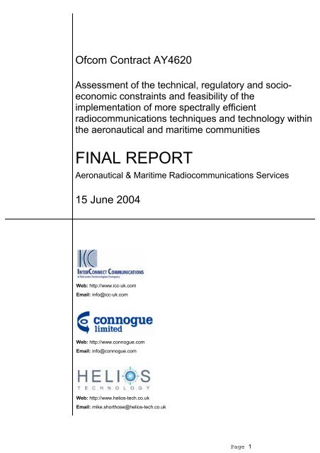
<strong>Ofcom</strong> Contract AY4620<br />
Assessment of the technical, regulatory and socioeconomic<br />
constraints and feasibility of the<br />
implementation of more spectrally efficient<br />
radiocommunications techniques and technology within<br />
the aeronautical and maritime communities<br />
<strong>FINAL</strong> <strong>REPORT</strong><br />
Aeronautical & Maritime Radiocommunications Services<br />
15 June 2004<br />
Web: http://www.icc-uk.com<br />
Email: info@icc-uk.com<br />
Web: http://www.connogue.com<br />
Email: info@connogue.com<br />
Web: http://www.helios-tech.co.uk<br />
Email: mike.shorthose@helios-tech.co.uk<br />
Page 1
Table of Contents<br />
1 Executive Summary.......................................................................................................... 8<br />
1.1 Overview 8<br />
1.2 Summary of recommendations 12<br />
1.2.1 Aeronautical Radiodetermination........................................................................12<br />
1.2.2 Maritime Radiodetermination ..............................................................................15<br />
1.2.3 Aeronautical Radiocommunications....................................................................15<br />
1.2.4 Maritime Radiocommunications..........................................................................17<br />
1.2.5 Licensing.............................................................................................................19<br />
1.2.6 General ...............................................................................................................19<br />
2 Introduction to Report.................................................................................................... 21<br />
2.1 Background 21<br />
2.2 Scope 23<br />
2.3 Purpose 23<br />
2.4 The International Organisations Involved 23<br />
2.4.1 The Aviation Community.....................................................................................23<br />
2.4.2 The Maritime Community....................................................................................27<br />
2.5 Spectrum Pricing Issues 28<br />
2.6 Disclaimer 29<br />
3 Aeronautical Radio Determination................................................................................ 30<br />
3.1 Introduction 30<br />
3.2 Ground Based Primary Radar 30<br />
3.2.1 Primary Radar Frequency Allocations ................................................................30<br />
3.2.2 Primary Radar Technology .................................................................................34<br />
3.2.3 Operational Requirements ..................................................................................40<br />
3.2.4 Regulatory and Standardisation Issues ..............................................................43<br />
3.2.5 Possible Improvements to Existing Technology .................................................45<br />
3.2.6 Replacement Technologies (In Band and Other)................................................51<br />
3.2.7 Allocation Sharing ...............................................................................................52<br />
3.2.8 Possible Overall Spectral Efficiency Improvements............................................55<br />
3.2.9 Socio Economic Issues.......................................................................................57<br />
3.2.10 Primary Radar Recommendations......................................................................60<br />
3.3 Secondary Radar (L-Band Secondary ATC) 62<br />
3.3.1 Introduction .........................................................................................................62<br />
3.3.2 Frequency Allocations (International & National)................................................62<br />
3.3.3 Technology Description ......................................................................................63<br />
3.3.4 Operational Requirements ..................................................................................66<br />
3.3.5 Regulatory and Standardisation Issues ..............................................................68<br />
3.3.6 Possible Improvements to existing technology ...................................................71<br />
3.3.7 Possible New Technologies (in-band) ................................................................73<br />
3.3.8 Replacement Technologies (radio, other or none)..............................................76<br />
3.3.9 Allocation Sharing Opportunities.........................................................................82<br />
3.3.10 Possible Overall Spectrum Efficiency Improvements .........................................82<br />
3.3.11 Conclusions and recommendations....................................................................84<br />
3.4 Aeronautical Radio-Navigation Services (ARNS) 85<br />
3.4.1 Introduction .........................................................................................................85<br />
3.4.2 Frequency Allocations.........................................................................................86<br />
3.4.3 Technology Descriptions.....................................................................................89<br />
3.4.4 Operational Requirements ..................................................................................98<br />
3.4.5 Regulatory and Standardisation Issues ............................................................103<br />
3.4.6 Possible Improvements to existing technology .................................................107<br />
Page 2
3.4.7 Possible New Technologies (in-band) ..............................................................109<br />
3.4.8 Replacement Technologies (radio, other or none)............................................110<br />
3.4.9 Allocation Sharing Opportunities.......................................................................111<br />
3.4.10 Summary Of Possible Overall Spectral Efficiency Improvements.....................113<br />
3.4.11 Conclusions and Recommendations ................................................................115<br />
3.4.12 Note on Mobile Navigation Aids – Radar Altimeters .........................................121<br />
3.4.13 Note on Mobile Navigation Aids – Airborne Radar ...........................................122<br />
4 Maritime Radiodetermination ...................................................................................... 124<br />
4.1 Introduction 124<br />
4.1.1 Background.......................................................................................................124<br />
4.1.2 Frequency Allocations.......................................................................................125<br />
4.2 Ground Based 126<br />
4.2.1 MSR (Maritime Surveillance Radar) .................................................................126<br />
4.2.2 RACONs ...........................................................................................................131<br />
4.2.3 SHF 14 GHz Ship Berthing ...............................................................................133<br />
4.3 Shipborne 135<br />
4.3.1 MSR (Maritime Surveillance Radar) .................................................................135<br />
4.3.2 SHF 9 GHz SARTs ...........................................................................................136<br />
4.3.3 Radar Target Enhancers (RTEs) ......................................................................138<br />
4.4 Conclusions and Recommendations 139<br />
5 Aeronautical Communications.................................................................................... 145<br />
5.1 Introduction 145<br />
5.2 Frequency Allocations (International & National) 146<br />
5.2.1 HF Communications (R) and (OR)....................................................................146<br />
5.2.2 VHF Communications(R) and (OR) ..................................................................146<br />
5.2.3 UHF Communications (NATO 230 – 380 MHz) ................................................147<br />
5.2.4 UHF Communications > 862 MHz – Public Correspondence ...........................147<br />
5.2.5 1.5/1.6 GHz – Satellite ......................................................................................147<br />
5.3 Current technology description 148<br />
5.3.1 DSB/AM (analogue) voice.................................................................................148<br />
5.3.2 HF voice............................................................................................................148<br />
5.3.3 Current data link technology .............................................................................149<br />
5.3.4 UHF Communications (NATO 230 – 380 MHz) ................................................151<br />
5.3.5 UHF Communications > 862 MHz – Public Correspondence ...........................152<br />
5.4 Operational requirements 152<br />
5.4.1 Overview of operational requirements ..............................................................152<br />
5.4.2 Role of HF and HFDL in supporting the operational requirements ...................152<br />
5.4.3 Role of VHF analogue communications in supporting the operational<br />
requirements....................................................................................................................153<br />
5.4.4 Relationship between airspace capacity and VHF spectrum requirements......153<br />
5.4.5 AMSS................................................................................................................154<br />
5.5 Regulatory and Standardisation Issues 154<br />
5.5.1 HF Communications (R) and (OR)....................................................................154<br />
5.5.2 VHF Communications Analogue and Digital (R) and (OR) ...............................154<br />
5.5.3 Extension of VHF band .....................................................................................154<br />
5.6 Possible Improvements to existing technology 155<br />
5.6.1 VHF voice: 8.33 kHz channelisation .................................................................155<br />
5.6.2 Movement of HF voice services to HFDL .........................................................156<br />
5.6.3 Movement of HFDL to Satcom..........................................................................156<br />
5.6.4 VHF datalink: upgrade of ACARS to VDL Mode 2 and initial transfer of ATIS and<br />
controller pilot dialogue....................................................................................................156<br />
5.6.5 VHF voice: reducing long term spectrum requirements for voice .....................159<br />
5.6.6 UHF Communications (NATO 230 – 380 MHz) ................................................160<br />
Page 3
5.7 Possible New Technologies (in-band) 160<br />
5.7.1 Emerging technologies .....................................................................................160<br />
5.7.2 VHF Communications Digital Links...................................................................161<br />
5.7.3 Possible use of Mode S SSR as a data link......................................................165<br />
5.8 Replacement Technologies (radio, other or none) 166<br />
5.8.1 Introduction .......................................................................................................166<br />
5.8.2 Establishment of new satellite services ............................................................166<br />
5.8.3 Broadband systems ..........................................................................................170<br />
5.9 Allocation Sharing Opportunities 171<br />
5.9.1 Gatelink.............................................................................................................171<br />
5.9.2 Transfer to commercial data links .....................................................................173<br />
5.9.3 Other sharing issues for further consideration ..................................................178<br />
5.10 Possible Overall Spectrum Efficiency Improvements 178<br />
5.11 Conclusions and Recommendations 180<br />
5.11.1 Introduction .......................................................................................................180<br />
5.11.2 Socio-economic issues (general)......................................................................180<br />
5.11.3 Short term measures ........................................................................................184<br />
5.11.4 Medium term measures ....................................................................................186<br />
5.11.5 Long term measures .........................................................................................189<br />
6 Maritime Communications........................................................................................... 191<br />
6.1 Introduction 191<br />
6.2 Short Range Devices 192<br />
6.2.1 Frequency and socio-economic considerations................................................192<br />
6.3 LF DGPS 194<br />
6.3.1 Frequency Allocations (international)................................................................194<br />
6.3.2 Technology Description ....................................................................................195<br />
6.3.3 Operational Requirements ................................................................................195<br />
6.3.4 Regulatory and Standardisation issues ............................................................196<br />
6.3.5 Possible Improvements to Existing Technology ...............................................197<br />
6.3.6 Possible New Technologies (in-band) ..............................................................198<br />
6.3.7 Replacement Technologies (radio, other or none)............................................198<br />
6.3.8 Allocation Sharing issues..................................................................................198<br />
6.3.9 Possible Overall Spectrum Efficiency Improvements .......................................198<br />
6.4 GMDSS in the United Kingdom 203<br />
6.4.1 UK Search and Rescue (SAR) at HF and MF...................................................205<br />
6.5 MF and HF Communications Services, Techniques and Technologies 205<br />
6.5.1 Automation and Adaptive Techniques ..............................................................205<br />
6.5.2 E-mail and Data Services .................................................................................207<br />
6.5.3 NVIS (Near Vertical Incidence Sky-wave) Propagation Techniques ................209<br />
6.6 MF - Communications 210<br />
6.6.1 Frequency Allocations (international, Region 1) ...............................................210<br />
6.6.2 Technology Description ....................................................................................211<br />
6.6.3 Operational Requirements ................................................................................212<br />
6.6.4 Regulatory and Standardisation Issues ............................................................213<br />
6.6.5 Possible Improvements to Existing Technology ...............................................213<br />
6.6.6 Possible New Technologies (in-band) ..............................................................213<br />
6.6.7 Replacement Technologies (radio, other or none)............................................214<br />
6.6.8 Allocation Sharing issues..................................................................................215<br />
6.6.9 Possible Overall Spectrum Efficiency Improvements .......................................215<br />
6.6.10 Socio-Economic Issues.....................................................................................215<br />
6.7 HF Communications 217<br />
6.7.1 Frequency Allocations (international)................................................................217<br />
6.7.2 Technology Description ....................................................................................218<br />
6.7.3 Operational Requirements ................................................................................219<br />
Page 4
6.7.4 Regulatory and Standardisation issues ............................................................219<br />
6.7.5 Possible New Technologies (in-band) ..............................................................220<br />
6.7.6 Replacement Technologies (radio, other or none)............................................221<br />
6.7.7 Allocation Sharing issues..................................................................................222<br />
6.7.8 Possible Overall Spectrum Efficiency Improvements .......................................222<br />
6.7.9 Socio-Economic Issues.....................................................................................223<br />
6.8 VHF – Communications (International) 223<br />
6.8.1 Frequency Allocations (international)................................................................223<br />
6.8.2 Technology Description ....................................................................................224<br />
6.8.3 Operational Requirements ................................................................................224<br />
6.8.4 Regulatory and Standardisation issues ............................................................225<br />
6.8.5 Possible Improvements to Existing Technology ...............................................226<br />
6.8.6 Possible New Technologies (in-band) ..............................................................226<br />
6.8.7 Replacement Technologies (radio, other or none)............................................227<br />
6.8.8 Allocation Sharing issues..................................................................................227<br />
6.8.9 Possible Overall Spectrum Efficiency Improvements .......................................228<br />
6.8.10 Re-arranging the Frequency Spectrum of Appendix 18 to the Radio Regulations<br />
and Releasing Part of it for Other Applications................................................................228<br />
6.8.11 Socio-economic Issues .....................................................................................229<br />
6.9 VHF – Communications (Private) 230<br />
6.10 VHF - AIS (Automatic Identification System) 231<br />
6.10.1 Frequency Allocations (international)................................................................231<br />
6.10.2 Technology Description ....................................................................................231<br />
6.10.3 Operational Requirements ................................................................................233<br />
6.10.4 Regulatory and Standardisation issues ............................................................233<br />
6.10.5 Possible Improvements to Existing Technology ...............................................233<br />
6.10.6 Allocation Sharing Issues..................................................................................233<br />
6.10.7 Possible Overall Spectrum Efficiency Improvements .......................................233<br />
6.11 EPIRBs (121.5 MHz / 243 MHz / 406.1 MHz) 234<br />
6.11.1 Frequency Allocations (international)................................................................234<br />
6.11.2 Technology Description ....................................................................................234<br />
6.11.3 Operational Requirements ................................................................................234<br />
6.11.4 Regulatory and Standardisation issues ............................................................235<br />
6.12 UHF – On Board Communications 235<br />
6.12.1 Frequency Allocations (international and national) ...........................................235<br />
6.12.2 Technology Description ....................................................................................235<br />
6.12.3 Operational Requirements ................................................................................235<br />
6.12.4 Regulatory and Standardisation Issues ............................................................235<br />
6.12.5 Possible Improvements to Existing Technology ...............................................236<br />
6.12.6 Possible New Technologies (in-band) ..............................................................236<br />
6.12.7 Possible Overall Spectrum Efficiency Improvements .......................................236<br />
6.12.8 Socio economic factors.....................................................................................236<br />
6.13 UHF Communications (GSM and IMT-2000) 237<br />
6.14 Maritime Satellite Communications in the 1.5/1.6 GHz Band and above 238<br />
6.14.1 Frequency Allocations (international)................................................................238<br />
6.14.2 Technology Description ....................................................................................238<br />
6.14.3 Operational Requirements ................................................................................238<br />
6.14.4 Regulatory and Standardisation issues ............................................................239<br />
6.14.5 Possible Improvements to Existing Technology, Possible New Technology (inband)<br />
239<br />
6.14.6 The ESV issue ..................................................................................................239<br />
6.15 Maritime Communications Spectral Efficiency 240<br />
6.16 The Global Maritime Distress and Safety System (GMDSS) and the International<br />
Convention for the Safety of Life at Sea (SOLAS Convention) 240<br />
6.17 Compliance of Maritime Equipment with EU Directives 241<br />
Page 5
6.17.1 Marine Equipment Directive..............................................................................241<br />
6.18 R&TTE Directive 242<br />
6.19 Conclusions 242<br />
7 Licensing ....................................................................................................................... 244<br />
7.1 General 244<br />
7.1.1 Structure of the Chapter....................................................................................246<br />
7.1.2 Acknowledgements...........................................................................................246<br />
7.2 Summary of European and National spectrum management regimes 246<br />
7.2.1 European Regulatory Framework .....................................................................246<br />
7.2.2 National Regulatory Regimes ...........................................................................249<br />
7.2.3 Public availability of information relating to fees and charges ..........................253<br />
7.2.4 Legislative basis of licensing, fees and charges in European Member States .258<br />
7.2.5 Change of Control Rules relating to radio spectrum licences ...........................261<br />
7.2.6 Relationship between Licensing, Fees and Charges........................................262<br />
7.2.7 Purpose of Administrative Fees and Spectrum Charges ..................................263<br />
7.2.8 Approaches to setting Administrative Fees.......................................................264<br />
7.2.9 Approaches to setting Spectrum Fees..............................................................265<br />
7.2.10 Approaches to setting Spectrum Charges ........................................................265<br />
7.2.11 ITU Notification .................................................................................................269<br />
7.3 Fees and Charges Information Provided 269<br />
7.3.1 Background.......................................................................................................269<br />
7.3.2 Fees and Charges Overview ............................................................................269<br />
7.4 Future Plans 288<br />
7.5 Identified Pricing Trends 288<br />
8 Summary of Report’s Conclusions and Recommendations .................................... 290<br />
8.1 Aeronautical Radiodetermination 290<br />
8.1.1 Primary radar ....................................................................................................290<br />
8.1.2 Secondary radar ...............................................................................................291<br />
8.1.3 Aeronautical Radio-Navigation Services...........................................................291<br />
8.2 Maritime Radiodetermination 291<br />
8.3 Aeronautical Radiocommunications 292<br />
8.4 Maritime Radiocommunications 292<br />
8.5 Licensing 293<br />
8.6 General Issues and Recommendation 294<br />
8.6.1 Standards and the European Regulatory Framework.......................................294<br />
8.6.2 The Market........................................................................................................295<br />
8.6.3 A Voluntary Approach .......................................................................................296<br />
8.6.4 Other AIP Issues...............................................................................................297<br />
ANNEX 1 Glossary of Terms................................................................................................. 298<br />
ANNEX 2 Mandatory Standards ........................................................................................... 307<br />
Annex 2-1 Aeronautical Radiodetermination Standards 307<br />
Annex 2-2 Maritime Radiodetermination Standards (SOLAS & Marine Equipment<br />
Directive) 317<br />
Annex 2-3 Aeronautical Communications Standards 318<br />
Annex 2-4 Maritime Communications Standards (SOLAS & Marine Equipment<br />
Directive) 321<br />
ANNEX 3 Harmonised Standards (R&TTE Directive) and Interface Requirements ......... 324<br />
Annex 3-1 Maritime Radiodetermination Standards 324<br />
Annex 3-2 Maritime Communications Equipment Standards outside the SOLAS<br />
Convention and the Marine Equipment Directive 325<br />
Page 6
ANNEX 4 List of pertinent ITU Recommendations for Maritime Services........................ 329<br />
ANNEX 5 Structure of the 4, 6 and 8 MHz HF Maritime Bands .......................................... 331<br />
ANNEX 6 Concerning AIS Carriage Requirements............................................................. 334<br />
ANNEX 7 References............................................................................................................. 336<br />
Annex 7-1 Aeronautical Radiodetermination References – Chapter 3 336<br />
Annex 7-2 Maritime Radiodetermination References – Chapter 4 338<br />
Annex 7-3 Aeronautical Communications References – Chapter 5 339<br />
Annex 7-4 Maritime Communications References – Chapter 6 344<br />
ANNEX 8 Countries in Receipt of Questionnaire................................................................ 345<br />
ANNEX 9 The Questionnaire................................................................................................. 346<br />
Prepared by: Approved by:<br />
Richard Womersley<br />
Mike Shorthose<br />
John McIntyre<br />
David Court<br />
Eberhard George<br />
Ben Stanley<br />
Page 7
1 Executive Summary<br />
1.1 Overview<br />
In these early years of the new millennium and as mobility becomes a progressively more<br />
valued commodity, it is clear that the radio spectrum is becoming increasingly important<br />
to society: an importance, which embraces both economic and social aspects. It is<br />
equally well recognised that the radio spectrum is a limited and finite resource and that<br />
the benefits which it affords society can only be realised, to their full potential, if the use of<br />
radio spectrum is carefully managed.<br />
The management techniques required, to ensure the effective use of the radio spectrum,<br />
are a function of the propagation characteristics of the part of the spectrum (band) under<br />
consideration, the demand for spectrum in that band and the use or uses to which it is<br />
being put. Thus, different management techniques need to be deployed in different<br />
bands to ensure that each can be used to its full potential.<br />
The demand for radio spectrum is ever increasing as more applications which require the<br />
use of spectrum are developed. This demand has been, to a large extent, successfully<br />
balanced by increasingly sophisticated spectrum management techniques, as well as<br />
improvements in the spectral efficiency of the technologies deployed. However, as radio<br />
spectrum is a finite resource, we are approaching the point where traditional spectrum<br />
management techniques, even taking into account developments in technology, are no<br />
longer able to guarantee access to the spectrum to those services which are requesting it<br />
and this in turn is leading, in some bands, to congestion and spectrum shortages.<br />
In the UK, it is the role of the Office of Communications (<strong>Ofcom</strong>) to manage the radio<br />
spectrum and with the above in mind, <strong>Ofcom</strong> has commissioned a study to assess the<br />
technical, regulatory and socio-economic constraints and feasibility of implementing more<br />
spectrally efficient radio communications techniques within the bands used by the<br />
aeronautical and maritime communities. These communities have, up until recently, been<br />
considered sacrosanct with respect to their spectrum use due, largely, to the international<br />
nature of the communities and thus the difficulties associated with taking significant<br />
measures at a national level, and the serious issues concerning the potential impact on<br />
safety of life. Professor Martin Cave in his 2002 ‘Review of Radio Spectrum Management’<br />
in the United Kingdom reconsidered these aspects and indicated that a review of the<br />
situation for these users should be undertaken.<br />
Following an open competitive tender process, a contract (reference number AY4620)<br />
was awarded to a team consisting of InterConnect Communications Ltd, Connogue Ltd<br />
and Helios Technologies, to carry out the above study. This document is the final report<br />
prepared under the study and has been compiled as an input to <strong>Ofcom</strong>’s spectrum review<br />
process. Issues relating to Maritime and Aeronautical operations and safety are beyond<br />
the scope of this report as is their impact on spectrum requirements, for which normal<br />
consultation would take place.<br />
Professor Martin Cave in his review of radio spectrum management in the United<br />
Kingdom recommended that the Government should, wherever technically and<br />
operationally feasible, facilitate greater flexibility in the use of a given frequency band.<br />
This recommendation is generally pertinent since if by a combination of regulatory and<br />
technical processes it is possible to improve spectrum efficiency in any frequency band,<br />
congestion may be alleviated, more users accommodated or spectrum could be<br />
transferred to other users or alternative applications. However, there is not much flexibility<br />
for an administration to deviate from the rules agreed internationally. This has to be taken<br />
into account when considering possibilities to increase the efficiency of frequency usage.<br />
Page 8
It is against such socio-economic issues that the feasibility of introducing more spectrally<br />
efficient technologies must be considered. It will also be necessary to gauge the<br />
possibility and likelihood of whether significant changes to the status-quo are likely to<br />
occur within the various regional and international organisations.<br />
In both maritime and aeronautical industries, finding a way forward is limited by the<br />
difficulty of obtaining widespread fleet equipage for any particular solution. Furthermore,<br />
equipment costs tend to dominate any implementation strategy and spectrum<br />
considerations are given little consideration. The Consultant considers it important that<br />
<strong>Ofcom</strong> work to ensure that future solutions are spectrum efficient. Given the very long<br />
lead times for implementation, it is important now to ensure that correct implementation<br />
paths are chosen.<br />
Radiodetermination is a generic term for radionavigation and radiolocation and includes<br />
radar, navigational aids and systems such as ILS, VOR, radio altimeters etc.<br />
Concerning aeronautical radio determination, evolution in the following areas is<br />
highlighted:<br />
• Ground based primary radar, which provides non-co-operative surveillance of<br />
aircraft;<br />
• Secondary radar, which relies on cooperation from the target in the form of<br />
equipage with a suitable transponder;<br />
• Aeronautical Radio-Navigation Services.<br />
Concerning maritime radio determination, evolution in the following areas is highlighted:<br />
• Ground based systems;<br />
• Shipborne systems.<br />
Though opportunities for improving the spectral efficiency of the radar and associated<br />
technologies used for maritime radiodetermination are limited, there are potential<br />
modifications to spectrum use which could make overall more efficient use of spectrum.<br />
Improvements to existing technologies, replacement technologies, allocation sharing,<br />
spectral efficiency improvements and socio economic issues are discussed for both<br />
aeronautical and maritime areas, as listed above.<br />
Concerning aeronautical radiocommunications, evolution is driven by two key factors:<br />
• The saturation of the VHF radiocommunications band and<br />
• A steadily rising demand for ATS services and a potentially very large increase in<br />
demand for non-ATS services.<br />
Concerning maritime radiocommunications, the key issues are:<br />
• Maritime safety requirements are dominated by the internationally agreed<br />
GMDSS, SOLAS Convention and the Marine Equipment Directive,<br />
• MF and HF (especially public correspondence) requirements are declining in the<br />
developed world,<br />
• VHF public correspondence is also declining; however a number of important<br />
operational and safety functions are identified for the Appendix 18 (to the Radio<br />
Regulations) frequencies and on frequencies contiguous to Appendix 18, used in<br />
the UK for maritime business radio.<br />
• GSM is providing most maritime public correspondence traffic in the European<br />
maritime area.<br />
Page 9
Alternative uses might eventually be identified for redundant MF and HF spectrum, priority<br />
candidates would be improved maritime data services, digital broadcasting and defence<br />
applications. The Consultant is of the opinion that it may be beneficial to launch a<br />
European Spectrum Review covering the LF to HF bands to ascertain future requirements<br />
and develop a strategy which takes account of new technology, the development of<br />
regional markets and ensures the effective use of spectrum. The VHF bands might be<br />
rationalised taking advantage of redundant public correspondence channels and efficient<br />
spectrum saving techniques adopted to make maximum use of the remaining channels<br />
whilst providing backwards compatibility for the more important safety and operational<br />
functions. This would be subject to studies to determine actual requirements for public<br />
correspondence in order to ensure that premature release of spectrum does not<br />
compromise an important requirement. Spectrum released in all bands might be available<br />
for reallocation to other UK radiocommunication services, subject to any international<br />
constraints.<br />
The Consultant has identified an issue concerning GSM and IMT-2000 used to provide in<br />
many cases unplanned maritime public correspondence services as a result of service<br />
area overspill into surrounding maritime areas. Whilst 900 MHz systems appear to<br />
provide adequate coverage and has hastened the decline of planned public<br />
correspondence services, it is unlikely that IMT-2000 operating in the 2 GHz and 2.5 GHz<br />
bands will be suitable for maritime applications due to increased propagation losses. It<br />
appears necessary to determine the requirement for public correspondence in coastal<br />
waters in conjunction with a study to ascertain the actual use of spectrum in the<br />
international and UK CSR bands.<br />
The Report also addresses licensing and associated fees and charges. A particular<br />
requirement was to obtain licensing information from at least 30 prominent countries in<br />
order to provide a benchmark for future UK activities in this area.<br />
Questionnaires were sent to a number of key administrations around the World<br />
requesting detailed information on their approach to licensing and the application of<br />
appropriate fees and charges for radiocommunication systems used by the aeronautical<br />
and maritime communities.<br />
Unfortunately only a limited number of detailed responses were received in the time<br />
available, however this information was supplemented by publicly available material and<br />
updating material collected some 2 years earlier.<br />
In general Administrative Incentive Pricing (AIP) is not applied widely to aeronautical and<br />
maritime services. The only country where AIP seems to have been widely implemented<br />
is Australia. However even then Australia differentiates for aeronautical and maritime<br />
applications between those licensees who require an assignment and those that do not.<br />
Some countries e.g. the US and Canada where aircraft and small vessels that do not<br />
generally travel outside their national borders and are not subject to mandatory carriage<br />
requirements are exempted from licensing. In the case of Canada and the US there is<br />
also a bilateral agreement with respect to the free movement of ‘small’ vessels and<br />
aircraft between the two countries. A study could be conducted in the United Kingdom,<br />
possibly involving other British Isles administrations, addressing whether such an<br />
approach would benefit UK aviation and maritime industries. Such considerations might<br />
be restricted to the use of VHF aviation and maritime frequencies and on-board<br />
navigation apparatus.<br />
With respect to radiodetermination stations, mobile apparatus is often incorporated into<br />
the aircraft or ships licence at no extra charge. In the case of land radiodetermination<br />
stations the cost of licensing varies between zero as a result of minimal licensing<br />
requirements, for example if the systems are operated by governmental organisations,<br />
and a relatively high value such as found in Australia where the AIP regime has<br />
introduced bandwidth and operational frequency factors into the pricing equation.<br />
Page 10
There appear to be no clear patterns from the data collected; even an assumption that<br />
fees are generally intended to cover costs cannot be justified from the spread of values<br />
obtained. In principle, the Consultant is of the opinion that AIP should ideally be applied to<br />
all radiocommunication services in order to encourage the efficient and effective use of<br />
spectrum. However in view of the international aspects of these systems including safety<br />
and operational considerations as well as single market and European issues an<br />
innovative approach would be required to achieve such a development in Europe.<br />
In the case of the aeronautical and maritime sectors and maximising the spectrum<br />
resource available to them, the key issues would seem to be safety, market issues, the<br />
European regulatory framework, treaty obligations, standards, the introduction of new<br />
technology and last but not least the possible use of incentive pricing to realise spectrum<br />
efficiency gains within the sectors.<br />
A study of the issues involved has led the Consultant to suggest a voluntary process for<br />
consideration by the concerned parties, in this case <strong>Ofcom</strong>, the MCA, CAA and other<br />
stakeholders. The concept needs to be constructed in such a way that all parties feel they<br />
are gaining from the situation. A voluntary UK certification approach is suggested in<br />
parallel with the introduction of AIP to the aeronautical and maritime communities. The<br />
current UK interface requirement would be maintained but extended to include the<br />
voluntary category of equipment (for the R&TTE Directive) or a licence condition which<br />
met more strenuous spectral efficiency targets, thus attracting significant fees/charges<br />
discounts. Industry would have the benefit of developing a new generation of equipment<br />
with a subsequent increase in sales and likely mandatory carriage requirements in the<br />
future. <strong>Ofcom</strong> may gain spectrum but will need to promote the voluntary approach within<br />
Europe as a first step towards the formal revision of a standard and/or the issue of a<br />
Commission mandate to the standards bodies.<br />
Note that a number of general assumptions have been made in this report regarding the<br />
costs for new or upgraded equipment:<br />
• For aeronautical costs, the value of aircraft downtime in not considered since, in<br />
common with most other cost benefit assessments carried out in the community,<br />
it is assumed that new or upgraded equipment is provided during routine<br />
maintenance. However, it is acknowledged that in some cases additional<br />
downtime may be necessary although detailed consideration of this is beyond<br />
the scope of the current work.<br />
• Aeronautical costs for airborne equipment include the cost of the “service<br />
bulletin”, which provides all the procedures and documentation changes<br />
necessary to effect a certifiable equipment upgrade, but not “re-certification<br />
costs” which are negligible in comparison.<br />
Page 11
1.2 Summary of recommendations<br />
1.2.1 Aeronautical Radiodetermination<br />
1.2.1.1 Ground Based Primary Radar<br />
The recommendations arising from consideration of the primary radar technical,<br />
regulatory and socio-economic constraints have been grouped into the following<br />
categories:<br />
• Specific measures to release spectrum;<br />
• General improvements of spectral characteristics of primary radar;<br />
• Band sharing.<br />
The recommendations take into account the following key issues:<br />
• Spectrum planning must take account of the continuing operational requirement<br />
for primary radar for en route, approach/TMA and airport surface detection. No<br />
fundamental changes have been identified in the operational requirement which<br />
would reduce spectrum requirements.<br />
• Technology choice is driven primarily by the need to satisfy the operational<br />
requirement.<br />
• Spectrum planning will need to take into account some increase in potential<br />
demand for civil ATC primary radar services, particularly for approach/TMA<br />
facilities and surface movement radar. This is expected to grow in line with the<br />
general expansion in air transport and may be further influenced by security<br />
requirements.<br />
• There may be a requirement for reduced false alarm rates which needs to be<br />
taken into consideration in the determination of radar protection criteria and band<br />
sharing opportunities.<br />
It is not clear that there is any viable technology to replace primary radar – certainly not in<br />
the short term. In the absence of suitable alternative technologies, pricing would not<br />
provide any incentive to move away from primary radar.<br />
It should be noted that a number of the specific recommendations have already been<br />
implemented or planned by service providers. In particular, the use of solid state systems<br />
with pulse compression is becoming more widely adopted.<br />
Specific Measures to Release Spectrum<br />
Recommendation 3.1: <strong>Ofcom</strong> in association with the CAA may wish to consider whether<br />
it is feasible to replace the UHF Primary radars in Channel 36 in favour of S band or L<br />
band equipment. It is necessary to review the review the operational requirement for<br />
these systems and the appropriate timescale for replacement with the relevant operating<br />
authorities. It could be implemented as part of the normal equipment replacement cycle.<br />
Recommendation 3.2: The possibility of moving surface movement radars currently in<br />
Ku Band to X band should be considered thereby releasing Ku band for other<br />
applications. The cost of this is estimated at around £9m (project costs). The amount of<br />
spectrum released needs to be confirmed with the MoD. It could be implemented as part<br />
of the normal equipment replacement cycle.<br />
Recommendation 3.3: In the longer term, alternative systems with the potential to<br />
release spectrum should be further evaluated and developed.<br />
Page 12
General Improvements to the Spectral Characteristics of Primary Radar<br />
Recommendation 3.4: A long term policy to replace magnetron transmitters should be<br />
adopted. Such improvements could be instigated by CAA and <strong>Ofcom</strong> under the terms of<br />
the licensing agreement. The cost of replacing magnetron systems is estimated at £66m<br />
(S band and X band approach radars) and could be implemented under the normal<br />
replacement cycle. Increases in spectral efficiency are likely to be offset by increasing<br />
demand for radar services.<br />
Recommendation 3.5: In the short term, consideration should be given to equipping<br />
magnetron transmitters with low pass filters to meet the current emission mask. This<br />
approach may be necessary where the systems concerned have a long life expectancy.<br />
Costs are in the range £20k to £100k per installation.<br />
Recommendation 3.6: The current unwanted emission mask should be adopted as the<br />
medium term goal for primary radar systems.<br />
Recommendation 3.7: Pulse compression should be the technology of choice for future<br />
primary radar systems for both operational requirement and spectrum reasons.<br />
Recommendation 3.8: Solid state transmitters should be adopted for future systems<br />
given the ability to control pulse rise and fall times to minimise the out of band emissions<br />
and the single channel fail soft capability to minimise frequency requirements. This<br />
approach is also preferred for operational requirement reasons.<br />
Band Sharing<br />
Recommendation 3.9: More visibility of spectrum used by the military in the L and S<br />
bands may assist the delivery of improved spectrum efficiency. <strong>Ofcom</strong> should consider an<br />
initiative in this area.<br />
Recommendation 3.10: The overriding recommendation in the area of band sharing is<br />
for the development of a methodology which can assess the feasibility of band sharing.<br />
This would lead to a more strategic approach to the identification of band sharing<br />
opportunities. These developments should be carried out by a group representing all<br />
interested parties.<br />
Recommendation 3.11: Studies into the use of a statistical approach to band sharing<br />
opportunities should be continued and extended to include full consideration of<br />
operational and technical requirements of radar services.<br />
Recommendation 3.12: The use of 3D radars in ATC applications should be considered<br />
for long term R and D. Studies into the cost and benefits, operational validation and<br />
methods of funding should be reviewed.<br />
Recommendation 3.13: Increased standardisation of primary radar characteristics<br />
should be considered as a means for improving spectral efficiency and increasing<br />
compatibility with potential band sharing services. Improved spectrum utilisation<br />
characteristics should be a standardisation objective. Standardisation could be carried out<br />
by industry bodies such as EUROCAE for technical standards or by EUROCONTROL for<br />
operational standards. Global aspects would require the involvement of ICAO. It is<br />
considered that increased standardisation would achieve operational benefits as well as<br />
spectrum utilisation benefits.<br />
Recommendation 3.14: Band sharing should only be contemplated in a fully regulated<br />
environment.<br />
Page 13
1.2.1.2 Secondary radar<br />
The key developments which influence use of the 1030/1090 MHz frequencies are:<br />
• The transfer to Mode S from current SSR. As well as a number of operational<br />
benefits, this provides a reduction in the level of interference and makes it<br />
possible to maintain SSR services as traffic grows.<br />
• The implementation of ADS-B services via 1090 extended squitter, which whilst<br />
offering potential operational benefits, will increase the use of the 1090 MHz<br />
spectrum and possibly saturate.<br />
Recommendations 3.15 to 3.17 below apply to the efficient use by SSR of the 1030/1090<br />
MHz frequencies<br />
Recommendation 3.15: <strong>Ofcom</strong> should satisfy themselves that the CAA has taken the<br />
appropriate steps to ensure that the tailoring of SSR Pulse Repetition Frequencies<br />
conforms to ICAO recommendations.<br />
Recommendation 3.16: The implementation of Mode S SSR in the UK should be<br />
encouraged (allowing selective addressing and potentially fewer replies) coupled with the<br />
implementation of measures to encourage equipage and the appropriate implementation<br />
of controller tools which use the resulting data.<br />
Recommendation 3.17: Mode S Extended Squitter implementation – <strong>Ofcom</strong> should work<br />
with the CAA in ensuring that data downlinked from the aircraft is not superfluous to<br />
requirements. In particular this means reviewing the need for the regular broadcast of<br />
DAPs.<br />
The next two recommendations apply to the introduction of new services on the 1090<br />
MHz frequency.<br />
Recommendation 3.18: The 1090MHz channel will be severely constrained in the<br />
medium term. A review of the future use of this band should be carried out. The review<br />
should ensure that any new applications meet clearly defined operational requirements; if<br />
not, studies should be performed to assess the potential benefit against the cost to an<br />
already saturated channel. The studies should also assess the timescales over which the<br />
applications will remain effective given that increased traffic will further saturate the<br />
channel. Crucially, it should be ensured that the introduction of new applications does not<br />
impact on existing safety of life applications such as SSR and ACAS.<br />
Recommendation 3.19: <strong>Ofcom</strong> should work with the CAA to evaluate other technologies<br />
for ADS-B and ensure that spectrum efficient solutions are developed and implemented.<br />
The final recommendation applies to extension of the use of the 1030 MHz frequency.<br />
Recommendation 3.20: The possibility of further utilising 1030MHz (for example, for TIS-<br />
B) should be encouraged and studied.<br />
1.2.1.3 Aeronautical Radio-Navigation Services<br />
Recommendation 3.21: <strong>Ofcom</strong> should work with the CAA to ensure the timely<br />
decommissioning of non-operationally required radio navigation aids, in particular, NDBs<br />
and VORs. The following caveats apply:<br />
• The requirements of General Aviation and the Military for NDBs and VORs in the<br />
UK must be urgently addressed;<br />
• The impact of an RNAV only environment should be assessed, particularly from<br />
a safety and security viewpoint.<br />
Page 14
Recommendation 3.22: <strong>Ofcom</strong> should recommend to the CAA that a feasibility study be<br />
carried out into the potential for rationalising the DME spectrum to avoid the requirement<br />
for more spectrum elsewhere in the future. In practice, this would entail:<br />
• Looking at long-term allocations for DME, in light of the proposed DME/DME<br />
infrastructure, and the proposed implementation of the GNSS L5/E5 band (1164-<br />
1215MHz);<br />
• The feasibility and practical implications of the de-pairing of VOR, DME and ILS<br />
frequencies should be investigated, to allow better spectrum planning in the Lband;<br />
• The feasibility and practical implications of de-tripling of ILS/MLS/DME should be<br />
investigated, to free up spectrum for more efficient allocations;<br />
• <strong>Ofcom</strong> should work in conjunction with the CAA to ensure that studies are<br />
undertaken into the possible effects of UAT (ADS-B datalink) on DME<br />
frequencies.<br />
1.2.2 Maritime Radiodetermination<br />
Recommendation 4.1: The 5 GHz band is little used by (commercial) maritime radar in<br />
and around the UK. It is already shared with PMSE and HiperLAN. Further sharing of this<br />
spectrum with other suitably compatible services should be investigated.<br />
Recommendation 4.2: Consider a reduction in the allocations to maritime radar at 3, 5<br />
and 9 GHz. Such a reduction would require a study into congestion levels in the three<br />
bands.<br />
Recommendation 4.3: Introduce additional sharing, in particular with PMSE in the 3 and<br />
9 GHz maritime bands.<br />
Recommendation 4.4: A survey into the usage of ship-berthing radar should be<br />
conducted and a suitable allocation (if available and required) made available to enable<br />
them to be licensed. The potential for these (or indeed any other) unlicensed devices, to<br />
cause interference to legitimate spectrum users needs to be controlled and <strong>Ofcom</strong> should<br />
consider undertaking a market surveillance exercise to determine the size and nature of<br />
the problem.<br />
1.2.3 Aeronautical Radiocommunications<br />
1.2.3.1 Short term measures<br />
Recommendation 5.1: An urgent first measure is to promote the migration to 8.33 kHz<br />
spacing in the VHF band. This measure will alleviate the immediate shortage of VHF<br />
spectrum and facilitate the establishment of digital services.<br />
Implementation for high level sectors is limited by ground infrastructure limitations which<br />
NATS is addressing although no solution is currently apparent for air traffic sectors which<br />
cover a wide geographic area. For low level implementation, the barrier is GA equipage<br />
and an investigation of possible means to stimulate GA equipage should be carried out.<br />
<strong>Ofcom</strong> should work with the CAA to encourage the implementation of 8.33 kHz spacing<br />
including accelerating the necessary changes to the NATS infrastructure and considering<br />
the issue of, and a possible means of stimulating, GA equipage.<br />
Page 15
1.2.3.2 Medium term measures<br />
Medium term measures include:<br />
• encouraging the aeronautical community to bring demand for new voice<br />
channels under control through the introduction of more efficient air traffic control<br />
concepts such that the demand begins to level off;<br />
• transferring existing ACARS data to VDL Mode 2;<br />
• freeing up VHF spectrum by decommissioning VORs.<br />
The control of demand requires NATS to employ strategies to provide additional airspace<br />
capacity that rely on techniques other than systemisation. In the next 4 years, NATS will<br />
have implemented much of its Mode S programme. This in turn provides the data<br />
necessary to implement some initial controller tools with a resultant increase in capacity.<br />
In the longer term, concepts based on a greater delegation to the pilot offer the potential<br />
to provide much greater airspace capacity without the need to introduce more sectors.<br />
Planning for such a concept is needed now. However no specific recommendation for<br />
<strong>Ofcom</strong> is made on this issue since it is seen as primarily an issue for the aeronautical<br />
community only.<br />
Recommendation 5.2: The introduction of VDL2 provides an opportunity to transfer<br />
existing ACARS traffic with a resultant increase in spectrum efficiency by a factor of 10.<br />
ATIS services should also be transferred making possible the re-allocation of some of the<br />
spectrum. The introduction of VDL2 also provides an opportunity to introduce some<br />
controller-pilot dialogue services, which are unlikely to result in a decrease of voice<br />
channels but provide a means of preparing for a wholescale transfer in the longer term.<br />
Where parts of the VHF band are to be used for AOC and commercial services in<br />
general, <strong>Ofcom</strong> should consider administrative incentive pricing to encourage efficient<br />
usage.<br />
Recommendation 5.3: It is proposed that new VDL services will occupy the spectrum<br />
between 136 and 137 MHz (i.e. that spectrum newly assigned to aeronautical<br />
communications). However this spectrum is already in use for analogue services which<br />
will have to be found new frequencies below 136 MHz. One of the problems with the band<br />
136 to 137 MHz revolves around industrial, scientific and medical (ISM) heating<br />
machines. Such machines operate at frequencies around 13 and 27 MHz at very high<br />
powers for the purposes of drying (biscuits and paint commonly). Whilst these devices are<br />
not intended to radiate, the high powers involved mean that even small amounts of<br />
harmonic distortion can produce signals at higher frequencies that can cause interference<br />
to other services. Unfortunately the 10th harmonic of the 13 MHz band and the 5th<br />
harmonic of the 27 MHz band fall into the aeronautical communications band. This<br />
causes particular concerns for airborne receivers which have a very large radio line-ofsight.<br />
It was common practise, prior to the opening of 136 – 137 MHz for aeronautical<br />
communications, that these devices, if found to be radiating excessively on harmonic<br />
frequencies, were re-tuned such that the harmonics fell above 136 MHz and hence<br />
outside the aeronautical bands. This now means, however, that there are a large number<br />
of interfering carriers present on frequencies between 136 and 137 MHz. It will take<br />
further work by the relevant national administrations to clear these bands further so that<br />
they are suitable for the introduction of digital services (to which they cause greater<br />
problems than for analogue services). A first stage in the movement to data is to use<br />
136MHz+ for initial data services – <strong>Ofcom</strong> should work with the CAA to ensure that this<br />
part of the spectrum is used efficiently and that sources of interference are removed as<br />
soon as is practical.<br />
Recommendation 5.4: The decommissioning of VOR navaids will provide additional<br />
VHF spectrum for communications. It is important to take action to agree timescales<br />
Page 16
internationally for decommissioning and to assist NATS in varying the terms of its licence<br />
if required to remove barriers to decommissioning. Assistance may be required to GA<br />
users if the VOR network is decommissioned. <strong>Ofcom</strong> should work with the CAA to<br />
encourage the decommissioning of VOR navaids and re-use of the spectrum for<br />
communication purposes. (Note that this is also covered in recommendation 3.21)<br />
1.2.3.3 Long term measures<br />
Recommendation 5.5: It is important to determine a strategy for the long term transfer to<br />
data. This includes establishing plans for:<br />
• technology choice<br />
• clearing out of VHF spectrum<br />
<strong>Ofcom</strong> to work with CAA to ensure plans are put in place for a) the movement of voice to<br />
data and b) the gradual clearout and re-utilisation of the VHF spectrum<br />
Recommendation 5.6: <strong>Ofcom</strong>, working with the CAA, should ensure that solutions<br />
considered for future data link technology are beneficial when viewed in terms of<br />
spectrum utilisation and that no longer utilised spectrum is freed up where possible. There<br />
is consensus that aviation requires a new data link for future needs from 2012/2015+. The<br />
long term technology choice needs to consider:<br />
• the potential for low cost satellite based services, possibly shared with<br />
commercial uses<br />
• the potential for an optimised system utilising the VHF spectrum.<br />
The satellite route offers the possibility of sharing services with commercial users<br />
providing a possible route to lower cost. It seems preferable that aviation should avoid<br />
implementing a bespoke system.<br />
Use of a VHF system has the advantage of using spectrum dedicated solely to aviation<br />
use and providing a terrestrial system under the control of the aeronautical industry. The<br />
introduction of a new system will require a concerted effort to clear out existing use of the<br />
band.<br />
In all likelihood a dual strategy will be pursued with new systems operating both in the<br />
VHF and L bands. <strong>Ofcom</strong> needs to ensure that its own views on spectrum utilisation feed<br />
directly into the planning process in order that spectrum efficient solutions emerge.<br />
Recommendation 5.7: <strong>Ofcom</strong> should also investigate the possibility of applying in cooperation<br />
with the Ministry of Defence, the principles of recommendation 5.1 to the airground-air<br />
bands in the range 230 – 380 MHz, with a view to initiating a reduction in airground-air<br />
bands, ideally within NATO, Europe or as a minimum within the UK.<br />
1.2.4 Maritime Radiocommunications<br />
Recommendation 6.1: If a frequency solution for Short Range Devices (SRDs)<br />
based on globally available ISM bands does not meet all maritime requirements, the next<br />
best alternative would be to harmonise solutions capable of being implemented on a<br />
regional basis. In this regard it may be appropriate to specifically identify SRD bands<br />
appropriate for maritime applications in CEPT Recommendation T/R 70-03. It is<br />
recommended that such a course of action might be considered by the UK in WG FM of<br />
CEPT ECC (See Section 6.2).<br />
Recommendation 6.2: Section 6.3 and sections 6.5, 6.6 and 6.7 have indicated a<br />
possibility for new technology or change of use within the foreseeable future. However<br />
either option would benefit from a European market and harmonised frequency bands to<br />
ease co-ordination difficulties and provide economies of scale for industry. It is therefore<br />
Page 17
ecommended that the UK lobby for a CEPT DSI process for the band 30 kHz to 30 MHz<br />
within the CEPT ECC and the European Commission’s Radio Policy Committee, as well<br />
as introducing relevant technical, operational, economic and regulatory issues contained<br />
in this Report into the committee structure and decision making processes of the relevant<br />
international bodies. The overall objective should be to continue to promote innovation in<br />
the spectrum management process at the international level. (See Sections 6.3, 6.5, 6.6<br />
and 6.7).<br />
Recommendation 6.3: Very little use is made of the MF telegraphy band. Narrowband<br />
direct printing has not replaced Morse telegraphy as was expected to happen.<br />
Except on 490 and 518 kHz, and on 500 kHz which despite full implementation of the<br />
GMDSS has maintained a certain safety and distress function in some areas of the world,<br />
there is little traffic in the band 415-526.5 kHz. It is therefore recommended that an in<br />
depth and careful review of this band should be initiated with a view to allocate a<br />
significant part of it for other applications. This could be part a European overall spectrum<br />
review (DSI) covering LF, MF and HF spectrum, see Recommendation 6.2 (See also<br />
Section 6.6).<br />
Recommendation 6.4: Subject to the results of public consultation and any<br />
European DSI process (see Recommendation 6.2) it is recommended that new digital<br />
systems in the 2 MHz MF band should be considered on a national and non-interference<br />
basis taking account of the need to maintain interoperability with ships from foreign<br />
countries (See Sections 6.6).<br />
Recommendation 6.5: Adaptive systems have been successfully introduced in the<br />
fixed service in the HF bands. They would likewise offer great advantages to the maritime<br />
mobile service in the MF (see section 6.6.6) and HF bands. The implementation of<br />
adaptive systems on frequencies detailed in Appendix 17 to the Radio Regulations is<br />
permitted for initial testing through note p to the table in Part A of the Appendix.<br />
Frequencies from outside the maritime bands could of course be added to the group of<br />
frequencies used. It is understood that the final introduction of this new technology into<br />
the maritime mobile service requires further in-depth studies and the adoption of<br />
appropriate technical and regulatory provisions. It is therefore recommended, that<br />
regulatory pre-conditions are developed for the implementation of such adaptive<br />
techniques along the lines described above (See Section 6.7).<br />
Recommendation 6.6: In the HF bands, there is a rapidly growing need for digital<br />
technologies. Appendix 17 to the Radio Regulations, allows for initial testing and the<br />
possible future introduction within the maritime service of new digital technologies. The<br />
ITU-R is already conducting studies to improve the efficient use of these maritime bands.<br />
It is recommended that every effort is made to support these studies and refrain from<br />
implementing national solutions that might not be compatible with the outcome of these<br />
studies. With regard to SSB telephony, it is believed premature to advocate a changeover<br />
to digital techniques. In the longer term a transition to digital techniques, perhaps<br />
similar to those envisaged for digital HF broadcasting, may be considered (See Section<br />
6.7).<br />
Recommendation 6.7: It is recommended that an in depth study of all UK<br />
applications within the bands 156.0 – 158.5 MHz and 160.6 – 163.1 MHz ( including<br />
Appendix 18 (to the Radio Regulations) international maritime channels as well as Coast<br />
Station Radio private UK maritime channels) should be considered. The goal would be to<br />
determine:<br />
� The future VHF spectrum requirements of the UK maritime industry with a view to<br />
rationalisation of the current spectrum taking account recent changes in the<br />
industry and the introduction of new technologies.<br />
Page 18
� The study should further ascertain current and future maritime public<br />
correspondence needs and ascertain whether a combination of GSM/IMT-2000<br />
and satellite communications is likely to satisfy communications requirements in<br />
British waters.<br />
� Such a study would need to take account of the need to:<br />
o Ensure 25 kHz fitted ships would be able to operate as intended for an<br />
agreed period;<br />
o Ensure 161.975 and 162.025 MHz are maintained for AIS;<br />
o Seek to achieve a reduction in the number of two-frequency channels for<br />
port operations and ship movement.<br />
(See Sections 6.8, 6.9 and 6.10).<br />
Recommendation 6.8: Use of 12.5 kHz technology on all ten UHF on-board<br />
channels is recommended in order to minimise possible interference (See Section 6.12).<br />
Recommendation 6.9: The GSM system at 900 MHz is increasingly used by the<br />
maritime community as a substitute for maritime VHF public correspondence. IMT-2000 is<br />
now being implemented. In the long term, it will likely replace GSM 900. In order to<br />
maintain the obvious advantages of public mobile telecommunication systems for the<br />
maritime community, it will be of particular importance that IMT-2000 in coastal areas<br />
should be available in the 900 MHz band. This is because the 2 GHz band, whilst<br />
particularly suited for areas on land with high traffic densities and thus small cells, will<br />
have an off shore range that is inadequate for serving the maritime community effectively.<br />
It is therefore recommended that frequencies at 900 MHz should be made available for<br />
the implementation of IMT-2000 in coastal areas; when GSM is planned for<br />
decommission (See Section 6.13).<br />
1.2.5 Licensing<br />
Recommendation 7.1:<br />
In view of the trend to deregulate licensing in some countries in the GA sector and<br />
domestic maritime non-SOLAS sector, it is recommended that a study should be<br />
conducted in the United Kingdom, possibly involving other British Isles administrations, of<br />
whether such an approach would benefit the UK aviation and maritime industries. Such a<br />
development might be restricted to the use of VHF aviation and maritime frequencies and<br />
on-board navigation apparatus. The introduction of a class licence for such applications<br />
could also be linked to AIP i.e. the use of spectrally efficient wireless telegraphy<br />
apparatus would meet the terms of the class licence, whilst continued use of ‘old’<br />
equipment would continue to attract fees. However the need to record MMSI details<br />
would have to be addressed. See also section 6.6.10. Although it is envisaged such a<br />
scheme could be limited to vessels registered by the flagging territories of the British Isles<br />
(two sovereign countries and three Crown dependencies), such a scheme might in future<br />
be proposed for extension to the European Union or CEPT. However the difficulties of<br />
attempting this are recognised. (see section 7.5)<br />
1.2.6 General<br />
Recommendation 8.1:<br />
<strong>Ofcom</strong> is invited to consider the establishment of a voluntary regime to develop a UK<br />
certification process to stimulate the development of spectrally efficient techniques which<br />
may lead to improved spectrum occupancy and efficiencies. Such a process would need<br />
the support of both user and manufacturing communities. In addition it could be promoted<br />
as a European process as a means to signify when a particular standard or standards<br />
Page 19
could be considered for revision. It is believed that such a process could benefit from the<br />
introduction of AIP to provide incentives to users to purchase new equipment.<br />
(see section 8.6.3)<br />
Page 20
2 Introduction to Report<br />
In these early years of the new millennium and as mobility becomes a progressively more<br />
valued commodity, it is clear that the radio spectrum is becoming increasingly important<br />
to society: an importance, which embraces both economic and social aspects. It is<br />
equally well recognised that the radio spectrum is a limited and finite resource and that<br />
the benefits which it affords society can only be realised, to their full potential, if the use of<br />
radio spectrum is carefully managed.<br />
The management techniques required, to ensure the effective use of the radio spectrum,<br />
are a function of the propagation characteristics of the part of the spectrum (band) under<br />
consideration, the demand for spectrum in that band and the use or uses to which it is<br />
being put. Thus, different management techniques need to be deployed in different<br />
bands to ensure that each can be used to its full potential.<br />
The demand for radio spectrum is ever increasing as more applications which require the<br />
use of spectrum are developed. This demand has been, to a large extent, successfully<br />
balanced by increasingly sophisticated spectrum management techniques, as well as<br />
improvements in the spectral efficiency of the technologies deployed. However, as radio<br />
spectrum is a finite resource, we are approaching the point where traditional spectrum<br />
management techniques, even taking into account developments in technology, are no<br />
longer able to guarantee access to the spectrum to those services which are requesting it<br />
and this in turn is leading, in some bands, to congestion and spectrum shortages.<br />
In the UK, it is the role of the Office of Communications (<strong>Ofcom</strong>) to manage the radio<br />
spectrum and with the above in mind, <strong>Ofcom</strong> has commissioned a study to assess the<br />
technical, regulatory and socio-economic constraints and feasibility of implementing more<br />
spectrally efficient radio communications techniques within the bands used by the<br />
aeronautical and maritime communities. These communities have, up until recently, been<br />
considered sacrosanct with respect to their spectrum use due, largely, to the international<br />
nature of the communities and thus the difficulties associated with taking significant<br />
measures at a national level, and the serious issues concerning the potential impact on<br />
safety of life. Professor Martin Cave in his 2002 ‘Review of Radio Spectrum Management’<br />
in the United Kingdom reconsidered these aspects and indicated that a review of the<br />
situation for these users should be undertaken.<br />
Following an open competitive tender process, a contract (reference number AY4620)<br />
was awarded to a team consisting of InterConnect Communications Ltd, Connogue Ltd<br />
and Helios Technologies, to carry out the above study. This document is the final report<br />
prepared under the study.<br />
In support of the review of aeronautical and maritime radiodetermination and<br />
radiocommunications issues, a number of important countries were contacted during the<br />
study, with a view to collating information concerning their pricing regimes, which might<br />
act as a benchmark for future UK policy and strategy in this area. This report documents<br />
the authors’ views and recommendations on these matters.<br />
2.1 Background<br />
<strong>Ofcom</strong> has indicated that together with the CAA and MCA, a consideration of how<br />
administrative incentive pricing could be implemented for civil radar, including<br />
navigational aids needs to be addressed as well as determining suitable time scales for<br />
introduction.<br />
A starting assumption has been that fixed radionavigation stations may provide greater<br />
scope for more efficient spectrum use and possibly better frequency re-use than for<br />
mobile operation. The trade off between bandwidth and operational requirements is<br />
Page 21
addressed as well as any technological advances that may impact the balance between<br />
these two factors.<br />
<strong>Ofcom</strong> has indicated that where there is congestion and where UK based aeronautical or<br />
maritime users have alternatives concerning the technology choice for their on-board<br />
systems, then <strong>Ofcom</strong>, working with the CAA and MCA, should consider applying<br />
differential licence fees to encourage moves to more spectrally efficient equipment, thus<br />
easing congestion over time whilst taking account of the value of spectrum as an input<br />
cost.<br />
The pricing regime for Coast Station Radio UK (CSR (UK)) licences is based on<br />
frequencies which are not internationally harmonised and are permitted for use within<br />
territorial waters only. It is necessary to consider the possibilities of permitting the<br />
introduction of narrow-band technologies (e.g. 12.5 kHz/ 10 kHz/ 6.25 kHz/ 5 kHz) or<br />
even digital technology. Furthermore, issues will need to be addressed such as migration,<br />
parallel working, transitional arrangements and compatibility with existing systems.<br />
Consideration will also have to be given to those CSR licences that are based on<br />
internationally harmonised frequencies. Licensing and pricing issues are addressed in<br />
Chapter 7 of this Report.<br />
The study addresses the extent of possible interference on moored vessels to determine<br />
whether the additional 4 UHF maritime channels (making a total of 10) are likely to<br />
significantly increase spectrum re-use. If the results are favourable consideration could<br />
then be given to reviewing the pricing regime in this area to give an incentive for moving<br />
to 12.5 kHz channel spacing.<br />
The slow take up of using 8.33 kHz channels (instead of 25 kHz) for aeronautical VHF<br />
communications above FL 250 (approx. 25,000 ft) is investigated in order to ascertain the<br />
possible increased exploitation of the available spectral resource, especially given the<br />
high degree of congestion in this band. The practical implications and the consideration of<br />
technical issues such as Doppler shift and the present method of using frequency offsets<br />
need to be considered.<br />
The authors wish to record their appreciation for the assistance provided by NRA<br />
representatives in providing detailed information, the Civil Aviation Authority (CAA), the<br />
Maritime Coastguard Agency (MCA) and other key stakeholders (e.g. Port Authorities,<br />
National Air Traffic Services (NATS) etc.) to ensure that equipment carriage<br />
requirements, technical standards and Interface Requirements were taken into account.<br />
Completed questionnaires were gratefully received from Hong Kong, Turkey and the<br />
United Kingdom. In addition thanks go to those NRAs/administrations, who although not<br />
completing the questionnaire, provided detailed information in correspondence sent to the<br />
Consultant.<br />
The legacy regulator, the Radiocommunications Agency (RA) has completed the first part<br />
of a review of the pricing models that underpin the current Administrative Incentive Pricing<br />
(AIP) regime. This has determined an economically robust, logical and practical<br />
methodology for setting administrative prices for radio spectrum. The RA has begun to<br />
apply this set of guiding principles and theoretical perspective in order to make<br />
recommendations to set licence prices in broad use categories and to calculate their<br />
values in representative cases in each major area of radio application. This study is<br />
intended to provide the necessary input parameters to that review, providing information<br />
on the technical, regulatory and socio-economic constraints to implementing more<br />
spectrally efficient techniques and technologies in the maritime and aeronautical services,<br />
including the scope for use of different bands.<br />
In 2001 Connogue Limited participated in a study on administrative and frequency fees<br />
related to the licensing of networks involving the use of frequencies. This was focussed<br />
on the situation prevailing for public telecommunications networks within the European<br />
Union. This study builds on this work, extending considerations to aeronautical and<br />
Page 22
maritime radiodetermination and radiocommunication services in the European Union as<br />
well as in other prominent countries around the globe. The results of these studies will<br />
likely be used for benchmarking processes for a future UK licensing regime concerning<br />
such services.<br />
2.2 Scope<br />
This document has been compiled as an input to <strong>Ofcom</strong>'s spectrum review process.<br />
Issues relating to Maritime and Aeronautical operations and safety are beyond the scope<br />
of this report as is their impact on spectrum requirements, for which, normal consultation<br />
would take place.<br />
The document addresses maritime and aeronautical radiodetermination systems as well<br />
as maritime and aeronautical radiocommunications systems. Technical, regulatory and<br />
socio-economic issues are considered in depth. Radiodetermination is a generic term for<br />
radionavigation and radiolocation and includes radar, navigational aids and systems such<br />
as ILS, VOR, radio altimeters etc. The document also addresses some defence usage of<br />
aeronautical radiocommunications since without dedicated spectral resources military<br />
aircraft would have to be included within civil systems for air traffic control purposes.<br />
Public telecommunications systems such as GSM and IMT-2000 are also considered.<br />
Although dedicated intra community (aeronautical/maritime) public correspondence<br />
services have failed commercially, the requirement for passenger telecommunications<br />
remains and to some extent is covered by land systems.<br />
The document also addresses the licensing situation in a number of prominent countries<br />
concerning maritime and aeronautical radiodetermination systems as well as maritime<br />
and aeronautical radiocommunications systems. This is likely to be used for<br />
benchmarking purposes.<br />
2.3 Purpose<br />
The purpose of this Report is to:<br />
1. Determine the technical, regulatory and socio-economic constraints and feasibility<br />
of introducing bandwidth efficient radars for both on-board and land-based<br />
maritime and aeronautical applications;<br />
2. Determine the technical, regulatory and socio-economic constraints and feasibility<br />
of introducing more spectrally efficient radiocommunications techniques and<br />
technologies within the aeronautical and maritime communities and<br />
3. Evaluate the aeronautical and maritime licensing structures and pricing details of<br />
30 relevant prominent administrations in order to provide an international licensing<br />
regime benchmark.<br />
The Report also takes account of any relevant EC, CAA, IMO, ICAO, IEC, ITU, ETSI,<br />
CENELEC, EUROCAE and/or EUROCONTROL technical and regulatory requirements<br />
and standards.<br />
2.4 The International Organisations Involved<br />
2.4.1 The Aviation Community<br />
This section describes the processes for the regulation of the radio equipment carried by<br />
civil aircraft. It identifies and highlights, in particular, the essential role of the agreements<br />
made in the International Telecommunication Union as they affect the radio systems<br />
carried by aircraft for air navigation. In this examination, it separates the two distinctive<br />
and complementary areas of regulation, the first for telecommunications, and the second<br />
Page 23
for aviation safety. Compliance with both is necessary before any international flight can<br />
be undertaken. It shows that the constituent parts of these regulatory processes have<br />
some functions arrived at through the process of international agreements, which are then<br />
incorporated into national regulations, and others (particularly the development of<br />
performance standards) which are developed by voluntary agreement between all<br />
interested parties and then adopted by national law as the basis of the regulation.<br />
Modern aircraft are equipped with many radio systems operating in a possible seventeen<br />
different frequency bands ranging from 9 kHz to 15 GHz. Approximately half of the<br />
systems have both transmit and receive functions, and the remainder are receive only.<br />
Three are for primary communications purposes, and up to twelve are for radio navigation<br />
functions, including three which have integral and complementary data links. In the<br />
course of a flight, an aircraft may traverse territory other than that of its State of registry<br />
and must therefore be regulated within a systematic framework of internationally agreed<br />
rules. These must ensure that the flight is safe for passengers and crew, and free from<br />
risk of damage to persons and property on the ground. As a part of this regulatory<br />
process, the radio installations must conform to agreed performance standards, must<br />
operate in correct frequency bands, must be licensed by appropriate authorities, and be<br />
operated by authorised personnel.<br />
The regulatory framework to ensure these requirements have, as their basis, two quite<br />
separate international agreements, which are implemented at the national level by two<br />
sets of national regulatory bodies. An outline description of the organisational elements of<br />
this framework is given below.<br />
Telecommunications regulation<br />
ITU World Radiocommunication Conferences agree the allocation of radio frequency<br />
bands to be used for aeronautical communications and radio navigation which are then<br />
incorporated in Chapter II, Frequencies, of the Radio Regulations. In this chapter, Article<br />
5, Frequency Allocations, contains the frequency allocation limits, the geographical scope<br />
and the status of the allocation, the sharing with other services, and any special<br />
conditions applying. Chapter VIII, Aeronautical Services of the Radio Regulations, deals<br />
with licensing, inspection, infringements, interference and related matters for aeronautical<br />
radio stations. The basic technical parameters for frequency stability, permitted levels of<br />
spurious emissions, and other spectrum use parameters, are agreed by ITU-R and<br />
embodied in ITU-R Recommendations which then may be incorporated by reference in<br />
the main body of the Regulations. Taken together, these form a body of regulations for<br />
use by national telecommunications authorities to control ground and airborne radio<br />
stations in regard to their basic transmit and receive functioning and their use. The use of<br />
radio in an aircraft when outside its state of registry must conform to these basic licensing<br />
conditions.<br />
Aviation regulation<br />
The safety aspects of the operation of civil aircraft are governed by the terms of the ICAO<br />
Convention on International Civil Aviation (Dot 7300). In the context of the carriage and<br />
operation of radio, Article 30 of the Convention states that “aircraft of each contracting<br />
State may, in or over the territory of other contracting States, carry radio transmitting<br />
apparatus only if a licence to install and operate such apparatus has been issued by the<br />
appropriate authorities of the State in which the aircraft is registered”. The Convention<br />
does not define the national body to exercise the function, which is normally that body<br />
with responsibility for telecommunications. Article 31 requires also that all of the radio<br />
equipment on board shall be covered by a certificate of airworthiness, invariably issued by<br />
the authority with responsibility for aviation safety. Article 37 calls for the adoption of<br />
International Standards and Recommended Practices (SARPs) dealing with, inter alia,<br />
communications and navigation aids. SARPs normally address all interface parameters,<br />
including radio frequency (RF), performance, coding, etc., to ensure worldwide<br />
Page 24
interoperability. These provisions form the major part of the international framework for<br />
aviation safety in regard to the radio systems carried by aircraft. It should be noted that<br />
ICAO SARPs are only agreed for systems which are standardized on a worldwide basis,<br />
and hence do not include such self-contained systems as radio altimeters, airborne<br />
weather radar, etc., carried as a mandatory requirement by many aircraft, and which also<br />
meet the proscribed certificate of airworthiness requirements.<br />
National regulations<br />
The respective national authorities, for telecommunications and for aviation in the State of<br />
registry of an aircraft, are responsible for ensuring compliance with the international<br />
agreements within their competence and jurisdiction. It is common for the<br />
telecommunications licence to be issued by that authority only when the aviation safety<br />
requirements have been approved and a Certificate of Airworthiness has been granted by<br />
the aviation authorities. The total authorization thus embodies the permission to transmit<br />
and receive radio signals (the telecommunications part), and the certification that the<br />
systems are satisfactory for the navigation of the aircraft (the air safety part). Aircraft are<br />
frequently transferred from one country to another, on delivery after manufacture, or by<br />
wet or dry lease during their life. The country of acceptance may agree to transfer the<br />
Certificate of Airworthiness with the aircraft as a practical means of compliance with<br />
international agreements. This latter procedure is recognized in Article 33 of the ICAO<br />
Convention and in Article 18 of the Radio Regulations.<br />
Regulations<br />
The process of airworthiness approval of the radio in aircraft includes requiring the<br />
assurance of the correct functioning of the equipment after its installation in the aircraft,<br />
which includes its performance as a working communications or radionavigation system,<br />
as well as its compatibility with other on-board radio and electronic systems. Prior to its<br />
installation, the equipment must have received approval under a Technical Standard<br />
Order (TSO) issued by a responsible body, such as the Federal Aviation Administration<br />
(FAA) in the United States, or the Joint Aviation Authorities (JAA) in Europe.<br />
A TSO defines the performance and environmental requirements for the airborne radio<br />
system concerned and is traditionally based on the Minimum Operational Performance<br />
Specifications (MOPS) developed in voluntary bodies, such as RTCA in the United States<br />
and the EUROCAE in Europe, This voluntary collaborative process, in which all of the<br />
interested parties (administrators, radio system manufacturers, aircraft constructors,<br />
airlines, etc.) participate, has the advantage of facilitating the achievement of<br />
performance parameters which are realistic and which can be manufactured at economic<br />
cost levels.<br />
Standardization of aircraft wiring and physical details (form and fit) is further carried out<br />
through the Aeronautical Radio, Inc. (ARINC) Characteristic, a document developed by<br />
the International Airlines Electronic and Engineering Committee (AEEC), for which ARINC<br />
provides the Secretarial service. The ARINC characteristic includes also all of the<br />
performance requirements, sometimes enhanced over that of the TSO, and is the<br />
generally used specification for the procurement of radio for commercial aircraft.<br />
The processes of airworthiness for most aviation radio recognize that some<br />
environmental and performance requirements can be relaxed for aircraft used only for<br />
private or pleasure purposes, outside the airspace used by commercial aviation and on<br />
short flights. The telecommunications requirements remain the same as those for<br />
commercial aircraft.<br />
Airworthiness requirements for radio not used for navigation or air traffic needs, e.g.<br />
passenger telephones, are usually limited to an assurance that it is not a safety hazard<br />
and does not, in any way, affect the correct functioning of the other radio and electronic<br />
systems carried for safety purposes.<br />
Page 25
The above describes the main regulatory features which apply to the use of radio in<br />
aircraft. They are characterized by:<br />
a) the requirement to observe two sets of international treaty obligations, ITU and ICAO;<br />
b) the participation of two national regulatory bodies, one for telecommunications aspects<br />
and one for air safety approval requirements; and<br />
c) a voluntary collaborative process for the preparation of performance specifications.<br />
In Europe, two other bodies are relevant to the setting of standards for aviation:<br />
• EUROCONTROL, which as well as taking a central role in the development of<br />
new technologies and air traffic management concepts produces equipment and<br />
application standards for use within the aviation community.<br />
• ETSI which through its technical committee, TG25, produces European Norms<br />
for ground equipment.<br />
The Single European Sky regulations, which have now been adopted, will provide the<br />
necessary legislative framework to drive Europe towards a more unified ATM system and<br />
provides the European Commission with the powers to stimulate the establishment of an<br />
ATM system roadmap and to ensure its effectiveness.<br />
The regulations cover ATM safety, the organisation and management of airspace, the<br />
integration of military requirements, the standardisation of systems and operations, the<br />
provision of air traffic services and on the human (air traffic controllers) aspects of Single<br />
Sky.<br />
The Single European Sky is a legislative framework, ultimately to support the sustainable<br />
growth in aviation by increasing ATM capacity, safety and efficiency. The regulations<br />
consist of:<br />
• Regulation of the European Parliament and of the Council laying down the<br />
framework for the creation of a Single European Sky, setting<br />
• a list of the high-level principles that must be followed in the creation of a Single<br />
Sky;<br />
• a definition of the work of the proposed Single Sky Committee;<br />
• a means of coordinating relations with non-Community countries;<br />
• supervision, monitoring, performance review and impact assessment<br />
mechanisms;<br />
• the provision of safeguards; and a<br />
• legislative financial statement.<br />
• Regulation on the provision of air navigation services in the Single European<br />
Sky, setting out a draft authorisation system, compliance review mechanism and<br />
revised payment arrangements for the provision of air navigation services within<br />
the Community.<br />
• Regulation on the organisation and use of airspace in the Single European Sky,<br />
setting out a mechanism to establish a single coherent Community airspace with<br />
common design, planning and management procedures. This includes the<br />
creation of a single new European Upper Flight Information Region (FIR) above<br />
28500 feet, to be followed within three years by the creation of a single FIR in the<br />
lower airspace. The Upper FIR would include a number of "functional" blocks of<br />
airspace designed to maximise system efficiency rather than as at present be<br />
restricted to national boundaries.<br />
Page 26
• Regulation on the interoperability of the European ATM network, setting out a<br />
draft regulation designed to achieve interoperability between the Community's air<br />
navigation service providers and the creation of an internal market in equipment,<br />
systems and associated services. This includes the establishment of European<br />
technical ATM standards in co-operation with EUROCAE and, where relevant,<br />
with EUROCONTROL.<br />
The regulations are compatible with, for example, ICAO, ECAC and EUROCONTROL<br />
standards. They build on these already established frameworks by providing the<br />
conditions for seamless integration of ATM in member States. Also, many aspects of the<br />
regulations give legal strength to already familiar concepts. Good examples are the<br />
Flexible Use of Airspace, or new standards such as the EUROCONTROL Safety<br />
Regulatory Requirements (ESARRs); which are very close to existing practices within<br />
some EU states.<br />
2.4.2 The Maritime Community<br />
When referring to regulatory, standardisation or other international considerations a<br />
number of international bodies are involved in the maritime scene. The key regulatory<br />
provisions are addressed in section 4sections 6.16, 6.17 and 46.18 below. This section is<br />
designed to provide the reader with a brief overview of the key bodies mentioned in the<br />
following paragraphs.<br />
At the regulatory level the key body in Europe is the European Union and a number of<br />
Directives, Decisions and other instruments are addressed in the following text, notably<br />
the Marine Equipment Directive and the Radio and Telecommunications Terminal<br />
Equipment Directive.<br />
Two United Nations specialised agencies play a major role in maritime activities. The<br />
Safety of Life at Sea (SOLAS) Convention of the International Maritime Organisation<br />
(IMO) obliges contracting states to ensure that relevant ships carry safety related<br />
equipment on board. The Global Maritime Distress and Safety System (GMDSS), an<br />
integral part of the SOLAS Convention, utilises radiocommunications to provide a<br />
homogeneous global emergency system for distress communications and the<br />
dissemination of safety information. Radio frequencies and associated technical matters<br />
are the responsibility of the International Telecommunication Union (ITU) via its<br />
Convention, Constitution and Radio Regulations as well as Recommendations and other<br />
instruments of its three specialist sectors i.e. Radiocommunications, Telecommunications<br />
Standardisation and Development.<br />
The regional regulatory telecommunication organisation for Europe is the European<br />
Conference of Postal and Telecommunications administrations (CEPT). This body works<br />
with the European Union in a co-operative manner with respect to electronic<br />
communications. Of particular relevance to this study is CEPT’s work on licensing,<br />
frequency management (including a common European frequency table), spectrum<br />
engineering and preparing the European position for ITU World Radio Conferences.<br />
CEPT also has an agreement with ETSI, the European Telecommunications Standards<br />
Institute concerning parameters within standards that may impact spectrum utilisation.<br />
ETSI together with CENELEC (European Committee for Electrotechnical Standardization)<br />
and CEN (European Committee for Standardization) make up the trio of European<br />
standardisation bodies, which can be mandated by the European Commission to produce<br />
harmonised standards which can provide a presumption of conformity with the essential<br />
requirements of ‘new approach’ Directives (e.g. inter alia the EMC and R&TTE<br />
Directives). These bodies also produce other voluntary technical standards.<br />
ETSI also co-operates with IEC (see below) and CENELEC concerning maritime and<br />
electromagnetic compatibility (EMC) issues respectively. In very simplistic terms ETSI can<br />
Page 27
e considered as the European version of the ITU telecommunications standardisation<br />
(and parts of the radiocommunications) sector whilst CENELEC has a close relationship<br />
with the IEC and its CISPR committee dealing with EMC.<br />
The International Association of Marine Aids to Navigation and Lighthouse Authorities<br />
(IALA) has established a number of committees which may produce recommendations.<br />
Of relevance to this study are:<br />
• Automatic Identification System (AIS): concentrating, on the introduction of AIS<br />
shore stations;<br />
• Aids to Navigation Management (ANM): concentrating on management issues<br />
experienced by members;<br />
• Radionavigation (RNAV): concentrating on both terrestrial and satellite systems<br />
such as GNSS and radar aids to navigation;<br />
• Vessel Traffic Services (VTS): concentrating on all issues surrounding VTS<br />
Technical committee No. 80 of the International Electrotechnical Commission (IEC) deals<br />
with maritime navigation and radiocommunication equipment and systems. It prepares<br />
standards for maritime navigation and radiocommunication equipment and systems<br />
making use of electrotechnical, electronic, electroacoustic, electro-optical and data<br />
processing techniques.<br />
The Radio Technical Commission for Maritime Services (RTCM) is an international nonprofit<br />
scientific, professional and educational organisation. RTCM members are<br />
organisations that are both non-government and government. Although started in 1947 as<br />
a U.S. government advisory committee, RTCM is now an independent organisation<br />
supported by its members from all over the world. Special Committees provide a forum in<br />
which government and non-government members work together to develop technical<br />
standards and consensus recommendations in regard to issues of particular concern.<br />
2.5 Spectrum Pricing Issues<br />
In addressing socio economic issues some consideration is necessary on Administrative<br />
Incentive Pricing. A number of ways of estimating the marginal value or opportunity cost<br />
of spectrum have been suggested including:<br />
• revenue of the organisations using the spectrum resource;<br />
• profitability of the spectrum using activity;<br />
• cost of the next best alternative (radio or non-radio) technology, alternative<br />
service or alternative frequency bands.<br />
However the first bullet indicates nothing about the value of the use of spectrum. For the<br />
purposes of this study the cost of the next best alternative has been used.<br />
Spectrum prices can be set through various selling mechanisms however the purpose of<br />
an administratively determined pricing system is to influence spectrum users so that:<br />
their applications for spectrum access would reflect the value they place on their<br />
spectrum use;<br />
applicants would consider alternative means of communication, not necessarily<br />
requiring access to the radio spectrum, and avoid use of the most congested<br />
frequencies;<br />
existing users would examine their spectrum needs and shed surplus spectrum;<br />
Page 28
new entrants and new technologies would have a greater chance of gaining access to<br />
the spectrum.<br />
It is then necessary to consider the alternative actions a user can adopt if denied access<br />
to a given frequency band. The possible actions vary across applications, but include:<br />
• using an alternative service (e.g. public communications rather than self provided<br />
communications);<br />
• using alternative un-congested frequency bands - these alternative frequencies<br />
must be in some way less attractive (in cost of exploitation and other terms) than<br />
the frequencies in question, otherwise they would already be used;<br />
• using an alternative technology (e.g. narrower bandwidth technology) which<br />
allows more efficient use of spectrum currently occupied by the user;<br />
• not using spectrum, and thereby either incurring higher costs or reducing profits.<br />
The additional "cost" of these alternatives, over and above the cost of using the spectrum<br />
in question, gives the spectrum its value. It is this additional cost that gives the marginal<br />
value of spectrum.<br />
Note that a number of general assumptions have been made in this report regarding the<br />
costs for new or upgraded equipment:<br />
• For aeronautical costs, the value of aircraft downtime in not considered since, in<br />
common with most other cost benefit assessments carried out in the community,<br />
it is assumed that new or upgraded equipment is provided during routine<br />
maintenance. However, it is acknowledged that in some cases additional<br />
downtime may be necessary although detailed consideration of this is beyond<br />
the scope of the current work.<br />
• Aeronautical costs for airborne equipment include the cost of the “service<br />
bulletin”, which provides all the procedures and documentation changes<br />
necessary to effect a certifiable equipment upgrade, but not “re-certification<br />
costs” which are negligible in comparison.<br />
2.6 Disclaimer<br />
Whilst every effort has been made to ensure the accuracy of the information contained in<br />
this report, the authors can not accept any responsibility for actions or decisions that may<br />
be taken as a result of the information herein.<br />
The opinions expressed in this Report are those of the authors and do not necessarily<br />
reflect the views of <strong>Ofcom</strong>, nor does <strong>Ofcom</strong> accept responsibility for the accuracy of the<br />
information contained herein.<br />
Page 29
3 Aeronautical Radio Determination<br />
3.1 Introduction<br />
In the aeronautical area, members of the study team have had meetings with UK CAA<br />
(DAP) and NATS. Informal responses have been received from the radar suppliers<br />
Thales and Raytheon.<br />
3.2 Ground Based Primary Radar<br />
Ground based primary radar is a long established tool for air traffic control services which<br />
has the basic virtue of providing non – co-operative surveillance of aircraft. The joint civil<br />
military nature of air traffic services in the UK is such that primary radar services are<br />
available to both parties for a range of operational requirements. Primary radar is<br />
expensive to provide and utilises substantial amounts of spectrum; however it continues<br />
to provide an essential service.<br />
3.2.1 Primary Radar Frequency Allocations<br />
3.2.1.1 Scope<br />
This section illustrates the current frequency usage profile in the UHF, L, S, X and Ku<br />
frequency bands for civil radar installations in the United Kingdom.<br />
3.2.1.2 UHF Band - 590-598 MHz<br />
The frequency band 590-598 MHz (TV channel 36) is allocated to DAP /MoD for<br />
aeronautical radio navigation. Two frequencies have been assigned by DAP for radars<br />
operating in this band. (Radars in this band occupy a necessary bandwidth (-20dB) of 1.8<br />
MHz).<br />
3.2.1.3 L-Band - 1215 MHz to 1365MHz<br />
The frequencies 1215 MHz to 1350MHz are used by DAP (Directorate of Airspace Policy)<br />
for primary radar subject to co-ordination with the MoD (in practice civil primary radar is<br />
limited to above 1243 MHz). The frequencies 1350 to 1365MHz may also be used by<br />
DAP subject to co-ordination with DTI. There are 34 ATC L-band assigned civil radar<br />
frequencies, 4 of which are reused (12%). Note that most radars require more than one<br />
frequency assignment, for example, due to multipulse working or frequency diversity<br />
operation. The band is also heavily used by the military (for radiolocation and GPS-L2),<br />
earth exploration satellites (space-to-earth) and the amateur radio service on a secondary<br />
basis. Civil radar frequencies and illustrative (20dB) bandwidths are listed in increasing<br />
order in Table 3-1 below. The highlighted entries indicate the reused frequencies.<br />
Page 30
Foperating MHz B-20dB MHz Foperating MHz B-20dB MHz<br />
1254.23 11/12.3 1305.00 3.9<br />
1255.00 16.7 1306.00 4.4<br />
1257.23 11 1312.00 Bandwidth not known<br />
1260.00 4.3 1317.23 11/12.3<br />
1260.23 4.3 1320.23 11<br />
1265.00 3.9 1321.00 16.7<br />
1266.00 4.4 1323.23 11<br />
1266.23 11 1325.00 4.3<br />
1269.77 6.8/6.3 1326.23 11<br />
1272.77 6.3 1332.77 6.3/6.3<br />
1275.77 6.3 1335.00 4.4<br />
1279.00 4.3 1335.77 6.3<br />
1281.77 6.3 1336.00 4.4<br />
1284.00 16.7 1338.77 6.3<br />
1285.00 4.4 1341.77 6.3<br />
1286.00 4.4 1345.00 4.3<br />
1288.00 Bandwidth not known 1349.00 16.7<br />
Table 3-1: L-Band ATC frequency assignments and -20dB Bandwidths<br />
Note: - In the case of multipulse radar services, the frequency allocations to the short and<br />
long pulses may be transposed but the overall bandwidth requirements are unaffected.<br />
3.2.1.4 S-Band - 2700MHz to 3100MHz<br />
The frequencies 2700MHz to 3100MHz are used by DAP/MoD for primary radar. This<br />
band is heavily used by the military and sharing with maritime users takes place above<br />
2900 MHz. There are 55 S-Band civil ATC radar frequency assignments in the U.K. 12 of<br />
these frequencies (22%) are reused. Civil radar frequencies and illustrative necessary<br />
bandwidths are listed in increasing order in Table 3-2.The reused frequencies are<br />
highlighted.<br />
Page 31
Foperating MHz B-20dB MHz Foperating MHz B-20dB MHz<br />
2710.00 7.0 2860.00 6.4<br />
2719.50 6.4 2865.00 4.0<br />
2720.00 6.4 2870.00 7.0<br />
2720.50 2.4 2881.00 6.4<br />
2721.00 9 2882.00 9.1<br />
2730.00 4.0/7.0 2885.00 10/7.0/7.0/10<br />
2735.00 7.0 2886.00 6.4<br />
2740.00 7.0/8.0 2890.00 7.0<br />
2744.50 4.4 2891.00 7.0<br />
2745.50 2.4 2895.00 6.4/6.4/10<br />
2749.00 1.6 2900.00 6.4<br />
2752.00 6.4 2908.00 10<br />
2760.00 10/10 2910.00 6.4<br />
2765.00 10/10/10 2915.00 6.4/6.4<br />
2770.00 1.6 2920.00 10<br />
2775.00 6.4/10 2933.00 6.4<br />
2784.50 4.4 2940.00 7.0<br />
2785.50 2.4 2950.00 10<br />
2800.00 10 2975.00 6.4/6.4<br />
2809.50 4.4 3000.00 6.4<br />
2810.50 2.4 3014.00 7.0<br />
2815.00 10 3016.00 7.0<br />
2833.00 10 3025.00 6.4<br />
2838.33 10 3030.00 6.4/6.4<br />
2840.00 6.4/5.7 3040.00 6.4<br />
2845.00 6.4 3050.00 6.4<br />
2850.00 6.4/5.7 3085.00 6.4<br />
2855.00 7.7<br />
Table 3-2: S-Band ATC frequency assignments and -20dB Bandwidths<br />
Note: - In the case of multipulse radar services, the frequency allocations to the short and<br />
long pulses may be transposed but the overall bandwidth requirements are unaffected.<br />
3.2.1.5 X-band - 9000MHz to 9200MHz and 9300MHz to 9500 MHz<br />
The frequencies 9000MHz to 9200MHz and 9300MHz to 9500 MHz are used by<br />
DAP/MoD for primary radar. There are 12 civil X-Band ATC radars operating in the U.K. 5<br />
of the 9 frequencies (56%) are reused. The frequencies and the approximate bandwidths<br />
are provided in Table 3-3. The reused frequencies are highlighted.<br />
Page 32
Foperating MHz B-20dB MHz Foperating MHz B-20dB MHz<br />
9170.00 73 9410.00 21/46/73/73/73<br />
9320.00 32/32 9460.00 32/32<br />
9345.00 25/46 9438.00 73<br />
9405.00 25/46 9450.00 55<br />
9425.00 73<br />
Table 3-3: X-Band ATC (PSR) frequency assignments in the UK<br />
Note that some radars in this band have selectable pulse width. Bandwidth is based on<br />
the shortest pulse width.<br />
3.2.1.6 Ku-band - 15.63GHz to 16.60GHz<br />
The frequencies 15.63GHz to 16.60MHz are used by DAP/MoD for primary radar. There<br />
are three frequencies assigned for ASDE equipment operating at three locations. All three<br />
frequencies are allocated to each of the three sites. As noted later, ASDE equipment has<br />
a very short range such that frequency reuse should be always possible. The bandwidth<br />
for all three systems is calculated at 73MHz.<br />
1 15650.00<br />
2 15800.00<br />
3 16400.00<br />
Table 3-4: Ku-Band ATC (PSR) frequency assignments in the U.K.<br />
3.2.1.7 Radar Sites and Ranges<br />
The relative location of the L-band radars currently in operation in the U.K. is illustrated in<br />
the Figure 3-1 below. The range for each station pair is recorded in Table 3-5.<br />
TIREE<br />
LOWTHER<br />
HILL<br />
CLEE HILL<br />
BURRINGTON<br />
HEATHROW<br />
PERWINNES<br />
HILL<br />
GREAT DUN<br />
FELL<br />
CLAXBY<br />
DEBDEN<br />
GATWICK<br />
PEASE<br />
POTTAGE<br />
Page 33
L Band<br />
Burrington<br />
Figure 3-1: L Band Radar Station Locations<br />
Claxby<br />
Clee Hill<br />
Debden<br />
Gatwick<br />
Great Dun Fell<br />
Heathrow<br />
Lowther Hill<br />
Pease Pottage<br />
Burrington 331 170 289 246 391 225 421 242 651 591<br />
Claxby 178 136 225 195 195 294 234 404 502<br />
Clee Hill 191 208 234 178 310 213 493 485<br />
Debden 98 327 85 426 111 545 625<br />
Gatwick 391 34 495 13 629 676<br />
Great Dun Fell 361 98 400 258 311<br />
Heathrow 451 38 604 640<br />
Lowther Hill 496 204 209<br />
Pease Pottage 634 681<br />
Perwinnes Hill<br />
Tiree<br />
272<br />
Table 3-5: Distances between L Band Radar Stations (Kilometres)<br />
3.2.2 Primary Radar Technology<br />
3.2.2.1 Primary Radar Background<br />
This section gives primary radar technology background relevant to frequency and<br />
bandwidth issues.<br />
Primary radar is currently in wide spread use in air traffic control world-wide. It operates<br />
independently of on board systems and is therefore the only system which detects non<br />
co-operating targets or weather data. Non co-operating targets can include aircraft with<br />
faulty transponders, light aircraft without any form of transponder or military aircraft that<br />
are seeking to avoid detection. Security considerations have recently enhanced this role.<br />
The basic principle of operation of primary radar is very easy to understand, however, the<br />
theory can be quite complex.<br />
The radar antenna illuminates the target with a microwave signal, which is then reflected<br />
and picked up by a receiving device. The radar signal is generated by a powerful<br />
transmitter and received by a highly sensitive receiver. The signal delivered by the<br />
receiving antenna is called echo or return.<br />
Lower microwave frequencies are less affected by weather conditions (particularly rain)<br />
than high frequencies. Returns from rain present a significant problem and are a factor<br />
in the choice of frequency for an ATC radar. However, low frequencies require much<br />
bigger antennas to achieve a narrow beam.<br />
A long range radar (with range up to 250 nm), may typically use frequencies in L band.<br />
This type of radar requires a very large antenna to resolve targets at long range. Note,<br />
however, that some long range radars operate on Channel 36 (UHF) and also in S band<br />
(no civil ATC en-route radars operate in this band).<br />
Typically, a short to medium range radar may use S band. This can be used to give a<br />
sharper beam for a moderate sized antenna, giving good performance to medium ranges<br />
(150 nm). An airport/terminal area radar, operating at shorter range (up to 80 nm), may<br />
have a smaller antenna with wider beam width. A very narrow beam is not so critical for<br />
shorter range applications.<br />
In contrast, an airport surface movement radar, operating at very short range, will use a<br />
higher frequency to achieve high resolution from a small antenna (a small antenna is<br />
necessary to achieve the required high rotation speed). The high resolution enables<br />
Page 34<br />
Perwinnes Hill<br />
Tiree
different types of objects (aircraft, buildings, vehicles etc.) to be distinguished. Most<br />
surface movement radars use X band or Ku Band.<br />
The time taken for the radar pulse to reach the target and return to the receiver provides a<br />
measurement of the slant range (distance) of the radar antenna from the target. The<br />
angular determination of the target is determined by the directivity of the antenna. The<br />
operating principle of pulse radar involves the transmission of a short pulse of microwave<br />
energy at regular time intervals. This transmission involves amplitude modulation of a<br />
micro-wave signal with the pulse signal. The duration of this pulse is known as the pulse<br />
width or pulse length. The receiver is listening between the successive transmitted<br />
pulses. Returns from an individual target arrive in a fixed interval (round trip time) after the<br />
transmitted pulse.<br />
The pulse width determines the range resolution capability of the radar. This is the ability<br />
of the system to distinguish between closely spaced targets on the same bearing. The<br />
range resolution is governed by the operational requirement; notably the required aircraft<br />
separation standard. The pulse width determines the necessary bandwidth of the radar,<br />
with higher resolutions requiring a bigger bandwidth.<br />
The time period is composed of one transmitted pulse and one listening period and<br />
repeats at a fixed rate; this is called the PRF (Pulse Repetition Frequency) and is<br />
typically of the order of 1 kHz ( long range radars have a low PRF and short range radars<br />
a much higher PRF). The ratio of the pulse width to the pulse repetition interval is called<br />
the duty cycle. Typical values for the pulse width and pulse repetition interval for<br />
aeronautical ground primary radar are 1 µ s and 1 ms respectively. It will be appreciated<br />
that depending on the PRF, antenna turning speed and beamwidth, several returns or<br />
“hits” will be received on each scan (one rotation) of the antenna. A large number of “hits”<br />
increases the signal to noise ratio.<br />
During transmission, the peak of the transmitted pulse defines the peak power. This is<br />
typically in the range 150 kilowatts to 10 megawatts for ATC radars. The mean power of<br />
the transmission is defined by the peak power multiplied by the duty cycle. The mean<br />
power is an important value since it is a measure of the total amount of microwave energy<br />
to be transmitted by the system. The EIRP of ATC primary radar systems is in the range<br />
75 to 95 dBW.<br />
Due to the Doppler effect, there is a frequency change in the received pulse relative to the<br />
transmitted pulse. This depends upon the radial speed of the target and can be used to<br />
discriminate moving objects from fixed ones.<br />
The Radar Cross Section (RCS) or target size is a representation of the magnitude of the<br />
echo received from the target. ATC radars are usually specified against a target size of 1<br />
to 3 sq metres. Radar coverage diagrams indicate the reference RCS for the coverage<br />
indicated. The RCS varies significantly depending on the type and size of target and the<br />
aspect of the illumination.<br />
In order to overcome target size fluctuations, many radars use two or more different<br />
illumination frequencies. This is known as frequency diversity and provides a significant<br />
gain in radar performance. Frequency diversity can be achieved in two main ways. In a<br />
dual channel system, both transmitters can transmit simultaneously on two different<br />
frequencies, thereby providing frequency diversity. Alternatively, a single transmitter with<br />
the required bandwidth can transmit pulses at two different frequencies in sequence.<br />
3.2.2.2 The Radar Equation<br />
Radar performance is governed by the radar equation which defines the maximum range<br />
of target detection relative to radar parameters. The basic form is:<br />
Page 35
R<br />
max<br />
⎡<br />
= ⎢P<br />
⎢⎣<br />
2 2<br />
G σλ<br />
⎤<br />
3<br />
( 4 ) (min) ⎥ ⎥<br />
p<br />
π Pr<br />
⎦<br />
1/<br />
4<br />
Where: Pp is the peak power<br />
Pr(min) is the Minimum Detectable Signal<br />
σ is the RCS<br />
and G is the antenna gain.<br />
It will be noted that range is proportional to the fourth root of transmitted power and that<br />
the longer the wavelength, the better the range performance. This is why 10cm radars<br />
are less used for long range radars. Coupled with improved immunity to weather returns,<br />
the lower frequencies are therefore attractive to system designers. The major<br />
disadvantage is the cost of an antenna with the required resolution.<br />
The minimum detectable signal is related to the probability of detection and probability of<br />
false alarm. A high level of detection with low false alarms requires a high signal to noise<br />
ratio. These closely interrelated aspects are also important in the context of band sharing<br />
and are covered in more detail in the band sharing section.<br />
3.2.2.3 Pulse Compression<br />
The radar equation indicates that if all factors have been optimised, the peak power must<br />
be increased by a factor of 16 to double the maximum radar range. Since the maximum<br />
level of the instantaneous power is limited (which is the case for modern solid state<br />
radars), an alternative (and usually easier approach) is to increase the pulse length.<br />
Unfortunately a long pulse degrades the radar resolution. The requirements for increased<br />
range and better range resolution clearly conflict for a conventional radar.<br />
Typically, in pulse compression radar, a long frequency modulated pulse is amplified by<br />
the transmitter output stage and passed to the antenna. The frequency increases linearly<br />
over the duration of the pulse. This is often described as a chirp pulse. On reception, the<br />
frequency modulated pulse is passed through a filter (the compressor) with a<br />
characteristic which delays the higher frequencies less than the lower frequencies. The<br />
net result is to compress the received pulse width and increase its effective peak power.<br />
Note that the process can introduce sidelobes in the time domain. These sidelobes are<br />
due to the non ideal characteristics of the compression filter and can generate false<br />
alarms. The principles are shown on Figure 3-2.<br />
Page 36
Frequency<br />
Amplitude<br />
Frequency<br />
Amplitude<br />
Time<br />
side<br />
lobes<br />
Time<br />
Time<br />
Time<br />
Time<br />
Expander<br />
freq.response<br />
TX output<br />
Compressor<br />
freq.response<br />
Compressed<br />
Pulse<br />
Figure 3-2: Basic Principles of Pulse Compression<br />
Many other encoding mechanisms can be used to obtain similar results. The degree of<br />
compression is characterised by the compression ratio, which is the ratio of the<br />
uncompressed pulse-width to the compressed pulse-width. Pulse compression provides<br />
the following benefits:<br />
• The use of long pulses with a high energy content to give longer range<br />
performance.<br />
• High resolution equal to the short pulse equivalent of the transmitted pulse (in<br />
proportion to the compression ratio).<br />
• Low peak powers can be used which are compatible with solid state transmitters.<br />
• Reduced overall bandwidth requirements (depending on the choice of operating<br />
parameters).<br />
• Reduced susceptibility to interfering signals, which use different encoding<br />
principles. However, it is more susceptible to interference, which uses similar<br />
encoding principles.<br />
Pulse compression increases system complexity and care needs to be taken to avoid the<br />
introduction of false alarms known as time side-lobes (see Figure 3-2). Also because of<br />
the length of the transmitted pulse, it is usually necessary to transmit an additional short<br />
pulse to ensure that the minimum range performance is achieved (this requires an<br />
additional frequency allocation but the transmitted energy is very low). However, on<br />
balance pulse compression is an excellent technique, which is used in the majority of new<br />
ATC primary radars.<br />
Page 37
3.2.2.4 Antenna Systems<br />
For most ATC applications, the antenna is required to produce a fan beam in the vertical<br />
cross section. This shape of beam ensures that optimum distribution of energy occurs<br />
with the upper limit of coverage set by the maximum altitude required and the lower limit<br />
set to minimise the energy transmitted into the ground. As the antenna rotates, it<br />
describes a coverage volume with the characteristics of a flat cylinder with the antenna at<br />
the centre. As already noted, the horizontal beamwidth is set to maximise angular<br />
resolution of targets. Typical beam widths are in the range 1 to 2 degrees which gives an<br />
indication of the directivity. Such beam widths equate to an antenna gain in the range 30<br />
to 35 dB<br />
This type of radar is only capable of defining target positions in two dimensions – range<br />
and bearing. Using modern phased arrays it is possible to “steer” the beam under<br />
computer control in two or three dimensions. Such techniques are very costly and have<br />
not been generally applied to ATC surveillance radars to date.<br />
Generally ATC radar antennas are horizontally polarised (i.e. with the electric field in the<br />
horizontal plane) which gives maximum response from aircraft targets. Circular<br />
polarisation is used as an option to improve the detection of targets in rain.<br />
3.2.2.5 Transmitters<br />
Radar transmitters are divided into two main types: driven and self-oscillating. This<br />
terminology refers to the nature of the output device. In a self-oscillating system, the<br />
output tube is simply switched on and off at intervals corresponding to the radar pulse<br />
width. The transmission frequency is determined by the tube itself. In a driven system the<br />
output device is a high power amplifier with the pulse pattern and transmission<br />
frequencies determined at low level by the drive circuits. Driven systems provide better<br />
control of the transmitted spectrum.<br />
The only self oscillating tube widely used in ATC radar is the magnetron. The magnetron<br />
is physically small and uses relatively lower voltages (typically 15 to 25kV). It is used<br />
where compact dimensions and low costs are at a premium. Typical applications include<br />
low cost airport radars and in aircraft where space is a problem. It is also widely used in<br />
marine radar applications. However, as a self oscillating device, it has poor spectral<br />
characteristics and stability.<br />
The klystron is widely used in ATC radars. It is used in high power applications and<br />
requires high voltages (typically 80 to 100kV). It therefore requires X ray shielding and<br />
numerous safety interlocks.<br />
The travelling wave tube can provide a wide bandwidth, which is necessary to transmit<br />
short pulses or permit frequency diversity operation. The cost of TWT’s is high, but this is<br />
usually offset by a long in-service life.<br />
Solid state devices operate with low voltages and have a long life expectancy. They are<br />
well suited to feeding conventional rotating antennas as well as planar array applications<br />
where they provide a distributed power source. They are also much better suited to pulse<br />
compression applications and generate pulses with good spectral characteristics. In<br />
applications where they are used to drive a conventional antenna, a power combining<br />
network must be provided.<br />
Page 38
3.2.2.6 Receivers<br />
The receiver system is responsible for the amplification of the weak signals received from<br />
the antenna. Virtually all radar receivers operate on the double superhetrodyne principle.<br />
Most of the gain and selectivity of the receiver is implemented in the intermediate<br />
frequency amplifier. The low frequency of the IF amplifier makes it easier to achieve good<br />
pass band characteristics. In primary radar, the IF pass band characteristics are not only<br />
matched to the bandwidth of the transmitted pulse, but the phase characteristics are also<br />
matched to achieve the optimum signal to noise ratio. Radar system bandwidth is also<br />
covered in section 3.2.5.13.<br />
Note that because the RF bandwidth is quite large, receiver front-end saturation and/or<br />
desensitisation plays an important part in determining the impact of interference.<br />
Also supported by theoretical and experimental findings is an extreme sensitivity of<br />
detection probability to changes in the radar receiver’s signal to noise ratio (S/N), in this<br />
case caused by adding interference signal power to inherent receiver noise. This is<br />
covered in more detail in the section on band sharing.<br />
3.2.2.7 Signal and Plot Processing<br />
The basic function of a signal processor/plot extractor is to maximise the detection of<br />
wanted targets in the presence of unwanted ground and weather returns. This is achieved<br />
by the analysis of the Doppler content of the received signals. Ground returns have little<br />
or no Doppler content and are rejected in favour of aircraft returns. Similar processes are<br />
applied to weather returns although fast moving weather may cause false alarm problems<br />
in the more basic type of signal processor.<br />
The output of the Doppler filter is normally put through a detection threshold process to<br />
control false alarms. The nature of this thresholding process and the ability of the system<br />
to discriminate against non- synchronous pulse interference is a very important factor<br />
when evaluating the feasibility of band sharing. This is covered in more detail in section<br />
3.2.7.3.<br />
The final stage is to determine target position from the hit pattern (plot extraction). This<br />
process involves correlating the hit patterns in range and azimuth to determine the target<br />
position. The type of Doppler filtering and the threshold process vary widely from one<br />
type of radar to another.<br />
3.2.2.8 Radar Data Processing and Display<br />
The processes outlined so far are generally carried out at the radar sensor. The target<br />
plots (often combined with secondary radar data) are then transmitted to the air traffic<br />
control centre or airport. The plots are then further processed into tracks (=correlated<br />
plots) for display to the operational controllers. Again the approach varies from one<br />
system to another.<br />
3.2.2.9 Technology Summary<br />
It can be seen that the primary radar chain from sensor to the controller’s display is<br />
designed to optimise the performance of a given type of radar. It is the bespoke nature of<br />
primary radar systems that makes generalisations of performance under differing<br />
conditions difficult to predict.<br />
Page 39
3.2.3 Operational Requirements<br />
3.2.3.1 Introduction<br />
The study has reviewed the future operational requirements for primary radar on the<br />
grounds that it is necessary to determine the service requirements as a prerequisite to<br />
consideration of spectrum requirements. This is particularly true given the long term<br />
nature of changes in ATC procedures and also the lead time involved in changes to<br />
spectral allocations. Furthermore, in the case of primary radar, a small change in<br />
operational requirements could result in a relatively large change in spectrum utilisation.<br />
3.2.3.2 Users<br />
The study is principally concerned with the civil ATC use of primary radar for the control of<br />
aircraft. This can include commercial aircraft, military aircraft and general aviation. The<br />
study has not included military defence aspects but the military ATC services are a joint<br />
operation with UK NATS and these joint civil/military requirements are included. Primary<br />
radar provides services to these customers in most of the bands considered. Exceptions<br />
include civil airport surface movement radars, which generally are not involved in<br />
providing services to military aircraft.<br />
NATS Approach/TMA Radar and En Route radar data is provided to additional users such<br />
as local airports. This ensures that maximum use is made of a given radar service.<br />
3.2.3.3 Approach/TMA Surveillance Radar<br />
Primary radar is used at airports and terminal areas to provide independent radar<br />
coverage. Larger airports use primary radar as a non co-operative aid which provides<br />
coverage in the event of SSR failure, non SSR transponder equipped aircraft and<br />
intruders. Smaller airports are often equipped with primary radar only as their main source<br />
of radar information. Primary radar for approach/TMA use is an accepted requirement<br />
throughout Europe and elsewhere. In the US, the FAA has announced a plan to renew<br />
primary radar in terminal areas with timescales extending to 2015.<br />
Generally such radars are characterised by a short range capability and a high data<br />
update rate (the result of a high antenna rotation rate). The high data update rate<br />
provides precision surveillance in the approach phase. These services are normally<br />
dedicated to a specific airport/TMA and are designed to provide good short range<br />
performance to runway thresholds. S band radars tend to be the preferred option for this<br />
application with 34 civil radars currently deployed. There are also 7 short range approach<br />
radars operating in the X band.<br />
Approach radars normally have ranges of less than 80nm with 60nm being a typical<br />
figure. Minimum range is typically 0.25 nm – this can be an important parameter because<br />
it dictates the maximum pulse width that can be used.<br />
Good low cover is of prime importance in the specification of an approach/TMA radar with<br />
the following requirement being typical:<br />
• Ground level from 0 to 2nm;<br />
• 300ft from 2nm to 15nm;<br />
• 2000 ft from 15nm to 40nm;<br />
• 5000ft from 40nm to 50nm.<br />
High level coverage is normally set at a ceiling of 30000 ft for all ranges. Turning speeds<br />
of 15 RPM are required if operating in a three nautical mile separation standard<br />
environment.<br />
Page 40
Target size (=Radar Cross Section) criteria are typically in the range 1 – 3 sq metres.<br />
Even at airports handling large commercial transport aircraft, the primary radar is normally<br />
required to detect and display intruding aircraft, which are of unspecified type.<br />
A typical specification includes the ability to detect small targets (1sqm) with a probability<br />
of detection of 90% and inevitably requires advanced processing to minimise the<br />
probability of false alarms (10 -6 ). S band is also widely used by the military.<br />
The general conclusion is that the basic operational requirement for civil approach/TMA<br />
radar is unlikely to change significantly in the foreseeable future. An exception may be<br />
that the requirement for a low false alarm rate may become more exacting. Also, the<br />
probability is that as aviation expands, there is likely to be increased demand for primary<br />
radar systems as more airports identify the need to have radar coverage to improve<br />
expedition and safety of traffic.<br />
3.2.3.4 Airport Surface Movement Radars<br />
There are a total of 8 airport surface movement radars operating in the UK (5 at X band<br />
and 3 at Ku band). Primary radar is the principle general purpose tool for monitoring<br />
aircraft, vehicles and potential obstructions on the airport surface. Other sensors, such as<br />
multilateration systems, are coming into use but they are likely to be complementary to<br />
the basic surface movement radar. Security considerations are likely to increase the<br />
demand for this type of radar.<br />
Surface movement radars are limited to a maximum range of about 2.5nm although<br />
operational requirements often specify the airport surface as the “range” requirement.<br />
Minimum range is of the order of 0.05nm. They operate with aircraft and vehicles in close<br />
proximity and are normally specified with a 60 RPM update rate.<br />
Ground movement radars are usually required to provide coverage to an altitude of 350 ft<br />
in order to display missed approaches, helicopter operations etc. Pulse widths are very<br />
short – for example 40ns – to meet the requirement for high resolution of detail on the<br />
airport surface. Given the requirement to monitor all aspects of the airport surface,<br />
surface movement radars general have only very limited signal processing. Data<br />
processing to provide correlation with other sensors and to track aircraft is becoming<br />
common.<br />
Monitoring of the airport surface is becoming increasingly important and some<br />
enhancement to the operational requirement is likely in the future. This is likely to take the<br />
form of more airports being equipped with surface movement radar and improved<br />
coverage at airports where surface movement radar is already deployed.<br />
3.2.3.5 En Route Services<br />
There are a total of 12 L band en- route radars in the United Kingdom and two of them<br />
are dual use (en route /airport). There are also two UHF radars. These radars support<br />
ATC services to traffic flying in airways (the specific route structure established mainly for<br />
commercial traffic and involving a mandatory ATC service) and off airways (traffic flying<br />
outside the airways which is a mix of all classes of traffic) for most of the United Kingdom.<br />
Secondary radar is the principle tool for the management of traffic flying airways although<br />
the civil controllers use primary radar to monitor traffic which may not be transponder<br />
equipped, traffic which has suffered transponder failure or other unidentified traffic. The<br />
Military ATC authorities use the en route primary radar services to provide services to off<br />
airways traffic. Mandatory carriage of SSR transponders is not required at low altitudes.<br />
NATS has a contract with the MoD to provide and maintain the MoD share of en-route<br />
primary radar services.<br />
En route radars are characterised by long range performance and relatively low data<br />
update rates. They are nearly always specified in conjunction with a secondary radar<br />
Page 41
system, which is usually co-mounted. They are normally integrated with a network of<br />
similar installations to provide national or international coverage. The data is usually<br />
provided to centralised air traffic control centres although in some cases the radar<br />
information is supplied to a local airport for Terminal and Approach use. En route radars<br />
are normally L band and provide good performance in adverse weather conditions.<br />
En-route radars normally provide range coverage in excess of 80nm and more typically<br />
160nm. Minimum range requirements are typically 1nm. Low coverage is usually more<br />
generalised, for example, 5000ft throughout the coverage volume. High level coverage<br />
requirements are typically 50000 ft. A rotation rate of 8 to 10 RPM is typical for a long<br />
range radar providing services to aircraft flying in the en route phase of flight where a 5nm<br />
separation standard is normal.<br />
En route primary radars are required to detect a wide range of aircraft types, some of<br />
which present a very small radar cross section. This means that a fairly stringent target<br />
size (=RCS) criteria has to be applied (1 – 2 sq metres).<br />
There has been significant debate regarding the need for en route primary radar for civil<br />
ATC but there is reluctance to dispense with the only non co-operative service in a safety<br />
of life environment. In addition, given the requirements of Military ATC, the basic<br />
operational requirement for en route primary radar is likely to continue for the foreseeable<br />
future. This view is supported by NATS current replacement plan for en route radar which<br />
includes primary radar facilities. Finally, the need for primary radar has undoubtedly been<br />
reinforced by the increased requirement to track non cooperative targets which may pose<br />
a security threat. This view was confirmed by both CAA and NATS. The requirement for<br />
primary radar is also covered in the section on Regulatory and Standardisation issues.<br />
The CAA noted the close relationship with the military in terms of frequency allocations for<br />
en route radar services. However, the CAA is not party to the overall military requirements<br />
for frequencies in the L and S bands.<br />
3.2.3.6 Coverage<br />
The general policy adopted by CAA and NATS is to provide coverage from two<br />
independent radar sources. This is required to satisfy the overall availability requirements<br />
noting that a given service can be interrupted as a result of equipment failure or planned<br />
maintenance. For example in the case of en route radar, normal practice is to provide<br />
overlapping cover at 5000 ft. Note that this results in an apparent over provision of<br />
services because several radars may provide coverage at higher levels.<br />
Coverage is usually referenced to a probability of detection. The quoted probabilities of<br />
detection are typically 90%. This figure appears low; however this is the level achieved at<br />
the edges of cover and is really a performance yardstick. Within the normal operational<br />
service areas much higher figures are expected.<br />
3.2.3.7 False Alarms<br />
Maintaining the required level of false alarms can be technically challenging and it is<br />
possible that the operational requirement for reduced false alarm performance will<br />
become even more exacting. This situation is one of the reasons why air traffic service<br />
providers are particularly sensitive to band sharing where an increased false alarm rate is<br />
a possible risk.<br />
3.2.3.8 Sector Blanking<br />
The use of sector blanking as a means of limiting radar interference is technically possible<br />
and is considered subject to the operational requirements for coverage. In practice, given<br />
Page 42
the normal requirement for 360 degree coverage and the wide range of users for a given<br />
radar service, it usually proves difficult to blank a specific sector.<br />
3.2.3.9 Primary Radar Operational Requirement Summary<br />
The position on the operational requirement for primary radar services can be<br />
summarised as follows:<br />
• In the UK, there is likely to be a continuing requirement for primary radar for en<br />
route, approach/TMA and airport surface movement applications.<br />
• The scope of operational requirements is likely to remain static although there<br />
may be a requirement for reduced false alarm rates.<br />
• The requirement for security based requirements is likely to increase.<br />
• The number of radar facilities supporting approach and surface movement<br />
requirements is likely to grow in line with the general expansion in air transport.<br />
• The requirement for long range primary radars is likely to remain constant with<br />
security issues a potential additional driver.<br />
Hence, there appears to be little scope for reduced spectrum requirements based on a<br />
relaxation of operational requirements.<br />
3.2.4 Regulatory and Standardisation Issues<br />
3.2.4.1 UK CAA<br />
The CAA (DAP) support the aviation line that dedicated spectrum for aviation is the<br />
correct approach but recognise that the case must be appropriately justified to ITU.<br />
The UK CAA Safety Regulation Group produces a number of policy, guidance and<br />
requirements documents which cover primary radar as follows:<br />
Air Traffic Services Operation Memorandum (ATSOM) No 39 (Issued to Service Providers<br />
in December 2000). The key statements from this document are: ‘PSR is the minimum<br />
level of equipment necessary to support any form of Radar Control, Radar Advisory or<br />
Radar Information Service. SSR may supplement the PSR to safely accommodate<br />
increases in traffic complexity or density. In the En-Route environment, PSR must be<br />
provided in areas of high density or high complexity. In areas of light traffic, but<br />
nevertheless requiring a surveillance service, standalone SSR may be sufficient. PSR is<br />
required wherever the Controlling Authority of the airspace concerned has a need to<br />
provide radar separation between transponding and non-transponding traffic.’<br />
Air Traffic Information Services Notices (ATSIN) No 30. Issued to Service Providers in<br />
May 2003, reminds them of the continuing validity of ATSOM 39, and provides additional<br />
information concerning any changes to existing radar systems. ATSIN 35 extends the<br />
lifetime of ATSIN 30.<br />
Safety Requirements for the provision of Radar Services are contained in CAP670 Part C,<br />
Section 3, Surveillance. The material contained in this document sets out the<br />
requirements to be met by providers of civil air traffic services and associated services in<br />
the UK in order to ensure that those services are safe for use by aircraft and meet<br />
internationally agreed standards. Inherent in this process is the need to have control over<br />
the operating environment. In addition to requirements, the text offers explanatory notes<br />
and guidance material on acceptable methods of compliance with the requirements. This<br />
paper makes reference to spurious frequency components for primary radar and specifies<br />
a level of – 50 dB for spurious components relative to the mean power.<br />
Page 43
Operational procedures/requirements for the provision of radar separation are contained<br />
in the Manual of Air Traffic Services (MATS Part 1 (CAP493), Chapter 3 Section 10).<br />
The CAA has a departmental Policy Paper (10) that covers primary and secondary radar<br />
services including the relevant ATSINS and ATSOMS. It gives guidance to its Inspectors.<br />
This paper is in the process of being reviewed and brought up to date and it is planned to<br />
put it in the public domain. No major changes are anticipated as a result of the review.<br />
All the above papers (except Policy Paper 10) are currently in the public domain and can<br />
be downloaded from the CAA website (http://www.caa.co.uk ).<br />
3.2.4.2 ICAO<br />
The International Civil Aviation Organisation (ICAO) is the global organisation responsible<br />
for air navigation. It publishes International Standards and Recommended Practices<br />
(SARPS) for Aeronautical Telecommunication in Annex 10 to the Convention on<br />
International Civil Aviation. This document only makes limited reference to primary radar<br />
in the context of Precision Approach Radar (PAR). This includes standards for the PAR<br />
and the associated Surveillance Radar Element (SRE). These standards are defined<br />
because of the very specific accuracy requirements associated with precision approaches<br />
and do not define standards for conventional en route, approach/TMA and airport surface<br />
movement applications.<br />
3.2.4.3 European<br />
The EUROCONTROL ATM 2000+ strategy generally advises that primary radar shall be<br />
maintained in major terminal areas up to at least 2020. The EUROCONTROL Surveillance<br />
Standard reflects this requirement for primary radar in major terminal areas.<br />
EUROCONTROL also publish generic documents providing specifications for S band<br />
primary radars. Suitably tailored, these can be used by air traffic service providers for<br />
procurement purposes. As a consequence of the European Union Single European Sky<br />
initiative, the EUROCONTROL ATM2000+ strategy is placing emphasis on the need for<br />
improved security and improved civil /military co-ordination. These factors may result in a<br />
review of surveillance radar requirements including primary radar. On the general<br />
question of spectrum management, EUROCONTROL is currently developing a strategic<br />
action plan for improved aeronautical spectrum management across Europe.<br />
EUROCONTROL documents can be accessed on the website<br />
http://www.eurocontrol.int/index1.html.<br />
EUROCAE do not currently provide standards for primary radar but may provide a vehicle<br />
for standardisation work in the future (http://www.eurocae.org).<br />
It has been agreed within the ECAC (European Civil Aviation Conference) that a<br />
framework should be created in order to defend the civil aviation interests in respect of<br />
spectrum management. This integrated approach across Europe may complicate any UK<br />
initiatives in this area.<br />
3.2.4.4 General Points<br />
The supplier and service industries have adopted de facto standards for the operational<br />
performance of primary radar systems – typically the basic operational requirements for<br />
each class of radar outlined in section 3.2.3. However, the detailed algorithms for signal<br />
processing tend to be proprietary in nature. This factor makes it difficult to predict<br />
performance under interference conditions.<br />
On the question of the regulation of the aeronautical frequencies, the CAA, working with<br />
<strong>Ofcom</strong> and MoD, apply specialist expertise to spectrum management, frequency<br />
Page 44
management and planning. They also support <strong>Ofcom</strong> in terms of aeronautical<br />
requirements through bodies such as the ITU, ICAO and CEPT.<br />
The study excluded consideration of the military frequency requirements which may have<br />
significant impact on the primary radar utilisation status, notably in the L and S bands.<br />
The feasibility of increased standardisation of primary radar characteristics should be<br />
considered as a means for improving spectral efficiency and increased compatibility with<br />
potential band sharing services. This could be carried out by industry bodies such as<br />
EUROCAE for technical standards or by EUROCONTROL for operational standards. The<br />
UK CAA may also be willing to consider the incorporation of more detailed spectrum<br />
requirements in their documents such as CAP 670.<br />
Generally the detailed technical standardisation of primary radar is not highly developed.<br />
The self to self link nature of the system discourages technical standards which are<br />
difficult to apply. The consensus on detailed operational requirements for primary radar<br />
was outlined in section 3.2.3.<br />
3.2.5 Possible Improvements to Existing Technology<br />
3.2.5.1 Introduction<br />
Section 3.2.2 above (Primary Radar Technology) summarises the basic primary radar<br />
technology including some of the newer developments.<br />
This section is aimed at summarising the main techniques available to improve the<br />
spectrum utilisation of the current technology. The techniques described are essentially<br />
those that are considered proven for aeronautical safety of life applications.<br />
Primary radar transmits and receives its own signals. This has led to a situation where<br />
radar engineers have been able to design systems to meet specific operational<br />
requirements generally without regard to standards which are essential in a co-operative<br />
system such as Secondary Surveillance Radar.<br />
The consequences are that the characteristics of system vary widely and that each<br />
system must be considered on a case by case basis. Recommendations for<br />
improvements can only be guidelines as they may or may not apply to the specific<br />
systems concerned.<br />
Retrospective modifications to existing systems are generally very difficult to apply. This<br />
is because a radar system is usually a matched system where each component is<br />
optimised to meet the overall system performance objectives. An apparently small change<br />
in operating parameters often results in changes to other parts of the system and can be<br />
uneconomic. Improvements aimed at spectrum efficiency are generally more feasible for<br />
new systems provided the features are considered at the design stage. The life<br />
expectancy of primary radar systems is usually of the order of 15 to 20 years and this<br />
may govern the timescales for the introduction of more spectrally efficient systems.<br />
3.2.5.2 Efficient use of the radio spectrum by radar stations – Rec. ITU-R<br />
M.1372-1<br />
This Recommendation is a potential baseline for the consideration of spectral efficiency<br />
improvements. In summary, it addresses the questions of antenna performance (including<br />
3D systems), the use of advanced Doppler signal processing, integrators and constant<br />
false alarm detectors. The recommendation serves to illustrate the wide range of<br />
potential differences between radar systems with regard to spectral efficiency and<br />
suitability for band sharing. Most of the techniques are covered in the following sections.<br />
Page 45
3.2.5.3 Radar Frequency Spectrum Definitions<br />
The frequency spectrum can be considered in respect of three main definitions:<br />
• Necessary Bandwidth;<br />
• Out of Band Emission Region;<br />
• Spurious Emission Region.<br />
3.2.5.4 Necessary Bandwidth<br />
Recommendation ITU-R SM.1541 (Unwanted Emissions in the Out of Band Domain)<br />
defines the necessary bandwidth as “the width of the frequency band which is just<br />
sufficient to ensure the transmission of information at the rate and quality required under<br />
the specified conditions”<br />
The pulse width of the radar defines the necessary bandwidth of the transmitted signal.<br />
The necessary bandwidth is 20dB below the peak envelope value and is defined as the<br />
1.<br />
79 6.<br />
36<br />
smaller of B N = or , where t is the pulse duration and tr is the rise time.<br />
t. t t<br />
r<br />
Modified equations apply to pulse compression systems.<br />
Radar engineers also define the 3dB bandwidth which is the reciprocal of the pulse width.<br />
3.2.5.5 Out of band Emissions<br />
Recommendation ITU-R SM.1541 defines out of band (OoB) emissions as “emission on a<br />
frequency or frequencies immediately outside the necessary bandwidth which results<br />
from the modulation process, but excluding spurious emissions”. Out of band limits are<br />
based on the -40dB bandwidth of the spectrum of the transmitted waveform.<br />
where K is a constant which is typically about 6.2, although it varies depending on a<br />
number of radar parameters (see Recommendation ITU-R SM.1541). Modified equations<br />
apply to pulse compression systems.<br />
The extent of the out of band transmission is therefore governed by the pulse width and<br />
pulse rise time. Spectrum efficiency is maximised by using a pulse width which is exactly<br />
matched to the operational requirement for range resolution. In addition, increasing the<br />
pulse width and rise times reduces the level and extent of the out of band emissions.<br />
Tailoring the rise times is therefore one method of controlling the level of out of band<br />
transmissions. Limiting the out of band spectrum by the introduction of filters may<br />
introduce pulse distortion if the filtering is too severe.<br />
3.2.5.6 Spurious Emissions<br />
Recommendation ITU-R SM.1541 defines the spurious domain as the frequency range<br />
beyond the OoB domain in which spurious emissions generally predominate. In the case<br />
of pulse radars the boundary between the out of band and spurious domains is usually<br />
taken to be the point where the OoB limits have fallen to the spurious emission level<br />
specified in Appendix 3 to the Radio Regulations. The spurious emission levels that must<br />
be met by all new radio determination stations and existing ones from 1 st January 2012<br />
are detailed in Appendix 3 to the Radio Regulations.<br />
Page 46
3.2.5.7 Emission Masks<br />
The ITU and CEPT have developed emission masks for radars that are detailed in<br />
Recommendation ITU-R SM.1541 and ERC Recommendation (02)05 respectively. The<br />
current unwanted emission mask is shown in Fig 3-3 below.<br />
Figure 3-3: Current Out of Band Mask for Primary Radars<br />
3.2.5.8 Pulse Rise and Fall Time<br />
The pulse width and rise times have been noted as having a direct effect on the overall<br />
spectral requirements of the radar. Radar pulses are typically derived from transmitters<br />
where there is comparatively little control of the pulse shape. Furthermore, the most<br />
efficient way of transmitting energy is to generate a pulse with a rectangular shape.<br />
However, there are significant benefits to be obtained in terms of out of band and<br />
spurious emissions if the pulse rise times are controlled. In practice, the use of such<br />
techniques is likely to be essential if the recommendations of the emission masks are to<br />
be achieved. The use of solid state transmitters provides superior out of band spectrum<br />
control. This is because the rise times associated with solid state transmitters are typically<br />
in the range 100 to 200ns compared with 15 to 60 ns for a magnetron. Superior control of<br />
pulse rise and fall times resulting in reduced bandwidth requirements can be achieved by<br />
utilising modern solid state transmitters.<br />
3.2.5.9 Pulse Compression<br />
The concept of pulse compression as applied to primary radar has been outlined earlier.<br />
For ground based ATC radars, this technology is now considered optimal and all the<br />
prime suppliers base their main product lines on this approach. The basic advantages<br />
are as follows:<br />
• Good range performance from long pulses;<br />
• High resolution equals compressed pulse equivalent;<br />
• Low peak powers – compatible with solid state transmitters;<br />
• No need for high voltages, waveguide pressurisation and dehydration;<br />
• Reduced overall bandwidth requirements (depending on the choice of operating<br />
parameters);<br />
• Reduced susceptibility to interference utilising different encoding principles.<br />
Page 47
The disadvantages can be summarised as follows:<br />
• Increased complexity due to pulse compression;<br />
• Requirement for separate pulse to meet minimum range requirements (separate<br />
frequency but low amplitude);<br />
• Potential for time sidelobes (=false alarms);<br />
• Cost.<br />
The first three disadvantages can generally be resolved by careful design. However, the<br />
cost of a pulse compressed radar weighs heavily on the smaller ATC service operators<br />
who often adopt low cost magnetron systems. Certainly they are likely to resist the early<br />
replacement of serviceable equipment which fully satisfies their operational needs. The<br />
introduction of incentives may bring forward replacement timescales.<br />
The bandwidth benefits of pulse compression (relative to a non-pulse compressed radar)<br />
depend directly on the radar parameters including the transmitter type. For example, an S<br />
band solid state pulse compression radar may have a 20dB (necessary) bandwidth of<br />
2MHz compared to a magnetron radar of 7MHz. There is, however, the need to provide<br />
spectrum for an additional pulse to provide adequate short range performance (bandwidth<br />
typically 4MHz). This pulse avoids the masking effect of the long pulse. Although the total<br />
spectrum benefits seem marginal, it must be remembered that the short pulse has<br />
significantly less energy. However, inappropriate choice of operating parameters could<br />
lead to increased bandwidth requirements. Note that it is the combination of pulse<br />
compression techniques and solid state technology (with slower rise times) that gives<br />
optimum spectrum utilisation.<br />
Pulse compression is the technology of choice because it provides good operational<br />
performance and superior control of bandwidth requirements.<br />
3.2.5.10 Self Oscillating Transmitters<br />
Self oscillating transmitters mainly use magnetrons as the output tube. Transmitters<br />
based on magnetrons are widely used in aeronautical approach radars (16 in S band and<br />
7 in X band). Only one civil L band magnetron system exists and this is to be replaced in<br />
the near future. They are also used in ASDE or Surface Movement Radars (SMR)<br />
operating in X band and Ku Band. A total of eight airports are equipped with SMR<br />
operating in these bands. They are cheap and produce the high levels of peak power<br />
required for radar applications. However they suffer form a number of undesirable<br />
characteristics from a spectrum utilisation point of view:<br />
• Pulse rise time is not controllable and inherently fast causing undesirable levels<br />
of out of band emissions;<br />
• They suffer from frequency drift;<br />
• They produce high levels of harmonics and spurious noise;<br />
• Frequency drift and a deterioration of spectrum occur with age.<br />
In addition the RF starting phase varies from pulse to pulse which limits the radar<br />
performance in the area of the Doppler measurements necessary to distinguish between<br />
fixed targets and aircraft.<br />
There is scope to improve the OoB and spurious transmission levels from a magnetron<br />
system by the use of low pass filters (see below).<br />
The recommendations concerning magnetrons are as follows:<br />
Page 48
• A long term policy to replace magnetron based transmitters (L and S band) with<br />
solid state transmitters should be adopted by service providers. Solid state<br />
technology is becoming available at X band.<br />
• In the short term, coaxial magnetrons with low pass filters should be adopted to<br />
meet the current unwanted emission mask.<br />
3.2.5.11 Driven Transmitters<br />
Driven transmitters provide a much higher degree of control of the transmitted waveforms.<br />
Until recently, klystrons and travelling wave tubes were the main output devices used in<br />
“driven” civil ATC radars. Klystrons are capable of high peak powers but with a<br />
restricted bandwidth which limits their use in pulse compression systems. They can suffer<br />
from a relatively high harmonic content in their output. Travelling wave tubes have a<br />
higher bandwidth capability but can only provide relatively low peak power outputs. They<br />
are ideally suited to pulse compression systems and are widely used by National Air<br />
Traffic Services in the current long range network (L Band) and as approach/TMA radars<br />
(S band). However, they suffer from relatively fast rise times thus limiting spectral<br />
efficiency.<br />
Most ATC radars employing valves require dual channels to achieve the specified level of<br />
system availability. Dual channel systems require two sets of operating frequencies.<br />
Solid state technology is now the preferred option for new L and S band systems although<br />
currently they represent only a small percentage of the installed systems in the UK. NATS<br />
has a long term radar replacement programme which will adopt solid state technology<br />
including pulse compression.<br />
Individual devices provide only low mean and peak powers. The low mean power<br />
limitation is overcome by using the appropriate number of devices in parallel while the low<br />
peak power limitation is overcome by utilising pulse compression. The output of individual<br />
devices can be combined in a combiner network and the output coupled to a conventional<br />
antenna in the normal way. Alternatively the individual devices can be placed on a<br />
radiating surface and the output combined in space. This is known as a phased array and<br />
represents a combination of transmitter and antenna technology. Solid state devices are<br />
ideally matched to the use of pulse compression to achieve overall spectrum benefits.<br />
Solid state technology can be designed to be inherently fail-soft. A fail soft capability<br />
means that a system element can fail without an interruption to the service. This is a<br />
consequence of using large numbers of modules in parallel and having some redundancy<br />
in the number of modules necessary to satisfy the operational requirement. This may<br />
obviate the requirement to have two channels of equipment for availability reasons. This<br />
approach may partially offset the higher initial cost of solid state equipment and provide<br />
savings in frequency allocations.<br />
Solid state technology (coupled with pulse compression) represents the optimum<br />
approach to the provision of ATC approach and long range radar services in terms of<br />
radar performance and controlled spectrum utilisation. Initial costs can be partially offset<br />
by single channel configurations and reduced operating costs. Significant progress has<br />
been made by service providers in the adoption of this technology.<br />
3.2.5.12 Antenna Design and Coverage<br />
Careful design of the antenna is necessary to avoid unnecessary illumination outside the<br />
areas of required coverage. This approach maximises the performance of the radar<br />
system and minimises the potential for interference to and from other systems. Generally<br />
radar systems utilise a narrow beam in the horizontal plane to provide adequate azimuth<br />
accuracy and resolution. In the vertical plane, a fan beam is used to provide adequate low<br />
level and high level coverage. These parameters are therefore directly linked to the<br />
Page 49
operational requirement. However, the narrower the beam the larger the sidelobe levels<br />
become. Sidelobes constitute unnecessary illumination and need to be minimised for<br />
radar performance reasons. Strong targets (=large aircraft) will be seen by the main beam<br />
as well as the sidelobes resulting in multiple detections of the same aircraft at different<br />
azimuths (if we are considering the azimuth sidelobes). Therefore, in terms of antenna<br />
design, the radar performance objectives coincide with the requirements of optimum<br />
spectrum utilisation. Modern primary radar antenna designs utilising either conventional<br />
antenna designs or phased arrays represent the state of the art in terms of two<br />
dimensional radar systems.<br />
Three dimensional radar systems using phased arrays, which have electronic beam<br />
steering under computer control in three dimensions, offer the possibility of confining the<br />
illumination to the specific areas occupied by the target (noting that a sweep of the full<br />
coverage volume is required to initially acquire targets). Such systems are technically but<br />
not operationally proven and would be very costly to implement across the radar<br />
infrastructure. In view of the benefits to radar performance and the spatial aspects of<br />
spectrum efficiency, the application of 3D (phased array) systems to ATC surveillance<br />
radar should be considered as a research topic.<br />
3.2.5.13 Filters and Bandwidth Requirements<br />
The subject of bandwidth requirements and filters is complex. The bandwidth of every<br />
radar is different depending on pulse width, pulse rise-time, pulse compression frequency<br />
deviation, type of output device, frequency diversity, multi-pulse working etc. Therefore,<br />
the bandwidth of every type of radar must be calculated individually for each of the 3dB<br />
bandwidth, the necessary bandwidth (-20dB) and the out of band limits (-40dB).<br />
In general the introduction of filters at any point in the transmit/receive chain with band<br />
pass characteristics less than the spectrum of the transmitted waveform introduces<br />
distortion to the pulses. This distortion can take the form of time sidelobes, which are<br />
additional pulses either side of the desired pulse. These time sidelobes can cause false<br />
alarms because they have similar characteristics to the basic pulse.<br />
Time sidelobes can be introduced by the filter required by pulse compression (see Figure<br />
3-2) or by filters which are designed to minimise the transmitted spectrum.<br />
Filters which minimise the transmitted spectrum are designed to reduce out of band and<br />
spurious transmissions. Such filters can be useful in reducing the OoB and spurious<br />
emissions of magnetron systems. Typically, a low pass filter could be used at the 40 dB<br />
bandwidth to provide compliance with the 20dB/decade roll off characteristic defined in<br />
Figure 3-3. Application of filters around the necessary bandwidth (20dB) is likely to result<br />
in the introduction of time sidelobes. In general, a band pass filter can be applied based<br />
on the 40dB bandwidth of the pulse without serious pulse distortion, time sidelobes or<br />
impact on radar range performance to meet the unwanted emission mask.<br />
3.2.5.14 Statistical Analysis<br />
The use of statistical techniques in relation to the evaluation of band sharing opportunities<br />
has been considered by ITU Radiocommunication Study Group document 8B/28-E –<br />
“Use of Statistical and Operational Aspects in the Radar’s Protection Criteria”<br />
This document outlines the use of a particular statistical approach to determine what<br />
constitutes an unacceptable degradation of the operational performance of a radar<br />
system in the presence of short term interference. The paper first makes some illustrative<br />
assumptions about the processing techniques included in the whole radar chain including<br />
the controller’s radar processing and display system. It then considers the effect of<br />
permanent interference on the probability of detection. This model is then extended to<br />
consider the effect of sporadic interference. The conclusion is that under the assumed<br />
Page 50
conditions, the effect of sporadic interference on probability of detection can be very<br />
small.<br />
The paper is a preliminary view only and recommends that the introduction of a statistical<br />
and operational aspects in the protection criteria should be further studied by WP 8B. This<br />
view is supported by the study team noting the following points:-<br />
• The assumptions used in the paper do not apply to all radar systems. In<br />
particular, the retention on the controller’s display of a “coasting” radar plot for up<br />
to four consecutive lost plots (an aircraft travels a long way in four rotations of<br />
the antenna) is not acceptable in many operational environments. For example,<br />
aircraft manoeuvring in the approach environment or military aircraft pulling high<br />
G turns.<br />
• The major issue is one of whether the safety case can be demonstrated in an<br />
interference environment. The ATC industry uses safety methodologies which<br />
are more related to those used in the nuclear industry in terms of safety<br />
requirements.<br />
• It is difficult to provide a generalised approach to statistical analysis in an<br />
environment where the radar characteristics and operational requirements vary<br />
significantly from one system to another.<br />
• The scope of the statistical study must be representative of current and future<br />
radar systems and their operational requirements. This will require an input from<br />
the specialists in the field.<br />
3.2.5.15 Improvements to Technology – Summary<br />
Improvements to the technology can be considered in three categories:<br />
1. Minor improvements to existing systems such as the incorporation of filters in<br />
magnetron systems which may provide limited benefits in specific circumstances.<br />
2. Improvements which are likely to be inherent in the design of new radar systems and<br />
provide more optimum spectrum utilization benefits. They include the adoption of<br />
design aim emission mask standards, controlled pulse shaping, pulse compression<br />
and solid state transmitters.<br />
3. More fundamental changes which are likely to give spectrum utilisation benefits.<br />
These include:<br />
• More studies of band sharing techniques involving, for example, statistical<br />
methods.<br />
• Advanced radar techniques, for example, bistatic or CW radar.<br />
• The use of electronically steered beam antenna technology.<br />
These techniques are characterised by the need for significant R&D and will take<br />
many years to implement.<br />
3.2.6 Replacement Technologies (In Band and Other)<br />
Primary radar is a unique technology in the sense that it requires no co–operation from<br />
the target under surveillance. There are no issues of fleet fit and as long as there is a<br />
requirement for an independent non co-operative facility of this nature then there are<br />
currently no alternative technologies.<br />
However, it should be noted that SSR is the main operational tool in controlled airspace<br />
and in many ways is the “replacement technology” for primary radar. The availability of<br />
SSR has minimised the demand for primary radar although not to the point where the<br />
Page 51
primary radar service can be withdrawn. Secondary radar is now the principal civil ATC<br />
surveillance tool with primary radar in a back up and safety net role. The use of low cost<br />
transponders is a constructive development to increase SSR transponder fit and hence<br />
the total population of transponder equipped aircraft. Subsequent sections describe the<br />
issues concerning SSR and the use of ADS in the long term.<br />
The parallel study “Techniques for improving radar spectrum utilization” is reviewing more<br />
radical alternative technologies for radar. These technologies are likely to require<br />
extensive trials in the context of design and operational proving before adoption by<br />
equipment suppliers and air traffic service providers. This view was expressed by both<br />
NATS and CAA.<br />
3.2.7 Allocation Sharing<br />
3.2.7.1 Current Situation<br />
Allocation sharing is already a fact of life. In L band, the allocated bandwidth is already<br />
shared with the military, amateurs (including wide band TV repeaters), earth exploration<br />
satellites, and GNSS. Meteorological wind profiling systems also are in this band although<br />
they are not an interference problem. L band is under consideration for sharing with<br />
Galileo and two military developments are under review.<br />
In S band, the allocated bandwidth is split between aeronautical radionavigation service<br />
(mainly 2.7 to 2.9 MHz) and the maritime radionavigation service (mainly 2.9 to 3.1 MHz).<br />
The military make extensive use of both the lower and upper parts of the band. Other<br />
sharing possibilities are aircraft telemetry, ENG/OB and UAV (Unmanned Airborne<br />
Vehicle) control signals.<br />
Also other interference sources such as wind farms are degrading radar performance<br />
particularly in terms of false alarms. The civil authorities do not have full control of the key<br />
bands. DAP co-ordinate with the military regarding frequency allocation but are generally<br />
not in a position to analyse the full impact of other services in the band.<br />
Allocation sharing in the aeronautical services is a relatively new requirement and the<br />
following sections are intended to highlight the technical feasibility and consider future<br />
approaches.<br />
3.2.7.2 Pulse Repetition Frequency Discrimination<br />
Most primary radar systems use a technique known as pulse repetition frequency<br />
discrimination to reduce the impact of adjacent radar interference. Essentially these<br />
systems are designed to reduce the impact of interference which is pulsed in nature and<br />
has an interpulse period which is not significantly shorter than the victim radar. This<br />
technique enables much better spectrum utilisation than would otherwise be the case.<br />
Note that it does not provide immunity to interference which raises the noise level for<br />
extended periods of time because of high duty cycle.<br />
3.2.7.3 Detection Thresholds<br />
It has been noted in the earlier section on Primary Radar Technology that radar<br />
performance (in terms of probability of target detection and probability of false alarms) is<br />
heavily dependent on the characteristics of the background noise. Typical primary radar<br />
systems use a detection threshold mechanism (constant false alarm rate detector –<br />
CFAR) in which the threshold is controlled by the average of received amplitudes in cells<br />
surrounding the test (target detection) cell, as a means of controlling the false-alarm rate.<br />
A typical method uses the outputs of several range cells, which are summed and<br />
multiplied by a constant to establish the detection threshold. The spacing of the cells is<br />
equal to the radar range resolution. This form of detection is susceptible to interfering<br />
Page 52
signals which populate the range cell samples. A simple example of this type of detector<br />
is shown in Figure 3-4.<br />
Input<br />
Figure 3-4: Constant False Alarm Rate Detector<br />
The detection threshold is designed to maintain a constant false alarm rate with respect to<br />
the back ground noise level, which has essentially homogeneous Rayleigh statistics. If<br />
the interfering signal does not have these characteristics, then the false alarm rate is<br />
likely to rise. Furthermore if the interfering signal fills the range cell samples then the<br />
threshold will rise, degrading the probability of detection.<br />
3.2.7.4 Interference to Noise Ratios<br />
In the specialist community, there are differences of opinion regarding the impact of band<br />
sharing proposals and the protection levels for primary radar are still under discussion.<br />
Primary radar system performance is very susceptible to changes in signal to noise ratio<br />
as is illustrated in Figure 3-5.<br />
Probability<br />
of<br />
detection<br />
.95<br />
.8<br />
.5<br />
.2<br />
M taps in each<br />
delay line<br />
Taped Tapped delay delay line line<br />
Sum<br />
Test cell cel<br />
Sum<br />
Non fluctuating<br />
Taped Tapped delay line line<br />
10-4 10-8 10-12 10-4 10-8 10-12 10-4 10-4 Sum<br />
10-8 10-8 Video (range under<br />
test)<br />
10-12 10-12 Comparator<br />
x K<br />
Probability of false alarm<br />
10 12 14 16 18 20 22<br />
Signal to noise ratio<br />
Output<br />
Detection<br />
Threshold<br />
Swerling<br />
1<br />
Page 53
Figure 3-5: Probability of detection as a function of signal to noise ratio<br />
Figure 3-5 is for illustrative purposes only and is not intended to support calculations. It<br />
shows two different types of target model: non-fluctuating and fluctuating (Swerling 1). It<br />
will be noted that the relationship between probability of detection and changes in signal<br />
to noise ratio is heavily dependent on the target model chosen.<br />
For a non-fluctuating target and a given false alarm rate, a one dB change in signal to<br />
noise ratio can reduce the probability of detection by about 28%. In the case of a<br />
fluctuating target, a one dB change in signal to noise ratio can reduce the probability of<br />
detection by some 8%.<br />
If the protection level is set at an interference level to noise ratio (INR) of –6dB, then the<br />
impact on overall signal to noise ratio is about 1dB. If the INR is set at –9dB, then the<br />
impact on overall signal to noise ratio is about 0.5 dB.<br />
In general, primary radar systems are very sensitive to interfering signals unless they<br />
have radar like characteristics i.e. a pulsed waveform with a low duty cycle.<br />
3.2.7.5 Pulse Compression<br />
It has already been noted that the use of pulse compression improves immunity to<br />
interference provided that the encoding regime is significantly different. This underlines<br />
the potential benefits of planning band sharing to use differences in characteristics which<br />
optimise the immunity between services. For example it may be possible to adopt a long<br />
term policy to standardise ATM services on the use of pulse compression including<br />
guidelines on the encoding techniques. This may improve the probability of band sharing<br />
with other services which use different encoding techniques.<br />
3.2.7.6 Allocation Sharing Summary<br />
The points in the preceding paragraphs are intended to illustrate that extreme caution<br />
must be observed in the evaluation of band sharing with safety of life primary radar<br />
services. Band sharing may be a possibility but it is likely to require a number of<br />
changes to the installed radar systems, the application of standards to primary radar<br />
systems, the identification of the necessary characteristics of potential band sharing<br />
services and full analysis of their suitability. All this must be achieved with the support of<br />
the ATM equipment and service suppliers, candidate sharing system and service<br />
suppliers and regulators. It is proposed that this is developed as a band sharing strategy<br />
for the specific bands concerned.<br />
These points enable some observations to be drawn with regard to opportunities for band<br />
sharing:<br />
• Band sharing incurs the risk of increasing the false alarm rate and/or a reduction<br />
in probability of detection.<br />
• The CAA are acutely aware of the need for the efficient use of the spectrum<br />
including band sharing if the analysis can demonstrate no risks to the primary<br />
radar service.<br />
• There is a lack of primary radar standards which would assist the assessment of<br />
band sharing proposals.<br />
• The protection ratios (interference to noise ratio) need to be further developed.<br />
An agreed method for assessing the feasibility of band sharing should be developed as a<br />
first step. Such a methodology would then permit the development of an agreed strategy<br />
for band sharing. This strategy would take into consideration the characteristics of<br />
Page 54
potentially suitable band sharing services based on analysis by experts from both fields.<br />
This approach would also enable radar designs to incorporate protection mechanisms<br />
taking account of the long lead times involved. Band sharing with safety of life services<br />
can only be contemplated in a fully regulated environment.<br />
3.2.8 Possible Overall Spectral Efficiency Improvements<br />
3.2.8.1 The Concept of Spectral Efficiency<br />
It is apparent from preceding sections that primary radar systems satisfy a wide range of<br />
operational requirements and employ many different techniques to meet these<br />
requirements. Furthermore, the primary determinant of spectrum utilisation is the required<br />
radar resolution. The concept of spectral efficiency is therefore difficult to apply and<br />
produces little benefit over and above the simple relationship between the required<br />
resolution and bandwidth.<br />
These issues are covered in a paper “Considering the Concept of Spectrum Efficiency as<br />
applied to Radar” SE34(01)35. The paper considers the spectrum occupancy as inputs in<br />
terms of polarisation, time, space and frequency. The performance achieved such as<br />
probability of detection, update rate, volume of coverage and/or resolution can be<br />
considered as outputs. The key input parameter is bandwidth which is directly related to<br />
system resolution. The output side is much more difficult to define as all the parameters<br />
are interrelated. If system resolution were adopted as the only output parameter than<br />
virtually all radars would have similar efficiency.<br />
The operational requirement for radar resolution is directly linked to aircraft separation<br />
standards. The other critical factor is how the radar systems minimise out of band and<br />
spurious emissions which are governed to some extent by the technology used. These<br />
factors are covered in the earlier sections. However, the use of the term spectral<br />
efficiency in radar creates an impression that the degree of control of spectrum usage is<br />
more significant than it is for a given operational requirement. This view is echoed in the<br />
SE34(01)35 paper.<br />
The remainder of Section 3.2.8 therefore concentrates mainly on possible opportunities<br />
for withdrawing or relocating services from existing band allocations.<br />
3.2.8.2 CAA Frequency Assignment Process<br />
The CAA was asked to outline their frequency assignment process. This is an outline of<br />
their process in the context of S band:<br />
A new assignment requires the following parameters:<br />
1. Antenna gain characteristics;<br />
2. Antenna location and height above ground;<br />
3. Peak output power and feeder losses;<br />
4. Instantaneous transmitted bandwidth;<br />
5. Receiver IF bandwidth and sensitivity;<br />
6. LNA (Low Noise Amplifier) saturation level;<br />
7. PRF and pulse width;<br />
8. Any frequency separation requirements.<br />
The first step is to calculate the free space path loss between other civil radars in the<br />
same band within a radius of 70 nm.<br />
Page 55
The next step is to determine if signals from these radars will be close to or exceed the<br />
LNA saturation level. If any do, the assignment is not progressed further without<br />
agreement from both radar operators that they are willing to accept the situation.<br />
Assuming there are no problems with LNA saturation, the next check is to identify a<br />
candidate frequency. For this centre frequency, it is established whether signals from<br />
nearby radars will fall within the new radar’s IF band. If this is the case, the level of<br />
received pulses are calculated and checked that they are not more than 40 dB above the<br />
radar’s sensitivity. (This is considered to be an acceptable level for directly received<br />
pulses, which will not overload or distort the radar’s performance). If the received signals<br />
are above this level, then alternative frequencies are considered. In some cases, an<br />
alternative option is to consider whether the radar-to-radar antenna coupling can be<br />
reduced by applying some tilt to the new radar, thus benefiting from the antenna’s low<br />
elevation angle cut-off characteristics.<br />
The margin for directly received pulses (40 dB) assumes that both radars have similar<br />
PRF’s and pulse widths. If nearby radars have higher PRF’s or longer pulse widths, the<br />
margin must be reduced accordingly.<br />
When this process has been completed, and suitable frequencies (and frequency spacing<br />
if appropriate) have been located, the assignment is notified to MoD (Defence Spectrum<br />
Management) and MCA (if above 2.9 GHz) for co-ordination, where they apply their own<br />
compatibility process against their own radars. Assuming MoD and MCA confirm<br />
compatibility, the assignment is completed.<br />
3.2.8.3 UHF Primary Radar<br />
There are two radars operating in the United Kingdom. It may be opportune to consider<br />
whether it would be feasible to replace these systems in favour of S or L band equipment.<br />
This would move the radar systems out of the UHF band. It would be necessary to review<br />
the requirement for these systems and the replacement timescales with the relevant<br />
operating authorities.<br />
3.2.8.4 L Band and S Band Civil ATC Radars<br />
In these bands, we consider ATC radars provided by civil organisations such as NATS<br />
and airport operating companies. These bands are the cornerstone of ATC primary radar<br />
based operations in the UK. As the study does not include the examination of the military<br />
use of these bands, overall band utilisation cannot be accurately defined.<br />
However, by way of an example, it is instructive to look at the current utilisation of S band<br />
(see Table 3-2). S band (2.7GHz to 3.1GHz) is occupied by some 34 civil ATC radars.<br />
These radars are a mix of pulse compression systems (19) and single pulse systems<br />
(15). The number of frequency allocations varies according to main and standby<br />
requirements; or short and long pulse requirements in the case of pulse compression.<br />
The total occupied bandwidth (by civil radars alone) in terms of the minus 20 dB<br />
bandwidth is some 460 MHz in an occupied spectrum of 375 MHz.<br />
The limits on out of band transmissions are defined by the –40dB bandwidth which is<br />
much greater than the necessary bandwidth particularly for magnetron radars. When<br />
considering out of band transmissions there is a very high degree of overlap even when<br />
taking into account the re- use of frequencies due to path length and other geographical<br />
considerations. The fact that the services can operate on this basis is due to the PRF<br />
discrimination incorporated in the radars but it should be noted that this process has<br />
performance limitations.<br />
Given the disparate nature of the current and future systems, the consequences of<br />
improvements in spectral efficiency are also difficult to quantify. However, as outlined in<br />
section 3.2.5, there are a number of technology improvements which should be<br />
Page 56
ecommended for future good management of spectral efficiency. These performance<br />
improvements are unlikely to lead to any change in band allocation requirements in the<br />
short term although it can be expected that they will contain the future growth of civil radar<br />
system requirements within these bands.<br />
3.2.8.5 X Band and Ku Band Civil ATC Radars<br />
X band contains a mix of short range approach radars and surface movement radars. Ku<br />
band contains three surface movement radars (Heathrow, Edinburgh and Stansted<br />
Airports). The use of X band short range approach radars is likely to remain static for the<br />
foreseeable future. The use of surface movement radars is likely to increase as a result of<br />
increased traffic and security requirements. Given the short range requirements for<br />
surface movement radar and the downward looking nature of the antenna, the question<br />
arises as to whether two bands are necessary for this application. X band offers superior<br />
weather performance although a larger antenna is required to maintain beam shape<br />
requirements. The possibility of moving surface movement radars currently located in Ku<br />
band to X band should therefore be considered.<br />
3.2.9 Socio Economic Issues<br />
This section first considers general socio-economic issues associated with primary radar<br />
systems and then examines the cost and implementation issues associated with the<br />
potential spectrum management improvement initiatives outlined in the report. Any costs<br />
given can only be considered illustrative at this stage.<br />
3.2.9.1 Spectrum Management<br />
The UK CAA deploys a high level of expertise to manage aeronautical spectrum in coordination<br />
with the MoD. Coupled with close co-operation with <strong>Ofcom</strong>, this arrangement<br />
provides the appropriate level of expertise needed to achieve spectrum management<br />
objectives. Approaches to band sharing are discussed separately.<br />
3.2.9.2 Public Perception<br />
Primary radar is seen by aviation professionals and public alike as an essential safety of<br />
life technology. It is assumed that aircraft are under permanent surveillance by one<br />
system or another. The possibility that performance might suffer as a result of<br />
interference from a third party would probably be considered unacceptable.<br />
3.2.9.3 Equipment Costs<br />
The cost of providing aeronautical surveillance radar services is very high due to the high<br />
performance and integrity requirements. Also they are generally produced in low volume<br />
which results in substantial development cost overheads.<br />
Approximate project costs for a dual channel L band radar system are in the range £5m to<br />
£10m. Approximate costs of SSR equipment is in the range £2m to £4m. Building and<br />
services costs are very variable depending on location and access road requirements but<br />
are likely to exceed £4m. An S band Primary Radar is likely to cost around £3m<br />
including buildings. These high costs result in long life expectancy for the equipment<br />
which, in turn, reduces the rate of the modernisation of the technology. Replacement<br />
costs assume that the new equipment can be installed in parallel with existing equipment<br />
thereby avoiding service outages and related costs. These costs also make allowance for<br />
installation and formal acceptance procedures.<br />
It will be appreciated that air traffic service providers would be reluctant to spend these<br />
sums of money if cheaper alternative technologies were readily available. This is<br />
Page 57
particularly true of airports with lower traffic levels where the provision of radar facilities<br />
presents a significant budgetary requirement.<br />
3.2.9.4 Cost Recovery<br />
The MoD finances the majority of the L band costs in contract with NATS with NATS<br />
recovering the remainder through the mechanism of the en route charges.<br />
NATS recovers costs of airport radar services either directly through users or under the<br />
terms of contracts with airport operators. Non NATS airports recover costs directly from<br />
users.<br />
3.2.9.5 Replacement Planning<br />
NATS (NATS En Route Limited) has recently embarked on a major surveillance radar<br />
replacement project. This project envisages replacement of its entire UK radar network by<br />
2012. These are en-route facilities. Replacement of the approach radars, where NATS<br />
(NATS Services Ltd) provides airport air traffic services, is subject to the terms of the<br />
agreements with the airport operators. Although they mostly use TWT based “driven<br />
transmitters” with pulse compression, these facilities are likely to require replacement in<br />
the next five years or so.<br />
There are a large number of S band and X band approach radars based on magnetron<br />
systems in use at the “non NATS” airports. Any proposal to update these radars on<br />
spectrum management issues would require extensive consultation with the operators<br />
involved. Some of the X band systems at the smaller airports are very old. Their<br />
replacement with equivalent low cost systems may not be practical.<br />
3.2.9.6 Pricing<br />
The Cave report recommends incentive pricing to encourage the efficient use of the<br />
spectrum. This covers both differential pricing - to encourage alternative more spectrally<br />
efficient systems - and opportunity cost pricing - to encourage users to economise on<br />
spectrum based on the use of alternative technologies at the margin. It is not clear,<br />
however, that there is any viable technology to replace primary radar – certainly not in the<br />
short term. In the absence of suitable alternative technologies, pricing would not provide<br />
any incentive to move away from primary radar. On the other hand, pricing could be used<br />
as a mechanism to provide an incentive for the adoption of incremental changes (rather<br />
than outright replacement) to improve spectral efficiency or to explore band sharing<br />
possibilities.<br />
In the context of primary radar, most ATC providers are likely to adopt spectrally efficient<br />
technology during the next replacement cycle.<br />
The only incremental change proposed is related to the adoption of filters on current<br />
generation magnetron systems. Given that complete system replacement is likely to<br />
precede upgrade in most cases, the application of pricing for a limited application (filters)<br />
is not recommended.<br />
3.2.9.7 Specific Measures to Release Spectrum<br />
The proposal to withdraw radar services from the UHF Band may meet resistance from<br />
the operators of the two remaining radars. Although the radars are old, they are<br />
supported by adequate spares and an undertaking regarding the availability of<br />
frequencies until the equipment requires replacement. On the other hand the equipment<br />
is old. The cost and timescales of replacing the two systems needs to be examined<br />
alongside a review of the operational requirement. Based on this review, there are two<br />
Page 58
possible options which would reduce potential costs – use of alternative radar services<br />
and the use of an S band rather than an L band solution.<br />
The release of Ku band would involve the replacement of three surface movement radar<br />
installations at Heathrow, Stansted and Edinburgh. The traffic levels at all three airports<br />
are such that the facilities must provide comprehensive coverage. The costs are likely to<br />
be of the order of £9m (project costs). The amount of spectrum released needs to be<br />
confirmed with the MoD. A particular uncertainty in the cost estimate relates to complexity<br />
of providing adequate coverage. This needs expert assessment by NATS.<br />
The study on “Techniques for Improving Radar Spectrum Utilization” is likely to put<br />
forward proposals for new techniques which may be developed for use in air traffic<br />
services. These techniques are likely to require extensive development and evaluation<br />
over the long term. It is important that the resources and the timescales required to<br />
develop a mature product for deployment in air traffic control are not underestimated.<br />
3.2.9.8 General Improvements to the Spectral Characteristics of Primary<br />
Radar<br />
The report recommends the use of solid state transmitters and pulse compression as the<br />
technology of choice for replacement radar systems. This is likely to be implemented in<br />
the area of en route radars and approach radars at major airports during the next<br />
replacement cycle. Note that radar systems have a relatively long life expectancy –<br />
typically about 15 to 20 years so it may take some time before this generation of<br />
equipment is installed at all locations. A difficult area is the provision of this type of<br />
equipment at the smaller airports which currently use S band magnetron systems. Even<br />
more problematic are those airports which use limited range, low cost X band magnetron<br />
based equipment. These airports may find it difficult to justify the cost of solid state<br />
systems given the relatively low cost of magnetron systems.<br />
A long term policy of replacing magnetron systems is the appropriate objective and this<br />
could be encouraged by the adoption of the current emission mask as a national<br />
objective. The cost of replacing magnetron systems is estimated at around £66m (S band<br />
and X band approach radars) and could be implemented under the normal replacement<br />
cycle. Increases in spectral efficiency are likely to be offset by increasing demand for<br />
radar services.<br />
This approach has the disadvantage that the smaller airports may choose to dispense<br />
with a radar service rather than incur the cost of purchasing a new radar. Clearly this has<br />
safety implications.<br />
Some improvement in spectral efficiency could be achieved by the use of filters. This is a<br />
relatively low cost option with benefits only in specific circumstances. The cost is in the<br />
range £20k to £100k per installation.<br />
The use of modern spectrally efficient radars in L, S and X bands is unlikely to release<br />
spectrum for other purposes in the short or medium term although it can be expected that<br />
they will contain the future growth of radar system requirements within these bands.<br />
The requirements for improved spectral performance could be incorporated in the<br />
relevant CAA Policy papers.<br />
3.2.9.9 Band Sharing<br />
The overriding recommendation in the area of band sharing is for the development of a<br />
methodology which can assess the feasibility of band sharing. This would lead to a more<br />
strategic approach to the identification of band sharing opportunities. Air traffic service<br />
providers and regulators are required to adopt a safety oriented view which requires strict<br />
adherence to safety management procedures. Safety management procedures require<br />
Page 59
thorough hazard analysis which is often complex and time consuming. In engineering out<br />
risks, it is fundamental that they avoid losing control of the environment in which the<br />
safety related service operates. As a result, band sharing can only be contemplated<br />
where all band sharing parties operate in a fully regulated environment. Furthermore, they<br />
wish to understand and partake in the analysis of any potential risk situations. On the<br />
other hand the requirement for spectrum continues to grow and all parties have an<br />
obligation to demonstrate that spectrum is being used efficiently.<br />
In the technical domain primary radar does not share spectrum easily, however there are<br />
possibilities which should be examined.<br />
A further complication is the international aspect of both aviation and frequency<br />
assignment; however, it is considered that a UK initiative in this area would be productive.<br />
The need is therefore to provide a forum to discuss the band sharing issues in advance of<br />
the formal process. This would allow time for the analysis to be completed with the<br />
appropriate experts present, before the band sharing proposals are seen as a fait<br />
accompli. Forum members could, for example, participate in the proposed statistical study<br />
of band sharing with radar systems.<br />
The introduction of primary radar standards would assist the analysis of band sharing<br />
opportunities. These standards could be designed to take spectrum utilisation into<br />
account as a parameter. The need for such standards could be initiated by the CAA in<br />
conjunction with EUROCONTROL (operational requirements) and EUROCAE (technical<br />
requirements). Note, however, it is unlikely that these standards could be rigid in all<br />
respects given the self to self and proprietary nature of primary radar equipment.<br />
3.2.10 Primary Radar Recommendations<br />
The recommendations arising from consideration of the primary radar technical,<br />
regulatory and socio-economic constraints have been grouped into the following<br />
categories:<br />
• Specific measures to release spectrum;<br />
• General improvements of spectral characteristics of primary radar;<br />
• Band sharing.<br />
The recommendations take into account the following key issues:<br />
• Spectrum planning must take account of the continuing operational requirement<br />
for primary radar for en route, approach/TMA and airport surface detection. No<br />
fundamental changes have been identified in the operational requirement which<br />
would reduce spectrum requirements.<br />
• Technology choice is driven primarily by the need to satisfy the operational<br />
requirement.<br />
• Spectrum planning will need to take into account some increase in potential<br />
demand for civil ATC primary radar services, particularly for approach/TMA<br />
facilities and surface movement radar. This is expected to grow in line with the<br />
general expansion in air transport and may be further influenced by security<br />
requirements.<br />
• There may a requirement for reduced false alarm rates which needs to be taken<br />
into consideration in the determination of radar protection criteria and band<br />
sharing opportunities.<br />
It is not clear that there is any viable technology to replace primary radar – certainly not in<br />
the short term. In the absence of suitable alternative technologies, pricing would not<br />
provide any incentive to move away from primary radar.<br />
Page 60
It should be noted that a number of the specific recommendations have already been<br />
implemented or planned by service providers. In particular, the use of solid state systems<br />
with pulse compression is becoming more widely adopted.<br />
3.2.10.1 Specific Measures to Release Spectrum<br />
Recommendation 3.1: <strong>Ofcom</strong> in association with the CAA may wish to consider whether<br />
it is feasible to replace the UHF Primary radars in Channel 36 in favour of S band or L<br />
band equipment. It is necessary to review the review the operational requirement for<br />
these systems and the appropriate timescale for replacement with the relevant operating<br />
authorities. It could be implemented as part of the normal equipment replacement cycle.<br />
Recommendation 3.2: The possibility of moving surface movement radars currently in<br />
Ku Band to X band should be considered thereby releasing Ku band for other<br />
applications. The cost of this is estimated at around £9m (project costs). The amount of<br />
spectrum released needs to be confirmed with the MoD. It could be implemented as part<br />
of the normal equipment replacement cycle.<br />
Recommendation 3.3: In the longer term, alternative systems with the potential to<br />
release spectrum should be further evaluated and developed.<br />
3.2.10.2 General Improvements to the Spectral Characteristics of Primary<br />
Radar<br />
Recommendation 3.4: A long term policy to replace magnetron transmitters should be<br />
adopted. Such improvements could be instigated by CAA and <strong>Ofcom</strong> under the terms of<br />
the licensing agreement. The cost of replacing magnetron systems is estimated at £66m<br />
(S band and X band approach radars) and could be implemented under the normal<br />
replacement cycle. Increases in spectral efficiency are likely to be offset by increasing<br />
demand for radar services.<br />
Recommendation 3.5: In the short term, consideration should be given to equipping<br />
magnetron transmitters with low pass filters to meet the current emission mask. This<br />
approach may be necessary where the systems concerned have a long life expectancy.<br />
Costs are in the range £20k to £100k per installation.<br />
Recommendation 3.6: The current unwanted emission mask should be adopted as the<br />
medium term goal for primary radar systems.<br />
Recommendation 3.7: Pulse compression should be the technology of choice for future<br />
primary radar systems for both operational requirement and spectrum reasons.<br />
Recommendation 3.8: Solid state transmitters should be adopted for future systems<br />
given the ability to control pulse rise and fall times to minimise the out of band emissions<br />
and the single channel fail soft capability to minimise frequency requirements. This<br />
approach is also preferred for operational requirement reasons.<br />
3.2.10.3 Band Sharing<br />
Recommendation 3.9: More visibility of spectrum used by the military in the L and S<br />
bands may assist the delivery of improved spectrum efficiency. <strong>Ofcom</strong> should consider an<br />
initiative in this area.<br />
Recommendation 3.10: The overriding recommendation in the area of band sharing is<br />
for the development of a methodology which can assess the feasibility of band sharing.<br />
This would lead to a more strategic approach to the identification of band sharing<br />
opportunities. These developments should be carried out by a group representing all<br />
interested parties.<br />
Page 61
Recommendation 3.11: Studies into the use of a statistical approach to band sharing<br />
opportunities should be continued and extended to include full consideration of<br />
operational and technical requirements of radar services.<br />
Recommendation 3.12: The use of 3D radars in ATC applications should be considered<br />
for long term R and D. Studies into the cost and benefits, operational validation and<br />
methods of funding should be reviewed.<br />
Recommendation 3.13: Increased standardisation of primary radar characteristics<br />
should be considered as a means for improving spectral efficiency and increasing<br />
compatibility with potential band sharing services. Improved spectrum utilisation<br />
characteristics should be a standardisation objective. Standardisation could be carried out<br />
by industry bodies such as EUROCAE for technical standards or by EUROCONTROL for<br />
operational standards. Global aspects would require the involvement of ICAO. It is<br />
considered that increased standardisation would achieve operational benefits as well as<br />
spectrum utilisation benefits.<br />
Recommendation 3.14: Band sharing should only be contemplated in a fully regulated<br />
environment.<br />
3.3 Secondary Radar (L-Band Secondary ATC)<br />
3.3.1 Introduction<br />
Whereas primary radar (reviewed in section 3.2) provides surveillance on all targets,<br />
secondary surveillance radar (SSR) relies on cooperation from the target in the form of<br />
equipage with a suitable transponder. Since civil aircraft operating in controlled airspace<br />
are required to be suitably equipped and since SSR provides additional data compared<br />
with primary radar (including altitude and identity), SSR provides the principal means by<br />
which air traffic controllers obtain a “picture” of the location of aircraft under their control.<br />
It is therefore an essential safety critical service for air traffic control.<br />
This section reviews the key issues associated with SSR:<br />
• The upgrade of current SSR to a new “Mode S” operating in the same band in<br />
the period up to 2010 leading to benefits of reduced RF interference and support<br />
for increased traffic levels;<br />
• The range of other systems using the same band, including ACAS and 1090<br />
squitter, leading to potential saturation of the band for some services some time<br />
after 2010;<br />
• The potential for ADS-B based on 1090 squitter to replace some of the services<br />
currently provided by SSR in the period after 2010;<br />
• A similar potential for other ADS-B systems in different bands having the<br />
possible advantage of relieving some of the congestion in L-band.<br />
3.3.2 Frequency Allocations (International & National)<br />
SSR uses the 1030MHz and 1090 MHz frequencies world-wide. These frequencies fall<br />
within the 960-1215MHz allocation by the ITU to ARNS/RNS and primarily used for<br />
DMEs.<br />
Page 62
3.3.3 Technology Description<br />
3.3.3.1 Introduction<br />
Secondary Surveillance Radars consist of a ground interrogator and an airborne<br />
transceiver (which detects the interrogation and produces a reply that is synchronous with<br />
the interrogation). All SSR installations operate on 1030MHz for the ground-air<br />
interrogations and 1090MHz for the air-ground reply. The use of different frequencies for<br />
uplink and downlink ensures that any reflections or echoes to the interrogation signal will<br />
not interfere with the aircraft’s reply. This overcomes one of the main technical limitations<br />
of PSR, and explains why SSR has a much better performance than PSR. However, note<br />
that unlike primary radar, SSR is a dependent system (reliant on airborne equipage of<br />
transponders), and therefore cannot ‘see’ unequipped airborne traffic.<br />
The interrogation and control transmissions (on 1030MHz) must have tolerances within<br />
0.2MHz of the carrier frequency for Mode A/C and ± 0.1MHz for Mode S. The frequency<br />
tolerance for the reply transmission shall be ±3MHz for Mode A/C and ±1MHz for Mode S.<br />
SSR is used as a stand-alone system, or co-located and synchronised with primary radar<br />
(particularly in en-route areas, where all the UK’s primary en-route radars are co-located<br />
and frequency paired with SSR). It is used in en-route, TMA and on the airport surface<br />
(normally as part of a multilateration solution).<br />
3.3.3.2 Technical Description<br />
The ground interrogator transmits a signal, which is responded to by the aircraft’s<br />
transponder. The ground then measures the round trip delay of the received signal, and<br />
extracts data from the aircraft transponder reply. Azimuth is measured from the position of<br />
the rotating radar antennae.<br />
Figure 3-6 below shows a basic schematic for the operation of SSR.<br />
Figure 3-6: Secondary Surveillance Radar, showing the pulse data transfer<br />
The interrogations for Mode A/C can be seen in Fig 3-7 – P1 and P3 are the interrogation<br />
pulses, with P2 being the control pulse. The P2 pulse is used for sidelobe suppression –<br />
the P2 pulse is constant, and thus other pulses can be measured against it to ensure that<br />
the target will only reply when in the main P1/P3 beam. If the P2 pulse returns a higher<br />
signal level than the P1 or P3 pulse, the target is outside the main beam and will not<br />
reply.<br />
Page 63
MODE<br />
MODE<br />
8 µs<br />
P1 P2 P3<br />
P1<br />
Interrogations (1030 MHz)<br />
P2<br />
21 µs<br />
P3<br />
Aircraft responds<br />
with Identity (Mode A) Code<br />
Aircraft responds<br />
with altitude (Mode C) data<br />
Figure 3-7: 1030MHz interrogation signals<br />
In reply, the aircraft transponder sends a 12-bit burst of data (each pulse separated by<br />
1.45 µs).<br />
3.3.3.3 Development of SSR<br />
Secondary Surveillance Radars have increased in complexity over their design lifetime.<br />
SSR grew out of the military wartime system known as IFF (Interrogate Friend or Foe).<br />
With IFF, a target picked up by primary radar would subsequently be interrogated by the<br />
secondary radar and, if it did not give the appropriate response, it would be assumed to<br />
be hostile. With SSR, the principle is similar except that the transponder may return either<br />
identity (Mode A) or height (Mode C) information and an unresponsive target is not<br />
necessarily assumed to be hostile. [Note that the SSR system also includes some typical<br />
military identification modes: Mode 1, 2, 3 and 4, where Mode 3 is analogous to Mode A].<br />
Mode A identity codes suffer from the limitation that only 4096 combinations are possible<br />
using the pulses available (octal 0000-7777). In modern European airspace, that number<br />
can prove inadequate; as several aircraft may be assigned the same identity code (their<br />
origin may be in geographically separated airspace regions, but as the flight progresses,<br />
two or more of these aircraft may appear via the same SSR). An optional Special Position<br />
Indicator pulse (SPI) is only set if the pilot activates the IDENT key on his control panel<br />
(where a controller needs to differentiate aircraft with the same Mode A code). The SPI<br />
pulse is recognised by ground systems, and an indication is made on the controller<br />
display.<br />
Original SSR systems used a technique known as ‘sliding window’ to estimate the<br />
azimuth of the target. Sliding window interrogators repeatedly send out interrogations,<br />
and the aircraft’s azimuth can be pin-pointed as the mid-point between the leading and<br />
trailing edges of the reply (i.e. when it started and stopped responding). This technique’s<br />
accuracy relies on receiving a relatively high number of valid replies to confirm the<br />
existence of a target.<br />
More modern SSR interrogators use a monopulse technique, utilising a pair of differential<br />
receiving antennas, as shown in Figure 3-8 below. Both antennas receive the reply, and<br />
by amplitude or phase measurements the azimuth can be calculated. By comparing the<br />
Page 64
amplitudes of each antenna (calculations of the sum and difference signals from these<br />
antennas), the azimuth of the aircraft within the beam can be determined from a single<br />
reply (and theoretically even from one single pulse in the reply).<br />
Rx A<br />
Rx B<br />
Figure 3-8: Monopulse SSR (MSSR) technique<br />
Monopulse SSR (known as MSSR) therefore has significant advantages over the early<br />
sliding window methods – it is roughly 4 times more accurate and requires fewer replies.<br />
This in turn means the interrogation frequency (pulse repetition frequency, or PRF) can<br />
be reduced, leading to reductions in the overall level of RF interference. Note that the UK<br />
has already in a previous update cycle replaced its sliding window radar with monopulse<br />
radar – hence there is little further scope for increased spectrum efficiency.<br />
In the current environment, three ‘modes’ of SSR can be implemented: A, C and S. Mode<br />
S is an evolution of conventional MSSR Mode A/C in which more data transfer<br />
capabilities are added to the system. Mode S enables the selective interrogation of<br />
aircraft and the extraction of air derived data through which new ATM functionality can be<br />
developed. It overcomes certain limitations of SSR Mode A/C:<br />
• The limitations in the number of Mode A identity codes – Mode S uses the hardcoded<br />
ICAO address of the aircraft for identification – each 24-bit address is<br />
unique to its aircraft. For identification of the aircraft to the controller, this address<br />
can then be uniquely correlated with the flight ID which is also down-linked by<br />
Mode S.<br />
• Altitude precision – Mode S provides higher altitude precision (from 100ft to 25ft<br />
increments).<br />
The standard Mode S level is known as Elementary Surveillance (with ICAO address, 25ft<br />
altitude increments and position).<br />
Mode S Enhanced Surveillance consists of Elementary Surveillance supplemented by the<br />
extraction of airborne parameters known as Downlink Airborne Parameters (DAPs) to be<br />
used in the ground Air Traffic Management systems. Some parameters are for display to<br />
controllers, known as Controller Access Parameters (CAPs), and some are for (ATM)<br />
system function enhancements, known as System Access Parameters (SAPs).<br />
Mode S has been designed to be compatible with existing technology – i.e. Mode A/C and<br />
ACAS. Mode S standards are defined in ICAO Annex 10 Volumes III and IV amendment<br />
73.<br />
3.3.3.4 SSR Modes<br />
These definitions from ICAO Annex 10 Volume IV attempt to clarify the various roles of<br />
each mode.<br />
Page 65
SSR Mode Use<br />
Mode A Elicits transponder replies for identity (using SSR code – octal 0000-<br />
7777) and surveillance.<br />
Mode C Elicits transponder replies for automatic pressure-altitude transmission<br />
and surveillance.<br />
Mode A/C/S 1 all call<br />
(intermode)<br />
Mode A/C only all<br />
call (intermode)<br />
The mode used to elicit replies for surveillance of Mode A/C transponders<br />
and acquisition of Mode S transponders.<br />
The mode used to elicit replies for surveillance of Mode A/C transponders<br />
only; Mode S transponders do not reply.<br />
Mode S only all call Only Mode S transponders respond.<br />
Mode S only<br />
broadcast<br />
Mode S only<br />
selective<br />
interrogation<br />
To transmit information to all Mode S transponders; no replies are<br />
elicited.<br />
For surveillance of, and communication with, individual Mode S<br />
transponders. For each interrogation, a reply is elicited only from the<br />
transponder uniquely addressed by the interrogation.<br />
Table 3-6 – ICAO Annex 10 – Definitions of SSR Modes<br />
3.3.3.5 Other compatible technologies<br />
The Airborne Collision Avoidance System (ACAS) provides an airborne picture of nearby<br />
SSR transponder equipped aircraft to the flight crew, and assists in the collision<br />
avoidance if necessary. ACAS interrogates SSR Mode A/C and Mode S transponders in<br />
nearby aircraft, detects the transponders’ replies, and measures the relative range and<br />
bearing. Using these measurements and the reply data (e.g. pressure altitude), ACAS<br />
estimates the relative position of each responding aircraft, and predicts a track for that<br />
aircraft. The RF characteristics of all ACAS signals comply with their SSR equivalent.<br />
Multilateration and 1090 Extended Squitter are also likely to be introduced in European<br />
airspace in the near future (initial local implementations have already started). See<br />
section below on new technologies in-band (3.3.7).<br />
3.3.4 Operational Requirements<br />
3.3.4.1 Overview of operational requirements<br />
The operational requirements for SSR stem from the need to have an accurate method of<br />
determining aircraft position in ‘gate-to-gate’ operations. From the airlines’ viewpoint, they<br />
want to get from departure to destination as safely and efficiently as possible. To do this,<br />
Air Traffic Controllers provide a dual service:<br />
• To provide safe separations for all aircraft under their control;<br />
• To ensure the orderly and efficient conduct of flights.<br />
The controller must know aircraft position at all times during the flight (when in controlled<br />
airspace), and must be able to identify uniquely an aircraft. Although PSR provides<br />
independent radar coverage near airports, in the en-route environment its performance<br />
does not meet requirements (i.e. inadequate positional accuracy, allied to no unique<br />
identification methods). SSR is used to track all transponder-equipped aircraft in en-route<br />
airspace (much of the UK’s airspace is only available to such aircraft), and allows 5nm<br />
1<br />
Note that Mode A/C/S is a mode which can support Mode A, Mode C and Mode S<br />
functions.<br />
Page 66
separation minima to be achieved due to the high relative accuracy, integrity and<br />
availability.<br />
Therefore, a mandate for SSR equipage exists throughout European airspace. Indeed, for<br />
safety and redundancy reasons, dual coverage of SSR is required throughout the core<br />
en-route area of Europe. In TMAs, SSR and PSR coverage is required.<br />
Mode S Elementary Surveillance has replaced MSSR in 6 core European States (not<br />
including the UK) since 2002. Mode S Enhanced Surveillance is proposed to be<br />
implemented in France, UK and Germany from 2005 (mandatory equipage of the<br />
commercial fleet), with all aircraft equipped by 2008. The following quote from<br />
EUROCONTROL’s Mode S Programme states the uncertain situation that Mode S<br />
Enhanced Surveillance is in:<br />
“Mode S Elementary Surveillance will be introduced in many ECAC States; its selective<br />
interrogation capability will overcome the limitations on the current SSR systems, allowing<br />
capacity to continue to increase in a safe and efficient manner. The Provisional Council<br />
has approved the implementation of Mode S Elementary Surveillance. Some users are<br />
not convinced about the relevance of Mode S Enhanced Surveillance and therefore have<br />
held up Provisional Council (PC) approval so far.”<br />
The CAA has initiated separate Regulatory Impact Assessments (RIAs) 2 for both the<br />
proposed implementation of Mode S Enhanced Surveillance for IFR GAT flights in<br />
designated TMA and En Route airspace from 31 March 2005 and for the implementation<br />
of Mode S elementary surveillance for flights elsewhere from 31 March 2008. These RIAs<br />
are now at the second stage of consultation.<br />
ACAS also uses SSR signals to track and avoid collision with other transponder equipped<br />
aircraft.<br />
Future systems have also been designed (and are currently being tested in preoperational<br />
trials) to follow-on from Mode S (using the same transponders). 1090<br />
Extended Squitter (a broadcast datalink) will broadcast over the same frequency<br />
(1090MHz), and decisions have been taken in the US and Europe to use this datalink to<br />
introduce airborne surveillance (via ADS-B). As such, Airbus and Boeing are intending to<br />
equip their aircraft to support the broadcast of 1090ES by 2005.<br />
Users (particularly ANSPs) will be required to make decisions on whether to target Mode<br />
S Enhanced Surveillance or 1090ES (or both) in the medium term. Both technologies<br />
deliver aircraft derived data for use in ground tools, and both therefore bring significant<br />
benefits over current systems. However, these benefits will only mature in synch with the<br />
development and implementation of ground tools that will use them. At present, the lack<br />
of tools to use the additional data beneficially is one of the major barriers to any decision<br />
being made by the users. It is understood that NATS is considering an initial<br />
implementation of controller tools which will use Mode S derived data and provide some<br />
airspace capacity benefits.<br />
2 An RIA is a policy tool that assesses the impact, in terms of costs, benefits and risks of<br />
any proposed regulation. It is intended to improve the quality of advice to Ministers and<br />
encourages informed debate. Part of the RIA process is to conduct full public<br />
consultation.<br />
Page 67
3.3.4.2 Summary of operational requirements on spectrum<br />
Even though there is some discussion over which technology will be implemented in-band<br />
in the future, it is clear the frequency will continue to be congested for the foreseeable<br />
future. Within the UK, NATS and the CAA do not foresee the decommissioning of SSR.<br />
As the load on the frequency is in part proportional to the traffic density in the coverage<br />
area, this will have a bearing on the frequency requirements. Traffic is expected to<br />
increase steadily over the next 10-15 years, with a doubling of the current European<br />
traffic levels predicted by 2015.<br />
There may be a requirement for ground-based surveillance accuracies to be increased in<br />
the future. In particular:<br />
• There is a need for more consistent surveillance accuracy (currently, the impact<br />
of a fixed azimuth accuracy leads to increased errors at long range);<br />
• There is a potential need for increased accuracy should there be a need to<br />
decrease separation minima.<br />
These requirements may lead to further developments and implementation of SSR.<br />
However, it is also possible that these requirements could be met by ADS systems based<br />
on the superior accuracy available from GNSS. The downlinking of aircraft parameters<br />
(via 1090ES or Mode S Enhanced Surveillance) may also play a vital role in this.<br />
As such, the operational requirements on the spectrum will increase in the next few years,<br />
mainly due to the increase in SSR replies.<br />
The UK SSR environment is managed by the National IFF/SSR Committee which reports<br />
to the UK Spectrum Strategy Committee. Modelling and interference investigations are<br />
used to monitor interference. The IFF/SSR Committee reports to the UK Spectrum<br />
Strategy Committee. According to the CAA, the results of the modelling and interference<br />
investigations support the view that increased use of Mode A/C will adversely affect the<br />
integrity of the SSR frequencies. This view is supported by work conducted in Germany<br />
and other States. Due to the proliferation of SSR systems for ATC purposes and the<br />
increasing use of ACAS systems, the SSR frequencies are in danger of becoming<br />
saturated. This causes an increase in interference, which in turn is leading to a<br />
consequent decrease in the probability of replies received. Through selective addressing,<br />
Mode S reduces the number of replies being made and therefore reduces RF pollution.<br />
Therefore, the drive within the UK is to implement Mode S as a means of ensuring that,<br />
through the control of interference, future operational requirements can be met.<br />
Furthermore, since the events of September 11 th , security issues have become more<br />
important. In particular, the ongoing need for a secure surveillance system. In this<br />
respect, SSR has an advantage over the alternative ADS-B systems, where surveillance<br />
relies on self-location by the aircraft and, in some cases, air to ground communication<br />
which may be more vulnerable than is the case for L band systems.<br />
It is worth noting that the number of interrogators will not significantly change; the uplink<br />
frequency of 1030MHz will therefore have scope for improvement (at present, it is<br />
underused).<br />
3.3.5 Regulatory and Standardisation Issues<br />
3.3.5.1 In-Band Technical Regulation – ICAO SARPS – Annex 10 Vol IV,<br />
Chapters 2, 3 and 4.<br />
The ICAO SARPS are well developed for SSR, and include a range of regulatory features<br />
designed to protect and enhance the frequency use. The following table presents a<br />
Page 68
summary of the most relevant standards, regulations and recommendations from Annex<br />
10.<br />
Reference Standard or regulation<br />
2.1.2.1.1 “Administrations should coordinate with appropriate national and<br />
international authorities those implementation aspects of the SSR<br />
system which will permit its optimum use.<br />
Note – In order to permit the efficient operation of ground equipment<br />
designed to eliminate interference from unwanted aircraft transponder<br />
replies to adjacent interrogators (defruiting equipment), States may<br />
need to develop coordinated plans for the assignment of pulse<br />
repetition frequencies (PRF) to SSR interrogators.”<br />
2.1.2.1.2/3 The assignment of interrogation and surveillance identifier (II and SI)<br />
codes should be subject to regional air navigation agreements in areas<br />
of overlapping coverage.<br />
2.1.2.4 Side-lobe suppression shall be provided on all interrogations.<br />
3.1.1.4.6 The lower limit of rise-time for pulses (0.05 µs) is used to reduce<br />
sideband radiation.<br />
3.1.1.7.4 Suppression – to prevent replies to interrogations received via the<br />
sidelobes of the interrogator antenna and to prevent Mode A/C<br />
transponders replying to Mode S interrogations – shall be applied when<br />
the P2 pulse has greater amplitude than P1.<br />
3.1.1.7.9.2 “Reply rate limit control. To protect the system from the effects of<br />
transponder over-interrogation by preventing response to weaker<br />
signals when a predetermined reply rate has been reached, a<br />
sensitivity reduction type reply limit control shall be incorporated in the<br />
equipment.”<br />
3.1.1.8.1.1 “Recommendation – To minimize unnecessary (Mode A/C)<br />
transponder triggering and the resulting high density of mutual<br />
interference, all interrogators should use the lowest practicable<br />
interrogator repetition frequency that is consistent with the display<br />
characteristics, interrogator antenna beam width and antenna rotation<br />
speed employed.”<br />
3.1.1.8.2 “Recommendation (Mode A/C only) – In order to minimize system<br />
interference the effective radiated power of interrogators should be<br />
reduced to the lowest value consistent with the operationally required<br />
range of each individual interrogator site.”<br />
4.3.2.2 A range of interference controls are applied to ACAS including radiated<br />
power, interrogation rate, and changes in power due to density of<br />
surrounding equipped traffic.<br />
Table 3-7 SSR Considerations<br />
Table 3-7 above indicates the strenuous efforts that have been undertaken to make the<br />
most efficient use possible of the two channels allocated to SSR.<br />
Spectrum limits are also applied to each of the modes. Figure 3-9 below (taken from<br />
Annex 10) shows the regulation applicable to SSR Mode S transmissions.<br />
Page 69
Figure 3-9: Required spectrum limits for Mode S transponder transmitter<br />
3.3.5.2 Out-of-band (OoB) Regulation<br />
Both SSR and ACAS are ‘safety-of-life’ systems, meaning that frequency protection is<br />
vital. In practice, this entails regulation and standardisation of ARNS in neighbouring<br />
channels (e.g. DME).<br />
SSR frequencies fall in the middle of ITU’s allocation to ARNS (960-1215MHz). As such,<br />
regulation that takes place is between aeronautical regional navigation services. In<br />
particular, the siting of DMEs and their equivalent frequency setting must be considered,<br />
so as to maintain the strict protection from OoB interference in the 1090/1030MHz bands.<br />
The military also has applications in this band (960-1215MHz) – military identification<br />
systems (some of which ‘frequency-hop’) such as JTIDS (Joint Tactical Information<br />
Distribution System) are the best examples. However, any such use is secondary to the<br />
primary purpose of the band (ARNS), and strict regulations guarantee minimal<br />
interference from these systems.<br />
3.3.5.3 Summary of regulation<br />
ICAO’s position is to recommend the reservation of the two frequencies for the<br />
foreseeable future and this view appears to have general support from other aeronautical<br />
stakeholders (i.e. airlines, service providers etc).<br />
Page 70
Co-ordination of PRF (pulse repetition frequency) on a national basis is required for<br />
overlapping coverage areas of SSR. Essentially, this means tailoring the pulse rate to<br />
factors such as: the technology of the SSR (Mode S, MSSR, Mode S Enhanced<br />
Surveillance); the coverage required; and the SSRs in the vicinity. Allied to plot plan<br />
processing techniques, this should assist in reducing the number of invalid responses<br />
being processed by the ground system.<br />
3.3.6 Possible Improvements to existing technology<br />
The development of monopulse SSR (MSSR) has led to a reduction in the FRUIT levels<br />
throughout Europe. Its implementation highlights an issue for the development of the<br />
technology – many monopulse radars only supplemented their ‘sliding window’ equivalent<br />
when the existing radar was due to be replaced.<br />
Partly for this reason, mandates have been imposed by several States (Belgium, France,<br />
Germany, Luxembourg, the Netherlands and Switzerland) for Mode S Elementary<br />
Surveillance. The UK has plans for the implementation of Mode S SSR ground stations<br />
across its coverage area in the period up to 2010. An AIC has been circulated advising<br />
users of a possible mandate for Mode S Enhanced Surveillance in the 2005+ timeframe<br />
(along with France and Germany) and the CAA has initiated separate Regulatory Impact<br />
Assessments (RIAs) 3 for both the proposed implementation of Mode S Enhanced<br />
Surveillance for IFR GAT flights in designated TMA and En Route airspace from 31<br />
March 2005 and for the implementation of Mode S elementary surveillance for flights<br />
elsewhere from 31 March 2008. These RIAs are now at the second stage of consultation.<br />
This gradual shift from MSSR Mode A/C to Mode S should mean a reduction in the RF<br />
interference level. The use of selective addressing (and lockout protocols) mean that<br />
interrogations happen only once per cycle with Mode S (decreasing the second replies<br />
and FRUIT). Also, use of the ICAO 24-bit address, which can be correlated with the Flight<br />
ID, means that each aircraft is uniquely identified, leading to less confusion and possible<br />
extra transmission of SPIs (special position indicator).<br />
However, Mode S Enhanced Surveillance, as is planned in France, Germany and the UK<br />
by 2005, will include a greater amount of data extracted from the transponder in the form<br />
of Downlinked Aircraft Parameters (DAPs). The development of ADS-B (1090ES) may<br />
make this redundant (as the information could be broadcast from the aircraft), but the<br />
level of in-band interference will still be affected.<br />
In summary, the technology in the short-term will improve, leading to a more efficient use<br />
of the available spectrum. However, as extra data is transmitted over the frequency and<br />
the traffic density increases in the medium-term, in-band efficiency may decrease to a<br />
level unsustainable for some ‘safety-of-life’ applications.<br />
3 An RIA is a policy tool that assesses the impact, in terms of costs, benefits and risks of<br />
any proposed regulation. It is intended to improve the quality of advice to Ministers and<br />
encourages informed debate. Part of the RIA process is to conduct full public<br />
consultation.<br />
Page 71
Parameter Value Notes<br />
Service topology Point-to-point This is a Mode S Specific Service.<br />
Data collection is optimised thanks to an asynchronous<br />
mechanism: on the air side, data extracted from the avionics<br />
busses are periodically polled to refresh dedicated Mode S<br />
transponder’s memory register. On the ground side, data<br />
extraction through the Mode S link is initiated when required<br />
according to ground users’ requests.<br />
Aircraft data allocation to the transponder’s memory is predetermined/standardised<br />
by ICAO doc 9688.<br />
The retained parameters for initial implementation of Mode S<br />
enhanced surveillance in Europe are the following:<br />
1) For CAP D/L service: Magnetic Heading, IAS/Mach nr<br />
2) For CAP & SAP: Selected Altitude<br />
3) For SAP: Vertical Rate, Track Angle Rate, Roll Angle,<br />
Ground Speed, True Track Angle<br />
These data fit into 2 Mode S GICB registers (BDS 50/60).<br />
Wind vector, as required by ODIAC/CAP, would require a<br />
third register to be extracted (BDS 44)<br />
For Mode S Specific Protocol (MSP):<br />
Limited addressing at the application level with 63 channels<br />
available. Non-connected mode, no flow-control mechanism.<br />
ATN compliance No<br />
Frequency band 1030, 1090<br />
MHz<br />
RF Channels Two distinct<br />
channel<br />
Modulation<br />
scheme<br />
DPSK and<br />
PPM<br />
Bit rate Uplink: 4 Mb/s<br />
Downlink: 1<br />
Mb/s<br />
Channel access<br />
method<br />
Frequency<br />
availability<br />
(allocation<br />
status)<br />
Managed via<br />
Mode S<br />
interrogation<br />
scheduling<br />
Frequencies<br />
available.<br />
1030 MHz for uplink transponder interrogations<br />
1090 MHz for downlink replies<br />
Uplink: Differential Phase Shift Keying (DPSK)<br />
Downlink: Pulse Position Modulation (PPM)<br />
Note: Data transfer is only available during the beam dwell;<br />
hence effective data rate for a 6 second rotation is<br />
approximately 600 bps.<br />
Access is managed according to air situation (in order to<br />
reduce interference/FRUIT) and user demand for GICB<br />
transactions.<br />
Global allocation of 1090/1030 MHz to SSR and Mode S<br />
systems<br />
1030/1090 RF channels are also used by: classical SSR<br />
Surveillance, Mode S elementary surveillance, Mode S<br />
squitter & ACAS, Mode S extended squitter, and other Mode<br />
S data services described above. Mode S elementary<br />
surveillance is a pre-requisite for Mode S datalink; It can be<br />
anticipated that the available bandwidth in the antenna’s<br />
beam for a given aircraft will be shared between Mode S<br />
Enhanced Surveillance and SVC/MSP. However, the impact<br />
of the deployment of Mode S Enhanced surveillance on<br />
critical systems/services like Mode S elementary<br />
surveillance, ACAS II and 1090ES/ADS-B/TIS-B/ASAS are to<br />
be assessed. Also used by military IFF system.<br />
Page 72
Parameter Value Notes<br />
Dependencies UTC<br />
synchronisatio<br />
n is required in<br />
ground<br />
stations to<br />
enable time<br />
stamping of<br />
collected<br />
aircraft data<br />
Data in the Mode S transponder’s registers does not include<br />
timestamps<br />
Table 3-8: Mode S summary<br />
3.3.7 Possible New Technologies (in-band)<br />
3.3.7.1 Introduction<br />
New technologies operating on the same frequency include new uses of the same data,<br />
and developments of existing concepts. Multilateration and 1090 Extended Squitter are<br />
two systems likely to be introduced in the next few years.<br />
3.3.7.2 Multilateration<br />
Multilateration is a triangulation technique whereby SSR signals sent from an aircraft are<br />
received at several ground sensors in the vicinity (normally, airport surface). A<br />
measurement is made of the difference of the ‘time-of-arrival’ (TOA) of each signal at<br />
each sensor by a central computer. The time difference of arrival can then be used to<br />
accurately determine the location of the origin of the signal (i.e. aircraft). Three ground<br />
sensors enable a 2-D position to be determined; four or more sensors enable a 3-D<br />
position measurement, as well as greater accuracy in the 2-D position measurement.<br />
3.3.7.3 1090MHz Extended Squitter<br />
The 1090 MHz Extended Squitter (1090 ES) is an extension of Mode S technology. A<br />
number of extended squitters are transmitted at a high rate (five times a second). Each<br />
message consists of 112 bits, 24 bits of which are used for parity. The data rate used is<br />
one megabit per second, within a message. Access to the 1090 MHz channel is<br />
randomised, and the channel is shared with Secondary Surveillance Radar (Mode A/C<br />
and Mode S) and the Airborne Collision Avoidance System (ACAS).<br />
1090 ES provides air-air, air-ground and ground-air broadcast services (i.e. ADS-B –<br />
Automatic Dependent Surveillance- Broadcast and TIS-B - Traffic Information Services -<br />
Broadcast). A complementary uplink broadcast service could be provided at 1030 MHz<br />
i.e. the SSR interrogation frequency.<br />
Numerous simulations have been conducted by the FAA and UK Civil Aviation Authority<br />
to ensure that 1090 ES does not have an adverse effect on the ACAS and SSR. These<br />
simulations show that 1090 ES can operate along side these other systems.<br />
1090 ES enjoys support from the FAA and some European ANSPs. Support in Europe is<br />
considered ‘medium’.<br />
The risk in developing 1090 ES into an operational system is considered low. Certifiable<br />
equipment already exists which is very close to the anticipated final requirements for 1090<br />
ES.<br />
For air-air surveillance 1090 ES could be used in all airspace types. For air-ground<br />
surveillance, 1090 ES requires a relatively high density of ground stations and is therefore<br />
not suitable for oceanic and remote areas.<br />
Page 73
The coverage available from a 1090 ES ground station is very dependent upon the<br />
density of traffic and local deployment of other systems (ACAS, Mode S) operating in the<br />
same frequencies. Coverages of up to 40nm are thought to be possible up to 2010.<br />
Beyond 2010, the levels of FRUIT (false replies) on the 1090MHz band are thought to<br />
significantly reduce the performance of the datalink.<br />
The modulation of the ADS-B message transmission is Pulse Position Modulation (PPM).<br />
Airborne terminal design<br />
The layout of the airborne 1090 ES system is illustrated below.<br />
Transmitted<br />
extended squitters<br />
Received<br />
extended squitters<br />
Top and bottom<br />
Mode S antennas<br />
TCAS<br />
Antennas<br />
Mode S Transponder<br />
TCAS<br />
(ATN router)<br />
Barometric altimeter<br />
Avionics systems<br />
(FMS, CDTI, etc)<br />
256 BDS registers<br />
including 6<br />
extended squitter<br />
Figure 3-10 – 1090 ES Airborne Architecture<br />
1090 ES messages are contained in Binary Data Store (BDS) registers. Six of the 256<br />
BDS registers in the Mode S transponder contain extended squitters. These registers are<br />
frequently updated by the avionics systems.<br />
The extended squitter registers are transmitted at frequent intervals autonomously by the<br />
transponder and can also be extracted by a request from a ground interrogator. If an<br />
extended squitter BDS register is not updated for 2 seconds, then it is cleared by the<br />
transponder, thus preventing the transponder transmitting out-of-date information.<br />
Standards<br />
The SARPs for the Extended Squitter have been agreed by ICAO SICASP (Secondary<br />
Surveillance Radar Improvement and Collision Avoidance Systems Panel) and are<br />
included in the latest issue of ICAO Annex 10.<br />
ICAO SICASP has also published the Manual of Mode S Specific Services, Doc 9688 in<br />
1997. EUROCAE has developed MOPS for a Mark 4 Mode S transponder. The<br />
characteristic defines the installation and inputs required to supply the aircraft data for use<br />
by the transponder, and include the Extended Squitter functionality. This document has<br />
also been published.<br />
RTCA has developed “1090 MHz MOPS” which also define the message formats and<br />
protocols for Mode S Extended Squitter. This was published in January 2001.<br />
The AEEC (Airlines Electronic Engineering Committee) has developed an ARINC<br />
characteristic (ARINC 718) that defines the “form and fit” (i.e. the physical<br />
Page 74
interconnections, plugs, pin layouts, etc) of the required Mode S transponder avionics.<br />
This does not yet include the required functionality for the extended squitter.<br />
There is some overlap between several of the above standards. The most recent<br />
standard and the main reference are the RTCA 1090 MHz MOPS. It is intended that other<br />
standards will be adjusted to reflect this one.<br />
Simulation Results<br />
In terms of ADS-B performance, the most influential simulations were conducted by<br />
TLAT. These simulations used both VOLPE and SIEM models.<br />
The results tend to indicate that:<br />
• 1090 ES has a limited capacity to support FIS-B;<br />
• 1090 ES does not support long range air-air applications (> 90 nm);<br />
• 1090 ES will support short range air-air applications (
Operational Use<br />
Although many large aircraft are equipped with a minimum Mode S capability, this does<br />
not include the Extended Squitter function. A very small number of commercial aircraft<br />
have already been upgraded to transmit extended squitter. British Airways have six such<br />
aircraft.<br />
Parameter Value Notes<br />
Service topology Air-ground<br />
datalink, Air-air<br />
broadcast,<br />
Uplink<br />
broadcast,<br />
Downlink<br />
broadcast<br />
ATN compliance No<br />
1090 MHz Extended Squitter includes a ‘crosslink’ for ACAS, which<br />
is a simple data link<br />
Frequency band 1090 MHz Complementary uplink broadcast service could be provided at 1030<br />
MHz.<br />
RF Channels Single. One channel at 1090 MHz provides air-air, air-ground and groundair<br />
broadcast services.<br />
Modulation<br />
scheme<br />
PPM Pulse Position Modulation<br />
Bit rate 1 Megabit/sec<br />
Channel access<br />
method<br />
Frequency<br />
availability<br />
(allocation status)<br />
Random<br />
Frequencies<br />
already<br />
allocated and<br />
available.<br />
Mode S operates on 1030 MHz and 1090 MHz. International<br />
spectrum allocation of the required 3 MHz channel exists. No further<br />
actions are required to secure suitable frequencies.<br />
Dependencies No Not dependent upon the deployment of other technologies.<br />
May impact on other systems operating at the same frequency –<br />
ACAS and SSR (Mode A/C and Mode S)<br />
Other issues Security issues and potential vulnerabilities still to be assessed by<br />
the aeronautical community.<br />
Table 3-9: 1090ES summary<br />
3.3.8 Replacement Technologies (radio, other or none)<br />
3.3.8.1 Introduction<br />
The possible introduction of competing ADS-B datalinks on other bands (e.g. VDL Mode 4<br />
in the VHF band; UAT probably at 978MHz) may reduce the reliance on 1090MHz<br />
Extended Squitter datalink, thus freeing up some of the channel. This introduction will<br />
depend on the uptake of ADS-B in Europe, in particular the airlines’ view of the benefits<br />
accrued.<br />
The uptake of ADS-B also depends on airline and ANSP economics. Economies of scale<br />
have meant that 1090ES is the preferred solution for the short-medium term (with aircraft<br />
already mandated to equip with Mode S transponders). VDL Mode 4 is a viable<br />
alternative, but requires a separate on-board transponder.<br />
VDL Mode 4 also provides a point to point communication service – details are given in<br />
section 4. Details on UAT are given below.<br />
Page 76
3.3.8.2 UAT<br />
The Universal Access Transceiver (UAT) is the result of an internally funded project at<br />
MITRE/CAASD in the US, started in December 1994 to develop and demonstrate a<br />
transceiver system designed specifically to support the function of ADS-B. UAT has been<br />
developed to a prototype status and is being trialled in the US.<br />
In addition to ADS-B, UAT is intended to support uplink broadcast data from ground<br />
stations. This could include TIS-B and/or FIS-B data. Note that UAT only supports<br />
broadcast applications and not point to point applications.<br />
The UAT prototype operates in a single channel with a bandwidth of approximately 2-3<br />
MHz, using the same frequency for transmit and receive. All aircraft access the channel<br />
autonomously at random, and there is no centralised ground control or on-board logic for<br />
this function.<br />
The first UAT prototype operated with experimental authorisation at 966MHz, which is in<br />
the range used for DME (960-1215 MHz). The large scale trials presently underway in<br />
Alaska (“Capstone”) operate at 981 MHz. The channel that will be used in a final<br />
operational system is not yet fixed. Within the US, the FAA has initiated procedures to<br />
secure a permanent frequency assignment.<br />
UAT has been specifically designed to provide air-air, air-ground and ground-air<br />
broadcast services.<br />
UAT does not provide point-to-point functionality.<br />
System description<br />
UAT messages are transmitted using continuous phase frequency shift keying. Data is<br />
transmitted at a rate just over 1 Mbit/sec (precisely 1.041667 megabit/second), thus each<br />
bit period is 0.96 microseconds.<br />
In the UAT system, the ‘frame’ is the most fundamental time unit. Frames are one second<br />
long and begin at the start of each Universal Time Coordinated (UTC) (or GNSS)<br />
second 4 . Each frame is divided up into two segments – one for ground station<br />
transmissions and another for mobile station transmissions (aircraft or surface vehicle).<br />
Each segment is further subdivided into message start opportunities (MSOs) spaced 250<br />
ms apart for a total of 4,000 MSOs per frame. The MSO is the smallest time increment<br />
used for scheduling Ground Uplink messages or ADS-B message transmissions.<br />
4 UTC is a global standard for time which was defined by the International Consultative<br />
Committee (CCIR), a predecessor of the ITU-T. CCIR Recommendation 460-4, or ITU-T<br />
Recommendation X.680 (7/94) contains the full definition. The UTC second can be<br />
obtained from GPS or, more generally, GNSS signals.<br />
Page 77
Ground broadcasts<br />
(188 ms = 752 MSOs)<br />
Timeslot consists<br />
of 22 MSOs<br />
(5.5ms)<br />
Ground message<br />
(3712 bits payload)<br />
Ground station messages are<br />
synchronised to timeslots.<br />
Timeslot usage is planned so<br />
ground station transmissions<br />
do not overlap.<br />
UAT frame of 1 second<br />
ADS-B reports from aircraft<br />
(812 ms = 3248 MSOs)<br />
ADS-B message<br />
(128/256 bits payload)<br />
Message Start<br />
Opportunities<br />
(MSOs, 250 µ s)<br />
Aircraft ADS-B reports are synchronised to an<br />
MSO if the aircraft has an accurate time<br />
reference available.<br />
MSOs are selected randomly by aircraft.<br />
Figure 3-11 – UAT timing structure<br />
= Guard time of 48 MSOs (12ms)<br />
Ground transmissions<br />
The first segment of the frame is allocated to transmissions from UAT ground stations and<br />
consists of 752 MSOs (Message Start Opportunities). This portion of the frame contains<br />
32 time-slots, each containing 22 MSOs and therefore lasting 5.5 ms, with a guard time of<br />
48 MSOs at the end of the frame.<br />
Each ground station is assigned one of the 32 time-slots in such a way that transmissions<br />
from nearby ground stations can be received without interference. Each ground station<br />
transmits a ground broadcast message once each second, starting at the beginning of its<br />
assigned slot.<br />
ADS-B message transmissions<br />
The second segment of the frame is devoted to ADS-B message transmissions. Within<br />
this portion of the frame, aircraft and surface vehicles are required to transmit at randomly<br />
selected times from among the 3200 MSOs in the segment. The selection algorithm is<br />
designed to prevent any two stations from repeatedly selecting the same MSO. Aircraft<br />
messages may contain 128 or 256 bits of ADS-B data (payload).<br />
A substantial guard time, specifically for timing drift, is accommodated at both the<br />
beginning and the end of an ADS-B segment. This allows for clock drift in airborne units<br />
for a period of time before there would be any possibility of ADS-B transmission overlap<br />
with a ground message.<br />
UAT, like VDL4, needs a source of precise time to ensure that it is aware of the timeslot<br />
structure to which it should adhere when transmitting messages. The source could most<br />
easily be a GNSS receiver. However, in the event of loss of the timing source, a mobile<br />
UAT receiver may make timing measurements on ground station signals to determine<br />
timing information.<br />
Exactly one ADS-B message is transmitted per aircraft every second. An ADS-B message<br />
is either 252 or 380 bit intervals in length.<br />
Page 78
Figure 3-12 shows the format and components of the ADS-B message burst transmission<br />
from aircraft (or ground vehicles).<br />
number of bits:<br />
Tx power stabilisation<br />
Synchronisation<br />
Length identifier<br />
4 36<br />
8 128/256 24 48 4<br />
ADS-B data<br />
(‘payload’)<br />
Tx ramp down<br />
Forwarded Error Correction<br />
Cyclic Redundancy Check<br />
Figure 3-12 – UAT ADS-B message transmitted from aircraft/ground vehicle<br />
UAT is the only one of the ADS-B data link systems to incorporate a Forward Error<br />
Correction (FEC). This gives it increased robustness to bit errors that may occur in the<br />
message since a small number of these can be corrected. The Cyclic Redundancy Check<br />
(CRC) is still applied following any corrections by the FEC. This maintains the integrity of<br />
the message.<br />
The UAT message set is defined with a “Basic” Message that includes only State Vector<br />
information, and a set of 3 “Extended Length” Messages (types 0, 1, 2) that each include<br />
the State Vector plus other variable information required by the RTCA MASPS. In trials<br />
(e.g. the Capstone trial), aircraft were configured to only transmit the basic and extended<br />
type 0 messages.<br />
The ADS-B message transmission rate for UAT is fixed at once per second. This rate has<br />
been designed to support all applications identified in RTCA DO-242.<br />
Airborne terminal design<br />
Different airborne terminal configurations are possible depending on the class of aircraft.<br />
The configuration illustrated in. Figure 3-13 may be sufficient for low-end general aviation<br />
users.<br />
T/R<br />
UAT transceiver<br />
GPS time/position sensor<br />
& altitude source<br />
ADS-B Reports<br />
TIS-B, FIS-B<br />
Application<br />
processor(s)<br />
CDTI and<br />
surveillance<br />
functions<br />
Figure 3-13 – UAT Low-end Airborne Architecture<br />
A processing unit linked to the transceiver processes data from ADS-B reports and<br />
external data sources such as TIS-B and FIS-B, and provides surveillance reports and<br />
track data to the CDTI and other surveillance functions.<br />
Under normal conditions it is expected that the UAT transceiver would interface with a<br />
GNSS sensor and barometric altitude source for a minimal installation. The GNSS sensor<br />
would provide the position and velocity information as well as timing for ADS-B<br />
Page 79
transmissions. These sources of aircraft data would also provide information to the CDTI<br />
and other surveillance functions about the aircraft’s own position and status.<br />
Air transport category aircraft may carry dual UAT transceivers; each connected to the<br />
application processor(s) and the GNSS time/position and altitude sources.<br />
Standardisation<br />
An RTCA UAT MOPS has recently been completed.<br />
An AMCP Working Group of the Whole meeting in May 2002 decided to initiate SARPs<br />
development of UAT, a move supported by the FAA.<br />
AEEC (ground station) standardisation has not been initiated.<br />
Demonstration<br />
TLAT and subsequent simulations have shown that UAT is able to meet all ADS-B<br />
requirements (except that surface applications have not been evaluated).<br />
The FAA conducted initial trials of UAT in the Ohio Valley, known as OpEval, as part of<br />
the FAA’s Safe Flight 21 programme. This work was reported in two phases, OpEval-1<br />
and OpEval-2. FAA trials are continuing with the Alaska Capstone programme.<br />
Capstone is a joint initiative between the FAA and US industry. It is evaluating ADS-B<br />
applications through trials conducted in the Alaska region. There are 150 aircraft<br />
equipped with UAT avionics including: GNSS navigation receiver, ADS-B<br />
transmitter/receiver, moving map display with TIS-B traffic and terrain advisory services,<br />
FIS providing weather maps etc. and a multi-function colour display (CDTI). There is a<br />
network of 12 ground stations providing redundant coverage of ground stations. UAT is<br />
also being used to provide cooperative radar-like services.<br />
A UAT trial was conducted in Paris in October 2000, organised by EUROCONTROL with<br />
the participation of the FAA Safe Flight 21 Programme, Mitre, and UPS Aviation<br />
Technologies. UAT operation was tested in the 966 MHz channel, which is currently<br />
unused in France.<br />
Page 80
Parameter Value Notes<br />
Service<br />
topology<br />
ATN<br />
compliance<br />
Frequency<br />
band<br />
Air-air<br />
broadcast,<br />
Uplink<br />
broadcast,<br />
Downlink<br />
broadcast<br />
No<br />
960-1215 MHz<br />
RF Channels Single 1 MHz<br />
channel<br />
Modulation<br />
scheme<br />
Binary GFSK<br />
+/- 312.5 kHz<br />
Bit rate 1.041667<br />
Mbit/s<br />
Channel<br />
access<br />
method<br />
Frequency<br />
availability<br />
(allocation<br />
status)<br />
Dependencie<br />
s<br />
Currently no frequency globally available<br />
Random Slots Ground Stations use separate slots in a predefined manner.<br />
No operational<br />
frequencies<br />
currently<br />
allocated.<br />
Earliest<br />
availability:<br />
2006 (may be<br />
longer in<br />
Europe)<br />
UTC time<br />
source<br />
Europe and the US are converging on the 978 MHz frequency.<br />
Analysis shows that a UAT assignment at 978 or 979 MHz is<br />
possible in the US. These frequencies are used in the US for<br />
testing purposes, and there are no operational assignments in<br />
that US at either frequency.<br />
Analysis of the utilisation of the frequencies 978 and 979 MHz in<br />
Europe shows that a number of DME and TACAN assignments<br />
exist in Europe at these frequencies: 6 assignments at 978 MHz<br />
and 50 assignments at 979 MHz, suggesting 978 MHz as a<br />
possible candidate for UAT.<br />
The deployment of UAT requires international co-ordination to<br />
obtain a 3MHz channel in the DME band. Whilst a suitable<br />
frequency seems likely to be available in America, the European<br />
situation is more complex.<br />
The ECAC Navigation Strategy foresees the long-term use of<br />
DMEs to support GNSS in providing a harmonised area<br />
navigation (RNAV) environment.<br />
This will require significant deployment of new DMEs in Europe,<br />
in particular within terminal areas. The current estimate is that<br />
180-200 new DMEs will be required by 2010.<br />
Requires an accurate source of UTC time, nominally from a<br />
GNSS receiver (which may be a GPS receiver)<br />
Other issues Security issues and potential vulnerabilities still to be assessed<br />
by the aeronautical community.<br />
Table 3-10: UAT summary<br />
3.3.8.3 Prospects for ADS-B implementation<br />
ADS-B provides a possible alternative to Mode S SSR providing position and other data.<br />
The UK current surveillance programme involves replacement of the current SSR with<br />
Mode S phased over the period 2003 – 2010. Hence there is little prospect that ADS-B<br />
for air/ground surveillance will be a viable alternative in the short and medium term. In the<br />
Page 81
longer term, there may be a requirement to provide air-ground applications so as to<br />
provide enhanced accuracy position data.<br />
The main opportunity is for ADS-B to support new air traffic control applications which<br />
require air to air surveillance. Many new applications are being developed and validated<br />
and there is operator pressure to introduce an initial batch known as “Package 1”. It is<br />
expected that ADS-B in core European regions will initially be supported by 1090 ES<br />
since the transponders will be in place because of the Mode S mandate (noting that<br />
further adaptation of the transponders will be needed to support ADS-B applications).<br />
Hence there is a marginal cost business case driving this choice but it will be important to<br />
ensure that the required applications still operate under levels of increased interference.<br />
However, from the spectrum utilisation point of view, neither UAT nor 1090 ES are good<br />
choices:<br />
• both systems are based on random transmissions and hence there is inefficient<br />
use of the available spectrum;<br />
• 1090ES operates in a crowded band and there is the expectation that medium<br />
and long range air to air applications will not be capable of being supported.<br />
The third candidate, VDL Mode 4, has the advantage of using an organised channel<br />
access scheme and hence appears to be a much more efficient user of spectrum. For<br />
example, a recent EUROCONTROL study showed that ADS-B requirements could be fully<br />
met at short, medium and long range for representative traffic levels on four 25 kHz VHF<br />
channels. This compares to rather limited performance for 1090ES operating within<br />
1MHz of spectrum. The drawbacks of VDL Mode 4 include its need to operate in the<br />
already congested VHF spectrum, the additional cost of fitting VDL Mode 4 transponders<br />
and a general lack of industry consensus on the business case for VDL Mode 4.<br />
3.3.9 Allocation Sharing Opportunities<br />
There are not likely to be further technologies allocated to the 1030/1090MHz frequency<br />
pair, due to the RF interference levels in-band, allied to the criticality of the applications<br />
supported by the band.<br />
However, the military are pressing for increased bandwidth allocation, in particular for<br />
communications and identification systems such as JTIDS. DAP has granted the military<br />
use of the 960-1215MHz on a secondary basis – although military needs must be taken<br />
into account, the 1030MHz and 1090MHz frequencies should be protected from any<br />
interference from these systems due to their relative criticality.<br />
3.3.10 Possible Overall Spectrum Efficiency Improvements<br />
The various technologies presented in this section are summarised in the following table:<br />
Page 82
Technology Band/Frequency Information<br />
Mode S SSR 1030/1090 MHz Derivation of position via radar techniques. Data<br />
link on downlink allows additional aircraft data to be<br />
obtained<br />
Airborne Collision<br />
Avoidance<br />
System (ACAS)<br />
1090 MHz System designed to provide short range advisories<br />
to pilot of potential conflict with another aircraft<br />
Multilateration 1090 MHz Position location by triangulation using time of<br />
arrival measurements of transmissions from aircraft<br />
1090 Extended<br />
Squitter<br />
VDL Mode 4 VHF 108/118 –<br />
137MHz<br />
UAT 960 – 1215MHz (not<br />
currently allocated)<br />
1090 MHz Position and aircraft data from broadcast<br />
transmissions. Position is determined by the aircraft<br />
itself (e.g. via GPS) – known as ADS-B<br />
Alternative ADS-B system operating in VHF band<br />
Alternative ADS-B system operating in L band<br />
Uplink on 1030 1030 MHz Possible future system for uplink of data taking<br />
advantage of relative under utilisation of 1030 MHz<br />
Table 3-11 Technologies Described<br />
As traffic density increases across Europe (up by 150% by 2014 according to STATFOR),<br />
the frequency congestion will in theory increase proportionally, due to the increased<br />
replies to MSSR, Mode S SSR and ACAS interrogations. 1090MHz (over which<br />
information is downlinked) is forecast to become saturated by 2010 5 . It is therefore<br />
imperative that the available channels are utilised to their optimum efficiency. In practice,<br />
this covers three areas:<br />
• Out-of-band interference;<br />
• In-band interference;<br />
• Cross-channel usage.<br />
Out-of-band interference is characterised primarily by the allocation of frequencies<br />
neighbouring 1030 or 1090MHz to DME.<br />
In-band interference, considering current technology such as Mode S and ACAS, is<br />
minimised by the statistical analysis of Pulse Repetition Frequencies in SSRs on a<br />
national scale (to match them to operational requirements, rather than just setting a<br />
default value). The implementation of Mode S will allow selective addressing (allowing<br />
single replies, instead of multiple), further minimising the frequency usage.<br />
Care should be taken with the possible medium term implementation of Mode S<br />
Enhanced Surveillance (incorporating the downlink of additional parameters, leading to a<br />
more congested frequency) or 1090ES for ADS-B. Mode S Enhanced Surveillance has<br />
been subject to an AIC published by the CAA, proposing its implementation by 2008.<br />
Although dependent on the ground tools available in ATC at that time, recommendations<br />
should be made not to downlink unnecessary data.<br />
ADS-B in particular may lead to a swift degradation in the efficiency of the spectrum –<br />
instead of addressed interrogations (Mode S), ADS-B sends random broadcasts of data<br />
to all recipients, thus increasing the number of bits sent. Traffic Information Services –<br />
Broadcast (TIS-B) is a ground-based version of ADS-B operating on the 1090MHz<br />
5 Assuming the implementation of Mode S enhanced surveillance and 1090ES for ADS-B.<br />
Page 83
channel, and would further increase the demand on the frequency. Note however that<br />
TIS-B could in theory operate on the 1030MHz channel (underutilised at present) – here,<br />
cross-channel usage leads to spectrum efficiency.<br />
3.3.11 Conclusions and recommendations<br />
The key developments which influence use of the 1030/1090 MHz frequencies are:<br />
• The transfer to Mode S from current SSR. As well as a number of operational<br />
benefits, this provides a reduction in the level of interference and makes it<br />
possible to maintain SSR services as traffic grows.<br />
• The implementation of ADS-B services via 1090 extended squitter, which whilst<br />
offering potential operational benefits, will increase the use of the 1090 MHz<br />
spectrum and possibly saturate.<br />
Recommendations 3.15 to 3.17 below apply to the efficient use by SSR of the 1030/1090<br />
MHz frequencies<br />
Recommendation 3.15: <strong>Ofcom</strong> should satisfy themselves that the CAA has taken the<br />
appropriate steps to ensure that the tailoring of SSR Pulse Repetition Frequencies<br />
conforms to ICAO recommendations.<br />
Recommendation 3.16: The implementation of Mode S SSR in the UK should be<br />
encouraged (allowing selective addressing and potentially fewer replies) coupled with<br />
implementation of measures to encourage equipage and the appropriate implementation<br />
of controller tools which use the resulting data.<br />
Recommendation 3.17: Mode S Extended Squitter implementation – <strong>Ofcom</strong> should work<br />
with the CAA in ensuring that data downlinked from the aircraft is not superfluous to<br />
requirements. In particular this means reviewing the need for regular broadcast of DAPs.<br />
Socio-economic factors<br />
Upgrade of the commercial fleet is a costly exercise but one for which there is reasonable<br />
support. The first stage of upgrade to provide elementary surveillance is already covered<br />
by a mandate, and this is likely to be extended to cover enhanced surveillance. Hence,<br />
pricing measures are unlikely to be required.<br />
Upgrade of GA aircraft is also highly cost sensitive and upgrade is generally resisted by<br />
the GA fleet. The CAA’s intention is to mandate equipage for elementary surveillance for<br />
all aircraft by 2008. The costs this will impose on the GA fleet are currently unknown<br />
although it might be expected to be in the region of £1000 to £3000 6 . This amounts to a<br />
total GA fleet cost of between £6M and £18M assuming a fleet of 6,200 aircraft. It may be<br />
necessary to provide support for GA users in order to facilitate the equipage.<br />
The next two recommendations apply to the introduction of new services on the 1090<br />
MHz frequency.<br />
Recommendation 3.18: The 1090MHz channel will be severely constrained in the<br />
medium term. A review of the future use of this band should be carried out.<br />
The review should ensure that any new applications meet clearly defined operational<br />
requirements; if not, studies should be performed to assess the potential benefit against<br />
6 CAA are currently sponsoring a programme to develop a low cost Mode S/1090 ES capable<br />
transponder. The target cost, subject to verification by the programme, is below £1000.<br />
Page 84
the cost to an already saturated channel. The studies should also assess the timescales<br />
over which the applications will remain effective given that increased traffic will further<br />
saturate the channel. Crucially, it should be ensured that the introduction of new<br />
applications does not impact on existing safety of life applications such as SSR and<br />
ACAS.<br />
Recommendation 3.19: <strong>Ofcom</strong> should work with the CAA to evaluate other technologies<br />
for ADS-B and ensure that spectrum efficient solutions are developed and implemented.<br />
Socio-economic factors<br />
The introduction of ADS-B via 1090 extended squitter is possible at the same time as<br />
airborne equipment is upgraded to support Mode S enhanced surveillance. Hence, from<br />
the point of view of commercial aircraft users, there is marginal cost argument that<br />
favours implementation of 1090 ES rather than some other ADS-B system such as UAT<br />
or VDL Mode 4. A EUROCONTROL study analysed costs for the three ADS-B systems<br />
and concluded that a new installation of VDL Mode 4 or UAT would cost between £30k<br />
and £40k per aircraft compared with an upgrade of equipment already installed as part of<br />
a Mode S enhanced surveillance equipage. Pricing mechanisms could therefore work to<br />
alleviate congestion of the 1090 MHz band. However, because of the international nature<br />
of aviation, there is a need first for the aeronautical community to determine a strategy for<br />
the long term use of ADS-B in order to ascertain detailed requirements. At that point, use<br />
of incentive pricing might be appropriate to encourage the most spectrum efficient<br />
solution.<br />
The final recommendation applies to extension of the use of the 1030 MHz frequency.<br />
Recommendation 3.20: The possibility of further utilising 1030MHz (for example, for TIS-<br />
B) should be encouraged and studied.<br />
3.4 Aeronautical Radio-Navigation Services (ARNS)<br />
3.4.1 Introduction<br />
The primary purpose of navigation is to enable an aircraft to “plan, direct, or plot its path”<br />
[from Collins English Dictionary] from departure to destination.<br />
In the early days of aviation, this would be the remit of a specialist member of the flight<br />
crew (navigator), whose task it was to plot the routing on a map, using visual observation<br />
marks. This method of navigation, known by some as ‘pilotage’, is still used in today’s<br />
VFR (Visual Flight Rules) flights mainly undertaken by GA aircraft. Allied to this method is<br />
dead reckoning: a mathematical calculation of time, distance and direction, by which a<br />
pilot can chart the course of his flight. Dead reckoning is still used in many forms of<br />
aviation as an error check.<br />
In today’s environment, navigation is a mix of ground-based radio navigation aids, inertial<br />
systems and satellite navigation systems. These provide pilots with a means to navigate<br />
accurately, even when in instrument meteorological conditions (i.e. IFR – Instrument<br />
Flight Rules). Together, these aids form the radionavigation service, the definition of<br />
which is: “a radiodetermination service used for the purposes of navigation, including<br />
obstruction warning (radiodetermination is the determination of the position, velocity<br />
and/or other characteristics of an object of information relating to these parameters, by<br />
means of the propagation properties of radio waves)”- source: ITU-R website.<br />
The primary purpose is still to allow aircraft to direct themselves from A to B. However, in<br />
today’s crowded airspace, aircraft must do this whilst respecting ATC system constraints.<br />
These are put in place for two main reasons:<br />
• To maintain or improve the safety of the flight (and overall traffic situation);<br />
Page 85
• To maintain or improve the orderly and efficient flow of traffic.<br />
These constraints mean that the route taken by civil aircraft is often not the fastest or<br />
most efficient one. Strenuous efforts are made in today’s environment to ensure that<br />
aircraft are in the air for the least time possible; passengers benefit from shorter flights<br />
and airlines (and the environment) benefit with less fuel being burnt.<br />
Unique constraints are also in place near airports; i.e. within the TMA. Aircraft must be<br />
able to line up with the runway from several miles away. The controller must sequence<br />
and merge aircraft arriving on several different routes onto one approach path. As the<br />
aircraft comes near the ground, noise and environment constraints must be taken into<br />
account.<br />
As the traffic grows, the constraints must become tighter – i.e. navigational performance<br />
must increase. It has moved from 2D to 3D, and is likely to move to 4D (i.e. with time) in<br />
the near future. Accuracy of navigation is continually increasing, and the availability of<br />
navigation aids (or GNSS) will also grow in the future.<br />
3.4.2 Frequency Allocations<br />
3.4.2.1 Scope<br />
This section illustrates the current frequency usage profile for navigation systems in the<br />
United Kingdom of Great Britain and Northern Ireland, the State of Jersey and Eire.<br />
3.4.2.2 Loran-C<br />
The band 90-110 kHz is allocated for RNS usage (and particularly in Europe and the US<br />
for Loran-C). 1800-2000 kHz is allocated to the now-defunct LORAN-A, and is currently<br />
used primarily for amateur applications.<br />
Internationally, the allocation to Loran-C is driven by the USA (and likely to continue to be<br />
– maritime use by the US Coast Guard service). Europe is represented by the Northwest<br />
European Loran-C System (NELS), which includes UK coverage.<br />
3.4.2.3 NDB<br />
Internationally, 130-535 kHz is allocated for aeronautical radionavigation services. Within<br />
ICAO’s Region 1 (Europe), 255-526.5 kHz is allocated to NDBs, although maritime uses<br />
some of this band. 7 It is bounded by the LF and MF sound broadcasting bands.<br />
Note also that mobile aeronautical NDBs, which are mainly military, operate in the UK up<br />
to 979 kHz, along with MF broadcasting.<br />
3.4.2.4 Marker Beacons<br />
Short range radionavigation beacons are centred on 75 MHz (74.8-75.2 MHz). Power<br />
output is typically 3W or less.<br />
7 Note that the mobile detection equipment – Automatic Direction Finders – are able to<br />
receive signals in the range of 190-1800 kHz.<br />
Page 86
3.4.2.5 ILS<br />
VOR/ILS localizers are allocated frequencies within the VHF band i.e. 108-117.975MHz<br />
internationally (ARNS). In practice, this band is split between stand-alone VOR and<br />
VOR/ILS, with VOR/ILS taking 108MHz – 111.975MHz.<br />
328.6-335.4 MHz (ARNS) is allocated to the ILS glideslope in all three ICAO regions;<br />
these frequencies are paired with the VHF value of the corresponding localiser.<br />
3.4.2.6 VHF VOR<br />
108-117.975MHz is allocated world-wide for ARNS. As mentioned above, the band is<br />
shared between ILS and VOR, with stand-alone VOR frequencies extending from<br />
112.000MHz – 117.975MHz. Where VORs are co-located with ILS, frequencies between<br />
108-111.975MHz can be used.<br />
3.4.2.7 C-Band MLS<br />
5000-5250MHz (ARNS) is allocated internationally in the C-band. However, due to slow<br />
take-up of Microwave Landing Systems in Europe, currently only 5030-5090MHz is used,<br />
with the upper part of the band reserved for expansion. How much is reserved for ARNS<br />
is a matter for debate.<br />
3.4.2.8 L-Band DME<br />
960-1215 MHz (ARNS/RNSS) is allocated internationally.<br />
From the ITU’s Frequency Allocation Footnote 5.328 – The band 960 – 1215 MHz is<br />
reserved on a world-wide basis for the use and development of airborne electronic aids to<br />
air navigation and any directly associated ground-based facilities.<br />
3.4.2.9 L-Band GNSS<br />
All frequency allocations for RNSS are world-wide, allocated through the ITU:<br />
• 1164 – 1215MHz (space-Earth, space-space);<br />
• 1215 – 1300MHz (space-Earth, space-space);<br />
• 1300 – 1350MHz (Earth-space);<br />
• 1559 – 1626.5MHz (space-Earth, space-space).<br />
Note: 1610 - 1626.5 MHz is currently co-assigned with radio-determination<br />
(radionavigation) satellite, Mobile Satellite Services and Radio Astronomy sharing the<br />
frequency. GLONASS radionavigation satellite service currently uses the lower part of this<br />
band, but after 2005 is expected to transfer to the 1559-1610 MHz band [source: ICAO<br />
Doc 9718].<br />
Actual usage of the frequency is defined below for the three current main candidate<br />
GNSS solutions – GPS, GLONASS and Galileo. Note that for certain frequencies, energy<br />
at the carrier frequency is minimal, with the sidelobes actually dominating the overall<br />
signal.<br />
For GPS (US Military Global Positioning System):<br />
• L1 Link 1, carrier frequency = 1575.42 MHz +/- 12MHz; civil frequency.<br />
• L2 Link 2, carrier frequency = 1227.6 MHz +/- 12MHz. (military frequency for<br />
Precise Positioning Service, with civil usage progressively coming on-line from<br />
2003 to 2008).<br />
• L3 Link 3, other use.<br />
Page 87
• L4 Link 4, carrier frequency = 1379.913 MHz; ionospheric correction.<br />
And in the future:<br />
• L5 Link 5, carrier frequency = 1176.45 MHz +/- 12MHz (operational by 2008,<br />
and planned for use in critical safety of life applications such as world-wide civil<br />
aviation – note however that there has been no decision yet taken on the use of<br />
this frequency within the UK).<br />
For GLONASS (Russian Federation military-based Global Navigation Satellite System):<br />
• L1 = 1598.0625 – 1605.375MHz +/- 5.11MHz. Note that 1610.485 – 1614.4225<br />
MHz is currently assigned to GLONASS L1, but will be re-allocated by 2005.<br />
• L2 = 1242.9375 – 1248.625MHz +/- 5.11MHz. Note that 1253.735 – 1256.7975<br />
MHz is currently assigned to GLONASS L2, but is due to be re-allocated by<br />
2005.<br />
For Galileo (European GNSS):<br />
• E1: 1587-1591MHz and E2 – 1559-1563MHz – these are also commonly<br />
referred to as E2-L1-E1, as they are co-located with the L1 GPS signal.<br />
• E4: 1254-1258MHz.<br />
• E5: Galileo carrier frequency = 1198 MHz (planned for operation by 2008-2010)<br />
with significant sidelobes up to +/- 10MHz (in effect, there are two separate<br />
carrier frequencies – E5a and E5b – at 1176.45MHz and 1202.025MHz<br />
respectively). Note that the allocation given by WRC2000 is 1164-1215MHz.<br />
• E6: Galileo carrier frequency = 1278.75MHz +/- 10MHz. (WRC2000 allocation of<br />
1260-1300MHz).<br />
• C1 – Galileo = 5010-5030MHz.<br />
There is also an Earth-space allocation from 1300-1350MHz for RNSS earth stations.<br />
1164 MHz<br />
E5a/E5b E6 L1<br />
L5<br />
space - Earth,<br />
space - space<br />
1188 MHz<br />
1215 MHz<br />
L2 G2 L1 G1<br />
space - Earth, space - space<br />
1260 MHz<br />
E4 L4 L3<br />
1300 MHz<br />
1559 MHz<br />
E2<br />
Earth - space<br />
space - Earth,<br />
space - space<br />
E1<br />
1626.5 MHz<br />
5010 MHz<br />
C1<br />
Page 88<br />
5030 MHz
3.4.3 Technology Descriptions<br />
EN-ROUTE NAVIGATION AIDS<br />
Figure 3-14 – RNSS allocations<br />
3.4.3.1 Loran-C<br />
Loran-C (Long Range Navigation) is a low frequency, hyperbolic, terrestrial<br />
radionavigation aid. It is approved as a supplemental air navigation system for IFR and<br />
VFR use – low predictable accuracies mean that it cannot be used as a primary system.<br />
Organisation and pulse structure<br />
Loran-C transmitters are organised into chains of 3 to 5 stations. Within a chain, one<br />
station is designated a ‘master’ station, and the others are ‘secondary’ stations. The<br />
Loran-C chains are used to provide the user with 2-dimensional position, velocity and, in<br />
some cases, time. The technical parameters and operation of Loran-C are wellunderstood<br />
as it has been operational since the late 1950s.<br />
The Loran-C navigation signal is a structured sequence of short radio frequency pulses<br />
on a carrier wave centred at 100 kHz. These pulses are transmitted in groups of eight or<br />
nine pulses forming a ‘burst’. All secondary stations radiate pulses in groups of eight,<br />
whereas the master signal has an additional ninth pulse to enable identification (Figure<br />
3-15).<br />
The sequence of signal transmissions consists of a pulse group from the master station<br />
(M) followed at precise time intervals by pulse groups from the secondary stations (W, X<br />
W, X, Y, and Z in Figure 3-15). The time interval between the re-occurrence of the master<br />
pulse is called the Group Repetition Interval (GRI). Each Loran-C chain has a unique<br />
GRI, allowing each receiver to identify and isolate signal groups even though all Loran-C<br />
transmitters operate on the same frequency.<br />
The geographical line between the master and each secondary station is called the<br />
baseline. Typical baselines range from 1200 to 1900 km. Chain coverage is determined<br />
by the power transmitted from each transmitter in the chain, the distance between them<br />
and how the different transmitters are oriented in relation to each other (the geometry of<br />
the chain).<br />
M W X Y Z M<br />
GRI<br />
Figure 3-15 – Loran-C pulse structure<br />
Time<br />
The figure above shows the pulses against a time baseline, with the Master station (M)<br />
and 4 secondary stations (W, X, Y and Z). The ninth pulse, identifying the Master station,<br />
can be seen in the diagram.<br />
Receiver operation<br />
A basic Loran-C receiver measures the time difference (TD) between the time-of-arrival of<br />
the master signal and the signals from each of the secondary stations of a chain. Using<br />
these TDs, plus the velocity of radio propagation, and allowing for the curvature of the<br />
earth, a line-of-position (LOP) is computed for each pair of stations.<br />
Page 89
The intersection of each line-of-position provides the geographic position of the receiver.<br />
Each line-of-position is the shape of a hyperbola, classifying Loran-C as a hyperbolic<br />
system.<br />
An alternative mode of receiver operation uses only two transmitting stations and an<br />
accurate atomic clock at the receiver to provide actual time of arrival of the transmitted<br />
signals (ranging). This mode is called Rho-Rho navigation. In this mode the lines of<br />
position are circular, and the intersection of the circles gives the geographic position. The<br />
two-position ambiguity of intersecting circles may be removed by other means. Use of this<br />
mode of operation is restricted owing to the high cost of receiving equipment.<br />
Additional secondary factors (ASFs)<br />
Loran-C receivers compute distances from Loran-C transmitting stations using time of<br />
arrival measurements and the propagation velocity of the radio ground wave to determine<br />
position. Small variations in the velocity of propagation between that over sea water and<br />
that over different land masses are known as the Additional Secondary Factors (ASFs).<br />
Corrections may be applied to compensate for such variations. The corrections improve<br />
the accuracy of the Loran-C service at locations where the received Loran-C signal<br />
passes over land on its way from transmitter to receiver.<br />
The values of ASF depend on the conductivity of the earth’s surface along the signal<br />
paths. Sea water has high conductivity, and the ASFs of sea water are by definition zero.<br />
Dry land, mountains, or ice generally have low conductivity and radio signals travel over<br />
them more slowly, giving rise to substantial ASF delays and hence degradation of<br />
absolute accuracy.<br />
ASFs vary little with time, and it is therefore possible to calibrate the Loran-C service by<br />
measuring ASF values throughout the coverage area. NELS currently have a programme<br />
for the mapping of the ASFs in northern Europe, based on a combination of computer<br />
modelling and field measurements. When the data has been collected, it is intended that<br />
these corrections will be available as electronic databases for incorporation in Loran-C<br />
receivers.<br />
Propagation anomalies<br />
The Loran-C system is suitable for many land radio location applications. However,<br />
propagation anomalies may be encountered in urban areas caused by the proximity of<br />
large man-made structures.<br />
Compensation for these anomalies is usually possible either by prior measurement or by<br />
the application of the local ASFs. However, improvement in the accuracy of Loran-C<br />
service may also be achieved by the measurement and broadcast of local corrections if<br />
required.<br />
Service provision in Europe – Northwest European Loran-C System (NELS)<br />
The principal Loran-C activities in Europe are co-ordinated through the Northwest<br />
European Loran-C Agreement, which established the Northwest European Loran-C<br />
System (NELS).<br />
NELS is currently providing a Loran-C service from 8 transmitter stations in Norway,<br />
Denmark, Germany, and France. A map showing the current Loran-C coverage as<br />
predicted by NELS is shown in Figure 3-16. NELS has predicted the additional coverage<br />
that will be obtained when the Loophead station in Ireland becomes operational – shown<br />
by a dotted red line in the figure below. The commissioning of this station is pending the<br />
resolution of disagreements on planning permission and legal issues.<br />
Page 90
Figure 3-16 – Current (and future – dotted red line) Loran-C coverage as predicted<br />
by NELS<br />
3.4.3.2 NDB<br />
Non-directional beacons have been used as a primary airborne navigation aid since<br />
World War II. Non-directional signals are transmitted via a low or medium frequency,<br />
whereby a properly equipped receiver can determine bearings and ‘home in’ on the<br />
station. Alternatively, the opposite radial can be used to track away from the beacon.<br />
The radio signal is broadcast in every direction at once; hence its name, non-directional<br />
beacon. Ranges can vary from a few miles to hundreds of miles, depending on the<br />
antenna power. The NDB station consists of a radio transmitter, an antenna coupling<br />
device, and an antenna. NDBs are allocated frequencies by the ITU from 130 – 535 kHz,<br />
with Europe (ICAO Region 1) actually using a narrower band between 255-526.5 kHz.<br />
Mobile aeronautical off-route NDBs (used by the military) are assigned frequencies up to<br />
979 kHz in the UK. Channelisation is 1 kHz.<br />
NDBs are omnidirectional. Transmission power depends on the role of the beacon –<br />
short-range locators may transmit at 10W, whereas en-route beacons can transmit at<br />
powers up to 1kW. Typical aviation NDBs transmit at between 25 and 200W.<br />
In order to track a signal, the aircraft must be fitted with an Automatic Direction Finder<br />
(ADF). The ADF set is used in an aircraft, and consists of a receiver that will pick up a<br />
radio signal in the 190 kHz to 1800 kHz radio band. The ADF receiver utilizes two<br />
antennas to intercept the radio signal and determine the direction of that signal. This<br />
directional information is displayed on an instrument that points to a compass heading<br />
indicating the direction from the receiver to the source of the radio signal. No distance<br />
measurements are included.<br />
3.4.3.3 VHF VOR<br />
One of the reasons for the unreliability and inaccuracy of airborne direction finding<br />
systems operating with ground medium frequency beacons (NDBs) and public broadcast<br />
stations is that medium frequencies (i.e. longer wavelengths) can be badly affected by<br />
atmospheric interference, skywave interference and coastline refraction. VOR (VHF<br />
Omni-Range) uses frequencies that are high enough to avoid these problems as their<br />
primary signal propagation is by space waves (or line-of-sight).<br />
Page 91
VOR beacons transmit in the 108 – 117.975 MHz band using two antennas (one omnidirectional<br />
and one loop) to generate a polar diagram called a Limacon. In conventional<br />
beacons, the loop aerial is then mechanically rotated at 30 Hz so that the polar diagram<br />
rotates. An aircraft, receives this signal which varies in amplitude at 30 Hz and represents<br />
the aircraft’s bearing from the beacon; however, to decode the bearing, a reference is<br />
required and this is transmitted by the beacon as a fixed 30 Hz Frequency Modulated<br />
signal (it actually uses a sub-carrier at 480 Hz from the primary frequency to avoid<br />
interference with the AM modulations received at the aircraft). As shown below, the<br />
reference signal is calibrated such that the two 30 Hz signals (one AM and one FM) are<br />
identical for an aircraft on a bearing of magnetic North from the beacon [see Figure 3-17<br />
– top]. Elsewhere, the measured phase difference (θ) between the AM and FM signals<br />
represent the magnetic bearing of the aircraft from the beacon [see Figure 3-17 –<br />
bottom].<br />
VOR Beacon<br />
Limacon A<br />
North (M)<br />
θ<br />
Θ = Phase Difference measured<br />
at the aircraft<br />
Figure 3-17 – Operation of a VOR System<br />
Even if there is some minor misalignment at the beacon, aircraft on the same bearing<br />
from the beacon will receive the same information; this was not necessarily the case<br />
using the DF/NDB bearing system, which usually suffered from different direction finding<br />
errors even with two receivers in the same aircraft. Other advantages over NDB bearing<br />
systems are that the VOR receiver is relatively simple needing only to demodulate the FM<br />
signal and compare its phase with that of the AM signal; no moving parts are involved and<br />
B<br />
Page 92
only a standard omni-directional VHF aerial is required; the beacon’s audio sub-carrier<br />
can also be used to transmit information such as the weather conditions at local airfields.<br />
Although VOR is a line-of-sight system, VOR beacons are given a protected range to<br />
prevent problems of mutual interference with other beacons. Clearly, because the VOR<br />
system is passive (i.e. the aircraft does not transmit), there is no limit to the number of<br />
users of VOR bearing information.<br />
The bearings received from conventional VOR beacons are still susceptible to some<br />
errors mainly through multi-path reflections usually termed “siting errors”. One solution is<br />
to use a different design of beacon known as Doppler VOR. In these beacons, the<br />
rotating loop is replaced by 50 aerials placed on the diameter of about 14 metres.<br />
Transmissions are made sequentially as phase differences so that the Limacon is<br />
reproduced but as a FM signal, and the omni-aerial now transmits an AM reference. The<br />
aircraft receiver cannot tell the difference between conventional and Doppler VOR<br />
beacons and merely compares the two signals as before to produce a bearing. The main<br />
advantages of the DVOR are the large aperture of the aerial which reduces multi-path<br />
effects and the elimination of moving parts giving a higher reliability of the ground beacon.<br />
Typically (with a conventional beacon) the ground beacon will be in error by ± 3° through<br />
multi-path and calibration, and the aircraft receiver contributes another ± 3° through the<br />
inaccuracy of phase difference measurements; this gives a 95% error value of ± 4° for<br />
bearings at the output of the receiver. While this is satisfactory for using to home<br />
overhead a ground beacon, bearing errors of this magnitude are not very satisfactory for<br />
position fixing as the across bearing distance errors increase with increasing range from<br />
the beacon.<br />
VORs use a 50 kHz channelisation. VORs based on an airport (used for short-range<br />
application) tend to use powers in the range of 25-50W; for en-route VORs, this value<br />
increases to 100-200W.<br />
3.4.3.4 L-Band DME<br />
DME (Distance Measuring Equipment) is a system whereby paired pulses at specific<br />
frequencies are sent out from the aircraft (i.e. an airborne interrogator) and received at<br />
the ground station, which then transmits paired pulses back to the aircraft at the same<br />
spacing, but on a different frequency (offset by 63 MHz). The time for the round trip is<br />
measured by the airborne DME unit, and calculated as distance. Only slant range is<br />
displayed, meaning that DME suffers from limitations at short ranges (i.e. when the<br />
aircraft is directly overhead, as slant distance becomes equal to altitude). The pulse<br />
repetition rate (unique to each aircraft) varies from 5-150 per second, allowing up to 100<br />
aircraft to be handled by one DME station.<br />
The Distance Measuring Equipment (DME) developed for military purposes as part of<br />
TACAN was still classified equipment in the late 1940s, and was not made available to<br />
civilian users until the 1950s.<br />
DME operates in the 960 – 1215 MHz band, which means that, like VOR, DME is a lineof-sight<br />
system. DME is an active system; i.e. the aircraft has to transmit to obtain<br />
information. The transmission (or interrogation as it is called) consists of a pair of pulses.<br />
On receipt of such a pulse-pair exceeding a preset amplitude, the beacon responds after<br />
a pre-set delay with an equivalent pulse-pair. In fact, for transmitter efficiency, the ground<br />
beacon transmits continuously producing pulse-pairs mainly as random noise. As more<br />
aircraft interrogate the beacon, its receiver gain is reduced until about 100 aircraft<br />
responses are handled and the beacon is producing replies and no noise; this places a<br />
practical limit on the number of aircraft that can use the beacon.<br />
The aircraft receives its replies amongst many other pulse-pairs (noise and replies to<br />
other aircraft). The aircraft receiver recognises its own replies by integrating over a<br />
Page 93
number of interrogations that are made at irregular intervals (prf jitter) and locks onto<br />
those replies that consistently arrive at a regular time (i.e. at the same range). In search<br />
mode, the aircraft interrogates at about 150 pulse-pairs per second, but this rate is<br />
dropped to 24 – 30 once lock-on is achieved. Using a value for the speed of<br />
electromagnetic wave propagation in air, the time interval between interrogation and<br />
reception can be converted into distance (allowing for the beacon delay) which in the<br />
case of aircraft is of course slant range.<br />
Slant Range = ½ (time - delay) x speed of propagation<br />
Slant Range<br />
Interrogation pulse-pairs<br />
Beacon replies<br />
(after a fixed delay)<br />
DME<br />
Beacon<br />
Figure 3-18 – Operation of a DME system<br />
Typical accuracy (95%) of DME is 0.1nm or 0.2% of range; however, this relies on<br />
calibration of the ground beacon delay. Aircraft receivers take account of this delay, but if<br />
the ground beacon is out of calibration, errors will occur.<br />
As the system started as a military design, the frequency band used is divided into 252<br />
Channel numbers, with 1 MHz channelisation. These channel numbers are paired with<br />
VOR, MLS and/or ILS frequencies.<br />
The airborne and ground systems use effective radiated powers between 30-50dBW.<br />
3.4.3.5 L-Band GNSS<br />
Satellite navigation is used to determine position, velocity and precise time by receiving<br />
signals transmitted from several satellites in a constellation. Navigation receivers<br />
measure the distance from the receiver to the satellite using a technique known as<br />
‘passive ranging’ – 3 satellites in range allow a determination of 2D position, 4 satellites<br />
allow a 3D position with a precise time measurement.<br />
Three potential GNSS providers exist – the United States’ Global Positioning System<br />
(GPS), the Russian Federation’s Global Navigation Satellite System (GLONASS), and<br />
Europe’s future deployment of Galileo 8 .<br />
GPS currently uses 4 bands, with each providing specific functions. L1 and L4 are used<br />
for general positioning functions; L2 is used for the precise position determination (mainly<br />
military, but in the future it will be opened up for civil usage); L3 has other uses. The US<br />
government has a policy to encourage access to these frequencies – as such, L1 and L2<br />
will be increased in power, and selective availability (only allowing coarse position) has<br />
8<br />
Note that a Chinese system may become operational in the future, but no firm details or<br />
timescales are yet available.<br />
Page 94
een switched off. L1 and L2 are therefore both currently used for precise position<br />
determination.<br />
The ITU has recently allocated two extra frequencies to GPS and Galileo; the L5 and E5<br />
frequency bands both fall within the L-band currently allocated to ARNS (in particular,<br />
DME). Note that this is also applicable to the future allocation for Galileo E6.<br />
Power flux density limits are placed on GNSS, to protect the current ARNS applications<br />
(i.e. in the E5, E6 and L2/G2 bands): WRC-03 placed an aggregate EPFD of -<br />
121.5dBW/m 2 /MHz on all RNSS systems in the band 1164 – 1215 MHz.<br />
To ensure sufficient availability, accuracy and integrity for critical aviation applications,<br />
GNSS is supplemented by augmentation systems – these can be wide area (WAAS),<br />
regional area (RAAS), or local area (LAAS).<br />
Wide area augmentation systems tend to be space-based, to provide the greatest<br />
possible coverage. In Europe, EGNOS is being developed to provide the space-based<br />
augmentation service from 2005. Whether this will support safety-of-life applications (such<br />
as civil aviation) has yet to be determined (through the production of the safety case).<br />
EGNOS (geostationary satellites supported by ground stations) will operate over the<br />
same frequencies as GNSS (L1, L5 and E5 being in current plans). Similar systems exist<br />
in the USA (WAAS), Japan (MSAS) and China (SNAS).<br />
Local area augmentation systems are ground-based, and are commonly known as GBAS<br />
(Ground-Based Augmentation Systems). These consist of data transmissions of<br />
navigation information from ground stations. They operate over the VHF frequencies<br />
(108-117.975MHz) with 25 kHz channel spacing, and therefore compete with ILS and<br />
VOR for spectrum allocation.<br />
AIRPORT-ONLY NAVIGATION AIDS<br />
3.4.3.6 ILS<br />
The ILS is an approach system that provides horizontal and vertical guidance, and<br />
distance information. ILS consists of transmitter stations on the ground and receivers onboard.<br />
Technical Characteristics<br />
The system is composed of several subsystems:<br />
VOR/ILS Localizer: is used to provide lateral guidance to the aircraft and thus allows for<br />
tracking the extended runway centreline. The localizer information is typically displayed<br />
on a course deviation indicator (CDI) which is used by the pilot until visual contact is<br />
made and the landing completed. The localizer radiates on a carrier frequency between<br />
108 to 112 MHz with 50 kHz channel spacing. This carrier is modulated with audio tones<br />
of 90 Hz, 150 Hz, and 1020 Hz. The 1020 Hz tone is used for facility identification.<br />
Sectorised antennae are used to ensure the primary strength of the signal is aligned with<br />
the runway centre-line (within 10 degrees of the on-track signal, the reception range is<br />
approximately 18nm). The effective radiated power is approximately 50W.<br />
ILS Glide slope: provides the pilot with vertical guidance. This signal gives the pilot<br />
information on the horizontal needle of the CDI to allow the aircraft to descend at the<br />
proper angle to the runway touchdown point. The glide slope radiates on a carrier<br />
frequency between 329 and 335 MHz and is also modulated with 90 Hz and 150 Hz<br />
tones. The glide slope frequencies are frequency paired with the localizer, meaning the<br />
pilot has to tune only one receiver control. The glide slope is normally between 2.5 and 3<br />
degrees so that it intersects the middle marker at an altitude of about 200 ft and the outer<br />
Page 95
marker at an altitude of roughly 1400 ft (above runway elevation). Sectorised antennas<br />
are used, with powers roughly similar to airport VORs (i.e. 50W).<br />
Marker beacons: are used to alert the pilot that an action (e.g., altitude check) is needed.<br />
This information is presented to the pilot by audio and visual cues. The ILS may contain<br />
three marker beacons: inner, middle and outer. The inner marker is used only for<br />
Category II operations. The marker beacons are located at specified intervals along the<br />
ILS approach and are identified by discrete audio and visual characteristics. All marker<br />
beacons operate on a frequency of 75 MHz (OM: 400 Hz, MM: 1300 Hz, IM: 3000 Hz).<br />
The beams radiate vertically with a diameter of approximately 3500ft at a height of 1000ft<br />
(evidently, the value increases as the altitude increases). Power is usually 3W or less<br />
(although note that the Outer Marker may be replaced by an NDB, which uses a power of<br />
around 25W).<br />
Distance Measuring Equipment (DME) is increasingly co-located with ILS to replace the<br />
marker beacons.<br />
ILS suffers from Course Distortion. This is disturbances to localiser and glide slope<br />
courses when surface vehicles (e.g. aircraft that taxi) operate near the localiser or glide<br />
slope antennas. Areas where this occurs are called ILS Critical Areas. It is the Air Traffic<br />
Controller’s responsibility to ensure that no interference exists when ILS approaches are<br />
in progress.<br />
Operational Aspects<br />
The visibility conditions at the airport have an impact on the approach and landing phase<br />
of a flight; that is the main reason why for landing operations, visibility conditions on the<br />
runway have been classified into several categories namely NPA, NPV, CAT I, CAT II and<br />
CAT III.<br />
• Non-precision approach operations basic (NPA). An instrument approach<br />
which does not rely on the utilisation of vertical guidance relative to a glide path.<br />
• Non-precision approach operations with vertical guidance (NPV). An<br />
instrument approach which utilises guidance relative to a glide path and does not<br />
meet requirements established for precision approach and landing operations.<br />
• Precision approach and landing operations (PA). An instrument approach<br />
and landing using precision lateral and vertical guidance relative to a glide path<br />
with minima as determined by category of operation. Precision approach is<br />
classified into three operational categories.<br />
The three groups are defined in terms of the Runway Visual Range (RVR) and Decision<br />
Height. The Decision Height is the lowest height above the runway where pilots make the<br />
decision to continue the landing or to abort. It is based on the ability of pilots to obtain<br />
guidance from visual cues on the ground rather than from instruments in the cockpit. If<br />
pilots are unable to see a sufficient number of visual cues at the decision height, the<br />
landing must be aborted.<br />
The International Civil Aviation Organisation (ICAO) defines three categories of visibility<br />
for landing civil aircraft with the aid of an Instrument Landing System:<br />
Category I: The decision height (height at which the pilot must have established visual<br />
contact with the runway) is not lower than 200 ft. If the runway is not clearly visible to the<br />
pilot at the Decision Height, then a Missed Approach must be executed. The Runway<br />
Visual Range is not less than 1800 ft (using some kind of runway lighting). The RVR is<br />
measured on the ground and communicated to the Pilot by ATC.<br />
Category II: The decision height is not lower than 100 ft. The Runway Visual Range is<br />
not less than 700 ft. The aircraft must carry a dual ILS receiver to perform a CAT II<br />
Page 96
landing. He must carry either a radar altimeter or inner-marker receiver to measure the<br />
decision height. He must also have an autopilot, and two pilots.<br />
For Category I and II operations, two transmissometer measurements are made, one<br />
made near the threshold and the other about midway down the length of the runway<br />
(transmissometers measure the transmission of light through a medium – in this case,<br />
providing information on the medium, since light’s characteristics are well-known). The<br />
latter location provides useful information for aircraft taking off as well as for landing<br />
aircraft during landing roll. The limitation of the transmissometer is that it measures<br />
visibility on the ground, whereas pilots approaching a runway like to know the visibility on<br />
the approach path.<br />
Category III: This category is further subdivided in three classes:<br />
• CAT IIIa: The decision height is lower than 100 ft and the RVR is not less than<br />
700 ft.<br />
• CAT IIIb: The decision height is lower than 50 ft and the RVR is not less than<br />
150 ft.<br />
• CAT IIIc: Zero visibility<br />
These sub-categories can also be expressed as aircraft capabilities – for Category IIIa<br />
operations, an automatic landing capability, i.e. the aircraft touching down on the runway,<br />
is required. For Category IIIb operations, an automatic rollout capability in addition to an<br />
automatic landing capability is required. For Category IIIc operations, the taxiing portion of<br />
the landing must also be automatic.<br />
3.4.3.7 C-Band MLS<br />
Concept<br />
The Microwave Landing System (MLS) originated in the early 1970’s. The MLS is a<br />
precision approach and landing guidance system which provides two or three dimensional<br />
position information and various ground to air data. International standardisation for the<br />
MLS Time Reference Scanning Beam (TRSB) concept was reached by the International<br />
Civil Aviation Organization (ICAO) in 1978.<br />
The main components of MLS are:<br />
• Elevation Subsystem;<br />
• Azimuth Subsystem;<br />
• Back Azimuth Subsystem;<br />
• DME/P.<br />
Technical Characteristics<br />
The MLS duplicates and augments the capabilities of the ILS, which provides a ± 0.7º<br />
proportional guidance region around the glide slope angle and a region of approximately<br />
± 3.0° azimuth about the centreline approach of the instrumented runway. The MLS is<br />
capable of providing a maximum ± 62.0° azimuth coverage region with a typical<br />
installation using only ± 40.0° azimuth coverage region. The MLS elevation signal can<br />
provide coverage up to +30.0° above ground level. The glidepath can be varied from 0.1<br />
to 15°. This could allow helicopters to use an appropriate glidepath.<br />
Two of the transmitters provide MLS azimuth functions; they are located at each end of<br />
the runway, and are positioned facing the runway. With both runway directions equipped,<br />
the azimuth antenna facing the approaching aircraft is configured as the approach<br />
azimuth transmitter and the opposite antenna becomes the back azimuth transmitter. The<br />
approach azimuth transmitter is used to guide the aircraft during an instrument (non-<br />
Page 97
visual) approach to the active runway. It may also be used in precision area navigation<br />
(RNAV) when coupled with the elevation and distance measuring equipment that are the<br />
remaining transmitted signals.<br />
The Azimuth and Back Azimuth signal beam shapes are both fan-shaped in a vertical<br />
plane formed along any of the antenna’s radials. As viewed by the pilot of an aircraft on<br />
final approach to the runway, the azimuth beam is swept from the right-most coverage<br />
angle to the left-most in the “To” scan, and is then returned from the left to right coverage<br />
angle in the “From” scan after a specified delay at the left-most limit. The time difference<br />
between the reception of the two scans is determined. A third signal transmitted is the<br />
elevation signal. This fan-shaped beam is transmitted from the Elevation antenna located<br />
abeam the MLS datum point. The beam originates at an angle near horizontal (minimum<br />
elevation angle), scans to the upper elevation angle limit in an upward direction (the “To”<br />
scan), and then returns (the “From” scan). The time interval between the “To” and “From”<br />
scans is measured in the receiver and based on the data transmitted from the ground<br />
(concerning site geometry and configuration) the elevation angle of the aircraft is<br />
determined.<br />
The MLS system has 200 channels, with a 1MHz channel spacing (ILS has only 40<br />
channels). Technically, this allows for a nearly unlimited number of MLS installations<br />
without interference. However, low operational need means that not all of the available<br />
channels are currently required.<br />
3.4.4 Operational Requirements<br />
3.4.4.1 General navigation requirements<br />
Introduction to RNAV and RNP<br />
RNAV (or Area Navigation) is a method which permits aircraft operation on any desired<br />
flight path within the coverage of referenced navigation aids, or within the limits of the<br />
capabilities of self-contained aids (i.e. IRS/INS), or both. The Required Navigation<br />
Performance (RNP) determines the accuracy of the RNAV system to determine the<br />
aircraft’s absolute geographical position (instead of its position relative to a navigation aid,<br />
as is the case with VOR/DME etc).<br />
The RNP for aircraft in the ECAC area is mandated to RNP 5 (i.e. the containment value<br />
is 5nm) – also known as B-RNAV (Basic area navigation). States must ensure that the<br />
navigational infrastructure provided adequately supports the prescribed RNP type in a<br />
specific area (or on a specific route).<br />
RNAV represents a fundamental change in navigation philosophy. Instead of flying<br />
to/from specific navaids, aircraft can now determine their absolute position from a variety<br />
of inputs (e.g. VOR, DME, GNSS and INS). As such, the coverage of these navaids<br />
should be tailored to ensure that at all times the aircraft can determine its position to<br />
within 5nm (or whatever the RNP value is set to). Note that not all navaids are required –<br />
whatever is provided must be sufficient to provide the required performance (and possibly<br />
include a redundant system due to the criticality of the application). As a result of this<br />
concept, the practice of ‘point-to-point’ navigation is becoming rare in civil aviation.<br />
In order to facilitate this move to RNAV, many aircraft are equipped with Multi-Mode<br />
Receivers, or MMR, which integrate L-band, VHF, UHF and C-band signals in the flight<br />
management system.<br />
EN-ROUTE NAVIGATION AID REQUIREMENTS<br />
Page 98
3.4.4.2 Loran-C<br />
Loran-C is promoted as a possible back-up to satellite-based navigation means (i.e.<br />
GNSS), along with triple INS/IRS 9 , VOR/DME and GBAS. In practice, modern aviation is<br />
likely to choose the alternatives for GNSS back-up due to Loran-C’s limited coverage in<br />
Europe, and the low predictable accuracies returned by the system.<br />
Maritime continues to use Loran-C as a primary means of navigation. ICAO believe<br />
several States’ GA communities have equipped with Loran-C airborne receivers; as such,<br />
they foresee an operational need in the medium term.<br />
3.4.4.3 NDB<br />
In modern aviation, NDBs are used primarily in instrument approaches. Often co-located<br />
with the Outer Marker (referred to as a Locator Outer Marker, or LOM), they can be used<br />
in precision or non-precision approaches.<br />
Within the UK, several NDBs are used as small airport locators (i.e. essential for General<br />
Aviation navigation). This also applies to offshore operations in the UK - navigation to<br />
oilrigs is currently exclusively by means of NDBs. As GPS operations become<br />
commonplace, NDBs will be used as a redundancy check.<br />
Where NDBs are used as part of an instrument approach, and no equivalent groundbased<br />
means exist for transition to the ILS course (e.g. DME), it can be expected that<br />
these shall be maintained until the ILS system is no longer used (thought to be in the very<br />
long term – e.g. 2015) . Evidently, replacement of the NDB’s role in an ILS approach<br />
procedure (for example, by the installation of a DME or VOR) would also enable the<br />
decommissioning of further NDBs. Stand-alone NDBs, used in en-route airspace or as<br />
locators for smaller airports, may be phased out earlier.<br />
The UK Ministry of Defence also uses mobile aeronautical NDBs for off-route operations;<br />
these are co-allocated with medium frequency broadcasting in the UK. Future military<br />
requirements for these beacons are not known, and will depend on the military’s<br />
upgrading to GNSS-based navigation solutions.<br />
3.4.4.4 VHF VOR<br />
VORs have been core in Europe’s navigation plan since their introduction, providing the<br />
ability to fly to/from a beacon accurately. As mentioned above, this has recently changed<br />
with the advent of RNAV procedures. Beacons are no longer a prerequisite along routes –<br />
instead, coverage of suitable navigation aids must be available to allow an aircraft to<br />
determine its position.<br />
GNSS is expected to fulfil the primary role of position determination. However, due to<br />
safety and security requirements, GNSS is expected to require a redundant ground-based<br />
navigation system; VOR systems being one of the candidate solutions (with DME/DME,<br />
triple inertial etc).<br />
The pressures on the VHF band, along with the relative accuracy of a DME solution<br />
compared to VORs, mean that EUROCONTROL favours a DME/DME solution for<br />
redundancy (and safety/security) requirements. As such, rationalisation of the VOR<br />
infrastructure is likely to take place for en-route operations within the next 5 years –<br />
EUROCONTROL plans to withdraw VORs in ECAC airspace by 2010.<br />
9 INS/IRS – Inertial Navigation (or Reference) System – an inertial system that measures<br />
changes in acceleration and rotation to determine position, attitude and velocity.<br />
Generally, three independent systems are installed in modern civil aircraft for redundancy.<br />
Page 99
Some military GAT operations may still require conventional infrastructure support<br />
beyond the 2010 limit foreseen by EUROCONTROL for the phasing out of VORs.<br />
The UK is likely to make a decision regarding the future deployment of VORs in the near<br />
future – it is recognised by the CAA that there may be redundancy in the current system,<br />
with VOR/DME providing the same function and GNSS coming on-line.<br />
3.4.4.5 L-Band DME<br />
DME, as part of RNAV operations, is likely to be the primary means of navigation in the<br />
short term. After 2006 (EGNOS introduction), they are likely to be used as the main<br />
secondary navigation aid (providing redundancy for GNSS). No decommissioning is<br />
therefore planned in Europe. Indeed, on the contrary, comprehensive coverage of DMEs<br />
shall be required in ECAC airspace by 2005 and in TMAs by 2010.<br />
The MoD liaises with the UK CAA in the provision of military DME/TACAN allocated for<br />
primary usage. The MoD indicated that they would not want to rely solely on a spacebased<br />
navigation solution (for security and safety reasons) – DME/TACAN systems are<br />
therefore likely to play a significant role in the future.<br />
3.4.4.6 L-Band GNSS<br />
GNSS offers the potential to provide one system for all phases of flight, thus reducing the<br />
amount of equipment carried on-board an aircraft (and the cost). GNSS is forecast to<br />
become a ‘sole means’ of navigational positional determination in the long term (circa<br />
2020). It is therefore a critical safety-of-life issue to protect the allocation of the spectrum<br />
GNSS has been given (5 bands for GPS, 6 for Galileo).<br />
Within Europe, overall space-based augmentation for GPS, GLONASS and subsequently<br />
Galileo is planned to be provided by EGNOS (European Geostationary Navigation<br />
Overlay System) circa 2006. More accurate timings, accuracies and integrities will be<br />
available to the user. Other systems world-wide will provide a similar service (e.g.<br />
WAAS). At a European level, the funds have been committed to develop EGNOS to pass<br />
an operational readiness review (ORR) – following this, the safety case will need to be<br />
developed before safety-of-life applications may be carried out using the system. The UK<br />
is yet to make a firm decision on the use of EGNOS.<br />
Augmentation may be necessary for specific phases of flight – for example, nonaugmented<br />
GNSS height information does not meet accuracy requirements for precision<br />
approaches. This should be provided by GBAS in the near-term, with a European<br />
roadmap for GBAS development and implementation being prepared by EUROCONTROL.<br />
The implementation of GBAS may allow precision approaches; work is on-going to<br />
determine the possibility of a GNSS Landing System capable of Category II or III (current<br />
systems, allied to GBAS, should be capable of Category I – Galileo when implemented<br />
will also meet Category I requirements).<br />
AIRPORT-ONLY NAVIGATION AID REQUIREMENTS<br />
3.4.4.7 ILS<br />
VOR/ILS localizers are standard for instrument approaches in Europe (and world-wide).<br />
Although only short-medium range, frequency allocation problems are increasing in core<br />
areas due to the operational requirement to frequency pair with DME/MLS.<br />
Traditionally, marker beacons have been used in the design of instrument approaches, for<br />
pilot awareness on the approach. However, they are now being replaced by DMEs, which<br />
provide a much greater operational benefit.<br />
Page 100
Recent studies in the USA have indicated that the middle marker has no discernible<br />
benefit; there is also a recommendation to replace the outer marker with a navaid<br />
(VOR/DME) to facilitate procedure design.<br />
3.4.4.8 C-Band MLS<br />
Although carrying out a similar function to ILS equipment, MLS provides better<br />
performance in fog or low cloud, and is immune to multi-path effects from local buildings<br />
or aircraft. It also allows curved approaches (e.g. that are necessary due to terrain).<br />
The future of MLS is unsure. In 1974 ICAO solicited proposals for the replacement of ILS.<br />
The Time-Reference Scanning Beam MLS, proposed by Australia and the US, was<br />
recommended by ICAO in 1978. The MLS standard was adopted in 1985 and it was<br />
planned to migrate from ILS to MLS in 1998. When Satellite Navigation Systems became<br />
available it was believed that MLS would be abandoned. Support for MLS is stronger in<br />
Europe than it is in the US. In fact, the 2001 Federal Radionavigation Plan (FRP) states:<br />
“The FAA has terminated the development of the Microwave Landing System (MLS)<br />
based on favourable GPS test results. The U.S. does not anticipate installing additional<br />
MLS equipment in the NAS (National Airspace System).”<br />
Europe currently believes that SBAS and GBAS will not provide the necessary<br />
augmented accuracies to GNSS to allow precision approaches greater than Category I by<br />
2010. MLS is therefore still being implemented across Europe.<br />
NATS ordered four MLS to be installed at London Heathrow. The Airbus’ ordered by<br />
British Airways will be equipped with MLS receivers. NATS has also placed options for<br />
additional MLS installations at other airports across the country. The UK MoD has<br />
expressed a strong operational need for the use of MLS on mobile runways. It is<br />
understood that up to 50 systems may have been ordered.<br />
The safety aspects of MLS may eventually lead to a more structured implementation<br />
(including a possible mandate). For the moment, the decision is one of safety and<br />
economics (as it allows greater capacity at airports in non-optimum weather conditions).<br />
Operational need will also depend on the evolution of GNSS Landing Systems, which<br />
cannot currently be predicted accurately.<br />
3.4.4.9 Summary<br />
The table below shows a summary of the operational requirements for each navigation<br />
means, and how they impact on spectrum use and efficiency (i.e. opportunities for<br />
spectrum efficiency gains, and constraints on that gain).<br />
Page 101
Navaid Development Impact on Spectrum Comment<br />
En-route<br />
Loran-C<br />
NDB<br />
VOR<br />
DME<br />
Support for Loran is<br />
decreasing – the EC or<br />
EUROCONTROL are<br />
not likely to support<br />
Loran in their plans. It<br />
may therefore become<br />
redundant as EGNOS<br />
and Galileo are<br />
introduced.<br />
Withdrawal of NDB in<br />
Europe by 2010 as<br />
part of move to RNAV<br />
operations.<br />
Rationalisation in the<br />
near-term. Redundant<br />
system as far as<br />
commercial aviation is<br />
concerned.<br />
Advent of GNSS and<br />
direct routing will lead<br />
to decommissioning of<br />
VOR infrastructure in<br />
the long term.<br />
Operational<br />
requirements on DME<br />
increase due to greater<br />
traffic density and<br />
European reliance on<br />
DME/DME<br />
infrastructure.<br />
From an aviation<br />
perspective, the<br />
spectrum could be<br />
freed for other<br />
applications.<br />
However, aviation is<br />
not the sole users of<br />
Loran.<br />
An opportunity to<br />
allow secondary uses<br />
(on a non-interfering<br />
basis) during the<br />
transition.<br />
Once region is NDBfree,<br />
the spectrum<br />
could be re-used for<br />
other applications<br />
(locally in UK / Europe<br />
initially – other ICAO<br />
regions may not be so<br />
quick to<br />
decommission NDBs).<br />
Possible alternative<br />
uses in-band in the<br />
long term with<br />
secondary use in the<br />
short term. (see also<br />
discussion on same<br />
subject in Section 5).<br />
Greater congestion in<br />
960-1215 MHz band.<br />
NELS has<br />
development plans<br />
through to 2020.<br />
Although aviation’s<br />
requirements on<br />
Loran are very low,<br />
there are other users,<br />
for example maritime,<br />
who continue to<br />
promote the system.<br />
Introduction of Eurofix<br />
may mean Loran is<br />
used as GNSS<br />
augmentation in the<br />
short->medium term.<br />
GA still has use in UK<br />
(particularly when<br />
used as airport<br />
locators), as does<br />
offshore operations.<br />
The freeing of the<br />
NDB spectrum<br />
depends on:<br />
a)how powerful the<br />
GA lobby will be;<br />
b) how quickly GA will<br />
move to a GNSSbased<br />
solution.<br />
Also, even if only GA<br />
uses NDBs, they will<br />
still constitute a<br />
‘safety-of-life’<br />
application, and<br />
require the requisite<br />
protection from inband<br />
or out-of-band<br />
interference.<br />
Again, GA’s speed of<br />
transition to GNSS will<br />
determine how fast<br />
these<br />
decommissioning<br />
plans will be<br />
implemented.<br />
EUROCONTROL<br />
supports a DME/DME<br />
infrastructure as<br />
backup to GNSS.<br />
Greater coverage<br />
therefore required –<br />
approx 230 extra<br />
stations are expected<br />
to be implemented.<br />
Page 102
Airport<br />
GNSS<br />
Marker<br />
Beacon<br />
ILS<br />
MLS<br />
Operational benefits as<br />
a single system for all<br />
phases of flight.<br />
Recent studies show<br />
that marker beacons<br />
are becoming<br />
redundant. Co-located<br />
DME is by far the<br />
better solution.<br />
ILS is a standardised<br />
fully deployed system.<br />
May be a move to MLS<br />
on the basis of safety<br />
or operational need at<br />
high capacity airports.<br />
Slow take-up of MLS<br />
may free up spectrum<br />
for other uses (GNS,<br />
AMSS) locally.<br />
Critical to protect<br />
GNSS spectrum<br />
allocations, as it will<br />
become the primary<br />
navigation means for<br />
the foreseeable<br />
future.<br />
Freeing up of<br />
radiolocation beacon<br />
allocation (75 MHz<br />
channel).<br />
Must protect ILS<br />
allocations for the<br />
foreseeable future.<br />
There may be an<br />
issue with frequency<br />
planning of MLS [ref<br />
NATS comments]<br />
As more users move<br />
over to GNSS, more<br />
bands will be used<br />
(L5, E5).<br />
Decommissioned as<br />
life-time ends –<br />
availability of<br />
spectrum therefore<br />
depends on life-time<br />
of beacons.<br />
Cost vs. benefit of<br />
MLS system is<br />
prohibitive.<br />
Table 3-12: Operational requirements for each navigation means<br />
3.4.5 Regulatory and Standardisation Issues<br />
3.4.5.1 Loran-C<br />
There are no ICAO or European standards available for Loran-C.<br />
MLS emerging where<br />
there is business<br />
need.<br />
UK MoD has<br />
requirements for 50<br />
MLS systems. If MLS<br />
is shown to be safer<br />
than ILS, a mandate<br />
may be passed in the<br />
future.<br />
3.4.5.2 NDB<br />
Varying strategies exist for the longevity of NDBs in Europe. ICAO wishes to safeguard<br />
allocations until at least 2015, and EUROCONTROL’s navigation strategy includes this in<br />
their considerations. However, EUROCONTROL has decided to actively decommission<br />
NDBs for aviation use; NDBs cannot support RNAV operations due to their relatively low<br />
accuracy and therefore, they have no role for civil aviation. GPS should replace the<br />
function of NDBs for GA; how fast this occurs depends on the ability of GA to upgrade to<br />
GPS (at a higher cost).<br />
Interference from weather (lightning, precipitation) or night-time effects (increased<br />
interference from distant stations) reduce the efficiency of NDBs – in addition, the lower<br />
part of the band is subject to significant interference from broadcasting (and is therefore<br />
unusable for aviation). Regulation will not be implemented to alter this situation.<br />
Page 103
3.4.5.3 ILS<br />
ILS frequencies will be protected for the foreseeable future – even if MLS and GLS are<br />
implemented, these systems are expensive, and will not provide additional functionality<br />
for many users (i.e. they have a negative cost-benefit case for new equipment).<br />
ICAO Annex 10 and CAA Cap 670 define the standards and performance limits on ILS<br />
operation.<br />
3.4.5.4 VHF VOR<br />
EUROCONTROL strategies recommend the rationalisation of the European navigational<br />
infrastructure – as part of this, the decommissioning of VORs is proposed within 2010<br />
timescales. With the WRC 2003 decision to allow primary use of the VHF spectrum by<br />
aeronautical mobile radionavigation services, further pressure is expected to be placed<br />
for the decommissioning of VORs.<br />
Note however that issues exist with the full phase-out of VORs (and NDBs). Firstly,<br />
General Aviation will be forced to equip with GNSS or RNAV computers. A low-cost<br />
system for GA is essential before this can happen. Secondly, there is the proposed<br />
reliance on RNAV for navigation, with no back-up to this method. Studies are currently<br />
on-going in EUROCONTROL investigating the potential impact of a solely RNAV future<br />
environment.<br />
Protection is also afforded to, and from, the FM broadcasting services operating in the 87-<br />
108MHz band.<br />
3.4.5.5 C-Band MLS<br />
The spectrum allocated to MLS by ITU extends from 5000 to 5250 MHz but ICAO<br />
currently specifies only the sub-band from 5030 to 5090 MHz and reserves the upper<br />
band for future use. The lower 30 MHz were allocated to GNSS at the World Radio<br />
Conference in 2000. Fixed Satellite Services operate in the 5090 to 5150 MHz band on a<br />
non-interference basis. WRC-03 modified Radio Regulation footnotes 5.444 & 5.444A<br />
and Resolution 114 (Rev.WRC-03) which relates to this band.<br />
3.4.5.6 L-Band DME<br />
ICAO Annex 10 specifies strict co-channel and adjacent channel geographical separation<br />
criteria. This becomes an issue when looking at full DME coverage across the ECAC area<br />
to support RNP-RNAV operations. A regulated PFD (power flux density) may be the best<br />
way to ensure cross-channel interference is minimised; WRC-03 proposed this solution,<br />
but no firm decision has yet been taken.<br />
The ITU in Recommendation M.1639 has determined an EPFD (equivalent power flux<br />
density) limit for RNSS in the L-Band (particularly 1164-1215MHz), to protect ARNS – the<br />
methodology can be found in ITU Recommendation M.1642. In the short term, the focus<br />
is upon the protection of ARNS. In the much longer term, as GNSS becomes more<br />
prevalent in aviation, it could be argued that the focus will shift to prioritise the protection<br />
of GNSS signals. This will depend on the ability of the relevant bodies to prove the<br />
performance of sole-means GNSS-based solutions.<br />
3.4.5.7 L-Band GNSS<br />
GNSS is constrained by strong standardisation and regulatory requirements. GNSS<br />
signals impact on currently used ground-based navigation aids such as DMEs and<br />
primary radars. In order to protect existing ARNS allocations, the ITU has imposed an<br />
aggregate EPFD limit on all RNSS signals.<br />
Page 104
The demand for the L-Band GNSS frequencies will become increasingly widespread<br />
throughout Europe as the reliance on GNSS for airborne navigation increases. Issues<br />
surrounding the possible interference from ARNS (DMEs) in the 1164-1215MHz band<br />
must be resolved in the near future. This is due to problems at high altitudes (when<br />
several DME stations are visible to the antenna, the in-band signals increase), and this in<br />
spite of directional antenna. Although the ITU has addressed the issue, there is an ongoing<br />
discussion on the extent of the problem (the conclusion of which will be important,<br />
as the introduction of the L5 band at 1176.45 MHz +/-12 MHz for GPS and the E5 band at<br />
1188-1208MHz for Galileo will have an impact). WRC-03 established Resolutions 609 &<br />
610 (WRC-03) and Recommendation 608 (WRC-03). Further solutions may include the<br />
reallocation of the DMEs, or by the further limiting of the power flux density of either<br />
system.<br />
• From the perspective of the 1215-1300 MHz band, the situation is complicated.<br />
The rights of existing ARNS (in the form of primary radars) are defended by<br />
several parties. Whether this is valid, and if so how to protect ARNS, has<br />
remained a matter for debate for 3-4 years.<br />
Although limits have been successfully imposed in the lower L-band to protect DME, the<br />
technology issues are different here – the military currently uses the GPS allocation inband<br />
(GPS L2) for precise positioning services and it strongly defends the right to<br />
maximum signal strength. As Galileo is introduced, a new band (E6) will be used; this falls<br />
in the middle of the UK’s primary radar frequency pattern. Evidently, if E6 becomes a<br />
prime civil signal carrier frequency, the effects on ARNS will become more prevalent than<br />
is currently the case. The UK, through CAA, MoD and <strong>Ofcom</strong>, is currently looking at this<br />
issue. ICAO is also preparing studies to resolve the debate. WRC-03 modified Radio<br />
Regulation footnotes 5.329, 5.331 and established Resolutions 608 and 610 (WRC-03) in<br />
relation to the use of the band 1215 – 1300 MHz.<br />
The 1559-1626.5MHz allocations are strongly defended by the relevant aviation bodies<br />
(e.g. ICAO); although 72 countries (Europe/Middle East) have established fixed services<br />
allocated to this band (Footnotes 5.362B and 5.362C), the ITU agreed at WRC2000 that<br />
the usability of GNSS was constrained by these fixed services, and as such, the<br />
allocation should be ceased as soon as practicable. As a result, in many countries these<br />
fixed services remain a primary allocation until 2005, and then become a secondary (noninterfering)<br />
service until 2015, when they shall cease. Note that the UK is not included in<br />
this footnote (i.e. no fixed services in this band) but neighbouring countries (i.e. France)<br />
are.<br />
From the Earth-space perspective, the allocation of 1300-1350 MHz to Galileo ground<br />
stations is subject to studies in geographical separation criteria between the ground<br />
stations and radio-navigation aids (primary radars) (WRC2000 – Resolution 607).<br />
From the socio-economic point of view, there have been major investments in Galileo<br />
(and EGNOS) by European organisations, agencies and companies – in order to justify<br />
this, they will want to see solid returns. Political pressure is likely to be brought to ensure<br />
that GNSS sees increasing demand.<br />
Page 105
3.4.5.8 Summary<br />
En-route<br />
Navaid Development Impact on Spectrum Comment<br />
Loran-C No regulation<br />
NDB EUROCONTROL Nav<br />
Strategy recommends<br />
the decommissioning<br />
of all NDBs as soon as<br />
practicable.<br />
VOR EUROCONTROL Nav<br />
Strategy recommends<br />
the decommissioning<br />
of all VORs, as they<br />
have a lower accuracy<br />
than DMEs to support<br />
RNAV operations.<br />
DME The ITU has<br />
determined an EPFD<br />
limit for RNSS in the L-<br />
Band (particularly<br />
1164-1215MHz), to<br />
protect DME. Possible<br />
PFD limits imposed in<br />
future. (Resolutions<br />
609, 610 (WRC-03)<br />
and Recommendation<br />
608 (WRC-03) apply.<br />
Possible freeing up of<br />
spectrum for<br />
broadcasting use<br />
(Short/Medium<br />
Wave).<br />
If this proceeds, VHF<br />
spectrum should be<br />
freed for other uses –<br />
it is recommended<br />
that aviation<br />
continues to use the<br />
spectrum however,<br />
with ILS, GBAS, VDL<br />
Mode 2, 3 and 4, and<br />
VHF voice all<br />
competing for<br />
available spectrum.<br />
Co/cross channel<br />
interference is an<br />
issue. Regulation (of<br />
frequency and PFD)<br />
may be able to control<br />
the interference.<br />
No regulatory issues<br />
Any decommissioning<br />
needs to be coordinated<br />
with<br />
neighbouring States<br />
(e.g. France) –<br />
therefore changes<br />
should be driven<br />
through<br />
ICAO/EUROCONTROL<br />
.<br />
Timescales for<br />
decommissioning vary,<br />
and will in practice<br />
depend upon non-civil<br />
aviation users – e.g.<br />
GA, Military.<br />
Strict co-channel /<br />
adjacent channel<br />
separation criteria are<br />
specified in the SARPS<br />
– meaning that<br />
frequency planning for<br />
new DMEs could<br />
become an issue.<br />
Page 106
Airport<br />
GNSS Aggregate EPFD limits<br />
imposed by ITU on<br />
RNSS signals, to<br />
protect existing ARNS<br />
allocations.<br />
Marker<br />
Beacon<br />
The ITU modified<br />
Radio Regulation<br />
footnotes 5.329, 5.331<br />
and established<br />
Resolutions 608 and<br />
610 (WRC-03) in<br />
relation to the<br />
protection of ARNS in<br />
the bands 1215-1300<br />
MHz.<br />
Geographical<br />
separation criteria<br />
being looked at<br />
between Galileo earth<br />
stations and PSR<br />
locations (WRC2000<br />
Resolution 607).<br />
Fixed services to be<br />
discontinued in the<br />
1559-1626.5 MHz<br />
band after 2015.<br />
ILS No decommissioning<br />
planned in the<br />
medium-term, due to<br />
cost of MLS, and lack<br />
of accuracy of GNSS<br />
Landing Systems.<br />
MLS Full allocation of MLS<br />
is not taken. In-band<br />
secondary uses are<br />
already common.<br />
Although GNSS is at<br />
present being limited<br />
to protect ARNS<br />
allocations, the<br />
strategic decision by<br />
EUROCONTROL to<br />
move towards GNSS<br />
‘sole means’<br />
navigation ensures<br />
that any allocation to<br />
GNSS will be primary<br />
usage in the long<br />
term future.<br />
As such, although<br />
currently RNSS has<br />
constraints applied to<br />
its signal (power<br />
output); in the future<br />
this may be reversed<br />
(as PSR and DME<br />
become secondary to<br />
the need for a strong<br />
RNSS signal in<br />
aviation).<br />
Major investment by<br />
European bodies<br />
means that lobbying<br />
power will be strong.<br />
Expect spectrum<br />
requirements to<br />
increase rapidly in the<br />
long-term.<br />
No regulation.<br />
No change likely. No specific<br />
requirements beyond<br />
those applying to the<br />
entire 108-117.975 MHz<br />
band.<br />
Dependent on takeup<br />
of MLS in UK,<br />
more secondary uses<br />
could be allowed.<br />
Table 3-13: Navaid Summary<br />
3.4.6 Possible Improvements to existing technology<br />
A decision may need to<br />
be taken on whether to<br />
keep 5150-5250 MHz<br />
for possible MLS use,<br />
or whether to limit the<br />
frequency allocation for<br />
the long-term.<br />
3.4.6.1 Loran-C<br />
Loran-C is represented in Europe by NELS – they have plans to develop Loran as a<br />
communications channel for GNSS augmentation via a system known as Eurofix. This<br />
provides a low-cost alternative to EGNOS. Although the data rate achievable with Eurofix<br />
is low, it is sufficient to significantly improve the accuracy and integrity of the user’s<br />
position fix as a GNSS augmentation fix.<br />
Page 107
The Eurofix service that is under implementation by NELS is intended ultimately to:<br />
• be available throughout the entire coverage area of NELS and the European<br />
Union;<br />
• meet the requirements for adoption/recognition as a component of the worldwide<br />
radio-navigation system by the IMO/ICAO;<br />
• meet the requirements for safety relevant applications for land and maritime<br />
users.<br />
Note that Eurofix will certainly not meet the requirements of civil aviation in the ECAC<br />
area. However, general aviation (in those States currently using Loran-C) may benefit<br />
from the new system.<br />
GPS time synchronization of the Loran-C chains and the use of digital receivers may<br />
support improved accuracy and coverage of the service.<br />
Also, NELS are mapping the ASF (for propagation errors due to ephemeral effects) in<br />
Member States – a series of corrections will be available as electronic databases.<br />
NELS also have plans to extend coverage of Loran to the Mediterranean (2010), Canary<br />
Islands and Eastern Europe (2015). It should be noted that aviation will almost certainly<br />
not require Loran-C in these timescales, due to the availability of other navigation sources<br />
(ref: datalink roadmap).<br />
Standards<br />
International standards for Loran-C/Eurofix receivers do not currently exist, although as<br />
noted above (3.4.6.1), work is underway to standardise Eurofix within RTCM<br />
specifications. Standardisation and certification of Loran-C/Eurofix receivers would be a<br />
requirement prior to utilisation of such receivers for safety-critical environments within<br />
Europe, such as in general aviation.<br />
3.4.6.2 NDB<br />
No development work for aviation uses is likely.<br />
3.4.6.3 ILS<br />
ILS systems reached relative maturity during the 1950s and 60s. With the advent of MLS<br />
(and GNSS Landing Systems), it is not likely new ILS systems or technology will be<br />
developed.<br />
The main development in recent times is the co-locating of a DME system with the ILS,<br />
replacing the outdated marker beacons.<br />
3.4.6.4 VHF VOR<br />
No improvements are likely.<br />
3.4.6.5 C-Band MLS<br />
Triple pairing (with DME/ILS) may lead to an inefficient use of the spectrum. Without triple<br />
pairing, MLS may be fitted into the 5030-5090MHz band (with 5090-5150MHz or 5090-<br />
5250MHz used for MLS expansion). The rest of the band could then be freed for AMSS. It<br />
should be noted that WRC-03 modified Radio Regulation footnotes 5.444, 5.444A and<br />
established Resolution 114 (Rev.WRC-03) which relates to this band.<br />
Page 108
3.4.6.6 L-Band DME<br />
EUROCONTROL’s navigation strategy calls for further provision of DMEs to enhance<br />
coverage. Roughly 230 DMEs are forecast to be needed in core Europe to ensure full<br />
coverage for RNP-RNAV operations.<br />
3.4.6.7 L-Band GNSS<br />
The introduction of new augmentation systems (such as EGNOS), in addition to extra<br />
GNSS satellites being launched (GPS2, Galileo), will see greater usage of the allocated<br />
bands. The overall power of each of these systems is likely to increase; plans already<br />
exist for GPS L1 and L2 signals to increase in power.<br />
3.4.7 Possible New Technologies (in-band)<br />
3.4.7.1 Loran-C<br />
Not applicable.<br />
3.4.7.2 NDB<br />
None known.<br />
3.4.7.3 Marker Beacons<br />
Not applicable.<br />
3.4.7.4 ILS<br />
The 108-117.975 MHz band is currently shared between ILS/VORs (108-111.975 MHz)<br />
and stand-alone VORs (112-117.975 MHz). ICAO proposes to allow the future allocation<br />
of the ILS portion of the band to GNSS ground-based augmentation services (GBAS) and<br />
VHF Datalink (VDL Mode 4). GBAS would probably be co-located with ILS equipment for<br />
the foreseeable future – regulation may therefore be necessary to ensure appropriate<br />
allocations are given to each technology such that interference is kept to a minimum.<br />
A new resolution from WRC 2003 provided the approval for the use of aeronautical<br />
mobile radionavigation services in this band – namely VHF Data Link Mode 4.<br />
3.4.7.5 VHF VOR<br />
In common with ILS (see above), VORs may be affected by potential changes to the<br />
Radio Regulations to allow aeronautical mobile radionavigation services to be allocated to<br />
the band on a primary basis. As such, VDL Mode 4 may impact upon the frequency<br />
congestion if it is introduced as planned in the medium-term.<br />
More information on VHF Datalink Mode 4 can be found in section 5.<br />
3.4.7.6 C-Band MLS<br />
HiperLAN – High Performance Radio Local Area Network – has been ratified by CEPT<br />
and the ITU for use on a non-interfering non-protected secondary basis at 5150-5250<br />
MHz. This may be extended to 5350MHz in the future.<br />
In addition, 5091-5150 MHz is shared with non-geostationary satellite systems in the<br />
mobile satellite service. It should be noted that WRC-03 modified Radio Regulation<br />
footnotes 5.444 & 5.444A and Resolution 114 (Rev.WRC-03) which relates to this band.<br />
Page 109
3.4.7.7 L-Band DME<br />
Internationally, the implementation of UAT (Universal Access Transceiver) for ADS-B will<br />
impact upon a narrow range of frequencies in-band (thought to be around 966MHz or<br />
978MHz). Initially, this will affect the USA, but the requirement for global harmonisation<br />
may see this frequency allocated in Europe in the medium term.<br />
The MoD uses some of the spectrum for aeronautical communications, following<br />
agreements with DAP (for non-interference with the primary use of ARNS).<br />
3.4.7.8 L-Band GNSS<br />
The introduction and proliferation of Ultra-Wide Band (UWB) solutions has caused<br />
concern amongst the aviation fraternity, in part because UWB has been unregulated in<br />
the past. UWB is a low-power, high bandwidth communications method, with bandwidths<br />
spread over more than 1.5MHz.<br />
The effects of UWB can be negated by technical solutions – examples include frequency<br />
hopping or pulsing, thus avoiding the RNSS and ARNS allocated frequencies. However,<br />
problems still exist with the aggregate effect that thousands of mobile wireless unlicensed<br />
UWB devices might have on the overall noise floor. The USA has detected the problem<br />
(as described in a recent IATA paper), and points out that spectrum protection is not<br />
conducted by the airlines, but by government or international bodies. UWB spectrum is<br />
part of private spectrum that is overseen in the US by the Federal Communications<br />
Commission, which has a remit of allowing maximum access for the most users. As such,<br />
UWB is currently being promulgated through safety-of-life service frequency allocations<br />
(in particular, from 1559 to 1626.5MHz).<br />
3.4.8 Replacement Technologies (radio, other or none)<br />
3.4.8.1 Loran-C<br />
As the planned EGNOS technology comes on-line, there will be strong pressure for users<br />
to move to the new augmentation system (in time for the introduction of Galileo, Europe’s<br />
GNSS) – particularly if the safety case for EGNOS proves favourable for safety critical<br />
applications.<br />
3.4.8.2 NDB<br />
GNSS is likely to replace the requirement for NDBs, particularly as Galileo comes on-line<br />
circa 2008.<br />
The take-up of GNSS amongst GA users depends primarily on the availability of low-cost<br />
solutions.<br />
3.4.8.3 Marker Beacons<br />
Marker beacons are being replaced by DME systems (co-located with the ILS).<br />
3.4.8.4 ILS<br />
ILS may be replaced by MLS (Microwave Landing System), where the commercial and<br />
safety aspects are beneficial. MLS allows for greater accuracy, and negates the multipath<br />
effects experienced by ILS (off buildings, aircraft etc).<br />
In time, GNSS Landing Systems (GLS) may become standard – at present, they are able<br />
to support Category I approaches (work is on-going for Cat II and III).<br />
There is pressure on the glideslope allocation from other aeronautical mobile services.<br />
Page 110
3.4.8.5 VHF VOR<br />
VORs are predominantly used for point-to-point navigation and not widely used for RNAV.<br />
They will continue to be used in the introduction of a ‘total RNAV’ environment in<br />
European airspace. The ECAC navigation strategy plans for a mandate for RNP RNAV in<br />
2010 (although such a date is now unlikely to be met as an announcement of the<br />
mandate is required 7 years in advance and it has not yet happened) and after this date<br />
the VORs could be decommissioned. The navigation environment for IFR aircraft would<br />
then be GNSS and DME/DME. Note that some recent work in EUROCONTROL has<br />
questioned the feasibility of removing the VORs even after a mandate for RNP RNAV.<br />
GA would continue to use VORs, since they would be unaffected by the RNP RNAV<br />
mandate. Pressure on the spectrum from aeronautical mobile services (VDL Mode 4) may<br />
also create pressure to bring forward the dates for decommissioning.<br />
3.4.8.6 C-Band MLS<br />
The incumbent ILS systems may still meet operational requirements. Alternatively, GNSS<br />
Landing Systems may replace both ILS and MLS (although these are only capable of<br />
supporting Category I operations at present, the introduction of Galileo and its<br />
augmentation systems may increase this to Cat IIIB eventually).<br />
3.4.8.7 L-Band DME<br />
Although GNSS can provide a sole means of navigation, there is a requirement for a<br />
ground-based navigation infrastructure to guard against the possibility of interference<br />
(illegally through jamming, or from natural causes such as ionospheric effects) and for<br />
safety/redundancy. DME meets the requirements for a relatively low-cost system. Future<br />
replacement technologies are unlikely, given that DME/DME is the recommended solution<br />
until 2020.<br />
3.4.8.8 L-Band GNSS<br />
None.<br />
3.4.9 Allocation Sharing Opportunities<br />
3.4.9.1 Loran-C<br />
EUROCONTROL and ICAO maintain that certain States still require usage of the Loran-C<br />
bands for aviation – until it can be demonstrated that aviation use has ceased, their<br />
position is that the unique allocation to Loran should be retained.<br />
3.4.9.2 NDB<br />
Broadcasting and maritime mobile could both make use of additional in-band allocation,<br />
particularly around the 255-283.5 kHz band. As ICAO has stated it wishes to maintain<br />
allocations until 2020, these other uses would be subject to usage on a non-interference<br />
basis. The possibility exists to extend the shared allocation frequencies beyond 283.5<br />
kHz. Note that any sharing undertaken would also need to be co-ordinated with the<br />
military, which use mobile beacons.<br />
3.4.9.3 Marker Beacons<br />
No opportunities.<br />
Page 111
3.4.9.4 ILS<br />
ILS allocations are threatened by the implementation of GBAS and VDL Mode 4 in-band.<br />
Although GBAS will allow an ILS-like service, the risk for users to move to a GLS solution<br />
before 2020 is fairly low. Maintaining the ‘status quo’ is most users’ preference, as ILS<br />
meets most operational requirements, and aircraft are already equipped. VDL Mode 4<br />
allocations should be co-ordinated with international bodies such as ICAO and<br />
EUROCONTROL; ILS allocations should not be restricted.<br />
FM Broadcasting can interfere with the lower end of the localiser spectrum. Sharing of the<br />
spectrum is difficult, due to the frequency pairing of VOR, ILS and DME. If this frequency<br />
pairing (or tripling) could be decreased, a more efficient use of the spectrum could be<br />
achieved; this would in turn enable the introduction of new technologies in-band.<br />
3.4.9.5 VHF VOR<br />
The opportunity to decommission stand-alone VORs (whilst de-pairing them with DME<br />
and ILS) should lead to greater use of the band by other technologies such as VDL Mode<br />
4.<br />
3.4.9.6 C-Band MLS<br />
Triple pairing (with DME/ILS) may lead to an inefficient use of the spectrum. Without triple<br />
pairing, MLS may be fit into the 5030-5090 MHz band (with 5090-5150 MHz used for MLS<br />
expansion). The rest of the band could then be used for AMSS. (See also section<br />
3.4.6.5).<br />
3.4.9.7 L-Band DME<br />
The band is heavily populated, with pressure from the MoD’s datalink applications<br />
(JTIDS/MIDS), SSR/ACAS (1030 MHz and 1090 MHz), UAT (approx 978 MHz), GNSS,<br />
DME and non-regulated amateur users. (see section 3.3 above for more discussion on<br />
SSR, ACAS and UAT).<br />
Reallocation of DME frequencies has been proposed, to free up space for the forthcoming<br />
GPS L5 band (EUROCONTROL SMA); however, co-location with VORs has meant it is<br />
impossible until VOR decommissioning circa 2010. Even then, for the L5 band in core<br />
Europe, reallocation of DME frequency usage may prove impossible.<br />
3.4.9.8 L-Band GNSS<br />
GNSS can be divided into three broad areas – the L5 / E5 bands, the E6 (L2/G2) band<br />
and the E2-L1-E1 band. Each of these poses individual allocation sharing opportunities<br />
(or threats).<br />
In the lower L-band (1164 – 1215 MHz), sharing is already planned between ARNS<br />
(specifically DME and JTIDS/MIDS) and RNSS. There are studies on-going to determine<br />
the likely interference as L5 comes on-line. The ITU has set limits on the EPFD of the<br />
GNSS signals, to protect ARNS. The UK is likely to support methodologies enabling the<br />
equitable and efficient usage of the spectrum within this EPFD limit.<br />
The E6 (and L2/G2) space-Earth band (1215-1300 MHz) shares the frequency with UK<br />
civil and military radar systems – issues arising, and allocation sharing opportunities, are<br />
discussed in previous <strong>Ofcom</strong> (and the former regulator, the Radiocommunications<br />
Agency) reports (see refs). It should be noted that WRC-03 modified Radio Regulation<br />
footnotes 5.329, 5.331 and established Resolutions 608 and 610 (WRC-03) in relation to<br />
the use of the band 1215 – 1300 MHz.<br />
The E2-L1-E1 band (1559-1626.5 MHz) is subject to an ICAO policy of no new in-band<br />
allocations. The protection of GNSS signals from harmful interference is of major concern<br />
Page 112
to aviation. As discussed in section 3.4.5.7, allocations are actually being moved out-ofband<br />
over the next few years (i.e. fixed services cease usage by 2015). The issue<br />
currently is whether other technologies such as UWB, or harmonics from certain other<br />
frequencies (e.g. TV broadcasting operating around 800 MHz), will affect operations (and<br />
are therefore allowable). This is currently being researched at an ICAO and<br />
EUROCONTROL level.<br />
3.4.10 Summary Of Possible Overall Spectral Efficiency Improvements<br />
This section attempts to highlight any improvements that could be made to increase<br />
spectrum efficiency. The possible mechanisms for carrying out these improvements are<br />
discussed in further sections below.<br />
LORAN-C – the allocation is fixed on a central frequency, which will not change in the<br />
foreseeable future (due to non-aviation requirements). Although there is a possibility of<br />
reducing the bandwidth, the likelihood is that 20 kHz is the minimum required to provide a<br />
safety-of-life service (e.g. to maritime users), and therefore should be maintained.<br />
NDB – competition exists from broadcasting and maritime mobile. Broadcasting at the<br />
upper and lower ends of the band may be able to increase its allocation if the<br />
decommissioning of NDBs permits. ICAO recommends that the overall allocations are<br />
maintained until 2020 – nevertheless, the 255-283.5 kHz band is currently shared<br />
between MRNS, ARNS and broadcasting, thus constraints on broadcasting may be able<br />
to be removed in-band before 2020, or more allocation sharing permitted in frequencies<br />
over 283.5 kHz. General Aviation is the main blocking point to the decommissioning –<br />
methods should therefore be found to replace the GA requirement for NDBs. Scenarios<br />
could include:<br />
• Equipping GA with RNAV capability (in practice, an RNAV computer and the<br />
ability to receive multiple modes of navigation inputs) or;<br />
• Equipping GA with GNSS capability.<br />
Marker Beacons – no change foreseen.<br />
ILS – the ILS frequency allocation shall remain protected; channelisation is fixed.<br />
However, non-interfering secondary allocations may be granted – local augmentation<br />
systems for GNSS, such as GBAS for landing systems, may be allocated frequencies<br />
within ILS bands. Geographical separation criteria should be implemented to ensure<br />
efficient frequency usage. However, with the withdrawal of VORs, it may be more prudent<br />
to site GBAS in the upper part of the allocation to VHF ARNS.<br />
VOR – in common with ILS, channelisation is fixed. The frequency allocation is likely to<br />
remain; however, actual usage will decrease in the long term as VORs are<br />
decommissioned. Plans should be drawn up on how best to re-use the available<br />
frequencies; competing services include VDL Mode 4 datalink, GBAS and ILS. Again,<br />
General Aviation has current requirements for VORs; replacement strategies will be<br />
identical as those for NDBs.<br />
DME – due to the hard double or triple-pairing with ILS, MLS and VOR, DME allocations<br />
can be very inefficient. Reduction of the requirements for triple pairing (due to<br />
decommissioning of the VORs) may lead to greater spectral efficiency. Possible<br />
opportunities therefore include:<br />
Investigating the efficiency savings made by de-tripling or de-coupling the ILS, MLS, VOR<br />
and DME frequencies where appropriate.<br />
In the medium-term, the usage of the new E5/L5 frequencies (even with the limits<br />
imposed) will lead to interference between GNSS and DME. The solution of moving all<br />
DME out of the GNSS band has been found to be unworkable in Europe. However, this<br />
Page 113
may not be the case for UK airspace, and a similar study should be undertaken to identify<br />
whether it is possible to move all DME into the 960-1164 MHz band. Note that the<br />
introduction of UAT in Europe would put further pressure on the band 10 – at present, this<br />
does not seem likely before 2012.<br />
MLS – decisions should be taken on the operational requirement for the further uptake of<br />
MLS. If no firm operational or business need for further installations is foreseen in the UK,<br />
the upper end of the allocated C-band could be re-examined, with a view to more<br />
efficiently allocating present secondary services through the removal of the ARNS<br />
constraints. Possible opportunities therefore include:<br />
• Identifying future requirements for MLS in the UK – from the point of view of<br />
safety, and for pure capacity requirements – then, if possible, review upper MLS<br />
band allocations.<br />
GNSS – the carrier frequencies of GNSS are fixed internationally, and are likely to remain<br />
in place in the long term. Channelisation and bandwidth are reasonably fixed. However,<br />
some debate exists on the power of the individual signals, and their effects on existing<br />
ARNS. Due to aviation’s specified future reliance on GNSS-based navigation solutions, it<br />
may be unwise to impose too many limits on the signals. Temporary PFD limits may be<br />
acceptable to allow the transition from point-to-point navigation aids to GNSS-based<br />
RNAV environments. Whatever decisions are taken will be at an international level; as<br />
such, <strong>Ofcom</strong>’s role would be as a participant representing UK interests in the discussion.<br />
10 Further information on UAT can be found in the SSR section above (3.3.8)<br />
Page 114
3.4.11 Conclusions and Recommendations<br />
3.4.11.1 Summary of Developments<br />
Navaid Development Impact on spectrum Comment<br />
En-route Loran-C No civil aviation<br />
Possible freeing of Note that maritime and<br />
regulatory support. EC (relatively small) others use Loran-C as a<br />
and EUROCONTROL spectrum for alternate primary navigation aid. Any<br />
do not foresee a role for users (or further spectrum reallocations<br />
Loran-C in the future allocations on a should take into account<br />
navaid mix. ICAO<br />
secondary non- the non-aviation<br />
recommends retention of<br />
allocation for RNS, but<br />
allows secondary users<br />
on a non-interfering basis.<br />
interfering basis). requirements.<br />
NDB<br />
VOR<br />
Introduction of Eurofix for<br />
GNSS augmentation.<br />
Decommissioning of NDB<br />
as part of shift to RNAV<br />
environment in Europe<br />
(based on DME and<br />
GNSS).<br />
Decommissioning (in the<br />
UK) is dependent on GA<br />
take-up of alternate<br />
navigation means (most<br />
likely GNSS-based<br />
solutions).<br />
Strategy for European<br />
application of RNP-RNAV<br />
calls for decommissioning<br />
of VORs Europe-wide.<br />
Pressure on VHF<br />
spectrum from<br />
communications<br />
applications.<br />
DME Full DME coverage<br />
planned Europe-wide for<br />
RNP-RNAV operations.<br />
Freeing of<br />
aeronautical NDB<br />
spectrum for re-use by<br />
alternate services<br />
(e.g. maritime mobile,<br />
maritime<br />
radionavigation,<br />
broadcasting).<br />
A slow-down in<br />
reallocation<br />
opportunities would<br />
result.<br />
In medium-term,<br />
reallocation of VHF<br />
band to<br />
communications<br />
services (data and<br />
possibly voice).<br />
As VORs are deemed<br />
surplus to<br />
requirements in the<br />
medium-term, there<br />
may be a strong<br />
political lobby to free<br />
the spectrum for<br />
communications use<br />
Increasing demand on<br />
L-band.<br />
Very limited aviation use.<br />
Radiobeacons may still be<br />
in use for non-aviation<br />
purposes (e.g. oil platform<br />
locators, military uses,<br />
maritime locators). Studies<br />
on the scale of these<br />
diverse applications are<br />
required before spectrum<br />
reallocation. Note that<br />
ICAO policy calls for<br />
international allocation of<br />
ARNS for use by NDBs<br />
until at least 2020.<br />
<strong>Ofcom</strong> to stimulate GA’s<br />
uptake of GPS (through<br />
CAA).<br />
Any decision must be coordinated<br />
at a regional level<br />
– neighbouring States must<br />
be consulted. Therefore,<br />
<strong>Ofcom</strong> should lobby<br />
EUROCONTROL / ICAO<br />
to put in place the<br />
necessary processes for<br />
change.<br />
Possible clearing of lower<br />
DME frequencies.<br />
Page 115
Airport<br />
GNSS<br />
Marker<br />
Beacons<br />
Introduction of L5 and E5<br />
frequency bands for<br />
GNSS.<br />
Introduction of L5<br />
frequency band (1176.45<br />
+/- 12 MHz) and E5<br />
frequency band (1188-<br />
1208 MHz) circa 2010<br />
Strong European lobby<br />
for increased use of<br />
GNSS as ‘sole means’ of<br />
navigation in long-term,<br />
and primary means<br />
(supported by DME/DME)<br />
in the medium-term.<br />
Development of GNSS,<br />
SBAS and GBAS for use<br />
in precision landing<br />
systems.<br />
Replacement by full DME<br />
coverage (to allow RNAV<br />
terminal operations).<br />
ILS Maintain frequency<br />
requirements (in the lower<br />
VHF band) due to<br />
operational need and<br />
socio-economic case.<br />
MLS<br />
MoD has plans to equip<br />
50 MLS in UK; LHR has<br />
MLS in service – other<br />
airports may follow.<br />
Benefits (operationally<br />
and from a safety point of<br />
view) exist – however, the<br />
CBA is not strong enough<br />
to drive equipage.<br />
Possible replacement by<br />
GNSS Landing System<br />
(GLS).<br />
Triple pairing<br />
(MLS/ILS/DME) is an<br />
issue for spectrum<br />
efficiency.<br />
Issue of interference<br />
with GNSS. Possible<br />
reallocation of DMEs.<br />
Careful planning of<br />
alternate uses is<br />
required – GNSS is<br />
expected to be the<br />
primary application in<br />
the medium-long term.<br />
Protection of GNSS<br />
bands. Possible<br />
reallocation of DMEs.<br />
VHF spectrum used<br />
for GBAS (same<br />
frequencies as ILS) –<br />
may be an issue<br />
where ILS and GLS<br />
are both required.<br />
Spectrum to be freed<br />
in medium-term for<br />
alternate uses.<br />
Protect frequency<br />
allocations for ILS<br />
(from GBAS and VDL<br />
Mode 4)<br />
MLS spectrum will be<br />
locally used in the<br />
coming years. It<br />
should be protected<br />
from in-band<br />
interference from<br />
other applications in<br />
the UK.<br />
MLS spectrum<br />
(internationally) would<br />
be under pressure if<br />
GLS is proved to meet<br />
performance<br />
requirements as MLS<br />
would then be surplus<br />
to requirements.<br />
If this requirement<br />
were removed, it<br />
would enable better<br />
frequency planning.<br />
Optimum allocation of<br />
DMEs is critical for the near<br />
future. Recommend <strong>Ofcom</strong><br />
to push for studies into the<br />
most efficient allocation.<br />
Possible VOR/DME<br />
unpairing as VORs are<br />
decommissioned?<br />
Optimum allocation of<br />
DMEs is critical for the near<br />
future. Recommend <strong>Ofcom</strong><br />
to push for studies into the<br />
most efficient allocation.<br />
MLS offers a completely<br />
different spectrum, with<br />
opportunities for growth.<br />
Possible promotion of a<br />
move to MLS.<br />
ILS is a mature common<br />
system – avionics have<br />
been long deployed. Any<br />
changes (MLS or GLS) will<br />
require very strong cost or<br />
safety cases.<br />
MLS avionics are relatively<br />
expensive – with ILS being<br />
fully deployed, the status<br />
quo makes an attractive<br />
alternative.<br />
The US Federal<br />
Radionavigation Plan calls<br />
for the movement to GLS<br />
(no future MLS installations<br />
are foreseen). Europe<br />
believes significant issues<br />
still exist with GLS;<br />
therefore MLS is still viable<br />
replacement for ILS in<br />
Europe.<br />
Studies should be initiated<br />
assessing the impact of this<br />
de-tripling.<br />
Page 116
Table 3-14: Summary of Developments<br />
3.4.11.2 Recommendations<br />
Recommendation 3.21: <strong>Ofcom</strong> should work with the CAA to ensure the timely<br />
decommissioning of non-operationally required radio navigation aids, in particular, NDBs<br />
and VORs. The following caveats apply:<br />
• The requirements of General Aviation and the Military for NDBs and VORs in the<br />
UK must be urgently addressed;<br />
• The impact of an RNAV only environment should be assessed, particularly from<br />
a safety and security viewpoint.<br />
Socio-economic factors<br />
Costs of Equipment – Ground: The ATSP (NATS UK or specific airport authorities) has<br />
the responsibility to provide navigation aids for aircraft in their airspace/airport. Costs to<br />
be borne include: the original purchase (capital costs), maintenance costs (annual costs),<br />
and replacement costs (at the end of the navigation aids’ lifetime).<br />
Looking at the en-route environment, these costs include DME, VOR and NDBs.<br />
Evidently GNSS is not part of this structure (co-ordinated at an international level). Table<br />
3-15 shows the approximate annual cost for the UK (at 2002 prices). The table assumes<br />
a 15 year lifespan for navigation aids, meaning that 7% must be replaced year on year.<br />
Annual Total Annual<br />
Number Lifespan (yrs) Capital Cost Running Cost Cost<br />
DME 48 15 £ 70,000 £ 1,700 £ 0.31 M<br />
VOR 50 15 £ 170,000 £ 7,700 £ 0.97 M<br />
NDB 11 15 £ 25,000 £ 1,700 £ 0.03 M<br />
Annual Cost £ 1.31 M<br />
Table 3-15 – Annual En-route Navigation Infrastructure Costs<br />
The total cost of maintaining the UK en-route navigation infrastructure is therefore<br />
approximately £ 1.3 M per annum. The potential savings from decommissioning VOR and<br />
NDB are in the order of £ 1.0 M per annum.<br />
When we add in the UK airport environment, this annual decommissioning saving<br />
becomes more pronounced (see Table 3-16 below), being approximately £ 1.8 M.<br />
Annual Total Annual<br />
Number Lifespan (yrs) Capital Cost Running Cost Cost<br />
DME 66<br />
75 (incl. 24<br />
15 £ 70,000 £ 1,700 £ 0.42 M<br />
VOR TACANs) 15 £ 170,000 £ 7,700 £ 1.45 M<br />
NDB 118 15 £ 25,000 £ 1,700 £ 0.37 M<br />
Annual Cost £ 2.26 M<br />
Table 3-16 – UK Navigation Aid Costs (Airports and En-route)<br />
Note that this should be balanced against requirements for extra DMEs to support RNAV<br />
operations. However, as can be seen from the tables above, the annual and capital<br />
expenditure for DMEs is far less than for VORs.<br />
In the airport environs, the cost of equipment has an increased influence over the choice<br />
of system. Part of the reason for the slow up-take of MLS is the high cost of the system<br />
when compared against ILS – and this coupled with the long lifetimes of ILS equipment.<br />
Page 117
Costs of Equipment – Air: Although there are considerable savings in ground<br />
infrastructure costs if VORs and NDBs are de-commissioned, there are substantial<br />
airborne equipment costs, particular for GA operators. In the case of airlines, which have<br />
a mandate for RNAV equipage, it is unnecessary to examine the costs. GA, as mentioned<br />
in the scenarios above, currently has an exemption. In order to decommission VORs and<br />
NDBs, and move to a complete RNAV environment, this exemption would have to be<br />
ceased.<br />
Standalone RNAV Equipment is manufactured by; inter alia, Garmin, Bendix King and<br />
UPS Aviation Technologies. Typical sample costs covering the entire standalone RNAV<br />
equipage list include the following:<br />
Apollo GX60 £ 3,000 by UPS Aviation Technologies<br />
KLN900 £ 8,100 by Bendix King<br />
GNS530 £ 8,600 by Garmin<br />
For some GA IFR (Instrument Flight Rules) users, the provision of P-RNAV and RNP<br />
RNAV navigation capabilities will be achieved through these standalone RNAV navigation<br />
units. The cost of a standalone RNAV (including GPS) unit for users in this category is<br />
estimated to be approximately £ 10,000.<br />
For cost analysis, aircraft are grouped into the following approximate categories:<br />
� T0: Very light single engine aircraft / non-powered aircraft;<br />
� T1: Light single engine pressurised aircraft (piston/turboprop);<br />
� T2: Light multi-engine pressurised aircraft (piston/turboprop);<br />
� T3: Large turboprops;<br />
� J1: Light business jets;<br />
� J2: Midsize business jets;<br />
� J3: Commercial jets and large business jets.<br />
The following table 3-17 summarises the assumed component costs for each aircraft<br />
type.<br />
T0/T1<br />
Initial Cost<br />
T2/T3/J1 J2/J3<br />
GPS Receiver £ 4,000 £ 10,000 £ 12,500<br />
DME £ 11,000 £ 11,000 £ 22,500<br />
FMS £ 0 £ 35,000 £ 85,000<br />
Installation Costs £ 3,200 £ 3,200 £ 26,500<br />
Crew Training £ 130 £ 130 £ 30,500<br />
Documentation £ 0 £ 0 £ 13,500<br />
Certification £ 500 £ 500 £ 500<br />
Maintenance<br />
Annual Costs<br />
10% 10% 10%<br />
Database £ 22 £ 22 £ 1000<br />
Table 3-17 – Aircraft Component Costs<br />
Page 118
Notes:<br />
• The costs are not dependent on whether the change is to P-RNAV or RNP<br />
RNAV. The cost difference between these upgrades is dependent upon the<br />
number of additional units required.<br />
• For T0/T1 it is assumed that a combined GPS/RNAV computer is purchased<br />
rather than separate GPS and FMS.<br />
• This cost would be zero for J2 and J3 if the requirement for AFM change is<br />
removed.<br />
• Maintenance is only included for new avionics.<br />
• Database costs are additional to current costs.<br />
• Military costs are not presented, due to lack of information.<br />
Cost Recovery: CAA DAP, acting as agent for <strong>Ofcom</strong>, charges licence fees for<br />
navigational aids in the UK. This fee is charged by the number of frequencies used by<br />
each individual navigation aid at the declared location. In addition, the ATSU also pays for<br />
the purchase of the navigation aid, and any maintenance or upkeep necessary.<br />
The recovery of all costs on ground-based radio-navigation aids has traditionally been via<br />
route or airport charges on the aircraft using the service; this is likely to remain the case in<br />
the future.<br />
For route charges, the difficulty is examining exactly what factor ARNS plays; they are<br />
calculated based on the overall service, and not only with reference to the navigation<br />
aids, since for RNAV there is no way to identify which en-route navigation aids are used<br />
by each individual aircraft.<br />
For the airport domain, the charge structure is easier since the tower should have records<br />
of which approach procedure each aircraft uses; navigational aids are generally tied into<br />
approach procedures, and therefore use of navigational aids can be calculated – e.g. ILS<br />
approach will use ILS (localiser and glideslope) and possibly DME; NDB non-precision<br />
approach will only use an NDB etc.<br />
Airborne equipment costs, where retrofitting is required, are recovered as part of<br />
customer charges. The obvious exceptions are the military and GA communities, where<br />
little or no primary cost recovery exists. This then presents a problem in encouraging<br />
these communities to move to new, more spectrally efficient, technologies.<br />
Regulatory impact<br />
Regulatory Authorities: The regulatory authorities involved with the lobbying and<br />
promoting of aviation RF requirements have traditionally taken a defensive stance when<br />
dealing with the allocation of spectrum. This is not necessarily unreasonable since the<br />
safety criticality of a civil aircraft’s navigation systems is very high, particularly in the<br />
landing phase of flight.<br />
From ICAO’s ‘Position for ITU WRC2003’ document:<br />
“The ICAO position aims at securing availability of radio frequency spectrum to meet civil<br />
aviation requirements for current and future safety-of-flight applications. In particular, it<br />
stresses that safety considerations dictate that exclusive frequency bands must be<br />
allocated to highly critical aeronautical systems and that adequate protection against<br />
harmful interference must be ensured.”<br />
In the UK, a balance is struck between the MoD and CAA DAP in determining the<br />
assignment of ARNS applications to spectrum. In general, this partnership works in<br />
providing equitable use of the frequency to each user.<br />
Page 119
However, in recent years, the rapid and fast-changing uptake of radio spectrum by new<br />
services (using broadband, hiperLAN, AMSS technologies etc) has caused a shift in<br />
thinking. The ITU no longer accepts the long-term ‘hoarding’ of frequencies; with WRCs<br />
scheduled every four years and a continual cycle of preparation in regional organisations,<br />
the ITU is able to consider new requirements and make the necessary changes to the<br />
Radio Regulations. An example of this is the MLS frequency allocation (5000-5250MHz),<br />
where only the bottom half of the band is actually used by ARNS; pressure is growing for<br />
the unused portion to be reallocated on a primary basis.<br />
Balanced against this is the current tendency to allocate bands to services, without<br />
adequately judging the viability of sharing the allocation. The prime example is UWB,<br />
which impacts several RNSS/ARNS bands with low power interference; the cumulative<br />
effect of this interference may degrade RNSS signals as UWB proliferates.<br />
The scenario involving decommissioning of VORs and NDBs would face resistance from<br />
regulatory authorities – ICAO wish to maintain the allocations roughly 10 years past the<br />
expected operational need. Any decisions taken should take this factor into account.<br />
Public Perception: The short-term commercial considerations, so important in other<br />
areas of frequency management (such as fixed services), do not apply to ARNS.<br />
Although airlines (the eventual customers) operate reasonably short-term individual<br />
policies, when they are considered as a body the requirements on air traffic services<br />
change fairly slowly, particularly when discussing the removal of certain services.<br />
From the public point of view, the availability and reliability of safety-of-life services in<br />
aviation is taken for granted. Any reduction in the functioning of these services would not<br />
be tolerated. As an example of this, the new GNSS solution (Galileo) has been developed<br />
partly to allay fears that European users were relying on a US Military system with signals<br />
that could be degraded if needed by the US Military (e.g. in wartime). Therefore, a<br />
European civil system was designed to give unhindered access and performance.<br />
When looking at decommissioning VORs and NDBs, an interesting point is raised<br />
regarding the redundancy of RNAV – with no point-to-point navigation aids available, the<br />
flight crew would have no back-up ‘first principles’ method if RNAV was incapacitated.<br />
Safety studies are currently on-going to examine this point. If issues are found, it may<br />
mean a reprieve for VORs.<br />
The application of pricing<br />
<strong>Ofcom</strong>, following a recent review of spectrum management, has been tasked with<br />
encouraging greater spectrum efficiency through the use of administrative incentive<br />
pricing (AIP) – prices set by the regulator that should reflect the opportunity cost of<br />
spectrum use (thereby providing effective incentives for efficient use). AIP can influence<br />
both the allocation of spectrum, and the assignment of spectrum rights; however, as<br />
ARNS and RNSS allocation is generally governed by international agreements, it is in the<br />
assigning of rights that AIP has the most leverage.<br />
Balanced against this purely economic viewpoint is the cost of the social use of spectrum<br />
– in short, the ‘opportunity cost’ of having a safety-of-life service of adequate performance<br />
versus losing this safety-of-life service due to poor performance. In airborne navigation,<br />
this ‘opportunity cost’ in most cases outweighs any considerations of pure pricing. Indeed,<br />
in the recent <strong>Ofcom</strong> study on spectrum pricing it was suggested that any services<br />
internationally allocated on an exclusive basis which do not experience in-band<br />
congestion should be exempt from AIP. According to Cave, the effective opportunity cost<br />
to individual users of ARNS is usually zero, due to mandated standards for safety-of-life<br />
services – most often corresponding to a particular equipage on-board the aircraft (with<br />
the notable example of 8.33 kHz vs. 25 kHz channel spacing in the VHF band, discussed<br />
in aeronautical comms below). This applies to VORs, ILS and DME.<br />
Page 120
Where technology choices do exist for the individual user, differential licence fees could<br />
be applied to encourage a move to a more spectrally efficient system. It may be possible<br />
to apply pricing measures to encourage a transition away from NDBs and VORs. In the<br />
UK, this could support the move from point-to-point navigation to RNAV or GNSS-based<br />
navigation. Although civil aircraft have been mandated to move to the new (more<br />
spectrally efficient) solution, exemptions exist for military and General Aviation on the<br />
basis of the cost of upgrading. The problem remains for how to apply pricing – there is no<br />
easy way to tell who is using which en-route navigation aids. The airport domain is easier,<br />
since the tower already charges aircraft depending on which type of approach they use<br />
(ILS, non-precision NDB etc). For this area, additional AIP could be added to the<br />
approach charges, to encourage users to move to a more spectrally efficient solution. In<br />
practice, this would entail applying AIP to NDB approaches, in co-ordination with the<br />
airport’s managing authorities. However, if pricing is to be used, it seems best simply to<br />
charge higher fees to aircraft that are not equipped with DME equipment (the costs for<br />
this were shown above and these could be used as the basis for charging). Given the<br />
long lead times resulting from regulatory and safety of life considerations, a possible<br />
approach is to apply pricing measures with a view to forcing a change over a relatively<br />
long time period (i.e. 10 years). This might mean, for example, applying higher charges to<br />
new aircraft if not equipped with DMEs. Then, the higher charges should be applied after<br />
a 5 to 10 year period to all non-equipped aircraft. This at least provides an incentive for<br />
purchasers of new aircraft and gives a reasonable time for retrofit aircraft to comply.<br />
Recommendation 3.22: <strong>Ofcom</strong> should recommend to the CAA that a feasibility study be<br />
carried out into the potential for rationalising the DME spectrum to avoid the requirement<br />
for more spectrum elsewhere in the future. In practice, this would entail:<br />
• Looking at long-term allocations for DME, in light of the proposed DME/DME<br />
infrastructure, and the proposed implementation of the GNSS L5/E5 band (1164-<br />
1215 MHz);<br />
• The feasibility and practical implications of the de-pairing of VOR, DME and ILS<br />
frequencies should be investigated, to allow better spectrum planning in the Lband;<br />
• The feasibility and practical implications of de-tripling of ILS/MLS/DME should be<br />
investigated, to free up spectrum for more efficient allocations;<br />
• <strong>Ofcom</strong> should work in conjunction with the CAA to ensure that studies are<br />
undertaken into the possible effects of UAT (ADS-B datalink) on DME<br />
frequencies 11 .<br />
The application of pricing<br />
The requirements of this recommendation are primarily technical in nature and require<br />
initial study by the aeronautical industry. No immediate applications for pricing have<br />
therefore been identified.<br />
3.4.12 Note on Mobile Navigation Aids – Radar Altimeters<br />
Radar altimeters operate in the C-band at 4300 MHz (+/- 100 MHz). This ARNS allocation<br />
(4200-4400 MHz) applies to all three ICAO regions.<br />
Airborne radar altimeters are used at low altitudes to provide a greater accuracy than<br />
barometric altimeters. In particular, they are used in automatic landing systems on<br />
11<br />
Note that it is unlikely that UAT will be implemented in Europe in the medium-term (i.e.<br />
before 2012).<br />
Page 121
modern civil aircraft to determine the start of the flare procedure, or as inputs to the<br />
Ground Proximity Warning System (GPWS). For these applications, both of which have<br />
high ‘safety-of-life’ criticality, good performance and low interference are vital. The use of<br />
a wide frequency band (200 MHz) is an essential feature in achieving high orders of<br />
interference rejection, particularly in densely populated areas. ICAO Doc 9718 states<br />
although studies in 1990 reported that accuracy requirements may be met with less than<br />
200 MHz bandwidth, it now appears that future requirements may require more than 200<br />
MHz.<br />
No substitutes exist for this technology – it has a unique role in the modern aviation<br />
operational concept.<br />
Standards for radar altimeters have been in existence since the mid-70s (RTCA MOPS<br />
for radar altimeters and GPWS – DO-155 and DO-161A).<br />
Issues<br />
Although use of the band is exclusively reserved for airborne radio altimeters (and the<br />
associated transponders on the ground), passive sensing in the earth exploration-satellite<br />
and space research services is allocated on a secondary basis. Research has been ongoing<br />
since 1998 into the issues of band-sharing with space-based passive earth<br />
sensors. Studies have recommended that the use and development of ARNS should be<br />
unconstrained by EESS, and that no protection can be claimed by EESS. As the power<br />
differential is reasonably large in favour of radar altimeters, interference from EESS is<br />
minimal. The issue is therefore whether ARNS requires such a large bandwidth. As<br />
mentioned above, ICAO believes it is an essential feature in ensuring the performance<br />
and accuracy of the safety-of-life critical ARNS, and therefore should be maintained.<br />
As radar altimeters experience interference in proportion to the density of surrounding<br />
traffic (particularly above or below), it is likely that performance will be degraded in the<br />
future as traffic density increases. Therefore, proposals have been developed to allocate<br />
further bandwidth to ARNS – this may be debated at WRC2007.<br />
3.4.13 Note on Mobile Navigation Aids – Airborne Radar<br />
Airborne Doppler Radar operates in the bands 8.750 – 8.850 GHz and 13.25-13.4 GHz.<br />
Airborne Weather Radar operates in the band 5.350 – 5.470 GHz. These allocations<br />
apply to all three ICAO regions. Other uses of the same band for earth explorationsatellite<br />
and space research do so as long as they cause no interference with, or<br />
constrain, the aeronautical use.<br />
Doppler navigation systems are widely used for specialised applications such as<br />
identification of ground speed and flight track control.<br />
Current weather surveillance is based on an onboard weather radar system capable of<br />
detecting convective activity, precipitation density and turbulence in the aircraft vicinity.<br />
The purpose is linked directly to the safety of flight by providing a means of avoiding<br />
potentially harmful weather conditions. It also supports greater flight efficiency and<br />
passenger comfort.<br />
The main advance is expected to be the progressive introduction of predictive windshear<br />
facilitated by the advance in the Doppler systems employed by weather radar. Wind shear<br />
is a sudden change in wind direction or velocity, often found around thunderstorms or in<br />
unstable atmospheric conditions. Its worst representation are the so called microbursts,<br />
vertical columns of air rapidly descending towards the ground, and extremely dangerous<br />
because they may be capable of overcoming the maximum climbing performance of the<br />
aircraft.<br />
Local weather conditions (including fog, smoke, wind and lightening activity) can be<br />
obtained via voice communications from the ground or other aircraft.<br />
Page 122
The implementation of ADS and up and downlink communication technologies (see<br />
sections 3.3 and 5) makes it possible to share weather information both air-air and airground.<br />
This makes it possible to provide enhanced weather information without separate<br />
equipage with airborne radar. However, the overall requirement for airborne radar will not<br />
decrease since there will still be a need for gathering of basic data (i.e. a high proportion<br />
of aircraft still have to be equipped in order for there to be valid data to exchange via data<br />
link). Hence, it is concluded that the requirement for airborne radar will be maintained, is<br />
closely related to safety of life applications, and therefore there is little scope for spectrum<br />
efficiency measures in this band.<br />
Page 123
4 Maritime Radiodetermination<br />
4.1 Introduction<br />
4.1.1 Background<br />
The requirements of the maritime industry depend heavily upon the economic<br />
development and activity within this industrial sector. In recent years the sector has<br />
shown some slight economic and industrial growth. Profit margins have improved and<br />
financial investment in the sector is increasing. Developments and implementations of<br />
new technologies have generally been restricted to the minimum needed to comply with<br />
administrative and safety requirements, in particular the implementation of GMDSS to<br />
larger vessels.<br />
In the short term most companies are likely not to have ambitious plans for the<br />
implementation of new radar technologies; however there is recognition from within the<br />
industry that moves need to be taken to comply with recently proposed tighter restrictions<br />
on spurious emissions as proposed by the ITU. The typical replacement cycle for a ship’s<br />
radar is of order 10 years, which inevitably leads to slow uptake in recent technological<br />
changes, unless mandated or where obvious (financial) efficiency gains can be made. As<br />
an example, in January 2003, the ITU mandated a new standard for spurious emissions<br />
from maritime radar equipment 12 . This applied to all new equipment as of 1 January 2003<br />
but the timescale for all radar equipment to conform to the new specification is 1 January<br />
2012.<br />
Most freight and passenger operators agree that in the long term there is the need for the<br />
further integration of maritime transport with inter-modal transport. This applies<br />
particularly to freight transport and requires that no intermediate handling of goods takes<br />
place at the modal switch, thereby reducing the total transportation time of cargo and<br />
reducing errors in handling at intermediate steps.<br />
Both in freight transport and in passenger transport, the trend towards the development of<br />
inter-modal, door-to-door, services is one of the most important issues. This development<br />
of inter-modal services, together with the enlargement of ships to gain economies of scale<br />
advantages are probably the most important developments envisaged for the maritime<br />
industry. Information is essential for the efficient planning and co-ordination of land<br />
transport with maritime transport. Delays will increase the turnaround times of vessels in<br />
ports, thereby decreasing the efficiency of the vessel and resulting in an increase in the<br />
cost of transportation.<br />
Efficient ship-shore communications and the availability of electronic navigational aids<br />
can facilitate efficient planning of port activities and could help ensure that ships are<br />
managed within designated time slots.<br />
Developments in the integration of land-based information (fleet owner, freight operator,<br />
fishing agency etc.) with maritime/vessel-based information are required to achieve<br />
optimal operational efficiency. This will lead to the creation of “integrated ship<br />
management systems” and will improve efficiency of ship operations, which in turn will<br />
reduce turn-around times in ports and therefore reduce operational expenses of fleet<br />
owners.<br />
12 The out-of-band roll-off was changed from 20 to 40dB per decade.<br />
Page 124
Maritime transport has always been important to the United Kingdom as an island nation.<br />
In general, the development of the transport industry depends heavily on the development<br />
of the economy as a whole. Transport demand, for both cargo and passengers, for all<br />
modes of transport has shown uninterrupted growth since 1970.<br />
Maritime transport, and in particular maritime cargo transport, experienced a growth of<br />
35% in the late 1970’s and the start of the 1980’s, but has diminished in absolute terms<br />
slightly in subsequent years. Maritime transport is very important for trade between<br />
Europe and America/Far East countries and for transport between the different European<br />
countries.<br />
Within the EU the European Commission has developed and is maintaining a Common<br />
Transport Policy, which has been implemented in order to ensure that the transport sector<br />
can take full advantage of the implementation of the Single Market.<br />
This Chapter has addressed the spectrum management and socio-economic issues<br />
concerned with maritime radar systems and the associated equipment used to improve<br />
the visibility of certain key structures. At the end of this Chapter the Consultant has<br />
included a number of recommendations which the UK Office of Communications may<br />
wish to consider.<br />
4.1.2 Frequency Allocations<br />
Maritime radiodetermination systems (with the exception of ship berthing radar – please<br />
see later discussion on this matter) all operate in three distinct frequency bands.<br />
3 GHz<br />
Both the Region 1 and UK frequency allocation tables allocate the frequencies 2900 –<br />
3100 MHz to Maritime Radionavigation as a primary service. Footnote UK98 states that<br />
this frequency band is limited to maritime radars.<br />
In the UK, this band is shared on a co-primary basis with Aeronautical Radionavigation<br />
and on a secondary basis with Radiolocation. The band is also used by the MoD for the<br />
radionavigation and radiolocation services.<br />
5 GHz<br />
The UK frequency allocation tables allocate the frequencies 5460 – 5650 MHz to Maritime<br />
Radionavigation as a primary service. In the UK frequency allocation table, footnote UK<br />
105 adds that the maritime radionavigation service is limited to shipborne and associated<br />
land based radars. This allocation is shared in the UK on a co-primary basis with<br />
Aeronautical Radionavigation and on a secondary basis with Radiolocation and the Land<br />
Mobile service on the frequencies 5460 – 5470 and 5470 – 5650 MHz respectively.<br />
The Region 1 allocation for this spectrum is to Radionavigation as a primary service and<br />
radiolocation as a secondary service on the frequencies 5460 – 5470 MHz, and to<br />
Maritime Radionavigation as a primary service and radiolocation as a secondary service<br />
on the frequencies 5470 – 5650 MHz.<br />
According to the UK frequency allocation table, frequencies between 5350 and 5470 MHz<br />
are used by the MoD for the radiolocation service. Meteorological radars are allowed<br />
between 5600 and 5650 MHz, and military radars may operate in this band on a<br />
secondary basis.<br />
9 GHz<br />
Both the Region 1 and UK frequency allocation tables allocate the frequencies 8850 –<br />
9000 MHz to Maritime Radionavigation on a primary basis, though footnote UK4 indicates<br />
that these frequencies are assigned to the MoD in the UK (and are thus outside the remit<br />
Page 125
of this study). These frequencies are shared in the UK with the Radiolocation Service on<br />
a co-primary basis.<br />
Again, both in Region 1 and in the UK the frequencies 9200 – 9300 MHz are allocated to<br />
Maritime Radionavigation on a primary basis and are shared with the Radiolocation<br />
Service on a co-primary basis.<br />
In addition, the frequencies 9300 – 9500 MHz are allocated to Maritime Radionavigation<br />
on a primary basis in the UK, but this is not a Region 1 allocation per se as the Region 1<br />
allocation in this frequency range is simply for Radionavigation on a primary basis and<br />
radiolocation on a secondary basis. These frequencies are shared with Aeronautical<br />
Radionavigation (in the UK) on a co-primary basis and Radiolocation on a secondary<br />
basis. This band is the most commonly used for maritime radar with over 800,000 shipborne<br />
radars believed to be in operation.<br />
The UK frequency allocation table, footnote UK120, indicates that the use of the<br />
frequency range 9200 – 9500 MHz for maritime radionavigation is for shipborne radar and<br />
RACONs with harbour radars by special arrangement.<br />
The MoD is allocated the range 9200 – 9300 MHz for the radiolocation service and the<br />
range 9300 – 9500 MHz for the radionavigation service.<br />
4.2 Ground Based<br />
4.2.1 MSR (Maritime Surveillance Radar)<br />
Ground based Maritime Surveillance Radar (MSR) is used to track the movement of<br />
shipping in and around coastal (and to a lesser extent in-shore) waterways. Radars are<br />
employed by a number of organisations such as the Maritime and Coastguard Agency<br />
(MCA) who have 3 radars covering the English Channel, as well as operators of ports and<br />
docks. In addition, some private companies operate radars (and other services) to provide<br />
a set of services known as Vessel Traffic Services (VTS). VTS is particularly appropriate<br />
in the approaches and access channels of a port and in areas having high traffic density,<br />
movements of noxious or dangerous cargoes, navigational difficulties, narrow channels,<br />
or environmental sensitivity.<br />
4.2.1.1 Technology Description<br />
The principles of operation of marine primary radars are fundamentally the same as the<br />
aeronautical systems described elsewhere in this report and thus the technological<br />
background has not been repeated for the sake of brevity. There are, however, a number<br />
of significant differences in the way in which radar is employed in the maritime sector as<br />
opposed to the aeronautical sector:<br />
• Velocity of traffic: The velocity of maritime traffic is much lower placing less<br />
stringent demands on update rate. Also this difference may provide some<br />
increased tolerance to occasional loss of detection.<br />
• Interference suppression: Maritime radars are required to suppress high levels<br />
of emissions from adjacent radars. In the case of aeronautical radar, a few, wellspaced<br />
ground-based radars are used to plot the movements of various aircraft.<br />
Whilst facsimiles of this exist for ground based maritime radars insofar as there<br />
are networks of ground-based maritime radars tracking vessels in and out of<br />
ports for example, the majority usage of maritime radar is on the vessels<br />
themselves to aid navigation and safety in busy waterways. Thus maritime radars<br />
rely heavily on their interference suppression (pulse repetition frequency<br />
discrimination) circuits to minimise the effects of interference caused by other<br />
Page 126
adars operating in their vicinity. Note, however, that all types of radar may suffer<br />
front-end saturation from interfering signals thereby reducing sensitivity.<br />
• Accuracy: Marine radars are characterised by very short pulse-widths which<br />
improves resolution at the expense of occupied bandwidth.<br />
• Range: Another difference between aeronautical and maritime radar lies in the<br />
range of detection that is required. A typical maritime radar mounted 15 metres<br />
above sea-level on a vessel has a range of only 30 miles. Ground-based radars<br />
may have greater coverage but as they are tracking traffic at sea-level instead of<br />
airborne, the range is still much more restricted than their aeronautical<br />
counterparts.<br />
• Coverage: Additionally, as the area of interest for a ground-based maritime radar<br />
is out to sea, interference caused whilst it is sweeping inland areas is not a<br />
significant problem 13 .<br />
Primary maritime radars operate in the bands 2900 – 3100 MHz, 5460 – 5650 MHz and<br />
9200 – 9500 MHz. These radars are used in both the mobile role on board ship and in a<br />
fixed role for harbour and estuary control. The majority of fixed installations are in the 9<br />
GHz band and provide a high resolution display due to the short pulse-widths employed.<br />
Land based radars are used for a variety of shipping control and collision avoidance<br />
purposes as well as general surveillance by coast guards. Using computer processing<br />
and enhanced displays, the information derived from a group of these radars is displayed<br />
as an aid to collision avoidance. It also provides information for future traffic control<br />
systems.<br />
Peak rated powers for maritime radars range from 1 to 100 kW. Pulse lengths range from<br />
a maximum of 1.5µS down to 0.03µS for 3 GHz radars and 0.02µS for 9 GHz radars<br />
(implying 3dB bandwidths up to 50 MHz). Figure 4-1 below shows the current out-of-band<br />
emission mask for maritime radar (the same applies in all 3 bands, though note that it is a<br />
percentage based mask, hence the actual skirt of the mask is wider for the higher<br />
frequency bands).<br />
Maritime radars in the 3 GHz band typically operate on a centre frequency of 3040 MHz;<br />
radars in the 9 GHz band are centred around 9410 MHz. In the case of many lower cost<br />
radars, no mechanism of frequency feedback control is used such that the transmit<br />
frequency, once set at the point of manufacture or installation, may drift due to<br />
temperature and other conditions.<br />
Figure 4-1: Out-Of-Band Mask for Radars<br />
13 And indeed sector blanking can be used to turn off radar transmitters and receivers<br />
whilst they sweep areas of no interest.<br />
Page 127
Pulse compression techniques are already in use for some maritime radars.<br />
4.2.1.2 Operational Requirements<br />
No operational requirements relating to ground-based radar have been identified. IMO<br />
and other documentation regarding the performance of maritime radar relate only to its<br />
ship-borne use.<br />
4.2.1.3 Regulatory and Standardisation Issues<br />
Maritime radars are defined in technical standards produced by the ITU, IEC and ETSI,<br />
and their operational requirements in IMO documents. Table 4-1 below lists the relevant<br />
standards.<br />
Organisation Standard Description<br />
IEC 62252 Radar for craft not in compliance with IMO SOLAS Chapter V<br />
IEC 60872 Maritime navigation and radiocommunication equipment and<br />
systems – Radar plotting aids<br />
IEC 60936 Maritime navigation and radiocommunication equipment and<br />
systems – Radar<br />
IEC 60945 Maritime navigation and radiocommunication equipment and<br />
systems – General requirements<br />
IMO IB978E Performance Standards for Shipborne Radiocommunication and<br />
Navigational Equipment<br />
IMO IB970E Handbook on the Global Maritime Distress and Safety System<br />
ITU ITU-R M.1313 Technical characteristics of maritime radionavigation radars<br />
ITU ITU-R M.1314 Methods to reduce radar unwanted emissions<br />
Table 4- 1 Maritime Radar Standards<br />
4.2.1.4 Possible Improvements to existing technology<br />
A parallel <strong>Ofcom</strong> study “Techniques for improving radar spectrum utilization” is reviewing<br />
alternative technologies for radar. These technologies are likely to require extensive trials<br />
in the context of design and operational<br />
proving before adoption by maritime users.<br />
One interesting development is the sharing<br />
of radar information by Internet. Such a<br />
system would enable two (or more) suitably<br />
equipped users to share radar information.<br />
Whilst at the moment this technology is in its<br />
infancy, there is a clear potential to use, for<br />
example, wireless LAN connections to share<br />
radar information, improving accuracy and<br />
extending the range of current radars. In a<br />
sense, this is not strictly an improvement in<br />
spectral efficiency, it is simply a<br />
displacement of one service (radar) with<br />
another (wireless LAN or similar), nor would<br />
they negate the need for some radars to<br />
operate in the first instance.<br />
For GMDSS class vessels, such a system is<br />
unlikely to provide the degree of reliability<br />
that is necessary where safety-of-life issues<br />
MARITIME RADAR PLUGS INTO A PC<br />
German and Italian firms have joined forces to create<br />
a PC-based radar system that exploits the<br />
computer’s built-in networking capabilities to share<br />
information with other users over the Internet.<br />
Radars have traditionally been based on custom-built<br />
systems relying on proprietary hardware and<br />
software. This makes them expensive to build and<br />
maintain and difficult to connect to other<br />
manufacturers’ systems. The PC Radar board is<br />
based on off-the-shelf components and can be fitted<br />
inside a standard personal computer. It was<br />
developed by French electronics company Sodena<br />
under the Eureka EU research programme with the<br />
help of Italian firm GEM Elettronica<br />
In extreme circumstances when a ship loses the use<br />
of its own antenna, it could use PC Radar to look at<br />
another vessel’s image of local traffic on its own<br />
display. Fishing fleets, the yachting market and<br />
inland vessels will all benefit, the two firms say.<br />
http://www.eureka.be/pcradar/<br />
Page 128
are a concern, however for smaller craft for which radar is a convenience rather than a<br />
necessity, such a system may well prove more cost effective than a full-blown radar. If an<br />
Internet connection back to shore can be established, safety of life services could also<br />
potentially view nearby vessels radar screens, assisting with the identification and<br />
location of ships in distress, or just generally enhancing their radar visibility in the area.<br />
4.2.1.5 Possible New Technologies (in-band)<br />
No new technologies being planned as alternatives to the current radar technology within<br />
the existing frequency allocation have been identified. Modern maritime radars already<br />
employ the majority of the standard techniques for improving accuracy and reducing<br />
output powers such as pulse compression. The move by the ITU to enforce tighter out-ofband<br />
emission limits will cause many of the older units installed to be replaced by more<br />
modern versions.<br />
4.2.1.6 Alternative Technologies or Spectrum (other or none)<br />
AIS<br />
The introduction of Automatic Identification System (AIS) provides an alternative<br />
mechanism for coastal stations to identify the location of vessels. The UK Coast Guard<br />
currently employs a network of AIS receivers around the UK rather than radars in order to<br />
locate shipping, it being a more cost effective solution than the large number of radars<br />
that would be required. AIS provides the additional function of identifying each ship.<br />
It is clear that many vessels are being fitted with AIS as a matter of routine thus there is a<br />
minimal economic impact concerned with implementing the standard. IPR issues with<br />
respect to AIS are addressed in section 6.10.4.<br />
4.2.1.7 Allocation Sharing Opportunities<br />
Sharing with other services<br />
The Maritime Coastguard Agency (MCA) informed us that they were not aware of any<br />
land-based maritime radars operating in the UK in the 5 GHz band. GMDSS requires that<br />
vessels of certain types install two radars operating in one or more of the 3, 5 and/or 9<br />
GHz bands, one (or more) of which must operate in the 9 GHz band. By far the most<br />
common usage is 3 and 9 GHz as these two bands, being of significantly different<br />
wavelengths compliment each other in terms of accuracy, resistance to weather<br />
conditions (fog, rain etc) and range. 5 GHz was seen as a possible compromise band but<br />
has been very little used other than; it is understood, in Japan and some parts of the<br />
USA. The MCA would not be concerned if this band were shared with or re-allocated for<br />
other users, as it would not expect there to be a knock-on impact for UK-based radar<br />
services.<br />
The band 5470 – 5725 MHz is under consideration as a potential band for HiperLAN 14<br />
(Band B – with a power limit of up to 1 Watt in the UK). This band clearly overlaps with<br />
the 5 GHz radar band at 5460 – 5650 MHz. Sharing is made possible in this context due<br />
to the low power, low range nature of the HiperLAN technology, and because of the use<br />
of Transmitter Power Control (TPC), which ensures that the minimum transmitter power<br />
required to maintain the connection is used, and Dynamic Frequency Selection (DFS)<br />
whereby channels found to be occupied (for example, by a radar or by another nearby<br />
14 All devices must comply with ERC Decision 99(23) and IR 2006<br />
Page 129
HiperLAN) are not used. ERC Report 015 deals with sharing between HiperLAN and<br />
radar operating at 5 GHz and concludes,<br />
“This report has studied the possibility of RLANs sharing with radar in the radiolocation<br />
bands around 5.5 GHz and has assessed the potential for interference from radar<br />
systems to RLANs. Using free space propagation formulae, the required separation<br />
distance between radars and RLANs is limited by the Radio Horizon (50 km for ground<br />
based radar and 340 km for airborne radar). However, this is the worse case and does<br />
not take into account terrain or building attenuation. Further calculations show that the<br />
RLAN could tolerate interference from between 5 and 14 radars at a given time. This is<br />
unlikely to reflect the majority of situations where RLANs will be used (mainly urban areas<br />
at some distance from radar installations), and the geographical distribution of interfering<br />
sources will probably be less than 5 radars within a radius of 50 km. Where an RLAN is<br />
operating within line of sight of one or more radars, the system throughput will be reduced<br />
but still within acceptable limits.”<br />
There are also a number of assignments to Programme Making and Special Events<br />
(PMSE) in the range 5480 – 5815 MHz. These are used for temporary point-to-point video<br />
links as well as radio cameras and portable video links. PMSE transmissions in this band<br />
have a maximum ERP of 40dBW and, where the allocation overlaps with the maritime<br />
radionavigation band, the frequencies must not be used within 10km of the coast. The<br />
fact that these allocations are licensed and co-ordinated means that protection of<br />
maritime services can be, so far as possible, ensured.<br />
ERO Report 006 investigated the potential for sharing between PMSE and radar services<br />
in the frequency band 2700 – 2900 MHz; whilst this is an aeronautical radar band the<br />
findings are, nonetheless, relevant. Fundamentally, the report argues that the coordination<br />
distances between aeronautical radar and PMSE video links was such that it<br />
would require international co-ordination in most cases, and thus be time-consuming. The<br />
report’s overall conclusion was that it would not be possible to share between<br />
(aeronautical) radar and PMSE.<br />
A paper by SE34 considering measures of spectral efficiency for radars (SE34(01)35)<br />
concludes:<br />
“In describing the ways in which radars occupy parts of the spectrum in bandwidth,<br />
time, space and polarization, the opportunities of sharing have been mentioned.<br />
This paper started with a statement that radars do not easily share with other<br />
services. As has been shown there are some limited opportunities for radars to<br />
share with other radars. These cases do not extend to sharing with other services<br />
within the coverage area of the radar except in special circumstances. In general it<br />
is concluded again that radars do not share their spectrum easily”<br />
The key here is that radars do not share well within the coverage area of the radar. With<br />
maritime radar being focussed around the coastline, there are still potential sharing<br />
opportunities inland.<br />
Reduction in available spectrum<br />
In discussions with radar users, it would appear that there is not yet strong evidence of<br />
congestion in the radar bands at present (even in busy shipping lanes such as the English<br />
Channel). Such congestion would appear as numerous unidentified dots on the radar<br />
display. The systems employed by maritime radar systems to block interference from<br />
other radars clearly enable a good degree of sharing.<br />
Page 130
Though the amount of shipping traffic is still growing, this growth is relatively small 15 ; it is<br />
unlikely that in the short- to medium-term congestion in the maritime radar bands will be<br />
experienced. One option is therefore to reduce the amount of spectrum available to<br />
maritime radars and re-use the recovered spectrum for other purposes.<br />
However, the ability to restrict the spectrum allocated to maritime radars is, to a large<br />
extent, hamstrung by the international nature of the traffic. Whilst the UK could impose,<br />
for example, a restriction on the available radar spectrum, it would be very difficult for<br />
radar users entering UK waters to comply with this. Notwithstanding this, there are also<br />
issues with some of the transponders that are used to enhance the visibility of certain<br />
geographical features (as described in the following sections). A unilateral decision by the<br />
UK to reduce available spectrum could, however, significantly reduce the number of radar<br />
emissions in a given part of the spectrum to a degree where it may become possible for<br />
other services to use the spectrum successfully.<br />
Combined with a drive to improve sharing between services, allowing sharing in some of<br />
the spectrum whilst making it clear that that particular portion of a band was not to be<br />
used by UK vessels may offer the best solution for making more effective use of the<br />
spectrum.<br />
4.2.1.8 Possible Overall Spectrum Efficiency Improvements<br />
The operational restrictions placed on maritime radar mean that changes to the<br />
specifications are unlikely to yield a significant improvement in spectral efficiency.<br />
However there does appear to be some potential for a reduction in the amount of<br />
spectrum allocated to maritime radar services, especially if this sharing is confined to one<br />
portion of the band.<br />
4.2.2 RACONs<br />
4.2.2.1 Technology Description<br />
Radar Beacons (RACONs), when used with a ship’s radar form a secondary navigation<br />
system and operate in the 3 and 9 GHz bands.<br />
ITU Radio Regulation 4.40 defines a RACON as: ‘a transmitter receiver device associated<br />
with a fixed navigational mark which, when triggered by a radar, automatically returns a<br />
distinctive signal which can appear on the display of the triggering radar, providing range,<br />
bearing and identification information.’<br />
The displayed response has a length on the radar display corresponding to a few nautical<br />
miles, encoded as a Morse character beginning with a dash for identification. The<br />
inherent delay in the RACON causes the displayed response to appear behind the echo<br />
from the structure on which the racon is mounted.<br />
Racons are used for the following purposes:<br />
• To identify aids to navigation, both seaborne (e.g. buoys) and land-based (e.g.<br />
lighthouses);<br />
• To identify landfall or positions on inconspicuous coastlines;<br />
• To indicate navigable spans under bridges;<br />
15<br />
UK international freight for example grew on average just 2.3% per annum between<br />
1980 and 2000<br />
Page 131
• To identify offshore oil platforms and similar structures;<br />
• To identify and warn of environmentally-sensitive areas (such as coral reefs);<br />
• To mark new and uncharted hazards;<br />
• To identify centre and turning points.<br />
RACON range is approximately line-of-sight range, normally over 15 nautical miles,<br />
although actual range depends upon a number of factors, including mounting height,<br />
atmospheric conditions, and racon receiver sensitivity setting.<br />
RACONs can be placed on any navigational mark (lighthouses, beacons, perches, buoys,<br />
etc). The return on the ship’s radar will clearly identify the mark from surrounding targets<br />
and allow the mariner to accurately measure his range and bearing.<br />
4.2.2.2 Operational Requirements<br />
There are approximately 1,000 racons in operation in and around the UK.<br />
4.2.2.3 Regulatory and Standardisation Issues<br />
The ITU-R Recommendation M.824-2, Technical Parameters for Radar Beacons<br />
(RACONs) specifies the minimum technical characteristics for general purpose RACONs<br />
and contains guidance for their use.<br />
A recommended specification for RACONs is published (reference R-101r1) by the<br />
International Association of Maritime Aids to Navigation and Lighthouse Authorities<br />
(IALA).<br />
4.2.2.4 Possible Improvements to existing technology<br />
The IMO sub-committee on safety of navigation in a report on a review of performance<br />
standards for radar equipment 16 states that:<br />
“It is perceived that the requirement to trigger SARTs and RACONs of current designs<br />
imposes constraints on radar design. These constraints, when coupled with future ITU<br />
requirements to restrict out of band emissions, may result in increased costs and<br />
complexity of equipment. Whilst compatibility with SARTs 17 at X-band must remain until a<br />
replacement beacon is mandated by IMO, it is considered that the requirement to operate<br />
RACONs at S-band can be removed from the mandatory performance requirements and<br />
thus allow innovative design of radar operating in this band.”<br />
It is clear, therefore, that the maritime community appreciates the need to improve the<br />
performance and spectral efficiency of maritime radars and the proposed removal of the<br />
need to support RACONs in S-Band would enable new technologies to be employed.<br />
Implementing this recommendation is unlikely to have a major financial or operational<br />
impact on the maritime industry. RACONs currently operate in both bands, and most<br />
organisations who implement them provide RACONs in both S- and X-bands. As X-band<br />
is the most common form of radar (and indeed at least one radar on a GMDSS compliant<br />
vessel must work in X-band) the removal of S-band RACONs would appear to be a logical<br />
step forward to allow the development of more efficient maritime radars in S-band.<br />
16<br />
Reference: NAV49/9<br />
17<br />
SARTs do not operate on S-Band frequencies<br />
Page 132
4.2.2.5 Possible New Technologies (in-band)<br />
No new or replacement technologies which operate in the same bands have been<br />
identified.<br />
4.2.2.6 Alternative Technologies or Spectrum (other or none)<br />
No alternative technologies have been identified.<br />
4.2.2.7 Allocation Sharing Opportunities<br />
There are no sharing opportunities specific to RACONs as they occupy the same<br />
spectrum as their interrogating radars. As such, sharing with radars will, by default, imply<br />
sharing with RACONs.<br />
4.2.2.8 Possible Overall Spectrum Efficiency Improvements<br />
The removal of the necessity for RACONs to operate in both S- and X-bands in favour of<br />
an X-band only system would allow more efficient maritime radars to be developed in Sband.<br />
4.2.3 SHF 14 GHz Ship Berthing<br />
4.2.3.1 Frequency Allocations (International & National)<br />
There is no specific spectrum allocation to Maritime Radionavigation in this frequency<br />
band; however the frequencies 13.4 – 14.0 GHz are allocated both in Region 1 and in the<br />
UK to both Radionavigation and Radiolocation as co-primary services. Further the<br />
frequencies 14.0 – 14.3 GHz are also allocated both at Region 1 and in the UK to<br />
Radionavigation as a primary service.<br />
4.2.3.2 Technology Description<br />
Ship-berthing radars are Doppler radars mounted on jetties etc, to assist the berthing of<br />
very large ships. A search of the Internet suggests that such devices operate on various<br />
frequencies in Europe, examples being 12.6 GHz, 13.2 GHz and the frequency band 13.7<br />
– 14.3 GHz. They are used mainly to dock very large oil tankers at a few specific<br />
locations. Such vessels have enormous potential for damage even at extremely low<br />
speeds. Although ship-berthing radars are low power devices and few in number, they are<br />
significant in terms of safety and possible environmental consequences of an accident.<br />
4.2.3.3 Operational Requirements<br />
We have not yet managed to identify any hard evidence that these systems are in use in<br />
the UK, however it is known that standard maritime radar does not have sufficient<br />
accuracy to allow some larger vessels to successfully dock at some of the more active<br />
ports in the UK and that devices such as ship-berthing radars provide the additional<br />
information necessary to ensure the successful management of larger vessels.<br />
4.2.3.4 Regulatory and Standardisation Issues<br />
There do not appear to be any internationally mandated standards for ship-berthing radar,<br />
however it seems likely that such devices are in fact short range Doppler devices as<br />
specified in CEPT/ERC/DEC (99)07 and ETSI EN 300 440. As such they operate at lower<br />
powers of 25mW and are licence exempt in the UK as long as they operate between 13.4<br />
and 14.0 GHz.<br />
Page 133
4.2.3.5 Possible Improvements to existing technology<br />
None identified.<br />
4.2.3.6 Possible New Technologies (in-band)<br />
None identified.<br />
4.2.3.7 Alternative Technologies or Spectrum (other or none)<br />
None identified.<br />
4.2.3.8 Allocation Sharing Opportunities<br />
The frequencies on which ship-berthing radars operate are already shared with other<br />
services. The UK frequency allocation table covering the main frequencies over which it is<br />
believed such devices operate is reproduced below:<br />
13.75 – 14.00 GHz<br />
FIXED-SATELLITE (Earth to space) UK5<br />
RADIOLOCATION<br />
RADIONAVIGATION UK130<br />
Standard Frequency and Time<br />
Signal- Satellite (Earth to space)<br />
Space Research<br />
5.501, 5.502, 5.503, 5.503A<br />
UK4, 11<br />
14.0 – 14.25 GHz<br />
FIXED-SATELLITE (Earth to space)<br />
5.484A, 5.506 UK1, 5<br />
RADIONAVIGATION 5.504<br />
Land Mobile-Satellite (Earth to space) UK1, 5<br />
UK4 13.4-14.0 GHz – MoD<br />
UK5 13.75-14.00 GHz – DTI – For the<br />
Fixed-Satellite Service<br />
UK130 The radionavigation service is<br />
limited to 13.7-14.0 GHz and to<br />
assignments agreed by MoD<br />
UK5 14.0 – 14.4 GHz – DTI (for the<br />
satellite and land mobile-satellite<br />
Services);<br />
14.25 – 14.4 DTI (for the fixed and<br />
mobile except the aeronautical<br />
mobile services).<br />
fixed<br />
Table 4- 2 UK Frequency Table 13.75 – 14.25 GHz<br />
No strong evidence is available to suggest the use of ship-berthing radars in this band<br />
other than the Norwegian Frequency Allocation Table which lists ‘Ship Berthing Radar’ in<br />
the range 13.25 to 13.75 GHz. It therefore seems wholly possible that such low power,<br />
low range radars are operating in various ports around the UK without causing<br />
interference to other spectrum users. Nonetheless, there is a need to bring such radio<br />
usage under licence control.<br />
Socio-economic factors<br />
If radio spectrum is being used for these services, quite possibly without the users<br />
realising that such usage is not licensed, there is potential for them to cause interference<br />
to other radio users.<br />
Page 134
4.2.3.9 Possible Overall Spectrum Efficiency Improvements<br />
<strong>Ofcom</strong> should initiate a market survey to determine the extent of usage of such<br />
equipment and identify potential frequencies that could be used in the UK, if such are<br />
available and required, in order to bring the usage of such equipment into a licensed<br />
framework.<br />
4.3 Shipborne<br />
4.3.1 MSR (Maritime Surveillance Radar)<br />
4.3.1.1 Technology Description<br />
The description given in section 4.2.1.1 concerning ground-based radars applies equally<br />
here and has not been duplicated for the purpose of brevity.<br />
The requirements for ship-borne radars vary; many vessels are required by the IMO<br />
convention on safety of life at sea to carry two radars. This requirement can be met by<br />
fitting two 9 GHz radars or one 9 GHz radar and one either 3 GHz or 5 GHz radar. The<br />
band 9200 – 9500 MHz is by far the most commonly employed, but the 3 GHz band is<br />
used on ships which encounter sleet and snow on a regular basis, as it gives better<br />
results in these conditions due to a reduction in the effects of clutter relative to the 9 GHz<br />
band. A low-power version of the 9 GHz radar is fitted to a large number of yachts and<br />
pleasure vessels.<br />
4.3.1.2 Operational Requirements<br />
IMO Operational Requirements<br />
The IMO sets out the operational performance criteria which maritime radars shall meet.<br />
This standard sets limits for accuracy of measurement and minimum and maximum range<br />
over which the radar must produce the specified level of accuracy.<br />
The practical implication of the range requirement translates into the need to mount the<br />
radar head at least 15 metres above sea level. It is common practise, however that the<br />
electronics associated with the radar (including the RF modules) are on the deck. This<br />
has a direct impact on the technical specifications of the radar. The short delay in sending<br />
the transmitted signal up 15 metres of cable, and waiting the same time for the received<br />
reflections, together with the speed at which it is possible to switch between transmit and<br />
receive, plus the minimum range requirement (i.e. how close to a vessel the radar must<br />
function) of 40 metres has a direct impact on the pulse-width, which must remain short in<br />
order to meet the IMO operational requirements. Keeping the pulse short implies a wider<br />
bandwidth.<br />
GMDSS Requirements<br />
The Global Maritime Distress and Safety System (GMDSS) is a maritime communication<br />
system for all vessels. However, it is not just for emergencies and can be used for vesselto-vessel<br />
routine communications. Commercial vessels over 300 gross tonnage and<br />
certain smaller fishing vessels, including some fishing boats are mandated to carry<br />
GMDSS equipment. Most of the well-known offshore yacht races now insist yachts are<br />
GMDSS equipped too. The GMDSS requirements split the oceans into 4 different kinds of<br />
area, each dependent on distance from the shore, and density of maritime traffic. The sea<br />
area a vessel is to operate in, determines which of the elements of the GMDSS that it<br />
must carry.<br />
There are several elements that make up the total GMDSS communications package<br />
including Digital Selective Calling (DSC) via radio. The other elements include satellite<br />
communications, Navtex for weather and navigation information, Search and Rescue<br />
Page 135
Radar Transponders (SARTs) and Emergency Position Indicating Radio Beacons<br />
(EPIRBs).<br />
Ships built on or after 1 February 1995 have been required to be fitted with all applicable<br />
GMDSS equipment. Ships built before that date were given until 1 February 1999 to<br />
comply fully with all the GMDSS requirements.<br />
4.3.1.3 Regulatory and Standardisation Issues<br />
See section 4.2.1.3<br />
4.3.1.4 Possible New Technologies (in-band)<br />
See section 4.2.1.5.<br />
4.3.1.5 Alternative Technologies or Spectrum (other or none)<br />
AIS<br />
The introduction of Automatic Identification System (AIS) provides an alternative<br />
mechanism for coastal stations to identify the location of vessels. The UK Coast Guard<br />
currently employs a network of AIS receivers around the UK rather than radars in order to<br />
locate shipping, it being a more cost effective solution than the large number of radars<br />
that would be required. AIS provides the additional function that it identifies each ship.<br />
Socio-economic factors<br />
It is clear that many vessels are being fitted with AIS as a matter of routine thus there is a<br />
minimal economic impact concerned with implementing the standard.<br />
4.3.1.6 Allocation Sharing Opportunities<br />
The Maritime Coastguard Agency (MCA) informed us that they were not aware of any<br />
land-based maritime radars operating in the UK in the 5 GHz band. GMDSS requires<br />
radars operating at 3, 5 and/or 9 GHz but the most common usage is 3 and 9 GHz as<br />
these two bands, being of significantly different wavelengths compliment each other in<br />
terms of accuracy, resistance to weather conditions (fog, rain etc) and range. 5 GHz was<br />
seen as a possible compromise band but has been very little used other than; it is<br />
understood, in Japan and some parts of the USA. The MCA would not be concerned if<br />
this band were shared with or re-allocated for other users, as it would not expect there to<br />
be a knock-on impact for UK-based radar services.<br />
Please see section 4.2.1.7<br />
4.3.1.7 Possible Overall Spectrum Efficiency Improvements<br />
Please see section 4.2.1.8.<br />
4.3.2 SHF 9 GHz SARTs<br />
4.3.2.1 Technology Description<br />
A Search and Rescue Transponder (SART) is a device which is used to locate survival<br />
craft or distressed vessels by creating a series of dots on a<br />
rescuing ship’s radar display. SARTs only operate with X-Band<br />
(9 GHz) radar systems.<br />
A SART is triggered by any 9 GHz radar within a range of<br />
approximately 8 nautical miles. Each radar pulse received<br />
causes it to transmit a response which is swept repetitively<br />
Page 136
across the complete radar frequency band (9200 – 9500 MHz). At some point in each<br />
sweep, the SART frequency will match that of the interrogating radar and be within the<br />
pass-band of the radar receiver. If the SART is within range, the frequency match will<br />
produce a response on the radar display (typically a line of 12 dots or arcs equally spaced<br />
by about 0.64 nautical miles out from the SART’s location).<br />
4.3.2.2 Operational Requirements<br />
SARTs form part of the GMDSS (which applies to cargo ships of 300 gross tons and over<br />
when travelling on international voyages or in the open sea and all passenger ships<br />
carrying more than twelve passengers when travelling on international voyages or in the<br />
open sea), and SARTs are mandatory in any of the GMDSS sea areas.<br />
4.3.2.3 Regulatory and Standardisation Issues<br />
SARTs are standardised by the IEC in document IEC 61097-1 (Global maritime distress<br />
and safety system (GMDSS) – Part 1: Radar transponder – Marine search and rescue<br />
(SART) – Operational and performance requirements, methods of testing and required<br />
test results). ETSI standard ETS 300-151 (Radio Equipment and Systems (RES); 9 GHz<br />
radar transponders for use in search and rescue operations Technical characteristics and<br />
methods of measurement) also applied but has since been withdrawn.<br />
Socio-economic factors<br />
9 GHz SARTs are mandated by GMDSS. Unless there is a change in the requirement, it<br />
is highly unlikely that the UK could take a unilateral decision to modify the specification or<br />
otherwise employ alternative technologies. SARTs form part of the key safety-of-life backstop<br />
for vessels in distress.<br />
4.3.2.4 Possible Improvements to existing technology<br />
There are no developments planned to the existing SART specifications.<br />
4.3.2.5 Possible New Technologies (in-band)<br />
No new technologies have been identified.<br />
4.3.2.6 Alternative Technologies or Spectrum (other or none)<br />
No alternative technologies have been identified.<br />
4.3.2.7 Allocation Sharing Opportunities<br />
No sharing opportunities specific to SARTs have been identified.<br />
4.3.2.8 Possible Overall Spectrum Efficiency Improvements<br />
It is worth noting that any move to reduce the amount of spectrum available to maritime<br />
radars in the 9 GHz band for re-use by other services could be hampered by the<br />
presence of SARTs. The SART response to interrogation, i.e. to emit a signal that sweeps<br />
across the whole radar band (thereby ensuring that it is detected by the interrogating<br />
radar – and any others nearby) means that if the allocation to maritime radar in the 9 GHz<br />
band were to be reduced, any existing SARTs, when triggered would emit a signal across<br />
the whole of the current band, ignoring the reduction in allocation.<br />
That being said, SART usage is for emergencies only, and hence the level of interference<br />
caused by the SART would be very limited. They are also most often used at sea, further<br />
reducing the potential for interference into the UK. As the SART would still be sweeping<br />
Page 137
the whole of the reduced band, the effectiveness of the SART in causing detection on<br />
nearby radars would not be impaired.<br />
4.3.3 Radar Target Enhancers (RTEs)<br />
4.3.3.1 Technology description<br />
A Radar Target Enhancer (RTE) is designed to respond to an interrogating radar with an<br />
amplified signal, which is transmitted on the same frequency with minimal time delay in an<br />
omni-directional manner. The effect of this is to provide the structure on which it is<br />
mounted with a consistent radar return where otherwise, without enhancement, it would<br />
have become intermittent, difficult or impossible to detect.<br />
4.3.3.2 Operational Requirements<br />
IMO Regulation 19 paragraph .2.1.7 requires radar reflectors or other means to enable<br />
detection by ships navigating by radar at both 3 and 9 GHz to be carried, where<br />
practicable, by ships less than 150 Gross Tonnes. For UK-flagged this includes pleasure<br />
vessels. Under this regulation, RTEs are regarded as ‘other means’.<br />
4.3.3.3 Regulatory and Standardisation Issues<br />
Reflectors meeting the standards laid down in British Standard BS 7380:1990 (ISO<br />
standard 8729: 1987) meet IMO performance standards. Radar reflectors which were<br />
type tested and approved to the earlier Department for Transport (DfT) Marine Radar<br />
Reflector Specification, published in 1977, also comply with the IMO standards.<br />
Recommendation ITU-R M.1176 gives the technical parameters for RTEs.<br />
4.3.3.4 Possible Improvements to existing technology<br />
Though not strictly an improvement, RTE’s only respond on the frequency on which they<br />
are interrogated. It is therefore possible that changes could be made to the frequencies<br />
allocated to the interrogating radar such that the response of the RTE was also modified.<br />
4.3.3.5 Possible New Technologies (in-band)<br />
Older technologies such as passive radar reflectors are still in use on some vessels,<br />
where there is sufficient space (RTEs providing a similar reflection in much less physical<br />
space). RTEs are currently required to operate in both the 3 and 9 GHz bands (but not<br />
the 5 GHz band), however there is a clear move by the maritime community to<br />
considering the 9 GHz band as the mandatory requirement, with 3 GHz as a back up and<br />
where required by vessels that encounter diverse environmental and weather situations. It<br />
may thus be possible, to remove the requirement for RTEs to operate at 3 GHz (as has<br />
been suggested for RACONs).<br />
4.3.3.6 Alternative Technologies or Spectrum (other or none)<br />
None identified.<br />
4.3.3.7 Allocation Sharing Opportunities<br />
No sharing opportunities specific to RTEs have been identified.<br />
Page 138
4.3.3.8 Possible Overall Spectrum Efficiency Improvements<br />
As with many of the ship-borne devices employed to assist visibility of objects, it is<br />
changes in the specification of the interrogating radar that would bring about the greatest<br />
potential efficiency gains, and not the transponders such as RTEs.<br />
4.4 Conclusions and Recommendations<br />
Though opportunities improving the spectral efficiency of the radar and associated<br />
technologies used for maritime radiodetermination are limited, there are potential<br />
modifications to spectrum use which could make overall more efficient use of spectrum.<br />
Recommendation 4.1: The 5 GHz band is little used by (commercial) maritime radar in<br />
and around the UK. It is already shared with PMSE and HiperLAN. Further sharing of this<br />
spectrum with other, suitably compatible services should be investigated.<br />
The fact that the existing 5 GHz maritime radar band is already successfully shared with<br />
other compatible services implies that further sharing opportunities may exist.<br />
Socio-Economic Issues<br />
It is our understanding that few, if any, UK vessels are fitted with 5 GHz radar equipment.<br />
Thus, the impact to the UK shipping community of the removal of (all or part of) this band<br />
or increased sharing would be minimal both in terms of cost to the industry and in terms<br />
of operational impact. However, there may still be occasions when non-UK registered<br />
vessels which do use 5 GHz radars enter UK waters. This would have 2 potentially large<br />
impacts:<br />
UK services using the 5 GHz band may be impacted by the transmissions from the<br />
radars. This is most likely to occur in coastal areas and the impact would depend, to a<br />
large extent, on the technology chosen to operate in the band. For example, the existing<br />
HiperLAN specifications take specific account of the presence of radars. Similar sharing<br />
criteria 18 may need to be considered if the band is to be used for permanent (e.g.<br />
operating 24 hours x 7 days) services.<br />
The radars on the affected vessels will suffer interference. Unless the vessels are fitted<br />
with ONLY a 5 GHz radar, which is unlikely if they are covered by GMDSS rules, as at<br />
least one on-board radar must be in the 9 GHz band, and then interference to the radar<br />
would not cause an operational problem. The situation is further improved by the fact that<br />
the interference would occur when the radar was sweeping across the UK landmass, and<br />
not whilst out to sea. Of course, this would hamper detection of other vessels between the<br />
vessel and the coast but as the 9 GHz radars would continue to function, the overall loss<br />
of visibility would be minimal.<br />
Regulatory Impact<br />
Increased sharing of the 5 GHz band with other services would not require a change to<br />
any standard or specification relating to maritime radar equipment, as no change to the<br />
radars themselves would be required.<br />
The next step would be for <strong>Ofcom</strong> to determine appropriate sharing criteria for the band.<br />
Such a determination will involve consideration of the role of the other services already<br />
sharing the band and may show that further sharing is not practical. If such an<br />
investigation did, however, prove the possibility of additional sharing, <strong>Ofcom</strong> may also<br />
wish to consider giving notice that it intends to open the band for further sharing in order<br />
18 Such as the use of Reed-Solomon or BCH codes<br />
Page 139
that UK registered vessels can take appropriate decisions about the band in which they<br />
purchase any new equipment.<br />
The application of pricing<br />
The use of incentive pricing is only applicable where users are required to change<br />
behaviour. In this instance, existing users would not be expected to change behaviour,<br />
instead additional users occupy the same spectrum and thus the application of AIP in this<br />
context is not suitable.<br />
Recommendation 4.2: Consider a reduction in the allocations to maritime radar at 3, 5<br />
and 9 GHz. Such a reduction would require a study into congestion levels in the three<br />
bands.<br />
The fact that there is little evidence of congestion in the maritime radar bands, and that<br />
the growth in maritime traffic remains relatively modest (around 2.3% per annum)<br />
suggests that there is scope to reduce the amount of spectrum allocated to such services.<br />
To what extent such a reduction may be feasible and how much spectrum may be<br />
recovered will depend upon the impact of the reduction on the level of congestion in the<br />
affected band, and the impact of that congestion on the operation and detection of other<br />
vessels and hence safety. A detailed analysis of the current level of traffic in the most<br />
congested areas (the English Channel and the Solent) would be needed in order to give<br />
an indication of current congestion levels.<br />
Socio-Economic Issues<br />
To some extent the spectrum recovered by any reduction in the allocation would not be<br />
completely clear. The use of radars on a wide range of international shipping traffic that<br />
enters UK waters, would mean that it would be impossible to stop some radars working<br />
on the recovered frequencies, however UK registered vessels could be made to empty a<br />
specific section of one or more of the bands. Another factor in the potential success of<br />
any such reduction would therefore be the extent to which the maritime traffic in and<br />
around the UK comprises UK registered vessels as opposed to those registered (and<br />
hence licensed, for radio purposes, elsewhere).<br />
In the 9 GHz band, the situation is further complicated by the use of SARTs. Once a<br />
SART detects an interrogating radar it responds by sweeping a signal across the whole<br />
available band (9200 – 9500 MHz) to ensure that it is detected, not just by the<br />
interrogating radar, but also by any others which may be in the vicinity. SARTs are<br />
required by GMDSS but are only activated when a vessel is in distress. However whilst<br />
an activated SART would transmit a signal across the whole 9 GHz band, thereby having<br />
the potential to cause interference to other users who may be occupying any cleared<br />
spectrum, in practise, this is unlikely to be a major issue.<br />
Firstly, SARTs are only triggered in emergency situations where the situation has not<br />
been identified by other means (such as visual sighting), thus the amount of interference<br />
they are likely to cause is very small.<br />
Secondly, such emergencies are more likely to occur away from highly populated<br />
coastlines (as events taking place along more populated coastlines would be more likely<br />
to be seen by other methods such as visual sighting or other radars). Thus the level of<br />
interference to any on-shore communications would be relatively small.<br />
Thirdly, the visibility of a SART would not be affected by a reduction in frequency<br />
allocation. Whilst it would sweep across frequencies that may have been re-allocated for<br />
other services, it would also, by nature of its design, sweep across the frequencies still<br />
being employed by radars. Thus the effectiveness of a SART would not be diminished by<br />
a reduction in allocated spectrum.<br />
Other devices such as RACONs and RTEs, generally respond on the frequencies on<br />
which they have been interrogated. Interrogation by a radar which is operating in a<br />
Page 140
educed frequency allocation would therefore result in a response within that allocation.<br />
However, if non UK licensed vessels were to interrogate the device on a frequency<br />
outside any reduced allocation, it would have to respond on the interrogating frequency,<br />
otherwise its function would be impaired and it would not show up on the radar. If the<br />
device (in particular an RTE) were mounted on a vessel out at sea, this is unlikely to be a<br />
problem to any other users of the spectrum as the range of such devices is limited. For a<br />
RACON mounted on a coastal feature, the main direction of the responding beam would<br />
be out to sea, and hence the amount of interference caused inland would be minimal.<br />
From a technical and social perspective, it therefore seems highly possible to reduce the<br />
amount of spectrum available to maritime radars with minimal impact. Such a reduction<br />
could not be achieved using many of the current systems employed which are, due to the<br />
low cost nature of their construction, struggling even to fit with the existing ITU mask.<br />
However, the use of more modern techniques would allow better frequency control and<br />
thus a reduction in the required bandwidth.<br />
From an economic standpoint, radars are typically replaced every 8 to 10 years, meaning<br />
that it can take up to 25 years overall before old technologies are fully phased out.<br />
However a reduction in spectrum does not require new technologies to be installed<br />
(though operators may take the opportunity to do so if other changes take place). Instead,<br />
some radars would require re-tuning away from the frequencies which were being<br />
reassigned for other uses. The proportion of radars so affected would depend on how<br />
much of the frequency were re-allocated. The financial impact would also be less than a<br />
complete change-out of technology. A new maritime (ship-borne) radar typically costs<br />
between £1000 and £10000 depending on the level of sophistication (the lower range of<br />
prices applies only to small radars intended for small ships and pleasure craft). Thus, it is<br />
reasonable to assume that re-tuning a radar would not cost, on average, more than<br />
£2500, and even this amount would seem relatively large.<br />
The 3 GHz band (2900 – 3100 MHz) is currently 200 MHz wide. The typical 3dB emitted<br />
bandwidth of maritime radar is up to 50 MHz. Assuming this as a worst case, reducing the<br />
amount of spectrum by 50 MHz (25%) would appear reasonable. The number of ships<br />
registered (and hence licensed) in the UK (including the Isle of Man which is also covered<br />
by UK maritime licensing) is estimated to be 11,000 19 . Thus a reasonable estimate of the<br />
cost of retrieval of 50 MHz of spectrum, assuming that some modifications were required<br />
to all vessels operating in the 3 GHz band is £23 million. The actual figure for the 3 GHz<br />
band is likely to be lower than this as it is less common in use than the 9 GHz band (for<br />
which more than one radar may be fitted to any given vessel).<br />
A similar proportion of the 9 GHz band (being wider at 300 MHz wide) would return 75<br />
MHz for similar costs. The cost at 9 GHz is likely to be higher as it is a more popular<br />
frequency range, however as the centre frequency most commonly employed is 9410<br />
MHz, which is towards the top of the 300 MHz wide allocation, it may well be relatively<br />
straightforward to recover spectrum at the lower end of the band, where fewer radars are<br />
operating.<br />
However, maritime radars are not the only users of the bands allocated to maritime radar.<br />
All are shared with military users (and in the case of the 3 GHz band, with aeronautical<br />
radars). Whilst it may be possible for maritime users to change their use of spectrum, the<br />
19 The Isle of Man has 9,000 registered vessels. Data for the UK, not being in the top 20<br />
countries for which data is published, is unknown but must be less than 8,000 (the<br />
number registered to the country in 20 th place). Being a relatively major maritime nation<br />
we have therefore assumed that the UK has 2,000 registered vessels making a total of<br />
11,000.<br />
Page 141
other occupiers of the spectrum could easily stymie any reduction in the allocation and<br />
consideration needs to be taken of the systems employed by other users before it would<br />
be worthwhile to make any changes to maritime radar users.<br />
Regulatory Impact<br />
The reduction in allocation to maritime radar in any of the currently used bands would<br />
have a direct impact upon the specifications of the radars deployed. Many current radars,<br />
though nominally operating on frequencies slightly offset from the centre of the bands,<br />
due to the short pulse-widths and the limitations in frequency control, in effect occupy the<br />
whole of the available band. However, technically there is no need for them to do so. The<br />
application of more modern techniques could reduce the overall bandwidth required. Such<br />
a change would therefore require maritime radars sold in the UK to conform to a UK<br />
specific specification.<br />
To achieve this may be a challenge itself. UK vessels subject to IMO Carriage<br />
Requirements are required to comply with the EU Council Directive on Marine Equipment,<br />
98/85/EC and modifications. In accordance with the provisions of this Directive, radio<br />
equipment installed on board a vessel required to comply with SOLAS, must install<br />
equipment that complies with the standards of those Standardisation Bodies listed in the<br />
relevant Annex to the Directive. This requires that such equipment must comply with<br />
either the relevant ETSI Standard or the International Electro-Technical Commission<br />
(IEC) Standard. The equipment would also have to be marked as compliant with the<br />
standard. However Article 6.1 of the Directive states, ”No Member State shall prohibit the<br />
placing on the market or the placing on board a Community ship of equipment referred to<br />
in Annex A.1 which bears the mark or for other reasons complies with this Directive or<br />
refuse to issue or renew the safety certificates relating thereto.”<br />
These requirements would continue (unless the Directive and IMO Carriage<br />
Requirements were amended) even if the UK introduced a requirement for more<br />
spectrally efficient equipment to be installed on UK vessels since a vessel owner could<br />
still fit any equipment bearing the ships wheel mark. However AIP might be applied to<br />
encourage purchase of equipment which met a UK ‘voluntary national measure’ which<br />
encouraged spectrally efficiency whilst maintaining operational integrity.<br />
A similar situation could arise with non SOLAS vessels where radar equipment is subject<br />
to the R&TTE Directive, 99/5/EC. This ‘new approach Directive’ relies on the use of<br />
harmonised standards (developed as a result of a Commission mandate to CEN,<br />
CENELEC and/or ETSI) to provide a presumption of conformity with the essential<br />
requirements of the Directive, one of which (Article 3.2) requires the effective and efficient<br />
use of the radio spectrum to avoid harmful interference.<br />
Within the R&TTE Directive the concept of harmonised frequency bands has been<br />
introduced. Every frequency band can be considered harmonised throughout the EU if it<br />
satisfies the following:<br />
• it is designated to accommodate radio equipment which can only transmit under<br />
the control of a network; or<br />
• it is allocated to the same radio interface in every Member State in the following<br />
way:<br />
o there is a common frequency allocation; and<br />
o within this allocation, the allotment and/or assignment of radio<br />
frequencies or radio frequency channels follows a common plan or<br />
arrangement; and<br />
o the equipment satisfies common parameters (e.g. frequency, power,<br />
duty cycle, bandwidth, etc.)<br />
Page 142
A non harmonised frequency band is considered to be the complement of a harmonised<br />
band. Information on whether a band is harmonised or not is expected to be included in<br />
national frequency tables. The R&TTE Directive imposes the obligation on EU Member<br />
States to publish their National Frequency Plans. Where bands are harmonised, the<br />
Commission will identify those and include them in the group of interfaces for Class 1<br />
bands. This list is maintained in consultation with the Member States and published on<br />
the Web.<br />
In non harmonised frequency bands such as the radiodetermination bands, a<br />
manufacturer is required to notify an administration before placing the equipment on the<br />
market. Administrations in turn issue ‘interface requirements’ with any specific national<br />
requirements. It could be argued that if spectrally efficient requirements were introduced<br />
by the UK to avoid harmful interference to current and future services then this would be<br />
in accordance with the Directive. On the other hand difficulties might arise if UK<br />
requirements were such that CE marked or IEC compliant equipment designed for the<br />
band in question and accepted by other Member States were not acceptable in the UK.<br />
Again the UK interface requirement or a licence condition might include a ‘voluntary<br />
national measure’ where R&TTE compliant equipment, which met more strenuous<br />
spectral efficiency targets, could receive favourable fees treatment under an AIP regime.<br />
Of course in both SOLAS and non SOLAS cases proportionality would be the key to<br />
achieving favourable treatment by the Commission and other Member States. It might<br />
also be advisable to discuss ‘voluntary national measures’ with the Commission before<br />
introducing such concepts.<br />
The application of Pricing<br />
Pricing could be used to modify the behaviour of the maritime user in this instance. The<br />
cost of replacing a radar with a newer version such as would be required in order to<br />
reduce the emitted bandwidth could be encouraged by the application of AIP to the<br />
appropriate element of the maritime radio licence. The magnitude of the likely cost of<br />
modifications to each radio user (i.e. circa £2,500) is such that appropriate licence costing<br />
could have an impact on users’ behaviour.<br />
Recommendation 4.3: Introduce additional sharing, in particular with PMSE in the 3 and<br />
9 GHz maritime bands.<br />
An alternative to reducing the amount of spectrum allocated to maritime radars would be<br />
to increase the amount of sharing with other services. As has been shown in the 5 GHz<br />
band, sharing of maritime radars with other, compatible services, can take place.<br />
However an ITU study into possible sharing with aeronautical radar determined that<br />
sharing with any service was not practicable. The largest issue concerning increased<br />
sharing is that of the impact of the interference from the sharers into radars. A small<br />
increase in the background noise yields a significant reduction in the range and potential<br />
accuracy of a radar. The 9 GHz band is obviously the most sensitive to such effects as<br />
devices such as SARTs are used for safety of life purposes.<br />
Nonetheless, the opportunity for increased sharing in the 3 and 9 GHz bands with<br />
maritime radar services appears feasible. As with the comments under option (1), this<br />
position is aided due to the nature of maritime radar services.<br />
Socio-Economic Issues<br />
In principle, carefully selected sharing between maritime radars and other users should<br />
have minimal or little impact on the maritime users, either operationally or financially. It is<br />
therefore difficult to quantify the economic effects of such sharing. Only in the event that<br />
such sharing required modernisation of existing radars would there be a financial impact,<br />
insofar as the need to modify existing radars.<br />
Page 143
Given the physical range of transmissions in the bands concerned, it is also feasible that<br />
the UK could ‘go it alone’ in making changes to these bands as only in exceptional<br />
circumstances would any interference be caused to or from foreign countries.<br />
However, and especially in the 9 GHz bands, the operation of radars and their associated<br />
devices (RTE, RACON etc) are a large and critical part of the services which protect the<br />
lives of mariners. If the UK were to introduce services which were, at a later date, proven<br />
to have caused an incident involving loss of life, the social consequences could be<br />
potentially large. However, radars are not the only element of the GMDSS, which also<br />
includes EPIRBs relying on satellite communications. Having said that, identifying the<br />
location of a vessel at sea can not easily be accomplished by satellite and EPIRBs, but at<br />
sea is unlikely to be where land-based interference is a large problem.<br />
The major restriction in terms of increased sharing is however, the other users who<br />
occupy the bands. The 3 GHz band is already shared with aeronautical services and both<br />
the 3 and 9 GHz bands are shared with military users. It seems likely, therefore, that<br />
sharing of the maritime radar bands with other users, despite the apparent feasibility of<br />
such sharing, is again stymied by those other users.<br />
Recommendation 4.4: A survey into the usage of ship-berthing radar should be<br />
conducted and a suitable allocation (if available and required) made available to enable<br />
them to be licensed. The potential for these (or indeed any other) unlicensed devices, to<br />
cause interference to legitimate spectrum users needs to be controlled and <strong>Ofcom</strong> should<br />
consider undertaking a market surveillance exercise to determine the size and nature of<br />
the problem.<br />
The unlicensed use of ship-berthing radars at around 14 GHz had the potential to cause<br />
interference with other licensed users. It is possible that such radars are lower power<br />
devices operating in licence exempt spectrum under the auspices of ERC decision<br />
99(07). However, this has not been proven.<br />
Page 144
5 Aeronautical Communications<br />
Civil aviation provides a major source of transport for passengers, and for high-cost low<br />
volume or perishable goods. For business travel air is the only viable means for journeys<br />
exceeding 1000 km. The air transport regime is a highly competitive one, with pressures<br />
increasing for greater efficiency and flexibility of operation. The market and the players<br />
are global, margins are minimal, and mistakes are often costly and disastrous. On a<br />
broader front an efficient air transport system is a vital determinant in the economic<br />
prosperity and the exploitation of the resources of countries and of regions, generating<br />
some £108 billion per annum of economic activity within the European Union. Future<br />
estimates of aviation activity and knowledge of future plans are a pre-requisite to the<br />
assessment for radio frequency spectrum. This chapter examines some of the key issues<br />
concerning aeronautical radiocommunications.<br />
5.1 Introduction<br />
Aeronautical communication is an essential safety critical service providing a constant link<br />
between pilots and controllers. Communication is also important for commercial data<br />
related to airline operations and, increasingly, to the provision of services for passengers.<br />
Aeronautical communication requirements are generally considered under the following<br />
headings:<br />
• Air Traffic Services (ATS): services to support air traffic control including direct<br />
communication between controllers and pilots.<br />
• Airline Operational Control (AOC): services involving data transfer between the<br />
aircraft and the Airline Operational Centre or operational staff at the airport<br />
associated with the safety and regularity of flights. The Airline Communications<br />
Addressing and Reporting System (ACARS) has supported this service since the<br />
1980s. This is considered to be a growth area and airlines are expected to start<br />
making increased use of datalink applications to provide communications at the<br />
gate and airborne monitoring applications.<br />
• Airline Administrative Communications (AAC): includes applications concerned<br />
with administrative aspects of airline business such as crew rostering and cabin<br />
provisioning. These are essential to the airlines business but do not impact on<br />
the safety and regularity of flight. AAC applications are not specified by ICAO<br />
and should not use communications resources reserved for safety<br />
communications.<br />
• Airline Passenger Correspondence (APC): includes communications services<br />
that are offered to passengers (email, internet access and telephony). Access to<br />
such services would be via seatback screens, airline provided equipment or<br />
passengers own laptops or other mobile equipment. Services would be offered to<br />
passengers within the ticket price or as a chargeable service.<br />
For air traffic services, the existing technology is extremely simple, based in terrestrial<br />
regions on voice communication over VHF DSB-AM radios with 25 kHz channelisation<br />
and on HF voice technology in remote and oceanic regions. Although it is rare for any<br />
particular channel to be highly utilised, the need for a channel to be assigned to each air<br />
traffic controller and the coverage required for each channel has lead to saturation of the<br />
VHF band. A key focus for this section is therefore on methods to alleviate the current<br />
saturation of spectrum allocated to voice services whilst simultaneously increasing<br />
spectrum efficiency. The following general methods are considered:<br />
• The introduction of new air traffic management concepts which have inherently<br />
lower requirement for communication.<br />
Page 145
• Optimisation of analogue voice services.<br />
• Optimisation of current digital services.<br />
• Wholescale movement of current analogue services to digital (both voice and<br />
data, but primarily data) accompanied by an aggressive reduction in analogue<br />
channels.<br />
There is consensus within the aviation industry that the long term solution lies in the<br />
movement to digital technologies. There is no shortage of possible candidates, although<br />
the industry is slow to adopt any particular new solution primarily because:<br />
• global consensus needs to be obtained in order not to burden operators with<br />
multiple fit solutions;<br />
• the cost of avionics is such as to preclude regular updating of technology.<br />
This section assesses the possible evolution of communication services from the current<br />
time to beyond 2015 taking account of a wide range of possible technologies:<br />
• Current technologies which are already in operation:<br />
• VHF Voice supported by 25 kHz and 8.33 kHz channel spacing<br />
• HF voice<br />
• ACARS supported by VHF, HFDL and AMSS<br />
• Emerging technologies which have been subject to significant development work<br />
by the aviation community and, in some cases, significant deployment decisions:<br />
• VDL Mode 2<br />
• VDL Mode 3;<br />
• VDL Mode 4;<br />
• Gatelink.<br />
• Future technologies for which there are emerging development plans:<br />
• Next Generation Satellite Service (NGSS);<br />
• Satellite Data Link Service (SDLS);<br />
• 3G/UMTS (CDMA Wideband);<br />
• Boeing Connexion (Boeing CS).<br />
Note that there is some overlap between technologies providing communication services<br />
and those which could also support future surveillance services (this is discussed in<br />
section 3.3.8).<br />
5.2 Frequency Allocations (International & National)<br />
5.2.1 HF Communications (R) and (OR)<br />
For HF voice and data services, discrete frequency bands are allocated between 2880 -<br />
22000 kHz (AM(R)S). There are 9 sub-bands, with the aeronautical allocation taking 1331<br />
kHz in total.<br />
5.2.2 VHF Communications(R) and (OR)<br />
The VHF band for aeronautical communications stretches from 117.975 – 137.000 MHz<br />
(AM(R)S) globally (all 3 ICAO regions).<br />
Page 146
Within this band, 121.5 MHz and 123.1 MHz are reserved for emergency use, and 123.45<br />
MHz is allocated for air-air communications (in remote regions for airlines).<br />
Most of the band is used for VHF voice services, although digital ACARS services are<br />
spread evenly between the top and middle of the band.<br />
5.2.3 UHF Communications (NATO 230 – 380 MHz)<br />
Over 100 MHz within the range 230 – 380 MHz is designated for air-ground-air<br />
applications, which is managed by NATO on behalf of the Alliance. The band is allocated<br />
to the mobile service both internationally and nationally and is not specifically allocated for<br />
off route aeronautical communications. Apart from the glide path radio-navigation band at<br />
328.6 – 335.4 MHz (treated in the chapter dealing with aeronautical radionavigation) and<br />
the international distress and safety frequency for survival craft at 243 MHz, no direct use<br />
of the band is made for civil radiocommunications purposes. However civilian air traffic<br />
controllers provide ATS to military services on assigned frequencies in the band, which<br />
helps to avoid impacting VHF national airspace air ground communications.<br />
5.2.4 UHF Communications > 862 MHz – Public Correspondence<br />
The need for a terrestrial aeronautical public correspondence system started in the United<br />
States where the band 849 – 851 MHz (uplink) was paired with 894 – 896 MHz<br />
(downlink). This spectrum was not available in Europe. ITU WARC92 allocated frequency<br />
spectrum for the Aeronautical Public Correspondence (APC) service within the frequency<br />
bands 1670 - 1675 / 1800 - 1805 MHz ITU-RR 5.380 based on proposals from CEPT<br />
Administrations. This was known as the Terrestrial Flight Telephone System (TFTS). In<br />
the USA the service appears to be in decline with only two operators now providing<br />
service. In many CEPT countries TFTS networks were licensed, however the actual<br />
development of subscriber numbers in those TFTS networks have shown that TFTS<br />
networks in Europe have not been a success. The CEPT Decision designating these<br />
bands for TFTS has therefore been abrogated.<br />
ETSI is now investigating a concept which would allow passengers to use their own GSM<br />
telephones on board the aircraft. The proposal, GSM-A, would install a system similar to a<br />
GSM base station on the aircraft, which was originally intended to be linked to the ground<br />
over the exiting TFTS link. The power-control mechanism which already exists in the<br />
GSM protocol will be used to keep the power output of the telephones below the levels<br />
which could cause interference to avionics systems. With the probable reallocation of<br />
TFTS spectrum this concept will have to await the identification of alternative spectrum for<br />
air-ground linking. For the future it may be appropriate to consider facilities for an<br />
aeronautical IMT-2000 service as well as GSM.<br />
5.2.5 1.5/1.6 GHz – Satellite<br />
The following bands are available for aeronautical satellite communications:<br />
• 1525-1559 MHz (space-to-Earth);<br />
• 1626.5-1660.5 MHz (Earth-to-space).<br />
Note: Only those bands are indicated, where a service is provided by Inmarsat. There are<br />
other bands available in principle due to their allocation status.<br />
• In addition to its availability for routine non-safety purposes, the bands 1530-<br />
1544 MHz and 1 626.5-1 645.5 MHz are used for distress and safety purposes.<br />
Maritime GMDSS distress, urgency and safety communications have priority in<br />
these bands.<br />
Page 147
• Use of the band 1544-1545 MHz is limited to distress and safety operations,<br />
including feeder links of satellites needed to relay the emissions of satellite<br />
emergency position-indicating radio beacons to earth stations and narrow-band<br />
(space-to-Earth) links from space stations to mobile stations.<br />
• Use of the band 1 645.5-1 646.5 MHz is limited to distress and safety operations,<br />
including transmissions from satellite EPIRBs and the relay of distress alerts<br />
received by satellites in low polar Earth orbits to geostationary satellites.<br />
5.3 Current technology description<br />
5.3.1 DSB/AM (analogue) voice<br />
VHF DSB/AM voice is available throughout the world in 25 kHz channels. Recently, 8.33<br />
kHz channelisation has been introduced in Europe in high density areas, although not yet<br />
in the UK. The transceiver power usually takes values between 40 and 60W.<br />
In the UK, the “Climax system” uses offset carrier techniques to increase regional<br />
coverage. The principals behind Climax are described below.<br />
Obtaining the required wide area coverage given local line of sight constraints requires<br />
the use of more than one ground transmitter/receiver site. If all of these stations operated<br />
on the same frequency, interference would result in low frequency beat frequencies which<br />
would not be a problem for aviation since they could be filtered out (a similar effect is<br />
found in FM broadcasting but it has a low impact because of filtering). However, Doppler<br />
effects will cause frequency shifting depending on the location of transmitters relative to<br />
the aircraft path. This results in variable audio frequency beating which cannot be filtered<br />
without detriment to the desired audio communication.<br />
Climax operates by introducing significant transmission offsets between transmitter sites<br />
which, by careful planning, produces acceptable performance. A key part of the system is<br />
the narrower bandwidth for the transmission compared with the receiver performance –<br />
hence the receiver can receive a wide range of offset transmissions (wide receiver<br />
bandwidth) and interference between offset transmissions is minimised (narrow<br />
transmission bandwidth).<br />
The application of Climax to 8.33 kHz channel spacing systems is described in section<br />
5.6.1.<br />
The safety requirement for party-line communications (leading to situational awareness<br />
for all airborne and ground-based users) leads to a wide geographic coverage for each<br />
channel (and thus very poor spectrum efficiency).<br />
5.3.2 HF voice<br />
High frequency (HF) is extensively used in remote and oceanic areas, due to the ability of<br />
HF waves (3-32MHz) to reflect off the ionosphere and thus work over significant ranges<br />
(typically between 1000 and 3000 kilometres). As it is reliant on the characteristics of the<br />
ionosphere (and propagating atmosphere), the integrity and reliability of the signal can<br />
vary according to season, time of day, geographical location, and solar fluctuations.<br />
Transmitter powers are usually in the range of 10-200W (peak envelope performance) –<br />
and approximately 100W on average.<br />
Page 148
5.3.3 Current data link technology<br />
5.3.3.1 VHF data link<br />
VHF datalink is the traditional basis for AOC data services provided as part of the ACARS<br />
service. Aeronautical Mobile Satellite Service (AMSS) also supports ACARS and is also<br />
used as the bearer for Future Air Navigation System 1/A (FANS 1/A) 20 in the Pacific and<br />
North Atlantic 21 . High Frequency Data Link (HFDL) also supports ACARS.<br />
5.3.3.2 High Frequency Data Link<br />
High Frequency Data Link (HFDL) is a global end-to-end packet data communication<br />
system designed to function as a sub-network of the Aeronautical Telecommunications<br />
Network (ATN), and to provide a world-wide coverage based on operations at around 10<br />
HFDL ground stations.<br />
The use of HF and the wide coverage of each ground station (5000 km radius) means<br />
that HFDL is suited for the transmission of information data (neither tactical, nor strategic)<br />
in oceanic and remote areas.<br />
The characteristics of HFDL are summarised in Table 5-1 below.<br />
Parameter Value Notes<br />
Service topology Point-to-point<br />
ATN compliance Yes<br />
Frequency band HF spectrum: 2 to 32<br />
MHz<br />
RF Channels Carrier centred at 1440<br />
Hz and modulated at an<br />
1800 Hz rate (symbol<br />
speed is always 1800<br />
baud).<br />
Modulation scheme M-PSK modulation (2-PSK, 4-PSK or 8-PSK)<br />
Bit rate 300, 600, 1200, or 1800<br />
bps.<br />
Channel access<br />
method<br />
System with 4 to 6 families of 5 to 6 HF frequencies<br />
each, based on operations at 8 to 10 HF Datalink<br />
ground stations for world wide coverage<br />
Four data rates are usable, based on signal quality,<br />
depending on the atmospheric conditions (impacting<br />
the SNR):300, 600, 1200, and 1800 bps.<br />
Reserved or random Each slot can be designated either for uplink, for<br />
downlink for a particular aircraft (reserved slot) or for<br />
contention downlink (random access).<br />
Uses a protocol consisting of a combination of<br />
Frequency Division Multiple Access (FDMA) and slotted<br />
Time Division Multiple Access (TDMA)<br />
20<br />
FANS 1/A is the system, including avionics, to support digital controller-pilot dialogue<br />
primarily in the oceanic region<br />
21<br />
The ACARS VHF Datalink is also used to support the FANS1/A applications where<br />
there is coverage.<br />
Page 149
Parameter Value Notes<br />
Frequency availability<br />
(allocation status)<br />
Available Band globally available.<br />
Dependencies Time-source Each ground station needs a time reference for the<br />
proper working of its squitter. The access to the<br />
physical medium is a random access to avoid the<br />
collision as far as possible, and there is a need for<br />
temporal co-ordination in this procedure.<br />
Power Ground – 6kW or less<br />
Air – 400W or less<br />
This is the transmitter peak envelope power [ref ICAO<br />
SARPS – Annex 10].<br />
Table 5- 1 HFDL Characteristics<br />
5.3.3.3 AMSS<br />
The AMSS is a mobile communications system intended for provision of digital voice and<br />
data communications services to and from aircraft. The range of possible applications for<br />
these services includes airline passenger communications (public correspondence),<br />
airline operations communications and air traffic control services.<br />
The major elements of AMSS are:<br />
• Space Segment: in particular the satellite communications transponders and<br />
associated frequency bands assigned for use by the Aeronautical Mobile<br />
Satellite System. The space segment uses transparent payloads.<br />
• Aircraft Earth Stations (AES) which interface with the space segment (at L-band)<br />
for communications with Ground Earth Stations, and which interface in the<br />
aircraft with ACARS and other data equipment, and with crew and passenger<br />
voice equipment, in accordance with the relevant technical and operational<br />
requirements;<br />
• Ground Earth Stations (GES): Which interface with the space segment (at Cband<br />
and L-band) and with the fixed networks, and which are operated in<br />
accordance with the relevant technical and operational requirements for<br />
communications with AESs; GESs operate to their own essentially independent<br />
but interlinked networks; and<br />
• Network Coordination Stations (NCS): Located at designated earth stations,<br />
which interface via the space segment (at C-band and L-band) with the GESs for<br />
the purpose of allocating satellite channels.<br />
AESs supporting circuit-mode voice services (Classes 2 and 3) are classified according to<br />
the type of voice services that they can support; that is safety or non-safety. The Inmarsat<br />
safety/non-safety classification concerns only the minimum EIRP supported by the AES<br />
installation. This in turn reflects a theoretical voice channel return link availability that is<br />
expected for a particular AES.<br />
It should be noted that AESs which do not meet the minimum EIRP for the safety<br />
classification will not comply with the existing minimum EIRP requirements of ICAO<br />
SARPs or RTCA MOPS for voice services. The relaxed EIRP requirements for the nonsafety<br />
classification are intended to meet the needs of those AES users wishing to carry<br />
aeronautical public correspondence circuit-mode traffic only, at the lower channel<br />
availability figure.<br />
Both safety and non-safety AESs are fully compliant with the ITU International Radio<br />
Regulations criteria for the use of the AMSS band and provide for strict observance of the<br />
Page 150
absolute priority which is required to be given to distress and urgency, ATS and AOC<br />
traffic over APC traffic.<br />
Channel Types<br />
The characteristics of AMSS are summarised in Table 5-2 below.<br />
Parameter Value Notes<br />
Service topology Point-to-point<br />
ATN compliance Yes Only available with Data 3 mode.<br />
Frequency band Ka and L-band Inmarsat uses only 3 MHz today.<br />
RF Channels C-Channel (Voice)<br />
P- R and T-Channel<br />
(Data)<br />
Modulation scheme A-QPSK (Voice)<br />
A-BPSK (Data)<br />
Bit rate 21 kbps (Voice)<br />
10.5 kbps (Data)<br />
Service Link:<br />
Satellite to AES: 1544-1555 MHz<br />
AES to Satellite: 1645.5-1656.5 MHz<br />
Feeder Link:<br />
Satellite to GES: 3600-3620 MHz<br />
GES to Satellite: 6425-6440 MHz<br />
Lower data rate channels (600 and 1200 bps)<br />
used for Aero-L<br />
Channel access method TDMA and Random Channel access is by random slotted ALOHA,<br />
GES then control channel using TDMA.<br />
Frequency availability<br />
(allocation status)<br />
Global allocation<br />
Dependencies Ownership The service depends on the INMARSAT satellite<br />
constellation with the exception of the Japan Civil<br />
aviation with MSAS system.<br />
Table 5- 2 AMSS Characteristics<br />
5.3.4 UHF Communications (NATO 230 – 380 MHz)<br />
The RAF and guest air forces make extensive use of the 230 – 380 MHz band for<br />
aeronautical mobile operations. The band is used primarily for military functions, including<br />
air ground communications and ATC for military functions. NATS provides ATC functions<br />
for military aircraft essentially identical to the ATC communications in the VHF band. In<br />
most areas NATS transmits ATC information simultaneously on VHF and UHF channels<br />
for military aircraft which are not equipped with VHF equipment. Military aircraft therefore<br />
remain aware of civilian aircraft and vice versa. Military uses include but are not limited to,<br />
coordination of in-flight refuelling, vectoring of aircraft to targets and large scale training<br />
exercises. Military ATC involving ground control, approach control, training flights, combat<br />
etc would typically make exclusive use of the UHF band.<br />
Page 151
5.3.5 UHF Communications > 862 MHz – Public Correspondence<br />
Terrestrial public correspondence systems are in decline, the service provided did not<br />
meet market expectations. The optimal solution would be to extend the ‘virtual home<br />
environment’ to the air. In other works provide technical solutions which allow an aircraft<br />
to become a visited public mobile telecommunications network and permit roaming of<br />
terminals onto the internal network, GSM or IMT-2000.<br />
Satellite 1.5/1.6 GHz Inmarsat systems also provide an opportunity to provide public<br />
correspondence for passengers.<br />
The average power of a UHF transceiver is between 20 and 30W.<br />
5.4 Operational requirements<br />
5.4.1 Overview of operational requirements<br />
Communication is an essential part of air traffic service (ATS) provision and, for tactical<br />
control of aircraft, provides a safety critical link between pilot and controller. Other ATS<br />
requirements include delivery of air traffic information services (ATIS).<br />
Aeronautical communications also includes non-ATS communication such as:<br />
• AOC – Airline Operational Communications;<br />
• AAC – Airline Administrative Communications;<br />
• APC/IFE – Airline Passenger Correspondence/In Flight Entertainment.<br />
AOC supports the regularity of flight and is considered as safety related. AOC is<br />
traditionally supported by the same media as ATC.<br />
Support for AOC applications is important to all airlines as it is seen as a key enabler of<br />
operational efficiency benefits.<br />
AAC and APC/IFE are non-safety related. AAC relates to typically narrow band<br />
applications that support the airline operation but are not concerned with the safety and<br />
regularity of flight, for example baggage handling. APC/IFE however has significantly<br />
different characteristics to ATS communications and typically requires a broadband<br />
solution.<br />
There is increasing demand for all of these services as well as a new and increasing<br />
demand for security related services such as video links from the cockpit.<br />
5.4.2 Role of HF and HFDL in supporting the operational requirements<br />
HF and HFDL are the only terrestrially-based means of communicating from remote or<br />
oceanic areas – VHF and other ground-based frequencies propagate by line-of-sight.<br />
ATC, weather and airline operations communications are passed via HF/HFDL.<br />
As such, HF is necessary for the foreseeable future to provide redundancy for satellite<br />
communications. Indeed, due to the cost of satellite communications, many users prefer<br />
HF/HFDL in spite of the limitations. Also, satellite communications have a limited<br />
coverage at the poles.<br />
EUROCONTROL’s view is that there is a need to extend the allocation by at least 30 kHz,<br />
due to increases of HF traffic of 9% per year in an already congested band. ICAO is<br />
investigating the possibility of moving into the 5MHz band currently occupied by AMS<br />
(OR). The introduction of HF datalink has increased the use of the band, and it is still<br />
being implemented world-wide.<br />
Page 152
Note that HF also carries airline operator communication and this requirement is<br />
increasing.<br />
5.4.3 Role of VHF analogue communications in supporting the operational<br />
requirements<br />
VHF voice is the primary communications band for line-of-sight air-ground<br />
communications in terrestrial regions and is used at all airports, for en route, approach<br />
and landing phases of flight and for a variety of short-range tasks for general aviation and<br />
recreational flying activities (e.g. gliders and balloons).<br />
VHF voice is considered vital to ATC for the foreseeable future. The benefits of party-line<br />
communications, and the tactical nature of voice, allows controllers and pilots to interact<br />
in real-time to ensure the safety and flow of traffic. The voice communications between<br />
pilots and airline operations centres (AOCs) are not considered as essential, but are still<br />
desirable.<br />
5.4.4 Relationship between airspace capacity and VHF spectrum<br />
requirements<br />
The operational requirements for voice communication have a number of characteristics<br />
which lead to inefficient use of VHF spectrum:<br />
• A requirement for an immediate “permanently on” link between controller and<br />
pilot – this leads to a requirement for dedicated VHF channels.<br />
• A link is required between the controller of a sector and all aircraft in that sector.<br />
A sector is a large geographical region which delineates a controller’s region of<br />
responsibility. It is an operational requirement that the communications limit is<br />
beyond the controller’s region of responsibility. This need for wide area coverage<br />
complicates the assignment of transmitters and receivers, restricts the scope for<br />
frequency re-use and leads to the need for “offset carrier” techniques which are<br />
almost unique to the UK and which require 25 kHz channelisation (note that<br />
NATS appears to use larger en-route sectors than elsewhere in Europe).<br />
• There is a requirement for a party line in which all aircraft in a sector can hear<br />
each other as well as the controller. This enforces simplex communication and<br />
further limits the scope for frequency re-use (line of sight ground to air is much<br />
shorter than line of sight air to air).<br />
• Radio communication between a controller and aircraft under control generally<br />
takes up 10 to 20% of a controller’s time. Hence, basic channel utilisation is low.<br />
Taken together the overall spectrum efficiency of the VHF band is extremely poor<br />
compared to almost any other system. The result is that, although there is significant<br />
bandwidth available, service providers in general, and NATS specifically, are struggling to<br />
meet new requirements for voice channels. NATS report that some requirements for enroute<br />
sectors have not been met for 4 years.<br />
Note that although there is a one to one mapping between a sector and a channel, the<br />
demand for channels is not static since NATS regularly opens new sectors in a bid to<br />
provide more airspace capacity. Effectively, there is a trend to more, smaller sectors<br />
through a process known as systemisation. This has helped NATS cope with increasing<br />
traffic demand over the last 20 years.<br />
However, systemisation is a process subject to diminishing returns (simply put, smaller<br />
sectors means more coordination between the controllers in neighbouring sectors and<br />
this in the end dominates controller workload, limiting the scope for the addition of further<br />
sectors). Hence NATS (in common with other service providers) will have to find other<br />
Page 153
mechanisms to provide more airspace capacity and this in itself will provide a brake on<br />
the demand for channels.<br />
New operational concepts which could provide more airspace capacity without increasing<br />
the demand for voice channels include:<br />
• Greater automation of the controller processes. A variety of controller tools are<br />
being developed to assist the control process. Many of these rely on improved<br />
surveillance data, such as that provided by Mode S enhanced surveillance (see<br />
Chapter 3). Through its current radar procurement programme, NATS will put in<br />
place infrastructure that can provide suitable surveillance data. It is believed that<br />
NATS is also intending to introduce an initial suite of controller tools based on<br />
this infrastructure which should at least slow down the requirement for more air<br />
traffic sectors in the time frame 2007 – 2011.<br />
• Larger en-route sectors through a combination of planned trajectories and<br />
successive delegation to the pilot. New concepts are being developed in which<br />
large increases in airspace capacity are provided through a combination of a)<br />
much greater cooperation between ground and air to plan conflict free<br />
trajectories and b) responsibility for parts of the control process being delegated<br />
to the pilot. The details are still be researched and validated but there is the<br />
possibility that the size of air traffic control sectors could actually be increased,<br />
thus lowering the requirement for voice channels in the timeframe 2012+.<br />
5.4.5 AMSS<br />
Although AMSS provides a global service, it is high cost compared with the other links<br />
and hence its use is generally limited to:<br />
• passenger services<br />
• low levels of ATS and AOC traffic in oceanic regions<br />
5.5 Regulatory and Standardisation Issues<br />
5.5.1 HF Communications (R) and (OR)<br />
The planned development of digital communications over power lines, the increase in<br />
cable TV and broadcasting services all lead to considerable pressure on the HF band.<br />
The underlying level of interference is growing, leading to a further reduction in the<br />
performance of HF aeronautical communications.<br />
ICAO would like to protect the current allocations from competing users (examples<br />
include mobile services, cable TV and digital communications via power lines).<br />
5.5.2 VHF Communications Analogue and Digital (R) and (OR)<br />
The main issue is the compatibility of the VHF frequencies (117.975-137.000 MHz) and<br />
the sound broadcasting service in the 87-108 MHz band (i.e. FM radio).<br />
Due to cost issues in retro-fitting, many GA radios cannot handle the additional<br />
frequencies recently allocated for VHF voice – 136-137 MHz. As such, design and<br />
channel allocation needs to take this into account.<br />
5.5.3 Extension of VHF band<br />
Section 3.4.10 highlighted the potential for the decommissioning of VORs operating below<br />
the current communications band. This offers the possibility of establishing new<br />
Page 154
communication services which could, through a transfer of voice to data, alleviate<br />
congestion in the current band.<br />
It is understood that NATS’ intention is to start the process of moving out of VOR<br />
operations as soon as possible. However, NATS has concerns about whether this is<br />
permitted by the terms of its operating licence and whether the need to support general<br />
aviation users would prevent wholescale de-commission of VOR.<br />
One conclusion of the ITU’s World Radiocommunications Conference in 2003 (WRC-<br />
2003) was that consideration for additional radio spectrum allocation for aviation could be<br />
made in the range 108 MHz to 6 GHz including consideration of current satellite<br />
frequency allocations. The ITU would assess new requirements against the overall need<br />
to develop spectrum efficient systems. Consideration of extension of the VHF band could<br />
therefore be made within the terms of this proposed review.<br />
5.6 Possible Improvements to existing technology<br />
5.6.1 VHF voice: 8.33 kHz channelisation<br />
A migration from 25 kHz channels to 8.33 kHz channels has been implemented at high<br />
altitude in Europe, although not extensively yet in the UK. As a result of an equipage<br />
mandate, the air transport fleet is largely equipped with 8.33 kHz capable radios. A more<br />
widespread use of 8.33 kHz is being promoted as a short-term solution to frequency<br />
congestion in the VHF band.<br />
CAA believes that the move to 8.33 kHz would give UK enough spectrum to meet<br />
demand for analogue voice services until 2020 (equivalent figures for Europe as a whole,<br />
tend to quote 2015 as the “saturation point”).<br />
NATS is planning a transition to 8.33 kHz operations although there are a number of<br />
barriers which have acted to slow down implementation:<br />
a) Equipage of general aviation aircraft which acts to limit the potential for<br />
implementation at low altitudes. Note that an effective initial implementation would be<br />
to follow corridors i.e. down to Heathrow since 8.33 kHz is easier to implement at low<br />
level since there is no need for offset carrier systems. However, this would require<br />
widespread equipage in the GA fleet.<br />
b) Difficulties implementing 8.33 kHz over the wide geographic areas serving en-route<br />
sectors. This is because the Climax offset carrier system cannot be used as<br />
effectively with 8.33 kHz since 8.33 kHz cannot contain as many offset carriers as a<br />
25 kHz channel 22 . This limits the potential use of 8.33 kHz to smaller sectors.<br />
c) NATS has identified a number of sectors that could transfer to 8.33 kHz but is<br />
currently unable to implement them because its voice distribution and switching<br />
infrastructure (i.e. the interface between the ground and airborne segments) is not<br />
ready. This restricts the rate of implementation above FL245.<br />
d) Equipage of military aircraft would also need to be addressed prior to<br />
implementation.<br />
22 Note that a recent EUROCONTROL study has highlighted difficulties with current 8.33<br />
kHz radios that may limit even further the opportunity to implement a Climax system.<br />
Clearly more work is required to determine how wide area coverage can be provided in<br />
an 8.33 kHz environment.<br />
Page 155
5.6.2 Movement of HF voice services to HFDL<br />
The implementation of HFDL may reduce the number of voice messages being passed<br />
(and the duration of each message), leading to a more efficient use of the spectrum.<br />
5.6.3 Movement of HFDL to Satcom<br />
Satellite communications may be used for remote/oceanic regions. However, coverage is<br />
poor near the poles, and the cost/benefit case for users (in particular, airlines) means that<br />
many continue to prefer HF communications.<br />
A low-cost satellite communications solution is not likely in the near future. As such, the<br />
cost-benefit case for HFDL continues to be a driver for airline equipage.<br />
5.6.4 VHF datalink: upgrade of ACARS to VDL Mode 2 and initial transfer<br />
of ATIS and controller pilot dialogue<br />
The move to datalink communications may increase the performance for VHF (with VDL<br />
Mode 2, Mode 3 and Mode 4 offering potential improvements in spectrum efficiency<br />
compared to VHF voice).<br />
VDL Mode 2 (VDL2) provides an air/ground bit-oriented point-to-point VHF data link which<br />
is compatible with the aeronautical telecommunication network (ATN). VDL2 is designed<br />
to support both AOC and ATS applications, and for many airlines is seen as an upgrade<br />
to ACARS for their AOC communications needs.<br />
Airlines and the data link service providers ARINC and SITA are pushing ahead with an<br />
initial implementation of VDL2 which uses VDL2 as an improved carrier for the ACARS<br />
service. This is termed ACARS over AVLC (AOA). Substantial levels of implementation<br />
are expected by 2010.<br />
EUROCONTROL has progressed the VDL2 system for use for ATS applications under the<br />
PETAL II, Euro VDL2, and Link 2000+ programmes.<br />
The Link 2000+ programme aims to use VDL2 to support initial data link services such as:<br />
• Data Link Initiation Capability<br />
• Digital ATIS<br />
• ATC Communication Management.<br />
• ATC Clearances and Flight Plan Consistency are also planned to be<br />
progressively introduced in the en-route environment in a second phase of the<br />
Link 2000+ programme.<br />
VDL2 uses a Differential 8-Phase Shift Keying (D8PSK) modulation scheme and a CSMA<br />
medium access protocol (Collision Sensitive Multiple Access) similar to the VHF ACARS<br />
scheme. One VHF channel is shared by many aircraft and ground stations.<br />
Interference testing of VDL2 to assess frequency compatibility with other onboard<br />
systems has been carried out by EUROCONTROL and is now complete. EUROCONTROL<br />
has progressed frequency planning at recent ICAO FMG meetings, and has specified a<br />
number of steps to vacate the necessary frequency channels.<br />
According to the EUROCONTROL plan presented at FMG, in Europe VDL2 is planned to<br />
operate in four frequencies at the top of the COM band: 136.975, 136.925, 136.875, and<br />
136.825 MHz. This involves clearing existing users of the channels away from these<br />
channels, and into other channels lower in the spectrum.<br />
Page 156
The figure below shows the possible steps as outlined in the EUROCONTROL plan: as the<br />
current situation (labelled 2001), a possible intermediate step (middle column), and the<br />
channels as they could be in 2010 (right column).<br />
Figure 5-1: Proposed EUROCONTROL frequency plan for the EUR region<br />
SITA and ARINC have plans to deploy a ground VDL2 infrastructure (60-80 units for<br />
SITA) that will cover all Europe. ARINC advertises in 2002 that it has already installed<br />
VDL2 ground stations in 110 sites across the US, and at three sites providing coverage<br />
across southern France.<br />
In addition, the LINK 2000+ Programme objective is to plan and co-ordinate the<br />
implementation of operational air/ground data link services for Air Traffic Management<br />
(ATM) in the core area of Europe in the timeframe 2000 – 2007. Thus while ARINC and<br />
SITA develop the ground infrastructure (for AOA and ATN), the EUROCONTROL<br />
programmes are implementing the ATS data link services.<br />
The characteristics of VDL Mode 2 are summarised in Table 5-3 below.<br />
Parameter Value Notes<br />
Service topology Point-to-point Support for broadcast DLS addresses is mandatory,<br />
and support for broadcast DLS connection<br />
establishment is optional.<br />
ATN compliance Yes<br />
Frequency band 118.000 MHz – 136.975<br />
MHz<br />
RF Channels 25 kHz channels<br />
Transmission Power Limited to 15W<br />
Potential for 720 channels.<br />
A common signalling channel is allocated worldwide at<br />
136.975 MHz<br />
Page 157
Parameter Value Notes<br />
Modulation scheme D8PSK D8PSK at 10.5 symbols/s<br />
Bit rate 31.5 kbits per second<br />
Channel access<br />
method<br />
Frequency availability<br />
(allocation status)<br />
p-persistence CSMA-CD Carrier Sense Multiple Access with Collision Detection<br />
Currently only the CSC<br />
(136.975 MHz) is<br />
dedicated to VDL-2.<br />
Expected that 4<br />
frequencies will be<br />
dedicated to VDL-2<br />
(136.975, 136.925,<br />
136.875, and 136.825).<br />
Dependencies Airborne VDR supporting<br />
VDL2 frame<br />
transmission.<br />
Ground VHF Data Radio<br />
stations deployed by the<br />
Air/ground<br />
communication service<br />
provider.<br />
Table 5- 3 Characteristics of VDL Mode 2<br />
This band is completely saturated in the western part of<br />
Europe making the allocation of channels difficult in the<br />
near future.<br />
Some services used locally by some airports or ACCs<br />
shall be moved from the 136.7MHz, 136.725 MHz and<br />
136.750 MHz frequencies (in France, Germany,<br />
Sweden, Italy).<br />
SITA is granted licences for Amsterdam and CDG<br />
airports on the CSC frequency.<br />
Avionics implementation is specific: the physical and<br />
MAC layer are implemented in the radio (VDR) while<br />
the other layers (LME and above) are implemented in<br />
the CMU/ATSU hosting all the communication stacks<br />
(ATN router and application services).<br />
5.6.4.1 Impact of VDL2 on spectrum efficiency<br />
The replacement of ACARS by VDL Mode 2 is expected to provide a 10-fold increase in<br />
spectrum utilisation from an ACARS baseline of typically 300bps. Simulations are ongoing<br />
in EUROCONTROL to demonstrate the data capacity of a VDL Mode 2 channel.<br />
There is also potential for the move of voice services to data, beginning with VDL2. The<br />
obvious first choice of service is to move ATIS to digital since these are uplink broadcast<br />
services which can make best use of the relatively high bit rate of VDL2 whilst having<br />
lower vulnerability to message loss as a result of interfering transmissions from other<br />
stations. Such a move would be spectrum efficient and could be accompanied by a<br />
parallel decrease in the number of analogue voice channels allocated to ATIS.<br />
A further stage of interest is the transfer of controller pilot dialogue as described above.<br />
This is primarily of interest as a proving ground and is judged unlikely to offer a long term<br />
solution. The reasons for this judgement include:<br />
• VDL2 employs a random access mechanism with little protection against<br />
overload and no priority mechanism;<br />
• it is therefore unsuited to tactical controller/pilot dialogue and hence only a<br />
fraction of controller/pilot dialogues could be transferred;<br />
• hence there would be little or no impact on the requirements for voice channels<br />
since a channel will still have to be reserved per sector.<br />
Furthermore, issues relating to the data rate of VDL 2 for en-route and terminal area<br />
airspace scenarios have been raised indicating that VDL2 may not be a particularly<br />
Page 158
efficient solution (this relates both to the data rate achievable in en-route and terminal<br />
point to point scenarios and the need to use 25 kHz guard channels).<br />
5.6.5 VHF voice: reducing long term spectrum requirements for voice<br />
The introduction of 8.33 kHz channel spacing will alleviate current congestion. The<br />
transfer of some voice services, such as ATIS, to data will also free up a small number of<br />
voice channels. In the longer term, it can be expected that most other ATS<br />
communication will be transferred to data. This development will lower the utilisation of<br />
each voice channel such that the case for maintaining a single voice channel per sector<br />
will become increasingly unattractive from the point of view of spectrum utilisation.<br />
Furthermore, as the demand for data communication increases, voice spectrum will come<br />
under increasing pressure for re-allocation to data services.<br />
The study team is unaware of studies into the re-organisation of spectrum once there has<br />
been significant movement to data services. However, it appears appropriate to<br />
investigate now how such a re-organisation could take place.<br />
A number of items for consideration are set out below.<br />
5.6.5.1 Investigate long term channel utilisation<br />
As described above, in current operations a very large cell size is required on account of<br />
the need for party-line communication in large sectors. The utilisation of a single channel<br />
reaches a typical maximum of 10-20% (meaning that the channel is being used for<br />
communication 10-20% of the time and unused during the rest of the time) [ICAO Doc<br />
9718]. However, although the channel is not particularly highly used, from the point of<br />
view of the control process, communication is a regular event and essential to the control<br />
process. Hence many channels are required to serve the large number of sectors in UK<br />
airspace.<br />
Contrast this with the operation of the emergency channel. Utilisation is very low,<br />
presumably so low that the probability of two aircraft using it at the same time is very<br />
small. In this case, a single frequency is used for the whole of the UK using offset carrier<br />
techniques.<br />
The transfer of ATS communication to data will result in a reducing channel utilisation<br />
such that, at some point, it might become feasible to serve a number of sectors with the<br />
same channel. The point at which such a development becomes acceptable to controllers<br />
and the safety regulator requires further investigation. If it is possible to amalgamate<br />
channels in this way, it becomes possible to derive a strategy for the introduction of data,<br />
accompanied by an ongoing consolidation of voice allocations.<br />
The study team is unaware of any studies of the utilisation of channels although it is<br />
understood that CAA are about to carry out a study on utilisation in terms of how<br />
effectively channels are planned against each other.<br />
5.6.5.2 Investigate introduction of digital voice<br />
An alternative strategy for voice in the longer term is to introduce digital voice. From the<br />
point of view of efficient spectrum utilisation a system based on a commercial standard<br />
which allows for trunking of voice calls seems the most attractive, since the provisioning<br />
of channel allocation can simply be scaled according to need. In such a system, a<br />
controller could maintain near immediate access to a particular aircraft. The need for<br />
maintenance of a party line with a group of other aircraft could also be investigated.<br />
The introduction of digital voice burdens operators with an additional system with which to<br />
equip and hence such a solution is unlikely to be attractive in the short or medium term.<br />
Page 159
5.6.6 UHF Communications (NATO 230 – 380 MHz)<br />
A large amount of the spectrum used for air-ground-air communications is believed to be<br />
used for mainly narrow-band systems carrying a single 25 kHz speech or data channel.<br />
Frequency hopping is also employed for secure communications within the air-ground-air<br />
bands.<br />
The study team believes that spectrum in this range is a valuable commodity and the use<br />
of spectrum efficient equipment should also be an operational requirement for defence<br />
forces provided operational efficiency is not impaired. The introduction of 8.33 kHz<br />
channel spacing replicating the civil situation would be a first step. A second step would<br />
be to again transfer of some voice services, such as ATIS, to data. In the longer term, it<br />
could be expected that as per the civil community most other ATS communication will be<br />
transferred to data.<br />
There might even be a possibility for the UK to take a lead in this regard provided UHF<br />
radios fitted in military aircraft operating in UK air-space were capable of utilising 25 kHz<br />
and/or 8.33 kHz channelling. This part of the spectrum is already used for land mobile<br />
applications in Ireland, it would seem feasible to similarly use spectrum further east in the<br />
UK if the NATO air-ground-air bands could be reduced from around 100 MHz to 50 MHz.<br />
Obviously co-ordination with mainland Europe would be an issue but this should be a<br />
process managed by NATO, CEPT and national administrations in an orderly manner<br />
with an eventual goal of recovering spectrum on a European basis.<br />
A further issue concerns the use of UHF (or VHF) PBR frequencies at airports by the CAA<br />
for ground movement control around the airfield. It would seem that some of these<br />
requirements could be addressed by other systems. Emergency services might be<br />
embraced by the Airwave TETRA emergency system. Furthermore, now that VHF<br />
aeronautical spectrum can be used for ground vehicles there may be further possibilities<br />
for the use of company channels and other channels assigned to operational ground<br />
vehicles. Once an aircraft moves ‘off stand’, it has a need to know what traffic is in the<br />
taxiways. Previously a ‘follow me’ vehicle would have to use UHF cross coupled to VHF in<br />
order to get back to the tower controllers. It would therefore seem appropriate to consider<br />
using VHF aeronautical frequencies wherever possible and as a consequence it may be<br />
possible to reduce the use of PBR frequencies at airports.<br />
5.7 Possible New Technologies (in-band)<br />
5.7.1 Emerging technologies<br />
The previous section discussed the general need to move current voice services to data.<br />
This could be digital voice or digital data. This section discusses some of the options for<br />
future digital links in bands already allocated for aeronautical use.<br />
There are a number of emerging technologies which are yet to enter operational service<br />
but for which significant standardisation, development and trials work has been carried<br />
out. These technologies could see implementation from 2007 onwards. The identified<br />
technologies are:<br />
• VDL3;<br />
• VDL4;<br />
• Mode S SSR<br />
Note that Mode S Data Link has been standardised by ICAO as a potential data link. No<br />
stakeholder has plans to implement Mode S Data Link. However, the study has provided<br />
a brief consideration of this link.<br />
Page 160
5.7.2 VHF Communications Digital Links<br />
Note that, although the VHF spectrum is already congested with the result that it is<br />
currently difficult to launch new digital services, the aeronautical community has<br />
reasonably unchallenged access to the VHF band and it makes sense to use the band for<br />
digital communication where possible. Hence the introduction of an efficient VHF link,<br />
either narrow band or wideband, together with a concerted effort to clear out analogue<br />
channels is a reasonable strategy, albeit one which will face initial barriers related to<br />
current spectrum shortages.<br />
VHF datalinks are being standardised, and will be fully implemented in the next few years.<br />
VDL Mode 2 is the first candidate and, as discussed above, is undergoing initial<br />
implementation. VDL Mode 3 is being considered mainly in the USA and VDL Mode 4 is<br />
being considered in Europe, Russia and Asia. Implementation would lead to a decrease<br />
in the reliance on analogue techniques.<br />
5.7.2.1 VDL Mode 3<br />
The VHF Digital Link Mode 3 (VDL3) system provides multiple channels to operate on<br />
one 25 kHz frequency assignment. The VDL3 system uses the same physical layer as<br />
VDL2 (D8PSK modulation), provides a data service and also employs a 4.8 kilobits per<br />
second vocoder for voice operation.<br />
VDL3 has been selected by the FAA for the future provision of voice and data<br />
communications, and forms the basis of the FAA’s Next Generation Air/Ground<br />
Communications (NEXCOM) programme. (Note that it is possible that the FAA will<br />
abandon its VDL3 programme in favour of implementation of 8.33 kHz analogue voice<br />
systems – no firm decision has been made although one could be expected in the next<br />
year).<br />
The FAA will deploy VDL3 to support voice in the high-altitude en-route airspace by 2009<br />
and data around 2012. The FAA does not propose to offer AOC services through their<br />
VDL3 network.<br />
VDL3 employs Time Division Multiple Access (TDMA). The system divides a radio<br />
transmission into four 30-millisecond segments which equates to a 120-millisecond frame.<br />
Each of these segments can be assigned to different user groups to achieve a theoretical<br />
four-fold increase in effective use of a channel.<br />
The system software digitises and compresses 120 ms of the sound into 576 bits that are<br />
transmitted in one burst during a 30-millisecond segment. By using the same software to<br />
decompress the burst on the receiving end, high quality reproduction of voice waveforms<br />
is achieved. Because the basic transmission of the radio is a digital signal, data can also<br />
be transmitted on one of the other time division slots.<br />
The VDL3 system provides for a variety of different system configurations. The various<br />
configurations differ in the way that the different time slot resources are allocated to<br />
different user groups. A user group consists of a ground radio and a number of airborne<br />
radios which are all interconnected by voice and/or data communications.<br />
At any given time different user groups can be in different configurations. An airborne<br />
radio does not need to know configuration information prior to net initialisation. This<br />
information is provided by the ground station.<br />
There are 4-slot configurations and 3-slot configurations. The 4-slot configurations<br />
provide guard time sufficient to allow interference-free communication up to a range of<br />
200 nautical miles (nm). For long range scenarios, the 3-slot configurations provide for<br />
600 nm.<br />
The 4-slot configurations include the following:<br />
Page 161
• 4V. Provides 4 voice channels (no data) in one 25 kilohertz (kHz) channel. This<br />
mode may, as an option, include data downlink using the management (or “M”)<br />
channel transmissions and features such as urgent/priority access,<br />
semiautomatic frequency change, and caller ID.<br />
• 2V2D. Provides 2 voice and 2 data channels in one 25 kHz channel. These are<br />
paired so that one user group uses one voice and data time slot pair and a<br />
second, independent, group uses the other voice and data pair.<br />
• 3V1D. Provides 3 voice channels and 1 data channel in one 25 kHz channel.<br />
The three voice channels are completely independent; however, the single data<br />
channel is shared by the three user groups.<br />
• 3T. Provides a trunked capability shared by all users in one 25 kHz channel in<br />
which 1 out of 4 time slots is available for voice or data and 2 out of 4 time slots<br />
are available exclusively for data. The fourth time slot is used exclusively for<br />
channel management functions.<br />
The 3-slot configurations include the following:<br />
• 3V. Provides 3 voice channels (no data) in one 25 kHz channel. This mode is<br />
analogous to 4V, but provides more propagation guard time.<br />
• 2V1D. Provides 2 voice and 1 data channel in one 25 kHz channel. This mode is<br />
analogous to 3V1D, but provides more propagation guard time.<br />
• 3S. Provides a single voice channel in one 25 kHz channel. The same digital<br />
voice bit-stream can be transported on each of 3 time slots used by 3 separate<br />
ground sites to provide coverage over an area larger than that which could be<br />
provided by a single ground site.<br />
• 2V1X. Provides 1 wide area voice channel for 2 separate ground stations and<br />
reserves another independent channel in one 25 kHz channel. The independent<br />
channel is defined separately in its own beacon.<br />
The ICAO standards for VDL3 are complete. RTCA has developed MASPS and MOPS<br />
for the system. No activity is underway in EUROCAE, ETSI, or AEEC.<br />
The characteristics of VDL Mode 3 are summarised in the table below.<br />
Parameter Value Notes<br />
Service topology Point-to-Point Broadcast uplinks can also be supported<br />
Uplink and Downlink broadcast are the primary<br />
mode of operation for voice communications.<br />
ATN compliance Yes Additional voice services also included.<br />
Frequency band 118 – 136.975 MHz Provides up to four voice/data circuits on a<br />
single 25 KHz channel assignment.<br />
RF Channels Single 25 KHz channel<br />
Transmitter power Typically 15W<br />
Modulation scheme D8PSK<br />
Bit rate 31.5 kbps A EUROCONTROL study has estimated the<br />
effective data rate as 5040 bps.<br />
Page 162
Parameter Value Notes<br />
Channel access<br />
method<br />
Frequency availability<br />
(allocation status)<br />
TDMA Limited to 4 slots<br />
No operational frequencies<br />
currently assigned in Europe<br />
or North America<br />
Typical Configurations<br />
4 Slot:<br />
4V (4 voice)<br />
3V1D (3 voice / 1 data)<br />
2V2D (2 voice / 2 data)<br />
3T (trunked voice and data)<br />
3 Slot (extended range):<br />
3V (3 voice)<br />
2V1D (2 voice / 1 data)<br />
3S<br />
2V1X<br />
Dependencies Synchronised time source needed to maintain<br />
TDMA timing for multiple ground stations<br />
operating simultaneously on the same frequency<br />
in a given area.<br />
Table 5- 4 Characteristics of VDL Mode 3<br />
5.7.2.2 VDL Mode 4<br />
VDL Mode 4 (VDL4) is a digital data link designed to operate in the VHF frequency band<br />
using one or more standard 25 KHz VHF communications channels. It is capable of<br />
providing both point-to-point and broadcast services between mobile stations, as well as<br />
between mobiles and fixed ground stations.<br />
VDL4 has support in some European states, particularly from Sweden, Russia, Germany<br />
and Italy as well as some Low Cost Carriers and the General Aviation Community, but is<br />
not well supported in the US. Comm4Solutions propose a network of VDL4 ground<br />
stations for AOC. The system has undergone significant development and demonstration<br />
in Europe, with particular emphasis so far on its ability to support ADS-B applications.<br />
VDL4 uses the Gaussian-filtered Frequency Shift Keying (GFSK) modulation scheme<br />
which has a modulation rate of 19,200 bits/s.<br />
Access to the VDL4 medium is time-multiplexed. The system uses the Self-organising<br />
Time Division Multiple Access (TDMA) concept, known as STDMA, which was invented<br />
and developed in Sweden.<br />
The STDMA scheme firstly divides the communication channel into 'time-slots'. Each<br />
time-slot may be used by a radio station (whether mounted on aircraft, ground vehicles or<br />
at fixed ground stations) to transmit a message.<br />
Secondly, access to the time-slots is organised. This means that each station is<br />
responsible for prior selection and reservation of the slots it wishes to use. The use of<br />
organised time-slots reduces the chances of message conflict.<br />
Page 163
In order to transmit at the correct time and to ensure global co-ordination between all<br />
participating stations, each station requires an accurate time source. In VDL4, the timeslots<br />
are all synchronised to UTC time, normally provided by a GNSS receiver.<br />
Slots are grouped into superframes, each 1 minute long, with 4500 slots in every<br />
superframe. Thus there are 75 slots per second, and each slot is 13.33 ms in duration.<br />
A position report typically occupies one time-slot while other transmissions, such as<br />
ground station transmissions, may occupy more.<br />
The self-organising concept allows VDL4 to operate efficiently without a centralised coordinating<br />
station, thus eliminating the need for a ground infrastructure. Ground stations<br />
may however serve an important role providing other services that enhance VDL4<br />
operations.<br />
VDL4 is foreseen to operate on specific channels, called Global Signalling Channels<br />
(GSCs), which should eventually be allocated worldwide. In high traffic-density airspace,<br />
the GSCs will be supplemented by Regional Signalling Channels (RSCs), or by Local<br />
Signalling Channels (LSCs). The GSC channels will be used by all participating stations,<br />
and used by ground stations to broadcast Directory of Services (DoS) information about<br />
the services available on the GSC channels, and on regional or local channels.<br />
Frequencies for VDL4 in Europe have been proposed by EUROCONTROL. The plan<br />
foresees making way for the VDL frequencies at the top of the 117.975 – 137.000MHz<br />
band and has been approved by the ICAO Frequency Management Group in Europe.<br />
There is a debate as to whether VDL4 will be able to use frequencies in the 108.000 –<br />
117.975 MHz band. The FAA view is believed to be that VDL4 frequency assignments in<br />
the US would probably have to be in the 117.975 – 137.000MHz band.<br />
It is intended that VDL4 will operate on 25 KHz frequency channels in both the 117.975 –<br />
137.000MHz and 108.000 – 117.975 MHz frequency bands.<br />
VDL4 SARPs were published by ICAO in late 2001. Work on updating the Technical<br />
Manual for improvement of point-to-point communications has recently been completed,<br />
and awaits publication by ICAO. There are a number of patent issues associated with<br />
VDL Mode 4 which are common with the Maritime AIS system (see section 6.10 for a<br />
discussion of AIS and the associated patent issues). The key result of a European<br />
Commission study of the patent issues is that “...the attitude of the patent holders is<br />
reasonable and that information provided on the patents could not be considered as<br />
insufficient to cover the needs of a standardisation body such as ICAO...” (see<br />
http://www.gpc.se/patent/ecpatent.doc).<br />
VDL4 ADS-B MOPS were published as Interim MOPS by EUROCAE in mid-2001. A<br />
European Norm for VDL4 ground stations has recently been produced by ETSI.<br />
The characteristics of VDL Mode 4 are summarised in the Table 5-5 below.<br />
Parameter Value Notes<br />
Service topology Air-air broadcast<br />
Uplink broadcast<br />
Downlink broadcast Airair<br />
point-to-point A/G<br />
point-to-point<br />
ATN compliance Yes<br />
Frequency band 108-136.975 MHz Allocations of required channels could be in either<br />
Page 164
Parameter Value Notes<br />
RF Channels Multiple 25 kHz channels the 117.975 – 137.000MHz or 108.000 – 117.975<br />
MHz bands. No global allocation has yet been<br />
determined.<br />
Transmitter power Airborne – 20W<br />
Ground – 32W<br />
Modulation scheme Binary GFSK<br />
+/- 2400 Hz<br />
Bit rate 19200 bit/sec<br />
To support ADS-B applications VDL4, four<br />
channels are recommended 2 and 2 regional.<br />
Additional local channels would also be required<br />
for airport surface operation.<br />
Note that for small aircraft (GAT), the power is<br />
4W (VDL Mode 4 MOPS).<br />
Channel access method STDMA Self-Organising TDMA with nominally 75 slots per<br />
second per channel.<br />
Table 5- 5 Characteristics of VDL Mode 4<br />
5.7.2.3 Prospects for VDL3 and VDL4<br />
The general view in Europe is that, since 8.33 kHz will provide Europe’s voice needs until<br />
2015, the potential advantages of VDL3 are reduced. The airline community do not favour<br />
VDL3 – hence the view of the study team is that VDL3 is unlikely to enter operational<br />
service.<br />
The view on VDL4 is more complex since VDL4 offers a wider range of communication<br />
services than other VDL modes and hence is also a candidate for ADS-B.<br />
EUROCONTROL is considering VDL4 as a potential communication and ADS-B link for<br />
implementation from 2010 onwards. No decisions have been made. From the point of<br />
view of communication modes, VDL4 has a number of advantages over VDL2 including<br />
an access mechanism that provides efficient channel re-use and hence potentially greater<br />
effective data rates in en-route scenarios. Crucially, VDL4 supports priority and preemption<br />
and hence is well suited to tactical data links. Hence, the wholescale transfer of<br />
controller pilot dialogue is possible.<br />
A key issue for the aeronautical community is the proliferation of data link technologies.<br />
The existence of three different VHF data link technologies is a barrier to consensus<br />
building. However, several manufacturers have begun to address this issue through the<br />
production of multi-mode radios which are capable of supporting 25 kHz, 8.33 kHz and<br />
combinations of the VHF digital links. Hence a migration path 25 kHz to 8.33 kHz<br />
analogue for voice together with data modes progressing ACARS to VDL2 to VDL3/4 is<br />
technically possible.<br />
5.7.3 Possible use of Mode S SSR as a data link<br />
Mode S Secondary Surveillance Radar (SSR) was discussed in Section 3.3 as a means<br />
for provision of surveillance data. Mode S SSR has also been standardised to provide a<br />
communications link that is compatible with the ATN. The aeronautical community has<br />
given consideration in the past to use of this link for ATS communication services. The<br />
current status is that such use is not being actively pursued. The reasons for stopping<br />
development of Mode S data link included:<br />
Page 165
• achievement of required data rates and latency times for ATS were expected to<br />
require the use of relatively expensive ground based electronically scanning<br />
antennae;<br />
• alternative data links in the VHF and L-Band appeared to be becoming available.<br />
Whereas these reasons are still valid, the study team feel that it may be worth revisiting<br />
the possible use of Mode S:<br />
• Mode S provides a very secure data link compared with other modes;<br />
• the spectrum is available and expected to be capable of supporting the data<br />
load;<br />
• the system is well standardised and has been demonstrated;<br />
• a mandate for Mode S enhanced surveillance would provide a level of equipage<br />
that could be upgraded to support data communication on 1030/1090 MHz<br />
channels.<br />
Implementation of data services on 1030/1090 MHz channels would alleviate the load on<br />
the VHF spectrum.<br />
5.8 Replacement Technologies (radio, other or none)<br />
5.8.1 Introduction<br />
There are a number of replacement technologies for which there are emerging<br />
development plans but for which standardisation and demonstration is immature.<br />
Implementation dates and, in some cases, frequency assignments, are very uncertain<br />
and probably only possible from 2012 onwards. The identified technologies are:<br />
• New satellite services including:<br />
• Next Generation Satellite Service (NGSS);<br />
• Satellite Data Link Service (SDLS);<br />
• Broadband technology;<br />
NGSS is used to refer to the LEO/MEO systems such as Iridium and Globalstar whose<br />
primary purpose was mass communications market but which initially offered aviation<br />
service. ICAO is currently considering none of these systems.<br />
SDLS is a long term ESA research programme aim at demonstrating improvements to the<br />
current AMSS. During the course of this study EUROCONTROL have commenced work on<br />
NexSat which is a proposed L-band satcom solution which includes elements of the<br />
SDLS programme.<br />
Other companies have shown interest in providing new aeronautical mobile satellite<br />
communications systems both in the existing L-band allocation and at other frequencies<br />
such as Ka- and Ku-band which do not have an aeronautical allocation. Given the<br />
embryonic nature of these systems they have not been discussed in detail.<br />
5.8.2 Establishment of new satellite services<br />
This section considers two possible future satellite systems which could carry<br />
aeronautical traffic:<br />
• the next generation satellite system;<br />
• SDLS.<br />
Page 166
5.8.2.1 Next Generation Satellite System<br />
Next Generation Satellite System is a generic term referring to the potential aeronautical<br />
use of a number of emerging satellite system. The principal NGSS are: Iridium, ICO and<br />
Globalstar. As ICO and Globalstar no longer have plans to provide an aeronautical<br />
service, only Iridium is considered in detail.<br />
The nominal Iridium constellation consists of 66 satellites in low earth orbit (485 miles,<br />
780km) connected by inter-satellite links, and supported by a network of gateway earth<br />
stations. The system is designed to permit voice or data to reach its destination anywhere<br />
on Earth. The relatively short relay distance reduces the delay and enhances the quality<br />
of voice transmissions.<br />
The constellation has been deployed and in operation since 1998. Each satellite covers<br />
an area 4,000 km wide. Iridium is the only system to enable communications from one<br />
handset to another without the need to be downlinked through a gateway earth station.<br />
The satellites carry out on-board switching of the calls from the handsets.<br />
A link is transferred from cell to cell and from satellite to satellite as the spacecraft orbit<br />
(approximately one earth revolution per 100 minutes). The gateways are continuously<br />
linked to at least two satellites of the constellation.<br />
Iridium currently offers an aeronautical voice and data communications service.<br />
The characteristics of Iridium are summarised in Table 5-6 below.<br />
Parameter Value Notes<br />
Service topology Point to Point Data and Voice services<br />
ATN compliance No An SNDCF could be developed<br />
Frequency band L-band, K-band, Ka-<br />
band<br />
RF Channels Four frequency subbands<br />
User Uplink 1616 – 1626.5 MHz (L- band)<br />
User Downlink 1616 – 1626.5 MHz (L- band)<br />
Feeder Uplink 29.1 – 29.3 GHz (Ka- band)<br />
Feeder Downlink 19.4 – 19.6 GHz (K- band)<br />
Inter-satellite 23.18 – 23.38 GHz (K-band)<br />
Transmitter power 1400W at source. EIRP is approx -70dBW/MHz.<br />
Modulation scheme QPSK<br />
Bit rate 2400 bps Voice and data services<br />
Channel access method FDMA, TDMA, TDD<br />
Frequency availability<br />
(allocation status)<br />
Dependencies None<br />
FCC Allocation No further action required, although frequencies<br />
are not restricted to aviation use.<br />
Table 5- 6 Characteristics of Iridium<br />
Page 167
5.8.2.2 SDLS<br />
SDLS is a proposed new satellite system designed to provide safety-related aeronautical<br />
communications. The system is being developed by ESA 23 . The idea is to use existing<br />
satellite and communications infrastructure as far as possible. SDLS represents a<br />
potential NGSS.<br />
It should also be noted that some of the characteristics designed here are design goals<br />
and may be different in a final system.<br />
The concept behind the design of the Satellite Data Link System (SDLS) is to provide<br />
improved satellite communications and surveillance services to offer:<br />
• Circuit Mode Voice for AOC.<br />
• ATS Specific Voice Service – replication of partyline and quasi-instant access<br />
by dedication of forward and return channels to each ATC sector.<br />
• All tuned receivers will constantly monitor traffic on the channel.<br />
• The partyline capability can be emulated by re-broadcasting the voice<br />
transmissions from aircraft via the forward channel.<br />
• Point-to-Point Data – ATN Compliant sub-network.<br />
• Polling Service - This ‘Polling Service’ allows the transfer between aircraft and<br />
ground of repetitive data and is similar to Automatic Downlinking of Aircraft<br />
Parameters (ADAP) services. It is proposed that the Polling Service be used to<br />
send:<br />
• Basic information - Position (latitude, longitude, altitude); Time; Figure of Merit;<br />
Flight ID.<br />
• Extended information - Ground Vector; Weather information; Projected profile;<br />
Short term intent; Intermediate intent.<br />
The SDLS system could use any of the satellite bands, but the L-band seems the most<br />
probable option. Currently there is no exclusive allocation, but priority access for<br />
AMS(R)S to a 10 MHz sub-band of the MSS band is granted through a footnote in the<br />
Radio Regulations. This could require the use of priority and pre-emption rules against<br />
other MSS uses of the band.<br />
Alternatively, dedicated usage of a sub-band could be decided. These issues are under<br />
consideration in ITU fora. By developing a system dedicated to AMS(R)S, the case for<br />
dedicated spectrum is likely to be easier to make and defend. The amount of spectrum<br />
needed for AMS(R)S is also under consideration, and is dependent on the range of<br />
applications to be supported, the final design of the system and the frequency re-use<br />
achievable.<br />
The SDLS system is still being defined. However it is proposed that SDLS would use<br />
QPSK modulation. The data rate would be 6.8 kbits/s per channel, and the vocoder rate<br />
for voice services would be 4.8 kbits/s per channel. These baseband channels would then<br />
be mapped onto a 1 MHz Code Division Multiple Access (CDMA) channel using a<br />
spreading code.<br />
23 EUROCONTROL have started the process of standardising an NGSS called NexSat<br />
which re-uses some elements of SDLS.<br />
Page 168
As the new satellite service will support civil aviation world-wide, ICAO SARPS will need<br />
to be developed. It is anticipated that much of the existing AMSS SARPS could be<br />
updated to include SDLS features.<br />
In addition, MASPS and MOPS will need to be developed. A further step will require<br />
standardisation in the avionics industry on equipment form, fit and function<br />
characteristics; this is traditionally the role of the AEEC.<br />
The GES operators will need a more detailed set of technical standards than is provided<br />
in the ICAO SARPS. For the current AMSS this level of detail was contained in the<br />
Inmarsat System Definition Manual (SDM). The SDM is used by GES and avionics<br />
manufacturers to produce equipment. This same level of detail will be required with<br />
SDLS.<br />
The characteristics of SDLS are summarised in Table 5-7 below.<br />
Parameter Value Notes<br />
Service topology Uplink point-to-point,<br />
Downlink point-to-point<br />
ATN compliance Yes Additional specific service also provided.<br />
Frequency band Satellite bands (L-band,<br />
C-band, Ku-band)<br />
RF Channels 867 kHz bandwidth<br />
1545-1555 MHz for the downlink (from satellite to<br />
AES)<br />
1646.5-1656.5 MHz for the uplink (from AES to<br />
satellite)<br />
Modulation scheme QPSK Ground to air: Synchronous CDMA QPSK<br />
Bit rate 6.8 kb/s (4.8 kb/s<br />
vocoder) per channel<br />
Air to ground: Quasi Synchronous CDMA QPSK<br />
SDLS proposes to use a coding scheme using a<br />
convolution code (rate 3/4 and K=5) and, with a<br />
vocoder rate of 4.8 kbps rate (6.4 Kbps with error<br />
protection) leads to a link rate of 6.8 kbps<br />
including synchronisation overhead.<br />
Channel access method CDMA Forward channels are operated as slotted CDMA<br />
by each GES sending information requests to the<br />
controlled AES. A forward channel is allocated to<br />
one GES; this GES sends the information on a<br />
slotted burst, which is received by all AESs. Only<br />
the addressed AES recovers and processes the<br />
message.<br />
Return channels are operated either:<br />
Asynchronously: For the Polling Service<br />
(PS) services, a set of AESs share a CDMA<br />
coded channel for the return link in a slotted<br />
reservation scheme. Each AES has access to the<br />
return channel in a predefined slot burst or frame<br />
according to the message length which is<br />
indicated by the GES in the signalling information<br />
carried in the forward link. For other services, a<br />
set of AESs uses the same CDMA channel using<br />
slotted ALOHA.<br />
Synchronously: A TDMA CDMA channel<br />
is used.<br />
Page 169
Parameter Value Notes<br />
Frequency availability<br />
(allocation status)<br />
Dependencies None known<br />
Yes Access to L-band spectrum for AMS(R)S is<br />
guaranteed under a Radio Regulation Footnote.<br />
The possibility of sharing arrangements within the<br />
MSS is still under discussion in ITU.<br />
Table 5- 7 Characteristics of SDLS<br />
Hence frequencies are available but would need<br />
to be shared by other uses i.e. existing Inmarsat<br />
AMSS<br />
5.8.3 Broadband systems<br />
Third Generation Mobile Communications (3G) has been developed by the<br />
telecommunications industry to support broadband personal mobile communications. 3G<br />
uses the Universal Mobile Telecommunications System (UMTS) protocols and Code<br />
Division Multiple Access (CDMA). Within 3G there are two proposed systems – WCDMA<br />
and CDMA2000. EUROCONTROL are actively developing the aviation use of 3G systems.<br />
This work has included simulations, bench tests and successful flight trials.<br />
The availability of the high bandwidth enables a variety of content to be transmitted,<br />
including voice, multimedia, internet and other sources of data. Additionally, 3G systems<br />
are intended to be highly compatible, offering services such as worldwide roaming.<br />
3G is an exciting technology which has the potential for offering a terrestrial broadband<br />
solution to aviation users, with the cost advantage of VHF solutions, and the bandwidth of<br />
satcom solutions.<br />
There are good reasons for adopting 3G/CDMA for aviation use:<br />
• It can provide a high-throughput data, voice, and video communication link<br />
available over continental airspace;<br />
• It has the potential of supporting a wide range of services including ATS, AOC,<br />
AAC and APC;<br />
• It will be compatible with the future satellite services, so that a seamless 3G<br />
service over continental and oceanic airspace will be possible;<br />
• The 3G technology is already developed and standardised and available in a<br />
mass market – therefore aviation standardisation should be very rapid, and<br />
system component costs will be low and experienced engineers widely available.<br />
There are different frequency bands in which the system could operate – the VHF<br />
(aeronautical band), 1 GHz, and 5 GHz are currently all being considered. The 1 GHz<br />
band has not yet been used in the prototype equipment.<br />
The throughput achieved to-date at 5 GHz with 5 MHz bandwidth is 1.5 Mbits per second.<br />
The system can accommodate both ATN and IP. Transmission delay is in the region of a<br />
few milliseconds.<br />
EUROCONTROL has simulated and performed flight trials with the Time Division Duplex<br />
(TDD) system. With the TDD system, the range is about 25 km. If using TDD, the system<br />
is limited to a range of 25 km at the nominal throughput - greater range is possible but<br />
only at the expense of throughput.<br />
Simulation and bench tests have been done for Frequency Division Duplex (FDD), with<br />
trials planned in the near future. With FDD, using either WCDMA or CDMA2000, range is<br />
Page 170
only power limited, and so the range can be of the order of 100-200 km. The size of a cell<br />
is therefore not an issue for FDD.<br />
A large part of the aeronautical standards that will be required for the 3D/CDMA system<br />
can simply be carried over from the current 3G standards. However, the aeronautical<br />
3D/CDMA standards will need to differ from the current 3G standards due to the different<br />
part of the spectrum being used, with consequent impact on the RF equipment.<br />
The aeronautical system has to accommodate a higher Doppler shift than the current 3G<br />
standards. This has to be compensated for in the system and will impact on the standard.<br />
ICAO has not yet been approached to produce ICAO SARPs. Also no EUROCAE/RTCA<br />
MOPS activity is yet being considered.<br />
An appropriate agenda item for WRC 2007 was adopted at WRC 2003, which inter alia<br />
requires consideration of spectrum for the system. However the system is expected to be<br />
able to co-exist with MLS in the MLS band with no problems. The system may also use<br />
the RadioLAN band.<br />
The characteristics of emerging broadband systems are summarised in Table 5-8 below.<br />
Parameter Value Notes<br />
Service topology Uplink point-to-point,<br />
Downlink point-to-point<br />
ATN compliance Yes The system can be ATN compliant and/or IP<br />
compliant.<br />
Frequency band 5 GHz (C-band) Could also operate in the 2 GHz and/or VHF<br />
aeronautical band<br />
RF Channels Single 5 MHz channel<br />
EIRP 40-50dBW. Specific value for Boeing Connexion.<br />
Modulation scheme QPSK<br />
Bit rate 1.5 Mbps<br />
Channel access method CDMA With Frequency Division Duplex (FDD) or Time<br />
Division Duplex (TDD) for duplex transmission<br />
Frequency availability<br />
(allocation status)<br />
Dependencies<br />
Frequencies not yet<br />
assigned<br />
Text is currently being considered for an agenda<br />
item in WRC 2003 or 2006 for consideration of a<br />
spectrum allocation for the system. However the<br />
system is expected to be able to co-exist with<br />
MLS in the MLS band with no problems. The<br />
system may also use the RadioLAN band.<br />
Table 5- 8 Characteristics of Emerging Broadband Systems<br />
5.9 Allocation Sharing Opportunities<br />
5.9.1 Gatelink<br />
The concept of high bandwidth communications with aircraft at or near the gate is not<br />
new. Over the years a number of technologies have been considered including the use of<br />
fibre-optic links, microwave links and more recently the currently emerging Wireless Local<br />
Area Network (WLAN) solutions.<br />
Page 171
A number of airlines and equipment manufacturers have shown considerable interest in<br />
the Gatelink concept. In particular the Rockwell-Collins Integrated Information System<br />
(I 2 S) programme supports the integration of Gatelink to multiple aircraft systems, a file<br />
server and a secure interface unit to enable safety and non-safety applications to be<br />
supported.<br />
British Airways, Swissair and Condor have all been involved in trials of Gatelink systems.<br />
In 2000, EUROCONTROL published an in depth study into Wireless Airport<br />
Communications Systems (WACS), which considered potential WLAN solutions for<br />
Gatelink. The material in this section is largely taken from the published reports.<br />
The three main Wireless LAN candidate technologies which could be used for Gatelink<br />
are:<br />
• Systems operating at 2.4 GHz conforming to IEEE 802.11b standards:<br />
• GHz FHSS / DHSS<br />
• GHz DSSS HDR<br />
• High Performance Radio Local Area Network (HiperLAN) according to ETSI<br />
HiperLAN standards:<br />
• 5.2 and 5.8 GHz HiperLAN/1 and HiperLAN/2<br />
• 17.1 GHz HiperLAN<br />
• Systems conforming to Digital European Cordless Telecommunications (DECT)<br />
standards.<br />
Trials already conducted have shown that 2.4 GHz technology is usable in an airport<br />
environment using either DSSS or FHSS modulation. Systems operating at 5 and 17 GHz<br />
are less well developed. While these systems have the potential to offer improved data<br />
throughput, they do so at the expense of usable range.<br />
Gatelink offers a huge potential for Airline Operational Communications (AOC), Airline<br />
Administrative Communications (AAC) and Air Passenger Correspondence (APC). The<br />
role in Air Traffic Control is less clear.<br />
The deployment of Gatelink to support non-safety services is likely to be driven by local<br />
business cases and may support emerging Collaborative Decision Making (CDM)<br />
applications and applications involving the (re)allocation of CFMU slots, but the additional<br />
burden of supporting ATC is likely to increase costs and timescales. The adoption of a<br />
mature system, some years after deployment, to support ATC in the presence of<br />
alternative communications means should be considered.<br />
Systems operating at 2.4 GHz can either use Frequency Hopping Spread Spectrum<br />
(FHSS) or Direct Sequence Spread Spectrum (DSSS) modulation schemes. Current<br />
FHSS systems have a data rate of between 1 and 2 Mbps. Current DSSS systems have a<br />
data rate of 2 Mbps, but future systems are planned with a rate of up to 11 Mbps.<br />
The characteristics of Gatelink are summarised in Table 5-9 below.<br />
Parameter Value Notes<br />
Service topology Uplink point-to-point,<br />
Downlink point-to-point<br />
Page 172
Parameter Value Notes<br />
ATN compliance No Current systems being implemented are based<br />
on TCP/IP and are not ATN compliant. The ICAO<br />
ATN Manual contains provisions for previous<br />
Gatelink solutions – but not WACS as considered<br />
here.<br />
Frequency band 2.4 GHz, Other potential systems at 5.2 GHz, 5.8 GHz and<br />
17.1 GHz<br />
RF Channels Single channel<br />
Modulation scheme Frequency Hopping<br />
Spread Spectrum<br />
(FHSS) and Direct<br />
Sequence Spread<br />
Spectrum (DSSS)<br />
Bit rate 2.4 GHz FHSS:<br />
Current systems have a<br />
rate of 1-2 Mbps<br />
2.4 GHz DSSS:<br />
Bit rate on current<br />
systems is 2 Mbps – in<br />
future this may be<br />
increased to 11 Mbps<br />
Other Systems:<br />
5.2 and 5.8 GHz:<br />
Bit rates of up to 20 Mbps are expected<br />
17.1 GHz:<br />
Bit rates of up to 150 Mbps are expected<br />
Channel access method CSMA-CA, TDMA Systems complying with IEEE 802.11a (5 GHz<br />
systems) and 802.11b (2.4 GHz systems) use<br />
Carrier Sense Multiple Access with Collision<br />
Avoidance (CSMA-CA)<br />
Frequency availability<br />
(allocation status)<br />
Dependencies None<br />
Frequencies allocated<br />
worldwide and available<br />
Table 5- 9 Characteristics of Gatelink<br />
HiperLAN systems (5 GHz systems) use Time<br />
Division Multiple Access TDMA<br />
Frequencies at 2.4 GHz are available worldwide<br />
for use by WACS/Gatelink and do not require a<br />
licence.<br />
At 5.2 GHz, there are worldwide frequencies<br />
available which do not require a licence.<br />
At 17.1 GHz, allocation is worldwide but users<br />
require a licence for a particular geographical<br />
area.<br />
5.9.2 Transfer to commercial data links<br />
The increase in requirements for passenger services (IFE etc) drives the provision of new<br />
high data rate links (particularly for uplink services). An opportunity for ATS<br />
communication is to piggy back on top of these services. The advantage is that<br />
passenger services will be commercially driven with separate business cases providing a<br />
low marginal cost route for ATS. The drawbacks include the lack of precedent for sharing<br />
Page 173
links with non-safety critical services and the general reluctance in the industry to<br />
consider such a route. A further disadvantage is that such links provide only a low data<br />
rate downlink.<br />
5.9.2.1 AMSS<br />
One example of a future service is a development of AMSS.<br />
Inmarsat have recently introduced the Swift64 high speed data link for cabin services<br />
(not ATM). This service should provide channels with up to 64 kbit/s, although in trials 46-<br />
57 kbps was obtained.<br />
Honeywell and Thales have a prototype Inmarsat-approved Swift64 system which is due<br />
for production in 2003. The airborne system consists of a new HS-600 unit added on to a<br />
conventional Honeywell MCS-6000 Inmarsat system. The system is currently<br />
asynchronous, with 64 kbps (Swift64) data delivered to the aircraft and a Ku-band link for<br />
data delivery from the aircraft.<br />
The next generation Inmarsat-4 satellites are due for launch next year. These satellites<br />
will be able to support broadband communications including 3G with channel rates in<br />
excess of 420 kbits/s.<br />
5.9.2.2 Boeing Connexion System<br />
The Boeing Connexion system is a satellite-based data communication system that will<br />
provide broadband data services such as internet, TV, and radio to aircraft using leased<br />
Ku-band satellite transponders. The system will operate in the 14.0-14.5 GHz band for<br />
aircraft-to-space links and in portions of the 11.2-12.75 GHz band (depending on region)<br />
for space-to-aircraft links.<br />
The system will offer uplink rates of up to 10 Mbps per aircraft, and downlink data rates of<br />
up to 1.5 Mbps. Thus the system is highly asymmetrical, the uplink offering a far higher<br />
throughput than the downlink. Airplane passengers will access the system using a laptop<br />
computer, PDA or seatback terminal.<br />
Boeing has total control over the system. The system gained FAA certification in May<br />
2002, and certification for use in UK airspace in July 2002.<br />
It may be difficult to modify the Boeing system to provide ATS services, with the required<br />
guarantees of reliability, availability, safety, and security.<br />
The proposed system is composed of four segments:<br />
• a space segment which consists of leased FSS transponders<br />
• an airborne terminal segment that consists of satellite terminals installed on<br />
multiple aircraft<br />
• a ground earth station segment which consists of one or more FSS Earth<br />
stations<br />
• a Network Operations Center (NOC) segment that controls the aggregate<br />
emissions of the system in order to prevent interference to other co-frequency<br />
systems.<br />
Page 174
Figure 5-2: Boeing Connexion system segments<br />
The ground earth station segment is connected to the NOC segment with redundant highspeed<br />
data connections. Multiple ground earth stations and NOCs may be included in the<br />
system for redundancy.<br />
5.9.2.3 Uplink<br />
The connection from the ground up to the satellite will employ up to four transponders<br />
(carriers), with uplink data rates of between 5 and 10 Mbps per transponder. The system<br />
uses a direct sequence spread spectrum (DSSS) waveform to minimize interference.<br />
Figure 5-3: Data uplink via transponders (carriers) in Boeing Connexion system<br />
Each aircraft will be capable of receiving four transponders from the satellite for a total<br />
data rate of between 20 and 40 Mbps. Each forward link signal transmitted to the aircraft<br />
carries an IP packet stream of video and data content.<br />
Packets are unicast, multicast or broadcast to aircraft in the transponder coverage region.<br />
An onboard router accepts only those packets addressed to that aircraft and routes the<br />
packets to passengers via the onboard LAN.<br />
Page 175
Live TV content and pushed web page content (most popular web pages) are multicast to<br />
aircraft. The web content is cached in an onboard server for rapid availability to<br />
passengers.<br />
The satellite links will only be used to convey content that is not available from the<br />
onboard server. All e-mail will be received and transmitted in real-time over the satellite<br />
links.<br />
5.9.2.4 Downlink<br />
As on the uplink, the system uses a direct sequence spread spectrum (DSSS). The<br />
system downlink uses demand assigned multiple access (DAMA) to adjust the transmit<br />
data rate from the aircraft (16 Kbps to 1.5 Mbps) to match the aircraft demand.<br />
Figure 5-4: Data downlink via transponders (carriers) in Boeing Connexion system<br />
The number of DSSS chips per bit is adjusted to maintain a nearly constant chipping rate<br />
of 90% of the transponder bandwidth. Multiple aircraft simultaneously access each return<br />
link transponder using different pseudo noise (PN) code phases (similar to CDMA). The<br />
system experiences some loss of performance (about 1 dB) due to self-interference from<br />
asynchronous aircraft transmissions.<br />
Airborne antenna design<br />
Boeing will initially offer airlines an electronically scanned phased array antenna that<br />
mounts flat on the crown of the aircraft. The antennas cause some additional<br />
aerodynamic drag to the aircraft.<br />
The antennas will be mounted on top of the aircraft fuselage and separated from each<br />
other by approximately 1.25 meters to prevent self-interference. Prototype transmit<br />
antennas are currently being fabricated by Boeing, and receive antennas have been flight<br />
tested for a number of years.<br />
Both phased array antennas can be electronically scanned to about 70 °. This scan angle<br />
performance is sufficient for initial operation but is inadequate for busy higher latitude air<br />
routes in North America, Europe and the North Atlantic.<br />
A different antenna design that can scan down to the horizon is required for operation at<br />
latitudes above 60°. Such antennas typically protrude more above the top of the aircraft<br />
Page 176
and incur additional aerodynamic drag. Boeing is working with suppliers to develop high<br />
performance antennas that can scan down to the horizon.<br />
5.9.2.5 Deployment<br />
The system will use leased Ku-band transponders on geostationary satellites to provide<br />
an initial service. Boeing plans to grow the system capacity with customer demand by<br />
leasing additional transponders.<br />
Existing Ku-band satellites can provide coverage over most continental landmasses.<br />
However, transponder coverage is currently not available over popular trans-oceanic air<br />
routes. Boeing plans to provide a North Atlantic air route service using transponders that<br />
were recently added as a “piggy-back payload” to an in-production commercial satellite.<br />
A CONUS service is planned for late 2001, with expansion to the Atlantic & Pacific<br />
Oceans, Europe, Canada and South/Central America in 2003. A service to Asia and<br />
Africa is planned for 2004.<br />
The characteristics of Boeing Connexion are summarised in Table 5-10 below.<br />
Parameter Value Notes<br />
Service topology Point-to-point The major aim of the system is to provide video<br />
(television) and high bit rate transmission (web<br />
access using cache mechanism on board aircraft)<br />
from ground to air in a multicast or broadcast<br />
mode.<br />
ATN compliance No<br />
Frequency band Service Link:<br />
RF Channels<br />
Satellite to AES: 11.2-<br />
12.75 GHz<br />
AES to Satellite: 14.0-<br />
14.5 GHz<br />
Feeder Link:<br />
EIRP 46.2dBW.<br />
Satellite to GES: 19.3-<br />
19.7 GHz<br />
GES to Satellite: 29.1-<br />
29.5 GHz<br />
Modulation scheme Direct Sequence<br />
Spread Spectrum<br />
(DSSS)<br />
To a lower extent the system could also support<br />
point-to-point communication.<br />
The basic packet standard is IP compliant.<br />
It is not a basic service but an ATN packet could be<br />
embedded in an IP packet.<br />
Ku band used also by VSAT. Exact allocation<br />
depends on the ITU region considered.<br />
Page 177
Parameter Value Notes<br />
Bit rate 5-10 Mbps uplink<br />
Channel access method<br />
Frequency availability<br />
(allocation status)<br />
16 kbps – 1.5 Mbps<br />
downlink<br />
Frequency usage<br />
currently granted in<br />
US, Canada, UK, &<br />
Germany.<br />
Dependencies Availability of Ku<br />
transponders on board<br />
satellite.<br />
Table 5- 10 Characteristics of Boeing Connexion<br />
Frequency usage needs to be granted by the<br />
country where the service is intended to be<br />
operated.<br />
The service is totally under the control of Boeing<br />
5.9.3 Other sharing issues for further consideration<br />
A lot of aviation traffic, especially GA, takes place only during the day, either due to<br />
restrictions on visibility or limitations in the times over which airports can operate (no<br />
flights are allowed in or out of Heathrow overnight for example). It is therefore possible<br />
that if a suitable sharer could be identified, some of the aeronautical communications<br />
channels could be re-used for other purposes at night.<br />
5.10 Possible Overall Spectrum Efficiency Improvements<br />
The possible measures for improved spectrum efficiency identified in this section are<br />
summarised in Table 5-11 below.<br />
Development Impact on Spectrum Comment<br />
Operational requirements<br />
Increased airspace capacity through new<br />
operational concepts including<br />
automation, conflict free trajectories and<br />
increased delegation to pilot rather than<br />
through systemisation<br />
Regulatory<br />
Decommission VOR and make more<br />
VHF spectrum available for<br />
communication<br />
Optimisation of current analogue voice services<br />
Encourage move to 8.33 kHz channel<br />
spacing<br />
Introduction of UHF 8.33 kHz spacing in<br />
NATO band<br />
Optimisation of services using current digital links<br />
Potential for a reduction in<br />
demand on VHF spectrum<br />
through a reduction in the<br />
number of air traffic control<br />
sectors<br />
More efficient use of existing<br />
spectrum (i.e. decommission<br />
of increasingly redundant<br />
system and replacement with a<br />
useful system)<br />
Significant reduction in need<br />
for spectrum since current<br />
channelisation is divided into<br />
three<br />
Potential for releasing<br />
spectrum for other applications<br />
Some early gains through initial<br />
automation but wholescale<br />
concept change needed from<br />
(2012+)<br />
Possible barriers include the<br />
terms of NATS operating licence<br />
and the need to maintain support<br />
for VOR operations<br />
At high altitude requires<br />
completion of RICE infrastructure<br />
and a solution for large sectors<br />
At low altitude requires GA<br />
equipage<br />
Costs an issue but if backwards<br />
compatibility ensured may speed<br />
up introduction<br />
Page 178
Encourage move of HF voice to HFDL More efficient use of current<br />
HF channels<br />
Use Satcom to replace HFDL High cost of satellite<br />
communication makes this<br />
unlikely in the short term<br />
Transfer ACARS to VDL2 10 fold increase in VHF<br />
channel utilisation<br />
Move ATIS to digital ATIS on VDL Mode<br />
2<br />
Move some ATS controller pilot dialogue<br />
to data on VDL Mode 2<br />
Investigate more efficient ways of<br />
allocating analogue channels as<br />
communications move to data<br />
Free up UHF spectrum by moving<br />
surface vehicles to VHF<br />
Remove requirement for some<br />
VHF voice channels<br />
Little effect on spectrum (in<br />
fact need spectrum at top of<br />
voice band)<br />
A key issue – as voice moves<br />
to data, voice channel<br />
utilisation becomes very low –<br />
how can this be taken<br />
advantage of?<br />
Makes it possible to introduce<br />
new services into UHF<br />
spectrum<br />
Wholescale movement of current analogue services to digital<br />
Move voice to VDL Mode 3 Provides up to 4 voice<br />
channels per 25kHz channel<br />
Move communication to VDL Mode 4 More efficient than current<br />
VHF communication<br />
Reconsider Mode S datalink Potential to introduce data link<br />
into an existing part of the<br />
spectrum reducing overload<br />
elsewhere (i.e. in VHF<br />
spectrum)<br />
Establish new satellite services including<br />
NGSS and SDLS<br />
Introduce broadband services in existing<br />
spectrum (VHF or L band)<br />
Not possible to determine at<br />
this stage<br />
Potential for highly efficient<br />
system in VHF band<br />
Share services over WiFi (Gatelink) Aviation benefits from<br />
commercially allocated<br />
spectrum, reducing pressure<br />
on spectrum elsewhere<br />
Piggy back ATS services on to satellite<br />
commercial services (e.g. future AMSS,<br />
Boeing Connexion)<br />
Not possible to determine at<br />
this stage<br />
Note that VDL 2 is not<br />
particularly efficient for two way<br />
point to point communication<br />
because of its random access<br />
protocol and need for guard<br />
bands<br />
Will become possible as VDL<br />
Mode 2 is introduced<br />
VDL2 not a long term solution for<br />
CPDLC because of random<br />
access protocol and no support<br />
for priority<br />
Open ended requiring more<br />
investigation<br />
Currently happening at some<br />
airports (e.g. Heathrow)<br />
Unlikely to offer many<br />
advantages over 8.33kHz<br />
channelisation and hence<br />
implementation considered<br />
unlikely<br />
Spectrum efficiency still to be<br />
proven<br />
Mode S data link has been<br />
considered and rejected in the<br />
passed by the community.<br />
However, there is some<br />
possibility that it could be reconsidered<br />
on the back of the roll<br />
out of the Mode S surveillance<br />
ground infrastructure.<br />
Development should emphasise<br />
spectrum efficiency<br />
New system, implementation in<br />
VHF requires clearing out of old<br />
VHF services<br />
In L band, would require proof<br />
that services could be provided<br />
at an attractive price<br />
Airport authorities actively<br />
planning to expand WiFi services<br />
Driven by reduced marginal<br />
costs.<br />
Mixing safety critical and nonsafety<br />
critical on the same<br />
Page 179
Table 5- 11 Measures for Improved Spectrum Efficiency<br />
channel – is this really such a<br />
problem?<br />
The following is proposed as a strategy for improving overall spectrum efficiency for<br />
aeronautical communication:<br />
• short term measures (to 2005): migrate voice services to 8.33 kHz spacing and<br />
decommission VOR navaids.<br />
• medium term measures (2005 to 2012): encouraging the aeronautical community<br />
to bring demand for new voice channels under control through the introduction of<br />
more efficient air traffic control concepts such that the demand begins to level<br />
off;<br />
• long term measures: establish spectrum efficient solutions for air/ground<br />
communication coupled with clearing out of voice channels.<br />
The next section states recommendations and explores the socio-economic issues<br />
associated with this strategy.<br />
5.11 Conclusions and Recommendations<br />
5.11.1 Introduction<br />
This Chapter of the Report has reviewed the options for the evolution of aeronautical<br />
communication. The evolution is driven by two key factors:<br />
• the saturation of the VHF band;<br />
• a steadily rising demand for ATS services and a potentially very large increase in<br />
demand for non-ATS services.<br />
Finding a way forward is limited by the difficulty of obtaining widespread fleet equipage for<br />
any particular solution. Furthermore, equipment costs tend to dominate any<br />
implementation strategy and spectrum considerations are given little consideration.<br />
Hence it is important that <strong>Ofcom</strong> work to ensure that future solutions are spectrum<br />
efficient. Given the very long lead times for implementation, it is important now to ensure<br />
that correct implementation paths are chosen.<br />
5.11.2 Socio-economic issues (general)<br />
The technology necessary to support the short and medium elements of the strategy is<br />
already available. Similarly, the changes to air traffic management concepts necessary to<br />
begin the process of migrating voice to data have already been demonstrated as part of<br />
the EUROCONTROL Link 2000+ programme. The barriers to progress are essentially<br />
socio-economic. The key factors are described below.<br />
Cost of fleet upgrade: Any change in technology will require a change in the equipment<br />
carried by aircraft. The business sector facing the highest costs is the Air Transport<br />
aircraft operators. Costs escalate for many reasons including:<br />
• the need to produce equipment that is certified for carriage on aircraft without<br />
detriment to other safety of life aircraft systems<br />
• the possible requirement to install new antennas<br />
• the need to take the aircraft out of service for upgrade to take place<br />
• small volume specialised market leading to inherently high unit costs<br />
Page 180
An illustrative example of airborne costs for point-to-point technologies is given in Table<br />
5-12 below (based on work carried out for the European Commission).<br />
Costs in £ HFDL VDL2 VDL3 VDL4<br />
Baseline assumed HF voice or no<br />
HF<br />
Hardware<br />
No CMU<br />
previously<br />
installed<br />
CMU previously<br />
installed<br />
Cost of transceiver 41,600 34,800 39,800 31,700<br />
Antenna (x 2) n/a n/a 1,400 1,400<br />
Upgrade of Radio Control Panel<br />
(RCP) x 2<br />
Communications Management Unit<br />
(CMU)<br />
Upgrade of Communications<br />
Management Unit (CMU)<br />
Upgrade of Data Link Control<br />
Display Unit (DCDU)<br />
Integration, installation &<br />
certification<br />
n/a n/a 13,400 n/a<br />
n/a 33,100 n/a n/a<br />
n/a n/a 5,600 5,600<br />
n/a n/a 4,200 n/a<br />
Installation kit(s) 2,100 3,400 3,000 2,300<br />
Service bulletin 4,200 6,800 6,000 4,700<br />
Man-hours (80 euro/hour) 2,100 3,400 3,200 2,300<br />
Total initial costs per aircraft (1<br />
transceiver)<br />
Yearly maintenance costs per<br />
aircraft (1 transceiver)<br />
50,000 81,500 76,600 48,000<br />
4,200 6,800 6,400 4,700<br />
Page 181<br />
Point-to-point<br />
CMU previously<br />
installed<br />
Table 5- 12 Summary of Airborne Costs for the Point-to-Point Technologies<br />
It can be seen that costs can be of the order of £82k per aircraft, amounting to some<br />
£900M for the European AT fleet (assuming 11,000 aircraft). These costs are for<br />
retrofitting existing aircraft. Costs for new aircraft are generally much lower although, as<br />
discussed later in this section, the rate of introduction of new aircraft is very slow.<br />
Cost for GA users: Compared with the AT fleet, the costs for GA users are much lower.<br />
Some manufacturers are currently proposing multimode radios with a capability for 8.33<br />
kHz voice, VDL Mode 2 and other VDL modes at a cost of between £1.5k and £3.5k.<br />
Given market volume, the prices may be even lower.<br />
Unfortunately, such costs are prohibitive to many GA operators and hence there is<br />
considerable resistance to change, particularly where that change results from a<br />
requirement to be interoperable with AT class aircraft and where there is no tangible<br />
benefit for GA.
Cost of ground infrastructure: The cost of ground infrastructure can also be a<br />
significant barrier to change. The cost of a European network of VHF digital ground<br />
stations is illustrated below.<br />
The costs include the ground station (transceiver + antenna), but exclude the network and<br />
ATC centre upgrade costs.<br />
Costs in £ HFDL VDL2 VDL3 VDL4<br />
Baseline assumed Existing HF<br />
voice ground<br />
station<br />
Existing ground<br />
station site<br />
Existing ground<br />
station site<br />
Page 182<br />
Point-to-point<br />
Mode S<br />
Elementary<br />
Surveillance<br />
Cost of ground station 33,800 42,300 105,600 77,500<br />
Installation 6,800 8,500 21,100 15,500<br />
Total initial cost per ground<br />
station (1 transceiver) 40,600 50,800 126,700 93,000<br />
Yearly maintenance costs per<br />
ground station (1 transceiver) 3,400 4,200 10,600 7,700<br />
Number of ground stations required<br />
in Europe 20 150 150 150<br />
Total ground station costs (1<br />
transceiver) 0.8 million 7.6 million 19.0 million 14.0 million<br />
Table 5- 13 Summary of Ground Costs for the Point-to-Point Technologies<br />
Slow update cycles: The high costs of equipment, in an industry operating on low<br />
margins, leads to a resistance to change and, in part, explains slow update cycles.<br />
Operators will use airborne equipment for as long as possible to extract the greatest value<br />
for money.<br />
A second issue is the slow update rate of aircraft. The rate of introduction of new aircraft<br />
is typically less than 5% of the overall fleet per year. Hence, whereas the introduction of<br />
new technology is much cheaper when purchased with a new airframe, the reality is that,<br />
if there is any urgency about introducing new technology (i.e. faster than 10 years), the<br />
appropriate costs are retrofit costs which as illustrated above can exceed £80k for a<br />
typical airframe.<br />
A further contributory factor is the time taken to reach consensus on a particular next<br />
step. It took time for operators to accept the upgrade to 8.33 kHz and the next major<br />
upgrade, to Mode S enhanced surveillance, is still poorly accepted on the basis that there<br />
is no clear value for money.<br />
A further example of lack of consensus is in the choice of future air traffic concept. There<br />
is consensus that something needs to be done in order to provide sufficient capacity to<br />
meet airspace demand but little consensus as to the what. Up until now, spectrum<br />
efficiency has not been a major issue in consideration of a future direction for concept and<br />
technology.<br />
Safety of life communication/public perception: Aeronautical communication provides<br />
a safety critical service and the community has generally required the communication to<br />
be ring-fenced into its own spectrum allocation. This has lead to a resistance to sharing<br />
with other modes and leads to an unwillingness to piggyback onto more commercially<br />
focussed services (such as passenger communication).
Illustrative value of spectrum calculations: In a recently published report on spectrum<br />
pricing, the potential to apply administrative incentive pricing (AIP) to aeronautical<br />
spectrum is considered. The model used is to relate the marginal value of spectrum to the<br />
cost of upgrade. The approach was used to provide three marginal values for the<br />
migration to 8.33 kHz.<br />
The same approach is used in the illustrations that follow. Also included is a very simple<br />
indication of the “value” of the spectrum as a means of assessing if there could be a<br />
business case for adopting spectrum efficient technologies.<br />
The illustrations are based around the emerging strategy for aeronautical communication<br />
shown in the figure 5-5 below.<br />
Figure 5-5 Strategy for Aeronautical Communications<br />
This is the EUROCONTROL strategy for data communication and surveillance. For data<br />
communication the process involves the phasing out of ACARS for digital transmission of<br />
AOC data with a migration to VDL Mode 2. There is then a transition to a more spectrally<br />
efficient VDL mode (VDL M3 or M4) followed by a next generation system, either satellite<br />
or terrestrially based. Simultaneously, there is an introduction of other communication<br />
means to support ADS-B (1090 ES followed by VDL Mode 4). The early stages of the<br />
communication strategy apply to commercial operator data. The later stages include the<br />
transfer of ATS voice services to data.<br />
In parallel with the illustration (Figure 5-5) above, a migration of voice services to 8.33<br />
kHz is expected. The study team believe that it is also vitally important that when the next<br />
generation systems are introduced, there is an equivalent wholescale reduction in the use<br />
of VHF voice channels so that the spectrum can be re-used for data and other services.<br />
Based on Figure 5-5 above, the following “spectrally efficient” illustrations are provided:<br />
Page 183
• migration to 8.33 kHz spacing for voice services increasing spectrum efficiency<br />
by a factor of between 2 and 3.<br />
• migration of a VDL Mode 2 network to a more efficient solution within the VHF<br />
band increasing the efficiency for transmission of AOC data by a factor of<br />
between 2 and 3 on top of the improvement by a factor 10 achieved in the<br />
migration ACARS to VDL Mode 2.<br />
• migration of voice services to data within or outside the VHF band with an<br />
accompanying reduction of voice services.<br />
5.11.3 Short term measures<br />
Recommendation 5.1: An urgent first measure is to promote the migration to 8.33 kHz<br />
spacing in the VHF band. This measure will alleviate the immediate shortage of VHF<br />
spectrum and facilitate the establishment of digital services.<br />
Implementation for high level sectors is limited by ground infrastructure limitations which<br />
NATS is addressing although no solution is currently apparent for air traffic sectors which<br />
cover a wide geographic area. For low level implementation, the barrier is GA equipage<br />
and an investigation of possible means to stimulate GA equipage should be carried out.<br />
<strong>Ofcom</strong> should work with the CAA to encourage the implementation of 8.33 kHz spacing<br />
including accelerating the necessary changes to the NATS infrastructure and considering<br />
the issue of, and a possible means of stimulating, GA equipage.<br />
Socio-economic factors<br />
Firstly consider the value of VHF spectrum to NATS operations. For illustration purposes,<br />
it is assumed that NATS annual turnover from airline fees is of the order of £500M per<br />
annum with typically 8% profit before tax 24 . All spectrum allocated to the communication,<br />
navigation and surveillance infrastructure is required to support this level of turnover.<br />
Taking the case of VHF voice communications, it will be assumed there are<br />
approximately 500 25 kHz channels dedicated to air traffic control. Each channel is<br />
therefore supporting revenue of £1M per year and profit before tax of about £80k per<br />
year.<br />
Since each 25 kHz voice channel could be divided into three, NATS has the potential to<br />
generate an additional £160k per year from a 25 kHz channel by moving to 8.33 kHz<br />
channelisation. It is unlikely that an increase of efficiency by a factor 3 could be achieved<br />
because of re-use distance considerations. Assuming more conservatively that the<br />
increase in efficiency is a factor of 2, the additional profit is £80k per year.<br />
Hence there is a clear motivation for NATS to secure sufficient spectrum allocation to<br />
support the growth of air traffic.<br />
As indicated earlier in this section, there are a number of barriers to converting to 8.33<br />
kHz:<br />
• NATS must update its infrastructure<br />
• the GA fleet must update to support 8.33 kHz (it is assumed that AT class aircraft<br />
have already converted to 8.33 kHz).<br />
24<br />
These are illustrative figures, believed by the study team to be realistic. The figures<br />
have not been validated by NATS.<br />
Page 184
An illustrative calculation of the costs associated with converting to 8.33 kHz has been<br />
provided in a recent study for <strong>Ofcom</strong> 25 . This is a good general illustration but a number of<br />
comments can be made:<br />
• An upgrade cost of £845 per aircraft is quoted. It is very doubtful that the change<br />
could be made by an upgrade of current radios (as is assumed in the recent<br />
study for <strong>Ofcom</strong>) – rather, the existing radio would have to be disposed of and<br />
replaced with a new radio. In order to introduce 8.33 kHz, all aircraft operating in<br />
a particular region must be equipped. However, the refresh time for radios in GA<br />
is likely to be even slower than AT class. A GA pilot will not change a radio<br />
unless absolutely necessary and possibly not within the lifetime of the aircraft (15<br />
years at least). Hence, 8.33 kHz could only be introduced at low altitude if there<br />
is requirement to change radios and possibly additional funding to make this<br />
possible. Hence, the illustrative calculation should include the full price of the<br />
8.33 kHz radio (£3,225) and not the marginal difference between a 25 kHz and<br />
8.33 kHz radio (i.e. we rely on wholescale change of the fleet rather than a drip<br />
feed via new aircraft).<br />
• The quoted value of £75,000 for upgrade of a ground station is accepted<br />
assuming it was sourced from NATS. However, the distinction between 8.33 kHz<br />
and 25 kHz equipage is not understood. A particular new ground radio would<br />
support both channel arrangements. Hence, in the illustration, all ground stations<br />
would have to be converted.<br />
• NATS will also incur additional costs to convert its voice network to handle 8.33<br />
kHz. The costs are estimated at £10M although this figure has not been<br />
validated.<br />
• An estimated cost of £20,000 for each non-ATC station upgrade is felt to be a<br />
reasonable estimate given the non-safety critical nature of the services<br />
(equivalent to the cost of a TETRA PAMR transceiver).<br />
• The report quotes 6,200 aircraft as requiring upgrade. Fleet data for the UK<br />
indicates that this may be higher (up to 8000) although in the table below 6,200<br />
has been used.<br />
A revised table (5-14) of marginal cost following the same method with revised input costs<br />
is therefore:<br />
Cost element Cost<br />
ATC station upgrade + Network conversion £45.25m<br />
Non-ATC station upgrade £28.32m<br />
Aircraft station upgrade £20.0m<br />
Total cost £93.57m<br />
Annualised total £9.99m<br />
Cost per MHz £1.05m<br />
Cost per 25 kHz £26,200<br />
Table 5- 14 Marginal Cost for conversion to 8.33 kHz<br />
25 “An economic study to review spectrum pricing”, INDEPEN, Aegis systems and<br />
Warwick Business School, February 2004.<br />
Page 185
The key is to provide a phased transition:<br />
• fit ground station upgrades into the normal replacement cycle<br />
• choose regions to convert to 8.33 kHz and, if possible, provide assistance to the<br />
affected GA operators. Note that this might involve providing direct funding<br />
assistance to GA operators in return for acceptance by that community of a<br />
mandate to equip by a certain date. Other options include waiting for natural fleet<br />
renewal, a process that could take at least 15 years, or simply issuing a<br />
mandate, in which case all resultant costs are placed on the GA community.<br />
5.11.4 Medium term measures<br />
Possible medium term measures include:<br />
• encouraging the aeronautical community to bring demand for new voice<br />
channels under control through the introduction of more efficient air traffic control<br />
concepts such that the demand begins to level off;<br />
• transferring existing ACARS data to VDL Mode 2<br />
• freeing up VHF spectrum by decommissioning VORs.<br />
The control of demand requires NATS to employ strategies to provide additional airspace<br />
capacity that rely on techniques other than systemisation. In the next 4 years, NATS will<br />
have implemented much of its Mode S programme. This in turn provides the data<br />
necessary to implement some initial controller tools with a resultant increase in capacity.<br />
In the longer term, concepts based on a greater delegation to the pilot offer the potential<br />
to provide much greater airspace capacity without the need to introduce more sectors.<br />
Planning for such a concept is needed now. However no specific recommendation for<br />
<strong>Ofcom</strong> is made on this issue since it is seen as primarily an issue for the aeronautical<br />
community only.<br />
Recommendation 5.2: The introduction of VDL2 provides an opportunity to transfer<br />
existing ACARS traffic with a resultant increase in spectrum efficiency by a factor of 10.<br />
ATIS services should also be transferred making possible the re-allocation of some of the<br />
spectrum. The introduction of VDL2 also provides an opportunity to introduce some<br />
controller-pilot dialogue services, which are unlikely to result in a decrease of voice<br />
channels but provide a means of preparing for a wholescale transfer in the longer term.<br />
Where parts of the VHF band are to be used for AOC and commercial services in<br />
general, <strong>Ofcom</strong> should consider administrative incentive pricing to encourage efficient<br />
usage.<br />
Socio-economic factors<br />
This illustration is based on the operations of SITA which are described below.<br />
The SITA AIRCOM Datalink Service today comprises over 650 VHF ACARS stations<br />
deployed in over 165 countries. The SITA VHF AIRCOM Datalink service has over 120<br />
airlines/aircraft operator customers which have over 5,000 VHF ACARS equipped aircraft<br />
that use the service on an almost daily basis, exchanging on average 11.5 million kilobits<br />
per month. Over sixty percent of this traffic is exchanged over the European region where<br />
the service operates on 3 frequency channels.<br />
Over 2,000 (representing seventy customers) of these aircraft are also equipped with<br />
SATCOM avionics that exchange, on average, over 2 million kilobits per month.<br />
Since the early 1990’s an increasing number of air traffic service providers have started to<br />
use the AIRCOM Datalink service to exchange Air Traffic Service related application data<br />
which currently accounts for around 5% of the total traffic exchanged over the service.<br />
Page 186
A VDL2 channel will provide 10 times the capacity of the existing VHF ACARS channel,<br />
i.e. for Europe, where approximately 7 million kilobits are exchanged monthly today over<br />
3 VHF channels, the effective capacity will be increased to 70 million kilobits which SITA<br />
believes will more than adequately meet foreseen increases in AOC communications as<br />
well as the requirements for ATS applications.<br />
If the number of channels is increased from 3 to 6 this would effectively double the<br />
capacity, i.e. enable the exchange of 140 million kilobits per month.<br />
The price per kilobit of data exchanged is difficult to obtain and subject to commercial<br />
agreements between SITA and individual airlines although aeronautical cost benefit<br />
cases have used an estimated figure of £0.046 per kilobit. This values the revenue from<br />
SITA’s current European business on ACARS at £1.3M per year per channel. The move<br />
to VDL Mode 2 has the potential to increase the revenue to £13M per year per channel<br />
for the European service. Assuming that SITA operate at10% profit before tax, each<br />
channel has potential value of £1.3M per year.<br />
Hence, assuming demand for data services exists and, experience in other fields<br />
suggests that it does (although not necessarily at the relatively high data costs used by<br />
SITA); there is strong commercial desire to use any spectrum that could be freed up in<br />
the VHF band.<br />
An early use of digital links might be for the uplink of aircraft information. Such an uplink<br />
might provide a valuable service to general aviation users which, since the information<br />
could include the location of restricted areas, could enhance safety of both GA and AT<br />
class aircraft.<br />
Assuming that GA operators would be prepared to pay an annual subscription of £300 26 ,<br />
that 10% of the 20,000 GA fleet in the UK take up the service and that the basic<br />
subscription service requires one 25 kHz channel, then the revenue generate per channel<br />
is £600,000 per annum. Assuming the service is provided at a 10% profit rate, the value<br />
generated is £60k per annum.<br />
Clearly there is a strong potential to unlock spectrum for commercial use. The obvious<br />
mechanism is a concerted drive to 8.33 kHz channelisation. The barriers are a) the need<br />
to modify ground infrastructure and b) providing interoperability with GA.<br />
Taking the example of GA first, the cost of equipping GA with new radios might be £20M<br />
assuming 20000 aircraft, and £1000 per radio. The data value of 10 channels could be as<br />
high as £20m per year.<br />
It is important that the digital services are provided as efficiently as possible. Although<br />
VDL Mode 2 provides a considerable improvement compared with ACARS, it is still not<br />
particularly efficient. Studies have indicated that the effective data throughput of other<br />
VDL modes (3 and 4) could be between 2 and 3 times higher than that of VDL Mode 2. It<br />
is therefore possible to consider the use of AIP to encourage take up of more efficient<br />
data modes.<br />
There are at least two possible scenarios:<br />
• A: allow airline choice at first adoption and support both modes within the ground<br />
infrastructure<br />
• B: allow VDL Mode 2 to predominate and then upgrade to the next mode.<br />
26 This figure is based on the study team’s judgement and has been made for illustration.<br />
The figure has not been validated with GA users.<br />
Page 187
There is little cost difference between the various VDL modes; hence there is no airborne<br />
operator marginal cost. However, the ground network will need to support two modes,<br />
probably via multimode ground equipment located at the same ground station. It will be<br />
assumed that ground station conversion costs are similar to those quoted above for<br />
conversion to 8.33 kHz, namely £75,000. Assuming that there are 30 ground stations<br />
providing network services in the UK, the total cost is therefore £2.25M. Assuming that<br />
the network supports 4 channels and that a threefold increase in efficiency is obtained,<br />
the marginal cost table becomes (Table 5-15):<br />
Cost element Scenario A<br />
ATC station upgrade + Network conversion N/A<br />
Non-ATC station upgrade £2.25m<br />
Aircraft station upgrade 0<br />
Total cost £2.25m<br />
Annualised total £240k<br />
Cost per MHz £2.4m<br />
Cost per 25 kHz £60k<br />
Table 5- 15 Revised Marginal Cost Table<br />
Although the cost per 25 kHz channel is relatively high, the revenues that could be<br />
supported on the channels made available are also potentially high. Also the cost per 25<br />
kHz channel decreases as the number of channels used for data increases (since the<br />
same equipment can be used to support a large number of channels).<br />
In order to encourage the adoption of more efficient VDL solutions, it may be necessary to<br />
offer incentives or disincentives for aircraft to equip noting that there is little inherent<br />
marginal cost differential between the airborne equipment.<br />
Recommendation 5.3: It is proposed that new VDL services will occupy the spectrum<br />
between 136 and 137 MHz (i.e. that spectrum newly assigned to aeronautical<br />
communications). However this spectrum is already in use for analogue services which<br />
will have to be found new frequencies below 136 MHz. One of the problems with the band<br />
136 to 137 MHz revolves around industrial, scientific and medical (ISM) heating<br />
machines. Such machines operate at frequencies around 13 and 27 MHz at very high<br />
powers for the purposes of drying (biscuits and paint commonly). Whilst these devices are<br />
not intended to radiate, the high powers involved mean that even small amounts of<br />
harmonic distortion can produce signals at higher frequencies that can cause interference<br />
to other services. Unfortunately the 10 th harmonic of the 13 MHz band and the 5 th<br />
harmonic of the 27 MHz band fall into the aeronautical communications band. This<br />
causes particular concerns for airborne receivers which have a very large radio line-ofsight.<br />
It was common practise, prior to the opening of 136 – 137 MHz for aeronautical<br />
communications that these devices, if found to be radiating excessively on harmonic<br />
frequencies, were re-tuned such that the harmonics fell above 136 MHz and hence<br />
outside the aeronautical bands. This now means, however, that there are a large number<br />
of interfering carriers present on frequencies between 136 and 137 MHz. It will take<br />
further work by the relevant national administrations to clear these bands further so that<br />
they are suitable for the introduction of digital services (to which they cause greater<br />
problems than for analogue services). A first stage in the movement to data is to use<br />
136MHz+ for initial data services – <strong>Ofcom</strong> should work with the CAA to ensure that this<br />
part of the spectrum is used efficiently and that sources of interference are removed as<br />
soon as is practical.<br />
Page 188
Recommendation 5.4: The decommissioning of VOR navaids will provide additional VHF<br />
spectrum for communications. It is important to take action to agree timescales<br />
internationally for decommissioning and to assist NATS in varying the terms of its licence<br />
if required to remove barriers to decommissioning. Assistance may be required to GA<br />
users if the VOR network is decommissioned. <strong>Ofcom</strong> should work with the CAA to<br />
encourage the decommissioning of VOR navaids and re-use of the spectrum for<br />
communication purposes. (Note that this is also discussed in Section 3.4).<br />
5.11.5 Long term measures<br />
Recommendation 5.5: It is important to determine a strategy for the long term transfer to<br />
data. This includes establishing plans for:<br />
• technology choice<br />
• clearing out of VHF spectrum<br />
<strong>Ofcom</strong> to work with CAA to ensure plans are put in place for a) the movement of voice to<br />
data and b) the gradual clearout and re-utilisation of the VHF spectrum<br />
Socio-economic factors<br />
For this illustration, it will be assumed that the movement of air traffic service voice to data<br />
involves an increase in spectrum efficiency which frees up most of the current VHF<br />
communication band, but requires wholescale introduction of a new technology. The<br />
costs will be approximated by the costs necessary to introduce VDL Mode 2 plus<br />
automation of control suites:<br />
• £81k, airborne costs<br />
• £51k per ground station<br />
• 11,000 aircraft<br />
• 150 ground stations<br />
• £450M for CWP upgrade<br />
• £160M for network<br />
The figures above are taken from the data link roadmap study carried out for the<br />
European Commission and apply to the European region. It will be assumed that 20% of<br />
these costs can be apportioned to the UK.<br />
It will also be assumed that most of 18MHz voice spectrum could be freed up. See Table<br />
5-16 below.<br />
Cost element<br />
ATC station upgrade + Network conversion £124m<br />
Non-ATC station upgrade N/A<br />
Aircraft station upgrade £178m<br />
Total cost £302m<br />
Annualised total £32.2m<br />
Cost per MHz £1.8m<br />
Cost per 25 kHz £45k<br />
Table 5- 16 Costs to introduce VDL Mode 2 plus automation of control suites<br />
Page 189
Discussion: Clearly the imposition of spectrum charging will be unwelcome to a<br />
community already struggling to profit from air traffic operations. However, there may be<br />
opportunities for commercial users to fund other users. For example, the use of spectrum<br />
for commercial and passenger data has huge potential and it is possible that the costs of<br />
employing more spectrally efficient solutions could be offset by making the freed up<br />
spectrum available to commercial uses.<br />
Note that any proposal to introduce spectrum trading will be difficult if aeronautical<br />
regulators are worried about safety of life issues. The adoption of new technology would<br />
need to be coordinated to free up usable spectrum. This suggests that the best solution<br />
might be to have a central body managing the upgrade and selling the spectrum.<br />
Individual licensees would have to entrust their “property rights” to the central body, which<br />
some may be unwilling to do.<br />
Recommendation 5.6: <strong>Ofcom</strong>, working with the CAA, should ensure that solutions<br />
considered for future data link technology are beneficial when viewed from spectrum<br />
utilisation and that no longer utilised spectrum is freed up where possible. There is<br />
consensus that aviation requires a new data link for future needs from 2012/2015+. The<br />
long term technology choice needs to consider:<br />
• the potential for low cost satellite based services, possibly shared with<br />
commercial uses<br />
• the potential for an optimised system utilising the VHF spectrum.<br />
The satellite route offers the possibility of sharing services with commercial users<br />
providing a possible route to lower cost. It seems preferable that aviation should avoid<br />
implementing a bespoke system.<br />
Use of a VHF system has the advantage of using spectrum dedicated solely to aviation<br />
use and providing a terrestrial system under the control of the aeronautical industry. The<br />
introduction of a new system will require a concerted effort to clear out existing use of the<br />
band.<br />
In all likelihood a dual strategy will be pursued with new systems operating both in the<br />
VHF and L bands. <strong>Ofcom</strong> needs to ensure that its own views on spectrum utilisation feed<br />
directly into the planning process in order that spectrum efficient solutions emerge.<br />
Recommendation 5.7: <strong>Ofcom</strong> should also investigate the possibility of applying in cooperation<br />
with the Ministry of Defence, the principles of recommendation 5.1 to the airground-air<br />
bands in the range 230 – 380 MHz, with a view to initiating a reduction in airground-air<br />
bands, ideally within NATO, Europe or as a minimum within the UK.<br />
Page 190
6 Maritime Communications<br />
6.1 Introduction<br />
The requirements of the maritime industry depend heavily upon the economic<br />
development and activity within this industrial sector. In recent years the sector has<br />
shown some slight economic and industrial growth. Profit margins have improved and<br />
financial investment in the sector is increasing. Developments and implementations of<br />
new technologies have generally been restricted to the minimum needed to comply with<br />
administrative and safety requirements.<br />
In the short term most companies are likely not to have ambitious plans for the<br />
implementation of new technologies for radiocommunications; however some small<br />
projects might be initiated which are aimed to improve efficiency in the movements of<br />
vessels, passengers, and freight.<br />
Most freight and passenger operators agree that in the long term there is the need for the<br />
further integration of maritime transport with inter-modal transport. This applies<br />
particularly to freight transport and requires that no intermediate handling of goods takes<br />
place at the modal switch, thereby reducing the total transportation time of cargo and<br />
reducing errors in handling at intermediate steps.<br />
Both in freight transport and in passenger transport, the trend towards the development of<br />
inter-modal, door-to-door, services is one of the most important issues. This development<br />
of inter-modal services, together with the enlargement of ships to gain economies of scale<br />
advantages are probably the most important developments envisaged for the maritime<br />
industry. Information is essential for the efficient planning and co-ordination of land<br />
transport with maritime transport. Delays will increase the turnaround times of vessels in<br />
ports, thereby decreasing the efficiency of the vessel and resulting in an increase in the<br />
cost of transportation.<br />
Efficient ship-shore communications and the availability of electronic navigational aids<br />
can facilitate efficient planning of port activities and could help ensure that ships are<br />
managed within designated time slots.<br />
Developments in the integration of land-based information (fleet owner, freight operator<br />
and fishing agency) with maritime/vessel-based information are required to achieve<br />
optimal operational efficiency. This will lead to the creation of “integrated ship<br />
management systems” and will improve efficiency of ship operations, which in turn will<br />
reduce turn-around times in ports and therefore reduce operational expenses of fleet<br />
owners.<br />
Maritime transport has always been important to the United Kingdom as an island nation.<br />
In general, the development of the transport industry depends heavily on the development<br />
of the economy as a whole. Transport demand, for both cargo and passengers, for all<br />
modes of transport has shown uninterrupted growth since 1970.<br />
Maritime transport, and in particular maritime cargo transport, experienced a growth of<br />
35% in the late 1970’s and the start of the 1980’s, but has diminished in absolute terms<br />
slightly in subsequent years. Maritime transport is very important for trade between<br />
Europe and America/Far East countries and for transport between the different European<br />
countries.<br />
Within the EU the European Commission has developed and is maintaining a Common<br />
Transport Policy, which has been implemented in order to ensure that the transport sector<br />
can take full advantage of the implementation of the Single Market.<br />
Page 191
This Chapter has addressed the spectrum management and socio economic issues<br />
involving a number of maritime radiocommunications systems located on land and on<br />
ships, with a few to ascertaining whether the spectrum involved could be used in a more<br />
efficient manner within the United Kingdom. At the end of this Chapter the Consultant has<br />
included a number of recommendations which the UK Office of Communications may<br />
wish to consider.<br />
The various sub-sections which follow, address a number of aspects of maritime<br />
radiocommunications systems. Where there are differences between land based and<br />
mobile application of the same technology or system, this is referenced in the text.<br />
Throughout the various sections in this Chapter reference is often made to a 3 character<br />
code designating the class of emission employed. The origin of the code is contained in<br />
Appendix 1 (Classification of Emissions and Necessary Bandwidths) to the ITU Radio<br />
Regulations.<br />
6.2 Short Range Devices<br />
There appears to be a growing requirement for the use of SRDs on board ship. In recent<br />
years, radio systems for short-range communications, remote control and monitoring<br />
purposes have been developed as well as wireless local area networks and Bluetooth<br />
applications.<br />
Particular operational applications that might be of interest on board a ship are:<br />
monitoring systems for engine parameters, door lock registration systems, wireless<br />
communications in enclosed spaces and the remote operation of davits.<br />
6.2.1 Frequency and socio-economic considerations<br />
The technical characteristics of the equipment, in particular the operating frequencies,<br />
should be such that systems may be used internationally. There are no special<br />
frequencies identified for such applications within the ITU Radio Regulations. However in<br />
principle any frequency allocated to the mobile service or the maritime mobile service<br />
might be used for such applications in international waters.<br />
The identification of harmonised frequencies for short range devices is becoming an ever<br />
increasing problem on a global scale. Essentially SRDs in most countries operated on a<br />
deregulated basis and many are inexpensive consumer products. And there is a<br />
fundamental issue that regional frequency allocations vary considerably between Europe<br />
and the Americas. Many SRDs find their way across the Atlantic in tourists’ suitcases and<br />
in both Europe and N America interference has occurred from such devices. Is this<br />
relevant to the maritime situation? To a certain extent it is, since frequency bands<br />
identified for SRD applications on ships in port and within territorial waters are likely to<br />
follow regional trends.<br />
The CEPT has adopted Recommendations T/R 70-03 to deal with low power and short<br />
range devices. There are a number of annexes dealing with very specific items such as<br />
the detection of avalanche victims or high performance wireless LAN, however Annex 1<br />
deals with non specific SRDs and this annex is reproduced below in Fig 6-1. The<br />
European Telecommunications Standards Institute (ETSI) has now developed<br />
harmonised standards (see section 4.4) and voluntary standards for the majority of these<br />
devices. Other standards or technical specifications might be applicable within the<br />
framework of the R&TTE Directive. The term “Short Range Device” (SRD) is intended to<br />
cover the radio transmitters which provide either unidirectional or bi-directional<br />
communications and have a low capability for causing interference to other radio<br />
equipment. SRDs use either integral, dedicated or external antennas and all modes of<br />
modulation can be permitted subject to relevant standards. Due to the many different<br />
services provided by these devices, no description can be exhaustive; however, the<br />
Page 192
following categories are amongst those covered, telecommand and telecontrol, telemetry,<br />
alarms and speech and video.<br />
For CEPT countries that have implemented the R&TTE Directive, Article 12 (CE-marking)<br />
and Article 7.2 on putting into service of radio equipment apply. The latter Article states<br />
that ”member states may restrict the putting into service of radio equipment only for<br />
reasons related to the effective and appropriate use of the radio spectrum, avoidance of<br />
harmful interference or matters relating to public health.” For Short Range Devices an<br />
individual licence is normally not required.<br />
But, for particular applications an individual licence may be required, for example where<br />
national frequency bands are chosen within broad tuning ranges.<br />
Let us take an example where Norway has adopted a ship-borne system for remote<br />
operation and registering of door locks, operating on 869.850 MHz. There are no specific<br />
technical standards for such systems, but the equipment should at least fulfil relevant<br />
EMC requirements, e.g. those specified in IEC standard 60945. Additionally, the radiated<br />
output power is required to be less than 5 mW. No protection is given to short range<br />
systems and these systems should not interfere with other radio systems on board. If<br />
Annex 1 of CEPT Recommendation T/R 70-03 is studied it can be seen that the<br />
frequency 869.850 MHz falls within sub-band k) allocated for 5mW systems in CEPT<br />
countries. To test whether the device is likely to be permitted in US ports, the band plan in<br />
the United States has been studied. The band 869 – 894 MHz is paired with 824 – 849<br />
MHz and is used for the Cellular Radiotelephone Service and is designated as the subband<br />
for mobile receivers. Thus base stations in the vicinity of the port may block the<br />
SRD and the SRD could cause interference to the cellular handsets of persons visiting<br />
the ship. Conversely in Europe, spectrum below 862 MHz is widely used for television<br />
broadcasting, which is why the band plans for broadcasting and mobile applications in the<br />
850/900 MHz area vary considerably between the two continents.<br />
One classification of frequency band, often used for low power devices might however be<br />
a candidate for global SRD devices and indeed some sub-bands are already being used<br />
for just such applications e.g. IEEE 802.11 and Bluetooth devices at 2450 MHz. Some of<br />
the frequencies allocated for Industrial, Scientific or Medical (ISM) applications are listed<br />
in the Radio Regulations and are available on a global basis. It is these frequencies that<br />
might be considered in the first instance for maritime SRD applications. Many of the<br />
bands are also included in Recommendation T/R 70-03. In particular the ISM bands<br />
centred on 13.56 MHz, 40.68 MHz, 2450 MHz, 5.8 GHz, 24.125 GHz and 26.953 - 27.287<br />
MHz may be candidates. It should be noted that the CEPT and ITU Region 1 ISM band at<br />
433.92 MHz and the ITU Region 2 ISM band at 915 MHz are not available on a global<br />
basis.<br />
If a solution based on globally available ISM bands does not meet all maritime<br />
requirements, the next best alternative would be to harmonise solutions capable of being<br />
implemented on a regional basis. In this regard it may be appropriate to specifically<br />
identify SRD bands appropriate for maritime applications in CEPT Recommendation T/R<br />
70-03. Such a course of action might be considered by the UK.<br />
Recommendation 6.1: If a frequency solution for Short Range Devices (SRDs)<br />
based on globally available ISM bands does not meet all maritime requirements, the next<br />
best alternative would be to harmonise solutions capable of being implemented on a<br />
regional basis. In this regard it may be appropriate to specifically identify SRD bands<br />
appropriate for maritime applications in CEPT Recommendation T/R 70-03. It is<br />
recommended that such a course of action might be considered by the UK in WG FM of<br />
CEPT ECC.<br />
Page 193
Figure 6-1 Reproduction of Annex 1 of CEPT ECC Rec. T/R 70-03 on SRDs<br />
6.3 LF DGPS<br />
6.3.1 Frequency Allocations (international)<br />
The band 283.5-315 kHz is allocated in Region 1 on a primary basis to the aeronautical<br />
radionavigation and maritime radionavigation (radiobeacons) services. In the European<br />
Maritime Area (EMA), this band was planned for the maritime radionavigation service<br />
(radiobeacons) at the Regional Administrative Conference for the Planning of the<br />
Maritime Radionavigation Service (Radiobeacons) in the EMA, Geneva, 1985.<br />
According to RR 5.73, in the band 285-325 kHz (283.5-315 kHz in Region 1), radio<br />
beacon stations in the maritime radionavigation service may transmit supplementary<br />
Page 194
navigational information using narrow-band techniques, on condition that the prime<br />
function of the beacon is not significantly degraded.<br />
6.3.2 Technology Description<br />
DGPS or DGNSS provides differential corrections to GPS or other navigational satellite<br />
system receivers in order to improve navigation accuracy and, in addition, monitors the<br />
integrity of satellite transmissions.<br />
Integrity monitoring of the reference stations is a vital feature of DGPS. The stations test<br />
for GPS signals that are out of specification and immediately notify users to disregard the<br />
signal. With DGPS, this warning occurs within a few seconds of the satellite becoming<br />
‘unhealthy ’, compared to the GPS system, where up to 12 hours can elapse before<br />
notification is received. Such improved accuracies are required because the use of highly<br />
accurate positional information is central to the functioning of navigational aids like<br />
Electronic Chart Display and Information Systems (ECDIS) and Automatic (ship)<br />
Identification System (AIS).<br />
Each DGPS radio beacon comprises of two independent GPS receivers, (including<br />
special software to calculate the corrections), an MSK modulator, a transmitter operating<br />
in the LF/MF band (285 - 325 kHz), a DGPS station controller and an integrity monitor.<br />
Critical components of the system are redundant and the DGPS radiobeacons are<br />
remotely controlled and monitored 24 hours a day.<br />
This form of DGPS uses pseudo-range (distance measurement) corrections and rangerate<br />
corrections from a single reference station, which has sufficient channels (typically<br />
12) to track all satellites in view. Pseudo-ranges are simultaneously measured to all<br />
satellites in view, and using the known position of the receiver’s antenna and the<br />
positional data from each satellite, the errors in the pseudo-ranges are calculated. These<br />
errors are converted to corrections and are broadcast to user receivers. The user’s GPS<br />
receiver applies the corrections to the pseudo-ranges measured to each satellite used in<br />
its position calculation. The GPS receiver always applies the latest corrections received.<br />
Using this method, and depending on the user-to-reference station separation and the<br />
age of the corrections being applied, horizontal accuracy of the system can be improved<br />
from 13 to 22 metres (95%of the time) to better than 10 metres (95%of the time).<br />
Typically in operational stations accuracies of 2-4 metres can be expected from a typical<br />
maritime DGPS receiver.<br />
Technical, economic and administrative factors have indicated that the use of maritime<br />
radiobeacons is therefore a feasible solution for the transmission of differential<br />
corrections. The propagation of transmissions from maritime radiobeacons is mainly by<br />
ground wave with a usable range that does not exceed the range of applicability of the<br />
reference station corrections. The further the user is from the reference station, the less<br />
accurate the navigational solution is likely to be. Many administrations have therefore<br />
implemented facilities to provide such differential corrections. The technical<br />
characteristics of maritime beacons used for the transmission of the differential correction<br />
signal and for associated receivers are given in Recommendation ITU-R M. 823-2.<br />
Appendix 12 to the Radio Regulations contains, inter alia, field strength values on which<br />
the daylight service range of the radiobeacon station shall be based.<br />
6.3.3 Operational Requirements<br />
There are no specific operational requirements. The system can work in a given area with<br />
one station transmitting the correction signals. However, in order to guarantee maximum<br />
use in a larger sea area that is covered by maritime radiobeacon stations from more than<br />
one administration; these administrations normally coordinate their efforts. In this regard<br />
IALA has issued guidelines on bilateral agreements and inter-agency Memorandums of<br />
Page 195
Understanding on the provision of DGNSS services in the frequency band 283.5 kHz –<br />
325 kHz.<br />
The objective of these Guidelines is to provide examples of Bilateral Agreements and an<br />
Inter-agency Memorandum of Understanding that set out the responsibilities of the<br />
countries and agencies concerned. They also indicate the procedures necessary to<br />
maintain the service at the required level of accuracy and availability for use in areas<br />
where stations located in two or more countries provide a DGNSS service. Such a<br />
situation exists between the United Kingdom and Ireland, see Figure 6-2 below.<br />
Figure 6-2 DGNSS stations in the United Kingdom and Ireland<br />
Radiobeacons transmitting differential correction signals are not part of the Global<br />
Maritime Distress and Safety System.<br />
6.3.4 Regulatory and Standardisation issues<br />
The technical characteristics of the system, including the data format of the correction<br />
signal, must be standardised according to Recommendation ITU-R M.823-2, otherwise<br />
the usability of the system would be at risk. However many countries ensure equipment<br />
has been designed to comply with the relevant prevailing standards of the RTCM and<br />
IALA.<br />
In particular the RTCM has developed two relevant documents which are used within the<br />
industry in the development of systems and equipment:<br />
• RTCM Recommended Standards for Differential GNSS (Global Navigation<br />
Satellite Systems) Service, Version 2.3 (RTCM Paper 136-2001/SC104-STD) –<br />
Page 196
This standard is used around the world for differential satellite navigation<br />
systems, both maritime and terrestrial.<br />
• RTCM Recommended Standards for Differential Navstar GPS Reference<br />
Stations and Integrity Monitors (RSIM), Version 1.1 (RTCM Paper 137-<br />
2001/SC104-STD) – A companion to the preceding standard, this standard<br />
addresses the performance requirements for the equipment which broadcasts<br />
DGNSS corrections.<br />
Furthermore IEC has developed the standard IEC 61108 addressing performance<br />
standards for maritime navigation and radiocommunication equipment and systems -<br />
Global navigation satellite systems (GNSS).<br />
The radio-beacon equipment and the ship-borne equipment (receiver for the differential<br />
correction signal) have to comply with the R&TTE Directive.<br />
6.3.5 Possible Improvements to Existing Technology<br />
The remaining error sources (clock, ephemeris, ionospheric and tropospheric) vary much<br />
more slowly than when the system operated under the Selective Availability (SA) mode<br />
prior to May 2000. Consequently the rate at which corrections must be received is now<br />
much lower. Depending on the characteristics of the DGNSS user receiver this could<br />
result in a marked improvement in the effective availability of the service in areas of<br />
marginal coverage, because loss of signal for periods of several minutes will have little or<br />
no effect on accuracy. Integrity may now be the primary factor determining required<br />
DGNSS update rate.<br />
The IALA Radionavigation Committee has identified four possible routes for development:<br />
1. Reduction of the data rate, providing better range because the energy would be<br />
concentrated in a narrower bandwidth.<br />
2. Reduction of the frequency of correction messages allowing the increased<br />
provision of other standard messages<br />
3. Addition of messages containing phase corrections giving sub-metre accuracy.<br />
4. Addition of messages containing meteorological or hydrographic data.<br />
Another concept that could be considered is the broadcasting of ionospheric corrections<br />
derived from a wide-area model, rather than the values obtained at the broadcast site<br />
alone. This could lead to an integrated network of stations rather than stand alone<br />
broadcast sites, but it does introduce much greater reliance on communication links.<br />
A future version is likely to include improved datalink integrity using cyclic redundancy<br />
checks and a more efficient message structure. It is likely that the new format will be<br />
introduced on different frequencies in particular application areas, requiring centimetre<br />
accuracy for specialised applications such as docking. The provision of additional<br />
frequencies for these stations might not present much of a problem in the Americas,<br />
Africa or Asia, where channel spacing can be reduced from 1 kHz to 500 Hz, but in<br />
Europe, where spacing is already 500 Hz and the band is fully utilised, it would be<br />
necessary to plan such a change in conjunction with the withdrawal of the remaining<br />
direction-finding beacons.<br />
Recommendation ITU-R M.1178 indicates that in order to permit more efficient use of the<br />
maritime radio navigation band, regulatory arrangements should be made to allow for the<br />
transmission of maritime navigational information using narrow-band techniques from<br />
stations other than radiobeacons. However, the Recommendation does not indicate any<br />
alternative station or frequency band.<br />
Page 197
6.3.6 Possible New Technologies (in-band)<br />
Apart from the system enhancements mentioned above no new technologies are<br />
anticipated in this band for maritime applications.<br />
6.3.7 Replacement Technologies (radio, other or none)<br />
It is quite possible that the European navigation satellite system GALILEO will provide an<br />
accuracy that does not require any auxiliary system for the enhancement of the basic<br />
accuracy of the navigational satellite system. An announcement by the United Kingdom<br />
was made to the 44th session of the IMO’s Sub-Committee on Safety of navigation<br />
that it intended to discontinue the radiobeacon service operated by the three General<br />
Lighthouse Authorities (Trinity House, Northern Lighthouse Board and<br />
Commissioners of Irish Lights) on 1 February 1999 in accordance with the Marine<br />
Navigation Plan (MNP). The MNP provided for discontinuation of this service by the<br />
year 2000 or sooner. The advent of GALILEO together with the closure of<br />
conventional maritime beacons would make the transmission of supplementary<br />
navigational information from radiobeacon stations superfluous.<br />
Should GALILEO and its predecessor EGNOS materialise as planned (see 6.3.9.4) the<br />
spectrum used for DGPS/DGNSS could be considered for alternative applications such<br />
as broadcasting.<br />
6.3.8 Allocation Sharing issues<br />
The band 283.5-315 kHz (Region 1) is shared with the aeronautical radionavigation<br />
service on a co-primary basis. Due to the establishment of the radiobeacon plan in the<br />
European Maritime Area including the modification procedures, no sharing problems have<br />
arisen.<br />
In Region 1, the frequency band 285.3-285.7 kHz is also allocated to the maritime<br />
radionavigation service (other than radiobeacons) on a primary basis (Radio Regulation<br />
(RR) No. 5.74). This band is used for a hyperbolic maritime radionavigation system in<br />
accordance with Recommendation ITU-R M. 631. No sharing difficulties with maritime<br />
radiobeacon stations have been reported.<br />
6.3.9 Possible Overall Spectrum Efficiency Improvements<br />
Conventional maritime radio-beacons provide a backup to more sophisticated<br />
radionavigation systems and are the primary low-cost, medium accuracy systems for<br />
ships equipped with only minimal radionavigation equipment. The beacons are used for<br />
direction finding. The number of such beacons has been steadily declining in recent<br />
years, which has provided the opportunity to implement DGPS beacons on a global basis,<br />
thus maintaining a reasonable level of spectrum efficiency as well as the development of<br />
a cost effective accurate navigational aid.<br />
The present differential correction system can thus be considered to be spectrally<br />
efficient, since it is supplementing maritime radiobeacons used for DF applications<br />
without adversely affecting that prime function. No improvements are therefore required.<br />
6.3.9.1 System Issues<br />
The Global Positioning System (GPS) is a United States Department of Defense<br />
developed, worldwide, satellite based radionavigation system operating in the 1215 -1240<br />
MHz and 1559 -1610 MHz bands. It was inaugurated in 1994. Although a principal part of<br />
the Global Navigation Satellite System (GNSS) its strategic importance in times of crisis<br />
has always been of concern to civilian users (especially non US users) who worry that<br />
service could be withdrawn. On the other hand the use of GPS is presently free of charge.<br />
Page 198
No change in this approach is envisaged. It is, however, quite likely that GALILEO, which<br />
will be mainly operated on a commercial basis, will levy fees for its use.<br />
6.3.9.2 System Longevity<br />
Some users and manufacturers have questioned the continuing requirement for DGNSS<br />
with the ending of SA, post May 2000. Much of the investment in the UK and Ireland has<br />
already taken place, but in spectrum terms it is appropriate to review the need for<br />
DGNSS.<br />
The continuing need for DGNSS is very much application dependent. Although GPS<br />
without SA provides an accuracy of approximately 15-25 m (95%), there remains an IMO<br />
requirement for 10 m accuracy in the harbour entrance and approach phase of<br />
navigation, which can only currently be met by DGNSS. Leisure craft were well-served by<br />
the 60-100 m (95%) accuracy of raw GPS; the removal of SA has improved that accuracy<br />
even further, although not to the extent afforded by DGNSS. Aside from accuracy, the<br />
other main benefit of DGNSS is the enhanced integrity of the navigation solution.<br />
Commercial vessels negotiating restricted channels could easily justify DGNSS on<br />
grounds of integrity monitoring alone. Specialised positioning applications such as<br />
dredging and hydrographic survey and in particular buoy positioning by the lighthouse<br />
authorities themselves will continue to benefit from the improved accuracy and integrity<br />
afforded by DGNSS, whereas much of the fishing industry probably needs no<br />
improvement on GPS without SA. The emerging reliance on automatic positioning<br />
systems using ECDIS, automatic pilots and AIS also impose greater requirements on<br />
positioning accuracy and integrity.<br />
It is anticipated that DGNSS will remain a core navigation service for maritime safety and<br />
efficiency for about the next 10 years.<br />
6.3.9.3 International Agreement<br />
The General Lighthouse Authorities’ or GLA’s (Trinity House, Northern Lighthouse<br />
Board and Commissioners of Irish Lights) DGPS facility is an integrated British Isles<br />
system and is the newest element of the mix of visual, audible and electronic aids to<br />
navigation provided by the three GLAs of the UK and Ireland under their MNP.<br />
The MNP resulted from widespread consultation with the maritime community on the<br />
requirement for Marine Aids to Navigation into the 21st century. The plan was devised to<br />
ensure the ongoing provision of a satisfactory, economical and reliable ‘aids to navigation<br />
service’ to meet the changing requirements of all classes of mariner.<br />
DGPS, which became operational on 1 July 2002, is a network of 14 ground-based<br />
reference stations providing transmissions with coverage of at least 50 nautical miles<br />
around the coasts of the United Kingdom and Ireland. It is an open system - available to<br />
all mariners - and is financed from light dues charged on commercial shipping and other<br />
income paid into the General Lighthouse Fund.<br />
Dependent on the conditions of the UK and Irish MNP, the UK may not have too much<br />
scope for spectrum changes whilst the DGNSS is seen as a key element of the ‘aids to<br />
navigation’.<br />
Furthermore, whilst DGNSS is not subject to mandatory IMO carriage requirements it is<br />
clear that DGNSS services have been implemented around the globe and provide an<br />
important service for maritime safety.<br />
Page 199
6.3.9.4 Possible Replacement System<br />
In determining whether spectrum can be released and can be considered a candidate for<br />
refarming, one must first examine whether an alternative is available and if possible the<br />
cost implications of such a move.<br />
The European Space Agency’s Galileo project (GNSS-2) aims to launch a group of<br />
satellites to provide the EU with an advanced positioning and navigation system under<br />
civilian control. The system should be operational in 2008. Galileo’s predecessor, the<br />
EGNOS project (GNSS-1), will boost the performance of existing GPS and Glonass<br />
systems. Geostationary satellites will augment GPS and Glonass signals by sending<br />
corrections to EGNOS receivers. EGNOS is part of EUROCONTROL’s Satellite Based<br />
Augmentation System project. Measurements made during EGNOS trials have shown<br />
that accuracies of 3.8 m were achieved in 95 percent of cases and within 1.35 m in 50<br />
percent of the cases. This is a considerable improvement in accuracy, compared to GPS<br />
and is of a similar order to current DGPS results.<br />
The rationale for developing Galileo is:<br />
• Strategic, in order to protect European economies from dependency on other<br />
states’ systems, which could deny access to civil users at any time, and to<br />
enhance safety and reliability. The only services currently available are the US<br />
Global Positioning Service (GPS) and the equivalent Russian system, both<br />
military but made available to civil users.<br />
• Commercial, although Galileo will not be able to charge for the use of its basic<br />
service, because it is accepted that users need to have free open access, it<br />
could become a commercially viable business by providing value added services<br />
which will establish a position in the market alongside GPS.<br />
• Economic, to secure an increased share for Europe in the equipment market and<br />
related technologies, deliver efficiency savings for industry, create social benefits<br />
through cheaper transport, reduced congestion and less pollution and stimulate<br />
employment.<br />
The services likely to be offered are:<br />
• A free Open Access Service providing basic positioning navigation and timing<br />
signals as a new universal service;<br />
• Chargeable Commercial Services based on additional encrypted data;<br />
• Safety of Life Services which will provide greater accuracy and integrity, allowing<br />
the user to know within a few seconds if the positioning information has become<br />
corrupted;<br />
• A Search and Rescue Service which identifies a user’s location to civilian<br />
emergency services;<br />
• A Public Regulated Service based on a robust signal, resistant to interference or<br />
jamming and restricted to certain public security organisations such as police<br />
and fire services.<br />
On current knowledge it would seem that prior to the projected lifetime of current<br />
generation DGPS/DGNSS systems Galileo may be on track to provide a comparable<br />
service to DGPS for safety of life applications. This of course assumes that European<br />
thinking will maintain a viewpoint that safety of life services should be funded from tax<br />
receipts or should be subsidised by commercial services. In terms of cost to Ireland and<br />
the UK there is likely to be an eventual cost saving as DGPS stations are<br />
decommissioned and their call on the General Lighthouse Fund is minimised.<br />
Page 200
However the situation would be somewhat different for users. It is likely that a new<br />
receiver would have to be fitted for Galileo systems; indeed one scenario suggests that<br />
the Galileo Operating Company will obtain revenue from royalties on chipset sales, paid<br />
by equipment providers who incorporate a Galileo chip in their products, to allow users to<br />
get the open access service. Additional revenues would come from service providers who<br />
envisage utilising the encrypted signals to offer other enhanced services. With such<br />
scenarios in mind it is likely that a significant period of time must elapse before the current<br />
DGPS can be curtailed since the navigation of UK and Irish waters by non British Isles<br />
(Ireland, UK and Isle of Man) flagged vessels could be impaired. The current cost for<br />
DGPS equipment is between £600 and £2000. On top of this would be the cost of fitting<br />
and training. This cost in turn may be extrapolated to provide a hint of the possible costs<br />
involved if a country’s maritime fleet required to be fitted with new equipment.<br />
Until such time it is also clear that the accuracy advantage afforded by DGNSS (1-10 m)<br />
remains essential for meeting the IMO requirement for navigation in restricted waters. In<br />
addition the accuracy advantage of DGNSS remains significant for specialised positioning<br />
applications, whilst the relaxed requirement for data latency may improve the effective<br />
availability of the service in marginal areas and offers the potential to reuse part of the<br />
datalink capacity. This opens up many opportunities to improve the service by increasing<br />
coverage or by providing additional information. Lastly, the introduction of phase<br />
corrections could allow the service to meet the most stringent accuracy requirements in<br />
IMO Resolution A.860(20).<br />
6.3.9.5 Possible use of eventual vacated spectrum<br />
The band 283.5 - 325 kHz is adjacent to the 148.5 – 283.5 kHz LF broadcasting band in<br />
Region 1 and overlaps and is adjacent to the primary and exclusive aeronautical<br />
radionavigation band 325 – 405 kHz used for non directional beacons (NDBs).<br />
It would seem that the DGPS could to a certain extent be treated in a similar manner to<br />
any overall review of spectrum between 283.5 kHz and 526.5 kHz which might occur as a<br />
result of the availability of Galileo services in Europe towards the end of the decade. This<br />
could open the door to a sound broadcasting band extending from 148.5 kHz to 1606.5<br />
kHz. There would appear to be a limited number of other radiocommunications<br />
applications that might make use of this LF and MF spectrum which might be refarmed.<br />
If then the band 283.5 – 325 kHz is considered as a possible candidate for broadcasting;<br />
conventional LF broadcasting systems are ideal for wide area coverage but require high<br />
power transmitters and very large antenna arrays. It would also be advisable to seek<br />
CEPT agreement on any plans to change the service designation in the band, in view of<br />
the large co-ordination distances involved for broadcasting and the situation that the<br />
current service designation in the frequency band is to a safety service.<br />
The last two LF broadcasting services launched in the British Isles were established on a<br />
commercial basis in Ireland to predominantly serve a UK market. The music station<br />
Atlantic 252 was launched in 1989 and closed down in December 2001. The Irish public<br />
service broadcaster RTE held 20 per cent of the shares. Bids of up to £60 million were<br />
expected when Atlantic 252 first came on the market in early 1998. In 2001 CLT (Radio<br />
Luxembourg) disposed of their 80 per cent share for £2 million after the parent company<br />
sold the station to the sports station, Teamtalk. Teamtalk 252, a live sports station<br />
launched in March 2002 itself closed in July 2002. The holding company disposed of its<br />
80% shareholding to RTE. The experience is therefore that the economic viability of large<br />
AM LF commercial stations is at least questionable, in view of numerous competing local<br />
services, poor music quality and the limited availability of advertising revenues for<br />
nationwide radio services.<br />
However potential operators of DRM (Digital Radio Mondiale - a universal, nonproprietary<br />
digital AM radio system with near-FM quality) many of which are public service<br />
Page 201
oadcasters could be interested in the possibility of a new European wide-area band in<br />
which DRM could be launched without impacting established LF stations. Although the<br />
DRM signal is designed to fit in with the existing AM broadcast band plan, based on<br />
signals of 9 kHz or 10 kHz bandwidth with modes requiring as little as 4.5 kHz or 5 kHz<br />
bandwidth, DRM can take advantage of wider bandwidths, such as 18 or 20kHz which<br />
could exploit a new band. Besides providing near-FM quality audio, the DRM system has<br />
the capacity to integrate data and text. The benefits of Digital AM for receiver, transmitter<br />
and semiconductor manufacturers are:<br />
• Bringing longevity to older AM technologies;<br />
• Opportunity to identify possibilities for new areas of interest;<br />
• Increasing the market potential for transmitting and receiver systems;<br />
• Optimising return on investment for dual technology components for low data<br />
rate systems applied to narrow-band transmission channels;<br />
• Opportunity to effectively influence cost-effective design concepts for future AM<br />
radio systems;<br />
• Through DRM, active participation in AM digital development.<br />
In addition global harmonisation of the DRM standard has the potential possibility of<br />
providing an estimated market of 2.5 billion DRM receivers world-wide. Of course the<br />
benefits of such a harmonised global market would be diminished somewhat if national or<br />
regional solutions were to be adopted, nevertheless there would be sufficient component<br />
commonality to achieve significant economies of scale.<br />
In January 2003, the International Electrotechnical Committee (IEC) voted in favour of the<br />
DRM standard IEC 62272-1 Ed. 1: Digital Radio Mondiale (DRM) - Part 1: System<br />
Specification.<br />
There could also be an argument for leaving MF and LF spectrum fallow as it becomes<br />
available for reallocation. EMC issues and a gradual increase in the noise floor can make<br />
the reception of LF and MF broadcasting services particularly difficult. Further, broadband<br />
wire-line electronic communications networks will increasingly use MF and LF frequencies<br />
in the domestic environment. Many studies have hinted that radiocommunications<br />
services and non-intentional wire-line radiators may be difficult sharing partners. Until<br />
more efficient broadband delivery mechanisms have been developed it may be preferable<br />
in the interests of broadband deployment and increased local loop competition to limit<br />
further radio expansion and the launch of new radiocommunications services in affected<br />
frequency bands.<br />
6.3.9.6 Conclusions<br />
Any changes in the DGPS band could not be envisaged until the end of the decade when<br />
more accurate GNSS systems become available. Any policy decisions need to be taken<br />
with the knowledge that DGPS deployment in the British Isles involves two sovereign<br />
jurisdictions. There would seem to be little negative impact on the General Lighthouse<br />
Authorities as it is unlikely that a differential element will be required for the next<br />
generation of GNSS systems.<br />
It is also possible that users will not be affected as general navigation, safety of life and<br />
search and rescue activities may be provided without imposing direct charges.<br />
If the band likely to be vacated is considered for broadcasting it would be preferable to<br />
seek agreement in CEPT in view of the likely large co-ordination distances involved. It is<br />
difficult to quantify the value of a new LF broadcasting band to broadcasters in view of the<br />
commercial viability of such stations. However a band in which to launch DRM could be of<br />
Page 202
interest to broadcasters and manufacturers alike but a UK and possibly Irish only solution<br />
would probably not provide a sufficient market base to proceed with such a project.<br />
There is also an argument for reducing MF and LF radiocommunications utilisation in the<br />
near term in view of likely EMC problems with unintentional RF radiators, including wireline<br />
electronic communications networks in the conurbations. Once optical fibre or fixed<br />
wireless access to the home has become widely deployed such a policy, if adopted could<br />
be reviewed.<br />
Recommendation 6.2: Section 6.3 and sections 6.5, 6.6 and 6.7 below have<br />
indicated a possibility for new technology or change of use within the foreseeable future.<br />
However either option would benefit from a European market and harmonised frequency<br />
bands to ease co-ordination difficulties and provide economies of scale for industry. It is<br />
therefore recommended that the UK lobby for a CEPT DSI process for the band 30 kHz to<br />
30 MHz within the CEPT ECC and the European Commission’s Radio Policy Committee,<br />
as well as introducing relevant technical, operational, economic and regulatory issues<br />
contained in this Report into the committee structure and decision making processes of<br />
the relevant international bodies. The overall objective should be to continue to promote<br />
innovation in the spectrum management process at the international level.<br />
6.4 GMDSS in the United Kingdom<br />
Before addressing maritime communications with respect to the services and<br />
technologies found in specific bands, it is necessary to address the Global Maritime<br />
Distress and Safety System (GMDSS) from a UK perspective. The GMDSS was first<br />
introduced into the IMO’s SOLAS Convention in 1988; it is addressed in several places<br />
throughout this Chapter because the regulatory and standardisation regime including<br />
carriage requirements for SOLAS vessels is somewhat different to those which are<br />
applicable to non SOLAS ships.<br />
IMO’s recommended GMDSS configuration uses a combination of digital selective (DSC)<br />
calling which uses telegraphy for automatic reception based on frequency shift keying. A<br />
DSC transmission provides key details of the vessel in an emergency situation, its<br />
geographical coordinates (entered manually or via a GPS interface) and the nature of the<br />
difficulty. The system then switches to a voice channel for a further exchange of<br />
information. Within the GMDSS, frequency pairs are used (see table 6-2 below), with one<br />
frequency designated for DSC and the other for radiotelephony. MF and HF DSC use<br />
radio Telex type signals (F1B) with a data rate of 100 Baud.<br />
In the UK there are only VHF and MF DSC coast stations, for sea areas A1 and A2<br />
respectively, the station locations and the range of coverage provided by these stations is<br />
shown below. There are nine MF equipped coast stations, namely: Aberdeen, Clyde,<br />
Falmouth, Holyhead, Humber, Milford Haven, Shetland, Stornoway and Tyne Tees. Sea<br />
area A1 extends 30-50 nautical miles from the coast and sea area A2 extends to 150 -<br />
250 nautical miles but excludes A1 designated areas. See table 6-1 and figure 6-3 below.<br />
Area<br />
Description<br />
A1 - within range of<br />
shore-based VHF<br />
stations<br />
A2 - within range of<br />
shore-based MF<br />
stations<br />
A3 - within<br />
Inmarsat satellite<br />
range<br />
Distance 40 - 90 km About 90 - 750 km 70º N to 70º S<br />
latitude<br />
Radio VHF MF<br />
VHF<br />
HF or Inmarsat<br />
MF<br />
VHF<br />
A4 - other areas (i.e.<br />
beyond Inmarsat<br />
range)<br />
North of 70º N or S of<br />
70º S<br />
HF<br />
MF<br />
VHF<br />
Table 6-1 Description of Sea Areas and radio link characteristics<br />
Page 203
The nearest receiving station for HF DSC is at Lyngby, Denmark, which monitors all the<br />
HF GMDSS frequencies for sea areas A3 and A4.<br />
Band Radiotelephony DSC<br />
MF 2182kHz H3E 2187.5kHz<br />
HF 4125 kHz J3E 4207.5kHz<br />
HF 6215kHz J3E 6312kHz<br />
HF 8219kHz J3E 8414.5kHz<br />
HF 12290kHz J3E 12577kHz<br />
HF 16420kHz J3E 16804.5kHz<br />
Table 6-2: GMDSS frequency pairs<br />
Figure 6-3 British Isles and North West Europe DSC limits of sea areas.<br />
Reproduced from Admiralty List of Radio Signals Volume 5 2001/02 by permission of the<br />
Controller of Her Majesty’s Stationery Office and the UK Hydrographic Office (www.ukho.gov.uk)<br />
Page 204
6.4.1 UK Search and Rescue (SAR) at HF and MF<br />
In addition to GMDSS, SAR requirements extend across all frequency bands. Most<br />
search and rescue radio traffic is confined to VHF; however 2596 kHz is assigned for<br />
SAR operations involving HM Coastguard (MCA) and the Royal National Lifeboat<br />
Institution (RNLI). 8364 kHz is assigned for SAR operations but is used only when the<br />
operational area is well away from land and for communications between aeronautical<br />
and maritime mobile stations.<br />
For on-scene communications during coordinated search and rescue operations, 2182<br />
kHz is used for distress and safety communications, 3023 kHz and 5680 KHz for ship to<br />
aircraft communications and 4125 kHz for ship to ship and ship to shore communications.<br />
Other UK SAR frequencies are shown in Table 6-3.<br />
Frequency Application<br />
3085 kHz SAR operations secondary<br />
3095 kHz Milford / Liverpool RAF SAR (Night)<br />
4710 kHz Liverpool RAF SAR (RAF Valley)<br />
5695 kHz SAR operations secondary<br />
5699 kHz SAR operations secondary (night)<br />
5860 kHz SAR operations<br />
11243 kHz Liverpool RAF SAR secondary<br />
Table 6-3 Additional UK SAR frequencies<br />
6.5 MF and HF Communications Services, Techniques and<br />
Technologies<br />
6.5.1 Automation and Adaptive Techniques<br />
6.5.1.1 Introduction<br />
In recent decades MF (above 1.6 MHz) and HF voice communications, originally AM<br />
double sideband and latterly SSB have been used for medium and long-distance<br />
communications. Such systems have a number of positive characteristics that can be<br />
enhanced as well as drawbacks that can be minimised through the use of automatic and<br />
adaptive techniques. The positive attributes for communication in MF and HF bands<br />
above 1.6 MHz include the ability to establish cost effective medium and long-distance<br />
transmission paths. The negative aspects include variable propagation, much lower<br />
overall reliability and limited data bandwidth. Communicating in these frequency bands<br />
requires the optimisation of conditions to make it reasonably reliable which is dependent<br />
on a large number of factors such as operator experience, operating frequency, the<br />
degree of ionisation of the ionosphere and the distance between stations (number of<br />
hops),<br />
In manual operation, a procedure used until recent years to optimise radio communication<br />
between points required the operator to adjust the parameters of the system for maximum<br />
performance as a result of the condition of the ionosphere and other propagation<br />
conditions. Present-day, automation techniques reduce the burden on the operator by<br />
adding subsystems for frequency management, link establishment, link maintenance, etc.<br />
Automation can be added to provide an impression of an MF/HF conventional<br />
Page 205
communications system when in reality the radio is a multi-channel communication device<br />
performing many underlying functions.<br />
In addition to these automation techniques, adaptive techniques can also reduce the<br />
burden on the operator while making the radio more responsive to changing HF radio<br />
propagation conditions. Adaptivity is the automatic process for modifying the operating<br />
parameters and/or system configuration in response to changes in the time-varying<br />
channel propagation conditions and external noise.<br />
At the transmission level, adaptive characteristics might include: data rate, waveform,<br />
error coding, power, and antenna type and pattern procedures as well as performance<br />
assessment characteristics unique to the transmission level. At the link level, adaptive<br />
characteristics include frequency management, ionospheric sounding, channel probing,<br />
and occupancy/congestion monitoring in addition to performance-assessment details. At<br />
the network level, adaptive characteristics include adaptive routing, flow control, protocol<br />
management, data exchange, and network reconfiguration, as well as performanceassessment<br />
details. At the system level, adaptive characteristics include system<br />
management, system-level frequency management and control, in addition to<br />
performance assessment details.<br />
6.5.1.2 Frequency Management<br />
There are generally considered to be three essential component parts in HF frequency<br />
management, long-term issues or propagation forecasts, short-term issues such as<br />
adjustments needed to compensate for an unpredicted change and current conditions.<br />
Adaptive frequency management deals with the issues that might be used to adjust<br />
frequency use, based on network conditions. At the link-adaptive level, the primary<br />
consideration is with the current conditions and the choice of frequency to use for a<br />
particular message.<br />
6.5.1.3 Real-Time Channel Evaluation (RTCE)<br />
The key to achieving significant benefits in the way that an automated HF radio system<br />
controller uses the HF propagation medium for communication is to ensure that an<br />
adequate supply of real-time data is available for decision-making purposes. The<br />
transceiver must keep track of propagating frequencies/channels based on the results of<br />
an analysis of real-time-channel-evaluation (RTCE) information to determine the best<br />
choice for message transmission. RTCE is the process of measuring appropriate<br />
parameters from a set of communication channels in real time and using the data thus<br />
obtained to describe quantitatively the states of those channels and hence the capabilities<br />
for passing a given class, or classes, of communication traffic. Once the details of those<br />
channels providing the required path have been determined, a channel ranking can be<br />
performed by taking into account the effects of path loss, noise, interference, multi-path,<br />
fading, dispersion, Doppler shift and specific user requirements.<br />
6.5.1.4 Users’ requirements<br />
Maritime MF and HF radio can be a cost effective alternative to satellite communication<br />
systems. Radio systems at these frequencies require a frequency channel that is as clear<br />
as possible (free of noise and interference). The attributes of the automated and adaptive<br />
radio communication link are such that it will regularly monitor the operation of the varying<br />
HF medium to exploit the spectrum with the greatest efficiency possible. Users’ basic<br />
requirements might be said to be the ability to key communicate automatically with other<br />
users on some common frequencies and networks without human intervention.<br />
Page 206
6.5.1.5 Summary<br />
As MF and HF automatic link establishment radios evolve, their design is constantly being<br />
updated with new features and functions that increase the level of automation and<br />
increase the radio’s ability to adapt to changing propagation conditions. A fully adaptive<br />
MF/HF system typically operates under microprocessor control, incorporates automation<br />
for most functions, and is capable of a variety of diversity schemes with a set of channel<br />
intelligence functions for automatically establishing and maintaining links in an adaptive<br />
manner in response to time-varying channel propagation, external noise, and<br />
electromagnetic-compatibility (EMC) conditions.<br />
6.5.2 E-mail and Data Services<br />
6.5.2.1 Introduction<br />
Telex over Radio (TOR), generally referred to as Narrow Band Direct Printing (NBDP) due<br />
to its use of relatively narrow bandwidth in the HF spectrum (channels are spaced 500 Hz<br />
apart) and its direct printing capability has been an important element in maritime<br />
communications for many years. It was widely used up to the introduction of the GMDSS<br />
in 1992. Before the introduction of telex services utilising the Inmarsat space segment,<br />
initially through Inmarsat A and latterly via Inmarsat-C, TOR was the primary method of<br />
telex communications for ships at sea. ITU standards were developed and remain in force<br />
today.<br />
Inmarsat based systems gradually replaced NBDP because they were faster and more<br />
efficient, required less operator skills and were available continuously.<br />
A number of systems have been or are being developed. Norway has been testing an HF<br />
system capable of data communications including e-mail. Such a system might provide<br />
public correspondence and part of the GMDSS in sea areas A3 and A4. Because of the<br />
promising results distress communications may also be considered.<br />
6.5.2.2 GMDSS issues<br />
Subsequent to GMDSS implementation NBDP has been in rapid decline principally<br />
because most GMDSS installations include an Inmarsat-C capability that offers a user<br />
friendly always available telex option. NBDP uses low data rates by today’s standards (50<br />
Baud) and relied on operator intervention, an expensive commodity in an era when Radio<br />
Officers were gradually being phased out for routine communications and shore based<br />
telex systems were also in decline and closing around the world. Furthermore the modern<br />
electronic data communications world was already arriving on board ship with PCs and<br />
networking.<br />
Although NBDP was gradually disappearing, new methods of text communications based<br />
on terrestrial radio (HF) were being developed and growing in popularity. Norway<br />
proposed within the IMO that the mandatory requirements for MF/HF radio equipment to<br />
be fitted with NBDP for ships operating in sea areas A3 and A4 should be reconsidered,<br />
as the system was outdated. At that time COMSAR within IMO determined that NBDP<br />
should be retained until a viable alternative was found that would perform all the present<br />
functions of the NBDP. It was generally accepted that new mobile-satellite and MF/HF email<br />
systems were currently used at sea and could be considered as an alternative at a<br />
later stage, but this would need to be approved and adopted by the IMO for use within the<br />
GMDSS.<br />
Norway has again raised the issue at the IMO with the objective of considering HF E-mail<br />
as an alternative system to HF NBDP and the need to develop to develop performance<br />
standards accordingly. In addition at WRC-03 the ITU modified Appendix 17 of the Radio<br />
Regulations to permit maritime HF frequencies to be used for data transmissions.<br />
Page 207
6.5.2.3 Globe Wireless e-mail HF communication system<br />
In addition to the Norwegian trials a large commercial global HF communications network<br />
has been implemented by Globe communications. The Globe e-mail HF communication<br />
system has been in operation for about 9 years and uses a network of 23 sites in different<br />
countries around the world. Communications are fully automated and no radio operator<br />
skills are required. Software clients similar to those used with Internet email are employed<br />
and more than 4,000 ships, including those of all the major flags, use the system.<br />
It would appear that the capability, availability and reliability of this system may make it an<br />
ideal terrestrial wireless option for safety and reporting requirements such as those<br />
demanded by IMO mandated requirements of security alerting and long-range AIS.<br />
The system is much cheaper to operate than a satellite system while at the same time<br />
offering similar capabilities. GlobeEmail is an automated system, both from shore to ship<br />
and in the reverse direction. Every ship participating in the system is provided with<br />
customised software and a dual mode modem. The user on the ship uses the simple email<br />
client to send and receive messages, in a similar manner to POP3 E-mail. Another<br />
part of the software controls the HF radio. It scans the radio, sampling every channel<br />
used and identifies the six best frequencies, at any point in time. It also monitors the ‘outbox’<br />
of the E-mail program and when a message is placed there, it automatically links<br />
with one of Globe’s shore stations and transmits the message. Sophisticated, errorcorrecting,<br />
transmission protocols have increased the reliability significantly and a<br />
network of stations around the world, linked to a central control point, provides coverage<br />
world-wide, including the polar-regions. This system and others like it were designed to<br />
overcome the deficiencies of past marine communications systems and any file, text,<br />
graphic or binary can be sent via radio. It is claimed that speed, reliability, and coverage<br />
is better than Inmarsat Standard C satellite performance.<br />
The combination of Digital Signal Processing and adaptive techniques produces the<br />
lowest available underlying marine communications costs. This is because a terrestrial<br />
system does not have to contribute to expensive space segment costs and does not have<br />
to invest in uplink earth stations.<br />
Standard HF radios and inexpensive computers can provide the enhanced adaptive<br />
techniques required for this service.<br />
Other developments have included technology that allows HF radio to transmit binary<br />
files. Previously radio NBDP and SITOR was the most sophisticated protocol available to<br />
ships. Telex has a very limited character set and is unable to transmit files such as word<br />
processing documents, spreadsheets, or interact with on line services. A new technology,<br />
named CLOVER, brings all of these features to HF radio. This new technology also<br />
dramatically improves the throughput available on HF radio. Telex operates at 50 Baud<br />
(bits per second). The GlobeEmail, using CLOVER moves data at a rate of 2400 bits per<br />
second.<br />
CLOVER is robust even under the poorest propagation conditions due to its use of a very<br />
low base data rate that relies upon differential modulation between pulses. The CLOVER<br />
signal fits perfectly within existing channel allocations because it consists of a time<br />
sequence of amplitude-shaped pulses. Its data throughput is always the highest possible<br />
since the CLOVER modem is capable of shifting among ten different modulation modes<br />
using various combinations of frequency, phase-shift and amplitude modulation.<br />
Some of the more important spectrum related and operational requirements of the system<br />
are:<br />
• The system should have the ability to simultaneously transmit and receive on a<br />
single channel pair of frequencies.<br />
Page 208
• The class of emission, in accordance with current ITU designators, is F7B.<br />
However, any emission type may be used provided the bandwidth does not<br />
exceed that allocated to the frequency in use.<br />
• Any bandwidth may be used provided that the bandwidth allocated to the<br />
frequency in use is not exceeded.<br />
• Since WRC-2003 many frequencies in the exclusive maritime mobile bands<br />
designated in Appendix 17 to the ITU Radio Regulations may be assigned.<br />
These include duplex voice channels, facsimile/data frequencies and frequencies<br />
previously assigned for Morse telegraphy. Frequencies in bands allocated to the<br />
maritime mobile or mobile services could also be used.<br />
• The radio used for this service should:<br />
1. utilise Digital Signal Processing (DSP) techniques;<br />
2. be capable of being controlled from a computer;<br />
3. have a pass-band with no group delay distortion and a pass-band<br />
ripple with a maximum variation of 0.5 dB;<br />
4. be frequency stable to +/- 10 Hz;<br />
5. be able to have its frequency accuracy, power and VSWR monitored<br />
remotely via a computer,<br />
6.5.3 NVIS (Near Vertical Incidence Sky-wave) Propagation Techniques<br />
NVIS, or Near Vertical Incidence Sky-wave, refers to a radio propagation mode which<br />
involves the use of antennas with a very high radiation angle, approaching or reaching 90<br />
degrees, along with selection of an appropriate frequency below the critical frequency, to<br />
establish reliable communications over a radius of around 300 km. Deliberate exploitation<br />
of NVIS is best achieved using antenna installations which achieve some balance<br />
between minimizing ground-wave (low angle of launch) radiation, and maximizing near<br />
vertical incidence sky-wave (very high launch angle) radiation. Successful NVIS<br />
communications depends on being able to select a frequency which will be reflected from<br />
the ionosphere even when the angle of radiation is nearly vertical. These frequencies are<br />
usually in the range of 2-10 MHz, though sometimes the limit is higher. A frequency is<br />
selected which is below the current critical frequency (the highest frequency which the F<br />
layer will reflect at a maximum 90 degree angle of incidence) but not so far below the<br />
critical frequency that the D and/or E layers have an adverse impact.<br />
NVIS techniques concentrate on the areas which are often in the skip zone. The skip<br />
zone is the region consisting of areas of the earth's surface which are outside the<br />
coverage area of the transmitting station's ground-wave but not sufficiently distant far to<br />
receive sky-wave reflections. The goal is to radiate a signal at a frequency which is below<br />
the critical frequency, at a nearly vertical angle, and have that signal reflected from the<br />
ionosphere at a very high angle of incidence, returning to the earth at a relatively nearby<br />
location. Absorption by the D layer, and other factors, determine some minimum<br />
frequency below which the signal will no longer be usable, and usually some distance<br />
beyond which signals will no longer be usable.<br />
One of the most effective antennas for NVIS is a dipole positioned from 0.1 to 0.25<br />
wavelengths (or lower) above ground where vertical and nearly vertical radiation reaches<br />
a maximum, at the expense of lower angle radiation. A dipole can be used at even lower<br />
heights, resulting in some loss of vertical gain.<br />
The advantages of NVIS operation include:<br />
Page 209
• Coverage of an area by NVIS techniques, which is normally in the skip zone i.e.<br />
that area which is normally too far away to receive ground-wave signals, but not<br />
yet far enough away to receive sky-waves reflected from the ionosphere.<br />
• NVIS requires no infrastructure such as repeaters or satellites. Two stations<br />
employing NVIS techniques can establish reliable communications without the<br />
support of any third party.<br />
• Signals propagated via the NVIS mode are relatively free from fading.<br />
• Antennas optimised for NVIS can usually be erected near to the ground. Simple<br />
dipoles work very well.<br />
• The path to and from the ionosphere is short and direct, resulting in lower path<br />
losses due to factors such as absorption by the D layer.<br />
• NVIS techniques can dramatically reduce noise and interference, resulting in an<br />
improved signal/noise ratio.<br />
• With its improved signal/noise ratio and low path loss, NVIS works well with low<br />
power thus facilitating spectrum sharing.<br />
The disadvantages of NVIS operation include:<br />
• Due to differences between daytime and night-time propagation, a minimum of<br />
two different frequencies must be used to ensure semi-reliable around-the-clock<br />
communications.<br />
• A need for antennas producing a high angle of radiation, the simplest of which<br />
would be a horizontal or semi horizontal dipole, not a convenient antenna for<br />
smaller vehicles or vessels.<br />
The selection of an optimum frequency for NVIS operation depends upon many variables.<br />
Among these are time of day, time of year, solar activity, type of antenna used,<br />
atmospheric noise, and atmospheric absorption.<br />
NVIS could provide for the shared use of the maritime mobile bands included in<br />
Appendices 17 and 25 of the ITU Radio Regulations for localised fixed and land mobile<br />
service operations. It could also be used for broadcasting and other point to point and<br />
point to multipoint radiocommunication services. Maritime HF communications are<br />
unlikely to be used at ranges less than 300 km because the MF maritime bands will offer<br />
a more reliable service. Ship stations receiving from a coast station located within the<br />
same general area as NVIS communication links being operated on land will therefore be<br />
beyond the range of those NVIS links. A possibility remains that ship stations operating<br />
close to the shore using long distance HF communications to contact a shore station in<br />
their own country may be affected; however, ships should normally operate to the nearest<br />
coast station for the purpose of public correspondence. Likewise, there is also a potential<br />
interference problem if the coast station receiving transmissions from a ship, lies within<br />
range of NVIS fixed/mobile operations. The possibility of shared use of some HF<br />
frequency bands between localised services using NVIS techniques and medium/long<br />
range services using low angle launch antennas and oblique angle reflection from the<br />
ionosphere would therefore appear to be feasible.<br />
6.6 MF - Communications<br />
6.6.1 Frequency Allocations (international, Region 1)<br />
The following bands are available for MF communications in ITU Region 1 and the EMA:<br />
Page 210
• 415-526.5 kHz (primary or co-primary): main use is for MF telegraphy, but also<br />
NBDP;<br />
• sub-bands between 1606.5-3800 kHz (primary or co-primary): main use is for MF<br />
telephony, but also NBDP and DSC.<br />
A detailed break-down of the frequency sub-bands for coast and ship stations and<br />
intership use, for single-sideband radiotelephony, NBDB and DSC is given in Article 52 of<br />
the Radio Regulations.<br />
The following bands were planned (assignment planning) at the Regional Administrative<br />
Conference for the Planning of the MF Maritime Mobile and Aeronautical Radionavigation<br />
Services (Region 1). Geneva, 1985:<br />
• 415-435 kHz, 435-495 kHz and 505-526.5 kHz for the maritime mobile service<br />
for Morse telegraphy and NBDP;<br />
• 1606.5-1625 kHz, 1635-1800 kHz and 2045-2160 kHz for the maritime mobile<br />
service for SSB telephony and NBDP;<br />
• 415-435 kHz and 510-526.5 kHz for the aeronautical radionavigation service<br />
(radiobeacons).<br />
The frequencies used for distress and safety communications in the Global Maritime<br />
Distress and Safety System (GMDSS) are:<br />
• 490, 518, 2174.5, 2182 and 2187.5 kHz; details on their use are specified in<br />
Appendix 15 to the Radio Regulations.<br />
The frequencies used for non-GMDSS distress and safety communications are:<br />
• 500, 518 and 2182 kHz; details on their use are specified in Appendix 13 to the<br />
Radio Regulations.<br />
From a United Kingdom perspective there is no congestion in the MF bands used for<br />
commercial traffic (see also Section 6.6.3).<br />
6.6.2 Technology Description<br />
The following technologies are utilised in the MF maritime bands:<br />
• Morse telegraphy, class of emission A1A;<br />
• narrow-band direct printing (e.g. NAVTEX), class of emission F1B or J2B;<br />
• digital selective calling (DSC), class of emission F1B or J2B.<br />
• single-sideband telephony, class of emission J3E, simplex and duplex operation;<br />
The technology used ranges from techniques which date back to the start of<br />
radiocommunications, such as Morse telegraphy, to more advanced digital systems, for<br />
example DSC and NBDP. Due to the international character of the service, progress in<br />
implementing more modern techniques on a worldwide basis is a slow process.<br />
Technical characteristics of the equipment can be found in Recommendation ITU-R<br />
M.476 for NBDP (incorporated by reference in the ITU Radio Regulations), in<br />
Recommendation ITU-R M.493 for DSC, in Recommendation ITU-R M.540 for NAVTEX<br />
equipment and in Recommendation ITU-R M.1173 for SSB transmitters (incorporated by<br />
reference in the RR).<br />
Due to the international character of the service, agreed operational procedures have to<br />
be observed. In addition to those contained in Chapter VII and IX of the Radio<br />
Regulations, relevant requirements can be found in Recommendation ITU-R M.492 for<br />
NBDP (incorporated by reference in the Radio Regulations), in Recommendation ITU-R<br />
Page 211
M.540 for NAVTEX equipment, in Recommendation ITU-R M.541 for DSC (incorporated<br />
by reference in the RR), in Recommendation ITU-R M.1170 for Morse telegraphy and in<br />
Recommendation ITU-R M.1171 for radiotelephony.<br />
6.6.3 Operational Requirements<br />
The MF bands are used for medium range communications up to several 100 km, during<br />
day-time mainly ground wave propagation, at night time mainly sky wave propagation.<br />
Maritime voice and data ship-to-shore and shore-to-ship communications are a continuing<br />
requirement.<br />
The frequency band 415-526.5 kHz is to be used by ships and coast stations for radio<br />
telegraphy. The maritime use of these bands was previously foreseen to transfer from<br />
Morse telegraphy to narrow-band direct printing telegraphy (NBDP), but this expectation<br />
has not as yet been realised. With the exception of two frequencies (490 kHz and 518<br />
kHz) which are designated for the dissemination of maritime safety information by means<br />
of NBDP (NAVTEX system), Morse telegraphy has been almost the sole usage in the<br />
bands at least in Europe.<br />
Navtex transmissions broadcast information to shipping such as urgent meteorological<br />
and navigational warnings using radiotelex transmissions. In the UK Navtex transmissions<br />
are broadcast from three locations, Niton, Cullercoats and Portpatrick. The service uses<br />
both 490 kHz and 518 kHz and each station transmits at a given time. The transmission<br />
power for Navtex as recommended by the IMO is 1kW during daylight hours and 300W at<br />
night. These services have a nominal range of 270nm (500km). Coverage around UK<br />
waters is augmented by NAVTEX transmitters in the Republic of Ireland, sited at Valentia<br />
and Malin Head, both with nominal ranges of 400nm.<br />
Maritime safety information (MSI) is broadcast by MCA stations on the frequencies in<br />
Table 6-4 below.<br />
Station Frequency (kHz)<br />
Solent 1641<br />
Milford 1767<br />
Shetland 1770<br />
Stornoway 1886<br />
Yarmouth 1869<br />
Holyhead 1880<br />
Clyde 1883<br />
Humber 1925<br />
Falmouth/Milford 2670<br />
Aberdeen 2691<br />
Tyne Tees 2719<br />
Table 6-4 MSI Frequencies used in the UK<br />
Page 212
The United Kingdom has closed down all coast stations offering a commercial (public<br />
correspondence) service in all frequency bands because they are no longer economically<br />
viable. If communications are not established through coast stations of other countries (e.<br />
g. the Danish coast station Lyngby Radio), the public communications needs of ships are<br />
mainly met by GSM, if close enough to a base station on land or by satellite (Inmarsat).<br />
The issue of public correspondence services and the increased use of GSM and satellite<br />
communications are addressed in more detail elsewhere in this report.<br />
Apart from the frequencies used for distress and safety, it would appear from a United<br />
Kingdom perspective that the MF bands that are designated for commercial traffic could<br />
be released for other services. Due to the international character of the maritime mobile<br />
service and the need for agreement in the ITU, would be a very time-consuming process<br />
6.6.4 Regulatory and Standardisation Issues<br />
Coast station equipment for general as well as for distress and safety use has to comply<br />
with the R&TTE Directive.<br />
The shipborne equipment has to comply with the R&TTE Directive for equipment used for<br />
non-SOLAS purposes and with the Marine Equipment Directive concerning equipment for<br />
distress and safety under the SOLAS Convention; compliance with this Directive<br />
guarantees automatic compliance with the relevant requirements in the SOLAS<br />
Convention.<br />
6.6.5 Possible Improvements to Existing Technology<br />
There is no incentive for any improvements to the existing technology; this applies in<br />
particular to Morse telegraphy, since its importance is rapidly decreasing (see also<br />
Section 6.6.3).<br />
6.6.6 Possible New Technologies (in-band)<br />
With regard to SSB telephony, it is believed to be premature to consider a change-over to<br />
digital techniques. As far as the digital modes of operation are concerned, it could be<br />
envisaged that high-speed data systems in accordance with Recommendation ITU-R<br />
M.1081 might be implemented. These are presently limited to the HF bands; nevertheless<br />
they could also be implemented in the MF bands within one telephony channel.<br />
There is also the possibility to use many of the techniques addressed in section 6.5 within<br />
the spectrum allocated to the maritime mobile and mobile services between 1.6 and 3<br />
MHz. Firstly, NVIS propagation characteristics (see 6.5.3) might provide possibilities for<br />
introducing more services in the range through sharing, however the main technology<br />
challenges will be the development of antennas for mobile stations with a high launch<br />
angle. Large vessels will of course be able to install the electrically low horizontal<br />
antennas best suited for such propagation but this may not apply to smaller ships or land<br />
vehicles if sharing was to be contemplated.<br />
The adaptive techniques described in section 6.5.1 are equally applicable to spectrum in<br />
the range 1.6 – 3 MHz and the Email and data services described in 6.5.2 might also be<br />
extended to the upper end of the MF frequency band.<br />
Although WRC-2003 was mandated to review, under its agenda item 1.14, also the<br />
frequency arrangements in the maritime MF bands concerning the use of digital<br />
technology, no pertinent decision was taken.<br />
Page 213
6.6.7 Replacement Technologies (radio, other or none)<br />
Sea area A2 is defined as an area within range of a shore based MF DSC station. This<br />
varies between 90 km at the low frequency end of the MF range at 300 kHz and 750 km<br />
at the upper end. Range is also dependent on time of day with the greatest ranges being<br />
achieved after the hours of darkness. Technologies that might replace MF maritime<br />
communications include VHF communications, low power HF communications or satellite<br />
based systems. Mandatory carriage requirements within the range for SOLAS vessels<br />
include a 2182 kHz watch receiver and an MF radio installation capable of transmitting<br />
and receiving DSC and radio telephony.<br />
Public correspondence is no longer provided by UK coast stations and GMDSS DSC<br />
includes MF at 2187.5 kHz with 2182.0 kHz used as an associated telephony frequency<br />
with the MF SAR frequency at 2596 kHz. There are then 11 frequencies between 1641<br />
and 2719 kHz used for MSI broadcasts. Popular MF inter-ship simplex frequencies<br />
include 2048 kHz, 2065 kHz, 2079 kHz and 2096.5 kHz.<br />
In principle there would seem to be scope for considering some changes to the way the<br />
MF band is utilised in the UK especially on any remaining UK allotments within the 1985<br />
ITU Region 1 Plan for maritime services. However it is unlikely that the 11 MSI<br />
frequencies could be vacated quickly on safety grounds although safety broadcasts could<br />
no doubt be accommodated by other means.<br />
Let us examine the cost of equipping one segment of the maritime industry, perhaps the<br />
most vulnerable to additional costs; the fishing industry. MF intership voice<br />
communications has traditionally been used by fishing fleets to maintain contact with<br />
other vessels as well as for other safety related activities. The 2002 Department for<br />
Environment, Food and Rural Affairs (Defra) list of registered UK fishing vessels includes<br />
945 fishing vessels greater than 10 metres and 3598 vessels less than 10 metres. Let us<br />
assume around 4500 in total. Most vessels of less than 10 metres would fish within VHF<br />
range of each other and would probably be within VHF range of the coast. Many vessels<br />
would also be already fitted with VHF maritime equipment. Vessels of over 10 metres in<br />
length are more likely to operate in fishing grounds remote from the UK and may require<br />
the extended range of MF but in this case they would be remote from the UK.<br />
In summary many of the communications requirements of inshore fleets might be<br />
accommodated at VHF but in later sections we will also be examining the same question,<br />
the cost of alternative means of communication in respect of alternatives to VHF. In terms<br />
of commercial and safety communications it is feasible that low data rate satellite<br />
communications could provide a replacement and it is likely that this would need to be<br />
additional expenditure for most fishing vessels. Equipment costs would be in the order of<br />
£ 2500 however a ship owner would need to pay for installation registration charges and<br />
monthly usage rates. This is likely to be a total replacement cost to the industry of around<br />
£15M.<br />
A cheaper option could be to use foreign automatic MF/HF maritime Email services<br />
especially if they become accepted as part of the GMDSS in which case a modern HF<br />
transceiver with DSP and computer control would be required. A large upfront initial<br />
expenditure of around £3000 – £4000 would be required. There would again be<br />
subscription charges and the cost of messages but these are less than the cost of circuit<br />
switched satellite connections.<br />
In reality there is probably no substitute for basic distress MF DSC/telephony and intership<br />
voice telephony on a small fishing vessel with the comfort of being able to solicit<br />
advice and help from friends and colleagues in a difficult situation.<br />
Page 214
6.6.8 Allocation Sharing issues<br />
In section 6.3.9.5 we have already examined whether maritime spectrum below the MF<br />
broadcasting band might be of interest to broadcasters. As was stated there, DRM is a<br />
new broadcasting technology development and could be implemented in new frequency<br />
bands as well as in the more traditional LF and MF bands. It might therefore be possible<br />
to introduce such networks in spectrum below 526.5 kHz if the requirement for<br />
aeronautical NDBs starts to diminish in the UK by 2010 as expected as GNSS systems<br />
come on stream and the integrity of residual maritime distress and safety requirements<br />
can be protected until they are no longer required. It should however be noted that ICAO<br />
considers NDBs may be required until 2020.<br />
DRM was designed as an in-band technology rather than an occupier of new spectrum,<br />
nevertheless there could be interest in the band from broadcasters and potential<br />
broadcasters. As mentioned earlier the economics of such stations and the available<br />
advertising revenues may have to be addressed.<br />
It is also likely that the Radio Society of Great Britain (RSGB) might propose that an<br />
allocation to the amateur service in the vicinity of 500 kHz would be worthy of<br />
consideration. An allocation between the lowest allocation to the amateur service at 136<br />
kHz and their allocation at 1810 kHz might provide this service with a useful spectrum<br />
addition and encourage study in low frequency propagation mechanisms. A spokesman<br />
from the International Amateur Radio Union (IARU) has confirmed that there would be<br />
interest in an allocation somewhere between the two lowest amateur allocations<br />
6.6.9 Possible Overall Spectrum Efficiency Improvements<br />
The introduction of more modern digital systems in the MF radiotelephony bands would<br />
increase overall spectrum efficiency (see Section 6.6.6). Because of the decreasing use<br />
of the MF telegraphy band, also on the international level, it seems possible for the<br />
maritime mobile service to give up this band in the long term with the exception of those<br />
few frequencies that are used for GMDSS and non-GMDSS distress and safety<br />
communications (490, 500 and 518 kHz). But this will be a very slow process and will<br />
certainly find opposition from less developed countries. An exhaustive review of the band<br />
415-526.5 kHz is therefore highly desirable.<br />
6.6.10 Socio-Economic Issues<br />
The GMDSS was developed by the International Maritime Organisation (IMO) and<br />
supported by the ITU as the worldwide Distress and Safety communications system. In<br />
the UK the MCA is responsible for its implementation. The GMDSS became operational in<br />
1991 and on 1st February 1999 became a compulsory requirement for all Safety of Life at<br />
Sea (SOLAS) convention vessels; that is vessels over 300 gross registered tons and<br />
various classes of passenger and fishing vessels.<br />
The implementation of the GMDSS has highlighted the importance of ensuring that<br />
Maritime radio is correctly licensed. Details of a licensee's vessel, emergency contact etc.<br />
is made available to HM Coastguard and may be used to facilitate a search and rescue<br />
operation. All DSC radios (both in coast and ship stations) must be programmed with a<br />
Maritime Mobile Service Identity (MMSI) number, which uniquely identifies the station.<br />
MMSIs have a standard format, which identifies the type of station and country of<br />
registration. Vessel MMSI numbers are issued in the United Kingdom by the Radio<br />
Licensing Centre on behalf of <strong>Ofcom</strong>. Local offices of <strong>Ofcom</strong>, as part of the licensing<br />
process, issue Coastal Station Radio MMSIs. It is crucial that only MMSIs issued by<br />
<strong>Ofcom</strong> or the Radio Licensing Centre on their behalf are programmed into DSC<br />
equipment (as the MMSIs are registered with the ITU). The use of incorrect numbers<br />
could mean that the Search and Rescue services might deploy inappropriate resources in<br />
response to a distress call thereby compromising their effectiveness.<br />
Page 215
The feasibility of utilising alternative communications for small commercial vessels has<br />
been addressed in previous sections in order to ascertain a possible value for MF<br />
maritime spectrum. It is at this point that it is pertinent to refer to the Government's<br />
response to the Environment, Transport and Regional Affairs (ETRA) Committee's report<br />
'The Future of the UK Shipping Industry'. The Government has stated that action is now<br />
needed in order to reverse the decline in the UK shipping industry, and welcomed the<br />
Committee's general support of the Government's shipping policy paper, 'British Shipping:<br />
Charting a new course', which was designed to initiate the required action. The policy<br />
paper outlined the Government's strategy for securing the future of the UK shipping<br />
industry in the form of 33 action points designed to develop the UK's maritime skills,<br />
secure British seafaring employment, enhance the UK's attractiveness to shipping<br />
enterprises, and gain safety and environmental benefits. The ETRA recommended that<br />
urgent action should be taken both to increase the number of vessels on the UK register,<br />
and to increase the number of British seafarers. The Government agreed responding that<br />
two of the central aims of the Government's shipping policy were to encourage UK ship<br />
registration and to promote the employment and training of British seafarers. The<br />
Government's shipping policy paper sets out a number of actions designed to develop a<br />
shipping environment in which UK shipping companies would be encouraged to develop<br />
their shipping operations and register their vessels in the UK, and to develop the UK's<br />
maritime skills base by employing and training increasing numbers of British seafarers.<br />
Any policy developed for AIP which is based on the cost of alternative technology, which<br />
is significantly higher than the costs of the currently utilised technology may have an<br />
adverse impact on the registration plans of ship and fleet owners. This may particularly<br />
apply to the fishing fleet which as a consequence of declining fish stocks and necessary<br />
preservation measures has suffered badly in recent years.<br />
In many cases at MF and at HF and VHF the alternative communications mechanism for<br />
voice telephony is always commercial satellite providers with attendant equipment, space<br />
segment and registration costs. Fishing fleets rely heavily on MF inter-ship voice<br />
communications especially when out of VHF range of the coast and other fleet members.<br />
Distress and safety requirements might be handled more effectively using cost effective<br />
commercial data communications based on adaptive HF technology if the IMO approve<br />
such systems for participation in the GMDSS. However there would also be a need to<br />
update equipment and pay for the use of the service.<br />
Digital MF systems could be introduced on a national and non-interference basis without<br />
jeopardising the interoperability with ships from foreign countries. Introduction of new<br />
technology would in the long run require worldwide harmonisation in the ITU which is a<br />
cumbersome and time-consuming process with very long lead-times for the transition to<br />
new technologies. Developing countries are normally reluctant to changes due to the cost<br />
implications. On a national basis, new technologies could be introduced on a trial basis,<br />
but as has been pointed out before, there does not seem to be an incentive for the United<br />
Kingdom to embark on such an initiative.<br />
Another difficulty is that coast station equipment is only required in very small quantities<br />
with the consequence that economies of scale cannot be achieved, irrespective of<br />
whether conventional or more advanced technology, that better meets the needs of the<br />
user, is employed.<br />
It would therefore seem opportune for the United Kingdom to seek an in-depth European<br />
review of LF, MF and probably HF spectrum as well with a view to ascertaining European<br />
current and future requirements and to make the necessary recommendations and plans<br />
for the future. This could be achieved through a proposal for an additional phase of the<br />
Detailed Spectrum Investigation (DSI) process which has been a feature of European<br />
spectrum management since 1991. With a European approach, economies of scale can<br />
be achieved for regional solutions to regional requirements. Spectrum plans for the<br />
introduction of new technologies can also take account of the needs of existing services<br />
Page 216
in an appropriate manner. Last but not least a unified European position within the IMO<br />
and ITU can help significantly in the achievement of UK objectives.<br />
The United Kingdom was by no means insignificant in achieving the European approach<br />
to radiocommunications that we have today. This now needs to be built upon to effectively<br />
manage this valuable resource to the benefit of all. Proposals for change must therefore<br />
be discussed openly in a transparent manner to determine whether or not envisaged<br />
pricing arrangements will have a negative or positive impact on the UK maritime industry<br />
as a whole. It will then have to be determined whether an incentive administrative pricing<br />
regime for maritime authorisations will need to include an element which will reflect the<br />
economic value of maintaining and extending the UK register of shipping.<br />
Recommendation 6.3: Very little use is made of the MF telegraphy band. Narrowband<br />
direct printing has not replaced Morse telegraphy as was expected to happen.<br />
Except on 490 and 518 kHz, and on 500 kHz which despite full implementation of the<br />
GMDSS has maintained a certain safety and distress function in some areas of the world,<br />
there is little traffic in the band 415-526.5 kHz. It is therefore recommended that an in<br />
depth and careful review of this band should be initiated with a view to allocate a<br />
significant part of it for other applications. This could be part a European overall spectrum<br />
review (DSI) covering LF, MF and HF spectrum, see also Recommendation 6.2 above.<br />
Recommendation 6.4: Subject to the results of public consultation and any<br />
European DSI process (see Recommendation 6.2 above) it is recommended that new<br />
digital systems in the 2 MHz MF band should be considered on a national and noninterference<br />
basis taking account of the need to maintain interoperability with ships from<br />
foreign countries.<br />
6.7 HF Communications<br />
6.7.1 Frequency Allocations (international)<br />
The following bands are available for maritime HF communications:<br />
• 4, 6, 8, 12, 16, 18/19, 22 and 25/26 MHz<br />
Appendix 17 to the Radio Regulations contains the detailed frequencies and channelling<br />
arrangements in the HF bands between 4000 and 27500 kHz allocated exclusively to the<br />
maritime mobile service. The 3 lower frequency bands are particularly important for<br />
maritime communications as they generally provide reliable night time communications at<br />
any time in the solar cycle, except in periods of high geomagnetic activity in temperate<br />
and northerly/southerly latitudes. Detailed charts of the 4, 6 and 8 MHz bands can be<br />
found at Annex 5.<br />
Frequencies are available for:<br />
• ship stations for oceanographic data transmission;<br />
• ship stations for telephony, duplex operation;<br />
• ship and coast stations for telephony, simplex operation;<br />
• ship and coast stations for telephony, duplex operation;<br />
• ship stations for wide-band telegraphy, facsimile and special transmission<br />
systems;<br />
• ship stations (paired) for NBDP telegraphy and data transmission systems at<br />
speeds not exceeding 100 Bd for FSK and 200 Bd for PSK;<br />
• ship stations for calling in Morse telegraphy;<br />
Page 217
• ship stations for working in Morse telegraphy;<br />
• ship stations (non-paired) for NBDP telegraphy and data transmission systems at<br />
speeds not exceeding 100 Bd for FSK and 200 Bd for PSK and for Morse<br />
telegraphy (working);<br />
• ship stations for DSC;<br />
• coast stations (paired) for NBDP telegraphy and data transmission systems at<br />
speeds not exceeding 100 Bd for FSK and 200 Bd for PSK;<br />
• coast stations for DSC;<br />
• coast stations wide-band and Morse telegraphy, facsimile, special and data<br />
transmission systems and NBDP telegraphy;<br />
• coast stations for telephony, duplex operation;<br />
• initial testing and the possible future introduction within the maritime service of<br />
new digital technologies (Appendix 17to the RR, Part A, note p to the table).<br />
Appendix 25 to the Radio Regulations contains the provisions and the associated<br />
frequency allotment Plan for coast radiotelephone stations operating in the exclusive<br />
maritime mobile bands between 4 000 kHz and 27 500 kHz.<br />
There are a number frequencies used for distress and safety communications in the<br />
GMDSS in the 4, 6, 8, 12, 16, 18/19, 22 and 25/26 MHz bands. Details of their use are<br />
specified in Appendix 15 to the Radio Regulations.<br />
Other MSI broadcasts for ships at greater ranges are transmitted from the UK on the<br />
following frequencies in the HF bands, termed high sea NBDP MSI transmissions from<br />
coast stations – 4210 kHz, 6314 kHz, 8416.5 kHz and 12579 kHz.<br />
The frequencies used for non-GMDSS distress and safety communications are: 4125,<br />
6215 and 8364 kHz; details of their use are specified in Appendix 13 to the Radio<br />
Regulations.<br />
From the United Kingdom perspective there is no congestion in those HF bands used for<br />
commercial traffic (see also Section 6.7.3).<br />
6.7.2 Technology Description<br />
• Morse telegraphy, class of emission A1A;<br />
• narrow-band direct printing, class of emission F1B or J2B;<br />
• digital selective calling (DSC), class of emission F1B or J2B;<br />
• single-sideband telephony, class of emission J3E, simplex and duplex operation;<br />
• narrow and wideband data transmission, class of emission F1B or J2B.<br />
The technology used ranges from Morse telegraphy, to more advanced systems, such as<br />
DSC, NBDP and wideband data transmission. Due to the international character of the<br />
service, progress in implementing more modern techniques on a worldwide basis is slow.<br />
Technical characteristics of the equipment can be found in Recommendation ITU-R<br />
M.476 for NBDP (incorporated by reference in the RR), in Recommendation ITU-R M.493<br />
for DSC, in Recommendation ITU-R M.625 for NBDP equipment employing automatic<br />
identification (incorporated by reference in the RR), in Recommendation ITU-R M.627 for<br />
NBDP equipment using NBPSK (incorporated by reference in the RR), in<br />
Recommendation ITU-R M.688 for direct-printing telegraph systems for promulgation of<br />
high seas and NAVTEX-type safety information, in Recommendation ITU-R M.1081 for<br />
Page 218
automatic facsimile and data systems and in Recommendation ITU-R M.1173 for SSB<br />
transmitters (incorporated by reference in the RR).<br />
Due to the international character of the service, agreed operational procedures have to<br />
be observed. In addition to those contained in Chapter VII and IX of the Radio<br />
Regulations, relevant requirements can be found in Recommendation ITU-R M.492 for<br />
NBDP (incorporated by reference in the RR), in Recommendation ITU-R M.541 for DSC<br />
(incorporated by reference in the RR), in Recommendation ITU-R M.1170 for Morse<br />
telegraphy, in Recommendation ITU-R M.1171 for radiotelephony and in<br />
Recommendation ITU-R M.1081 for automatic HF facsimile and data systems.<br />
6.7.3 Operational Requirements<br />
The HF bands are used for terrestrial international long range ionospheric<br />
communications with worldwide coverage.<br />
Maritime voice and data ship-to-shore communications is a continuing requirement.<br />
However, according to our investigations, the United Kingdom has closed down all coast<br />
stations offering a commercial (public correspondence) service, because they are no<br />
longer economically viable. If HF communications are not established through coast<br />
stations of other countries, e. g. the Danish coast station Lyngby Radio, long-distance<br />
communication needs of ships are met via satellite (Inmarsat). ESVs offer also an<br />
alternative for larger ships - this matter is addressed in more detail in section 6.14.6.<br />
Apart from the HF frequencies used for distress and safety, it would seem seen from a<br />
United Kingdom perspective, that the maritime HF bands could be reused for more<br />
advanced applications. It is however doubtful, whether there would be sufficient incentive<br />
for a potential United Kingdom coast station operator to invest money to provide such<br />
new services. Due to the international character of the maritime mobile service the<br />
process of re-farming the HF maritime bands has to be agreed in the ITU, and is likely to<br />
be a very cumbersome and time-consuming process.<br />
It can be summarised that the importance of HF maritime communications is gradually<br />
decreasing because of alternative systems to meet the needs of the shipping industry,<br />
e.g. the Inmarsat system at 1.5/1.6 GHz and ESVs. The situation may change if new<br />
technologies offer new communication possibilities, which do not exist at present.<br />
6.7.4 Regulatory and Standardisation issues<br />
Coast station equipment for general as well as for distress and safety use has to comply<br />
with the R&TTE Directive.<br />
Shipborne equipment has to comply with the R&TTE Directive for equipment used for<br />
non-SOLAS purposes and with the Marine Equipment Directive concerning equipment for<br />
distress and safety under the SOLAS Convention; compliance with this Directive<br />
guarantees automatic compliance with the relevant requirements in the SOLAS<br />
Convention.<br />
We should at this point mention an important regulatory matter that will impact all services<br />
utilising spectrum between 4 and 10 MHz with exception of the band 7,000.0 – 7,200.0<br />
kHz. National administrations and regional bodies such as CEPT are already addressing<br />
agenda item 1.13 of the ITU World Radio Conference to be held in 2007. This agenda<br />
item provides for a review of the spectrum and the Plans incorporated into the Radio<br />
Regulations for both aeronautical and maritime services. The review will consider the<br />
impact of new technologies and their impact on radiocommunications services.<br />
There is no incentive for any improvements to the existing Morse telegraphy and SSB<br />
radiotelephony technologies since their importance is rapidly decreasing. Improvements<br />
Page 219
might be effected through the implementation of completely new technologies (digital,<br />
adaptive systems, see Section 6.7.6.<br />
6.7.5 Possible New Technologies (in-band)<br />
There is also the possibility to use many of the techniques addressed in section 6.5 within<br />
the spectrum allocated to the maritime mobile and mobile services between 4 and 10<br />
MHz. Firstly, NVIS propagation characteristics (see 6.5.3) might provide possibilities for<br />
introducing more services in the range through sharing, however the main technology<br />
challenges will be the development of antennas for mobile stations with a high launch<br />
angle. Large vessels will of course be able to install the electrically low horizontal<br />
antennas best suited for such propagation but this may not apply to land vehicles if<br />
sharing was to be contemplated.<br />
a) Digital technology<br />
WRC-97 considered that it would be desirable to extend the use of digital technology to<br />
the maritime HF A1A Morse telegraphy bands since these bands were significantly<br />
underutilised and that the requirement for the use of new digital technologies in the<br />
maritime mobile service was growing rapidly. Consequently, the WRC adopted<br />
amendments to the Radio Regulations to provide for the use of digital telecommunication<br />
technology in the maritime HF telephony and A1A Morse bands. It noted that the use of<br />
the maritime HF A1A Morse radiotelegraphy bands was steadily diminishing with the<br />
result that administrations were already beginning to use these bands for digital systems<br />
on a non-interference basis. It is known that in some countries internet (email) services<br />
are being implemented on these frequencies.<br />
WRC-2003 reviewed, under its agenda item 1.14, the frequency and channel<br />
arrangements in the maritime MF and HF bands concerning the use of digital technology,<br />
also taking account of Resolution 347 (WRC-97, subsequently abrogated at WRC-2003)<br />
of the Radio Regulations. Consequently, it revised Appendix 17 to the RR to allow for<br />
initial testing and the possible future introduction within the maritime service of new digital<br />
technologies (Appendix 17, Part A, note p to the table). In its Resolution COM4/2 it<br />
considered that the need to use new digital technologies in the maritime mobile service is<br />
growing rapidly and that the use of new digital technology on maritime HF and MF<br />
frequencies will make it possible to respond better to the emerging demand for new<br />
services. ITU-R is already conducting studies to improve the efficient use of these<br />
maritime bands. These studies can benefit from different digital technologies developed<br />
for other services. ITU-R has been requested by WRC-2003 to finalise these ongoing<br />
studies urgently including proposing a timetable for the introduction of these new digital<br />
technologies.<br />
It is recommended that every effort is made to support these studies and refrain from<br />
implementing national solutions that might not be compatible with future systems.<br />
With regard to SSB telephony, it would seem premature to consider a change-over to<br />
digital techniques. In the longer term a transition to digital techniques, perhaps similar to<br />
that use for digital HF broadcasting, may be advocated.<br />
b) Adaptive systems<br />
Adaptive technology is addressed in detail in section 6.5.1. This is certainly another area<br />
that might offer opportunities to the maritime HF community and at the same time make<br />
much better use of the available frequency spectrum is adaptive systems. Adaptive<br />
systems are systems which can automatically select the optimum channel from an<br />
assigned group, which release the channel when no traffic is present, thus allowing<br />
frequencies to be shared more effectively and efficiently, reducing interference between<br />
users and providing the ability to increase traffic density. Adaptive systems make it<br />
possible to achieve a higher quality of service by combining an ability to exploit modern<br />
Page 220
adio-frequency technology with advanced real-time control software. The result is a<br />
system which is reliable, robust, cost-effective and easy to use. Frequency-agile, adaptive<br />
HF systems may be used for any type of fixed or mobile service, but have a greater<br />
capability for digital technologies where a high quality is required. An adaptive system<br />
automates the process involved in establishing, maintaining and terminating HF links.<br />
There is no need for skilled operators the quality of service and the efficiency of the link is<br />
improved.<br />
An adaptive system has a triple function, firstly automatic selection of the frequency and<br />
of other system parameters to be used, secondly automatic operation as regards calling<br />
and thirdly establishing the communications path and disconnecting the adaptive function<br />
during the communication so as to optimise at all times the quality of service with respect<br />
to the ionospheric conditions and spectrum congestion. Some adaptive systems have the<br />
capability to monitor the channel prior to utilisation and assess the channel quality on a<br />
periodic basis. This capability enables the adaptive system to avoid the use of channels<br />
which have a limited utility and it also reduces the probability of interference to other<br />
users of the spectrum. One current application which uses adaptive techniques is the<br />
various operators which offer an automated E-mail service including the transmission of<br />
binary files and graphics. Such systems are covered in section 6.5.2 above.<br />
Studies are ongoing in the ITU-R; they focus inter alia on grade of service, efficient use of<br />
spectrum, minimisation of interference and better access to the spectrum (see e.g.<br />
Question ITU-R 205-1/9, Recommendations ITU-R F.1110 and SM.1266).<br />
Recommendation 6.5:<br />
Adaptive systems have been successfully introduced in the fixed service in the HF bands.<br />
They would likewise offer great advantages to the maritime mobile service in the MF (see<br />
section 6.6.6) and HF bands. The implementation of adaptive systems on frequencies<br />
listed in Appendix 17 to the Radio Regulations is permitted for initial testing through note<br />
p to the table in Part A of the Appendix. Frequencies from outside the maritime bands<br />
could of course be added to the group of frequencies used. It is of course well understood<br />
that the final introduction of this new technology in the maritime mobile service requires<br />
further in-depth studies and the adoption of appropriate technical and regulatory<br />
provisions. It is therefore recommended, that regulatory pre-conditions are developed for<br />
the implementation of such adaptive techniques along the lines described above.<br />
6.7.6 Replacement Technologies (radio, other or none)<br />
Use of CB equipment (around 27 MHz) might be considered as a cheap alternative for<br />
small boats for general communications and also in a limited way for safety and distress<br />
alerting and communications. According to information received from the United Kingdom<br />
Coastguard, they currently do not monitor any CB channel nor do they have plans to do<br />
so. The situation in Germany is exactly the same. Information from other European<br />
countries has not been found. Australia has however used spectrum in the vicinity of the<br />
CB band for such an application. Details are provided in Table 6-5.<br />
Frequency Application in Australia<br />
27.680 MHz Ship to ship/ ship to shore Calling and working<br />
27.720 Professional fishing. Calling and working/ ship to ship and ship to shore<br />
27.820 As 27.720<br />
27.860 Secondary DISTRESS, safety and calling<br />
27.880 Primary DISTRESS, safety and calling<br />
27.900 Calling and working ship to shore<br />
Page 221
27.910 As 27.900<br />
27.960 Calling and working ship to ship<br />
27.980 Rescue organisations such as, Surf Rescue Ship to ship/ship to shore<br />
Table 6-5 Australian Maritime 27 MHz frequencies<br />
With the decline in use of CB frequencies and the relative low price of equipment, the<br />
possibility of utilising this part of the spectrum for small boats should be kept in mind if<br />
additional spectrum resources are considered necessary in the future for this category of<br />
user. For the time being, this issue should not be pursued any further.<br />
6.7.7 Allocation Sharing issues<br />
NVIS propagation techniques described in section 6.5.3 may provide for the shared use<br />
of maritime mobile bands in the range 4 – 10 MHz. These could be envisaged for<br />
localised fixed and land mobile service operations. Whether there is a requirement for<br />
such HF fixed and mobile services in the UK is largely irrelevant since there is a<br />
requirement for such services in many developing countries. If their needs can be<br />
satisfied at World Radio Conferences benefits may accrue to Europe in the satisfying of<br />
other requirements. There is one problem already mentioned; NVIS relies on transmitting<br />
and receiving emissions at an angle of radiation near 90 degrees. Antennas are relatively<br />
simply such as a horizontal dipole mounted close to ground level, however such antennas<br />
are not generally capable of being mounted on small moving vehicles, for example a half<br />
wave dipole at 10 MHz is some 15 metres in length. On the other hand short (in terms of<br />
wavelength) vertical whips, either loaded or tuned can be mounted on vehicles but the<br />
angle of launch is rather low, thus the full effects of NVIS may not be realised and sharing<br />
may prove to be more difficult. It would therefore seem that fixed services would be better<br />
sharing partners than land mobile services.<br />
On the assumption that antenna problems can be overcome, Maritime HF<br />
communications are unlikely to be used at ranges less than 300 km because the MF<br />
maritime bands will offer a more reliable service. Ship stations receiving from a coast<br />
station located within the same general area as NVIS communication links being operated<br />
on land will therefore be beyond the range of those NVIS links. A possibility remains that<br />
ship stations operating close to the shore using long distance HF communications to<br />
contact a shore station in their own country may be affected; however, ships should<br />
normally operate to the nearest coast station for the purpose of public correspondence.<br />
Likewise, there is also a potential interference problem if the coast station receiving<br />
transmissions from ships lays within range of NVIS fixed/mobile operations.<br />
6.7.8 Possible Overall Spectrum Efficiency Improvements<br />
The introduction of modern digital systems in the HF maritime bands will increase the<br />
overall spectrum efficiency (see Section 6.7.5). Despite the obvious decrease in the traffic<br />
handled on HF, it seems premature to suggest the release of part of the maritime<br />
spectrum to other services despite the heavy demand from e.g. the broadcasting service,<br />
the fixed and land mobile services and defence systems. Additional sharing may however<br />
be possible.<br />
On the one hand, innovative applications and technology might make the HF bands much<br />
more attractive than they currently are at present and as indicated below HF maritime<br />
systems may prove to be a cost effective alternative to the current generation of maritime<br />
mobile satellite communications.<br />
Page 222
6.7.9 Socio-Economic Issues<br />
The issues outlined in section 6.6.10 concerning MF communications are generally<br />
applicable here. However the newer automated HF systems already seem to offer a<br />
viable and cost effective alternative to satellite communications. Although operated by<br />
commercial entities there is a need to exploit the entrepreneurial nature of the systems<br />
but at the same time developing the means to provide competition and diversity in order<br />
to ensure a reliable and long term service. This is especially important if such services are<br />
recognised as providing an acceptable and approved alternative for the GMDSS.<br />
Other new digital systems could be introduced on a national and non-interference basis<br />
without jeopardising the interoperability with ships from foreign countries. It is envisaged<br />
that the introduction of new digital technologies will be only possible on a medium to longterm<br />
basis. A change of the HF frequency and channel arrangements will have serious<br />
cost implications and in particular developing countries will find it difficult. On the other<br />
hand with present modern synthesizer equipment, a frequency change within a given<br />
band is not a major issue. As long as enough bandwidth for the modes of operation<br />
presently used is preserved to meet the needs of developing countries, there should not<br />
be too much resistance for a gradual change.<br />
Recommendation 6.6: In the HF bands, there is a rapidly growing need for digital<br />
technologies. Appendix 17 to the Radio Regulations, allows for initial testing and the<br />
possible future introduction within the maritime service of new digital technologies. The<br />
ITU-R is already conducting studies to improve the efficient use of these maritime bands.<br />
It is recommended that every effort is made to support these studies and refrain from<br />
implementing national solutions that might not be compatible with the outcome of these<br />
studies. With regard to SSB telephony, it is believed premature to advocate a changeover<br />
to digital techniques. In the longer term a transition to digital techniques, perhaps<br />
similar to those envisaged for digital HF broadcasting, may be considered.<br />
6.8 VHF – Communications (International)<br />
6.8.1 Frequency Allocations (international)<br />
International VHF maritime communication is located in the sub-bands 156.0125-<br />
157.4375 MHz and 160.6125-162.0375 MHz from within the band 156-174 MHz allocated<br />
to the mobile service on a primary basis. The frequencies and their conditions of use are<br />
specified in Appendix 18 to the Radio Regulations (Table of transmitting frequencies in<br />
the VHF maritime mobile service). Appendix 18 provides for 59 channels (1-28, 60-88,<br />
AIS1, AIS2) to be used for:<br />
• ship and coast stations;<br />
• single-frequency or two-frequency operation;<br />
• inter-ship, port operations and ship movement, public correspondence;<br />
• digital selective calling for distress, safety and calling (exclusive use of channel<br />
70);<br />
• distress, safety and calling (exclusive use of channel 16);<br />
• automatic ship identification and surveillance (exclusive use of channels AIS 1<br />
and 2; see also Section 6.10);<br />
For further details, see Appendix 18.<br />
Apart from DSC and AIS, the main use is for radiotelephony. However, certain channels<br />
can also be used for direct-printing telegraphy, data and facsimile transmissions.<br />
Page 223
The frequencies used for distress and safety communications in the GMDSS are (for<br />
details see Appendix 15 to the Radio Regulations):<br />
• 156.3 MHz for communication between ship and aircraft stations engaged in coordinated<br />
search and rescue operations;<br />
• 156.525 for distress and safety calls using DSC, also used by DSC VHF EPIRBs<br />
although none have been manufactured to date;<br />
• 156.650 MHz for ship-to-ship communications relating to the safety of navigation;<br />
• 156.800 MHz for distress and safety communications by radiotelephony.<br />
The frequencies used for non-GMDSS distress and safety communications are (for<br />
details see Appendix 13 to the Radio Regulations):<br />
• the same frequencies as above for GMDSS with the exception of 156.525 MHz,<br />
since distress alerting is by radiotelephony on 156.800 MHz and not by DSC.<br />
The United Kingdom does not operate coast stations for public correspondence purposes.<br />
6.8.2 Technology Description<br />
• radiotelephony, class of emission F3E or G3E;<br />
• narrow-band direct printing, class of emission F2B or G2B;<br />
• digital selective calling (DSC), class of emission F2B or G2B;<br />
• automatic identification (AIS, see Section 6.10)<br />
The channel spacing is 25 kHz. However with the prior agreement of affected<br />
administrations and administrations having an urgent need to reduce local congestion<br />
may apply 12.5 kHz channel interleaving on a non-interference basis to 25 kHz channels,<br />
provided that certain conditions are met, inter alia that Recommendation ITU-R M.1084 is<br />
observed. For further details see Section 6.8.5.<br />
Technical characteristics of equipment can be found in Recommendation ITU-R M. 489<br />
(VHF radiotelephone equipment, incorporated by reference in the Radio Regulations), in<br />
Recommendation ITU-R M. 493 (DSC) and in Recommendation ITU-R M. 693 (DSC VHF<br />
EPIRB). Due to the international character of the service, agreed operational procedures<br />
have to be observed. In addition to those contained in Chapters VII and IX of the Radio<br />
Regulations, relevant requirements can be found in Recommendation ITU-R M. 541<br />
(DSC, incorporated by reference in the Radio Regulations) and in Recommendation ITU-<br />
R M. 1171 (radiotelephony).<br />
6.8.3 Operational Requirements<br />
VHF maritime services are extremely important international services which are used for<br />
distress and safety, calling and communications, ship movement and navigation, port<br />
operations, inter-ship communications and public correspondence applications. VHF<br />
maritime services are also a fundamental part of the GMDSS. Maritime VHF<br />
communications serve a variety of short-range communication needs up to a range of<br />
abut 50 km, in particular in coastal waters and in port areas. VHF voice and data ship-toshore,<br />
shore-to-ship and ship-to ship communications are a continuing requirement.<br />
However, due to the availability of alternative systems, e.g. GSM and satellite systems,<br />
public correspondence is, at least in Europe, rapidly decreasing. For this reason, the<br />
United Kingdom has closed down all coast stations offering a commercial service (public<br />
correspondence).<br />
Page 224
The further development of GSM and IMT-2000 will certainly have an impact on voice<br />
telephony in particular with leisure vessels operating in coastal waters. Given the<br />
international aspect of transport, major growth can be contributed to GSM cellular digital<br />
communications. On the other hand it is recognised that GSM is inappropriate for ships<br />
trading internationally. These ships need globally available satellite links.<br />
Regarding satellite communications further growth in the implementation of satellite<br />
telephony systems for public correspondence is expected. At this moment however,<br />
satellite telephony communications is only a relatively small part of the total<br />
communications pattern of a vessel for operational ship-to-shore communications, due to<br />
the high cost of the equipment and air-time. For public correspondence, satellite<br />
telephony has already played a significant role in this type of communications and further<br />
growth is likely.<br />
Although GSM and satellite communications have caused a decrease in the use of<br />
maritime frequencies, they will never be a complete alternative for the maritime<br />
radiotelephone since a large proportion of maritime services require “point-to-multipoint”<br />
communications instead of a “point-to-point” mode of operation.<br />
This leaves a dilemma for mariners, there obviously remains a requirement for public<br />
correspondence especially on passenger and leisure vessels yet there is no maritime<br />
service. An additional consideration is that with perhaps the exception of the Straits of<br />
Dover, ships sailing near to the United Kingdom coast-line can normally not use, as is the<br />
case in the MF bands, VHF coast stations of other countries. However by accident or<br />
design GSM coverage is often adequate at times of greatest need, at the start and end of<br />
a journey.<br />
Much of the above was predictable from a survey of CEPT administrations carried out by<br />
the European Radiocommunications Office (ERO) of CEPT in 1996. Administrations were<br />
asked their views on how current maritime use (in 1996) would develop in the future<br />
including the impact of PCS. Within the responses from administrations two trends were<br />
evident. Firstly, there was an indication that a move towards the usage of satellite<br />
communications was generally foreseen. This was due to the implementation of GMDSS<br />
systems in vessels and the widespread use of the Inmarsat-C system for GMDSS.<br />
Inmarsat-C could also be used for data communications purposes, which would in turn<br />
tend to decrease the usage (in 1966) of radiotelegraphy and Morse in the MF band and<br />
would also decrease the use of HF bands for ship to shore communications.<br />
The second trend was the application of personal communications systems (either by<br />
cellular services or by satellite communication systems). It was foreseen that this would<br />
have a major effect on public correspondence provision.<br />
However administrations also reported an increasing number of ship movements and<br />
cited a need for additional VHF channels for short distance maritime and inland waterway<br />
transport in ship-shore communications. It was suggested that the net result would be that<br />
some channels in the VHF band used for public correspondence would be re-used for<br />
ship-to-shore communications, whilst certain services in the MF and HF bands, (i.e.<br />
radiotelegraphy and Morse) would diminish but not disappear in the coming years.<br />
6.8.4 Regulatory and Standardisation issues<br />
Coast station equipment for general and for distress and safety use has to comply with<br />
the R&TTE Directive.<br />
The shipborne equipment has to comply with the R&TTE Directive for equipment used for<br />
non-SOLAS purposes and with the Marine Equipment Directive concerning equipment for<br />
distress and safety under the SOLAS Convention; compliance with this Directive<br />
guarantees automatic compliance with the relevant requirements in the SOLAS<br />
Convention.<br />
Page 225
6.8.5 Possible Improvements to Existing Technology<br />
In recent years the Appendix 18 channels have been severely congested in some regions<br />
of the world. The concept of alleviating the situation through the introduction of innovative<br />
technology has been postulated, with some advocating a reduction in channel spacing to<br />
12.5 kHz whilst others including the United Kingdom suggesting a move to narrow-band<br />
spectrally efficient digital technologies. The ensuing debate was reminiscent of<br />
discussions in the aeronautical sector concerning the move to 8.33 kHz channelling and<br />
whether or not to digitise. In the absence of an international agreement it has been left<br />
that administrations having an urgent need to reduce local congestion may apply 12.5<br />
kHz channel interleaving on a non-interference basis to 25 kHz channels under certain<br />
conditions. The situation is similar to that which prevailed when the channel spacing was<br />
reduced from 50 to 25 kHz some thirty years ago. However with the reduction in public<br />
correspondence traffic and the use of GSM in coastal areas, congestion may now have<br />
reduced to an acceptable level and other factors may now require consideration. It should<br />
be borne in mind in this connection that the United Kingdom no longer operates VHF<br />
coast stations open for public correspondence.<br />
Recommendation ITU-R M.1084 provides interim solutions for improved efficiency in the<br />
use of the band 156-174 MHz by stations in the maritime mobile service. It offers a<br />
number of alternative solutions to go from the present 25 kHz channel spacing to 12.5,<br />
6.25 and 5 kHz channels. In view of the fact that more modern systems are being studied<br />
in ITU-R with preliminary results already available, it is suggested that the interim method<br />
chosen, if required for reasons of congestion, should in no way prejudice the<br />
implementation of the longer term solution resulting from the on-going studies which may<br />
result in the use of advanced technologies and channel spacing other than 12.5 kHz. In<br />
summary, if required, an interim system with interleaved narrow-band channels at 12.5<br />
kHz offset spacing using conventional FM technology with characteristics as specified in<br />
Annex 3 of Recommendation ITU-R M.1084 may be implemented.<br />
However, it would be preferential to wait for a more advanced digital system as outlined in<br />
Section 6.8.6.<br />
6.8.6 Possible New Technologies (in-band)<br />
The long-term requirement within the international community is for an advanced<br />
spectrally efficient digital system to provide improved efficiency in the use of the band<br />
156-174 MHz. Digital technologies offer a variety of advantages in terms of frequency<br />
efficiency, quality of service and equipment costs. The great success of GSM would have<br />
never been possible in an analogue environment. The dramatic decrease of equipment<br />
price has only been possible with digital technologies. It is therefore obvious that the<br />
maritime service should also benefit from this technological development.<br />
The transition to digital technologies must be implemented in such a way that distress and<br />
safety communications in the maritime VHF band are not disrupted and that the new<br />
system is able to co-exist with existing equipment. Transition from the present FM system<br />
to a fully digital system will pose serious problems in maintaining the required grade of<br />
service because the systems are completely incompatible with each other as opposed to<br />
a transition within an FM system with a reduction of channel spacing. In particular, the<br />
availability of all functions of the GMDSS must be guaranteed without any disruption. The<br />
transition will therefore only be a gradual one with long periods of operational overlap.<br />
Studies on digital maritime VHF systems are underway in ITU-R; partial answers can be<br />
found in Recommendation ITU-R M.1312. They are not yet that advanced that any<br />
recommendation in the context of this study can be given on possible system<br />
characteristics. In particular, further study is required into the question of whether the<br />
future digital system should be a narrow-band system with e.g. 8.33 kHz channel spacing<br />
or a TDMA system with a given number of traffic channels per RF carrier similar to GSM<br />
Page 226
or TETRA. Also the integration of GMDSS functions into a digital system has to be<br />
carefully studied. It will therefore take quite some time, for a final technical solution to<br />
become available.<br />
In summary, it is our view that the future of maritime VHF communications is digital and<br />
preference should be given to this development. Interim systems along the lines of<br />
Section 6.8.5 should therefore only be implemented if absolutely necessary from the<br />
viewpoint of unacceptable congestion of the Appendix 18 channels or when required to<br />
satisfy the needs of other potential users of the spectrum. It is our belief from the material<br />
available that due to the closure of commercial communications (public correspondence)<br />
there is as a result considerable relief in congestion. Appendix 18 already takes account<br />
of this trend and provides for the use of all public correspondence channels for port<br />
operations.<br />
6.8.7 Replacement Technologies (radio, other or none)<br />
VHF maritime communications is generally considered to have a range of about 35 to 100<br />
km. In looking at replacement technologies for non GMDSS or other distress and<br />
emergency related communications, there are generally only three options, MF and HF<br />
maritime communications, satellite communications and any coverage provided by<br />
commercial GSM or other public mobile operators. At the extremity of the working range,<br />
in open waters the GSM option is probably not generally available. Satellite costs would<br />
be high for inter-ship communications and public correspondence using voice<br />
communications. MF and HF services should be available and may be developed using<br />
new technologies along the lines discussed in earlier sections; they may also be provided<br />
by commercial operators in other countries. GMDSS requirements can of course be<br />
realised by MF or an Inmarsat-C capability.<br />
However as a vessel moves towards the coast and its destination the need for<br />
communications becomes greater, there is more congestion in the sea lanes, ships will<br />
need to communicate with on-shore services, port operations etc and passengers and<br />
crew will be looking for public telecommunications services. Within 5 -10 km of a port<br />
there is likely to be GSM or IMT-2000 coverage and thus this mode of communications<br />
may be considered an option for placing a value on VHF maritime spectrum. Qualifying<br />
factors will have to be included in formulating a value, for example whether GSM quality<br />
of service criteria matches the immediacy requirements for port operations traffic.<br />
6.8.8 Allocation Sharing issues<br />
The spectrum identified in Appendix 18 to the Radio Regulations, with the exception of<br />
156.8 MHz is allocation the mobile, except aeronautical mobile (R), service. Footnotes to<br />
the ITU table of frequency allocations require administrations to give priority to the<br />
maritime mobile service. It is nevertheless possible to consider sharing arrangements<br />
within the UK that will not adversely impact maritime services, indeed this has already<br />
been implemented in the case of mountain rescue services.<br />
However as an island with several inland navigable waterways (canals and rivers), for<br />
larger vessels there are not too many locations that are sufficiently remote from maritime<br />
activities to permit unqualified sharing with, for example, land mobile services. There is<br />
thus a need to develop a considered approach to possible sharing scenarios based on<br />
traffic demand. If these prove to be representative of wider trends in Europe they ideally<br />
would in addition need to be propagated internationally to achieve a harmonised<br />
approach, with the attendant advantages of larger product markets etc.<br />
Page 227
6.8.9 Possible Overall Spectrum Efficiency Improvements<br />
The introduction of 12.5 kHz channel spacing would considerably increase spectrum<br />
efficiency. It will of course not double frequency use, because it is on the one hand<br />
unrealistic to believe that the entire maritime VHF spectrum will be used on a 12.5 kHz<br />
basis and because on the other hand the reduction in the channel width with the ensuing<br />
reduction in frequency deviation will result in a degradation of the overall system<br />
performance. However, there will be a satisfactory net result in frequency efficiency. For<br />
additional information concerning a move from 25 kHz to 12.5 kHz channel spacing see<br />
section 6.12.7.<br />
The implementation of digital technology will result in a much better frequency efficiency,<br />
which cannot, however, be quantified at this point in time because the system<br />
characteristics are not yet known.<br />
6.8.10 Re-arranging the Frequency Spectrum of Appendix 18 to the Radio<br />
Regulations and Releasing Part of it for Other Applications<br />
The following concept for re-arranging the use of the Appendix 18 channels and using the<br />
remainder together with part of the frequencies available for VHF private maritime<br />
communications was considered by the Consultant based on the following assumptions:<br />
a) There is no need to maintain maritime VHF public correspondence channels<br />
due to the non-availability of commercial services and the availability in<br />
many coastal areas of alternative communication means (e.g. GSM).<br />
b) For a similar reason mirroring the situation with UK PBR licences, the need<br />
for private maritime VHF communications would decrease over time<br />
resulting in a reduced need to continue to provide as many frequencies as<br />
are now available for this purpose.<br />
c) There is increasing simplex and decreasing duplex use.<br />
d) The channel spacing is 12.5 kHz, thus doubling the number of available<br />
channels, with technical parameters as specified in Recommendation ITU-R<br />
M. 1084.<br />
e) The service requirements, except for public correspondence, of the current<br />
Appendix 18 are met.<br />
f) The re-arrangement does not prejudice a later transition to digital<br />
technology.<br />
g) Any implementation of the concept would require coordination with<br />
neighbouring countries.<br />
h) The use of split channels could be considered in accordance with ITU WRC-<br />
2000 revisions to Appendix 18.<br />
It may therefore have been feasible as an interim step prior to an all digital solution to<br />
take account of the demise of public correspondence and relocate users from the lower<br />
part of the international band to the upper part and at the same time implement 12.5 kHz<br />
spacing, initially in a block of channels between 156.075 and 156.275 MHz. The following<br />
bands would then have remained available for international maritime use as contained in<br />
Appendix 18 of the Radio Regulations, but without public correspondence:<br />
• Circa 156-156.9 MHz for DSC for distress, safety and calling, for inter-ship, for<br />
single- and two-frequency port operations and ship movement;<br />
• Circa 160.6-160.975 MHz inter-ship, single- and two-frequency port operations<br />
and ship movement paired with the band 156-156.9 MHz, as applicable, with a<br />
duplex spacing of 4.6 MHz;<br />
Page 228
• 161.975 and 162.025 ( formerly channels 87 and 88) maintained for AIS;<br />
• Reduction in the number of two-frequency channels for port operations and ship<br />
movement.<br />
The remainder of the current Appendix 18 frequencies together with part of the private<br />
maritime VHF band might then have been available for other applications, subject to the<br />
agreement of neighbouring administrations:<br />
• Circa 156.9-158.4 MHz paired with 161.5-163 MHz (excluding the AIS channels<br />
161.975 and 162.025 MHz) subject to additional rationalisation to take account of<br />
other use within the United Kingdom of certain frequencies within these bands.<br />
After studying in detail licensing statistics and channel availability a number of issues<br />
have become apparent:<br />
• Whilst the sub-band 156.075 -156.275 MHz and its 4.6 MHz pair remain<br />
relatively clear, public correspondence channels in the lower part of the<br />
international band have already been assigned to other users.<br />
• The private CSR band adjacent to the international band is additionally used for<br />
other services within the UK, possibly message handling which would need to be<br />
addressed in proposing major changes.<br />
• Public correspondence undoubtedly remains a requirement for ships and small<br />
boats. If future generations of terrestrial mobile services offer reduced coverage<br />
of European waters the demand is likely to increase. This question requires<br />
much more study at the European level before relinquishing all the current<br />
internationally assigned spectrum resource.<br />
The Consultant is still of the opinion that a major rationalisation of VHF maritime spectrum<br />
is warranted but this is not a simple task and requires an in-depth study and public<br />
consultation to determine the correct course of action.<br />
6.8.11 Socio-economic Issues<br />
If any UK specific solution is implemented in the VHF maritime bands it must be<br />
remembered particularly that coast station equipment is only required in small quantities,<br />
economies of scale cannot be achieved, irrespective of whether conventional or more<br />
advanced technology is used.<br />
From the economic point of view, the implementation of an interim system with 12.5 kHz<br />
channel spacing complementary to the present system with 25 kHz channel spacing,<br />
which has to be maintained due to the international character of VHF maritime radio and<br />
in particular to meet the requirements of the GMDSS, might not be desirable. It could<br />
place an unnecessary financial burden on the shipping industry, which would have to<br />
change equipment again, once a final digital solution was finally introduced. It should,<br />
however, be borne in mind, that such a radical change in the maritime mobile service will<br />
take a lot of time to achieve, since developing countries in particular will require a very<br />
long transition time to implement the new system.<br />
In order to obtain a feel for the cost and numbers involved in a change which would<br />
require new equipment licensing statistics were taken from the last Annual Report and<br />
Accounts of the Radiocommunications Agency, Table 6-6. This indicates that numbers of<br />
CSR licences are reasonably static but ship station licences have grown at a rate of about<br />
10% in the last year. Not all CSR licences are for a single base station so some care is<br />
needed in interpreting these figures but let us assume that around 65,000 equipments<br />
could be involved in any changes. The figures also suggest that there were 3625<br />
assignments in 2003 and some 3665 assignments in 2002.<br />
Page 229
Licence Numbers<br />
YEAR 2003 2002<br />
Coastal Station Radio:<br />
CSR (UK) 507 558<br />
CSR (Marina) 431 442<br />
CSR (International) 492 464<br />
CSR Training Establishment 20 2<br />
Coastal Station Radio subtotal 1,450 1,466<br />
Ship Radio (including Ship Portable<br />
Radio):<br />
Charities 436 332<br />
Others 62,046 58,618<br />
Ship Radio subtotal 62,482 58,950<br />
Table 6-6 2002 and 2003 UK CSR Licensing Statistics<br />
The implementation of digital technology requires a completely new generation of<br />
equipment not compatible with the present system. This will have serious economic<br />
implications for the shipping industry and will be a reason for developing countries to<br />
delay the process. On the other hand, this will give industry the chance to develop and<br />
place on the market a new generation of equipment. Furthermore, the similarity in<br />
technology with land-mobile equipment will make it possible for the maritime community<br />
to benefit from economies of scale, although the number of production units will be far<br />
less than in the land-mobile service.<br />
A standard VHF marine radio would cost in the order of £200, one that requires specialist<br />
filters and a modified synthesiser for a total market size of 65,000 is likely to be £500 –<br />
£700. Digital radio prices have been discussed with Nokia, a typical TETRA mobile<br />
terminal would be of the order of £850 but this assumes a terminal made to a common<br />
European standard. For example a TETRA like terminal made for APCO, the US public<br />
safety market would be of the order of £3000. A coast station equipment would be<br />
significantly more expensive. From this order of figures it seems clear that a harmonised<br />
European approach is needed to push volumes up and achieve the necessary economies<br />
of scale.<br />
6.9 VHF – Communications (Private)<br />
Many countries have in the past recognised the need for additional maritime channels<br />
either for company business or for co-ordinating leisure or sporting activities.<br />
Furthermore, within the past 20 years there have been various ideas in Europe and<br />
elsewhere concerning the identification of frequency bands for an automatic maritime<br />
public telephone system. An example of a working system can be found in the United<br />
States.<br />
The US Automated Maritime Telecommunication System (AMTS) is described by the<br />
FCC as a specialised system of coast stations providing integrated and interconnected<br />
marine voice and data communications, somewhat like a cellular phone system for tugs,<br />
barges and other vessels on waterways. AMTS is available in US coastal waters and<br />
inland waterways and uses spectrum in the range 217 – 220 MHz.<br />
Page 230
Closer to home the CEPT consultative process of Detailed Spectrum Investigations (DSI)<br />
in its 2 nd phase report published in March 1995 recommended that consideration be given<br />
to a harmonised European private maritime band 157.45 – 157.95 MHz paired with<br />
162.05 – 162.55 MHz using 5 or 6.25 kHz channel spacing. In Europe, as mentioned<br />
elsewhere in this Chapter the commercial success of GSM with its extensive coverage of<br />
coastal and inland waterways has undermined the commercial viability for any dedicated<br />
maritime public correspondence system but there will continue to be a requirement for a<br />
limited number of conventional private ship to shore communication channels.<br />
Some countries are already using frequencies adjacent to those of Appendix 18 to the<br />
Radio Regulations for private VHF maritime communications. In the United Kingdom the<br />
following non exclusive (for maritime) bands are available for this purpose:<br />
• 157.45-158.5 MHz;<br />
• 160.975-161.475 MHz;<br />
• 162.05-163.00 MHz.<br />
Where two frequency simplex or duplex operation is employed on designated frequencies<br />
the spacing between transmitter and receiver frequencies is 4.6 MHz.<br />
The technical characteristics are identical to those for international VHF maritime<br />
communications on Appendix 18 channels. They are specified in Recommendation ITU-R<br />
M.489. Since this is a purely national matter, administrations are free to take any<br />
measures they see fit. However, due to alternative short range communication means, in<br />
particular GSM, it is believed that there is no real need to continue to provide as many<br />
frequencies as are now available for private maritime VHF communications. A detailed<br />
proposal for an alternative use in connection with part of the Appendix 18 frequencies<br />
was considered in Section 6.8.<br />
The land-based and shipborne equipment have to comply with the R&TTE Directive.<br />
Since the band in question is not used for distress and safety communications, there is no<br />
requirement emanating from the SOLAS Convention.<br />
6.10 VHF - AIS (Automatic Identification System)<br />
6.10.1 Frequency Allocations (international)<br />
Two international channels have been allocated for AIS use, i.e. AIS 1: 161.975 MHz and<br />
AIS 2: 162.025 MHz (see Appendix 18 to the Radio Regulations, Table of transmitting<br />
frequencies in the VHF maritime mobile band). These channels were formerly coast<br />
station transmit frequencies of channels 87 and 88. They will be used for an automatic<br />
ship identification and surveillance system capable of providing worldwide operation on<br />
high seas, unless other frequencies are designated on a regional basis for this purpose.<br />
The frequencies are simplex frequencies for ship and coast station use.<br />
6.10.2 Technology Description<br />
Automatic Identification System (AIS) is a broadcast system, operating in the VHF<br />
maritime mobile band. It is capable of sending and receiving ship information such as<br />
identification, position, course, speed and more, to and from other ships and to and from<br />
shore. The AIS therefore allows an efficient exchange of navigational data between ships<br />
and between ships and shore stations, thereby improving the safety of navigation. The<br />
system is used primarily for surveillance and safety of navigation purposes in ship-to-ship<br />
use, ship reporting and vessel traffic service applications. It can also be used for other<br />
maritime safety related communications. The system is autonomous, automatic and<br />
continuous and operates primarily in a broadcast mode, but also assigned and<br />
Page 231
interrogation modes using TDMA techniques. The system is capable of expansion to<br />
accommodate future expansion in the number of users and diversification of applications,<br />
including vessels which are not subject to IMO AIS carriage requirements, aids to<br />
navigation and search and rescue.<br />
With the capabilities of ship-to-ship, ship-to-shore and shore-to-ship communications, AIS<br />
will greatly enhance the safety, improve the efficiency of the traffic management and<br />
increase the vessel security and emergency response capabilities. Specifically, the<br />
potential benefits of AIS include providing a more efficient vessel traffic management as a<br />
result of knowing accurate location and speed of the vessels, monitoring vessel speeds<br />
especially for hazardous cargo and deeper draft vessels in narrow and shallow waters<br />
and faster response time to vessels in case of security concerns and vessel accidents or<br />
incidents. The potential benefits to users include the reduction of overall transit time as a<br />
result of better scheduling and the timely dispatching of pilots etc.<br />
Figure 6-4: Diagram – Kongsberg Maritime System<br />
As indicated in the above diagram AIS can be used on buoys, lighthouses and lightships.<br />
The system uses a self-organised TDMA (SOTDMA 27 ) system with fixed access<br />
(FATDMA) used at base stations and accommodates all users and meets the likely future<br />
requirements for an efficient use of the spectrum. The ship station and base station uses<br />
either 25 or 12.5 kHz single frequency simplex channels. The GMSK coded data<br />
frequency modulates the transmitter; the bit rate is 9600 bit/s independent of the channel<br />
width.<br />
27 By convention, “SODTMA” is used in the Maritime community for self-organising TDMA<br />
whereas “STDMA” is used by the Aeronautical community<br />
Page 232
6.10.3 Operational Requirements<br />
The operational characteristics of the universal AIS using TDMA techniques in the VHF<br />
maritime band are specified in Recommendation ITU-R M.1371. Class A shipborne<br />
equipment has to comply with relevant IMO AIS carriage requirements. Class B shipborne<br />
equipment will provide facilities not necessarily in full accordance with IMO AIS carriage<br />
requirements.<br />
6.10.4 Regulatory and Standardisation issues<br />
The coast station has to comply with the R&TTE Directive. Class A ship-borne equipment<br />
has to comply with relevant IMO AIS carriage requirement as amended by the Maritime<br />
Safety Committee MSC 73 and MSC 76 (see Annex 6). Class B ship-borne equipment will<br />
provide facilities not necessarily in full accordance with IMO AIS carriage requirements.<br />
In this section it may be pertinent to note that the question of IPR has been raised with<br />
respect to the use of the Self-Organised Time Division Multiple Access (STDMA)<br />
technique, also called VDL (VHF Digital Link) Mode 4. STDMA is a technology that can<br />
potentially be used for providing an air/ground and/or an air/air datalink, as well as<br />
navigation and surveillance capabilities.<br />
During the standardisation process of VDL Mode 4/STDMA within ICAO (International<br />
Civil Aviation Organisation) and IMO (International Maritime Organisation), questions<br />
have been posed to the European Commission concerning how to handle potential<br />
intellectual property rights related to technologies that are subject to international<br />
standardisation within UN specialised agencies.<br />
Despite various concerns the European Commission is of the opinion that the intellectual<br />
property rights holders concerned are prepared to offer fair, reasonable and nondiscriminatory<br />
monetary and non-monetary terms for the licence to use any IPR and<br />
therefore the information provided on the patents could not be considered as insufficient<br />
to cover the needs of a standardisation body such as ICAO or IMO. Nevertheless if IPR<br />
issues remain difficulty vessels using AIS may have to use Carrier Sense Multiple Access<br />
(CSMA) in the future.<br />
6.10.5 Possible Improvements to Existing Technology<br />
The technology used has only been recently developed and implemented. Therefore for<br />
the time being improvements are neither required nor available.<br />
6.10.6 Allocation Sharing Issues<br />
As mentioned in section 6.8.10 the two AIS frequencies might eventually fall within a band<br />
proposed for land mobile exploitation. If this proves to be the case the UK might lobby<br />
within CEPT and the ITU for replacement or additional AIS frequencies which fall within<br />
the eventual band allocated in the UK to the maritime mobile service.<br />
6.10.7 Possible Overall Spectrum Efficiency Improvements<br />
The reduction of the channel spacing in the maritime mobile VHF band from 25 kHz to<br />
12.5 kHz would make the system more spectrally efficient (see also sections 6.8.9 and<br />
6.12.7). This would not affect the signal bit rate.<br />
Recommendation 6.7: It is recommended that an in depth study of all UK<br />
applications within the bands 156.0 – 158.5 MHz and 160.6 – 163.1 MHz ( including<br />
Appendix 18 (to the Radio Regulations) international maritime channels as well as Coast<br />
Station Radio private UK maritime channels) should be considered. The goal would be to<br />
determine:<br />
Page 233
� The future VHF spectrum requirements of the UK maritime industry with a view to<br />
rationalisation of the current spectrum taking account recent changes in the<br />
industry and the introduction of new technologies.<br />
� The study should further ascertain current and future maritime public<br />
correspondence needs and ascertain whether a combination of GSM/IMT-2000<br />
and satellite communications is likely to satisfy communications requirements in<br />
British waters.<br />
� Such a study would need to take account of the need to:<br />
o Ensure 25 kHz fitted ships would be able to operate as intended for an<br />
agreed period;<br />
o Ensure 161.975 and 162.025 MHz are maintained for AIS;<br />
o Seek to achieve a reduction in the number of two-frequency channels for<br />
port operations and ship movement.<br />
6.11 EPIRBs (121.5 MHz / 243 MHz / 406.1 MHz)<br />
6.11.1 Frequency Allocations (international)<br />
Frequency used: 121.5 MHz; see Appendix 15 to the Radio Regulations specifying<br />
frequencies for distress and safety communications for the Global Maritime Distress and<br />
Safety System (GMDSS). 121.5 MHz is also the emergency frequency for civil aviation<br />
and is also used for search and rescue operations to and from aircraft. EPIRBs also<br />
generally transmit on the survival craft emergency frequency of 243 MHz. There is also a<br />
provision for DSC EPIRBs on 156.525 MHz (channel 70). VHF EPIRBs are part of the<br />
GMDSS.<br />
COSPAS-SARSAT satellites detect EPIRBs/ELTs transmitting on the specific radio<br />
frequencies of 121.5 MHz, 243 MHz and 406.0 to 406.1 MHz. A satellite detecting an<br />
active EPIRB/ELT on these frequencies needs to have both the EPIRB/ELT and a ground<br />
station in its visibility window in order that an alert can be received. This is known as<br />
'Local Mode' where only ground stations in the field of view of the satellite detecting an<br />
EPIRB/ELT will receive the alert data.<br />
6.11.2 Technology Description<br />
An emergency position-indicating radio beacon (EPIRB) is a station in the mobile service<br />
the emissions of which are intended to facilitate search and rescue operations (see RR<br />
No. 1.93). Since these beacons communicate with the aeronautical VHF service, the<br />
transmitted signals are double-sideband amplitude modulated (full carrier). The<br />
modulation consists of a characteristic audio-frequency signal obtained by amplitude<br />
modulation of the carrier frequency with a downward audio-frequency sweep within a<br />
range of not less than 700 Hz between 1600 Hz and 300 Hz. The technical characteristics<br />
of EPIRBs on 121.5 MHz and 243 MHz are specified in Recommendation ITU-R M.690.<br />
6.11.3 Operational Requirements<br />
The aeronautical emergency frequency 121.5 MHz is used for the purposes of distress<br />
and urgency for radiotelephony by stations of the aeronautical mobile service using<br />
frequencies in the band between 117.975 MHz and 137 MHz. This frequency may also be<br />
used for these purposes by survival craft stations. Emergency position-indicating radio<br />
beacons use the frequency 121.5 MHz in accordance with Recommendation ITU-<br />
R M.690-1. Mobile stations of the maritime mobile service may communicate with stations<br />
of the aeronautical mobile service on the aeronautical emergency frequency 121.5 MHz<br />
Page 234
for the purposes of distress and urgency only, and on the aeronautical auxiliary frequency<br />
123.1 MHz for coordinated search and rescue operations, using class A3E emissions for<br />
both frequencies (see also RR 5.200). They shall then comply with any special<br />
arrangement between governments concerned by which the aeronautical mobile service<br />
is regulated<br />
6.11.4 Regulatory and Standardisation issues<br />
The EPIRB has to comply with the Marine Equipment Directive; compliance with this<br />
Directive guarantees automatically compliance with the relevant requirements in the<br />
SOLAS Convention. It shall also comply with the standards and recommended practices<br />
of ICAO, in this case Annex 10, Volume III, Part II, Chapter 5.<br />
6.12 UHF – On Board Communications<br />
6.12.1 Frequency Allocations (international and national)<br />
In the maritime mobile service, the frequencies 457.525 MHz, 457.550 MHz, 457.575<br />
MHz, 467.525 MHz, 467.550 MHz and 467.575 MHz may be used by on-board<br />
communication stations. Where needed, equipment designed for 12.5 kHz channel<br />
spacing using also the additional frequencies 457.5375 MHz, 457.5625 MHz, 467.5375<br />
MHz and 467.5625 MHz may be introduced for on-board communications. The United<br />
Kingdom has permitted the use of these additional four channels. The use of these<br />
frequencies in territorial waters may be subject to the national regulations of the<br />
administration concerned (RR No. 5.287). WRC-97 adopted the introduction of a channel<br />
spacing of 12.5 kHz for maritime UHF on-board communications, to be used on a<br />
voluntary basis.<br />
The bands 456-459 MHz and 460-470 MHz are allocated world-wide to the fixed and<br />
mobile services on a primary basis.<br />
It should be noted that the frequencies 156.750 and 156.850 MHz (Appendix 18 to the<br />
Radio Regulations, channels 15 and 17) are also available for on-board communications<br />
subject to certain restrictions e.g. terminal power output.<br />
On a national basis, other frequencies can be used, subject to successful coordination, if<br />
so required. It is also likely that within Europe, licence exempt PMR446 equipment is also<br />
used for on-board applications as well as on land.<br />
6.12.2 Technology Description<br />
On-board communications are voice communications and cover a wide range of<br />
communication needs, such as internal communications on board one ship, with other<br />
ships nearby and between one ship and its personnel on land, e.g. for mooring<br />
operations. Low-power, hand-held equipment with frequency or phase modulation is<br />
used. The characteristics of on-board equipment are specified in Recommendation ITU-R<br />
M.1174 (incorporated by reference in the Radio Regulations). The UK is seeking<br />
amendments to this recommendation in order to permit all types of data signals to be<br />
transmitted.<br />
6.12.3 Operational Requirements<br />
On-board communications are not part of the GMDSS.<br />
6.12.4 Regulatory and Standardisation Issues<br />
On-board equipment has to comply with the R&TTE Directive.<br />
Page 235
6.12.5 Possible Improvements to Existing Technology<br />
The use of 25 kHz equipment with a maximum deviation of 16 kHz is not compatible with<br />
12.5 kHz equipment working on the four interleaved channels. In order to minimise<br />
possible interference, use of 12.5 kHz technology on all ten channels is encouraged. This<br />
will not eliminate interference altogether, because there may be on-board<br />
communications by ships under foreign flags with 25 kHz technology in the same harbour<br />
area as new equipment, but it will significantly reduce the probability of interference.<br />
Consider e.g. the Cowes yachting regatta with a great need for on-board<br />
communications. Simultaneous use of 25 kHz and 12.5 kHz equipment will create<br />
interference both ways; into the 25 kHz receiver from the interleaved 12.5 kHz channel<br />
and into the 12.5 kHz receiver from the 25 kHz transmitter with a maximum deviation of<br />
16 kHz spilling over into the interleaved 12.5 kHz channel.<br />
6.12.6 Possible New Technologies (in-band)<br />
In the medium to long run, implementation of digital techniques is possible and desirable.<br />
There may also be a need for data communications in addition to voice. Some of the<br />
channels indicated in Section 6.12.1 could be identified for digital on-board<br />
communications. ITU-R should be invited to study the matter.<br />
6.12.7 Possible Overall Spectrum Efficiency Improvements<br />
The use of 12.5 kHz channels and the implementation of digital techniques will improve<br />
spectrum efficiency. However in the case of interleaving FM channels there is an issue of<br />
reduced deviation and therefore reduced coverage. Studies conducted in the UK in the<br />
late 1960s concerning the implementation of a VHF radiotelephone service concluded<br />
that in theory a 12.5 kHz mobile receiver would require between 6.2 and 13 dB more<br />
signal than a 25 kHz mobile for a comparative edge of service performance in an urban<br />
environment. However low power systems such as on board systems generally have a<br />
reduced dynamic range of signals and this is favourable to the narrower channel spacing<br />
condition. Against this there is a small deterioration in signal to noise ratios at 12.5 kHz<br />
spacing due to the reduced deviation. This occurs chiefly in the good signal areas and<br />
amounts to 2.5 – 3 dB. This is true at VHF and UHF.<br />
UHF PBR field trials were conducted in London in 1969. The results of test and<br />
observations made by ITT over a 12 month period (later confirmed by the Ministry of<br />
Posts and Telecommunications (MPT) in 1973) show that coverage at 12.5 kHz is<br />
virtually indistinguishable from the coverage obtained from a 25 kHz system. In terms of<br />
absolute range, impulsive interference, and speech quality the difference between the two<br />
systems was barely perceptible subjectively.<br />
It may be appropriate to conduct some subjective tests in the marine environment to<br />
confirm the results of previous decades.<br />
Recommendation 6.8: Use of 12.5 kHz technology on all ten UHF on-board<br />
channels is recommended in order to minimise possible interference.<br />
6.12.8 Socio economic factors<br />
On-board equipment is generally low-cost; its replacement by new digital equipment<br />
should not cause major economic problems. Should digital technology be implemented,<br />
dual-mode equipment would be required for a transition period to permit communication<br />
within and between ships that still use analogue techniques. It is assumed that the 11,000<br />
or so SOLAS vessels in the red ensign fleet would have at least two UHF hand portable<br />
transceivers on board, thus at approximately £200 per equipment the cost of replacement<br />
of 25 kHz radios by new radios fitted with 12.5 kHz filters would be of the order of £6<br />
Page 236
million . A digital or dual mode alternative, especially if the market size is small, could be<br />
2 to 4 times larger.<br />
6.13 UHF Communications (GSM and IMT-2000)<br />
The GSM system around 900 MHz and to a lesser degree GSM 1800 operating at 1.8<br />
GHz are increasingly used by the maritime community as a substitute for maritime VHF<br />
public correspondence. This together with the increasing use of satellite personal<br />
communications systems has contributed to the closure of all maritime VHF coast stations<br />
previously open for public correspondence in the United Kingdom. This is likewise true for<br />
other European countries. The advantage of GSM is obvious; it offers a high-quality<br />
automatic service available in coastal in-shore areas as well as on land, whereas the<br />
setting-up of a maritime VHF public correspondence call is a cumbersome manual<br />
process via the coast station. Since 900 MHz GSM is somewhat higher than conventional<br />
VHF maritime frequencies, GSM coverage in coastal waters is rather less than maritime<br />
VHF channels.<br />
IMT-2000 is now being implemented and may eventually replace GSM 900 and GSM<br />
1800. In order to maintain the present attractiveness of GSM for the maritime community,<br />
it would help maritime areas (similarly to rural areas) if the IMT-2000 system were to be<br />
engineered to also operate in the 900 MHz band as well as in its current 2 GHz and<br />
eventually 2.5 GHz expanded allocation.<br />
As well as providing service in European coastal waters such a development would also<br />
provide a cost effective means of providing GSM service in rural land areas.<br />
From the allocation point of view the 900 MHz band is also available for IMT-2000. Radio<br />
Regulation No. 5.317A stipulates that administrations wishing to implement IMT-2000<br />
may use those parts of the band 806-960 MHz which are allocated to the mobile service<br />
on a primary basis and are used or planned to be used for mobile systems.<br />
Resolution 224 (WRC-2000) on frequency bands for the terrestrial component of IMT-<br />
2000 below 1 GHz requests administrations which are implementing or planning to<br />
implement IMT-2000, to consider the use of bands below 1 GHz and the possibility of<br />
evolution of first- and second-generation mobile systems to IMT-2000, in the frequency<br />
band identified in No. 5.317A, based on market demand and other national<br />
considerations. An important consideration is the requirement to provide coverage in<br />
coastal waters for the benefit of the maritime community.<br />
GSM equipment and also IMT-2000 equipment is extremely low in cost and therefore also<br />
extremely attractive for the maritime community as opposed to specialised maritime<br />
equipment where due to the rather small number of units produced economies of scale<br />
can only be achieved in a very limited manner.<br />
The equipment shall comply with the R&TTE Directive.<br />
Recommendation 6.9: The GSM system at 900 MHz is increasingly used by the<br />
maritime community as a substitute for maritime VHF public correspondence. IMT-2000 is<br />
now being implemented. In the long term, it will likely replace GSM 900. In order to<br />
maintain the obvious advantages of public mobile telecommunication systems for the<br />
maritime community, it will be of particular importance that IMT-2000 in coastal areas<br />
should be available in the 900 MHz band. This is because the 2 GHz band, whilst<br />
particularly suited for areas on land with high traffic densities and thus small cells, will<br />
have an off shore range that is inadequate for serving the maritime community effectively.<br />
It is therefore recommended that frequencies at 900 MHz should be made available for<br />
the implementation of IMT-2000 in coastal areas, when GSM is planned for<br />
decommission.<br />
Page 237
6.14 Maritime Satellite Communications in the 1.5/1.6 GHz Band<br />
and above<br />
6.14.1 Frequency Allocations (international)<br />
The following bands are available for maritime satellite communications:<br />
• 1525-1559 MHz (space-to-Earth);<br />
• 1626.5-1660.5 MHz (Earth-to-space).<br />
Note: Only those bands are indicated, where a service is provided by Inmarsat. There are<br />
other bands available in principle due to their allocation status.<br />
Usage of the bands indicated above for the GMDSS is as follows (see Appendix 15 to the<br />
Radio Regulations):<br />
• In addition to its availability for routine non-safety purposes, the bands 1530-<br />
1544 MHz and 1 626.5-1 645.5 MHz are used for distress and safety purposes.<br />
GMDSS distress, urgency and safety communications have priority in these<br />
bands.<br />
• Use of the band 1544-1545 MHz is limited to distress and safety operations,<br />
including feeder links of satellites needed to relay the emissions of satellite<br />
emergency position-indicating radio beacons to earth stations and narrow-band<br />
(space-to-Earth) links from space stations to mobile stations.<br />
• Use of the band 1 645.5-1 646.5 MHz is limited to distress and safety operations,<br />
including transmissions from satellite EPIRBs and the relay of distress alerts<br />
received by satellites in low polar Earth orbits to geostationary satellites. This<br />
relates to No. 5.375 of the Radio regulations where the use of the band 1 645.5-<br />
1 646.5 MHz by the mobile-satellite service (Earth-to-space) and for inter-satellite<br />
links is limited to distress and safety communications<br />
6.14.2 Technology Description<br />
The Inmarsat system is a geostationary satellite system. It offers a wide range of<br />
communication facilities:<br />
• Inmarsat A: telephony, fax and data system based on analogue technology,<br />
more than 20 years old; the Inmarsat A service will be closed down at the end of<br />
2007;<br />
• Inmarsat B: digital successor to Inmarsat A, direct dial, high quality telephony,<br />
telex, fax and data system, 9.6 to 64 kbit/s;<br />
• Inmarsat C: low cost store-and-forward data messaging terminals for small ships,<br />
also for the GMDSS;<br />
• Inmarsat E: GMDSS EPIRB.<br />
6.14.3 Operational Requirements<br />
Maritime satellite communications serve the global communication needs of the maritime<br />
community, in particular in the public correspondence area. They have to a large extent<br />
replaced HF maritime public correspondence. They also form an essential part of the<br />
GMDSS. The service is provided by Inmarsat Ltd, a commercial company registered in<br />
the United Kingdom. Inmarsat has a quasi-monopoly in the field of maritime satellite<br />
communications.<br />
Page 238
Inmarsat was the world’s first global mobile satellite communications operator and is still<br />
the only one to offer a mature range of modern communications services to maritime,<br />
land mobile and aeronautical users. Formed as a maritime-focused intergovernmental<br />
organisation over 20 years ago, it has been a commercial company since 1999. The<br />
public service duties, i.e. the GMDSS function for the maritime community, and air traffic<br />
control communications for the aeronautical community, are supervised by a small<br />
intergovernmental organisation.<br />
6.14.4 Regulatory and Standardisation issues<br />
Coast station equipment for general and for distress and safety use has to comply with<br />
the R&TTE Directive.<br />
Recommendation ITU-R M.830 contains operational procedures for mobile-satellite<br />
networks or systems in the bands 1530-1544 MHz and 1626.5-1645.5 MHz which are<br />
used for distress and safety purposes as specified for GMDSS.<br />
6.14.5 Possible Improvements to Existing Technology, Possible New<br />
Technology (in-band)<br />
Due to the international character of the service, the quasi-monopoly of Inmarsat and the<br />
high cost involved in developing a competitive system there is no room for any national<br />
improvement of the existing technology or the implementation of new technology.<br />
6.14.6 The ESV issue<br />
Resolution 82 of ITU WRC 2000 resolved to invite the ITU-R to continue to study, as a<br />
matter of urgency, the regulatory, technical and operational constraints to be applied to<br />
Earth Stations on Vessels (ESV) operating in the fixed satellite service (FSS); in particular<br />
to determine the appropriate value for the minimum distance from ESV stations beyond<br />
which these stations can be assumed not to have the potential to cause unacceptable<br />
interference to stations of other services of any administration and beyond which no<br />
coordination would be required<br />
A licensing regime for ESVs on board vessels has the potential to provide valuable<br />
services to ships and their passengers and crew, and licensing them, subject to rules for<br />
protecting terrestrial systems from interference in shared bands would enable operators<br />
to make more efficient use of their spectrum. Crews and passengers have come to expect<br />
a similar full range of voice, video, and data communications that they enjoy on land<br />
whilst travelling. With their broad footprints the FSS is well-suited to satisfying these<br />
requirements. In some cases mobile satellites are best equipped to satisfy maritime<br />
communications needs, however, in other instances, the services offered on a fixed<br />
satellite system may be the preferred choice. Mobile satellites and fixed satellites have<br />
different system architectures, coverage patterns, link budgets, service capabilities, and<br />
price structures. To maximize efficiency, enhance flexibility, increase competition, and<br />
improve service options, a regulatory regime could be developed that makes it possible<br />
for the maritime industry to transmit and receive through both types of satellite systems,<br />
and leave it to the consumer to determine which type of system is optimal for particular<br />
service needs.<br />
The regulatory and operational provisions for ESVs transmitting in the 5 925-6 425 MHz<br />
and 14-14.5 GHz bands were determined at ITU WRC-03. It is the responsibility of the<br />
administration that issues the licence for the use of ESVs in these bands to ensure that<br />
such stations do not present any potential to cause unacceptable interference to the<br />
services of other concerned administrations. The minimum distance from a coast line<br />
where ESVs can operate without the prior agreement of any administration are 300 km in<br />
the 5 925-6 425 MHz band and 125 km in the 14-14.5 GHz band.<br />
Page 239
6.15 Maritime Communications Spectral Efficiency<br />
Development Impact on Spectrum Comment<br />
LF Communications<br />
LF DGPS Available for other services in<br />
medium to long term<br />
MF Communications<br />
Digital introduction and decreased<br />
use<br />
HF Communications<br />
Digital introduction and decreased<br />
use<br />
VHF Communications<br />
12.5 kHz channelling or digital<br />
introduction.<br />
UHF Communications<br />
On board maritime<br />
Introduce 12.5 kHz channelling on<br />
all 10 channels<br />
MF Spectrum may be freed in the<br />
long term.<br />
Premature to consider HF spectrum<br />
decrease.<br />
More efficient use of existing<br />
spectrum<br />
Eventually spectrum efficiency<br />
improved by around 40% taking<br />
account of reduced range<br />
Introduction of SRDs Very little if ISM bands used. More<br />
impact if regional solutions used.<br />
IMT-2000 at 2 GHz Possible reduction in coverage of<br />
coastal waters compared with<br />
GSM900<br />
Review desirable.<br />
Consideration for use by<br />
broadcasting. Dependent on<br />
DGNSS<br />
Review of 415 – 526.5 kHz<br />
desirable. Non-civil<br />
requirements in HF spectrum.<br />
Consideration of adaptive<br />
digital techniques. NVIS<br />
propagation.<br />
Digital Email services and<br />
adaptive techniques. NVIS<br />
propagation in low HF.<br />
Consider a reduction in<br />
maritime spectrum<br />
Problems may occur in interim<br />
period<br />
Consider introduction of IMT-<br />
2000 at 900 MHz.<br />
Table 6-7 Maritime Communications Spectral Efficiency<br />
6.16 The Global Maritime Distress and Safety System (GMDSS)<br />
and the International Convention for the Safety of Life at<br />
Sea (SOLAS Convention)<br />
The GMDSS is an internationally recognised distress and safety radiocommunication<br />
system for ships replacing the previous safety system which relied on Morse telegraphy<br />
on 500 kHz and on radiotelephony on 2182 kHz and on VHF channel 16 (156.8 MHz).<br />
The GMDSS is an automated ship-shore-system using digital selective calling on<br />
terrestrial frequencies as well as satellites. The GMDSS is mandated for ships<br />
internationally by the SOLAS Convention, an international treaty concluded by the<br />
member states of the International Maritime Organisation, a United Nations specialised<br />
agency, and was instrumental in the development of the GMDSS. The procedures<br />
governing the use are contained in the ITU Radio Regulations and in ITU-R<br />
Recommendations. The GMDSS became operational on 1 st February 1999.<br />
The relevant provisions of the SOLAS Convention apply to cargo ships of 300 gross tons<br />
and over when travelling on international voyages or in the open sea and to all passenger<br />
ships carrying more than twelve passengers when travelling on international voyages or<br />
in the open sea. It is also applicable to various classes of fishing vessels. The specific<br />
Page 240
carriage requirements for distress and safety radiocommunication equipment depend on<br />
the sea area (A1 to A4) in which the ship is sailing.<br />
Under the SOLAS Convention, every ship, while at sea, must have the facilities for<br />
essential communications, namely:<br />
• transmitting ship-to-shore distress by at least two separate and independent<br />
means;<br />
• receiving shore-to-ship distress alerts;<br />
• transmitting and receiving ship-to-shore distress alerts;<br />
• transmitting and receiving search and rescue co-ordinating communications;<br />
• transmitting and receiving on-scene communications;<br />
• transmitting and, as required, receiving signals for locating;<br />
• transmitting and receiving maritime safety information;<br />
• transmitting and receiving general radiocommunications to and from shore-based<br />
radio systems or networks;<br />
• transmitting and receiving bridge-to-bridge communications.<br />
6.17 Compliance of Maritime Equipment with EU Directives<br />
6.17.1 Marine Equipment Directive<br />
The SOLAS Convention requires that large passenger and large cargo ships carry<br />
specific equipment for distress and safety purposes.<br />
The European Union has adopted the Marine Equipment Directive (96/98/EC, amended<br />
by 98/85/EC, 2001/53/EC and 2002/75/EC) in order to ensure application of obligations<br />
under the SOLAS Convention in the EU member states. The Directive applies to all safety<br />
and distress equipment installed on ships which are subject to IMO carriage requirements<br />
under the SOLAS Convention. The MCA has indicated that any radio, radar or navigation<br />
equipment approved under the Marine Equipment Directive has been entirely acceptable<br />
for use on all UK vessels since 1 January 1999 and will continue to be acceptable for the<br />
foreseeable future. The Directive does not apply to distress and safety equipment at coast<br />
stations.<br />
The Marine Equipment Directive requires that the compliance of equipment with the<br />
requirements of international conventions shall be demonstrated solely in accordance<br />
with the testing standards and conformity procedures referred to in the Directive. In some<br />
cases, the Directive refers to IEC and ETSI standards, in which case the manufacturer<br />
may choose which standard to apply.<br />
Directive 96/98/EC is implemented in the UK by the Merchant Shipping (Marine<br />
Equipment) Regulations 1999. As the equipment does not fall within the scope of the<br />
R&TTE Directive but must meet the requirements of the Marine Equipment Directive,<br />
equipment shall bear the "ship's wheel" marking rather than the CE marking.<br />
Page 241
6.18 R&TTE Directive<br />
Maritime radio equipment which is not covered by the SOLAS Convention is covered by<br />
the Radio and Telecommunications Terminal Equipment Directive (R&TTE Directive)<br />
Directive 99/5/EC. This is a “New Approach Directive”. It relies on harmonised standards<br />
developed by recognised European standards bodies, e.g. ETSI, to define technical<br />
characteristics which can be used to meet the essential requirements in accordance with<br />
the Directive. The Directive also applies to receivers (see Article 2(c) of the Directive).<br />
See also section 4.4.<br />
The Directive applies to equipment not covered by the Marine Equipment Directive, i.e.<br />
also for coast station equipment used for safety and distress purposes.<br />
From a UK standpoint the UK Radio Interface Requirements are also pertinent. Under the<br />
Radio Equipment and Telecommunications Terminal Equipment Regulations 2000, which<br />
implements the R&TTE Directive in the UK, it is a legal requirement that all radio<br />
equipment (with certain specific exceptions) meets the essential requirements of the<br />
Directive. It is the responsibility of any person who places radio equipment on the market<br />
or takes it into service in the UK to ensure that the requirements of the R&TTE Directive<br />
are met. It must be marked with the CE marking which means that a written declaration of<br />
conformity by the manufacturer has been drawn up for it, together with information for the<br />
user on the intended use of the equipment (e.g. Maritime radio).<br />
6.19 Conclusions<br />
The radio frequency spectrum is a finite and extremely valuable resource. It is therefore<br />
important that the commercial and social benefit that can be derived from it is maximised.<br />
The maritime mobile service is primarily an international service. The international<br />
character requires the harmonisation of frequencies, of equipment characteristics and<br />
operational procedures in order to guarantee the smooth interoperability of stations of<br />
different countries that are all using the same portion of the spectrum. The service is<br />
governed by international agreements, such as the Radio Regulations and the<br />
Convention for the Safety of Life at Sea (SOLAS Convention) and also by relevant ITU-R<br />
Recommendations. It is therefore only to a limited degree open to diverging national<br />
solutions. Thus, there is only very limited room for the implementation of more spectrally<br />
efficient radiocommunication techniques and technology. Possibilities do certainly exist in<br />
frequency bands, that deliver smaller coverage, inter alia higher bands, such as VHF, or<br />
where usage is rapidly decreasing (HF) due to alternative means of long-distance<br />
communications. On a world-wide level, changes in technology can only be implemented<br />
in the medium-to-long term, because developing countries in particular are very reluctant<br />
to agree to changes due to the high cost involved to replace existing technology.<br />
Professor Martin Cave in his 2002 ‘Review of Radio Spectrum Management’ in the United<br />
Kingdom recommended that the Government should, wherever technically and<br />
operationally feasible, facilitate greater flexibility in the use of a given frequency band.<br />
This recommendation is generally pertinent since if by a combination of regulatory and<br />
technical processes it is possible to improve spectrum efficiency in any frequency band,<br />
congestion may be alleviated, more users accommodated or spectrum could be<br />
transferred to other users or alternative applications. However, in view of the fore-going,<br />
there is not much flexibility for an administration to deviate from the rules agreed<br />
internationally. This has to be taken into account when considering possibilities to<br />
increase the efficiency of frequency usage.<br />
To a certain extent the industry focus for peripheral equipment is still directed towards the<br />
U.S. and this gives their indigenous industry a great advantage. All industries favour large<br />
markets and the attendant economies of scale. The downturn in maritime trade, flags of<br />
convenience and the more diverse nature of ship building has tended to disperse the<br />
Page 242
suppliers of radiocommunications equipment. Scandinavia, the United Kingdom, Japan<br />
and the U.S. have all contributed significantly to the manufacture and supply of maritime<br />
electronics.<br />
But whilst it may be possible to develop systems technically market issues are also<br />
important. Most equipment manufacturers will be looking for markets for their products on<br />
a global basis, a regional approach for a sophisticated and innovative spectrum usage<br />
philosophy may fail because of the absence of economies of scale in the provision of<br />
equipment. It will therefore be necessary to examine how to increase the market<br />
possibilities for any approach taken.<br />
It is against such socio-economic issues that the feasibility of introducing more spectrally<br />
efficient technologies must be considered. It will also be necessary to gauge the<br />
possibility and likelihood of whether significant changes to the status-quo are likely to<br />
occur within the various regional and international organisations.<br />
A number of recommendations have been developed from the considerations discussed<br />
in Chapter 6. Where there is no recommendation for a given frequency band or<br />
application, the status quo should be maintained for the reasons given in the relevant<br />
sections. In general the recommendations suggest a policy.<br />
Page 243
7 Licensing 28<br />
7.1 General<br />
The purpose of this Chapter was to examine the various elements taken into account by a<br />
number of prominent aeronautical and maritime nations including EU Member States, in<br />
developing licensing regimes and setting fees and charges for land based and mobile<br />
aeronautical and maritime radiodetermination and radiocommunication systems. The<br />
actual levels of fees and charges were also analysed and compared, on a country by<br />
country basis.<br />
The wide disparity between countries in the approaches to setting fees and charges for<br />
use of radio spectrum also makes comparison difficult. For example, some countries have<br />
adopted administrative pricing methods 29 in an attempt to encourage more efficient use of<br />
the spectrum, whereas others adopt a cost recovery approach or apply market based<br />
methods, such as auctions, for large spectrum assignments.<br />
A key objective of this task was to determine transparency of national licensing regimes<br />
and to clarify the justification for administrative fees and spectrum fees / charges. As part<br />
of the work, it was intended that comparisons would be made between the various<br />
approaches used by administrations to determine fees and charges, and consideration<br />
given to possible approaches to good practice by European NRAs in terms of meeting the<br />
objectives of the Licensing Directive 30 . The Licensing Directive is not part of the current<br />
European regulatory framework but for reasons explained below its terminology has been<br />
used in this document. Reference should be made to section 7.2.1.1 for details<br />
concerning the European telecommunications regulatory framework in operation today.<br />
For the purpose of considering licensing and fees and charges regimes around the World,<br />
and in line with the former European terminology within the framework of the Licensing<br />
Directive, Administrative Fees and Spectrum Charges have been defined as follows:<br />
Administrative Fees are fees intended to cover the costs of examining an application for a<br />
licence, granting the relevant authorisation and verifying compliance with the terms and<br />
conditions set once the service or network is operational. Under the terms of the<br />
Licensing Directive (Article 11.1), Member States were required to ensure that such fees<br />
sought only to cover the administrative costs incurred in the issue, management, control<br />
and enforcement of the applicable individual licences. In the case of General<br />
28 Where an administrative or regulatory term is mentioned in association with a particular<br />
country, the use of the word or term will assume the definition or meaning applicable in<br />
the country concerned (e.g. apparatus licence tax in Australia).<br />
29 Administrative pricing refers to the setting of spectrum charges that reflect the<br />
economic value of the spectrum resource, rather than merely the costs associated with<br />
licensing and managing the spectrum. The term should not be confused with<br />
administrative fees, which are set on a cost-recovery basis.<br />
30 Directive 97/13/EC of the European Parliament and the Council of 10th April 1997 on a<br />
common framework for general authorisations and individual licences in the field of<br />
telecommunications services (O.J L 117/15, 07.05.97).<br />
Page 244
Authorisations 31 , Article 6 of the Licensing Directive required fees to cover only the<br />
administrative costs associated with the authorisation scheme but did not require costs to<br />
be apportioned to individual applicants.<br />
Spectrum Charges are charges which reflect the need to ensure the optimal use of scarce<br />
resources. Article 11.2 of the Licensing Directive allowed Member States to levy such<br />
charges on a non-discriminatory basis, taking into particular account the need to foster<br />
the development of innovative services and competition.<br />
These definitions were chosen simply because in adopting the Authorisation Directive<br />
(see 7.2.1.1 below) confusing terminology has been introduced with the terms<br />
administrative charges and spectrum fees in place of administrative fees and spectrum<br />
charges used in the Licensing Directive. The Consultant’s view is that the terminology of<br />
the Licensing Directive is more usually used around the World and has therefore been<br />
retained in this work.<br />
For the purposes of the study we have also defined a third category of payment, namely a<br />
Spectrum Fee, (see also 7.2.9 below) which, whilst being based on the amount and type<br />
of radio spectrum that is licensed, is set by reference to the NRA's overall costs. We<br />
have treated these spectrum fees separately from other administrative fees and included<br />
them in the overall category of spectrum charges, partly because of their direct correlation<br />
with the amount of spectrum used (and hence their potential role in promoting optimal use<br />
of scarce spectrum resources) and partly because in general they do not appear to bear<br />
any obvious correlation with the costs relating to the specific licence or service category<br />
concerned.<br />
Information has been sought on administrative fees and spectrum charges levied by<br />
around 30 countries. The countries selected for investigation and listed in Annex 8 were<br />
selected for their prominence with respect to one or more of the following criteria:<br />
• A major maritime nation;<br />
• A major aeronautical nation;<br />
• A nation with a progressive approach to telecommunications regulation;<br />
• An important regional country or<br />
• A British Crown Dependency (Isle of Man) or UK Dependent Territory (Bermuda)<br />
offering an independent maritime registration regime.<br />
The four principal radiocommunication activities addressed were:<br />
i) Aeronautical Radiodetermination equipment (Radiolocation and Radionavigation)<br />
operating on land and in aircraft and any satellite variants.<br />
ii) Maritime Radiodetermination equipment (Radiolocation and Radionavigation)<br />
operating on land and in ships and any satellite variants.<br />
iii) Aeronautical Radiocommunication equipment operating on land and in aircraft<br />
and any satellite variants<br />
iv) Maritime Radiocommunication equipment operating on land and in ships and any<br />
satellite variants<br />
31 A similar interpretation would arise in the case of some class licensing systems or<br />
where no specific licence is issued e.g. the administrative costs of administering such<br />
schemes may be recovered.<br />
Page 245
To obtain the necessary information a detailed questionnaire (see Annex 9) was<br />
circulated to NRA contact points, in the case of CEPT member countries the public<br />
contact point detailed on the ERO web site and in the case of other countries, to<br />
administrations’ addresses detailed on the ITU web site. The questionnaire was circulated<br />
in February 2004 and a reminder sent in March 2004. Unfortunately only Hong Kong,<br />
Turkey and the United Kingdom had replied in detail by the date of compiling this<br />
Chapter. However a number of administrations replied indicating that human resource<br />
difficulties would not permit them to complete the questionnaire but provided information<br />
on web sites containing information pertinent to the questionnaire. Information was also<br />
gathered from a number of public sources, including other NRA web sites and published<br />
documents.<br />
7.1.1 Structure of the Chapter<br />
The Chapter comprises four main sections, addressing the following specific topics:<br />
i) Licensing regimes for services using spectrum.<br />
ii) Approaches to setting administrative fees and spectrum charges<br />
iii) Conclusions and Trends<br />
7.1.2 Acknowledgements<br />
The authors wish to record their appreciation for the assistance provided by NRA<br />
representatives in the preparation of this report. Completed questionnaires were received<br />
from Hong Kong, Turkey and the United Kingdom. In addition several<br />
NRAs/administrations, although not completing the questionnaire, provided detailed<br />
information in correspondence sent to the Consultant. Where appropriate this information<br />
has also been included.<br />
7.2 Summary of European and National spectrum management<br />
regimes<br />
7.2.1 European Regulatory Framework<br />
The European framework for the licensing and authorisation of radio networks using radio<br />
spectrum falls within the remit of two bodies, namely the European Union (EU) and the<br />
Conference of European Postal and Telecommunications Administrations (CEPT). The<br />
EU framework defines the scope for individual licences and general authorisations and<br />
endeavours to promote a harmonised market for radiocommunication services,<br />
particularly where international mobility is involved. CEPT, whose membership extends<br />
beyond the EU and currently includes 46 countries in the European region, is responsible<br />
for co-ordinating spectrum management and allocation activities at a regional level, within<br />
the global framework defined by the International Telecommunication Union (ITU).<br />
The following sections review briefly the role and activities of the EU and CEPT in relation<br />
to licensing, fees and charges for radiocommunication services.<br />
7.2.1.1 European Union<br />
The former EU regulatory framework for the licensing of telecommunications networks<br />
and services, including those using spectrum, was enshrined in the Licensing Directive<br />
and facilitated an effective transition from monopoly provision of telecommunications<br />
networks and services to a competitive, liberalised environment. The main provisions of<br />
the Licensing Directive which related to licence fees and charges were those in Article 11,<br />
referred to in section 7.1 above.<br />
Page 246
Increasing convergence between telecommunication, information technology,<br />
broadcasting and other media sectors prompted the Commission to review the regulatory<br />
framework for all forms of electronic communication (the "1999 Review"). The 1999<br />
Review concluded that all transmission networks and services for electronic<br />
communication should be covered by a single regulatory framework, and a package of<br />
legislative measures has been proposed by the Commission to this effect.<br />
The new regulatory framework for electronic communications networks and services were<br />
applied in all Member States from 25 July 2003 and comprises the following five<br />
Directives:<br />
i) On a common regulatory framework for electronic communication networks<br />
and services (the Framework Directive 2002/21/EC);<br />
ii) On the authorisation of electronic communications networks and services<br />
(the Authorisation Directive 2002/20/EC);<br />
iii) On access to, and interconnection of, electronic communication networks<br />
and associated facilities (2002/19/EC);<br />
iv) On universal service and users' rights relating to electronic communications<br />
networks and services (2002/22/EC); and<br />
v) On the processing of personal data and the protection of privacy in the<br />
electronic communications sector (2002/58/EC).<br />
In addition, a new Decision on a regulatory framework for radio spectrum in the<br />
Community has been adopted (the Spectrum Decision), to establish a procedural<br />
framework for the development of spectrum policy and harmonisation of radio frequencies<br />
(through the use of comitology procedures). The scope of the Spectrum Decision is not<br />
limited to electronic communication services but extends to other internal market policy<br />
areas such as transport and R&D.<br />
The Authorisation Directive 32 requires NRAs to issue general authorisations for all<br />
electronic communication networks and services, but allows for individual rights of use to<br />
be granted for radio spectrum where this is necessary, for example to avoid harmful<br />
interference. NRAs may limit the number of such rights of use only where this is<br />
necessary to ensure the efficient use of radio frequencies.<br />
Article 12.1 of the Authorisation Directive requires administrative charges 33 in respect of<br />
this for general authorisations and rights of use to cover only the following:<br />
"administrative costs which will be incurred in the management, control and enforcement<br />
of the applicable general authorisation scheme and of rights of use […], which may<br />
include costs for international co-operation, harmonisation and standardisation, market<br />
analysis, monitoring compliance and other market control, as well as regulatory work<br />
involving preparation and enforcement of secondary legislation and administrative<br />
decisions…".<br />
Article 12.1(b) goes on to state that such charges shall:<br />
32 Council common position adopted on 17 September 2001.<br />
33 Note this is a change in terminology from the Licensing Directive, which defined such<br />
payments as Administrative Fees. Administrative Fee is the terminology adopted in this<br />
report.<br />
Page 247
"be imposed upon the individual undertakings in an objective, transparent and<br />
proportionate, manner which minimises additional administrative costs and<br />
attendant charges."<br />
Article 13 of the Authorisation Directive provides that Member States may allow NRAs to:-<br />
"impose fees for the rights of use for radio frequencies… which reflect the need to<br />
ensure the optimal use of these resources. Member States shall ensure that such<br />
fees shall be objectively justified, transparent, non-discriminatory, and proportionate<br />
in relation to their intended purpose and shall take into account the objectives in<br />
Article 7 of Directive 2002./21/EC [Framework Directive]."<br />
The Framework Directive 34 requires (Article 8) Member States to:<br />
"ensure the effective management of radio frequencies for electronic<br />
communication services in their territory" and to "ensure that the allocation and<br />
assignment of such radio frequencies by national regulatory authorities are based<br />
on objective, transparent, non-discriminatory and proportionate criteria".<br />
The Framework Directive also makes provision for NRAs to permit the transfer of rights to<br />
use radio spectrum between undertakings, subject to notification to the NRA and on the<br />
condition that competition is not distorted as a result of such transfer, and that no change<br />
of use to harmonised spectrum allocations is involved.<br />
Article 15 of the Authorisation Directive relates to availability of information on fees and<br />
charges, requiring Member States to:<br />
"ensure that all relevant information on rights, conditions, procedures, charges, fees<br />
and decisions concerning general authorisations and rights of use is published and<br />
kept up to date in an appropriate manner so as to provide easy access to that<br />
information for all interested parties."<br />
Again it is necessary to point out that there is a fundamental difference in terminology<br />
between the Licensing (the terminology used in this report) and Authorisation Directives,<br />
in that the term Administrative Fees is replaced by Administrative Charges in the<br />
Authorisation Directive, and charges (relating to scarce resources) are replaced by fees<br />
for the right of use of radio frequencies.<br />
7.2.1.2 CEPT ECC<br />
The European Conference of Postal and Telecommunications administrations (CEPT) is<br />
the regional regulatory telecommunications body for Europe and currently has a<br />
membership of 46 European and neighbouring countries. CEPT’s Electronic<br />
Communications Committee (ECC) co-ordinates the use of the radio spectrum across the<br />
CEPT region. It has five permanent working groups in the spectrum management field<br />
concerned with frequency management (FM), spectrum engineering (SE), regulatory<br />
affairs (RA), WRC preparation and ITU council conference preparation. The RA working<br />
group has responsibility for matters relating to fees and charges for radio spectrum.<br />
The ECC’s stated aim is “to ensure that European administrations, industry, broadcasters,<br />
service providers, operators and users derive maximum benefit from the finite spectrum<br />
resource”. In line with wider European moves to develop a fully integrated single market,<br />
ECC is endeavouring to harmonise frequency allocations as far as possible throughout<br />
Europe. Whilst some harmonisation initiatives have been backed by Commission<br />
Directives or Decisions, in many other cases the Commission has delegated this<br />
responsibility to CEPT, whose mandates take the form of ECC Decisions, whereby<br />
34 Council common position adopted 17 September 2001.<br />
Page 248
administrations commit themselves to the implementation of harmonised use of specific<br />
frequency bands or standards.<br />
A number of important elements concerning licensing and associated fees and charges<br />
are contained and discussed in ECC and ERC (the predecessor of the ECC)<br />
documentation. In particular ERC Report 53 (May 1998), on the introduction of economic<br />
criteria in spectrum management and the principles of fees and charging in the CEPT<br />
countries, is pertinent. The report discusses both the traditional licensing mechanisms<br />
and a number of aspects of spectrum pricing (administrative pricing, auctions, secondary<br />
market for spectrum rights) and its potential influence on spectrum re-farming,<br />
implementation of migration plans, and the adaptation of traditional spectrum fees to<br />
market conditions. ERC Report 61 on the harmonisation of licensing and ERC Report 76<br />
on the role of spectrum pricing in spectrum management are also valuable references.<br />
7.2.2 National Regulatory Regimes<br />
Most countries require some form of individual licence or authorisation to be held in order<br />
to utilise radio spectrum for radiocommunications services covered by this document.<br />
Within Europe, in Belgium, Germany, Greece, France and Luxembourg, a specific<br />
“spectrum licence” as such is not required, but a frequency assignment must still be<br />
obtained using procedures akin to those used for spectrum licensing in other European<br />
Union Member States, with fees and/or charges applying to these assignments. For<br />
example in Germany in accordance with the 1996 telecommunications law, all services in<br />
2001 were subject to a one-off frequency fee as specified in the regulation (FGebv) and<br />
an annual frequency use ‘contribution’ as stated in the FbeitrV.<br />
The organisational approach to licensing also varies amongst the European Union<br />
Member States. Some have a single, integrated body dealing with all aspects of<br />
spectrum and service licensing, whilst others split these activities between different<br />
organisations. In some cases, the broad policy framework is determined within a<br />
Ministerial Department, while the day-to-day issuing and enforcement of licences is<br />
handled by a separate regulatory body which may report to the Ministerial Department or<br />
may be autonomous. A number of Member States have also established an independent<br />
telecommunications regulator 35 responsible for overseeing competition aspects and<br />
enforcing service licence conditions. Although generally appointed by government,<br />
independent regulators are able to intervene autonomously in areas such as licence<br />
infringements or anti-competitive practices, and act as the NRA with regard to these<br />
activities. For the purposes of international representation, there is usually one<br />
designated NRA in each Member State, although responsibility for specific activities may<br />
be delegated to other relevant bodies such as independent regulators. For the purposes<br />
of the study, we have used the term NRA in the generic sense to refer to all bodies<br />
involved in the licensing and spectrum management processes.<br />
Table 7-1 lists the main organisations involved in spectrum and service licensing in each<br />
of the Member States. Note that in most Member States (10 out of 15), there are two<br />
organisations involved in the licensing process, generally a Ministerial Department<br />
dealing with policy matters and a separate department or Agency dealing with day-to-day<br />
licensing activities. In Spain, two Ministerial Departments are involved - the Ministry of<br />
Economic Affairs supervises the regulator, CMT, while the Ministry of Development's<br />
SETSI is responsible for issuing licences. In the Netherlands and UK there are separate,<br />
independent regulators (OPTA and <strong>Ofcom</strong>) which are involved in some aspects of licence<br />
35 The term "independent regulator" in this context refers to an organisation that is<br />
independent of Government.<br />
Page 249
enforcement (mainly competition aspects) and which command fees from licensees.<br />
France has separate NRAs dealing with telecommunications (ART) and<br />
radiocommunications (ANFR). Austria has regional bodies (fernmeldebüro) which are<br />
involved in issuing and enforcing some radio licences.<br />
It can be argued that the involvement of several organisations in the licensing process<br />
may have a negative effect on transparency, however this need not be the case if the<br />
organisations co-operate in providing information and dealing with the licensing process.<br />
In general, so long as appropriate links and cross-references are provided between the<br />
various organisations' web sites the involvement of several organisations does not appear<br />
to have a bearing on the quality or the accessibility of licensing information. Indeed, given<br />
the specialist nature of many of the activities related to the licensing process (e.g.<br />
economic or technical) there can be merits in these being dealt with by separate,<br />
specialist organisations.<br />
Page 250
National Regulatory Authority<br />
for telecommunications<br />
service using radio spectrum<br />
B Belgian Institute for Postal Services<br />
and Telecommunications (BIPT).<br />
DK Telestyrelsen (National IT and<br />
Telecommunications Agency –<br />
NTA).<br />
D Regulatory Authority for<br />
Telecommunications and Post<br />
(RegTP)<br />
EL National Telecommunications and<br />
Posts Commission (EETT)<br />
E Secretaría de Estado de<br />
Telecomunicaciones y para la<br />
Sociedad de la Información (SETSI),<br />
a unit of the Ministry of Science and<br />
Technology<br />
Other Organisations involved in Notes<br />
licensing services, spectrum or<br />
networks<br />
Minister of Communications and Infrastructure The Minister is responsible for political matters. BIPT is, inter alia, responsible for management<br />
The Information Technology (IT) Department<br />
of the Ministry of Research and Information<br />
Technology.<br />
Federal Ministry of Economics and<br />
Technology<br />
Ministry of Transport and Communications<br />
(MTC)<br />
Ministry of Economic Affairs Comisión del<br />
Mercado de las Telecomunicaciones (CMT)<br />
and control of licensing, frequencies and the numbering plan<br />
NTA is a government Agency under the Ministry of Research and Information Technology<br />
Fees and charges are set by the Minister for Economics and Technology in consultation with<br />
other government departments.<br />
The Ministry has the exclusive competence for strategy as regards the telecommunications<br />
sector and to introduce legislation. However, the competent authority for the regulation and<br />
supervision of the telecommunications market is by law EETT, which is the appointed<br />
independent regulatory authority for<br />
telecommunications. EETT is also the competent authority for the<br />
award of the individual licences, allocation of radio<br />
frequencies, management and supervision of the spectrum use.<br />
SETSI is responsible for policy making and issuing both telecommunications and radio<br />
spectrum licences. CMT arbitrates in disputes between network operators and service<br />
providers, advises SETSI on tariffs and regulatory proposals and deals with applications for<br />
telecommunications service licences. CMT may also issue licenses when scarcity is not an<br />
issue. The Ministry of Economic Affairs is responsible for supervision of CMT.<br />
F Ministry of Telecommunications Agence National des Fréquences (ANFR) Ministry issues public telecommunication licences and is responsible for determining frequency<br />
fees. ART is responsible for other licensing activities, including licensing of private networks.<br />
Autorité de Régulation des<br />
Télécommunications (ART)<br />
ANFR is responsible for planning, managing and monitoring spectrum use.<br />
IRL Commission for Communications Department of Communications, Marine & The Department is responsible for telecommunications and radio spectrum regulatory policy.<br />
Regulation (COMREG)<br />
Natural Resources<br />
COMREG is responsible for licensing and enforcement activities.<br />
I Communications Authority (AGCOM Ministry of Communications AGCOM is responsible for frequency planning and defines licensing procedures. The Ministry<br />
- Autorità per le Garanzie nelle<br />
Comunicazioni).<br />
assigns frequencies to operators and grants radio spectrum licences.<br />
L Luxembourg Institute of Regulation Ministry of Communications The Ministry is responsible for telecommunications policy and for final granting of licences after<br />
(ILR)<br />
analysis of applications by ILR. ILR is responsible for regulation of the telecommunications,<br />
electricity, postal and gas services. It replaced the former Luxembourg Institute of<br />
Telecommunications under new legislation in July 2000. ILR is a financially and administratively<br />
independent authority under the supervision of the Ministry of Communications.<br />
NL Ministry of Transport, Public Works Radiocommunications Agency (Rijksdienst DGPT is responsible for policy matters<br />
& Water Management (Directorate voor Radiocommunicatie - RDR)<br />
General of Telecommunications & Onafhankelijke Post en Telecommunicatie RDR is part of the Transport and Water Management Inspectorate and is responsible for<br />
Posts - DGPT)<br />
Autoriteit (OPTA)<br />
implementation of radio spectrum policy and licensing<br />
OPTA is responsible for competition and fair trading matters.<br />
Page 251
National Regulatory Authority<br />
for telecommunications<br />
service using radio spectrum<br />
A Broadcast and Telecommunications<br />
Regulator (Rundfunk und Telekom<br />
Regulierungs – RTR GmbH)<br />
Telekom-Control Commission (TKK)<br />
Other Organisations involved in<br />
licensing services, spectrum or<br />
networks<br />
Regional Telecommunications Authorities<br />
(Fernmeldebüro):<br />
Büro für Funkanlagen und<br />
Telekommunikationsendeinrich-tungen (BFT)<br />
Frequency Office (Frequenzbüro)<br />
Federal Ministry for Transport, Innovation and<br />
Technology<br />
Notes<br />
RTR GmbH replaced former Telekom Control GmbH<br />
Fernmeldebüro deal with operating licences for radio equipment, also monitoring of<br />
frequencies and investigation of interference.<br />
Frequenzbüro deals with international and national frequency co-ordination.<br />
The Federal Ministry is the supreme telecommunications authority, which prepares laws and<br />
issues ordinances regarding licensing of radio communication services.<br />
P Portuguese National<br />
Ministry of Social Equipment<br />
BFT will deal with placing on the market, free circulation and use of telecommunication<br />
equipment according to the R&TTE Directive.<br />
The Ministry is responsible for government policy on telecomms.<br />
Communications Authority<br />
ANACOM reports to the Ministry. ANACOM is autonomous in its decision making and its main<br />
(ANACOM)<br />
responsibilities include support to the Ministry in planning legislation and managing radio<br />
spectrum, granting licences, supervising authorisations and inspect, certify and assess<br />
conformity of communications equipment). ANACOM is responsible for the national frequency<br />
plan. The Ministry is responsible for setting spectrum charges.<br />
FIN The Communications Administration Finnish Communications Regulatory Authority CAD is responsible for legislation, overall regulation and supervision of telecommunications.<br />
Department (CAD) in the Ministry of (FICORA)<br />
FICORA is in charge of technical regulations, frequency and number management. FICORA is<br />
Transport and Communications.<br />
an Agency under the Ministry of Transport and Communications<br />
S National Post and Telecom Agency Department of Communications, Ministry of NPTA is in charge of telecommunications regulatory affairs and frequency management. The<br />
(NPTA)<br />
Transport and Communications<br />
Department is responsible for preparing governmental policy on telecomms, overseeing NPTA.<br />
and institutional representation of the Swedish government at international level<br />
UK Office of Communications (<strong>Ofcom</strong>) Department of Trade and Industry (DTI),<br />
Department for Transport<br />
Department for Transport is the responsible government department for the CAA and MCA<br />
Table 7-1 - Organisations responsible for licensing telecommunication services in EU Member States<br />
Page 252
7.2.3 Public availability of information relating to fees and charges<br />
Many countries and all European NRAs make extensive use of the Internet to aid the<br />
transparency of their procedures. Access to information has also been helped by the<br />
activities of CEPT and the EU, including moves to harmonise licensing procedures where<br />
feasible.<br />
However, despite these welcome improvements, there is still a wide variation in the<br />
amount of information made available by individual administrations and NRAs and the<br />
ease with which this information can be accessed. Whilst some NRAs place all relevant<br />
information in the web, others restrict this to national official journals or printed information<br />
sheets which must be procured from the NRA or other Government Department. In some<br />
cases there appears to be no publicly available information concerning fees and charges<br />
for certain services.<br />
When informing the consultant that it was not possible to complete the questionnaire as<br />
requested many administrations provided their web address and some URLs of key pages.<br />
Some administrations have not replied at all and attempts were made by the consultant to<br />
obtain information where possible. Table 7-2 below is a compilation of general information<br />
obtained from the Web on the countries listed in Annex 8.<br />
Page 253
COUNTRY<br />
QUESTION<br />
2.1.1 - National Organisations with Responsibilities for Granting of Radio Frequencies & Related Licences, & Setting administrative Fees or Spectrum Charges<br />
Australia The Australian Communications Authority (ACA) – see http://www.aca.gov.au/ ACA is responsible for regulating telecommunications and radiocommunications, including<br />
promoting industry self-regulation and managing the radio frequency spectrum. ACA also has significant consumer protection responsibilities.<br />
Austria Bundesministerium für Verkehr, Innovation und Technologie (BMVIT) – see http://www.bmvit.gv.at/sixcms/ (no English).<br />
Bahamas Bahamas Telecommunications Corporation (BATELCO) – see http://www.btcbahamas.com/main_flash.htmlThe Bahamas Telecommunications Company Ltd (BTT) has been<br />
the regulator and provider of telecommunications services in The Bahamas for more than 100 years.<br />
Public Utilities Commission (PUC) – see http://www.pucbahamas.gov.bs/ The Public Utilities Commission (PUC) was established on March 1, 2000 under the provisions of the<br />
Public Utilities Commission Act, 1993. It was established for the economic regulation of electricity, telecommunications, and water and sewerage services. However the PUC only<br />
regulates telecommunications, including management of the radio frequency spectrum, at this time.<br />
Belgium The Belgian regulatory body for postal services and telecommunication (BIPT) – see http://www.bipt.be/bipt_E.htm Established by the Act of 21 March 1991, BIPT is the<br />
regulatory body of the postal and telecommunications sector in Belgium. The Institute is responsible for strategic, regulatory and operational tasks, tasks regarding the settlement of<br />
disputes between operators and regulation of the whole sector.<br />
Bermuda The Ministry of Telecommunications & E-Commerce – see http://www.mtec.bm/ The Department of Telecommunications is responsible for: Broadcasting, Coastal Stations, the<br />
Frequency Spectrum: e.g., cellular telephones, Radio Communication of All Types , Receiving Systems<br />
Brazil Ministry of Communications – see http://www.mc.gov.br/fale_english.htm (almost no English) The Ministry of Communications is the body of the executive branch in charge with<br />
the elaboration and accomplishment of the public policies regarding communication. Its activities comprise three fundamental areas: Broadcasting, Postal Services, and<br />
Telecommunication. In the Broadcasting Secretariat, the Ministry administrates the permissions of radio and open TV, since the beginning of the public tender process to the<br />
effective working of the winning bidders, based on specific legislation, on laws and several rules. In order to supervise the sector of telecommunication and broadcasting the<br />
Ministry reckons on the technical procedures of its regulatory agency called Anatel, National Agency of Telecommunication.<br />
National Agency of Telecommunication (Anatel) – see http://www.anatel.gov.br/home/default.asp (no English)<br />
Canada Industry Canada – see http://www.ic.gc.ca/cmb/welcomeic.nsf/icPages/Menu-e Industry Canada was the Department of Trade and Commerce, which was created on<br />
December 3, 1982. The Minister is responsible for many Acts including Telecommunications Legislation, Marketplace and Trade Regulation, Canadian Intellectual Property Office<br />
(CIPO) Legislation, and Consumer Legislation.<br />
Spectrum Management and Telecommunications (SITT) – see http://strategis.ic.gc.ca/epic/internet/insmt-gst.nsf/vwGeneratedInterE/home?OpenDocument SITT are a<br />
department within Industry Canada responsible for: licence applications; spectrum auctions; broadcasting; radiocommunications (including spectrum licensing, cell phone and<br />
amateur radio services); telecommunications; consumer information; Canada Gazette and public notices; references (including circulars, licence fees, and the Canadian Frequency<br />
Allocation table); and utilities (equipment lists).<br />
Canadian Radio-television and Telecommunications Commission (CRTC) – see http://www.crtc.gc.ca/eng/welcome.htm The CRTC is an independent agency responsible for<br />
regulating Canada's broadcasting and telecommunications systems.<br />
China National Radio Spectrum Management Centre - see http://www.srrc.gov.cn/gg.htm (no English).<br />
Cyprus Ministry of Communications and Works of the Republic of Cyprus – see. http://www.mcw.gov.cy/mcw/mcw.nsf/Main?OpenFrameSet Department of Electronic<br />
Communications is the Government’s advisor on telecommunications policy matters including those related to harmonisation with the Acquis Communitaire of the European Union.<br />
It coordinates and manages the Government’s activities on all telecommunications technical issues such as satellite communications, broadcasting networks of radio and TV<br />
stations. It also manages the radio frequency spectrum. It supervises the activities of the Cyprus Telecommunications Authority in accordance with the Telecommunications<br />
Services Law, on behalf of the Minister of Communications and Works.<br />
Denmark National IT & Telecom Agency - see http://www.itst.dk/mainpage.asp<br />
Page 254
COUNTRY<br />
QUESTION<br />
2.1.1 - National Organisations with Responsibilities for Granting of Radio Frequencies & Related Licences, & Setting administrative Fees or Spectrum Charges<br />
Finland The Finnish Communications Regulatory Authority (FICORA) – see http://www.ficora.fi/englanti/radio/index.htm FICORA oversees the use of radio frequencies in Finland. The<br />
objective is to offer to all users radio frequencies that are as free from interference as possible. Radio spectrum management aims at ensuring that technically and economically<br />
feasible radio frequencies can be assigned future radio systems as well. This must not, however, restrict the use of radio frequencies for present radio systems.<br />
France Agence Nationale des Fréquences – see http://www.anfr.fr/ (very little English).<br />
Germany The Federal Ministry of Economics and Labour (BMWA) – see - http://www.bmwa.bund.de/Navigation/Service/english.html BMWA = inisterium für Wirtschaft und Arbeit. The<br />
Radio Spectrum Policy Group (RSPG) – see http://rspg.groups.eu.int/Default.htm Public consultation on secondary trading of rights to use radio spectrum. The Radio Spectrum<br />
Policy Group (RSPG) was established under the Commission Decision 2002/622/EC as one of the actions following the adoption of the Radio Spectrum Decision 676/2002/EC. The<br />
RSPG shall adopt opinions, which are meant to assist and advise the Commission on radio spectrum policy issues, on co-ordination of policy approaches and, where appropriate,<br />
on harmonised conditions with regard to the availability and efficient use of radio spectrum necessary for the establishment and functioning of the internal market<br />
Regulatory Authority for Telecommunications and Posts (Reg TP) – see http://www.regtp.de/en/index.html Reg TP is a structurally separate authority with the maximum<br />
possible independence is needed to perform these tasks. The Regulatory Authority for Telecommunications and Posts was therefore set up as provided for by the<br />
Telecommunications Act, in force since 1 August 1996. It is a higher federal authority within the scope of business of the Federal Ministry of Economics and Labour, and has its<br />
headquarters in Bonn. The Regulatory Authority superseded the Federal Ministry of Posts and Telecommunications and its subordinate Federal Office.<br />
Greece Ministry of Transport & Communications (but no details found)<br />
Hong Kong The Office of the Telecommunications Authority (OFTA) - see http://www.ofta.gov.hk/frameset/home_index_eng.html OFTA is the statutory body responsible for regulating the<br />
telecommunications industry in Hong Kong. The work of OFTA in relation to the licensing of radiocommunications services/systems covers the following main areas: regulating<br />
telecommunications installations/services; tracking down illegal radiocommunications activities; and managing radio spectrum and co-ordinating satellite orbital positions.<br />
Ireland The Commission for Communications Regulation (ComReg) – see http://www.comreg.ie/ ComReg was established on 1 December 2002. It is the statutory body responsible<br />
for the regulation of the electronic communications sector (telecommunications, radiocommunications and broadcasting transmission) and the postal sector. They are the national<br />
regulatory authority for these sectors in accordance with EU law, which is subsequently transposed into Irish legislation. For Radiocommunications - see<br />
http://www.comreg.ie/sector/default.asp?TV4=TTX&S=4&print=&id=&q=&sTV4=TTX&TV4Exp=N<br />
Italy The Ministry of Communications – see http://www.comunicazioni.it/en/index.php The current Ministry of Communications framework (previously Ministry of Posts and<br />
Telecommunications), in layman's terms, stems from the reshaping of its central administration headquarters, then self-governing, into a public, economic body. They grant<br />
licences, authorizations and permissions, adopting the relevant provisions taking great care of their observance.<br />
Japan Telecommunications Bureau of the Ministry of Public Management, Home Affairs, Posts and Telecommunications – see http://www.tele.soumu.go.jp/e/index.htm<br />
The Radio Policy Division plans, designs and promotes the general policies for the radio use, allocates the frequency and executes radio operators certificates system.<br />
appropriating a portion of the surplus.<br />
Korea Ministry of Information and Communication Republic of Korea (MIC) – see http://www.mic.go.kr/etc/20040401_popup01.jsp One of its umbrella Agencies is the Korea<br />
Communications Commission (KCC) – see http://www.kcc.go.kr/eng/e_main1.php<br />
The Korea Communications Commission (KCC) is an independent regulatory agency. Established by the Article 37 of Telecommunications Basic Act, it is charged with<br />
deliberating issues concerning fair competition environments and consumer protection of telecommunication services, and with arbitrating disputes among telecommunication<br />
service carriers and between users and carriers.<br />
Lebanon Lebanese Ministry of Telecommunications – see http://www.mpt.gov.lb/index.htm No information about radio communications.<br />
Liberia No information available from the Internet.<br />
Luxembourg Institut Luxembourgeois de Régulation - see http://www.etat.lu/ILR/content.html (No English)<br />
Page 255
COUNTRY<br />
QUESTION<br />
2.1.1 - National Organisations with Responsibilities for Granting of Radio Frequencies & Related Licences, & Setting administrative Fees or Spectrum Charges<br />
Malta The Ministry for Transport and Communications - see http://www.mtc.gov.mt/ The Ministry for Transport and Communications is the national entity responsible for transport<br />
and communications. This Ministry is primarily charged with the formulation and implementation of policy in these areas with the aim of ensuring that the country maintains and<br />
improves upon its performance in these fields.<br />
The Wireless Telegraphy Department – see http://www.wtd.gov.mt/index.htm ensures that all radiocommunication services in Malta operate efficiently, without causing harmful<br />
interference, and also ensures that licensed users of wireless telegraphy equipment abide by the conditions of their licence.<br />
Netherlands Ministry of Economic Affairs - see http://www.minez.nl/default_bel.asp?pagina=english The Dutch Ministry of Economic Affairs (EZ) operates as a true partner in trade and<br />
industry in the Netherlands. This small, dynamic department plays an important role in creating the best possible circumstances for economic activity in the Netherlands, stimulating<br />
innovation and growth in vital sectors. EZ seeks and maintains a permanent dialogue with companies on strategic issues, also offering subsidies aimed at strengthening the<br />
competitive edge of those industries that qualify to use them.<br />
The Netherlands Radiocommunications Agency - see http://www.agentschap-telecom.nl/ The Netherlands Radiocommunications Agency is the government agency responsible<br />
for frequency planning and management in the Netherlands. Primary activities of the Radiocommunications Agency are frequency planning, issuing licences for frequency use, and<br />
enforcement of frequency use.<br />
New Zealand The Ministry of Economic Development - see http://www.med.govt.nz/ The Radio Spectrum Management Group - see http://www.med.govt.nz/rsm/about/index.html part of the<br />
Operations Branch of the Ministry of Economic Development, administers the radio spectrum under the auspices of the Radiocommunications Act 1989 and its subordinate<br />
regulations, the Radiocommunications Regulations 2001.<br />
Norway The Norwegian Post and Telecommunications Authority - see http://www.npt.no/portal/page?_pageid=78,41174&_dad=portal&_schema=PORTAL Norwegian Post and<br />
Telecommunications Authority (NPT) is an autonomous administrative agency under the Norwegian Ministry of Transport and Communications, with monitoring and regulatory<br />
responsibilities for the postal and telecommunications markets in Norway. The NPT is self-financed, primarily through fees and charges.<br />
Pakistan Pakistan Telecommunications Authority (PTA) - see http://www.pta.gov.pk/ PTA was formed under the Pakistan Telecommunications Reorganisation Act, 1996. It is a regulatory<br />
body, which regulates the establishment, operation and maintenance of telecommunications services. It also promotes and protects the interests of telecommunication service<br />
providers and users, ensuring that the consumers get high quality services at competitive prices, with a reasonable range of choice.<br />
Panama Ente Regulador de Los Servicious Publicos – see http://www.ersp.gob.pa/consulta.asp (no English)<br />
Portugal Autoridade Nacional de Comunicações (ANACOM) - see http://www.anacom.pt/index.jsp?categoryId=2958 ANACOM is the regulator, supervisor and representative of the<br />
communications sector in Portugal. Autoridade Nacional de Comunicações (ANACOM) is the new designation of the Instituto das Comunicações de Portugal, after the publication<br />
of the new statutes in 6 of January of 2002. It is the regulatory authority for telecommunications and postal communications, in accordance with the base laws for<br />
telecommunications and postal services (article 5 of Law no. 91/97, of 1 August and article 18 of Law no. 102/99 of 26 July).<br />
Russian Federation Ministry for Communications and Informatization of the Russian Federation see - http://english.minsvyaz.ru/site.shtml?id=22 The Russian Federation Ministry for<br />
Communications and Informatization (Minsvyazi of Russia) is a federal executive power structure, which implements the state policy and management in the communications (tele<br />
and postal) and informatization areas, and the related coordination of other federal executive power structures.<br />
State Commission on Radio Frequencies (SCR) - see http://english.minsvyaz.ru/site.shtml?id=37 Responsible for the Assignment of the radio-frequency bands for the radioelectronic<br />
devices (REMs) developed (modernized), manufactured in the Russian Federation and bought from abroad; Planning of distribution and utilization of the radio-frequency<br />
bands, orbits and standing points (areas) of the man-made Earth satellites for the satellite systems (networks), which fall within the RF jurisdiction; Settlement of issues of the<br />
utilization by Russian operators of the radio-frequency bands for the exploitation in the RF territory of the satellite communication ground stations working via the man-made Earth<br />
satellites of the foreign satellite systems (networks); Determination of the basic technical features and requirements towards REMs during their development, production and supply<br />
to the national market; Coordination of general requirements towards means and systems of the active protection of public information in part of their electromagnetic compatibility<br />
(EMC) with other REMs; Coordination of actions related to provision of the international-legal protection of the frequency assignments to the RF REDs, and guidance over the<br />
coordination and registration of the nations REDs frequencies at the International Telecommunication Union (ITT).<br />
Singapore The Infocomm Development Authority of Singapore (IDA) – see http://www.ida.gov.sg/idaweb/marketing/index.jsp The Infocomm Development Authority of Singapore (IDA) is<br />
Page 256
COUNTRY<br />
QUESTION<br />
2.1.1 - National Organisations with Responsibilities for Granting of Radio Frequencies & Related Licences, & Setting administrative Fees or Spectrum Charges<br />
at the heart of the New Economy where technology, capital, knowledge and talent are being pushed beyond national boundaries.<br />
South Africa Department of Communications – see http://docweb.pwv.gov.za/ The Department of Communications is the public service arm of the Ministry for Posts, Telecommunications and<br />
Broadcasting. The Department is the centre of policymaking and policy review for the Posts, Telecommunications and Broadcasting sectors in the country. This includes policy<br />
making that affects state-owned enterprises such as Telkom SA Limited, South African Post Office (Pty) Ltd, Sentech and the SABC, as well as the regulators – the Independent<br />
Broadcasting Authority, the Universal Service Agency and the South African Telecommunications Regulatory Authority. All these, including the Department, fall under the Cabinet<br />
portfolio of Posts, Telecommunications and Broadcasting.<br />
The Independent Communications Authority of South Africa (ICASA) - see http://www.icasa.org.za/ The Independent Communications Authority of South Africa (ICASA) is the<br />
regulator of telecommunications and the broadcasting sectors. It was established in July 2000 in terms of the Independent Communications Authority of South Africa Act No.13 of<br />
2000. It took over the functions of two previous regulators, the South African Telecommunications Regulatory Authority (SATRA) and the Independent Broadcasting Authority (IBA).<br />
The two bodies were merged into ICASA to facilitate effective and seamless regulation of telecommunications and broadcasting and to accommodate the convergence of<br />
technologies.<br />
Spain Ministry of Science and Technology – see http://www.mcyt.es/english_mcyt/indexingles.htm (no useful data in English available).<br />
Sweden National Post and Telecom Agency – see http://www.pts.se/default.asp?SectionID=&ItemID=&LanguageID=EN Post- och telestyrelsen, PTS, the Swedish National Post and<br />
Telecom Agency, is the governmental authority for all issues relating to the telecoms, IT, radio and postal services. One of our key tasks is to ensure the development of functioning<br />
postal and telecom markets. We actively promote healthy competition, supervise price trends and have the consumer's interests at heart. PTS also issues regulations and ensures<br />
that existing legislation is followed.<br />
Turkey TELECOMMUNICATIONS AUTHORITY – see http://www.tk.gov.tr/Eng/english.htm (nothing available in English)<br />
UAE Ministry of Finance & Industry - see http://www.fedfin.gov.ae/ The UAE's telecommunications sector is the most highly developed in the region, with state telecommunications<br />
giant Etisalat also being one of the region's top companies. Through its 34 per cent owned affiliate, Thuraya, Etisalat will launch its own satellite during 2000, this being intended to<br />
serve up to 1.9 million users in 49 countries from the Atlantic to the Indian sub-continent and Central Asia. Locally, there are over 450,000 mobile telephones, while access to<br />
Internet services, has been available since 1995, with connection and usage rates being continually reduced as Internet connections grow A complete e-commerce service,<br />
Contrast, was launched in 1999. Now planning to diversify into cable television, Etisalat is also a key partner in the FLAG (Fibre-Optic Link Around the Globe) network, the world's<br />
longest operating submarine cable system, which links Europe to Asia and the Far East.<br />
Emirates Telecommunications Corporation (Etisalat) – see http://www.etisalat.ae/index2.htmEmirates Telecommunications Corporation - Etisalat came into being on 30th<br />
August 1976. The Corporation provides telecommunication services to the United Arab Emirates and is one of the leading service providers in the Middle East Region. It is one of<br />
the largest and most successful companies in the Middle East, controls the telecommunications business in the UAE.<br />
UK Office of Communications (<strong>Ofcom</strong>) see - http://www.ofcom.org.uk/ <strong>Ofcom</strong> is the regulator for the UK communications industries, with responsibilities across television, radio,<br />
telecommunications and wireless communications services.<br />
USA The Federal Communications Commission (FCC) - See http://www.fcc.gov/ The Federal Communications Commission (FCC) is an independent United States government<br />
agency, directly responsible to Congress. The FCC was established by the Communications Act of 1934 and is charged with regulating interstate and international communications<br />
by radio, television, wire, satellite and cable. The FCC's jurisdiction covers the 50 states, the District of Columbia, and U.S. possessions. The Federal Communications Commission<br />
is responsible for regulating aviation and marine radios.<br />
Table 7-2 Public information concerning the countries to which the Questionnaire was sent<br />
Page 257
7.2.4 Legislative basis of licensing, fees and charges in European Member<br />
States<br />
In most Member States, there are two levels of legislation which relate to the licensing of<br />
telecommunications and other radiocommunication services. Primary legislation, i.e. Acts<br />
or Laws enacted by national Parliaments, typically provide the broad framework for<br />
licensing, such as defining the role and responsibilities of the NRA and the circumstances<br />
under which fees or charges can be levied. Secondary legislation, in the form of decrees,<br />
executive orders or statutory instruments is typically used to set the level of fees or<br />
charges, or to transcribe European Directives into national law. All Member States have<br />
enacted primary legislation as part of the telecommunications liberalisation process, and it<br />
is this legislation that is used as the basis for setting administrative fees for service<br />
licences. In many cases this legislation also addresses spectrum licensing. However<br />
Denmark, Ireland, Finland and Sweden have separate primary legislation addressing radio<br />
and telecommunications licensing, whilst in the UK a mixed regime is in operation with<br />
some separate primary legislation such as the Wireless Telegraphy Act (1949 and 1998) in<br />
operation alongside the Communications Act (2003). This Act inter alia provided for the<br />
formal powers of the Secretary of State for Trade and Industry to grant wireless telegraphy<br />
licences under section 1 of the Wireless Telegraphy Act 1949 to transfer to the Office of<br />
Communications (“<strong>Ofcom</strong>”). In some cases the radio legislation predates liberalisation<br />
(Ireland - 1926, Belgium - 1979, Finland - 1988), though in each case the legislation has<br />
been amended periodically to cope with new developments.<br />
Table 7-3 below summarises the main primary legislation relating to telecommunications<br />
service and radio spectrum licensing in each of the European Member States.<br />
However other legislation may be pertinent for the licensing of aircraft and ships for<br />
example the national legislation which transposes the European Union’s Marine Equipment<br />
Directive (96/98/EC and subsequent modifications) into national law as well as national<br />
legal and regulatory provisions that implement Articles 29 and 30 of the ICAO Convention<br />
which require aircraft stations on international flights to be issued with a licence. In the UK<br />
the latter is covered by the Air Navigation Order, Article 76 and Schedule 11.<br />
Page 258
Principal Legal Basis (Primary Legislation) relating to National Licensing Regime<br />
B Act of 30 July 1979 on radio communications: establishes the general condition for the provision of radio communications. The Act was implemented by the Royal Decree of 15 October 1979 and the<br />
Ministerial Decree of 19 October 1979 concerning private radio communications. Specific decrees on spectrum charges are issued under this Act.<br />
DK Regulation of radio frequency allocations and assignments is regulated by Act No. 394 of 10 June 1997 on Radio Communications and Assignment of Radio Frequencies (the Act on Frequencies) as amended<br />
by Act No.1011 of 23 December 1998, Act No. 1096 of 29 December1999 and by Act No. 232 of 5 April 2000.<br />
D Telecommunications Act of 25 th July 1996: set up the regulatory framework and provided the legal basis for establishment of the NRA (RegTP). The Act defines the scope of licensing for telecommunications<br />
networks, services and radio spectrum.<br />
EL Law 2867/2000, introduced on 1 st January 2001, defines the regulatory framework for the Greek telecommunications market. The Law enhanced the role of the independent regulator, EETT, which is now the<br />
competent authority for the award of individual licences, allotment of frequency bands, assignment of individual radio frequencies and the management and supervision of spectrum use.<br />
E Law 11/1998, of 24 th April, General Telecommunications Act: defines broad framework of telecommunications regulation in Spain, including scope of general authorisations and individual licences,<br />
management of and access to the radio spectrum and levels of administrative fees and spectrum charges. Current spectrum charges are specified in Article 66 of Law 13/2000.<br />
F Telecommunications Act, 1996: defines licensing requirements and fees for telecommunications networks and services, including those using the radio spectrum. Royalties (annual fees) are defined in Articles<br />
L.33-1, L.33-2 and L.34-1 of the posts and telecommunications code.<br />
IRL Wireless Telegraphy Acts 1926 - 1988: govern licensing or exemption from licensing of radiocommunications apparatus. Licences are granted under section 5 of the Act to keep, have possession of, install,<br />
maintain, work and use apparatus in a specified place.<br />
I Law no. 249 of 31 st July 1997 on the Creation of the telecommunications NRA (AGCOM) and provisions on telecommunications and broadcasting systems.<br />
L Telecommunications Act of 21 st March 1997 set up the regulatory framework for telecommunications and provided legal basis for establishment of NRA (ILR). Article 7 of the Act defines which types of<br />
network or service require individual licences. Articles 29 - 32 define the approach to managing and assigning frequencies, including provision for Grand-Ducal Decrees to determine specific frequency<br />
allocations and to set fees and charges for access to spectrum.<br />
NL Telecommunications Act (T Act): States that a licence is required for the use of frequencies and must be requested from the State Secretary of Transport, Public Works and Water Management. Under the T<br />
Act, licences are only required for the use of frequencies and numbers.<br />
A Federal Telecommunications Law of 1 August 1997 (as amended) provides regulatory framework and legal basis for the establishment of the NRA. The Law distinguishes between granting of authorisations for<br />
Page 259
importation, sale, ownership, installation and operation of radio equipment and granting of Konzessions for provision of telecommunication services using radio equipment. The scope of the Law is to promote<br />
competition in telecommunications and includes the efficient and interference-free use of available frequencies. Specific clauses relate to annual spectrum charges for all authorised radio networks and onceoff<br />
charges for spectrum assignment.<br />
Other measures include a revision of the Telecommunications Law and a complete reorganisation of the regulatory authorities, establishing a Communications Commission and the Rundfunk und Telekom<br />
Regulierungs-GmbH (RTR GmbH, formerly Telekom Control )<br />
.<br />
P Basic Telecommunications Law (no. 91 of 1 st August 1997): defines the general regulations for the setting up, management and operation of telecommunications networks and the provision of<br />
telecommunications services.<br />
FIN Telecommunications Market Act (396/1997): set up legal framework for telecommunications and provided legal basis for creation of NRA (FICORA)<br />
The Radio Act (517/1988) govern radio equipment and its possession and use as well as the protection of radiocommunications from interference<br />
S The Telecommunications Act (1993:597) and the Radiocommunications Act (1993:559), both with later amendments, set up the regulatory framework for telecommunications and the establishment of the NRA<br />
(National Post and Telecommunications Agency).<br />
UK Wireless Telegraphy Acts 1949 and 1998 covers licensing of radiocommunication networks and apparatus. The 1998 Act updated earlier legislation, making provision for auctions and administrative pricing.<br />
Communications Act 2003 authorises the trading of radio frequencies.<br />
Table 7-3 Legal Basis of Spectrum Licensing in EU Member States<br />
Page 260
7.2.5 Change of Control Rules relating to radio spectrum licences<br />
Telecommunications and radio spectrum licences are generally not transferable without<br />
the approval of the NRA or other national government representative. Typically, specific<br />
provisions relating to the transfer of licences under specific circumstances (such as a<br />
change of ownership of the licence holder) are included within national legislation or within<br />
individual licences. Details of specific change of control rules applied by European<br />
Member States are summarised in Table 7-4 below.<br />
B For private networks (fixed links / satellite), authorisations and frequency assignments can not be<br />
transferred but must be cancelled and new ones issued.<br />
DK Licences may only be assigned wholly or partly to other parties if the licence holder has obtained the<br />
consent of the NTA thereto, prior to the assignment. Such assignment includes indirect assignment<br />
such as stocks, shares or other ownership interests that involve changes in the control of the licence<br />
holder. Section 7 of the Mobile Communications Act states that licences may not be assigned in<br />
whole or in part without the approval of the NRA. Assignment in this context also relates to indirect<br />
changes of control of the licensee. Assignment to a third party of some of the licensed spectrum (i.e.<br />
spectrum trading) is also not permitted.<br />
D Telecommunications licences may be transferred in accordance with § 9 of the Telecommunications<br />
Law. Written agreement of the NRA is required. Radio frequencies cannot generally be transferred<br />
but must be handed back to the NRA and re-assigned.<br />
EL Licence transfer requires the prior approval by EETT, who will ensure that the new licence holder can<br />
fulfil the licence terms and that no restrictions in competition arise.<br />
E The new owner must maintain existing licence obligations. Where scarce spectrum resources are<br />
involved, there is a minimum time before takeovers or mergers can take place. Competition rules do<br />
not allow large operators to take over smaller competitors.<br />
F Any significant change of capital structure of licensed PTO must be notified to ART, but there are no<br />
specific rules to prevent such changes other than general competition law.<br />
IRL Service and spectrum licences are not transferable and COMREG consent is required for any change<br />
of control or ownership.<br />
I An individual licence can be transferred to third parties only after the approval of the NRA.<br />
L Conditions of transfer of individual licences are included in individual licence schedules. Licences are<br />
generally not transferable.<br />
NL A licence may be transferred to another upon application by the holder of that licence with the<br />
permission of the Minister. Conditions may be attached to such permission, which may be altered from<br />
time to time (article 3.8 of the T Act).<br />
A §16 of the Telecommunications Law states that a licence can only be transferred with the agreement<br />
of the Regulator. For operation of authorised radiocommunication equipment the licensee has to<br />
inform the Fernmeldebüro (regional offices) of any change of ownership.<br />
P Decree Law also states that if an entity wishes to transfer a licence it must obtain ANACOM's<br />
authorisation.<br />
FIN No specific change of control rules.<br />
S Transfer of an individual licence is not permitted.<br />
UK Licences are "not assignable", i.e. legal rights to the licence cannot be transferred to another<br />
undertaking. Subject to competition issues not being distorted, the licensing authority will normally<br />
endeavour to issue a replacement licence to a new undertaking on the same terms.<br />
Table 7-4 - NRA "Change of Control" rules for radio spectrum licences.<br />
In addition to the indicated situation in the countries listed in Table 7-4 above, Hong Kong<br />
and Turkey have indicated that the transfer of a licence is not permitted. In Australia the<br />
Radiocommunications Act 1992 was amended to permit the transfer of apparatus licences.<br />
When an apparatus licence is transferred, it will remain in force for the balance of the<br />
original term of the licence (this is subject, to the possibility of any later administrative<br />
action taken by the Australian Communications Authority (ACA) to suspend or cancel the<br />
licence). The transferred licence will also be subject to the same conditions as applied to<br />
the licence immediately before the transfer.<br />
Page 261
The transfer provisions of the Act also give the ACA the power to make a determination<br />
should it be necessary to prohibit the transfer of certain types of licences, or to specify<br />
circumstances in which a licence may not be transferred.<br />
7.2.6 Relationship between Licensing, Fees and Charges.<br />
Spectrum licensing concerns the right to access a potentially scarce resource and<br />
therefore may command charges that are in excess of the cost of licensing, to reflect the<br />
scarcity value of the resource.<br />
There are a number of approaches to setting spectrum charges where there is scarcity and<br />
these are addressed in section 7.2.10. It should however be noted that spectrum need not<br />
always be treated as a scarce resource. In some frequency bands and geographic areas,<br />
there may be little foreseeable demand for spectrum and in such instances it would not be<br />
appropriate to levy charges above those required to cover costs. Hence it may be<br />
appropriate for some spectrum licences to be subject to cost-based fees and others<br />
subject to above-cost charges, depending upon whether there is likelihood of scarcity. In<br />
some countries, there is a mixed approach to spectrum licensing, with fees based on the<br />
costs of specific spectrum management or licensing activities and a separate spectrum<br />
charge applied only where there is a scarcity.<br />
Some countries apply spectrum fees which, whilst set with reference to the NRA’s overall<br />
costs, are apportioned to individual licensees on the basis of the amount of spectrum<br />
and/or frequency band licensed. Table 7-5 provides a summary of the types of fees and<br />
charges that are applied in each European Union Member State.<br />
Finally, it should be noted that cost-based administrative or spectrum fees may incorporate<br />
elements of indirect costs which, whilst not relating directly to the licence or authorisation<br />
concerned, nevertheless are legitimate and necessary costs associated with the running of<br />
the NRA. The apportionment of such costs, which are addressed in more detail in section<br />
7.2.8.4, is a complex issue and is open to various interpretations which can lead to<br />
significant variations in the level of fees in different countries.<br />
Administrative<br />
fees for spectrum<br />
licence<br />
Spectrum fees<br />
(cost-based)<br />
B Yes (satellite only) Yes (not all<br />
services)<br />
DK Yes Yes Yes<br />
D Yes Yes Yes<br />
EL No Yes (not all<br />
services)<br />
Spectrum charges<br />
(above cost)<br />
Yes (auction or<br />
administrative<br />
pricing )<br />
Yes (auction),<br />
E No No Yes (administrative<br />
pricing)<br />
F Yes No Yes (administrative<br />
pricing)<br />
IRL No Yes (not all<br />
services)<br />
I Yes Yes (not all<br />
services)<br />
L No Yes No<br />
Yes (administrative<br />
pricing)<br />
Yes (auction or<br />
administrative<br />
pricing )<br />
NL No Yes Yes (Auction)<br />
A Yes Yes (not all<br />
services)<br />
P Yes Yes No<br />
Yes (Auction)<br />
Page 262
FIN Yes Yes No<br />
S Yes No No<br />
UK No 36 No Yes (auction or<br />
administrative<br />
pricing )<br />
Table 7-5 – General situation concerning the application of fees and charges in EU Member<br />
States<br />
Note that all Member States apply administrative fees of some description, in some cases<br />
for spectrum licences and in some cases for network / service licences. The latter only<br />
apply to public telecommunications networks.<br />
In those countries that do not apply administrative fees for spectrum licensing, relevant<br />
costs are recovered either by means of cost-based spectrum fees or are recovered from<br />
the proceeds of administrative pricing or auctions. For cost-based spectrum fees, all the<br />
NRA’s relevant costs are recovered from all the licensees, but the amount recovered from<br />
individual licensees is a function of the amount and type of spectrum resource that is<br />
licensed.<br />
7.2.7 Purpose of Administrative Fees and Spectrum Charges<br />
There are two principal reasons why it is necessary to levy fees and charges for<br />
radiocommunications services. Firstly, administrative fees are required to cover the costs<br />
associated with issuing licences, monitoring market behaviour and enforcing licence<br />
conditions.<br />
Secondly, spectrum charges should reflect the need to provide an incentive for those using<br />
spectrum to do so in the most efficient manner and to ensure optimum use of scarce<br />
spectrum resources. Charges may also be applied to encourage users who have a viable<br />
alternative (e.g. the use of fibre optic cable instead of fixed radio links) to vacate spectrum,<br />
making way for new market entrants or new service offerings which value spectrum more,<br />
thus optimising the economic benefits of the use of the spectrum. In a competitive bidding<br />
scenario, spectrum charges can also provide an objective and transparent means of<br />
awarding licences where the number is limited due to the scarcity of spectrum.<br />
The radio spectrum is a finite resource, representing a relatively small amount of the<br />
broader electromagnetic spectrum that includes infra-red and optical frequencies with<br />
many orders of magnitude more bandwidth. The value of spectrum over other electronic<br />
communication media is not so much its capacity for information transmission, but its<br />
ability to convey such information to remote users under a wide variety of scenarios,<br />
including a full mobile capability. This value is particularly apparent in mobile and<br />
broadcast applications, where radio spectrum provides the only means for wide area<br />
wireless delivery of services over non-line of sight paths.<br />
The attractiveness of certain parts of the spectrum is further enhanced by the physical<br />
properties of the spectrum (notably the available bandwidth, geographic range and re-use<br />
capability) and the service to which the spectrum has been allocated by the ITU and<br />
regional bodies such as the CEPT. In practice, terrestrial broadcasting and wide area<br />
mobile communications are constrained to frequencies below 3 GHz (to provide wide area<br />
non-line of sight coverage), whereas line of sight applications such as terrestrial fixed links<br />
36 [In the UK cost based administrative fees apply for aeronautical and maritime services.<br />
Spectrum charges or administrative pricing have not so far been implemented for<br />
aeronautical and maritime services.]<br />
Page 263
or satellite systems can take advantage of the greater bandwidths available in the higher<br />
frequency bands.<br />
Access to spectrum is required by a wide range of users, including non-commercial<br />
organisations such as the military, public safety organisations and navigation services.<br />
Much of this spectrum must also be in the sub-3GHz region, further reducing the spectrum<br />
available for mobile and broadcast applications. Effective utilisation of this remaining<br />
spectrum requires careful management on the part of the NRA and, where demand<br />
exceeds supply, a means of assigning spectrum to those who are most likely to make<br />
optimum use of scarce resources. Fees and charges relating to spectrum address these<br />
two aspects, i.e. recovery of the costs associated with good spectrum management<br />
practice and providing a financial incentive to users to make most efficient use of this<br />
limited resource.<br />
7.2.8 Approaches to setting Administrative Fees<br />
7.2.8.1 Introduction<br />
Administrative fees enable NRAs to recover the costs associated with spectrum<br />
management and licensing. Some of these costs are incurred prior to licence issue and<br />
may therefore be recovered as a single payment when the licence is issued. Other costs<br />
are ongoing, relating to maintenance and enforcement of licences and the broader<br />
management of the radio spectrum. There are also indirect costs incurred by the licensing<br />
body, such as personnel, training or other overheads, which need to be recovered within<br />
the administrative fee framework.<br />
The following sections address each of these three cost elements. We then go on to<br />
review the main approaches currently used by Member States to determine the appropriate<br />
level of administrative fees<br />
7.2.8.2 Costs associated with Licensing<br />
Licensing costs fall into two broad categories, namely those associated with the<br />
preparation and issuing of the licence or authorisation, and those associated with<br />
maintenance and enforcement. The former may include costs associated with any<br />
necessary enabling legislation and the holding of auctions or comparative processes<br />
hereafter referred to as ‘beauty contests’ in this Report, in addition to the direct costs of<br />
drafting and issuing the licence. Ongoing costs include those associated with enforcing<br />
licence conditions. It may also be necessary to update licences from time to time to take<br />
account of changes in national or European legislation. There are two approaches<br />
generally applied to the recovery of such costs, namely the application of a fixed annual<br />
fee for each type of licence, and the application of a levy based on the licensee’s turnover<br />
or profitability. Whilst a fixed fee is more directly related to the costs associated with a<br />
specific licence, a levy may be seen as more equitable in terms of the apportionment of<br />
costs to large and small players.<br />
7.2.8.3 Costs associated with Spectrum Management<br />
Management of the radio spectrum is a complex task involving long-term, strategic<br />
planning, day-to-day assignment of spectrum to individual users, enforcement of licence<br />
conditions and obligations, and dealing with unlicensed or unauthorised users. Depending<br />
on the national regulatory regime, these functions may be undertaken by a single body or<br />
be delegated to different bodies either within or outside government. Similarly, costs may<br />
be allocated directly to specific functions or services, or aggregated, either to broad groups<br />
of services or functions or across the entire spectrum management regime. In some<br />
cases, costs may not even be specifically allocated to spectrum management, but may<br />
include other associated regulatory aspects such as enforcement.<br />
Page 264
Among the specific, identifiable costs which can be directly associated with spectrum<br />
management are:<br />
• Participation in international fora,<br />
• Licensing of radiocommunication services.<br />
• Co-ordination.<br />
• Enforcement of licence conditions.<br />
• Policing the spectrum.<br />
7.2.8.4 Indirect costs<br />
In addition to the direct costs relating to the process of licensing and maintenance of a<br />
specific radiocommunication licensee, there are a number of functions that NRAs<br />
undertake that can be considered as ‘indirect costs’ to the process of spectrum<br />
management. Typical indirect costs could include:<br />
• Research and development of new technologies to the benefit of spectrum users,<br />
• Market surveillance,<br />
• Marketing and public relations,<br />
• National database management,<br />
• Participation in a variety of international regulatory and standardisation fora not<br />
wholly related to spectrum management,<br />
• Monitoring and enforcement procedures and<br />
• Administrative functions including IT, Finance and Human Resources.<br />
It is reasonable for some or all of the above costs to be recovered by the licensing process,<br />
since without undertaking such functions the overall quality of the spectrum management<br />
activity may decline. Some administrations therefore include indirect as well as direct costs<br />
in the setting of annual administrative fees.<br />
7.2.9 Approaches to setting Spectrum Fees<br />
Cost-based spectrum fees are similar to administrative fees in that they are intended to<br />
recover the costs incurred by NRAs in the licensing and/or frequency management<br />
processes. However, unlike administrative fees, spectrum fees for individual licences take<br />
account of the type and/or amount of spectrum resource assigned to that licence.<br />
Typically they are set on a per-bandwidth basis, and may also take into account the<br />
frequency band. The costs that are to be recovered generally include both direct and<br />
indirect costs, though in most cases there is little or no information on how such charges<br />
are apportioned. Since there is not in practice a direct correlation between the amount and<br />
type of spectrum licensed and the costs incurred, cost-based spectrum charges may not<br />
reflect the costs associated with individual licences or authorisations, or even broad<br />
categories of licence or authorisation.<br />
7.2.10 Approaches to setting Spectrum Charges<br />
7.2.10.1 Introduction<br />
Like spectrum fees, spectrum charges are generally based on the amount or type of<br />
spectrum that is licensed. However, unlike spectrum fees, charges may be set at a level<br />
Page 265
that produces overall revenue in excess of the NRA’s cost, where this can be justified on<br />
the basis of ensuring optimal use of scarce spectrum resources.<br />
There are two main approaches to determining spectrum charges, namely administrative<br />
pricing and market-based mechanisms such as auctions. Administrative pricing can be<br />
used in conjunction with beauty contests, since the scarcity tends to limit the number of<br />
licences that can be offered; it may also be applied to services that are licensed on a first<br />
come first served basis, such as private CSR maritime services, to differentiate between<br />
congested and uncongested frequency bands or geographic areas. It should not be<br />
applied to spectrum that has been auctioned.<br />
The following sections provide a brief overview of administrative and market based<br />
spectrum pricing concepts.<br />
7.2.10.2 Administrative Pricing<br />
In instances where spectrum is congested (i.e. demand exceeds supply), administrative<br />
pricing offers an approach by which the value of the use of radio frequencies is taken into<br />
account and reflected in spectrum charges, thereby encouraging users who have an<br />
alternative to migrate to other technologies or frequencies. Under an administrative pricing<br />
regime spectrum charges tend to be set with reference either to the cost of the next best<br />
alternative technology or service, or to the level of profit that will be foregone if the user<br />
ceases to use the spectrum. The purpose of administrative pricing is to ration demand for<br />
spectrum in a way that promotes the economically efficient use of spectrum. The objective<br />
is far more than the recovery of costs. (See also Section 2.5)<br />
Administrative pricing may also be applied where there is no scarcity, by applying lower<br />
charges as an incentive (potentially below cost) to utilise frequency bands and/or locations<br />
that are not congested in order to encourage migration from congested bands or locations.<br />
A similar approach can be taken to providing incentives to introduce more spectrally<br />
efficient technologies. The term Administrative Incentive Pricing (AIP) is often used in this<br />
regard.<br />
Administrative pricing may be used both with "first come first served" and comparative<br />
(beauty contest) approaches to licensing. A "first come first served" approach is typically<br />
used for licensing of individual stations. Beauty contests have historically been the most<br />
common approach to awarding network licences where demand exceeds supply.<br />
7.2.10.3 Auctions<br />
Auctions are mentioned here for completeness. Essentially an auction involves the<br />
awarding of licences to those who bid the greatest amount in monetary terms. There are<br />
many varieties of auction and their design is a specialised skill. However, in all cases it is<br />
likely that certain pre-qualification criteria must be met to enable bidders to participate.<br />
These may be limited to simply demonstrating that the bidder has the financial resources<br />
to back up its bid, or may extend to meeting certain minimum service criteria or obligations<br />
should a licence be awarded.<br />
7.2.10.4 Hybrid approach<br />
A hybrid approach combines elements of both auctions and administrative pricing, for<br />
example by including a financial bid as one element of a beauty contest.<br />
7.2.10.5 NRA Objectives in setting fees and charges<br />
Part of the brief of this Study was to investigate countries' priorities in setting administrative<br />
fees and spectrum fees / charges. The questionnaire included a request to evaluate the<br />
relative importance of various parameters that might be taken into account in setting fees<br />
Page 266
and charges. The results for those countries that responded are presented in Table 7-6<br />
below. Since the responses by the administrations to the questionnaire were similar for all<br />
categories of aeronautical and maritime stations, whether satellite or terrestrial or installed<br />
on land or are mobile, the responses have been included in a single table.<br />
Spectrum Fees / Charges<br />
Promotion of spectrum efficiency<br />
Simplicity and transparency<br />
Recovery of costs<br />
Reflecting market value of<br />
spectrum<br />
Promotion of competition<br />
Geographical Coverage<br />
Raising revenue for Government<br />
Administrative Fees<br />
H<br />
K<br />
Promotion of spectrum efficiency 5 1<br />
TR UK<br />
Recovery of costs 5 1 2<br />
Simplicity and transparency 5 1 3<br />
Geographical Coverage 1 1 1<br />
Promotion of competition 1 1<br />
Raising revenue for Government<br />
Other<br />
Numbers of equipment 5<br />
Numbers of vehicles 5<br />
Correct registration of service<br />
users<br />
Key:<br />
1= not important, 2 = slightly important, 3 = average importance, 4 = very important, 5 = most important consideration<br />
Table 7-6 - Relative importance of various factors in setting fees and charges<br />
7.2.10.6 Secondary Trading<br />
As part of the study, administrations were asked whether they had any plans to introduce<br />
any form of spectrum trading, i.e. the ability of a licensed spectrum user to sell on all or<br />
part of his assigned spectrum to a third party.<br />
In Australia following a 1990 report by the Bureau of Transport and Communications<br />
Economics, which identified widespread inefficiency in many aspects of spectrum<br />
management in Australia and a 1991 report on the Management of the Radio Frequency<br />
Spectrum by the House of Representatives Standing Committee on Transport,<br />
Communications and Infrastructure, the Australian administration introduced the<br />
Radiocommunications Act 1992 to reform spectrum management.<br />
The Act introduced spectrum pricing and also provided for the creation of spectrum<br />
licences akin to property rights. The Act requires spectrum licences to be assigned by a<br />
market-based mechanism, such as an auction, tender or predetermined or negotiated<br />
price. There is a project instigated by the Australian administration with defined objectives<br />
for converting bands where practicable to spectrum licensing. However not all spectrum is<br />
considered by the Australian administration to be suitable for this, for example if there is a<br />
5<br />
Page 267
high degree of sharing or the band is subject to international co-ordination or is used for<br />
broadcasting. In such cases, apparatus licences, which permit the use of a particular<br />
technology and type of equipment, are being retained. These are also tradable. Both types<br />
of licence may be traded or sub-let but only spectrum licences can be sub-divided or<br />
aggregated.<br />
In New Zealand a tradable spectrum property rights scheme was adopted in late 1989<br />
following the enactment of the Radiocommunications Act 1989. A programme to convert<br />
portions of the spectrum from apparatus licensing to property rights followed. Apparatus<br />
licences are still being issued for most of the radio spectrum, including land mobile and<br />
fixed bands, but the New Zealand government aims to bring all fixed, mobile and<br />
broadcasting radio spectrum progressively under the new regime.<br />
The new system involves the creation of management rights and licence rights.<br />
Management rights do not confer the right to transmit but the manager is able to issue<br />
licences to itself or others for spectrum within its management. Holders of management<br />
rights pay no annual fee for those rights but will have paid through a tender process for the<br />
management right. They also have to pay a fee to the Ministry of Commerce (MoC) for any<br />
licence rights they issue to themselves and others.<br />
The new regime was applied first in broadcasting where the perceived need for reform was<br />
greatest. Spectrum trading is considered to be working well and, in combination with<br />
spectrum pricing, to have provided a degree of flexibility in spectrum utilisation that would<br />
not have occurred under a purely regulatory regime.<br />
In May 2003 the United States FCC changed the rules that prevented spectrum licensees<br />
from making available to others the temporary use of their spectrum. Subsequent to the<br />
2003 rule change companies were allowed to lease and trade spectrum licenses. The rule<br />
change was expected to create a secondary market for swapping licenses among various<br />
spectrum users, including broadcasters. However the primary beneficiary of the change<br />
was expected to be large mobile phone companies and broadcasters. Under the new rules<br />
the holder of a licence (with FCC approval) can allow another party to provide equipment<br />
and personnel to supplement his own activities.<br />
The UK is actively pursuing secondary trading with the 2003 Communications Act<br />
permitting the trading of spectrum rights. Spectrum trading is under consideration for<br />
possible implementation in the 2007 – 2009 timeframe for ground based aeronautical and<br />
coastal maritime communications. Additionally, a similar proposal is under consideration<br />
for ground based radiodetermination but is not proposed for on-board radio-determination<br />
equipment. In a number of EU Member States the matter is under active consideration. In<br />
Germany, a first draft of the new law has been presented for public discussion. In Austria,<br />
after a discussion process a new law was to be enacted before the summer of 2003.<br />
Despite the fact that all concepts have been based on the European framework there<br />
differences between the various countries.<br />
In response to the questionnaire Turkey indicated that it was contemplating the<br />
introduction of spectrum trading whilst Hong Kong had no plans to do so.<br />
In some countries licences are already transferable (subject to NRA or Government<br />
approval) which is itself a form of trading. Most European NRAs have no firm plans to<br />
introduce secondary trading, but do not object to its introduction in other Member States.<br />
If there is evidence of spectrum hoarding or inefficient reallocation of spectrum to highest<br />
value uses, the next issue is what means should and could NRAs use to prevent such<br />
hoarding, such as a use or lose requirement or some other mechanism. A major difficulty<br />
with use or lose is in the difficulty in defining "use", and the time that should be allowed<br />
before new services are developed.<br />
Page 268
7.2.11 ITU Notification<br />
Administrations were asked to provide information on how licence applications for<br />
aeronautical and maritime communications and radiodetermination stations were<br />
processed and notified to the ITU. In Hong Kong licensing information to be submitted to<br />
the ITU is sent via the Ministry of Information Industry of the People’s Republic of China. In<br />
the UK a similar procedure operates where necessary licensing information is obtained<br />
from the relevant databases; this is then forwarded to the ITU in the required format.<br />
Turkey responded by stating that ship station call signs and names were notified to the ITU<br />
list of ship stations periodically and radiodetermination stations were notified to the ITU list<br />
of radiodetermination and special services.<br />
7.3 Fees and Charges Information Provided<br />
7.3.1 Background<br />
This section of the Report analyses the specific situation in those countries that responded<br />
to the questionnaire. However as only 3 countries (Hong Kong, Turkey and the UK) had<br />
responded with detailed replies at the time of writing, information on actual fees and<br />
charges in other counties have been obtained from administrations’ public web sites.<br />
Part 2 of the questionnaire addressed general information concerning licensing and<br />
authorisations for radiocommunications stations used by the aeronautical and maritime<br />
sectors; the setting of fees and charges including the underlying national regulatory<br />
framework, and any planned developments that may lead to changes either to fee levels or<br />
to the licensing and regulatory regime. These issues were discussed in section 7.2 above.<br />
Parts 3 and 4 address the licensing requirements of communications applications for the<br />
aeronautical and maritime communities, as well as their passengers. Parts 5 and 6<br />
concern the licensing of radiodetermination applications used by the aeronautical and<br />
maritime sectors and include radar systems used for both navigational and nonnavigational<br />
purposes as well as navigational aids and other navigational systems which<br />
use spectrum but are not considered to use radar technology.<br />
Other Chapters in this report have addressed the ways in which more efficient radio<br />
technologies might be introduced to the aeronautical and maritime communities with<br />
respect to their communications and navigational needs. In addition socio-economic issues<br />
have also been addressed.<br />
It is clear that unlike more commercially orientated services one of the prime issues is the<br />
international nature of the services in question and that safety and operational integrity is<br />
of prime importance. In addition some of the applications and equipment are covered by<br />
European Directives where compliance with the requirements of the Directive can lead to a<br />
‘Mark’ which in turn can lead to the material being placed on the market or can be fitted on<br />
board aircraft and ships. Chapter 8 addresses the manner in which the goals of incentive<br />
administrative pricing can be achieved, whilst maintaining good order with European and<br />
global legal, regulatory, operational and standardisation requirements.<br />
7.3.2 Fees and Charges Overview<br />
Recipients of the questionnaire were asked to specify whether radio spectrum licences<br />
under study related to the spectrum itself, the use or installation of specific apparatus or a<br />
combination of the two. The responding countries indicated that for aeronautical and<br />
maritime services a combination of both applied.<br />
Some Member States apply administrative fees rather than spectrum fees or charges for<br />
the use of aeronautical and maritime radiodetermination and radiocommunications<br />
spectrum, i.e. the payment does not depend upon the amount or type of spectrum<br />
Page 269
esource consumed but is a flat fee per licence. This is justified on the grounds that unlike<br />
mobile or broadcasting spectrum, the spectrum under investigation has not historically<br />
been considered to be a scarce resource and is used for safety of life applications.<br />
However, growing demand for spectrum and a desire to operate a consistent<br />
administrative pricing policy has already led some countries to consider the adoption of<br />
spectrum charges based on administrative pricing techniques (see Section 7.2.10.2) to<br />
encourage more efficient and effective use of the spectrum.<br />
Table 7-7 indicates which countries are using, or planning to use administrative pricing,<br />
and the main parameters used in determining spectrum fees / charges for aeronautical and<br />
maritime services. Currently it is believed only Australia is applying administrative pricing<br />
for aeronautical and maritime services. The overall cost of an individual licence reflects the<br />
value and the amount of the spectrum being used (or denied to other users) by the<br />
licensee. This is calculated according to a formula that takes account of four parameters:<br />
• spectrum location;<br />
• geographic location;<br />
• bandwidth and<br />
• power.<br />
The formula means spectrum pricing is efficient, equitable and transparent, as fees reflect<br />
the amount of spectrum used, and are higher for spectrum in greater demand. For<br />
assigned licences, that is, where an individual frequency or frequencies are assigned, the<br />
tax is calculated individually for each licence. For non assigned licences, where each<br />
licence of the same licensing option has access to the same spectrum, the tax is the same<br />
for each licence.<br />
Table 7-8 shows the number of aeronautical and maritime licences issued in a number of<br />
countries which completed the questionnaire or provided the information by another<br />
means. Where available, the approximate revenue generated in administrative fees and<br />
spectrum fees / charges is also recorded.<br />
Table 7-9, Table 7-10, Table 7-11 and Table 7-12 below provide information on the<br />
detailed questions raised in the questionnaire concerning one-off and recurring<br />
administrative fees and spectrum charges. Most of the information has been obtained from<br />
the web pages of the administrations concerned.<br />
Administrative Pricing deployed Y N N N N<br />
Administrative Pricing planned N N N<br />
Frequency Band<br />
Amount of Spectrum (Bandwidth) Y<br />
Technology<br />
Spectrum Efficiency<br />
Geographic Location<br />
Transmitter Power<br />
Station Power EIRP<br />
Antenna Type<br />
Market Value of Spectrum<br />
Operator Financial Performance<br />
Frequency Co-ordination Y<br />
Licensing / authorisation costs Y Y<br />
A<br />
U<br />
N<br />
Z<br />
T<br />
R<br />
H<br />
K<br />
U<br />
K<br />
Page 270
Frequency Management Costs Y<br />
A<br />
U<br />
None Y<br />
Table 7-7: Approach to setting fees and charges for Aeronautical and<br />
Maritime Services<br />
No. of<br />
Aeronautic<br />
/Aircraft<br />
licences<br />
N<br />
Z<br />
Radiocommunications Radiodetermination<br />
Approx.<br />
annual<br />
revenue £<br />
No. of<br />
Maritime<br />
coast/ship<br />
licences<br />
Approx.<br />
annual<br />
revenue £<br />
T<br />
R<br />
H<br />
K<br />
No. of<br />
Aeronautic<br />
land/mobile<br />
licences<br />
U<br />
K<br />
Approx.<br />
annual<br />
revenue £<br />
No of<br />
Maritime<br />
land/mobile<br />
licences<br />
Page 271<br />
Approx.<br />
annual<br />
revenue £<br />
HK 44/155 4.7k/1.7k 196/1149 7.23k/14.4k NL 45.8/0 NL 109/645<br />
TR 0/1280 NIL 0/19684 NIL 189 NIL NIL NIL<br />
UK 1779/9207 950k 1463/65000 0/1,114,423 558/0 [3] 84/0 [4,5]<br />
AUS 2793 49k 3991/1353 62k/202k [6] 2145 181k<br />
[1]: NL = Not Licensed NIL=Question not answered<br />
[2]: Re Turkey aeronautical radionav figures do not include radar stations<br />
[3]: Re UK aeronautical radionav receipts included in overall aeronautical receipts<br />
[4]: Re UK maritime radionav figures refer to shore based navaids<br />
[5]: Re UK maritime radionav receipts included in overall maritime receipts<br />
[6]: Re Australia maritime radiodetermination figures and associated costs are a global figure for all<br />
radiodetermination applications.<br />
Table 7-8: Approximate number of licences and revenue generated by<br />
administrative fees and spectrum fees / charges in EU Member States (where<br />
provided by NRAs)
COUNTRY<br />
One-Off Administrative Fees applicable to:<br />
Australia 37 Issue Fee Assigned Licences<br />
Aeronautical £126.45<br />
Aircraft £52.91<br />
Q3.10 – Aeronautical Mobile Q4.10 – Maritime Mobile Q5.10 – Aeronautical Radionavigation<br />
& Radiolocation<br />
Issue Fee Assigned Licences<br />
Coast and Ship assigned £66 per<br />
hour of work involved<br />
Issue Fee<br />
Land £103.13<br />
Mobile available under aircraft licence<br />
Q6.10 – Maritime Radionavigation &<br />
Radiolocation<br />
Issue Fee<br />
Land £103.13<br />
Mobile available under ship licence<br />
Austria No English on Web Site No English on Web Site No English on Web Site No English on Web Site<br />
Bahamas None (i.e. nothing mentioned on<br />
their web site)<br />
None (i.e. nothing mentioned on<br />
their web site)<br />
None (i.e. nothing mentioned on their<br />
web site)<br />
None (i.e. nothing mentioned on<br />
their web site)<br />
Belgium No details found on Web Site No details found on Web Site No details found on Web Site No details found on Web Site<br />
Bermuda No details found on Web Site No details found on Web Site No details found on Web Site No details found on Web Site<br />
Brazil No English on Web Site No English on Web Site No English on Web Site No English on Web Site<br />
Canada Issuance Fee - Aeronautical<br />
Station fees £9.10/channel -<br />
Aircraft stations (domestic)<br />
exempt, (international)<br />
£9.10<br />
Issuance Fee - Coast Station fees<br />
£9.10/channel – Ship stations<br />
(domestic) exempt, (international)<br />
£9.10<br />
Issuance Fee - Land Station fees<br />
£9.92/channel – Mobile stations<br />
(domestic) exempt, (international)<br />
£9.92<br />
Issuance Fee - Land Station fees<br />
£9.92/channel - Mobile stations<br />
(domestic) exempt, (international)<br />
£9.92<br />
China No English on Web Site No English on Web Site No English on Web Site No English on Web Site<br />
Cyprus No details found on Web Site No details found on Web Site No details found on Web Site No details found on Web Site<br />
Denmark No details found on Web Site No details found on Web Site No details found on Web Site No details found on Web Site<br />
Finland No details found on Web Site No details found on Web Site No details found on Web Site No details found on Web Site<br />
France Law not signed – No charge<br />
levied for about 5 years<br />
Responsibility of French CAA no<br />
details on web site<br />
No charge in France No charge in France<br />
37 Many conditions apply – see http://www.aca.gov.au/aca_home/licensing/radcomm/licence_fees/overview.htm#Administrative%20charge<br />
Page 272
COUNTRY<br />
One-Off Administrative Fees applicable to:<br />
Germany Aeronautical Station £91<br />
Aircraft Station £91<br />
Q3.10 – Aeronautical Mobile Q4.10 – Maritime Mobile Q5.10 – Aeronautical Radionavigation<br />
& Radiolocation<br />
Coast Station £91<br />
Aircraft Station £91<br />
Land Station £91<br />
Mobile Station – Included in aircraft<br />
station fee<br />
Q6.10 – Maritime Radionavigation &<br />
Radiolocation<br />
Land Station £91<br />
Mobile Station £91<br />
Greece No details found on Web Site No details found on Web Site No details found on Web Site No details found on Web Site<br />
Hong Kong N/A N/A N/A N/A<br />
Ireland No details found on Web Site No details found on Web Site No details found on Web Site No details found on Web Site<br />
Italy No details found on Web Site No details found on Web Site No details found on Web Site No details found on Web Site<br />
Japan No details found on Web Site No details found on Web Site No details found on Web Site No details found on Web Site<br />
Korea No details found on Web Site No details found on Web Site No details found on Web Site No details found on Web Site<br />
Lebanon Initial Application £1.14 Initial Application £1.14 No details found on Web Site No details found on Web Site<br />
Liberia No Web Site/information No Web Site/information No Web Site/information No Web Site/information<br />
Luxembourg No English on Web Site No English on Web Site No English on Web Site No English on Web Site<br />
Malta No details found on Web Site No details found on Web Site No details found on Web Site No details found on Web Site<br />
Netherlands No details found on Web Site No details found on Web Site No details found on Web Site No details found on Web Site<br />
New Zealand<br />
Description: Ship or Aircraft.<br />
Amount Payable: £22.75 (£7.00 if application declined).<br />
Description: Mobile.<br />
Amount Payable: £22.75 (£7.00 if application declined).<br />
Description: Coast.<br />
Amount Payable: £190.75 (£175.00 if application declined).<br />
Description: Repeater.<br />
Amount Payable: £397.25 (£350.00 if application declined).<br />
Norway One-time fees for registration of<br />
installed radio equipment in<br />
No details found on Web Site No details found on Web Site<br />
No details found on Web Site No details found on Web Site No details found on Web Site<br />
Page 273
COUNTRY<br />
One-Off Administrative Fees applicable to:<br />
Q3.10 – Aeronautical Mobile<br />
aircraft are:<br />
fully equipped aircraft of more<br />
than 9,000 kg, £400.00<br />
fully equipped aircraft of less than<br />
9,000 kg, £200.00<br />
aircraft that are not fully equipped,<br />
£80.00<br />
Q4.10 – Maritime Mobile Q5.10 – Aeronautical Radionavigation<br />
& Radiolocation<br />
Q6.10 – Maritime Radionavigation &<br />
Radiolocation<br />
Pakistan Initial Approval Fee £41 Initial Approval Fee £41 No details found on Web Site No details found on Web Site<br />
Panama No English on Web Site No English on Web Site No English on Web Site No English on Web Site<br />
Portugal No details found on Web Site No details found on Web Site No details found on Web Site No details found on Web Site<br />
Russian Federation No details found on Web Site No details found on Web Site No details found on Web Site No details found on Web Site<br />
Singapore No details found on Web Site No details found on Web Site No details found on Web Site No details found on Web Site<br />
South Africa No details found on Web Site No details found on Web Site No details found on Web Site No details found on Web Site<br />
Spain No details found in English on<br />
Web Site<br />
No details found in English on<br />
Web Site<br />
No details found in English on Web<br />
Site<br />
No details found in English on Web<br />
Site<br />
Sweden No details found on Web Site No details found on Web Site No details found on Web Site No details found on Web Site<br />
Turkey Question not answered & no<br />
details found in English on Web<br />
Site<br />
Question not answered & no<br />
details found in English on Web<br />
Site<br />
Question not answered & no details<br />
found in English on Web Site<br />
Question not answered & no details<br />
found in English on Web Site<br />
UAE No details found on Web Site No details found on Web Site No details found on Web Site No details found on Web Site<br />
UK N/A N/A N/A N/A<br />
USA N/A N/A N/A N/A<br />
COUNTRY Recurring Administrative Fees applicable to:<br />
Table 7-9 – One-off Administrative Fees<br />
Page 274
Australia Renewal fee £2.69 per assigned<br />
frequency per year<br />
For non-assigned aeronautical<br />
licence cost recovery fees £8.07<br />
per year per station<br />
Q3.11 – Aeronautical Mobile Q4.11 – Maritime Mobile Q5.11 – Aeronautical Radionavigation<br />
& Radiolocation<br />
Renewal fee £2.69 per assigned<br />
frequency per year<br />
For non-assigned ship licence<br />
cost recovery fees £8.07 per year<br />
per station<br />
Renewal fee £2.69 per assigned<br />
frequency per year<br />
Q6.11 – Maritime Radionavigation &<br />
Radiolocation<br />
Renewal fee £2.69 per assigned<br />
frequency per year<br />
Austria No English on Web Site No English on Web Site No English on Web Site No English on Web Site<br />
Bahamas<br />
Description: Aircraft Radio<br />
Telephone Operating Licence<br />
(Private Craft Restricted)<br />
Amount Payable: £16.80 annually<br />
Description: Aircraft Radio<br />
Telephone Operating Licence<br />
(Public Transport)<br />
Amount Payable: £28.00 annually<br />
Description: Ship Radiotelephone<br />
Station (Private Pleasure Craft)<br />
Amount Payable: £16.80<br />
annually<br />
Description: Ship Radiotelephone<br />
or Radio Telegraph Station on<br />
Cargo Freight or Working Vessel<br />
under Category A (vessels under<br />
400 gross tonnage).<br />
Amount Payable: £42.00<br />
annually<br />
Description: Ship Radio<br />
Telegraph Station on Cargo<br />
Freight or Working Vessel under<br />
Category B (vessels over 400<br />
gross tonnage).<br />
Amount Payable: £84.00<br />
annually<br />
Description: Operators –<br />
Radiotelephone Operating<br />
Licence Category A General<br />
Amount Payable: £28.00<br />
annually<br />
Description: Aeronautical Fixed<br />
Ground Station Licence<br />
Amount Payable: £168.00 annually<br />
Description: Aircraft Radio Station<br />
Licence<br />
Amount Payable: £33.60 annually<br />
None (i.e. nothing mentioned on<br />
their web site<br />
Belgium No details found on Web Site No details found on Web Site No details found on Web Site No details found on Web Site<br />
Page 275
COUNTRY<br />
Recurring Administrative Fees applicable to:<br />
Q3.11 – Aeronautical Mobile Q4.11 – Maritime Mobile Q5.11 – Aeronautical Radionavigation<br />
& Radiolocation<br />
Q6.11 – Maritime Radionavigation &<br />
Radiolocation<br />
Bermuda No details found on Web Site No details found on Web Site No details found on Web Site No details found on Web Site<br />
Brazil No English on Web Site No English on Web Site No English on Web Site No English on Web Site<br />
Canada Renewal Fee - Aeronautical Station<br />
fees £33.88/channel - Aircraft<br />
stations (domestic) exempt,<br />
(international)<br />
£29.76<br />
Renewal Fee - Coast Station<br />
fees £33.88/channel – Ship<br />
stations (domestic) exempt,<br />
(international)<br />
£29.76<br />
Renewal Fee - Land Station fees<br />
£33.88/channel – Mobile stations<br />
(domestic) exempt, (international)<br />
£33.88<br />
Renewal Fee - Land Station fees<br />
£33.88/channel - Mobile stations<br />
(domestic) exempt, (international)<br />
£33.88<br />
China No English on Web Site No English on Web Site No English on Web Site No English on Web Site<br />
Cyprus No details found on Web Site No details found on Web Site No details found on Web Site No details found on Web Site<br />
Denmark No details found on Web Site No details found on Web Site No details found on Web Site No details found on Web Site<br />
Finland No details found on Web Site No details found on Web Site No details found on Web Site No details found on Web Site<br />
France Law not signed – No charge levied<br />
for about 5 years<br />
Germany Per year<br />
Aeronautical Station £175.70<br />
Aircraft Station £20.82<br />
Responsibility of French CAA no<br />
details on web site<br />
Per year<br />
Coast station £6.82<br />
Ship station £6.82<br />
No charge in France No charge in France<br />
Per year<br />
Land station £175.70<br />
Mobile station – included in aircraft<br />
station fee<br />
Per year<br />
Land station £6.10<br />
Mobile station £6.10<br />
Greece No details found on Web Site No details found on Web Site No details found on Web Site No details found on Web Site<br />
Hong Kong Description: Aircraft Station Licence<br />
fee (duration one year).<br />
Status: Recovery of administration<br />
costs for processing of application,<br />
maintenance of licence and<br />
spectrum management.<br />
Amount Payable: £10.50 per<br />
licence.<br />
Description: Ship Station Licence<br />
(duration one year).<br />
Purpose/basis: Recovery of<br />
administration costs for<br />
processing of application,<br />
maintenance of licence and<br />
spectrum management.<br />
Amount Payable: £10.50 per<br />
licence.<br />
Description:<br />
Fee for Land Station (annual fee).<br />
Purpose/basis: Recovery of cost for<br />
spectrum management.<br />
Amount Payable: £4.20 per station.<br />
Description: Fee for mobile station<br />
(annual fee).<br />
Purpose/basis: Recovery of cost for<br />
spectrum management.<br />
Amount Payable: £10.50 per<br />
station.<br />
Page 276
COUNTRY<br />
Recurring Administrative Fees applicable to:<br />
Q3.11 – Aeronautical Mobile Q4.11 – Maritime Mobile Q5.11 – Aeronautical Radionavigation<br />
& Radiolocation<br />
Description: Aeronautical VHF<br />
Fixed Station Licence fee<br />
(duration one year).<br />
Purpose/basis: Recovery of<br />
administration costs for processing<br />
of application, maintenance of<br />
licence and spectrum management.<br />
Amount Payable: £105.00 per<br />
licence,<br />
Ireland Description: Aircraft Radio Licence.<br />
Amount Payable: Not stated.<br />
Description: Pleasure Vessel<br />
Radio Network Station Licence<br />
(duration one year).<br />
Purpose/basis: Recovery of<br />
administration costs for<br />
processing of application,<br />
maintenance of licence and<br />
spectrum management.<br />
Amount Payable: £10.50 per<br />
licence.<br />
Description: PRS Licence (for<br />
services other than land mobile<br />
services).<br />
Purpose/basis: Recovery of<br />
administration costs for<br />
processing of application,<br />
maintenance of licence and<br />
spectrum management.<br />
Amount Payable:<br />
£3500.00 per licence per annum.<br />
£70.00 per annum per land<br />
station or land earth station<br />
operated by the licensee.<br />
Description: Maritime Mobile<br />
Licence.<br />
Amount Payable: £2.52.<br />
Q6.11 – Maritime Radionavigation &<br />
Radiolocation<br />
Description: Fee for land station<br />
(annual fee).<br />
Purpose/Basis: Recovery of cost for<br />
spectrum management.<br />
Amount Payable: £5.60 per station.<br />
No details found on Web Site No details found on Web Site<br />
Italy No details found on Web Site No details found on Web Site No details found on Web Site No details found on Web Site<br />
Page 277
COUNTRY<br />
Recurring Administrative Fees applicable to:<br />
Japan Description: Aircraft earth stations.<br />
Amount Payable:<br />
£22.00 annually per station.<br />
Q3.11 – Aeronautical Mobile Q4.11 – Maritime Mobile Q5.11 – Aeronautical Radionavigation<br />
& Radiolocation<br />
Description: Ship Stations.<br />
Amount Payable: £6.00 annually<br />
per station.<br />
Description: Static Coastal radio<br />
station.<br />
Amount Payable: £55.00<br />
annually per station.<br />
Description: Ship earth stations.<br />
Amount Payable: £22.00<br />
annually per station.<br />
Q6.11 – Maritime Radionavigation &<br />
Radiolocation<br />
No details found on Web Site No details found on Web Site<br />
Korea No details found on Web Site No details found on Web Site No details found on Web Site No details found on Web Site<br />
Lebanon Annual Inspection £3.80<br />
Ship Station £3.80<br />
Coast Station £5.69<br />
>400W £9.48<br />
Inmarsat Station £57<br />
Annual Inspection £3.80<br />
Aircraft Station £3.80<br />
Aeronautical Station £5.69<br />
>400W £9.48<br />
Inmarsat Station £57<br />
No details found on Web Site No details found on Web Site<br />
Liberia No Web Site/information No Web Site/information No Web Site/information No Web Site/information<br />
Luxembourg No English on Web Site No English on Web Site No English on Web Site No English on Web Site<br />
Malta Description: Aeronautical Portable<br />
Transceiver On Board Aircraft<br />
Licence<br />
Amount Payable: £15.70 annually<br />
Description: Application for a<br />
Provisional Ship Radio Station<br />
Licence (Applicable Only to<br />
Ships complying with GMDSS<br />
Requirements)<br />
Amount Payable: £78.50<br />
annually for vessels over 300<br />
tonnes & £47.10 for vessels<br />
under 300 Tonnes<br />
No details found on Web Site No details found on Web Site<br />
Page 278
COUNTRY<br />
Recurring Administrative Fees applicable to:<br />
Q3.11 – Aeronautical Mobile Q4.11 – Maritime Mobile Q5.11 – Aeronautical Radionavigation<br />
& Radiolocation<br />
Description: Application to install a<br />
Wireless Telegraphy Station For<br />
Air-Ground Communications<br />
Amount Payable: £78.50 annually<br />
Description: Application for the<br />
installation of a Wireless<br />
Telegraphy Station on Board Non<br />
GMDSS Sea Craft<br />
Amount Payable: No details<br />
found on Web Site<br />
Description: Application for a<br />
Private Maritime Mobile VHF<br />
Radio Station for use by Shipping<br />
Agents from their Offices with<br />
Ships<br />
Amount Payable: No details<br />
found on Web Sit<br />
Description: Application for the<br />
use of VHF Sets on other boats<br />
of the Same Owner (applicable<br />
only to boats registered with the<br />
Fisheries Department)<br />
Amount Payable: No details<br />
found on Web Site<br />
Q6.11 – Maritime Radionavigation &<br />
Radiolocation<br />
Netherlands No details found on Web Site No details found on Web Site No details found on Web Site No details found on Web Site<br />
New Zealand<br />
Description: Ship or Aircraft.<br />
Amount Payable: £15.75 annually.<br />
Description: Mobile.<br />
Amount Payable: £15.75 annually.<br />
Description: Coast.<br />
Amount Payable: £15.75 annually.<br />
Description: Repeater.<br />
Amount Payable: £47.25 annually.<br />
No details found on Web Site No details found on Web Site<br />
Page 279
COUNTRY<br />
Norway<br />
Recurring Administrative Fees applicable to:<br />
Q3.11 – Aeronautical Mobile Q4.11 – Maritime Mobile Q5.11 – Aeronautical Radionavigation<br />
& Radiolocation<br />
The annual fee is £28.00 for:<br />
a licence for radio equipment<br />
including communication services<br />
on board an aircraft<br />
a licence for radio navigation<br />
equipment on board an aircraft<br />
a licence for pulsed radar<br />
equipment on board an aircraft.<br />
The annual licence fee for a<br />
terminal on board an aircraft for<br />
telecommunication with a public or<br />
private network is £80.00<br />
The annual licence fee for radio<br />
equipment able to transfer<br />
data/speech by aero mobile,<br />
maritime and private channels on<br />
board an aircraft is £48.00.<br />
Pakistan Aircraft Station<br />
Type 1 £51<br />
Type 2 £71<br />
Type 3 £101<br />
Maritime Aircraft £51<br />
Aeronautical Station £71<br />
No details found on Web Site<br />
Ship station £51<br />
Coast station £101<br />
Inmarsat Station £101<br />
The annual fee for navigation systems<br />
is £80.00 for each base station and for<br />
use of:<br />
MF/HF frequencies, £400.00<br />
UHF frequencies, £160.00<br />
SHF frequencies, £80.00.<br />
The annual licence fee for an<br />
identifiable emergency positionindicating<br />
radio beacon on board an<br />
aircraft is £40.00<br />
Q6.11 – Maritime Radionavigation &<br />
Radiolocation<br />
The annual fee for navigation<br />
systems is £ 100.00 for each base<br />
station and for use of:<br />
MF/HF frequencies, £400.00<br />
UHF frequencies, £160.00<br />
SHF frequencies, £80.00.<br />
No details found on Web Site No details found on Web Site<br />
Panama No English on Web Site No English on Web Site No English on Web Site No English on Web Site<br />
Portugal No details found on Web Site No details found on Web Site No details found on Web Site No details found on Web Site<br />
Russian Federation No details found on Web Site No details found on Web Site No details found on Web Site No details found on Web Site<br />
Singapore No details found on Web Site No details found on Web Site No details found on Web Site No details found on Web Site<br />
South Africa No details found on Web Site No details found on Web Site No details found on Web Site No details found on Web Site<br />
Page 280
COUNTRY<br />
Recurring Administrative Fees applicable to:<br />
Spain No details found in English on Web<br />
Site<br />
Q3.11 – Aeronautical Mobile Q4.11 – Maritime Mobile Q5.11 – Aeronautical Radionavigation<br />
& Radiolocation<br />
No details found in English on<br />
Web Site<br />
No details found in English on Web<br />
Site<br />
Q6.11 – Maritime Radionavigation &<br />
Radiolocation<br />
No details found in English on Web<br />
Site<br />
Sweden No details found on Web Site No details found on Web Site No details found on Web Site No details found on Web Site<br />
Turkey Question not answered & no details<br />
found in English on Web Site<br />
Question not answered & no<br />
details found in English on Web<br />
Site<br />
Question not answered & no details<br />
found in English on Web Site<br />
Question not answered & no details<br />
found in English on Web Site<br />
UAE No details found on Web Site No details found on Web Site No details found on Web Site No details found on Web Site<br />
UK<br />
Description: Aircraft –<br />
Transportable (non fixed, hand<br />
held).<br />
Amount Payable: £15 renewal<br />
annually.<br />
Description: Aircraft Tier 3<br />
(includes: Gliders, etc).<br />
Amount Payable: £20 renewal<br />
annually.<br />
Description: Aircraft Tier 2.<br />
Amount Payable: £150 renewal<br />
annually.<br />
Description: Aircraft Tier 1.<br />
Amount Payable: £350 renewal<br />
annually.<br />
Description: Ship Radio Licence.<br />
Amount Payable: £20 renewal<br />
annually.<br />
Description: Ship Portable Radio<br />
Licence.<br />
Amount Payable: £15 renewal<br />
annually.<br />
Description: Coastal Radio<br />
Station (CSR) Marina.<br />
Amount Payable: £75 renewal<br />
annually (channels M, M2 & 80<br />
charges per base).<br />
Description: CSR International.<br />
Amount Payable: £100 renewal<br />
annually (charged per base per<br />
frequency).<br />
Description: Navigational Aids (NDBs,<br />
DMEs, Beacons etc.).<br />
Amount Payable: £50 renewal<br />
annually.<br />
Description: NAVAID/Radar.<br />
Amount Payable: £20 renewal<br />
annually (charges per base per<br />
frequency).<br />
Description: DGPS VHF.<br />
Amount Payable: £250 renewal<br />
annually (charged per base per<br />
frequency).<br />
Description: DGPS MF/HF.<br />
Amount Payable: £1,000 renewal<br />
annually (charged per base per<br />
frequency).<br />
Page 281
COUNTRY<br />
Recurring Administrative Fees applicable to:<br />
Q3.11 – Aeronautical Mobile Q4.11 – Maritime Mobile Q5.11 – Aeronautical Radionavigation<br />
& Radiolocation<br />
Description: Aeronautical (Ground<br />
to Air) Ground Stations (AGS) -<br />
General Aviation.<br />
Amount Payable: £25 renewal<br />
annually.<br />
Description: AGS – Airfield Flight<br />
Information Service.<br />
Amount Payable: £100 renewal<br />
annually.<br />
Description: AGS HF Licence.<br />
Amount Payable: £350 renewal<br />
annually.<br />
Description: AGS – Air<br />
Traffic/Ground Movement Control.<br />
Amount Payable: £150 renewal<br />
annually.<br />
Description: AGS – Operations<br />
Control (ex AGS Special).<br />
Amount Payable: £250 renewal<br />
annually.<br />
USA Aeronautical Station £97.63 per 10<br />
years<br />
Domestic aircraft station exempt<br />
International aircraft station £55.79<br />
per 10 years<br />
Description: CSR UK.<br />
Amount Payable: £180 renewal<br />
annually (charged per base per<br />
frequency).<br />
Description: CSR Training<br />
Establishment.<br />
Amount Payable: £50 renewal<br />
annually.<br />
Description: Maritime Radio<br />
Suppliers Licence.<br />
Amount Payable: £50 renewal<br />
annually.<br />
Coast Station £111.58 per 10<br />
years<br />
Domestic non GMDSS exempt<br />
International ship station £111.58<br />
Table 7-10 – Recurring Administrative Fees<br />
Q6.11 – Maritime Radionavigation &<br />
Radiolocation<br />
Covered by Aeronautical Licences Covered by Maritime licences<br />
Page 282
COUNTRY<br />
One-Off Spectrum Charges applicable to:<br />
Q3.12 – Aeronautical Mobile Q4.12 – Maritime Mobile Q5.12 – Aeronautical Radionavigation<br />
& Radiolocation<br />
Q6.12 – Maritime Radionavigation &<br />
Radiolocation<br />
Australia No one off charges No one off charges No one off charges No one off charges<br />
Austria No English on Web Site No English on Web Site No English on Web Site No English on Web Site<br />
Bahamas None (i.e. nothing mentioned on<br />
their web site)<br />
None (i.e. nothing mentioned on<br />
their web site)<br />
None (i.e. nothing mentioned on their<br />
web site)<br />
None (i.e. nothing mentioned on<br />
their web site)<br />
Belgium No details found on Web Site No details found on Web Site No details found on Web Site No details found on Web Site<br />
Bermuda No details found on Web Site No details found on Web Site No details found on Web Site No details found on Web Site<br />
Brazil No English on Web Site No English on Web Site No English on Web Site No English on Web Site<br />
Canada No Spectrum Charges No Spectrum Charges No Spectrum Charges No Spectrum Charges<br />
China No English on Web Site No English on Web Site No English on Web Site No English on Web Site<br />
Cyprus No details found on Web Site No details found on Web Site No details found on Web Site No details found on Web Site<br />
Denmark No details found on Web Site No details found on Web Site No details found on Web Site No details found on Web Site<br />
Finland No details found on Web Site No details found on Web Site No details found on Web Site No details found on Web Site<br />
France Law not signed – No charge<br />
levied for about 5 years<br />
Responsibility of French CAA no<br />
details on web site<br />
No charge in France No charge in France<br />
Germany No Spectrum Charges No Spectrum Charges No Spectrum Charges No Spectrum Charges<br />
Greece No details found on Web Site No details found on Web Site No details found on Web Site No details found on Web Site<br />
Hong Kong Nil Nil Nil Nil<br />
Ireland No details found on Web Site No details found on Web Site No details found on Web Site No details found on Web Site<br />
Italy No details found on Web Site No details found on Web Site No details found on Web Site No details found on Web Site<br />
Japan No details found on Web Site No details found on Web Site No details found on Web Site No details found on Web Site<br />
Korea No details found on Web Site No details found on Web Site No details found on Web Site No details found on Web Site<br />
Lebanon No details found on Web Site No details found on Web Site No details found on Web Site No details found on Web Site<br />
Liberia No Web Site/information No Web Site/information No Web Site/information No Web Site/information<br />
Page 283
COUNTRY<br />
One-Off Spectrum Charges applicable to:<br />
Q3.12 – Aeronautical Mobile Q4.12 – Maritime Mobile Q5.12 – Aeronautical Radionavigation<br />
& Radiolocation<br />
Q6.12 – Maritime Radionavigation &<br />
Radiolocation<br />
Luxembourg No English on Web Site No English on Web Site No English on Web Site No English on Web Site<br />
Malta No details found on Web Site No details found on Web Site No details found on Web Site No details found on Web Site<br />
Netherlands No details found on Web Site No details found on Web Site No details found on Web Site No details found on Web Site<br />
New Zealand Nil Nil Nil Nil<br />
Norway No details found on Web Site No details found on Web Site No details found on Web Site No details found on Web Site<br />
Pakistan No details found on Web Site No details found on Web Site No details found on Web Site No details found on Web Site<br />
Panama No English on Web Site No English on Web Site No English on Web Site No English on Web Site<br />
Portugal No details found on Web Site No details found on Web Site No details found on Web Site No details found on Web Site<br />
Russian Federation No details found on Web Site No details found on Web Site No details found on Web Site No details found on Web Site<br />
Singapore No details found on Web Site No details found on Web Site No details found on Web Site No details found on Web Site<br />
South Africa No details found on Web Site No details found on Web Site No details found on Web Site No details found on Web Site<br />
Spain No details found in English on<br />
Web Site<br />
No details found in English on<br />
Web Site<br />
No details found in English on Web<br />
Site<br />
No details found in English on Web<br />
Site<br />
Sweden No details found on Web Site No details found on Web Site No details found on Web Site No details found on Web Site<br />
Turkey Question not answered & no<br />
details found in English on Web<br />
Site<br />
Question not answered & no<br />
details found in English on Web<br />
Site<br />
Question not answered & no details<br />
found in English on Web Site<br />
Question not answered & no details<br />
found in English on Web Site<br />
UAE No details found on Web Site No details found on Web Site No details found on Web Site No details found on Web Site<br />
UK Not Applicable Not Applicable Not Applicable Not Applicable<br />
USA Not Applicable Not Applicable Not Applicable Not Applicable<br />
Table 7-11 – One-Off Spectrum Charges<br />
Page 284
COUNTRY<br />
Recurring Spectrum Charges applicable to:<br />
Australia Aeronautical and aircraft<br />
assigned stations<br />
30MHz
COUNTRY<br />
Recurring Spectrum Charges applicable to:<br />
Q3.13 – Aeronautical Mobile Q4.13 – Maritime Mobile Q5.13 – Aeronautical Radionavigation<br />
& Radiolocation<br />
Q6.13 – Maritime Radionavigation &<br />
Radiolocation<br />
Ireland No details found on Web Site No details found on Web Site No details found on Web Site No details found on Web Site<br />
Italy No details found on Web Site No details found on Web Site No details found on Web Site No details found on Web Site<br />
Japan No details found on Web Site No details found on Web Site No details found on Web Site No details found on Web Site<br />
Korea No details found on Web Site No details found on Web Site No details found on Web Site No details found on Web Site<br />
Lebanon No details found on Web Site No details found on Web Site No details found on Web Site No details found on Web Site<br />
Liberia No Web Site/information No Web Site/information No Web Site/information No Web Site/information<br />
Luxembourg No English on Web Site No English on Web Site No English on Web Site No English on Web Site<br />
Malta No details found on Web Site No details found on Web Site No details found on Web Site No details found on Web Site<br />
Netherlands No details found on Web Site No details found on Web Site No details found on Web Site No details found on Web Site<br />
New Zealand<br />
Description: for other services (of which Aeronautical/Maritime might be) less than 10 dBW.<br />
Amount Payable: £17.50 annually.<br />
Description: for other services (of which Aeronautical/Maritime might be) 10 dBW or more, but less than 20 dBW.<br />
Amount Payable: £35.00 annually.<br />
Description: for other services (of which Aeronautical/Maritime might be) 20 dBW or more, but less than 30 dBW.<br />
Amount Payable: £70.00 annually.<br />
Description: for other services (of which Aeronautical/Maritime might be) 30 dBW or more.<br />
Amount Payable: £105.00 annually.<br />
Norway No details found on Web Site No details found on Web Site No details found on Web Site No details found on Web Site<br />
Pakistan No details found on Web Site No details found on Web Site No details found on Web Site No details found on Web Site<br />
Panama No English on Web Site No English on Web Site No English on Web Site No English on Web Site<br />
Portugal No details found on Web Site No details found on Web Site No details found on Web Site No details found on Web Site<br />
Russian Federation No details found on Web Site No details found on Web Site No details found on Web Site No details found on Web Site<br />
Singapore No details found on Web Site No details found on Web Site No details found on Web Site No details found on Web Site<br />
Page 286
COUNTRY<br />
Recurring Spectrum Charges applicable to:<br />
Q3.13 – Aeronautical Mobile Q4.13 – Maritime Mobile Q5.13 – Aeronautical Radionavigation<br />
& Radiolocation<br />
Q6.13 – Maritime Radionavigation &<br />
Radiolocation<br />
South Africa No details found on Web Site No details found on Web Sit e No details found on Web Site No details found on Web Site<br />
Spain No details found in English on<br />
Web Site<br />
No details found in English on<br />
Web Site<br />
No details found in English on Web<br />
Site<br />
No details found in English on Web<br />
Site<br />
Sweden No details found on Web Site No details found on Web Site No details found on Web Site No details found on Web Site<br />
Turkey Question not answered & no<br />
details found in English on Web<br />
Site<br />
Question not answered & no<br />
details found in English on Web<br />
Site<br />
Question not answered & no details<br />
found in English on Web Site<br />
Question not answered & no details<br />
found in English on Web Site<br />
UAE No details found on Web Site No details found on Web Site No details found on Web Site No details found on Web Site<br />
UK N/A N/A N/A N/A<br />
USA N/A N/A N/A N/A<br />
Table 7-12 – Recurring Spectrum Charges<br />
Page 287
7.4 Future Plans<br />
From the countries that returned the questionnaire the United Kingdom indicated that it<br />
was considering a change in the tariff structures for aeronautical and maritime licensing<br />
dependent on the outcome of this study. From the Consultant’s investigation of<br />
administrations’ web sites it was noted that the Australian Communications Authority (ACA)<br />
is currently conducting a review of the model used for calculating apparatus licence tax.<br />
The Australian Government has requested the ACA to investigate whether a more flexible<br />
and transparent model could be introduced. In particular whether all elements required for<br />
the calculation of fees could be provided to licensees.<br />
7.5 Identified Pricing Trends<br />
Unfortunately a limited number of detailed responses were received in the time available,<br />
however this information was supplemented by publicly available material and updating<br />
material collected some 2 years earlier as well as in-depth research and study of<br />
information available on the Internet.<br />
In general administrative pricing is not applied widely to aeronautical and maritime<br />
services. The only country where Administrative pricing seems to have been widely<br />
implemented is Australia. However even then Australia differentiates for aeronautical and<br />
maritime applications between those licensees who require an assignment and those that<br />
do not. Where an individual assignment is required the annual spectrum tax is calculated<br />
taking account of inter alia the bandwidth of the system. Furthermore, in some cases the<br />
amount of time taken to assign frequencies initially is calculated on an hourly rate. Where<br />
an apparatus uses unassigned frequencies a nominal fee is charged, which comprises an<br />
amount to cover costs and an element relating to the spectrum used.<br />
In some countries e.g. the US and Canada where aircraft and small vessels do not<br />
generally travel outside their national borders and are not subject to mandatory carriage<br />
requirements they are exempted from licensing. In the case of Canada and the US there is<br />
also a bilateral agreement with respect to the free movement of ‘small’ vessels and aircraft<br />
between the two countries.<br />
With respect to radiodetermination stations, mobile apparatus is often incorporated into the<br />
aircraft or ships licence at no extra charge. In the case of land radiodetermination stations<br />
the cost of licensing varies between zero as a result of minimal licensing requirements, for<br />
example if the systems are operated by governmental organisations, and a relatively high<br />
value such as found in Australia where the administrative pricing regime has introduced<br />
bandwidth and operational frequency factors into the pricing equation.<br />
In order to provide some overall comparisons between countries where prices have been<br />
found, the annual renewal costs for several types of station are portrayed in Table 7-13<br />
below.<br />
Recommendation 7.1:<br />
In view of the trend to deregulate licensing in some countries in the GA sector and<br />
domestic maritime non-SOLAS sector, it is recommended that a study should be<br />
conducted in the United Kingdom, possibly involving other British Isles administrations, of<br />
whether such an approach would benefit the UK aviation and maritime industries. Such a<br />
development might be restricted to the use of VHF aviation and maritime frequencies and<br />
on-board navigation apparatus. The introduction of a class licence for such applications<br />
could also be linked to AIP i.e. the use of spectrally efficient wireless telegraphy apparatus<br />
would meet the terms of the class licence, whilst continued use of ‘old’ equipment would<br />
continue to attract fees. However the need to record MMSI details would have to be<br />
addressed. See also section 6.6.10. Although it is envisaged such a scheme could be<br />
Page 288
limited to vessels registered by the flagging territories of the British Isles (two sovereign<br />
countries and three Crown dependencies), such a scheme might in future be proposed for<br />
extension to the European Union or CEPT. However the difficulties of attempting this are<br />
recognised.<br />
COUNTRY -<br />
Recurring Annual<br />
Cost for certain<br />
types of Station<br />
International<br />
Aircraft Station<br />
International<br />
Ship Station<br />
GMDSS<br />
Land<br />
Radionavigation<br />
Station (SHF radar)<br />
Australia £19.98 £19.98 £642 - £14,977<br />
Canada £29.76 £29.76 £33.88<br />
Germany £20.82 £6.82 £175.70<br />
Hong Kong £10.50 £10.50 £4.20<br />
Ireland £2.52.<br />
Japan £22 £6<br />
Lebanon £7.60 £7.60<br />
Malta £78.50 £78.50<br />
New Zealand £50.75 £50.75<br />
Norway £28 £80<br />
Pakistan £101 (max) £51<br />
UK £350 (max) £20 £50<br />
USA £5.79 £11.58<br />
Table 7-13 Comparative cost of annual apparatus/licence/station renewal charges<br />
The countries represented in Table 7-13 represent a broad spectrum of development with<br />
wide ranging GDPs. The United States appears to represent particularly good value for<br />
money for licensees; however the annual renewal fee is computed from a 10 year figure<br />
which is the usual period of validity for such licences in the United States. The effect of<br />
spectrum pricing can clearly be seen in the case of land based radar apparatus in<br />
Australia, with 9 GHz equipment representing the lowest cost and 3 GHz the highest cost.<br />
There appear to be no clear patterns concerning the level of fees and charges although in<br />
61% of the 13 countries listed aircraft station fees appear to be below £30 whilst 69% of<br />
ship station fees are less than £30, even an assumption that fees are generally intended to<br />
cover costs cannot easily be explained from the spread of values in Table 7-13. The UK<br />
fee for aircraft stations seems particularly high whilst Malta stands out as a country with<br />
high ship station licences. In principle, the Consultant is of the opinion that Administrative<br />
Incentive Pricing (AIP) should ideally be applied to all radiocommunication services, in<br />
order to encourage the efficient and effective use of spectrum. However in view of the<br />
international aspects of these systems including safety and operational considerations as<br />
well as single market and European issues, an innovative approach would be required to<br />
achieve such a development in Europe. This would be especially relevant for radar<br />
systems, however bandwidth tariff bands must be carefully considered in order to provide<br />
adequate incentives to reflect state of the art developments in technology. This matter is<br />
also addressed in Chapters 4 and 8 of this Report.<br />
Page 289
8 Summary of Report’s Conclusions and<br />
Recommendations<br />
8.1 Aeronautical Radiodetermination<br />
8.1.1 Primary radar<br />
Primary radar spectrum planning must take account of the continuing operational<br />
requirement for primary radar for en route, approach/TMA and airport surface detection. No<br />
fundamental changes have been identified in the operational requirement which would<br />
reduce spectrum requirements. The choice of technology utilised is driven primarily by the<br />
need to satisfy the operational requirement. Some increase in potential demand for civil<br />
ATC primary radar services, particularly for approach/TMA facilities and surface movement<br />
radar is expected. This demand is expected to grow in line with the general expansion in<br />
air transport and may be further influenced by security requirements. In addition there may<br />
a requirement for reduced false alarm rates which needs to be taken into consideration in<br />
the determination of radar protection criteria and band sharing opportunities.<br />
It is not clear that there is any viable technology to replace primary radar – certainly not in<br />
the short term. In the absence of suitable alternative technologies, pricing would not<br />
provide any incentive to move away from primary radar. A number of the specific detailed<br />
recommendations have already been implemented or planned by service providers. In<br />
particular, the use of solid state systems with pulse compression is becoming more widely<br />
adopted.<br />
Specific Measures identified to release spectrum included a consideration of the remaining<br />
primary radars in UHF broadcasting band v; the possibility of moving surface movement<br />
radars currently in Ku Band to X band and the continuing evaluation and development of<br />
alternative systems having the potential to release spectrum.<br />
General Improvements to the spectral characteristics of primary radar could include the<br />
development of a long term policy to replace magnetron transmitters. However in the<br />
shorter term, consideration could be given to equipping magnetron transmitters with low<br />
pass filters to meet the current emission mask. The current unwanted emission mask for<br />
radar transmitters should be adopted as the medium term goal for primary radar systems<br />
and it is considered that pulse compression should be the technology of choice for future<br />
primary radar systems for both operational requirements and spectrum efficiency reasons.<br />
However solid state transmitters should be adopted for future systems given the ability to<br />
control pulse rise and fall times to minimise out of band emissions.<br />
With respect to band sharing more visibility of spectrum used for defence purposes in the L<br />
and S bands may assist the delivery of improved spectrum efficiency and an initiative in<br />
this respect could be considered. However the most important issue with respect to<br />
spectrum sharing is for the development of a methodology which can assess the feasibility<br />
of various sharing scenarios. This would lead to a more strategic approach to the<br />
identification of band sharing opportunities. Studies into the use of a statistical approach to<br />
band sharing opportunities in a fully regulated environment should be continued and<br />
extended to include full consideration of operational and technical requirements of radar<br />
services.<br />
For the long term, R and D studies into the cost and benefits of using 3D radars in ATC<br />
applications should be considered. Operational validation and methods of funding should<br />
also be reviewed.<br />
It is believed that increased standardisation of primary radar characteristics should be<br />
considered as a means for improving spectral efficiency and increasing compatibility with<br />
Page 290
potential band sharing services. Improved spectrum utilisation characteristics should be a<br />
standardisation objective. Standardisation could be carried out by industry bodies such as<br />
EUROCAE for technical standards or by EUROCONTROL for operational standards.<br />
Global aspects would require the involvement of ICAO. It is considered that increased<br />
standardisation would achieve operational benefits as well as spectrum utilisation benefits.<br />
8.1.2 Secondary radar<br />
The two frequencies 1030 MHz and 1090 MHz are key to any consideration of secondary<br />
radar. The principal developments which will influence the use of these frequencies include<br />
the transfer to Mode S from current SSR and the implementation of ADS-B services using<br />
1090 MHz with a resulting possibility that congestion may occur. It is therefore necessary<br />
to ensure that the tailoring of SSR Pulse Repetition Frequencies conforms to ICAO<br />
recommendations. The implementation of Mode S SSR in the UK should be encouraged<br />
(allowing selective addressing and potentially fewer replies) coupled with the<br />
implementation of measures to encourage hardware roll out and the implementation of<br />
controller tools which use the resulting data.<br />
With respect to Mode S Extended Squitter implementation it has been proposed that<br />
<strong>Ofcom</strong> should work with the CAA in ensuring that data downlinked from the aircraft is not<br />
superfluous to requirements. In particular this would mean reviewing the need for regular<br />
broadcast of DAPs.<br />
The 1090MHz channel will be severely constrained in the medium term. A review of the<br />
future use of this band should be carried out. The review should ensure that any new<br />
applications meet clearly defined operational requirements; if not, studies should be<br />
performed to assess the potential benefit against the cost to an already saturated channel.<br />
The studies should also assess the timescales over which the applications will remain<br />
effective given that increase in traffic will further saturate the channel. Crucially, it should<br />
be ensured that introduction of new applications do not impact on existing safety of life<br />
applications such as SSR and ACAS. Other technologies for ADS-B should also be<br />
evaluated to ensure that spectrum efficient solutions are developed and implemented. In<br />
addition the possibility of further utilising 1030MHz (for example, for TIS-B) should be<br />
encouraged and studied.<br />
8.1.3 Aeronautical Radio-Navigation Services<br />
The timely decommissioning of aged radio navigation aids which become surplus to<br />
requirements has been identified as an issue, in particular, NDBs and VORs. However the<br />
operational requirements of the affected players and the capability of envisaged<br />
replacement systems must be assessed particularly from a safety and security viewpoint.<br />
Furthermore, in the interests of spectrum efficiency it may be opportune to conduct a study<br />
concerning the rationalisation of DME spectrum, in particular addressing the long-term<br />
spectrum requirements for DME. This would include an investigation into the feasibility and<br />
practical implications of de-pairing VOR, DME and ILS frequencies and de-tripling<br />
ILS/MLS/DME assignments. The possible effects of UAT (ADS-B datalink) on DME<br />
frequencies should also be studied.<br />
8.2 Maritime Radiodetermination<br />
A notable outcome of this study is the reaffirmation that the 5 GHz band is little used by<br />
(commercial) maritime radar in and around the UK. It is already shared with PMSE<br />
applications and HiperLAN. Further sharing of this spectrum with other suitably compatible<br />
services may be feasible and could be investigated. On the basis that some of the<br />
technological advances developed for aeronautical radar may find their way to the maritime<br />
sector a reduction in the allocations to maritime radar at 3, 5 and 9 GHz might be<br />
Page 291
considered, however such a reduction would require a study into congestion levels in the<br />
three bands. An additional option would be to consider the introduction of additional<br />
sharing, in particular with PMSE in the 3 and 9 GHz maritime bands.<br />
A survey into the usage of ship-berthing radar should be conducted and a suitable<br />
allocation (if available and required) made available to facilitate the licensing of such<br />
apparatus.<br />
8.3 Aeronautical Radiocommunications<br />
An urgent first measure is to promote the migration to 8.33 kHz spacing in the VHF band.<br />
This measure will alleviate the immediate shortage of VHF spectrum and facilitate the<br />
establishment of digital services.<br />
Implementation for high level sectors is limited by ground infrastructure limitations which<br />
NATS is addressing although no solution is currently apparent for air traffic sectors which<br />
cover a wide geographic area. For low level implementation, the barrier is the GA sector<br />
and an investigation of possible means to stimulate GA equipage should be carried out.<br />
The implementation of 8.33 kHz channel spacing needs to be encouraged, including the<br />
acceleration of necessary changes to the NATS infrastructure and considering the issue of,<br />
and a possible means of stimulating, GA equipage.<br />
Medium term measures include encouraging the aeronautical community to bring the<br />
demand for new voice channels under control through the introduction of more efficient air<br />
traffic control concepts such that the demand begins to level off, for example transferring<br />
existing ACARS data to VDL Mode 2 and freeing up VHF spectrum by decommissioning<br />
VORs.<br />
The introduction of VDL2 provides an opportunity to transfer existing ACARS traffic with a<br />
resultant increase in spectrum efficiency by a factor of 10. ATIS services should also be<br />
transferred making possible the re-allocation of some of the spectrum. It is proposed that<br />
new VDL services will occupy the spectrum between 136 and 137 MHz (i.e. that spectrum<br />
newly assigned to aeronautical communications). However this spectrum is already in use<br />
for analogue services which will have to be found new frequencies below 136 MHz. One of<br />
the problems with the band 136 to 137 MHz concerns harmonic radiation from ISM<br />
equipment operating in the 13 and 27 MHz ISM bands. This causes particular concerns for<br />
airborne receivers which have a very large radio line-of-sight. The decommissioning of<br />
VOR navaids would provide additional VHF spectrum for communications applications;<br />
however it is important to take action to agree timescales internationally for<br />
decommissioning this equipment.<br />
It is important to determine a strategy for the long term transfer to data. This includes<br />
establishing plans for a technology choice including the consideration of satellite based<br />
services as well as the use of the aeronautical VHF band and the resultant possible<br />
transfer of services. It has also been suggested that the possibility of investigating, in cooperation<br />
with the Ministry of Defence, whether the air-ground-air bands in the range 230 –<br />
380 MHz could for non secure communications be candidates for 8.33 kHz channel<br />
spacing, with a view to determining whether a reduction in air-ground-air bands could be<br />
considered, ideally within NATO Europe or as a minimum within the UK.<br />
8.4 Maritime Radiocommunications<br />
The use of radio based short range devices (SRDs) is increasingly a requirement on board<br />
ships. The ideal solution would utilise globally available ISM bands however if this does not<br />
meet all maritime requirements, the next best alternative would be to harmonise solutions<br />
capable of being implemented on a regional basis.<br />
Page 292
Very little use is made of the MF telegraphy band with the exception of 490 kHz, 500 kHz<br />
and 518 kHz; there is thus little traffic in the band 415-526.5 kHz. In several places within<br />
Chapter 6 the possibility for the introduction of new technology or a change of use has<br />
been postulated. The Consultant has postulated that the LF to HF frequency range<br />
addressed in this study would benefit from a European market and harmonised frequency<br />
bands to ease co-ordination difficulties and provide economies of scale for industry. A<br />
CEPT DSI process for the band 30 kHz to 30 MHz is suggested as a possible way to<br />
respond to such an approach. In addition to consulting widely, it is suggested that every<br />
opportunity should be sought for introducing the relevant technical, operational, economic<br />
and regulatory issues contained in this Report into the committee structure and decision<br />
making processes of the relevant international bodies. The overall objective should be to<br />
continue to promote innovation in the spectrum management process at the international<br />
level.<br />
Subject to the results of public consultation and any European DSI process new digital<br />
systems in the 2 MHz MF band might be considered on a national and non-interference<br />
basis taking account of the need to maintain interoperability with ships from foreign<br />
countries.<br />
Adaptive systems have been successfully introduced to the fixed service in the HF bands.<br />
They would likewise offer great advantages to the maritime mobile service in the MF and<br />
HF bands; the regulatory pre-conditions necessary might therefore be developed for the<br />
implementation of such techniques.<br />
In the HF bands, there is a rapidly growing need for digital technologies and the<br />
international community is engaged in the necessary studies. It is recommended that every<br />
effort is made to support these studies and refrain from implementing national solutions<br />
that might not be compatible with the outcome of these studies.<br />
At VHF, an in depth study of all UK applications within the ‘maritime band’ addressing the<br />
international maritime channels as well as Coast Station Radio private maritime channels<br />
should be considered. The principal goal would be to determine the future VHF spectrum<br />
requirements of the UK maritime industry with a view to the rationalisation of the current<br />
spectrum, taking account of recent changes in the industry and the introduction of new<br />
technologies.<br />
At UHF, the use of 12.5 kHz technology on all ten UHF on-board channels has been<br />
suggested in order to minimise possible interference in a mixed scenario. Turning to public<br />
correspondence, the GSM system at 900 MHz is increasingly used by the maritime<br />
community as a substitute for maritime VHF public correspondence. IMT-2000 is now<br />
being implemented and in the long term, it will likely replace GSM 900. The question of<br />
how frequencies at 900 MHz should be made available for the implementation of IMT-2000<br />
in coastal areas, when GSM is planned for decommission requires some consideration.<br />
The outcome of such strategic thinking might also have some impact on the policy adopted<br />
for the VHF bands.<br />
8.5 Licensing<br />
No clear trends resulted from the benchmarking part of the study; however it appears that<br />
only Australia has implemented administrative pricing in respect of aeronautical and<br />
maritime services. Even then pricing is only applied where specific frequencies are<br />
assigned, although a nominal amount is charged for non-assigned applications, which are<br />
not subject to the class licences applicable for domestic (non-SOLAS) ships and aircraft.<br />
It is suggested that a study should be conducted whether a class licence approach would<br />
benefit the UK aviation and maritime industries for access to VHF aviation and maritime<br />
frequencies and on-board navigation apparatus. A class licence for such applications could<br />
also be linked to AIP only applying fees and charges if older equipment continues to be<br />
Page 293
used. However the need to record MMSI details would have to be addressed. The<br />
extension of such a concept to the whole of the British Isles is also briefly discussed.<br />
8.6 General Issues and Recommendation<br />
This study brings together most of the key spectrum management issues. Previous<br />
chapters deal with frequency management and harmonisation of use, socio economic<br />
factors and the market, refarming of spectrum, the introduction of new technology,<br />
standards, licensing including fees and charges, administrative pricing, European and<br />
international regulatory issues, and the co-ordination of spectrum with neighbouring<br />
countries.<br />
The goal of any administration is to utilise the spectrum in an efficient and effective manner<br />
by creating a predictable environment for current and future use of radio in a manner which<br />
is in the public interest. The use of the radio spectrum needs to be strategically planned in<br />
order to create an environment which allows for the long term planning and harmonisation<br />
with international trends concerning radio services and products, whilst maximising the<br />
potential for users and industry.<br />
Objectives to be achieved may include the following:<br />
• To allow the development of new services to meet customer and governmental<br />
demand for radio services<br />
• To manage the radio spectrum taking account of governmental requirements and<br />
the needs of the various commercial sectors<br />
• To harmonise spectrum use with international developments (ITU, CEPT and the<br />
EU)<br />
• To enable liberalisation of, and competition for, telecommunications (including<br />
radiocommunications) services and equipment<br />
• To enable the realisation of public policy objectives on safety (including<br />
emergency services), cultural (including broadcasting) and social issues<br />
• To stimulate technological innovation and competitiveness<br />
• To support economic growth, create employment and to promote general welfare<br />
• To support national security and defence.<br />
In the case of the aeronautical and maritime sectors and the maximising of the spectrum<br />
resource available to them, the key issues would seem to be safety, market issues, the<br />
European regulatory framework, treaty obligations, standards, the introduction of new<br />
technology and last but not least the possible use of incentive pricing to realise spectrum<br />
efficiency gains within the two sectors.<br />
Let us take an example to explore the issue in detail. The UK has a need for additional<br />
PMSE spectrum and temporary long haul fixed service spectrum below 10 GHz. The<br />
current radionavigation bands at 3, 5 and 9 GHz seem possible candidates to fill this role.<br />
To achieve this scenario it would be necessary to consider a reduction in the size of the<br />
allocations concerned.<br />
8.6.1 Standards and the European Regulatory Framework<br />
The reduction in allocation to maritime radar in any of the currently used bands would have<br />
a direct impact upon the specifications of the radars deployed. Many current radars, though<br />
nominally operating on frequencies slightly offset from the centre of the bands, due to the<br />
short pulse-widths and the limitations in frequency control, in effect occupy the whole of the<br />
available band. However, technically there is no need for them to do so. The application of<br />
more modern techniques could reduce the overall bandwidth required. Such a change<br />
would therefore require radars sold in the UK to conform to a UK specific specification. UK<br />
vessels subject to IMO Carriage Requirements are required to comply with the EU Council<br />
Page 294
Directive on Marine Equipment, 98/85/EC and modifications. In accordance with the<br />
provisions of this Directive, radio equipment installed on board a vessel required to comply<br />
with SOLAS, must install equipment that complies with the standards of those<br />
Standardisation Bodies listed in the relevant Annex to the Directive. This requires that such<br />
equipment must comply with either the relevant ETSI Standard or the International Electro-<br />
Technical Commission (IEC) Standard. The equipment would also have to me marked as<br />
compliant with the standard. However Article 6.1 of the Directive states, ”No Member State<br />
shall prohibit the placing on the market or the placing on board a Community ship of<br />
equipment referred to in Annex A.1 which bears the mark or for other reasons complies<br />
with this Directive or refuse to issue or renew the safety certificates relating thereto.”<br />
These requirements would continue (unless the Directive and IMO Carriage Requirements<br />
were amended) even if the UK introduced a requirement for more spectrally efficient<br />
equipment to be installed on UK vessels since a vessel owner could still fit any equipment<br />
bearing the ships wheel mark.<br />
Of course safety is a major factor in the case of the IMO SOLAS Convention and a similar<br />
scenario exists in the case of aviation and the ICAO Convention. In this regard the<br />
operational requirements have been developed to ensure that the equipment provides an<br />
adequate level of operational integrity, designed to satisfy safety of life and property needs.<br />
A similar situation could arise with non SOLAS vessels where radar equipment is subject to<br />
the R&TTE Directive, 99/5/EC. This ‘new approach Directive’ relies on harmonised<br />
standards to provide a presumption of conformity with the essential requirements of the<br />
Directive, one of which (Article 3.2) requires the effective and efficient use of the radio<br />
spectrum to avoid harmful interference. In non harmonised frequency bands such as the<br />
radiodetermination bands, a manufacturer is required to notify an administration before<br />
placing the equipment on the market. Administrations in turn issue ‘interface requirements’<br />
with any specific national requirements. It could be argued that if spectrally efficient<br />
requirements were introduced by the UK to avoid harmful interference to current and future<br />
services then this would be in accordance with the Directive. On the other hand difficulties<br />
might arise if UK requirements were such that CE marked or IEC compliant equipment<br />
designed for the band in question and accepted by other Member States were not<br />
acceptable in the UK.<br />
8.6.2 The Market<br />
Let us then assume that the UK would like to move forward in view of extreme pressures<br />
on the spectrum. Let us also assume that the standards issue can be resolved on the basis<br />
that European industry has realised the potential benefit of producing more spectrally<br />
efficient equipment which meets all the current standards. However, because the UK would<br />
be the only country adopting such an approach, the cost of the equipment would be<br />
significantly higher than conventional radar equipment which also carries the CE and<br />
‘Ship’s-Wheel’ marks. UK ship owners may well argue that in the case of SOLAS vessels<br />
they are entitled to fit the cheaper equipment, manufacturers may also challenge any UK<br />
‘national’ requirement, if it means their declaration of conformity is not accepted by a single<br />
Member State, in this case the UK.<br />
The Consultant therefore tends towards the opinion that any requirement for improvements<br />
in spectrum efficiency should be carried through to the European arena with a view to<br />
propagating UK requirements in the appropriate European forums. If successful the major<br />
European fleets of Cyprus, Malta and Greece, as well as other EU Member States would<br />
significantly increase the market size for more spectrally efficient equipment, producing<br />
significant economies of scale.<br />
Page 295
8.6.3 A Voluntary Approach<br />
The European regulatory framework no longer looks too kindly on a national approach to<br />
standards; thus the concept described below should be developed on a voluntary basis<br />
between the concerned parties, in this case <strong>Ofcom</strong>, the MCA, CAA and other stakeholders.<br />
The approach needs to be constructed in such a way that all parties feel they are gaining<br />
from the situation.<br />
For <strong>Ofcom</strong> the gains are obvious, additional spectrum resources to reallocate for other<br />
applications. In addition a stated goal of the voluntary activity could be to promote the<br />
‘voluntary’ standard in the appropriate standardisation bodies. For industry the advantages<br />
will be questioned. But if the UK was able to stimulate the European market and beyond,<br />
equipment sales would be significant. In the case of British and European industry,<br />
research and development activities to develop new technologies could also be stimulated.<br />
The companies might also be offered <strong>Ofcom</strong> support and influence in achieving the results<br />
of ‘voluntary’ discussions in the standards bodies. Turning to the owners, the purchase of<br />
equipment which met voluntary standards could be supported through AIP, in other words,<br />
once administrative pricing had been introduced a significant discount would accrue if<br />
bandwidth efficient equipment was installed within an agreed timetable. The major issue<br />
here is radar equipment. It is recognised that the current licence fees are rather low but it is<br />
assumed that AIP would be applied to non spectrally efficient equipment, which could<br />
increase the fees significantly. The voluntary scheme would then have the possibility of<br />
offering a discounted scale of tariffs. A condition of any class licence for domestic<br />
aeronautical and non SOLAS maritime traffic would be that the spectrally efficient<br />
equipment should be installed. If not then a standard licence and associated tariffs would<br />
be required.<br />
In summary a voluntary UK certification approach could be considered in parallel with the<br />
introduction of AIP to the aeronautical and maritime communities. This would still permit<br />
owners to purchase CE and Ship’s-wheel, marked equipment if they preferred that route.<br />
The UK interface requirement might include a ‘voluntary national measure’ where R&TTE<br />
and MED compliant equipment, which in addition utilised spectrally efficient technology,<br />
could receive favourable fees treatment under an AIP regime.<br />
The current UK interface requirement would be maintained but extended to include the<br />
voluntary category of equipment (for the R&TTE Directive) or a licence condition which met<br />
more strenuous spectral efficiency targets, thus attracting significant fee/charge discounts.<br />
Industry would have the benefit of developing a new generation of equipment with a<br />
subsequent increase in sales and likely mandatory carriage requirements in the future.<br />
<strong>Ofcom</strong> may gain spectrum but will need to promote the voluntary approach within Europe,<br />
as a first step towards the formal revision of a standard and/or the issue of a Commission<br />
mandate to the standards bodies. Of course in both SOLAS and non SOLAS cases,<br />
proportionality would be the key to achieving favourable treatment by the Commission and<br />
other Member States. It might also be advisable to discuss ‘voluntary national measures’<br />
with the Commission before introducing such concepts.<br />
Recommendation 8.1:<br />
<strong>Ofcom</strong> is invited to consider the establishment of a voluntary regime to develop a UK<br />
certification process to stimulate the development of spectrally efficient techniques which<br />
may lead to improved spectrum occupancy and efficiencies. Such a process would need<br />
the support of both user and manufacturing communities. In addition it could be promoted<br />
as a European process as a means to signify when a particular standard or standards<br />
could be considered for revision. It is believed that such a process could benefit from the<br />
introduction of AIP to provide incentives to users to purchase new equipment.<br />
Page 296
8.6.4 Other AIP Issues<br />
In section 7.5 it was suggested that consideration might be given to the introduction of a<br />
class licence for domestic GA and non SOLAS ships, which did not travel outside the<br />
British Isles. The use of spectrally efficient VHF radio equipment for the safety and<br />
regularity of operations, as well as spectrally efficient on-board radionavigation applications<br />
could be a condition of such a class licence, see 8.6.3 above. If such a concept is<br />
favourably received it might be portrayed as an AIP approach, where the fees would be<br />
zero if voluntarily certified spectrally efficient equipment is deployed. If older equipment<br />
continues to be used, the official position could be that such equipment would attract a<br />
significant annual renewal charge, proportionate to the bandwidth used.<br />
For aeronautical and maritime mobile stations utilising frequencies generally available to<br />
these services, the introduction of an AIP regime is unlikely to have a major impact on fees<br />
and charges. This is borne out by the pricing structure introduced in Australia.<br />
Furthermore, in order to avoid a negative impact on the UK registry it may be appropriate<br />
to introduce a mechanism whereby the use of spectrally efficient mobile radionavigation<br />
equipment on domestic non SOLAS and GA vehicles is the subject of the class licence as<br />
described above. However continued use of radar equipment within a timetable to be<br />
agreed, not conforming to the state of the art voluntary standard would require individual<br />
licensing in accordance with AIP principles.<br />
On the other hand, land radionavigation systems might benefit from a more rigorous AIP<br />
approach in order to reflect the amount of spectrum occupied and the spectrum congestion<br />
likely in that geographical area. Costs should follow the typical AIP pattern described in<br />
section 2.5 above. With regard to radar systems the fee structures should ideally include<br />
appropriate tariff breaks which adequately award systems employing state of the art<br />
technology.<br />
Page 297
ANNEX 1 Glossary of Terms<br />
(OR) Off-Route<br />
(R) Route<br />
AAC Airline Administrative Control<br />
ACARS Aircraft Communications and Address Reporting System<br />
ACAS Airborne Collision Avoidance System<br />
ADAP Automatic Downlinking of Aircraft Parameters<br />
ADF Automated Direction Finder<br />
ADS Automated Dependence Surveillance<br />
ADS-B Automated Dependence Surveillance-Broadcast<br />
AEEC Airlines Electronic Engineering Committee<br />
AES (1) Aeronautical Enroute Service<br />
AES (2) Aircraft Earth Station<br />
AIC Aeronautical Information Circular<br />
AIP (1) Aeronautical Information Publication<br />
AIP (2) Administrative Incentive Pricing<br />
AIS Automatic Identification System<br />
ALOHA “Hello and welcome” (random-access protocol)<br />
AM Amplitude Modulation<br />
AMASS Airport Movement Area Safety System<br />
AMCP Aeronautical Mobile Communications Panel<br />
AMS Aeronautical Mobile Service<br />
AMSS Aeronautical Mobile Satellite Service<br />
AMTS Automated Maritime Telecommunication System<br />
ANM Aids to Navigation Management<br />
ANS Air Navigation System<br />
ANSP Aviation Navigation Satellite Programs<br />
AOA ACARS Over AVLC<br />
AOC Airline Operational Communications<br />
APC Aeronautical Public Correspondence<br />
APCO Association of Public-Safety Communications<br />
ARINC Aeronautical Radio Incorporated<br />
ARNS Aeronautical Radionavigation Service<br />
ASAS Airborne Separation Assurance Systems<br />
ASDE Airport Surface Detection Equipment<br />
Page 298
ASF Additional Secondary Factor<br />
ATC Air Traffic Control<br />
ATIS Automated Terminal Information Services<br />
ATM Air Traffic Management<br />
ATN Aeronautical Telecommunication Network<br />
ATS Air Traffic Services<br />
ATSIN Air Traffic Services Information Notices<br />
ATSOM Air Traffic Services Operations Memorandum<br />
ATSU Air Traffic Services Unit<br />
AVLC Aviation Link Control<br />
Bd Baud<br />
BDS Binary Data Store<br />
BPSK Bi-phase Shift Keying<br />
CAA Civil Aviation Authority<br />
CAA(DAP) Civil Aviation Authority (Directorate of Airspace Policy)<br />
CAASD Center for Advanced Aviation System Development (in USA)<br />
CAP Controller Access Parameter<br />
CB Citizens Band<br />
CDI Course Deviation Indicator<br />
CDMA Code Division Multiple Access<br />
CDTI Cockpit Displays of Traffic Information<br />
CEN European Committee for Standardization<br />
CENELEC European Committee for Electrotechnical Standardization<br />
CEPT European Conference of Postal and Telecommunications administrations<br />
CFAR Constant False Alarm Rate<br />
CISPR International Special Committee on Radio Interference<br />
CLOVER<br />
CLT Radio Luxembourg<br />
The generic name of a class of modulation waveforms that use sequential<br />
amplitude-shaped tone pulses to send data. The modulation may be forms<br />
or combinations of frequency, phase, or amplitude shift modulation of a<br />
tone pulse.<br />
CNS Communications, Navigation and Surveillance<br />
COM Communications<br />
COMSAR Search and Rescue Committee (of IMO)<br />
COSPAS-SARSAT International Satellite System for Search and Rescue<br />
CPDLC Controller Pilot Datalink Communications<br />
CRC Cyclic Redundancy Check<br />
CSC Common Signal Channel<br />
CSMA Carrier Sense Multiple Access<br />
Page 299
CSR Coast Station Radio<br />
D8PSK Differential 8-ary Phase Shift Keying<br />
DAP Downlink Airborne Parameters<br />
dB Decibel<br />
DECT Digital Enhanced Cordless Telecommunications<br />
DEFRA Department for Environment, Food & Rural Affairs<br />
DF Direction Finding<br />
DGNSS Differential Global Navigation Satellite Systems<br />
DGPS Differential Global Positioning System<br />
DME Distance Measuring Equipment<br />
DOS Directory of Services<br />
DfT Department for Transport<br />
DPSK Differential Phase Shifting Keying<br />
DRM Digital Radio Mondiale<br />
DSB Double Side Band<br />
DSC Digital Selective Calling<br />
DSI Detailed Spectrum Investigation<br />
DSP Digital Signal Processing<br />
DSSS Direct Sequence Spread Spectrum<br />
DTI Department of Trade and Industry<br />
DVOR Doppler Very High Frequency Omnidirectional Range<br />
EC (1) European Commission<br />
EC (2) Executive Controller (Radar Controller)<br />
ECAC European Civil Aviation Conference<br />
ECC Electronic Communications Committee<br />
ECDIS Electronic Chart Display and Information Systems<br />
EGNOS European Geostationary Navigation Overlay Service<br />
EIRP Effective Isotropic Radiated Power<br />
ELT Emergency Locator Transmitter<br />
EMA European Maritime Area<br />
EMC Electromagnetic Compatibility<br />
ENG/OB Electronic News Gathering (Outside Broadcast)<br />
EPFD Equivalent Power Flux Density<br />
EPIRB Emergency Position Indicating Radio Beacon<br />
ERO European Radiocommunications Office of CEPT<br />
ESA European Space Agency<br />
ESV Earth Stations on Vessels<br />
Page 300
ETRA Environment, Transport and Regional Affairs Committee<br />
ETSI European Telecommunications Standards Institute<br />
EU European Union<br />
EUROCAE European Organisation for Civil Aviation Equipment<br />
EUROCONTROL European Organisation for the Safety of Air Navigation<br />
FAA Federal Aviation Administration<br />
FATDMA Fixed Access Time Division Multiple Access<br />
FCC Federal Communications Commission of the USA<br />
FDD Frequency Division Duplex<br />
FEC Forward Error Correction<br />
FHSS Frequency Hopping Spread Spectrum<br />
FM Frequency Modulation<br />
FM WG Frequency Management Working Group (of CEPT)<br />
FMS Flight Management System<br />
FRUIT False Replies Unsynchronised In Time<br />
FSK Frequency Shift Keying<br />
FSS Fixed Satellite Service<br />
GA General Aviation<br />
GBAS Ground-Based Augmentation Systems<br />
GDP Gross Domestic Product<br />
GES Ground Earth Station<br />
GFSK Gaussian Frequency Shift Keying<br />
GHz Gigahertz<br />
GICB<br />
Ground Initiated “Comm B” – (note that “Comm B” is a specific protocol<br />
used by Mode S SSR)<br />
GLA General Lighthouse Authorities<br />
GLONASS Global Orbiting Navigation Satellite System<br />
GLS GPS Landing System<br />
GMDSS Global Maritime Distress and Safety System<br />
GMSK Gaussian Minimum Shift Keying<br />
GNSS Global Navigation Satellite System<br />
GPS Global Positioning System<br />
GPWS Global Proximity Warning System<br />
GSC Global Signalling Channel<br />
GSM Global System for Mobile communications<br />
HF High Frequency (3 MHz – 30 MHz)<br />
HFDL HF Data Link<br />
I2S Integrated Information System<br />
Page 301
IALA<br />
International Association of Marine Aids to Navigation and Lighthouse<br />
Authorities<br />
IARU International Amateur Radio Union<br />
IATA International Air Transport Association<br />
ICAO International Civil Aviation Organisation<br />
IEC International Electrotechnical Commission<br />
IEEE Institute of Electrical and Electronic Engineers<br />
IFE In-Flight Entertainment<br />
IFF Interrogate Friend or Foe<br />
IFR Instrument Flight Rules<br />
ILS Instrument Landing System<br />
IMO International Maritime Organization<br />
IMT International Mobile Telecommunications<br />
IMT 2000<br />
International Mobile Telecommunications (global standard for third<br />
generation (3G) wireless communications)<br />
INS Inertial Navigation System<br />
IP Internet Protocol<br />
IPR Intellectual Property Rights<br />
IRS Inertial Reference System<br />
ISM Industrial, Scientific or Medical<br />
ITT International Telephone and Telegraph<br />
ITU International Telecommunication Union<br />
JTIDS Joint Tactical Information Distribution System<br />
kHz KiloHertz<br />
LAAS Local Area Augmentation System<br />
LAN Local Area Network<br />
LEO Low Earth Orbit<br />
LF Low Frequency (30 kHz – 300 kHz)<br />
LNA Low Noise Amplifier<br />
LOM Locator Outer Marker<br />
LOP Line-Of-Position<br />
LORAN Long Range Navigation<br />
LSC Local Signalling Channels<br />
MASPS Minimum Aviation Systems Performance Specification (or Standard)<br />
MATS Manual of Air Traffic Services<br />
MCA Maritime and Coastguard Agency<br />
MED Marine Equipment Directive<br />
MEO Medium Earth Orbit<br />
Page 302
MF Medium Frequency (300 kHz – 3000 kHz)<br />
MHz MegaHertz<br />
MIDS Multifunction Information Distribution System<br />
MITRE A registered trademark of the MITRE Corporation<br />
MLS Microwave Landing System<br />
MMR Multi-Mode Receiver<br />
MMSI Maritime Mobile Service Identity<br />
MNP Marine Navigation Plan<br />
MoD Ministry of Defence<br />
MOPS Minimum Operational Performance Specification<br />
M-PSK M-ary Phase Shift Keying<br />
MRNS Maritime Radionavigation Service<br />
MSI Maritime Safety Information<br />
MSK Minimum Shift Keying<br />
MSO Message Start Opportunities<br />
MSP Mode S Specific Protocol<br />
MSS Mobile Satellite Service<br />
MSSR Monopulse Secondary Surveillance Radar<br />
NAS National Airspace System<br />
NATO North Atlantic Treaty Organisation<br />
NATS National Air Traffic Services<br />
NAV Navigation<br />
NAVTEX Navigational Text<br />
NBDP Narrow Band Direct Printing<br />
NBPSK Narrow Band Phase Shift Keying<br />
NCS Network Coordination Stations<br />
NDB Non-Directional Beacon<br />
NELS Northwest European Loran-C System<br />
NEXCOM Next Generation Air/Ground Communications<br />
NGSS Next Generation Satellite System<br />
nm Nautical Mile<br />
NOC Network Operations Centre<br />
NPA Non-Precision Approach<br />
NPV Non-Precision approach operations with Vertical guidance<br />
NRA National Regulatory Authority<br />
NVIS Near Vertical Incidence Sky-wave<br />
ODIAC Operational Development of Initial A/G Data Communications<br />
Page 303
<strong>Ofcom</strong> UK Office of Communications<br />
OoB Out of Band<br />
PA Precision Approach<br />
PAR Precision Approach Radar<br />
PBR Private Business Radio<br />
PC Provisional Council<br />
PCS Personal Communications System<br />
PFD Power Flux Density<br />
PMSE Programme Making and Special Events<br />
P-NAV Precision Area Navigation<br />
POP3 Post Office Protocol No 3<br />
PPM Pulse Position Modulation<br />
PRF Pulse Repetition Frequency<br />
PS Polling Service<br />
PSK Phase Shift Keying<br />
PSR Primary Surveillance Radar<br />
QPSK Quadrature Phase Shift Keying<br />
R&D Research and Development<br />
R&TTE Radio and Telecommunications Terminal Equipment<br />
RA WG Regulatory Affairs Working Group (of CEPT)<br />
RAAS Regional Area Augmentation System<br />
RACON Radar Beacons<br />
RAF Royal Air Force<br />
RCS Radar Cross Section<br />
RES Radio Equipment and Systems<br />
RF Radio Frequency<br />
RICE Remote Interface Control Equipment<br />
RNAV aRea NAVigation<br />
RNLI Royal National Lifeboat Institution<br />
RNP Required Navigation Performance<br />
RPM Revenue Passenger Miles<br />
RR Radio Regulations (of the ITU)<br />
RSC Regional Signalling Channel(s)<br />
RSGB Radio Society of Great Britain<br />
RSIM Reference Stations and Integrity Monitors<br />
RTCA Radio Technical Commission for Aeronautics<br />
RTCE Real Time Channel Evaluation<br />
Page 304
RTCM Radio Technical Commission for Maritime Services<br />
RTE (1) Radar Target Enhancers<br />
RTE (2) Radio Telefis Eireann<br />
RVR Runway Visual Range<br />
SA Selective Availability<br />
SAR Search and Rescue<br />
SARPS Standards and Recommended Practices<br />
SART Search and Rescue Transponder<br />
SATCOM Satellite Communication<br />
SDLS Satellite Data Link Service<br />
SDM System Definition Manual<br />
SE WG Spectrum Engineering Working Group (of CEPT)<br />
SICASP<br />
Secondary Surveillance Radar Improvements and Collision Avoidance<br />
Systems Panel<br />
SIEM Mode S extended squitter simulation model operated by Qinetiq.<br />
SITA<br />
Provider of global information and telecommunication solutions to the air<br />
transport and related industries.<br />
SITOR Simplex Telex Over Radio<br />
SMA Spectrum Management Activities (in EUROCONTROL)<br />
SNDCF Sub-Network Dependent Convergence Function<br />
SNR Signal to Noise Ratio<br />
SOLAS Safety of Life at Seas<br />
SOTDMA Self-Organised Time Division Multiple Access 38<br />
SPI Special Position Indicator<br />
SRD Short Range Devices<br />
SRE Surveillance Radar Element<br />
SSB Single Sideband<br />
SSR Secondary Surveillance Radar<br />
STDMA Self-organising time division multiple access<br />
TACAN Tactical Air Navigation<br />
TDD Time Division Duplex<br />
TDMA Time Division Multiple Access<br />
TETRA Terrestrial Trunked Radio<br />
TFTS Terrestrial Flight Telephone System<br />
38 By convention, “SODTMA” is used in the Maritime community for self-organising TDMA<br />
whereas “STDMA” is used by the Aeronautical community<br />
Page 305
TIS-B Traffic Information Services – Broadcast<br />
TMA Terminal Manoeuvring Area<br />
TOA Time Of Arrival<br />
TOR Telex Over Radio<br />
TRSB Time Reference Scanning Beam<br />
TWT Travelling Wave Tube<br />
UAT Universal Access Transceiver<br />
UAV Unmanned Airborne Vehicle<br />
UHF Ultra High Frequency (300-3000 MHz)<br />
UK United Kingdom<br />
UMTS Universal Mobile Telecommunications System<br />
UN United Nations<br />
URL Uniform Resource Locator<br />
UTC Universal Time Co-ordinates<br />
UWB Ultra-Wide Band<br />
VDL VHF Data Link<br />
VDR VHF Data Radio<br />
VFR Visual Flight Rules<br />
VHF Very High Frequency (30 to 300 MHz)<br />
VOLPE FAA, John A. Volpe National Transportation Systems Center (in USA)<br />
VOR Very High Frequency Omnidirectional Range<br />
VSWR Voltage Standing Wave Radio<br />
VTS Vessel Traffic Services<br />
WAAS Wide Area Augmentation System<br />
WCDMA Wide-band CDMA<br />
WLAN Wireless Local Area Network<br />
WRC World Radiocommunication Conference<br />
Page 306
ANNEX 2 Mandatory Standards<br />
Annex 2-1 Aeronautical Radiodetermination Standards<br />
Band 130-535 kHz (selected bands)<br />
Service Aeronautical radionavigation<br />
Aviation use<br />
Annex 10<br />
Non-directional beacons, locator beacons<br />
SARPs Annex 10, Volume I, Chapter 3, paragraphs 3.4 and 3.9<br />
Frequency plan Regional plan<br />
Channelisation 1 kHz spacing; in EUR Region 0.5 kHz assignments may also<br />
be used.<br />
Planning criteria<br />
Annex 10, Volume V, Chapter 3, paragraph 3.2<br />
Annex 10, Volume I, Attachment C, paragraph 6<br />
Annex 10, Volume V, Attachment B<br />
Air Navigation Plan European Area Regional Plan, Part X, Table COM-4<br />
Other regions to be added<br />
RTCA MOPS DO-179; MOPS for ADF equipment (1982)<br />
Eurocae MOPS 712-7<br />
ARINC characteristic ED-51<br />
ITU Res./Rec./Reg. None<br />
Other material CCIR Report No. 910-1 - Sharing between the maritime mobile<br />
service and the aeronautical radionavigation service in the band<br />
415-526.5 kHz. Note.-This report is published in Annex 3 to<br />
Volume VIII of the Report of the XVII Plenary Assembly of the<br />
International Radio Consultative Committee (CCIR) (Düsseldorf,<br />
1990).<br />
Final Acts of the Regional Administrative Conference for the<br />
Planning of the MF Maritime Mobile and Aeronautical<br />
Radionavigation Service (Region l), Geneva 1985.<br />
Band 1800-2000 kHz (Region 3)<br />
Service Radionavigation<br />
Aviation use LORAN A<br />
Annex 10<br />
SARPs None<br />
Frequency plan None<br />
Channelisation Two frequencies - 1850 kHz and 1950 kHz<br />
Planning criteria None<br />
RTCA MOPS DO-194 MOPS for airborne area navigation equipment using<br />
LORAN-C (1986)<br />
Eurocae MOPS None<br />
ARINC characteristic None<br />
ITU Res./Rec./Reg. None<br />
Other material None<br />
Page 307
Band 74.8-75.2 MHz<br />
Service Aeronautical radionavigation<br />
Aviation use Marker beacon<br />
Annex 10<br />
SARPs Annex 10, Volume I, Chapter 3, 3.1.7 and 3.6<br />
Frequency plan Fixed frequency of 75 MHz<br />
Channelisation None<br />
Planning criteria Annex 10, Volume I, Attachment C, Section 5<br />
RTCA MOPS DO-143 MOPS for airborne radio marker receiving equipment<br />
operating on 75 MHz (1970).<br />
EUROCAE MOPS l/W67/70<br />
ARINC characteristic None<br />
ITU Res./Rec./Reg. None<br />
Other material None<br />
Band 108-117.975 MHz<br />
Service Aeronautical radionavigation<br />
Aviation use<br />
Annex 10<br />
VOR (108-117.975 MHz ), ILS localizer (108-111.975 MHz )<br />
SARPs Annex 10, Volume I, Chapter 3, 3.1 (ILS) and 3.3 (VOR)<br />
Frequency plan Annex 10, Volume I, Chapter 3, 3.1.6 (ILS)<br />
Channelisation 100 kHz/50 kHz spacing<br />
Planning criteria<br />
Annex 10, Volume V, Chapter 4, 4.2<br />
RTCA MOPS<br />
Eurocae MOPS<br />
ARINC characteristic<br />
ITU Res./Rec./Reg.<br />
Other material<br />
Annex 10, Volume I, Attachment C, 2.6 (ILS)<br />
Annex 10, Volume I, Attachment C, 3.5 (VOR/ILS)<br />
ILS: DO-195, MOPS for airborne ILS localizer receiving<br />
equipment operating within the radio frequency range of 108-112<br />
MHz.<br />
VOR: DO-196 MOPS for airborne VOR receiving equipment<br />
operating within the radio frequency range of 108-117.95 MHz.<br />
ILS: ED-46B, ED-74 (combined ILS/MLS)<br />
VOR: ED-22B, ED-52 (ground equipment)<br />
ILS: 710-9<br />
VOR: 711-9<br />
ITU-R M.441-1: Signal-to-interference ratios and minimum field<br />
strengths required in the aeronautical-mobile (route) service<br />
above 30 MHz<br />
ITU-R SM.1009: Compatibility between the sound broadcasting<br />
service in the baud 87-108 MHz and the aeronautical services in<br />
the band 108-137 MHz<br />
Receiver susceptibility to FM broadcast:<br />
• DO 176: FM broadcast interference related to airborne<br />
ILS, VOR and VHF communications (1981)<br />
• Annex 10, Volume I, Chapter 3, 3.1.4 (ILS)<br />
• Annex 10, Volume I, Attachment C, 2.2.10 (ILS)<br />
• Annex 10, Volume I, Chapter 3, 3.3.8 (VOR)<br />
• Annex 10, Volume I, Attachment C, 3.6.5 (VOR)<br />
DO-217 MASPS for DGNSS instrument approach system:<br />
Special Category 1 (SCAT-1) (1993)<br />
Change 1 to DO-217 (1994), change 2 to DO-217 (1990)<br />
Page 308
Band 328.6-335.4 MHz<br />
Service Aeronautical radionavigation<br />
Aviation use ILS glide path<br />
Annex 10<br />
SARPs Annex 10, Volume I, Chapter 3, 3.1.5<br />
Frequency plan Annex 10, Volume I, Chapter 3, 3.1.6<br />
Channelisation 300 kHz or 150 kHz spacing<br />
Planning criteria as for ILS localizer<br />
RTCA MOPS DO-192, MOPS for airborne ILS glide slope receiving equipment<br />
operating within the radio frequency range of 328.6-335.4 MHz<br />
(1986)<br />
EUROCAE MOPS None<br />
ARINC characteristic 551<br />
ITU Res./Rec./Reg. None<br />
Other material None<br />
Band 960-1215 MHz<br />
Service Aeronautical radionavigation<br />
Aviation use DME<br />
Annex 10<br />
SARPs Volume I, Chapter 3, 3.5<br />
Frequency plan Volume I, Chapter 3, Table A. Volume V, Chapter 4, 4.3<br />
Planning criteria Volume I, Attachment C, Section 7 EUR ANP COM/3<br />
RTCA MOPS DO 189, MOPS for airborne DME operations within the<br />
frequency range of 960-1215 MHz (1995).<br />
Eurocae MOPS None<br />
ARINC characteristic 709, 709A (DMEYP)<br />
ITU Res./Rec./Reg. The use of the band 1 164-1 300 MHz by systems and networks<br />
in the radionavigation-satellite service for which complete<br />
coordination or notification information, as appropriate, is<br />
received by the ITU Radiocommunication Bureau after<br />
1 January 2005 is subject to the application of the provisions of<br />
Nos. 9.12, 9.12A and 9.13. Resolution 610 (WRC-03) shall also<br />
apply<br />
Other material None<br />
Band 1030 MHz and 1090 MHz<br />
Service Aeronautical radionavigation<br />
Aviation use<br />
Annex 10<br />
SSR/ACAS<br />
SARPs Annex 10, Volume IV, Chapters 3 and 4<br />
Frequency plan Two frequencies: 1030 MHz for ground-to-air interrogations and<br />
1090 MHz for air-to-ground reply.<br />
Channelisation N/A<br />
Planning criteria Coordination of the pulse repetition frequency (PRF) on a<br />
national basis is required for overlapping coverage areas of<br />
SSR.<br />
RTCA MOPS<br />
DO 181C (Mode S)<br />
DO 185, MOPS for traffic alert and collision avoidance systems;<br />
airborne equipment consolidated edition (1983/ 1990)<br />
DO-218B MOPS for the Mode S airborne data link processor<br />
EUROCAE MOPS 718 (Mode S transponder and ACAS)<br />
ARINC characteristic None<br />
ITU Res./Rec./Reg. Res. No. 18 (Mob-83): Relating to the procedure for identifying<br />
and announcing the position of ships and aircraft of States not<br />
parties to an armed conflict<br />
Page 309
Other material DO-197A MOPS for active traffic alert and collision avoidance<br />
system 1 (active TCAS 1) (1994)<br />
Band 1260-1400 MHz<br />
Service Radiolocation / Aeronautical radionavigation / Radionavigationsatellite<br />
Aviation use Medium- and long-range surveillance radar<br />
Annex 10<br />
SARPs None<br />
Frequency plan Nationally produced<br />
Channelisation Nationally produced<br />
Planning criteria Nationally produced<br />
RTCA MOPS None<br />
ARINC characteristic None<br />
EUROCAE MOPS None<br />
ITU Res./Rec./Reg. Rec. No. 701: Relating to the use of frequency band 1330-1400<br />
MHz by the radio astronomy service<br />
Res. No. 606 (WRC-2000): Use of the frequency band 1215-<br />
1300 MHz by systems of the radionavigation-satellite service<br />
(space-to-Earth)<br />
Res. No. 607 (WRC-2000): Studies on compatibility between<br />
stations of the radionavigaiton-satellite service (Earth-to-space)<br />
and the radiolocation service operating in the frequency band<br />
1300-1350 MHz<br />
ITU-R M.1463: Characteristics of and protection criteria for<br />
radars operating in the radiodetermination service in the<br />
frequency band 1215-1400 MHz<br />
Other material None<br />
Page 310
Band 1559-1626.5 MHz<br />
Service Radionavigation-satellite / aeronautical radionavigation<br />
Aviation use GNSS<br />
Annex 10<br />
SARPs Annex 10, Volume I, Chapters 2 and 3<br />
Frequency plan GPS; GLONASS<br />
Channelisation None<br />
Planning criteria None<br />
RTCA MOPS<br />
DO-208; MOPS for airborne supplemental navigation equipment<br />
using GPS (1991)<br />
DO-228; MOPS for GNSS airborne antenna equipment (1995)<br />
Eurocae MOPS None<br />
ARINC characteristic 743 (GPS), 743A (GPVGLONASS)<br />
ITU Res./Rec./Reg. Resolution 220 (WRC-97): Studies to consider the feasibility of<br />
using a portion of the band 1559-1610 MHz by the mobilesatellite<br />
service (space-to-Earth)<br />
ITU-R M.823: Technical characteristics for differential<br />
transmissions for GNSS from maritime radio beacons in the<br />
frequency band 283.6-315 MHz in Region 1 and 285-325 MHz in<br />
Regions 2 and 3<br />
ITU-R M.1088: Considerations for sharing with systems of other<br />
services operating in the bands allocated to the radionavigationsatellite<br />
service<br />
ITU-R M.1317: Considerations for sharing between systems of<br />
other services operating in bands allocated to the<br />
radionavigation-satellite service and aeronautical<br />
radionavigation services and the global navigation satellite<br />
system GLONASS<br />
ITU-R M.1318: Interference protection evaluation model for the<br />
radionavigation-satellite service in the 1559-1610 MHz band<br />
ITU-R M.1343: Essential technical requirements of mobile earth<br />
stations 1-3 GHz<br />
ITU-R M.1477: Technical and performance characteristics of<br />
current and planned radionavigation-satellite service (space-to-<br />
Earth) and aeronautical radionavigation service receivers to be<br />
considered in interference studies in the hand 1559-1610 MHz<br />
ITU-R M.1480: Essential technical requirements of land mobile<br />
earth stations for global GSO MSS systems providing voice<br />
and/or data communications in the bands 1-3 GHz<br />
Other material GNSS Panel Reports<br />
RTCA DO-235 Assessment of Radio Frequency Interference<br />
Relevant to GNSS (1997).<br />
Page 311
Band 2700 - 3300 MHz<br />
Service Aeronautical radionavigation / Radionavigation<br />
Aviation use Primary surveillance radar, surveillance radar element (SRE) of<br />
precision approach radar (PAR) medium-range systems,<br />
ground-based weather radar.<br />
Annex 10<br />
SARPs Annex 10, Volume I, paragraph 3.2.4<br />
Frequency plan None<br />
Planning criteria None<br />
RTCA MOPS None<br />
EUROCAE MOPS None<br />
ARINC characteristic None<br />
ITU Res./Rec./Reg. ITU-R M.629: Use for the RN service of the frequency bands<br />
2900-3100 MHz, 5470-5650 MHz, 9200-9300 MHz, 9300-9500<br />
MHz and 9500-9800 MHz<br />
ITU-R M.1460: Technical and operational characteristics and<br />
protection criteria of radiodetermination and meteorological<br />
radars in the 2900-3100 MHz band<br />
ITU-R M.1461: Procedures for determining the potential for<br />
interference between radars operating in the radiodetermination<br />
service and systems in other services<br />
ITU-R M.1464: Characteristics of and protection criteria for<br />
radio-navigation and meteorological radars operating in the<br />
frequency band 2700-2900 MHz<br />
ITU-R M.1465: Characteristics of and protection criteria for<br />
radars operating in the radiodetermination service in the<br />
frequency band 3100-3700 MHz<br />
Other material None<br />
Band 4200-4400 MHz<br />
Service Aeronautical radionavigation<br />
Aviation use<br />
Annex 10<br />
Radio altimeters<br />
SARPs None<br />
Frequency plan None<br />
Planning criteria None<br />
RTCA MOPS<br />
DO-155 (Airborne low range radar altimeters (1974))<br />
DO-161A (Airborne ground proximity warning system (1976))<br />
Eurocae MOPS None<br />
ARINC characteristic 594 (GPWS), 707<br />
ITU Res./Rec./Reg. Rec. No. 606 (Mob-87): The possibility of reducing the band<br />
4200-4400 MHz used by radio altimeters in the aeronautical<br />
radionavigation service<br />
Report [BL/8] (Dusseldorf 1990)<br />
Question 94/8: Bandwidth required for radio altimeter<br />
Other material None<br />
Page 312
Band 5000-5250 MHz<br />
Service Aeronautical radionavigation<br />
Aviation use<br />
Annex 10<br />
MLS<br />
SARPs Annex 10, Volume I, Chapter 3, 3.11<br />
Frequency plan Annex 10, Volume I, Table A<br />
Planning criteria<br />
Annex 10, Volume V, Chapter 4, 4.4<br />
RTCA MOPS<br />
Annex 10, Volume I, Attachment G, Section 9<br />
DO- 177, MOPS for MLS airborne receiving equipment (1986)<br />
Eurocae MOPS None<br />
ARINC characteristic 727<br />
ITU Res./Rec./Reg. Rec. No. 607 (Mob-87): Future requirements of the band 5000-<br />
5250 MHz for the aeronautical radionavigation service<br />
ITU-R S.1342 Method for determining coordination distances, in<br />
the 5 GHz band, between the international standard microwave<br />
landing system (MLS) in the aeronautical radionavigation service<br />
(ARNS) and non-geostationary mobile-satellite service stations<br />
providing feeder uplink services.<br />
Other material RTCA DO-226 guidance material for evolving airborne precision<br />
area navigation equipment with emphasis on MLS.<br />
Band 5350-5470 MHz<br />
Service Aeronautical radionavigation<br />
Aviation use Airborne weather radar<br />
Annex 10<br />
SARPs Annex 6, Part 1, Chapter 6, 6.11<br />
Frequency plan None<br />
Channelisation None<br />
Planning criteria None<br />
RTCA MOPS DO-173 MOPS for airborne weather radar and ground mapping<br />
pulsed radars (1985)<br />
Eurocae MOPS None<br />
ARINC characteristic No. 708<br />
ITU Res./Rec./Reg. No. 5.448B of the Final Acts of ITU WRC-03 concerning use of<br />
the Frequency Band 5350-5460 MHz by Spaceborne Active<br />
Sensors.<br />
Other material DO-220, MOPS for airborne weather radar with forward-looking<br />
wind shear detection capability (1993)<br />
Band 8750-8850 MHz<br />
Service Aeronautical radionavigation/radiolocation<br />
Aviation use Airborne Doppler radar<br />
Annex 10<br />
SARPs None<br />
Frequency plan None<br />
Channelisation None<br />
Planning criteria None<br />
RTCA MOPS DO-220, MOPS for Airborne Weather Radar with forwardlooking<br />
Windshear detection capability (1993)<br />
Eurocae MOPS None<br />
ARINC characteristic None<br />
ITU Res./Rec./Reg. None<br />
Other material None<br />
Page 313
Band 9000-9500 MHz<br />
Service Aeronautical radionavigation/radionavigation<br />
Aviation use Primary radar 3 cm short-range applications including precision<br />
approach. Airport surface detection equipment (ASDE)<br />
Annex 10<br />
SARPs Annex 10, Volume I, Chapter 3, 3.2<br />
Frequency plan None<br />
Channelisation None<br />
Planning criteria None<br />
RTCA MOPS None<br />
Eurocae MOPS None<br />
ARINC characteristic 708 (AWR)<br />
ITU Res./Rec./Reg. ITU-R M.629: Use for the radionavigation service of the radio<br />
frequency bands 2900-3100 MHz, 5470-5650 MHz, 9200-9300<br />
MHz, 9300-9500 MHz and 9500-9800 MHz<br />
Other material None<br />
Band 13.25-13.4 GHz<br />
Service Aeronautical radionavigation<br />
Aviation use Airborne Doppler radar<br />
Annex 10<br />
SARPs None<br />
Frequency plan None<br />
Channelisation None<br />
Planning criteria None<br />
RTCA M0PS DO-173, DO-220, DO-158<br />
Eurocae MOPS None<br />
ARINC characteristic None<br />
ITU Res./Rec./Reg. ITU-R M.496-3: Limits of power flux-density of radionavigation<br />
transmitters to protect space station receivers in the fixedsatellite<br />
service in the 14 GHz band<br />
Other material None<br />
Page 314
Band 15.4-15.7 GHz<br />
Service Aeronautical radionavigation/radiolocation<br />
Aviation use Primary radar particularly airport surface detection equipment<br />
(ASDE)<br />
Annex 10<br />
SARPs None<br />
Frequency plan None<br />
Channelisation None<br />
Planning criteria None<br />
RTCA MOPS None<br />
Eurocae MOPS None<br />
ARINC characteristic None<br />
ITU Res./Rec./Reg. Res. 719 (WRC-95): Urgent studies required in preparation for<br />
the 1997 World Radiocommunication Conference; Annex to<br />
Resolution 719.<br />
Res. 123 (WRC-97): Feasibility of implementing feeder links of<br />
non-geostationary satellite networks in the mobile-satellite<br />
service in the band 15.43-15.63 GHz (space-to-Earth) while<br />
taking into account the protection of the radio astronomy service,<br />
the earth exploration-satellite (passive) service and the space<br />
research (passive) service in the band 15.35- 15.4 GHz.<br />
Res. 116: Allocation of frequencies to the fixed satellite service<br />
(space-to-Earth) in the band 15.4-15.7 GHz for feeder links of<br />
non-geostationary satellite networks in the mobile-satellite<br />
service<br />
Res 117: Allocation of frequencies to the fixed satellite service<br />
(Earth-to-space) in the band 15.45-15.65 GHz for use by feeder<br />
links of non-geostationary satellite networks operating in the<br />
mobile satellite service.<br />
ITU-R S.1340 Sharing between feeder links for the mobilesatellite<br />
service and the aeronautical radionavigation service in<br />
the Earth-to-space direction in the band 15.4-15.7 GHz.<br />
ITU-R S.1341 Sharing between feeder links for the mobilesatellite<br />
service and the aeronautical radionavigation service in<br />
the space-to-Earth direction in the band 15.4-15.7 GHz and the<br />
protection of the radio astronomy service in the band 15.35-15.4<br />
GHz.<br />
Other material None<br />
Page 315
Band 24.25-24.65 GHz<br />
Service Radionavigation<br />
Aviation use Primary radar: airport surface detection equipment<br />
Annex 10<br />
SARPs None<br />
Frequency plan None<br />
Channelisation None<br />
Planning criteria None<br />
RTCA MOPS None<br />
Eurocae MOPS None<br />
ARINC characteristic None<br />
ITU Res./Rec./Reg. None<br />
Other material None<br />
Band 31.8-33.4 GHz<br />
Service Radionavigation<br />
Aviation use Airport surface detection equipment<br />
Annex 10<br />
SARPs None<br />
Frequency plan None<br />
Channelisation None<br />
Planning criteria None<br />
RTCA MOPS None<br />
Eurocae MOPS None<br />
ARINC characteristic None<br />
ITU Res./Rec./Reg. Rec. No. 707 (WARC-79): Relating to the use of the frequency<br />
band 32-33 GHz shared between the inter-satellite service and<br />
the radionavigation service.<br />
Other material None<br />
Page 316
Annex 2-2 Maritime Radiodetermination Standards (SOLAS & Marine<br />
Equipment Directive)<br />
Organisation Standard Description<br />
IEC 62252 Radar for craft not in compliance with IMO SOLAS Chapter V<br />
IEC 60872 Maritime navigation and radiocommunication equipment and<br />
systems – Radar plotting aids<br />
IEC 60936 Maritime navigation and radiocommunication equipment and<br />
systems – Radar<br />
IEC 60945 Maritime navigation and radiocommunication equipment and<br />
systems – General requirements<br />
IMO IB978E Performance Standards for Shipborne Radiocommunication and<br />
Navigational Equipment<br />
IMO IB970E Handbook on the Global Maritime Distress and Safety System<br />
Page 317
Annex 2-3 Aeronautical Communications Standards<br />
Band 2850-22000 kHz (selected bands)<br />
Service AM(R)S<br />
Aviation use Air-ground communications (HF voice and data)<br />
Annex 10<br />
SARPs Annex 10, Volume III, Part II, Chapter 2, 2.4<br />
Frequency plan Appendix 27 (see ITU below)<br />
Channelisation 3 kHz spacing SSB<br />
Planning criteria see ITU below<br />
RTCA MOPS DO-163, MOPS for airborne HF radio communication<br />
transmitting/receiving equipment (1976)<br />
Eurocae MOPS None<br />
ARINC characteristic 719-5<br />
ITU Res./Rec./Reg. Appendix 27 to Radio Regulations (Frequency Allotment Plan,<br />
Planning Criteria).<br />
Res. No. 207.<br />
Res. No. 405: Relating to the use of frequencies of the<br />
aeronautical mobile (R) service.<br />
Rec. No. 401: Relating to the efficient used of aeronautical<br />
mobile worldwide frequencies.<br />
Rec. No. 402: Relating to cooperation in the efficient use of<br />
worldwide frequencies in the aeronautical mobile (R) service.<br />
ITU-R M.1458 Use of the frequency bands between 2.8-22 MHz<br />
by the AM(R)S for data transmission using class of emission<br />
J2D<br />
Other material The reports of AMCP/3, AMCP/4, AMCP/5 and ADSP/3 contain<br />
ICAO material relevant to the development of ASRPs for HF<br />
data link.<br />
Bands 3023 kHz and 5680 kHz<br />
Service AM(R)S<br />
Aviation use Search and rescue (SAR) frequencies in HF<br />
Annex 10<br />
SARPs None<br />
Frequency plan Annex 10, Volume V, Chapter 2, 2.2<br />
Channelisation None<br />
Planning criteria None<br />
RTCA MOPS DO-163, MOPS for airborne HF radio communications<br />
transmitting/receiving equipment<br />
EUROCAE MOPS None<br />
ARINC characteristic None<br />
ITU Res./Rec./Reg. Res. No. 403: Relating to the use of frequencies 3023 kHz and<br />
5680 kHz common to the aeronautical mobile (R) and (OR)<br />
services<br />
Other material Radio Regulations, Chapter VII and Appendix 13, Appendix 27<br />
Band 117.975-137 MHz<br />
Service AM(R)S<br />
Aviation use Air-ground and air-air communication (VHF voice and data)<br />
Annex 10<br />
SARPs Annex 10;Volume III, Part II, Chapter 2, 2.1, 2.2 and 2.3<br />
Frequency plan Annex 10, Volume V, Chapter 4, 4.1<br />
Channelisation 25 kHz /8.33 kHz<br />
Planning criteria Annex 10, Volume V, Attachment A<br />
Page 318
RTCA MOPS DO 186A - MOPS for airborne radio communications equipment<br />
operating within the frequency range 117.975-137 MHz (1995).<br />
EUROCAE MOPS ED-23B<br />
ARINC characteristic 716-7,750 (Data)<br />
ITU Res./Rec./Reg. Rec. No. 714 (Mob-87): Compatibility between the aeronautical<br />
mobile (R) service in the band 117.975-137 MHz and sound<br />
broadcasting stations in the band 87.5-108 MHz.<br />
ITU-R IS. 1009: Compatibility between the sound broadcasting<br />
service in the band 87-108 MHz and the aeronautical services in<br />
the band 108-137 MHz<br />
Other material<br />
RTCA DO-225: VHF air-ground communication systems<br />
improvements alternative studies and selection of proposals for<br />
future action (1994)<br />
RTCA DO-224: Signal in space MASPS for advanced VHF<br />
digital data communications, including compatibility with digital<br />
voice techniques (1994).<br />
RTCA DO 176 - FM IX: Interference related to airborne ILS,<br />
VOR and VHF communications (1981).<br />
Frequency 121.5 MHz, 123.1 MHz, and 243 MHz<br />
Annex 10<br />
SARPs Annex 10, Volume III, Part II, Chapter 5<br />
Frequency plan Annex 10, Volume V, Chapter 4<br />
Channelisation None<br />
Planning criteria None<br />
RTCA MOPS<br />
DO 183 MOPS for emergency locator transmitters operating on<br />
121.5 and 243ÿMHz.<br />
DO-204, MOPS for 406 MHz emergency locator transmitters<br />
(ELT)<br />
EUROCAE MOPS None<br />
ARINC characteristic None<br />
ITU Res./Rec./Reg. Resolution 18 (MOB-83) relating to the procedure for identifying<br />
and announcing the position of ships and aircraft of States not<br />
parties to an armed conflict.<br />
Rec. 604 (Rev. Mob-87): Future use and characteristics of<br />
emergency position-indicating radio beacons (EPIRBs)<br />
ITU-R M.690: Technical characteristics of emergency position<br />
indicating radio beacons (EPIRBs) operating on carrier<br />
frequencies 121.5 MHz and 243 MHz.<br />
Other material<br />
ITU Radio Regulations, Chapter VII and Appendix 13<br />
DO-182, ELT equipment and installation performance (1982)<br />
Bands 406-406.1 MHz<br />
Service Mobile-satellite (Earth-to-space)<br />
Aviation use<br />
Annex 10<br />
Search and rescue<br />
SARPs Annex 10, Volume III, Part II, Appendix 1 to Chapter 5<br />
Frequency plan Annex 10, Volume V<br />
Channelisation None<br />
Planning criteria None<br />
RTCA MOPS<br />
DO-204, MOPS for 406 MHz emergency locator transmitters<br />
(ELT)(1994)<br />
Change 1 to DO-204 (1994)<br />
EUROCAE MOPS None<br />
ARINC characteristic None<br />
ITU Res./Rec./Reg. Res. No. 205 (Rev. Mob-87): Protection of the band 406-406.1<br />
MHz allocated to the mobile-satellite service<br />
Page 319
ITU-R M.633 Transmission characteristics of a satellite position<br />
indicating radio beacon (satellite ERIRB) system operating<br />
through a low polar orbiting satellite system in the 406 MHz band<br />
Other material None<br />
Band 1544-1545 MHz and 1645.5-1646.5 MHz<br />
Service Mobile satellite<br />
Aviation use Distress and safety communications (satellite EPIRBs)<br />
Annex 10<br />
SARPs None<br />
Frequency plan None<br />
Planning criteria None<br />
RTCA MOPS None<br />
Eurocae MOPS None<br />
ARINC characteristic None<br />
ITU Res./Rec./Reg. Radio Regulations: Article 38/Appendix 15<br />
Other material None<br />
Band 1545-1555 MHz and 1646.5 MHz<br />
Service AMS(R)S<br />
Aviation use Satellite communications<br />
Annex 10<br />
SARPs Annex 10, Volume III, Part I, Chapter 4<br />
Frequency plan Prepared by space segment provider<br />
Channelisation None<br />
Planning criteria None<br />
RTCA MOPS DO-210D, MOPS for aeronautical mobile-satellite services<br />
(1996)<br />
Eurocae MOPS None<br />
ARINC characteristic 741 P1 (aircraft installation) 741 P2 (satellite design) 741 P4<br />
(specification and description language.<br />
ITU Res./Rec./Reg. Res. No. 44 (Mob-87): Compatibility of equipment used in the<br />
mobile-satellite service<br />
Res. No. 222 (WRC-2000): Use of the bands 1525-1559 MHz<br />
and 1626.5-1660.5 MHz by the mobile-satellite service<br />
ITU-R M.828-1: Definition of availability for communication<br />
circuits in the mobile-satellite service<br />
ITU-R M.1037: Bit error performance objectives for the AMS(R)S<br />
radio links<br />
ITU-R M.1089: Technical considerations for the coordination of<br />
mobile-satellite systems supporting the AMS(R)S<br />
ITU-R M.1233: Technical considerations for sharing satellites<br />
network resources between the MSS (other than AMS(R)S) and<br />
AMS(R)S<br />
ITU-R M.1234: Permissible level of interference in a digital<br />
channel of a geostationary satellite network in the AMS(R)S in<br />
the bands 1545-1555 MHz and 1646.5-1656.5 MHz and its<br />
associated feeder links caused by other networks of this service<br />
and the FSS.<br />
Other material AMCP/5 Report<br />
Page 320
Annex 2-4 Maritime Communications Standards (SOLAS & Marine Equipment<br />
Directive)<br />
TITLE IEC STANDARD<br />
Global maritime distress and safety system (GMDSS) Part 2: IEC 610972<br />
COSPAS/SARSAT EPIRB Satellite emergency position<br />
indicating radio beacon operating on 406 MHz Operational and<br />
performance requirements, methods of testing and required<br />
test results<br />
Global maritime distress and safety system (GMDSS) Part 3:<br />
Digital selective calling (DSC) equipment Operational and<br />
performance requirements, methods of testing and required<br />
testing results<br />
Global maritime distress and safety system (GMDSS) Part 5:<br />
Inmarsat E Emergency position indicating radio beacon<br />
(EPIRB) operating through the Inmarsat system Operational<br />
and performance requirements, methods of testing and<br />
required test results<br />
Global maritime distress and safety system (GMDSS) Part 6:<br />
Narrowband direct printing telegraph equipment for the<br />
reception of navigational and meteorological warnings and<br />
urgent information to ships (NAVTEX) Operational and<br />
performance requirements, methods of testing and required<br />
test results<br />
Global maritime distress and safety system (GMDSS) Part 7:<br />
Shipborne VHF radiotelephone transmitter and receiver -<br />
Operational and performance requirements, methods of testing<br />
and required test results<br />
Global maritime distress and safety system (GMDSS) Part 8:<br />
Shipborne watchkeeping receivers for the reception of digital<br />
selective calling (DSC) in the maritime MF, MF/HF and VHF<br />
bands Operational and performance requirements, methods of<br />
testing and required test results<br />
Global maritime distress and safety system (GMDSS) Part 9:<br />
Shipborne transmitters and receivers for use in the MF and HF<br />
bands suitable for telephony, digital selective calling (DSC) and<br />
narrow band direct printing (NBDP) Operational and<br />
performance requirements, methods of testing and required<br />
test results<br />
Global maritime distress and safety system (GMDSS) Part 10:<br />
Inmarsat B ship earth station equipment Operational and<br />
performance requirements, methods of testing and required<br />
test results<br />
Global maritime distress and safety system (GMDSS) Part 12:<br />
Survival craft portable two-way VHF radiotelephone apparatus<br />
Operational and performance requirements, methods of testing<br />
and required test results<br />
IEC 610973<br />
IEC 610975<br />
IEC 610976<br />
IEC 610977<br />
IEC 610978<br />
IEC 610979<br />
IEC 6109710<br />
IEC 6109712<br />
Page 321
Global navigation satellite systems (GNSS) Part 1: Global<br />
positioning system (GPS) Receiver equipment Performance<br />
standards, methods of testing and required test results<br />
Maritime navigation and radiocommunication equipment and<br />
systems Global navigation satellite systems (GNSS) Part 2:<br />
Global navigation satellite system (GLONASS) Receiver<br />
equipment Performance standards, methods of testing and<br />
required test results<br />
Maritime navigation and radiocommunication equipment and<br />
systems Part 1: Shipborne automatic transponder system<br />
installation using VHF digital selective calling (DSC)<br />
techniques Operational and performance requirements,<br />
methods of testing and required test results<br />
Global maritime distress and safety system (GMDSS) Part 11:<br />
Narrow band direct printing (NBDP) equipment (radiotelex) -<br />
Operational and performance requirements, methods of testing<br />
and required test results<br />
Global maritime distress and safety system (GMDSS) Part 14:<br />
Reserve sources of energy Operational and performance<br />
requirements, methods of testing and required test results<br />
Maritime navigation and radiocommunication equipment and<br />
systems Global navigation satellite systems (GNSS) Part 3:<br />
Combined GPS and GLONASS systems Receiver equipment -<br />
Performance standards, methods of testing and required test<br />
results<br />
Maritime navigation and radiocommunication equipment and<br />
systems Global navigation satellite systems (GNSS) Part 4:<br />
Differential GPS/GLONASS systems Receiver equipment -<br />
Performance standards, methods of testing and required test<br />
results<br />
Maritime navigation and radiocommunication equipment and<br />
systems Integrated Navigation Systems Operational and<br />
performance requirements, methods of testing and required<br />
test results<br />
Maritime navigation and radiocommunication equipment and<br />
systems Part 2: Shipborne Universal Automatic Identity<br />
transponder System (UAIS) Operational and performance<br />
requirements, methods of testing and required test results<br />
IEC 611081<br />
IEC 611082<br />
IEC 619931<br />
IEC 6109711<br />
IEC 6109714<br />
IEC 611083<br />
IEC 611084<br />
IEC 61924<br />
IEC 619932<br />
Page 322
ETSI STANDARDS<br />
DESIGNATION ETSI STANDARDS<br />
VHF radio installation capable of transmitting and receiving EN 300 162, EN 300<br />
DCS and radio telephony<br />
338, EN 300 828<br />
VHF DSC Watchkeeping receiver EN 300 338, EN 300<br />
828, EN 301 033<br />
NAVTEX receiver EN 300 065, EN 301<br />
011<br />
EGC Receiver ETS 300 460, EN 300<br />
829<br />
HF Maritime Safety Information (MSI) equipment (HF NBDP<br />
receiver)<br />
EN 300 067<br />
406 MHz EPIRB (COSPAS-SARSAT) EN 300 066<br />
L-band EPIRB (INMARSAT) ETS 300 372<br />
2182 kHz watch receiver ETS 300 441, EN 301<br />
090<br />
Two-tone alarm signal generator EN 300 373<br />
MF radio installation capable of transmitting and receiving<br />
DSC and radio telephony<br />
EN 300 338, EN 300<br />
373<br />
MF radiotelephone DSC watchkeeping receiver EN 300 338, EN 301<br />
033<br />
Inmarsat C SES ETS 300 460, EN 300<br />
829<br />
MF/HF radio installation capable of transmitting and<br />
receiving DSC, NBDP and radiotelephone<br />
EN 300 338, EN 300<br />
373, ETS 300 067<br />
Radiotelephone MF/HF DSC watchkeeping receiver EN 300 338, EN 301<br />
033<br />
Aeronautical two-way VHF radio telephone apparatus EN 301 688<br />
Portable survival craft two-way VHF radiotelephone<br />
apparatus<br />
Final survival craft two-way VHF radiotelephone apparatus EN 301 466<br />
Electro Magnetic Compatibility (EMC) for Maritime Mobile<br />
Earth Stations (MMES) operating in the 1,5/1,6 GHz bands<br />
providing Low Bit Rate Data Communications (LBRDC) for<br />
the Global Maritime Distress and Safety System (GMDSS)<br />
EN 300 225, EN 300<br />
828<br />
EN 300 829<br />
Page 323
ANNEX 3 Harmonised Standards (R&TTE Directive) and<br />
Interface Requirements<br />
Radio equipment which is not covered by IMO carriage requirements is covered by the<br />
Radio and Telecommunications Terminal Equipment Directive.<br />
Annex 3-1 Maritime Radiodetermination Standards<br />
DESIGNATION STANDARD<br />
IEC Standard - Maritime navigation and radiocommunication<br />
equipment and systems – Radar<br />
IEC 60936<br />
UK MARITIME RADIODETERMINATION INTERFACE REQUIREMENTS<br />
TITLE REFERENCE<br />
UK Radio Interface Requirement 2020 for Radar 9 GHz<br />
2020<br />
(non-SOLAS) in the maritime radionavigation service – IEC<br />
60936<br />
UK Radio Interface Requirement 2031 for Racons (3GHz<br />
and 9GHz) in the maritime radionavigation service (ITU-R<br />
M.824)<br />
UK Radio Interface requirement 2032 for transmission of<br />
differential correction signals of Global Navigation Satellite<br />
Systems (DGNSS) from Maritime Radio stations in the<br />
Frequency Bands 162.4375-162.4625 and 163.0125-<br />
163.03125 MHz<br />
UK Radio Interface Requirement 2033 for a universal<br />
shipborne automatic identification system using time<br />
division multiple access in the VHF band of the maritime<br />
mobile service for use coast stations<br />
UK Radio Interface Requirement 2034 for Radio Beacons of<br />
the Maritime Radiodetermination Service in the Frequency<br />
Band 283.5-315 kHz<br />
2031<br />
2032<br />
2033<br />
2034<br />
Page 324
Annex 3-2 Maritime Communications Equipment Standards outside the<br />
SOLAS Convention and the Marine Equipment Directive<br />
ETSI STANDARDS<br />
DESIGNATION ETSI<br />
STANDARD<br />
UHF EQUIPMENT<br />
Ultra-High Frequency (UHF) on-board communications<br />
systems and equipment<br />
VHF EQUIPMENT<br />
Radiotelephone transmitters and receivers for the maritime<br />
mobile service operating in VHF bands<br />
Radiotelephone transmitters and receivers for the maritime<br />
mobile service operating in VHF bands<br />
EN 300 720<br />
EN 300 162<br />
EN 301 925<br />
Survival craft portable VHF radiotelephone apparatus ETS 300 225<br />
Electro Magnetic Compatibility (EMC) for radiotelephone<br />
transmitters and receivers for the maritime mobile service<br />
operating in the VHF bands<br />
Two-way VHF radiotelephone apparatus for fixed installation<br />
in survival craft<br />
Radio telephone transmitters and receivers for the maritime<br />
mobile service operating in the VHF bands used on inland<br />
waterways<br />
Portable Very High Frequency (VHF) radiotelephone<br />
equipment for the maritime mobile service (for non-GMDSS<br />
applications only)<br />
VHF transmitters and receivers for Coastal Stations for<br />
GMDSS and other applications in the maritime mobile service<br />
MF/HF EQUIPMENT<br />
Maritime mobile transmitters and receivers for use in the MF<br />
and HF bands<br />
Radiotelex equipment operating in the Maritime MF/HF<br />
service<br />
EN 300 828<br />
EN 301 466<br />
EN 300 698<br />
EN 301 178<br />
EN 301 929<br />
EN 300 373<br />
EN 300 067<br />
Maritime MF/HF radio equipment Class E DEN/ERM-RP01-054<br />
Page 325
DIGITAL SELECTIVE CALLING (DSC) EQUIPMENT<br />
Equipment for generation, transmission and reception of<br />
Digital Selective Calling (DSC) in the maritime MF, MF/HF<br />
and/or VHF mobile service<br />
Shipborne watchkeeping receivers for reception of Digital<br />
Selective Calling (DSC) in the maritime MF, MF/HF and VHF<br />
bands<br />
VHF radiotelephone equipment for general communications<br />
and associated equipment for Class "D" Digital Selective<br />
Calling (DSC)<br />
EMERGENCY POSITION INDICATING RADIO BEACONS (EPIRB)<br />
Float-free maritime satellite Emergency Position Indicating<br />
Radio Beacons (EPIRBs) operating on 406.025 MHz<br />
Maritime Emergency Position Indicating Radio Beacons<br />
(EPIRBs) intended for use on the frequency 121,5 MHz or<br />
the frequencies 121,5 MHz and 243 MHz for homing<br />
purposes only<br />
Maritime float-free satellite Emergency Position Indicating<br />
Radio Beacon (EPIRB) operating in the 1,6 GHz band<br />
through geostationary satellites<br />
PERSONAL LOCATOR BEACONS (PLB)<br />
Satellite Personal Locators Beacons (PLBs) operating in the<br />
406,0 MHz to 406,1 MHz frequency band<br />
NAVTEX EQUIPMENT<br />
Narrow band direct printing telegraph equipment for<br />
receiving meteorological or navigational information<br />
(NAVTEX)<br />
Electro Magnetic Compatibility (EMC) standard for Narrow<br />
Band Direct Printing (NBDP) NAVTEX receivers operating in<br />
the maritime mobile service<br />
Non printing narrow band telegraph equipment for receiving<br />
meteorological or navigational information (NAVTEX)<br />
EN 300 338<br />
EN 301 033<br />
EN 301 025<br />
EN 300 066<br />
EN 300 152<br />
EN 300 372<br />
DEN/ERM-TG26-056<br />
EN 300 065<br />
EN 301 011<br />
MARITIME EQUIPMENT FOR COMMUNICATING WITH AIRCRAFT<br />
Fixed and portable VHF equipment operating on 121,5 MHz<br />
and 123,1 MHz<br />
DEN/ERM-RP01-053<br />
EN 301 688<br />
Page 326
MARITIME SATELLITE EQUIPMENT<br />
Network Control Facilities (NCF) for Maritime Mobile Earth<br />
Stations (MMES) operating in the 1,5/1,6 GHz and 11/12/14<br />
GHz bands providing Low Bit Rate Data Communications<br />
(LBRDC)<br />
Maritime Mobile Earth Stations (MMES) operating in the<br />
1,5/1,6 GHz bands providing Low Bit Rate Data<br />
Communications (LBRDC) for the Global Maritime Distress<br />
and Safety System (GMDSS)<br />
Maritime Mobile Earth Stations (MMES) operating in the<br />
1,5/1,6 GHz bands providing Low Bit Rate Data<br />
Communications (LBRDC) in the Maritime Mobile Satellite<br />
Service (MMSS), not intended for distress and safety<br />
communications<br />
Maritime Mobile Earth Stations (MMESs) operating in the 1,5<br />
GHz and 1,6 GHz providing voice and/or data for the Global<br />
Maritime Distress and Safety System (GMDSS)<br />
MARITIME EMC<br />
Electro Magnetic Compatibility (EMC) for radiotelephone<br />
transmitters and receivers for the maritime mobile service<br />
operating in the VHF bands<br />
Electro Magnetic Compatibility (EMC) standard for Narrow-<br />
Band Direct-Printing (NBDP) NAVTEX receivers operating in<br />
the maritime mobile service<br />
Electro Magnetic Compatibility (EMC) standard for Maritime<br />
radio equipment and services covered by the R&TTE<br />
Directive<br />
ETS 300 459<br />
ETS 300 460<br />
ETS 300 740<br />
DEN/ERM-RP01-034<br />
EN 300 828<br />
EN 301 011<br />
EN 301 843<br />
UK MARITIME INTERFACE REQUIREMENTS FOR R&TTE DIRECTIVE<br />
TITLE REFERENCE<br />
UK Radio Interface Requirement 2021 for VHF transmitters 2021<br />
and receivers for use at coast stations in the maritime<br />
mobile service<br />
UK Radio Interface Requirement 2023 for transmitters and<br />
receivers in the MF/HF bands for use at coast stations in the<br />
maritime mobile service<br />
UK Radio Interface Requirement 2024 for portable<br />
radiotelephone equipment in the maritime mobile service<br />
operating in the VHF bands (for non-GMDSS applications<br />
only)<br />
UK Radio Licence Interface Requirement 2025 for a<br />
universal shipborne automatic identification system using<br />
time division multiple access in the VHF band of the<br />
maritime mobile service<br />
2023<br />
2024<br />
2025<br />
Page 327
UK Radio Licence Interface Requirement 2026 for VHF<br />
radiotelephone equipment for general communications and<br />
associated equipment for Class "D" Digital Selective Calling<br />
(DSC)<br />
UK Radio Interface Requirement 2029 for Maritime<br />
Emergency Position indicating Radio Beacons (EPIRBs)<br />
intended for use on the frequency 121,5MHz or the<br />
frequencies 121,5 MHz and 243 MHz for homing purposes<br />
only<br />
UK Radio Interface requirement 2032 for transmission of<br />
differential correction signals of Global Navigation Satellite<br />
Systems (DGNSS) from Maritime Radio stations in the<br />
Frequency Bands 162.4375-162.4625 and 163.0125-<br />
163.03125 MHz<br />
UK Radio Interface Requirement 2033 for a universal<br />
shipborne automatic identification system using time<br />
division multiple access in the VHF band of the maritime<br />
mobile service for use coast stations<br />
UK Radio Interface Requirement 2034 for Radio Beacons of<br />
the Maritime Radiodetermination Service in the Frequency<br />
Band 283.5-315 kHz<br />
UK Radio Interface Requirement 2035 for maritime UHF onboard<br />
communications systems and equipment.<br />
UK Radio Interface Requirement 2039 for hand-held /<br />
transportable radiotelephone equipment with DSC Distress<br />
Alerting Capability in the maritime mobile service operating<br />
in the VHF bands (for non-SOLAS applications only)<br />
UK Radio Interface Requirement 2042 for Maritime<br />
Personal Locator Beacons (PLBs) intended for use with the<br />
COSPAS-SARSAT Distress Alert System on the<br />
frequencies 406.025MHz or 406.028MHz, with an auxiliary<br />
121.5MHz transmitter for homing purposes only, and<br />
optional Navigational Interface (either Internal or External)<br />
2026<br />
2029<br />
2032<br />
2033<br />
2034<br />
2035<br />
2039<br />
2042<br />
Page 328
ANNEX 4 List of pertinent ITU Recommendations for<br />
Maritime Services<br />
Direct-printing telegraph equipment in the maritime mobile<br />
service<br />
Technical characteristics of VHF radiotelephone equipment<br />
operating in the maritime mobile service in channels spaced<br />
by 25 kHz<br />
Operational procedures for the use of direct-printing<br />
telegraph equipment in the maritime mobile service<br />
Digital selective-calling system for use in the maritime<br />
mobile service<br />
Operational and technical characteristics for an automated<br />
direct-printing telegraph system for promulgation of<br />
navigational and meteorological warnings and urgent<br />
information to ships<br />
Operational procedures for the use of digital selectivecalling<br />
equipment in the maritime mobile service<br />
ITU-R M 476<br />
ITU-R M 489<br />
ITU-R M 492<br />
ITU-R M 493<br />
ITU-R M 540<br />
ITU-R M 541<br />
Characteristics of maritime radio beacons (Region 1). ITU-R M 588<br />
Direct-printing telegraph equipment in the maritime mobile<br />
service<br />
Technical characteristics of VHF radiotelephone equipment<br />
operating in the maritime mobile service in channels spaced<br />
by 25 kHz<br />
Use of hyperbolic maritime radionavigation systems in the<br />
band 283.5-315 kHz<br />
Transmission characteristics of a satellite emergency<br />
position-indicating radio beacon (satellite EPIRB) system<br />
operating through geostationary satellites in the 1.6 GHz<br />
band<br />
Technical characteristics for a high frequency direct-printing<br />
telegraph system for promulgation of high seas and<br />
NAVTEX-type maritime safety information<br />
Technical characteristics of emergency position-indicating<br />
radio beacons (EPIRBs) operating on the carrier<br />
frequencies of 121.5 MHz and 243 MHz<br />
Technical characteristics of VHF emergency positionindicating<br />
radio beacons using digital selective calling (DSC<br />
VHF EPIRB)<br />
Technical characteristics of differential transmissions for<br />
Global Navigation Satellite Systems from maritime radio<br />
beacons in the frequency band 283.5-315 kHz in Region 1<br />
and 285-325 kHz in Regions 2 and 3<br />
ITU-R M 625<br />
ITU-R M 627<br />
ITU-R M 631<br />
ITU-R M 632<br />
ITU-R M 688<br />
ITU-R M 690<br />
ITU-R M 693<br />
ITU-R M 823<br />
Technical Parameters for Radar Beacons (RACONs) ITU-R M 824<br />
Operational procedures for mobile-satellite networks or<br />
systems in the bands 1 530-1 544 MHz and 1 626.5-<br />
ITU-R M 830<br />
Page 329
1 645.5 MHz which are used for distress and safety<br />
purposes as specified for GMDSS<br />
Interim solutions for improved efficiency in the use of the<br />
band 156-174 MHz by stations in the maritime mobile<br />
service<br />
ITU-R M 1084<br />
Morse telegraphy procedures in the maritime mobile service ITU-R M 1170<br />
Radiotelephony procedures in the maritime mobile service ITU-R M 1171<br />
Technical characteristics of single-sideband transmitters<br />
used in the maritime mobile service for radiotelephony in the<br />
bands between 1 606.5 kHz (1 605 kHz Region 2) and<br />
4 000 kHz and between 4 000 kHz and 27 500 kHz<br />
Technical characteristics of equipment used for on-board<br />
vessel communications in the bands between 450 and 470<br />
MHz<br />
Use of the maritime radionavigation band 283.5-315 kHz<br />
(Region 1) and 285-325 kHz (Regions 2 and 3)<br />
A long-term solution for improved efficiency in the use of the<br />
band 156-174 MHz by stations in the maritime mobile<br />
service<br />
ITU-R M 1173<br />
ITU-R M 1174<br />
ITU-R M 1178<br />
ITU-R M 1312<br />
Technical characteristics of maritime radionavigation radars ITU-R M.1313<br />
Methods to reduce radar unwanted emissions ITU-R M.1314<br />
Technical characteristics for a universal shipborne<br />
automatic identification system using time division multiple<br />
access in the VHF maritime mobile band<br />
Technical and operational characteristics and protection<br />
criteria of radiodetermination and meteorological radars in<br />
the 2 900-3 100 MHz band<br />
Procedures for determining the potential for interference<br />
between radars operating in the radiodetermination service<br />
and systems in other services<br />
Characteristics of and protection criteria for radars operating<br />
in the radiodetermination service in the frequency band 1<br />
215-1 400 MHz<br />
Characteristics of and protection criteria for radionavigation<br />
and meteorological radars operating in the frequency band<br />
2 700-2 900 MHz<br />
Characteristics of and protection criteria for radars operating<br />
in the radiodetermination service in the frequency band 3<br />
100-3 700 MHz<br />
ITU-R M 1371<br />
ITU-R M 1460<br />
ITU-R M 1461<br />
ITU-R M 1463<br />
ITU-R M 1464<br />
ITU-R M 1465<br />
Page 330
ANNEX 5 Structure of the 4, 6 and 8 MHz HF Maritime Bands<br />
Sub-band structure of the 4 MHz maritime band<br />
4.05 4.1 4.2 4.3 4.4 4.45<br />
4 063.3 063.3 – – 4 064.8 4 064.8 oceanographic oceanographic research research communications communications - 6 × 0.3kHz chs - 6 × 0.3kHz chs<br />
4 066.4 – 4 114.4 ship-to-shore radiotelephony - 27 × 3kHz chs<br />
4 066.4 – 4 114.4 ship-to-shore radiotelephony - 27 × 3kHz chs<br />
4 147.4 – 4 150.4 simplex radiotelephony - 2 × 3kHz chs<br />
4 147.4 – 4 150.4 simplex radiotelephony - 2 × 3kHz chs<br />
4 154.0 – 4 170.0 ship-to-shore wideband telegraphy, facsimile - 5 × 4kHz chs<br />
4 154.0 – 4 170.0 ship-to-shore wideband telegraphy, facsimile - 5 × 4kHz<br />
chs 4 172.5 – 4 181.5 ship-to-shore NBDP (Telex) - 18 × 0.5kHz chs<br />
4 181.75 – 4 186.75 ship-to-shore Morse telegraphy calling chs<br />
4 172.5 – 4 181.5 ship-to-shore NBDP (Telex) - 18 × 0.5kHz chs<br />
4 187.0 – 4 202.0 ship-to-shore Morse telegraphy working channels - 31 × 0.5kHz chs<br />
4 181.75 – 4 186.75 ship-to-shore Morse telegraphy calling chs<br />
4 202.5 – 4 207.5 simplex NBDP (Telex) - 10 × 0.5kHz chs<br />
4 187.0 – 4 202.0 ship-to-shore Morse telegraphy working channels - 31 ×<br />
0.5kHz 4 207.5 – chs 4 209.0 ship-to-shore DSC - 4 × 0.5kHz chs<br />
4 209.5 – 4 219.0 shore-to-ship NBDP (Telex) - 20 × 0.5kHz chs<br />
4 202.5 – 4 207.5 simplex NBDP (Telex) - 10 × 0.5kHz chs<br />
4 219.5 – 4 220.5 shore-to-ship DSC – 3 × 0.5kHz chs<br />
4 207.5 – 4 209.0 ship-to-shore DSC - 4 × 0.5kHz chs<br />
4 221.0 – 4 351.0 shore-to-ship wideband telegraphy, facsimile, NBDP, special etc<br />
4 209.5 – 4 219.0 shore-to-ship NBDP (Telex) - 20 × 0.5kHz chs<br />
4 352.4 – 4 436.4 shore-to-ship radiotelephony - 29 × 3kHz chs<br />
Page 331<br />
Colour key<br />
Radiotelephony<br />
Wideband and Morse telegraphy, fax,<br />
etc<br />
Oceanographic research<br />
Morse telegraphy<br />
NBDP – narrow-band direct-printing (tlx)<br />
DSC - digital selective calling<br />
Ship station channels<br />
Coast station channels<br />
Simplex channels
Sub-band structure of the 6 MHz maritime band<br />
6.2 6.3 6.4 6.5<br />
6 201.4 – 6 224.4 ship-to-shore radiotelephony - 8 × 3kHz chs<br />
6 225.4 201.4 – – 6 6 231.4 224.4 simplex ship-to-shore radiotelephony radiotelephony - 3 × 3kHz chs - 8 × 3kHz chs<br />
6 235.0 225.4 – – 6 6 259.0 231.4 ship-to-shore simplex radiotelephony wideband telegraphy, - 3 × 3kHz facsimile chs - 7 × 4kHz chs<br />
6 261.3 235.0 – 6 6 262.5 259.0 oceanographic ship-to-shore research wideband communications telegraphy, - facsimile 5 × 0.3kHz - 7 chs × 4kHz chs<br />
6 263.0 261.3 – 6 6 275.5 262.5 ship-to-shore oceanographic NBDP research (Telex) - 25 communications × 0.5kHz chs - 5 × 0.3kHz chs<br />
6 275.75 263.0 – 6 6 280.75 275.5 ship-to-shore Morse NBDP telegraphy (Telex) - calling 25 × 0.5kHz chs chs<br />
6 281.0 275.75 – 6 – 284.5 6 280.75 ship-to-shore ship-to-shore NBDP Morse (Telex) telegraphy - 8 × 0.5kHz calling chs chs<br />
6 285.0 281.0 – – 6 6 300.0 284.5 ship-to-shore Morse NBDP telegraphy (Telex) working - 8 × 0.5kHz channels chs - 31 × 0.5kHz chs<br />
6 300.5 – 6 311.5 simplex NBDP (Telex) - 23 × 0.5kHz chs<br />
6 285.0 – 6 300.0 ship-to-shore Morse telegraphy working channels - 31 × 0.5kHz<br />
chs 6 312.0 – 6 313.5 ship-to-shore DSC - 4 × 0.5kHz chs<br />
6 314.0 300.5 – 6 6 330.5 311.5 shore-to-ship simplex NBDP NBDP (Telex) - - 23 34 × 0.5kHz chs<br />
6 331.0 312.0 – 6 6 332.0 313.5 shore-to-ship ship-to-shore DSC DSC – 3 × - 0.5kHz 4 × 0.5kHz chs chs<br />
6 332.5 – 6 501.0 shore-to-ship wideband telegraphy, facsimile, NBDP, special etc<br />
6 502.4 – 6 523.4 shore-to-ship radiotelephony - 8 × 3kHz chs<br />
Page 332<br />
Colour key<br />
Radiotelephony<br />
Wideband and Morse telegraphy, fax,<br />
etc<br />
Oceanographic research<br />
Morse telegraphy<br />
NBDP – narrow-band direct-printing (tlx)<br />
DSC - digital selective calling<br />
Ship station channels<br />
Coast station channels<br />
Simplex channels
Sub-band structure of the 8 MHz maritime band<br />
8.1 8.2 8.3 8.4 8.5 8.6 8.7 8.8<br />
8 100.0 – 8 8 195.0 simplex radiotelephony<br />
8 196.4 – 8 8 292.4 ship-to-shore radiotelephony - 33 × - 3kHz 33 × chs 3kHz chs<br />
8 295.4 – – 8 8 298.4 298.4 simplex simplex radiotelephony - 2 × - 3kHz 2 × 3kHz chs chs<br />
8 302.0 –<br />
–<br />
8<br />
8<br />
338.0<br />
338.0<br />
ship-to-shore<br />
ship-to-shore<br />
wideband<br />
wideband<br />
telegraphy,<br />
telegraphy,<br />
facsimile<br />
facsimile<br />
- 7 × 4kHz<br />
- 7<br />
chs<br />
× 4kHz chs<br />
8 340.3 – 8 341.5 oceanographic research communications - 5 × 0.3kHz chs<br />
8 340.3 – 8 341.5 oceanographic research communications - 5 × 0.3kHz chs<br />
8 342.0 – 8 365.5 ship-to-shore Morse telegraphy working channels - 48 × 0.5kHz chs<br />
8 342.0 – 8 365.5 ship-to-shore Morse telegraphy working channels - 48 × 0.5kHz<br />
chs 8 365.75 – 8 370.75 ship-to-shore Morse telegraphy calling chs<br />
8 371.0 365.75 – 8 – 376.0 8 370.75 ship-to-shore Morse Morse telegraphy telegraphy working channels calling chs - 11 × 0.5kHz chs<br />
8 376.5 371.0 – – 8 8 396.0 376.0 ship-to-shore NBDP Morse (Telex) telegraphy - 40 × 0.5kHz working chs channels - 11 × 0.5kHz<br />
chs<br />
8 396.5 – 8 414.0 simplex NBDP (Telex) - 36 × 0.5kHz chs<br />
8 376.5 – 8 396.0 ship-to-shore NBDP (Telex) - 40 × 0.5kHz chs<br />
8 414.5 – 8 416.0 ship-to-shore DSC - 4 × 0.5kHz chs<br />
8 396.5 – 8 414.0 simplex NBDP (Telex) - 36 × 0.5kHz chs<br />
8 416.5 – 8 436.0 shore-to-ship NBDP (Telex) - 40 × 0.5kHz chs<br />
8 436.5 414.5 – – 8 8 437.5 416.0 shore-to-ship ship-to-shore DSC DSC – 3 × - 0.5kHz 4 × 0.5kHz chs chs<br />
8 438.0 – 8 707.0 shore-to-ship wideband telegraphy, facsimile, NBDP, special etc<br />
8 708.4 – 8 813.4 shore-to-ship radiotelephony - 36 × 3kHz chs<br />
Page 333<br />
Colour key<br />
Radiotelephony<br />
Wideband and Morse telegraphy, fax,<br />
etc<br />
Oceanographic research<br />
Morse telegraphy<br />
NBDP – narrow-band direct-printing (tlx)<br />
DSC - digital selective calling<br />
Ship station channels<br />
Coast station channels<br />
Simplex channels
ANNEX 6 Concerning AIS Carriage Requirements<br />
MSC 73/21/Add.2 ANNEX 7 Page 137<br />
2.4 All ships of 300 gross tonnage and upwards engaged on international voyages and<br />
cargo ships of 500 gross tonnage and upwards not engaged on international voyages and<br />
passenger ships irrespective of size shall be fitted with an automatic identification system<br />
(AIS), as follows:<br />
1. ships constructed on or after 1 July 2002;<br />
2. ships engaged on international voyages constructed before 1 July 2002:<br />
2.1. in the case of passenger ships, not later than 1 July 2003;<br />
2.2. in the case of tankers, not later than the first survey for safety equipment*<br />
on or after 1 July 2003;<br />
2.3. in the case of ships, other than passenger ships and tankers, of 50,000 gross<br />
tonnage and upwards, not later than 1 July 2004;<br />
2.4. in the case of ships, other than passenger ships and tankers, of 10,000 gross<br />
tonnage and upwards but less than 50,000 gross tonnage, not later than 1<br />
July 2005;<br />
2.5. in the case of ships, other than passenger ships and tankers, of 3,000 gross<br />
tonnage and upwards but less than 10,000 gross tonnage, not later than 1<br />
July 2006.<br />
2.6. in the case of ships, other than passenger ships and tankers, of 300 gross<br />
tonnage and upwards but less than 3,000 gross tonnage, not later than 1<br />
July 2007; and<br />
3. ships not engaged on international voyages constructed before 1 July 2002, not later<br />
than 1 July 2008;<br />
4. the Administration may exempt ships from the application of the requirements of<br />
this paragraph when such ships will be taken permanently out of service within two<br />
years after the implementation date specified in subparagraphs .2 and .3;<br />
5. AIS shall:<br />
5.1. provide automatically to appropriately equipped shore stations, other ships<br />
and aircraft information, including the ship's identity, type, position,<br />
course, speed, navigational status and other safety-related information;<br />
Refer to regulation I/8.<br />
I:\MSC\73\21a2.DOC<br />
MSC 73/21/Add.2 ANNEX 7 Page 138<br />
Page 334
5.2. receive automatically such information from similarly fitted ships;<br />
5.3. monitor and track ships; and<br />
5.4. exchange data with shore-based facilities;<br />
6. the requirements of paragraph 2.4.5 shall not be applied to cases where<br />
international agreements, rules or standards provide for the protection of<br />
navigational information; and<br />
7. AIS shall be operated taking into account the guidelines adopted by the<br />
Organization.*<br />
SOLAS/CONF.5/DC/1 ANNEX Page 4<br />
ANNEX<br />
[DRAFT] AMENDMENTS TO THE INTERNATIONAL CONVENTION FOR THE SAFETY OF<br />
LIFE AT SEA, 1974 AS AMENDED<br />
CHAPTER V SAFETY OF NAVIGATION<br />
Regulation 19 - Carriage requirements for shipborne navigational systems and equipment<br />
1 The existing subparagraphs .4, .5 and .6 of paragraph 2.4.2 are replaced by the following:<br />
“.4 in the case of ships, other than passenger ships and tankers, of 300 gross tonnage<br />
and upwards but less than 50,000 gross tonnage, not later than the first safety<br />
equipment survey 1<br />
after 1 July 2004 or by 31 December 2004, whichever occurs<br />
earlier; and”<br />
2 The following new sentence is added at the end of the existing subparagraph .7 of paragraph 2.4:<br />
“Ships fitted with AIS shall maintain AIS in operation at all times except where international<br />
agreements, rules or standards provide for the protection of navigational information.”<br />
CHAPTER XI SPECIAL MEASURES TO ENHANCE MARITIME SAFETY<br />
3 The existing chapter XI is renumbered as chapter XI-1.<br />
Regulation 3 - Ship identification number<br />
4 The following text is inserted after the title of the regulation:<br />
“(Paragraphs 4 and 5 apply to all ships to which this regulation applies. For ships<br />
constructed before [1 July 2004], the requirements of paragraphs 4 and 5 shall be complied<br />
with not later than the first scheduled dry-docking of the ship after [1 July 2004])”<br />
5 The existing paragraph 4 is deleted and the following new text is inserted:<br />
“4 The ship’s identification number shall be permanently marked:<br />
Page 335
ANNEX 7 References<br />
Annex 7-1 Aeronautical Radiodetermination References – Chapter 3<br />
The Report of an Investigation into the Characteristics, Operation and Protection<br />
Requirements of Civil Aeronautical and Civil Maritime System Radar” Alenia Marconi<br />
Systems<br />
ITU Radiocommunication Study Group document 8B/28-E - “Use of Statistical and<br />
Operational Aspects in the Radar’s Protection Criteria”<br />
Efficient use of the radio spectrum by radar stations –Rec. ITU-R M.1372-1<br />
Unwanted Emissions in the Out of band Domain ITU-R SM1541<br />
Considering the Concept of Spectrum Efficiency as applied to Radar SE34(01) 35<br />
Introduction to Radar Systems Third Edition Merril L. Skolnik<br />
ICAO Annex 10 Volume IV – “Aeronautical Communications – Surveillance Radar and<br />
Collision Avoidance Systems” – July 2002.<br />
EUROCONTROL Mode S Programme – http://www.eurocontrol.int/mode_s/<br />
European Commission Roadmap for the Implementation of Datalink Services in European<br />
ATM – Technology Assessment – version 5.0 – February 2003.<br />
EUROCONTROL STATFOR Medium Term Forecast of Annual Number of IFR Flights –<br />
http://www.eurocontrol.int/statfor/forecasts/index.html<br />
ICAO Document 9718 – AN/957 – Handbook on Radio Frequency Spectrum Requirements<br />
for Civil Aviation – Third Edition 2003.<br />
EUROCONTROL ADS Programme –<br />
http://www.eurocontrol.int/ads/ADS_Programme_content.htm<br />
ICAO Doc 9688 – Manual of Mode S Specific Services – First Edition, 1997<br />
ED-73A: Minimum Operational Performance Specification for Secondary Surveillance<br />
Radar Mode S Transponders, May 1995<br />
DO-260a, Minimum Operational Performance Standards for 1090 MHz Automatic<br />
Dependent Surveillance – Broadcast (ADS-B), RTCA SC-186, April 2003 (Also published<br />
as an earlier draft by EUROCAE as ED-102)<br />
Technical Link Assessment Report, EUROCONTROL, March 2001<br />
RTCA Minimum Aviation System Performance Standards for Automatic Dependent<br />
Surveillance Broadcast, DO-242A, June 2002<br />
RTCA Minimum Operational Performance Standards for Universal Access Transceiver,<br />
DO-282, August 2002.<br />
United Kingdom Table of Radio Frequency Allocations, RA365<br />
http://www.ofcom.org.uk/static/archive/ra/publication/ra_info/ra365.htm<br />
Northwest European LORAN-C System – http://www.nels.org/index.html<br />
EUROCONTROL Navigation Strategy for ECAC – edition 2.1, March 1999.<br />
Federal Radionavigation Plan 2001 (DoD, Department of Transport, USA).<br />
EUROCONTROL Transition Plan for the Implementation of the Navigation Strategy in ECAC<br />
2000-2015+, edition 3, May 2000.<br />
CAA SRG Cap 670 – ATS Safety Requirements – June 2003.<br />
Page 336
UK Communications Act 2003 (and EC Communications Directives)<br />
ICAO APANPIRG – Ultra-Wide Band Technology paper – 20 th July 2001.<br />
<strong>Ofcom</strong> 1215-1300MHz report (ARNS/RNSS)<br />
Page 337
Annex 7-2 Maritime Radiodetermination References – Chapter 4<br />
IMO resolution A.578 (14) Guidelines for Vessel Traffic Services.<br />
Radar, Sonar & Navigation Industry News 2003-08-07.<br />
Norwegian Frequency Allocation table –<br />
http://www.npt.no/pt_internet/ressursforvaltning/frekvenser/frekvensplan/shf_table.html<br />
Recommendation ITU-R M.824-2, Technical Parameters for Radar Beacons (RACONs)<br />
Recommendation ITU-R SM. 1372-1 Efficient use of the radio spectrum by radar stations in<br />
the radiodetermination service<br />
Transport Trends, UK Government Department for Transport<br />
Page 338
Annex 7-3 Aeronautical Communications References – Chapter 5<br />
HFDL<br />
HFDL SARPS, ICAO Annex 10, Volume III, Chapter 11, Amendment 74, 1999 .<br />
DO265, MOPS for Aeronautical Mobile High Frequency Data Link (HFDL).<br />
DO 277, Minimum Aviation System Performance Standards (MASPS) for the High<br />
Frequency Data Link Operating in the Aeronautical Mobile (Route) Service (AM(R)S),<br />
March 2002 .<br />
SC-188, Minimum Aviation System Performance Standards (MASPS) for High Frequency<br />
Data Link (HFDL).<br />
ARINC Characteristics 753 for HF Data Radio (HFDR) and HF Data Unit (HFDU).<br />
AMSS<br />
’System Definition Manual’, Inmarsat Maritime Safety Services, Version 2c July 1997.<br />
Draft 8 of Supplement 10 to ARINC Characteristic 741, “Aviation Satellite Communication<br />
System, Part 1, Aircraft Installation Provisions”.<br />
Draft 3 of Supplement 7 to ARINC Characteristic 741, “Aviation Satellite Communications<br />
System, Part 2, System Design and Equipment Functional Description”.<br />
D-215A, Guidance on Aeronautical Mobile Satellite Service (AMSS) End-to End System<br />
Performance.<br />
D0-270, MASPS for the Aeronautical Mobile-Satellite (R) Service (AMS(R)S) as used in<br />
Aeronautical Data Links.<br />
DO-231 Design Guidelines and Recommended Standards for the Implementation and Use<br />
of AMS(R)S Voice Services in a Data Link Environment.<br />
DO-222, Guidelines on AMS(R)S Near-Term Voice Implementation and Utilization.<br />
Satellite Earth Stations and Systems (SES); Aircraft Earth Stations (AES) operating under<br />
the Aeronautical Mobile Satellite Service (AMSS)/Mobile Satellite Service (MSS) and/or the<br />
Aeronautical Mobile Satellite in Route Service (AMSIS/ Mobile Satellite Service (MSS),<br />
ETSI EN 301 473 v 1.2.2 February 2001.<br />
Satellite Earth Stations and Systems (SES); Survey on the need for an ETS for Aircraft<br />
Earth Stations (AES) in the Aeronautical Mobile Satellite Service (AMSS), May 1996.<br />
Honeywell and Thales receive Inmarsat Swift 64 High Speed Data Approval, Airfax2000,<br />
April 16th 2002.<br />
VDL Mode 2<br />
Standards and Recommended Practices (SARPs) for VHF Digital Link, Annex 10, Volume<br />
III, Part I, ICAO.<br />
Draft Manual on Detailed Technical Specifications for the VDL Mode 2 Digital Link.<br />
ED-92: Minimum Operational Performance Specification for an Airborne VDL Mode-2<br />
Transceiver Operating in the frequency range 118-136.975 MHz.<br />
Page 339
VHF air-ground Digital Link (VDL) Mode 2; Technical characteristics and methods of<br />
measurement for ground-based equipment; Part 1: Physical layer, EN 301 841-1<br />
(published), Part 2: Data link layer, EN 301 841-2 (draft), ETSI, 2002.<br />
LINK 2000+ Programme Master Plan, Version 0.94.<br />
Euro VDL Mode 2 – Project Overview, Version 2.0.<br />
631-3 VHF Digital Link Implementation Provisions Functional Description, October 2000,<br />
ARINC.<br />
EUROCONTROL VDL-2 day presentations, 18th April 2001.<br />
VDL-2 Physical layer validation report, EUROCONTROL COM -5-11-0501.<br />
PETAL-II Transition and Final Report, Volume 1, EUROCONTROL, May 2002.<br />
PETAL-II Transition and Final Report, Volume 2, EUROCONTROL, May 2002.<br />
VDL Mode 3<br />
Standards and Recommended Practices (SARPs) for VHF Digital Link, Annex 10, Volume<br />
III, Part I, ICAO.<br />
Technical Manual – AMCP/7-WP81 Appendix B to the report on Agenda Item 1.<br />
Implementation Manual – AMCP/7-WP81 Appendix C to the report on Agenda Item 1.<br />
DO-271, Minimum Operational Performance Standards (MOPS) for Aircraft VDL Mode 3<br />
Transceiver Operating in the Frequency range 117.975-137.000 MHz, RTCA.<br />
DO-224A, Signal-in-Space Minimum Aviation System Performance Standards (MASPS) for<br />
Advanced VHF Digital Data Communications Including Compatibility with Digital Voice<br />
Techniques, RTCA.<br />
GAO-02-710 National Airspace System, FAA’s approach to its New Communication<br />
system appears prudent, but challenges remain, FAA, July 2002.<br />
NEXCOM System Requirements Document, FAA-E-2958, FAA, January 2002.<br />
NEXCOM Multimode Digital Radio, FAA-E-2938, FAA, July 2001<br />
NEXCOM Next Generation Air/Ground Communications, Jim Eck, FAA, October 2001.<br />
NEXCOM Avionics Approach, Sandra Anderson, FAA, October 2001.<br />
Why VDL-3? The rationale behind the FAA’s technology choice for NEXCOM, FAA,<br />
September 2001.<br />
DO-279, Next Generation Air/Ground Communications (NEXCOM) Principles of operation<br />
for VDL Mode 3, RTCA<br />
VDL Mode 4<br />
Draft Manual on Detailed Specifications for the VDL Mode 4 Digital Link (EUROCONTROL<br />
working draft post AMCP WG-M/2), EUROCONTROL (ICAO), 21 January 2002.<br />
Standards and Recommended Practices (SARPs) for VHF Digital Link, Annex 10, Volume<br />
III, Part I, ICAO.<br />
ED-108: Interim MOPS for VDL Mode 4 Aircraft Transceiver for ADS-B EUROCAE, July<br />
2001.<br />
Technical Link Assessment Report, EUROCONTROL, March 2001.<br />
Page 340
Summary of the Functional and Technical Assessment of the ADS-B Link Architecture<br />
Alternatives, Interim Report, FAA, November 7 2001.<br />
Simulation of ADS-B using VDL Mode 4 in the LA Basin and Core European Airspace,<br />
Swedish CAA, Version 3.0, June 1999 .<br />
VDL Mode 4 in A-SMGCS – Performance Simulations, LFV, January 2002.<br />
ATC Simulation Report: Delegated Airborne Separation during Approach and Climb Out.<br />
May 2000, NUP, SATSA.<br />
NGSS<br />
Report on agenda item 3 of the 7th meeting of the aeronautical mobile communication<br />
council, Montreal, ICAO, 22-30, March 2000.<br />
DO-262, MOPS for Avionics Supporting Next Generation Satellite Systems (NGSS).<br />
Inventory of Potential ATS and AOC Applications to be served by emerging NGSS,<br />
EMERTA/WP2.1.1/AATM/04, European Commission, September 1999.<br />
Long Term Benefits of NGSS, EMERTA/WP2/DERA/002/0.4 European Commission Oct<br />
2000.<br />
NGSS Capabilities, EMERTA/WP2.1.2/SOF/0.4, European Commission October 2000.<br />
NGSS Study Synthesis Report, EMERTA/WP201/SOF/2.0, March 2001.<br />
Iridium Aviation Datalinks for ADS”, Final Report, Version 0.9, 5 th July 1999.<br />
SDLS<br />
Satellite Data Link System (SDLS), Claude Loisy ESA, 30 January 2002.<br />
Satellite Data Link System (SDLS) Satellite Data Link System (SDLS), Present Status and<br />
Projected Future Activities, Claude Loisy, ESA, October 2001.<br />
Preliminary Study of Satellite Spectrum Requirements - Review and Update of ESA SDLS<br />
and IATA studies, EUROCONTROL COM-SAT-REQ-D1, Edition 1.1, April 2002.<br />
Satellite Data Link System (SDLS) - A Dedicated Mobile Satellite Communication System<br />
Responding to the Highly Demanding Requirements of Civil Aviation, Claude Loisy,<br />
ESTEC, ESA.<br />
Most Probable Satellite Communication Operating Concept for ECAC and other regions of<br />
the world, EUROCONTROL, Draft edition, May 2002.<br />
3G/UMTS/CDMA References<br />
Second Airborne Trials with the Siemens 3G Testbed, EUROCONTROL, September 2002.<br />
Study into Modifying the Siemens 3G Testbed for Airborne Trials, EUROCONTROL, August<br />
2002.<br />
3rd Generation Partnership Project (3GPP) Standards, 3GPP.<br />
WCDMA Gets Set For TakeOff in Air Transport, 3G Newsroom, 15 th March 2002.<br />
Gatelink<br />
Integrated Information Systems, Rockwell Collins, White Paper.<br />
Page 341
Study of Wireless Airport Communication Systems (WACS) – Inventory of Existing<br />
Wireless Systems and Related Activities, COM-2-30-1100, Edition 1.2, February 2000,<br />
EUROCONTROL .<br />
Study of Wireless Airport Communication Systems (WACS) – User Requirements, COM-2-<br />
30-1300, Edition 1.2, February 2000, EUROCONTROL.<br />
Study of Wireless Airport Communication Systems (WACS) – Spectrum Issues, COM-2-<br />
30-1200, Edition 1.2, February 2000, EUROCONTROL.<br />
Study of Wireless Airport Communication Systems (WACS) – Report on Technical<br />
Analysis, COM-2-30-1600, Edition 1.2, February 2000, EUROCONTROL.<br />
Study of Wireless Airport Communication Systems (WACS) – Costs and Benefits, COM-2-<br />
30-1600, Edition 1.2, February 2000, EUROCONTROL.<br />
Study of Wireless Airport Communication Systems (WACS) – Synthesis Report, COM-2-<br />
30-1900, Edition 1.2, February 2000, EUROCONTROL.<br />
Wireless LAN Medium Access Control (MAC) and Physical Layer (PHY) Specifications,<br />
IEEE 802.11.<br />
Wireless LAN Medium Access Control (MAC) and Physical Layer (PHY) Specifications:<br />
High Speed Physical Layer (PHY) in the 5 GHz Band, IEEE 802.11a.<br />
Wireless LAN Medium Access Control (MAC) and Physical Layer (PHY) Specifications:<br />
Higher Speed Physical Layer (PHY) Extension in the 2.4 GHz band, IEEE 802.11b.<br />
Broadband Radio Access Networks (BRAN); HIgh PErformance Radio Local Area Network<br />
(HIPERLAN), Type 2; Requirements and architectures for wireless broadband access,<br />
ETSI.<br />
Compatibility studies related to the possible extension band for HIPERLAN at 5 GHz,<br />
Report 72, ERC.<br />
Broadband Radio Access Networks (BRAN); HIPERLAN Type 2; System overview, ETSI.<br />
Radio Equipment and Systems (RES); Wideband transmission systems; Technical<br />
characteristics and test conditions for data transmission equipment operating in the 2.4<br />
GHz ISM band and using spread spectrum modulation techniques, ETS 300 328, ETSI .<br />
Boeing Connexion<br />
Connexion by Boeing - Broadband Satellite Services for Aircraft, Michael de La Chapelle et<br />
al., Boeing Space & Communications, July 2001 .<br />
Connexion by Boeing - Broadband Satellite Services for Aircraft, AEEC Data Link Users<br />
Forum, Boston, USA, July 2001, Al Burgemeister, The Boeing Company .<br />
Boeing's inflight Internet service gets FAA certification, Puget Sound Business Journal,<br />
May 2002<br />
United Kingdom Grants License for Connexion by Boeing, CNN Money, July 2002.<br />
General<br />
Roadmap for the implementation of data link services in European Air Traffic Management<br />
(ATM): Technology Assessment, European Commission contract B2001/B2-<br />
7020D/Si2.330694, Document P167D2020 Version 5.0, 28 February 2003. .<br />
Roadmap for the implementation of data link services in European Air Traffic Management<br />
(ATM): Application Assessment, European Commission contract B2001/B2-<br />
7020D/Si2.330694, Document P167D1030 Version 2.0, 30 October 2002. .<br />
Page 342
An economic study to review spectrum pricing, Indepen, Aegis and Warwick Business<br />
School, February 2004. .<br />
Analyse Options For Initial Air/Ground Data Networks: Executive Summary<br />
COM.ET2.ST15.0000, EUROCONTROL, 1998<br />
Page 343
Annex 7-4 Maritime Communications References – Chapter 6<br />
• United Kingdom Table of Radio Frequency Allocations, RA365<br />
http://www.ofcom.org.uk/static/archive/ra/publication/ra_info/ra365.htm<br />
• UK Communications Act 2003 (and EC Communications Directives)<br />
• An economic study to review spectrum pricing, Indepen, Aegis and Warwick<br />
Business School, February 2004.<br />
• ITU Radio Regulations<br />
• CEPT Recommendation T/R 70-03 concerning SRDs<br />
• Various Directives of the European Union in particular 1995/5/EC (R&TTE) and<br />
1996/98/EC (MED)<br />
• Commission Decision on the Application of 3(3)(e) of 1999/5/EC<br />
• 2002 List of Registered UK Fishing Vessels – Defra<br />
• Positioning using a differential GPS in near shore tidal waters – Ince, Edwards<br />
and Parker – University of Newcastle<br />
• Cave 2002 Review of Radio Spectrum Management in the UK<br />
• Airworthiness Information Leaflet – Guidance on Testing Emergency Location<br />
Transmitters – UK CAA<br />
• Inception Study to support the development of a business plan for Galileo<br />
programme – PricewaterhouseCoopers, Belgium – Study contract ETU-B6613-<br />
E4-PWC-2001-S12.321824<br />
• Verification and validation of Galileo system and services – Naddeo, Tossaint<br />
and Strodl<br />
• High Data Rate HF Communication System – Gangully, Jovancevic, Parker and<br />
Brown – Center for Remote Sensing Inc.<br />
Page 344
ANNEX 8 Countries in Receipt of Questionnaire<br />
COUNTRY Aero, Mar or Reg<br />
import<br />
EU15 All<br />
Notes<br />
USA All No1 Aero, No 12<br />
maritime nation<br />
Canada Aero, Reg<br />
Panama Mar No 1 maritime nation<br />
Liberia Mar No 2 maritime nation<br />
Bahamas Mar No 4 maritime nation<br />
Malta Mar No 5 maritime nation<br />
Cyprus Mar No 6 maritime nation<br />
Singapore Mar, Aero No 7 maritime nation<br />
China Mar, Aero Including Hong Kong<br />
Japan All<br />
Australia Aero, Reg<br />
New Zealand Reg<br />
Bermuda UK Dependency<br />
Norway Aero, Mar Part SAS, No 10<br />
maritime nation<br />
Korea Aero, Mar No 15 maritime nation<br />
Turkey Mar No 20 maritime nation<br />
South Africa Reg Important regional<br />
country<br />
UAE Aero Important regional<br />
country<br />
Brazil Important regional<br />
country<br />
Russian Federation Important regional<br />
country<br />
Note In addition fees and charges information from Lebanon and Pakistan were<br />
incorporated into the report<br />
Page 345
ANNEX 9 The Questionnaire<br />
In order to conserve paper and the size of the document, the questionnaire is presented in the<br />
form of an embedded word document.<br />
It can be accessed by clicking the appropriate icon below<br />
DESCRIPTION EMBEDDED FILE<br />
Basic Questionnaire<br />
C:\Questionnair.doc<br />
Page 346