spezial 2013 - August Laube
spezial 2013 - August Laube
spezial 2013 - August Laube
WENIGER ANZEIGEN

Sie wollen auch ein ePaper? Erhöhen Sie die Reichweite Ihrer Titel.
YUMPU macht aus Druck-PDFs automatisch weboptimierte ePaper, die Google liebt.
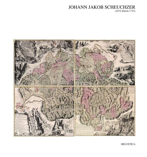
JOHANN JAKOB SCHEUCHZER<br />
(1672 Zürich 1733)<br />
HELVETICA