

MapInfo Spatial Server Web Map Service - Product Documentation ...
MapInfo Spatial Server Web Map Service - Product Documentation ...
MapInfo Spatial Server Web Map Service - Product Documentation ...

You also want an ePaper? Increase the reach of your titles
YUMPU automatically turns print PDFs into web optimized ePapers that Google loves.
NamedStyles/PointStylePin<br />
<br />
<br />
-180, -90, 180, 90<br />
<br />
Once you have defined your Layers, the WMSLayerTree defines both what layers the server's GetCapabilities<br />
response will contain, and what layers can be used by the service. By doing this, it allows for a<br />
central default configuration to be defined for all layers, and then for a specific instance of the server,<br />
these default layers can be exposed or hidden using the WMSLayerTree, or existing layers can be redefined,<br />
or new layer definitions can be added.<br />
Creating a WMSLayerTree<br />
The WMSLayerTree defines the layers that are exposed through the WMS and also defines the structure<br />
of how these layers are organized. Only the layers defined in the WMSLayerTree are returned in a<br />
GetCapabilites response, and can be defined and returned in a Get<strong>Map</strong> or GetFeatureInfo query.<br />
WMSLayerTree Rules<br />
The following rules apply when creating a WMSLayerTree:<br />
• The Title element of the layer defined in the WMSLayerTree must match the Name element defined<br />
in the WMSLayerList.<br />
• Each Title element must be wrapped in a WMSLayerTree element.<br />
• Each WMSLayerTree element can contain one or more WMSLayerTree elements.<br />
• There can be only one WMSLayerTree at the root. That root layer can have any number of children,<br />
as can any of those children.<br />
• If more than one root WMSLayerTree is defined in a configuration file, only the first WMSLayerTree<br />
will be exposed through the service.<br />
• If multiple configuration files have WMSLayerTrees defined, the last configuration file listed in the<br />
beans.xml file that has a WMSLayerTree will be the one exposed through the service.<br />
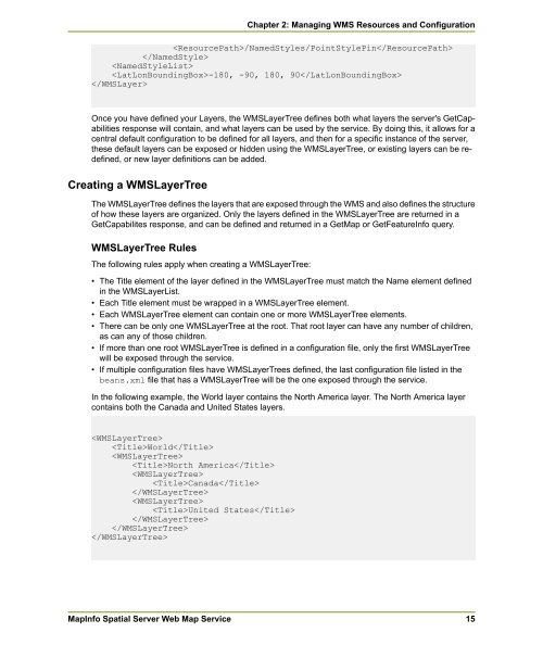
In the following example, the World layer contains the North America layer. The North America layer<br />
contains both the Canada and United States layers.<br />
<br />
World<br />
<br />
North America<br />
<br />
Canada<br />
<br />
<br />
United States<br />
<br />
<br />
<br />
<strong><strong>Map</strong>Info</strong> <strong>Spatial</strong> <strong>Server</strong> <strong>Web</strong> <strong>Map</strong> <strong>Service</strong><br />
Chapter 2: Managing WMS Resources and Configuration<br />
15


