united states - Alaska Division of Geological & Geophysical Surveys ...
united states - Alaska Division of Geological & Geophysical Surveys ...
united states - Alaska Division of Geological & Geophysical Surveys ...
You also want an ePaper? Increase the reach of your titles
YUMPU automatically turns print PDFs into web optimized ePapers that Google loves.
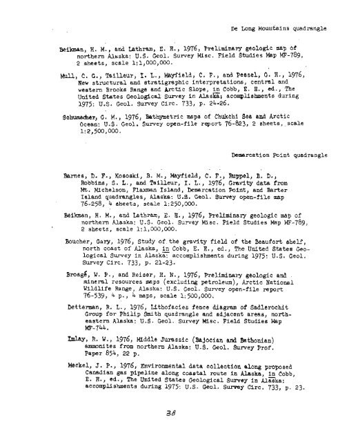
De Long Mouritai ns quadrangle<br />
Bei-n, H. M., and Lathram, E. H., 1976, Preliminary geologic map ef<br />
northern <strong>Alaska</strong>! U.S. Geol. Survey Misc. Field Studies Map MF-789,<br />
2 sheets, scale 1:1,000,000.<br />
mil, C. G., Tailleur, 1. L., Mayfield, t. F., and Pessel, C. H., 136,<br />
New structural and stratigraphic interpretations, central and<br />
western Brooks Range and Arctic Slope, in Cobb, E. R., ed., The<br />
United States <strong>Geological</strong> S wey in <strong>Alaska</strong>t acompUshments during<br />
1975: U.S. Geol. survey Circ. 733, p. 24-26.<br />
Sch~~~r~&er, G. M., 1976, Batmetric mnpe <strong>of</strong> Chukchi Sea and Arctic<br />
Ocean: U.S . Geol. Survey open-file report 76-823) 2 sheets , . scale<br />
1!2,500,000,<br />
Demarcation Point quadrangle<br />
. . . .<br />
Barnes, D. F., Kosoeki, B. M., Mayfield, C. F., Rttppel, B. D.,<br />
Robbins, S . L., and Tailleur, I. L. , 1976, Gravity data from<br />
Mt. Michelson, Flaman Island, Demarcation Point, and Barter<br />
Island quadrangles, <strong>Alaska</strong>: U.S. Geol. Survey open-file map<br />
76-258, 4 sheets, scale 1:250,000.<br />
Beihan, H. M,, and Lathram, 2. H., 1976, Preliminary geologic map <strong>of</strong><br />
northern <strong>Alaska</strong>: U. S. Geol. Survey Misc. Field Studies Map MF-789,<br />
2 sheets, scale 1:1,300,000.<br />
B6ucher) Gary, 1976, Study <strong>of</strong> the gravity field <strong>of</strong> the Beaufort shelf,<br />
north coast <strong>of</strong> <strong>Alaska</strong>, in Cobb, E. H., ed., The United States Geo-<br />
logical Survey i n ~laska: accomplishments during 1975 : U . S . Geol .<br />
Survey Circ, 733, p. 21-23.<br />
~rosgd, W. P., and Reiser, H. N., 1976, Preliminary geologic and<br />
mine 1-81 resources maps (excluding petroleum), Arctic National<br />
Wildlife Range, <strong>Alaska</strong>: U. S . Geol . Survey open-f lle report<br />
76-539) 4 p., 4 maps, scale 1:500,000.<br />
betterman, R. L., 1976, Lith<strong>of</strong>acies fence diagram <strong>of</strong> Sadler~chit<br />
Group for Philip Smith quadrangle and addaccnt areas, northeastern<br />
<strong>Alaska</strong>: U.S. Geol. Survey Misc. Field Studies Map<br />
?a-744.<br />
Mayj R. W., 1976, Middle Jumssic (b~ecian azd ihthonian)<br />
ammonites from northern <strong>Alaska</strong>: U.S. Geol. Survey Pr<strong>of</strong>.<br />
Paper 854, 22 p.<br />
Meckel, J. P., 1976, ~nvironmental data collection along preposed<br />
Canadian gas pipeline along coaetal route in <strong>Alaska</strong>, in Cobb,<br />
E. H., ed., The United States <strong>Geological</strong> S wey in <strong>Alaska</strong>:<br />
accomplishments during 1975: U.S. Geol. Sumy Circ. 733, p. 23.


