Management Plan - Glover's Reef Marine Reserve
Management Plan - Glover's Reef Marine Reserve
Management Plan - Glover's Reef Marine Reserve

Create successful ePaper yourself
Turn your PDF publications into a flip-book with our unique Google optimized e-Paper software.
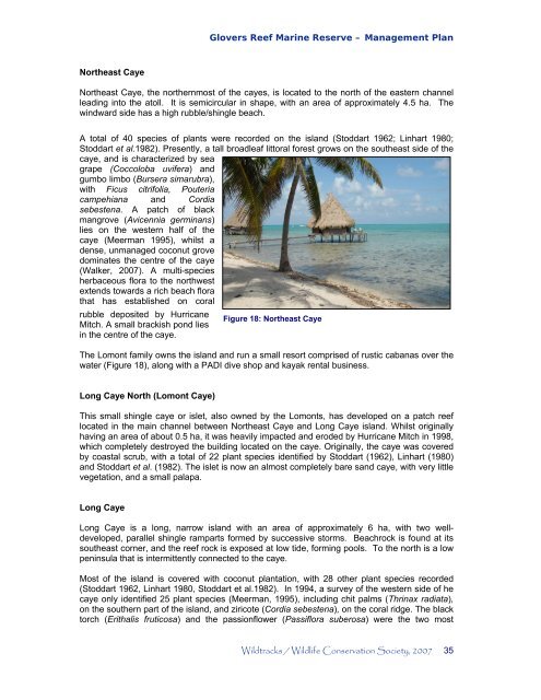
Northeast Caye<br />
Glovers <strong>Reef</strong> <strong>Marine</strong> <strong>Reserve</strong> – <strong>Management</strong> <strong>Plan</strong><br />
Northeast Caye, the northernmost of the cayes, is located to the north of the eastern channel<br />
leading into the atoll. It is semicircular in shape, with an area of approximately 4.5 ha. The<br />
windward side has a high rubble/shingle beach.<br />
A total of 40 species of plants were recorded on the island (Stoddart 1962; Linhart 1980;<br />
Stoddart et al.1982). Presently, a tall broadleaf littoral forest grows on the southeast side of the<br />
caye, and is characterized by sea<br />
grape (Coccoloba uvifera) and<br />
gumbo limbo (Bursera simarubra),<br />
with Ficus citrifolia, Pouteria<br />
campehiana and Cordia<br />
sebestena. A patch of black<br />
mangrove (Avicennia germinans)<br />
lies on the western half of the<br />
caye (Meerman 1995), whilst a<br />
dense, unmanaged coconut grove<br />
dominates the centre of the caye<br />
(Walker, 2007). A multi-species<br />
herbaceous flora to the northwest<br />
extends towards a rich beach flora<br />
that has established on coral<br />
rubble deposited by Hurricane<br />
Mitch. A small brackish pond lies<br />
in the centre of the caye.<br />
Figure 18: Northeast Caye<br />
The Lomont family owns the island and run a small resort comprised of rustic cabanas over the<br />
water (Figure 18), along with a PADI dive shop and kayak rental business.<br />
Long Caye North (Lomont Caye)<br />
This small shingle caye or islet, also owned by the Lomonts, has developed on a patch reef<br />
located in the main channel between Northeast Caye and Long Caye island. Whilst originally<br />
having an area of about 0.5 ha, it was heavily impacted and eroded by Hurricane Mitch in 1998,<br />
which completely destroyed the building located on the caye. Originally, the caye was covered<br />
by coastal scrub, with a total of 22 plant species identified by Stoddart (1962), Linhart (1980)<br />
and Stoddart et al. (1982). The islet is now an almost completely bare sand caye, with very little<br />
vegetation, and a small palapa.<br />
Long Caye<br />
Long Caye is a long, narrow island with an area of approximately 6 ha, with two well-<br />
developed, parallel shingle ramparts formed by successive storms. Beachrock is found at its<br />
southeast corner, and the reef rock is exposed at low tide, forming pools. To the north is a low<br />
peninsula that is intermittently connected to the caye.<br />
Most of the island is covered with coconut plantation, with 28 other plant species recorded<br />
(Stoddart 1962, Linhart 1980, Stoddart et al.1982). In 1994, a survey of the western side of he<br />
caye only identified 25 plant species (Meerman, 1995), including chit palms (Thrinax radiata),<br />
on the southern part of the island, and ziricote (Cordia sebestena), on the coral ridge. The black<br />
torch (Erithalis fruticosa) and the passionflower (Passiflora suberosa) were the two most<br />
Wildtracks / Wildlife Conservation Society, 2007 35