Charrette Briefing Handbook - City of Wayzata
Charrette Briefing Handbook - City of Wayzata
Charrette Briefing Handbook - City of Wayzata

Create successful ePaper yourself
Turn your PDF publications into a flip-book with our unique Google optimized e-Paper software.
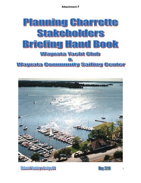
Attachment F<br />
1
Attachment F<br />
This copyright handbook is being published by the <strong>Charrette</strong> Steering Committee for<br />
use at the charrette. The purpose <strong>of</strong> the handbook is to provide information concerning<br />
the charrette and the location to charrette participants.<br />
Steering Committee Members:<br />
Katie Bassett,Shady Lane Neighbor<br />
Paul Penningroth, Old Holdridge Neighbor<br />
Ann Markus, Bushaway Neighbor<br />
Thomas Tanner, <strong>Wayzata</strong> <strong>City</strong> Council<br />
Bryan Gadow, AICP, <strong>Wayzata</strong> <strong>City</strong> Planner<br />
Dallas Johnson, Yacht Club Commodore<br />
Bert Foster, Yacht Club Board <strong>of</strong> Directors Member<br />
Dr. Ross Siemers, President <strong>Wayzata</strong> Sailing Foundation<br />
Howard Nordeen, <strong>Wayzata</strong> Sailing Foundation, Board Member<br />
Among other sources information for this handbook was provided by:<br />
Bryan Gadow, <strong>City</strong> <strong>of</strong> <strong>Wayzata</strong><br />
Michael Kelly, <strong>City</strong> <strong>of</strong> <strong>Wayzata</strong><br />
The <strong>Wayzata</strong> Historical Society<br />
The Minnesota Historical Society<br />
Greg Nybeck, The Lake Minnetonka Conservation District<br />
James Wisker, Minnehaha Creek Watershed District<br />
Nicholas Peterson, Hennepin County<br />
Gordon Gunlock<br />
Bert Foster, <strong>Wayzata</strong> Yacht Club<br />
Dallas Johnson, <strong>Wayzata</strong> Yacht Club<br />
Mark Jana, <strong>Wayzata</strong> Yacht Club<br />
Allen Klugman, PE. Westwood Pr<strong>of</strong>essional Services<br />
Frank Sabota, Sabota Enviromental Services<br />
44 interviews <strong>of</strong> <strong>City</strong> Council, Planning Commission, Yacht Club, Sailing Center and<br />
Neighbors<br />
Parking Attendants<br />
<strong>Wayzata</strong> Trolley<br />
Steve Bern, Yacht Club Manager<br />
Cappy Holland Executive Director <strong>Wayzata</strong> Sailing Foundation<br />
Planning Consultant<br />
Midwest Planning & Design, LLC<br />
2
Attachment F<br />
<strong>Briefing</strong> Hand Book Table <strong>of</strong> Contents<br />
Using this <strong>Briefing</strong> <strong>Handbook</strong> 4<br />
Chapter One <strong>Charrette</strong> Folder<br />
<strong>Charrette</strong> ,Mission Goals ,and Detailed Expected Product Schedule:<br />
Purpose 5<br />
Draft Mission Statement 5<br />
Mission Process 5<br />
Mission Goals 6<br />
<strong>Charrette</strong> Product Expectations 7<br />
Detail Schedule with responsibilities and times 9<br />
<strong>Charrette</strong> Details: 12<br />
Location<br />
Organization:<br />
Facilitator’s Role<br />
Workstation Assignments and Tasks<br />
Physical Organization and Materials<br />
Workstations<br />
Sieve Overlays<br />
<strong>Briefing</strong> Binder<br />
Food Service<br />
Presentations and Large Group Interactions<br />
Technical Experts and Facilitator<br />
Draft Vision Statement 14<br />
<strong>Charrette</strong> Room Layout diagram 15<br />
Chapter Two Local Context Folders<br />
<strong>Wayzata</strong> Folder 16<br />
Comprehensive Plan, Zoning and Entitlements<br />
Existing Land Use Map<br />
Zoning District Map<br />
Relevant Zoning Regulations<br />
Yacht Club and Sailing Center Conditional Use Permits 22<br />
Public Streets and Public Lake Access<br />
Utility Information<br />
Summary <strong>of</strong> Site and Natural Resource information<br />
Historical Resource Information<br />
Neighborhood Folder 37<br />
View Analysis<br />
Neighborhood Architecture<br />
Minnehaha Creek Watershed District Folder 44<br />
Relevant Rules<br />
Lake Minnetonka Conservation District Folder 44<br />
Multiple Dock Permits for the Yacht Club and Sailing Center<br />
Boat Density<br />
Dock Plan<br />
<strong>Wayzata</strong> Yacht Club Folder 49<br />
Mission and Vision<br />
Description<br />
Organization and Membership<br />
Policies<br />
Typical Race Schedule<br />
Parking Study 54<br />
<strong>Wayzata</strong> Community Sailing Center Folder 59<br />
Vision<br />
Description and Programs<br />
New Facilities<br />
Interviews and Analysis Folder 63<br />
Summary and detail discussion<br />
Issues<br />
Analysis and planning strategies<br />
Sources and notes 77<br />
3
Attachment F<br />
Chapter Three Planning Area Folder Site Analysis Folder<br />
The maps will be available in large scale at the charrette<br />
Base Map<br />
Physical Data by Parcel<br />
Aerial Photograph<br />
County Proposed Eastman Lane Plan<br />
Wetlands Map<br />
Air Photo<br />
Right-<strong>of</strong>-Way Diagram<br />
Chapter Four White Papers Folder CD Folder only<br />
Sailing History<br />
Adaptive Sailing<br />
Sailing Schools<br />
Discussion and Context Sensitive Design Eastman Lane<br />
Lake Minnetonka Dredging Policy Minnehaha Creek Watershed District<br />
Summary <strong>of</strong> Dock and Boat Storage Rules Lake Minnetonka Conservation District<br />
Cooperative Agreement For a Public Boat Ramp <strong>City</strong> <strong>of</strong> <strong>Wayzata</strong> and the Minnesota<br />
Department <strong>of</strong> Natural Resources<br />
Green Parking<br />
Green Parking Lots, Planning by Design: Montgomery County Planning<br />
Commission<br />
Bioretention Applications Environmental Protection Agency<br />
Field Evaluation <strong>of</strong> Permeable Pavements for Stormwater Management<br />
Environmental Protection Agency<br />
Green Parking Rehbein Environmental Solutions<br />
Cultural Resource Study<br />
Chapter Five Context Photo Folder CD Folder only<br />
Yacht Club<br />
Club house, land east <strong>of</strong> the club house and docks<br />
West parking lot, public boat launch and docks<br />
East Parking Lot<br />
Sailing Center<br />
Arlington Circle South (Fire lane)<br />
Eastman Lane<br />
Using this <strong>Briefing</strong> Hand Book:<br />
The purpose <strong>of</strong> this book is to provide information to be helpful to the charrette participants known as<br />
“stakeholders”. The book consists <strong>of</strong> organizational information to provide each stakeholder the opportunity<br />
to fully participate in the charrette. The book will help the stakeholder navigate the charrette<br />
process by understand their role in the charrette, the charrette’s organization including a detail schedule,<br />
expectations, how decisions are made, and the resources that will be available at the charrette to<br />
assist the stakeholder in collectively formulating a master plan and implementation tools.<br />
Because successful participation depends on coming to the charrette as an active, knowledgeable participant,<br />
we developed background information organized into context folders. The context folders include<br />
the planning area (Arlington Circle South , Burlington Northern Santa Fe Rail Road ,Eastman<br />
Lane, Central Ave. south <strong>of</strong> Eastman Lane and the property owned by the yacht club and the sailing<br />
foundation within the regional, city, and neighbor context. Also, the context folders provide all the<br />
background information necessary to formulated a master plan including: natural and cultural resource<br />
information, neighborhood information, traffic and street information, zoning, entitlement, Watershed<br />
District, and Lake Minnetonka Conservation District information, historical information, detail organizational<br />
operational and site information related to the yacht club and sailing center, and a series <strong>of</strong> maps<br />
with detail information . By studying the background information contained in this book, each stakeholder<br />
will have the knowledge and resources similar to any <strong>of</strong> the experts involved in the process.<br />
4
Attachment F<br />
Chapter One; <strong>Charrette</strong><br />
Mission Statement, Mission Goals,<br />
Detailed Expected Product and Organization<br />
Mission Statement:<br />
Purpose: This organizational statement describes the overreaching purpose <strong>of</strong> the<br />
charrette. It represents the higher-level purpose that each <strong>of</strong> us, as stakeholders,<br />
agree to strive to achieve during the charrette. The Mission Statement will be used<br />
as a guide throughout the charrette to describe the project to new comers and to the<br />
press, and to keep the planning effort on task. The statement is divided into three<br />
parts; The mission statement, drafted by the Steering Committee, is presented for<br />
approval by the charrette participants at the beginning <strong>of</strong> the charrette. The mission<br />
process describes the means that each <strong>of</strong> us as participants agree to use to create a<br />
concept master plan and implementation tools. The mission goals illustrate the goals<br />
that each <strong>of</strong> us agree to try to accomplish during the charrette planning process.<br />
Draft Mission Statement:The <strong>Charrette</strong>’s Mission is to bring together community<br />
and neighborhood leaders; the leaders <strong>of</strong> the <strong>Wayzata</strong> Yacht Club and <strong>Wayzata</strong><br />
Community Sailing Center along with key <strong>City</strong>, Lake Minnetonka Conservation<br />
District, and Minnehaha Creek Watershed District staff and technical experts to<br />
create a master plan and implementation tools for the Yacht Club and Sailing<br />
Center that:<br />
Resolves existing issues;<br />
Protects and enhances the Lake, the Neighborhood, the Yacht Club and the<br />
Sailing Center as community assets;<br />
Creates a balance <strong>of</strong> neighborhood and community needs with those <strong>of</strong> the<br />
Yacht Club and Sailing Center so that all exist in harmony.<br />
<strong>Charrette</strong> Mission Process:<br />
The Steering Committee has chosen to use the <strong>Charrette</strong> planning process to create<br />
the master plan and implementation tools because it will bring talented, creative lea-<br />
ders and pr<strong>of</strong>essionals into the process, encourage the free flow <strong>of</strong> ideas, and stimu-<br />
late a creative/synergistic planning event. The charrette process is organdie around<br />
the following elements:<br />
Imaging and Sharing Information: The <strong>Charrette</strong> imaging format involves participants<br />
arranging drawings <strong>of</strong> various plan elements on a map to develop a master<br />
plan and then creating the tools to accomplish the master plan over time.<br />
Pr<strong>of</strong>essional Facilitator and Workstations: Each <strong>of</strong> five work stations will continuously<br />
collaborate. A floating pr<strong>of</strong>essional facilitator, moves among workstations<br />
(groups <strong>of</strong> people working on a plan) making suggestions, encouraging “thinking<br />
out <strong>of</strong> the box,” helping with direction, and encouraging the sharing <strong>of</strong> collective<br />
ideas among workstations as the charrette proceeds;<br />
Workstations are organized around the charrette’s mission and product wih a seat<br />
5
Attachment F<br />
at the table for each stakeholder. Neighbors and others who were not identified as<br />
stakeholders, but who wish to attend the charrette can join in the process.<br />
Technical Assistance: Besides Stakeholders and others that may wish to join in the<br />
charrette planning process, Technical assistance such as a traffic and parking specialist,<br />
civil engineers, landscape architects and architects will be<br />
available to work with the stakeholders to create a plan.<br />
<strong>Charrette</strong> Mission Goals (part <strong>of</strong> the mission Statement):<br />
Participation Goals:<br />
Stakeholders invited:<br />
The <strong>Charrette</strong> Steering Committee, which consists <strong>of</strong> city, neighborhood, yacht club<br />
and sailing center leaders, invited you as key leader (stakeholder) from the<br />
neighborhood, community, yacht club, sailing center, or agencies that can contribute<br />
to the quality <strong>of</strong> the plan and its successful adoption. They also invited a pr<strong>of</strong>essional<br />
facilitator and design pr<strong>of</strong>essionals who can provide skills in design, ecology,<br />
water use, and engineering.<br />
Participatory ground rules:<br />
As a participating stakeholder we all agree to:<br />
Strive to understand before trying to be understood, and to promote full and active<br />
participation;<br />
Use consensus as the decision making tool;<br />
Strive to respect the opinion <strong>of</strong> others;<br />
Strive to be open and to embrace and support the decisions arrived at by consensus;<br />
Clearly articulating any objections to the decisions at the charrette so that they<br />
can be resolved rather than being silent only to voice the objection in another<br />
form;<br />
Strive to obtain commitment to support the charrette’s plan as it is legitimized.<br />
Support the consensus plan and implementation tool developed at the charrette.<br />
Product Goals: to produce a high-quality master plan, including site plan design with<br />
illustrations, entitlement document, and broad operating principles:<br />
Design goals:<br />
Create a plan to enhance the community assets identified as the neighborhood,<br />
yacht Club and sailing center;<br />
The planning area includes: the Lake on which boats are moored or docked, the<br />
land owned by the <strong>Wayzata</strong> Yacht Club and the <strong>Wayzata</strong> Sailing Foundation,<br />
Eastman Lane and Arlington Circle, Central Ave south <strong>of</strong> Eastman Lane (public<br />
boat launch), and the Burlington Northern and Santa Fe Railroad right-<strong>of</strong>-way;<br />
Consider sustainable design practices including energy and best management<br />
practices (BMP) for storm water retention and run<strong>of</strong>f.<br />
Use the charrette process and the master plan to resolve a number <strong>of</strong> existing<br />
issues.<br />
6
Attachment F<br />
Broad Operating Principles Goal:<br />
Develop broad operating principle for such things as use <strong>of</strong> the yacht club’s club<br />
house and the sailing center, regattas, use <strong>of</strong> the grounds, neighborhood use <strong>of</strong> the<br />
facilities, and other items that will help to resolve existing issues.<br />
Legitimization, Entitlement and Amendment Goals:<br />
Create a method <strong>of</strong> legitimizing the decisions and plan agreed upon during the<br />
charrette so the <strong>City</strong> Council, LMDC, Watershed District (MCWD) can approve<br />
entitlements that are: legal, fair to all concerned, predictable, and provide for sustained<br />
operations <strong>of</strong> the yacht Club and sailing center in harmony with the<br />
neighborhood and community.<br />
Create an amendment method to amend the plan from time to time involving<br />
stakeholders from all those represented at the charrette.<br />
Public/Private partnership Goals:<br />
Work in partnership with the <strong>City</strong>, LMDC, MCWD, DNR, yacht club, sailing center<br />
and neighborhood to develop the plan and to implement the plan;<br />
Commit to continue the partnership after the plan is completed.<br />
<strong>Charrette</strong> Product Expectations:<br />
Expectations:<br />
This is an organizational statement articulating what the stakeholders expect to accomplish<br />
in terms <strong>of</strong> product at the charrette. It consists <strong>of</strong> a list <strong>of</strong> products that will<br />
be included in the master plan.<br />
The following products are expected be produced as part <strong>of</strong> the charrette process:<br />
This pre-charrette <strong>Briefing</strong> Hand Book containing:<br />
<strong>Charrette</strong> participation information and charts to help the participants to understand<br />
the charrette process arrangement, and schedule;<br />
Contextual paper containing information and maps such as historical information,<br />
information about the neighborhood, sailing center and yacht club, Lake environmental<br />
and ecological information, land use, entitlement information, traffic, road,<br />
railroad and parking information, detailed information about the site, and a view<br />
analysis. This information will be used to facilitate understanding <strong>of</strong> the variety <strong>of</strong><br />
local context <strong>of</strong> the yacht club and sailing centers relative to:<br />
the Old Holdridge, Shady Lane, and Bushaway Neighborhoods, an eclectic<br />
neighborhood <strong>of</strong> single family cottages, larger homes and multifamily,<br />
<strong>Wayzata</strong>, a lake community striving to retain its small town character,<br />
Lake Minnetonka, and<br />
Eastman Lane the east gateway to the community;<br />
Interview information from the interviews conducted last summer<br />
Draft charrette mission statement and draft master plan vision statement to be approved<br />
at the charrette by the stakeholders;<br />
Comparison and Technical papers: These are resource papers prepared by the<br />
consultants and from <strong>of</strong>ficial city and other agency documents that will address the issues<br />
discovered in the interviews conducted last summer. The papers will provide in-<br />
7
Attachment F<br />
formation about the club and sailing center, history <strong>of</strong> sailing on the Lake, cultural resource<br />
information about the planning area , public lake access information, street and<br />
parking information.<br />
Shared vision:<br />
Within the context, the information and the <strong>City</strong>’s guide plan, the charrette<br />
participants will be asked to approve a vision statement for this area. Visioning<br />
is a facilitated interactive process that creates ownership in the plan, commit-<br />
ment to its implementation and a statement depicting what the Stakeholders are<br />
striving to create in words and images.<br />
The <strong>Charrette</strong> will result in a plan with illustration including the following elements:<br />
Site Concept Master Plan including:<br />
Location <strong>of</strong> all buildings on WYC and WCSC lots including both existing and proposed<br />
structures with lot dimensions, dimensions <strong>of</strong> proposed and existing structures,<br />
and existing and proposed setbacks <strong>of</strong> all buildings located on property;<br />
Location and number <strong>of</strong> existing and proposed parking spaces, storage areas, slips<br />
and ramps;<br />
Concept best management practices (BMP) to improve water quality;<br />
Vehicular access and circulation including: parking, curb cuts, driveways and drop<br />
<strong>of</strong>fs;<br />
Pedestrian circulation system;<br />
Public access plan<br />
Location and type <strong>of</strong> existing and proposed lighting;<br />
Site plan details such as trash receptacles, dock, ramp, slide, and slip locations;<br />
Lot dimensions and area;<br />
Dimensions <strong>of</strong> proposed and existing structures;<br />
Concept landscape and aesthetics plan;<br />
Architectural elevations (type and materials used in external surfaces);<br />
General cost and financing estimate, and 20 year implementation program.<br />
Entitlements and Amendment:<br />
The charrette will develop an entitlement method for zoning based on the master<br />
plan .<br />
The <strong>Charrette</strong> will develop an amendment process agreement by which the master<br />
plan and the entitlements can be amended.<br />
Broad Operating Principles:<br />
The charrette will develop broad-operating principles to resolve existing issues,<br />
without curtailing the operation <strong>of</strong> the club or sailing center.<br />
8
The followin g is an ou tlin e <strong>of</strong> the char rette sch ed u le including r esponsib ilities, activ ities an d timing:<br />
Date Activity and<br />
Responsibility<br />
May, 2010 <strong>Briefing</strong> Hand<br />
Book<br />
(Richard Krier)<br />
Friday<br />
June 18`<br />
Friday<br />
June 18<br />
Friday<br />
June 18<br />
Friday<br />
June 18<br />
Friday<br />
June 18<br />
Reconnaissance<br />
walking tour <strong>of</strong><br />
the yacht club,<br />
sailing school<br />
and neighborhoods<br />
(Richard Krier)<br />
Walking Tour<br />
Debriefing<br />
(Facilitator)<br />
<strong>Charrette</strong><br />
Facilitator<br />
Dr. Ross<br />
Siemers,<br />
Sailing Foundation<br />
,President<br />
Master <strong>of</strong> Ceremonies<br />
Facilitator<br />
<strong>Charrette</strong><br />
Facilitator<br />
Task During<br />
the Activity<br />
Send <strong>Briefing</strong><br />
Hand Book to<br />
each stakeholder<br />
Sign in Workstationassignments;Welcome<br />
by Dallas<br />
Johnson and<br />
<strong>City</strong> Council<br />
Member;<br />
Pre-tour briefing<br />
by Richard<br />
Krier<br />
<strong>Charrette</strong> participants<br />
to<br />
share observations<br />
Mission Statement,<br />
Goals and<br />
Process;<br />
Master Plan<br />
Vision Statement<br />
Buffet Dinner;<br />
Welcome by<br />
TBA;<br />
Introductions;<br />
Product Expectations;Workstation,<br />
process<br />
and responsibility<br />
Small Group<br />
workstations<br />
Attachment F<br />
D eta iled WYC / WCSC C harrette Schedule<br />
Master Plan<br />
Objective Approximate<br />
Start time<br />
End time<br />
Opportunity to<br />
become familiar<br />
with the locational<br />
context<br />
and the site,<br />
schedule and<br />
details.<br />
Understanding<br />
location context<br />
Document and<br />
prioritize key<br />
observations<br />
Understanding<br />
Mission and<br />
Process; Approve<br />
a <strong>Charrette</strong><br />
Mission Statement<br />
and a Master<br />
Plan Vision<br />
Statement<br />
Social &<br />
Educational<br />
Creative synergistic<br />
process:<br />
Select reporter;<br />
Create concepts<br />
Way zata Y acht Club<br />
<strong>Charrette</strong> Process Schedule:<br />
1:00PM<br />
2:30PM<br />
2:30 PM<br />
3:30 PM<br />
3:30PM<br />
5:00 PM<br />
5:00 PM<br />
6:30 PM<br />
6:30 PM<br />
9:00 PM<br />
Location &<br />
Comments<br />
Computer Disk<br />
containing the<br />
Hand Book<br />
Bay Center<br />
gathering<br />
with context<br />
survey and<br />
camera; Participants<br />
when<br />
signing in will<br />
be given colored<br />
nametags<br />
that will designate<br />
their workstation;<br />
Bay Center<br />
Bay Center<br />
Bay Center<br />
Bay Center<br />
9
Date Activity and<br />
Responsibility<br />
Saturday<br />
June 19<br />
Saturday<br />
June 19<br />
Saturday<br />
June 19<br />
Saturday<br />
June 19<br />
Saturday<br />
June 19<br />
Saturday<br />
June 19<br />
<strong>Charrette</strong><br />
Facilitator<br />
<strong>Charrette</strong><br />
Facilitator<br />
<strong>Charrette</strong><br />
Facilitator<br />
<strong>Charrette</strong><br />
Facilitator<br />
<strong>Charrette</strong><br />
Facilitator<br />
<strong>Charrette</strong><br />
Facilitator<br />
Task During the<br />
Activity<br />
Reports by each<br />
work station<br />
Small Group<br />
work stations<br />
Reports by each<br />
work station<br />
Lunch<br />
Small Group<br />
work stations<br />
Group meeting<br />
all work stations<br />
Synergize plans,<br />
Evaluation<br />
Wrap up and<br />
Thanks<br />
Attachment F<br />
Objective Approximate<br />
Start time<br />
End time<br />
Sharing ideas developed<br />
on Friday,<br />
discussing<br />
impasses and issues<br />
Creative synergistic<br />
process:<br />
Develop plan segments<br />
and illustrations<br />
Synthesis: Each<br />
workstation presents<br />
plan segments<br />
and illustrations<br />
for discussion<br />
Finalize plan segments<br />
based on<br />
discussion<br />
Prepare final illustrations<br />
Each workstation<br />
presents final plan<br />
segments & illustrations<br />
Final Plan and<br />
Implementation<br />
Tools<br />
8:00 AM<br />
9:30 AM<br />
9:30 AM<br />
12:00 PM<br />
12:00 PM<br />
1:30 PM<br />
1:30 PM<br />
3:00 PM<br />
3:00 PM<br />
4:30 PM<br />
4:30 PM<br />
5:00 PM<br />
Location &<br />
Comments<br />
Bay Center<br />
Buffet Breakfast<br />
at the work stations<br />
Bay Center<br />
Bay Center<br />
Buffet Lunch at<br />
the work stations<br />
Bay Center<br />
3:30 PM Refreshments<br />
Bay Center<br />
Bay Center<br />
10
Attachment F<br />
<strong>Charrette</strong> Detail<br />
Our process objective is to create a synergistic environment conducive to creativity,<br />
which will enable the participants to produce outstanding designs for the Planning<br />
Area, including a concept master plan, broad operating principles, a means <strong>of</strong> entitlement<br />
and an agreement <strong>of</strong> how the plan can be amended (implementation tools).<br />
<strong>Charrette</strong> Location: Bay Center Development Office South East Entrance Facing<br />
Lake Street.<br />
<strong>Charrette</strong> Organization:<br />
Basic Plan<br />
We use the continuously collaborative “fish bowl” charrette method, that utilizes a floating<br />
pr<strong>of</strong>essional facilitator who moves among the work stations making suggestions,<br />
encouraging “thinking out <strong>of</strong> the box”, helping with direction, and encouraging the sharing<br />
<strong>of</strong> collective ideas among workstations. As the charrette proceeds, this method is<br />
key to the charrette process.<br />
The charrette is organized into one implementation workstation and four design workstations.<br />
The four design workstations consist <strong>of</strong> pr<strong>of</strong>essional designers (Landscape<br />
Architects, Architects, Civil Engineers, Hydrologist and Parking Specialist ) and stakeholders<br />
that work together. They will be responsible for producing a master plan as described<br />
earlier in the product expectations. These design workstation objectives and<br />
groups consist <strong>of</strong>:<br />
Design Workstation One Objective is an overall plan with an emphasis on the<br />
Sailing Center and Arlington Circle South (Fire Lane)<br />
Stakeholders at this workstation:<br />
Marty Bassett or Katie Bassett<br />
Dr. Ross Siemers<br />
Howard Noreen<br />
Thomas Tanner<br />
Toni Peet<br />
Lynn Gruber<br />
Ellen Dehaven<br />
Landscape Architect Meg Amosti and Architect John Crump<br />
Design Workstation Two Objective is an overall plan with an emphasis on Eastman<br />
Lane.<br />
Stakeholders at this workstation:<br />
Michael Kelly<br />
Chris Fittipaldi<br />
Jonathan McDonagh<br />
Ann Markus<br />
Gordy Straka<br />
Merrily Borg Babcock<br />
Landscape Architect Chris Oaks, Civil Engineer Peter Willenbring, Traffic<br />
Engineer Allen Klugman<br />
11
Attachment F<br />
Design Workstation Three Objective is overall plan with an emphasis on 2<br />
or more scenarios for the east yacht club property.<br />
Stakeholders at this workstation:<br />
Greg Schultz<br />
Dale Roberts<br />
Dallas Johnson<br />
Mark Janda<br />
Janet Sabes or Robert Sabes<br />
Kristen Eide-Tollefson<br />
Architect Randy Gould, Landscape Architect Bill Sanders, Traffic Engineer<br />
Allen Klugman<br />
Design Workstation Four Objective is overall plan with emphasis on the<br />
public boat launch, yacht club’s club house property, and yacht club’s west<br />
parking lot.<br />
Stakeholders at this workstation:<br />
Paul Penningroth<br />
Roger Patterson<br />
Bert Foster<br />
Larry Aubuchon<br />
James Wisker<br />
Richard Glidwell<br />
Dan Baasen<br />
Landscape Architect Mark Apfbacher, Traffic Engineer Allen Klugman<br />
Implementation Workstation Five Operating, Entitlement and Future Process<br />
Workstation: Besides being involved in overall plan, the primary function<br />
<strong>of</strong> this workstation is to develop the following:<br />
Develop broad operating principles;<br />
Legitimize the plan developed at the other workstations in the form <strong>of</strong> a<br />
comprehensive plan amendment and a zoning ordinance amendment.<br />
Develop a recommendation to Minnehaha Creek Watershed District Rules<br />
for plan implementation.<br />
Develop a recommendation to the Lake Minnetonka Conservation District<br />
for the plan implementation.<br />
Develop a process for amending the plan and zoning regulations<br />
Stakeholders at this workstation consist the following:<br />
Dennis Morrison<br />
Doug Sauter<br />
Steven Bren<br />
Bryan Gadow<br />
Richard Krier<br />
Karl Ludescher<br />
Greg Nybeck<br />
We ask that each workstation select a spokesperson to report at each <strong>of</strong> the<br />
12
Attachment F<br />
group gatherings (see detail schedule for group gatherings) .<br />
Physical Organization and Materials:<br />
The following is a description <strong>of</strong> the charrette room (see diagram included ) arrang<br />
ment and the materials supplied to the participants:<br />
Workstations:<br />
Workstations One through Four consist <strong>of</strong> a table with chairs, a flip chart and tran<br />
parent sieve map easel. The base map and sieve layer will be on clear plastic and<br />
fixed to the easel. Each table will have Sharpies and pencils, a scale, note pads, 24<br />
by 36 air photo and tracing paper.<br />
Sieve: We are using an overlay sieve method that allows the stakeholders to overlay<br />
information including a base map with 2-foot contour interval topography and existing<br />
features, natural features map with regulated and unregulated features, and a view<br />
analysis map. Participants can design on the easel screen by using the 36 inch or 12<br />
inch tracing paper. The natural features layer consists <strong>of</strong>:<br />
Regulated natural areas protected by law including:<br />
Protected wetlands;<br />
Flood Plain;<br />
Lake Minnetonka below the Ordinary High Water Mark (OHWM).<br />
Non-regulated natural areas such as trees or tree massing and soils.<br />
<strong>Briefing</strong> Hand Book: This briefing hand book will be available at each work<br />
station. We will mail these books in CD disk format to each stakeholder and technical<br />
person before the charrette.<br />
Food: A buffet service will be set up in the work area. Participants are invited to<br />
help themselves and to eat at their workstations. We will serve:<br />
Buffet Dinner Friday<br />
Continental Breakfasts Saturday<br />
Refreshments.<br />
Presentations and large group interactions will take place in the work area<br />
Friday June 18 Welcome: Dallas Johnson, Commodore<br />
Pre-tour briefing by Richard Krier<br />
Tour debriefing facilitated by Trudy Richter<br />
<strong>Charrette</strong> Mission Statement, Process and Goals facilitated by<br />
Trudy Richter<br />
Master Plan Vision Statement facilitated by Trudy Richter<br />
Friday June 18 Dinner Master <strong>of</strong> Ceremonies Dr. Ross Siemers<br />
Welcome by <strong>Wayzata</strong> Official TBA<br />
Introductions by Dr. Ross Siemers<br />
<strong>Charrette</strong> organization, expectations facilitated by Trudy Richter<br />
13
Attachment F<br />
Saturday June 19 Sharing ideas, discussing issues and impasses facilitated by<br />
Trudy Richert<br />
Saturday June 19 Synthesis; plan segment presentation for discussion facilitated<br />
by Trudy Richter<br />
Saturday June 19 Final plan and illustrations presentations facilitated by Trudy<br />
Richter<br />
Technical Experts:<br />
The technical expert that have been invited to participate in the charrette are:<br />
Facilitator Trudy Richter, Richardson, Richter & Associates, Inc.<br />
Landscape Architect Meg Amosti, RLA : Specializes in environmental and urban<br />
design, and site planning; Windsor Company, St. Paul;<br />
Landscape Architect Chris Oaks, ASLA, USGBC: Specializes in urban and park<br />
design and site planning; Windsor Company, St. Paul;<br />
Landscape Architect Bill Sanders, ASLA: Specializes in urban design and recreational<br />
facilities; principle at Sanders Wacker and Bergly, St. Paul;<br />
Landscape Architect Craig Wilson, ASLA: Specializes in low impact development<br />
Civil Engineer Peter Willenbring, P.E.:Specializes in municipal engineering, principle<br />
at WSB, Plymouth;<br />
Traffic Engineer Allen Klugman, P.E.: Specializes in traffic engineering and parking<br />
lot design; principle at Westwood Pr<strong>of</strong>essional Services, Inc, Eden Prairie<br />
Design Architect Randy Gould, Specializes in architectural management and design,<br />
Ryan Companies Minneapolis<br />
Architect John Crump, AIA, LEED: Specializes in Institutional Architecture<br />
Planner Richard Krier, AICP, Specializes in urban design and master plans, principle<br />
Midwest Planning & Design, LLC<br />
Draft Vision Statement :<br />
A vision statement is a simple positive statement <strong>of</strong> the stakeholder’s articulation <strong>of</strong><br />
what they envision the yacht Club and sailing school to be. It embodies the basis<br />
for the foundation <strong>of</strong> the master plan and provides direction to the stakeholders<br />
as to what the master plan should achieve. The Steering Committee formulated the<br />
following positive draft vision statement for the stakeholders’ consideration:<br />
We envision the yacht club and sailing center, as an important part<br />
<strong>of</strong> the community's character that adds to the quality <strong>of</strong> life, can<br />
aesthetically fit into the community fabric and the image <strong>of</strong> the<br />
small town on the Lake. Our vision is a first rate primarily com-<br />
petitive sailing yacht club and educational sailing center, welco<br />
ing all members <strong>of</strong> the community to experience the sport <strong>of</strong> sail<br />
ing, located on an important gateway to the community,<br />
compatible with the neighborhood and the neighborhood’s arch-<br />
tecture.<br />
14
Attachment F<br />
The above diagram is a schematic <strong>of</strong> the where the charrette will take place. Each <strong>of</strong> the workstations ( 1-5) are<br />
labeled as well as the food service area and conference area, where different workstation can conference without<br />
disturbing the other stations.<br />
15
Attachment F<br />
Chapter Two Local Context Folders<br />
Creating a successful master plan, requires an understanding <strong>of</strong> the local setting .<br />
This means not only understanding the real sitting, but also understanding WYC and<br />
WCSC context perceived by the sailors, community and the neighborhood. This<br />
context may be documented by physical evidence, expanded by local possibilities,<br />
and constrained by the setting and local situation. This section deals with the information<br />
obtained from the records search and the interviews relative to:<br />
The perception that neighbors and public <strong>of</strong>ficials have <strong>of</strong> WYC and WCSC and<br />
an analysis based on interviews;<br />
The neighborhood context interpolated from <strong>of</strong>ficial documents and interviews;<br />
The WYC and WCSC history and entitlements, and<br />
Information about the site and neighborhood from various sources.<br />
<strong>Wayzata</strong> Folder:<br />
Comprehensive Plan, Zoning Entitlements:<br />
A number <strong>of</strong> <strong>of</strong>ficial documents help understand the neighborhoods, yacht club and<br />
sailing center. The <strong>City</strong>’s Comprehensive Plan and its implementation tool, the zoning<br />
ordinance, represents <strong>of</strong>ficially articulated and legal identity <strong>of</strong> the neighborhoods<br />
including the yacht club and sailing center. The zoning ordinance, as a comprehensive<br />
plan implementation tool, must conform to the plan for it to have a legal basis in<br />
the control <strong>of</strong> private property. Relevant parts <strong>of</strong> comprehensive plan and zoning<br />
ordinance are discussed along with the entitlements that are either inherent or have<br />
been granted by the <strong>City</strong> <strong>of</strong> <strong>Wayzata</strong> and exist on the property today.<br />
Comprehensive Plan: This document represents the <strong>of</strong>ficial policies <strong>of</strong> the <strong>City</strong> related<br />
to public improvements, transportation, private land use, and public facilities.<br />
The plan has been adopted by the <strong>City</strong> Council and approved by the Metropolitan<br />
Council.<br />
The <strong>City</strong>’s board objectives contained in the Comprehensive Plan provide insight<br />
into the <strong>of</strong>ficial thinking or what is important in the context <strong>of</strong> the community and<br />
neighborhood character. These objectives include:<br />
Preserve and enhance <strong>Wayzata</strong>’s “small town” character:<br />
Scale, walkability, land use patterns,<br />
Street and boulevard character<br />
Strong residential neighborhoods<br />
Reinforce and enhance residential neighborhoods<br />
A vibrant and healthy business climate<br />
A strong downtown is key to the economic and social base <strong>of</strong> the community<br />
Preserve and enhance the business structure for primary retail/commercial areas<br />
Family orientation<br />
Built physical environment to allow for the development <strong>of</strong> cultural and social<br />
activities that provide the opportunity for social engagement.<br />
Community heritage<br />
Built community form; redevelopment <strong>of</strong> significant properties; small town roots<br />
16
Preservation <strong>of</strong> historic or significant properties<br />
Maintain and enhance the diversity <strong>of</strong> housing options<br />
Continue to recognize housing diversity is a community asset<br />
Address the need and opportunities for life cycle housing<br />
A connected community<br />
Build physical and psychological connections between all residential neighbor<br />
hoods, business areas, and links to other recreational amenities<br />
Protection <strong>of</strong> amenities<br />
Preserve and protect significant natural resource areas<br />
Promote access to community park and open space resources.<br />
Strengthen and reinforce community gateways (Eastman Lane is a community gateway)<br />
Provide announcement and a sense <strong>of</strong> place to areas <strong>of</strong> the community at key entry<br />
points through architectural, landscape and urban design elements<br />
Sustainability<br />
As addressed in: policy decisions, legislative actions, administrative actions, and project<br />
implementation””<br />
The <strong>City</strong>’s Comprehensive Plan Land Use Section and Zoning Ordinance classifies<br />
these areas as follows:<br />
Neighborhood<br />
Area<br />
Old Holdridge<br />
Neighborhood<br />
Comprehensive Plan Land Use<br />
Designations<br />
Mix <strong>of</strong> single family and medium<br />
density multifamily<br />
Attachment F<br />
Zoning Ordinance Designation<br />
R-3A single and two family<br />
residential, R-2A single family<br />
residential<br />
Relevant use allowed by<br />
Conditional Use Permit<br />
Not applicable<br />
Shady Lane Low density single family R-2A single family Not applicable<br />
Eastman/ Bushaway<br />
Estate single family R-1 low density single family Not applicable<br />
WCSC Semi Public/Private R-2A single family residential<br />
Sailing School,<br />
WYC Semi Public/Private (club house East <strong>of</strong> Central Ave: R-1 low R 2A- Sailing School;<br />
property west and east parking lot)<br />
and<br />
density residential; West <strong>of</strong><br />
Central Ave: R-2A Single R-1- Commercial outdoor<br />
Estate Single Family (small sliver Family Residential<br />
recreational areas including<br />
<strong>of</strong> land east <strong>of</strong> the club house property)<br />
golf courses and country<br />
clubs, Swimming pools and<br />
similar facilities<br />
WYC uses are not allowed<br />
in the R-2A zoning district<br />
by CUP<br />
Semi-Public/Private - Semi-public/private land uses include private golf courses, yacht clubs, sailing schools and other quasi<br />
public recreational facilities and uses.<br />
17
Attachment F<br />
The first map is<br />
the land use plan<br />
from the comprehensive<br />
plan.<br />
This map divides<br />
the city<br />
into various land<br />
use categories<br />
and takes precedent<br />
over the<br />
zoning map.<br />
The second map<br />
is the zoning<br />
ordinance map<br />
that divides the<br />
city in to zoning<br />
districts. As it<br />
relates to the<br />
yacht club the<br />
maps are in conflict.<br />
18
Attachment F<br />
Relevant Existing Zoning Standards:<br />
Relevant standards that apply to WYC and WCSC property are as follows:<br />
Zoning District Bulk Requirements:<br />
The R2A single family zoning district (sailing center and the area west <strong>of</strong> Central Ave<br />
boat ramp) rules require: 1) a 25,000 square foot minimum lot area, 2) principle<br />
structures to have 20-foot rear yard setback, 50-foot front yard setback, 75-foot lake<br />
yard setback, and 15-foot side yard setback with the rear yard being reduced to 5<br />
feet for accessory structures. Lot coverage is limited to 20% <strong>of</strong> the lot area and impervious<br />
surface is limited to 30% <strong>of</strong> the lot area (25% in the shore land overlay zoning<br />
district). Accessory structures have a height limit <strong>of</strong> 20 feet. Lake lots the front<br />
yard is the yard that faces the street; Lake lots do not have a rear yard. Also, an existing<br />
structures front yard setback (yard towards Eastman Lane) is the distance<br />
from the street right-<strong>of</strong>-way to the existing home (Principal structure).<br />
The R-1 district (yacht club east <strong>of</strong> Central Ave.) rules require: 1) a 40,000 square<br />
foot lot area; 2) lot depth <strong>of</strong> 150 feet; 3) side yard setback <strong>of</strong> 20 feet, 4) front yard<br />
setback <strong>of</strong> 45 feet and 5) rear yard setback <strong>of</strong> 50 feet with accessory structures having<br />
a 10-foot side and rear yard. Structures adjacent to shoreline used exclusively for<br />
the storage <strong>of</strong> watercraft must have a side yard setback <strong>of</strong> 10 feet. Lot coverage is<br />
limited to 15% <strong>of</strong> the lot area, and impervious surface is limited to 25% <strong>of</strong> lot area.<br />
Shore Land Overlay District (All the land in the planning area):<br />
This overlay-zoning district puts the following relevant additional condition on property<br />
within 1000 feet <strong>of</strong> Lake Minnetonka:<br />
Building Setback for the principle and non-water oriented accessory structures,<br />
and buildings: 75 feet from the Ordinary High Water Level (OHWL) <strong>of</strong><br />
929.4 feet above sea level and a variable setback, which is determined by the<br />
location <strong>of</strong> riparian structures located on either side. Of the options for determining<br />
this setback the most restrictive would be 78 feet on the WCSC property.<br />
Any additions or new structures on the sailing center land would require a<br />
78-foot lake setback. The 75-foot lake setback is measured from the OHWL,<br />
which wraps around the west WYC lot and sailing center lot from the lake<br />
along the shore <strong>of</strong> the dredge channel.<br />
35-foot building height;<br />
25% to 100% impervious surface coverage with anything over 25% subject to<br />
storm water treatment facilities with an approved conditional use permit and<br />
shore land impact plan;<br />
Water related accessory structures are allowed based on the allowed uses in<br />
the zoning district (WYC R-1 and R-2A and WSCS R-2A). These accessory<br />
uses cannot be more than 10 feet high or 250 square feet in area (400 SF and<br />
20 feet wide for boat and related storage) and must be located at least 10 feet<br />
from the OHWL. The view from the lake must be camouflaged and the ro<strong>of</strong><br />
with a safety rail may be used as a deck. Also, stairways, lifts, handicapped<br />
ramps and landing areas with width restrictions are allowed adjacent to the<br />
lake.<br />
19
Attachment F<br />
Special provisions for semi public uses include: double setbacks or vegetative<br />
screening from the lake; vegetative or topographic screening <strong>of</strong> parking areas;<br />
limits on: signing, short term moorings, lighting, vegetation clearing, trimming<br />
and pruning, grading and filling, placement and design <strong>of</strong> parking lots, driveways<br />
and roads must have the same setbacks as structures, and there are provisions<br />
for storm water management.<br />
Parking Requirements:<br />
Parking Stall Size:<br />
Except for compact car parking, 9 feet wide by 20 feet or 18 feet long when at 90 degrees<br />
(the most efficient way to park vehicles) a 24-foot wide two way driving isle is<br />
required. Twenty percent <strong>of</strong> the parking spaces can be designed for compact cars<br />
having an 8-foot wide and 16 feet long stall. Except for certain businesses which are<br />
allowed to provide restricted joint parking, parking must be on the same lot and under<br />
the same ownership as the principle use. Parking lot entrances must be at least 40<br />
feet from intersections and all properties are entitled to at least one driveway access<br />
from an abutting and improved public street. Driveway accesses must be 125 feet<br />
apart.<br />
Parking Spaces Required Marinas ands Schools:<br />
Marinas are required to have seven spaces for each 10 boats or mooring<br />
spaces.<br />
Sailing Schools Although there are requirements for public and private schools<br />
there are not requirements for a sailing school. It appears that the <strong>City</strong> can set<br />
the standard based on: “Subject to the review and processing <strong>of</strong> a conditional<br />
use permit as regulated by Section 801.04 <strong>of</strong> the Zoning Ordinance, the <strong>City</strong><br />
may reduce the number <strong>of</strong> required <strong>of</strong>f-street parking spaces and/or loading<br />
spaces when the use can demonstrate in documented form a need which is<br />
less than required. In such situations, the <strong>City</strong> may require land to be reserved<br />
for parking development should use or needs change” .<br />
Flood Plain Overlay Zoning District:<br />
A large part <strong>of</strong> the WCSC front yard (toward the street) is below the 100-year regional<br />
flood plain 931.5 feet) classified in the zoning ordinance as (AE) Floodway. Within<br />
the overlay flood zoning district the following relevant uses and standards apply:<br />
Allowed permanent land uses and conditional uses:<br />
Allowed uses provided no fill, excavation, structures, storage <strong>of</strong> materials<br />
or equipment and the use does not reduce the storage capacity <strong>of</strong><br />
the floodway; boat launching ramps, trails, swimming areas, and for Industrial<br />
commercial and residential uses loading and parking areas;<br />
Conditional use as long as they do not reduce the flood storage capacity<br />
including: structures accessory to open spaces, placement <strong>of</strong> fill, marinas,<br />
boat rental, docks, piers, wharves and water control structures,<br />
streets, bridges, storage yards for readily removable equipment and machinery<br />
or materials and similar uses. The fill must be limited to what is<br />
needed to grade or landscape for the conditional use.<br />
The lowest level <strong>of</strong> a building near the flood plain including the basement which is not<br />
20
Attachment F<br />
flood pro<strong>of</strong>ed, must be located at least one-foot above the regional flood elevation <strong>of</strong><br />
931.5 feet above sea level.<br />
Setback Non-conforming Structure: Partially Removed<br />
The current sailing center, Rosekran’s home, is a nonconforming building subject to<br />
the nonconforming constraints. The location <strong>of</strong> the building, about 7 feet from the<br />
west property line, causes the nonconformity.<br />
Although not a part <strong>of</strong> the zoning ordinance, the <strong>Wayzata</strong> Building Inspector is interpreting<br />
“remodel” to include removal <strong>of</strong> the current structure as long as one foundation<br />
wall and the first floor remain intact and are all-salvageable. Salvageable means<br />
that major structural parts cannot be added. The building inspector and the city manager<br />
make a determination if the proposal is a remodel or demolition. If it is a demolition<br />
then the new building needs to conform to all the current regulations including the<br />
15 foot setback. If it is determined to be a remodel a new structure could have a<br />
seven-foot setback (current Rosekran’s home setback) rather than a 15-foot setback<br />
from the west property line by leaving a salvageable existing west wall, salvageable<br />
foundation and salvageable first floor in place.<br />
Fences and landscaping:<br />
Screening is required along the boundary <strong>of</strong> non-residential property when it abuts a<br />
residential property or is across the street from a residential zone. The area <strong>of</strong> land<br />
that is between the building and the street is considered the front yard. Fences not<br />
higher then 42 inches and not more than 50% opaque are allowed in the front yard.<br />
Except for a sight visibility triangle on corner lots, fences up to 6 feet in height can be<br />
located in the front yard as long as they are meant to screen and are at least 10 feet<br />
from the roadway. There are not any restrictions on the height <strong>of</strong> hedges used for<br />
fences. The city council can allow exceptions to these standards by use <strong>of</strong> a conditional<br />
use permit.<br />
Non-residential property is required to be landscaped. The amount and placement <strong>of</strong><br />
the landscaping is determined by a landscape plan with the size and type <strong>of</strong> the<br />
planting material listed in the ordinance.<br />
Signs:<br />
With performance standards, a 6-square foot with a maximum height <strong>of</strong> 5 feet identification<br />
sign is allowed in R1 (club house) but not in the R2-A (sailing center) zoning<br />
districts.<br />
Storage:<br />
The city ordinance is conflicted concerning storage. One section allows non residential<br />
uses to store equipment (boats and trailers, etc.) in an enclosed building or to be<br />
fully screened. Another section allows storage in the side yard and not in the front<br />
yard or lake yard without regard to screening. The more restrictive requirement<br />
would most likely apply.<br />
21
Attachment F<br />
Conditional Use Permits: WYC and WCSC Entitlement History<br />
The following air photo visually identifies various properties owned by WYC and<br />
WCSC<br />
Lot 2 sliver <strong>of</strong> land between the club house circle drive eastward:<br />
WYC began in 1964 on a small piece <strong>of</strong> property formerly owned by Reid’s Boat<br />
Sales. The lakeshore property, located east <strong>of</strong> the clubhouse property adjacent to the<br />
Lake contains approximately 7,173 square feet (identified as lot 2 on the above air<br />
photo), From 1964 until the first conditional use permit was issued in 1974, WYC<br />
changed the property’s focus to sailing and continued to operate and use it as a marina.<br />
This property is currently zoned R-1 single family and is shown on the Comprehensive<br />
Plan as “estate single family land use” rather than semi pubic/private. This<br />
land use designation is a serious concern to the club.<br />
Lot 3 Clubhouse Property:<br />
In 1974, WYC acquired the Leckas’ property (lot 3 on the attached air photo), which<br />
had also been operated as a marina. This property contains approximately 12,706<br />
square feet. In 1974, WYC submitted a unified site plan <strong>of</strong> the Reid’s property (Lot 2)<br />
and the Leckas’ property (Lot 3) to the <strong>City</strong>. This plan included 31 parking spaces on<br />
gravel parking lot; one stall for every 2 boat slips (additional stalls were leased from<br />
the property west <strong>of</strong> the Leckas site) and 59 boat slips. On February 5, 1974, the<br />
<strong>City</strong> Council issued a conditional use permit to “operate a private sailboat club” and it<br />
granted two variances to the <strong>City</strong> Code: one to allow a five-foot parking lot setback to<br />
the north and west property lines and a variance to allow a limestone or gravel parking<br />
lot rather than a bituminous lot. The Council provided its approval with only the<br />
condition that the improvements conform to the submitted WYC uniform site plan.<br />
22
Attachment F<br />
By 1979, WYC was ready to tear down the Leckas’ buildings that served as a clubhouse<br />
and build the present clubhouse structure. The <strong>City</strong> Council granted the<br />
building permit and amended the 1976 conditional use permit agreement allowing a<br />
2300 square foot building including a caretaker’s apartment. Significantly, it granted<br />
two variances: one to allow a 5-foot building setback from Eastman Lane and the<br />
other to allow 44-foot setback from the lake. The action applied to both the Reid’s<br />
property and the Leckas property. The clubhouse property (Lot 3) is currently zoned<br />
R-1 single family residential and is planned semi public private land use in the city’s<br />
comprehensive plan.<br />
Lot 1 East Parking Lot:<br />
This property, zoned R-1 single family and planned as semi public/private land use,<br />
was acquired in 1976. The property contains approximately 88,033 square feet between<br />
then County Road 16 (Eastman Lane), the railroad right-<strong>of</strong>-way, and west <strong>of</strong><br />
County Road 101(Bushaway Road at the time State Trunk Highway 101). WYC acquired<br />
the property, known as the Bell’s Property (lot 1 on the attached air photo), in<br />
response to a growing issue about congested parking conditions on Eastman Lane.<br />
WYC proposed to use Bell’s property as a parking lot primarily to provide overflow<br />
parking on summer weekends when parking along Eastman Lane was congested.<br />
Although purchased to resolve an issue, WYC was limited by the <strong>City</strong> Council to only<br />
69 parking spaces. The property can environmentally and aesthetically accommodate<br />
200 parking spaces with screening and protecting the existing utilities. In addition,<br />
the conditional use permit required WYC to make lake shore improvements to<br />
Reid’s property (lot 2), limited the buoy field to 30 buoys within 400 feet <strong>of</strong> the shore,<br />
and limit the parking lot use. The resulting conditional use permit took the then nonconforming<br />
status away from Reid’s property (lot 2), and imposed conditions on Bell’s<br />
property (lot 1), Reid’s property (lot 2), and clubhouse property (Leckas, lot 3). However,<br />
it did not repeal the 1974 setback variances on Leckas (lot 3).<br />
The conditions imposed by the 1976 Conditional Use Permit allowing a 69-space<br />
parking lot on Bell (lot 1) are summarized as:<br />
1. All landscaping, plantings as per the approved site plan;<br />
2. Trash to be kept in an approved dumpster and the area to be kept clean and free<br />
<strong>of</strong> trash and debris;<br />
3. The number <strong>of</strong> boat slips not to exceed 97 and the number <strong>of</strong> mooring buoys beyond<br />
30 (127 total). The location <strong>of</strong> both the slips and the buoys were indicated on a<br />
site plan;<br />
4. The number and size <strong>of</strong> structures in the clubhouse area could not be increase<br />
(this was later amended) and no structures are allowed on lot 1(Bell property);<br />
1. The allowed limestone parking lot on the Bell property could not be enlarged;<br />
2. No boat trailers are to be parked on the Bell site, clubhouse (Leckas site) or on<br />
land that was being leased at the time west <strong>of</strong> the clubhouse site (west parking lot);<br />
3. The Bell property (known in the agreement as the “parking lot site”) was not to<br />
be used for any use except parking lot and then only during the boating season;<br />
4. The Bell property could not be used between the hours <strong>of</strong> 11:00 PM and 8:00 AM<br />
Monday Through Thursday and could not be used between the hours o 12:00AM<br />
23
Attachment F<br />
and 8:00 AM Friday Through Sunday;<br />
5. Should WYC not have control <strong>of</strong> the parking area (Bell property) the parking lot<br />
was to be abandoned and the limestone area covered with grass.<br />
The property (Bell lot one) is restricted in its use by an electric power easement and<br />
sanitary sewer and water easement including sewage lift station. The use <strong>of</strong> the land<br />
is also restricted by the seven foot depth <strong>of</strong> the city water lines that transverse the<br />
property.<br />
An amendment to the 1976 agreement (Bell, Reid’s’ and Leckas properties) stipulated<br />
that the total number <strong>of</strong> slips and buoys associated with this property would not<br />
exceed 127 and the buoy field would not extend more than 400 feet into the lake. Although<br />
the shoreline for this property is 540 feet long, the current LMCD dock permit<br />
reflects this agreement.<br />
In 1990 due to low water, WYC obtained permission to temporarily move its buoy field<br />
from 400 feet to 800 feet. It appears; at this time is when <strong>City</strong> authorized limited parking<br />
on the edge <strong>of</strong> Eastman Lane designating it for vehicles with trailers only. The<br />
WYC has for 45 years been mostly a sailboat marina. However, in 1989-90 with record<br />
low water, the WYC could not moor 4-foot draft sailboats in many marina locations.<br />
Members parked their sailboats in their yard and the club rented the vacant slips<br />
to 91 power boats. Without this flexibility, the yacht club could not have survived. Although<br />
a sail boat racing and teaching marina, with this history in mind, the yacht club<br />
will continue to require this flexibility.<br />
Lot 4 West Parking Lot:<br />
In 1986, WYC acquired the old Tibbits & Wise Boat Works land from the trust representing<br />
the <strong>Wayzata</strong> Bay Association, which had purchased the land from the boat<br />
works in 1944. This Tibbits & Wise Boat Works (lot 4 on the attached air photo) land<br />
had been leased by WYC for parking for number <strong>of</strong> years. The use <strong>of</strong> this land as a<br />
marina, well documented in the history section <strong>of</strong> this hand book, is a nonconforming<br />
use in an R2A single family residential zoning district and is shown on the comprehensive<br />
plan as semi public/private land use which includes the use as a yacht club<br />
(private recreational use). One section (801.01.5) <strong>of</strong> the zoning ordinance indicates<br />
that as a legally existing use at the time <strong>of</strong> its adoption, the use would now be considered<br />
a conditional land use in this zoning district. This zoning section explains the<br />
former planner’s recommendation and the use <strong>of</strong> a conditional use permit to allow<br />
the jib crane.<br />
Lot 5 Sailing Center (Hague- Rosekran’s Property):<br />
The property, located at 456 Arlington Circle, known as the Rosekran’s property (lot 5<br />
on the attached air photo), was acquired in 2007 for a sailing school. Sailing School<br />
is an allowed land use in the R-2A residential zoning district with a conditional use<br />
permit. The <strong>City</strong> Council issued the permit, with conditions, in May 2008.<br />
Besides being subject to all the extensive regulations in the R2A, Flood Protection<br />
24
Attachment F<br />
and Shoreland Overlay zoning districts, the <strong>City</strong> Council placed the additional conditions<br />
on the property (paraphrased):<br />
Joint parking with the WYC;<br />
No parking or drop <strong>of</strong>f on Arlington Circle;<br />
Securing other necessary permits and the Fire Marshall’s approved use <strong>of</strong> the<br />
building.<br />
It is significant that the city Council’s minutes mentions “filling and other requirements”<br />
meaning that WSCS and the <strong>City</strong> realized that some <strong>of</strong> the property is located<br />
below the 100-year regional flood elevation resulting in a limited use <strong>of</strong> this area.<br />
Conditional Use Permit Discussion:<br />
Minnesota law provides that conditional land uses are allowed “by right” in a zoning<br />
district as long as the conditions for issuing the conditional use permit are satisfied.<br />
The burden <strong>of</strong> pro<strong>of</strong> to show that the conditions are satisfied lies with the applicant,<br />
but should the city council turn down a conditional use permit the burden <strong>of</strong> pro<strong>of</strong> at<br />
the district court lies with the city to show that the conditions for issuing a conditional<br />
use permit were not satisfied. The law provides that secondary conditions imposed by<br />
the city council, as well as the primary conditions specified in the zoning ordinance for<br />
issuing a conditional use permit must be reasonable and not curtail the reasonable<br />
use <strong>of</strong> the property for the allowed conditional use. Conditional uses also run with the<br />
land and not with ownership.<br />
The conditional use permit process is a city quasi-judicial /administrative process<br />
rather than a legislative process. As such, a city council cannot arbitrarily impose<br />
conditions. In <strong>Wayzata</strong>, the conditions need to address the following criteria for issuing<br />
a conditional use permit:<br />
The proposed action in relation to the specific policies and provisions <strong>of</strong> the<br />
Comprehensive Plan.<br />
The use's compatibility with present and future uses <strong>of</strong> the area.<br />
The use's conformity with all performance standards.<br />
The proposed use's effect on the area in which it is proposed.<br />
The proposed use's impact upon property values in the area in which it is developed.<br />
Traffic generated by the proposed use is in relation to capabilities <strong>of</strong> streets<br />
serving the property. WSCS and WYC are located on a Collector Street.<br />
The proposed use's impact upon existing public services and facilities including<br />
parks, schools, streets, utilities, and the <strong>City</strong>'s service capacity.<br />
Although common in many municipal zoning ordinances, the vagueness <strong>of</strong> some <strong>of</strong><br />
these conditions leave the city, neighborhood and property owner vulnerable to court<br />
actions that could over turn a city council’s decision. As a general zoning phiosphy<br />
Public Streets:<br />
The streets in this area, with the exception <strong>of</strong> the Eastman Lane, Arlington Circle,<br />
and Lake Street combination (old County Road 16), are local residential streets without<br />
curb and gutter. The streets ,which at one time were designated as County<br />
25
Attachment F<br />
Road 16 are classified a major collector street in the city’s comprehensive plan.<br />
Eastman Lane, a 26-foot wide two lane street that in 1999 and in 2005 had a traffic<br />
volume <strong>of</strong> 6,100 Average Daily Traffic (ADT). At the current time or in the future<br />
according to the comprehensive plan, Eastman Lane has not been identified<br />
as having capacity deficiencies or transportation issues The comprehensive plan<br />
retains Eastman Lane as a two-lane street. The city’s comprehensive plan shows<br />
Eastman Lane as having an existing bike/walk trail that currently exists as widened,<br />
paved shoulders, as constructed by Hennepin County in 2001. The right-<strong>of</strong>way,<br />
easement and implied use is variable from 26 feet in the area <strong>of</strong> the yacht<br />
club’s west parking lot and sailing center (implied use) to 39 feet adjacent to the<br />
club house (implied use) and 66 feet along the east parking lot (plated right-<strong>of</strong>way).<br />
Implied use means that the city or county do not have dedicated or easement<br />
right-<strong>of</strong>-way, but have used and maintained the street for a number <strong>of</strong> years<br />
and can continue to use and maintain the street in the future.<br />
Although the 66-foot right-<strong>of</strong>-way width is typical and the speed is typical <strong>of</strong> a former<br />
county road, the right-<strong>of</strong>-way widths, which are within the city’s control and<br />
the speeds, which are controlled by the state, are not typical <strong>of</strong> a community wishing<br />
to retain small town character. Because speeds are controlled by the state,<br />
the process for reducing the speed limit involves the following: When the city believes<br />
that the existing speed limit upon any street or highway within its jurisdictions<br />
and not a part <strong>of</strong> the state trunk highway system is greater or less than is<br />
reasonable or safe driving under existing conditions, they may request the state to<br />
authorize, upon the basis <strong>of</strong> an engineering and traffic investigation, the erection<br />
<strong>of</strong> appropriate signs designating what speed is reasonable and safe. If the traveled<br />
speed on the street is less than the posted speed the state may reduce the<br />
speed limit, but if the traveled speed is greater the state may increase the speed<br />
limit. Speed limits can also be reduced by designing the street with traffic calming<br />
measures that are discussed at the end <strong>of</strong> this hand book.<br />
Traffic, bicycle, and pedestrian safety on Eastman Lane, an identified issue from<br />
the interviews, would be greatly improved by using the methods contained in the<br />
Institute <strong>of</strong> Traffic Engineers (ITE) publication“ Context Sensitive Street Solutions”.<br />
Part <strong>of</strong> the ITE publication is included as a “white paper” in this hand book.<br />
Existing Comprehensive Plan Standards for local and collector streets:<br />
Functional Classification Local Street Collector Street (Eastman)<br />
Right-<strong>of</strong>-Way 50 -80 ft 60-100 ft<br />
Capacity 8,000 to 10,000 ADT 8,000 to 10,000 ADT<br />
Speeds Maximum 30MPH 30 to 40 MPH<br />
The problem with updating Eastman Lane is the amount <strong>of</strong> right-<strong>of</strong> way (34 feet in<br />
some locations). Because <strong>of</strong> this restriction, the city should be encouraged to work<br />
with the railroad to use part <strong>of</strong> the railroad’s right-<strong>of</strong>-way for street improvements. A<br />
discussion <strong>of</strong> street widths, pedestrian amenities, cleaning pollutants from storm water<br />
run<strong>of</strong>f is provided in an attached “white paper”.<br />
26
Detail Streets in the Planning Area:<br />
Arlington Circle:<br />
Arlington Circle is a platted undeveloped 60-foot wide public street right-<strong>of</strong>-way running<br />
from the lake to what some <strong>of</strong> the neighbors think is a precarious intersection<br />
with Shady Lane and Eastman Lane.<br />
The street is used for: fire truck access to the lake, limited staff access to the WCSC<br />
<strong>of</strong>fice and winter recreational parking and access to the lake. Except in the winter,<br />
parking is not allowed on the<br />
street. Our parking study conducted<br />
between July 6 and September<br />
3, 2009, indicated an average<br />
<strong>of</strong> one car parked on the<br />
street on Thursday evening race<br />
night.<br />
Eastman Lane, Shady Lane,<br />
Arlington Circle intersection,<br />
with railway crossing medians<br />
Source: <strong>City</strong> <strong>of</strong> <strong>Wayzata</strong><br />
Attachment F<br />
Arlington Circle intersects Lake<br />
Street north <strong>of</strong> the railroad tracks.<br />
Shady Lane, Eastman Lane, Arlington<br />
Circle and a private driveway<br />
that used to be the main en-<br />
trance to the Eastman Estate form the intersection at WSCS’s northwest corner.<br />
These three streets coming together at this location, along with the newly installed<br />
median have, in the opinion <strong>of</strong> one <strong>of</strong> the neighbor’s, created traffic turning movement<br />
issues.<br />
Traffic accident reports indicate that this intersection has had a number <strong>of</strong> minor traffic<br />
accidents. Although primarily the result <strong>of</strong> the sharp curve at this location, eight <strong>of</strong><br />
the 14 reported 2005-2009 traffic accidents between Lake Street and Bushaway<br />
Road occurred at this intersection.<br />
Central Avenue Boat Launch:<br />
The Central Avenue public boat launch operates as a city facility with a Department<br />
<strong>of</strong> Natural Resources (DNR) agreement. This part <strong>of</strong> Central Ave was plated, as a<br />
33-foot wide public street right-<strong>of</strong>-way in 1888 as part <strong>of</strong> the Arlington Heights subdivision.<br />
Although there was a Torrens action in 1937 that registered the lake end <strong>of</strong><br />
the avenue, this action would, by state statute, not affect the public street right-<strong>of</strong>-way<br />
that extends to the lake, but does effect the underlying property rights. The 1997 cooperative<br />
agreement with the DNR indicates that the <strong>City</strong> had historically operated<br />
the street as a public boat launch and specifies that the street would be used as a<br />
public boat launch perpetually unless the <strong>City</strong> provides a “similar or higher quality alternative”<br />
public launch. Other pertinent public launch conditions contained in the<br />
DNR agreement include: unless in an emergency, the ramp is to remain open year<br />
around, 24 hours per day; maintenance is to be provided by the <strong>City</strong>; <strong>City</strong> cannot restrict<br />
its use based on parking, boat size, place <strong>of</strong> residence, or boat engine horse<br />
power. Its use can be restricted based on “surface water use zoning regulations” .<br />
27
Attachment F<br />
Because only the LMCD and DNR control the surface water use, It’s our opinion that<br />
these are DNR or LMCD zoning regulations.<br />
The 2004 DNR aerial survey indicates that the average daily public boat ramp use on<br />
weekends is 13.2 boats and the average daily use on weekdays is 6.6 boats. As part<br />
<strong>of</strong> the parking study conducted by Midwest Planning & Design in the summer <strong>of</strong><br />
2009, WYC parking attendants counted 6 vehicles and trailers parked on Eastman<br />
Lane on Thursday evenings and 8 parked on Eastman Lane on Sunday afternoons.<br />
Neither <strong>of</strong> these studies account for days when the ramp is used for fishing tournament<br />
lake access. Personal observation and anecdotal information indicates that the<br />
use is substantially more intense during these events. From interviews conducted<br />
with ramp users, it appears the ramp is a favorite for pr<strong>of</strong>essional anglers and nonriparian<br />
<strong>Wayzata</strong> residents because <strong>of</strong> its convenient location and because <strong>of</strong> the extra<br />
time that it takes to launch a boat at the pubic launch in Gray’s Bay and then to<br />
get out <strong>of</strong> Gray’s Bay.<br />
A search <strong>of</strong> accident records from 2005 to date found one accident recorded that related<br />
to the boat ramp and this one was a car avoiding another car and hitting the<br />
rear <strong>of</strong> a parked trailer. An interview with the Sheriff's Water Patrol indicated that<br />
there were no known accidents at the ramp from 1993 to the present. However, the<br />
sheriff’s records are incomplete. In addition, WYC members have related one serious<br />
accident with injuries related to this ramp.<br />
The <strong>Wayzata</strong> Fire Department retains the access for fire protection and will required<br />
continuous access to the lake. It is highly unlikely that the <strong>City</strong> would consider vacating<br />
the Avenue, because <strong>of</strong> its past and public uses and the limited public access to<br />
the lake within <strong>Wayzata</strong>.<br />
Eastman Lane:<br />
For a number <strong>of</strong> years Hennepin County has been working with the city and the<br />
neighborhood including WYC to design major changes to Bushaway Road (County<br />
State Aid Highway 101) and limited changes to Eastman Lane. To this end some time<br />
ago, the County worked with WYC to develop the alternative Eastman Lane Plan.<br />
However, a city task force and the county have been working to modify that alignment.<br />
The most recent plan can be found at the end <strong>of</strong> this hand book.<br />
Traffic:<br />
Cut-through traffic in the Old Holdridge Neighborhood was identified as one <strong>of</strong> the<br />
WYC issues. An origin and destination study, completed as part <strong>of</strong> the proposed Bay<br />
Center redevelopment, studied cut-through traffic in the Old Holdridge Neighborhood<br />
at midday and in the PM hours. In summary the study concludes: a large percentage<br />
<strong>of</strong> existing traffic in the neighborhood east <strong>of</strong> the proposed <strong>Wayzata</strong> Bay Center Redevelopment<br />
is cut-through traffic. The primary cut through route is Central Avenue<br />
South and Circle Drive East (61% <strong>of</strong> the cut through traffic).<br />
There is not a significant difference in cut-through traffic between the study at midday<br />
28
Attachment F<br />
and the study at the PM hours; indicating that the majority <strong>of</strong> the cut-through issue is<br />
not associated with WYC in that WYC primary traffic generation time period is in the<br />
PM hours. If WYC was a primary contributor to cut-through traffic a surge would be<br />
present in the late PM time period.<br />
Although there was not significant rail traffic during the study period to corroborate the<br />
assumption, the traffic pattern <strong>of</strong> Lake Street / LaSalle Street is a logical cut-through<br />
route for vehicles avoiding the at-grade rail crossing when trains are present.<br />
However, without trains present, the traffic pattern <strong>of</strong> Central Avenue / LaSalle Street<br />
showed that there was no significant cut-through <strong>of</strong> traffic avoiding County Road 101,<br />
<strong>Wayzata</strong> Boulevard and Bushaway Road.<br />
Since traffic volumes are well below levels that would raise any capacity concerns,<br />
the issue with the cut-through traffic is not operational. HRG (the consultant conducting<br />
the study) believes the issue is unsafe driver behavior through the neighborhood.<br />
The field recorder that was stationed at the intersection <strong>of</strong> Central Avenue and E Circle<br />
Drive observed a large number <strong>of</strong> vehicles failing to stop at the stop sign at this<br />
intersection, which was most prevalent with the vehicles traveling south on Central<br />
Avenue. This creates safety concerns with both pedestrians and vehicles turning<br />
north onto Central Avenue from Circle Drive East.”<br />
HRG recommends improving major roads to reduce delays, improving driver awareness<br />
and improving enforcement as solutions to the cut-through traffic. Although, this<br />
study indicates that cut through traffic is not primarily a WYC issue, there are several<br />
traffic calming devices and designs that could be installed to discourage cut-through<br />
traffic. The use <strong>of</strong> these devices in other communities has proven to be very effective<br />
to reducing cut-through traffic and reducing speeds.<br />
Utilities:<br />
Public sanitary sewer and domestic water are provided to the clubhouse and sailing<br />
center property through connections in Eastman Lane.<br />
The sailing center property is serviced by a 6 inch water main and by an 8 inch sanitary<br />
sewer that extends from Lake Street. The clubhouse is serviced by a 6 inch water<br />
main that extends from Reno street to Eastman Lane. Sanitary Sewer is provided by<br />
the 8 inch line from the east.<br />
The Metropolitan Council’s 24 inch force main, located north <strong>of</strong> the railroad tracks in<br />
the railroad right-<strong>of</strong>-way, links <strong>Wayzata</strong>, Orono ,and Minnetonka Beach to a sewage<br />
treatment plant on the Minnesota River. The existing force main turns to the south under<br />
the tracks into the yacht club’s east property, runs along the north edge <strong>of</strong> the east<br />
property, then south along Bushaway Road. The Metropolitan Council plans to provide<br />
a parallel force main. The location <strong>of</strong> the new force main has not been determined.<br />
This force main easement along with 6 inch and 10 inch water main easements bisect<br />
29
Attachment F<br />
the yacht club’s east parking lot. The drawings on the this page illustrate the various<br />
utilities in the east parking area.<br />
Metropolitan sanitary sewer force main location and depth note large plan format<br />
will be available at the charrette or on line at yacht club web site<br />
Location <strong>of</strong> both 6 inch<br />
water main ( blue line<br />
closer to Bushaway Road),<br />
the 10 inch water main<br />
(blue line) and the metropolitan<br />
force main (black<br />
line) and pumping station<br />
in the east property.<br />
With less than 7 feet <strong>of</strong><br />
cover in some areas, the<br />
elevation <strong>of</strong> the east property<br />
in the location <strong>of</strong> the<br />
water mains can not be<br />
lowered<br />
30
The <strong>City</strong>’s Surface Water Quality Management Plan indicates<br />
a new storm sewer pipe is planned along the sailing<br />
center’s north lot line to the channel. There are not<br />
any<br />
other sediment ponds or other facilities planned for the<br />
property or the surrounding streets.<br />
An existing storm water pipe connects a large part <strong>of</strong> the<br />
Old Holdridge Neighborhood under WYC property to an<br />
outfall at the Lake.<br />
The Plan also indicates that the planned maximum impervious<br />
surface for the sailing center and<br />
west parking lot ( R-2A zoning district) is<br />
30% and the clubhouse property and<br />
east parking lot (R-1 zoning district) is<br />
25%<br />
Summary <strong>of</strong> Site and Natural Resource Information:<br />
The following is a summary <strong>of</strong> pertinent physical information :<br />
Wetlands: Although there are extensive wetlands located north <strong>of</strong> the rail way, in the<br />
rail right-<strong>of</strong>-way, only a small wet land exists on the yacht club’s east property.<br />
Wetlands<br />
Source:<br />
MCWD<br />
with modifications<br />
by<br />
Svoboda<br />
Ecological<br />
Services<br />
Attachment F<br />
31
Attachment F<br />
Lake Minnetonka:<br />
The lake’s Ordinary High Water Level (OHWL) is 929.4 feet above sea level. The regional<br />
100-year flood plain is 931.1 feet which means that the lowest inhabitable<br />
space (basement elevation) for new buildings needs to be at least 1-foot above the<br />
100-year flood elevation.<br />
There are not any known fisheries along the shore associated with the WYC or<br />
WCSC property.<br />
The lowest recorded Lake level was in 1937 at 922.08 feet with the most recent low<br />
level in 1990 at 925.42 feet. The Gray’s Bay dam outlet to Minnehaha Creek is<br />
closed when the lake’s level reaches 928.6 feet. The adjacent chart indicates lake<br />
levels since 2000. This wide fluctuation in lake levels leaves the club vulnerable to<br />
not being able to provide moorage for keel boats.<br />
Natural Resource Study:<br />
In summary, natural resource study<br />
conducted for the Hennepin County<br />
Department <strong>of</strong> Environmental services<br />
indicates the following:<br />
The neighborhood including WYC<br />
and WCSC was once part <strong>of</strong> the Minnesota’s<br />
“Big Woods”, which included<br />
Oak , Maple, Basswood as predominated<br />
species. The WYC and WCSC<br />
property was oak with openings and<br />
barrens.<br />
Natural Communities: Although small remnants<br />
are located north <strong>of</strong> the railroad, not any “Big Woods”<br />
remnants <strong>of</strong> pre-settlement vegetation exists on WYC<br />
or WCSC property. The County Biological Survey<br />
lists four rare animal occurrences within one mile <strong>of</strong><br />
the <strong>City</strong> including Acadian Flycatcher, Pugnose<br />
Shiner, and Red-shouldered hawk. One neighbor<br />
reported seeing a snow owl, turkey, Carolina Wren,<br />
Yellow Billed Kooley, mink, possum, deer and fox in<br />
the Old Holdridge Neighborhood including the east<br />
parking lot.<br />
A cultural research study conducted by Westwood<br />
pr<strong>of</strong>essional services for the yacht club concludes that not any cultural sites or protected<br />
species were found on the sites.<br />
Soils :<br />
The east parking area appears to be Hayden Loam soils. The Hayden (Hbc) soils<br />
(blue area) have high available moisture with water table <strong>of</strong> 5 feet in every season.<br />
32
Attachment F<br />
The surface layer is easily eroded. Subsurface correction would be required for structures<br />
and paved surfaces on these soils. The area where the sailing center home is<br />
located (light green area) appears to be lake<br />
beach sandy (lc). These soils tend to be stable<br />
with low shrink swell potential. As expected, the<br />
water table is high limiting the potential for basements.<br />
The rest <strong>of</strong> the sailing center property as<br />
well as the west parking lot, club house area and<br />
strip <strong>of</strong> land east <strong>of</strong> the club house was once a<br />
marsh (MA) that has been filled. The soils under<br />
the fill are peaty muck over loam. The water table is<br />
probably at the same level as the lake. Base-<br />
ments and footings for buildings are not recommended<br />
on this soil type and even paved parking<br />
lots would not prove to be stable unless the soil<br />
were removed.<br />
Soils map: WYC and WCSC are located<br />
in the brown area, which was<br />
Soil test conducted in the lower areas <strong>of</strong> the sailing center confirm the marsh type<br />
conditions with about 12 feet <strong>of</strong> peaty muck type soils.<br />
Historic and Cultural Resource Information:<br />
Neighborhood Historical Foundation:<br />
Although it is thought that Eastern Dakota Sioux lead by Chief Shakopee use Carpenter’s<br />
Point as a hunting camp, historical records do not locate any Native American burial<br />
mounds on WYC or WCSC property.<br />
Old Holdridge neighborhood was designed uniquely as a late Victorian era railroad<br />
suburb with large lots, public spaces, mews, and curvilinear streets. The Holdridge<br />
Passenger Railway Depot provided the anchor for the neighborhood’s early development.<br />
The stationmaster’s house still exists in the neighborhood. It was from near this<br />
station that some <strong>of</strong> the steamboats that plied the lake were docked as well as Wise’s<br />
first dance pavilion at the lake’s edge. Both the Arlington Hotel and Northland Inn, a<br />
favorite place for Chicago vacationers, were located in the neighborhood. Thomas and<br />
Harry Wise <strong>of</strong> the Tibbits & Wise Boat Works lived just north <strong>of</strong> the tracks.<br />
Past neighborhood residents read like a Who’s Who directory <strong>of</strong> Minneapolis business<br />
leaders including such names as: Piper, Nash, Smith, Eastman, Sweatt and Rand.<br />
The architects who designed the homes, at least along Bushaway Road and Shady<br />
Lane, include some <strong>of</strong> Minnesota’s most famous architects.<br />
Yacht Club and Sailing Center History:<br />
Strip <strong>of</strong> Land East <strong>of</strong> the Clubhouse Property:<br />
WYC began in 1964 on a small piece <strong>of</strong> property formerly owned by Reid’s Boat Sales.<br />
was immediately adjacent to a commercial marina operated by the Leckas family (Club<br />
house property). When WYC acquired the Reid’s property, it was used as a marina<br />
with boat rentals and docks. There were no structures on the land. One <strong>of</strong> the inter-<br />
33
viewed neighbors remembers renting fishing boats on a number <strong>of</strong> occasions from the<br />
Reid’s.<br />
Club House Property:<br />
In 1974, WYC acquired the Leckas’ property (known as the “Greeks”) which had also<br />
been operated as a marina. The property contained two buildings, one was the<br />
Leckas’ home and the other building an unidentified use, but probably boat rental and<br />
storage building, docks and other related marina uses. One <strong>of</strong> the “Greek’s” buildings<br />
was built on the Central Ave right-<strong>of</strong>-way. In 1979, WYC demolished the Leckas’ buildings<br />
that served as a clubhouse and build the present clubhouse. The new club house<br />
contains a large meeting room, catering kitchen area, bath and changing rooms and an<br />
entrance area. There is an apartment above part <strong>of</strong> the clubhouse. The area outside<br />
contains patios, the deck areas, drop <strong>of</strong>f area, driveways, storage area and enclosed<br />
trash area, sidewalk, trees and grass.<br />
East Parking Lot:<br />
In 1976, WYC acquired approximately 88,033 square feet between County Road 16<br />
(Eastman Lane) the railroad right-<strong>of</strong>-way and west <strong>of</strong> County Road 101(Bushaway<br />
Road). At one time this property was the location for the Great Northern Railroads’<br />
Holdridge Depot and a staging area for the massive steamboats docked nearby on the<br />
lake.<br />
West Parking Lot:<br />
In 1986, WYC acquired the old Tibbets & Wise Boat Works land from the trust representing<br />
the <strong>Wayzata</strong> Bay Association, which had purchase the land from the boat<br />
works in 1944. This land had been leased by WYC for parking for number <strong>of</strong> years.<br />
The Tibbets & Wise Boat Works occupied lot 3 from 1908 until 1934 . The Boat Works,<br />
operating out <strong>of</strong> three buildings, built pleasure boats, stored boats and rented boats on<br />
the property. In 1912, the company appears to have received a State <strong>of</strong> Minnesota<br />
dredging permit and created the<br />
channel that is located on the<br />
west side <strong>of</strong> the property. It is<br />
likely that at one time the channel<br />
extended into the property<br />
that was acquired in 1914 by<br />
Hague (Hague-Rosekran’s property).<br />
The dredging spoils were<br />
used to make the existing island,<br />
which was somewhat larger than<br />
it is today, had a small building<br />
on it, and for many years was<br />
tree covered. The Boy Scouts<br />
used the island and its small<br />
building for a number <strong>of</strong> years.<br />
Shortly after 1919, Harry Wise<br />
Attachment F<br />
Dredging Plan with 3 buildings shown<br />
Source: Minnesota Historical Society<br />
34
opened and operated a dance pavilion on the east end <strong>of</strong> the dredge spoils island.<br />
Two Boat Works’ buildings and the dance pavilion were destroyed in 1925 and the remaining<br />
building burned in 1932, but the boat works continued on the site until1934.<br />
After the company was liquidated, Wise continued to used the site as a marina with<br />
boats stored on the site in a long corrugated metal building on the east side <strong>of</strong> the<br />
dredge channel. The channel was kept open and the boats were brought up the channel<br />
for storage.<br />
Pictures courtesy <strong>of</strong> Gordon Gunlock<br />
In 1944, <strong>Wayzata</strong> Bay Associates, who sold it<br />
by a contract for deed to Boyer, acquired the<br />
site. Boyer, in 1982, tried unsuccessfully to<br />
subdivide the property into 3 single family lots<br />
and continued to operate the marina until the<br />
property was sold to WYC by a trust in 1986.<br />
WYC has used the lot as a marina since its<br />
acquisition. The property is used for marina<br />
parking, limited boat storage and access to<br />
the lake.<br />
Sailing Center Property:<br />
After unsuccessfully trying to locate a sailing school building on the west lot, the <strong>Wayzata</strong><br />
Sailing Foundation (<strong>Wayzata</strong> community<br />
Sailing Center) purchased the property and<br />
house, located at 456 Arlington Circle and<br />
known as the Rosekrans’ property .<br />
Hague/Rosekrans House<br />
Source: Historical and Architectural Resources<br />
<strong>of</strong> <strong>Wayzata</strong>, July 2003<br />
Attachment F<br />
This property has an interesting history. A local<br />
plumbing contractor Hague, had the 1890 “gable<br />
ro<strong>of</strong>ed suburban cottage” type house, once in<br />
Woodland, dragged across the bay over the ice<br />
in 1914. Once in place, the rear two-story area<br />
and the two story front porch were added. The<br />
home originally owned by Hague was occupied<br />
by two women until 1931, at which time it was<br />
abandon, but left open with much <strong>of</strong> the furniture<br />
intact. The empty home, which was not vandal-<br />
ized until later, made a convenient changing room for swimmers and emergency shelter<br />
for picnickers and boaters using the Arlington Circle for lake access. The Rosekrans<br />
family moved into the home in 1943 after their feed store burned and lived in the<br />
home until it was purchased by WCSC in 2007.<br />
“The structure’s historical significance lies in its relation to the themes <strong>of</strong> domestic architecture<br />
and lake shore residential development associated within the context <strong>of</strong><br />
<strong>Wayzata</strong>’s Guilder Age (1867-1929).” The <strong>City</strong>’s Historic Preservation Commission<br />
designated the site as a number one priority heritage preservation site. However,<br />
35
unless the owner agrees to the designation it has no affect. Neither Rosekrans nor<br />
WCSC agreed to the designation as a heritage preservation site.<br />
The <strong>Wayzata</strong> Sailing Foundation, in an effort to preserve the property, had it surveyed<br />
for historic restoration and found that the structural defects, modifications required<br />
by code and costs made restoration prohibitive.<br />
Central Avenue Public Boat Launch:<br />
Central Avenue (boat launch) was plated, as a 33-foot wide public street in 1888 as<br />
part <strong>of</strong> the Arlington Heights Subdivision. Although there was a Torrens action in<br />
1937 that registered the lake end <strong>of</strong> the Avenue, this action would, by statute, not<br />
affect the public street that extends to the lake. For a number <strong>of</strong> years this small<br />
section <strong>of</strong> Central Avenue was used as a summer and winter public boat launch.<br />
When the yacht club began winter bubbling to preserve the dock structures, the city<br />
moved the winter access to Arlington Circle. At one time part <strong>of</strong> Leckas home, which<br />
was converted to the club house, extended into Central Avenue. When the home<br />
was removed, the new clubhouse was built east <strong>of</strong> Central Avenue. Today the Avenue<br />
is used by cooperative agreement with the DNR as a public boat launch.<br />
Central Avenue is somewhat narrower<br />
than the launch area in that club’s<br />
land extends to the white bollards on<br />
the right and the tree on the left<br />
Gordon Gunlock and his mother on<br />
public dock at the end <strong>of</strong> Arlington<br />
Circle. Note Tibbets &Wise Boat<br />
Works Building in the back ground<br />
Attachment F<br />
Over the years, conflicts between the club, the city,<br />
and the fishing community have resulted from the<br />
location <strong>of</strong> this launch. To reduce some <strong>of</strong> the conflicts,<br />
the club installed fence on both sides, a dock<br />
for the launch users, and bollards to protect the<br />
trees. The club dredges the access to the launch<br />
and provides the launch dock.<br />
The launch is a source <strong>of</strong> siltation to the lake with<br />
storm water from Eastman Lane eroding the gravel<br />
into the lake. Likewise, the “power on boat recovery”<br />
erodes the lake bed. The city provides an unsightly<br />
potable toilet for summer use, and the DNR inspects<br />
boats and and provides invasive species education<br />
information at the launch.<br />
Arlington Circle South:<br />
Platted as a public street with the Arlington Heights<br />
Subdivision, this street has been a popular access to<br />
the lake and a gathering place. At one time a public<br />
dock, located at the end <strong>of</strong> Arlington Circle, provided:<br />
fishing, bathing, teen hangout and swimming opportunities<br />
for the near by residents. It was also a local<br />
night time hangout for older teens and young adults.<br />
This undeveloped street has limited summer use, but is a primary access point for<br />
winter recreational uses.<br />
36
Attachment F<br />
Neighborhood Folder<br />
The neighborhood folder provides a visual view analysis <strong>of</strong> the yacht club and sailing<br />
center from the neighborhood and also a context analysis <strong>of</strong> the neighborhood architecture.<br />
The vision statement provides: “located on an important gateway to the community,<br />
compatible with the neighborhood and the neighborhood’s architecture”. To<br />
accomplish this vision, the context analysis can be used as a design tool.<br />
View Analysis<br />
In the fall <strong>of</strong> 2009 and Spring <strong>of</strong> 2010, Midwest Planning & Design took pictures <strong>of</strong> the<br />
views from a number <strong>of</strong> homes that look over the lake. The following is an analysis <strong>of</strong><br />
those views:<br />
East parking lot:<br />
Because part <strong>of</strong> the yacht club’s east lot is depressed and because <strong>of</strong> the<br />
dense vegetation, except for Eide and a small area from Amdahl, the homes<br />
north <strong>of</strong> the Burlington Northern and Santa Fe Rail Road do not have a view <strong>of</strong><br />
the east parking lot in either leaf on and leaf <strong>of</strong>f times <strong>of</strong> the year. However,<br />
two <strong>of</strong> the homes (Roberts and Braden) have long views above the east lot <strong>of</strong><br />
the lake. The parking lot has an elevation that ranges from 932 ft to 934 ft to<br />
944 ft to 950 ft in the upper lot. The top <strong>of</strong> the railway grade is 942 feet opposite<br />
the lower lot and 944 ft opposite the upper lot. Homes in this area have second<br />
floor elevations ranging from 936 ft to 960 feet.<br />
East marina, clubhouse, west parking lot and sailing center.<br />
The homes opposite the club house and west parking lot have rather clear<br />
views <strong>of</strong> the lake. These homes belonging to Borg Babcock, Ludescher, 1050<br />
Lake Street, Patterson and Penningroth have varying views but generally clear<br />
views <strong>of</strong> the clubhouse, east marina, and west parking lot including the public<br />
launch. Not any <strong>of</strong> the homes have a leaf on view <strong>of</strong> the existing sailing center<br />
building. Both Apartment buildings have long views <strong>of</strong> the lake and can view<br />
the top <strong>of</strong> the club house. The rail road in this location ranges from 938 feet to<br />
940 feet. The homes’ second stories range from 950 feet to 956 feet.<br />
Other views<br />
The home adjacent to Arlington Circle (Basset) has a view <strong>of</strong> the sailing center<br />
lake yard from the second story. The properties east <strong>of</strong> the yacht club have<br />
long views <strong>of</strong> the marina, club house and sailing center. Some concern was expressed<br />
in the interviews about the marina views.<br />
The table on the following page describes each property’s view. The view analysis<br />
diagram (next page) also shows the views from each property and provides pictures <strong>of</strong><br />
each property. The scale in this book is rather limited. A large diagram will be available<br />
at the charrette.<br />
37
View Analysis<br />
View <strong>of</strong><br />
Upper East<br />
Lot<br />
Estimated<br />
Upper floor<br />
elevation<br />
Distance Vegetation<br />
Top <strong>of</strong> railroad<br />
grade<br />
East Lot<br />
Elevation<br />
Leaf On Leaf <strong>of</strong>f<br />
Eide 960 ft 254 ft Heavy 944 ft 946 ft Limited visibility<br />
Clear visibility<br />
Connelly 932 345 ft Heavy 944 ft 944 ft Not visible Not visible<br />
Amdahl<br />
Thonton<br />
944 ft 340 ft Heavy<br />
Small<br />
opening<br />
Roberts 953 ft 185 ft Heavy SE<br />
Clear<br />
south and<br />
south west<br />
Braden 953 256 ft Relatively<br />
clear<br />
Heavy<br />
south east<br />
1320 La-<br />
Salle 305<br />
Lacher<br />
Borg Babcock<br />
View <strong>of</strong><br />
East Marina<br />
and<br />
Club House<br />
Borg Babcock<br />
Not available<br />
944 ft 944 ft Limited visibility<br />
942 ft 934 ft Not visible<br />
Long view <strong>of</strong><br />
the lake<br />
942 ft 934 ft Not visible<br />
Long view <strong>of</strong><br />
the lake<br />
Limited visibility<br />
Not visible<br />
Long view <strong>of</strong><br />
the lake<br />
Not visible<br />
Long view <strong>of</strong><br />
the lake<br />
436 ft Heavy 940 ft 930 ft Not visible Not visible<br />
950 ft 266 ft Heavy 940 ft 930 ft Not visible Not visible<br />
Estimated<br />
Upper floor<br />
elevation<br />
950 ft 231 ft<br />
294 ft<br />
Ludescher 950 ft 231 ft<br />
248 ft<br />
Hampton<br />
Apts.<br />
Central Ave.<br />
Apts.<br />
1050 Lake<br />
street<br />
946 ft 423 ft<br />
402 ft<br />
Distance Vegetation<br />
Relatively<br />
clear<br />
Top <strong>of</strong> railroad<br />
grade<br />
940 ft<br />
940 ft<br />
Clear 940 ft<br />
940 ft<br />
Moderately<br />
940 ft<br />
940 ft<br />
East Lot<br />
Elevation<br />
930 ft<br />
948 ft<br />
930 ft<br />
948 ft<br />
930 ft<br />
948 ft<br />
944 ft 356 ft Light 940 ft 930 ft<br />
948 ft<br />
954 ft 358 ft<br />
378 ft<br />
Patterson 956 ft 351 ft<br />
393 ft<br />
Moderate 938 ft<br />
938 ft<br />
Light<br />
south and<br />
SE Heavy<br />
SW<br />
Penningroth 950 ft 422 ft Light<br />
south and<br />
SE Heavy<br />
SW<br />
Attachment F<br />
938 ft<br />
938 ft<br />
930 ft<br />
948 ft<br />
930 ft<br />
948 ft<br />
938 ft 930 ft<br />
948 ft<br />
Leaf On Leaf <strong>of</strong>f<br />
Clear<br />
Clear<br />
Clear<br />
Clear<br />
Obstructed<br />
Obstructed<br />
Clear to top<br />
<strong>of</strong> club house<br />
Clear SE<br />
Obstructed<br />
south west<br />
Clear south<br />
and SE Obstructed<br />
south<br />
west<br />
Clear south<br />
and SE Obstructed<br />
south<br />
west<br />
Clear<br />
Clear<br />
Clear<br />
Clear<br />
Obstructed<br />
Obstructed<br />
Clear to top <strong>of</strong><br />
club house<br />
Clear SE<br />
Obstructed<br />
south west<br />
Clear south<br />
and SE , Obstructed<br />
south<br />
west<br />
Clear south<br />
and SE Obstructed<br />
south<br />
west<br />
38
Attachment F<br />
Note: larger diagram<br />
will be available<br />
at the charrette<br />
or can be views at<br />
the yacht club web<br />
site<br />
39
Attachment F<br />
Neighborhood context:<br />
The purpose <strong>of</strong> this section is to acquaint the stakeholder with the architectural character<br />
in the neighborhoods. The Architecture relates to the Vision Statement.<br />
Shady Lane Neighborhood:<br />
This Arlington Heights Subdivision, which is in proximity to the sailing center, consists<br />
<strong>of</strong> a mix <strong>of</strong> older estate architecture, and new estate homes that have replaced<br />
some <strong>of</strong> the original dwellings.<br />
Source: Google Maps<br />
Once dominated by the Eastman Estate, the following types <strong>of</strong> architecture appear<br />
in this neighborhood:<br />
40
Bushaway Neighborhood:<br />
The homes in this neighborhood, as well as the others are used to understand the<br />
architectural context. With an exception, the homes in this neighborhood are newer<br />
estate homes typified by the following:<br />
Source: Google Maps<br />
Attachment F<br />
41
Old Holdridge Neighborhood:<br />
This generally modest neighborhood located north <strong>of</strong> the sailing center and yacht<br />
club has a variety <strong>of</strong> housing types including single family bungalow, cape cod, split<br />
levels to post war homes such as ramblers and a scattering <strong>of</strong> multifamily dwellings.<br />
Source: Google Maps<br />
Attachment F<br />
42
Attachment F<br />
43
Attachment F<br />
Minnehaha Creek Watershed District (MCWD) and Department <strong>of</strong> Natural Resources<br />
(DNR) Folder<br />
The watershed district is governed by a board <strong>of</strong> governors appointed by the Hennepin<br />
County Board. It operates with the authority <strong>of</strong> the state for protection <strong>of</strong> the lake and<br />
its environs. In addition, many <strong>of</strong> the powers <strong>of</strong> the DNR have been delegated by cooperative<br />
agreement to the Watershed District. The district enforces its rules in the following<br />
areas:<br />
Erosion Control<br />
Grading <strong>of</strong> 5,000 square feet or more.<br />
Stockpiling or excavation <strong>of</strong> more than 50 cubic yards <strong>of</strong> material or more.<br />
Floodplain Alteration<br />
Any activity that proposes to place fill <strong>of</strong> any type in a 100 year floodplain asso-<br />
ciated with a lake, river, stream, wetland, or any other water basin.<br />
Wetland Protection<br />
All projects associated with the draining, filling, excavation, or alteration <strong>of</strong> a<br />
wetland.<br />
Work in wetlands may also require a Wetland Conservation Act permit issued<br />
through MCWD or local municipality.<br />
Shoreline and Stream Bank Improvement<br />
All shoreline and stream bank improvements, including but not limited to rip rap,<br />
retaining walls, sheet piling, and boat ramps.<br />
All sand blanket projects including family beaches.<br />
Stream and Lake Crossings<br />
Placement <strong>of</strong> roads, highways, or utilities in the bed <strong>of</strong> a protected water or wet<br />
land.<br />
Construction <strong>of</strong> a bridge or related crossing <strong>of</strong> a water, waterway or wetland.<br />
Placement <strong>of</strong> a culvert or similar structure in the bed or channel <strong>of</strong> a protected<br />
water or wetland.<br />
Storm water Management<br />
All residential, commercial, institutional, industrial, or public land development<br />
projects that will increase the area <strong>of</strong> impervious surface or change land con<br />
tours to alter the drainage ways, increase peak run<strong>of</strong>f rates, or affect the quality<br />
<strong>of</strong> storm water flows.<br />
Single family homes, additions <strong>of</strong> garages, decks, etc. are exempt from this rule<br />
but may require a permit under one <strong>of</strong> the other rules.<br />
Dredging<br />
Dredging is one <strong>of</strong> the most stringently applied rules the District implements.<br />
The DNR promulgated dredging regulation that are enforced by MCWD. The<br />
language <strong>of</strong> the dredging rule strives to strike a balance between a riparian<br />
property owner’s rights to navigation and the ecological impact caused by dredg<br />
ing the lake bed. All dredging permit applications for Lake Minnetonka or Lake<br />
Minnetonka tributaries must comply with the provisions <strong>of</strong> the Lake Minnetonka<br />
Dredging Joint Policy Statement.(See white papers).<br />
Lake Minnetonka Conservation District (LMCD) Folder<br />
The Lake Minnetonka Conservation District (LMCD) was created by the Legislature in<br />
44
Attachment F<br />
1967. Prior to 1967, the cities managed the waters in their city. The LMCD is governed<br />
by a Board <strong>of</strong> Directors composed <strong>of</strong> one member appointed by the <strong>City</strong> Council<br />
<strong>of</strong> each <strong>of</strong> the 14 cities around the lake.<br />
LMCD power to regulate uses (docks, watercraft, etc) on Lake Minnetonka is superior<br />
to municipal powers. Minnesota Statute 103.641: “Subject to the provisions <strong>of</strong> chapters<br />
97A (game and Fish), 103D(Watershed Districts), 103E (Drainage), 103G (DNR<br />
and waters <strong>of</strong> the State), and 115(Water Pollution Control and Sanitary Districts), and<br />
the rules and regulations <strong>of</strong> the respective agencies and governing bodies vested with<br />
jurisdiction and authority under those chapters, the LMCD has the following powers on<br />
Lake Minnetonka:<br />
to regulate the construction, installation, and maintenance <strong>of</strong> permanent and<br />
temporary docks and moorings consistent with federal and state law;<br />
to regulate the construction, configuration, size, location, and maintenance <strong>of</strong><br />
commercial marinas and their related facilities including parking areas and sanitary<br />
facilities. The regulation shall be consistent with the applicable municipal<br />
building codes and zoning ordinances where the marinas are located.”<br />
The LMCD Board reviews various license application requests, considers lake studies,<br />
develops measures to control the invasion <strong>of</strong> exotic plants and species (i.e. Eurasian<br />
Water milfoil, Zebra Mussels, etc.), and considers other related lake-management issues<br />
to improve the public’s enjoyment <strong>of</strong> the lake.<br />
In establishing the LMCD, the Legislature granted the “Right <strong>of</strong> Use” for lakeshore<br />
property owners to have BSUs (Boat Storage Units such as: docks, slides and buoys),<br />
without regard to sail or motor boat. In granting this “right <strong>of</strong> use”, the legislature has<br />
preempted any local ordinances, and has directed the LMCD to establish ordinances<br />
governing, among other things, BSUs. A property owner has the right to the maximum<br />
number <strong>of</strong> BSUs allowed by then current LMCD rules/code. Even if the property owner<br />
chooses not to use all <strong>of</strong> its BSUs, they are inherently part <strong>of</strong> the property and cannot<br />
be curtailed by other local ordinances. This vestment can only be curtailed or changed<br />
by amending the LMCD Code.<br />
Since 1967 the LMCD has adopted a comprehensive Code <strong>of</strong> Ordinances to manage<br />
and regulate a variety <strong>of</strong> lake activities. These ordinances include the use <strong>of</strong> the lake<br />
for docking/mooring <strong>of</strong> boats. However, if a property owner had docks existing at the<br />
time the LMCD ordinances were passed, those were considered “legal nonconforming”<br />
and were “grandfathered”. For example, the docks at the yacht club east<br />
<strong>of</strong> the public launch ramp extend out 200 ft from the shore and are “grandfathered”. All<br />
the sailing center and yacht club docks west <strong>of</strong> the public launch ramp conform to the<br />
LMCD code by extending out 100 feet.<br />
The LMCD defines watercraft as restricted and unrestricted watercraft. Restricted watercraft<br />
is any boat that is not classified as an unrestricted watercraft. Unrestricted Watercraft<br />
are any boat or vessel for use on, or stored on the lake that is: 16 feet or less in<br />
length and which uses a motor <strong>of</strong> 10 horsepower or less; or 20 feet or less in length<br />
45
which is propelled solely by human power.<br />
Attachment F<br />
The number <strong>of</strong> restricted watercraft that a property owner can have is regulated by<br />
Boat Storage Units (BSU). A BSU means a space or facility (dock, slide or buoy) available<br />
for mooring and storing a watercraft. The sailing center and yacht club are allowed<br />
one restricted watercraft BSU for each 10 feet <strong>of</strong> shoreline. The number <strong>of</strong> unrestricted<br />
watercraft at a marina is limited to one per 15 feet <strong>of</strong> shoreline.<br />
West <strong>of</strong> the public launch ramp the yacht club and the sailing center have a combined<br />
shoreline <strong>of</strong> 1014 linear feet with an inherent right to 101 BSUs. They currently have<br />
96 BSUs. East <strong>of</strong> the launch ramp the yacht club has 540 linear feet <strong>of</strong> shoreline. Because<br />
the number <strong>of</strong> slips and buoys granted by the city as a conditional use permit<br />
when it controlled the number <strong>of</strong> boats on its part <strong>of</strong> the lake, these BSUs are<br />
“grandfathered” by the LMCD to 128 boats on docks and buoys and 18 boats on slides<br />
for a total <strong>of</strong> 146 boats.<br />
The yacht club and sailing center have the following LMCD multiple dock licenses and<br />
special density license:<br />
WYC Site 1, east <strong>of</strong> the public launch ramp, consists <strong>of</strong> 108 boats at docks<br />
and 18 on slides.<br />
WYC Buoy field for 20 buoys.<br />
WYC Site 2 , associated with the west parking lot with 446 linear feet <strong>of</strong><br />
shoreline consists <strong>of</strong> 18 boats in the water, 15 slides, 2 transient slips, the jib<br />
crane and 30 unregistered kids boats on shore racks. Site 2 has a LMCD<br />
special density license for which it <strong>of</strong>fers public amenities in exchange for<br />
having one BSU for each 10 ft <strong>of</strong> shoreline.<br />
WYC Site 3 , the dredge spoils island, with 328 linear feet <strong>of</strong> shoreline con-<br />
sists <strong>of</strong> 25 boats in the water and 2 transient docks, a small launch ramp,<br />
and 22 unregistered kids boats stored on the land. Site 3 has a LMCD special<br />
density license.<br />
WCSC Site 4, the sailing school property with 240 ft <strong>of</strong> shoreline has 8 boats<br />
in the water, 11 slides, and 16 unregulated kid’s boats stored on shore. Site<br />
4 has a special LMCD density license .<br />
Site 2 & 4 have a variance to allow the foot bridge to across the dredge<br />
channel.<br />
Boat Density and Special Density License:<br />
Except where a public benefit is shown, LMCD rules allow one boat storage unit<br />
(BSU) for each 50 feet <strong>of</strong> shoreline. With the public benefit (public amenity) the yacht<br />
club and sailing center entitlement becomes one boat storage unit for each 10 feet <strong>of</strong><br />
shoreline. The sailing center and yacht club provide a public amenity, which is defined<br />
by providing the following amenities:<br />
Public Access:<br />
Crane and Launch: The club supplies and maintains the launch dock at the<br />
public boat access. The public can use the west parking lot launch ramp and<br />
dock on a limited basis to launch unrestricted watercraft. The club provides<br />
46
Attachment F<br />
uses its crane by appointment to non-club members <strong>of</strong> the community to<br />
launch and recover keel boats. The crane is also available to the <strong>Wayzata</strong><br />
Fire Department and Sheriff’s Water Patrol to recover boats that can not be<br />
retrieved by other methods. Training is provided to the Sheriff’s Water Patrol<br />
on crane use and sailing.<br />
Emergency recovery: The access dock in the west parking lot is available to<br />
the <strong>Wayzata</strong> Fire Department and the Sheriff’s Water Patrol for emergency<br />
recovery and slips are available for impounded boats. A fire lane is maintained<br />
to insure emergency recovery access to these docks.<br />
Public Lakeshore access and programs:<br />
Collegiate Program for University <strong>of</strong> Minnesota Sailing and St. Thomas University<br />
Sailing Programs include: 1) providing teachers and coaches for the<br />
sailing teams and the U’s Recreation Sports Sailing Activity, 2) storing the<br />
University’s small sailboats on shore and their coach boats, 3) parking, and<br />
small boat launching, 4) renting sailboats to students for both racing and rec<br />
sports sailing. Also, a complete regatta site for “Big 10” and other college<br />
regattas hosted by the universities is available.<br />
<strong>Wayzata</strong> and Hopkins High School competitive sail boat racing program is<br />
provided with lakeshore access, boats, coaching and race regatta space to<br />
compete with other schools in the state.<br />
Swimming program for children with adult supervision in the swimming<br />
beach area as part <strong>of</strong> the sailing program.<br />
Adaptive boat program open to the public with handicapped access to ADA<br />
docks and a “Hoyer Lift” for handicapped access.<br />
Adaptive sailing program for people with disabilities with regularly scheduled<br />
and advertised classes for the public and events for Courage Center and<br />
State Services for the Blind.<br />
Primary intermediate and advanced teaching programs are open to the public<br />
in a number <strong>of</strong> children and adult venues.<br />
Environmental programs: These programs include lake environment in the<br />
teaching curriculum and regatta boat inspections for invasive species.<br />
Public sail boat racing education and lake environmental programs: These<br />
programs include a variety <strong>of</strong> sail boat racing class room and on the water<br />
instruction open to the general public teaching sailing and seamanship.<br />
A variety <strong>of</strong> yacht club memberships are available to the public at reasonable<br />
fees.<br />
Since the city granted a conditional use permit for the sailing center, the center has<br />
been organizing its educational functions that separates the students by ages, need for<br />
supervision and skills into “class rooms” which enhance safety and supervision. These<br />
education functions are further discussed in the sailing center part <strong>of</strong> the handbook.<br />
Without obtaining any additional BSUs that are inherent to the sites, these safety, education<br />
and supervision goals require the yacht club and sailing center to request<br />
changes to the multiple dock license. The following diagram illustrates those changes:<br />
47
Attachment F<br />
Note: Illustrative<br />
only subject to<br />
revisions<br />
Opti Laser<br />
Area<br />
420s Area<br />
Pram and<br />
Adaptive<br />
Area<br />
48
Attachment F<br />
<strong>Wayzata</strong> Yacht Club Folder<br />
Mission Statement:<br />
The foremost purpose <strong>of</strong> the <strong>Wayzata</strong> Yacht Club is the promotion <strong>of</strong> sailboat racing<br />
competition. Through the promotion and development <strong>of</strong> active and competitive sailboat<br />
racing, WYC promotes seamanship and sportsmanship.<br />
WYC also seeks generally to promote the development and popularity <strong>of</strong> the sport <strong>of</strong><br />
sailing by:<br />
Providing and promoting an affordable variety <strong>of</strong> high quality, competitive<br />
sailboat racing,<br />
Advance the sport <strong>of</strong> sailboat racing,<br />
Support other racing programs,<br />
Provide member services,<br />
Promote training and development,<br />
Improve facilities,<br />
Provide a relaxed social environment.<br />
Vision:<br />
The <strong>Wayzata</strong> Yacht Club is a hub <strong>of</strong> dedicated, passionate sailboat racers nationally<br />
recognized for its leadership and growth <strong>of</strong> a preeminent, innovative regional sailboat<br />
racing community.<br />
Description:<br />
The Yacht Club was founded in the Spring <strong>of</strong> 1965 by 15 sailors who had purchased<br />
sailboats from Reed’s Quiet World. The new <strong>Wayzata</strong> Yacht Club formed racing and<br />
social programs to enhance Reed’s marina. In the early days, with only the original<br />
property, the facilities consisted <strong>of</strong> a satellite (port-a-potty) on the bulkhead.<br />
The racing schedule was initiated in 1965 with about 16 Ensigns and 15 O’Day day<br />
sailors. By 1967 there were 28 Ensigns and 21 Day Sailors plus about 22 other boats.<br />
Family membership was originally granted only to these 2 recognized classes. By 1968<br />
there were 30 Ensigns, 32 Day Sailors, and about 35 MORC boats. The PHRF class<br />
was added in about 1979. The 70's and early 80's saw a very competitive MORC racing<br />
fleet.<br />
In the late 70's a group <strong>of</strong> sailors made a fleet purchase <strong>of</strong> the first J24's produced and<br />
became the first one design J24 fleet in the world. The early 80's continued with the<br />
introduction <strong>of</strong> the J22 and the creation <strong>of</strong> J22 Fleet #1. WYC is also home to the rebirth<br />
<strong>of</strong> Capri 25 One Design sailing. Sonar fleet #5 was added in the early 80's along<br />
with one design racing for S2 7.9's. WYC is approximately 75% one design racing.<br />
The property west <strong>of</strong> the turn-a-round to the boat ramp (Leckas) was owned by the<br />
Oak Grove Marina, who sold bait and rented slips and fishing boats. After purchasing<br />
the property the ramshackle Leckas home was used as a club house for several years.<br />
When water and sewer were made available in 1981 WYC razed the home and built<br />
49
the current clubhouse.<br />
The property west <strong>of</strong> the boat launch/clubhouse had been operated as a marina, boat<br />
works or boat landing and storage area since the early settlement days. The current<br />
channel cut into the land was once covered by a boathouse and was used<br />
for floating boats into the workshop. By the 1980’s the existing marina had become a<br />
rundown eyesore to the community. WYC attempted to purchase the property, but the<br />
membership was unable to agree on a price and the property was sold to a developer.<br />
Fortunately, the developer was unable to gain acceptable city permitting, and<br />
WYC purchased the marina in 1985.<br />
In 2007, the childhood home <strong>of</strong> Dave Rosekrans (past US Sailing President) located<br />
west <strong>of</strong> the channel became available. Through the generosity <strong>of</strong> past commodore<br />
Denny Sanford and smaller donors, <strong>Wayzata</strong> Sailing Foundation purchase the property<br />
for just over 2 million dollars The sailing center, a separate entity from the <strong>Wayzata</strong><br />
Yacht Club, houses <strong>Wayzata</strong> youth sailing programs, the sailing school, college<br />
and H.S. racing programs, and many present and future community programs that<br />
would be impractical at the yacht club.<br />
Racing program:<br />
The yacht club currently has five one-design fleets (S2 7.9, Ensign, J22, J24, Capri 25,<br />
& Sonar) plus racing fleets using PHRF (Performance Handicapped Racing Fleet) and<br />
Sonar: Slop, 25 feet, crew <strong>of</strong> 3<br />
J 24: Slope, 24 feet crew <strong>of</strong> 3<br />
Capri 25: Slop, 25 feet, crew <strong>of</strong> 3<br />
Attachment F<br />
J 22: Slope, 22 feet ,crew <strong>of</strong> 3 S2 7.9: Slop, 26 feet,<br />
crew <strong>of</strong> 3<br />
MORC & PHRF have a variety <strong>of</strong><br />
boats<br />
50
MORC ( Midget Ocean Racing Fleet) rules.<br />
Club Organization:<br />
The club is managed by a 15 member board <strong>of</strong> directors that are elected by the membership<br />
annually with alternating terms. The board is chaired by a “commodore”.<br />
Among other things, the board hires a full time club manager. who is responsible to the<br />
commodore. Within the club, each fleet has an organization with <strong>of</strong>ficers. The fleets<br />
are part <strong>of</strong> national fleet organizations.<br />
Membership:<br />
For the last 9 years the membership has been rather constant fluctuating between 550<br />
to 620 members.<br />
Membership history by type<br />
Attachment F<br />
Types <strong>of</strong> Membership:<br />
Honorary Memberships<br />
Full Membership (formerly, Family Membership) is<br />
appropriate for those intending to race a boat, moor at<br />
the club and vote on club issues. Full membership<br />
include spouse and young children. Upon joining, a<br />
one-time membership certificate must be purchased.<br />
Skipper Partner Membership (formerly, Annual<br />
Membership) are popular for sailors who do not own a<br />
boat, but wish to sail. All equity holders in boat<br />
partnerships are required to, at a minimum, be Skipper<br />
Member at the club.<br />
Crew Membership provides sailors who crew at WYC<br />
with club mailings, a club parking sticker, and free<br />
access to club facilities.<br />
Yacht Club Policies:<br />
Besides policies related to sail boat racing and racing participation, the club has a<br />
number <strong>of</strong> social policies and cooperative property policies including:<br />
policies designed to limit or control the use <strong>of</strong> alcohol,<br />
policies related to becoming a full member;<br />
policies related to mooring priority, mooring location, and parking priority,<br />
policies related to guests,<br />
policies related to the use <strong>of</strong> the club house and grounds including:<br />
Noise polices:<br />
The entire WYC facility is to be a quiet area between 10:00 P.M. and<br />
8:00 A.M.<br />
No outdoor speakers shall be used during events except the PA<br />
system for announcements during daylight hours. Outdoor<br />
speakers or music speakers are not generally allowed during events.<br />
The Board <strong>of</strong> Directors may approve "Outdoor Live Music up to early<br />
evening hours" for a WYC Club Event. Such approval requires a<br />
written plan approved by the Board <strong>of</strong> Directors.<br />
51
Attachment F<br />
No outdoor live music for any private event<br />
Indoor live music or any amplified sound, above quiet background<br />
music, may be approved by the Board <strong>of</strong> Directors for a WYC Club<br />
Event up to 10:00 pm with all patio doors kept closed during the<br />
music. Such approval requires a written plan approved by the WYC<br />
Board <strong>of</strong> Directors.<br />
All members must tie <strong>of</strong>f their halyards before leaving their boat in order to<br />
eliminate all halyard noise in any wind condition.<br />
Public Use Policies:<br />
There must be a Full Member willing to take responsibility to supervise the<br />
entire event from beginning to end to ensure all club rules are<br />
followed. (noise, clean up, securing the clubhouse, etc.).<br />
No live bands are allowed without WYC Board approval.<br />
Assured clean up arrangements need to be made ahead <strong>of</strong> time.<br />
The clubhouse must be properly secured after the public use.<br />
The club manager may require Board review <strong>of</strong> an event request.<br />
Only one registered event is permitted at a time; the event cannot<br />
conflict with a regularly scheduled WYC event or another previously<br />
registered event.”<br />
In addition, there are rules on the use <strong>of</strong> the facilities including limiting the<br />
number <strong>of</strong> people to 75.<br />
Parking polices:<br />
“Club parking on race days is limited; therefore members are required to observe<br />
the following rules:<br />
Vehicles parked in the parking lots must display current WYC parking<br />
stickers or be registered in the clubhouse guest registration book.<br />
The west parking lot is reserved for full and skipper members.<br />
The near end <strong>of</strong> the east parking lot is for full, skipper and crew members.<br />
The far end <strong>of</strong> the east parking lot is for full, skipper and crew members, their<br />
guests and the public.<br />
Guest vehicles must be registered by a member in the registration<br />
book in the clubhouse.<br />
Vehicles should be parked as closely together as possible. The<br />
maximum distance apart should be two feet.<br />
The drive through isle is intended for drop-<strong>of</strong>f and pick-up only. Parking in<br />
the isle is not permitted and is subject to being towed.<br />
Parking in the handicap parking space is also subject to being towed with a<br />
$200 fine.<br />
The parking area on Eastman Lane has been designated by the <strong>City</strong><br />
<strong>of</strong> <strong>Wayzata</strong> for vehicles with trailers only. Vehicles without trailers may<br />
be ticketed and towed.<br />
Personal Property, Lifts and Trailers:<br />
Boat lifts may not be stored along the shoreline or in the parking lots,<br />
but may remain in the water by the dock.<br />
52
Attachment F<br />
No trailers with or without boats may be parked overnight in the<br />
east lot.<br />
Trailers with or without boats may not be stored in the west lot.<br />
On occasion, generally around "put in" and "pull out" days, overnight<br />
parking may be allowed in the west lot if permission has been obtained<br />
from the WYC manager.<br />
Crane:<br />
Club members may purchase an annual operation card for the crane.<br />
This card is non-transferable and may be revoked without warning if used<br />
by the card holder for boats other than their own or those in a WYC recognized<br />
partnership.<br />
Crane operation hours are dawn to dusk.<br />
No chemical washing is allowed.<br />
Crane boom shall be stored pointed at the white home across the street.<br />
A crane use orientation must be completed before any operator may use<br />
the crane.<br />
Typical Race Schedule:<br />
The typical year begins in the early winter with a series <strong>of</strong> seminars. These seminars<br />
last through the spring and continue into early summer. The first regatta is in<br />
late April with “put in”, when most <strong>of</strong> the boats are put into the water May 1st. The<br />
Thursday night races (the most intense event) start in middle <strong>of</strong> May, as do the collegiate<br />
schedule and the Sunday races. The Thursday night races end at the end <strong>of</strong><br />
September. The season ends in late October when most <strong>of</strong> the boats are hauled<br />
out. The typical week at <strong>Wayzata</strong> Yacht Club looks something like this:<br />
Monday nights are generally for “match races” when two boats compete with<br />
each other. These races generate very little vehicle traffic.<br />
Tuesday and Wednesday nights are generally for Laser competition, again generating<br />
very little vehicle traffic.<br />
Thursday is race night for all <strong>of</strong> the fleets. This is the most intense event <strong>of</strong> the<br />
week when most <strong>of</strong> the vehicle traffic is generated.<br />
Fridays are for special events such as the ADA regatta, and the Mike Plant Junior<br />
regatta.<br />
Saturdays are reserved for “Around Big Island”, an all fleet race and it is available<br />
for special events.<br />
Sunday is race day for all fleets and match races. This is the second most attended<br />
event <strong>of</strong> the week.<br />
During the summer there are generally regional and even national regattas for the<br />
53
Attachment F<br />
one design fleets. These are usually scheduled during the week.<br />
Parking Study:<br />
Identified as an issue by both the city and neighborhood, Midwest Planning & Design,<br />
undertook a parking study to:<br />
Determine the number <strong>of</strong> Yacht Club participants that parked on the public streets<br />
Determine number and type <strong>of</strong> vehicles that were using the yacht club parking lots<br />
and the Bayside Center parking lot,<br />
Determine the number <strong>of</strong> vehicles with trailers parked along Eastman Lane,<br />
Develop alternative parking strategies that will maximize the use <strong>of</strong> the existing<br />
parking areas and reduce the use <strong>of</strong> on street parking.<br />
Current Yacht Club Parking Polices<br />
The club has identified parking as a issue and has taken several steps to correct the<br />
problem including .<br />
Acquisition <strong>of</strong> the east parking lot in response to a growing issue about congested<br />
parking conditions on Eastman Lane. WYC proposed to use east parking area<br />
(Bell’s property) as a parking lot primarily to provide overflow parking on summer<br />
weekends when parking along Eastman Lane was congested. Nearby homeowners<br />
expressed concern with parking and as a result the number <strong>of</strong> parking spaces<br />
was limited to 69 parking spaces.<br />
Parking and access was an important issue when the city granted a conditional use<br />
permit for the sailing center. The parking for the center was limited to on site land<br />
and to the yacht club’s west parking lot despite the presents <strong>of</strong> the public street.<br />
In the last few years the club has made a concerned effort to limit parking on public<br />
streets in the near by residential neighborhood. This effort to limit parking was by<br />
general information to the members and also by temporary signs placed on residential<br />
streets asking members to park in the club’s parking lots.<br />
To make parking in the east parking lot and Bay Center easier for the members<br />
providing them with an alternative to parking on the residential streets, the club<br />
hires a shuttle trolley that runs between the club and the Bay Center lot and the<br />
club and the east parking lot.<br />
To control parking the club hires 3 parking/security attendants and provides them<br />
with authority to direct and control parking in both the west and east lots.<br />
Study Method:<br />
Between July 6 and September 3 vehicle information was gathered and analyzed for<br />
Thursday race night, selected Sundays and at one national regatta. Vehicle counts<br />
were taken as to the number, type <strong>of</strong> vehicle (compact car, midsize car, full size car,<br />
mini vans and SUV’s, trailers) and the vehicle’s location.<br />
Study Results (see diagram on page 58):<br />
Because the most intensive parking demand day is Thursday, it was studied in more<br />
detail. The graphic on the next page 58 illustrates the parking demand for a typical<br />
Thursday race night. On a typical Thursday race night, seventy-eight percent (78%) <strong>of</strong><br />
the 305 vehicles are parked in the yacht club parking lots, Twelve percent (12%) are at<br />
Bay Center, nine percent (9%) are parked on Eastman Lane and Lake Street and 3<br />
54
Attachment F<br />
vehicles are parked on neighborhood residential streets. One vehicle was parked at<br />
the sailing center.<br />
The study found that seventy-three percent (73%)<strong>of</strong> the 305 vehicles were compact<br />
cars and midsize cars with 27% being full size cars, SUV’s small trucks and minivans.<br />
This debunks a myth that the sailors generally drive large vehicles to the club.<br />
Clearly and despite the myth being perpetuated, the issue <strong>of</strong> parking on neighborhood<br />
residential streets has been resolved. Likewise, the use Eastman Lane for vehicle<br />
and trailer parking with an average <strong>of</strong> 6 trailers on Thursday and Sunday<br />
seems relatively small. Except on limited occasions, trailer parking on Eastman<br />
Lane can be attributed to users <strong>of</strong> the public boat launch.<br />
The study also documented serious safety hazards related to the dropping <strong>of</strong>f <strong>of</strong> students<br />
by parents. The organization <strong>of</strong> the drop <strong>of</strong>f zone on the club property with<br />
access to the sailing center by a wood bridge, with out a clearly marked drop <strong>of</strong>f<br />
zone or clear traffic flow causes driver confusion resulting in unnecessary and dangerous<br />
vehicle backing movements. Also, without clear designated zones, there<br />
was unnecessary mingling <strong>of</strong> students preparing boats and vehicles.<br />
The city identified the lack <strong>of</strong> emergency access to the west lot dock area as a hazard.<br />
This situation was corrected early last season by providing a 24-foot wide<br />
emergency vehicle lane appropriately signed. Even with the addition <strong>of</strong> this emergency<br />
vehicle lane, the west lot accommodated 103 vehicles on the busiest events<br />
<strong>of</strong> the season.<br />
The use <strong>of</strong> parking attendants with authority were observed to increase the number<br />
<strong>of</strong> vehicles that were accommodated. The attendants sent vehicles to the east lot,<br />
arranged vehicles by type and size, reduced the space needed to park multi vehicles<br />
and keep clear driving isle open while accommodating more vehicles. They<br />
steadfastly enforced club policy in both lots to accommodate more vehicles,<br />
During the busiest events and to encourage <strong>of</strong>f street parking, the “trolley” hired by<br />
the club to improve access from the east lot and the Bay Center had an average <strong>of</strong><br />
29 passengers and ran continuously from the Bay Center to the club and from the<br />
east parking lot to the club before the event.<br />
Although there have not been any pedestrian accidents on Eastman Lane, observations<br />
indicate a potential problem due to the lack <strong>of</strong> pedestrian facilities such as a<br />
sidewalk or trail along Eastman Lane. A large number <strong>of</strong> pedestrians were observed<br />
walking on the side <strong>of</strong> the road from the east parking lot to the club on Thursday<br />
race night. Pedestrian crossings were random. There are not any controlled<br />
pedestrian crossings along this section <strong>of</strong> Eastman Lane. These unprotected pedestrian<br />
movement constitutes a potential safety hazard in that most <strong>of</strong> the pedestrian<br />
movement is at the same time as the peak PM traffic volume uses the road.<br />
55
Vehicle Type Percent <strong>of</strong> Total<br />
Parking Spaces<br />
Compact 39% 5.75ft wide by<br />
14.92 ft long<br />
Midsize 34% 5.8 feet wide by<br />
15.98 feet long<br />
Full Size, Mini<br />
Vans SUV’s and<br />
Small Trucks<br />
Attachment F<br />
Recommendations:<br />
1. Pedestrian safety should be improved along Eastman Lane. Interviews with<br />
neighbors and observations indicate a need to improve the relationship between<br />
pedestrian, trailer parking, public launch use and vehicles using Eastman Lane.<br />
The technical paper attached to this handbook provides one solution to some <strong>of</strong><br />
this safety issue.<br />
2. Student drop <strong>of</strong>f accommodations need safety and “way finding” improvements.<br />
3. Based on this study, the following table suggests parking stall dimensions and<br />
driving lane widths:<br />
Vehicle Size Parking Stall<br />
Dimension<br />
Driving Isle<br />
Width<br />
8.0 feet by 16 feet 22 feet at 90<br />
degrees<br />
8.0 feet by 18 feet 22 feet at 90<br />
degrees<br />
27% Varies 8.5 feet by 18 feet 24 feet at 90<br />
degrees<br />
4. Areas <strong>of</strong> the parking lots should be designated by car sizes. For example the<br />
west lot should be designated for compact and midsize cars on Thursday race<br />
night. Currently 103 vehicles are parked in west lot on Thursday race night. Using<br />
the parking stall and isle standards from above table and designating it mostly<br />
for compact and midsize cars approximately 99 vehicles should be parked in this<br />
lot. The east lot has the potential <strong>of</strong> accommodating a 200 vehicles if designed<br />
with the above standards. With these changes along with parking changes at the<br />
sailing center, all <strong>of</strong> the vehicles can be accommodated in <strong>of</strong>f street parking<br />
spaces on the busiest events <strong>of</strong> the season. With changes to Eastman Lane all<br />
the average number <strong>of</strong> vehicles with fishing boat trailers plus additional parking<br />
can be accommodated.<br />
5.The current city ordinance requires 7 parking spaces for 10 boat or mooring<br />
spaces or 0.7 parking space for each boat or mooring space. The city ordinance<br />
does not define boat space or mooring space. LMCD rules require adequate<br />
parking needs to be provided for multiple dock license and for special density.<br />
The Institute <strong>of</strong> Traffic Engineers (ITE) in a limited study indicates that .29 parking<br />
spaces per boat berth will accommodate marina parking demand.<br />
6. Our study suggests the greatest parking demand is on Thursday race night with<br />
305 vehicles need to be accommodated. All <strong>of</strong> the parking demand at this event<br />
is associated with slips or buoys. Developing a parking standard based on this<br />
56
Attachment F<br />
This graphic illustrates the location,<br />
number and type <strong>of</strong> vehicles<br />
parked on various properties<br />
during the busiest events <strong>of</strong><br />
the season.<br />
57
Attachment F<br />
worst case scenario would accommodate all parking demand in the future. However,<br />
using BSUs as a demand determination ignores the data in that the largest<br />
demand is not associated with BSUs but with slips and buoys. Slides BSUs generate<br />
much less parking demand because slides are generally used for small<br />
teaching watercraft associated with the sailing center as are unrestricted watercraft.<br />
Even during a collegiate regatta (slides and unrestricted watercraft), we observed<br />
the parking lot was not extensively used.<br />
The sailing center and club have 183 slips and buoys combined. Of course during<br />
any one year not all <strong>of</strong> the slips harbor racing sail boats, nor do all the sail boats<br />
generate high demand traffic because they are not all raced at once. Even with<br />
these differences a standard <strong>of</strong> 1.7 parking spaces per racing sail boat or per slip<br />
and buoy will accommodated all the vehicles that will use the club during the highest<br />
demand period.<br />
Low impact development parking:<br />
Low impact development best management practices that do not diminish the number<br />
<strong>of</strong> parking space should be a parking design standard used in the creation <strong>of</strong> a<br />
master plan. This design standard conforms to the city’s storm water management<br />
plan and the comprehensive plan’s emphasis on lake protection and reduction <strong>of</strong><br />
phosphorous and other pollutants into the lake. It also contributes to one <strong>of</strong> the<br />
yacht club’s goals in protection and enjoyment <strong>of</strong> the lake.<br />
The city code requires parking lots to be paved and striped. Although appropriate<br />
for year around land uses such as shopping centers and <strong>of</strong>fice buildings, this standard<br />
is not appropriate for seasonal uses such as the yacht club and sailing center.<br />
Other types <strong>of</strong> surfaces and vehicle designations or separations that protect the lake<br />
are appropriate. These surfaces can range from grass surface in the east parking<br />
where cars are parked twice per week for a short period <strong>of</strong> time to a variety <strong>of</strong> surfaces<br />
in the west lot and sailing center. Such surfaces as granite combined, supported<br />
grass or other pervious surfaces (see white paper), provide environmentally<br />
friendly parking lots where use is seasonally limited. Designating car spots also can<br />
be done in an environmentally friendly manner with the use <strong>of</strong> various non intrusive<br />
markers.<br />
58
Attachment F<br />
<strong>Wayzata</strong> Community Sailing School Folder<br />
Vision:<br />
The <strong>Wayzata</strong> Community Sailing Center is supported by local organizations to introduce<br />
and instruct children, teens and adults to safely enjoy a variety <strong>of</strong> on-water activities<br />
and events.<br />
Mission:<br />
Provide and promote affordable high quality instruction for the safe operation<br />
<strong>of</strong> a variety <strong>of</strong> boat types, with an emphasis on sailboats and sailboat<br />
racing.<br />
Promote and teach integrity, self-sufficiency, teamwork and leadership for<br />
all students.<br />
Provide a facility for the youth community to practice and participate in sailing<br />
regattas.<br />
Facilitate outreach programs to introduce sailing to inner city children working<br />
with the Plant Foundation and the YMCA.<br />
Introduce various non-motorized boating instruction to the community<br />
Provide a pleasant, safe and relaxed social atmosphere.<br />
Description and Program:<br />
The <strong>Wayzata</strong> Community Sailing Center (WCSC), the <strong>Wayzata</strong> Sailing Foundation<br />
(WSF) and <strong>Wayzata</strong> Sailing School (WSS):<br />
The WSF is the <strong>Wayzata</strong> Sailing Foundation operating as a Minnesota 501-c3 nonpr<strong>of</strong>it<br />
charitable organization. The WSS is the <strong>Wayzata</strong> Sailing School operated by<br />
the WSF, a nationally recognized and award winning youth sailing school with some<br />
<strong>of</strong> the most highly accredited sailing instructors in the nation. WCSC is the organization<br />
providing community based operations in <strong>Wayzata</strong>.<br />
WSF’s property, located at 456 Arlington Circle and known as the Rosekrans’ property,<br />
was acquired in 2008 for a sailing school. The property, owned by the <strong>Wayzata</strong><br />
Sailing Foundation, provides space, docks, slips, ramps, and buildings for WCSC.<br />
The school uses a centerboard type sailboat that are easily wheeled up onto shore<br />
via the ramps for racing and teaching children, keelboats for more advanced lessons,<br />
and several “chase boats” for teaching and safety.<br />
The current WSCS programs include:<br />
A one or two week day camp type programs for children ranging from young children<br />
5 to 6 years old and 7 to 10 year olds in the pram Small kids program on the island<br />
sail boat day camps to the 420 sail boat camps with<br />
11 to 16 year olds.<br />
Youth programs using a 420 type center board sail<br />
boat that include racing, sailing and environmental<br />
studies in a variety <strong>of</strong> programs for 11 to 18 year<br />
olds.<br />
59
Girls in the youth program hauling out a 420<br />
sail boat on a dolly<br />
<strong>Wayzata</strong> High School sailors racing<br />
Attachment F<br />
Younger children getting ready to launch<br />
Teaching very<br />
young child<br />
(5 & 6 year olds)<br />
Spring and Fall High School racing program for <strong>Wayzata</strong> and Hopkins High School involving<br />
7th graders to seniors. Starting in April, high school<br />
training is in 420s with jib and main sail exclusively. In the fall<br />
high school sailors train in Lasers and 420s.<br />
Spring and Fall <strong>Wayzata</strong> Community Sailing Center partners<br />
with the Recreational Sports Department <strong>of</strong> the University <strong>of</strong><br />
Minnesota and University <strong>of</strong> St. Thomas. Both universities <strong>of</strong>fer<br />
a co-curricular educational and leadership programs for the students<br />
on the sailing team. <strong>Wayzata</strong> Community Sailing Center<br />
provides boats, coaching, and funds. Students compete in regattas<br />
sponsored by the Midwest Collegiate Sailing Association<br />
and the Intercollegiate Sailing Association.<br />
There is an adaptive program for the blind and visually impaired high school juniors<br />
and seniors from the Summer Transition Program sponsored by the State Services for<br />
the Blind, and a Courage Center Program. In addition to the high school programs,<br />
several classes have been specially designed so Scouts can earn their Sailing Merit<br />
Badge. “Cool in the <strong>City</strong>” program is operated in conjunction with Blaisedell YMCA for<br />
inner city youth.<br />
Community adult teaching programs, although not the main focus provide sailing instruction<br />
for all ages <strong>of</strong> adults. These programs <strong>of</strong>fer learning opportunities for beginners,<br />
intermediates and advanced sailors.<br />
60
Attachment F<br />
Besides, Adaptive program<br />
for the blind, WCSC<br />
works cooperatively with<br />
Courage Center on other<br />
adaptive programs including<br />
an adaptive interschool<br />
racing program<br />
Cool in the <strong>City</strong> and<br />
Mike Plant Kids, provides<br />
lake and sailing<br />
experiences for inter-<br />
Safety and supervision is the first criteria for using and storing boats:<br />
The number <strong>of</strong> younger children in the programs dictates safety and boat handling organization.<br />
For example, younger sailor using the Optis and prams require maximum<br />
supervision and minimum launch and recovery operations. For this reason Optis and<br />
Lasers, are stored in racks next to the launch ramp at WYC . They are rigged by the<br />
children and carried by the children, some times with assistance, the short distance to<br />
the west parking lot launch ramp which works best for the younger children. The island<br />
is used primarily for the prams that are stored on the island. These are the very<br />
youngest children who need a lot <strong>of</strong> supervision and are well contained on the small<br />
island. There are typically 10-12 prams used with the little kids. The island is also<br />
used as overflow for the “Junior Olympics”. The summer winds make these areas<br />
safer for smaller children to dock and start out .<br />
The youth, high school and college programs use the 420 sail boat. These boats are<br />
stored on slides or on dollies and wheeled by hand to the launch ramp. The ramp on<br />
sailing center because <strong>of</strong> topography is designed to allow easier launch and recovery<br />
<strong>of</strong> these boats.<br />
A sea <strong>of</strong> stored 420 sail boats can be unattractive<br />
to non sailors, but the safe youth and<br />
children’s program operations depend on storing<br />
these boats on the sailing center property<br />
when they are not in use. To reduce the unattractiveness,<br />
WSF is considering several options<br />
for summer and winter storage including<br />
420s behind screening<br />
screening the boats as was done when they<br />
were on the yacht club’s property or restricting storage to certain locations on the property<br />
or both.<br />
New Facilities:<br />
At the present time, the existing home has been updated so that it can be used as an<br />
61
<strong>of</strong>fice and for storage, but not for<br />
class rooms. This class room deficiency<br />
as well as other issues are<br />
concerns being addressed. There<br />
are several disadvantages to using<br />
the existing home related to code issues<br />
for a school and the need to<br />
have enough room for indoor class<br />
rooms. WSF, which owns the property,<br />
would like to remove the existing<br />
home and build a larger sailing<br />
center. However, a final decision on<br />
a future home has not been made by<br />
the WSF Board.<br />
Attachment F<br />
Tent and picnic tables are used for class rooms<br />
Artist concept <strong>of</strong> new building on the site Source: Bruce Schmidt Architects<br />
62
Attachment F<br />
Interviews and Analysis Folder<br />
Summary:<br />
In 2009, 44 interviews were conducted with yacht club and sailing center board members,<br />
public <strong>of</strong>ficials and neighbors. The goal <strong>of</strong> the interviews was to develop a contextual<br />
understanding <strong>of</strong> the community and neighborhood within which WYC and<br />
WSCS operate, and to develop an understanding <strong>of</strong> the WYC and WSCS.<br />
Although not viewed as separate organizations, most people, generally, think WYC<br />
and WCSC are community and neighborhood assets and do not want them to leave.<br />
They see both organizations as an important part <strong>of</strong> the community fabric providing the<br />
image that they want to project and providing an important link to the most prevalent<br />
“small town character” theme expressed by a large number <strong>of</strong> people.<br />
The Lake is a jewel in their lives manifested in a “parental protectionist” attitude towards<br />
the lake and access to the lake. What we mean by this is that people generally<br />
feel that the lake, therefore the neighborhood, and their way <strong>of</strong> life are jeopardized by<br />
change. To protect the lake is seen as the focal point to protecting a way <strong>of</strong> life.<br />
A number <strong>of</strong> clear ethnological themes that at times are in conflict, held in common by<br />
both the neighbors and by the public <strong>of</strong>ficials, emerged from the interviews:<br />
Maintaining small lake town character;<br />
Slowing change (growth);<br />
Holding on to the nostalgic town (a sense <strong>of</strong> history);<br />
Maintaining a domicile (the quiet neighborhood);<br />
Wanting diversity (mixed land uses) and rejecting <strong>of</strong> the typical automobile<br />
suburb.<br />
“Rus in urbe” or retaining the urban convenience while living in the country<br />
Manifestation <strong>of</strong> capitalism expressed in property rights, individualism and property<br />
as an investment commodity without rough edges introduced by mixed land<br />
uses.<br />
The interviews and document search reveals a long history <strong>of</strong> conflict between these<br />
ethnological themes. For example, the vitality <strong>of</strong> urban character embodied by the limited<br />
number <strong>of</strong> Thursday night race events intruding on quiet country living. The unmanicured<br />
look and interference with views is interpreted as a threat to property as an<br />
investment commodity and to domicile. Although manifested in the relations with WYC<br />
and WCSC, the conflict is also <strong>of</strong> a community character with property as an investment<br />
commodity in conflict with diversity, a trait <strong>of</strong> small town character.<br />
The record search when coupled with the interviews also reveals public <strong>of</strong>ficials who<br />
pr<strong>of</strong>oundly understand the value <strong>of</strong> small town character, mixed uses and diversity.<br />
These <strong>of</strong>ficials work hard to grapple with the fine grain relationships necessary to accomplish<br />
the desired end. However, the record indicates inapproperately introduced<br />
conflict between the competing ethnological themes, the city and the organizations,<br />
and property owners. At the same time, we saw and heard from passionate sailors, an<br />
ingredient necessary to make the organizations viable, not understanding yet wrestling<br />
63
Attachment F<br />
with the community’s ethnos, without knowing how to fit into and support the culture as<br />
part <strong>of</strong> the community fabric.<br />
This community stage is an immensely complicated place involving a large company <strong>of</strong><br />
meaningful and civil people who we observed as frustrated. This frustration, mostly<br />
hidden, from time to time has an opportunity to emerge as unilateral actions, the perpetuation<br />
<strong>of</strong> unfavorable myths that were at one time based in reality but no longer<br />
true, and a great deal <strong>of</strong> distrust and fear.<br />
Interviews:<br />
Forty-four people were interviewed. Those interviewed included representative sample<br />
<strong>of</strong> neighbors; all Planning Commissioners and all <strong>City</strong> Council members; local agency,<br />
<strong>City</strong> staff and State <strong>of</strong>ficials who could provide relevant information The confidential<br />
individual interviews were scheduled by Midwest Planning & Design, LLC (MPD) and<br />
conducted by MPD’s Principle during July and August 2009. The interview questions<br />
were developed by MPD with the purpose <strong>of</strong>: 1) understanding the context <strong>of</strong> the area<br />
in which a master plan is developed, 2) understanding the attitudes toward WYC and<br />
WCSC, 3) understanding the history within the context <strong>of</strong> the area; 4) identifying the<br />
positive and the negative concerns about WYC and WCSC.<br />
Perception <strong>of</strong> WYC and WCSC:<br />
How people perceive a land use becomes important to the planning process because it<br />
sets the agenda for support or opposition to the land use. With the goal <strong>of</strong> understanding<br />
perception, we asked all the interviewees if they thought WYC was an asset to the<br />
community. We also asked the same people if they thought WCSC was an asset to<br />
the community. To develop our understanding, we asked them to elaborate on their<br />
answer.<br />
Positive perception, public <strong>of</strong>ficials:<br />
<strong>Wayzata</strong> Yacht Club:<br />
Public <strong>of</strong>ficials interviewed enthusiastically indicated that both WYC and WCSC are<br />
assets to the community and are an important part <strong>of</strong> the community structure. They<br />
see WYC as a long-standing historical “classy” factor in the community that provides<br />
community recreational access to the lake without cost to the <strong>City</strong>. WYC provides a<br />
positive, “port type, nautical community image” on an important “gateway” (Eastman<br />
Lane) to the downtown (<strong>City</strong>). Sailing is perceived as: a clean, wholesome sport; adding<br />
colorful beauty to the lake; enhancing the neighborhood and community; helping to<br />
create the “<strong>Wayzata</strong> brand” ; making the area look better, providing neighborhood and<br />
community diversity (a small town characteristic), and adding value to the area. One<br />
person articulated WYC as an asset that fits into the general theme <strong>of</strong> why people like<br />
<strong>Wayzata</strong> when she said: “It is a family oriented extension <strong>of</strong> our small town character<br />
that adds to the quality <strong>of</strong> life, aesthetically fits into the community fabric and the image<br />
<strong>of</strong> a small town on the lake.”<br />
Others thought that WYC brings family oriented people to the business community.<br />
Officials perceived WYC as a good, although at times troublesome and exasperating,<br />
64
Attachment F<br />
citizen and a good neighbor with “passionate members who love sailing.” The wish is<br />
that they become “allied with the neighborhood.”<br />
<strong>Wayzata</strong> Community Sailing School:<br />
Public <strong>of</strong>ficials interviewed see WCSC as a community asset. When asked to elaborate,<br />
they indicated it is an asset because: it attracts kids; teaches kids respect for the<br />
lake, safety, confidence-building skills. They think <strong>of</strong> it as a high quality school that<br />
opens up opportunities for youth, inner city kids, and the handicapped. One person<br />
appreciated that it was not an “elitist organization.” Another sees the school as a<br />
“village asset” and would like to see WCSC <strong>of</strong>fer more classes and be proactively collaborating<br />
with local organizations such as the business community, churches, and Interfaith<br />
Outreach. Others thought WCSC provides good family recreation and adds to<br />
the community’s family orientation; “it fits with the <strong>Wayzata</strong> family image.”<br />
Others thought WCSC will evolve to a good use <strong>of</strong> the land and that its location is appropriate<br />
adjacent safe waters and WYC. Some felt that it was “putting <strong>Wayzata</strong> on<br />
the map enhancing its reputation and helping the retail stores by bringing more people<br />
to the community.<br />
Positive perception, neighbors:<br />
<strong>Wayzata</strong> Yacht Club:<br />
With the exception <strong>of</strong> three neighbors, (21 were interviewed) neighbors also see WYC<br />
and WCSC as neighborhood and community assets. Those neighbors seeing WYC as<br />
an asset like the land use because it allows lake views which another land use may<br />
interrupt; see it as a small town “charmer” with sailing adding beauty to the lake. For<br />
several people, sailing provides neighborhood entertainment indicating that they love<br />
to watch the sailboats “especially on Thursday night when they come back in mass<br />
from the lower lake with their colorful sail open.” There was expression by some that<br />
they like the sights and sounds <strong>of</strong> sailing. One person liked the “wind chime” like<br />
noises. However, most people objected to the use <strong>of</strong> the PA system at the club and on<br />
the lake. Others felt it <strong>of</strong>fered a unique service, fit the concept <strong>of</strong> an “affluent community,”<br />
and was making <strong>Wayzata</strong> nationally recognizable. Some indicated that WYC<br />
was improving as a “neighbor that listens, at least recently, to their concerns.” All <strong>of</strong><br />
the neighbors indicated that there were issues that need to be resolved and expressed<br />
a heightened concern with WYC growth.<br />
Those neighbors that did not see WYC as an asset expressed: Highly sensitive fears<br />
that it would grow too large; thought it needed to beautify its grounds; didn’t increase<br />
the economic value <strong>of</strong> the neighborhood or their property and interfered with lake<br />
views. Another felt that it creates too much traffic, and served more than <strong>Wayzata</strong><br />
families, making a claim that the non-residents were those who are creating the problems.<br />
There is a general perception with these neighbors that the club has been arrogant<br />
and needs to work positively with the neighborhood rather than growing uncontrollably<br />
and acting like it is not part <strong>of</strong> the neighborhood. “ I want it to be a good<br />
neighbor”, said one interviewee. Only one neighbor indicated that they would like to<br />
see WYC move.<br />
65
Attachment F<br />
<strong>Wayzata</strong> Community Sailing Center:<br />
With few exceptions, the neighbors are also generally positive about WCSC. Some<br />
neighbors loved to hear the laughter <strong>of</strong> children, appreciated youth education and saw<br />
the school as an educational opportunity not only for sailing, but for environmental education<br />
related to the lake. Another saw it as an appropriate buffering land use between<br />
WYC and the single-family neighborhood and yet another saw it as a good diversity in<br />
the neighborhood. One person did not have an issue with the land use, programs or<br />
operations, but did express major concerns with site housekeeping. The only person<br />
who did not see it as an asset saw WCSC as an unnecessary expansion <strong>of</strong> WYC.<br />
How can WYC and WCSC be better neighbors?<br />
We also asked how WYC and WCSC could be better neighbors. Like the asset question,<br />
we tried to separate WYC and WCSC questions and the uses. This was not always<br />
possible. The next part <strong>of</strong> this report deals with how the organizations could be<br />
better neighbors.<br />
Like many public <strong>of</strong>ficials, the <strong>Wayzata</strong> <strong>of</strong>ficials do not like controversy. A general expression<br />
<strong>of</strong> frustration is almost universal with these <strong>of</strong>ficials. They are, in some cases,<br />
imploring WCSC and WYC to work with the neighborhood and the <strong>City</strong> to resolve the<br />
issues <strong>of</strong> parking, access and keeping a buffer area between the school and the<br />
neighborhood. A number <strong>of</strong> public <strong>of</strong>ficials decried what they perceive as arrogance,<br />
and the lack <strong>of</strong> respect for public safety, the <strong>City</strong>, and its ordinances. One expressed<br />
his frustration when he said, ”both the Club and the School need to walk in the<br />
neighbor’s shoes to see the affects <strong>of</strong> their actions and proposals, and then to ask<br />
themselves, if I were this neighbor how would I truthfully react to the proposal.” “There<br />
is too much <strong>of</strong> “we and they” attitude demonstrated by the school and club.”<br />
WYC Myths:<br />
We obtained many ideas from public <strong>of</strong>ficials and neighbors that WYC and WCSC can<br />
use to improve the perception <strong>of</strong> a “good neighbor”. We also noticed that both organizations<br />
are seen for past mistakes or old animosities rather in the “here and now”.<br />
Perpetuating myths that grew from past perceptions and behaviors seems to be the<br />
focal point <strong>of</strong> some neighbors and a few public <strong>of</strong>ficials. For example, there’s a perception<br />
that WYC has made major strides in its public image, but a very few <strong>of</strong> the public<br />
<strong>of</strong>ficials, and a significant number <strong>of</strong> neighbors harbor old animosities; distrust runs<br />
high. Although occurring in the past and not a present reality, inappropriate club member<br />
behaviors, a long-standing issue, still plagues WYC. Today small instances are<br />
sometimes magnified beyond their seriousness because <strong>of</strong> instances that may have<br />
occurred up to five, ten or even twenty years ago and now are part <strong>of</strong> the “WYC myth”.<br />
A few public <strong>of</strong>ficials referred to WYC members as “big kids” or “kids” or “need to<br />
have members conduct themselves as adults.” Thursday night was referred to as “big<br />
kid night”.<br />
For Example, parking in the neighborhood has been generally curtailed, but public <strong>of</strong>ficials<br />
and neighbors still tell <strong>of</strong> inappropriate behavior when club member parking was<br />
common in the neighborhood. Past arrogances are magnified and brought forward<br />
66
Attachment F<br />
without recent facts to indicated that the behaviors have changed. These and other<br />
examples are part <strong>of</strong> what we call the “WYC myth.” Out <strong>of</strong> frustration club members<br />
also tell stories <strong>of</strong> past conflicts in which they felt betrayed. Rather than dealing with<br />
the “here and now”, they also have a sence <strong>of</strong> that the neighborhood and the city<br />
have acted inappropriately.<br />
Establishing Mutual Trust:<br />
There is a lack <strong>of</strong> trust by the yacht club <strong>of</strong> the public <strong>of</strong>ficials and <strong>of</strong> the neighbors.<br />
This mistrust seems to come from a long history <strong>of</strong> conflict, which is perceived by the<br />
yacht club as micro management and attempts to curtail existing property rights. It is<br />
manifested in such statements as, “when we try to work with the city we can not get<br />
clear direction, there seems to be a disconnect between the council and the staff; we<br />
are treated unfairly by stringing us along and then changing things after we have made<br />
an agreement.” The myths perpetuated by some <strong>of</strong> the neighbors, especially the residential<br />
street parking myths, animosities from up to 20 years ago and the spreading <strong>of</strong><br />
incorrect information also contribute to the yacht club’s mistrust.<br />
A major underlying fear expressed in some fashion by most <strong>of</strong> the neighbors and many<br />
<strong>of</strong> the public <strong>of</strong>ficials involves the fear that WYC and WCSC will “continue to grow uncontrollably.”<br />
This fear was expressed out right and in a number <strong>of</strong> statements: “a<br />
three pound use in a two pound bag”, “stop pushing the envelope”, “limit the membership<br />
and growth”, “I am absolutely afraid that you will continue to grow and ruin our<br />
neighborhood” or WYC will become a motorboat marina. Like most fears, this growth<br />
fear has past roots, but like most fears is also somewhat, but not totally, irrational.<br />
Establishing trust and maintaining it constitutes a hard on going job. An essential element<br />
in trust is mutually benefiting reciprocity, a job seen as an essential undertaking<br />
for the city, neighborhood, yacht club and sailing center that will reduce (not eliminate)<br />
the historical tension that exists between the organizations and the neighborhood.<br />
Another common theme running through the “how can we be better neighbors” question<br />
and related to growth fears expressed itself in the perception that WYC and WCSC<br />
does not have a plan, does not coordinate its planning, cannot stick to an overall vision,<br />
and does not care about the vitality <strong>of</strong> the neighborhood. One <strong>of</strong>ficial expressed<br />
it like this: “make your neighbors allies.” Another sincerely, and we think pr<strong>of</strong>oundly,<br />
stated: “this neighborhood needs to be protected if it is going to continue to be viable<br />
and maintain its character” (italics added). Looking for opportunities where the club’s<br />
actions can improve the neighborhood constitutes a new way <strong>of</strong> thinking.<br />
Neighbor’s and Public Officials perception <strong>of</strong> their community and neighborhood:<br />
The yacht club has been part <strong>of</strong> this neighborhood for over 40 years. The neighbors<br />
interviewed have lived in neighborhood an average <strong>of</strong> 17 years. These neighbors<br />
moved to this area for a variety <strong>of</strong> reasons including: good place for kids; schools; quietness;<br />
their particular home; proximity to downtown <strong>Wayzata</strong>, proximity to a church, to<br />
downtown Minneapolis, to the bus, other parts <strong>of</strong> the metro area or to work. Lake access,<br />
fishing, and lake views with south facing lots were important location considera-<br />
67
Attachment F<br />
tions. Many treasure the lakeshore and <strong>Wayzata</strong> Bay’s safety. Some neighborhoods<br />
talked about the natural wooded setting extensively. Some followed spouses; others<br />
grew up in the community or took advantage <strong>of</strong> an opportunity. Although a limited<br />
number have sailed, most are power boaters, over half <strong>of</strong> the neighbors boat on the<br />
lake. However, many avoid the lake on the weekends because <strong>of</strong> the “power boat<br />
chaos in <strong>Wayzata</strong> Bay”.<br />
With these answers and when asked what they valued most about living in <strong>Wayzata</strong>,<br />
we can start to see the community and neighborhood characteristics that are ethnologically<br />
important. Culturally important characteristics need understanding to avoid or<br />
at least diminish controversial polarization brought about by change.<br />
Small Town Character:<br />
The most prevalent characteristic communicated to us was the concept <strong>of</strong> “small town<br />
character.” Asked to elaborate on the meaning <strong>of</strong> “small town character,” the<br />
neighbors articulated several examples: similar to the “Cheers” phenomenon, “where<br />
everyone knows your name” or “where people stop to talk when we are sitting on our<br />
front porch.” Others liked the strong inclusive community organizations; the urban<br />
form: small streets and small buildings; unique recognizable neighborhoods, with<br />
“every neighborhood different,” and unique housing, “not like most tract suburbs.“ A<br />
large number <strong>of</strong> people liked the area because it is a ”walkable” community close to<br />
restaurants, grocery store, and shopping. Others articulated “small town character” as<br />
land use and social diversity and a community with a heart (downtown). Small quaint<br />
place, and solitude were used a number <strong>of</strong> times to describe the character. One<br />
neighbor articulated it when she said: “Being around the lake is like being on a perpetual<br />
vacation.” Even the presence <strong>of</strong> an active railroad added to the unique “small town<br />
character” in some neighbor’s minds.<br />
When asked: “what are the special, unique, sensitive, or important features that exist<br />
in this area.” Neighbors responded with examples such as: the lake; access to the<br />
lake; wetlands; bird life; open space; open views <strong>of</strong> the lake; their neighbors; quiet<br />
neighborhood; walkable access, and open and green Arlington Circle. One neighbor<br />
thought it was a unique place because it is a “compromise between the city and the<br />
country.” This last statement is one <strong>of</strong> the most important ethnological concepts in<br />
suburban growth that needs to be understood when fitting into a mixed use small town<br />
suburban community.<br />
The pubic <strong>of</strong>ficials interviewed have lived in <strong>Wayzata</strong> for an average <strong>of</strong> 20 years; seven<br />
(7) years being the shortest period and 55 years being the longest period. The reasons<br />
for moving to <strong>Wayzata</strong> are similar to what the neighbors gave as reasons with the<br />
exception that there is more emphasis on the quality <strong>of</strong> education, nostalgia and community.<br />
All but one <strong>of</strong> the public <strong>of</strong>ficials is a boater and three are or were sailors.<br />
Like the neighbors, a large number <strong>of</strong> <strong>of</strong>ficials stressed small town or village character<br />
and they articulated the meaning <strong>of</strong> small town character in similar ways as the<br />
neighbors articulated the character. For example, one person said his goal was to:<br />
68
Attachment F<br />
“maintain <strong>Wayzata</strong> as the old time vacation village not as a suburb.” Another person<br />
stated: “There is constant babble about small town character, but big houses, big <strong>of</strong>fices,<br />
and big commercial will kill the small town that we have”.<br />
Public <strong>of</strong>ficials gave other examples <strong>of</strong> “small town character” including: old growth<br />
trees, water quality; parks trails; little shops; rural character; closeness to the country;<br />
safe roads; unique neighborhoods and “a south facing sun bathed community” meaning<br />
don’t interfere with views. It’s a slow pace area relaxing with a high quality <strong>of</strong> life<br />
that provides a relief from the city. (Obviously a commuter and another example <strong>of</strong><br />
suburban ethnology). Other reasons for valuing this area are: the beauty <strong>of</strong> the place,<br />
its architecture, its parks, variety <strong>of</strong> land uses and the safety <strong>of</strong> small town living. One<br />
person articulated the small town when he said: “we need good passionate development<br />
by people philosophically willing to keep <strong>Wayzata</strong> attractive as a place to live,<br />
work and play”. The automobile suburban image, Plymouth for example, is repugnant<br />
to many people.<br />
Perception <strong>of</strong> Lake Minnetonka:<br />
Of course, both public <strong>of</strong>ficials and neighbors described Lake Minnetonka as the “great<br />
natural resource even in a State <strong>of</strong> natural resources” or the community’s life style<br />
character. We asked several questions designed to coax interviewees to articulate<br />
what they think about the lake and to describe what threats they see to the lake. This<br />
jewel at their doorstep is a primary reason that many people chose <strong>Wayzata</strong> and continue<br />
to live in the community. There is a deep, emotional, protectionist attitude about<br />
the lake and about public access to the lake. This attitude can be characterized as<br />
“protectionist parental.” That is, a perception that it’s their responsibility to protect the<br />
lake like a parent would protect a child. Others characterized the lake as: a community<br />
asset owned by all the citizens; provides refreshing breezes; calming; peaceful; a<br />
beautiful and wonderful amenity; love it; scenic and natural; great fishing; great for winter<br />
walks, and “we love to walk to the beach, to the end <strong>of</strong> Arlington and skip stones;<br />
sunsets on the docks; feeding fish”.<br />
A large number <strong>of</strong> interviewees felt that the lake and thus their way <strong>of</strong> life were in some<br />
jeopardy. The most prevalent themes when asked to articulate the reason for this feeling<br />
were: over development, pollution and invasive species threaten the quality <strong>of</strong> the<br />
lake and as such their enjoyment. They also listed other threats such as: shoreline deterioration;<br />
pollution including mercury that impairs the lake, phosphorous from storm<br />
water run<strong>of</strong>f; pollution from parking lots, impervious surface and yards; diminished wet<br />
lands and tree cover; abusive motor boat traffic; property maintenance; use <strong>of</strong> chemicals<br />
in the lake; over use <strong>of</strong> the lake; lake levels; sailing center; new Bay Center; traffic<br />
and the elimination <strong>of</strong> green space.<br />
Ethnological Identity:<br />
As expected, clear ethnological identity exists between the neighbors and the public<br />
<strong>of</strong>ficials. Any planning and development needs to understand that identity and fit in to<br />
the “small town character” while acting as a “parental protector” <strong>of</strong> the lake.<br />
69
Attachment F<br />
This small town concept fits with some <strong>of</strong> the cultural themes identified by public <strong>of</strong>ficials<br />
and neighbors resulted in ideas <strong>of</strong> how WYC and WCSC fit into this culture. A<br />
few neighbors and some public <strong>of</strong>ficial emphasized the need to rehabilitate rather than<br />
remove the Rosekrans House; part <strong>of</strong> the desire to retain history and lake related architecture.<br />
Another public <strong>of</strong>ficial stressed the need to develop a coordinated plan for<br />
WYC, WCSC, and city improvements to a New England style motif including buildings,<br />
landscaping, streets, sidewalks and paths, fencing, parking, docks, slips, lighting, etc.<br />
We would suggest a traditional nautical theme rather than any type <strong>of</strong> modern architectural<br />
style would also capture the “small town character.” One person mentioned keeping<br />
things at a human scale (code word for small) and limiting heights. Extending the<br />
walkability on Eastman Lane was a common suggestion. More lake related recreation<br />
use to bring people closer to the lake was also suggested by more than one person.<br />
How to manage change while maintaining “small town character” is a dilemma facing a<br />
number <strong>of</strong> public <strong>of</strong>ficials. The dilemma occurs in the realization that change is occurring<br />
in both the community and neighborhood, wanting the community to improve and<br />
not knowing how or having the will to maintain the communities character within the<br />
parameters <strong>of</strong> maintaining character.<br />
WYC and WCSC are community assets as long as they are quiet, beautiful places,<br />
adding beauty to the lake and the view, educating kids and improving the community<br />
image. However, on Thursday night for 17 weeks out <strong>of</strong> 52 weeks, it fills with people<br />
and changes the character <strong>of</strong> the area to a busy, vibrant, bustling, car invested place;<br />
very urban. We believe this change experienced in this limited fashion grinds against<br />
the basic reason public <strong>of</strong>ficials and neighbors chose <strong>Wayzata</strong> over an urban life style<br />
and that it, at some level, threatens them to the point that they feel they need to contain<br />
it.<br />
Small town character” and the lake are rally points rooted in basic ethnological themes:<br />
Small Town Character,<br />
Nostalgia (sense <strong>of</strong> history) in conflict with change,<br />
Rejection <strong>of</strong> the automobile suburb,<br />
“Paternalism” as it pertains to the lake.<br />
Planning strategies immersed in these themes and wrapped in managed change while<br />
maintaining the community’s character, will go a long way to assuring a reasonable<br />
use <strong>of</strong> WYC and WCSC land that will actually enhance the neighborhood or be perceived<br />
to enhance the neighborhood.<br />
Specific possible development examples are:<br />
Eliminating all on street parking while appropriately screening parking and storage<br />
areas;<br />
Develop a coordinated theme so that all improvements have a small town nautical<br />
theme or themes identified by the context <strong>of</strong> the neighborhood;<br />
Protect views as improvements are made to the property;<br />
Developing Arlington Circle as a greenway with limited vehicle public access and<br />
emergency vehicle access while strengthening its buffer function;<br />
70
Attachment F<br />
Coordinate improvements with Eastman Lane improvements and insist that the<br />
County and <strong>City</strong> create a “nautical gateway” to the community that improves walkability;<br />
Improve Central Ave public access embracing it into the nautical design and minimize<br />
its negative effects on the lake and the club;<br />
More effectively use the navigable channel between WYC and WCSC for keel boat<br />
moorage;<br />
Develop a neighborhood membership with club and sailing center privileges that<br />
could include: use <strong>of</strong> the facilities, boat launching, crane use, small boat storage<br />
such as a small craft rack, environmental and boat training, etc;<br />
Use “best management practice” to clean surface water run<strong>of</strong>f before it is released<br />
to the lake;<br />
Issues and Concerns:<br />
Concerns are issues that neighbors and public <strong>of</strong>ficials find <strong>of</strong>fensive or, in our terms,<br />
toxic to community character. The following issues identified at the interviews have<br />
been categorized by subjects:<br />
Issues and Concerns<br />
General Growth: The concern that we heard most <strong>of</strong>ten is based on the fear <strong>of</strong><br />
“uncontrolled growth”. This manifestation it revealed in representative statements<br />
such as: “Shady Lane would become more isolated by commercial<br />
and sailing uses”; “that the buoy field will be moved or expanded interfering<br />
with lake use and views”; “WYC is “shoehorning into a space that it was<br />
never intended to contain such a use”, and “stop proliferation”.<br />
This concern is addressed by creating predictability. That is, creating a zoning<br />
tool that is flexible enough to allow the club and sailing center the opportunity<br />
to run their operations within their vision, but within a plan that creates<br />
predictability. Either a form based code or performance code approach<br />
rather then incremental conditional use permits will allow this to occur.<br />
Traffic: Traffic congestion, safety and nuisance due to the public boat launch<br />
including lining up to obtain access, bicycle and pedestrian safely due to<br />
trailer parking; traffic congestion and safety at the intersection <strong>of</strong> Eastman<br />
Lane and Arlington Circle; pedestrian access and safety along Eastman<br />
Lane; traffic cutting through Old Holdridge Neighborhood; wide streets; safe<br />
access in the yacht club’s east parking lot; need to reduce Eastman Lane<br />
speeds, and the need for dedication <strong>of</strong> additional Eastman Lane right-<strong>of</strong>way.<br />
At the back <strong>of</strong> this hand book is a cross section suggested by Midwest Planning<br />
and Design that will separate and protect pedestrians and bicycles, reduce<br />
speeds (25 MPH) and provide on street parking as a pedestrian asset<br />
rather than a safety concern.<br />
Parking: Parking on Arlington Circle including winter parking, parking in the<br />
71
Attachment F<br />
neighborhood (greatly improved) parking and public safety in the west parking<br />
lot (lot 4); expanding the east parking lot; un-slightly parking at WCSC;<br />
winter use <strong>of</strong> Arlington Circle including: loading and unloading Snowmobile<br />
and ATV trailers and fish houses ; WYC crew members do not care where<br />
they park; not sufficient <strong>of</strong>f street parking especially for events; parking<br />
seems to be a 100% plus; sail boat trailer parking during very are regattas.<br />
Having demonstrated that the club and sailing center have sufficient room on<br />
their land to contain all its parking on site using acceptable parking standards,<br />
the design objective will be to create parking areas that are both aesthetically<br />
and environmentally sound for this seasonal use. Like wise, a redesign<br />
<strong>of</strong> Arlington Circle that creates a summer environmental buffer and<br />
allows limited and responsible winter use as well as emergency vehicle access<br />
can be accomplished. Studies and existing examples have demonstrated<br />
that abuses can be controlled by design. For example, the design<br />
and placement <strong>of</strong> the new sailing center, creating an environmental greenway<br />
with access that limits abusive behavior.<br />
Noise: Starting gun and horn on <strong>Wayzata</strong> Bay all day long; train; speed boats;<br />
abusive noisy parties; audio speaker at times; limit traffic noise especially on<br />
Arlington Circle; noise beyond 10:00PM; loud music; boom boxes; PA system;<br />
noise from halyards; need last call curfew earlier than 10:00 PM; bands.<br />
Although the club has changed its operating policy to reduce noise and other<br />
nuisances, these policies can be strengthen. Likewise, responsible use <strong>of</strong><br />
the club house for community space will change the image from a “party<br />
place” to a <strong>Wayzata</strong> community space thus encouraging activities that reflect<br />
the character <strong>of</strong> the residential area. Neighborhood memberships, discussed<br />
earlier, that encourage its use by the neighborhood will also change<br />
the image.<br />
Crime: Minor vandalism; sail boat people deter crime and at times seem to add<br />
to crime. Police records do not indicate any unusual amount <strong>of</strong> crime in this<br />
neighborhood. In addition, the club has security.<br />
Nuisance: Trash from motor boaters; junk; water clarity during the dredging in<br />
the 1980s; trash, broken bottles, liter, alcohol use, 4 wheeler and snowmobile<br />
noise and trespassing onto yards near Arlington Circle during the winter;<br />
smells <strong>of</strong> gas from the public ramp; spot lights; upward lighting; dust from<br />
parking lot and tracking gravel onto Eastman Lane from the parking lots<br />
causing safety issues for bikers; housekeeping especially at WCSC;<br />
As discussed earlier, many <strong>of</strong> these nuisances can be, as addressed by design.<br />
However, educational and regulatory changes are also necessary.<br />
These can include such regulations as: power on restrictions at the public<br />
landing, signs and fines for litter and trespass, and speed limits for <strong>of</strong>f road<br />
72
vehicles.<br />
Attachment F<br />
Water Quality: nitrogen, phosphorous; herbicides; zebra mussel; hardscape<br />
(impervious surface); boat cleaning; surface storm water run<strong>of</strong>f reduce water<br />
quality.<br />
Using Best Management Practices (BMP) in the use and design <strong>of</strong> the facilities,<br />
including the public boat launch and Eastman Lane will reduce the pollution<br />
contributed by this area to the lake.<br />
Invasive species: Garlic Mustard; Buckthorn; Milfoil; Lose Leaf; Flowering Rush;<br />
Zebra Mussel;<br />
There is a need to control lake access to control Aquatic Invasive Species<br />
such as: better and more thorough inspection, better trained inspectors;<br />
continued regatta inspections. The public launch is a city operation and the<br />
city should empower inspects and assure their training as part <strong>of</strong> the responsibility<br />
<strong>of</strong> having a municipal ramp.<br />
Marina Operations: non-teaching motor boats; boat rental (research confirmed<br />
that there are not any boat rentals except in conjunction with the university<br />
sailing program); WCSC winter boat storage in the lake and front yard setbacks;<br />
non-standards for small boats on land (LMCD has standards); increasing<br />
the number <strong>of</strong> slips; week end boat usage needs to be managed;<br />
floating dock; density <strong>of</strong> boats is pushing the envelope; over use; number <strong>of</strong><br />
regattas; reducing the boat density near the residential part <strong>of</strong> the neighborhood<br />
moving some <strong>of</strong> the slips to the east, being careful where boats are<br />
parked.<br />
Operational policies and design can address most <strong>of</strong> these issues.<br />
View obstruction: vegetation blocking views; possible future building heights or<br />
location; view <strong>of</strong> the crane;<br />
Other concerns: WCSC looks like a mess; deterioration <strong>of</strong> the fisheries by herbicides<br />
(not WYC issue ); tree protection; WCSC does not seem to understand<br />
that there are rules; need to strengthen public use with the LMCD to maintain<br />
boat density; the way the neighborhood is treated by WYC; need to protect<br />
the trees; location <strong>of</strong> the new Metropolitan Council’s sanitary sewer 24<br />
inch duplicate force main to be installed north <strong>of</strong> Eastman Lane.<br />
Rosekran’s House:<br />
During the interview period a news article appeared in the local paper indicating that<br />
the existing home would be demolished and a new building would be built for the sailing<br />
school. There were several public <strong>of</strong>ficials that expressed disappointed that the<br />
existing home was proposed to be torn down. They felt keeping a sense <strong>of</strong> history<br />
73
Attachment F<br />
should be part <strong>of</strong> the education program. Substantial disbelief was expressed when it<br />
was explained to them the keeping the home was cost prohibitive, even to the point <strong>of</strong><br />
suggesting a renovating contractor that could do the job at reasonable cost. Other <strong>of</strong>ficials<br />
did not believe that the existing home could not be renovated for the same price<br />
as tearing it down.<br />
Concern and Issue Analysis:<br />
Sailing improves the value <strong>of</strong> the residential property as long as the use, like other<br />
mixed-uses, is designed and used in a fine-grained manner. For example, creating a<br />
WYC and WCSC design and operations that allow the uses to interact, not just to exist,<br />
with the other uses without having a negative impact on each other. Likewise, this applies<br />
to the other uses in the mixed-use area; meaning that the impacts <strong>of</strong> single-family<br />
homes may have on WYC. We think that one reason WYC and WCSC conditional use<br />
permits are not turned down is that the <strong>City</strong> intuitively understands mixed-use characteristic,<br />
but they clearly do not know how to regulate it without inviting conflict.<br />
Some public <strong>of</strong>ficials and a number neighbors use the rhetoric <strong>of</strong> “small town character”<br />
without understanding that when land uses are mixed as is typical in small towns,<br />
non-toxic conflicts will exist. To maintain small town character, business as usual is<br />
not going to work, that is, standard zoning and conditional use permits are not an effective<br />
means to regulate mixed-use neighborhoods. There are at least two mixed use<br />
zoning methods that will work more affectively then the current jumbo <strong>of</strong> what is known<br />
as Euclidian zoning.<br />
The large dissatisfaction, illustrated by the number <strong>of</strong> issues, with the WYC and<br />
WCSC, although not as distasteful as some projects that we have worked on, makes<br />
us think, especially in light <strong>of</strong> the fact that they think WYC and WCSC are assets, that<br />
the concerns are systemic <strong>of</strong> a bigger issue not solvable by WYC or WCSC alone. Although<br />
a number <strong>of</strong> issues described by public <strong>of</strong>ficials and neighbors are understandably<br />
irritating, we think the underlying issue revolves around what we describe as<br />
ethno-conflict.<br />
There are a number <strong>of</strong> ethnological themes that, at times, are in conflict with each<br />
other, yet held in common by both the neighbors and by the public <strong>of</strong>ficials. These are:<br />
1) Maintaining “small lake town character”, which was not only positively characterized<br />
with such statements as wanting diversity (mixed land uses) and rejection <strong>of</strong> the automobile<br />
suburb, walkability, sense <strong>of</strong> history, maintaining a domicile (the quite neighborhood),<br />
but what could be considered negatively characterized by statements like: slowing<br />
change (growth), nostalgic absolutism. This observation leads us to the next<br />
theme.<br />
2) “Rus in urbe” or retaining the urban convenience while living in the country. This is<br />
largely an American theme expressed repeatedly and embodying the foundation <strong>of</strong> the<br />
“American Dream,” an expression <strong>of</strong> a threatened selfhood and pursuit <strong>of</strong> the utopian<br />
mix <strong>of</strong> country and the city. It is so deeply ingrained in the suburban culture that any<br />
74
Attachment F<br />
disruption <strong>of</strong> it, a disruption common even in a real small town, let alone in an active,<br />
vibrant metropolitan area, will induce heightened conflict, frustration, and polarization.<br />
3) The suburb and suburban property is seen as a manifestation <strong>of</strong> capitalism expressed<br />
in property rights and individualism. Property, quality <strong>of</strong> the neighborhood and<br />
community are together seen as an investment commodity. When rough edges associated<br />
with mixed-use are introduced, a threat to this commodity is assumed and a reaction<br />
pursues which manifests itself in wanting to eliminate the threat, and finding<br />
fault (large number <strong>of</strong> issues and concerns). Except for the elimination, this was evident<br />
from the interviews but not as evident from the document search. To better illustrate<br />
the theme: the arrangement, care and marketing <strong>of</strong> planned communities related<br />
to property as a commodity is exemplified by such places as Hilton Head, Bearpath,<br />
and the manicured, gated communities found especially in California and the south.<br />
The interviews and document search reveals a long history <strong>of</strong> conflict between these<br />
ethnological themes. For example, the vitality in urban character embodied by the limited<br />
number <strong>of</strong> Thursday night race events (17 Thursdays out <strong>of</strong> 52 Thursdays in the<br />
year) intruding on vision <strong>of</strong> rus in urbs (quiet country living). The un-manicured look,<br />
interfaced views, etc. seen as a threat to the investment commodity (property as an<br />
investment commodity in conflict with diversity common in small towns). The threat<br />
brought about by the possible elimination <strong>of</strong> “borrowed views” relates to investment<br />
commodity but also represents a threat to selfhood and individualism. That is, although<br />
the views are making the investment commodity worth more without any capital<br />
cost, they also differentiate individual property and thus differentiate individual selfhood<br />
(my property is better than yours) by retaining the views. If the views are lost, the selfhood<br />
associated with differentiated property is diminished.<br />
Point being: the issues we heard are a manifestation <strong>of</strong> much deeper ingrained ethnos<br />
and that solving them may placate neighbors and public <strong>of</strong>ficials for a while, but because<br />
they are not the underlying issue other faults will be found or myths perpetuated.<br />
Developing a master plan that builds on the neighborhood culture may not curtail issues<br />
but it certainly will dramatically reduce them.<br />
The sailing center and club are not innocent and their attitudes and their behaviors can<br />
re-enforce the conflicts. However, as the interviews and records search reveal WYC<br />
and WCSC are also victims <strong>of</strong> myths, old animosities, unreasonable conditions, unilateral<br />
agreements, and restrictive rules that limit their ability to resolve issues. Processes<br />
and negotiated legitimate understandings need to be developed with the city<br />
and neighborhood rather than unilateral actions by either the city or the organizations.<br />
This is not to suggest that some concerns are not within the power <strong>of</strong> WYC and WCSC<br />
to resolve. These issues need to be addressed, but parking issues, Arlington Circle,<br />
storm water are not solvable by the organizations alone and traffic issues associated<br />
with Eastman Lane and the public boat launch should not be solved on the back <strong>of</strong> the<br />
organizations.<br />
75
Attachment F<br />
Analysis Conclusion:<br />
From the information, we believe that the time is right to realign the entitlements in a<br />
way that provides predictability for all parties, makes WYC and WCSC less vulnerable<br />
and more likely to accomplish its vision and reduces the conflict. We also think the<br />
time is right to move forward as an ally with the neighborhood, by combating old myths,<br />
developing trust, and outreaching.<br />
In moving forward WYC and WCSC needs to continue to take a programmed task oriented<br />
responsibility to resolve issues that are within their power. Through the master<br />
planning process, it must insist that the city come to the table to resolve issues that are<br />
their responsibility. If <strong>Wayzata</strong> is like other Cities, it will try, as it did in 1976, to put the<br />
burden on WYC. Within reason, WYC and WCSC needs to stand fast to insist that the<br />
solutions to the issues and to making this neighborhood a part <strong>of</strong> the fabric <strong>of</strong> small<br />
town character need to be proactively developed and paid for by all parties not just<br />
WYC and WCSC.<br />
Suggested Planning Strategies:<br />
The strategies suggested below along with the those suggested in the various analysis<br />
sections are being provided in this draft report to stimulate discussion, which we hope<br />
will lead to other ideas and strategies.<br />
Use the charrette process to develop a detailed, transparent, collaborative,<br />
physical master plan with the <strong>City</strong>, Neighborhood, LMCD, MCWD and DNR<br />
that is context sensitive with the neighborhood, solves many <strong>of</strong> the current<br />
issues and incorporates the WYC and WCSC long term vision including the<br />
ultimate program size <strong>of</strong> WYC and WCSC. The plan should encompass both<br />
WYC and WCSC property, public launch, Eastman Lane, Arlington Circle<br />
and the marina. The plan should include details such as access, parking,<br />
storm water management, preservation <strong>of</strong> green space, future building locations<br />
and height, view protection, general but not specific landscaping, and<br />
the marina.<br />
Such a plan should be detailed and should set boundaries. For example, a<br />
clear non overlapping understanding as to jurisdiction, an understanding that<br />
lake levels change and the survival <strong>of</strong> WYC depends on a reasonable<br />
amount <strong>of</strong> flexibility to adopt to those change.<br />
Ally with the neighborhood and work with the <strong>City</strong> to legitimize the agreed<br />
upon master plan as a separate zoning district with detailed entitlements<br />
Develop a general timetable to implement the plan with private and public<br />
budgets and funding sources and with a <strong>City</strong>/County commitment to fund<br />
cost related to Arlington Circle, the public launch and improvements to Eastman<br />
Lane. The county’s current reluctance to improve Eastman lane to<br />
Lake Street should not be acceptable.<br />
Develop a general operational plan that implements the physical develop-<br />
76
Attachment F<br />
ment master plan and sets standard <strong>of</strong> marina and property operations without<br />
giving up vested rights that are needed for the success <strong>of</strong> the yacht club<br />
and sailing center.<br />
Review, and if necessary, set and enforce standards related to member behavior<br />
that dignifies WYC. Although we do not think it is necessary, many<br />
private clubs ask members to agree in writing to the clubs standards <strong>of</strong> behavior.<br />
Because we cannot see into the future and we do not want to continue to<br />
invite conflict and distrust, develop an interactive policy that can be approved<br />
by the <strong>City</strong> as to how the physical plan will be amended from time to time to<br />
account for unpredictable situations.<br />
Sources and Notes:<br />
Entitlements are property rights inherent in the ownership <strong>of</strong> land and the exercise <strong>of</strong> those rights by a grant <strong>of</strong><br />
authority from the peoples representatives in this case the <strong>City</strong> Council and the LMCD<br />
Confidential Interviews conducted in July and August 2009<br />
Confidential Interviews conducted in July and August 2009<br />
Having views or open space that a property owner does not own, or contribute a capital or operating expense to is,<br />
in planning terms, considered a “barrowed view or barrowed space”. E.g., parks, wetlands and non-riparian views.<br />
Plan making requires the “barrowed space” concept to be understood as does the concept <strong>of</strong> “property rights” because<br />
they will be in conflict with each other and provide a political pivot around which to rally support or opposition.<br />
2009 Comprehensive Plan Page 1-7<br />
2009 Comprehensive Plan Page 3-3<br />
2009 Comprehensive Plan Map 5.1<br />
SRF Report to the <strong>City</strong> <strong>of</strong> <strong>Wayzata</strong>, December 13, 2005, Page 8 Table 1<br />
2009 Comprehensive Plan Map 5.6, 5.7, 5.8<br />
http://www.ite.org/emodules/scriptcontent/Orders/index.cfm<br />
Minnesota Wetland Conservation Act<br />
<strong>City</strong> Zoning Code<br />
http://webapps5.dnr.state.mn.us/cgi-bin/lk_levels_dump.pl?format=csv&id=27013300<br />
http://www.minnehahacreek.org/<br />
<strong>Wayzata</strong>: Natural Resource Inventory and Minnesota Land Cover Classification System Mapping, March 2006,<br />
Hennepin County Department <strong>of</strong> Environmental Services, prepared by Bonestroo Resources with funding from<br />
the DNR<br />
A scoping study is a cursory review <strong>of</strong> the available information and a site visit to determine if a more detail study<br />
is necessary. There are a number <strong>of</strong> firms in the twin cities that do this type <strong>of</strong> work<br />
<strong>Wayzata</strong> Bay Center Redevelopment Origin and Destination Study, Howard R. Green Company 2007<br />
July interview with the owner<br />
<strong>Wayzata</strong> Historical Society Telegraph 46 th edition Jan/Feb/Mar, 2009 page 4<br />
<strong>Wayzata</strong> Historical Society Telegraph 47 th edition April May June 2009 page 3<br />
Gordon Gunlock interview<br />
The rue in urbe is an ethnological phenomenon that dives suburban growth. Simply put, it is the desire by a majority<br />
<strong>of</strong> North Americans to have the social and economic benefits <strong>of</strong> the city while enjoying the benefits <strong>of</strong> rural<br />
living. These non-parallel desires <strong>of</strong>ten lead to conflict. <strong>Wayzata</strong> is primary example <strong>of</strong> this phenomenon in action,<br />
which may account for the polarized governance related to development. Source Dr. John Archer,<br />
County Property records; Gronberg Survey<br />
June 21 letter from Phil Cole to <strong>City</strong> Attorney Robert Meller<br />
Confidential neighbor interview conducted August 4, 2009<br />
77
Attachment F<br />
1974 Areal Photo, Gromberg and C<strong>of</strong>fman Survey, June 21 letter from Phil Cole to <strong>City</strong> Attorney Robert Meller<br />
<strong>City</strong> Council Minutes January 15, 1974<br />
<strong>City</strong> Council Minutes February 5, 1974<br />
<strong>City</strong> Council Minutes January 18 1979<br />
Amendment to the 1976 Agreement Dated February 5, 1980<br />
June 21 letter from Phil Cole to <strong>City</strong> Attorney Robert Meller<br />
January 6, 1976 <strong>City</strong> Council Minutes<br />
June 21 letter from Phil Cole to <strong>City</strong> Attorney Robert Meller<br />
April 30, 1976 Agreement between the <strong>City</strong> and WYC<br />
April 30, 1976 Agreement between the <strong>City</strong> and WYC<br />
May 3, 1982 Amendment to 1976 Agreement<br />
July 10, 1990 <strong>City</strong> Council Minutes<br />
Deed <strong>of</strong> Trust; letter to Stephen Levitus from Bradley Fuller dated Sept 13, 1985<br />
letter to Stephen Levitus from Bradley Fuller dated Sept 13, 1985<br />
<strong>Wayzata</strong> Historical Society Telegraph 46 th edition Jan/Feb/Mar, 2009 page 4<br />
Minnesota Historical Society, Although the plan which was obtained by Gordon Gunlock from the MHS was most<br />
likely used to obtain a permit a search at MHS did not produce the drawing contained in this report <strong>of</strong> a copy <strong>of</strong><br />
the permit.<br />
1912 Map <strong>of</strong> proposed channel, Minnesota Historical Society<br />
Interview with Gordon Gunlock, Wise relative who lived in the area in the 1930’s<br />
<strong>Wayzata</strong> Historical Society Telegraph 46 th edition Jan/Feb/Mar, 2009 page 4<br />
<strong>Wayzata</strong> Historical Society Telegraph 46 th edition Jan/Feb/Mar, 2009 page 4<br />
Interview with Gordon Gunlock, Wise relative who lived in the area in the 1930’s<br />
<strong>City</strong> Planning Commission Minutes March 15, 1982<br />
Memo from David Licht and Scott Richards (<strong>City</strong>’s Planning Consultants) to Tom Young, June 30, 1997 In the<br />
same memo Licht indicates that a marina is not allowed in the R-2 Single family district as a conditional use permit;<br />
Interview and correspondence between the <strong>City</strong> and WYC. Conditional use permit language from the <strong>City</strong> Ordinance<br />
States:”801.01.5: CONDITIONAL USES: Any established use or building legally existing prior to the establishment<br />
<strong>of</strong> this Ordinance and which now classified as a conditional use may be continued in like fashion and<br />
activity and shall automatically be considered as having received conditional use permit approval. Any change to<br />
such a use, or any other subsequently approved<br />
conditional use, shall however, require a new conditional use permit be processed<br />
according to this Ordinance.(page1-2). “<br />
July and August Interviews<br />
Interview conducted August 5, 2009, Historical and Architectural Resources <strong>of</strong> <strong>Wayzata</strong>, Minnesota prepared for<br />
the Heritage Preservation Board <strong>Wayzata</strong> Historical Society, July 2003<br />
Historical and Architectural Resources <strong>of</strong> <strong>Wayzata</strong>, Minnesota prepared for the Heritage Preservation Board <strong>Wayzata</strong><br />
Historical Society, July 2003<br />
Interview with Gordon Gunlock<br />
Historical and Architectural Resources <strong>of</strong> <strong>Wayzata</strong>, Minnesota prepared for the Heritage Preservation Board <strong>Wayzata</strong><br />
Historical Society, July 2003<br />
Interview with Gordon Gunlock; purchase agreement.<br />
Historical and Architectural Resources <strong>of</strong> <strong>Wayzata</strong>, Minnesota prepared for the Heritage Preservation Board <strong>Wayzata</strong><br />
Historical Society, July 2003<br />
<strong>Wayzata</strong> <strong>City</strong> Council Resolution number 17-2008, <strong>City</strong> Council Minutes<br />
"Boat Storage Units" means a space or facility available for mooring, docking or storing a watercraft to be used<br />
on the Lake. Boat Storage Units does not include such a space or facility located on land unless it is used in conjunction<br />
with a commercial dock;<br />
Watercraft" means any vessel, boat, canoe, raft, barge, sailboard, or any similar device used or useable for carrying<br />
and transporting persons on the Lake<br />
"Unrestricted Watercraft" means any boat or vessel for use on or stored on the public waters <strong>of</strong> the lake which<br />
is:<br />
16 feet or less in length and un-motorized; or<br />
16 feet or less in length and which uses a motor <strong>of</strong> 10 horsepower or less; or 20 feet or less in length and un-<br />
78
Attachment F<br />
motorized, and which is propelled solely by human power.<br />
Neighborhood interviews, Interview with Gunlock<br />
Neighbor interview<br />
<strong>Wayzata</strong> Police Department, Accident Reports<br />
March 4, 1990 letter from <strong>City</strong> Attorney Richard Peterson to the <strong>City</strong> Council<br />
DNR Cooperative Agreement <strong>Wayzata</strong> Facility May 6, 1997<br />
2004 DNR Survey typical week end survey time 2 to 4 PM and typical week day time is 5 to 7 PM. The DNR has<br />
complete a study in 2009 but the results are not available yet<br />
Discussion with ramps users August 7, 2009<br />
<strong>Wayzata</strong> Police Department Traffic Accident Records 2005 through August 2009<br />
Interview with Deputy Sheriff Chris Matheson, Sept 18, 2009<br />
That is a property right to have the land use<br />
The courts have interpreted that the burden <strong>of</strong> pro<strong>of</strong> is on the applicant for a conditional use permit to prove to the<br />
<strong>City</strong> Council that the provision listed above are satisfied. Should the <strong>City</strong> Council acting in quasijudicial/administrative<br />
role denies the permit, the burden <strong>of</strong> pro<strong>of</strong> changes to the <strong>City</strong> to prove in a court <strong>of</strong> law<br />
that the conditions were not satisfied.<br />
<strong>City</strong> Zoning Ordinance page 29, page 68 1971<br />
<strong>City</strong> Ordinance Section 801.01.5<br />
<strong>City</strong> Zoning Ordinance page 52-3<br />
<strong>City</strong> Zoning Ordinance page 4-2<br />
Article 5 United State Constitution<br />
The LMCD powers to regulate docks is superior to municipal powers. MS 103.641: Subject to the provisions <strong>of</strong><br />
chapters 97A( game and Fish), 103D(Water shed Districts), 103E(drainage), 103G DNR and waters <strong>of</strong> the State,<br />
and 115( Water Pollution Control and Sanitary Districts), and the rules and regulations <strong>of</strong> the respective agencies<br />
and governing bodies vested with jurisdiction and authority under those chapters, the district has the following<br />
powers on Lake Minnetonka, excluding the area <strong>of</strong> public drainage ditches or watercourses connected to the<br />
lake:to regulate the construction, installation, and maintenance <strong>of</strong> permanent and temporary docks and mooringsconsistent<br />
with federal and state law; to regulate the construction, configuration, size, location, and maintenance<br />
<strong>of</strong> commercial marinas and their related facilities including parking areas and sanitary facilities. The regulation<br />
shall be consistent with the applicable municipal building codes and zoning ordinances where the marinas are<br />
located;<br />
Subdivision 1.Authority and effect.<br />
(a) The district may adopt rules and regulations to effectuate the purpose <strong>of</strong> its establishment and the powers<br />
granted to the district.<br />
(b) The rules and regulations have the effect <strong>of</strong> an ordinance if declared by the board <strong>of</strong> directors <strong>of</strong> the district and<br />
stated in the rule or regulation<br />
Zoning ordinance page 20-15<br />
Zoning ordinance page 93-2, Flood Rate Insurance Map<br />
Zoning ordinance page 20-16, 21-17,<br />
1974 Conditional Use Permit<br />
John Archer, Phd University <strong>of</strong> Minnesota<br />
The neighbors and property owners who allowed us to take picture from their property for the view analysis<br />
<strong>Wayzata</strong> yacht Club Members and files<br />
79
Attachment F<br />
Chapter Two Planning Area Site Analysis Folder<br />
The following maps, pictures, and plans included in this section will be available in<br />
large scale at the charrette:<br />
80
Attachment F<br />
81
Attachment F<br />
82
Attachment F<br />
83
Attachment F<br />
84
Attachment F<br />
85
.<br />
Attachment F<br />
86
Chapter Three White Papers Folder CD Folder only<br />
This folder can be accessed on the CD. It contains the following discussions papers and information:<br />
Sailing History<br />
Adaptive Sailing<br />
Sailing Schools<br />
Discussion and Context Sensitive Design Eastman Lane<br />
Lake Minnetonka Dredging Policy Minnehaha Creek Watershed District<br />
Summary <strong>of</strong> Dock and Boat Storage Rules Lake Minnetonka Conservation District<br />
Cooperative Agreement For a Public Boat Ramp <strong>City</strong> <strong>of</strong> <strong>Wayzata</strong> and the Minnesota<br />
Department <strong>of</strong> Natural Resources<br />
Green Parking<br />
Green Parking Lots, Planning by Design: Montgomery County Planning<br />
Commission<br />
Bioretention Applications Environmental Protection Agency<br />
Field Evaluation <strong>of</strong> Permeable Pavements for Stormwater Management<br />
Environmental Protection Agency<br />
Green Parking Rehbein Environmental Solutions<br />
Cultural Resource Study<br />
Chapter Four Context Photos CD Folder only<br />
This folder can be accessed on the CD. It contains the following context Pictures<br />
Yacht Club<br />
Club house, land east <strong>of</strong> the club house and docks<br />
West parking lot, public boat launch and docks<br />
East Parking Lot<br />
Sailing center<br />
Arlington Circle South Fire lane<br />
Eastman Lane<br />
Attachment F<br />
87