

Ceredigion Coast Path - Brochures - Visit Wales
Ceredigion Coast Path - Brochures - Visit Wales
Ceredigion Coast Path - Brochures - Visit Wales

Create successful ePaper yourself
Turn your PDF publications into a flip-book with our unique Google optimized e-Paper software.
Cambrian<br />
Mountains<br />
<strong>Ceredigion</strong> is sheltered to the east by the upland expanse of the<br />
Cambrian Mountains which covers over 760 square miles. This great<br />
mountain range is the source of some of Britain’s best known rivers.<br />
The Severn - the UK’s longest river - and the picturesque Wye both stem<br />
from these uplands as do the Ystwyth, Rheidol, Teifi and Towy.<br />
Apart from the A44 linking Aberystwyth with Oxford - once described by<br />
the AA as one of the world’s most scenic road journeys - routes across the<br />
Cambrian Mountains have hardly changed since the days of the Drovers,<br />
other than that those single track roads are now covered with asphalt!<br />
The upland scenery is truly stupendous and is ideal for walking, cycling<br />
and riding. There are also several well stocked upland lakes and reservoirs<br />
offering competitive angling opportunities.<br />
His Royal Highness The Prince of <strong>Wales</strong> first explored the Cambrian<br />
Mountains when he was a student at the University of <strong>Wales</strong> Aberystwyth<br />
in 1969. More recently, His Royal Highness has inspired The Cambrian<br />
Mountains Initiative, a wide-ranging project to help sustain<br />
traditional upland farms, communities, the environment and<br />
the heritage of mid <strong>Wales</strong>. To support the venture, The<br />
Prince kindly donated a landscape watercolour which is now<br />
incorporated in the brand design. The painting is of Cwm<br />
Berwyn, near Tregaron. Farmers and local food or craft<br />
producers who sign up to the stringent principles of the<br />
Mynyddoedd Cambrian Mountains are joining forces to use<br />
the brand to signify provenance and quality. The initiative<br />
will also extend to distinctive tourism and associated rural<br />
activities within the Cambrian Mountains. For further<br />
information visit www.cambrianmountains.co.uk<br />
8<br />
<strong>Ceredigion</strong> est abritée à l’Est par la<br />
chaîne des monts Cambriens qui<br />
couvrent plus de 1900 kilomètres<br />
carrés. La région des monts Cambriens<br />
est bien particulière. Ses paysages<br />
immenses sont intacts et on y trouve les<br />
sources de certains fleuves britanniques<br />
parmi les plus connus. Les paysages des<br />
plateaux sont vraiment magnifiques et<br />
les possibilités de randonnée, vélo,<br />
pêche et équitation y sont nombreuses.<br />
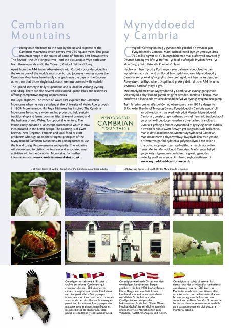
MYNYDDOEDD<br />
CAMBRIAN<br />
M O U N TA I N S<br />
Mynyddoedd<br />
y Cambria<br />
Cysgodir <strong>Ceredigion</strong> rhag y gwyntoedd gaeafol o’r dwyrain gan<br />
Fynyddoedd y Cambria. Mae’r ucheldiroedd hyn yn ymestyn dros<br />
760 milltir sgwâr ac o’u hunigeddau mae rhai o afonydd enwocaf y<br />
Deyrnas Unedig yn llifo: yr Hafren - yr hiraf o afonydd Prydain Fawr - yr<br />
afon Gwy, y Teifi, Ystwyth, Rheidol a’r Tywi.<br />
Heblaw am hen ffyrdd y Porthmyn - sy’n dal mewn bodolaeth o dan<br />
wyneb tarmac - dim ond un ffordd fawr sydd yn croesi Mynyddoedd y<br />
Cambria, sef yr A44 sy’n cysylltu dwy dref ag iddynt hen hanes dysg, sef,<br />
Aberystwyth â Rhydychen. Disgrifiodd yr AA y daith dros yr A44 fel un o<br />
siwrneiau harddaf y byd i gyd.<br />
Mae moelydd meithion Mynyddoedd y Cambria yn cynnig golygfeydd<br />
ysblennydd a chyfleoedd gwych ar gyfer cerdded, merlota a beicio. Mae<br />
cronfeydd a llynnoedd yr ucheldiroedd hefyd yn cynnig pysgota penigamp.<br />
Tra’n fyfyriwr ym Mhrifysgol Cymru Aberystwyth ym 1969 y darganfu<br />
Ei Uchelder Brenhinol Tywysog Cymru Fynyddoedd y Cambria gyntaf oll.<br />
Yn ddiweddar y mae wedi ysbrydoli Menter Mynyddoedd<br />
Cambrian, prosiect i gynorthwyo cynnal ffermydd traddodiadol<br />
yn yr ucheldiroedd, cymunedau a threftadaeth canolbarth<br />
Cymru. I gefnogi’r fenter, cyfrannodd y Tywysog dirlun dyfrlliw<br />
o’i waith ei hun o Gwm Berwyn ger Tregaron sydd bellach yn<br />
rhan o ddyluniad brandio Menter Mynyddoedd Cambrian.<br />
Mae amaethwyr a chynhyrchwyr bwydydd lleol sy’n ymuno<br />
â’r fenter yn gorfod cyfateb â gofynion llym o ran safon a<br />
tharddiad y cynnyrch gan gydweithio a marchnata o dan<br />
faner Menter Mynyddoedd Cambrian. Mae’r fenter hefyd<br />
yn ymestyn i gwmpasu twristiaeth a gweithgareddau<br />
gwledig eraill yn yr ardal. Am fwy o wybodaeth ewch i<br />
www.mynyddoeddcambrian.co.uk<br />
HRH The Prince of <strong>Wales</strong> - President of the Cambrian Mountains Initiative EUB Tywysog Cymru - Llywydd Menter Mynyddoedd y Cambria<br />
<strong>Ceredigion</strong> wird nach Osten von den<br />
weitläufigen kambrischen Bergen<br />
geschützt, die fast 1900 km 2 umfassen.<br />
Diese Berge sind ein distinktives<br />
Hochland von weiter, unverdorbener<br />
natürlicher Schönheit und das<br />
Quellgebiet von einigen der<br />
bekanntesten britischen Flüsse. Diese<br />
Hochlandschaft ist wirklich erstaunlich<br />
und bietet viele Möglichkeiten zum<br />
Wandern, Radfahren, Angeln und Reiten.<br />
<strong>Ceredigion</strong> se cobija al este en las<br />
tierras altas de las Montañas cambrianas,<br />
que abarcan más de 1900 km 2 . Las<br />
Montañas cambrianas son tierras altas<br />
caracterizadas por belleza natural y son<br />
la cuna de algunos de los ríos más<br />
conocidos de Gran Bretaña. El paisaje de<br />
las tierras altas es realmente formidable<br />
para pasear, montar en bici, pescar y<br />
montar a caballo.