

Engineering geology of British rocks and soils Mudstones of the ...
Engineering geology of British rocks and soils Mudstones of the ...
Engineering geology of British rocks and soils Mudstones of the ...

Create successful ePaper yourself
Turn your PDF publications into a flip-book with our unique Google optimized e-Paper software.
Reports Boreholes<br />
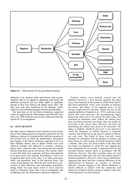
Figure 6.2 Table structure for <strong>the</strong> geotechnical database.<br />
arithmetic to be checked within <strong>and</strong> between data records,<br />
st<strong>and</strong>ard codes to be applied to appropriate data fields <strong>and</strong><br />
additional geological <strong>and</strong> key fields added (a significant<br />
amount <strong>of</strong> error was found in all digital source data). The<br />
data were only <strong>the</strong>n transferred to <strong>the</strong> database, which<br />
enforces a strict referential integrity between <strong>the</strong> data tables.<br />
The total data set for <strong>the</strong> Mercia Mudstone comprised<br />
values for approximately 6500 samples <strong>and</strong> 3600 SPT tests<br />
from over 1400 boreholes <strong>and</strong> test pits, abstracted from <strong>the</strong><br />
reports for 32 investigations.<br />
6.4 DATA QUALITY<br />
The data sources comprised recent contracts carried out by<br />
four <strong>of</strong> <strong>the</strong> leading ground investigation contractors for <strong>the</strong><br />
Highways Agency or its predecessors with <strong>the</strong> exception <strong>of</strong><br />
<strong>the</strong> Teesside area in which <strong>the</strong> identification, description<br />
<strong>and</strong> logging <strong>of</strong> <strong>the</strong> Mercia Mudstone appeared to be <strong>of</strong> a<br />
high st<strong>and</strong>ard. Source data in digital format were used<br />
wherever possible <strong>and</strong> subjected to extensive checking<br />
before entry, o<strong>the</strong>rwise data were abstracted <strong>and</strong> entered<br />
directly from hard-copy by one person. The extreme values<br />
in each data field were examined, <strong>and</strong> those that appeared<br />
to be gross errors were deleted. Never<strong>the</strong>less, it has to be<br />
recognised that much <strong>of</strong> <strong>the</strong> data, as in o<strong>the</strong>r geoscience<br />
fields, was potentially 'dirty' in <strong>the</strong> statistical sense. The<br />
values in <strong>the</strong> database are <strong>of</strong>ten <strong>the</strong> final result from a succession<br />
<strong>of</strong> field, laboratory <strong>and</strong> transcription procedures,<br />
during which one must expect errors to occur, however<br />
small or infrequent. Some data, such as stratigraphy <strong>and</strong><br />
wea<strong>the</strong>ring zone, are interpretative <strong>and</strong> hence subjective.<br />
30<br />
Geology<br />
Core<br />
Fracture<br />
Samples<br />
SPT<br />
In situ<br />
permeability<br />
Index<br />
Particle size<br />
Chemistry<br />
Triaxial<br />
Consolidation<br />
Compaction/<br />
CBR<br />
Rock<br />
Fracture indices were initially entered into <strong>the</strong><br />
database. However, it soon became apparent that <strong>the</strong>re<br />
was a wide disparity in <strong>the</strong> manner in which <strong>the</strong>se indices<br />
had been determined. Some were recorded as fractures<br />
per metre, <strong>and</strong> o<strong>the</strong>rs, in <strong>the</strong> opposite sense, as <strong>the</strong><br />
average length between fractures. Whilst <strong>the</strong> text <strong>of</strong> <strong>the</strong><br />
original definition (Franklin et al., 1971) could have been<br />
stated with more precision, <strong>the</strong> accompanying figure<br />
showed <strong>the</strong> index was to be used in <strong>the</strong> latter sense, <strong>and</strong><br />
expressed in millimetre units. Where <strong>the</strong> indices have<br />
been recorded as fractures per metre, <strong>the</strong>y can readily be<br />
converted to <strong>the</strong> correct form. However, <strong>the</strong> basis for<br />
determining <strong>the</strong> indices does need to be consistent. The<br />
index, as defined, should be given for a core interval in<br />
which <strong>the</strong> frequency <strong>of</strong> natural fractures is generally<br />
constant, <strong>and</strong> should not in any way be related to individual<br />
core runs. The limits <strong>of</strong> <strong>the</strong>se intervals would<br />
normally be coincident with <strong>the</strong> changes in stratum, <strong>and</strong><br />
where <strong>the</strong>re is a clear change <strong>of</strong> fracture frequency within<br />
a stratum. This issue was most evident in <strong>the</strong> data from<br />
one major investigation, in which <strong>the</strong> core logging had<br />
been undertaken by two people. It appeared that one had<br />
recorded fracture indices much in accordance with <strong>the</strong><br />
definition. However, <strong>the</strong> o<strong>the</strong>r recorded values for each<br />
metre interval within each core run (<strong>and</strong> without regard to<br />
stratum boundaries). The level <strong>of</strong> <strong>the</strong> values, fur<strong>the</strong>rmore,<br />
suggested that <strong>the</strong>re had been a distinct difference in <strong>the</strong><br />
identification <strong>of</strong> fractures, as ‘natural’ or ‘drillinginduced’.<br />
Fracture logging <strong>of</strong> <strong>the</strong> Mercia Mudstone is<br />
clearly difficult to achieve with <strong>the</strong> consistency <strong>and</strong><br />
objectivity needed to justify statistical analysis, <strong>and</strong> entry<br />
<strong>of</strong> this parameter was discontinued.


