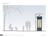
Potomac Waterfront Flood Mitigation Study - City of Alexandria
Potomac Waterfront Flood Mitigation Study - City of Alexandria
Potomac Waterfront Flood Mitigation Study - City of Alexandria

Create successful ePaper yourself
Turn your PDF publications into a flip-book with our unique Google optimized e-Paper software.
Technical Analyses Support<br />
climate change. The USACE provided a policy circular, titled Water Resource Policies and<br />
Authorities Incorporating Sea-Level Change Considerations in Civil Work Programs, dated July<br />
1, 2009, that specifically states: “…engineering designs should consider alternatives that are<br />
developed and assessed for the entire range <strong>of</strong> possible future rates <strong>of</strong> sea-level change.”<br />
The USACE policy discusses the methodology to derive the sea-level rise at a specific location,<br />
which is based on an updated and modified National Research Council report from 1986. The<br />
methodology involves calculating the sea level rise based on location, year project is built, and<br />
expected age <strong>of</strong> project.<br />
The <strong>City</strong> <strong>of</strong> <strong>Alexandria</strong> is a highly urban area, which limits opportunities to provide structural<br />
flood mitigation measures. The floodwall proposed in this study provides 3 feet <strong>of</strong> freeboard<br />
above the 100-year flood elevation to meet FEMA’s levee certification requirements. Three feet<br />
<strong>of</strong> freeboard will accommodate the anticipated sea level fluctuations. However, if the <strong>City</strong><br />
prefers to achieve and retain FEMA levee certification, additional freeboard should be<br />
considered. Consideration <strong>of</strong> sea level rise for the Jones Point berm can be accomplished in the<br />
same manner as the floodwall.<br />
Another large-scale flood control alternative proposed in this study is the elevated walkway. The<br />
elevated walkway height, at an elevation <strong>of</strong> 6.0 feet NGVD, was selected as the maximum<br />
practical height based on topographic information. The intent <strong>of</strong> the elevated walkway is to<br />
mitigate frequent flood events while preserving the look and feel <strong>of</strong> the waterfront; therefore,<br />
increasing the height <strong>of</strong> the elevated walkway to accommodate the sea level fluctuations will<br />
have a direct impact on the intent <strong>of</strong> the project. The proposed road height was also selected<br />
based on topographic constraints; therefore, consideration <strong>of</strong> sea level rise for this measure is not<br />
feasible.<br />
28-JUL-10\\ 4-10