PyQGIS Documentation - Linfiniti Geo Blog
PyQGIS Documentation - Linfiniti Geo Blog
PyQGIS Documentation - Linfiniti Geo Blog

Create successful ePaper yourself
Turn your PDF publications into a flip-book with our unique Google optimized e-Paper software.
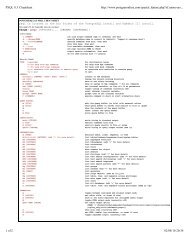
actionZoomIn.setCheckable(True)<br />
actionZoomOut.setCheckable(True)<br />
actionPan.setCheckable(True)<br />
self.connect(actionZoomIn, SIGNAL("triggered()"), self.zoomIn)<br />
self.connect(actionZoomOut, SIGNAL("triggered()"), self.zoomOut)<br />
self.connect(actionPan, SIGNAL("triggered()"), self.pan)<br />
self.toolbar = self.addToolBar("Canvas actions")<br />
self.toolbar.addAction(actionZoomIn)<br />
self.toolbar.addAction(actionZoomOut)<br />
self.toolbar.addAction(actionPan)<br />
# create the map tools<br />
self.toolPan = QgsMapToolPan(self.canvas)<br />
self.toolPan.setAction(actionPan)<br />
self.toolZoomIn = QgsMapToolZoom(self.canvas, False) # false = in<br />
self.toolZoomIn.setAction(actionZoomIn)<br />
self.toolZoomOut = QgsMapToolZoom(self.canvas, True) # true = out<br />
self.toolZoomOut.setAction(actionZoomOut)<br />
self.pan()<br />
def zoomIn(self):<br />
self.canvas.setMapTool(self.toolZoomIn)<br />
def zoomOut(self):<br />
self.canvas.setMapTool(self.toolZoomOut)<br />
def pan(self):<br />
self.canvas.setMapTool(self.toolPan)<br />
<strong>PyQGIS</strong> <strong>Documentation</strong>, Release 1.4<br />
You can put the above code to a file, e.g. mywnd.py and try it out in Python console within QGIS. This code will put<br />
the currently selected layer into newly created canvas:<br />
import mywnd<br />
w = mywnd.MyWnd(qgis.utils.iface.activeLayer())<br />
w.show()<br />
Just make sure that the mywnd.py file is located within Python search path (sys.path). If it isn’t, you can simply<br />
add it: sys.path.insert(0, ’/my/path’) — otherwise the import statement will fail, not finding the<br />
module.<br />
7.3 Rubber Bands and Vertex Markers<br />
To show some additional data on top of the map in canvas, use map canvas items. It is possible to create custom canvas<br />
item classes (covered below), however there are two useful canvas item classes for convenience: QgsRubberBand<br />
for drawing polylines or polygons, and QgsVertexMarker for drawing points. They both work with map coordinates,<br />
so the shape is moved/scaled automatically when the canvas is being panned or zoomed.<br />
To show a polyline:<br />
r = QgsRubberBand(canvas, False) # False = not a polygon<br />
points = [ QgsPoint(-1,-1), QgsPoint(0,1), QgsPoint(1,-1) ]<br />
r.setTo<strong>Geo</strong>metry(Qgs<strong>Geo</strong>metry.fromPolyline(points), None)<br />
7.3. Rubber Bands and Vertex Markers 27