- Page 1 and 2:
Proceedings Eighth International Sy
- Page 3 and 4:
1987 by the American Society for Ph
- Page 5 and 6:
A NOTE ON THE FUTURE OF AUTO-CARTO
- Page 7 and 8:
Algorithms for spatial search or qu
- Page 9 and 10:
Research into electronic maps and a
- Page 11 and 12:
Sandhu, Jatinder 403 Shea, K. Stuar
- Page 13 and 14:
integration of the findings on tech
- Page 15 and 16:
departments of municipalities are p
- Page 17 and 18:
systems, similar cost reduction in
- Page 19 and 20:
exist here: it is rarely possible t
- Page 21 and 22:
REFERENCES Chris man, N. and Nieman
- Page 23 and 24:
THE USER PROFILE FOR DIGITAL CARTOG
- Page 25 and 26:
second is to reduce all lines to a
- Page 27 and 28:
OVERLAY PROCESSING IN SPATIAL INFOR
- Page 29 and 30:
digital terrain models, or magnetic
- Page 31 and 32:
(2-dimensional) or volumes (3-dimen
- Page 33 and 34:
whereas the lattice induced by spat
- Page 35 and 36:
5.2 Overlay Operation One of the mo
- Page 37 and 38:
permit the determination of the len
- Page 39 and 40:
more about the quality of the avail
- Page 41 and 42:
of the user interface and would res
- Page 43 and 44:
FUNDAMENTAL PRINCIPLES OF GEOGRAPHI
- Page 45 and 46:
of continuous space (the model of A
- Page 47 and 48:
look like is transmitted through th
- Page 49 and 50:
(Sullivan and others, 1985). On the
- Page 51 and 52:
PRESCRIPTIONS To carry out the prin
- Page 53 and 54:
AN ADAPTIVE METHODOLOGY FOR AUTOMAT
- Page 55 and 56:
They reorganize available space and
- Page 57 and 58:
Global Filtering Basics: This filte
- Page 59 and 60:
If the geometry is determined throu
- Page 61 and 62:
SYSTEMATIC SELECTION OF VERY IMPORT
- Page 63 and 64:
Improvements The first improvement
- Page 65 and 66:
RESULTS ANALYSIS There are two test
- Page 67 and 68:
Figure 4. A TIN generated from VIP
- Page 69 and 70:
only or the most important one. Unt
- Page 71 and 72:
terrain surface, may have in corres
- Page 73 and 74:
Advantages of determining the Media
- Page 75 and 76:
egards points, only the endpoints o
- Page 77 and 78:
contours some measures of size and
- Page 79 and 80:
MEASURING THE DIMENSION OF SURFACES
- Page 81 and 82:
dimension of an entity, is constant
- Page 83 and 84:
terrain. In order to avoid a sampli
- Page 85 and 86:
APPLICATIONS TO DIGITAL ELEVATION M
- Page 87 and 88:
1.20 1.16 • D I M 1.12 E N S 1.06
- Page 89 and 90:
Stability of Map Topology and Robus
- Page 91 and 92:
The 0-cells in the usual topologica
- Page 93 and 94:
Notice in Figure 1 that the interme
- Page 95 and 96:
Algorithm for computing robustness
- Page 97 and 98:
We may sum the forces by a straight
- Page 99 and 100:
and computational algorithms, which
- Page 101 and 102:
The geopositioning model presented
- Page 103 and 104:
It should be noted that only the fr
- Page 105 and 106:
While Voronoi polygons have often b
- Page 107 and 108:
additional vector rotation about th
- Page 109 and 110:
inconsistency. The problem stems fr
- Page 111 and 112:
Chain Intersection Determining chai
- Page 113 and 114:
node(6,[h(l8),t(l9),t(24),h(21)]).
- Page 115 and 116:
Sliver Removal. We remove a sliver
- Page 117 and 118:
Little, J.J. and Peucker, T.K. 1979
- Page 119 and 120:
measured control points. In this pa
- Page 121 and 122:
TEST RESULTS For testing the above
- Page 123 and 124:
A SPATIAL DECISION SUPPORT SYSTEM F
- Page 125 and 126:
data by time period, by category, a
- Page 127 and 128:
BASIC version of the PLACE suite re
- Page 129 and 130:
procedural language. The classifier
- Page 131 and 132:
FIGURE 1: SOFTWARE COMPONENTS FOR S
- Page 133 and 134:
Realistic Flow Analysis Using a Sim
- Page 135 and 136:
Realistic Flow Analysis Using a Sim
- Page 137 and 138:
Realistic Flow Analysis Using a Sim
- Page 139 and 140:
Realistic Flow Analysis Using a Sim
- Page 141 and 142:
TIN FORMAT VS. MATRIX FORMAT The pr
- Page 143 and 144:
One of the major challenges involve
- Page 145 and 146:
Because TINFLOW is a PC-based GIS,
- Page 147 and 148:
Art; I DitH ot twin 1.1610 Strew He
- Page 149 and 150:
RATIONALE Gridded surface data sets
- Page 151 and 152:
5. For each polygon, for each cell
- Page 153 and 154:
A mapping function was used to topo
- Page 155 and 156:
CONCLUSIONS This depression-finding
- Page 157 and 158:
Methods For spatial analusis The tw
- Page 159 and 160:
1. Sampling to determine the sample
- Page 161 and 162:
A simcle multiscale model . Instead
- Page 163 and 164:
Complex multiscale models. The one-
- Page 165 and 166:
Mandelbrot, B.B., 198E. The Fractal
- Page 167 and 168:
A number of authors have proved the
- Page 169 and 170:
Once having the Fourier-transf arm
- Page 171 and 172:
From the above listed aspects (2) i
- Page 173 and 174:
A considerably large number of labo
- Page 175 and 176:
Oliver,M.A., R.Webster (1936) Semi-
- Page 177 and 178:
model can be used as the basis for
- Page 179 and 180:
ts phase space by analogy to phase
- Page 181 and 182:
Figure 3. Classified 64 by 64 raste
- Page 183 and 184:
in the delimitation of domains in p
- Page 185 and 186:
Mark, D.M. and Aronson, P.B. 1984,
- Page 187 and 188:
To make decisions about this world,
- Page 189 and 190:
Limitations inherent to the modeliz
- Page 191 and 192:
operations delimiting rights to the
- Page 193 and 194:
Uncertainty absorption is very diff
- Page 195 and 196:
Minsky, M. L. 1965, Matter, Minds,
- Page 197 and 198:
data, covering extremely large area
- Page 199 and 200:
Figure 1. a) Test data set with, tr
- Page 201 and 202:
Figure 2. Four pyramids - line segm
- Page 203 and 204:
convenient to consider grids to be
- Page 205 and 206:
REFERENCES Davis, J.C., 1973, Stati
- Page 207 and 208: the data element, in this case an a
- Page 209 and 210: EXPERIENCE WITH R-TREES IN A CIS LA
- Page 211 and 212: REFERENCES Guttman, A. 1984, R-Tree
- Page 213 and 214: World Shoreline Vectors Shoreline v
- Page 215 and 216: Table 4. Applications of gridded el
- Page 217 and 218: classes desired for a given applica
- Page 219 and 220: Table 6. The impact of block size o
- Page 221 and 222: Jones, Christopher B. and Abraham,
- Page 223 and 224: DISADVANTAGES OF A SINGLE COVERAGE
- Page 225 and 226: faster and less complex than genera
- Page 227 and 228: NOS detailed source data 20 meter r
- Page 229 and 230: si '- /W^ ?f ? ( " ( I?
- Page 231 and 232: REFERENCES Aronson P. and Morehouse
- Page 233 and 234: with the purpose of optimizing geom
- Page 235 and 236: purposes, the value 1/e may be thou
- Page 237 and 238: V describing points/ / y/ B / /•*
- Page 239 and 240: clarity, the number of describing p
- Page 241 and 242: ACKNOWLEDGMENTS The author wishes t
- Page 243 and 244: INTRODUCTION In any application of
- Page 245 and 246: 7T 0 — 7T X Hay River Figure 1: A
- Page 247 and 248: 0 — 7T Alluvial fan contour Figur
- Page 249 and 250: Peucker, 1973) can be used here; th
- Page 251 and 252: Mark, D. M., 1985, Fundamental spat
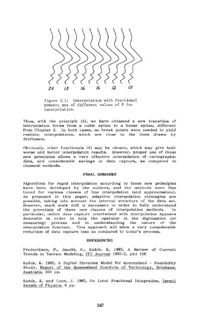
- Page 253 and 254: •©—e—©—e- Figure 1.1: Spl
- Page 255 and 256: SLAU- 9/1000 Figure 1.5: Results of
- Page 257: t-0 I.I 7.4 /.6 1.8 2.0 Figure 2.1:
- Page 261 and 262: Each 1-cell may be labeled with one
- Page 263 and 264: and latitude. Each 0-cell is the ow
- Page 265 and 266: as a minimum the combination of FIP
- Page 267 and 268: FIGURE 1. TIGER-I SYSTEM DATABASE S
- Page 269 and 270: TOPOLOGY IN THE TIGER FILE Gerard B
- Page 271 and 272: valid to use a topological file who
- Page 273 and 274: must result in a file that still is
- Page 275 and 276: MAINTENANCE OF GEOGRAPHIC STRUCTURE
- Page 277 and 278: features, emphasizing their areal c
- Page 279 and 280: standard list handling routines tha
- Page 281 and 282: ESTIMATING PRODUCTION PARAMETERS FO
- Page 283 and 284: hardware reliability and productivi
- Page 285 and 286: equest. Using this method, the cont
- Page 287 and 288: Angeles maps the smallest. The data
- Page 289 and 290: DESIRABLE CHARACTERISTICS OF A SPAT
- Page 291 and 292: (Waugh, 1986) have worked around th
- Page 293 and 294: TIGRIS: TOPOLOSICALLY INTEGRATED GE
- Page 295 and 296: DM takes care of creating and delet
- Page 297 and 298: START NODE , Figure 1: The Geometry
- Page 299 and 300: ALGORITHM DESIGN This section descr
- Page 301 and 302: •face 1). The crossing count func
- Page 303 and 304: AN INTEGRATED DBMS APPROACH TO GEOG
- Page 305 and 306: supplied by the data processing dep
- Page 307 and 308: its integrity constraints. We have
- Page 309 and 310:
performance problems. Normal intera
- Page 311 and 312:
yield cache hit ratios of between 3
- Page 313 and 314:
Developing a DBMS for Geographic In
- Page 315 and 316:
many:many relation must be implemen
- Page 317 and 318:
[4] definitions of feature classes,
- Page 319 and 320:
Design We will not deal in this pap
- Page 321 and 322:
implementation. This becomes essent
- Page 323 and 324:
will be no violations when re-creat
- Page 325 and 326:
length fields. Use of a fixed numbe
- Page 327 and 328:
GEOGRAPHIC INFORMATION PROCESSING I
- Page 329 and 330:
Entity types may be divided into su
- Page 331 and 332:
epresentations, naturally exhibit a
- Page 333 and 334:
• Any two elements either contain
- Page 335 and 336:
CURRENT WORK Work related to PROBE
- Page 337 and 338:
GEOGRAPHIC INFORMATION PROCESSING U
- Page 339 and 340:
of the geographic information. It g
- Page 341 and 342:
appear as entire entities, such as
- Page 343 and 344:
time. Instead, the OVERLAY operatio
- Page 345 and 346:
features. Facilities are provided f
- Page 347 and 348:
AN INFORMATION SYSTEM FOR GEOSCIENC
- Page 349 and 350:
• geometric (component) complexit
- Page 351 and 352:
y some parameters. The actual solid
- Page 353 and 354:
cubels are not stored. By basing it
- Page 355 and 356:
computed. The first volume computat
- Page 357 and 358:
ATTRIBUTE HANDLING FOR GEOGRAPHIC I
- Page 359 and 360:
for a hierarchical DBMS is of neces
- Page 361 and 362:
Soil Samples: S1,...,Sn Symbology:
- Page 363 and 364:
elements. This allows data to aggre
- Page 365 and 366:
In most government organizations in
- Page 367 and 368:
A GEOGRAPHICAL DATABASE SYSTEM Will
- Page 369 and 370:
topology of the data should be main
- Page 371 and 372:
the poset. Figure 2 gives an exampl
- Page 373 and 374:
egions correctly during cartographi
- Page 375 and 376:
The dbmap compiler generates "P-cod
- Page 377 and 378:
to mention the forthcoming CD/I sys
- Page 379 and 380:
case win.p=17 ! Lasso segments into
- Page 381 and 382:
DESIGN AND IMPLEMENTATION OF MICROC
- Page 383 and 384:
in water management decision-making
- Page 385 and 386:
Many-to-many sets. The extended net
- Page 387 and 388:
logical structuring facilities of t
- Page 389 and 390:
THEMATIC ATTRIBUTE-BEARING ENTITITE
- Page 391 and 392:
TRENDS IN HARDWARE FOR GEOGRAPHIC I
- Page 393 and 394:
provide some of the networking and
- Page 395 and 396:
won't do some of the really effecti
- Page 397 and 398:
THE MIBQU1DED EVOLUTION OF FUTURE M
- Page 399 and 400:
eventually evolved into an art form
- Page 401 and 402:
foundation from which the cartograp
- Page 403 and 404:
REFERENCES Brassel Kurti 1977. A Su
- Page 405 and 406:
OTHER INFORMATION EXTERNAL STORAGE
- Page 407 and 408:
HUMAN INTERFACE REQUIREMENTS FOR VE
- Page 409 and 410:
The output from the VNA must meet s
- Page 411 and 412:
(turn left or right) and an indicat
- Page 413 and 414:
Kuipers, B., 1978, Modeling spatial
- Page 415 and 416:
code was little changed from the ol
- Page 417 and 418:
used. The command had to be rewritt
- Page 419 and 420:
Epson compatible dot matrix printer
- Page 421 and 422:
Metagraphics Software Corporation,
- Page 423 and 424:
DEVELOPMENT STRATEGY The basic phil
- Page 425 and 426:
subsequently converts them into eit
- Page 427 and 428:
Figure 5. Single value vector plot
- Page 429 and 430:
The combination of a complete range
- Page 431 and 432:
FUTURE DEVELOPMENTS Any GIS is an e
- Page 433 and 434:
environment for the creation and de
- Page 435 and 436:
The experience with Turbo PASCAL ha
- Page 437 and 438:
mentioned, no work has been specifi
- Page 439 and 440:
Olsson, L., 1985, An Integrated Stu
- Page 441 and 442:
E. Analytical Modules OVERLAY Under
- Page 443 and 444:
commands going the the 384. In some
- Page 445 and 446:
any other, i.e., a light yellow-gre
- Page 447 and 448:
from just these three variables. Ad
- Page 449 and 450:
System Concept The goal of the proj
- Page 451 and 452:
Specific Programming Requirements A
- Page 453 and 454:
well as making interim use of data
- Page 455 and 456:
chosen for DigiTAS is registered to
- Page 457 and 458:
The administrative rule specifies t
- Page 459 and 460:
1985,1986). A "Zipping" process was
- Page 461 and 462:
Effects of Conservation Tillage A -
- Page 463 and 464:
In summary, system advocates, imple
- Page 465 and 466:
Niemann, BJ. and J. Portner. 1984.
- Page 467 and 468:
THE DISPLAY OF BOUNDARY INFORMATION
- Page 469 and 470:
The purpose of this paper is to exp
- Page 471 and 472:
While this approach certainly is ec
- Page 473 and 474:
MAPI: Overplotted Symbols, Explicit
- Page 475 and 476:
Map #1 is clearly the least preferr
- Page 477 and 478:
AUTOMATED MAP INSET DETERMINATION F
- Page 479 and 480:
Algorithms Selected for Considerati
- Page 481 and 482:
placed their inset boundaries so th
- Page 483 and 484:
and injured another 3536 people. Ne
- Page 485 and 486:
+»+ ooooooooooooooctcooooooooooooo
- Page 487 and 488:
«»+ 000000009000000tCOOO00000000C
- Page 489 and 490:
*++ 00000000OOOOOOCCO'n 00000000000
- Page 491 and 492:
(2) Design public education program
- Page 493 and 494:
ecords, census information, and lan
- Page 495 and 496:
o Parcel Centroid X Control Point L
- Page 497 and 498:
consequent residuals on the control
- Page 499 and 500:
cumscribing circle passing through
- Page 501 and 502:
Summary and Conclusions Figure 5 il
- Page 503 and 504:
FIGHTING BUDWORM WITH A GIS Glen Jo
- Page 505 and 506:
The process of targeting specific f
- Page 507 and 508:
BLOCK PROPOSAL I BLOCK PROPOSAL Fig
- Page 509 and 510:
BLOCKPROPOSALS TOTAL SUSCEPTIBLE AI
- Page 511 and 512:
AUTOMATION OF FLOOD HAZARD MAPPING
- Page 513 and 514:
AUTOMATED TOPOGRAPHIC DATA COLLECTI
- Page 515 and 516:
After reviewing existing standards,
- Page 517 and 518:
Figure 5 EXAMPLE OF PUBLISHED FBFM
- Page 519 and 520:
panel. Acceptance and use of such a
- Page 521 and 522:
EXPERT SYSTEMS APPLIED TO PROBLEMS
- Page 523 and 524:
Us_e_r_ Interface s One of most imp
- Page 525 and 526:
classification of landcover and lan
- Page 527 and 528:
drawn from the knowledgebase . Ther
- Page 529 and 530:
Chandra, N. and Goran , W. 1986, "S
- Page 531 and 532:
THE EXPERT GEOGRAPHIC KNOWLEDGE SYS
- Page 533 and 534:
produces conclusions or other resul
- Page 535 and 536:
geographic knowledge engineer under
- Page 537 and 538:
original inquiry. The Domain Cyclop
- Page 539 and 540:
outine automated geographic queries
- Page 541 and 542:
Are Cartographic Expert Systems Pos
- Page 543 and 544:
A feature of expert systems which h
- Page 545 and 546:
REFERENCES Bertin J, 1984 Semiology
- Page 547 and 548:
systems offer, such as speed and co
- Page 549 and 550:
maps, soil types, transportation, h
- Page 551 and 552:
management action, timber productio
- Page 553 and 554:
AUTOMOBILE NAVIGATION IN THE PAST,
- Page 555 and 556:
Chadwick Road Guide TheChadwickRoad
- Page 557 and 558:
to a destination whose coordinates
- Page 559 and 560:
Although GPS has great potential ac
- Page 561 and 562:
Figure 2. Navigation, Maps and Mobi
- Page 563 and 564:
Digital Map Requirements of Vehicle
- Page 565 and 566:
store the map as a topological data
- Page 567 and 568:
Generalization and Abstraction To p
- Page 569 and 570:
•Capacity Digital maps require a
- Page 571 and 572:
Whatever the case, an alternative t
- Page 573 and 574:
ON GIVING AND RECEIVING DIRECTIONS:
- Page 575 and 576:
all coordinate system. Sketch maps
- Page 577 and 578:
All 20 sets of directions analyzed
- Page 579 and 580:
BCD E Figure 1: Traffic-light symbo
- Page 581 and 582:
were also accompanied by verbal dir
- Page 583 and 584:
RESEARCH INTO ELECTRONIC MAPS AND A
- Page 585 and 586:
civic, private and military. To app
- Page 587 and 588:
HARDWARE POSITIONING SYSTEMS INPUT
- Page 589 and 590:
SOFTWARE MM STOBACI CZKTBAl »ATABA
- Page 591 and 592:
en 00 o Figure 3. AVL 2000 Systems
- Page 593 and 594:
. beginning and end nodes o . nodes
- Page 595 and 596:
A RELATIONAL DATABASE MODEL FOR AN
- Page 597 and 598:
INPUT MAP DB HARDWARE CONTROL PROGR
- Page 599 and 600:
network, and relational models [Eve
- Page 601 and 602:
algorithms vary according to the ty
- Page 603 and 604:
expert system specialized in optima
- Page 605 and 606:
The Map-Environment Interface: Surr
- Page 607 and 608:
INTRODUCTION In 1086, a comprehensi
- Page 609 and 610:
THE DATA BASE Four main contractors
- Page 611 and 612:
egions, Local Education Authority a
- Page 613 and 614:
combining data derived from, say, m
- Page 615 and 616:
ACQUIRING APPROXIMATE REPRESENTATIO
- Page 617 and 618:
and yields test scores which repres
- Page 619 and 620:
if the answer to x[k] is YES then
- Page 621 and 622:
d(x ) = y (x ) - y (x ) . (12) i C
- Page 623 and 624:
committee" while (18) can be used t
- Page 625 and 626:
size of the database may not influe
- Page 627 and 628:
1. Poquonock_bridge (No) V 2. Niant
- Page 629 and 630:
Table 6. Membership Values Resultin
- Page 631 and 632:
simple term matching to represent '
- Page 633 and 634:
Robinson, V.B. 198-4, "Modeling Ine
- Page 635 and 636:
to have a mechanism to output the f
- Page 637 and 638:
RECORD 1 -— coordinates RECORD 2
- Page 639 and 640:
determine whether the code matches
- Page 641 and 642:
A GENERAL APPROACH TO MAP CONFLATIO
- Page 643 and 644:
Figure 1 Each link can be thought o
- Page 645 and 646:
Figure 3c Original coverage alignme
- Page 647 and 648:
n Identity Link: Figure 4 Surroundi
- Page 649 and 650:
Figure 6a Matching features after i
- Page 651 and 652:
RASTER AND VECTOR PROCESSING FOR SC
- Page 653 and 654:
w 128 2 8 32 ^M^...-^..:.!^,-. 4 ,
- Page 655 and 656:
Digitally, encoding can be performe
- Page 657 and 658:
Figure 3a - DEM displayed as shaded
- Page 659 and 660:
have been performed. Figure 4d show
- Page 661 and 662:
RECURSIVE APPROXIMATION OF TOPOGRAP
- Page 663 and 664:
subquadrant is subdivided if it con
- Page 665 and 666:
value's position in the matrix, pro
- Page 667 and 668:
We noted above that Chen and Tobler
- Page 669 and 670:
Photo-Mapper (GPM-II) collects what
- Page 671 and 672:
CARTOGRAPHIC DATA ENTRY THROUGH AUT
- Page 673 and 674:
Future developments of advanced mas
- Page 675 and 676:
Figure 3. The AP process is repeate
- Page 677 and 678:
monitored is not following the inte
- Page 679 and 680:
System Improvements FUTURE AFT DEVE
- Page 681 and 682:
THE INWARD SPIRAL METHOD: An Improv
- Page 683 and 684:
METHODS OF TIN GENERATION There are
- Page 685 and 686:
The data are now ready for triangul
- Page 687 and 688:
An array (POINTS) contains the x, y
- Page 689 and 690:
not be seen from that viewpoint, an
- Page 691 and 692:
SCALE-BASED SIMULATION OF TOPOGRAPH
- Page 693 and 694:
Measurements describing this fracta
- Page 695 and 696:
This implies that the inverse trans
- Page 697 and 698:
[xv] The values of A, B, C, and D i
- Page 699 and 700:
REFERENCES Bassett, K. A. (1972) "N
- Page 701 and 702:
taken. In a subsequent process one
- Page 703 and 704:
The approach taken for constructing
- Page 705 and 706:
array that will contain the boxes o
- Page 707 and 708:
Step 5 {establish cluster limits} b
- Page 709 and 710:
NUMBER OF BOXES GENERATED For pract
- Page 711 and 712:
the completed boxes may not be prac
- Page 713 and 714:
THE OVERPLOT RESOLUTION ALGORITHM S
- Page 715 and 716:
Practical Integer Programming Algor
- Page 717 and 718:
Second, this type of algorithm has
- Page 719 and 720:
Hirsch, S.A. 1982. An Algorithm for
- Page 721 and 722:
stage is being carried out by scien
- Page 723 and 724:
ALGORITHM DEVELOPMENT OF EVALUATIVE
- Page 725 and 726:
Figure 2 Randomly generated points
- Page 727 and 728:
solution is not appropriate (see fi
- Page 729 and 730:
Monmonier, M.S. 1984. Geographic in
- Page 731 and 732:
to the problem of calculating bisec
- Page 733 and 734:
Figure 3. A Skeleton Vertex and Its
- Page 735 and 736:
Brassel and Reifs circle test for f
- Page 737 and 738:
management tool with a periodical d
- Page 739 and 740:
) an iterative algorithm forces the
- Page 741 and 742:
the shapes have to be known in orde
- Page 743 and 744:
When at a node, the algorithm will
- Page 745 and 746:
"'* ..* «......«......« :m r±t:
- Page 747 and 748:
Once this island is detected it is
- Page 749 and 750:
REFERENCES Corbett, James P., 1979,
- Page 751 and 752:
Our experiences have refined our th
- Page 753 and 754:
intelligently by a spatially sorted
- Page 755 and 756:
SOFTCOPY METHODS OF CARTOGRAPHIC DA
- Page 757 and 758:
the hardware and software component
- Page 759 and 760:
EXPERIMENT #3: THE EFFECT OF RESOLU
- Page 761 and 762:
image contained only one patch. Alt
- Page 763 and 764:
a) ZOOMED (56.9%) b) ZOOMED (39.1%)
- Page 765 and 766:
Integrating Multiple Data Represent
- Page 767 and 768:
egular decompositions such as quadt
- Page 769 and 770:
CONCEPTl tidal basin CONCFPT2 distr
- Page 771 and 772:
Attributes of all three classes are
- Page 773 and 774:
lines or polygons with small number
- Page 777:
0-937294-88-8^