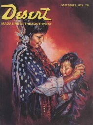
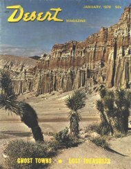
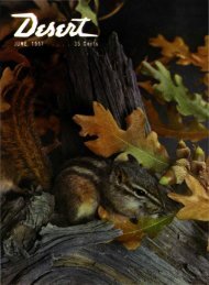
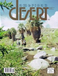
the magazine y - Desert Magazine of the Southwest
the magazine y - Desert Magazine of the Southwest
the magazine y - Desert Magazine of the Southwest

You also want an ePaper? Increase the reach of your titles
YUMPU automatically turns print PDFs into web optimized ePapers that Google loves.
Arrow indicates <strong>the</strong> mouth <strong>of</strong> narrow Padre creek tributary where Fa<strong>the</strong>r Escalaiite and his party cut steps in <strong>the</strong> canyon<br />
walls to make <strong>the</strong> first recorded crossing oj <strong>the</strong> Colorado river in nor<strong>the</strong>rn Arizona November 7, 1776. The padre and his<br />
companions crossed diagonally downstream to <strong>the</strong> willow-grown bar shown in <strong>the</strong> center <strong>of</strong> <strong>the</strong> photograph.<br />
EL Vado de los Padres<br />
(THE CROSSING OF THE FATHERS)<br />
After years <strong>of</strong> controversy it remained for a little party <strong>of</strong> explorers headed<br />
by Dr. Russell G. Frazie r to discover and establish beyond any doubt <strong>the</strong> exact<br />
spot at which Fa<strong>the</strong>r Escalante and his trail-finding expedition made <strong>the</strong>ir historic<br />
crossing <strong>of</strong> <strong>the</strong> Colorado river in 1776. Dr. Frazier wrote this story for <strong>the</strong><br />
<strong>Desert</strong> <strong>Magazine</strong> just bsfore his departure with <strong>the</strong> Byrd expedition to <strong>the</strong> Antarctic<br />
several months c:go.<br />
"In order that we might get <strong>the</strong><br />
horses down <strong>the</strong> side canyon I have<br />
mentioned, we found it necessary to<br />
cut steps with our hatchet in <strong>the</strong> rock<br />
<strong>of</strong> <strong>the</strong> mountain for a distance <strong>of</strong><br />
about three yards or a little less.''<br />
~~f HIS entry was made in his journ-<br />
I al November 7, 1776, by Fa<strong>the</strong>r<br />
Silvestre Velez de Escalante, who,<br />
with Fa<strong>the</strong>r Francisco Atanasio E>ominguez,<br />
led <strong>the</strong> first known party <strong>of</strong> white<br />
me;n to enter what is now <strong>the</strong> state <strong>of</strong><br />
Utah.<br />
This group, numbering 10 Spaniards<br />
and several Indians and halfbreeds, left<br />
Sar.ta Fe, New Mexico, to explore a route<br />
to Monterey in California.<br />
Entering <strong>the</strong> state near Jensen, Utah,<br />
<strong>the</strong>y traveled west through <strong>the</strong> Uintah<br />
basin, crossed <strong>the</strong> Wasatch mountains,<br />
visited <strong>the</strong> "Laguna" Indians at Utah<br />
lake, traveled south along <strong>the</strong> mountains<br />
to what is now called <strong>the</strong> Escalante des-<br />
J U L Y , 19 4 0<br />
By DR. RUSSELL G. FRAZIER<br />
ert, and <strong>the</strong>n were forced by lateness <strong>of</strong><br />
<strong>the</strong> season to turn back toward Santa Fe<br />
without accomplishing <strong>the</strong>ir original<br />
mission. Eventually <strong>the</strong>y reached Lee's<br />
fei ry on <strong>the</strong> Colorado river but could not<br />
cross because <strong>of</strong> <strong>the</strong> depth and velocity<br />
<strong>of</strong> <strong>the</strong> great river. Traveling nor<strong>the</strong>ast<br />
over <strong>the</strong> high and broken plateau near<br />
thi; river <strong>the</strong>y finally discovered a place<br />
which appeared to be a practicable ford,<br />
and after cutting steps in <strong>the</strong> steep wall<br />
<strong>of</strong> a side canyon to get <strong>the</strong>ir horses down,<br />
succeeded in making <strong>the</strong> first recorded<br />
crossing <strong>of</strong> <strong>the</strong> Colorado river.<br />
The exact location <strong>of</strong> that first crossing,<br />
known as El Vado de los Padres, has<br />
be:n in dispute for a number <strong>of</strong> years. It<br />
seems to have been known and used by<br />
ea 'ly Mormon missionaries on <strong>the</strong>ir visits<br />
to <strong>the</strong> Hopi villages and <strong>the</strong> Navajo<br />
cojntry, but through error has been<br />
wiongly indicated on all modern maps.<br />
This error was first brought to my attention<br />
by Frederick S. Dellenbaugh, a<br />
member <strong>of</strong> <strong>the</strong> second Powell expedition<br />
<strong>of</strong> 1871, whose interest in <strong>the</strong> history <strong>of</strong><br />
<strong>the</strong> river continued to <strong>the</strong> end <strong>of</strong> his life.<br />
Charles Kelly, who had photographed<br />
<strong>the</strong> supposed crossing in 1932, while on<br />
a river voyage, was also <strong>of</strong> <strong>the</strong> opinion<br />
that it was incorrectly designated and did<br />
not correspond with Escalante's description.<br />
After examining <strong>the</strong> supposed crossing<br />
at Cane creek while on my river voyage<br />
<strong>of</strong> 1933, and after much discussion <strong>of</strong><br />
<strong>the</strong> problem with Dellenbaugh, Kelly<br />
and o<strong>the</strong>rs, I determined to locate <strong>the</strong><br />
actual crossing, if possible, and place a<br />
suitable marker for <strong>the</strong> guidance <strong>of</strong> future<br />
travelers. After reading Escalante's<br />
entry it seemed possible that if he cut<br />
steps in <strong>the</strong> rock, <strong>the</strong>y might still be visible,<br />
and if so, <strong>the</strong> steps <strong>the</strong>mselves would<br />
definitely locate <strong>the</strong> actual Crossing <strong>of</strong><br />
<strong>the</strong> Fa<strong>the</strong>rs.<br />
Four years passed before anything fur<strong>the</strong>r<br />
was done in this direction. Then in