Download (1660Kb) - OAR@ICRISAT
Download (1660Kb) - OAR@ICRISAT
Download (1660Kb) - OAR@ICRISAT

Create successful ePaper yourself
Turn your PDF publications into a flip-book with our unique Google optimized e-Paper software.
The project implementation started in the year 1996-97 and works were implemented in 92<br />
watersheds as per approval. The project execution over run due to delay executing works<br />
and non-compliance of guidelines in the stipulated period of four years and was extended<br />
up to 2002-2003 which was completed in seven years.<br />
Agricultural Situation in Mahabubnagar<br />
Soils and Land use pattern<br />
In Mahabubnagar, sandy loams and red sandy loam soils are the major soil types and salt<br />
affected black soils are also present. In the total geographical area of Mahabubnagar 67% are<br />
red sandy loams, 20% black soil area and remaining 13% are dubba and mixed soils.<br />
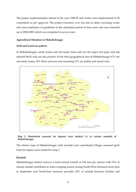
Map 1. Watersheds assessed for impacts were marked (•) in various mandals of<br />
Mahabubnagar.<br />
The district map of Mahabubnagar with mandals and watersheds/villages assessed (pink<br />
font) for impact were marked in map 1.<br />
Rainfall<br />
Mahabubnagar district receives a total normal rainfall of 754 mm per annum with 74% of<br />
annual rainfall contributes to main cropping season during South-West Monsoon from June<br />
to September and North-East monsoon provides 20% of rainfall between October and<br />
8