Download (1660Kb) - OAR@ICRISAT
Download (1660Kb) - OAR@ICRISAT
Download (1660Kb) - OAR@ICRISAT

You also want an ePaper? Increase the reach of your titles
YUMPU automatically turns print PDFs into web optimized ePapers that Google loves.
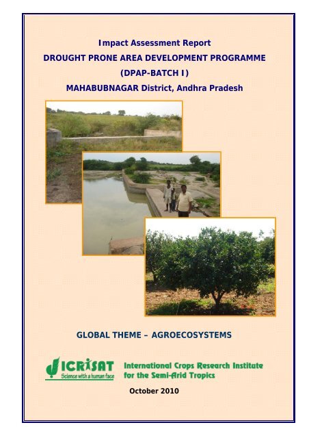
Impact Assessment Report<br />
DROUGHT PRONE AREA DEVELOPMENT PROGRAMME<br />
(DPAP-BATCH I)<br />
MAHABUBNAGAR District, Andhra Pradesh<br />
GLOBAL THEME – AGROECOSYSTEMS<br />
October 2010
Impact Assessment Report<br />
DROUGHT PRONE AREA DEVELOPMENT PROGRAMME<br />
(DPAP-BATCH I)<br />
MAHABUBNAGAR District, Andhra Pradesh<br />
GLOBAL THEME – AGROECOSYSTEMS<br />
October 2010
Contents<br />
S.No. PARTICULARS PAGES<br />
1. Contents 1<br />
Acknowledgements 2<br />
Abbreviations 3<br />
2. Executive summary of impact assessment 4<br />
3. Background 6<br />
4. Method of impact assessment 9<br />
Multi-Disciplinary Impact assessment team 9<br />
Discussions with DWMA officials 10<br />
Focused Group Discussions 11<br />
Field visits 12<br />
Period of evaluation 12<br />
5. Watershed-wise impact assessment reports 12<br />
i Alwal 13<br />
ii Ausalikunta 17<br />
iii Balabadrayapally 20<br />
iv Banala 24<br />
v Bollaram 27<br />
vi Boyapally 31<br />
vii Chinnarevalley 34<br />
viii Eklaspur 38<br />
ix Elkicherla 42<br />
x Ettam 46<br />
xi Fareedpur 49<br />
xii Gattunellikuduru 52<br />
xiii Gokfasalwad 55<br />
xiv Gudlanerva 58<br />
xv Guvvaladinne 61<br />
xvi Inole 64<br />
xvii Parpalley 67<br />
xviii Peddajathram 70<br />
xix Somasila 73<br />
xx Vemula 77<br />
6. Analysis of Impacts 82-88<br />
1
ACKNOWLEDGEMENTS<br />
We express our gratitude to the Department of Land Resources (DoLR), Ministry of Rural<br />
Development (MoRD), Government of India, New Delhi; for assigning the study of impact<br />
assessment of DPAP Batch-I watersheds in Mahabubnagar district.<br />
We gratefully acknowledge the Commissioner, Department of Rural Development,<br />
Government of Andhra Pradesh for providing co-ordination with Project Director, District<br />
Water Management Agency (DWMA), Mahabubnagar; to guide us in selecting watersheds<br />
well distributed across the district to capture complete representation of variability of<br />
watersheds development for the impact assessment study of DPAP Batch I watersheds in<br />
Mahabubnagar.<br />
We are thankful for the support and guidance of Project Director, DWMA for providing all<br />
support from their project staff for their active participation. We record our profound thanks<br />
to Mr. Samuel, Assistant Project Director for his help arranging our tour schedules, contact<br />
persons at different watershed every day during our field visits and to organize village<br />
meetings in all watersheds, which was most crucial in our efforts.<br />
Our team acknowledges the useful information shared by Chairmen, Secretaries and DPAP<br />
project beneficiaries during focused group discussions (FGD) and field visits.<br />
We profusely thank Dr. William D. Dar, Director General of ICRISAT for his approval to<br />
undertake this study and encouragement for a good analysis of the study.<br />
S P Wani<br />
Principal Scientist (Watersheds)<br />
Regional Theme Coordinator (Asia)<br />
Global Theme – Agroecosystems<br />
ICRISAT, Patancheru 502 324<br />
A. P<br />
2
ABBREVIATIONS<br />
APD Assistant Project Director<br />
CCT Continuous Contour Trenches<br />
DRDA District Rural Development Agency<br />
DPAP Drought Prone Area Programme<br />
DWMA District Water Management Agency<br />
FGD Focused Group Discussions<br />
GCS Gully Control Structures<br />
IWD Integrated Watershed Development<br />
LBS Loose Boulder Structures<br />
MDT Mandal Development Team<br />
NGO Non-governmental Organization<br />
NRM Natural Resources Management<br />
PD Project Director<br />
PIA Project Implementing Agency<br />
PRA Participatory Rural Appraisal<br />
PT Percolation Tank<br />
RFDs Rock Filled Dams<br />
SF Social Forestry<br />
SHGs Self-Help Groups<br />
SMC Soil Moisture Conservation<br />
SWCS Soil Water Conservation Structures<br />
UGs User Groups<br />
VSS Vana Samrakshana Samithi<br />
WA Watershed Association<br />
WS Watershed<br />
WDC Watershed Development Committee<br />
WDF Watershed Development Fund<br />
WDT Watershed Development Team<br />
3
EXECUTIVE SUMMARY OF IMPACT ASSESSMENT<br />
In Mahabubnagar district, DPAP – batch 1 received funding for development of 92<br />
watersheds in 48 mandals and the project was implemented from 1995-2003 to treat 46000 ha<br />
with watershed development.<br />
1. One of the main objectives of DPAP was to ensure and enhance people’s participation in<br />
this programme. In the inception stage, ten of the selected twenty watershed villages for<br />
impact assessment took up Entry Point Activity (EPA) that ensured community<br />
participation and awareness about the watershed project. In watershed villages where<br />
EPA was undertaken, villagers were satisfied and appreciative of the usefulness of the<br />
works.<br />
2. Although there was ample scope and opportunities to address the issues of women by<br />
forming self-help groups (SHGs) involving weaker sections of the society, this aspect<br />
was not actively persuaded as was evidenced by poor growth of total 78 SHGs and a<br />
very few are functional at present in the selected 20 watershed communities.<br />
3. User groups (UGs) were formed in four watersheds out of the twenty watersheds. Soil<br />
and water conservation works were undertaken by the WCs without much participation<br />
of people.<br />
4. In 14 watersheds out of 20 watersheds assessed, masonry structures constructed were<br />
generally of good quality and suitably located. However, in these watersheds, for lack of<br />
maintenance of the structures for a longer period, some structures were damaged, need<br />
immediate attention to repair these structures and remove siltation to improve efficiency<br />
of SWC structures.<br />
5. Farmers in fourteen watersheds located in different mandals reported an increase in<br />
ground water levels ranging from 2 to 3 feet generally and in some watersheds water<br />
level raise was up to 10 feet and increased availability of water for irrigation up to<br />
March-April months. In nine watersheds, the number of successful bore wells increased<br />
to more than 200 in each watershed, as an indication of water availability.<br />
6. Period of water availability for irrigation extend from November-December months<br />
before the watershed development, to end of March-April after the watershed<br />
development. This situation favored for double cropping with one or two supplemental<br />
irrigations for second crops between January to March every year.<br />
7. In most of the villages there was a clear agreement on availability of drinking water in<br />
plenty round the year after watershed development project implementation in their area.<br />
8. In some watersheds (Alwal, Boypally and Ettam), water storage in percolation tanks<br />
providing drinking water for cattle population even during summer months.<br />
9. Crop intensity increased between 160%-200% as the number of bore well those support<br />
second crop were more than 200 per village. Due to availability of water for longer<br />
period in the season up to end of March-April, crops like groundnut, sunflower and<br />
maize as second crop after paddy was introduced.<br />
4
10. Our enquiries revealed that there was considerable interest generated among farmers for<br />
mango and sweet oranges cultivation on seeing the success of watershed farmers<br />
planted mango and sweet orange through DPAP–I.<br />
11. Farmers had harvested mango with a net income ranging from Rs.10,000 to Rs.20,000 per<br />
acre based on growth and age of mango orchards developed through DPAP-1. Sweet<br />
orange was another prominent fruit crop spread through this project and farmers in<br />
various DPAP-1 watersheds indicated that their net income from sweet orange orchards<br />
varies from Rs.25, 000 to 50,000 per acre based on the age and growth of the orchard.<br />
12. Development of common property resources (CPRs) was done in five watersheds of the<br />
twenty selected watersheds in the project for the impact assessment study. CPRs were<br />
developed similar to the entire watershed with construction of check dams, percolation<br />
tanks and formation of field bunding as CPRs land had already been under cultivation<br />
by SC/ST farmers with usufruct rights in several watersheds.<br />
13. In the selected twenty watershed villages for impact assessment, the migration for<br />
employment did not change in seven (35%) villages, in another eight (40%) of the<br />
watershed villages, migration reduced to 5%-10% from as high as 30%-50% in some<br />
villages, not only due to watershed development and crop productivity increase, but<br />
also because of National Rural Employment Guarantee Scheme (NREGS) of the central<br />
government.<br />
14. Our analysis of focused group discussions with village communities indicate that only in<br />
25% (5) of the watershed villages farmers expressed affirmatively for withstanding<br />
drought effects for one or two years and vulnerable for mainly fodder scarcity as there is<br />
no fodder security for large number of goat, sheep and cattle population.<br />
15. Farmers and WC members in almost all watersheds mentioned that if the WDF was<br />
made available for repair and maintenance of watershed structures or for construction of<br />
much needed new structures, the impact would have been felt very much by the<br />
beneficiaries in the watershed.<br />
5
BACKGROUND<br />
Department of wasteland development under the Ministry of Rural areas and Employment,<br />
Government of India, sanctioned the Integrated Wasteland Development Project (DPAP) -<br />
Phase I for Mahabubnagar district of Andhra Pradesh. The project encompassed treatment<br />
of 46000 ha of cultivable land in 92 watersheds in 46 mandals of Mahabubnagar district. The<br />
objectives of this project were: (1) To integrate land and water conservation and<br />
management into the village micro-watershed plans; and (2) To enhance people’s<br />
participation in the integrated watershed development program at all stages. This project<br />
was sanctioned for implementation with a project budget outlay of Rs. 1840 lakhs (Table 1)<br />
and to accomplish over a period of seven years from 1995-96 to 2002-03.<br />
Table 1. Development activity component-wise approved allocations and expenditure in<br />
the project.<br />
Components of<br />
developmental activities<br />
District Rural Development Agency (DRDA) Mahabubnagar, now designated as District<br />
Water Management Agency (DWMA) was assigned the responsibility of providing<br />
infrastructure for implementation, management of the project through project implementing<br />
agency and financial supervision of the project and received an amount of Rs.1840 lakhs<br />
grant at 50% contribution each from GOI and government of AP. DRDA-Mahabubnagar<br />
selected government and non-governmental agencies for project implementation during<br />
1995-96 to 2000-2001. The details of 92 selected watersheds in respective mandals for<br />
treatment is given in Table 2.<br />
Details of project funding (Rs. in lakhs)<br />
Total allocation Total expenditure Deviation<br />
Community organizations 73.60 27.25 46.35<br />
Training 110.4 42.32 68.08<br />
Works 1479.21 1392.68 86.53<br />
Administrative costs 184 326.65 -142.65<br />
6
Table 2. Details of 92 watersheds covered by DPAP-I project for treatment in various<br />
mandals of Mahabubnagar.<br />
S No. Mandal No. of S No. Mandal No. of<br />
watersheds<br />
watersheds<br />
1 Addakal 2 25 Telkapally 2<br />
2 Balanagar 2 26 Thimmajipeta 2<br />
3 Boothpur 2 27 Keshampet 2<br />
4 Farooqnagar 2 28 Midjil 2<br />
5 Hanwada 2 29 Achampeta 2<br />
6 Jadcherla 2 30 Amrabad 1<br />
7 Koilkonda 2 31 Balmoor 2<br />
8 Kondurg 2 32 Kodair 2<br />
9 Kothur 2 33 Kollapur 2<br />
10 Mahabubnagar 2 34 Lingal 2<br />
11 Nawabpeta 2 35 Uppunuthala 2<br />
12 Devarakadra 2 36 Weepangandla 1<br />
13 Dhanwad 2 37 Atmakur 2<br />
14 Doulatabad 2 38 CCkunta 2<br />
15 Kosgi 2 39 Dharoor 2<br />
16 Maddur 2 40 Ghanapur 2<br />
17 Makthal 2 41 Ieez 2<br />
18 Narva 1 42 Itikyal 2<br />
19 Utkoor 3 43 Kothakota 1<br />
20 Bijanepally 2 44 Maldakal 1<br />
21 Gopalpeta 2 45 Pangal 2<br />
22 Nagarkurnool 2 46 Pebbair 2<br />
23 PK Pally 2 47 Peddamandadi 2<br />
24 Tadoor 2 48 Wanaparthy 2<br />
Total 48 44<br />
7
The project implementation started in the year 1996-97 and works were implemented in 92<br />
watersheds as per approval. The project execution over run due to delay executing works<br />
and non-compliance of guidelines in the stipulated period of four years and was extended<br />
up to 2002-2003 which was completed in seven years.<br />
Agricultural Situation in Mahabubnagar<br />
Soils and Land use pattern<br />
In Mahabubnagar, sandy loams and red sandy loam soils are the major soil types and salt<br />
affected black soils are also present. In the total geographical area of Mahabubnagar 67% are<br />
red sandy loams, 20% black soil area and remaining 13% are dubba and mixed soils.<br />
Map 1. Watersheds assessed for impacts were marked (•) in various mandals of<br />
Mahabubnagar.<br />
The district map of Mahabubnagar with mandals and watersheds/villages assessed (pink<br />
font) for impact were marked in map 1.<br />
Rainfall<br />
Mahabubnagar district receives a total normal rainfall of 754 mm per annum with 74% of<br />
annual rainfall contributes to main cropping season during South-West Monsoon from June<br />
to September and North-East monsoon provides 20% of rainfall between October and<br />
8
December months. Drought conditions generally prevail during south-west monsoon season<br />
determines the crop production in the season.<br />
Annual Rainfall (mm)<br />
1200<br />
1000<br />
800<br />
600<br />
400<br />
200<br />
0<br />
2004<br />
423<br />
Mahabubnagar district<br />
2005<br />
1052<br />
2006<br />
596<br />
2007<br />
9<br />
848<br />
Year(s)<br />
Figure 1. Annual rainfall of Mahabubnagar district during 2004-09 and district normal rainfall.<br />
Rainfall in the district since crop season 2003-04 until 2007-08, i.e. immediately after the<br />
watershed implementation period up to 2008-09 rainfall has been erratic and below normal<br />
during 2004, 2006 and 2008 seasons in the district. Hence, farmers in some watersheds<br />
during focused group discussions mentioned about low rainfall that lead to less impact of<br />
watershed interventions/development.<br />
METHOD OF IMPACT ASSESSMENT<br />
Multi-disciplinary impact assessment team<br />
Dr. S P Wani, Principal Scientist (Watersheds) and Regional Theme Co-ordinator (Asia),<br />
Global Theme-Agroecosystems<br />
Mr. V Nageswara Rao, Lead Scientific Officer (Agronomy)<br />
Mr. L S Jangawad, Sr. Scientific Officer (Agricultural Engineering)<br />
Mr. Ch Srinivasa Rao, Sr. Scientific Officer (Soil Science)<br />
ICRISAT’s Global Theme on Agrocecosystems, which was responsible for the impact<br />
evaluation of the DPAP watershed projects in Mahabubnagar, consists of scientists from<br />
various professional backgrounds: soil science, hydrology and agricultural engineering and<br />
agronomy. To undertake the impact assessment of watershed projects, multi-disciplinary<br />
team was formed that consisted of (at least) three researchers with different areas of<br />
2008<br />
622<br />
2009<br />
746<br />
Normal<br />
754
expertise and (at least) one scientific officer who was responsible for the technical inspection<br />
and evaluation of the constructed structures in the watershed. To assess the different aspects<br />
of watershed development projects, the scientists in each team had scientific expertise in<br />
Agronomy and soil science/hydrology, engineering/technical aspects and social aspects/<br />
institutions.<br />
As a first step, ICRISAT’s Global Theme Agroecosystems discussed the “terms of references”<br />
from the Government of India and shared the experiences from previous impact and<br />
midterm assessments. The division of tasks was undertaken in a participatory manner<br />
depending on the professional expertise and the local knowledge of the scientists and<br />
scientific officers. We had divided tasks of the impact assessment in two parts (1) Focused<br />
Group discussions, with participation of the local population, a crucial factor of a successful<br />
impact assessment; and (2) Field visits, to ensure verification of watershed structures, their<br />
maintenance and assess their use.<br />
DISCUSSIONS WITH DWMA OFFICIALS<br />
ICRISAT undertook the assessment with an open and participatory approach with the staff<br />
of the DWMA and village level staff. The involvement of the program staff of the respective<br />
watershed projects at various stages of the assessment aimed at enhancing the ownership of<br />
the results among the extension personnel.<br />
Impact assessments in watersheds of DPAP-1, Mahabubnagar started with the ICRISAT<br />
team meeting Mr. Samuel, Additional Project Director and two of the Assistant Project<br />
Directors (APD) of DWMA and their staff under the instruction of Project Director of the<br />
District Water Management Agency, Mahabubnagar.<br />
Meeting with project staff helped us to finalize the list of watershed villages (Table 3) evenly<br />
spread across 48 mandals in Mahabubnagar district (Map 1, Mahabubnagar district) for<br />
impact assessment and scheduled our visit. We requested to make ensure the availability<br />
and participation of concerned APDs at FGD in watersheds in their respective mandals and<br />
their presence was quite helpful in organizing village meeting and field visits to watershed<br />
structures<br />
10
Table 3. List of selected DPAP-I watersheds and concerned APDs for impact assessment.<br />
S. No. Name of the<br />
watershed<br />
Mandal Name of the PIA<br />
1. Alwal Peddamandadi Dy. Executive Engineer, MDT-VII,<br />
DCBC, Wanaparthy<br />
2. Ausalikunta Lingal SM, MDT-V, Achampeta<br />
3 Balabadrayapally Kosgi Vana Samrakshna Samithi, Kosgi<br />
4 Bonala Balamur SM, MDT-V, Achampeta<br />
5. Bollaram Devarakadra Dy. Executive Engineer, MDT-II,<br />
Narayampet<br />
6 Boyapally Mahabubnagar BAIF, Mahabubnagar<br />
7. Chinnarevalley Balanagar Dy. Executive Engineer, MDT-I,<br />
Mahabubnagar<br />
8. Eklaspur IEEZ ACF, MDT-VI, Wanaparthy<br />
9 Elkicherla Boothpur PRDIS, Jadcherla<br />
10. Ettam Kodair Dy. Executive Engineer, MDT-V,<br />
Achampeta<br />
11. Fareedpur CC kunta ADA, MDT-VI, Wanaparthy<br />
12. Gattunellikuduru Telkapally DKRDA, Nagarkurnool<br />
13. Gokfasalwad Doultabad Dy. Executive Engineer, MDT-II,<br />
Narayampet<br />
14. Gudlanarva Bijanepally Dy. Executive Engineer, MDT-III,<br />
Nagarkurnool<br />
15. Guvvaladinne Dharoor Seva, Gadwal<br />
16. Inole Achampeta ADA, MDT-V, Achampeta<br />
17 Parpalley Koilakonda ADA, MDT-I, Mahabubnagar<br />
18 Peddajathram Utkoor ADA, MDT-II, Narayampeta<br />
19 Somasila Kollapur Dy. Executive Engineer, MDT-V,<br />
Achampeta<br />
20 Vemula Midjil Dy. Executive Engineer, MDT-IV,<br />
Kalwakurthy<br />
FOCUSED GROUP DISCUSSIONS<br />
The focused-group-discussions were held with members of the watershed development<br />
team, the watershed committee, farmers/beneficiaries and whenever possible with the<br />
Gram Panchayat president even. Focused-group-discussions enabled us to elicit valuable<br />
information in short time and to include the community in the process. It is important to<br />
check, however, the participation of a representative sample of the local population in order<br />
to extract meaningful information that helps to draw conclusions of the whole picture. We<br />
standardized a comprehensive version of focused group discussion format which is used for<br />
this assessment. ICRISAT ensured the participation of majority local language speakers in<br />
11
the multidisciplinary team and structured the focused-group-discussions according to the<br />
guidelines and the specific local context. The meetings focused on the community’s<br />
knowledge of the watershed program, their personal benefits as well as their assessment of<br />
the impacts for the whole community. In villages where women Self-Help-Groups (SHGs)<br />
were formed under the watershed project, a special focus was laid on discussions with the<br />
SHG members and the impacts upon women’s lives of the watershed project.<br />
The meetings also served as an opportunity to verify the records of the watershed<br />
development team where ever available and to discuss aspects such as maintenance of the<br />
structures, sustainability and other schemes implemented in the village.<br />
FIELD VISITS<br />
While the focus-group-discussions were held in the village, other member(s) of the team<br />
inspected a minimum of two structures considering them as samples of these physical<br />
structures such as check-dams, percolation tanks, CCTs, open wells and retaining walls,<br />
assessed their quality of construction and selection of location and measured structures on a<br />
random basis and assess their potential impacts for number beneficiaries and extent area<br />
and on the community well-being. Individual farmers were interviewed for their gains by<br />
watershed interventions when they were spotted in the fields nearby the structures<br />
wherever possible.<br />
After completing the field visits, the observations were openly shared with the participating<br />
program staff. Their comments and feedback were also included in the assessment of the<br />
watersheds.<br />
PERIOD OF EVALUATION<br />
Impact assessment of watersheds in Mahabubnagar was done in 3 rd and 4 th weeks of<br />
September and 4 th week of November 2009 and the actual field visits took place for three<br />
weeks in Mahabubnagar district with the help of project staff of DWMA, Mahabubnagar.<br />
WATERSHED-WISE IMPACT ASSESSMENT<br />
The details of focused group discussions, assessment of watershed interventions including<br />
our observations of soil and water conservation structures (pictures) and watershed-wise<br />
impacts on watershed communities were provided here under in the suggested format for<br />
all the 20 watersheds assessed during September and November 2009.<br />
12
Impact Assessment Report<br />
Alwal Watershed, DPAP-I Batch<br />
Peddamandade Mandal, Mahabubnagar district, Andhra Pradesh<br />
1. Details of watershed:<br />
i. Name of the Scheme: DPAP-I Batch<br />
ii. Name of the watershed:<br />
iii. Names of villages in the<br />
Watershed:<br />
iv. Villages/Mandal/District:<br />
v. Name and Address of PIA:<br />
Alwal<br />
Alwal<br />
vi. Total area of the watershed: 500 ha<br />
2. Land Use Pattern:<br />
i. Arable land (ha)<br />
ii. Non arable land (ha)<br />
iii. Government/Community<br />
land (ha)<br />
iv. Private land (ha)<br />
v. Treated arable 500 ha<br />
vi. Treated non arable<br />
3. Verification financial and other Records<br />
Alwal/Peddamandade/Mahabubnagar<br />
Dy Executive Engineer, MDT-VII, DCBC<br />
i. Total Budget: Approved: Rs. 20 lakhs Spent: Rs.15, 51400<br />
ii. Expenditure incurred as<br />
per guidelines<br />
YES<br />
iii. Works executed as per<br />
Records<br />
iv. Whether watershed<br />
committees exits<br />
v. if exists, activities of the<br />
committees<br />
Yes, CDs: 20 (4-5 CDs damaged and silt filled), PTs: 50<br />
(some require maintenance), Field Bunding: 500-600acres,<br />
RFDs/LSD: 130 or more, Feeder Channels: 6, two for a big<br />
tank and four for 4 small tanks.<br />
Yes, Chairman: Srinivas Reddy, President: M. Venkat<br />
Reddy, Secretary: G. Venkata Reddy,<br />
Existing and functioning with regular meetings on issues<br />
related to revolving of WDF and other additional fund.<br />
Still functioning with active involvement of president and<br />
committee members. WDF has been used as input credit to<br />
farmers on interest and increased credit mobilization<br />
capacity to WA, with equal and genuine opportunity for<br />
farmers to access credit from the Watershed Association.<br />
13
5. Community participation (how community participation have been ensured and what<br />
EPA have been taken up, inputs of details of beneficiaries)<br />
Entry Point Activity was decided based on community requirement to form a drainage<br />
canal of 200 m length in the village to facilitate good drainage thereby good hygiene. It<br />
was constructed at a cost of Rs.1, 00,000.<br />
6. Qualitative Parameters of Impacts<br />
i. Functioning of village level<br />
institutions<br />
Describe:<br />
ii. Records of meetings<br />
properly updated<br />
iii. Liaison with scientific<br />
institutions established<br />
iv. Watershed Development<br />
Fund collected? and its<br />
utilization<br />
No. of UGs No. of SHGs WC members:15<br />
Before After Before After Male:11<br />
- 8 - 1 Female:4<br />
Watershed Committee meets once in a month, or as and<br />
when required, Watershed Association meets once in six<br />
months.<br />
WC members and farmers visited ICRISAT and Ralegaon<br />
Siddi to learn about efficient NRM technologies<br />
Rs.260000/- was collected as WDF and deposited, later it<br />
has been utilized further to provide input credit to farmers<br />
on low interest. Fund so multiplied to more than Rs.<br />
700000 is being used as loans prioritizing based on need<br />
equitably to members.<br />
v. Self Help Groups No:1 Revolving fund: Rs.20000<br />
V.O functioning:<br />
Utilization of loans:<br />
Savings:<br />
Bank linkages established:<br />
vi. Planned CPRs sustainable &<br />
equitable development<br />
vii. Benefits to weaker sections<br />
(women, dalits & landless)<br />
7. Quantitative Parameters of Impacts<br />
i. Improvements in water table/<br />
water availability<br />
ii. Additional area under<br />
cultivation/horticulture/<br />
afforestation<br />
iii. Changes in cropping pattern<br />
and intensity<br />
iv. Changes in agricultural<br />
productivity<br />
v. Changes in fodder & fuel<br />
wood availability<br />
Percolation tanks were dug even in forest lands for GW<br />
recharge. There is no CPR as all the land was distributed<br />
to SC/ST farmers and landless people.<br />
Open wells:100 (completely dried due to continuous<br />
droughts for 4 years); bore wells: 300-400 are functional,<br />
drinking water is available because of watersheds<br />
development<br />
1000 acres under additional cultivation for second crop.<br />
10,000 mango plantations but survival was 2000 plants.<br />
Paddy, groundnut, sorghum, pigeon pea, castor crops in<br />
double cropping systems<br />
Paddy:25-30bags/acres (75 kg), groundnut: 25-30 bags<br />
(40 kg), sorghum:5-6bags/acre, pigeon pea: 2 bags/acre<br />
Scarcity of fodder during drought years when paddy<br />
was not taken up in two crops.<br />
14
vi. Changes in size and character<br />
of livestock holdings<br />
vii. Status of grazing land & their<br />
carrying capacity<br />
viii. Employment generated<br />
due to implementation of<br />
project<br />
ix. Change in household<br />
category, total & source<br />
x. Freedom from Debt and<br />
reduction in degree of<br />
dependence of money lenders<br />
xi. Reduction in out-migration<br />
(case studies)<br />
xii. Reduction in drought<br />
vulnerability of the watershed<br />
xiii. Detailed case studies of<br />
specific farmers impacted by<br />
the project<br />
xiv. Photographs showing work +<br />
its impact<br />
Milk Buffaloes increased in number by more than 25%<br />
since the watershed development.<br />
There are no grazing lands as all vacant lands were<br />
distributed to SC/ST farmers.<br />
Complete participation was ensured during<br />
implementation thus ensured employment during<br />
development and at present employment is sufficient<br />
NA<br />
Commercial Banks and APGV provides input credit to<br />
farmers; WA provides credit to most needy on priority<br />
while some people approach private money lenders.<br />
30% out migration still continues for the sake of higher<br />
payment in cities and wage defaulter to labor in village.<br />
Yes, as the productivity and incomes increased after the<br />
watershed development at least medium and large<br />
holder farmers expressed their ability to withstand<br />
droughts.<br />
1.Jagan Mohan Reddy developed 12 acres mango<br />
plantation fruit bearing since 5 yrs.<br />
2.Venkata Reddy developed 20 acres of fruit bearing<br />
mango with mean net income of Rs.16000/acre/annum<br />
8. Learnings and process documentation (how the program could be implemented better;<br />
constraints, improvements possible, Changes made etc.)<br />
9. Specific datasets on different impact parameters: NA<br />
10. Observations and Comments by Evaluators:<br />
• Relevance of the location of the structure was appropriate, considering technical<br />
inputs.<br />
• Physical measurements were matching with M book), quality of works was good<br />
and after maintenance of the structures has been fairly to the standards, needs silt<br />
removal at some structures.<br />
• Drinking water availability for villagers needs and cattle population requirements<br />
were very well met during drought years also.<br />
• Improvement in number of bore well (300-400 bore wells -> 300 deep) dug due to<br />
water availability and pumping hours in most of the bore wells is continues and<br />
available round the year.<br />
• Thousand acres area is utilized for two crops during two seasons and crop yields<br />
increased in the range of 30% to 40%in different years.<br />
15
• Proper utilization of water and good governance are the issues which are reasons<br />
for successful implementation of watershed development as informed by the<br />
president.<br />
Picture 1. President Mr Srinivas Reddy, WA, Alwal who has illustriously used WDF for the<br />
benefit of WA members in the absence of specific guidance.<br />
16
1. Details of watershed:<br />
Impact Assessment Report<br />
Ausalikunta Watershed, DPAP-I Batch<br />
Lingal Mandal, Mahabubnagar district, Andhra Pradesh<br />
i. Name of the Scheme: DPAP–I Batch<br />
ii. Name of the watershed:<br />
iii. Names of villages in the<br />
Watershed:<br />
iv. Villages/Mandal/District:<br />
v. Name and Address of PIA:<br />
Ausalikunta<br />
Ausalikunta<br />
vi. Total area of the watershed: 500 ha<br />
2. Land Use Pattern:<br />
i. Arable land (ha) NA<br />
ii. Non arable land (ha)<br />
iii. Government/Community<br />
land (ha)<br />
iv. Private land (ha)<br />
v. Treated arable<br />
vi. Treated non arable<br />
3. Verification financial and other Records<br />
Ausalikunta/Lingal/Mahabubnagar<br />
SM, MDT-V, Achampeta<br />
i. Total Budget: Rs. 16, 00500 Approved: 20 lakhs Spent: Rs. 16, 00500<br />
ii. Expenditure incurred as<br />
per guidelines<br />
Yes<br />
iii. Works executed as per<br />
Records<br />
iv. Whether watershed<br />
committees exits<br />
v. if exists, activities of the<br />
committees<br />
Check dams : 4; Percolation Tanks : 25; Rockfilled dams:<br />
150; Bunding was done in 65% of area of watersheds (300<br />
acres)<br />
Yes, Chairman : Abdul Sattar<br />
Secretary : Madhava Reddy<br />
President : Venkateswarlu<br />
Nil<br />
4. Community participation (how community participation have been ensured and what<br />
EPA have been taken up, inputs of details of beneficiaries)<br />
NA<br />
17
5. Qualitative Parameters of Impacts<br />
i. Functioning of village level<br />
institutions<br />
Describe:<br />
ii. Records of meetings<br />
properly updated<br />
iii. Liaison with scientific<br />
institutions established<br />
iv. Watershed Development<br />
Fund collected? and its<br />
utilization<br />
No. of UGs No. of SHGs WC members<br />
Before After Before After Male<br />
NA NA Female<br />
Watershed Committee meets once in a month, or as and<br />
when required, Watershed Association meets once in six<br />
months.<br />
WC members and farmers visited ICRISAT and Ralegaon<br />
Siddi to learn about efficient NRM technologies<br />
Rs.1,29,000 available in the bank with the control of<br />
association secretary, however no advise from officials on<br />
utilization for maintenance works<br />
v. Self Help Groups No: Revolving fund: Rs.<br />
V.O functioning:<br />
Utilization of loans:<br />
Bank linkages established:<br />
Savings:<br />
vi. Planned CPRs sustainable &<br />
equitable development<br />
vii. Benefits to weaker sections<br />
(women, dalits & landless)<br />
No information on CPR development<br />
6. Quantitative Parameters of Impacts<br />
i. Improvements in water table/<br />
water availability<br />
ii. Additional area under<br />
cultivation/horticulture/aff<br />
orestation<br />
iii. Changes in cropping<br />
pattern and intensity<br />
iv. Changes in agricultural<br />
productivity<br />
v. Changes in fodder & fuel<br />
wood availability<br />
vi. Changes in size and<br />
character<br />
holdings<br />
of livestock<br />
vii. Status of grazing land &<br />
their carrying capacity<br />
viii. Employment generated<br />
due to implementation of<br />
project<br />
10 to 12 feet’s increased in water levels for 3 to 4 years<br />
200 to 300 acres increased under groundnut cultivation. 25<br />
acres mango plantation were done only for 5 acres<br />
survived, Horticulture development was a failure as the<br />
activity was neglected<br />
100 acres brought under paddy cultivation only 10 bore<br />
wells are dug. Cropping intensity increased by 100%in<br />
paddy area.<br />
Cotton, maize, sunflower, paddy only, double cropping is<br />
practiced in paddy fields with sunflower as second crop.<br />
NA<br />
Milk production increased but has no relevance to<br />
watershed development as categorically responded by<br />
farmers.<br />
NA<br />
Employment available during watershed development,<br />
later there is no considerable employment for rural poor.<br />
18
ix. Change in household<br />
category, total, & sourcex.<br />
Freedom from Debt and<br />
reduction in degree of<br />
dependence of money<br />
lenders (case studies)<br />
xi. Reduction in out-migration<br />
(case studies)<br />
xii. Reduction in drought<br />
vulnerability<br />
watershed<br />
of the<br />
xiii. Detailed case studies of<br />
specific farmers impacted<br />
by the project<br />
xiv. Photographs showing work<br />
+ its impact<br />
NA<br />
Bank loans are scarce to access still dependant on money<br />
lenders in the village.<br />
Out migration reduced significantly because of watershed<br />
development and due to NREGS also.<br />
Some farmers benefitted by bore wells expressed the<br />
ability to with stand consecutive drought years for two<br />
seasons at least.<br />
NA<br />
7. Learnings and process documentation (how the program could be implemented better;<br />
constraints, improvements possible, changes made etc.)<br />
8. Specific datasets on different impact parameters:<br />
NA<br />
9. Observations and Comments by Evaluators:<br />
♦ 10 to 12 feet water available in the open well because of good recharge of ground<br />
water.<br />
♦ After maintenance of structures were fair, however, requires desilting and apron<br />
repairs for three structures.<br />
♦ Improved ground water after good rainy seasons and water available for second<br />
crop supplemental irrigation.<br />
♦ Increased in area under cultivation by 300 acres and crop yields increased by 25%<br />
in kharif season with additional yields with rabi crops in paddy areas.<br />
19
1. Details of watershed:<br />
Impact Assessment Report<br />
Balabadrayapally Watershed, DPAP-I Batch<br />
Kosgi Mandal, Mahabubnagar district, Andhra Pradesh<br />
i. Name of the Scheme: DPAP-I Batch<br />
ii. Name of the watershed:<br />
iii. Names of villages in the<br />
Watershed:<br />
iv. Villages/Mandal/District:<br />
v. Name and Address of PIA:<br />
vi. Total area of the watershed: 500 ha<br />
2. Land Use Pattern:<br />
i. Arable land (ha) NA<br />
ii. Non arable land (ha) NA<br />
iii. Government/Community<br />
land (ha)<br />
NA<br />
iv. Private land (ha) NA<br />
v. Treated arable 500 ha<br />
vi. Treated non arable NA<br />
3. Verification financial and other Records<br />
Balabadrayapally<br />
Balabadrayapally<br />
Balabadrayapally/Kosgi/Mahabubnagar<br />
Vana Samrakshana Samithi, Kosgi<br />
i. Total Budget: Approved: Rs. 1565000 Spent: Rs.1609415<br />
ii. Expenditure incurred as<br />
per guidelines<br />
Rs.1609415<br />
iii. Works executed as per<br />
Records<br />
iv. Whether watershed<br />
committees exits<br />
v. if exists, activities of the<br />
committees<br />
CDs: 6 (Breaches Noticed), Bunding was taken up in 305<br />
acres and it has been in good condition,<br />
PTs :12 (Revetment stolen), LBS/ RFDs: 220 (Not in good<br />
condition, boulders removed and used for other purposes)<br />
CCTs=35 m length were dug, desilting of a tank was done<br />
Chairman : T. Ravindra Reddy, Members : 10<br />
President : T. Rami Reddy, Gramin Member : 2<br />
Secretary : Ibrahim, GP member : 2<br />
Nil<br />
4. Community participation (how community participation have been ensured and what<br />
EPA have been taken up, inputs of details of beneficiaries)<br />
EPA: No entry point activity was taken up in this project.<br />
20
5. Qualitative Parameters of Impacts<br />
i. Functioning of village level<br />
institutions<br />
Describe:<br />
ii. Records of meetings<br />
properly updated<br />
iii. Liaison with scientific<br />
institutions established<br />
iv. Watershed Development<br />
Fund collected? and its<br />
utilization<br />
No. of UGs No. of SHGs WC members:12<br />
Before After Before After Male :10<br />
- 15 8 17 Female : 2<br />
Watershed Committee meets for every 15 days once<br />
Watershed Association meets monthly once<br />
Secretary under went a training with MDT on accounts<br />
maintenance, secretary and chairman visited Ralegaon<br />
siddi to assess NRM technologies.<br />
Rs. 7500000<br />
v. Self Help Groups No:17 Revolving fund: Rs. Nil<br />
V.O functioning: NA<br />
Utilization of loans:<br />
Bank linkages established:<br />
Savings:<br />
vi. Planned CPRs sustainable &<br />
equitable development<br />
2 acres of afforestation was taken up.<br />
vii. Benefits to weaker sections<br />
(women, dalits & landless)<br />
NA<br />
6. Quantitative Parameters of Impacts<br />
i. Improvements in water<br />
table/water availability<br />
ii. Additional area under<br />
cultivation/horticulture/<br />
afforestation<br />
iii. Changes in cropping<br />
pattern and intensity<br />
iv. Changes in agricultural<br />
productivity<br />
v. Changes in fodder & fuel<br />
wood availability<br />
vi. Changes in size & character<br />
of livestock holdings<br />
vii. Status of grazing land &<br />
their carrying capacity<br />
viii. Employment generated<br />
due to implementation of<br />
project<br />
Open wells: 50 (Water up to December); Bores: 200 (up to<br />
April) water available year round after check dams were<br />
constructed with watershed development.<br />
86 acres was brought under horticultural plantation, 61<br />
acres cultivated under sweet oranges and mango was<br />
planted in 25 acres with more than 90% survival.<br />
Paddy, Ground nut, Pigeon pea, Sweet orange are the<br />
changes in cropping<br />
Paddy : 25 bags/ acre, Ground nut : 15 bags/acre, Pigeon<br />
pea : 6-7 bags/acre<br />
NA<br />
Milch cows increased in number from 100 approximately<br />
to 180 at present<br />
Fodder scarcity is observed in some seasons even after<br />
watershed development due to droughts.<br />
Employment available to those who lived in the village<br />
during watershed development but further no significant<br />
improvement in labor employment in the farms.<br />
21
ix. Change in household<br />
category, total & source<br />
x. Freedom from Debt and<br />
reduction in degree of<br />
dependence of money<br />
lenders (case studies)<br />
xi. Reduction in out-migration<br />
(case studies)<br />
xii. Reduction in drought<br />
vulnerability of the<br />
watershed<br />
xiii. Detailed case studies of<br />
specific farmers impacted<br />
by the project<br />
xiv. Photographs showing work<br />
+ its impact<br />
NA<br />
APGV bank provides crop loans and money lenders are<br />
available to provide loan @ 3% interest per month.<br />
No change in migration, continuing with 20% (200) of<br />
people migrating to cities.<br />
Could not assure themselves against drought vulnerability<br />
in the event of consecutive years of drought.<br />
1. T Chandra Sekhar Reddy in his 4 acres of Sweet<br />
Orange planted took up 4 crops of fruit harvest.<br />
Earned Rs. 2 lakhs/annum for 4 acres of crop.<br />
2. T Pratapa Reddy in his 2 acre of Sweet Oranges<br />
planted - had two crop harvests. Earned an income of<br />
1 lakh for 2 acres/annum in two years<br />
7. Learnings and process documentation (how the program could be implemented better;<br />
constraints, improvements possible, Changes made etc.)<br />
8. Specific datasets on different impact parameters:<br />
NA<br />
9. Observations and Comments by Evaluators:<br />
• Crop yields improved due to water availability for supplemental irrigation of rabbit<br />
crops under bore wells.<br />
• Ten bore wells were recharge and revived<br />
• Relevance of location of the structure was appropriate, using technical considerations<br />
• Physical measurements were matching with M book as was verified during the visit<br />
• After maintenance of the structures was poor, as silt deposited resulting in low<br />
storage of water behind the Structure, side walls breached due to floods in October<br />
2009, needs repairs.<br />
22
Picture 2. A check dam in Balabadrayapally completely silted-up due to lack of maintenance,<br />
reducing water storage.<br />
23
1. Details of watershed:<br />
Impact Assessment Report<br />
Banala Watershed, DPAP-I Batch<br />
Balmoor Mandal, Mahabubnagar district, Andhra Pradesh<br />
i. Name of the Scheme: DPAP-I Batch<br />
ii. Name of the watershed:<br />
iii. Names of villages in the<br />
Watershed:<br />
iv. Villages/Mandal/District:<br />
v. Name and Address of PIA:<br />
Banala<br />
Banala<br />
vi. Total area of the watershed: 500 ha<br />
2. Land Use Pattern:<br />
i. Arable land (ha) NA<br />
ii. Non arable land (ha)<br />
iii. Government/Community<br />
land (ha)<br />
iv. Private land (ha)<br />
v. Treated arable<br />
vi. Treated non arable<br />
500 ha<br />
3. Verification financial and other Records<br />
Banala/Balmoor/Mahabubnagar<br />
SM, MDT-V, Achampeta<br />
i. Total Budget: Rs.16, 75000 Approved: Rs. 20 lakhs Spent: Rs.16,75,000<br />
ii. Expenditure incurred as<br />
per guidelines<br />
Yes<br />
iii. Works executed as per<br />
records<br />
iv. Whether watershed<br />
committees exits<br />
v. if exists, activities of the<br />
committees<br />
Gully Controls: 60-70, Good and compacted Bunding in 400<br />
hectares, Check dams: 4, Percolation Tanks: 6.<br />
Yes, Chairman: Ramu<br />
President : Kassum<br />
4. Community participation (how community participation have been ensured and what<br />
EPA have been taken up, inputs of details of beneficiaries)<br />
Nil<br />
24
5. Qualitative Parameters of Impacts<br />
i. Functioning of village level<br />
institutions<br />
Describe:<br />
ii. Records of meetings<br />
properly updated<br />
iii. Liaison with scientific<br />
institutions established<br />
iv. Watershed Development<br />
Fund collected? and its<br />
utilization<br />
No. of UGs No. of SHGs WC members<br />
Before After Before After Male<br />
- NA - 5 Female<br />
Watershed Committee meets once in 15 days intervals;<br />
Watershed Association meets monthly once.<br />
WDF Rs. 1,70,000 deposited in Bank under the control of<br />
watershed secretary.<br />
v. Self Help Groups No: NA Revolving fund: Rs.50,000<br />
V.O functioning:<br />
Savings:<br />
Utilization of loans: Agriculture implements, own needs<br />
Bank linkages established:<br />
vi. Planned CPRs sustainable<br />
& equitable development<br />
NA<br />
vii. Benefits to weaker sections<br />
(women, dalits & landless)<br />
NA<br />
6. Quantitative Parameters of Impacts<br />
i. Improvements in water<br />
table/water availability<br />
ii. Additional area under<br />
cultivation/horticulture/<br />
afforestation<br />
iii. Changes in cropping<br />
pattern and intensity<br />
iv. Changes in agricultural<br />
productivity<br />
v. Changes in fodder & fuel<br />
wood availability<br />
vi. Changes in size and<br />
character of livestock<br />
holdings<br />
vii. Status of grazing land &<br />
their carrying capacity<br />
viii. Employment generated<br />
due to implementation of<br />
project<br />
5-6 feet raise in ground water levels in the open wells in<br />
watershed, at 90-120 feet water is available for bore wells.<br />
30 acres brought under cultivation after watershed<br />
interventions. 50 acres mango was developed with fencing<br />
around farms because of uncontrolled grazing by goat &<br />
Sheep herds.<br />
Maize, sunflower, groundnut, pigeonpea, cotton, paddy<br />
Yield of groundnut (10-12Q), Cotton (6-8Q), Paddy (8-<br />
10Q) per hectare increase was reported. Cropping<br />
intensity increased by 50% only.<br />
Fodder availability increased due to introduction high<br />
yielding grasses.<br />
Number cows increased in the village for producing/<br />
rearing bulls.<br />
Sheep and goat population also significantly increased<br />
No grazing land except in forest land<br />
Increased if rainfall is good. No labor migration when<br />
watershed works were executed. Good employment<br />
generated.<br />
25
ix. Change in household<br />
category, total & source<br />
x. Freedom from Debt and<br />
reduction in degree of<br />
dependence of money<br />
lenders (case studies)<br />
xi. Reduction in out-migration<br />
(case studies)<br />
xii. Reduction in drought<br />
vulnerability of the<br />
watershed<br />
xiii. Detailed case studies of<br />
specific farmers impacted<br />
by the project<br />
xiv. Photographs showing work<br />
+ its impact<br />
NA<br />
Debt from money lenders reduced, because bank loans are<br />
available without difficulty.<br />
No change in migration and continued as men do not<br />
spend on liquor when they work outside their village and<br />
save money when migrate to cities.<br />
Can withstand better due to higher agricultural incomes in<br />
other years.<br />
Mr. Jitendar Reddy has 2 acres of mango with a check dam<br />
recharging groundwater nearby his field and Mr. Lal<br />
Reddy has 4 acres of mango orchards developed through<br />
watershed program. Both of them have income from<br />
mango orchards for the past 3 years<br />
7. Learnings and process documentation (how the program could be implemented better;<br />
constraints, improvements possible, changes made etc.)<br />
8. Specific datasets on different impact parameters:<br />
9. Observations and Comments by Evaluators:<br />
• After maintenance of the structures is fair, however required repairs for breaches at<br />
side walls and removal of silt behind the check dams sooner for better use of the<br />
structures.<br />
• Some Gully Control Structures damaged and require repair and maintenance.<br />
26
1. Details of watershed:<br />
Impact Assessment Report<br />
Bollaram (Koilsagar) Watershed, DPAP-I Batch<br />
Devarakadra Mandal, Mahabubnagar district, Andhra Pradesh<br />
i. Name of the Scheme: DPAP–I Batch<br />
ii. Name of the watershed:<br />
iii. Names of villages in the<br />
Watershed:<br />
iv. Villages/Mandal/District:<br />
v. Name and Address of PIA:<br />
Bollaram<br />
Bollaram<br />
vi. Total area of the watershed: 500 ha<br />
2. Land Use Pattern:<br />
i. Arable land (ha) NA<br />
ii. Non arable land (ha)<br />
iii. Government/Community<br />
land (ha)<br />
iv. Private land (ha)<br />
v. Treated arable<br />
500 ha<br />
vi. Treated non arable NA<br />
3. Verification financial and other Records<br />
Bollaram/Devarakadra/Mahabubnagar<br />
Dy. Executive Engineer, MDT-II, Narayampet<br />
i. Total Budget: Rs. 15,73100 Approved: Rs. 20 lakhs Spent: Rs. 15,51,400<br />
ii. Expenditure incurred as<br />
per guidelines<br />
Yes<br />
iii. Works executed as per<br />
Records<br />
Yes, check dams: 8,<br />
iv. Whether watershed<br />
committees exits<br />
Chairman : Tirumalesa<br />
v. if exists, activities of the<br />
committees<br />
Nil<br />
4. Community participation (how community participation have been ensured and what<br />
EPA have been taken up, inputs of details of beneficiaries)<br />
EPA – A school building was constructed with Rs 1.0 lakh includes 30% contribution<br />
from the villagers.<br />
27
5. Qualitative Parameters of Impacts<br />
i. Functioning of village level<br />
institutions<br />
Describe:<br />
ii. Records of meetings<br />
properly updated<br />
iii. Liaison with scientific<br />
institutions established<br />
iv. Watershed Development<br />
Fund collected? and its<br />
utilization<br />
No. of UGs No. of SHGs WC members :11<br />
Before After Before After Male:11<br />
8 Female: 0<br />
Records verified & audited<br />
Chairman, President & secretaries visited CRIDA,<br />
Hyderabad and some farmers visited KVK, Madnapur<br />
WDF of Rs. 3,00,000 was collected from the beneficiaries<br />
and deposited in the Bank A/c of Watershed Association,<br />
at present account balance of Rs. 80,000/- is available.<br />
v. Self-Help Groups No: Revolving fund: Rs.<br />
V.O functioning:<br />
Utilization of loans:<br />
Bank linkages established:<br />
vi. Planned CPRs sustainable &<br />
equitable development<br />
vii. Benefits to weaker sections<br />
(women, dalits & landless)<br />
Savings:<br />
6. Quantitative Parameters of Impacts<br />
i. Improvements in water<br />
table/ water availability<br />
ii. Additional area under<br />
cultivation/horticulture/<br />
Afforestation<br />
iii. Changes in cropping<br />
pattern and intensity<br />
iv. Changes in agricultural<br />
productivity<br />
v. Changes in fodder & fuel<br />
wood availability<br />
vi. Changes in size & character<br />
of livestock holdings<br />
vii. Status of grazing land &<br />
their carrying capacity<br />
viii. Employment generated<br />
due to implementation of<br />
project<br />
ix. Change in household<br />
category, total & source<br />
Change in GWL & availability can not be attributed to<br />
watershed development as Koilsagar irrigation dam was<br />
constructed submerging some part of the watershed and<br />
storing water in the reservoir.<br />
No additional area brought into cultivation, bunding was<br />
done in the watershed area.<br />
28
x. Freedom from debt and<br />
reduction in degree of<br />
dependence of money<br />
lenders (case studies)<br />
xi. Reduction in out-migration<br />
(case studies)<br />
xii. Reduction in drought<br />
vulnerability of the<br />
watershed<br />
xiii. Detailed case studies of<br />
specific farmers impacted<br />
by the project<br />
xiv. Photographs showing work<br />
+ its impact<br />
7. Learnings and process documentation (how the program could be implemented better;<br />
constraints, improvements possible, changes made etc.)<br />
8. Specific datasets on different impact parameters:<br />
9. Observations and Comments by Evaluators:<br />
• Size & type of the structure: Percolation tank: 8 m-L, H-1.2m<br />
• Relevance of the location, technical inputs of structure: Inappropriate<br />
• Physical measurements (whether matching with M book) : Yes<br />
• Quality of the work : Fair<br />
• After maintenance of the structure : Poor<br />
• Bunding reduced soil erosion & conserved rain water<br />
• Some bunds breached away and were not repaired<br />
• Some SWC STRUCTURES are working alright & giving benefits. Koil sagar, a big<br />
dam was constructed after the watershed project implementation in this village,<br />
shows lack of coordination of two implementing agencies.<br />
• Lot of area submerged under Koilsagar dam, only a small area is still with farmers<br />
for cultivation.<br />
29
Picture 3. Check dam and Loose Boulder structures in Bollaram watershed under DPAP-1.<br />
30
1. Details of watershed:<br />
Impact Assessment Report<br />
Boyapally watershed, DPAP-I Batch<br />
Mahabubnagar mandal, Mahabubnagar district Andhra Pradesh<br />
i. Name of the Scheme: DPAP–I Batch<br />
ii. Name of the watershed:<br />
iii. Names of villages in the<br />
Watershed:<br />
iv. Villages/Mandal/District:<br />
v. Name and Address of PIA:<br />
Boyapally<br />
Boyapally<br />
vi. Total area of the watershed: 500 ha<br />
2. Land Use Pattern:<br />
i. Arable land (ha)<br />
ii. Non arable land (ha)<br />
iii. Government/Community<br />
land (ha)<br />
iv. Private land (ha)<br />
v. Treated arable 500 ha<br />
vi. Treated non arable<br />
3. Verification financial and other Records<br />
Boyapally/Mahabubnagar/Mahabubnagar<br />
BAIF, Mahabubnagar<br />
i. Total Budget Rs.16,57700 Approved: Rs. 20 lakhs Spent: Rs.16,02,000<br />
ii. Expenditure incurred as<br />
per guidelines<br />
Yes<br />
iii. Works executed as per<br />
Records<br />
iv. Whether watershed<br />
committees exits<br />
v. if exists, activities of the<br />
committees<br />
Check Dams: 2, Percolation Tanks: 2, Rock Filled Dams:<br />
150, Gully control structures : 400, Bunding: Considerable<br />
area covered<br />
Sarpanch : Narsimulu<br />
UPA Surpanch : P Anjaneyulu<br />
Secretary(W/S) : Shyam Sunder Reddy<br />
4. Community participation (how community participation have been ensured and what<br />
EPA have been taken up, inputs of details of beneficiaries)<br />
Road-side drains in the village were constructed spending Rs.85000/- with villagers<br />
contribution (30%) through Shramadhanam.<br />
31
5. Qualitative Parameters of Impacts<br />
i. Functioning of village level<br />
institutions<br />
Describe:<br />
ii. Records of meetings<br />
properly updated<br />
iii. Liaison with scientific<br />
institutions established<br />
iv. Watershed Development<br />
Fund collected? and its<br />
utilization<br />
No. of UGs No. of SHGs WC members: 12<br />
Before After Before After Male: 11<br />
- - Female: 1<br />
Watershed committee meets every 15 days and Watershed<br />
association meets every month.<br />
Watershed Committee member and Farmers were taken to<br />
Shadnagar for an exposure visit.<br />
Rs. 1,29,000 was collected and deposited in WDF account;<br />
however there are no instructions to use that money for<br />
maintenance of structures and amount is not used so far.<br />
v. Self Help Groups No: Revolving fund: Rs.<br />
V.O functioning:<br />
Utilization of loans:<br />
Bank linkages established:<br />
Savings:<br />
vi. Planned CPRs sustainable &<br />
equitable development<br />
No CPRs developed.<br />
vii. Benefits to weaker sections<br />
(women, dalits & landless)<br />
NA<br />
6. Quantitative Parameters of Impacts<br />
i. Improvements in water<br />
table/water availability<br />
ii. Additional area under<br />
cultivation/horticulture/aff<br />
orestation<br />
iii. Changes in cropping<br />
pattern and intensity<br />
iv. Changes in agricultural<br />
productivity<br />
v. Changes in fodder & fuel<br />
wood availability<br />
vi. Changes in size and<br />
character of livestock<br />
holdings<br />
vii. Status of grazing land &<br />
their carrying capacity<br />
viii. Employment generated<br />
due to implementation of<br />
project<br />
Ground water levels increased by 5 to 8 feet, Irrigated area<br />
increased. About 25-30 open wells and 50-60tube wells are<br />
operational in the watershed. Bunding increased water<br />
conservation in situ and recharge, protected soil erosion.<br />
NA<br />
Sorghum/pigeonpea, paddy, groundnut, ragi and castor<br />
are major crops.<br />
Before watershed, groundnut pod yields were 10-15 bags/<br />
acre increased to 25-30 bags/acre now; and Paddy from 20<br />
bags/acre before increased to 30 bags/acre now<br />
Fodder shortage is not there<br />
Milch buffaloes and cows increased from 600 to 700 in<br />
number; however, draught purpose cattle reduced<br />
because of maintenance problems.<br />
Employment increased due to increased agricultural<br />
activity.<br />
32
ix. Change in household<br />
category, total & source<br />
x. Freedom from Debt and<br />
reduction in degree of<br />
dependence of money<br />
lenders (case studies)<br />
xi. Reduction in out-migration<br />
(case studies)<br />
xii. Reduction in drought<br />
vulnerability of the<br />
watershed<br />
xiii. Detailed case studies of<br />
specific farmers impacted<br />
by the project<br />
xiv. Photographs showing work<br />
+ its impact<br />
Dependence on private money lenders<br />
Migration decreased by about 60% and 30% to 40%<br />
migration still continuing to Mumbai.<br />
In the absence of good rainfall, farmers faced<br />
vulnerability, but drinking waters situation is better than<br />
in non-watershed villages.<br />
7. Learnings and process documentation (how the program could be implemented better;<br />
constraints, improvements possible, Changes made etc.)<br />
8. Specific datasets on different impact parameters:<br />
NA<br />
9. Observations and Comments by Evaluators:<br />
• After maintenance of the structures was Fair<br />
• Wells were recharged and ground water is available<br />
Picture 4a. Focused group discussion was<br />
held in Boypally village secretariat.<br />
Picture 4b. A check dam in Boypally with<br />
breaches to the apron.<br />
33
1. Details of watershed:<br />
Impact Assessment Report<br />
Chinnarevallay Watershed, DPAP-I Batch<br />
Balanagar Mandal, Mahabubnagar district, Andhra Pradesh<br />
i. Name of the Scheme: DPAP-I Batch<br />
ii. Name of the watershed:<br />
iii. Names of villages in the<br />
Watershed:<br />
iv. Villages/Mandal/District:<br />
v. Name and Address of PIA:<br />
vi. Total area of the watershed: 500 ha<br />
2. Land Use Pattern:<br />
i. Arable land (ha)<br />
ii. Non arable land (ha)<br />
iii. Government/Community<br />
land (ha)<br />
iv. Private land (ha)<br />
v. Treated arable 500 ha<br />
vi. Treated non arable<br />
Chinnarevallay<br />
Chinnarevallay<br />
3. Verification financial and other Records<br />
Chinnarevallay/Balanagar/ Mahabubnagar<br />
Dy. Executive Engineer, MDT-I, Mahabubnagar<br />
i. Total Budget: Rs. 1657585 Approved: Rs.16,57,585 Spent: Rs. 16,57,070<br />
ii. Expenditure incurred as<br />
per guidelines<br />
Rs. 1657070<br />
iii. Works executed as per<br />
Records<br />
iv. Whether watershed<br />
committees exits<br />
v. if exists, activities of the<br />
committees<br />
Yes, CDs: 4 (side walls breaches noticed and confirmed),<br />
PTs: 1, Field Bunding: 345 ha, RFDs/LBS: 200 plus, Sunken<br />
pits: 30<br />
Yes, Chairman: M.Chandraiah<br />
President: K.Chandramohan<br />
Secretary: B.Kasiram<br />
4. Community participation (how community participation have been ensured and what<br />
EPA have been taken up, inputs of details of beneficiaries)<br />
Entry Point Activity: Community contributed through 50% Shramadhanam for a bus<br />
shelter constructed in the village at a cost of Rs.50400/-<br />
34
5. Qualitative Parameters of Impacts<br />
i. Functioning of village level<br />
institutions<br />
ii. Records of meetings<br />
properly updated<br />
iii. Liaison with scientific<br />
institutions established<br />
Describe:<br />
iv. Watershed Development<br />
Fund collected? and its<br />
utilization<br />
No. of UGs No. of SHGs WC members:11<br />
Before After Before After Male: 10<br />
0 5 Female:1<br />
Watershed Committee meeting were held monthly once<br />
Watershed Association meetings were held once in two to<br />
six months<br />
WC members were trained at DCBC, Shadnagar on<br />
Horticulture plantation, trained on Agarbathi<br />
preparation, visit to Raligam Siddi in Maharashtra on<br />
NRM efficient use<br />
RS. 98, 540<br />
v. Self Help Groups No: Revolving fund: Rs.40,000<br />
V.O functioning:<br />
Utilization of loans:<br />
Bank linkages established:<br />
Savings:<br />
vi. Planned CPRs sustainable &<br />
equitable development<br />
Bunding in 2 to 3 acres<br />
vii. Benefits to weaker sections<br />
(women, dalits & landless)<br />
NA<br />
6. Quantitative Parameters of Impacts<br />
i. Improvements in water<br />
table/water availability<br />
ii. Additional area under<br />
cultivation/horticulture/<br />
afforestation<br />
iii. Changes in cropping<br />
pattern and intensity<br />
iv. Changes in agricultural<br />
productivity<br />
v. Changes in fodder & fuel<br />
wood availability<br />
vi. Changes in size and<br />
character of livestock<br />
holdings<br />
vii. Status of grazing land &<br />
their carrying capacity<br />
Open wells: 50 (10’ to 15’ water column); bore wells: 200<br />
(depth-180-200). 2 to 3m increase in water level in open<br />
wells. All open wells dried now, water available in bore<br />
wells up to May<br />
Mango-25 acre, teak- on farmers’ field bunds based on<br />
their interest, 40 acres additional area brought under<br />
cultivation due to bore wells<br />
160% crop intensity possible and practiced cotton, maize,<br />
pigeon pea, castor, paddy cropping.<br />
Cotton-10-12Q/ha, maize-15-20Q/acre, pigeon pea-2 to 3<br />
Q/acre, castor 3 to 5 Q/acre, paddy-22 bags/acre<br />
Fodder availability increased with maize and paddy<br />
cultivation.<br />
Before watershed milk production was 120 lts in the<br />
village. After watershed – 320 lts due to increase in<br />
improved breeds of cows and buffaloes increased.<br />
Improved grass availability, each farmer has 0.5 to 1 acre<br />
grass land cultivated for cattle fodder.<br />
35
viii. Employment generated<br />
due to implementation of<br />
project<br />
ix. Change in household<br />
category, total & source<br />
x. Freedom from Debt and<br />
reduction in degree of<br />
dependence of money<br />
lenders (case studies)<br />
xi. Reduction in out-migration<br />
(case studies)<br />
xii. Reduction in drought<br />
vulnerability of the<br />
watershed<br />
xiii. Detailed case studies of<br />
specific farmers impacted<br />
by the project<br />
xiv. Photographs showing work<br />
+ its impact<br />
During watershed development stage, employment was<br />
available in plenty, however, now it is limited to increased<br />
farm operations only.<br />
Bank loans were available to farmers in the village, no<br />
money lenders were providing loans on interest.<br />
5% migration continuing even after watershed<br />
development<br />
(1) Lohit Reddy, 8 acres mango orchard bearing since 5<br />
years, fetches a net income of Rs. 20000/acre/annum.<br />
(2) Chenna Kesavulu B, 3 acres of mango orchard bearing<br />
since 5 years, earns an income of Rs.10000/acre/annum<br />
7. Learnings and process documentation (how the program could be implemented better;<br />
constraints, improvements possible, Changes made etc.)<br />
8. Specific datasets on different impact parameters:<br />
9. Observations and Comments by Evaluators:<br />
• Location of structure considering technical aspects is appropriate.<br />
• Physical measurements (whether matching with M book): Yes<br />
• Quality of the works: Good<br />
• After maintenance of the structure: Fair<br />
• Bore well yields are very good<br />
• Most of the structures silted up, needs removal of silt for effective utilization<br />
• Percolation Tank is very intact, check dams were of major use for 10 farmers<br />
36
Picture 5a. Check dam on KRpalli<br />
vagu, Chinnarevally which is fully<br />
silted and apron was eroded.<br />
Picture 5b. Check dam across Kondareddy Palli cheruvu<br />
vagu Chinnarevally needs filling up of stone packing of<br />
apron.<br />
37
1. Details of watershed:<br />
Impact Assessment Report<br />
Eklaspur Watershed, DPAP–I Batch<br />
Teeja Mandal, Mahabubnagar district, Andhra Pradesh<br />
i. Name of the Scheme: DPAP-I<br />
ii. Name of the watershed:<br />
iii. Names of villages in the<br />
Watershed:<br />
iv. Villages/Mandal/District:<br />
v. Name and Address of PIA:<br />
vi. Total area of the watershed:<br />
2. Ownership pattern of land:<br />
i. Arable land (ha)<br />
ii. Non-arable land (ha)<br />
iii. Government/ Community land<br />
(ha)<br />
iv. Private land (ha)<br />
v. Treated arable (ha)<br />
vi. Treated non-arable (ha)<br />
Eklaspur<br />
Eklaspur<br />
Eklaspur/Teeja/Mahabubnagar<br />
ACF, MDT-VI, Wanaparthy<br />
500 ha<br />
500 ha<br />
3. Verification financial and other Records<br />
i. Total cost: Rs. 15,09000 Approved: Rs.20 lakhs Spent: Rs.15,09,000<br />
ii. Expenditure incurred as<br />
per guidelines<br />
Yes<br />
iii. Works executed as per<br />
Records<br />
Yes<br />
iv. Whether watershed<br />
committees exits<br />
Yes, Srinivas, watershed committee Secretary<br />
v. if exists, activities of the<br />
committees<br />
Nil<br />
4. Community participation (how community participation have been ensured and what<br />
EPA have been taken up, inputs of details of beneficiaries).<br />
38
5. Qualitative Parameters of Impacts<br />
i. Functioning of village level<br />
institutions<br />
No. of UGs No. of SHGs WC<br />
members:<br />
Before After Before After Male:<br />
Female:<br />
Describe:<br />
ii. Records of meetings<br />
properly updated<br />
iii. Liaison with scientific<br />
institutions established<br />
iv. Watershed Development<br />
Fund collected? and its<br />
utilization<br />
v. Self Help Groups No: Revolving fund:<br />
V.O functioning:<br />
Utilization of loans:<br />
Bank linkages established:<br />
vi. Planned CPRs sustainable &<br />
equitable development<br />
vii. Benefits to weaker sections<br />
(women, dalits & landless)<br />
Savings:<br />
6. Quantitative Parameters of Impacts<br />
i. Improvements in water<br />
table/water availability<br />
ii. Additional area under<br />
cultivation/horticulture/aff<br />
orestation<br />
iii. Changes in cropping<br />
pattern and intensity<br />
iv. Changes in agricultural<br />
productivity<br />
v. Changes in fodder & fuel<br />
wood availability<br />
vi. Changes in size and<br />
character of livestock<br />
holdings<br />
vii. Status of grazing land &<br />
their carrying capacity<br />
viii. Employment generated<br />
due to implementation of<br />
project<br />
ix. Change in household<br />
category, total & source<br />
40 acres of paddy is additional brought under cultivation<br />
after the watershed development.<br />
Cotton, ground nut and paddy crops replaced sorghum<br />
and castor crops.<br />
39
x. Freedom from debt and<br />
reduction in degree of<br />
dependence of money<br />
lenders (case studies)<br />
xi. Reduction in out-migration<br />
(case studies)<br />
xii. Reduction in drought<br />
vulnerability of the<br />
watershed<br />
xiii. Detailed case studies of<br />
specific farmers impacted<br />
by the project<br />
xiv. Photographs showing work<br />
+ its impact<br />
7. Learnings and process documentation (how the program could be implemented better;<br />
constraints, improvements possible, changes made etc.)<br />
8. Observations and Comments by Evaluators:<br />
Sweet oranges which were planted under horticulture improvement during watershed<br />
development has been up rooted due to non-availability of water as indicated by some<br />
farmers. However, some farmers contradicted and told that poor growth of low quality<br />
plants and lower price of sweet oranges were main reasons than non-availability of<br />
water per se.<br />
Relevance of the location for the structure is fair which has taken consideration of<br />
technical inputs. Physical measurements are matching with M book and Quality of the<br />
work is fair. Maintenance of the structures is poor after the watershed project was<br />
completed.<br />
After the flash floods in Mahabubnagar, watershed structures in Eklaspur got breached,<br />
damaged and silted up.<br />
40
Picture 6. In Eklaspur all watershed structures were damaged after devastating floods during<br />
October 2009 in Mahabubnagar.<br />
41
1. Details of watershed:<br />
Impact Assessment Report<br />
Elkicherla watershed, DPAP-I Batch<br />
Boothpur Mandal, Mahabubnagar district, Andhra Pradesh<br />
i. Name of the Scheme: DPAP–I Batch<br />
ii. Name of the watershed:<br />
iii. Names of villages in the<br />
Watershed:<br />
iv. Villages/Mandal/District:<br />
v. Name and Address of PIA:<br />
Elkicherla<br />
Elkicherla<br />
vi. Total area of the watershed: 500 ha<br />
2. Land Use Pattern:<br />
i. Arable land (ha)<br />
ii. Non arable land (ha)<br />
iii. Government/Community<br />
land (ha)<br />
iv. Private land (ha)<br />
v. Treated arable 500 ha<br />
vi. Treated non arable<br />
3. Verification financial and other Records<br />
Elkicherla/Boothpur/Mahabubnagar<br />
PRDIS, Jadcherla<br />
i. Total Budget: Rs.17,25100 Approved: Rs. 20 lakhs Spent: Rs.15,40,000<br />
ii. Expenditure incurred as<br />
per guidelines<br />
Yes<br />
iii. Works executed as per<br />
Records<br />
iv. Whether watershed<br />
committees exits<br />
v. if exists, activities of the<br />
committees<br />
Check dams: 6; Percolation Tanks: 2; Bunding in 1000 acres,<br />
no farm ponds and Gully control Structures for 1200 m.<br />
Secretary : B. Ranganna<br />
NIL<br />
4. Community participation (how community participation have been ensured and what<br />
EPA have been taken up, inputs of details of beneficiaries)<br />
Not done due to lack of commonly agreed decision in finalizing activity for entry point<br />
activity.<br />
42
5. Qualitative Parameters of Impacts<br />
i. Functioning of village level<br />
institutions<br />
Describe:<br />
ii. Records of meetings<br />
properly updated<br />
iii. Liaison with scientific<br />
institutions established<br />
iv. Watershed Development<br />
Fund collected? and its<br />
utilization<br />
No. of UGs No. of SHGs WC members : 11<br />
Before After Before After Male : 9<br />
- 8 - Female : 2<br />
Watershed committee meets every 15 days and Watershed<br />
Association meets every 3 months.<br />
Some farmers were taken to Shadnagar on exposure visit<br />
WDF was contributed by some members and<br />
approximately Rs 80,000/- was put in post office, as per<br />
Project Director some did not contribute to WDF in this<br />
watershed.<br />
v. Self Help Groups No: Revolving fund: Rs.<br />
V.O functioning:<br />
Utilization of loans:<br />
Bank linkages established:<br />
Savings:<br />
vi. Planned CPRs sustainable &<br />
equitable development<br />
CPRs not developed<br />
vii. Benefits to weaker sections<br />
(women, dalits & landless)<br />
No works for weaker section<br />
6. Quantitative Parameters of Impacts<br />
i. Improvements in water<br />
table/water availability<br />
ii. Additional area under<br />
cultivation/horticulture/<br />
afforestation<br />
iii. Changes in cropping<br />
pattern and intensity<br />
iv. Changes in agricultural<br />
productivity<br />
v. Changes in fodder & fuel<br />
wood availability<br />
Groundwater increased and greenery increased. Tube<br />
wells also recharged (approximately 100) up to 4 feet; tube<br />
wells had sufficient water during last year while tube<br />
wells in untreated area became dry in the previous<br />
summer. Water available at 110 feet deep in tube wells of<br />
treated area while water is at 180-300 feet deep in tube<br />
wells of untreated area.<br />
About 500 acres brought under cultivation.<br />
Approximately 20 hectares of mango and Sweet lime<br />
plantation was done but only 6 hectares survived.<br />
Horticulture plants were given along with 3 years<br />
maintenance assistance.<br />
Paddy area increased under irrigation. Crop Intensity<br />
increased with double cropping of Paddy in rainy season<br />
and groundnut in rabi to 160%<br />
Yields of Paddy increased up to 30 bags / acre, groundnut<br />
pod yield up to 20 bags / acre with watershed<br />
interventions. Paddy yield was 20 bags/acre and<br />
Groundnut pod yields were 15 bags/acre before<br />
Watershed interventions.<br />
Milch animals increased due to increased fodder<br />
availability<br />
43
vi. Changes in size and<br />
character of livestock<br />
holdings<br />
vii. Status of grazing land &<br />
their carrying capacity<br />
viii. Employment generated<br />
due to implementation of<br />
project<br />
ix. Change in household<br />
category, total & source<br />
viii. Freedom from Debt and<br />
reduction in degree of<br />
dependence of money<br />
lenders (case studies)<br />
ix. Reduction in out-migration<br />
(case studies)<br />
x. Reduction in drought<br />
vulnerability of the<br />
watershed<br />
xi. Detailed case studies of<br />
specific farmers impacted<br />
by the project<br />
xii. Photographs showing work<br />
+ its impact<br />
Milch animals increased by about 100, i.e. almost doubled<br />
Employment increased by 100%, number of labor days of<br />
work availability almost doubled with rabi cropping<br />
additionally in the watershed area.<br />
NA<br />
Dependence on private money lenders decreased. Now,<br />
farmers have their own funds for inputs. Financial<br />
situation of farming families improved.<br />
NREGS has reduced out migration. People are back to<br />
villages due to sufficient work availability and higher<br />
wages.<br />
Due to more groundwater availability they could<br />
withstand drought, untreated area no crops<br />
Mr. S. Venkata Reddy S/o Narsimha Reddy had good<br />
benefits due to horticulture developed because of<br />
improved ground water.<br />
Mr. Balaswamy also got good benefit from watershed<br />
activities<br />
7. Learnings and process documentation (how the program could be implemented better;<br />
constraints, improvements possible, Changes made etc.)<br />
8. Specific datasets on different impact parameters:<br />
9. Observations and Comments by Evaluators:<br />
• Relevance of the Location of the structures was appropriate, considering technical<br />
inputs.<br />
• Physical measurements matched with Measurement books and structures are of<br />
good quality.<br />
• 100 Bore well in the watershed and ground water available at 80 ft deep. Damages<br />
were there for water harvesting structures and repair and maintenance were not<br />
done so far.<br />
44
Picture 7a. Focused group discussion in<br />
Elkicherla with watershed beneficiaries.<br />
Picture 7b.A check dam with breaching near<br />
the side wall.<br />
45
1. Details of watershed:<br />
Impact Assessment Report<br />
Ettam Watershed, DPAP-I Batch<br />
Kodair Mandal, Mahabubnagar district, Andhra Pradesh<br />
i. Name of the Scheme: DPAP-I Batch<br />
ii. Name of the watershed:<br />
iii. Names of villages in the<br />
Watershed:<br />
iv. Villages/Mandal/District:<br />
v. Name and Address of PIA:<br />
Ettam<br />
Ettam<br />
vi. Total area of the watershed: 500 ha<br />
2. Land Use Pattern:<br />
i. Arable land (ha)<br />
ii. Non arable land (ha)<br />
iii. Government/Community<br />
land (ha)<br />
iv. Private land (ha)<br />
v. Treated arable 500 ha<br />
vi. Treated non arable<br />
3. Verification financial and other Records<br />
Ettam/Kodair/Mahabubnagar<br />
Dy. Executive Engineer, MDT-V, Achampeta<br />
i. Total Budget: Rs.15,27600 Approved: Rs. 20 lakhs Spent: Rs.14,77,600<br />
ii. Expenditure incurred as<br />
per guidelines<br />
Yes<br />
iii. Works executed as per<br />
Records<br />
iv. Whether watershed<br />
committees exits<br />
v. if exists, activities of the<br />
committees<br />
Yes, Check dams: 3, Percolation tanks: 6, Bunding: 100 ha,<br />
RFDs/GC: 30, cattle drinking tanks: 5, Gobar gas plants: 3<br />
(non functional)<br />
Yes, Chairman: K.Sangam<br />
President: C. Chandra Reddy<br />
Secretary: M. Raman Goud<br />
4. Community participation (how community participation have been ensured and what<br />
EPA have been taken up, inputs of details of beneficiaries)<br />
EPA: Drinking/irrigation water tank revetment of the bank with stone was done.<br />
46
5. Qualitative Parameters of Impacts<br />
i. Functioning of village level<br />
institutions<br />
Describe:<br />
ii. Records of meetings<br />
properly updated<br />
iii. Liaison with scientific<br />
institutions established<br />
iv. Watershed Development<br />
Fund collected? and its<br />
utilization<br />
No. of UGs No. of SHGs WC members: 13<br />
Before After Before After Male:11<br />
- Owners<br />
executed<br />
works<br />
- NA Female:2<br />
WC: meeting once monthly<br />
WA: once in 3 months<br />
Visited other watershed villages<br />
RS.1,40,000/- deposit handed over to Watershed<br />
Development Team member of the office DWMA with<br />
instructions from PD, DWMA.<br />
v. Self Help Groups No: Revolving fund: Rs.<br />
V.O functioning:<br />
Utilization of loans:<br />
Bank linkages established:<br />
vi. Planned CPRs sustainable<br />
& equitable development<br />
vii. Benefits to weaker sections<br />
(women, dalits & landless)<br />
Savings:<br />
6. Quantitative Parameters of Impacts<br />
i. Improvements in water<br />
table/water availability<br />
ii. Additional area under<br />
cultivation/horticulture/<br />
afforestation<br />
iii. Changes in cropping pattern<br />
and intensity<br />
iv. Changes in agricultural<br />
productivity<br />
v. Changes in fodder & fuel<br />
wood availability<br />
vi. Changes in size and<br />
character of livestock<br />
holdings<br />
vii. Status of grazing land & their<br />
carrying capacity<br />
viii. Employment generated due<br />
to implementation of project<br />
Ground water level increased by 10-15 feet after<br />
watershed implementation.<br />
60-70acres of additional area brought under annual<br />
crops.<br />
100 acres of mango plantation was given and in 50% of<br />
the area orchards were established properly.<br />
Paddy area increased, groundnut sorghum/pigeonpea,<br />
castor/pigeonpea systems increased in 150 acres area.<br />
30-40 bags paddy, groundnut 8 to10 Q/acres, no change<br />
in sunflower yields of 3 to 5 Q/acres, because new<br />
improved varieties are not used.<br />
Stylosanthes hamota grass on field bunds increased fodder<br />
availability earlier but less fodder available this year due<br />
to low rainfall.<br />
Number of Buffaloes increased sheep and goat number<br />
also increased.<br />
No increase in grazing land area and capacity<br />
Employment increased during the watershed<br />
development works and due to increased farm work.<br />
47
ix. Change in household<br />
category, total & source<br />
x. Freedom from Debt and<br />
reduction in degree of<br />
dependence of money<br />
lenders (case studies)<br />
xi. Reduction in out-migration<br />
(case studies)<br />
xii. Reduction in drought<br />
vulnerability of the<br />
watershed<br />
xiii. Detailed case studies of<br />
specific farmers impacted by<br />
the project<br />
xiv. Photographs showing work<br />
+ its impact<br />
NA<br />
Role of money lenders decreased and interest rate was<br />
reduced to 24% from 36-48% with money lenders. Bank<br />
loans are available; however obtaining loans from banks<br />
has been difficult as informed by farmers.<br />
Reduced migration greatly due to NREGS and no<br />
migration recently.<br />
Tolerance and withstanding drought has been better<br />
compared to before watershed development.<br />
Mr. Megha Reddy, has planted 2 acres of mango and<br />
could establish good mango orchard with Banishan<br />
variety, he earns net profit of Rs.10,000 per acre/annum<br />
7. Learnings and process documentation (how the program could be implemented better;<br />
constraints, improvements possible, changes made etc.)<br />
8. Specific datasets on different impact parameters:<br />
9. Observations and Comments by Evaluators:<br />
• Mango and sweet oranges orchards plantations were good; farmers indicated that<br />
they were supplied with 80% good and 20% rogue plants, hence suffered some loss<br />
of trees in their orchards.<br />
• Farmers requested that mango orchards fencing should be supported from WS<br />
schemes. Watershed farmers should be allowed to give permission for bore wells for<br />
orchards.<br />
• Since this area is wild boar infested, watchmen sheds should be provided in the<br />
orchards to control wild pigs’ problem.<br />
Picture 8. Focused group discussion with beneficiaries in Ettam watershed.<br />
48
Impact Assessment Report<br />
Fareedpur watershed, DPAP-I Batch<br />
Chinna Chintakunta Mandal, Mahabubnagar District, Andhra Pradesh<br />
1. Details of watershed:<br />
i. Name of the Scheme: DPAP–I Batch<br />
ii. Name of the watershed:<br />
iii. Names of villages in the<br />
Watershed:<br />
iv. Villages/Mandal/District:<br />
v. Name and Address of PIA:<br />
Fareedpur<br />
Fareedpur<br />
vi. Total area of the watershed: 500 ha<br />
2. Land Use Pattern:<br />
i. Arable land (ha)<br />
ii. Non arable land (ha)<br />
iii. Government/Community<br />
land (ha)<br />
iv. Private land (ha)<br />
v. Treated arable 500 ha<br />
vi. Treated non arable<br />
3. Verification financial and other Records<br />
Fareedpur/CCKunta/Mahabubnagar<br />
ADA, MDT-VI, Wanaparthy<br />
i. Total Budget: Rs. 15,26900 Approved: Rs. 20 lakhs Spent: Rs.12,54,300<br />
ii. Expenditure incurred as<br />
per guidelines<br />
iii. Works executed as per<br />
Records<br />
iv. Whether watershed<br />
committees exits<br />
v. if exists, activities of the<br />
committees<br />
Check Dams: 2 (good conditions but side breaching for one<br />
check dam), Rock filled dams/Loose Boulder Structures:<br />
100 and bunding was done in 300 acres.<br />
Chairman : Mr. M. Venkata Reddy<br />
President : Mr. Basavaraj<br />
Secretary : Mr. Peer Mohammad<br />
NIL<br />
4. Community participation (how community participation have been ensured and what<br />
EPA have been taken up, inputs of details of beneficiaries)<br />
49
5. Qualitative Parameters of Impacts<br />
i. Functioning of village level<br />
institutions<br />
Describe:<br />
No. of UGs No. of SHGs WC members<br />
Before After Before After Male<br />
Female<br />
ii. Records of meetings<br />
properly updated<br />
iii. Liaison with scientific<br />
institutions established<br />
iv. Watershed Development NA<br />
Fund collected? and its<br />
utilization<br />
v. Self Help Groups No: Revolving fund: Rs.<br />
V.O functioning:<br />
Utilization of loans:<br />
Bank linkages established:<br />
vi. Planned CPRs sustainable &<br />
equitable development<br />
vii. Benefits to weaker sections<br />
(women, dalits & landless)<br />
Savings:<br />
6. Quantitative Parameters of Impacts<br />
i. Improvements in water<br />
table/water availability<br />
ii. Additional area under<br />
cultivation/horticulture/<br />
afforestation<br />
iii. Changes in cropping<br />
pattern and intensity<br />
iv. Changes in agricultural<br />
productivity<br />
v. Changes in fodder & fuel<br />
wood availability<br />
vi. Changes in size and<br />
character of livestock<br />
holdings<br />
vii. Status of grazing land &<br />
their carrying capacity<br />
viii. Employment generated<br />
due to implementation of<br />
project<br />
ix. Change in household<br />
category, total, & source-<br />
Soil erosion was completely ceased. Ground water level in<br />
open wells increased by 2 m and water is available round<br />
the year in bore wells.<br />
19 acres of sweet oranges was planted under horticulture<br />
development but 16 acres survived.<br />
Castor/ pigeonpea, cotton and paddy are grown below<br />
the catchment.<br />
50
x. Freedom from Debt and<br />
reduction in degree of<br />
dependence of money<br />
lenders (case studies)<br />
xi. Reduction in out-migration<br />
(case studies)<br />
xii. Reduction in drought<br />
vulnerability of the<br />
watershed<br />
xiii. Detailed case studies of<br />
specific farmers impacted<br />
by the project<br />
xiv. Photographs showing<br />
work + its impact<br />
Bank loans, Money lenders<br />
50% migration reduced; as now 200 people migrate every<br />
year recent times<br />
1. Umamaleswara Reddy – 12 acres – sweet Oranges<br />
2. Maniappa Telaya – 7 acres – Sweet Oranges<br />
3. Ramulu K – 3 acres – Sweet Oranges<br />
7. Learnings and process documentation (how the program could be implemented better;<br />
constraints, improvements possible, changes made etc.)<br />
8. Specific datasets on different impact parameters:<br />
9. Observations and Comments by Evaluators:<br />
• Location of the structure considering technical inputs was more appropriate<br />
• Physical measurements (whether matching with M book) : Yes<br />
• Quality of the work : Fair and after maintenance of the structure is Fair<br />
• Improved groundwater in open wells as well as increase pumping hours with bore<br />
wells.<br />
• Water level in open wells is estimated as 2m water column<br />
Picture 9. Focused group discussion with beneficiaries and WC members in Fareedpur.<br />
51
1. Details of watershed:<br />
Impact Assessment Report<br />
Gattunellikuduru Watershed, DPAP–I Batch<br />
Tellapaddy Mandal, Mahabubnagar district, Andhra Pradesh<br />
i. Name of the Scheme: DPAP-I<br />
ii. Name of the watershed:<br />
iii. Names of villages in the<br />
Watershed:<br />
iv. Villages/Mandal/District:<br />
v. Name and Address of PIA:<br />
vi. Total area of the watershed:<br />
2. Ownership pattern of land:<br />
i. Arable land (ha)<br />
ii. Non-arable land (ha)<br />
iii. Government/ Community land<br />
(ha)<br />
iv. Private land (ha)<br />
v. Treated arable (ha)<br />
vi. Treated non-arable (ha)<br />
Gattunellikuduru<br />
Gattunellikuduru<br />
Gattunellikuduru<br />
DKRDA, Nagarkurnool<br />
500 ha<br />
500 ha<br />
3. Verification financial and other Records<br />
i. Total cost: Rs. 17,49900 Approved: Rs.20 lakhs Spent: Rs.16,05,100<br />
ii. Expenditure incurred as<br />
per guidelines<br />
Yes<br />
iii. Works executed as per<br />
Records<br />
iv. Whether watershed<br />
committees exits<br />
v. if exists, activities of the<br />
committees<br />
Percolation Tank: 1; 400 acres bunding which is flattened<br />
now and damaged. Bunds=400<br />
Yes<br />
NIL<br />
4. Community participation (how community participation have been ensured and what<br />
EPA have been taken up, inputs of details of beneficiaries)<br />
No entry point activity was taken up.<br />
52
5. Qualitative Parameters of Impacts<br />
i. Functioning of village level No. of UGs No. of SHGs WC members:6<br />
institutions<br />
Before After Before After Male: 6<br />
Describe:<br />
3 Female: nil<br />
ii. Records of meetings<br />
properly updated<br />
No information: No meeting<br />
iii. Liaison with scientific<br />
institutions established<br />
Nil<br />
iv. Watershed Development<br />
Fund collected? and its<br />
utilization<br />
No information<br />
v. Self Help Groups No: Revolving fund: Rs: 40,000/-<br />
V.O functioning:<br />
Utilization of loans:<br />
Bank linkages established:<br />
Savings:<br />
vi. Planned CPRs sustainable &<br />
equitable development<br />
vii. Benefits to weaker sections<br />
(women, dalits & landless)<br />
No CPR development<br />
6. Quantitative Parameters of Impacts<br />
i. Improvements in water<br />
table/water availability<br />
ii. Additional area under<br />
cultivation/ horticulture/<br />
afforestation<br />
iii. Changes in cropping<br />
pattern and intensity<br />
iv. Changes in agricultural<br />
productivity<br />
v. Changes in fodder & fuel<br />
wood availability<br />
vi. Changes in size and<br />
character of livestock<br />
holdings<br />
vii. Status of grazing land &<br />
their carrying capacity<br />
viii. Employment generated<br />
due to implementation of<br />
project<br />
Rainfall is also very important factor in appreciating<br />
impact of watershed structures and development. There<br />
are no open wells functional. Operational bore wells=40 to<br />
a depth of 200 feet.<br />
4.5 acres of mango, at present 60 plants are successful<br />
No productivity improvement technologies<br />
Fodder shortage is very acute due to less rain for the<br />
previous three years.<br />
No milk production increase, no increase in coffee, Sheep<br />
and buffaloes population.<br />
All government grazing lands were occupied and no<br />
grazing land available<br />
53
ix. Change in household<br />
category, total, & source<br />
x. Freedom from Debt and<br />
reduction in degree of<br />
dependence of money<br />
lenders (case studies)<br />
xi. Reduction in out-migration<br />
(case studies)<br />
xii. Reduction in drought<br />
vulnerability of the<br />
watershed<br />
xiii. Detailed case studies of<br />
specific farmers impacted<br />
by the project<br />
xiv. Photographs showing<br />
work + its impact<br />
500-600 migration earlier, this year migrated population<br />
around 200.<br />
No change in drought vulnerability<br />
5. Learnings and process documentation (how the program could be implemented better;<br />
constraints, improvements possible, changes made etc.)<br />
6. Observations and Comments by Evaluators:<br />
a. SHG groups were maintained very well up to 2007 and the managing women<br />
members of SHGs got married and left the village, due to lack of trained<br />
members the groups were discontinued.<br />
b. Percolation tanks and Gully Control structures were damaged.<br />
c. Structures totally damaged and needs repairs soon.<br />
Picture 10a. Focused group discussion with<br />
watershed beneficiaries in Guttanellikudur<br />
watershed.<br />
54<br />
Picture 10b. Defunct open wells rejuvenated but<br />
not used in the village.
1. Details of watershed:<br />
Impact Assessment Report<br />
Gokafasalbad Watershed, DPAP-I Batch<br />
Doulatabad Mandal, Mahabubnagar district, Andhra Pradesh<br />
i. Name of the Scheme: DPAP-I Batch<br />
ii. Name of the watershed:<br />
iii. Names of villages in the<br />
Watershed:<br />
iv. Villages/Mandal/District:<br />
v. Name and Address of PIA:<br />
Gokafasalbad<br />
Gokafasalbad<br />
vi. Total area of the watershed: 500 ha<br />
2. Land Use Pattern:<br />
i. Arable land (ha)<br />
ii. Non arable land (ha)<br />
iii. Government/Community<br />
land (ha)<br />
iv. Private land (ha)<br />
v. Treated arable 500 ha<br />
vi. Treated non arable<br />
3. Verification financial and other Records<br />
Gokafasalbad/Doulatabad, Mahabubnagar<br />
Dy. Executive Engineer, MDT-II, Narayampet<br />
i. Total Budget: Rs.1681500 Approved: Rs.20 lakhs Spent: Rs.16,32,300<br />
ii. Expenditure incurred as<br />
per guidelines<br />
Yes<br />
iii. Works executed as per<br />
records<br />
iv. Whether watershed<br />
committees exits<br />
v. If exists, activities of the<br />
committees<br />
Field binding was done in 228 hectare, Gully control<br />
structures : 156, check dams: 6, Nursery raised: 25000 plants<br />
Yes,<br />
President : P Bheem Sain Rao<br />
Chairman : A Keshava Reddy<br />
Secretary : Srinivas Rao<br />
Nil<br />
4. Community participation (how community participation have been ensured and what<br />
EPA have been taken up, inputs of details of beneficiaries)<br />
EPA : Community Hall was constructed at a cost of RS 79,000 and additionally 30%<br />
through Shramadhanam from villages.<br />
55
5. Qualitative Parameters of Impacts<br />
i. Functioning of village level<br />
institutions<br />
Describe:<br />
No. of UGs No. of SHGs WC members: 14<br />
Before After Before After Male: 11<br />
- 8 - 22 Female: 3<br />
ii. Records of meetings<br />
properly updated<br />
iii. Liaison with scientific<br />
institutions established<br />
iv. Watershed Development<br />
Fund collected? and its<br />
utilization<br />
v. Self Help Groups No: Revolving fund: Rs.<br />
V.O functioning:<br />
Utilization of loans:<br />
Savings:<br />
Bank linkages established:<br />
vi. Planned CPRs sustainable<br />
& equitable development<br />
vii. Benefits to weaker sections<br />
(women, dalits & landless)<br />
Field Binding, Gully Control Structures etc were done in<br />
the watershed activity.<br />
NIL<br />
6. Quantitative Parameters of Impacts<br />
i. Improvements in water<br />
table/water availability<br />
ii. Additional area under<br />
cultivation/horticulture/<br />
afforestation<br />
iii. Changes in cropping<br />
pattern and intensity<br />
iv. Changes in agricultural<br />
productivity<br />
v. Changes in fodder & fuel<br />
wood availability<br />
vi. Changes in size and<br />
character of livestock<br />
holdings<br />
vii. Status of grazing land &<br />
their carrying capacity<br />
Open well : 80; 3 are still functioning, Bore wells: 240,<br />
water table rose with watershed interventions to 90 feet<br />
from 120 feet earlier. 3 to 4 feet near check dams while<br />
other areas dried up<br />
250 acres cultivation increased due to watershed<br />
development under summer paddy crop<br />
Sorghum, paddy, pigeonpea, green gram, groundnut<br />
Sorghum: 4 to 5 Q/acre, paddy: 25 Q/acre, Pigeonpea : 3<br />
to 4 Q/acre, Green Gram : 3 to 4 Q/acre, Groundnut: 6to 7<br />
Q/acre<br />
Milk Yield of 30 to 40 liters/day was collected in the<br />
village before watershed development currently increased<br />
to 200 liters/day after watershed.<br />
56
viii. Employment generated due<br />
to implementation of<br />
project<br />
ix. Change in household<br />
category, total, & sourcex.<br />
Freedom from Debt and<br />
reduction in degree of<br />
dependence of money<br />
lenders (case studies)<br />
xi. Reduction in out-migration<br />
(case studies)<br />
xii. Reduction in drought<br />
vulnerability of the<br />
watershed<br />
xiii. Detailed case studies of<br />
specific farmers impacted<br />
by the project<br />
xiv. Photographs showing work<br />
+ its impact<br />
Sangaramana Grameena Vikas bank, APGVB, Balampeet<br />
and co-operative bank, Doulatabad were the main source<br />
of input credit to farmers. No money lender in this village.<br />
Migration reduced because of NREGS and among<br />
construction workers also only 5% migration existing.<br />
Sakriya Nayak had planted 6 acre mango which was in<br />
full bearing for previous 3 seasons. He earned a net<br />
income of Rs. 30,000/acre.<br />
Sarabaiah planted 6 acre of sweet oranges which has been<br />
bearing fruits for two seasons, he earns a net income of Rs.<br />
80,000/6 acres/annum.<br />
7. Learnings and process documentation (how the program could be implemented better;<br />
constraints, improvements possible, changes made etc.)<br />
8. Specific datasets on different impact parameters:<br />
9. Observations and Comments by Evaluators:<br />
♦ Gully control structures were considered more useful by villagers and further<br />
requesting check dams and GC structures for soil and water conservation.<br />
♦ Farmers are requesting larger areas of mango and sweet orange plantation as they<br />
have realized the value of orchards development.<br />
57
Picture 11a. Percolation tank in Gokafasalbad<br />
with proper maintenance.<br />
Picture 11b. Sweet orange plantation at<br />
bearing in a farmer’s field in Gokafasalbad.<br />
58
1. Details of watershed:<br />
Impact Assessment Report<br />
Gudlanerva Watershed, DPAP–I Batch<br />
Bijnapally Mandal, Mahabubnagar district, Andhra Pradesh<br />
i. Name of the Scheme: DPAP-I<br />
ii. Name of the watershed:<br />
iii. Names of villages in the<br />
Watershed:<br />
iv. Villages/Mandal/District:<br />
v. Name and Address of PIA:<br />
vi. Total area of the watershed:<br />
2. Ownership pattern of land:<br />
i. Arable land (ha)<br />
ii. Non-arable land (ha)<br />
iii. Government/ Community land<br />
(ha)<br />
iv. Private land (ha)<br />
v. Treated arable (ha)<br />
vi. Treated non-arable (ha)<br />
Gudlanerva<br />
Gudlanerva<br />
Gudlanerva/Bijnapally/ Mahabubnagar<br />
Dy. Executive Engineer, MDT-III, Nagarkurnool<br />
500 ha<br />
500 ha<br />
3. Verification financial and other Records<br />
i. Total cost: Rs.1568800 Approved: Rs. 20 lakhs Spent: Rs.15,13,800<br />
ii. Expenditure incurred as per<br />
guidelines<br />
Yes<br />
iii. Works executed as per<br />
Records<br />
iv. Whether watershed<br />
committees exits<br />
v. if exists, activities of the<br />
committees<br />
Checkdams:13; Percolation Tanks: nil; Field bundings:68<br />
acres, Gully control structures:115<br />
NO<br />
Nil<br />
4. Community participation (how community participation have been ensured and what<br />
EPA have been taken up, inputs of details of beneficiaries)<br />
NIL<br />
59
5. Qualitative Parameters of Impacts<br />
i. Functioning of village level No. of UGs No. of SHGs WC members:<br />
institutions<br />
Before After Before After Male:<br />
-<br />
Describe:<br />
- - 15 Female:<br />
ii. Records of meetings<br />
properly updated<br />
iii. Liaison with scientific<br />
institutions established<br />
iv. Watershed Development<br />
Fund collected? and its<br />
utilization<br />
v. Self Help Groups No: Revolving fund: Rs: 2.6 lakhs /15<br />
groups. They added their savings<br />
and distributed 20000/- to each<br />
group<br />
V.O functioning:<br />
Utilization of loans:<br />
Bank linkages established:<br />
vi. Planned CPRs sustainable<br />
& equitable development<br />
vii. Benefits to weaker sections<br />
(women, dalits & landless)<br />
Savings:<br />
6. Quantitative Parameters of Impacts<br />
i. Improvements in water<br />
table/water availability<br />
ii. Additional area under<br />
cultivation/horticulture/<br />
afforestation<br />
iii. Changes in cropping<br />
pattern and intensity<br />
iv. Changes in agricultural<br />
productivity<br />
v. Changes in fodder & fuel<br />
wood availability<br />
vi. Changes in size and<br />
character of livestock<br />
holdings<br />
vii. Status of grazing land &<br />
their carrying capacity<br />
Ground water availability is very low from a depth of<br />
more than 200 feet in this watershed area. Farmers draw<br />
less than 2-2.5” water from bore wells near the village<br />
tank.<br />
No horticulture plantation was done.<br />
60
viii. Employment generated<br />
due to implementation of<br />
project<br />
ix. Change in household<br />
category, total & source<br />
x. Freedom from Debt and<br />
reduction in degree of<br />
dependence of money<br />
lenders (case studies)<br />
xi. Reduction in outmigration<br />
(case studies)<br />
xii. Reduction in drought<br />
vulnerability of the<br />
watershed<br />
xiii. Detailed case studies of<br />
specific farmers impacted<br />
by the project<br />
xiv. Photographs showing<br />
work + its impact<br />
Employment generated only during the implementation of<br />
watershed development works, but no improvement later.<br />
Long-term labor migration continues, but reduced by 50%.<br />
However, NREGS helped reduced labor migration<br />
7. Learnings and process documentation (how the program could be implemented better;<br />
constraints, improvements possible, changes made etc.)<br />
8. Observations and Comments by Evaluators:<br />
♦ Padmavathi SHG which has 15 members actively functioning and members grow<br />
vegetables and doing vegetable business.<br />
♦ Location of the structure is fair considering technical aspects appropriately.<br />
♦ Constructions quality is poor and after maintenance is negligible. Beneficiaries felt<br />
that the scheme should be implemented thru responsible organizations or officials.<br />
♦ All structures were damaged due to poor construction.<br />
♦ Watershed committee misused the funds and executed poor quality works. All<br />
structures are damaged in the same year as foundation and quality of construction<br />
was very poor<br />
♦ They have grabbed even office furniture and became defunct.<br />
♦ Already brought to the notice of officials and villagers complain that no action was<br />
taken on watershed committee.<br />
61
1. Details of watershed:<br />
Impact Assessment Report<br />
Guvvaladinne Watershed, DPAP–I Batch<br />
Gadwal Mandal, Mahabubnagar district, Andhra Pradesh<br />
i. Name of the Scheme: DPAP-I<br />
ii. Name of the watershed:<br />
iii. Names of villages in the<br />
Watershed:<br />
iv. Villages/Mandal/District:<br />
v. Name and Address of PIA:<br />
vi. Total area of the watershed:<br />
2. Ownership pattern of land:<br />
i. Arable land (ha)<br />
ii. Non-arable land (ha)<br />
iii. Government/ Community land<br />
(ha)<br />
iv. Private land (ha)<br />
v. Treated arable (ha)<br />
vi. Treated non-arable (ha)<br />
Guvvaladinne<br />
Guvvaladinne<br />
Guvvaladinne/Gadwal/Mahabubnagar<br />
Seva, Gadwal<br />
500 ha<br />
500 ha<br />
3. Verification financial and other Records<br />
i. Total cost: Approved: Rs.18,55,200 Spent: Rs. 15,03,100<br />
ii. Expenditure incurred as<br />
per guidelines<br />
Yes, Rs. 1592100<br />
iii. Works executed as per<br />
Records<br />
iv. Whether watershed<br />
committees exits<br />
v. if exists, activities of the<br />
committees<br />
Check dams: 3, Percolation Tanks: 6, RFDs/LBS=255, Field<br />
bunding: 500-600 acres.<br />
Yes, Chairman: Chinna Venkanna, President: Sivarajappa<br />
Secretary: M. Bhaskar Reddy<br />
NIL<br />
4. Community participation (how community participation have been ensured and what<br />
EPA have been taken up, inputs of details of beneficiaries)<br />
Temple basement was taken up as community involved entry point activity with<br />
community participation in shramadhanam.<br />
62
5. Qualitative Parameters of Impacts<br />
i. Functioning of village level<br />
institutions<br />
Describe:<br />
ii. Records of meetings<br />
properly updated<br />
iii. Liaison with scientific<br />
institutions established<br />
iv. Watershed Development<br />
Fund collected? and its<br />
utilization<br />
No. of UGs No. of SHGs WC members:11<br />
Before After Before After Male: 9<br />
- 16 - 12 Female: 2<br />
Watershed Committee met once in month regularly and<br />
watershed association met once in 6 Months.<br />
Exposure visits and trainings were organized to committee<br />
members and farmers in Mahabubnagar, Gadwal and<br />
Ralegaon Sidde met Anna Hazare.<br />
Rs: 1,47,125/- was collected as WDF and deposited in<br />
postal savings as well as bank current account.<br />
v. Self Help Groups No: Revolving fund: Rs: 2,60,000+40,000<br />
V.O functioning:<br />
Savings:<br />
Utilization of loans: Petty Business, hotel, sheep, buffaloes<br />
Bank linkages established: Tank silt application after level<br />
vi. Planned CPRs sustainable<br />
& equitable development<br />
vii. Benefits to weaker sections<br />
(women, dalits & landless)<br />
6. Quantitative Parameters of Impacts<br />
i. Improvements in water<br />
table/water availability<br />
ii. Additional area under<br />
cultivation/horticulture/<br />
afforestation<br />
iii. Changes in cropping<br />
pattern and intensity<br />
iv. Changes in agricultural<br />
productivity<br />
v. Changes in fodder & fuel<br />
wood availability<br />
vi. Changes in size and<br />
character of livestock<br />
holdings<br />
vii. Status of grazing land &<br />
their carrying capacity<br />
Open wells: 100, water is available at a depth of 25-30 feet,<br />
5-10 feet water level increased in two years due to good<br />
rains. Water level in the open wells (100 no) increased by 2<br />
to 3 meters and 200 bore wells are used for agriculture.<br />
250 acre newly brought under cultivation, mango<br />
plantation was done in 360 acres out of which 300 acres<br />
surviving.<br />
Traditionally sorghum, bajra, groundnut were main crops.<br />
After watershed interventions farmers grew cotton,<br />
groundnut, sunflower, pigeonpea with high yields of the<br />
crops<br />
Cotton: 6q/acre-10-15 acres; pigeonpea 2-3 q/acre<br />
groundnut: 20 q/acre and castor 25q/acre<br />
63
viii. Employment generated<br />
due to implementation of<br />
project<br />
ix. Change in household<br />
category, total & source<br />
x. Freedom from Debt and<br />
reduction in degree of<br />
dependence of money<br />
lenders (case studies)<br />
xi. Reduction in outmigration<br />
(case studies)<br />
xii. Reduction in drought<br />
vulnerability of the<br />
watershed<br />
xiii. Detailed case studies of<br />
specific farmers impacted<br />
by the project<br />
xiv. Photographs showing work<br />
+ its impact<br />
Grameena Bank and Market Yard also provides credit at<br />
3% interest rate, no private money lending exists.<br />
Labor migration Increased by 15% unusually in this<br />
watershed as informed by respondents.<br />
Mr. Pratap Reddy has 10 acres of sweet oranges. He gives<br />
crop for lease at Rs. 65000 per one acre per crop season.<br />
Mr. Sivarajappa Gouda has eight acres mango and three<br />
acres sweet oranges developed in watershed project. He<br />
earns Rs. 2 lakh from eight acres of mango per year and<br />
also earns Rs. 3 lakh from three acres of sweet oranges<br />
crop per year.<br />
7. Learnings and process documentation (how the program could be implemented better;<br />
constraints, improvements possible, changes made etc.)<br />
8. Observations and Comments by Evaluators:<br />
Relevance of the location of the structures is good considering technical inputs.<br />
Physical measurements were matching with Measurements book very well. Quality<br />
of the work is good and after maintenance of the structures is fair.<br />
Farmers suggested for their betterment through watershed works:<br />
a. Adding tank silt amending the soils in their area<br />
b. Check dams at the suitable size and budget should be sanctioned; and<br />
c. Horticulture (mango and sweet oranges planting) is required to be implemented and<br />
drop implementation should be done.<br />
64
1. Details of watershed:<br />
Impact Assessment Report<br />
Inole Village Watershed, DPAP-I Batch<br />
Achampeta Mandal, Mahabubnagar district, Andhra Pradesh<br />
i. Name of the Scheme: DPAP–I Batch<br />
ii. Name of the watershed:<br />
iii. Names of villages in the<br />
Watershed:<br />
iv. Villages/Mandal/District:<br />
v. Name and Address of PIA:<br />
Inole<br />
Inole<br />
vi. Total area of the watershed: 500 ha<br />
2. Land Use Pattern:<br />
i. Arable land (ha)<br />
ii. Non arable land (ha)<br />
iii. Government/Community<br />
land (ha)<br />
iv. Private land (ha)<br />
v. Treated arable 500 ha<br />
vi. Treated non arable<br />
3. Verification financial and other Records<br />
Inole/Achampeta/Mahabubnagar<br />
ADA, MDT-V, Achampeta<br />
i. Total Budget Approved: lakhs Spent: lakhs<br />
ii. Expenditure incurred as<br />
per guidelines<br />
iii. Works executed as per<br />
Records<br />
iv. Whether watershed<br />
committees exits<br />
v. if exists, activities of the<br />
committees<br />
CD: 12, Bunding: 1000acre (Bunding good); PT: 1, farm<br />
pond:1, LBS and gully control structures: 150<br />
1. Community participation (how community participation have been ensured and what<br />
EPA have been taken up, inputs of details of beneficiaries)<br />
Respondents indicated that a road was laid and a culvert was constructed under the<br />
entry point activity at the beginning of watershed development.<br />
65
5. Qualitative Parameters of Impacts<br />
i. Functioning of village<br />
level institutions<br />
Describe:<br />
No. of UGs No. of SHGs WC members:13<br />
Before After Before After Male:11<br />
- - - - Female:2<br />
ii. Records of meetings<br />
properly updated<br />
iii. Liaison with scientific<br />
institutions established<br />
iv. Watershed Development<br />
Fund collected? and its<br />
utilization<br />
v. Self-Help Groups No: Revolving fund: NA<br />
V.O functioning: NA<br />
Utilization of loans:<br />
Bank linkages established:<br />
Savings:<br />
vi. Planned CPRs sustainable<br />
& equitable development<br />
No CPR development<br />
vii. Benefits to weaker<br />
sections (women, dalits &<br />
landless)<br />
NA<br />
6. Quantitative Parameters of Impacts<br />
i. Improvements in water<br />
table/water availability<br />
ii. Additional area under<br />
cultivation/horticulture/<br />
afforestation<br />
iii. Changes in cropping<br />
pattern and intensity<br />
iv. Changes in agricultural<br />
productivity<br />
v. Changes in fodder & fuel<br />
wood availability<br />
vi. Changes in size and<br />
character of livestock<br />
holdings<br />
vii. Status of grazing land &<br />
their carrying capacity<br />
Increase groundwater levels and 50 open wells and 30<br />
bore wells are functional. In bore wells water is available<br />
at a depth of 80 to 100 feet, in 15 bore wells pumping time<br />
has almost become doubled and water is available up to<br />
March- April<br />
10-15 acres with Mango gardening 2 to 3 acres per<br />
individuals<br />
10 farmers benefited; Cotton, Paddy, pigeon pea<br />
Reduced population<br />
66
viii. Employment generated<br />
due to implementation of<br />
project<br />
ix. Change in household<br />
category, total & source<br />
x. Freedom from Debt and<br />
reduction in degree of<br />
dependence of money<br />
lenders (case studies)<br />
xi. Reduction in out-migration<br />
(case studies)<br />
xii. Reduction in drought<br />
vulnerability of the<br />
watershed<br />
xiii. Detailed case studies of<br />
specific farmers impacted<br />
by the project<br />
xiv. Photographs showing work<br />
+ its impact<br />
Less because bank credit is available<br />
No reduction in migration<br />
Dasari Buchamma got 2 acres of land near a Percolation<br />
Tank. She was cultivating dryland crops before<br />
watersheds and after watershed she has been growing 2<br />
crops of paddy in her two acres.<br />
7. Learnings and process documentation (how the program could be implemented better;<br />
constraints, improvements possible, changes made etc.)<br />
8. Specific datasets on different impact parameters:<br />
9. Observations and Comments by Evaluators:<br />
• Size, type of the structure visited: Percolation lack:40m-L, BW-3m, w-1m BW: 3m<br />
• Location of the structure considering technical inputs was appropriate<br />
• Physical measurements (whether matching with M book) : Yes<br />
• Quality of the work : Good<br />
• After maintenance of the structure : Fair<br />
• Ground water improved and Bore wells are 80 to 100 ft deep<br />
67
Picture 12ab.Check dams in Inole watershed in Achampeta mandal constructed under DPAP-1.<br />
1. Details of watershed:<br />
Impact Assessment Report<br />
Parpally Watershed, DPAP-I Batch<br />
Koilkonda Mandal, Mahabubnagar District, Andhra Pradesh<br />
i. Name of the Scheme: DPAP–I Batch<br />
ii. Name of the watershed:<br />
iii. Names of villages in the<br />
Watershed:<br />
iv. Villages/Mandal/District:<br />
v. Name and Address of PIA:<br />
vi. Total area of the watershed:<br />
2. Land Use Pattern:<br />
i. Arable land (ha)<br />
ii. Non arable land (ha)<br />
iii. Government/Community<br />
land (ha)<br />
iv. Private land (ha)<br />
v. Treated arable 500 ha<br />
vi. Treated non arable<br />
Parpally<br />
Parpally<br />
3. Verification financial and other Records<br />
Parpally/Koilkonda/Mahabubnagar<br />
ADA, MDT-I, Mahabubnagar<br />
500 ha<br />
i. Total Budget: Rs. 158,500 Approved: Rs. 20 lakhs Spent: Rs. 161056<br />
ii. Expenditure incurred as<br />
per guidelines<br />
Rs.161056<br />
iii. Works executed as per<br />
Records<br />
CD : 6, PTs : 1, feeder channel=1, field bunding 245 ha,<br />
Horticulture : 12; Gully Control structure (183) in 12 acres<br />
68
iv. Whether watershed<br />
committees exits<br />
v. if exists, activities of the<br />
committees<br />
were developed, rejuvenation of dry well=100 by recharge<br />
Yes, Secretary: Ashanna Goud was available for<br />
discussions. Chairman: N. Narayana; WA president: B.<br />
Venkata Reddy.<br />
Nil<br />
4. Community participation (how community participation have been ensured and what<br />
EPA have been taken up, inputs of details of beneficiaries)<br />
Road & culverts were constructed leading to the village and a building was constructed<br />
for the watershed association.<br />
69
5. Qualitative Parameters of Impacts<br />
i. Functioning of village level<br />
institutions<br />
Describe:<br />
ii. Records of meetings<br />
properly updated<br />
iii. Liaison with scientific<br />
institutions established<br />
iv. Watershed Development<br />
Fund collected? and its<br />
utilization<br />
No. of UGs No. of SHGs WC members : 13<br />
Before After Before After Male : 11<br />
- 17 15 35 Female : 2<br />
Conducted meetings of WC and WA at regular intervals,<br />
Watershed action plans were prepared.<br />
WC chairman, secretary and 2 other farmers visited<br />
Ralegaon siddi<br />
Rs. 93932 was collected as WDF and was not given for<br />
maintenance works to groups.<br />
v. Self Help Groups No: Revolving fund: Rs.2.7 lakhs were<br />
given to 4 SHGs only<br />
V.O functioning: Fund not functional<br />
now<br />
Savings:<br />
Utilization of loans: Rs. 2.7 lakhs were given to SC/ST members for traditional<br />
enterprises of rural poor.<br />
Bank linkages established:<br />
vi. Planned CPRs sustainable &<br />
equitable development<br />
No CPRs development done<br />
vii. Benefits to weaker sections Revolving fund was given to SC/ST women but a<br />
(women, dalits & landless) recovery from members to the fund is not there.<br />
6. Quantitative Parameters of Impacts<br />
i. Improvements in water<br />
table/water availability<br />
ii. Additional area under<br />
cultivation/horticulture/a<br />
fforestation<br />
iii. Changes in cropping<br />
pattern and intensity<br />
iv. Changes in agricultural<br />
productivity<br />
v. Changes in fodder & fuel<br />
wood availability<br />
vi. Changes in size and<br />
character of livestock<br />
holdings<br />
vii. Status of grazing land &<br />
their carrying capacity<br />
Tube wells also recharged, some open wells became<br />
functional after development of water harvesting structures.<br />
About 40% GWL increased, tube wells pumping time has<br />
doubled, Water is be available up to March-April<br />
40% area increased under cultivation, cropping intensity also<br />
increased. About 100 acres of additional area brought under<br />
cultivation.<br />
Paddy, groundnut in irrigated area, irrigated area increased<br />
by about 40% to paddy from dryland crops<br />
Pigeonpea yield increased by 50% (2-3 bags/acre)<br />
100 litres /day of milk was procured earlier and after<br />
watershed development milk production increased to 200<br />
litres /day in the watershed village.<br />
Milch animals also increased in number.<br />
70
viii. Employment generated<br />
due to implementation of<br />
project<br />
ix. Change in household<br />
category, total, source<br />
x. Freedom from debt and<br />
reduction in degree of<br />
dependence of money<br />
lenders (case studies)<br />
xi. Reduction in out-migration<br />
(case studies)<br />
xii. Reduction in drought<br />
vulnerability of the<br />
watershed<br />
xiii. Detailed case studies of<br />
specific farmers impacted<br />
by the project<br />
xiv. Photographs showing work<br />
+ its impact<br />
Employment increased due to increased area & intensity of<br />
crops<br />
About 80% of BPL families have improved their life<br />
standards, about 300 families benefitted<br />
State Bank of Hyderabad, Koilkonda finances the credit for<br />
agricultural inputs through crop loans only to some farmers<br />
others dependence on money a lender which is slowly<br />
reduced.<br />
Migration certainly decreased, some respondents attribute it<br />
to advances given by contractors in towns.<br />
Drought to tolerance increased due to increased<br />
groundwater availability for agricultural production.<br />
7. Learnings and process documentation (how the program could be implemented better;<br />
constraints, improvements possible, changes made etc.)<br />
8. Specific datasets on different impact parameters:<br />
9. Observations and Comments by Evaluators:<br />
♦ Size & type of the structure: Percolation tank: 50m-L, BW-2m, water depth: 4m<br />
♦ Location of the structure considering technical inputs was appropriate<br />
♦ Physical measurements (whether matching with M book) : Yes<br />
♦ Quality of the work : Good<br />
♦ After maintenance of the structure: Fair<br />
♦ Water harvesting structures were having cracks and leakages, they need repairs<br />
♦ Diversion drains were made in the past but not maintained well. Farmers requested<br />
for renovations and repairs to diversion canals for diverting runoff water into<br />
defunct open wells to recharge.<br />
♦ 150 open wells (only 2 are functional and all others are defect,) 200 tube wells are<br />
functional<br />
♦ About 10-12 small old tanks are there<br />
71
1. Details of watershed:<br />
Impact Assessment Report<br />
Peddajatram Watershed, DPAP-I Batch<br />
Utkoor Mandal, Mahabubnagar district, Andhra Pradesh<br />
i. Name of the Scheme: DPAP-I Batch<br />
ii. Name of the watershed:<br />
iii. Names of villages in the<br />
Watershed:<br />
iv. Villages/Mandal/District:<br />
v. Name and Address of PIA:<br />
vi. Total area of the watershed:<br />
2. Land Use Pattern:<br />
Peddajatram<br />
Peddajatram<br />
i. Arable land (ha) NA<br />
ii. Non arable land (ha)<br />
iii. Government/Community land<br />
(ha)<br />
iv. Private land (ha)<br />
v. Treated arable 500 ha<br />
vi. Treated non arable<br />
3. Verification financial and other Records<br />
Peddajatram/ Utkoor/ Mahabubnagar<br />
ADA, MDT-II, Narayampeta<br />
500 ha<br />
i. Total Budget: Rs.16165 Approved: lakhs Spent: Rs.16165<br />
ii. Expenditure incurred as<br />
per guidelines<br />
Yes<br />
iii. Works executed as per<br />
Records<br />
iv. Whether watershed<br />
committees exists<br />
v. If exists, activities of the<br />
committees<br />
CDs : 6 (All good conditions), Earthern Bunding : 200acres),<br />
Percolation Tanks : 3 (one breached due to floods),<br />
Rockfilled Dams/Loose Boulder Structures: 210 (All are<br />
intact)<br />
Chairman : Nagi Reddy, Mayani<br />
President : H Hanumantha Reddy<br />
Secretary : M Sudharshan Reddy<br />
NIL<br />
4. Community participation (how community participation have been ensured and what<br />
EPA have been taken up, inputs of details of beneficiaries)<br />
As EPA, a Veterinary Hospital was constructed at a cost of Rs.49,000 and watershed<br />
members contributed through Shramadhanam.<br />
72
5. Qualitative Parameters of Impacts<br />
i. Functioning of village level<br />
institutions<br />
Describe:<br />
ii. Records of meetings<br />
properly updated<br />
iii. Liaison with scientific<br />
institutions established<br />
iv. Watershed Development<br />
Fund collected? and its<br />
utilization<br />
No. of UGs No. of SHGs WC members<br />
Before After Before After Male<br />
2 Female<br />
WC : Once in a month<br />
WA : Once in three month<br />
Visited Raligam siddi to learn about natural resource<br />
management model developed by Sri Anna Hazare.<br />
Rs.1,00000/- handed over to PD; DWMA<br />
v. Self Help Groups No: Revolving fund: Rs. Nil<br />
V.O functioning:<br />
Utilization of loans:<br />
Bank linkages established:<br />
vi. Planned CPRs sustainable &<br />
equitable development<br />
vii. Benefits to weaker sections<br />
(women, dalits and<br />
landless)<br />
Savings:<br />
6. Quantitative Parameters of Impacts<br />
i. Improvements in water<br />
table/water availability<br />
ii. Additional area under<br />
cultivation/horticulture/a<br />
fforestation<br />
iii. Changes in cropping<br />
pattern and intensity<br />
iv. Changes in agricultural<br />
productivity<br />
v. Changes in fodder & fuel<br />
wood availability<br />
vi. Changes in size and<br />
character of livestock<br />
holdings<br />
vii. Status of grazing land &<br />
their carrying capacity<br />
viii. Employment generated<br />
due to implementation of<br />
project<br />
Water improved even in bore wells, water reduces only in<br />
April-May by 50%. Earlier bore wells used to dry up by<br />
March.<br />
No Horticultural Plantation; 15 acres proposed but could<br />
not materialize due to non-cooperation of members.<br />
73
ix. Change in household<br />
category, total & source<br />
x. Freedom from debt and<br />
reduction in degree of<br />
dependence of money<br />
lenders (case studies)<br />
xi. Reduction in out-migration<br />
(case studies)<br />
xii. Reduction in drought<br />
vulnerability of the<br />
watershed<br />
xiii. Detailed case studies of<br />
specific farmers impacted<br />
by the project<br />
xiv. Photographs showing work<br />
+ its impact<br />
Canara bank, Narayanpeta provides input credit bank<br />
loans to farmers and money lenders are not operating in<br />
the village.<br />
No Migration at present, it was reduced from 70% of<br />
population migrating for employment earlier.<br />
1. Nandigonda Thimmappa got benefitted with double<br />
cropping after a check dam in Yenala area. 200 acres of<br />
field bunding helped more farmers conserve moisture<br />
in their fields for good crops.<br />
7. Learnings and process documentation (how the program could be implemented better;<br />
constraints, improvements possible, changes made etc.)<br />
8. Specific datasets on different impact parameters:<br />
9. Observations and Comments by Evaluators:<br />
• Silt deposition to be removed<br />
• Water for cattle is improved<br />
• Groundwater level increased<br />
• Check dams are in good condition<br />
• Percolation Tanks damaged due to floods<br />
Farmers request:<br />
(1) Yennegattala vagu to be bridged with a dam; and (2) Horticulture development on two<br />
hillocks would be taken for the benefit of landless poor with usufruct rights.<br />
Picture 13a. Check dam in Peddajatram<br />
watershed.<br />
Picture 13b. Check dam in Peddajatram<br />
watershed silted up without maintenance.<br />
74
1. Details of watershed:<br />
i. Name of the Scheme:<br />
ii. Name of the watershed:<br />
iii. Names of villages in the<br />
Watershed:<br />
iv. Villages/Mandal/District:<br />
Impact Assessment Report<br />
Somasila Watershed, DPAP-I Batch<br />
Kollapur Mandal, Mahabubnagar district, Andhra Pradesh<br />
v. Name and Address of PIA:<br />
vi. Total area of the watershed:<br />
2. Land Use Pattern:<br />
i. Arable land (ha)<br />
ii. Non arable land (ha)<br />
iii. Government/Community<br />
land (ha)<br />
iv. Private land (ha)<br />
v. Treated arable<br />
vi. Treated non arable<br />
DPAP-I Batch<br />
Somasila<br />
Somasila<br />
3. Verification financial and other Records<br />
Somasila/Kollapur/Mahabubnagar<br />
Dy. Executive Engineer, MDT-V, Achampeta<br />
500 ha<br />
i. Total Budget: Rs.15,35600 Approved: Rs. 20 lakhs Spent: Rs.15,35,600<br />
ii. Expenditure incurred as<br />
per guidelines<br />
iii. Works executed as per<br />
Records<br />
iv. Whether watershed<br />
committees exits<br />
v. if exists, activities of the<br />
committees<br />
500<br />
Yes, check Dams: 8, Percolation Tanks: 4, Bunding: 600<br />
acres, Rock filled dams: 200, cattle feeding water tanks: 2;<br />
water supply scheme at Brahmangari Temple.<br />
Yes, Chairman: K.Jambalaiah<br />
President: B. Rangaiah<br />
Secretary: P. Eswaraiah<br />
4. Community participation (how community participation have been ensured and what<br />
EPA have been taken up, inputs of details of beneficiaries)<br />
As EPA, Cement Concrete road before a temple (20mts*10mts) at a cost of Rs.80,000 has<br />
been developed which was quite useful for a long time.<br />
75
5. Qualitative Parameters of Impacts<br />
i. Functioning of village level<br />
institutions<br />
Describe:<br />
ii. Records of meetings<br />
properly updated<br />
iii. Liaison with scientific<br />
institutions established<br />
iv. Watershed Development<br />
Fund collected? and its<br />
utilization<br />
No. of UGs No. of SHGs WC members<br />
Before After Before After Male<br />
4 Female<br />
Watershed Committee meets monthly once<br />
Watershed Association meets once in 3 months<br />
No linkages with scientific institutions<br />
A fund of Rs.2 lakhs was collected and deposited in the<br />
savings account later transferred to government.<br />
v. Self Help Groups No: Revolving fund: Rs.<br />
V.O functioning:<br />
Utilization of loans:<br />
Bank linkages established:<br />
Savings:<br />
vi. Planned CPRs sustainable &<br />
equitable development<br />
vii. Benefits to weaker sections<br />
(women, dalits & landless)<br />
No government land CPRs and no efforts were made.<br />
6. Quantitative Parameters of Impacts<br />
i. Improvements in water<br />
table/water availability<br />
ii. Additional area under<br />
cultivation/horticulture/<br />
afforestation<br />
iii. Changes in cropping<br />
pattern and intensity<br />
iv. Changes in agricultural<br />
productivity<br />
v. Changes in fodder & fuel<br />
wood availability<br />
vi. Changes in size and<br />
character of livestock<br />
holdings<br />
vii. Status of grazing land &<br />
their carrying capacity<br />
viii. Employment generated<br />
due to implementation of<br />
project<br />
ix. Change in household<br />
category, total & source<br />
Under each well 1-3 acres irrigation water increased is<br />
availability after development of SWC STRUCTURES in<br />
the watershed.<br />
30 acres brought under irrigated cultivation additionally.<br />
300 acres mango and teak plantation was taken up. No<br />
plantation is established because of droughts.<br />
300 to 400 acres brought under cultivation which was not<br />
cultivated earlier. No increase in crop intensity<br />
No increase due to low rainfall<br />
Fodder shortage is there<br />
Seeds of sorghum were given, no increase in livestock, no<br />
increase in milk production<br />
Reserve forest and government land are used for grazing<br />
During watershed development employment increased<br />
76
x. Freedom from debt and<br />
reduction in degree of<br />
dependence of money<br />
lenders (case studies)<br />
xi. Reduction in outmigration<br />
(case studies)<br />
xii. Reduction in drought<br />
vulnerability of the<br />
watershed<br />
xiii. Detailed case studies of<br />
specific farmers impacted<br />
by the project<br />
xiv. Photographs showing<br />
work + its impact<br />
The village is free from money lenders as no body is<br />
coming forward to lend money.<br />
No migration as it is stopped after watershed<br />
We are better off in terms of having drinking water for<br />
animals & human beings as informed by Mr. Khasim<br />
Mr. Fakeer Basha, a farmer near by a check dam has good<br />
water availability. He cultivated paddy & groundnut<br />
every year.<br />
7. Learnings and process documentation (how the program could be implemented better;<br />
constraints, improvements possible, changes made etc.)<br />
8. Specific datasets on different impact parameters:<br />
9. Observations and Comments by Evaluators:<br />
♦ WDF funds need to be released for maintenance and repairs of structures as<br />
requested by WC members.<br />
♦ Check dams require some repairs; hence the funds may be effectively utilized as<br />
these structures are constructed 10 year back.<br />
77
Picture 14. Farmers in Somasila watershed expressing their views in focused group discussion.<br />
78
1. Details of watershed:<br />
Impact Assessment Report<br />
Vemula Watershed, DPAP-I Batch<br />
Midjil Mandal, Mahabubnagar district, Andhra Pradesh<br />
i. Name of the Scheme: DPAP-I Batch<br />
ii. Name of the watershed:<br />
iii. Names of villages in the<br />
Watershed:<br />
iv. Villages/Mandal/District:<br />
Vemula<br />
Vemula<br />
Vemula/Midjil/Mahabubnagar<br />
v. Name and Address of PIA: Dy. Executive Engineer, MDT-IV, Kalwakurthy<br />
vi. Total area of the watershed: 500 ha<br />
2. Land Use Pattern:<br />
i. Arable land (ha) NA<br />
ii. Non arable land (ha)<br />
iii. Government/Community<br />
land (ha)<br />
iv. Private land (ha)<br />
v. Treated arable 500 ha<br />
vi. Treated non arable<br />
3. Verification financial and other Records<br />
i. Total Budget: Rs.16, 02700 Approved: Rs.15,56,700 Spent: Rs.16,02,700<br />
ii. Expenditure incurred as<br />
per guidelines<br />
Rs.16,02700<br />
iii. Works executed as per<br />
Records<br />
iv. Whether watershed<br />
committees exits<br />
v. if exists, activities of the<br />
committees<br />
Yes, CDs: 10 (2 good & 2 leakages & breaches), PTs: 10,<br />
Earthen Bunding: 348 acres, RFDs/LBS: 168, Sunken pits:<br />
30 approximately<br />
Yes, Chairman: Krishnaiah Gouda, President: B. Mohan<br />
Reddy, Secretary: M. Shankar Gouda, intermediate<br />
qualification<br />
Nil<br />
4. Community participation (how community participation have been ensured and what<br />
EPA have been taken up, inputs of details of beneficiaries)<br />
Entry point activity was not taken up in this watershed.<br />
79
5. Qualitative Parameters of Impacts<br />
i. Functioning of village level<br />
institutions<br />
ii. Records of meetings<br />
properly updated<br />
iii. Liaison with scientific<br />
institutions established<br />
Describe:<br />
iv. Watershed Development<br />
Fund collected? and its<br />
utilization<br />
No. of UGs No. of SHGs WC members:11<br />
Before After Before After Male:9<br />
- 16 - 18 Female:2<br />
Watershed Committee meetings were held once in a<br />
month, while Watershed Association meeting were held<br />
once in three months as per the records.<br />
10 farmers from this village visited other watersheds in<br />
the district, chairman and farmers visited RARS, Palem for<br />
3 day training, 20 farmers attending watershed workshop<br />
conducted at Midjil addressed by Anna Hazare.<br />
RS.105000 approximately<br />
v. Self Help Groups No: Revolving fund: Rs. NIL<br />
V.O functioning:<br />
Utilization of loans:<br />
Savings:<br />
Bank linkages established:<br />
vi. Planned CPRs sustainable &<br />
equitable development<br />
vii. Benefits to weaker sections<br />
(women, dalits & landless)<br />
6. Quantitative Parameters of Impacts<br />
i. Improvements in water<br />
table/water availability<br />
ii. Additional area under<br />
cultivation/horticulture/<br />
afforestation<br />
iii. Changes in cropping<br />
pattern and intensity<br />
iv. Changes in agricultural<br />
productivity<br />
v. Changes in fodder & fuel<br />
wood availability<br />
vi. Changes in size and<br />
character of livestock<br />
holdings<br />
vii. Status of grazing land &<br />
their carrying capacity<br />
Bunding, Percolation Tanks, check dams as it is in use by<br />
SC/ST people/farmers<br />
SC/ST farmers cultivating CPR lands got benefitted<br />
through SWC STRUCTURES in those areas due to<br />
improved water availability.<br />
Open wells:150 (40’ depth water availability, 3’-4’ water<br />
level increase), 10 feet water availability even in march;<br />
bore wells:200 (100’ depth), Bore wells supply water up to<br />
the month of May<br />
400-500 acres brought under cultivation after DPAP-I,<br />
Mango plantation 20-30 acres, all established well<br />
150% crop intensity; cotton, maize, paddy, pigeonpea &<br />
sunflower.<br />
Cotton 12 Q/acre, maize 20 Q/acre, paddy 30 bags/ acre,<br />
pigeonpea 5 Q/acre, sunflower 3 Q/acre, groundnut 15<br />
bags/acre, overall 50% yield increase in dryland crops.<br />
Fodder supply improved but not adequate<br />
Livestock population increased with number of milch<br />
cattle improvement.<br />
80
viii. Employment generated<br />
due to implementation of<br />
project<br />
ix. Change in household<br />
category, total, & sourcex.<br />
Freedom from Debt and<br />
reduction in degree of<br />
dependence of money<br />
lenders (case studies)<br />
xi. Reduction in outmigration<br />
(case studies)<br />
xii. Reduction in drought<br />
vulnerability of the<br />
watershed<br />
xiii. Detailed case studies of<br />
specific farmers impacted<br />
by the project<br />
xiv. Photographs showing<br />
work + its impact<br />
SBI, Velchal; money lenders (36%)<br />
Migration reduced from 200 labors out migration to 50-60<br />
people migrating to city with special skills.<br />
Reduced vulnerability due to paddy & cotton crop<br />
improvement<br />
1. Mr. B. Ramalinga Reddy has 10 acres of mango orchard<br />
bearing fruits since 5 years; net income of<br />
RS.15000/acre/annum<br />
2. Mr. K. Anji Reddy has 8 acres of mango orchard,<br />
bearing fruits since 7 years. He earns a net income of<br />
RS.12000/acre/annum.<br />
Included at the end of each watershed report along with<br />
observations of evaluator where ever pictures were taken<br />
7. Learnings and process documentation (how the program could be implemented better;<br />
constraints, improvements possible, changes made etc.)<br />
Main Percolation Tanks construction of with cement structure is to be done<br />
Check dams & PTs are good<br />
Village tanks should be developed<br />
8. Specific datasets on different impact parameters:<br />
9. Observations and Comments by Evaluators:<br />
♦ Location of the structure considering technical inputs is appropriate<br />
♦ Physical measurements (whether matching with M book): Yes<br />
♦ Quality of the works is Good<br />
♦ After maintenance of the structures is Fair<br />
♦ Silted up heavily and structural damages due to cracks and even recent floods.<br />
81
ANALYSIS OF IMPACTS<br />
Drought Prone Area Programme (Batch I) in Mahabubnagar district targeted and developed<br />
92 watersheds in 48 mandals (15 erstwhile revenue blocks) in four years started in the year<br />
1995-96 and execution of developmental activities completed by 2002-03, with a delay of<br />
almost four years from the sanctioned period. The area treated under watershed activities<br />
(SWC structures) was 46,000 ha with a total expenditure of Rs.1392.6 lakhs directly released<br />
to Watershed committees during the period. Amounts sanctioned towards training,<br />
community participation and administrative charges to the tune of Rs. 642 lakhs were<br />
released to concerned PIA directly. We chose 20 watersheds developed by PIAs from 20<br />
different mandals of Mahabubnagar to have well distributed representation of watersheds<br />
for the impact assessment.<br />
Verification of Records<br />
In this district, we spent lots of time to fetch or access records during our team’s field trips to<br />
watersheds and meeting with officials in DWMA office to gather information and<br />
verification of records, however, found it difficult to get the required reports. Our efforts<br />
were fruitful finally in getting final evaluation report of this project from the office of the<br />
Commissioner of Rural Development and Andhra Pradesh Academy of Rural Development<br />
(APARD), Hyderabad. This report was useful in cross verification of information, we<br />
gathered during focused group discussion with beneficiaries in each watershed. Most of the<br />
activity reports including action plans and measurement books and bank passbooks,<br />
supposed to be available with watershed committees were reportedly taken and placed in<br />
DWMA office for safe custody according to watershed committees’ members.<br />
Community (People’s) Participation<br />
One of the main objectives of DPAP was to ensure and enhance people’s participation in this<br />
programme. At the inception stage, in ten of the twenty selected watershed villages for<br />
impact assessment, Entry Point Activity (EPA) was implemented either to construct a school<br />
building (Bollaram), a bus shelter (Chinnarevally), a community center (Gokfasalwad), a<br />
veterinary hospital (Peddajatram), revetment of drinking water tank (Ettam), or road<br />
formation and road-side drainage channel in the villages (Alwal, Boypally) that ensured<br />
community participation and awareness about the watershed project. In some watersheds<br />
EPA could not be done for varied interests and lack of common agreement among<br />
82
eneficiaries on a particular work as EPA. In watershed villages where EPA was<br />
undertaken, villagers were satisfied and appreciative of the usefulness of the works.<br />
Project expenditure pattern (Table 1) indicates that spending on community organizations<br />
development and training of beneficiaries was less than 50% of the allocated budget.<br />
Although, there was ample scope and opportunities to address the issues of women by<br />
forming self-help groups (SHGs) involving weaker sections of the society, this aspect was<br />
not actively persuaded as was evidenced by poor growth of total 78 SHGs<br />
(Balabadhrayapally - 8, Banala – 5, Gattunellikudur - 3, Gokfasalwad - 22, Gudlanerva - 15,<br />
Guvvaladinne - 4, Parpally – 15, Peddajatram – 2 and Somasila 4); and a very few are<br />
functional at present in the selected 20 watershed communities. In large scale activities<br />
which promote income generation like raising nursery of horticultural and forest tree plants,<br />
weaker sections and women through SHGs should have been involved. SHGs development<br />
would have impacted much better in terms of income generation and sustainability of rural<br />
livelihoods.<br />
User groups (UGs) were formed in four watersheds (Elkicherla - 8, Bollaram - 5, Alwal – 8<br />
and Gokfasalwad - 8) out of the twenty watersheds. Soil and water conservation works were<br />
undertaken by the WCs without much participation of people. User groups’ participation in<br />
constructing SWC structures would have developed belongingness and prompted for timely<br />
management of these structures.<br />
Soil and water conservation structures<br />
Soil and water conservation works permitted under this component in the project was for an<br />
estimated allocation and release of Rs.1479 lakhs to cover 46000 ha, an amount of Rs. 1392.6<br />
lakhs was spent. A total of 92 continuous contour trenches, 502 no. non-cemented water<br />
harvesting structure, 435 cemented SWC structures, 2009 other SWC structures and large<br />
number of stone checks were constructed in this project.<br />
In majority of watersheds assessed (in 14 watersheds out of 20 watersheds), masonry<br />
structures constructed either by PIA of government organization or NGO were generally of<br />
good quality and suitably located. However, in these watersheds, for lack of maintenance of<br />
the structures for a longer period, some structures were damaged, need immediate attention<br />
to repair these structures and remove siltation to improve efficiency of SWC structures.<br />
83
In Gudlanerva and Gattunellikuduru watersheds, the structures constructed were of poor<br />
quality without good foundation and aprons hence most of the structures in the watersheds<br />
damaged several years back and repairs were not done resulting in no benefit to farmers in<br />
terms soil and water conservation and groundwater improvement.<br />
In Vemula, Eklaspur and Guvvaladinne watersheds, quality of structures and location<br />
suitability were good, some of these SWC structures were severely damaged due to heavy<br />
flash floods in October 2009 and required repairs for damaged structures.<br />
Water availability for irrigation and drinking purpose<br />
Farmers in fourteen watersheds located in different mandals reported an increase in ground<br />
water levels ranging from 2 to 3 feet generally and in some watersheds water level raise was<br />
up to 10 feet and increased availability of water for irrigation up to March-April months. In<br />
nine watersheds, the number of successful bore wells increased to more than 200 in each<br />
watershed, as an indication of water availability. In Boyapally and Chinnarevally<br />
watersheds, farmers realized less availability of groundwater in un-treated areas of their<br />
villages compared to more water availability in treated watershed areas of these villages.<br />
Impact of watershed interventions especially masonry structures has been felt very much by<br />
the beneficiary farmers in DPAP developed watershed villages in terms of their utility to<br />
control erosion and to some extent ground water increase and water availability for drinking<br />
purpose more importantly. Period of water availability for irrigation extended from<br />
November-December months before the watershed development, to end of March-April<br />
after the watershed development. This situation favored for double cropping with one or<br />
two supplemental irrigations for second crops between January to March every year. In<br />
most of the villages there was a clear agreement on availability of drinking water in plenty<br />
round the year after watershed development project implementation in their area. In some<br />
watersheds (Alwal, Boypally and Ettam), water storage in percolation tanks providing<br />
drinking water for cattle population even during summer months.<br />
84
Enhanced agricultural productivity of seasonal crops<br />
Due to water availability, farmers in all watersheds reported increase in cultivated area of<br />
paddy. Crop intensity increased between 160%-200% as the number of bore well those<br />
support second crop were more than 200 per village. Due to availability of water for longer<br />
period in the season up to end of March-April, crops like groundnut, sunflower and maize<br />
as second crop after paddy was introduced. Although, variability exists in reported<br />
productivity enhancement, it varied from as low as 20% in case of castor and pigeonpea to<br />
more than 50% increase in case of grain crops like paddy, maize as well as second crop of<br />
groundnut and sunflower in some watersheds. Some Farmers cultivated paddy in two<br />
seasons under bore well irrigation in the second season. Yields of paddy in the first season<br />
generally increased from 15 to 25 bags per acre and in the second season average yield was<br />
up to 35 bags per acre. Although, paddy is not an efficient crop for scarce water utilization,<br />
farmers are taking up paddy as second crop also in watersheds for food grains and fodder<br />
for animals. Farmers were not exposed to best production technologies for dryland crops to<br />
achieve higher water use efficiency in these crops. This should have been possible as the<br />
farmers get exposed to advances in dryland technologies.<br />
Afforestation and Horticulture Development<br />
Under DPAP Batch-1 watersheds of Mahabubnagar, afforestation activity received Rs. 655.6<br />
lakhs grant while horticulture activity received a sanction of Rs. 37.9 lakhs. Our visit<br />
revealed that there was considerable interest generated among farmers for mango and Sweet<br />
oranges cultivation on seeing the success of watershed farmers planted mango and sweet<br />
orange through DPAP–I. In 10 watersheds, considerable area of mango plantation<br />
developed. Those include 300 acres in Guvvaladinne, 50 acres in Ettam, 50 acres in Alwal, 25<br />
acres each in Ausalikunta, Balabadrayapally, Chinnarevellay, Somasila and Vemula. Less<br />
than 10 acres of mango orchards survived in Elkicherala and Gokfasalwad. Actual area<br />
targeted under mango plantation and plants supplied to farmers were 4 to 5 times higher to<br />
the actually survived and established orchards. As an example in Alwal watershed, mango<br />
plants were supplied for 250 acres while 50 acres plantation only survived due to several<br />
reasons. Farmers had harvested mango with a net income ranging from Rs.10,000 to<br />
Rs.20,000 per acre based on growth and age of mango orchards developed through DPAP-1.<br />
As an exception, in Gudlanerva and Peddajatram there was no horticulture activity done to<br />
benefit farmers.<br />
85
Sweet orange was another prominent fruit crop developed through this project in<br />
Balabadrayapalli (61 acres), Gattunellikuduru (16 acres) and Gokfasalwad (10 acres). Teak<br />
and Tamarind plantations were developed on field bunds of interested farmers. Farmers in<br />
various DPAP-1 watersheds indicated that their net income from sweet orange orchards<br />
varies from Rs.25,000 to 50,000 per acre based on the age and growth of the orchard.<br />
Farmers indicated reasons for poor establishment of orchards were:<br />
1. Low quality sweet orange plants and low quality small and weak mango plants were<br />
supplied,<br />
2. Lack of sufficient water supply during establishment due to drought during 2001-<br />
2004 seasons; and<br />
3. In unprotected orchards, plants were exposed to goat and cattle grazing during<br />
summer season.<br />
Common Property Resources and Wasteland Development<br />
Mahabubnagar is one of the frequently drought affected districts having large areas of<br />
wastelands. Development of common property resources (CPRs) was done in five<br />
watersheds of the twenty selected watersheds in the project for the impact assessment study.<br />
In Alwal and Vemula watersheds, CPRs were developed similar to the entire watershed<br />
with construction of check dams, percolation tanks and formation of field bunding as CPRs<br />
land had already been under cultivation by SC/ST farmers with usufruct rights. In<br />
Chinnarevally, Gokfasalwad and Guvvaladinne large areas of waste lands were developed<br />
by forming field bunds to conserve moisture in-situ. In all other watersheds, there was no<br />
information on CPRs development during DPAP-1 Project.<br />
Employment and Migration<br />
In the entire Andhra Pradesh, Mahabubnagar has the distinction of highest labor migration<br />
in the state, due to scarce rainfall and low productivity of dryland crops. In the selected<br />
twenty watershed villages for impact assessment, the migration for employment did not<br />
change in seven (35%) villages and these are Banala, Balabadhrayapally, Bollaram, Eklaspur,<br />
Gudlanerva, Inole and Parpally. In another eight (40%) of the watershed villages, migration<br />
reduced to 5%-10% from as high as 30%-50% in some villages, not only due to watershed<br />
development and crop productivity increase, but because of National Rural Employment<br />
Guarantee Scheme (NREGS) of the central government. In Fareedpur and Guttanellikudur<br />
around 200 to 500 laborers still continue to migrate seasonally for six to nine months in a<br />
86
year. Surprisingly in Guvvaladinne, respondents indicated the increase in labor migration.<br />
As informed by respondent farmers at the time of focused group discussion, 5% migration<br />
in some of the villages was for higher wage earnings and for especially skilled labor like<br />
construction workers and security duties. Parity in labor wages between men and women<br />
still exists in most of the watersheds.<br />
Our analysis of focused group discussions with village communities indicate that only in<br />
25% (5) of the watershed villages farmers expressed affirmatively for withstanding drought<br />
effects for one or two years and vulnerable for mainly fodder scarcity as there is no fodder<br />
security for large number of goat, sheep and cattle population. Farmers expressed fodder<br />
scarcity even in years of subnormal or poorly distributed rainfall season when crop<br />
production becomes lower.<br />
Watershed Development Fund<br />
Watershed development fund should be collected in all the watersheds as per guidelines<br />
and deposited in the banks for joint operations by watershed committee and WDT from the<br />
PIA. It is gathered from the reports that Rs. 1.0 lakh to Rs. 1.80 lakh deposits were available<br />
as watershed development fund with various WCs collected from watershed member<br />
beneficiaries as WDF at the rates specified in guidelines and the amount has been<br />
transferred to PD, DWMA. Farmers and WC members in almost all watersheds mentioned<br />
that if the fund was made available for repair and maintenance of watershed structures, or<br />
for construction of much needed new structures their impact would have been felt very<br />
much by the beneficiaries in the watershed.<br />
In Alwal watershed of Peddamandadi mandal, the watershed committee with the<br />
inspiration of its president Mr. M. Venkata Reddy utilized the WDF Rs.2,60,000 for the<br />
benefit of watershed members by giving input credit to them at bank interest rates. The<br />
objective as emphasized by president was to give loans to most needy and less privileged<br />
farmers to approach the bank for credit. At the time of assessment, the fund enhanced to<br />
more than Rs.7,00,000 without any defaulters. A part of the money was used for<br />
maintenance of watershed structures and village sanitation with the approval of the<br />
watershed committee, as an ideal example of best practice.<br />
87
Suggestion for enhanced impacts in these watersheds<br />
1. Watershed development fund contributed by watershed members should be utilized<br />
for repair and maintenance of watershed structures on regular basis annually, by<br />
desilting and attending necessary repairs for masonry structures and rock filling and<br />
earth works for breaches.<br />
2. As an exit policy, a matching grant equal to accrued WDF may be provided to a<br />
village body which must accept the responsibility for repair and maintenance of the<br />
structures annually by utilizing the interest portion of the WDF. An example was<br />
available from Alwal watershed managed by WC, Alwal; for further study.<br />
3. Mango and sweet orange cultivation is of interest to farmers and remunerative,<br />
hence smallholder farmers may be given an opportunity to take up one hectare<br />
orchards based on feasibility, with possible option of drip irrigation for efficient use<br />
of water in scarce rainfall zone.<br />
4. Fodder availability is another issue which may need attention to enhance income and<br />
livelihoods for poor by rearing milch cattle, goat and sheep. Increasing fodder<br />
availability by growing improved forage grasses and fodder supplying trees in<br />
agricultural and non-agricultural vacant lands.<br />
88