700 Timberpine Avenue - City of Sunnyvale - State of California
700 Timberpine Avenue - City of Sunnyvale - State of California
700 Timberpine Avenue - City of Sunnyvale - State of California

Create successful ePaper yourself
Turn your PDF publications into a flip-book with our unique Google optimized e-Paper software.
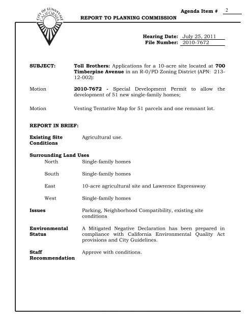
REPORT TO PLANNING COMMISSION<br />
Agenda Item # 2<br />
Hearing Date: July 25, 2011<br />
File Number: 2010-7672<br />
SUBJECT: Toll Brothers: Applications for a 10-acre site located at <strong>700</strong><br />
<strong>Timberpine</strong> <strong>Avenue</strong> in an R-0/PD Zoning District (APN: 213-<br />
12-002):<br />
Motion 2010-7672 - Special Development Permit to allow the<br />
development <strong>of</strong> 51 new single-family homes;<br />
Motion Vesting Tentative Map for 51 parcels and one remnant lot.<br />
REPORT IN BRIEF:<br />
Existing Site<br />
Conditions<br />
Agricultural use.<br />
Surrounding Land Uses<br />
North Single-family homes<br />
South Single-family homes<br />
East 10-acre agricultural site and Lawrence Expressway<br />
West Single-family homes<br />
Issues Parking, Neighborhood Compatibility, existing site<br />
conditions<br />
Environmental<br />
Status<br />
Staff<br />
Recommendation<br />
A Mitigated Negative Declaration has been prepared in<br />
compliance with <strong>California</strong> Environmental Quality Act<br />
provisions and <strong>City</strong> Guidelines.<br />
Approve with conditions.
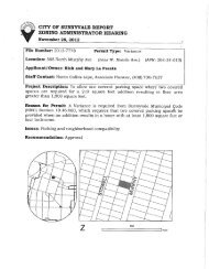
VICINITY MAP<br />
2010-7672 – Toll Brothers<br />
Page 2 <strong>of</strong> 13 (PC)
PROJECT DATA TABLE<br />
2010-7672 – Toll Brothers<br />
Page 3 <strong>of</strong> 13 (PC)<br />
EXISTING PROPOSED<br />
REQUIRED/<br />
PERMITTED<br />
General Plan<br />
Residential Low<br />
Density<br />
Same Residential Low<br />
Density<br />
Zoning District R-0/PD Same R-0/PD<br />
435,600 308,000 net after<br />
street dedications.<br />
6,000 min.<br />
Lot Size (s.f.)<br />
Lots are 6,000<br />
min. up to a<br />
maximum <strong>of</strong><br />
7,300<br />
Gross Floor Area<br />
N/A 3,387-3,508 per 2,<strong>700</strong> w/out PC<br />
(s.f.)<br />
lot<br />
hearing<br />
Lot Coverage (%) N/A 30-38% 40% max.<br />
Floor Area Ratio<br />
(FAR)<br />
N/A 56%-58% No max.<br />
No. <strong>of</strong> Units 0 51 52 max.<br />
Density (units/net<br />
acre)<br />
N/A 7 7 acre max.<br />
Meets 75% min?<br />
N/A Yes 38 min. based<br />
on net lot area<br />
Bedrooms/Unit N/A 5 N/A<br />
Unit Sizes (s.f.)<br />
(including garage)<br />
N/A 3,387-3,508 N/A<br />
Building Height<br />
(ft.)<br />
N/A 29’ 9” 30’ max.<br />
No. <strong>of</strong> Stories N/A 2 2 max.<br />
Setbacks (First /Second Facing Property)<br />
Front<br />
N/A 20’ average<br />
25’ average<br />
20’ min.<br />
25’ min.<br />
Left Side N/A 5’ 5”/ 7’ 4’ / 7’ min.<br />
Right Side N/A 5’ 5”/ 7’ 4’ / 7’ min.<br />
Rear<br />
Landscaping (sq. ft.)<br />
N/A 20’ 20’ min.<br />
Total Landscaping N/A 3,000 per lot N/A<br />
Water<br />
Conserving<br />
Plants (%)<br />
N/A 70% 70%
2010-7672 – Toll Brothers<br />
Page 4 <strong>of</strong> 13 (PC)<br />
Parking<br />
Total Spaces N/A 4 4 min.<br />
Covered Spaces<br />
Stormwater<br />
N/A 2 per lot 2 min. per lot<br />
Impervious<br />
Surface Area<br />
(s.f.)<br />
435,600 222,284 No Max.<br />
Impervious<br />
Surface (%)<br />
100% 51% No Max.<br />
Starred items indicate deviations from <strong>Sunnyvale</strong> Municipal Code<br />
requirements.<br />
BACKGROUND:<br />
In 1990, the <strong>City</strong> Council approved a similar project that included the subject<br />
site, as well as the adjacent 10-acre parcel. The project included the following:<br />
• Tentative Map (#6328) for 51 single-family homes on subject site and 61<br />
units on the eastern 10-acres;<br />
• Special Development Permit (SDP) (#6329);<br />
• Annexation <strong>of</strong> the two 10-acre parcels into the <strong>City</strong>;<br />
• Cancellation <strong>of</strong> Williamson Act Contract, for both parcels;<br />
• Rezoning <strong>of</strong> adjacent 10-acre site from R-2 to R-1.5/PD. Subject 10-acre<br />
site has been zoned R-0/PD since 1988 and R-0 since 1965.<br />
The 1990 Tentative Map and SDP approvals have now expired. The property<br />
annexations are complete and the properties are within the <strong>City</strong> limits. The<br />
Williamson Act Contracts were tentatively cancelled and require no further<br />
action by the <strong>City</strong> at this time. See Williamson Act Contract section below.<br />
DISCUSSION:<br />
Requested Permits<br />
• Special Development Permit<br />
The proposed project is a Special Development Permit to allow 51 singlefamily<br />
homes and related design review for the homes. The project meets all<br />
<strong>of</strong> the applicable <strong>City</strong> Municipal Code zoning requirements and the<br />
applicant is not seeking any deviations from zoning code at this time.<br />
• Vesting Tentative Map<br />
A subdivision is required to create 51 separate ownership lots and one<br />
remnant parcel for the existing water well. The Vesting Tentative Map vests<br />
the developer’s right to build the project for the life <strong>of</strong> the map. It also
2010-7672 – Toll Brothers<br />
Page 5 <strong>of</strong> 13 (PC)<br />
secures the approved project against future <strong>Sunnyvale</strong> Municipal Code<br />
(SMC) changes by the <strong>City</strong> that might otherwise affect the project.<br />
ANALYSIS:<br />
Architecture<br />
The homes would be 3,387-3,508 square feet each, including two-car garages<br />
and two uncovered parking spaces in the driveways. There are three different<br />
floor plans with three different elevations or architectural styles available. See<br />
architectural elevations in Attachment D for details. All homes are two story<br />
units and the parcels will provide private rear yard spaces which vary in size.<br />
The applicant has incorporated all <strong>of</strong> staff’s comments and there are no<br />
recommended modifications at this time.<br />
The proposed home are similar in character to the existing homes in the<br />
surrounding neighborhood; however the proposed homes would have larger<br />
square footage. To the south <strong>of</strong> the site (across Lily Ave.) homes are primarily<br />
single-story and range from 1,400 – 1,800 square feet. Across <strong>Timberpine</strong> to<br />
the west, homes are generally larger with one and two-stories. The sizes<br />
typically range from 2,100 – 2,800 square feet. Homes in the Torreya, Dahlia,<br />
and Toyon neighborhood to the north have a greater size variance from 1,500 –<br />
2,600 square feet and are primarily single story.<br />
Individual homeowners will be allowed to select the model (plan and<br />
architectural style) and the parcel. As a condition <strong>of</strong> approval, the developer<br />
will submit to staff a plan to ensure there is a variation in the pattern <strong>of</strong> home<br />
plans and architectural styles.<br />
Development Standards<br />
• Site Layout<br />
The proposed subdivision is for 51 new single-family homes. Lot sizes are<br />
approximately 6,000 square feet each with larger corner lots. The site is<br />
currently vacant and has historically been under agricultural use. There<br />
was no prior development <strong>of</strong> the site. The site is located adjacent to<br />
residential uses (single-family homes to the north, south, and west). A 10acre<br />
parcel is located directly east and is expected to remain an agricultural<br />
use for the foreseeable future.<br />
The project would include two new public street extensions. Toyon <strong>Avenue</strong><br />
and Torreya <strong>Avenue</strong>s would extend from their existing street terminus down<br />
to Lily <strong>Avenue</strong>. The streets <strong>Timberpine</strong>, Dahlia, and Lily <strong>Avenue</strong> are<br />
currently substandard in width and would be widened as part <strong>of</strong> the project.<br />
With the widening <strong>of</strong> these streets, Lily, <strong>Timberpine</strong>, and Dahlia will meet<br />
current <strong>City</strong> street standards.
2010-7672 – Toll Brothers<br />
Page 6 <strong>of</strong> 13 (PC)<br />
Standard water, sewer, right-<strong>of</strong>-way and utility connections/upgrades are<br />
available and will be extended to the site as part <strong>of</strong> the project as required<br />
by the Municipal Code. The project also includes additions to the existing<br />
public sidewalk network.<br />
There are no setback deviations proposed in the project. Note, however,<br />
under SMC 19.34.030 the front yard minimum is 15’ and the average is 20’.<br />
This means the front yard setback on each block must average 20’. The<br />
intent is to allow variations in the rhythm or pattern <strong>of</strong> homes placement on<br />
each block. The applicant is proposing that the three plans would have<br />
different setbacks, one at 15’, one at 20’, and the third at 25’. The average <strong>of</strong><br />
the three plans will achieve the minimum setback average <strong>of</strong> 20’.<br />
As with the architectural options, individual homeowners will be allowed to<br />
select the plan and the parcel. As a condition <strong>of</strong> approval, the developer will<br />
submit to staff a plan to ensure there is a variation in the pattern <strong>of</strong> front<br />
yard setback that will average 20’. The developer will likely need to work<br />
with individual buyers at the time <strong>of</strong> purchase to achieve the correct setback<br />
minimum.<br />
• Water Well<br />
The 10-acre project site currently has an irrigation well that historically<br />
served the agricultural uses on the subject parcel, and the 10-acre parcel to<br />
the east. It is understood by the <strong>City</strong> that the well and its associated<br />
delivery system (ditches and pipes) has been used in the past by two<br />
property owners. Currently the well and associated delivery system only<br />
serves the 10-acre parcel to the east. The well and conveyance system will<br />
remain in its current location and continue to serve the 10-acre parcel to<br />
the east until such time as the eastern 10 acres is no longer in agricultural<br />
use.<br />
The well pump and ditch (delivery system) will be placed underground to the<br />
extent possible. This will translate to the pump being placed in an<br />
underground vault and water delivery via underground pipes.<br />
• Trash and Recycling Access<br />
Similar to other single-family homes in the neighborhood, individual trash<br />
and recycling carts will be used and will be serviced from the public streets.<br />
• Parking and Circulation<br />
SMC Section 19.46.050 requires that new single-family homes provide two<br />
covered parking spaces, plus two uncovered spaces. Parking would be<br />
provided within two-car garages for each unit, two-car driveways at each<br />
unit, and additional parking on the existing and new public streets.<br />
A Traffic and Operations Analysis has been prepared by Hexagon<br />
Transportation Consultants, Inc, dated April 22, 2011. The Hexagon report
2010-7672 – Toll Brothers<br />
Page 7 <strong>of</strong> 13 (PC)<br />
describes the existing traffic conditions at this site. The report also<br />
discusses the project’s effects on access, circulation, and the proposed<br />
improvements related to the extension <strong>of</strong> the project area roadways. The<br />
proposed 51 new housing units will result in new vehicle trips in the area,<br />
but the number <strong>of</strong> residential trips will not exceed the capacity <strong>of</strong> the<br />
existing circulation system, including non-motorized travel and all relevant<br />
components <strong>of</strong> the circulation system; this includes the existing<br />
intersections, streets, highways and freeways, pedestrian walkways, bicycle<br />
paths, and mass transit. The report concludes that the estimated increase<br />
in traffic volumes due to project-generated traffic would not create any<br />
operational problems, and all <strong>of</strong> the studied road segments currently have<br />
more than adequate capacity to handle the additional traffic generated by<br />
the project. There will be no substantial impact on the existing circulation<br />
patterns in the neighborhood. See Attachment D for more details.<br />
Although the project would not result in any significant traffic impacts, the<br />
project would be required to pay a traffic impact fee. The anticipated Traffic<br />
Impact Fee is approximately $104,508.18, and will be used by the <strong>City</strong> as<br />
part <strong>of</strong> the ongoing maintenance and upgrade <strong>of</strong> the <strong>City</strong>’s transportation<br />
systems to <strong>of</strong>fset the contribution <strong>of</strong> project-generated traffic on local<br />
roadways. The project would result in a less than significant traffic impact.<br />
• Tree Preservation<br />
An Arborist’s Report was completed by Hort Science on in September 2010.<br />
The report reviewed the existing trees on-site and concludes that as part <strong>of</strong><br />
the project, 16 protected trees will be removed. Protected under SMC is<br />
defined as any tree greater than 38” in circumference, measured at 4.5’ from<br />
the adjacent grade. All 16 trees proposed for removal are in poor condition<br />
and are located in areas <strong>of</strong> future roadway widening. The trees cannot be<br />
saved with the <strong>City</strong>’s requirements for standard public street widths. Per<br />
Conditions <strong>of</strong> Approval, a 36” box tree is to be provided for each protected<br />
tree being removed. All new public streets will have street trees installed per<br />
SMC requirements.<br />
• Landscaping<br />
The applicant has submitted a preliminary landscaping plan that shows<br />
public right-<strong>of</strong>-way landscaping and private fences. Private landscaping will<br />
be installed at the option <strong>of</strong> the individual homeowners. Future homeowners<br />
can include landscape installation as part <strong>of</strong> their property purchase or they<br />
can install through a private party. All new landscaping must be installed<br />
according to the <strong>City</strong>’s Water Efficient Landscaping code requirements. The<br />
developer will draft landscape plans that can be optionally purchased by the<br />
homeowners and will have them pre-approved by the <strong>City</strong> through a<br />
Miscellaneous Plan Permit. If individual homeowners choose to install<br />
landscaping themselves, they will be required to submit a Miscellaneous<br />
Plan Permit for staff review and approval prior to installation.
2010-7672 – Toll Brothers<br />
Page 8 <strong>of</strong> 13 (PC)<br />
• Fences<br />
An Acoustical Analysis was completed by Charles M. Salter Associates, Inc.<br />
in April 2011. The report discusses existing noise conditions at the site as<br />
well as applicable <strong>Sunnyvale</strong> noise standards and thresholds.<br />
The study measured noise levels at four locations surrounding the property.<br />
Existing noise levels were measured at levels between DNL 60 dBa and DNL<br />
64 dBa. To account for future traffic volumes <strong>of</strong> 1-2%, 1dB was added to the<br />
measured DNL. A future DNL <strong>of</strong> up to 65 dB is expected for the exterior<br />
noise level. This level is considered conditionally acceptable by the <strong>City</strong><br />
Noise Sub-Element. In order to meet the <strong>City</strong>’s goal <strong>of</strong> 60 dB in rear yards, a<br />
six foot tall noise barrier is necessary for the proposed homes on Lily<br />
<strong>Avenue</strong> and the house on the northeast corner <strong>of</strong> the project site on Dahlia<br />
at Toyon <strong>Avenue</strong>. These fences meet existing SMC requirements.<br />
All other side and rear yard fences will be provided by the developer at their<br />
or the future property owner’s costs and will comply with SMC<br />
requirements.<br />
• Stormwater Management<br />
A preliminary Stormwater Management Plan has been submitted as<br />
required, which shows proposed drainage patterns and conceptual<br />
treatment techniques to minimize surface run<strong>of</strong>f and pollution. A more<br />
detailed Stormwater Management Plan will be submitted during the building<br />
permit phase per Conditions <strong>of</strong> Approval.<br />
The project will require the construction <strong>of</strong> new stormwater management<br />
devices and the expansion <strong>of</strong> existing <strong>City</strong> utilities in the area. The<br />
stormwater treatment devises consist <strong>of</strong> vegetated swales in the public right<strong>of</strong>-way<br />
to treat street run<strong>of</strong>f, and vegetated swales on private property to<br />
treat the impervious surfaces on the new parcels. All new street stormwater<br />
run-<strong>of</strong>f will be captured and treated in stormwater treatment swales located<br />
within the public right-<strong>of</strong>-way.<br />
Future homeowners will be fully responsible for the cost <strong>of</strong> maintenance and<br />
repair <strong>of</strong> the private stormwater treatment areas as well as those in the<br />
public right-<strong>of</strong>-way. A maintenance district will be formed for the purpose <strong>of</strong><br />
funding these improvements.<br />
• Green Building Requirements<br />
The project is required to achieve a minimum <strong>of</strong> 70 green building points to<br />
fulfill green building requirements. Most <strong>of</strong> the green building points are<br />
incorporated into the design <strong>of</strong> the landscaping, building materials, energy<br />
performance and plumbing. A Green Point Rated Checklist has been<br />
provided and demonstrates the project is expected to achieve 133 points. As<br />
required, verification <strong>of</strong> the green building measures will be completed by<br />
the Building Safety Division during the building permit process.
2010-7672 – Toll Brothers<br />
Page 9 <strong>of</strong> 13 (PC)<br />
• Below Market Rate (BMR) Housing<br />
No BMRs are required <strong>of</strong> this development since the R-0 zoning does not<br />
require BMRs.<br />
• Construction Activities and Schedule<br />
Project construction will consist <strong>of</strong> two phases. The first phase will involve<br />
site grading, underground utilities, and street construction associated with<br />
the first 51 lots <strong>of</strong> the proposed subdivision. Grading intensive activities are<br />
expected to last 10 to 14 weeks. The second phase involves construction <strong>of</strong><br />
the homes and associated site improvements. This phase will begin with the<br />
parcels fronting on <strong>Timberpine</strong> and Torreya <strong>Avenue</strong>s and will proceed east<br />
with the parcels fronting on the east side <strong>of</strong> Torreya and Toyon <strong>Avenue</strong>s.<br />
Construction is expected to take two and one-half years to complete. The<br />
project will be subject to the SMC requirements for noise and hours <strong>of</strong><br />
construction contained in Section 16.08.030.<br />
Williamson Act Contract<br />
The project site is currently under a Williamson Act Contract with the <strong>City</strong>. In<br />
1990 the <strong>City</strong> Council took action to approve a tentative cancellation <strong>of</strong> the<br />
Williamson Act Contract, at the request <strong>of</strong> the property owners. The Tentative<br />
Certificate <strong>of</strong> Land Contract Cancellation by the <strong>City</strong> Council (Resolution 124-<br />
90) remains in effect today, and no further action by the Council is required<br />
according to the <strong>State</strong> Department <strong>of</strong> Conservation. Once the property owner or<br />
contract holder receives a certificate <strong>of</strong> tentative cancellation from the <strong>City</strong>, the<br />
conditions, including the cancellation fee payment, must be fulfilled before a<br />
final cancellation may be approved. There is no expiration date on a tentative<br />
cancellation action.<br />
The property owner will notify the <strong>City</strong> Council when they have satisfied the<br />
conditions and contingencies stated in the certificate <strong>of</strong> tentative cancellation,<br />
including the cancellation fee <strong>of</strong> $1,687,500 (12.5% <strong>of</strong> the $13,500,000 land<br />
valuation) that needs to be paid to the <strong>State</strong> Lands Commission. Within 30days<br />
<strong>of</strong> receipt <strong>of</strong> the notice, and upon a determination that the conditions and<br />
contingencies have been satisfied, the <strong>City</strong> Council will execute a certificate <strong>of</strong><br />
cancellation <strong>of</strong> contract, which will finalize the contract cancellation. (GC<br />
§51283.4(b)).<br />
Environmental Review<br />
A Mitigated Negative Declaration has been prepared in compliance with<br />
<strong>California</strong> Environmental Quality Act provisions and <strong>City</strong> Guidelines. An initial<br />
study has determined that the proposed project would not create any<br />
significant environmental impacts with implementation <strong>of</strong> the recommended<br />
mitigation measures.<br />
The Initial Study includes discussion about noise impacts, traffic, hazardous<br />
materials, air quality, aesthetics, etc. See Attachment D for more details.
2010-7672 – Toll Brothers<br />
Page 10 <strong>of</strong> 13 (PC)<br />
Mitigation measures have been incorporated in the attached conditions <strong>of</strong><br />
approval at the appropriate states <strong>of</strong> construction (Attachment B). The<br />
following is a summary <strong>of</strong> a few issues not already discussed in the report<br />
above:<br />
• Soil Contamination<br />
A Phase I Environmental Assessment has been prepared by Berlogar<br />
Geotechnical Consultants (BGC), dated April 2, 2010. A second study<br />
dated January 29, 2010, also analyzed soil samples. The reports include<br />
the property’s prior-use history, a review <strong>of</strong> neighborhood properties for<br />
hazardous material contaminations, a preliminary screening for asbestos<br />
containing building materials, lead based paint, drinking water quality<br />
and radon, a search for above ground storage tanks, underground tanks,<br />
and equipment containing PCBs. Soil samples were also taken at the<br />
site. The reports conclude that there is no environmental impairment <strong>of</strong><br />
the site and that any contamination is within acceptable levels. The<br />
reports also conclude that a Phase II assessment is not warranted.<br />
• Noise<br />
Noise generating activities would include grading, the establishment <strong>of</strong><br />
utilities, construction <strong>of</strong> streets, construction <strong>of</strong> 51 new homes, and<br />
landscaping. Pile driving or other ground born vibrations are not<br />
anticipated during construction. Noise impacts resulting from<br />
construction depend on the noise generated by various pieces <strong>of</strong><br />
construction equipment, the timing and duration <strong>of</strong> noise generating<br />
activities, and the distance between construction noise sources and noise<br />
sensitive receptors. Construction noise impacts primarily result when<br />
construction activities occur during noise-sensitive times <strong>of</strong> the day<br />
(early morning, evening, or nighttime hours), the construction occurs in<br />
areas immediately adjoining noise sensitive land uses, or when<br />
construction noise lasts over extended periods <strong>of</strong> time. Where noise from<br />
construction activities could exceed the <strong>City</strong>’s goal <strong>of</strong> 60 dBa in the<br />
project vicinity for duration <strong>of</strong> one year or more, the impacts would be<br />
reduced to a less than significant level with mitigation.<br />
• Aesthetics<br />
The project site is not located within or near any known scenic vista or<br />
scenic highways. There are no scenic resources present on the project<br />
site as the property is currently vacant. The project site is surrounded by<br />
residential uses with the exception <strong>of</strong> the 10-acre parcel to the east<br />
which is currently in agricultural use. The project would result in the<br />
development <strong>of</strong> a vacant 10-acre parcel with 51 dwelling units. Although<br />
the development <strong>of</strong> the project would change the existing visual character<br />
<strong>of</strong> the site, it would not substantially degrade the quality <strong>of</strong> the site and<br />
its surroundings, nor would it cause a significant adverse visual change<br />
to the neighborhood character. The project would extend one and twostory<br />
single-family residences into a residential neighborhood <strong>of</strong> similar
2010-7672 – Toll Brothers<br />
Page 11 <strong>of</strong> 13 (PC)<br />
massing, scale and building heights. The <strong>City</strong>’s implementation <strong>of</strong> the<br />
Single-Family Design Guidelines and staff’s review <strong>of</strong> final development<br />
plans, which will be submitted for final Building Permit review, will<br />
ensure that the final design <strong>of</strong> the project is consistent with the plans<br />
reviewed by the Planning Commission.<br />
FISCAL IMPACT<br />
Transportation Impact Fee<br />
Projects resulting in net new peak hour automobile trips are subject to a<br />
transportation impact fee. The transportation impact fee is estimated to be<br />
$104,508.18, and must be paid prior to issuance <strong>of</strong> a building permit. The<br />
amount is subject to the fee in place at the time <strong>of</strong> payment.<br />
Park Dedication In-Lieu Fee<br />
The project is subject to a park dedication in-lieu fee for each new residential<br />
unit. The park dedication in-lieu fee is based on the acreage standard in place<br />
at the time the project was deemed complete (2.25 acres/1,000 population); the<br />
fee, based on FY 2011-2012 adopted land values is estimated to be<br />
$948,467.27, and must be paid prior to recordation <strong>of</strong> a Final Map. The<br />
amount is subject to the fee, based on a formula in the Municipal Code, in<br />
place at the time <strong>of</strong> payment.<br />
PUBLIC CONTACT<br />
Outreach Meeting<br />
The applicant held two community outreach meetings on April 22, 2010 and<br />
August 5, 2010. Approximately 80 residents and 50 residents respectively<br />
attended from the surrounding neighborhood. A majority <strong>of</strong> the concerns were<br />
related to construction timing, construction impacts, density, circulation, soil<br />
contamination, using the land for a park, the existing water well, architecture,<br />
and home sales prices. Most residents attending the meeting were generally<br />
positive about the proposed project with the largest concern being the<br />
possibility <strong>of</strong> developing the site at a density higher that the existing R-0 zone;<br />
since this is not being proposed, this issue was satisfied.<br />
Planning Commission Study Session<br />
A Planning Commission study session was held on May 23, 2011. The<br />
Commission had concerns about stormwater controls in the public right-<strong>of</strong>way,<br />
soil contamination, the aesthetics <strong>of</strong> existing well, safety issues with the<br />
water conveyance ditches, and the phasing <strong>of</strong> the final four housing units.<br />
The applicant has made a number <strong>of</strong> project modifications in response to this<br />
meeting, including working with the <strong>City</strong> to get the well equipment in an<br />
underground vault and placing the water lines underground in a pipeline. The
2010-7672 – Toll Brothers<br />
Page 12 <strong>of</strong> 13 (PC)<br />
applicant also eliminated the phasing <strong>of</strong> the final four housing units, so the<br />
project will now be developed in one phase.<br />
Notice <strong>of</strong> Negative<br />
Declaration and Public<br />
Hearing<br />
• Published in the Sun<br />
newspaper<br />
• Posted on the site<br />
• 412 notices mailed to the<br />
property owners and<br />
residents within 300 ft. <strong>of</strong><br />
the project site<br />
CONCLUSION<br />
Staff Report Agenda<br />
• Posted on the <strong>City</strong> <strong>of</strong><br />
<strong>Sunnyvale</strong>'s Website<br />
• Provided at the<br />
Reference Section <strong>of</strong><br />
the <strong>City</strong> <strong>of</strong><br />
<strong>Sunnyvale</strong>'s Public<br />
Library<br />
• Posted on the<br />
<strong>City</strong>'s <strong>of</strong>ficial<br />
notice bulletin<br />
board<br />
• <strong>City</strong> <strong>of</strong><br />
<strong>Sunnyvale</strong>'s<br />
Website<br />
Discussion: Staff finds the project, as conditioned, meets the required Findings<br />
and Goals <strong>of</strong> the General Plan. The Conditions <strong>of</strong> Approval ensure that impacts<br />
to the site and surrounding development are considered minimal.<br />
Findings and General Plan Goals: Staff was able to make the required<br />
Findings based on the justifications for the Special Development Permit that<br />
were provided by the applicant as well as based on staff analysis.<br />
Recommended Findings and General Plan Goals are located in Attachment A.<br />
Conditions <strong>of</strong> Approval: Recommended Conditions <strong>of</strong> Approval are located in<br />
Attachment B.<br />
ALTERNATIVES<br />
1. Adopt the Mitigated Negative Declaration and approve the Special<br />
Development Permit and Vesting Tentative Map with attached conditions.<br />
2. Adopt the Mitigated Negative Declaration and approve the Special<br />
Development Permit and Vesting Tentative Map with modified conditions.<br />
3. Adopt the Mitigated Negative Declaration and deny the Special<br />
Development Permit and Vesting Tentative Map.<br />
4. Do not adopt the Mitigated Negative Declaration and direct staff as to<br />
where additional environmental analysis is required.
RECOMMENDATION<br />
2010-7672 – Toll Brothers<br />
Page 13 <strong>of</strong> 13 (PC)<br />
Recommend Alternative 1: Adopt the Mitigated Negative Declaration and<br />
approve the Special Development Permit and Vesting Tentative Map with<br />
attached conditions.<br />
Prepared by:<br />
Steve Lynch<br />
Project Planner<br />
Reviewed by:<br />
Trudi Ryan<br />
Planning Officer<br />
Attachments:<br />
A. Recommended Findings<br />
B. Recommended Conditions <strong>of</strong> Approval<br />
C. Mitigated Negative Declaration<br />
D. Hexagon Transportation Consultants, Traffic and Operations Analysis,<br />
dated April 22, 2011<br />
E. Site and Architectural Plans
Special Development Permit<br />
General Plan Goals and Policies:<br />
RECOMMENDED FINDINGS<br />
2010-7672 – Toll Brothers<br />
Attachment A (PC)<br />
Page 1 <strong>of</strong> 2<br />
Housing and Community Revitalization Sub-element<br />
Policy A.2: All new residential developments should build at least 75 percent<br />
<strong>of</strong> the permitted density.<br />
Policy C.1: Continue efforts to balance the need for additional housing with<br />
other community values, such as preserving the character <strong>of</strong><br />
established neighborhoods, high quality design, and promoting a<br />
sense <strong>of</strong> identity in each neighborhood.<br />
Goal D: Maintain diversity in tenure, type, size, and location <strong>of</strong> housing to<br />
permit a range <strong>of</strong> individual choices for all current residents and<br />
those expected to become city residents.<br />
Goal E: Maintain and increase housing units affordable to households <strong>of</strong><br />
all income levels and ages.<br />
Land Use and Transportation Element<br />
Goal C2: Ensure Ownership and rental housing options in terms <strong>of</strong> style,<br />
size and density that are appropriate and contribute positively to<br />
the surrounding area.<br />
Policy C2.2: Encourage the development <strong>of</strong> ownership housing to maintain a<br />
majority <strong>of</strong> housing in the city for ownership choices.<br />
Policy N1.2: Require new development to be compatible with the<br />
neighborhood, adjacent land uses and the transportation system.<br />
Community Design Sub-element<br />
Policy C.4: Encourage quality architectural design, which improves the <strong>City</strong>’s<br />
identity, inspires creativity, and heightens individual as well as<br />
cultural identity.<br />
1. The proposed use attains the objectives and purposes <strong>of</strong> the General Plan<br />
<strong>of</strong> the <strong>City</strong> <strong>of</strong> <strong>Sunnyvale</strong>. (Finding Met).<br />
The proposed project meets the goals and policies <strong>of</strong> the General Plan as<br />
listed above by creating 51 single-family homes that promote housing<br />
goals that encourage home ownership. The project also meets the policy<br />
for a minimum 75% <strong>of</strong> the allowable density for the zoning district.
2010-7672 – Toll Brothers<br />
Attachment A (PC)<br />
Page 2 <strong>of</strong> 2<br />
2. The proposed use ensures that the general appearance <strong>of</strong> proposed<br />
structures, or the uses to be made <strong>of</strong> the property to which the<br />
application refers, will not impair either the orderly development <strong>of</strong>, or<br />
the existing uses being made <strong>of</strong>, adjacent properties. (Finding Met)<br />
The proposed project is the same density and similar style <strong>of</strong> the<br />
surrounding development. The site layout will complete the circulation<br />
patterns in the existing neighborhood as well as complete three<br />
substandard streets surrounding the project. The design <strong>of</strong> the homes is<br />
considered high quality and will greatly improve the overall appearance<br />
<strong>of</strong> the area over current conditions.<br />
Vesting Tentative Map<br />
In order to approve the Tentative Map, the proposed subdivision must be<br />
consistent with the general plan. Staff finds that the Tentative Map is in<br />
conformance with the General Plan. However, if any <strong>of</strong> the following findings<br />
can be made, the Tentative Map shall be denied. Staff was not able to make<br />
any <strong>of</strong> the following findings and recommends approval <strong>of</strong> the Tentative Map.<br />
1. That the subdivision is not consistent with the General Plan.<br />
2. That the design or improvement <strong>of</strong> the proposed subdivision is not<br />
consistent with the General Plan.<br />
3. That the site is not physically suitable for the proposed type <strong>of</strong><br />
development.<br />
4. That the site is not physically suitable for the proposed density <strong>of</strong><br />
development.<br />
5. That the design <strong>of</strong> the subdivision or proposed improvements is likely to<br />
cause substantial environmental damage or substantially and avoidably<br />
injure fish or wildlife or their habitat.<br />
6. That the design <strong>of</strong> the subdivision or type <strong>of</strong> improvements is likely to<br />
cause serious public health problems.<br />
7. That the design <strong>of</strong> the subdivision or the type <strong>of</strong> improvements will conflict<br />
with easements, acquired by the public at large, for access through or use<br />
<strong>of</strong> property within the proposed subdivision.<br />
8. That the map fails to meet or perform one or more requirements or<br />
conditions imposed by the "Subdivision Map Act" or by the Municipal Code<br />
Staff was not able to make any <strong>of</strong> the findings (B.1-8), and recommends<br />
approval <strong>of</strong> the Tentative Map.
ATTACHMENT B<br />
RECOMMENDED<br />
CONDITIONS OF APPROVAL AND<br />
STANDARD DEVELOPMENT REQUIREMENTS<br />
JULY 25, 2011<br />
Planning Application 2010-7672<br />
<strong>700</strong> <strong>Timberpine</strong> <strong>Avenue</strong><br />
Special Development Permit to allow the development <strong>of</strong> 51 new single-family<br />
homes; and Vesting Tentative Map for subdivision <strong>of</strong> one lot into 51 parcels<br />
and one remnant lot<br />
The following Conditions <strong>of</strong> Approval [COA] and Standard Development<br />
Requirements [SDR] apply to the project referenced above. The COAs are<br />
specific conditions applicable to the proposed project. The SDRs are items<br />
which are codified or adopted by resolution and have been included for ease <strong>of</strong><br />
reference, they may not be appealed or changed. The COAs and SDRs are<br />
grouped under specific headings that relate to the timing <strong>of</strong> required<br />
compliance. Additional language within a condition may further define the<br />
timing <strong>of</strong> required compliance. Applicable mitigation measures are noted with<br />
“Mitigation Measure” and placed in the applicable phase <strong>of</strong> the project.<br />
In addition to complying with all applicable <strong>City</strong>, County, <strong>State</strong> and Federal<br />
Statutes, Codes, Ordinances, Resolutions and Regulations, Permittee expressly<br />
accepts and agrees to comply with the following Conditions <strong>of</strong> Approval and<br />
Standard Development Requirements <strong>of</strong> this Permit:<br />
GC: THE FOLLOWING GENERAL CONDITIONS AND STANDARD<br />
DEVELOPMENT REQUIREMENTS SHALL APPLY TO THE APPROVED<br />
PROJECT.<br />
GC-1. CONFORMANCE WITH APPROVED PLANNING APPLICATION:<br />
All building permit drawings and subsequent construction and<br />
operation shall substantially conform with the approved planning<br />
application, including: drawings/plans, materials samples, building<br />
colors, and other items submitted as part <strong>of</strong> the approved application.<br />
Any proposed amendments to the approved plans or Conditions <strong>of</strong><br />
Approval are subject to review and approval by the <strong>City</strong>. The Director<br />
<strong>of</strong> Community Development shall determine whether revisions are<br />
considered major or minor. Minor changes are subject to review and<br />
approval by the Director <strong>of</strong> Community Development. Major changes<br />
are subject to review at a public hearing. [COA] [PLANNING]<br />
GC-2. USE EXPIRATION:<br />
The approved Special Development Permit shall expire if the use is<br />
discontinued for a period <strong>of</strong> one year or more. [SDR] (PLANNING)
2010-7672 – 0 <strong>Timberpine</strong> <strong>Avenue</strong> - Toll Brothers Attachment B<br />
Page 2 <strong>of</strong> 19<br />
GC-3. PERMIT EXPIRATION:<br />
The permit shall be null and void two years from the date <strong>of</strong> approval<br />
by the final review authority at a public hearing if the approval is not<br />
exercised, unless a written request for an extension is received prior<br />
to expiration date and is approved by the Director <strong>of</strong> Community<br />
Development. [SDR] [PLANNING]<br />
GC-4. TITLE 25:<br />
Provisions <strong>of</strong> Title 25 <strong>of</strong> the <strong>California</strong> Administrative Code shall be<br />
satisfied with dependence on mechanical ventilation. [SDR]<br />
[BUILDING]<br />
GC-5. STORMWATER MANAGEMENT PLAN:<br />
Project is subject to Provision C3, <strong>of</strong> the Municipal Regional<br />
Stormwater Permit Order No. R2-2009-0074, as determined by a<br />
completed “Stormwater Management Plan Data Form”, and therefore<br />
must submit a Final Stormwater Management Plan as per SMC<br />
12.60.140 prior to issuance <strong>of</strong> the building permit. [SDR] [PLANNING]<br />
GC-6. ENCROACHMENT PERMIT:<br />
Obtain an encroachment permit from the Department <strong>of</strong> Public Works<br />
for all <strong>of</strong>f-site improvements. [SDR] [PUBLIC WORKS]<br />
PS: THE FOLLOWING CONDITIONS SHALL BE MET PRIOR TO<br />
SUBMITTAL OF BUILDING PERMIT, AND/OR GRADING PERMIT.<br />
PS-1. ARCHITECTURAL VARIATION:<br />
The developer shall submit to staff, for review and approval, a plan to<br />
ensure there is a variation in the pattern <strong>of</strong> home plans and<br />
architectural styles. The intent is to ensure there are not similar<br />
homes next to one another. [COA] [PLANNING]<br />
PS-2. FRONT YARD SETBACK COMPLIANCE:<br />
The developer shall submit to staff, for review and approval, a plan to<br />
ensure there is a variation in the pattern <strong>of</strong> front yard setback that<br />
achieves the minimum average <strong>of</strong> 20’ [COA] [PLANNING]<br />
PS-3. EXTERIOR MATERIALS REVIEW:<br />
Final exterior building materials and color schemes are subject to<br />
review and approval by the Director <strong>of</strong> Community Development prior<br />
to submittal <strong>of</strong> a building permit. [COA] [PLANNING]
2010-7672 – 0 <strong>Timberpine</strong> <strong>Avenue</strong> - Toll Brothers Attachment B<br />
Page 3 <strong>of</strong> 19<br />
BP: THE FOLLOWING CONDITIONS SHALL BE ADDRESSED ON THE<br />
CONSTRUCTION PLANS SUBMITTED FOR ANY DEMOLITION<br />
PERMIT, BUILDING PERMIT, GRADING PERMIT, AND/OR<br />
ENCROACHMENT PERMIT AND SHALL BE MET PRIOR TO THE<br />
ISSUANCE OF SAID PERMIT(S).<br />
BP-1. CONDITIONS OF APPROVAL:<br />
Final plans shall include all Conditions <strong>of</strong> Approval included as part<br />
<strong>of</strong> the approved application starting on sheet 2 <strong>of</strong> the plans. [COA]<br />
[PLANNING]<br />
BP-2. RESPONSE TO CONDITIONS OF APPROVAL:<br />
A written response indicating how each condition has or will be<br />
addressed shall accompany the building permit set <strong>of</strong> plans. [COA]<br />
[PLANNING]<br />
BP-3. NOTICE OF CONDITIONS OF APPROVAL:<br />
A Notice <strong>of</strong> Conditions <strong>of</strong> Approval shall be filed in the <strong>of</strong>ficial records<br />
<strong>of</strong> the County <strong>of</strong> Santa Clara and provide pro<strong>of</strong> <strong>of</strong> such recordation to<br />
the <strong>City</strong> prior to issuance <strong>of</strong> any <strong>City</strong> permit, allowed use <strong>of</strong> the<br />
property, or Final Map, as applicable. The Notice <strong>of</strong> Conditions <strong>of</strong><br />
Approval shall prepared by the Planning Division and shall include a<br />
description <strong>of</strong> the subject property, the Planning Application number,<br />
attached conditions <strong>of</strong> approval and any accompanying subdivision or<br />
parcel map, including book and page and recorded document<br />
number, if any, and be signed and notarized by each property owner<br />
<strong>of</strong> record.<br />
For purposes <strong>of</strong> determining the record owner <strong>of</strong> the property, the<br />
applicant shall provide the <strong>City</strong> with evidence in the form <strong>of</strong> a report<br />
from a title insurance company indicating that the record owner(s) are<br />
the person(s) who have signed the Notice <strong>of</strong> Conditions <strong>of</strong> Approval.<br />
[COA] [PLANNING]<br />
BP-4. NOISE DISTURBANCE COORDINATOR:<br />
A Disturbance Coordinator will be assigned to the project for the full<br />
duration <strong>of</strong> building construction. This coordinator will ensure that all<br />
conditions <strong>of</strong> approval and mitigation measures are enforced. In<br />
addition, the Disturbance Coordinator will respond to complaints<br />
from the public regarding air quality issues in a timely manner. The<br />
contact information for this Coordinator will be posted in plain view at<br />
the project site at two different locations. The Coordinator will also be<br />
responsible for notifying adjacent properties <strong>of</strong> the demolition<br />
schedules. [COA] [PLANNING]
2010-7672 – 0 <strong>Timberpine</strong> <strong>Avenue</strong> - Toll Brothers Attachment B<br />
Page 4 <strong>of</strong> 19<br />
BP-5. BLUEPRINT FOR A CLEAN BAY:<br />
The building permit plans shall include a “Blueprint for a Clean Bay”<br />
on one full sized sheet <strong>of</strong> the plans. [SDR] [PLANNING]<br />
BP-6. FEES AND BONDS:<br />
The following fees and bonds shall be paid in full prior to issuance <strong>of</strong><br />
building permit.<br />
a) TRANSPORTATION IMPACT FEE - Pay Traffic Impact fee for the net<br />
new trips resulting from the proposed project that will be<br />
calculated prior to issuance <strong>of</strong> a Building Permit. (SMC 3.50).<br />
[SDR] [PLANNING]<br />
b) PARK IN-LIEU - Pay Park In-lieu fees shall be paid under FY 2011-<br />
2012 fees (based on a park land dedication rate <strong>of</strong> 2.25<br />
acres/1,000 population) at the land value in place at the time <strong>of</strong><br />
payment, prior to approval <strong>of</strong> the Final Map or Parcel Map. (SMC<br />
18.10). [SDR] [PLANNING]<br />
BP-7. MECHANICAL EQUIPMENT (EXTERIOR):<br />
Detailed plans showing the locations <strong>of</strong> individual exterior mechanical<br />
equipment/air conditioning units shall be submitted and subject to<br />
review and approval by the Director <strong>of</strong> Community Development prior<br />
to issuance <strong>of</strong> building permits whether to be installed by the<br />
developer or by new property owners at a later time. Proposed<br />
locations shall have minimal visual and minimal noise impacts to<br />
neighbors and ensure adequate usable open space. Individual exterior<br />
mechanical equipment/air conditioning units shall be screened with<br />
architecture or landscaping features. [PLANNING] [COA]<br />
BP-8. LANDSCAPE PLAN:<br />
Landscape and irrigation plans shall be prepared by a certified<br />
pr<strong>of</strong>essional, and shall comply with <strong>Sunnyvale</strong> Municipal Code<br />
Chapter 19.37 requirements. Landscape and irrigation plans are<br />
subject to review and approval by the Director <strong>of</strong> Community<br />
Development through a Miscellaneous Plan Permit at the time <strong>of</strong><br />
Building Permit submittal. The landscape plan shall include the<br />
following elements:<br />
a) All areas not required for parking, driveways or structures shall be<br />
landscaped.<br />
c) Ten percent (10%) <strong>of</strong> trees shall be 24-inch box size or larger and<br />
no tree shall be less than 15-gallon size.<br />
d) Any “protected trees”, (as defined in SMC 19.94) approved for<br />
removal, shall be replaced with a specimen tree <strong>of</strong> at least 36-inch<br />
box size.<br />
e) Ground cover shall be planted so as to ensure full coverage<br />
eighteen months after installation.<br />
f) The design <strong>of</strong> each perimeter wall for the development shall be<br />
similar in appearance and construction material. Final design is
2010-7672 – 0 <strong>Timberpine</strong> <strong>Avenue</strong> - Toll Brothers Attachment B<br />
Page 5 <strong>of</strong> 19<br />
subject to review and approval by Planning Staff prior to issuance<br />
<strong>of</strong> a building permit.<br />
g) Backflow devices and other appurtenances are to include screening<br />
and covers as approved by the Director <strong>of</strong> Community<br />
Development. This includes all devices (irrigation, DCDA, etc.)<br />
located in the front or side yard landscape areas. Covers should be<br />
black, metal mesh with rounded top covers (e.g. – “mailbox style”).<br />
[COA] [PLANNING]<br />
BP-9. PRE-APPROVED, WATER EFFICIENT LANDSCAPE PLANS:<br />
The developer shall submit a minimum <strong>of</strong> three landscape plans for<br />
review and approval by the Community Development Department.<br />
These plans will be reviewed through a Miscellaneous Plan Permit to<br />
ensure they meet the <strong>City</strong>’s Water Efficient Landscaping code<br />
requirements. These plans shall be available for purchase by the<br />
future homeowners.<br />
[PLANNING] [COA]<br />
BP-10. PRIVATE INSTALLATION OF LANDSCAPING:<br />
Future homeowners who choose to install the site landscaping<br />
privately (private landscape company or homeowner) are shall submit<br />
for review and approval Miscellaneous Plan Permit to ensure they<br />
meet the <strong>City</strong>’s Water Efficient Landscaping code requirements. This<br />
MPP must be approved prior to installation <strong>of</strong> the landscaping.<br />
[PLANNING] [SDR]<br />
BP-11. STORMWATER MANAGEMENT CALCULATIONS:<br />
Submit two copies <strong>of</strong> the <strong>City</strong> <strong>of</strong> <strong>Sunnyvale</strong> Impervious Surface<br />
Calculation worksheet prior to issuance <strong>of</strong> a Building Permit. [COA]<br />
[PLANNING]<br />
BP-12. STORMWATER MANAGEMENT PLAN:<br />
Submit two copies <strong>of</strong> a Stormwater Management Plan subject to<br />
review and approval by Director <strong>of</strong> Community Development and third<br />
party certification, pursuant to SMC 12.60, prior to issuance <strong>of</strong><br />
building permit. [COA] [PLANNING/PUBLIC WORKS]<br />
BP-13. STORM WATER MANAGEMENT PLAN THIRD PARTY CERTIFICATION:<br />
Third party certification <strong>of</strong> the Storm Water Management Plan is<br />
required per the following guidance: <strong>City</strong> <strong>of</strong> <strong>Sunnyvale</strong> – Storm Water<br />
Quality BMP Applicant Guidance Manual for New and Redevelopment<br />
Projects - Addendum: Section 3.1.2 Certification <strong>of</strong> Design Criteria<br />
Third-Party Certification <strong>of</strong> Storm Water Management Plan<br />
Requirements. The third party certification shall be provided prior to<br />
building permit issuance. [SDR] [PLANNING/PUBLIC WORKS]
2010-7672 – 0 <strong>Timberpine</strong> <strong>Avenue</strong> - Toll Brothers Attachment B<br />
Page 6 <strong>of</strong> 19<br />
BP-14. BEST MANAGEMENT PRACTICES:<br />
The project shall comply with the following source control measures<br />
as outlined in the BMP Guidance Manual and SMC 12.60.220. Best<br />
management practices shall be identified on the building permit set <strong>of</strong><br />
plans and shall be subject to review and approval by the Director <strong>of</strong><br />
Public Works:<br />
a) Storm drain stenciling. The stencil is available from the <strong>City</strong>'s<br />
Environmental Division Public Outreach Program, which may be<br />
reached by calling (408) 730-7738.<br />
b) Landscaping that minimizes irrigation and run<strong>of</strong>f, promotes<br />
surface infiltration where possible, minimizes the use <strong>of</strong> pesticides<br />
and fertilizers, and incorporates appropriate sustainable<br />
landscaping practices and programs such as Bay-Friendly<br />
Landscaping.<br />
c) Appropriate covers, drains, and storage precautions for outdoor<br />
material storage areas, loading docks, repair/maintenance bays,<br />
and fueling areas.<br />
d) Covered trash, food waste, and compactor enclosures.<br />
e) Plumbing <strong>of</strong> the following discharges to the sanitary sewer, subject<br />
to the local sanitary sewer agency’s authority and standards:<br />
i) Discharges from indoor floor mat/equipment/hood filter wash<br />
racks or covered outdoor wash racks for restaurants.<br />
ii) Dumpster drips from covered trash and food compactor<br />
enclosures.<br />
iii) Discharges from outdoor covered wash areas for vehicles,<br />
equipment, and accessories.<br />
iv) Swimming pool water, spa/hot tub, water feature and<br />
fountain discharges if discharge to onsite vegetated areas is<br />
not a feasible option.<br />
v) Fire sprinkler test water, if discharge to onsite vegetated areas<br />
is not a feasible option. [SDR] [PLANNING]<br />
BP-15. NOISE REDUCTION:<br />
Final construction drawings shall incorporate all noise mitigation<br />
measures as set forth under “Mitigation Measures” in the approved<br />
environmental document (MND) and all plans shall be wet-stamped<br />
and signed by the noise consultant. [COA] [PLANNING]<br />
Mitigation Measure<br />
WHAT: 1) A six foot tall noise barrier shall be constructed at the rear<br />
yards <strong>of</strong> the homes on Lily <strong>Avenue</strong> and the house on the<br />
northeast corner <strong>of</strong> the project site on Dahlia at Toyon<br />
<strong>Avenue</strong>s. This barrier, as described the Salter 2011 report,<br />
must be solid from top to bottom, have no surface gaps or<br />
cracks, and must be a minimum <strong>of</strong> three pounds per square<br />
foot. The wall may be masonry, CMU block, or enhanced<br />
wood.
2010-7672 – 0 <strong>Timberpine</strong> <strong>Avenue</strong> - Toll Brothers Attachment B<br />
Page 7 <strong>of</strong> 19<br />
2) To achieve compliance with the 45 dB interior noise level<br />
standard, Sound Transmission Class minimum rated 26-28<br />
windows shall be installed near all living spaces.<br />
3) All units shall have a ventilation or air-conditioning<br />
system that provides habitable interior environments.<br />
WHEN: The conditions shall be incorporated into the construction<br />
plans. All conditions must be installed prior to Building<br />
Permit final.<br />
WHO: The property owner (developer) will be solely responsible for<br />
implementation and maintenance <strong>of</strong> these conditions.<br />
HOW: The conditions shall be incorporated into the construction<br />
plans<br />
Mitigation Measure<br />
WHAT: The project applicant shall implement a Construction<br />
Management Plan (CMP) for all development within 1,000<br />
feet <strong>of</strong> occupied residential uses, approved by the Director <strong>of</strong><br />
Community Development to minimize impacts to<br />
surrounding sensitive land uses to the extent possible. The<br />
CMP shall include the following measures to minimize the<br />
impacts <strong>of</strong> construction upon nearby sensitive land uses:<br />
1. Measures to control noise by limiting hours <strong>of</strong> operation<br />
<strong>of</strong> construction activities to those allowed under SMC and<br />
by avoiding sensitive early morning and evening hours,<br />
notifying residents prior to major construction activities,<br />
and scheduling equipment selection.<br />
2. Utilize ‘quiet’ models <strong>of</strong> air compressors and other<br />
stationary noise sources where technology exists.<br />
3. Equip all internal combustion engine-driven equipment<br />
with mufflers, which are in good condition and<br />
appropriate for the equipment.<br />
4. Locate all stationary noise-generating equipment, such as<br />
air compressors and portable power generators, as far<br />
away as possible from residences or noise-sensitive land<br />
uses.<br />
5. Locate staging areas and construction material areas as<br />
far away as possible from residences or noise-sensitive<br />
land uses.<br />
6. Route all construction traffic to and from the project site<br />
via designated truck routes where possible. Prohibit<br />
construction related heavy truck traffic in residential<br />
areas where feasible. Construction workers will not be<br />
permitted to park on neighborhood streets.
2010-7672 – 0 <strong>Timberpine</strong> <strong>Avenue</strong> - Toll Brothers Attachment B<br />
Page 8 <strong>of</strong> 19<br />
7. Control noise from construction workers’ radios to a point<br />
that they are not audible at existing residences bordering<br />
the project site.<br />
8. Prohibit all unnecessary idling <strong>of</strong> internal combustion<br />
engines.<br />
9. Notify all adjacent business, residences, and noisesensitive<br />
land uses <strong>of</strong> the construction schedule in<br />
writing. Notification by door hangars <strong>of</strong> nearby residence<br />
regarding significant upcoming construction activities.<br />
10. Designate a "disturbance coordinator" who will be<br />
responsible for responding to any local complaints about<br />
construction noise. The disturbance coordinator will<br />
determine the cause <strong>of</strong> noise complaints (e.g., starting too<br />
early, bad muffler, etc.) and will require that reasonable<br />
measures warranted to correct the problem be<br />
implemented. Conspicuously post a telephone number for<br />
the disturbance coordinator at the construction site and<br />
include it in the notice sent to neighbors regarding the<br />
construction schedule. The noise disturbance coordinator<br />
shall be authorized to address and accommodate special<br />
circumstances (home bound or medical conditionadjacent<br />
homeowners).<br />
WHEN: The CMP shall be submitted for review and approval prior to<br />
Building Permit issuance.<br />
WHO: The property owner (developer) will be solely responsible for<br />
implementation and maintenance <strong>of</strong> these conditions.<br />
HOW: The CMP shall be submitted for review and approval prior to<br />
Building Permit issuance.<br />
BP-16. HISTORICAL AND CULTURAL REMAINS:<br />
The project shall comply with all necessary requirements regarding<br />
Historic and Cultural Remains. [COA][PLANNING]<br />
Mitigation Measures<br />
WHAT: 1) For projects involving substantial ground disturbance, the<br />
individual project sponsor shall be required to contact the<br />
<strong>California</strong> Historical Resources Information System (CHRIS)<br />
to determine whether the particular project is located in a<br />
sensitive area. Future development projects that the CHRIS<br />
determines may be located in a sensitive area--i.e., on or<br />
adjoining an identified archaeological site--shall proceed only<br />
after the project sponsor contracts with a qualified<br />
archaeologist to conduct a determination in regard to<br />
cultural values remaining on the site and warranted<br />
mitigation measures.
2010-7672 – 0 <strong>Timberpine</strong> <strong>Avenue</strong> - Toll Brothers Attachment B<br />
Page 9 <strong>of</strong> 19<br />
2) If a significant archaeological resource is identified during<br />
grading, the <strong>City</strong> and project proponent shall seek to avoid<br />
damaging effects to the resource. Preservation in place to<br />
maintain the relationship between the artifact(s) and the<br />
archaeological context is the preferred manner <strong>of</strong> mitigating<br />
impacts to an archaeological site. Preservation may be<br />
accomplished by:<br />
• Planning construction to avoid the archaeological site;<br />
• Incorporating the site within a park, green space, or other<br />
open space element;<br />
• Covering the site with a layer <strong>of</strong> chemically stable soil; or<br />
• Deeding the site into a permanent conservation easement.<br />
3) When in-place mitigation is determined by the <strong>City</strong> to be<br />
infeasible, a data recovery plan, which makes provisions for<br />
adequate recovery <strong>of</strong> the scientifically consequential<br />
information about the site, shall be prepared and adopted<br />
prior to any additional excavation being undertaken. Such<br />
studies must be submitted to the <strong>California</strong> Historical<br />
Resources Regional Information Center. If Native American<br />
artifacts are indicated, the studies must also be submitted to<br />
the Native American Heritage Commission. Identified<br />
cultural resources should be recorded on form DPR 422<br />
(archaeological sites). Mitigation measures recommended by<br />
these two groups and required by the <strong>City</strong> shall be<br />
undertaken, if necessary, prior to resumption <strong>of</strong> construction<br />
activities.<br />
A data recovery plan and data recovery shall not be required<br />
if the <strong>City</strong> determines that testing or studies already<br />
completed have adequately recovered the necessary data,<br />
provided that the data have already been documented in<br />
another EIR or are available for review at the <strong>California</strong><br />
Historical Resource Regional Information Center [CEQA<br />
Guidelines section 15126.4(b)].<br />
In the event that subsurface cultural resources are otherwise<br />
encountered during approved ground-disturbing activities for<br />
a project area construction activity, work in the immediate<br />
vicinity shall be stopped and a qualified archaeologist<br />
retained to evaluate the finds following the procedures<br />
described above.<br />
If human remains are found, special rules set forth in <strong>State</strong><br />
Health and Safety Code section 7050.5 and CEQA Guidelines<br />
section 15126.4(b) shall apply.
2010-7672 – 0 <strong>Timberpine</strong> <strong>Avenue</strong> - Toll Brothers Attachment B<br />
Page 10 <strong>of</strong> 19<br />
WHEN: These conditions shall apply during construction <strong>of</strong> the<br />
project.<br />
WHO: The property owner will be solely responsible for<br />
implementation and maintenance <strong>of</strong> these conditions.<br />
HOW: These conditions shall apply during construction <strong>of</strong> the<br />
project and shall be incorporated into the construction<br />
plans.<br />
BP-17. AIR QUALITY:<br />
The project shall comply with all necessary requirements regarding<br />
Air Quality. [COA][PLANNING]<br />
Mitigation Measures<br />
WHAT: Permits must be obtained from the <strong>City</strong> <strong>of</strong> <strong>Sunnyvale</strong><br />
(grading permit and Storm Water Pollution Prevention Plan)<br />
and BAAQMD (J-Permit) prior to demolition or new<br />
construction. The <strong>City</strong> <strong>of</strong> <strong>Sunnyvale</strong> permit shall, amongst<br />
others, specifically include the following mitigation<br />
measures:<br />
1. Water all active construction areas at least twice daily<br />
and more <strong>of</strong>ten during windy periods. Active areas<br />
adjacent to residences should be kept damp at all times.<br />
2. Cover all hauling trucks or maintain at least two feet <strong>of</strong><br />
freeboard.<br />
3. Pave, apply water at least twice daily, or apply (non-toxic)<br />
soil stabilizers on all unpaved access roads, parking<br />
areas, and staging areas.<br />
4. Sweep daily (with water sweepers) all paved access roads,<br />
parking areas, and staging areas and sweep streets daily<br />
(with water sweepers) if visible soil material is deposited<br />
onto the adjacent roads.<br />
5. Hydroseed or apply (non-toxic) soil stabilizers to inactive<br />
construction areas (i.e., previously-graded areas that are<br />
inactive for 10 days or more).<br />
6. Replant vegetation in disturbed areas as quickly as<br />
possible.<br />
7. Enclose, cover, water twice daily, or apply (non-toxic) soil<br />
binders to exposed stockpiles.<br />
8. Limit traffic speeds on the construction site to 15 mph.<br />
9. Suspend construction activities that cause visible dust<br />
plumes to extend beyond the construction site.<br />
10. Install windbreaks or fences along adjacent residential<br />
properties.<br />
11. During renovation and demolition activities, removal or<br />
disturbance <strong>of</strong> any materials containing asbestos, lead<br />
paint or other hazardous pollutants will be conducted in<br />
accordance with BAAQMD rules and regulations (refer to<br />
Section 2.9, Hazards and Hazardous Materials).
2010-7672 – 0 <strong>Timberpine</strong> <strong>Avenue</strong> - Toll Brothers Attachment B<br />
Page 11 <strong>of</strong> 19<br />
12. A Disturbance Coordinator will be assigned to the project<br />
for the full duration <strong>of</strong> asbestos abatement, demolition<br />
activities, grading, excavation, and building construction.<br />
This coordinator will ensure that all air quality mitigation<br />
measures are enforced. In addition, the Disturbance<br />
Coordinator will respond to complaints from the public<br />
regarding air quality issues in a timely manner. The<br />
contact information for this Coordinator will be posted in<br />
plain view at the project site. The Coordinator will also be<br />
responsible for notifying adjacent properties <strong>of</strong> the<br />
demolition schedules.<br />
13. Opacity is an indicator <strong>of</strong> exhaust particulate emissions<br />
from <strong>of</strong>f-road diesel powered equipment. The Disturbance<br />
Coordinator shall ensure that emissions from all<br />
construction diesel powered equipment used on the<br />
project site do not exceed 40 percent opacity for more<br />
than three minutes in any one hour. Any equipment<br />
found to exceed 40 percent opacity (or Ringelmann 2.0)<br />
shall be repaired immediately. Any equipment emitting<br />
dark smoke three minutes after start up is in violation <strong>of</strong><br />
this measure.<br />
14. Diesel equipment standing idle for more than five minutes<br />
shall be turned <strong>of</strong>f. This would include trucks waiting to<br />
deliver or receive soil, aggregate, or other bulk materials.<br />
Rotating drum concrete trucks could keep their engines<br />
running continuously as long as they were onsite.<br />
15. The project shall develop and implement a plan,<br />
demonstrating that the heavy-duty (> 50 horsepower) <strong>of</strong>froad<br />
vehicles to be used in the construction project,<br />
including owned, leased and subcontractor vehicles, will<br />
achieve a project-wide fleet-average 20 percent NOx<br />
reduction and 45 percent particulate reduction compared<br />
to the most recent CARB fleet average at time <strong>of</strong><br />
construction. Note, the Sacramento Metropolitan Air<br />
Quality Management District maintains a Construction<br />
Mitigation Calculator that could be used to demonstrate<br />
compliance with these requirements.<br />
16. Properly tune and maintain equipment for low emissions.<br />
17. Avoid staging construction equipment within 100 feet <strong>of</strong><br />
residential properties.<br />
WHEN: These conditions shall apply during construction <strong>of</strong> the<br />
project.<br />
WHO: The property owner will be solely responsible for<br />
implementation and maintenance <strong>of</strong> these conditions.<br />
HOW: The conditions shall be incorporated into the construction<br />
plans.
2010-7672 – 0 <strong>Timberpine</strong> <strong>Avenue</strong> - Toll Brothers Attachment B<br />
Page 12 <strong>of</strong> 19<br />
BP-19: FIRE PREVENTION REQUIREMENTS:<br />
The following requirements and upgrades are required, for review and<br />
approval by the Department <strong>of</strong> Public Safety: [COA] [PLANNING/<br />
PUBLIC SAFETY]<br />
a) As applicable, comply with the requirements contained in<br />
<strong>Sunnyvale</strong> Municipal Code Chapter 16.52, 16.53 and 16.54;<br />
<strong>California</strong> Fire Code, and Title 19 <strong>California</strong> Code <strong>of</strong> Regulations.<br />
Building plan submittals after January 1, 2011 will have to comply<br />
with the 2010 adopted codes.<br />
b) The water supply for fire protection and fire fighting shall be<br />
approved by the Department <strong>of</strong> Public Safety (508 CFC)<br />
c) A fully automatic fire sprinkler system is required for the new<br />
homes. The fire sprinkler systems shall be in accordance with<br />
NFPA 13, and CFC. (16.52.270 SMC & Section 903 CFC)<br />
d) Provide a water meter size sufficient to handle the fire sprinkler<br />
system.<br />
e) A fire alarm system is required for buildings meeting the<br />
requirements under Section 907.2.9 CFC.<br />
f) Install approved smoke detectors and carbon monoxide detectors<br />
in accordance with the <strong>Sunnyvale</strong> Municipal Code (MC 16.52.280).<br />
g) Fire hydrants are required to be spaced no more than every 300<br />
feet. Hydrants shall be Clow 75. (508 CFC)<br />
h) Provide required number <strong>of</strong> approved fire extinguishers (minimum<br />
size <strong>of</strong> 2A10BC) (CCR Title 19: 568)<br />
i) Prior to any combustible construction or materials on site, provide<br />
fire access drives and operational on-site fire protection systems if<br />
applicable. (Chapter 14 CFC)<br />
j) Provide a written construction Fire Protection Plan. (Section 1408<br />
CFC)(Refer to Unidocs.org , Fire Prevention documents).<br />
EP: THE FOLLOWING CONDITIONS SHALL BE ADDRESSED AS PART OF<br />
AN ENCROACHMENT PERMIT APPLICATION.<br />
EP-1. MAINTENANCE DISTRICT RELATED TO STORMWATER TREATMENT<br />
AREAS:<br />
Prior to issuance <strong>of</strong> the Public Works encroachment permit, the<br />
owner/subdivider shall submit to the <strong>City</strong> evidence that a<br />
Maintenance District is established to fund perpetual maintenance <strong>of</strong><br />
stormwater treatment areas on private properties and in the public<br />
right-<strong>of</strong>-way, to <strong>City</strong>’s satisfaction.<br />
EP-2. ENCROACHMENT AGREEMENT RELATED TO STORMWATER<br />
TREATMENT AREAS IN THE PUBLIC RIGHT-OF-WAY:<br />
Prior to issuance <strong>of</strong> the Public Works encroachment permit, the<br />
owner/subdivider shall execute and record an Encroachment<br />
Agreement regarding installation, and perpetual maintenance <strong>of</strong><br />
stormwater treatment facilities located in the public right-<strong>of</strong>-way. The
2010-7672 – 0 <strong>Timberpine</strong> <strong>Avenue</strong> - Toll Brothers Attachment B<br />
Page 13 <strong>of</strong> 19<br />
Encroachment Agreement shall include but not limited to the<br />
following provisions:<br />
a. Identify the areas and items <strong>of</strong> encroachment with description and<br />
plot map.<br />
b. Identify the party(ies) (such as the Home Owner’s Association or<br />
Maintenance District) responsible for perpetual maintenance <strong>of</strong><br />
those encroachment items.<br />
c. Outline the maintenance schedule and requirements.<br />
d. Refer to the established Maintenance District (see EP-1 above) to<br />
fund perpetual maintenance <strong>of</strong> those encroachment items.<br />
[COA] [PUBLIC WORKS]:<br />
EP-3. REMOVAL AND/OR UNDERGROUNDING OF EXISITNG PRIVATE<br />
IRRIGATION FACILITIES:<br />
The existing well and appurtenances on Lot A shall be placed<br />
underground to the extent feasible. The existing well riser on<br />
<strong>Timberpine</strong> and any existing underground private facilities within the<br />
public right-<strong>of</strong>-way shall be removed. The existing shed shall be<br />
removed. The lot shall be landscaped according to the approved plans.<br />
EP-4. PROTECTION OF EXISTING IRRIGATION CONVEYANCE:<br />
The existing irrigation conveyance shall be maintained at all times<br />
until it is replaced with underground pipes.<br />
EP-5. PUBLIC IMPROVEMENT MODIFICATIONS:<br />
The owner/subdivider is required to pay for all changes or<br />
modifications to existing city utilities, streets and other public utilities<br />
within or adjacent to the project site, including but not limited to<br />
utility facilities/conduits/vaults relocation due to grade change in the<br />
park strip area, caused by the development. [COA] [PUBLIC WORKS]<br />
EP-6. DEFICIENT PUBLIC IMPROVEMENTS:<br />
Any existing deficient public improvements shall be upgraded to<br />
current city standards as required by the Director <strong>of</strong> Public Works.<br />
EP-7. COMPLIANCE WITH CITY DESIGN STANDARDS AND STANDARD<br />
DETAILS AND SPECIFICATIONS:<br />
All public improvements shall be designed in accordance with<br />
applicable city design standards pursuant to <strong>Sunnyvale</strong> municipal<br />
code sections 18.12, and city standard details and specifications,<br />
unless otherwise approved by the Director <strong>of</strong> Public Works. [SDR]<br />
[PUBLIC WORKS)<br />
EP-8. LANDSCAPING IN PUBLIC RIGHT-OF-WAY:<br />
The owner/subdivider shall install street trees <strong>of</strong> species determined<br />
by the Public Works Department. Street trees and landscaping in the<br />
public right-<strong>of</strong>-way shall be included in the detailed landscape and<br />
irrigation plan subject to review and approval by the Director <strong>of</strong> Public
2010-7672 – 0 <strong>Timberpine</strong> <strong>Avenue</strong> - Toll Brothers Attachment B<br />
Page 14 <strong>of</strong> 19<br />
Works. New street trees shall be 24-inch box size or 25 gallon size or<br />
larger and installed with minimum <strong>of</strong> one <strong>City</strong> tree per lot. A<br />
continuous root barrier shall be installed along new sidewalk. The<br />
<strong>City</strong> trees shall be planted to be compatible with the private<br />
stormwater treatment piping system within the vicinity. No <strong>City</strong> trees<br />
should to be planted within 10' <strong>of</strong> a sanitary sewer lateral. The fire<br />
hydrant shall be maintained free and clear <strong>of</strong> all vines, shrubs,<br />
bushes, ivy, etc for a minimum <strong>of</strong> 4 feet high. [SDR] [PUBLIC WORKS]<br />
EP-9. UTILITY PROVIDERS:<br />
Contact the utility companies for their review/approval requirements<br />
and/or procedures for site development. [COA] [PUBLIC WORKS]<br />
EP-10. UTILITY ABANDONMENT/RELOCATION:<br />
All existing utility lines and/or their appurtenances not serving the<br />
project and/or have conflicts with the project, shall be capped,<br />
abandoned, removed, relocated and/or disposed to the satisfaction <strong>of</strong><br />
the <strong>City</strong>. [COA] [PUBLIC WORKS]<br />
EP-11. CATCH BASIN STENCIL:<br />
All catch basins and storm drain inlet facilities in the public right-<strong>of</strong>way<br />
shall be stenciled with the appropriate “No Dumping” message as<br />
supplied by the Public Works Department.<br />
EP-12. RECORD DRAWINGS:<br />
Record drawings (including street, sewer, water, storm drain and <strong>of</strong>fsite<br />
landscaping plans) shall be submitted to the <strong>City</strong> prior to<br />
encroachment permit sign-<strong>of</strong>f. [COA] [PUBLIC WORKS]<br />
TM: THE FOLLOWING CONDITIONS SHALL BE MET PRIOR TO THE<br />
APPROVAL OF THE FINAL MAP OR PARCEL MAP.<br />
TM-1. INDEMNIFICATION AGREEMENT:<br />
Prior to final map recordation, the owner/subdivider shall provide the<br />
<strong>City</strong> a separate Indemnification Agreement to indemnify, defend and<br />
hold harmless the <strong>City</strong> against claims relating to or arising from the<br />
1952 agreement executed by and between Ben Francia and Joseph<br />
Francia, recorded April 02, 1952 as Book 2393, Page 469 <strong>of</strong> Official<br />
Records. [PLANNING/PUBLIC WORKS]<br />
TM-2. ENCROACHMENT AGREEMENT RELATED TO EXISTING IRRIGATION<br />
CONVEYANCE AND FUTURE IRRIGATION PIPES IN THE PUBLIC<br />
RIGHT-OF-WAY:<br />
Prior to recordation <strong>of</strong> the final map, the party(ies) who executed the<br />
1952 agreement, as recorded April 02, 1952 as Book 2393, Page 469<br />
<strong>of</strong> Official Records, shall execute and record an Encroachment<br />
Agreement regarding private irrigation facilities located in the public
2010-7672 – 0 <strong>Timberpine</strong> <strong>Avenue</strong> - Toll Brothers Attachment B<br />
Page 15 <strong>of</strong> 19<br />
right-<strong>of</strong>-way. If owner/subdivider feels that all parties are not<br />
necessary to execute the agreement, have that stated on letterhead<br />
from their legal counsel.<br />
The Encroachment Agreement shall include but not be limited to the<br />
following provisions:<br />
a. Identify the areas and items (existing and future) <strong>of</strong> encroachment<br />
with description and plot map.<br />
b. Identify the party(ies) responsible for on-going maintenance <strong>of</strong><br />
those existing and future encroachment items, until they are<br />
removed.<br />
c. Outline the maintenance schedule and requirements.<br />
d. Identify the party(ies) obligated to remove those irrigation pipes.<br />
e. Upon removal <strong>of</strong> the irrigation pipes, and relinquishment <strong>of</strong> the<br />
1952 agreement, recorded April 02, 1952 as book 2393, page 469<br />
<strong>of</strong> <strong>of</strong>ficial records, the Encroachment Agreement will be terminated.<br />
On the final map, the owner shall make a reference to the subject<br />
Encroachment Agreement.<br />
[COA] [PUBLIC WORKS]<br />
TM-3. MAINTENANCE FOR IRRIGATION PIPES ON PRIVATE PROPERTIES:<br />
There shall be private irrigation water easement identified on the final<br />
map for Lots 1, 26, 27, and 51. On the final map, the owner shall<br />
state the current title owner(s) or developer/subdivider (Toll Brothers)<br />
shall be responsible for on-going maintenance <strong>of</strong> private irrigation<br />
pipes on private properties, and that the subject easement shall<br />
expire once the private irrigation pipes on private property are either<br />
removed or abandoned to the satisfaction <strong>of</strong> the property owners at<br />
the time <strong>of</strong> the removal/abandonment.<br />
TM.4. “LOT A” MAINTENANCE:<br />
The title owner(s) <strong>of</strong> Lot A or other third party that has been<br />
determined to be acceptable by the <strong>City</strong>, shall landscaped and<br />
maintain in a neat condition, as shown on the approved plans. Lot A<br />
which includes the well and its associated facilities as well as the<br />
public sidewalk and landscaping within Lot A, until such time the<br />
private well is abandoned/destructed in accordance with condition<br />
TM-5 below, and Lot A is <strong>of</strong>fered to the <strong>City</strong> and accepted by the <strong>City</strong><br />
for public use.<br />
TM.5. “LOT A” OWNERSHIP:<br />
The current title owner(s), or developer/subdivider (Toll Brothers), or<br />
other third party that has been determined to be acceptable by the<br />
<strong>City</strong>, <strong>of</strong> Lot A shall own Lot A, which includes the well and its<br />
associated facilities as well as the public sidewalk and landscaping<br />
within Lot A, until such time the private well is<br />
abandoned/destructed in accordance with condition TM-5 below, and
2010-7672 – 0 <strong>Timberpine</strong> <strong>Avenue</strong> - Toll Brothers Attachment B<br />
Page 16 <strong>of</strong> 19<br />
Lot A is <strong>of</strong>fered to the <strong>City</strong> and accepted by the <strong>City</strong> for public use. Lot<br />
A shall not be owned by individual homeowners and/or future<br />
Homeowners Association and/or the future maintenance district.<br />
Prior to conveyance to the <strong>City</strong> Pending conveyance, the<br />
owner/subdivider will maintain Lot A including landscaping and<br />
surface area.<br />
TM.6. LOT A OFFER AND ACCEPTANCE OF DEDICATION:<br />
The title owner(s) <strong>of</strong> Lot A may dedicate Lot A to the <strong>City</strong> in the future<br />
for public use upon abandonment and/or destruction <strong>of</strong> the private<br />
well and its associated facilities. However, <strong>City</strong>’s acceptance <strong>of</strong> the<br />
subject dedication is contingent upon the following items:<br />
a. Complete the abandonment and destruction <strong>of</strong> the well in<br />
accordance with the rules and regulations established by the Santa<br />
Clara Valley Water District at the time <strong>of</strong> the<br />
abandonment/destruction.<br />
b. Comply with condition TM-8.<br />
c. The 1952 agreement, recorded April 02, 1952 as Book 2393, Page<br />
469 <strong>of</strong> Official Records, is relinquished or terminated.<br />
[COA] [PUBLIC WORKS]<br />
TM-7. FINAL MAP COMPLIANCE WITH VESTING TENTATIVE MAP:<br />
Final map shall be substantially the same as the vesting tentative<br />
map. Any alteration <strong>of</strong> vesting tentative map after the vesting tentative<br />
map is approved maybe subject to additional approval by the <strong>City</strong><br />
prior to final map approval. Record the final map prior to any building<br />
permit issuance. [COA] [PUBLIC WORKS]<br />
TM.8. EASEMENTS:<br />
A public sidewalk easement shall be established across Lot A.<br />
Reservation <strong>of</strong> new and/or abandonment <strong>of</strong> existing public/private<br />
utility easement(s), ingress/egress easement(s) necessary for the<br />
project site shall be recorded with the map or with separate<br />
instruments prior to occupancy. Quitclaim Deed is required for<br />
abandonment <strong>of</strong> private easements. No permanent structures are<br />
allowed within any <strong>of</strong> the easement limits. The <strong>City</strong> shall not be<br />
responsible for maintenance <strong>of</strong> any non-<strong>City</strong> utilities within any<br />
easements. [COA] [PUBLIC WORKS]<br />
TM.9. OFFER AND ACCEPTANCE OF DEDICATION:<br />
The following conditions shall be satisfied prior to final map approval<br />
and no later than 24 months after approval <strong>of</strong> the Vesting Tentative<br />
Map.<br />
a. The owner/subdivider shall provide an updated Phase I<br />
Environmental Site Assessment (ESA) to the April 2, 2010 report<br />
for the dedicated area, as the current ESA prepared by Berlogar<br />
Geotechnical Consultants has expired. A follow-up Phase II
2010-7672 – 0 <strong>Timberpine</strong> <strong>Avenue</strong> - Toll Brothers Attachment B<br />
Page 17 <strong>of</strong> 19<br />
investigation if recommended by the Phase I conclusion shall be<br />
paid for by the owner/developer.<br />
b. The owner/subdivider shall provide a written statement from a<br />
pr<strong>of</strong>essional geotechnical engineer (with stamp) that:<br />
1. The dedicated area is free <strong>of</strong> contamination or hazardous<br />
material and is suitable for unrestricted public use;<br />
2. The dedicated area’s soils have adequately characterized in light<br />
<strong>of</strong> the city’s intended public use; and<br />
3. Chemical constituents found in soils are below levels <strong>of</strong> concern<br />
and not present or require no further remediation for<br />
unrestricted public use.<br />
TM.10. SUBDIVISION AGREEMENT:<br />
Execute a Subdivision Agreement and provide improvement securites<br />
and/or cash deposit(s) for all proposed public and/or private<br />
improvements prior to the final map recordation and/or any permit<br />
issuance, whichever occurs first. [COA] [PUBLIC WORKS]<br />
TM.11. DEVELOPMENT FEES:<br />
Development fees associated with the entire subdivision, including<br />
but not limited to utility frontage and/or connection fees, <strong>of</strong>f-site<br />
improvement plan check and inspection fees, shall be paid prior to<br />
recordation <strong>of</strong> the final map or encroachment permit issuance<br />
whichever occurs first. [COA] [PUBLIC WORKS]<br />
TM.12. PUBLIC IMPROVEMENTS:<br />
The owner/subdivider is required to install all public improvements<br />
as required by <strong>Sunnyvale</strong> Municipal Code Sections 18.08, including<br />
but not limited to, curb & gutter, sidewalks, driveway approaches,<br />
curb ramps, street pavements, utility extensions and connections,<br />
meters/vaults, trees and landscaping, signs, striping, street lights,<br />
etc., prior to occupancy as required by the Director <strong>of</strong> Public Works.<br />
[COA] [PUBLIC WORKS]<br />
TM.13. COMPLIANCE WITH SUBDIVISION REQUIREMENTS:<br />
Comply with all applicable <strong>Sunnyvale</strong> Municipal Code requirements<br />
as outlined in Title 18: Subdivisions. [SDR] [PUBLIC WORKS]<br />
PF: THE FOLLOWING CONDITIONS SHALL BE ADDRESSED ON THE<br />
CONSTRUCTION PLANS AND/OR SHALL BE MET PRIOR TO<br />
RELEASE OF UTILITIES OR ISSUANCE OF A CERTIFICATE OF<br />
OCCUPANCY.<br />
PF-1. LANDSCAPING AND IRRIGATION:<br />
All landscaping and irrigation as contained in the approved building<br />
permit plan shall be installed prior to occupancy. [COA] [PLANNING]
2010-7672 – 0 <strong>Timberpine</strong> <strong>Avenue</strong> - Toll Brothers Attachment B<br />
Page 18 <strong>of</strong> 19<br />
PF-2. DISCLOSURE:<br />
The owner/subdivider shall provide full written disclosure <strong>of</strong> the<br />
following:<br />
a) For buyer <strong>of</strong> Lot 1 – Disclosure <strong>of</strong> Lot A, sub-surface well and<br />
irrigation facilities, requirements for well abandonment/destruction<br />
by the Lot A owner, and the 1952 agreement executed by and between<br />
Ben Francia and Joseph Francia, recorded April 02, 1952 as Book<br />
2393, Page 469 <strong>of</strong> Official Records.<br />
b) For buyers <strong>of</strong> Lots 1, 26, 27, and 512 – Disclosure <strong>of</strong> private subsurface<br />
irrigation facilities/easement and the 1952 agreement<br />
executed by and between Ben Francia and Joseph Francia, recorded<br />
April 02, 1952 as Book 2393, Page 469 <strong>of</strong> Official Records.<br />
c) For buyers <strong>of</strong> all 51 lots – Disclosure <strong>of</strong> all stormwater treatment<br />
areas and maintenance requirements, specifically the areas in the<br />
public right-<strong>of</strong>-way.<br />
d) All other pertinent agreements and known facts that affect the<br />
properties.<br />
PF-3. COMPLETION OF PUBLIC IMPROVEMENTS:<br />
All public improvements for the entire subdivision shall be completed<br />
prior to first building occupancy. [COA] [PUBLIC WORKS]<br />
DC: THE FOLLOWING CONDITIONS SHALL BE COMPLIED WITH AT ALL<br />
TIMES DURING THE CONSTRUCTION PHASE OF THE PROJECT.<br />
DC-1. BLUEPRINT FOR A CLEAN BAY:<br />
The project shall be in compliance with stormwater best management<br />
practices for general construction activity until the project is<br />
completed and either final occupancy has been granted. [SDR]<br />
[PLANNING]<br />
DC-2. CONSTRUCTION PARKING:<br />
Construction parking shall be managed by the applicant and their<br />
general contractor so that neighbors are not impacted by construction<br />
vehicle parking. When the site permits, all construction parking shall<br />
be on-site and not on the public streets.<br />
[COA] [PLANNING]<br />
AT: THE FOLLOWING CONDITIONS SHALL BE COMPLIED WITH AT ALL<br />
TIMES THAT THE SPECIAL DEVELOPMENT PERMITTED BY THIS<br />
PLANNING APPLICATION OCCUPIES THE PREMISES.<br />
AT-1. LANDSCAPE MAINTENANCE:<br />
All landscaping shall be installed in accordance with the approved<br />
landscape plan and shall thereafter be maintained in a neat, clean,
2010-7672 – 0 <strong>Timberpine</strong> <strong>Avenue</strong> - Toll Brothers Attachment B<br />
Page 19 <strong>of</strong> 19<br />
and healthful condition. Trees shall be allowed to grow to the full<br />
genetic height and habit (trees shall not be topped). Trees shall be<br />
maintained using standard arboriculture practices. [COA] [PLANNING]<br />
AT-2. GARAGES CLEAR:<br />
Homeowners shall keep garages clear and operable for two-car<br />
parking at all times.<br />
AT-3. BMP MAINTENANCE:<br />
The project applicant, owner, landlord, or Maintenance Agreement<br />
parties, must properly maintain any structural or treatment control<br />
best management practices to be implemented in the project, as<br />
described in the approved Stormwater Management Plan and<br />
indicated on the approved building permit plans. [SDR] [PLANNING]<br />
AT-4. BMP RIGHT OF ENTRY:<br />
The project applicant, owner, landlord, or Maintenance Agreement<br />
parties,, shall provide access to the extent allowable by law for<br />
representatives <strong>of</strong> city, the local vector control district, and the<br />
Regional Water Quality Control Board, strictly for the purposes <strong>of</strong><br />
verification <strong>of</strong> proper operation and maintenance for the storm water<br />
treatment best management practices contained in the approved<br />
Storm Water Management Plan. [SDR] [PLANNING]
PLANNING DIVISION<br />
CITY OF SUNNYVALE<br />
P.O. BOX 3707<br />
SUNNYVALE, CALIFORNIA 94088-3707<br />
NOTICE OF INTENT TO ADOPT A<br />
MITIGATED NEGATIVE DECLARATION<br />
File Number: 2010-7672<br />
No. 11-1 1<br />
This form is provided as a notification <strong>of</strong> an intent to adopt a Mitigated Negative Declaration which has<br />
been prepared in compliance with the provisions <strong>of</strong> the <strong>California</strong> Environmental Quality Ad <strong>of</strong> 1970, as<br />
amended, and Resolution #I 18-04.<br />
PROJECT TITLE:<br />
Application for a Special Development Permit and Vesting Tentative Map filed by Toll Brothers.<br />
PROJECT DESCRIPTION AND LOCATION (APN):<br />
2010-7672: Toll Brothers [Applicant] Josephine Angelo Trustee [Owner] Application for a Special<br />
Development Permit and Vesting Tentative Map to allow 51 new single family homes located at <strong>700</strong><br />
<strong>Timberpine</strong> <strong>Avenue</strong>. (APN: 213-12-002) SL<br />
WHERE TO VIEW THIS DOCUMENT:<br />
The Mitigated Negative Declaration, its supporting documentation and details relating to the project are<br />
on file and available for review and comment in the Office <strong>of</strong> the Secretary <strong>of</strong> the Planning Commission,<br />
<strong>City</strong> Hall, 456 West Olive <strong>Avenue</strong>, <strong>Sunnyvale</strong>.<br />
This Mitigated Negative Declaration may be protested in writing by any person prior to 5:00 p.m. on<br />
Thursday, July 11, 2011. Protest shall be filed in the Department <strong>of</strong> Community Development, 456 W.<br />
Olive <strong>Avenue</strong>, <strong>Sunnyvale</strong> and shall include a written statement specifying anticipated environmental<br />
effects which may be significant. A protest <strong>of</strong> a Mitigated Negative Declaration will be considered by<br />
the adopting authority, whose action on the protest may be appealed.<br />
HEARING INFORMATION:<br />
A public hearing on the project is scheduled for:<br />
Thursday, July 11, 2011 at 8:00 p.m. in the Council Chambers, <strong>City</strong> Hall, 456 West Olive <strong>Avenue</strong>,<br />
<strong>Sunnyvale</strong>, CA 94086.<br />
TOXIC SITE INFORMATION:<br />
(No) listed toxic sites are present at the project location<br />
Circulated On June. 17, 201 1 Signed:<br />
,-
Initial Study Checklist<br />
Project Name: <strong>700</strong> <strong>Timberpine</strong> <strong>Avenue</strong><br />
File #2010-7672<br />
Page 1 <strong>of</strong> 31<br />
Project Title 51 new single-family homes on a 10-acre parcel<br />
that is a portion <strong>of</strong> the 20-acre property<br />
commonly referred to as the "Corn Palace".<br />
(APN 21 3-1 2-002)<br />
Lead Agency Name and Address<br />
Contact Person<br />
Phone Number<br />
Project Location<br />
Applicant's Name<br />
I<br />
<strong>City</strong> <strong>of</strong> <strong>Sunnyvale</strong><br />
P.O. Box 3707, <strong>Sunnyvale</strong>, CA 94088-3707<br />
I<br />
Steve Lynch, Senior Planner<br />
I<br />
I<br />
I<br />
408-730-2723<br />
<strong>700</strong> <strong>Timberpine</strong> <strong>Avenue</strong> (located to east <strong>of</strong><br />
<strong>Timberpine</strong> <strong>Avenue</strong> and to the north <strong>of</strong> Lily<br />
Toll Brothers<br />
Project Address <strong>700</strong> <strong>Timberpine</strong> <strong>Avenue</strong>, <strong>Sunnyvale</strong>, CA 94086<br />
Zoning<br />
R-O/PD (Low Density Residential1 Planned<br />
Development)<br />
I<br />
I<br />
General Plan<br />
Residential Low Density<br />
Other Public Agencies whose approval<br />
is required<br />
I<br />
DESCRIPTION OF THE PROJECT: The proposed project is a Vesting Tentative Map for the subdivision<br />
<strong>of</strong> one, 10-acre parcel (the site) into 51 lots and a Special Development Permit (SDP) for the construction<br />
<strong>of</strong> 51 single-family homes.<br />
DETAILED PROJECT DESCRIPTION:<br />
None<br />
On-site Development: The site is currently vacant and has historically been under agricultural use. There<br />
were no prior uses <strong>of</strong>, or development <strong>of</strong> the site.<br />
The developer is proposing to subdivide the existing 10-acre parcel into 51 parcels, approximately 6,000<br />
square feet each. The parcels are proposed to contain 51 single-family detached dwelling units. The<br />
homes would be around 3,000 square feet each, including two-car garages and two uncovered parking<br />
spaces in the driveways. There are three different floor plans with three different elevations or<br />
architectural styles available. All homes are two story units and the parcels will provide private rear yard<br />
spaces which vary in size.<br />
Parking would be provided within two-car garages for each unit, two-car driveways at each unit, and<br />
additional parking on the existing and new public streets.<br />
The project would be developed in two phases. The first phase consists <strong>of</strong> the subdivision <strong>of</strong> 47 <strong>of</strong> the 51<br />
lots. The second phase consists <strong>of</strong> the development <strong>of</strong> the remaining 4 lots in the future.
!<br />
ATTACHMENT G<br />
Initial Study Checklist<br />
Project Name: <strong>700</strong> <strong>Timberpine</strong> <strong>Avenue</strong><br />
File #2010-7672<br />
Page 2 <strong>of</strong> 31<br />
The 10-acre project site currently has an irrigation well that historically served the agricultural uses on the<br />
subject parcel, and the approximate 10-acre parcel to the east. It is understood by the <strong>City</strong> that the well<br />
and its associated delivery system (ditches and pipes) was used by two property owners. Currently the<br />
well and associated delivery system only serves the approximate 10-acre parcel to the east. The well<br />
and conveyance system will remain in and continue to serve the 10-acre parcel to the east. The well is<br />
not proposed to be significantly modified or otherwise altered under this project. Water service will<br />
continue without interruption to the eastern 10-acres as it historically has been delivered, until such time<br />
as the eastern 10 acres is no longer in agricultural use.<br />
The project meets all <strong>of</strong> the applicable <strong>City</strong> Municipal Code requirements and the applicant is not seeking<br />
any deviations from code at this time.<br />
Off-site Improvements: Standard water, sewer, right-<strong>of</strong>-way and utility connections/upgrades are<br />
available and will be extended to the site as part <strong>of</strong> the project as required by the Municipal Code. The<br />
project also includes additions to the existing public sidewalk network.<br />
The project would include two new public street extensions. Toyon <strong>Avenue</strong> and Torreya <strong>Avenue</strong>s would<br />
extend from the existing street terminus to Lily <strong>Avenue</strong>. <strong>Timberpine</strong>, Dahlia, and Lily <strong>Avenue</strong> are currently<br />
substandard streets in width and would be widened as part <strong>of</strong> the project. With the extension <strong>of</strong> these<br />
streets, Lily, <strong>Timberpine</strong> and Dahlia will meet current street standards for the <strong>City</strong>.<br />
All new street stormwater run-<strong>of</strong>f will be captured and treated in stormwater treatment swales located<br />
within the public right-<strong>of</strong>-way. Future homeowners will be responsible for the cost <strong>of</strong> maintenance and<br />
repair <strong>of</strong> these stormwater treatment areas.<br />
Construction Activities and Schedule: Project construction will consist <strong>of</strong> two phases. The first phase will<br />
involve site grading, underground utilities, and street construction associated with the first 47 lots <strong>of</strong> the<br />
proposed subdivision. House construction will begin with the parcels fronting on <strong>Timberpine</strong> and Torreya<br />
<strong>Avenue</strong>s and will proceed east with the parcels fronting on the east side <strong>of</strong> Torreya and Toyon <strong>Avenue</strong>s.<br />
Construction timing is expected to take two and one-half years. Phase 2 consists <strong>of</strong> the development <strong>of</strong><br />
the remaining 4 lots <strong>of</strong> the 51-lot subdivision following irrigation well abandonment. Construction will be in<br />
accordance with the <strong>California</strong> Building Code. The project will be subject to the <strong>Sunnyvale</strong> Municipal<br />
Code requirements for noise and hours <strong>of</strong> construction contained in Chapters 19.42.0.0 and 16.08.030.<br />
Surroundinq Uses and Settinq: The site is located adjacent to residential uses (single-family homes to the<br />
north, south, and west). A 10-acre parcel is located directly east and is expected to remain an agricultural<br />
use.<br />
EVALUATION OF ENVIRONMENTAL IMPACTS:<br />
1. A brief explanation is required for all answers except "No lmpact" answers that are adequately<br />
supported by the information sources a lead agency cites in the parentheses following each question.<br />
A "No lmpact" answer is adequately supported if the referenced information sources show that the<br />
impact simply does not apply to projects like the one involved (e.g. the project falls outside a fault<br />
rupture zone). A "No Impact" answer shoutd be explained where it is based on project-specific<br />
factors as well as general standards (e.g. the project will not expose sensitive receptors to pollutants,<br />
based on a project-specific screening analysis).<br />
2. All answers must take account <strong>of</strong> the whole action involved, including <strong>of</strong>f-site as well as on-site,<br />
cumulative as well as project-level, indirect as well as direct, and construction as well as operational<br />
impacts.
ATTACHMEN-<br />
Page i( roject Name: <strong>700</strong><br />
Initial <strong>Timberpine</strong> Study Checklist <strong>Avenue</strong><br />
~ile #2010-7672<br />
Page 3 <strong>of</strong> 31<br />
3. Once the lead agency has determined that a particular physical impact may occur, then the checklist<br />
answers must indicate whether the impact is potentially significant, less than significant with<br />
mitigation, or less than significant. "Potentially Significant Impact" is appropriate if there is substantial<br />
evidence that an effect may be significant. If there are one or more "Potentially Significant Impact"<br />
entries when the determination is made, an EIR is required.<br />
4. "Negative Declaration: Potentially Significant Unless Mitigation Incorporated" applies where the<br />
incorporation <strong>of</strong> mitigation measures has reduced an effect from "Potentially Significant Impact" to a<br />
"Less Significant Impact." The lead agency must describe the mitigation measures, and briefly<br />
explain how they reduce the effect to a less than significant level (mitigation measures from Section<br />
17, "Earlier Analysis," may be cross-referenced).<br />
5. Earlier analysis may be used where, pursuant to the tiering, program EIR, or other CEQA process, an<br />
effect has been adequately analyzed in an earlier EIR or negative declaration. Section 15063 (c) (3)<br />
(d). In this case, a brief discussion should identify the following:<br />
6. Earlier Analysis Used. ldentify and state where they are available for review.<br />
7. Impacts Adequately Addressed. ldentify which effects from the above checklist were within the scope<br />
<strong>of</strong> and adequately analyzed in an earlier document pursuant to applicable legal standards, and state<br />
whether such effects were addressed by mitigation measures based on the earlier analysis.<br />
8. Mitigation Measures. For effects that are "Less than Significant with Mitigation Measures<br />
Incorporated," describe the mitigation measures which were incorporated or refined from the earlier<br />
document and the extent to which they address site-specific conditions for the project<br />
9. Lead agencies are encouraged to incorporate into the checklist references to information sources for<br />
potential impacts (e.g. general plans, zoning ordinances). Reference to a previously prepared or<br />
outside document should, where appropriate, include a reference to the page or pages where the<br />
statement is substantiated.<br />
ENVIRONMENTAL FACTORS POTENTIALLY AFFECTED:<br />
The environmental factors checked below would be potentially affected by this project, involving at least<br />
one impact that is a "Potentially Significant Impact" as indicated by the checklist on the following pages.<br />
Aesthetics [7 Hazards & Hazardous Public Services<br />
Materials<br />
[7 Agricultural HydrologyMlater [7 Recreation<br />
Resources Quality<br />
Air Quality Land Uselplanning ~ra'ns~ortation/~raffic<br />
a Biological Resources Mineral Resources [7 UtilitieslService<br />
Systems<br />
Cultural Resources Noise Mandatory Findings <strong>of</strong><br />
Significance<br />
GeologylSoils [7 PopulationlHousing<br />
MANDATORY FINDINGS OF SIGNIFICANCE (see checklist for further information):<br />
Does the project have the potential to degrade the quality <strong>of</strong> the environment,<br />
Yes<br />
substantially reduce the habitat <strong>of</strong> a fish or wildlife species, cause a fish or wildlife<br />
population to drop below self-sustaining levels, threaten to eliminate a plant or animal No<br />
community, reduce the number or restrict the range <strong>of</strong> a rare or endangered plant or<br />
animal, or eliminate important examples <strong>of</strong> the major periods <strong>of</strong> <strong>California</strong> history or
ATTACr-PMENT &<br />
Page <strong>of</strong><br />
Initial Study Checklist<br />
Project Name: <strong>700</strong> <strong>Timberpine</strong> <strong>Avenue</strong><br />
File #2010-7672<br />
Page 4 <strong>of</strong> 31<br />
Does the project have impacts that are individually limited, but cumulatively Yes<br />
considerable? ("Cumulatively considerable" means that the incremental effects <strong>of</strong> a<br />
project are considerable when viewed in connection with the effects <strong>of</strong> the past projects, €4 No<br />
the effects <strong>of</strong> other current projects, and the effects <strong>of</strong> probable future projects)?<br />
Does the project have environmental effects which will cause substantial adverse effects 17 Yes<br />
on human beings, either directly or indirectly?<br />
€4 No<br />
DETERMINATION:<br />
On the basis <strong>of</strong> this initial evaluation:<br />
I find that the proposed project COULD NOT have a significant effect on the environment, and a NEGATIVE<br />
DECLARATION will be prepared.<br />
I find that although the proposed project could have a significant effect on the environment, there will not be a significant<br />
effect in this case because revisions in the project have been made by or agreed to by the project proponent. A<br />
MITIGATED NEGATIVE DECLARATION will be prepared.<br />
I find that the proposed project MAY have a significant effect on the environment, and an ENVIRONMENTAL IMPACT<br />
REPORT is required.<br />
I find that the proposed project MAY have a "potential significant irnpac? or "potentially significant unless mitigated"<br />
imoact .. ~,-.~-~ on the environment. - - . but at least one effect (1) . . has been adeauatelv anaivzed in an earlier document oursuant to<br />
applicable legal standards, and (2) has been addressed by mitigatio" measureibased on the earlier analysik as<br />
described on attached sheets. An ENVIRONMENTAL IMPACT REPORT is required, but it must analyze only the effects<br />
that remain to be addressed.<br />
I find that although the proposed project couid have a significant effect on the environment, because all potentially<br />
significant effects (a) have been analyzed in an earlier EiR or NEGATiVE DECLARATION pursuant to applicable<br />
standards and (b) have been avoided or mitigated pursuant to that earlier EIR or NEGATIVE DECLARATION, including<br />
revisions or mitigation measures that are imposed upon the proposed project, nothing further is required.<br />
Checklist Preparer: Steve Lynch Date: June 14, 201 1<br />
Title: Senior Planner <strong>City</strong> <strong>of</strong> <strong>Sunnyvale</strong><br />
Signature:<br />
€4
Planning<br />
1. Aesthetics -Substantially damage<br />
scenic resources, including, but not<br />
limited to trees, historic buildings?<br />
-<br />
"' -<br />
- a c<br />
m m-,<br />
m<br />
%$<br />
0 .<br />
0. tn<br />
s=s<br />
=.-; -5,<br />
3 ,j,g<br />
n o 0<br />
o n m<br />
I nighttime viewsin the area? I 1 I l l<br />
Initial Study Checklist<br />
Project Name: <strong>700</strong> <strong>Timberpine</strong> <strong>Avenue</strong><br />
File #2010-7672<br />
Page 5 <strong>of</strong> 31<br />
<strong>Sunnyvale</strong> General Plan Map, Open<br />
Space Sub-element<br />
<strong>City</strong> Guidelines<br />
~.sunnyvale~lanninq.com<br />
Project Description<br />
2. Aesthetics -Substantially degrade the<br />
existing visual character or quality <strong>of</strong><br />
the site and its surroundings<br />
including significant adverse visual<br />
changes to neighborhood character?<br />
<strong>Sunnyvale</strong> General Plan Map, Open<br />
Space Sub-element<br />
<strong>City</strong> Guidelines<br />
w.sunnyvale~ianninq.com<br />
Project Description<br />
3. Aesthetics -Create a new source <strong>of</strong> T substantial light or glare which O<br />
would adverselv affect dav or<br />
O<br />
4. Population and Housing - Induce<br />
substantial population growth in an<br />
area, either directly (for example, by<br />
proposing new homes and<br />
businesses) or indirectly (for<br />
example, through extension <strong>of</strong> roads<br />
or other infrastructure)-in a way that<br />
is inconsistent with the <strong>Sunnyvale</strong><br />
General Plan?<br />
5. Population and Housing -Displace<br />
substantial numbers <strong>of</strong> existing<br />
housing, necessitating the<br />
construction <strong>of</strong> replacement housing<br />
elsewhere?<br />
-0 substantial numbers <strong>of</strong> people,<br />
necessitating the construction <strong>of</strong><br />
repiacement housing elsewhere?<br />
7. Land Use Planning - Physically<br />
divide an established community?<br />
q<br />
5:<br />
c.O<br />
8 2<br />
a .<br />
Jv)<br />
jXi<br />
n u 0<br />
.d<br />
0<br />
z<br />
Source Other Than Project<br />
Description and Plans<br />
<strong>Sunnyvale</strong> General Plan Map, Open<br />
Space Sub-element<br />
<strong>City</strong> Guidelines<br />
w.sunnyvale~lanninq.com<br />
I<br />
Project Description<br />
<strong>Sunnyvale</strong> Land Use and<br />
Transportation Element <strong>of</strong> the<br />
General Plan,<br />
General Plan Map<br />
w.sunnyvaieplanninq.com<br />
Project Description<br />
0 Housing Sub-Element<br />
w.sunnyvaleplanninq.com<br />
Project Description<br />
q<br />
q<br />
q<br />
Housing Sub-Element, Land Use and<br />
Transportation Element and General<br />
Plan Map<br />
www.sunnwaIe~lanninq.com<br />
Project Description<br />
<strong>Sunnyvale</strong> General Plan Map<br />
www.sunnyvaleplanninq.com<br />
Project Description
Planning<br />
Land Use Planning conflict - With the<br />
<strong>Sunnyvale</strong> General Plan, Zoning<br />
Ordinance. San Francisco Bay<br />
Conservation and Development<br />
Commission (BCDC) area or related<br />
specific plan adopted for the purpose<br />
<strong>of</strong> avoiding or mitigating an<br />
environmental effect?<br />
-- --<br />
and Traffic - Res~lt in<br />
nadequate park~ng capaciry?<br />
Hazards and Hazardous Materials -<br />
For a project located the M<strong>of</strong>fett<br />
Field AlCUZ or an airport land use<br />
plan, or where such a plan has not<br />
been adopted, within two miles <strong>of</strong> a<br />
public airport or public use airport,<br />
wouid the project result in a safety<br />
hazard for people residing or working<br />
in the project area?<br />
11. Hazards and Hazardous Materials -<br />
For a project within the vicinity <strong>of</strong> a<br />
private airstrip, wouid the project<br />
result in a safety hazard for people<br />
residing or working in the project<br />
area?<br />
12. Hazards and Hazardous Materials -<br />
For a project within the vicinity <strong>of</strong><br />
M<strong>of</strong>fett Federal Airfield, would the<br />
project result in a safety hazard for<br />
people residing or working in the<br />
project area?<br />
13. Agricultural Resources - Conflict with<br />
existing zoning for agricultural use,<br />
or a Williamson Act contract?<br />
Noise - Exposure <strong>of</strong> persons to or<br />
generation <strong>of</strong> noise levels in excess<br />
<strong>of</strong> standards established In the Noise<br />
Sub-Element, Noise limits in the<br />
Sunnwale - - Municipal Code, or<br />
applicable standaids <strong>of</strong> the <strong>California</strong><br />
Building Code?<br />
ATTACHMENT<br />
Page 7 <strong>of</strong> ject Name:<br />
Initial study Checklist<br />
<strong>700</strong> <strong>Timberpine</strong> <strong>Avenue</strong><br />
File #2010-7672<br />
Page 6 <strong>of</strong> 31<br />
5<br />
5<br />
.2<br />
mt;<br />
L-<br />
3.g<br />
0 .= -<br />
P V)<br />
c c<br />
22.2 '<br />
m m ~<br />
al .-<br />
'<br />
25<br />
0<br />
y1<br />
$5<br />
JV)<br />
[XI<br />
I<br />
I<br />
- :<br />
0<br />
z<br />
Source Other Than Project<br />
Description and Plans<br />
Transportation Element, <strong>Sunnyvale</strong><br />
General Plan, Title 19 (Zoning) <strong>of</strong> the<br />
<strong>Sunnyvale</strong> Municipal Code<br />
Parking Requirements (Section<br />
19.46) in the <strong>Sunnyvale</strong> Municipal<br />
Zoning Map, <strong>Sunnyvale</strong> ~enerai<br />
Plan Map. The previous<br />
environmental review associated<br />
with the establishment <strong>of</strong> the church<br />
concluded that activities and<br />
previously completed construction<br />
would not interfere with activities at<br />
M<strong>of</strong>fett Field.<br />
www.sunnyvaleplanninq.com<br />
There are no private airstrios in or in<br />
the vicinity <strong>of</strong> '<strong>Sunnyvale</strong><br />
Zon~ng Map, S~nnyva~e Genera<br />
1 / Plan Map 1<br />
<strong>Sunnyvale</strong> Noise Sub-Eiement, SMC<br />
www.sunn~aleplannina.com<br />
19.42 Noise Ordinance<br />
htt~://acode.uslcodeslsunnwalelvie<br />
w.php?topic=l9&frames=<strong>of</strong>f.<br />
201 1 Charles Salters Report
Planning<br />
15. Noise -Exposure <strong>of</strong> persons to or<br />
generation <strong>of</strong> excessive ground<br />
borne vibration?<br />
16. Noise -A substantial permanent or<br />
periodic increase in ambient noise<br />
levels in the project vicinity above<br />
levels existing without the project?<br />
17. Biological Resources - Have a<br />
substantially adverse impact on any<br />
riparian habitat or other sensitive<br />
natural community identified in local<br />
or regional plans, policies,<br />
regulations, or by the <strong>California</strong><br />
Department <strong>of</strong> Fish and Game or<br />
U.S Wildlife Service?<br />
18. Biological Resources -Have a<br />
substantial adverse effect on<br />
federally protected wetlands as<br />
defined by Section 404 <strong>of</strong> the Clean<br />
Water Act (including, but not limited<br />
to, marsh, vernal pool, coastal, etc.)<br />
through direct removal, filling,<br />
hydrological interruption, or other<br />
means?<br />
19. Biological Resources -Interfere<br />
substantiallv with the movement <strong>of</strong><br />
any resident or migratoryfish or<br />
ATTACH MENP<br />
1<br />
Initial Study Checklist .-' Project Name: <strong>700</strong> <strong>Timberpine</strong> <strong>Avenue</strong><br />
Page ~t yT File nzo10-7672<br />
Page 7 <strong>of</strong> 31<br />
[XI<br />
[XI<br />
- s<br />
[7<br />
I I I I I<br />
I I I I I<br />
/ wildlife soecies or with established 1 1 1<br />
native resident migratory wildlife<br />
corridors, or impede the use <strong>of</strong> native<br />
wildlife nursery sites?<br />
20. Biological Resources -Conflict with<br />
anv local oolicies or ordinances<br />
prAtectini biological resources, such<br />
as a tree preservation policy or<br />
ordinance?<br />
21. Biological Resources -Conflict with<br />
the orovisions <strong>of</strong> an adopted Habitat<br />
conservation Plan, ~atiral<br />
Conservation Community Plan, other<br />
approved local, regionai, or state<br />
habitat conservation plan?<br />
[7<br />
I I I I I<br />
[7 [7<br />
Source Other Than Project<br />
Description and Plans<br />
<strong>Sunnyvale</strong> Noise Sub-Element<br />
www.sunn~ale~lanninq.com<br />
Project Description<br />
<strong>Sunnyvale</strong> Noise Sub-Element<br />
w.sunnwale~lannin~.com<br />
General Plan Map<br />
Project Description<br />
SMC 19.90 Tree Preservation<br />
Ordinance<br />
<strong>Sunnyvale</strong> Inventory <strong>of</strong> Heritage<br />
I<br />
Trees<br />
Hort Science Arborist's Report,<br />
/ September 201 0 I
.<br />
Planning<br />
22. Historic and Cultural Resources -<br />
Cause a substantial adverse change<br />
in the significance <strong>of</strong> a historical<br />
resource or a substantial adverse<br />
change in an archeological<br />
resource?<br />
23. Historic and Cultural Resources -<br />
Disturb any human remains,<br />
including those interred outside <strong>of</strong><br />
formal cemeteries?<br />
Public Services -Would the project<br />
result in substantial adverse physical<br />
impacts associated with the provision<br />
<strong>of</strong> new or expanded public schools,<br />
the construction <strong>of</strong> which could<br />
cause significant environmental<br />
impacts, in order to maintain<br />
acceptable performance objectives?<br />
ATTACHMENT<br />
Page<br />
"E<br />
i 5 m s<br />
. c c<br />
2 c<br />
0 .En - a m<br />
c c<br />
22.2<br />
, ei)<br />
a .-<br />
25. Air Quality - Conflict with or obstruct<br />
implementation <strong>of</strong> the BAAQMD air<br />
quality plan? How close is the use to<br />
a major road, hwy. or freeway?<br />
-<br />
26. Air Quality - Would the project<br />
generate greenhouse gas emissions, C]-LX<br />
either directly or indirectly, that may<br />
have a significant impact on the<br />
cr;<br />
2 g<br />
+E<br />
" 'E<br />
, P<br />
Jv,<br />
* o<br />
-<br />
E<br />
0<br />
z<br />
Initial Study Checklist<br />
roject Name: <strong>700</strong> <strong>Timberpine</strong> <strong>Avenue</strong><br />
File #2010-7672<br />
Page 8 <strong>of</strong> 31<br />
<strong>Sunnyvale</strong> Heritage Preservation<br />
Sub-Element,<br />
<strong>Sunnyvale</strong> inventory or Heritage<br />
Resources<br />
Project Description. Planned grading<br />
will disturb the site and may affect<br />
sub-surface resources it they exist.<br />
The following public school districts<br />
are located in the <strong>City</strong> <strong>of</strong> <strong>Sunnyvale</strong>:<br />
Fremont Union High School District,<br />
<strong>Sunnyvale</strong> Elementary School<br />
District, Cupertino Union School<br />
District and Santa Clara Unified<br />
School District.<br />
Project Description<br />
-'Ern-€i-<br />
<strong>Sunnyvale</strong> BAAQMD CEQA General Guidelines Plan Map<br />
environment? I I<br />
with any applicable plan, policy or<br />
regulation <strong>of</strong> any agency adopted for<br />
the purpose <strong>of</strong> reducing the<br />
emissions <strong>of</strong> greenhouse gases?<br />
standard or contribute substantially<br />
to an existing or projected air quality<br />
violation. I I I I<br />
29. Air Quality -Result in a cumulatively<br />
considerable net increase <strong>of</strong> any<br />
criteria pollutant for which the project<br />
region is non-attainment under an<br />
applicable federal or state ambient<br />
air quality standard (including<br />
releasing emissions which exceed<br />
quantitative thresholds for ozone<br />
17<br />
I I I<br />
Source Other Than Project<br />
Description and Plans<br />
<strong>Sunnyvale</strong> Air Quality Sub-Element<br />
www.sunnwaleplannina.com<br />
Project Description<br />
BAAQMD CEQA Guidelines<br />
Project Description<br />
1BAAQMD CEQA Guidelines<br />
<strong>Sunnyvale</strong> Air Quality Sub-Element<br />
Project Description<br />
BAAQMD CEQA Guidelines<br />
<strong>Sunnyvale</strong> Air Quality Sub-Element
Planning<br />
precursors)? 1<br />
30. Air Quality -Expose sensitive<br />
receptors to substantial pollutant<br />
concentrations?<br />
I<br />
) q<br />
31. Seismic Safety -Rupture <strong>of</strong> a known<br />
earthquake fault, as delineated on<br />
the most recent Alquist-Priolo<br />
Earthquake Fault Zoning Map issued<br />
by the <strong>State</strong> Geologist for the area or<br />
based on other substantial evidence<br />
<strong>of</strong> a known fault?<br />
32. Seismic Safety - Inundation by<br />
seiche, tsunami. or mudflow?<br />
33. Seismic Safety-Strong seismic<br />
ground shaking?<br />
34. Seismic Safety-Seismic-related<br />
ground failure, including liquefaction?<br />
I<br />
C]<br />
c c<br />
$ 2<br />
-3%<br />
& a-' .F<br />
--1WZ<br />
c-<br />
= v<br />
cG<br />
g I<br />
0.'<br />
d m<br />
U C I<br />
- 0<br />
m<br />
.!<br />
0<br />
z<br />
Initial Study Checklist<br />
Project Name: <strong>700</strong> <strong>Timberpine</strong> <strong>Avenue</strong><br />
File #2010-7672<br />
Page 9 <strong>of</strong> 31<br />
Source Other Than Project<br />
Description and Plans<br />
"1<br />
BAAQMD CEQA Guidelines<br />
<strong>Sunnyvale</strong> Air Quality Sub-Element<br />
www.sunnvvaleplanninq.com<br />
Project Description<br />
Seismic Safety and Safety Sub-<br />
Element <strong>of</strong> the <strong>Sunnyvale</strong> General<br />
Plan<br />
www.sunnyvaleplanninq.com<br />
Seismic Safety and Safety Sub-<br />
Element <strong>of</strong> the <strong>Sunnyvale</strong> General<br />
Plan<br />
www.sunnwaleplanninq.com<br />
Seismic Safety and Safety Sub-<br />
Element <strong>of</strong> the <strong>Sunnyvale</strong> General<br />
Plan<br />
www.sunnvvaleplanninq.com<br />
Seismic Safety and Safety Sub-<br />
Element <strong>of</strong> the <strong>Sunnyvale</strong> General<br />
Plan<br />
2. Aesthetics (Less than Significant): The project site is not located within or near any known scenic<br />
vista or scenic highways. There are no scenic resources present on the project site as the property is<br />
currently vacant. The project site is surrounded by residential uses with the exception <strong>of</strong> the 10-acre<br />
parcel to the east which is currently in agricultural use. The project would result in the development <strong>of</strong> a<br />
vacant 10-acre parcel with 51 dwelling units. Although the development <strong>of</strong> the project would change the<br />
existing visual character <strong>of</strong> the site, it would not substantially degrade the quality <strong>of</strong> the site and its<br />
surroundings, nor would it cause a significant adverse visual change to the neighborhood character. The<br />
project would extend one and two-story single-family residences into a residential neighborhood <strong>of</strong> similar<br />
massing, scale and building heights. The <strong>City</strong>'s implementation <strong>of</strong> the Single-Family Design Guidelines<br />
and staff's review <strong>of</strong> final development plans, which will be submitted for final Building Permit review, will<br />
ensure that the final design <strong>of</strong> the project is consistent with the plans reviewed by the Planning<br />
Commission. Therefore, the project will not substantially degrade the visual character or quality <strong>of</strong> the site<br />
and its surroundings. As a result, this impact will be less than significant.<br />
3. Aesthetics (Less than Significant): <strong>City</strong>'s implementation <strong>of</strong> the Single-Family Design Guidelines,<br />
staff's review <strong>of</strong> final development plans, and implementation <strong>of</strong> the Department <strong>of</strong> Public Work Standard<br />
C]
Initial Study Checklist<br />
oject Name: <strong>700</strong> <strong>Timberpine</strong> <strong>Avenue</strong><br />
File #2010-7672<br />
Page 10 <strong>of</strong> 31<br />
Details, which will be submitted for final Building Permit and Public Works reviews, will ensure that the<br />
final design <strong>of</strong> the project will not create substantial new sources <strong>of</strong> light and glare and that the project<br />
will be consistent with the surrounding neighborhood. As a result, this impact will be less than significant.<br />
4. Population and Housing (Less than Significant): The site is currently vacant and would be replaced<br />
with a 51-unit residential project. The proposed 51 single-family units are consistent with the allowable<br />
density <strong>of</strong> the existing zoning (R-OIPD - Low Density Residential Planned Development) and General<br />
Plan designation (Low Density Residential - 7dulac) <strong>of</strong> the site. The new homes would provide additional<br />
home ownership opportunities and would have a slight incremental increase in the <strong>City</strong>'s JobsIHousing<br />
balance. There are no Below Market Rate (BMR) units required in this project. This minor increase in<br />
population is considered a less than significant impact because the <strong>Sunnyvale</strong> General Plan and zoning<br />
ordinance contemplate development <strong>of</strong> the property with residential uses and account for the projected<br />
slight increase in residential population. Therefore, the project would not induce substantial population<br />
growth and it would not be inconsistent with the <strong>Sunnyvale</strong> General Plan.<br />
9. Transportation and Traffic (Less than Significant): A Traffic and Operations, Analysis has been<br />
prepared by Hexagon Transportation Consultants, Inc, dated April 22, 201 1. This study is attached to this<br />
Initial Study and is available for review at the <strong>City</strong> <strong>of</strong> <strong>Sunnyvale</strong>'s One-Stop Counter.<br />
The Hexagon report dated April 22, 201 1 describes the existing traffic conditions at this site. The report<br />
also discusses the project's effects on access, circulation, and the proposed improvements related to the<br />
extension <strong>of</strong> the project area roadways. The report concludes that the project will have no substantial<br />
impact on the existing circulation patterns in the neighborhood.<br />
The proposed project meets the <strong>City</strong>'s parking requirements by providing a two-car garage for each unit<br />
and two uncovered spaces in the driveways in accordance with the applicable zoning. This is consistent<br />
with the existing homes in the surrounding neighborhood. In addition, new public streets would provide<br />
on-street parking for residents and the general public. As a result, this impact will be less than significant.<br />
13. Agricultural Resources (Less than Significant): The project site is zoned R-OIPD - Low Density<br />
Residential Planned Development. The project site is currently under a Williamson Act Contract with the<br />
<strong>City</strong>. The <strong>City</strong> Council in 1990 took action to approve a tentative cancellation <strong>of</strong> the Williamson Act<br />
contract, at the request <strong>of</strong> the property owners. The Tentative Certificate <strong>of</strong> Land Contract Cancellation<br />
by the Council (Resolution 124-90) remains in effect (still valid), and no further action by the local<br />
jurisdiction is required according to the Department <strong>of</strong> Conservation. Once an applicant receives a<br />
certificate <strong>of</strong> tentative cancellation, the conditions, including the cancellation fee payment, must be<br />
fulfilled before a final cancellation may be approved. There is no expiration date on a tentative<br />
cancellation.<br />
The landowner shall notify the board or council when he or she has satisfied the conditions and<br />
contingencies enumerated in the certificate <strong>of</strong> tentative cancellation. Within 30-days <strong>of</strong> receipt <strong>of</strong> the<br />
notice, and upon a determination that the conditions and contingencies have been satisfied, the board or<br />
council shall execute a certificate <strong>of</strong> cancellation <strong>of</strong> contract, cause the certificate to be recorded, and<br />
send a copy to the Director <strong>of</strong> Conservation. (GC §51283.4(b)). Because the property is already zoned<br />
for residential use and the Williamson Act Contract was cancelled, this impact will be less than significant.<br />
14. Noise (Less than Significant with Mitigation) - Existing Conditions Effects on Project: An<br />
Acoustical Analysis was completed by Charles M. Salter Associates, Inc. in April 201 1. This study is<br />
attached to this Initial Study and is available for review at the <strong>City</strong> <strong>of</strong> <strong>Sunnyvale</strong>'s One-Stop Counter.
Initial Study Checklist<br />
Project Name: <strong>700</strong> <strong>Timberpine</strong> <strong>Avenue</strong><br />
File #2010-7672<br />
Page 11 <strong>of</strong> 31<br />
The report dated April 11, 201 1 discusses existing noise conditions at the site as well as applicable SMC<br />
noise standards and thresholds.<br />
The study measured noise levels at four locations surrounding the property. Existing noise levels were<br />
measured at levels between DNL 60 dBa and DNL 64 dBa. To account for future traffic volumes <strong>of</strong> 1-2%,<br />
IdB was added to the measured DNL. A future DNL <strong>of</strong> up to 65 dB is expected for the exterior noise<br />
level. This level is considered conditionally acceptable by the <strong>City</strong> Noise Sub-Element. In order to meet<br />
the <strong>City</strong>'s goal <strong>of</strong> 60 dB, a six foot tall noise barrier is necessary for the rear yards <strong>of</strong> the proposed homes<br />
on Lily <strong>Avenue</strong> and the house on the northeast corner <strong>of</strong> the project site on Dahlia at Toyon <strong>Avenue</strong>. This<br />
will reduce this impact to less than significant.<br />
An interior noise level above 45 dB is also expected to occur in the living spaces. The noise report<br />
recommends typical dual-pane windows (STC 26-28 minimum) and standard frame construction. The<br />
report also recommends mechanical ventilation <strong>of</strong> the units to provide for a habitable interior environment<br />
when the windows are closed to shield noise. This will reduce this impact to less than significant.<br />
To achieve this reduction the following mitigation measures are needed required:<br />
WHAT: 1) A six foot tall noise barrier shall be constructed at the rear yards <strong>of</strong> the homes on Lily<br />
<strong>Avenue</strong> and the house on the northeast corner <strong>of</strong> the project site on Dahlia at Toyon<br />
<strong>Avenue</strong>s. This barrier, as described the Salter 2011 report, must be solid from top to<br />
bottom, have no surface gaps or cracks, and must be a minimum <strong>of</strong> three pounds per<br />
square foot. The wall may be masonry, CMU block, or enhanced wood.<br />
2) To achieve compliance with the 45 dB interior noise level standard, Sound<br />
Transmission Class minimum rated 26-28 windows shall be installed near all living<br />
spaces.<br />
3) All units shall have a ventilation or air-conditioning system that provides habitable<br />
interior environments.<br />
WHEN: These mitigation measures shall be converted into conditions <strong>of</strong> approval for the SDP<br />
prior to its final approval by the <strong>City</strong>'s Planning Commission. The building plans will<br />
reflect the noise attenuation measures identified above prior to conditions will become<br />
valid when the SDP is approved and prior to Building Permit issuance. All mitigation<br />
measures must be installed prior to Building Permit final.<br />
WHO: The property owner (developer) will be solely responsible for implementation and<br />
maintenance <strong>of</strong> these mitigation measures.<br />
HOW: The conditions <strong>of</strong> approval will require these mitigation measures to be incorporated into<br />
the construction plans.<br />
14. Noise (Less than Significant with Mitigation) - Construction Impacts: The first phase <strong>of</strong><br />
construction <strong>of</strong> the project would occur over an approximate two and one-half year period, followed by<br />
the future construction <strong>of</strong> the remaining four lots in the second phase. Grading intensive activities would<br />
last 10 to 14 weeks. Noise generating activities would include grading, the establishment <strong>of</strong> utilities,<br />
construction <strong>of</strong> streets, construction <strong>of</strong> 51 new homes, and landscaping. Pile driving or other ground born<br />
vibrations are not an anticipated during construction.<br />
Noise impacts resulting from construction depend on the noise generated by various pieces <strong>of</strong><br />
construction equipment, the timing and duration <strong>of</strong> noise generating activities, and the distance between<br />
construction noise sources and noise sensitive receptors. Construction noise impacts primarily result
Initial Study Checklist<br />
Project Name: <strong>700</strong> <strong>Timberpine</strong> <strong>Avenue</strong><br />
File #2010-7672<br />
Page 12 <strong>of</strong> 31<br />
when construction activities occur during noise-sensitive times <strong>of</strong> the day (early morning, evening, or<br />
nighttime hours), the construction occurs in areas immediately adjoining noise sensitive land uses, or<br />
when construction noise lasts over extended periods <strong>of</strong> time. Where noise from construction activities<br />
could exceed the <strong>City</strong>'s goal <strong>of</strong> 60 dBa in the project vicinity for duration <strong>of</strong> one year or more, the impacts<br />
would be reduced to a less than significant level with mitigation.<br />
To achieve this reduction the following mitigation measures are required:<br />
WHAT: The project applicant shall implement a Construction Management Plan (CMP) for all<br />
development within 1,000 feet <strong>of</strong> occupied residential uses, approved by the Director <strong>of</strong><br />
Community Development to minimize impacts to surrounding sensitive land uses to the<br />
extent possible. The CMP shall include the following measures to minimize the impacts <strong>of</strong><br />
construction upon nearby sensitive land uses:<br />
1. Measures to control noise by limiting hours <strong>of</strong> operation <strong>of</strong> construction activities to<br />
those allowed under SMC and by avoiding sensitive early morning and evening hours,<br />
notifying residents prior to major construction activities, and scheduling equipment<br />
selection.<br />
2. Utilize 'quiet' models <strong>of</strong> air compressors and other stationary noise sources where<br />
technology exists.<br />
3. Equip all internal combustion engine-driven equipment with mufflers, which are in good<br />
condition and appropriate for the equipment.<br />
4. Locate all stationary noise-generating equipment, such as air compressors and<br />
portable power generators, as far away as possible from residences or noise-sensitive<br />
land uses.<br />
5. Locate staging areas and construction material areas as far away as possible from<br />
residences or noise-sensitive land uses.<br />
6. Route all construction traffic to and from the project site via designated truck routes<br />
where possible. Prohibit construction related heavy truck traffic in residential areas<br />
where feasible. Construction workers will not be permitted to park on neighborhood<br />
streets.<br />
7. Control noise from construction workers' radios to a point that they are not audible at<br />
existing residences bordering the project site.<br />
8. Prohibit all unnecessary idling <strong>of</strong> internal combustion engines.<br />
9. Notify all adjacent business, residences, and noise-sensitive land uses <strong>of</strong> the<br />
construction schedule in writing. Notification by door hangars <strong>of</strong> nearby residence<br />
regarding significant upcoming construction activities.<br />
10. Designate a "disturbance coordinator" who will be responsible for responding to any<br />
local complaints about construction noise. The disturbance coordinator will determine<br />
the cause <strong>of</strong> noise complaints (e.g., starting too early, bad muffler, etc.) and will<br />
require that reasonable measures warranted to correct the problem be implemented.<br />
Conspicuously post a telephone number for the disturbance coordinator at the<br />
construction site and include it in the notice sent to neighbors regarding the<br />
construction schedule. The noise disturbance coordinator shall be authorized to<br />
address and accommodate special circumstances (home bound or medical condition-<br />
adjacent homeowners).<br />
WHEN: These mitigation measures shall be converted into conditions <strong>of</strong> approval for the SDP<br />
prior to its final approval by the <strong>City</strong>'s Planning Commission. The conditions will become<br />
valid when the SDP is approved and the CMP shall be submitted for review and approval<br />
prior to Building Permit issuance.
ATTACHMENT '<br />
Project wane: <strong>700</strong><br />
Initial<br />
~imberpine<br />
Study Checklist<br />
venue<br />
File #2010-7672<br />
Page 13 <strong>of</strong> 31<br />
WHO: The property owner (developer) will be solely responsible for implementation and<br />
maintenance <strong>of</strong> these mitigation measures.<br />
HOW: The CMP shall be submitted for review and approval prior to Building Permit issuance.<br />
15. and 16. Noise (Less than Significant with Mitigation): The project may introduce short-term and<br />
temporary additional sources <strong>of</strong> noise to the project area during construction. This will occur primarily<br />
during the heavy-construction phase <strong>of</strong> the project (grading, utilities, and street construction). Through<br />
the <strong>City</strong>'s implementation <strong>of</strong> the Municipal Code noise regulations contained in Chapters 19.42.030 and<br />
I 16.08.030, this impact will be lessened to a less than significant level during construction. The project will<br />
I not require pile driving.<br />
To achieve this reduction the following mitigation measures are required:<br />
WHAT: The project applicant shall implement a Construction Management Plan (CMP) for all<br />
development within 1,000 feet <strong>of</strong> occupied residential uses, approved by the Director <strong>of</strong><br />
Community Development to minimize impacts to surrounding sensitive land uses to the<br />
extent possible. The CMP shall include the following measures to minimize the impacts <strong>of</strong><br />
construction upon nearby sensitive land uses:<br />
1. Measures to control noise by limiting hours <strong>of</strong> operation <strong>of</strong> construction activities to<br />
those allowed under SMC and by avoiding sensitive early morning and evening hours,<br />
notifying residents prior to major construction activities, and scheduling equipment<br />
selection.<br />
2. Utilize 'quiet' models <strong>of</strong> air compressors and other stationary noise sources where<br />
technology exists.<br />
3. Equip all internal combustion engine-driven equipment with mufflers, which are in good<br />
condition and appropriate for the equipment.<br />
4. Locate all stationary noise-generating equipment, such as air compressors and<br />
portable power generators, as far away as possible from residences or noise-sensitive<br />
land uses.<br />
5. Locate staging areas and construction material areas as far away as possible from<br />
residences or noise-sensitive land uses.<br />
6. Route all construction traffic to and from the project site via designated truck routes<br />
where possible. Prohibit construction related heavy truck traffic in residential areas<br />
where feasible. Construction workers will not be permitted to park on neighborhood<br />
streets.<br />
7. Control noise from construction workers' radios to a point that they are not audible at<br />
existing residences bordering the project site.<br />
8. Prohibit all unnecessary idling <strong>of</strong> internal combustion engines.<br />
9. Notify all adjacent business, residences, and noise-sensitive land uses <strong>of</strong> the<br />
construction schedule in writing. Notification by door hangars <strong>of</strong> nearby residence<br />
regarding significant upcoming construction activities.<br />
10. Designate a "disturbance coordinator" who will be responsible for responding to any<br />
local complaints about construction noise. The disturbance coordinator will determine<br />
the cause <strong>of</strong> noise complaints (e.g., starting too early, bad muffler, etc.) and will<br />
require that reasonable measures warranted to correct the problem be implemented.<br />
Conspicuously post a telephone number for the disturbance coordinator at the<br />
construction site and include it in the notice sent to neighbors regarding the<br />
construction schedule. The noise disturbance coordinator shall be authorized to<br />
address and accommodate special circumstances (home bound or medical condition-<br />
adjacent homeowners).
Initial Study Checklist<br />
Project Name: <strong>700</strong> <strong>Timberpine</strong> <strong>Avenue</strong><br />
File #2010-7672<br />
Page 14 <strong>of</strong> 31<br />
WHEN: These mitigation measures shall be converted into conditions <strong>of</strong> approval for the SDP<br />
prior to its final approval by the <strong>City</strong>'s Planning Commission. The conditions will become<br />
valid when the SDP is approved and the CMP shall be submitted for review and approval<br />
prior to Building Permit issuance.<br />
WHO: The property owner (developer) will be solely responsible for implementation and<br />
maintenance <strong>of</strong> these mitigation measures.<br />
HOW: The CMP shall be submitted for review and approval prior to Building Permit issuance.<br />
20. Biological Resources (Less than Significant): An Arborist's Report was completed by Hort<br />
Science on in September 2010. This study is available for review at the <strong>City</strong> <strong>of</strong> <strong>Sunnyvale</strong>'s One-Stop<br />
Counter. The report reviewed the existing trees on-site and concludes that as part <strong>of</strong> the project, 16<br />
protected trees are proposed for removal. Protected under SMC is defined as any tree greater than 38" in<br />
circumference, measured at 4.5' from the adjacent grade. All 16 trees proposed for removal are in poor<br />
condition and are located in areas <strong>of</strong> future roadway widening. The trees cannot be saved with the <strong>City</strong>'s<br />
requirements for standard public street widths. Per Conditions <strong>of</strong> approval, a 36" box tree is to be<br />
provided for each protected tree being removed. This impact is less than significant.<br />
23. Historic and Cultural Remains (Less than Significant with Mitigation): The proposed project<br />
includes grading and land disturbance for public and private improvements associated with the tentative<br />
map and new homes. Although there are no recorded archeological sites for the subject properties, there<br />
still remains the possibility <strong>of</strong> discovery <strong>of</strong> Native American remains during grading. In the event <strong>of</strong> a<br />
discovery, project grading could result in potential disturbance <strong>of</strong> subsurface cultural resources which<br />
would result in a significant impact unless mitigated. There are no surface historic resources currently<br />
known to be on the project site. Although the discovery <strong>of</strong> cultural resources on the site is not anticipated<br />
and the following mitigation measure has been included in the project to reduce the potential impact to a<br />
less than significant level:<br />
WHAT: 1) For projects involving substantial ground disturbance, the individual project sponsor<br />
shall be required to contact the <strong>California</strong> Historical Resources Information System<br />
(CHRIS) to determine whether the particular project is located in a sensitive area. Future<br />
development projects that the CHRIS determines may be located in a sensitive area--i.e.,<br />
on or adjoining an identified archaeological site--shall proceed only after the project<br />
sponsor contracts with a qualified archaeologist to conduct a determination in regard to<br />
cultural values remaining on the site and warranted mitigation measures.<br />
2) If a significant archaeological resource is identified during grading, the <strong>City</strong> and project<br />
proponent shall seek to avoid damaging effects to the resource. Preservation in place to.<br />
maintain the relationship between the artifact(s) and the archaeological context is the<br />
preferred manner <strong>of</strong> mitigating impacts to an archaeological site. Preservation may be<br />
accomplished by:<br />
Planning construction to avoid the archaeological site;<br />
Incorporating the site within a park, green space, or other open space element;<br />
Covering the site with a layer <strong>of</strong> chemically stable soil; or<br />
Deeding the site into a permanent conservation easement.<br />
3) When in-place mitigation is determined by the <strong>City</strong> to be infeasible, a data recovery<br />
plan, which makes provisions for adequate recovery <strong>of</strong> the scientifically consequential<br />
information about the site, shall be prepared and adopted prior to any additional<br />
excavation being undertaken. Such studies must be submitted to the <strong>California</strong> Historical<br />
Resources Regional lnformation Center. If Native American artifacts are indicated, the
ATTACHMENT C<br />
Page<br />
Initial Study Checklist<br />
Project Name: <strong>700</strong> <strong>Timberpine</strong> <strong>Avenue</strong><br />
File #2010-7672<br />
Page 15 <strong>of</strong> 31<br />
studies must also be submitted to the Native American Heritage Commission. Identified<br />
cultural resources should be recorded on form DPR 422 (archaeological sites). Mitigation<br />
measures recommended by these two groups and required by the <strong>City</strong> shall be<br />
undertaken, if necessary, prior to resumption <strong>of</strong> construction activities.<br />
A data recovery plan and data recovery shall not be required if the <strong>City</strong> determines that<br />
testing or studies already completed have adequately recovered the necessary data,<br />
provided that the data have already been documented in another EIR or are available for<br />
review at the <strong>California</strong> Historical Resource Regional Information Center [CEQA<br />
Guidelines section 15126.4(b)].<br />
In the event that subsurface cultural resources are otherwise encountered during<br />
approved ground-disturbing activities for a project area construction activity, work in the<br />
immediate vicinity shall be stopped and a qualified archaeologist retained to evaluate the<br />
finds following the procedures described above.<br />
If human remains are found, special rules set forth in <strong>State</strong> Health and Safety Code<br />
section 7050.5 and CEQA Guidelines section 15126.4(b) shall apply.<br />
WHEN: These mitigation measures shall be converted into conditions <strong>of</strong> approval for the SDP<br />
prior to its final approval by the <strong>City</strong>'s Planning Commission. The conditions will become<br />
valid when the SDP is approved. Conditions will be applicable during the construction <strong>of</strong><br />
the project.<br />
WHO: The property owner will be solely responsible for implementation and maintenance <strong>of</strong><br />
these mitigation measures.<br />
HOW: The conditions <strong>of</strong> approval require these mitigation measures to be incorporated into the<br />
construction plans.<br />
25. and 26. Air Quality (Less than Significant with Mitigation):<br />
The Bay Area Air Quality Management District (BAAQMD) 2011 CEQA Guidelines thresholds <strong>of</strong><br />
significance provide that a development project would have a significant cumulative impact unless: 1) the<br />
project can be shown to be in compliance with a qualified Climate Action Plan, 2) project emissions <strong>of</strong><br />
C02 equivalent greenhouse gases (C02 e) are less than 1,100 metric tons per year, or 3) project<br />
emissions <strong>of</strong> C02 equivalent greenhouse gases are less than 4.6 metric tons per year per service<br />
population (residents plus employees). The <strong>City</strong> <strong>of</strong> <strong>Sunnyvale</strong> does not have a Climate Action Plan at the<br />
time <strong>of</strong> the writing <strong>of</strong> this Initial Study. The applicant provided information stating the project is estimated<br />
to produce approximately 657 metric tons <strong>of</strong> C02 (51 homes (488 daily trips) x 2.80 population x 4.6<br />
metric tones = approximately 657 metric tons) which is less than 1,100 metric tons assuming worst case<br />
<strong>of</strong> 4.6 metric tons per year per service population.<br />
With respect to construction-related air quality impacts, the project requires grading <strong>of</strong> the site, including<br />
significant cut-and-fill to balance or level the site. Project grading and construction may introduce<br />
temporary and short-term dust into the air, and therefore temporarily affect air quality. There are existing<br />
residential units to the north, south and west <strong>of</strong> the subject property. This population could be negatively<br />
affected by the change in air quality, if mitigation is not implemented. Through the <strong>City</strong>'s implementation<br />
<strong>of</strong> the Municipal Code's construction regulations (measures to keep all streets and public ways clean <strong>of</strong><br />
debris, dirt, dust, and other undesirable outcomes <strong>of</strong> construction), and the BAAQMD regulations, this<br />
impact will be lessened to a less than significant level during construction.<br />
This could be accomplished through the following mitigation measures:
ATTACHMENT L Initial Study Checklist<br />
Page o f 3 5 Project Name: <strong>700</strong> <strong>Timberpine</strong> <strong>Avenue</strong><br />
File #2010-7672<br />
Page 16 <strong>of</strong> 31<br />
WHAT: Permits must be obtained from the <strong>City</strong> <strong>of</strong> <strong>Sunnyvale</strong> (grading permit and Storm Water<br />
Pollution Prevention Plan) and BAAQMD (J-Permit) prior to demolition or new<br />
construction. The <strong>City</strong> <strong>of</strong> <strong>Sunnyvale</strong> permit shall, amongst others, specifically include the<br />
following mitigation measures:<br />
1. Water all active construction areas at least twice daily and more <strong>of</strong>ten during windy<br />
periods. Active areas adjacent to residences should be kept damp at all times.<br />
2. Cover all hauling trucks or maintain at least two feet <strong>of</strong> freeboard.<br />
3. Pave, apply water at least twice daily, or apply (non-toxic) soil stabilizers on all<br />
unpaved access roads, parking areas, and staging areas.<br />
4. Sweep daily (with water sweepers) all paved access roads, parking areas, and<br />
staging areas and sweep streets daily (with water sweepers) if visible soil material is<br />
deposited onto the adjacent roads.<br />
5. Hydroseed or apply (non-toxic) soil stabilizers to inactive construction areas (i.e.,<br />
previously-graded areas that are inactive for 10 days or more).<br />
6. Replant vegetation in disturbed areas as quickly as possible.<br />
7. Enclose, cover, water twice daily, or apply (non-toxic) soil binders to exposed<br />
stockpiles.<br />
8. Limit traffic speeds on the construction site to 15 mph.<br />
9. Suspend construction activities that cause visible dust plumes to extend beyond the<br />
construction site.<br />
10. Install windbreaks or fences along adjacent residential properties.<br />
11. During renovation and demolition activities, removal or disturbance <strong>of</strong> any materials<br />
containing asbestos, lead paint or other hazardous pollutants will be conducted in<br />
accordance with BAAQMD rules and regulations (refer to Section 2.9, Hazards and<br />
Hazardous Materials).<br />
12. A Disturbance Coordinator will be assigned to the project for the full duration <strong>of</strong><br />
asbestos abatement, demolition activities, grading, excavation, and building<br />
construction. This coordinator will ensure that all air quality mitigation measures are<br />
enforced. In addition, the Disturbance Coordinator will respond to complaints from<br />
the public regarding air quality issues in a timely manner. The contact information for<br />
this Coordinator will be posted in plain view at the project site. The Coordinator will<br />
also be responsible for notifying adjacent properties <strong>of</strong> the demolition schedules.<br />
13. Opacity is an indicator <strong>of</strong> exhaust particulate emissions from <strong>of</strong>f-road diesel powered<br />
equipment. The Disturbance Coordinator shall ensure that emissions from all<br />
construction diesel powered equipment used on the project site do not exceed 40<br />
percent opacity for more than three minutes in any one hour. Any equipment found to<br />
exceed 40 percent opacity (or Ringelmann 2.0) shall be repaired immediately. Any<br />
equipment emitting dark smoke three minutes after start up is in violation <strong>of</strong> this<br />
measure.<br />
14. Diesel equipment standing idle for more than five minutes shall be turned <strong>of</strong>f. This<br />
would include trucks waiting to deliver or receive soil, aggregate, or other bulk<br />
materials. Rotating drum concrete trucks could keep their engines running<br />
continuously as long as they were onsite.<br />
15. The project shall develop and implement a plan, demonstrating that the heavy-duty<br />
(z 50 horsepower) <strong>of</strong>f-road vehicles to be used in the construction project, including<br />
owned, leased and subcontractor vehicles, wiil achieve a project-wide fleet-average<br />
20 percent NOx reduction and 45 percent particulate reduction compared to the most<br />
recent CARE fleet average at time <strong>of</strong> construction. Note, the Sacramento
ATTACHMENT<br />
Page<br />
Initial Study Checklist<br />
Project Name: <strong>700</strong> <strong>Timberpine</strong> <strong>Avenue</strong><br />
File #2010-7672<br />
Page 17 <strong>of</strong> 31<br />
Metropolitan Air Quality Management District maintains a Construction Mitigation<br />
Calculator that could be used to demonstrate compliance with these requirements'<br />
16. Properly tune and maintain equipment for low emissions.<br />
17. Avoid staging construction equipment within 100 feet <strong>of</strong> residential properties.<br />
WHEN: These mitigation measures shall be converted into conditions <strong>of</strong> approval for the SDP<br />
prior to its final approval by the <strong>City</strong>'s Planning Commission. The conditions will become<br />
valid when the SDP is approved. Conditions will be applicable during the construction <strong>of</strong><br />
the project.<br />
WHO: The property owner will be solely responsible for implementation and maintenance <strong>of</strong><br />
these mitigation measures.<br />
HOW: The conditions <strong>of</strong> approval will require these mitigation measures to be incorporated into<br />
the construction plans.<br />
30. Air Quality (Less than Significant with Mitigation): The project requires grading <strong>of</strong> the site,<br />
including significant cut-and-fill to balance or level the site. This may introduce temporary and short-term<br />
construction impacts including vehicle emissions generated by construction equipment, dust in the air,<br />
and therefore temporarily affect air quality. The project may result in potential increases in air pollutant<br />
emissions during construction and due to the increased generation <strong>of</strong> project traffic. Project construction-<br />
related emissions would be associated with elevated particulate levels and emissions associated with<br />
construction equipment operations. Nearby residents could be affected by the change in air quality if<br />
mitigation is not implemented. Through the <strong>City</strong>'s implementation <strong>of</strong> the Municipal Code's construction<br />
regulations and the BAAQMD regulations, this impact will be lessened to a less than significant level<br />
during construction.<br />
This could be accomplished through the following mitigation measures:<br />
WHAT: Permits must be obtained from the <strong>City</strong> <strong>of</strong> <strong>Sunnyvale</strong> (grading permit and Storm Water<br />
Pollution Prevention Plan) and BAAQMD (J-Permit) prior to demolition or new<br />
construction. The <strong>City</strong> <strong>of</strong> <strong>Sunnyvale</strong> permit shall, amongst others, specifically include the<br />
following mitigation measures:<br />
1. Water all active construction areas at least twice daily and more <strong>of</strong>ten during windy<br />
periods. Active areas adjacent to residences should be kept damp at all times.<br />
2. Cover all hauling trucks or maintain at least two feet <strong>of</strong> freeboard.<br />
3. Pave, apply water at least twice daily, or apply (non-toxic) soil stabilizers on all<br />
unpaved access roads, parking areas, and staging areas.<br />
4. Sweep daily (with water sweepers) all paved access roads, parking areas, and<br />
staging areas and sweep streets daily (with water sweepers) if visible soil material is<br />
deposited onto the adjacent roads.<br />
5. Hydroseed or apply (non-toxic) soil stabilizers to inactive construction areas (i.e.,<br />
previously-graded areas that are inactive for 10 days or more).<br />
6. Replant vegetation in disturbed areas as quickly as possible.<br />
7. Enclose, cover, water twice daily, or apply (non-toxic) soil binders to exposed<br />
stockpiles.<br />
8. Limit traffic speeds on the construction site to 15 mph.<br />
9. Suspend construction activities that cause visible dust plumes to extend beyond the<br />
construction site.<br />
10. Install windbreaks or fences along adjacent residential properties.<br />
' see http:i/www.airquality.orgiceqaiindex.shton
Initial Study Checklist<br />
oject Name: <strong>700</strong> <strong>Timberpine</strong> <strong>Avenue</strong><br />
File #2010-7672<br />
Page 18 <strong>of</strong> 31<br />
11. During renovation and demolition activities, removal or disturbance <strong>of</strong> any materials<br />
containing asbestos, lead paint or other hazardous pollutants will be conducted in<br />
accordance with BAAQMD rules and regulations (refer to Section 2.9, Hazards and<br />
Hazardous Materials).<br />
12. A Disturbance Coordinator will be assigned to the project for the full duration <strong>of</strong><br />
asbestos abatement, demolition activities, grading, excavation, and building<br />
construction. This coordinator will ensure that all air quality mitigation measures are<br />
enforced. In addition, the Disturbance Coordinator will respond to complaints from<br />
the public regarding air quality issues in a timely manner. The contact information for<br />
this Coordinator will be posted in plain view at the project site. The Coordinator will<br />
also be responsible for notifying adjacent properties <strong>of</strong> the demolition schedules.<br />
13. Opacity is an indicator <strong>of</strong> exhaust particulate emissions from <strong>of</strong>f-road diesel powered<br />
equipment. The Disturbance Coordinator shall ensure that emissions from all<br />
construction diesel powered equipment used on the project site do not exceed 40<br />
percent opacity for more than three minutes in any one hour. Any equipment found to<br />
exceed 40 percent opacity (or Ringelmann 2.0) shall be repaired immediately, Any<br />
equipment emitting dark smoke three minutes after start up is in violation <strong>of</strong> this<br />
measure.<br />
14. Diesel equipment standing idle for more than five minutes shall be turned <strong>of</strong>f. This<br />
would include trucks waiting to deliver or receive soil, aggregate, or other bulk<br />
materials. Rotating drum concrete trucks could keep their engines running<br />
continuously as long as they were onsite.<br />
15. The project shall develop and implement a plan, demonstrating that the heavy-duty<br />
(> 50 horsepower) <strong>of</strong>f-road vehicles to be used in the construction project, including<br />
owned, leased and subcontractor vehicles, will achieve a project-wide fleet-average<br />
20 percent NOx reduction and 45 percent particulate reduction compared to the most<br />
recent CARB fleet average at time <strong>of</strong> construction. Note, the Sacramento<br />
Metropolitan Air Quality Management District maintains a Construction Mitigation<br />
Calculator that could be used to demonstrate compliance with these requirements2.<br />
16. Properly tune and maintain equipment for low emissions.<br />
17. Avoid staging construction equipment within 100 feet <strong>of</strong> residential properties.<br />
WHEN: These mitigation measures shall be converted into conditions <strong>of</strong> approval for the SDP<br />
prior to its final approval by the <strong>City</strong>'s Planning Commission. The conditions will become<br />
valid when the SDP is approved. Conditions will be applicable during the construction <strong>of</strong><br />
the project.<br />
WHO: The ~ro~ertv owner will be solely responsible for implementation and maintenance <strong>of</strong><br />
these mitigation measures.<br />
HOW: The conditions <strong>of</strong> approval will require these mitigation measures to be incorporated into<br />
the construction plans.<br />
Responsible Division: Planning Division Completed by: Steve Lynch Date: 6/1411 1<br />
see http:l/www.airquality.or~ceqdindex.shtn
Transportation<br />
35. Exceeds the capacity <strong>of</strong> the<br />
existing circulation system, based<br />
on an applicable measure <strong>of</strong><br />
effectiveness (as designated in a<br />
general plan policy, ordinance,<br />
etc.), taking into account all<br />
modes <strong>of</strong> transportation including<br />
nonmotorized travel and all<br />
relevant components <strong>of</strong> the<br />
circulation system, including but<br />
not limited to intersections,<br />
streets, highways and freeways.<br />
oedestrian walkwavs, bicvcle<br />
baths, and mass transit?.<br />
36. Conflict with an applicable<br />
congestion management program,<br />
including, but not limited to level <strong>of</strong><br />
- ATTACHMENT C<br />
Page <strong>of</strong> Initial Study Checklist<br />
Project Name: <strong>700</strong> <strong>Timberpine</strong> <strong>Avenue</strong><br />
File #2010-7672<br />
Page 19 <strong>of</strong> 31<br />
[XI<br />
Z<br />
Source Other Than Project<br />
Description and Plans<br />
<strong>City</strong>'s Land Use and<br />
Transportation Element, Santa<br />
Clara County Transportation<br />
Plan, and AASHTO: A Policy on<br />
Geometric Design <strong>of</strong> Highways<br />
and Streets.<br />
Hexagon Traffic Report, dated<br />
412211 1<br />
I service standards and travel demand I 1 I I 1 LOS thresholds). 1<br />
measurements; or other standards<br />
established by the county congestion<br />
management agency for designated<br />
roads or highways?<br />
.<br />
37. Results in a change In air traffic<br />
~atte'rns. including either an increase<br />
/n air traffic levels-or a change in<br />
flight patterns or location that results<br />
in substantial safety risks to vehicles,<br />
bicvcles, or oedestrians?<br />
. .<br />
38. Substantially increase hazards to a<br />
design feature (e.g., sharp curves or<br />
dangerous intersections) or<br />
incompatible uses (e,g. farm<br />
equipment)?<br />
39. Conflict with adopted policies, plans,<br />
or programs regarding public transit<br />
or nonmotorized transportation?<br />
0<br />
T[7m<br />
I I I I I<br />
Santa Clara County Congestion<br />
Management Program and Technical<br />
Guidelines (for conducting TIA and<br />
<strong>Sunnyvale</strong> General Plan including<br />
the Land Use and Transportation<br />
Standard Specifications.<br />
Technical Guidelines, and VTA Short<br />
Range Transit Plan.
Initial Study Checklist<br />
Project Name: <strong>700</strong> <strong>Timberpine</strong> <strong>Avenue</strong><br />
File #2010-7672 ~ -<br />
Page 20 <strong>of</strong> 31<br />
Source Other Than Project<br />
Transportation Description and Plans<br />
40. Affect the multi-modal performance<br />
<strong>of</strong> the highway andlor street andlor<br />
rail andlor <strong>of</strong>f road nonmotorized trail<br />
transportation facilities, in terms <strong>of</strong><br />
structural, operational, or perception-<br />
based measures <strong>of</strong> effectiveness<br />
(e.g. quality <strong>of</strong> service for<br />
nonmotorized and transit modes)?<br />
pedestrian or bicycle circuiation or<br />
access, or preclude future planned<br />
and approved bicycle or pedestrian<br />
circulation?<br />
VTA Community Design and<br />
Transportation Manual, and<br />
<strong>Sunnyvale</strong> Neighborhood Traffic<br />
Calming Program.<br />
and Bicycle Opportunities Studies<br />
and associated capital projects.<br />
performance or availability <strong>of</strong> all Report, W A Short Range Transit<br />
transit including buses; light or heavy<br />
rail for people or goods movement?<br />
Further Discussion if "Less Than Significant" with or without mitigation:<br />
Plan, and Valley Transportation Plan<br />
for 2035.<br />
35. Transportation (Less than Significant) - A Traffic and Operations Analysis has been prepared by<br />
Hexagon Transportation Consultants, Inc, dated April 22, 201 1. This study is attached to this Initial Study<br />
and is available for review at the <strong>City</strong> <strong>of</strong> <strong>Sunnyvale</strong>'s One-Stop Counter.<br />
The Hexagon report dated April 22, 201 1 describes the existing traffic conditions at this site. The report<br />
also discusses the project's effects on access, circulation, and the proposed improvements related to the<br />
extension <strong>of</strong> the project area roadways.<br />
The project proposes 51 new housing units which will result in new vehicle trips in the area. The number<br />
<strong>of</strong> residential trips will not exceed the capacity <strong>of</strong> the existing circulation system, including non-motorized<br />
travel and all relevant components <strong>of</strong> the circulation system, including but not limited to intersections,<br />
streets, highways and freeways, pedestrian walkways, bicycle paths, and mass transit. The Hexagon<br />
report prepared for this project concludes that the estimated increase in traffic volumes due to project-<br />
generated traffic would not create any operational problems, and all <strong>of</strong> the studied road segments<br />
currently have more than adequate capacity to handle the additional traffic generated by the project.<br />
Although the project would not result in any significant traffic impacts, the project would be required to<br />
pay a traffic impact fee. The anticipated Traffic Impact Fee is approximately $104,508.18, and will be<br />
used by the <strong>City</strong> as part <strong>of</strong> the ongoing maintenance and upgrade <strong>of</strong> the <strong>City</strong>'s transportation systems to<br />
<strong>of</strong>fset the contribution <strong>of</strong> project-generated traffic on local roadways. The project would result in a less<br />
than significant traffic impact.<br />
Responsible Division: Planning Division Completed by: Steve Lynch Date: 611 411 1
1<br />
i<br />
Building<br />
43. Hydrology and Water Quality - Place<br />
housing within a 100-year floodplain,<br />
as mapped on a federal Flood<br />
Hazard Boundary or Flood Insurance<br />
Rate Map or other flood hazard<br />
delineation map?<br />
44. Hydrology and Water Quality - Place<br />
within a 100-year flood hazard area<br />
structures which would impede or<br />
redirect flood flows?<br />
45. Hydrology and Water Quality -<br />
Expose people or structures to a<br />
significant risk <strong>of</strong> loss, injury or death<br />
Involving flooding, including flooding<br />
as a result <strong>of</strong> the failure <strong>of</strong> a levee or<br />
dam?<br />
46. Geology and Soils -Result in<br />
substantial soil erosion or the loss <strong>of</strong><br />
topsoil?<br />
47. Geology and Soils -Be located on a<br />
geologic unit or soil that is unstable,<br />
or that would become unstable as a<br />
result <strong>of</strong> the project, and potentially<br />
result in on- or <strong>of</strong>f-site landslide,<br />
lateral spreading, subsidence,<br />
liquefaction or collapse?<br />
48. Geology and Soils -Be located on<br />
expansive soil, as defined by the<br />
current building code, creating<br />
substantial risks to life or property?<br />
Further Discussion if "Less than Significant" with or without mitigation:<br />
ATT"BcH[\II%Nw Initial Study Checklist<br />
roject Name: <strong>700</strong> <strong>Timberpine</strong> <strong>Avenue</strong><br />
Page<br />
File #2010-7672<br />
Page 21 <strong>of</strong> 31<br />
XE<br />
iir at;<br />
;- .-O<br />
2 = E<br />
o .F-<br />
L m<br />
s c<br />
25.0 c-<br />
a:<br />
+E " c<br />
-2%<br />
8.FZ<br />
a"'z<br />
8.g<br />
4"'<br />
'<br />
IXI<br />
- :<br />
g<br />
-<br />
0<br />
Z<br />
IXI<br />
Source Other Than Project<br />
Description and Plans<br />
FEMA Flood lnsurance Rate Map<br />
Effective 511 8109<br />
www.sunnyvaleplannina.com ,<br />
<strong>California</strong> Building Code, Title 16<br />
(Building) <strong>of</strong> the <strong>Sunnyvale</strong> Municipal<br />
Code<br />
Project Description<br />
FEMA Flood lnsurance Rate Map<br />
Effective 511 8/09<br />
www.sunnwaleplanninq.com,<br />
<strong>California</strong> Building Code, Title 16<br />
(Building) <strong>of</strong> the <strong>Sunnyvale</strong> Municipal<br />
Code<br />
Project Description<br />
1995 ABAG Dam Inundation Map<br />
www.abaq.ca.~ov,<br />
<strong>California</strong> Building Code, Title 16<br />
(Building) <strong>of</strong> the <strong>Sunnyvale</strong> Municipal<br />
Code<br />
Project Description<br />
<strong>Sunnyvale</strong> Municipal Code 12.60,<br />
Storm Water Quality Best <strong>Sunnyvale</strong><br />
Management Practices Guideline<br />
Manual<br />
Project Description<br />
Blueprint for a Clean Bay<br />
Safety and Seismic Safety Sub-<br />
Element,<br />
www.sunnwaleplanninq.com<br />
<strong>California</strong> Plumbing, Mechanical, and<br />
Electrical Codes and Title 16<br />
(Building) <strong>of</strong> the <strong>Sunnyvale</strong> Municipal<br />
Code<br />
<strong>California</strong> Plumbing, Mechanical, and<br />
Electrical Codes and Title 16<br />
(Building) <strong>of</strong> the <strong>Sunnyvale</strong> Municipal<br />
Code<br />
I<br />
I<br />
I<br />
!<br />
I<br />
i<br />
I<br />
i
Initial Studv Checklist<br />
46. Geology and Soils (Less than Significant): The project site is currently an agricultural use and<br />
subject to erosion and loss <strong>of</strong> topsoil during rainy times. The proposed project will have a significant<br />
amount <strong>of</strong> grading intended to level the site through a cut-and-fill process. During the time the ex~sting<br />
topsoil is exposed and potentially subject to erosion and loss. There is no surface run-<strong>of</strong>f anticipated<br />
during construction and no long-term run-<strong>of</strong>f expected after construction. This aspect <strong>of</strong> the project will be<br />
less than significant with the implementation <strong>of</strong> <strong>Sunnyvale</strong>'s Municipal Code 12.60, Storm Water Quality<br />
Best Management Practices, Regional Water Quality Boards C.3 permit requirements, and the Blueprint<br />
for a Clean Bay.<br />
Based on the project description (no hazardous material usage, no septic tanks, to significant water<br />
usage or discharge) and implementation <strong>of</strong> <strong>Sunnyvale</strong>'s Municipal Code 12.60, Storm Water Quality Best<br />
Management Practices, Regional Water Quality Boards C.3 permit requirements, and the Blueprint for a<br />
Clean Bay, the project will have a less than significant impact on water quality.<br />
47. Geology and Soils (Less than Significant): The project site is not located in an area with any active<br />
faults, but may experience strong seismic ground shaking in the event <strong>of</strong> an earthquake. Through the<br />
<strong>City</strong>'s implementation <strong>of</strong> the Uniform Building Code requirements for areas with potential for seismic<br />
activity, this aspect <strong>of</strong> the project will be less than significant.<br />
Responsible Division: Planning Division Completed by: Steve Lynch Date: 6/14/11
Engineering<br />
ATMCWMENP<br />
Page initial study Checklist<br />
Project Name: <strong>700</strong> <strong>Timberpine</strong> <strong>Avenue</strong><br />
File #2010-7672<br />
Page 23 <strong>of</strong> 31<br />
-<br />
"E<br />
.-<br />
mm;.<br />
-2.<br />
,<br />
n tn<br />
z5.g<br />
52s<br />
a . .F<br />
3 .<br />
[?<br />
49. Utilities and Service Systems:<br />
Project Description<br />
Exceed wastewater treatment<br />
<strong>Sunnyvale</strong> Wastewater Management<br />
requirements <strong>of</strong> the applicable<br />
Sub-Element<br />
Regional Water Quality Control<br />
www.sunnwale~lannina.com<br />
Board?<br />
50. Utilities and Service Systems:<br />
Reouire or result in construction <strong>of</strong><br />
new water or wastewater treatment<br />
facilities or expansion <strong>of</strong> existing<br />
facilities, the construction <strong>of</strong> which<br />
could cause significant<br />
environmental effects?<br />
I I I I I<br />
Project Description<br />
1 1<br />
sunnwie waste water ~anagement -<br />
sub-~lement<br />
Water Resources Sub-Element<br />
www.sunnwale~lannina.corn<br />
1<br />
Require or result in the construction<br />
<strong>of</strong> new storm water drainage facilities<br />
or expansion <strong>of</strong> existing facilities, the<br />
construction <strong>of</strong> which could cause 1<br />
[?<br />
I<br />
I<br />
1<br />
I<br />
I<br />
I<br />
/<br />
Project Description<br />
Sunnwale Waste Water<br />
~ani~ement Sub-Element<br />
Water Resources Sub-Element<br />
www.~~nnwaIe~lanninq.com 1<br />
g$<br />
E;<br />
a 'E<br />
3<br />
J"y<br />
u<br />
g<br />
-<br />
0<br />
z<br />
Source Other Than Project<br />
Description and Plans<br />
I significant environmental effects? I I I I / I<br />
52. Utilities and Service Systems: Have<br />
sufficient water supplies available to<br />
serve the project from existing<br />
entitlements and resources, or are<br />
new or expanded entitlements<br />
needed?<br />
53. Utilities and Service Systems: Result<br />
in a determination by the wastewater<br />
treatment provider which services or<br />
may serve the project determined<br />
that It has adequate capacity to<br />
serve the project's projected demand<br />
in addition to the provider's existing<br />
commitments?<br />
54. Utilities and Service Systems: Be<br />
served by a landfill with suficient<br />
permitted capacity to accommodate<br />
the project's solid waste disposal<br />
needs?<br />
55. Hydrology and Water Quality -<br />
Violate any water quality standards<br />
or waste discharge requirements?<br />
Project Description<br />
Water Resources Sub-Element<br />
Project Description<br />
<strong>Sunnyvale</strong> Wastewater Management<br />
Sub-Element<br />
www.sunnwaleplanninq.com<br />
4<br />
56. Hydrology and Water Quality - [7 I Santa Clara Valley Water District<br />
Substantially degrade groundwater<br />
[?<br />
<strong>Sunnyvale</strong> Solid Waste Management<br />
Sub-Element<br />
www.s~nnwale~lannint~.corn<br />
Regional Water Quality Control<br />
Board (RWQCB) Region 2 Municipal<br />
Regional Permit<br />
Groundwater Protection Ordinance
Engineering<br />
ATTACHMENT c Initial Study Checklist<br />
Page <strong>of</strong> Project Name: <strong>700</strong> <strong>Timberpine</strong> <strong>Avenue</strong><br />
File #2010-7672<br />
Page 24 <strong>of</strong> 31<br />
2zw<br />
m<br />
z.22<br />
' " '<br />
SEE<br />
0,s-<br />
P (0<br />
55.E<br />
52%<br />
2.6~ ; al .s<br />
I I I I I I<br />
supplies or interfere substantially<br />
with groundwater recharge such that<br />
there would be a net deficit in aquifer<br />
volume or a lowering <strong>of</strong> the local<br />
groundwater table level (e.g., the<br />
production rate <strong>of</strong> pre-existing<br />
nearby wells would drop to a level<br />
which would not support existing<br />
land uses or planned uses for which<br />
permits have been granted)?<br />
57. Hydrology and Water Quality -<br />
Otherwise substantially degrade<br />
water quality?<br />
58. Hvdroloav and Water Quality - I 1 1 I / RWQCB, Region 2 Municipal<br />
~ieate &contribute run<strong>of</strong>f which<br />
Regional permit,<br />
would exceed the capacity <strong>of</strong> existing<br />
or planned storm water drainage<br />
Stormwater Quality BMP Guidance<br />
Manual for New and Redevelopment<br />
systems in a manner which could<br />
Projects<br />
create flooding or provide substantial<br />
www.sunnwaleplanninq.com<br />
additional sources <strong>of</strong> polluted run<strong>of</strong>f?<br />
59. Hydrology and Water Quality -<br />
Substantially alter the existing<br />
drainage pattern <strong>of</strong> the site or area,<br />
including through the alteration <strong>of</strong> the<br />
course <strong>of</strong> a stream or river?<br />
, ,<br />
Santa Clara Valley Water District<br />
(SCWVD) Guidelines and Standards<br />
[X1 for Land Use Near Streams<br />
www valleywater orq<br />
- 1 Citv <strong>of</strong> Shnnwaie Stormwater<br />
Quality Best Management Practices<br />
(BMP) Guidance Manual for New<br />
and Redevelopment Projects<br />
60. Utilities and Service Systems:<br />
Comply with federal, state, and local<br />
statues and regulations related to<br />
solid waste? I<br />
:$<br />
e.2<br />
5<br />
w<br />
s<br />
P<br />
2<br />
(XI<br />
Source Other Than Project<br />
Description and Plans<br />
www.valleywater.org<br />
Project description<br />
Water Resources Sub-Element<br />
w.sunnvvaie~lanninq.com<br />
I I Element <strong>of</strong> the ~unnyvale General<br />
(XI Plan
Page Project Name:<br />
~ile #2010-7672<br />
Page 25 <strong>of</strong> 31<br />
+<br />
2'- 2% 0<br />
Engineering . 5 5 5 ; Source Other Than Project<br />
Cka. a .m Description and Plans<br />
61. Public Services Infrastructure?<br />
Would the project result in<br />
substantial adverse physical impacts<br />
associated with the provision <strong>of</strong> new<br />
or physically altered government<br />
facilities, need for new or physically<br />
altered government facilities, the<br />
construction <strong>of</strong> which could cause<br />
significant environmental impacts, in<br />
order to maintain acceptable service<br />
ratios, response times or other<br />
performance objectives for any <strong>of</strong> the<br />
public services?<br />
Further Discussion if "Less than Significant" w<br />
2 C E . '&<br />
09- U J -Iv,<br />
a UJ z<br />
h or wii<br />
out n<br />
Project Description<br />
51. and 58. Utilities and Service Systems (Less than Significant): The project will require the<br />
construction <strong>of</strong> new stormwater management devices and the expansion <strong>of</strong> existing <strong>City</strong> utilities in the<br />
area. The stormwater treatment devises consist <strong>of</strong> vegetated swales in the public right-<strong>of</strong>-way to treat<br />
street run<strong>of</strong>f, and vegetated swales on private property to treat the impervious surfaces on the new<br />
parcels. The 51 houses and storrnwater treatments will both be connected to the <strong>City</strong>'s drainage facilities<br />
in the area. This will require an expansion <strong>of</strong> the existing system, but it will not cause a degradation or<br />
significant impact to the <strong>City</strong> because stormwater management measures will be incorporated into project<br />
roadways.<br />
The project site currently has an irrigation well that historically severed the agricultural uses on the<br />
subject parcel, and the approximate 10-acre parcel to the east. It is understood by the <strong>City</strong> that the well<br />
and its associated delivery system (ditches and pipes) was used by the two property owners. Currently<br />
the well and associated delivery system only serves the approximate 10-acre parcel to the east. The well<br />
and conveyance system will remain in order to serve the 10-acre parcel to the east, and the well is not<br />
proposed to be significantly modified or otherwise altered under this project. Water service will continue<br />
without interruption to the eastern 10-acres as it historically has been delivered, until such time as the<br />
eastern 10 acres is no longer in agricultural use. The use <strong>of</strong> the well will not be impacted by this project.<br />
This impact is less than significant. 1<br />
Responsible Division: Planning Division Completed by: Steve iynch<br />
Date: 611411 1<br />
1
Public Safety - Hazardous Materials<br />
62. Public Services Police and Fire<br />
protection -Would the project result<br />
in substantial adverse physical<br />
impacts associated with the provision<br />
<strong>of</strong> new or physically altered<br />
government facilities, need for new<br />
or physically altered government<br />
facilities, the construction <strong>of</strong> which<br />
could cause significant<br />
environmental impacts, in order to<br />
maintain acceptable service ratios,<br />
response times or other performance<br />
objectives for any <strong>of</strong> the public<br />
services?<br />
63. Public Services Police and Fire<br />
protection -Would the project result<br />
in inadequate emergency access?<br />
ATTACHMENT<br />
Page $7 Initial Study Checklist<br />
Project Name: <strong>700</strong> <strong>Timberpine</strong> <strong>Avenue</strong> ,<br />
File #2010-7672<br />
Page 26 <strong>of</strong> 31<br />
==<br />
zm.-<br />
p U O<br />
c !S g<br />
E E , &<br />
o -<br />
P 0)<br />
55.6<br />
C'-<br />
I <strong>Sunnyvale</strong> Law Enforcement Sub-<br />
Element<br />
<strong>Sunnyvale</strong> Fire Services Sub-<br />
Element<br />
Safety and Seismic Safety Sub-<br />
/ Element<br />
SMC Section 16.52 Fire Code<br />
i I I I I I I<br />
Further Discussion if "Less than Significant" with or without mitigation: None required.<br />
%$<br />
~ 5 cg %<br />
g 1<br />
_(a a .C"<br />
Responsible Division: Planning Division Completed by: Steve Lynch Date: 6/1411 1<br />
*<br />
2<br />
0<br />
Source Other Than Project<br />
Description and Plans
Create a significant hazard to the<br />
public or the environment through<br />
the routine transport, use or disposal<br />
<strong>of</strong> hazardous materials?<br />
65. Hazards and Hazardous Materials -<br />
public or the environment through<br />
reasonably foreseeable upset and<br />
accident conditions involving the<br />
likely release <strong>of</strong> hazardous materials<br />
into the environment?<br />
Hazards and Hazardous Materials -<br />
Emit hazardous emissions or handle<br />
hazardous or acutely hazardous<br />
materials, substances, or waste<br />
within one-quarter mile <strong>of</strong> an exiting<br />
or proposed school?<br />
67. Hazards and Hazardous Materials -<br />
Be located on a site which is<br />
included on a list <strong>of</strong> hazardous<br />
materials sites compiled pursuant to<br />
Government Code Section 65962.5<br />
and, as a result would it create a<br />
significant hazard to the public or the<br />
environment?<br />
- 0<br />
m<br />
0<br />
z<br />
Initial Study Checklist<br />
roject Name: <strong>700</strong> <strong>Timberpine</strong> <strong>Avenue</strong><br />
File #2010-7672<br />
Page 27 <strong>of</strong> 31<br />
Source Other Than Project<br />
Description and Plans<br />
Project Description<br />
I I. I I I 1<br />
Create a significant hazard to the<br />
68. Hazards and Hazardous Materials -<br />
Impair implementation <strong>of</strong>, or<br />
physically interfere with an adopted<br />
emergency response plan or<br />
emergency evacuation plan?<br />
[?<br />
Further Discussion if "Less than Significant" with or without mitigation:<br />
Project Description<br />
Project Description<br />
Hazardous Waste & Substances List<br />
(<strong>State</strong> <strong>of</strong> <strong>California</strong>)<br />
List <strong>of</strong> Known Contaminants in<br />
<strong>Sunnyvale</strong><br />
BGC Phase I Environmental<br />
Assessment, April 2, 2010<br />
BGC Soil Sample Report, January<br />
29,201 0<br />
Seismic Safety and Safety Sub-<br />
Element <strong>of</strong> the <strong>Sunnyvale</strong> General<br />
Plan<br />
www.sunnwaleplanninq.com<br />
67. Hazards and Hazardous Materials (Less than Significant) -A Phase I Environmental Assessment<br />
has been prepared by Berlogar Geotechnical Consultants (BGC), dated April 2, 2010. A second study<br />
dated January 29, 2010, also analyzed soil samples. These studies are available for review at the <strong>City</strong> <strong>of</strong><br />
<strong>Sunnyvale</strong>'s One-Stop Counter. The reports includes the property's prior-use history, a review <strong>of</strong><br />
neighborhood properties for hazardous material contaminations, a preliminary screening for asbestos<br />
containing building materials, lead based paint, drinking water quality and radon, a search for above<br />
ground storage tanks, underground tanks, and equipment containing PCBs. Soil samples were also<br />
taken at the site. The reports conclude that there is no environmental impairment <strong>of</strong> the site and that any
Initial Study Checklist<br />
ect Name: <strong>700</strong> <strong>Timberpine</strong> <strong>Avenue</strong><br />
File #2010-7672<br />
Page 28 <strong>of</strong> 31<br />
contamination is within acceptable levels. The reports also conclude that a Phase I1 assessment is not<br />
warranted. This impact is less than significant.<br />
Responsibie Division: Planning Division Completed by: Steve Lynch Date: 6/14/1 1<br />
Community Services<br />
69. Public Services Parks -Would the<br />
project result in substantial adverse<br />
physical impacts associated with the<br />
provision <strong>of</strong> new or physically aitered<br />
government facilities, need for new<br />
or physically aitered government<br />
facilities, the construction <strong>of</strong> which<br />
could cause significant<br />
environmental impacts, in order to<br />
maintain acceptable service ratios,<br />
response times or other performance<br />
objectives for any <strong>of</strong> the public<br />
services?<br />
I<br />
Open Space & Recreation Sub-<br />
Element<br />
~ww.sunnvvale~lanninq.com<br />
Project Description<br />
70. Recreation -Would the project<br />
increase the use <strong>of</strong> existing Element<br />
neighborhood or regional parks or<br />
www.sunnwale~lanninq.com<br />
other recreational facilities such that<br />
Project Description<br />
substantial physical deterioration <strong>of</strong><br />
the facility would occur or be<br />
accelerated?<br />
71. Recreation - Does the project inciude<br />
recreationai faciiities or require the TI- 07<br />
Element<br />
construction or expansion <strong>of</strong><br />
www.sunnvvaleplanninq.com<br />
recreationai facilities which might<br />
Project Description<br />
have an adverse physicai effect on<br />
the environment?<br />
I<br />
Further Discussion if "Less than Signi :ant" with or w lout mitigation:<br />
69. and 70. Recreation (Less than Significant): Development <strong>of</strong> 51 residences will generate an<br />
increase in the use <strong>of</strong> existing park facilities. Through implementation <strong>of</strong> the <strong>City</strong>'s Park Dedication<br />
requirement, which includes payment <strong>of</strong> the estimated park in-lieu fee <strong>of</strong> approximately $1,319,606.64 for<br />
the 51 units. This impact is less than significant.<br />
Responsible Division: Planning Division Completed by: Steve Lynch Date: 611411 1
<strong>City</strong> <strong>of</strong> <strong>Sunnyvale</strong> General Plan:<br />
A. General Plan Map<br />
B. Air Quality Sub-Element (1 993)<br />
C. Arts Sub-Element (1995)<br />
D. Community Design Sub-Element (1990)<br />
E. Community Engagement Sub-Element (2007)<br />
F. Fire Services Sub-Element (1995)<br />
G. Community Vision (2007)<br />
H. Fiscal Sub-Element (2006)<br />
I. Heritage Preservation Sub-Element (1995)<br />
J. Housing & Community Revitalization Sub-<br />
Element (2009)<br />
K. Land Use & Transportation Sub-Element (1997)<br />
Revised 4/28/09 with Allocation <strong>of</strong> Street Space<br />
Policies<br />
L. Law Enforcement Sub-Element (1995)<br />
M. Legislative Management Sub-Element (1999)<br />
N. Library Sub-Element (2003)<br />
0. Noise Sub-Element (1997)<br />
P. Open Space and Recreation Sub-Element<br />
(2006) Updated with Parks <strong>of</strong> the Future Study<br />
4/28/2009. Revised 4/24/09.<br />
Q. Safety & Seismic Safety Sub-Element (2008)<br />
R. Socio-Economic Sub-Element (1989)<br />
S. Solid Waste Management Sub-Element (1996)<br />
T. Support Services Sub-Element (1988)<br />
U. Surface Run-<strong>of</strong>f Sub-Element (1 993)<br />
V. Wastewater Management Sub-Element (1996)<br />
W. Water Resources Sub-Element (2008)<br />
<strong>City</strong> <strong>of</strong> <strong>Sunnyvale</strong> Municipal Code:<br />
A. Title 8 Health and Sanitation<br />
B. Title 9 Public Peace, Safety or Welfare<br />
C. Title 10 Vehicles and Traffic<br />
D. Title 12 Water and Sewers<br />
E. Chapter 12.60 Storm Water Management<br />
F. Title 13 Streets and Sidewalks<br />
G. Title 16 Buildings and Construction<br />
H. Chapter 16.52 Fire Code<br />
I. Chapter 16.54 Building Standards for Buildings<br />
Exceeding Seventy -Five Feet in Height<br />
J. Title 18 Subdivisions<br />
K. Title 19 Zoning<br />
L. Chapter 19.28 Downtown Specific Plan District<br />
M. Chapter 19.29 M<strong>of</strong>fett Park Specific plan<br />
District<br />
N. Chapter 19.39 Green Building Regulations<br />
0. Chapter 19.42 Operating Standards<br />
P. Chapter 19.54 Wireless Telecommunication<br />
Facilities<br />
Q. Chapter 19.81 Streamside Development<br />
Review<br />
ATTACHMENT C<br />
Page <strong>of</strong> Initial Study Checklist<br />
Project Name: 110 Connernara Wav<br />
File #2011-707;<br />
Page 29 <strong>of</strong> 31<br />
R. Chapter 19.96 Heritage Preservation<br />
S. Title 20 Hazardous Materials<br />
Specific Plans:<br />
A. Downtown Specific Plan<br />
B. El Camino Real Precise Plan<br />
C. Lockheed Site Master Use Permit<br />
D. M<strong>of</strong>fett Park Specific Plan<br />
E. 101 & Lawrence Site Specific Plan<br />
F. Southern Pacific Corridor Plan<br />
G. Lakeside Specific Plan<br />
H. Arques Campus Specific Plan<br />
Environmental lmpact Reports:<br />
A. Futures Study Environmental lmpact Report<br />
B. Lockheed Site Master Use Permit<br />
Environmental lmpact Report<br />
C. Tasman Corridor LRT Environmental lmpact<br />
Study (supplemental)<br />
D. Kaiser Permanente Medical Center<br />
Replacement Center Environmental lmpact<br />
Report (<strong>City</strong> <strong>of</strong> Santa Clara)<br />
E. Downtown Development Program<br />
Environmental lmpact Report<br />
F. Caribbean-M<strong>of</strong>fett Park Environmental Impact<br />
Report<br />
G. Southern Pacific Corridor Plan Environmental<br />
lmpact Report<br />
H. East <strong>Sunnyvale</strong> ITR General Plan Amendment<br />
EIR<br />
I. Palo Alto Medical Foundation Medical Clinic<br />
Project EIR<br />
J. Luminaire (Lawrence Station RoadIHwy 237<br />
residential) EIR<br />
K. NASA Ames Development Plan Programmatic<br />
EIS<br />
L. Mary <strong>Avenue</strong> Overpass EIR<br />
M. Mathilda <strong>Avenue</strong> Bridge EIR<br />
Maps:<br />
A. General Plan Map<br />
B. Zoning Map<br />
C. <strong>City</strong> <strong>of</strong> <strong>Sunnyvale</strong> Aerial Maps<br />
D. Flood Insurance Rate Maps (FEMA)<br />
E. Santa Clara County Assessors Parcel<br />
F. Utility Maps<br />
G. Air Installations Compatible Use Zones<br />
(AICUZ) Study Map<br />
H. Noise Sub-Element Appendix A 2010 Noise<br />
Conditions Map<br />
Note: All references are the most recent version as <strong>of</strong> the date the Initial Study was prepared.
ATTACHMENT<br />
Page<br />
Lists I Inventories:<br />
A. <strong>Sunnyvale</strong> Cultural Resources lnventoj List<br />
B. Heritage Landmark Designation List<br />
C. Santa Clara County Heritage Resource<br />
Inventory<br />
D. Hazardous Waste & Substances Sites List<br />
(<strong>State</strong> <strong>of</strong> <strong>California</strong>)<br />
j E. List <strong>of</strong> Known Contaminants in <strong>Sunnyvale</strong><br />
F. USFWS / CA Dept. F&G Endangered and<br />
Threatened Animals <strong>of</strong> <strong>California</strong><br />
http:llwww.dfg.ca.gov/biogeodatalcnddb/pdfsflEAn<br />
imals.pdf<br />
G. USFWS / CA Dept. F&G Endangered,<br />
Thr4eatened and Rare Plants <strong>of</strong> <strong>California</strong><br />
http://w.dfg.ca.gov/biogeodata/cnddb/pdfsflEPI<br />
ants.pdf<br />
Legislation I Acts I Bills I Resource Agency<br />
Codes and Permits:<br />
A. Subdivision Map Act<br />
B. San Francisco Bay Region<br />
Municipal Regional Stormwater NPDES Permit<br />
C. Santa Clara County Valley Water District<br />
Groundwater Protection Ordinance<br />
D. The . - Hazardous -~~ Waste and Substance Site List<br />
Tank List<br />
www.geotracker.waterboards.ca.gov<br />
F. The Federal EPA Superfund List<br />
w.epa.gov/region9/cleanuplcalifornia.htmI<br />
Section 404 <strong>of</strong> Clean Water Act<br />
Transportation:<br />
A. <strong>California</strong> Department <strong>of</strong> Transportation<br />
Highway Design Manual<br />
B. <strong>California</strong> Department <strong>of</strong> Transportation Traffic<br />
Manual<br />
C. <strong>California</strong> Department <strong>of</strong> Transportation<br />
Standard Plans & Standard Specifications<br />
D. Highway Capacity Manual<br />
E. lnstitute <strong>of</strong> Transportation Engineers -Trip<br />
Generation Manual & Trip Generation<br />
Handbook<br />
F. lnstitute <strong>of</strong> Transportation Engineers - Traffic<br />
Engineering Handbook<br />
G. lnstitute <strong>of</strong> Transportation Engineers - Manual<br />
<strong>of</strong> Traffic Engineering Studies<br />
H. lnstitute <strong>of</strong> Transportation Engineers -<br />
Transportation Planning Handbook<br />
I. lnstitute <strong>of</strong> Transportation Engineers - Manual<br />
<strong>of</strong> Traffic Signal Design<br />
J. lnstitute <strong>of</strong> Transportation Engineers -<br />
Transportation and Land Development<br />
Initial Study Checklist<br />
Project Name: I10 Connemara Way<br />
File #2011-7072<br />
Page 30 <strong>of</strong> 31<br />
K. U.S. Dept. <strong>of</strong> Transportation Federal Highway<br />
Administration Manual on Uniform Traffic<br />
Control Devices for Street and Highways & CA<br />
Supplements<br />
L. <strong>California</strong> Vehicle Code<br />
M. Santa Clara County Congestion Management<br />
Program and Technical Guidelines<br />
N. Santa Clara County Transportation Agency<br />
Short Range Transit Plan<br />
0. Santa Clara County Transportation Plan for<br />
2035<br />
P. Traffic Volume Studies, <strong>City</strong> <strong>of</strong> <strong>Sunnyvale</strong><br />
Public works Department <strong>of</strong> Traffic Engineering<br />
Division<br />
Q. <strong>State</strong>wide Integrated Traffic Records System<br />
R. <strong>Sunnyvale</strong> Zoning Ordinance - including Titles<br />
10&13<br />
S. <strong>City</strong> <strong>of</strong> <strong>Sunnyvale</strong> General Plan - land Use and<br />
Transportation Element<br />
T. <strong>City</strong> <strong>of</strong> <strong>Sunnyvale</strong> Bicycle Plan<br />
U. <strong>City</strong> <strong>of</strong> <strong>Sunnyvale</strong> Neighborhood Traffic<br />
Calming Program<br />
V. Valley Transportation Authority Bicycle<br />
Technical Guidelines<br />
w.dtsc ca.qovlSiteC,eanu~IConese List.cfm W. Valley Transportation A~rhoriry Community<br />
E. The Leakina - Underarouna - Petroleum Storage -<br />
Desiqn & Transponation - Manual <strong>of</strong> Best<br />
~raczces for lnt'egrating Transportation and<br />
Land Use<br />
X. Santa Clara County Sub-Regional Deficiency<br />
Plan<br />
Y. <strong>City</strong> <strong>of</strong> <strong>Sunnyvale</strong> Deficiency Plan<br />
2. AASHTO: A Policy on Geometric Design <strong>of</strong><br />
Highways and Streets<br />
AA.<strong>City</strong> <strong>of</strong> <strong>Sunnyvale</strong> Pedestrian and Bicycle<br />
Opportunities Studies<br />
BB.Valley Transportation Authority Operations<br />
Performance Report<br />
Public Works:<br />
A. Standard Specifications and Details <strong>of</strong> the<br />
Department <strong>of</strong> Public Works<br />
B. Storm Drain Master Plan<br />
C. Sanitary Sewer Master Plan<br />
D. Water Master Plan<br />
E. Solid Waste Management Plan <strong>of</strong> Santa Clara<br />
County<br />
F. Geotechnical Investigation Reports<br />
G. Engineering Division Project Files<br />
H. Subdivision and Parcel Map Files<br />
Note: All references are the most recent version as <strong>of</strong> the date the Initial Study was prepared:
Miscellaneous Agency Plans:<br />
A. ABAG Projections 201 0<br />
B. Bay Area Clean Air Plan<br />
C. BAAQMD CEQA Guidelines<br />
D. Criteria <strong>of</strong> the National Register <strong>of</strong> Historic<br />
Places<br />
Building Safety:<br />
A. <strong>California</strong> Building Code<br />
B. <strong>California</strong> Energy Code<br />
C. <strong>California</strong> Plumbing Code<br />
D. <strong>California</strong> Mechanical Code<br />
E. <strong>California</strong> Electrical Code<br />
F. <strong>California</strong> Fire Code<br />
G. Title 16.52 <strong>Sunnyvale</strong> Municipal Code<br />
H. Title 16.53 <strong>Sunnyvale</strong> Municipal Code<br />
I. Title 16.54 <strong>Sunnyvale</strong> Municipal Code<br />
J. Title 19 <strong>California</strong> Code <strong>of</strong> Regulations<br />
Guidelines and Best Management Practices<br />
A. Storm Water Quality Best Management<br />
Practices Guidelines Manual 2007<br />
B. <strong>Sunnyvale</strong> <strong>City</strong>wide Design Guidelines<br />
C. <strong>Sunnyvale</strong> Industrial Guidelines<br />
D. <strong>Sunnyvale</strong> Single-Family Design Techniques<br />
E. <strong>Sunnyvale</strong> Eichler Guidelines<br />
F. Blueprint for a Clean Bay<br />
G. SCWVD Guidelines and Standards for Land<br />
Use Near Streams<br />
H. The United <strong>State</strong>s Secretary <strong>of</strong> the Interior's<br />
Guidelines for Rehabilitation<br />
I. Criteria <strong>of</strong> the National Register <strong>of</strong> Historic<br />
Places<br />
Additional Project References:<br />
A. Project Description<br />
B. <strong>Sunnyvale</strong> Project Environmental Information<br />
Form<br />
C. Project Development Plans dated **/**I**<br />
D. Project Traffic Impact Analysis<br />
E. Project Noise Study - 201 1 Edward Pack Study<br />
F. Project Air Quality Analysis<br />
G. Field Inspection<br />
H. Project Site Plan dated **I**/**<br />
I. Project construction schedule<br />
J. Project Draft Storm Water Management Plan<br />
K. Project Tree Inventory<br />
L. Project Tree Preservation Plan<br />
M. Project Green Building Checklist<br />
N. Project LEED Checklist<br />
Initial Study Checklist<br />
Project Name: 110 Connemara Wav<br />
File #2011-707i<br />
Page 31 <strong>of</strong> 31<br />
Other:<br />
A. <strong>State</strong> <strong>of</strong> <strong>California</strong> Department <strong>of</strong> Parks and<br />
Recreation From (DPR 523A-L)<br />
B. Traffic and Operations Analysis by Hexagon<br />
Transportation, dated April 22, 201 1<br />
C. Acoustical Analysis by Charles M. Salter,<br />
dated April 20, 201 1<br />
D. BGC Phase I Environmental Assessment,<br />
April 2, 2010<br />
E. BGC Soil Sample Report, January 29, 2010<br />
F. Hort Science Arborist's Report, September<br />
201 0<br />
Note: All references are the most recent version as <strong>of</strong> the date the lnitial Study was prepared.
MEMORANDUM<br />
Date: April 22,201 1<br />
To: Mr. Richard Nelson, Toil Brothers, Inc.<br />
From: Brian Jackson<br />
Subject: Traffic Operations Analysis for a Proposed Subdivision in <strong>Sunnyvale</strong>, CA<br />
Hexagon Transportation Consultants, inc. has completed a traffic operations analysis for the proposed 51-<br />
unit subdivision on vacant land in <strong>Sunnyvale</strong>, <strong>California</strong>. The project site is located along the east side <strong>of</strong><br />
<strong>Timberpine</strong> <strong>Avenue</strong>, between Dahlia Drive and Lily <strong>Avenue</strong>, and currently is an open field. A reduced<br />
project size (47 units) also was analyzed. According to the reduced project, Torreya <strong>Avenue</strong> and Toyon<br />
<strong>Avenue</strong> will not connect to Lily <strong>Avenue</strong> due to an existing water well &irrigation easement that will remain<br />
indefinitely. The 51 lot subdivision involves connecting Torreya <strong>Avenue</strong> and Toyon <strong>Avenue</strong> to Lily <strong>Avenue</strong>,<br />
should the well easement no longer be needed & lot A is further subdivided.<br />
According to <strong>Sunnyvale</strong> staff, a typical Traffic Impact Analysis (TIA) is not necessary for this project<br />
because the oroiect would aenerate fewer than 100 ~eak-hour trios. but the Citv recommended a studv <strong>of</strong><br />
potential road system improvements. Hexagon analyzed traffic cdnditions based on traffic counts and held<br />
observations.<br />
Scope <strong>of</strong> Work<br />
The DurDose <strong>of</strong> the traffic analysis is to determine whether anv chanaes to the existina road svstem are<br />
necessary with the addition <strong>of</strong>project-generated traffic. The following streets were evaluated ior Existing,<br />
Existing + Project Phase 1 (reduced project), and Existing + Project (51-lot subdivision) traffic conditions:<br />
1. White Oak Lane<br />
2. Lily <strong>Avenue</strong><br />
3. <strong>Timberpine</strong> <strong>Avenue</strong><br />
4. Columbine <strong>Avenue</strong><br />
5. Torreya <strong>Avenue</strong><br />
6. Toyon <strong>Avenue</strong><br />
7. Henderson <strong>Avenue</strong><br />
8. lris <strong>Avenue</strong><br />
Existing Conditions<br />
The project site is situated in an area <strong>of</strong> <strong>Sunnyvale</strong> consisting mostly <strong>of</strong> residential uses and supporting<br />
uses such as parks and schools. The site is located within a large neighborhood near the southwest corner<br />
<strong>of</strong> Lawrence Expressway and Reed <strong>Avenue</strong>. The major roadways that border the neighborhood are Reed<br />
<strong>Avenue</strong> on the north, El Camino Real on the south, Lawrence Expressway on the east, and Wolfe Road on<br />
the west. Access to the project site from Reed <strong>Avenue</strong> is provided via a traffic signal at <strong>Timberpine</strong><br />
<strong>Avenue</strong>. Access from El Camino Real is provided via multiple streets including Henderson <strong>Avenue</strong><br />
(signalized). Helen <strong>Avenue</strong> (unsignalized) and Halford <strong>Avenue</strong> (signalized). Access to the neighborhood<br />
from Lawrence Expressway is provided via a traffic signal at Poinciana Drive. Access from Wolfe Road is<br />
provided via a traffic signal at lris <strong>Avenue</strong>. All <strong>of</strong> the internal intersections near the project site are either<br />
stop-controlled or uncontrolled, which is typical for residential neighborhoods.<br />
111 W. St. John Street, Suite 850. San Jose, <strong>California</strong> 95113<br />
phone 408.971.6100. fax 408.971.6102. www.hextrans.com
The Estates at <strong>Sunnyvale</strong><br />
LEGEND<br />
7777; =Site Location<br />
La'.,.<br />
I =Tube Location a+ 3%<br />
XX =Average Daily Traffic Volumes a><br />
vzi<br />
c-3<br />
n<br />
Uixraon T~~nr~a~rrrion (onru~rmrr. lnc.<br />
.. .<br />
. .<br />
. . .<br />
m z<br />
Figure 1 9,<br />
-4<br />
Study Area and Count Locations
n Mr. Richard Nelson<br />
April 25, 2011<br />
U Page 3 <strong>of</strong> 10<br />
Existing Traffic Volumes<br />
Hexagon conducted 2-day 24-hour tube counts (see Appendix A) on the 8 streets listed above. The counts<br />
were conducted in October 2010 on Tuesdav the 19Ih and Wednesday the 20Ih while local schools were in<br />
session. Figure 1 shows the project study area, the approximate tube-count locations, and the existing<br />
average daily traffic (ADT) volumes.<br />
Average daily traffic volumes on the study road segments ranged from approximately 240 vehicles per day<br />
(Tovon <strong>Avenue</strong>) to 4.060 vehicles Der dav (Timber~ine <strong>Avenue</strong>). The count data show that Columbine<br />
~vgnue, ~orreya venue and TOY& ~ven"e have'relative~~ low traffic volumes (all less than 650 vehicles<br />
per day). This is to be expected since these three residential streets in essence dead-end and, therefore,<br />
do not provide any through traffic access. Based on historical count data provided by the <strong>City</strong> <strong>of</strong> <strong>Sunnyvale</strong><br />
Department <strong>of</strong> Public Works, local residential streets in <strong>Sunnyvale</strong> typically carry between 200 and 1.800<br />
vehicles per day. Therefore, the existing traffic volumes on these three streets are within the typical range<br />
for local streets in <strong>Sunnyvale</strong>.<br />
<strong>Timberpine</strong> <strong>Avenue</strong>, Henderson <strong>Avenue</strong>, Iris <strong>Avenue</strong>, Lily <strong>Avenue</strong> and White Oak Lane are all <strong>City</strong>-<br />
designated Residential Collectors with traffic volumes ranging from approximately 2,680 to 4,060 vehicles<br />
per day. Based on historical count data provided by the <strong>City</strong> <strong>of</strong> <strong>Sunnyvale</strong> Department <strong>of</strong> Public Works,<br />
residential collectors in <strong>Sunnyvale</strong> typically carry between 1,200 and 10,000 vehicles per day. Therefore,<br />
the existing traffic volumes on these five study road segments also are within the typical range for<br />
residential collectors in <strong>Sunnyvale</strong>. Table 1 presents the existing ADT volumes.<br />
Table I<br />
I 1 White Oak Ln, btwn Myrtle Drand Poinciana Dr Residential Collector 2,680 1<br />
I<br />
. . .<br />
2 L~lyAv, bbtwn TamarackLn and<strong>Timberpine</strong> Av<br />
. .<br />
Residential Collector<br />
1 3 Tim berpine Av, btwn Columbine Avand Clematis Dr Residential Collector 4,060 1<br />
4 Columbine . Av, btwn . . nmberpini . ~vand Totrey A" . Local<br />
. .<br />
65p I<br />
. .<br />
1 5 Torreya Av, slo Columbine Av Local 290 I<br />
6 Toyon Av, slo Columbine Av Local<br />
I<br />
1 7 Henderson Av, slo Lily Residential Collector 3,440 1<br />
8 iris Av, wlo ~enderson<br />
. ... . . ., .. . . . . ." . . . . . .. .<br />
... .. . .<br />
Av . .<br />
.,.<br />
. . . ' - " . ~esidential ~oliector<br />
. . .<br />
.. .<br />
w:<br />
in the <strong>City</strong><strong>of</strong> Sunnyale local residential streets typically carryup to 1,800 vehicles per day, while<br />
residential collectors typicallycarry up to 10,000 chicles perday.<br />
Project Descrlptlon<br />
.3;%0 . :<br />
Project buildout includes constructing 51 single-family homes on a vacant piece <strong>of</strong> land. Torreya <strong>Avenue</strong><br />
and Toyon <strong>Avenue</strong> ultimately would be extended from Dahlia Drive southward to Lily <strong>Avenue</strong>. The new<br />
homes would be constructed along the east side <strong>of</strong> <strong>Timberpine</strong> <strong>Avenue</strong>, along both sides <strong>of</strong> the Torreya<br />
<strong>Avenue</strong> extension, and along the west side <strong>of</strong> the Toyon <strong>Avenue</strong> extension. Figure 2 shows the proposed<br />
site plan under the 51-lot subdivision conditions.
The Estates at <strong>Sunnyvale</strong><br />
i<br />
5<br />
#<br />
E<br />
,<br />
, ;.,,- '<br />
II ,, I ' ,r w w -".' C. * .A - -<br />
% C, ;<br />
am *.., ,~ in
n Mr. Richard Nelson<br />
April 25, 2011<br />
U Page 5 <strong>of</strong> 10<br />
.-<br />
Project Phase I (Reduced Project Conditions)<br />
As described earlier, a reduced 47-unit project size also was analyzed. According to the reduced project<br />
plan, Torreya <strong>Avenue</strong> and Toyon <strong>Avenue</strong> will not connect to Lily <strong>Avenue</strong>. Figure 3 shows the proposed site<br />
plan under project phase 1 conditions.<br />
Project Conditions<br />
The magnitude <strong>of</strong> traffic produced by a new development and the locations where that traffic would appear<br />
are estimated using a three-step process: (I) trip generation, (2) trip distribution, and (3) trip assignment.<br />
In determining project trip generation, the magnitude <strong>of</strong> traffic generated by the project is estimated. As<br />
part <strong>of</strong> the project trip distribution, an estimate is made <strong>of</strong> the directions to and from which the project trips<br />
would travel. In the project trip assignment, the project trips are assigned to specific streets and<br />
intersections. These procedures are described below.<br />
Project Trip Generation<br />
Through empirical research, available data quantify the amount <strong>of</strong> traffic produced by common land uses.<br />
Thus, for the most common land uses standard trip generation rates can be applied to predict the future<br />
traffic increases that would result from a new development. The magnitude <strong>of</strong> traffic added to the roadway<br />
network by a particular development is estimated by multiplying the applicable trip generation rates by the<br />
size <strong>of</strong> the development. The trip generation rates that are typically used for projects in <strong>Sunnyvale</strong> are<br />
published in the Institute <strong>of</strong> Transportation Engineers (ITE) manual entitled Trip Generation, 8'" Edition,<br />
2008.<br />
Based on the ITE rate for Single-Family Detached Housing (ITE Land Use Code 210), buiidout <strong>of</strong> the<br />
project would generate 488 daiiy vehicle trips, with 52 trips occurring during the PM peak hour <strong>of</strong> traffic.<br />
Phase I <strong>of</strong> the project would generate 450 daiiy vehicle trips, with 48 trips occurring during the PM peak<br />
hour. The weekday PM peak hour <strong>of</strong> traffic typically occurs between 4:00 PM and 6:00 PM. It is during this<br />
period on an average weekday that the highest traffic volumes are present on most roadways. The project<br />
trip generation estimates are shown below in Table 2.<br />
I~in~ie-~amil~ ~etached Housing 51 units 9.57 488 1 .O1 33 19 521<br />
Single-Family Detached Housing 47 units 9.57 450 1.01 30 18 48<br />
e:<br />
la1 Rates based on ITE Trip Generation Manual, 8th Edition (2008). Land Use Code 210.<br />
Trip Distribution Pattern and Trip Assignment<br />
The trip distribution pattern for the proposed residential development was based on existing travel patterns<br />
on the surrounding roadway network and the relative locations <strong>of</strong> complementary land uses. The trips<br />
generated by both phase 1 and the 51-lot subdivision conditions <strong>of</strong> the proposed project were assigned to<br />
the roads in accordance with the trip distribution pattern. The project trip distribution pattern and trip<br />
assignments for phase 1 and the 51-lot subdivision conditions are shown graphically on Figures 4 and 5,<br />
respectively.
The Estates at <strong>Sunnyvale</strong><br />
f<br />
j<br />
1<br />
$<br />
!.<br />
n<br />
,<br />
Urrraon T~~nr~okrrr~on(onru~r~nrr. lnc<br />
ALTERNATIVE SITE PLAN - OPTION A - FIRE TURNING EXHIBIT .Z@f'?Z"<br />
THE ESTATES AT SUNNYVALE<br />
?"~=ES':JE%EN:PfffP<br />
m w -"ALE rn Ce . MA -CAW- ,.,, .,-. :. ,-,, .= ,m>"," . ,<br />
Site Plan - Project Phase 1<br />
"a-<br />
93-4
The Estates at <strong>Sunnyvale</strong><br />
LEGEND<br />
4 =Site Location<br />
LL"&J<br />
XX(XX) = PM Peak-Hour Buildout Trips<br />
(Daily Buildout Trips)<br />
- - - = 51-Lot Subdivision Street<br />
Project Trip Distribution Pattern and Trip Assignment -<br />
Figure 4<br />
Buildout
The Estates at <strong>Sunnyvale</strong><br />
LEGEND<br />
7 =Site Location<br />
%(%) = PM Peak-Hour Phase 1 Trips<br />
(Daily Phase 1 Trips)<br />
--- = Reduced Projed Street<br />
- n<br />
k ~6on T~mr~o~rrr~on (osru~rmn. tnc.<br />
Figure 5<br />
Project Trip Distribution Pattern and Trip Assignment - Phase 1<br />
4B !?.RE
n Mr. Richard Nelson<br />
April 25, 2011<br />
U Page 9 <strong>of</strong> 10<br />
Project Traffic Volumes<br />
The project trips for both the 51-lot and 47-lot subdivisions were added to existing volumes to obtain traffic<br />
volumes with the project under both conditions. Table 3 shows the increases in traffic voiumes on the<br />
study road segments as a result <strong>of</strong> both the 51-lot and 47-lot project scenarios. As shown in the table, the<br />
project would increase the average daily traffic volumes on the study road segments by approximately 45<br />
to 200 vehicles per day, depending on the project scenario. Theproject wouid add between 5 and 20<br />
vehicle trips to the study road segments during the PM peak hour <strong>of</strong> traffic. The traffic increase on these<br />
streets over a 24-hour period and during the PM peak hour <strong>of</strong> traffic would be an average <strong>of</strong> 12% for the<br />
PM peak hour and 15% daily, and the total volumes still wouid be well within the typical range for these<br />
residential streets to function as expected under either 51-lot or 47-lot project traffic conditions.<br />
On-site Circulation and Emergency Vehicle Access<br />
With the 47 lot subdivision Terreya <strong>Avenue</strong> and Toyon <strong>Avenue</strong> would be extended into the site to provide<br />
access to most <strong>of</strong> the homes. The new streets wouid be built to standard pubiic street specifications, so<br />
they wouid accommodate emergency vehicles. Some homes would have direct access to <strong>Timberpine</strong><br />
<strong>Avenue</strong>, which wouid be widened to a standard pubiic street cross-section. With the 51-lot subdivision,<br />
Terreya <strong>Avenue</strong> and Toyon <strong>Avenue</strong> would be connected to Lily <strong>Avenue</strong>, which would further enhance<br />
circulation for residents and emergency vehicles in the neighborhood.<br />
Parking<br />
The proposed project consists <strong>of</strong> single-family detached homes with garages, similar to the existing homes<br />
in the neighborhood. Each home would have a two-car garage plus a driveway apron for parking. in<br />
addition, the new public streets wouid aiiow on-street parking. The project complies with the <strong>City</strong> <strong>of</strong><br />
<strong>Sunnyvale</strong> Parking Code.<br />
Transit, Bicycle, and Pedestrian Access<br />
The project would have a negligible impact on transit service or ridership. There are no transit routes that<br />
traverse the streets that would be modified by the project. The project wouid generate few transit riders<br />
because the closest bus service (one route) is on Reed <strong>Avenue</strong>, which is about % mile from the site. The<br />
project wouid enhance bicycle and pedestrian circulation by widening <strong>Timberpine</strong> <strong>Avenue</strong> and adding<br />
sidewalks where they currently don't exist. The 51-lot subdivision would further enhance pedestrian and<br />
bicycle circulation by providing additional connections between Dahlia Drive and Lily <strong>Avenue</strong>.<br />
Conclusions<br />
The daily traffic volumes on all eight road segments currentiy are typical for these types <strong>of</strong> streets. The<br />
estimated increases in traffic volumes due to project-generated traffic would not create any operational<br />
problems, and all <strong>of</strong> the study road segments currently have more than adequate capacity to handle the<br />
additional traffic generated by the project under either the 51 or 47 lot conditions (between 5 and 20 peak-<br />
hour trips). Therefore, the slight increase in traffic with the project wouid not result in any significant traffic<br />
impact or warrant any road system improvements, including intersection design changes.
n Mr. Richard Nelson<br />
April 25,2011<br />
U Page 10<strong>of</strong> 10<br />
Table 3<br />
11 White Oak, btwn M e and Poinciana Residential Collector 230 2.680 13 117 14 127 243 2.797 244 2.807 1<br />
8 iris,wlo~enderson " ' ; Residenoa. C~llecQr 370 3.390<br />
. .. . . .. .-,. . . .<br />
-<br />
5 45 5 49 375 3,435 375 3,439<br />
Notes:<br />
In the <strong>City</strong> <strong>of</strong> <strong>Sunnyvale</strong> local residential skeets typically carry up to 1,800 vehicles per day, while residential collectors typically carry up to 10,000 vehicles per day.
Appendix A<br />
Trafflc Count Data