A spatial multi-risk hazard assessment and vulnerability study of ...
A spatial multi-risk hazard assessment and vulnerability study of ...
A spatial multi-risk hazard assessment and vulnerability study of ...

Create successful ePaper yourself
Turn your PDF publications into a flip-book with our unique Google optimized e-Paper software.
Most <strong>of</strong> the rural flooded area is used for commercial agriculture <strong>and</strong> is under irrigation.<br />
A major incident such as this could cause extensive damage to agricultural infrastructure<br />
<strong>and</strong> crops in the area.<br />
• Vaalkop <strong>and</strong> Rooikoppies dam failure scenarios.<br />
Figure 4-5 indicates the dam failure scenarios <strong>of</strong> the Vaalkop <strong>and</strong> Rooikoppies dams.<br />
There are no highly populated areas at <strong>risk</strong>, but along the river there are commercial<br />
farming activities. Damage could be caused to crops <strong>and</strong> irrigation infrastructure in case<br />
<strong>of</strong> flooding. The R511 from Brits to Thabazimbi would also be flooded <strong>and</strong> an<br />
alternative access route would have to be found.<br />
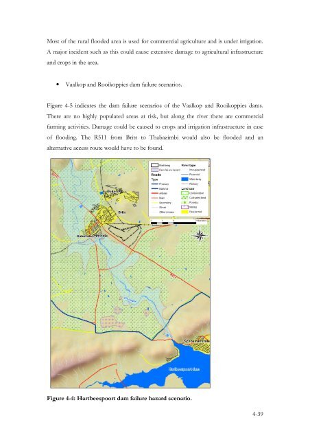
Figure 4-4: Hartbeespoort dam failure <strong>hazard</strong> scenario.<br />
4-39