Salinity situation statement Tweed River and Gnowergerup Brook
Salinity situation statement Tweed River and Gnowergerup Brook
Salinity situation statement Tweed River and Gnowergerup Brook

Create successful ePaper yourself
Turn your PDF publications into a flip-book with our unique Google optimized e-Paper software.
<strong>Salinity</strong> <strong>situation</strong> <strong>statement</strong>: <strong>Tweed</strong> <strong>River</strong> & <strong>Gnowergerup</strong> <strong>Brook</strong> WRT 41 Water Resource Technical Series<br />
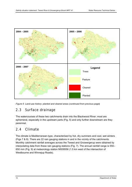
2004 – 2005<br />
2006 – 2007<br />
Figure 6 L<strong>and</strong>-use history: planted <strong>and</strong> cleared areas (continued from previous page)<br />
2.3 Surface drainage<br />
The watercourses of these two catchments drain into the Blackwood <strong>River</strong>; most are<br />
ephemeral, especially in the upstream parts (Fig. 5) <strong>and</strong> only further downstream are they<br />
perennial.<br />
2.4 Climate<br />
2005 – 2006<br />
Trees<br />
Pasture<br />
Cleared<br />
Planted<br />
Legend<br />
The climate is Mediterranean-type, characterised by hot, dry summers <strong>and</strong> cool, wet winters<br />
(Figs 7 & 8). There are 22 rain gauging stations in <strong>and</strong> in the vicinity of the catchments.<br />
Monthly catchment rainfall averages across the <strong>Tweed</strong> <strong>and</strong> <strong>Gnowergerup</strong> were obtained by<br />
interpolating data from these rain gauging stations (Fig. 7). The annual rainfall range is 550–<br />
650 mm (Fig. 9) at meteorology station M009556 (1.5 km west of the intersection of<br />
Westbourne <strong>and</strong> Winnejup Roads).<br />
10 Department of Water