

natural Hazards and Climate Change risks - GFDRR
natural Hazards and Climate Change risks - GFDRR
natural Hazards and Climate Change risks - GFDRR

You also want an ePaper? Increase the reach of your titles
YUMPU automatically turns print PDFs into web optimized ePapers that Google loves.
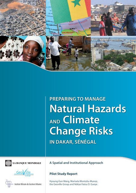
preparing to manage<br />
Natural <strong>Hazards</strong><br />
<strong>and</strong> <strong>Climate</strong><br />
<strong>Change</strong> Risks<br />
in Dakar, Sénégal<br />
LA BANQUE MONDIALE<br />
A Spatial <strong>and</strong> Institutional Approach<br />
Pilot Study Report<br />
Institut Africain de Gestion Urbaine<br />
Hyoung Gun Wang, Marisela Montoliu-Munoz,<br />
the Geoville Group <strong>and</strong> Ndèye Fatou D. Gueye
Preparing to Manage Natural <strong>Hazards</strong> <strong>and</strong><br />
<strong>Climate</strong> <strong>Change</strong> Risks in Dakar, Senegal<br />
A Spatial <strong>and</strong> Institutional Approach<br />
Pilot Study Report<br />
June 2009<br />
Hyoung Gun Wang<br />
Economist, Spatial team FEU, SDN, The World Bank<br />
Marisela Montoliu-Munoz<br />
Head, Spatial team FEU, SDN, The World Bank<br />
The Geoville Group<br />
Ndèye Fatou D. Gueye<br />
African Urban Management Institute
The International Bank for Reconstruction<br />
<strong>and</strong> Development/THE WORLD BANK<br />
1818 H Street, N.W.<br />
Washington, D.C. 20433 U.S.A<br />
June 2009<br />
This study has been prepared by the World Bank. The judgements expressed here do not<br />
necessarily reflect the views of the Board of Executive Directors or of the governments they<br />
represent.
TABLE OF CONTENTS<br />
ACKNOWLEDGEMENTS .................................................................................................... I<br />
ACRONYMS AND ABBREVIATIONS ............................................................................... II<br />
EXECUTIVE SUMMARY ..................................................................................................... 1<br />
1. Introduction .................................................................................................................. 9<br />
2. Natural Disasters in Dakar, Senegal ........................................................................ 13<br />
3. Conceptual framework for hazard, risk, <strong>and</strong> vulnerability ................................... 21<br />
3.1 Definitions........................................................................................................ 21<br />
3.2 Risk Factors <strong>and</strong> Related Information Sources ................................................ 24<br />
3.3 Hazard types..................................................................................................... 25<br />
3.4 <strong>Hazards</strong> <strong>and</strong> <strong>Climate</strong> <strong>Change</strong> ........................................................................... 27<br />
4. Spatial Analysis .......................................................................................................... 29<br />
4.1 Overview <strong>and</strong> the Definition of Peri-Urban Areas .......................................... 29<br />
4.2 Map Generation ............................................................................................... 32<br />
4.2.1 L<strong>and</strong> Use Mapping ............................................................................... 36<br />
4.2.2 Hazard Potential Maps ......................................................................... 41<br />
4.3 Spatial Analysis ............................................................................................... 48<br />
4.3.1 Methodology ........................................................................................ 48<br />
4.3.1.1 Overview ................................................................................ 48<br />
4.3.1.2 Generation of Input Data ...................................................... 51<br />
4.3.1.3 Mapping <strong>and</strong> statistical analysis ........................................... 55<br />
4.3.2 Spatial Analysis Results ....................................................................... 56<br />
4.3.2.1 L<strong>and</strong> Cover <strong>Change</strong>s ............................................................. 56<br />
4.3.2.2 Social Exposure <strong>and</strong> Vulnerability ........................................ 59<br />
4.3.2.3 Economic Exposure <strong>and</strong> Vulnerability .................................. 60<br />
4.3.2.4 Built-up Areas exposed to <strong>Hazards</strong> ....................................... 62<br />
4.3.2.5 Non-built-up Areas exposed to <strong>Hazards</strong> ............................... 65<br />
5. Hotspot Characterization <strong>and</strong> Assessment of Institutional Capacity ................... 67<br />
5.1 Overview .......................................................................................................... 67<br />
5.2 The “Primer” Survey (the City Typology <strong>and</strong> Risk Characterization Matrix) 67<br />
5.3 The survey results ............................................................................................ 69<br />
5.3.1 General data on the Departments ......................................................... 69<br />
5.3.2 Governance Structure Related to Disaster Risk Management ............. 70<br />
5.3.3 Urban Planning <strong>and</strong> L<strong>and</strong> Use Regulations ......................................... 75
5.3.4 Exposure of Political <strong>and</strong> Economic Assets to Disasters ..................... 77<br />
5.3.5 <strong>Climate</strong> <strong>Change</strong> Preparedness .............................................................. 78<br />
5.3.6 Disaster Response System ................................................................... 78<br />
5.3.7 Peri-urban Areas .................................................................................. 79<br />
5.4 Knowledge <strong>and</strong> Capacity Gaps for disaster management <strong>and</strong> climate change<br />
impacts ............................................................................................................. 80<br />
6. Moving Forward: Lessons Learned <strong>and</strong> Action Plans to Ramp up Natural<br />
Hazard <strong>and</strong> <strong>Climate</strong> <strong>Change</strong> Risk Management Practices in Dakar, Senegal .... 83<br />
6.1 Guiding principles: Hyogo Framework for Action .......................................... 83<br />
6.2 More pro-active approach to informing, motivating, <strong>and</strong> involving people in<br />
their own local communities ............................................................................ 84<br />
6.2.1 Informing, motivating, <strong>and</strong> involving people in their own local<br />
communities. ........................................................................................ 85<br />
6.2.2 Strengthening local institutional capacity <strong>and</strong> coordination. ............... 85<br />
6.2.3 Policy reforms <strong>and</strong> investments for improved hazard resilience <strong>and</strong><br />
preparedness at the local level ............................................................. 86<br />
6.3 Replication of the Pilot Study .......................................................................... 87<br />
BIBLIOGRAPHY .................................................................................................................. 89
TABLE<br />
Table 1: Components <strong>and</strong> Factors of RISK <strong>and</strong> Related Information Sources <strong>and</strong> Assessment<br />
Results ..................................................................................................................... 24<br />
Table 2: Types of Natural <strong>Hazards</strong>, Potential Anthropogenic Causes <strong>and</strong> Relations to Other<br />
<strong>Hazards</strong> .................................................................................................................... 26<br />
Table 3: Overview of the Produced Maps ............................................................................... 33<br />
Table 4: Available Multi-temporal Satellite Scenes ................................................................ 36<br />
Table 5: List of Thematic Classes for l<strong>and</strong> use change mapping ............................................ 38<br />
Table 6: Key for classifying <strong>and</strong> reporting relative <strong>natural</strong> hazard potentials at aggregated<br />
resolution (250 meter) ............................................................................................. 41<br />
Table 7: Classes Contained in the Multi-Hazard Map ............................................................. 45<br />
Table 8: List of Maps Produced for Spatial Analysis .............................................................. 49<br />
Table 9: Source Data, Preparation Methods, <strong>and</strong> Resulting Input Data for the Spatial Analysis<br />
................................................................................................................................. 51<br />
Table 10: L<strong>and</strong> Cover 1988 <strong>and</strong> 2008 <strong>and</strong> L<strong>and</strong> Cover <strong>Change</strong>s ............................................ 57<br />
Table 11: L<strong>and</strong> Price Value Exposed to High Hazard Potentials (million US$) ..................... 61<br />
Table 12: City Typology <strong>and</strong> Risk Characterization Matrix ................................................... 68<br />
Table 13: Population in Authorized <strong>and</strong> Non-authorized Human Settlements in the Dakar<br />
Metropolitan Area ................................................................................................... 70<br />
FIGURE<br />
Figure 1: The Classification of Urban, Peri-Urban, <strong>and</strong> Rural areas in the Dakar Metropolitan<br />
Area ........................................................................................................................... 2<br />
Figure 2: Hazard Mapping of the Dakar Metropolitan Area ..................................................... 3<br />
Figure 3: Hotspots of Social Exposure with High Population Growth <strong>and</strong> High Hazard<br />
Potentials VS Population Growth (1988 – 2008) in Areas with Hazard Potentials .. 4<br />
Figure 4: Flooding <strong>and</strong> Coastal Erosion Threaten Life <strong>and</strong> Resources of Dakar .................... 14<br />
Figure 5: Risk Triangle, Crichton 1999 ................................................................................... 22<br />
Figure 6:: Risk as a Function of Hazard, Vulnerability, Exposure, <strong>and</strong> Resilience ................ 23<br />
Figure 7: The Dakar Metropolitan Area, Covering the Departments of Dakar, Guédiawaye,<br />
Pikine, <strong>and</strong> Rufisque ............................................................................................... 30<br />
Figure 8: The Classification of Urban, Peri-Urban, <strong>and</strong> Rural areas in the Dakar Metropolitan<br />
Area ......................................................................................................................... 32<br />
Figure 9: Detailed L<strong>and</strong> Use Map of Dakar, 2008 ................................................................... 37<br />
Figure 10: Comparison of Detailed <strong>and</strong> Aggregated L<strong>and</strong> Use Map for Year 2008 ............... 38<br />
Figure 11: L<strong>and</strong> Use <strong>Change</strong>s, 1988, 1999, <strong>and</strong> 2008 ............................................................. 40
Figure 12: Relative Flood Potential Layer for Dakar, Senegal Aggregated to 250m Cells. .... 42<br />
Figure 13: Coastal Erosion Potential Layer for Dakar, Senegal Aggregated to 250m Cells. .. 43<br />
Figure 14: 1m Coastal Inundation Potential for Dakar, Senegal Aggregated to 250m Cells .. 44<br />
Figure 15: 5m Coastal Inundation Potential for Dakar, Senegal Aggregated to 250m Cells .. 44<br />
Figure 16: Multi-Hazard Potential in Dakar, Senegal, Including Relative Flood Potential,<br />
Coastal Erosion <strong>and</strong> 1m Coastal Inundation Potential Scenarios ........................... 46<br />
Figure 17: Multi-Hazard Potential in Separate Maps .............................................................. 47<br />
Figure 18: Synchronizing L<strong>and</strong>-Cover/Use Data with the Census Data ................................. 53<br />
Figure 19: Comparison of Census-Based (Department) <strong>and</strong> Spatially Disaggregated<br />
Population Distribution ........................................................................................... 54<br />
Figure 20: Hazard Potential Zoning Applied to the Satistical Analysis Maps ........................ 55<br />
Figure 21: Detail of Hazard map ............................................................................................. 56<br />
Figure 22: Development of the Built-up Area, 1988, 1999, <strong>and</strong> 2008 .................................... 58<br />
Figure 23: Total Share of Built-up Areas within Urban, Peri-urban, <strong>and</strong> Rural Communes in<br />
2008 ......................................................................................................................... 58<br />
Figure 24: Population Growth 1988 - 2008 in Areas with Different Hazard Potentials .......... 59<br />
Figure 25: Hot Spots of Social Exposure Given by High Population Growth between 1999<br />
<strong>and</strong> 2008 <strong>and</strong> High <strong>Hazards</strong> Potentials ................................................................... 60<br />
Figure 26: Economic Exposure to <strong>Hazards</strong> Expressed by L<strong>and</strong> Price Values (US$ per sq km)<br />
................................................................................................................................. 61<br />
Figure 27: Built-up Area in 2008 Threatened by <strong>Hazards</strong>, with Detail Shown in the Upper<br />
Part .......................................................................................................................... 63<br />
Figure 28: Share of Industrial/Commercial/Traffic Areas <strong>and</strong> Exposure to <strong>Hazards</strong> in 2008 . 64<br />
Figure 29: Non-built-up Areas 2008 Exposed to High Hazard Potentials ............................... 65<br />
Figure 30: Hazard Potentials in Non-built-up Areas ............................................................... 66<br />
BOX<br />
Box 1: Natural Hazard <strong>and</strong> Disaster Risk Overview for Dakar ............................................... 14<br />
Box 2: Natural <strong>Hazards</strong> in the Dakar Metropolitan Area ........................................................ 17<br />
Box 3: Justification for Selection of Specific Natural <strong>Hazards</strong> ............................................... 29
ACKNOWLEDGEMENTS<br />
Many people deserve acknowledgement for their valuable contributions to this study.<br />
First of all, we thank Madhu Raghunath, who set the foundations for this project during her<br />
assignment at the Spatial <strong>and</strong> Local Development Team, <strong>and</strong> Christian Diou <strong>and</strong> Sylvie<br />
Debomy (AFTU2), who have provided useful guidance <strong>and</strong> support from the perspective of<br />
the Africa Region. Mr. Diou offerd invaluable advice <strong>and</strong> facilitation of the validation <strong>and</strong><br />
dissemination workshops in Dakar, from his position at the World Bank Senegal Country<br />
Office. We are also grateful for the frank <strong>and</strong> helpful feedback of the peer reviewers, Franck<br />
Bousquet (AFTU2), Uwe Deichmann (DECRG), Daniel Hoornweg (FEU), <strong>and</strong> Madhu<br />
Raghunath (from her new position in MNSSD), whose comments have helped us strengthen<br />
this pilot study <strong>and</strong> consider ways to enhance future replications of this work.<br />
We would like to express our sincere appreciation for the support <strong>and</strong> ground-truthing<br />
comments received from the workshop participants in Dakar, Senegal, on March 5 th , 2009,<br />
including Alioune Badara Diouck, Mamadou Dieng, Abdou Birahim Diop, Mme Madeleine<br />
Diof Sarr, Mme Badiane Reine Marie Coly, Demba Ba, Adama Guèye, Aboubacry Sadikh<br />
Niang, Oumar Cissé, <strong>and</strong> Denis Jean-Jacques Jordy. A particular note of thanks is due to<br />
Gracia Sorensen (FEU) <strong>and</strong> Astou Diaw-Ba (AFCF1) who provided tireless <strong>and</strong> effective<br />
logistic assistance.<br />
Last but not least, we are grateful to the Global Facility for Disaster Response <strong>and</strong><br />
Recovery (<strong>GFDRR</strong>) for providing generous funding for this project. Saroj Kumar Jha <strong>and</strong><br />
C.Y. Ollero offered resources <strong>and</strong> encouragement, <strong>and</strong> Andrea Zanon <strong>and</strong> Segio Dell’Anna<br />
played an important facilitation role in the implementation of this study.<br />
The findings, interpretations, <strong>and</strong> conclusions expressed in this report can,<br />
nevertheless, only be attributed to the authors, <strong>and</strong> do not necessarily represent the views of<br />
the World Bank, it Executive Directors, or the countries they represent.<br />
i
ADM<br />
AOF<br />
CAPC<br />
CEP<br />
CIP<br />
CRED<br />
CRPC<br />
CSE<br />
CSPC<br />
DASSE<br />
DEM<br />
DLR<br />
DPC<br />
DRM<br />
DRR<br />
DST<br />
ACRONYMS AND ABBREVIATIONS<br />
The Municipal Development Agency<br />
Afrique Occidentale Française (French West Africa)<br />
The Auxiliary Committee of Civil Protection<br />
Coastal Erosion Potential<br />
Coastal Inundation Potential<br />
Center of Research on the Epidemiology of Disasters<br />
The Regional Committee of Civil Protection<br />
Centre of Ecological Monitoring<br />
The High Commission of Civil Protection<br />
Direction of Social, Health <strong>and</strong> Educative Affairs (Direction des Affaires<br />
Sociales Sanitaires et Educatives)<br />
Digital Elevation Model<br />
Deutsches Zentrum für Luft- und Raumfahrt (German Aerospace Center)<br />
The Division of Civil Protection<br />
Disaster Risk Management<br />
Disaster Risk Reduction<br />
Technical Services<br />
FEU, SDN The Finance, Economics <strong>and</strong> Urban Development Department, The Sustainable<br />
Development Network<br />
<strong>GFDRR</strong> The Global Facility for Disaster Reduction <strong>and</strong> Recovery<br />
GIS Geographic Information Systems<br />
GNSP Fire Department staff (Groupement National des Sapeurs Pompiers)<br />
IAGU African Urban Management Institute<br />
IPCC The Intergovernmental Panel on <strong>Climate</strong> <strong>Change</strong><br />
MSL Mean Sea Level Rise<br />
NGO Non-Governmental Organization<br />
ORSEC Organization des Secours (the National Emergency Organization Plan)<br />
PDAS Master Plan for Urban Planning <strong>and</strong> Preservation of the Niayes <strong>and</strong> the Green<br />
Zones of Senegal<br />
PDU Urban Master Plan<br />
PDUD Urban Mobility Plan for the Agglomeration of Dakar<br />
PRDI The Regional Integrated Development Plan<br />
PRSP Poverty Reduction Strategy Paper<br />
RFP Relative Flood Potential<br />
ii
SAR<br />
SPOT<br />
SRAT<br />
SRTM<br />
UN/ISDR<br />
UNDP<br />
African Oil Refinery Company<br />
Satellite Pour l'Observation de la Terre<br />
Regional L<strong>and</strong>-Use Planning<br />
The Shuttle Radar Topography Mission<br />
The United Nations International Strategy for Disaster Reduction<br />
The United Nations Development Programme<br />
iii
Peri-Urban Expansion Areas<br />
4. The definition of peri-urban areas varies across countries <strong>and</strong> can sometimes be a<br />
source of confusion. This study started by defining the broad geographic scope of the<br />
analysis, which covers an area of 550 square kilometers including <strong>and</strong> around the city center<br />
of Dakar, <strong>and</strong> stretching the Departments of Dakar, Guediawaye, Pikine, <strong>and</strong> Rufisque (see<br />
map below). Using a combination of quantitative measurements (distance to city center,<br />
population density) <strong>and</strong> qualitative observations <strong>and</strong> know-how from local experts, the study<br />
classified the communes in this broad area into three segments: Urban (Dakar center, <strong>and</strong><br />
communes with high density of urban economic <strong>and</strong> industrial activity), Rural (communes<br />
conventionally classified as “rural” according to Senegal administrative system), <strong>and</strong> Peri-<br />
Urban (communes lying in-between, exhibiting mixed l<strong>and</strong> uses <strong>and</strong> relatively lower<br />
densities than the urban communes.).<br />
Figure 1: The Classification of Urban, Peri-Urban, <strong>and</strong> Rural areas in the Dakar<br />
Metropolitan Area<br />
Spatial analysis<br />
5. The spatial analysis combines results from hazard mapping (see maps below) with<br />
population maps, l<strong>and</strong> price data, <strong>and</strong> l<strong>and</strong> cover information in order to derive the exposure<br />
of different variables in different locations to the three selected <strong>natural</strong> hazards. The scale of<br />
the spatial analysis is regional/metropolitan, a level of detail that is relevant for the<br />
2
awareness-raising <strong>and</strong> institutional engagement purposes intended here. Extensions to this<br />
analysis, not covered at the current pilot stage, may include (a) consideration of other <strong>natural</strong><br />
hazards; (b) more thorough evaluation of the potential economic impact of <strong>natural</strong> hazards,<br />
taking into account direct <strong>and</strong> indirect damages; <strong>and</strong> (c) additional analysis of more detailed<br />
geographic information systems (GIS) data, cadastres, <strong>and</strong> first-h<strong>and</strong> ground-truthing, to<br />
ascertain detailed <strong>risks</strong> faced by specific populations <strong>and</strong> built areas in the broad areas<br />
indicated here as under risk.<br />
Figure 2: Hazard Mapping of the Dakar Metropolitan Area<br />
6. Spatial analysis helps to discern the spatial relationship between the <strong>natural</strong> hazard<br />
potentials <strong>and</strong> the exposed variables, i.e. population, l<strong>and</strong> use units, <strong>and</strong> economic assets.<br />
Specifically, it generates statistical results <strong>and</strong> maps containing the following information:<br />
<br />
<br />
Potential hotspots <strong>and</strong> risk areas illustrating type <strong>and</strong> degree of vulnerability for the<br />
different risk categories <strong>and</strong> scales of risk defined previously,<br />
Built-up areas exposed to risk: general characterization of the urban l<strong>and</strong> use (i.e.<br />
residential, industrial/commercial, etc.) including type of vulnerability, <strong>and</strong><br />
Non-built-up areas exposed to risk: general characterization of the l<strong>and</strong> use,<br />
topography, <strong>and</strong> soil, including type of vulnerability.<br />
7. Spatial analysis shows that l<strong>and</strong> cover in the area under study has changed<br />
significantly in the past twenty years – the surface of urbanized areas has increased by over<br />
25% in the period, about 1% per year. Population growth over the period between 1988 <strong>and</strong><br />
3
2008 took place to a significant extent in areas that are prone to a moderate or high hazard<br />
potential. In particular, peri-urban areas have the highest percentage of population growth in<br />
hazard prone areas. In communes that are defined as peri-urban, almost 40% of new<br />
population has settled in areas with significant hazard potential from inl<strong>and</strong> flooding, coastal<br />
erosion, or sea level rise. This rate is twice as high that of urban (19%) <strong>and</strong> rural communes<br />
(23%) in the area under study.<br />
Figure 3: Hotspots of Social Exposure with High Population Growth <strong>and</strong> High Hazard<br />
Potentials VS Population Growth (1988 – 2008) in Areas with Hazard Potentials<br />
Hotspots of Social Exposure with<br />
High Population Growth <strong>and</strong> High Hazard<br />
Potentials<br />
Population Growth (1988 – 2008)<br />
in Areas with Hazard Potentials<br />
100,0%<br />
90,0%<br />
80,0%<br />
70,0%<br />
60,0%<br />
50,0%<br />
40,0%<br />
30,0%<br />
Hot-spot of population<br />
increase in high risk zones<br />
20,0%<br />
10,0%<br />
0,0%<br />
Urban Peri-urban Rural Dakar (average)<br />
Population growth in areas with low or<br />
no hazard potential<br />
Population growth in areas with<br />
high/moderate hazard potential<br />
8. A broad calculation of the exposure <strong>and</strong> vulnerability of economic assets in the area<br />
under study was inferred from the spatial analysis of l<strong>and</strong> price values. Using this method,<br />
the study estimated that the Dakar Metropolitan Area represents a total l<strong>and</strong> value of<br />
$44 billion. Out of this total value, over $2 billion or 5% is exposed to high <strong>natural</strong> hazard<br />
potentials. Given the imperfect functioning of l<strong>and</strong> markets in Dakar, this is only a very<br />
rough approximation to the exposure of economic assets to <strong>natural</strong> hazards. Further<br />
extensions of this work should refine the methodology for the calculation of economic <strong>risks</strong><br />
due to <strong>natural</strong> hazards. Nevertheless, these early estimates indicate the importance of<br />
appropriate planning to mitigate the city’s economic vulnerability to these <strong>risks</strong>.<br />
Hotspot characterization <strong>and</strong> assessment of institutional capacity<br />
9. A survey developed by the World Bank’s East Asia Region (the City Typology <strong>and</strong><br />
Risk Characterization Matrix, or simply the “Primer” Questionnaire) was adjusted to the<br />
needs of this analysis <strong>and</strong> conducted to collect information on the Dakar Metropolitan Area’s<br />
human <strong>and</strong> built environment characteristics, potential impacts of <strong>natural</strong> hazards <strong>and</strong> climate<br />
change <strong>risks</strong>, <strong>and</strong> local-level disaster management institutional capacity. The survey analysis<br />
reviewed (i) general information on four administrative Departments of the Dakar<br />
Metropolitan Area: Dakar, Guédiawaye, Pikine, <strong>and</strong> Rufisque, (ii) governance structure<br />
related to disaster risk management, (iii) urban planning <strong>and</strong> l<strong>and</strong> use regulations, <strong>and</strong> (iv)<br />
other factors such as political <strong>and</strong> economic impacts of disasters, climate change<br />
preparedness, disaster response system, <strong>and</strong> peri-urban areas.<br />
4
10. The survey found that the implementation framework for disaster risk management<br />
(DRM) is ambiguous <strong>and</strong> complex at the local level, even though Senegal has been actively<br />
pursuing Disaster Risk Reduction (DRR) strategies at the national <strong>and</strong> regional levels. For<br />
example, in the case of flooding hazard, the local mayor is often responsible for disaster<br />
response but has very little influence on mitigation as those policies are often determined at<br />
the national level. Local governments lack adequate funding for infrastructure investments<br />
<strong>and</strong> service delivery, <strong>and</strong> face the challenge of skills shortage <strong>and</strong> lack of technical capacity<br />
to deal with complex issues like climate variability <strong>risks</strong>. Furthermore, planning instruments<br />
like l<strong>and</strong> use planning, which has the ability to influence the urban-rural footprint, remains<br />
under the influence of the national government.<br />
Using Lessons Learned to Assist Awareness-Raising<br />
11. Guiding principles: Hyogo Framework for Action. The Hyogo Framework for<br />
Action is adopted as guiding principle for designing the recommendations from the current<br />
study. The Hyogo Framework is a global blueprint for disaster risk management<br />
implementation during the decade 2005-2015, adopted by the Member States of the United<br />
Nations. It underscores: (i) the need for a more pro-active approach to informing, motivating<br />
<strong>and</strong> involving people in all aspects of disaster risk reduction in their own local communities;<br />
<strong>and</strong> (ii) the scarcity of budget resources allocated to risk reduction objectives, as compared to<br />
the significant potential to better exploit existing resources <strong>and</strong> established practices for more<br />
effective disaster risk reduction. Consistent with these principles, the recommendations<br />
emerging from this study include measures that improve awareness of disaster <strong>risks</strong>, as well<br />
as a frank assessment of institutional resources <strong>and</strong> capacity for disaster management <strong>and</strong><br />
prevention in the Dakar Metropolitan Area (see summary table below).<br />
12. Informing, motivating, <strong>and</strong> involving people in their own local communities. The<br />
most immediate recommendation from this pilot study is to develop a general awareness<br />
campaign – which has already started with the process of validation <strong>and</strong> dissemination of the<br />
findings of the study. Local agencies <strong>and</strong> local communities should play a pivotal role in<br />
disaster management practices, <strong>and</strong> develop dem<strong>and</strong> for improved l<strong>and</strong> use planning <strong>and</strong><br />
disaster response. In turn, empowered local communities <strong>and</strong> agencies can play a key role in<br />
identifying areas <strong>and</strong> structures under risk, <strong>and</strong> monitoring <strong>and</strong> evaluating the implementation<br />
of the measures. Alignment with the Hyogo Framework requires a consultative <strong>and</strong><br />
participatory process that ensures sustainability <strong>and</strong> ownership of the measures proposed.<br />
13. Strengthening local institutional capacity <strong>and</strong> coordination. The study also reveals<br />
failures of capacity, accountability <strong>and</strong> coordination among local agencies <strong>and</strong> between them<br />
<strong>and</strong> agencies at other administrative levels. These are issues that require further examination<br />
<strong>and</strong> discussion among the relevant stakeholders. This study limits itself to pointing to some<br />
of the key institutional capacity <strong>and</strong> coordination issues identified. It suggests some that may<br />
be on the critical path for progress <strong>and</strong> deserve special attention, such as the identification<br />
<strong>and</strong> empowerment of an institutional champion for disaster risk management <strong>and</strong> prevention<br />
at the metropolitan level, <strong>and</strong> the development of a local database on hazards <strong>and</strong> the training<br />
of local agency staff to use it effectively.<br />
14. Policy reforms <strong>and</strong> investments for improved hazard resilience <strong>and</strong> preparedness at<br />
the local level. Beyond the immediate findings <strong>and</strong> recommendations of this study,<br />
stakeholders in Dakar need to consider what substantive policy <strong>and</strong> investment measures may<br />
be considered over time. Ultimately, policy reforms that influence behavior to promote better<br />
risk management <strong>and</strong> investments that strengthen resilience at the local level would be<br />
5
needed to improve the situation of Dakar <strong>and</strong> its peri-urban expansion areas. The findings of<br />
this study suggest the importance to focus on better local l<strong>and</strong> use planning <strong>and</strong> management,<br />
<strong>and</strong> infrastructure, <strong>and</strong> the last segment in the table below summarizes possible measures to<br />
be considered. This study does not make specific recommendations in these areas, however,<br />
as this would require a more detailed analysis. Selection of viable choices would also depend<br />
importantly on stakeholder consultation.<br />
Avenue for<br />
engagement<br />
General Awareness<br />
Campaign<br />
(Already initiated in<br />
the context of this pilot<br />
study)<br />
Strengthening Local<br />
Institutional Capacity<br />
<strong>and</strong> Inter-agency<br />
Coordination<br />
Policy Reform <strong>and</strong><br />
Investment<br />
Action plan<br />
Organize local knowledge <strong>and</strong> information dissemination<br />
activities, targeting local public agencies <strong>and</strong> local<br />
communities, on the seriousness of the <strong>natural</strong> hazards <strong>and</strong><br />
climate change impacts on their own lives, with focus on the<br />
behaviors that the population can control <strong>and</strong> improve on.<br />
Arrange collaboration <strong>and</strong> joint activities with various local<br />
agencies, academic <strong>and</strong> research institutions, non-profit<br />
organizations (NGOs) to pursue these campaigns of<br />
sensitization.<br />
Identify viable <strong>and</strong> well-recognized institutional champion at<br />
the Metropolitan Level.<br />
Initiate discussion at the highest political level for institutional<br />
strengthening <strong>and</strong> coordination <strong>and</strong> reforms:<br />
Initial focus: (a) development of early warning <strong>and</strong> quickresponse<br />
system, paying attention to currently under-served<br />
peri-urban areas; <strong>and</strong> (b) improve local organization <strong>and</strong><br />
capacity to enforce urban zoning <strong>and</strong> regulations to reduce<br />
vulnerability to <strong>natural</strong> hazards, with special focus on<br />
currently under-served <strong>and</strong> fast-growing peri-urban areas.<br />
Medium-term focus: (a) adequate resourcing of key<br />
agencies; (b) policy reform; <strong>and</strong> (c) reallocation of public<br />
expenditure <strong>and</strong> investment to local disaster risk mitigation<br />
<strong>and</strong> prevention. (See further below.)<br />
Develop a spatial database for local disaster management in<br />
the Dakar Metropolitan Area, <strong>and</strong> ensure broad access <strong>and</strong><br />
h<strong>and</strong>s-on training for local agency staff.<br />
Promote local communities’ engagement <strong>and</strong> participation in<br />
disaster prevention measures.<br />
Improve local l<strong>and</strong> use planning <strong>and</strong> management:<br />
(a) improvement of l<strong>and</strong> property right assignment <strong>and</strong><br />
enforcement, with special focus on peri-urban areas; <strong>and</strong> (b)<br />
consultative development of metropolitan development plan,<br />
including identification of disaster hotspots <strong>and</strong> corridors for<br />
urban expansion, <strong>and</strong> potential l<strong>and</strong> acquisition plans to<br />
support urban growth corridors.<br />
6
Strengthening resource base for local authorities, including<br />
through proposed betterment taxes that take advantage of<br />
improved l<strong>and</strong> management plans <strong>and</strong> corridor development.<br />
Invest in climate- <strong>and</strong> disaster-proofing infrastructure <strong>and</strong><br />
housing stock: retrofitting existing infrastructure <strong>and</strong> housing<br />
in hazard-prone areas; improving infrastructure planning <strong>and</strong><br />
monitor quality of investments.<br />
Replication of the Pilot Study<br />
15. This study was intended as a pilot to test new methodologies, <strong>and</strong> identify how the<br />
approach could be enhanced in case of replication. Interest in replicating the approach exists<br />
for other African cities, as well as for a selection of Asian cities. This pilot study may also<br />
provide the foundation for the development of a city vulnerability index to be applied to a<br />
large number of cities. In replications of this study, it is proposed that the following<br />
enhancements be considered:<br />
Consideration of a broader range of <strong>natural</strong> hazards, beyond the three included<br />
in this study.<br />
Progress toward a more robust definition of peri-urban areas.<br />
More detailed <strong>and</strong> better documented analysis of the economic impact of<br />
hazards.<br />
<br />
<br />
<br />
More detailed discussion of the methodology for population density<br />
imputation, possibly considering different relationships between building<br />
density <strong>and</strong> population density, depending on whether the area is formal or<br />
informal.<br />
Addition of information (layering) on major infrastructure (roads, electricity,<br />
sanitation).<br />
Utilization of more detailed GIS data sources, such as those captured in<br />
cadastres, to inform the more detailed economic <strong>and</strong> population analysis<br />
suggested above.<br />
16. These extensions of the current pilot study may lead to slight increases in the cost of<br />
undertaking the study in the initial replications, until the methodology is refined <strong>and</strong><br />
st<strong>and</strong>ardized.<br />
7
1. Introduction<br />
17. The Dakar Metropolitan Area (or the Region of Dakar) represents less than 1% of the<br />
national territory, but shelters 25% of its total population <strong>and</strong> 50% of its urban population.<br />
Since it was the capital city of the French West Africa (AOF), Dakar has been a hub; its<br />
strategic position was instrumental in its cultural <strong>and</strong> political leadership. Moreover, its<br />
economic, cultural, <strong>and</strong> political leadership was associated with touristic <strong>and</strong> military assets<br />
derived from a favorable geographical context.<br />
18. The Dakar Metropolitan Area has become a sprawling conurbation. This evolution<br />
was made possible by the dynamism <strong>and</strong> <strong>natural</strong> growth of its population, its role as a main<br />
exchange point, <strong>and</strong> its role as host area for migrants. With the excessive concentration of<br />
population in a small portion of space, Dakar agglomeration is a real “Human Anthill”. The<br />
rapid urbanization of the region remains uncontrolled resulting in huge problems in terms of<br />
meeting the basic needs in housing, l<strong>and</strong>, mobility, life environment, <strong>and</strong> urban poverty.<br />
19. The urban structure is marked by imbalances <strong>and</strong> lack of integration as a result of<br />
ineffective l<strong>and</strong> management <strong>and</strong> lack of strategic planning at the local <strong>and</strong> regional levels.<br />
The Government’s urban investments are mostly concentrated in the city center (the<br />
Department of Dakar) at the expense of the peri-urban areas – labor supplying areas where<br />
half of the total population of the region lives. Yet this social <strong>and</strong> infrastructural disparity<br />
promotes the spillover of migration from the city center, its peri-urban areas, <strong>and</strong> its close<br />
hinterl<strong>and</strong>s resulting in degradation of the life environment.<br />
20. Dakar’s housing <strong>and</strong> l<strong>and</strong> markets face a number of interrelated challenges in terms of<br />
access <strong>and</strong> affordability; it has become increasingly hard to meet the rapidly increasing<br />
dem<strong>and</strong> for these goods within the city’s perimeter, in the context of price inflation <strong>and</strong> l<strong>and</strong><br />
speculation. As a consequence, the suburbanization of the region has accelerated, creating<br />
new problems – for instance, those associated with property rights <strong>and</strong> management:<br />
ownership is often unclear or uncertified in peri-urban areas. As underscored by World<br />
Development Report 2009: Reshaping Economic Geography (World Bank, 2008a), wellfunctioning<br />
l<strong>and</strong> markets are essential to facilitate the movement of the population toward<br />
economic opportunity, as well as the evolution of l<strong>and</strong> uses from lower to higher value or,<br />
more importantly, the allocation of l<strong>and</strong> to the most efficient uses.<br />
21. The current territorial <strong>and</strong> administrative organization of the Dakar Metropolitan Area<br />
is complex, with interlocking of various forms of governance (Region, Department,<br />
Arrondissement, Commune, Rural communities). At the larger, regional level, the “Region”<br />
is headed by the governor (appointed), followed by the “Department,” headed by the Prefect<br />
(appointed). At the local level, there are three types of distinct territorial or administrative<br />
units: the “Arrondissement” is headed by the Sous-prefect (appointed), the “Communes” by<br />
the Mayor (elected), <strong>and</strong> the “Rural Communities” by the President of rural community<br />
(elected).<br />
22. This institutional complexity <strong>and</strong> ambiguity generates a fragmentation of local<br />
policies <strong>and</strong> power conflict at various levels (administrative <strong>and</strong> institutional). In addition,<br />
the weight of the national <strong>and</strong> regional governments can often undermine local authorities<br />
<strong>and</strong> local public action. With the ongoing decentralization reform, administrative authorities<br />
<strong>and</strong> decentralized public services are in fact losing weight. The relationships between local<br />
authorities <strong>and</strong> the national <strong>and</strong> regional administrations are not very well defined, mixing<br />
autonomy, assistance, <strong>and</strong> supervision. The excessive “agencization” of the Government<br />
9
activities <strong>and</strong> key projects results in higher density <strong>and</strong> more complex government structure,<br />
with new ad-hoc agencies carrying out the missions the ministries are expected to take.<br />
23. The Dakar Metropolitan Area is characterized by a lack of dialogue between the<br />
administration services, the administration <strong>and</strong> local authorities, <strong>and</strong> between the local<br />
authorities. The populations, the civil society, <strong>and</strong> the private sector are only weakly involved<br />
in urban management.<br />
24. Dakar has been a hub of cultural <strong>and</strong> political leadership <strong>and</strong> the destination of large<br />
rural-urban migrations since the 1960s. Recent satellite imagery reveals contiguous<br />
expansion of urban built-up areas over the decades, with a large proportion of the urban<br />
growth occurring in the peri-urban areas (outer suburbs) of the city center. As the Dakar<br />
Metropolitan Area experiences rapid urban expansion, it faces increased vulnerability to<br />
<strong>natural</strong> hazards <strong>and</strong> climate change <strong>risks</strong>.<br />
25. Overlaid on top of this confluence of political <strong>and</strong> demographic factors, the <strong>natural</strong><br />
hazard <strong>risks</strong> faced by the Dakar Metropolitan Area make for a truly complex picture in terms<br />
of ensuring safe livelihoods <strong>and</strong> an enabling environment for economic productivity. In order<br />
to meet those challenges <strong>and</strong> to manage rapid urbanization in the areas likely to be hit by<br />
<strong>natural</strong> hazards or undergo climate change impacts, the knowledge <strong>and</strong> response capacity of<br />
the local authorities need to be significantly improved.<br />
26. The World Bank’s Spatial <strong>and</strong> Local Development Team (FEU, SDN) <strong>and</strong> the World<br />
Bank-housed Global Facility for Disaster Response <strong>and</strong> Recovery (<strong>GFDRR</strong>), in collaboration<br />
with colleagues from the World Bank Senegal Country Office, have launched an innovative<br />
pilot study. The main objectives of this study are two pronged:<br />
27. First, it develops a new generic methodology combining spatial <strong>and</strong> institutional<br />
analyses at reasonable costs, which would serve a st<strong>and</strong>ard assessment template ready to<br />
replicate to other cities <strong>and</strong> other countries. This will benefit global disaster management<br />
practitioners <strong>and</strong> communities.<br />
28. Second, it provides action plans for Dakar, Senegal to ramp up disaster management<br />
practices. We aim at providing an overarching strategic framework in bottom-up <strong>and</strong><br />
sensitization perspectives, rather than a list of extensive top-down directions <strong>and</strong> micromanagement<br />
recommendations. We believe the latter is counter-productive, unsustainable,<br />
<strong>and</strong> inconsistent with our guiding principle: informing, motivating, <strong>and</strong> involving people in<br />
all aspects of disaster risk reduction in their own local communities. This element will benefit<br />
directly local communities in the Dakar Metropolitan Area as well as Senegal governments in<br />
general.<br />
29. In this regard, this study (i) develops state-of-the-art spatial analysis tools to spatially<br />
evaluate <strong>natural</strong> hazard <strong>and</strong> climate change <strong>risks</strong>, <strong>and</strong> (ii) addresses the critical knowledge<br />
<strong>and</strong> capacity gaps of local governments in dealing with rapid peri-urban expansion into areas<br />
that may face vulnerability to <strong>natural</strong> hazards, including those <strong>risks</strong> associated with climate<br />
variability. Three pillars of activities are being implemented sequentially.<br />
Activity 1: Spatial Analysis of Natural Hazard <strong>and</strong> <strong>Climate</strong> <strong>Change</strong> Risks <strong>and</strong> Hotspot<br />
Characterization in Peri-Urban Expansion Areas of Dakar, Senegal<br />
30. Activity 1 develops a methodology for the generation of hazard <strong>and</strong> vulnerability<br />
maps for the Dakar Metropolitan Area. Three types of hazards are selected for detailed spatial<br />
analysis: Flooding (inl<strong>and</strong> flooding of depressions), Coastal Erosion, <strong>and</strong> Sea Level Rise. The<br />
10
occurrence of flooding within the area of Dakar has recently been increasing for climatic <strong>and</strong><br />
anthropogenic reasons, <strong>and</strong> constitutes a major threat especially for newer settlements in<br />
unsuited low-lying terrain. Coastal erosion as a more steadily acting, but very hazardous<br />
process in the area is included in the detailed analysis along with scenarios of sea level rise.<br />
31. Satellite imagery at different time points (1988, 1999, <strong>and</strong> 2008) <strong>and</strong> hazards<br />
information from various sources are collected, geo-processed, <strong>and</strong> integrated for the<br />
thematic map generation. These maps include l<strong>and</strong> use profiles, geology, hydrology, single<br />
<strong>and</strong> multi <strong>natural</strong> hazard maps (flooding, coastal erosion <strong>and</strong> sea level rise scenarios). Spatial<br />
analysis combines all these information, <strong>and</strong> produces hazard risk profiles in the Dakar<br />
Metropolitan Area. The concepts <strong>and</strong> methods follow best-known st<strong>and</strong>ards <strong>and</strong> scientific<br />
approaches.<br />
Activity 2: Hotspot Characterization <strong>and</strong> Assessment of the Institutional Capacities at<br />
the Local Level<br />
32. Activity 2 implements a local field survey for the hotspot characterization of the four<br />
departments in the Dakar Metropolitan Area: Dakar, Pikine, Guédiawaye <strong>and</strong> Rufisque, <strong>and</strong><br />
identifies the inter-relationship between governance structure, urban-rural characteristics,<br />
disaster <strong>risks</strong> <strong>and</strong> climate change preparedness. The survey also examines the institutional<br />
capacity at the local level. The activity combines survey results <strong>and</strong> assesses gaps in the<br />
prevention <strong>and</strong> mitigation capacity of local governments with respect to the particular <strong>risks</strong><br />
that they face as their cities exp<strong>and</strong> beyond their current jurisdictions.<br />
Activity 3: Action Plans to Ramp up Natural Hazard <strong>and</strong> <strong>Climate</strong> <strong>Change</strong> Risk<br />
Management Practices in Dakar, Senegal<br />
33. Activity 3 proposes action plans of Dakar to ramp up <strong>natural</strong> hazard <strong>and</strong> climate<br />
change risk management practices. The guidelines <strong>and</strong> action plans draw on the findings of<br />
Activities 1 <strong>and</strong> 2 <strong>and</strong> the international consensuses on best-practice exercises.<br />
34. The guiding principle is “more pro-active approach to informing, motivating, <strong>and</strong><br />
involving people in their own local communities,” as articulated in the Hyogo Framework for<br />
Action 2005-2015. Local agencies <strong>and</strong> local communities should play a pivotal role in<br />
disaster management practices, <strong>and</strong> correspondingly empowered to ramp up disaster<br />
management practices. The empowerment should follow four venues of engagements.<br />
<br />
<br />
<br />
First, local agencies <strong>and</strong> local communities should be better informed.<br />
Construction of a spatial database for local disaster management <strong>and</strong><br />
sensitization is highly recommended.<br />
Second, local agencies <strong>and</strong> local communities should be provided more<br />
resources <strong>and</strong> administrative support (from national <strong>and</strong> regional<br />
governments) to implement <strong>and</strong> enforce disaster-mitigating l<strong>and</strong>-use<br />
regulations effectively.<br />
Third, disaster management in peri-urban expansion areas, which are often<br />
politically <strong>and</strong> economically neglected, should be addressed in long-term<br />
inclusive local development perspectives.<br />
11
Fourth, Sensitization activities to wake up public awareness on <strong>natural</strong> hazards<br />
<strong>and</strong> climate change <strong>risks</strong> are a key trigger for more sustainable <strong>and</strong> inclusive<br />
disaster management.<br />
12
2. Natural Disasters in Dakar, Senegal<br />
35. Flooding is one of the most severe hazards threatening Dakar, <strong>and</strong> in the last years it<br />
has become a frequent <strong>and</strong> enduring reality. The underlying causes are complex <strong>and</strong> involve<br />
not only the recent increase of rainfalls, but in particular the whole socio-economic process of<br />
an out-of-control urban sprawl. The consequences are devastating: “Three months since<br />
183,000 people in Dakar were affected by severe floods resulting from torrential rains, many<br />
houses <strong>and</strong> schools are still floating in water.” 2<br />
36. Moreover, Senegal is one of the countries that suffer most from coastal erosion:<br />
“Currents sweep away the s<strong>and</strong> from Rufisque’s coast <strong>and</strong> deposit it further south. The beach<br />
is slowly being hollowed out <strong>and</strong> the shore is receding. Abdoulaye Ndiayhe, an old fisherman<br />
who offers his services as guide, insists that more than 100 meters once separated the sea<br />
from a house whose ruins are now being lapped by the waves.” 3<br />
37. Around Dakar, the maritime domain is crowed with hotels -- already operating or in<br />
construction – buildings touching the sea which may result in rock slides <strong>and</strong> tidal waves.<br />
There are various causes of coastal erosion, whether they are <strong>natural</strong> or entropic. But global<br />
warming generated by greenhouse gas may increase sea level. Coastal erosion can therefore<br />
be regarded as a phenomenon in progress. Surveys on the impacts of climate change in the<br />
Senegalese coastal areas (Denis et al. 1995; Niang-Diop et al. in press) show that the increase<br />
of the sea level can result in floods in the lower coastal areas <strong>and</strong> increased salinization of<br />
l<strong>and</strong>s <strong>and</strong> of surface <strong>and</strong> ground waters.<br />
38. In the Cap-Vert Peninsula, coastal erosion is felt in both beaches <strong>and</strong> rocky shores.<br />
The main identified erosion areas include: the area of Camberene-Yoff, the West <strong>and</strong> East<br />
ledges of Dakar, <strong>and</strong> the bay of Hann. It is worth mentioning the Mbeubeuss quarries which<br />
show serious signs of erosion. Coastal erosion is particularly felt in the area of Rufisque-<br />
Bargny with the narrowing of the beach of Rufisque, particularly along the center of the city,<br />
resulting, in the sectors of Merina <strong>and</strong> Thiawlene, in overhanging buildings <strong>and</strong> stripped<br />
roads. 4<br />
39. The rocky sector of the tip of the Cap-Vert Peninsula is an unstable area. Based on the<br />
observation of the Madeleines, Fall et al. (1996) proposed annual rates between 0.8 <strong>and</strong> 1.4 m<br />
for the loamy cliffs of the Hospital reaching 4m at the volcanic tuffs of the Pasteur beach. For<br />
all the West <strong>and</strong> East ledges, Diop (2000) indicates that between 1980 <strong>and</strong> 1997 the annual<br />
gradual disappearance rate of the littoral is 0.45 <strong>and</strong> 2.7m. The most affected sector being the<br />
Madeleine <strong>and</strong> the Rebeuss beach.<br />
40. Thus, the below shown pictures are only small glimpses of the extent of the hazards<br />
that are threatening <strong>and</strong> afflicting the Dakar Metropolitan Area. The flood map shown in<br />
Figure 3 gives an impression of the dimension of the 2008 flooding. Both, flooding <strong>and</strong><br />
coastal erosion, are to a large part caused by human behavior <strong>and</strong> are exacerbated by <strong>Climate</strong><br />
<strong>Change</strong>.<br />
2 http://www.planuk.org/wherewework/westafrica/senegal/floodsindakar/.<br />
3 http://portal.unesco.org/en/ev.php-<br />
URL_ID=30499&URL_DO=DO_PRINTPAGE&URL_SECTION=201.html<br />
4 Rapport sur l’état de l’environnement au Sénégal. Edition 2005. Centre de Suivi Ecologique.<br />
13
Figure 4: Flooding <strong>and</strong> Coastal Erosion Threaten Life <strong>and</strong> Resources of Dakar<br />
Upper left: A desperate impression of the<br />
recent flood<br />
http://www.solarpanel.co.za/globalwarming.htm<br />
Upper right: September 2008 in Dakar<br />
http://wow.gm/africa/senegal/dakar/article/200<br />
8/9/10/senegal-flooding-spreads-as-rainscontinue<br />
Lower left: Senegal: Coastal Zones at the<br />
Mercy of the Waves<br />
http://portal.unesco.org/en/ev.php-<br />
URL_ID=30499&URL_DO=DO_PRINTPAG<br />
E&URL_SECTION=201.html<br />
Box 1: Natural Hazard <strong>and</strong> Disaster Risk Overview for Dakar<br />
Overview<br />
(Source:<br />
http://ww2.unhabitat.org/programmes/uef/cities/summary/dakar.htm 5<br />
Dakar, the political <strong>and</strong> economic capital of Senegal, has a metropolitan population of over<br />
1.8 million; thus, it concentrates 22% of the country's population on 0.1% of its l<strong>and</strong>. The<br />
metropolitan region enjoys a temperate coastal climate. It is located on a peninsula that can<br />
be divided into three zones: a) an eastern section of volcanic outflow, s<strong>and</strong>s <strong>and</strong> a large<br />
plateau; b) a central region of dunes <strong>and</strong> depressions; <strong>and</strong> c) a western section of undulating<br />
hills <strong>and</strong> plateaus.<br />
5 UN-Habitat (no date given): Identifying Geographic <strong>and</strong> Thematic Environmental Issues through Consultation.<br />
http://ww2.unhabitat.org/programmes/uef/cities/summary/dakar.htm<br />
14
Economy<br />
(Source: http://ww2.unhabitat.org/programmes/uef/cities/summary/dakar.htm<br />
Economically, Dakar generates 68% of Senegal's GDP <strong>and</strong> its workers account for 66% of<br />
the national wage bill. 80% of the country's industries are located in the metropolitan<br />
region. In resource use, Dakar consumes three-quarters of Senegal's piped water <strong>and</strong> 40% of<br />
its charcoal. The unemployment rate is 30% <strong>and</strong> 40% of the active work force is employed<br />
in the informal sector. About 13% of the population is estimated to be living below the<br />
country's poverty line.<br />
Settlement Structures<br />
(Source: http://ww2.unhabitat.org/programmes/uef/cities/summary/dakar.htm<br />
Spatially, urban development is characterized by a preponderance of informal settlements<br />
with limited access <strong>and</strong> poor transportation, <strong>and</strong> inadequate infrastructure <strong>and</strong> services. Two<br />
of every three newly-established households in the metropolitan region are sub-st<strong>and</strong>ard.<br />
Unplanned settlements have made it difficult to gain access to <strong>and</strong> to connect<br />
neighborhoods, <strong>and</strong> have put additional strain on the existing transportation network. Lowincome<br />
districts tend to be the most underserved; for example, in the central city 61% of<br />
households have piped water but this figure drops to 16% in the poor district of Rufisque.<br />
<strong>Hazards</strong><br />
(Source: http://ww2.unhabitat.org/programmes/uef/cities/summary/dakar.htm<br />
Problems of environmental health - malaria, gastrointestinal diseases <strong>and</strong> upper respiratory<br />
tract infections are prevalent in Dakar's poorer neighborhoods <strong>and</strong> are linked with poor<br />
sanitation <strong>and</strong> waste management.<br />
Water pollution - Dakar's most important aquifer is located close to the surface, making it<br />
vulnerable to malfunctioning sanitary systems <strong>and</strong> other domestic wastewater. The risk of<br />
bacteriological contamination is greatest for those who draw water from those who draw<br />
water from the aquifer's 5000 unregulated wells.<br />
Natural <strong>risks</strong> - the city is exposed to frequent <strong>and</strong> constant <strong>natural</strong> <strong>risks</strong>. Flooding,<br />
though infrequent, can be devastating. The last major flood affected 10,000 families; it is<br />
estimated that the next major flood will cause nearly $9 million worth of damage. Damage<br />
from coastal erosion is a more constant risk.<br />
Industrial <strong>risks</strong> - Dakar's citizens have experienced a series of fatal industrial accidents.<br />
These are linked to poor workplace safety, proximity of industrial activities <strong>and</strong> residential<br />
areas, a low level of public information, <strong>and</strong> lack of enforcement of safety measures <strong>and</strong><br />
other rules.<br />
Recent climatic developments <strong>and</strong> implications for Dakar<br />
(Source: http://findarticles.com/p/articles/mi_go2454/is_/ai_n29342505 )<br />
Senegal benefits from a Sudano-Guinean climate <strong>and</strong> thus from more favorable ecological<br />
conditions in the southern part of its territory. Furthermore, the temperate climate of the<br />
Atlantic seaboard has played an important role in the establishment of most of its major<br />
cities. The resulting imbalances between North <strong>and</strong> South, East <strong>and</strong> West, both ecogeographically<br />
<strong>and</strong> with respect to economic potential, significantly influence the internal<br />
mobility of the population. Reflecting these factors, Senegal's current population of almost<br />
15
11 million is distributed very unevenly across the country's total area of 196 722.<br />
Changing climatic conditions have stimulated this mobility <strong>and</strong> contributed to reinforcing<br />
the role of urbanization. Indeed, like most West African nations, particularly those of the<br />
Sahelian region, Senegal has experienced a complete upheaval in its climatic norms since<br />
the mid-1960s, when a long period (1950-67) of surplus rainfall caused the rapid growth of<br />
the overall population <strong>and</strong> an augmentation of rural population density.<br />
Jean Leborgne points to three distinct periods of rainfall deficit (1970-3, 1976-7, 1983-4)<br />
punctuating the long period of drought in the Sahelian region between 1970 <strong>and</strong> 1990. The<br />
climate in Senegal is regulated by a rainy season of 3-4 months <strong>and</strong> a dry season of 8-9<br />
months, <strong>and</strong> the <strong>natural</strong> world proves extremely vulnerable to climatic variations (Michel<br />
1990). Because the Senegalese economy is based principally on agriculture (peanuts, millet,<br />
sorghum, rice, cotton, manioc, sugar cane <strong>and</strong> niebe), the chronic drought since the 1970s<br />
has had a traumatic effect.<br />
The crisis of the economic motor that is agriculture inspired a massive migration toward<br />
the cities <strong>and</strong> increasingly to foreign countries.<br />
The capital, Dakar, has been the principal destination for the rural exodus <strong>and</strong> the<br />
principal site for observing the most pertinent problems caused by this migration <strong>and</strong><br />
accelerated urbanization. The development of Dakar has manifested itself by a rapid spatial<br />
expansion, resulting from intrinsic demographic dynamism (<strong>natural</strong> increase) <strong>and</strong> migratory<br />
influx from regions of the interior (net immigration). The Dakar agglomeration, with a<br />
population now estimated at some 4 million, thus constitutes the most important site of<br />
socialization <strong>and</strong> invention of Senegalese society.<br />
As a result of the enduring internal migration, Senegal's population was already over 48%<br />
urban in 2001, one of the highest levels of urbanization in mainl<strong>and</strong> sub-Saharan Africa.<br />
Over 76% of this urban population lived in areas classified as slums, which were<br />
growing at over 4% p.a. (UN-HABITAT 2006, 188).<br />
The degradation of marine ecosystem conditions through climatic change <strong>and</strong> other<br />
factors has left Senegalese fishermen, especially the youngest age cohorts, destitute <strong>and</strong> thus<br />
drives them toward massive emigration to Spain on traditional fishing boats, as now<br />
regularly featured in international news reports. This dramatic phenomenon sees thous<strong>and</strong>s<br />
of immigrants searching for a better life through suicidal voyages from the Senegalese<br />
coastline.<br />
(Highlighted text by author of this study)<br />
16
Box 2: Natural <strong>Hazards</strong> in the Dakar Metropolitan Area<br />
Hazard Type<br />
<strong>and</strong> Hazard<br />
characteristics<br />
Information, maps, <strong>and</strong> data provided by various<br />
sources<br />
References<br />
Flooding<br />
Local<br />
occurrence in<br />
depressions<br />
Human factors<br />
are very<br />
important<br />
factors of<br />
flooding<br />
Recent<br />
increase due to<br />
increased<br />
rainfall<br />
Flooding<br />
closely linked<br />
to the<br />
geological<br />
setting of the<br />
area<br />
Scientific paper on the relationship between Urban sprawl<br />
<strong>and</strong> flooding at Yeumbeul suburb. In depth analysis of the<br />
<strong>natural</strong>, human <strong>and</strong> external causes of flooding.<br />
“The most important factor is the human factors with the<br />
poor management of l<strong>and</strong> <strong>and</strong> the occupation of<br />
depressions”.<br />
Scientific paper on Problems associated with flooding in<br />
Dakar, western Senegal: influence of geological setting <strong>and</strong><br />
town management<br />
“The increase of both flooding in some districts <strong>and</strong> the<br />
environmental damage that is taking place year by year are<br />
closely linked to the geological setting of the area, notably<br />
the topography <strong>and</strong> geomorphologic processes. These<br />
factors are so important that decision makers must take full<br />
account of them when considering any new proposals for<br />
development”.<br />
“The last major flood affected 10,000 families; it is<br />
estimated that the next major flood will cause nearly $9<br />
million worth of damage”<br />
Mbow, C.,<br />
Diop, A.,<br />
Diaw, A.T.,<br />
Niang,<br />
(2008) 6<br />
Lo , P.G.,<br />
Diop, M.B. 7<br />
UN-Habitat 8<br />
Flood map of Western Africa from Sept. 30, 2008 ReliefWeb 9<br />
Aug.Sept. 2005<br />
Heaviest rains in Dakar in two decades. Worst affected<br />
were Pikine <strong>and</strong> Guediawaye shanty towns outside Dakar.<br />
Worst floods in 20 years in Senegal’s suburbs.<br />
"reconstruction required after the floods would cost some<br />
45 billion CFA francs"<br />
Dartmouth<br />
Flood<br />
Observatory<br />
10<br />
6 Mbow, C., Diop, A., Diaw, A.T., Niang (2008): Urban sprawl development <strong>and</strong> flooding at Yeumbeul suburb<br />
(Dakar-Senegal). African Journal of Environmental Science <strong>and</strong> Technology Vol. 2 (4), pp. 075-088<br />
http://www.academicjournals.org/AJEST/PDF/pdf%202008/April/Mbow%20et%20al.pdf<br />
7 Lo , P.G., Diop, M.B. (2000): Problems associated with flooding in Dakar, western Senegal: influence of<br />
geological setting <strong>and</strong> town management. Bull. Eng. Geol. Env. 58, p 145-149.<br />
8 UN-Habitat (no date given): Identifying Geographic <strong>and</strong> Thematic Environmental Issues through Consultation.<br />
http://ww2.unhabitat.org/programmes/uef/cities/summary/dakar.htm<br />
9 ReliefWeb: Floods in Western Africa (as of 30 Sep 2008).<br />
http://www.reliefweb.int/rw/rwb.nsf/db900SID/LPAA-7JZBJQ?OpenDocument&rc=1&cc=sen<br />
10 Dartmouth Flood Observatory, Global Active Archive of Large Flood Events.<br />
http://www.dartmouth.edu/%7Efloods/Archives/2008.xml<br />
17
Hazard Type<br />
<strong>and</strong> Hazard<br />
characteristics<br />
Coastal Erosion<br />
Information, maps, <strong>and</strong> data provided by various<br />
sources<br />
Floods reported for Dakar: 2008, 2007 (2003, 2002, 2000)<br />
“Thous<strong>and</strong>s have been affected by flooding in more than<br />
40 neighborhoods across Senegal, including 21 Dakar<br />
suburbs according to the Senegalese fire rescue services.<br />
AFP has reported at least one drowning”.<br />
“Dakar neighborhoods affected include Pikine,<br />
Guédiawaye, Thiaroye <strong>and</strong> Diamaguène, according to<br />
Mayé Konate, spokesman the National Association of<br />
Firefighters”.<br />
But Youcef Ait Chellouche, disaster management<br />
coordinator at the IFRC, warns the problems are only<br />
beginning. “We need to be ready for potential epidemics –<br />
like cholera – to break out as the water starts to subside.<br />
We are closely monitoring this situation.”<br />
“Flooding worsened a cholera epidemic already underway<br />
in Dakar in 2005, which eventually infected more than<br />
23,000 people”.<br />
“The two districts are Guédiawaye <strong>and</strong> Pikine, both of<br />
which are in coastal wetl<strong>and</strong> zones. Particularly affected is<br />
the neighborhood of Wakhinane Nimzatt, which means<br />
“dig <strong>and</strong> drink” in the local language Wolof”.<br />
“Building on wetl<strong>and</strong>s exacerbates the flood situation”,<br />
said Sysall. “These wetl<strong>and</strong>s are not viable for<br />
construction.”<br />
The rural exodus to Dakar has contributed greatly to the<br />
flood problem, as newcomers build houses illegally, but<br />
the government is planning a tougher stance.<br />
“Analysis of the results shows that the slides were<br />
influenced by the geotechnical properties of the soil, the<br />
References<br />
GLIDE<br />
Disaster<br />
Data Base 11<br />
SENEGAL:<br />
Flooding<br />
spreads as<br />
rains<br />
continue 12<br />
SENEGAL:<br />
Thous<strong>and</strong>s<br />
displaced<br />
from their<br />
Dakar<br />
homes 13<br />
Fall, M.,<br />
Azzam, R.,<br />
11 GLIDE Disaster Data Base, http://www.glidenumber.net/glide/public/search/search.jsp<br />
12 SENEGAL: Flooding spreads as rains continue.<br />
http://wow.gm/africa/senegal/dakar/article/2008/9/10/senegal-flooding-spreads-as-rains-continue<br />
13 SENEGAL: Thous<strong>and</strong>s displaced from their Dakar homes.<br />
http://wow.gm/africa/senegal/dakar/article/2008/10/7/senegal-thous<strong>and</strong>s-displaced-from-their-dakar-homes<br />
18
Hazard Type<br />
<strong>and</strong> Hazard<br />
characteristics<br />
Permanent<br />
process<br />
Cliff retreat<br />
rates up to 2m<br />
p.a.<br />
Human factors<br />
contribute, e.g.<br />
via s<strong>and</strong><br />
extraction<br />
Drought<br />
Major hazard<br />
of the area<br />
when regarded<br />
at a continental<br />
scale.<br />
Drought is an<br />
Information, maps, <strong>and</strong> data provided by various<br />
sources<br />
weathering, the hydrogeological situation, <strong>and</strong> the erosion<br />
by waves”.<br />
“It was demonstrated that the tuff cliffs retreated 10 to 60<br />
m between 1953 <strong>and</strong> 1981. This agrees with the poor<br />
geotechnical properties of the volcanic tuffs. The recession<br />
of the loam cliffs in this period is 10 to 20 m. The basalt<br />
cliffs show the lowest recession because of their high<br />
strength”.<br />
“The village is facing a serious coastal erosion problem;<br />
the outer row of fisher folk houses has already been<br />
destroyed by the sea <strong>and</strong> thus ab<strong>and</strong>oned by the population.<br />
Assistance from specialists in coastal dynamics/processes<br />
is an urgent requirement”.<br />
“Like many other coastal cities in West Africa, Dakar is<br />
prone to several coastal hazards. The most serious among<br />
these hazards is coastal erosion”.<br />
“The effect of nature is through two modes of strong <strong>and</strong><br />
constant swells <strong>and</strong> the action of tidal waves during roughsea<br />
seasons. The contribution of human beings is due to a<br />
cumulative effect of poor city planning <strong>and</strong><br />
overpopulation”.<br />
“This concentration of people led to a construction boom,<br />
<strong>and</strong> then, to excessive s<strong>and</strong> extraction from beaches <strong>and</strong><br />
dunes”.<br />
Droughts are a common meteorological phenomenon in the<br />
Sahel zone, <strong>and</strong> are caused by recurring, large-scale shifts<br />
in the general global circulation. They may be aggravated<br />
by climate change, or climate variability may further<br />
increase with climate change.<br />
Droughts decrease agricultural yields <strong>and</strong> led in the past<br />
decades to the tremendous migrations of people to Dakar<br />
References<br />
Noubactep,<br />
C. 14<br />
UNESCO-<br />
Dakar<br />
Office 15<br />
Sane, M.,<br />
Yamagishi,<br />
H. 16<br />
Mbow, C.,<br />
Diop, A.,<br />
Diaw, A.T.,<br />
Niang, ..<br />
(2008) 17<br />
14 Fall, M., Azzam, R., Noubactep, C. (2006): A multi-method approach to study the stability of <strong>natural</strong> slopes<br />
<strong>and</strong> l<strong>and</strong>slide susceptibility mapping. Engineering Geology 82 241– 263.<br />
http://cat.inist.fr/?aModele=afficheN&cpsidt=17446593<br />
15 UNESCO-Dakar Office: Socio-cultural survey of the Yoff coastal community, Senegal: conserving biological<br />
<strong>and</strong> cultural diversity. http://www.unesco.org/csi/act/dakar/projec4e.htm<br />
16 Sane, M., Yamagishi, H. (2004): Coastal Erosion in Dakar, Western Senegal, Journal of the Japan Society of<br />
Engineering Geology, Vol. 44; No. 6; p. 360-366. http://sciencelinks.jp/jeast/article/200407/000020040704A0134339.php<br />
(abstract)<br />
17 Mbow, C., Diop, A., Diaw, A.T., Niang (2008): Urban sprawl development <strong>and</strong> flooding at Yeumbeul suburb<br />
(Dakar-Senegal). African Journal of Environmental Science <strong>and</strong> Technology Vol. 2 (4), pp. 075-088<br />
http://www.academicjournals.org/AJEST/PDF/pdf%202008/April/Mbow%20et%20al.pdf<br />
19
Hazard Type<br />
<strong>and</strong> Hazard<br />
characteristics<br />
indirect driver<br />
for severe other<br />
hazards (e.g.<br />
flooding) in the<br />
Dakar<br />
Metropolitan<br />
Area.<br />
Earthquakes<br />
Tornado<br />
Information, maps, <strong>and</strong> data provided by various<br />
sources<br />
<strong>and</strong> other urban areas. Thus, droughts lead indirectly to the<br />
problems <strong>and</strong> hazards within the Dakar Metropolitan Area<br />
itself.<br />
The earthquake potential is low in Dakar according to the<br />
Nathan data base of Munich Re, though not totally absent.<br />
There is a medium probability of tornados according to<br />
Munich Re, on a four-point scale ranging from low over<br />
medium to high <strong>and</strong> very high.<br />
References<br />
Munich Re,<br />
Nathan 18<br />
Munich Re,<br />
Nathan<br />
Hail Storm The Hailstorm probability is low (from low – medium –<br />
high) according to Munich Re.<br />
Munich Re,<br />
Nathan<br />
41. At the environmental level, despite the efforts made, pollution is prevailing in the<br />
bays surrounding Dakar such as the Bay of Hann. The other major environmental concern<br />
remains air pollution which derives from public transportation, old cars, <strong>and</strong> cement factories.<br />
The gradual colonization <strong>and</strong> degradation of the “Niayes” <strong>and</strong> other sensitive ecological areas<br />
may turn out to be the worst ecological disaster. 19 The environmental problems cannot be<br />
addressed without mentioning the “Mbeubeuss” dump, an environmental disaster-in-themaking,<br />
surrounded by human settlements <strong>and</strong> agricultural l<strong>and</strong>s.<br />
18 NATHAN Data Base by Munich Re, http://mrnathan.munichre.com/<br />
19 “Niayes” means lowl<strong>and</strong>s between parallel s<strong>and</strong> dunes. The “Gr<strong>and</strong>e Niayes” is located between Dakar <strong>and</strong><br />
Pikine. The water table is near the ground surface (ie located under the superficial s<strong>and</strong> zone).<br />
20
3. Conceptual framework for hazard, risk, <strong>and</strong> vulnerability<br />
3.1 Definitions<br />
42. There is a variety of definitions of hazards, risk, vulnerability, <strong>and</strong> related terms, as<br />
listed in Thywissen (2006). The definitions <strong>and</strong> underst<strong>and</strong>ing of these terms reflect the<br />
attitude towards the underlying causes <strong>and</strong> factors of risk <strong>and</strong>, at the same time, influence<br />
concepts <strong>and</strong> strategies of disaster management. As Thywissen points out, there has been a<br />
shift from regarding disasters as extreme events caused by <strong>natural</strong> forces, to viewing them as<br />
manifestations of unresolved (human) development problems.<br />
<strong>Hazards</strong><br />
43. Among the many definitions of ‘Hazard’, the one of the United Nations International<br />
Strategy for Disaster Reduction (UN/ISDR) is frequently found in the relevant literature <strong>and</strong><br />
is taken here as a st<strong>and</strong>ard definition:<br />
A potentially damaging physical event, phenomenon or human activity that may cause<br />
the loss of life or injury, property damage, social <strong>and</strong> economic disruption or<br />
environmental degradation. <strong>Hazards</strong> can include latent conditions that may represent<br />
future threats <strong>and</strong> can have different origins: <strong>natural</strong> (geological, hydrometeorological<br />
<strong>and</strong> biological) or induced by human processes (environmental degradation <strong>and</strong><br />
technological hazards). <strong>Hazards</strong> can be single, sequential or combined in their origin<br />
<strong>and</strong> effects. Each hazard is characterized by its location, intensity, frequency <strong>and</strong><br />
probability. (UN/ISDR, 2004).<br />
44. This study is confined to Natural <strong>Hazards</strong>. Nevertheless, their assessment includes the<br />
consideration of anthropogenic factors, as these may aggravate the <strong>natural</strong> factors <strong>and</strong> in<br />
some cases even turn hazardous situations into actual disasters. This applies for instance to<br />
the flooding events in Dakar. In other cases, anthropogenic factors trigger extreme <strong>natural</strong><br />
events, which would otherwise not materialize <strong>and</strong> remain hazards- potential events.<br />
Hazard versus Event, Disaster <strong>and</strong> Risk<br />
45. While <strong>Hazards</strong> have been <strong>and</strong> may be differently defined in different contexts, it<br />
should be stressed that the term ‘Hazard’ needs to be differentiated from ‘Event’, ‘Disaster’<br />
<strong>and</strong> ‘Risk’. Shortly, <strong>Hazards</strong> are no events, but only potential harmful events, whereas a<br />
Disaster is the impact of a hazard that has materialized to an event, on a community, human<br />
assets <strong>and</strong>/or <strong>natural</strong> resources.<br />
46. Risk, according to an UNDP definition is “The probability of harmful consequences,<br />
or expected loss of lives, people injured, property, livelihoods, economic activity disrupted<br />
(or environment damaged) resulting from interactions between <strong>natural</strong> or human induced<br />
hazards <strong>and</strong> vulnerable conditions. Risk is conventionally expressed by the equation (UNDP,<br />
2004).<br />
Risk = Hazard × Vulnerability.<br />
47. Another concept that is widely applied in disaster research is risk being composed of<br />
the three components Hazard, Exposure, <strong>and</strong> Vulnerability (Schneiderbauer <strong>and</strong> Ehrlich in<br />
Birkmann 2006) illustrated with the Risk Triangle by Crichton (1999).<br />
21
Figure 5: Risk Triangle, Crichton 1999<br />
48. The risk concept presented in Figure 5 is based on a separation of the impact of<br />
hazard events into exposure <strong>and</strong> vulnerability.<br />
49. Exposure refers to the quantity of the exposed elements: “Elements at risk, an<br />
inventory of those people or artifacts that are exposed to a hazard.” (UNDP, 2004). One may<br />
add environmental/<strong>natural</strong> assets to the list of potentially exposed items, although these are<br />
more difficult or often impossible to quantify.<br />
50. Vulnerability refers to “The conditions determined by physical, social, economic, <strong>and</strong><br />
environmental factors or processes, which increase the susceptibility of a community to the<br />
impact of hazards” (UN/ISDR, 2004).<br />
51. While several definitions of vulnerability integrate or equate exposure <strong>and</strong><br />
vulnerability (see Thywissen 2006), the authors of this study believe that the separation of the<br />
two terms makes definitely sense. Exposure in the above cited definition can be measured or<br />
estimated by studies such as this or similar approaches. Vulnerability, on the other h<strong>and</strong>, is a<br />
very complex <strong>and</strong> often in many respects intangible property that cannot be directly measured<br />
<strong>and</strong> hardly be quantified in absolute terms. Yet, the decrease of vulnerability (<strong>and</strong> the<br />
increase of coping capacities <strong>and</strong> resilience) has moved in the focus of disaster management<br />
strategies <strong>and</strong> superseded the mainly technical prevention or mitigation of disasters. In this<br />
respect the development of Vulnerability Indicators is of importance.<br />
52. Figure 6 presents a third concept of risk. Here a longer-term perspective is explicitly<br />
taken, by adding the resilience of a system to the factors that determine the size of the risk.<br />
22
Figure 6:: Risk as a Function of Hazard, Vulnerability, Exposure, <strong>and</strong> Resilience 20<br />
53. To underst<strong>and</strong> the logic behind this concept, a short digression is made to the terms<br />
Coping Capacity <strong>and</strong> Resilience following Thywissen (2006), who puts all these disaster<br />
related terms <strong>and</strong> their manifold definitions in a logical <strong>and</strong> coherent synthesis. According to<br />
Thywissen,<br />
<br />
<br />
Coping capacity encompasses those strategies <strong>and</strong> measures that act directly<br />
upon damage during the event by alleviating or containing the impact or by<br />
bringing about efficient relief, as well as those adaptive strategies that modify<br />
behavior or activities in order to circumvent or avoid damaging effects.<br />
Resilience is all of these things, plus the capability to remain functional during<br />
an event <strong>and</strong> to completely recover from it. So resilience includes coping<br />
capacity but at the same time goes beyond it.<br />
54. Thywissen (2006, p.38) points out: “If the extent of the damage or harm is defined<br />
also by the duration of the adverse effects <strong>and</strong> by its repercussions on people’s poverty,<br />
economy, or awareness, then vulnerability has to include coping capacity <strong>and</strong> resilience”.<br />
Analogy to illustrate the Risk Concept<br />
55. For a better underst<strong>and</strong>ing, let’s take the following analogy: A hundred persons are<br />
exposed to the same bacteria (Hazard) during the same time period let’s say in a train<br />
compartment. Thus, the Exposure of these 100 people is identical. But yet they may not be<br />
infected by the bacteria to the same degree – some persons may stay healthy, the other ones<br />
may get infections depending on their individual degree of susceptibility (or Vulnerability).<br />
In addition, some of the infected people may stay ill for two weeks, some others only for 3<br />
days, or similar, depending on their Resilience.<br />
56. However, Vulnerability can in certain instances depend on the degree of exposure. (In<br />
the above analogy that might be the case if the people in the compartment are exposed to the<br />
bacteria over an extremely long time span, so that almost nobody can resist). In addition,<br />
Vulnerability <strong>and</strong> Resilience are interrelated as they partly depend on the same factors, but<br />
overall they include also many different factors.<br />
20 Thywissen (2006)<br />
23
3.2 Risk Factors <strong>and</strong> Related Information Sources<br />
57. A comprehensive risk profile for a specific region <strong>and</strong> time frame would under the<br />
above definition of risk include the items listed in Table 1. Here, not all of these items are<br />
requested, <strong>and</strong> only for a part of them can information be derived in the frame of this study.<br />
The respective items are highlighted in yellow. Thus, Table 1 illustrates the relation between<br />
a more comprehensive Risk assessment <strong>and</strong> the elements that are provided in this study.<br />
Table 1: Components <strong>and</strong> Factors of RISK <strong>and</strong> Related Information Sources <strong>and</strong><br />
Assessment Results<br />
Risk Components<br />
<strong>and</strong> Definitions used<br />
here<br />
Hazard<br />
A potentially<br />
damaging physical<br />
event, phenomenon<br />
or human activity<br />
that may cause the<br />
loss of life or injury,<br />
property damage,<br />
social <strong>and</strong> economic<br />
disruption or<br />
environmental<br />
degradation<br />
(UN/ISDR, 2004)<br />
Vulnerability<br />
The conditions<br />
determined by<br />
physical, social,<br />
economic, <strong>and</strong><br />
environmental factors<br />
or processes, which<br />
increase the<br />
susceptibility of a<br />
community to the<br />
impact of hazards<br />
(UN/ISDR, 2004)<br />
Exposure<br />
Elements at risk, an<br />
inventory of those<br />
Factors of the<br />
Risk<br />
Components<br />
Location<br />
Intensity<br />
Frequency<br />
Probability<br />
Physical<br />
factors <strong>and</strong><br />
processes<br />
Social factors<br />
<strong>and</strong> processes<br />
Economic<br />
factors <strong>and</strong><br />
processes<br />
Environmental<br />
factors <strong>and</strong><br />
processes<br />
Exposed<br />
people<br />
Information Sources<br />
(indicative examples)<br />
Single hazard factor maps<br />
(e.g., DEM, geology, soil<br />
sealing)<br />
Superposition of single <strong>and</strong><br />
multi-hazard factors<br />
E.g., climate data, disaster<br />
data bases, etc.<br />
Long term data series<br />
Scientific assessments,<br />
Monitoring of Current<br />
Trends<br />
E.g., <strong>Climate</strong> data to show<br />
recurring adverse or<br />
deteriorating climate<br />
conditions <strong>and</strong><br />
consequences<br />
Social data, e.g., education<br />
Demographic<br />
developments<br />
E.g., Individual Income<br />
data<br />
Financial Situation of the<br />
public sector<br />
Adverse Economic Trends<br />
E.g., Maps of very<br />
sensitive elements,<br />
habitats, etc.;<br />
Monitoring of Habitat<br />
degradation<br />
L<strong>and</strong> Use Maps, census<br />
data<br />
Resulting<br />
Information<br />
(generic type,<br />
examples)<br />
Spatial differentiation<br />
of single <strong>and</strong> multihazard<br />
factors<br />
Spatial distribution of<br />
relative hazard<br />
intensity<br />
Statistics,<br />
Assessments<br />
Damage-frequency<br />
relationship,<br />
Return period<br />
Statistics, Maps,<br />
Assessment<br />
Statistics, Maps,<br />
Assessment<br />
E.g., Maps of recent<br />
urban expansion<br />
Statistics, Maps,<br />
Assessment<br />
E.g., coral reef maps,<br />
Statistics on climatesensitive<br />
resources<br />
Distribution of<br />
residential areas <strong>and</strong><br />
population<br />
24
people, artifacts, <strong>and</strong><br />
environmental<br />
resources that are<br />
exposed to a hazard.<br />
(UNDP, 2004)<br />
“environmental<br />
resources” added by<br />
author<br />
Resilience<br />
Includes coping<br />
capacity <strong>and</strong> the<br />
capability to remain<br />
functional during an<br />
event <strong>and</strong> to<br />
completely recover<br />
from it.<br />
According to<br />
Thywissen (2006)<br />
Exposed<br />
property<br />
Exposed<br />
livelihood<br />
Exposed<br />
environment<br />
Direct relief<br />
Adaptive<br />
strategies that<br />
modify<br />
behavior<br />
Prevention<br />
measures<br />
Capability to<br />
remain<br />
functional<br />
during an<br />
event <strong>and</strong> to<br />
completely<br />
recover from<br />
it<br />
L<strong>and</strong> use maps<br />
L<strong>and</strong> use maps<br />
L<strong>and</strong> cover maps<br />
Information about external<br />
assistance <strong>and</strong> relief<br />
needed <strong>and</strong> provided<br />
through humanitarian<br />
organizations during or<br />
following hazard events<br />
Review of political<br />
developments, educational<br />
measures; Information<br />
about technical, social <strong>and</strong><br />
economic conditions <strong>and</strong><br />
developments, etc.<br />
Information about planned<br />
<strong>and</strong> concrete measures<br />
under way<br />
Monitoring <strong>and</strong><br />
documentation of<br />
reconstruction, protection,<br />
prevention <strong>and</strong> early<br />
warning measures, <strong>and</strong> of<br />
socio-economic factors<br />
Note: The contents highlighted in yellow are covered by this study.<br />
Distribution of<br />
residential <strong>and</strong> other<br />
built-up areas<br />
Distribution of<br />
agricultural,<br />
industrial,<br />
commercial etc.<br />
activities<br />
L<strong>and</strong> cover types<br />
Assessment, statistics<br />
E.g., Maps of<br />
hazardous zones for<br />
l<strong>and</strong> development<br />
that are to be avoided<br />
E.g., maps showing<br />
dams, sewers,<br />
protection against<br />
erosion;<br />
Hazard-proof<br />
buildings, etc.<br />
Descriptions,<br />
assessments, maps of<br />
those measures;<br />
Time series of socioeconomic<br />
data<br />
covering the period<br />
before <strong>and</strong> after the<br />
hazard event<br />
3.3 Hazard types<br />
58. <strong>Hazards</strong> are often grouped into three main categories according to their causes<br />
(Schneiderbauer <strong>and</strong> Ehrlich in Birkmann (ed.) 2006):<br />
<br />
<br />
<br />
<strong>natural</strong>,<br />
technological, <strong>and</strong><br />
anthropogenic or social causes.<br />
59. The allocation of a hazard to one cause may be difficult, as hazards may have<br />
interrelated causes, <strong>and</strong> frequently one hazard is triggered by another.<br />
25
60. Table 2 contains an overview of <strong>natural</strong> hazards <strong>and</strong> combined <strong>natural</strong>/anthropogenic<br />
hazard types. Four types of hazard events (tropical cyclones, earthquakes, floods <strong>and</strong><br />
droughts) were responsible for 94 percent of the deaths triggered by <strong>natural</strong> disasters between<br />
1980 <strong>and</strong> 2000 worldwide (UNDP, 2004). Many of these so-called <strong>natural</strong> hazards have also<br />
anthropogenic causes or may be triggered by human factors. Only a few hazards are purely<br />
<strong>natural</strong>.<br />
Table 2: Types of Natural <strong>Hazards</strong>, Potential Anthropogenic Causes <strong>and</strong> Relations to<br />
Other <strong>Hazards</strong><br />
Natural <strong>and</strong> combined<br />
<strong>natural</strong>/anthropogenic<br />
<strong>Hazards</strong><br />
Hazard Types Potential Anthropogenic<br />
factors or triggers<br />
Major relations to<br />
other hazards<br />
Geological <strong>Hazards</strong> Earthquake Tsunamis, fire<br />
Volcanic<br />
eruption<br />
L<strong>and</strong> slides<br />
L<strong>and</strong> Slide <strong>and</strong><br />
Mud flow<br />
Subsidence<br />
Coastal<br />
erosion<br />
Soil destabilization as a<br />
result of deforestation,<br />
agricultural, technical, or<br />
leisure activities<br />
Excessive extraction of<br />
water or other substances<br />
Extraction of s<strong>and</strong> or other<br />
materials<br />
Flooding<br />
Flooding<br />
Hydrologic <strong>Hazards</strong> Flood Soil sealing, especially<br />
rapid urbanization<br />
Canal contamination<br />
River regulations<br />
Epidemic, famine<br />
Snow <strong>and</strong> ice<br />
avalanche<br />
Leisure or technical<br />
activities<br />
Deforestation<br />
Tsunami<br />
Storm surges<br />
Potential increase with<br />
climate change<br />
May be caused by<br />
earth quake<br />
Flooding, coastal<br />
erosion<br />
26
Natural <strong>and</strong> combined<br />
<strong>natural</strong>/anthropogenic<br />
<strong>Hazards</strong><br />
Hazard Types Potential Anthropogenic<br />
factors or triggers<br />
Major relations to<br />
other hazards<br />
Atmospheric <strong>Hazards</strong><br />
Meteorological<br />
Drought<br />
Soil degradation in<br />
combination with dry<br />
meteorological conditions<br />
may lead to edaphic<br />
droughts<br />
Famine<br />
Subsequent severe<br />
soil erosion<br />
Tropical<br />
cyclone<br />
Potential increase with<br />
climate change<br />
Flooding<br />
Tornado<br />
Potential increase with<br />
climate change<br />
Hail storm<br />
Potential increase with<br />
climate change<br />
Heat wave<br />
Potential increase with<br />
climate change<br />
Wildfire <strong>Hazards</strong><br />
Carelessness; Intended<br />
fires<br />
running out of control<br />
Criminal actions<br />
Biospherical <strong>Hazards</strong> Epidemic Lacking education<br />
Poor sanitation <strong>and</strong> waste<br />
management<br />
Famine<br />
Complex socio-economic<strong>natural</strong><br />
reasons, mainly<br />
related to poverty besides<br />
<strong>natural</strong> conditions <strong>and</strong><br />
armed conflicts<br />
May cause or<br />
trigger human<br />
actions that in turn<br />
increase the<br />
probability of<br />
further hazards<br />
3.4 <strong>Hazards</strong> <strong>and</strong> <strong>Climate</strong> <strong>Change</strong><br />
61. “The most vulnerable industries, settlements <strong>and</strong> societies are generally those in<br />
coastal <strong>and</strong> river flood plains, those whose economies are closely linked with climatesensitive<br />
resources, <strong>and</strong> those in areas prone to extreme weather events, especially where<br />
rapid urbanization is occurring.” (IPCC, 2007). This statement of the 4th IPCC Assessment<br />
Report fully applies to the Dakar Metropolitan Area. Natural hazards cannot be regarded<br />
separately from climate change <strong>and</strong> its variability. It is widely known that the number <strong>and</strong><br />
severity of <strong>natural</strong> disasters has increased during the past decades.<br />
27
62. <strong>Climate</strong> change is interrelated with <strong>natural</strong> hazards in several ways. In this<br />
context, it is important to look at an area in a greater spatial context. While sea level rise is<br />
the most direct <strong>and</strong> prominent climate-change related threat for low lying coastal cities,<br />
deteriorating climatic conditions in the wider surroundings of those cities will in many places<br />
increase human migration into the cities <strong>and</strong> thus accelerate the already rapid urbanization.<br />
Unmanaged urban growth aggravates or even triggers <strong>natural</strong> hazard events, as urban<br />
expansion tends to occur in hazard-prone peri-urban areas which attract poor people with a<br />
cheaper l<strong>and</strong> price. At the same time, climate change <strong>and</strong> its variability weaken the resilience<br />
capabilities of those cities.<br />
28
4. Spatial Analysis<br />
4.1 Overview <strong>and</strong> the Definition of Peri-Urban Areas<br />
63. This section aims at providing the conceptual <strong>and</strong> methodological basis for the<br />
generation of hazard <strong>and</strong> vulnerability maps for Dakar, Senegal. While all types of “<strong>natural</strong>”<br />
hazards relevant for the area are considered, a selection of the following hazards for a<br />
detailed spatial analysis was made: Flooding (inl<strong>and</strong> flooding of depressions), Coastal<br />
Erosion, <strong>and</strong> Sea Level Rise. Local subsidence over time was not considered in this study.<br />
The occurrence of flooding within the Dakar Metropolitan Area has recently been increasing<br />
for climatic <strong>and</strong> anthropogenic reasons, <strong>and</strong> constitutes a major threat especially for newer<br />
settlements in unsuited low-lying terrain. Coastal erosion as a more steadily acting, but very<br />
hazardous process in the area was included in the detailed analysis along with scenarios of<br />
sea level rise.<br />
64. The generation of all map inputs needed for the risk analysis are described in detail.<br />
These maps include l<strong>and</strong> use at three different points of time (1988, 1999, <strong>and</strong> 2008), Digital<br />
Elevation Model (DEM) based data layers, geology, hydrology, single-hazard maps<br />
(flooding, coastal erosion <strong>and</strong> sea level rise scenarios), <strong>and</strong> a multi-hazard map integrating all<br />
three hazards analyzed.<br />
65. The Spatial Analysis combines the hazard mapping results with population maps, l<strong>and</strong><br />
price data, <strong>and</strong> l<strong>and</strong> cover information in order to derive the exposure of these items to the<br />
hazards. As an important intermediate step, the population data from the census are<br />
disaggregated to the much finer level of 250 meter grid cells using housing density data<br />
derived from the satellite data.<br />
66. The scale of the spatial analysis is regional, a level of detail that is relevant for the<br />
awareness-raising <strong>and</strong> institutional engagement purposes intended here. Extensions to this<br />
analysis, not covered at the current pilot stage, may include (a) consideration of other <strong>natural</strong><br />
hazards; (b) more thorough evaluation of economic impacts of hazards taking into account<br />
direct <strong>and</strong> indirect damages; <strong>and</strong> (c) additional analysis of more detailed geographic<br />
information systems (GIS) data, cadastres, <strong>and</strong> first-h<strong>and</strong> ground-truthing, to ascertain<br />
detailed <strong>risks</strong> faced by specific populations <strong>and</strong> built areas in the broad areas indicated here<br />
as under risk.<br />
Box 3: Justification for Selection of Specific Natural <strong>Hazards</strong><br />
According to the historical data (see previous chapter) available for the Dakar<br />
Metropolitan Area <strong>and</strong> surroundings, flooding, coastal erosion <strong>and</strong> drought are identified<br />
as the most frequent, prevalent <strong>and</strong> significant <strong>natural</strong> hazards. While inl<strong>and</strong> flooding<br />
<strong>and</strong> coastal erosion are direct <strong>risks</strong> to urban development in Dakar, the <strong>natural</strong> risk of<br />
drought must be viewed in wider geographic perspective. In Senegal, drought is<br />
documented to be a driver of migration to Dakar, but cannot be regarded as direct hazard<br />
to urban development within the Dakar Metropolitan Area. Sea level rise has been<br />
selected as it is the most pertinent climate-change related <strong>natural</strong> risk for the coastal city<br />
of Dakar.<br />
29
Study area<br />
67. The Area of Interest covers a surface of approximately 582 square kilometers. It is<br />
shown in the map <strong>and</strong> satellite images below:<br />
Figure 7: The Dakar Metropolitan Area, Covering the Departments of Dakar,<br />
Guédiawaye, Pikine, <strong>and</strong> Rufisque 21<br />
21 Sources: (2008) Africa's Urbanization for Development: Underst<strong>and</strong>ing Africa's Urban Challenges <strong>and</strong><br />
Opportunities Built-up area in 2008 (white line), as observed from aerial photography—Authors’ manual<br />
analysis. Administrative area (blue line)—maplibrary.com. ground imagery—GoogleEarth & embedded<br />
sources.<br />
30
Peri-urban areas<br />
68. There is no consensus on a definition of peri-urban (urban fringe) areas. Peri-urban<br />
areas have been defined in a qualitative way, for instance, as a zone of transition in l<strong>and</strong>-use<br />
lying between the continuously built up urban <strong>and</strong> suburban areas of a central city (Pryor,<br />
1968); a transition zone between fully urbanized l<strong>and</strong> in cities <strong>and</strong> areas in predominantly<br />
agricultural use (Rakodi, 1998); or an area subject to urban expansion on the edge of cities<br />
<strong>and</strong> environmentally fragile urban area which is unstable <strong>and</strong> unfit for occupation (World<br />
Bank, 2007). Buxton et al. (2006) considered proximity to primary metropolitan areas <strong>and</strong> to<br />
their physical structure <strong>and</strong> form, especially types of l<strong>and</strong> use.<br />
69. In addition, there have been attempts to define peri-urban areas quantitatively, for<br />
example in terms of the contiguous territory to a central place having a density of at least<br />
1,000 persons per square mile (US Census Bureau). 22 However, there is a general agreement<br />
that peri-urban areas cannot be defined uniformly only by one measure. As Webster (2002)<br />
notes, contiguous built up (peri-urban) areas sometimes extend as far as 150 km from the core<br />
city – or, in the case of Chinese cities, as far as 300km.<br />
70. This study adopts an eclectic peri-urban definition, combining quantitative <strong>and</strong><br />
qualitative local information <strong>and</strong> taking into consideration know-how of local experts. The<br />
communes in the Dakar Metropolitan Area are classified into 3 subdivisions: (i) Urban areas,<br />
including communes in the Department of Dakar (the city center) <strong>and</strong> four communes<br />
(Rufisque, Bargny, Diamniadio <strong>and</strong> Sébikotane) <strong>and</strong> three joint districts (Rufisque Ouest,<br />
Rufisque Nord <strong>and</strong> Rufisque Est) in the Department of Rufisque, which are in general, areas<br />
with strong urban <strong>and</strong> industrial economic activities; (ii) Rural areas, including two large<br />
communes in the Department of Rufisque defined locally as “Rural Communes,” Sangalkam,<br />
<strong>and</strong> Yène; <strong>and</strong> (iii) Peri-urban areas, which are the areas lying in between these other types of<br />
areas, including mixed l<strong>and</strong> use <strong>and</strong> relatively lower densities (Figure 8). 23<br />
22 US Census Bureau 1995 at: http://www.census.gov/population/censusdata/urdef.txt.<br />
23 Specifically, Urban areas include Biscuiterie, Cambérène, Dieuppeul-Derklé, Fann-Point E-Amitié, Gorée,<br />
Gr<strong>and</strong> Yoff, Gr<strong>and</strong>-Dakar, Gueule Tapée-Fass-Colobane, Hann-Bel Air, HLM, Médina, Mermoz-Sacré<br />
Cœur, Ngor, Ouakam, Parcelles Assainies, Patte d'Oie, Plateau, Sicap Liberté, <strong>and</strong> Yoff (the Department of<br />
Dakar); Bargny, Rufisque Est, Rufisque Nord, <strong>and</strong> Rufisque Ouest communes (the Department of Rufisque).<br />
Rural areas are Sangalkam, <strong>and</strong> Yène rural communities (the Department of Rufisque). Finally, Peri-urban<br />
areas cover Golf Sud, Ndiarème Limoulaye, Sam Notaire, <strong>and</strong> Wakhinane Nimzatt (the Department of<br />
Guédiawaye); Dalifort, Diamaguène Sicap Mbao, Djidah-Thiaroye Kaw, Guinaw Rail Nord, Guinaw Rail<br />
Sud, Keur Massar, Malika, Mbao, Pikine Est, Pikine Nord, Pikine Ouest, Thiaroye Gare, Thiaroye Sur Mer,<br />
Tivaouane Diaksao, Yeumbeul Nord, <strong>and</strong> Yeumbeul Sud communes (the Department of Pikine).<br />
31
Figure 8: The Classification of Urban, Peri-Urban, <strong>and</strong> Rural areas in the Dakar<br />
Metropolitan Area<br />
Some remarks on the limitations of the study<br />
71. It can be seen that this study compiles <strong>and</strong> spatially analyses many components of<br />
hazard (or disaster) <strong>risks</strong>, especially with regard to the spatial distribution <strong>and</strong> interaction of<br />
major risk factors. On the other h<strong>and</strong>, the study is limited in the following respect: With the<br />
available input information only the spatial distribution of relative hazard potentials can be<br />
estimated. The absolute damage-frequency relationship <strong>and</strong> probabilities <strong>and</strong> their spatial<br />
differentiation cannot be derived. So for instance absolute inundation levels <strong>and</strong> probabilities<br />
cannot be determined, <strong>and</strong> it is not possible with a remote study to infer concrete figures<br />
about coastal erosion. Likewise, the projected flooded areas in connection with the assumed<br />
seal level rise scenarios are the result of simplifying assumptions (the only possible in such a<br />
study), <strong>and</strong> do by no means mean that the flooded area will actually be of that extension.<br />
72. With regard to vulnerability <strong>and</strong> exposure, mainly exposure-related information can<br />
be derived. Vulnerability, as argued below, cannot be measured directly, but only inferred<br />
with the help of indicators. In the context of this study we derive spatial indicators of<br />
vulnerability from hot spots of exposure, assuming that extreme concentrations of exposure<br />
will lead to locally increased vulnerability.<br />
73. Finally, for this study no information on protection <strong>and</strong> prevention measures that may<br />
be taken or planned by local authorities are known <strong>and</strong> included.<br />
4.2 Map Generation<br />
74. The map generation described in this chapter comprises<br />
L<strong>and</strong> use <strong>and</strong> l<strong>and</strong> use change for two periods (1988-1999, 1999-2008)<br />
32
Single hazard factor maps<br />
Single hazard potential maps, <strong>and</strong><br />
Multi-hazard potential maps.<br />
75. In Table 3, an overview is provided about these maps, including input data used,<br />
methods, map contents, <strong>and</strong> references for their production.<br />
Table 3: Overview of the Produced Maps<br />
Map Type Input Data Approach Contents References<br />
L<strong>and</strong> Use <strong>and</strong> L<strong>and</strong> use <strong>Change</strong> Maps<br />
L<strong>and</strong> use <strong>and</strong><br />
l<strong>and</strong> use change<br />
Optical satellite<br />
data<br />
Image Coregistration<br />
Visual Image<br />
interpretation<br />
<strong>Change</strong> analysis<br />
Topology<br />
checks <strong>and</strong><br />
validation<br />
Current detailed<br />
l<strong>and</strong> use (2008)<br />
<strong>and</strong><br />
L<strong>and</strong> use<br />
changes 1999 –<br />
2008 <strong>and</strong> 1988 –<br />
1999<br />
Legend: 13 <strong>and</strong><br />
7 classes,<br />
respectively<br />
Modified<br />
CORINE l<strong>and</strong><br />
cover legend<br />
Single Hazard Factor Maps<br />
Corrected <strong>and</strong><br />
adapted<br />
Digital<br />
Elevation<br />
Model (DEM)<br />
Hybrid (based<br />
on X <strong>and</strong> C<br />
B<strong>and</strong>) SRTM<br />
(Shuttle Radar<br />
Topography<br />
Mission)<br />
DEM correction<br />
based on<br />
imposed<br />
drainage<br />
condition;<br />
Adaptation of<br />
seashore level<br />
to high<br />
resolution<br />
satellite<br />
imagery<br />
Hydrologically<br />
correct,<br />
depression-less<br />
DEM<br />
ANUDEM<br />
program by<br />
Michael<br />
Hutchinson 24<br />
DEM derivate:<br />
Slope<br />
Corrected DEM<br />
Average<br />
maximum<br />
technique<br />
Slope in degrees Burrough <strong>and</strong><br />
McDonell 25<br />
DEM derivate: Corrected DEM State of the Art Aspect in ArcGIS<br />
24 Hutchinson, M. F. (1993): Development of a continent-wide DEM with applications to terrain <strong>and</strong> climate<br />
analysis. In Environmental Modeling with GIS, ed. M. F. Goodchild et al., 392–399. New York: Oxford<br />
University Press.<br />
25 Burrough, P. A., McDonell, R.A. (1998): Principles of Geographical Information Systems (Oxford University<br />
Press, New York), p. 190.<br />
33
Aspect GIS software degrees:<br />
0° = N, 180° =<br />
S<br />
software<br />
DEM derivate:<br />
Flow direction<br />
Corrected DEM<br />
Derivation of<br />
steepest descent<br />
(or maximum<br />
drop) among<br />
eight directions<br />
Eight direction<br />
flow model;<br />
Flow direction<br />
in degrees<br />
Jensen <strong>and</strong><br />
Dominingue 26<br />
DEM derivate:<br />
Flow<br />
accumulation<br />
Corrected DEM<br />
Flow derived as<br />
accumulated<br />
weight of all<br />
cells flowing<br />
into each<br />
downslope cell<br />
in the output<br />
raster<br />
Flow<br />
accumulation<br />
expressed as no.<br />
of cells<br />
contributing to<br />
the accumulated<br />
water at a given<br />
location<br />
Jensen <strong>and</strong><br />
Dominingue<br />
DEM derivate:<br />
Watersheds<br />
Corrected DEM<br />
Catchment areas ARC GIS<br />
software<br />
Geology<br />
Detailed Map<br />
by Lo <strong>and</strong> Diop<br />
(1:25.000), <strong>and</strong><br />
Geologic map<br />
1:200.000<br />
Digitizing <strong>and</strong><br />
merging the<br />
two input maps<br />
Geological map<br />
with 11<br />
geologic units<br />
Lo <strong>and</strong> Diop 27 ;<br />
Centre de Suivi<br />
Ecologique<br />
(CSE,<br />
http://www.cse.<br />
sn/)<br />
Rocky Cliffs<br />
Topographic<br />
Map 1 :50.000<br />
(1983)<br />
Visual map<br />
interpretation<br />
<strong>and</strong> delineation<br />
of respective<br />
features<br />
Map containing<br />
coastal stretches<br />
with rocky cliffs<br />
Institute<br />
Geographique<br />
National France<br />
(IGN,<br />
http://www.ign.f<br />
r/)<br />
Soil Sealing<br />
2008 L<strong>and</strong> use<br />
map derived in<br />
this study<br />
Map re-coding<br />
Binary map<br />
containing<br />
sealed <strong>and</strong> nonsealed<br />
surfaces<br />
Hydrologic<br />
Features<br />
Topographic<br />
Map 1 :50.000<br />
Visual map<br />
interpretation<br />
<strong>and</strong> delineation<br />
Map containing:<br />
Wetl<strong>and</strong>s/Ponds<br />
Institute<br />
Geographique<br />
National France<br />
26 Jenson S. K., Domingue, J.O. (1988): Extracting Topographic Structure from Digital Elevation Data for<br />
Geographic Information System Analysis. Photogrammetric Engineering <strong>and</strong> Remote Sensing 54 (11): 1593-<br />
1600.<br />
27 Lo , P.G., Diop, M.B. (2000): Problems associated with flooding in Dakar, western Senegal: influence of<br />
geological setting <strong>and</strong> town management. Bull. Eng. Geol. Env. 58, p 145-149.<br />
34
(without<br />
permanent<br />
water bodies)<br />
(1983) of respective<br />
features<br />
;<br />
Temporary<br />
flooded;<br />
(IGN,<br />
http://www.ign.f<br />
r/)<br />
Temporary<br />
water channels<br />
Permanent<br />
water bodies<br />
Topographic<br />
Map 1 :50.000<br />
(1983)<br />
High resolution<br />
Satellite data<br />
2008<br />
Visual map<br />
interpretation<br />
<strong>and</strong> delineation<br />
of respective<br />
features,<br />
merging<br />
features from<br />
both sources<br />
Map containing:<br />
Permanent<br />
water surfaces;<br />
Permanent<br />
water channels<br />
Institute<br />
Geographique<br />
National France<br />
(IGN,<br />
http://www.ign.f<br />
r/)<br />
Single Hazard Potential Maps<br />
Flood Potential<br />
Map<br />
DEM <strong>and</strong><br />
derivates ;<br />
Geological<br />
Map ;<br />
Soil Sealing<br />
Map<br />
Hydrological<br />
features<br />
Reclassification<br />
of<br />
all map input<br />
layers using<br />
five-point<br />
scales <strong>and</strong><br />
additive<br />
merging<br />
Map of Relative<br />
Flood Potential:<br />
five levels from<br />
no risk to very<br />
high plus<br />
permanent<br />
water bodies<br />
Lo <strong>and</strong> Diop;<br />
Mbow et al. 28<br />
Coastal<br />
Erosion<br />
Potential<br />
Geological<br />
Map ;<br />
Aspect of the<br />
coast facing the<br />
predominant<br />
wave impact;<br />
Slope of the<br />
coast<br />
Reclassification<br />
of<br />
all map input<br />
layers using<br />
five-point<br />
scales <strong>and</strong><br />
additive<br />
merging<br />
Map of Relative<br />
Coastal Erosion:<br />
five levels from<br />
no risk to very<br />
high<br />
Fall et al. 29<br />
Coastal<br />
Inundation<br />
Potential<br />
DEM<br />
Connectivity<br />
analysis for 2<br />
seal levels rise<br />
scenarios<br />
Map of flooded<br />
areas in<br />
different sea<br />
level rise<br />
scenarios<br />
Poulter <strong>and</strong><br />
Halpin 30<br />
28 Mbow, C., Diop, A., Diaw, A.T., Niang, .. (2008): Urban sprawl development <strong>and</strong> flooding at Yeumbeul<br />
suburb (Dakar-Senegal). African Journal of Environmental Science <strong>and</strong> Technology Vol. 2 (4), pp. 075-088<br />
http://www.academicjournals.org/AJEST/PDF/pdf%202008/April/Mbow%20et%20al.pdf.<br />
29 M.Fall, R.azzam,C.Noubactep. 2006. A multi-method approach to study the stability of <strong>natural</strong> slopes <strong>and</strong><br />
l<strong>and</strong>slide susceptibility mapping. Engineering Geology 82: 241-263.<br />
30 Poulter, B., Halpin, P.N. (2007): Raster Modelling of Coastal Flooding from Sea-Level Rise. Int. Journal of<br />
Geographical Information Science, Vol. 22, No.2, p. 167-182.<br />
35
Multi - Hazard Potential Maps<br />
Multi Hazard<br />
Potential<br />
Relative Flood<br />
Potential<br />
Coastal Erosion<br />
Potential<br />
Coastal<br />
Inundation<br />
Potential<br />
Reclassification<br />
of<br />
all map input<br />
layers <strong>and</strong><br />
merging<br />
Map of showing<br />
potential for<br />
<strong>natural</strong> hazards<br />
in Dakar<br />
Khatsu <strong>and</strong><br />
v.Westen 31<br />
4.2.1 L<strong>and</strong> Use Mapping<br />
76. These base maps should include urban areas <strong>and</strong> rural communes, show built-up <strong>and</strong><br />
non-built up areas, <strong>and</strong> highlight areas <strong>and</strong> direction of observed rapid urban expansion based<br />
on comparison of time series data.<br />
77. The objective of “map generation” is to generate multi-temporal base GIS maps of the<br />
Dakar Metropolitan Area from satellite imagery, depicting built-up areas, the nature of major<br />
infrastructure <strong>and</strong> areas with rapid urban expansion as well as non-built up areas such as<br />
agriculture <strong>and</strong> forests. The project should generate comparable information as input to<br />
diagnostics for urban extent <strong>and</strong> peri-urban expansion in the Dakar Metropolitan Area. GIS<br />
maps should show the status <strong>and</strong> development of l<strong>and</strong> cover/use within the area for three<br />
points in time, i.e. 1988, 1999, <strong>and</strong> 2008. In order to create multi-temporal base GIS maps for<br />
the Dakar Metropolitan Area three different acquisition dates within the last 3 decades were<br />
considered.<br />
Table 4: Available Multi-temporal Satellite Scenes<br />
Acquisition Date Sensor Resolution<br />
2008-09-08 / 2007-09-<br />
26<br />
1999-11-04 / 1999-11-<br />
11<br />
SPOT 5 2.5m<br />
L<strong>and</strong>sat ETM<br />
15 m (resolution<br />
merge)<br />
1988-03-10 L<strong>and</strong>sat TM 30m<br />
Base mapping 2008<br />
78. Mapping started with the most recent satellite data with the highest spatial resolution<br />
(SPOT satellite image 2008 with 2.5 meter resolution). Technical procedures are based on<br />
automated object-based classification to detect specific l<strong>and</strong> cover elements, complemented<br />
by GIS-based post-processing <strong>and</strong> visual image interpretation to add additional l<strong>and</strong><br />
cover/use classes that need detailed on-screen investigation <strong>and</strong> verification. Additional<br />
31 Khatsu, P., v.Westen, C.J, (2005): Urban multi-hazard risk analysis using GIS <strong>and</strong> Remote Sensing: A case<br />
study from Kohima Town, Nagal<strong>and</strong>, India, ACRS Proceedings, p9.<br />
. http://www.aars-crs.org/acrs/proceeding/ACRS2005/Papers/URM1-2.pdf<br />
36
sources for identification were scanned topographic maps <strong>and</strong> information extracted from<br />
online-sources (webmaps).<br />
79. The current nomenclature of 13 thematic classes represents the maximum information<br />
content that can be realistically derived from SPOT satellite imagery. For subsequent<br />
mapping of l<strong>and</strong> use changes an aggregated l<strong>and</strong> use nomenclature was used to allow for<br />
reliable detection <strong>and</strong> recognition of l<strong>and</strong> use changes using L<strong>and</strong>sat imagery.<br />
Figure 9: Detailed L<strong>and</strong> Use Map of Dakar, 2008<br />
37
Figure 10: Comparison of Detailed <strong>and</strong> Aggregated L<strong>and</strong> Use Map for Year 2008<br />
Detailed L<strong>and</strong> use classification 2008 (13<br />
classes)<br />
Aggregated L<strong>and</strong> use classification 2008 (7<br />
classes)<br />
Central business district, very dense urban fabric 80‐100%<br />
Mixed use, dense urban fabric 50‐80%<br />
Primarily residential, low to medium density urban fabric 10‐50%<br />
Isolated rural structures<br />
Industrial / commercial areas<br />
Roads (asphalted roads > 10m width)<br />
Railways<br />
Port areas & Airports<br />
Mineral extraction sites<br />
Green urban areas<br />
Forests<br />
Water<br />
Agricultural areas <strong>and</strong> other open non‐urban l<strong>and</strong><br />
Residential areas<br />
Non‐residential urban areas<br />
Transport units<br />
Green urban areas<br />
Forest<br />
Water<br />
Agricultural areas <strong>and</strong> other open non‐urban l<strong>and</strong><br />
Base mapping 1988 <strong>and</strong> 1999 <strong>and</strong> changes<br />
80. Mapping of the historical l<strong>and</strong> use for the reference dates 1988 <strong>and</strong> 1999 was done by<br />
using lower resolution L<strong>and</strong>sat imagery (15m merged image for 1999, 30m image for 1988).<br />
Methods used comprise automated l<strong>and</strong> cover derivation <strong>and</strong> visual interpretation.<br />
Table 5: List of Thematic Classes for l<strong>and</strong> use change mapping<br />
Common classed l<strong>and</strong> cover/use maps 1988, 1999<br />
<strong>and</strong> 2008<br />
Additional classed only for<br />
l<strong>and</strong> cover/use map 2008<br />
Urban areas<br />
Residential areas<br />
Central business district,<br />
very dense urban fabric 80-<br />
100%<br />
Mixed use, dense urban<br />
fabric 50-80%<br />
38
Common classed l<strong>and</strong> cover/use maps 1988, 1999<br />
<strong>and</strong> 2008<br />
Additional classed only for<br />
l<strong>and</strong> cover/use map 2008<br />
Primarily residential, low to<br />
medium density urban fabric<br />
10-50%<br />
Isolated rural structures<br />
Non-residential urban<br />
areas<br />
Industrial / commercial areas<br />
(incl. water supply<br />
infrastructure, sea walls <strong>and</strong><br />
flood defenses)<br />
Mineral extraction sites<br />
Roads (> 10m width)<br />
Transport units<br />
Railways<br />
Port areas & Airports<br />
Green urban areas<br />
Forests<br />
Non-urban areas<br />
Water<br />
Agricultural areas <strong>and</strong><br />
other open non-urban l<strong>and</strong><br />
39
Figure 11: L<strong>and</strong> Use<br />
<strong>Change</strong>s, 1988, 1999, <strong>and</strong> 2008<br />
Residential areas<br />
Non-residential urban areas<br />
Transport units<br />
Green urban areas<br />
Forest<br />
Water<br />
Agricultural areas <strong>and</strong> other<br />
open non-urban l<strong>and</strong><br />
40
4.2.2 Hazard Potential Maps<br />
Single Hazard potential maps<br />
81. The purpose of the single hazard factor maps is to provide the necessary input data<br />
layers for a spatial representation of the <strong>natural</strong> hazards in Dakar. As also human factors<br />
contribute to these hazards, they are also contained in this map array (i.e. soil sealing). For<br />
each hazard type we classified the available input parameter for risk potential according to<br />
peer reviewed published scientific literature of related studies in the area <strong>and</strong> merged the<br />
appropriate parameters using best practice knowledge <strong>and</strong> GIS techniques. The input<br />
parameters, spatial analysis <strong>and</strong> results are described for each <strong>natural</strong> hazard hereafter. Input<br />
data maps are also shown in Annex.<br />
82. In order to facilitate analysis for the Dakar Metropolitan Area <strong>and</strong> to accommodate<br />
the different resolutions <strong>and</strong> accuracies of the input data in the final multi hazard map, the<br />
single hazard risk potential grids were aggregated to 250 x 250 meter cells using a nearest<br />
neighborhood method. Comparability of all hazard potential maps is ensured by using a<br />
homogeneous classification scheme for each hazard map as shown in the following table:<br />
Table 6: Key for classifying <strong>and</strong> reporting relative <strong>natural</strong> hazard potentials at<br />
aggregated resolution (250 meter)<br />
High<br />
Moderate<br />
Low<br />
No risk<br />
Relative Flood Potential (RFP)<br />
83. To derive a relative flood potential map of Dakar all factors were considered that were<br />
in past studies identified to be significant <strong>and</strong>/or relevant parameters contributing to flooding<br />
by rain <strong>and</strong> for which a data layer was available. These are:<br />
<br />
<br />
<br />
<br />
<br />
<br />
Elevation (from absolute, depressionless DEM)<br />
Geology as an indicator for the permeability of the ground<br />
Degree of soil sealing<br />
Slopes of the topography<br />
Degree of potential flow accumulation<br />
Hydrological features<br />
Permanent water bodies<br />
84. Each parameter was reclassified for relative flood potential according to the studies by<br />
Lo <strong>and</strong> Diop (2000) <strong>and</strong> Mbow et al.(2008), <strong>and</strong> to best practice knowledge by our scientific<br />
experts.<br />
41
Figure 12: Relative Flood Potential Layer for Dakar, Senegal Aggregated to 250m Cells.<br />
Coastal Erosion Potential (CEP)<br />
85. In order to derive a coastal erosion potential map of Dakar, Senegal, all factors were<br />
incorporated that were in past studies identified to be significant <strong>and</strong>/or relevant parameters<br />
contributing to coastal erosion <strong>and</strong> for which a data was readily available in an adequate<br />
resolution. These are:<br />
<br />
<br />
<br />
<br />
Geology as an indicator for the stability of the coast<br />
Aspect of the coast facing the pre-dominant wave impact<br />
Slope of the coast<br />
Information on the direction of pre-dominant wave impact, based on Satellite<br />
Radar data <strong>and</strong> obtained through the database of http://www.surfline.com.<br />
86. Each parameter was re-classified for coastal erosion potential based on the studies by<br />
Fall et al. (2006) <strong>and</strong> according to best-practice knowledge by our scientific experts.<br />
42
Figure 13: Coastal Erosion Potential Layer for Dakar, Senegal Aggregated to 250m<br />
Cells.<br />
Sea Level Rise<br />
87. Two scenarios were assumed: A mean sea level rise (MSL) of 1m <strong>and</strong> a mean sea<br />
level rise of 5m. These two scenarios are not considered to be likely in the short term, but<br />
representing them in the maps of the city can give stakeholders <strong>and</strong> policy makers a sense of<br />
the magnitude of extreme climate change impact. The projection of the sea level rise was<br />
based on the DEM.<br />
88. Sea level rise can be expected to cause coastal erosion <strong>and</strong> inundations. During that<br />
time an unforeseeable sequence of coastal erosion, protection measures <strong>and</strong> actual inundation<br />
will occur, which will vary depending on various conditions, especially topography, geology<br />
<strong>and</strong> human factors. Meteorological factors during the period of sea level rise, such as storm<br />
frequency, can also not be projected.<br />
89. For the technical approach a comprehensive study of Poulter <strong>and</strong> Halpin (2007) has<br />
been consulted, which shows the high variability of resulting flood extents when using<br />
varying horizontal DEM resolutions <strong>and</strong> different assumptions made on hydrological<br />
connectivity.<br />
43
Figure 14: 1m Coastal Inundation Potential for Dakar, Senegal Aggregated to 250m<br />
Cells<br />
Figure 15: 5m Coastal Inundation Potential for Dakar, Senegal Aggregated to 250m<br />
Cells<br />
Multi hazard potential map<br />
90. The single hazard potential maps aggregated to 250m grid level were merged with the<br />
objective to obtain a map that reflects both, the type <strong>and</strong> the potential of all three analyzed<br />
<strong>natural</strong> hazards for a given location (250x250m cell). In order to achieve this, the single<br />
hazards <strong>and</strong> their potential were combined to a new set of hazard potentials that includes<br />
possible combinations of several hazards, single hazards, where only one hazard type occurs,<br />
<strong>and</strong> areas with no hazard potential.<br />
44
91. For multi-hazard maps, this is a st<strong>and</strong>ard approach (see for example Khatsu <strong>and</strong><br />
v.Westen, 2005), even though different variants of the approach may be applied.<br />
The three single hazards<br />
<br />
<br />
<br />
Relative Flood Potential (RFP)<br />
Coastal Erosion Potential (CEP), <strong>and</strong><br />
Coastal Inundation Potential (CIP)<br />
92. Were combined to a multi-hazard map containing both, the hazard types <strong>and</strong> their<br />
potential. However, due to the complexity of the map, not all original degrees of the hazard<br />
potentials could be maintained. Consequently, an aggregation of the hazard potential to the<br />
following two levels was applied:<br />
1) Low <strong>and</strong> moderate potential of the respective hazard (aggregating the low <strong>and</strong> moderate<br />
potential)<br />
2) High Potential of the respective hazard (remained the same as in the single hazard maps).<br />
93. One exception from this scheme was made for the RFP as a single risk, as the<br />
aggregation of low <strong>and</strong> moderate RFP would result in a very large, undifferentiated<br />
aggregated class. For this reason, moderate <strong>and</strong> low RFP are depicted as individual classes.<br />
94. As a result, the hazard classes listed in Table 7 were derived for the multi-hazard map.<br />
Figure 16 shows the resulting multi-hazard map with the classes listed in Table 7. Figure 17<br />
shows another representation of the multi-hazard potential, where the single hazards are<br />
juxta-positioned instead of overlaid.<br />
Table 7: Classes Contained in the Multi-Hazard Map<br />
Hazard Classes derived for the<br />
multi-hazard map<br />
No Potential<br />
Low <strong>and</strong> Moderate CIP/CEP<br />
Low <strong>and</strong> Moderate CIP/RFP<br />
Low RFP<br />
Moderate RFP<br />
Low <strong>and</strong> Moderate CEP<br />
Low <strong>and</strong> Moderate CIP<br />
High CIP/CEP<br />
Original Hazard Potential in Single<br />
Hazard Map (possible alternatives)<br />
No Potential of any single hazard<br />
CIP low or moderate, CEP low or moderate<br />
CIP low or moderate, RFP low or moderate<br />
RFP low, others no potential<br />
RFP moderate, others no potential<br />
CEP low or moderate, others no potential<br />
CIP low or moderate, others no potential<br />
CIP high, CEP high<br />
CIP high, CEP moderate or low<br />
CIP moderate or low, CEP high<br />
45
Hazard Classes derived for the<br />
multi-hazard map<br />
High CIP/RFP<br />
Original Hazard Potential in Single<br />
Hazard Map (possible alternatives)<br />
CIP high, RFP high<br />
CIP high, RFP moderate or low<br />
CIP moderate or low, RFP high<br />
High RFP<br />
High CEP<br />
High CIP<br />
RFP high, others no potential<br />
CEP high, others no potential<br />
CIP high, others no potential<br />
Figure 16: Multi-Hazard Potential in Dakar, Senegal, Including Relative Flood<br />
Potential, Coastal Erosion <strong>and</strong> 1m Coastal Inundation Potential Scenarios<br />
46
Figure 17: Multi-Hazard Potential in Separate Maps<br />
47
4.3 Spatial Analysis<br />
4.3.1 Methodology<br />
4.3.1.1 Overview<br />
95. The objective of “Spatial Analysis” is to obtain information about the spatial relationship<br />
between the <strong>natural</strong> hazard potentials <strong>and</strong> the exposed “items”, i.e. population, l<strong>and</strong> use units,<br />
<strong>and</strong> economic assets. For this purpose, different spatial analyses were to be performed,<br />
generating statistical results <strong>and</strong> maps containing the following information:<br />
Potential hotspots <strong>and</strong> risk areas illustrating type <strong>and</strong> degree of vulnerability for<br />
the different risk categories <strong>and</strong> scales of risk defined previously (Task 1)<br />
<br />
<br />
Built-up areas exposed to risk: general characterization of the urban l<strong>and</strong> use (i.e.<br />
residential, industrial/commercial, etc.) including type of vulnerability (Task 2)<br />
Non-built-up areas exposed to risk: general characterization of the l<strong>and</strong> use,<br />
topography, <strong>and</strong> soil, including type of vulnerability (Task 3).<br />
96. As an outcome of the theoretical part of this project <strong>and</strong> of the common clarification,<br />
instead of the term “vulnerability” the term “exposure” should be used in this context for the<br />
following reason: What we measure with remote sensing <strong>and</strong> auxiliary information in such a<br />
project is the kind <strong>and</strong> quantity of items, which are exposed to potential hazard events. We<br />
cannot infer conclusions about their vulnerability without further information. Such information<br />
would for instance include institutional capacities at different administrative levels, state of the<br />
infrastructure(s), public income <strong>and</strong> expenses, educational level, etc. This type of “vulnerability<br />
analysis” however is not covered in this study.<br />
97. Instead, we relate the spatial distribution of the hazard potentials to different quantities<br />
<strong>and</strong> types of exposed items, i.e., people, l<strong>and</strong> prices, <strong>and</strong> l<strong>and</strong> use. Vulnerability is thus not<br />
directly derived, but a relative spatial increase of vulnerability is indicated in the map legends as<br />
a result of a concentration of exposed items <strong>and</strong> hazard potentials (see Figure 20). This follows<br />
the logic that a higher vulnerability of exposed items can be expected at locations where spatial<br />
concentrations (hot spots) of both hazard potential <strong>and</strong> degree of exposure occur.<br />
98. The objectives stated in the three above listed items were first translated into a list of map<br />
products that can be generated on the basis of the available input data <strong>and</strong> results generated so far<br />
(Table 8). The relation of these map products to the original, above listed tasks is indicated in the<br />
table (Task No., column 1).<br />
99. Along with the maps, statistical analyses were performed, using MS Excel. In the<br />
following sections, the methodology <strong>and</strong> results of the produced statistics <strong>and</strong> the maps are<br />
presented, structured according to the three above listed project tasks.<br />
48
Table 8: List of Maps Produced for Spatial Analysis<br />
Task<br />
No.<br />
Map Name Map Contents Approach<br />
Social exposure <strong>and</strong> vulnerability<br />
1 Social exposure<br />
<strong>and</strong> vulnerability<br />
2008<br />
1 Social exposure<br />
<strong>and</strong> vulnerability<br />
1999<br />
1 Social exposure<br />
<strong>and</strong> vulnerability<br />
1988<br />
1 Population<br />
development <strong>and</strong><br />
vulnerability 1999<br />
to 2008<br />
1 Population<br />
development <strong>and</strong><br />
vulnerability 1988<br />
to 1999<br />
No. of residential people per<br />
hectare in 2008 within<br />
potential (multi)-hazard zones<br />
on a continuous scale<br />
No. of residential people per<br />
hectare in 1999 within<br />
potential (multi)-hazard zones<br />
on a continuous scale<br />
No. of residential people per<br />
hectare in 1988 within<br />
potential (multi)-hazard zones<br />
on a continuous scale<br />
Population development 1999<br />
- 2008 in absolute numbers on<br />
a 250 m grid basis within<br />
(multi)-hazard zones on a<br />
continuous scale<br />
Population development 1988<br />
- 1999 in absolute numbers on<br />
a 250 m grid basis within<br />
potential (multi)-hazard zones<br />
on a continuous scale<br />
Disaggregation of residential<br />
population figures to 250 m<br />
grid cells on the basis of l<strong>and</strong><br />
use data <strong>and</strong> overlay with<br />
(multi)-hazard zones. The<br />
population figures are shown<br />
on a hectare basis.<br />
Derivation of the population<br />
development on a 250m grid<br />
basis <strong>and</strong> overlay with<br />
(multi)-hazard zones<br />
Derivation of population<br />
development on a 250m grid<br />
basis <strong>and</strong> overlay with hazard<br />
zones<br />
Economic exposure <strong>and</strong> vulnerability<br />
1 Economic<br />
exposure <strong>and</strong><br />
vulnerability 2008<br />
L<strong>and</strong> price values in $ /sq km<br />
<strong>and</strong> potential (multi)-hazard<br />
zones<br />
The l<strong>and</strong> prices are on a sq km<br />
basis <strong>and</strong> were converted from<br />
the Senagalese Franc into U.S.<br />
dollars<br />
Overall social <strong>and</strong> economic vulnerability<br />
1 Overall social <strong>and</strong><br />
economic<br />
L<strong>and</strong> prices <strong>and</strong> population<br />
density overlaid with potential<br />
49<br />
Based on a classification of<br />
the l<strong>and</strong> prices <strong>and</strong> population<br />
density 6 combined classes for
vulnerability 2008 (multi)-hazard zones these two properties were<br />
built <strong>and</strong> overlaid with<br />
(multi)-hazard zones<br />
Built-up Areas exposed to <strong>Hazards</strong><br />
2 Built-up areas with<br />
(multi)-hazard<br />
potential 2008<br />
2 Built-up areas with<br />
(multi)-hazard<br />
potential 1999<br />
Built-up l<strong>and</strong> use classes in<br />
2008 <strong>and</strong> potential (multi)-<br />
hazard zones<br />
Built-up l<strong>and</strong> use classes in<br />
1999 <strong>and</strong> potential (multi)-<br />
hazard zones<br />
Overlay of built-up l<strong>and</strong> use<br />
classes <strong>and</strong> (multi)-hazard<br />
zones;<br />
(multi)-hazard zones are only<br />
depicted within built-up areas<br />
2 Built-up areas with<br />
(multi)-hazard<br />
potential 1988<br />
2 Share of industrial/<br />
commercial/traffic<br />
areas <strong>and</strong><br />
vulnerability 2008<br />
Built-up l<strong>and</strong> use classes in<br />
1988 <strong>and</strong> potential (multi)-<br />
hazard zones<br />
Percentage of<br />
industrial/commercial/ traffic<br />
areas within 250 m grid cells<br />
overlaid by <strong>and</strong> (multi)-hazard<br />
zones<br />
Derivation of percentage of<br />
these economically used areas<br />
within 250 m grid cells,<br />
shown together with (multi)-<br />
hazard zones<br />
(multi)-hazard zones are<br />
depicted for the total area<br />
Non-built-up Areas exposed to <strong>Hazards</strong><br />
3 Non built-up areas<br />
with (multi)-hazard<br />
potential 2008<br />
3 Non built-up areas<br />
with (multi)-hazard<br />
potential 1999<br />
3 Non built-up areas<br />
with (multi)-hazard<br />
potential 1988<br />
Non built-up l<strong>and</strong> use classes<br />
in 2008 <strong>and</strong> potential (multi)-<br />
hazard zones, soil types<br />
Non built-up l<strong>and</strong> use classes<br />
in 1999 <strong>and</strong> potential (multi)-<br />
hazard zones, soil types<br />
Non built-up l<strong>and</strong> use classes<br />
in 1988 <strong>and</strong> potential (multi)-<br />
hazard zones, soil types<br />
Overlay of non built-up l<strong>and</strong><br />
use classes <strong>and</strong> (multi)-hazard<br />
zones together with soil types;<br />
(multi)-hazard zones are only<br />
depicted within non built-up<br />
areas<br />
50
4.3.1.2 Generation of Input Data<br />
100. For the generation of the input data of the Spatial Analysis, several data sources were<br />
used, which were partly generated in this project, <strong>and</strong> partly derived from respective source data.<br />
A list of the data sources <strong>and</strong> the derived input data for the Spatial Analysis is contained in Table<br />
9. The table includes a short description of the data preparation <strong>and</strong> generation methods. A more<br />
detailed description of the population disaggregation is added following Table 9.<br />
Table 9: Source Data, Preparation Methods, <strong>and</strong> Resulting Input Data for the Spatial<br />
Analysis<br />
Source data<br />
Vintage <strong>and</strong> Data<br />
source<br />
Method of data<br />
preparation/generation<br />
Resulting input for<br />
the Spatial<br />
Analysis<br />
Satellite data from<br />
SPOT <strong>and</strong><br />
LANDSAT<br />
satellites<br />
Generated in this<br />
project<br />
Automatic image<br />
classification <strong>and</strong> visual<br />
correction <strong>and</strong><br />
refinement<br />
Visual change detection<br />
L<strong>and</strong> cover data<br />
with 10m raster size<br />
13 (detailed) <strong>and</strong> 7<br />
(generalized) classes<br />
Share of industrial/<br />
commercial/traffic<br />
areas<br />
Hazard Potentials<br />
Generated in this<br />
project<br />
Various GIS intersection<br />
<strong>and</strong> modelling<br />
approaches<br />
Hazard potentials<br />
with 250m raster<br />
size<br />
Transformation in 250m<br />
raster data sets<br />
Demographic data<br />
from different<br />
administrative<br />
levels;<br />
L<strong>and</strong> cover data<br />
(generated in this<br />
project)<br />
L<strong>and</strong> cover data<br />
(1988, 1999, 2008)<br />
generated in this<br />
project<br />
Demographic data<br />
(1988, 1998, 2005)<br />
from:<br />
Ministry of<br />
economy <strong>and</strong><br />
finances of Senegal<br />
National agency for<br />
demography <strong>and</strong><br />
statistics – Dakar<br />
Population<br />
disaggregation<br />
modelling using inhouse<br />
developed models<br />
The figures for 1999 <strong>and</strong><br />
2008 were extrapolated<br />
based on averaged<br />
population growth rates<br />
Disaggregegated<br />
population data:<br />
Number of people<br />
per hectare,<br />
rasterized with 250<br />
m grid resolution<br />
Population<br />
development<br />
between 1988 <strong>and</strong><br />
1999, <strong>and</strong> 1999 <strong>and</strong><br />
2008<br />
51
Source data<br />
Vintage <strong>and</strong> Data<br />
source<br />
Method of data<br />
preparation/generation<br />
Resulting input for<br />
the Spatial<br />
Analysis<br />
Digital Elevation<br />
Model Hybrid X <strong>and</strong><br />
C B<strong>and</strong> SRTM-<br />
Data, 30m (90m for<br />
gaps)<br />
2000<br />
DLR<br />
Bilinear interpolation<br />
for smoothing,<br />
resampling;<br />
Filling gaps with 90m<br />
SRTM<br />
Elevation data with<br />
10m raster size<br />
Topographic Maps<br />
Dakar, Bargny,<br />
Kayar<br />
1:50.000<br />
1983<br />
National Geographic<br />
Institute of France<br />
Extraction of permanent<br />
water bodies in<br />
combination with l<strong>and</strong><br />
cover maps<br />
Permanent water<br />
bodies as depicted in<br />
the Spatial Analysis<br />
Maps<br />
Soil map of Senegal<br />
1:1.000.000<br />
1965<br />
Institute of research<br />
in Dakar (centre<br />
O.R.S.T.O.M)<br />
Scanned, vectorized,<br />
translation of soil types,<br />
geographical<br />
coregistration,<br />
assignment of map<br />
colors<br />
Digital soil map,<br />
used for<br />
cartographic overlay<br />
Administrative<br />
boundaries, various<br />
levels<br />
2008<br />
National agency for<br />
demography <strong>and</strong><br />
statistics - Dakar<br />
Analogue borough<br />
boundaries were<br />
vectorized <strong>and</strong> partially<br />
corrected;<br />
Derivation of district<br />
boundaries<br />
Digital<br />
administrative<br />
boundaries<br />
L<strong>and</strong> Price Values 2008<br />
Local consultation<br />
Currency translation<br />
from Senegalese Franc<br />
to U.S. $<br />
L<strong>and</strong> prices in U.S.<br />
$/sq km<br />
Derivation of the Disaggregated Population Data for 1988, 1999, <strong>and</strong> 2008<br />
101. Information about the distribution of population within Dakar was essential to estimate<br />
the local social exposure to the hazards. The better the allocation of the population can be<br />
assessed, the better the exposure of the population to <strong>natural</strong> hazards can be estimated. Therefore<br />
it is of greatest interest to disaggregate the population from municipality or district level to a<br />
more detailed level such as 250 m grid cells.<br />
52
102. For the study area census data was obtained for the years 1988, 1998 <strong>and</strong> 2005. While for<br />
1988 the census data was available on district level, 1998 census data was only available for<br />
whole Dakar, <strong>and</strong> for 2005 census data was available on municipality level. 32<br />
103. To use the census data for the disaggregation procedure, which is based on the housing<br />
density (proportion of residential areas) derived from earth observation data, the census data has<br />
to be synchronized with the l<strong>and</strong> cover data. L<strong>and</strong> cover data was derived from the satellite<br />
images that were available for 1988, 1999 <strong>and</strong> 2008.<br />
Figure 18: Synchronizing L<strong>and</strong>-Cover/Use Data with the Census Data<br />
104. The following steps were performed for synchronizing l<strong>and</strong> cover data <strong>and</strong> the census<br />
data (see Figure 15):<br />
Extrapolation of overall Dakar population to 1999 based on population growth<br />
between 1988 <strong>and</strong> 1998.<br />
<br />
<br />
<br />
Disaggregation of population on commune level based on population of 1999 <strong>and</strong><br />
change of residential build up area between 2005 <strong>and</strong> 1999<br />
Disaggregation of population on commune level based on population of 1988 <strong>and</strong><br />
change of residential build up area between 1999 <strong>and</strong> 1988<br />
Extrapolation of population to 2008 on commune level based on population<br />
growth between 1999 <strong>and</strong> 2005.<br />
105. The population information on municipality level serves as input for the population<br />
disaggregation to 250m grid cells. Applying housing density (proportion of residential areas) as a<br />
proxy for population density allows estimating the local population distribution. This approach<br />
can be formalized as follows:<br />
Pdens = k Hdens (1)<br />
POP = ∑ A k Hdens (2)<br />
106. where Pdens <strong>and</strong> Hdens are the population <strong>and</strong> housing density respectively, POP is the<br />
total population of the municipality <strong>and</strong> Ai corresponds to the area of the housing density i. The<br />
factor k, representing the relationship between population <strong>and</strong> housing density, can be derived by<br />
solving equation (2). The local population density is then calculated from equation (1). The<br />
following assumptions were made when applying this approach: (i) the population density is<br />
32 Agence Nationale de la Statistique et de la Demographie<br />
53
proportional to housing density, (ii) no population occurs outside housing areas, <strong>and</strong> (iii)<br />
dependency between population <strong>and</strong> housing density<br />
is constantt within a region.<br />
Figure 19: Comparison of Census-Based (Department) 333<br />
<strong>and</strong> Spatially Disaggregated<br />
Population Distribution<br />
► populationper<br />
r<br />
departmentst<br />
statistics<br />
►► ► disaggregate<br />
ed population<br />
density<br />
per 250m Gr G<br />
rid cell (2008)<br />
Dakar Population<br />
No Population<br />
50 <strong>and</strong> below inh/h<br />
51 - 100 inh/ha<br />
101 - 250 inh/ha<br />
251 - 500 inh/ha<br />
Above 500 inh/ha<br />
3 dimensional population<br />
per 250m grid cell (2008)<br />
107. Figure 16 shows the effect of the disaggregation. After the disaggregation, uninhabited<br />
areas are separated<br />
from inhabited areas, <strong>and</strong> within the latter<br />
the population density<br />
is shown.<br />
This gives a significantly “sharper” image of the actual distribution of the resident population.<br />
33 Source<br />
: UN-Habitatt (2007), Stratégie de développement urbain du Gr<strong>and</strong>-Dakar. Diagnostic Territorial, Rapport<br />
Consolidé.<br />
54
4.3.1.3 Mapping <strong>and</strong> statistical analysis<br />
108. The Spatial Analysis Maps are raster based maps with a general raster size of 250m. This<br />
is the reference grid size used for the derivation of the hazard potential, the disaggregation of the<br />
population <strong>and</strong> for the derivation of the share of the industrial/ commercial/traffic areas shown in<br />
one of the maps covering. Exempted from the 250m raster size is the representation of the l<strong>and</strong><br />
cover classes, properties of the non-built-up areas (soil types, DEM), traffic lines, <strong>and</strong> district<br />
boundaries. These items are depicted in 10m resolution.<br />
109. For the maps showing the spatial analysis results, the hazards potentials were generalized<br />
for cartographic simplicity. High Potential zones were kept separately, while Moderate <strong>and</strong> Low<br />
Potential zones were combined, which resulted in a total of six Hazard Potential zones (Figure<br />
17). 34<br />
Figure 20: Hazard Potential Zoning Applied to the Satistical Analysis Maps<br />
110. Cartographic overlay techniques using dots of different colors <strong>and</strong> size were used for the<br />
superposition of the exposed items <strong>and</strong> the hazard potentials (see Figure 18). The dot grids were<br />
shifted to each other in order to enable the representation of co-occurring hazard potentials.<br />
34 For the Coastal Inundation Potential in the Spatial Analysis, only the 1m Sea Level Rise scenario was used. The<br />
latter comprises possible coastal inundations to over 3 to 4 meters, because spring-tides <strong>and</strong> storm waves have to<br />
be accounted for. A sea level rise of 1m is expected to occur within more than half a century to over three<br />
centuries (current estimates move towards the shorter end).<br />
The 5m sea level rise scenario was not included in the Spatial Analysis. This would go far beyond the temporal<br />
applicability of the other map parameters; further on there is complete uncertainty as to what time period may be<br />
needed for a 5m rise.<br />
55
Figure 21: Detail of Hazard map<br />
Note: see Figure 20 for Legend<br />
111. The statistical analysis was performed using MS Excel. All three Hazard Potentials, i.e.<br />
High – Moderate – Low where used separately for the analysis, while for the cartographic<br />
presentation Low <strong>and</strong> Moderate Hazard Potentials where combined. The statistics were derived<br />
separately for the following three spatial units: (i) Urban areas, (ii) Peri-urban areas, <strong>and</strong> (iii)<br />
Rural areas. The subdivision classification is based on the consultation with local experts (Figure<br />
8).<br />
4.3.2 Spatial Analysis Results<br />
4.3.2.1 L<strong>and</strong> Cover <strong>Change</strong>s<br />
112. The l<strong>and</strong> cover changes are not part of the spatial analysis, but they are shown here in<br />
order to highlight the massive urban development that has taken place during the observed time<br />
period. Table 10 provides an overview about the major l<strong>and</strong> cover changes between 1988 <strong>and</strong><br />
2008. In the last column the changes are indicated in percent of the l<strong>and</strong> cover 1988: both<br />
residential <strong>and</strong> other urban areas have increased by over 25% each, meaning they grow at a rate<br />
of more than one percent per year. They grew mainly at the expense of green <strong>and</strong> other nonbuilt-up<br />
urban areas, <strong>and</strong> to some extent agricultural areas. Forest areas experienced little change.<br />
56
Table 10: L<strong>and</strong> Cover 1988 <strong>and</strong> 2008 <strong>and</strong> L<strong>and</strong> Cover <strong>Change</strong>s<br />
Thematic classes<br />
Area in km²<br />
1988 2008<br />
<strong>Change</strong><br />
km²<br />
in<br />
<strong>Change</strong> in<br />
%<br />
1988 - 1988 -<br />
2008 2008<br />
Residential areas<br />
81.58<br />
102.04<br />
+ 20.46<br />
+ 25.1<br />
Non residential urban areas*<br />
29.91<br />
38.07<br />
+ 8.16<br />
+ 27.3<br />
Transport units<br />
15.17<br />
15.49<br />
+ 0.32<br />
+ 2.2<br />
Green & other non-built-up<br />
b<br />
Forests<br />
73.16<br />
15.98<br />
47.87<br />
15.99<br />
- 25.29<br />
- 34.6<br />
+ 0.1 + 0.1<br />
Water<br />
4.88<br />
6.37<br />
+ 1.49<br />
+ 30.6<br />
Agricultural <strong>and</strong> other open 362.22 356.13 - 6.09 - 1.7<br />
b l d<br />
* Comprises all industrial/commercial areas including water supply infrastructure, construction & mineral extraction sites.<br />
113. The development of built-up areas within the areas defined in this<br />
study as Urban, Peri-<br />
urban <strong>and</strong> Rural is shown in Figure 22. The highest<br />
relative growth in built-up area has occurred<br />
in the area defined as Rural, <strong>and</strong> the lowest in the Urban area. That means the Rural built-up l<strong>and</strong><br />
is developing most<br />
dynamically – although from a small initial base – while, in absolute terms,<br />
the Urban areas accommodate<br />
the largest<br />
growth of built-up areas. The current situation is shown<br />
in Figure 23: The Urban area has 77%, the Peri-urban area 55% %, <strong>and</strong> the Rural Area 6% built-up<br />
l<strong>and</strong>.<br />
57
180<br />
Figure 22: Development of the Built-up Area, 1988, 1999, <strong>and</strong> 2008<br />
km²<br />
160<br />
140<br />
120<br />
100<br />
80<br />
60<br />
40<br />
20<br />
0<br />
+10,0%<br />
+9,6%<br />
+10,4%<br />
+12,2%<br />
+12,4% +14,3%<br />
1988 1999 2008<br />
urban<br />
peri-urban<br />
rural<br />
Figure 23: Total Share of Built-up Areas within Urban, Peri-urban, <strong>and</strong> Rural Communes<br />
in 2008<br />
2008<br />
Urban communes<br />
23%<br />
Peri-urban communes<br />
Rural communes<br />
6%<br />
45%<br />
55%<br />
77%<br />
94%<br />
Total area built-up<br />
Total area non-built-up<br />
58
4.3.2.2 Social Exposure <strong>and</strong> Vulnerability<br />
114. This section examines the relation between the population growth during the time period<br />
1988/1999/2008 <strong>and</strong> the areas experiencing hazards of inl<strong>and</strong> flooding (RFP = Relative Flood<br />
Potential), Coastal Erosion (CEP), <strong>and</strong> Coastal inundation Potential (CIP). As highlighted in<br />
Figure 24, much of the population growth that happened in this period took place in areas that<br />
are exposed to a moderate or high hazard potential – <strong>and</strong> the Peri-urban zone has the highest<br />
percentage of population growth in hazard prone areas. In Dakar’s Peri-urban communes,<br />
almost 40% of new population has settled in areas with significant hazard potential from inl<strong>and</strong><br />
flooding, coastal erosion, or sea level rise. This rate is twice as high compared to urban (19%)<br />
<strong>and</strong> rural communes (23%) in the Dakar Metropolitan Area.<br />
Figure 24: Population Growth 1988 - 2008 in Areas with Different Hazard Potentials<br />
100,0%<br />
90,0%<br />
80,0%<br />
70,0%<br />
60,0%<br />
50,0%<br />
40,0%<br />
30,0%<br />
20,0%<br />
10,0%<br />
0,0%<br />
Urban Peri-urban Rural Dakar (average)<br />
Population growth in areas with low or<br />
no hazard potential<br />
Population growth in areas with<br />
high/moderate hazard potential<br />
115. Still another representation of the social exposure <strong>and</strong> vulnerability is shown in Figure<br />
25, where the yellow ellipses mark areas with a high population growth 1999 – 2008 <strong>and</strong> high<br />
hazard potentials.<br />
59
Figure 25: Hot Spots of Social Exposure Given by High Population Growth between 1999<br />
<strong>and</strong> 2008 <strong>and</strong> High <strong>Hazards</strong> Potentials<br />
Hot-spot of population<br />
increase in high risk zones<br />
4.3.2.3 Economic Exposure <strong>and</strong> Vulnerability<br />
116. The links between economic exposure <strong>and</strong> vulnerability are based on information on l<strong>and</strong><br />
price values collected through local consultation. L<strong>and</strong> prices are expressed in U.S. $ per square<br />
km (Figure 26). The figures reveal that the Dakar Metropolitan Area represents a total l<strong>and</strong><br />
value of 44 billion USD, <strong>and</strong> that 4.9% of this l<strong>and</strong> value, i.e. 2.15 billion USD, is exposed to<br />
high hazard potentials.<br />
117. Further, Table 11 shows the l<strong>and</strong> values exposed to high hazard potentials differentiated<br />
according to Urban/Peri-urban/Rural zone, <strong>and</strong> to hazard type: while in the Urban area, the<br />
largest exposure is to Coastal Erosion, in the Peri-urban <strong>and</strong> the Rural Areas the major hazard<br />
threatening l<strong>and</strong> values is Inl<strong>and</strong> Flooding.<br />
60
Figure 26: Economic Exposure to <strong>Hazards</strong> Expressed by L<strong>and</strong> Price Values (US$ per sq<br />
km)<br />
Table 11: L<strong>and</strong> Price Value Exposed to High Hazard Potentials (million US$)<br />
Hazard type Urban Peri-urban Rural<br />
The Dakar<br />
Metropolitan<br />
Area (total)<br />
Inl<strong>and</strong> Flooding 134 291 751 1,176<br />
Coastal Erosion 501 115 97 257<br />
Coastal Inundation 73 2 181 714<br />
TOTAL 709 408 1,030 2,147<br />
61
4.3.2.4 Built-up Areas exposed to <strong>Hazards</strong><br />
118. An example of Spatial Analysis output is shown in Figure 27. The hazard potentials are<br />
only overlaid on built-up areas, therefore the pattern of hazard potential present in the other maps<br />
is interrupted here.<br />
119. This map type shows what kind of built-up l<strong>and</strong> use classes are exposed to hazards, <strong>and</strong><br />
the type <strong>and</strong> degree of hazard potential. In the detailed (upper) part of Figure 24 there is a<br />
widespread low to moderate inl<strong>and</strong> flooding hazard potential within the respective area, <strong>and</strong> that<br />
areas under high hazard potential for inl<strong>and</strong> flooding seem to be limited in extent. Likewise, in<br />
this area there is a low to moderate coastal erosion potential threatening the southern coastal<br />
region.<br />
120. Thus, this type or similar maps could be used as the basis for infrastructure planning such<br />
as sewage disposal, or engineering measures to locally decrease hazard potentials. As a sort of<br />
economically relevant built-up l<strong>and</strong> exposed to hazards, a further map type was generated within<br />
this category: It shows the kind <strong>and</strong> degrees of hazard potentials, <strong>and</strong> the amount of<br />
Industrial/Commercial/Traffic areas exposed to them (Figure 28). Again, a detail is extracted in<br />
the upper part of this figure. The map shows that areas containing large shares of economically<br />
relevant l<strong>and</strong> cover classes are prone to at least a low to moderate inl<strong>and</strong> flooding or coastal<br />
erosion hazard.<br />
62
Figure 27: Built-up Area in 2008 Threatened by <strong>Hazards</strong>, with Detail Shown in the Upper<br />
Part<br />
63
Figure 28: Share of Industrial/Commercial/Traffic Areas <strong>and</strong> Exposure to <strong>Hazards</strong> in 2008<br />
64
4.3.2.5 Non-built-up Areas exposed to <strong>Hazards</strong><br />
121. The final type of Spatial Analysis was applied to investigate hazard potentials in nonbuilt-up<br />
areas. The result for 2008 is shown in Figure 29. Especially in the enlarged upper part of<br />
the figure, low elevation areas (depressions) can be recognized, which are obviously more prone<br />
to flooding than surrounding areas with larger slopes. This type of map can potentially be used<br />
for advising municipal administrations in the question of l<strong>and</strong> use zoning. Areas with high<br />
hazard potential, for instance, should not be assigned as building zones.<br />
122. The scope of this study does not allow for detailed area or structural assessments,<br />
but it provides the basis for planning more in-depth research, including in-situ work to develop<br />
l<strong>and</strong> use zoning maps. Figure 30 shows the percentage of non-built-up areas in the Urban, Periurban,<br />
<strong>and</strong> Rural communes that are exposed to high hazard potentials.<br />
Figure 29: Non-built-up Areas 2008 Exposed to High Hazard Potentials<br />
Urban communes<br />
(Open l<strong>and</strong>: 23,78 km² = 23%)<br />
91% High Risk9%<br />
4%<br />
3%<br />
2%<br />
Peri-urban communes<br />
(Open l<strong>and</strong>: 44,74 km² =45%)<br />
Rural communes<br />
(Open l<strong>and</strong>: 357,79 km² =94%)<br />
83% High Risk 17%<br />
10%<br />
7%<br />
0%<br />
93% High Risk 7%<br />
5%<br />
1%<br />
1%<br />
Non-built-up area (high RFP)<br />
Non-built-up area (high CEP)<br />
Non-built-up area (high CIP)<br />
Non-built-up area (no hazard potential)<br />
65
Figure 30: Hazard Potentials in Non-built-up Areas<br />
66
5. Hotspot Characterization <strong>and</strong> Assessment of Institutional Capacity<br />
5.1 Overview<br />
123. Senegal has been actively pursuing a Disaster Risk Reduction (DRR) strategy at the<br />
national <strong>and</strong> regional levels as part of its Poverty Reduction Strategy (PRS) process (IMF 2007).<br />
The strategy, which was developed as part of the Africa Regional Strategy for Disaster Risk<br />
Reduction, has initiated several programs at the national level, including the establishment of<br />
flood <strong>and</strong> disaster management committee under the coordination of the Ministry of the Interior.<br />
The Ministry of the Interior is also responsible for the plan of the national disaster relief<br />
organization (ORSEC). Furthermore, a special flood management plan, also known as the<br />
JAXAAY plan, has been established with a view to increasing the effectiveness of the services<br />
provided in flood prone areas. However, the implementation framework for disaster risk<br />
management (DRM) is ambiguous, complex, <strong>and</strong> unclear at the local level.<br />
124. For example, in the case of flooding, the local mayor is often responsible for disaster<br />
response but has very little influence on mitigation, as those policies are often determined at the<br />
national level. In Senegal, six Departments at the national level are in charge of flooding issues:<br />
the Ministère de l’Urbanisme, the Ministère de l’Environnement, the Ministère de<br />
l’Aménagement du Territoire, the Ministère de l’Intérieur, the Ministère de l’Hydraulique, <strong>and</strong><br />
the Ministère de la Prévention (Mbow et al., 2008). The coordination mechanism is weak among<br />
the ministries, which in turn weakens coordination at the local level further.<br />
125. Even though Senegal has devolved extensive responsibilities to local governments as part<br />
of its decentralization process, local governments lack adequate funding for infrastructure<br />
investments <strong>and</strong> service delivery. They also confront skills shortages in general; the lack of<br />
technical capacity is even more poignant in relation to dealing with complex issues like climate<br />
variability <strong>risks</strong>. Furthermore, planning instruments like l<strong>and</strong> use planning, which has the ability<br />
to influence the urban-rural footprint, remains pretty much under the control of the central<br />
government. Ex-ante disaster risk management (DRM) measures like l<strong>and</strong>-use <strong>and</strong> infrastructure<br />
planning that can reduce exposure of <strong>natural</strong> hazard <strong>risks</strong> at the local level are essential in a fastgrowing<br />
city like Dakar.<br />
5.2 The “Primer” Survey (the City Typology <strong>and</strong> Risk Characterization Matrix)<br />
126. In order to assess DRM institutional capacity at the local level, a specially designed<br />
survey was implemented, namely the City Typology <strong>and</strong> Risk Characterization Matrix, or simply<br />
the Primer Questionnaire (World Bank, 2008b). The assessment exercise, developed by the<br />
World Bank, identifies the city’s human <strong>and</strong> built environment characteristics, <strong>and</strong> potential<br />
impacts of <strong>natural</strong> hazards <strong>and</strong> climate change <strong>risks</strong>. 35<br />
127. The Primer Questionnaire is designed to give an overview of all important issues <strong>and</strong><br />
activities that could affect the city, <strong>and</strong> should be completed by a range of city stakeholders. It is<br />
35 The assessment will also identify (i) local government prerogatives <strong>and</strong> authorities that would allow them to take<br />
action in dealing with potential climate change impacts <strong>and</strong> <strong>natural</strong> hazards, <strong>and</strong> (ii) main vulnerable <strong>and</strong> at-risk<br />
areas. This knowledge provides valuable information in order to define priority actions that move (or “cool<br />
down”) the city from becoming a “Hot Spot.”<br />
67
divided into 11 categories of attributes (A through K) in four main areas. We extend the<br />
Questionnaire by adding additional modules of (i) Vulnerability assessment for different<br />
consequences of climate change, (ii) Preparedness <strong>and</strong> response to different <strong>natural</strong> hazards in<br />
peri-urban expansion areas, (iii) Institutional framework, <strong>and</strong> (iv) Peri-urban areas.<br />
City description<br />
Table 12: City Typology <strong>and</strong> Risk Characterization Matrix<br />
Category A<br />
Category B<br />
Category C<br />
Category D<br />
Category E<br />
Category F<br />
the geographical location of the city<br />
the size <strong>and</strong> main characteristics of the city area <strong>and</strong><br />
population<br />
governance structure <strong>and</strong> hazard management<br />
the responsibilities for disaster risk management <strong>and</strong><br />
climate change management<br />
the financial resource of the city<br />
the city’s built environment.<br />
Political <strong>and</strong> economic<br />
impacts<br />
Category G<br />
Category H<br />
the political impact of a disaster affecting some cities<br />
the impact of disasters on the most relevant urban<br />
economic activities of the city<br />
Natural hazards<br />
Category I<br />
Category J<br />
the threat of <strong>natural</strong> hazards<br />
the disaster response system <strong>and</strong> existence of a city’s<br />
emergency response plan<br />
<strong>Climate</strong> change impacts<br />
Category K<br />
climate change impact<br />
128. The survey collected local DRM information from four administrative Departments of<br />
the Dakar Metropolitan Area: Dakar, Guédiawaye, Pikine, <strong>and</strong> Rufisque. It was implemented in<br />
December 2008 using the questionnaire in the Annex. The questionnaire is divided into three<br />
modules: 1) Definition of hotspots; 2) The institutional framework; <strong>and</strong> 3) The peri-urban areas.<br />
68
A local consultant, with help of two professionals, conducted the survey. A range of<br />
decentralized authorities were interviewed, including Préfets, city authorities (Mayors, Deputy<br />
Mayors) technicians from the cities of Dakar, Guédiawaye, Pikine, <strong>and</strong> Rufisque, urban planners,<br />
l<strong>and</strong> use specialists, financial experts, <strong>and</strong> hotel managers.<br />
5.3 The survey results<br />
5.3.1 General data on the Departments<br />
129. The Dakar Metropolitan Area (the Region of Dakar) stretches only about 550 square<br />
kilometres or 0.28% of the total national territory, but is the highest population density area with<br />
4,122 inhabitants per square kilometer. However, its population is unevenly distributed with<br />
22,108 inhabitants per square km in the department of Guédiawaye <strong>and</strong> 842 inhabitants per<br />
square km in Rufisque. 36 Given the fact that Rufisque is the least populated department <strong>and</strong> its<br />
rural characteristics, it has the largest l<strong>and</strong> stocks particularly in the rural communities of Yène<br />
<strong>and</strong> Sangalkam.<br />
130. The Dakar Metropolitan Area has a population of 2,167,893 inhabitants distributed as<br />
follows: Department of Dakar: 871,038; Guédiawaye: 259,972; Pikine: 767,046; <strong>and</strong> Rufisque:<br />
269,737 inhabitants. 37 According to the same source, the annual population growth rates in 2002-<br />
2006 in the four departments are respectively: 2.96%; 2.9%, 3.9%; <strong>and</strong> 3.32% for Dakar,<br />
Guédiawaye, Pikine, <strong>and</strong> Rufisque. The department of Guédiawaye is the smallest one (12.9<br />
sq/km <strong>and</strong> has the highest population density (22,108 inhabitants per square km), followed by<br />
Dakar with a population density of 13,366 inhabitants per square km living on 78.5 sq/km,<br />
Pikine (9,777 inhabitants per sq/km on 86.8 sq/km l<strong>and</strong>, <strong>and</strong> Rufisque which is the largest<br />
department (371.8 sq/km) with the lowest density (842 inhabitants per sq/km).<br />
131. Squatter settlements, which are defined as housing occupation in areas which have not<br />
been plotted out based on urban planning rules, is very common in the cities of developing<br />
countries. Statistics are not reliable, as shanty towns, slums, irregular housing, squatter<br />
settlements, <strong>and</strong> traditional villages integrated in the city tend to be confused. Some specialists<br />
assume that 30% of the Senegalese urban population, which is around 1,300,000 inhabitants, is<br />
living in squatter settlements. The largest concentration of squatter settlements in Senegal is in<br />
the Pikine-Guédiawaye area with a population of 600,000 inhabitants (Diagne, 2002), which in<br />
our definition of this study can be classified as peri-urban areas.<br />
36 Source : Situation économique et sociale de la région de Dakar-année 2006, ANSD, Service Régional de la<br />
Statistique et de la Démographe de Dakar (SRSD), October 2007.<br />
37 Source : Situation économique et sociale de la région de Dakar-année 2006, ANSD, Service Régional de la<br />
Statistique et de la Démographe de Dakar (SRSD), October 2007.<br />
69
Table 13: Population in Authorized <strong>and</strong> Non-authorized Human Settlements in the Dakar<br />
Metropolitan Area 38<br />
Region % Dakar % Pikine % Rufisque %<br />
Housing (regular,<br />
Buildings, Villas)<br />
4674.1 62.28 2952 89.05 1482.3 42.95 239.96 32.5<br />
% 100 63.15 31.71 5.14<br />
Squatter<br />
(Spontaneous)<br />
1633.1 21.76 98.32 2.98 1464.2 42.42 70.58 9.57<br />
% 100 6.02 89.65 4.33<br />
Village Type 1196.7 15.96 264.36 7.97 504.74 14.63 427.63 57.93<br />
% 100 22.09 42.17 35.74<br />
TOTAL 7504 100 3314.7 100 3451.1 100 738.17 100<br />
Source : enquête ménages CAUS- PDU de Dakar 2025<br />
132. Given the percentage of the floating population 39 , the department of Dakar has the lowest<br />
rate (2.98%). The highest rates are in Guédiawaye, Pikine, <strong>and</strong> Rufisque. There is data variability<br />
for Guédiawaye, because our calculations based on the results of the latest population census<br />
carried out in 2002 give 37.5% whereas the environmental profile of Guédiawaye (IAGU, 2005)<br />
gives 70%. As far as Rufisque is concerned, the city Mayor gave the figure of 22.95%. For<br />
Pikine the rate is 64.2% (Audit Urbain de Dakar, 1999).<br />
5.3.2 Governance Structure Related to Disaster Risk Management<br />
Current Disaster Risk Management System<br />
133. Traditionally, the hazard <strong>and</strong> disaster management is assured through 2 types of<br />
mechanisms: The High Commission of Civil Protection (CSPC), which have subdivisions at<br />
regional <strong>and</strong> departmental levels, <strong>and</strong> the Division of Civil Protection (DPC).<br />
134. The High Commission of Civil Protection (CSPC) is a special consultation body in the<br />
domain of civil defence, established by the Government for risk prevention. The Commission is<br />
chaired by the Minister of Interior <strong>and</strong> is represented at administrative level by the regional <strong>and</strong><br />
auxiliary commissions of civil protection <strong>and</strong> it includes representatives of Presidence,<br />
38 Enquête ménages CAUS-PDU de Dakar 2025<br />
39 Floating population includes all people living in irregular zones, spontaneous occupations (in zones that have not<br />
been parcelled), <strong>and</strong> traditional villages. Our own calculation (for Guédiawaye) was made as follows: population<br />
of the irregular quarters (Medina Gounas <strong>and</strong> Wakhinane Nimzat) / Total department population × 100.<br />
70
Primature, Parliament, sectoral ministries, local authorities, the private sector, <strong>and</strong> civil society<br />
organizations, etc. (Decree n° 99 – 158 du 22 février 1999).<br />
135. The Division of Civil Protection (DPC) is responsible in time of peace or war for<br />
protecting people, facilities, resources, <strong>and</strong> public <strong>and</strong> private properties. It heads various<br />
departments of civil protection at all levels <strong>and</strong> can use the Fire Department staff (GNSP). DPC<br />
manages the permanent secretariat of the High Commission of Civil Protection (CSPC) <strong>and</strong> it<br />
includes:<br />
Department of Surveys <strong>and</strong> Civil Defense Operations ;<br />
Administrative <strong>and</strong> Financial Division;<br />
The Permanent Secretariat of the High Commission of Civil Protection ; <strong>and</strong><br />
The Training <strong>and</strong> Refresher Training Centre for Civil Protection of Dakar.<br />
136. Its mission in terms of prevention consists of:<br />
Developing draft texts on civil protection ;<br />
Organizing in partnership with Regional <strong>and</strong> Auxiliary Commissions of Civil<br />
Protection <strong>and</strong> Inter-Ministry Technical Committees, prevention visits in public<br />
settlements, classified facilities, high buildings, <strong>and</strong> other buildings at risk;<br />
Ensuring follow-up of reports from prevention visits;<br />
Providing security recommendations for construction projects of public<br />
settlements, classified facilities <strong>and</strong> high buildings. The recommendations are<br />
made prior to delivering a construction authorization ; <strong>and</strong><br />
Training, informing, <strong>and</strong> sensitizing on hazard prevention.<br />
137. In terms of disaster management, its mission consists of:<br />
Developing relief plans, for example the ORSEC Plan ;<br />
Providing recommendations on Individual Intervention Plans (P.P.I.) <strong>and</strong> Internal<br />
Operational Plans (P.O.I.);<br />
<br />
<br />
<br />
Developing regional resource files that can be mobilized when the ORSEC Plan is<br />
triggered. The Division of Civil Protection heads the ORSEC National Resource<br />
Management Committee;<br />
Securing the file of the civil protection back-up units; <strong>and</strong><br />
Developing focussed hazard management programmes: rehabilitation <strong>and</strong><br />
establishment of fire hose systems, lightning rods, etc.<br />
138. The hierarchical structure between these civil protection structures is descending: at the<br />
top level we have the High Commission of Civil Protection (CSPC), then the Regional<br />
Committee of Civil Protection (CRPC) <strong>and</strong> the Auxiliary Committee of Civil Protection<br />
(CAPC). The Division of Civil Protection (DPC) plays a role of connecting those three<br />
organizations because it is coordinating all the means of the Plan ORSEC.<br />
71
139. The functional relations between these civil protection organizations can be resumed as<br />
follow: in case of disaster occurring in Rufisque, for example, the Prefect, with regard to the<br />
extent of the disaster, initiates the ORSEC Plan at departmental level via the CAPC that (s)he is<br />
heading. However, before the starting of the departmental ORSEC Plan, a localising,<br />
identification <strong>and</strong> mobilisation of means must be done by the Prefect. If the disaster is beyond<br />
the capacities of the CAPC, or if it spreads to the other departments of the region, the Governor<br />
takes the matter in charge, under the instruction of the DPC. This latter DPC plays a role<br />
between the CRPC, the CAPC <strong>and</strong> the CSPC, of which it assures the permanent secretariat. If the<br />
disaster spreads too many regions, the DPC asks to the Ministry of Interior, via the CSPC to start<br />
the National ORSEC Plan. However, the Prefects <strong>and</strong> Governors are often surpassed because the<br />
means censing <strong>and</strong> update at departmental <strong>and</strong> regional levels are still not correctly done.<br />
The institutional framework includes also:<br />
The National Flooding Prevention <strong>and</strong> Control Unit (CNPLI) chaired by the<br />
Minister of Interior (Decree n°2004-1153 du 18 août 2004 modifiant le décret<br />
n°2003-685 du 13 novembre 2003) ;<br />
<br />
<br />
<br />
The Steering Committee of Risk Prevention <strong>and</strong> Hazard Management within the<br />
framework of the Charter signed in September 2002 by the Minister of Interior<br />
<strong>and</strong> the Chair of the National Employer Council (CNP), which is one of the most<br />
representative employer organizations in Senegal;<br />
The Steering Committee of the Memor<strong>and</strong>um of Underst<strong>and</strong>ing on prevention of<br />
drowning in authorized beaches signed in March 2004 by the Minister of Interior<br />
<strong>and</strong> the Chair of the Association of Mayors in Senegal; <strong>and</strong><br />
The National Platform for disasters <strong>risks</strong> reduction.<br />
140. The mechanism also includes the National Commission of Sustainable Development<br />
(CNDD), the National Meteorological Centre of Yoff, the Centre of Ecological Monitoring<br />
(CSE), the Ministry of Environment, Nature Protection, Water Storage Ponds, <strong>and</strong> Artificial<br />
Lakes, <strong>and</strong> recently the Disasters Risks Reduction Network of members of Parliament.<br />
Moreover, following consultations organized with the stakeholders involved, <strong>and</strong> within the<br />
aforementioned commissions, the Government defined the following:<br />
<br />
<br />
A national action plan on risk prevention aiming at mainstreaming policies <strong>and</strong><br />
programmes within the framework of a sustainable development strategy ; <strong>and</strong><br />
A short <strong>and</strong> medium term national programme of prevention <strong>and</strong> protection of<br />
vulnerable areas (2004-2007). The programme includes (i) building dykes against<br />
water swelling in vulnerable areas, (ii) building channels <strong>and</strong> pumping stations,<br />
(iii) developing of retention ponds, <strong>and</strong> (iv) transferring population from flooding<br />
prone sites to suitable sites.<br />
141. Finally, between July <strong>and</strong> December 2004, the Government organized a consultation<br />
meeting with a group of Senegalese <strong>and</strong> international experts supported by ILO to define an<br />
industrial hazard control system. The system includes the following:<br />
<br />
<br />
Establishment of a national industrial hazards control unit;<br />
Consolidation of an industrial hazards legal <strong>and</strong> regulatory framework;<br />
72
Creation of a National Research Institute on major industrial hazards;<br />
Capacity building on major industrial hazards control;<br />
Definition of an industrial hazards management plan; <strong>and</strong><br />
Organization of a promotion campaign for the project with the stakeholders.<br />
142. In the aforementioned multi-sector programmes, steps have been made to encourage<br />
prioritization of risk prevention in economic <strong>and</strong> social development plans, sustainable<br />
development programmes, poverty alleviation programmes, <strong>and</strong> national UN Millennium<br />
Development Goals implementation plans.<br />
143. A number of academic <strong>and</strong> research institutions are working on disasters <strong>and</strong> climate<br />
change. Some of them are:<br />
The Institute of Environment Science (ISE) in the Faculty of Science <strong>and</strong><br />
Techniques of Cheikh Anta Diop University of Dakar (UCAD);<br />
The Laboratory of Atmospheric Physics in UCAD Faculty of Science <strong>and</strong><br />
Techniques;<br />
<br />
The Centre for Ecological Monitoring (CSE);<br />
The Regional Centre for Improvement of Adaptation to Drought<br />
(CERAAS/ISRA);<br />
<br />
Adaptation to <strong>Climate</strong> <strong>Change</strong> in Africa (ACCA) of the International<br />
Development Research Centre (IDRC);<br />
Institute of Earth Sciences (IST) ;<br />
The National Meteorology Division ;<br />
African Urban Management Institute (IAGU) ;<br />
<br />
<br />
<br />
ENDA;<br />
GREEN Senegal (Environment Research <strong>and</strong> Survey Group) ; <strong>and</strong><br />
The Federation of Senegalese NGOs (FONGS).<br />
144. About the territorial administration, the Government is represented at departmental level<br />
by the Prefect who is appointed for an undetermined term. The city authority is the Mayor who<br />
has a five year term. In general, the municipalities do not have a division in charge of risk<br />
management. For Pikine, there is the “Direction des Affaires Sociales, Sanitaires et Educatives”<br />
(DASSE), which is responsible for public assistance to the population. DASSE has three<br />
equipped ambulances <strong>and</strong> fifty relief workers as a result of Italian cooperation. For Rufisque,<br />
there is a Security Commission within the Mayor’s Office in addition to the technical services in<br />
charge of prevention <strong>and</strong> compliance visits. The Secretariat is sheltered by the Fire Department.<br />
145. In all the cities there is the Environment Department. At regional level there exists the<br />
Environment <strong>and</strong> Classified Settlements Division <strong>and</strong> the Regional Environment Service. In<br />
Guédiawaye <strong>and</strong> Pikine, there is within the Prefecture a department in charge of environment<br />
management headed by the sanitation services.<br />
73
Financial Resources of the Cities of the Dakar Metropolitan Area<br />
146. Revenues (47.4 billion CFA) as well as expenditures (47.3 billion CFA) of the Dakar<br />
Metropolitan Area are significant, but they represent only 2% of the regional GDP. The budget<br />
of the City of Dakar rose from 2 billion CFA in 1985 to 10 billion CFA in 1996, 24 billion in<br />
2004, 26 billion in 2005, <strong>and</strong> over 28 billion in 2006, making 50% of the budgets of local<br />
authorities in the agglomeration. This shows a clear financial imbalance between the local<br />
authorities in the Dakar Metropolitan Area. The distribution of the expenditures confirms the<br />
predominance of operational expenditures over investment expenditures with respectively 59%<br />
<strong>and</strong> 41% (Source: CDS, IAGU, 2008).<br />
147. The revenues are 94% recurring revenues whereas an important part of the expenditures<br />
(68%) are devoted to functioning, leaving some for investment. However, compared with the<br />
regional wealth, the levies at local levels are very low (2%) against 13% for the Government<br />
levies. But this situation is more due to the nature of taxes levied in each entity rather than to<br />
performance of local authorities. (Source: CDS, IAGU, 2008).<br />
148. The survey shows the total budget of the administrative departments is 36.73 billion for<br />
Dakar, 841.21 million for Guédiawaye, 8.85 billion for Pikine, <strong>and</strong> 6.33 billion for Rufisque as<br />
of 2008. The budgets mainly include local taxes <strong>and</strong> levies (around 90%) for all the departments.<br />
Subsidies from central government remain minimal, less than 2%. The funds from internal <strong>and</strong><br />
international markets are not often specified.<br />
<strong>Climate</strong> <strong>Change</strong> Management <strong>and</strong> Hazard Management at Administrative Department<br />
Level<br />
149. The hazards related to climate variability <strong>and</strong> human action are increasing. The<br />
concentration of population in large agglomerations, their settlement in risky areas, <strong>and</strong> the<br />
development of economic activities in some sites, result in the population vulnerability to<br />
disasters <strong>and</strong> major hazards.<br />
150. Senegal has experienced several disasters including the explosion of an ammonia tank in<br />
1992 in the SONACOS factory in Dakar, the crumbling of buildings (old buildings <strong>and</strong> even<br />
building under construction, in some cases as a result of non compliance with the construction<br />
st<strong>and</strong>ards), flooding in some areas (lack of channels, works <strong>and</strong> structures undersizing against<br />
the cities’ demographic evolution). The accidents resulted in heavy human <strong>and</strong> property losses.<br />
The advent of such hazards showed the urgency of having proper knowledge of the nature of<br />
those hazards which threaten the populations, their location, <strong>and</strong> the resources needed.<br />
151. In an effort to face <strong>natural</strong> disasters <strong>and</strong> those generated by human action, the<br />
Government authorities have adopted since 1993 the ORSEC Plan, which aims at coordinating<br />
relief operations in times of disaster. Within the framework of the hazard prevention effort, the<br />
Government established in 1993 a High Commission <strong>and</strong> Regional <strong>and</strong> Auxiliary Commissions<br />
of Civil Protection. Moreover, Commissions for specific disaster management were also<br />
established, such as the National Commission of Flooding Prevention <strong>and</strong> Control.<br />
152. The activities implemented by those Commissions <strong>and</strong> the identification of <strong>risks</strong> carried<br />
out in October 2002 by the Division of Civil Protection in partnership with administrative<br />
authorities helped define the areas where <strong>risks</strong> are likely to take place at the expense of the<br />
populations, the nature of the <strong>risks</strong>, <strong>and</strong> the preventive measures to take. It is necessary to<br />
visualize in the maps all those data in order to help the authorities have a readable risk database<br />
74
<strong>and</strong> existing resources to cope with it, take appropriate action, <strong>and</strong> strengthen intervention <strong>and</strong><br />
disaster management resources. This study provides practical spatial database <strong>and</strong> action plans to<br />
support the initiatives.<br />
153. As far as disaster risk management at department level is concerned, the responsibilities<br />
are clearly defined consistently with the terms of reference of the Division of Civil Protection<br />
both at depopulated <strong>and</strong> decentralized levels. However, in terms of climate change management,<br />
given its technical aspect, the Prefect refers to the Regional Department of the Environment <strong>and</strong><br />
Classified Settlements. For the specific case of Rufisque, the Water <strong>and</strong> Forestry Department is<br />
very active. The authorities in charge of the contracts for the services are: the Prefect, the cities<br />
<strong>and</strong> communes Mayors, <strong>and</strong> the Chairs of rural communities (specific case of Rufisque).<br />
5.3.3 Urban Planning <strong>and</strong> L<strong>and</strong> Use Regulations<br />
154. With regards to the issue of urban planning, there are many planning documents which<br />
are partial <strong>and</strong> hardly integrated in the regional space. In other words, the (technical <strong>and</strong><br />
regulatory) instruments which could help own urban development are yet to be implemented.<br />
155. Urban Master Plans (PDU) are hardly implemented for proper spatial evolution in the<br />
region. The PDU is a reference document that aims to plan <strong>and</strong> program the development of an<br />
agglomeration in short <strong>and</strong> medium terms (10 to 20 years), taking into account the global<br />
objectives of the regional development. It specifies the socio-economic <strong>and</strong> demographic<br />
perspectives of the region <strong>and</strong> the agglomeration <strong>and</strong> determines the means <strong>and</strong> strategies to be<br />
implemented in order to reach a harmonious <strong>and</strong> sustainable development. From 1946 to 2001,<br />
there have been four urban Master Plans developed in 1946, 1961, 1967, <strong>and</strong> 2001. The latest<br />
Master Plan was developed in December 2006 (Dakar Horizon 2025), but it has not been<br />
validated yet for a lack of implementing order. As a matter of fact, its validation was postponed<br />
by the stakeholders until some data are updated. The data are updated but the implementing order<br />
remains to be signed.<br />
156. The Urban Mobility Plan for the agglomeration of Dakar (PDUD) Horizon 2025 has been<br />
developed to address the critical problems of mobility in the Dakar Metropolitan Area <strong>and</strong> to<br />
reorganize the transport by promoting public transportation in Dakar. The PDUD, which dated<br />
back in September 2007 (it can be seen in the Division of Urban Planning in the Departmental<br />
Urban Service), is not forcibly taken into account in the construction of the major roadwork<br />
items which are often managed by specialized agencies. Guédiawaye as well as Pikine <strong>and</strong><br />
Rufisque depends on PDUD. However, for Rufisque there is an accessible Subdivision Plan in<br />
the City Technical Services <strong>and</strong> in the Departmental L<strong>and</strong> <strong>and</strong> Estate Registry Services.<br />
157. The Master Plan for Urban Planning <strong>and</strong> Preservation of the Niayes <strong>and</strong> the Green Zones<br />
of Dakar (PDAS) has not played its role yet, in terms of overall urban planning. The PDAS is a<br />
specific plan for the Niayes (depressions zones) <strong>and</strong> Green Zones at the level of the Dakar<br />
Metropolitan Area, <strong>and</strong> has been validated since 2004.<br />
158. The Regional L<strong>and</strong>-Use Planning framework (SRAT) provides comprehensive guidelines<br />
which are not forcibly taken into account in the field. In fact, the SRAT is validated but the<br />
implementation does not really respect the prescriptions included in it. Finally, the actions<br />
planned in the Regional Integrated Development Plan (PRDI) finalized since 2004 are not<br />
implemented yet.<br />
75
159. The survey finds that the percentage of population living in regular areas is 63% in<br />
Rufisque, 60% in Dakar, 35.8% in Pikine, <strong>and</strong> 30% in Guédiawaye. These data show the level of<br />
irregular settlements in the administrative departments. Guédiawaye <strong>and</strong> Pikine are the<br />
departments where a large majority of local people reside in irregular areas. The population<br />
density in the irregular areas of the department of Dakar is very high (375 inhabitants par square<br />
kilometer <strong>and</strong> around 200 inhabitants per sq/km in Rufisque. In Dakar, the population of the<br />
traditional <strong>and</strong> historic districts is around 100,000 inhabitants representing 11.5% of the total<br />
population of the administrative department, whereas for Rufisque, the population is less than<br />
5% of the total department population.<br />
160. With respect to the issue of the building code, Senegal has a Code of Urban Planning<br />
(Loi N° 88-05 du 20-06-1998) which regulates the construction st<strong>and</strong>ards <strong>and</strong> is being reviewed<br />
in an effort to integrate hazard aspects in building construction. This Code stipulates in Chapter<br />
2, Article 69 that nobody can undertake a construction without authorization no matter what its<br />
nature is or carry out modifications in existing buildings in the Cities <strong>and</strong> in the agglomerations<br />
with over 5,000 inhabitants, <strong>and</strong> the other agglomerations defined by Decree, other<br />
agglomerations with important demographic growth, extension, <strong>and</strong> functions. This obligation is<br />
put upon public services <strong>and</strong> public service contractors, administrative departments <strong>and</strong><br />
communes as well as private persons.<br />
161. Construction authorization is delivered by the Ministry of Urban Planning <strong>and</strong> Housing,<br />
or by the Governor of the administrative region where the construction will take place, or by the<br />
Director in charge of urban planning in the conditions defined in the regulatory part of the Code.<br />
There is also the law (Loi N° 78-43 du 06 juillet 1978) which provides guidelines for<br />
architecture in Senegal. All the services of the Ministry of Urban Planning <strong>and</strong> Housing are in<br />
charge of their implementation. But at the city level, the DST (Technical Services) is involved.<br />
162. The construction authorizations are instructed by the services of the Ministry of Urban<br />
Planning <strong>and</strong> Housing for the local collectivities. The request (comprising a number of<br />
documents) is addressed to the Mayor <strong>and</strong> the documents are transmitted to the urban planning<br />
service for registration <strong>and</strong> preliminary examination before its introduction in the approval<br />
circuit (Domains, Cadastre, Civil Protection, Division of Environment, etc.). Then the<br />
authorization ordinance is prepared <strong>and</strong> transmitted to the Mayor for signature <strong>and</strong> after<br />
signature, the documents are transmitted to the Prefect for approval before going back to the<br />
Urban Planning service which delivers it to the applicant. The duration of all this operation can<br />
be three months. In Rufisque, the DST has developed construction guidelines for the clay belt.<br />
163. With regards to the level of compliance with the construction st<strong>and</strong>ards, in Dakar, Pikine,<br />
<strong>and</strong> Rufisque, there are no figures, because the compliance certificate is not dem<strong>and</strong>ed after<br />
completing their construction. For Guédiawaye, the percentage is estimated 10%.<br />
164. As far as the vulnerability of the buildings to <strong>natural</strong> disasters is concerned, no data are<br />
available, but our sources have evaluated this aspect for the four administrative departments: for<br />
Dakar less than 5% of the buildings are highly vulnerable, for Guédiawaye <strong>and</strong> Pikine it is over<br />
15%, <strong>and</strong> for Rufisque it is between 5 <strong>and</strong> 15%. For historic buildings, the percentage is<br />
everywhere less than 5% whereas for new formal constructions, the rate is under 1% for Dakar<br />
<strong>and</strong> Rufisque <strong>and</strong> over 5% for Guédiawaye <strong>and</strong> Pikine. However, as the estimates are not based<br />
on scientific quantitative analysis such as the spatial analysis of this study, those are only for<br />
reference.<br />
76
5.3.4 Exposure of Political <strong>and</strong> Economic Assets to Disasters<br />
165. Covering only 2.8% of the national territory, the Dakar Metropolitan Area hosts 75% of<br />
the country’s economic activity. Dakar’s GDP is worth around 2.724 billion CFA <strong>and</strong> represents<br />
60% of wealth generated in the national territory. Its sector-based distribution shows the<br />
predominance of services with 69% of the GDP, far ahead the secondary <strong>and</strong> primary sectors.<br />
The revenues collected by local authorities on the wealth generated in the agglomeration remains<br />
poor despite the increasing growth of the budgets of communes <strong>and</strong> key local authorities of the<br />
Dakar Metropolitan Area. The national Government remains the main player of the economy in<br />
spite of a consolidated decentralization at institutional level.<br />
166. We briefly discuss the locations of political <strong>and</strong> economic stakeholders <strong>and</strong> the size of<br />
economic values exposed to disaster <strong>risks</strong>. 40<br />
Exposure of Political Assets to Disasters<br />
167. As the national capital city, a regional <strong>and</strong> departmental capital, Dakar shelters the<br />
political administration, 80% of Senegalese industries, <strong>and</strong> the majority of decision makers.<br />
Guédiawaye, Pikine, <strong>and</strong> Rufisque are departmental capitals with many decision makers as a<br />
result of its political <strong>and</strong> historical background. It is very likely that disasters influence political<br />
activity in urban as well as in peri-urban areas.<br />
Exposure of Economic Assets to Disasters<br />
168. The administrative departments covered by the survey are situated in the Dakar<br />
Metropolitan Area which shelters the major national economic activities. The departments of<br />
Dakar <strong>and</strong> Rufisque are at various levels the main economic activity centers at national <strong>and</strong><br />
regional levels, unlike Guédiawaye <strong>and</strong> Pikine.<br />
169. The Dakar Metropolitan Area accommodates over 46% of the Senegalese officials, 97%<br />
of the trade <strong>and</strong> transport sectors employees, 96% of the bank employees, 95% of industries <strong>and</strong><br />
businesses, <strong>and</strong> 87% of permanent jobs 41. Industries in Dakar include high risk industries such as<br />
hydrocarbon tanks in the Port, factories like SONACOS, <strong>and</strong> petrochemical industries.<br />
170. In Rufisque, there is the largest cement plant in West Africa (SOCOCIM Industries),<br />
pharmaceutical industries like VALDAFRIQUE, an oil factory (SENARH), a mattress factory<br />
(SPI), the electric power plant of Cap des Biches which produces 22.2% of the total production<br />
of SENELEC (National Electricity Company) with 167 MW, <strong>and</strong> another power plant in<br />
Kounoune.<br />
171. In Pikine, the industry represents 9,111 jobs, 8.1 % of the total jobs. Industrial activities<br />
are located in the industrial zone with SAR (Africa Oil Refinery), a woodwork plant (La<br />
Rochette), RHONE POULENC, <strong>and</strong> the Free Zone (SAFCAC, SENECOR, VENUS, etc.)<br />
172. The sector of services is represented by trade (35 markets the most important of which<br />
are the fish market <strong>and</strong> the stockyard), <strong>and</strong> transportation is also an important service sector. The<br />
sector of finance is developed in the Department of Dakar, but it is not important in other<br />
40 This section is not intended to evaluate economic impacts of disasters systematically by taking into account direct<br />
<strong>and</strong> indirect damages. It is rather a broad description of the mass of economic activities exposed to disaster <strong>risks</strong>.<br />
41 Plan de développement de la région de Dakar, conseil Régional, 2004<br />
77
administrative departments. In Dakar, the tourism sector is the most important with 22% of the<br />
national capacity <strong>and</strong> 233,643 arrivals in 2006.<br />
5.3.5 <strong>Climate</strong> <strong>Change</strong> Preparedness<br />
173. In general, the climate change impacts are unknown by the survey interviewees. As for<br />
the sectors vulnerable to climate change, in all the administrative departments covered by the<br />
survey, the following have experienced the effects of climate change:<br />
<br />
<br />
<br />
<br />
<br />
<br />
<br />
<br />
<br />
The built-up environment (the coast dwellers);<br />
The cultural <strong>and</strong> religious heritage (in Rufisque, the Mosque, the Church, <strong>and</strong> the<br />
central market are threatened by the sea);<br />
The local economy (trade, industry);<br />
Electric power production <strong>and</strong> distribution (Cap des Biches Power Plant in<br />
Rufisque);<br />
Access to healthcare;<br />
L<strong>and</strong> use (resulting in Rufisque in displaced population to new l<strong>and</strong> plotting);<br />
Transportation (water taxi system planned for Rufisque to connect Dakar by the<br />
sea can be a solution to the transportation constraints);<br />
Recreation sites; <strong>and</strong><br />
Tourism.<br />
174. With regards to Dakar, the evaluation of climate change is based on surveys which were<br />
already carried out. As for Guédiawaye <strong>and</strong> Pikine, there has been no specific survey on climate<br />
change. However, the organizational, financial, <strong>and</strong> urban audits conducted by ADM <strong>and</strong> other<br />
surveys address the issue in general terms. As far as Rufisque is concerned, a perfunctory survey<br />
has been carried out with partners from the city of Nancy, France in addition to the alert made by<br />
the Chair of the Environment Commission of the Mayor’s office since 2004. But none of the<br />
cities has a specific climate change strategy.<br />
5.3.6 Disaster Response System<br />
175. In terms of climate change related national policy, since 1994, Senegal has developed a<br />
national climate change strategy completed by a 1997 National Communication which is a report<br />
dealing with policies <strong>and</strong> projects to mitigate the climate change impacts in vulnerable areas, but<br />
also aiming at adapting agriculture to climate change. The second reference document is the<br />
National Action Plan Against <strong>Climate</strong> <strong>Change</strong> developed in a participatory way.<br />
176. The Dakar Metropolitan Area is prone to disasters such as flooding <strong>and</strong> coastal erosion.<br />
There is a system to respond to these phenomena. There is the ORSEC Plan (Relief Organization<br />
Plan) for flooding. For coastal erosion, there is urban planning of the Millennium Port from the<br />
ledges of Dakar to Gorée Isl<strong>and</strong>, but all those interventions are made at national level as a result<br />
of Dakar position. In Rufisque, it seems that the system which includes the police, the<br />
78
Gendarmerie, the Mayor’s Office, <strong>and</strong> the Fire Department is still in st<strong>and</strong>-by but operating<br />
loosely.<br />
177. At departmental level, there is a disaster response system that is a departmental<br />
commission coordinated by the Prefect <strong>and</strong> includes the technical services <strong>and</strong> the Fire<br />
Department which operates the Secretariat. There is also the ORSEC Plan triggered by the High<br />
Commission of Civil Protection (CSPC) which is in contact with the Governor who informs the<br />
Prefect <strong>and</strong> the latter contacting the Sous-prefects. Decentralized authorities (city mayors,<br />
commune <strong>and</strong> arrondissement mayors) <strong>and</strong> services <strong>and</strong> structures (technical services, the Fire<br />
Department, etc.) are involved in disaster management. The Police <strong>and</strong> the Gendarmerie are also<br />
involved in the disaster response system.<br />
178. For the classified settlements (at risk) there are the Internal Operational Plans (POI)<br />
supported by the ORSEC Plan, depending on the scope of the disaster. But, altogether this<br />
mechanism lacks - suffers of an insufficiency of - resources <strong>and</strong> a prevention mechanism. The<br />
population civic commitment is usually called upon when relief interventions are organized.<br />
179. However, this disaster response mechanism is not often tested <strong>and</strong> there are hardly any<br />
simulations. The legal arrangement has to be improved by identifying <strong>and</strong> locating resources for<br />
simulation exercises. The mechanism is not updated on a regular basis.<br />
5.3.7 Peri-urban Areas<br />
180. The institutions that exist in the urban communes are 19 arrondissement communes in the<br />
Department of Dakar, 3 arrondissement communes <strong>and</strong> 2 communes in the department of<br />
Rufisque. In the department of Rufisque, there are 2 rural communities. Rufisque is the only<br />
administrative department in the Dakar Metropolitan Area that includes in its local authorities<br />
two rural jurisdictions: Sangalkam <strong>and</strong> Yène. We classify as peri-urban communes five<br />
arrondissement communes in Guédiawaye <strong>and</strong> sixteen in Pikine.<br />
181. In peri-urban communes, there is not a specific, formal <strong>and</strong> well organized disaster<br />
response system. However at departmental level, in addition of the fire department, there are<br />
punctual actions of arrondissement communes <strong>and</strong> also in case of disasters, there is, what we<br />
call, community dynamics that is a solidarity dash coming from associations, <strong>and</strong> individual<br />
citizens at the quarter level. Unfortunately, there is no formal interactions between communes<br />
<strong>and</strong> administrative departments on disaster management activities, even though communal<br />
authorities, often, use to ask help of some institutions (to have for example motor-pumps in case<br />
of flooding).<br />
182. A number of public (or para-public) agencies are responsible for infrastructure<br />
investments. The public institutions are essentially the Government <strong>and</strong> Local Collectivities. The<br />
Para-public institutions are the Municipal Development Agency (ADM), Public Works <strong>and</strong><br />
Employment Agency (AGETIP), Autonomous Agency of Roads Works (AATR Agence<br />
Autonome des Travaux Routiers), Programme of Construction <strong>and</strong> Rehabilitation of State Build<br />
Patrimony (PCRPE Programme de Construction et de Réhabilitation du Patrimoine Bâti de<br />
l’Etat), National Office of Sewage System in Senegal (ONAS Office National de<br />
l’Assainissement du Sénégal), <strong>and</strong> National Programme of Local Development (PNDL<br />
Programme National de Développement Local).<br />
79
5.4 Knowledge <strong>and</strong> Capacity Gaps for disaster management <strong>and</strong> climate change<br />
impacts<br />
183. The survey helped point out that apart from the interviewed technicians, most of the<br />
people interviewed, even though they are not aware of disaster <strong>risks</strong> which are threatening, can<br />
remember serious accidents such as the ammonia explosion in SONACOS factory in 1992,<br />
which claimed several casualties <strong>and</strong> important material damages, although they know nothing<br />
about climate change <strong>and</strong> its negative impacts on their life environment. Apart from their<br />
participation in seminars <strong>and</strong> other meetings dealing with climate change <strong>and</strong> other initiatives<br />
taken within the Rufisque Municipal Council which includes an Environment Commission<br />
steered by an expert, <strong>and</strong> in Pikine where a reflection has been initiated for three years, local<br />
authorities are not knowledgeable about the issue of the climate change impacts.<br />
184. Policies addressing the <strong>natural</strong> hazards <strong>and</strong> climate change <strong>risks</strong> exist at the national<br />
level. Risk management mechanisms also exist, for instance, in risky industries. However, no<br />
mechanism is set up to deal with the impact of climate change, <strong>and</strong> local authorities are not<br />
prepared to face them either.<br />
185. The capacity of institutions to face climate change was found to face limitations, but<br />
more in terms of resources <strong>and</strong> planning capacity than in terms of awareness:<br />
In general, technicians from the ministries involved in the climate change issues<br />
<strong>and</strong> those from organizations such as ADM (Municipal Development Agency),<br />
research institutes, universities <strong>and</strong> NGOs are well aware of the issue. In some<br />
institutions, actions are taken but much is yet to be done; <strong>and</strong><br />
<br />
The issue of resources is often referred to, to explain the fact that almost nothing<br />
is done in terms of preparedness to climate change.<br />
186. ADM is aware of the scope of <strong>natural</strong> disasters, which are a recurrent phenomenon in the<br />
country (flooding, coastal erosion, atmospheric pollution as a result of mobility conditions).<br />
ADM also developed, in partnership with the Division of Civil Protection, the Fire Department,<br />
<strong>and</strong> other consultants, training modules for capacity building of municipal technicians, territorial<br />
administration staff, elected representatives, <strong>and</strong> other policy makers. For the cities, in<br />
partnership with environment associations, ADM considers developing a sharing, exchange, <strong>and</strong><br />
popularization framework on effective risk prevention.<br />
187. As for SAR (African Oil Refinery Company), an operational risk control mechanism is in<br />
place. The <strong>risks</strong> <strong>and</strong> disasters are managed by the Control <strong>and</strong> Method Service under the<br />
supervision of the Safety <strong>and</strong> Environment Sections in compliance with the arrangements of the<br />
International Security Evaluation System. At internal level, the Chief on duty is responsible for<br />
it. When a problem arises, the Internal Operational Plan (POI) is triggered in relation to the<br />
Prefet, the Fire Department, the Gendarmerie, <strong>and</strong> the populations. This mechanism is being<br />
simulated on an annual basis. SAR has equipments for sea leaking with a floating dam which<br />
helps absorb the leaked wastes. This equipment is unique in West Africa <strong>and</strong> is stored with<br />
Dakar Port’s Authority (PAD). It is also worth mentioning that SAR is involved in the ORSEC<br />
Plan. However, there is no mechanism to mitigate climate change impacts.<br />
188. During the interviews conducted for this study, urban planners <strong>and</strong> l<strong>and</strong> use specialists<br />
have confirmed that, in all the administrative departments, the risk zones are spotted by the<br />
80
technical services, but there is a lack of specific structures in charge of hazards <strong>and</strong> disaster<br />
management <strong>and</strong> preparedness to facing climate change impacts. Municipal technicians point<br />
out the absence of a specific service devoted to hazards <strong>and</strong> disaster management at the<br />
commune level <strong>and</strong> of a preparedness mechanism to mitigate the climate change impacts.<br />
81
6. Moving Forward: Lessons Learned <strong>and</strong> Action Plans to Ramp up<br />
Natural Hazard <strong>and</strong> <strong>Climate</strong> <strong>Change</strong> Risk Management Practices in<br />
Dakar, Senegal<br />
189. The current pilot study focuses on applying spatial <strong>and</strong> institutional analysis at the<br />
regional/metropolitan scale to the identification of hazard <strong>risks</strong> facing the peri-urban expansion<br />
areas of Dakar. As a pilot for a broader work program on hazard risk management in peri-urban<br />
expansion areas, this study is helping in determining how the analytical methodologies can be<br />
improved, <strong>and</strong> what aspects of this analysis work best <strong>and</strong> can be most useful for awarenessraising<br />
<strong>and</strong> decision making. In addressing the specific problems of Dakar, the most appropriate<br />
use of this level of analysis is in awareness-raising itself. This pilot study can be <strong>and</strong> is being<br />
effectively used to improve overall awareness of governments at different levels <strong>and</strong> civil society<br />
stakeholders of the magnitude <strong>and</strong> nature of these exposures <strong>and</strong> vulnerabilities, to motivate<br />
further discussion, analysis <strong>and</strong> action. Next steps on both fronts – actions for Dakar <strong>and</strong><br />
improvements <strong>and</strong> replication of the methodology – are discussed in this final section, against<br />
the broader backdrop of the Hyogo framework for action on disaster reduction.<br />
6.1 Guiding principles: Hyogo Framework for Action<br />
190. A recent global initiative to promote a strategic <strong>and</strong> systematic approach to reducing<br />
vulnerabilities <strong>and</strong> hazard <strong>risks</strong> is the Hyogo Framework for Action 2005-2015. 42 It was adopted<br />
at the World Conference on Disaster Reduction in January 2005 in Kobe, Hyogo, Japan. The<br />
Conference underscored the need for, <strong>and</strong> identified ways of, building the resilience of nations<br />
<strong>and</strong> communities to disasters.<br />
191. The Hyogo Framework for Action draws on the conclusions from the review of the 1994<br />
Yokohama Strategy 43 , <strong>and</strong> underpins (i) more pro-active approach to informing, motivating <strong>and</strong><br />
involving people in all aspects of disaster risk reduction in their own local communities, <strong>and</strong> (ii)<br />
the scarcity of resources allocated specifically from development budgets for the realization of<br />
risk reduction objectives while noting the significant potential to better exploit existing resources<br />
<strong>and</strong> established practices for more effective disaster risk reduction.<br />
192. In order to achieve strategic goals, the Hyogo Framework for Action has selected five<br />
priorities for action. States, regional <strong>and</strong> international organizations <strong>and</strong> other actors concerned<br />
need to take into consideration the key activities under each of five priorities <strong>and</strong> implement<br />
them to their own circumstances <strong>and</strong> capacities.<br />
42 The scope of this Framework for Action encompasses disasters caused by hazards of <strong>natural</strong> origin <strong>and</strong> related<br />
environmental <strong>and</strong> technological hazards <strong>and</strong> <strong>risks</strong>. It thus reflects a holistic <strong>and</strong> multi-hazard approach to disaster<br />
risk management <strong>and</strong> the relationship, between them which can have a significant impact on social, economic,<br />
cultural <strong>and</strong> environmental systems, as stressed in the Yokohama Strategy (section I, part B, letter I, p. 8).<br />
43 The Yokohama Strategy for a Safer World: Guidelines for Natural Disaster Prevention, Preparedness <strong>and</strong><br />
Mitigation <strong>and</strong> its Plan of Action (“Yokohama Strategy”) adopted in 1994, provides a l<strong>and</strong>mark guidance on<br />
reducing disaster <strong>risks</strong> <strong>and</strong> the impacts of disasters.<br />
83
Ensure that disaster risk reduction is a national <strong>and</strong> a local priority with a strong<br />
institutional basis for implementation.<br />
193. Countries that develop policy, legislative <strong>and</strong> institutional frameworks for disaster risk<br />
reduction <strong>and</strong> that are able to develop <strong>and</strong> track progress through specific <strong>and</strong> measurable<br />
indicators have greater capacity to manage <strong>risks</strong> <strong>and</strong> to achieve widespread consensus for,<br />
engagement in <strong>and</strong> compliance with disaster risk reduction measures across all sectors of society.<br />
Key activities include (i) National institutional <strong>and</strong> legislative frameworks, (ii) Resources, <strong>and</strong><br />
(iii) Community participation.<br />
Identify, assess <strong>and</strong> monitor disaster <strong>risks</strong> <strong>and</strong> enhance early warning.<br />
194. A starting point for reducing disaster risk <strong>and</strong> for promoting a culture of disaster<br />
resilience lies in the knowledge of the hazards <strong>and</strong> the physical, social, economic <strong>and</strong><br />
environmental vulnerabilities to disasters that most societies face, <strong>and</strong> of the ways in which<br />
hazards <strong>and</strong> vulnerabilities are changing in the short <strong>and</strong> long term, followed by action taken on<br />
the basis of that knowledge. Key activities include (i) National <strong>and</strong> local risk assessments, (ii)<br />
Early warning, (iii) Capacity, <strong>and</strong> (iv) Regional <strong>and</strong> emerging <strong>risks</strong>.<br />
Use knowledge, innovation <strong>and</strong> education to build a culture of safety <strong>and</strong> resilience at<br />
all levels.<br />
195. Disasters can be substantially reduced if people are well informed <strong>and</strong> motivated towards<br />
a culture of disaster prevention <strong>and</strong> resilience, which in turn requires the collection, compilation<br />
<strong>and</strong> dissemination of relevant knowledge <strong>and</strong> information on hazards, vulnerabilities <strong>and</strong><br />
capacities. Key activities include (i) Information management <strong>and</strong> exchange, (ii) Education <strong>and</strong><br />
training, (iii) Research, <strong>and</strong> (iv) Public awareness.<br />
Reduce the underlying risk factors.<br />
196. Disaster <strong>risks</strong> related to changing social, economic, environmental conditions <strong>and</strong> l<strong>and</strong><br />
use, <strong>and</strong> the impact of hazards associated with geological events, weather, water, climate<br />
variability <strong>and</strong> climate change, are addressed in sector development planning <strong>and</strong> programs as<br />
well as in post-disaster situations. Key activities include (i) Environmental <strong>and</strong> <strong>natural</strong> resource<br />
management, (ii) Social <strong>and</strong> economic development practices, <strong>and</strong> (iii) L<strong>and</strong>-use planning <strong>and</strong><br />
other technical measures.<br />
Strengthen disaster preparedness for effective response at all levels.<br />
197. At times of disaster, impacts <strong>and</strong> losses can be substantially reduced if authorities,<br />
individuals <strong>and</strong> communities in hazard-prone areas are well prepared <strong>and</strong> ready to act <strong>and</strong> are<br />
equipped with the knowledge <strong>and</strong> capacities for effective disaster management.<br />
6.2 More pro-active approach to informing, motivating, <strong>and</strong> involving people in their<br />
own local communities<br />
198. Following the Hyogo Framework for Action guidelines, local agencies <strong>and</strong> local<br />
communities should play a pivotal role in disaster management practices. They should be better<br />
informed <strong>and</strong> provided more resources to implement effective disaster management practices.<br />
National <strong>and</strong> regional governments legislate for various l<strong>and</strong>-use regulations <strong>and</strong> mobilize<br />
physical <strong>and</strong> administrative resources for various ex-ante <strong>and</strong> ex-post disaster management<br />
activities. However, the actual implementation to prevent <strong>and</strong> mitigate <strong>natural</strong> hazard <strong>and</strong> climate<br />
84
change <strong>risks</strong> including enforcement <strong>and</strong> supervision should be done by local agencies <strong>and</strong> local<br />
communities.<br />
199. Consistent with these principles, the recommendations emerging from this study include<br />
measures that improve awareness of disaster <strong>risks</strong>, as well as a frank assessment of institutional<br />
resources <strong>and</strong> capacity for disaster management <strong>and</strong> prevention in the Dakar Metropolitan Area.<br />
We identify three avenues for engagement:<br />
First, informing, motivating, <strong>and</strong> involving people in their own local<br />
communities. .<br />
Second, strengthening local institutional capacity <strong>and</strong> coordination. .<br />
<br />
Third, policy reforms <strong>and</strong> investments for improved hazard resilience <strong>and</strong><br />
preparedness at the local level. .<br />
6.2.1 Informing, motivating, <strong>and</strong> involving people in their own local communities.<br />
200. The most immediate recommendation from this pilot study is to develop a general<br />
awareness campaign – which has already started with the process of validation <strong>and</strong> dissemination<br />
of the findings of the study. Local agencies <strong>and</strong> local communities should play a pivotal role in<br />
disaster management practices, <strong>and</strong> develop dem<strong>and</strong> for improved l<strong>and</strong> use planning <strong>and</strong> disaster<br />
response. In turn, empowered local communities <strong>and</strong> agencies can play a key role in identifying<br />
areas <strong>and</strong> structures under risk, <strong>and</strong> monitoring <strong>and</strong> evaluating the implementation of the<br />
measures. Alignment with the Hyogo framework requires a consultative <strong>and</strong> participatory<br />
process that ensures sustainability <strong>and</strong> ownership of the measures proposed.<br />
Action plan: General Awareness Campaign<br />
201. (Already initiated in the context of this pilot study)<br />
Organize local knowledge <strong>and</strong> information dissemination activities, targeting<br />
local public agencies <strong>and</strong> local communities, on the seriousness of the <strong>natural</strong><br />
hazards <strong>and</strong> climate change impacts on their own lives, with focus on the<br />
behaviors that the population can control <strong>and</strong> improve on.<br />
<br />
Arrange collaboration <strong>and</strong> joint activities with various local agencies, academic<br />
<strong>and</strong> research institutions, non-profit organizations (NGOs) to pursue these<br />
campaigns of sensitization.<br />
6.2.2 Strengthening local institutional capacity <strong>and</strong> coordination.<br />
202. The study also reveals failures of capacity, accountability <strong>and</strong> coordination among local<br />
agencies <strong>and</strong> between them <strong>and</strong> agencies at other administrative levels. These are issues that<br />
require further examination <strong>and</strong> discussion among the relevant stakeholders. This study limits<br />
itself to pointing to some of the key institutional capacity <strong>and</strong> coordination issues identified. It<br />
suggests some that may be on the critical path for progress <strong>and</strong> deserve special attention, such as<br />
the identification <strong>and</strong> empowerment of an institutional champion for disaster risk management<br />
<strong>and</strong> prevention at the metropolitan level, <strong>and</strong> the development of a local database on hazards <strong>and</strong><br />
the training of local agency staff to use it effectively.<br />
85
Action plan: Strengthening Local Institutional Capacity <strong>and</strong> Inter-agency<br />
Coordination<br />
Identify viable <strong>and</strong> well-recognized institutional champion at the Metropolitan<br />
Level.<br />
<br />
<br />
<br />
Initiate discussion at the highest political level for local institutional strengthening<br />
<strong>and</strong> coordination <strong>and</strong> reforms:<br />
o Initial focus: (a) development of early warning <strong>and</strong> quick-response system,<br />
paying attention to currently under-served peri-urban areas; <strong>and</strong> (b) improve<br />
local organization <strong>and</strong> capacity to enforce urban zoning <strong>and</strong> regulations to<br />
reduce vulnerability to <strong>natural</strong> hazards, with special focus on currently underserved<br />
<strong>and</strong> fast-growing peri-urban areas.<br />
o<br />
Medium-term focus: (a) adequate resourcing of key local agencies; (b) policy<br />
reform; <strong>and</strong> (c) reallocation of public expenditure <strong>and</strong> investment to local<br />
disaster risk mitigation <strong>and</strong> prevention. (See further below.)<br />
Develop a spatial database for local disaster management in the Dakar<br />
Metropolitan Area, <strong>and</strong> ensure broad access <strong>and</strong> h<strong>and</strong>s-on training for local<br />
agency staff.<br />
Promote local communities’ engagement <strong>and</strong> participation in disaster prevention<br />
measures.<br />
6.2.3 Policy reforms <strong>and</strong> investments for improved hazard resilience <strong>and</strong> preparedness at the<br />
local level<br />
203. Beyond the immediate findings <strong>and</strong> recommendations of this study, stakeholders in<br />
Dakar need to consider what substantive policy <strong>and</strong> investment measures may be considered<br />
over time. Ultimately, policy reforms that influence behavior to promote better risk management<br />
<strong>and</strong> investments that strengthen resilience at the local level would be needed to improve the<br />
situation of Dakar <strong>and</strong> its peri-urban expansion areas. The findings of this study suggest the<br />
importance to focus on better local l<strong>and</strong> use planning <strong>and</strong> management, <strong>and</strong> infrastructure, <strong>and</strong><br />
the last segment in the table below summarizes possible measures to be considered. This study<br />
does not make specific recommendations in these areas, however, as this would require a more<br />
detailed analysis. Selection of viable choices would also depend importantly on stakeholder<br />
consultation.<br />
Action plan: Policy Reform <strong>and</strong> Investment<br />
Improve local l<strong>and</strong> use planning <strong>and</strong> management: (a) improvement of l<strong>and</strong><br />
property right assignment <strong>and</strong> enforcement, with special focus on peri-urban<br />
areas; <strong>and</strong> (b) consultative development of metropolitan development plan,<br />
including identification of disaster hotspots <strong>and</strong> corridors for urban expansion,<br />
<strong>and</strong> potential l<strong>and</strong> acquisition plans to support urban growth corridors.<br />
<br />
Strengthening resource base for local authorities, including through proposed<br />
betterment taxes that take advantage of improved l<strong>and</strong> management plans <strong>and</strong><br />
corridor development.<br />
86
Invest in climate- <strong>and</strong> disaster-proofing infrastructure <strong>and</strong> housing stock:<br />
retrofitting existing infrastructure <strong>and</strong> housing in hazard-prone areas; improving<br />
infrastructure planning <strong>and</strong> monitor quality of investments.<br />
6.3 Replication of the Pilot Study<br />
204. As mentioned earlier, this study was intended as a pilot to test new methodologies, <strong>and</strong><br />
identify how the approach could be enhanced in case of replication in other cities <strong>and</strong> regions of<br />
the developing world. Interest in replicating the approach exists for other African cities, as well<br />
as for a selection of Asian cities. Also, this pilot study may also provide the foundation for the<br />
development of a city vulnerability index to be applied to a large number of cities. In<br />
replications of this study, it is proposed that the following enhancements be considered:<br />
<br />
<br />
<br />
<br />
<br />
<br />
Consideration of a broader range of <strong>natural</strong> hazards, beyond the three included in<br />
this study.<br />
More robust definition of peri-urban areas.<br />
More detailed <strong>and</strong> better documented analysis of the economic impact of hazards.<br />
More detailed discussion of the methodology for population density imputation,<br />
possibly considering different relationships between building density <strong>and</strong><br />
population density, depending on whether the area is formal or informal.<br />
Addition of information (layering) of major infrastructure (roads, electricity,<br />
sanitation).<br />
Utilization of more detailed GIS data sources, such as those captured in cadastres,<br />
to inform the more detailed economic <strong>and</strong> population analysis suggested above.<br />
205. These extensions of the current pilot study may lead to slight increases in the cost of<br />
undertaking the study, at least in the initial replications.<br />
87
BIBLIOGRAPHY<br />
Birkmann, B. (ed., 2006), Measuring Vulnerability to Natural <strong>Hazards</strong>: Towards Disaster<br />
Resilient Societies, United Nations University Press.<br />
Buxton et al. (2006), “<strong>Change</strong> <strong>and</strong> continuity in Peri-Urban Australia,” mimeo, RMIT<br />
University, Australia.<br />
Crichton, D. (1999), The Risk Triangle. In Ingleton, J. (ed.): Natural Disaster Management,<br />
London, Tudor Rose.<br />
Dennis, K.C., I. Niang-Diop <strong>and</strong> R.J. Nicholls (1995), “Sea-Level Rise <strong>and</strong> Senegal: Potential<br />
Impacts <strong>and</strong> Consequences,” Journal of Coastal Research, Special Issue, 14:243-261.<br />
Diagne, M. (2002), Restructuration de l’habitat spontané dans les quartiersurbains pauvres :<br />
Exemple des outils institutionnels expérimentés auSénégal. Programme d’Appui à la<br />
Décentralisation et la GouvernanceLocale en Afrique, Dakar : Institut Africain de<br />
Gestion Urbaine (IAGU).<br />
Diop, S. (2000), Contexte géologique et risques naturels : Déterminants structuraux de<br />
l’instabilité des corniches de la partie sud de Dakar, Mém.Ing. I.S.T., Dakar,<br />
n°009/IST/2000.<br />
Fall, M., <strong>and</strong> R. Azzam (1998), “Application de la géologie de l'ingénieur et de SIG à l'étude de<br />
la stabilité des versants côtiers, Dakar, Senegal,” Proceedings 8th International IAEG<br />
Congress, Vancouver, 21.-25. Sept. 1998, Rotterdam.<br />
Fall, M., R.Azzam, <strong>and</strong> C.Noubactep (2006), “A multi-method approach to study the stability of<br />
<strong>natural</strong> slopes <strong>and</strong> l<strong>and</strong>slide susceptibility mapping,” Engineering Geology, 82: 241-263.<br />
IMF (2007), “Senegal: Poverty Reduction Strategy Paper - Joint Staff Advisory Note,” IMF<br />
Country Report No. 07/317.<br />
IPCC (2007), IPCC Report on Coastal Systems <strong>and</strong> Low-Lying Areas, IPCC 4th Report.<br />
http://www.global-greenhouse-warming.com/IPCC-4th-Report.html.<br />
Khatsu, P., <strong>and</strong> C. J. v.Westen (2005), “Urban multi-hazard risk analysis using GIS <strong>and</strong> Remote<br />
Sensing: A case study from Kohima Town, Nagal<strong>and</strong>, India,” ACRS Proceedings.<br />
http://www.aars-crs.org/acrs/proceeding/ACRS2005/Papers/URM1-2.pdf.<br />
Mbow, C., A. Diop, A. T. Diaw, <strong>and</strong> C. I. Niang (2008), “Urban sprawl development <strong>and</strong><br />
flooding at Yeumbeul suburb (Dakar-Senegal),” African Journal of Environmental<br />
Science <strong>and</strong> Technology, Vol. 2 (4), 75-88.<br />
Poulter, B., <strong>and</strong> Halpin, P.N. (2007), “Raster Modelling of Coastal Flooding from Sea-Level<br />
Rise,” Int. Journal of Geographical Information Science, Vol. 22, No.2, 167-182.<br />
Pryor, R. J. (1968), “Defining the Rural-Urban Fringe,” Social Forces, 47.<br />
Rakodi, C. (1998), “Review of the Poverty Relevance of the Peri-Urban Interface Production<br />
System Research,” Report for the DFID Natural Resources Systems Research<br />
Programme.<br />
89
Thywissen, K., (2006), “Components of Risk, A Comparative Glossary,” SOURCE – Studies of<br />
the University: Research, Counsel, Education – Publication Series of UNU-EHS, No.<br />
2/2006. http://www.unisdr.org/eng/library/Literature/9985.pdf<br />
UNDP (United Nations Development Programme) Bureau for Crisis Prevention <strong>and</strong> Recovery<br />
(2004), Reducing Disaster Risk: A Challenge for Development. A Global Report. Pelling,<br />
M.; Maskrey, A.; Ruiz, P.; Hall, L. (Eds.). John S. Swift Co., USA.<br />
UN/ISDR (United Nations International Strategy for Disaster Reduction) (2004), Living with<br />
Risk. A Global Review of Disaster Reduction Initiatives, 2004 version, United Nations,<br />
Geneva.<br />
Webster, D. (2002), “On the Edge: Shaping the Future of Peri-Urban East-Asia,” Discussion<br />
Paper, The Urban Dynamics of East Asia Project, Stanford: Aisa/Pacific Research<br />
Center.<br />
World Bank (2007), “Sustainable Development in East Asia’s Urban Fringe,” mimeo,<br />
Washington, DC.<br />
World Bank (2008a), World Development Report: Reshaping Economic Geography, World<br />
Bank, Washington, DC.<br />
World Bank (2008b), <strong>Climate</strong> Resilient Cities: A Primer on Reducing Vulnerabilities to <strong>Climate</strong><br />
<strong>Change</strong> Impacts <strong>and</strong> Strengthening Disaster Risk Management in East Asia Cities, World<br />
Bank, Washington, DC.<br />
90
The World Bank’s Spatial <strong>and</strong> Local Development Team (FEU, SDN)<br />
<strong>and</strong> the Global Facility for Disaster Response <strong>and</strong> Recovery (<strong>GFDRR</strong>),<br />
in collaboration with colleagues from the World Bank Senegal Country<br />
Office, the Geoville Group <strong>and</strong> African Urban Management Institute<br />
(iagU), have developed state-of-the-art spatial analysis tools to spatially<br />
evaluate <strong>natural</strong> hazard <strong>and</strong> climate change <strong>risks</strong>, <strong>and</strong> addresses the<br />
critical knowledge <strong>and</strong> capacity gaps of local governments.<br />
The report proposes action plans to ramp up <strong>natural</strong> hazard <strong>and</strong> climate<br />
change risk management practices drawing on the findings of the study<br />
<strong>and</strong> the international consensuses on best-practice exercises.<br />
Institut Africain de Gestion Urbaine<br />
The World Bank<br />
1818 H Street, NW<br />
Washington, DC 20433 USA<br />
tel: (202) 473-1000<br />
fax: (202) 477-6391<br />
Internet: http://web.worldbank.org<br />
GeoVille Information Systems GmbH<br />
Sparkassenplatz 2/315-325 | A - 6020 Innsbruck | Austria<br />
Phone: ++43 (0)512 56 20 21 - 0<br />
Fax: ++43 (0)512 56 20 21 - 22<br />
email: info@geoville.com<br />
Internet: www.geoville.com<br />
Institut Africain de Gestion Urbaine<br />
Liberté VI Extension N°5<br />
B.P. 7263 Dakar, Sénégal<br />
Tél : +221 338698700<br />
Fax : +221 338272813<br />
e-mail : iagu@orange.sn Internet : www.iagu.org<br />
Dakar_Final Report engl.indd 2 23.07.09 14:51


