10_Volume-2-Part 12 - Hyder Consulting
10_Volume-2-Part 12 - Hyder Consulting
10_Volume-2-Part 12 - Hyder Consulting

Create successful ePaper yourself
Turn your PDF publications into a flip-book with our unique Google optimized e-Paper software.
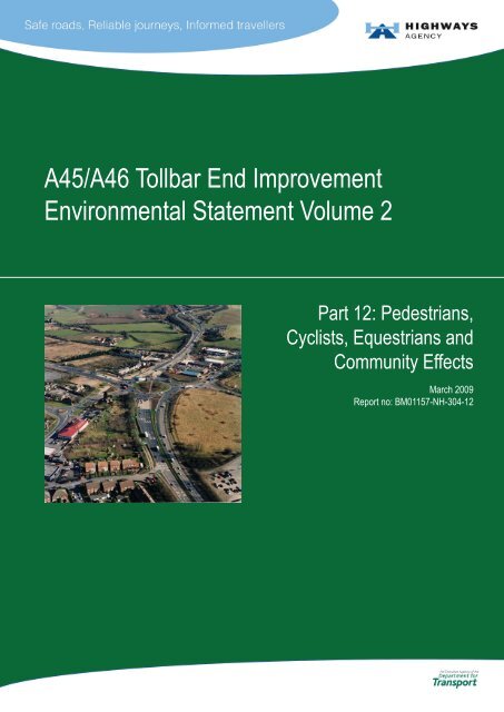
A45/A46 Tollbar End Improvement<br />
Environmental Statement <strong>Volume</strong> 2<br />
<strong>Part</strong> <strong>12</strong>: Pedestrians,<br />
Cyclists, Equestrians and<br />
Community Effects<br />
March 2009<br />
Report no: BM01157-NH-304-<strong>12</strong>
Foreword<br />
The Tollbar End roundabout is a strategic junction on the UK trunk road<br />
network, to the south of Coventry. The junction services movement<br />
between the M40, M42, M45, M6, M1 and M69 motorways, and provides a<br />
link for the movement of vehicles between London and the Midlands. The<br />
junction also facilitates the movement of local traffic, in particular to<br />
Coventry airport and the nearby businesses and industries. The Scheme<br />
would offer significant improvements to both strategic and local traffic, as it<br />
would increase the capacity of the A45/ A46 Tollbar End Roundabout,<br />
enabling traffic to flow more easily through the junction, reducing rat<br />
running in southern Coventry.<br />
The need for an improvement scheme for Tollbar End Junction was<br />
highlighted in the 1994 ‘A45 Scheme Identification Study’. In 1998 the<br />
Government published ‘A New Deal for Trunk Roads in England’. This<br />
identified that the A45 / A46 Tollbar End Junction is a key junction on the<br />
strategic highway network that experiences considerable traffic congestion,<br />
delays and safety problems. The Scheme was included in the<br />
Government’s ‘A New Deal for Trunk Roads in England (1998)’ as a<br />
scheme for consideration.<br />
The Scheme was subject to a Public Consultation in 2001 and was entered<br />
into the Targeted Programme of Improvements (TPI) in April 2003. Further<br />
design work and studies have been undertaken and a new Preferred<br />
Option was proposed in September 2006. This proposed Scheme was<br />
presented at a locally held public exhibition in March 2007.<br />
As required by European and UK legislation, an Environmental Impact<br />
Assessment of the Preferred Option has been undertaken. This is a means<br />
of drawing together in a systematic way an Assessment of the project's<br />
likely significant environmental impacts.<br />
The results of the Assessment are presented in this Environmental<br />
Statement (ES), which is presented as a multi-volume document:<br />
<br />
<br />
<br />
<strong>Volume</strong> 1A presents the Scheme and summarises the environmental<br />
effects and any mitigation measures;<br />
<strong>Volume</strong> 1B contains the figures and drawings referred to in <strong>Volume</strong><br />
1A; and,<br />
<strong>Volume</strong> 2 is a series of <strong>12</strong> specialist reports providing the detailed<br />
Assessments underlying <strong>Volume</strong> 1A.<br />
This specialist report, <strong>Volume</strong> 2 <strong>Part</strong> <strong>12</strong> (Pedestrians, Cyclists, Equestrians<br />
and Community Effects), details the Pedestrians and other Non-Motorised<br />
User Assessment.<br />
Environmental Statement <strong>Volume</strong> 2<br />
A45/A46 Tollbar End Improvement<br />
Page i<br />
<strong>Part</strong> <strong>12</strong>: Pedestrians et al<br />
March 2009
Contents<br />
1 Introduction ...............................................................................................................1<br />
1.1 General .........................................................................................................................1<br />
1.2 The Proposed Scheme .................................................................................................1<br />
1.3 Study Area ....................................................................................................................2<br />
1.4 Legislation and Guidance .............................................................................................2<br />
1.5 Methodology .................................................................................................................3<br />
2 Existing Conditions...................................................................................................9<br />
2.1 Facilities........................................................................................................................9<br />
2.2 NMU Survey................................................................................................................15<br />
2.3 Local Vehicle Traffic....................................................................................................18<br />
3 Design and Mitigation .............................................................................................19<br />
3.1 General .......................................................................................................................19<br />
3.2 Operation ....................................................................................................................19<br />
3.3 Construction Mitigation ...............................................................................................20<br />
4 Assessment of Effects............................................................................................22<br />
4.1 Construction Effects....................................................................................................22<br />
4.2 Operational Effects .....................................................................................................23<br />
5 Summary..................................................................................................................27<br />
6 References..............................................................................................................29<br />
Tables<br />
Table <strong>12</strong>.1<br />
Table <strong>12</strong>.2<br />
Table <strong>12</strong>.3<br />
Table <strong>12</strong>.4<br />
Table <strong>12</strong>.5<br />
Table <strong>12</strong>.6<br />
Assessment of Change in Severance<br />
Established Footpaths and Cycle Routes within a 500m Radius<br />
Community Facilities within the Study Area<br />
Public Transport Services within the Vicinity of the Scheme<br />
Destination of Pedestrians and Others within the Study Area<br />
<strong>12</strong>-Hour Average NMU <strong>Volume</strong> at Busiest Survey Entry Points<br />
Figures<br />
Table <strong>12</strong>.7 Predicted Changes in Journey Length and Times in 2009 – Footpath 443<br />
Figure 1.1<br />
Figure 1.2<br />
Figure <strong>12</strong>.1<br />
Scheme Location Plan<br />
Scheme Layout<br />
Established Paths and National Cycle Routes within the Study Area (500m)<br />
Environmental Statement <strong>Volume</strong> 2<br />
A45/A46 Tollbar End Improvement<br />
Page ii<br />
<strong>Part</strong> <strong>12</strong>: Pedestrians et al<br />
March 2009
Figure <strong>12</strong>.2<br />
Figure <strong>12</strong>.3<br />
NMU Survey Zones<br />
Community Facilities within the Study Area (500m)<br />
Figure <strong>12</strong>.4 Pedestrian Movement Friday 30.09.05<br />
Figure <strong>12</strong>.5 Pedestrian Movement Saturday 01.<strong>10</strong>.05<br />
Figure <strong>12</strong>.6 Pedestrian Movement Sunday 02.<strong>10</strong>.05<br />
Figure <strong>12</strong>.7 Cyclist Movement Friday 30.09.06<br />
Figure <strong>12</strong>.8 Cyclist Movement Saturday 30.<strong>10</strong>.06<br />
Figure <strong>12</strong>.9 Cyclist Movement Sunday 30.<strong>10</strong>.06<br />
Figure <strong>12</strong>.<strong>10</strong> Proposed Footpaths and Cycle Routes within the Study Area (500m)<br />
Appendices<br />
Appendix <strong>12</strong>.1<br />
NMU Survey Data<br />
Environmental Statement <strong>Volume</strong> 2<br />
A45/A46 Tollbar End Improvement<br />
Page iii<br />
<strong>Part</strong> <strong>12</strong>: Pedestrians et al<br />
March 2009
1 Introduction<br />
1.1 General<br />
1.1.0.1 This report assesses the potential impacts of the proposed A45 / A46<br />
Tollbar End Improvement Scheme (hereinafter referred to as ‘the Scheme’)<br />
on pedestrians, cyclists, equestrians and communities. For ease of<br />
reference, the term ‘pedestrians and others’ is used in this report to<br />
describe this group.<br />
1.2 The Proposed Scheme<br />
1.2.0.1 The Tollbar End roundabout is a strategic junction on the trunk road<br />
network, near Coventry. The junction facilitates the movement of vehicles<br />
between London and the Midlands and services movement between the<br />
M40, M6, M1, M42, M45 and M69 motorways. The junction also facilitates<br />
the movement of local traffic, in particular to Coventry Airport and the<br />
nearby businesses and industries. A location plan showing the position of<br />
the Scheme on the network is shown in Figure 1.1.<br />
1.2.0.2 The Scheme would provide a dual 3-lane bypass to follow the existing A45<br />
line between Stivichall Junction and Tollbar End roundabout. The Tollbar<br />
End roundabout would be improved to a grade-separated junction with an<br />
underpass between the A45 Stonebridge Highway and the A46 Coventry<br />
Eastern Bypass. The Scheme also includes improvements to the<br />
northbound off-slip on the A46 Kenilworth Bypass. A plan of the Scheme is<br />
shown in Figure 1.2.<br />
1.2.0.3 The A45 / A46 Tollbar End Improvement Scheme comprises the following<br />
elements:<br />
<br />
<br />
<br />
<br />
<br />
<br />
Grade-separation of the Tollbar End roundabout, by construction of a<br />
new dual two-lane underpass connecting the A46 Coventry Eastern<br />
Bypass to the eastern end of the A45 Stonebridge Highway;<br />
Construction of two single span structures to accommodate the<br />
grade-separation;<br />
Enlargement of Tollbar End roundabout, with improved traffic signal<br />
controls;<br />
Construction of a new signalised junction at the intersection of Siskin<br />
Drive and Rowley Road;<br />
Asymmetrical widening to the south of the existing A45 Stonebridge<br />
Highway between the Tollbar End roundabout and Stivichall Junction<br />
(approximately 1.9 km west of Tollbar End), from dual two-lane<br />
carriageway to dual three-lane carriageway;<br />
Addition of sign gantries; 3 no. on the A46 Kenilworth Bypass<br />
northbound approach to Stivichall Junction, and 4 no. on the A45<br />
Stonebridge Highway between Stivichall Junction and Tollbar End<br />
roundabout;<br />
Environmental Statement <strong>Volume</strong> 2<br />
A45/A46 Tollbar End Improvement<br />
Page 1<br />
<strong>Part</strong> <strong>12</strong>: Pedestrians et al<br />
March 2009
The addition of a third lane on the northbound carriageway of the A46<br />
Kenilworth Bypass south of Stivichall Junction, requiring a widening of<br />
a 200m length of the A46 Kenilworth Bypass northbound approach to<br />
Stivichall junction;<br />
Construction of a new footbridge over the River Sowe to<br />
accommodate the repositioning of the combined footway / cycleway<br />
as a result of carriageway widening works;<br />
Construction of stormwater wetlands and a bioretention area; and,<br />
The proposals would also include noise fencing, landscaping and<br />
improved drainage measures to minimise the effects on the<br />
surrounding area.<br />
1.3 Study Area<br />
1.3.0.1 The Study Area for this Assessment includes community facilities and nonmotorised<br />
routes of importance or significance within a 500m radius around<br />
the Scheme. The areas of Willenhall, north of Tollbar End roundabout and<br />
Finham and Stivichall, to the west of Stivichall Junction, are within the<br />
Study Area for the Scheme. The Study Area is shown on Figure <strong>12</strong>.1.<br />
1.4 Legislation and Guidance<br />
1.4.0.1 Legislation and guidance documents of specific relevance to the<br />
Assessment are listed below:<br />
1.4.1 UK Legislation<br />
Countryside and Rights of Way Act (2000);<br />
Traffic Signs Regulations and General Directions 2002 SI 3113;<br />
<br />
Planning Policy Guidance (PPG) 17: Planning for Open Space,<br />
Sport and Recreation; and,<br />
Good Practice Guide on Planning for Tourism 1 .<br />
1.4.2 Guidance<br />
<br />
<br />
The Department for Transport (DfT) Design Manual for Roads and<br />
Bridges (DMRB), <strong>Volume</strong> 5, Section 2, <strong>Part</strong> 5. Non-Motorised User<br />
Audits; and,<br />
DMRB, <strong>Volume</strong> 11, Section 3, <strong>Part</strong> 8. Pedestrians and Others and<br />
Community Effects.<br />
1 Planning Policy Guidance 21: Tourism (PPG21), was cancelled on 1 September 2006. The<br />
Department for Communities and Local Government suggests “The Good Practice Guide on<br />
Planning for Tourism” as a replacement guide.<br />
Environmental Statement <strong>Volume</strong> 2<br />
A45/A46 Tollbar End Improvement<br />
Page 2<br />
<strong>Part</strong> <strong>12</strong>: Pedestrians et al<br />
March 2009
1.4.3 Other Relevant Documents<br />
<br />
<br />
Warwickshire County Council (WCC) 2000. A Strategic Plan for<br />
Warwickshire (2002 – 2005);<br />
WCC 2006. Countryside Access and Rights of Way Improvement<br />
Plan (2006 –2016) (CAROWIP);<br />
WCC 1995. Warwick District Local Plan (1996 – 2011);<br />
WCC 2006. Warwickshire Local Transport Plan (LTP 2006);<br />
WCC 2001. Warwickshire Structure Plan (1996 – 2011);<br />
<br />
<br />
Coventry City Council (CCC) Walking and Cycling Strategies<br />
(1994);<br />
CCC Transport Programme (2005); and,<br />
(Adopted) Coventry Development Plan (UDP), CCC, 2001<br />
1.5 Methodology<br />
1.5.1 General<br />
1.5.1.1 The methodology used in this Assessment follows the requirements of<br />
DMRB <strong>Volume</strong> 11, Section 3, <strong>Part</strong> 8 (June 1993). The Assessment<br />
examines the Scheme’s impact on the journeys people make within and<br />
around the Study Area as pedestrians (including ramblers), cyclists and<br />
equestrians. Impacts on local vehicular traffic have also been considered,<br />
and are discussed in detail in <strong>Volume</strong> 2 <strong>Part</strong> 13: Vehicle Travellers.<br />
1.5.1.2 To undertake this Assessment, the following key studies have been<br />
undertaken:<br />
<br />
<br />
<br />
Identification of existing and proposed journey routes, Public Rights<br />
of Way (PRoW) and important community facilities used by<br />
pedestrians and others;<br />
Assessment of changes in journey length and amenity and<br />
community severance; and,<br />
Consultation with statutory and non-statutory bodies.<br />
These are discussed further below.<br />
1.5.2 Identification of Existing and Proposed Journey Routes, Rights<br />
of Way and Important Community Facilities<br />
1.5.2.1 To assess the impact of the Scheme on pedestrians and others, the Study<br />
Area was examined for facilities such as PRoW, recreational facilities and<br />
community buildings used by the following community groups:<br />
<br />
<br />
<br />
Environmental Statement <strong>Volume</strong> 2<br />
A45/A46 Tollbar End Improvement<br />
Pedestrians and ramblers;<br />
Cyclists;<br />
Equestrians; and,<br />
Page 3<br />
<strong>Part</strong> <strong>12</strong>: Pedestrians et al<br />
March 2009
Vulnerable users (disabled, elderly and children).<br />
1.5.2.2 In addition, accidents involving pedestrians and others in the vicinity of<br />
Tollbar End roundabout have been examined.<br />
1.5.3 Assessment of Changes in Journey Length and Amenity and<br />
Community Severance<br />
1.5.3.1 Existing journeys made by pedestrians and others in the vicinity of the<br />
Scheme have been examined and the changes to journey length, amenity,<br />
safety, access and community severance predicted.<br />
1.5.3.2 As part of this Assessment, an origin/destination survey, known as the Non-<br />
Motorised Users (NMU) Survey was undertaken based on guidance within<br />
DMRB <strong>Volume</strong> 11, Section 3, <strong>Part</strong> 8.<br />
1.5.3.3 The NMU survey was carried out on Friday 30 September 2005, Saturday 1<br />
October 2005 and Sunday 2 October 2005 between 07:00 and 19:00 on<br />
each day.<br />
1.5.3.4 The NMU survey area is shown on Figure <strong>12</strong>.2. The survey area covered<br />
all the designated footpaths and cycleways from Stivichall Junction, A45<br />
Stonebridge Highway and Tollbar End roundabout, which are situated<br />
along the route of the proposed Scheme. The survey area was divided into<br />
twenty-two sections to enable easy identification and counting of NMU<br />
during the survey. Observers, located in each of the twenty-two areas, used<br />
the ‘spot count’ survey method (as stated in DMRB <strong>Volume</strong> 3: <strong>Part</strong> 8) to<br />
manually count the number of pedestrians, cyclists and equestrians moving<br />
through the Study Area.<br />
1.5.3.5 It should be noted that the survey was only carried out for one weekend<br />
and one weekday and the results should therefore not be considered fully<br />
representative – use could vary over time, especially through the seasons.<br />
In addition, the weather conditions on the weekend were mainly cold and<br />
overcast with sporadic light showers. This may have had an effect on the<br />
survey results.<br />
1.5.3.6 The results of the survey are discussed in Section 2.<br />
1.5.4 Consultation<br />
1.5.4.1 Between November 2005 and July 2006, the following organisations were<br />
consulted to obtain information on pedestrians and others and community<br />
effects:<br />
<br />
<br />
<br />
<br />
<br />
SUSTRANS;<br />
Coventry Cyclists Touring Club (CTC);<br />
Coventry City Council (CCC);<br />
Warwickshire County Council; and,<br />
Warwick District Council.<br />
Environmental Statement <strong>Volume</strong> 2<br />
A45/A46 Tollbar End Improvement<br />
Page 4<br />
<strong>Part</strong> <strong>12</strong>: Pedestrians et al<br />
March 2009
1.5.4.2 Key issues relevant to pedestrians and others raised during the<br />
consultation are outlined below:<br />
<br />
<br />
<br />
<br />
SUSTRANS confirmed the need to ensure that pedestrian and cycle<br />
routes remained open during construction;<br />
SUSTRANS and Coventry CTC were content with NMU proposals<br />
at Tollbar End roundabout in principle, and accepted that it is<br />
difficult to provide crossing opportunities to Rowley Road / Siskin<br />
Drive with no traffic lights on these arms of the junction;<br />
Coventry CTC were concerned about the effect of the Scheme on<br />
links between residential areas and schools/workplaces within a five<br />
mile radius of the Scheme; and,<br />
During the initial consultation, the potential NMU arrangements to<br />
be provided on roads linking residential areas, schools and<br />
workplaces within the vicinity of the Scheme were queried.<br />
SUSTRANS enquired whether a bridge was to be provided to link<br />
Stonehouse Lane with the footpath leading to Rowley Road.<br />
1.5.4.3 In spring 2006, a further round of consultations was undertaken, and the<br />
following comments received:<br />
<br />
<br />
Concern was raised by Coventry CTC, SUSTRANS and CCC,<br />
regarding the proposed width of 2.5m for the joint-use footpath and<br />
cycleway. CCC, SUSTRANS and Coventry CTC all advised they<br />
would expect a 3m minimum width for shared cyclist/pedestrian<br />
facilities; and,<br />
The provision of adequate crossing facilities in the Siskin Drive area<br />
was queried by Coventry CTC and SUSTRANS, with particular<br />
concern regarding the safety of cyclists approaching Tollbar End<br />
roundabout from Siskin Drive in relation to the proposed slip road.<br />
1.5.4.4 The issues raised were considered in the design process and are<br />
discussed further in Section 3 of this report.<br />
1.5.4.5 In November 2006, a consultation meeting was organised between <strong>Hyder</strong><br />
<strong>Consulting</strong> Ltd. and representatives of CCC, SUSTRANS, Coventry CTC<br />
and CTC Right to Ride. The main issues raised were those already<br />
mentioned in Section 1.5.4.3, and<br />
<br />
<br />
<br />
The possibility of providing a footbridge across the A45 Stonebridge<br />
Highway opposite Stonehouse Lane;<br />
The possible provision of sign-posting for NMU across Tollbar End<br />
roundabout; and,<br />
Improved access for cyclists at certain road entries.<br />
These issues were further considered within the design process.<br />
1.5.4.6 In addition to consultation with key stakeholders, discussions were<br />
undertaken with Jaguar Whitley regarding the proposed expansion of their<br />
site. The potential to amalgamate improvements to pedestrian and cyclist<br />
facilities was considered, and the following issues were raised:<br />
Environmental Statement <strong>Volume</strong> 2<br />
A45/A46 Tollbar End Improvement<br />
Page 5<br />
<strong>Part</strong> <strong>12</strong>: Pedestrians et al<br />
March 2009
Jaguar Whitley are proposing a new pedestrian route from their site<br />
into Stonebridge Meadows Local Nature Reserve (LNR); and,<br />
The potential to connect this to the footpath/cycleway that runs to<br />
the north of A45 Stonebridge Highway (i.e. along eastbound<br />
carriageway) with the proposed new route.<br />
1.5.5 Assessment of Effects<br />
1.5.5.1 To help clarify and quantify the effects of the Scheme, the Assessment<br />
methodology has applied significance criteria set out in the DfT Transport<br />
Analysis Guidance (TAG) using the Physical Fitness Sub-Objective TAG<br />
Unit 3.3.<strong>12</strong> (June 2003) and the Severance Sub-Objective TAG Unit 3.6.2<br />
(June 2003).<br />
1.5.6 Physical Fitness<br />
1.5.6.1 The TAG Physical Fitness Sub-Objective measures the Scheme’s<br />
contribution to overall health from increased levels of physical activity<br />
through walking and cycling, with the minimum time that would lead to<br />
health benefits being 30 minutes. Within this guideline, there are four levels<br />
of benefit that can be considered:<br />
For new walk and cycle trips where journey times are below the 30<br />
minute threshold, there would be some minor health benefits;<br />
For new walk and cycle trips where journey times are above the 30<br />
minute threshold, there would be significant health benefits;<br />
<br />
<br />
For existing walk and cycle trips, where the journey time remains<br />
above the threshold, health benefits would be largely unchanged;<br />
and,<br />
For existing walk and cycle trips, where the journey time falls below<br />
the threshold, there would be some minor reductions in health<br />
benefits.<br />
1.5.6.2 Changes to journey times for pedestrians and cyclists using the footways /<br />
cycle paths in the vicinity of the Scheme have been assessed using<br />
methodology prescribed in DMRB <strong>Volume</strong> 11, Section 3 <strong>Part</strong> 8 (June<br />
1993). This is discussed in Section 4.2 below.<br />
1.5.7 Severance<br />
1.5.7.1 Changes in journey times or amenity for pedestrians and others may be<br />
such that they affect, adversely or beneficially, the degree to which a<br />
locality is subject to ‘community severance’. Community severance is<br />
defined as the separation of residents from facilities and services they use<br />
within their community, caused by new or improved roads or by changes in<br />
traffic flows. Severance may also be caused by the demolition of a<br />
community facility or the loss of land used by members of the public.<br />
1.5.7.2 Cyclists and equestrians are considered to be less susceptible to<br />
severance than pedestrians, because they can travel more quickly than<br />
Environmental Statement <strong>Volume</strong> 2<br />
A45/A46 Tollbar End Improvement<br />
Page 6<br />
<strong>Part</strong> <strong>12</strong>: Pedestrians et al<br />
March 2009
people on foot, although there may still be significant impact on these<br />
groups.<br />
1.5.7.3 Severance may be classified according to the following broad levels:<br />
<br />
<br />
<br />
<br />
None – little or no hindrance to pedestrian and others movement;<br />
Slight – all people wishing to make pedestrian and others<br />
movements would be able to do so, but there would be some<br />
hindrance to movement;<br />
Moderate – some people, particularly children and old people, are<br />
likely to be dissuaded from journeys on foot. For others, pedestrian<br />
journeys would be longer or less attractive; and,<br />
Severe – people are likely to be deterred from making pedestrian<br />
journeys to an extent sufficient to induce a reorganisation of their<br />
activities. In some cases, this could lead to a change in the location<br />
of centres of activity or to a permanent loss of access to certain<br />
facilities for a particular community. Those who do make journeys<br />
on foot would experience considerable hindrance.<br />
1.5.7.4 To carry out the Assessment, the following steps are required:<br />
<br />
<br />
<br />
Estimate the level of severance for the Do Minimum (i.e. without the<br />
construction of the Scheme)and Do Something (i.e. with the<br />
construction of the Scheme) scenarios in the opening year (2014);<br />
By comparison of the level of severance for the Do Minimum and Do<br />
Something scenarios, estimate the change in severance (reductions<br />
and increases) based on the impact categories in Table <strong>12</strong>.1; and,<br />
Estimate the number of people likely to be affected by the changes<br />
in severance.<br />
Table <strong>12</strong>.1<br />
Assessment of Change in Severance<br />
Do Something Severance Scenario<br />
Do Minimum Severance<br />
Scenario<br />
None Slight Moderate Severe<br />
None None Slight<br />
negative<br />
Moderate<br />
negative<br />
Large<br />
negative<br />
Slight Slight positive None Slight<br />
negative<br />
Moderate<br />
negative<br />
Moderate<br />
Moderate<br />
positive<br />
Slight positive None Slight<br />
negative<br />
Severe Large positive Moderate<br />
positive<br />
Slight positive<br />
None<br />
1.5.7.5 Severance should be assessed at a number of locations across a network.<br />
This is likely to lead to a range of Assessments. Some locations in a<br />
network may experience reductions in severance, whilst others may<br />
experience increases. Some locations may experience greater changes in<br />
Environmental Statement <strong>Volume</strong> 2<br />
A45/A46 Tollbar End Improvement<br />
Page 7<br />
<strong>Part</strong> <strong>12</strong>: Pedestrians et al<br />
March 2009
severance than others. For each level of change in severance, the numbers<br />
of people affected should be accumulated. The overall Assessment for the<br />
Scheme should then be based on the following guidelines (in each case,<br />
the Assessment is beneficial if severance is reduced, adverse if severance<br />
is increased):<br />
<br />
<br />
<br />
<br />
The overall Assessment is likely to be Neutral if increases in<br />
severance are broadly balanced by relief of severance;<br />
The overall Assessment is likely to be Slight where change in<br />
severance is slight or the total numbers of people affected across all<br />
levels of severance is low (e.g. less than 200 per day);<br />
The overall Assessment is likely to be Large where change in<br />
severance is large, and affects a moderate or high number of<br />
people or the total numbers of people affected across all levels of<br />
severance is high (e.g. greater than <strong>10</strong>00 per day); and,<br />
The overall Assessment is likely to be Moderate in all other cases.<br />
1.5.7.6 The numbers of cyclists and/or equestrians likely to be affected should be<br />
examined and, if significant, a qualitative Assessment made as to whether<br />
the impact of severance is more or less severe than for pedestrians.<br />
Environmental Statement <strong>Volume</strong> 2<br />
A45/A46 Tollbar End Improvement<br />
Page 8<br />
<strong>Part</strong> <strong>12</strong>: Pedestrians et al<br />
March 2009
2 Existing Conditions<br />
2.1 Facilities<br />
2.1.1 Public Rights of Way<br />
2.1.1.1 At present, CCC does not have a definitive map to describe the existing<br />
footpaths and cycleways within and surrounding the Study Area.<br />
Information regarding the PRoW within the Study Area was obtained from<br />
the “Ramblers Map”, as provided by Coventry City Council. Data on cycle<br />
routes was obtained from the SUSTRANS website<br />
http://www.sustrans.org.uk, as accessed 25 September 2006) and CCC<br />
Cycle Map and Guide.<br />
2.1.1.2 Established footpaths and cycle routes within the Study Area are presented<br />
in Table <strong>12</strong>.2 and shown on Figure <strong>12</strong>.1.<br />
Table <strong>12</strong>.2<br />
Established Paths and Cycle Routes within a 500m Radius of the Proposed Scheme<br />
PRoW<br />
Identification<br />
No.<br />
Type<br />
Location<br />
435-441 Footpath<br />
443 Footpath<br />
428 Footpath<br />
396 Footpath<br />
397 Footpath<br />
398 Footpath<br />
Series of footpaths from the A45 Stonebridge<br />
Highway across Baginton School Playing Fields<br />
towards A45 and B41<strong>10</strong> London Road.<br />
Starts on southern edge of the A45 Stonebridge<br />
Highway, opposite Stonehouse Lane and extends<br />
directly south to meet Rowley Road.<br />
Extends in a loop from Stivichall Junction<br />
extending northwards along the A444 towards<br />
Black Prince Avenue. It then crosses over to Leaf<br />
Lane and continues south back toward Stivichall<br />
Junction.<br />
Runs northwest from the junction of Howes Lane<br />
and Mill Hill to the A45 Stonebridge Highway just<br />
west of Stivichall Junction.<br />
Extends west half way along footpath 396 toward<br />
Jacklin Drive, amongst the residential area of<br />
Finham.<br />
Extends east to west along A45 Stonebridge<br />
Highway between Stivichall Junction and the<br />
junction with Green Lane / A46 Kenilworth<br />
Bypass.<br />
Environmental Statement <strong>Volume</strong> 2<br />
A45/A46 Tollbar End Improvement<br />
Page 9<br />
<strong>Part</strong> <strong>12</strong>: Pedestrians et al<br />
March 2009
PRoW<br />
Identification<br />
No.<br />
None<br />
None<br />
Type<br />
Footpath<br />
and<br />
National<br />
Cycle<br />
Route<br />
Bridleway<br />
Location<br />
The route extends east, from A46 Kenilworth<br />
Bypass, alongside the west and eastbound<br />
carriageways of the A45 Stonebridge Highway<br />
toward Stivichall Junction. The footpath / national<br />
cycle route is then directed around the southwesterly<br />
corner of the junction where it forms a<br />
single route adjacent to the westbound<br />
carriageway of the A45 Stonebridge Highway,<br />
ending at Tollbar End roundabout.<br />
A footpath and National Cycle Route also exists<br />
adjacent to the eastbound carriageway of the A45<br />
Stonebridge Highway between Stivichall Junction<br />
and Tollbar End roundabout.<br />
Runs south from Fernside Avenue / Leaf Lane<br />
junction, across the northwest segment of<br />
Stivichall Junction roundabout via an overbridge.<br />
It passes through an underpass under the A45<br />
Stonebridge Highway then splits into two routes,<br />
either crossing the southwest segment of the<br />
roundabout via an overbridge to continue south<br />
alongside the A46 Kenilworth Bypass; or crossing<br />
over the A46 (utilising the southern overbridge of<br />
Stivichall Junction), then underneath the<br />
southeast segment of Stivichall Junction<br />
roundabout via an underpass to join the National<br />
Cycle Route extending east along the A45<br />
Stonebridge Highway.<br />
2.1.1.3 A number of footpaths and cycleways are present in the vicinity of the<br />
proposed Scheme. A series of footpath/cycle routes circumvent Tollbar End<br />
roundabout, utilising a series of Toucan crossings across the individual<br />
links/arms of the roundabout. Footway and cycleway routes run adjacent to<br />
both the north and south sides of the A45 Stonebridge Highway, and lead<br />
into those around Tollbar End roundabout.<br />
2.1.1.4 Cycleways adjacent to the A45 Stonebridge Highway form a link between<br />
the Stivichall and Finham areas to the west of the Scheme, and<br />
Stonebridge Trading Estate and Middlemarch Business Park toward the<br />
south-eastern end of the Scheme.<br />
2.1.1.5 A signed footpath and cycleway runs between Rowley Road and the A45<br />
Stonebridge Highway, to the west of the Tollbar End roundabout.<br />
2.1.1.6 There are also a series of footpaths/cycleways navigating Stivichall<br />
Junction, including two underpasses and overbridges linking Leaf Lane to<br />
A46 Kenilworth Bypass South and A45 Stonebridge Highway. The<br />
underpasses/overbridges also form part of the only bridleway within the<br />
Study Area.<br />
Environmental Statement <strong>Volume</strong> 2<br />
A45/A46 Tollbar End Improvement<br />
Page <strong>10</strong><br />
<strong>Part</strong> <strong>12</strong>: Pedestrians et al<br />
March 2009
2.1.1.7 Toucan crossings navigating Tollbar End roundabout provide specific<br />
facilities for vulnerable people (e.g. the elderly, disabled people and<br />
children), whilst the underpasses/overbridges traversing Stivichall Junction<br />
also support the provision of a bridleway.<br />
2.1.1.8 At present pedestrians are crossing the A45 Stonebridge Highway, where<br />
there are no pedestrian crossings. This may be due to it providing a ‘quick<br />
route access’ between the residences of Willenhall, the Stonebridge<br />
Trading Estate and to Footpath no. 443, despite the need to traverse the<br />
safety barrier in the middle of the highway.<br />
2.1.1.9 WCC and CCC provided the traffic accident data for this Assessment, for<br />
the period January 2001 to December 2005. It should be noted that the<br />
data examined in the NMU Assessment only represents accidents within<br />
the geographical area of the Scheme. However, the traffic accident<br />
information used in the Cost Benefit Analysis (COBA) uses a wider<br />
catchment area including other roads that are affected by the Scheme.<br />
2.1.1.<strong>10</strong> Accident data (in the form of Personal Injury Accident reports collected by<br />
the Police between 2001 and 2005 inclusive) have been provided by the<br />
Warwickshire County Council Road Safety Intelligence Team. During this<br />
period, a total of 94 accidents were recorded within <strong>10</strong>0m of the Scheme<br />
footprint.<br />
2.1.2 Community and Commercial Facilities<br />
2.1.2.1 Key community facilities within the Study Area are listed in Table <strong>12</strong>.3 and<br />
presented in Figure <strong>12</strong>.3. The main commercial facilities have also been<br />
considered, as they are likely to provide start and end points of journeys for<br />
employees using footpaths and cycleways within the Study Area.<br />
Table <strong>12</strong>.3<br />
Community Facilities within the Study Area<br />
Facility Location Address Comments<br />
Allotments<br />
Allotments<br />
Northwest of<br />
Tollbar End<br />
Roundabout<br />
Southwest of<br />
Stivichall<br />
Junction<br />
Statutory Allotments,<br />
Willenhall<br />
C/O Len Parnell, Coventry<br />
& District Allotments &<br />
Gardens Council Secretary<br />
Statutory Allotments,<br />
Baginton Mill Leisure<br />
Gardens<br />
C/O Len Parnell, Coventry<br />
& District Allotments &<br />
Gardens Council Secretary<br />
28 plots<br />
<strong>10</strong>2 plots<br />
Retail Park<br />
Northeast of<br />
Tollbar End<br />
Roundabout<br />
Orchard Retail Park,<br />
London Road, Coventry<br />
CV3 4RP<br />
Comprises several<br />
commercial<br />
businesses<br />
Page 11<br />
Environmental Statement <strong>Volume</strong> 2<br />
A45/A46 Tollbar End Improvement<br />
<strong>Part</strong> <strong>12</strong>: Pedestrians et al<br />
March 2009
Facility Location Address Comments<br />
Trading<br />
Estate<br />
Southwest of<br />
Tollbar End<br />
Roundabout<br />
Stonebridge Trading<br />
Estate, Coventry CV3 4FJ<br />
Comprises several<br />
commercial<br />
businesses<br />
Business<br />
Park<br />
South of<br />
Tollbar End<br />
Roundabout<br />
Middlemarch Business<br />
Park, Siskin Drive,<br />
Coventry CV3 4FJ<br />
Comprises several<br />
commercial<br />
businesses<br />
Airport<br />
Southwest of<br />
Tollbar End<br />
Roundabout<br />
Coventry Airport<br />
Customer Services,<br />
Phoenix House, Coventry<br />
Airport South, Siskin<br />
Parkway West, Coventry<br />
CV3 4PB<br />
Hotel<br />
Adjacent to<br />
Tollbar End<br />
Roundabout<br />
The Glengary Guest<br />
House, 699-701 London<br />
Road, Tollbar End,<br />
Coventry CV3 4EX<br />
Contains bar and<br />
restaurant<br />
Hotel<br />
Southeast of<br />
Tollbar End<br />
Roundabout<br />
on A45<br />
London Road<br />
Holiday Inn Coventry<br />
(South), A45 London Road,<br />
Ryton-On-Dunsmore,<br />
Coventry CV8 3DY<br />
Falls just outside the<br />
500m Study Area<br />
Hotel Baginton The Old Mill, Mill Hill,<br />
Baginton, Coventry CV8<br />
3AH<br />
School Willenhall Baginton Fields School,<br />
Sedgemoor Road,<br />
Coventry CV3 4EA<br />
Public<br />
House<br />
Midland Air<br />
Museum<br />
Stivichall<br />
Rowley Road<br />
The Festival, Leaf Lane,<br />
Cheylesmore, Coventry<br />
CV3 5AQ<br />
Midland Air Museum,<br />
Baginton, Warwickshire,<br />
CV8 3AZ<br />
Roman Fort Baginton<br />
The Lunt Roman Fort,<br />
Coventry Road, Baginton,<br />
Warwickshire CV8 3AJ<br />
A partially<br />
reconstructed Roman<br />
Fort, established<br />
60AD and now a<br />
visitor attraction.<br />
2.1.2.2 Finham is situated between the A46 Kenilworth Bypass, Green Lane and<br />
the A45 Stonebridge Highway, southwest of Stivichall Junction. Finham is a<br />
small residential area in the outskirts of Coventry, which also comprises a<br />
library and Finham Park School.<br />
2.1.2.3 To the northwest of Stivichall Junction is the residential area of Stivichall.<br />
Stivichall lies to the west of the A444, north of Finham and south of<br />
Cheylesmore. The Festival public house is situated adjacent to the A45<br />
Environmental Statement <strong>Volume</strong> 2<br />
A45/A46 Tollbar End Improvement<br />
Page <strong>12</strong><br />
<strong>Part</strong> <strong>12</strong>: Pedestrians et al<br />
March 2009
Stonebridge Highway and a row of local commercial businesses are<br />
located along Fernside Avenue, including a nursery.<br />
2.1.2.4 A larger residential area of Willenhall is located to the north of Tollbar End.<br />
Several commercial businesses are located north along B41<strong>10</strong> London<br />
Road, whilst Orchard Retail Park is situated directly northeast of the Tollbar<br />
End roundabout.<br />
2.1.2.5 Baginton Fields School is located on the western fringe of Willenhall and<br />
accessed from Sedgemoor Road. The playing fields extend west to meet<br />
the River Sowe and south to meet Stonebridge Highway, and are also used<br />
by King Henry VIII School.<br />
2.1.2.6 Situated on the southern edge of the playing fields are King Henry VIII<br />
School Sports Pavilion and one residential property (for the Caretaker).<br />
King Henry VIII School access the playing fields from the A45 Stonebridge<br />
Highway.<br />
2.1.2.7 Stonebridge Trading Estate lies to the west of Tollbar End roundabout,<br />
adjacent to, and south of, A45 Stonebridge Highway. The trading estate<br />
comprises several commercial businesses with the main access obtained<br />
from Rowley Road.<br />
2.1.2.8 Adjacent to the A45 London Road, directly southeast of Tollbar End<br />
roundabout is the Glengary Guest House and a row of residential<br />
properties. Several commercial businesses are also situated directly south<br />
of Tollbar End roundabout, between Siskin Drive and A45 London Road.<br />
2.1.2.9 Coventry city centre is located approximately 5km northwest of the<br />
Scheme. Many attractions are located within Coventry including Coventry<br />
Cathedral, Herbert Art Gallery and Museum, Coventry Transport Museum<br />
and a wide variety of shopping facilities.<br />
Public Transport<br />
2.1.2.<strong>10</strong> The level of public transport accessibility has been considered in the vicinity<br />
of the Scheme. Willenhall is served by <strong>12</strong> bus services, as shown in Table<br />
<strong>12</strong>.4 (Route Numbers – 11, 13, 13A, 21, 21C, 21W, 570, 580, 737, 801, 15,<br />
54)<br />
2.1.2.11 There are six bus stops in the vicinity of Stivichall Junction, which are<br />
shown in Table <strong>12</strong>.4 (Route Numbers – 2, 14, 15, 54, 538, and 539).<br />
2.1.2.<strong>12</strong> A bus stop is also located in Montgomery Close on the B41<strong>10</strong> London<br />
Road, to the north of the existing Tollbar End roundabout.<br />
Environmental Statement <strong>Volume</strong> 2<br />
A45/A46 Tollbar End Improvement<br />
Page 13<br />
<strong>Part</strong> <strong>12</strong>: Pedestrians et al<br />
March 2009
Table <strong>12</strong>.4<br />
Public Transport Services within the Vicinity of the Scheme<br />
Service Operator Origin Via Destination Frequency<br />
Route 11<br />
Travel<br />
West<br />
Midlands<br />
Coventry<br />
City Centre<br />
Stonehouse<br />
Lane / Rowley<br />
Drive<br />
Willenhall<br />
30mins<br />
Route 13<br />
Travel<br />
West<br />
Midlands<br />
Willenhall Coventry Prologis<br />
Park<br />
<strong>12</strong>mins peak<br />
30mins evening /<br />
weekends<br />
Route 13A<br />
Travel<br />
West<br />
Midlands<br />
Willenhall /<br />
Binley<br />
Trading<br />
Estate<br />
N/A<br />
Prologis<br />
Park<br />
Approx 20mins<br />
during morning peak<br />
hours (Mon-Fri)<br />
Route 21<br />
Travel<br />
West<br />
Midlands<br />
Willenhall<br />
Coventry &<br />
Warwickshire<br />
Hospital,<br />
Stoney<br />
Stanton Road<br />
and Bell<br />
Green<br />
Wood End<br />
<strong>10</strong>mins during peak<br />
hours<br />
30mins during<br />
evening / weekends<br />
Route 21C<br />
Travel<br />
West<br />
Midlands<br />
Willenhall Cheylesmore /<br />
Coventry<br />
Wood End<br />
Approx every 60mins<br />
daytime (Mon-Fri)<br />
30mins evening /<br />
weekends<br />
Route 21W<br />
Travel<br />
West<br />
Midlands<br />
Wood End Bell Green,<br />
Stoney<br />
Stanton Road<br />
and Coventry<br />
&<br />
Warwickshire<br />
Hospital<br />
Middlemarch<br />
Business<br />
Park<br />
15 / 30mins during<br />
peak mornings (Mon<br />
– Fri)<br />
Restricted service<br />
operates between<br />
1430-1730 (Mon-Fri)<br />
Route 570 / 580 Mike De<br />
Courcey<br />
Travel<br />
Coventry<br />
Ryton,<br />
Stretton,<br />
Dunchurch<br />
Rugby<br />
Service operates at<br />
various intervals<br />
between 0715-1835<br />
(Mon –Sat)<br />
Route 737<br />
Mike De<br />
Courcey<br />
Travel<br />
Coventry Not specified Coventry<br />
Airport<br />
Hourly<br />
Route 801<br />
Travel<br />
West<br />
Midlands<br />
University<br />
of Warwick<br />
Finham,<br />
Whitley and<br />
Willenhall<br />
Walsgrave<br />
Hospital<br />
30mins<br />
Route 15<br />
Travel<br />
West<br />
Midlands<br />
Coventry<br />
City Centre<br />
Kenilworth<br />
Road & Green<br />
Lane<br />
Finham<br />
15mins peak<br />
30mins daytime<br />
Route 54<br />
Travel<br />
West<br />
Midlands<br />
Coventry<br />
City Centre<br />
Fenside,<br />
Finham,<br />
Green Lane<br />
Coventry<br />
60mins eve (Mon-Fri)<br />
60mins all-day sun<br />
Environmental Statement <strong>Volume</strong> 2<br />
A45/A46 Tollbar End Improvement<br />
Page 14<br />
<strong>Part</strong> <strong>12</strong>: Pedestrians et al<br />
March 2009
2.2.1.3 The main purpose for pedestrian and other users’ journeys on Friday and<br />
Saturday were to reach home or work. This trend is slightly altered on<br />
Sunday, when NMU facilities were predominantly used to reach home, or<br />
for recreational purposes. Footpaths and cycleways were also used to<br />
enable pedestrians and others to reach retail facilities, particularly on<br />
Saturday.<br />
2.2.1.4 In summary, the results of the survey indicate that there was no greater use<br />
of the pedestrian facilities, within the Study Area, on any one day. During<br />
the survey, 378 cyclists and 1<strong>10</strong>4 pedestrians, of whom 9 were vulnerable<br />
users, passed through the Study Area. No equestrians were observed<br />
during the study. The busiest entry points were those around Stivichall<br />
Junction and Tollbar End roundabout. A relatively high proportion of NMU<br />
also used the footpaths/cycleways along the A45 Stonebridge Highway,<br />
particularly between Stonehouse Lane, Selsey Close and the entrance to<br />
the playing fields.<br />
2.2.1.5 However, compared to the numbers of vehicular traffic using Tollbar End<br />
roundabout, Stivichall Junction and the A45 Stonebridge Highway, the<br />
number of NMU recorded in the vicinity of the Scheme was low, and<br />
therefore of slight significance.<br />
2.2.1.6 Further details regarding the patterns of NMU movements are given below.<br />
Pedestrians<br />
2.2.1.7 In general, the number of pedestrians using the routes within the Study<br />
Area was approximately equal on each day of the survey.<br />
2.2.1.8 Interpretation of the NMU results have shown that:<br />
<br />
<br />
<br />
The busiest entry points during the survey period were those around<br />
Stivichall Junction and Tollbar End roundabout (Entry Points D, E and<br />
F at Stivichall Junction; entry points 1, 6, <strong>12</strong>, 15 and 22 at Tollbar End<br />
roundabout). Along the A45 Stonebridge Highway, entry points 21<br />
and 31 were busiest (See Table <strong>12</strong>.8, Appendix <strong>12</strong>.1). The <strong>12</strong>-hour<br />
average NMU volumes for the busiest entry points are detailed in<br />
Table <strong>12</strong>.6 below;<br />
In general, the routes around Stivichall Junction were used for short<br />
journeys to enable NMU to negotiate crossing the junction. Journeys<br />
made using an entry point at Stivichall Junction also ended via exit<br />
points at Stivichall Junction; and,<br />
Similarly, NMU using entry points at Tollbar End roundabout also<br />
exited the Study Area via exit points at Tollbar End roundabout.<br />
Environmental Statement <strong>Volume</strong> 2<br />
A45/A46 Tollbar End Improvement<br />
Page 16<br />
<strong>Part</strong> <strong>12</strong>: Pedestrians et al<br />
March 2009
Table <strong>12</strong>.6<br />
<strong>12</strong>-Hour Average NMU <strong>Volume</strong> at Busiest Survey Entry Points<br />
Study Area Entry Point NMU <strong>Volume</strong><br />
Stivichall Junction<br />
D 39<br />
E 64<br />
F 26<br />
Tollbar End Roundabout<br />
1 20<br />
6 27<br />
<strong>12</strong> 22<br />
15 25<br />
22 76<br />
A45 Stonebridge Highway<br />
21 31<br />
31 50<br />
2.2.1.9 Other routes comparatively well used included:<br />
<br />
<br />
<br />
Environmental Statement <strong>Volume</strong> 2<br />
A45/A46 Tollbar End Improvement<br />
Entry point 62 at the western end of the A45 Stonebridge Highway.<br />
A total of 26 NMU used this entry point during the survey period;<br />
Entry point 24 is located to the west of Tollbar End roundabout. This<br />
entry point provides access to and from the southern edge of the<br />
Willenhall District. Of the 24 pedestrians utilising entry point 24<br />
during the survey period, 22 did so on the weekend; and,<br />
Entry points 3 and 4 are adjacent to each other and located on the<br />
A45 London Road, south of Tollbar End roundabout. NMU journeys<br />
made from these two entry points are generally short, exiting further<br />
south on A45 London Road, at Tollbar End roundabout and at exit<br />
point 15 on Rowley Road.<br />
2.2.1.<strong>10</strong> Therefore, the survey showed that the greatest areas of NMU activity/<br />
movement were across Stivichall Junction and at Tollbar End roundabout,<br />
which were used on a daily basis. Although there was less activity along<br />
the A45 Stonebridge Highway (full survey data is provided in Appendix<br />
<strong>12</strong>.1), the NMU facilities along the highway (particularly the south side and<br />
the eastern end of the north side) were still regularly used.<br />
Cyclists<br />
2.2.1.11 Cyclist movements recorded during the surveys indicate that:<br />
<br />
<br />
The routes within the Study Area were used equally on weekdays<br />
and weekends. However, the number of cyclists recorded on<br />
Saturday was lower than for the remainder of the survey (Friday,<br />
131; Saturday, 78; Sunday, 136); and,<br />
The distribution of cyclists and pedestrians using entry points and<br />
the ensuing route to exit point follow similar patterns (see Figures<br />
<strong>12</strong>.4 -<strong>12</strong>.9), indicating that NMU routes around Tollbar End<br />
roundabout and Stivichall Junction were the most heavily used.<br />
Page 17<br />
<strong>Part</strong> <strong>12</strong>: Pedestrians et al<br />
March 2009
Vulnerable Users<br />
2.2.1.<strong>12</strong> Of the 1482 NMU recorded during the survey, 9 were vulnerable users.<br />
Although the survey results do not differentiate the number of vulnerable<br />
users, from the volume of NMU at each entry/exit point of the Study Area,<br />
the survey showed that the main purposes of vulnerable users’s journeys<br />
were to reach home, retail outlets or for recreational purposes.<br />
Equestrians<br />
2.2.1.13 The survey results indicate that equestrians do not frequently use the paths<br />
in the Study Area. Although no equestrians were observed during the<br />
survey, the presence of the established bridleway traversing Stivichall<br />
Junction would suggest there is (or used to be) equestrian activity in this<br />
area. However, the available data does not allow an Assessment to be<br />
made of its importance.<br />
2.3 Local Vehicle Traffic<br />
2.3.0.1 No detailed surveys were undertaken to establish local traffic movements in<br />
the vicinity of the Scheme. However, these movements would have been<br />
captured within the wider traffic survey carried out in 2003 for traffic<br />
modelling purposes.<br />
Environmental Statement <strong>Volume</strong> 2<br />
A45/A46 Tollbar End Improvement<br />
Page 18<br />
<strong>Part</strong> <strong>12</strong>: Pedestrians et al<br />
March 2009
3 Design and Mitigation<br />
3.1 General<br />
3.1.0.1 The purpose of this section is to briefly describe the main elements of the<br />
Scheme as they would relate to the potential impacts on pedestrians and<br />
others, and how they would be mitigated.<br />
3.1.0.2 An NMU Audit has been carried out during the Preliminary Design stage,<br />
and would continue to be reviewed during detailed design and construction<br />
of the Scheme, in order to ensure that the needs of pedestrians and others<br />
are fully considered.<br />
3.2 Operation<br />
3.2.0.1 In general, pedestrian and cyclist facilities would be improved throughout<br />
the length of the Scheme. Combined footpath/cycleways would be provided<br />
with an increased width of 3m. Pedestrians and cyclists would be separated<br />
by white lining along the paths. The location of pedestrian routes around<br />
the Scheme is shown in Figure <strong>12</strong>.1.<br />
3.2.0.2 The existing footpaths/cycleways around Tollbar End roundabout would be<br />
completely replaced and updated to improve access across the<br />
roundabout. A new combined footpath/cycleway would be built on the<br />
inside of the new roundabout’s circulatory carriageway, and would be<br />
accessible from the B41<strong>10</strong> London Road, the A45 London Road and from<br />
Siskin Drive. Pedestrian crossing points across the roundabout’s circulatory<br />
carriageway would be traffic signal controlled.<br />
3.2.0.3 To facilitate easier pedestrian and cyclist movement throughout the<br />
Scheme, new signage would be developed for Tollbar End roundabout<br />
during the detailed design stage. At this stage, it is proposed to utilise a<br />
system of signposts around the junction, to help NMU navigate the safest<br />
routes. The existing pedestrian traffic light control system (the Toucan<br />
lights) would continue in a slightly expanded form under the Scheme.<br />
3.2.0.4 Following discussion with CCC, Footpath 443 linking Rowley Road to the<br />
A45 Stonebridge Highway, would be removed by the Scheme, and closed<br />
by the Orders. Alternative available routes using Tollbar End roundabout<br />
are shown on Figure <strong>12</strong>.<strong>10</strong>.<br />
3.2.0.5 In addition, the Rowley Road/ Siskin Drive junction would be re-modelled<br />
as a traffic signalised junction, which would allow a safer provision for<br />
pedestrians and cyclists using this diversion.<br />
3.2.0.6 The combined footpath/cycleway adjacent to the northern edge of the A45<br />
Stonebridge Highway would provide access from the B41<strong>10</strong> London Road<br />
to Stonehouse Lane, Selsey Close, and the entrance to King Henry VIII<br />
School playing fields. The existing combined footpath/cycleway beyond this<br />
point (i.e. along the northern edge of the carriageway) toward Stivichall<br />
Environmental Statement <strong>Volume</strong> 2<br />
A45/A46 Tollbar End Improvement<br />
Page 19<br />
<strong>Part</strong> <strong>12</strong>: Pedestrians et al<br />
March 2009
Junction would be stopped up, and no replacement access would be<br />
included in the Scheme Orders.<br />
3.2.0.7 The footpath/cycleway adjacent to the south side of the A45 Stonebridge<br />
Highway would be extended to provide a pedestrian/cyclist link between<br />
Tollbar End roundabout and the footpath network at Stivichall Junction. A<br />
new pedestrian/cyclist footbridge would be built adjacent to the existing<br />
road bridge to improve the access over the River Sowe, and allow the<br />
combined footway to be extended safely.<br />
3.2.0.8 The lay-bys (2 no.) on either side of the A45 Stonebridge Highway would<br />
be permanently removed by the Orders, and would not be replaced. A new<br />
minor ‘field’ access would be provided for the tenant farmer to the<br />
Stonebridge Meadows Local Nature Reserve (LNR).<br />
3.2.0.9 Once established, the landscape mitigation planting and mounding would<br />
reduce the visual effect of the Scheme on NMU using the routes within the<br />
Study Area, particularly along the south side of A45 Stonebridge Highway<br />
(see <strong>Volume</strong> 2, <strong>Part</strong> 7 Landscape Effects).<br />
3.3 Construction Mitigation<br />
3.3.0.1 During the construction phase of the Scheme, the safety needs of<br />
pedestrians and others would be considered by segregating them from both<br />
vehicle and site traffic. Further mitigation measures would be developed<br />
within the Construction Environmental Management Plan (CEMP) (see<br />
<strong>Volume</strong> 2, <strong>Part</strong> 5, Disruption Due to Construction), to minimise potential<br />
disruption to pedestrians and others during the construction of the Scheme.<br />
3.3.0.2 The footpath/cycleway network at Tollbar End roundabout and along the<br />
A45 Stonebridge Highway would be directly affected during the Scheme<br />
construction. However, access across the roundabout would be maintained<br />
throughout the construction period.<br />
3.3.0.3 The construction of the River Sowe footbridge would require the temporary<br />
closure of the footpath and cycle route to the south of the A45 Stonebridge<br />
Highway (i.e. along the westbound carriageway).<br />
3.3.0.4 In both cases a number of temporary diversions would be required to<br />
maintain the accessibility of these routes. The temporary diversions<br />
required and the management of pedestrian/ cyclist movements would be<br />
discussed with the Planning and Transportation Division of CCC and<br />
included in the CEMP.<br />
3.3.0.5 Footpath 443, linking Rowley Road to the A45 Stonebridge Highway, would<br />
be stopped up by Scheme and a convenient alternative access would be<br />
provided. The footpath would be closed from the beginning of the<br />
construction activities.<br />
3.3.0.6 Public access to Stonebridge Meadows LNR would be provided in future<br />
through the adjacent Jaguar-Whitley site, as part of their proposed<br />
development. However, should the development plans for Jaguar-Whitley<br />
not be built according to current proposals, the footpath/cycleway along the<br />
Environmental Statement <strong>Volume</strong> 2<br />
A45/A46 Tollbar End Improvement<br />
Page 20<br />
<strong>Part</strong> <strong>12</strong>: Pedestrians et al<br />
March 2009
northern boundary of the A45 Stonebridge Highway could be continued<br />
from the entrance to the playing fields to the existing entrance point to the<br />
Local Nature Reserve.<br />
3.3.0.7 The bus stop at Montgomery Close on the B41<strong>10</strong> London Road would have<br />
to be relocated during construction, and would therefore be permanently<br />
moved to a new location approximately 40m north along the B41<strong>10</strong> London<br />
Road. The existing facilities would be retained at the new location.<br />
Environmental Statement <strong>Volume</strong> 2<br />
A45/A46 Tollbar End Improvement<br />
Page 21<br />
<strong>Part</strong> <strong>12</strong>: Pedestrians et al<br />
March 2009
4 Assessment of Effects<br />
4.1 Construction Effects<br />
4.1.0.1 Construction of the Scheme would primarily affect pedestrians and others<br />
using the footpaths and road network near to the works. However, during<br />
periods of traffic management, traffic may be diverted and cause temporary<br />
impacts to pedestrians and others using the road network further from the<br />
Scheme. Potential impacts on pedestrians and others would therefore have<br />
to be managed on a flexible basis during the construction period.<br />
4.1.0.2 During construction, access along the footpaths/cycleways within the<br />
vicinity of the Scheme would be maintained wherever possible. However,<br />
NMU may still be affected by construction activities, such as traffic<br />
management, operating construction vehicles, or the construction work<br />
itself. These impacts may include delays (e.g. waiting for construction<br />
vehicles to pass, longer routes), adverse conditions (i.e. possible mud on<br />
the footpath due to construction works) and potential increased sources of<br />
alarm to ridden horses (e.g. noise from construction vehicles).<br />
4.1.0.3 The sources of visual impacts on NMU during the construction period would<br />
result from the removal of existing vegetation and presence of earthworks,<br />
temporary lighting, signage, construction plant and machinery. There would<br />
be adverse visual impacts from footpaths directly affected by construction<br />
processes, and several footpaths in close proximity to the works would also<br />
suffer adverse visual impacts. NMU in the vicinity of structural works, in<br />
particular improvements at Tollbar End roundabout are likely to experience<br />
significant adverse visual effects associated with direct views to large<br />
machinery such as piling augers and other ancillary equipment.<br />
4.1.0.4 Footpath 443 currently links Rowley Road to the A45 Stonebridge Highway.<br />
During construction works, the footpath would be blocked for safety<br />
reasons, and would be permanently closed thereafter. Due to its current<br />
low usage, the consequential impact would be assessed as slight<br />
adverse, though it could be considered to be mitigated by a slightly longer<br />
walk around the land in question.<br />
4.1.0.5 The works to the Tollbar End roundabout would result in the modification of<br />
the pedestrian crossings and footpaths, cycleways and tracks in the area.<br />
Access across the roundabout would be maintained throughout the<br />
construction period and signage would be provided for NMU. These<br />
alternative accesses and crossings may result in slightly longer journey<br />
times. The resulting impact would be temporary slight adverse.<br />
4.1.0.6 A new footbridge over the River Sowe on the south side of the A45<br />
Stonebridge Highway, immediately east of Stivichall Junction, would be<br />
needed to allow the widening of the carriageway and re-routing of the<br />
existing combined footway and cycleway to avoid modifying the existing<br />
bridge. The separate footbridge specifically for the 3m wide combined<br />
cycleway / footway would be provided adjacent to and south of the existing<br />
River Sowe Bridge.<br />
Environmental Statement <strong>Volume</strong> 2<br />
A45/A46 Tollbar End Improvement<br />
Page 22<br />
<strong>Part</strong> <strong>12</strong>: Pedestrians et al<br />
March 2009
4.1.0.7 The construction of this footbridge would require the temporary closure of<br />
the footpath and cycle route that runs to the south of the A45 Stonebridge<br />
Highway. The closure would affect NMU travelling along the length of the<br />
A45 Stonebridge Highway. Access from Tollbar End roundabout to<br />
Stonebridge Trading Estate would not be impacted. A diversion via the<br />
Rowley Road would be available to pedestrians and other NMU and is<br />
shown on Figure <strong>12</strong>.<strong>10</strong>.<br />
4.1.0.8 Table <strong>12</strong>.7 shows the impact of the temporary diversion, which would result<br />
in an increased journey time of <strong>10</strong> minutes. Given the low number of NMU<br />
making the journey from Stivichall Junction to Tollbar End roundabout and<br />
the availability of an alternative route via Rowley Road, the impact of the<br />
closure would be temporary slight adverse.<br />
Table <strong>12</strong>.7<br />
Predicted Changes in Journey Length and Times in 2011 – Temporary Closure of A45<br />
Footpath and Cycle Route<br />
Do<br />
Minimum<br />
Do<br />
Something<br />
Distance<br />
(km)<br />
Approx.<br />
increase in<br />
journey length<br />
(km)<br />
Approx.<br />
average<br />
time* (mins)<br />
2.7 32<br />
3.5<br />
0.8<br />
* 5km/hr speed used for people on foot<br />
42<br />
Approx.<br />
increase in<br />
journey time<br />
(mins)<br />
<strong>10</strong><br />
4.2 Operational Effects<br />
4.2.1 Public Rights of Way and other NMU Routes<br />
4.2.1.1 There are four footpaths that would be directly affected by the Scheme.<br />
One is Footpath 443, which would be removed. In addition, the existing<br />
footpath/cycleway that runs to the north of the A45 Stonebridge Highway<br />
would be stopped up between the entrance to the King Henry VIII School<br />
playing fields and Stivichall Junction. The existing footpath/cycleway that<br />
runs to the south of the A45 Stonebridge Highway would also be moved<br />
slightly south via a new footbridge over the River Sowe, to relocate<br />
adjacent to the widened carriageway. Also the footpaths / cycleways /<br />
tracks in the vicinity of Tollbar End roundabout would be modified by the<br />
enlarged junction.<br />
4.2.1.2 Where the short stretch of ‘Cyclists Only’ path accesses the A46 Coventry<br />
Eastern Bypass north-east of the Tollbar End roundabout, the entry to the<br />
carriageway would be tapered to facilitate a safer access for cyclists<br />
entering the carriageway.<br />
4.2.1.3 The combined footpath/cycleways around Tollbar End roundabout would be<br />
designed as 3m wide segregated facilities to facilitate both pedestrians and<br />
cyclists. The Tollbar End roundabout traffic light controls would include<br />
phasing to allow safe pedestrian access across the carriageways.<br />
Environmental Statement <strong>Volume</strong> 2<br />
A45/A46 Tollbar End Improvement<br />
Page 23<br />
<strong>Part</strong> <strong>12</strong>: Pedestrians et al<br />
March 2009
4.2.1.4 The track through the centre of the existing roundabout and the pedestrian /<br />
cyclist crossing of the A46 Coventry Eastern Bypass westbound on slip<br />
would be removed. A 3.0m wide footpath / cycleway would be provided on<br />
the inside of the roundabout of the Tollbar End Junction. Four signalised<br />
crossings would be provided: near Siskin Drive, at the A45 London Road,<br />
at the A45 Stonebridge Highway off-slip, and at the B41<strong>10</strong> London Road.<br />
The footpath / cycleway on the roundabout and the signalised crossings<br />
would provide for all movements with minimal increases in journey times.<br />
4.2.1.4 The changes in the facilities at the roundabout would provide improved<br />
crossings at the Rowley Road and Siskin Drive Crossing than the current<br />
facilities.<br />
4.2.1.5 However the removal of the crossing at the A46 Coventry Eastern Bypass<br />
on slip and the track through the centre of the roundabout would slightly<br />
increase journey times. The approximate increase in journey time has<br />
been assessed to be less than 1 minute. This has assessed to be slight<br />
adverse.<br />
4.2.1.4 A minimum of two additional footpath accesses would be provided from the<br />
combined footpath/cycleway on the south side of the A45 Stonebridge<br />
Highway to the Stonebridge Trading Estate.<br />
4.2.1.5 The closure of Footpath No. 443 would impact upon users on a permanent<br />
basis. However, no significant impact is expected, as the level of usage on<br />
both routes is currently very low, and an increase in journey time of 1<br />
minute and <strong>12</strong> seconds is considered to be of low significance (see Table<br />
<strong>12</strong>.7).<br />
Table <strong>12</strong>.7 Predicted Changes in Journey Length and Times in 2011 – Removal of Footpath 443<br />
Distance<br />
(km)<br />
Approx.<br />
increase in<br />
journey length<br />
(km)<br />
Approx.<br />
average<br />
time* (mins)<br />
Approx.<br />
increase in<br />
journey time<br />
(mins)<br />
Do<br />
Minimum<br />
Do<br />
Something<br />
0.248 1.2<br />
0.486<br />
0.238<br />
* 5km/hr speed used for people on foot<br />
2.4<br />
1.2<br />
4.2.1.6 The changes to the A45 Stonebridge Highway would prevent pedestrians<br />
from crossing the A45 between Stonehouse Lane and Footpath 443, and<br />
lead them to use the crossing points provided at Tollbar End roundabout.<br />
The current crossing of the A45 Stonebridge Highway is not a designated<br />
crossing point, and as such the change in journey times has not been<br />
calculated. The prevention of this ‘short-cut’ across the A45 Stonebridge<br />
Highway would, however, confer a significant safety benefit for pedestrian<br />
usage.<br />
Environmental Statement <strong>Volume</strong> 2<br />
A45/A46 Tollbar End Improvement<br />
Page 24<br />
<strong>Part</strong> <strong>12</strong>: Pedestrians et al<br />
March 2009
4.2.2 Amenity Value of PRoW and Other Routes<br />
4.2.2.1 The effects of the Scheme on the amenity value, in terms of the views from<br />
the PRoW within the Study Area, have been evaluated in <strong>Volume</strong> 2 <strong>Part</strong> 7:<br />
Landscape. That report also illustrates views from PRoW in the wider area<br />
around the Scheme. Existing views from the PRoW are described and then<br />
views in the winter for Year 1 (one year after opening) and Year 15 (fifteen<br />
years after opening) are presented. In addition, views from PRoW in the<br />
summer for Year 15 are also discussed. For Year 1 and Year 15, the views<br />
described assume the Scheme has been constructed and planting and<br />
mounding measures have been implemented. The majority of PRoW would<br />
not experience any discernible change in views as a result of the proposed<br />
Scheme. As part of the Scheme improvements, new signage would be<br />
placed at key locations on and around Tollbar End roundabout, clearly<br />
indicating pedestrian and cyclist routes and possible destinations across<br />
the junction.<br />
4.2.2.2 This would provide a slight benefit on the existing situation.<br />
4.2.3 Community Facilities<br />
4.2.3.1 One community facility would be lost as result of the Scheme, namely the<br />
Glengary Guest House, located on the A45 London Road, southeast of the<br />
Tollbar End roundabout. The guest house would be demolished during<br />
construction to facilitate the increased diameter of the new roundabout<br />
layout and the proposed westbound off-slip for the A46 Coventry Eastern<br />
Bypass. The impact of this property loss is assessed as being of ‘slight<br />
significance’ within the overall Scheme, as described in <strong>Volume</strong> 2 <strong>Part</strong> 11:<br />
Land Use, and would therefore have a minor adverse impact.<br />
4.2.3.2 Bus services would be positively impacted by the Scheme with the<br />
provision of traffic lights on the B41<strong>10</strong> arm of the roundabout. This would<br />
allow improved bus access to the roundabout and reduced queuing times<br />
during peak hours. During the construction phase, the bus stop adjacent to<br />
Montgomery Close would have to be relocated, which would have a<br />
negligible impact. At completion of the construction works this bus stop<br />
would be permanently relocated some 40m north of its current location,<br />
again with resulting negligible impact. Overall, it has been assessed that<br />
there would be a slight positive impact on local bus services.<br />
4.2.3.3 Overall, the Scheme would have a minor adverse impact on community<br />
facilities.<br />
4.2.4 Physical Fitness<br />
4.2.4.1 The Scheme does not create any new footpaths, cycle routes or bridleways<br />
(although there would be minor alternations to existing routes). However,<br />
one footpath (No. 443) would be closed permanently. In addition, the<br />
unnamed footpath/cycleway along the southern side of the A45<br />
Stonebridge Highway would be extended to link Tollbar End roundabout to<br />
the footpath network at Stivichall junction, whilst the unnamed<br />
Environmental Statement <strong>Volume</strong> 2<br />
A45/A46 Tollbar End Improvement<br />
Page 25<br />
<strong>Part</strong> <strong>12</strong>: Pedestrians et al<br />
March 2009
footpath/cycleway along the northern side of the A45 Stonebridge Highway<br />
would be shortened.<br />
4.2.4.2 The closure of Footpath 443 would slightly increase journey lengths by up<br />
to 0.24km for pedestrians and others travelling from Rowley Road to the<br />
A45 Stonebridge Highway. This would lead to an increase in journey time<br />
of approximately 1 minute and <strong>12</strong> seconds for pedestrians walking this<br />
route, as shown in Table <strong>12</strong>.7. The minimum total journey time required to<br />
provide any health benefit is assessed to be 30 minutes. Although the<br />
closure of Footpath 443 would increase the average total journey time<br />
between Rowley Road and the A45 Stonebridge Highway, it would only be<br />
raised to 2 minutes and 24 seconds. This is considered to be of low<br />
significance. Therefore, the increased journey time would not be significant,<br />
and the effect of the Scheme on physical fitness would be neutral.<br />
4.2.5 Severance<br />
4.2.5.1 As identified in Section 4.2.3, one community facility would be lost as a<br />
result of the Scheme, namely the Glengary Guest House, which would be<br />
demolished. Apart from this building, access to all other facilities within the<br />
immediate vicinity of the Scheme would be maintained. Public transport<br />
services would remain accessible, with the relocation of the bus stop to the<br />
north of the Tollbar End roundabout (at Montgomery Close). Therefore, the<br />
Scheme would have an overall neutral effect with no resulting severance to<br />
community facilities.<br />
Environmental Statement <strong>Volume</strong> 2<br />
A45/A46 Tollbar End Improvement<br />
Page 26<br />
<strong>Part</strong> <strong>12</strong>: Pedestrians et al<br />
March 2009
5 Summary<br />
5.0.0.1 Four footpaths / cycleways / tracks would be directly affected by the<br />
Scheme.<br />
<br />
<br />
<br />
<br />
Footpath 443 would be stopped up, and a convenient diversion would<br />
be provided;<br />
The unnamed footpath/cycleway along the south side of the A45<br />
Stonebridge Highway, would be realigned and temporarily closed<br />
during the works, and extended to connect to the footpath network at<br />
Stivichall Junction;<br />
The unnamed footpath / cycleway along the north side of the A45<br />
Stonebridge Highway would connect Tollbar End roundabout to the<br />
King Henry VIII School playing fields north of the Scheme. The<br />
remaining section of this footway would be stopped up; and,<br />
Unnamed footpaths / cycleways / tracks in the vicinity of Tollbar End<br />
roundabout would be modified by the enlarged junction. The crossing<br />
at the A46 Coventry Eastern Bypass on slip and the track through the<br />
centre of the roundabout would be removed. A footpath / cycleway<br />
around the roundabout would be provided with pedestrian / cyclist<br />
crossings to cater for all NMU movements.<br />
The considered impact on these footpaths is slight adverse.<br />
5.0.0.2 Once operational, the Scheme would be accessible by pedestrians and<br />
cyclists.<br />
5.0.0.3 The impact of the Scheme on pedestrian and cyclist views would be limited<br />
or slight, as the majority of routes used by NMU within the Study Area<br />
would not experience any significant change. However, there would be a<br />
slight improvement to amenity in terms of additional signage of pedestrian<br />
and cyclist routes around Tollbar End roundabout, and there would be an<br />
improvement in road safety arising from the prevention of short-cutting<br />
across the A45 Stonebridge Highway opposite Footpath 443. As such the<br />
overall effect of the Scheme on amenity would be a slight benefit.<br />
5.0.0.4 The Scheme does not sever other existing local routes, particularly to<br />
community facilities. Existing travel patterns would not be adversely<br />
affected and a reduction in traffic levels along local routes resulting from the<br />
operation of the Scheme should not adversely affect the amenity and safety<br />
of these routes for pedestrians and others. Therefore, the Scheme would<br />
have a neutral effect on severance.<br />
5.0.0.5 Bus services would be positively impacted by the Scheme with the<br />
provision of traffic lights on the B41<strong>10</strong> London Road arm of the roundabout.<br />
This would allow improved access to the roundabout and reduced queuing<br />
times during peak hours. During the construction phase, and permanently<br />
thereafter, one bus stop would be relocated some 40m away from Tollbar<br />
End roundabout, which would have a negligible impact.<br />
Environmental Statement <strong>Volume</strong> 2<br />
A45/A46 Tollbar End Improvement<br />
Page 27<br />
<strong>Part</strong> <strong>12</strong>: Pedestrians et al<br />
March 2009
5.0.0.6 In terms of health benefits the Scheme does not create any new PRoW,<br />
cycle routes or bridleways. The temporary closure of the A45 Stonebridge<br />
Highway footpath and cycle route along the eastbound carriageway would<br />
result in a temporary slight adverse impact. The realignment of the<br />
footpath/cycleway with the provision of the new River Sowe footbridge<br />
would not lead to any significant changes in time or distance for users of<br />
that route. The closure of Footpath 443 and provision of a permanent<br />
diversion would slightly extend journey times for users wishing to use this<br />
route. However, the slight increase and the temporary closure of the A45<br />
footpath would be of minor significance. Therefore, overall, the Scheme<br />
would have a neutral effect on public health.<br />
5.0.0.7 During construction, access along all affected routes would be maintained<br />
by measures such as traffic management, temporary diversions,<br />
management of user movements and signage for affected routes. Access<br />
to public transport facilities would also be maintained, with a temporary bus<br />
stop installed close to Montgomery Close. The CEMP prepared for the<br />
Scheme prior to the commencement of construction work, would detail the<br />
mitigation measures to be taken to reduce potential impacts on pedestrians<br />
and others.<br />
5.0.0.8 Overall, it is considered that the Scheme would have a slight adverse<br />
effect on pedestrians, cyclists and other non-motorised road users.<br />
Environmental Statement <strong>Volume</strong> 2<br />
A45/A46 Tollbar End Improvement<br />
Page 28<br />
<strong>Part</strong> <strong>12</strong>: Pedestrians et al<br />
March 2009
6 References<br />
Department for Transport. Design Manual for Roads and Bridges, <strong>Volume</strong><br />
5, Section 2, <strong>Part</strong> 5. Non-Motorised User Audits.<br />
Department for Transport. 2005. Design Manual for Roads and Bridges.<br />
<strong>Volume</strong> 11, Section 3, <strong>Part</strong> 8. Pedestrians and Others and Community<br />
Effects.<br />
Highways Agency. 2000. Encouraging Sustainable Travel: Highways<br />
Agency Strategic Plan for Accessibility.<br />
Department for Transport: Transport Analysis Guidance (TAG) using the<br />
Physical Fitness Sub-Objective TAG Unit 3.3.<strong>12</strong> (June 2003) and the<br />
Severance Sub-Objective TAG Unit 3.6.2 (June 2003).<br />
Coventry City Council. 1993. City of Coventry Unitary Development Plan<br />
Warwickshire County Council. 2000. A Strategic Plan for Warwickshire<br />
(2002 – 2005).<br />
Warwickshire County Council. 2005. (Draft) Countryside Access and Rights<br />
of Way Improvement Plan (2006 –2016) (CAROWIP).<br />
Warwickshire County Council. 1995. Warwick District Local Plan (1996 –<br />
2011).<br />
Warwickshire County Council. 2006. Warwickshire Local Transport Plan<br />
(2006).<br />
Warwickshire County Council. 2001. Warwickshire Structure Plan (1996 –<br />
2011).<br />
Environmental Statement <strong>Volume</strong> 2<br />
A45/A46 Tollbar End Improvement<br />
Page 29<br />
<strong>Part</strong> <strong>12</strong>: Pedestrians et al<br />
March 2009
Appendix <strong>12</strong>.1<br />
NMU Survey Data<br />
Environmental Statement <strong>Volume</strong> 2<br />
A45/A46 Tollbar End Improvement<br />
Page A1<br />
<strong>Part</strong> <strong>12</strong>: Pedestrians et al<br />
March 2009
Table A.1<br />
NMU Survey Data - Summary of Total Non Motorised User <strong>Volume</strong> by Entry Point (for<br />
Weekdays and Weekends)<br />
Friday 30.09.05<br />
Saturday 01.<strong>10</strong>.05<br />
Sunday 02.<strong>10</strong>.05<br />
Total NMU<br />
NMU <strong>Volume</strong><br />
NMU <strong>Volume</strong><br />
NMU <strong>Volume</strong><br />
Entry Point Pedestrian Cyclists Pedestrian Cyclists Pedestrian Cyclists<br />
I 6 1 5 0 11 1 24<br />
H 4 2 2 0 4 0 <strong>12</strong><br />
G 13 2 <strong>10</strong> 0 23 6 54<br />
F 21 17 24 0 7 9 78<br />
E 30 29 35 6 65 26 191<br />
D 19 21 32 2 32 <strong>12</strong> 118<br />
C 4 4 11 4 11 1 35<br />
B 0 0 4 0 2 0 6<br />
A 0 0 2 0 4 0 6<br />
62 4 7 7 3 2 3 26<br />
61 0 0 0 0 0 0 0<br />
60 0 0 0 0 0 0 0<br />
59 0 0 0 0 0 0 0<br />
58 0 0 0 0 0 0 0<br />
57 0 0 0 0 0 0 0<br />
56 0 0 0 0 0 0 0<br />
55 0 0 0 0 0 0 0<br />
54 0 0 0 0 0 0 0<br />
53 0 0 0 0 0 0 0<br />
52 1 0 0 0 0 0 1<br />
51 0 0 0 0 0 0 0<br />
50 0 0 0 0 0 0 0<br />
49 0 0 0 0 0 0 0<br />
48 0 0 0 0 0 0 0<br />
47 0 0 0 0 0 0 0<br />
46 0 0 0 0 0 0 0<br />
45 0 0 0 0 0 0 0<br />
44 0 0 0 0 0 0 0<br />
43 0 0 0 0 0 0 0<br />
Environmental Statement <strong>Volume</strong> 2<br />
A45/A46 Tollbar End Improvement<br />
Page A2<br />
<strong>Part</strong> <strong>12</strong>: Pedestrians et al<br />
March 2009
Friday 30.09.05<br />
Saturday 01.<strong>10</strong>.05<br />
Sunday 02.<strong>10</strong>.05<br />
Total NMU<br />
NMU <strong>Volume</strong><br />
NMU <strong>Volume</strong><br />
NMU <strong>Volume</strong><br />
Entry Point Pedestrian Cyclists Pedestrian Cyclists Pedestrian Cyclists<br />
42 0 0 0 0 0 0 0<br />
41 0 0 0 0 0 0 0<br />
40 0 0 0 0 0 0 0<br />
39 0 0 0 0 0 0 0<br />
38 0 0 0 0 0 0 0<br />
37 0 0 0 0 0 0 0<br />
36 0 0 0 0 0 0 0<br />
35 0 0 0 0 0 0 0<br />
34 1 0 0 0 1 0 1<br />
33 0 0 0 0 0 0 0<br />
32 0 0 0 0 0 0 0<br />
31 21 40 15 1 70 2 149<br />
30 0 0 0 0 1 0 1<br />
29 0 0 0 0 0 0 0<br />
28 0 0 0 0 0 0 0<br />
27 1 0 0 0 6 0 7<br />
26 0 0 0 0 8 1 9<br />
25 0 0 0 0 8 0 8<br />
24 2 0 0 0 22 0 24<br />
23 21 1 6 3 6 3 40<br />
22 49 14 88 18 28 30 227<br />
21 38 6 36 4 9 0 93<br />
20 0 0 0 0 0 0 0<br />
19 0 0 0 0 0 0 0<br />
18 0 0 0 0 0 0 0<br />
17 0 0 0 0 1 0 1<br />
16 0 0 0 0 5 0 5<br />
15 19 7 16 <strong>10</strong> 15 7 74<br />
14 0 0 0 0 2 0 2<br />
13 1 0 1 0 2 8 <strong>12</strong><br />
Environmental Statement <strong>Volume</strong> 2<br />
A45/A46 Tollbar End Improvement<br />
Page A3<br />
<strong>Part</strong> <strong>12</strong>: Pedestrians et al<br />
March 2009
Friday 30.09.05<br />
Saturday 01.<strong>10</strong>.05<br />
Sunday 02.<strong>10</strong>.05<br />
Total NMU<br />
NMU <strong>Volume</strong><br />
NMU <strong>Volume</strong><br />
NMU <strong>Volume</strong><br />
Entry Point Pedestrian Cyclists Pedestrian Cyclists Pedestrian Cyclists<br />
<strong>12</strong> 34 6 19 1 5 1 66<br />
11 1 0 0 0 1 0 2<br />
<strong>10</strong> 1 0 0 0 0 0 1<br />
9 1 0 0 0 0 0 1<br />
8 4 0 0 0 4 0 8<br />
7 1 1 3 0 3 0 8<br />
6 23 4 18 <strong>12</strong> 9 15 81<br />
5 4 1 4 0 0 0 9<br />
4 <strong>10</strong> 0 2 0 5 0 17<br />
3 3 0 13 0 0 0 16<br />
2 0 0 2 0 2 0 4<br />
1 11 0 9 15 14 11 60<br />
Layby Only 0 0 4 0 0 0 4<br />
Environmental Statement <strong>Volume</strong> 2<br />
A45/A46 Tollbar End Improvement<br />
Page A4<br />
<strong>Part</strong> <strong>12</strong>: Pedestrians et al<br />
March 2009