Copertina AV6 europa ing.indd - Dolomiti Turismo
Copertina AV6 europa ing.indd - Dolomiti Turismo
Copertina AV6 europa ing.indd - Dolomiti Turismo

Create successful ePaper yourself
Turn your PDF publications into a flip-book with our unique Google optimized e-Paper software.
Unione<br />
Europea<br />
Repubblica<br />
Italiana<br />
Regione<br />
Veneto<br />
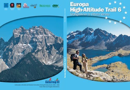
Europa High-Altitude Trail 6 ITALO ZANDONELLA CALLEGHER<br />
Cofi nanziato nell’ambito dell’Iniziativa Comunitaria Interreg IIIA Italia/Austria 2000 - 2006<br />
Fondo FESR (Cod.Progetto VEN222015)
ITALO ZANDONELLA CALLEGHER<br />
Europa High-Altitude Trail 6<br />
Großglockner to Vittorio Veneto<br />
from the glaciers<br />
to the Veneto plain<br />
High Altitude Trail Grossglockner-Monte Peralba<br />
by Günter Mussnig and Ernst Rieger<br />
The Dolomites "Alta Via" n. 6<br />
or Alta Via dei Silenzi<br />
created by Toni Sanmarchi in 1972<br />
by Italo Zandonella Callegher
Cover:<br />
The Kreuzseescharte and the lakes Kreuzsee and Wangenitzsee of<br />
the Schobergruppe in the Hohe Tauern National Park<br />
First page:<br />
Rifugio Pier Fortunato Calvi<br />
Back Cover:<br />
The Monte Cridola<br />
Introduction<br />
This booklet, created especially for the European hik<strong>ing</strong> enthusiast,<br />
is someth<strong>ing</strong> completely new, an absolute first. A truly European<br />
Alta Via (High Altitude Trail), which runs from the huge barrier of the<br />
Großglockner, in Austria, through into Italy to the Monte Peralba, i.e.<br />
from the spr<strong>ing</strong>s of the Piave river, and on to the little city of Vittorio<br />
Veneto.<br />
In recent years a wide range of new hik<strong>ing</strong> routes has been created in<br />
the Alps, but none runn<strong>ing</strong> through such a variety of landscapes as this<br />
one, which links the eternal glaciers at the foot of the highest mountain<br />
in Austria with the Veneto plain.<br />
A fantastic route in 19 daily stages, some 180km long, provid<strong>ing</strong> a<br />
total of about 100 hours of hik<strong>ing</strong>. Someth<strong>ing</strong> like a prestigious trekk<strong>ing</strong><br />
holiday in Nepal – if not better - and all of it in European territory.<br />
All this has been made possible by a project called “Intervention for<br />
the exploitation of alpine and cross-border hik<strong>ing</strong> routes. The system of<br />
the alpine mountain paths: High Altitude Trail “From the glaciers to the<br />
Veneto plain”, by Interreg IIIa Italy – Austria 2000 – 2006.<br />
©2005 Provincial Administration of Belluno<br />
DEPARTMENT FOR TOURISM, FARMING AND ACTIVITIES<br />
SERVICE FOR COMMUNICATION AND PROMOTION<br />
Via Psaro, 21 - 32100 Belluno<br />
www.infodolomiti.it<br />
New edition by<br />
Italo Zandonella Callegher<br />
Photo: Manrico Dell'Agnola,Günter Mussnig,<br />
Ernst Rieger, Österreichischer Alpenverein<br />
and Thomas Funt<strong>ing</strong>er<br />
Translation: Scuola di L<strong>ing</strong>ua Europa<br />
Graphics: Evidenzia<br />
Printed by: Linea Grafica<br />
Thanks to this project it has been possible to “join up” the two High<br />
Altitude Trail: the Austrian one, almost unexplored by Italian hikers<br />
- which runs north of the Veneto Dolomites, start<strong>ing</strong> out from the snowcovered<br />
mass of the Großglockner– and the tried and tested, but wilder,<br />
Italian Alta Via (High Altitude Trail) delle <strong>Dolomiti</strong> n.6, also known since<br />
1972 as Alta Via delle <strong>Dolomiti</strong> n.6 or Alta Via dei Silenzi.<br />
A marriage of two different cultures, united by the same passion for<br />
the mountains, their culture, their valleys, their people.<br />
EUROPA HIGH-ALTITUDE TRAIL 6 3
Characteristics of this Europa<br />
High-Altitude Trail 6<br />
The two sectors which make up the Europa High-<br />
Altitude Trade 6<br />
First sector, High Altitude Trail Großglockner-Peralba: leaves from the<br />
splendidmountain group which rises severely up north of Lienz and<br />
ends at the border between Austria and Italy at the Passo dell’Oregóne,<br />
between the Carinthia region and the Cadore area, near the Monte<br />
Peralba.<br />
Second sector, Alta Via (High Altitude Trail) delle <strong>Dolomiti</strong> n.6, or “dei<br />
silenzi”; runs from Monte Peralba to the little city of Vittorio Veneto, after<br />
go<strong>ing</strong> over the mountains on the left of the Piave, between the Veneto<br />
and Friuli regions.<br />
High Altitude Trail Großglockner-Peralba<br />
The Glockner – Vittorio Veneto route begins at the foot of the<br />
Großglockner, the highest mountain in Austria, 3798m. From the<br />
Großglockner district, on the second day, the path leads into the<br />
Schobergruppe, which has over 50 peaks of over 3000m. Across high<br />
saddles, isolated cirques with beautiful alpine lakes, go<strong>ing</strong> from refuge<br />
to refuge, in about four days you will reach Lienz, Austria’s “Dolomite<br />
City”. If you choose to climb some of the peaks (Großglockner, Roter<br />
Knopf, Keeskopf, Petzeck, Strasskopf), you can spend even longer on these<br />
splendid mountains.<br />
From Lienz the route leads into the massif of the Lienzer Dolomiten,<br />
comparable in appearance with the stone marvels of the South Tyrol.<br />
Across these impos<strong>ing</strong> rock barriers, just under 3000m, narrow paths<br />
lead, in two days, into the attractive Lesachtal.<br />
From St Lorenzen you proceed towards the Carnic Alps and, through<br />
the Frohntal, a day’s walk<strong>ing</strong> will take you to the Italian-Austrian border.<br />
Here the Alta Via High Altitude Trail delle <strong>Dolomiti</strong> n.6, or “dei Silenzi”,<br />
begins.<br />
The Glockner- Peralba path initially follows a route which is rich<br />
in tradition, the “Wiener Höhenweg” (Viennese High Mountain Path),<br />
before its end on the South side of the Hohe Tauern National Park. The<br />
alpine landscape is dominated by the impos<strong>ing</strong> Hohe Tauern with the<br />
largest National Park in the Alps. But why should a route in the Hohe<br />
Tauern be called after the capital of Austria, Vienna?<br />
The answer is quite simple: in the “golden age” of mountaineer<strong>ing</strong>,<br />
at the beginn<strong>ing</strong> of the last century, it was mostly mountaineers from<br />
the big cities who were responsible for develop<strong>ing</strong> the tourist industry<br />
in the Alps, firstly with their significant mountaineer<strong>ing</strong> endeavours,<br />
such as the first ascents of peaks and rock faces of increas<strong>ing</strong> difficulty,<br />
and later by build<strong>ing</strong> refuges and trac<strong>ing</strong> paths and mountain routes.<br />
This was the case in the Hohe Tauern and in the Schobergruppe. On the<br />
southern side of the Glockner, Viennese climbers were particularly<br />
active.<br />
Particular mention must be given to a group of mountaineers who<br />
shared an enthusiasm for the alpine environment which they wanted<br />
to transmit to their students. In Vienna, in 1874, they founded the<br />
“Lehrer Touristenklub”, which initially was not part of the Alpenverein,<br />
but became a section of it in 1911.<br />
Since 1914 the “Wiener Lehrer” Section has been in charge of the<br />
south-west part of the Schobergruppe, and since 1925 it has been<br />
responsible for the Gradental. In 1928 the Gradenseehütte was built. It<br />
was inaugurated in 1931, and later re-named “Adolf No Berger Hütte”,<br />
after the first chairman of the “Wiener Lehrer ” Section, who became<br />
well-known at the beginn<strong>ing</strong> of the 1930s particularly because of the<br />
paths he traced out in the Schobergruppe. He also designed the “Wiener<br />
Höhenweg” in its present form.<br />
Therefore, we have to thank the far-sightedness and dynamism of<br />
these Viennese mountaineers for this superb High Altitude Trail. Berg<br />
Heil!<br />
The route begins in the largest National Park in Austria, the Hohe<br />
Tauern. For the first few days, you walk in a north-south direction in<br />
the heart of this superb protected area, cross<strong>ing</strong> the border between the<br />
4 GROßGLOCKNER TO VITTORIO VENETO EUROPA HIGH-ALTITUDE TRAIL 6 5
Tyrol and Carinthia regions several times. Then you leave behind the<br />
National Park and the chain of the Hohe Tauern above the Iselberg, and<br />
move on to new challenges with the traverse of the Lienzer Dolomiten,<br />
the Carnic Alps and on into Italy.<br />
The traverse in the Hohe Tauern National Park from the Glocknerhaus<br />
to the Iselberg is definitely the most difficult stage from a mountaineer<strong>ing</strong><br />
point of view, as the route goes as far up as the 3000m of the Seehöhe,<br />
and often crosses small glaciers; but it is also the most spectacular part<br />
of the entire itinerary. For a whole week, with ascents to various peaks,<br />
you will be walk<strong>ing</strong> at altitude without ever go<strong>ing</strong> down to the valley.<br />
And all of this through the magnificent, undisturbed natural landscape<br />
of the Hohe Tauern National Park, which is not only a wonderful high<br />
mountain landscape; it is also home to many rare species of animals<br />
and plants. If you keep your eyes open along the Wiener Höhenweg, you<br />
will often have the chance to see some extraordinary wildlife, such as<br />
wild mountain goats, bearded lammergeyers and eagles.<br />
Alta Via delle <strong>Dolomiti</strong> n. 6 or “dei Silenzi”<br />
In 1972, Toni Sanmarchi published the guidebook “Alta Via dei<br />
Silenzi” for Tamari Editors in Bologna, immediately warn<strong>ing</strong> readers<br />
that “...this route is not one of those typical, well-known ones that cross<br />
the most famous of the Dolomite groups and that are so fashionable<br />
nowadays; routes that are used excessively by all types of people due<br />
to their deserved popularity and fame, thus lead<strong>ing</strong> to overcrowd<strong>ing</strong><br />
on some parts.”<br />
This is a High Altitude Trail with a difference! Due to its surround<strong>ing</strong>s,<br />
its lack of support points like those found on the other routes and<br />
its savage wilderness.<br />
In fact the route, although runn<strong>ing</strong> partly through the Pre-alpine<br />
territory, introduces characteristics that are much more severe than<br />
those normally found in the dolomites; extremely hot temperatures in<br />
the summer, frequent mist, unexpected storms and drastic temperature<br />
sw<strong>ing</strong>s, to name but a few.<br />
Nowadays the paths that up until about fifty years ago were abundant<br />
and well trod, have partly disappeared among weeds or under<br />
landslides. Only the main ones remain, well maintained by skilled<br />
volunteers.<br />
Along these partly equipped, signposted trails that can sometimes<br />
be a bit risky but never unachievable, runs the “Alta Via dei Silenzi”.<br />
But why “silenzi”? (‘silence’)? In the midst of these mountains, especially<br />
in the middle and final part of the route, there isn’t a trace of a<br />
liv<strong>ing</strong> soul, not even the sheep which used to graze here. There are also<br />
very few wild animals, as they have – foolishly - been hunted, although<br />
nowadays (2005) they are beginn<strong>ing</strong> to reappear. Here there is complete<br />
silence. That’s why Toni Sanmarchi alias “Capitan Barancio” chose this<br />
fitt<strong>ing</strong> name. Bit by bit, some structures have been added or improved<br />
on for hill-walkers so that these days, at the end of each walk, shelter<br />
can be found in a decent rifugio (refuge) or in a spartan but life-sav<strong>ing</strong><br />
fixed bivouac. In the 1960s, when the great mountaineer W. Herberg<br />
(one of the last modern explorers) re-traced Lothar Patéra’s footsteps on<br />
the Duranno and the Col Nudo, he noticed that everyth<strong>ing</strong> had remained<br />
“just like it was when it was first discovered” and the hours spent on the<br />
exploration added up to more than double of those used by the pioneers<br />
of the 19th and early 20th centuries. He could no longer find the paths<br />
and those remain<strong>ing</strong> were hazardous. The casère (old shepherds’ cottages)<br />
– poor but irreplaceable places of protection –were crumbl<strong>ing</strong> and<br />
had fallen down over the years from neglect. Silence had returned…<br />
Along this High Altitude Trail the isolation is peaceful, not disturb<strong>ing</strong>;<br />
the surround<strong>ing</strong>s are extremely remote and wild; the mountains have<br />
remained just as they were in primordial times. You may feel that all<br />
this sounds wonderful, and it is, but you should not let this lead you<br />
into underestimat<strong>ing</strong> the risks it presents. The more an environment is<br />
harsh and isolated, the more precautions are necessary. Safety, stamina,<br />
train<strong>ing</strong>, organisation and accurate maps and guides books are more<br />
crucial here than anywhere else. Remember there are no rescue centres<br />
nearby.<br />
The Alta Via delle <strong>Dolomiti</strong> n° 6 or dei Silenzi starts at the beginn<strong>ing</strong><br />
of the Piave river, in the damp plateau at the foot of the Peralba at the<br />
head of the Visdende valley and reaches Vittorio Veneto by cross<strong>ing</strong> over<br />
the Rinaldo, Tèrze, Clap, Monti di Sàuris, Tiàrfin, Crìdola, Spalti di Toro e<br />
Monfalcòni mountain ranges as well as the Duranno-Cima dei Preti and<br />
Col Nudo-Cavallo.<br />
6 GROßGLOCKNER TO VITTORIO VENETO EUROPA HIGH-ALTITUDE TRAIL 6 7
Right here at the beginn<strong>ing</strong> of the Piave river, this High Altitude Trail<br />
meets and joins up with the one com<strong>ing</strong> from Austria, from the Hohe<br />
Tauern.<br />
They move on together and become the Europa High-Altitude Trail 6, in<br />
serene friendship and without ideological barriers.<br />
The Alta Via delle <strong>Dolomiti</strong> n.6 maintains an average height of<br />
2000 metres, with relatively easy hik<strong>ing</strong> and rock climb<strong>ing</strong>, but has<br />
frequent stretches on uneven ground that can sometimes be tricky<br />
and exposed (especially along certain variants), above all in the<br />
Duranno-Cima dei Preti area. However, fixed apparatus can be found<br />
on the most difficult parts.The main problem on this route is lack of<br />
water, especially in the central and southern parts. Up until July you<br />
can take advantage of the snow that has accumulated in the gullies;<br />
after that you have to resign yourself to go<strong>ing</strong> down to the river...<br />
One of the privileges offered by these mountains are the fantastic<br />
views and the wide-open and majestic landscapes. However, as is<br />
always the case in the Pre-alps, mist is often present, so that they are only<br />
visible early in the morn<strong>ing</strong>.<br />
Finally, changes in the weather should be studied very carefully in<br />
order not to be caught out unprepared in the middle of this wild and<br />
deserted wasteland, fantastic as it may be.<br />
Hav<strong>ing</strong> said this, we can only echo Toni Sanmarchi’s words: “ The<br />
Alta Via dei Silenzi is still the Montagna del Buon Dio”. (‘The Good Lord’s<br />
Mountain’). May those who walk on it benefit not only from healthy<br />
physical exercise, but also deep, visual and spiritual personal satisfaction.”<br />
We feel obliged to point out that some authors have modified the original<br />
route, adapt<strong>ing</strong> it to their own personal taste, for general tourism<br />
needs and that of their guidebook users. In some cases the original Italian<br />
route has been drastically altered, with strange variants, mak<strong>ing</strong> the<br />
High Altitude Trail excessively long: more than fifteen days instead of<br />
eleven, with some stretches reduced to only two or three hours per day.<br />
It’s true that this would be ideal for holidays, relax<strong>ing</strong> and enjoyable, but<br />
we have preferred to remain faithful to “the old days”, even if this means<br />
that some stretches may seem a bit severe in length or steepness.<br />
11 days, however are quite sufficient to complete the main “branch”<br />
of the route, without hurry<strong>ing</strong> unnecessarily. A word of advice:<br />
those wish<strong>ing</strong> to tackle the Alta Via delle <strong>Dolomiti</strong> accord<strong>ing</strong> to the<br />
schedule suggested will need to be fit and trained. Some stretches are<br />
necessarily long and without support points, and it would be much<br />
easier (but also heavier) to take a tent. However, some long stretches<br />
can be completed us<strong>ing</strong> a taxi or other vehicle, for example: from Erto<br />
to Cimolàis and Cellìno (not recommended on foot); from S. Martino<br />
for the Alpàgo to Casèra Pal and from Campón to Vittorio Veneto.<br />
However, the walk<strong>ing</strong> days could be increased by add<strong>ing</strong>:<br />
1) the climb from Sappàda to the Sorgenti del Piave us<strong>ing</strong> the<br />
“Sentiero Frassati”;<br />
2) the Monfalcóni traverse at altitude;<br />
3) the deviation for the Capanna Tita Barba and the Casèra del Cavalét;<br />
And others; depend<strong>ing</strong> on how your holidays are organised!<br />
The Italian part of the Europa High-Altitude Trail 6 can be divided<br />
into three distinct parts, correspond<strong>ing</strong> to the main ranges crossed.<br />
1- Peralba, Rinaldo, Clap, Tiàrfin;<br />
2- Crìdola, Spalti di Toro e Monfalcóni, Cima dei Preti-Duranno;<br />
3- Col Nudo-Cavallo.<br />
In order to satisfy almost any whim, a few different variants are<br />
described. These variants aim to give a wider range of choice, but at<br />
the same time br<strong>ing</strong> certain difficulties, although not significant.<br />
Also in this case, in comparison with Toni Sanmarchi’s guide,<br />
published in 1972, some changes and updates have been made to<br />
the original route, because dur<strong>ing</strong> the last few years, there have been<br />
some morphological changes, as well as changes as a result of interventions<br />
carried out by the organisations responsible for maintain<strong>ing</strong><br />
and the equipp<strong>ing</strong> the various stages of the route. Hav<strong>ing</strong> said this,<br />
noth<strong>ing</strong> has been taken away from the originality of the work and<br />
the idea; if anyth<strong>ing</strong> there has been a respectful will<strong>ing</strong>ness to improve<br />
on and to further define Sanmarchi’s route.<br />
8 GROßGLOCKNER TO VITTORIO VENETO EUROPA HIGH-ALTITUDE TRAIL 6 9
The stages<br />
The long route has been divided up into daily stages, each of which<br />
has precise reference points, a beginn<strong>ing</strong> and an end, which may be a<br />
refuge, a bivouac, a malga (mountain hut), or a simple shelter. These<br />
are generally open from the 20th of June to the 20th of September,<br />
except<strong>ing</strong> variations due to altitude or for other reasons which will<br />
be explained in the guide in the relevant “technical details” sections.<br />
Both the refuges and the mountain huts (of which there are many,<br />
and very welcom<strong>ing</strong>, particularly in Austria) offer food and accommodation,<br />
sometimes basic, but always friendly and genuine.<br />
The bivouacs are always open and unstaffed and inside all you<br />
will find are some mattresses, camp beds and blankets.<br />
At the height of the summer season it is advisable to book places<br />
in the refuges well in advance (see telephone numbers in the descriptions<br />
of each refuge), especially in August.<br />
Out of respect for others’ needs, you should cancel as early as possible if<br />
you are unable to honour your book<strong>ing</strong>, even if you have already paid.<br />
The stages have been designed in such a way that, from departure<br />
to arrival, i.e. from one stop-off point to another, they should take a<br />
minimum of 2.30 – 3 hours to a maximum of 9 hours, for an average<br />
fit, trained hiker. This should give hikers, especially those leav<strong>ing</strong><br />
early in the morn<strong>ing</strong>, the chance to rest, relax or visit the area around<br />
the stop-off point chosen.<br />
Naturally, each stage can be walked individually, i.e. start<strong>ing</strong> out<br />
from a different support point or a village at the bottom of the valley.<br />
These link<strong>ing</strong> paths also come in useful if you want to divert from,<br />
or give up, the main route. Information on these paths, and where<br />
you can find them, can be had by consult<strong>ing</strong> the Bibliography, or the<br />
topographical maps of the relevant area, details of which are listed<br />
in the “Technical Details” sections.<br />
The stages are described in a simple way, immediately understandable<br />
and easy to read, but the descriptions contain different<br />
information and many important data; here you will find everyth<strong>ing</strong><br />
even the most demand<strong>ing</strong> hiker might want to know. Each daily<br />
route is described in such a way as to let the hiker know exactly what<br />
s/he can expect throughout the day; for example: other refuges or<br />
support points, gradients in ascent and descent, approximate length<br />
of the route in km, time required, path numbers, difficulty, any fixed<br />
equipment, signs; but also notes on the environment and the views,<br />
the flora and fauna, the geology and other points of interest.<br />
As for mountaineer<strong>ing</strong>, there is now a difficulty scale, drawn up<br />
some years ago, for hikers, which should be learnt and taken seriously,<br />
in order to avoid unpleasant surprises.<br />
Below is the international table of hik<strong>ing</strong> difficulty levels:<br />
T for tourists, i.e. elementary difficulty<br />
E for hikers<br />
EE for expert hikers<br />
EEA for expert hikers with via ferrata equipment<br />
A for climbers<br />
However, you should remember that in Austria, where the<br />
signposts indicate the level of difficulty, another evaluation system<br />
is used, based on different colours, as for ski slopes:<br />
Blu<br />
Rosso<br />
Nero<br />
easy, i.e. T/E<br />
average difficulty, i.e. EE<br />
difficult, i.e. EEA, some stretches possibly A<br />
Recommended period<br />
The ideal period for the routes is undoubtedly the summer, i.e. from<br />
the end of June to September, since the climate and weather conditions<br />
are more stable than dur<strong>ing</strong> the rest of the year.<br />
Bear in mind that each of the two sectors of the High Altitude<br />
Trail in this guide has its own individual “identity card”; thus, the<br />
Großglockner-Peralba sector is easier, at least the initial part, in July<br />
and August, due to its latitude and the correspond<strong>ing</strong> weather conditions,<br />
while the Alta Via delle <strong>Dolomiti</strong> n.6 can be tackled from as<br />
10 GROßGLOCKNER TO VITTORIO VENETO EUROPA HIGH-ALTITUDE TRAIL 6 11
early as the beginn<strong>ing</strong> of June until almost the end of September (but<br />
check when the refuges close).<br />
On the High Altitude Trail Großglockner-Peralba, for example,<br />
some technical difficulties can be encountered on hard snow or<br />
frozen rock plates in the first part of the route, even at the height of<br />
summer. Obviously, on sheet ice it is compulsory to use hillwalk<strong>ing</strong><br />
crampons, which weigh very little, and which no hiker should be<br />
without in their rucksack.<br />
On the Alta Via (High Altitude Trail) delle <strong>Dolomiti</strong> n.6, difficulty<br />
on snow or ice is rarely encountered at the height of summer, except<br />
for the odd frozen channel or strip of hard snow at the beginn<strong>ing</strong> of<br />
the season. In these cases it is advisable to use a light rope to secure<br />
the less experienced. Remember that a slip always has unpleasant<br />
consequences, both physical and psychological.<br />
So, better a piece of bread less and a length of rope more!<br />
Equipment<br />
It is necessary, indeed vital, for the hiker to have good mountain equipment.<br />
These days the market offers a huge range and variety of all sorts<br />
of products and technical specialities for use in all seasons. A trained,<br />
professional sales assistant can help you to choose the best product for<br />
your needs, but we feel obliged to offer some advice of our own.<br />
The choice of underwear is extremely important. The traditional<br />
cotton and wool garments have been replaced by products in<br />
polypropylene and other materials, often combined with polyester<br />
or newly-designed materials (the textile industry evolves continually,<br />
and by the time this guide is published, even more innovative<br />
products will probably be available), which have the advantage of<br />
expell<strong>ing</strong> sweat and thus keep<strong>ing</strong> the body dry.<br />
The famous “grandma” style thick woolly socks are now almost<br />
a distant memory, and today hikers use products created with synthetic<br />
fibres of various types, which are warm and allow the skin to<br />
breathe. To protect their legs, many hillwalkers use very light nylon<br />
knee-length socks (women’s pop-socks), which give excellent protection<br />
to the skin and a fine natural wrap for the muscles.<br />
Hik<strong>ing</strong> boots must be chosen with particular care. In the southern<br />
part of the route, light trekk<strong>ing</strong> shoes are sufficient, but on the snowcovered<br />
mountains of the northern sector it is vital to have a more<br />
technical, robust type of footwear, specifically designed for that kind<br />
of terrain, and to which crampons can be applied if need be.<br />
Sunglasses are indispensable at least when cross<strong>ing</strong> areas covered<br />
in snow.<br />
Knickerbocker type trousers, comfortable as they are, are rarely<br />
worn in Italy, although they are still popular in other countries. The<br />
kind of trousers normally worn these days are long, very technical<br />
(i.e. light, elasticised, with numerous pockets, brightly coloured to<br />
aid visibility, water-resistant, etc.); there is a vast range of choice,<br />
depend<strong>ing</strong> on individual taste and budget.<br />
The old-style heavy woollen shirts have also been replaced by<br />
synthetic fabrics (fleece), but you can also find excellent models in<br />
breathable cotton or other fibres that the market “imposes” upon<br />
hikers who want to keep up with the times (and with fashion).<br />
Fleece is an exceptional fabric, which has been used for years now<br />
and is continually evolv<strong>ing</strong>, allow<strong>ing</strong> the hiker to wear a splendid<br />
sweater which is lightweight, breathable, warm, waterproof and<br />
comfortable.<br />
The same material is also common these days for gloves and hats.<br />
It is not difficult to choose a good wind-cheater jacket. Polyamide<br />
jackets are the lightest, the most waterproof and also breathable.<br />
Unfortunately the high price puts many people off buy<strong>ing</strong> this extremely<br />
useful type of technical jacket, but if you take advantage of the<br />
sales, and ignore fashion trends for once, you can save a lot.<br />
Telescopic walk<strong>ing</strong> sticks, adaptable and extremely lightweight,<br />
are very useful in ascent because they save you about 30% of the<br />
effort; they are practically indispensable for anyone with any kind of<br />
knee problems because they lighten the burden of the rucksack, transferr<strong>ing</strong><br />
some of its weight onto the arms, which should therefore be<br />
kept in good shape. Even this extremely useful piece of equipment<br />
has its limits, however: it should not be used when cross<strong>ing</strong> on led-<br />
12 GROßGLOCKNER TO VITTORIO VENETO EUROPA HIGH-ALTITUDE TRAIL 6 13
ges or on steep paths half way up the mountainside, for example,<br />
because they can cause you to lose your balance and trip; it should<br />
not be used anywhere you need to use one or both of your hands on<br />
the rock; it is not recommended in steep descent; if they get stuck<br />
between the shoulder straps of you rucksack and your back, they can<br />
collide with the rock and cause you to lose your balance.<br />
It is unadvisable to carry too big a rucksack, because it gets in the<br />
way on difficult stretches; an average size rucksack is sufficient, with<br />
a few useful pockets to carry recommended items: personal documents,<br />
cellphone (very useful; it has saved many lives, although it<br />
cannot be used everywhere), membership card of mountaineer<strong>ing</strong><br />
associations, to get discounts in the refuges, topographical maps<br />
and guides, a pen and perhaps a diary, Swiss knife, water flask,<br />
compass and altimeter, camera, first aid items (especially common<br />
ones such as painkillers, vitamin C, saline integrators, plasters, gauzes,<br />
bandages, thermometer, and anyth<strong>ing</strong> else the individual hiker<br />
might need) and all those little accessories that personal experience<br />
and requirements demand.<br />
Never forget a change of underwear, socks, handkerchiefs, sheets<br />
in synthetic fibre (on sale in many refuges), sleep<strong>ing</strong> bag-lightweight<br />
bivouac for emergencies (you can buy them at a reasonable price, and<br />
they weigh about 200g), someth<strong>ing</strong> to shelter you from the rain (the<br />
old-fashioned cap is not often used these days, with hikers preferr<strong>ing</strong><br />
a small umbrella, which must, however, be able to stay up in strong<br />
wind), lightweight climb<strong>ing</strong> shoes or other footwear for use inside the<br />
refuges, a waterproof cotton hat (the “desert” type is best, as it protects<br />
you from UV rays and also covers the neck and ears). A length (about<br />
20 metres) of lightweight rope is useful, as well as some snaplinks.<br />
On the vie ferrate it is compulsory to use a helmet, snaplinks and<br />
a ferrata harness , so these should also be carried in your rucksack.<br />
Crampons are also necessary (on the market you can find an extremely<br />
lightweight model for hillwalk<strong>ing</strong>, which is quite sufficient.<br />
To tackle the Europa High-Altitude Trail 6 it is not indispensable to<br />
have a rope, but it is certainly useful for some rocky stretches, ice-covered<br />
rock plates or other cases in which help might be required. In the<br />
case of groups walk<strong>ing</strong> together, members could take turns carry<strong>ing</strong><br />
the rope.<br />
Those who hanker after the old-style climb<strong>ing</strong> environment can<br />
experience the beauty and majesty of the mountains by spend<strong>ing</strong> the<br />
night in a tent, curled up in a warm sleep<strong>ing</strong> bag, sometimes lulled<br />
to sleep by rain fall<strong>ing</strong> softly on the roof. The only price to be paid for<br />
such an unforgettable experience is a few extra kilos to carry!<br />
Extremely important: NEVER forget to br<strong>ing</strong> adequate water<br />
supplies and, of course, a little food for daily use, which you can buy<br />
in the various refuges, without weigh<strong>ing</strong> down your rucksack at the<br />
outset with all manner of urban delicacies.<br />
Route signs<br />
In the Austrian sector of the Europa High-Altitude Trail 6, (i.e. the High<br />
Altitude Trail Großglockner-Peralba until the Passo dell’Oregóne) the<br />
signs are different from those used in Italy. In Austria the signposts<br />
also indicate the level of difficulty of the route.<br />
a) Metal signposts indicat<strong>ing</strong> the destination, difficulty level (blue=easy;<br />
red=average difficulty; black=difficult) time required and path number<br />
(accord<strong>ing</strong> to EU indications); or wooden signposts.<br />
b) Two red vertical or horizontal stripes with a white stripe in the<br />
middle. Where very frequent signs are necessary, you will find<br />
simple red or red and white signs. The triangle with the number<br />
of the High Altitude Trail should be found also in Austria.<br />
Along the route in the Italian sector (i.e. from the Passo dell’Oregóne-<br />
Peralba to Vittorio Veneto) the hiker can find three types of signs at all<br />
the main points.<br />
a) Painted triangle with the High Altitude Trail number inside; this<br />
type of sign is a little less common than the follow<strong>ing</strong>;<br />
b) Path sign consist<strong>ing</strong> of two horizontal red stripes with a white<br />
stripe in the middle on which you can find the path number in<br />
black. Along paths that require more frequent signs, in between<br />
those above you can find simple red or red and white signs.<br />
c) Wooden chart signs on fixed poles (old types in metal).<br />
14 GROßGLOCKNER TO VITTORIO VENETO EUROPA HIGH-ALTITUDE TRAIL 6 15
The coordination of signposts on the busy network of alpine paths<br />
in the Veneto Region is constantly monitored, sector by sector. Where<br />
the triangles, path signs and charts are found to be in poor condition<br />
and thus difficult or impossible to see, the hiker should pay careful<br />
attention to the indications set out in this guide.<br />
Nevertheless, an attentive walker shouldn’t have problems of<br />
orientation if they constantly refer to a good map or put into practice<br />
information given by hut managers along the route.<br />
Safety in the mountains<br />
As the paths of the Europa High-Altitude Trail 6 can be very tir<strong>ing</strong> at<br />
times and conducted above 2900 metres, experience, good equipment,<br />
sure foot<strong>ing</strong>, absence of vertigo and good physical condition<br />
are indispensable to ensure safety.<br />
Often dangers are undervalued in the mountains: a rapid change<br />
in weather, an unexpected storm, a premature snowfall, an icy patch<br />
of ground, fast-mov<strong>ing</strong> rivers….can all turn a pleasant, light-hearted<br />
trip into a ordeal, even on well-marked stretches of path. Good selfcontrol<br />
can be vital.<br />
A fundamental condition for trekk<strong>ing</strong> along the High Altitude Trail<br />
paths is good weather! Therefore you should find out weather conditions<br />
first from the available sources.<br />
If, despite all the above precautions and excellent equipment, an<br />
accident nevertheless happens (a slip, twist, fracture, injury from fall<strong>ing</strong><br />
rocks, lightn<strong>ing</strong>, illness, vertigo etc.), try not to panic (difficult though<br />
this is) and follow the recommended indications where possible.<br />
The Austrian Mountain Rescue Association was founded in 1896.<br />
Its task is to help, rescue, recover and assist people who have an<br />
accident in the mountains, or to search for miss<strong>ing</strong> people or people<br />
in emergency situations.<br />
Some 11,000 men and women with mountaineer<strong>ing</strong> expertise<br />
belong to the association and are active in a voluntary and honorary<br />
role. The number to call for Mountain Rescue in Austria is 140, free of<br />
charge and active 24 hours. The European emergency number is 112,<br />
but access to all networks is possible only if no PIN code is inserted,<br />
or more exactly, PIN code 112.<br />
The membership fee of the Alpenverein covers the cost of rescue<br />
and transport home from abroad (as a result of accident or illness).<br />
Information : Weltweit Service (www.alpenverein.at)<br />
The CNSAS (National Speleological Mountain Rescue Organization,<br />
a special section of the CAI, Italian Alpine Club, whose emergency<br />
telephone number is 118, active 24 hours) and the Austrian Mountain<br />
Rescue normally operate in so-called hostile environments and in all<br />
inaccessible areas of the province. This does not only mean – as is often<br />
believed - areas such as, cliff faces or vie ferrate (equipped paths), but<br />
also and above all snowfields and glaciers, ice falls, avalanches, cable<br />
cars, ski slopes, caves, ravines, gorges and gullies, rivers and all other<br />
types of environment not necessarily at high altitude (hills, woods, etc.),<br />
that due to access or movement problems, or in special weather conditions,<br />
require the intervention of qualified personnel that have expertise<br />
in all areas of mountaineer<strong>ing</strong> and speleology techniques and rescue.<br />
Keep in mind that the refuges located along the Europa High-<br />
Altitude Trail 6 are equipped with public telephones (except the fixed<br />
bivouacs); in addition, all refuge managers are trained to help send<br />
correct and quick requests to Mountain Rescue.<br />
International rules for mountain safety<br />
Never underestimate the dangers and risks associated with<br />
any type of activity connected to the mountains and to hostile<br />
environments in general (mountaineer<strong>ing</strong>, speleology, ski<strong>ing</strong>,<br />
mountain bik<strong>ing</strong>, hunt<strong>ing</strong>, mushroom pick<strong>ing</strong>, delta plane<br />
fly<strong>ing</strong> and parachut<strong>ing</strong> etc.); the rapid changes in weather, the<br />
difficulty of the route, walk<strong>ing</strong> time, etc.<br />
Good mental-physical condition, adequate preparation and<br />
train<strong>ing</strong> for the task to be undertaken are essential.<br />
Avoid attempt<strong>ing</strong> routes that are beyond your technical ability<br />
and physical and mental preparation.<br />
Never walk alone, whenever possible be accompanied and/or<br />
advised by qualified individuals or organisations<br />
Obtain adequate information about the route’s particular<br />
features and difficulty as well as the area in general. Study all<br />
necessary information in advance regard<strong>ing</strong> the destination or<br />
route chosen, us<strong>ing</strong> the appropriate guides and maps.<br />
16 GROßGLOCKNER TO VITTORIO VENETO EUROPA HIGH-ALTITUDE TRAIL 6 17
Always leave extremely precise information about where you<br />
are go<strong>ing</strong> and which route you intend to take, us<strong>ing</strong> visitors<br />
books in huts and bivouacs when appropriate.<br />
Find out the weather conditions in advance, especially the<br />
local forecast.<br />
Br<strong>ing</strong> adequate footwear and cloth<strong>ing</strong>: avoid wear<strong>ing</strong> train<strong>ing</strong><br />
shoes and shoes with smooth soles.<br />
Br<strong>ing</strong> a head torch. Do not forget light, easily digested food<br />
and water with perhaps added saline integrators.<br />
Br<strong>ing</strong> a small first aid kit.<br />
Basic rules on how to behave in the event of an accident<br />
Stay calm and do not act impulsively, try to evaluate the particular<br />
situation<br />
Evaluate the general situation (environment) and the specific<br />
situation (the accident). Try to identify actual and possible<br />
dangers.<br />
Immediately adopt measures to avoid and prevent further risks.<br />
Request help by immediately call<strong>ing</strong> 140 in Austria, or 118<br />
in Italy. The European freephone emergency number is 112,<br />
which puts you through directly to the nearest police headquarters.<br />
What to say when you call 140 in Austria and 118 in Italy<br />
Supply precise information about the injured person/s (name,<br />
surname, residence) and the telephone number from which<br />
you are call<strong>ing</strong>, if possible.<br />
Give details on the location of the accident or visual references that<br />
can help identify the spot easily, such as: mountain group, side,<br />
path, via ferrata, valley, channel, ledge, rest, crest, gully, etc...<br />
Give a brief summary of the accident stat<strong>ing</strong> the time at which<br />
it happened.<br />
Specify the number of injured and their condition.<br />
Describe the weather conditions, especially visibility.<br />
Highlight any obstacles in the area with particular reference<br />
to power lines and cables, chair-lifts and ski-lifts and any<br />
other overhang<strong>ing</strong> cables that could get in the way.<br />
Give any other information that could aid the operation (people<br />
present, particular obstacles or difficulties etc.)<br />
Explain precisely how to reach the place where the accident<br />
happened, or where the injured person is.<br />
Indicate the presence of other people on the spot who witnessed<br />
the accident, and in particular, if they are able to help.<br />
Search interventions for miss<strong>ing</strong> or lost persons<br />
Specify date and time of departure.<br />
Describe the method of transport used to reach the spot (if car, specify<br />
number plate, model, colour, appearance, characteristics etc.).<br />
Indicate destination and chosen route and/or probable or<br />
possible fixed objectives (hill walk<strong>ing</strong>, ferrata, climb<strong>ing</strong> etc.).<br />
Give the number of walk<strong>ing</strong> or climb<strong>ing</strong> companions and<br />
their hill-walk<strong>ing</strong> or mountaineer<strong>ing</strong> abilities and experience.<br />
Describe cloth<strong>ing</strong> (pay<strong>ing</strong> particular attention to colour) and<br />
materials and food supplies carried.<br />
Inform of any psychological, physical, family or social problems.<br />
Communicate information already given to other bodies and/<br />
or organisations.<br />
Supply any other useful information regard<strong>ing</strong> the subject(s),<br />
location and general environmental conditions.<br />
Interventions in case of avalanche<br />
As for previous points 1 and 2.<br />
Give the exact or presumed number of people swept away<br />
and the exact or presumed number of people buried.<br />
Specify the brand and model of apparatus used for search<strong>ing</strong><br />
the persons swept away by the avalanche.<br />
Identify the presence of any witnesses able to give an exact<br />
account of what happened:<br />
- If a visual-auditory- apparatus search has been carried out:<br />
- Provide a brief description of the avalanche (size and characteristics)<br />
and the exact point where the people were swept away<br />
and/or disappeared (right, left, above, below etc.);<br />
- objects already extracted and their position, as for previous<br />
point above.<br />
- other information and particulars that can help the intervention.<br />
18 GROßGLOCKNER TO VITTORIO VENETO EUROPA HIGH-ALTITUDE TRAIL 6 19
International mountain rescue signals<br />
International mountain rescue signals are still the same today as they<br />
were in the past, and often the only means possible in the immensity<br />
of the mountains is send<strong>ing</strong> an visual or acoustic signal 6 times per<br />
minute, at regular intervals, i.e. every 10 seconds. Pause for a minute<br />
and repeat the same signal until you receive a response. This is done<br />
three times in a minute, every 20 seconds, in a visual or audible way.<br />
By acoustic signals, we mean shout<strong>ing</strong> or whistl<strong>ing</strong> or any other<br />
perceptible noises; by visual signals we mean wav<strong>ing</strong> handkerchiefs,<br />
items of cloth<strong>ing</strong> or mirror signals….; at night you can use a torch or,<br />
if possible, a fire (obviously with caution, especially if you are in a<br />
wooded area or a wooden shelter).<br />
The ever more frequent use of helicopters by Mountain Rescue<br />
has rendered new signall<strong>ing</strong> methods necessary. Colourful sleep<strong>ing</strong><br />
bags or anoraks spread out on the ground, smoke signals or marks<br />
in the snow can aid location from above. The SOS rescue sign can be<br />
made with letters of about 2m long, us<strong>ing</strong> contrast<strong>ing</strong> stones placed<br />
on the ground, or footprints in the snow. In order to be seen from<br />
above, i.e. by helicopter, you need to make the follow<strong>ing</strong> signals with<br />
your arms or with lights at night:<br />
Both arms raised and<br />
spread out<br />
or green light<br />
Left arm raised and<br />
spread out, Right arm<br />
point<strong>ing</strong> down<br />
or red light<br />
Yes, to the pilot’s questions.<br />
Land here<br />
Help is needed<br />
No, to the pilot’s questions.<br />
Don’t land here.<br />
No help needed<br />
When giv<strong>ing</strong> the helicopter instructions to land, keep the follow<strong>ing</strong><br />
in mind: with arms outspread, remain still at the edge of the<br />
land<strong>ing</strong> place; where possible the area surround<strong>ing</strong> the land<strong>ing</strong> place<br />
should be clear of obstacles up to a space of 20x20 metres.<br />
TAKE NOTE! Don’t move away until the rotor blades have stopped:<br />
you are an important fix<strong>ing</strong> point for the pilot. Any items of<br />
cloth<strong>ing</strong> laid on the floor to help the pilot should be held down with<br />
stones to protect against the strong airflow given off by the helicopter’s<br />
blades!<br />
Minimum impact<br />
Hik<strong>ing</strong> is one of the most pleasant and healthiest outdoor pursuits,<br />
but it also requires increas<strong>ing</strong> awareness of the negative impact that<br />
it can have on nature and on the landscape. High in the mountains<br />
the mantle of humus is often very thin and the vegetation is extremely<br />
vulnerable to the damage caused by people walk<strong>ing</strong> over it:<br />
3000 cross<strong>ing</strong>s of a stretch of alpine field in a year are enough to turn<br />
a grassy area into a barren terrain.<br />
Hikers on the High Altitude Trail must do their best to avoid<br />
shortcuts to limit the effects of wash<strong>ing</strong> away of the waters and<br />
prevent unsettl<strong>ing</strong> the ground; they must also try not to go off the<br />
paths so as not to disturb wildlife, and to reduce noise pollution,<br />
particularly when cross<strong>ing</strong> protected areas or biotopes of particular<br />
scientific importance. They should not leave rubbish behind, gather<br />
mushrooms, berries, flowers or fossils. If you have to light a fire, do<br />
so with extreme caution and only in appropriate areas.<br />
High Altitude Trail badge<br />
Hikers, once they arrive in Vittorio Veneto, can receive, free of<br />
charge, a special badge with the High Altitude Trail logo. To get this<br />
badge, you must go to the IAT (Tourist Information and Assistance)<br />
office in Piazza Duomo in Belluno, and present a sheet of paper with<br />
all the stamps from the refuges visited along the route (the stamps<br />
can also be left in the appropriate spaces in this guide).<br />
Once hikers request the badge, they are also entered into the list<br />
of people who have completed the High Altitude Trail, and they can<br />
express their impressions of the route, and point out anyth<strong>ing</strong> they<br />
think is lack<strong>ing</strong>.<br />
20 GROßGLOCKNER TO VITTORIO VENETO EUROPA HIGH-ALTITUDE TRAIL 6 21
Table of itineraries<br />
Itinerary Deparure point Gradient in ascent Gradient in descent Time<br />
High Altitude Trail Grossglockner-Monte Peralba<br />
Alta Day Via 1 Großglockner-Peralba<br />
Glocknerhaus 700 m 4,30hrs<br />
Day 12 Glocknerhaus Glorer Hütte 700 500 m 4,30hrs 5,30hrs<br />
Day 23 Glorer Elberfelder Hütte Hütte 600 500 m 5,30hrs 4,00hrs<br />
Day 34 Elberfelder Noßberger Hütte 600 500 m 4,00hrs 4,30hrs<br />
Day 45 Noßberger Wangenitzsee Hütte Hütte 200 500 m 4,30hrs 3,30hrs<br />
Day 56 Wangenitzsee Winklerner Hütte Hütte 200 750 m 2,30 hrs 3,30hrs +taxi<br />
Day 67 Winklerner Karlsbader Hütte 750 300 m 2,30 hrs 4,30hrs +taxi<br />
Day 78 Karlsbader St. Lorenzen Hütte 1200 300 m 5,00 4,30hrs<br />
Day 8 St. Lorenzen 1200 m 5,00 hrs<br />
The Dolomites "Alta Via" n.6 or Alta Via dei Silenzi<br />
Alta Day Via 1 delle Sorgenti Dolmiti del Piave n. 6<br />
550 m 1150 m 4,00 hrs<br />
Day 12 Sorgenti Sappàda del Piave 550 800 m 1150 260 m 4,00hrs<br />
Day 23 Sappàda Rifugio De Gasperi 370 800 m 260 350 m 4,00hrs 4,30hrs<br />
Day 34 Rifugio De Fabbro Gasperi 370 500 m 1120 350 m 4,30hrs 6,30hrs<br />
Day 45 Rifugio Fabbro Giàf 500 650 m 1120 760 m<br />
6,30hrs<br />
Day 56 Rifugio Giàf Padova 650 980 m 760 400 m 4,30hrs<br />
Day 67 Rifugio Bivacco Padova Laghét de sòra 980 800 m 400 750 m 4,30hrs 8,00hrs<br />
Day 78 Bivacco Laghét Greselìn de sòra 350 800 m 1620 750 m 8,00hrs<br />
Day 89 Bivacco Cimolàis Greselìn 1620 350 m 1620 150 m 8,00hrs 7,00hrs<br />
Day10 9 Cimolàis Ricovero Col Nudo 1200 1620 m 1300 150 m 7,00hrs 6,30hrs<br />
Day10 11 Ricovero Rifugio Semenza Col Nudo 1200 430 m 1300 2300 m 6,30hrs 9,00hrs<br />
Day 11 Rifugio Semenza 430 m 2300 m 9,00hrs<br />
High Altitude Trail<br />
Grossglockner-Monte Peralba<br />
By Günter Mussnig and Ernst Rieger<br />
22 GROßGLOCKNER TO VITTORIO VENETO
Itinerary<br />
Technical details<br />
Departure Point:<br />
from the “Glocknerhaus” at the foot of the<br />
Gro_glockner<br />
Arrival Point:<br />
Hochwei_stein Haus (Austria), Rifugio Calvi<br />
(Italy)<br />
Walk<strong>ing</strong> days: 8<br />
Route Length:<br />
about 100 kilometres<br />
Refuges on the main route: 8<br />
Bivouacs on the main route: 1<br />
Refreshments on the way: 11<br />
Longest stretch:<br />
the 2nd, about 5,30 hours.<br />
Shortest stretch:<br />
the 6th, about 2,30 hours.<br />
Total time required (exclud<strong>ing</strong> variants): about 33 hours<br />
Difficulty:<br />
T3,average difficulty; a stretch of T4, difficult<br />
Total gradient in ascent:<br />
about 6200 metres<br />
Total gradient in descent:<br />
about 6000 metres<br />
Maximum gradient in ascent:<br />
1650m, from Lienz (possible taxi)<br />
Maximum gradient in descent:<br />
1230m, to Lienz (possible taxi)<br />
Maximum altitude :<br />
Hornscharte, 2958m<br />
Minimum altitude :<br />
Lienz, 637m<br />
Mountain Groups involved : 4<br />
Recommended period :<br />
from the end of June to the middle of<br />
September<br />
Signs:<br />
Good everywhere<br />
Recommended maps (in order of use)<br />
Tabacco maps 1:25.000<br />
n. 40 “Glocknergruppe”, Alpenvereinskarte, dalla Glocknerhaus alla Glorer Hütte;<br />
n. 41 “Schobergruppe”, Alpenvereinskarte, from the Glorer Hütte to Lienz;<br />
Tabacco maps 1:50.000<br />
n. 182 “Lienzer Dolomiten und Lesachtal”, Freytag & Berndt, Kompass Karte, da Karte<br />
n. 47 “Lienzer Dolomiten und Lesachtal”, Kompass Karte, from Lienz to the Sorgenti del<br />
Piave<br />
Description of the walks<br />
Day one<br />
From the Glocknerhaus to the Salmhütte and the<br />
Glorer Hütte<br />
Time required: 4,30 hours<br />
Maximum altitude: Glatzschneid, 2660m<br />
Gradient in ascent: c.700m<br />
Difficulty: Red (EE, Expert Hikers)<br />
Path: N.741<br />
Maps: Alpenvereinskarte n.40, Glocknergruppe, 1: 25,000<br />
The itinerary suggested leaves from nearby the renovated Glocknerhaus<br />
Alpine Centre, located right on the Gletscherstraße (Road of the Glaciers) to the<br />
Kaiser-Franz-Josefs-Höhe, a part of the Alta Via del Großglockner (Großglockner<br />
Hochalpenstraße)<br />
The Glocknerhaus is located in the municipal territory of Heiligenbut, and a<br />
short stay immersed in the marvellous alpine world of the Hohe Tauern National<br />
Park before sett<strong>ing</strong> out on the long route is highly recommended. It is certainly<br />
a good idea to prepare yourself for the itinerary with some acclimatization<br />
trips around Heiligenbut. You can find tourist information about Heiligenbut<br />
from: Tourismusverban Heiligenbut, Hof 4, A-9844 Heiligenblut - Tel: ++43<br />
(0) 48242001 21 - Fax: ++43 (0) 48242001 43 - Mail: office@heiligenblut.at<br />
- Web: www.heiligenblut.at<br />
To get from Heiligenbut to the departure point of the route, the Glocknerhaus,<br />
take the local buses (which stop right outside the Glocknerhaus). The refuge,<br />
owned by the Klagenfurt Section of the Austrian Alpine Club, is a pulpit over the<br />
Großglockner. It offers all the comforts of a modern refuge, as well as various<br />
information points.<br />
The Glocknerhaus, 2132m, owned by the Klagenfurt Section of the Austrian<br />
Alpine Club, is open from mid-May to mid-October, and is particularly interest<strong>ing</strong><br />
24 HIGH ALTITUDE GROßGLOCKNER-MONTE PERALBA EUROPA HIGH-ALTITUDE TRAIL 6 25
Some information panels of the National Park describe the route<br />
for the glacier and the climb to the Großglockner.<br />
Follow the Gletscherweg and Salmhütte signs. The path leads, with<br />
a gradient of 130m in descent, to the two large contain<strong>ing</strong> walls of<br />
the Margaritzensperre. Beyond the summit crests of both walls you<br />
enter into the protected area of the National Park. Then you come to<br />
a fork and from here you follow the path towards the Stockerscharte<br />
and the Salmhütte. Now the path turns to the right and goes gently<br />
up the alpine pastures. The view towards the Großglockner and the<br />
Pasterze glacier becomes progressively more spectacular. Near the little<br />
lake Am Seele, 2230m, mostly dry, the path becomes considerably<br />
steeper. From here the route leads through a rocky flank towards the<br />
Stockerscharte saddle, 2501m.<br />
About 1,30 hours<br />
Mouth of the „Pasterzengletscher“ glacier with the Großglockner in the background<br />
from the point of view of mountaineer<strong>ing</strong> history. Build<strong>ing</strong> began in 1875; a year<br />
later, on the 17th of August 1876, the Glocknerhaus was officially opened, and<br />
at that time it was just above the gigantic Pasterze glacier. Dur<strong>ing</strong> the period<br />
of growth of mountaineer<strong>ing</strong>, the refuge was indispensable for access to the<br />
Großglockner area from the Carinthia side. The grow<strong>ing</strong> number of visitors,<br />
however, meant that the Glocknerhaus had to be restructured and extended,<br />
most recently between 2001 and 2003. As the glacier retreated (today it can<br />
no longer be seen from the refuge), the Glocknerhaus certainly lost for a time<br />
its significance for mountaineers, but in recent decades it has regained its role<br />
as the most important departure point for the climb up the Großglockner from<br />
Carinthia. But also the famous - Pasterze (Ice Path), a themed route of the<br />
Austrian Alpine Club in the National Park, starts out from here and leads directly<br />
to the tongue of the largest glacier in the Western Alps, the Pasterze (you can<br />
buy the nature guide at the Glocknerhaus).Refuge Tel: 0043 (0) 4824 24666.<br />
Fax: 0043 (0) 4824 24668<br />
(www.glocknerhaus.com, info@glocknerhaus.com<br />
Beds in dormitory: 48. Mattresses in dormitory: 40. Winter bivouac with 8<br />
places.<br />
The view from the saddle is breathtak<strong>ing</strong>: the Großglockner is<br />
splendid and the Pasterze, the biggest glacier in the Western Alps,<br />
9km long and with a surface of 18km square, spreads out at your<br />
feet. Other extraordinary icy mountains, such as the Johannisberg,<br />
3453m, or the Hohe Sonnblick, 3105m, complete the superb view.<br />
The first part of the stretch of path which follows is delicate and<br />
requires great care, since the sides of the valley sweep down for hundreds<br />
of metres until the bed of the Leiterbach.<br />
Then there is a stretch secured by a fixed rope.<br />
Be careful when the ground is wet, or covered with ice or snow.<br />
The path soon widens, the walls open out, and the road, almost<br />
parallel to the rock layers, leads you towards the Salmhütte, 2644m.<br />
The Salmhütte, owned by the Vienna Section of the Austrian Alpine Club, is<br />
an important structure for the climb to the Großglockner. It is not only the favourite<br />
base for those climb<strong>ing</strong> the Großglockner, but it was a decisive factor for<br />
the first ascent of the highest mountain in Austria in 1800. Salmhütte, 2644m,<br />
Vienna Section of the Austrian Alpine Club. Refuge tel: 0043 (0) 4824/2089<br />
Valley telephone 0043 (0) 4824/2089 Refuge fax: 0043 (0) 4824/2089. Open<br />
from mid-June to the end of September. Dormitory with 25 beds. Dormitory with<br />
25 mattresses. Winter bivouac with 6 places.<br />
26 HIGH ALTITUDE GROßGLOCKNER-MONTE PERALBA EUROPA HIGH-ALTITUDE TRAIL 6 27
You can find information for guided tourist hikes on the Großglockner from:<br />
Heiligenbut Guides Association : A-9844 Heiligenblut, Hof 4.<br />
Tel.: ++43 (0) 4824 2700. Fax: ++43 (0) 4824 2700-4<br />
(www.grossglockner-bergfuehrer.at , grossglockner-bergfuehrer@8ung.at).<br />
WEB: www.grossglockner-bergfuehrer/.at<br />
Day two<br />
Hikers high above the “Leitertal” valley on the path for the „Salmhütte” refuge.<br />
When, in 1799, the Prince Bishop of Carinthia, Count Salm-Reiffenscheid,<br />
took his first expedition to the Großglockner, he ordered the build<strong>ing</strong> of the first<br />
Salmhütte at the foot of the Leiterkees.<br />
Then, it was the first alpine refuge in the Western Alps. After the successful<br />
ascent of the Großglockner, dur<strong>ing</strong> the “Second Salmic Expedition” in 1800,<br />
the refuge fell into disrepair, in spite of some improvements and extensions.<br />
In 1850, the Klagenfurt section built the second Salmhütte at the foot of the<br />
Schwerteks, by means of an artificial cave, as an emergency shelter. However,<br />
as a result of continual flood<strong>ing</strong>, the refuge was abandoned again. The remains<br />
of the refuge (the cave) can still be seen on the path lead<strong>ing</strong> from the present<br />
Salmhütte to the Hohenwartscharte, 2700m.<br />
In 1912 the Vienna section decided to build a “new Salmhütte” in the immediate<br />
vicinity of the original. In 1913 build<strong>ing</strong> began on the present Salmhütte.<br />
The First World War halted all the reconstruction plans, but on the 7th of July<br />
1929 the “new Salmhütte” was finally inaugurated and opened.<br />
If, enchanted by the view over the Großglockner, you decide you want to<br />
climb the highest mountain in Austria, you must already have the necessary<br />
equipment with you, and you must have an Alpine Guide accompany you.<br />
From the Glorer Hütte to the Elberfelder Hütte<br />
Time required: about 5,30 hours<br />
Maximum altitude: Kesselkees Sattel, 2926m<br />
Gradient in ascent: 500m<br />
Difficulty: Red (EE, Expert Hikers)<br />
Path: N.713, 918<br />
Maps: Alpenvereinskarte n.41, Schobergruppe, 1: 25,000<br />
From the Glorer Hütte, leave the Großglockner group and enter the<br />
spectacular, solitary Schobergruppe, with its wonderful views over<br />
the south side of the Hohe Tauern. This day is a long one, and it is<br />
recommended that you leave very early from the Glorer Hütte. From<br />
here, follow the Wiener Höhenweg on the Peischlach Törl signs and go<br />
round the Kasteneck, 2284m, to the west, where care is required in<br />
winter when cross<strong>ing</strong> some snow-covered channels.<br />
Towards the Höhenkote, 2570m, the ground becomes rougher and<br />
you soon reach the Peischlach Törl, 2490m, near which there is an<br />
unstaffed shelter.<br />
1,30 hours from the Glorer Hütte.<br />
In this area, the morphological characteristics change considerably,<br />
because the path leaves the above-mentioned Matreier Schuppenzone<br />
and goes into an area of different geological formations. In the<br />
com<strong>ing</strong> days, you will be pass<strong>ing</strong> through a landscape of much<br />
darker rock formations, and the environment will become harsher.<br />
The Peischlach Törl is also an important point because it is here that<br />
you leave the Glocknergruppe and enter the Schobergruppe.<br />
28 HIGH ALTITUDE GROßGLOCKNER-MONTE PERALBA EUROPA HIGH-ALTITUDE TRAIL 6 29
Roterknopf<br />
From here a longer climb takes you towards the Kesselkees Sattel,<br />
c.3000m. The path goes past a very peculiar passage, with little valleys,<br />
basins and boulders, before the frozen lake of the Peischlach Kees.<br />
Here you will find yourself, all of a sudden, in high mountain territory,<br />
and the path becomes noticeably worse. It takes you above the<br />
detritus at the edge of the glacier right to the Kesselkees Sattel, 2926m.<br />
The saddle is reached from the Peischlach Törl in about 1,30 hour.<br />
At the saddle is the fixed bivouac “Gernot Röhr”, which offers<br />
shelter in the event of bad weather.<br />
From the Kesselkees Sattel there is a very long descent into the<br />
upper Gö_nitztal towards the Elberfelder Hütte. The first metres of<br />
the saddle are particularly steep, and rather difficult when there is<br />
snow; there is a fixed rope to aid this passage.<br />
High above the so-called Tramerkar, if you get down a little you will<br />
just be able to see the little Tramersee, a jewel in this harsh environment.<br />
It seems as if an enormous river of rock, a glacier in blocks com<strong>ing</strong><br />
down from the Kristall Kopf, formed the retain<strong>ing</strong> wall of the lake.<br />
The path which follows leads to the Tramer Bach, which comes<br />
out of the little lake. From here there is a particularly beautiful view<br />
of the large overhang<strong>ing</strong> glacier of the west wall of the Roter Kopf,<br />
3281m. From here, the impos<strong>ing</strong> rock fortress of the Roter Kopf<br />
seems difficult and inaccessible.<br />
For a bit, the path runs along the base of the steep east wall of the<br />
Roter Kopf and at the end of the Gö_nitztal, finally crosses a little bridge<br />
over the sparkl<strong>ing</strong>, wild Gö_nitzbach. A few minutes’ climb will take<br />
you to the nearby Elberfelder Hütte, 2346m, which nestles in a superb<br />
landscape of rounded humps, smoothed into shape by the glacier.<br />
You can reach the Elberfelder Hütte in about 2 hours from the<br />
Kesselkees Sattel.<br />
The Elberfelder Hütte, 2346m, is owned by the Elberfeld Section of the<br />
German Alpine Club, and is open from the beginn<strong>ing</strong> of July to the middle of<br />
September. It offers basic hotel services, with 12 beds in a dormitory and 46 mattresses,<br />
plus 5 places in the winter bivouac; Refuge Tel: 0043 (0) 4824/2545;<br />
email: blackhill65@yahoo.com; website: www.alpenverein.wtal.de/huette<br />
30 HIGH ALTITUDE GROßGLOCKNER-MONTE PERALBA EUROPA HIGH-ALTITUDE TRAIL 6 31
The refuge bears the name of Elberfeld, a suburb of the large city of<br />
Wuppertal, in Nordrhein – Westphalia. The outbreak of World War One meant that<br />
build<strong>ing</strong> was postponed until 1925. After two years’ work, on the 8th of August<br />
1928, it was inaugurated. Today, the Elberfelder Hütte is a modern refuge, which<br />
has obtained the environmental quality stamp of the German Alpine Club.<br />
Day three<br />
From the Elberfelder Hütte to the Adolf Noßberger Hütte<br />
Time required: 4 hours<br />
Maximum altitude: Klammerscharte, 2930m<br />
Gradient in ascent: 600m<br />
Difficulty: Red and Black (EE, Expert Hikers and EEA Expert Hikers<br />
with Equipment)<br />
Path: N.921<br />
Maps: Alpenvereinskarte n.41, Schobergruppe, 1: 25,000<br />
This stage is the highest point on the route, and also covers the most<br />
difficult stretch from a mountaineer<strong>ing</strong> point of view. You have a choice of two<br />
variants, neither of which is easy:<br />
1- pass the ice-covered area of the Klammerscharte, 2930m, between the<br />
Klammerköpfen and the Hornköpfen;<br />
2- conquer to the north-east the Hornscharte, 2958m, extraordinarily steep,<br />
between the Großer Hornkopf and the Kreuzkopf<br />
Before choos<strong>ing</strong> a route, it is imperative that you find out from the manager<br />
of the Elberfelder Hütte about the condition of the tracks. Generally speak<strong>ing</strong>,<br />
the follow<strong>ing</strong> rule of thumb is valid: at the beginn<strong>ing</strong> of the summer, until a layer<br />
of “firn” (hardened spr<strong>ing</strong> snow) covers the Großnitzkees and this glaciers allows<br />
you to climb up to the Klammerscharte, the first option is preferable. Later on in<br />
the summer, as the snow disappears, the Hornscharte variant is better, because<br />
the ice has melted, although it is steeper. Both variants are described below.<br />
From the Elderfelder Hütte, follow the marked path through the<br />
clearly marked edges of the glacier and the head of the Gößnitztal,<br />
dominated by the seven peaks of the Klammerköpfe, separated from<br />
each other by extremely steep snow-filled channels. You soon reach<br />
a fork, from where you follow the track towards east, marked as<br />
Klammerscharte.<br />
„Großer Gradensee“ lake<br />
at the bottom; the overhang<strong>ing</strong> notch is the „Klammerscharte” saddle (2.930m)<br />
Now the path winds its way steeply up and crosses the base of<br />
the long, broken north-west crest of the Großer Hornkopf, 3251m,<br />
and finally reaches the edge of the glacier in an area scattered with<br />
morainic rocks.<br />
The high mountain landscape inspires the profound respect of the<br />
traveller. The Gößnitzkees sweeps steeply down towards the bottom<br />
of the narrow passage of the Klammerscharte, bordered by dark rock<br />
walls and snow-covered channels.<br />
N.B.! Especially when the glacier becomes exposed, crevasses open up,<br />
and a fall here could have fatal consequences. Climbers attempt<strong>ing</strong> this route<br />
should therefore have some experience of glaciers, as well as appropriate equipment<br />
(crampons, ice-axes, secur<strong>ing</strong> ropes; difficulty level EEA)<br />
If you follow this advice, cross<strong>ing</strong> of the Klammerscharte is sure to be an<br />
unforgettable mountaineer<strong>ing</strong> experience. The climb up the glacier, which is very<br />
steep, is accompanied by an increas<strong>ing</strong>ly strik<strong>ing</strong> landscape ; particularly impressive<br />
is the nearby Roter Kopf, 3281m, and then the Großglockner, 3798m.<br />
You finally reach, in the steepest part of the glacier, some recently<br />
positioned metal safety ropes which, along the north edge of the<br />
branch of the glacier which here almost becomes a couloir, lead<br />
directly to the narrow rock window of the Klammerscharte, 2930m.<br />
2,30 hours from the Ebelferder Hütte.<br />
32 HIGH ALTITUDE GROßGLOCKNER-MONTE PERALBA EUROPA HIGH-ALTITUDE TRAIL 6 33
The view from the narrow rock breccia of the Klammerscharte is surpris<strong>ing</strong>ly<br />
wide, out over the nearest valley open<strong>ing</strong>, of the Gradental. Down below are<br />
the sparkl<strong>ing</strong> waters of the Großer Gradensee. This splendid high mountain<br />
lake marks the end of the third day, because on its banks lies the little Adolf<br />
Noßberger Hütte, although it is not yet visible at this point.<br />
The descent from the Klammerscharte to the Großer Gradensee goes<br />
down through an alluvial channel, initially narrow and steep, in the<br />
upper part of which you can find snow until late in the summer.<br />
For this reason, the descent must be tackled with caution. The first<br />
metres at the top are, however, made easier by fixed ropes on the<br />
right edge of the channel (in the downward sense). N.B.! The ropes<br />
are often covered with snow and/or ice.<br />
Crampons and an ice-axe are necessary if the snow in the channel<br />
is hard. Hereafter the<br />
channel becomes wider and less steep.<br />
Over gravely ground, you soon reach a recently created wind<strong>ing</strong><br />
track. You are now near a fork near the shore of the lake. From<br />
here the channel of rubble and snow which sweeps down from the<br />
Klammerscharte appears extraordinarily steep and high.<br />
Follow the marked path towards the nearby Adolf Noßberger Hütte,<br />
savour<strong>ing</strong> the last minutes’ walk along the banks of the lake.<br />
The view around the lake, here in the heart of the National Park,<br />
is marvellous. If you want to enjoy it for a little longer, you can go<br />
along the path round the lake, but if you prefer to reach the day’s<br />
destination straight away, you will soon find yourself at the little<br />
Adolf Noßberger Hütte.<br />
1,30 hours from the Klammerscharte.<br />
4 hours from the Elberfelder Hütte<br />
Variant I<br />
The Hornscharte is the “ceil<strong>ing</strong>”, i.e. the highest point of the Wiener<br />
Höhenweg, and indeed of the whole of the Europa High-Altitude Trail 6. The view<br />
from here is truly breathtak<strong>ing</strong>; from no other saddle does the Großglockner<br />
appear so solitary and impos<strong>ing</strong>.<br />
On the „Hornscharte“ saddle (2.958m); Großglockner in the background (3.798m)<br />
The climb towards the Hornscharte begins moderately and follows<br />
the marked path in an easterly direction. It goes past a stream and<br />
reaches a fork. The follow<strong>ing</strong> upward path (Hornscharte signpost),<br />
well marked, leads to a marvellous, wide high mountain basin. Here,<br />
you will be enchanted by the lovely rock horn of the Kögele, 3030m,<br />
the impos<strong>ing</strong> Hornkees and the gigantic rock bastion of the Großer<br />
Hornkopf, 3251m.<br />
You will easily recognise the narrow rock window of the<br />
Hornscharte, 2958m, located on the crest which links the Kreuzkopf,<br />
3013m, and the Großer Hornkopf.<br />
At first the path leads easily north along the steep Hornkees, until,<br />
just under the saddle, you reach a steep area. Some steps in the rock<br />
are secured with fixed ropes. Finally, follow<strong>ing</strong> a tir<strong>ing</strong>, crumbly<br />
stretch, you climb briefly up to the exposed saddle. N.B.! In snowy or<br />
icy conditions, this stretch must not be underestimated.<br />
The climb to the Hornscharte, 2958m, from the Elberferder Hütte<br />
takes about 2,30 hours.<br />
34 HIGH ALTITUDE GROßGLOCKNER-MONTE PERALBA EUROPA HIGH-ALTITUDE TRAIL 6 35
Dawn over the peak of the Petzeck (3.283m), the Großglockner<br />
(3.798m) rises up in the distance<br />
The descent which follows (from the Hornscharte into the Gradental)<br />
is one of the most difficult passages of the whole route, and therefore<br />
requires great care. The view towards the saddle is daunt<strong>ing</strong>; an<br />
extremely steep snow-covered channel sweeps down into a solitary<br />
glacial cirque.<br />
A fixed rope leads directly from the saddle to an exposed rock<br />
mass towards an obvious ramp, on the rocks on the left edge in the<br />
direction of a steep snow-covered channel. The fixed rope runs along<br />
the wall which reaches the glacial cirque.<br />
At the beginn<strong>ing</strong> of the summer, this ramp and the safety ropes<br />
may be covered with snow, which means you have to descend along<br />
the steep channel, exposed to fall<strong>ing</strong> stones.<br />
In this case it is better to choose the Klammerscharte variant.<br />
At the end of the ropes, you climb down on the rocks of the snowcovered<br />
channel, which is no longer so narrow and steep, and soon<br />
reach the glacial cirque under the saddle at an altitude of 2629m.<br />
The follow<strong>ing</strong> descent is a little easier, but is also steep. Now<br />
you can enjoy the superb view of the nearby rocky peaks: Großer<br />
Friedrichskopf (3134m), Georgskopf (3090m) and the Petzeck (3283m)<br />
with its gigantic north-east wall. The track crosses a large stream<br />
and runs down along two evident rock crest discharges of the Großer<br />
Hornkopf (3251m), until it reaches a fork at 2346m. N.B.! Here you follow<br />
the signs for the Adolf Noßberger Hütte for about 150m. The path<br />
is good and leads to numerous little alpine lakes. The small refuge<br />
appears on the shore of the Großer Gradensee.<br />
5 hours from the Elberfelder; gradient c.800m. Difficulty: Black<br />
(EEA)<br />
The Adolf Noßberger Hütte, 2488m, owned by the Wiener Lehrer Section<br />
of the Austrian Alpine Club, is open from the beginn<strong>ing</strong> of June to the end of<br />
September, and offers basic hotel services. 14 beds, 22 mattresses, 2 places<br />
in the winter bivouac. Refuge Tel: ++43 (0) 664/9841835 (www.nossberger.at<br />
, roland@nossberger.at)<br />
The history of the “Wiener Lehrer” Section is indissolubly linked with the<br />
open<strong>ing</strong> up of the Schobergruppe to mountaineers. A group of teachers with a<br />
common passion for the mountains wanted to transmit their enthusiasm to their<br />
students, so they founded the “Lehrer-Touristenklub” (Teacher-Tourist Club) in<br />
Vienna in 1874. The Association later became part of the Austrian Alpine Club in<br />
1911, because it was clear that its members were keen to help open up the Alps<br />
to climbers, even by creat<strong>ing</strong> refuges and paths, and look<strong>ing</strong> after their territory.<br />
Since 1914, the south-west part of the Schobergruppe, and since 1925<br />
also the Gradental, have been looked after by the “Wiener Lehrer” Section. It<br />
was not until paths were made across the Niedere Gradenscharte in 1928,<br />
36 HIGH ALTITUDE GROßGLOCKNER-MONTE PERALBA EUROPA HIGH-ALTITUDE TRAIL 6 37
and then the Wiener Hohenweg was created in 1933, that the Schobergruppe<br />
opened up to climbers. In the interven<strong>ing</strong> years, from 1928 to 1931, the Adolf<br />
Noßberger Hütte (at that time called the Gradenseehütte) was built. The refuge<br />
was named after the then Chairman of the “Wiener Lehrer” Section, Adolf<br />
Noßberger (1881-1946), because of his huge efforts to create numerous mountain<br />
and climb<strong>ing</strong> itineraries in the Schobergruppe.<br />
Day four<br />
From the Adolf Noßberger Hütte to the Wangenitzsee<br />
Hütte<br />
Time required: 4,30 hours<br />
Maximum altitude: Niedere Gradenscharte, 2796m<br />
Gradient in ascent: 500m<br />
Difficulty: Red (EE)<br />
Path: N.918<br />
Maps: Alpenvereinskarte n.41, Schobergruppe, 1: 25,000<br />
The Adolf Noßberger Hütte lies in the heart of the Schobergruppe and is<br />
separated from the other refuges by high and sometimes difficult saddles. For<br />
this reason, the paths from the Elberfelder Hütte to the Adolf Noßberger Hütte,<br />
and then on to the Wangenitzsee Hütte, are the most difficult stretches of the<br />
whole route.<br />
Niedere Gradenscharte(lower passage)<br />
Here we will describe in detail only the variant which goes via the<br />
Niedere Gradenscharte, because, although it is a longer route, it offers<br />
many advantages: from a mountaineer<strong>ing</strong> point of view it is considerably<br />
less difficult, and above all depends less on the conditions of<br />
the weather and the ground. So the Niedere Gradenscharte, unlike the<br />
Hohe Gradenscharte, can be crossed without particular risks, even in<br />
fresh snow. A further advantage is that it is close to a splendid peak:<br />
Keeskopf, 3081m, which can be reached with just a little more effort.<br />
You begin with a meditative walk along the shore of the<br />
Großer Gradensee, until you come to a fork you passed by the day<br />
before com<strong>ing</strong> down from the Klammerscharte. Now follow the<br />
“Niedere Gradenscharte” indication, and immediately cross a stream.<br />
Immediately afterwards the ground becomes very steep, but the path<br />
is well marked and you go up without great difficulty. At the beginn<strong>ing</strong><br />
of the summer there are snowfields and an ice-axe is necessary.<br />
The climb up the east slope is a real pleasure; after all the stones and<br />
gravel of the previous days, it is wonderful to be able to walk over<br />
the rock plates smoothed by the glacier.<br />
To the right of the climb the torrent of the glacier of the Klammer<br />
Kees cascades down, and the view downwards to the turquoise<br />
waters of the Großer Gradensee becomes more strik<strong>ing</strong> with every step<br />
you take. Soon the lake disappears from sight.<br />
You now cross an extraordinary passage smoothed by the glacier,<br />
which nestles amidst a spectacular range of peaks. The view extends<br />
out over the numerous Klammerkopf, the Großer Hornkopf, the Petzeck, the<br />
isolated Friedrichskopf and the “twins” Perschitzkopf and Kruckelkopf.<br />
You can enjoy these peaks, as the path runs across slightly slop<strong>ing</strong><br />
ground down into a large depression full of little lakes, covered until<br />
late in the summer with a thick layer of ice. You walk close to the<br />
lakes, and soon come to the col of the Niedere Gradenscharte, 2796m,<br />
which sweeps steeply down into the Debanttal.<br />
About 1,30 hours from the Adolf Noßberger Hütte to the saddle.<br />
The descent from the Niedere Gradenscharte is very steep and rocky<br />
at the beginn<strong>ing</strong>. A fixed rope guides you down directly from the<br />
saddle over the rocks into a small glacial cirque. The descent is aided,<br />
at the steepest points, by iron ladders; in dry weather it should not<br />
present particular problems. Out of the above-mentioned glacial<br />
cirque the stretch of path which follows leads, with numerous sharp<br />
bends, to some large boulders. A steep uphill path takes you to the<br />
so-called Steinkar. You soon meet a fork, and follow the signs for the<br />
Wangenitzsee Hütte. The route now crosses the steep slopes under the<br />
Weißwandspitzen, where the ground is steeper and requires particular<br />
care. In the most exposed passages there are fixed ropes to help you.<br />
The steepness of the ground diminishes and you reach the<br />
38 HIGH ALTITUDE GROßGLOCKNER-MONTE PERALBA EUROPA HIGH-ALTITUDE TRAIL 6 39
The Wangenitzsee Hütte, 2508m, is owned by the “Royal Dutch Sport Club<br />
for Climb<strong>ing</strong> and Mountains”. It is open from the end of June until the middle of<br />
September. 25 beds in dormitory, 38 mattresses in dormitory. Winter bivouac<br />
with 16 places. Refuge tel: 0043 (0)4826229<br />
Lightweight bridge over the bank of the „Wangenitzsee“ lake<br />
Perschitz Kar, one of the most solitary points of the hike: the glacial<br />
cirque is completely isolated at the foot of the rock walls of the impos<strong>ing</strong><br />
Perschitz Kopf.<br />
You cross the glacial cirque with its large boulders and come to a<br />
fork on its northern edge. The Hohe Gradenscharte path, much more<br />
difficult, arrives here. Proceed upwards on a distinct rocky ramp<br />
until you reach the Kreuzseeschartel, 2750m, once again on the main<br />
crest of the Schobergruppe.<br />
About 2 hours from the Niedere Gradenscharte.<br />
The day ends at the Wangenitzsee, because on the banks of the lake<br />
is the Wangenitzsee Hütte. The descent from the Kreutzseeschartel to the<br />
refuge is not difficult and is a very pleasant walk at the end of a very<br />
long day. The good path leads down to the valley with many sharp<br />
bends and there are splendid views over the lakes. The track finally<br />
leads to the bank of the Kreuzsee on flat ground and on to the large<br />
Wangenitzsee Hütte.<br />
1 hour from the Kreuzseeschartel<br />
The Wangenitzsee Hütte has a very interest<strong>ing</strong> and varied history, and is the<br />
only refuge in the Alps which belongs to the “Royal Dutch Sport Club for Climb<strong>ing</strong><br />
and Mountains”. The “Moravia” Section of the German Alpine Club, founded on<br />
the 15th of February 1882 in Brünn, bought the operative area from the ex Haida<br />
Section of the German Alpine Club on the 25th of May 1924. Soon afterwards the<br />
Section began build<strong>ing</strong> the Wangenitzsee Hütte, and the new refuge was inaugurated<br />
on the 8th of August 1927. After the troubles of the Second World War, it<br />
was completely destroyed by fire in 1947, and in the 1960s the Austrian Alpine<br />
Club asked its Holland Section to work on the reconstruction of the Wangenitzsee<br />
Hütte. Between 1964 and 1966 the refuge was rebuilt and extended. In 1998<br />
the Holland Section broke away from the Austrian Alpine Club and founded its<br />
own alpine club, “Royal Dutch Sport Club for Climb<strong>ing</strong> and Mountains”.<br />
Day five<br />
From the Wangenitzsee Hütte to the Winklerner Hütte<br />
Time required: 3,30 hours<br />
Maximum altitude: Obere Seescharte, 2604m<br />
Gradient in ascent: c.200m<br />
Difficulty: Red (EE),brief equipped stretch<br />
Path: 918<br />
Maps: Alpenvereinskarte n.41, Schobergruppe, 1: 25,000<br />
The fifth day of the Europa High-Altitude Trail 6 in Austria is the last in the<br />
Hohe Tauern National Park and on the Wiener Höhenweg. The route goes across<br />
a saddle on the main crest of the Schobergruppe, the Obere Seescharte,<br />
2064m, into the Debanttal and then to the Winklerner Hütte, which is on the<br />
south edge of the Schobergruppe and all of the Hohe Tauern.<br />
The good path takes you firstly onto flat ground among the large<br />
lakes, and then across an overhang<strong>ing</strong> bridge to the south bank of the<br />
Wangenitzsee. Now the path becomes steeper. A brief exposed passage<br />
40 HIGH ALTITUDE GROßGLOCKNER-MONTE PERALBA EUROPA HIGH-ALTITUDE TRAIL 6 41
actually quite easy to climb, and the dark rock horn of the Ralfkopf,<br />
which is certainly an extraordinary peak, but which cannot compete<br />
with the splendour of its neighbours, the Hochschober to the west and<br />
the Glödis to the east. Only the north-east part of the peaks pf the<br />
Debanttal is not clearly visible from here.<br />
The path becomes wider and comes out onto a mule-track on the<br />
alpine pasture. Now you are not far from the Raneralm Hütte, 1903m,<br />
(privately owned, overnight accommodation not available), where<br />
you can have a rest. From here a small saddle and a few minutes’<br />
walk will take you to the day’s stop-off point, the Winklerner Hütte,<br />
owned by the Winklern Section of the Austrian Alpine Club, which<br />
can be reached in 2 hours.<br />
From the „Obere<br />
Seescharte“ saddle<br />
(2.604m), view over the<br />
„Wangenitzsee“ lake and<br />
the„Wangenitzsee Hütte”<br />
refuge (2.508m)<br />
is secured by a fixed rope; then there are some hairpin bends above<br />
a rubble-covered slope which take you to the Obere Seescharte, 2604m.<br />
From here, round numerous hairpin bends, you go down to the<br />
valley until Gaislitz Bach. The last stretch of path for the Winklerner<br />
Hütte is, compared to the previous part, a comfortable walk through<br />
a wonderful landscape of alpine pastures. From now on, continue<br />
slightly downwards, cross numerous little streams and enjoy the<br />
brilliant green of the pastureland. The splendid view covers all the<br />
large peaks of the Southern Schobergruppe.<br />
The 360° view covers to the west the impos<strong>ing</strong> Schleitniz, the<br />
“local mountains” of Lienz, less than 3000m high, then the bold<br />
Alkuser Rotspitze and the north-west corner pillar, the Hochschober,<br />
which towers above everyth<strong>ing</strong>. Here the mountain chain turns to<br />
the north-east and no longer goes down any lower than 3000m. It<br />
leads to the rounded, snow-covered hump of the Kleiner Schober,<br />
the rocky peaks of the Debantgrat which seem inaccessible, but are<br />
The Winklerner Hütte, 1905m, owned by the Winklern Section of the<br />
Austrian Alpine Club, is open from the beginn<strong>ing</strong> of June until the end of<br />
September and offers basic hotel services with 30 mattresses in dormitory, no<br />
beds. Refuge tel: 0043 (0)664 2333081 (winklernerHuette@gmx.at)<br />
The Winklerner Hütte nestles amidst an idyllic landscape of alpine pastures<br />
and it is also open at weekends in winter. From here, the Strasskopf (2401m)<br />
offers a first-class ski mountaineer<strong>ing</strong> destination.<br />
Day six<br />
From the Winklerner Hütte to the Karlsbader Hütte<br />
Time required: 2,30 hours, taxi transfer from the Winklerner Hütte to<br />
the Dolomiten Hütte<br />
Maximum altitude: Karlsbader Hütte, 2260m<br />
Gradient: c.750m<br />
Difficulty: Black (EEA)<br />
Path: N.14<br />
Maps:<br />
Freytag und Berndt: “Lienzer Dolimiten-Lesachtal”,<br />
Wanderkarte 182, 1:50,000<br />
New horizons await you with the traverse of two mountain groups which<br />
belong to the Southern Calcareous Alps : the Lienzer Dolomiten and the Carnic<br />
Alps. On the main crest of the Carnic Alps you will leave Austria and enter Italy.<br />
42 HIGH ALTITUDE GROßGLOCKNER-MONTE PERALBA EUROPA HIGH-ALTITUDE TRAIL 6 43
Day Six is an unusual day, because you go beyond the great valley basin of<br />
Lienz, which separates the Lienzer Dolomiten from the Hohe Tauern. We recommend,<br />
assum<strong>ing</strong> you do not want to waste time, that you take a taxi from the<br />
Winklerner Hütte to the carpark at the Dolomiten Hütte, which is the departure<br />
point. If you prefer to make do without the taxi, you will have to add on an extra<br />
day, because the descent from the Winklerner Hütte to the main road and the<br />
bus stop at Iselberg takes two hours. From here you get the bus for Lienz, with a<br />
connection for Tristach, where the climb to the Dolomitenhütte begins (a further<br />
two hours’ walk).<br />
Below is described the variant with the taxi and the climb to the Karlsbader<br />
Hütte. The manager of the Winklerner Hütte can help you book a taxi for the<br />
early morn<strong>ing</strong>.<br />
Go down a good road until you meet the main state road at Iselberg<br />
(border between Carinthia and Tyrol), and then again towards Tristach,<br />
where the climb begins towards the carpark of the Dolomitenhütte (toll<br />
road from the Gasthof Kreithof). After about an hour you reach the carpark,<br />
at 1600m. Here, in the shadow of the impos<strong>ing</strong> north wall of the<br />
Laserzwand, the day six route really begins.<br />
From the carpark, after a few minutes, you pass the Dolomitenhütte,<br />
1620m, always open, privately owned, no overnight accommodation<br />
available. Continue on the wide road and soon afterwards you will<br />
reach a fork, where the so-called Rudl-Eller-Steig starts.<br />
This variant to get to the Karlsbader Hütte, the stop-off point of day six, is<br />
much more challeng<strong>ing</strong> than the normal way which runs near the carriage road;<br />
but if you have followed the Wiener Höhenweg route until here, you can undoubtedly<br />
cope with the “Rudl-Eller-Steig”.<br />
Follow the marked path above a steep grassy slope until you come<br />
to a large saddle : the Weißsteinsattel, 1747m, with many alpine huts.<br />
The view over the northern precipices of the Lasezkessel from here is<br />
simply breathtak<strong>ing</strong>. The path leads up above a light crest through<br />
an idyllic pastureland landscape towards the splendid Hexenboden<br />
(Witches’ Territory), in a wonderful larch wood. The path adapts to<br />
the wild environment. What has been until now a comfortable path<br />
through pastureland now becomes steep and exposed in places and<br />
passes many small reliefs among large mugo pines. Brief passages<br />
are aided by fixed ropes, before you pass the Zellinschartl, 2070m, and<br />
start the hardest part of the “Rudl-Eller-Steig”.<br />
A steep channel-chimney (with a fixed rope) climbs upwards<br />
and continues on slop<strong>ing</strong> rock plates (fixed rope, iron stirrups)<br />
until the beginn<strong>ing</strong> of a detritus ramp. You now find yourself<br />
directly under the north wall of the Große Laserzwand, 2614m, 600m<br />
high, almost vertical. This is the rock climbers’ Eldorado; if you are<br />
lucky you might catch a glimpse of a roped party.<br />
Now you go up the fairly tir<strong>ing</strong> detritus ramp, where you must be<br />
careful not to dislodge stones. Soon you will come to a narrow rock window,<br />
the Hohes Törl, 2233m, the highest point on the “Rudl-Eller-Steig”.<br />
From the Hohe Törl, the path leads steeply down the precipice. A<br />
metal rope and some steps aid the descent; then you must quickly cross<br />
the precipice, because it is exposed to fall<strong>ing</strong> stones. Now the terrain<br />
becomes less difficult and you walk at the foot of the Kleine Lazerswand.<br />
After cross<strong>ing</strong> a brief rocky channel, you go down onto the carriage-road<br />
which leads from the Dolomitenhütte to the Karlsbader<br />
Hütte, 2260m. From here you can see today’s stop-off point, the<br />
Karlsbader Hütte, at the centre of an impos<strong>ing</strong> high mountain basin,<br />
near the Laserzkar.<br />
The refuge can be reached in about 2,30 hours along the carriage<br />
road from the Dolomitenhütte.<br />
The Karlsbader Hütte, 2260m, belongs to the Karlsbad Section of the<br />
German Alpine Club, and is open from mid-June to the end of September. Beds<br />
in rooms: 40; mattresses in dormitory: 62. Winter bivouac with 4 places, always<br />
open. Refuge tel 0043 (0)664 9759998 Valley tel 0043(0)664 9759998<br />
The superb surround<strong>ing</strong>s, in the midst of a large number of fabulous<br />
mountains to climb, includ<strong>ing</strong> the Laserzwand (2614m), the bold Rote Turm<br />
(2702m), the Große Sandspitze (2772m), the highest peak of the Lienzer<br />
Dolomiten, the level Seekofel (2744m) and the towered Teplitzer Spitze<br />
(2614m), explain why the Karlsbader Hütte is one of the best-loved meet<strong>ing</strong><br />
points for climbers in the whole of Austria.<br />
44 HIGH ALTITUDE GROßGLOCKNER-MONTE PERALBA EUROPA HIGH-ALTITUDE TRAIL 6 45
Day seven<br />
From the Karlsbader Hütte to the Lesachtal<br />
Time required: about 3,30 hours (plus another hour on the road until<br />
St. Lorenzen, if you prefer not to take a taxi).<br />
Maximum altitude: Kerschbaumertörl, 2285m<br />
Gradient in ascent: c.300m<br />
Difficulty: Red (EE)<br />
Path: 213, 215<br />
Maps: Wanderkarte 182, 1:50,000<br />
This stage also offers extraordinarily beautiful views, and br<strong>ing</strong>s you very<br />
close to the rocky peaks of the Lienzer Dolomiten. What is more, you can<br />
enjoy this stretch of path as much as you like because there are no exposed<br />
or difficult parts.<br />
You start at the Karlsbader Hütte with a brief descent along the path<br />
marked “Kerschbaumer Törl” and then you walk alongside impos<strong>ing</strong><br />
rocky peaks, such as the Teplitzer Spitze and the Kerschbaumer<br />
Törlspitz. Finally you go up quite steeply round some hairpin bends<br />
until the marked notch of the Kerschbaumer Törl, 2285m, with its<br />
enclosure for cattle, an hour’s walk from the Karlsbader Hütte.<br />
A brief, but steep descent soon leads to a fork. From here, follow<br />
the path marked “Zochenpaß” which leads immediately down through<br />
pleasant fields to the foot of the impos<strong>ing</strong> Simonskopf.<br />
This green, grassy ridge (it is also known as Mauererboden) is<br />
splendid ground to walk on and leads directly onto the Zochenpaß,<br />
2260m, the second pass of this day (45 minutes from the Kerschbaumer<br />
Törl). This pass also offers a splendid view, and the Carnic Alps, the<br />
last natural obstacle on the way, appear particularly fascinat<strong>ing</strong>.<br />
From the Zochenpaß, follow the path diagonally west, towards a flat,<br />
green terrace. From here you enter into a steeper area, where the welltraced<br />
path leads downwards, with numerous hairpin bends. At the<br />
foot of this steep slope (also called Ochsenlahner), you go into the thick<br />
From the „Kerschbaumer Törl“ (2.285m), view<br />
over the „Karlsbader Hütte” refuge (2.260m)<br />
of a wonderful larch wood, the so-called Zochenwald. Through the<br />
wood the trail leads out of the Wildsendergraben to a fork at which you<br />
go onto a large carriage-road. A two-hour descent from the Zochenpaß<br />
leads to the Terme (Spa area) Tuffbad, 1262m, today’s stop-off point.<br />
3,30 hours from the Karlsbader Hütte<br />
Although the spa area (the waters of which are recommended for those<br />
suffer<strong>ing</strong> from rheumatism or metabolism disorders) and the hotel next to it<br />
offer peaceful overnight accommodation (book rooms in advance), the accommodation<br />
services at St Lorenzen in Lesachtal, 1128m, seem more suitable as<br />
a departure point for the follow<strong>ing</strong> day (climb to the Carnic Alps). Therefore you<br />
must arrange for a taxi at Tuffbad, assum<strong>ing</strong> that, after a long day’s walk<strong>ing</strong>, you<br />
wish to avoid a further tedious three kilometres’ walk along the tarmac road.<br />
46 HIGH ALTITUDE GROßGLOCKNER-MONTE PERALBA EUROPA HIGH-ALTITUDE TRAIL 6 47
Day eight<br />
From St Lorenzen to the Hochweißsteinhaus and the<br />
Rifugio Calvi<br />
Time required: 5 hours<br />
Maximum altitude: Hochalpljoch, 2280m<br />
Gradient in ascent: 600m from the Frohntal, 1200m from the bottom of the<br />
valley<br />
Difficulty: Red (EE)<br />
Path: 448, 449<br />
Maps:<br />
Freytag und Berndt: „Lienzer Dolomiten-<br />
Lesachtal“,Wanderkarte 182, 1:50,000<br />
Day eight is a special day, because you will be leav<strong>ing</strong> Austria and sett<strong>ing</strong><br />
foot in Italy, on the Hochalpljoch pass, 2280m, where, with the Carnic Alps, you<br />
go over a second chain of the calcareous Alps.<br />
The wild nature of the Dolomites of Lienz is revealed in the hidden area of<br />
the„Mohamedaner Kar“ cirque<br />
In the Lesachtal, which some years ago was chosen as “European<br />
Landscape of the Year”, you will encounter a harmonious culture, marked by a<br />
kind of mountain agriculture that you rarely find in the Alps. Those interested<br />
should set aside a day to stop in St Lorenzen and visit the Sanctuary of Maria<br />
Luggau, 1179m, which is just four kilometres away from the Osttirol, a magnificent<br />
example of gothic architecture with a splendid Baroque interior. Next to the<br />
chapel is the large convent of the Serviti order, a symbol of the little village.<br />
Follow the carriage road from St Lorenzen, which, through the<br />
long Frohntal, leads up to the Frohnalm. This stretch takes two hours<br />
on foot along the carriage-road, which in the summer months is open<br />
to traffic. If you want to avoid this rather unattractive stretch of the<br />
itinerary, you can of course take a taxi.<br />
Once you come to the park<strong>ing</strong> area at the Frohnalm (Ingridhütte,<br />
1646m), there is a very varied climb to the Hochweißsteinhaus, 1867m.<br />
At first the well-traced path leads you up onto a splendid alpine<br />
pasture, then, with many hairpin bends, up a steeper slope. Here,<br />
you can clearly see the wide open<strong>ing</strong> of the Frohntal, in the middle<br />
of which is the Hochweißsteinhaus, 1867m, a refuge belong<strong>ing</strong> to the<br />
Austria Section of the Austrian Alpine Club.<br />
1 hour from the Frohnalm park<strong>ing</strong> area.<br />
This final stop in Austria is particularly pleasant in the summer,<br />
because the refuge is surrounded by flowers in bloom.<br />
The Hochweißsteinhaus, 1876m, is owned by the Austria Section of the<br />
Austrian Alpine Club and offers basic hotel services. Open from mid-June to the<br />
end of September with 18 beds in dormitory and 40 mattresses.<br />
Refuge tel. ++43 (0) 676 7462886.Valley tel. ++43 (0) 676/7462886<br />
(hwh@aon.at)<br />
From the Hochweißsteinhaus the route follows the path for the Öfner<br />
Joch until it comes onto an old military road (dur<strong>ing</strong> WW1 the mountain<br />
front of the many battles between Italy and Austria-Hungary ran<br />
along here). Now you walk on this old road ( Hochalpljoch signpost),<br />
where the traces of WW1 battles are visible everywhere. When you<br />
come to a fork, the ground becomes steep and the path, skilfully tra-<br />
48 HIGH ALTITUDE GROßGLOCKNER-MONTE PERALBA EUROPA HIGH-ALTITUDE TRAIL 6 49
A4<br />
A27<br />
A23<br />
A23<br />
E55<br />
E55<br />
E68<br />
E66 E66
ced, moves easily upwards among the rock walls, before com<strong>ing</strong> out<br />
again onto pleasant fields, on the Hochalpljochs-Oregóne pass, 2280m,<br />
on the border between Italy and Austria.<br />
Now in Italy, you will soon come down to the Rifugio Pier<br />
Fortunato Calvi, 2164m, between the Peralba and the Chiadénis. The<br />
refuge could be an excellent departure point for the Italian part of<br />
the Europa High-Altitude Trail 6 (Alta Via delle <strong>Dolomiti</strong> n.6 or dei<br />
Silenzi), but if you like, there is time to go down to Sappàda and start<br />
the long adventure towards Vittorio Veneto from there.<br />
5 hours from the park<strong>ing</strong> area.<br />
The Rifugio Pier Fortunato Calvi, 2164m, is just south of the Passo Sésis,<br />
between the Peralba and the Chiadénis. Owned by the Sappàda section of the<br />
CAI (Italian Alpine Club), it sleeps 56. Open from June 1st to October 15th, basic<br />
hotel services. Book<strong>ing</strong>s can be made by call<strong>ing</strong> 0435 46 92 32 or the manager<br />
on 0435 66176. Winter shelter sleeps 6.<br />
Information<br />
Information on the Hohe Tauern National Park<br />
House of the National Park “Alte Schmelz”, A-9843 Großkirchheim;<br />
Döllach 14<br />
Tel++43(0)48256161 ; fax ++43 (0)4825 6161 16 (www.hohetauern.<br />
at, nationalpark@ktn.gv.at)<br />
Information on weather conditions in Austria (in German)<br />
Tyrol: ++ 43 (0) 900 911 566 08; Carinthia: ++43 (0) 900 911 566 08<br />
The Dolomites "Alta Via" n.6<br />
or Alta Via dei Silenzi<br />
By Italo Zandonella Callegher<br />
52 HIGH ALTITUDE GROßGLOCKNER-MONTE PERALBA
Itinerary<br />
Technical details<br />
Description of the walks<br />
Departure point:<br />
from the Rifugio Pier Fortunato Calvi or Sorgenti<br />
del Piave at Comèlico-Sappàda<br />
Arrival point:<br />
Vittorio Veneto<br />
Walk<strong>ing</strong> days: 11<br />
Length of route:<br />
about 180 kilometres<br />
Huts on the main route: 7<br />
Bivouacs on the main route:<br />
2 and a cavern shelter at Col Nudo<br />
Refreshments on the way:<br />
about ten<br />
Longest & most difficult stretch:<br />
the seventh, 8 hours, from Casèra Laghét de<br />
sóra to the Bivacco Greselin<br />
Shortest stretch:<br />
the fifth, 3 hours, from Rifugio Giaf to the<br />
Rifugio Padova<br />
Total time required (exclud<strong>ing</strong> variants): about 65 hours<br />
Difficulty:<br />
E, EE (EEA on some variants)<br />
Total gradient in ascent:<br />
about 9.000 metres<br />
Total gradient in descent:<br />
about 10.000 metres<br />
Maximum gradient in ascent:<br />
1627 m, from Cellìno to Passo Valbona<br />
Maximum gradient in descent:<br />
1880 m, from the Rifugio Semenza to Vittorio<br />
Veneto<br />
Maximum Height:<br />
Forcella Compól, 2450 metres<br />
Minimum Height:<br />
Vittorio Veneto, 139 metres<br />
Ranges involved: 8<br />
Refuges open from:<br />
about the 20th June – 20th September<br />
Signposts:<br />
good everywhere, but be careful not to get lost in<br />
the Cima dei Preti-Duranno and Col Nudo zones<br />
Day one<br />
From the Rifugio Pier Fortunato Calvi and the Rifugio<br />
Sorgenti del Piave to Sappàda via the Laghi d’Olbe<br />
Dislivello 550 m in salita; 1150 m in discesa<br />
Tempo netto ore 4 dalle Sorgenti del Piave<br />
Sentiero 136, 129, 135<br />
Difficoltà E, EE<br />
Cartografia Carta Tabacco n. 01, 1:25.000<br />
The Austrian part of the Europa High-AltitudeTrail 6 ends at the Rifugio Pier<br />
Fortunato Calvi. From here, go<strong>ing</strong> round the Peralba, you soon come down onto<br />
the Val Sésis road from where you continue as described below<br />
The Val Sésis road that comes from Cima Sappàda ends at Rifugio Sorgenti<br />
del Piave at 1830m, in an idyllic place ly<strong>ing</strong> west of the colossal Peralba, on<br />
the crest overlook<strong>ing</strong> the Val Visdende. Easily reachable by car, it is privately<br />
owned. Open in the summer, with a bar, restaurant, and a few beds. Phone 347<br />
8308614 for book<strong>ing</strong>s.<br />
A bit to the east from the Sella del Col di Caneva, and close to the refuge,<br />
you can the find the Piave spr<strong>ing</strong> that up until the beginn<strong>ing</strong> of the century, and<br />
even now by some local farmers, was called “La Piave”, which you can find<br />
inscribed in stone. The huge Monte Peralba mass dominates the sombreness<br />
of the place at 2694m.<br />
Recommended Maps (in order of use) - Tabacco map 1:25.000,<br />
n. 01 “Sappàda - S. Stefano - Forni Avoltri”, for the stretch from Sorgenti<br />
del Piave to Rifugio Fabbro;<br />
The Rifugio Pier Fortunato Calvi at a height of 2164m, immediately<br />
n. 02 “Forni di Sopra - Ampezzo - Sàuris - Val Tagliamento”, for the stretch<br />
south of the Passo (pass) Sésis and situated between the Peralba and<br />
from the Rifugio Fabbro to Rifugio Padova;<br />
n. 021 “<strong>Dolomiti</strong> di Sinistra Piave”, for the stretch from the Rifugio Padova<br />
the Chiadénis, could be an excellent Alta Via delle <strong>Dolomiti</strong> n.6 departure<br />
point for those com<strong>ing</strong> from Austria.<br />
to Cellìno;<br />
n. 012 “Alpàgo - Cansiglio - Piancavallo - Val Cellìna”, for the stretch from<br />
Cellìno to Casère Pizzoc;<br />
n. 54 024 “Prealpi e <strong>Dolomiti</strong> Bellunesi”, THE from DOLOMITES Casère "ALTA Pizzoc VIA" to N. Vittorio 6 OR “DEI Veneto SILENZI” EUROPA HIGH-ALTITUDE TRAIL 6 55
For those com<strong>ing</strong> from Italy and who prefer not to go up to the Sorgenti by<br />
car , we recommend the follow<strong>ing</strong> alternative, which starts out from Sappàda and<br />
follows the second stage of the “Sentiero (path) Frassati”, thus avoid<strong>ing</strong> a large<br />
part of monotonous tarmac road.<br />
After pass<strong>ing</strong> the Caserma (barracks) della Brigata Julia at Cretta,<br />
you take the little road that goes to the left and leads to Piave and a<br />
restored mill. The little road then comes out onto a road that passes<br />
from Cima Sappàda into Val Sésis. Then, after a few metres, you take<br />
the “Sentiero Frassati” and the “Sentiero Naturalistico (nature path)<br />
Piave” to your left, which passes through the woods to the Piave.<br />
After cross<strong>ing</strong> it, continue on until you meet the road again beneath<br />
the hairpin bends of Piani del Cristo. After cross<strong>ing</strong> the road you take<br />
the path that passes through the shrine of Maria Luggau. Beyond<br />
the Piave riverbed you climb up the other bank follow<strong>ing</strong> the old Val<br />
Sésis path until Piani del Cristo at 1410m.<br />
After walk<strong>ing</strong> for a while on the flat tarmac road, you quickly reach<br />
Baita del Rododendro, where you leave the road for the path on the left<br />
until you reach the river Piave, which you can cross over on a little<br />
bridge. Go on to the right for about 60 metres on a mule-track and at<br />
the first fork turn right again onto the path that goes into the forest. You<br />
come out at Ponte (bridge) Schordan at 1496m, where you follow the<br />
tarmac road for about 200 metres until you see some wide bends. To the<br />
right there is an unmarked but obvious track that climbs up through the<br />
woods until you reach the road again. Cross over it (there is a sign on a<br />
tree) and walk up the slope for a short distance in order to take the good<br />
path that leads to Pian dei Pastori, pass<strong>ing</strong> just above the tarmac road.<br />
At this point you follow the road until the big bend at a height of<br />
1679m, where you will see a CAI path sign and a wooden chart indicat<strong>ing</strong><br />
the nature path. From here there are two possibilities. Those<br />
who wish to stop at the Rifugio alle Sorgenti can continue on the tarmac<br />
road, reach<strong>ing</strong> it after about 2.5 kilometres. Those who have decided<br />
to continue on the first walk are advised to ascend westwards along<br />
the “Frassati” and “Naturalistico” paths that lead to Passo del Ròccolo at<br />
1815m, from where, towards the left (south) on path 129, you walk in<br />
the direction of Rinaldo and the Laghi d’Ólbe.<br />
About 2.30 hours from Sappàda.<br />
Those com<strong>ing</strong> from Austria must go descend at the Rifugio Calvi<br />
until the fork at Rifugio alle Sorgenti.<br />
Shortly before the Sorgenti del Piave, just where the car park is, a<br />
dirt track with the path sign 136 branches off to the left (west) which,<br />
proceed<strong>ing</strong> in a south western direction, borders the Col di Càneva.<br />
Walk along the crest until you reach the Passo del Ròccolo at 1815<br />
metres. Here the path meets the “Frassati” or the “Naturalistico”, as<br />
mentioned before, which arrive from Val Sésis. Continue south on the<br />
129 path (the 136 descends into Val Visdende) until the point where<br />
you almost get lost among the mugo pines and scree that form the<br />
wild base of Monte Lastròni, part of the Rinaldo range.<br />
The path now clearly deviates west, crosses over a landslide of<br />
boulders, climbs steeply up a crumbl<strong>ing</strong> gully dotted with grass and<br />
leads to the green and panoramic Sella del Franza at 2152 metres.<br />
A few paths leave from here: the 135 descends westwards through<br />
the Val Popèra (not to be confused with the Popèra group, which is on<br />
the other side of Comèlico) finish<strong>ing</strong> in the Val Visdende; the other, constructed<br />
dur<strong>ing</strong> the war and bit difficult to pass, climbs northwards,<br />
finish<strong>ing</strong> on Monte Franza: a third path, the 193, branches off more or<br />
less westwards, steeply climb<strong>ing</strong> to Forcella Rinaldo; the 135, which<br />
we are go<strong>ing</strong> to follow, immediately climbs up towards the southeast<br />
over steep scree and reaches the Passo del Mulo at 2356m , shelter<strong>ing</strong><br />
behind Monte Righile.<br />
From the pass you descend in a sharp zigzag motion on an excellent<br />
undulat<strong>ing</strong> path that takes you neatly to the large grassy basin,<br />
where you can see the beautiful Laghi (lakes) d’Ólbe at 2156 metres.<br />
2.30 hours from Sorgenti.<br />
At the extreme eastern tip of the largest lake there is a fork.<br />
This is where the marked path 138 leaves .This is not part of the<br />
route, but goes east, descend<strong>ing</strong> to Pian delle Bombarde in the Val Sésis,<br />
along the Rio della Miniera valley.<br />
56 THE DOLOMITES "ALTA VIA" N. 6 OR “DEI SILENZI” EUROPA HIGH-ALTITUDE TRAIL 6 57
Follow the 135 path south, which descends into the large mountain<br />
pastures as far as Rio del Mulino. Hav<strong>ing</strong> crossed these, the path<br />
enters into the narrow Gosse gorge, leads on to a small valley road<br />
and after a few bends, takes off again skirt<strong>ing</strong> the stream until it reaches<br />
the characteristic Cappella del Calvario (chapel). From here until<br />
Sappàda, Mühlbach area, at 1242m, the road is short and charm<strong>ing</strong>,<br />
pass<strong>ing</strong> through the Via Crucis woods.<br />
A third path from the Laghi d’Ólbe goes off to the west on the<br />
marked path 141 descend<strong>ing</strong> south, skirt<strong>ing</strong> the Cresta del Ferro, until<br />
the Rifugio Monte Ferro at 1563m. The refuge is open in the summer<br />
and the winter and offers the same services as a small hotel. From here<br />
a small road leads to the Granvilla area of Sappàda at 1218 metres.<br />
Both of these paths are good, although the 141 is a bit wilder and<br />
“civilisation” (i.e. the ski lift system) is met at 1563m, while on the<br />
135, the road that leads to the ski lifts is met at about 1850m. You<br />
really are spoilt for choice!<br />
1.30 hours from Laghi d’Òlbe.<br />
4 hours from the Sorgenti del Piave.<br />
Sappàda at 1218 metres is an important summer and winter resort and a<br />
target for beautiful and satisfy<strong>ing</strong> walks and climbs. It nestles in a vast, sunny<br />
plain that stretches for 5 kilometres among undulat<strong>ing</strong>, emerald grass-lands<br />
which, towards the top, disappear into a dense forest of conifers just before the<br />
impos<strong>ing</strong> rocky structures of the Tèrze, Clap, Siéra and Rinaldo ranges.<br />
The resort features pretty wooden houses, a spoken dialect of Germanic<br />
origin, time-honoured folklore and architectural traditions, refined cuisine and<br />
various cultural events. Sappàda is a unique pearl in the Carnic Alps district.<br />
The population ,of German origin , emigrated towards the middle of the XI<br />
century from the Valle di Villgraten, above Sillian in Austria, perhaps escap<strong>ing</strong><br />
from the oppression of Count Heimfels. In 1078, to guarantee their safety, the<br />
people of Sappàda sent a petition to the Patriarch Enrico di Aquileia who granted<br />
several privileges and exemptions. In 1296 the Patriarch Raimondo della Torre<br />
gave his citizens all the stones from his local church as a present. Together with<br />
the people from Camino, Sappàda followed the fate of the Cadore with Riccardo<br />
da Camino’s precise orders that “those brave German subjects” were not to<br />
be in the least disturbed. In 1347 the Patriarch Bertrando united Sappàda with<br />
Carnia remain<strong>ing</strong> united until 1852, the year in which the Austrian government<br />
unified it with the province of Belluno. Thus, the local traditions are of German<br />
and Carnic, but geographically and administratively speak<strong>ing</strong>, Sappàda belongs<br />
to Belluno.<br />
Day two<br />
From Sappàda to the Rifugio Fratelli De Gasperi via<br />
the Passo Èlbel<br />
Time required: 4 hours<br />
Gradient: 800m in ascent, 260m in descent<br />
Difficulty: EE<br />
Paths: 314, 315, 201<br />
Maps: Carta Tabacco n.01, 1:25.000<br />
From the Granvilla area of Sappàda, situated at 1218m, you descend<br />
by tarmac road until you get to the Caravan Park. From here you go<br />
right (west, then south) until you reach the Piave river. Cross over the<br />
little bridge and follow the little road marked 314 that goes into the<br />
Rio Storto valley and ends at 1258m where it meets the Rio del Gufo.<br />
The 314 path goes on along the stream here takes the name of Rio<br />
Enghe. At a height of 1434m you leave the 314, which climbs up to<br />
the Passo Oberenghe (see Variant 1) on your right and you take the left<br />
branch , numbered 315. Very soon the path passes the “rio” (brook)<br />
and climbs up (curv<strong>ing</strong> sharply) the extremely steep hillside until<br />
it arrives at a drop with a beautiful waterfall. The path then crosses<br />
diagonally below the drop and reaches the entrance of the secluded,<br />
gravely cirque of the Ciadìn di Èlbel. Turn<strong>ing</strong> southwards, keep<strong>ing</strong> to<br />
the orographical left of the Ciadìn, you climb up the upper part until<br />
you reach the Passo Èlbel (1963m) carved between the Crete Brusàde<br />
and the eastern margin of the Cresta di Enghe.<br />
3 hours from Sappàda Granvilla.<br />
From the Passo Èlbel you descend south via the old war path that shortly<br />
after meets the 202A path, which branches off from the 202 which comes from<br />
58 THE DOLOMITES "ALTA VIA" N. 6 OR “DEI SILENZI” EUROPA HIGH-ALTITUDE TRAIL 6 59
Variant I<br />
From Sappàda to the Rifugio Fratelli De Gasperi via<br />
the Passo Oberenghe<br />
From Sappàda Granvilla to the fork at the bottom of the Valle del Rio<br />
Enghe, at a height of 1434m, refer to Day Two<br />
Continue to the right on the 314, which climbs up the valley’s orographical<br />
left slope lead<strong>ing</strong> into the Ciadìn di Enghe. After a long climb<br />
at the foot of the wild valley you reach the Passo Oberenghe, at 2081m,<br />
from where you can enjoy fantastic panoramic views of the Tèrza<br />
Grande, the Creta Alta di Mimòias, the Razzo plateau and the Brentóni.<br />
The “Sappada Dolomites”<br />
the Passo Oberenghe. Still keep<strong>ing</strong> to the 315 you continue towards the east,<br />
encircl<strong>ing</strong> the base of the Campanile (pinnacle) di Mimòias and after cross<strong>ing</strong> a<br />
thin pine wood, you reach the Casèra di Clap Piccolo knoll where you take the<br />
201 path that comes from Casèra Mimòias. Follow<strong>ing</strong> the 201 to the left towards<br />
the north, then the east, pass the two branches of the Rio Pradibosco, climb up<br />
a slope and arrive at the Rifugio Fratelli De Gasperi situated at 1767 m.<br />
Ore 1 from Passo Èlbel.<br />
Ore 4 from Sappàda Granvilla.<br />
The Rifugio Giuseppe, Gian Battista and Luigi Calisto De Gasperi, who were<br />
great mountaineers and scientists from Friuli, is situated on a wooded mountainside<br />
at the foot of the Cretón di Clap Grande and is owned by the Tolmezzo<br />
CAI Section. Surrounded by bold needles and wonderful dolomite rock-faces, it<br />
stands in a delightful position, dominat<strong>ing</strong> the Val Pesarìna. It opens from the<br />
15th June to the 30th September, although it will open outside this period with<br />
prior agreement with the manager. It offers the same services as a small hotel<br />
with 104 beds; to book telephone 0433-6 90 69 or the manager on 0432-58<br />
04 52.Winter apartments available with 2 beds.<br />
Zig zagg<strong>ing</strong> briefly down towards the Val Frisón, at a height of<br />
1975m, you take the southeast path marked 202 that leads to Passo<br />
di Mimòias, situated at 1976 metres, after a short walk eastwards.<br />
After cross<strong>ing</strong> the pass and descend<strong>ing</strong> for a while, you walk along<br />
easily until the fork with the 202A, where you continue as described<br />
in Day Two<br />
It is best to follow the 202 to the left (east), which descends down to<br />
Casèra Mimòias, at 1623m; from here you take the 203 path that descends<br />
in a north-eastern direction to a height of 1581m, where it joins<br />
the 201 that starts from the beautiful pasture and wooded oasis of<br />
Pradibosco and leads to the Rifugio De Gasperi, situated at 1767 metres.<br />
5 hours from Sappàda.<br />
Day three<br />
From the Rifugio Fratelli De Gasperi to the Rifugio<br />
Tenente Fabbro via Forcella Lavardêt<br />
Time required: 4 hours<br />
Gradient: 370m in ascent, 350m in descent<br />
Difficulty: E<br />
Paths:<br />
201, 203, SS Road 465, un-numbered stretch<br />
Maps: Carta Tabacco n.01, 1:25.000<br />
60 THE DOLOMITES "ALTA VIA" N. 6 OR “DEI SILENZI” EUROPA HIGH-ALTITUDE TRAIL 6 61
From the Rifugio Fratelli De Gasperi you re-take the 201 and follow<br />
it until you reach Casèra Mimòias, at 1623 metres.<br />
From the casèra you follow the excellent track marked 203 (the 202<br />
continues on to the right – west- towards Passo Mimòias; see Variant<br />
1) and you descend to cross the Rio Mimòias. Continu<strong>ing</strong> decidedly<br />
south, you walk through woods for some time at a height of about<br />
1500m, until you reach a crossroads at Casèra Lavardêt, situated just<br />
to the north at 1459m. Carry on westwards and soon after you are on<br />
the tarmac branch that joins the SS 619 road at Forcella Lavardêt and<br />
the SS 465, closed at the moment, which crosses the Val Frisón lead<strong>ing</strong><br />
(not now because it is closed to traffic) to Campolongo di Comèlico.<br />
From Forcella Lavardêt (1531m) follow the ‘abandoned’ SS 465<br />
westwards (passable from Campolongo only up to about 1020m)<br />
which comes from the Val Frisón. Descend for about one kilometre<br />
until you reach a fork at 1484 metres. Then take the cart-road on the<br />
left (south) that quickly leads to Casèra Campo, 1441 metres. This<br />
track continues on for a bit in a southwest direction and reaches<br />
the Torrente Frisón at a height of 1420 metres. Soon after, you leave<br />
behind on your right the road that goes on towards the valley, and<br />
you start to climb up a path that at first is moderate but then becomes<br />
steep. This path goes to Casèra Sottopiova, situated at 1733m.<br />
After arriv<strong>ing</strong> there, a short while later you reach the nearby Rifugio<br />
Tenente Giuseppe Fabbro, situated at 1783 metres.<br />
4 hours from Rifugio Fratelli De Gasperi.<br />
The Rifugio Tenente Giuseppe Fabbro is located on the western margin of<br />
the Razzo plateau’s pleasant pastures, slightly to the east of Sella or Valico<br />
(pass) di Ciampigòtto. Privately owned, it is managed by the Sinistra Piave Rural<br />
Families’ Association (non- profit) and is open from the 15th June to the 20th<br />
September (but also from 23rd December to 8th January and every weekend<br />
throughout the winter); it offers the same services as a small hotel and has<br />
around 40 beds; book by telephon<strong>ing</strong> the refuge 0435-46 03 57, or volunteers<br />
on 0435-48 26 02 or 0438-50 15 58.<br />
Day four<br />
From the Rifugio Tenente Giuseppe Fabbro to the<br />
Rifugio Giàf via Doàna<br />
Time required: 6,30 hours<br />
Gradient: 500m in ascent, 1120m in descent<br />
Difficulty: E<br />
Paths: SS Road 619,338,336,207<br />
Maps: Carta Tabacco n.02, 1:25.000<br />
Leav<strong>ing</strong> the Rifugio Fabbro, you reach Sella or Valico di Ciampigòtto<br />
to the west (1790m) after a few minutes, continu<strong>ing</strong> on the SS 619<br />
for about 2.5 kilometres towards Laggio and Vigo. Once you have<br />
reached the fork where the track marked 338 branches off to the left,<br />
a bit further on after the fifth bend and at a height of about 1660m,<br />
you descend it, meet<strong>ing</strong> the stream at 1559m then climb<strong>ing</strong> comfortably<br />
via a little track until Casèra Doàna, at 1911 metres, situated in<br />
an excellent position.<br />
Leav<strong>ing</strong> the casèra behind you join the path marked 336 that goes<br />
southeast, climb<strong>ing</strong> up the Colròsolo slopes and arriv<strong>ing</strong> at Passo del<br />
Landro (1820m) after a lovely walk over the western cliffs of the col.<br />
Leav<strong>ing</strong> the 336, which goes awkwardly downhill to Val Prendèra,<br />
and the 329,which descends directly and with some difficulty to<br />
Stàbie, walk slightly south up to Col Pioi (1863m) to descend once<br />
again into the ever more dense woods, along the Costa Bordonà.<br />
Arriv<strong>ing</strong> at a height of about 1500m you meet the 207, which you<br />
follow to the right (west, then north west). This path gently leads<br />
to Pian di Stàbie, 1373m, where at a dirt track, it crosses the 336 that<br />
arrives from the Val Prendèra. Follow the 207 southwards, simply follow<strong>ing</strong><br />
the fine cart track that cuts through the tree-dotted pastures<br />
and which further on is flanked by picturesque barns. In this way<br />
you arrive a few hundred metres north of Passo della Màuria that you<br />
then quickly reach at 1298 metres. Here you can find a restaurant, bar<br />
and telephone. Bus services to and from the Cadore and Carnia.<br />
4 hours from the Rifugio Fabbro.<br />
62 THE DOLOMITES "ALTA VIA" N. 6 OR “DEI SILENZI” EUROPA HIGH-ALTITUDE TRAIL 6 63
The Monte Cridola<br />
A reasonable road, initially marked with the signs 341 and 348,<br />
leaves the Màuria in a southern direction. A bit further on the road<br />
divides. You follow the road marked 341 to the left. After about 1<br />
kilometre, the road changes into a decent path that descends to the<br />
Torrente la Tor. Cross the stream and continue steadily at a height<br />
of about 1300m, through the pine, larch and beech woods until a<br />
bit after the Rio Torriglia spr<strong>ing</strong>s where you go down to reach the<br />
Torrente Fossiàna at 1187m. From here you climb up a woody hill,<br />
return<strong>ing</strong> to about 1350m, you go round the eastern sides of Monte<br />
Boschèt, pass<strong>ing</strong> the Torrente Giàf and, after a short climb, you reach<br />
the Rifugio Giàf situated at 1400 metres.<br />
2.30 hours from Passo della Màuria.<br />
6.30 hours from Rifugio Fabbro.<br />
The Rifugio Giàf, run by the Forni di Sopra CAI Section, is located in the<br />
upper Val di Giàf at the base of Costòn. It is open from 1st June to 30th<br />
September and offers the same services as a small hotel. It has 43 beds; to<br />
book telephone 0433-8 80 02 or the manager on 0433-8 85 01.<br />
Winter shelter with 9 beds.<br />
Day five<br />
From the Rifugio Giàf to the Rifugio Padova<br />
Time required: 3 hours<br />
Gradient: 650m in ascent, 760m in descent<br />
Difficulty: E<br />
Paths: 346<br />
Maps: Carta Tabacco n.02, 1:25.000<br />
This is a very scenic and easy walk. It comfortably takes you from the Friuli<br />
region to the province of Belluno, skirt<strong>ing</strong> along the Crìdola, the Spalti di Toro e<br />
Monfalcóni. It is an excellent solution for those not want<strong>ing</strong> to challenge themselves<br />
with the more difficult variants described later, which wind their way down the<br />
Alta Via’s Friuli slopes, apart from Variant 4, which stays in the Cadore area.<br />
Bear<strong>ing</strong> in mind that until you reach the Rifugio Maniàgo, three days from<br />
the Rifugio Padova, everyth<strong>ing</strong> go<strong>ing</strong> well, there is no place to stop for refresh-<br />
64 THE DOLOMITES "ALTA VIA" N. 6 OR “DEI SILENZI” EUROPA HIGH-ALTITUDE TRAIL 6 65
ment, it is strongly advisable to stop and get some supplies before enter<strong>ing</strong> into<br />
the enchanted k<strong>ing</strong>dom of Duranno, and the idyllic green oasis of the historic<br />
Rifugio Padova, linked to Domegge di Cadore by a fine carriage road.<br />
From the Rifugio Giàf you take the mule-track marked 346 ,which<br />
climbs up and immediately enters a sparse wood, keep<strong>ing</strong> to the<br />
orographical right of the Torrente Giàf. Com<strong>ing</strong> out of the woods you<br />
can see the Torre Spinotti and the Torre Antonio Berti further ahead on<br />
the left. The path passes at the base of the Crìdola’s south walls and<br />
the base of the Monfalcòni’s northern ones. Climb<strong>ing</strong> constantly up<br />
a good path, you finally reach the panoramic Forcella Scodavacca, at<br />
2043 metres which is a huge stony corridor with a wonderful entrance<br />
between proud crags that geologically speak<strong>ing</strong> are no longer<br />
considered dolomite yet which have all the dolomites’ main features.<br />
In particular, the Crìdola,the Spalti and Monfalcòni, have even more to<br />
offer in terms of architectural audacity! The mysteries of science….<br />
From Forcella Scodavacca, stay<strong>ing</strong> on the 346, you descend west<br />
into the Valle Pra di Toro, enter<strong>ing</strong> the mugo pine woods shortly after.<br />
Signposts on the Forcella Scodavacca with the Torre Antonio Berti<br />
(on the right) and the Torre Spinotti ( on the left)<br />
Where the Val d’Aràde joins the Valle Pra di Toro, the path crosses the<br />
stream’s sh<strong>ing</strong>le bed, goes into the pine wood and finally comes out<br />
into the large alpine basin where there was once the Casèra Pra di Toro.<br />
At the bottom end of the hollow you can find the characteristic<br />
Rifugio Padova, at 1287 metres.<br />
3 hours from Rifugio Giàf.<br />
The Rifugio Padova, linked with Domegge by road and path, was opened on<br />
the 14th August 1910 at the top end of the clear<strong>ing</strong>. It was destroyed dur<strong>ing</strong> the<br />
First World War, rebuilt in 1920 and again destroyed by an avalanche in February<br />
1931. It was immediately reconstructed at the bottom part of the hollow for<br />
safety reasons. It is owned by the Padua CAI Section and offers the same services<br />
as a small hotel with 24 beds. It is open from Easter to the end of October<br />
and from 22nd December to 7th January; to book telephone 0435-7 24 88 or<br />
telephone the manager on 0435-68 50 69 or mobile 338-47 63 400.<br />
Day six<br />
From the Rifugio Padova to Casèra Laghèt de sóra<br />
via Forcella Spe<br />
Time required: 4,30 hours<br />
Gradient: 980m in ascent, 400m in descent<br />
Difficulty: EE<br />
Paths: 352,389<br />
Maps: Carta Tabacco n.021, 1:25.000<br />
From the Rifugio Padova at 1287m, you climb southwards on the<br />
marked path 352 until the nearby ex Casèra Pra di Toro where you<br />
turn decisively towards west, then southwards again, walk<strong>ing</strong> up<br />
the Costa del Col. After pass<strong>ing</strong> a large meadow you descend among<br />
fir trees and birches to the ruins of Casèra Valle at 1360 metres.<br />
1 hour from the Rifugio Padova<br />
You leave the path that goes up to the Capanna Tita Barba on your<br />
right (an idyllic place with fantastic views, well worth a visit; see<br />
Variant 4) and follow the little valley to the left, once called Fosso degli<br />
Elmi, stay<strong>ing</strong> on the path marked 352. NOTE: in some parts the path<br />
66 THE DOLOMITES "ALTA VIA" N. 6 OR “DEI SILENZI” EUROPA HIGH-ALTITUDE TRAIL 6 67
gets lost in the bed of the stream, which is almost always dried up .<br />
At a height above 1850m, almost at the head of the wild Fosso degli<br />
Elmi, you meet the path com<strong>ing</strong> from the Capanna Tita Barba which<br />
you follow, climb<strong>ing</strong> steeply up the valley until arriv<strong>ing</strong> at the sandy<br />
Forcella Spe, at 2049 metres.<br />
2 hours from the Casèra Valle fork.<br />
3 hours from the Rifugio Padova.<br />
From here, continu<strong>ing</strong> left (east) for about 20 minutes, you can<br />
reach the Bivacco Giusto Gervasutti bivouac at 1940m, also accessible<br />
by the Variant 2. This is an excellent stopp<strong>ing</strong> place in case of bad<br />
weather with 9 beds. NB: there is no water.<br />
After scrambl<strong>ing</strong> over the forcella (saddle) the path drops down to<br />
the right (south) for about 200 metres until it meets the path marked<br />
389 at the head of the Val di Santa Maria. Be careful not to go down<br />
us<strong>ing</strong> the 356, which crosses via the harsh Val di Santa Maria finish<strong>ing</strong><br />
in Val Cimoliàna.<br />
At this point, you follow the 389 to the right and after hav<strong>ing</strong><br />
walked across the eastern slopes of the Cima Spe, you enter into<br />
the Val Misera. You continue almost at altitude, climb up a bit, then<br />
down again until the extremely desolate and isolated Val dei Làres.<br />
After cross<strong>ing</strong> this, you climb straight up to the Forcella Pedescàgno, at<br />
1930m, a narrow open<strong>ing</strong> on the crest between the Col dei Fràssin and<br />
the Col Andón. On the other side you can see the Casèra Laghét de sòra<br />
shelter and the Cima dei Preti walls. With a wonderful walk towards<br />
the right, at the base of the rock face, you arrive in northern Val dei<br />
Fràssin, which you circle until you return to the south west reach<strong>ing</strong><br />
the Casèra Laghét de sòra bivouac, at 1871 metres.<br />
1.30 hours from Forcella Spe.<br />
4.30 hours from the Rifugio Padova.<br />
Towards Pra di Toro and the Padova Refuge<br />
with the Marmarole in the background<br />
The hut is a lovely stone build<strong>ing</strong>, restored from the ruins of shepherds’ old<br />
and humble shelters and is owned by the Monfalcone CAI Section, which merits<br />
praise for the superb job, clever insight and usefulness of the restoration. It is<br />
positioned in an extremely charm<strong>ing</strong> position. It offers 8 beds, with kitchen utensils<br />
and a wood stove; always open and unstaffed. There is water nearby.<br />
68 THE DOLOMITES "ALTA VIA" N. 6 OR “DEI SILENZI” EUROPA HIGH-ALTITUDE TRAIL 6 69
The Bivacco Casèra Laghét de sóra is reachable from at least four other<br />
important points apart from the Rifugio Padova via the Fosso degli Elmi<br />
on the 389 path and from the Val Cimoliàna on path 390. Three of these<br />
are a lot longer and more difficult, but very reward<strong>ing</strong>.<br />
Variant II<br />
From the Rifugio Giàf to the Bivacco Casèra Laghét<br />
de sóra via the Val Meluzzo, the Rifugio Pordenone,<br />
Sentiero Marini and the Bivacco Gervasutti.<br />
Friuli Variant 1<br />
This is a lovely traverse that circles the eastern and south-eastern sides of<br />
the Spalti di Toro e Monfalconi mountain range.<br />
From the Rifugio Giàf you follow the convenient ,steep 361 path, which you<br />
go along south for a few hundred metres until reach<strong>ing</strong> a fork. Here you leave<br />
the path marked 354 to your right and continue left on almost level ground,<br />
along a vast scree. The path now climbs upwards, goes around the northern<br />
rocky spur of the Cima Urtisièl, enters into a steep, gravely and narrow gully and<br />
finally reaches the Forcella Urtisièl at 1990 metres. After Forcella Urtisièl the<br />
path descends southwards on the Truol Sciòps until a height of about 1800m<br />
(where the 369 breaks away and leads to the Forcella Val di Brica, still on<br />
the Truoldai Sciòps). From the fork you walk westwards until nearby Casòn di<br />
Valmenòn at 1778m, where there is some spartan shelter.<br />
You then descend to Valmenón by the convenient mule-track, pass<strong>ing</strong><br />
Casòn dei Pècoli at 1363m and, after hav<strong>ing</strong> walked the whole<br />
deserted Val Meluzzo, you reach a clear<strong>ing</strong> where the dirt track lead<strong>ing</strong><br />
to the Rifugio Pordenone at 1249 metres branches off to the right.<br />
3 hours from Rifugio Giàf.<br />
Casera Vedorcia with the Campanile<br />
di Toro and the Spalti<br />
Owned by the Pordenone CAI Section, the Rifugio Pordenone was built in<br />
1930 and then extended and modernised. It is situated almost at the point<br />
where the Val Montanaia and Val Meluzzo meet. It is in a pleasant position<br />
although immersed in a dense pinewood forest. It opens from 1st June to 30th<br />
September, has 77 beds and offers the same services as small hotel. To book<br />
telephone 0427-8 73 00 or the manager on 0437-77 08 51.<br />
Winter shelter available with 6 beds.<br />
70 THE DOLOMITES "ALTA VIA" N. 6 OR “DEI SILENZI” EUROPA HIGH-ALTITUDE TRAIL 6 71
The Gervasutti bivouac is typical semi-cask construction and is owned by<br />
the Trieste XXX October CAI Section who named it in the memory of the great<br />
Fruili mountaineer. It is located south of the Cima Cadìn degli Elmi, near the<br />
Forcella Spe. It has 9 beds and is always open and unstaffed. There is no water<br />
but you can find it in Val di Santa Maria somewhat further down.<br />
To the right, the Forcella spe beyond the sequence of towers<br />
of the Cadin degli Elmi,Cadin di Vedorcia and Cadin di Toro<br />
If you have some time on your hands you could arrange an excellent stop<br />
over here before embark<strong>ing</strong> on the long, second part of this variant.<br />
From the Rifugio Pordenone you descend westwards through the<br />
forest, then you walk across the Val Montanaia’s mass of scree up to<br />
the opposite bank where you take the 352 path, steeply climb<strong>ing</strong> the<br />
woody slope. We are now on the “Sentiero (path) Marini”. Shortly<br />
after, the slope levels out and comes out under a wide hollow where<br />
the Casèra Le Corde is situated at 1503m; from here you can enjoy a<br />
splendid view of the Campanile di Val Montanaia. After an almost flat<br />
stretch the path starts to climb steeply again, then descends to cross<br />
through a deep valley where you can find water, climbs up the other<br />
side and arrives at the Casèra Col Cadorin ruins at 1743m then, a bit<br />
higher up, the flat relief of the Col Cadorin. From here the path is<br />
almost horizontal, skirt<strong>ing</strong> the rocks and pass<strong>ing</strong> through some little<br />
valleys with gentle ups and downs. Finally you reach an exposed<br />
stretch aided by some fixed ropes; a bronze plaque commemorates<br />
Arturo Marini after whom the path is named . Complet<strong>ing</strong> the climb<br />
along the big slope covered with short mugo pine trees, you arrive at<br />
the Giusto Gervasutti bivouac, situated at 1940 metres.<br />
4 hours from Rifugio Pordenone.<br />
7 hours from Rifugio Giàf.<br />
Follow<strong>ing</strong> the path 352 westwards, you reach Forcella Spe at 2049m<br />
in about 20 minutes, or a bit lower down if you follow the extremely<br />
crumbly scree track southwards; from here to the Casèra Laghét de<br />
sóra bivouac see the final part of DAY SIX.<br />
2 hours from the Forcella Spe<br />
9 hours from the Rifugio Giàf.<br />
Variant III and III/bis<br />
III) From the Rifugio Giàf to the Bivacco Granzotto-<br />
Marchi , the Bivacco Perugini and the Rifugio<br />
Pordenone.<br />
III/bis) From the Rifugio Pordenone along the Sentiero<br />
Marini, to the Bivacco Gervasutti and the Bivacco<br />
Casèra Laghét de sóra.<br />
Friuli variant 2<br />
From the Rifugio Giàf you follow the path bound for Forcella<br />
Urtisièl for a while, marked 361-342 (on the route known as“Anello di<br />
Bianchi”) up to the fork at a height of about 1580m. Go<strong>ing</strong> up to the<br />
right (west) via the 342 you reach the base of a large gravely gorge.<br />
Climb<strong>ing</strong> awkwardly over boulders and scree you reach the Forcella<br />
di Casón at 2224m, where you then descend over rubble and grass<br />
until the final cirque of Val Monfalcòn di Forni, on the edge of which is<br />
the Granzotto-Marchi Bivouac at 2170 metres.<br />
2.30 hours from the Rifugio Giàf.<br />
The Renzo Granzotto and Antonio Marchi Bivouac is simply delightful<br />
and is erected a short distance from the Forcella del Leone, the<br />
Forcella Monfalcón di Forni, the Forcella de la Busas and the Forcella del<br />
Casón, in the delightful upper cirque of the Val Monfalcòn di Forni.<br />
72 THE DOLOMITES "ALTA VIA" N. 6 OR “DEI SILENZI” EUROPA HIGH-ALTITUDE TRAIL 6 73
The Monfalcon di Forni, which<br />
hosts the Granzotto-Marchi<br />
Bivouac<br />
The bivouac is situated on a large grassy knoll, fac<strong>ing</strong> the Campanile’s north<br />
face. It is dedicated to the memory of the mountain guide and ski instructor<br />
Giuliano Perugini who was killed on the Jof Fuart in 1960. It opened in 1961 and<br />
has 9 beds. It is owned by the S.A.G. and the XXX October Sections of the CAI<br />
Trieste. Water can be found further down in the Val Montanaia.<br />
Due to repeated vandalism it has been said that this bivouac will be removed.<br />
A sad but just punishment!<br />
From the Bivacco Perugini you can reach the Rifugio Padova (and the<br />
continuation of the Alta Via) by cross<strong>ing</strong> the Forcella Segnata (2150m)<br />
and walk<strong>ing</strong> for 2.30 hours along the path marked 357; see Variant V.<br />
Sponsored by the Pordenone Rotary Club to commemorate two<br />
mountaineers from Pordenone it was opened in 1962. It is always<br />
open and is unstaffed. It has 12 beds and is owned by the Pordenone<br />
CAI Section. There is water nearby (10 minutes). It was destroyed by<br />
an avalanche in the winter of 88-89 and immediately rebuilt.<br />
From the bivouac, the 349 path climbs directly to the Forcella del Leone<br />
at 2290m; here you can see a plaque to commemorate the mountaineer Piero<br />
Tajarol to whom the follow<strong>ing</strong> path is dedicated. From here you descend south<br />
into upper Val Monfalcón di Cimoliàna, which is surrounded by fantastic scenery,<br />
meet<strong>ing</strong> some spr<strong>ing</strong>s on the way. Reach<strong>ing</strong> the bottom of the cirque and level<br />
with a little stream, the path divides. You take the right branch (south west)<br />
marked 360 ,which initially crosses a narrow, gloomy gorge and then climbs<br />
directly west; a fixed rope and metal ladder helps with the climb up to the<br />
Forcella Cimoliàna (2184m) which you reach over extremely unstable, but not<br />
difficult, ground. At this point you descend on gravel to the upper cirque in the<br />
Val Montanaia and after a short while you are at the Bivacco Giuliano Perugini,<br />
2060m, in sight of the Campanile di Val Montanaia’s north face.<br />
Ore 5.30 dal Rifugio Giàf.<br />
From the Bivacco Perugini you descend along the Val Montanaia on the 353<br />
until you meet the 352 near the Rifugio Pordenone. The refuge is reachable in<br />
just a few minutes from the fork for those who intend to stop at this wonderful<br />
place, which we recommend.<br />
7 hours from the Rifugio Giàf.<br />
To continue along the Sentiero Marini until the Gervasutti and<br />
Casèra Laghét de sóra bivouacs, see Variant II.<br />
6 hours from the Rifugio Pordenone.<br />
13 hours from the Rifugio Giàf.<br />
Variant IV<br />
From the Rifugio Giàf to Casèra Laghét de sóra<br />
via the Rifugio Padova and the Capanna (hut) Tita<br />
Barba and Casèra del Cavalét and Forcella del Frate.<br />
Cadore variant<br />
From the Rifugio Giàf to the Rifugio Padova and up to the Casèra<br />
Valle fork at 1360m, see DAY SIX.<br />
4 hours from Rifugio Giàf to the fork at Casèra Valle.<br />
After arriv<strong>ing</strong> at the Casèra Valle fork (1360), 1 hour from the<br />
Rifugio Padova, you continue to the right (west) along a decent<br />
unnumbered path that climbs quite steeply into the woods, crosses<br />
to the left (south west) and, circl<strong>ing</strong> widely at 1660m, returns from<br />
74 THE DOLOMITES "ALTA VIA" N. 6 OR “DEI SILENZI” EUROPA HIGH-ALTITUDE TRAIL 6 75
North Peak of the Cresta del<br />
Leone, a sentry between the<br />
Monfalcone di Cimoliana and<br />
the Monfalcone di Forni<br />
the right into the pleasant grassy oasis of Casèra Vedòrcia (1704m).<br />
Here there is a wonderful panoramic view of Crìdola, Spalti di Toro<br />
e Monfalcóni. This is one of the most magical places in the Belluno<br />
Dolomites. From the casèra, you climb upwards again on a fine<br />
mule-track, flanked by rural build<strong>ing</strong>s, until you reach the clear<strong>ing</strong><br />
where the small and welcom<strong>ing</strong> Capanna Tita Barba is situated at 1821<br />
metres. An excellent stopp<strong>ing</strong> place.<br />
1.30 hours from the Casèra Valle fork<br />
5.30 hours from Rifugio Giàf.<br />
Leav<strong>ing</strong> the Capanna Tita Barba behind, continue south-eastwards<br />
on the 350 through a dense wood up to the fork at Campo Scorz where<br />
the 350 branches off to the left to Forcella Spe (DAY SIX). Continue to<br />
the right (south west) on the 355 until you enter the grassy and gravely<br />
cirque of the Pian dei Làres (1840m) where the path becomes a bit<br />
unclear. Head directly (watch out for the signs) for the tracks that can<br />
be seen on the overlook<strong>ing</strong> Forcella Pian dei Làres (2049m), which are<br />
reached after a steep climb. A bit further on there is a fork where the<br />
355 goes down to the right (west) towards the Pian dei Làres and Val<br />
Anfèla, while the path marked 372 continues left. Follow the 372, which<br />
circles the beautiful head of the Val Anfèla. The path is easy with only<br />
a few ups and downs. After arriv<strong>ing</strong> below the rocks, take the path<br />
marked to the right (the left climbs up to Forcella Val Misera), which<br />
crosses under the rock-faces, climbs up a small crest and a gravely<br />
plate, finally lead<strong>ing</strong> to Forcella per Vedòrcia (2234m) on the crest that<br />
links the Pale dell’Aio to Cima dei Làres. Here there is a wonderful view<br />
of the Cavalèt basin.<br />
Descend briefly on grass, tak<strong>ing</strong> care not to miss the tracks when it<br />
is foggy, to reach a secluded pasture with the Casèra del Cavalét situated<br />
in the middle at 1995 metres.<br />
This is a shepherd’s shelter, in poor condition but useful as an emergency<br />
shelter. It is hoped that an adequate restoration will be made. Located in the<br />
lower part of the delightful basin, at the head of the Val Bosco del Bèlo, it is an<br />
excellent start<strong>ing</strong> point for walks or short climbs in the surround<strong>ing</strong> area. There<br />
is water right in front of the casèra until about the middle of August, after that,<br />
further up follow<strong>ing</strong> the bed of the stream. The territory as far as the Cima Laste,<br />
76 THE DOLOMITES "ALTA VIA" N. 6 OR “DEI SILENZI” EUROPA HIGH-ALTITUDE TRAIL 6 77
Casèra Laghèt de sòra and Pala Anziana belongs to the town of Pieve di Cadore,<br />
although this may seem topographically illogical.<br />
Those who do not want to reach the casèra can walk across pasture<br />
at the extreme left of the basin and come out on to path 365 lead<strong>ing</strong><br />
to Forcella del Frate (2209m); from here, stay<strong>ing</strong> on the 365, a good<br />
path descends to the high pastures of the Val dei Fràssin where the<br />
Casèra Laghèt de sòra bivouac is situated at 1871 metres.<br />
3.30 hours from the Capanna Tita Barba.<br />
9 hours from the Rifugio Giàf.<br />
Variant V<br />
From the Rifugio Giàf to the Bivacco Casèra Laghét<br />
de sóra via the Bivacco Granzotto-Marchi and Bivacco<br />
Perugini, and to the Forcella Segnata, Rifugio<br />
Padova, Capanna (hut)Tita Barba and Forcella del<br />
Frate.<br />
From the Rifugio Giàf to the Bivacco Perugini see Variant III.<br />
From the Bivacco Perugini follow the 357 path towards west, then<br />
south west, until you enter into a series of gravely gullies which,<br />
with a bit of effort, lead to Forcella Segnata (2250m), immediately<br />
northeast of Cima Toro. Near the saddle there is a great view of the<br />
Campanile di Val Montanaia. Descend carefully (some parts are a bit<br />
tricky) along the opposite steep, rocky gully in a north-westerly<br />
direction keep<strong>ing</strong> to the orographical left. Reach<strong>ing</strong> the cone at the<br />
foot of the small rock-face, continue to descend towards the bottom<br />
of the Val Ciadin where another good path (the 357) can be found.<br />
Follow<strong>ing</strong> it, you arrive at Pra di Toro and the Rifugio Padova at 1287<br />
metres. An excellent stop over place.<br />
8 hours from Rifugio Giàf.<br />
For the Capanna Tita Barba, the Casèra del Cavalét and the Forcella<br />
del Frate, see Variant IV.<br />
6 hours from Rifugio Padova.<br />
14 hours from Rifugio Giàf.<br />
If you would like to pass via Forcella Spe (near the Bivacco<br />
Gervasutti) from the fork at Casèra Valle, see Day Six<br />
4.30 hours from Rifugio Padova.<br />
12.30 hours from Rifugio Giàf.<br />
Day seven<br />
From the Bivacco Casèra Laghét de sóra to the<br />
Bivacco Greselìn<br />
Time required: 8 hours<br />
Gradient: 800m in ascent, 750m in descent<br />
Difficulty: EE, A<br />
Paths:<br />
as yet un-numbered<br />
Maps: Carta Tabacco n.021, 1:25.000<br />
Here we enter into the very heart of the route, into the wildest and loneliest<br />
part of the Alta Via delle <strong>Dolomiti</strong> n.6, where silence reigns and where difficulties<br />
are psychological rather than technical, more of orientation than actual climb<strong>ing</strong>.<br />
However, this stage is certainly demand<strong>ing</strong> for a simple hill-walker used to the<br />
comfort of crowded routes strewn with mountain huts. It is only recommended<br />
for those who are familiar with the alpine difficulty range, at least with the lower<br />
grades. Some rock climbs in the Cima dei Preti area are in fact grade 2 and one<br />
climb comes close to grade 3.<br />
Together with the eighth walk this is certainly one of the most beautiful<br />
stretches along the Alta Via. If you wish to leave the walk at anytime you can<br />
descend easily from the Bivacco Casèra Laghèt de sóra to Val Cimoliàna via the<br />
Val dei Fràssin.<br />
It is strongly recommended NOT to do this walk in unpredictable or foggy<br />
weather.<br />
From the Bivacco Casèra Laghét de sòra the currently un-numbered<br />
path climbs towards the southwest, then south along the grassy summit<br />
of Pala Anziana and is often lost. Watch out for the signs ; there<br />
are many , but they are often hidden among the grass. High up, a<br />
bit before the slopes of Cima Laste, the path goes into a large, thinly<br />
grassed basin overlook<strong>ing</strong> the Pala Anziana. Follow<strong>ing</strong> the red signs,<br />
78 THE DOLOMITES "ALTA VIA" N. 6 OR “DEI SILENZI” EUROPA HIGH-ALTITUDE TRAIL 6 79
The Cima dei Frati and the Cima dei Prati of<br />
the Forcella Duranno<br />
walk across the whole of the basin enjoy<strong>ing</strong> the beautiful and solitary<br />
surround<strong>ing</strong>s until you reach Forcella Val dei Drap at 2290 metres.<br />
2 hours from the bivouac.<br />
Go steeply down the opposite slope, which is a mixture of grass<br />
and scree, up to a small saddle on the right. Walk across this until<br />
you reach a small notch in the rock with Forcella dei Cacciatori written<br />
on it (2173 metres). At this point you pass the gorge, which descends<br />
directly from the east rampart of Cima dei Preti, and climb up over<br />
easy rock, keep<strong>ing</strong> to the right, inside a steep couloir. Further on after<br />
another saddle you cross the upper Val dei Cantoni.<br />
2 hours from Forcella Val dei Drap.<br />
4 hours from Bivacco Casèra Laghét de sóra.<br />
The path then continues to the foot of a gully and, without enter<strong>ing</strong><br />
it, climbs upwards again over easy rock, keep<strong>ing</strong> to the left until<br />
it reaches Forcella Compòl at 2450 metres.<br />
2 hours from Val dei Cantoni.<br />
6 hours from the Bivacco Casèra Laghét de sóra.<br />
Beyond the saddle there is a long descent, initially on the left then<br />
go<strong>ing</strong> back into the gully on the right. At the beginn<strong>ing</strong> of the season<br />
you can find water here. After a few difficult points you arrive at the<br />
foot of the slope where you can sometimes find a small snowfield.<br />
After cross<strong>ing</strong> the snowfield, or the rocks, the path br<strong>ing</strong>s you below<br />
a gully then, after another brief descent, you almost arrive at the<br />
bottom of another couloir. In order to reach this you have to tread<br />
very carefully on a small, narrow ledge; this is the most tricky, but not<br />
impossible, part of the traverse. At the end of the gully you descend<br />
further for a few metres, walk across grass and rubble, go up a short<br />
rocky shoulder, overcome one more little gully and you literally pop<br />
out close to the Bivacco Paolo Greselìn situated at 1920 metres.<br />
2 hours from Forcella Compòl.<br />
9 hours from Bivacco Casèra Laghét de sóra.<br />
The Bivacco Greselin is situated at the edge of the large Cadin de Frati<br />
basin, between Cima dei Frati and Cima dei Preti and is owned by the Padua<br />
CAI Section. It was dedicated in 1958 to a mountaineer from Padua who was<br />
80 THE DOLOMITES "ALTA VIA" N. 6 OR “DEI SILENZI” EUROPA HIGH-ALTITUDE TRAIL 6 81
killed in the mountains and was destroyed in 1975 by an avalanche. It was<br />
then substituted by the present traditional semi-cask model. It has 8 beds and<br />
sometimes there is water nearby; if not, 20 minutes away.<br />
Day eight<br />
From the Bivacco Greselìn to the Rifugio Maniago to<br />
Erto and Cimolàis<br />
Time required: 8 hours<br />
Gradient: 350m in ascent, 1620m in descent<br />
Difficulty: EE, EEA<br />
Paths: 358,374<br />
Maps: Carta Tabacco n.021, 1:25.000<br />
A charm<strong>ing</strong> route set in an untamed, silent and peaceful environment. It has<br />
a few exposed stretches and some difficult passages aided by fixed apparatus.<br />
In case of bad weather or other necessity, you can descend directly from the<br />
bivouac to Val Cimoliana via the Val del Compòl path marked 358 between the<br />
Costa dei Tass and the Pale Foriane.<br />
From the bivouac you follow the 358 south westwards, which<br />
passes at the foot of the Cima dei Frati. The path climbs up over some<br />
rocky plates, scattered with scree, then up a gully with a few fixed<br />
cables until it reaches the highest of the three notches on the Costa<br />
dei Tass jagged peaks, visible from the bivouac. After some exposed<br />
ledges, grassy spots and plates you cross over the Cima dei Frati crest<br />
and descend the steep, scree slope that originates from the Forcella<br />
dei Frati. The tracks for Forcella dei Frati and the Bivacco Baroni in the<br />
upper Val Montina go up to the right (north-west).<br />
Walk<strong>ing</strong> on you pass a natural cavern positioned at the foot of<br />
Duranno’s southeast slopes, which can be very useful in case of bad<br />
weather although not very comfortable. Continue up to the Forcella<br />
Duranno (2217m) where you meet the 374 com<strong>ing</strong> from Gravina del<br />
Duranno. Once you have climbed over the south saddle, you descend<br />
to Gravina, at first over easy rocks, then on hard and rubbly ground<br />
until you are level with the wood. You reach the Rifugio Maniago at<br />
1730 metres shortly after.<br />
3.30 hours from Bivacco Greselìn.<br />
The Duranno and the Val Zèmola<br />
Owned by the Maniago CAI Section, the refuge was built in 1963 near the<br />
ruins of the Casèra Bozzia in Val Zèmola. It is dedicated to the mountaineer<br />
Chino Mazzoli and has 26 beds. It is open from 1st June to 30th September and<br />
offers the same services as a small hotel. To book telephone 0427-87 91 44 or<br />
contact the manager on 338-169 74 79. Winter apartments with 6 beds.<br />
The first rate path marked 374 leaves the Rifugio Maniago and goes<br />
swiftly down to the south along the woody hillside, passes what is<br />
left of the Casèra Pezzèi, meets a dirt track and descends as far as the<br />
Torrente Zemóla’s rough riverbed. Beyond this you follow the road that<br />
leads up to Erto (778 metres). The road has exposed stretches and is<br />
closed to unauthorized traffic.<br />
2.30 hours from the Rifugio Maniago.<br />
6 hours from the Bivacco Greselìn.<br />
82 THE DOLOMITES "ALTA VIA" N. 6 OR “DEI SILENZI” EUROPA HIGH-ALTITUDE TRAIL 6 83
At Erto you can find food and drink at the Locanda Julia in IX<br />
Ottobre 32, tel. 0427 879080. To rent rooms call 0427 879006.<br />
From Erto to Cimolàis (652m) you follow the Statale 251, which<br />
passes San Martino. Cross over the Passo di San Osvaldo (828m) and<br />
descend to the delightful village after about 7 kilometres.<br />
Of course you can use the bus (the Longarone-Erto-Cimolàis-Claut line;<br />
check the timetable) or you can ask a kind-hearted soul for a lift or finally<br />
you can use the old “caval di San Francesco” (mean<strong>ing</strong> your own two<br />
feet!). You can also find food, drink and rooms to rent at Cimolàis.<br />
About 2 hours, on foot, from Erto to Cimolàis.<br />
About 8 hours from Bivacco Greselìn.<br />
Variant VI<br />
From the Rifugio Maniago to Erto along the “Sentiero<br />
alpinistico Osvaldo Zandonella”<br />
This is a “crag walk” for experts. There are some tricky stretches on the<br />
rock face, aided by fixed ropes. Fantastic views. The path was created in 1978<br />
by the “Gruppo Amici della Montagna di Onigo di Piave”(Friends of the mountains)<br />
who have also maintained it for years. Some fixed ropes have been replaced<br />
or been put in use again by those assigned by the region for maintenance<br />
and upkeep. The route isn’t difficult, just very rough.<br />
The path is divided into two stretches. The FIRST you can find described<br />
below. The SECOND STRETCH is not recommended as it is much harder and has<br />
had some fixed apparatus removed due to continuous damage from fall<strong>ing</strong> rocks<br />
or landslides. They both remain, however, two fantastically beautiful routes.<br />
The Monte Tòc, descend<strong>ing</strong><br />
along the Val Zémola<br />
First Stretch<br />
From the Rifugio Maniago (chart) the path initially goes across<br />
towards the west, then climbs straight up to the north via a steep<br />
gully covered with mugo pines, after which you enter the fine gravely<br />
and solitary cirque south of the Duranno. You cross this, climb<strong>ing</strong><br />
steeply up until you reach the rock face where there is a bronze<br />
commemorative plaque. Then you go up to the left via a long, wet,<br />
narrow slanted ledge (be careful if there is ice) until reach<strong>ing</strong> a terrace.<br />
From here you walk along a rocky gully and shortly after you are<br />
84 THE DOLOMITES "ALTA VIA" N. 6 OR “DEI SILENZI” EUROPA HIGH-ALTITUDE TRAIL 6 85
on the Forcella della Spalla (2133m); see chart. Here there are fantastic<br />
views of the Belluno Dolomites and the neighbour<strong>ing</strong> Duranno and<br />
Cima dei Preti.<br />
Take the clear deviation to the left (west) along the gravely brow,<br />
until you reach (or cross immediately below) the Cima della Spalla at<br />
2234 metres. The path now descends and becomes faint although it<br />
is still marked and clear. From a small saddle, high up and on the<br />
Vajont side, you cross the rocks below the short walls of the Cresta di<br />
Rodisègre as far as Portelline di Ruditia. Go down via the Piave side,<br />
go<strong>ing</strong> round a rock-spike on gravely ground then immediately climb<strong>ing</strong><br />
back up another saddle, the Portellina Ovest. Via a narrow ledge<br />
with fixed ropes and a grassy area you pass a “landro” (shepherd’s<br />
hut). Scrambl<strong>ing</strong> over rocks and via a relatively easy equipped path<br />
you finally arrive at Forcella di Ruditia. Up over the rocks on the other<br />
side to follow a series of ledges with a good “landro”, or shepherd’s<br />
shelter (possibility of shelter for 2-3 people). Follow<strong>ing</strong> some fixed<br />
ropes you go down to a ledge and through a very narrow passageway<br />
(chart with indications). You should continue along the ledge<br />
route, which is very beautiful with wonderful views, lead<strong>ing</strong> to an<br />
alpine meadow and then on to a small saddle situated below.<br />
Still skirt<strong>ing</strong> the slopes, you arrive at another saddle from where<br />
you descend on the Vajont side along a small gully, which easily<br />
crumbles at the beginn<strong>ing</strong> but then becomes stony (watch out for<br />
the signs at the bottom). Half way along you cross over to the right<br />
among the small mugo pines, continu<strong>ing</strong> on until you reach a fork<br />
in the woods. Continue on to the stream, climb<strong>ing</strong> quickly up to the<br />
Casèra Bedin (1711m) where you can find spartan shelter.<br />
N.B.: the “Percorso alpinistico Osvaldo Zandonella” (mountaineer<strong>ing</strong> route)<br />
continues with the SECOND STRETCH, not described here for the reasons<br />
mentioned before, which goes over the Forcella di Citta and, on the Piave side,<br />
crosses the Buscàda and Palazza slopes with considerable difficulty reach<strong>ing</strong><br />
the Forcella del Borgà towards Erto, and from here, to Erto; about 11 hours<br />
walk<strong>ing</strong> com<strong>ing</strong> from Rifugio Maniago.<br />
From the Casèra Bedin it is advisable to descend directly via the<br />
grassy path along the wooded hillside until you reach the Val Zemóla<br />
road and then Erto.<br />
7.30 hours from Rifugio Maniago.<br />
Day nine<br />
From Cimolàis to the Ricovero Col Nudo<br />
Time required: 7 hours from Cimolàis; 5 hours from Cellìno<br />
Gradient: 1620m in ascent, 150m in descent<br />
Difficulty: EE<br />
Paths: SS road 251,965<br />
Maps: Carta Tabacco n.21 and n.012, 1:25.000<br />
It is recommended that you get from Cimolàis to Cellìno di Sopra 514m)<br />
with some type of transport as there are 6 kilometres to do on the SS 251<br />
road.<br />
From Cellìno you proceed into the Val Chialedina on the marked<br />
path 965 along a little road at a height of 602 metres, that after a few<br />
kilometres is closed to traffic. Up to this point, which is 8 kilometres<br />
from Cimolàis, you could (in fact you should) go by car /taxi to<br />
lighten this considerable steep stretch; 2 hours on foot.<br />
Ascend to the top of the valley until you get to a meadow and<br />
the little Casèra Gravuzza (984m). This is a tiny shepherds’ hut shelter<strong>ing</strong><br />
behind a woody slope, where the Rio Frugna flows into the<br />
Val Chialedina. The casèra can offer emergency shelter for about 4-5<br />
people.<br />
From the Casèra Gravuzza, at the end of the little road which is<br />
often blocked by floods, you continue to climb towards the south<br />
west through the Val Chialedina, keep<strong>ing</strong> to the 965 path which at<br />
first goes through woods then on to a morainic crest. Reach<strong>ing</strong> a<br />
height of about 1400m, the path sw<strong>ing</strong>s to the right and after leav<strong>ing</strong><br />
the valley that ends a bit further up, starts to steeply climb up the<br />
right side through mugo pines and beeches. Arriv<strong>ing</strong> at the foot of<br />
86 THE DOLOMITES "ALTA VIA" N. 6 OR “DEI SILENZI” EUROPA HIGH-ALTITUDE TRAIL 6 87
the slopes you go across a field and you overcome a rocky fascia by<br />
climb<strong>ing</strong> up steps carved into the rock. Then you pass another small<br />
gully made easier by a metal rope. Shortly after you arrive at a grassy<br />
spot, slop<strong>ing</strong> slightly with rocks dotted about, which takes you to the<br />
pass. You walk along this keep<strong>ing</strong> to the left of a few strange rock<br />
formations shaped over time by water and over gravel mixed with<br />
grass until you reach the Passo di Valbona (2130m) where you can find<br />
welcome shelter and rest in the Col Nudo shelter (2115m) nearby.<br />
3.30 hours from Casèra Gravuzza.<br />
5 hours from Cellìno.<br />
7 hours on foot from Cimolàis<br />
The recently built Ricovero Col Nudo, commissioned by the CAI Alpàgo<br />
subsection, Longarone division, is vitally important, especially since the area<br />
offers noth<strong>ing</strong> else. It takes advantage of a natural cavity in the rock-face and<br />
the bottom has been dug and levelled. Protective walls have been built around it,<br />
covered with wood and sheet-iron. Inside, up to 4 people can sleep on a wooden<br />
base; therefore it is useful, if not essential, to have a sleep<strong>ing</strong> bag. Water is available<br />
inside the shelter. This is a must for romantic and inquisitive hikers: they<br />
will re-live the experiences of the old pioneers of these mountains, savour<strong>ing</strong> the<br />
unique joys reserved to the explorer, in the simplicity of the spartan shelter…<br />
Day ten<br />
From the Ricovero Col Nudo to the Rifugio Semenza<br />
Time required: 6.30 hours<br />
Gradient: 1200m in ascent, 1300m in descent<br />
Difficulty: EE, E<br />
Paths: 965, Road for Montanès, 924<br />
Maps: Carta Tabacco n.12, 1:25.000<br />
From Ricovero Col Nudo (2115m) you descend southwest on path<br />
965, until you reach the wide basin located in the upper part of the<br />
desert-like Montagna del Vescovo. Head towards Col di Piero, a characteristic<br />
and isolated rock spike, which separates the two valleys.<br />
Keep<strong>ing</strong> on the orographical right of Col di Piero, where the path’s<br />
signs become more and more clear, you pass by the barely visible<br />
The Col Nudo<br />
ruins of upper Casèra Scalet where you meet the tracks of path 960,<br />
originat<strong>ing</strong> from the Sentiero Costacurta and which crosses west<br />
towards Forcella della Lastra At this point the path improves and goes<br />
straight down to Venàl di Montanès, arriv<strong>ing</strong> at lower Casèra Scalèt<br />
(1169m) and meets the little road. Follow this southwards and when<br />
you get to the Casèra Stabali area (1049m), you leave the little road<br />
that descends southwards towards the Rifugio Carota and continue<br />
on to the left (east). The road makes a double curve, passes the bridge<br />
and starts to go down again towards south.<br />
After about 4 kilometres of road from lower Scalèt you reach Montanès<br />
(866m), then, still by road, Pèdol, Funès, Irrighe and Tàmera. From this last<br />
place, without a doubt it would be better to follow the decent sheeptrack<br />
southwards, which firstly leads to Stalle Pradevaia then on to the<br />
Casèra Mont area where the Rifugio Alpàgo (970m) used to be. When the<br />
Alta Via n.6 was ‘launched’ it was indicated as a stopp<strong>ing</strong> point.<br />
88 THE DOLOMITES "ALTA VIA" N. 6 OR “DEI SILENZI” EUROPA HIGH-ALTITUDE TRAIL 6 89
The severe rock barrier of Col Nudo dominates<br />
the Alpago basin<br />
90 THE DOLOMITES "ALTA VIA" N. 6 OR “DEI SILENZI” EUROPA HIGH-ALTITUDE TRAIL 6 91
Another way to ‘invent’ a place to stop is the nearby Agriturismo<br />
Cate (1022m), which is 1.5 kilometres away to the east still on the Alta<br />
Via stretch. 2.30 hours from the Ricovero Col Nudo.<br />
Owned by a Chiés d’Alpàgo cooperative, Agriturismo Cate is currently<br />
(2004) privately managed. It can offer restaurant services for up to 60 people<br />
and beds for 15- 20. It is open for the whole of August, plus all weekends the<br />
rest of the year, and from 23rd December – 8/9 January. It is recommended<br />
that you book on 328 8787012<br />
Tak<strong>ing</strong> into consideration that the day’s route is quite short and<br />
that from San Martino up to here you can get a lift in a car or you can<br />
use the taxi service, it is recommended that you go further on up to<br />
the CAI Rifugio Semenza.<br />
From Agriturismo Cate a good carriage road continues on towards<br />
the east until it meets the 924 path at the fork at 1054 metres. Enter<br />
the forest on the little track until you reach the base of the Val Salatìs.<br />
Com<strong>ing</strong> out of the woods you continue on through lonely and primitive<br />
surround<strong>ing</strong>s, pass<strong>ing</strong> close to a deep swallow hole (a funnel<br />
shaped cavity, which is a feature of karstic ground and often found in<br />
the Alpàgo area) After pass<strong>ing</strong> Stalla Campitello(1389m), the track ends<br />
at the Casèra Pian de le Stèle (1421m) where you continue on the main<br />
track to the right (east). At a height of 1558m there is another fork. Once<br />
again keep to the right, still on the 924, walk<strong>ing</strong> across the bottom of<br />
the Valle Sperlonga, at first walk<strong>ing</strong> on flat ground covered with rubble,<br />
then enter<strong>ing</strong> into an ancient U-shaped glacial cirque, where you climb<br />
steeply up, pass<strong>ing</strong> a cavern, as far as Forcella Lastè (2036m) where you<br />
can find the Rifugio C.e M. Semenza situated at 2020 metres.<br />
4 hours from Agriturismo Cate.<br />
6.30 hours from the Ricovero Col Nudo.<br />
The Rifugio Carlo & Massimo Semenza owned by the Vittorio Veneto CAI<br />
Section, is open from 15th June to 15th September, offer<strong>ing</strong> the same services<br />
as a small hotel and has 30 beds. To book telephone 0437-4 90 55 or<br />
contact the manager on 0422-80 70 49.<br />
The nearby Bivacco Lastè acts as a winter shelter and is always open<br />
and is unstaffed. 9 beds.<br />
Day eleven<br />
From the Rifugio Semenza to Vittorio Veneto<br />
Time required: 9 hours<br />
Gradient: 430m in ascent, 2300m in descent<br />
Difficulty: E (but it becomes EE because of the length and the<br />
gradient)<br />
Paths: 923, 922, 980<br />
Maps: Carta Tabacco n.012 and n. 024, 1:25.000<br />
From the Rifugio Semenza (2020m), descend towards the southwest<br />
along the ancient glacial cirque via the 923 path. The path improves<br />
once you get to the deep valley and opens up among rhododendrons<br />
and lean pastures, gravel and rocky outcrops, until it gets to a large<br />
boulder. Here you see a small plinth, with a little figure of the Virgin<br />
Mary donated by the Tambre Alpine troops (Sasso della Madonna)<br />
situated at a height of 1567 metres.<br />
Two paths branch off from the boulder. Take the left one numbered<br />
922, which goes round the Col del Cuc, with lengthy ups and<br />
downs and arrives at Casèra Palantina situated at 1521m in a splendid<br />
position. The excellent 922 path goes westwards then towards the<br />
south west, lead<strong>ing</strong> to Canàie (1069m), com<strong>ing</strong> out onto a road in<br />
front of an inn.<br />
From Canàie continue west on the 922 through the Val Triton,<br />
meet<strong>ing</strong> up with the SS 422 which goes off to the left (south), lead<strong>ing</strong><br />
quickly to Campón at 1041 metres. You can also get here easily from<br />
Canàie by the tarmac road.<br />
1.30 hours from the Rifugio Semenza.<br />
From Campón you follow the road that goes to Palughetto (1041m)<br />
for about 1 kilometre in a northwest direction. This is also reachable,<br />
and we recommend this option, by path n.922, which passes north of<br />
the plain. Go about 500m further on as far as the second bend where<br />
a mule track branches off to the left, br<strong>ing</strong><strong>ing</strong> you to a small road close<br />
to Valpiccola (about 1340m) via a moderate climb through La Banca.<br />
92 THE DOLOMITES "ALTA VIA" N. 6 OR “DEI SILENZI” EUROPA HIGH-ALTITUDE TRAIL 6 93
Cross<strong>ing</strong> this road, you continue on in a south-westerly direction<br />
until you meet another cart road beyond which is the Casèra Prese at<br />
1344 metres.<br />
Continue on this cart road until it becomes more difficult; then<br />
climb up southwards towards the Col de la Fèda (1442m) on the orographical<br />
right of Pian de la Pita and Monte Millifrèt reach<strong>ing</strong> Casère<br />
Pizzoc at 1499 metres.<br />
If you follow the road that has just appeared for about 1 kilometre eastwards,<br />
you arrive at the nearby Rifugio Città di Vittorio Veneto (1547m) owned by<br />
Italcementi and leased to the Vittorio Veneto Association of Alpine Troops, but<br />
privately managed. Open daily from July to September (and only at weekends in<br />
May, June and October). Basic hotel services, with 22 beds, shower and toilets.<br />
Refuge telephone 368 3 70 89 78. Telephone Association of Alpine Troops 0438<br />
50 00 99. Offices open Monday and Friday from 5.30pm to 7pm.<br />
The hut is on Monte Pizzoc, an extraordinary viewpoint for the Belluno<br />
Dolomites. It could be a useful rest<strong>ing</strong> place in case of necessity, as is still a long<br />
way to Vittorio Veneto, the heat is start<strong>ing</strong> to be felt and tiredness is sett<strong>ing</strong> in.<br />
From the Rifugio Vittorio Veneto, not far from the SS 422, to which it is conveniently<br />
linked, you can descend towards the plain by car if the opportunity arises<br />
,or by taxi (to book, call Pieve d’Alpàgo on 0437 47 90 92)<br />
However, the Alta Via continues on to the left just after the Casère<br />
Pizzoc and goes down the Agnelezza hillside. At the beginn<strong>ing</strong> through<br />
open, lean pastures then skirt<strong>ing</strong> a fir tree and black pine forest,<br />
then again through pastures as far as Monte Costiera at about 1100<br />
metres. Fantastic views of Lago di Santa Croce and Alpàgo. The path<br />
continues to descend until a height of about 729m where it meets a<br />
small road that passes on the opposite slope and goes briefly up the<br />
north west side of the Costa di Serravalle as far as the stone quarry at<br />
764 metres. After cross<strong>ing</strong> the quarry you take a path that cuts across<br />
the hillside, covered with chestnuts, birches and little oak trees,<br />
return<strong>ing</strong> to the crest through weeds and scrub. At a height of about<br />
500m you meet the Turris nigra ruins, after which the path becomes<br />
steep and descends to the beautiful Sant’Augusta church at 349m,<br />
where via a cobbled road and pass<strong>ing</strong> six chapels built by votive offer<strong>ing</strong><br />
in 1642, you descend through the small wood to finally reach the<br />
Piazza Serravalle in Vittorio Veneto at 139 metres.<br />
9 hours from the Rifugio Semenza.<br />
Vittorio Veneto was named in 1866 in honour of Vittorio Emanuele II. It<br />
is formed by two neighbour<strong>ing</strong>, but separate, ancient town centres which dur<strong>ing</strong><br />
that year were reunited after the annexation of the Veneto to the K<strong>ing</strong>dom of<br />
Italy: Ceneda, 142m, situated opposite the plain between the Meschio river and<br />
the Cervada torrent that flows from the Livenza river, and Serravalle, 149m, a<br />
bit higher up, shelter<strong>ing</strong> behind the initial slopes of the Prealps, in the narrow<br />
gorge where the Meschio river exits.<br />
Ceneda, of Roman origin and fortified by Teodorico was a very important<br />
town under the rule of the Longobards and even more so dur<strong>ing</strong> the time of<br />
Carlomagno, separated from Serravalle shortly after 1000. In 1337 it was<br />
subjugated to Venice. These two ancient municipalities, at the time of the 1866<br />
act of union were transformed into museums; the Ceneda one is the work of<br />
Sansovino and today houses objects from the battle of 1918: the Serravalle<br />
one contains works of art and ancient relics. Dominated by the San Martino<br />
Castle, of Longobard origin, Ceneda is now a bishops’ seat and an industrial and<br />
modern commercial centre. Serravalle, however, has kept more of its historical<br />
appearance. Build<strong>ing</strong>s of considerable beauty and interest include the Cathedral<br />
of Santa Maria Nuova, the ancient gothic town hall, the build<strong>ing</strong>s surround<strong>ing</strong><br />
Piazza Flaminio with walls and towers sheltered behind the hills. Vittorio Veneto<br />
lent the name to the battle that ended in November 1918 with which Italy won<br />
its long war against Austria. The city received a Cross awarded dur<strong>ing</strong> the first<br />
world war and Golden Medal awarded dur<strong>ing</strong> the Second World War.<br />
94 THE DOLOMITES "ALTA VIA" N. 6 OR “DEI SILENZI” EUROPA HIGH-ALTITUDE TRAIL 6 95
Balconies in Venetian<br />
architectural style in<br />
the historical centre<br />
of Serravalle in<br />
Vittorio Veneto<br />
Bibliography<br />
BERTI ANTONIO E CAMILLO, DOLOM ITI ORIENTALI, VOL. II, CAI-TCI, 1982<br />
Bo Franco, Rifugi e Bivacchi del CAI, Priuli & Verlucca, 2002<br />
CASTIGLIONI ETTORE, ALP I CARNICHE, CAI-TCI, 1954<br />
DE ROVERE ATTILIO E MARIO DI GALLO, ALP I CARNICHE 2, CAI-TCI, 1995<br />
FAIN PIERO E SANMARCHI TONI, ALTA VIA DELLE PREALP I BELLUNESI E DELL’ALP ÀGO<br />
N. 7, Tamari Editore, Bologna, 1976<br />
FAIN PIERO E SANMARCHI TONI, COLNUDO-CAVALLO, NSE, 1982<br />
FAIT MARIO E ZANDONELLA CALLEGHER ITALO, ESCURSIONI COM ÈLICO E SAP P ÀDA,<br />
Cierre, 1997<br />
FRADELONI SERGIO, DOLOM ITI DI SINISTRA PIAVE E PREALP I CARNICHE, Ed.<br />
<strong>Dolomiti</strong>, 1989<br />
GABERSCIK RINO, GUIDA ESCURSIONISTICA ALLE ALP I CARNICHE, Genova, 1980<br />
HAULEITNER FRANZ, DOLOM ITI SCONOSCIUTE, ATHESIA, Bolzano, 1987<br />
HAULEITNER FRANZ, LE ALTE VIE DELLE DOLOM ITI, Zanichelli, 1989<br />
BETTIOLO ROBERTO, MONTI DELL’ALP ÀGO, Nuovedizionidolomiti, 1993<br />
PIANON GIANNI, SUI MONTI DELL’ALP AGO, Tamari Montagna Edizioni, 2002<br />
SANMARCHI ANTONIO, ALTA VIA DEI SILENZI N. 6, Tamari, Bologna, 1972<br />
SEZIONE VAL COMÈLICO DEL CAI, <strong>Dolomiti</strong> del Comèlico e Sappàda,<br />
Ed. <strong>Dolomiti</strong>, 1987<br />
TREVISAN TULLIO, ESP LORAZIOE E STORIA ALP INISTICA DELLE M ONTAGNE DELLA<br />
VALCELLÌNA, Pordenone, 1983<br />
VISENTINI LUCA, DOLOM ITI D’OLTRE PIAVE, Athesia, 1995<br />
ZANDONELLA CALLEGHER ITALO, 50 ESCURSIONI IN VALDI PIAVE, TAM ARI, Bologna,<br />
1977<br />
ZANDONELLA CALLEGHER ITALO, ALTA VIA DELLE DOLOM ITI N. 6, AM M . PROVINCIALE<br />
Belluno, 1991<br />
ZANDONELLA CALLEGHER ITALO, DOLOM ITI DELPIAVE, Athesia, 1991<br />
ZANDONELLA CALLEGHER ITALO, DOLOM ITI ESCURSIONI SCELTE, Panorama, 1995-<br />
97-98-1999<br />
ZANDONELLA CALLEGHER ITALO, DOLOM ITI, Panorama, 2002-2003<br />
96 THE DOLOMITES "ALTA VIA" N. 6 OR “DEI SILENZI” EUROPA HIGH-ALTITUDE TRAIL 6 97
Maps consulted<br />
Alpenvereinskarte, 1:25.000<br />
MAP<br />
MAP<br />
40 “Glocknergruppe”, from the Glocknerhaus to the Glorer<br />
Hütte<br />
41 “Schobergruppe”, from the Glorer Hütte to Lienz<br />
Freytag & Berndt Karte, 1:50.000<br />
MAP 182 “Lienzer Dolomiten und Lesachtal”, from Lienz to the<br />
Lesachtal<br />
Kompass Karte, 1:50.000<br />
MAP<br />
47 “Lienzer Dolomiten und Lesachtal”, from Lienz to the<br />
Sorgenti del Piave<br />
Tabacco maps 1:25.000<br />
MAP 01 “Sappàda, Santo Stefano, Forni Avoltri” ” from the Sorgenti<br />
del Piave to Rifugio Fabbro<br />
MAP 02 “Forni di Sopra, Ampezzo, Sàuris, Alta Val Tagliamento”<br />
from the Rifugio Fabbro to the Rifugio Padova<br />
MAP 021 “<strong>Dolomiti</strong> Sinistra Piave” ” from the Rifugio Padova to<br />
Cellìno<br />
MAP 012 “Alpàgo, Cansiglio, Val Cellìno” from Cellìno to Casère<br />
Pizzoc<br />
MAP 024 “Prealpi e <strong>Dolomiti</strong> Bellunesi” from Casère Pizzoc to Vittorio<br />
Veneto<br />
Index<br />
Characteristics of this Europa High-Altitude Trail 6<br />
The two sectors which make up the Europa High-Altitude Trail 6 .......pag. 4<br />
The stages .........................................................................................pag. 10<br />
Recommended period .......................................................................pag. 11<br />
Equipment .........................................................................................pag. 12<br />
Route signs .......................................................................................pag. 15<br />
Safety in the mountains ...................................................................pag. 16<br />
International rules for mountain safety .............................................pag. 17<br />
Basic rules on how to behave in the event of an accident .................pag. 18<br />
What to say when you call 140 in Austria and 118 in Italy ................pag. 18<br />
Search interventions for miss<strong>ing</strong> or lost persons ..............................pag. 19<br />
Interventions in case of avalanche ...................................................pag. 19<br />
International mountain rescue signals ..............................................pag. 20<br />
Minimum impact ...............................................................................pag. 21<br />
High Altitude Trail badge ..................................................................pag. 21<br />
Table of itineraries ...........................................................................pag. 23<br />
Alta Via Großglockner-Peralba<br />
Technical detail .................................................................................pag. 24<br />
Description of the walks<br />
Day one<br />
From the Glocknerhaus to the Salmhütte and the Glorer Hütte .........pag. 25<br />
Day two<br />
From the Glorer Hütte to the Elberfelder Hütte ..................................pag. 29<br />
Day three<br />
From the Elberfelder Hütte to the Adolf Noßberger Hütte ..................pag. 32<br />
Variant I .............................................................................................pag. 34<br />
Day four<br />
From the Adolf Noßberger Hütte to the Wangenitzsee Hütte ........... pag. 38<br />
Niedere Gradenscharte(lower passage) ............................................pag. 38<br />
Day five<br />
From the Wangenitzsee Hütte to the Winklerner Hütte ......................pag. 41<br />
Day six<br />
From the Winklerner Hütte to the Karlsbader Hütte ...........................pag. 43<br />
Day seven<br />
From the Karlsbader Hütte to the Lesachtal .....................................pag. 46<br />
98 THE DOLOMITES "ALTA VIA" N. 6 OR “DEI SILENZI” EUROPA HIGH-ALTITUDE TRAIL 6 99
Index<br />
Day eight<br />
From St Lorenzen to the Hochweißsteinhaus and the Rifugio Calvi ....pag. 48<br />
Information .....................................................................................pag. 52<br />
Information on the Hohe Tauern National Park .................................pag. 52<br />
Information on weather conditions in Austria (in German) .................pag. 52<br />
Alta Via delle <strong>Dolomiti</strong> n.6 or Alta Via dei Silenzi<br />
Technical detail .................................................................................pag. 53<br />
Description of the walks<br />
Day one<br />
From the Rifugio Pier Fortunato Calvi and<br />
the Rifugio Sorgenti del Piave<br />
to Sappàda via the Laghi d’Olbe .....................................................pag. 55<br />
Day two<br />
From Sappàda to the Rifugio Fratelli De Gasperi<br />
via the Passo Èlbel ..........................................................................pag. 59<br />
Variant I<br />
From Sappàda to the Rifugio Fratelli De Gasperi<br />
via the Passo Oberenghe .................................................................pag. 61<br />
Day three<br />
From the Rifugio Fratelli De Gasperi<br />
to the Rifugio Tenente Fabbro via Forcella Lavardêt ..........................pag. 61<br />
Day four<br />
From the Rifugio Tenente Giuseppe Fabbro to<br />
the Rifugio Giàf via Doàna ...............................................................pag. 63<br />
Day five<br />
From the Rifugio Giàf to the Rifugio Padova ....................................pag. 65<br />
Day six<br />
From the Rifugio Padova to Casèra Laghèt de sóra<br />
via Forcella Spe ..............................................................................pag. 67<br />
Variant II<br />
From the Rifugio Giàf to the Bivacco Casèra Laghét de sóra<br />
via the Val Meluzzo, the Rifugio Pordenone,<br />
Sentiero Marini and the Bivacco Gervasutti. .....................................pag. 71<br />
Friuli Variant 1 ..................................................................................pag. 71<br />
Index<br />
Variant III and III/bis<br />
III) From the Rifugio Giàf to the Bivacco Granzotto-Marchi,<br />
the Bivacco Perugini and the Rifugio Pordenone.<br />
III/bis) From the Rifugio Pordenone along the Sentiero Marini,<br />
to the Bivacco Gervasutti and the Bivacco Casèra Laghét de sóra.<br />
Friuli variant 2 ...................................................................................pag. 73<br />
Variant IV<br />
From the Rifugio Giàf to Casèra Laghét de sóra ..............................pag. 75<br />
via the Rifugio Padova and the Capanna (hut)<br />
Tita Barba and Casèra del Cavalét and Forcella del Frate. ................pag. 75<br />
Cadore variant ................................................................................pag. 75<br />
Variant V<br />
From the Rifugio Giàf to the Bivacco<br />
Casèra Laghét de sóra via the Bivacco Granzotto-Marchi<br />
and Bivacco Perugini, and to the Forcella Segnata,<br />
Rifugio Padova, Capanna (hut)Tita Barba and Forcella del Frate. .......pag. 78<br />
Day seven<br />
From the Bivacco Casèra Laghét de sóra to the Bivacco Greselìn ...pag. 79<br />
Day eight<br />
From the Bivacco Greselìn to the Rifugio Maniago<br />
to Erto and Cimolàis ........................................................................pag. 82<br />
Variant VI<br />
From the Rifugio Maniago to Erto along the<br />
“Sentiero alpinistico Osvaldo Zandonella” ........................................pag. 85<br />
Day nine<br />
From Cimolàis to the Ricovero Col Nudo ..........................................pag. 87<br />
Day ten<br />
From the Ricovero Col Nudo to the Rifugio Semenza ........................pag. 88<br />
Day eleven<br />
From the Rifugio Semenza to Vittorio Veneto ...................................pag. 93<br />
Bibliography ......................................................................................pag. 97<br />
Maps consulted ................................................................................pag- 98<br />
100 THE DOLOMITES "ALTA VIA" N. 6 OR “DEI SILENZI” EUROPA HIGH-ALTITUDE TRAIL 6 101
Refuge's stamps<br />
Refuge's stamps<br />
102 THE DOLOMITES "ALTA VIA" N. 6 OR “DEI SILENZI” EUROPA HIGH-ALTITUDE TRAIL 6 103
Refuge's stamps<br />
Refuge's stamps<br />
104 THE DOLOMITES "ALTA VIA" N. 6 OR “DEI SILENZI” EUROPA HIGH-ALTITUDE TRAIL 6 105
Refuge's stamps<br />
Refuge's stamps<br />
106 THE DOLOMITES "ALTA VIA" N. 6 OR “DEI SILENZI” EUROPA HIGH-ALTITUDE TRAIL 6 107
Refuge's stamps<br />
Refuge's stamps<br />
108 THE DOLOMITES "ALTA VIA" N. 6 OR “DEI SILENZI” EUROPA HIGH-ALTITUDE TRAIL 6 109
Information<br />
in Austria<br />
Information<br />
in Italy<br />
Administration of the Hohe Tauern National Park<br />
9843 Großkirchheim, Döllach 14.<br />
Tel. 0043 (0) 4825/6161, E-mail: nationalpark@ktn.gv.at<br />
Internet: www.hohetauern.at<br />
Heiligenblut Tourist Office<br />
A-9844 Heiligenblut<br />
Tel. 0043 (0) 4824 2001 - E-mail: glockner@netway.at<br />
Großkirchheim Tourist Office<br />
A-9843 Großkirchheim<br />
Tel. 0043 (0) 4825 521 21 - E-mail: grosskirchheim@ktn.gde.at<br />
Mörtschach Tourist Office<br />
A-9842 Mörtschach<br />
Tel. 0043 (0) 4826 701<br />
E-mail: nationalparkgemeinde-moertschach@aon.at<br />
Winklern Tourist Office<br />
A-9841 Winklern<br />
Tel. 0043 (0) 4822 227 20 - E-mail: winklern.tourist@ktn.gde.at<br />
Lienz Tourist Office<br />
A-9900 Lienz<br />
Tel. 0043 (0) 04852/65265 - E-mail: tvblienz@aon.at<br />
Lesachtal Tourist Office<br />
A-9653 Lies<strong>ing</strong><br />
Tel. 0043 (0) 4716/242 - E-mail: info@lesachtal.com<br />
Project assigned by<br />
Österr. Alpenverein<br />
Sezioni di Großkirchheim-Heiligenblut-Mörtschach<br />
A-9843 Großkirchheim 146<br />
Tel. 0043 (0) 664 2404901<br />
Österreich-Italien Italy-Austria Interreg IIIA<br />
Financed by the Government of Carinthia, Regional Plann<strong>ing</strong> Dept.<br />
Provincial administration<br />
Settore <strong>Turismo</strong> - Servizio Comunicazione e Promozione<br />
Via Psaro, 21 - 32100 Belluno - Tel. +39 0437 940084<br />
mail@infodolomiti.it<br />
Tourist information agency - Sappàda<br />
Borgata Bach, 9 - 32047 Sappada (BL) - Tel. +39 0435 469131<br />
sappada@infodolomiti.it<br />
Tourist information agency - S. Stefano di Cadore<br />
Piazza Roma, 37 - 32045 S. Stefano di Cadore (BL)<br />
Tel. +39 0435 62230 - santostefano@infodolomiti.it<br />
Tourist information agency - Carnia<br />
Via Cadore, 1 - 33024 Forni di Sopra (UD) - Tel. +39 0433 886767<br />
Tourist information agency - Pieve di Cadore<br />
Via Venezia, 20 - 32040 Tai di Cadore(BL) - Tel. +39 0435 31644<br />
tai@infodolomiti.it<br />
Tourist information agency - Domegge<br />
Municipio Via Roma, 38 - Domegge di Cadore - Tel. +39 043572487<br />
Associazione Pro Loco - Longarone<br />
Piazza Jacopo Tasso, 2 - 32013 Longarone (BL)<br />
Tel. +39 0437 770119 - +39 0437 770177 - proloco@longarone.net<br />
Tourist information agency - Tambre d’Alpago<br />
32010 Tambre d’Alpàgo - Piazza 11 gennaio 1945<br />
Tel. +39 0437 49277 alpago@infodolomiti.it<br />
Tourist information agency - Vittorio Veneto<br />
Piazza del Popolo, 18 - 31029 Vittorio Veneto (TV)<br />
Tel. +39 0438 5 72 43 - iat.vittorioveneto@provincia.treviso.it<br />
For problems regard<strong>ing</strong> book<strong>ing</strong>s, confirmations, cancelations, open<strong>ing</strong> and<br />
clos<strong>ing</strong> periods of mountain huts, etc., you can also contact, apart from the<br />
respective managers of course, the Italian Alpine Club Sections who own the<br />
properties, keep<strong>ing</strong> in mind that the CAI members are volunteers and are not<br />
often present dur<strong>ing</strong> office hours in the relevant Adminstration sections. For<br />
the refuge telephone numbers and those of their managers refer to the text<br />
110 THE DOLOMITES "ALTA VIA" N. 6 OR “DEI SILENZI” EUROPA HIGH-ALTITUDE TRAIL 6 111
Austrian Alpine<br />
Club Sections<br />
Section Grosskirchheim-Heiligenblut-Mörtschach<br />
Döllach 146<br />
A 9843 Grosskirchheim<br />
Glocknerhaus, 2132 m<br />
OeAV Section Klagenfurt<br />
Völkermarkter Str. 9 - 9020 Klagenfurt<br />
Salmhütte, 2644 m<br />
OeAV Section Wien<br />
Rahlgasse 6/14 - A 1060 Wien<br />
Glorer Hütte, 2642 m<br />
DAV Section Eichstätt<br />
Marktplatz 15 - D-85072 Eichstätt<br />
Elberfelder Hütte, 2340 m<br />
DAV Section Elberfeld - Luisenstr. 108,<br />
D-42103 Wuppertal<br />
Adolf-Nossberger-Hütte, 2488 m<br />
OeAV Section Wiener Lehrer<br />
Josefsgasse 12 - A 1080 Wien<br />
Wangenitzseehütte, 2508 m<br />
Koninklijke Nederlandse Klim- en Bergsport Verenig<strong>ing</strong> (NKBV)<br />
Houttuinlaan 16A - 3447 GM Woerden - Netherlands<br />
Winklerner Hütte, 1905 m<br />
OeAV Section Winklern - A 9841 Winklern, Mölltal<br />
Karlsbader Hütte, 2260 m<br />
DAV Section Karlsbad - Rote Erde 56<br />
D-95643 Tirschenreuth<br />
Hochweißsteinhaus, 1868 m<br />
OeAV Section Austria<br />
Rotenturmstraße 14, - A-1010 Wien<br />
112 THE DOLOMITES "ALTA VIA" N. 6 OR “DEI SILENZI”
Italian Alpine Club<br />
Sections<br />
Sappàda<br />
32047 Via Bach, 146<br />
for the Rifugio Pier Fortunato Calvi<br />
Tolmezzo<br />
33028 via Battisti, 4<br />
for the Rifugio Fratelli De Gasperi<br />
Forni di Sopra<br />
33024 Via Roma, 13<br />
for the Rifugio Giàf<br />
Pordenone<br />
33170 Piazzetta del Cristo, 5/A<br />
for the Rifugio Pordenone<br />
Padua<br />
35100 Galleria San Bernardino 5/10 - Tel. +39 049 8 75 08 42<br />
for the Rifugio Padova<br />
Maniago<br />
33085 Piazza Italia<br />
for the Rifugio Maniago<br />
Longarone, Alpàgo Subsection<br />
32010 Pieve d’Alpàgo<br />
for the Ricovero Col Nudo (shelter)<br />
Vittorio Veneto<br />
31029 Viale della Seta, 55<br />
for the Rifugio Semenza and the Bivacco Lastè