

East Mountain Trails & Bikeways Master Plan - Bernalillo County
East Mountain Trails & Bikeways Master Plan - Bernalillo County
East Mountain Trails & Bikeways Master Plan - Bernalillo County

You also want an ePaper? Increase the reach of your titles
YUMPU automatically turns print PDFs into web optimized ePapers that Google loves.
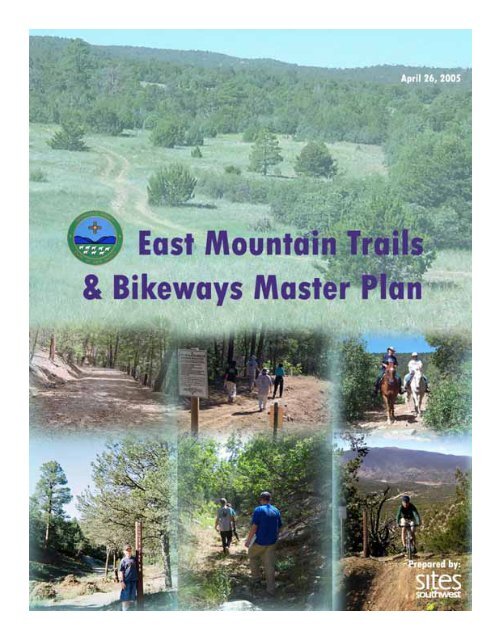
Cover Photo Credits<br />
Top Row Middle and Right<br />
Bottom Row Middle<br />
Lisa Powell<br />
Lisa Powell
Acknowledgements<br />
The following individuals and agencies are<br />
acknowledged for their support and assistance in<br />
the process of completing the plan:<br />
1. <strong>Bernalillo</strong> <strong>County</strong> Commission<br />
Alan B. Armijo, Chairman, District 1<br />
E. Tim Cummins, Vice-Chairman, District 4<br />
Michael Brasher, District 5<br />
Teresa L. Córdova, District 2<br />
Deanna Archuleta-Loeser, District 3<br />
2. <strong>Bernalillo</strong> <strong>County</strong><br />
Thaddeus Lucero, <strong>County</strong> Manager<br />
Julie Baca, Deputy <strong>County</strong> Manager for<br />
Community Services<br />
Joanne Caffrey, Director, <strong>Bernalillo</strong> <strong>County</strong> Parks<br />
and Recreation<br />
Chip Berglund, Park Administrator, <strong>Bernalillo</strong><br />
<strong>County</strong> Parks and Recreation<br />
Adrienne Candelaria, Senior Park <strong>Plan</strong>ner,<br />
<strong>Bernalillo</strong> <strong>County</strong> Parks and Recreation<br />
3. <strong>Plan</strong>ning Team<br />
Clay Campbell, AICP, Project Manager,<br />
<strong>Bernalillo</strong> <strong>County</strong> Parks and Recreation<br />
Phyllis Taylor, AICP, Principal, Sites Southwest<br />
John Barney, Project Manager, Sites Southwest<br />
Maura Lewiecki, ASLA, Landscape and Graphic<br />
Design, Sites Southwest<br />
Barbara Herrington, AICP, <strong>Plan</strong>ner, Sites<br />
Southwest<br />
Diane Scena, RLA<br />
Karen Aspelin, P.E., Parsons-Brinckerhoff<br />
4. Technical Team Members<br />
Rick Atwell, U.S. Forest Service<br />
Attila Bality, U.S. National Park Service RTCA<br />
Mary Bean, U.S. Forest Service/Sandia Ranger<br />
District<br />
Chip Berglund, <strong>Bernalillo</strong> <strong>County</strong> Parks and<br />
Recreation<br />
Nano Chavez, <strong>Bernalillo</strong> <strong>County</strong>, Zoning, Building<br />
& <strong>Plan</strong>ning<br />
Maggie Gould, City of Albuquerque Parks and<br />
Recreation/Open Space Division<br />
Macario Griego, Carnuel Land Grant<br />
Jeremy Kruger, New Mexico State Land Office<br />
Nathan Masek, <strong>Bernalillo</strong> <strong>County</strong> Public Works<br />
Steve Miller, <strong>Bernalillo</strong> <strong>County</strong> Public Works<br />
Dave Mitchell, <strong>Bernalillo</strong> <strong>County</strong> Public Works<br />
Laurie Moye, Public Service Co. of New Mexico<br />
Estefanie Muller, Village of Tijeras<br />
Jim Sattler, City of Albuquerque Parks and<br />
Recreation/Open Space Division<br />
Matt Schmader, City of Albuquerque Parks and<br />
Recreation/Open Space Division<br />
Mari Simbaña, <strong>Bernalillo</strong> <strong>County</strong>, Zoning,<br />
Building & <strong>Plan</strong>ning<br />
Loretta Tollefson, Mid-Region Council of<br />
Governments<br />
Greg White, New Mexico Dept. of Transportation<br />
The following individuals are acknowledged with<br />
appreciation for their invaluable service in the<br />
Project Steering Committee, and for providing<br />
important direction and a deep commitment to a<br />
sense of place in the <strong>East</strong> <strong>Mountain</strong>s during the<br />
field assessment and master planning process:<br />
5. Steering Committee<br />
Sam Beard<br />
Jackie Bouker<br />
Don Carnicom<br />
Kristin Clayton<br />
Seth Coulombe<br />
Charlie Ervin<br />
Greg and Sue Fleming<br />
Pam Gravagne<br />
Patty Jones<br />
Elaine Morrell<br />
John H. O’Malia<br />
Eric Russell<br />
Finally, the <strong>Plan</strong>ning Team would like to thank<br />
the past, present and future community of the<br />
<strong>East</strong> <strong>Mountain</strong>s area of <strong>Bernalillo</strong> <strong>County</strong>, whose<br />
input forms the bedrock of this <strong>Master</strong> <strong>Plan</strong> and<br />
for whom this <strong>Master</strong> <strong>Plan</strong> is dedicated..<br />
EAST MOUNTAIN TRAILS AND BIKEWAYS MASTER PLAN
Executive Summary<br />
<strong>Bernalillo</strong> <strong>County</strong> Parks and Recreation<br />
Department (BCPR) and Public Works Division<br />
(BCPWD) are pleased to submit the <strong>East</strong><br />
<strong>Mountain</strong> <strong>Trails</strong> and <strong>Bikeways</strong> <strong>Master</strong> <strong>Plan</strong> for<br />
review and approval by the <strong>County</strong> <strong>Plan</strong>ning<br />
Commission and the Board of <strong>County</strong><br />
Commissioners. Through the diligent work of<br />
lead consultant Sites-Southwest, this <strong>Master</strong><br />
<strong>Plan</strong> has been developed to guide trail and<br />
bikeway siting, funding, design, and development<br />
in the 120,000-acre plan area of the <strong>East</strong><br />
<strong>Mountain</strong>s. <strong>Trails</strong> are intended to be multi-use for<br />
walking, hiking, bicycling, or riding horses. The<br />
plan map identifies a total of 290 linear miles of<br />
trails and bikeways that could be developed at<br />
plan build-out, which is expected to take over 10<br />
years depending on funding. <strong>Bernalillo</strong> <strong>County</strong><br />
trail planners, the State of New Mexico<br />
Department of Transportation (NMDOT) Bicycle,<br />
Pedestrian, and Equestrian Trail Coordinator, the<br />
<strong>East</strong> <strong>Mountain</strong> Coalition of Neighborhoods and<br />
Landowners, <strong>East</strong> <strong>Mountain</strong> residents, <strong>East</strong><br />
<strong>Mountain</strong> developers, and elected officials are<br />
the intended plan users and beneficiaries.<br />
The <strong>Master</strong> <strong>Plan</strong> was developed during 2004 and<br />
contains the cumulative input and analysis from:<br />
• 300+ individuals contributing their time and<br />
opinions at public meetings, community<br />
events, and citizen steering committee<br />
meetings;<br />
• Representatives from twelve public agencies,<br />
departments, and land grants contributing<br />
their time and expertise on a technical<br />
advisory committee;<br />
• Numerous stakeholders contributing their<br />
time and knowledge and sharing their<br />
concerns and ideas with project planners;<br />
• Dozens of volunteer hours conducting field<br />
surveys to locate viable trail corridors;<br />
• Coordination with <strong>Bernalillo</strong> <strong>County</strong> staff<br />
updating the <strong>East</strong> <strong>Mountain</strong> Area <strong>Plan</strong> and<br />
<strong>County</strong> and City staff preparing Open Space<br />
Resource Management <strong>Plan</strong>s for eight Open<br />
Space properties in the <strong>East</strong> <strong>Mountain</strong>s; and<br />
• Existing plans, policies, and ordinances that<br />
provide the context and rationale for<br />
preparing the <strong>East</strong> <strong>Mountain</strong> <strong>Trails</strong> and<br />
<strong>Bikeways</strong> <strong>Master</strong> <strong>Plan</strong>.<br />
Proposed trail corridors (see fold-out map in<br />
rear pocket) are identified that could physically<br />
link most neighborhoods, commercial areas,<br />
<strong>County</strong> and City-owned Open Space properties,<br />
and federal lands managed by the Sandia<br />
Ranger District through non-vehicular routes on<br />
hard-surfaces or soft-surfaces. Most trail<br />
corridors are identified on public rights-of-way<br />
controlled by NMDOT or BCPWD. Some desired<br />
trail corridors are on private properties whose<br />
owners were contacted in Fall 2004. <strong>Bernalillo</strong><br />
<strong>County</strong> hopes to work with many of these owners<br />
by obtaining trail easements through subdivision<br />
dedication, fee-simple acquisition, or voluntary<br />
arrangements using landowner protection<br />
afforded by the New Mexico Recreational Use<br />
Statute.<br />
When and where possible, constructing specific<br />
trail facilities as part of road improvements by<br />
BCPWD, NMDOT, or private developers will be<br />
pursued. All proposed trail and bikeway facilities<br />
are categorized as one of the following types (as<br />
described starting on page 44):<br />
1) Shared Rural Roads<br />
2) Bike Routes with Paved Shoulders<br />
3) Multi-Use <strong>Trails</strong> within Road Right-of-<br />
Way (hard or soft surface)<br />
4) Multi-Use Soft Surface <strong>Trails</strong> in<br />
Separate Rights-of-Way or Easements<br />
Additional facilities identified in the plan as<br />
means to support the trail types include a)<br />
staging areas (5-10 parking spaces + trailers), b)<br />
EAST MOUNTAIN TRAILS AND BIKEWAYS MASTER PLAN<br />
Page i
trailheads (2-5 parking spaces), c) neighborhood<br />
access points (no parking spaces), and d) major<br />
recreation use areas. The major recreation use<br />
areas are the locations where a dedicated trail<br />
use, in conjunction with an organized trail user<br />
group and a willing landowner, could occur after<br />
detailed planning and responsibilities are formally<br />
outlined in an agreement.<br />
The major recreation use areas are proposed as<br />
a concept in response to motorized<br />
recreational users who enjoy ATV, motorbike,<br />
and off-road jeep use. Some of these users<br />
participated in the steering committee and public<br />
meetings. Motorized recreational uses are<br />
allowed within the Cedro Peak Recreational Area<br />
managed by the Sandia Ranger District and<br />
within the <strong>Master</strong> <strong>Plan</strong> area. Almost all proposed<br />
trail corridors are within ¼ mile of a residence,<br />
school or within NMDOT or <strong>Bernalillo</strong> <strong>County</strong><br />
rights-of-way and are therefore currently off-limits<br />
to motorized users. <strong>Bernalillo</strong> <strong>County</strong> and<br />
NMDOT do not allow recreational motorized uses<br />
within their respective rights-of-way. <strong>County</strong><br />
Ordinance 58-105, prohibits operation of<br />
motorized recreational vehicles within ¼ mile of<br />
any residence or school, except on private<br />
property. Development of major recreation use<br />
areas for motorized users will be facilitated by<br />
<strong>Bernalillo</strong> <strong>County</strong> only if and when such users<br />
have an established organization, commit to<br />
stewardship of the land, and are willing to enter<br />
into binding agreements with underlying<br />
landowners. The New Mexico State Legislature<br />
adopted ATV legislation in 2005 that could affect<br />
future development of motorized parks and trails.<br />
Future trail funding is expected to come from<br />
federal, state, local, and possibly grant sources<br />
listed below. Adoption of this <strong>Master</strong> <strong>Plan</strong> by the<br />
Board of <strong>County</strong> Commissioners and inclusion of<br />
identified NMDOT and BCPWD maintained roads<br />
in the MRCOG’s Transportation Improvement<br />
Program are necessary requirements for funding<br />
by federal and state sources.<br />
• Federal – Transportation Equity Act for the<br />
21 st Century and its successor (subject to<br />
Congressional approval in 2005), Surface<br />
Transportation Program Enhancements,<br />
Congestion Mitigation and Air Quality,<br />
National Highway System, and Recreational<br />
<strong>Trails</strong> Federal Grant Program<br />
• State – New Mexico Legislative Capital<br />
Outlay or Memorial appropriation bills, Land<br />
and Water Conservation Fund<br />
• Local – <strong>Bernalillo</strong> <strong>County</strong>’s “Five Percent<br />
Trail Set Aside” Ordinance (Chapter 2, Article<br />
4), <strong>East</strong> <strong>Mountain</strong> Park Impact Fees<br />
(Chapter 46)<br />
Trail corridor projects are prioritized in the<br />
<strong>Master</strong> <strong>Plan</strong>, but priorities are intended to be<br />
flexible in order to respond to segment-specific<br />
funding or road rehabilitation opportunities,<br />
private sector development timing or growth<br />
pressures, and public demand. The top three<br />
area segments for implementation are Frost<br />
Road, Gutierrez Canyon Road, and Juan Tomas<br />
Road.<br />
Future trail development implementation will<br />
be an on-going process. BCPR has received not<br />
only formal support for the <strong>Master</strong> <strong>Plan</strong> from the<br />
<strong>East</strong> <strong>Mountain</strong> Coalition of Neighborhoods and<br />
Landowner Associations, but has also secured<br />
their commitment to serve as a <strong>Trails</strong> Advocacy<br />
Committee. It is envisioned that over the longterm,<br />
the <strong>Trails</strong> Advisory Committee will work<br />
with BCPR and BCPWD on designing trail<br />
segments, pursuing trail development funds,<br />
serving as “eyes and ears” on trail maintenance<br />
and enforcement issues, serving as a liaison to<br />
neighborhood associations, and developing a<br />
trail steward program. The National Park Service<br />
Rivers, <strong>Trails</strong> and Conservation Assistance<br />
Program has agreed to work with BCPR and the<br />
<strong>East</strong> <strong>Mountain</strong> Coalition in 2005 to facilitate their<br />
involvement in plan implementation.<br />
Page ii<br />
EAST MOUNTAIN TRAILS AND BIKEWAYS MASTER PLAN
Table of Contents<br />
Chapter I. Introduction .....................................................................................1<br />
Section A. Background and Context ............................................................................................ 1<br />
Section B. Project History ............................................................................................................ 2<br />
Section C. <strong>Plan</strong>ning Area ............................................................................................................. 3<br />
Section D. List of Terms and Acronyms ....................................................................................... 4<br />
Section E. <strong>Plan</strong> Organization ....................................................................................................... 4<br />
Chapter II. Policy Context & Public Involvement ....................................................5<br />
Section A. Applicable Policies and <strong>Plan</strong>s ..................................................................................... 5<br />
Section B. Community Process and Public Involvement.............................................................. 7<br />
Section C. Goals and Objectives................................................................................................ 10<br />
Chapter III. Existing Conditions & Analysis ..........................................................15<br />
Section A. Natural Environment ................................................................................................. 15<br />
Section B. Socio-Cultural Landscape......................................................................................... 21<br />
Section C. Demographics & Ongoing Development................................................................... 22<br />
Section D. Public Roads and Rights-of-Way .............................................................................. 24<br />
Section E. Public Lands & Open Space ..................................................................................... 25<br />
Section F. Existing <strong>East</strong> <strong>Mountain</strong> <strong>Trails</strong> & <strong>Bikeways</strong> Facilities ................................................. 33<br />
Chapter IV. <strong>Master</strong> <strong>Plan</strong> ...................................................................................41<br />
Section A. General Recommendations ...................................................................................... 41<br />
Section B. Guidelines for Trail and Bikeway Facility Types........................................................ 46<br />
Section C. <strong>Master</strong> <strong>Plan</strong> Description............................................................................................ 52<br />
Chapter V. Phasing & Implementation ...............................................................59<br />
Section A. Generalized Priority Segments & Facilities ............................................................... 61<br />
Section B. Funding Sources & Strategies .................................................................................. 62<br />
Section C. Long Term Management & Maintenance.................................................................. 64<br />
Section D. Envisioning the Future <strong>East</strong> <strong>Mountain</strong> Trail System.................................................. 66<br />
Appendices<br />
Appendix A. Key Terms ......................................................................................................................... 68<br />
Appendix B. Acronyms .......................................................................................................................... 70<br />
Appendix C. Generalized Projects and Costs ........................................................................................ 71<br />
Appendix D. References ........................................................................................................................ 77<br />
Technical Appendices (under separate cover)<br />
EAST MOUNTAIN TRAILS AND BIKEWAYS MASTER PLAN<br />
Page iii
Figures<br />
Figure 1. Vicinity Map ................................................................................................................................... 4<br />
Figure 2. Slope and Elevation..................................................................................................................... 16<br />
Figure 3. New Mexico Vegetation Zones .................................................................................................. 17<br />
Figure 4. Soil Capacity for <strong>Trails</strong>................................................................................................................. 18<br />
Figure 5. Vegetation Classification ............................................................................................................. 19<br />
Figure 6. Social Landscape: Pueblos, Land Grants, Neighborhood Associations, New Subdivision .......... 23<br />
Figure 7. 2000 Population Density and Age Cohort.................................................................................... 26<br />
Figure 8. Population Projections................................................................................................................. 27<br />
Figure 9. Land Use ..................................................................................................................................... 28<br />
Figure 10. Roads and Rights-of-Way.......................................................................................................... 29<br />
Figure 11. Open Space Areas and Management Restrictions.................................................................... 30<br />
Figure 12. Proposed <strong>Trails</strong> and Bikeway Corridors Segments ................................................................... 42<br />
Figure 13. Shared Rural Road Facility Alternative 1................................................................................... 47<br />
Figure 14. Shared Rural Road Facility Alternative 2................................................................................... 47<br />
Figure 15. Shared Rural Road Facility Alternative 3................................................................................... 47<br />
Figure 16. Bike Route with Paved Shoulders ............................................................................................. 48<br />
Figure 17. Sidewalk and Bike Lane Along Roadway .................................................................................. 48<br />
Figure 18. Cross Section of Road with Paved and Soft Surface Multi-Use <strong>Trails</strong>....................................... 49<br />
Figure 19. Soft Surface Multi-Use Trail........................................................................................................ 50<br />
Figure 20. The <strong>Master</strong> <strong>Plan</strong> ........................................................................................................................ 53<br />
Figure 21. Tijeras Close-up ........................................................................................................................ 56<br />
Figure 22. Process Diagram ....................................................................................................................... 60<br />
Tables<br />
Table 1. Rights-of-Way on <strong>East</strong> <strong>Mountain</strong> Highways................................................................................... 25<br />
Table 2. User Characteristics and Preferences (Unpaved Surfaces).......................................................... 37<br />
Table 3. User Characteristic and Preferences (paved surfaces)................................................................. 39<br />
Table 4. Generalized Segment Priority........................................................................................................ 61<br />
Table 5. Maintenance Matrix ...................................................................................................................... 65<br />
Table 6. Important Projects and Preliminary Cost Estimates...................................................................... 72<br />
Table 7. Important Projects and Preliminary Cost Estimates...................................................................... 74<br />
Page iv<br />
EAST MOUNTAIN TRAILS AND BIKEWAYS MASTER PLAN
Chapter I. Introduction<br />
<strong>Bernalillo</strong> <strong>County</strong> Parks & Recreation<br />
Department and Public Works Division initiated<br />
the preparation of the <strong>East</strong> <strong>Mountain</strong> <strong>Trails</strong> and<br />
<strong>Bikeways</strong> <strong>Master</strong> <strong>Plan</strong> in 2003. The plan is in<br />
response to residential growth in the area, a<br />
recommendation in the <strong>East</strong> <strong>Mountain</strong> Area <strong>Plan</strong>,<br />
and a request by the Greater Albuquerque<br />
Recreational <strong>Trails</strong> Committee (GARTC), which<br />
has representatives from unincorporated<br />
<strong>Bernalillo</strong> <strong>County</strong>.<br />
The intent of the <strong>Master</strong> <strong>Plan</strong> is to identify major<br />
trail and bikeway corridors and pivotal links<br />
between those corridors and major public Open<br />
Space areas and civic destinations for walking,<br />
hiking, bicycling, and riding horses. Over the long<br />
term, implementation of the plan will result in a<br />
network of connections between residential<br />
areas, commercial nodes, and public lands<br />
managed by the United States Forest Service,<br />
City of Albuquerque and <strong>Bernalillo</strong> <strong>County</strong>. The<br />
plan attempts to accommodate all user groups<br />
within the proposed system, although not on<br />
every trail.<br />
Rights-of-way for <strong>County</strong>-maintained roads,<br />
state-maintained routes, or utility easements are<br />
expected to be locations for some trail corridors.<br />
Drainage easements and some private roads<br />
may offer other possibilities. Finally, in some<br />
instances, private lands may be the only route for<br />
key links. Potential links were analyzed to<br />
determine the viability of securing public access<br />
through land purchase, easement acquisition, or<br />
other creative means.<br />
Adoption of the <strong>East</strong> <strong>Mountain</strong> <strong>Trails</strong> and<br />
<strong>Bikeways</strong> <strong>Master</strong> <strong>Plan</strong> will assist <strong>Bernalillo</strong><br />
<strong>County</strong> staff, developers, and neighborhoods in<br />
the subdivision design, review, and approval<br />
processes. The <strong>Master</strong> <strong>Plan</strong> will also be helpful in<br />
securing future state and federal funds for trail<br />
development and construction, and in prioritizing<br />
“Five Percent Set-Aside” funds dedicated to<br />
<strong>County</strong> trail and bikeway development per<br />
<strong>Bernalillo</strong> <strong>County</strong> Code 2-241.<br />
Section A. Background and Context<br />
The <strong>East</strong> <strong>Mountain</strong> Area is a predominantly rural<br />
collection of communities on the eastern side of<br />
the Sandia and Manzanita <strong>Mountain</strong>s in eastern<br />
<strong>Bernalillo</strong> <strong>County</strong>. The mountains form the<br />
western boundary of the area’s 316 square miles<br />
of piñon-juniper foothills and grasslands, except<br />
for a wide swath that cuts through Tijeras<br />
Canyon along I-40 until it reaches the<br />
Albuquerque City limits on the west. The area is<br />
also bounded on the west by Kirtland Air Force<br />
Base. To the east, the area extends to the Santa<br />
Fe <strong>County</strong> and Torrance <strong>County</strong> lines just east of<br />
NM 217 (<strong>Mountain</strong> Valley Road). Its border to the<br />
north is Sandoval <strong>County</strong> and to the south is the<br />
Chilili Land Grant and Isleta Pueblo.<br />
Historically, Native Americans and Spanish<br />
settlers traveled through Tijeras Canyon to reach<br />
timber forests and hunting and trading areas.<br />
Their historic villages were San Antonio, the early<br />
population and religious center of the Cañon de<br />
Carnuel Land Grant, Carnuel, Tijeras, Cañoncito,<br />
San Antonito, Sedillo, Chilili, Escabosa, and Juan<br />
Tomas. Water for some of the communities was<br />
developed from the springs at San Antonio (now<br />
the site of Ojito Open Space), Cole Springs (near<br />
Cañoncito), and La Cienega (near San Antonito).<br />
Other communities engaged in dryland farming.<br />
(EMAP 1992.)<br />
The area later developed with seasonal homes<br />
and cabins for city residents seeking relief from<br />
the seasonal heat and for tuberculosis patients<br />
seeking cures in the cold, dry climate. Over time,<br />
the <strong>East</strong> <strong>Mountain</strong> Area has primarily grown into<br />
an expanding bedroom community for people<br />
who work in Albuquerque and even Santa Fe,<br />
with average lot sizes of two acres or more.<br />
EAST MOUNTAIN TRAILS AND BIKEWAYS MASTER PLAN Page 1
The area also is a destination for tourists and<br />
recreational users. The Sandia and Manzanita<br />
<strong>Mountain</strong>s attract picnickers, hikers, runners,<br />
road cyclists, mountain bikers, motorcyclists,<br />
equestrians, and jeep and all-terrain vehicles<br />
drivers during the warm months. The Sandia Ski<br />
Area and Cibola National Forest offer trails and<br />
runs for downhill and cross county skiing, as well<br />
as sledding and snowshoeing in the winter<br />
months. Bicyclists and roller skiers tour and race<br />
along NM 14, Frost Road, NM 333 and other<br />
major corridors. The paved path along NM 14<br />
offers leisure opportunities for dog walkers,<br />
joggers, and casual cyclists.<br />
Two major roadways intersect in the Village of<br />
Tijeras (the Spanish name for scissors), roughly<br />
dividing the <strong>East</strong> <strong>Mountain</strong> Area into four<br />
quadrants. Interstate 40, which replaced Old<br />
Route 66 (renamed NM 333 or the “I-40 frontage<br />
road”) bisects the area from east to west. NM<br />
14/NM 337 form the major north-south spine (and<br />
is still referred to as North and South 14). Most of<br />
the commercial activities and public institutions<br />
such as the schools, post offices, and library are<br />
located along NM 14/337, with a few<br />
establishments dotting the frontage road on NM<br />
333.<br />
With no public transportation available, residents<br />
depend upon personal vehicles, private van<br />
services, or their own foot power to go places. A<br />
rudimentary spine of a trail and bikeways system<br />
is in place. There are wide shoulders along NM<br />
333 from Albuquerque to Tijeras and along parts<br />
of other roads. There are shoulders and asphalt<br />
path along NM 14 from Tijeras to Frost Road.<br />
Recently <strong>Bernalillo</strong> <strong>County</strong> constructed an<br />
asphalt path along NM 14 from San Antonito<br />
Elementary School to Vista Grande Community<br />
Center. Sidewalks are non-existent in rural parts<br />
of the Project Area and many unpaved rural<br />
roads also serve as trail facilities for many users.<br />
Residents travel on informal dirt paths on both<br />
sides of Frost Road and through various parcels<br />
of public and private land in the area. The Cibola<br />
National Forest also maintains a network of trails<br />
on their land both north and south of I-40. There<br />
remains, however, a lack of formal trail and<br />
bikeway connections to schools and other public<br />
facilities and open space properties, sufficient<br />
shoulders on many roads, trail access, and safe<br />
crossings that would create a truly interconnective<br />
trails and bikeways system.<br />
Section B. Project History<br />
<strong>East</strong> <strong>Mountain</strong> residents have long desired to<br />
preserve what they consider a rural lifestyle and<br />
atmosphere. This is broadly defined as large-lot<br />
development, privacy and independence, open<br />
spaces and dark skies. It also embraces room for<br />
farm animals and agriculture, conservation of<br />
water and wildlife habitat, and small-scale<br />
commercial development. To this end, a steering<br />
committee of area citizens worked with <strong>Bernalillo</strong><br />
<strong>County</strong> to develop the <strong>East</strong> <strong>Mountain</strong> Area <strong>Plan</strong>,<br />
(EMAP 1992) which was adopted in 1992. Area<br />
plans cover diverse, major geographic parts of<br />
the metropolitan area, typically 15 or more<br />
square miles, and specify important development<br />
standards, key land use, utility and public facility<br />
development. The EMAP is currently in the<br />
process of being updated by the <strong>Bernalillo</strong><br />
<strong>County</strong> Zoning, Building and <strong>Plan</strong>ning<br />
Department and is scheduled for completion and<br />
adoption in 2005. EMAP <strong>Plan</strong>ners prepared a<br />
Quality of Life Survey in early 2004 for <strong>East</strong><br />
<strong>Mountain</strong> residents as part of the EMAP update.<br />
Over 75% of respondents said their families use<br />
Cibola National Forest trails. Many respondents<br />
also noted their desire for more trails and cited<br />
trails and Open Space as reasons why they live<br />
in the <strong>East</strong> <strong>Mountain</strong>s.<br />
The EMAP called for creating a multi-use<br />
network of open spaces and trail corridors. It<br />
advocated developing pedestrian and bicycle<br />
trails separated from traffic lanes on roadways. It<br />
also recommended a few general places for trails<br />
to be completed—for example, multi-use trails on<br />
the graded gravel pit and recreational use on<br />
Page 2<br />
EAST MOUNTAIN TRAILS AND BIKEWAYS MASTER PLAN
Sections 15 and 16 south of I-40. The plan did<br />
not specifically identify where this multi-use<br />
network of trails should be located, however, or<br />
how it should be designed or funded. The<br />
Albuquerque <strong>Trails</strong> and <strong>Bikeways</strong> Facility <strong>Plan</strong><br />
(1993), moreover, stopped short of planning for<br />
trail corridors in the <strong>East</strong> <strong>Mountain</strong>s, deferring to<br />
the EMAP. This <strong>East</strong> <strong>Mountain</strong> <strong>Trails</strong> and<br />
<strong>Bikeways</strong> <strong>Master</strong> <strong>Plan</strong> fulfills the EMAP<br />
recommendations and completes trail planning<br />
for the populated areas of <strong>Bernalillo</strong> <strong>County</strong>.<br />
Since the EMAP adoption in 1992, several road<br />
shoulders were widened by the NM Department<br />
of Transportation. The paved trail segment was<br />
completed from San Antonito Elementary to Vista<br />
Grande Community Center. <strong>County</strong> government<br />
officials and staff, however, felt that further<br />
expansion would benefit from a more<br />
comprehensive process that involved citizens in<br />
creating a master plan for a proposed trails<br />
network. The master plan process would work<br />
with citizens to document existing trails, locate<br />
new trails, and prioritize and program trail<br />
segments for funding and construction. It would<br />
also complement the 2004 revision of the EMAP<br />
as well as the development of site-specific Open<br />
Space resource management plans for nine<br />
<strong>County</strong> and City-owned properties, which were<br />
also prepared in 2003 – 04.<br />
Due to the popularity and increased use by<br />
motorized users (ATV’s and motorbikes) in<br />
recent years, and because these uses are<br />
allowed on many national forest lands, this<br />
<strong>Master</strong> <strong>Plan</strong> attempts to acknowledge and<br />
incorporate existing and potential motorized use.<br />
Motorized uses generate significant positive and<br />
negative opinions. The <strong>Plan</strong>ning Team has<br />
attempted to address this issue in a way that is<br />
sensitive to existing land management and<br />
neighborhood concerns and meaningful for<br />
motorized enthusiasts.<br />
<strong>Bernalillo</strong> <strong>County</strong> wrote and received a technical<br />
assistance grant from the National Park Service<br />
Rivers, <strong>Trails</strong>, and Conservation Assistance<br />
Program, to help develop a planning process and<br />
resource management plans for four <strong>County</strong>owned<br />
<strong>East</strong> <strong>Mountain</strong> Open Space properties<br />
(Carlito Springs, Ojito de San Antonio, Sedillo<br />
Ridge and Sabino Canyon) and five City-owned<br />
<strong>East</strong> <strong>Mountain</strong> Open Space properties (San<br />
Antonito, Gutierrez Canyon, Juan Tomas,<br />
Golden, Tres Pistolas).<br />
In part to complement the open space effort, and<br />
in response to recommendations in the EMAP,<br />
the preparation of the <strong>East</strong> <strong>Mountain</strong> <strong>Trails</strong> and<br />
<strong>Bikeways</strong> <strong>Master</strong> <strong>Plan</strong> began in late 2003.<br />
Through a competitive process in 2003, the<br />
<strong>County</strong> selected the Albuquerque design firm of<br />
Sites Southwest to prepare the <strong>Master</strong> <strong>Plan</strong>.<br />
Karen Aspelin from Parsons Brinckerhoff and<br />
trails consultant Diane Scena were also on the<br />
team.<br />
Section C. <strong>Plan</strong>ning Area<br />
The planning area for the project is<br />
approximately 120,000 acres located in the<br />
eastern part of <strong>Bernalillo</strong> <strong>County</strong> (see Figure 1)<br />
(the “<strong>Master</strong> <strong>Plan</strong> Area”) approximately half of<br />
which are in the National Forest. The boundaries<br />
of the Project Area are defined in the north by<br />
Santa Fe <strong>County</strong>, in the east by Santa Fe <strong>County</strong><br />
and Torrance <strong>County</strong>, in the south by the old<br />
Chilili Land Grant boundary, and in the west by<br />
the City of Albuquerque, Sandia National<br />
Laboratories, Kirtland Air Force Base,<br />
Department of Energy (including the Department<br />
of Defense Withdrawal Areas in National Forest<br />
lands in the Manzanitas <strong>Mountain</strong>s), and Isleta<br />
Pueblo. Lands managed by the U. S. Forest<br />
Service, the New Mexico State Land Office,<br />
<strong>Bernalillo</strong> <strong>County</strong> Open Space, City of<br />
Albuquerque Open Space Division, and<br />
Albuquerque Public Schools are included in the<br />
<strong>Master</strong> <strong>Plan</strong> Area. Most of these agencies have<br />
management plans for the lands under their<br />
stewardship that the <strong>Master</strong> <strong>Plan</strong> integrates as<br />
appropriate.<br />
EAST MOUNTAIN TRAILS AND BIKEWAYS MASTER PLAN Page 3
Figure 1. Vicinity Map<br />
Section D. List of Terms and<br />
Acronyms<br />
A list of terms and acronyms for the project is<br />
contained in Appendix A and Appendix B.<br />
Section E. <strong>Plan</strong> Organization<br />
The <strong>East</strong> <strong>Mountain</strong> <strong>Trails</strong> and <strong>Bikeways</strong> <strong>Master</strong><br />
<strong>Plan</strong> (EMTBP) contains six chapters. After this<br />
introductory chapter, Chapter 2 outlines the<br />
policy context of relevant and adopted plans and<br />
ordinances that affect this <strong>Master</strong> <strong>Plan</strong>. Public<br />
involvement in the planning process is also<br />
described. Chapter 3 describes the existing<br />
physical conditions and context of the <strong>East</strong><br />
<strong>Mountain</strong>s. Specific plan proposals and actions<br />
are contained in the heart of the <strong>Master</strong> <strong>Plan</strong> in<br />
Chapter 4. Finally, Chapter 5 contains phasing<br />
and implementation steps. A large format plan<br />
map may be found in the pocket at the end of the<br />
document. Technical appendices are packaged<br />
separately and contain all technical and<br />
background information used to prepare the plan.<br />
Page 4<br />
EAST MOUNTAIN TRAILS AND BIKEWAYS MASTER PLAN
Chapter II. Policy Context & Public Involvement<br />
Section A. Applicable Policies<br />
and <strong>Plan</strong>s<br />
Many adopted plans govern or guide the<br />
development of the <strong>East</strong> <strong>Mountain</strong> <strong>Trails</strong> and<br />
<strong>Bikeways</strong> <strong>Master</strong> <strong>Plan</strong>. Most of these documents<br />
call for the creation of a system of open space,<br />
parks and trails, with inter-connected bicycle and<br />
trail networks joining origins and destinations,<br />
both for recreation and transportation. They<br />
support improved safety, efficiency and choice<br />
for non-motorized transportation alternatives.<br />
They encourage opportunities for joint<br />
management and funding.<br />
1. <strong>Plan</strong>s adopted by <strong>Bernalillo</strong><br />
<strong>County</strong><br />
Albuquerque/<strong>Bernalillo</strong> <strong>County</strong><br />
Comprehensive <strong>Plan</strong> (1988, amendments<br />
through 2002) This Rank I plan provides<br />
guidelines for land use, environmental and<br />
resource management. It emphasizes the need<br />
to link parks, open space and trails throughout<br />
the <strong>County</strong>.<br />
<strong>East</strong> <strong>Mountain</strong> Area <strong>Plan</strong> (1992) An update of<br />
this <strong>Plan</strong> is underway in 2005. The plan was<br />
"developed to guide future development by<br />
addressing resource preservation, commercial<br />
development in designated areas, maintenance<br />
of the area's rural character, wastewater<br />
regulation requirements and environmental<br />
protection.” It contains policy and specific<br />
recommendations. The goals and objectives<br />
make numerous references to the development<br />
of a bicycle and trail network. The <strong>East</strong> <strong>Mountain</strong><br />
<strong>Trails</strong> and <strong>Bikeways</strong> <strong>Master</strong> <strong>Plan</strong> fulfills a<br />
recommendation of the EMAP.<br />
<strong>Bernalillo</strong> <strong>County</strong> Parks and Recreation<br />
Parks, Open Space and <strong>Trails</strong> (POST)<br />
<strong>Master</strong>plan 2003 -2010 This <strong>Plan</strong> was adopted<br />
October 14, 2003. The plan will guide the<br />
<strong>County</strong> over the next seven years in developing<br />
new facilities, improving existing facilities and<br />
securing project funding. The plan envisions "an<br />
interconnected system of parks, open space and<br />
trails that facilitates active and passive recreation<br />
opportunities,” as well as "encouraging bicycling<br />
and walking as transportation modes and as a<br />
means of fitness.” It also contains an excellent<br />
and extensive overview of existing plans and<br />
policies, including the Albuquerque/<strong>Bernalillo</strong><br />
<strong>County</strong> Comprehensive <strong>Plan</strong>, Major Public Open<br />
Space Facility <strong>Plan</strong>, <strong>East</strong> <strong>Mountain</strong> Area <strong>Plan</strong><br />
and the <strong>Trails</strong> and <strong>Bikeways</strong> Facility <strong>Plan</strong> (City of<br />
Albuquerque), relevant portions of which were<br />
incorporated into this review. The <strong>East</strong> <strong>Mountain</strong><br />
Trail and <strong>Bikeways</strong> <strong>Master</strong> <strong>Plan</strong> is a key part of<br />
implementing the POST.<br />
<strong>Trails</strong> and <strong>Bikeways</strong> Facility <strong>Plan</strong> (1993, 1996)<br />
The City of Albuquerque and <strong>Bernalillo</strong> <strong>County</strong><br />
adopted this plan in 1993 and updated the map<br />
in 1996. This plan addresses policy, standards<br />
and trail locations. It calls for development of a<br />
metropolitan area-wide bicycle and multi-use trail<br />
system and outlines policy for future trail and<br />
bikeway development and usage. Design<br />
standards and objectives for various types of<br />
users and locations are included. Proposed<br />
revisions to design standards are currently being<br />
reviewed. The TBFP did not address trails in the<br />
<strong>East</strong> <strong>Mountain</strong> Area, stating "Policies for trail<br />
development in the <strong>East</strong> <strong>Mountain</strong> Area are<br />
contained in the <strong>East</strong> <strong>Mountain</strong> Area <strong>Plan</strong>."<br />
<strong>East</strong> <strong>Mountain</strong> Open Space Resource<br />
Management <strong>Plan</strong>s (2004)<br />
Separate site-specific plans are currently being<br />
developed for each <strong>County</strong> and City open space<br />
property in the <strong>East</strong> <strong>Mountain</strong>s. The plans will<br />
EAST MOUNTAIN TRAILS AND BIKEWAYS MASTER PLAN Page 5
propose appropriate uses and management<br />
strategies, including resource-based recreation,<br />
trails and trail access, for each of the nine City<br />
and <strong>County</strong> Open Space properties in the <strong>East</strong><br />
<strong>Mountain</strong> Area. To date, plans are underway and<br />
site specific trails and access points are<br />
incorporated into the <strong>East</strong> <strong>Mountain</strong> <strong>Trails</strong> and<br />
<strong>Bikeways</strong> <strong>Master</strong> <strong>Plan</strong>.<br />
Major Public Open Space Facility <strong>Plan</strong> (1999)<br />
The Albuquerque City Council and the <strong>Bernalillo</strong><br />
<strong>County</strong> Commission adopted this plan in January<br />
1999. The plan establishes policy for planning,<br />
land use decisions and management of the Major<br />
Public Open Space (MPOS) System and<br />
includes a section on Major Public Open Space<br />
in the <strong>East</strong> <strong>Mountain</strong>s. Page 66, Policy B.1.b.<br />
states: "Provide opportunities for outdoor<br />
education and recreation including picnicking,<br />
trails for multiple users and forest-based<br />
environmental education." Page 68, Policy D.5.<br />
states: "The city shall investigate opportunities for<br />
trail linkages, joint management and/or funding of<br />
<strong>East</strong> <strong>Mountain</strong> MPOS facilities with the National<br />
Forest , <strong>Bernalillo</strong> <strong>County</strong>, and other agencies<br />
which provide environmental education."<br />
2025 Metropolitan Transportation <strong>Plan</strong> (MTP)<br />
for the Albuquerque Metropolitan <strong>Plan</strong>ning<br />
Area, The Mid-Region Council of Governments<br />
(MRCOG) approved this plan in May 2003 and<br />
updates it every three years. This 20-year plan is<br />
developed based on input from its member<br />
agencies and includes policy and funding<br />
designations for transportation projects within the<br />
Albuquerque Metropolitan <strong>Plan</strong>ning Area. The<br />
<strong>Plan</strong>ning Area includes the <strong>East</strong> <strong>Mountain</strong>s, but<br />
has few specific recommendations affecting it.<br />
The goals of the plan support the development of<br />
an integrated multi-modal transportation system.<br />
It includes the 2004-2009 Transportation<br />
Improvement Program (TIP), which details<br />
federal funding for the first six years of the MTP.<br />
Adoption of the EMTBP and integration into the<br />
MTP could result in future funding for trails.<br />
Long-Range Bikeway System Map (2004) This<br />
map is developed by MRCOG to reflect longrange<br />
policy for bicycle facilities in the<br />
Albuquerque Metropolitan <strong>Plan</strong>ning Area and to<br />
provide a framework for developing the longrange<br />
Metropolitan Transportation <strong>Plan</strong> and<br />
short-range Transportation Improvement<br />
Programs. It currently is being revised and<br />
expanded to a broader regional system<br />
perspective to provide greater regional<br />
connectivity. It will incorporate trails identified in<br />
the final adopted <strong>East</strong> <strong>Mountain</strong> <strong>Trails</strong> and<br />
<strong>Bikeways</strong> <strong>Master</strong> <strong>Plan</strong>.<br />
<strong>Bernalillo</strong> <strong>County</strong> Ordinance 58-105 Operation<br />
of Motorized Vehicle in Certain Areas<br />
This ordinance prohibits the use of motorized<br />
recreational vehicles on <strong>County</strong> lands within a<br />
quarter of a mile from a residence, school,<br />
hospital or convalescent home.<br />
New Mexico Public Recreation Statute<br />
This statute eliminates the liability of private<br />
landowners for public recreation use of private<br />
land. See Technical Appendix for the full statute.<br />
2. Other Relevant <strong>Plan</strong>ning<br />
Documents<br />
These documents provide relevant information<br />
regarding development of facilities, including<br />
alignment, destinations, design standards and<br />
management, within and adjacent to the <strong>East</strong><br />
<strong>Mountain</strong> <strong>Trails</strong> and <strong>Bikeways</strong> <strong>Master</strong> <strong>Plan</strong> area.<br />
Cibola National Forest Land and Resource<br />
Management <strong>Plan</strong> (Forest <strong>Plan</strong>) as amended<br />
1990 & 1996This plan defines the long-term<br />
direction for managing the Cibola National<br />
Forest. As such, it prescribes types and degrees<br />
of development for recreational use on the Cibola<br />
National Forest. A significant portion of the<br />
Forest within the <strong>East</strong> <strong>Mountain</strong>s is federally<br />
designated Wilderness, which precludes<br />
mechanized and motorized use. Environmental<br />
Analyses and Decision Notices which were<br />
completed after the initial publication of the<br />
Page 6<br />
EAST MOUNTAIN TRAILS AND BIKEWAYS MASTER PLAN
Forest <strong>Plan</strong> have been incorporated as<br />
amendments (e.g. the Ecosystem Management<br />
<strong>Plan</strong> for Lands in and Adjacent to the Military<br />
Withdrawal).<br />
Santa Fe <strong>County</strong> Open Land and <strong>Trails</strong> <strong>Plan</strong><br />
for the Wildlife, <strong>Mountain</strong>s, <strong>Trails</strong>, and<br />
Historic Places Program (2000) This plan<br />
establishes “long-range strategies for open land<br />
and trails conservation in Santa Fe <strong>County</strong>, and<br />
guidance “to evaluate, acquire, develop and<br />
manage parks, open lands and trails.” Goals for<br />
the trail system include building and enhancing a<br />
county-wide network of trails and protecting<br />
historic trails. The map of proposed trail<br />
corridors shows mile-wide trail corridors. The<br />
first major north-south trail link proposed is from<br />
Pojoaque to Edgewood, but the alignment shown<br />
is distant from the <strong>Bernalillo</strong> <strong>County</strong> line. More<br />
recently, the Town of Edgewood has been<br />
developing a trails plan to which the <strong>East</strong><br />
<strong>Mountain</strong> <strong>Trails</strong> and <strong>Bikeways</strong> <strong>Master</strong> <strong>Plan</strong> could<br />
connect.<br />
Turquoise Trail Corridor Management <strong>Plan</strong><br />
(1999, Version 1) calls for a pedestrian trail, bike<br />
trail and cross country ski trail master plan and<br />
parking areas for biking trailheads along NM 14.<br />
These trailheads could connect to facilities<br />
proposed in the <strong>East</strong> <strong>Mountain</strong> <strong>Trails</strong> and<br />
<strong>Bikeways</strong> <strong>Master</strong> <strong>Plan</strong>.<br />
Campbell Ranch <strong>Master</strong> <strong>Plan</strong> (2000) As<br />
originally submitted to <strong>Bernalillo</strong> <strong>County</strong>, this plan<br />
called for the creation of a multi-purpose trail<br />
network, including regional, village and<br />
neighborhood trails which would provide<br />
recreational and leisure opportunities and<br />
common space. Two regional trails were<br />
proposed: an east-west trail located in the<br />
southern part of the development across NM 14,<br />
linking the Cibola National Forest land with open<br />
space and two proposed villages, and a northsouth<br />
trail along the east side of NM 14. The<br />
area subsequently was annexed by the Town of<br />
Edgewood. Campbell Corporation is now<br />
preparing public improvements districts for the<br />
provision of water, sewer, law enforcement, etc.<br />
NM Bicycle - Pedestrian - Equestrian<br />
Advisory <strong>Plan</strong> (2003) Developed by the<br />
Bicycle-Pedestrian-Equestrian (BPE) Advisory<br />
Committee of the New Mexico Department of<br />
Transportation (NMDOT), this plan provides<br />
guidelines for use by the NMDOT and county and<br />
municipal governments in the design and<br />
implementation of non-motorized transportation<br />
facilities. “NMDOT, FHWA and the BPE are<br />
committed to integrating bicycle, pedestrian and<br />
equestrian accommodations as a routine part of<br />
planning, designing and constructing…NM’s<br />
transportation system.” There are no specific<br />
commitments to facility locations in the <strong>East</strong><br />
<strong>Mountain</strong>s.<br />
Section B. Community Process and<br />
Public Involvement<br />
The planning process for the <strong>East</strong> <strong>Mountain</strong><br />
<strong>Trails</strong> and <strong>Bikeways</strong> <strong>Master</strong> <strong>Plan</strong> was designed<br />
to gather specific public input from <strong>East</strong> <strong>Mountain</strong><br />
residents and individuals and groups mostly likely<br />
to use the future trail system. The team<br />
developed a multi-prong approach to informing<br />
and involving the public in the planning process.<br />
The initial strategy was to draw people into the<br />
planning process early to obtain information<br />
about what trails and bikeways they currently<br />
use, what starting places and destinations they<br />
would like to be linked in the future, and other<br />
issues and concerns they might have. The<br />
project team could then concentrate on exploring<br />
the feasibility and design of the trail system<br />
based on this information.<br />
To accomplish this, the project team did the<br />
following:<br />
• Established a volunteer Citizen’s Steering<br />
Committee comprising representatives from<br />
various use groups (hikers, motor bikers,<br />
mountain and road bicyclists, runners, cross-<br />
EAST MOUNTAIN TRAILS AND BIKEWAYS MASTER PLAN Page 7
country skiers, equestrians, and off-highway<br />
vehicle enthusiasts) to help guide the<br />
process, verify potential trail corridors in the<br />
field, and spread the word. The majority of<br />
committee members were residents of the<br />
<strong>East</strong> <strong>Mountain</strong> Area.<br />
• Established a Technical Team of project<br />
stakeholders, such as the NM Department of<br />
Transportation, the U S Forest Service and<br />
Public Service Company of New Mexico to<br />
guide decisions and enhance cooperation in<br />
trail selection and design.<br />
• Developed a mailing list of stakeholders,<br />
neighborhood association representatives in<br />
<strong>County</strong> Commission District Five, and other<br />
interested persons to notify about meetings<br />
and other opportunities for involvement.<br />
• Developed a list of media contacts, including<br />
school newsletters<br />
• Posted a web page on the <strong>County</strong> website to<br />
explain the project and present updates,<br />
maps and surveys used in the planning<br />
process.<br />
• Discussed the project with over 20<br />
stakeholder groups (listed in Section 3.<br />
below).<br />
The Technical contains the agendas, sign-in<br />
sheets and summaries for each meeting held as<br />
part of the public process. The Technical<br />
Appendix contains a print-out of the web pages<br />
for the project.<br />
1. Steering and Technical<br />
Committee Meetings<br />
The Steering and Technical Committees met<br />
early in the process to define issues and<br />
concerns that the project should address as well<br />
as to map their knowledge about existing<br />
conditions and future plans. In a guided exercise,<br />
the Steering Committee expressed their opinions<br />
on trail design, the outline of the future trail<br />
system, management issues, user conflicts, and<br />
limits to access. The Technical Team addressed<br />
these issues as well as potential resources,<br />
easement opportunities, planning coordination,<br />
safety issues, and the potential for teaching and<br />
interpretation. The plan’s goals and objectives as<br />
well as the initial map of existing potential trails<br />
grew out of these discussions.<br />
Both groups continued to meet several more<br />
times throughout the process—two in joint<br />
meetings—to provide guidance and information.<br />
During the subsequent meetings, Steering<br />
Committee and Technical Team members helped<br />
further define important trail corridors and nodes<br />
as they reported on small group meetings held<br />
with such stakeholders as the Greater<br />
Albuquerque Recreational <strong>Trails</strong> Committee<br />
(GARTC), the National Forest , and the Village of<br />
Tijeras. They also helped develop and further<br />
refine the User Matrix (see Table 2 and Table 3),<br />
which attempts to capture information on various<br />
dimensions essential to specific uses and trail<br />
compatibility, such as hiking, mountain biking or<br />
off-road vehicle use. Finally, both groups<br />
assisted in the fieldwork necessary to determine<br />
the proposed corridors, links and other facilities<br />
in the <strong>Master</strong> <strong>Plan</strong>.<br />
Both groups have given valuable information and<br />
advice regarding opportunities and constraints of<br />
various trail corridors and access points.<br />
Members also were active in identifying trails<br />
along key corridors to public open space in order<br />
to complete the network envisioned by the plan.<br />
2. Public Meetings<br />
Three public meetings were held in the <strong>East</strong><br />
<strong>Mountain</strong> Area to elicit proposals for and<br />
selection of trails and bikeways for the <strong>Master</strong><br />
<strong>Plan</strong> network. In addition, the project team<br />
staffed a booth at <strong>East</strong> <strong>Mountain</strong> Pride Day on<br />
April 25, 2004, to provide more opportunity for<br />
residents to view and comment on proposed trail<br />
corridors and access points.<br />
• January 29, 2004 Public Meeting For the first<br />
public meeting, a project description and<br />
invitation from <strong>Bernalillo</strong> <strong>County</strong><br />
Commissioner Michael Brasher were mailed<br />
Page 8<br />
EAST MOUNTAIN TRAILS AND BIKEWAYS MASTER PLAN
to persons on the stakeholder and<br />
neighborhood association mailing lists. The<br />
team distributed 1,000 flyers to the three<br />
local APS schools to place in the student<br />
backpacks and delivered them to local<br />
businesses for posting. Flyers were also<br />
placed at Los Vecinos and Vista Grande<br />
Community Centers and emailed to the <strong>East</strong><br />
<strong>Mountain</strong> High School, which emails<br />
information to parents. In addition contacts<br />
were made and press releases sent to the<br />
two local newspapers The Independent and<br />
<strong>Mountain</strong>view Telegraph. The effort drew<br />
more than 100 people to the first public<br />
meeting—a quarter from Albuquerque— on<br />
January 29, 2004. Attendees who signed in<br />
at the meeting were added to the mailing list<br />
for future communications.<br />
• April 6, 2004 Public Meeting The second<br />
public meeting attracted approximately 60<br />
members of the public—20 percent from<br />
Albuquerque. Participants split into three<br />
smaller, mixed-user groups to discuss what<br />
characteristics of the landscape and general<br />
environment were of key importance to their<br />
particular use. They also examined potential<br />
negative impacts of their use and prioritized<br />
proposed trail corridors. Their comments<br />
were compiled and further verified to create<br />
the User Matrix on page 37. In addition,<br />
many attendees filled out a survey indicating<br />
whether they agreed or disagreed with the<br />
proposed goals and objectives for the <strong>Master</strong><br />
<strong>Plan</strong>, which were derived from earlier public<br />
input. The goals and objectives presented on<br />
page 10 reflect their input.<br />
• October 27, 2004 Public Meeting. The final<br />
public meeting drew approximately 100<br />
members of the community -- 30 percent<br />
from Albuquerque. In an open house format,<br />
the planning team presented the draft <strong>Master</strong><br />
<strong>Plan</strong> in conjunction with the draft Open<br />
Space Resource Management <strong>Plan</strong>s. The<br />
public was asked to comment on the plan<br />
and identify priority areas for implementation.<br />
January 29 Public Meeting<br />
At the meeting, participants identified existing<br />
trails and obstacles on a map and indicated<br />
where obstacles existed. They also indicated<br />
starting points and destinations they would<br />
like to see linked by trails and suggested<br />
locations for potential future trails and<br />
bikeways both on the maps and a survey<br />
form.<br />
For subsequent meetings, the team<br />
distributed notices to the mailing list, school<br />
newsletters, and the media. Fliers were also<br />
posted at businesses in the <strong>East</strong> <strong>Mountain</strong><br />
Area.<br />
Many Open House attendees were property<br />
owners who were contacted in writing about<br />
the draft trail plan because potential trail<br />
corridors were identified on their properties.<br />
Responses ranged from support to<br />
indifference to anger. The project team<br />
evaluated each situation independently, but<br />
within the context of the overall proposed trail<br />
network, and revised the plan map<br />
accordingly.<br />
In addition to commenting at the October 27<br />
Open House, the public had the opportunity<br />
to view the draft plan at the <strong>East</strong> <strong>Mountain</strong><br />
Library, Los Vecinos and Vista Grande<br />
Community Centers, or on-line at the projects<br />
web site housed at www.bernco.gov.<br />
EAST MOUNTAIN TRAILS AND BIKEWAYS MASTER PLAN Page 9
Comments on this draft were accepted until<br />
November 24, 2004 at which time the project<br />
team started making revisions to be<br />
incorporated into the final draft that was<br />
submitted for formal <strong>Bernalillo</strong> <strong>County</strong><br />
approval by the <strong>County</strong> <strong>Plan</strong>ning<br />
Commission and the Board of <strong>County</strong><br />
Commissioners.<br />
October 27 Public Meeting<br />
3. Stakeholder Involvement<br />
The project team met individually with various<br />
stakeholders to develop a collaborative working<br />
relationship and understanding of management<br />
concerns and to work out specific details of the<br />
trail system. Team members also made<br />
presentations to various interest groups such as<br />
the Greater Albuquerque Recreational <strong>Trails</strong><br />
Committee and City and <strong>County</strong> open space<br />
advisory bodies, to keep them informed of the<br />
process and solicit any comments.<br />
The project Team met with the following<br />
stakeholders<br />
• Cibola National Forest<br />
• National Park Service RTCA<br />
• NM Department of Transportation<br />
• NM State Land Office<br />
• NM Department of Mining and Natural<br />
Resources/Game and Fish Division<br />
• Greater Albuquerque Recreational <strong>Trails</strong><br />
Committee (GARTC)<br />
• Acequia Madre de San Antonio Community<br />
Ditch Association<br />
• <strong>Bernalillo</strong> <strong>County</strong> Open Space Advisory<br />
Committee<br />
• <strong>Bernalillo</strong> <strong>County</strong> Fire Department<br />
• Village of Tijeras<br />
• City of Albuquerque Open Space Division<br />
• Albuquerque Public Schools<br />
• Town of Edgewood<br />
• Campbell Corporation<br />
• Roger Cox and Associates (Paa-Ko<br />
Subdivision)<br />
• Sandia <strong>Mountain</strong> Natural History Center<br />
• Museum of Archaeology and Material Culture<br />
• Carnuel Land Grant<br />
• Private Property Owners (as requested)<br />
• Public Service Company of New Mexico<br />
Section C. Goals and Objectives<br />
The following goals and objectives were<br />
identified from the public process and<br />
interactions with various stakeholders.<br />
1. Create an interconnected system of<br />
multi-use trails and bikeways.<br />
• Provide local trail/bikeway connections<br />
between residential communities and<br />
civic and commercial activity centers<br />
such as schools, post offices, stores and<br />
restaurants.<br />
• Link public open spaces and parks by<br />
trails/bikeways.<br />
• Provide trail/bikeway connections to trail<br />
systems maintained by other government<br />
or private entities.<br />
• Develop loop trails or bikeways that<br />
provide a north-south corridor across the<br />
area and that connect Albuquerque to<br />
the <strong>East</strong> <strong>Mountain</strong> Area.<br />
• Identify regional trail and bikeway<br />
connections (i.e., to Golden, Madrid and<br />
Santa Fe).<br />
• Use a range of options such as bike<br />
lanes, ASHTO shoulders, paved and<br />
Page 10<br />
EAST MOUNTAIN TRAILS AND BIKEWAYS MASTER PLAN
soft-surface off-road trails to complete<br />
trail connections.<br />
• Remove obstacles or improve difficult<br />
crossings in currently used<br />
trails/bikeways.<br />
• Make use of rights-of-way where<br />
possible, such as arroyos, utility<br />
easements, abandoned railways and<br />
roadways, to create the trail system.<br />
• Use existing infrastructure and trails<br />
whenever feasible.<br />
• Provide trailhead parking and staging<br />
areas for the trails and bikeways system.<br />
• Explore opportunities for trail<br />
development on private properties using<br />
the New Mexico Recreational Use<br />
Statute concerning easement for feesimple<br />
land acquisition.<br />
• Educate private property owners about<br />
New Mexico Recreational Use Statute.<br />
• Consider trail connections that can<br />
double as fire breaks or emergency exits.<br />
2. Where feasible: accommodate the<br />
full range of users within the trail<br />
and roadway system.<br />
• Investigate and balance the needs and<br />
desires of current and future users in<br />
working to maximize the safe use and<br />
enjoyment of the trails and bikeways<br />
system.<br />
• Address user conflicts, particularly<br />
motorized and non-motorized uses,<br />
through trail design, appropriate user<br />
designation, and other strategies.<br />
• Incorporate research on projected trends<br />
in trail use.<br />
• Make trails handicap-accessible where<br />
feasible and develop criteria for<br />
identifying which trails will accommodate<br />
the physically challenged.<br />
• Have trails serve as secondary access<br />
routes for fire protection.<br />
• Serve local residents, metro-area<br />
recreational users and tourist/visitors.<br />
3. Identify appropriate trail design<br />
standards for the trail and bikeway<br />
system.<br />
• Design trails to ensure safety of users.<br />
Separate trails for use by children and<br />
equestrians from the roadway as much<br />
as feasible.<br />
• Make provisions for wildlife crossings<br />
and conservation of wildlife habitat when<br />
locating trail routes.<br />
• Minimize the trails and bikeways<br />
system’s impact on the environment.<br />
• Ensure that the trail and bikeway uses<br />
are compatible with adjacent<br />
neighborhoods.<br />
• Minimize trail and bikeway maintenance<br />
requirements.<br />
• Provide for handicap accessibility to the<br />
trails and bikeways system.<br />
• Recommend strategies to encourage<br />
respect and courtesy among various<br />
users, such as driver/bicyclist awareness<br />
that includes “Share the Road” signs.<br />
• Address issues of utility line clearance in<br />
locating and designing trails.<br />
• Address line-of-sight and visibility issues<br />
in locating and designing trails.<br />
• Clearly designate trail crossings of roads<br />
and make improvements to enhance<br />
safety.<br />
• Work with <strong>Bernalillo</strong> <strong>County</strong> Public<br />
Works to incorporate trail or bikeway<br />
sections on roads that have to be paved<br />
to comply with fugitive dust control<br />
requirements.<br />
• Incorporate natural elements for paved<br />
multi-use trails.<br />
4. Develop an implementation strategy<br />
for the trails and bikeways.<br />
• Assign primary responsibility for plan<br />
implementation to <strong>Bernalillo</strong> <strong>County</strong><br />
Parks and Recreation Department.<br />
• Acquire land or easements that will be<br />
needed for parking and staging areas.<br />
EAST MOUNTAIN TRAILS AND BIKEWAYS MASTER PLAN Page 11
• Contact identified public and private<br />
entities to secure permission to use<br />
staging areas or trailheads.<br />
• Provide appropriate signage along routes<br />
and at trailheads.<br />
• Work with other governmental<br />
agencies—local, state, and federal—to<br />
coordinate planning efforts in the<br />
development and signage of new trail<br />
facilities.<br />
• Set priorities for which trail segments are<br />
to be developed first.<br />
• Consider potential opportunities for<br />
private development to contribute<br />
needed rights-of-way and assist in trail<br />
development.<br />
• Identify a variety of possible funding<br />
sources for trails and bikeways.<br />
• Form partnerships with appropriate<br />
organizations and agencies, such as<br />
Talking Talons Youth Leadership and the<br />
<strong>East</strong> <strong>Mountain</strong> Historical Society, to help<br />
create trails and provide interpretive and<br />
educational information.<br />
5. Maintain and manage trail and<br />
bikeway facilities to keep them in<br />
good working order.<br />
• Assign responsibilities for maintaining<br />
trails during the design process and after<br />
construction occurs.<br />
• Identify potential sources and seek<br />
funding for maintenance.<br />
• Recommend strategies to prevent<br />
damage to or loss of trails and bikeways.<br />
• Implement a trails stewardship program<br />
to help maintain trails and bikeways.<br />
• Form partnerships with other<br />
organizations that may be interested in<br />
helping maintain trails, such as user<br />
groups.<br />
• Identify opportunities for cooperation and<br />
shared resources among agencies.<br />
6. Publicize the trail system to potential<br />
users and as a regional attraction.<br />
• Develop brochure map of the trail and<br />
bikeway system.<br />
• Distribute brochure through placement at<br />
Open Space areas, trail access points<br />
and public destination points (e.g., post<br />
offices, schools, etc.)<br />
• Coordinate with all economic<br />
development and tourism agencies to<br />
distribute information regarding the trail<br />
system.<br />
• Develop appropriate signage for trails,<br />
bikeways and trail access facilities.<br />
• Work with user groups to publicize the<br />
trail and bikeway system and promote<br />
responsible use.<br />
• Develop and distribute information about<br />
safe and courteous use and protection of<br />
all resources.<br />
7. Create an advisory board that includes<br />
representatives of formal user group<br />
associations that represent various<br />
user groups of <strong>East</strong> <strong>Mountain</strong> Area<br />
trails and bikeways to facilitate longterm<br />
plan implementation.<br />
• Encourage all trail user groups, including<br />
motorized users, to organize into formal user<br />
associations that can work with federal, state<br />
and local government departments.<br />
• Work with user associations to develop<br />
and manage segments of the trail system<br />
which are targeted for particular user<br />
groups, including potential joint<br />
ownership and management of<br />
recreational use lands and trail<br />
easements.<br />
• Establish a process for board and user<br />
associations to assist managers in<br />
resolving potential user conflicts and<br />
developing trail use education programs<br />
and signage.<br />
• Encourage self-policing by user<br />
associations.<br />
Page 12<br />
EAST MOUNTAIN TRAILS AND BIKEWAYS MASTER PLAN
8. Work with private landowners<br />
and/or agencies whose land lies<br />
within potential trail corridors.<br />
• Notify affected private landowners and<br />
keep them informed of status of trail<br />
corridors.<br />
• Inform private landowners of <strong>County</strong>’s<br />
commitment not to seek land or trail<br />
easements through condemnation<br />
process.<br />
• Secure trail easements from relevant<br />
private-land owners over the long term<br />
through negotiation or development<br />
review processes.<br />
• Educate private landowners about the<br />
New Mexico Public Recreation Statute.<br />
9. Preserve Rural Character and Quality<br />
of Life.<br />
• Respect privacy and interest of rural<br />
residents by limiting trail corridors over<br />
private land to areas necessary to gain<br />
access to public open space areas or<br />
reduce fire hazard.<br />
• Respect the privacy and solitude of<br />
residents, many of whom moved to the<br />
<strong>East</strong> <strong>Mountain</strong>s area to be away from<br />
traffic, people and urban influences.<br />
• Preserve historic function of dirt and<br />
gravel roads as trails connecting<br />
residents to various open spaces and<br />
other resources within the community.<br />
• Maintain public access to open space<br />
resources.<br />
EAST MOUNTAIN TRAILS AND BIKEWAYS MASTER PLAN Page 13
Page 14<br />
EAST MOUNTAIN TRAILS AND BIKEWAYS MASTER PLAN
Chapter III. Existing Conditions & Analysis<br />
The <strong>East</strong> <strong>Mountain</strong> Area is one of the last<br />
remaining predominantly rural areas in <strong>Bernalillo</strong><br />
<strong>County</strong>. Nearly half the acreage in the Project<br />
Area is public open space land, and typical rural<br />
extractive land uses do occur. Much of the area<br />
remains wooded and is used for grazing. The<br />
Project Area has a long history of agrarian<br />
settlement dating back to Native American<br />
Pueblo and Hispano communities in the Tijeras<br />
Canyon, San Antonio Arroyo, and San Pedro<br />
Creek.<br />
Today, however, the Project Area is undergoing<br />
rapid change in the form of residential<br />
development. The Sandia, Manzanita, and<br />
Manzano <strong>Mountain</strong> chains have traditionally<br />
separated communities on the east side of the<br />
mountains from Albuquerque and other<br />
communities in the Rio Grande Valley, and<br />
thereby fostered an independent and rural<br />
lifestyle in the area. Increasing scarcity of<br />
developable land on the east side of<br />
Albuquerque, dependency on automobiles and<br />
accompanying modern road networks, and<br />
recent trends in residential development that<br />
value proximity to open space areas have<br />
brought considerable change. A landscape of<br />
rural living is in the process of being changed by<br />
urban commuters and second homes.<br />
<strong>Trails</strong> have long functioned in the <strong>East</strong> <strong>Mountain</strong>s<br />
as important connections in the rural landscape<br />
for transportation, communication and recreation.<br />
As the population has increased, many of these<br />
trails have been converted into roads or private<br />
access easements.<br />
Section A. Natural Environment<br />
The geology, topography, soils and natural<br />
.<br />
systems are typical of the east side of the Rio<br />
Grande rift. The creation of the rift resulted in<br />
formation of both the Sandia and Manzano<br />
<strong>Mountain</strong>s. The abrupt change in elevation has<br />
benefited the Project Area with higher rates of<br />
precipitation than nearby Albuquerque.<br />
1. Topography<br />
There is considerable topographical variation in<br />
the Project Area, with the elevation and slopes of<br />
the Sandia, Manzanita and Manzano <strong>Mountain</strong>s<br />
on the western edge, the flatness of the high<br />
plains on the eastern edge, and the smaller<br />
chains of mountains and foothills, including<br />
Cedro Peak, San Antonio and Monte Largo<br />
areas. Canyons and arroyos cut by seasonal<br />
runoff and perennial streams have added even<br />
more variation to the land forms. Elevation<br />
ranges from over 10,500 feet above sea level<br />
along Sandia Crest to approximately 6,500 feet<br />
at the eastern <strong>County</strong> boundary. Topographic<br />
diversity provides the potential for different trail<br />
experiences and interpretive opportunities, but<br />
presents a challenge to functional trail<br />
construction.<br />
2. Slopes<br />
Although the eastern slopes of the Sandias are<br />
much gentler than the western face, there are still<br />
a number of areas with steep slopes, especially<br />
along canyons. Slopes greater than 30 percent<br />
are problematic for trail construction for any use<br />
because of the potential for trail erosion and<br />
deterioration. Areas with 15 percent or greater<br />
slopes are problematic for trails for motorized<br />
use. Areas with problematic slopes are shown in<br />
Figure 2.<br />
EAST MOUNTAIN TRAILS AND BIKEWAYS MASTER PLAN Page 15
Figure 2. Slope and<br />
Elevation<br />
Page 16<br />
EAST MOUNTAIN TRAILS AND BIKEWAYS MASTER PLAN
3. Soils<br />
The soils in the area fall into approximately two<br />
categories:<br />
1. Rock outcrops and rocky soils such as those<br />
in the Borolls, Escabosa, Kolob, La Porte,<br />
Pino, and Rock Outcrop series, which are<br />
typically found in the mountainous areas.<br />
2. Alluvial soils such as those in the Bluepoint,<br />
Brazito, Burnac, Carlito, Embudo, Gila,<br />
Kolob, La Fonda, Salas, Sandia, Scholle,<br />
Seis, Silver, Tesajo, Tijeras and Wink series,<br />
which are typically found on the mesa, high<br />
plains and riparian areas. High clay content<br />
soils such as those in the Bluepoint series<br />
and rock content soils such as those in the<br />
Borolls, La Porte, Kolob, and Rock Outcrop<br />
series present challenges to trail construction<br />
for most users. Rock outcrop areas with little<br />
or no vegetation are preferable for off-road<br />
vehicle (Jeep) users.<br />
Figure 4 shows areas with soils that will not<br />
readily support trails in red, Category 1, and<br />
areas with moderate challenges to trail<br />
construction in orange, Category 2, and areas<br />
with no limitation for trails in blue, Category 3.<br />
4. Hydrology<br />
The Project Area has a number of<br />
arroyos, which have cut beautiful<br />
canyons. The most notable of these are<br />
the Tijeras Arroyo, the San Antonio<br />
Arroyo, San Pedro Creek, and the Otero<br />
Canyon Arroyo. Some of the arroyos<br />
have sources in springs such as Carlito<br />
Springs, Ojito and Tres Pistolas. These<br />
hydrologic features are perennial during<br />
an average year. The arroyos are<br />
wettest during the spring runoff and<br />
summer monsoon months, when they<br />
are deluged by flash flooding in the<br />
aftermath of powerful thunderstorms.<br />
The arroyos are rich habitat areas and<br />
function as key wildlife corridors from the<br />
mountain and upland areas to the<br />
riparian and bottomland areas. The arroyos also<br />
often provided the route for early trails and cart<br />
paths. Because of the hydrologic and ecological<br />
functions of the arroyos, trails in arroyo bottom<br />
areas should be moved to outside the riparian<br />
zone. Springs and views of arroyos are important<br />
potential destination points and interpretive areas<br />
for a trail system. The map in Figure 5 identifies<br />
important arroyos and creeks. Figure 5 also<br />
shows major vegetation communities.<br />
5. Vegetation<br />
The vegetation is typical of mountainous regions<br />
in New Mexico. There is a gradient of vegetation<br />
communities that correspond to elevation and<br />
proximity to arroyos (Figure 3). <strong>Mountain</strong> top<br />
areas have the greatest precipitation and can<br />
support spruce-fir communities. The dry mesa<br />
and high plains areas support junipers and<br />
grasses. In between there is a range of<br />
evergreen communities from Ponderosa Pine to<br />
Piñon-Juniper. Riparian areas support<br />
hydrophytic plants of the willow-cottonwood<br />
community. Some washes support conifer<br />
populations at lower elevations.<br />
Figure 3. New Mexico Vegetation Zones<br />
(from W. Dunmire and G. Tierney 1995. Wild <strong>Plan</strong>ts of the Pueblo Province. Santa Fe: Museum of New Mexico<br />
Press)<br />
EAST MOUNTAIN TRAILS AND BIKEWAYS MASTER PLAN Page 17
Figure 4. Soil<br />
Capacity for <strong>Trails</strong><br />
Page 18<br />
EAST MOUNTAIN TRAILS AND BIKEWAYS MASTER PLAN
Figure 5. Vegetation<br />
Classification<br />
EAST MOUNTAIN TRAILS AND BIKEWAYS MASTER PLAN Page 19
Much of the area appears to have been logged<br />
according to a 30 to 40-year cycle and has been<br />
heavily grazed for over a century. Logging has<br />
taken most of the older trees. Grazing has<br />
inhibited grass regeneration and encouraged<br />
growth of woody shrubs and trees. In addition,<br />
fire, the most important regenerator of the<br />
original woodland and grassland communities,<br />
has been suppressed since the middle of the<br />
century. As a result, there are considerable thick<br />
shrubby areas of similarly aged stands of<br />
junipers, piñon pines and ponderosa pines. This<br />
situation has resulted in a high fire hazard for<br />
much of the Project Area. This hazard has only<br />
increased during the recent drought cycle and<br />
the bark beetle infestation of piñon pine<br />
populations.<br />
The existing vegetation has several implications<br />
for the proposed trail system. The trail system will<br />
enable users to experience the gradient of<br />
vegetation from the top of the Sandia <strong>Mountain</strong>s<br />
to the bottomlands of the Tijeras Arroyo and<br />
flatlands of the high plains at the edge of the<br />
<strong>County</strong>. Well-placed trails can also function as<br />
important fire breaks, and as critical emergency<br />
access in the event of a wildfire.<br />
6. Wildlife Habitat<br />
The Project Area is situated along one of the<br />
major flyways in the Americas, affording<br />
important temporary shelter and forage for<br />
migratory species as well as the opportunity for<br />
potential trail users to view them.<br />
Wildlife in the Project Area is similar to that found<br />
in other New Mexico upland and mountainous<br />
areas. The following is a bird species list from a<br />
bird survey done for the Campbell Ranch area,<br />
but which is typical for the Project Area:<br />
<strong>Mountain</strong> chickadee (parus gambeli)<br />
Common bushtit (Psaltriparus minimus)<br />
Pinyon jay (Gymnorphinus cyanocephalu)<br />
Western scrub jay (Aphelocoma coerulescens)<br />
Steller’s jay (Cyanocitta stelleri)<br />
American goldfinch (Carduelis tristis)<br />
Common raven (Corvus corax)<br />
American crow (Corvus brachrhynchos)<br />
White-breasted nuthatch (Sitta carolinensis)<br />
Pygmy nuthatch (Sitta pygmaea)<br />
Plain titmouse (Parus inorantus)<br />
Hairy woodpecker (Picoides villosus)<br />
Red-naped sapsucker (Sphyrapicus (nuchalis)<br />
Western bluebird (Sialia mexicana)<br />
<strong>Mountain</strong> bluebird (Sialia currucoides)<br />
Bewick’s wren (Thryomanes bewickii)<br />
Mallard (Anus platrhynchos)<br />
European starling (Starnus vulgaris)<br />
Kildeer (Charadrius vociferous)<br />
Pine Siskin (Carduelis pinus)<br />
House finch (Carpodacus mexicanus)<br />
American kestrel (Falco sparverius)<br />
American robin (Tardus migratorius)<br />
Townsend’s solitaire (Myadestes townsendi)<br />
Brown creeper (Certhis Americana)<br />
In addition, coyotes, prairie dogs, rattle snakes,<br />
and other mammals, reptiles, and amphibians<br />
common to upland New Mexico areas are found<br />
in the Project Area.<br />
According to State Game and Fish personnel,<br />
there are no listed species in the <strong>East</strong> <strong>Mountain</strong>s<br />
that a trail system would negatively impact. There<br />
have been surveys done in the Campbell Ranch<br />
area for the Northern Goshawk and Mexico<br />
Spotted Owl, but none have been found. The<br />
USFS views La Madera Road as potential habitat<br />
for the Northern Goshawk. <strong>Trails</strong> should be<br />
placed outside the riparian zone so as not to<br />
impact nesting and forage areas critical to wildlife<br />
diversity. The trail system could provide access<br />
to important vantage points and blinds for<br />
viewing wildlife. Wildlife concerns were<br />
addressed in a previous environmental<br />
assessment for Tecolate Trail determined<br />
Page 20<br />
EAST MOUNTAIN TRAILS AND BIKEWAYS MASTER PLAN
appropriate level of location of trail development<br />
in the area between Madera and Tejano<br />
Canyons.<br />
The US Forest Service has undertaken a number<br />
of measures in the David Canyon area to<br />
improve wildlife habitat and restore native<br />
species, including thinning of forested areas and<br />
construction of wildlife drinkers. <strong>Trails</strong> and points<br />
of access to National Forest lands will need to<br />
avoid these areas.<br />
Three important pueblo sites are in the Project<br />
Area, including Tijeras Pueblo, the San Antonito<br />
Pueblo and the Paa-Ko pueblo along the San<br />
Pedro Creek. Other cultural sites include early<br />
Hispano settlements and plazas, such as those<br />
found at San Antonio and along the Tijeras<br />
Arroyo. Decisions whether or not to make the<br />
sites destination points will be made on a caseby-case<br />
basis with the affected community.<br />
Cultural sites will generally need to be avoided by<br />
the trail system to avoid damaging the resource.<br />
Section B. Socio-Cultural<br />
Landscape<br />
The Sandia Man Cave, which is on the western<br />
edge of the Project Area in the Sandia<br />
<strong>Mountain</strong>s holds clues to the earliest known<br />
inhabitants of this landscape several thousand<br />
years ago. In more recent times, pueblos had<br />
settlements along the Tijeras Arroyo, San Pedro<br />
Creek and San Antonio Arroyo. Hispanic settlers<br />
arrived in the 18 th century and Anglo settlers<br />
began to arrive in the latter part of the 19 th<br />
century. Over time, hunter-gatherer and<br />
subsistence farming systems were replaced by<br />
large-scale extractive industries, such as mining<br />
and cattle ranching, and these in turn are being<br />
displaced by residential communities populated<br />
largely by commuters and second homeowners.<br />
In the process, the cultural landscape is being<br />
reconstructed by new ways of working and living<br />
on the land. These recent additions coexist<br />
simultaneously with vestiges of earlier eras.<br />
Important elements of the socio-cultural<br />
landscape are shown in Figure 6.<br />
1. Cultural Sites & Resources<br />
As in many upland areas in New Mexico, there<br />
could be numerous cultural sites in the Project<br />
Area. Cultural resource surveys may have to be<br />
done as part of designing any segment of the<br />
<strong>Master</strong> <strong>Plan</strong>. The Campbell Ranch development<br />
had a survey done that catalogued over 500 sites<br />
on its land alone. Sites tend to be clustered near<br />
riparian areas because of the need for water.<br />
2. Land Grants & Traditional Land<br />
Uses<br />
Four land grants dating back to the early<br />
Hispanic settlement have at least a portion of<br />
their boundaries in the Project Area: Elena<br />
Gallegos Land Grant, San Pedro Land Grant,<br />
Carnuel Land Grant and the Chilili Land Grant.<br />
The first two no longer exist as organized land<br />
grant associations. In the north end of the Project<br />
Area, the owner previous to the Campbell<br />
Farming Corporation bought the San Pedro Land<br />
Grant. The last of the Elena Gallegos Land Grant<br />
was bought by the High Desert Corporation and<br />
was subdivided into new residential areas, an<br />
Albuquerque Open Space and the Sandia<br />
Wilderness. Chilili and Carnuel are still<br />
functioning as land grants, although the land<br />
grants do not hold title to all of their former<br />
holdings. Carnuel Land Grant has several<br />
functioning acequia systems today. Ownership<br />
of land grant lands is shared among members of<br />
the original land grant families.<br />
Land grants were anchored by historic Hispanic<br />
towns, which were often built on top of older<br />
pueblo settlements with a small plaza area and<br />
church. Traditionally, the land grants provided for<br />
a range of land uses to support the populations<br />
of these small rural communities. Riparian areas<br />
and mountain springs were diverted to provide<br />
irrigation water for crops and orchards.<br />
<strong>Mountain</strong>ous woodland areas provided fuel,<br />
pasture and game. <strong>Trails</strong> and cart paths were<br />
integral to the livelihood of these communities.<br />
EAST MOUNTAIN TRAILS AND BIKEWAYS MASTER PLAN Page 21
Paths connected one rural community to another,<br />
as well as resident farmers to the gathering<br />
centers of their community and to the more<br />
remote areas integral to their livelihood. Current<br />
land grants, traditional village areas, and major<br />
subdivisions are shown in Figure 6.<br />
Carnuel Land Grant indicated that no public trails<br />
should be proposed for their lands at this time.<br />
Chilili Land Grant did not respond to invitations to<br />
participate on the project. However, there is an<br />
opportunity to remember the traditional function<br />
of trails in connecting parts of a rural landscape.<br />
In the case of unpaved roads such as Gutierrez<br />
Canyon Road, Vallecitos Road and Juan Tomas,<br />
traditional routes in the form of trails as part of<br />
the proposed trail system can be preserved.<br />
3. Community Form, Centers,<br />
Neighborhoods & Subdivisions<br />
As in many rural places, the landscape of the<br />
<strong>East</strong> <strong>Mountain</strong>s traditionally contained large,<br />
open, rural extractive use areas such as crop<br />
farming, orchards, pasturage, and timber, or<br />
small community hubs at key junctions. These<br />
small nodes live on in a variety of ways. Places<br />
such as Cedro, Ponderosa, Sedillo and Tablazon<br />
have been largely displaced by recent<br />
developments, leaving only a name, a few<br />
buildings or a ruin, as in the case of the Village of<br />
Juan Tomas. Other places, such as Cedar Crest,<br />
San Antonito, Carnuel, Monticello, Tijeras,<br />
Yrissara and Escabosa, have preserved some of<br />
their place qualities but changed with the times.<br />
Both Carnuel and San Antonio operate and<br />
maintain functioning acequia associations as<br />
political subdivision in the State of New Mexico.<br />
The Village of Tijeras is incorporated as a<br />
municipality. Many of these latter areas contain<br />
important civic structures and gathering places,<br />
such as post offices, community centers,<br />
schools, shopping areas, parks, bars, restaurants<br />
and churches, and represent important<br />
destinations for the trails system. The map in<br />
Figure 6 also shows many of these destination<br />
points.<br />
More recent development in the <strong>East</strong> <strong>Mountain</strong>s<br />
has taken a different form. Residential<br />
development has replaced other rural uses of the<br />
land. Subdivisions and neighborhood<br />
associations have increasingly replaced the small<br />
community crossroads and family and land grant<br />
lands. A shared rural community landscape is<br />
being replaced by a fenced, more private<br />
landscape. In the process, many older trails and<br />
connections have been lost or replaced by roads.<br />
But the need for trails remains. Many of these<br />
newer residents moved to the area seeking a<br />
rural quality of life that would permit equestrian,<br />
ATV, or other types of off-road recreational use.<br />
In addition, the arrival of new residents has given<br />
rise to other needs for alternative transportation<br />
and recreation. Children living in these<br />
communities need safe walking routes to school.<br />
Resident equestrians and motorized recreation<br />
enthusiasts need routes away from high traffic<br />
corridors. Many of the private subdivisions also<br />
have a need for new access routes for egress<br />
and ingress during a fire, which could also serve<br />
as trails. Figure 6 also shows neighborhood<br />
associations and major subdivisions.<br />
Section C. Demographics & Ongoing<br />
Development<br />
The <strong>East</strong> <strong>Mountain</strong> Area is one of the fastest<br />
growing areas in <strong>Bernalillo</strong> <strong>County</strong> outside the<br />
Albuquerque City Limits. The trail system<br />
envisioned by the <strong>Master</strong> <strong>Plan</strong> will serve the<br />
various needs of the population. As a result, the<br />
<strong>Master</strong> <strong>Plan</strong> needs to provide for the facilities that<br />
will meet both the current and future needs of the<br />
area. The maps provided in this section used<br />
data from the Mid Region Council of<br />
Governments. The unit of analysis is the Data<br />
Analysis Sub Zone (DASZ).<br />
Page 22<br />
EAST MOUNTAIN TRAILS AND BIKEWAYS MASTER PLAN
Figure 6. Social Landscape:<br />
Pueblos, Land Grants,<br />
Neighborhood Associations,<br />
New Subdivision<br />
EAST MOUNTAIN TRAILS AND BIKEWAYS MASTER PLAN Page 23
1. Existing Population<br />
The U.S. Census counted 18,162 persons living<br />
in the <strong>East</strong> <strong>Mountain</strong>s in 2000. Fifty-eight<br />
percent lived north of I-40 and 42 percent south<br />
of I-40.<br />
shows the relative number and density of people<br />
living in the <strong>East</strong> <strong>Mountain</strong> Area as well as<br />
relative numbers of different age groups. The<br />
map also shows points that correspond to<br />
residential populations. The most populous and<br />
dense areas are the Sandia Knolls area, the<br />
Cedar Crest area and the Ponderosa Pine area<br />
south along NM 337. The Sedillo area, Tablazon<br />
area, <strong>County</strong>-line area and the NM 14 areas<br />
neighboring the National Forest also have high<br />
populations and densities. Higher populations in<br />
these areas suggest a higher priority for certain<br />
facilities. The relative numbers of school-age<br />
children also suggest higher priority for the<br />
development of facilities. School-age children in<br />
the Cedar Crest, Sandia Knolls, Sedillo, Tijeras<br />
and Ponderosa areas are a relatively large<br />
proportion of the entire <strong>East</strong> <strong>Mountain</strong> population.<br />
2. Population Projections (2025)<br />
The population in the <strong>East</strong> <strong>Mountain</strong> Area is<br />
projected to increase by 6,503 persons by 2025<br />
to reach a total of 24,665 persons. More (61%)<br />
will live north of I-40 than south (39%). Figure 8<br />
shows the future projected population. Much of<br />
the Project Area will grow more than 100 people<br />
per DASZ, but the Paa-Ko and Campbell Ranch<br />
subdivision areas are projecting the greatest<br />
growth rates.<br />
3. Land Use and Future Land Use (2025)<br />
Figure 9 shows existing land use and future land<br />
use for the projected growth shown in Figure 8.<br />
Land use in the Project Area is currently still largely<br />
rangeland. By 2025, however, a majority of the<br />
acreage in the <strong>East</strong> <strong>Mountain</strong> Area is projected to<br />
be residential. Many of the remaining usable<br />
undesignated trails are on private land.<br />
Section D. Public Roads and Rightsof-Way<br />
The map in Figure 10 shows all roads and rights- ofway<br />
(ROW) in the Project Area. A number of the<br />
roads are currently unpaved or privately owned. In<br />
contrast to these local roads, I-40, which bisects the<br />
project area, is part of the interstate highway system<br />
crossing New Mexico. The Project Area also<br />
includes US 333, a segment of former U.S. 66, once<br />
known as the “Mother Road.” The roads in Figure 10<br />
are classified by surface type and ownership as<br />
follows:<br />
• Paved highway<br />
• Paved roadway<br />
• Unpaved public roadway<br />
• Paved private roadway<br />
• Unpaved private roadway.<br />
Again due to the rural quality of the <strong>East</strong><br />
<strong>Mountain</strong>s, only the state highways and certain<br />
dedicated roads in the <strong>County</strong> and Village of<br />
Tijeras actually have formal rights-of-way that<br />
were dedicated or acquired in the process of<br />
construction. Those roads outlined in gray in<br />
Figure 10 have the standard <strong>County</strong> right-of-way,<br />
and those in pink have the right-of-way<br />
associated with state roads. Typically, these<br />
range from 80 to 200 feet for the State Highways<br />
(see Table 1) in the Study Area.<br />
For dedicated <strong>County</strong> roads, the ROW varies<br />
from 40 to 80 feet depending on whether they are<br />
collector or arterial roads. Arterial roads are<br />
limited to the State highways, Frost Road and<br />
<strong>Mountain</strong> Valley Road. Other public roads that<br />
are maintained by the <strong>County</strong> were developed<br />
via prescriptive easement as a result of public<br />
use and necessity over time. These roads have<br />
a variable right-of-way associated with them that<br />
is limited to the maintained area of the road from<br />
v-ditch edge to v-ditch edge, and can vary from<br />
approximately 12 to 40 feet. As discussed below,<br />
some of these roads function as trails, and it is<br />
the goal of this plan to preserve that function.<br />
However, there may be segments of such roads<br />
Page 24<br />
EAST MOUNTAIN TRAILS AND BIKEWAYS MASTER PLAN
Table 1. Rights-of-Way on <strong>East</strong> <strong>Mountain</strong> Highways<br />
Highway Segment Rights-of-Way Width<br />
NM 14<br />
I-40 to Frost Road<br />
Varies throughout, but usually 130' to 160'. One narrow spot of about 80'<br />
approximately 300' south of Rossiter Estate Road.<br />
NM 14<br />
Middle of the triangle (at intersection with<br />
Crest Highway)<br />
200’<br />
NM 14 San Pedro Grant Line to 3000' south 80'<br />
NM 14<br />
South of Sandoval <strong>County</strong> Line to San Pedro<br />
Grant Line<br />
200'<br />
NM 536 (Crest<br />
Highway)<br />
NM 14 to Sandoval <strong>County</strong> Line<br />
132' with 400' "Reserve Strip". Near NM 14 it narrows to 80'.<br />
NM 337 I-40 to 4 miles south<br />
132' or 200' through Forest Land (with 200' "Reserve Strip") and 100' through<br />
private lands.<br />
NM 337<br />
South boundary of Cibola National Forest to<br />
5 miles north<br />
Generally 150' or 200'. Never < 150'. Sometimes > 200'<br />
NM 337 Torrance <strong>County</strong> Line to 9 miles north Varies: 80', 100', or 120'<br />
NM 217 All 80'<br />
Historic US 66 had 200' of ROW. When I-40 came in the ROW was widened<br />
NM 333 (Old US<br />
Albuquerque to Santa Fe <strong>County</strong> Line throughout. There is one narrow spot of 94' just west of NM 337 where NM<br />
66)<br />
333 does not follow alignment of old US 66.<br />
Frost Road Right at NM 14 (only info available) 150'<br />
where additional ROW will have to be secured for<br />
dedicated trails or lanes. Fugitive dust control<br />
requirements and trail development funds<br />
represent opportunities to enhance these roads<br />
and traffic functions as trails.<br />
<strong>Bernalillo</strong> <strong>County</strong> will have to work with the N.M.<br />
Department of Transportation to identify future<br />
funding sources for ROW acquisition, as well as<br />
to explore <strong>County</strong> funding through General<br />
Obligation bonds or legislative requests.<br />
Section E. Public Lands & Open<br />
Space<br />
A key component of the plan is to identify<br />
destination open space areas for the trails<br />
system in order to create and maintain an open<br />
space network in the area over the long term.<br />
The <strong>East</strong> <strong>Mountain</strong> Area is flanked on the west<br />
by public land owned and managed by the<br />
National Forest . The State Land Office also<br />
owns several sections in the area. Other land<br />
owners include University of New Mexico and<br />
Albuquerque Public Schools, <strong>Bernalillo</strong> <strong>County</strong><br />
and the City of Albuquerque Parks and<br />
Recreation Open Space Division. Figure 11 is a<br />
map of public land ownership in the Project Area.<br />
Descriptions of each of the major open space<br />
areas along with existing and planned trail<br />
facilities are below:<br />
1. The United States Department<br />
of Agriculture, Forest Service (USFS)<br />
The majority of recreation opportunities in the<br />
<strong>East</strong> <strong>Mountain</strong> Area are located on National<br />
Forest lands managed by the Sandia Ranger<br />
District of the Cibola National Forest. Facilities<br />
along the Sandia Crest Highway, which is a<br />
State, National and Forest Service Scenic<br />
Byway, are the most developed and include<br />
individual and group picnicking facilities,<br />
restrooms, interpretive trails and trailhead<br />
parking. Many of the trails on the east side of the<br />
Sandias access the Sandia <strong>Mountain</strong><br />
Wilderness, where mechanized and motorized<br />
use is prohibited. Most trails outside of<br />
designated Wilderness are open to a variety of<br />
uses. Handicap accessible trails are located on<br />
National Forest lands in the form of short<br />
interpretive loop trails at the Tijeras Pueblo site<br />
behind the Sandia Ranger Station, and at Doc<br />
Long and Cienega Picnic Grounds, along the<br />
Sandia Crest Highway.<br />
EAST MOUNTAIN TRAILS AND BIKEWAYS MASTER PLAN Page 25
Figure 7. 2000 Population<br />
Density and Age Cohort<br />
Page 26<br />
EAST MOUNTAIN TRAILS AND BIKEWAYS MASTER PLAN
Figure 8. Population Projections<br />
EAST MOUNTAIN TRAILS AND BIKEWAYS MASTER PLAN Page 27
Figure 9. Land Use<br />
Page 28<br />
EAST MOUNTAIN TRAILS AND BIKEWAYS MASTER PLAN
Figure 10. Roads and<br />
Rights-of-Way<br />
EAST MOUNTAIN TRAILS AND BIKEWAYS MASTER PLAN Page 29
Figure 11. Open Space Areas and Management<br />
Restrictions<br />
Page 30<br />
EAST MOUNTAIN TRAILS AND BIKEWAYS MASTER PLAN
Official National Forest maps for the Sandia<br />
Ranger District and the Sandia <strong>Mountain</strong><br />
Wilderness are available. In recent years, the<br />
private road which accesses Cole Springs Picnic<br />
Ground on National Forest lands has been<br />
closed and gated by the private property owners.<br />
The Cedro Peak area, south of I-40 is used by<br />
hikers, mountain bikers, equestrians and offhighway<br />
vehicle (OHV) enthusiasts. There are<br />
far fewer developed recreation facilities in this<br />
area of the Sandia Ranger District, and a<br />
comprehensive trail plan has yet to be developed<br />
for this area. Recreation facilities at Oak Flat<br />
Picnic Ground, Deadman Campground and<br />
Cedro Peak Campground were designed<br />
primarily for group activities, and most require<br />
reservations and fees for use. Pine Flat Picnic<br />
Ground has a group use site, as well as<br />
individual picnic sites.<br />
Most National Forest lands west of Highway 337<br />
(South 14) are within or adjacent to the Military<br />
Withdrawal (lands administratively withdrawn for<br />
use by the Department of Defense and the<br />
Department of Energy). Management of these<br />
lands, including trail and road management, is<br />
described in the Ecosystem Management <strong>Plan</strong><br />
for National Forest Lands in and Adjacent to<br />
the Military Withdrawal Environmental Analysis<br />
and Decision Notice completed in 1996 by the<br />
National Forest in cooperation with the<br />
Department of Energy, Kirtland Area Office and<br />
the Department of Defense, Kirtland Air Force<br />
Base. In 2003, Kirtland Air Force Base initiated a<br />
proposal to construct a $2.2 million dollar fence<br />
on Withdrawal lands in the vicinity of Otero<br />
Canyon because of security and safety concerns.<br />
This proposal generated interest and in some<br />
cases, consternation, among trail users, many of<br />
who have used trails and volunteered time to<br />
maintain trails for years. Kirtland Air Force Base<br />
prepared the required Environmental<br />
Assessment and released a Finding of No<br />
Significant Impact (FONSI) in July 2004. This<br />
clears the way for fence construction to begin in<br />
accordance with their proposal. In September<br />
2004, however, Kirtland's proposal for fencing<br />
Otero Canyon area is under a supplemental<br />
review by the government office in charge of<br />
environmental oversight, pursuant to a request<br />
by Congresswoman Heather Wilson. This is not<br />
the normal process for proposals like the Otero<br />
Canyon fence and should be seen as a small<br />
victory for recreational users who continue to<br />
seek compromise with KAFB. As of December<br />
2004, the supplemental review and final outcome<br />
of the fence proposal are still undetermined<br />
2. New Mexico State Land Office<br />
(SLO)<br />
The New Mexico State Land Office (SLO) owns<br />
and manages seven parcels, totaling several<br />
thousand acres in the Project Area. All but one<br />
of the parcels are located south of I-40. These<br />
parcels are currently managed and leased for<br />
grazing. One parcel – the only State Land Office<br />
land north of I-40 – is currently proposed for<br />
development as a residential subdivision. All of<br />
the SLO lands have trails that appear to be used<br />
informally for recreational purposes by hikers,<br />
equestrians and other users. The Apple Valley<br />
parcel had an especially large number of trails<br />
with recent tracks. A limited recreational use<br />
permit is supposed to be purchased by trail users<br />
from the State Land Office. Currently, all<br />
motorized use is forbidden. Public and private<br />
organizations may be considered to lease SLO<br />
lands for more formalized recreational uses, such<br />
as permanent multi-use trails and parks but<br />
detailed discussions with the SLO and leaseholders<br />
are required.<br />
3. University of New Mexico<br />
(UNM)<br />
The University of New Mexico (UNM) currently<br />
owns and manages two parcels of land near the<br />
west gateway of the Tijeras Canyon and at the<br />
upper end of La Madera Road. Both areas have<br />
informal trails on them, but the lands are not<br />
managed for recreational use. Traditionally, as<br />
with other state lands, UNM has managed and<br />
leased the lands for grazing. The parcel near<br />
EAST MOUNTAIN TRAILS AND BIKEWAYS MASTER PLAN Page 31
Tijeras Canyon is slated for acquisition by City of<br />
Albuquerque Open Space, while the parcel on La<br />
Madera Rd. is intended for acquisition by<br />
National Forest Service.<br />
4. Albuquerque Public Schools<br />
(APS) / Charter Schools<br />
Albuquerque Public Schools owns several<br />
properties in the Project Area. Some of these<br />
have become schools, while others, such as<br />
those located in the Sandia Knolls subdivision,<br />
remain vacant. Properties with schools located<br />
on them include the <strong>East</strong> <strong>Mountain</strong> Charter High<br />
School and the San Antonito Elementary School<br />
just off of North 14, and Montoya Elementary<br />
School and Roosevelt Middle School in Tijeras.<br />
The largest APS parcel is located on the edge of<br />
the National Forest and contains the Sandia<br />
<strong>Mountain</strong> Natural History Museum. Route 66<br />
Elementary School (Edgewood – Moriarty<br />
Schools) is also within the <strong>Plan</strong> Area.<br />
5. <strong>Bernalillo</strong> <strong>County</strong> and City of<br />
Albuquerque Open Space (BCOS and<br />
AOS)<br />
In addition, the City of Albuquerque and<br />
<strong>Bernalillo</strong> <strong>County</strong> own and manage nine Open<br />
Space properties in the area, six to the north and<br />
three to the south of I-40. The <strong>County</strong> open<br />
space properties — Carlito Springs, Ojito de San<br />
Antonio, Sedillo Ridge, and Sabino Canyon —<br />
were purchased since 1999 through two county<br />
mill levy initiatives that were approved by voters.<br />
The City open space properties — San Antonito,<br />
Gutierrez Canyon, Juan Tomas, and Golden —<br />
have been under its jurisdiction since the late<br />
1960s, mostly through Bureau of Land<br />
Management lease agreements. Tres Pistolas<br />
was a joint purchase by the National Forest , City<br />
of Albuquerque, and <strong>Bernalillo</strong> <strong>County</strong>. All of<br />
these Open Space areas are characterized by<br />
striking topography and unique natural or cultural<br />
landscape resources. For a description of each<br />
open space area see the Technical Appendix.<br />
All of the Open Space properties have trails and<br />
other interpretive resources that are used by<br />
members of the community. In February 2002,<br />
the <strong>Bernalillo</strong> <strong>County</strong> Parks and Recreation<br />
Department (BCPR) initiated a joint effort with the<br />
City of Albuquerque Open Space Division to<br />
develop resource-based management plans for<br />
all <strong>County</strong> and City open space properties in the<br />
<strong>East</strong> <strong>Mountain</strong> Area. The project received a<br />
technical assistance grant from the National Park<br />
Service, which donated a staff facilitator to lead<br />
the effort. The project created a citizen’s steering<br />
committee to guide the process and has drawn<br />
on a broad range of community groups and<br />
organizations to work on documenting existing<br />
conditions, analyzing issues and opportunities,<br />
and developing management plans. The<br />
management plans are in various stages of<br />
completion, summarized in the Technical<br />
Appendix under the individual open space<br />
properties.<br />
Another goal of the project is to develop local<br />
stewards that will watch over the properties and<br />
assist in caretaking. The <strong>East</strong> <strong>Mountain</strong> <strong>Trails</strong><br />
and <strong>Bikeways</strong> team has monitored the<br />
management plans as they were formulated and<br />
incorporated their recommendations for trail<br />
facilities into this <strong>Master</strong> <strong>Plan</strong>.<br />
<strong>Bernalillo</strong> <strong>County</strong> Parks and Recreation also<br />
owns and maintains two community centers and<br />
three parks in the Project Area. Los Vecinos in<br />
Tijeras and Vista Grande on North 14 are<br />
community centers that provide a broad range of<br />
facilities and programs to the area. In addition to<br />
a gym and classrooms, Los Vecinos has a skate<br />
park and large turf area for sports and other<br />
uses. Vista Grande Community Center is the<br />
home of the Performing Arts Center, the Natural<br />
Resources Camp and the <strong>East</strong> <strong>Mountain</strong> Little<br />
League. El Refugio Archery Center in Gutierrez<br />
Canyon, Sunflower Meadow Park and Hocket<br />
Park and Whispering Pines Senior Meal Center<br />
in Escabosa are BCPR-owned facilities in the<br />
<strong>East</strong> <strong>Mountain</strong> Area. Undeveloped park parcels<br />
can be found in Sandia Knolls, the Sedillo Hill<br />
Page 32<br />
EAST MOUNTAIN TRAILS AND BIKEWAYS MASTER PLAN
area and the Estancia Vista area on the eastern<br />
edge of the <strong>County</strong>.<br />
Section F. Existing <strong>East</strong> <strong>Mountain</strong><br />
<strong>Trails</strong> & <strong>Bikeways</strong> Facilities<br />
There is no single map that accurately shows all<br />
existing trails, nor is there a comprehensive<br />
inventory other than the trail map developed by<br />
Charlie Ervin of Two Wheel Drive. The following<br />
assessment was prepared by project team<br />
members with input from the community, the<br />
Steering Committee, the Technical Team and<br />
stakeholders. Except where trails have been<br />
formally designated, the aggregate of this input is<br />
referred to as Undesignated Potential <strong>Trails</strong>.<br />
Some existing dirt and gravel roads that function<br />
as trails are being designated and adopted<br />
formally as trails as part of this plan.<br />
1. <strong>Bikeways</strong> within Roadway<br />
Rights-of-Way<br />
Roadways identified by the public as existing or<br />
potential on-street bicycle routes were reviewed<br />
by members of the project team on Saturday<br />
morning, February 21, 2004, as more bike riders<br />
were expected to be out riding on a Saturday<br />
than a weekday. Cold and snowy weather,<br />
however, resulted in only one bike rider and three<br />
walkers being observed on the roads. Typically,<br />
however, fair weather weekends see a number of<br />
road bicyclists pedaling from Albuquerque along<br />
NM 333 through Tijeras Canyon, north on NM 14<br />
to the Crest Highway or Frost Road or continuing<br />
along the NM 333 shoulder parallel to I-40.<br />
Observations of the team members are<br />
summarized below. Where available, two-way<br />
average weekday traffic volume (AWDT) for<br />
2002, collected by the Mid-Region Council of<br />
Governments is shown.<br />
The following roads have fairly wide shoulders<br />
(four to six feet plus):<br />
• NM 337 (“South 14”) between I-40 and NM<br />
217 ( <strong>Mountain</strong> Valley Road), AWDT 1,900-<br />
5,400 vehicles)<br />
• NM 333 (“Old Route 66”) from Albuquerque<br />
to NM 217 (AWDT 3,500-7,100 vehicles)<br />
• NM 536 (the “Crest Highway,” AWDT 400-<br />
1,600 vehicles)<br />
The problem with shoulder use—quite noticeable<br />
during the field visit—is maintenance; in<br />
particular, keeping the shoulders free of debris.<br />
At the time of the field visit, the shoulders were<br />
covered with de-icing material moved by<br />
snowplows, making the shoulders impassable for<br />
a road bike. During the public process, users also<br />
complained of rocks, trash, and shoulder damage<br />
during and after sewer line construction.<br />
NM 14 from I-40 to Frost Road (AWDT 8,700-<br />
12,400 vehicles) has less than three-foot<br />
shoulders and two-foot gutter pans. The uneven<br />
pavement joint between the two makes it difficult<br />
for a bicyclist to ride between the outside driving<br />
lane and the curb. Debris on the NM 14<br />
shoulders was also apparent.<br />
NM 14 Shoulder<br />
The shoulder width along Frost Road from NM 14<br />
to the <strong>County</strong> line (AWDT 1,400-3,800) varies<br />
greatly, but in most areas is only zero to one foot.<br />
Driving lane widths, however, seem to be greater<br />
than the standard 12 feet. On this road and on<br />
other roads with wide driving lanes and narrow<br />
shoulders, re-striping might reduce the amount of<br />
EAST MOUNTAIN TRAILS AND BIKEWAYS MASTER PLAN Page 33
added pavement width needed to create a<br />
shoulder that road cyclists could use.<br />
<strong>Mountain</strong> Valley Road (NM 217) from I-40 to<br />
Frost Road (AWDT 900-3,500 vehicles) has<br />
newly-constructed six-foot shoulders for the<br />
section north of Wildlife Trail and south of<br />
Revelation Place. The shoulders have been<br />
constructed to be level with the driving lanes—in<br />
other words, no pavement joint between the<br />
driving lane and the shoulder. Unfortunately, the<br />
shoulders were covered with debris. The<br />
remainder of <strong>Mountain</strong> Valley Road has no<br />
paved shoulders. The <strong>County</strong> has plans to finish<br />
the construction of paved shoulders south to I-40<br />
and north to Frost Road.<br />
New Paved Shoulders on <strong>Mountain</strong> Valley Road<br />
NM 333 (“Old Route 66) from NM 217 to the<br />
<strong>County</strong> line (AWDT 6,000) is another instance of<br />
a road with wide driving lanes and narrow paved<br />
shoulders where re-striping might be able to<br />
reduce the amount of added pavement width<br />
needed to create a shoulder usable by bicyclists.<br />
The other <strong>County</strong> roads driven during the field<br />
visit were Meadow Drive, Oak Flats Road, Anaya<br />
Road north of Gonzales Road, Gonzales Road,<br />
Juan Tomas Road, Sedillo Hill Road (AWDT 400-<br />
1,700 vehicles), and Vallecitos Road (AWDT<br />
1,500-1,800 vehicles). The daily traffic volume<br />
carried by each of these roads is probably low<br />
enough that the driving lanes themselves could<br />
be used safely by bicyclists. Because of existing<br />
adjacent features – drop-offs, culverts, guard<br />
rails, driveways, and fences – adding paved<br />
shoulders to these roads would be expensive.<br />
With the amount of debris that tends to build up<br />
on shoulders, it is likely that bicyclists would use<br />
the driving lanes anyway. This statement also<br />
applies to State-maintained NM 217 (AWDT 500-<br />
2,600 vehicles).<br />
2. Existing Formal Off-Road<br />
Pedestrian, Equestrian and Bicycle<br />
Facilities<br />
There are few sidewalks in the plan area.<br />
Equestrians, bicyclists and pedestrians use many<br />
road rights-of-way, even without<br />
accommodations. A significant number of<br />
informal trails also cross private land throughout<br />
the plan area. The following paths exist formally<br />
or informally off the highways but within the<br />
public rights-of-way.<br />
• NM 14 from I-40 to Frost Road has an<br />
asphalt- paved recreational trail on the east<br />
side and a signed “horse route” on the west<br />
side which is unpaved and too narrow in<br />
places. This path provides pedestrian access<br />
to the majority of the area’s commercial<br />
businesses, which are located along NM 14.<br />
Multiple driveways on both sides<br />
characterize this path.<br />
NM 14 Paved Recreational Trail on <strong>East</strong> Side of Road<br />
Page 34<br />
EAST MOUNTAIN TRAILS AND BIKEWAYS MASTER PLAN
NM 14 “Horse Route” on West Side of Road<br />
• Frost Road from NM 14 to Vallecitos Drive<br />
(AWDT 3,200-3,800 vehicles) has de facto<br />
unpaved trails on both the north and south<br />
sides of the road. The trails were observable<br />
because they were signed “Motorcycles<br />
Prohibited”. A member of the public had<br />
mentioned that an abandoned railbed is<br />
located on the north side of Frost Road just<br />
east of NM 14; however, no evidence of this<br />
railbed could be seen during the field visit.<br />
De Facto Recreational Trail on Frost Road<br />
• <strong>Bernalillo</strong> <strong>County</strong> recently completed a paved<br />
connector trail between San Antonito<br />
Elementary School and Vista Grande<br />
Community Center, which is approximately<br />
0.5 miles long.<br />
Connector trail between Vista Grande Community<br />
Center San Antonito Elementary School<br />
In addition, there are two other trails that are in<br />
the process of being constructed by other<br />
entities;<br />
• Partly paved connecter trail from Roosevelt<br />
Middle School to Los Vecinos Community<br />
Center, which will be constructed by APS.<br />
• Proposed trail along San Pedro Creek from<br />
San Pedro Creek Estates to Paa-ko, which<br />
will be constructed by Talking Talons Youth<br />
Leadership. This is a sensitive biological<br />
corridor, and according to the Campbell<br />
Corporation, this trail is likely to be open to<br />
public use only for guided educational tours.<br />
3. Existing Dirt and Gravel Roads<br />
that are Currently Used as <strong>Trails</strong><br />
Traditionally, many roads in the <strong>East</strong> <strong>Mountain</strong><br />
Area originated as horse or walking trails and<br />
cart paths. Many of these trails have been<br />
successively enlarged, re-engineered and paved<br />
to become the roadways they are today. Many<br />
such roads, however, remain unpaved.<br />
According to members of the community, they<br />
continue to function as trails for equestrians, offroad<br />
vehicles and walkers. An outcome of this<br />
plan is to recognize these roads as trail facilities,<br />
which are shared with licensed motorized users.<br />
Based on input received from the public, the<br />
following dirt and gravel roads are currently used<br />
by the equestrians, off-road vehicles and walkers<br />
as shared facilities:<br />
• Gutierrez Canyon Road<br />
EAST MOUNTAIN TRAILS AND BIKEWAYS MASTER PLAN Page 35
• Juan Tomas Road<br />
• Vallecitos Road (Tablazon Road)<br />
• Sedillo Road<br />
• Five Hills Road<br />
• Via Sedillo Road<br />
• Longview Road<br />
• Upper Juan Tomas Road<br />
• Carlito Springs Road<br />
• Casa Loma Road<br />
• Cedro Peak Road (Forest Road 252)<br />
• Forest Road 462<br />
• Pine Ridge Road<br />
• Pinon Trail Road<br />
• El Refugio Road<br />
• Herrera Road<br />
• <strong>Plan</strong>t Road<br />
• Bearcat Road<br />
• Skyland Road<br />
• Armin Road<br />
• Buckboard Road<br />
• San Isdoro Road<br />
• Charlotte Drive<br />
• Ojito Road<br />
• Luna Road<br />
4. Unrecognized <strong>Trails</strong><br />
Based on input from members of the community,<br />
a number of informal or unrecognized trails were<br />
mapped. These trails are not paved and are used<br />
by a variety of users. Many are a legacy of the<br />
early rural path network that connected rural<br />
communities. These trails are on private land or<br />
public land with varying levels of permission for<br />
various users. These unrecognized trails<br />
represent key opportunities for future links<br />
because they are already functioning as trails.<br />
Some dirt roads, however, may have explicit<br />
prohibitions for public use by landowners and/or<br />
utility companies.<br />
5. Utility Corridors<br />
There are a series of utility corridors that exist in<br />
the Project Area which function as informal trails<br />
for some users. Some of these corridors are<br />
preferred routes for off-road vehicles (jeep)<br />
users, because of the variation in topography, but<br />
their use in most locations may be unauthorized.<br />
Two major PNM utility corridors run east-west<br />
and north-south from the Tijeras Canyon along<br />
the National Forest and Old Route 66<br />
respectively. Another set of pipeline corridors<br />
runs diagonally northwest from just south of the<br />
Campbell Ranch lands on the <strong>County</strong> boundary<br />
to the National Forest and beyond. These<br />
corridors also represent opportunities for future<br />
links. Coordination with the utility company on<br />
safety and encroachment agreements will be<br />
required.<br />
6. Ditch & Arroyo <strong>Trails</strong><br />
A number of informal trails exist along the<br />
irrigation system and lands of the Carnuel Land<br />
Grant. Many of these trails, which run along the<br />
Tijeras Arroyo, its tributaries, and inter-woven<br />
acequias and drains, have been used for<br />
centuries by community members, connecting<br />
family to family, and field and orchard to home.<br />
This informal trail system is an important cultural<br />
landscape element for which there is no current<br />
map. Because of the sensitive nature of the lands<br />
and the wishes of the Carnuel Land Grant, the<br />
<strong>Master</strong> <strong>Plan</strong> does not identify these or propose<br />
any future development or enhancements.<br />
7. Trail Users<br />
Many different types of recreation use trails and<br />
roadways within the <strong>East</strong> <strong>Mountain</strong>s. The<br />
<strong>Plan</strong>ning Team developed a matrix of their<br />
preferences based on input from members of the<br />
community and the Steering Committee. These<br />
users break down into two general categories –<br />
1) users of the road/paved surfaces and 2) users<br />
of unpaved surfaces. Table 2 shows on-road<br />
users and Table 3 shows off-road users.<br />
Page 36<br />
EAST MOUNTAIN TRAILS AND BIKEWAYS MASTER PLAN
Table 2. User Characteristics and Preferences (Unpaved Surfaces)<br />
Hikers (snow<br />
Cross-country Motorcyclist/Dirt<br />
Off-Highway<br />
shoers) Runners Equestrians <strong>Mountain</strong> Bikers skiers<br />
Bikers<br />
ATVs<br />
Vehicles<br />
Typical Duration 2 hours to half day 0.5 to 2 Hours 2.5 hrs. to half day half day Half to full day Half day (4 hours) Half day ( 4 hours) 5-8 hours/ full day<br />
Typical Distance 3-10 miles 2-10 miles 5-20 miles<br />
Terrain<br />
Diverse topography, Diverse, but not Meadows, gentle slope,<br />
views, higher too severe variety, open climbs,<br />
elevation, trees,<br />
wide<br />
ridges, variety, flatter<br />
easements/shoulders onroad,<br />
for kids and people<br />
challenging, woods<br />
with mobility<br />
impairments<br />
Surface<br />
Defined and wellmaintained<br />
trails,<br />
shoulders, single<br />
tread, natural<br />
surface, no ruts<br />
Soft surface,<br />
often near or<br />
adjacent to road<br />
Dirt roads; loose, loamy<br />
soil; surface like<br />
racetrack, unpaved<br />
Loop trails: 5-20<br />
miles<br />
Variety, challenging<br />
trails, some<br />
easier/flatter trails for<br />
beginners<br />
Unpaved dirt, rock,<br />
wood chips<br />
2-20 miles<br />
Prefer undulating<br />
or flat rather than<br />
straight up and<br />
down.<br />
Snow<br />
Loops at least 50<br />
miles, can cross other<br />
roads 10 to 30 miles 5 to 10 miles<br />
Challenging, variety,<br />
less environmentally<br />
sensitive areas, crossslope<br />
trails<br />
Unpaved stable<br />
compact surface<br />
8 to 10% "Not many<br />
slopes are too steep in<br />
EMA"<br />
Under 20% Relatively flat up to 30%<br />
Cross-slopes 15%<br />
Slope<br />
Under 30% desirable desirable slopes 8%-10%, < 15% desirable<br />
or less<br />
Clearance 8 feet 8 feet 10 feet 10 feet 8 feet 10 feet 10 feet 10 feet<br />
Diverse<br />
Unpaved<br />
Mining roads, rocky<br />
screen, ledges, large<br />
trees for winching,<br />
large riverbeds,<br />
arroyos<br />
Unpaved, rugged,<br />
steep, rocky remote;<br />
difficulty, isolated,<br />
boulders,<br />
Steep slopes,<br />
desirable, shallow<br />
slopes not<br />
challenging<br />
Track Single track Single Track<br />
Facilities<br />
Trailmaps and Access/Parking<br />
markers, parking, for Off Road<br />
dog area, restrooms<br />
Single track, some sideby-side<br />
trails: 4'-10',<br />
adequate sight distance<br />
Available water, trailer<br />
parking, turnaround<br />
space, trailheads, more<br />
trailhead parking<br />
Single track, 24"<br />
tread<br />
Double-track<br />
Area to park Parking Area to park trailers,<br />
trucks<br />
Single track, can use<br />
narrow 8-10 feet,<br />
directional trail, need 3'<br />
for handlebars, some<br />
used by OHVs Double track None<br />
Area to park<br />
trailers and access<br />
roads/special park<br />
None, designated<br />
area<br />
EAST MOUNTAIN TRAILS AND BIKEWAYS MASTER PLAN Page 37
Table 2. User Characteristics and Preferences (Unpaved Surfaces)<br />
Key to experience<br />
Hikers (snow<br />
shoers) Runners Equestrians <strong>Mountain</strong> Bikers<br />
Isolation, quiet, view Quiet, few cars Tranquility, quiet, birds, Good runs--<br />
wildlife, dogs free to (good air!) deer, peacefulness, undulating terrain,<br />
be off-leash,<br />
remoteness, nature, loops; some flatter<br />
destinations eg.<br />
trees, wildlife-viewing, areas for kids and<br />
springs<br />
safety, ability to ride from beginners<br />
house<br />
Cross-country<br />
skiers<br />
Quiet, wildlife<br />
viewing<br />
Motorcyclist/Dirt<br />
Bikers<br />
Remoteness, away<br />
from horses, undulating<br />
terrain with long loops<br />
ATVs<br />
Area to explore,<br />
views,<br />
Off-Highway<br />
Vehicles<br />
Isolation, difficult and<br />
challenging,<br />
mountains, technical<br />
challenge<br />
Obstacles/Issues<br />
Mud, fences, no<br />
signs, motorized<br />
vehicles, equestrians<br />
Traffic, ATVs,<br />
garbage & debris<br />
Uncontrolled dogs,<br />
motorized vehicles, blind<br />
corners, loose rocks,<br />
logs, fences, low<br />
branches, litter, unaware<br />
cyclists and bikers<br />
Sand, wet clay,<br />
ATVs, horses, down<br />
branches<br />
Snowmobiles,<br />
ATVs, large rocks,<br />
fallen trees<br />
Down branches, ATVs,<br />
horses, pedestrians<br />
Steep side slopes,<br />
boulders,<br />
pedestrians,<br />
equestrians, hikers<br />
Lots of other users of<br />
any kind; soft soils<br />
Negative Impacts<br />
Disturb animal<br />
habitat, disturb<br />
vegetation if go off<br />
trail<br />
Disturb habitat<br />
Erosion, horse manure,<br />
habitat disturbance<br />
Erosion, habitat<br />
disturbance, frighten<br />
wildlife<br />
Disturb habitat;<br />
scare hikers/snow<br />
shoers<br />
Noise, erosion, can<br />
spook horses on blind<br />
turns, habitat<br />
disturbance<br />
Noise, dual-track<br />
users destroy<br />
single tracks for<br />
cycles, erosion,<br />
habitat disturbance<br />
Noise, dual-track<br />
users destroy single<br />
tracks for cycles,<br />
erosion, wide<br />
vehicles damage<br />
narrow roads, hillside<br />
damage, habitat<br />
disturbance<br />
Recommendations<br />
Signage, dog offleash<br />
areas, shorter<br />
and flatter loops for<br />
kids and people with<br />
mobility impairments<br />
Soft surface trail<br />
off, but along<br />
major roads that<br />
connects to<br />
hiking trails<br />
Educate users re: trail<br />
signs and ROW,<br />
trailhead signs to turn off<br />
motors near horses<br />
Trail park Signed trails Multi-use trails need to<br />
stay multi-use; enjoy<br />
helping maintain trails;<br />
trail ratings based on<br />
slope, terrain.<br />
Dedicated park<br />
with signage,<br />
signage for<br />
dedicated &<br />
shared trails<br />
Own space for<br />
different user types<br />
Page 38<br />
EAST MOUNTAIN TRAILS AND BIKEWAYS MASTER PLAN
Table 3. User Characteristic and Preferences (paved surfaces)<br />
Pedestrians Rollerbladers Road Bicycles<br />
Typical Duration 1 hour to half day Half day half day<br />
Typical Distance 0.5 to 5 miles or more 2 to 10 miles 30-100 miles<br />
Terrain Paved paths, preferably off-road Paved paths, Generally flat or undulating,<br />
off-road<br />
Surface Paved paths, unpaved paths Paved and cleared of ALL debris (sand,<br />
stones)<br />
Hard surface, paved trail or bike lane,<br />
especially on Frost Road and N. 14 to<br />
schools<br />
Paved, signed & striped shoulder,<br />
cleared of debris and surface<br />
impediments<br />
Slope Less than 5 percent generally Flat with small undulations Greater than 5% generally; may exceed<br />
for short distances<br />
Clearance 8 feet 8 feet 10 feet<br />
Track Single track Six-foot wide Paved trails, bike lanes, road shoulders<br />
Facilities Parking, benches Occasional bars to hold onto to stop,<br />
benches along the way<br />
Parking<br />
Key to experience<br />
Connections to desired<br />
destinations, safety from cars,<br />
safety in street crossings<br />
Long routes without obstacles and steep<br />
slopes<br />
Long, fast routes with terrain variability<br />
Obstacles/Issues<br />
Cars, road bikes, poor pavement,<br />
unsafe road crossings<br />
Stones, sand, rocks, debris, steep slopes<br />
Garbage & debris, bad pavement, poor<br />
drivers, pedestrians<br />
Negative Impacts Disturb wildlife Frighten pedestrians, equestrians,<br />
joggers, wildlife; impede traffic when on<br />
roads<br />
Recommendations<br />
Sidewalks or trails near roads that<br />
connect important civic<br />
destinations<br />
Complete paved trail from Vista Grande<br />
north on 14 to <strong>County</strong> Line<br />
Impede cars, frighten pedestrians<br />
Dedicated lanes or signed and striped<br />
shoulders<br />
EAST MOUNTAIN TRAILS AND BIKEWAYS MASTER PLAN Page 39
Page 40<br />
EAST MOUNTAIN TRAILS AND BIKEWAYS MASTER PLAN
Chapter IV. <strong>Master</strong> <strong>Plan</strong><br />
The final <strong>Master</strong> <strong>Plan</strong> was generated by the<br />
<strong>Plan</strong>ning Team during the summer and fall of 2004.<br />
It represents the cumulative input of members of<br />
the <strong>East</strong> <strong>Mountain</strong> community, the Steering<br />
Committee Members, Technical Team Members,<br />
and key stakeholders. Based on this input, the<br />
planning team initially delineated important trail and<br />
bikeway corridors along with links from these<br />
corridors to Major Open Space areas and other<br />
logical destinations.<br />
The second step was to assess these links and<br />
corridors by segment in the field. Major corridors<br />
and segments are shown in Figure 12. The<br />
planning team, Steering Committee members, and<br />
interested members of the public went out in the<br />
field in teams. These teams identified potential<br />
bikeways and trails by type and their approximate<br />
alignment, as well as potential locations for staging<br />
areas, trailheads, and neighborhood access points.<br />
The proposed facilities were then reviewed and<br />
refined during meetings with Steering Committee<br />
and Technical Team members. BCPR then<br />
contacted land owners in writing whose property<br />
could potentially be directly impacted by<br />
implementation of the <strong>Master</strong> <strong>Plan</strong>. A final plan was<br />
developed, which was presented to the public in<br />
October 2004 and the <strong>County</strong> <strong>Plan</strong>ning<br />
Commission in early 2005. After revising the plan<br />
based on this feedback, the <strong>Master</strong> <strong>Plan</strong> was<br />
presented for adoption by the <strong>County</strong> Commission<br />
in Spring 2005.<br />
The <strong>Master</strong> <strong>Plan</strong> comprises 1) a series of general<br />
recommendations found in Section A and 2) the<br />
<strong>Trails</strong> and <strong>Bikeways</strong> <strong>Master</strong> <strong>Plan</strong> in Section B,<br />
with recommendations for specific facilities,<br />
segments and links.<br />
Section A. General Recommendations<br />
1. Create the <strong>East</strong> <strong>Mountain</strong><br />
<strong>Trails</strong> Advocacy Committee<br />
The <strong>County</strong> should explore the creation of an<br />
<strong>East</strong> <strong>Mountain</strong>s <strong>Trails</strong> Advocacy Committee. It is<br />
envisioned that the Trail Advocacy Committee<br />
would be composed of <strong>East</strong> <strong>Mountain</strong> residents<br />
and relevant technical agencies, and would<br />
function like the Greater Albuquerque<br />
Recreational <strong>Trails</strong> Committee (GARTC) and the<br />
Greater Albuquerque Bicycle Advisory<br />
Committee (GABAC) in Albuquerque. These<br />
advisory committees are composed of trail and<br />
bikeway advocates whose members are<br />
appointed by the City Council and <strong>County</strong><br />
Commission. Their purposes are to involve the<br />
public in multi-use trail and bikeway development<br />
issues and to serve as an extension of staff’s<br />
eyes and ears regarding trail and bikeway<br />
development and maintenance.<br />
BCPR has discussed with the <strong>East</strong> <strong>Mountain</strong><br />
Coalition of Neighborhoods and Landowners<br />
regarding their interest in serving as the <strong>Trails</strong><br />
Advocacy Committee. Their Executive Board is<br />
quite interested in serving as this role and is<br />
considering the establishment of a trail subcommittee<br />
that could evolve into an active<br />
partner with BCPR for plan implementation.<br />
Potential tasks for the Coalition to undertake over<br />
the long-term include:<br />
1. Designing trails in conjunction with<br />
<strong>County</strong> staff on a segment-by-segment<br />
basis as funds become available<br />
2. Advocating for trail development funds<br />
from New Mexico Capital Outlay<br />
appropriations and other sources<br />
3. Securing grant funds for trail<br />
development when a local government is<br />
ineligible to receive such funds<br />
EAST MOUNTAIN TRAILS AND BIKEWAYS MASTER PLAN Page 41
Figure 12. Proposed <strong>Trails</strong> and Bikeway Corridors Segments<br />
Page 42<br />
EAST MOUNTAIN TRAILS AND BIKEWAYS MASTER PLAN
4. Helping secure, and in some cases<br />
possibly being the holder of, public trail<br />
easements obtained from private property<br />
owners<br />
5. Serving as the <strong>County</strong>’s “eyes and ears”<br />
regarding trail maintenance and<br />
enforcement issues that will be <strong>County</strong> or<br />
NM Department of Transportation<br />
responsibilities<br />
6. Serving as a liaison to neighborhood<br />
associations about <strong>East</strong> <strong>Mountain</strong> trails<br />
7. Developing a trails steward and awareness<br />
program<br />
The Coalition is a revived organization from the<br />
late 1990s with engaged leadership that seeks to<br />
be proactively involved in community land use<br />
and zoning issues. They formally expressed<br />
support of the adoption and implementation of<br />
the <strong>Master</strong> <strong>Plan</strong> at their November 17, 2004<br />
general membership meeting. It is envisioned<br />
that they would be joined by other interested<br />
individuals and agency representatives, as<br />
appropriate, to work with BCPR toward the seven<br />
tasks noted above over the long-term. Other nonprofit<br />
organizational partners could also emerge,<br />
particularly suitable non-profit organizations that<br />
might be interested in holding and maintaining<br />
trail easements under the New Mexico Land<br />
Conservation Incentives Act. Non-profit<br />
organizations, however, cannot directly receive<br />
state funding because that would violate the antidonation<br />
clause.<br />
BCPR and the Coalition will continue to<br />
communicate and refine this idea as the <strong>Master</strong><br />
<strong>Plan</strong> nears adoption. The National Park Service<br />
Rivers, <strong>Trails</strong> and Conservation Assistance<br />
Program has agreed to work with BCPR and the<br />
coalition to facilitate their involvement in plan<br />
implementation. BCPR is grateful for Coalition<br />
and RTCA support and is excited about the<br />
prospects of collaborating on plan<br />
implementation. The value of neighborhood and<br />
agency support and assistance in plan<br />
implementation is tremendous.<br />
2. Maintain an Outreach Effort to<br />
Private Land Owners, Land Grants,<br />
and Acequia Associations Whose<br />
Property May be Impacted by the<br />
<strong>Master</strong> <strong>Plan</strong><br />
The <strong>County</strong> contacted more than 100 property<br />
owners in October 2004 whose properties are within<br />
desired trail corridors. Property owners were given<br />
an opportunity to review and comment on the plan.<br />
Actual alignments should occur as applicants submit<br />
subdivision applications or as funds become<br />
available for trail projects within existing public rightsof-way.<br />
Trail easements from private property<br />
owners could possibly be combined with trail<br />
development opportunities in the public right-of-way<br />
so that segments and links can extend as far as<br />
possible as shown in the final adopted <strong>Master</strong> <strong>Plan</strong>.<br />
The <strong>County</strong> should maintain contact with affected<br />
private property owners, acequia associations, and land<br />
grants through the assistance of the <strong>East</strong> <strong>Mountain</strong><br />
Coalition of Neighborhoods and Landowners. Direct<br />
mailings to private property owners and/or other forms<br />
of communication need to be designed so that <strong>East</strong><br />
<strong>Mountain</strong> residents have a way of getting updates on<br />
the progress of plan implementation.<br />
3. Develop a Trail Easement<br />
Program<br />
The <strong>County</strong> should undertake the development of an<br />
overall strategy and marketing package for a Trail<br />
easement program. Several facilities in the trails plan<br />
are on or along private lands, and will require a<br />
formal easement in order to construct and use the<br />
facility. The <strong>County</strong> on its own, or in tandem with a<br />
private entity (land trust, foundation, etc.) needs to<br />
develop the capacity and process for negotiating,<br />
implementing and enforcing trail easements over the<br />
long term. The <strong>County</strong> should also develop a<br />
marketing package with the <strong>East</strong> <strong>Mountain</strong> Coalition<br />
of Neighborhood and Landowner Associations to<br />
provide prospects with information about the merits<br />
and benefits (tax, etc.) of conveying an easement to<br />
the <strong>County</strong> for a trail.<br />
EAST MOUNTAIN TRAILS AND BIKEWAYS MASTER PLAN Page 43
4. Develop a <strong>Trails</strong> and Facilities<br />
Stewards Program<br />
The <strong>County</strong>, in conjunction with the <strong>East</strong><br />
<strong>Mountain</strong> Coalition and NPS RTCA should<br />
develop its own trail stewards program. This<br />
program would engage formal user groups<br />
(Horseways NM, etc.) and community groups<br />
(neighborhood associations, churches, etc.) to<br />
undertake the management of trails, trail access<br />
facilities and recreation areas. The development<br />
of this program would engage the community<br />
directly in the maintenance of the trails system,<br />
increasing the level of care and use by members<br />
of the community, and decreasing costs to the<br />
<strong>County</strong>.<br />
5. Develop Formal Memorandums<br />
of Understanding (MOUs) with the<br />
National Forest and other Land<br />
Management Agencies<br />
The <strong>County</strong> should undertake the negotiation and<br />
execution of formal MOUs with the National<br />
Forest and other open space organizations in<br />
the area, such as City of Albuquerque Open<br />
Space, State Land Office, Albuquerque Public<br />
Schools, Isleta Pueblo and <strong>East</strong> <strong>Mountain</strong><br />
Coalition. This will enable the <strong>County</strong> to jointly<br />
implement some of the projects under the <strong>Master</strong><br />
<strong>Plan</strong>, and thereby perhaps shift some of the cost<br />
and accelerate the implementation schedule.<br />
The MOUs will also enable the <strong>County</strong> to<br />
leverage additional funding for trails facilities, and<br />
to share management responsibilities. The<br />
MOUs would also increase the level of<br />
cooperation between the <strong>County</strong> and these other<br />
agencies.<br />
6. Develop a <strong>Trails</strong> Map for the<br />
<strong>East</strong> <strong>Mountain</strong> Area<br />
The <strong>County</strong> in tandem with the <strong>East</strong> <strong>Mountain</strong><br />
Coalition, the US Forest Service, State Land Office,<br />
City of Albuquerque Open Space and stakeholders<br />
should undertake to develop a full color trails map for<br />
the area. This map would build on the Otero Canyon<br />
<strong>Trails</strong> map, US Forest Service data and input<br />
received during the current <strong>Master</strong> <strong>Plan</strong> process. The<br />
map would provide invaluable information about<br />
existing trails and potential destinations in the trail<br />
system. The map would be updated every couple<br />
years to account for new additions to the plan.<br />
7. Collaborate Actively with US<br />
Forest Service and other Open<br />
Space Agencies<br />
The <strong>County</strong> should collaborate with the US Forest<br />
Service in its future effort management plans<br />
affecting the <strong>East</strong> <strong>Mountain</strong>s. As part of this effort,<br />
the <strong>County</strong> should also continue to collaborate with<br />
the City of Albuquerque Parks and Recreation<br />
Department and the State Land Office in the<br />
development of their management plans.<br />
8. Develop Capacity for Long<br />
Term Management of <strong>Trails</strong> and<br />
<strong>Bikeways</strong> System<br />
The <strong>County</strong> should undertake the capacity-building<br />
necessary to manage the growing trail system. This<br />
would include increased staffing for both the Parks<br />
and Recreation Department and the Public Works<br />
Department, as well as needed equipment, such as<br />
sweepers for paved trails.<br />
9. Modify Ordinances to be<br />
Consistent with Long-Term Goals of<br />
the <strong>Master</strong> <strong>Plan</strong><br />
The <strong>County</strong> should undertake modifications to <strong>County</strong><br />
Ordinances, such as the Off-Road Motorized Vehicle<br />
use and zoning overlays to conform to current goals<br />
and future practices pursuant to this plan.<br />
10. Designate Shared Rural Roads<br />
As Trail Facilities<br />
It is recommended that <strong>Bernalillo</strong> <strong>County</strong> adopt roads<br />
indicated in the <strong>Trails</strong> and <strong>Bikeways</strong> <strong>Master</strong> <strong>Plan</strong> as<br />
Shared Rural Road Trail Facilities. Where these<br />
facilities are currently unpaved and are fully functional<br />
as unpaved trails, they are to be considered existing<br />
Page 44<br />
EAST MOUNTAIN TRAILS AND BIKEWAYS MASTER PLAN
trail facilities. Where those facilities are currently paved<br />
or do not function as trail facilities for other reasons,<br />
additional right-of-way and unpaved facilities (see<br />
Chapter IV-B) will need to be developed before<br />
they may be considered trail facilities. In the event of<br />
future paving, provision for the existing trail facility will<br />
have to be made according to one of the alternative<br />
cross sections in Section IV-B or other<br />
alternative approved by both <strong>County</strong> Public Works and<br />
<strong>County</strong> Parks and Recreation. Future paving to<br />
accommodate trails may require the purchase of<br />
additional right-of-way and the construction of a new<br />
soft surface trail adjacent to the roadway.<br />
11. Obtain Soft Surface Multi-use<br />
Trail Corridor Easements<br />
It is recommended that soft surface multi-use<br />
trails be developed by the <strong>County</strong> on private lands<br />
only when a valid easement for the trail has been<br />
granted by the private landowner to the <strong>County</strong> or<br />
another private association with legal status (for<br />
example, a conservation land trust or user group<br />
association) working in cooperation with the<br />
<strong>County</strong>. Trail easements may be purchased or<br />
conveyed to the <strong>County</strong> as a part of another<br />
transaction, but the <strong>County</strong> shall not use its power<br />
of condemnation to obtain a trail easement. The<br />
final alignment of the easement, construction of the<br />
trail and landscaping, and rules for usage will<br />
be developed in cooperation with the private<br />
landowner. The private landowner will be protected<br />
from liability for any public use according to the<br />
New Mexico Recreational Liability Statute (See<br />
Technical Appendix).<br />
12. Designate Bike Routes and Paved<br />
Shoulders<br />
It is recommended that <strong>Bernalillo</strong> <strong>County</strong> include<br />
paved shoulders as part of road improvements to any<br />
road that is a Bike Route pursuant to this <strong>Master</strong><br />
<strong>Plan</strong>. Adoption of this <strong>Master</strong> <strong>Plan</strong> shall trigger follow<br />
through by <strong>Bernalillo</strong> <strong>County</strong> within its Public Works<br />
Department and with NMDOT.<br />
13. Collaborate on Trail Facilities<br />
on Open Space and National Forest<br />
Service Land<br />
It is recommended that <strong>Bernalillo</strong> <strong>County</strong> support and<br />
collaborate on the development of soft surface multiuse<br />
trails in the <strong>Master</strong> <strong>Plan</strong> on National Forest, <strong>County</strong><br />
Open Space and City of Albuquerque land. The<br />
agency-owner will determine final alignments and<br />
usage rules.<br />
14. Facilitate Trail Development<br />
Opportunities on Leased Public Land<br />
It is recommended that soft-surface multi-use trails in the<br />
<strong>Master</strong> <strong>Plan</strong> on leased public land, such as the lands of<br />
the New Mexico State Land Office, be negotiated by<br />
<strong>Bernalillo</strong> <strong>County</strong> in cooperation with the agency-owner<br />
and other private trail user associations, and the existing<br />
lessee. Unless otherwise agreed, the final trail alignments<br />
and proposed usage cannot negatively impact the<br />
economic value of the lease, and will be subject to<br />
approval of the lessee.<br />
15. Work with Motorized User<br />
Groups to Designate and Establish<br />
Areas for Legal Motorized Use<br />
Motorized trail uses are a major issue in the <strong>East</strong><br />
<strong>Mountain</strong>s. Currently, ATV and motorbike use occurs on<br />
private property and is allowed at the USFS Cedro Peak<br />
Area. <strong>County</strong> ordinance prohibits their use within onefourth<br />
mile of any residence, school or hospital. New<br />
residential development and population growth will limit<br />
motorized trail activities more because of <strong>County</strong><br />
ordinance restrictions. The <strong>Master</strong> <strong>Plan</strong> attempts to<br />
accommodate motorized users by identifying recreation<br />
areas where this use could be concentrated. This use is<br />
subject to further planning, property owner permission,<br />
formal agreements, and the organization and stewardship<br />
development of specific motorized trail user groups like<br />
ATVs, motorbikes, and off-road Jeeps. Further, the New<br />
Mexico State Legislature adopted ATV and related<br />
motorized use legislation in 2005 that could affect<br />
motorized uses in <strong>Bernalillo</strong> <strong>County</strong> and the entire state.<br />
EAST MOUNTAIN TRAILS AND BIKEWAYS MASTER PLAN Page 45
Section B. Guidelines for Trail and<br />
Bikeway Facility Types<br />
Many roads in the <strong>East</strong> <strong>Mountain</strong> Area began as<br />
trails, prior to the development of motorized<br />
travel and local, state and federal road systems.<br />
These roads continue to be critical for nonmotorized,<br />
as well as motorized travel, both for<br />
local connections and for regional transportation.<br />
All new projects or major reconstruction projects<br />
shall accommodate travel by pedestrians and<br />
bicyclists, except where pedestrians and<br />
bicyclists are prohibited by law from using a<br />
given facility or where the costs of including<br />
bikeways and walkways would be excessively<br />
disproportionate to the need or probable use.<br />
Where potential trails are near acequias,<br />
coordination with the Acequia Association is<br />
required. Equestrians will be accommodated in<br />
those corridors where there is current or<br />
projected equestrian use and where sufficient<br />
separation from vehicular traffic can be achieved.<br />
Facilities for pedestrian, bicycle and equestrian<br />
use shall be designed to the best currently<br />
available standards and guidelines, such as<br />
AASHTO's Guide for the Development of Bicycle<br />
Facilities (1999) and Guide for the <strong>Plan</strong>ning,<br />
Design, and operation of Pedestrian Facilities<br />
(2004) and the Manual for Uniform Traffic Control<br />
Devices (MUTCD) for signing and marking of<br />
road crossings, bikeways, walkways and<br />
equestrian trails.<br />
In the rural <strong>East</strong> <strong>Mountain</strong> Area of <strong>Bernalillo</strong><br />
<strong>County</strong>, appropriate accommodations may range<br />
from shared roads or shoulders to sidewalks<br />
and/or separate multi-use trails, either paved or<br />
soft surface. Major bike corridors will be<br />
designated with Bike Route signs.<br />
The Americans with Disabilities Act of 1990<br />
(ADA), a federal law prohibiting discrimination<br />
against people with disabilities, requires public<br />
entities to provide accessible accommodations<br />
for people with disabilities. Regulations provide<br />
that when new pedestrian facilities (or projects<br />
that alter existing facilities) are planned, those<br />
facilities must be designed and constructed to be<br />
accessible to and usable by people with<br />
disabilities. Trail design criteria are provided in<br />
the U.S. Access Board draft Guidelines for<br />
Outdoor Developed Areas. Draft guidelines for<br />
public rights-of-way can be found in the U.S.<br />
Access Board Accessible Rights-of-Way: a<br />
Design Guide (1999).<br />
The following cross-sections (page 45-48)<br />
illustrate the critical dimensions and relationships<br />
between various types of accommodations. The<br />
combination of facilities and users will vary for<br />
individual road and trail corridors and subsequent<br />
design will be tailored for each section.<br />
1. Rural Roads<br />
Many existing rural roads with low traffic volumes<br />
and speeds serve motorized vehicles, bicyclists,<br />
pedestrians and equestrians well, either within<br />
the travel lane or on shoulders. Shoulder width<br />
and treatment become more important as traffic<br />
volumes and speeds increase and in areas with<br />
steep grades or where visibility is limited.<br />
• Narrow, low speed, dirt or gravel roads, with low<br />
volumes and good sight distances can accommodate<br />
non-motorized users with few improvements.<br />
• Paved locals - Though not ideal, if less than 1000<br />
Average Daily Traffic, paved locals with slow speeds<br />
and good sight distances may accommodate<br />
bicyclists and pedestrians even with shoulders less<br />
than 4'.<br />
• If existing paved roads are too narrow to<br />
accommodate other users safely and existing right of<br />
way isn’t adequate to provide safe accommodations,<br />
acquisition of additional right of way is recommended.<br />
For new development, adequate right of way will be<br />
secured at time of development to accommodate<br />
future bicycle and pedestrian facilities.<br />
• Issues: As more roads are paved to reduce<br />
"fugitive dust" and comply with Air Quality<br />
regulations, or at the request of residents,<br />
special provisions for non-motorized travelers<br />
Page 46<br />
EAST MOUNTAIN TRAILS AND BIKEWAYS MASTER PLAN
ecome critical. Speeds tend to increase<br />
with pavement. Maintaining low speeds<br />
promotes safety for all users, especially<br />
where right of way on existing roads is<br />
limited. Either maintain low speeds through<br />
traffic calming measures or add shoulders.<br />
Figure 13 through Figure 15 provide proposed<br />
alternative cross-sections which would accommodate<br />
existing trail users and can be adapted for particular<br />
segments, depending on available right-of-way and<br />
other physical considerations.<br />
Figure 13. Shared Rural Road Facility Alternative 1<br />
Figure 14. Shared Rural Road Facility Alternative 2<br />
Figure 15. Shared Rural Road Facility Alternative 3<br />
EAST MOUNTAIN TRAILS AND BIKEWAYS MASTER PLAN Page 47
2. Bike Routes<br />
The plan recommends paved shoulders and<br />
designation of bike routes on paved arterials and<br />
highways. Paved shoulders on paved roadways<br />
serve a variety of safety, operational and<br />
maintenance needs, in addition to<br />
accommodating bicyclists and pedestrians. In<br />
rural areas, paved shoulders should be included<br />
in all new construction and reconstruction<br />
projects on roadways with greater than 1,000<br />
ADT. Use AASHTO's recommendations for<br />
shoulder width as described in A Policy on<br />
Geometric Design of Highways and Streets<br />
(Green Book). With higher volumes and speeds,<br />
steep grades and/or limited sight distance, 4-6' or<br />
wider paved shoulders are needed for bicycles<br />
and pedestrians. If possible, reduce travel lane<br />
width to widen shoulders in order to minimize<br />
additional pavement and<br />
right of way impacts.<br />
Narrow lanes will also help<br />
manage vehicle speeds in<br />
residential areas.<br />
Dirt shoulders or a<br />
separate soft surface trail<br />
should be provided for<br />
equestrians in paved road<br />
corridors where there is<br />
equestrian travel.<br />
Issues: Context sensitive<br />
design considerations,<br />
severe physical<br />
constraints and insufficient<br />
right of way (ie. roads on<br />
prescriptive easements)<br />
may limit options.<br />
Additional right of way<br />
should be acquired in<br />
order to provide<br />
appropriate and safe<br />
facilities. Figure 16 shows<br />
a typical cross-section of a<br />
road that includes<br />
shoulders for a bike route.<br />
Figure 16. Bike Route with Paved Shoulders<br />
Figure 17. Sidewalk and Bike Lane Along Roadway<br />
3. Multi-Use <strong>Trails</strong> within the Road<br />
Right of Way<br />
As a rural/semi-rural area, sidewalks and<br />
separate paved trails paralleling the roads in the<br />
plan area are currently very limited. Sidewalks or<br />
separated multi-use trails (paved or other firm<br />
stable ADA-compliant surface) are recommended<br />
in activity centers, particularly within one mile of<br />
schools and commercial centers.<br />
• Sidewalks, within right of way, should be a<br />
minimum of 5' wide, with a 5' separation from<br />
the roadway and should meet ADA<br />
requirements for slopes, surfaces and<br />
access ramps. Figure 17 shows a road<br />
cross section with sidewalk and paved<br />
shoulder.<br />
Page 48<br />
EAST MOUNTAIN TRAILS AND BIKEWAYS MASTER PLAN
• Paved Multi-use <strong>Trails</strong><br />
This type of facility is recommended for<br />
regional multi-use trails (I-40/NM333 and NM<br />
14). Paved multi-use trails may be<br />
considered in lieu of sidewalks as an option<br />
for access to major destinations, like village<br />
centers and schools, (within one mile of<br />
destinations). Shoulders should still be<br />
provided for road bike use. Use AASHTO<br />
Guide for Development of Bicycle Facilities.<br />
Provide a minimum 5' separation from<br />
roadway or a physical barrier and meet ADA<br />
requirements.<br />
• Issues: Carefully evaluate the number of<br />
driveway crossings. If greater than four<br />
per mile, proceed with extreme caution.<br />
• Soft-surface Multi-use <strong>Trails</strong><br />
Separate soft-surface trails or dirt shoulders<br />
should be provided for equestrians in paved<br />
road corridors where there is equestrian<br />
travel. These may also serve other users.<br />
Figure 18 shows a typical cross section at a<br />
roadway that includes paved and soft surface<br />
multi-use trails.<br />
• Bridges<br />
Bridges should be built with sufficient width<br />
to accommodate two-way bicyclist,<br />
equestrian and pedestrian traffic. Existing<br />
bridges should be evaluated for retrofits that<br />
Figure 18. Cross Section of Road with Paved and Soft Surface Multi-Use <strong>Trails</strong><br />
would improve safety for non-motorized<br />
users.<br />
• Trail Crossing Treatments at Roadways<br />
Safe crossings shall be provided for<br />
pedestrians and other non-motorized users<br />
including bicyclists and equestrians in activity<br />
centers, school areas, at major intersections,<br />
and where trails cross roads at mid-block<br />
locations. The treatment of trail crossings at<br />
roadways in the <strong>East</strong> <strong>Mountain</strong> Area will vary<br />
depending on a number of factors, including<br />
traffic volume, number of lanes, presence of<br />
a median, and speed on the road being<br />
crossed, as well as the expected trail volume<br />
at the crossing. Possible treatments include:<br />
- enhanced signing and striping<br />
- raised crossings<br />
- raised median for refuge<br />
- curb extensions/street narrowing<br />
- increased lighting<br />
- in-pavement or overhead flashing<br />
beacons<br />
- traffic signals (where warranted by the<br />
Manual on Uniform Traffic Control Devices)<br />
Providing marked crosswalks at locations<br />
uncontrolled by traffic signals or stop signs<br />
has been controversial, with many studies<br />
concluding that the crosswalk gives the<br />
pedestrian a false sense of security when<br />
EAST MOUNTAIN TRAILS AND BIKEWAYS MASTER PLAN Page 49
crossing the roadway. Recent research<br />
findings (“Safety Analysis of Marked Versus<br />
Unmarked Crosswalks in 30 Cities,” ITE<br />
Journal, January 2004) have resulted in<br />
recommendations for and against installing<br />
marked crosswalks and other pedestrian<br />
improvements at uncontrolled locations<br />
based on the roadway factors listed above.<br />
For instance, for a trail crossing at a two-lane<br />
road with a daily traffic volume less than<br />
9,000 vehicles per day and a speed limit over<br />
40 mph (as an example, the current condition<br />
on NM 337), an increase in pedestrian crash<br />
risk would be expected by installing a<br />
marked crosswalk without other pedestrian<br />
facility enhancements. The<br />
recommendations of the ITE Safety Analysis<br />
should be used as a guideline in selecting<br />
the appropriate treatment when designing<br />
trail crossings of roadways in the <strong>East</strong><br />
<strong>Mountain</strong> <strong>Trails</strong> and <strong>Bikeways</strong> <strong>Plan</strong> area.<br />
4. Multi-use Soft Surface <strong>Trails</strong> in<br />
Separate Rights of Way or<br />
Easements<br />
• Paved Multi-use <strong>Trails</strong> may also be<br />
developed in separate rights of way or<br />
easements, reducing potential conflicts with<br />
motor vehicles to crossing locations.<br />
• Soft Surface <strong>Trails</strong> in separate rights-of-way<br />
on private property easements may occur in<br />
utility corridors, as local connections to<br />
subdivisions, including fire access roads<br />
and/or utility access roads doubling as trail<br />
access, or connections to and between<br />
destinations, including public lands with trail<br />
systems managed by various agencies.<br />
Most will be multi-use, serving a variety of<br />
users. Some may be signed to restrict user<br />
types. Motorized Off Highway Vehicles are<br />
restricted to designated roads, trails and<br />
areas. The <strong>Trails</strong> and <strong>Bikeways</strong> <strong>Master</strong> <strong>Plan</strong><br />
discusses needs of individual users in<br />
Chapter IV and the Technical Appendix. The<br />
USDA Forest Service Trail Construction and<br />
Maintenance Notebook provides guidance<br />
for these types of trails. Figure 19 is a crosssection<br />
of a soft surface multi-use trail.<br />
Figure 19. Soft Surface Multi-Use Trail<br />
5. Trail Access Facilities<br />
Access to the trail, bikeway and open space<br />
system will require dedicated points for entering<br />
the system. In places this will entail creating<br />
areas for potential users to park their vehicles<br />
and prepare for their trail activity. Other locales<br />
are not intended to have parking. Three types of<br />
trail access facilities are identified in the <strong>Master</strong><br />
<strong>Plan</strong>:<br />
A) staging areas;<br />
B) trailheads; and<br />
C) neighborhood access points<br />
• Staging areas<br />
Staging Areas are trail facilities that have<br />
large parking areas in order to provide<br />
sufficient space for five or more vehicles,<br />
including trailers that carry horses or off-road<br />
vehicles. A staging area could provide direct<br />
access for users to a major open space area,<br />
or could also be a staging area for cyclists<br />
using major roads or for other users making<br />
use of rural road and open space system.<br />
Typically, the surface of the facility is gravel<br />
or crusher fines, but in certain instances may<br />
be paved asphalt or stabilized crusher fines<br />
in order to provide ADA access. Staging<br />
Page 50<br />
EAST MOUNTAIN TRAILS AND BIKEWAYS MASTER PLAN
Areas will typically include signage,<br />
designated entry points and an information<br />
kiosk with a map and interpretive materials.<br />
The Forest Service staging area at Mars<br />
Court is an example of a functional staging<br />
area. Several staging areas currently exist on<br />
National Forest land, but several more are<br />
proposed at various locations in the <strong>Master</strong><br />
<strong>Plan</strong> area.<br />
• Trailheads<br />
Trailheads are meant to accommodate two to<br />
eight cars, but not trailers. They are smaller<br />
than staging areas. These facilities provide<br />
access to open space facilities or segments<br />
of the trail system. They may also be used to<br />
provide access in residential or other areas<br />
where a staging area would be inappropriate<br />
or problematic, or where the typical users are<br />
likely only to be hikers and dog walkers.<br />
Trailheads may be as simple as a gravel pulloff<br />
or could be a paved and striped series of<br />
parking places, in order to provide ADA<br />
access to a neighboring facility. Trailheads<br />
will typically include signage, designated<br />
entry points and an information box that<br />
provides maps to the facility/segment of the<br />
system. A typical Trailhead facility is similar<br />
to that currently found at Sunflower Park and<br />
Juan Tomas Open Space. Several<br />
Trailheads exist on National Forest and City<br />
and <strong>County</strong> Open Space lands, and several<br />
more are proposed by the <strong>Master</strong> <strong>Plan</strong>.<br />
• Neighborhood Access Points<br />
Neighborhood Access Points are the most<br />
limited of access facilities. Typically, the<br />
<strong>Master</strong> <strong>Plan</strong> has proposed these facilities at<br />
the interface between existing or future<br />
residential areas and open space areas.<br />
Because of the residential uses, parking<br />
facilities for non-residents would be<br />
inappropriate. The Neighborhood Access<br />
Point will permit existing and future<br />
residential neighbors, as well as users of the<br />
rural road and trail system to access the<br />
open space. Neighborhood Access Points<br />
will have minimal signage and a designated<br />
entry point, but otherwise no supporting<br />
facilities. A typical Neighborhood Access<br />
Point proposed in this plan is found at the<br />
end of McGuinness Road into the Juan<br />
Tomas Open Space.<br />
6. Potential Recreation Areas<br />
A series of Potential Recreation Areas are<br />
identified. These areas would typically have more<br />
intensive recreational use than other open space<br />
areas. The goal for these areas would be to<br />
provide motorized and other intensive users with<br />
courses that could meet the needs of their<br />
particular use. These facilities would be jointly<br />
managed by the <strong>County</strong> and a formal foundation<br />
or association representing particular user<br />
group(s), pursuant to terms established at the<br />
time of acquisition or lease. Significant<br />
coordination and planning with property owners,<br />
user groups, and adjacent residents will be<br />
required to make these potential recreation areas<br />
a reality.<br />
7. ADA Accessible Facilities<br />
Currently, there are three major ADA accessible<br />
interpretive trail facilities on National Forest land at<br />
the Doc Long and Cienega Picnic Areas, and the<br />
Sandia Ranger District Station on South 14. ADA<br />
accessible facilities also exist along north 14 and<br />
between the Vista Grande Community Center and<br />
neighboring school facilities. There are several ADA<br />
accessible facilities identified in the <strong>Master</strong> <strong>Plan</strong>,<br />
including the paved trail along Frost Road and US<br />
333, as well as the sidewalks and off road paved<br />
trails proposed near existing and proposed schools in<br />
Tijeras and near the <strong>County</strong> Line by the Route 66<br />
Elementary School. Finally, there are fully accessible<br />
interpretive facilities proposed adjacent to the Tijeras<br />
Arroyo on the APS lands from the school road<br />
entrance to the bridge to Los Vecinos Community<br />
Center.<br />
EAST MOUNTAIN TRAILS AND BIKEWAYS MASTER PLAN Page 51
Section C. <strong>Master</strong> <strong>Plan</strong> Description<br />
The <strong>Master</strong> <strong>Plan</strong> is shown in Figure 20 and is<br />
also attached as fold-out map at the back of this<br />
report. The <strong>Plan</strong> provides for the following types<br />
of facilities, which are described in detail<br />
previously in Chapter IV Section B:<br />
• Rural Roads<br />
• Bike Routes<br />
• Multi-Use <strong>Trails</strong> in the ROW (paved and<br />
soft surface)<br />
• Trail Access Facilities (staging areas,<br />
trailheads and access points)<br />
• Soft surface Multi-use <strong>Trails</strong> with<br />
separate ROW or easements<br />
• Potential Recreation Areas<br />
• ADA Accessible Facilities<br />
The <strong>Master</strong> <strong>Plan</strong> has been divided into 15<br />
segments that correspond to the 15 segments<br />
used for field assessment and planning. Brief<br />
descriptions of each segment’s character and<br />
proposed facilities are presented below.<br />
Figure 20 shows existing trail facilities and<br />
proposed corridors for new facilities. Segment<br />
descriptions are a guide for the <strong>County</strong>’s future<br />
planning and design efforts. The final<br />
determination of legal feasibility (right-of-way and<br />
easement status), surveying, engineering<br />
feasibility, alignment, and construction plans for<br />
each trail facility will occur on a segment-bysegment<br />
basis during separate planning and<br />
design of projects to be undertaken by the<br />
<strong>County</strong> for specific facilities as part of the<br />
implementation of the <strong>Master</strong> <strong>Plan</strong>. New facilities<br />
be built only upon completion of a final alignment<br />
study, adequate design and construction funds.<br />
1. Crest Highway (NM 536)<br />
The Crest Highway is the principal route for many<br />
users to visit Sandia Crest and to access the Crest<br />
Trail and Faulty <strong>Trails</strong>. Currently, cyclists seeking a<br />
challenge use the road. The <strong>Master</strong> <strong>Plan</strong> proposes<br />
that it become a signed bikeway with a minimum<br />
paved shoulder width of two feet, however when a<br />
shoulder is less than 4 feet they share the travel lane.<br />
Two proposed multi-use trail corridors are shown in<br />
this area, including the pipeline utility corridor that<br />
connects the University of New Mexico (UNM) La<br />
Madera and Paa-Ko lands to the National Forest and<br />
the Civilian Conservation Corps (CCC) trail corridor<br />
through the Campbell Ranch lands. No additional<br />
trail access facilities are proposed for the Crest<br />
Highway.<br />
2. La Madera Road<br />
La Madera Road forms the dividing line between the<br />
Paa-Ko lands and Campbell Ranch west of North 14.<br />
The <strong>Master</strong> <strong>Plan</strong> proposes four-foot paved shoulders<br />
along the entire length of the corridor to the Sandoval<br />
<strong>County</strong> Line. In addition a soft surface trail is<br />
recommended along the east side of the road inside<br />
Paa-Ko lands where enough ROW exists. The existing<br />
paved trail that connects the community center to San<br />
Antonito Elementary school would be extended along<br />
the northeast side of La Madera Road over to the <strong>East</strong><br />
<strong>Mountain</strong> Charter High School.<br />
In addition to the off-road trails discussed above,<br />
multi-purpose trails are proposed to connect the<br />
cul-de-sacs within the Paa-Ko subdivision to La<br />
Madera Road. A dirt trail/road at the north end of<br />
the Paa-Ko subdivision is proposed as a trail,<br />
which would connect through a proposed<br />
potential recreation area to La Madera Road.<br />
Inside the existing Paa-Ko subdivision, roads are<br />
to be signed for pedestrians and bicyclists. A<br />
Staging Area is proposed along the La Madera<br />
Road junction of the middle Paa-Ko trail and the<br />
Utility Easement Corridor Trail.<br />
3. Far North 14 (NM14)<br />
The Far North 14 segment goes from San Antonito all the<br />
way to the Sandoval <strong>County</strong> Line. In addition to the<br />
facilities described above that will tie into NM 14 in this<br />
area, the <strong>Master</strong> <strong>Plan</strong> proposes six-foot-wide shoulders<br />
along the roadway and a paved multi-use trail on the west<br />
side of the road from the <strong>County</strong> line south to the Vista<br />
Grande Community Center. A soft surface multi-use trail<br />
is proposed for the east side of the roadway, which will<br />
make connections into the Campbell Ranch subdivision<br />
as those internal trail systems develop. The paved<br />
Page 52<br />
EAST MOUNTAIN TRAILS AND BIKEWAYS MASTER PLAN
Figure 20. The <strong>Master</strong> <strong>Plan</strong><br />
EAST MOUNTAIN TRAILS AND BIKEWAYS MASTER PLAN Page 53
shoulders, paved multi-use and soft surface<br />
multi-use trails would extend north to Sandoval<br />
<strong>County</strong> to connect with any future Santa Fe and<br />
Sandoval <strong>County</strong> trail system. The <strong>Master</strong> <strong>Plan</strong><br />
proposes a second, multi-use trail from San<br />
Antonito Elementary School to the intersection of<br />
Frost Road. A Staging Area and a major crossing<br />
are shown at the intersection with Frost Road.<br />
4. Frost Road<br />
Frost Road connects from San Antonito and NM<br />
14 to the Sandia Knolls subdivision to <strong>Mountain</strong><br />
Valley Road and into Edgewood. Many current<br />
users of this road would like better<br />
accommodations. A paved multi-use trail is<br />
proposed from Valle Hermosa Road all the way<br />
to North 14 to accommodate the large volume of<br />
school children and other potential users. For<br />
recreational users, a soft surface trail is proposed<br />
for the south side of Frost Road with as much<br />
separation from driving lanes as possible. A safe<br />
crossing or signalization will be needed at the<br />
intersection of Frost and NM 14 as well as the<br />
intersections of local rural roads. The <strong>Master</strong><br />
<strong>Plan</strong> identifies potential new access routes into<br />
and through the Sandia Knolls to enable<br />
continuous trail links and emergency vehicle<br />
access. The <strong>Plan</strong> also identifies four-foot wide<br />
paved shoulders along Vallecitos Road and<br />
shared Rural Road facilities along Adobe Lane,<br />
Pine Ridge Road, Valle Hermosa Road,<br />
Entranosa Road, Tumbleweed Road, Taft Road,<br />
Kramer Road and the north end of <strong>Mountain</strong><br />
Valley Road. Access to the proposed Open<br />
Space area in Campbell Ranch (see Campbell<br />
Ranch <strong>Master</strong> <strong>Plan</strong>) would come off the <strong>Mountain</strong><br />
Valley Road, whereas the Tumbleweed-Taft-<br />
Kramer Road connection would provide access<br />
to the State Land Office Lands on <strong>Mountain</strong><br />
Valley Road. Both Adobe Lane and Pine Ridge<br />
Road would provide access to the San Antonito<br />
Open Space. Valle Hermosa Road would provide<br />
an additional soft-surface connection from Frost<br />
Road to Gutierrez Canyon Road.<br />
5. North 14 (NM 14)<br />
The North 14 segment runs from Tijeras to San<br />
Antonito and is the principal route for accessing<br />
the Sandia <strong>Mountain</strong> National Forest Wilderness<br />
and Ojito Open Space areas. Over the long<br />
term, the <strong>Master</strong> <strong>Plan</strong> proposes development of<br />
six-foot wide shoulders along this road for<br />
cyclists, redevelopment of the existing sidewalk<br />
into a paved multi-use trail with a buffer on the<br />
east side of the highway and development of soft<br />
surface trail on the west side. In addition, shared<br />
rural road facilities and access facilities are<br />
proposed for Line Road (Staging Area), Cole<br />
Springs Road (Trailhead), Casa Loma Road<br />
(Staging Area), and Ojito Road (Staging Area). A<br />
Trailhead and multi-purpose trail is proposed<br />
east of NM 14 from the intersection of Cole<br />
Springs Road to provide access through private<br />
property to the Gutierrez Canyon Open Space.<br />
The crossing at US 333 is another key facility to<br />
enable users to make connections.<br />
6. Gutierrez Canyon Road<br />
Gutierrez Canyon Road forms the spine of<br />
another important trail corridor in the <strong>East</strong><br />
<strong>Mountain</strong> Area centered on the two City Open<br />
Spaces, Gutierrez Canyon and San Antonito.<br />
Under the <strong>Master</strong> <strong>Plan</strong>, the road itself is to be an<br />
important shared Rural Road facility. Other<br />
shared Rural Road facilities are proposed for<br />
Pine Ridge Road, Piñon Trail, Hobart Road, and<br />
El Refugio Road. In addition to trails and access<br />
points proposed in the existing open space<br />
resource management plans, multi-use trails are<br />
proposed to connect Piñon Trail to the Gutierrez<br />
Canyon Open Space, Piñon Trail, Hobart Road<br />
and Valle Hermosa Road to Gutierrez Canyon<br />
Road proper. El Refugio Archery Center is<br />
proposed as a major Staging Area facility for this<br />
segment.<br />
7. North <strong>Mountain</strong> Valley Road<br />
<strong>Mountain</strong> Valley Road between Frost Road and<br />
U.S. 333 is an important north-south connection<br />
on the east side of the Project Area. Six foot<br />
Page 54<br />
EAST MOUNTAIN TRAILS AND BIKEWAYS MASTER PLAN
shoulders are proposed for the entire length of<br />
this segment. A single Trailhead and set of<br />
connecting multi-use soft surface trails are<br />
proposed for the State Land Office lands.<br />
Coordination with the developers of the proposed<br />
Las Leyendas Subdivision is required to ensure<br />
their internal trail network has adequate<br />
connections to trail corridors beyond the<br />
subdivision that are identified in this <strong>Master</strong> <strong>Plan</strong>.<br />
8. West US 333 (Old Route 66)<br />
West 333 (Old Route 66) provides the western<br />
gateway to the Project Area and the point of<br />
connection to the City of Albuquerque trails and<br />
bikeways facilities. It connects from Four Hills<br />
Road and Tramway in Albuquerque to Tijeras<br />
and includes much of the original area of the<br />
Carnuel Land Grant. As a result, the principal<br />
facilities through the segment will be six-footwide<br />
paved shoulders and a paved multi-use trail<br />
along the south side of 333 within the ROW.<br />
Bike Route status is proposed for Stage Coach<br />
Road up to the Manzano/Four Hills Open Space.<br />
A shared Rural Road facility is proposed for<br />
Herrera Road and Carlito Springs Road. A series<br />
of additional soft surface multi-purpose trails and<br />
neighborhood access points are proposed for the<br />
private land below and north of the Open Space<br />
to connect to the Open Space and along the<br />
Tijeras Arroyo.<br />
At Tres Pistolas, land is proposed to be<br />
purchased for a Staging Area that would provide<br />
access to the Open Space, and from there, to the<br />
National Forest from the southeast corner of the<br />
property. Additional Staging Areas are shown for<br />
the island at the Carnuel on-ramp to I-40 and at<br />
an unused parking lot near the Tijeras Arroyo. A<br />
motorized recreation area that could potentially<br />
be dedicated jeep use, subject to further planning<br />
and coordination is also shown on private land<br />
east of the Four Hills Open Space. Finally, a<br />
pedestrian bridge connection over I-40 between<br />
the Four Hills Open Space and the South Sandia<br />
Foothills Open Space, which was originally<br />
proposed as part of the Interstate Corridor<br />
Enhancement plan, is also reiterated as part of<br />
this <strong>Master</strong> <strong>Plan</strong>.<br />
9. Tijeras<br />
The six-foot shoulders and the paved multi-use<br />
trail proposed on the south side of the US 333<br />
will continue through Tijeras and connect with the<br />
multi-use paved trails on NM 14 to San Antonito<br />
and South 337 to the USFS Ranger Station.<br />
Between intersections of South 337 and NM 14,<br />
however, the multi-use trail will be an eight-foot<br />
sidewalk and the shoulders will be striped bike<br />
lanes. Widening of the entrance roads and<br />
provision for a continuous six-foot wide sidewalk<br />
and a striped bike lane are proposed for the<br />
Public School Road. A spur will connect to the<br />
existing pedestrian bridge across the Tijeras<br />
Arroyo to Los Vecinos Community Center. An<br />
ADA-accessible interpretive trail is proposed<br />
along the Arroyo from the west entrance road to<br />
the schools up to just beyond the bridge to the<br />
Community Center. A paved multi-use trail is<br />
also proposed from US 333 along the road<br />
leading up to Tijeras Village Hall and back to<br />
U.S. 333 along an adjacent road. Villacitos Road,<br />
including the segment that connects across the<br />
National Forest to Tablazon, is to be a shared<br />
Rural Road facility. Parking facilities at the<br />
schools and the Community Center are proposed<br />
as Staging Areas. Crossings to the School Road<br />
over NM 337 and across US 333 will also be<br />
important facilities.<br />
EAST MOUNTAIN TRAILS AND BIKEWAYS MASTER PLAN Page 55
Figure 21. Tijeras Close-up<br />
10. <strong>East</strong> US 333<br />
The six-foot shoulders and the paved multi-use<br />
trail will continue from Tijeras past the Santa Fe<br />
<strong>County</strong> Line to connect with the City of<br />
Edgewood system. A soft surface multi-use trail<br />
is proposed in limited areas from Kennedy Road<br />
to the Zuzax underpass and to the beginning of<br />
Sedillo Road. Zuzax Road is to have four-foot<br />
shoulders for cyclists and a wide unpaved<br />
shoulder from Gutierrez Canyon Road to the<br />
Zuzax underpass. Sedillo Road will also have<br />
four foot paved shoulders. Camino del Poniente,<br />
Sunrise Road, Kennedy Road (including Forest<br />
Road 462), Sedillo Road and several of its local<br />
feeder roads (Five Hills Road, Longview Road,<br />
Via Sedillo Road) are all shared Rural Road<br />
facilities. Maintaining the Rural Road facilities will<br />
enable equestrian uses to continue over the longterm.<br />
Soft surface multi-use trail corridors are<br />
proposed from Sunshine Road to the Las<br />
Leyendas Property and along the Section Line<br />
from the National Forest land at the end of<br />
Longview and east to Via Sedillo Road. The latter<br />
trail corridor has an additional spur corridor that<br />
goes south to connect to the Sedillo Ridge Open<br />
Space. A series of Neighborhood Access Points<br />
are shown off the Rural Roads for this segment.<br />
Staging Areas are shown at the nexus of<br />
Kennedy and Longview Roads with the National<br />
Forest.<br />
11. South 337 to Oak Flat<br />
South 337 has a number of new facilities that<br />
have been proposed as part of a recent<br />
Management <strong>Plan</strong> developed by the US Forest<br />
Service. <strong>Trails</strong> facilities at Chamisoso Canyon<br />
Road, Otero Canyon and David Canyon have<br />
been improved. Throughout this segment, sixfoot-wide<br />
paved shoulders are proposed. In<br />
addition, sidewalks and bike lanes are proposed<br />
from the intersection of US 333 to Public School<br />
Road, and a paved multi-use trail from Public<br />
School Road up to the USFS Ranger Station on<br />
the <strong>East</strong> side of the road.<br />
Page 56<br />
EAST MOUNTAIN TRAILS AND BIKEWAYS MASTER PLAN
12. NM 217 (South Valley<br />
<strong>Mountain</strong> Road)<br />
State Road 217 segment could provide access to<br />
the east side of many of the <strong>East</strong> <strong>Mountain</strong> Open<br />
Space areas, including the Cedro Peak area of<br />
the National Forest, Sedillo Ridge Open Space<br />
(BC) and Juan Tomas Open Space (COA). Along<br />
State Road 217 from US 333 to the intersection<br />
with <strong>Plan</strong>t Road, six foot paved shoulders are<br />
proposed. A soft surface multi-use trail is<br />
proposed on the east side of the highway from<br />
<strong>Plan</strong>t Road to Juan Tomas Road. Four-foot<br />
shoulders are proposed for Gonzales Road.<br />
Shared Rural Road facilities are shown for<br />
Barton Road, Brannan Road, Upper Juan Tomas<br />
Road, Young Road, Lower Juan Tomas Road,<br />
McGuinness Road, and <strong>Plan</strong>t Road. Proposed<br />
soft surface multi-use trail corridors are shown<br />
connecting Brannan Road and Upper Juan<br />
Tomas Road to the Sedillo Ridge Open Space,<br />
State Road 217 and the SLO 217 Property to<br />
Edgewood <strong>Trails</strong> Park, and the Juan Tomas<br />
Open Space and McGuinness Road to Juan<br />
Tomas Road. A series of soft surface multi-use<br />
trail corridors are also proposed in the National<br />
Forest to provide connections among various<br />
open space areas. A trailhead is shown at the<br />
Sedillo Ridge Open Space and a Staging Area is<br />
proposed for the SLO 217 Property.<br />
13. Juan Tomas Road<br />
Juan Tomas Road, like Gutierrez Canyon Road,<br />
is an historic road that has evolved from earlier<br />
paths. It too is the spine for an existing trails<br />
network that should be preserved. The <strong>Master</strong><br />
<strong>Plan</strong> shows the entire segment as a shared Rural<br />
Road facility. The <strong>Plan</strong> also provides for Upper<br />
and Lower Juan Tomas Roads, as well as Forest<br />
Road 252 and Young Road to be shared Rural<br />
Roads. A series of proposed soft-surface multiuse<br />
trail corridors are shown, which connect the<br />
Sedillo Ridge Open Space, Juan Tomas Open<br />
Space and the Sabino Canyon Open Space<br />
through National Forest lands. Staging Areas are<br />
shown on State Land Office Land at the<br />
intersection with 217, at the junction of Bear Scat<br />
2 Track Trail and Sabino Canyon Open Space.<br />
14. South NM 337 (Pine Flat/Oak<br />
Flat)<br />
South 337 from Juan Tomas Road down to Apple<br />
Valley Road is characterized by many relatively<br />
recent subdivisions, some of which are inholdings<br />
in the National Forest. Along the<br />
highway, six-foot wide shoulders are proposed<br />
and a soft surface multi-use trail is proposed on<br />
the west side of the road from Raven Road/Oak<br />
Flat Road intersection to Apple Valley Road.<br />
Four-foot shoulders are proposed for Oak Flat<br />
Road, with a soft surface trail proposed for the<br />
north side of the road from 337 to the first<br />
entrance into the Oak Flat Picnic Ground. Shared<br />
Rural Road facilities are proposed for several<br />
roads in the Cedro subdivision, Raven Road, and<br />
Armin Road-Kuhn Road link. Soft surface multiuse<br />
trail corridors that would also serve as<br />
emergency vehicle access are shown in the<br />
Cedro subdivision and from Kuhn Road to<br />
Skyland Road in two places. Soft surface multiuse<br />
trail corridors are also proposed across the<br />
SLO Apple Valley property. A major staging area<br />
currently exists at Mars Court. The <strong>Master</strong> <strong>Plan</strong><br />
proposes development of the Juan Tomas<br />
Trailhead and the Carolino Canyon Picnic Area<br />
parking lot into a Staging Area. Along with SLO<br />
parcel Neighborhood Access Points, Trailheads<br />
are shown at the Apple Valley.<br />
15. Yrisarri-Escabosa<br />
The Yrisarri- Escabosa area is at the southern<br />
end of the <strong>Plan</strong> Area and includes segments of<br />
South NM 337 and South NM 217. The <strong>Master</strong><br />
<strong>Plan</strong> calls for six-foot wide shoulders along the<br />
highways, and a soft-surface multi-use trail along<br />
both sides of NM 337, from Raven Road to <strong>Plan</strong>t<br />
Road, and on the west side of 337 from the<br />
intersection of 217 to Chilili. A four-foot shoulder<br />
is proposed for Anaya Road. Shared Rural Road<br />
facilities are proposed for a number of roads,<br />
including Apple Valley Road, San Isidro Road,<br />
Abbey Road, Bear Cat Road and <strong>Plan</strong>t Road.<br />
EAST MOUNTAIN TRAILS AND BIKEWAYS MASTER PLAN Page 57
Additional soft surface multi-use trail corridors<br />
are proposed to connect to the SLO Apple Valley<br />
Property, the SLO Escabosa-Isleta Property and<br />
the SLO <strong>County</strong> Line Parcels. The SLO<br />
Escabosa-Yrisarri property is proposed for a<br />
motorized recreation course park, subject to<br />
further planning and coordination, and the area to<br />
the east is proposed for motorized trail use. Two<br />
staging areas are proposed for the Escabosa –<br />
Yrisarri and the <strong>County</strong> Line properties.<br />
Trailheads are also suggested near the<br />
Ponderosa Restaurant and the Ecabosa-Isleta<br />
property.<br />
Page 58<br />
EAST MOUNTAIN TRAILS AND BIKEWAYS MASTER PLAN
Chapter V. Phasing & Implementation<br />
Completion and adoption of the <strong>East</strong> <strong>Mountain</strong><br />
<strong>Trails</strong> and <strong>Bikeways</strong> <strong>Master</strong> <strong>Plan</strong> represents only<br />
the beginning of a process that will result in the<br />
creation of a fully functional trails and bikeways<br />
system. The implementation process envisioned<br />
by the <strong>Master</strong> <strong>Plan</strong> will take place over the next<br />
two to three decades. The level of coordination<br />
among different agencies during this <strong>Master</strong> <strong>Plan</strong><br />
will be key to full implementation over the long<br />
term. The ongoing involvement of the <strong>East</strong><br />
<strong>Mountain</strong> community through the <strong>East</strong> <strong>Mountain</strong><br />
Coalition of Neighborhood and Landowner<br />
Associations, other user groups, and community<br />
stakeholders are also critically important.<br />
<strong>Bernalillo</strong> <strong>County</strong> emphasizes and recognizes<br />
the land management authority and<br />
jurisdiction of the United State Forest<br />
Service/Sandia Ranger District on its lands.<br />
Many desired trail improvements throughout<br />
the <strong>East</strong> <strong>Mountain</strong>s are outside of the<br />
<strong>County</strong>’s scope to implement.<br />
<strong>Bernalillo</strong> <strong>County</strong> Parks and Recreation<br />
Department (BCPR) and <strong>Bernalillo</strong> <strong>County</strong> Public<br />
Works Division (BCPW) will be the primary<br />
agencies responsible for implementing the <strong>East</strong><br />
<strong>Mountain</strong> <strong>Trails</strong> and <strong>Bikeways</strong> <strong>Master</strong> <strong>Plan</strong><br />
outside of the Cibola National Forest. Staff from<br />
these two agencies normally involved in trail<br />
projects will handle short-term implementation<br />
(< 3 years). Short-term implementation funding<br />
will come from the <strong>County</strong>’s “Five-Percent Set<br />
Aside” ordinance, <strong>East</strong> <strong>Mountain</strong> Park impact<br />
fees, and any specific capital outlay<br />
appropriations obtained by a legislator<br />
representing the <strong>East</strong> <strong>Mountain</strong>s. Excluding trail<br />
projects associated with subdivision and/or<br />
special use permit land use approvals, <strong>County</strong><br />
staff cannot undertake more than a couple of trail<br />
corridor projects within three years of plan<br />
adoption because of staffing and funding<br />
limitations.<br />
The <strong>East</strong> <strong>Mountain</strong> Coalition of Neighborhoods<br />
and Landowners will be involved in the shortterm<br />
and long-term implementation of this plan.<br />
Though further coordination will be an on-going<br />
process, the <strong>County</strong> has reached general<br />
agreement with the Coalition about their longterm<br />
assistance in:<br />
1. Supporting the adoption of the EM <strong>Trails</strong><br />
<strong>Plan</strong> before the <strong>County</strong> <strong>Plan</strong>ning<br />
Commission and the Board of <strong>County</strong><br />
Commissioners.<br />
2. Promoting trail awareness and<br />
maintenance by volunteering on National<br />
<strong>Trails</strong> Day (first Saturday of June),<br />
possibly in conjunction with trail<br />
development and stewardship activities<br />
on <strong>County</strong> Open Space properties that<br />
will be undertaken with Talking Talons<br />
Youth Leadership, Inc..<br />
3. Establishing a permanent trails subcommittee<br />
to work with the <strong>County</strong> and<br />
developers.<br />
4. Participating in securing trail easements.<br />
5. Helping to develop promotional<br />
information for distribution to the media,<br />
residents, etc.<br />
6. Participating in periodic revisions of trail<br />
corridor development priorities.<br />
Involving the <strong>East</strong> <strong>Mountain</strong> Coalition in plan<br />
implementation will be aided tremendously by the<br />
National Park Service RTCA technical assistance<br />
grant for 2005. This effort will help the Coalition<br />
establish themselves as a plan partner and<br />
gradually increase their organizational capacities<br />
relative to plan implementation.<br />
During the on-going implementation process,<br />
priorities may shift from those outlined in this<br />
chapter depending on the opportunities that<br />
emerge through future development and open<br />
space acquisition processes. As priority projects<br />
are decided upon, the <strong>County</strong> will identify funding<br />
sources and partners at the Federal, State and<br />
EAST MOUNTAIN TRAILS AND BIKEWAYS MASTER PLAN Page 59
local level for planning, design and construction<br />
of the targeted facilities. An alignment/feasibility<br />
study will then take place to determine the<br />
specific placement of the trail in the landscape,<br />
as well as the projected construction costs, the<br />
real estate requirements (land, right-of-way<br />
and/or easements) and environmental and other<br />
clearances necessary to complete the proposed<br />
facility. Once all necessary funding, real estate<br />
and clearances have been obtained, the final<br />
design and construction documents will be<br />
developed for the facility. Only thereafter will the<br />
actually facility be constructed by the <strong>County</strong><br />
through a contractor or its own staff. Typically, a<br />
given facility will take two to four years to<br />
complete from the time the <strong>County</strong> initiates’<br />
action on a proposed priority facility. This process<br />
is shown in Figure 22.<br />
The specifics of the implementation process and<br />
partners will vary depending on the different<br />
types of facilities. In all projects, the <strong>East</strong><br />
<strong>Mountain</strong> Coalition of Neighborhoods and<br />
Landowners will be involved.<br />
• Bike Routes (shoulders, striping and<br />
signage) will typically be initiated by the<br />
<strong>County</strong> Public Works Division working with<br />
NMDOT utilizing funds earmarked for<br />
transportation projects. Where necessary,<br />
ROW will need to be secured.<br />
• Future changes to rural roads, which already<br />
are functioning parts of the trail system, as<br />
well as trail modifications to former rural<br />
roads that have been recently paved, will<br />
also be initiated by the Public Works Division<br />
and will in many cases require purchasing of<br />
additional ROW.<br />
• Paved multi-purpose trails and soft surface<br />
trails within road ROW will be a joint effort of<br />
the Public Works and Parks and Recreation<br />
Departments, and depending on the type of<br />
road will also involve NMDOT. Paved multipurpose<br />
trails will in many cases require an<br />
alignment study and some additional ROW<br />
purchases.<br />
• Implementation of soft surface trails outside<br />
of road ROW will begin with securing of an<br />
easement for the trail, either by mutually<br />
agreeable transfer from a private landowner<br />
to the <strong>County</strong>, or as part of the platting of<br />
land for residential development. Trail<br />
easements may also involve a private third<br />
party that can hold the easement. In the<br />
case of trails on the State Land Office lands,<br />
permission of the existing lease-holder will<br />
have to be obtained and/or an additional<br />
lease will have to be negotiated with State<br />
Land Office. Once the easement or lease<br />
has been established the trail may be<br />
designed and constructed, often with the<br />
assistance of volunteers and user group<br />
organizations.<br />
• Other facilities such as trailheads, recreation<br />
areas and staging areas will require the<br />
<strong>County</strong> to purchase or lease land from<br />
Figure 22. Process Diagram<br />
Page 60<br />
EAST MOUNTAIN TRAILS AND BIKEWAYS MASTER PLAN
private land owners or the NM State Land<br />
Office to build the particular facility. In some<br />
cases, these will be joint efforts with other<br />
agencies such as the Open Space division of<br />
either the City or the <strong>County</strong> or the Forest<br />
Service.<br />
As the implementation process for facilities<br />
construction gets underway, some of the<br />
recommendations above will also need to be<br />
implemented in order for the <strong>County</strong> to bring the<br />
plan and envisioned facilities to fruition. The<br />
order of priority for various recommendations are<br />
listed below.<br />
• Letters to Private Land Owners potentially<br />
impacted by the plan – with the <strong>Master</strong> <strong>Plan</strong><br />
out as a public document, private land<br />
owners whose land will may be affected<br />
should be notified. This effort is an important<br />
courtesy by the <strong>County</strong> and may alleviate the<br />
potential for resistance during the<br />
implementation process. This step has<br />
already been taken as the draft plan was in<br />
the final stages of completion.<br />
• <strong>East</strong> <strong>Mountain</strong> Coalition of Neighborhood<br />
and Landowner Associations –<br />
establishing a trails committee as an<br />
advocacy and planning<br />
support organization for<br />
trails and bikeways in the Segment<br />
<strong>East</strong> <strong>Mountain</strong>s is perhaps<br />
Frost Road<br />
Gutierrez Canyon<br />
the single most important<br />
Juan Tomas<br />
recommendation for<br />
Village of Tijeras<br />
implementation. The<br />
La Madera Road<br />
committee will be critical<br />
South 337/Oak Flats<br />
to development of plans NM 14<br />
for specific facilities and <strong>East</strong> NM 333<br />
for working with private West NM 333<br />
landowners to secure<br />
<strong>Mountain</strong> Valley Road<br />
easements. They will also Far North NM 14<br />
be an advocate for funding<br />
NM 217<br />
and organizing volunteer<br />
efforts for fund raising, trail<br />
Yrissara – Escabosa<br />
awareness, etc.<br />
NM 337 to Pine Flats<br />
• Easement Strategy and<br />
Package – the easement<br />
Crest Highway<br />
Table 4. Generalized Segment Priority<br />
package is necessary for securing the many<br />
easements from private landowners to make<br />
the trail system a reality and to build the<br />
<strong>County</strong>’s capability for managing<br />
implementation of this plan.<br />
• Completion of MOUs with Agencies –<br />
many of the facilities envisioned by the plan<br />
can only become a reality once this<br />
recommendation has been implemented.<br />
Key MOUs will need to be executed with<br />
USFS, AOSD, NMDOT and the SLO.<br />
• <strong>East</strong> <strong>Mountain</strong> <strong>Trails</strong> Poster – this could be<br />
the first tangible product of the <strong>Master</strong> <strong>Plan</strong><br />
effort, and become an important, evolving<br />
reference for the <strong>East</strong> <strong>Mountain</strong> community.<br />
Section A. Generalized Priority<br />
Segments & Facilities<br />
After the final <strong>Master</strong> <strong>Plan</strong> was developed, the<br />
facilities envisioned were aggregated into a series of<br />
projects by segment. As part of the community input<br />
process that involved the Steering Committee and<br />
the Technical Team, each segment was prioritized<br />
and priorities were presented and commented on the<br />
October 27 Open House. Table 4 shows the fifteen<br />
segments in general order of priority.<br />
Priority<br />
High<br />
High<br />
High<br />
Medium to High<br />
Medium to High<br />
Medium to High<br />
Medium to High<br />
Medium to High<br />
Medium to High<br />
Medium to High<br />
Medium<br />
Medium<br />
Medium<br />
Low<br />
Low<br />
EAST MOUNTAIN TRAILS AND BIKEWAYS MASTER PLAN Page 61
Priorities were based on:<br />
• relative need currently, (e.g. emphasis and<br />
interest from community meetings or<br />
relatively large number of recreational users<br />
that would benefit from facility immediately)<br />
• relative cross functionality, (e.g. crossing<br />
would serve both school kids and recreation<br />
enthusiasts)<br />
• potential for completing a circuit or link, (e.g.<br />
creating an access trail and trailhead to an<br />
existing Forest Service trail)<br />
• ease of implementation, (e.g. private land<br />
owners already interested in working with<br />
<strong>County</strong> to conveying easement, or facility<br />
already partly built)<br />
• likelihood of being implemented through the<br />
development process, (e.g. parcel where trail<br />
corridor is located is likely to come before the<br />
county for site plan review, or rural road<br />
facility is likely to be upgraded under <strong>County</strong><br />
paving schedule)<br />
The Technical Appendix contains a preliminary<br />
effort to identify multiple and specific<br />
improvements within most of each of the<br />
generalized segments. Generalized costs are<br />
also identified.<br />
After plan adoption, the <strong>County</strong> will work with the<br />
<strong>East</strong> <strong>Mountain</strong> Coalition of Neighborhoods and<br />
Landowners and other agencies and<br />
departments to secure funding for the “high” and<br />
“medium to high” segments.<br />
Section B. Funding Sources &<br />
Strategies<br />
There are several funding sources and strategies<br />
open to the <strong>County</strong> in the implementation<br />
process. For the purposes of the plan, they have<br />
been divided into four categories, Federal, State,<br />
Local and Private Sector/volunteer. Full<br />
implementation of the <strong>Master</strong> <strong>Plan</strong> will require a<br />
combination from all of these sources.<br />
1. Federal Programs &<br />
Opportunities<br />
• Federal Highway Administration (FHWA)<br />
administers the Transportation Equity Act for<br />
the 21st Century (TEA-21), which expired in<br />
2002 and has not been renewed by Congress,<br />
(currently extended through May of 2005).<br />
This Act allows use of federal highway funds<br />
for non-motorized transportation projects.<br />
Bicycle, trail or sidewalk projects may be<br />
included in a larger roadway project or may<br />
compete with other roadway projects for<br />
funding in the categories listed below under the<br />
existing TEA-21 legislation. The proposed<br />
successor to TEA-21 may include other funding<br />
opportunities and constraints. Except for the<br />
Recreational <strong>Trails</strong> Program, these funds are<br />
programmed through the Mid-Region Council<br />
of Governments. MRCOG’s involvement with<br />
the <strong>County</strong> will be necessary for federal funds.<br />
- Surface Transportation Program<br />
Enhancements, (STPE), eligible<br />
projects include sidewalks and paths,<br />
striping, lighting and signing.<br />
- Congestion Mitigation and Air Quality,<br />
(CMAQ), may be used for bikeways and<br />
trails with a transportation purpose in<br />
non-attainment areas (<strong>Bernalillo</strong> <strong>County</strong>).<br />
- National Highway System (NHS) may<br />
be used to construct bicycle facilities on<br />
lands adjacent to any highway on the<br />
National Highway System.<br />
- Surface Transportation Program<br />
(STP), may be used for construction of<br />
on-street bike facilities and shoulders.<br />
- Hazard Elimination and Railway-<br />
Highway Crossing Programs funds<br />
corrections to locations dangerous to<br />
motorists and bicyclists.<br />
- Recreational <strong>Trails</strong> Federal Grant<br />
Program (RTP) is administered by the<br />
New Mexico State Parks Division of the<br />
Energy, Minerals and Natural Resources<br />
Department. The RTP program provides<br />
funds to states to develop and maintain<br />
Page 62<br />
EAST MOUNTAIN TRAILS AND BIKEWAYS MASTER PLAN
ecreational trails and trail related<br />
facilities for both non-motorized and<br />
motorized recreational trail uses.<br />
- Scenic Byways – NM 14(Turquoise<br />
Trail) and NM 333 (historic Route 66) are<br />
National Scenic Byways, eligible for<br />
federal scenic byway funds.<br />
• The USFS also has funds for trails facility<br />
projects that are within their management<br />
mandate and management plans. In this<br />
context, some of the projects outlined above<br />
could potentially be joint projects between<br />
the <strong>County</strong> and USFS. In the past, the<br />
Sandia District has also been successful in<br />
partnering with other local government<br />
entities to secure grant funds for trails facility<br />
improvements that benefited both the USFS<br />
and local government.<br />
• The National Parks Service RTCA also has<br />
programs that can help facilitate and fund<br />
planning efforts and community engagement<br />
for specific projects.<br />
2. State of New Mexico Programs<br />
& Opportunities<br />
• The New Mexico Legislature may approve<br />
funds for bikeways and trail projects through<br />
special appropriations bills (capital requests<br />
or memorials) during annual legislative<br />
sessions.<br />
• New Mexico Department of Transportation<br />
(NMDOT) provides funds for projects on New<br />
Mexico and US highways.<br />
• The Land and Water Conservation Fund<br />
(LWCF) federal grant mailto:program is<br />
administered by the New Mexico State Parks<br />
Division of the Energy, Minerals and Natural<br />
Resources mailto:Department administers.<br />
Funds are provided through the National<br />
Park Service of the U.S. Department of<br />
Interior. The Land & Water Conservation<br />
Fund ACT of 1965 (P.L. 85-578) created a<br />
program to stimulate, encourage and assist<br />
state and local governments to acquire,<br />
develop and/or rehabilitate quality outdoor<br />
recreation areas and facilities.<br />
3. Local Programs and<br />
Opportunities<br />
• The <strong>Bernalillo</strong> <strong>County</strong> Commission enacted<br />
the <strong>Trails</strong> and <strong>Bikeways</strong> Set Aside Ordinance<br />
in 1994. 5% of the total General Obligation<br />
(GO) Bond program for road and drainage<br />
projects is set aside for bikeways and trails,<br />
generating approximately $800,000 every<br />
two years. This is the only dedicated funding<br />
source currently.<br />
• Specific CIP projects funded by GO bonds<br />
for roads or other <strong>County</strong> facilities may<br />
include accommodations for bicycles,<br />
pedestrians and/or equestrians. Available<br />
funds for right of way acquisition are<br />
currently very limited.<br />
• Small scale recommended improvements,<br />
such as limited shoulder work or striping<br />
might be accomplished through maintenance<br />
and operations budgets.<br />
4. Private Sector & Volunteers<br />
• Developers will be required to provide right of<br />
way and make infrastructure improvements<br />
consistent with <strong>Bernalillo</strong> <strong>County</strong> Standard<br />
Street Cross Sections and other subdivision<br />
requirements (which will be revised to include<br />
<strong>East</strong> <strong>Mountain</strong> <strong>Trails</strong> and <strong>Bikeways</strong> <strong>Master</strong><br />
<strong>Plan</strong> recommendations). <strong>Bernalillo</strong> <strong>County</strong><br />
development review of subdivision through<br />
<strong>County</strong> Development Review Authority<br />
process will need to incorporate these<br />
revised street cross-sections.<br />
• Other land owners and neighborhood<br />
associations may be interested in working<br />
with the <strong>County</strong> to convey trail easements<br />
and even building trails in their<br />
neighborhoods<br />
• Some privately organized groups such as the<br />
<strong>East</strong> <strong>Mountain</strong> Coalition, equestrian groups,<br />
Boy Scouts of America, Extreme Jeep and<br />
EAST MOUNTAIN TRAILS AND BIKEWAYS MASTER PLAN Page 63
others could undertake to build trail facilities,<br />
or could work with the <strong>County</strong> to secure<br />
grant/foundation funding for facilities and<br />
segments of the system.<br />
• Some church groups and corporations (e.g.<br />
Intel) also have public service programs and<br />
funds for community outreach that could<br />
potentially be leveraged to build trails under<br />
the supervision of <strong>Bernalillo</strong> <strong>County</strong> staff.<br />
• Selected projects, such as small soft-surface<br />
trail connections or small neighborhood<br />
accesses, might be built with volunteers from<br />
user groups, under the supervision of<br />
<strong>Bernalillo</strong> <strong>County</strong> staff.<br />
Section C. Long Term Management &<br />
Maintenance<br />
Initial attention to good design will help to reduce<br />
maintenance needs. However, once trails and<br />
bikeways are developed in the plan area, it is<br />
essential to keep them in good condition, in order<br />
to promote use, protect the safety of the users<br />
and protect the investment. Regular scheduled<br />
routine maintenance, such as sweeping, litter<br />
removal, and vegetation control, will be required.<br />
Systematic inspection will identify problems and<br />
help in prioritizing needs. In addition, the<br />
maintenance staff needs the capacity to respond<br />
to problems reported by citizens, such as graffiti<br />
removal, vandalism and emergency repairs. And<br />
over time, resources need to be allocated for<br />
facility repair, rehabilitation or renovation and<br />
upgrades to meet evolving standards.<br />
1. Maintenance Responsibilities<br />
Proposed <strong>East</strong> <strong>Mountain</strong> trail and bikeway<br />
facilities will be under multiple jurisdictions:<br />
• Roads, shoulders, sidewalks or sidepaths<br />
may be under the jurisdiction of NMDOT,<br />
<strong>Bernalillo</strong> <strong>County</strong> Public Works, or may be<br />
privately owned and maintained by<br />
homeowner associations.<br />
• Roads, trails and related facilities on National<br />
Forest lands are maintained by the US<br />
Forest Service.<br />
• <strong>Bernalillo</strong> <strong>County</strong> Parks and Recreation and<br />
Public Works share maintenance<br />
responsibilities for trails, with Parks and<br />
Recreation responsible for weed and litter<br />
and vegetation control and BCPW<br />
maintaining signs, benches, fences, trail<br />
surfaces and bridges. <strong>Trails</strong> and related<br />
facilities in Open Space lands, City or<br />
<strong>County</strong>, are maintained by the respective<br />
Open Space Divisions of Parks and<br />
Recreation. BCPW maintains asphalt trails,<br />
BCPR maintains soft surface trails. Public<br />
Works maintains <strong>County</strong> road rights-of-way,<br />
including mowing, drainage, pruning,<br />
sweeping, ice and snow removal and<br />
pavement repairs.<br />
These divisions are confusing to the user. As<br />
county facilities increase in the plan area, it is<br />
recommended that the various agencies involved<br />
explore the possibility of instituting a central<br />
location where citizens can report problems.<br />
2. Approaches for management<br />
and maintenance of the system<br />
Currently, <strong>Bernalillo</strong> <strong>County</strong> has very few trails<br />
and bikeway facilities in the plan area. As the<br />
<strong>County</strong> trails and bikeway system develops,<br />
maintenance responsibilities will increase.<br />
Recommended strategies for supporting the<br />
<strong>County</strong>'s maintenance resources include:<br />
• implement a trail stewardship program to<br />
help maintain trails and bikeways<br />
• form partnerships with other organizations,<br />
such as user groups, that would be<br />
interested in helping maintain trails<br />
• seek cooperative agreements between<br />
<strong>Bernalillo</strong> <strong>County</strong> and other involved entities,<br />
such as NMDOT, USFS, City of Albuquerque<br />
Open Space that allow for the best use of<br />
limited maintenance resources.<br />
Page 64<br />
EAST MOUNTAIN TRAILS AND BIKEWAYS MASTER PLAN
The <strong>East</strong> <strong>Mountain</strong> Coalition of Neighborhoods<br />
and Landowners will be invaluable in helping to<br />
craft these strategies, as well as the essential<br />
management strategies for education and<br />
enforcement.<br />
3. Maintenance Methods<br />
Recommended maintenance practices can be<br />
found in the Technical Appendix. in excerpts<br />
modified from the following documents.<br />
For on-street bicycle facilities, City of Albuquerque<br />
Comprehensive On-Street Bicycle <strong>Plan</strong>, November<br />
2000. Comprehensive maintenance program<br />
guidelines were developed with this plan, with<br />
representation from BCPW, BCPR and BC<br />
representatives to the Greater Albuquerque<br />
Bicycling Advisory Committee (GABAC) and<br />
Greater Albuquerque Recreational <strong>Trails</strong><br />
Committee (GARTC) on the steering committee.<br />
These excellent guidelines are included in this<br />
document, but modified to replace references to the<br />
City of Albuquerque with appropriate <strong>Bernalillo</strong><br />
<strong>County</strong> references. Many of the on-street bicycle<br />
routes, parallel trails and crossings, proposed or<br />
currently in use in the <strong>East</strong> <strong>Mountain</strong> plan area, are<br />
on NMDOT facilities. The NM Bicycle-Pedestrian-<br />
Equestrian Advisory <strong>Plan</strong> of the NMDOT,<br />
December, 2003 includes the General<br />
Recommendations for maintenance, found in the<br />
Technical Appendix.<br />
Table 5. Maintenance Matrix<br />
For paved and soft surface trails, the City of<br />
Albuquerque and GARTC have been engaged in<br />
developing trail maintenance guidelines (Trail<br />
Maintenance Guidelines, March 2003 Draft).<br />
These are still in draft form, but are included in<br />
the Technical Appendix, again with references to<br />
the City replaced by appropriate <strong>Bernalillo</strong><br />
<strong>County</strong> references.<br />
The USDA Forest Service Trail Construction and<br />
Maintenance Notebook should also be consulted<br />
as a resource for maintenance of soft surface<br />
trails.<br />
4. Maintenance Costs<br />
Expanded facilities and increased maintenance<br />
responsibilities will result in additional equipment<br />
and personnel needs. Currently, <strong>Bernalillo</strong><br />
<strong>County</strong> doesn't have a dedicated sweeper for the<br />
<strong>East</strong> <strong>Mountain</strong> Area. A sweeper is borrowed<br />
from the South Valley. This plan recommends<br />
purchase of a sweeper (estimated at $80,000) in<br />
a future CIP program to be housed in the <strong>East</strong><br />
<strong>Mountain</strong>s for trail and bikeway maintenance. As<br />
facilities expand, it will also be necessary to<br />
expand maintenance personnel. One proposal<br />
for addressing these needs is for BCPW and<br />
BCPR to form a combined county-wide trails and<br />
median maintenance crew. Table 5 shows the<br />
approximate maintenance cost of different trail<br />
and bikeway facilities on a per mile basis.<br />
Facility type Maintenance cost per unit* Person hours per year<br />
<strong>Bikeways</strong> (shoulders, signs)<br />
No cost increase over regular road maintenance<br />
Rural road facilities<br />
No cost increase over regular road maintenance<br />
Paved multi-use trails $6000 - $9000 per mile 150 - 160 hours per mile<br />
Soft surface trails $400 - $1000 per mile 100 – 110 hours per mile<br />
Crossings<br />
No cost increase over regular road maintenance<br />
Staging areas & trail heads $8,000 – 10,000 per acre 400 – 500 hours per acre<br />
Access points $400 - $1000 per unit 100 – 110 hours per unit<br />
Maintenance costs are affected by the following:<br />
• Quality of design and construction of facilities<br />
• Level of development of facilities<br />
• Use of volunteers<br />
• Crew travel time and equipment availability<br />
• Level of service*<br />
• Ability to share tasks with other agencies<br />
* BCPR workers maintain an average of 12 acres per worker; the standard set by NRPA is 4 acres of maintenance per worker. (from BC Parks, Open<br />
Space and <strong>Trails</strong> <strong>Master</strong> <strong>Plan</strong>, September 2003)<br />
EAST MOUNTAIN TRAILS AND BIKEWAYS MASTER PLAN Page 65
Section D. Envisioning the Future<br />
<strong>East</strong> <strong>Mountain</strong> Trail System<br />
By 2030, many of the goals and objectives of the<br />
<strong>East</strong> <strong>Mountain</strong> <strong>Trails</strong> and <strong>Bikeways</strong> <strong>Master</strong> <strong>Plan</strong><br />
outlined above will have been achieved. Other<br />
goals and objectives, such as the map of existing<br />
trails, preserving rural quality and resolving user<br />
conflicts, go beyond the scope of this project. In<br />
most of these instances, important first steps<br />
have been taken as a part of this project, but the<br />
<strong>County</strong> and community will need to continue to<br />
work toward fulfilling the promise of these goals<br />
and objectives over the long term.<br />
The <strong>Master</strong> <strong>Plan</strong> has provided the framework for<br />
a vision of what the future <strong>Trails</strong> and <strong>Bikeways</strong><br />
system will be in 2030. By then, children from<br />
older and newer neighborhoods will be walking<br />
and biking on a variety of trails systems to<br />
schools, community centers and a range of<br />
recreation facilities from parks and recreation<br />
centers to open space and National Forest<br />
Lands. By 2030, a variety of users will have trails<br />
and areas of use linked together seamlessly<br />
across lands managed by a variety of agencies<br />
and even private land owners. The system of<br />
trails and bikeways will have become an<br />
important amenity for the many in the greater<br />
Albuquerque area, and quite possibly have<br />
become a regional destination for recreation<br />
enthusiasts. And yet in 2030, many of the<br />
traditional routes that formed the interconnected<br />
spine and circulation system among the early<br />
inhabitants of the <strong>East</strong> <strong>Mountain</strong> Area will have<br />
been preserved through the networks of soft<br />
surface trails and rural roads envisioned by this<br />
plan.<br />
Ultimately, the promise of the <strong>East</strong> <strong>Mountain</strong><br />
<strong>Trails</strong> and <strong>Bikeways</strong> <strong>Plan</strong> is one of connection –<br />
neighborhoods to public facilities and open space<br />
areas, and future community to earlier<br />
communities and the processes that gave shape<br />
to an evolving place that the many residents of<br />
the <strong>East</strong> <strong>Mountain</strong>s area call home.<br />
Page 66<br />
EAST MOUNTAIN TRAILS AND BIKEWAYS MASTER PLAN
Appendices<br />
Appendix A. Key Terms<br />
Appendix B. Acronyms<br />
Appendix C. Generalized Projects and Costs<br />
Appendix D. References<br />
(Other Appendices are provided in Technical<br />
Appendix Under Separate Cover)<br />
EAST MOUNTAIN TRAILS AND BIKEWAYS MASTER PLAN Page 67
Appendix A. Key Terms<br />
Access Points- Designated areas and<br />
passageways that allow the public to reach a<br />
trail or open space area from adjacent streets<br />
or community features.<br />
Americans with Disabilities Act of 1990<br />
(ADA) – Federal law requiring public entities<br />
and public accommodations to provide<br />
accessible accommodation for people with<br />
disabilities.<br />
All-Terrain Bike Trail- Off-road trail for allterrain<br />
(mountain) bikes. Single-use loop trails<br />
usually located in larger parks and natural<br />
resource areas.<br />
Bike Lane- A portion of the roadway which<br />
has been designated by striping, signing and<br />
pavement markings for the preferential or<br />
exclusive use of bicycles. (AASHTO)<br />
Bike Route- A segment of a system of<br />
bikeways designated by the jurisdiction having<br />
authority with appropriate directional and<br />
informational markers, with or without specific<br />
bicycle route number(s). (AASHTO)<br />
Bikeway-Any road, path, or way which in some<br />
manner is specifically designated as being<br />
open to bicycle travel, regardless of whether<br />
such facilities are designated for the exclusive<br />
use of bicycles or are to be shared with other<br />
transportation modes. (AASHTO)<br />
Cross-Country Ski Trail-<strong>Trails</strong> developed for<br />
traditional and skate-style cross-country skiing.<br />
Loop trails usually located in larger parks and<br />
natural resource areas.<br />
Equestrian Trail-<strong>Trails</strong> developed for<br />
horseback riding. Loop trails located in larger<br />
parks and natural areas. Sometimes<br />
developed as multi-use with hiking and allterrain<br />
biking where conflicts can be controlled.<br />
Looped Trail-Trail or trail systems designed so<br />
that the routes form loops, giving users the<br />
option of not traveling the same section of trail<br />
more than once on a trip.<br />
Major Public Open Space- Major Public Open<br />
Space is an integrated system of lands and<br />
waters that have been designated either in the<br />
<strong>East</strong> <strong>Mountain</strong> Open Space <strong>Master</strong> <strong>Plan</strong>, the<br />
<strong>County</strong> Comprehensive Zoning Code or the<br />
City of Albuquerque Open Space Facility <strong>Plan</strong>.<br />
Multiple tread - Trail design in which paved<br />
and unpaved trails run parallel within the same<br />
corridor. Usually, some separation is desirable<br />
between the two trail types.<br />
Out-and-Back Trail- A trail on which users<br />
travel to a destination then backtrack to the<br />
trailhead.<br />
Multi-use Trail- A trail permitting more than<br />
one type of user.<br />
Park <strong>Trails</strong>- <strong>Trails</strong> located within greenways,<br />
parks, and natural resource areas. Focus is on<br />
recreational value and harmony with natural<br />
environment.<br />
Paved Trail- Trail surfaced with asphalt or<br />
concrete, which may accommodate bicycles,<br />
in-line skaters and ski trainers, strollers, and<br />
pedestrians desiring a hard walking surface<br />
Primary <strong>Trails</strong>- <strong>Trails</strong> of primary importance to<br />
the regional transportation network. These<br />
heavily used trails consist of a 10’-14’ wide<br />
paved surface sometimes with a 5’ wide<br />
unpaved trail separated by 5’ or greater buffer.<br />
Primary trails are designed for higher speeds<br />
and thus have greater horizontal and vertical<br />
clearances and fewer intersections than<br />
secondary trails.<br />
Secondary <strong>Trails</strong>- <strong>Trails</strong> that supplement and<br />
often provide access to primary trails; these are<br />
Page 68<br />
EAST MOUNTAIN TRAILS AND BIKEWAYS MASTER PLAN
narrower (8’ minimum) trails with tighter<br />
clearances and lower design speeds.<br />
Shared Use Path- A path physically<br />
separated from motorized vehicular traffic by<br />
an open space or barrier and either within the<br />
highway right-of-way or within an independent<br />
right-of-way, developed for use by both<br />
bicyclists and pedestrians. (AASHTO)<br />
Shoulder – The portion of the roadway<br />
continuous with the traveled way for<br />
accommodation of stopped vehicles, for<br />
emergency use and for lateral support of subbase,<br />
base and surface courses.<br />
Single or Limited Use Trail- A trail restricted<br />
to particular uses or prohibiting certain uses in<br />
order to minimize potential conflicts or impacts<br />
as in special wilderness and/or Open Space<br />
areas.<br />
Single tread, Multi-use Trail- paved or<br />
unpaved trail within the trail corridor, open to all<br />
trail users.<br />
space facility. Trailheads typically include<br />
signage, designated entry points and maps,<br />
and may have parking for two to eight cars, but<br />
no trailers.<br />
Trail Corridor- A trail alignment or a proposed<br />
or future trail designated where right-of-way is<br />
not available or not defined. In developed<br />
areas, traffic-slowing mechanisms may be<br />
applied to the street system to create linkages<br />
of trail segments. In undeveloped areas, when<br />
property is developed, trail access must be<br />
incorporated into the development.<br />
Watershed- The region draining into a river,<br />
river system, or other body of water.<br />
Soft surface trail-Unpaved natural trail or trail<br />
surfaced with compacted earth, crusher fines,<br />
bark or gravel. Soft surface trails may<br />
accommodate equestrians, mountain bikers,<br />
joggers, and pedestrians preferring a soft<br />
walking surface (stabilized soft trails may also<br />
accommodate wheelchair users).<br />
Staging Area-An area where users can<br />
congregate to begin or end a trip. Staging<br />
areas will typically include parking for five or<br />
more vehicles, including trailers, signage,<br />
access to a major trail, open space or bikeway<br />
system and an information kiosk.<br />
Trail- A separate pathway designated by signs<br />
for use by non-motorized traffic only, including<br />
pedestrians, bicyclists, equestrians and people<br />
who use wheelchairs. Not all trails may<br />
accommodate all of these uses. <strong>Trails</strong> may be<br />
either paved or soft surface.<br />
Trailhead-An access point to a trail or open<br />
EAST MOUNTAIN TRAILS AND BIKEWAYS MASTER PLAN Page 69
Appendix B. Acronyms<br />
List of Commonly Used Acronyms<br />
AASHTO-Refers to the American Association<br />
of State Highway and Transportation Officials.<br />
ADA – Americans with Disabilities Act of 1990,<br />
federal law requiring public entities and public<br />
accommodation for people with disabilities.<br />
ADT – Average Daily Traffic.<br />
APS – Albuquerque Public Schools<br />
POST <strong>Plan</strong> - A <strong>Bernalillo</strong> <strong>County</strong><br />
interdepartmental planning effort for Parks,<br />
Open Space and <strong>Trails</strong>. Also, the physically<br />
connected system of Parks, Open Space and<br />
<strong>Trails</strong>.<br />
ROW – Right-of-way.<br />
SLO — New Mexico State Land Office<br />
USFS – United States Forest Service<br />
(Department of Agriculture)<br />
BCPR -- <strong>Bernalillo</strong> <strong>County</strong> Parks & Recreation<br />
BCPW – <strong>Bernalillo</strong> <strong>County</strong> Public Works<br />
CAOS or AOS – City of Albuquerque Open<br />
Space Division.<br />
EMAP – <strong>East</strong> <strong>Mountain</strong> Area <strong>Plan</strong>.<br />
EMTBMP – <strong>East</strong> <strong>Mountain</strong> <strong>Trails</strong> and <strong>Bikeways</strong><br />
<strong>Master</strong> <strong>Plan</strong>.<br />
ISTEA- The Intermodal Surface Transportation<br />
Efficiency Act of 1991. The federal highway<br />
and transportation bill which provides funding<br />
for roads and other modes of transportation,<br />
including bikes and pedestrians. Superseded<br />
by Transportation Equity Act for 21 st Century<br />
(TEA-21) in 1999.<br />
MDU – Memorandum of Understanding.<br />
MRCOG – Middle Region Council of<br />
Governments<br />
NMDOT – New Mexico Department of<br />
Transportation.<br />
NPS RTCA – National Park Services Rivers,<br />
<strong>Trails</strong> and Conservation Assistance Program.<br />
Page 70<br />
EAST MOUNTAIN TRAILS AND BIKEWAYS MASTER PLAN
Appendix C. Generalized<br />
Projects and Costs<br />
EAST MOUNTAIN TRAILS AND BIKEWAYS MASTER PLAN Page 71
Table 6. Important Projects and Preliminary Cost Estimates<br />
Priority Projects<br />
Improvement<br />
Cost per<br />
L.F.<br />
Length<br />
(L.F.)<br />
Projected<br />
Cost Potential Funding Sources Land/ROW Reqmts<br />
NM 14/Frost Road Crossing Signalization of intersection - - $150,000 NMDOT, Bernco CIP,<br />
FHWA<br />
NM 14 to La Madera Utility Corridor 5' soft surface trail $6.00 7,300 $44,000 RTP, LWCF, volunteers Trail Easement<br />
PAA-KO to Vista Grande Trail 5' soft surface trail $6.00 5,000 $30,000 volunteers, 5% set-aside Trail Easement<br />
NM 14 Paved Multi-Purpose Trail (La Madera Road to Frost<br />
Road)<br />
10' asphalt trail $33.00 5,000 $165,000 NMDOT, Bernco CIP,<br />
FHWA, Scenic Byways, NM<br />
leg.<br />
NM 14/US 333 Crossing Improvements Minor crossing improvements - - $75,000 NMDOT, FHWA<br />
Ojito Open Space Access Improvements<br />
Rural Road Improvements<br />
18' asphalt, 12' unpaved $26.00 3,400 $88,000 Bernco CIP ROW<br />
shoulder<br />
Soft Surface Trail 5' soft surface trail $6.00 4,300 $26,000 Volunteers, RTP Trail Easement<br />
Trailhead Parking and amenities - - $100,000 RTP, LWCF Land Purchase<br />
Frost Road Paved Multi-Purpose Trail (NM 14 to Valle<br />
Hermosa)<br />
10' asphalt trail $33.00 15,400 $509,000 Bernco 5% Setaside,<br />
FHWA, RTP<br />
Gutierrez Canyon Rural Road Improvements<br />
18' asphalt, 12' unpaved $26.00 11,200 $290,000 Bernco CIP ROW<br />
shoulder<br />
<strong>Mountain</strong> Valley Road Bike Route -- shoulders & signage 6' paved shoulders each side $39.00 18,400 $716,000 Bernco CIP, FHWA<br />
(Frost Road to US 333)<br />
Old 66 Bike Route -- shoulders & signage (Tramway to 6' paved shoulders each side $39.00 33,400 $1,304,000 FHWA, NMDOT<br />
Tijeras)<br />
Tijeras Village Loop<br />
Sidewalk/Paved Multi-use Trail 6' sidewalk $50.00 1,900 $94,000 FHWA<br />
10' asphalt trail $33.00 3,800 $124,000 FHWA<br />
Bike Route -- shoulders & signage 6' paved shoulders each side $39.00 5,300 $205,000 FHWA<br />
Old 66 Bike Route -- shoulders & signage (Tijeras to <strong>County</strong> 6' paved shoulders each side $39.00 44,700 $1,743,000 FHWA<br />
Line)<br />
Long View Staging Area Parking and amenities - - $250,000 RTP, LWCF, Bernco 5% Land Purchase<br />
Setaside<br />
Mid-Block Crossing of NM 337 at Ranger Station Signing only - - $2,000 Bernco 5% Setaside<br />
Juan Tomas Rural Road Improvements<br />
18' asphalt, 12' unpaved $26.00 24,400 $636,000 Bernco CIP ROW<br />
shoulder<br />
Juan Tomas Road/Sedillo Ridge/USFS Staging Area Parking and amenities - - $250,000 RTP, LWCF, 5% Setaside<br />
Page 72<br />
EAST MOUNTAIN TRAILS AND BIKEWAYS MASTER PLAN
Priority Projects<br />
Improvement<br />
Cost per<br />
L.F.<br />
Length<br />
(L.F.)<br />
Projected<br />
Cost Potential Funding Sources Land/ROW Reqmts<br />
Mid-Block Crossing of NM 337 at Oak Flats/Raven Road Signing only - - $2,000 Bernco CIP<br />
Bear Cat Improvements<br />
Rural Road Improvements<br />
18' asphalt, 12' unpaved $26.00 14,800 $386,000 Bernco CIP ROW<br />
shoulder<br />
Recreational trails 10' soft surface trail $6.00 11,900 $71,000 RTP, LWCF, volunteers Land Lease<br />
Staging Area Parking and amenities - - $250,000 RTP, LWCF, Bernco 5%<br />
Setaside<br />
Land Lease<br />
EAST MOUNTAIN TRAILS AND BIKEWAYS MASTER PLAN Page 73
Table 7. Important Projects and Preliminary Cost Estimates<br />
Priority Projects<br />
Improvement<br />
Cost per<br />
L.F.<br />
Length<br />
(L.F.)<br />
Projected<br />
Cost Potential Funding Sources Land/ROW Reqmts<br />
La Madera UNM Lands - Sandia Utility Corridor 10' soft surface trail $11.00 20,700 $228,000 RTP, LWCF, (USFS), Trail Easement<br />
volunteers<br />
San Antonito Staging Area Parking and amenities - - $250,000 RTP, LWCF, Bernco 5%<br />
Setaside<br />
UNM Lands - La Madera Staging Area Parking and amenities - - $250,000 RTP, LWCF, Bernco 5% Land Lease<br />
Setaside, (USFS)<br />
NM 14 (Frost Road to San Pedro Estates)<br />
Soft Surface Trail 5' soft surface trail $6.00 5,800 $35,000 RTP, LWCF, volunteers<br />
Bike Route -shoulder & signage 6' paved shoulders each side $39.00 12,900 $504,000 FHWA<br />
NM 14 Bike Route -- shoulders & signage (NM 333 to 6' paved shoulders each side $39.00 31,200 $1,218,000 Bernco CIP, FHWA<br />
Frost Road)<br />
Frost Road Soft Surface Trail Improvements 5' soft surface trail $6.00 13,900 $84,000 RTP, LWCF, volunteers<br />
Sandia Knolls Secondary Access South Road/Trail 5' soft surface trail $6.00 4,500 $27,000 RTP, LWCF, BCFD, ROW, Easement<br />
volunteers<br />
Pinon Trail<br />
Rural Road 18' asphalt, 12' unpaved shoulder $26.00 12,800 $332,000 Bernco CIP ROW<br />
Trail Links & Access Points 5' soft surface trail $6.00 19,300 $116,000 RTP, LWCF, BCFD, Trail Easement<br />
volunteers<br />
Gutierrez Canyon Open Space/Ridgeline Trail to NM 14 5' soft surface trail $6.00 6,100 $37,000 RTP, LWCF, BCFD, Trail Easement<br />
volunteers<br />
Tres Pistolas Open Space<br />
Staging Area Parking and amenities - - $250,000 RTP, LWCF, Bernco 5% Land Purchase<br />
Setaside<br />
Trail Link 5' soft surface trail $6.00 $0 RTP, LWCF, BCFD,<br />
volunteers<br />
Four Hills Recreation Area Parking and amenities - - $250,000 RTP, LWCF, Bernco 5% Land Purchase<br />
Setaside<br />
<strong>Mountain</strong> Valley Road Crossing Improvements Minor crossing improvements - - $75,000 NMDOT, FHWA<br />
NM 337 from NM 333 to NM 217Shoulder<br />
6' paved shoulders each side $39.00 33,500 $1,307,000 FHWA, NMDOT<br />
Improvements & Signage<br />
Sedillo Road Connection to National Forest<br />
Rural Road 18' asphalt, 12' unpaved shoulder $26.00 9,000 $234,000 Bernco CIP ROW<br />
Trail 5' soft surface trail $6.00 9,300 $56,000 RTP, LWCF, BCFD,<br />
volunteers<br />
Trail Easement<br />
Page 74<br />
EAST MOUNTAIN TRAILS AND BIKEWAYS MASTER PLAN
Priority Projects<br />
Improvement<br />
Cost per<br />
L.F.<br />
Length<br />
(L.F.)<br />
Projected<br />
Cost Potential Funding Sources Land/ROW Reqmts<br />
Trail Head Parking and amenities - - $100,000 RTP, LWCF, (USFS) Land Purchase<br />
Rural Road Connections Between NM 217 and National<br />
Forest<br />
Brannan Road 18' asphalt, 12' unpaved shoulder $26.00 10,000 $260,000 Bernco CIP<br />
Upper Juan Tomas Road 18' asphalt, 12' unpaved shoulder $26.00 13,400 $348,000 Bernco CIP<br />
McGuinness Road 18' asphalt, 12' unpaved shoulder $26.00 600 $16,000 Bernco CIP<br />
Oak Flats Road Soft Surface Trail 5' soft surface trail $6.00 14,200 $85,000 RTP, LWCF, (USFS),<br />
volunteers<br />
Juan Tomas OS/USFS Joint Staging Area Parking and amenities - - $250,000 RTP, LWCF, Bernco 5%<br />
Setaside, AOS<br />
Apple Valley State Land Office Parcel<br />
Trail Heads Parking and amenities - - $200,000 RTP, LWCF, (USFS) Land Lease<br />
<strong>Trails</strong> 5' soft surface trail $6.00 6,100 $37,000 RTP, LWCF, (USFS), Land Lease<br />
volunteers<br />
Rural Roads 18' asphalt, 12' unpaved shoulder $26.00 4,200 $108,000 Bernco CIP ROW<br />
NM 337 Soft Surface Trail from Oak Flats/Raven Road<br />
to 217<br />
5' soft surface trail $6.00 24,500 $147,000 RTP, LWCF, (USFS),<br />
volunteers<br />
EAST MOUNTAIN TRAILS AND BIKEWAYS MASTER PLAN Page 75
Page 76<br />
EAST MOUNTAIN TRAILS AND BIKEWAYS MASTER PLAN
Appendix D. References<br />
Architectural and Transportation Barriers<br />
Compliance Board (Access Board). 1999. Draft<br />
Guidelines for Outdoor Developed Areas.<br />
American Association of State Highway and<br />
Transportation Officials (AASHTO). 1999.<br />
Guide for the Development of Bicycle Facilities.<br />
American Association of State Highway and<br />
Transportation Officials (AASHTO).2004.<br />
Guide for the <strong>Plan</strong>ning, Design, and Operation<br />
of Pedestrian Facilities.<br />
<strong>Bernalillo</strong> <strong>County</strong>. 1996. <strong>East</strong> <strong>Mountain</strong> Area<br />
<strong>Plan</strong>.<br />
<strong>Bernalillo</strong> <strong>County</strong> Parks and Recreation. 2003.<br />
Parks, Open Space and <strong>Trails</strong> <strong>Master</strong> <strong>Plan</strong>.<br />
1996. <strong>East</strong> <strong>Mountain</strong> Area <strong>Plan</strong>.<br />
City of Albuquerque. 2000. Comprehensive<br />
On-Street Bicycle <strong>Plan</strong>.<br />
City of Albuquerque/ <strong>Bernalillo</strong> <strong>County</strong>. 1993.<br />
<strong>Trails</strong> and <strong>Bikeways</strong> Facility <strong>Plan</strong>, 1993<br />
Ostrow, Geri. “Carlito Springs will Benefit from<br />
Program.” <strong>East</strong> <strong>Mountain</strong> Telegraph, Cedar<br />
Crest, NM. June 13, 2002. P. 9.<br />
Ostrow, Geri. “Los Manzanares open space<br />
ready for stewards.” <strong>East</strong> <strong>Mountain</strong> Telegraph,<br />
Cedar Crest, NM. June 20, 2002.<br />
Ostrow, Geri. “Local stewards are needed to<br />
manage Sabino Canyon.” <strong>East</strong> <strong>Mountain</strong><br />
Telegraph, Cedar Crest, NM. June 20, 2002.<br />
Ostrow, Geri. “Decade-long effort to make Tres<br />
Pistolas open space successful.” <strong>East</strong><br />
<strong>Mountain</strong> Telegraph, Cedar Crest, NM. June<br />
27, 2002.<br />
Ostrow, Geri. “Loma Ponderosa: low ridge,<br />
beautiful pines.” <strong>East</strong> <strong>Mountain</strong> Telegraph,<br />
Cedar Crest. July 4, 2002.<br />
Ostrow, Geri. “City owns four of the EM open<br />
space properties.” <strong>East</strong> <strong>Mountain</strong> Telegraph,<br />
Cedar Crest, NM. July 11, 2002.<br />
USDA Forest Service Trail Construction and<br />
Maintenance Notebook<br />
City of Albuquerque. 2003. Draft Trail Design<br />
and Maintenance Standards, prepared by<br />
Resource Technology, Inc.<br />
W. Dunmire and G. Tierney 1995. Wild <strong>Plan</strong>ts<br />
of the Pueblo Province. Santa Fe: Museum of<br />
New Mexico Press<br />
Mertes, J. D. and Hall, J. R. 1996. Park,<br />
Recreation, Open Space and Greenway<br />
Guidelines.<br />
New Mexico Department of Transportation.<br />
2003. Bicycle, Pedestrian Equestrian Advisory<br />
<strong>Plan</strong>.<br />
EAST MOUNTAIN TRAILS AND BIKEWAYS MASTER PLAN Page 77


