

East Mountain Trails & Bikeways Master Plan - Bernalillo County
East Mountain Trails & Bikeways Master Plan - Bernalillo County
East Mountain Trails & Bikeways Master Plan - Bernalillo County

Create successful ePaper yourself
Turn your PDF publications into a flip-book with our unique Google optimized e-Paper software.
NM 14 “Horse Route” on West Side of Road<br />
• Frost Road from NM 14 to Vallecitos Drive<br />
(AWDT 3,200-3,800 vehicles) has de facto<br />
unpaved trails on both the north and south<br />
sides of the road. The trails were observable<br />
because they were signed “Motorcycles<br />
Prohibited”. A member of the public had<br />
mentioned that an abandoned railbed is<br />
located on the north side of Frost Road just<br />
east of NM 14; however, no evidence of this<br />
railbed could be seen during the field visit.<br />
De Facto Recreational Trail on Frost Road<br />
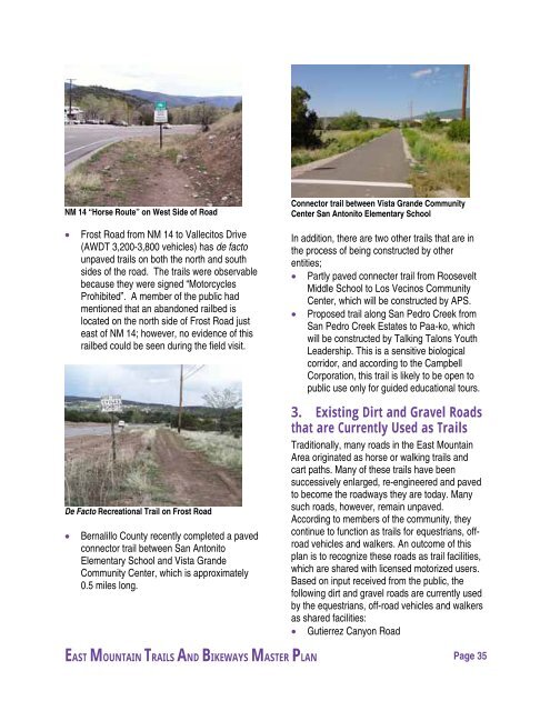
• <strong>Bernalillo</strong> <strong>County</strong> recently completed a paved<br />
connector trail between San Antonito<br />
Elementary School and Vista Grande<br />
Community Center, which is approximately<br />
0.5 miles long.<br />
Connector trail between Vista Grande Community<br />
Center San Antonito Elementary School<br />
In addition, there are two other trails that are in<br />
the process of being constructed by other<br />
entities;<br />
• Partly paved connecter trail from Roosevelt<br />
Middle School to Los Vecinos Community<br />
Center, which will be constructed by APS.<br />
• Proposed trail along San Pedro Creek from<br />
San Pedro Creek Estates to Paa-ko, which<br />
will be constructed by Talking Talons Youth<br />
Leadership. This is a sensitive biological<br />
corridor, and according to the Campbell<br />
Corporation, this trail is likely to be open to<br />
public use only for guided educational tours.<br />
3. Existing Dirt and Gravel Roads<br />
that are Currently Used as <strong>Trails</strong><br />
Traditionally, many roads in the <strong>East</strong> <strong>Mountain</strong><br />
Area originated as horse or walking trails and<br />
cart paths. Many of these trails have been<br />
successively enlarged, re-engineered and paved<br />
to become the roadways they are today. Many<br />
such roads, however, remain unpaved.<br />
According to members of the community, they<br />
continue to function as trails for equestrians, offroad<br />
vehicles and walkers. An outcome of this<br />
plan is to recognize these roads as trail facilities,<br />
which are shared with licensed motorized users.<br />
Based on input received from the public, the<br />
following dirt and gravel roads are currently used<br />
by the equestrians, off-road vehicles and walkers<br />
as shared facilities:<br />
• Gutierrez Canyon Road<br />
EAST MOUNTAIN TRAILS AND BIKEWAYS MASTER PLAN Page 35


