Chapter 3 Population Geography - W.H. Freeman
Chapter 3 Population Geography - W.H. Freeman
Chapter 3 Population Geography - W.H. Freeman

Create successful ePaper yourself
Turn your PDF publications into a flip-book with our unique Google optimized e-Paper software.
98 <strong>Chapter</strong> 3 <strong>Population</strong> <strong>Geography</strong><br />
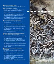
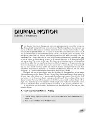
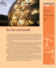
Figure 3.19 Fleeing from disease. This woodcut, which was printed in 1630, depicts Londoners<br />
leaving the pestilent city in a cart. In 1665–1666, London experienced the so-called Great Plague, an<br />
outbreak of bubonic plague that killed one-fifth of the city’s population. (Bettmann/Corbis.)<br />
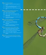
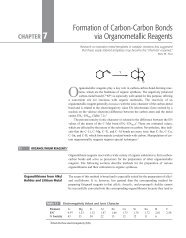
Figure 3.20 Mapping disease. This map was constructed by London physician John Snow. Snow was<br />
skeptical of the notion that “bad air” somehow carried disease. He interviewed residents of the Soho<br />
neighborhood stricken by cholera to construct this map of cholera cases and used it to trace the outbreak<br />
to the contaminated Broad Street pump. Snow is considered to be a founder of modern epidemiology.<br />
(Courtesy of The John Snow Archive.)