Doc_Post Tsunami GDA-NAD (Eng-UNEP).pdf - Wetlands ...
Doc_Post Tsunami GDA-NAD (Eng-UNEP).pdf - Wetlands ...
Doc_Post Tsunami GDA-NAD (Eng-UNEP).pdf - Wetlands ...
Create successful ePaper yourself
Turn your PDF publications into a flip-book with our unique Google optimized e-Paper software.
LIST OF ILLUSTRATIONS<br />
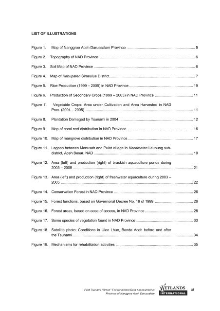
Figure 1. Map of Nanggroe Aceh Darussalam Province .................................................................. 5<br />
Figure 2. Topography of <strong>NAD</strong> Province ............................................................................................. 6<br />
Figure 3. Soil Map of <strong>NAD</strong> Province ................................................................................................... 6<br />
Figure 4. Map of Kabupaten Simeulue District.................................................................................... 7<br />
Figure 5. Rice Production (1999 – 2005) in <strong>NAD</strong> Province............................................................... 19<br />
Figure 6. Production of Secondary Crops (1999 – 2005) in <strong>NAD</strong> Province ..................................... 11<br />
Figure 7.<br />
Vegetable Crops: Area under Cultivation and Area Harvested in <strong>NAD</strong><br />
Prov. (2004 – 2005) ......................................................................................................... 11<br />
Figure 8. Plantation Damaged by <strong>Tsunami</strong> in 2004 ........................................................................ 12<br />
Figure 9. Map of coral reef distribution in <strong>NAD</strong> Province................................................................. 16<br />
Figure 10. Map of mangrove distribution in <strong>NAD</strong> Province................................................................ 17<br />
Figure 11. Lagoon between Menusah and Pulot village in Kecamatan Leupung subdistrict,<br />
Aceh Besar, <strong>NAD</strong> ................................................................................................. 19<br />
Figure 12. Area (left) and production (right) of brackish aquaculture ponds during<br />
2003 – 2005 ..................................................................................................................... 21<br />
Figure 13. Area (left) and production (right) of freshwater aquaculture during 2003 –<br />
2005 ................................................................................................................................. 22<br />
Figure 14. Conservation Forest in <strong>NAD</strong> Province ............................................................................. 26<br />
Figure 15. Forest functions, based on Governorial Decree No. 19 of 1999 ..................................... 26<br />
Figure 16. Forest areas, based on ease of access, in <strong>NAD</strong> Province ............................................... 28<br />
Figure 17. Some species of vegetation found in <strong>NAD</strong> Province........................................................ 33<br />
Figure 18. Satellite photo: Conditions in Ulee Lhue, Banda Aceh before and after<br />
the <strong>Tsunami</strong> ...................................................................................................................... 34<br />
Figure 19. Mechanisms for rehabilitation activities ........................................................................... 35<br />
<strong>Post</strong> <strong>Tsunami</strong> “Green” Environmental Data Assessment in xi<br />
Province of Nanggroe Aceh Darussalam


