
You also want an ePaper? Increase the reach of your titles
YUMPU automatically turns print PDFs into web optimized ePapers that Google loves.
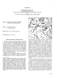
15°N<br />
13°<br />
158°E 159 160 c<br />
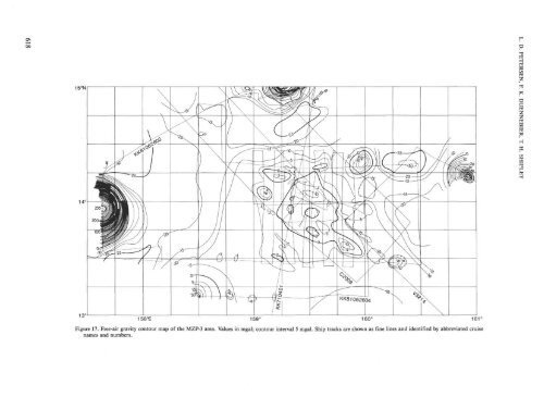
Figure 17. Free-air gravity contour map of the MZP-3 area. Values in mgal; contour interval 5 mgal. Ship tracks are shown as fine lines and identified by abbreviated cruise<br />
names and numbers.