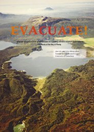
Tsunami evacuation: Lessons from the Great East Japan earthquake ...
Tsunami evacuation: Lessons from the Great East Japan earthquake ...
Tsunami evacuation: Lessons from the Great East Japan earthquake ...

Create successful ePaper yourself
Turn your PDF publications into a flip-book with our unique Google optimized e-Paper software.
2012<br />
3.5 Movements during and after <strong>evacuation</strong> ......................................................... 57<br />
3.5.1 Delayed <strong>evacuation</strong> or non-<strong>evacuation</strong> ............................................... 57<br />
3.5.2 Use of motor vehicles during <strong>evacuation</strong> ............................................ 57<br />
3.5.3 Use of boats during <strong>evacuation</strong> .......................................................... 58<br />
3.5.4 Schools <strong>evacuation</strong> ............................................................................. 58<br />
3.5.5 Necessary relocation <strong>from</strong> <strong>evacuation</strong> refuges ................................... 59<br />
3.5.6 Leaving <strong>evacuation</strong> refuges too early ................................................. 59<br />
3.6 Impacts of coastal defence on warning response and <strong>evacuation</strong> ................. 59<br />
3.7 Vertical <strong>evacuation</strong> buildings .......................................................................... 60<br />
3.7.1 Building specification and levels of damage ....................................... 60<br />
3.7.2 Community engagement ..................................................................... 60<br />
3.7.3 Evacuation building signage ............................................................... 61<br />
3.7.4 Owner agreement ............................................................................... 61<br />
3.7.5 24-hour access ................................................................................... 61<br />
3.7.6 Evacuee welfare ................................................................................. 61<br />
3.8 Additional recommendations <strong>from</strong> observations and interviews ..................... 62<br />
4.0 ACKNOWLEDGEMENTS .......................................................................................... 62<br />
5.0 REFERENCES ........................................................................................................... 62<br />
FIGURES<br />
Figure 1 Map of locations investigated in this report, with coastal topography and epicentre of March<br />
11 th main shock indicated. Note <strong>the</strong> grey lines delineate prefectures. All of <strong>the</strong> locations<br />
investigated lie within Iwate and Miyagi prefectures (labelled), which received <strong>the</strong> largest<br />
tsunami wave heights and most of <strong>the</strong> casualties. Base map credits: GEBCO, NOAA,<br />
National Geographic, DeLorme, Esri.................................................................................................. 5<br />
Figure 2 Excerpt <strong>from</strong> <strong>the</strong> tsunami <strong>evacuation</strong> map Clallam Bay, Clallam County, Washington. This<br />
map uses 2 zones, local sites of importance (fire department, etc.), <strong>evacuation</strong> routes and<br />
assembly areas (Clallam County Emergency Management, n d). ................................................... 10<br />
Figure 3 An example <strong>evacuation</strong> map in Washington. This map is for Long Beach and Ilwaco, Pacific<br />
County, and illustrates <strong>the</strong> use of 3 zones, <strong>evacuation</strong> routes and assembly areas (Pacific<br />
County Emergency Management, 2007). ......................................................................................... 10<br />
Figure 4 ‘<strong>Tsunami</strong> Hazard Zone’ sign with instructions to evacuate to high ground or inland in<br />
response to an <strong>earthquake</strong>. ............................................................................................................. 11<br />
Figure 5 ‘<strong>Tsunami</strong> Evacuation Route’ sign with arrow depicting <strong>the</strong> direction of <strong>evacuation</strong>. These<br />
signs are placed regularly along roads in tsunami hazard zones. .................................................... 11<br />
Figure 6 An example tsunami hazard map <strong>from</strong> Whananaki, New Zealand. .................................................. 12<br />
Figure 7<br />
An example tsunami <strong>evacuation</strong> map and information board as displayed outdoors (1.2 m<br />
wide) in <strong>the</strong> Island Bay community, Wellington, New Zealand. ........................................................ 12<br />
Figure 8 Extract <strong>from</strong> Tarō tsunami hazard map, indicating three sections of tsunami wall (red (1958<br />
section), black and yellow thick lines), tsunami gates (blue triangles and circles). The<br />
inundation extent of <strong>the</strong> 1986 Meiji (thin red line) and 1933 Shōwa tsunami (thin blue line).<br />
Evacuation refuges are marked as red triangles and welfare centres as red circles. Source:<br />
Tarō Town Disaster Prevention Office. ............................................................................................ 16<br />
Figure 9 Kamaishi City <strong>evacuation</strong> map (Source: Kamaishi City Disaster Prevention Office). ....................... 16<br />
Figure 10 Ōfunato City <strong>evacuation</strong> map (Source: Ōfunato City Disaster Management). ................................. 17<br />
Figure 11 Excerpt <strong>from</strong> Kesennuma City <strong>evacuation</strong> map (Source: Kesennuma General Affairs<br />
Department). .................................................................................................................................... 18<br />
Figure 12 Minami-Sanriku hazard map with <strong>evacuation</strong> refuge locations indicated by numbered red<br />
circles (Miyagi Prefectural Government, 2004). ............................................................................... 19<br />
Figure 13 Excerpt <strong>from</strong> <strong>the</strong> Ishinomaki tsunami hazard map with <strong>evacuation</strong> refuges (Ishinomaki City,<br />
n d). .................................................................................................................................................. 19<br />
Figure 14 Natori City hazard map (Source: Natori City Disaster Prevention Office)......................................... 20<br />
Figure 15<br />
Figure 16<br />
Figure 17<br />
A sign displayed above <strong>the</strong> road indicating to drivers that <strong>the</strong>y are entering an estimated<br />
tsunami inundation area. These signs were seen on roads within Kamaishi district. ....................... 20<br />
A sign displayed above <strong>the</strong> road indicating to drivers that <strong>the</strong>y are exiting an estimated<br />
tsunami inundation area. These signs were seen on roads within Kamaishi district. ....................... 20<br />
<strong>Tsunami</strong> <strong>evacuation</strong> route direction and distance sign displayed on a sign in<br />
Hitachihamacho, Miyako City. .......................................................................................................... 21<br />
GNS Science Report 2012/17<br />
iii