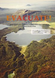
Tsunami evacuation: Lessons from the Great East Japan earthquake ...
Tsunami evacuation: Lessons from the Great East Japan earthquake ...
Tsunami evacuation: Lessons from the Great East Japan earthquake ...

Create successful ePaper yourself
Turn your PDF publications into a flip-book with our unique Google optimized e-Paper software.
2012<br />
Figure 49 The large open car park roof space above <strong>the</strong> fish market provided refuge to 1000 people.<br />
This structure is at <strong>the</strong> harbour front and inundation almost reached roof level. The open<br />
steel structure enabled tsunami flow at <strong>the</strong> 1 st storey. ..................................................................... 44<br />
Figure 50 The Prefectural Government offices suffered extensive scour and heavy in inundation of 8<br />
m. This building was constructed after 2004 and displays tsunami vertical <strong>evacuation</strong><br />
signage at roof level. 200 people survived <strong>the</strong> tsunami in this building ............................................ 44<br />
Figure 51 The National Government office, where 120 people took refuge <strong>from</strong> <strong>the</strong> tsunami. This<br />
building is adjacent to <strong>the</strong> Prefectural Government offices and was left undamaged when<br />
light steel structures were washed into it. The lower two storeys were inundated. .......................... 44<br />
Figure 52 Kesennuma central community centre, where 450 people took refuge when <strong>the</strong>y evacuated<br />
nearby buildings ............................................................................................................................... 45<br />
Figure 53 The Kahoku Newspaper offices were inundated to at least <strong>the</strong> ceiling of <strong>the</strong> 1 st storey. 71<br />
people took refuge here. .................................................................................................................. 45<br />
Figure 54 Locations of designated tsunami <strong>evacuation</strong> buildings in Minami-Sanriku Town: (A)<br />
Matsubara apartments; (B) Takano Kaikan building; (C) Shizugawa Hospital; (D) Fisheries<br />
Co-operative. Significant scour can be seen where seawater is encroaching around building<br />
(A) and to <strong>the</strong> east of building (D). ................................................................................................... 46<br />
Figure 55 Matsubara apartment block viewed <strong>from</strong> <strong>the</strong> seaward side with waterborne debris to <strong>the</strong> 4 th<br />
storey. The low seawall has been destroyed in <strong>the</strong> tsunami return flow and was sheltered in<br />
part by <strong>the</strong> apartment building. The foundations of this building are exposed above <strong>the</strong> water<br />
level due to extensive scour. ............................................................................................................ 46<br />
Figure 56 The Takano Kaikan building 160 m inland of <strong>the</strong> Matsubara apartment block. Little damage<br />
aside <strong>from</strong> glazing was observed here, despite heavy damage and collapse of RC buildings<br />
immediately seaward. ...................................................................................................................... 47<br />
Figure 57 Shizugawa Hospital (west building) – <strong>the</strong> taller of <strong>the</strong> 2 hospital buildings at 5-storeys, this<br />
section suffered less debris damage than <strong>the</strong> east building. ............................................................ 47<br />
Figure 58 Shizugawa Hospital (east building) viewed <strong>from</strong> <strong>the</strong> seaward side which suffered debris<br />
damage at <strong>the</strong> 1 st and 2 nd storeys. ................................................................................................... 47<br />
Figure 59 Minami-Sanriku fisheries co-operative building which was overtopped on March 11 th . Image<br />
credit: Google Streetview, August 2011. .......................................................................................... 47<br />
Figure 60 York Benimaru shopping centre, Minato-machi, Ishinomaki City. The rooftop car parking<br />
area is accessible by vehicle ramp and was successfully used for vertical <strong>evacuation</strong> on<br />
March 11 th . ....................................................................................................................................... 48<br />
Figure 61 The Homac hardware store is a single storey building with car parking on <strong>the</strong> roof, which is<br />
accessible by vehicle ramp. Image credit: Google Streetview, August 2011 ................................... 48<br />
Figure 62 The Hotaru funeral facility. This is an unlikely vertical <strong>evacuation</strong> facility given <strong>the</strong> lack of<br />
obvious roof space or external access, but successfully provided refuge on March 11 th . ................ 49<br />
Figure 63 Kadonowaki Elementary School was damaged by fire while inundated during <strong>the</strong> tsunami.<br />
People who had sought refuge hear were able to leave <strong>the</strong> building and evacuate fur<strong>the</strong>r<br />
uphill at <strong>the</strong> rear of <strong>the</strong> school. This building is a typical school structure in <strong>Japan</strong>; <strong>the</strong>se<br />
buildings are commonly used as <strong>evacuation</strong> or emergency welfare centres. ................................... 49<br />
Figure 64 Locations of designated <strong>evacuation</strong> buildings in Yuriage, Natori City: (A) Yuriage Junior High<br />
School; (B) Yuriage Elementary School; (C) Yuriage Community Centre. Sendai<br />
International airport is to <strong>the</strong> south of <strong>the</strong> area shown here. ............................................................ 50<br />
Figure 65 The Yuriage Community Centre was inundated to <strong>the</strong> 2 nd storey but 43 people survived in<br />
<strong>the</strong> building. ...................................................................................................................................... 50<br />
Figure 66 Yuriage Elementary School. 870 people took refuge here, where <strong>the</strong> large roof area and 3 rd<br />
storey were above inundation. Direct external access to <strong>the</strong> 3 rd storey is available <strong>from</strong> <strong>the</strong><br />
stairs shown here. ............................................................................................................................ 50<br />
Figure 67 Yuriage Junior High School is constructed on ground which is raised 1.8 m above <strong>the</strong><br />
surrounding fields. This helped to mitigate damage <strong>from</strong> <strong>the</strong> tsunami flow and only contents<br />
damage was observed (EEFIT, 2011). 823 people took refuge here. .............................................. 51<br />
Figure 68 Official vertical <strong>evacuation</strong> signage, as photographed on <strong>the</strong> apartment block in Kamaishi. ........... 52<br />
Figure 69 Sign indicating <strong>the</strong> entrance to external stairways at <strong>the</strong> apartment block in Kamaishi<br />
(Translation: “Evacuation building entrance (stairways)”.................................................................. 52<br />
GNS Science Report 2012/17<br />
v