Stavanger kommune
Stavanger kommune
Stavanger kommune

You also want an ePaper? Increase the reach of your titles
YUMPU automatically turns print PDFs into web optimized ePapers that Google loves.
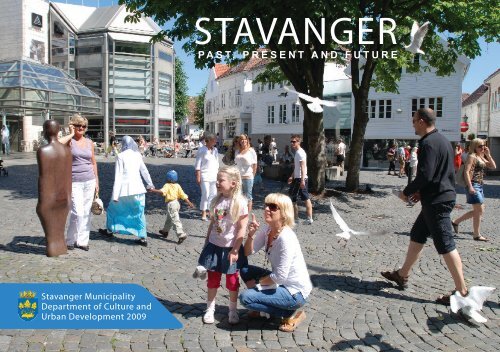
<strong>Stavanger</strong> Municipality<br />
Department of Culture and<br />
Urban Development 2009<br />
STAVANGER<br />
PAST, PRESENT AND FUTURE
STAVANGER<br />
PAST, PRESENT AND FUTURE<br />
<strong>Stavanger</strong> Municipality<br />
Department of Culture and<br />
Urban Development 2009
Introduction<br />
This is not a history book, nor is it a catalogue for those with<br />
a special interest in culture, architecture and town planning.<br />
It is a short introduction into how the city has become what<br />
we see today and what it may become in the future.<br />
Many members of the Department of Culture and Urban Development,<br />
and some from other departments in the <strong>Stavanger</strong><br />
Municipality, have contributed text and illustrations. Together,<br />
we have made a short presentation of examples from<br />
the city’s physical development and plans for the future. The<br />
examples can be an expression of an era, a mood or a stage<br />
in the continuous development of the city. They may be symbols,<br />
places which have become part of <strong>Stavanger</strong>’s identity.<br />
In this way we hope to show some of what we feel is special<br />
about <strong>Stavanger</strong>, both old and new.<br />
The first edition of this book was one of the Department of<br />
Culture and Urban Development’s contributions to <strong>Stavanger</strong><br />
as European Capital of Culture 2008 (“<strong>Stavanger</strong> 2008”). We<br />
hope this translation will be useful and enjoyable for visitors<br />
to the city.<br />
Per Jarle Solheim has written several of the chapters and developed<br />
the manuscript. Egil Bjørøen has been responsible<br />
Vågen seen from Valberget 2008<br />
4
Vågen seen from Valberget. Photo: C. L. Jacobsen, 1870s<br />
for the layout, design and some of the illustrations. Jorunn<br />
Imsland has provided most of the illustrations and the maps.<br />
Unless specified otherwise, the photographs have been taken<br />
by Siv Egeli. Thommas Bjerga has supervised production<br />
of the book. Brenda Solheim has translated the book into<br />
English.<br />
Department of Culture and Urban Development<br />
<strong>Stavanger</strong>, 1 June 2009<br />
Halvor S. Karlsen<br />
Director
List of Contents<br />
PAGE 7 CITY EXPANSION<br />
PAGE 8 A SHORT HISTORY OF THE CITY<br />
PAGE 14 STAVANGER ON THE MAP<br />
PAGE 16 STAVANGER IN NUMBERS<br />
PAGE 18 TRACES UNTIL 1965<br />
PAGE 32 CITY EXPANSION IN 1965 AND<br />
URBAN DEVELOPMENT AREAS<br />
PAGE 42 TRANSPORT AND URBAN DEVELOPMENT<br />
PAGE 44 GLIMPSES OF THE NEW STAVANGER<br />
PAGE 52 GREEN AREAS IN STAVANGER<br />
PAGE 54 TWO MAJOR TOWN PLANNING<br />
COMPETITIONS<br />
PAGE 60 TWO MAJOR CENTRAL DEVELOPMENT<br />
AREAS<br />
PAGE 66 CULTURE IS URBAN DEVELOPMENT<br />
PAGE 78 NORWEGIAN WOOD<br />
PAGE 80 VIEWS AND WALKS<br />
PAGE 84 PLANNING A CITY<br />
PAGE 86 THE FUTURE<br />
PAGE 88 SOURCES<br />
6
City Expansion<br />
<strong>Stavanger</strong> has developed from a small village round the harbour<br />
and adjacent area (Vågen and Østervåg) in the 12th century<br />
to become the fourth largest city in Norway. The city’s<br />
boundaries have been moved several times to accommodate<br />
population growth and commercial activities.<br />
As the map shows, growth was modest until 1866. The largest<br />
expansion occurred in 1965 when Madla municipality<br />
and parts of Hetland municipality were incorporated into<br />
<strong>Stavanger</strong>.<br />
Vågen seen from Valberget. Photo: C. L. Jacobsen 1869
A Short History of the City<br />
It is not without reason that the slogan for<br />
<strong>Stavanger</strong> 2008 was Open Port. The harbour<br />
and the sea have always been important.<br />
Vågen (the inner harbour), protected<br />
from the open ocean, was a natural starting Fishing-net sinker<br />
point for a port town. People have lived in<br />
what is now <strong>Stavanger</strong> as far back as the Stone Age. The first<br />
visible signs of habitation are rock carvings from the Bronze<br />
Age. However, it took a long time from about 1000 B.C.,<br />
when the first carvings were chiselled into the rock at Rudlå,<br />
until <strong>Stavanger</strong> became an important city.<br />
It is difficult to establish when <strong>Stavanger</strong> became a town or a<br />
city. Little is known of the period before approximately 1125<br />
when building of the cathedral (Domkirken) started on the<br />
hill between Vågen and Breiavatnet. <strong>Stavanger</strong> was given to<br />
the church in 1164 and was an important clerical centre in the<br />
Middle Ages. Even though town privileges were awarded in<br />
1425, the population at the beginning of the 16th century was<br />
no more than about 100, the majority of whom were connected<br />
to the church.<br />
Iron age farm, Ullandhaug<br />
Bronze Age rock carvings, Rudlå<br />
In the mid 16th century, there was a large international demand<br />
for timber and export of timber from Ryfylke to continental<br />
Europe laid the foundation for expansion. The first<br />
commercial firms and ship owners were established. <strong>Stavanger</strong><br />
became the administrative centre for <strong>Stavanger</strong> County<br />
A SHORT HISTORY OF THE CITY<br />
8
in 1568 and was granted a town charter in 1594. By that<br />
stage, the population had increased to 600.<br />
At the beginning of the 19th century, natural resources<br />
and international trade - the incredible herring fisheries<br />
and market for herring in Europe - provided the basis for<br />
enormous growth, particularly after free world trade was<br />
established in 1850. In the second half of the 19th century,<br />
<strong>Stavanger</strong> had the second largest commercial fleet in<br />
the country, with 600 ships in foreign trade, and was the<br />
centre of one of the country’s most important shipbuilding<br />
areas. Large trading and shipping companies were<br />
established.<br />
<strong>Stavanger</strong> cathedral<br />
The walls of the Kongsgård school are as old as the cathedral and the<br />
Utstein monastery, and one of very few buildings in the region from that<br />
period
The population grew from 2 500 in<br />
1800 to 30 000 a hundred years later.<br />
<strong>Stavanger</strong> became a large town by<br />
the standards of the time, with the<br />
cultural and material ambitions of a<br />
large city.<br />
By the late 19th century, the period<br />
of growth had in reality ended. The<br />
herring disappeared in about 1870.<br />
The freight market stagnated and<br />
almost disappeared during the next<br />
decade and the town went into a<br />
deep recession.<br />
In about 1890 a new business came into existence, the canning<br />
industry. The raw material was brisling from the fjord. In the<br />
course of a few decades, tinned brisling from <strong>Stavanger</strong> became<br />
one of the country’s most important export products. At the outbreak<br />
of the First World War, <strong>Stavanger</strong> was one of the leading<br />
industrial towns in Norway. Shipbuilding and maintenance was<br />
an important industry as well as the canning industry and its<br />
subcontractors.<br />
Sardine packing at Egeland’s canning factory, Hillevåg. Photo: H. Johannesen, ca 1910<br />
Ship under construction at Rosenberg. Photo: O. Gulliksen, ca 1920<br />
International crises in the period between the two World Wars<br />
also affected <strong>Stavanger</strong>. Many firms struggled and several local<br />
banks went bankrupt. However, this was a relatively short recession<br />
and by the end of the 1930s the town was on the rise again.<br />
A SHORT HISTORY OF THE CITY<br />
10
Herring in Vågen. C. Lutcherath, ca 1910
Drill bit, Norwegian<br />
Petroleum Museum<br />
The town was relatively undamaged during<br />
the Second World War and continued to grow<br />
until the 1960s, when demand for canned<br />
food decreased and competition within<br />
shipbuilding was hard. The town was<br />
heading for a new recession.<br />
The discovery of oil in the North Sea<br />
started a new period of growth. The<br />
first major oil field, Ekofisk, was<br />
discovered in the autumn of 1969.<br />
<strong>Stavanger</strong> became the administrative<br />
and technical centre for North Sea oil<br />
activity. The Norwegian Petroleum Directorate (Oljedirektoratet)<br />
was established in <strong>Stavanger</strong> and national and international<br />
oil companies set up offices. The Norwegian State’s national<br />
oil company (Statoil) became the largest employer. Major oil<br />
installations were constructed at Rosenberg and Jåttåvågen.<br />
After the end of major construction activity, growth continued<br />
in the service industry and administration, with great cumulative<br />
effect.<br />
Amalgamation of the <strong>Stavanger</strong> municipality with Madla and<br />
parts of Hetland in 1965 enabled <strong>Stavanger</strong> to expand and keep<br />
pace with the growth, and to establish new districts. The first<br />
general plan for the amalgamated area was approved in 1968.<br />
Platform construction. Photo: A. Brueland 1973<br />
A SHORT HISTORY OF THE CITY<br />
12
The planning basis was thereby ready to meet new challenges<br />
and further growth which resulted from major oil and<br />
gas discoveries. Many essential features of the plan have<br />
been implemented in establishing green areas, development<br />
areas and main roads.<br />
Prosperity is still increasing in the entire greater <strong>Stavanger</strong><br />
area. There are today no clear divisions between <strong>Stavanger</strong><br />
and the neighbouring municipalities of Sandnes, Sola and<br />
Randaberg and cooperation between the municipalities<br />
is developing strongly. The Forus area, which is located<br />
centrally at the junction of <strong>Stavanger</strong>, Sandnes and Sola, is<br />
perhaps the clearest example of cooperation with respect to<br />
area planning.<br />
<strong>Stavanger</strong> has been become a prosperous and international<br />
city, with a dynamic commercial and cultural life and high<br />
ambitions. The city became a university town on 1 January<br />
2005. The city has also received several civic awards, such<br />
as the Synergy Prize in 2001, Ossietzky Prize, Norwegian<br />
Cultural Municipality and Norwegian Sports Municipality<br />
in 2003, Best Host Town of Tall Ships Race 2004, International<br />
Municipality 2004 and Urban Environment Prize in<br />
2005 and 2006.<br />
Summer in Byfjorden
<strong>Stavanger</strong> on the Map<br />
Town Secretary Ulrik Frederik Aagaard’s map from 1726 is<br />
the oldest map of <strong>Stavanger</strong>. However, the town did not have<br />
technical mapping and surveying expertise until after the fire<br />
at Holmen in 1860 when first lieutenant Hielm in Kristiania<br />
(now Olso) was contracted to survey the area.<br />
As a result of the fire in 1860, water and gas works were<br />
established, the fire department was organized on a permanent<br />
basis and, in 1866, a position for a town engineer was<br />
established. It was not until 1901 that a combined position for<br />
Below: Surveyor’s certificate of plot area measure<br />
Right: <strong>Stavanger</strong>’s first theodolite<br />
STAVANGER ON THE MAP<br />
14
technical director and head of building development was<br />
established. A separate building development department<br />
was established in 1916. However, the Town Engineer did<br />
not recommend establishing a separate entity for planning<br />
and surveying until 1931. In 1952 the Council voted to<br />
establish the surveying department as a separate service and<br />
to establish a position of Chief Surveyor.<br />
The first series of maps at 1:500 scale was constructed in<br />
the 1950s. They were then photographed as the basis for<br />
maps at 1:1000. In the 1970s, a street name map was created<br />
for use internally within the municipality.<br />
In 1992 it was decided that the City<br />
Surveyor’s department should establish digital<br />
mapping data bases, including property<br />
maps. The coordinate system was recalculated<br />
(Euref 89) and implemented in 1998. At<br />
the same time, the mapping data bases were<br />
made accessible for internal and external use.<br />
Maps have now become “consumables” and<br />
anyone who has access to Internet also has<br />
access to a current map, updated every night.<br />
Theodolite, robot station with GPS 3D model of the area round the county court house GPS
<strong>Stavanger</strong> in Numbers<br />
The following diagram shows the current distribution of<br />
land use within <strong>Stavanger</strong>:<br />
Housing<br />
“Trehusbyen”<br />
City centre<br />
Industry and commerce<br />
Transformation areas<br />
Public buildings<br />
Public outdoor recreation<br />
Agriculture and nature<br />
Transport<br />
Other<br />
Approximately a third is housing. Just about one half is<br />
not built up and includes farmland, natural and recreational<br />
areas. However, it should be noted that many of <strong>Stavanger</strong>’s<br />
inhabitants work outside the city limits and that municipalities<br />
in the region are in practice one market for employment,<br />
housing and commerce.<br />
Right: Growth is distributed unevenly between the individual districts<br />
STAVANGER IN NUMBERS<br />
16
Other<br />
Poland<br />
Health and<br />
social services<br />
Other social and<br />
personal services<br />
Agriculture etc<br />
Industry, oil and<br />
gas production<br />
Afghanistan<br />
Finland<br />
Burma<br />
Lithuania<br />
Indonesia<br />
U.K.<br />
Turkey<br />
Education<br />
Building and<br />
construction<br />
Sri Lanka<br />
Chile<br />
Eritrea<br />
Holland<br />
Somalia<br />
Germany<br />
State, county and<br />
municipality<br />
Office and<br />
administration<br />
etc.<br />
Finance and<br />
insurance<br />
Transport and<br />
communication<br />
Shops, hotels<br />
and restaurants<br />
Ethiopia<br />
Serbia<br />
China<br />
Iraq<br />
France<br />
Thailand<br />
Philippines<br />
Russia<br />
Iran<br />
USA<br />
India<br />
Bosnia-Herzegovina<br />
Denmark<br />
Sweden<br />
Vietnam<br />
Pakistan<br />
A large portion of the jobs in <strong>Stavanger</strong> are associated with<br />
the oil industry or the industrial and administrative sectors,<br />
as shown in the diagram above. At the other end of the scale<br />
are agriculture, forestry and fishing (“Agriculture etc.”).<br />
People from <strong>Stavanger</strong> are often called “siddiser”,<br />
probably a Norwegian version of the English citizen,<br />
originating in the shipping era. At present, 12.5% of<br />
the inhabitants are immigrants. The above diagram<br />
indicates where these 15 000 new “siddiser” come<br />
from. The largest 20 groups are specified, but over<br />
130 other nationalities are included in “Others”.
Traces until 1965<br />
<strong>Stavanger</strong>’s history has left visible traces which we can still<br />
see today. Individual buildings and areas are witnesses to and<br />
symbols of different phases of development.<br />
King Sigurd Jorsalfar established the <strong>Stavanger</strong> bishopric in<br />
1125 and this is considered to be the year in which <strong>Stavanger</strong><br />
was founded. <strong>Stavanger</strong> may have been selected because of its<br />
natural harbour, located closest to England. <strong>Stavanger</strong> became<br />
an ecclesiastic centre, with monastery, school and bishop’s<br />
residence. However, after stagnating for many years, the bishopric<br />
was moved to Kristiansand in 1682 and a bishopric was<br />
not re-established in <strong>Stavanger</strong> before 1925.<br />
Many of <strong>Stavanger</strong>’s historical buildings have been lost, due in<br />
part to changes in society’s structure and values. The St. Olav<br />
monastery which lay west of Breivatnet fell into ruin after the<br />
Reformation and all traces were removed in 1577 when the<br />
monastery was used as a stone quarry. After existing for more<br />
than 500 years, the latin school was demolished in 1842. The<br />
Maria church was used as the town hall and finally a fire station,<br />
before it was pulled down in 1883.<br />
However, the cause of the greatest destruction historically has<br />
been fire. Most of the buildings were timber and fires were<br />
catastrophic. Between 1633 and 1833, large parts of the town<br />
were burnt to the ground as many as seven times.<br />
Eastern facade of the cathedral. Photo: C.J. Jacobsen, ca 1910<br />
TRACES UNTIL 1965<br />
18
Cathedral<br />
Building of the cathedral in romanesque style started in<br />
about 1125 under Bishop Reinald from Winchester in England.<br />
The building was seriously damaged by fire in 1272.<br />
During its reconstruction, the cathedral was expanded by<br />
adding a choir in gothic style and acquired its current form.<br />
The cathedral was renovated extensively between 1939<br />
and 1964. In connection with this work, led by Gerhard<br />
Fischer, the plaster was removed and the cathedral largely<br />
restored to its medieval appearance.<br />
Valberg Tower<br />
After the fire of 1833, it was decided to build a watchtower<br />
for the town’s firemen at Valberget, the highest point on<br />
Holmen, with an overview of the whole town at the time.<br />
The Valberg tower (Valbergtårnet), designed by the palace<br />
architect, Christian Grosch, was completed in 1853.<br />
The tower was never very successful in terms of fire<br />
protection. Following the next fire in 1860, when 210 houses<br />
at Holmen burnt to the ground, only the new fire tower<br />
was left standing. However, even though the Valberg tower<br />
never served its original purpose, the building, with its<br />
beautiful shape and commanding position, has become an<br />
important symbol of <strong>Stavanger</strong>.<br />
Between 1800 and 1900, the population increased tenfold.<br />
This, as well as modern technology and external influences,<br />
changed <strong>Stavanger</strong> completely in many areas. Banks, Valberg tower from the north-west. Photo: G. Wareberg 1917
gasworks, waterworks, railway, telephone, missionary societies,<br />
temperance society and newspaper were established. Cultural<br />
life flourished. The author Alexander Kielland, the artist<br />
Kitty Kielland and lyric poet Sigbjørn Obstfelder are perhaps<br />
the most well-known cultural figures from this period.<br />
“Acropolis”<br />
Prosperity gave <strong>Stavanger</strong> a new self-respect, which culminated<br />
in the construction of four large public buildings between<br />
1883 and 1897, the Rogaland Theatre (Rogaland Teater)<br />
(1883), <strong>Stavanger</strong> gymnastics hall (<strong>Stavanger</strong> Turnhall) (1891),<br />
<strong>Stavanger</strong> Museum (1893) and <strong>Stavanger</strong> hospital (<strong>Stavanger</strong><br />
sykehus) (1897). All of these were dedicated to culture and<br />
the welfare of the people, all were designed by the <strong>Stavanger</strong><br />
architect Hartvig Sverdrup Eckhoff and all were located on the<br />
hill above the town as it was at the time, a local “Acropolis”.<br />
The water supply for the hospital came from Mosvannet via a<br />
water tank at Våland and, from 1895, the Våland tower became<br />
a landmark. All this building activity was an enormous economic<br />
effort, perhaps the greatest investment in public welfare in<br />
<strong>Stavanger</strong> to date. Remarkably, this coincided with the onset<br />
of a serious depression following the collapse of the herring<br />
fisheries and shipping industry. All the major shipowners and<br />
businesses went bankrupt during the 1880s.<br />
Museum, gymnastics hall and theatre. Photo: C.J. Jacobsen 1901<br />
<strong>Stavanger</strong> hospital. Photo: M. Eckhoff 1897<br />
Today, the Rogaland Theatre has taken over the gymnastics<br />
hall and most of the hospital is used as Rogaland County Council<br />
offices. However, the buildings bear witness to civic pride,<br />
vision and faith in the future.<br />
TRACES UNTIL 1965<br />
20
”Acropolis” 2008<br />
Below: <strong>Stavanger</strong> Museum. Right: Rogaland Theatre
Breiavatnet and Byparken<br />
Breiavatnet has many names – the heart of the city, the city’s<br />
smiling eye – and has a special place in the city’s consciousness.<br />
Breiavatnet was part of Vågen until approximately 3 000 years<br />
ago, when the land rose (or the sea sank). At that time people<br />
were carving rock signs at Rudlå. The lake lay outside of the<br />
built-up area until the 19th century and just inside the town<br />
boundary until it was expanded in 1878.<br />
The town park was established as a public park in about 1870.<br />
Today, the city benefits from this wise decision.<br />
The park has beautiful trees, well-maintained beds of flowers<br />
and one of <strong>Stavanger</strong>’s most distinctive buildings. In 1915 an<br />
architectural competition was held for design of a music pavilion<br />
next to the cathedral. The winner was architect Erling<br />
Nielsen of Kristiania. This modest, but well-designed, building<br />
was completed in 1925 and fits in with the cathedral and green<br />
area of Kongsgård.<br />
Breiavatnet towards the railway station. Photo: A. Brueland 1970<br />
Music pavilion, 1920s<br />
Breiavatnet. Photo: Bitmap<br />
Together with Vågen, Breiavatnet is still the strongest natural<br />
feature in the city centre, even though landfills have changed<br />
its original appearance. <strong>Stavanger</strong> would have been poorer<br />
without the park and Breiavatnet with its promenade in the<br />
middle of the city.<br />
TRACES UNTIL 1965<br />
22
The Advent of Two-family Houses<br />
In the mid 19th century, <strong>Stavanger</strong> was a compact town,<br />
concentrated in the areas close to the sea between Bjergsted<br />
and Spilderhaug (Badedammen). This area largely coincides<br />
with the area which is considered to be the centre of<br />
<strong>Stavanger</strong> today.<br />
By the end of the 19th century, all the area available for<br />
building had been taken into use. However, no tenement<br />
blocks were built. Instead, the built-up area had started to<br />
expand towards Storhaug and Våland, and horizontally<br />
divided 2-family timber houses became the most common<br />
type of dwelling, both in this area and in later expansion<br />
up to the 1950s. The new districts were equipped with big<br />
prestigious school buildings. In the eastern part of town,<br />
new industries were established. Just south of town, the<br />
industrial area Hillevåg was established. The Rosenberg<br />
shipyard moved from Bjergsted to Buøy and accelerated<br />
development there.<br />
Morning at Mosvannet. Photo: H. Henriksen, ca 1915<br />
Våland from the mid-1930s. Photo: Widerøe<br />
Mosvatnet and Vålandskogen<br />
Mosvatnet and Vålandshaugen were incorporated into the<br />
town in 1866 and 1905 respectively. Large parts of Våland<br />
have subsequently become built-up. However, trees were<br />
planted in what is now Vålandskogen and around Mosvatnet<br />
lake and have become a resource for the city.
The Wooden Town (Trehusbyen)<br />
The concept of protection, which was established in the<br />
1950s, has subsequently developed and become stronger. One<br />
expression of this is preservation of the so-called Trehusbyen,<br />
which lies largely within the pre-1923 town limits. See the<br />
map on page 7.<br />
In <strong>Stavanger</strong>, as in other Norwegian towns, a large portion<br />
of the houses are timber constructions. Even though brick<br />
buildings appeared following the fires in the town centre in<br />
the 19th century, use of such material had as much to do with<br />
the building’s size and use as with fire safety. Wooden houses<br />
continued to dominate in the centre and in the new districts<br />
established as the city grew.<br />
Sporadic attempts were made to impose use of brick.<br />
However, these efforts did not succeed, primarily because of<br />
the cost. Brick was reserved for churches, factory buildings<br />
and other large buildings.<br />
Two-family houses, Våland<br />
Brick buildings, Wessels gate (left) and St. Petri (right). Photos: Egil Bjørøen<br />
With approximately 8 000 wooden houses from the period<br />
before 1950, <strong>Stavanger</strong> is the city with the largest number of<br />
wooden houses in Europe. It is truly a wooden city, and Trehusbyen<br />
is a natural description and name.<br />
Opposite: Wooden housing, Storhaug<br />
TRACES UNTIL 1965<br />
24
Awareness of the value of the wooden buildings is relatively<br />
new. In the 1940s, the municipality prepared comprehensive<br />
plans for modernizing the centre. The plans implied complete<br />
clearance of the existing buildings in the centre and at Straen.<br />
Only the cathedral, Kongsgård and the old post office were to<br />
be left standing.<br />
The first projects carried out in line with the clearance plans<br />
(Klubbgata, Olavskleiva) provoked protests. These resulted<br />
in a conservation plan for Straen, or ”Old <strong>Stavanger</strong>” (Gamle<br />
<strong>Stavanger</strong>), in 1956. This was one of the first conservation<br />
plans in the country and was extremely important for subsequent<br />
town planning in <strong>Stavanger</strong>. Architect Einar Hedén was<br />
central in this work. The plan has been expanded several times<br />
and it is now acknowledged that not only the city centre, but<br />
also all the wooden buildings in central districts, are important<br />
to <strong>Stavanger</strong>.<br />
The wharf warehouses are also an important part of<br />
<strong>Stavanger</strong>’s character. The herring period from about 1800–<br />
1880 changed the towns’s appearance in the shape of a<br />
continuous row of 200–300 warehouses from Sandvigå to<br />
Strømsteinen.<br />
When the herring disappeared, many of the warehouses were<br />
abandoned or were converted for other uses such as canning<br />
Above: Old <strong>Stavanger</strong>, Nedre Strandgate<br />
Below: Old <strong>Stavanger</strong>, Øvre Strandgate<br />
TRACES UNTIL 1965<br />
26
factories. Only approximately 60 still remain and many have<br />
changed shape or facade over time. In addition, they now lie<br />
some distance from the water following repeated landfills<br />
along the harbour front. However, they are still a visible<br />
and characteristic feature of the city. Many are now used as<br />
restaurants, pubs and discos, others as shops, storerooms or<br />
offices. It was not until 1993 that a complete register of the<br />
remaining warehouses was compiled and specific conservation<br />
regulations introduced.<br />
The row of wharf warehouses ca 1870 (<strong>Stavanger</strong> Cultural Heritage Office)<br />
Reconstructed on the basis of Torstrup’s map and old photographs by<br />
Helge Schelderup (Vågen) and Unnleiv Bergsgard (eastern harbour)<br />
Row of warehouses today, Skagenkaien towards Millennium Site
The conservation work has now also been applied to other<br />
districts with newer buildings. The most comprehensive work<br />
is the introduction of regulations for Trehusbyen, as defined<br />
in the Cultural Heritage Plan (Kulturminneplanen) in 1995.<br />
Specific aesthetic guidelines for Trehusbyen were introduced in<br />
2003. The municipality’s objective is to preserve this as an area<br />
with wooden buildings, both by preserving existing buildings<br />
and by constructing new buildings in wood.<br />
Two-family house, Våland<br />
Opposite: Inquisitive tourists in Øvre Strandgate<br />
Map showing ”Trehusbyen”<br />
TRACES UNTIL 1965<br />
28
After the Second World War, Norway was to be rebuilt. An<br />
idealistic generation of planners and architects were to give the<br />
towns more and better houses, new jobs, and green areas for<br />
the inhabitants. Terrace houses, where everyone had access to a<br />
garden, and blocks with large open areas were built outside the<br />
old town centre.<br />
There was a great shortage of houses and the standard of the<br />
older housing was poor. Housing cooperatives were one means<br />
of alleviating the housing shortage and the <strong>Stavanger</strong> Cooperative<br />
Building and Housing Association (SBBL) was established<br />
in 1946.<br />
The terrace house, also called the <strong>Stavanger</strong> House, was developed<br />
in about 1950. It became a trademark of housing<br />
construction in the 1950s and for SBBL’s early Cooperative<br />
Housing Societies. The house was based on a construction with<br />
economic spans and no internal load bearing walls and was<br />
simple and cheap to build. All the houses have an entrance at<br />
street level and their own garden. With two floors plus basement<br />
and attic, three bedrooms and practical kitchens, these<br />
were ideal family dwellings.<br />
Terrace houses (”<strong>Stavanger</strong> houses”) at Bekkefaret. Photo: Widerøe 1957<br />
Blocks of flats, Misjonsmarka. Photo: Widerøe 1957<br />
The <strong>Stavanger</strong> House received a lot of attention and many<br />
successors throughout the country. Fifty years later, they are<br />
still not old-fashioned. Even though many have been extended,<br />
reflecting increased affluence, many have retained their original<br />
layout and details.<br />
TRACES UNTIL 1965<br />
30
Typical areas with <strong>Stavanger</strong> houses are Steinkopfstykket<br />
and Årrestadstykket near Randabergveien, Tjennsvollskråningen,<br />
Vålandskråningen, Bekkefaret and Saxemarka-<br />
Solsletta. In total, almost 800 houses of this type have<br />
been built.<br />
The <strong>Stavanger</strong> houses from the 1950s stand as a testimony<br />
to the idealism of architects and developers in the difficult<br />
years after the Second World War. Some areas have also<br />
been designated for preservation.<br />
<strong>Stavanger</strong> is known for its wooden houses. However, other<br />
types of housing have also been built. International trends,<br />
particularly from Sweden, were followed. The first blocks<br />
of flats were built in 1948 and 1951 at Misjonsmarka, with<br />
175 flats in total. Saxemarka was subsequently developed,<br />
with over 400 flats.<br />
Blocks of flats, Saxemarka. Photo: Per Jarle Solheim<br />
Terrace houses (“<strong>Stavanger</strong> houses”) Ullandhaug<br />
One of the basic principles behind the construction of<br />
blocks in the 1950s was that the inhabitants should have<br />
light and fresh air. The blocks were not to be built too close<br />
together. There should be spacious outdoor areas. Every<br />
flat was to have a balcony, to compensate for lack of direct<br />
access to outdoor areas at ground level. The buildings<br />
were simple and economic.
City Expansion in 1965 and<br />
Urban Development Areas<br />
Amalgamation with Madla and parts of Hetland on 1 January<br />
1965 was a watershed in development of the city in more recent<br />
years, providing <strong>Stavanger</strong> with the opportunity for significant<br />
expansion.<br />
<strong>Stavanger</strong> is not a big city by international standards and does<br />
not have any real suburbs. Instead, so-called development areas<br />
have been established.<br />
The location of the development areas in the expanded <strong>Stavanger</strong><br />
municipality was largely defined by the development plan<br />
1966-70. The areas included Hundvåg, Stokka, Tjensvoll-Madlamark,<br />
Kvernevik-Sunde, Kristianlyst-Mariero, Hinna and<br />
Gausel-Godeset-Jattå, all outside the old city boundary, and<br />
Godalen and Rosenli inside it.<br />
Kalhammarviken with Bjelland’s herring meal factory. Photo: Widerøe 1952<br />
Development of Tjensvollskråningen. Photo: Widerøe 1957<br />
The development areas were a natural consequence of<br />
<strong>Stavanger</strong>’s active building land allocation policy, the socalled<br />
<strong>Stavanger</strong> Model. The <strong>Stavanger</strong> Model entails that the<br />
municipality acquires all larger areas which are designated for<br />
development. The areas are provided with roads, water, sewage<br />
and electricity. Individual areas within the larger areas are then<br />
sold to different developers based on a more detailed development<br />
plan.<br />
Opposite: Madlatorget. Photo: Bitmap<br />
CITY EXPANSION IN 1965 AND URBAN DEVELOPMENT AREAS<br />
32
Three Typical Development Areas<br />
The following areas are representative of different phases in<br />
development of the city:<br />
Buøy-Hundvåg<br />
Buøy has been part of <strong>Stavanger</strong> since 1878, while Hundvåg<br />
was incorporated into the city in 1965. The water tower at<br />
Buøy, a local landmark, was built in 1920 when the Rosenberg<br />
shipyard moved from Sandvigå at Bjergsted to Buøy.<br />
Houses for the workers were built both on Buøy and also at<br />
Hundvåg. The development of larger housing estates started<br />
in about 1967. At first the pace was fairly slow, but this increased<br />
after construction of the city bridge (Bybrua).<br />
When the bridge was opened, the island’s population was<br />
7 000. There are now 12 500 people living in this area and<br />
the number is expected to increase to 15 000. At the same<br />
time, the drastic reduction of activity at the Rosenberg<br />
shipyard has resulted in increased road traffic due to people<br />
driving to work on the mainland.<br />
The city bridge (Bybrua), constructed by professor Arne Selberg and engineer<br />
Johannes Holt, was opened in December 1977. A cutting connecting<br />
the harbour ring road and the Varmen/Lervig area in 1985 and a tunnel<br />
between the <strong>Stavanger</strong> railway station and the harbour ring road in 1989<br />
greatly improved access to the development areas on Buøy and Hundvåg<br />
Below: Rosenberg shipyard 1921<br />
Planning of a new underwater connection to the mainland<br />
is in progress, both as part of the Ryfast project, connecting<br />
<strong>Stavanger</strong> to Ryfylke via a 14 km underwater tunnel, and<br />
because an alternative ferry-free connection is desirable.<br />
Opposite: City bridge with Buøy and Hundvåg. Photo: Bitmap<br />
CITY EXPANSION IN 1965 AND URBAN DEVELOPMENT AREAS<br />
34
Sunde-Kvernevik<br />
When development started almost immediately after expansion<br />
of the city limits in 1965, Sunde and Kvernevik seemed to be<br />
far from town.<br />
Most of Sunde and Kvernevik was developed before 1980.<br />
Given that there were many developers, catering for different<br />
potential buyers, almost all types of houses and building styles<br />
from that period are represented. Developments in society and<br />
increased prosperity after the city’s last recession in the 1960s<br />
are reflected in the number of extensions subsequently built to<br />
the first houses at Kvernevik.<br />
Development area Søra Bråde, Sunde<br />
Building is still going on in the area, and there are examples<br />
of more recent architecture, as illustrated by the photographs<br />
from Søra Bråde at Sunde.<br />
Jåttå-Gauselmarka<br />
A continuous urban belt between <strong>Stavanger</strong> and Sandnes, also<br />
called the “Linear City”, was accepted as one of the basic<br />
principles of development of North Jæren. This made Gausel-<br />
Godeset-Jåttå, midway between Sandnes and <strong>Stavanger</strong> centre,<br />
a prime candidate for development. In addition, the proximity<br />
of work places at Forus made this area very attractive. Local<br />
work places were not part of the concept for any of the development<br />
areas. However, in this case, they were at least located<br />
in the vicinity.<br />
CITY EXPANSION IN 1965 AND URBAN DEVELOPMENT AREAS<br />
36
Planning started in about 1975. Development of Gauselmarka<br />
started in earnest in about 1980 and continued at<br />
Godeset. Development of Gauselbakken South and North<br />
started in about 2000. A main principle in all cases has<br />
been to ensure easy access to green areas.<br />
The period after 1980 has been a growth period, at the<br />
same time as new architectural fashions have arisen. Godeset-Gauselmarka<br />
and Gauselbakken have been gradually<br />
developed during this period, with a wide range of house<br />
types and styles in both areas. Gauselbakken North is the<br />
last area within the <strong>Stavanger</strong> boundaries where detached<br />
houses have been built to any great extent.<br />
Development will continue northwards at Jåttå.<br />
Development area Gauselbakken North<br />
Left and below: “Building for the future”, Gausel
Industrial Areas and Work Places<br />
In the development areas, there is a predominance of housing<br />
rather than work places. Work places are concentrated today<br />
in two main areas, <strong>Stavanger</strong> centre and Forus, 10 km further<br />
south.<br />
The <strong>Stavanger</strong> municipality’s development plan for 1966-<br />
1970 identified two new industrial areas, Dusavik and Forus.<br />
Both areas have been extremely important for development of<br />
the city.<br />
Dusavik became an onshore base for oil industry activity in<br />
the North Sea. Forus became a regional concentration of work<br />
places which most likely surpasses the visions of the planners<br />
in the 1960s. Jåttåvågen was established later as a construction<br />
site for large North Sea installations, notably the Condeep<br />
concrete gravity platforms.<br />
Early in the 1950s, initiative was taken to develop the Forus<br />
area for industry. Gradually the idea arose of establishing a<br />
large industrial area located centrally between the <strong>Stavanger</strong>,<br />
Sola and Sandnes municipalities as delineated following expansion<br />
of <strong>Stavanger</strong> in 1965. The total area is approximately<br />
65 hectares.<br />
Forus was originally the name of the area where the Stokka<br />
lake, which covered most of Forussletta, discharged into<br />
Forus area. Photo: Bitmap<br />
CITY EXPANSION IN 1965 AND URBAN DEVELOPMENT AREAS<br />
38
Gandsfjorden. The Stokka lake was drained at the beginning<br />
of the 20th century and the area was cultivated and became<br />
part of the adjacent farms. During the Second World War, the<br />
Germans built a new airport on Forussletta. After the war, the<br />
airport was no longer used, but the State retained ownership<br />
of the airport area.<br />
Forus extends across the boundaries of three municipalities,<br />
but is in reality treated as one continuous industrial area. This<br />
was the basis for the Forus master plan in 1965. The plan<br />
envisaged a traditional industrial area, but this was not to be.<br />
A major change occurred at the end of the 1970s as a result<br />
of oil industry activity. Statoil established its head office at<br />
Forus, followed by other oil companies. Structural changes<br />
Oil-related industry, Forus
in the Norwegian economy, whereby fewer and fewer goods<br />
are produced locally, have also left their mark. Heavy industry<br />
failed to materialize and, instead of manufacturing plants,<br />
warehouses for imported goods were built. The warehouses<br />
also developed gradually into sales outlets and then shops in<br />
competition with businesses in the urban centres.<br />
The area is administered by Forus Næringspark AS, an intermunicipality<br />
company with the mayors of <strong>Stavanger</strong>, Sandnes<br />
and Sola sitting on the board of directors. The company provides<br />
ready-for-building sites for sale to companies - almost<br />
1 000 companies to date.<br />
Today more than 60% of the almost 25 000 work places are<br />
related to offices, services and retail shopping. The number of<br />
work places may double within the next 30 years.<br />
One of the main challenges in the Forus area is the much larger<br />
relative growth in work places compared to other parts of<br />
the greater city area. This has resulted in considerably more<br />
car traffic to and from Forus compared to the town centres and<br />
in strained traffic conditions, particularly in the rush hour.<br />
Plans are now focusing on developing dedicated public transport<br />
routes. Pedestrian and bicycle traffic is also to be facilitated.<br />
The objective is to increase the number of people travelling<br />
to and from work by public transport or on foot or bicycle.<br />
Opposite: Statoil, Forus. Photo: Bitmap<br />
CITY EXPANSION IN 1965 AND URBAN DEVELOPMENT AREAS<br />
40
Transport and Urban Development<br />
The first car arrived in 1899, 20 years after the railway between<br />
<strong>Stavanger</strong> and Egersund was opened.<br />
Today approximately 60 000 vehicles are registered in <strong>Stavanger</strong>,<br />
over 75% of which are private cars. This has had enormous<br />
influence on development of the city. As the car became<br />
the most important means of transport, designing the road<br />
network became a major task. Car parking facilities had to be<br />
provided. Increased traffic became a major problem, first in<br />
the city centre and gradually throughout the entire city as new<br />
districts developed and jobs were established outside the<br />
centre. The motorway, which 40 years ago was supposed to<br />
solve transport problems for the foreseeable future, is now<br />
periodically jammed. Rush-hour traffic has become a problem<br />
in large parts of the road network.<br />
Dual-track, Jåttå station<br />
Traffic, Madlaveien at Siddishallen<br />
New roads have been built to remedy the situation. At the same<br />
time, <strong>Stavanger</strong> has focused on reducing the negative impact<br />
of car traffic in the city centre. The first major step has been to<br />
ban cars from parts of the centre at Holmen and Straen. When<br />
the Bergeland tunnel was opened in 1989, the main road past<br />
the cathedral could be restricted to pedestrians. The Storhaug<br />
tunnel reduced through-traffic in the Storhaug area.<br />
In recent years, <strong>Stavanger</strong> has also focused on bicycle traffic as<br />
a safe and effective alternative and on safety for pedestrians.<br />
TRANSPORT AND URBAN DEVELOPMENT<br />
42
However, the number of people opting to cycle has not<br />
increased as much as hoped. Ambitions for increased use<br />
of the bicycle are high and ongoing planning of a main<br />
cycle road between <strong>Stavanger</strong>, Forus and Sandnes is part<br />
of this investment. Planned to be of an exceptionally high<br />
standard, the main cycle road may be the first of its kind in<br />
Norway.<br />
Attention is increasingly focused on public transport, including<br />
establishing bus lanes. The railway between <strong>Stavanger</strong><br />
and Sandnes will become dual track in the near future.<br />
Possible excess capacity on this part of the track will be<br />
evaluated for use in a city rail system, initially in the form<br />
of a track from the railway at Gausel via Forus to the<br />
<strong>Stavanger</strong> airport.<br />
Traffic north to Haugesund and Bergen and east towards<br />
Ryfylke is at present dependent on ferries. Construction of<br />
an Eiganes tunnel has been proposed as part of a satisfactory<br />
route through <strong>Stavanger</strong> for the main coastal road E39<br />
from Kristiansand to Bergen and further north. This solution<br />
could contribute to reducing traffic through housing<br />
areas in <strong>Stavanger</strong>. Continuing north via an underwater<br />
tunnel (Rogfast) between North and South Rogaland, this<br />
will connect the west coast closer, in the same way as<br />
Ryfast (page 34) will connect Ryfylke closer to <strong>Stavanger</strong>.<br />
Bridge for cyclists and pedestrians across Madlaveien<br />
Storhaug tunnel
Glimpses of the New <strong>Stavanger</strong><br />
<strong>Stavanger</strong> Centre<br />
The area considered to be the city centre today is largely the<br />
same as the area within the 1848 town boundary. The district<br />
from the cathedral out to Holmen, limited by the market place,<br />
the cathedral square and Kongsgata, is often described as the<br />
medieval town, with its characteristic narrow and winding<br />
streets. The streets are probably based on old paths and tracks,<br />
adapted naturally to the terrain.<br />
After the Second World War, plans to modernize the city centre<br />
with wide streets and new buildings were considered. The<br />
plans were never implemented and, today, most of Holmen and<br />
the area around the cathedral are reserved for pedestrians.<br />
Kirkegata/Breigata<br />
Skagen with the Fred Hansen house in the foreground<br />
<strong>Stavanger</strong> Cultural Centre<br />
(<strong>Stavanger</strong> Kulturhus Sølvberget)<br />
When walking round this area, one will sooner or later come<br />
across Arneageren. This little square is the natural centre of<br />
the network of streets, and is where the Cultural Centre Sølvberget<br />
is located. Since 1987, Sølvberget has become a central<br />
cultural venue in the city and region and houses the <strong>Stavanger</strong><br />
library, <strong>Stavanger</strong> cinema, the Norwegian Children’s Museum<br />
(Norsk Barnemuseum), children’s workshop (Barnas Kulturverksted)<br />
and cafés. The centre is very popular and is always<br />
full of people. It has also developed into an international<br />
arena for work related to freedom of speech, where <strong>Stavanger</strong><br />
GLIMPSES OF THE NEW STAVANGER<br />
44
Kirkegata/Prostebakken<br />
Left: Søregata<br />
Below: Arneageren with <strong>Stavanger</strong> Cultural Centre Sølvberget
Freedom Centre, the International Cities of Refuge Network<br />
(ICORN) and the literature and freedom of speech festival<br />
Kapittel have central roles.<br />
The Harbour and Market Place<br />
The harbour has always been important to <strong>Stavanger</strong>. In the<br />
19th century it became a significant international port, but<br />
its shape and function have changed over the years. Major<br />
landfills have created a completely different waterfront, and<br />
the characteristic warehouses, which in the 19th century lay<br />
all along the water’s edge, now lie some distance from the<br />
quayside.<br />
The brig Alpha in Vågen ca 1880<br />
Sightseeing boat Clipper in Vågen in 2007<br />
Goods transport and international ferry traffic have been moved<br />
to Risavika near Tananger. However, local ferry traffic is<br />
still important, and cruise ships are frequent visitors during<br />
the tourist season.<br />
The harbour has become more of a recreational area for festivals<br />
and sporting events than a trade port. A 4 km urban walk,<br />
the “Blue Promenade”, follows the water from Badedammen<br />
to Bjergsted, passing ferry terminals and marinas.<br />
The marketplace, Torget, was important in the day-to-day<br />
life of the town. Farmers and fishermen congregated here and<br />
sold their produce. This traditional marketplace still exists,<br />
although on a smaller scale. It is particularly lively during the<br />
fruit and berry season.<br />
GLIMPSES OF THE NEW STAVANGER<br />
46
Millennium Site, the marketplace (Torget)<br />
Cruise ship Queen Mary 2 in Vågen<br />
Beach volleyball tournament World Tour <strong>Stavanger</strong>
Like the harbour, the marketplace has changed both in shape<br />
and function. Perhaps the most significant change took place<br />
around the start of the new millennium when <strong>Stavanger</strong> selected<br />
Torget as its “Millennium Site” and arranged an open<br />
architectural competition for its development. Millennium<br />
sites were created all over Norway, but the new Torget ranks<br />
amongst the most spectacular. A total renewal of the entire<br />
area, it connects Vågen to the sheltered Breiavatnet lake and<br />
is <strong>Stavanger</strong>’s major open-air arena, accommodating large<br />
events and festivals.<br />
The city centre has changed in use and character. At one time<br />
an important religious centre, it is now a centre for shopping<br />
and recreation. The process of change is illustrated in buildings<br />
from different epochs which have been preserved, rehabilitated<br />
or converted to other uses. These buildings are part<br />
of <strong>Stavanger</strong>’s visual identity, and a challenge to developers.<br />
Some modern buildings, such as the Skagen Brygge Hotel,<br />
have adapted to their historical surroundings; others, like the<br />
Norwegian Petroleum Museum (Oljemuseet) on Kjeringholmen,<br />
are strong contemporary statements.<br />
Skagen Brygge Hotel<br />
The Norwegian<br />
Petroleum Museum<br />
GLIMPSES OF THE NEW STAVANGER<br />
48
Kongsgata<br />
Cathedral square with SR-bank and Norges Bank<br />
Colourful houses in Øvre Holmegate<br />
<strong>Stavanger</strong> Storsenter, Klubbgata
City Centre Plan<br />
Work on a master plan for the centre (Kommunedelplan<br />
<strong>Stavanger</strong> Sentrum 1994 – 2005) started in 1992. When the<br />
plan was approved 4 years later, it was the first comprehensive<br />
master plan for a city centre in Norway.<br />
Combining more than 100 zoning plans, the master plan established<br />
traffic systems as well as parks and green corridors,<br />
conservation projects, “handle with care” buildings and not<br />
least new main projects for the public spaces in the city centre.<br />
Establishment of the plan had been enabled by the opening of<br />
the new E18 (now Rv 509) road from Kannik to Verksalmenningen<br />
in 1989, with a bridge over the railway area and a tunnel<br />
through Storhaug.<br />
Together with the master plan, a local analysis of the city<br />
centre and a City Catalogue were prepared, with 65 proposals<br />
for restoration of smaller public spaces. Some of the projects<br />
GLIMPSES OF THE NEW STAVANGER<br />
50
could be combined and created the basis for an action plan<br />
with five main proposed projects: the Central Public Space<br />
(development of Torget and the area round Breiavatnet), the<br />
Blue Promenade, the “green” Løkkeveien street, the “Green<br />
Corridor” between Breiavatnet and Mosvatnet, and <strong>Stavanger</strong><br />
East (upgrading of the Nedre Blåsenborg and Smedgate<br />
areas). The projects, shown on the map below, were completed<br />
or under construction in 2008.<br />
Main projects, City Centre Plan<br />
Blocks of flats in the centre<br />
Previous page, bottom left: St. Olav seen from Breiavatnet. Previous page:<br />
Olav V’s gate. Above: Badedammen. Below: Blåsenborg
Green Areas in <strong>Stavanger</strong><br />
<strong>Stavanger</strong> has perhaps the best continuous urban green structure<br />
of all Norwegian cities.<br />
Everything can be found here: parks, woods, beaches, lakes,<br />
meadows with wild flowers, viewpoints, skating facilities,<br />
playgrounds, cycling paths, bridle paths, ball parks, outdoor activity<br />
centres, swimming facilities and sports halls, connected<br />
together and make accessible by a network of footpaths. When<br />
the network is complete, it will offer approximately 220 km of<br />
“green” connections.<br />
In addition, many of the smaller islands in the municipality are<br />
designated for outdoor life and nature conservation.<br />
Green areas Above: Lundsneset Below: Mosvatnet Right: Bathing at Godalen<br />
The foundation for this continuous green structure was laid<br />
in the first master plan for the <strong>Stavanger</strong> municipality in the<br />
late 1960s. This was followed up in a Green Plan, approved in<br />
1992, and in all subsequent master plan revisions.<br />
During the last five years, the municipality has put great effort<br />
into securing outdoor areas for the general public through the<br />
public outdoor recreation area project (Friområdeprosjektet).<br />
The project is still ongoing and every year major investments<br />
are made to secure and make accessible more green areas.<br />
You will always find a footpath in the vicinity!<br />
GREEN AREAS IN STAVANGER<br />
52
Grønnstruktur<br />
<strong>Stavanger</strong> har kan hende den aller beste urbane, sammenhengende<br />
grønnstrukturen av alle norske byer.<br />
Her er alt: Parker, skoger, strender, vann og innsjøer, blomsterenger,<br />
utsiktspunkter, naturvernområder, kulturlandskaper,<br />
skateanlegg, lekeplasser, sykkelstier, ridestier, balløkker,<br />
friluftssentre, badeplasser, tett kontakt med idrettsanlegg og<br />
skolegårder, bundet sammen og gjort tilgjengelig med turveinettet,<br />
som ferdig utbygd vil by på ca 220 km sammenhengende<br />
grønne forbindelser.<br />
I tillegg er mange av de mindre øyene i <strong>kommune</strong>n sikret for<br />
friluftsliv og naturvern.<br />
Grunnlaget for denne gode, sammenhengende grønne strukturen,<br />
ble lagt allerede i <strong>Stavanger</strong>s første generalplan fra slutten<br />
av 60-årene, fulgt opp gjennom Grønn Plan og alle senere<br />
utgaver av <strong>kommune</strong>plan for <strong>Stavanger</strong>. De 5 siste årene har<br />
<strong>kommune</strong>n lagt ekstra stor innsats i å sikre og tilrettelegge friarealene<br />
for allmenn bruk, gjennom Friluftsprosjektet hvor det<br />
årlig investeres store beløp i sikring og tilgjengeliggjøring av de<br />
grønne områdene.<br />
Du finner alltid en turvei i nærheten!
Two Major Town Planning Competitions<br />
Several town planning competitions have been held in <strong>Stavanger</strong>,<br />
both for the central areas and also for the new districts.<br />
Two examples of the latter, which have subsequently been<br />
implemented, are Tjensvollbyen, started in 1968, and Jåttåvågen,<br />
started 32 years later.<br />
Tjensvollbyen (“Tjensvoll Town”)<br />
The concept of Tjensvollbyen had already arisen before amalgamation<br />
of the municipalities in 1965. The approximately 60<br />
hectare area lies partially within the old Madla and <strong>Stavanger</strong><br />
municipalities, on what was mostly open agricultural land.<br />
The idea was to build houses and a centre with shops and services<br />
for the inhabitants in the middle of the area. Other work<br />
places were not included in the concept.<br />
The planning competition in 1968 was won by the planning<br />
office of Andersson og Skjånes AS together with architectural<br />
firm Alex Christiansen AS. These formed the Tjensvoll team,<br />
which handled detailed planning. A smaller part of the area,<br />
Haugtussa, was awarded to the second prize winner, Brantenberg,<br />
Brantenberg and Hiorthøy, as an experimental area for<br />
low-cost housing.<br />
The development plan was ready in 1969. An independent<br />
committee was established to process planning issues within<br />
the area. Building started in 1972. Altogether approximately<br />
TWO MAJOR TOWN PLANNING COMPETITIONS<br />
54
2 000 houses were built, mostly under the direction of the <strong>Stavanger</strong><br />
and Hetland Cooperative Building and Housing Associations.<br />
By 1980, most of Tjensvoll had been developed.<br />
One of the distinctive features of Tjensvollbyen is the large variety<br />
of house types (low blocks, terrace houses and detached<br />
houses) and sizes (from 1 to 4 bedrooms). However, the impression<br />
is harmonious, not least because one firm of architects<br />
had overall responsibility for the main part of the development.<br />
The social profile of the area is another special feature. The<br />
almost 2 000 housing units include no “luxury apartments”.<br />
Tjensvollbyen was also the first large area in <strong>Stavanger</strong> which<br />
was designed to be free of cars. The majority of the car parking<br />
spaces were placed under the blocks of flats which surround<br />
the rest of the houses. Unfortunately, new driving and shopping<br />
habits have resulted in the commercial centre, which at<br />
the time was thought to be ideally located in the middle of the<br />
area, being used much less than anticipated.<br />
Left: Tjensvoll and <strong>Stavanger</strong> Forum Below: Individual houses, Tjensvoll
Jåttåvågen (“Jåttå Bay”)<br />
Jåttåvågen is located approximately 7.5 km from <strong>Stavanger</strong><br />
centre and approximately 3–5 km from the industrial area at<br />
Forus. The area is situated alongside the public transport route<br />
between <strong>Stavanger</strong> and Sandnes, where dual-track railway line<br />
is being constructed.<br />
During the most hectic North Sea development period, Jåttåvågen<br />
became a construction site for concrete structures. The<br />
first structure to be built was the Ekofisk tank in 1971-1973,<br />
followed by 14 Condeep platforms. The last of these was the<br />
Troll platform in 1995. One of the tallest structures in the<br />
world, it also marked the end of Jåttåvågen’s period as construction<br />
site for the North Sea.<br />
In 1998, the <strong>Stavanger</strong> municipality decided that Jåttåvågen<br />
should become a new urban district, with houses, industry<br />
and services, and that the municipality and private developers<br />
Hinna Park AS should cooperate in developing the area.<br />
Large parts of the bay had been filled in as part of the construction<br />
site and there was little nature or agriculture to take<br />
into account. However, one landmark of Jåttåvågen’s significance<br />
for North Sea oil industry has been preserved. The<br />
“leaning tower”, which was originally built to test concretelaying<br />
techniques, still stands.<br />
In 2000, the municipality arranged an open Nordic town planning<br />
competition which was to provide the basis for a local<br />
TWO MAJOR TOWN PLANNING COMPETITIONS<br />
56
master plan. Jåttåvågen was to be developed as:<br />
- A modern area for high technological and internationally<br />
orientated businesses (5 000 – 8 000 work places)<br />
- A futuristic and attractive housing area (min. 1 500 houses)<br />
- A pilot project for high density and ecofriendly development<br />
- A recreational area by the sea and a valuable link in<br />
continuous green areas<br />
- An area of high architectural quality, a meeting place for<br />
the district and a dynamo for the region.<br />
The winners of the competition were engaged to prepare the<br />
master plan, with Lund Hagem as main consultant and Team<br />
Yoto–70 grader nord, as contributor.<br />
The “leaning tower” will be an important element in the main<br />
axis between Jåttånuten and the Ryfylke mountains. A central<br />
public space will have room for large events.<br />
Jåttåvågen Previous page: Hinna Park block with the leaning tower in<br />
the background Above: Terrace houses Below: Tower blocks under<br />
construction<br />
A new stadium for the Viking football club and a district commercial<br />
centre were built early on. These have been important<br />
generators for development of the area. This, together with the<br />
deliberate focus on public transport with a new railway station<br />
on the dual-track railway, distinguishes Jåttåvågen from Tjensvoll.<br />
The size and type of dwellings is varied, as at Tjensvoll,<br />
but with no detached houses and a large proportion of flats in<br />
tower blocks.
The first home match at the Viking stadium was played in<br />
May 2004. A year later, the commercial centre opened, with<br />
10 000 m² of businesses and services. By the end of 2007,<br />
approximately 600 dwellings and 40 000 m² businesses, with<br />
1 500 work places, had been built or were under construction.<br />
A new secondary school was also opened in 2008 in the same<br />
area.<br />
Jåttåvågen will be an urban entity halfway between the established<br />
centres in <strong>Stavanger</strong> and Sandnes, with more than<br />
2 000 dwellings (about the same as at Tjensvoll), but with approximately<br />
7 000 work places and a number of services for<br />
the inhabitants and visitors.<br />
Jåttå secondary school<br />
Hinna Park housing complex<br />
Below: Housing at Jåttåvågen. Opposite: Overview of Jåttåvågen with Viking stadium<br />
and Jåttåvågen secondary school. Photo: Bitmap<br />
TWO MAJOR TOWN PLANNING COMPETITIONS<br />
58
Two Major Central Development Areas<br />
Until 2000, the trend was for the majority of the population<br />
to move out of the city centre, initially to the areas close to<br />
the centre, Storhaug, Våland, Vestre Platå and Kampen, and<br />
later to the new development areas.<br />
Recently, this trend has reversed to a certain extent and larger<br />
housing projects have been built and continue to be built<br />
within the town boundary of 1848. This applies particularly<br />
to areas where traditional industry was located until the end<br />
of the canning era in the 1960s and the establishment of<br />
Forus as the new inter-municipality business district.<br />
Urban Seafront (<strong>Stavanger</strong> East)<br />
In the 1950s, the eastern part of town, together with Hillevåg,<br />
had the largest concentration of industry in <strong>Stavanger</strong>.<br />
Twenty years later, many of the companies had disappeared<br />
or moved. There was a surplus of empty sites, particularly<br />
along the waterfront where the canning factories had been<br />
located. The reduction in employment and the increased<br />
number of empty industrial buildings resulted in the increasingly<br />
dilapidated character of the area.<br />
In 1999, Urban Seafront (Urban Sjøfront) was introduced<br />
as a new concept for the eastern part of town. Prior to this,<br />
plans were to continue using the area as a business district<br />
with a large element of industrial activity. The Urban Seafront<br />
concept proposed transforming the area into a mix<br />
TWO MAJOR CENTRAL DEVELOPMENT AREAS<br />
60
of housing, work places, recreation and culture. Many were<br />
enthusiastic about the concept and contributed to working towards<br />
its implementation. This work has been largely pursued<br />
Left: Urban Seafront concept Below: Tou Scene<br />
by Urban Sjøfront AS, a non-profit company owned by several<br />
landowners in the area.<br />
Many elements of the concept from 1999, such as a public<br />
promenade along the waterfront and different types of activity<br />
zones extending in from the sea, have been included in<br />
subsequent plans and projects. Development of the so-called<br />
“cultural axis” along Kvitsøygata has progressed furthest. The<br />
most important of the zones is undoubtedly centred around<br />
Tou Scene, an alternative cultural stage established in the old<br />
premises of the Tou Brewery.<br />
A zoning plan from 2002 for the southern part of the area stipulates<br />
a maximum height of 4-5 floors for buildings in most
of the district. A similar plan for the northern part of the area<br />
was approved in 2006. Both plans allow for both housing<br />
and commercial activity.<br />
So far, a series of high density housing projects has been<br />
completed at the Urban Seafront. Few commercial buildings<br />
have been constructed.<br />
Two major international architectural competitions have<br />
been held for development of parts of this<br />
area. The district on the north side of<br />
Lervig was one of several European<br />
sites included in the international<br />
architectural competition Europan<br />
8. An international<br />
architectural competition<br />
was also held for the area<br />
at the outside edge of<br />
Siriskjær as part of<br />
the Norwegian Wood<br />
project (see page 78).<br />
Badedammen is the<br />
part of Urban Seafront<br />
which has progressed<br />
furthest. The Strømsteinen<br />
area had long been used<br />
Above: Décor from Badedammen block Right. Overview of Badedammen<br />
TWO MAJOR CENTRAL DEVELOPMENT AREAS<br />
62
as a lido by the townspeople after several inhabited small<br />
islands were connected together in the 19th century and the<br />
seawater lake Badedammen was established. At about the<br />
same time, houses were built in the area in addition to the<br />
wharf warehouses which already existed.<br />
During the course of the next century, landfills were carried<br />
out in the area, particularly in Banevigå in the west, and<br />
many of the warehouses were replaced by larger industrial<br />
buildings.<br />
When the bridge to the islands was constructed in 1978, one<br />
of its columns was located in Badedammen. Ten years later<br />
a development plan for the Badedammen area was approved.<br />
The plan allowed development of both private housing and<br />
commercial buildings. Canals were to be dug into Badedammen<br />
to recreate the impression of an area of several small islands.<br />
However, development of the area came to a standstill<br />
due to economic stagnation.<br />
Only a few years later economic conditions changed. From<br />
the mid 1990s, new buildings have been constructed along<br />
almost the entire seafront. On the whole, these have been<br />
planned individually and have followed the development<br />
plan of 1988 to a limited extent only.<br />
The Badedammen park is located at the south-easternmost<br />
end of the Blue Promenade and is now being upgraded.<br />
Badedammen with city bridge
Bjergsted Area<br />
The area between the Bjergsted park and “Old <strong>Stavanger</strong>” has<br />
been totally transformed over the last 15 years. Prior to this,<br />
the area was an industrial zone. The gasworks, with two large<br />
gasometers, were located here as well as a nail factory, coal<br />
storage, print shop, soap factory and canning factories. These<br />
activities have now been either discontinued or moved. In their<br />
place, urban flats have been built or are under construction, in<br />
addition to a few office premises.<br />
The first project was Bjergsted Terrasse in about 1990.<br />
Straen Terrasse, just north of “Old <strong>Stavanger</strong>”, in 2000 was<br />
first in a new wave of large-scale developments in the area.<br />
The newest project, which is now under construction, Løkkeveien<br />
111, will create a clear boundary for Old <strong>Stavanger</strong><br />
towards the west.<br />
Photo montage Løkkeveien 111<br />
Above: New blocks of flats, Bjergsted Opposite: Overview of Bjergsted.<br />
Photo: Bitmap<br />
The same area. Gasworks 1930s. Photo: Wilse<br />
TWO MAJOR CENTRAL DEVELOPMENT AREAS<br />
64
Culture is Urban Development<br />
After the Second World War, cultural politics were an important<br />
part of establishment of the welfare state. At the same<br />
time, the definition of culture was expanded to include a wide<br />
range of human activities. A cultural democracy was to be<br />
created, where the government was to play an major role.<br />
In 1964 <strong>Stavanger</strong> established a Standing Committee of Cultural<br />
Affairs, followed in 1969 by the first culture plan. With its<br />
focus on the new and broader vision of culture, this plan was<br />
groundbreaking.<br />
Today, the <strong>Stavanger</strong> municipality conducts an active and<br />
broad cultural policy to ensure that cultural values are accessible<br />
to more people and to include and support new and<br />
untraditional cultural activities. A new plan for art and culture<br />
2009–2014 will establish the main guidelines for future cultural<br />
policy.<br />
Here are some examples of the city’s varied and exciting cultural<br />
life:<br />
Rogaland Theatre<br />
In 1850, the mayor L.W. Hansen built a new building at Skagen<br />
which was furnished with theatre facilities on the first<br />
floor and space for 300 spectators. Performances were later<br />
held in <strong>Stavanger</strong> Sparekasse’s assembly hall, and in 1883 the<br />
curtain went up for the first time at a new theatre building at<br />
From the opening of European City of Culture 2008<br />
CULTURE IS URBAN DEVELOPMENT<br />
66
Main stage, Rogaland Theatre. Performance of “The Thousandth Heart” 2007. Photo: E. Ashley
Kannik. The Rogaland Theatre, which was formally established<br />
in 1947, is housed in this building today. The theatre has<br />
been expanded several times. It has also taken over the adjacent<br />
old gymnastics hall, which has been rebuilt and used for<br />
children’s and youth theatre since 1957. Today the Rogaland<br />
Theatre is one of the leading theatres in the country and presents<br />
10–14 productions each year on four different stages.<br />
Sølvberget: <strong>Stavanger</strong> Kulturhus is described on page 44.<br />
Museums and Collections<br />
<strong>Stavanger</strong> has almost 20 museums which take care of and<br />
promote the cultural heritage of the city and region. These<br />
cover the whole spectrum from large to small collections.<br />
The <strong>Stavanger</strong> Museum has two departments at Muségata<br />
16. The Zoological Department displays bird<br />
life, with main emphasis on Rogaland, as well as<br />
Norwegian and foreign mammals. The Department<br />
of Cultural History has a special responsibility<br />
for documenting the general<br />
cultural history of Rogaland, with<br />
main emphasis on the history of<br />
<strong>Stavanger</strong>. The museum also administers<br />
the Norwegian Children’s<br />
Museum, the Medical Museum (Medisinsk<br />
Museum) and the Norwegian Museum<br />
of Printing (Norsk Grafisk Museum).<br />
<strong>Stavanger</strong> Museum. Above: 18th century interior<br />
Left: Finback whale scull and sparrowhawk<br />
CULTURE IS URBAN DEVELOPMENT<br />
68
The Maritime Museum (Sjøfartsmuseet), a special museum<br />
for the maritime history of the south-west of Norway,<br />
is located at Nedre Strandgate 17 and 19. The Canning<br />
Museum (Hermetikkmuseet) is located in a former canning<br />
factory at Øvre Strandgata 88 in Old <strong>Stavanger</strong>.<br />
The Museum of Archaeology (Arkeologisk museum i <strong>Stavanger</strong>),<br />
in Peder Klows gate 30, covers the history of Rogaland<br />
from the appearance of the first humans until the end<br />
of the Middle Ages. In addition to exhibitions, the museum<br />
does extensive research. In the summer months, a number<br />
of archaeological digs are carried out under the museum’s<br />
direction.<br />
Above: Archeological Museum. Below: Norwegian Petroleum Museum.<br />
Bottom: Rogaland Museum of Fine Arts<br />
The Norwegian Petroleum Museum (Norsk Oljemuseum)<br />
at Kjeringholmen is a modern and interactive museum. The<br />
museum shows how oil and gas are created and the technological<br />
development which enables these resources to be<br />
used.<br />
The Rogaland Museum of Fine Arts (Rogaland Kunstmuseum)<br />
is situated in a beautiful location at Mosvannsparken,<br />
a couple of kilometres from the city centre. Since 1992, the<br />
museum has been pivotal for the whole region and owns the<br />
largest Lars Hertervig collection in the country, more than<br />
70 oil paintings and other works. The museum’s permanent<br />
collection gives a rich insight into Norwegian pictorial art,<br />
totalling more than 2 000 works from the 19th century onwards.
<strong>Stavanger</strong> Symphony Orchestra<br />
The <strong>Stavanger</strong> Symphony Orchestra (<strong>Stavanger</strong> Symfoniorkester)<br />
is one of the most prominent orchestras in the country,<br />
with roots which go back to 1930. The orchestra is based in the<br />
<strong>Stavanger</strong> Concert Hall (<strong>Stavanger</strong> Konserthus) at Bjergsted.<br />
In association with the <strong>Stavanger</strong> Symphony Choir (<strong>Stavanger</strong><br />
Symfonikor), the orchestra offers a varied programme of established<br />
and new music, from major works to intimate chamber<br />
music, under the direction of famous conductors. The orchestra<br />
plays an important part in the cultural life of the city.<br />
Bjergsted Music Park and the Bjergsted Vision<br />
Bjergsted Park lies just north of Old <strong>Stavanger</strong>, a short walk<br />
from the marketplace. Since the 1970s, the park has been a<br />
meeting place for large music institutions and amateur music<br />
in <strong>Stavanger</strong>.<br />
Bjergsted park with <strong>Stavanger</strong> concert hall<br />
Festival in Bjergsted park. Photo: Sigbjørn Sigbjørnsen<br />
The park itself was established in about 1860, separated from<br />
the fjord by a row of warehouses and shipyards in Sandvigå.<br />
From 1920 until 1969, the park was used for trade fairs and<br />
exhibitions. Two of the exhibition halls were subsequently<br />
converted into the <strong>Stavanger</strong> School of Music (<strong>Stavanger</strong> musikkskole)<br />
and <strong>Stavanger</strong> Concert Hall. Bjergsted became the<br />
home of the <strong>Stavanger</strong> Symphony Orchestra, <strong>Stavanger</strong> School<br />
of Culture, University of <strong>Stavanger</strong>’s Institute of Music and<br />
Dance, Norwegian Institute of Sound and other musical organizations,<br />
and a venue for festivals.<br />
In about 2000, the Bjergsted Vision was launched. Bjergsted<br />
CULTURE IS URBAN DEVELOPMENT<br />
70
Music Park and the harbour area at Sandvigå were to<br />
become a national powerhouse for music and art and include<br />
a new concert hall of the highest international standard. The<br />
new hall will be situated beside the fjord, linking Bjergsted<br />
and the city centre. Construction started in early 2009 and is<br />
planned to be completed in 2011.<br />
The concert hall will contain an orchestral auditorium with<br />
1 500 seats and a multipurpose hall which will be used<br />
mainly for performance of amplified music and musical theatre<br />
and which can accommodate up to 2 000 spectators. An<br />
impressive foyer will face the sea and the forecourt. A large<br />
and sheltered outdoor amphitheatre will be located south of<br />
the concert hall.<br />
New concert hall at Bjergsted, now under construction. Illustration: Placebo Effects AS<br />
Café at Tou Scene<br />
A school of culture and a secondary school for music, dance<br />
and drama will be built north of the new concert hall.<br />
Tou Scene (Tou Stage)<br />
The Tou brewery moved out of its characteristic buildings by<br />
the sea in the eastern part of town in the 1970s. Tou Scene<br />
was established in the old brewery premises in 2001 after<br />
several groups of artists had emphasized the need for a new<br />
arena for modern art.<br />
After extensive rebuilding and rehabilitation, Tou Scene was<br />
officially opened in 2005 as a centre for contemporary art<br />
within different fields such as music, visual art, film and dramatic<br />
art. Tou Scene presents a continuous programme for the
public, where multi-disciplinary projects and performances are<br />
central. The premises are rented out to artists and commercial<br />
cultural enterprises. The goal is that Tou Scene shall be a work<br />
in progress, while retaining its cultural integrity and profile.<br />
Sculpture in the City<br />
Public sculpture is part of any active and affluent city.<br />
The first sculpture in <strong>Stavanger</strong> was the Iron<br />
Fountain (Jernfontenen), purchased when the<br />
waterworks were established in 1866.<br />
Gradually statues of the town’s dignitaries<br />
and purely artistic sculptures were<br />
erected.<br />
Broken chain by Johannes Block Hellum 1986<br />
Shipping monument by Arnold Haukeland 1968<br />
One work, which is very noticeable<br />
and which has received international<br />
attention, is Anthony Gormley’s<br />
“Broken Column”. This comprises 23<br />
stylized full-scale (1.95 m) casts of<br />
the artist’s body. These are installed at<br />
different locations, at a constant difference<br />
in altitude equal to the height<br />
of the statues, so that they would<br />
have formed an unbroken column<br />
if they had stood in the same place.<br />
All the sculptures face the same<br />
direction.<br />
Alexander Kielland<br />
by Magnus Vigrestad 1928<br />
CULTURE IS URBAN DEVELOPMENT<br />
72
Broken Column, A. Gormley.<br />
Six of a total of 23 sculptures
University of <strong>Stavanger</strong><br />
Development of the University of <strong>Stavanger</strong> has been called<br />
“the Ullandhaug fairy tale”. Following a meeting at the<br />
mayor’s office in spring 1962, a university committee for Rogaland<br />
was established. The first challenges were to establish<br />
university level education in the county and acquire a 120<br />
hectare site at Ullandhaug. A university fund was established<br />
and the <strong>Stavanger</strong> Municipality, Rogaland County Council<br />
and local companies contributed with significant amounts. The<br />
committee presented a strong recommendation that Norway’s<br />
fifth university should be situated in <strong>Stavanger</strong>. It was to take<br />
over 40 years to reach this goal.<br />
The first step was to establish the Rogaland District College<br />
(Rogaland Distriktshøyskole). The first building stage was<br />
complete in autumn 1974. The previous year Rogaland Research<br />
(Rogalandsforskning, now IRIS) was established and<br />
the research library (Forskningsbiblioteket) was opened in<br />
1975. The <strong>Stavanger</strong> Teacher Training College, Rogalandsdata<br />
and Norwegian School of Hotel Management (Norsk Hotellfagskole)<br />
were also established in the area. Over the next 30<br />
years, the District College was changed and expanded through<br />
mergers, name changes and several building stages.<br />
The University of <strong>Stavanger</strong> (UiS) was officially opened by<br />
King Harald V on 17 January 2005. A determined strategic<br />
effort, broad support at the local political level, economic<br />
strength in the region and efforts in the central decisionmaking<br />
apparatus had made this event possible.<br />
University area at Ullandhaug. Photo: Bitmap<br />
CULTURE IS URBAN DEVELOPMENT<br />
74
UiS lies in a central yet rural location at Ullandhaug, approximately<br />
4.5 km from <strong>Stavanger</strong> centre. UiS has about<br />
8 000 students and 1 000 employees. The aim is to increase<br />
the number of students to 9 000 by 2020. UiS has almost<br />
100 000 m² at its disposal. The university has a variety of<br />
teaching, research and development activities and is organized<br />
in three faculties, Arts and Education, Social Sciences and<br />
Science and Technology, all in the campus at Ullandhaug. In<br />
addition, the Institute of Music and Dance is located in idyllic<br />
surroundings at Bjergsted.<br />
Above: Auditorium<br />
Left: Canteen and foyer<br />
Below: Map of university area with main buildings
Festival City<br />
<strong>Stavanger</strong> Municipality has made a conscious effort during the<br />
last few decades to establish and develop festivals. <strong>Stavanger</strong><br />
is now a leading festival city, with over 60 large and small<br />
festivals for all groups of society, including festivals for food,<br />
sports, music, art, literature, oil, culture, humour and film.<br />
These have provided an important incentive in development of<br />
the city’s artistic and cultural life and identity and represent important<br />
values like diversity, quality, openness and accessibility.<br />
Right: Kaizers Orchestra, Pulpit Rock festival. Photo: S. Sigbjørnsen<br />
Opposite, top left: Gladmat festival, Strandkaien Bottom left: Grilling,<br />
Gladmat festival. Photo: S. Sigbjørnsen. Right: Beach volleyball, World Tour<br />
Below: The many festivals at Vågen in the summer attract large crowds.<br />
A rest on deck between activities can be useful.<br />
CULTURE IS URBAN DEVELOPMENT<br />
76
Norwegian Wood<br />
Norwegian Wood was one of the main <strong>Stavanger</strong> 2008 projects.<br />
Rogaland has a rich tradition of building in wood. The Norwegian<br />
Wood project highlights this tradition, contributing at the<br />
same time to the development of the Norwegian wooden town<br />
with urban, modern and sustainable architecture in an exciting<br />
interaction with the historical town. Norwegian Wood will be an<br />
arena where possibilities within wooden buildings are studied<br />
and tested, a showcase both nationally and internationally.<br />
Norwegian Wood includes 10–15 building projects in Rogaland.<br />
Common to all of these is the use of wood in an innovative<br />
manner, an emphasis on<br />
ecofriendly materials, energy<br />
efficiency and the principle of<br />
universal access.<br />
Above: Egenes Park Below: Jåttå East<br />
Three of the largest projects<br />
have been initiated by the <strong>Stavanger</strong><br />
municipality: the new<br />
wooden houses at Siriskjær in<br />
the Urban Seafront, Egenes<br />
Park at the <strong>Stavanger</strong> stadium<br />
and the Hothouse project at<br />
Jåttå East.<br />
NORWEGIAN WOOD<br />
78
Siriskjær is the result of an international architectural competition<br />
held by Norwegian Wood and the <strong>Stavanger</strong> Municipality<br />
in 2006. The project includes 150 flats, with some<br />
commercial premises on the ground floor. The concept is a<br />
reinterpretation of the wharf warehouse rows, with a sheltered<br />
inner side facing town while the outside opens up to the<br />
fjord and mountains.<br />
theme was the creation of urban qualities in the suburbs.<br />
Inspired by Trehusbyen, the architects arranged the buildings<br />
in a quadrant, with an almost continuous band of houses<br />
and gardens surrounding a public park. The project is<br />
the first low-energy project built under the direction of the<br />
<strong>Stavanger</strong> Municipality.<br />
Egenes Park includes 56 houses and a nursery school. The<br />
buildings have been adapted to the surrounding area, with<br />
terrace houses facing the existing wooden houses to the<br />
south. Towards the stadium, the largest massive wood block<br />
of flats in Northern Europe to date has been built.<br />
The Hothouse project, comprising 73 houses at Jåttå East,<br />
is the result of the Europan 7 competition, where a major<br />
Above: Egenes Park under construction Below: Siriskjær project
Views and Walks<br />
There are good views of <strong>Stavanger</strong> from the following five<br />
viewpoints: Valberget, Vålandshaugen, Varden, Tastaveden<br />
and Ullandhaug.<br />
Even though Valberget is not open on all sides, it is possible<br />
to see the harbour and the fjord, Old <strong>Stavanger</strong> and parts of<br />
the city centre, as well as the nearby islands and the fjord<br />
further out towards Ryfylke. From Vålandshaugen there is a<br />
wide vista and it is possible to see large parts of the city and<br />
Auglendshøyden, Ullandhaug and Mosvatnet to the south and<br />
west. From Varden there is particularly good overview of<br />
Storhaug and the area towards the city centre, Hillevåg and<br />
Våland. Tastaveden is a fine location for viewing the city’s<br />
islands and Ryfylke. The best overall view can be seen from<br />
Ullandhaug, with a stunning 360 degree panorama of the<br />
entire city and surrounding area.<br />
Left: From Varden, Storhaug Above: From Ullandhaug tower<br />
Below: From Valberg tower<br />
VIEWS AND WALKS<br />
80
From Våland tower From Tastaveden
Walks in the Central Parts of the City<br />
1. Storhaug<br />
This is an exciting round-walk from Obstfelders Plass (Obstfelder’s square)<br />
to the idyllic Ramsvig, returning via Rosenli, Tou Scene and Badedammen.<br />
The route goes through the old part of <strong>Stavanger</strong> at Blåsenborg and the<br />
residential area along Jelsagata and round Storhaugmarka, before continuing<br />
past Midjord and down to Ramsvig. From Ramsvig, the walk continues<br />
along the sea, first past Rosenli and Breivig, and then through the former<br />
industrial area from the heyday of the canning industry. The last part of the<br />
walk follows the Blue Promenade before returning to Obstfelders Plass via<br />
the characteristic ABC-quarter.<br />
2. Eiganes<br />
The Eiganes walk starts at Kiellandshagen. Many elegant timber and brick<br />
villas were built along the historical Eiganesveien during the period from<br />
1850 to 1920. The Kielland family’s summer residence, Ledaal, and Breidablikk<br />
are well-known tourist attractions, but there are also many private<br />
villas of high architectural quality. The walk ends at the Rogaland Museum<br />
of Fine Arts where you may study the largest collection of Lars Hertervig’s<br />
work in the country.<br />
Jelsagata 49<br />
Above: Ledaal. Below: Stokkabrautene<br />
3. A Cross-section of the City<br />
This walk starts in the harbour and goes via Old <strong>Stavanger</strong> to Store Stokkavatnet<br />
and back (approximately 6 km in total). Along the walk, it is possible<br />
to observe the expansion of the city and the development of the houses from<br />
1750 to the present day. Small deviations are recommended in order to see<br />
several interesting housing projects not on the main route.<br />
VIEWS AND WALKS<br />
82
Brochures describing the 3 walks are available at the <strong>Stavanger</strong> municipality’s Service Centre (Servicetorget). Also available is a pamphlet describing architecture<br />
and other sights along the Blue Promenade. Other pamphlets, including one for “Old <strong>Stavanger</strong>”, are under preparation.
Planning a City<br />
Many factors determine how a city develops. These may include<br />
geography and climate, economy, the structure of the<br />
community, natural resources, division of power, ideology,<br />
technology, culture, war and peace.<br />
Planning is currently regulated by the Planning and Building<br />
Act. The <strong>Stavanger</strong> city council is responsible for the execution<br />
of the Act and for the management of municipal and area<br />
planning and building permits. There are standing committees<br />
for planning and building issues (Kommunalstyret for<br />
byutvikling) and for cultural matters (Kommunalstyret for<br />
kultur). Both are served by one department, the Department<br />
of Culture and Urban Development (Kommunalavdeling<br />
kultur og byutvikling).<br />
The vision of the Department of Culture and Urban Development<br />
is to make <strong>Stavanger</strong> a “lively, green, safe and beautiful<br />
city”, by obtaining background material, producing or processing<br />
plans and building matters in accordance with applicable<br />
laws and regulations and by presenting such plans and building<br />
matters to the politicians so that they can make informed<br />
and – at least at the time – correct decisions.<br />
In order to carry out this process, the Department of Culture<br />
and Urban Development has seven sections, each of which is<br />
responsible for part of the process.<br />
Three of the sections deal with planning and processing of<br />
private planning proposals. Municipal Planning (Kommuneplanavdelingen)<br />
is responsible for producing the municipal<br />
master plan, which is updated every four years. Town Planning<br />
(Byplanavdelingen) and Transport Planning (Transportplanavdelingen)<br />
deal with all detailed plans such as zoning<br />
plans and local development plans. Some of the detailed<br />
plans are produced internally; others are submitted by private<br />
developers or other public authorities.<br />
Building Matters (Byggesakavdelingen) deals with all building<br />
and construction projects which are submitted for approval<br />
under the Planning and Building Act.<br />
Geodata (Geodataavdelingen) produces and maintains necessary<br />
maps and carries out land surveys.<br />
The Cultural Heritage Office (Byantikvaren) has an important<br />
role in the preservation and maintenance of existing buildings<br />
of cultural value and in ensuring good building practices.<br />
Cultural Affairs (Kulturavdelingen) is responsible for preparing<br />
and implementing the Culture Plan, and for maintaining<br />
the infrastructure necessary for the interaction between culture<br />
and urban development and for the city’s cultural function and<br />
image.<br />
PLANNING A CITY<br />
84
The Future<br />
<strong>Stavanger</strong> has experienced strong growth from the middle of the 1960s, both<br />
economically and in population and area. Approximately 50 years ago, the<br />
concept of the <strong>Stavanger</strong>-Sandnes “Linear City” was first described in writing.<br />
Today, the area between the two centres is completely built up, with<br />
Forus in the middle a destination in its own right.<br />
<strong>Stavanger</strong> is a lively and affluent urban society. Trade and industry is largely<br />
associated with the oil and gas activities. Work to expand the business base<br />
is in progress. All development plans for the city and region point towards<br />
further growth. Global challenges such as climate change, economic development<br />
and population growth, are the backdrop for long-term planning in the<br />
municipality.<br />
Protection of agricultural land and sustainable urban development are central<br />
challenges for North Jæren. The Jæren Long-term Urban Development Plan<br />
(Fylkesdelplan for langsiktig byutvikling på Jæren (FDP)) provides the<br />
framework for urban growth up to 2040. The <strong>Stavanger</strong> Municipality is planning<br />
for new development areas and for infill and transformation projects<br />
within the city’s built-up areas, particularly along the main public transport<br />
routes.<br />
Revision of the FDP, the Strategic Commercial Plan (Strategisk næringsplan)<br />
for the <strong>Stavanger</strong> region and the Municipal Master Plan for <strong>Stavanger</strong> is ongoing.<br />
The <strong>Stavanger</strong> region aims to be nationally and internationally recognized<br />
as open, energetic and creative. Cooperation between the commercial<br />
sector, the university, research establishments and the public sector creates a<br />
solid foundation for further development towards this goal.<br />
Above: The “Linear City”<br />
Right: Forus towards<br />
<strong>Stavanger</strong><br />
Opposite: The Jæren<br />
Long-term Urban<br />
Development Plan (FDP)<br />
THE FUTURE<br />
86
City Rail System<br />
Railway<br />
Bus Route<br />
E39<br />
Tunnel<br />
Bus Corridor<br />
Development Area<br />
Agriculture,<br />
Long-term Boundary<br />
Road<br />
Built-up Area<br />
Green Area<br />
Core Area Agriculture
Sources<br />
The Department of Culture and Urban Development is a<br />
multi-faceted department, with expertise in many areas. Its<br />
employees have been the most important source of information<br />
in this book. The Parks and Sports Department (Park og<br />
idrett) and City Archives (Byarkivet) have also contributed.<br />
The <strong>Stavanger</strong> Historical Society (Byhistorisk Forening <strong>Stavanger</strong>)<br />
(home page www.byhistoriskforening.org) and the<br />
following books have also been useful:<br />
“En by tar form”<br />
Author Anders Haaland, editor Unnleiv Bergsgard.<br />
Publisher Wigestrand, in cooperation with the <strong>Stavanger</strong><br />
Architectural Society, 1999<br />
“<strong>Stavanger</strong>s bebyggelse 1945-1965 – Den sosialdemokratiske<br />
orden”<br />
Unnleiv Bergsgard<br />
<strong>Stavanger</strong> Museum’s year book, volume 115 (2005), 2007<br />
Useful Web Sites<br />
There are many web sites with in-depth or specialized information<br />
about <strong>Stavanger</strong> and the <strong>Stavanger</strong> region, far too many to<br />
list here.<br />
Visitors as well as locals will find www.regionstavanger.com<br />
useful. This is a comprehensive multilingual portal for the whole<br />
region, with a wealth of information and useful links. The site is<br />
updated daily.<br />
Another very informative web site is www.stavanger-guide.no,<br />
especially its multilingual guide maps.<br />
The <strong>Stavanger</strong> municipality’s own web site<br />
www.stavanger.<strong>kommune</strong>.no gives useful information about<br />
the local authority’s operations, access to a range of maps, and<br />
assistance with many services. An English version is currently<br />
under development.<br />
”Rom for alle – <strong>Stavanger</strong> Boligbyggelag gjennom 50 år”<br />
Oddvar Lavold<br />
<strong>Stavanger</strong> Boligbyggelag, 1996<br />
Opposite: Kirkegata ca 1900. Photo: C. J. Jacobsen.<br />
SOURCES<br />
88