Systems Analysis of Zaragoza Urban Water - SWITCH - Managing ...
Systems Analysis of Zaragoza Urban Water - SWITCH - Managing ...
Systems Analysis of Zaragoza Urban Water - SWITCH - Managing ...

Create successful ePaper yourself
Turn your PDF publications into a flip-book with our unique Google optimized e-Paper software.
<strong>Systems</strong> <strong>Analysis</strong> <strong>of</strong> <strong>Zaragoza</strong> UWS<br />
Guillermo Penagos<br />
water tanks to prevent the consequent pollution <strong>of</strong> the river. They are also<br />
considering about using storm water for cleaning public facilities or for landscaping.<br />
According to the municipality staff the sewer system has got serous dimensional<br />
limitations. Therefore, even under the consideration that <strong>Zaragoza</strong> is a semiarid<br />
region, storm water might saturate the system and overflow to the Ebro River under<br />
strong rain events<br />
4.2.1.3 Agriculture irrigation systems<br />
The Ebro Valley at Aragon is the driest inland region <strong>of</strong> Europe. In fact most <strong>of</strong> the<br />
area around <strong>Zaragoza</strong> is naturally either bare or covered with desert-like vegetation.<br />
<strong>Water</strong> deficits are high due to low precipitation (less than 300 mm) and high<br />
evapotranspiration (more than 800 mm). Most <strong>of</strong> the soils <strong>of</strong> the region are Aridisols,<br />
and show similarities to those <strong>of</strong> North African deserts. However agriculture is an<br />
important activity along the Ebro catchment and the most relevant use <strong>of</strong> water<br />
resources in the catchment is agricultural irrigation. In <strong>Zaragoza</strong> province, including<br />
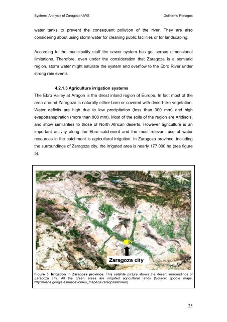
the surroundings <strong>of</strong> <strong>Zaragoza</strong> city, the irrigated area is nearly 177,000 ha (see figure<br />
5).<br />
Figure 5. Irrigation in <strong>Zaragoza</strong> province. This satellite picture shows the desert surroundings <strong>of</strong><br />
<strong>Zaragoza</strong> city. All the green areas are irrigated agricultural lands (Source: google maps,<br />
http://maps.google.es/maps?oi=eu_map&q=<strong>Zaragoza</strong>&hl=en)<br />
.<br />
25